National Landmarks at Risk: A Colonial Capital Case Study Annapolis, Maryland
|
|
|
- Albert Davidson
- 5 years ago
- Views:
Transcription

1 A Colonial Capital Case Study Annapolis, Maryland Union of Concerned Scientists May 20, 2014 Lisa Craig, Chief of Historic Preservation City of Annapolis


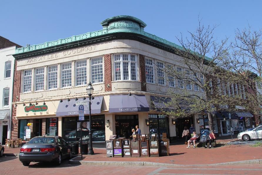
2 A Colonial Capital Planned City Annapolis laid out in 1695 in a Baroque plan. Contains 120 colonial-era buildings including the Palladian-style Hammond Harwood.


3 A Colonial Capital - Landmarks Home to all four Maryland signers of the Declaration of Independence George Washington Resigns His Commission 1783 Nation s Capital


4 A Colonial Capital Naval Academy


5 The Chesapeake Watershed Sea-level Rise in the Chesapeake could reach inches above 1990 levels by To date, 13 islands have been lost.


6 Maryland Climate Action Plan Predictions for Sea level rise along Maryland s coast: By Best estimate mean sea level rise is 1.4 By Best estimate mean sea level rise is 3.7 -


7 City of Annapolis Flood Mitigation Given the importance of the historic district and the waterfront the Annapolis response to sea level rise must focus on protecting existing structures and infrastructure. The downtown should be the subject of a study to determine the costs and benefits of public decision-making in mitigating property damage. Future planning efforts can evaluate the need and options for protecting historic structures Require floodproofing to the extent feasible while preserving the historic building exterior.

 3.4 2050 100 yr.")
8 Annapolis Flood Plain Mapping yr. Flood Plain at 7.8 ft High Tide (Nuisance Flooding) yr. Flood Plain at 8.3 ft


9 Annapolis Storm History 1775 Hurricane claims State House roof, which is then replaced by a hurricane resistant dome Wind damage and flooding 1933 Chesapeake and Potomac Hurricane 1955 Hurricane Connie sinks tour schooner Levin J. Marvel outside of Annapolis 1999 Hurricane Floyd results in 11.6 in. of rain -


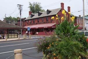
10 Hurricane Isabel - September 19, 2003 Market Space Main Street U.S. Naval Academy Eastport
![Annapolis City Dock Master Plan the historic built environment of City Dock [is] threatened by sea](/docs-images/83/87618753/images/11-0.jpg "level rise.")

11 Annapolis City Dock Master Plan the historic built environment of City Dock [is] threatened by sea level rise. In conjunction with the development of a Hazard Mitigation Plan to protect historic resources within the 100 year flood plain that is currently underway, the City will explore and present to the City Council for consideration several strategies for addressing the 100 year flood and sea level rise


12 Cultural Resources in Annapolis

13 FEMA Hazard Mitigation Planning Hazard mitigation planning is the process of determining how to reduce or eliminate the loss of life and property damage resulting from natural and manmade hazards. Process includes: Organizing your efforts to develop an effective mitigation plan; Identifying hazards and assessing losses to your community; Setting mitigation priorities and goals and writing the plan; Implementing the mitigation plan, including project funding.


14 Funding & Partners City of Annapolis - All Agencies Annapolis Business and Resident Associations State Agencies State Historic Preservation Office, Dept. of Natural Resources, Maryland Emergency Management Agency Federal Agencies United States Naval Academy, Federal Emergency Management Agency, US Army Corps of Engineers Nonprofits National Trust for Historic Preservation, Preservation Maryland, Maryland Humanities Council, Historic Annapolis, Union of Concerned Scientists

15 Assess Risks to Cultural Resources 1. Identify the hazards that can affect your community 2. Profile hazards to determine hazard-prone areas and magnitude of each hazard. 3. Inventory vulnerable historic/cultural resources assess vulnerability establish preservation priorities 4. Estimate the associated amount of potential losses
 - Loss to Structure ($) - Loss to Contents ($) - Loss of Function / Use ($) - Displacement Cost - Total Loss for Hazard")
16 Cultural Resource Inventory Worksheet #3 (cont.) - Property Vulnerability (High, Med. Low) - Loss to Structure ($) - Loss to Contents ($) - Loss of Function / Use ($) - Displacement Cost - Total Loss for Hazard Event Community Value (High, Med. Low)


17 Private Property - Flood Mitigation Door/window barriers, wall barrier and elevated interior first floor


18 Public Infrastructure Protection City Dock flood protection measures limited due to majority of land being privately owned. Shared responsibility with the Naval Academy for protecting 4,500 linear feet of shoreline adjacent to the Academy. Backflow preventers need to be installed at each sewer connection. Floodwalls, coffer dams, pumping station, temporary pumps, backflow preventers, flap valves and duckbill valves needed. Coffer Dam protecting Market House, Flap Valve & Rubber Duckbill Valve


19 A Model Program MHT is funding the project in part so that we can use it as a model for other communities throughout the state that have cultural resources threatened by sea-level rise. - Nell Ziehl, Chief, Office of Preservation Planning Crisfield, Somerset County MD

20 A Colonial Capital Case Study Annapolis, Maryland Union of Concerned Scientists May 20, 2014 Lisa Craig, Chief of Historic Preservation City of Annapolis
21 A Colonial Capital Case Study - Annapolis Slide 1 Sea-level rise is threatening Maryland's historic seaports. In Annapolis, the City's Historic Preservation Division is partnering with local, state and federal agencies, resident associations, businesses and historic preservation groups to prepare a disaster mitigation plan addressing the threat associated with sea level rise and flooding. Developing a property inventory, public outreach program, risk assessment tool and model mitigation projects, the plan's development follows the approach recommended by the Federal Emergency Management Agency through its "how-to" guide to State and Local mitigation planning. Slide 2 Laid out in 1695, Annapolis was one of the first planned cities in the United States. Its historic core contains the country s largest concentration of eighteenth-century brick buildings, including the Palladian-style Hammond- Harwood House, widely regarded as one of the finest colonial buildings in America. Settled by nonconforming Protestants from Virginia and other religious independents, Annapolis later became the capital of the colony, and the state of Maryland. The city s eighteenth-century waterfront bustled with ships bringing visitors, immigrants, servants, and slaves to town. Imported goods from Europe, the Caribbean, and other colonies filled dockside warehouses. Slide 3 All four of Maryland s signers (Thomas Stone, Samuel Chase, William Paca and Charles Carroll) of the Declaration of Independence lived in Annapolis. The city was the first post-revolutionary War capital of the United States, hosting the Continental Congress in 1783 and George Washington resigned his commission as commander of the Continental Army here in 1783, and the Treaty of Paris, which formally ended the war, was ratified in the State House in 1784, now the longest operating StateHouse in the nation.
22 Slide 4 Annapolis is also known as the home of the U.S. Naval Academy. Founded as the Naval School in 1845, with an initial enrollment of about 50 students, most of its Beaux Arts style historic buildings date from the early 1900s, including the chapel with its iconic dome. Hurricane Isabel caused widespread and serious flooding in the city during September 2003, when water levels at the Naval Academy reached about six and a half feet above average, more than two feet over the current 100- year flood level; causing more than $120 million in damage. Slide 5 The next major storm that hits Annapolis, MD, could cause extensive flooding and widespread damage to the city s historic center. Because sea levels continue to rise in Chesapeake Bay, a so-called 100-year storm (a severe event with a 1 percent chance of occurring in any given year) would likely severely damage many historic structures in Annapolis, take years from which to recover, and seriously harm the city s tourism economy. With its expansive coastline, low-lying topography, and growing coastal population, the Chesapeake Bay region is among the places in the nation most vulnerable to sea-level rise. Sea-level rise in the Chesapeake Bay region could reach inches above 1990 levels by Slide 6 As to Predictions for Sea level rise along Maryland s coast, by 2050 the best estimate mean sea level rise is 1.4 By 2100, best estimate mean sea level rise is 3.7 The State of Maryland has developed a Climate Action Plan to protect people, property, natural resources and public investments from impacts due to climate change. Slide 7 As part of the Maryland Climate Action Plan, sea rise studies conducted for lower Eastern Shore counties evaluated three possible responses to sea level rise: protect, retreat/relocate, and abandon. In Annapolis, the results of that analysis were as follows:
23 Given the importance of the historic district and the waterfront, and the recreational and economic needs for waterfront access, the Annapolis response to sea level rise must focus on protecting existing structures and infrastructure. The downtown should be the subject of a study to determine the costs and benefits of public decision-making in mitigating property damage. Future planning efforts can evaluate the need and options for protecting historic structures Require floodproofing to the extent feasible while preserving the historic building exterior. Slide yr. Flood Plain at 7.8 ft / High Tide (Nuisance Flooding) yr. Flood Plain at 8.3 ft Slide 9 Since The "Year of the Hurricane" when the first recorded severe storm tracked through the Chesapeake region on Sept. 6, the Chesapeake Bay and Annapolis has realized a doubling of severe storm events each Century. With major storm events occurring In The Great Chesapeake Bay Hurricane, in 1775 the hurricane which claimed the State House roof in Annapolis resulting in today's striking hurricane-resistant dome. In 1878 the Great October Gale, In 1915 a tropical storm which tracked through Annapolis, the worst storm in years with sustained wind damage and flooding, the 1933 Chesapeake and Potomac Hurricane made landfall in North Carolina on August 23 before tracking through Virginia and pounding Annapolis, 1954 Hurricane Hazel with gusts near 100 mph in 1955 Hurricanes Connie and Diane resulted in strong gales which sunk the tour schooner Levin J. Marvel, about 20 miles south of its home port of Annapolis resulting in 14 passengers drowned. In Hurricane Agnes was one of the state's most destructive natural disasters, an ecological calamity for the Chesapeake Bay, In 1999 Hurricane Floyd dumped more than inches of rain on Annapolis and then there was 2003, Tropical Cyclone Isabel with more than nine hours of high winds creating extreme flooding along the Chesapeake Bay and its tidal tributaries.
24 Slide 10 Initially a Category 4 Hurricane, Isabel was downgraded to a Tropical Cyclone by the time it reached the Chesapeake Bay. Isabel was the worst hurricane to affect the Chesapeake Bay region since Storm surge values of more than 8 feet flooded rivers that flowed into the Bay across Virginia, Maryland, Delaware, and Washington, D.C. The most intense hurricane of the 2003 season directly resulted in 17 deaths and more than 3 billion dollars in damages. The storm surge from Isabel caused disastrous flooding in the historic City Dock area, damaging dozens of buildings. It took a decade before the 1858 Market House was restored, reopening in Slide 11 the historic built environment of City Dock [is] threatened by sea level rise the City will explore and present to the City Council for consideration several strategies for addressing the 100-year flood and sea level rise. The study of strategies will include impacts on the historic fabric and infrastructure, visual impact, economic impact, engineering feasibility, insurability of structures, cost/benefit analysis, impact on the use of space in the city dock area for other purposes, and relationship to the flood control measures and plans of the United States Naval Academy. Slide 12 The city is preparing for the inevitability of another major storm and, by 2050, for at least a doubling of high-tide flooding events. In order to ensure the preservation of the buildings and streetscape within the 100-year floodplain of the city s Historic Landmark District, Annapolis is developing a Cultural Resource Hazard Mitigation plan beginning with a comprehensive survey of all 140 at-risk buildings in the district supported in part by the National Trust for Historic Preservation, the Maryland Historical Trust, Preservation Maryland, the Maryland Dept. of Natural Resources and the US Army Corp of Engineers. Among the many important buildings close to the City Dock that the survey will include are the waterfront Tobacco Warehouse (early nineteenth century); Middleton Tavern (ca. 1750), from which renowned visitors including George Washington and Thomas Jefferson traveled by ferry across the bay; and the Sands House (ca. 1739), one of the city s oldest and lowest-lying buildings. Annapolis s
25 pioneering approach to minimizing damage and disruption from future climate change is likely to become a model for other historic coastal cities. Slide 13 Whether a disaster impacts a major cultural institution, a historic "main street," or collections of family photographs or business records, the sudden loss of historic properties and cultural resources can negatively impact a community's character and economy, and can affect the overall ability of the community to recover from a disaster event. FEMA has provided a publication to show communities, step by step, how to develop and then implement a pre-disaster planning strategy for their historic properties and cultural resources. Slide 14 Partners/Funders = City of Annapolis - All Agencies, Annapolis Business and Resident Associations = State Agencies State Historic Preservation Office, Dept. of Natural Resources, Maryland Emergency Management Agency = Federal Agencies United States Naval Academy, Federal Emergency Management Agency, US Army Corps of Engineers = Nonprofits National Trust for Historic Preservation, Preservation Maryland, Maryland Humanities Council, Historic Annapolis, Union of Concerned Scientists Slide 15 Plan requires communities to 1) Identify the hazards that affect the community 2) Profile to determine hazard-prone areas and the magnitude of each hazard 3) Inventory vulnerable historic/cultural resources and establish preservation priorities and 4) Estimate the associated amount of potential losses Slide 16 Risk assessment includes analysis of the property s vulnerability, values associated with the loss of the structure, its contents, its function, and displacement of the residents or the business. In completing the preliminary estimates on damage impacts to properties within the 100 year flood plain area, we calculated that for 11 representative properties in the Historic District mix of new and old, masonry and frame, residential and commercial, public and private, the resulting in a combined economic loss of totaled $23,879,149 with the lowest at $163,550 and the highest at $8,529,290.
26 Slide 17 Mitigation strategies for individual properties include several types of purposebuilt flood barriers suitable for historic buildings. Most door and window barriers consist of various types of waterproof board and seals, which are inserted at times of flooding into small-section timber or metal channels on either side of the front door frame. Perimeter barriers are installed at the boundary of the property, and are intended to prevent water reaching the building at all. The City of Annapolis will develop design guidelines to assist property owners in deciding which barrier type works best for their property. Slide 18 Flood protection measures for public areas within the City Dock are limited due to the fact that the vast majority of the land is privately owned. The City of Annapolis is working to share responsibility with the United State Naval Academy for protecting the shoreline at the area where the Dock is adjacent to the Academy. There is roughly 4,500 linear feet of shoreline that will need protection. A combination of floodwalls, coffer dams, pumping stations, temporary pumps, backflow preventers, flap valves and duckbill valves will be incorporated into the strategy. Slide 19 MHT is funding the project in part so that we can use it as a model for other communities throughout the state that have cultural resources threatened by sealevel rise. As a matter of fact, the Technical Survey team currently working on the Annapolis plan traveled to Crisfield MD, which is still recovering from the impacts of Hurricane Sandy, to provide some necessary technical expertise to that small historic Eastern Shore community. Slide 20 Last night I was at a City Council hearing where cuts to our Emergency Preparedness and Response Management office were proposed. Beyond the obvious concern expressed by the community about the value this program offers, one insightful comment was made by a representative of Chesapeake Ready the local community is responsible for their business resiliency. And that is what we in Annapolis are doing taking the lead in planning responsibly, one property at a time, for a more resilient Historic District that will take our 3 centuries of landmarks safely into tomorrow s economy.
WEATHER IT TOGETHER. The Annapolis Model for Cultural Resource Adaptation Planning. Cultural Resources, Disaster Resilience, and Climate Uncertainty
 WEATHER IT TOGETHER The Annapolis Model for Cultural Resource Adaptation Planning Cultural Resources, Disaster Resilience, and Climate Uncertainty Historic Annapolis A Colonial Capital: National Landmark
WEATHER IT TOGETHER Building Resilience. The Annapolis Model for Cultural Resource Hazard Mitigation Planning
 WEATHER IT TOGETHER Building Resilience The Annapolis Model for Cultural Resource Hazard Mitigation Planning Weather It Together A Public / Private Partnership Weather It Together is the Annapolis model
Preparing Hudson River Waterfronts for an Era of Rapid Sea Level Rise
 Preparing Hudson River Waterfronts for an Era of Rapid Sea Level Rise CITY OF KINGSTON TIDAL WATERFRONT FLOODING TASK FORCE Gregg Swanzey Director, Office of Economic Development & Strategic Partnerships,
Resilience in Annapolis Creating a Cultural Resource Hazard Mitigation Plan
 Lisa Craig currently works as Director of Resilience with Michael Baker International, previously serving as Chief of Historic Preservation for the City of Annapolis. She is also a NAPC CAMP trainer on
Mitigation + Adaptation Strategies for Historic Structures and Sites
 Mitigation + Adaptation Strategies for Historic Structures and Sites Adrienne Burke, Esq., MSAS, LEED AP+ Executive Director, Riverside Avondale Preservation, Jacksonville, FL Cultural Resources, Disaster
NORTH KINGSTOWN PILOT PROJECT May 9, 2016 North Kingstown Town Council
 Engaging RI Local Governments in Hazard Mitigation and Coastal Resilience NORTH KINGSTOWN PILOT PROJECT May 9, 2016 North Kingstown Town Council Teresa A. Crean, AICP University of Rhode Island Coastal
Coastal Planning in Texas. Tony Williams Senior Director of Planning Coastal Resources Division Texas General Land Office
 Coastal Planning in Texas Tony Williams Senior Director of Planning Coastal Resources Division Texas General Land Office e The Texas General Land Office (GLO) and the Texas Coast Since 1836: Manager of
Empowering Local Action for Coastal Resilience in Massachusetts. Bruce K. Carlisle MA Office of Coastal Zone Management
 Empowering Local Action for Coastal Resilience in Massachusetts Bruce K. Carlisle MA Office of Coastal Zone Management Context Coastal communities continue to face both chronic and acute storm surge, erosion,
COASTAL CONSERVANCY. Staff Recommendation October 21, 2010 BATTERY POINT LIGHTHOUSE ENHANCEMENTS. File No Project Manager: Deborah Hirst
 COASTAL CONSERVANCY Staff Recommendation October 21, 2010 BATTERY POINT LIGHTHOUSE ENHANCEMENTS File No. 10-025 Project Manager: Deborah Hirst RECOMMENDED ACTION: Authorization to disburse up to $100,000
What Planners Do. Heather Wade, Coastal Planning Specialist Texas Sea Grant
 What Planners Do Heather Wade, Coastal Planning Specialist Texas Sea Grant What Planners Do Seminar Series Department of Landscape Architecture and Urban Planning College of Architecture ABOUT ME B.S.
EXHIBIT A CITY OF FORT WALTON BEACH, FLORIDA COASTAL MANAGEMENT & CONSERVATION
 EXHIBIT A CITY OF FORT WALTON BEACH, FLORIDA INTRODUCTION The Coastal Management and the Conservation Elements required by Chapter 9J-5.012 and 5.013, F.A.C., respectively, have been combined into one
Learning Objectives. Thinking about Tomorrow s Waterfront Parks Lessons from Hurricane Sandy and Beyond. Hurricane Sandy
 Learning Objectives Thinking about Tomorrow s Waterfront Parks Lessons from Hurricane Sandy and Beyond Presenters Peter Kelley, ASLA, James Koth, ASLA, Jeffery Sandgrund, Brooklyn Bridge Park Andrew Lavallee,
HUDSON RIVER WATERFRONT. Hudson River Waterfront Walkway
 HUDSON RIVER WATERFRONT Hudson River Waterfront Walkway The Hudson River Waterfront Bayonne Bridge to the George Washington Bridge 40 miles of waterfront land Hudson River Waterfront Conservancy 1988 Stakeholder
IDENTIFICATION TO IMPLEMENTATION THE JOURNEY OF CITY RESILIENCE
 IDENTIFICATION TO IMPLEMENTATION THE JOURNEY OF CITY RESILIENCE Cities are dynamic, living and growing entities. They are centers of art, heritage and cultural pride and their vibrancy attracts visitors,
New York City, 19 th c.
 New York City, 19 th c. Lower Manhattan, circa 1930s Westside Highway, Manhattan, circa 1940s Greenpoint Terminal Market, Brooklyn TRANSFORMATIONS ON THE WATERFRONT Harlem River Park, Manhattan BEFORE
Planning for Higher Education Journal V44N1 October December William Kenworthey
 Planning for Higher Education Journal V44N1 October December 2015 1 William Kenworthey FEATURE ARTICLE Future Imperfect Lessons Learned for an Approach to Achieve More Resilient Places by William Kenworthey
STEWARDSHIP OF LONG ISLAND SOUND S ECOLOGICAL AND RECREATIONAL RESOURCES
 STEWARDSHIP OF LONG ISLAND SOUND S ECOLOGICAL AND RECREATIONAL RESOURCES Robin Kriesberg, Save the Sound, Inc. Thomas Halavik, US Fish and Wildlife Service Coastal Program An Initiative to Identify, Protect
Benchmark Nonpoint Source Management Approaches In Other States
 Governor s Environmental Advisory Council 2007 Nonpoint Source Pollution Control Initiative Benchmark Nonpoint Source Management Approaches In Other States Governor s Environmental Advisory Council April
Virginia Beach and Sea Level Rise: Where Do We Go From Here?
 Virginia Beach and Sea Level Rise: Where Do We Go From Here? Clay Bernick City of Virginia Beach Environment & Sustainability Office Bayfront Advisory Committee Presentation July 19, 2012 Five Items to
Chesapeake Bay Critical Area Conservation Plan
 The Maryland-National Capital Park and Planning Commission Prince George s County Planning Department Development Review Division 301-952-3530 Note: Staff reports can be accessed at www.mncppc.org/pgco/planning/plan.htm.
QUESTIONS AND ANSWERS Windsor Woods, Princess Anne Plaza & The Lakes Combined Drainage Project
 QUESTIONS AND ANSWERS Windsor Woods, Princess Anne Plaza & The Lakes Combined Drainage Project PROJECT OVERVIEW Windsor Woods, Princess Anne Plaza and The Lakes are neighborhoods located in what was once
NJ Department of Environmental Protection
 NJ Department of Environmental Protection COASTAL AND LAND USE PLANNING New Jersey Coastal Management Program Covers NJ coastal waters to limit of tidal influence including 239 municipalities in 19 counties,
Legal implications of failing to
 Legal implications of failing to plan for sea level rise Gavin Leydon, Partner 30 April 2010 Outline Relevance to local l government & developers assessment & policy Developments in case law Climate change
Living Underwater: Hazard Mitigation Challenges from Sea Level Rise and Tidal Flooding
 ASFPM 2015 National Conference Living Underwater: Hazard Mitigation Challenges from Sea Level Rise and Darryl Hatheway, CFM, Sr. Coastal Scientist June 3, 2015 AGENDA Sea Level Rise and Science of climate
City of Norfolk Coastal Flood Mitigation Program. March 13, 2013
 City of Norfolk Coastal Flood Mitigation Program March 13, 2013 Topics Brief overview of Norfolk s Coastal Flood Program Data-driven analysis and decision making City-wide vulnerability, project concepts,
Planning for Historic/Cultural Resources Coastal Resiliency in Connecticut. Presented to CAFM s 3 rd Annual Conference
 Planning for Historic/Cultural Resources Coastal Resiliency in Connecticut Presented to CAFM s 3 rd Annual Conference October 25, 2016 Agenda Introduction and Project Overview Background Historic and Cultural
Improvement of the Atlantic Coast of New York City,
 Improvement of the Atlantic Coast of New York City, Rockaway Inlet to Norton Point Project at Sea Gate Meeting Purpose The U.S. Army Corps of Engineers, the New York State Department of Environmental Conservation,
RESILIENCY, ADAPTATION, & SUSTAINABILITY AT THE CITY OF ST. AUGUSTINE
 RESILIENCY, ADAPTATION, & SUSTAINABILITY AT THE CITY OF ST. AUGUSTINE PROGRAM UPDATE JANUARY 14, 2019 MICHAEL G. CULLUM, P.E. DIRECTOR, PUBLIC WORKS PROGRESSION OF PLANNING FOR RESILIENCY / ADAPTATION
Ghent Neighborhood League Briefing Living at Sea Level & Flooding Risks
 Ghent Neighborhood League Briefing Living at Sea Level & Flooding Risks Tuesday, August 11, 2015: Chrysler Museum Presentation by: Tom 757-761-0676 tom@mcneilan.com The Virginia Tidewater For 400+ years,
Keyport. Vision for Keyport
 Keyport Vision for Keyport Keyport is a rural, historic waterfront village bounded and limited in size by its natural borders of water and the Naval Undersea Warfare Center. The community consists primarily
Improving quality of life in. New York City ARCADIS NEW YORK CITY
 Improving quality of life in New York City ARCADIS NEW YORK CITY NEW YORK CITY - THE WORLD S MOST ECONOMICALLY POWERFUL CITY WITH TOTAL ECONOMIC OUTPUT OF OVER $1 TRILLION. AS ONE OF THE WORLD S MOST ICONIC
Disaster Preparedness AGA Disaster Planning Workshop June 25, 2013
 Disaster Preparedness AGA Disaster Planning Workshop June 25, 2013 Timothy Greenhouse Managing Director, Safety, Environment, Theft Prevention and Community Relations Scott Shepard Operations Manager,
Towards a Resilient Stormwater Future: Building Back from Hurricane Irene and Tropical Storm Lee. October 15, 2015 VUSP Symposium
 Towards a Resilient Stormwater Future: Building Back from Hurricane Irene and Tropical Storm Lee October 15, 2015 VUSP Symposium Russ Dudley, P.E., LEED AP Environmental Engineer Presentation Outline Impacts
Introducing Green Infrastructure for Coastal Resilience
 Introducing Green Infrastructure for Coastal Resilience National Oceanic and Atmospheric Administration (NOAA) Office for Coastal Management Gloucester, MA Office of Travel Courtesy, Tim Grafft What Is
ORDINANCE NO
 ORDINANCE NO. 9048-17 AN ORDINANCE OF THE CITY OF CLEARWATER (THE CITY), FLORIDA, MAKING AMENDMENTS TO THE CITY S COMPREHENSIVE PLAN IN ACCORDANCE WITH FLORIDA SENATE BILL 1094 (2015) PERIL OF FLOOD ACT
Adaptive Management Strategies for Resilient Coastlines: A Case Study on the Ft. Pierce, FL Breakwater Project
 Adaptive Management Strategies for Resilient Coastlines: A Case Study on the Ft. Pierce, FL Breakwater Project USACE Workshop November 21 st, 2013 By: Jenna Phillips Emphasis on Green or Nature-Based Engineering
Preliminary Sea Level Rise Case Study: Navarre Beach, FL
 Preliminary Sea Level Rise Case Study: Navarre Beach, FL This publication was funded in part, through a grant agreement from the Florida Department of Environmental Protection, Florida Coastal Management
Brooklyn Bridge Park: Storm Resilience through Design
 Brooklyn Bridge Park: Storm Resilience through Design During the early stages of the Brooklyn Bridge Park design process, careful thought was given to shoreline conditions and site location. Due to BBP
VIRGINIA WORKING WATERFRONT MASTER PLAN (MIDDLE PENINSULA, NORTHERN NECK, EASTERN SHORE AND HAMPTON ROADS)
") July 27, 2016 Lewis Lawrence, MPPDC Executive Director VIRGINIA WORKING WATERFRONT MASTER PLAN (MIDDLE PENINSULA, NORTHERN NECK, EASTERN SHORE AND HAMPTON ROADS) Guiding communities in protecting, restoring
July 27, 2016 Lewis Lawrence, MPPDC Executive Director VIRGINIA WORKING WATERFRONT MASTER PLAN (MIDDLE PENINSULA, NORTHERN NECK, EASTERN SHORE AND HAMPTON ROADS) Guiding communities in protecting, restoring
Libby Zemaitis October 18, 2017 Climate Outreach Specialist, NYS DEC Hudson River Estuary Program
 1 Supporting Hudson Riverfront communities as Climate-Adaptive Leaders Libby Zemaitis October 18, 2017 Climate Outreach Specialist, NYS DEC Hudson River Estuary Program The Hudson River Estuary Program
Executive Office of Energy and Environmental Affairs Massachusetts Vulnerability Preparedness Program. June 6, 2018
 Executive Office of Energy and Environmental Affairs Massachusetts Vulnerability Preparedness Program June 6, 2018 Presentation Outline: 1. What Natural Hazards Impact Falmouth 2. Coastal Resiliency Efforts
National Park Service U.S. Department of the Interior. The National Park Service in the Chesapeake Bay
 National Park Service U.S. Department of the Interior The National Park Service in the Chesapeake Bay Chesapeake Bay Gateways & Watertrails Network Established 1998... provide technical and financial assistance,
If you Google Disaster Recovery, you will get approximately 47,700,000 hits.
 DISASTER RECOVERY If you Google Disaster Recovery, you will get approximately 47,700,000 hits. Disaster Planning and Prevention are the keys to Disaster Recovery. Those who forget the past are condemned
Adaptation and Resilience at the City of Fort Lauderdale
 Adaptation and Resilience at the City of Fort Lauderdale Carlos Acosta, P.E. Assistant City Engineer City of Fort Lauderdale Overview Climate challenges and limitations Sea Level Rise Projections King
Fulfilling the Promise of Parks to People in a Changing Environment: The Gateway National Recreation Area Experience
 Fulfilling the Promise of Parks to People in a Changing Environment: The Gateway National Recreation Area Experience Helen Mahan Introduction Climate change will test the ability of the National Park Service
TABLE OF CONTENTS PAGE
 1989 BROWARD COUNTY LAND USE PLAN Original adoption March 1, 1989 Text amendments adopted as of March 10, 2015, are incorporated herein. BROWARD COUNTY BOARD OF COUNTY COMMISSIONERS BROWARD COUNTY PLANNING
QUESTIONS AND ANSWERS Windsor Woods, Princess Anne Plaza & The Lakes Combined Drainage Project
 QUESTIONS AND ANSWERS Windsor Woods, Princess Anne Plaza & The Lakes Combined Drainage Project Project Overview... 2 Thalia Creek (Windsor Woods) Tide Gate... 6 Club House Road Drainage Project... 9 Updated
CRITICALFACILITIESASSESSMENT IN SOUTHEASTERN CONNECTICUT STRATEGIES FOR ALL HAZARDS RESILIENCE
 CRITICALFACILITIESASSESSMENT IN SOUTHEASTERN CONNECTICUT STRATEGIES FOR ALL HAZARDS RESILIENCE Presented by: David Murphy, P.E., CFM, Milone & MacBroom, Inc. October 25, 2017 Agenda Project Background
Presentation Outcomes
 Green Infrastructure Rappahannock-Rapidan Living Lands Planning Workshop September 17, 2009 Presentation Outcomes Define green infrastructure principles and concepts (video). How are green infrastructure
Supporting Hudson Riverfront Communities as Climate-Adaptive Leaders. Libby Zemaitis November 17, 2017 NYS DEC Hudson River Estuary Program
 1 Supporting Hudson Riverfront Communities as Climate-Adaptive Leaders Libby Zemaitis November 17, 2017 NYS DEC Hudson River Estuary Program The Hudson River Estuary Program 2 Working to achieve 6 key
COASTAL MANAGEMENT ELEMENT. Last amended December 6, 2016 as part of the 2016 EAR
 COASTAL MANAGEMENT ELEMENT Last amended December 6, 2016 as part of the 2016 EAR Table of Contents Objective Page 7.1 Development and redevelopment of waterfront properties...7-1 7.2 Agency coordination
COUNTY COUNCIL OF PRINCE GEORGE'S COUNTY, MARYLAND SITTING AS THE DISTRICT COUNCIL 2010 Legislative Session. Council Members Dernoga and Olson
 DR- COUNTY COUNCIL OF PRINCE GEORGE'S COUNTY, MARYLAND SITTING AS THE DISTRICT COUNCIL 00 Legislative Session Bill No. CB--00 Chapter No. Proposed and Presented by Introduced by Co-Sponsors The Chairman
State of the State New Jersey. Steve Jacobus NJDEP 06/10/15
 State of the State New Jersey Steve Jacobus NJDEP 06/10/15 1980s Living shorelines term coined in MD 2003 North Carolina passes Living Shoreline Law (HB 1028) early 2000s Delaware puts no bulkhead policy
Shoreline Master Program Town of La Conner, Washington
 Shoreline Master Program Town of La Conner, Washington Department of Ecology approval effective Adopted September 24, 2013 by Town of La Conner Ordinance No.1106 Amended May 13, 2014 by Town of La Conner
MUNICIPAL RESILIENCE PLANNING ASSISTANCE PROJECT
 MUNICIPAL RESILIENCE PLANNING ASSISTANCE PROJECT William R. Rath, Esq. Legal Research Fellow Center for Energy & Environmental law University of Connecticut School of Law 860-570-5058 William.Rath@ UConn.edu
The Louisiana 2017 Coastal Master Plan: Climate Change and Sea Level Rise Planning in the International Context
 The Louisiana 2017 Coastal Master Plan: Climate Change and Sea Level Rise Planning in the International Context Dr. Michael K. Orbach Professor Emeritus of Marine Affairs and Policy Nicholas School of
Priorities. Public Communication & Transparency Website, CM Public Updates, Magic City Newsletter
 Priorities Recognition & Thanks to public servant employees Public Communication & Transparency Website, CM Public Updates, Magic City Newsletter Citizen/Customer Service Fiscal Responsibility Flood Protection
3.7. NEW JERSEY % 6.3% 2.0. Completed Yes Procedural Recommen dation
 C OST E FFICIENT C LIMATE A DAPTATION IN THE N ORTH A TLANTIC 135 3.7.1. LITTLE SILVER, NJ 3.7. NEW JERSEY Population Density Form of Government Category CRS Rating 2226/ sq. mi. Borough Suburban Bayfront
Risk Analysis Tools to Support Resilient Design
 Risk Analysis Tools to Support Resilient Design 1755 Cape Ann 6.3: BC WO Paul A. Morey FEMA Region I Woods Hole, MA/NOAA Hurricane & Earthquake Program Manager Maps Commonly used by FEMA and other Federal,
Planning for Historic/Cultural Resources Coastal Resiliency in Connecticut. Presented to ASFPM 41 st Annual Conference, Kansas City, MO
 Planning for Historic/Cultural Resources Coastal Resiliency in Connecticut Presented to ASFPM 41 st Annual Conference, Kansas City, MO May 3, 2017 Agenda Introduction and Project Overview Historic and
When I came to Colonial National Historical Park in late 1988 as
 Charles D. Rafkind One P&ik m&the ChefMredze Bay: 'the CdmtmlExfeiienee When I came to Colonial National Historical Park in late 1988 as its first full-time natural resource management specialist, I knew
Lower Meramec Multi-Jurisdictional Floodplain Management Plan Public Involvement (Results of Early Public Engagement) 27 June 2018
 27 June 2018") Lower Meramec Multi-Jurisdictional Floodplain Management Plan Public Involvement (Results of Early Public Engagement) 27 June 2018 Public Involvement Summary: The planning process includes opportunities
Lower Meramec Multi-Jurisdictional Floodplain Management Plan Public Involvement (Results of Early Public Engagement) 27 June 2018 Public Involvement Summary: The planning process includes opportunities
TO: Port of Orcas FROM: Tina Whitman, Science Director SUBJECT: Master Plan Update DATE: September 7, 2018
 TO: Port of Orcas FROM: Tina Whitman, Science Director SUBJECT: Master Plan Update DATE: September 7, 2018 Friends of the San Juans appreciates the opportunity to provide input to the Port of Orcas Master
An Integrated Approach for Water Management Examples from The Netherlands. Addressing Climate Change and Sea Level Rise
 An Integrated Approach for Water Management Examples from The Netherlands Addressing Climate Change and Sea Level Rise Superstorm Sandy Forum College of Staten Island March 8 2013 Water: a challenge and
Kevin M. Rampe, President -- Lower Manhattan Development Corporation
 For Internal Use Only: Date Received: WRP no. DOS no. NEW YORK CITY WATERFRONT REVITALIZATION PROGRAM Consistency Assessment Form Proposed actions that are subject to CEQR, ULURP or other local, state
Camden SMART Initiative Stormwater Management and Resource Training
 Camden SMART Initiative Stormwater Management and Resource Training www.camdensmart.com Camden s Struggle with Stormwater 1 The City of Camden is served by a combined sewer system, which uses the same
PUBLIC SPACE/AMENITY PROJECTS
 BUFFALO S LWRP 49 A1. Black Rock Canal Park Improvements Erie County Parks Black Rock Canal Park, Ontario and Niagara Street intersection PROJECT DESCRIPTION: Erie County s Black Rock Canal Park is 4.25
CLIMATE CHANGE & THE CARIBBEAN 3 TAKE AWAY MESSAGES
 CLIMATE CHANGE & THE CARIBBEAN 3 TAKE AWAY MESSAGES Climate Change... Distinct changes in measures of climate (rainfall, temperature, wind speed, etc.) lasting for a long period of time due to human actions.
Natural & Nature-Based Solutions for Risk Reduction & Resilience
 University of Massachusetts Amherst ScholarWorks@UMass Amherst International Conference on Engineering and Ecohydrology for Fish Passage International Conference on Engineering and Ecohydrology for Fish
COMMISSION ACTION FORM
 ITEM #: 6 DATE: 09-06-17 COMMISSION ACTION FORM REQUEST: Introduction and Initial Review of Proposed Amendments to the Ames Urban Fringe Future Land Map for the North Growth Gap Area BACKGROUND INFORMATION:
CHAPTER 1 Introduction
 CHAPTER 1 Introduction From sea to summit, Lane County covers almost 4,800 square miles of diverse Oregon landscape. Stretching from the Pacific Ocean through the Coastal Range, the Willamette Valley to
Building Innovation Celebrating Park Architecture and Beyond: Building for Resilience and Stewardship
 Building Innovation 2017 Celebrating Park Architecture and Beyond: Building for Resilience and Stewardship Shawn Norton National Park Service January, 2017 1 Todays Goals Understand the history and trends
Resilient Redesign III
 Resilient Redesign III Site Briefing Packet Over the next four days, you will join a team of regional and local experts to design strategies which may serve as models of resilience for communities throughout
THE PROTECTION OF CHATHAM COUNTY S NATURAL RESOURCES - THE POLICY SIDE
 THE PROTECTION OF CHATHAM COUNTY S NATURAL RESOURCES - THE POLICY SIDE SEA GRANT TIDAL CREEK SUMMIT CHARLESTON, SOUTH CAROLINA DECEMBER 5, 2011 Jackie Jackson Teel Chatham County-Savannah Metropolitan
Figure 1. Park Ave. Portsmouth
 Aquidneck Island Resilience Strategy Issue Paper 2 Issue: TRANSPORTATION Description of Concern: Aquidneck Island encompasses a 38 square mile area, including three municipalities, all supported by an
Billing Code: DEPARTMENT OF HOUSING AND URBAN DEVELOPMENT [Docket No. FR-6072-N-01]
![Billing Code: DEPARTMENT OF HOUSING AND URBAN DEVELOPMENT [Docket No. FR-6072-N-01]](/thumbs/91/107309814.jpg "Billing Code: DEPARTMENT OF HOUSING AND URBAN DEVELOPMENT [Docket No. FR-6072-N-01]") This document is scheduled to be published in the Federal Register on 12/18/2017 and available online at https://federalregister.gov/d/2017-27194, and on FDsys.gov Billing Code: 4210-67 DEPARTMENT OF HOUSING
This document is scheduled to be published in the Federal Register on 12/18/2017 and available online at https://federalregister.gov/d/2017-27194, and on FDsys.gov Billing Code: 4210-67 DEPARTMENT OF HOUSING
 BOARD OF ALDERMEN REGULAR SESSION MINUTES COMMUNITY BUILDING JULY 9, 2015 223 E. BAY STREET SOUTHPORT, N.C. PRESENT: ABSENT: STAFF PRESENT: Mayor Robert D. Howard Aldermen Mary Ellen Poole, Buddy Barnes,
Prince William County Rural Preservation Study
 Prince William County Rural Preservation Study Kickoff Public Meeting, August 1, 2013 Insert then choose Picture select your picture. Right click your picture and Send to back. Purpose of the Study Evaluate
Virginia Pilot. Climate Change Vulnerability and Risk Assessments of Transportation Infrastructure Hampton Roads, Virginia Implementation Pilot
 Virginia Pilot Climate Change Vulnerability and Risk Assessments of Transportation Infrastructure Hampton Roads, Virginia Implementation Pilot Yao-Jan Wu Andres Clarens Tanveer Hayat Brian Smith Jose Gomez
Aquatic, Terrestrial and Landscape Conservation Design Tools and Products of the North Atlantic LCC
 Aquatic, Terrestrial and Landscape Conservation Design Tools and Products of the North Atlantic LCC Scott Schwenk Science Coordinator, North Atlantic LCC Chesapeake Bay FWS Partners Meeting Annapolis,
Office of Greenways & Trails Providing Statewide Leadership and Coordination. Southeast Greenways and Trails Summit October 1-3, 2017
 Office of Greenways & Trails Providing Statewide Leadership and Coordination Southeast Greenways and Trails Summit October 1-3, 2017 1 Office of Greenways and Trails The Office of Greenways and Trails
Local rain-driven flooding (surface and ground water) Upstream rain-driven flooding (rivers) Tidal or storm surge-driven flooding (coast)
 Upstream rain-driven flooding (rivers) Tidal or storm surge-driven flooding (coast)") Adapting cities to floods Kristina Hill, PhD University of Virginia School of Architecture Hamburg, Germany What kinds of floods? 1 2 3 Local rain-driven flooding (surface and ground water) Upstream rain-driven
Adapting cities to floods Kristina Hill, PhD University of Virginia School of Architecture Hamburg, Germany What kinds of floods? 1 2 3 Local rain-driven flooding (surface and ground water) Upstream rain-driven
Bay County RESTORE Act Direct Component Proposals The project will encompass all of Unincorporated Bay County as a whole.
 Proj # Bay PRP 2014-016 Project Name Bay County Master Plan and Capital Improvement Strategic Plan Update Project Proposer, affiliation, web site Project Description Proj. Size (acres) Economic Environmental
CHAPTER 2 THE GEORGE WASHINGTON REGION TODAY
 CHAPTER 2 THE GEORGE WASHINGTON REGION TODAY 2.1 THE REGION DEFINED The George Washington Region represents 1,429 square miles in four counties. Political jurisdictions in the area include King George,
Case Study Presentation of the Downtown Brampton Flood Protection Class EA
 Case Study Presentation of the Downtown Brampton Flood Protection Class EA Presented by: Kenneth M. Dion, Project Director Port Lands Integration, Waterfront Toronto (formerly Senior Manager, TRCA) At:
A. INTRODUCTION B. CUMULATIVE EFFECTS ANALYSIS
 Chapter 4: Cumulative Effects A. INTRODUCTION The New York City Department of Parks and Recreation plans to reconstruct the Rockaway Beach Boardwalk in the borough of Queens, New York City, which Hurricane
Chesapeake Bay Landscape Professional
 Chesapeake Bay Landscape Professional Certification Initiative Suzanne Etgen, CCLC Board Member July 10, 2014 Chesapeake Conservation Landscaping Council Who is CCLC? Local Government Stormwater Programs
Virginia s Tidal Wetlands: Managing for Resilience. Pam Mason
 Virginia s Tidal Wetlands: Managing for Resilience Pam Mason Image: Skip Stiles, Wetlands Watch PAST: City of Norfolk shallow water and wetlands Fill. Maersk Nauticus Chrysler Museum Mc Arthur Mall Opera
CHATHAM COUNTY S PATH TO SUSTAINABILITY - THE NATURAL RESOURCES SIDE
 CHATHAM COUNTY S PATH TO SUSTAINABILITY - THE NATURAL RESOURCES SIDE GEORGIA ENVIRONMENTAL CONFERENCE SAVANNAH, GEORGIA AUGUST 23, 2012 Jackie Jackson Teel Chatham County-Savannah Metropolitan Planning
P.O. Box 1749 Halifax, Nova Scotia B3J 3A5 Canada Item No Audit & Finance Standing Committee November 28, 2018
 P.O. Box 1749 Halifax, Nova Scotia B3J 3A5 Canada Item No. 12.4.1 Audit & Finance Standing Committee November 28, 2018 TO: SUBMITTED BY: Chair and Members of the Audit & Finance Standing Committee Original
RIVER RECREATION AND CONSERVATION: LESSONS FROM COLORADO S 2013 FLOODS
 RIVER RECREATION AND CONSERVATION: LESSONS FROM COLORADO S 2013 FLOODS SORP RMIS May 2016 L O G A N S I M P S O N Agenda Why Are You Here? Land Use Resiliency Public Outreach Dialogue Recreation and Land
Somers Point Master Plan
 Somers Point Master Plan Progress Report and Public Meeting August 20, 2014 Master Plan Reexamination Municipal Land Use Law require that all municipalities reexamine their master plan every ten years.
Monitoring and Maintenance Permit Process
 Karen A. Duhring Marine Advisory Scientist Center for Coastal Resources Management Virginia Institute of Marine Science College of William & Mary April 9, 2010 Living Shorelines for Contractors and Project
SBPO BOARD MEETING MARCH 20, 2018
 SBPO BOARD MEETING MARCH 20, 2018 TODAY'S AGENDA > Booker Middle School Outreach > Property Information > Schedule > Guiding Principles > Three Concepts Booker Middle School Outreach Property Information
% 10.1% 3.0. Completed Yes Procedural Recommen dation. Implemented No Prevention Mandatory Unique Low (< $10,000)
") C OST E FFICIENT C LIMATE A DAPTATION IN THE N ORTH A TLANTIC 143 3.7.3. GREENWICH, NJ Population Density Form of Government Category 42.1/ sq. mi. Township Rural Bayshore CRS Rating 9 Median Household
C OST E FFICIENT C LIMATE A DAPTATION IN THE N ORTH A TLANTIC 143 3.7.3. GREENWICH, NJ Population Density Form of Government Category 42.1/ sq. mi. Township Rural Bayshore CRS Rating 9 Median Household
New York City, 17 th c.
 Mannahatta New York City, 17 th c. Lower Manhattan, circa 1930s Westside Highway, Manhattan, circa 1940s Greenpoint Terminal Market, Brooklyn VISION 2020 NEW YORK CITY COMPREHENSIVE WATERFRONT PLAN
E x E C U T I v E S U M M A R y / P L A N N I N G C O N T E x T 14 //
 14 // executive summary / planning context COMMUNITY GREENING PLAN PLANNING CONTEXT Capital Region Water has entered into a partial consent decree with the United States Department of Justice to address
Getting to Resilience webinar
 Getting to Resilience webinar A brief description of two NJDEP Projects: Resilient Coastal Communities Initiative & Municipal Public Access & Resiliency Small Grants Program June 26, 2014 Marty Rosen NJ
EEA Capital Investment in Green Infrastructure
 EEA Capital Investment in Green Infrastructure Goal: Advance local efforts to implement measures to increase natural storm damage protection, flood control, and community resilience State capital funding
Mitigation Action Plan City of Mebane
 Mitigation Action Plan The Mitigation Action Plan for the is divided into two subsections: 7.1 Status of Previously Adopted Mitigation Actions 7.2 New 2015 Mitigation Actions 7.1 Status of Previously Adopted