Lancaster Conservation Area Appraisal
|
|
|
- Lynne Shepherd
- 5 years ago
- Views:
Transcription

1 Lancaster Conservation Area Appraisal March 2013
2
3 Contents 1.0 Introduction Conservation Area Appraisal: Area-wide Overview Conservation Area Appraisal: 25 Character Area Analysis 3.1 The Quay The Castle City Centre Dalton Square Canal Corridor North Canal Corridor South Residential: North East Cathedral Residential: South West Westbourne Road High Street Conclusions and 159 Recommendations Appendices Appendix 1: Glossary of Terms 167 Appendix 2: Sources 171 Appendix 3: Checklist for heritage assets that make a positive contribution to the conservation area 175 Appendix 4: Contacts for Further Information 179 1
 27 Figure 3.3: Townscape Analysis (North) 28 Figure 3.")
 84 Figure 3.8: Conservation Designations (West) 124 Figure 3.9: Townscape Analysis (West) 125 Figure 4.")
4 List of Figures Figure 1.1: Conservation Area Designations (whole area) 4 Figure 2.1: Wider Context 8 Figure 2.2: Figure Ground Analysis 20 Figure 2.3: Listed and Positive Buildings 22 Figure 3.1: Character Areas 26 Figure 3.2: Conservation Designations (North) 27 Figure 3.3: Townscape Analysis (North) 28 Figure 3.4: Conservation Designations (Centre) 54 Figure 3.5: Townscape Analysis (Centre) 55 Figure 3.6: Conservation Designations (East) 83 Figure 3.7: Townscape Analysis (East) 84 Figure 3.8: Conservation Designations (West) 124 Figure 3.9: Townscape Analysis (West) 125 Figure 4.1: Capacity for Change 165 Produced for Lancaster City Council by the Architectural History Practice and IBI Taylor Young (2013) 2
5 1. Introduction Lancaster Conservation Area is a large, allencompassing designation resulting from the merger of several previous conservation areas. It now includes all of the City Centre and the Castle Precinct, in addition to land to the north (St George's Quays) and residential and industrial areas to the east and the west of the City Centre. Several smaller conservation areas were originally designated in Lancaster: Castle Precinct, St George's Quay, High Street, Market Street and Dalton Square. In 1988, as part of the Local Plan Process these were combined into two principal conservation areas: the City Centre and the Castle. On the 11 May 2011 these two areas were combined with the Moor Lane Mill Conservation Area to form the current Lancaster Conservation Area. The new designation followed a boundary review and public consultation exercise, undertaken by The Conservation Studio on behalf of Lancaster City Council in This concluded that the three areas should be merged. The consultation response was overwhelmingly in favour, although the number of respondents was very low. Other adjacent conservation areas (Aldcliffe Road, Bath Mill and Westfield Memorial Village) remained as stand-alone conservation areas. Cannon Hill was designated a conservation area for the first time in 2010, following consultation. Given this designation history, and the large extent of the Conservation Area, it is perhaps not surprising that this is a diverse area containing many smaller areas of distinct character. For this reason a Character Area approach is important in undertaking this appraisal; the conservation area has been divided into eleven character areas (see section 3). During research for this appraisal, The Architectural History Practice and Taylor Young used resources in the libraries of Lancashire County Council and Lancaster University and are grateful for the assistance received from librarians, particularly Andy Holgate at the Lancaster University Library who granted permission for the use of historic maps in the report. These can be seen on the University website at The Lancashire Historic Environment Record was consulted, particularly the Urban Archaeological Database for Lancaster and we are grateful to Ken Davies and to Peter Iles of Lancashire County Council for advice on archaeology. 1.1 Consultation and Adoption The first draft of this appraisal formed the subject of a six-week public consultation period from 2 November until 14 December The appraisal was posted on the Council s website, with hard copies available to view in Lancaster and Morecambe Town Halls, as well as in Lancaster and Morecambe Libraries. Two public consultation events were held in Lancaster Library on 3 and 14 November 2012, where there was an opportunity to speak to a conservation officer about the document. A Consultation Report was produced, and final amendments made. The final draft was then considered by Lancaster City Council's Planning Policy Cabinet Liaison Group on 11 March 2013, and received Management Team approval on 21 March Final approval was given by Individual Cabinet Member Decision on Monday 25 March 2013, with an implementation date (following a call-in period) of Thursday 4th April Planning Policy Context Figure 1.1 illustrates the current conservation area designations in the area. In addition to the Lancaster Conservation Area boundary it shows listed buildings, scheduled monuments and Article 4 Directions, and adjoining conservation areas. This plan clearly show that there are many listed buildings in the area, especially in the City Centre core. The plan also shows the Scheduled Monument designation, protecting the site of the Roman fort and the preconquest priory on Castle Hill, as well as the glassworks of Shrigley & Hunt. Conservation areas are designated under the
6 Planning (Listed Buildings & Conservation Areas) Act, which requires local authorities to review conservation area designations and if, appropriate, to designate additional areas. This appraisal has been produced to define and record the special architectural and historic interest of the Conservation Area, following the adoption of the extended area in The Core Strategy was adopted by Lancaster City Council in Within this document, the vision for Lancaster is a "prosperous historic city with a thriving knowledge economy". Policy SC5 seeks to achieve quality in design of new buildings and this will have a particular focus on Lancaster City Centre and its approaches, and the conservation areas generally. A Development Management Document is currently in draft and is due to go out to public consultation in October This contains important planning policy relevant to development within conservation areas and Lancaster City Centre. 4


7 Figure 1.1: Conservation Area Boundary and Designations 5 Crown copyright and database rights Ordnance Survey


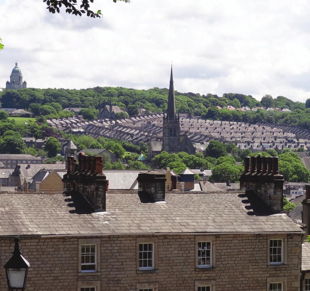
8 1.3 Summary of Special Interest Lancaster Conservation Area covers the historic core of the city, as well as peripheral areas of 19 th century urban expansion for housing and industry. The archaeologically sensitive Roman and medieval heart of the city has been overlaid with phases of 18 th and 19 th century development which have created a city of great richness, character and diversity. The use of local sandstone unifies the mix of buildings and is continued into some good areas of pavement and setted street surfacing, for example around Dalton Square. The hilly topography provides fine views and interesting level changes which are a distinctive aspect of Lancaster; key historic buildings such as the Castle and St Peter s RC Cathedral have landmark quality on the higher ground with more intimate framed views along streets. The river and canal provide strong landscapes within the city, lined by good groups of historic warehouses, mills and workers housing, complemented by recent development. The city centre is busy with people; the retail and cultural core supports a wide range of activities in historic buildings, many re-used for current uses. On some streets traffic is intrusive, but overall the city retains strong historic character with few visual intrusions or areas of over- development. The city centre is still predominately low-rise and finelygrained, allowing landmark historic buildings to punctuate the townscape. Good quality small public spaces provide attractive settings for historic buildings and relief in the city centre s grid of streets, with larger areas of green open space around the Castle, notably overlying the scheduled ancient monument of the Roman fort. 6
9 2. Conservation Area Appraisal: Area-wide Overview 2.1 Location and Setting Figure 2.1 shows the wider setting of the Conservation Area. Lancaster is located approximately 3 miles inland from the coast, on the south side of the tidal River Lune. It is strategically located at the lowest crossing point of the Lune. Lancaster has now effectively merged with Morecambe, but the River provides an effective break that gives separate integrity to both settlements. Lancaster is located on hilly terrain, with the Castle and Priory situated on a bluff overlooking the river, and the land rising higher in the east towards the Lancaster Moor and beyond to the Forest of Bowland. This topography gives attractive views across the City Centre, especially to the Ashton Memorial, which sits on the crest of a hill to the east. To the east of this runs the M6 motorway. The natural setting was attractive to early settlement, demonstrated by the almost continuous occupation of Castle Hill for over 2000 years. The river leading into the Irish Sea and beyond to the Atlantic enabled the town to become the 4 th largest port in Georgian England, the key to the city s prosperity that provided the architecture and townscape making it one of the finest Georgian towns in northern Britain. As the historic county town, Lancaster s hinterland stretched south to Manchester and Liverpool, east into the Pennines and north to Barrow in Furness; before local government reorganisation in 1974, its position in the north of Lancashire made more geographical sense. The underlying geology is a buff carboniferous sandstone, a source of excellent building stone, also riven for grey roof slates; there were quarries on the hill on the east side of the city, later landscaped for Williamson Park. To the north, the volcanic rock of the Cumbrian fells provided Lancaster with Burlington blue/grey and Westmorland green roofing slate. 2.2 The Conservation Area boundary Figure 2.1 also shows the surrounding Conservation Areas of Westfield Memorial Village, Cannon Hill, Aldcliffe Road and Bath Mill for context. These are separately designated conservation areas and are not the subject of this appraisal. The Lancaster Conservation Area covers the City Centre and selected areas of residential expansion. This generally comprises land defined to the north by the River Lune, by the Canal to the east and the railway line to the west. There are, however a number of projections: the Cathedral and blocks of residential streets to the east of the Canal and the Westbourne Road area to the west of the railway line. North-west of the centre, St George's Quay is important for a fine group of 18th century warehouses that face the River Lune. The river is spanned by a series of dramatic bridges. The former warehouses have mostly converted to residential use, with some sensitive infill development of new-build apartment blocks. The Lancaster Canal contours along the eastern edge of the Conservation Area. Whilst most of the Conservation Area is occupied by town centre uses, these peter away to the east and industrial, or former industrial, uses occupy most of the land around the canal. The exceptions are on the eastern banks of the Canal in the north, where streets of dense terraced housing adjoin the canal, and to the south of this St Peter s RC Cathedral is a landmark the east of the canal. In the south of the area the Penny Street Bridge over the canal marks a natural gateway to the City Centre. In the south-western part of the area, west of King Street, land-uses become more residential, with middle class Victorian terraces east of the railway. The railway line marks a more dramatic division, with the character of the area markedly suburban to the west and land-uses almost wholly residential. Part of this area, along Westbourne Road, is included in the Conservation Area. 7

10 Figure 2.1: Wider Context 8 Crown copyright and database rights Ordnance Survey

11 2.3 Historical Development of Lancaster Historic Lancaster has been the subject of numerous published accounts including a series of well-researched books by Dr Andrew White. A series of historic maps dating from the 17th century onwards charts the growing city, and are available in the local library, via the County Council s Mario website and on the Lancaster University Library s website. Investigations by Oxford Archaeology North (OANorth) and its predecessors has shed light on the Roman, medieval and later phases of the city and are recorded in an Urban Archaeological Database for Lancaster. There is still little known about prehistoric activity in Lancaster, although the Lune Valley and coastal strip attracted farming communities during this period. Scattered evidence of activity from the Neolithic period has been found, and a series of cremation burials point to a settled and organised population from the Bronze Age, but the settlement sites themselves have proved elusive. Lancaster s Roman settlement developed around an auxiliary fort on Castle Hill late in the 1st century AD. The fort later gave the city its name the castrum, or castle, on the Lune and was subject to several phases of occupation and rebuilding, probably not continuous. A civilian settlement developed on the slope to the east of the fort, either side of the present Church Street, and was occupied until the late 4 th century. The fort was abandoned early in the 5th century. Roman burials found around the Penny Street/King Street junction indicate a substantial occupied area, covering most of the modern city centre. After the end of Roman occupation in the 5th century, the settlement dwindled, although the fact that some Medieval streets (Church Street and Penny Street) follow the same line as Roman streets strongly suggests that the town was not completely abandoned. By the 8th or early 9th century, there was an early Christian community on Castle Hill, within the still visible enclosure of the fort. Lancaster is mentioned in Domesday in 1086, and there was a castle from the late 11th century, probably built by Roger of Poitou. He also founded a Benedictine Priory in 1094 which took over the earlier community and flourished until the Dissolution in the 16 th century. A market charter was granted in 1193 and there was a bridge across the Lune by In 1351 Lancashire was made a County Palatine under the Duchy of Lancaster, giving it a higher status than Liverpool or Manchester, but economically it was probably of little significance. The expanding castle expressed the strategic significance of Lancaster and its status as the County town; the castle has been continuously used for law courts and as a prison since the late 12th century. Speed s plan of Lancaster, published 1610 (University of Lancaster) 9
.")
12 Medieval Lancaster provided a market for the surrounding rural area and the Market Place is referred to from Some street names have changed, for example Church Street was known as Marygate or St Mary s Street, King Street as Chennel Lane until the 17th century and Cheapside as Pudding Lane (in 1451). Other streets in existence in the medieval period include Penny Street (c.1280), King Street ( ), Calkeld Lane ( ), China Lane (1362) and Stonewell (1362). A Dominican Friary was founded in about 1260 on land now occupied by Dalton Square, closed at the Dissolution in St Leonard s Gate is named after a leprosarium or hospital at a small priory, founded between 1189 and 1194 outside the north-eastern edge of the town. The medieval town was ringed by the townfields, the glebe land of Vicarage Fields, the Marsh to the west and Lancaster Moor to the east used for rough grazing. The medieval population of the town was probably no more than 1,500. The layout of Elizabethan Lancaster illustrated in the plan on John Speed s map of Lancashire, published in 1610, probably reflects the medieval street pattern. This shows houses lining the key east-west streets of Market Street, St Nicholas Street and Church Street cut by the north-south streets of Penny Street and King Street, with routes out of town such as St Leonard s Gate and Moor Lane. The mill race curving off the east side of the Lune, enclosed the Green Ayre, its culverted line now followed by Fleet Street and Damside Street. Behind narrow street frontages, land was divided into the long burgage plots typical of medieval towns. The pattern of these plots survives in parts of the modern city and property layout, except where erased by larger modern development. Mackreth s plan of 1778 clearly shows these medieval plots lining Church Street and Market Street, with Georgian expansion also evident. An early 18 th century engraving (after Buck) (Lancaster Library) Lancaster was transformed into an elegant Georgian town by the wealth from the port, associated with the Atlantic trade from the late 17 th century. In 1687, The Lambe was probably the first ship to sail to Jamaica from Lancaster, one of many that brought mahogany and plantation-grown products such as sugar, tobacco, rum and cotton into the port. By the mid-18 th century, Lancaster was the fourth largest port associated with slave ships in Britain. Improvements to the port included the building of St George s Quay in the 1750s and New Quay in 1767, both lined with warehouses, and the Customs House was built in A fine new bridge was built upstream of the medieval bridge in the 1780s, allowing the latter to be partially demolished and vessels to sail further up the Lune. The port s industries included shipbuilding, sail and rope-making, and imported exotic raw materials fostered industries such as cabinet making, most famously Gillows, established in 1729 by Robert Gillow. Damside Street and North Road were built along the line of the old mill stream with Cable Street (around 1759) parallel to the river to the north, prompting the development of the Green Ayre, close to the river. The Lancaster Canal opened in 1797, although the initial survey was in 1772, connecting the town to Preston and to Kendal via John Rennie s aqueduct. It was known as the Black and White Canal as it carried coal from the south and limestone from the north. 10
")
13 Mackreths plan of 1778 (University of Lancaster) 11

14 Society in Georgian Lancaster revolved around the seasonal Assizes at the Castle, when families came to town; the Assembly Rooms were built in 1759 and the Theatre on St Leonard s Gate in The [old] town hall was built in and the Custom House in 1764, with a new Crown Court at the Castle in the 1790s. The wealth of the town enabled owners to build new stone townhouses in place of earlier timber-framed buildings, many in large walled gardens. Detached gardens were laid out on the edge of the town. On the east edge of the town, the grounds of the former Frierage were planned for residential development in the early 1780s by John Dalton, with a new square. By this date, the Georgian trade boom was over and the port was soon eclipsed by Liverpool. As Lancaster declined economically and became less fashionable, town centre gardens were sub-divided into building plots. In Dalton Square, the planned development faltered, and some plots remained undeveloped until the new Town Hall was built in The canal attracted some steam-powered textile mills; White Cross Mill was built in 1802, Moor Lane North (worsted) in 1819, Albion in 1821, Moor Lane South (sail cloth) in 1825 and Queen Street mill (cotton) in However, compared to other Lancashire towns, textiles were not the only factor in the economy of the town which benefited from a broad base. The railway arrived in 1840; the new viaduct over the Lune allowed the present Castle Station to replace the earlier station on South Road, in After 1850 the economy improved and manufacturing became important, benefitting from the expanding railway network; the line to Leeds via the Lune valley opened in The huge Lancaster Carriage and Wagon Works were set up on Caton Road in The large Phoenix Foundry, north - of Phoenix Street manufactured and repaired rolling stock in the mid 19 th century. Oil cloth and linoleum were Lancaster s most successful 19 th century industries, developed by the Storey Brothers and the Williamsons. These firms took over and expanded earlier mills; the Storeys bought White Cross Mills in 1856 and Moor Lane Mills in 1861 and Bath Mills was acquired by Williamson in Joseph Storey s Heron Chemical Works on Moor Lane supplied the Storey mills with chemical products, such as dye pigments. Together, Storey Brothers employed around 1,000 people by Both the Storeys and the Williamsons were active in local politics and philanthropy; the Storeys paid for a new Mechanics Institute, renamed the Storey Institute ( ) and James Williamson, later Lord Ashton completed Williamson Park in the 1870s. Existing industries such as Gillows expanded; they extended their factory on St Leonard s Gate in the 1880s, behind new North Road showrooms. Baines map of 1824 shows Dalton Square (Lancaster University) 12

15 Between 1801 and 1881 the city s population doubled from less than 9,000 to over 20,000. The poor quality of early 19 th century housing, often in cramped courts in the town centre, was addressed by local bylaws after 1859, which encouraged better quality housing. Dense terraces with rear yards and back alleys were built on fields and gardens on the north-east side of the town; the Freehold Estate in the 1850s, streets off St Leonard s Gate in the 1850s and 60s, de Vitre Street area in the 1870s and the Greenfield estate in the 1880s. In the southwest new terraced houses were built along Dallas Road and Regent Street from the 1880s onwards, and to the south-west and south, more spacious housing for the middle classes was built in Cannon Hill, the Greaves and Bowerham. historic core remained intact; the St Nicholas Arcade was built over a medieval street. City centre shopping streets were pedestrianised from 1973 and a circulatory one-way system was introduced, but traffic congestion remained an on-going issue. Manufacturing decline in the 1960s hit the city hard with the closure of Waring & Gillow s works in 1962 and Williamson s White Cross mills in the 1970s. Local authorities, the NHS and the University became important to the city, creating new jobs and the latter supporting cultural life in Lancaster. Since the end of the 20 th century, Lancaster s retail businesses have faced competition from Preston and Manchester. Strong support for the protection of the historic city centre has been a feature of local politics and planning for the last 30 years, requiring conservation to be balanced against the demand for new infrastructure and development. 2.4 Archaeological Potential Part of a Map of 1877 by Hall & Harrison, showing terraced housing close to the canal, in the northeast of Lancaster (Lancaster Library) NB. North is to the right. From the 1920s, the Council funded new greenfield housing estates to replace cleared city centre slums. In the 20 th century, the Williamson and Storey mills continued to produce for a growing home market and remained major employers. Lancaster was awarded city status in The building of the M6 in 1960 freed the city centre from the through traffic that had choked the A6 and Skerton Bridge. An inner eastern relief road was envisaged but not implemented, although part of the area east of St Leonard s Gate and Dalton Square was cleared for this in the 1960s. In the post-war years, new retail development damaged part of the historic street pattern but most of the Occupied as a town for over 2000 years, and during parts of the prehistoric period, Lancaster has rich archaeology of all periods. The city s archaeological potential is particularly strong for the Roman, medieval and post medieval periods. The Urban Archaeological Database (UAD) for the city has been compiled by Oxford Archaeology North for use by the County Council and City Council, to inform planning decisions and aid the management and protection of the city s archaeology. Evidence for prehistoric activity is scant and has largely been due to chance finds in the 19 th century or during other projects andit is difficult to predict where further remains may survive within the builtup city. As-yet undeveloped areas, particularly those on south-facing slopes with ready access to water and other resources, and areas where later deposits are deepest are likely to have the highest potential to retain evidence of pre-roman times. There are no known standing features of this period within the conservation area, and little probability for their survival. ; The Roman occupation in Lancaster has been studied over a long period through 13
16 chance finds and excavations, on Castle Hill. Away from Vicarage Fields, arcaheological work has been associated with new development and does not provide a full picture of the Roman town and its extent, and cellars have destroyed much evidence, but it is clear that there is a rich sequence of Roman archaeology and there is great potential to learn more about this period. An outline of the forts on Castle Hill is known, but their full extent has yet to be established and little investigation has been possible away from the Vicarage fields. Remains of defences were found on the site of 27 Castle Hill and it is possible more remains survive as far south as Castle Park. The substantial civilian settlement seems to have extended east of the fort, with Church Street representing the approach road from the north-south route represented by the line of Penny Street and Cheapside. The southern extent of settlement proper is likely to lie between Common Garden Street and Spring Garden Street, but the area alongside Penny Street at least as far as the canal was used as a cemetery and remains have been found in this area beneath 18 th century and later development. The eastern extent of the settlement is less well defined, but the Stonewell area may represent its extent in this direction. Some areas of the settlement (e.g. alongside Church Street) have shown a substantial depth of Roman deposits, and in some places (e.g. off Aldcliffe Road) the top of the Roman layers was more than a metre below the modern surface. In the absence of evidence of particularly deep disturbance, all of Castle Hill and the city centre must be considered to have a high potential for the preservation of Roman material. A corridor alongside the projected line of the main Roman road, at least as far as the canal, must also be considered to have high potential. The northern edge of the settlement is likely to be defined by the base of the slope between Church Street and Damside Street, which is thought to represent the contemporary river bank, but the location of any port facilities or, indeed, a Roman bridge over the Lune, has yet to be discovered and may lay in the strip from St George's Quay to Parliament Street. Burials of Roman date have also been found at the Westfield Memorial Village, and this area should also be considered to have a medium to high potential. Standing remains of Roman date are limited to the Wery Wall, the core of a bastion of the 4 th century fort, and the excavated remains of the adjacent bathhouse which was destroyed to accommodate the defences After the end of the Roman occupation there seems to have been a gradual transition into the early medieval period, indicated by the continuous use of Church Street as the main street, but there is not much scope for more investigation of this little-understood period. Pre-Conquest finds on Castle Hill, including cross fragments suggest an early Christian community, but remains of this period rarely survive well outside waterlogged sites. The date of the first stone keep at the Castle is not precisely known; there may have been an earlier timber structure and earthwork There is little potential for standing remains of this period and even that is restricted to the castle and priory church sites. As noted above the medieval layout of the town and the outline history of the castle is known, but medieval archaeological deposits have suffered from Georgian and Victorian redevelopment and cellaring. There is, however, survival between cellars and in former (and extant) garden areas, especially towards the rear of plots where disturbance is likely. Areas shown as occupied on Speed's 1610 map should be considered as having some potential for medieval remains, the level depending upon the extent and depth of later development. As well as buried remains there are standing remains of medieval date in the city, with substantial parts of the castle and priory church of this period.the archaeology of standing buildings has potential for this period, and town centre buildings may retain fragments of timberframing and earlier structure behind stone frontages; for example, on Moor Lane, timber-framing was observed in 2011 in a house on the north side. By the 18 th century the balance of archaeological potential has moved from buried to structural remains, with documentary evidence also available. 14


17 Standing buildings of this date are wellrepresented across the city centre, although the best-preserved tend to be those of higher status; lower status buildings also deserve attention. Building recording is often worthwhile during alterations and more could be arranged through the planning consent process. A small number of sites, such as the Delft Pottery site west of the Carlisle Bridge and outside the Conservation Area, however, retain significant buried deposits of this date, and further investigation or other actions may be merited on occasion. For the Victorian and Modern periods large numbers of sites and structures exist and whilst many have a high potential for preservation, their significance is lower than those of earlier periods, except where they throw specific light on a Lancaster feature such as the linoleum industry. 2.5 Buildings and Architectural Quality building and as a result of this and local topography, the dominant buildings remain those of the medieval core on Castle Hill and (outside the Conservation Area, but important in views to the east) the Ashton Memorial in Williamson Park. Little 17th century domestic building survives, the most important exception is the Judges Lodgings (1639). The backs of Nos. 74 and 76 Church Street are partly 17 th century, otherwise building fabric of this date is largely confined to small houses, such as Nos. 17 and 19 Moor Lane. Survivals from the early 18 th century include Penny s Hospital ( ) on King Street, a very good, fairly intact example of purpose-built almshouses. The most architecturally significant building of this period is the Music Room (c.1739), an unusual and rare example of a garden pavilion, important for the surviving original interior plasterwork. It was built for the Martons of Capernwray Hall, whose townhouse was at No. 76 Church Street; this, with houses on Castle Park (Nos. 20, 22. etc.), is amongst the best of the early 18 th century houses. Priory Church of St Mary Lancaster retains some exceptionally important Norman and medieval architecture in the Castle, with its 12 th century keep and medieval towers and gatehouse. Also significant is the Priory Church of St Mary, on an ancient site but largely of the 14 th and 15 th century. Otherwise the city s character largely reflects rebuilding in the 18 th century, to which period most of the best buildings belong. The dominant building material is the local buff-coloured carboniferous sandstone, widely used, and giving visual cohesion to the street scene. The centre has no high-rise No.4 High Street, c1775 St George s Quay ( ) has nationally important maritime buildings. The Custom House (1763-4) is one of the town s most magnificent public buildings, its finest example of architecture of the period, and an expression of the ambitions and wealth of Lancaster s mercantile elite. With the contemporary warehouses, the quayside retains perhaps the best group of Georgian port buildings to survive in the country. Tall stone-built warehouses are found throughout the city, a rare surviving group of distinctive 15
, built to enable ships to moor further upstream, is another exceptional structure and the first large bridge in the country to have a flat deck.")


18 18 th century mercantile buildings. Thomas Harrison s monumental Skerton Bridge (1783-8), built to enable ships to moor further upstream, is another exceptional structure and the first large bridge in the country to have a flat deck. Late 18 th century building in the town included fine examples of Georgian houses and terraces, particularly on Church Street, High Street and Queen Street and south of the Castle. Some of the grander houses such as No.20 Castle Park have large gardens and summerhouses, privies or coach houses, features which rarely survive pressure for development in town centres. Many houses have interesting local features, such as tall rear stair windows and outriggers containing services. county town and juridical centre. The rebuilding of the Castle was started in the 1780s by Thomas Harrison, an architect of national repute, completed by Joseph Gandy. Shire Hall is an outstanding example of a late Georgian court complex, with many original features, interesting use of Gothic style and blends well with the earlier castle. The prison additions, many by Gandy, are of strong interest, and very well preserved. Other key buildings of the 18 th century are the tower of the Priory Church by Henry Sephton, a notable example of mid 18 th century combination of Gothic and classical motifs and St John s Church of with a tower of 1784 by Thomas Harrison. The old town hall (now museum) of , in good sturdy Greek Revival, fronts the market place and provides an important focal point in the town. Custom House, St George s Quay The Shire Hall at the Castle, designed by Thomas Harrison, c1796 St John s Church, North Road (1754-5) Within the conservation area, industrial buildings are clustered around the edge of the city. One of the earliest is the mid-18 th century malthouse on Brewery Lane, with later red brick brewing tower (1901). The early 19 th century textile mills along the Lancaster Canal ( ) are good examples of multi-storey stone-built mills, all now in new uses. The wealth generated by the linoleum industry that took over these mills built some of the town s fine Victorian and Edwardian landmarks, through the patronage of the Williamson and Storey families. An important strand in Lancaster s architectural development was its role as the 16


 on Market Street and the Natwest (1870) on Church Street, are well-executed provincial examples of the")

19 Moor Lane Mill North (1819, adapted for student flats 1989) Lancaster s most important architectural practice was founded by Edmund Sharpe in 1836 which, as Sharpe & Paley and successor firms, including Austin & Paley, produced designs of the highest calibre. Lancaster is an interesting place to study some of their less well known work, as well as outstanding buildings such as Paley s St Peter s Cathedral, a major example of mid- 19 th century Roman Catholic ecclesiastical architecture and a showcase for the outstanding local stained glass firm Shrigley & Hunt. Good examples of the firm s revival style work include The Storey Institute ( ), a very early example of a car showroom on North Road (1902) and the former co-op store on Church Street (1901). 19 th century commercial buildings in the centre, by other firms, such as the HSBC bank (1887) on Market Street and the Natwest (1870) on Church Street, are well-executed provincial examples of the building type. Workers housing was generally not included in earlier conservation designations, but the current boundary was extended to include some good groups of stone-built terraces. One of the earliest groups is on Bath Mill Lane, built in 1837 by the owners of Bath Mill, and there is another mid 19 th century terrace on St George s Quay. Most of the terraced housing in the conservation area was built under byelaws, between the 1870s and c.1900 and has varying vernacular details within the consistent terraced form. Stone chimneys, corbels for timber gutters, and simple moulded hoodmoulds over paired doorways are local details. The basic terraced form was used for larger middle class housing, with higher quality details, as on Westbourne Road. Brick housing is not characteristic of the conservation area. Workers housing on Bath Mill Street, 1837 The key building of the early 20 th century is the Town Hall, by E. W. Mountford (1906-9). It is a fine example of Edwardian Baroque architecture with fine little-altered interiors, in a formal setting enhanced by good statuary and balustraded walls. The contemporary fire station is a particularly good example. Former car showroom on North Road by Austin & Paley (1902) The Town Hall ( ) 17
.")
20 Building from the later 20 th century is generally less significant, and much was influenced by conservation controls encouraging reticence and respect for historic character. Neo-Georgian infill includes the offices on the east side of Dalton Square by the City Council with Harrison & Pitt (1996). An exception is the Millennium Bridge (Whitby Bird & Partners ) which is an unashamedly modern and successful addition to the waterside. 2.6 Townscape Analysis Topography and Views Within the Conservation Area the land rises and falls within the built-up area, creating interesting views and street forms. The most significant hill is of course, Castle Hill, on which sits the Castle and Priory Church precinct. North of this is an area of open land, mostly under grass with some woodland, overlying the Roman fort, a scheduled ancient monument. This offers good long range views in all directions, across Morecambe Bay and as far as the Cumbrian fells on a clear day. The dense vegetation on the undeveloped slopes north of the Priory rather detracts from the value of the land, both as an amenity resource and to appreciate views of the Castle and Priory Precinct. Elsewhere, long range views are prevalent throughout the Conservation Area to the surrounding hills. In many instances this includes the Ashton Memorial, adding a strong local identity. Views also exist from high ground within the study area over the City Centre, with hills in the background. For example, from Castle Hill south over the City Centre, from the canal bridges and towpath in the east into the City Centre and at various points within the centre (i.e. westwards on Church Street and southwards from the car parks on St Leonard's Gate). There are also important views into the Conservation Area from the surrounding hills, including Williamson Park. The River Lune provides important mid-range views: both from St George's Quay outwards across the river to the Carlisle Road bridge and new Millennium Bridge and from these bridges, and the opposite bank, to the buildings on St George's Quay Urban Form The urban form of the conservation area is still largely dictated by both its topography and its historical development. Development has often replaced earlier structures (especially Georgian and Victorian development replacing medieval development) but this has generally been done within the same plots and has left the original street form intact. In the central part of the area the traditional medieval form predominates: narrow streets, straight or gently curving, narrow and deep plots and back-of-pavement development. Outside of this (notably in the Dalton Square (4), and part of High Street (11) and Castle (2), Character Areas) a more planned Georgian form dominates: larger and wider plots, backof-pavement development and a more regular street grid (although this is often disrupted by topography). View south-east from Castle Hill 18
 with back alleys behind the terraces.")
21 St George's Quay from Millennium Bridge Beyond this a Victorian residential street form dominates: a regular, tighter and more linear street grid with smaller terraces facing linear streets (though again often subservient to topography) with back alleys behind the terraces. To the east of the area these are generally small workers cottages (Character Area 7) whilst in the west they are larger, more middle class terraces (Character Areas 9 and 10). Further out still, outside of this Conservation Area, is a more suburban form of late Victorian and 20th century housing areas. Where modern development occurs its largely fits within the pre-existing street structure and urban form, although there have been notable exceptions that have lost historic streets: the superimposed form of St Nicholas Arcades and the clearance associated with the once planned relief road in the east of the area. 19

22 Figure 2.2: Figure Ground Analysis 20 Crown copyright and database rights Ordnance Survey

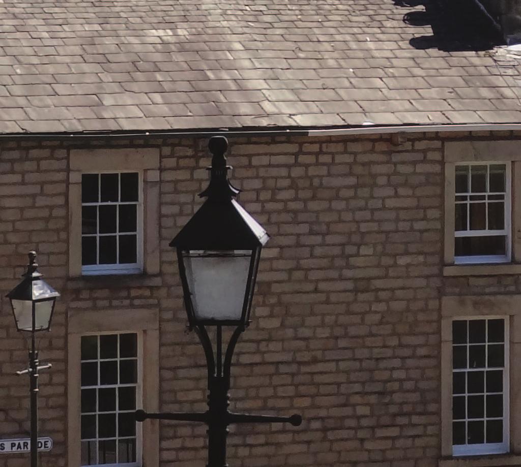
23 Listed and Unlisted Buildings There are many buildings and structures within the Conservation Area which, although they are not statutorily listed, contribute in a positive way to the character or appearance of the Conservation Area. Examples of these and listed buildings are referred to in the relevant section in each character area summary, and listed buildings (Grade I, II* or II) and unlisted positive buildings are marked on the map at Figure 2.3. The best examples of key building types that meet national designation criteria are listed. The conservation area has a rich collection of listed heritage assets, some are landmark buildings designed by nationally important architects such as Thomas Harrison, Paley & Austin or E.W.Mountford. Others are fine examples of a particular building type, such as Georgian warehouses, public buildings and houses and Victorian churches and commercial premises. Unlisted buildings which are significant in the conservation area are protected under the 1990 Planning Act and by policies in the NPPF. It is important to clearly identify these buildings as proposals for their demolition normally constitute substantial harm to the conservation area, which requires robust justification. There is a presumption in favour of the conservation of unlisted buildings that contribute to the character of the conservation area. To identify which unlisted buildings make a positive contribution, the checklist published by English Heritage was referred to during the preparation of the appraisal, reproduced in Appendix 3. The first item on the checklist refers to whether a building is the work of a particular architect of regional or local note. All unlisted buildings designed by the outstanding architectural firm Austin and Paley, founded by Edmund Sharpe, have been included where known, as well as buildings by less well-known designers such as Richard Gillow or Post Office architect Charles Wilkinson. Most landmark quality buildings are already listed, but there are many good examples of unlisted buildings on prominent corner sites and community buildings such as chapels and schools or industrial structures that are important in the city s townscape. Unlisted Georgian houses, now shops, on Cheapside Buildings that are characteristic of the city and possess features and details distinctive to Lancaster also make a positive contribution to the conservation area; these may not be architect-designed or individually prominent but they are built in local vernacular styles typical of the city. In particular, Georgian houses in the city centre are often now in retail or business use, but retain characteristic features in their stone details, proportions and overall form. Some have good Victorian shop fronts, later inserted. These former houses are also examples of buildings whose use has evolved and like former warehouses, workshops and mills, they illustrate the changing history of the city. Victorian terraced housing defines streets on the edge of the city centre developed for residential expansion. Although none of these would meet listing criteria, they have strong character and common details that merit their protection. Early examples of workers housing are now rare; good examples include the terrace on St George s Quay and Bath Mill Lane. 21
24 Figure 2.3: Listed and Positive Buildings 22 Crown copyright and database rights Ordnance Survey


25 Gabled former carriage works on Lodge Street Some unlisted buildings are associated with well-known local families such as the Storeys, and industrial structures built or used for their manufacturing businesses have been identified as well as smaller premises built for other local businesses such as cabinet making or carriage building. In the city centre, commercial buildings such as banks, shops and showrooms are important to the character of the retail streets and provide variety and interest to the street scene. Shop built in 1891 on Moor Lane Stone boundary walls that enclose gardens and public spaces are important to the design quality of parts of the city centre, and are also important in defining private space in residential streets. Canal bridges and wall structures have historic importance and are positive landscape features. 23
26 24
27 3. Conservation Area Appraisal: Character Area Analysis The Conservation Area has been divided into eleven areas of different and distinct character. This section of the report provides a separate analysis of each area. The eleven areas can be seen on Figure

28 Figure 3.1: Character Areas 26 Crown copyright and database rights Ordnance Survey


29 Lancaster Conservation Area Appraisal Figure 3.2: Conservation Designations (North) 27 Crown copyright and database rights Ordnance Survey


30 Figure 3.3: Townscape Analysis (North) 28 Crown copyright and database rights Ordnance Survey
31
Lancaster Conservation Area Appraisal. Character Area 8. Cathedral
 Lancaster Conservation Area Appraisal Character Area 8. Cathedral March 2013 118 3.8 Character Area 8. Cathedral 3.8.1. Definition of Special Interest "This character area is distinctive for the fine group
Character Area 6. Canal Corridor: South
 Character Area 6. Canal Corridor: South March 2013 98 3.6 Character Area 6. Canal Corridor South 3.6.1. Definition of Special Interest "The character of this area is defined by a group of large, significant
Character Area 7. Residential: North East
 Lancaster Conservation Area Appraisal Character Area 7. Residential: North East March 2013 106 3.7 Character Area 7. Residential: North East 3.7.1. Definition of Special Interest "This character area comprises
6. Bermondsey 6.1. Bermondsey Area Vision
 6. 6.1. Area Vision 6.1.1. is: An inner-london neighbourhood characterised by modest worker ho associated with the historic Rotherhithe docks and local manufacturing industries such as biscuits, jam, vinegar
5. Bankside and The Borough 5.1. Bankside and The Borough Area Vision
 5. 5.1. Area Vision 5.1.1. are: A globally significant central London business district which is home to international business headquarters; At the heart of the commercial and cultural life of the capital
Character Area 9. Residential: South West
 Lancaster Conservation Area Appraisal Character Area 9. Residential: South West March 2013 128 3.9 Character Area 9. Residential: South West 3.9.1. Definition of Special Interest "This character area is
7.1 Area 1: Haslemere Conservation Area
 7.1 Area 1: Haslemere Conservation Area Detailed map of Haslemere Town Conservation Area as of 2006 Crown copyright and database right 2011 Ordnance Survey LA100025451 27 The Conservation Area is characterised
13. London Bridge London Bridge Area Vision
 13. 13.1. Area Vision 13.1.1. is: A globally significant central London business district which is home to international business headquarters; Internationally renowned for its prominent riverfront location
Historic England Advice Report 26 August 2016
 Case Name: Kingsland Castle Case Number: 1435892 Background Historic England has been asked to review the scheduling for Kingsland Castle. The land on which the monument lies is understood to be for sale.
4. Conclusions and Recommendations
 4. Conclusions and Recommendations This section highlights the key conclusions and recommendations from the Conservation Area appraisals. 4.1 Building condition and impact of building alterations Buildings
National Character Area 70 Melbourne Parklands
 Summary The are a landscape of rolling farmland, parkland and woodland on the northern flanks of the ridge between Burton upon Trent and Swadlincote. The land slopes down to the River Trent, which borders
Conservation Area Designation, amendments and Review
 Conservation Area Designation, amendments and Review Location: No.s 37-49 (odd) Twickenham Road Date Assessed: January 2018 Adjacent Conservation Area Significance: Teddington Lock CA. The Teddington Lock
Lancaster Conservation Area Appraisal. Character Area 3. The City Centre
 Character Area 3. The City Centre March 2013 3.3 Character Area 3. The City Centre 3.3.1. Definition of Special Interest "The City Centre Character Area is the historic heart of Lancaster and still represents
8. Camberwell 8.1. Camberwell Area Vision
 8. 8.1. Area Vision 8.1.1. is: Centred on a medieval village centre which has become a thriving modern town centre surrounded by residential streets laid out in the Georgian era; Linked by rail to central
CHESHIRE HISTORIC TOWNS SURVEY
 CHESHIRE HISTORIC TOWNS SURVEY Frodsham Archaeological Strategy 2003 CHESHIRE HISTORIC TOWNS SURVEY Frodsham Archaeological Strategy 2003 Environmental Planning Cheshire County Council Backford Hall Backford
London Bridge London Bridge Area Vision Map
 Area Vision Map Borough Market Southwark Cathedral NSP54 Hay s Galleria Key: NSP Site Allocations Greenspace Low Line Thames Path Cycle Network Primary Shopping Areas Borough High Street Tube Station NSP51
Environmental and Landscape Mapping
 Environmental and Landscape Mapping In support of the Calveley Neighbourhood Plan November 2016 Project Name and Number: Calveley Neighbourhood Plan 16-025 Document Name and Revision: Environmental and
Peckham Peckham Area Vision Map
 Area Vision Map PNAAP13 PNAAP8 Sumner Road Surrey Canal Walk Bird in Bush Park Key: NSP Site Allocations PNAAP Allocations Greenspace Low Line Cycle Network Primary Shopping Areas Square Surrey Canal Walk
PLANNING STATEMENT. Market House Market Place Kingston upon Thames KT1 1JS
 PLANNING STATEMENT To support planning and listed building consent applications for change of use from Class A1 shop and Class A3 cafe to Class A3 restaurant at: Market House Market Place Kingston upon
ENVIRONMENTAL AND LANDSCAPE MAPPING
 APPENDIX IV : Environmental and Landscape Mapping ENVIRONMENTAL AND LANDSCAPE MAPPING Calveley Neighbourhood Plan November 2016 ENVIRONMENTAL AND LANDSCAPE MAPPING Calveley Neighbourhood Plan Calveley
Camberwell Camberwell Area Vision Map
 Area Vision Map NSP23 Burgess Park Edmund Street NSP29 NSP30 NSP31 New Road Benhill Road NSP27 NSP33 Green Brunswick Park NSP22 station NSP24 Peckham Road NSP26 St Giles Church Lucas Gardens NSP28 NSP25
PUBLIC REALM STRATEGY
 CONSULTATION DRAFT PUBLIC REALM STRATEGY Trenchard Street & Frogmore Street City Design Group Place Directorate Public Realm Strategy Trenchard Street & Frogmore Street Contents 1. Introduction 2. Understanding
Page 1 of 19 URBAN DESIGN FRAMEWORK FOR BOLTON STREET WATERFORD
 Page 1 of 19 URBAN DESIGN FRAMEWORK FOR BOLTON STREET WATERFORD 1.0 Introduction: The relocation of the City Council stores and depot from Bolton Street creates an exciting opportunity for development
STATEMENT OF OBJECTION TO THE PROPOSED DEVELOPMENT OF LAND AT CHURCH CLIFF DRIVE FILEY
 STATEMENT OF OBJECTION TO THE PROPOSED DEVELOPMENT OF LAND AT CHURCH CLIFF DRIVE FILEY You will be aware that Scarborough borough council have adopted a new local plan that includes land at Church Cliff
16. Peckham Peckham Area Vision
 16. 16.1. Area Vision 16.1.1. is: A lively town centre providing a range of daytime and night time activities on Rye Lane including a Library, a Leisure Centre and many independent retailers which specialise
DUN DORNAIGIL HISTORIC ENVIRONMENT SCOTLAND STATEMENT OF SIGNIFICANCE. Property in Care (PIC) ID: PIC289 Designations:
 ID: PIC289 Designations:") Property in Care (PIC) ID: PIC289 Designations: Scheduled Monument (SM90113) Taken into State care: 1974 (Guardianship) Last reviewed: 2004 HISTORIC ENVIRONMENT SCOTLAND STATEMENT OF SIGNIFICANCE DUN DORNAIGIL
Property in Care (PIC) ID: PIC289 Designations: Scheduled Monument (SM90113) Taken into State care: 1974 (Guardianship) Last reviewed: 2004 HISTORIC ENVIRONMENT SCOTLAND STATEMENT OF SIGNIFICANCE DUN DORNAIGIL
Elephant and Castle. Elephant and Castle Area Vision Map. Elephant and Castle. 216 New Southwark Plan Proposed Submission Version NSP42 NSP49 NSP44
 Area Vision Map Lamberth North Station Waterloo Road Southwark Station NSP49 NSP43 Blackfriars Rd St George s Road Borough Road NSP48 Great Suffolk Street NSP42 NSP44 NSP45 Borough Station Newington Gardens
Conservation Area Designation, amendments and Review
 Conservation Area Designation, amendments and Review Location: Any area largely confined to Park Road and St. James Avenue which includes the following properties: St. James Church, St. James Road; No.
The meeting house is of low-key design typical of the inter-war period. It has an attractive appearance with a spacious interior and good amenities.
 Friends Meeting House, Preston 189 St George s Road, Preston, PR1 6NQ National Grid Reference: SD 54314 30558 Statement of Significance The meeting house is of low-key design typical of the inter-war period.
BROADHEMBURY DESIGN STATEMENT
 BROADHEMBURY DESIGN STATEMENT As drawn up by Broadhembury Parish Council during the development of a Parish Plan and adopted at its meeting on 17 th May 2010 BROADHEMBURY DESIGN STATEMENT Contents Introduction
APPENDIX 9 HERITAGE CHARACTER
 APPENDIX 9 HERITAGE CHARACTER Defining attributes and features Perth Official Plan Appendix 9 HERITAGE CHARACTER defining attributes and features This appendix includes a table describing heritage attributes
STRENSALL RAILWAY BUILDINGS CONSERVATION AREA APPRAISAL. In association with Strensall with Towthorpe Parish Council
 STRENSALL RAILWAY BUILDINGS CONSERVATION AREA APPRAISAL In association with Strensall with Towthorpe Parish Council CONTENTS Page 1 Introduction 2 2 Location and Context 3 3 Topography and Setting 4 4
MATURE SUBURBS RESIDENTIAL DEVELOPMENT GUIDELINES
 MATURE SUBURBS RESIDENTIAL DEVELOPMENT GUIDELINES DRAFT FEBRUARY 2005 BIRMINGHAM CITY COUNCIL 1 Introduction Mature Suburbs Residential Development Guidelines - Interim Supplementary Planning Advice -
Appraisal of proposed alterations to the boundary of Helmsley Conservation Area
 Appraisal of proposed alterations to the boundary of Helmsley Conservation Area Elmslac Road: Elmslac Road was constructed in the early 1950s in two or three stages by the Helmsley Rural District Council.
5 Gratton Terrace London NW2 6QE. Reference: 17/5094/HSE Received: 4th August 2017 Accepted: 7th August 2017 Ward: Childs Hill Expiry 2nd October 2017
 Location 5 Gratton Terrace London NW2 6QE Reference: 17/5094/HSE Received: 4th August 2017 Accepted: 7th August 2017 Ward: Childs Hill Expiry 2nd October 2017 Applicant: WSD (Gratton) Ltd Proposal: The
2bPlanning Scheme. Appendix. Conservation - Removal of Structures. Grangegorman
 Appendix 2bPlanning Scheme Grangegorman Conservation - Removal of Structures Innovative Urban Quarter Contemporary Healthcare Facilities Modern Education Hub Accessible Public Spaces Appendix 2b: Purpose
Chitty Farmhouse Extension, Wall Lane, Silchester, Hampshire
 Chitty Farmhouse Extension, Wall Lane, Silchester, Hampshire An Archaeological Watching Brief For In Touch by Andrew Mundin Thames Valley Archaeological Services Ltd Site Code CFS 08/52 May 2008 Summary
BORRISOKANE SETTLEMENT PLAN
 BORRISOKANE SETTLEMENT PLAN 1.0 General Introduction and Development Context Location Borrisokane is located 15km north of Nenagh on the N52. While the town is primarily residential, it acts as a market
Local Listings. Townscape In Focus EHTF Annual Conference. Local listings - Pete Boland, Principal Conservation Officer, Dudley MBC
 Local Listings Townscape In Focus EHTF Annual Conference Pete Boland Principal Conservation Officer & Borough Archaeologist 10 th October 2008 Conclusions were based on a questionnaire sent to the Conservation
Archaeology and Planning in Greater London. A Charter for the Greater London Archaeology Advisory Service
 Archaeology and Planning in Greater London A Charter for the Greater London Archaeology Advisory Service THE PURPOSE OF THE CHARTER This Charter sets out how English Heritage will provide archaeological
UPPER GORDON ROAD TO CHURCH HILL, CAMBERLEY CONSERVATION AREA
 Introduction This leaflet explains the purpose of conservation areas and the implication of their designation for residents, property owners and the Council. It provides you with a plan of the area and
Archaeological Investigation in advance of Development at 2 Palace Cottages, Charing Palace, Charing, Kent
 Archaeological Investigation in advance of Development at 2 Palace Cottages, Charing Palace, Charing, Kent Site Code CHAR-EV-14 NGR 95412 49439 Date of Report 18/12/2014 Swale and Thames Archaeological
Historical Value As evidence of Quaker heritage in Wells extending over three hundred years, the meeting house has high historical value.
 Friends Meeting House, Wells-next-the-Sea Quaker Yard, Church Street, Wells-next-the-Sea, Norfolk, NR23 1HZ National Grid Reference: TF 91978 43092 Statement of Significance The building has high significance
LONGDEN VILLAGE DEVELOPMENT STATEMENT
 LONGDEN VILLAGE DEVELOPMENT STATEMENT 2017-2027 1 Longden Development Statement 2017-2027 15/01/18 1. Background 1.1 Longden Village Longden village is a very rural and traditional community first mentioned
EAST OF ENGLAND OFFICE
 Mr Philip Isbell Direct Dial: 01223 582751 Mid Suffolk District Council 131 high Street Our ref: P00524468 Needham Market Ipswich Suffolk IP6 8DL 18 January 2017 Dear Mr Isbell T&CP (Development Management
Rotherhithe Rotherhithe Area Vision Map
 Area Vision Map CWAAP1 Improved pedestrian and cycle links to the wider area Improved link from town centre to River Thames and docks CWAAP2 Brunel Museum NSP79 CWAAP3 Proposed Thames Crossing Station
Huddersfield Urban Design Framework. 3. Framework
 3. Framework The illustrative plan has been used as the basis for developing an urban design framework and strategy in Part 3 of this report. This is based on a series of regulatory plans that code the
COURTHOUSE CAMPUS BARNSLEY Executive Summary March 2010
 COURTHOUSE CAMPUS BARNSLEY Executive Summary March 2010 Estell Warren Cartwright Pickard Buro Happold King Sturge BWA Barnsley Metropolitan Borough Council introduction Courthouse Campus is the last major
HERITAGE STATEMENT AND IMPACT ASSESSMENT HILLBARK FARMHOUSE FRANKBY
 HILLBARK FARMHOUSE HERITAGE STATEMENT AND IMPACT ASSESSMENT HILLBARK FARMHOUSE FRONT ENTRANCE CONTENTS Executive summary 1.0 INTRODUCTION 1.1. Background to the report 1.2. Purpose of the Report 2.0 SIGNIFICANCE
Site ref: AS06 Site Name or Address: Murreys Court, Agates Lane
 Site ref: AS06 Site Name or Address: Murreys Court, Agates Lane Proposed Land Use: Total Site Area (Ha): Housing 1.85 Ha Description: It is understood that the owner has no plans to dispose of the site
Draft Submission of Chilcompton Parish Council to Mendip Local Plan
 Draft Submission of Chilcompton Parish Council to Mendip Local Plan Note: This is a draft for consultation. The Parish Council urges all villagers and other stakeholders to send comments to: parishclerk@chilcompton.org.
Former Keighley College Buildings, North Street
 Introduction The Vision To create a high quality, mixed-use destination that will lead to the successful redevelopment of the site and contribute to the wider regeneration of the town centre The Opportunity
Examination of South Cambridgeshire Local Plan
 Matter SC6A - Policy SS/5 Waterbeach New Town Historic England( formerly English Heritage) 874 Rep Nos 59748, 60250, 60253 Examination of South Cambridgeshire Local Plan Historic England, Hearing Statement
Designations protecting the historic designed landscape
 Historic Landscape Project Designations protecting the historic designed landscape A. Key national designations affecting the historic environment: 1. Listed buildings 2. Scheduled Monuments (generally
THE PORT OF IPSWICH FROM RICHES TO RAGS AND BACK AGAIN An Illustrated talk given by John Field notes by Bob Allen
 IPSWICH BUILDING PRESERVATION TRUST AGM 28/10/15 THE PORT OF IPSWICH FROM RICHES TO RAGS AND BACK AGAIN An Illustrated talk given by John Field notes by Bob Allen After the formal business of the AGM was
Lincoln Townscape Assessment. Boultham Park Inherited Character Area Statement
 Lincoln Townscape Assessment Boultham Park Inherited Character Area Statement January 2008 Page 2 of 12 Table of Contents Page Overview 2 Historical Development 2 Urban form 3 Views 5 Condition of Buildings
Ivol Buildings, Woodcote Road, South Stoke, Oxfordshire
 Ivol Buildings, Woodcote Road, South Stoke, Oxfordshire An Archaeological Watching Brief For Christ Church, Oxford by Pamela Jenkins Thames Valley Archaeological Services Ltd Site Code IBSS 04/03 March
DRAFT CONSERVATION AREA APPRAISAL CHAILEY GREEN DESIGNATED
 DRAFT CONSERVATION AREA APPRAISAL CHAILEY GREEN DESIGNATED 16.06.76 DRAFT CHAILEY GREEN CONSERVATION AREA APPRAISAL 1 SUMMARY 1.1 Key Positive Characteristics 1.2 Recommendations 2 INTRODUCTION 2.1 The
Neighbourhood Planning Local Green Spaces
 Neighbourhood Planning Local Green Spaces Introduction... 2 1. Why green space is important... 4 2. Neighbourhood plans and green space... 6 3. Evidence... 8 Statutory designations... 9 Green space audit...
Public Consultation. Land at Monks Farm, North Grove. Welcome
 Welcome Welcome to our public exhibition for development on Land at Monks Farm, orth Grove. Gallagher Estates and Gleeson Strategic Land are preparing an outline planning application for new homes, open
Exploring Abergavenny
 11 Majors Barn36 Ysguborwen Exploring Abergavenny 2 ysguborwen EXPLORING ABERGAVENNY For several years the Abergavenny and District Civic Society has been studying the streets, spaces and buildings of
Stanwick Neighbourhood Plan
 Stanwick Neighbourhood Plan Heritage Audit Stanwick Neighbourhood Plan Steering Group August 2015 Purpose of the Heritage Audit It is a core planning principle within National Planning Policy Framework
North East Region TYNE & WEAR 1 /315 (B ) NZ
 NZ") TYNE & WEAR Newcastle Upon Tyne 1 /315 (B.05.6311) NZ 28016514 138 FOSSWAY, WALKER An Archaeological Desk-Based Assessment for a Proposed Development at 138 Fossway, Walker GeoQuest Associates Consett
TYNE & WEAR Newcastle Upon Tyne 1 /315 (B.05.6311) NZ 28016514 138 FOSSWAY, WALKER An Archaeological Desk-Based Assessment for a Proposed Development at 138 Fossway, Walker GeoQuest Associates Consett
Perth and Kinross Council Development Management Committee 24 April 2013 Report of Handling by Development Quality Manager
 Perth and Kinross Council Development Management Committee 24 April 2013 Report of Handling by Development Quality Manager Alterations,Carpenter House, Carpenter Street, Perth, PH1 5GB Ref. No: 13/00303/FLL
SUE ROSEN ASSOCIATES. Re: DA DA/485/2016. Thank you etc
 Re: DA DA/485/2016 Thank you etc I m an Epping based heritage consultant commissioned by the Epping Civic Trust to comment on the heritage aspects of the proposed development and on the reportage associated
Garage Site, Foots Cray High Street, Sidcup, Kent, London Borough of Bexley
 Garage Site, Foots Cray High Street, Sidcup, Kent, London Borough of Bexley An Archaeological Evaluation for Mizen Design Build by Andy Taylor Thames Valley Archaeological Services Ltd FOC 07 September
an Inspector appointed by the Secretary of State for Communities and Local Government
 Appeal Decision Site visit made on 6 November 2017 by Rachel Walmsley BSc MSc MA MRTPI an Inspector appointed by the Secretary of State for Communities and Local Government Decision date: 19 th January
3(iv)(b) TCP/11/16(29)
(b) TCP/11/16(29)") 3(iv)(b) TCP/11/16(29) TCP/11/16(29) Planning Application 09/02229/AML Erection of a dwellinghouse, garage with upper floor accommodation and stables (Approval of Matters Specified by Conditions) at land
3(iv)(b) TCP/11/16(29) TCP/11/16(29) Planning Application 09/02229/AML Erection of a dwellinghouse, garage with upper floor accommodation and stables (Approval of Matters Specified by Conditions) at land
Case Studies; Meitheal Clusters Applied to Villages and Rural Settlements
 Case Studies; Meitheal Clusters Applied to Villages and Rural Settlements 23.3.9 (ii) Case Studies, Meitheal Clusters applied to villages and rural settlments Fig 22.3.12 Cluster site plan; church opposite
B - Coalfield River Corridor Landscape Character Type
 B - Coalfield River Corridor Landscape Character Type Landscape Character Type - Coalfield River Corridor The Coalfield River Corridors Landscape Character Type is located in the two converging valleys
New horse training area, Manor Farm, Great Kimble, Buckinghamshire
 New horse training area, Manor Farm, Great Kimble, Buckinghamshire An Archaeological Watching Brief For Redwing Structures (Marlow) Limited by Andy Taylor Thames Valley Archaeological Services Ltd Site
Plaistow and Ifold Neighbourhood Plan Pre-Submission Consultation Draft
 Mrs Beverley Weddell Clerk to Plaistow And Ifold Parish Council Lock House Lodge Knightons Lane Dunsfold, GU8 4NU. Dear Mrs Weddell, Our ref: Your ref: Telephone Fax HD/P5402/ 01483 252040 18 th October
Conservation Area Designation, amendments and Review
 Conservation Area Designation, amendments and Review Location: Are area largely confined to Cowley Road and North Warpole Way and incorporating the following properties: No.s 2-120 (even) & 61 123 (odd)
Proposals for the regeneration of Standard Quay, Faversham, Kent
 Proposals for the regeneration of Standard Quay, Faversham, Kent The purpose of this information is to explain the progress in regenerating Standard Quay and to outline proposals with indicative timescales
Memo. B R A Y H e r i t a g e
 6 1 3. 5 4 2. 3 3 9 3 6 1 3. 5 4 9. 6 2 3 1 c a r l @ b r a y h e r i t a g e. c o m Memo To: Jennifer Murray, Windmill Development Corporation From: Carl Bray, Bray Heritage Date: Monday, June 5, 2017
Houses on the Forest Edge
 Houses on the Forest Edge Vivien Hill 1 Contents 3 Introduction 4 Pavilion Cottages 5 Oak Tree Cottage 6 Arts and Crafts Style 7 Laura House 8 Hillview 9 Bryle House 10 William Wells and the 1851 Census
SPG 1. * the northern and western sections which are open fields used for pasture and grazing;
 SPG 1 1.0 INTRODUCTION This development brief is based on the allocation of the Priors Hall site for employment and countryside recreational purposes in the Corby Borough Local Plan. The brief is intended
East Harptree Landscape & Character Assessment
 East Harptree Landscape & Character Assessment Produced by East Harptree Parish Council in consultation with local residents September 2014 Contents The Parish of East Harptree: Objective Introduction
Welcome to our exhibition
 Welcome to our exhibition The Homes & Communities Agency (HCA) welcomes you to this public exhibition explaining our proposals for the redevelopment of the former Lea Castle Hospital site. About the Homes
Land adjacent to Dingle Dock, Front Street, East Garston
 Land adjacent to Dingle Dock, Front Street, East Garston An Archaeological Watching Brief for Dr J Davies by Jo Pine Thames Valley Archaeological Services Site Code DEG99/82 January 2000 Summary Site name:
Glenbrooke North. New Westminster s Neighbourhoods Identifying Historical Contexts. Historical Neighbourhood Context Statements 2008
 Historical Neighbourhood Context Statements 2008 Glenbrooke North Fifth Street: wide boulevard, with garden median at south end 1950s subdivision character along much of Eighth Avenue and east of Fourth
NAA SITE REF: HG2-22 CHURCH STREET, BOSTON SPA LEEDS LDF SITE ALLOCATIONS PLAN PRE-SUBMISSION CHANGES (FEBRUARY 2017) HERITAGE REPRESENTATIONS
 HERITAGE REPRESENTATIONS") NAA LEEDS LDF SITE ALLOCATIONS PLAN PRE-SUBMISSION CHANGES (FEBRUARY 2017) HERITAGE REPRESENTATIONS Northern Archaeological Associates Ltd. Marwood House Harmire Enterprise Park Barnard Castle Co. Durham
NAA LEEDS LDF SITE ALLOCATIONS PLAN PRE-SUBMISSION CHANGES (FEBRUARY 2017) HERITAGE REPRESENTATIONS Northern Archaeological Associates Ltd. Marwood House Harmire Enterprise Park Barnard Castle Co. Durham
Statement of Community Involvement LAND OFF SOUTHDOWN ROAD HORNDEAN, HAMPSHIRE
 LAND OFF SOUTHDOWN ROAD HORNDEAN, HAMPSHIRE CONTENTS Page 1. Introduction 3 2. Pre-application Discussions 4 3. The Consultation Process 5 4. Consultation Feedback 7 5. Responses to Consultation Feedback
10. East Dulwich East Dulwich Area Vision
 10. 10.1. Area Vision 10.1.1. is: A predominantly residential area characterised by mostly medium density housing, including many family homes. Many parts of have retained historic character and it includes
WANSFORD. Village Design Statement. Supplementary Planning Guidance adopted by Peterborough City Council on 22 nd August 2003
 WANSFORD Village Design Statement 2003 Supplementary Planning Guidance adopted by Peterborough City Council on 22 nd August 2003 Prospect of Wansford Bridge, St. Mary s Church and Bridge End, c.1902 Conceived,
Northbury Farm, Castle End Road, Ruscombe, Berkshire
 Northbury Farm, Castle End Road, Ruscombe, Berkshire An Archaeological Watching Brief For Sir Colin and Lady Southgate by Danielle Milbank Thames Valley Archaeological Services Ltd Site Code NFR 07/120
Centre for Archaeological Fieldwork, School of Archaeology and Palaeoecology, Queen s University Belfast.
 Centre for Archaeological Fieldwork, School of Archaeology and Palaeoecology, Queen s University Belfast. Monitoring Report No. 04 Duneight Motte and Bailey, May 2004. On behalf of Monitoring Report: Duneight
Parish Derry Slopes ITM Coordinates ; NG Coordinates C House B1 and farm buildings B2; Registered Garden L061
 Asset Ref No. HB/01/27/018A-C, Ballyarnett & Farm; Registered Historic Garden L061 Heritage Type Location Protection Status Condition Ownership (if known) Built Post-Medieval house & farm OS 6-inch map
I539. Smales 2 Precinct
 I539. Smales 2 Precinct I539.1. Precinct Description The Smales 2 Precinct applies to a 4.8 hectare block of land located on the southern side of Northcote Road and fronting Lake Pupuke, Takapuna. The
Canterbury City Council Military Road Canterbury Kent CT1 1YW. Title: CA/16/02745/ADV. Author: Planning and Regeneration.
 O Crown copyright and database rights 2017 Ordnance Survey 100019614 Title: CA/16/02745/ADV Author: Planning and Regeneration Scale 1:1,250 Map Dated: 23/01/2017 Canterbury City Council Military Road Canterbury
Environment Agency Flood Risk Map for the Village of Bridge
 Environment Agency Flood Risk Map for the Village of Bridge December 2016 21 Objective F. Conserving and Enhancing the Natural Environment The National Planning Policy Framework states that the planning
an Inspector appointed by the Secretary of State for Communities and Local Government
 Appeal Decision Site visit made on 23 January 2017 by Gareth Wildgoose BSc (Hons) MSc MRTPI an Inspector appointed by the Secretary of State for Communities and Local Government Decision date: 6 February
Ipswich Issues and Options for the Ipswich Local Plan Review, August 2017, Public Consultation
 Ipswich Issues and Options for the Ipswich Local Plan Review, August 2017, Public Consultation Having reviewed the issues and options documents, the Society has made the following response: Part 1 Strategic
Character Area 1: Town Core
 Character Area 1: Town Core Map S 354 Copyright Cotswold District Council 109 Character Area 1: Town Core Key Characteristics 355 356 357 358 359 360 361 362 363 364 365 366 367 368 369 370 Copyright Cotswold
Colchester Northern Gateway Master Plan Vision Review Draft. July 2016
 Colchester Northern Gateway Master Plan Vision Review Draft July 2016 Contents Introduction 4 Context 8 Purpose of the Report 8 Strategic Position 9 Overview of the Process 11 2012 Master Plan Vision 12
HERITAGE COUNTS 2017 East of England
 HERITAGE COUNTS 2017 East of England Introduction Heritage Counts 2017 is the sixteenth annual survey of the state of England s historic environment. This Regional Report is prepared by Historic England
Ordnance Street 110 Plan OS Lot 413 B202; parts of Lot 412 and portion of Lot 413
 Ordnance Street 110 Plan OS Lot 413 B202; parts of Lot 412 and portion of Lot 413 110 Ordnance Street has cultural heritage value under 3 categories Physical built in 1886, it is an example of late 19
Newcourt Masterplan. November Exeter Local Development Framework
 Newcourt Masterplan November 2010 Exeter Local Development Framework Background The Exeter Core Strategy Proposed Submission sets out the vision, objectives and strategy for the development of Exeter up
Land at Cardigan Street / Belmont Row / Gopsal Street, Eastside, Birmingham, B4 7RJ
 Committee Date: 02/10/2014 Application Number: 2014/05637/PA Accepted: 07/08/2014 Application Type: Full Planning Target Date: 02/10/2014 Ward: Nechells Land at Cardigan Street / Belmont Row / Gopsal Street,
17. Coolaney-Rockfield Mini-Plan
 County Development Plan 2017-2023 Consolidated Draft + Adopted Amendments - August 2017 17. Coolaney-Rockfield Mini-Plan Village profile Coolaney is located approximately 23 km to the south-west of Sligo