Northwest LRT Downtown to. Northwest Edmonton Study. Public Workshops
|
|
|
- Charleen Freeman
- 5 years ago
- Views:
Transcription

1 Northwest LRT Downtown to Northwest Edmonton Study Public Workshops March 23 & 24, 2010
2 Welcome Thank you all for attending
3 Welcome Introductions
4 Welcome Our Team s Commitment to You for Tonight To provide you with as much information as possible about the LRT Planning process and inputs To provide an opportunity for you to provide your thoughts and comments about the planning to date and going forward
5 Purpose Statement To establish an LRT connection between the Downtown and Northwest Edmonton 5
6 Agenda Overview Four parts Display area with information boards and fact sheets Presentation Workshop Question and Answer Session 6
7 Development of LRT Northwest LRT North LRT (NAIT) Strategic Planning Conceptual Planning Preliminary Engineering Detailed Engineering Construction Commitment to Budget/Project Approval LEVEL OF DETAIL Project Turnover Plan Produce

8 Critical Components Three components that will impact the decisions about the LRT Connection The overall LRT Network Plan Technical Analysis Public Input 8
9 Council Approved Corridor Screening Criteria Category Weighting Land Use/Promoting Compact Urban Form 4 Movement of People/Goods 3 Feasibility/Constructability 2 Parks, River Valley, and Ravine System 2 Social Environment 2 Natural Environment 2
10 Corridor Evaluation Criteria (Level 2) Land Use/Promoting Compact Urban Form Existing transit centres/park and ride Existing/future activity centres/destinations Land available with potential for redevelopment Existing/future population density Existing/future employment density Existing/future mix of housing/zoning/land use types Number of large development proposals under review or construction Existing land-use plans/bylaws support development/redevelopment Movement of People/Goods Percentage within existing public/rail right-of-way Projected ridership Estimated cost/rider Projected travel time Potential changes in roadway capacity within existing transportation corridors Includes existing/future bicycle/pedestrian facilities Potential for park and ride locations Feasibility/ Constructability Estimated capital/operating cost per kilometer How much of route is at grade (and gradeseparated)? Complexity to extend route in future Proximity to LRT maintenance facility Number of at-grade crossings
11 Impacts/benefits to parks/open space/river valley access Corridor Evaluation Criteria (Level 2) Parks, River Valley & Ravine System Need to acquire public land for the route Social Environment Need for private property acquisition Impact on local property values Ability to avoid, minimize, or mitigate neighbourhood impacts Potential for noise/vibration impacts Adjacent known cultural resource/heritage sites Student population near stations Number of low-income, no car, senior households near stations Natural Environment Impact on riparian habitat Number of river/stream crossings Potential for disruption due to construction
12 Northwest LRT Downtown to Northwest Edmonton Study Defining the Long Range Network


 The Way We Move")
 Integrated Transit &")
13 Edmonton s Planning Hierarchy The Way Ahead (Strategic Plan) City Vision The Way We Grow (Municipal Development Plan) The Way We Move (Transportation Master Plan) Integrated Transit & Land Use Policy Framework

14 Public Transportation - Strategic Objective 5.1 The City will pursue expansion of the LRT to all sectors of the city with a goal to increase transit ridership and transit mode split, and spur the development of compact, urban communities.


15 Integrated Transit & Land Use Framework Outlines land use and community investment recommendations near LRT nodes and along major bus corridors.


16 Station Typology Mixed Use / Town Centre Stations Employment Centre Stations Residential Centre Stations

17 Edmonton s LRT System First city in North America to develop a modern light rail system (1978) System State of the Art at time Serves key destinations and is continuing to expand Clareview Health Sciences South Campus Century Park


18 LRT System Style URBAN STYLE LRT 400m to 800m stop spacing km/h average speed SUBURBAN STYLE LRT 1000m to 2500m stop spacing 40 km/h average speed


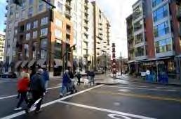
19 LRT - Urban Style LRT is part of the street Easy access for passengers LRT mixes with pedestrians Portland, USA


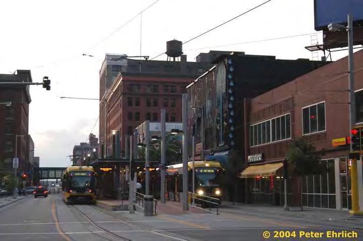
20 Closer Station Spacing Increase passenger catchment Support TOD, sustainable communities Less frequent transfers

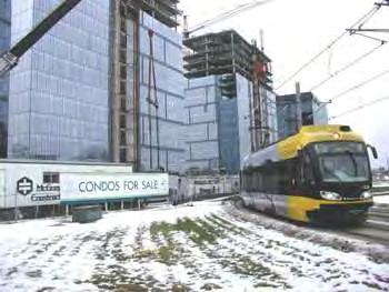
21 Recommendations Urban style LRT system 6-line City-scale Network Design in flexibility and capacity with surface-level routes Downtown circulator Regional connections
22 Recommendations of the LRT Network Assessment
23 LRT Projects - Status Corridor Definition Concept Planning Alignment Definition Preliminary Engineering Detailed Engineering Construction South LRT (Health Sciences to Century Park) Spring 2010 North LRT (Downtown to NAIT) Fall 2010 South LRT (Century Park to Ellerslie Road) Spring 2010 Northeast LRT (Clarview to Gorman) Spring 2010 Southeast LRT (Downtown to Mill Woods) End 2010 West LRT (Downtown to Lewis Estates) End 2010 Northwest LRT (NAIT to Northwest Edmonton) Summer 2010 TBD
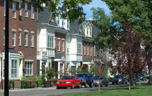
24 Northwest LRT Downtown to Northwest Edmonton Study LRT and Transit Oriented Development (TOD)
25 LRT and Transit Oriented Development (TOD) The transit - land use connection: How does it work? What can we learn from elsewhere?

26 The Transit - Land Use Connection Transit access affects location decisions
27 The Transit - Land Use Connection Amenities affect location decisions
28 Transit Alone Is Not Enough


29 3.3+ million population 4 LRT lines planned with 3 commuter rail corridors Region growing, with most growth projected in the urban area LRT viewed as a solution to traffic congestion Hiawatha line is 12 miles long, opened in 2004 Minneapolis LRT

30 Minneapolis TOD Policies Encourage development and reinvestment in centers combining transit, housing, offices, retail, services, open space and connected street supporting walking and bicycle use Livable Communities Funding Planned Unit Development overlays and station area planning Hennepin County TOD program
31 Minneapolis TOD


32 Calgary LRT 1.0+ million population 46.0 km of LRT Service Downtown line opened in 1981 Multiple lines and extensions


33 Calgary TOD Actions & Policies Calgary TOD planning objectives: Ensure transitsupportive land uses Increase density Create pedestrianoriented design Make each station area a place Manage parking, bus and vehicular traffic Plan in context with local communities

34 Calgary TOD Development
35 What Actions Are Needed? Steady, sustained, consistent policy Balanced, but consistent emphasis on the plan when conflicts arise Direct growth to priority areas for momentum / critical mass Consider impacts of other transportation investments that may not support the plan Consider impacts of other land use decisions in the city or region that may not support the plan
36 Northwest LRT Downtown to Northwest Edmonton Study Clarifying Question and Answer 15 minutes
37 Northwest LRT Downtown to Northwest Edmonton Study Public Involvement Process & Themes Heard to Date

38 Role of Public Involvement LRT will have advantages and disadvantages Public involvement is NOT about identifying the most popular route City Council will make final decision on which LRT route will proceed
39 Listening and Learning Online questionnaire hosted in Feb 2010 Open-ended questions - total of 1,199 participants Face-to-face interviews with stakeholders Purpose: Gain a greater understanding of benefits, issues, and impacts of LRT within the study area Refine discussion points

 Competing themes: Access to destinations vs.")
40 What we heard: Summary Traffic congestion is a key concern in this area Key opportunities for transit service St. Albert, shopping and recreation areas Development opportunities (City Centre Airport, Castledowns, Griesbach) Competing themes: Access to destinations vs. travel time Minimize disruption while maximizing ridership
41 What we heard: St. Albert Trail Corridor Key Benefit: Quickest and most direct option Travel time Best access for St. Albert Benefits to St. Albert Trail businesses Key Concern: Service to Edmonton Traffic impacts on St. Albert Trail Does not serve key areas in NW Edmonton and areas with growing populations
42 What we heard: 127 Street Corridor Key Benefit: Access to St. Albert Access to Airport and Yellowhead Trail Option to 118 Avenue provides service to Inglewood businesses Key Concern: Traffic congestion Most frequently cited as corridor with no benefits Misses desirable destinations 127 Street too busy now don t want to lose lanes

43 What we heard: 113A Street Corridor Key Benefit: Access to Shops and Parks Recreation centres and parks Access to North West Edmonton and City of St. Albert Key development areas in Griesbach and Castle Downs Key Concern: Community impacts Property acquisition Misses key high-density areas Traffic impact on key corridors

44 Underway now Public workshops March 23/24 econsultation March 22 to April 11 Information will help identify mitigation strategies for LRT Concept Plan for future study
45 Northwest LRT Downtown to Northwest Edmonton Study Corridor Route Analysis


46 LRT Corridor Planning Process

47 Study Area Overview
48 Purpose Statement Establish an LRT connection between Downtown and Northwest Edmonton The guiding principles supporting this purpose include: Maintain consistency with the Transportation Master Plan (TMP), Municipal Development Plan (MDP), the City s strategic direction, LRT System Network Plan, St. Albert's TMP and integrated land use framework, as well as the Capital Region Plan Shape land use to promote a more compact urban form Maximize use of existing transportation corridors Connect existing and future activity centers Increase transit system effectiveness Promote economic development/redevelopment Respect neighborhoods Respect parklands, river valley and ravine system Maximize cost effectiveness Provide opportunities for future system expansion

49 Route Alternatives Analysis Process

50 Initial Corridors Considered

51 North LRT Extension

52 Corridor Options

53 Potential Station Identification Process
54 Council Approved Corridor Screening Criteria Category Weighting Land Use/Promoting Compact Urban Form 4 Movement of People/Goods 3 Feasibility/Constructability 2 Parks, River Valley, and Ravine System 2 Social Environment 2 Natural Environment 2
55 Corridor Evaluation Criteria (Level 2) Land Use/Promoting Compact Urban Form Existing transit centres/park and ride Existing/future activity centres/destinations Land available with potential for redevelopment Existing/future population density Existing/future employment density Existing/future mix of housing/zoning/land use types Number of large development proposals under review or construction Existing land-use plans/bylaws support development/redevelopment Movement of People/Goods Percentage within existing public/rail right-of-way Projected ridership Estimated cost/rider Projected travel time Potential changes in roadway capacity within existing transportation corridors Includes existing/future bicycle/pedestrian facilities Potential for park and ride locations Feasibility/ Constructability Estimated capital/operating cost per kilometer How much of route is at grade (and gradeseparated)? Complexity to extend route in future Proximity to LRT maintenance facility Number of at-grade crossings
56 Corridor Evaluation Criteria (Level 2) Parks, River Valley & Ravine System Impacts/benefits to parks/open space/river valley access Need to acquire public land for the route Social Environment Need for private property acquisition Impact on local property values Ability to avoid, minimize, or mitigate neighbourhood impacts Potential for noise/vibration impacts Adjacent known cultural resource/heritage sites Student population near stations Number of low-income, no car, senior households near stations Natural Environment Impact on riparian habitat Number of river/stream crossings Potential for disruption due to construction
57 Space Trade Offs Constrained Right-of-Ways require further study Minimize property acquisition by removing: service roads traffic lanes on-street parking


58 C C St. Albert Trail Corridor B B A A

59 St. Albert Trail Corridor Section A-A Photo Credit: Google Earth Looking west High on Level 118 Avenue Bridge at 125 Street


60 St. Albert Trail Corridor Section A-A Existing: Option: Looking west High on Level 118 Avenue Bridge at 125 Street

61 St. Albert Trail Corridor Section B-B Photo Credit: Google Earth Looking northwest High on Level Groat Bridge Road at 121 Avenue


62 St. Albert Trail Corridor Section B-B Existing: Service Road Service Road Option: Service Road Service Road Looking northwest High on Level Groat Bridge Road at 121 Avenue

63 St. Albert Trail Corridor Section C-C Photo Credit: Google Earth Looking northwest on High St. Level Albert BridgeTrail at 128 Avenue


64 St. Albert Trail Corridor Section C-C Existing: Service Road Option: Service Road Looking northwest on High St. Level Albert BridgeTrail at 128 Avenue

65 D D C 127 Street C B B Corridor A A

66 127 Street Corridor Section A-A Photo Credit: Google Earth Looking north on 127 Street at 123 Avenue

67 127 Street Corridor Section A-A Existing: Service Road Option: Looking north on 127 Street at 123 Avenue

68 127 Street Corridor Section B-B Photo Credit: Google Earth Looking north on 127 Street at 130 Avenue


69 127 Street Corridor Section B-B Existing: Option: Looking north on 127 Street at 130 Avenue
70 127 Street Corridor - Section C-C Photo Credit: Google Earth Looking west on 137 Avenue at 135 Street

71 127 Street Corridor - Section C-C Existing: Service Road Option: Service Road Looking west on 137 Avenue at 135 Street

72 127 Street Corridor - Section D-D Photo Credit: Google Earth Looking west on 153 Avenue at 135 Street

73 127 Street Corridor - Section D-D Existing: Option: Looking west on 153 Avenue at 135 Street

74 B B 113 A Street A A Corridor

75 113 A Street Corridor Section A-A Photo Credit: Google Earth Looking north on 113 A Street at Grand Trunk Park


76 113 A Street Corridor Section A-A Existing: Option: Looking north on 113 A Street at Grand Trunk Park

77 113 A Street Corridor Section B-B Photo Credit: Google Earth Looking north on 113 A Street at 145 Avenue

78 113 A Street Corridor Section B-B Existing: Option: Looking north on 113 A Street at 145 Avenue
79 Next Steps Summer 2009 Fall 2009 Winter 2009 Spring 2010 Summer 2010 Fall 2010 Winter 2010 Technical Analysis Online Consultation Public Workshops March 23, 24 Public Information Sessions Week of June 7 Public Hearing Week of June 20 Further Planning and Engineering Studies
80 Northwest LRT Downtown to Northwest Edmonton Study Workshop 75 minutes
81 Public Involvement Objectives The public involvement process will identify: community/institution/business-specific issues that may impact the evaluation of route options. issues with respect to traffic and pedestrian impacts within communities and with respect to the overall transportation network. community, institutional, and/or business impacts that will affect the preliminary and detailed design.
82 Workshop Format and Ground Rules Workshop Goals To focus discussion on a specific question related to ALL the route options this is the information we need to take back and consider through the evaluation process To benefit from the wisdom of all the people around the table a chance to talk about all the route options and to mix it up and talk to some new people that maybe you haven t met before
83 Workshop Format and Ground Rules How it Will Work 3 different colors of tablecloths; one for each route Green for St. Albert Trail Corridor Yellow for 127 Street Corridor Blue for 113 A Street Corridor
84 Workshop Format and Ground Rules The questions for discussion and responses are: What are the advantages of this corridor? What needs to be addressed if this corridor is selected?
85 Workshop Format and Ground Rules After 10 minutes of discussion, I will stop you Each of you will have a maximum of 5 minutes to write down a maximum of 3 bullet points with your personal TOP three impacts on the route discussed at your table
86 Workshop Format and Ground Rules Post-it notes on each table One bullet point/thought per post-it note If you have a concern about a specific location on that route (like a certain intersection) make sure that is clearly marked on your post-it we will need to know this for our reference later
87 Workshop Format and Ground Rules Put your post-it notes on the blank board Our project staff will pick them up and the senior project leads will begin to sort them into major themes by route At my cue - switch to a table with a new route option and a new group of people Begin your 10 minute discussions on the new route
88 Givens and topics not on the table for discussion: The scope of the study is to define an LRT corridor between Northwest Edmonton and Downtown We will use High-Floor LRT technology on dedicated LRT right-of-way as much as we can All LRT will be at grade (street-level). Grade separations will only be pursued if it is required for technical reasons We will seek to minimize property acquisition, though some acquisition will be required
89 Workshop Format and Ground Rules After you have all had a chance to discuss all three routes, we will review the major themes that have come forward on all three route options
90 Northwest LRT Downtown to Northwest Edmonton Study Question and Answer Session 30 minutes
91 Question and Answer Session Ground Rules 2 minutes for each participant to ask a question or make a comment One follow-up question (1 minute) Will recognize 4 people for each round of questions; persons with microphones will go to those participants to ask their questions 3 rounds of questions Additional questions from same person not recognized until no new participants are wanting to ask questions Questions and responses will be recorded; please use microphones
92 Northwest LRT Downtown to Northwest Edmonton Study THANK YOU FOR YOUR PARTICIPATION
Public Open House #1
 Public Open House #1 TONIGHT S AGENDA Welcome Project Overview The Big Picture The Station Area The Analysis Thoughts about Future Change Breakout Group Discussions Summation / Next Steps Project Overview
Edmonton s Transit Oriented Development Journey
 Edmonton s Transit Oriented Development Journey Auckland Design Office Lunchtime Learning July 2018 Tom Young, MCIP, MCP NZ Group Manager, Urban Planning & Environmental Services tom.young@stantec.com
Port Credit Local Advisory Panel October 20 th Meeting
 Port Credit Local Advisory Panel October 20 th Meeting Focus Of This Evening s Meeting: 1. Hurontario Main Street Higher Order Transit Study 2. Port Credit Mobility Hub & GO Station Parking Structure Study
Green Line North Centre City Alignment
 Project overview The Green Line will be an important piece of Calgary's transit network, adding 40 kilometres of track to the existing 59 kilometre LRT system. End-to-end, the line will connect North Pointe
1.3 TRANSIT VISION 2040 FROM VISION TO ACTION THEME 1: PUTTING TRANSIT AT THE CENTRE OF COMMUNITIES. Fully integrate transit with community planning
 TRANSIT VISION 2040 FROM VISION TO ACTION TRANSIT VISION 2040 defines a future in which public transit maximizes its contribution to quality of life with benefits that support a vibrant and equitable society,
CITY COUNCIL AGENDA REPORT
 CITY COUNCIL AGENDA REPORT Subject: COUNCIL MOTION LRT ALIGNMENT REMOVAL FROM THE TRANSPORTATION MASTER PLAN On February 10, 2016 Councillor Hughes provided notice in accordance with Section 23 of Procedure
Crofton Manor 2803 West 41st Avenue WHAT WE HEARD. Public Consultation: Phase 1
 Crofton Manor 2803 West 41st Avenue WHAT WE HEARD Public Consultation: Phase 1 Background CROFTON MANOR What s Happening The City of Vancouver is undertaking a planning and public engagement process to
Route 110 Alternatives Analysis
 Route 110 Alternatives Analysis Public Meeting #1 December 15, 2014 Source: Town of Babylon Agenda Welcome/Introduction Hon. Antonio A. Martinez Deputy Supervisor, Town of Babylon Update on East Farmingdale
1 INTRODUCTION Purpose Project Background PROJECT CONTEXT Background The Capital City Downtown Plan...
 Attachment 3 Contents CONTENTS 1 INTRODUCTION... 3 Purpose... 3 Project Background... 3 2 PROJECT CONTEXT... 9 Background... 9 The Capital City Downtown Plan... 9 The LRT Expansion Plan - LRT Downtown
Corridor Vision. 1Pursue Minnehaha-Hiawatha Community Works Project. Mission of Hennepin County Community Works Program
 1Pursue Minnehaha-Hiawatha Community Works Project Minnehaha-Hiawatha Community Works is a project within the Hennepin Community Works (HCW) program. The mission of the HCW program is to enhance how the
Welcome. Green Line LRT. Beltline Alignment Options. Stay engaged! Follow the Green Line story at calgary.ca/greenline
 Welcome Green Line LRT Beltline Alignment Options Stay engaged! Follow the Green Line story at calgary.ca/greenline Green Line LRT Why are we here? Our Challenge Determine the best alignment in the Beltline.
CHAPTER 7: Transportation, Mobility and Circulation
 AGLE AREA COMMUNITY Plan CHAPTER 7 CHAPTER 7: Transportation, Mobility and Circulation Transportation, Mobility and Circulation The purpose of the Transportation, Mobility and Circulation Chapter is to
NORTHEAST RIVER CROSSING FUNCTIONAL PLANNING STUDY
 WELCOME Northeast River Crossing Functional Planning Study Phase 2 Public Meeting 4 to 8 PM Informal drop-in format and discussion tables Meeting Purpose Introduce the Northeast River Crossing Functional
12/9/2013. HOLLYWOOD/PINES CORRIDOR PROJECT AMPO 2013 Annual Conference October 24, Our Perspective. Broward.
 HOLLYWOOD/PINES CORRIDOR PROJECT AMPO 2013 Annual Conference October 24, 2013 Our Perspective Broward Fort Lauderdale 1 Broward Metropolitan Planning Organization Fort Lauderdale Fort Lauderdale Skyline
JANUARY 19, 2011 CENTRAL AVENUE-METRO BLUE LINE TRANSIT-ORIENTED DEVELOPMENT IMPLEMENTATION PROJECT COMMUNITY FORUM
 CENTRAL AVENUE-METRO BLUE LINE TRANSIT-ORIENTED DEVELOPMENT IMPLEMENTATION PROJECT COMMUNITY FORUM JANUARY 19, 2011 THE MARYLAND-NATIONAL CAPITAL PARK AND PLANNING COMMISSION PRINCE GEORGE S COUNTY PLANNING
Atlanta BeltLine Corridor Environmental Study. Scoping Meeting August 2008
 Atlanta BeltLine Corridor Environmental Study Scoping Meeting August 2008 What Will We Be Discussing Today? Study Overview - How Did We Get Here? - What Is the Study About? - Who Is Involved? - Where Is
Evaluation Criteria. Detailed Evaluation Criteria
 Evaluation Criteria Detailed Evaluation Criteria Community Well-being A safe and socially inclusive service that improves access to key community destinations and provides transportation choices for Calgarians.
West Broadway Transit Study Initial Screening of Alternatives Memo
 West Broadway Transit Study Initial Screening of Alternatives Memo 5/22/2015 Prepared by the SRF Consulting Group Team for Table of Contents Purpose... 1 Methodology... 1 Screening... 5 Screening Criteria...
Mississippi Skyway Preliminary Engineering Report
 EXECUTIVE SUMMARY Mississippi Skyway Preliminary Engineering Report CITY OF RAMSEY, MINNESOTA DECEMBER 2014 City of RAMSEY EXECUTIVE SUMMARY Project Need and Intent The Mississippi Skyway pedestrian bridge
Local Growth Planning in North Central Green Line Communities
 2018 April 30 Page 1 of 6 EXECUTIVE SUMMARY This report outlines a high-level scope for local growth planning for north central Green Line communities. The catalyst for this review is the significant investments
DELIVERING ON THE TRANSIT PROMISE
 DELIVERING ON THE TRANSIT PROMISE Dena Belzer October 6, 2015 Presentation Overview 1. Puget Sound As a Transit Region: Putting SeaTac in Context 2. Starting at the Beginning: How Does TOD Work? 3. Strategies
WELCOME and introduction
 1 WELCOME and introduction Mobility Hub Locations within Burlington STUDY OVERVIEW STUDY OBJECTIVES The City of Burlington is developing four Area Specific Plans, one for each of Burlington s Mobility
Tonight s Agenda. 6:00 6:30 Welcome and Tour Panels with Team 6:30 7:30 Presentation 7:30 8:45 Break Out Session 8:45 9:30 Feedback & Next Steps
 Tonight s Agenda 6:00 6:30 Welcome and Tour Panels with Team 6:30 7:30 Presentation 7:30 8:45 Break Out Session 8:45 9:30 Feedback & Next Steps Welcome Public Open House #2 Tonight s Presentation Project
Chapter 1.0 Introduction
 Chapter 1.0 Introduction 1.1 Background The North Metro commuter rail line is part of the RTD FasTracks regional transit system expansion program to build more than 100 miles of rail transit throughout
Executive Summary. NY 7 / NY 2 Corridor
 Executive Summary NY 7 / NY 2 Corridor Transportation and Land Use Study December 2005 Prepared for: Town of Colonie Capital District Transportation Committee Prepared by: Introduction: Land use decisions
EDMONTON: Changing the Way We Grow and the Way We Move
 EDMONTON: Changing the Way We Grow and the Way We Move Rhonda, Toohey, P.Eng. Transportation Department City of Edmonton Paper prepared for presentation at the Sustainable Urban Transportation Session
Welcome. Walk Around. Talk to Us. Write Down Your Comments
 Welcome This is an information meeting introducing the applications for proposed redevelopment of the Yorkdale Shopping Centre site at 3401 Dufferin Street and 1 Yorkdale Road over the next 20+ years,
REVIEW AND EVALUATION OF REGIONAL LAND USE
 REVIEW AND EVALUATION OF REGIONAL LAND USE AND TRANSPORTATION SCENARIOS #220831 Environmental Justice Task Force October 7, 2014 VISION 2050 Process Development of Guiding Vision for Land Use and Transportation
Century Park to Ellerslie Road Preliminary Engineering
 Century Park to Ellerslie Road Preliminary Engineering South LRT Extension Stakeholder Information Panel Brochure March 2010 www.edmonton.ca/lrtprojects LRT Station (left) and Transit Centre Architectural
Don Mills Crossing Study and Celestica Lands Development Application Community Meeting, Open House, and Breakout Discussions
 Consultation Summary Don Mills Crossing Study and Celestica Lands Development Application Community Meeting, Open House, and Breakout Discussions This report is not intended to provide a verbatim transcript
Urban Design Manual PLANNING AROUND RAPID TRANSIT STATIONS (PARTS) Introduction. Station Study Areas
 Introduction. Station Study Areas") 111111 PLANNING AROUND RAPID TRANSIT STATIONS (PARTS) Introduction The ION rapid transit system will link Waterloo, Kitchener and Cambridge through a central transit corridor (CTC). There are a number
111111 PLANNING AROUND RAPID TRANSIT STATIONS (PARTS) Introduction The ION rapid transit system will link Waterloo, Kitchener and Cambridge through a central transit corridor (CTC). There are a number
Robbinsdale LRT Station. CDI Development Guidelines. August Overview
 Robbinsdale LRT Station August 2018 Overview The City of Robbinsdale may have the coolest opportunity site along the 13 mile stretch of the Bottineau LRT corridor / Blue Line extension. Located a block
Key Themes and Responses May 2016
 King and Victoria Transit Hub and Waterloo Street Pedestrian Access Key Themes and Responses May 2016 The following summarizes what Regional staff heard about the King Victoria Transit Hub and Waterloo
Chapter 1: Introduction
 Chapter 1: Introduction The Penn Avenue Community Works Corridor Vision and Implementation Framework presents an integrated communitybased vision and a coordinated, long-term implementation framework for
INDEPENDENCE BOULEVARD AREA PLAN. June 24, 2008
 INDEPENDENCE BOULEVARD AREA PLAN Public Meeting #1 June 24, 2008 Tonight s Agenda Introduction Welcome and Ground Rules Overview Presentation Purpose of the Plan What Brings Us Here? A Tour of the Corridor
BeltLine Corridor Environmental Study
 BeltLine Corridor Environmental Study Joint TAC and SAC Meeting December 8, 2008 What We Will Discuss Today Outreach and Agency Coordination Scoping Results Existing Conditions Historical and Archeological
COMMUNITY OPEN HOUSE. March 28, 2012
 COMMUNITY OPEN HOUSE March 28, 2012 THE CASE FOR URBAN INVESTMENT One of the best things that cities can do to create jobs especially in the private sector is to improve the quality of life of their inhabitants.
Mill Woods Town Centre Proposed Rezoning LDA
 Mill Woods Town Centre Proposed Rezoning LDA15 0649 The City of Edmonton has received an application for rezoning and an amendment to the Mill Woods Station Area Redevelopment Plan (ARP) for the Mill Woods
Southeast Extension to RidgeGate Parkway Scoping Booklet
 Southeast Extension to RidgeGate Parkway Scoping Booklet PUBLIC SCOPING MEETING SCHEDULE Public Scoping Meeting Wednesday, November 2, 2011 6:00pm to 7:30pm City of Lone Tree Recreation Center Willow Room
Scope of Services. River Oaks Boulevard (SH 183) Corridor Master Plan
 Corridor Master Plan") Scope of Services River Oaks Boulevard (SH 183) Corridor Master Plan PROJECT AREA The project area consists of the River Oaks Boulevard (SH 183) corridor bounded by SH 199 at the northern end and the Trinity
Scope of Services River Oaks Boulevard (SH 183) Corridor Master Plan PROJECT AREA The project area consists of the River Oaks Boulevard (SH 183) corridor bounded by SH 199 at the northern end and the Trinity
Regency Developments. Urban Design Brief. Holyrood DC2 Rezoning
 Regency Developments Urban Design Brief Holyrood DC2 Rezoning Stantec Consulting Ltd. 7-31-2017 1. Overview Regency Developments intends to rezone the lands located at 8510 and 8511 93 Avenue, within the
Welcome to the Oakridge Centre Open House
 Welcome to the Oakridge Centre Open House Why is the City hosting this event? This open house is to inform you of a rezoning application submitted to the City of Vancouver to amend the existing CD-1 (Comprehensive
BeltLine Corridor Environmental Study
 BeltLine Corridor Environmental Study Citywide Conversation on Transit and Trails April 2, 2009 Agenda & Introductions Introductions Environmental Study Process Overview of the BeltLine Project BeltLine
PUBLIC OPEN HOUSE HURONTARIO-MAIN CORRIDOR SECONDARY PLAN
 PUBLIC OPEN HOUSE HURONTARIO-MAIN CORRIDOR SECONDARY PLAN Tuesday, February 28, 2012 6pm 9pm 1 st Floor Atrium, City Hall 2 Wellington Street West, Brampton 1 POLICY FRAMEWORK The 2006 Provincial Growth
Status Report: MD 355 Project
 Status Report: MD 355 Project OCTOBER 2006 M-NCPPC MONTGOMERY COUNTY PLANNING DEPARTMENT Summary of Community Comments, and break to the Results of the MD 355 Participation Session Brookside Gardens -
Midtown Corridor Alternatives Analysis. Appendix A - Initially Considered Alternatives Screening
 Midtown Corridor Alternatives Analysis Appendix A - Initially Considered Alternatives Screening Arterial BRT on Lake Street - Overall Rating: RATING Metropolitan Council recommendations stated in the Transportation
Integrated Urban Development. April Reflections from the NZPI Study Tour of Portland, Seattle and Vancouver
 Integrated Urban Development April 2009 Reflections from the NZPI Study Tour of Portland, Seattle and Vancouver Integrated Urban Development Urban Growth Management Transportation Transit Orientated Mixed
JASPER PLACE. Area Redevelopment Plan
 JASPER PLACE Area Redevelopment Plan Executive Summary Jasper Place is an established community where people live, work and play. The Jasper Place Area Redevelopment Plan (ARP) provides a tool to help
CAPITAL LINE SOUTH LRT EXTENSION INTRODUCTION
 INTRODUCTION What: The 2010 preliminary design for the Capital Line South LRT Extension will run from the Century Park Station to Ellerslie Road. It will connect to the Heritage Valley Park and Ride located
AGINCOURT SECONDARY PLAN
 1 AGINCOURT SECONDARY PLAN 1. AGINCOURT SECONDARY PLAN The following policies and principles apply to the area herein referred to as Agincourt, as outlined on Map 1-1. 1. GENERAL POLICIES 1.1 This Secondary
TRANSIT-ORIENTED DEVELOPMENT POLICY DRAFT. City Planning and Development Department Kansas City, Missouri
 TRANSIT-ORIENTED DEVELOPMENT POLICY DRAFT City Planning and Development Department Kansas City, Missouri What is Transit Oriented Development (TOD)? Development that focuses land uses around a transit
edmonton.ca/ribbonofgreen #ribbonofgreen
 WHAT IS THE RIBBON OF GREEN? The Ribbon of Green is Edmonton s entire river valley and ravine system. The Ribbon of Green (2018) Project will provide strategic guidance for the southwest and northeast
East Corridor Final Environmental Impact Statement
 East Corridor Final Environmental Impact Statement Alternatives Considered Operating Plan The requirements for opening day operations versus year 2030 are based on ridership and operations. Opening day
Planning for TOD Implementation at a Corridor Scale
 Planning for TOD Implementation at a Corridor Scale Catherine Cox Blair, Reconnecting America Presentation to DRCOG and the Sustainable Communities Initiative May 14, 2012 What is Reconnecting America?
CITY CLERK. Parkland Acquisition Strategic Directions Report (All Wards)
") CITY CLERK Clause embodied in Report No. 10 of the, as adopted by the Council of the City of Toronto at its meeting held on November 6, 7 and 8, 2001. 10 Parkland Acquisition Strategic Directions Report
CITY CLERK Clause embodied in Report No. 10 of the, as adopted by the Council of the City of Toronto at its meeting held on November 6, 7 and 8, 2001. 10 Parkland Acquisition Strategic Directions Report
NORTH CLAYMONT AREA MASTER PLAN COMMUNITY WORKSHOP #1 FEBRUARY 3, 2016
 NORTH CLAYMONT AREA MASTER PLAN COMMUNITY WORKSHOP #1 FEBRUARY 3, 2016 1. Introduction To the team and to the Plan Planning Partners The Claymont Community WILMAPCO New Castle County Claymont Renaissance
Midtown Greenway Land Use and Development Plan Executive Summary
 Midtown Greenway Land Use and Development Plan Executive Summary Introduction The Midtown Greenway Land Use and Development Plan sets policy direction for land use and development in the Midtown Greenway
DRAFT PLAN PRESENTATION
 DRAFT PLAN PRESENTATION 1.23.2018 AGENDA Process Project Schedule Results from Visioning Workshop Draft Plan Highlights Concept Plans Feedback Next Steps PROJECT SCHEDULE KICK-OFF WORKSHOP August 29 th
CHAPTER 3 VISION, GOALS, & PLANNING PRINCIPLES. City of Greensburg Comprehensive Plan. Introduction. Vision Statement. Growth Management Goals.
 CHAPTER 3 VISION, GOALS, & PLANNING PRINCIPLES Introduction The Greensburg Comprehensive Plan is intended as a working community document. A combination of long and short-term goals, this document is intended
Urban Planning and Land Use
 Urban Planning and Land Use 701 North 7 th Street, Room 423 Phone: (913) 573-5750 Kansas City, Kansas 66101 Fax: (913) 573-5796 Email: planninginfo@wycokck.org www.wycokck.org/planning To: From: City Planning
Shift Rapid Transit Public Participation Meeting May 3, 2017
 Shift Rapid Transit Public Participation Meeting May 3, 2017 Shift Rapid Transit Initiative Largest infrastructure project in the city s history. Rapid Transit initiative will transform London s public
THE GARDEN CITY PLAN. City of St. Catharines Official Plan. City of St. Catharines
 THE GARDEN CITY PLAN City of St. Catharines Official Plan City of St. Catharines August 2010 APPROVAL INFORMATION This Official Plan of the City of St. Catharines Planning Area, known as the Garden City
495/MetroWest Development Compact Plan Citizen Planner Training Collaborative Conference. March 17, 2012
 495/MetroWest Development Compact Plan Citizen Planner Training Collaborative Conference March 17, 2012 Project Process Local and Regional Priority Areas Growth Scenarios Transportation Investment Categories
Laird in Focus Community Information Session
 Laird in Focus Community Information Session Tuesday, December 5, 2017 St. Anslem Catholic School, 182 Bessborough Drive Session 1: 5:30 pm - Presentation and Question and Answer Period 6:15 pm - Breakout
Gold Line Bus Rapid Transit Transit Oriented Development (BRTOD) Helmo Station Area Plan
 Helmo Station Area Plan") Appendix F Gold Line Bus Rapid Transit Transit Oriented Development (BRTOD) Helmo Station Area Plan Introduction and Purpose of the Plan The Gold Line Bus Rapid Transit facility is an eleven-mile dedicated
Appendix F Gold Line Bus Rapid Transit Transit Oriented Development (BRTOD) Helmo Station Area Plan Introduction and Purpose of the Plan The Gold Line Bus Rapid Transit facility is an eleven-mile dedicated
1.4 TRANSIT VISION 2040 FROM VISION TO ACTION THEME 1: PUTTING TRANSIT AT THE CENTRE OF COMMUNITIES. Fully integrate transit with community design
 TRANSIT VISION 2040 FROM VISION TO ACTION TRANSIT VISION 2040 defines a future in which public transit maximizes its contribution to quality of life with benefits that support a vibrant and equitable society,
What We Heard Public Engagement - Stage 1
 What We Heard Public Engagement - Stage 1 Background Early planning is underway for a potential new river crossing over the North Saskatchewan River, in the northeast part of the Edmonton region. The City
178 Carruthers Properties Inc.
 178 Carruthers Properties Inc. Planning Rationale for 178 Carruthers Avenue Site Plan Control Application June 2014 Table of Contents 1.0 Introduction 2.0 Overview of Subject Property 3.0 Current Zoning
Relief Line Project Assessment
 6/9/2015 Relief Line Project Assessment Stakeholder Advisory Meeting #2 June 9, 2015 Meeting Purpose Report on the Evaluation Results for Potential Station Locations Seek your Input on Potential Corridors
Land Use Amendment in Southwood (Ward 11) at and Elbow Drive SW, LOC
 at and Elbow Drive SW, LOC") 2018 November 15 Page 1 of 10 EXECUTIVE SUMMARY This land use amendment application was submitted by Rick Balbi Architect on 2017 August 31 on behalf of Sable Developments Ltd, and with authorization from
2018 November 15 Page 1 of 10 EXECUTIVE SUMMARY This land use amendment application was submitted by Rick Balbi Architect on 2017 August 31 on behalf of Sable Developments Ltd, and with authorization from
2040 LUP is a part of the Comprehensive Plan and carries the same legal authority. Economic Challenges
 1.1. Guiding Anchorage s Growth Where will new residents settle over the next two decades? Where will people work, shop, and play? Will there be enough room to grow? How will Anchorage look? Will growth
Silverdale Regional Center
 Silverdale Regional Center Vision for Silverdale Regional Center The Silverdale Regional Center Plan (Plan) will guide the evolution of the Silverdale Regional Center from a collection of strip malls and
GO Station Mobility Hubs: Draft Precinct Plans. Committee of the Whole July 12, 2018
 GO Station Mobility Hubs: Draft Precinct Plans Committee of the Whole July 12, 2018 Purpose of this Workshop Present Draft Precinct Plans for the 3 GO Station Mobility Hubs Continue the conversations that
ESTABLISH AN EFFICIENT TOWN CENTER
 ESTABLISH AN EFFICIENT TOWN CENTER 4 Overview Lisbon residents are proud of the history of Newent and at the same time recognize its current importance as a centralized location for a variety of municipal
PLAN ELEMENTS WORKSHOP. April 5, 2016
 PLAN ELEMENTS WORKSHOP April 5, 2016 needs more housing. But there is no one-size fits-all solution. Every neighborhood has its own character. In some places, density is not only appropriate it is badly
ROAD CLOSURE AND LAND USE AMENDMENT SILVER SPRINGS (WARD 1) NORTHEAST OF NOSEHILL DRIVE NW AND SILVER SPRINGS ROAD NW BYLAWS 2C2018 AND 29D2018
 NORTHEAST OF NOSEHILL DRIVE NW AND SILVER SPRINGS ROAD NW BYLAWS 2C2018 AND 29D2018") Page 1 of 19 EXECUTIVE SUMMARY This application proposes redesignating two parcels in the community of Silver Springs from Special Purpose Future Urban Development (S-FUD) District and undesignated road
Page 1 of 19 EXECUTIVE SUMMARY This application proposes redesignating two parcels in the community of Silver Springs from Special Purpose Future Urban Development (S-FUD) District and undesignated road
The Hartford Line Transit-Oriented Development (TOD) Action Plan. Maxwell L. Sokol, AICP WSP USA, Lead Planner New York, NY
 Action Plan. Maxwell L. Sokol, AICP WSP USA, Lead Planner New York, NY") The Hartford Line Transit-Oriented Development (TOD) Action Plan Maxwell L. Sokol, AICP WSP USA, Lead Planner New York, NY Key Presentation Take-Aways Deliberately build upon prior efforts at the local,
The Hartford Line Transit-Oriented Development (TOD) Action Plan Maxwell L. Sokol, AICP WSP USA, Lead Planner New York, NY Key Presentation Take-Aways Deliberately build upon prior efforts at the local,
Edmonton s LRT Setting the Stage for Heading Further South
 4 Capital Projects Project Updates Edmonton s LRT Setting the Stage for Heading Further South Art Washuta, P.Eng. AECOM Canada Ltd. Edmonton, Alberta Carole Cej, P.Eng. City of Edmonton Edmonton, Alberta
Atlanta BeltLine. Subareas 9 & 10. Master Plan Updates. March 26, Washington Park Jamboree 1
 Atlanta BeltLine Subareas 9 & 10 Master Plan Updates March 26, 2018 Washington Park Jamboree 1 22 miles, connecting 45 neighborhoods 22 MILES of transit 46 MILES of streetscapes and complete streets 33
RESOLUTION NO. R Refining the route, profile and stations for the Downtown Redmond Link Extension
 RESOLUTION NO. R2018-32 Refining the route, profile and stations for the Downtown Redmond Link Extension MEETING: DATE: TYPE OF ACTION: STAFF CONTACT: Capital Committee Board PROPOSED ACTION 09/13/2018
PROJECT BACKGROUND. Preliminary Design Scope and Tasks
 PROJECT BACKGROUND Preliminary Design Scope and Tasks The purpose of this Study is the development of preliminary designs for intersection improvements for Trunk Highway (TH) 36 at the intersections of
U T D N o r t h C a m p u s T O D and D o w n t o w n D e n t o n T O D
 U n i v e r s i t y o f T e x a s a t D a l l a s C i t y o f R i c h a r d s o n U T D N o r t h C a m p u s T O D and D o w n t o w n D e n t o n T O D Rick Leisner, AICP Assistant Director of Development
UTSC SECONDARY PLAN COMMUNITY OPEN HOUSE
 WELCOME TO THE UTSC SECONDARY PLAN COMMUNITY OPEN HOUSE 1 Welcome to the first Community Open House for the UTSC Secondary Plan. Hosted by the University of Toronto Scarborough (UTSC), the following panels
Promoting Economic Development Through Upfront SEPA Review: Lessons from South Downtown Tacoma
 Promoting Economic Development Through Upfront SEPA Review: Lessons from South Downtown Tacoma 1 This session will focus on the City of Tacoma s South Downtown Subarea Plan and associated Non-Project SEPA
2035 General Plan Update and Belmont Village Specific Plan. Joint Study Session with the City Council and Planning Commission April 12, 2016
 2035 General Plan Update and Belmont Village Specific Plan Joint Study with the City Council and Planning Commission April 12, 2016 Agenda 1. Welcome and Introductions 2. General Plan Update Status of
BROOKLYN PARK / 85TH AVE LRT STATION CDI DEVELOPMENT GUIDELINES DRAFT
 August 2018 Page intentionally left blank The Brooklyn Park Library adjacent to the 85th Ave LRT Station Area. OVERVIEW The Blue Line LRT Extension / Bottineau corridor offers a unique opportunity to leverage
Making Transit Oriented Development Work For Boonton, NJ
 Making Transit Oriented Development Work For Boonton, NJ Bloustein School of Planning and Public Policy Studio Dan Burton Loannie Dao Webster Slater Brandon Williams Ian Watson Maria Laham Nicola Mammes
Northwest Rail Corridor and US 36 BRT Development Oriented Transit Analysis 4.4 STATION AREA FINDINGS
 4.4 STATION AREA FINDINGS Each station is different, and each one requires a separate set of recommendations based on the vision for the site. This section outlines an initial TOD strategy and recommendations
2018 Priority Regional Transportation Projects. Integrated Regional Transportation Master Plan
 2018 Priority Regional Transportation Projects June 14, 2018 Table of Contents 1.0 INTRODUCTION 3 1.1 BACKGROUND 3 1.2 OBJECTIVES 3 2.0 METHODOLOGY 4 2.1 OVERVIEW OF EVALUATION PROCESS 4 2.2 PROJECT LIST
Bus Rapid Transit Backgrounder. December 2016
 Bus Rapid Transit Backgrounder December 2016 Background The City of London is completing the second stage of Shift, its public transit planning exercise. Shift, focuses on rapid transit, along with vehicular
Enhanced Planning Process
 Welcome The City of Vancouver has received an application to rezone 725-747 Southeast Marine Drive from CD-1 (Comprehensive Development) District to a revised CD-1 District By-law. The proposal is for
TONIGHT S PURPOSE INFORMATION SESSION CANORA & WEST JASPER PLACE SIDE STREETS CONCEPT PLANNING STUDY. Share draft side streets concept plan
 TONIGHT S PURPOSE Share draft side streets concept plan INFORMATION SESSION Share information and answer questions Tuesday, December 1, 2015 Drop-In 5:30 8:00 PM West Jasper/Sherwood Community Hall TONIGHT
TREASURE COAST REGIONAL PLANNING COUNCIL M E M O R A N D U M. To: Council Members AGENDA ITEM 5H
 TREASURE COAST REGIONAL PLANNING COUNCIL M E M O R A N D U M To: Council Members AGENDA ITEM 5H From: Date: Subject: Staff October 17, 2008 Council Meeting Local Government Comprehensive Plan Review Draft
INDEPENDENCE BOULEVARD AREA PLAN
 INDEPENDENCE BOULEVARD AREA PLAN Public Meeting October 28, 2008 Tonight s Agenda Introduction 4:00 4:05 Tom Warshauer Presentation 4:05 5:00 Blake Drury Group Exercises 5:00 5:50 All Wrap Up & Next Steps
CITY OF PUYALLUP. Background. Development Services
 CITY OF PUYALLUP Development Services 333 South Meridian Puyallup WA 98371 To: City Council From: Katie Baker, AICP, Planning Division Re: South Hill Neighborhood Plan Adoption Date: (Meeting date: February
Blue Line LRT Extension
 v e Noble Pkwy Noble Pkwy Xerxes Ave N Shingle Creek Penn Ave N Penn Ave N Fremont Ave N Lyndale Ave N S Washington Ave University Ave NE Blue Line LRT Extension LIGHT RAIL PLATFORM AND STATION DESIGN
Michigan City Alternative Analysis Realignment Study. Progress Status Update Report Presentation to City Council February 1, 2012
 Michigan City Alternative Analysis Realignment Study Progress Status Update Report Presentation to City Council Project Web Site Project Web Site is Active www. emichigancity.com Click on NICTD logo at
Building Great Neighbourhoods. Strathcona
 Building Great Neighbourhoods Strathcona March 21, 2018 Becky Redford Project Manager, Planning & Design Building Great Neighbourhoods Integrated Infrastructure Services Welcome and Purpose To provide
ROBBINSDALE LRT STATION CDI DEVELOPMENT GUIDELINES
 August 2018 OVERVIEW The City of Robbinsdale has a prime-opportunity site in the middle of the 13 mile stretch of the Bottineau LRT corridor / Blue Line extension. Robbinsdale offers a prominent, vital,
Windsor Locks Transit-Oriented Development Planning Grant Request. Project Background
 Windsor Locks Transit-Oriented Development Planning Grant Request Project Background Downtown Windsor Locks runs along Main Street in the vicinity of the intersection of Routes 159 and 140. The current