Linking Land Use and Transportation
|
|
|
- Alexander Gordon
- 5 years ago
- Views:
Transcription
1 Linking Land Use and Transportation NJ s Experience January 18, 2006 NYMTC - PFAC Mark Stout Planning & Development New Jersey Department of Transportation
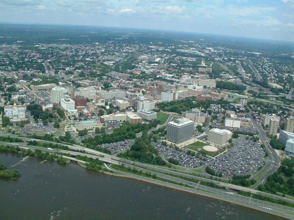
2 Where We Are Los Angeles, CA San Francisco, CA Washington, DC 120 Houston, TX 100 Dallas, TX Chicago, IL Nothern NJ Boston, MA NYC Miami, FL Detroit, MI 85 Area Avg. 80 Phila. PA Southern NJ Annual Hours of Delay per Traveler for Very Large Urban Areas (Year 2002) 20 0 Source: TTI Breakout Data Amongst the 85 Urban Areas studied, Northern NJ ranks 7 th amongst the Very Large Urban Areas in 2002, in terms of Annual Hours of Delay per Traveler
3 Where We Are Obesity Rates in the US, 1989 (left) and 2001 (right) Less than 10% Obese 15-20% Obese More than 25% Obese 10-14% Obese More than 20% Obese The Centers for Disease Control and Prevention (CDC) has labeled America s lack of physical activity as epidemic.

4 Why It s Happening What we thought would happen Traffic Widen 20-Year Forecast Capacity Years
5 Why It s Happening What s really happening Widen Traffic Widen Congestion Capacity Years

6 Why It s Happening
7 FY2007 Project Pool PROGRAM CATEGORIES Congestion Relief, 18% Intermodal Programs, 4% Local Aid, 9% Quality of Life, 2% Capital Program Support, 2% Capital Program Delivery, 8% Roadway Preservation, 20% Bridge Preservation, 28% Safety, 4% Bridge and Roadway Preservation, 5%

8 NJDOT s New Approach to Congestion Relief

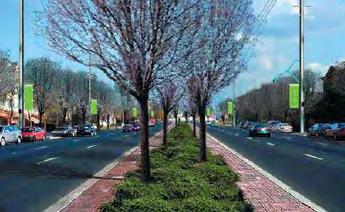
9 NJ FIT: Future in Transportation Creating healthier communities through a more integrated transportation system Mix Land Uses Create More Connections Design Roads in Context Calm Traffic Improve Communication Give Travelers Options Sense of Place Environmental Resources Build For Transit Promote System Efficiency
10
11 Smart Transportation Principles Partner with Communities on Land Use Planning Right-Size State Highway Investments Enhance Network Connectivity Leverage Private Sector Investment Design Context Sensitive Streets
12 Smart Transportation Principles Partner with Communities on Land Use Planning Right-Size State Highway Investments Enhance Network Connectivity Leverage Private Sector Investment Design Context Sensitive Streets

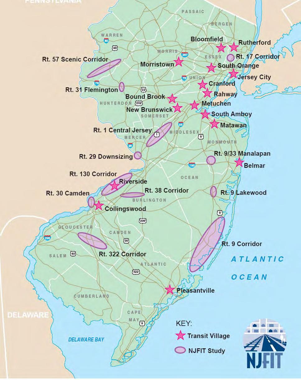
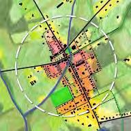
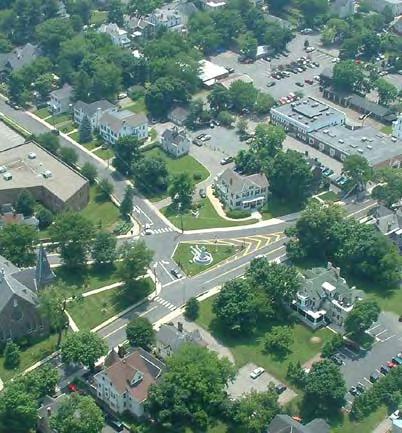
13 Route 57 Corridor Preservation Plan Warren County Key Elements ROUTE 31 3 Morris Canal Shabbecong Creek2 1- Infill in Existing Downtown 2- Enhanced Village 1 ROUTE Neighborhood Infill Strategies Greenway and Parks 5- Agriculture/ Viewshed Preservation 6- New Corridors Demonstration Plan: Borough/Township


14 Development Principles Rural Development Site Design & Parking Street Connectivity Mixed-Use Parks & Open Space
15 Development Guidelines Downtown Commercial Center Village Center Neighborhood Center Rural Neighborhood

16 Design Guidelines for Future Development

17 Design Guidelines: Design Elements and Standards Streets Building Frontages Parking Lighting Parks


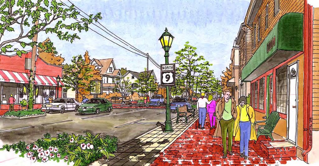
18 Design Elements and Standards Streets and Building Fronts Commercial Street Shop Front Neighborhood Street Porch Front


19 Design Elements and Standards Parking and Signage Safe for Pedestrians Visible to Pedestrians

20 Route 29 Trenton Established Urban Community

21 Route 29 Trenton Established Urban Community

22 Route 29 Trenton Established Urban Community

23 Route 29 Trenton Established Urban Community

24 Route 29 Trenton Established Urban Community A View from the Justice Center
25 Route 29 Trenton Established Urban Community A View from the Justice Center Scheme A Phase 1

26 Route 29 Trenton Established Urban Community A View from the Justice Center Scheme A Phase space parking structure 2 levels Block structure remains unchanged
27 Route 29 Trenton Established Urban Community A View from the Justice Center Scheme A Phase 2

28 Route 29 Trenton Established Urban Community A View from the Justice Center Scheme A Phase 2 New building - 2 stories office & 4 stories residential Garage is expanded to 900 spaces: for Justice Center for Private Development Project works with recommended Route 29 Boulevard street network Garage is wrapped with 4 story residential liner building

29 Route 29 Trenton Urban Boulevard Alternative State Capital War Memorial US 1 Rt. 29 Urban Boulevard Amtrak Approximately 18 AC of Developable Land (floodplain impact to be determined)
30 Route 322 Corridor Land Use and Transportation Study Gloucester County One of the fastest growing regions in NJ Working with municipalities to proactively develop in a more sustainable pattern

31 Route 322 Corridor Land Use and Transportation Study Gloucester County Towns have agreed to concentrate development in centers in order to preserve land, increase walkability, and make transit service more viable
32 Route 322 Developer Design Charrettes Residential & Retail Development Woolwich Township Retail Development Logan Township

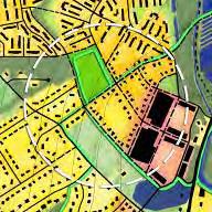
33 Route 33 Hamilton Suburban Community Grayfield Redevelopment

34 Route 33 Hamilton Suburban Community Grayfield Redevelopment


35 Route 1 Regional Growth Strategy Proposed Centers and Nodes by Sub-Area


36 Route 1 Regional Growth Strategy Proposed Centers and Nodes by Sub-Area

37 Mobility & Community Form A Guide to Linking the Circulation and Land Use Elements of the Municipal Master Plan Circulation Neighborhoods Parking Public Places Transit Stops Shopping Streets Natural Environment


38 Mobility & Community Form Planning jointly for mobility and community form shifts the emphasis of the Circulation Element from the movement of vehicles, people and goods to a broader concern with the quality of people's experience in a community.


39 Mobility & Community Form Rural Low Density Town Dense Suburb City Waterfront Corridor Center
40 Smart Transportation Principles Partner with Communities on Land Use Planning Right-Size State Highway Investments Enhance Network Connectivity Leverage Private Sector Investment Design Context Sensitive Streets
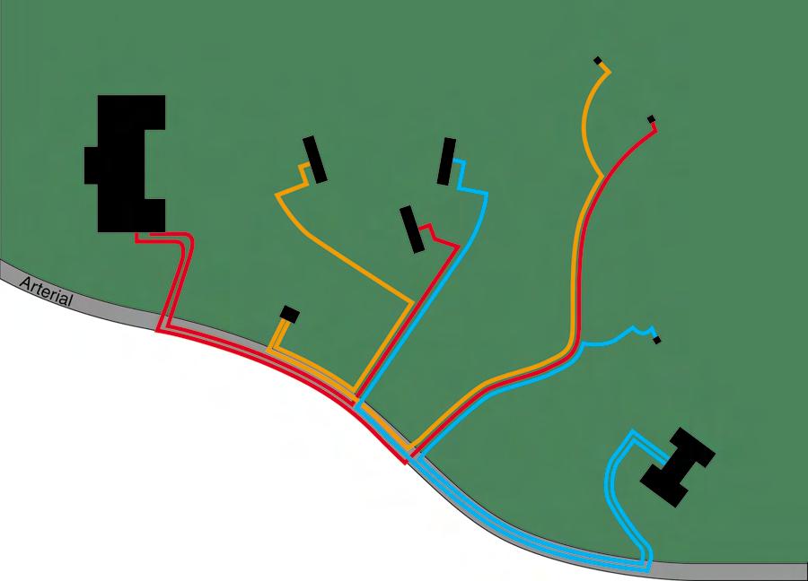
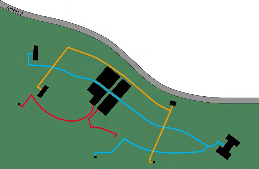
41 Route 31 Bypass Flemington Existing Rt lane grade separated freeway in blue Bypass $ million Route 202 Rt. 12 Flemington Circle

42 Route 31 Bypass Flemington Integrated Transportation and Land Use Framework Plan At-grade South Branch Parkway Network connections provide parallel routes to 202 and 31 Work with property owners to manage access and support approved development plans Create a connected open space system as part of the South Branch River

43 Route 31 Bypass Flemington Parkway alternative Revised project costs, including local grid, is $90 million

44 Route 31 Bypass Parkway Typical Section
45 Route 31 Bypass Flemington Phasing: Route 31 Lane continuity East Main St. intersection Main Street Circle
46 Route 31 Bypass Flemington Phasing: South Branch Parkway
47 Route 31 Bypass Flemington Phasing: Development Streets Fairgrounds Route 202 Commercial Other Future Development

48 Route 31 Bypass Flemington Phasing: Circle to Square Route 12 & Church St. Realignment Circle to Square Additional parallel route to parkway
49 Route 31 Bypass Flemington Phasing: Other Secondary Connections
50 Guidebook for Context Sensitive Solutions in NJ and PA

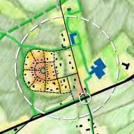
51 Assigns design guidance based on Transportation and Land Use Contexts Collaborative Effort between NJDOT, PennDOT and DVRPC Prescribes Community Involvement & Contribution

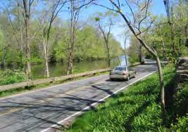
52 Historic Town (Flemington) Suburban (Route 31) Rural (Raritan River)
53 Smart Transportation Principles Partner with Communities on Land Use Planning Right-Size State Highway Investments Enhance Network Connectivity Leverage Private Sector Investment Design Context Sensitive Streets

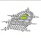
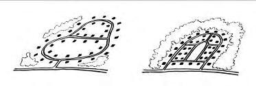
54 Better planning and design will get people out of cars! A grid-like street network creates more direct routes & makes it easier to walk. Illustration: Frank, LD Health & Community Design Slide courtesy of Kate Kraft, RWJF Greenwald, M.J. Transportation Research Record 2001


55 Street Connectivity Advantages of connectivity Provides more direct routes Helps disperse traffic Preserves highway capacity Improves bike/ped mobility Improves emergency response times Resources available for addressing connectivity in local Master Plans Importance of planning for a network of interconnected streets

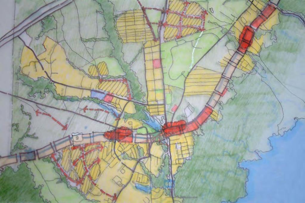
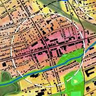
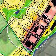
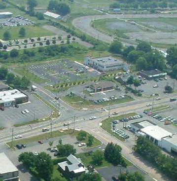
56 NJ Route 9 Ocean County

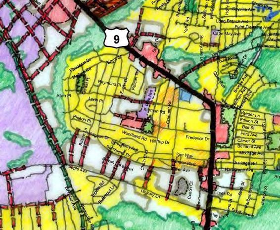
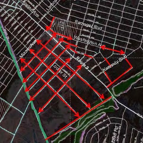
57 Route 9 Network Connections

58 Transportation Network Plan Route 322, Woolwich Township Future Mixed-Use Town Center Woolwich Adult, LLC Development (Residential & Retail)

59 Transportation Network Plan Route 322 Corridor Logan Harrison Woolwich

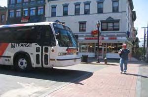
60 Route 33 Hamilton Suburban Community Network Enhancements Connect missing network
61 Smart Transportation Principles Partner with Communities on Land Use Planning Right-Size State Highway Investments Enhance Network Connectivity Leverage Private Sector Investment Design Context Sensitive Streets

62 Route 31 Bypass Flemington Parkway alternative Revised project costs, including local grid, is $90 million $20 million will be provided by private developers Local grid partially created by reshaping internal developer roads

63 Route 322 Corridor Cost Sharing - Woolwich

64 Route 322 Corridor Cost Sharing - Logan

65 Route 322 Corridor Cost Cost Sharing - Richwood

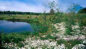
66 New Jersey Department of Transportation Transit Village Initiative

67 Transit Village Initiative Rutherford Station Square Partnered with Township, NJ Transit and Boiling Springs Bank. BSB built a mixeduse bank/office/residential/commuter parking structure adjacent to the Circle.
68 Smart Transportation Principles Partner with Communities on Land Use Planning Right-Size State Highway Investments Enhance Network Connectivity Leverage Private Sector Investment Design Context Sensitive Streets

69 Route 29 Trenton Context-Sensitive Roadways
70

71 Route 29 Trenton Existing Urban Freeway Sullivan Way Route 29 Route 1 Delaware River

72 Route 29 Trenton Urban Boulevard Alternative Route 29 Route 1 Delaware River

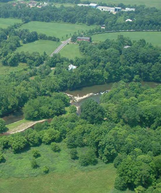
73 NJ Route 9
74 NJ Route 9

75 NJ Route 9

76 NJ Route 9

77 NJ Route 9
78 Rural Cross Section - Existing
79 Rural Cross Section - Proposed
80 Suburban Cross Section - Existing

81 Suburban Cross Section - Proposed

82 Urban Cross Section - Existing

83 Urban Cross Section - Proposed

84 Urban Cross Section - Proposed
85 Urban Cross Section - Proposed

86 Route 9 Visioning Urban/Village Cross Section


87 Route 9 Visioning Suburban Cross


88 Guidebook for Context Sensitive Solutions in NJ and PA


89 Better planning and design will reduce VMT! Reid Ewing, Generalizing from Sacramento: What Is Really Possible, a presentation made at the August 2005 Conference "Towards a Policy Agenda for Climate Change"

90 Better planning and design will reduce VMT! Potential Travel Reductions with Managed Growth: A Sacramento Case Study Gordon Garry, Sacramento Area Council of Governments, a presentation made at the August 2005 Conference "Towards a Policy Agenda for Climate Change"

91
Linking Land Use and Transportation
 Linking Land Use and Transportation NJ s Experience Transportation and Land Use Executive Seminar September 8, 2005 Beckman Center Irvine, California Gary Toth Director, Project Planning and Development
Subarea 4 Indian Creek. Vision The combination of park networks and transportation amenities make Subarea 4 the greenest hub in the Corridor.
 indian creek 180 extends south from 101st Street to I-435. The I-435 and Metcalf intersection is one of the primary intersections in the Kansas City Metro Area. The area includes several residential neighborhoods
12/9/2013. HOLLYWOOD/PINES CORRIDOR PROJECT AMPO 2013 Annual Conference October 24, Our Perspective. Broward.
 HOLLYWOOD/PINES CORRIDOR PROJECT AMPO 2013 Annual Conference October 24, 2013 Our Perspective Broward Fort Lauderdale 1 Broward Metropolitan Planning Organization Fort Lauderdale Fort Lauderdale Skyline
Public Open House #1
 Public Open House #1 TONIGHT S AGENDA Welcome Project Overview The Big Picture The Station Area The Analysis Thoughts about Future Change Breakout Group Discussions Summation / Next Steps Project Overview
Transportation Land Use Integration & Regional Planning. Don Kostelec, AICP Senior Planner, Louis Berger Group February 1, 2010
 Transportation Land Use Integration & Regional Planning Don Kostelec, AICP Senior Planner, Louis Berger Group February 1, 2010 Transportation Land Use Integration DOT-HUD-EPA Sustainable Communities Initiative
INDEPENDENCE BOULEVARD AREA PLAN
 INDEPENDENCE BOULEVARD AREA PLAN Public Meeting October 28, 2008 Tonight s Agenda Introduction 4:00 4:05 Tom Warshauer Presentation 4:05 5:00 Blake Drury Group Exercises 5:00 5:50 All Wrap Up & Next Steps
Pine Island Road Corridor Master Plan
 RECOMMENDED DEVELOPMENT PLAN Figure 9: Del Prado Village District Conceptual Framework The Conceptual Framework (Figure 8) for development of the Pine Island Corridor is to encourage mixed-use development
New Town Mixed Use District
 New Town Mixed Use District Montgomery County Planning Commission 2009 Annual Conference PA Chapter of the American Planning Association October 6, 2009 What is NTMU? More urban style of development Complementary
Citizen Comment Staff Response Staff Recommended Revision Planning Committee
 Citizen Comment Staff Response Staff Recommended Revision Planning Committee Area No. 1: Owner desires retail land uses. Area No. 1a: Owner of two small parcels adjacent to Area No. 1 desires retail land
DRAFT Subject to Modifications
 TREASURE COAST REGIONAL PLANNING COUNCIL M E M O R A N D U M To: Council Members AGENDA ITEM 8 From: Date: Subject: Staff May 19, 2017 Council Meeting Florida Department of Transportation Complete Streets
BROOKHILL NEIGHBORHOOD MODEL ZONING MAP AMENDMENT PREFACE TO APPLICATION
 BROOKHILL NEIGHBORHOOD MODEL ZONING MAP AMENDMENT PREFACE TO APPLICATION June 15, 2015 Revised: August 1, 2016 I. VISION Brookhill is a proposed community based upon the principles of Albemarle County
hermitage town center
 hermitage town center A Community Vision prepared by Strada for The City of Hermitage and The Mercer County Regional Planning Commission January 2007 table of contents introduction 3 design principles
ALTERNATIVES WHAT ELSE IS POSSIBLE?
 ALTERNATIVES WHAT ELSE IS POSSIBLE? VISION STATEMENT Rather than make a ±$250 million investment that will lock in place and exacerbate the current dysfunctional system for at least 5 more decades Let
Complete Streets in Lancaster County
 Complete Streets in Lancaster County PRESENTED BY: Robert Bini, AICP Director for Transportation Planning November 14, 2017 Lancaster County is a growing county of over 534,000 and the bottom line is...
DRAFT. Urban Development Areas Fairfax County. UDA Needs Profile: Tysons Corner 13% Location Characteristics. Socio-Economic Characteristics
 14 Urban Development Areas Fairfax County UDA Needs Profile: Tysons Corner Tysons Corner is located in Fairfax County, surrounded by the town of McLean to the east and Vienna on the west along I-495, the
Stakeholders Advisory Working Groups (SAWGs) Smart Growth and TOD Land Use (#11) SAWG Meeting
 Smart Growth and TOD Land Use (#11) SAWG Meeting") Presentation - Part II Tappan Zee Bridge/I-287 Corridor Project July 21, 2010 Slide 1. David Kooris (Regional Plan Association) welcomed members of the Land Use Stakeholders Advisory Working Groups (SAWGs)
Presentation - Part II Tappan Zee Bridge/I-287 Corridor Project July 21, 2010 Slide 1. David Kooris (Regional Plan Association) welcomed members of the Land Use Stakeholders Advisory Working Groups (SAWGs)
Status Report: MD 355 Project
 Status Report: MD 355 Project OCTOBER 2006 M-NCPPC MONTGOMERY COUNTY PLANNING DEPARTMENT Summary of Community Comments, and break to the Results of the MD 355 Participation Session Brookside Gardens -
MUNICIPAL IMPLEMENTATION TOOL #4: Delaware Valley Regional Planning Commission
 O U T R E A C H D E V E L O P M E N T G R O W T H A W A R E N E S S V I S I O N MUNICIPAL IMPLEMENTATION TOOL #4: R E S I D E N T I A L I N F I L L D E V E L O P M E N T Delaware Valley Regional Planning
Section4 Design Vision & Implementation Plan
 Section4 Design Vision & Implementation Plan W Woodschurch Rd 4.1 Design Focus Areas The Framework Plan is simply the starting point for directing the design and implementation of a wide range of transportation
Somers Point Master Plan
 Somers Point Master Plan Progress Report and Public Meeting August 20, 2014 Master Plan Reexamination Municipal Land Use Law require that all municipalities reexamine their master plan every ten years.
Draft Cary Community Plan Review Part 3: Shop, Engage, Serve, Special Area Plans, Other Updates. October 27, 2015 Police Department Training Room
 Draft Cary Community Plan Review Part 3: Shop, Engage, Serve, Special Area Plans, Other Updates Committee for the Future October 27, 2015 Police Department Training Room AGENDA 1. Welcome and Call to Order
GAINING LEVERAGE through
 GAINING LEVERAGE through FTA s New Starts Land Use Criteria Brigid Hynes-Cherin Associate Administrator FTA Office of Planning and Environment Evaluation and Rating of Transit Supportive Land Use Agenda
Partnerships in Transportation Transit-oriented Development The Return on Investment
 Partnerships in Transportation Transit-oriented Development The Return on Investment David M. Taylor, CNU Senior Vice President National Director, Sustainable Transportation Solutions Transit and Development
Designing INSIDE the Box
 Designing INSIDE the Box Using the ITE/CNU Walkable Urban Thoroughfares Manual to Build Complete Streets National Association of Regional Councils Raleigh, NC June 8, 2015 G. Wade Walker, P.E. Principal
MORRISVILLE TRANSPORTATION PLAN TOWN COUNCIL PRESENTATION AUGUST 22, 2017
 TOWN COUNCIL PRESENTATION AUGUST 22, 2017 SCENARIO PLANNING CORRIDORS Town Hall Drive Baseline + 2 McCrimmon Parkway Baseline + 2 NC 54 Baseline + 2 7 subregion model runs determining carrying capacity
Seneca Meadows. Block 4 Locate office, technology, and medical development adjacent to I Screen views of garage structures from I-270.
 Seneca Meadows Seneca Meadows has an industrial park in its southern end and a mixed-use employment area planned for the north end. The district benefits from extensive I-270 visibility, stream valley
The transportation system in a community is an
 7 TRANSPORTATION The transportation system in a community is an important factor contributing to the quality of life of the residents. Without a sound transportation system to bring both goods and patrons
EAR WORKSHOP FOR PALM BEACH COUNTY LOCAL GOVERNMENTS APRIL 2010 TREASURE COAST REGIONAL PLANNING COUNCIL
 EAR WORKSHOP FOR PALM BEACH COUNTY LOCAL GOVERNMENTS APRIL 2010 TREASURE COAST REGIONAL PLANNING COUNCIL Why Should I Care about Transportation & Land Use? Congestion or Mobility Pick One!! Congestion
Overview of the Plan. The Building Blocks of Centers, Neighborhoods and Network INTERNAL DRAFT
 Overview of the Plan 4 East Davidson Ramah Church Rd June Washam Rd Bradford District Park Bradford Shearer Rd Campus District NC 73 Davidson-Concord North Rocky River This Master Plan projects an approximate
ITEM #8. Regional Smart Growth Program. Regional Smart Growth Program. Presentation Overview. Coast Highway Vision and Stategic Plan.
 Regional Smart Growth Program Economic Development Commission What is Smart Growth? Adopted as part of the Regional Comprehensive Plan (RCP) RCP provides vision for region based on Smart Growth and sustainability
Urban Development Areas Frederick County
 18 Urban Development Areas Frederick County UDA Needs Profile: All UDAs Frederick County, Virginia's northernmost county has two UDA s, surrounded by the City of Winchester and located adjacent to the
Cobb County Design Guidelines Mableton Parkway & Veterans Memorial Highway Community Design Workshop January 12, 2017
 Community Design Workshop January 12, 2017 Agenda Opening Remarks / Introductions Scope of Work Existing Conditions Key Issues / Opportunities VPS Summary Draft Vision & Goal Statement Implementation Concepts
Status Update (2006 vs. Now) Citizen s Advisory Committee February Plan for Prosperity
 Citizen s Advisory Committee February Plan for Prosperity") Status Update (2006 vs. Now) Citizen s Advisory Committee February 2018 Plan for Prosperity 2000 2017 2000 2017 Gardnerville Population 6,000 5,760 5746 5,500 5,000 5,067 5,550 5,165 5,394 5,412 5,250
Status Update (2006 vs. Now) Citizen s Advisory Committee February 2018 Plan for Prosperity 2000 2017 2000 2017 Gardnerville Population 6,000 5,760 5746 5,500 5,000 5,067 5,550 5,165 5,394 5,412 5,250
Hockessin Community Redevelopment Plan
 Hockessin Community Redevelopment Plan 3.1 Introduction The Community Redevelopment Plan for the Village of Hockessin is the result of the people s vision for a distinct village center that serves as the
From Partnership to Reality
 From Partnership to Reality New Partners for Smart Growth February 4, 2011 What is Sustainable (human) Development? It is development that meets the needs of the present without compromising the ability
Transportation Working Team Duane Diggs, Co-Chair (VOICE Buffalo) Kelly Dixon, Co-Chair (GBNRTC) Paul Ray, Facilitator (UB Regional Institute)
 Kelly Dixon, Co-Chair (GBNRTC) Paul Ray, Facilitator (UB Regional Institute)") towards a more sustainable Buffalo Niagara Transportation Working Team Duane Diggs, Co-Chair (VOICE Buffalo) Kelly Dixon, Co-Chair (GBNRTC) Paul Ray, Facilitator (UB Regional Institute) Agenda Welcome,
towards a more sustainable Buffalo Niagara Transportation Working Team Duane Diggs, Co-Chair (VOICE Buffalo) Kelly Dixon, Co-Chair (GBNRTC) Paul Ray, Facilitator (UB Regional Institute) Agenda Welcome,
Rezoning Issues Setting a Foundation for Zoning Decisions
 Rezoning Issues Setting a Foundation for Zoning Decisions City Council Workshop May 2, 2016 Agenda Goal Need actionable items and sequence of steps Foundation for Zoning Decisions Council Workshop Discussion
S T V. P E R F O R M A N C E M A T T E R S. highways + bridges
 S T V. P E R F O R M A N C E M A T T E R S. highways + bridges STV s bridge and highway assignments traverse major metropolitan areas, cities and towns as well as rural corridors. Reflecting the tenets
Equitable Growth Through TOD Planning
 Equitable Growth Through TOD Planning Community Meeting # 2 November 2017 Goals Objectives Extend investment from downtown Connect neighborhoods physically and economically Enhance places based on local
Urban Development Areas Bedford County
 5 Urban Development Areas Bedford County UDA Needs Profile: All UDAs Bedford County has designated two UDAs: areas just outside the Bedford City Limits (generally to the south and east of the city) and
Rio/29 Small Area Plan. Design Plan & Implementation Framework Open House - January 25, 2018
 Rio/29 Small Area Plan Design Plan & Implementation Framework Open House - January 25, 2018 MEETING PURPOSE PRESENTATION 1. Orient to the updated design plans 2. Introduce implementing options 3. Explain
WRAPS Site Studies. Cooper, Robertson & Partners. December 8, Page 1
 WRAPS Page 1 Realigned N. Pierce Street & Extension Base 1 FOR PRESENTATION TOTAL GSF OFFICE 346,000 RESIDENTIAL 795,000 POTENTIAL RETAIL 40,000 TOTAL 1,181,000 795 DU Open Space (Development Parcels)
Urban Development Areas Albemarle County
 1 Urban Development Areas Albemarle County UDA Needs Profile: All UDAs Albemarle County has two UDAs: the Pantops UDA located east of the Rivanna River and the City of Charlottesville, and Places 29 South,
PLAN ELEMENTS WORKSHOP. April 5, 2016
 PLAN ELEMENTS WORKSHOP April 5, 2016 needs more housing. But there is no one-size fits-all solution. Every neighborhood has its own character. In some places, density is not only appropriate it is badly
Niagara GO Hub and Transit Stations Study
 Niagara GO Hub and Transit Stations Study Public Open House #2 June 2017 Study Purpose The purpose of this study is to prepare four key deliverables for each station area: 1. Work with Metrolinx to provide
Proposed Comprehensive Plan Strategies DRAFT for discussion June 28, 2017
 Proposed Comprehensive Plan Strategies DRAFT for discussion June 28, 2017 Land Use Rural Areas Refine the Farm and Forest area (FF) Update FF boundaries to account for existing lots less than five acres
City of Meriden Harbor Brook Flood Control Project Overview
 City of Meriden Harbor Brook Flood Control Project Overview Updated August 2013 OVERVIEW The center of Meriden, including the HUB site is the low point of the town which is ringed by basalt ridges. Running
Implementation Guide Comprehensive Plan City of Allen
 Implementation Guide 2030 Comprehensive Plan City of Allen DRAFT 2015 Implementation Guide Allen 2030 Comprehensive Plan INTRODUCTION The Comprehensive Plan serves as a guide for the growth and development
Pattern 7: Natural Environment
 Pattern 7: Natural Environment The landscape features of the city: the vegetation or the water, were often noted with care and with pleasure [People] were sharply aware of the few green oases in their
Developer s Program. The Station at East 54
 Developer s Program The Station at East 54 Existing Conditions The Station at East 54 is proposed for a 1.12 acre site at the northeast corner of Hamilton Road and Prestwick Road, tucked between the East
495/MetroWest Development Compact Plan Citizen Planner Training Collaborative Conference. March 17, 2012
 495/MetroWest Development Compact Plan Citizen Planner Training Collaborative Conference March 17, 2012 Project Process Local and Regional Priority Areas Growth Scenarios Transportation Investment Categories
MONTGOMERY COUNTY METRO STATION AREA DESIGN CHARRETTE
 MONTGOMERY COUNTY METRO STATION AREA DESIGN CHARRETTE Shady Grove Metro Station Area Charrette Closing Presentation October 25-28, 2000 MONTGOMERY COUNTY, MD M-NCPPC Design Collective, Inc. Architects
Secrest Short Cut and Monroe Expressway Small Area Plan AUGUST 29, 2018
 Secrest Short Cut and Monroe Expressway Small Area Plan AUGUST 29, 2018 Background and Process Monroe Expressway will be open by the end of 2018 Union County and Indian Trail identified a need to revisit
SECTION TWO: Urban Design Concepts
 SECTION TWO: Urban Design Concepts The Gardnerville Plan for Prosperity shapes economic opportunities presented by regional growth. The Urban Design Concepts provide policies and concepts for land use,
Corridor-Level Approaches to Creating Transit-Oriented Districts
 Corridor-Level Approaches to Creating Transit-Oriented Districts Dena Belzer Strategic Economics and Center for Transit-Oriented Development August 2011 5-year old partnership dedicated to improving practice
SH 199 Corridor Master Plan. Community Meeting No. 2 May 31, 2017
 Community Meeting No. 2 May 31, 2017 Transportation Projects On or Near SH 199 SH 199 from 0.3 miles south of FM 1886 to south end of Lake Worth bridge Construct freeway mainlanes and frontage roads 10-Year
Presentation to Town Council in association with Kubilins Transportation Group Rose & Associates Equinox Environmental
 Presentation to Town Council 03.03.09 in association with Kubilins Transportation Group Rose & Associates Equinox Environmental Vision Statement: Boone 2030 is...a friendly, vibrant, attractive community...financially,
DRAFT ROOSEVELT ROAD. District Recommendations. Figure 5.23 The Roosevelt Road Corridor
 CHAPTER 5 Figure 5.23 The Road Corridor Road will develop as a mixed-use corridor, emphasizing regional retail, west of the river and mixed-use development east of the river. KEY RECOMMENDATIONS 1. High
Delaware River Port Authority Southern New Jersey Waterfront Master Plan
 Delaware River Port Authority Southern New Jersey Waterfront Master Plan Press Conference January 11, 2006 Agenda Plan Purpose & Objectives Market Demand Residential Forecast Maritime Forecast Waterfront
THE LEADER IN MANAGED SECURITY
 THE LEADER IN MANAGED SECURITY THE KASTLE DIFFERENCE Through managed security services, protection of your people and your property is handled for you. Managed security is the preferred method for keeping
Making Transit Oriented Development Work For Boonton, NJ
 Making Transit Oriented Development Work For Boonton, NJ Bloustein School of Planning and Public Policy Studio Dan Burton Loannie Dao Webster Slater Brandon Williams Ian Watson Maria Laham Nicola Mammes
Downtown Elkton Station Area Plan, Elkton, MD. Difficult enough to get support for new starts challenge to fund Houston transit
 Difficult enough to get support for new starts challenge to fund Houston transit More difficult to build Community Support for dense development at station areas Major Concerns: Traffic, Property values,
7Page 72 CLEMMONS COMMUNITY COMPASS 5 DEVELOPMENT AND GROWTH
 5 Development and Growth WHHAATT DDOOEESS IITT I MMEEAANN TTOO BBEE SSUUSSTTAAI IINNAABBLLEE?? Many communities throughout the U.S. are taking on the challenge of becoming more sustainable. But what exactly
3 Vision and Goals. Vision and Goals. Blueprint for Bloomsburg. Vision. Town of Bloomsburg Comprehensive Plan,
 Vision and Goals 3 Vision and Goals Citizens of the Town of Bloomsburg clearly value their natural and cultural heritage, the walkable, mixed use pattern of downtown, the access to education, and the community
Silver Line CPAM UPDATE. Transportation and Land Use Committee October 14, 2016
 Silver Line CPAM UPDATE Transportation and Land Use Committee October 14, 2016 Purpose Recap Project History and Map Changes Provide Overview of CPAM Components Discuss Transportation Impacts Discuss Fiscal
Coast Highway Oceanside, California
 Coast Highway Oceanside, California Coast Highway Plan Zones What We ve Heard - Walkable/Bikeable Community (Senior and Child Friendly) -Wider Sidewalks -Street Trees -Traffic Calming -Bike Lanes -Paseos
124 Subarea Visions. Vision Plan. A. Nelessen Associates, INC I Visioning I Planning I Urban Design
 Subareas 124 Subarea Visions The next seven sections describe specific recommendations tailored to each subarea. Each subarea is discussed separately except for certain aspects of 95th Street and Antioch
NEIGHBORHOOD DESIGN ELEMENT
 NEIGHBORHOOD DESIGN ELEMENT INTRODUCTION The following recommendations constitute an urban design oriented "neighborhood analysis" of Plantation. It is an optional Comprehensive Plan Element. The five
THE 355/270 CORRIDOR:
 THE 355/270 CORRIDOR: Strategic Ideas for Sustaining a Livable Work Place Project Summary ACCESS LIFE DESIGN HEALTH WORK Montgomery County Planning Department The Maryland-National Capital Park and Planning
U T D N o r t h C a m p u s T O D and D o w n t o w n D e n t o n T O D
 U n i v e r s i t y o f T e x a s a t D a l l a s C i t y o f R i c h a r d s o n U T D N o r t h C a m p u s T O D and D o w n t o w n D e n t o n T O D Rick Leisner, AICP Assistant Director of Development
Corridors. Re-vitalize our Corridors and Gateways
 Corridors Re-vitalize our Corridors and Gateways Artist s rendering from the 287 Strategic Plan, 2015 Corridors are the major throughways of Loveland but they also provide important commercial, community
40 Years of Smart Growth Arlington County s Experience with Transit Oriented Development in the Rosslyn-Ballston Metro Corridor
 40 Years of Smart Growth Arlington County s Experience with Transit Oriented Development in the Rosslyn-Ballston Metro Corridor A presentation by the Arlington County Department of Community Planning,
Nader Obied Abd al raheem hathat. Dr. Farid S. Al-Qeeq
 Submit from Nader Obied Abd al raheem hathat Submit to Dr. Farid S. Al-Qeeq DEC. 2010 NEW URBANISM : is the most important planning movement this century, which emerged during the late 1980s and early
b r a n c h av e n u e tr a n s it co r r i d o r r e vita lization pl a n a m o d el fo r s u b u r ban retro fit
 b r a n c h av e n u e tr a n s it co r r i d o r r e vita lization pl a n a m o d el fo r s u b u r ban retro fit P R I N C E G EO RG E S CO U NT Y, M D ADO PTED 0 p R O J E C T C AT E G O R Y : U R B
TOD IMPLEMENTATION BEST PRACTICE TOOLBOX Leveraging Transit for City Shaping
 arrington.gb@gmail.com gbplacemaking.com THE TOD I LIVE IN ~ PORTLAND, OR TOD IMPLEMENTATION BEST PRACTICE TOOLBOX Leveraging Transit for City Shaping BEST PRACTICE TOPICS Timing & transit Parking & retail
Reshaping The City: New Visions for Urban Transport. Trent Lethco, Associate Principal Allison Davis, Senior Planner Vicent Risica, Planner Arup
 Reshaping The City: New Visions for Urban Transport Trent Lethco, Associate Principal Allison Davis, Senior Planner Vicent Risica, Planner Arup Agenda Where are we now? Rethinking infrastructure? Cities
Small Area Plan. South Gateway
 Small Area Plan Adopted May 12, 2008 South Gateway Purpose. The South Gateway Small Area Plan defines the City s expectations for the future of the southern entrance to the City at Interstate 85 and Highway
Designing Walkable Urban Thoroughfares: A Context Sensitive Approach
 Designing Walkable Urban Thoroughfares: A Context Sensitive Approach Communities Want: Flexibility Compatibility with adjacent land uses Balanced land use/transportation functions Safe and attractive streets
Atlanta BeltLine Subarea 3 Master Plan Update
 Atlanta BeltLine Subarea 3 Master Plan Update April 14, 2018 Workshop Meeting 1 22 miles, connecting 45 neighborhoods 22 MILES of transit 46 MILES of streetscapes and complete streets 33 MILES of urban
PRELIMINARY REPORT. HIGHWAY 18 CORRIDOR NEIGHBORHOOD PLAN VILLAGE OF DOUSMAN November, 2014
 PRELIMINARY REPORT HIGHWAY 18 CORRIDOR NEIGHBORHOOD PLAN VILLAGE OF DOUSMAN November, 2014 This preliminary report presents the initial recommendations for land use within the Highway 18 corridor along
Draft Plan Recommendations
 Draft Plan Recommendations Sponsored by Henry County and the Atlanta Regional Commission T S W TEAM Tunnell-Spangler-Walsh & Associates URS Corporation Marketek Study Area 1,300 acres Includes parts of
CHAPTER 1. Ms. Guajardo s Class - Central Elementary CH 1 1
 INTRODUCTION CHAPTER 1 Ms. Guajardo s Class - Central Elementary CH 1 1 1.1 SETTING South Centre City is a linear corridor south of Downtown Escondido paralleling Centre City Parkway and South Escondido
Pattern 3: Parking. Parking in great amounts is not a characteristic of great streets. Allan Jacobs. Community Form and Mobility Principles
 Pattern 3: Parking Parking in great amounts is not a characteristic of great streets. Allan Jacobs Parking is an integral part of the municipal circulation system and is often as important as roads in
DOMINION BOULEVARD CORRIDOR STUDY AND ECONOMIC DEVELOPMENT STRATEGIC PLAN A MODEL FOR CHESAPEAKE S FUTURE
 DOMINION BOULEVARD CORRIDOR STUDY AND ECONOMIC DEVELOPMENT STRATEGIC PLAN A MODEL FOR CHESAPEAKE S FUTURE Overview I. Draft Plan Process II. Draft Plan Overview a. Market Analysis b. Master Land Use Plan
Table of Contents. Elm Avenue Improvement Plan City of Waco, Texas. Introduction 1. Existing Context 1 Figure 1 2.
 Table of Contents Introduction 1 Existing Context 1 Figure 1 2 Plan Guidelines 3 Future Urban Form 4 The West-End 4 Main Street 6 The East-End 7 Figure 2 9 Public Improvement Recommendations 7 General
Exxon Service Station
 Exxon Service Station Environmental Impact Visual Analysis San Ramon/Blackhawk neighborhood service station. Design Community and Environment 5/97 Construction of computer models, application of material
MODULE 3 RESTRUCTURING THE ENVIRONMENT
 MODULE 3 RESTRUCTURING THE TOWNSHIP PHYSICAL ENVIRONMENT FOCUS OF THE MODULE The physical and spatial (locational) characteristics that prevent townships from developing Levels of intervention: Things
Jackson Highway Master Plans
 Jackson Highway Master Plans West Jackson Highway Master Plan (PLNP2008-00240) Jackson Township Specific Plan (PLNP2011-00095) NewBridge Specific Plan (PLNP2010-00081) Mather South Community Master Plan
South Fulton Parkway Transit Feasibility Study
 South Fulton Parkway Transit Feasibility Study Study Purpose To conduct a high level assessment of potential transit improvements in the South Fulton Parkway Corridor through the evaluation of various
City of Tacoma Planning and Development Services
 Agenda Item E-1 City of Tacoma Planning and Development Services To: Planning Commission From: Elliott Barnett, Planning Services Division Subject: Tacoma Mall Regional Center Subarea Plan and EIS Meeting
4.1.3 LAND USE CATEGORIES
 4.1.3 LAND USE CATEGORIES a. City Center District The City Center District incorporates the existing character and mix of uses in downtown Belmont to encourage redevelopment and new development in keeping
FY 2005 TRANSPORTATION CAPITAL PROGRAM
 Camden County Civic Center Access Study, Pennsauken 03340 This project will address operational and access improvements on Routes 30, 73 and 90 related to the Crossroads redevelopment project around the
TORTI GALLAS and partners, inc. How to Retrofit Your Suburb to Make a Downtown
 How to Retrofit Your Suburb to Make a Downtown April, 2010 Where to Start What should the Town look like? How do I attract new residents, businesses and visitors?? Should we preserve our heritage? How
Southern Gateway Project and Public Green
 Southern Gateway Project and Public Green Transportation and Trinity River Project Committee May 23, 2016 Purpose of Presentation Provide the history and an overview of the Southern Gateway Project (SGP)
40 Years of Smart Growth Arlington County s Experience with Transit Oriented Development in the Rosslyn-Ballston Metro Corridor
 40 Years of Smart Growth Arlington County s Experience with Transit Oriented Development in the Rosslyn-Ballston Metro Corridor A presentation by the Arlington County Department of Community Planning,
Broken Arrow Comprehensive Plan Update Public Workshop Meeting #3 January 23,
 Broken Arrow Comprehensive Plan Update Public Workshop Meeting #3 January 23, September 25,2018 2018 26 April 2016 AGENDA 1. Status Presentation - Charrette Recap - Proposed Vision Framework - Preliminary
INDEPENDENCE BOULEVARD AREA PLAN. June 24, 2008
 INDEPENDENCE BOULEVARD AREA PLAN Public Meeting #1 June 24, 2008 Tonight s Agenda Introduction Welcome and Ground Rules Overview Presentation Purpose of the Plan What Brings Us Here? A Tour of the Corridor
Definitions. Average Daily Traffic Demand (ADT): The actual number or projected number of cars that pass a point in a 24-hour period.
: The actual number or projected number of cars that pass a point in a 24-hour period.") Definitions Access Management: A combination of physical techniques and transportation policies used to control the flow of traffic between roads and the surrounding lands. Alternative City Form Scenarios:
Definitions Access Management: A combination of physical techniques and transportation policies used to control the flow of traffic between roads and the surrounding lands. Alternative City Form Scenarios:
Welcome. Comprehensive Plan & Transportation Plan Open House November 7, 2012
 Welcome Comprehensive Plan & Transportation Plan Open House November 7, 2012 Agenda Proposed future land use plan Comprehensive Plan strategies Traffic forecasts Future traffic operations Possible future
9 CITY OF VAUGHAN OFFICIAL PLAN AMENDMENT NO BOCA EAST INVESTMENTS LIMITED
 9 CITY OF VAUGHAN OFFICIAL PLAN AMENDMENT NO. 631 - BOCA EAST INVESTMENTS LIMITED The Planning and Economic Development Committee recommends the adoption of the recommendations contained in the following