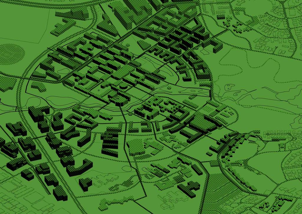
UNIVERSITY TOWN NEIGHBOURHOODS 5.5 HOUSING MELBOURNE CAMPUS MASTER PLAN 2014
|
|
|
- Eunice Horn
- 5 years ago
- Views:
Transcription
1
.")
2 EXISTING CONDITIONS & VISION NEIGHBOURHOOD VISION The provision of on-campus housing into the future will continue to be an important element of the La Trobe University experience. A long-term target of 15% of students housed on the campus will be pursued. This equates to approximately 6,000 beds on campus (derived from an indicative student population target of 40,000 EFTSL). Staff, short-term serviced apartment and hotel, specialist and private housing will also be located throughout the University Town. KEY ATTRIBUTES & SUPPORTIVE ELEMENTS At approximately 15.5 hectares (7% of the campus landholding), the Housing Neighbourhood has the smallest area of all University Town Neighbourhoods. Currently the neighbourhood accommodates all of the University s on-campus Colleges (Glenn, Menzies and Chisholm). The Colleges have had little change since they were first built, as early as The total GFA of the three colleges is 31,290 sqm: Glenn College: 12,760 sqm GFA. Menzies College (and MCA): 11,790 sqm GFA. Chisholm College: 6,740 sqm GFA. Existing built form within the Housing Neighbourhood will be redeveloped and consolidated to optimise dwelling density, while still respecting the native Australian landscape setting as prescribed by the original campus Master Plan. The revitalised Indoor Sports Centre will become a key element of a new network of small-scale recreation and neighbourhood centres that are dispersed throughout the Housing and Town Centre Neighbourhoods, catering for the anticipated growth in student and staff population, general employment and University Town accommodation. Redevelopment of the Union Building to accommodate a range of facilities to support the vitality of the student body, and particularly the surrounding residential population, will be pursued. It will be important to preserve the building s valued connections to the University, its ceremonies and cultural memory. The Housing Neighbourhood will provide strong links into surrounding neighbourhoods, helping to connect the traditionally isolated Core Campus with the Eastern Interface and R&D Park to the east and south-east. New and redeveloped built form in the precinct will provide active interfaces to the public realm and pedestrian networks, and will seamlessly integrate with bushland landscape spaces and water sensitive urban design elements. The relationship between housing and the environment will be highlighted with transitions from key pedestrian and eco-corridors to housing developed via transitional landscaped semi-private landscaped zones. 170 This area of the campus enjoys convenient access to Core Campus activities. The Union Building is located in the south of the neighbourhood, to the immediate north of Chisholm College. Although the building is in need of general refurbishment, it can hold events for 800 1,000 people, making it a unique facility in the north. The facility is already a focus for external group activities on campus. The campus existing Indoor Sports Centre is located in the north of the neighbourhood. While it is now reaching its capacity and requires upgrade, it provides a valued service to the University s students, especially those living on campus. The Infrastructure and Operations Group Maintenance Buildings are located to the north of the R&D Park and are in reasonable condition. The La Trobe University Museum of Art (LUMA) is located in the ground floor of Glenn College, with a Moat frontage. LUMA manages the University s Art Collection, which is one of the most significant University collections in the country. The welcoming and open feel of the Housing Neighbourhood, specifically its bushland character, is a key attractor for many students who live on campus, especially those from regional backgrounds. The Housing Neighbourhood s proximity to the Moat network is a valued aspect for on-campus residents m

3 2 1 BARRIERS TO CHANGE 70% of residents at the Melbourne campus are undergraduate (1st and 2nd year) and many come from regional Victoria. The Colleges within the Housing Neighbourhood currently cater for the undergraduate cohort. This College typology leads to a fairly uniform residential cohort. To build a more vibrant residential community, a greater variety of residents and accommodation types is required. The Colleges can become quite isolated at night as much of the campus closes after 6pm. After hours there is very little opportunity for residents to access on-campus facilities and perceived safety is an issue. This is also the case at weekends. The back-of-house areas for residential services require coordination to improve efficiency. It is clear that there is a demand for housing on campus, however much of the current stock needs to be modernised to suit evolving student expectations. Due to their construction in decades prior, the majority of on-campus dwellings will need to be upgraded in the short to medium-term. Currently the Union building is underutilised and in need of investment. The facility is considered to be tired and requires renovation or replacement (a large investment in either event). The Union Building is perceived as too far away from the Core Campus and cut off from other activities. The existing Indoor Sports Centre requires more space for a broad range of programmed and nonprogrammed activities. LUMA is perceived to be hidden and is largely inaccessible to the general public. MASTER PLAN TACTICS Diversify the current provision of housing within the University Town, both in terms of dwelling typology and residential cohort. Ensure existing residential stock is upgraded in the short to medium-term to meet changing student housing expectations. Increase the on-campus residential population by building additional dwellings within the Housing Neighbourhood and expanding the pattern of residential development north into the Town Centre. Pursue infill development within the neighbourhood, without compromising the established native character of the area. Ensure ground floor development provides community facilities to support residents as well as to increase visible activity within the Housing Neighbourhood to improve safety and security during the day and night. Improve pedestrian and bicycle connections throughout the neighbourhood. Ensure that new and redeveloped built form within the neighbourhood actively engages with the Moat (Ecocorridor network). Relocate LUMA to a more prominent regionally focussed site in the medium to long-term m Existing University building New built form Primary Pedestrian Network The La Trobe Tan KEY DEVELOPMENTS 1 2 SPORTS CENTRE Redevelop the Indoor Sports Centre as an extended hour and diversified facility that is better engaged with the adjacent Colleges and Eco-corridor context. The Centre will cater for on-campus residents and campus neighbours, such as the residents of Springthorpe and the new Polaris Town Centre development. THE UNION BUILDING The Union Building will be redeveloped to accommodate a range of facilities that support the vitality of the student body, and particularly the growth of the surrounding on-campus residential population. The Union Building will also act as a bridge between Core Campus and R&D Park activities, providing places for formal and informal teaching, learning and research. 171


4 NEIGHBOURHOOD LANDSCAPE PLAN LANDSCAPE CONTEXT The Housing Neighbourhood was largely developed in the 1970s when the campus was originally conceived. The buildings reflect the architecture of the time, and while the landscape surrounding these is not of notable significance, the bushland character is valued by staff and students. There are extensive stands of large eucalypts around the neighbourhood, with pathways snaking through the grounds. LANDSCAPE VISION The vision for the Housing Neighbourhood is to provide a refreshed and cohesive landscape to the precinct, surrounding the existing and proposed buildings. The existing high quality trees will be retained and enhanced by additional low story planting. The provision of garden beds throughout the neighbourhood will help to contain otherwise endless open spaces. This will change the perception of the landscape, and the way it is used. Pathways will be created to provide clear and direct links to other parts of the campus, for both pedestrians and cyclists. The pathways will be well lit and of high quality paving and amenity. Between existing and proposed buildings there is an opportunity to create residential courtyards for the students. Existing courtyards shall be refreshed, and new courtyards will be tailored to meet user requirements. The Housing Neighbourhood will be primarily native and local plant species, reinforcing the broader landscape of the University Town m Urban plazas and pathways Passive recreation areas Proposed garden bed Existing built form Proposed built form Water bodies


5 1 COURTYARDS Within the Housing Neighbourhood the development of new and additional student housing will allow for the inclusion of high quality college courtyard spaces. The spaces will be contained by built form providing sheltered and secluded open spaces for the students/residents. The courtyards will include high quality amenities, such as seating and barbecues, ensuring that students can utilise these spaces after hours, encouraging healthy social interaction. UNIVERSITY TOWN NEIGHBOURHOODS 2 CONNECTIONS The Housing Neighbourhood will be connected to adjacent neighbourhoods by safe and easily accessible pathways. New pathways will connect into existing and proposed path networks to promote walking and cycling throughout the University Town. The green connections will be high amenity, treed spaces, which provide shelter from wind and sun. They will be well lit, and have passive surveillance from surrounding buildings so paths are safe for after-dark use. 173
6 DEVELOPMENT CONTROLS BUILT FORM HEIGHT College development to be 4-6 levels, matching the character of the Core Campus and creating a higher density product in the neighbourhood. Indoor Sport Centre redevelopment should match existing heights of 1-3 levels. ALIGNMENT & SETBACK Alignment along the Primary and Secondary Pedestrian Networks, providing a strong and active built form edge. ENTRANCE Primary entries to buildings should address the Primary Pedestrian Network. Secondary entries will be highly visible and located on main pedestrian routes. Primary entries will be co-located and align with other adjacent building entries. Consider how the location of interior vertical circulation and collective study, lounge and recreation areas can be located to enrich the engagement of buildings with the adjoining pedestrian network and shared spaces. H1 ISC H3 H2 MS H4 H5 Redevelopment and extensions must maintain alignment and layout characteristics of the existing built form. New development must address the street where appropriate to encourage active engagement. VIEW CORRIDORS Major view corridors will align with the Primary Pedestrian Network. Sight lines will be maintained for visual connection between the Core Campus and R&D Park. Long sight lines will be achieved through pathway and landscape initiatives that place a high emphasis on pedestrian and cycling safety and security. There are limited highly visible sites into this neighbourhood. The Kingsbury Drive view line should be maximised and clear. Ensure service entries to buildings are appropriately placed away and hidden from activated edges. INTERFACES North: development needs to both respect and engage with the sensitive edge of the Wildlife Sanctuary. South/east: this interface abuts the R&D Park. This boundary will be permeable and legible, ensuring connections between the R&D Park and the Core Campus are developed and clear. West: the Eco-corridor interface will be developed as a blurred boundary, allowing pedestrian access, while still protecting the Moat environs. U GC MC H11 H9 H10 H8 H6 H7 ACTIVATED FRONTAGES Activation of facades will be prioritised along the Primary Pedestrian Network. H13 H14 H12 Ground floor level permeability will be encouraged in new development to ensure activation of all frontages m 1-3 level development Activated edges 4-6 level development View corridors 7-10 level development Sight lines Building entries Building alignments Primary pedestrian network
7 NEW DEVELOPMENT Name Programme Levels GFA (sqm) Notes H1 Sports Extension 2 1,410 H2 Sports Extension 2 2,316 H3 Sports Extension 2 3,136 H1 ISC H3 H2 MS H4 H5 H4 Services 4 4,376 H5 Services 4 4,540 H6 College Style Housing 4 9,864 H7 College Style Housing 4 7,844 H8 College Style Housing GC H6 H9 College Style Housing H10 College Style Housing H11 College Style Housing MC H7 H12 College Style Housing H13 Academic Iconic H14 College Style Housing H8 Total 82,842 H9 U H11 H10 H13 H14 H m Academic Development Research Development Community Development Residential Development Sports Development Iconic Development Commercial Development Primary pedestrian network 175

8 NEIGHBOURHOOD VISUALISATION Extend the Eco-corridor landscape to engage with residential development allowing improved amenity for residents Repurposed Moat Drive will be a main pedestrian and bicycle pathway connecting facilities outside the Moat Improved lighting around the pedestrian network The Moat Further planting and revegetation of the Eco-corridor Moat bridge to Sylvia Walton Building beyond The La Trobe Tan 176 Eco-corridor

9 Encourage opportunities for passive surveillance to improve security Setback of student residential upper levels to respect the adjacent Ecocorridor Undergraduateoriented housing UNIVERSITY TOWN NEIGHBOURHOODS Indicative section location College Circuit links new housing development in the neighbourhood. Multi purpose academic spaces ensuring activity at ground level, creating human scale spaces and an active interface to the removed pedestrian networks. 0 5m 10m 177

10 178
UNIVERSITY TOWN NEIGHBOURHOODS 5.2 ECO-CORRIDOR MELBOURNE CAMPUS MASTER PLAN 2014
 5.2 ECO-CORRIDOR 37 ECO-CORRIDOR EXISTING CONDITIONS & VISION NEIGHBOURHOOD VISION Investment in the Eco-corridor Neighbourhood will signify the University s commitment to supporting local ecology and
Chapter 13 Residential Areas: Appendices APPENDIX 1 Residential Areas
 Chapter 13 Residential Areas: Appendices Page 1 Chapter 13 Residential Areas: Appendices APPENDIX 1 Residential Areas Design Code for Intensive Housing INTRODUCTION DESIGN ELEMENTS A NEIGHBOURHOOD DESIGN
Memorial Business Park Site. Proposed Future Development. Design guidelines. August
 Memorial Business Park Site Proposed Future Development Design guidelines August 2014 www.designenvironment.co.nz 0064 3 358 3040 Contents 1.0 Background 1.1 Introduction 3 1.2 Objectives 4 2.0 Context
STRATEGIES INTRODUCTION
 4.0 STRATEGIES INTRODUCTION MASTER PLAN STRATEGIES MASTER PLAN THEMES The Master Plan Strategies section establishes campus-wide themes and strategies that underpin the Melbourne Campus Vision for the
ACKNOWLEDGEMENTS PROJECT TEAM
 ACKNOWLEDGEMENTS La Trobe University proudly acknowledges the Dja Dja Wurrung people, the traditional custodians of the land upon which the Bendigo Flora Hill campus is located. We recognise that Indigenous
URBAN DESIGN BRIEF URBAN DESIGN BRIEF 721 FRANKLIN BLVD, CAMBRIDGE August 2018
 URBAN DESIGN BRIEF URBAN DESIGN BRIEF 721 FRANKLIN BLVD, CAMBRIDGE August 2018 DESIGN BRIEF CONTENTS PART A 1.0 INTRODUCTION 2.0 DESCRIPTION & ANALYSIS OF SITE CONTEXT 3.0 DESIGN CONSTRAINTS AND OPPORTUNITIES
University of Saskatchewan CAMPUS MASTER PLAN. Senate Meeting Preliminary Presentation. April 21, 2018 DIALOG ECS DA WATT
 University of Saskatchewan CAMPUS MASTER PLAN Senate Meeting Preliminary Presentation April 21, 2018 DIALOG ECS DA WATT project process presentation agenda Stakeholder Engagement Project Control phase1
Urban Design Guidelines
 Urban Design Guidelines These Urban Design Guidelines comprise the Key Design Objectives below, the Roads Design Guidelines overleaf and Neighbourhood Framework Plans. Together with Section 3: Urban Design
SCHEDULE 12 TO THE DESIGN AND DEVELOPMENT OVERLAY GLEN WAVERLEY ACTIVITY CENTRE STRUCTURE PLAN
 DD/MM/YY Proposed C120 SCHEDULE 12 TO THE DESIGN AND DEVELOPMENT OVERLAY Shown on the planning scheme map as DDO12. GLEN WAVERLEY ACTIVITY CENTRE STRUCTURE PLAN 1.0 Design objectives DD/MM/YY Proposed
97 Lea Bridge Road, Leyton, E10 7QL London Borough of Waltham Forest December 2015
 97 Lea Bridge Road, Leyton, E10 7QL London Borough of Waltham Forest December 2015 Public Realm and Landscape Proposals LEA BRIDGE ROAD, WALTHAMSTOW Public Realm & Landscape Proposals BDP(90)RPT001 December
Derry Green Corporate Business Park
 Town of Milton Derry Green Corporate Business Park Urban Design Guidelines BMI/Pace - June 2010 Draft 3 Prepared by: Brook McIlroy Planning + Urban Design / Pace Architects Suite 300-51 Camden Street Toronto,
PUBLIC RIGHT-OF-WAY IN THIS CHAPTER PUBLIC REALM
 PUBLIC RIGHT-OF-WAY This section provides design guidelines for improvements in the public right-of-way. The public right-of-way refers to streets, sidewalks, non-vehicular thoroughfares, parks and greenways
GREENBANK DEVELOPMENT MASTERPLAN
 DEVELOPMENT MASTERPLAN POTENTIAL TRAIN STATION COMMUNITY CENTRE Greenbank will be a connected masterplanned community providing easy access to local and surrounding amenity. Affordable quality homes, green
SECTION ONE: INTRODUCTION. introduction
 introduction 1 INTRODUCTION Since it was first established in 1843 as a trading post for the Hudson s Bay Company, Victoria has evolved into a Provincial capital city that is recognized across Canada and
Regency Developments. Urban Design Brief. Holyrood DC2 Rezoning
 Regency Developments Urban Design Brief Holyrood DC2 Rezoning Stantec Consulting Ltd. 7-31-2017 1. Overview Regency Developments intends to rezone the lands located at 8510 and 8511 93 Avenue, within the
Woodbrook - Shanganagh
 Section 4: Key Sites Framework Strategy Woodbrook - Shanganagh Local Area Plan 2017-2023 4. Site Framework Strategies The Master Plans shall have regard to the thematic objectives under the LAP Development
Tāhuhu whakaruruhau ā-taone The sheltering ridge pole
 B2. Tāhuhu whakaruruhau ā-taone - Urban growth and form B2.1. Issues Tāhuhu whakaruruhau ā-taone The sheltering ridge pole Auckland s growing population increases demand for housing, employment, business,
DAREBIN PLANNING SCHEME AMENDMENT C137
 Who is the planning authority? Planning and Environment Act 1987 DAREBIN PLANNING SCHEME AMENDMENT C137 EXPLANATORY REPORT This amendment has been prepared by the Darebin City Council, who is the planning
Chapter 5 Urban Design and Public Realm
 5.1 Introduction Public realm is all areas of the urban fabric to which the public have access. It is where physical interaction takes place between people. It therefore, includes buildings and their design,
PORT WHITBY COMMUNITY
 PORT WHITBY COMMUNITY SECONDARY PLAN UPDATE COMMUNITY IMPROVEMENT PLAN URBAN DESIGN GUIDELINES September 2015 DRAFT PROPOSED AMENDMENT NUMBER # to the Whitby Official Plan PURPOSE: The intent of this Amendment
Mark-up of the effect of the proposed Bronte Village Growth Area OPA No.18 on the text of section 24, Bronte Village, of the Livable Oakville Plan
 Mark-up of the effect of the proposed Bronte Village Growth Area OPA No.18 on the text of section 24, Bronte Village, of the Livable Oakville Plan Notes: This document is provided for information purposes
Technical Appendix L, University Community Plan Town Center
 Technical Appendix L, University Community Plan Town Center Table of Contents L.1 Executive Summary L.2 Merced County University Community Plan, 2004 Findings L.2.1 Visioning L.2.2 UCP Goals, Objectives
East Bayshore Road Neighbourhood
 East Bayshore Road Neighbourhood Northridge Property Management Urban Design Brief 3195 East Bayshore Road City of Owen Sound January 2016 East Bayshore Road Neighbourhood Northridge Property Management
ELMVALE ACRES SHOPPING CENTRE MASTER PLAN
 ELMVALE ACRES SHOPPING CENTRE MASTER PLAN Contents 1.0 INTRODUCTION... 2 2.0 LOCATION... 2 3.0 EXISTING CONTEXT... 2 4.0 VISION & GUIDING PRINCIPLES... 2 5.0 LAND USE AND BUILT FORM... 4 5.1 St. Laurent
Complete Neighbourhood Guidelines Review Tool
 Complete Neighbourhood Guidelines Review Tool Prepared By: City of Regina Planning Department October 2014 Page 1 of 14 Community Development Review Checklist for Secondary Plans and Concept Plans The
CONTENTS 6.1 URBAN DESIGN
 6-2 Urban Design and Sustainable Development 6.0 URBAN DESIGN AND SUSTAINABLE DEVELOPMENT CONTENTS 6.1 URBAN DESIGN 6.1.1 General Policies 6.1.2 The Public Realm 6.1.3 Streets and Blocks 6.1.4 Streetscapes
The Master Plan Framework
 The Master Plan Framework The East Harbour Master Plan advances the development of 60 acres of former industrial lands east of the Don River. The Master Plan outlines a vision for a vibrant, transit-oriented
EXISTING COMPREHENSIVE PLAN
 EXISTING COMPREHENSIVE PLAN Town Center Land Use Element: V. LAND USE POLICIES Town Center Mercer Island's business district vision as described in "Your Mercer Island Citizen-Designed Downtown" was an
Seneca Meadows. Block 4 Locate office, technology, and medical development adjacent to I Screen views of garage structures from I-270.
 Seneca Meadows Seneca Meadows has an industrial park in its southern end and a mixed-use employment area planned for the north end. The district benefits from extensive I-270 visibility, stream valley
SITE ANALYSIS CALVARY HOSPITAL NORTH ADELAIDE LARGE INSTITUTIONS AND COLLEGES DPA CALVARY HOSPITAL
 SITE ANALYSIS Located at: 81-100 Strangways Terrace 55-79 Barnard Street 2-34 Hill Street 312-320 Ward Street HISTORY The Calvary Hospital was established in 1900 and is one of Adelaide's oldest hospitals.
Plan Modification to Chapter B2 of the Auckland Unitary Plan(AUP) Operative in part (15 November 2016)
 Operative in part (15 November 2016)") UNITARY PLAN UPDATE REQUEST MEMORANDUM TO FROM Phill Reid Linley Wilkinson DATE 25 September 2018 SUBJECT Plan Modification to Chapter B2 of the Auckland Unitary Plan(AUP) Operative in part (15 November
UNITARY PLAN UPDATE REQUEST MEMORANDUM TO FROM Phill Reid Linley Wilkinson DATE 25 September 2018 SUBJECT Plan Modification to Chapter B2 of the Auckland Unitary Plan(AUP) Operative in part (15 November
Welcome. Walk Around. Talk to Us. Write Down Your Comments
 Welcome This is an information meeting introducing the applications for proposed redevelopment of the Yorkdale Shopping Centre site at 3401 Dufferin Street and 1 Yorkdale Road over the next 20+ years,
Policies and Code Intent Sections Related to Town Center
 Policies and Code Intent Sections Related to Town Center The Town Center Vision is scattered throughout the Comprehensive Plan, development code and the 1994 Town Center Plan. What follows are sections
Section 5 (S5) - Sneydes Parade
 - Sneydes Parade") EAST WERRIBEE EMPLOYMENT PRECINCT PRECINCT STRUCTURE PLAN 15m High Large Canopy Tree encouraged 41.4 6.0 4.2 2.0 0.3 300mm Kerb 3 Lane incl. dedicated bus lane 6m median (Trees at 25m spacing) 3 Lane incl.
EAST WERRIBEE EMPLOYMENT PRECINCT PRECINCT STRUCTURE PLAN 15m High Large Canopy Tree encouraged 41.4 6.0 4.2 2.0 0.3 300mm Kerb 3 Lane incl. dedicated bus lane 6m median (Trees at 25m spacing) 3 Lane incl.
Subdivision Design Criteria. Penihana North GUIDELINES TO THE RULES
 Created September 2013 Penihana North Subdivision Design Criteria GUIDELINES TO THE RULES This part of the Plan sets out the design criteria for subdivision in Penihana North. The criteria will be considered
medium desnity housing
 This section updated September 2013 This part of the Plan sets out the assessment criteria for medium density housing. The criteria are designed to give designers and builders flexibility and to provide
Appendix D: Rockbank Major Town Centre key design principles
 Appendix D: Rockbank Major Town Centre key design principles ATTRACTING INVESTMENT & SUPPORTING THE COMMUNITY Principle 1 Create a focal point for a diverse range of uses within the town centre that are
GUIDELINES. Transit Oriented Development. Approved by Edmonton City Council on February 15, 2012 in tandem with City Policy C565
 Transit Oriented Development GUIDELINES Prepared by the City of Edmonton Sustainable Development and Transportation Services Departments Approved by Edmonton City Council on February 15, 2012 in tandem
1 Welcome! UBC Okanagan Master Plan Update - Open House
 1 Welcome! UBC Okanagan Master Plan Update - Open House UBC is updating the Master Plan for the Okanagan Campus. The purpose of today s Open House is to: Present the draft 2015 Master Plan Answer any questions
04Design. Methodology. Future of Jacksons Hill Identifying Potential Uses Building Typology and Adaptability Community Engagement
 Jacksons Hill Adaptive Re-Use Study 25 04Design Methodology Objectives Future of Jacksons Hill Identifying Potential Uses Building Typology and Adaptability Community Engagement Jacksons Hill Adaptive
Nelson Residential Street Frontage Guideline
 DRAFT 22-06-2012 Nelson Residential Street Frontage Guideline June 2012 1317273 Contents and purpose Residential s are important Residential s are much more than corridors which move traffic. Streets allow
PMP PRINTING SITE COMMUNITY ENGAGEMENT - PHASE 2
 PMP PRINTING SITE COMMUNITY ENGAGEMENT - PHASE 2 FEBRUARY 2019 0317-0511 - PMP Printng - M001 (8 -Floors) -Final date 14.11.2018 Vision: The PMP Printing site will be transformed into a contemporary mixed-use
2.0 Strategic Context 4
 2.0 Strategic Context 4 2.1 The Area Action Plan is a non-statutory plan, which forms a corporate policy document, expressing particular issues and areas of concern while also providing a vision for the
CONTENTS 8.0 LAND USE 8.1 GENERAL LAND USE 8.2 RESIDENTIAL 8.3 MIXED USE 8.4 COMMERCIAL 8.5 EMPLOYMENT LANDS
 8-2 Land Use 8.0 LAND USE CONTENTS 8.1 GENERAL LAND USE 8.1.1 Uses provided for in all Land Use Designations 8.1.2 Uses prohibited in Hazardous Lands, Hazardous Sites and Special Policy Areas 8.1.3 Uses
[PLANNING RATIONALE] For Site Plan Control and Lifting of Holding Zone By-Law 101 Champagne Avenue. May 23, 2014
![[PLANNING RATIONALE] For Site Plan Control and Lifting of Holding Zone By-Law 101 Champagne Avenue. May 23, 2014](/thumbs/75/71599615.jpg "[PLANNING RATIONALE] For Site Plan Control and Lifting of Holding Zone By-Law 101 Champagne Avenue. May 23, 2014") [PLANNING RATIONALE] For Site Plan Control and Lifting of Holding Zone By-Law 101 Champagne Avenue May 23, 2014 Contents 1.0 Introduction... 2 2.0 Site Context... 2 2.1 Adjacent Uses... 2 Figure 1: Site
[PLANNING RATIONALE] For Site Plan Control and Lifting of Holding Zone By-Law 101 Champagne Avenue May 23, 2014 Contents 1.0 Introduction... 2 2.0 Site Context... 2 2.1 Adjacent Uses... 2 Figure 1: Site
NEIGHBORHOOD 3: UNIVERSITY EDGE
 NEIGHBORHOOD 3: UNIVERSITY EDGE Aerial View of North Indiana Avenue EXISTING CHARACTER The University Edge neighborhood represents the primary town/gown interface between the campus and the city of Bloomington,
Bourne Downtown Site Planning
 Prepared for: The Town of Bourne, MA In Cooperation with: Bourne Financial Development Corporation Prepared by:, Inc. June 24, 2009 Table of Contents Introduction and Summary... 1 Site Existing Conditions...
New-Cast Mixed-use Development Proposal King Street West, Newcastle, Ontario
 URBAN DESIGN BRIEF New-Cast Mixed-use Development Proposal King Street West, Newcastle, Ontario TABLE OF CONTENTS: 1.0 Executive Summary 2.0 Creating Vibrant and Sustainable Urban Places: Excerpts from
Inclusive and Engaging City
 Inclusive and Engaging City An Inclusive City welcomes and enables all people to participate fully in City life. Population, housing, services, social inclusion and liveability are important elements of
BLETCHLEY PARK AREA - DEVELOPMENT FRAMEWORK
 ANNEX A To Item 9 REVISED TEXT: additions shown bold and underlined, deletions in (brackets and in italics). BLETCHLEY PARK AREA - DEVELOPMENT FRAMEWORK This framework sets out the key objectives and requirements
UTSC SECONDARY PLAN COMMUNITY OPEN HOUSE
 WELCOME TO THE UTSC SECONDARY PLAN COMMUNITY OPEN HOUSE 1 Welcome to the first Community Open House for the UTSC Secondary Plan. Hosted by the University of Toronto Scarborough (UTSC), the following panels
PILLAR FOUR INTEGRATE LAND USE & TRANSPORTATION
 PILLAR FOUR INTEGRATE LAND USE & TRANSPORTATION 8 Scarborough Centre on the Move Transportation Master Plan 123 8 Transportation Pillar Four Integrate Land Use & The fourth pillar focuses on the relationship
Northern Territory Compact Urban Growth Policy
 Northern Territory Compact Urban Growth Policy A Reference Policy Document to clause 2.7 (Reference to Policy) of the NT Planning Scheme May 2015 Table of Contents 1 Policy Setting... 3 1.1 Context for
CAL POLY MASTER PLAN UPDATE, March 2015
 Some Key Themes in the General Guiding Principles Academic Mission The plan must foremost advance the University s academic mission and student success. Foresight and Adaptability The plan should take
Deicke Richards Aug 2009 Rev A. Varsity Station Village A master plan for a TOD
 Deicke Richards Aug 2009 Rev A Varsity Station Village A master plan for a TOD Introduction The Varsity Station Village project is transforming empty governmentowned industrial land on Queensland s Gold
Town Center. Block 5 Existing multifamily residential units are expected to remain.
 Area Guidelines Germantown s districts should be developed as distinct communities with unique features that are supported through the guidelines. The guidelines not only help distinguish these districts
10.0 Open Space and Public Realm
 10.0 Open Space and Public Realm 10.0 Open Space and Public Realm The Public Open Space System is comprised of: outdoor spaces available for public use that are either publicly owned (e.g., parks and
K. SMART ASSOCIATES LIMITED
 Planning Justification Report Zoning By-Law Amendment 185 King Street North Waterloo, Ontario April 7th, 2017 Project Reference Number 16-245 K. SMART ASSOCIATES LIMITED CONSULTING ENGINEERS AND PLANNERS
3.1 Existing Land Use
 3.0 Land Use This strategy has been developed taking into account the position of the Town of Sidney as the economic center of the Saanich Peninsula. It acknowledges existing land use patterns in the downtown
(DC1) Direct Development Control Provision DC1 Area 4
 Direct Development Control Provision DC1 Area 4") . General Purpose (DC) Direct Development Control Provision DC Area 4 The purpose of this Provision is to provide for an area of commercial office employment and residential development in support of the
. General Purpose (DC) Direct Development Control Provision DC Area 4 The purpose of this Provision is to provide for an area of commercial office employment and residential development in support of the
Westwind Developments Ltd. PIONEER LANDS AREA STRUCTURE PLAN - PROPOSED AMENDMENT
 FEBRUARY 2013 TABLE OF CONTENTS 1.0 BACKGROUND... 1 1.1 Amendment... 1 2.0 LOCATION & CONTEXT... 2 2.1 Land Ownership... 2 3.0 POLICY CONTEXT... 3 3.1 Municipal Development Plan... 3 3.2 Capital Region
Keystone Business Park Precinct Structure Plan North East Industrial Precinct. Part 2 Design Principles
 Keystone Business Park Precinct Structure Plan North East Industrial Precinct Part 2 Design Principles Context Issues Services Landform Issues Geotech and contamination Ecology Traffic and access Issues
Wide asphalt driveway abutting school property. garage built with incompatible materials, too close to park. incompatible fencing materials
 Wide asphalt driveway abutting school property incompatible fencing materials garage built with incompatible materials, too close to park Lack of plantings as a buffer between private property and open
ANC 2A Presentation. November 9, 2006
 ANC 2A Presentation November 9, 2006 Introduction & Overview Applicants Boston Properties and KSI Services (project developers) The George Washington University (land owner) 2.66 acre site (former GW hospital
5.1 Site Plan Guidelines
 5. Community Core Guidelines Development of the Community Core will take place by plan of subdivision and site plan approval. It will occur in a phased manner that will reflect the timing of residential
5. Bankside and The Borough 5.1. Bankside and The Borough Area Vision
 5. 5.1. Area Vision 5.1.1. are: A globally significant central London business district which is home to international business headquarters; At the heart of the commercial and cultural life of the capital
Appendix C: Interim Mixed-Use Evaluation Criteria
 Appendix C: Interim Mixed-Use Evaluation Criteria C-1 Appendix C: Interim Mixed-Use Evaluation Criteria PURPOSE: The implementation of numerous policies contained within the Master Plan hinges on the creation
New Street Proposed Redevelopment Architecture & Urban Design Brief
 2130 2136 New Street Proposed Redevelopment Architecture & Urban Design Brief Prepared By: Cynthia Zahoruk Architect Inc. 3077 New Street, Burlington, ON, L7N 1M6 TABLE OF CONTENTS Background and Objective
I615. Westgate Precinct
 I615. Westgate Precinct I615.1. Precinct Description The Westgate Precinct is located approximately 18km west of the Auckland city centre. There are seven Sub-precincts in the Westgate Precinct: Sub-precinct
DOWNTOWN RESIDENTIAL DISTRICT DEVELOPMENT OPPORTUNITES
 DOWNTOWN RESIDENTIAL DISTRICT DEVELOPMENT OPPORTUNITES Out of all the areas in Downtown Painesville, this district provides the greatest opportunity for change with the vacation of Lake East Hospital.
WELLINGTON HOSPITAL DESIGN GUIDE TABLE OF CONTENTS
 WELLINGTON HOSPITAL DESIGN GUIDE TABLE OF CONTENTS 1.0 Introduction Page 2 The Place of Wellington Hospital 2 The Future of the Hospital 2 2.0 The Intention of the Design Guide 3 3.0 Analysis 4 General
THREE PARKS ZONE Three Parks Special Zone The process of applying for resource consents in the zone.
 .25 Three Parks Special Zone The purpose of this zone is to provide for growth and to give effect to the Wanaka 2020 Community (2002) and the more recent Wanaka Structure (2007) and Wanaka Transport Strategy
Uptown Rideau Street Secondary Plan [Amendment #166, January 12, 2016]
![Uptown Rideau Street Secondary Plan [Amendment #166, January 12, 2016]](/thumbs/76/73760497.jpg "Uptown Rideau Street Secondary Plan [Amendment #166, January 12, 2016]") [Amendment #166, January 12, 2016] The policies of this Secondary Plan are in effect, save and except for the property at 560 Rideau Street, for which there remains a site specific appeal to this Secondary
[Amendment #166, January 12, 2016] The policies of this Secondary Plan are in effect, save and except for the property at 560 Rideau Street, for which there remains a site specific appeal to this Secondary
Next Steps / Development Process. Structure Plan. June submitted to City of Fremantle. Structure Plan. July supported for advertising
 overview What is today about? In July 0, the City of Fremantle resolved that the be advertised for public comment. Today is about: Understanding the history and context of the site Having your say on the
LUNDY S LANE COMMUNITY IMPROVEMENT PLAN STUDY
 PUBLIC INFORMATION MEETING #2 October 12, 2016 LUNDY S LANE COMMUNITY IMPROVEMENT PLAN STUDY AGENDA 5:00 to 5:30pm: Open House 5:30 to 6:15pm: Presentation 6:15 to 7:00pm: Individual paced workshop with
Master Plan Principles
 Master Plan Principles Introduction Ryerson University thrives on change. As Ryerson is interwoven with established and emerging communities, continually evolving retail hubs, modern civic spaces and historic
LA TROBE UNIVERSITY BENDIGO FLORA HILL CAMPUS MASTER PLAN REPORT 5. KEY PROJECTS PREPARED BY MGS ARCHITECTS JUNE 2015
 LA TROBE UNIVERSITY BENDIGO FLORA HILL CAMPUS MASTER PLAN REPORT 5. KEY PROJECTS PREPARED BY MGS ARCHITECTS JUNE 05 BUS ROUTE AND TERMINAL Design intention A new public bus route is brought through campus,
Overview. Have your say. Distributed sites network key objectives. Planning vision. QUT Draft Estate Master Plan. Facilities Management
 Facilities Management Overview QUT Draft Estate Master Plan QUT has developed a Draft Estate Master Plan for its main campuses (Gardens Point and Kelvin Grove) and the 17 distributed sites. The draft plan
CITY OF FREMANTLE LOCAL PLANNING SCHEME NO. 4 AMENDMENT NO. 68 SCHEME AMENDMENT REPORT
 CITY OF FREMANTLE LOCAL PLANNING SCHEME NO. 4 AMENDMENT NO. 68 SCHEME AMENDMENT REPORT CITY OF FREMANTLE PLANNING AND DEVELOPMENT SERVICES 8 WILLIAM STREET FREMANTLE WA 6160 PLANNING AND DEVELOPMENT ACT
Section 4 - Public Realm & Landscape proposals Landscape Masterplan. Section 4 52
 - Public Realm & Landscape proposals Landscape Masterplan 52 Proposed Masterplan - Green Infrastructure Strategy District Park 4.33 Ha to provide Passive and active recreation with a large play area which
BERTRAMS PRIORITY BLOCK. Dra support documentation to the recommendations to SAHRA for the Priority Block, Bertrams, Johannesburg OCTOBER 2008
 BERTRAMS PRIORITY BLOCK Dra support documentation to the recommendations to SAHRA for the Priority Block, Bertrams, Johannesburg OCTOBER 2008 CONTENTS 1. Execu ve Summary 2. Report Structure 3. Background
8.0 Design and Form of Development 43/
 42/ 8.0 Design and Form of Development 43/ Rothwells Farm, Golborne/ Development Statement Figure 7. Site Constraints Key 44/ Site Boundary 360 Bus Route/Stops Existing Trees Underground Water Pipe Sensitive
6. DOWNTOWN. The Downtown Element focuses on supporting and expanding the vitality and enhancement of Downtown Chico as the City s central core.
 VISION In 2030, Downtown Chico is the heart of the community and the center of cultural activity. Engaging and active at the street level, it is a multi-story, mixed-use hub, with specialty retail, restaurants,
I207. Learning Precinct
 I207. Learning Precinct I207.1. Precinct description The Learning Precinct is centred on the Symonds Street ridge where the University of Auckland and Auckland University of Technology have the majority
II. SINGLE FAMILY RESIDENTIAL
 II. SINGLE FAMILY RESIDENTIAL Castle Rock is made up of numerous individually built houses and subdivision tracts that have been developed during the past century. Some of the tracts are diverse in architectural
Chairman and Members of the Planning and Development Committee. Thomas S. Mokrzycki, Commissioner of Planning and Building
 LA.09.TOR (Toronto) DATE: TO: FROM: SUBJECT: Chairman and Members of the Planning and Development Committee Thomas S. Mokrzycki, Commissioner of Planning and Building Central Waterfront Secondary Plan
Trafalgar Road Corridor Planning Study Open House
 Trafalgar Road Corridor Planning Study Open House June 24, 2013 6:30-8:30 p.m. Oakville & Trafalgar Rooms Overview The Livable Oakville Plan identifies the lands along Trafalgar Road, between the QEW and
Clairtrell Area Context Plan
 Clairtrell Area Context Plan March 2005 Urban Development Services City Planning Contents 1. Introduction... 4 2. Development Structure... 6 2.1 Streets... 7 2.1.1 Sheppard Avenue and Bayview Avenue...
Figure 3-1: Public Realm Plan
 3 Public Realm Figure 3-1: Public Realm Plan 3.1 Public Realm Concept The public realm concept for the Little Mountain site integrates a clear and accessible movement network with public spaces for social
URBAN DESIGN BRIEF. 2136&2148 Trafalgar Road. Town of Oakville
 URBAN DESIGN BRIEF 2136&2148 Trafalgar Road Town of Oakville Prepared By: METROPOLITAN CONSULTING INC For 2500674 Ontario Inc November 2016 TABLE OF CONTENTS Page No. 1.0 Introduction/Description of Subject
The Proposed Auckland Unitary Plan (notified 30 September 2013)
") 3 Business zones Introduction There are 10 business zones in the Unitary Plan: City Centre Metropolitan Centre Town Centre Local Centre Neighbourhood Centre Mixed Use General Business Business Park Light
3 Business zones Introduction There are 10 business zones in the Unitary Plan: City Centre Metropolitan Centre Town Centre Local Centre Neighbourhood Centre Mixed Use General Business Business Park Light
Urban Design Brief to 1557 Gordon Street & 34 Lowes Road West
 Urban Design Brief 1533 to 1557 Gordon Street & 34 Lowes Road West Reid s Heritage Homes Ltd. & 883928 Ontario Ltd. and RHH Property Management Ltd. City of Guelph Zoning By-law Amendment November 2017
Urban Design Manual PLANNING AROUND RAPID TRANSIT STATIONS (PARTS) Introduction. Station Study Areas
 Introduction. Station Study Areas") 111111 PLANNING AROUND RAPID TRANSIT STATIONS (PARTS) Introduction The ION rapid transit system will link Waterloo, Kitchener and Cambridge through a central transit corridor (CTC). There are a number
111111 PLANNING AROUND RAPID TRANSIT STATIONS (PARTS) Introduction The ION rapid transit system will link Waterloo, Kitchener and Cambridge through a central transit corridor (CTC). There are a number
BENSON / HUNT TERTIARY PLAN
 BENSON / HUNT TERTIARY PLAN TABLE OF CONTENTS 1.0 INTRODUCTION 1.1 Purpose 2 1.2 How to Read This Plan 3 1.3 Tertiary Plan Context 3 1.4 Vision and Principles 5 1.5 Public Consultation 5 2.0 PLANNING CONTEXT
Place Brief. National Collections Facility (NCF site)
") Place Brief. National Collections Facility (NCF site) Contents 1.0 Purpose 2.0 Location and Proposal 3.0 Vision and Aim 4.0 Placemaking Principles 5.0 Conclusion Plan 1 Location Plan Plan 2 Placemaking
Place Brief. National Collections Facility (NCF site) Contents 1.0 Purpose 2.0 Location and Proposal 3.0 Vision and Aim 4.0 Placemaking Principles 5.0 Conclusion Plan 1 Location Plan Plan 2 Placemaking
599 Kennedy Road - Official Plan Amendment and Zoning Amendment Application - Preliminary Report
 STAFF REPORT ACTION REQUIRED 599 Kennedy Road - Official Plan Amendment and Zoning Amendment Application - Preliminary Report Date: March 7, 2017 To: From: Wards: Reference Number: Scarborough Community
DRAFT Northeast Quadrant of Kipling Avenue and Highway 7 DRAFT AUGUST 29, Goals Land Use. The goals of this Plan are to:
 AUGUST 29, 2017 12.15 Northeast Quadrant of Kipling Avenue and Highway 7 12.15.1 Goals 12.15.2 Land Use The goals of this Plan are to: 12.15.2.1 General Provisions: a) Ensure the development of a compact
Evaluation Criteria. Detailed Evaluation Criteria
 Evaluation Criteria Detailed Evaluation Criteria Community Well-being A safe and socially inclusive service that improves access to key community destinations and provides transportation choices for Calgarians.
YONGE STEELES CORRIDOR SECONDARY PLAN. Young + Wright / IBI Group Architects Dillon Consulting Ltd. GHK International (Canada) Ltd.
 Ltd.") PART A: PREAMBLE 1.0 PURPOSE The purpose of this Secondary Plan is to provide a development framework for intensification of the Yonge/ Steeles corridor including the north side of Steeles Avenue West
PART A: PREAMBLE 1.0 PURPOSE The purpose of this Secondary Plan is to provide a development framework for intensification of the Yonge/ Steeles corridor including the north side of Steeles Avenue West
Colchester Northern Gateway Master Plan Vision Review Draft. July 2016
 Colchester Northern Gateway Master Plan Vision Review Draft July 2016 Contents Introduction 4 Context 8 Purpose of the Report 8 Strategic Position 9 Overview of the Process 11 2012 Master Plan Vision 12