alum creek park public workshop January 16, 2014
|
|
|
- Christal Cameron
- 5 years ago
- Views:
Transcription
1 alum creek park public workshop January 16, 2014
2 brief History Schneider Park Early 2000 s - Clean Ohio Fund - Acquisition & Invasive Species Removal SWBMP - Capital University agrees to assist with land along creek Bexley Land Use Strategy - calls for creekside park Alum Creek Corridor Committee is formed and begins researching park plan Bexley Community Foundation and Jeffrey Foundation award the City with funds for park planning City of Bexley receives final piece of property for full access to the creek Survey and planning workshops for Alum Creek Park City of Bexley Alum Creek Park Workshop


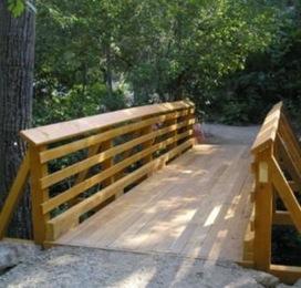
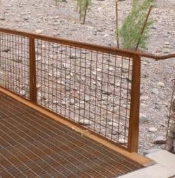
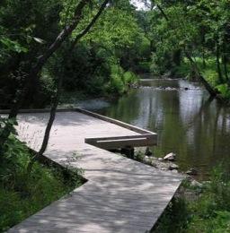
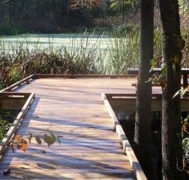
3 Existing Conditions ±3,200 feet of frontage along Alum Creek Site depth extends from ±30 to ±180 Total proposed park size of ±13 acres Existing park improvements include gazebo, kayak ramp/shelter, boardwalk over a portion of wetland, asphalt and crushed stone paths in places City of Bexley Alum Creek Park Workshop
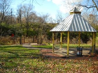
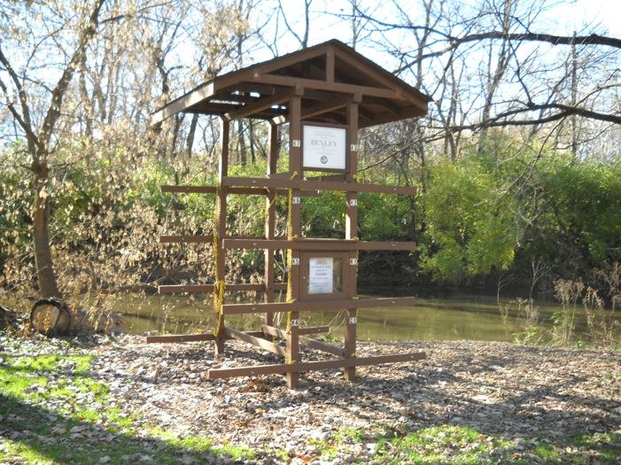
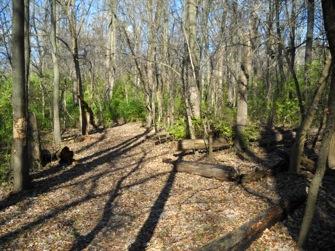
4 Existing Conditions City of Bexley Alum Creek Park Workshop

5 Existing Conditions City of Bexley Alum Creek Park Workshop

6 Survey Results 336 respondents Major themes: Trail Specifications Park Amenities Safety Dogs Nature City of Bexley Alum Creek Park Workshop
7 Tonight s Workshop What we hope to accomplish Review draft park plan Gather in-person feedback Drill-down/brainstorm issues and ideas How we re structuring it: Background presentation Presentation of draft park plan Q&A and feedback City of Bexley Alum Creek Park Workshop
8 ALUM CREEK STUDY PRELIMINARY PARK PLAN JANUARY 16, 2014

9 NATURE overlook observation decks preservation accentuate existing wetland removal of invasive species fishing dock tag and mark significant existing trees environmental education signage

10 TRAIL accessibility issues relative to path material bicycle stroller accommodation cost and maintenance requirements

11 AMENITIES benches exercise stations distance markers performance space play opportunities for kids community garden - other gardens

12 SAFETY AND DOGS fire - police access emergency call boxes proximity of path to alum creek accommodation for waste


13 OVERALL PLAN
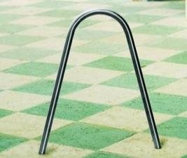
14 east main street steps LEGEND compacted ganular path shelter mulch path exercise station alum creek footbridge river overlook/dock emergency call box wetland restoration sheridan avenue signage trail marker (1/10 th mile) kayak/canoe station college avenue bike racks portable facility pad dog station restrooms ENLARGEMENT
15 natural play LEGEND compacted ganular path shelter mulch path exercise station footbridge river overlook/dock emergency call box wetland restoration signage trail marker (1/10th mile) kayak/canoe station bike racks portable facility pad dog station restrooms tall fescue demarcat park boundary ENLARGEMENT
 kayak/canoe station bike racks portable facility pad dog station restrooms livingston avenue ENLARGEMENT additiona throughou existing c orchard gravel pa")
16 tall fescue demarcates park boundary LEGEND turf/infor compacted ganular path shelter mulch path exercise station footbridge river overlook/dock emergency call box wetland restoration signage trail marker (1/10th mile) kayak/canoe station bike racks portable facility pad dog station restrooms livingston avenue ENLARGEMENT additiona throughou existing c orchard gravel pa blocks an

17 TRAIL MARKERS FOOTBRIDGES

18 RESTORATION RIVER OVERLOOK - DOCKS

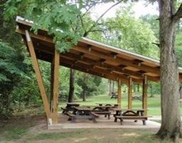
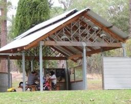

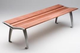
19 PARK SHELTERS AND SITE FURNISHINGS


20 EXERCISE STATIONS TALL FESCUE AT PARK BOUNDARY

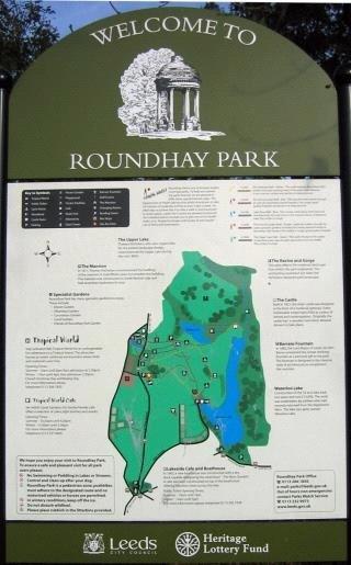
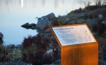
21 PARK ENTRY INTERPRETIVE SIGNAGE

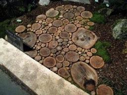
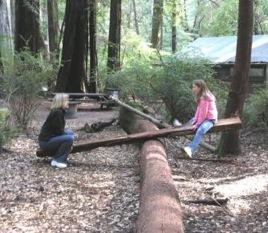

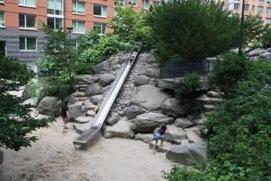
22 NATURAL PLAY


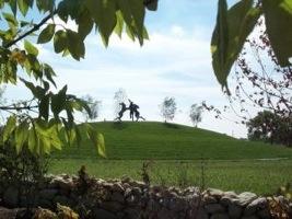
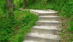
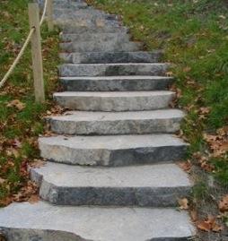
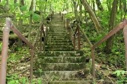
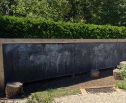
23 STEPS SLEDDING HILL OUTDOOR CLASSROOM


 for")


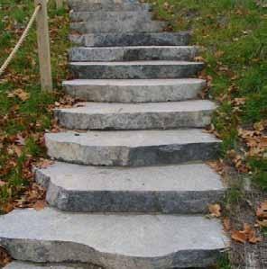
24 trail markers east main street steps footbridges remove invasive species within corridor, plant native species (trees/understory) for vegetative diversity, enhancement of wildlife habitat, and seasonal interest restoration alum creek college avenue enue an av sherid river overlook/docks cre alum exercise stations enlarge boardwalk/install ramp ve ek dri sledding hill parallel parking at sheridan avenue (20 spaces) park entry/interptretive signage replace steps outdoor classroom natural play park shelters tall fescue demarcates park boundary site furnishings turf/informal recreation fields additional tree planting throughout park LEGEND compacted ganular path shelter existing community garden mulch path exercise station orchard footbridge river overlook/dock emergency call box wetland restoration signage trail marker (1/10th mile) kayak/canoe station bike racks portable facility pad dog station I-70 gravel parking lot with precast blocks and bollards (44 spaces) livingston avenue restrooms A LU M C RE E K ST U DY BE XLE Y, OH I O P R EL I M I N A RY PA RK P L AN JA NUARY 9 T H, NORTH

25 Thank you
City of Plattsburgh DRI: Downtown Streetscapes & Riverfront Access. Downtown Streetscape and Riverfront Access Design
 City of Plattsburgh DRI: Downtown Streetscapes & Riverfront Access Welcome Thank you for coming this evening. Agenda PART I - Project Context The Downtown Revitalization Program Our DRI Projects Other
Public Input This appendix describes the public
 COMPREHENSIVE RECREATIONAL MASTER PLAN Public Input This appendix describes the public input process used during the planning of the Comprehensive Recreational Master Plan for the Parks and Open Spaces
Canal Winchester Parks Master Plan. Public Meeting 2 Thursday, February 2 6:30pm
 Canal Winchester Parks Master Plan Public Meeting 2 Thursday, February 2 6:30pm Meeting Agenda 1. Project overview 2. Project schedule 3. Public input results Survey Public Meeting #1 Stakeholder Interviews
A Vision for Walnut Creek
 A Vision for Walnut Creek Photo: City of Clive Walnut Creek Booklet 8 of 8 Greater Des Moines Water Trails and Greenways 1 Table of Contents Booklet 1: Water Trails Strategies and Policies Booklet 2: Beaver
APPENDIX D: PARKS AND RECREATION ACTION PLAN
 APPENDIX D: PARKS AND RECREATION ACTION PLAN Goals The following goals are specific to the development, maintenance, and operation of the existing parks in the Township, as well as the acquisition and
Preliminary Sketch Plan for Fort Hunter Park
 Preliminary Sketch Plan for Fort Hunter Park Public Presentation November 19, 2009 Dauphin County Parks and Recreation 100 Fort Hunter Road Harrisburg, PA 17110 (717) 599-5188 www.dauphinc.org THOMAS COMITTA
Chris James Park Planner July 16, Master Plan Kick Off Meeting
 Chris James Park Planner July 16, 2014 Master Plan Kick Off Meeting Meeting Overview Introductions Purpose of Meeting and Master Plan History & Background of Park Property Prior Planning Considerations
Mendota Heights 2040 Comprehensive Plan Draft Vers
 4 Parks and Trails The City of Mendota Heights boasts a variety of recreational and open space opportunities. Few cities can claim access to regional trails, riverside and lakeside parks, scenic bluffs
Montana Rail Link Park
 Montana Rail Link Park Neighborhood Open House A Missoula Community Partnership WITH LEADERSHIP FROM THE FRANKLIN TO THE FORT & SOUTHGATE TRIANGLE NEIGHBORHOODS Sovereign Hope Church, (1919 North Ave.)
MASTER PLAN for the EARL NEWHOUSE WATERFRONT
 MASTER PLAN for the EARL NEWHOUSE WATERFRONT on RESERVOIR POND - CANTON, MA Community Meeting #2 - Thursday, January 11 th PROJECT INTRODUCTION Project Goals: To prepare a MASTER PLAN which develops the
BENJAMIN BANNEKER PARK FRAMEWORK PLAN (PLAN ADOPTION)
") BENJAMIN BANNEKER PARK FRAMEWORK PLAN (PLAN ADOPTION) COUNTY BOARD MEETING DECEMBER 16, 2017 County Board Consideration: Adopt the Benjamin Banneker Park Framework Plan and Design Guidelines Framework
BENJAMIN BANNEKER PARK FRAMEWORK PLAN (PLAN ADOPTION) COUNTY BOARD MEETING DECEMBER 16, 2017 County Board Consideration: Adopt the Benjamin Banneker Park Framework Plan and Design Guidelines Framework
Las Colonias Park Master Plan
 2013 Las Colonias Park Master Plan City of Grand Junction June 2013 Introduction Las Colonias Park, a 101 acre parcel on the edge of the Colorado River south of downtown, was deeded to the City of Grand
Yadkin River Greenway Feasibility Study Fact Sheet Village of Clemmons, Town of Lewisville, Town of Bermuda Run
 Fact Sheet Village of Clemmons, Town of Lewisville, Town of Bermuda Run Project Background The Yadkin River Greenway Feasibility Study is a joint project with the Village of Clemmons, the Town of Bermuda
Welcome to the Public Meeting!
 Welcome to the Public Meeting! Please sign in, grab a paper survey, and check out the boards around the perimeter of the room. Once you ve viewed all of the boards, come join us in the middle of the room
Provide and maintain sufficient public parks, recreation facilities, and open space to meet the recreational needs of County residents and visitors.
 (ROS) Goal Provide and maintain sufficient public parks, recreation facilities, and open space to meet the recreational needs of County residents and visitors. OBJECTIVE ROS.01 The County shall acquire,
4.0 Concept Plan Implementation
 4.0 Concept Plan Implementation The following section defines the recommended strategy for the implementation of the Terwillegar Park Concept Plan including park management guidelines, capital costs, development
Project purpose. advise. The purpose of the Beaumaris Lake Open Space Rehabilitation project is to: + Develop a Functional Program Concept
 Project purpose owns Road Beaumaris Road The purpose of the Beaumaris Lake Open Space Rehabilitation project is to: + Develop a Functional Program Concept + Guide Rehabilitation of Landscape and Community
Emerson Park Master Plan Update. Public Meeting III August 27, 2014
 Emerson Park Master Plan Update Public Meeting III August 27, 2014 Meeting Agenda: Project Update Presentation of Master Plan Components Discussion and Feedback The Path Forward: Building on the Concept
Design Alternatives Workshop. Hilfiker Park Master Plan Workshop #2
 Design Alternatives Workshop Hilfiker Park Master Plan Workshop #2 Agenda for Tonight Staff Presentation (40 min) Introduction Master Plan Process Planning Context What We ve Heard So Far Design Alternatives
To: Planning Commission D.. June 3, 2009
 Agenda Item No. 9(a~ CITY OF WOODINVILLE, WA REPORT TO THE PLANNING COMMIS ION 17301 133 1'd Avenue NE, Woodinville, WA 98072 WWW.CI.WOODINVILLE.WA.US To: Planning Commission D.. June 3, 2009 From: Subject:
Master Plan Implementation Committee Meeting
 MILTON VILLAGE ZONING AND WATERFRONT STUDY Master Plan Implementation Committee Meeting February 12, 2018 7:00-9:00 pm IMAGE: GOOGLE COMPILED MEETING FEEDBACK/SURVEY RESULTS Waterfront Principles - Prioritized
Chapter 6. Overall Vision RECOMMENDATIONS. More Trail and Trail. Connections. Equal Access to Park. Facilities and Programs. Water Access.
 Overall Vision More Trail and Trail Connections Equal Access to Park Facilities and Programs Water Access Environment Variety Chapter 6 RECOMMENDATIONS Chapter 6 The following recommendations for park,
Minto-Brown Island. November 18, City of Salem, Parks & Transportation Services
 Minto-Brown Island Park Master Plan Public Meeting #1 November 18, 2014 City of Salem, Parks & Transportation Services Division, i i Public Works Welcome... and thanks for participating in the master planning
1.0 Background. 1.1 Study Process
 1.0 Background Planning for Terwillegar Park began in 2005 with the preparation of A Vision for Terwillegar Park (Randall Conrad & Associates), a City wide public consultation and visioning exercise. The
Clovis Urban Greening Plan. Community Workshop #2 Northwest
 Clovis Urban Greening Plan Community Workshop #2 Northwest Thursday, October 9, 2014 WHAT IS AN URBAN GREENING PLAN? A guide to help the City to improve quality of life for residents Identification of
Silver Creek Subdivision Public Park
 Silver Creek Subdivision Public Park Design Team: team80026 Munding Design Lead Consultant Gaia Designs Landscape Architect Wildrye Design Landscape Architect Akamai Design Civil Engineer introduction
Reconnecting to a Forgotten River St. Cloud MN. Aaron Hanson Design Design Thesis LA 572, Thesis, Spring 2012
 Reconnecting to a Forgotten River St. Cloud MN Aaron Hanson Design Design Thesis LA 572, Thesis, Spring 2012 site context 2.5 Miles Sartell St. Cloud to Fargo 170 Miles (2 hrs 45 mins) Hwy 10 infrastructure
North Shore Trail. Council Meeting June 10, 2002
 North Shore Trail Council Meeting June 10, 2002 Process Guiding Principles Inventory and Analysis Preliminary Concepts (4) Final Concept Phasing Strategy Estimated Costs OVERVIEW Purpose: Prepare an overall
POMONA. a place of adventure and discovery adjacent to Lake Arbor Community Park A SNAPSHOT OF ELEMENTS, USES, AND POTENTIAL FOR THE 28 - ACRE SITE
 POMONA a place of adventure and discovery adjacent to Lake Arbor Community Park A SNAPSHOT OF ELEMENTS, USES, AND POTENTIAL FOR THE - ACRE SITE TABLE OF CONTENTS TEAM 0 EXECUTIVE SUMMARY 0 EXISTING CONDITIONS
Marshview Park. Concept Briefing and Feedback Session. Aquarium/Owls Creek Plan Steering Committee March 20, 2012
 Marshview Park Concept Briefing and Feedback Session Aquarium/Owls Creek Plan Steering Committee March 20, 2012 1 Outline of Today s Discussion Introductions Context for Marshview Park Site analysis -
San Diego River Coalition 2012 Work Plan
 San Diego River Coalition 2012 Work Plan Adopted November 18, 2011 The mission of the San Diego River Coalition is preserve and enhance the San Diego River, its watershed, and its natural, cultural and
L-1 LEGEND HOMES AT DEER HILL LAFAYETTE, CALIFORNIA
 LEGEND Soccer Field 100 Yards (300 ft) x 60 Yards (180 ft) 6 Vinyl-Coated Chainlink Fence 15 Vinyl-Coated Chainlink Fence DE See Sheet L-2 for Filed North Enlargement Plan ER Park Boundary HIL LR OA D
WARM SPRINGS PARK MASTER PLAN
 TABLE OF CONTENTS page 1.0 Introduction and Overview 1 2.0 Information Gathering 2 3.0 Conceptual Alternative Development 8 4.0 Master Plan Development 14 5.0 Construction Cost Estimates 19 LIST OF FIGURES
The following principles guide the development of goals and strategies to protect and promote these amenities:
 OPEN SPACE/PARKS/TRAILS/RECREATION GOALS/STRATEGIES Cherry Hills Village is a living environment that offers low density development, open areas, public scenic vistas, public trails and public parks. This
Long Branch-Wayne Local Park Renovation Project
 Montgomery Parks Long Branch-Wayne Local Park Renovation Project Community Meeting #2 September 20, 2016 Oak View Elementary School 7:00-9:00 PM Welcome / Team Introductions M-NCPPC (Montgomery Parks)
1. Parks & Recreation Neighborhood Parks Community Parks Special Use Sites 2. Open Space 3. Trails
 Appendix A: Park Classifications The intent of parks and recreation classifications is to aid in making acquisition and design decisions for park sites, facilities and the organization of recreation space
Whitemarsh Comprehensive Plan Update: Housing & Land Use. Public Workshop #3: September 20, 2018
 Whitemarsh Comprehensive Plan Update: Housing & Land Use Public Workshop #3: September 20, 2018 Agenda Welcome Process Recap What We ve Heard The Plan Framework Review of Recommended Actions Land Use Housing
Summary of Changes in the DRAFT Rivers Project Natural Resource Master Plan from the 2001 approved plan to 2014 plan
 Summary of Changes in the DRAFT Rivers Project Natural Resource Master Plan from the 2001 approved plan to 2014 plan The entire Master Plan format and layout has been changed to comply with regulation
Potential Green Infrastructure Strategies May 6, 2015 Workshop
 Potential Green Infrastructure Strategies May 6, 2015 Workshop Background The City of Cortland is developing the Tioughnioga Urban Headwaters Green Infrastructure Action Plan with funding from the National
BURTON STATION STRATEGIC GROWTH AREA PLAN UPDATE PUBLIC MEETING 3/26/18
 BURTON STATION STRATEGIC GROWTH AREA PLAN UPDATE PUBLIC MEETING 3/26/18 1 WHERE WE ARE? 2 PRIMARY OBJECTIVES OF THE PLAN UPDATE 1. Update the land use designation for Burton Station Village to reflect
Building Great Neighbourhoods. Strathcona
 Building Great Neighbourhoods Strathcona March 21, 2018 Becky Redford Project Manager, Planning & Design Building Great Neighbourhoods Integrated Infrastructure Services Welcome and Purpose To provide
City of Los Angeles Department of Public Works
 City of Los Angeles Department of Public Works Environmental Scoping Meeting for the Proposed Sixth Street Park, Arts, River & Connectivity Improvements (PARC) Project May 3, 2017 1 Agenda Introductions
South Bend Park. Visioning Plan
 South Bend Park Visioning Plan 2007 South Bend Park, Visioning Program, Executive Summary The South Bend Park Visioning Program began with the receipt of an application from the Friends of South Bend Park,
Open Space, Natural Areas, Parks, and Recreation
 Open Space, Natural Areas, Parks, and Recreation WHAT ARE THE CITY S CURRENT VALUES? This section addresses open spaces, natural areas, parks and recreation, and stormwater multi-use projects under separate
Charles P. Johnson and Associates. Annapolis Landscape Architects
 Charles P. Johnson and Associates Annapolis Landscape Architects AGENDA Introduction Project Limits and Scope Site Analysis Opportunities & Constraints Program Goals Image Boards Design Alternatives Pros
South East Sports Complex Phase I
 South East Sports Complex Phase I City of Spokane Design Review Board August 29, 2018 (Revised) Objectives 1. Early discussion and collaboration. 2. Provide framework / catalyst for future improvements
MAYFIELD WEST SECONDARY PLAN PHASE 2
 MAYFIELD WEST SECONDARY PLAN PHASE 2 Public Open House #3 February 25, 2010 Draft Preferred Land Use Scenario TOWN OF CALEDON PLANNING & DEVELOPMENT DEPARTMENT Open House Agenda TOWN OF CALEDON 1. Welcome
Main Street Conversion Site
 Main Street Conversion Site Borough of Brooklyn, New York Preliminary Presentation Park Expansion Design & Development Committee 13 September 2012 Michael Van Valkenburgh Associates, Inc. Landscape Architects,
A larger version of this map is located on the last page of this PDF.
 MAP Committee Input McLoughlin Area Draft Vision Map A larger version of this map is located on the last page of this PDF. 1. The map above is intended to portray a vision for the McLoughlin area. It highlights
METROPOLITAN COUNCIL 390 North Robert Street, St. Paul, MN Phone (651) ; TDD (651)
 ; TDD (651)") DATE: October 24, 2012 METROPOLITAN COUNCIL 390 North Robert Street, St. Paul, MN 55101 Phone (651) 602-1000; TDD (651) 291-0904 TO: Metropolitan Parks and Open Space Commission FROM: Tori Dupre, Senior
DATE: October 24, 2012 METROPOLITAN COUNCIL 390 North Robert Street, St. Paul, MN 55101 Phone (651) 602-1000; TDD (651) 291-0904 TO: Metropolitan Parks and Open Space Commission FROM: Tori Dupre, Senior
Mt Baker Park Safe Access Project
 Mt Baker Park Safe Access Project PROJECT TEAM Greg funk, stairway inspector karen selander, project manager pam kliment, neighborhood planner Property Owner Development / Design Guidelines Project oversight
SOUTHEAST SPORTS COMPLEX MASTER PLAN
 REPORT TO SOUTHGATE NEIGHBORHOOD COUNCIL APRIL 13, 2016 Visioning Process April 30: Stakeholder Meeting with Sports Groups May 5: Stakeholder Meeting with Southgate Land Use Committee May 13: SNC Meeting
Silverwood Masterplan Kickoff Meeting. Jim Neidhart Dane County Parks Planning
 Silverwood Masterplan Kickoff Meeting Jim Neidhart Dane County Parks Planning 608-224-3614 January 30, 2014 Silverwood County Park Public Information Meeting Notice Sent notice to all landowners adjacent
2011 ASLA Design Awards. Centennial Park Merit Award Design Concepts CLA, Inc. Design over $500,000 Construction Budget
 2011 ASLA Design Awards Centennial Park Merit Award Design Concepts CLA, Inc. Design over $500,000 Construction Budget 2011 ASLA Colorado Professional Design Awards Project Name: Category: Location: Const.
METROPOLITAN COUNCIL 390 North Robert Street, St. Paul, MN Phone (651) ; TDD (651)
 ; TDD (651)") DATE: December 20, 2011 METROPOLITAN COUNCIL 390 North Robert Street, St. Paul, MN 55101 Phone (651) 602-1000; TDD (651) 291-0904 TO: Metropolitan Parks and Open Space Commission FROM: Tori Dupre, Senior
DATE: December 20, 2011 METROPOLITAN COUNCIL 390 North Robert Street, St. Paul, MN 55101 Phone (651) 602-1000; TDD (651) 291-0904 TO: Metropolitan Parks and Open Space Commission FROM: Tori Dupre, Senior
& SUSTAINABILITY PLAN
 Chapter 6: IMPLEMENTATION, MANAGEMENT, & SUSTAINABILITY PLAN Overview The Oxbow Park and Zollman Zoo Master Plan presents a long-term vision for the park. While phasing of improvements is suggested, Olmsted
North Oakville East Parks Facilities Distribution Plan. November, 2009
 North Oakville East November, 2009 POLICY CONTEXT 1) Purpose a) The purpose of this document is to be a guide for the location, configuration, design and development of the parks system for the North Oakville
Welcome to the Neighborhood! COPPERLEAF NEIGHBORHOOD GUIDE
 Welcome to the Neighborhood! COPPERLEAF NEIGHBORHOOD GUIDE 2017 At Copperleaf, feeling at home just comes naturally. Not surprising when you take a look around at the abundance of resources we offer to
PARKS AND RECREATION
 PARKS AND RECREATION WHAT YOU WILL FIND IN THIS CHAPTER: Background information on the development of the Park, Recreation, and System Plan (PRSP). General overview of Ellensburg s parks and recreation
Workshop #3 June 13, 2016
 Downtown Ocoee Master Plan Workshop #3 June 13, 2016 Our Team Our Team and Tonight s Goal Quick Recap: Why a Downtown Plan? How are we developing the plan? How can you still be involved? What s left to
CITY OF GIG HARBOR PEDESTRIAN AMENITIES & VOLUNTEER PROJECTS
 PEDESTRIAN & CITY PARKS Adam Tallman Park 6626 Wagner Way Ancich Waterfront Park 3555 Harborview Drive Austin Estuary Park 4009 Harborview Drive BMX Park/Sand Volleyball Courts 9702 Crescent Valley Drive
MASTER PLAN IMPLEMENTATION COSTS. Appendix A
 Appendix A MASTER PLAN IMPLEMENTATION COSTS Town of Bradford West Gwillimbury HENDERSON COMMUNITY PARK MASTER PLAN IMPLEMENTATION COSTS Draft Order of Magnitude Costing Revised 5/27/2014 ITEM DESCRIPTION
Johnson Street Bridge Public Realm Update
 Johnson Street Bridge Public Realm Update August 20, 2015 Background Johnson Street Bridge Replacement Project impacts a diverse range of stakeholders In addition to a new bridge, the project also includes
Outdoor Recreation Facilities Inventory
 Outdoor Recreation Facilities Inventory Allouez Neighborhood Parks: East Lawn Park (4.90 acres) is located in the northeastern corner of Allouez near Boyd Street. This site contains: Baseball diamond with
Oconee Rivers Greenway Project. TSPLOST 2018 Project # 5 Project Concept Sub-projects 7, 8, 9, 10, & 11. Mayor & Commission Work Session
 Oconee Rivers Greenway Project Project # 5 Project Concept Sub-projects 7, 8, 9, 10, & 11 Mayor & Commission Work Session February 13, 2018 North Oconee River Greenway 1 Project # 05 - Oconee Rivers Greenway
ACADEMY AREA CONCEPT PLAN
 ACADEMY AREA Strip ling C hape l Roa d CONCEPT PLAN 7 S2 U Stripling 52 ROADWAYS AND PARKING: ADVENTURE PLAYGROUND AND SPRAYGROUND: Current roadways follow existing drives. It is recommended that the Folds
Creation of Confluence Park and Input from Vermont River Conservancy
 CITY COUNCIL Agenda Item #18-236 Date: August 22, 2018 Consent Discussion X SUBJECT: Creation of Confluence Park and Input from Vermont River Conservancy SUBMITTING DEPARTMENT: Mayor RECOMMENDED ACTION:
The Vision. Photo provided by The Minervini Group. 46 Vision, Objectives & Strategies
 Vision, Objectives & Strategies The is the public framework and guide for future development of the Grand Traverse Commons. The establishes public polices for infrastructure, the preservation of natural
Toronto Parks Renaissance Strategy
 Toronto Parks Renaissance Strategy Overview, Emerging Themes and Directions Presentation to EDPC, May 4, 2006 Parks Renaissance Strategy Presentation Agenda Project Overview Emerging Themes and Directions
Memorandum CITY OF DALLAS
 Memorandum DATE September 23, 2016 CITY OF DALLAS TO The Honorable Members of the Transportation and Trinity River Project Committee: Lee M. Kleinman (Chair), Deputy Mayor Pro Tem Erik Wilson (Vice-Chair),
APPENDIX I: GREENWAY DESIGN STANDARDS
 APPENDIX I: GREENWAY DESIGN STANDARDS The goal of this report is to develop a palette of standard design elements that will help establish a distinct identify for the Bronx River Greenway. The greenway
Forest Grove Park Master Plan
 Workshop 03 Steering Committee Meeting 2:00 5:00 PM Public Open House 5:00 7:00 PM February 21, 2012 Agenda February 21, 2012 Schedule and planning process update. Preliminary Program review. Concept plan
Preferred Riverwalk Alternative Components August 17, 2017:
 Preferred Riverwalk Alternative Components August 17, 2017: 1. Entrance and Future Pump Station Location: Entrance location to line up with main parking entrance to Captain Parkers and allows future Pump
Lansing s Moores River Drive Regional Network Trail project extended the Lansing River Trail system to Waverly Road, and also included bike lane
 Lansing s Moores River Drive Regional Network Trail project extended the Lansing River Trail system to Waverly Road, and also included bike lane striping on W. Mount Hope Avenue. The boulevard on Moores
Northeast Everglades Natural Area
 Northern Palm Beach County Natural Areas Master Plan Northeast Everglades Natural Area August 3, 2006 GLATTING JACKSON KERCHER ANGLIN LOPEZ RINEHART, INC. Community Planning 1 Public Land Partners Agenda
Town of Lyons Parks Flood Recovery Planning Process. Photograph courtesy of Ed Bruder
 Town of Lyons Parks Flood Recovery Planning Process Photograph courtesy of Ed Bruder Lyons Parks and Recreation Flood Recovery Update 1. Meadow Park Phase II - Project PW20B1 Estimated Completion: Summer
LEMON CREEK AREA PLAN. Steering Committee Meeting April 27, 2017
 LEMON CREEK AREA PLAN Steering Committee Meeting April 27, 2017 Agenda Roll Call (6:00pm) Approval of Minutes April 20, 2017 (5 minutes) Review and Approve the Natural Resources & Recreation Chapter, Goals,
Mendota-Lebanon Hills Greenway Master Plan Executive Summary. August draft for more information visit
 Mendota-Lebanon Hills Greenway Master Plan Executive Summary August 2013 draft for more information visit www.hkgi.com/projects/dakota INTRODUCTION The Mendota-Lebanon Hills Greenway Master Plan portrays
Caroline Freeland Park Facility Plan Project
 Montgomery Parks Caroline Freeland Park Facility Plan Project Community Meeting #1 November 6, 2013 Bethesda Library 7:00-9:00 PM Welcome / Team Introductions Parker Rodriguez, Incorporated (Landscape
& SUSTAINABILITY PLAN
 Chapter 6: IMPLEMENTATION, MANAGEMENT, & SUSTAINABILITY PLAN Overview The Chester Woods Master Plan presents a long-term vision for the park. While phasing of improvements is suggested, Olmsted County
AVONDALE ESTATES GREENSPACE AD-HOC COMMITTEE
 AVONDALE ESTATES GREENSPACE AD-HOC COMMITTEE INVENTORY AND RECOMMENDATIONS REPORT November 7, 2018 Our Mission Statement: To provide assistance and support, through professional expertise in matters of
We d like to thank you for attending this Wekiva Parkway Section 8 Preliminary Design Update hosted by the Florida Department of Transportation.
 We d like to thank you for attending this Wekiva Parkway Section 8 Preliminary Design Update hosted by the Florida Department of Transportation. We will provide you information on the overall project and
Project Location. Jay and Patty Baker Park and Gordon River Greenway Connector Bridge. Naples Beach Golf Club. Gordon River. East. Naples.
 Gordon River Project Location Naples Beach Golf Club East Naples Naples Naples Bay Evergreen Golf and Country Club and Gordon River Greenway Connector Bridge Gordon River Greenway CONNECTOR BRIDGE AND
Popp s Ferry Causeway Park Back Bay Environmental Educational Center CASHIO COCHRAN LLC
 Popp s Ferry Causeway Park Back Bay Environmental Educational Center CASHIO COCHRAN LLC A LIMITED LIABILITY COMPANY Popp s Ferry Causeway Park Master Plan Prepared for: City of Biloxi Department of Parks
BISCUIT RUN PARK MASTER PLAN
 BOARD OF SUPERVISORS November 14, 2018 BISCUIT RUN PARK MASTER PLAN COUNTY OF ALBEMARLE ANHOLD ASSOCIATES Contents Project Introduction Property Background County Park Planning Process Existing Site &
PHASE 3-4 PARKS SOUTH PARK AND CHANNEL PARK
 PHASE 3-4 PARKS SOUTH PARK AND CHANNEL PARK Sheet List L1.0 L2.0 L3.0 L4.0 L5.0 L6.0 L7.0 L8.0 L9.0 L10.0 L11.0 L12.0 L13.0 L14.0 L15.0 L16.0 L17.0 L18.0 L19.0 L20.0 L21.0 L22.0 Cover Open Space Context
{Best Practices. Summary of Tools, Strategies and Best Practices from 11 Michigan Case Study Communities
 Case Studies Michigan Coastal Community Working Waterfronts { Summary of Tools, Strategies and from 11 Michigan Case Study Communities Table of Contents Zoning...2 Community and Stakeholder Collaboration
PUBLIC RIGHT-OF-WAY IN THIS CHAPTER PUBLIC REALM
 PUBLIC RIGHT-OF-WAY This section provides design guidelines for improvements in the public right-of-way. The public right-of-way refers to streets, sidewalks, non-vehicular thoroughfares, parks and greenways
PREVIOUS PUBLIC PARTICIPATION BRIEF October 2014
 Comprehensive Planning During the development of the county comprehensive plan, Cultivating Community: A Plan for Union County s Future from 2007 through 2009, and three concurrent multi municipal plans
Overview and Update of the Rutgers-New Brunswick Physical Master Plan. January 2015
 Overview and Update of the Rutgers-New Brunswick Physical Master Plan January 2015 Failure To Plan, is Planning For Failure Winston Churchill 2 Good Planning; The Key to Success 3 The university physical
Town of Peru Comprehensive Plan Executive Summary
 Town of Peru Comprehensive Plan Executive Communities that plan grow by choice, not by chance. A plan makes growth thoughtful, understandable, and predictable. A plan shows that a community is managing
Isabel Neighborhood Plan: Alternatives
 Isabel Neighborhood Plan: Alternatives Presented by: Lori Parks, Associate Planner February 2, 2015 Agenda 1. Background on BART to Livermore 2. Isabel Neighborhood Plan 3. Alternative Scenarios 4. General
Rogue River Recreation and Access Management Plan- Table Rocks Reach. Jackson County, Oregon Department of Fish and Wildlife, National Park Service
 Rogue River Recreation and Access Management Plan- Table Rocks Reach Jackson County, Oregon Department of Fish and Wildlife, National Park Service Today s Agenda Welcome Project refresher Project status/timeline
Subarea 4 Indian Creek. Vision The combination of park networks and transportation amenities make Subarea 4 the greenest hub in the Corridor.
 indian creek 180 extends south from 101st Street to I-435. The I-435 and Metcalf intersection is one of the primary intersections in the Kansas City Metro Area. The area includes several residential neighborhoods
To qualify for federal Transportation Enhancement (TE) funds a project must meet two basic federal requirements:
 funds a project must meet two basic federal requirements:") Eligibility Requirements To qualify for federal Transportation Enhancement (TE) funds a project must meet two basic federal requirements: 1) Relate to surface transportation and 2) Be one of the 12 designated
Eligibility Requirements To qualify for federal Transportation Enhancement (TE) funds a project must meet two basic federal requirements: 1) Relate to surface transportation and 2) Be one of the 12 designated
Focus Groups. 8 Focus Group meetings including 2 with staff, 1 with seniors, and 1 with students
 Project Team Nan Lanahan, Parks & Recreation Jason Gallo, Parks & Recreation Rob Leslie, DEDP John Smolinsky, Planning Board Brent Meredith, Highway Joan Gavrilik, Friends of Parks & Rec MaryLyn Koval,
PARDI MARKET PLAZA MASTER PLAN
 PARDI MARKET PLAZA MASTER PLAN CITY OF DIXON PLANNING COMMISSION MAY 16, 2017 Presented by: 1 CITY STAFF INTRODUCTION Deborah Barr Associate Civil Engineer, Project Manager Joe Leach City Engineer/Public
Plenty Gorge Park Draft Master Plan Consultation Report. Draft Master Plan April 2018
 Plenty Gorge Park Draft Master Plan Consultation Report Draft Master Plan April 8 Introduction As part of the development of the Plenty Gorge Park Master Plan, Parks Victoria designed a consultation and
Call for Artists for: Design and Construction of Environmental Art Activation Story Mill Community Park, Bozeman, MT
 Call for Artists for: Design and Construction of Environmental Art Activation Story Mill Community Park, Bozeman, MT Seeking artists to design, fabricate and install art elements in the nature sanctuary
MAYFIELD WEST SECONDARY PLAN PHASE 2
 MAYFIELD WEST SECONDARY PLAN PHASE 2 Council Information Workshop February 16, 2010 Draft Preferred Land Use Plan TOWN OF CALEDON PLANNING & DEVELOPMENT DEPARTMENT Workshop Agenda TOWN OF CALEDON 1. Welcome