Town of Corinth Road Erosion Inventory Report
|
|
|
- Kory Young
- 5 years ago
- Views:
Transcription

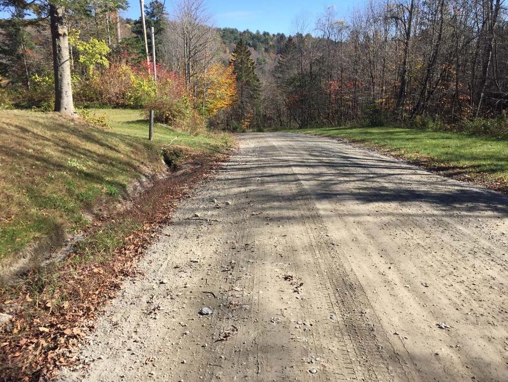
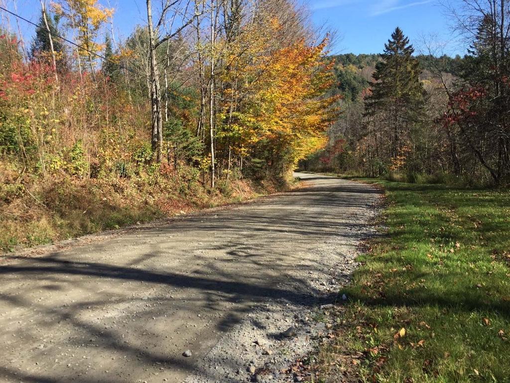
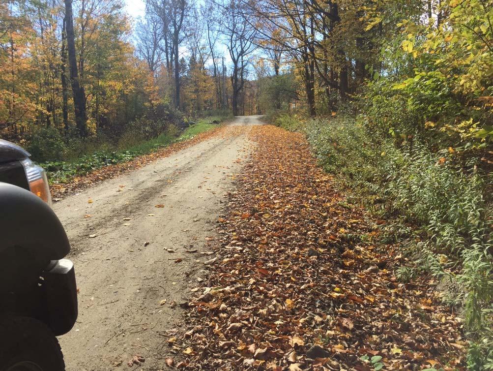
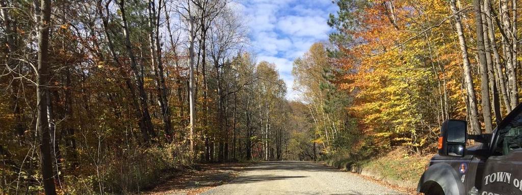
1 Town of Corinth Road Erosion Inventory Report Grist Mill Road. Photo taken by TRORC staff. Prepared by: 128 King Farm Road Woodstock, VT Inventory and report funded by the Vermont Agency of Transportation 2016 Better Roads Program.
2 Table of Contents Introduction Background Methodology Town Report Conclusion Maps Diagrams Appendices Appendix A Appendix B 2


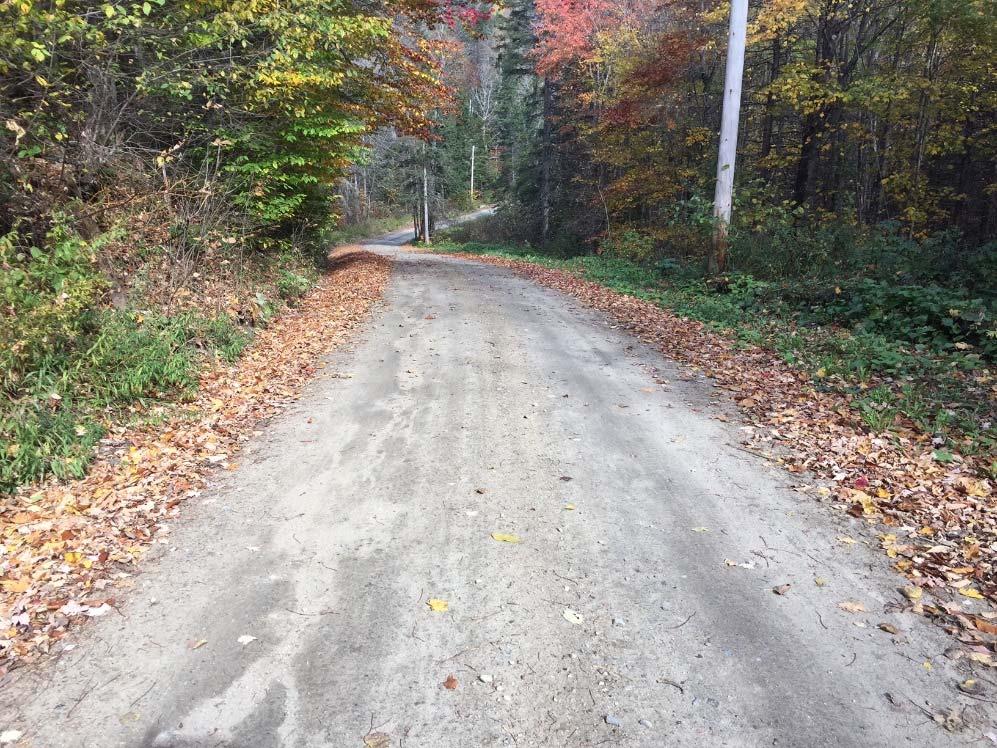
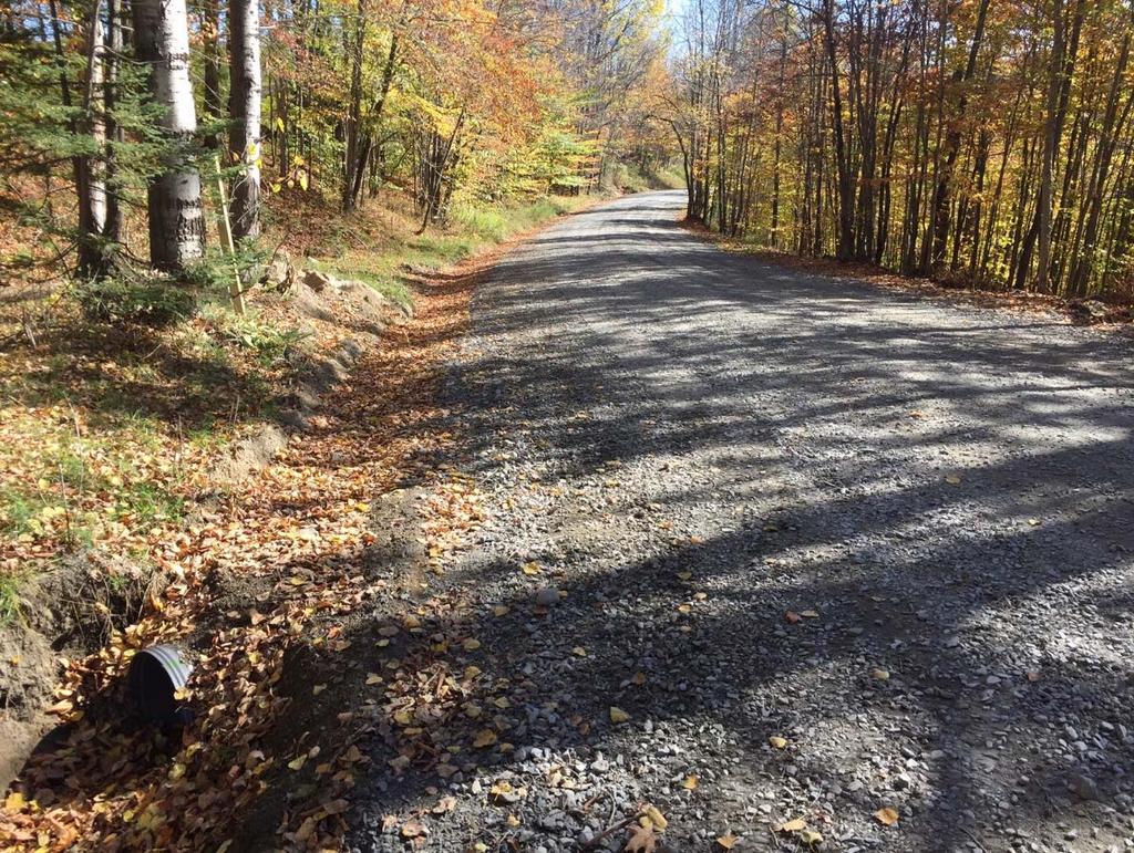
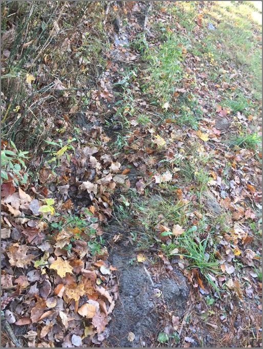
3 Introduction In the summer of 2017, the Two Rivers-Ottauquechee Regional Commission (TRORC) conducted a road erosion inventory (REI) to evaluate hydrologically connected segments in the town of Corinth. This report highlights the road sites with the most significant hydrological impact due to erosion within the municipality. Hydrologically-connected road segments are one or more of the following: Within 100 or within river corridor layer to water resources (perennial and intermittent streams, wetlands, lakes and ponds) Road segments that bisect a water resource Adjacent segments to bisected connected segments if 8% or greater slope Road segments that bisect 24 or greater culverts Non-connected segments that were bordered on either side by a connected segment Stormwater infrastructure mapping *There may be additional factors when assessing urban areas The following diagrams depict the criteria for hydrologically-connected road segment: Images created by TRORC staff Background Problem Definition Many roads in Vermont traverse waterways since these are the lowest and flattest parts of the topography. Erosion, exacerbated by unpaved roads, has adverse effects on nearby bodies of water. During rain events road sediment is deposited directly into the water resources. Water resources are defined as perennial and intermittent streams, wetlands, lakes, and ponds. Road sediment in water resources causes a wide spectrum of ecological 3
4 problems including increased algae blooms and decreased levels of dissolved oxygen, both of which negatively impact fish habitat and the ecosystem as a whole. Response Solutions are taking shape in the form of state permits and grants. Grants will support proper construction and maintenance of road drainage and surfaces, while the permit will set a standard with criteria that must be met. The goal is to minimize road erosion caused by storm runoff and ensure that any sediment that does erode is sufficiently diverted and filtered before reaching the watershed. Implementation Instrumental to both grant funding and permit compliance is the Road Erosion Inventory (REI), and Evaluation. The purpose of the inventory is to identify locations that result in problematic road erosion. These are the places that require continuous attention by town road crews to maintain quality or restore problems. Since sediment only reaches the watershed if the road is close to open water (rivers, streams, lakes, ponds, wetlands), only hydrologically-connected road segments were assessed. The Department of Environmental Conservation (DEC) provides GIS data of these hydrologically-connected road segments for each municipality. The inventory reflects the criteria set out by DEC s drafted Municipal Roads General Permit (MRGP), which is based on the Better Roads Manual provided by the Vermont Agency of Transportation (VTrans). The MRGP draft indicates that: 1. By July 2018 Municipalities apply for MRGP coverage and pay fees. (Starting in 2018, municipalities will be required to submit MRGP compliance updates every six months.) 2. By fall of 2020 Municipalities are required to submit a Road Stormwater Management Plan (RSWMP), which includes road erosion inventories and the implementation plans and schedules. 3. By December 31, 2037 All hydrologically-connected segments are expected to meet MRGP standards. The MRGP is required by the Vermont Clean Water Act (Act 64), and the Lake Champlain Phase I TMDL; the permit will be finalized by December 31, While funding from DEC might be available through the Ecosystem Restoration grant program, towns currently apply for funding through VTrans Better Roads grants. Better Roads is funded with state funds that could include appropriations through the Transportation Bill, the Clean Water Fund and the Capital Bill as well as federal funding VTrans receives from the Federal Highway Administration. Methodology The DEC determined all hydrologically-connected municipal roads (paved, gravel, and class 4) based on proximity to water. The hydrologically-connected roads were divided into approximately 300 foot segments and given an identification number. 4
5 Each segment was assessed and given a score of Fully, Partially, or Does Not Meet for the crown, berm, drainage, conveyance, drainage culverts and driveway culverts in the right-of-way. An overall score was given to each segment. o Fully (FM) indicates that all individual scores fully met. o Partially (PM) designates one or two partially meet individual scores. o Does Not Meet (DNM) stipulates three or more partially meets individual scores or one or more does not meet individual score. o Class 4 roads are evaluated based on gully erosion. If gully erosion is present, the overall segment does not meet. If gully erosion is absent, the overall segment fully meets. Town Report Context The town of Corinth is almost 50 square miles with the Waits River flowing through northeastern Corinth. Nearly half of the roads in Corinth run along rivers and cross them many times. Roads typically are flanked by a steep grade to one side and a river or creek on the other. This combined with steep roads creates extra challenges and emphasizes the importance of proper road drainage installation and maintenance. Current Condition This bar chart depicts the scoring breakdown by road type for hydrologically-connected road miles within the town s total road miles. Gravel Fully Hydro-miles Paved Partially Hydro-miles Does Not Meet Hydro-miles Total Road Miles Miles 5
 segments have been identified as High Priority.")
6 Appendix A depicts the town with detailed results of the inventory. The following provides a brief summary: There are 819 hydrologicallyconnected road segments in Corinth, or 49.7 miles. Of these 51% do not fully meet standards; which equal 25 miles of road eroding into the streams. Twenty-four (24) segments have been identified as High Priority. High Priority indicates an overall score of Does Not Meet with a slope of 10% or greater. These are the segments which the town will focus on addressing in future grants. They are also a good example of issues facing the road network as a whole as other segments are likely to deteriorate in similar ways. The three main issues in the high priority segments are: Poor Conveyance (58% Do Not Meet) Poor Drainage (100% have erosion present) Culverts (23% have inadequate or unstable culverts) 6
7 It is useful to note that of all hydrologically-connected roads, the average road grade is: 5.97%. This indicates the need for proper drainage practices, including stabilization through vegetation or stone-lining, and well-stabilized conveyance areas, as both of these are impacted by the faster flow of water that runs down steep grades. Common causes for these issues are as follows: Inadequate infiltration and diversion practices Unstable banks separating roads from rivers Unstable ditches or no ditches at all where they are needed Lack of culvert headwalls, or culverts that are poorly placed, undersized, or in disrepair Interventions Very High Priority Road Segments are on slopes >10% that do not meet standards. These must be brought to MRGP standards by 12/31/2025. For these the following practices must be implemented: >10%: Stone-line ditch with 12 minus stone 18 drainage culvert minimum 15 drive culvert For all other segments, best practices for drainage are as follows: 0-5%: Grass-lined ditch 5-8%: Stone-lined ditch with 6-8 minus stone Grass-lined ditch with stone check dam Grass-lined ditch AND 2+ cross culverts 8-10%: Stone-line ditch with 6-8 minus stone Conclusion The results of the field inventory illustrate the importance of the MRGP. While the placement of roads in proximity to water poses a threat, adequate road maintenance practices will greatly diminish the rate of unfiltered runoff reaching our valuable natural resources. TRORC and your road foremen will coordinate site visits to identify best management practices (BMPs) for remediation. Implementation plans to bring segments to MRGP compliance standards will include measures like grass and stone-lined drainage ditches, stone check-dams, sheet flow infiltration, ditches and turnouts disconnected from surface waters, road crowning, upgrading culverts, installing outlet stabilization headwalls, and stabilizing exposed soil. A detailed financial plan will be submitted to the VTrans Better Roads program. 7
8 Appendix A Figure 1- Depicts the Town with all hydro-connected segments and their scores, as well as the breakdown of how many segments Fully Meet, Partially Meet, and Do Not Meet. 8
9 9 Figure 2- Displays the segments with a score of Partially Meet and Does Not Meet.

10 10 Figure 3- Displays high priority segments within the town.


11 Appendix B Table 1 Terminology Illustrated Images created by TRORC staff 11
12 Figure 1 Permit and Grant Process Flow chart created by TRORC Staff 12
13 Appendix C Road Inventory and Evaluation Form for High Priority Project Sites Project 1 Cookeville Road.....Sites 1 Project 2 Center Road...Sites 2-3 Project 3 Threshold Way...Site 4 Project 4 Cookeville Road...Site 5 Project 5 Richardson Road......Sites 6-7 Project 6 White Road and Hayward Road....Site 8 Project 7 Fairground Road......Site 9 Project 8 Hoots Place......Sites Project 9 Page Hill Road Site 12 Project 10 Young Road......Sites Project 11 Chicken Farm Road.....Site 16 Project 12 Apple Hill Lane.....Sites Project 13 Notch End Road......Site 20 Project 14 Carpenter Place....Sites Project 15 Magoon Hill Road Site 24
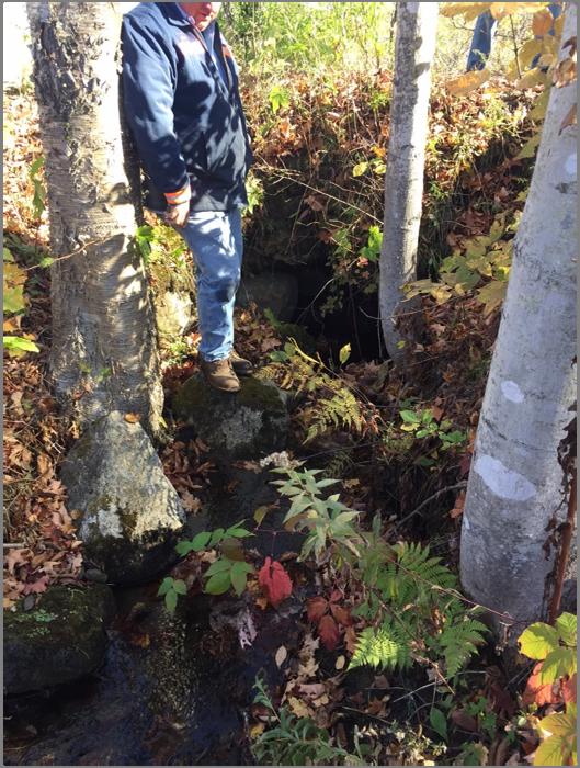
14 Project 1: Cookeville Road Best Management Practices: Add more ditch stone (4 ft already good) 18 culvert is undersized and rip rap on outlet: Will replace with 36 culvert To Threshold Way, 18 from house to culvert Road Segment Name & Segment ID Number: Road Average Road Site Number: Grade: Cookeville Rd Gravel 1.49% 1 Overall Segment Score: Does Not Meet 1. ROADWAY CROWN/TRAVEL LANE: Erosion 90% - 100% ( OK) Fully 3. ROAD DRAINAGE: Erosion 2. GRADER BERM/WINDROW: Erosion 50% - 89% ( OK) Partially 0% - 49% (0 327 OK) Does Not Meet Gully All areas meet standard Rill 4. CONVEYANCE AREA/TURNOUT: Erosion 5. DRIVEWAY CULVERT: 5. DRAINAGE CULVERT: Type of Erosion Notes: Header erosion at stream culvert
15 Project 2: Center Road Best Management Practices: Stone-line ditch on left side (start above driveway) Stone both sides below driveway to brook Upsize driveway culvert from 15 to 18 Road Segment Name & Segment ID Number: Road Average Road Site Number: Grade: Center Rd Gravel 5.79% 2 Overall Segment Score: Does Not Meet 1. ROADWAY CROWN/TRAVEL LANE: Erosion 50% - 89% ( OK) Partially Rill 3. ROAD DRAINAGE: Erosion 50% - 89% ( OK) Partially Rill 2. GRADER BERM/WINDROW: Erosion 90% - 100% ( OK) Fully 4. CONVEYANCE AREA/TURNOUT: Erosion All areas meet standard 5. DRIVEWAY CULVERT: 5. DRAINAGE CULVERT: Type of Erosion Notes: Steep and narrow still
16
 Fully 3. ROAD DRAINAGE: Erosion 50% - 89% (328 589 OK) Partially Rill 2. GRADER BERM/WINDROW: Erosion 90% - 100% (590 656 OK) Fully 4.")
17 Road Segment Name & Segment ID Number: Road Average Road Grade: Center Rd Gravel 18.1% 3 Overall Segment Score: Does Not Meet Site Number: 1. ROADWAY CROWN/TRAVEL LANE: Erosion 90% - 100% ( OK) Fully 3. ROAD DRAINAGE: Erosion 50% - 89% ( OK) Partially Rill 2. GRADER BERM/WINDROW: Erosion 90% - 100% ( OK) Fully 4. CONVEYANCE AREA/TURNOUT: Erosion All areas meet standard 5. DRIVEWAY CULVERT: 5. DRAINAGE CULVERT: Type of Erosion
18
 Fully 3.")
19 Project 3: Threshold Way Best Management Practices: Stone-line from top on left to brook Add 18 cross culvert at top of hill Add 18 above brook Road Segment Name & Segment ID Number: Road Average Road Site Number: Grade: Threshold Wy Gravel 10.26% 4 Overall Segment Score: Does Not Meet 1. ROADWAY CROWN/TRAVEL LANE: Erosion 90% - 100% ( OK) Fully 3. ROAD DRAINAGE: Erosion 50% - 89% ( OK) Partially Rill 2. GRADER BERM/WINDROW: Erosion 50% - 89% ( OK) Partially Rill 4. CONVEYANCE AREA/TURNOUT: Erosion One or more areas does not meet standard Rill 5. DRIVEWAY CULVERT: 5. DRAINAGE CULVERT: Type of Erosion Notes: Conveyance goes directly into stream with not much filtration for sediment. Bank by stream culvert falling away
20
 Partially Rill 3.")
21 Project 4: Cookeville Road Best Management Practices: Stone-line from culvert/beaver pad to top of hill Upsize driveway culvert to 30 Stone-line above cross culvert Road Segment Name & Segment ID Number: Road Average Road Site Number: Grade: Cookeville Rd Gravel 4.22% 5 Overall Segment Score: Does Not Meet 1. ROADWAY CROWN/TRAVEL LANE: Erosion 50% - 89% ( OK) Partially Rill 3. ROAD DRAINAGE: Erosion 50% - 89% ( OK) Partially Rill 2. GRADER BERM/WINDROW: Erosion 50% - 89% ( OK) Partially Rill 4. CONVEYANCE AREA/TURNOUT: Erosion All areas meet standard 5. DRIVEWAY CULVERT: 5. DRAINAGE CULVERT: Type of Erosion Notes: Conveyance could be built better, eroding road away
22
 Partially Rill 3.")
23 Project 5: Richardson Road Best Management Practices: Site 6: replace 3x3 stone culvert Site 7: realign Road Segment Name & Segment ID Number: Road Average Road Site Number: Grade: Richardson Rd Gravel 9.19% 6 Overall Segment Score: Does Not Meet 1. ROADWAY CROWN/TRAVEL LANE: Erosion 50% - 89% ( OK) Partially Rill 3. ROAD DRAINAGE: Erosion 50% - 89% ( OK) Partially Rill 2. GRADER BERM/WINDROW: Erosion 50% - 89% ( OK) Partially Rill 4. CONVEYANCE AREA/TURNOUT: Erosion All areas meet standard 5. DRIVEWAY CULVERT: 5. DRAINAGE CULVERT: Type of Erosion Notes: Should be class 4

24
 Partially Rill 3. ROAD DRAINAGE: Erosion 50% - 89% (328 589 OK) Partially 2.")
25 Road Segment Name & Segment ID Number: Road Average Road Grade: Richardson Rd Gravel 10.33% 7 Overall Segment Score: Does Not Meet Site Number: 1. ROADWAY CROWN/TRAVEL LANE: Erosion 50% - 89% ( OK) Partially Rill 3. ROAD DRAINAGE: Erosion 50% - 89% ( OK) Partially 2. GRADER BERM/WINDROW: Erosion 50% - 89% ( OK) Partially Rill 4. CONVEYANCE AREA/TURNOUT: Erosion All areas meet standard 5. DRIVEWAY CULVERT: 5. DRAINAGE CULVERT: Type of Erosion Notes: Road very steep and has rocks, seems like it should be class 4
 Fully 3.")
26 Project 6: White Road and Hayward Road Best Management Practices: At intersection of White and Hayward: stone-line right to culvert Upsize culvert from 18 to 24 Road Segment Name & Segment ID Number: Road Average Road Site Number: Grade: White Rd Gravel 6.13% 8 Overall Segment Score: Does Not Meet 1. ROADWAY CROWN/TRAVEL LANE: Erosion 90% - 100% ( OK) Fully 3. ROAD DRAINAGE: Erosion 2. GRADER BERM/WINDROW: Erosion 90% - 100% ( OK) Fully 0% - 49% (0 327 OK) Does Not Meet All areas meet standard 4. CONVEYANCE AREA/TURNOUT: Erosion 5. DRIVEWAY CULVERT: 5. DRAINAGE CULVERT: Type of Erosion Does Not Meet Gully Notes: 12% slope


27 Road Segment Name & Segment ID Number: Road Average Road Grade: Hayward Rd Gravel 13.03% N/A Site Number: Notes: Needs to be classified as hydrologically-connected segment as it meets criteria.
 Fully 3. ROAD DRAINAGE: Erosion 2.")
28 Project 7: Fairground Road Best Management Practices: Stone-line from white post/tree right to brook Upsize driveway from 15 to 18 Road Segment Name & Segment ID Number: Road Average Road Site Number: Grade: Fairground Rd Gravel 5.80% 9 Overall Segment Score: Does Not Meet 1. ROADWAY CROWN/TRAVEL LANE: Erosion 90% - 100% ( OK) Fully 3. ROAD DRAINAGE: Erosion 2. GRADER BERM/WINDROW: Erosion 90% - 100% ( OK) Fully 0% - 49% (0 327 OK) Does Not Meet Gully All areas meet standard 4. CONVEYANCE AREA/TURNOUT: Erosion 5. DRIVEWAY CULVERT: 5. DRAINAGE CULVERT: Type of Erosion Notes: Ditch incising, turning into gully
29
 Fully 3. ROAD DRAINAGE: Erosion 2.")
30 Project 8: Hoots Place Best Management Practices: Site 10: Stone-line ditch Site 11: Stone-line ditch from driveway second right side Road Segment Name & Segment ID Number: Road Average Road Site Number: Grade: Hoots Pl Gravel 10.11% 10 Overall Segment Score: Does Not Meet 1. ROADWAY CROWN/TRAVEL LANE: Erosion 90% - 100% ( OK) Fully 3. ROAD DRAINAGE: Erosion 2. GRADER BERM/WINDROW: Erosion 90% - 100% ( OK) Fully 4. CONVEYANCE AREA/TURNOUT: Erosion 0% - 49% (0 327 OK) Does Not Meet Gully One or more areas does not meet standard Gully 5. DRIVEWAY CULVERT: 5. DRAINAGE CULVERT: Type of Erosion
31
 Fully 3. ROAD DRAINAGE: Erosion Site Number: 2.")
32 Road Segment Name & Segment ID Number: Road Average Road Grade: Hoots Pl Gravel 13.18% 11 Overall Segment Score: Does Not Meet 1. ROADWAY CROWN/TRAVEL LANE: Erosion 90% - 100% ( OK) Fully 3. ROAD DRAINAGE: Erosion Site Number: 2. GRADER BERM/WINDROW: Erosion 90% - 100% ( OK) Fully 0% - 49% (0 327 OK) Does Not Meet Rill All areas meet standard 4. CONVEYANCE AREA/TURNOUT: Erosion 5. DRIVEWAY CULVERT: 5. DRAINAGE CULVERT: Type of Erosion Notes: Sediment spewing off turnouts and culvert outlets but not a problem for water quality in stream. Still needs stone lined ditching
 Fully 3.")
33 Project 9: Page Hill Road Best Management Practices: Upsize 15 culvert to 18 Stone-line ditch 100ft from inlet, stone outlet, clean bank and trees Road Segment Name & Segment ID Number: Road Average Road Site Number: Grade: Page Hill Rd Gravel 8.48% 12 Overall Segment Score: Does Not Meet 1. ROADWAY CROWN/TRAVEL LANE: Erosion 90% - 100% ( OK) Fully 3. ROAD DRAINAGE: Erosion 50% - 89% ( OK) Partially Rill 2. GRADER BERM/WINDROW: Erosion 50% - 89% ( OK) Partially Rill 4. CONVEYANCE AREA/TURNOUT: Erosion All areas meet standard 5. DRIVEWAY CULVERT: 5. DRAINAGE CULVERT: Type of Erosion Partially Rill Notes: Clogged culvert header, broken off outlet, culvert needs replacing
34
35 Project 10: Young Road Best Management Practices: Stone-line left side Replace driveway culvert at Spruce to stream Upsize 18 metal to 24 and stone outlet to brook Road Segment Name & Segment ID Number: Road Average Road Site Number: Grade: Young Rd Gravel 6.24% 13 Overall Segment Score: Does Not Meet 1. ROADWAY CROWN/TRAVEL LANE: Erosion 90% - 100% ( OK) Fully 3. ROAD DRAINAGE: Erosion 2. GRADER BERM/WINDROW: Erosion 90% - 100% ( OK) Fully 0% - 49% (0 327 OK) Does Not Meet All areas meet standard 4. CONVEYANCE AREA/TURNOUT: Erosion 5. DRIVEWAY CULVERT: 5. DRAINAGE CULVERT: Type of Erosion Partially Rill Notes: Poorly constructed ditch, sediment entering stream
 Fully 3. ROAD DRAINAGE: Erosion 50% - 89% (328 589 OK) Partially 2. GRADER BERM/WINDROW: Erosion 90% - 100% (590 656 OK) Fully 4.")
36 Road Segment Name & Segment ID Number: Road Average Road Grade: Young Rd Gravel 8.31% 14 Overall Segment Score: Does Not Meet Site Number: 1. ROADWAY CROWN/TRAVEL LANE: Erosion 90% - 100% ( OK) Fully 3. ROAD DRAINAGE: Erosion 50% - 89% ( OK) Partially 2. GRADER BERM/WINDROW: Erosion 90% - 100% ( OK) Fully 4. CONVEYANCE AREA/TURNOUT: Erosion All areas meet standard 5. DRIVEWAY CULVERT: 5. DRAINAGE CULVERT: Type of Erosion Partially Rill Notes: Ditch on opposite side of river not big enough, header collapsed, sediment entering stream
37
 Fully 3. ROAD DRAINAGE: Erosion 50% - 89% (328 589 OK) Partially Rill 2. GRADER BERM/WINDROW: Erosion 90% - 100% (590 656 OK) Fully 4.")
38 Road Segment Name & Segment ID Number: Road Average Road Grade: Young Rd Gravel 6.28% 15 Overall Segment Score: Does Not Meet Site Number: 1. ROADWAY CROWN/TRAVEL LANE: Erosion 90% - 100% ( OK) Fully 3. ROAD DRAINAGE: Erosion 50% - 89% ( OK) Partially Rill 2. GRADER BERM/WINDROW: Erosion 90% - 100% ( OK) Fully 4. CONVEYANCE AREA/TURNOUT: Erosion All areas meet standard 5. DRIVEWAY CULVERT: 5. DRAINAGE CULVERT: Type of Erosion Partially Rill Notes: Driveway culvert turning into conveyance into stream with not much sediment filtration
39
 Fully 3.")
 Fully 0% - 49% (0 327 OK) Does Not Meet Gully All areas meet standard 4.")
40 Project 11: Chicken Farm Road Road Segment Name & Segment ID Number: Road Average Road Grade: Chicken Farm Rd Gravel 9.75% 16 Overall Segment Score: Does Not Meet 1. ROADWAY CROWN/TRAVEL LANE: Erosion 90% - 100% ( OK) Fully 3. ROAD DRAINAGE: Erosion Site Number: 2. GRADER BERM/WINDROW: Erosion 90% - 100% ( OK) Fully 0% - 49% (0 327 OK) Does Not Meet Gully All areas meet standard 4. CONVEYANCE AREA/TURNOUT: Erosion 5. DRIVEWAY CULVERT: 5. DRAINAGE CULVERT: Type of Erosion Partially Rill Notes: Header filled with sediment, not draining/filtering well, 10.5% slope
41
42 Project 12: Apple Hill Lane Best Management Practices: Stone-line ditch on both sides Stone turnout Road Segment Name & Segment ID Number: Road Average Road Site Number: Grade: Apple Hill Ln 1924 Gravel 12.77% 17 Overall Segment Score: Does Not Meet 1. ROADWAY CROWN/TRAVEL LANE: Erosion 50% - 89% ( OK) Partially Gully 3. ROAD DRAINAGE: Erosion 2. GRADER BERM/WINDROW: Erosion 90% - 100% ( OK) Fully 4. CONVEYANCE AREA/TURNOUT: Erosion 0% - 49% (0 327 OK) Does Not Meet Gully One or more areas does not meet standard 5. DRIVEWAY CULVERT: 5. DRAINAGE CULVERT: Type of Erosion Notes: Stream-road conflict.
43 Road Segment Name & Segment ID Number: Road Average Road Grade: Apple Hill Ln 1922 Gravel 17.46% 18 Overall Segment Score: Does Not Meet 1. ROADWAY CROWN/TRAVEL LANE: Erosion Site Number: 2. GRADER BERM/WINDROW: Erosion 0% - 49% (0 163 OK) Does Not Meet Rill 90% - 100% ( OK) Fully 3. ROAD DRAINAGE: Erosion 0% - 49% (0 327 OK) Does Not Meet Gully All areas meet standard 4. CONVEYANCE AREA/TURNOUT: Erosion 5. DRIVEWAY CULVERT: 5. DRAINAGE CULVERT: Type of Erosion Notes:
44 Road Segment Name & Segment ID Number: Road Average Road Grade: Apple Hill Ln 1925 Gravel 17.13% 19 Overall Segment Score: Does Not Meet 1. ROADWAY CROWN/TRAVEL LANE: Erosion 50% - 89% ( OK) Partially Rill 3. ROAD DRAINAGE: Erosion Site Number: 2. GRADER BERM/WINDROW: Erosion 90% - 100% ( OK) Fully 4. CONVEYANCE AREA/TURNOUT: Erosion 0% - 49% (0 327 OK) Does Not Meet Gully One or more areas does not meet standard Rill 5. DRIVEWAY CULVERT: 5. DRAINAGE CULVERT: Type of Erosion Fully Notes: Lots of sediment in conveyance, outlet causing gully should stone line or better vegetated.
 Fully 3. ROAD DRAINAGE: Erosion 2.")
45 Project 13: Notch End Road Best Management Practices: Stone-line ditch curve Add new 18 Upsize 15 to 18 culvert Road Segment Name & Segment ID Number: Road Average Road Site Number: Grade: Notch End Rd Gravel 13.38% 20 Overall Segment Score: Does Not Meet 1. ROADWAY CROWN/TRAVEL LANE: Erosion 90% - 100% ( OK) Fully 3. ROAD DRAINAGE: Erosion 2. GRADER BERM/WINDROW: Erosion 90% - 100% ( OK) Fully 0% - 49% (0 327 OK) Does Not Meet Gully All areas meet standard 4. CONVEYANCE AREA/TURNOUT: Erosion 5. DRIVEWAY CULVERT: 5. DRAINAGE CULVERT: Type of Erosion Fully Notes: Very bad gully erosion, culvert taking a lot of the road.
46
47 Culvert outlet

48 Project 14: Carpenter Place Best Management Practices: Clean turnout Take out small trees on right side Stone-line ditch Road Segment Name & Segment ID Number: Road Average Road Site Number: Grade: Carpenter Pl Gravel 9.76% 21 Overall Segment Score: Does Not Meet 1. ROADWAY CROWN/TRAVEL LANE: Erosion 2. GRADER BERM/WINDROW: Erosion 0% - 49% (0 163 OK) Does Not Meet 90% - 100% ( OK) Fully 3. ROAD DRAINAGE: Erosion 0% - 49% (0 327 OK) Does Not Meet All areas meet standard 4. CONVEYANCE AREA/TURNOUT: Erosion 5. DRIVEWAY CULVERT: 5. DRAINAGE CULVERT: Type of Erosion Notes: Recently "fixed" but at first rain too much sediment will wash into river because not enough filtration BMPs.
 Fully 3. ROAD DRAINAGE: Erosion Site Number: 2. GRADER BERM/WINDROW: Erosion 50% - 89% (328 589 OK) Partially 4.")
49 Road Segment Name & Segment ID Number: Road Average Road Grade: Carpenter Pl Gravel 16.99% 22 Overall Segment Score: Does Not Meet 1. ROADWAY CROWN/TRAVEL LANE: Erosion 90% - 100% ( OK) Fully 3. ROAD DRAINAGE: Erosion Site Number: 2. GRADER BERM/WINDROW: Erosion 50% - 89% ( OK) Partially 4. CONVEYANCE AREA/TURNOUT: Erosion 0% - 49% (0 327 OK) Does Not Meet One or more areas does not meet standard 5. DRIVEWAY CULVERT: 5. DRAINAGE CULVERT: Type of Erosion Notes: Not enough vegetation to hold newly fixed road in place, big piles of sediment next to turnouts.
50 Road Segment Name & Segment ID Number: Road Average Road Grade: Carpenter Pl Gravel 11.13% 23 Overall Segment Score: Does Not Meet 1. ROADWAY CROWN/TRAVEL LANE: Erosion Site Number: 2. GRADER BERM/WINDROW: Erosion 0% - 49% (0 163 OK) Does Not Meet 0% - 49% (0 327 OK) Does Not Meet 3. ROAD DRAINAGE: Erosion 4. CONVEYANCE AREA/TURNOUT: Erosion 0% - 49% (0 327 OK) Does Not Meet One or more areas does not meet standard 5. DRIVEWAY CULVERT: 5. DRAINAGE CULVERT: Type of Erosion Notes: Recently fixed but sediment will wash right into stream, BMPs were not used.
 Partially Rill 3. ROAD DRAINAGE: Erosion 2.")
51 Project 15: Magoon Hill Road Best Management Practices: Add new cross-culvert Road Segment Name & Segment ID Number: Road Average Road Site Number: Grade: Magoon Hill Rd Gravel 7.59% 24 Overall Segment Score: Does Not Meet 1. ROADWAY CROWN/TRAVEL LANE: Erosion 50% - 89% ( OK) Partially Rill 3. ROAD DRAINAGE: Erosion 2. GRADER BERM/WINDROW: Erosion 50% - 89% ( OK) Partially Rill 4. CONVEYANCE AREA/TURNOUT: Erosion 0% - 49% (0 327 OK) Does Not Meet Rill One or more areas does not meet standard Rill 5. DRIVEWAY CULVERT: 5. DRAINAGE CULVERT: Type of Erosion Notes: Could use new culvert and better conveyance system. Road between here and main rd should be looked at - close to stream and bad conveyance spewing sediment right into stream and bad rill in ditches most of way down.
Town of Vershire Road Erosion Inventory Report
 Town of Vershire Road Erosion Inventory Report Taylor Valley Road. Photo taken by TRORC staff. Prepared by: 128 King Farm Road Woodstock, VT 05091 Inventory and report funded by the Vermont Agency of Transportation
East Montpelier SWMP Preliminary BMP Summary Sheet BMP ID #: 1 Site name: U-32 High School. Current site type
 East Montpelier SWMP Preliminary BMP Summary Sheet BMP ID #: 1 Site name: U-32 High School 930 Gallison Hill Rd, East Montpelier, VT Filter Berm, Sand Filter, Cistern / Rain Barrel, Gravel Wetland, Check
Single most pervasive problem: Polluted runoff from watershed development
 What are Some Potential Threats to Maine s Lakes Acid rain Mercury contamination Aquatic Invaders: The Milfoil threat Loss of critical habitat Global climate change Single most pervasive problem: Polluted
WQ-23 MOUNTAINOUS AND STEEP SLOPE SITES
 Greenville County Technical Specification for: WQ-23 MOUNTAINOUS AND STEEP SLOPE SITES 1.0 Mountainous and Steep Slope Sites 1.1 Description The geographic locations of portions of Greenville County are
Green Infrastructure for Municipalities in New York s Lake Champlain Basin
 Green Infrastructure for Municipalities in New York s Lake Champlain Basin Rural Roads Manual Download If you haven t already, download the manual: http://www.lcbp.org/2017/05/green-infrastructure-webinarseries/
City of Stoughton Erosion Control Permit Application (effective 2/6/2018)
") City of Stoughton Erosion Control Permit Application (effective 2/6/2018) Incomplete applications will not be accepted Project Name: Address of subject property: Landowner Name(s): Applicant Name: Landowner
City of Stoughton Erosion Control Permit Application (effective 2/6/2018) Incomplete applications will not be accepted Project Name: Address of subject property: Landowner Name(s): Applicant Name: Landowner
Draft Rhode Island Stormwater Design and Installation Standards Manual
 Draft Rhode Island Stormwater Design and Installation Standards Manual Summary The May 2009 Public Review Draft version of the RI Stormwater Design and Installation Standards Manual consists of approximately
ions nts July 1, 2019 The utility answers to some increase: Q: A: rainwater Q: A: areas any the total by
 Frequently Asked Quest ions Stormwater Rate Adjustmen nts The Fort Wayne Board of Stormwater Management and Fort Wayne City Council have approved an increasee stormwaterr utility fees to address neighborhood
Slow it, Spread it, Sink it using Green Stormwater Infrastructure
 Milly Archer Water Resources Coordinator Becky Tharp Green Infrastructure Collaborative Slow it, Spread it, Sink it using Green Stormwater Infrastructure Overview Defining LID and GSI Hydrology and impacts
Town of Hague Stormwater Outfall Evaluation Report
 Town of Hague Stormwater Outfall Evaluation Report Prepared by the Warren County Soil and Water Conservation District For the Town of Hague and the Lake George Park Commission November 2012 Table of Contents
Panther Pond Conservation Project Phase II
 Panther Pond Conservation Project Phase II 2009-2012 Working to protect and improve the water quality of Panther Pond The Panther Pond Conservation Project Phase II was funded in part by the US Environmental
Appendix I. Checklists
 Appendix I Checklists Town of Greenwich Drainage Manual Department of Public Works - Engineering Division Town Hall - 101 Field Point Road, Greenwich, CT 06836-2540 Phone 203-622-7767 - Fax 203-622-7747
Town of Bolton Stormwater Retrofit Opportunities
 Town of Bolton Stormwater Retrofit Opportunities Prepared by the Warren County Soil and Water Conservation District For the Town of Bolton under the Lake George Park Commission Community Stormwater Grant
Post Construction BMPs
 Post Construction BMPs Why are Post Construction BMPs important? With increased development brings the increase of impervious cover Parking lots, rooftops, driveways Storm water runoff volume increases
Town of Essex Small Site Erosion Control Guide
 Town of Essex Small Site Erosion Control Guide Why do we need to protect against erosion? Water Quality: Erosion and the transport of sediment and pollutants impacts the water quality of nearby streams
Tentatively Selected Plan within Harlem River, East River and Western Long Island Sound Planning Region. First Level Costs. Federal Non-Federal Total
 HARLEM RIVER, EAST RIVER AND WESTERN LONG ISLAND SOUND PLANNING REGION Flushing Bay and Creek Ecosystem Restoration Source Feasibility Study Background Study Resolution (1994), Reconnaissance Report (1996),
STORMWATER SITE PLAN INSTRUCTIONS AND SUBMITTAL TEMPLATE Medium and Large Projects
 DEPARTMENT OF COMMUNITY DEVELOPMENT 621 Sheridan Street, Port Townsend, WA 98368 Tel: 360.379.4450 Fax: 360.379.4451 Web: www.co.jefferson.wa.us/communitydevelopment E-mail: dcd@co.jefferson.wa.us STORMWATER
SUPPORTING DOCUMENT STORMWATER POLLUTION PREVENTION PLAN (SWPPP) NARRATIVE
 NARRATIVE") SUPPORTING DOCUMENT STORMWATER POLLUTION PREVENTION PLAN (SWPPP) NARRATIVE Please complete this narrative form and submit with your SWPPP drawings. Refer to Kitsap County Stormwater Design Manual Vol.
SUPPORTING DOCUMENT STORMWATER POLLUTION PREVENTION PLAN (SWPPP) NARRATIVE Please complete this narrative form and submit with your SWPPP drawings. Refer to Kitsap County Stormwater Design Manual Vol.
Maintaining Your Neighborhood Stormwater Facilities How to identify stormwater facilities and keep them working
 Maintaining Your Neighborhood Stormwater Facilities How to identify stormwater facilities and keep them working Photo to go here Table of Contents Getting to know your Stormwater Facilities..3 Fences and
Huntington Stormwater Utility
 Huntington Stormwater Utility Stormwater Management & Sediment and Erosion Control Requirements for Construction Sites Authorized by Huntington City Code Articles: 971, 970, 930, 935, 955, Revised April
Butte Creek Canyon. The New Road Built in April of 2015 by Signalized Intersection West, LLC. Presentation slides from December 2015 through June 2016
 Butte Creek Canyon The New Road Built in April of 2015 by Signalized Intersection West, LLC Presentation slides from December 2015 through June 2016 1 Dry Creek Bed: Because there is no culvert, rainwater
City of Petersburg, VA Stormwater Utility Frequently Asked Questions
 Q. What is stormwater runoff? A. Stormwater runoff is the water that flows off roofs, driveways, parking lots, streets and other hard surfaces during rain storms. Stormwater runoff is also the rain that
Chapter 4 - Preparation of Stormwater Site Plans
 Chapter 4 - Preparation of Stormwater Site Plans The Stormwater Site Plan is the comprehensive report containing all of the technical information and analysis necessary for the City to evaluate a proposed
When planning stormwater management facilities, the following principles shall be applied where possible.
 2.0 Principles When planning stormwater management facilities, the following principles shall be applied where possible. 2.0.1 Drainage is a regional phenomenon that does not respect the boundaries between
GENERAL INFORMATION What is Stormwater? What is a stormwater utility? What is an impervious surface?
 GENERAL INFORMATION What is Stormwater? Stormwater is rain or snowmelt that falls on streets, parking areas, rooftops, and other developed land and either flows directly into nearby streams or travels
Beyond Rain Gardens Advancing the Use of Compost for Green Infrastructure, Low Impact Development, & Stormwater Management
 Beyond Rain Gardens Advancing the Use of Compost for Green Infrastructure, Low Impact Development, & Stormwater Management VORS 2018 Stormwater Management Session 2 Stormwater Management, Green Infrastructure,
2016 WORKSHOP LVR Field Trip
 2016 WORKSHOP LVR Field Trip ***Note*** Many of the sites on this tour were NOT related to, or funded by, the DGLVR program. They are being shown to encourage discussion about the kinds of projects that
Problem Understanding
 Introduction...2-1 Previous Data and Mapping...2-2 Known Problem Areas...2-3 Resident Survey.2-3 Introduction The Village of Downers Grove stormwater system includes storm sewers, streams, wetlands, roadway
2008 Combined Clean Water Legacy Grant Application Id#: Use TAB key to move from field to field
 cwl funds - CWL_FY08Application.doc Page 1 2008 Combined Clean Water Legacy Grant Application Id#: Use TAB key to move from field to field 1. Applicant Organization Applicant Organization:THREE RIVERS
Planning the BMP. Region 2000 Planning District Commission Lynchburg, VA December 13, 20013
 Planning the BMP Region 2000 Planning District Commission Lynchburg, VA December 13, 20013 PLANNING THE BMP AGENDA BMP Selection BMP Design SWM Plan Preparation 2 BMP SELECTION Types of BMPs Structural
Worksheet #14 Water Runoff Management
 Water Runoff Management Use this worksheet to assess how well your property minimizes the potential for water runoff and property damage.. Why should you be concerned? What can you do? Rural runoff, also
Inventory and Assessment of Stormwater Infrastructure
 Inventory and Assessment of Stormwater Infrastructure Identifying and Assessing Stormwater Infrastructure Before an assessment can be completed, stormwater infrastructure must be located and identified
Moon Brook FRP BMP Summary Sheet. Ownership of Land where BMP is Located
 Outlet Retrofit Hitzel Terrace The town owned parcel along Hitzel Terrace is a natural wetland area which currently provides some level of stormwater detention and peak-flow attenuation. The proposed project
Low Impact Development for your homes, businesses & streets
 Low Impact Development for your homes, businesses & streets What s the problem anyways? - Development Impacts the Water Cycle In the past, our main pollution concern was Point Source Pollution Our current
Shelbyville, KY Stormwater Best Management Practices. Section 2 EROSION PREVENTION AND SEDIMENT CONTROL PLAN
 Section 2 EROSION PREVENTION AND SEDIMENT CONTROL PLAN 2.1 Requirements The City of Shelbyville, KY will require an Erosion Prevention and Sediment Control (EPSC) Plan for most types of development construction.
APPENDIX A SIMPLIFIED APPROACH TO STORMWATER MANAGEMENT FOR SMALL PROJECTS. In West Sadsbury Township, Chester County, Pennsylvania
 APPENDIX A SIMPLIFIED APPROACH TO STORMWATER MANAGEMENT FOR SMALL PROJECTS In West Sadsbury Township, Chester County, Pennsylvania TABLE OF CONTENTS I. Introduction 3 II. Importance of Stormwater Management
West Little Pimmit Storm Sewer & John Marshall Green Street Projects. July 7, 2015 Nottingham Elementary School
 West Little Pimmit Storm Sewer & John Marshall Green Street Projects July 7, 2015 Nottingham Elementary School Project Timeline February 2015: Archeological study of island, including historic spring location,
ENBRIDGE GAS DISTRIBUTION INC. Proposed Relocation for Ninth Line, Markham and Whitchurch-Stouffville. Environmental Screening Report
 Page 1 of 18 ENBRIDGE GAS DISTRIBUTION INC. Proposed Relocation for Ninth Line, Markham and Whitchurch-Stouffville Environmental Screening Report July 2011 Page 2 of 18 Table of Contents 1.0 INTRODUCTION
Stormwater Retrofitting: The Art of Opportunity. Presented by the Center for Watershed Protection
 Stormwater Retrofitting: The Art of Opportunity Presented by the Center for Watershed Protection What Are Stormwater Retrofits? Retrofits are stormwater management measures inserted in an urban or ultra-urban
ST. MARY S SOIL CONSERVATION DISTRICT (SMSCD) AND DPW&T CONCEPT EROSION AND SEDIMENT CONTROL AND STORMWATER MANAGEMENT GUIDELINES AND CHECKLIST
 AND DPW&T CONCEPT EROSION AND SEDIMENT CONTROL AND STORMWATER MANAGEMENT GUIDELINES AND CHECKLIST") St. Mary s Soil Conservation District 26737 Radio Station Way, Suite B Leonardtown, MD 20650 Phone: 301-475-8402 ext. 3 Fax: 301-475-8391 www.stmarysscd.com St. Mary s County Government Department of Public
St. Mary s Soil Conservation District 26737 Radio Station Way, Suite B Leonardtown, MD 20650 Phone: 301-475-8402 ext. 3 Fax: 301-475-8391 www.stmarysscd.com St. Mary s County Government Department of Public
Rain Gardens. A Welcome Addition to Your Landscape
 Rain Gardens A Welcome Addition to Your Landscape Where Does The Rainwater Go? Naturally, forests provide a way for rainwater to percolate into the soil, filtering pollutants while trees are allowed to
Maintaining Your Neighborhood Stormwater Facilities
 Maintaining Your Neighborhood Stormwater Facilities How to identify stormwater facilities and keep them working Layout by the Thurston County Storm and Surface Water Utility with thanks to the Delaware
Tips for Maintaining and Enhancing Stormwater Management Areas
 4 4 N. Second Street, Denton, Md. 21629 (410) 479-3625 (410) 479-3534 fax www.dentonmaryland.com Tips for Maintaining and Enhancing Stormwater Management Areas Information provided by the Town of Denton
STORMWATER GREEN INFRASTRUCTURE AND PLANNING/ZONING BOARDS
 STORMWATER GREEN INFRASTRUCTURE AND PLANNING/ZONING BOARDS Source: Center for Watershed Protection, 2007 Southern Tier Central Regional Planning & Development Board Chemung County Stormwater Team OUTLINE
Inventory and Assessment of Stormwater Infrastructure
 Inventory and Assessment of Stormwater Infrastructure Rutgers Cooperative Extension Water Resources Program and New Jersey Department of Environmental Protection Jeremiah Bergstrom, ASLA, LLA (e) jbergstrom@envsci.rutgers.edu
Just The Basics: Illicit Discharge. What does it mean to me?
 Just The Basics: Illicit Discharge What does it mean to me? What is an Illicit Discharge? An illicit discharge is the discharge of pollutants or non-storm water materials to storm water drainage systems
Bear Pond Watershed Survey Data Collected: May 2013 Map_Site Sector_Site Land_Use Problem UTM_East UTM_ North Location Area Recommend Impact Cost
 Map_Site Sector_Site Land_Use Problem UTM_East UTM_ North Location Area Recommend Impact Cost 1TR 1-01 TR Culvert- Crushed/Broken, Moderate Erosion 0362320 4889764 Bear Pond Rd. at Lewis Pike Rd. 137.6
5. LOW IMPACT DEVELOPMENT DESIGN STANDARDS
 5. LOW IMPACT DEVELOPMENT DESIGN STANDARDS Low Impact Development (LID) requires a shift in stormwater management away from conveying runoff to a small number of downstream points through hydraulically
CITY OF TUMWATER 555 ISRAEL RD. SW, TUMWATER, WA (360) (360) (FAX)
 (360) (FAX)") CITY OF TUMWATER 555 ISRAEL RD. SW, TUMWATER, WA 98501 (360) 754-4180 (360) 754-4126 (FAX) Email: cdd@ci.tumwater.wa.us APPENDIX II-C SHORT FORM CONSTRUCTION STORMWATER POLLUTION PREVENTION PLAN (SWPPP)
CITY OF TUMWATER 555 ISRAEL RD. SW, TUMWATER, WA 98501 (360) 754-4180 (360) 754-4126 (FAX) Email: cdd@ci.tumwater.wa.us APPENDIX II-C SHORT FORM CONSTRUCTION STORMWATER POLLUTION PREVENTION PLAN (SWPPP)
DEALING WITH STORM WATER MANAGEMENT
 December 2012 DEALING WITH STORM WATER MANAGEMENT This fact sheet provides information on the guiding principles of storm water management practices, explains the difference between structural and non-structural
BE WATER WISE. Managing Your Onlot Stormwater. Sept. 23, 2006 Watershed Weekend
 BE WATER WISE Managing Your Onlot Stormwater Sept. 23, 2006 Watershed Weekend 2006 1 All water resources are interrelated through the Hydrologic Cycle Sept. 23, 2006 Watershed Weekend 2006 2 What is Storm
Project: Mooney Lake Preserve Received: Location: 300 Sixth Ave. N., Orono Complete: Noticed:
 Permit Application No.: 15-445 Rules: Erosion Control, Wetland Protection, & Stormwater Management Applicant: BPS Properties, LLC Project: Mooney Lake Preserve Received: 8-24-15 Location: 300 Sixth Ave.
Public Information Centre # 2 Coronation Park Drainage Improvements Town of Oakville Municipal Class Environmental Assessment
 November 26, 2014 Public Information Centre # 2 Coronation Park Drainage Improvements Town of Oakville Municipal Class Environmental Assessment Study Area & Drainage System Legend Coronation Project Park
CITY OF HOLLY SPRINGS STORMWATER UTILITY FREQUENTLY ASKED QUESTIONS
 CITY OF HOLLY SPRINGS STORMWATER UTILITY FREQUENTLY ASKED QUESTIONS GENERAL What is a Stormwater Utility and why is it needed in Holly Springs? A Stormwater Utility is an entity responsible for the daily
City of Waco Stormwater Management Regulations
 1.0 Applicability: City of Waco Stormwater Management Regulations These regulations apply to all development within the limits of the City of Waco as well as to any subdivisions within the extra territorial
MANUAL OF DESIGN, INSTALLATION, AND MAINTENANCE REQUIREMENTS FOR STORMWATER MANAGEMENT PLANS
 MANUAL OF DESIGN, INSTALLATION, AND MAINTENANCE REQUIREMENTS FOR STORMWATER MANAGEMENT PLANS May 2007 SECTION 1 Responsibility of Applicant TABLE OF CONTENTS A. Stormwater Management Plan Required Information
Lake and Stream Restoration Project
 Pre-project Fact Sheet May 2012 Toledo Botanical Garden (TBG) is a 60 acre public garden visited by more than 120,000 people annually. It is located in Toledo, Ohio in the Ottawa River watershed within
Weston s Wetlands, Stormwater, & Open Space
 Weston s Wetlands, Stormwater, & Open Space Weston s Wetlands, Stormwater, & Open Space Conservation Commission Role and Responsibilities Laws that protect wetlands What residents can do to protect wetlands
E x E C U T I v E S U M M A R y / P L A N N I N G C O N T E x T 14 //
 14 // executive summary / planning context COMMUNITY GREENING PLAN PLANNING CONTEXT Capital Region Water has entered into a partial consent decree with the United States Department of Justice to address
HUDSON VALLEY REGIONAL COUNCIL 3 Washington Center, Newburgh NY
 PROJECT AREA: HYDE PARK HUDSON VALLEY REGIONAL COUNCIL 3 Washington Center, Newburgh NY 12550 http://www.hudsonvalleyregionalcouncil Insert aerial site photo with streets labeled GREEN INFRASTRUCTURE CONCEPT
STREAM BANK STABILIZATION THORPS MORTIMER RECREATION AREA Grandfather Ranger District SITE LOCATION & DRAINAGE AREA
 STREAM BANK STABILIZATION THORPS CREEK @ MORTIMER RECREATION AREA SITE LOCATION & DRAINAGE AREA SITE LOCATION Drainage Area = 1.14 sq. miles STREAM BANK STABILIZATION THORPS CREEK @ MORTIMER RECREATION
Urban Conservation Practice Physical Effects ESTABLISHMENT, GROWTH, AND HARVEST NUTRIENT MANAGEMENT
 NOT WELL 800 - Urban Stormwater Wetlands A constructed system of shallow pools that create growing conditions for wetland plants to lessen the impacts of stormwater quality and quantity in urban areas.
Win 3! Basic Guidelines for Successful Roadside Ditch Management
 Win 3! Basic Guidelines for Successful Roadside Ditch Management Rebecca Schneider Dept. Natural Resources Cornell University Cornell Local Roads Conference June 2, 2008 Town Highway Staff Responsibilities
4. CONCEPT PLAN DEVELOPMENT
 4. CONCEPT PLAN DEVELOPMENT Concept Plan Step 1: Identify Site Constraints and Opportunities Review the existing site to identify constraints and opportunities for GI Practices to meet the RRv. Constraints
Urban Stormwater Retrofit Program Highlights
 Urban Stormwater Retrofit Program Highlights Delaware Estuary Environmental Summit 2007 Prepared and Presented by: Liz Feinberg Project Funding: William Penn Foundation PA Coastal Zone Management Program
The use of low head weirs to. perennial streams with their floodplains:
 The use of low head weirs to reconnect severely entrenched perennial streams with their floodplains: An Anne Arundel County TMDL Watershed Implementation Plan Strategy presented by Hala Flores, P.E Mid
2.1.4 Roof Downspout Rain Gardens
 2008 SWMM, 2010 Revision City of Tacoma 2.1.4 Roof Downspout Rain Gardens Purpose and Definition Bioretention areas are shallow stormwater retention facilities designed to mimic forested systems by controlling
LOUISIANA STATE UNIVERSITY COMPREHENSIVE & STRATEGIC CAMPUS MASTER PLAN. APPENDIX G - Stormwater Study Findings & Stormwater Solutions
 LOUISIANA STATE UNIVERSITY COMPREHENSIVE & STRATEGIC CAMPUS MASTER PLAN APPENDIX G - Stormwater Study Findings & Stormwater Solutions LSU: MP Narrative July 2017 3.5 Open Space Existing Conditions The
TOWN OF SPRINGFIELD, NEW HAMPSHIRE
 TOWN OF SPRINGFIELD, NEW HAMPSHIRE NATURAL RESOURCES INVENTORY EXECUTIVE SUMMARY March 2008 Prepared by: Watershed to Wildlife, Inc. Natural Resource Consultants 42 Mill Street, Suite 3 Littleton, NH 03561
Understanding Drainage Options What s Feasible and Legal. February 2019
 Understanding Drainage Options What s Feasible and Legal February 2019 Outline for the Presentation Do you need a permit? Does common law apply? Does local government approve it? Will my neighbor allow
Riparian Buffer on the Bushkill Creek. Policies
 Riparian Buffer on the Bushkill Creek Riparian buffers provide numerous benefits to landowners and the community by protecting groundwater recharge areas, providing flood control, providing stormwater
Chapter 5: Natural Resources and Environment
 NATURAL RESOURCES AND ENVIRONMENT 5-1 5 Chapter 5: Natural Resources and Environment BACKGROUND AND INTENT Urban expansion represents the greatest risk for the future degradation of existing natural areas,
SMALL PROJECTS SIMPLIFIED APPROACH
 SMALL PROJECT APPLICATION AND STORMWATER MANAGEMENT DESIGN ASSISTANCE MANUAL FOR SMALL PROJECTS IN FULTON TOWNSHIP LANCASTER COUNTY, PENNSYLVANIA SMALL PROJECTS SIMPLIFIED APPROACH Prepared By: Light-Heigel
Swan Creek Urban BMP Inventory and Assessment. Jeff Grabarkiewicz, Kari Gerwin, Ann-Drea Hensley TMACOG, Lucas SWCD/Engineers, and Partners
 Swan Creek Urban BMP Inventory and Assessment Jeff Grabarkiewicz, Kari Gerwin, Ann-Drea Hensley TMACOG, Lucas SWCD/Engineers, and Partners Presentation Outline Project Background Methods Inventory Desktop
Royal River Youth Conservation Corps
 Royal River Youth Conservation Corps 2007 Summary Report What s Inside: Contributing Partners Introduction Summary of Accomplishments Map of Sites Descriptions and Photos of Work Completed in: Auburn Durham
7.0 SOCIAL, ECONOMIC, AND ENVIRONMENTAL ISSUES
 7.0 SOCIAL, ECONOMIC, AND ENVIRONMENTAL ISSUES The following list of social, economic, and environmental issues have been identified based on a preliminary inventory of resources in the project area, an
Outfall Retrofit Feasibility Study
 Outfall Retrofit Feasibility Study 2013 APWA-NC SWM Conference September 16-17, 2013 Overview PWD history with outfall retrofits Project setting Review of screening factors and weighting scale QA/QC process
WASHINGTON COUNTY OREGON
 WASHINGTON COUNTY OREGON LONG RANGE PLANNING DIVISION North Bethany Subarea Stream Corridors: Existing Regulations In Oregon, there is a distinct difference between the land use rules that apply in rural
What is stormwater runoff? Why is it a problem? Available Financial Incentives for Stormwater BMP s Downspout Disconnection - up to $20
 What is stormwater runoff? Stormwater is any form of natural precipitation (including ice and snow melt) that flows across undeveloped or developed land. In a natural setting, a majority of the water seeps
TOWNSHIP OF LOGAN SOIL & FILL IMPORTATION AND PLACEMENT APPLICATION SUBMITTAL CHECKLIST
 TOWNSHIP OF LOGAN SOIL & FILL IMPORTATION AND PLACEMENT APPLICATION SUBMITTAL CHECKLIST Applications: 5 copies of application - Applicant will reproduce the copies at his/her costs. The Township Clerk
SOIL EROSION AND SEDIMENT CONTROL
 SOIL EROSION AND SEDIMENT CONTROL SECTION 1: AUTHORITY, TITLE AND PURPOSE 11. STATUTORY AUTHORIZATION This ordinance is adopted pursuant to the provisions of the Federal Water Pollution Control Act 86
Vaughan Metropolitan Centre (VMC) Black Creek Renewal CLASS ENVIRONMENTAL ASSESSMENT
 Black Creek Renewal CLASS ENVIRONMENTAL ASSESSMENT") PUBLIC INFORMATION CENTRE Vaughan Metropolitan Centre (VMC) Black Creek Renewal Wednesday, May 10, 2017 6:00 p.m. to 8:00 p.m. Add photo Project Management, Environmental Assessment, Stormwater Management
PUBLIC INFORMATION CENTRE Vaughan Metropolitan Centre (VMC) Black Creek Renewal Wednesday, May 10, 2017 6:00 p.m. to 8:00 p.m. Add photo Project Management, Environmental Assessment, Stormwater Management
CITY OF VANCOUVER ADMINISTRATIVE REPORT
 CITY OF VANCOUVER ADMINISTRATIVE REPORT Date: October 20, 2004 Author: David Desrochers Phone No.: 604.873.7893 RTS No.: 4716 CC File No.: 5802 Meeting Date: December 14, 2004 TO: FROM: SUBJECT: Vancouver
A Review of Green Infrastructure Projects Implemented in the Grand Traverse Region
 A Review of Green Infrastructure Projects Implemented in the Grand Traverse Region Sarah U Ren Program Director The Watershed Center of Grand Traverse Bay 231-935-1514, suren@gtbay.org Our Mission: The
Gloucester County PLAN SUBMITTER'S CHECKLIST
 Page 1 of 9 Gloucester County PLAN SUBMITTER'S CHECKLIST FOR EROSION AND SEDIMENT CONTROL PLANS Please fill in all blanks and please reference the plan sheets/pages where the information may be found,
A: Downtown Diversion Pipe
 A: Downtown Diversion Pipe b c with modifications Map highlighting conservation easement. The diversion pipe would run along the railroad. Will divert 40-44% of total flow.; and Reduce the impact on Sand
Raingardens. Conserving and Protecting Water L
 L-5482 08-08 Raingardens Justin Mechell, Extension Assistant, and Bruce Lesikar, Extension Program Leader for Biological and Agricultural Engineering,The Texas A&M University System A raingarden is an
APPENDIX G: TOWN ORDINANCE REVIEW
 APPENDIX G: TOWN ORDINANCE REVIEW TYLin (225740) Woodard & Curran SWMP January 2013 Stormwater LID strategies, ranked for Zoning Bylaw and Site Plan Review Standards Dimensional Requirements Permit the
City of Petersburg, Virginia Stormwater Utility Program Residential Fee Credit Manual (Revised March 2014)
") City of Petersburg, Virginia Stormwater Utility Program Residential Fee Credit Manual (Revised March 2014) DEPARTMENT OF PUBLIC WORKS City Hall Annex- 103 West Tabb Street Petersburg, VA 23803 (804) 733
City of Petersburg, Virginia Stormwater Utility Program Residential Fee Credit Manual (Revised March 2014) DEPARTMENT OF PUBLIC WORKS City Hall Annex- 103 West Tabb Street Petersburg, VA 23803 (804) 733
STORMWATER UTILITY PRESENTATION November 18, 2014
 STORMWATER UTILITY PRESENTATION November 18, 2014 AGENDA 1. Introduction 2. What is Stormwater 3. What is the problem with polluted runoff? 4. Local Environmental Initiatives 5. Current status to fund,
USF System Campus Master Plan Updates Goals, Objectives and Policies
 2015-2025 USF System Campus Master Plan Updates Goals, Objectives and Policies Tampa Goals, Objectives, and Policies Table of Contents Executive Summary 2015 2025 USF Campus Master Plan Update Introduction
Phase I Ecological Network Report Terms of Reference
 Phase I Ecological Network Report Terms of Reference INTRODUCTION In 2007, the City of Edmonton created a new Natural Area Systems Policy (C-531) and a strategic plan, Natural Connections. Together, these
OVERMOUNTAIN VICTORY TRAIL BURKE CALDELL CORRIDOR FEASIBLITY STUDY REQUEST FOR QUALIFICATIONS CALDWELL COUNTY PATHWAYS
 OVERMOUNTAIN VICTORY TRAIL BURKE CALDELL CORRIDOR FEASIBLITY STUDY REQUEST FOR QUALIFICATIONS CALDWELL COUNTY PATHWAYS Caldwell County Pathways along with our co-partners City of Lenoir, Town of Gamewell,
Errol Heights Park and Community Garden Frequently Asked Questions March 22, 2018
 Errol Heights Park and Community Garden Frequently Asked Questions March 22, 2018 Question 1: What improvements are planned for Errol Heights Park? How will the community be engaged in the process to shape
4-Town Comprehensive Plan DRAFT 7/30/07
 4-Town Comprehensive Plan DRAFT 7/30/07 Acknowledgements ning Committee Town of Harrisburg Norman Roof Randy Nicol Town of Martinsburg Terry Thisse Paul Kelly Town of Montague Jan Bagdanowicz Wendy Perry
POLE BRIDGE ROAD NEAR FIVE LOT FARM
 Drainage Improvements Village of Avon Pole Bridge Road near Five Lot Farm December 2014 POLE BRIDGE ROAD NEAR FIVE LOT FARM Pole Bridge Road is the eastern border of the Village south of NYS route 5 &
Potential Green Infrastructure Strategies May 6, 2015 Workshop
 Potential Green Infrastructure Strategies May 6, 2015 Workshop Background The City of Cortland is developing the Tioughnioga Urban Headwaters Green Infrastructure Action Plan with funding from the National
The Art and Science of Stormwater Retrofitting
 The Art and Science of Stormwater Retrofitting April 9, 2008 Michael Novotney, Center for Watershed Protection Deb Caraco, Center for Watershed Protection Dan Frisbee, City of Charlottesville, Virginia
Craven Street Stormwater Improvement Projects
 Craven Street Stormwater Improvement Projects The Craven Street Watershed drains the area from Haywood Road to Westwood Place and down Haywood to the French Broad River. The watershed has one main un-named
Chagrin River Watershed Partners, Inc. Local Regulations. Amy H. Brennan (440)
") Chagrin River Watershed Partners, Inc. Local Regulations Amy H. Brennan (440) 975-3870 www.crwp.org abrennan@crwp.org July 9, 2013 Applicable Zoning and Building Codes Erosion and Sediment Control Grading
Chagrin River Watershed Partners, Inc. Local Regulations Amy H. Brennan (440) 975-3870 www.crwp.org abrennan@crwp.org July 9, 2013 Applicable Zoning and Building Codes Erosion and Sediment Control Grading