Stockport Comprehensive Plan. Adopted June 11, 2013
|
|
|
- Edward Caldwell
- 5 years ago
- Views:
Transcription

1 Stockport Comprehensive Plan Adopted June 11, 2013
2
3 Town of Stockport, NY Draft Comprehensive Plan Adopted June 11, 2013 Town Board Members Matt Murell, Supervisor Kathleen Hamm Norma Kirker Daniel Marcus Paul Knott Comprehensive Planning Committee Members Don Meltz Jr., Chairperson Jill Bolton Ernie Waldman Bill Yasinski Mike Kern John Florio Jr. Jack Mabb Planning Consultant Nan Stolzenburg, Community Planning and Environmental Associates Partial funding provided by the Hudson River Valley Greenway Stockport Comprehensive Plan 3
4 Contents Introduction... 8 Implementing the Plan Vision Statement Issues, Goals and Recommended Strategies Drinking Water Town Appearance Local Law Enforcement Recreation Soils And Septic Systems Economic Growth Traffic Senior Citizens Waterfront Resources Hudson River Valley Greenway Historic Resources Steep Slopes And Ridgelines Farmland And Open Space Protection Affordable Housing Environmental Resources Rural Character Conservation vs. Conventional Subdivision Layout Suggested New Zoning Districts to Meet Rural Character Goal Keeping Current Prioritized List of Recommended Actions Town Profile A Profile of the Town of Stockport Town History Demographics Age Distribution Public Services and Government Budget Analysis Budget Charts Building Permits and Subdivisions School Districts Historical, Cultural and Recreational Facilities Hudson River Valley Greenway Transportation and Traffic Highway Department Traffic Data Emergency Services Natural Resources Land Use Housing Affordability Town Survey Summary of Stockport Survey Results Planning Workshop Stockport Visioning Workshop Summary Visual Impacts Stockport Visual Impacts Assessment Summary Community Image Survey Summary Town of Stockport Community Image Survey Results Town of Stockport
5 One of the Most Highly Rated Positive Images Other Positive Images Negative Images Most Negatively Rated Image Summary of slide survey and characteristics of top rated positive and negative slides Positive Rated Slides Negative Rated Slides Slides with no Consensus Appendices Appendices Appendix A Significant Coastal Fish and Wildlife Habitats Program Habitats Coastal Fish & Wildlife Habitat Rating Form Appendix B Coastal Management Program Scenic Areas of Statewide Significance Columbia Greene North (CGN) District Appendix C Town Survey Appendix D Assessment of Water Supply Table of Contents (Water Assessment) Stockport Comprehensive Plan 5
6 Tables and Charts Table 1: Greenway Principals and the Goals that support them Table 2: Example Environmental Feature Multiplication Factor Table 3: Example Use of the Multiplication Factor Table 4: Action Plan for Stockport Table 5: Population Data Table 6: Population Changes from 1980 to Table 7: Educational Attainment - (18 years and older) Table 8: Income Data - Town of Stockport Table 9: Housing Data - Town of Stockport Table 10: Comparison of Demographics of the Region in Table 11: Comparison of Median Family and Household Incomes, Table 12: Industry and Occupations by Percent of Employed Persons 16 Years or Older, Table 13: Employment Data for Town of Stockport (for those aged 14 and older) Table 14: Age Distribution Table 15: Comparison of Age Distribution, Percent of Total Population, Table 16: Budget Appropriations Chart 1: Budget Appropriations, Table 17: General Fund Appropriations Chart 2: General Fund Appropriations, Table 18: Highway Appropriations Table 19: Comparison of Budget Appropriations, Table 20: Types of Building Permits Issued Table 21: Changes in Average Annual Daily Traffic in Stockport Table 22: Top Rated Positive and Negative Slides Table 23: Calculation of Significance Value for Stockport Creek and Flats Town of Stockport
7 List of Figures Figure 1: The Footbridge 32 Figure 2: Conventional Subdivision 37 Figure 3: Cluster Subdivision 37 Figure 4: Columbiaville in Figure 5: Farm Field 48 Figure 6: Old Route 9 Stone House 49 Figure 7: Statts House 61 Figure 8: St John s Church 78 Figure 9: Hudson River 79 Figure 10: Stottville waterfalls 81 List of Maps Assessment of Water Supply Maps: Figure 1: Topography Figure 2: Bedrock Geology Figure 3: Surficial Geology Figure 4: Well Locations Figure 5: Bedrock Topography Map 1: Current Zoning Map 2: Future Land Use Map 3: Important Locations Map 4: Water Features Map 5: Agriculture Map 6: Steep Slopes Map 7: Coastal Zone Map 8: Land Use/Property Class Map 9: Aerial Photograph Stockport Comprehensive Plan 7
8 Introduction Introduction A comprehensive plan is a written document that identifies the goals, objectives, principles, guidelines, policies, standards, and strategies for the growth and development of the community. It is not a law in itself, but New York State statutes require that all land use laws in a municipality be consistent with a comprehensive plan. The Town is authorized to develop and adopt a comprehensive plan by New York State Town Law Section 272-a. In order to accomplish development of this plan, the Town Board assigned the task to the Town of Stockport Comprehensive Planning Committee. The Committee, with current members including Don Meltz, Jill Bolton, Mike Kern, Ernie Waldman, Bill Yasinski, Jack Mabb, and John Florio Jr., were charged with developing a new plan to guide the future growth and development of Stockport. The Comprehensive Planning Committee met monthly, and with help from a planning consultant conducted an organized-planning process that included significant input from residents. The planning process included: developing and implementing a resident survey; preparing background studies, gaining additional public input from a planning workshop, a community image survey and public meetings; preparing a series of maps and surveying existing land uses and conditions in Stockport; outlining issues to be addressed by the plan; defining goals and recommendations based on identified problems, opportunities and public comment; and presenting the draft plan to the public for comments. The following public events took place during the Comprehensive Planning process: Monthly meetings of the Comprehensive Plan Committee (January 1999 through March 2003) Resident Survey (Summer 2000) Planning workshop (February 2001) Community Image Survey (May 2001) Survey on Issues and Goals (February 2002) Presentation of survey and workshop results (March 2002) Presentation of Draft Comprehensive Plan to Town Officials (November 2002) First Public Hearing on Draft Plan (December 2002) Second Public Hearing on Draft Plan (March 2003) Recommendation of the Comprehensive Plan to the Town Board (November 2003) Town Board sponsored Public Hearings (February 2004 and March 2005) 8 Town of Stockport
9 Introduction The issues, goals, and recommended strategies detailed below are based upon studies of information and data gathered about the Town of Stockport, as well as the input of many Town residents. Specific sources of information used to prepare this plan included: Stockport Resident Survey. Planning Workshop. Community Image Survey. Survey on Issues and Goals Assessment of Water Supply and Septic Suitability. Public attendance at the various public meetings hosted by the Comprehensive Plan Committee. Background studies of land use, population and economic profiles, housing, community facilities, transportation, recreation and educational resources, public safety programs, and environmental conditions of the Town and analysis of the regional growth patterns and trends that have affected, and will continue to affect the area s growth. Information and perspective from the Comprehensive Planning Committee. Information from the planning consultant. This Comprehensive Plan attempts to answer four questions for Stockport: Where are we now? Where are we going? Where do we want to be? and How can we get there? The profile and public input sections of this plan answers the Where are we now? and Where are we going? questions. It describes current conditions, demographics, physical and cultural features, and information from the residents. The Vision, articulated below, sets the tone and overall direction the Town of Stockport should take in the future. It answers the Where do we want to be? question. The vision statement was developed directly from the resident survey, planning workshop, and public comments received. It is an expression of the direction Stockport wishes to take in the future. The vision statement depicts in words and images what the community is striving to become. It should be considered as the starting point for the creation and implementation of the rest of the plan. After the vision statement was drafted, the Comprehensive Planning Committee worked to identify issues that should be addressed by the plan. For each issue, one or more goals have been established. The goals included in this plan are broad statements that reflect ideal future conditions desired by the Town. They were identified through a comprehensive planning process that included multiple opportunities for public participation. The goals offer more specific direction and are consistent with the stated vision of Stockport. The recommendations are a series of action steps or strategies that the Town can take to accomplish each goal contained in this plan. When put into action, these strategies will help Stockport attain its vision. Background information is provided in the Profile of the Town of Stockport to support and illustrate important resources and issues facing Stockport. Stockport Comprehensive Plan 9
10 Introduction Since decisions and actions affecting the immediate and long-range protection, enhancement, growth and development are made by local governments; New York State considers adoption of a comprehensive plan to be a means to promote the health, safety, and general welfare of the people of the town and to give consideration to the needs of the people. It is the policy foundation upon which communities are built. Once a comprehensive plan is adopted, there are several implications: All government agencies involved in planning capital projects in Stockport must first consider your plan. That means the Town now has a much larger stake in what other governmental agencies want to do when they are proposing a project. Development of the community inventory, shared vision, goals, and strategies can build consensus and support. Programs and regulations may be adopted to implement your plan to protect the town s resources and encourage desired development and growth. Comprehensive plans are also important documents to help the town be successful in finding grant monies. In New York State, all land use regulations must be in accordance with a comprehensive plan (Section 272-a). The plan provides the basis for regulatory programs. All land use laws should be reviewed, and updated where necessary to be in accordance with this plan. Implementing the Plan Once adopted, the Town Board should use the Action Plan for Stockport (page 53) as a checklist for implementation. This table outlines action priorities, and recommends specific groups in town to help with that step. It also outlines the time frame for implementing each step. The plan has a lifetime of 10 to 15 years, and recommends that the plan be reviewed and updated as needed every five years. This review could be conducted by the Town Board, the Planning Board, or by a special Ad-Hoc committee appointed for this task. There may be need for some public input to reassess the vision and goals, and there should be a review and update of what progress has been made in implementing the various recommendations. Changes should be made to keep the plan relevant to conditions in Stockport at the time. The process for updating the plan is the same as adopting the original plan and would include two public hearings, county review, SEQRA review, and adoption by resolution. 10 Town of Stockport
11 Vision Statement Vision Statement Our government is positive, forward thinking and decisive. The leadership is responsible, and has vision to work with our citizens in continuous growth. We live in a town that is clean, well maintained, and safe it is a place that people take pride in. Stockport provides quality public services and our water supply meets the needs of the community. There is access to quality recreational facilities for residents of all ages. The Hudson River and the Town s creeks are available for a full range of activities. A diversity of housing options is available for all. There is a wide range of support for Stockport s senior citizens, including public transportation, affordable housing, and social services. Stockport s natural beauty, rural character, and historic places are preserved. The Town welcomes commercial uses that are scaled to the community, well designed, and environmentally friendly. Commercial and residential needs are balanced. Stockport is, and will remain, a desirable place to live. Stockport Comprehensive Plan 11
12 Issues, Goals and Recommended Strategies Issues, Goals and Recommended Strategies ISSUE: DRINKING WATER. The existing water source is inadequate. Water quality is poor due to concentrations of iron and manganese. Existing water supplies may require filtration by the Department of Health if designated as groundwater under the influence of surface water. Bedrock and surficial geology in the area has little significant potential for development of new water sources. New water supplies have been identified outside of the Town boundary. Goal 1: To provide an adequate and acceptable water supply to those residents within the existing water districts at the most reasonable cost practicable. A. Test and evaluate the potential sources identified in the water assessment done by Alpha-Geoscience (appendix 1). Given the remote location of these potential sources, they should be compared to continuing the use of the existing water source, and using the Kinderhook Creek as a water source. Both of these options would require adding a filtration plant to the existing water treatment system. B. Aggressively seek funding from State and Federal sources for improving the quality and quantity of water. In order to accomplish this, Stockport should either hire a professional grant writer or coordinate with Columbia County in the event that they hire a grant specialist. 1. Stockport should revise existing applications before the Drinking Water State Revolving Fund. Expansion or repackaging of the application should use new information contained in the Water Supply Assessment (Alpha-Geoscience, 2001, see appendix D). 2. The Town should connect its water system with neighboring towns if connections would lead to increased revenue or funding opportunities. Goal 2: To protect potential sources of water for the future needs of the town. A. Coordinate with the NYS Department of Health, Bureau of Public Water Supply Protection to conduct a source water assessment for the primary water sources identified in the evaluation process. (New York State Source Water Assessment Program Plan, 1999) Such an assessment would include: 1. Delineating the assessment area. This process would depend on the type of source being evaluated (ground water or surface water). 2. Taking an inventory of potential contaminants within the assessment area 3. Evaluating the susceptibility of the water supply to those contaminants identified. 12 Town of Stockport
13 Issues, Goals and Recommended Strategies B. Depending on the ultimate source of water, develop a wellhead or watershed protection plan for those potential sources of water. 1. Create wellhead or watershed protection areas. The characteristics of the aquifers or watersheds surrounding the source water intake, the extent of pumping, degree of development activity surrounding the intake and vulnerability of the aquifer or watershed to surface contamination should be the criteria by which the protection area should be delineated. 2. This wellhead or watershed protection plan should detail best management practices and specify standards for new land use and development in the protection area(s) in order to protect water quality. 3. Due to the location of the primary water sources within or near their borders, the plan should coordinate with neighboring municipalities impacted by the protection plan. 4. As part of this plan, review current zoning designations and requirements in and around potential sources of water for compatibility with provision of high quality water. Consider prohibiting gas stations, storage of petroleum or chemical products, septic systems, sludge disposal, and use of pesticides within the protection area. Stockport Comprehensive Plan 13
14 Issues, Goals and Recommended Strategies ISSUE: TOWN APPEARANCE. People are greatly concerned about the aesthetic appearance of the Town. In particular, there are concerns related to junk, trash, junk cars, and poor upkeep of properties. Goal 3: To enhance the aesthetic character of the Town and provide for a visually pleasing community. A. Existing local laws related to unsafe buildings (Chapter 61), Junkyards (Chapter 79), and Solid Waste (Chapter 91) should be reviewed and updated to ensure that properties are free from dilapidated buildings, junk cars, and significant accumulations of waste and debris that could result in an unhealthy environment, and diminished neighborhood property values 1. Where updated these laws should include or expand statements relating to their purpose and intent. New statements should clearly outline the reasons for such laws, and refer to issues raised in this Comprehensive Plan. 2. Definitions should be reviewed, updated, and written to ensure clarity. 3. These laws should give proper enforcement authority to town police and code enforcement personnel, and clearly state enforcement procedures. 4. The Town should consider maximizing the town-established fine schedule to match levels authorized by state legislation. 5. Knowing that it may be difficult to legally define what a yard full of trash is, the Town should explore what other municipalities have done, the laws they have enacted, and the successes and failures of their efforts. The intention here would be to arrive at a solution that is unique to Stockport, and acceptable to the residents of the Town. B. Increase police patrols in certain areas with known junk, trash, and property maintenance problems. 1. Establish a scope of work for the code enforcement officers that also include patrols. C. Start a town-sponsored annual junk pickup-day for residents staffed by town employees. In addition, the Town should sponsor a junk car pickup-day. D. Initiate an annual program that encourages community and youth groups to become involved with improving the aesthetics of the Town. Some project ideas include flower planting, landscaping, trash pickup days, and volunteer yard cleanup crews. E. Work with the Town Highway Superintendent to enlist the highway crew in removal of junk along Town Right-of-ways. F. Work to educate the general public and potential developers on the importance of shaping the visual appearance of the town. This can be conveyed to people in such ways as meetings, workshops, brochures, or school-based programs. 14 Town of Stockport
15 Issues, Goals and Recommended Strategies G. Consider establishing curbside pickup for trash and opportunities for recycling to make it convenient for people to put trash in appropriate locations. Stockport Comprehensive Plan 15
16 Issues, Goals and Recommended Strategies ISSUE: LOCAL LAW ENFORCEMENT. There is difficulty in enforcement of local laws for a variety of reasons such as limited staffing and ambiguity in the way local laws are written. Goal 4: To ensure that Town laws regarding land use are easy to read and understand, enforceable, and clearly state how they will be enforced. A. Review the wording and legal enforceability of the existing Town laws, subdivision regulations, and zoning ordinance, and make amendments to clarify them. 1. Ensure that adequate procedures are detailed in local laws. 2. Consider adding illustrations and pictures to the subdivision and zoning regulations so that the Planning Board, Zoning Board of Appeals, Code Enforcement Officer, and applicant all have a clear understanding of the Town s expectations. 3. Local regulations should be clearly written with improved definitions. Goal 5: To provide adequate staffing for enforcement of its local laws. A. The Town should review and implement one or more of the following three options: Hire another police officer to enforce our local laws, increase the hours of the code enforcement officers so that there is more time for enforcement duties, and enlist county or state officers for local law enforcement. Goal 6: To ensure that the Code Enforcement Officer and police officer have clearly outlined and stated authority to enforce local laws. A. Clearly detail the procedure that code enforcement and police officers need to follow to make the laws work. 1. Develop a scope of work for the code enforcement and police officer that outlines the Town s expectations for enforcement activities. In this Scope, the Town should require that enforcement officer s report on a monthly basis to the Town Board at their regular monthly meeting. 2. Provide for additional training to enforcement personnel. B. Develop and widely distribute a local law enforcement booklet for citizens. This booklet should detail enforcement procedures in the Town, including how citizens can report violations; what procedures are to be followed; and names and contact information for enforcement personnel and Town Justices. Involve enforcement personnel and Town Justices in developing the content of this brochure. 16 Town of Stockport
17 Issues, Goals and Recommended Strategies ISSUE: RECREATION. There is a desire for enhanced recreational facilities and programs, especially for access to the creeks and Hudson River, new playground facilities, and more open space and conservation lands. Improvements to the Town Parks are needed to enhance summer recreational programs. Goal 7: To provide for a variety of recreational opportunities, especially those that relate to the Hudson River and creeks. A. Establish a Recreation Committee to seek grants and funding and to organize and advertise recreational programs in Stockport. This committee should regularly include input from residents so that Stockport s recreational programs continue to meet their needs. B. Provide safe and modern equipment at the parks in Columbiaville and Stottville. C. A new pavilion, or similar building, should be placed at one or both of the playgrounds to provide protection from the elements for the summer recreation program. Provide for a source of drinking water at both town recreation facilities. D. Improve access and recreational opportunities to the Hudson River and the various creeks. 1. Develop a Local Waterfront Revitalization Plan according to New York s Coastal Resources Program guidelines. In order to accomplish this, seek assistance and funding from the Coastal Program at New York s Department of State. 2. Provide signage, parking, and pathways for public access to the major creeks in Stockport (Kinderhook, Stockport, and Claverack Creeks). 3. Enhance existing Town parks to include waterfront access for recreational activities. 4. Work with local churches, the fire department, and others in Town to encourage canoeing and kayaking competitions, fishing derbies, or other related events. 5. Work with the Department of State (DOS), Department of Environmental Conservation (DEC), and The National Estuarine Research Reserve (NERR) on a plan for access to the Hudson River at the end of Station Road. Stockport Station should be clean and safe and should be widely promoted as a premier Hudson River access site. Promote train related events here for railroad enthusiasts and work to increase the facilities for sporting and other riverfront related activities. 6. Ensure that these additional recreation programs do not impede on existing hunting rights along the riverfront during hunting season. 7. Work with local and regional organizations, schools, environmental groups, and youth groups to promote education and Stockport Comprehensive Plan 17
18 Issues, Goals and Recommended Strategies appreciation of the Hudson River, and its unique characteristics and wildlife. 8. Develop the former Albany and Southern Railway Right-of-Way (Trolley Line) as a bike/hike trail. Work to link this trail with trails in adjacent towns to enhance recreational opportunities and to provide access to the creeks 18 Town of Stockport
19 Issues, Goals and Recommended Strategies ISSUE: SOILS AND SEPTIC SYSTEMS. Soil characteristics are such that a large portion of the town is poorly suited for septic disposal systems. This means that development may be limited, prohibited, or made more costly because alternative disposal systems may need to be constructed. Inadequate systems increase the risk of non-point source pollution. At the same time, there is an opportunity to optimize use of sewer systems in the more dense locations in town to provide more affordable infrastructure, and to encourage hamlet growth instead of rural sprawl. Goal 8: To require and/or provide environmentally responsible sewage disposal in areas designated for future development. A. Encourage development near existing central sewage lines. Development that takes place in areas served by sewer infrastructure is often less costly and more environmentally sound. 1. Reduce the size of required minimum lot sizes to increase density in areas served by central sewage lines. 2. Provide density bonuses on lots near existing sewage lines to increase density. 3. Provide for hamlet style design standards and guidelines for these areas so that a higher density of development can take place in a manner consistent with traditional hamlet design and layout. B. Limit the expansion of sewer lines into areas not already served. 1. Establish hamlet boundaries that include existing hamlets and appropriate adjacent lands for future hamlet growth. Limit sewer line expansion outside of these areas. This will allow room for growth and logical expansion and use of sewer and water infrastructure and at the same time can arrest sprawl into the surrounding rural areas. Unlimited expansion of sewer lines will increase growth rates outside of hamlets and will lead to further loss of farmland, open space, and rural character. 2. Consider developing a Generic Environmental Impact Statement that analyzes the environmental impact of sewer line expansion and that sets criteria for infrastructure expansion. 3. For development projects in areas not served by a central sewer, the Town Planning Board should continue to conduct a careful review of a parcel and its soil characteristics prior to approval. Site-specific soil conditions that might limit use of a conventional septic system should be evaluated and described, and mitigation measures undertaken. C. For neighborhood areas not currently served by central sewer lines (see map 2-proposed future land use map), the town should consider all available treatment options including constructed wetlands, small package plants, decentralized management systems, biological treatments, and other technologies that are available. Stockport Comprehensive Plan 19
20 Issues, Goals and Recommended Strategies Goal 9: To identify and limit building in areas not suitable for development. A. Amend Stockport s zoning ordinance to protect areas that have environmental constraints. (See also Goals 24 and 29.) 1. Set lower density limits for development in these areas. This could be in the form of increased minimum lot sizes, increased road frontage requirements, or decreasing density (as measured by the number of dwellings per acre.) 2. Develop overlay zones that have specific standards and requirements designed to protect environmental resources. 3. Promote alternate systems of waste disposal including decentralized management of private septic systems and other technologies. 20 Town of Stockport
21 Issues, Goals and Recommended Strategies ISSUE: ECONOMIC GROWTH. The community is divided over how much economic growth should occur in the future. A very low level of commercial building permit activity currently exists. Little new commercial activity, along with a loss of population, indicates that Stockport has an economy that is showing little growth. Stockport has lost about six percent of its population in the past decade while surrounding towns have gained. This pattern will influence future commercial growth in the Town. A key issue is how to allow for greater economic development without sacrificing the quality of life and natural beauty of the area. Goal 10: To provide for appropriate locations and density for commercial growth that complements and enhances the existing small town and rural character of Stockport, and that prevents commercial sprawl along major roads. A. Direct commercial growth to hamlet areas. 1. Identify appropriate boundaries for the hamlet areas and outline locations within those boundaries that are most conducive for commercial uses. Commercial growth within hamlets should take place primarily along the major thoroughfares, near other existing commercial growth, or on land immediately adjacent to hamlets. B. Identify a list of desirable commercial uses that could locate in the hamlet areas and amend zoning to ensure that these uses are allowable and provide standards and dimensions for those uses. Existing uses allowed in the residential zone and hamlet zone are appropriate for the new hamlet zone. C. Limit commercial growth outside of hamlet areas to preserve existing residential and rural character. 1. Continue allowance of neighborhood business as currently exists in town zoning outside of hamlet areas. 2. Prohibit other types of commercial development except in hamlets and commercial/light industrial zones. 3. Amend Article 5 (Neighborhood Businesses) to add to the list of prohibited businesses so that restaurants and businesses with drive-through windows are not allowed outside of hamlet areas. Except for this prohibition, the new rural zone would allow only neighborhood business uses as outlined in Article V. D. Develop a local list of Type 1 Actions, as authorized under SEQRA. This list should contain activities and uses that are determined to have potential significant environmental impacts. This will ensure comprehensive environmental review for those activities. E. Review the potential positive and negative economic and environmental impacts that large scale retail and commercial development would have on the Town. Consider placing a cap on the square foot area per building that these various uses could occupy. Some of the Stockport Comprehensive Plan 21
22 Issues, Goals and Recommended Strategies impacts to look at would include changes in property and sales tax revenue, traffic volume and patterns, neighboring property values, neighboring property uses, employment, community character, business uses in other areas of the Town, and changes to the natural environment F. Consider using the already established Planned Development zone for large-scale commercial use. Goal 11: To encourage small and low-impact businesses desired by the community. A. Make the approval process easy for those commercial uses desired in the hamlets of Stottville, Columbiaville, Stockport, and Rossman/Kings Acres. 2. Ensure that the approval process detailed in the zoning ordinance clearly outlines all necessary steps, application materials, and requirements so that there are no delays. 3. Include language in Stockport s zoning that clearly outlines and illustrates expectations so both the Planning Board and applicant understand them. 4. Offer density bonuses, building size bonuses, sign size bonuses, or other incentives for permitted commercial uses having a design and site layout consistent with the rural, and small town nature of the hamlets. Goal 12: To ensure that new commercial growth is designed in a manner consistent with the desired aesthetic character of Stockport. A. Develop a set of design guidelines specific to Stockport. These guidelines would be a series of illustrations for new commercial uses showing desired building designs, roof styles, landscaping, possible window and door treatments, etc. The purpose of this guide is to ensure that commercial development is consistent with the desired character in Stockport. B. Amend the zoning ordinance to incorporate these design features through building and site design standards required for commercial uses. C. Amend the zoning ordinance so that all uses currently allowed via a special use permit have associated standards and requirements in Article V (Special Use Permits). Currently, some uses require a special use permit, but no standards are detailed for that use. D. Update the zoning use schedule and area/bulk requirements to incorporate the strategies of this section so that they are consistent with the goals of this plan. 22 Town of Stockport
23 Issues, Goals and Recommended Strategies ISSUE: TRAFFIC. Traffic speed is a problem in many areas in Stockport. Traffic volume has increased on County Route 20 and this coincides with increased commercial development in Greenport. There is a need to increase pedestrian safety, especially in the hamlet and in more densely populated areas of Town. Goal 13: To provide for safe areas for pedestrian and bike traffic. A. Plan for and provide more sidewalks in the more heavily populated areas of the Town including Stottville, Columbiaville, and Kings Acres. Ensure that zoning and subdivision regulations include provisions for requiring sidewalks to be constructed in these locations. Depending on the location and topography of the site, ensure that new sidewalks provide for a planting strip with room for trees in the planting strip, or room for trees between the sidewalk and building lot. Planting strips and tree-lined streets have shown to slow traffic along rural roads and in hamlets where pedestrian safety is a concern. Tree lined streets also are important components to creating character. 1. Develop a long-term plan for sidewalk construction and maintenance, and tree-planting and tree maintenance in Stockport. 2. Encourage individuals and organizations to plant trees. This could be accomplished through implementing ideas such as communitywide tree planting days and possibly subsidized tree sales at local nurseries. B. Where pedestrian crosswalks exist, paint them in a different pattern, or when resurfaced put in a different style and/or surface texture. C. Work with DOT to improve pedestrian and bike access along state highways. Ensure that these resources are planned for when state roads are maintained/resurfaced, etc. D. Where practical and feasible, when local roads are re-paved, widen and pave the shoulders to provide for bike paths. E. Use portions of the old trolley line for a bike/pedestrian trail, and look for connections with the proposed Hudson and Kinderhook trails. Goal 14: To decrease traffic speeds in Town. A. Identify roads that are a priority to reduce speeds. B. Review existing road design requirements and subdivision regulations and make amendments to ensure that new roads are constructed to increase pedestrian safety and decrease speeds. 1. Allow for narrower streets in residential areas. 2. Avoid use of cul-de-sacs. 3. Use a short block length in a modified grid-pattern in major subdivisions. Stockport Comprehensive Plan 23
24 Issues, Goals and Recommended Strategies 4. Require sidewalks for subdivisions in hamlet areas and in new, major subdivisions. 5. Work with New York State Department of Transportation on an ongoing basis to understand and evaluate their long-term plans for state highways in Stockport. As an alternative to road enhancements that include third or fourth lanes, consider applying access management techniques and other traffic calming methods instead. 6. Well-marked pedestrian crossings, use of pedestrian bulb-outs, and other traffic calming techniques should be applied in hamlet areas. Goal 15: Minimize the impact of commercial growth in and around Stockport on roads in Town. A. Prior to approval of permits for commercial uses and major subdivisions along state highways, require a traffic impact study. B. Coordinate traffic studies and plans with Greenport, Claverack, and Ghent. C. Request the opportunity to comment on the SEQR done for commercial developments in adjacent towns. The Planning Board should review these proposals and comment on potential issues that may impact Stockport. D. Zoning should allow for cross, or shared access and other access management techniques such as reducing the number of curb cuts on major roads. 24 Town of Stockport
25 Issues, Goals and Recommended Strategies ISSUE: SENIOR CITIZENS. Demographics show that there will be an increasing number of senior citizens in the next 10 to 20 years. This trend will result in the need for more senior citizen housing options and needed services. Goal 16: To provide for a variety of housing options for senior citizens. A. Amend Stockport s zoning (Chapter 120) to define senior citizen housing. Local Law 1 (2001) does not define what senior housing is and that leaves ambiguity in the intent. Clearly define senior citizen housing for your senior citizen district and identify which housing types are desired. Senior housing types could include an assisted living center; nursing home; continuing care retirement community, or adult retirement community; accessory apartments; and congregate residences. B. Consider amending zoning to allow the use of elder cottages in residential locations. In order to accommodate elder cottages, zoning would need to allow a second home on a lot, and potentially allow for alteration of setbacks. Elder Cottage Housing Opportunities (ECHO s) are small factory built housing units that are placed as a secondary residence in the yard of a relative s home. They are similar to accessory apartments that are already allowed in Stockport. ECHO s are portable, and are moved to another location when no longer needed. They can be placed on temporary foundations in side or rear-yards, and have their own utilities. C. Review approval requirements for accessory use apartments and make amendments to allow for a timely and efficient approval process. Ensure that all standards, requirements, and steps are clearly outlined for applicants. D. Consider adding design standards for senior citizen housing in the senior citizen district to ensure that housing that is built will meet senior citizen needs. These include features such as wide doorways, seats, and handholds in tub and bathroom areas, levers instead of doorknobs, full banisters on both sides of staircases, balanced lighting in stairwells to reduce shadows, and flashing lights attached to doorbells and alarm systems. Goal 17: To provide adequate social, recreational, and transportation services for senior citizens. A. Maintain sidewalks in good repair. B. Work with other adjacent communities and the County to enhance a bus system for the elderly to provide free or inexpensive transportation to local destinations, shopping areas, and government areas. C. Future residential and commercial development should be pedestrian and bus friendly, especially in the hamlet areas. D. Interconnected streets, sidewalks, and designated bus stops near senior housing will all serve to strengthen the transportation system in Stockport and will contribute positively to the area s social network. Stockport Comprehensive Plan 25
26 Issues, Goals and Recommended Strategies E. Encourage commercial uses near senior housing that cater to daily needs. F. Ensure that local services like the post office remain easily assessable and that they remain located in the hamlet areas. G. Evaluate and consider development of a community center. Recreational programs for adults can be provided on a regular basis at this facility. 26 Town of Stockport
27 Issues, Goals and Recommended Strategies ISSUE: WATERFRONT RESOURCES. Waterfront resources have not been adequately protected. Stockport has not taken full advantage of the available Department of State, Division of Coastal Resource programs and funding, and the Town has not yet developed a Local Waterfront Revitalization Plan. Current local zoning and regulations do not adequately address the need to enhance and protect the Hudson River Waterfront in Stockport. As part of its Coastal Resources Program, New York State has identified significant plant and animal habitats, some incompatible uses, and scenic areas of statewide significance related to the Hudson River valley in Stockport. Further, the Stockport, Claverack, and Kinderhook Creeks have the potential to be designated as a wild, scenic, or recreational river, but no evaluation has been done, nor has any action been taken on this prospect at this time. Goal 18: To protect the Town s Hudson River resources, including the waterfront, wildlife and plant habitats, and designated scenic areas. A. Implement a Local Waterfront Revitalization Plan. 1. Take full advantage of the NYS Department of State Local Waterfront Revitalization Planning programs. a. A new town-appointed committee should be formed to develop a town Local Waterfront Revitalization Plan (LWRP). This committee should seek technical assistance from the NYS Department of State, Coastal Resources staff. b. The Town should seek funding for developing this waterfront revitalization plan from the NYS Department of State. c. The Local Waterfront Revitalization Plan should emphasize goals and strategies that are consistent with this Comprehensive Plan. B. Consider amending the local zoning law to be more consistent with the state-designated scenic areas in Stockport. 1. Consider implementing a new zoning district, or an overlay district that matches the locations of the state-designated scenic areas. Map 7 illustrates this concept 2. For this district, incorporate standards in the zoning that will work to protect the Town s Hudson River resources. These could include standards and guidelines that will ensure that new development emulates historic patterns of development, use of topography and woodlands as screening for new development, use of cluster development, targeting of open space and agricultural land protection programs, avoidance of building on ridgelines, and/or limiting the allowable density of development. (See Map #2 Proposed Future Land Use/Conceptual Zoning) Stockport Comprehensive Plan 27
28 Issues, Goals and Recommended Strategies 3. See also suggested new zoning districts to meet rural character goals (page 45). C. Work to designate the Stockport, Claverack, and Kinderhook Creeks as wild, scenic, and recreational rivers. Evaluate these creek resources and the Wild, Scenic and Recreational Rivers Program, and determine if it applies or is desirable to have in Stockport. If it is desirable, set up a town-sponsored committee to work towards designation of these creeks. Goal 19: To improve awareness and enjoyment of the Town s Hudson River and other waterway resources. A. Support citizen groups such as the Station Road River Friends, and Save the Stockport Footbridge Committee by publicizing their efforts and encouraging town events that support them. B. Coordinate efforts with the NYS Department of Environmental Conservation the Hudson River Valley Greenway, and CSX, to provide physical access across Stockport Station Trestle for pedestrian use. This could also be a possible extension of the Greenway Trail. C. Evaluate the wild, scenic, and recreational river program. If it is determined that this program is applicable to creeks in Stockport and that it is a desirable program, set up a committee to initiate the designation process. 28 Town of Stockport
29 Issues, Goals and Recommended Strategies ISSUE: HUDSON RIVER VALLEY GREENWAY. As a community involved in the Hudson River Valley Greenway, the Town of Stockport has agreed to address the five Greenway Principals according to the Memorandum of Understanding between the Town and the Greenway. These principles foster regional planning, protect natural and cultural resources, enhance public access to the Hudson River, enhance economic development, and provide for heritage and environmental education. Goal 20: In accordance with the Memorandum of Understanding with the Hudson River Valley Greenway, the Town of Stockport should support the five Greenway Principles. A. Identify the goals, objectives, and strategies within this document that support the five Greenway Principles. The following table (next page) illustrates which goals have recommended strategies that support the Greenway Principles. B. The Town should ensure that the specific recommendations supporting the Greenway Principles are implemented. In addition, the Town should communicate with the Hudson River Valley Greenway on a regular basis to report their progress in meeting the principles. Goal 21: To foster regional planning and on-going communication with surrounding municipalities. A. Designate a group of residents as a Town Greenway Committee. The role of this committee should be to communicate and discuss Greenway issues with surrounding towns and State agencies. In addition, this committee should work towards coordinating activities and programs that address Greenway issues. B. The Town should communicate on a regular basis with the Hudson River Valley Greenway staff to share information on programs and concerns related to the Town and the Hudson River. Stockport Comprehensive Plan 29
30 Issues, Goals and Recommended Strategies Comprehensive Plan Goal that Supports Greenway Principle Goal Number Goal 1 Table 1: Greenway Principals and the Goals that support them Topic of Goal Adequate Water Supplies Regional Planning Greenway Principal Supported by the Plan Protect Natural and Cultural Resources Enhance Public Access to Hudson River Enhance Economic Development Heritage and Environmental Education Goal 3 Goal 7 Goal 8, 9 Goal 10, 11, 12 Goal 13 Goal 18, 19 Goal 21 Goal 22, 23 Goal 24 Goals 25, 26 Goal 29 Goal 30 Aesthetic Character Recreational Opportunities Proper Sewage Treatment Economic Growth Pedestrian and Bike Traffic Hudson River Resources Regional Planning Historic Resources Steep Slope and Ridgeline Protection Farmland and Open Space Protection Environmental Resources Protection Rural and Small Town Character 30 Town of Stockport
31 Issues, Goals and Recommended Strategies ISSUE: HISTORIC RESOURCES. Despite the existence of many historic locations within the Town of Stockport, there are no Town sponsored historic preservation programs in place; however there is support and interest among residents for historic resources and an organized group is working toward historic preservation. Goal 22: To preserve historic properties, structures, artifacts, and landscapes. A. Appoint a group of interested and knowledgeable residents to a Historic Preservation Committee charged with implementing the other strategies outlined under these goals (Goals 22 and 23). B. Initiate grant-writing efforts to gain funding for historic preservation activities. C. Participate in the local, State, and federal programs that exist to help with historic preservation and restoration. D. Consider initiating a program to list historic structures and landscapes in Stockport on the National and State Historic Register. Work with the State Historic Preservation Office and local historic groups to identify and inventory appropriate locations. Should any locations or sites be added to, or be determined to be eligible for listing on the Historic Register, identify them on the Town s zoning map. Listing and eligibility for listing has several benefits including: 1. There are no restrictions placed on owners of registered properties. 2. Registered properties and those determined eligible for the Registers receive a measure of protection from the effects of federal and/or state agency sponsored, licensed or assisted projects. 3. Owners of certified historic properties may take up to a 20% federal income tax credit for the costs of substantial rehabilitation. 4. Registered properties receive a priority consideration from federal and state agencies in space rental or leasing. 5. A more rigorous environmental review is required to ensure that proposed projects do not negatively impact properties that are listed, or eligible for listing as a national historic landmark. E. Consider developing a local historic district law and designate historic districts around important sites to protect the exterior facades and historic character of these areas. 1. A local historic district requires establishment of a review process for any action that would alter the exterior of a building included in that district. This is often accomplished through the planning board or through an historic review board. Owners of buildings in a local historic district also receive a variety of tax benefits and properties in such areas usually have higher property values. Stockport Comprehensive Plan 31

32 Issues, Goals and Recommended Strategies Goal 23: To support private organizations involved in historic preservation within Stockport to maximize their effectiveness and to provide opportunities for public access to historic resources in the Town. A. Allow access to the Town Hall to these and other community-oriented groups for meetings and events. B. Assist these groups efforts by publicizing their events related to townowned historic structures and sites. C. Provide a display area in the town hall for historic related exhibits and educational materials. D. Work with the County, the State Historic Preservation Office, and local historic groups to include Stockport s historical sites on town and county maps and brochures. E Work with the Hudson Valley Greenway to include our historic sites on bike and walking trail maps and brochures. Figure 1: At 190, The Footbridge (circa 1914) is the longest suspension pedestrian bridge in New York State. It s located at the confluence of the Kinderhook, Claverack, and Stockport Creeks 32 Town of Stockport
33 Issues, Goals and Recommended Strategies ISSUE: STEEP SLOPES AND RIDGELINES. Stockport has many steep slope areas and ridgelines that should be protected to prevent erosion, sedimentation, and loss of scenic or rural landscapes. The Town s storm water and erosion control requirements are insufficient, as they do not establish specific standards or practices for new development. Goal 24: To prevent erosion of steep slope areas in Stockport and to protect important steep slope areas and their role in contributing to the Town s scenic and rural landscape. A. Protecting steep slopes can minimize erosion and excessive runoff, and protect unique terrain and scenic resources. Woodland uses are generally the preferred use for steep slopes. However, control of development on steep slopes can be established through provisions in subdivision, site plan review, zoning, or through a separate ordinance. Use erosion and sedimentation controls and prevention of ridgeline development to protect moderate sloped areas. One or more of the following options should be considered to accomplish this goal: 1. Identify areas having slopes 15% or greater and designate these areas as critical environmental areas under SEQRA to offer additional opportunities for project review. Designation of a location as a critical environmental area means that any proposal that is subject to environmental review under New York SEQRA is automatically designated a Type I project. Type I projects have a higher level of environmental review than other types of actions. 2. Amend local zoning and subdivision laws to establish standards for erosion and sedimentation control for development on slopes greater than 10%. 3. Consider prohibiting commercial and residential development on slopes greater than 15%. 4. Consider use of an environmental protection formula in zoning to determine appropriate densities on parcels having steep slopes (See Goal 30 for more details on this suggestion). 5. Erosion and sedimentation controls for roads or trails and other management activities on steep slopes are needed to minimize erosion associated with woodland uses. The New York State Forestry Best Management Practices manual should be used as a guideline to protect steep slopes during forestry operations. 6. Develop specific design standards and building site regulations to protect ridgelines. Include these in the towns land use regulations. Stockport Comprehensive Plan 33
34 Issues, Goals and Recommended Strategies ISSUE: FARMLAND AND OPEN SPACE PROTECTION. Quality farmland is essential for the Town s agricultural activities. Residents support the conservation of farmland and value the open space, scenic landscapes, and rural character these lands provide. Although there are few remaining farms in Stockport, significant land is used for agriculture and two agricultural districts exist in Stockport. However, there are not an adequate number of programs or policies enacted that serve to protect or enhance agriculture and protect farmland. Many of the soils best suited for agriculture have already been subdivided and developed. Goal 25: To enhance and support agricultural operations in Stockport. A. Stockport should implement a local Right to Farm Law to enhance protection of agricultural operations and support the local farm community. B. Ensure that local laws, including zoning, are farm-friendly and do not place undue restrictions on agriculture. C. Enhance the use of roadside stands to promote direct marketing of local agricultural products. Consider expanding the current definition of roadside stand so that there are more opportunities for farmers to sell agriculturally related produce and products. Current zoning restricts products sold at a roadside stand to those exclusively grown by the operator of the stand. D. Ensure that roadside stands are permitted uses in the proposed agricultural district and allow for larger farm stands on working farms than the current 100 square feet. E. Identify and encourage new commercial uses that support the farming industry such as milk and cheese processing plants, and other alternatives. Goal 26: To preserve the existing agricultural resources within the town. A. Encourage the Columbia County Board of Supervisors and the County Agriculture and Farmland Protection Board to work on a farmland preservation plan. In the case that a countywide plan is not developed, the Town of Stockport should submit this comprehensive plan to the NYS Department of Agriculture and Markets to have this approved as a local farmland protection plan. In this manner, the Town could become eligible for state funding for a purchase of development rights (PDR) program. B. Work to educate local farmers and landowners about the NY FarmLink program, which is a state program designed to help transition farms from one person or generation to the next. C. Lower the cost of purchasing farmland through support and implementation of a Purchase of Development Rights (PDR) program. Direct any available funds for PDR to lands located within the proposed new agricultural district. 34 Town of Stockport
35 Issues, Goals and Recommended Strategies D. Consider offering additional local tax incentives for landowners who voluntarily protect their farmlands through use of term or voluntary conservation easements. Many municipalities now offer this program to preserve farmland. In areas where land market values are increasing, taxes often rise. This creates an incentive to increase land use intensity to match the tax. In this case, taxes affect land use patterns and can lead to conversion of farmland for non-farm use. As more non-farm uses move to an agricultural area, it becomes even more difficult for farmers to continue their operations. This is often due to high land speculation pressures. The key is to provide methods to lower tax burdens and at the same time reduce land speculation, which will increase land market values. Thus, this plan recommends implementing both density controls and tax incentives. E. Consider extending existing Ag exemptions to small farm landowners who do not currently meet the acreage or income requirements for the state program. F. Planning Boards are required to fulfill their obligations to ensure that local land use decisions are not at odds with the policies of the Agricultural Districts law. Ensure that all provisions and procedures of the New York State Agriculture and Markets Law 25AA, Section 305 and 305-a are followed. This includes requirements for completion, by public agencies, of a Notice of Intent. This notice recognizes the important role of agriculture and seeks to avoid adverse farm impacts before public dollars are spent or land acquired for public projects. Section 305-a requires local planning and land use decision making to recognize the policy and goals of the agricultural district s law and to avoid unreasonable restrictions or regulations on farm operations within Ag districts. It requires an agricultural data statement, notice to affected landowners, and an evaluation of the potential impacts of a proposed land use in and adjacent to New York State certified agricultural districts. G. Make sure assessors inform local farmers about and farmers take advantage of the farm building exemption portion of the Real Property Tax Law, Section 483 NYS Farmers School Tax Credit, NYS 480A Program for Forestland; NYS Historic Barn Credit Program, the NYS Barn Rehabilitation Cost Share Program, and other tax benefits. H. Make sure assessors offer agricultural exemptions to qualifying farmers according to New York State Ag and Markets 25A. When land is taken out of production, enforce the required tax abatement rollbacks (penalties for farmland conversion to non-farm use). Goal 27: To preserve open spaces. A. Consider working with non-profit organizations, such as the Columbia Land Conservancy to develop a local PDR program. Inform landowners about the benefits of donating conservation easements. Stockport Comprehensive Plan 35
36 Issues, Goals and Recommended Strategies B. Encourage and support the county Board of Supervisors in the development of a County level PDR program. C. Consider amending the local zoning law, including the map of zoning districts to protect open spaces and active farmlands. This can be accomplished in a variety of ways and could include some or all of the following options: 1. Designate agricultural zones to incorporate prime farmland soils, and active agricultural lands in Stockport. Limit the number and size of residential parcels allowed to be subdivided from large farm properties in these zones. (See also: strategies for reaching rural character goals.) 2. Consider these areas as priority locations to apply any PDR program and protection incentives. Offer tax incentives in these zones for protection of open spaces and farmland. 3. Develop standards for the local building code and subdivision regulations that ensure that new houses will be placed in the least productive portions of an agricultural parcel. Rural character can also be protected by careful placement of the house on a site (for example, along a hedgerow rather than in the middle of a field). Revise road frontage, and front and side yard setbacks to allow for flexibility in site design. 4. Consider use of a Transfer of Development Rights (TDR) program. A TDR program is when development rights are transferred from one lot, parcel, or area of land to another. Sending areas (the locations that are to remain undeveloped) and receiving areas (the locations that are suitable to be developed) should be delineated.) 5. As an alternative to increased minimum lot sizes in the agricultural and rural zones, (currently zoned for 2 to 3 acre minimum lot sizes) provide a density bonus for clustered development on larger parcels of land. For example, on a 100 acre parcel, allow 5 homes with a density bonus of an additional 5 homes if they are clustered on 1 acre lots, leaving 90 acres of open land and 10 clustered 1 acre parcels (see another example on the next page). Seek to position the clustered housing on the least productive agricultural soils. 6. As an alternative to providing density bonuses as above, the Town could keep the density the same as it is now, but require the use of clustering or conservation subdivisions in the agricultural districts. 36 Town of Stockport


37 Issues, Goals and Recommended Strategies Conservation vs. Conventional Subdivision Layout Conventional Subdivision: 20 building lots on a 100 acre site, 1 dwelling unit per 5 acres, Minimum lot size-5 acres, Conserved open space-0% Conservation/Cluster Subdivision- 20 building lots on a 100 acre site, 1 dwelling unit per 5 acres, Minimum lot size-1/2 acre, Conserved open space-90% Source: SEWRPC Model Zoning Ordinance for Rural Cluster Development Stockport Comprehensive Plan 37
38 Issues, Goals and Recommended Strategies ISSUE: AFFORDABLE HOUSING There is concern among residents about the quality and quantity of affordable housing in Stockport. The ratio between housing values and median household incomes in Stockport indicates that there is a moderate need for more affordable housing. Goal 28: To ensure that affordable housing is provided for those people who have a need for it. A. Zoning can be utilized as a mechanism to ensure that affordable housing options exist in Stockport. Consider the following zoning provisions: 1. Encourage housing options by creating incentives for provision of low and moderate-income housing as part of a proposed development. Offering developers a density bonus can be an effective incentive. 2. Require developers of large-scale nonresidential uses (office parks or industrial facilities, for example) to build housing, or to pay a fee in lieu of construction into a housing trust fund. 3. Allow a variety of housing opportunities including single, double, and multi-family units, use of accessory apartments, rental options, use of manufactured housing (modular, panelized and pre-cut construction), and factory-built HUD-Code housing (commonly referred to as a mobile home.) 4. Establish a wide variety of allowable lot sizes so that those who cannot afford a large lot can still purchase land to build a house in Stockport. B. Encourage or require the use of clustered subdivisions under certain circumstances (see Goal 27.5.) Clustered developments, or the use of the conservation subdivision design, can meet a variety of housing needs and preserve rural character simultaneously. Should clustering be used, the Town should not impose a minimum size lot where this can occur because this tends to increase costs. C. The Town should ensure that its development standards do not prevent affordable residential opportunities. The Town should recognize that some standards result in higher development costs and should pay careful attention to: 1. Minimum street-width requirements and right-of-way widths; 2. Minimum lot size requirements (there should be a variety of sizes from small to large to provide options for all. Smaller lot sizes are more appropriate in or near the Hamlets.); 3. Lot widths and lot frontage requirements (smaller lot sizes are more affordable); and 4. Front, side and rear setback requirements (allows for smaller lot sizes.) D. For federal or state funded or approved affordable housing developments, consider development of local community design 38 Town of Stockport
39 Issues, Goals and Recommended Strategies standards that meet local needs and promote Stockport s community character and landscapes. Stockport Comprehensive Plan 39
40 Issues, Goals and Recommended Strategies ISSUE: ENVIRONMENTAL RESOURCES Residents desire a clean, safe, and quality environment. Land uses can negatively affect water resources, air quality, wildlife habitats, and open spaces in Town. There is a need for increasing people s awareness about the Town s environmental resources, and how land uses and activities impact them. Goal 29: To ensure a clean, safe, and quality natural environment. A. Many recommended strategies support this goal as well. See specific strategies related to drinking water protection, (Goal 2), soils and septic systems (Goal 8 and 9), waterfront resources (Goal 18, 19), Steep Slopes and Ridgelines (Goal 24), and farmland and open space (Goals 25, 26 and 27) for additional recommendations that can meet this goal. B. Fully implement all SEQR provisions and use that process to ensure that potential environmental impacts are identified and mitigated. During SEQR, future developments should be reviewed against goals and standards as outlined in this Comprehensive Plan. Facilitate training all Planning Board members on SEQR so that this law is effectively administered. The New York State Department of State can be contacted to provide free SEQR trainings. Ensure that all SEQR materials including the law, guidelines, and manuals are on hand for use by the Town and Planning Board. C. The Town Board, Planning Board, residents and landowners should use this Comprehensive Plan and its maps to understand what locations are considered to be environmentally sensitive. These areas should be carefully reviewed and mitigated for potential negative impacts when new development occurs. D. Consider establishing a Conservation Advisory Council (CAC) in Stockport. This volunteer council is established by the Town Board (under authority of New York State Environmental Conservation law) to assist the Town to inventory and evaluate environmental resources. Many communities use their CAC s as an advisory group to the Planning Board in matters relating to the environment. In this case, the CAC can be asked to review the environmental conditions of a site that is being reviewed by the Planning Board and offer observations, comments, and suggestions on ways to protect the environment. When established, the Town Board should clearly outline their expectations for the CAC and assign them specific roles and duties to perform. E. Ensure full compliance with SEQRA and with all applicable state and federal regulations relating to wetlands and floodplains. F. Work with DEC, and the County Soil and Water Conservation District to educate landowners about the natural functioning of streams and wetlands, and offer literature, training, and support on how to minimize damage and protect water resources. 40 Town of Stockport
41 Issues, Goals and Recommended Strategies G. Protect stream and water quality, as well as other environmental resources by initiating the following: 1. The CAC, if appointed, can collect information, invite staff from the above agencies to provide advice and expertise to the Planning Board, hold trainings, and offer advisory opinions to the Planning Board on ways to minimize non-point sources of pollution as part of the review of an application. 2. The following publications (or their updates) can be referenced for appropriate standards and techniques to protect the environment: 1) Guidelines for Urban Erosion and Sediment Control: New York, 1991; 2) Reducing the impacts of stormwater runoff from new development. NYS DEC, Bureau of Water Quality Management, 1992; 3) Controlling agricultural non-point source water pollution in New York State: A Guide to selection of best management practices to improve and protect water quality. NYS DEC, Division of Water, Bureau of Technical Services and Research. 1991; 4) SPDES General Permit for stormwater discharges from construction activities. NYS DEC, Division of Water. 1993; 5) Individual residential wastewater treatment systems design handbook. NYS Department of Health. 1996; and 6) New York State Forestry Best Management Practices. 3. Consider strengthening Stockport s existing zoning provisions that establishes stream buffer areas to further protect water resources from disturbances (See also Goal 24). Buffers should severely limit or prohibit building or development within designated areas along streams. 4. Many streams in Stockport have banks with very steep slopes (see Map 6-Steep Slopes). Current zoning offers some degree of protection of streams by requiring special use permits for development that occurs within 100 feet of a stream. Consider enhancing stream protection by designating a buffer area or setback on the zoning map that is at least 100 feet wide on either side of a classified stream and that also includes all areas of steep slopes adjacent to these streams. No development should take place within this buffer area. This measure would protect a variety of resources including steep slopes, water quality, important wildlife corridors, and rural character. 5. Some laws already exist to protect stream water quality. Stockport should be aware of, and make landowners aware of these requirements. These include: state regulations that prohibit placement of a septic system with 100 feet of a stream; and 6NYCRR Part 608 of the Environmental Conservation Law permits activities that affect streams and stream banks. The Town Board, Planning Board, and potential developers of sites in Stockport should be aware that wetland permits may be required by either New York State (Freshwater Wetland Permit) or by the U.S. Army Corps of Engineers when activities are in, Stockport Comprehensive Plan 41
42 Issues, Goals and Recommended Strategies or adjacent to, wetlands. Further, the Town Board, Planning Board, and potential developers should be aware that stormwater management plans may be required by New York State (State Pollutant Discharge Elimination System permit program). Stormwater management plans are designed to maintain pre-development quality and quantity of runoff and to eliminate surface runoff containing agricultural wastes, effluent from failed septic systems, and other non-point source pollutants. H. The Town s subdivision, site plan review, and zoning laws should ensure that evaluation is done on a proposed developments level of stormwater runoff and if needed, require use of stormwater management practices such as open drainage swales, settling (retention and detention) basins, and use of sumps and oil traps for commercial and major residential developments. Site plan review for commercial developments should contain provisions for limiting impervious surfaces (paved areas) to reduce water runoff. I. Provide resources for easy disposal of trash and products that are now being burned and consider enacting laws that prohibit open burning of trash, including paper products. (See also Goal 3.) J. Seek and examine records that may exist outlining inventory and research data collected on pollutants and hazardous wastes that are present on the site of the old L&B properties in Stottville. Seek funding to clean these sites up and develop alternative uses for the sites. 42 Town of Stockport

43 Issues, Goals and Recommended Strategies ISSUE: RURAL CHARACTER. There is concern that new development and land uses will not maintain the rural and historic character of the Town. According to the Community Image Survey, participants did not favor modern style strip development, or box style buildings. From a visual perspective, people highly value open space, historical scenes and buildings, hamlet and village style development (houses closer together and closer to the road). They also liked rural development with homes spread apart on large lots. Narrow, tree lined streets were preferred rather than wide treeless streets. Current zoning districts, standards, and requirements are not likely to result in maintenance of rural character because established densities do not match environmental conditions, commercial development is allowed along the Route 9 corridor, and development in the traditional hamlets is not strongly encouraged. Further, use of minimum lot sizes established in the zoning law will likely result in inefficient land use patterns that simply spread low to moderate density residential development throughout all areas. Goal 30: To maintain the small town atmosphere and rural character of the town. A. In addition to the suggested zoning and subdivision changes made in other sections of the plan, the following alternative zoning techniques can work to protect the rural character of Stockport. The following techniques offer new zoning districts and methods that will better meet the goals of this plan than can current zoning Figure 2: Hamlet of Columbiaville, Stockport, NY as it appeared in Painting by Gus Witzorek 1907, in A Visible Heritage, page 100. Stockport Comprehensive Plan 43
44 Suggested New Zoning Districts Suggested New Zoning Districts to Meet Rural Character Goal Current zoning offers procedures, administration, and standards that will serve the town well in many areas. This plan recommends a re-alignment of zones and zoning boundaries to better match environmental conditions. Additionally, the recommended zoning changes are designed to help Stockport preserve its farmlands, open spaces, and rural character. The changes will strengthen hamlets, focus commercial growth so as to prevent commercial strip development along highways, and work to prevent rural sprawl and suburbanization of the town. It is not the intention of these strategies to completely change the existing zoning. Rather, the suggestion is to redraw the zoning map and incorporate several new zoning districts and additional standards as follows: Hamlet District: The goals of the new hamlet districts are to 1) encourage affordable residential growth on smaller lots here; 2) encourage new residential growth in built-up areas so as to preserve open space and agricultural lands elsewhere in town; 3) encourage the majority of new business development to occur here; 4) provide enough density so that in time, it is more feasible and efficient to provide water and sewer in these locations; 5) to provide for enough land for future growth and expansion of the hamlet areas; and 6) to provide for traditional neighborhood development common to hamlets. The boundaries should encompass existing hamlets and adjacent land for room to grow. Neighborhood District: The goals of the new neighborhood district are similar to those of the hamlet district, but with recognition that no central sewer service is provided here. Greater consideration should be shown for the level of residential density and allowed commercial uses in this district. Future development patterns should reflect the existing traditional neighborhood style, and consider the possibility of changing these areas to a hamlet district in the future if there is a need to accommodate more residential growth. Agricultural District: The Agricultural District should have as a prime goal, the preservation of productive lands so they can be actively farmed. The boundaries of this new district should closely follow the current agricultural land uses. Rural District: This is similar to the existing RA district and should allow residential uses at low density, agriculture, and forestry, along with very limited business growth in the form of neighborhood business development. It should have as a prime goal the protection of the scenic and historic character of the area. Conservation District: The Conservation District should have as a prime goal protecting the undevelopable areas along the Hudson River, Stockport Creek, Kinderhook Creek, Claverack Creek, and Widows Creek. The Conservation Zone outlined on the Future Land Use/Conceptual Zoning Map 44 Town of Stockport
45 Regulatory Framework for Hamlets: Suggested New Zoning Districts (See Map 2) encompasses the following areas along these five water bodies: all open water with a 100 buffer, all adjacent DEC wetlands with a 100 buffer, and all slopes over 25% that are contiguous with these areas. The 100 year and 500 year flood hazard zones might also be considered for inclusion in the Conservation Zone. Commercial and large scale residential development here should be prohibited. Commercial/Light Industrial: The existing Commercial/Light Industrial district not included within the boundaries of the proposed new Hamlet district should continue. Create Hamlet districts around Stottville and Rossman/Kings Acres (See Map 2). These boundaries should extend beyond the current traditional hamlet areas and should be large enough to allow for additional future growth. Within these hamlets, the Town should require hamlet style development and smaller lot sizes appropriate to a hamlet. Hamlet style development would also include design standards for commercial businesses. It is within these hamlets that specific commercial uses should be allowed and encouraged. Residential growth in hamlet areas should be the densest in Stockport. Consider using dwellings per acre as a measurement of density instead of minimum lot size. New streets in hamlets should be in a grid or modified grid pattern and should prohibit or discourage uses of cul-de-sac streets. Other important siting and layout themes should be incorporated into the hamlet regulations that allow houses to have shallow front setbacks, and streets with sidewalks. The desire is to create a denser, pedestrian oriented atmosphere. Business growth in hamlet areas should be actively encouraged (see also recommendations made for economic growth on pages 22 and 23). Zoning should have a good use table for commercial uses allowed in the hamlets and should be much more extensive than that allowed outside of the hamlet areas. A priority would be to have local regulations allow for adaptive reuse of existing buildings. In addition to allowing the hamlets to develop as the primary locations for business development, the Town should consider enhancing the existing Commercial/Light Industrial (CLI) district by creating a new one, preferably near a hamlet. It should be for larger commercial or industrial uses. Stockport Comprehensive Plan 45
46 Suggested New Zoning Districts Regulatory Framework for Non-Hamlet Areas General Recommendations The Town should consider the following techniques in order to meet the rural character, environmental protection, and open space goals of this plan. The techniques presented are not necessarily exclusive and could be mixed and matched to create a pro-active regulatory framework for the non-hamlet areas Consider: Requiring mandatory use of clustering or conservation subdivisions for all major subdivisions and for all subdivisions on parcels currently 10 acres or larger. As an option, the town should consider requiring applicants to develop a sketch plan showing both a conventional subdivision layout and a cluster or conservation subdivision layout for all major subdivisions and for all subdivisions on parcels currently 10 acres or larger. Revising current road frontage requirements to avoid conventional spacing of dwellings. Creating incentives so that people can earn back density that has been lowered by providing the Town with something in return. For example, you can set the average density in agricultural areas to be 1 dwelling per 20 acres, but if they cluster, or voluntarily place permanent easements on at least 50% of the property they could be eligible for an average of 1 dwelling per 5 acres (see example on page 37). Incentives can be set up for protection of farm lands, prime soils, open space, steep slopes, stream or wetland buffer areas, provision of creek access, historic preservation, or provision of dedicated affordable housing units. Allowing a variety of home-based businesses in all zoning districts as currently exists in zoning. Design standards for commercial development including: buildings, parking, lighting, and landscaping; should be specified in order to accomplish the aesthetic and character goals of the Town. Establishing new development densities Several methods could be done to accomplish this: 1) Use an environmental zoning scheme whereby density is set based on environmental features. This is a method called environmental zoning. Here, densities are set to match environmental limitations. Densities are set for the overall district, but are then modified on a parcel-by-parcel basis and established based on the specific environmental conditions found on that site. The governing idea is that the capacity of the parcel is based on the environmental characteristics of the site. Development intensity should factor in environmental constraints. Environmental zoning can set density by using a multiplication factor on a site-by-site basis to determine appropriate density levels. This technique establishes a baseline density for each district and then uses the multiplication factor to adjust allowable density based on specific features that may be present on the site. This method could be applied to any zoning district 46 Town of Stockport
47 Suggested New Zoning Districts established by the town. An example of this multiplication factor, based on environmental features is as follows: Table 2: Example Environmental Feature Multiplication Factor Environmental Feature Open Water on Site Wetlands Flood Plain Slopes over 10% Preserved Historic or Archaeological Site Aquifer Recharge Non-constrained Land Multiplication Factor 0.0 units 0.05 units 0.2 units 0.2 units 2.0 units 0.2 units 1.0 units The following example shows how this system of zoning could work: Site Area is 97 acres and is in a district that has a base density of 1 dwelling unit per 3 acres. Table 3: Example Use of the Multiplication Factor Site Characteristics Area (Acreage) Density Multiplication Factor # units You Get Open Water Wetlands Floodplain Slopes over 10% Aquifer Historic Non-Constrained Total Site Acreage 96 TOTAL SITE CAPACITY units This parcel would be zoned for 22 units (rounding up from 21.51) with the 1.71 units on environmentally constrained lands transferred to the nonconstrained portion of the site. This compares to a conventional system that would yield 32 units at the base density of 1 dwelling per 3 acres. 2) Another method is to set specific densities for areas identified as having extremely severe, severe, and moderate limitations for development. These areas would need to be identified and mapped as a first step. Then a density appropriate for each of those areas could be set. Recommendations for those areas having extremely severe limitations are for a density set at 0 to.1 dwelling units per acre to be transferred to the developable portion of the site or off-site to another parcel if there are no buildable spots. Those areas with severe limitations could have a.1 to.2 dwelling unit density per acre, moderate limitations to have a density of.2 to.4 dwelling units per acre, and unconstrained lands such as in hamlets to have a density greater than 2 dwelling units per acre. With this method, development is transferred to the most developable portions of the site. Stockport Comprehensive Plan 47
48 Suggested New Zoning Districts Regulatory Framework Ideas for the Agricultural District: In order to protect open lands and prime agricultural lands so that active agriculture can take place, the following options should be considered: Establish incentives to use clustering or conservation subdivisions for all new residential development (see example on page 37). This could be applied on all parcels or all parcels over a certain size. Homes that are built, but are not part of a subdivision, should be properly sited so as to not interfere with agricultural operations and use, and prime farmland soils. Where clustering occurs, residences should be located on the poorest soils on the parcel so that prime soils for continued agriculture remain available. Encourage that a portion of each parcel is permanently protected and available for agricultural use. This preserved land can be managed in several ways. This portion of the parcel can remain owned by the original landowner. Alternatively, it can be attached to one of the new parcels. Finally, it is also feasible to set up a homeowners association so that all landowners in the new subdivision have ownership and control over the preserved lands. Target any monies and programs for Purchase of Development Rights to lands in these districts Consider initiating a Transfer of Development Rights program where the lands in the Agricultural zones are the sending areas, and the vacant lands in and around the hamlets are the receiving areas. Consider initiating an incentive program to earn back density by provision of clustering, conservation subdivisions, or permanent protection of land. Offer tax incentives for permanent protection of agricultural lands in these districts. Regulatory Framework Ideas for the Rural District: In order to protect the scenic quality and the rural character of this area the following options should be considered: Preserve woodlands and use them to screen new development and new uses. Encourage clustering on all parcels greater than 10 acres so that new development emulates historic patterns of development and is consistent with traditional patterns. Clustering and siting standards should reinforce historic patterns and architectural styles. This could also include emulation of farmstead clusters to emulate small clusters of buildings surrounded by undeveloped land. Establish guidelines for clearing of land on steep slopes. Allow for very wide setbacks of development from ravine edges or steep slopes. Encourage new buildings be sited below highest elevations to protect the ridgelines. Encourage lower density through use of one or more of the previously outlined methods. 48 Town of Stockport

49 Suggested New Zoning Districts The important aspect to advance here would be to set appropriate density based on an environmental zoning scheme, and creative lot layout to prevent conventional subdivision activity. Other methods to protect streams and steep slopes should be employed here including buffers from streams, maintenance of stream-side vegetation, protecting ridgelines from development, control of erosion and sedimentation, and deemphasizing setbacks, road frontages, and lot size in order to allow for flexible siting of buildings on lots. Regulatory Framework Ideas for the Conservation District Figure 3: 18 th Century Stone House on Old Route 9 This district, which lies predominantly along the Hudson River and its tributaries, would prohibit all commercial development and limit residential development to no more than one single family home. These are lands that are not suited to development due to very severe environmental limitations. Passive recreation and agriculture and forestry are the preferred land uses here. Best management practices should be encouraged to prevent erosion and sedimentation. Stockport Comprehensive Plan 49
50 Suggested New Zoning Districts The following chart summarizes the proposed zoning changes and compares them to existing zoning. Existing Zoning Districts Floodway (FW) Residential (R) Residential Conservation (RC) Residential Agriculture (RA) Hamlet (H) Commercial/Light Industrial (CLI) Planned Development (PDD) Commercial Uses Limited commercial uses allowed in RC and RA; most allowed by special permit in R, H, and CLI. FW prohibits almost all uses except for agriculture, forestry, and parks. Home occupations everywhere except CLI. Agriculture permitted everywhere. Planned developments allowed. Density No residential density allowed in FW; RC = 3 acre min. lot size; RA = 2 acre min. lot size; R =.5 to 1.5 min. lot size depending on whether water/sewer present; H =.5 min. lot size. No density bonuses or other incentives included. Dimensions Min. open space requirements; Has road frontage requirements and setbacks; no design standards. Flexible subdivision layouts allowed Clustering is authorized, but not mandated. No conservation subdivisions allowed. Proposed Zoning Districts Floodplain Overlay Rural (R) Conservation (C) Agriculture (A) Hamlet (H) and Neighborhood (N) Commercial/Light Industrial (CLI) Planned Development (PDD) Commercial Uses Neighborhood businesses only in R and A with an added prohibition of businesses with drivethroughs and restaurants; Other uses currently allowed will still be allowed in H and CLI but with large uses in excess of 40,000 square feet allowed in CLI; no commercial uses allowed in C. Agriculture permitted everywhere. Planned developments allowed. Density No residential density allowed in C; change from min. lot size to density measurement in other areas. Density bonuses included when open space, farmland, and other amenities are provided; includes provisions for use of environmental control formula to adjust density based on physical site conditions present. Dimensions Keeps existing open space requirements. Reduce or make road requirements flexible and keep current setback requirements; include design standards for all commercial buildings. Flexible subdivision layouts allowed Various ways of using clustering as voluntary, voluntary combined with density bonuses, or encouraged under certain circumstances are recommended (ex. For parcels 10 acres or larger or for major subdivisions). Authorizes and/or encourages use of conservation subdivision layout as flexible tool to preserve open space. 50 Town of Stockport
51 Keeping Current Suggested New Zoning Districts In order to keep current with conditions in our community, this Comprehensive Plan should be reviewed, and updated if necessary, every five years. The review should include evaluating changes in demographics, land use patterns, the economy, housing, the environment, and public opinion. All ordinances and local laws related to these topics should also be reviewed on a regular basis and whenever the Comprehensive Plan is amended to assure that the requirements for town development are consistent with current town conditions and needs. This review should also be an opportunity to evaluate the successes or limitations of related town policies. Stockport Comprehensive Plan 51
52 Recommended Actions Prioritized List of Recommended Actions Action This section presents, in chart form, the actions that have been recommended as part of the Plan. The actions are listed in a table that can be used as a checklist. It shows time frames, the type of action, and the group suggested to be responsible for implementing that action item. Short-term actions should be accomplished within three years of adopting the plan. Intermediate actions should take place four to eight years after adoption. Ongoing actions should take place both throughout the year and throughout the life of this plan. Policy actions refer to those that require the Town to state a specific policy and then work towards implementing that policy. Administrative actions refer to those that require administrative procedures to be developed and carried out. Program actions are those specific programs or activities that need to be accomplished, but that do not require a policy statement or law to implement it. Legal amendment actions are those that require making amendments to existing laws, or adopting new ones. The actions are shown in the order they appear in the plan. References to page numbers and goals are also offered to easily locate the details on each action item. Table 4: Action Plan for Stockport Time Type Frame Drinking Water Action Plan Table Legend S= Actions to be implemented in the Short Term of 0-3 years after adoption. I= Actions to be implemented in the Intermediate Term of 4-8 years after adoption. O= Actions that are ongoing throughout the life of the Comprehensive Plan. CAC= Conservation Advisory Council. Ad Hoc= specially appointed boards to accomplish a specific task. * It is recommended that all zoning changes be considered a priority task to be worked on and that all the potential zoning changes be considered initially at the same time in order to coordinate the various sections needing updating. Task to be Done By Plan Reference Identify appropriate sources of water for the Town. Aggressively seek funding to improve the quality and quantity of water. Develop a protection plan for all sources of water. Amend local zoning to ensure that land uses around water sources are compatible with quality water. Program Program Policy Local Law Adoption and/or Amendment S S S S Town Board, with input from Water Committee Town Board & Professional Assistance Town Board, Professional Assistance, Water Committee Town Board, Planning Board, Water Committee 52 Town of Stockport
53 Action Update Chapters 61, 79, and 91 to ensure that properties are free from unsafe buildings, trash, and junk cars. Increase police patrols in areas known to have illegal dumping problems. Start a town-sponsored junk pick-up day. Involve community and youth groups in programs to enhance the aesthetic character of town. Consider providing town-wide curbside pickup for trash and recycling. Make amendments to local laws to clarify and strengthen enforcement capability. Develop detailed procedures for building inspector and specify Town s expectations for enforcement. Provide for additional training for enforcement personnel. Increase hours of existing enforcement staff and/or hire additional part-time staff to assist. Develop booklet on enforcement for citizens. Establish a recreation committee to seek funding, organize, and advertise recreational programs. Provide safe and modern equipment at parks in Columbiaville and Stottville. Provide a building or structure at both playgrounds to protect visitors from the elements at the summer recreation program. Time Type Frame Town Appearance Local Law Adoption S and/or Amendment Recommended Actions Task to be Done By Town Board Administrative S/O Town Board Program Program Program S/O O S/O Local Law Enforcement Local Law Adoption S and/or amendment Policy, Administrative Policy, Administrative S/O O Town Board, Initiate Ad Hoc Committee to assist in developing Town Board, Initiate Ad Hoc Committee to assist in developing Town Board, Initiate Ad Hoc Committee to assist in developing Town Board Town Board with input from Building Inspector and assistance from NYS Department of State Town Board Administrative S Town Board Program I Building Inspector Recreation Program I Town Board Program Program I I Town Board, Initiate Recreation Committee to assist in developing Town Board, Initiate Recreation Committee to assist in developing Plan Reference Stockport Comprehensive Plan 53
54 Recommended Actions Action Develop a local Waterfront Revitalization Plan to enhance access and recreational opportunities to the Hudson River. Provide signage, parking, and pathways for public access to the major creeks. Work with NYS Departments of Environmental Conservation and State, along with NERR on a plan for access to the Hudson at the end of Station Road. Develop the former Albany and Southern Railway Right-of-Way (trolley line) as a bike/hike trail. Work with schools and local groups to promote education and appreciation of the Hudson River. Reduce minimum lot sizes or provide density bonuses near existing sewage lines to encourage more compact development in these locations. Develop hamlet style design standards and guidelines so that higher density development is consistent with traditional hamlets. Limit expansion of sewer lines into areas not already served. Type Policy Time Frame S Task to be Done By Town Board, Initiate Recreation Committee to assist in developing, Hudson River Valley Greenway, NYS DOS Program I Town Board Program S/I Town Board Program Program I O Soils and Septic Systems Local Law Adoption and/or Amendment Policy, Local Law Adoption and/or Amendment S S Town Board, Initiate Recreation Committee to assist in developing Town Board, Initiate Recreation Committee, Hudson River Valley Greenway, local organizations to assist in developing Town Board, Planning Board, assistance from Ad Hoc Zoning Committee, professional help Town Board, Planning Board, assistance from Ad Hoc Zoning Committee, professional help Policy O Town Board Plan Reference In areas not served by a central sewer, a careful review of a parcel and its soil characteristics should be done prior to approval for new development. Set lower density limits in areas that have environmental constraints or develop overlay zones with specific standards designed to protect environmental resources. Administrative O Planning Board Local Law Adoption and/or Amendment S Town Board, Planning Board, assistance from Ad Hoc Zoning Committee, professional help 54 Town of Stockport
55 Action Identify appropriate boundaries for hamlets, identify desirable commercial uses there, and amend zoning to ensure that these uses are allowable and encouraged. Make approval processes easy for those commercial uses desired in the hamlets of Stottville, Columbiaville, Stockport, and Rossman/Kings Acres. Time Type Frame Economic Growth Policy, Local Law Adoption and/or Amendment Recommended Actions S Task to be Done By Town Board, Planning Board, assistance from Ad Hoc Zoning Committee, professional help Plan Reference Consider developing a local Type I list for State Environmental Quality Review (SEQR) purposes. Larger-scale industrial uses should be built with quality landscaping, signage, and buffering. Offer density bonuses, building size bonuses, sign size bonuses or other incentives for permitted commercial uses having a design and site layout that are consistent with the character of the hamlets. Develop a design vocabulary specific to Stockport to show desired building designs. Require building and site design standards for commercial uses. Plan for and provide more sidewalks in the hamlet areas of Town. Tree-planting should become an integral part of street and sidewalk maintenance in Stockport. Enhance pedestrian crosswalks and markings. Policy, Administrative Policy, Local Law Adoption and/or Amendment Policy, Local Law Adoption and/or Amendment Program Local Law Adoption and/or Amendment Traffic Program Program Program Stockport Comprehensive Plan 55 I S S S S I/O I/O I/O Town Board, assistance from CAC, if appointed Town Board, Planning Board, assistance from Ad Hoc Zoning Committee, professional help Town Board, Planning Board, assistance from Ad Hoc Zoning Committee, professional help Town Board, Planning Board, assistance from Ad Hoc Zoning Committee, professional help Town Board, Planning Board, assistance from Ad Hoc Zoning Committee, professional help Town Board, Highway Department, NYS DOT Town Board, Highway Department, NYS DOT Town Board, with input from: NYS DOT, Town and County Highway Departments
56 Recommended Actions Action Work with Department of Transportation to improve pedestrian and bike access along state highways. Use the old trolley line for a bike/pedestrian trail and connect it with the Hudson and Kinderhook trails. Review existing road design requirements and make amendments to ensure that new roads are constructed to increase pedestrian safety and decrease speeds. Require a traffic impact study for commercial uses and major subdivisions proposed along state highways. Amend zoning to allow for cross access and other access management techniques. Coordinate all traffic studies and plans and SEQR materials with Greenport, Claverack, and Ghent. Amend zoning to adequately define senior citizen housing. Consider amending zoning to allow for use of elder cottages. Consider adding design standards to the existing senior citizen district to ensure that housing that is built will meet senior citizen needs. Work with adjacent communities to enhance a bus system for the elderly. Encourage commercial uses near senior housing that cater to daily needs. Ensure that services, like the post office, remain easily accessible and in hamlet areas. Type Program Program Local Law Adoption and/or Amendment Policy, Local Law Adoption and/or Amendment Local Law Adoption and/or Amendment Time Frame 56 Town of Stockport I I S O S Task to be Done By Town Board, NYS DOT Town Board, local organizations, Hudson River Valley Greenway Town Board, Planning Board, assistance from Ad Hoc Zoning Committee, professional help Town Board, Planning Board Town Board, Planning Board, assistance from Ad Hoc Zoning Committee, professional help Administrative O Planning Board Senior Citizens Local Law Adoption and/or Amendment Local Law Adoption and/or Amendment Local Law Adoption and/or Amendment S S S Town Board, Planning Board, assistance from Ad Hoc Zoning Committee, professional help Town Board, Planning Board, assistance from Ad Hoc Zoning Committee, professional help Town Board, Planning Board, assistance from Ad Hoc Zoning Committee, professional help Program I/O Town Board Program O Town Board Policy O Town Board Plan Reference
57 Action Evaluate and consider development of a community center. Develop and implement a local waterfront revitalization plan. Consider amending zoning to be consistent with the state-designated scenic areas in Stockport. Evaluate the Stockport, Claverack, and Kinderhook Creeks for designation as wild, scenic, and recreational rivers. If desirable, work towards this designation. Support citizen groups interested in river resources by encouraging town events that support them. Coordinate efforts with DEC and the Hudson River Valley Greenway to provide physical access across the Stockport Trestle for pedestrian use. Implement strategies that meet the goals of the Greenway Principles Establish a Town Greenway Committee to develop programs that address Greenway issues. Communicate regularly with the Hudson River Valley Greenway staff. Initiate grant-writing efforts to fund historic preservation efforts. Participate in local, state, and federal historic preservation programs that exist. Consider initiating a program to list historic structures and landscapes in Stockport on the National and State Historic Register. Consider developing a local historic district law. Allow access to the Town Hall to historic and community-oriented groups for meetings and events. Recommended Actions Type Time Task to be Done Frame By Town Board, Program I Recreation Committee, Senior Citizen Groups Waterfront Resources and Hudson River Greenway Town Board, NYS Policy S DOS, Ad Hoc Committee Local Law Adoption and/or Amendment Program, Policy S I Town Board, Planning Board, assistance from Ad Hoc Zoning Committee, professional help Town Board, CAC, if appointed Program, Policy O Town Board Program S Town Board, Recreation Committee, Greenway, NERR Policy O Town Board Policy S Town Board Historic Resources Program Policy Program Local Law Adoption and/or Amendment S OI S S Town Board, assisted by professional Town Board, local historic groups Town Board, local historic groups Town Board, Planning Board, assistance from Ad Hoc Zoning Committee, professional help Policy O Town Board Plan Reference Stockport Comprehensive Plan 57
58 Recommended Actions Action Assist these groups by publicizing events related to town-owned historic structures and sites. Provide a display in the Town Hall for historic related exhibits. Work with the Hudson River Valley Greenway to include historic sites on bike and walking trail guides. Develop a locally designated Critical Environmental Area under SEQR for areas having slopes >15%. Amend zoning and other laws to establish standards for erosion and sedimentation control of development on slopes >10%. Consider prohibiting commercial and residential development on slopes greater than 15%. Consider establishing buffers adjacent to streams to protect banks, steep slopes, water quality, rural character, and wildlife habitats. Establish a local Right-to-Farm law. Ensure that all local laws are farm friendly. Consider expanding current definition of roadside stands and allow for larger farm stands than currently allowed. Identify and encourage new commercial uses that support the farming industry. Type Time Frame 58 Town of Stockport Task to be Done By Program O Town Board Program O Town Board Program O Steep Slopes and Ridgelines Local Law Adoption and/or Amendment Local Law Adoption and/or Amendment Local Law Adoption and/or Amendment Local Law Adoption and/or Amendment Farmland and Open Space Protection Local Law Adoption S and/or Amendment Local Law Adoption and/or Amendment Local Law Adoption and/or Amendment I S S S O S Recreation Committee Town Board, Planning Board, assistance from Ad Hoc Zoning Committee, professional help Town Board, Planning Board, assistance from Ad Hoc Zoning Committee, professional help Town Board, Planning Board, assistance from Ad Hoc Zoning Committee, professional help Town Board, Planning Board, assistance from Ad Hoc Zoning Committee, professional help Town Board, County Agriculture and Farmland Protection Board Town Board, Planning Board, assistance from Ad Hoc Zoning Committee, professional help Town Board, Planning Board, assistance from Ad Hoc Zoning Committee, professional help Policy, Program S/O Town Board Plan Reference
59 Action Encourage the County to work on a farmland preservation plan. If this does not occur, submit this comprehensive plan to the NYS Department of Agriculture and Markets to have this approved as a local farmland protection plan. Educate farmers about the FarmLink program. Work with local non-profit groups to develop a local Purchase of Development Rights program. Amend zoning as recommended in the plan to establish districts and standards designed to protect open spaces and active farmlands. Consider amending zoning as recommended in the plan to ensure that affordable housing options exist. Encourage or require use of clustered subdivisions under certain circumstances to reduce development costs. Review development standards and ensure that they do not result in higher development costs. Ensure that the Town fully implements all SEQR provisions. Use this Comprehensive Plan and its maps regularly to understand sensitive environmental locations in town. Establish a Conservation Advisory Council to assist the Town in environmental issues. Type Recommended Actions Time Frame Task to be Done By Policy S/I Town Board Program O Town Board, Town Assessor, Town Clerk Program, Policy S/I Town Board Local Law Adoption and/or Amendment Affordable Housing Local Law Adoption and/or Amendment Local Law Adoption and/or Amendment Local Law Adoption and/or Amendment Environmental Resources Policy Policy Local Law Adoption and/or Amendment Plan Reference Stockport Comprehensive Plan 59 S S S S O O S Town Board, Planning Board, assistance from Ad Hoc Zoning Committee, professional help Town Board, Planning Board, assistance from Ad Hoc Zoning Committee, professional help Town Board, Planning Board, assistance from Ad Hoc Zoning Committee, professional help Town Board, Planning Board, assistance from Ad Hoc Zoning Committee, professional help Town Board, Planning Board Planning Board, and all other elected and appointed officials, committees, advisory boards, etc. that deal with land use matters. Town Board
60 Recommended Actions Action Local laws should include provisions to control stormwater runoff, and if needed, require use of stormwater management practices. Consider enacting laws that prohibit open burning of trash. Provide resources for easy disposal of products now being burned. Study records and characteristics of the old L&B properties. Seek funding to clean this site up and develop alternative uses. Consider implementing zoning changes in districts as recommended in the plan to protect rural character. This includes replacing current zones with hamlet, agricultural, rural, and conservation zones. Consider implementing zoning changes in standards and requirements as recommended in the plan. This includes provisions to encourage higher density and commercial growth in hamlets, controlling residential growth in nonhamlet areas, restricting business growth outside of hamlets, providing options to protect open lands and prime agricultural lands, and scenic areas. Keep the plan current by reviewing, and amending if necessary, this Plan every five years Type Local Law Adoption and/or Amendment Local Law Adoption and/or Amendment Time Frame S S Task to be Done By Town Board, Planning Board, assistance from Ad Hoc Zoning Committee, professional help Town Board Program S/I Town Board Program Rural Character Local Law Adoption and/or Amendment Local Law Adoption and/or Amendment Keeping Plan Current S/O S S Town Board with professional assistance Town Board, Planning Board, assistance from Ad Hoc Zoning Committee, professional help Town Board, Planning Board, assistance from Ad Hoc Zoning Committee, professional help Program O Town Board Plan Reference 60 Town of Stockport

61 A Profile of the Town of Stockport Town History Recommended Actions The first European to set foot in Columbia County was Henry Hudson. On September 17, 1609, Hudson stopped for a day at the mouth of what is now known as Stockport Creek. Here he ate a meal with the natives consisting of corn, beans, pigeons, and one fat dog, skinned in great haste 1 The first European settler in Stockport was Abraham Staats, who built a house and farm under Dutch rule around 1660 at the spot Henry Hudson landed. When the English took control of the area, Staats acquired a patent for 200 acres in1667, with 400 more acres added in The town of Stockport was formed in 1833 from parts of Stuyvesant, Ghent, and Hudson. It is the smallest town in Columbia County at 13 square miles in area. It was named after Stockport, England, the hometown of James Wild, a prominent resident at the time. At one time, this was the hub of industrial activity in Columbia County. The Claverack and Kinderhook Creeks join here to form the Stockport Creek, which flows out to the Hudson River. The Stockport Creek is the second largest unobstructed tributary of the Hudson, and drains over 70% of the land area of the County, and over 700 square miles of land (5% of the entire Hudson River watershed). Waterpower was abundant. There is still evidence of seven dam sites along the creeks, and there were probably more at one time. The historical evidence suggests that the motivation behind the town s formation was to benefit the proprietors of the many mills along these sources of waterpower. Figure 4: Staats House on Station Road, Oldest standing house in Columbia County. The Columbia White Sulfur Springs was located in the Hamlet of Stottville, at the southern end of town. In the mid-1800 s, these sulfur springs were as well known as those of Saratoga. People came from great distances to drink and bathe in the water. Near the springs are three waterfalls of 53 feet in total descent. These powered an extensive array of woolen mills operated by Jonathan Stott, the hamlet s namesake. These mills and associated buildings were used well into the 20 th century. The last of the major manufacturing companies, L&B furniture Co., moved to a new site in the city of Hudson in the 1980 s. Another concentration of mills was found in Columbiaville, one mile inland from the Hudson, on the Stockport Creek. Columbiaville was an incorporated village from 1813 until the formation of the town. 1 Captain Franklin Ellis, History of Columbia County, NY (Philadelphia: Everts & Ensign, 1878), 10. Stockport Comprehensive Plan 61
62 Town Profile Demographics Table 5: Population Data Total Population 2,324 2,847 3,121 2,933 No. of Households ,081 1,116 Total No. of Families No. of Married Couple Families No. of Female Head of Household Between 1970 and 2000, there has been a 26% increase in population. However, between 1990 and 2000, the population level decreased 6% (Table 3). At the same time that population decreased between 1990 and 2000, there has been an increase in the number of households along with a decrease in the number of families and married couple families. There has been a large increase in the number of households headed by females with no male present since In 2000, 77% of families were classified as married which is a 10% decrease from Table 6: Population Changes from 1980 to 2000 Area Change United States 226,546, ,710, ,421, New York State 17,558,165 17,990,455 18,976, Columbia 59,487 62,982 63, County Town of Stockport 2,847 3,121 2, The population decrease in Stockport compares to a slight increase in population in Columbia County, a 5.5% increase in New York State, and a 13% increase throughout the United States. Table 7: Educational Attainment - (18 years and older) Educational Attainment Less than high school diploma High school diploma College (1-3 years) Bachelors degree or higher For those 16 to 19 years old and enrolled in school ½ were employed and ½ were not (70 people each). 37 people were not enrolled in school. In 2000, there were significantly fewer people not receiving a high school diploma than in past years. In 1980, 41% of people aged over 16 did not receive a high school diploma. In 1990 that figure had fallen only slightly (to 40%) and by 2000, 14.7% of those over 18 did not receive a High School 62 Town of Stockport
63 Town Profile diploma. The number of people over age 25 with a high school diploma increased slightly from 38% in 1980 to 43.2% in The number of people earning a bachelors degree or higher was slightly lower in 1990 compared to 1980 and Overall, more people have attended college for one to three years. In 2000, about 5.3% received a bachelors degree or higher. 20.7% completed 1-3 years of college. Table 8: Income Data - Town of Stockport Median Income for $ 17,882 $ 35,019 $ 46,857 Families Per capita income $ 6,152 $ 11,160 $ 18,137 Social Security Households Public assistance households Retirement income NA households Self-employment households (+26%) 122 (+24.5%) Farm self-employment 27 9 NA households (-66%) Individuals below poverty level Percent of people living below poverty level 8.7% 6.6% 12.5% Income levels in Stockport have been quite consistent between 1980 and There are more people however, now living below the poverty level. The poverty level (12.5% of people) is much higher than that found in Columbia County (9%), but is lower than New York State (14.6%). The poverty level nearly doubled between 1990 and While the poverty level has increased, the number of households receiving public assistance has decreased. This may be due to the changes in Federal policy. There has been a large decrease in the number of farm households, although data for 2000 was unavailable. At the same time, there has been a very large increase in the number of self-employed people in Stockport. Stockport Comprehensive Plan 63
64 Town Profile Table 9: Housing Data - Town of Stockport ,057 1,175 1,204 Number of housing units Number of occupied 967 1,091 housing units (91.4%) (92.8%) Number of owner occupied housing (67.7%) (68%) units Number of rental units (23.7%) (31%) Vacant units 6 84 (69% are single family units; 23 were built between 1980 and 1990) Numbers & Type of Unit: 1,116 (92.7%) 831 (69%) 285 (23.7%) 88 (7.3%) 1 unit, detached unit, attached units units units 25* units * 15 4 Mobile homes/ trailers Other NA 10 0 Housing value, $ 32, $ 88, $ 88,000 median Rental prices, $ $ $ median gross rent No. of Residents 1,824 1,466 1,985 living in same house in last five years - living in same county -living in different county, same state - living in different state *In 1980 the categories 5-9 units & units were combined. 64 Town of Stockport
65 Town Profile There have been a negligible number of new housing units built in Stockport since 1990 (less than 3%). However, there has been a 14% increase in the number of housing units between 1980 and The number of occupied housing units has been quite consistent over the past two decades (about 92%). The number of units that are owner occupied has increased steadily over the years to about 74% of all units in The number of rental units fell slightly between 1990 and 2000 and the number of vacant units remains about the same. Housing values and rental prices have risen dramatically since The percent of the total number of units in each category has not changed substantially between 1980 and The number of mobile homes/trailers increased slightly, from 6.8% of all units in 1980 to 7.5% of all units in The figures in Table 9 showing the number of people and where they lived in the past five years gives some indication of movement patterns of residents. In 1980, about 64% of the people in Stockport lived in the same house as they did in However, in 2000, 72.4% of residents lived in the same house for the past five years. For those people who moved, a large percentage of them came to Stockport from other locations within Columbia County. The number of people moving to Stockport from within Columbia County in 1980 was 17.8% of the total population. By 1990 that figure was 29.5% and in 2000, it was 21.5%. In 2000, 5.8% of all residents moved to Stockport from outside of Columbia County. These figures indicate there is a portion of Stockport s population that is very mobile and indicates that Stockport draws more new residents from within the County than from other locations. Stockport Comprehensive Plan 65
66 Town Profile Land Area (square miles) No. residents per square mile Percent married couple families Percent female householder families Percent owner occupied units Median value of housing unit Unemployment rate Percent of all persons below poverty level Vacant status of housing units Table 10: Comparison of Demographics of the Region in 2000 United States New York State Columbia County Town of Stockport 3,648,399 48, % 67.6% 63% 77% 17% 14.7% 10.3% 16% 64.2% 47.9% 70% 69% $ 79,100 $ 82,900 $ 103,100 $ 88, % 8.5% 4.8% 3.5% 14.2% 24% 17.6% 12% 7% 8.1% 18.7% 7.3% Comparison of Stockport with Columbia County as a whole, New York State and the United States, using 2000 data, show the following: Stockport has a higher percentage of married couple families than either Columbia County or New York State, but is similar to that found in the United States. Similarly, Stockport has a higher percentage of female householder families than Columbia County or New York, and is slightly lower than that of the U.S. ; There was about the same percentage of owner occupied units, except Stockport has a higher percentage than New York State; The number of vacant housing units is about the same as other locations, except for Columbia County where there are twice as many vacant units; Median housing values are similar to those found in New York State and the United States, but are much lower than Columbia County as a whole; The unemployment rate of Stockport and Columbia County are lower than that found in either the state or the country; and Stockport has a lower percentage of people living below the poverty levels than other areas compared. These trends are very similar to trends seen in Town of Stockport
67 Town Profile Table 11: Comparison of Median Family and Household Incomes, 1999 Town/State Median Household Income Median Family Income New York State $ 43,393 $ 51,691 Greenport $ 37,394 $ 47,452 Kinderhook $ 52,604 $ 61,074 Claverack $ 41,647 $ 50,175 Stuyvesant $ 49,904 $ 51,688 Stockport $ 42,107 $ 46,857 In 2000, the Town of Stockport had median household and family incomes that were about the same as those found in Claverack and NYS as a whole. The Town of Greenport had income levels lower than those in Stockport. However, the Towns of Kinderhook and Stuyvesant had the highest income levels for both households and families. Stockport Comprehensive Plan 67
68 Town Profile Table 12: Industry and Occupations by Percent of Employed Persons 16 Years or Older, 2000 Industry Town of Stockport Educational, Health, 343 (22.4%) and Social Services Public Administration 199 (13%) Manufacturing 163 (10.6%) Retail Trade 162 (10.6) Construction 118 (7.7%) Arts, Entertainment, 114 (7.4%) Recreation, Accommodation, and Food Service Transportation, 104 (6.6%) Warehousing, and Utilities Other Services 101 (6.6%) Professional, 65 (4.2%) Scientific, Management, Administrative Finance, Insurance, 60 (3.9%) Real Estate, Rental, and Leasing Information 48 (3.1%) Wholesale Trade 30 (2%) Agriculture, Forestry, 25 (1.6%) Fishing, Hunting, Mining Occupations Town of Stockport Columbia County New York State Sales and Office 403 (26.3%) (23.5%) (27.1%) Occupations Management, 371 (24.2%) (33.6%) (36.7%) Professional, and Related Service Occupations 291 (19%) (16.8%) (16.6%) Production, 238 (15.5%) (13.8%) (11.7%) Transportation, and Material Moving Construction, 212 (13.8%) (10.8%) (7.6%) Extraction, and Maintenance Farming, Fishing, and Forestry 17 (1.1%) (1.5%) (0.3%) 68 Town of Stockport
69 Town Profile The most common industries where Stockport residences are employed in 2000 were in Educational, Health, and Social Services, Public Administration, Manufacturing, and Retail Trade. About 26.3% of the population aged 16 years and older worked in Sales and Office occupations. This occupation category had the highest percentage of workers from Stockport. There were about 24.2% of people in Management, Professional, and related occupations, 19% in Service occupations, 15.5% in Production, Transportation, and Material Moving occupations, 13.8% in Construction, Extraction, and Maintenance, and only 1.1% had occupations in Farming, Fishing, and Forestry. These figures are quite similar to those found for New York State and Columbia County. The one exception is in the area of professional and management occupations. For these occupations, Stockport has a lower percentage of people employed in them than either New York State or the County. Stockport has slightly more people employed in production, transportation, material moving, construction, extraction, and maintenance than other locations. Table 13: Employment Data for Town of Stockport (for those aged 14 and older) Labor force Males in labor force 619 (79.6%) 771 (72.2%) 855 (70.5%) Males unemployed (3.7%) (6.5%) (5.0%) Males not in labor force (21.8%) (21.3%) (24.5%) Females in labor force (40.1%) (48.5%) (59.5%) Females unemployed (2.0%) (5.1%) (1.1%) Females not in labor force (57.8%) (46.4%) (39.4%) 840 (75.9%) 28 (2.5%) 266 (24.1%) 736 (64.4%) 11 (1%) 407 (35.6%) Stockport has, overall, had a low unemployment rate. The unemployment rate for females has been, and generally continues to be lower than that for males. Between 1970 and 2000, fewer males were in the labor force saw about 9% fewer males in the labor force than in 1970, but 2000 shows an increase by over 5%. The number of females in the labor force has increased dramatically, from 40.1% of the female population in 1970 to over 64% in In 1980, the female unemployment rate rose, but by 1990, it was back down to very low levels similar to that seen in As the number of females in the labor force rose, those not in the labor force decreased proportionately. Stockport Comprehensive Plan 69

70 Town Profile Age Distribution Table 14: Age Distribution Age Group Population and older In 2000, the group with the largest number of people is aged between 35 and 44 years old. A comparison of the shift in age groups from 1990 to 2000 shows the predominant age group shifting from years old to years old. This shift to an older population is also seen when comparing 1980 to 1990 where the predominant age group (in numbers) shifted from very young (5 to 14 years in 1980) to 25 to 34 in The number of senior citizens in Stockport has remained fairly steady over the past four decades and ranges from 321 (in 1970) to 328 (in 2000). Although the number of senior citizens has not altered drastically over the years, there are a large number of people aged 45 to 54 that will become senior citizens within the next 10 to 20 years. Given these trends, it is likely that there will be a higher number of senior citizens in the town by 2010 than now. 70 Town of Stockport

71 Town Profile Table 15: Comparison of Age Distribution, Percent of Total Population, Stockport Columbia County New York State Stockport, Columbia County, and New York State are all consistent in the percent of their population in each age group. There are few differences between Stockport and New York State. However, both Stockport and New York State have fewer senior citizens than does Columbia County as a whole. Stockport has more people aged and than either Columbia County as a whole or New York State. The number of people under age 24 in all three locations is similar. This general pattern has existed since In that census, Columbia County also had significantly more senior citizens than Stockport (16.4% for the county, and 10.5% for Stockport). Stockport Comprehensive Plan 71
72 Town Profile Public Services and Government Budget Analysis The local government includes the Town Board, the Planning Board, the Zoning Board of Appeals, the Code Enforcement Officer, Highway Superintendent, Town Clerk, Tax Collector, two Town Justices, three Assessors, the Dog Control Officer, and the Town Police Department. Current local laws related to land use include: Subdivision of Land, Chapter 105, October 1998 Zoning, Chapter 120, October 1998 Senior Citizen Zoning District, Local Law No. 1 of 2001 Telecommunication Towers, Chapter 122, Local Law No. 2 of 2000 Unsafe Buildings, Chapter 61, Local Law No. 1, 1993 Junkyards, Chapter 79, 1964 Mobile Homes, Local Law No. 2, 1989 Solid Waste, Chapter 99, Local Law No. 1, 1989 In 2001, there was $1,350, in total appropriations. The budget estimated $662, to be raised from revenues, including taxes. There was $213, in unexpended balance leaving $473, to be raised by taxes and fees. General government and highway appropriations made up 55% of the total budget. Chart 1 shows the other appropriations. Of the water districts, District #2 had the largest budget appropriation (15%). In total, water districts take up 30% of the total budget ($405,039.00). Within the General Fund, the greatest share of appropriations was in the general government category. This includes expenditures for the town board, justice, supervisor, assessors, clerk-collector, attorney, engineer, buildings, and elections. Public safety takes 9% of the budget and funds police, traffic control, animal control and a safety inspector. Culture and recreation programs take about 6% of the budget and include youth programs, playgrounds and recreation center, historical properties, and historian. The undistributed funds are used for retirement, social security payments, and disability and hospitalization costs. Within in the Highway Fund, the category of general repairs has the largest appropriations, followed by snow removal and machinery costs. Employee benefits make up about 8% of the budget. The largest contributor to revenues comes from sales taxes. In 2001, $260, was to be raised from this source. This is about 77% of the total revenue. In the 2001 adopted budget, no property taxes were included in the budget. State aid, interest, fines, and franchise fees are other sources of revenue. 72 Town of Stockport
73 Town Profile Between 1991 and 1999, appropriations in all line items have increased. The general government category increased by about 34% during this time frame, cultural and recreation funding increased by about 24% and public safety increased by about 16%. Some categories saw very large increases: the home and community service category increased between 1991 and 1999 by 228%. Stockport Comprehensive Plan 73
74 Town Profile Budget Charts Table 16: Budget Appropriations 2001 Budget Funded Amount Appropriated General $453,761 Highway $314,778 Light $14,000 Fire $106,000 Water #1 $49,719 Water #2 $196,639 Water #3 $19,357 Sewer #1 $135,485 Kings Acre Sewer $60,392 Chart 1: Budget Appropriations, 2001 Budget Appropriations, 2001 Water #3 1% Sewer #1 10% Kings Acres Sewer 4% Water #2 15% Water #1 4% Fire 8% Light 1% General 34% Highway 23% 74 Town of Stockport
75 Town Profile Table 17: General Fund Appropriations 2001 Account Appropriated Amount of Appropriation General Government $194,487 Public Safety $39,751 Health $6,320 Highway Superintendent $38,935 Economic Assistance $4,000 Cultural and Recreation $36,550 Home and Community Services $27,718 Undistributed $45,000 Interfund Transfers $61,000 Chart 2: General Fund Appropriations, 2001 General Fund Appropriations, 2001 Undistributed 10% Interfund Transfers 13% Home and Community Services 6% Cultural and Recreation 8% Economic Assistance 1% Health 1% Highway Superintendent 9% Public Safety 9% General Government 43% Stockport Comprehensive Plan 75
76 Town Profile Table 18: Highway Appropriations 2001 Account Appropriated Amount of Appropriation General Repairs $128,399 (41%) Chips $21,412 (7%) Machinery $45,500 (14%) Brush and Weeds $5,200 (2%) Snow Removal $45,687 (15%) Employee Benefits $26,650 (8%) Debt Service $15,930 (5%) Transfers $26,000 (8%) Table 19: Comparison of Budget Appropriations, General Fund Difference % Change Account General $144,804 $194,487 $49, Government Public Safety $34,300 $39,751 $5, Health $3,450 $6,320 $2, Highway $24,635 $38,935 $14, Superintendent Economic $500 $4,000 $3, Assistance Cultural and $29,223 $36,550 $7, Recreation Home and $8,450 $27,718 $19, Community Services Undistributed $29,163 $45,000 $15, Interfund Transfers $2,000 $61,000 $59, Town of Stockport
77 Building Permits and Subdivisions School Districts Town Profile Three years of building permit data shows little new development activity in Stockport. The permits issued in this time period represent twelve new buildings that were constructed. Table 20: Types of Building Permits Issued Type of Work Self storage Modular Homes Steel Building Mobile Home Single Family Home Demolitions Remodeling/Additions Cell Towers There are two school districts that serve the Town of Stockport: Ichabod Crane and Hudson City schools. The Ichabod Crane Central School District was formed in 1954, incorporating seven community schools into one district. It serves a population of 13,900 residents, from both northern Columbia and southern Rensselaer counties. The district is comprised of five buildings: Ichabod Crane High School, serving about 680 students in grades 9 through 12, Ichabod Crane Middle School with students in grades 5 through 8, two elementary schools serving students in grades 3 through 5, and the primary school with students in kindergarten through grade 2. The total district enrollment was 2,437 students in Enrollments have remained at this level for several years. They have a professional staff of 203, 46 paraprofessionals and a support staff of % of enrollment receives free lunches. This figure has been stable for the past few years. Overall, the school district has a 95.5% annual attendance rate, with a 2.5% dropout rate. Average class sizes range from 16 to 22. The district has full-day kindergarten, multi-age classrooms and uses a team teaching approach. They offer enrichment programs and integrate technology in instruction. Students in the district have been recognized for success in such programs as marching band, interscholastic athletics and the Odyssey of the Mind competition. The Hudson City School District was formed in 1966 by incorporating the City of Hudson with eleven adjoining districts. The student body reflects a mixture of rural, suburban and urban populations. There are five district schools: Hudson High School with grades 9 through 12, Hudson Middle School serving grades 5 through 8, Greenport Elementary for grades 3 and 4, J.L. Edwards Elementary serving kindergarten through 2 and an Alternative Learning Program. Approximately 17,000 residents live in the district, with a student enrollment of 2,406 in The district lost about 80 students between 1989 and Average class sizes range from 14 to 20 students. In 1999, the district had a 93.3% annual attendance rate and a 3.4% dropout rate. The dropout rate has recently decreased from an 8.7% level. In 2000, there were about 41% of students enrolled in the free lunch program. This figure Stockport Comprehensive Plan 77

78 Town Profile has also been steady over the past five years. There is a professional staff of more than 232, 74 paraprofessionals, and a support staff of over 200. Hudson City School District offers full-day kindergarten, courses at the Vo-Tec Center and advanced placement courses. The community enjoys the tennis courts and the creative play areas on school grounds. The swimming pool is a center for activities such as swim teams, Red Cross lessons and open swims. Historical, Cultural and Recreational Facilities Figure 5: St. Johns Church, Route 25, Stockport. Map #1 (Community, Historic, and Important Properties) locates specific historical, recreational, and cultural resources in Stockport. Except for those located along the Hudson River, they tend to be concentrated in the hamlet areas of town. These include important service resources such as churches, clubs, fire departments, and post offices. St. Johns Church is the only site in Stockport listed on the National Historic Register. Although there are no other sites listed, many historic sites exist in Stockport. There are numerous old cemeteries, significant structures (such as the Statts House) and the footbridge. Map #1 also details the current zoning districts in Stockport. There are two public parks in Stockport located in Stottville and Columbiaville. Both have Little League Baseball fields, the Stottville Park has some playground equipment. Other recreational facilities in town include a DEC boat launch, and a private rod and gun club. The Town sponsors a summer youth recreation program at the park in Stottville. This 9 am to 2 pm program is designed primarily for youth under age 12. In 2001, there were 66 children that participated with about 30 to 40 attending each day. The Town provides bus service to the site. In addition to the summer recreation director position, eight high-school aged counselors are hired to assist. Some of the issues identified for this program are the need for more educationally oriented summer programs, the need for an indoor facility or covered building that could be used in bad weather, additional water storage for drinking, and a more conveniently placed phone line. Other town-wide recreational needs identified include a skateboard park, additional swimming opportunities, and easier access for Stockport s youth to other area programs. An abandoned trolley line runs through Stockport and provides future opportunities for bike/hike trails on it. In addition to the local public parks and recreation programs, Stockport residents can use the facilities at the Ichabod Crane and Hudson City school districts. 78 Town of Stockport

79 Hudson River Valley Greenway Town Profile In 1988, the Greenway Council was established and in 1991, the Hudson River Greenway Act was passed. This program provides a voluntary partnership between local governments and the state to encourage economic development while preserving the beauty and natural wealth of the area. The Greenway Act encourages communities to participate in the Greenway through the Hudson River Valley Greenway Communities Council, the Greenway Heritage Conservancy for the Hudson River Valley, the Agricultural Advisory Council, and the Hudson River Trail. The overall goal of the Council and the Conservancy is development of comprehensive greenway plans based on the five general criteria including natural and cultural resource protection, regional planning, economic development including agriculture and urban redevelopment, public access, and heritage and environmental education. The Greenway extends from Albany and Rensselaer counties to the north, and Rockland and Westchester counties to the south. Figure 6: View on the Hudson River National Estuarine Research Reserve from Souther s Road. Transportation and Traffic Highway Department Traffic Data The Town of Stockport voted to participate in, and was accepted into, the Greenway planning process in September Funds were made available from the Greenway to help the town develop this comprehensive plan in October The Town of Stockport receives State CHIP monies for road paving activities. In 1990, there were eight miles of dirt road. Now, all roads have stone tops, or are paved. The Highway Department is working on some roads that need to be rebuilt with fabric, gravel, and paving. Other duties performed by the Department include assisting with the water and sewer infrastructure, repairing the ball fields (when needed), and general maintenance such as mowing and brush removal. According to the Highway Department, some equipment is in need of replacement. This includes a 1974 tractor for mowing, a 1989 one-ton Ford dump truck that is especially important for road maintenance in Stottville where a larger truck would not fit along narrow streets with parked cars, and a 1989 Pay Loader which is too small for efficient work. Table 21: Changes in Average Annual Daily Traffic in Stockport Location AADT and Year Percent Change Stockport Comprehensive Plan 79
80 Town Profile Route 9 ends * at CR 57 Stottville Route 9 ends % at 9J Route 20 to % start of 22 Route 20 to % end of 22 Route % start of 20 9H to % Emergency Services Natural Resources Compiled from the New York Department of Transportation 2000 Traffic Volume Report. *These figures were from a NYS DOT forecast of the 2000 AADT value developed from the estimated AADT of the latest year for which actual count data is available. Certain portions of Route 20, Route 22 and Route 9H to the intersection with Route 66 has shown the greatest growth in daily traffic over the past decade. Route 9H showed the largest increase in AADT, with a 50% increase in traffic. Route 9 in the vicinity of Stottville has shown a modest increase of 4.8%. The northern section of Route 9, where it joins 9J showed a substantial decrease in traffic since Clearly, those state roads in the eastern portion of the Town of Stockport have seen the most growth in traffic. The Stockport Fire Department provides emergency services in the area. It is a first responder unit, but does not provide ambulance service. Greenport Rescue Squad provides ambulance services and has a professional EMT on duty. Like many other volunteer fire departments, the Stockport Department has issues related to declining membership and funding. Specific issues related to this include large amounts of time to train and drill members, increased liability requirements, and more time needed to raise money for equipment. The Department reports that emergency calls have increased and are more severe. Equipment and water supply is considered to be adequate at this time. The Stockport Town Police Department, as well as the New York State Police and County Sheriff provide police protection in Stockport. There is currently one local police officer. The Department indicates that most police calls are considered routine with no major crimes present. There is a need to increase manpower by adding one to two part-time officers. Surface Water: The abundance of water and the town s connection with the Hudson River, dominates natural features in Stockport. Three major tributaries to the Hudson River flow through Stockport: the Kinderhook, Claverack, and Stockport Creeks. The Claverack and Kinderhook join together near Columbiaville to form the Stockport Creek. 80 Town of Stockport

81 Figure 7: One of the 3 waterfalls in the hamlet of Stottville Town Profile Much of the area adjacent to the Hudson and along the Stockport Creek is considered to be significant coastal fish and wildlife habitat. This area is one of four federally designated Hudson River National Estuary Research Reserves. Stockport Middle Ground, and part of Gay s Point, is part of the Hudson River Islands State Park. Several locations are designated as critical habitats by the New York Natural Heritage program. Along the Hudson, areas from Judson Point south to the Stockport Creek include shallow and deep water with beaches around Stockport Middle Ground. Stockport Creek is a large tributary with both deep water and shallow areas, and unobstructed tidal and fresh water extending three miles upstream, including portions of Claverack and Kinderhook Creeks. South of Stockport Creek is a small upland spit of land and large marsh and mudflats between the railroad track and the River. Tidal channels cut this area. There is a long stretch of sandy beach and shallow water down to Priming Hook. See Appendix A for more details on the Significant Coastal Fish and Wildlife Habitats Program. Wetlands: Significant areas of wetlands occur adjacent to the Hudson River and Stockport Creek (Map #4, Water Features and Floodplains). Much of the land along the creeks is in a floodplain and wetland. This 1,543-acre wetland complex, called Stockport Flats, is owned by the State of New York and is the land included in the National Estuarine Research Reserve. This is a protected area, jointly administered by the federal government and five state agencies. Some of the rare species found at the site are osprey, heartleaf plantain, estuary beggar ticks, kidney leaf mud-plantain, and spongy arrowhead. Bald eagles have recently been found nesting in the area. Both the New York State Department of Environmental Conservation and the United States Army Corps of Engineers regulate wetlands. NYS regulates wetlands that are 12.4 acres and larger, while the Army Corps regulates all wetlands. For the larger wetlands, there is coordinated review of permits by both agencies. Some development proposals in or near wetlands smaller than 12.4 acres would likely be eligible to meet the requirements of a nationwide general permit. However, DEC and the Army Corps needs to approve all work in or near a wetland prior to commencement of work. In Stockport, there are no DEC regulated wetlands outside of the Hudson River and Stockport Creek complex. However, Map #4 shows numerous locations with hydric soils. Hydric soils are wet for a substantial amount of the year. These may have been wetlands long ago, but have most likely been drained and tilled for years. Soils: There are over 30 different soil types present in Stockport. Most of these developed on glacial lake silt and clays. The USDA- Natural Resources Stockport Comprehensive Plan 81
82 Town Profile Conservation Service (NRCS) has classified all soils in the town based on their limitations and potentials for land use. The NRCS has rated most of the soils in Stockport as having severe limitations for septic tank absorption fields. Soils are rated as having severe limitations if soil properties or site conditions are so unfavorable to overcome that special design, or significant increases in costs or maintenance are required. Less than one-half of one percent has been rated as having slight or moderate limitations for septic leach field development. Hydric or wet soils are identified on Map #4. These are scattered throughout the flatter sections of town and are often associated with small streams. See Appendix D, Section 3.0 for more details on soils. A substantial portion of the town is considered to have soils that are of statewide importance or that are prime farmland soils (Map #5, Agricultural Districts, Farmed Parcels, and Quality Soils). Prime soils are the best and potentially the most productive soils in town. They tend to be level or gently sloping, fertile, stable and deep. As classified by the U.S. Natural Resources Conservation Service, prime soils are best suited to a wide variety of farm crops with relatively few limitations. Prime soils are the most productive soils. Soils of statewide importance also have characteristics that make them suited for agriculture, but they are not as productive as the prime soils. Thirty-three percent of the town, or 2,792 acres, has soils of statewide importance. Eleven percent or 966 acres has prime farmland soils. Map#5 shows the location of these soils in relation to agricultural districts, and actively farmed parcels. Slope: The three major creeks (Kinderhook, Claverack, and Stockport), along with the Hudson River and their channels dominate the topography of the town. Map #6 (Steep Slopes) details steep slope areas found in Stockport. Steep slopes are areas that have more than a 15 percent grade. Steep slopes cover 1,126 acres, or about 13% of Stockport. Steep slope locations are almost exclusively correlated with stream banks in Stockport. Steep slopes can generally be found along, or close to the banks of all the creeks and the Hudson River. Many of the slopes are in excess of 25% in these locations. Steep slopes have remained largely undeveloped because costs for erosion control and proper septic system installation, road construction, and provision of services increase as slope increases. To a large extent, the hamlet of Rossman is located where steep slopes prevail. Slopes do not dominate the other hamlets. However, the eastern portion of Stottville does have some significant topography. Floodplains: Floodplains are mapped and regulated by the Federal Emergency Management Agency (FEMA) (Shown on Map #4). In Stockport, floodplains have been mapped and include the entire Hudson River area, and the full lengths of the Stockport, Claverack, and Kinderhook Creeks. Most of these mapped floodplains are considered to be 100-year floodplains, although some locations are delineated as 500-year floodplains. A mapped 100 and 500 year flood plain is also found along Fitting Creek. More information about topography can also be found in Appendix D, Section Bedrock Geology: Some of the dominant rock types in Stockport include shale, slate, limestone, siltstone, chert, thin quartzite, and greywacke. However, 82 Town of Stockport
83 Town Profile shale is the predominate bedrock material in town. These rocks generally exhibit limited water resource potential other than that needed for individual users. For more information on bedrock geology, see Appendix D, Section Surficial Geology: The area is underlain with silt, clay, and sand materials. These are fine-grained deposits that formed in glacial Lake Albany and its successors following the last glaciation. Some small areas of alluvial materials (river sediments) flank the Kinderhook and Claverack Creeks, and the Hudson River. Some locations, primarily along the creeks and river, have exposed bedrock (see map in Appendix D). There are very small patches of peat and muck along the islands in the Hudson River. Scenic Areas of Statewide Significance: See Map #7 (State Designated Coastal Zone, Significant Coastal Wildlife Habitat, and Scenic Areas of Statewide Significance) and Appendix B for details on the Scenic Areas of Statewide Significance resources in Stockport. The following summarizes information provided by New York State and describes the six different scenic areas designated here by the State. In addition, some of the state recommended practices that could be implemented to preserve the current visual character of the Town are provided. Stockport Creek Subunit: This area is highly scenic but has limited visual accessibility. It is considered to be moderately vulnerable to development and is recommended by the State to be preserved for its unique natural features. Stottville Farms Subunit: This area has distinctive scenic quality, is highly valued and extremely vulnerable to alteration. It is vulnerable mainly to incompatible development. Protection of open space and active farmland is considered important to preservation of the character of this coastal agricultural landscape. Topography and woodlands can provide screening for some new development, and emulation of historic patterns of development could preserve the visual character. Columbiaville Subunit: This area is moderately scenic, and is also highly accessible to the public. The State recommends maintenance of tightly clustered development patterns and a reinforcement of historic patterns and architectural style. Judson Farms Subunit: This area has high scenic quality, but its limited accessibility decreases its visual sensitivity. SASS recommendations include carefully siting structures, preserving the active agricultural lands, using small scale and in-fill buildings, and following the scale, siting, architecture, and historic land use pattern of farmland clusters to blend in. Newton Hook Ravine Subunit: This area is highly scenic, and has moderate to low accessibility. SASS recommendations for this area include minimal clearing of vegetation, set backs for future development from the ravine and from the highest elevations, and use of woodlands to screen buildings. Stockport Flats Subunit: This area has moderate scenic quality and accessibility. Development done in scale with hamlet character and use of woodlands to screen small-scale development are recommended measures to protect the visual character of this area. Stockport Comprehensive Plan 83
84 Town Profile Land Use Map #8 (Tax Parcel Land Use Map) details land use patterns derived from tax parcel information. There are 7,255 acres of land in Stockport (excluding the 1,203 acres in the Hudson River.) According to tax parcel data analysis, the largest land use in town is Agriculture (43% of the land base.) Residential use is the second most common land use (30% of the land base), followed by vacant lands (11%.) About 4% is considered to be conservation land, and there are 258 acres of land considered commercial (3.6% of the land base.) Lands used for recreation, community services, and industrial and for public services make up 1.3% of Stockport s land base, or about 95 acres. Map #9 (Orthophoto) clearly shows actual locations of farming, woodlands, and development. Residential development and other growth is concentrated along Route 9, and especially in the hamlet areas. Traditional, denser growth in the hamlets still exists although more recent residential growth has occurred along most of the length of Route 9. The area along Route 9, from Southers Road to the intersection of Route 9 and Chittenden Road is the least developed portion of that highway. Lands east of the Claverack and Kinderhook Creeks are largely undeveloped, as are lands adjacent to the Hudson River. Most of the open land in Stockport is farmed fields, and is not heavily forested. Woodlands are common only along the stream banks and steep slope areas of town. The brickyard dominates the northwestern corner of Stockport. Agriculture: Map #5 details the locations and relationships between agricultural districts, actively farmed parcels, and soils in Stockport. There are two New York certified agricultural districts in town: District #5 includes about 1,619 acres and District #10 includes 1,679 acres. Together, about 40% of the town is included in an agricultural district. There are some parcels of land currently being farmed that are not included in a NY ag district. These are located just north of Stottville. However, most of the active agriculture is taking place within the boundaries of an ag district. Most of the prime soils are also included within the district boundaries, and have active agriculture taking place on them. In the northernmost part of town, there are some significant areas of prime soils that are not being farmed at this time. The largest area of contiguous farmland can be found in the southwestern corner of Stockport. This area, included in NY Agricultural District 5, is sparsely developed, has little forested land, and active field crop operations dominate the working landscape. Another large, relatively undeveloped area that is still being farmed includes land along Alvord Dock Road. The northern section of District 5 shows more dense residential development along the roads, but with interior parcels still actively farmed. East of Route 9, open, relatively undeveloped landscapes predominate with a mix of woodland and farm fields. Current Zoning: Current zoning districts include three residential zones, a hamlet zone, and a commercial/light industrial zone. Map #1 (Current Zoning) details these zones. The largest is the Residential/Conservation zone (RC). This zone dominates the western portion of the town. This area permits one and two-family dwellings, individual mobile homes (with a special permit) 84 Town of Stockport
85 Housing Affordability Town Profile and general uses such as forestry, conservation, cottages, camps, noncommercial recreational uses, bed and breakfasts, home occupations, and agribusinesses. There is a minimum lot size of three acres and an 80% requirement for lots to remain in open space in the RC zone. Few commercial uses are allowed. The Residential/Agricultural (RA) zone covers the other major portion of town, east of the Kinderhook and Claverack Creeks. Permitted uses are very similar to those in the RC zone, but additional commercial uses are allowed by special permit. A minimum lot size of 2 acres is required with a minimum of 70% of open space required on each lot. The Residential zone (R) includes lands in a ¼ to ½ mile corridor on both sides of Route 9, and is located between the RC and RA districts. Residential uses similar to those permitted in both RC and RA are allowed in this district, but with the addition that most commercial uses are also allowed via a special permit. Required minimum lot sizes vary between.5 acres and 1.5 acres in this zone depending on whether central water or public sewers are available. This zone requires parcels to have a minimum of 50% to 70% of open space. The Hamlet zone includes only the hamlet of Stottville, and allows the highest residential density in Stockport (minimum lot size of.5 acres.) Forty percent of lots are to remain as open space in the Hamlet zone. Three areas are designated as commercial/light industrial. No residential uses are allowed here, and most commercial uses are permitted through the special use permit process. The town has also included a floodway zone where no development is permitted. The Floodway is the Federal Emergency Management Agency designation for the stream or river channel. It s the area covered by water when the stream is at full capacity, just before flood stage. The 100-year flood plain would be outside this area. In addition to these designated zones, the Town allows planned development districts (PD). These flexible developments establish area and bulk requirements for new development that is determined on a project-specific basis. Planned Developments are not mapped, but requirements and standards are established in the zoning law when a proposal arises. The Town Board has an active role in allowing planned developments to occur. There are several ways to determine if housing is generally affordable in a community. One method is to determine the rental index. This index shows the maximum gross rent a given household can afford. Affordable rental housing is generally considered to be no more than 30% of a household s monthly income. The average monthly rental rate in Stockport is $ (2000 Census Data). The median household income is $42,107. This income would yield about $ of income per month. Thirty percent of this is $1,052.67, which means that the average household could afford about $1000 per month in rent. This figure is higher than the average monthly rent. This indicates that rentals are affordable in Stockport for the average household in Stockport. Households that make less than the median income level may have difficulties affording the average rent however. For example, the 131 Stockport Comprehensive Plan 85
86 Town Profile households that earn less than $15,000 would be able to afford $375 per month in rent (using the 30% threshold measurement) Another method to determine affordability is to look at the ratio between the median value of a single-family house and median household income. Nationally, a ratio of 2 or less is considered to be affordable. The affordability ratio for Stockport is calculated from $88,000 (median value of homes) divided by $42,107 (median household income), or This figure is very acceptable and is just slightly above the desired ratio of two. This indicates that the households with incomes similar to the median income would likely find housing affordable in Stockport. As with the rental analysis, it is households earning much less than the median level that would have affordable housing difficulties. Finally, the purchase price multiplier analysis is another indication of affordability. This evaluates the maximum mortgage approval amount likely to be given to potential homebuyers. This is usually about 2.25 times annual income. The figures below show this multiplier plus a 10% down payment that is generally required when purchasing a home x $42,107 = $94, $94, % down = $104, Thus, median households would generally be able to afford a $104, mortgage. With the median value of a house in the area being $88,000, this would indicate that average households with incomes close to the median would not have difficulty affording the average house. However, there are 435 households in Stockport that earn less than $35,000, or about 39% of all households. Of these 131, or 12% earn less than $15,000. Between 60% and 100% of these 131 households indicated that they spent more than 35 percent of their annual income on housing costs (2000 Census). These are the households that would have the most difficulty purchasing the average home in Stockport. Using the formula above, these households would spend more than five times their annual income to afford the average house. The purchase price multiplier for them would mean that they would likely be able to afford a $37, mortgage. Homeownership for this 12% of Stockport s households is unlikely. Town Survey Summary of Stockport Survey Results About the Respondents During July 2000, the Comprehensive Planning Committee mailed 1215 surveys to residents in the Town of Stockport. The purpose of the survey was to get town residents involved in the planning process by obtaining their input in determining the major issues facing the town. The Committee received a response rate of 20%. The surveys can be summarized as follows: The people who responded were mainly those that have lived in Stockport a long time and the average length of residence was 26 years. Respondents came 86 Town of Stockport
87 Town Survey from a variety of places within Stockport: however, twice as many were located in the Ichabod Crane school district than the Hudson City School district. About 1/3 were from the Stottville area, 1/3 from County Route 25 and Hamlet of Stockport area, and 1/3 from the Hamlet of Columbiaville and Kings Acres. Thirty-eight were from the Route 9 corridor or other parts of Town. Almost half worked and averaged 15.6 miles traveling to work. Ninetythree percent were homeowners, with the remaining being renters. Input on Desire for New Community Facilities Over half were favorable toward having a new recreational facility in Town. About 30% said they would favor a library and a library shared with another town. About 22% said they would favor a museum in Stockport. Satisfaction with Existing Community Services Satisfaction with Recreational Programs Over half of the respondents were satisfied with the Town s fire department, police service, and ambulance service. Seventy-three percent were satisfied with the ICC school district and 33% were satisfied with the Hudson City School District. Less than half of the respondents were satisfied with the availability of community sidewalks (24%), and the condition of town parks (26%). Seventy-four percent were not satisfied with the quality of water and service. About equal numbers of respondents were satisfied with availability of health care in town as those who were not satisfied. Over half had no opinion on the availability of health care in Stockport. Almost half were satisfied with the condition of community streets. Fifty percent of the respondents had no opinion on the quality or quantity of recreational programs in Stockport. This high percentage may be a result of families who do not currently use the recreational facilities in Town. For those who did have an opinion, half were satisfied and half were not satisfied with the quality of recreational programs. Thirty-one percent were not satisfied with the quantity of these programs and 19% were satisfied. Fifty-two percent said that they would favor a recreation center in Town. Participants were asked to rank the importance of certain potential recreational uses. These were ranked, in order from most important to least important as follows: 1. Public lands providing access to the Hudson River 2. Playground with equipment 3. Open space and wildlife conservation areas 4. Public lands providing access to the creeks in Town 5. Nature trails 6. Athletic fields 7. Swimming and hike/bike/skiing trails 8. A pavilion for gatherings and parties 9. Tennis courts Stockport Comprehensive Plan 87
88 Town Survey Satisfaction with Housing Conditions and Availability The majority of respondents indicated that they were not satisfied with the overall appearance of housing in Stockport. Many indicated that certain areas, especially along Atlantic Ave., needed improvement. Others felt that some areas were good to excellent while others were poor. Such phrases as poor upkeep, needs improving, terrible, and some good - some bad were common negative responses. Although these sentiments were prevalent, some people did indicate that they felt the overall appearance was fine, good for the most part, and acceptable. Thirty percent of respondents said they were not satisfied with the availability of elderly housing and 55% had no opinion on this topic. Thirty-five percent said they were satisfied with the availability of affordable housing. Most people did not have an opinion on the quality or quantity of rental housing in Stockport (63%). This high figure of no opinion is likely due to the fact that most respondents were homeowners. The type of housing that people felt was needed in Stockport the most was senior housing (34 comments received), followed by single family housing (10 comments), and then any type of affordable, clean housing. There were many people who felt that no new housing should be encouraged until the water situation in Stockport can be solved. The majority of respondents would like to see the overall population of Stockport stay the same or increase somewhat. Input on Business and Economic Development Most respondents (60%) said they would like to see more job opportunities in Town. People were evenly split on opinions however, as to whether Stockport should spend more time and money attracting more business to the area (35% said yes, 35% said no, and the rest had no opinion). Twenty-two comments indicated that no new businesses were desired; another 18 said that any type of business was acceptable. The following businesses were listed by respondents as preferred most frequently. They are listed below from most frequently cited to least frequently: Support for Additional Public Expenditures 1. restaurant and food businesses 2. small retail 3. light manufacturing 4. local grocery store 5. low impact and non polluting businesses 6. convenience store 7. high paying jobs 8. industrial manufacturing 9. medical facilities 10. small scale service businesses 11. high technology businesses Respondents were asked if they would support an increase in taxes to provide more community services. A tax increase for provision of water was the only increase highly supported. Fifty-three percent would support increased taxes 88 Town of Stockport
89 Town Survey for water. Thirty-eight percent favored increased taxes for a new recreation facility although more than 50% favored having a new recreation center in Stockport. Thirty-seven percent supported an increase in taxes for preservation of agricultural lands. Thirty to 33% favored increasing taxes for parks and streets, respectfully. Less than 30% of respondents favored an increase in taxes for sewer, public conservation areas, and an industrial park. Tax expenditures for an industrial park was definitely not supported (62% said they would not support it). Stockport Comprehensive Plan 89
90 Town Survey Other Thoughts on Stockport People were asked to list some reasons why they chose to live in Stockport. This gives us some insight as to why people come, and stay, in Stockport. By an overwhelming majority, people said it was because of the location of the town (convenient to shopping, schools, jobs, transportation corridors, and jobs) and because of the area s charm, beauty, and rural character. Other important reasons (in order from most frequent response to least) were affordable housing; the quiet and peaceful nature of Stockport; friendly people; born or raised here; the schools; a safe and clean environment; and low taxes. Almost all of the responses to this question were very favorable. However, a few people indicated that they were trapped in Stockport due to the inability to sell their house (due to bad water or poor upkeep of the area), or that the area was not as nice as when they first moved here. When asked what needs to be changed in Stockport, over half said that the water needs to be greatly improved. The next priority was to clean up the town including removal of junk, junk cars, yard sales, rundown homes, and old factories and to provide trash and leaf removal on a regular basis. Other frequently listed changes that people thought should take place were to increase laws and code enforcement, especially when it relates to cleaning up properties; improve recreational facilities; eliminate slumlords and slums; and decrease traffic speed on the major routes through town. Some people wanted to ban burn barrels and several people felt that a sewer system was needed in Stockport. 90 Town of Stockport
91 Planning Workshop Town Survey Stockport Visioning Workshop Summary Positive Features of Stockport The first opportunity to involve residents and landowners in the planning process was a workshop held in the fall of About 35 people participated. They worked together in small groups to identify positive and negative features of Stockport. In addition, each small group was asked to develop a vision statement that they felt reflects the direction Stockport should take. The following summarizes this workshop. Workshop participants identified several features of Stockport that they feel are very positive. The table below offers the full list of positive features. The shaded items indicate those features that received priority status from one or more participants. Those features identified as most important include the rural, residential nature of Stockport; beautiful natural features (the river, mountain views, and topography) and high quality estuarine sanctuary along the Hudson River; easy access to other locations from roads and railroad; the Town Highway Department; and the people of Stockport. Solutions given for these concerns included: enforcement of ordinances and of zoning regulations to maintain rural character, good planning for development, renovate & open foot bridge, and getting rid of negative issues. Also suggested was improved river access, preservation of waterfront uniqueness, creative ways to overcome railroad barriers, and bringing water to potential commercial sites. Identified Positive Features of Stockport Rural character and rural residential nature Beautiful waterfront, mountain views, topography, natural beauty, scenic buildings Convenient location and good access to other locations, programs, and services via rail and roads The Town Highway Department The people and community spirit Flexible zoning, not overregulated The Hudson Valley Greenway Lack of billboards Good volunteer fire department Affordable taxes Proximity to Hudson River Agricultural uses Real estate improvements Good potential for commercial growth St. Johns Church Peaceful Stockport foot bridge Affordable housing Roads good for walking Good schools Fishing Rich history Decent air quality Stockport Comprehensive Plan 91
92 Town Survey Participants were also asked what could be done in the future to ensure that these positive features remain positive for the long-term. The following ideas were generated: Have better enforcement of local regulations, especially to maintain character. Need good planning for development. Renovate and open foot bridge. Improve access to the River. Find creative ways to overcome the railroad barriers. Bring water and sewer to potential commercial sites. Get rid of negative issues. Offer positive PR. Preserve waterfront uniqueness (implement a program like Stuyvesant with protection by the state and make a park with a river view). Negative Features of Stockport The major negative feature identified related to poor water quality and availability. Following this, the other major negative features included (in priority order) lack of enforcement of local laws, too many burn barrels, illegal dumping, lack of recreational resources, lack of historic preservation, lack of control of septic systems, traffic speed, and noise pollution. Other negative features were identified, but were not listed by the majority of participants and include those in the following table. The shaded items indicate those features that received priority status from one or more participants. Identified Negative Features of Stockport Poor water quality and availability Lack of enforcement of local laws Too many burn barrels Illegal dumping Lack of historic preservation Junk cars Lack of control of septic systems Traffic speed Lack of recreational facilities Noise pollution Lack of river access Lack of Town Hall parking Lack of community spirit Junk on Route 9 Zoning and mother-in-law apartment restrictions Drainage from storm and septics Decrepit buildings Vague commercial versus residential vision Lack of high speed phone hookups. Hard time getting public officials Leaf and lawn burning No enforcement of leash laws Lack of services for seniors Inadequate police coverage Not enough commercial development to lower the tax burden Lack of large item pick-up and take away 92 Town of Stockport
93 Town Survey The participants were asked to identify mechanisms that could be implemented in the future to improve or mitigate the perceived negative features of Stockport. These include: Water quality improvements such as a filtration system, treatment at the source, hooking up with Greenport, new wells, a whole new system all together. Grant money should be identified and used to fund these improvements. To improve enforcement, the Town should react to complaints in a timely fashion, enforce all laws on the books, impose fines, and add new beautification laws. Pass legislation to prohibit use of burn barrels. Develop a town-wide historical survey and elect a town historian. Development of Vision Statements During the workshop, participants were asked to work together to identify a vision statement for the future of Stockport. This process included identification of specific components of the vision, and then weaving these components together into a cohesive statement. The following list identifies the various components that people felt should be part of Stockport s vision. Each of the following components should be read as Stockport of the future will have..., or Stockport of the future will be... Environmental Components: Septic & sewers at all residences Encourage community participation in environmental projects Clean & great tasting water Waterfront nature preserve & arboretum No abandoned cars on property No dumping on private property Natural beauty preserved (mountain views, river & creek access) Environmentally responsible Sense of pride in surroundings Clean environment Clean air - no pollution or burning Commercial Components: Clean shops & cottage industries, no polluters A walkable community so people can buy newspapers, milk, and coffee Advertise for business to come here Better businesses Neighbor friendly industry A good vegetable business Something there is generating income Stockport Comprehensive Plan 93
94 Town Survey Historical & Cultural Components All the artifacts of its manufacturing history have not been turned into planters Historical society with a museum which is open regularly Footbridge repaired with a beautiful walkway on both sides Local Government Components People make the town - more friendly & helpful to one another Open minded government Consolidate with similar municipalities to make better service Recreational Components Improve recreational programs - ball, tennis, playground, concession (supervise children) Youth programs Access to water for recreation (fishing, boating, etc.) Recreational access to Hudson River - boating, hiking Town park for all ages to use, accessible Town offers great recreational resources & community meeting places Safe neighborhoods for all ages Residential Components Senior housing (affordable) Keep strong residential atmosphere - bedroom community People ride bikes & cars go slow The funky old buildings are still there People with no money & non-colonial taste stayed Quality of Life Components Clean Homes kept up Zoning enforced (ordinances for quality of life issues) Junk eliminated from front lawns Fences hide eyesores Lawns mowed Clean up run down buildings Traffic is same as it is now - adding more would take the quaintness away Traffic speeds are reduced on Route 9 Recreation center Senior housing Neighborhood water programs in place Leash laws work Houses painted Same open spaces with little development Historical signs are seen Keep our roads clear 94 Town of Stockport
95 Town Survey Business Components Commercial growth in specified zoned areas Clean business Businesses have nice parking lots, signs, clean windows Small businesses with clean, attractive frontage Growth by letting in more businesses Little Mom & Pop grocery store Small general store Economic development center Commercial & residential needs are balanced Commercial & residential development to support people of the town & good water for all 11. Easy access to jobs/ employment Town supports low intensity, home based businesses Town is prosperous with job opportunities No large industry or development People live in Stockport but work elsewhere Small clusters of small family owned businesses Small businesses that do not change character of town Small high-tech or inter-net companies employ 10% of the population Encourage more small business Attitudes Proud Friendly Keep town quaint as it is now Crime free Positive & caring Town government aggressive toward law enforcement Kids playing together Whole town working together for good Program for youth - everyone contributing to community service Neighborhoods are cohesive Town is a place people want to move to - small town Encourage residents to participate in town government & have many volunteers Public Services Components Good water quality/system Garbage pick up (twice per year) Good services, snow & garbage removal Speed through town kept to 30 mph Roads maintained & repaired regularly - town, county & state Maintained sidewalks throughout town Adequate water supply Good schools Stockport Comprehensive Plan 95
96 Town Survey Water has been improved so development can occur Dog patrol/ clean up after one s own dog Town beautification project going Roads Very little traffic, Route 9 about the same Traffic is rather heavy on Route 9 but quiet elsewhere Senior Citizen Support Develop a senior support group Meals on wheels available Senior citizens visiting in the park area next to senior housing Agriculture Open farmlands, a farming country setting with cutting hay, cows grazing in fields, and growing vegetables Aesthetic Components Aesthetically pretty - neat & tidy ( no junk cars or derelict houses) Well organized & zoned town Well maintained sidewalks in hamlets & good roads Hudson River becomes a larger part of the town s natural resources Avoid making changes Small development Well maintained homes & yards / trees & landscaping Other Components Organized day care for children Town officials follow up on complaints Park area & community center for all ages Officials more involved Town hall has lists of outside services to link our towns people to Community gardens visible 96 Town of Stockport
97 Vision Statements Town Survey After each table developed their list of components that should make up the vision statement, they worked together to develop one or more cohesive sentences. Each of the four tables of participants developed a vision statement. They are: Group 1: Government should be positive, forward thinking, decisive. Water is the barometer of the environmental health of our community. We want a hub of commercial activity that s scaled to the community. It must be clean and green. We have recreation for young people and a park for everyone. Our old things are preserved and we have encouraged attractive housing for a spectrum of residents including senior citizens. Properties are well maintained. Group 2: The town is a place where residents show pride by participating in all aspects of town life. It is a community that values and protects its historical and cultural resources. The town has an infrastructure to protect its natural resources without polluting the environment. The town balances commercial growth while maintaining rural residential communities. Stockport provides a high level of services for water, sewer and roads. We encourage and have developed recreational facilities and water access. The town offers affordable housing to meet the needs of all residents. Group 3: Stockport in the future will have: Quality of life: We live in a town that is clean and safe, that we can be proud of. Business: Careful development of small businesses with an industrial park that is well managed. Water: High quality drinking water is every citizen s right. Town Government: Stockport will have involved responsible leadership with vision to work with our citizens in continuous growth. Attitude: People are caring and respectful of each other and of our town. Group 4: Stockport of the future will have: Environment: The air is clean, water is clear, laundry is white, and the nearest power plant and cement plant are in New Jersey. Agriculture: Agriculture is prospering and valued by the community. Business: Small family owned businesses continue to flourish, but most people work elsewhere. No large development or strip malls have been permitted. Recreation: Walking trails and footbridges provide access to the Hudson River and rural land. Children share a community playground. Seniors: A wide range of support, including public transportation, meals on wheels, housing and social support provide for Stockport s senior citizens. Traffic: Most traffic on Route 9 is quiet. We have well maintained secondary roads. Aesthetics: Excellent and stringently enforced, but flexible zoning laws encourage tidy, well maintained properties and happy Stockportians.. Stockport Comprehensive Plan 97
98 Town Survey Visual Impacts Stockport Visual Impacts Assessment Summary See Map: Scenic Areas of Statewide Significance Stockport Creek: This area is highly scenic but has limited visual accessibility. It is moderately vulnerable to development and is recommended to be preserved for its unique natural features. Stottville Farms: This area has distinctive scenic quality, is highly valued and extremely vulnerable to alteration. It is vulnerable mainly to incompatible development. Protection of open space and active farmland is considered paramount to preservation of the character of this coastal agricultural landscape. Topography and woodlands can provide screening for some new development. Emulate historic patterns of development here. Columbiaville: This area is moderately scenic, and is also highly accessible to the public. In order to preserve its scenic quality, maintain a tightly clustered development pattern that is consistent with traditional patterns. Reinforce historic patterns and architectural style. Judson Farms: This area has high scenic quality, and its limited accessibility decreases its visual sensitivity. This area is under growth pressure and is vulnerable to inappropriate development. Carefully site structures here and combine with programs to preserve the active agricultural lands. Avoid impact on active farmland landscape and use small scale and in-fill buildings. Completely screen new development or follow the scale, siting, architecture, and historic land use pattern of farmland clusters to blend in. Use conservation easement programs here to maintain active ag landscapes. Newton Hook Ravine: This area is highly scenic, and has moderate to low accessibility. Steep slopes here decrease the degree of visual sensitivity. There should be minimal clearing of vegetation, and the small level plateaus in between ravine areas are vulnerable to subdivision. There should be set backs for future development from the ravine, and it should be screened in the woods, and sited away from highest elevations. Protection of vegetative cover and limits on development densities are necessary. Stockport Flats: This area has moderate scenic quality and accessibility. Vegetative cover should not be removed, and development should be in scale with hamlet character. Use woodlands to screen small-scale development. Allow only small scale, in-fill development. 98 Town of Stockport

99 Community Image Survey Summary Community Image Survey Town of Stockport Community Image Survey Results In order to identify and document people s preferences for design styles and various scenes and landscapes, a visual survey was done. Residents, landowners and business owners were invited to attend a program where mm slides were shown. 12 people attended. Participants rated each slide on a scale of -5 to +5 according to how the scene was aesthetically pleasing to them. A variety of scenes from around the region were portrayed in the visual survey. The results allow us to evaluate people s visual preference for commercial buildings, including stand-alone and strip mall designs, multifamily housing, single family housing sited on individual lots and in subdivisions, and views from a variety of common local streets. This technique was also used to assess preferences for signs, general building design, landscapes and other factors that influence our visual preferences such as utility poles and wires, sidewalks, road widths, and preferred setbacks. Although the participation level was low, the results are very consistent with those observed from both nearby and distant communities. In fact, there appears to be a national consensus in aesthetic preferences and results are remarkably consistent regardless of where in the United States this technique has been used. One of the Most Highly Rated Positive Images Stockport Comprehensive Plan 99


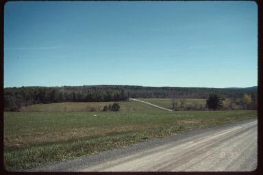
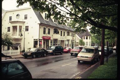
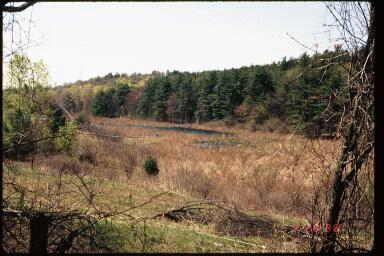
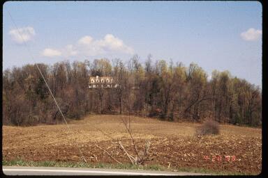
100 Community Image Survey Other Positive Images 100 Town of Stockport


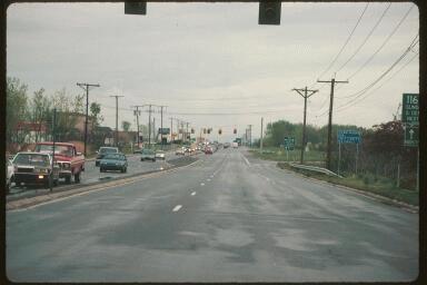
101 Negative Images Community Image Survey Most Negatively Rated Image Stockport Comprehensive Plan 101
Town of Peru Comprehensive Plan Executive Summary
 Town of Peru Comprehensive Plan Executive Communities that plan grow by choice, not by chance. A plan makes growth thoughtful, understandable, and predictable. A plan shows that a community is managing
4-Town Comprehensive Plan DRAFT 7/30/07
 4-Town Comprehensive Plan DRAFT 7/30/07 Acknowledgements ning Committee Town of Harrisburg Norman Roof Randy Nicol Town of Martinsburg Terry Thisse Paul Kelly Town of Montague Jan Bagdanowicz Wendy Perry
Laberge Group. Town of Coeymans. Draft Comprehensive Plan. Overview of Planning Process
 Draft : Presentation of Goals & Strategies Laberge Group Benjamin H. Syden, A.I.C.P., E.D.P Director in Charge Nicole Allen, A.I.C.P. Senior Planner Anjali Malhotra Planner Presentation Outline Introductions
TABLE OF CONTENTS. Transportation Chapter 1 - Introduction and Purpose of Planning to 1-3. Utilities
 Chapter 1 - Introduction and Purpose of Planning... 1-1 to 1-3 Pennsylvania Municipalities Planning Code (Act 247)...1-1 Previous County Planning Activities...1-1 Objectives of the Plan...1-2 Elements
3. VISION AND GOALS. Vision Statement. Goals, Objectives and Policies
 Vision Statement Queen Creek s interconnected network of parks, trails, open spaces and recreation opportunities provide safe and diverse activities and programs that sustain its unique, small town, equestrian
CHAPTER 3 VISION, GOALS, & PLANNING PRINCIPLES. City of Greensburg Comprehensive Plan. Introduction. Vision Statement. Growth Management Goals.
 CHAPTER 3 VISION, GOALS, & PLANNING PRINCIPLES Introduction The Greensburg Comprehensive Plan is intended as a working community document. A combination of long and short-term goals, this document is intended
CHAPTER 7: VISION AND ACTION STATEMENTS. Noble 2025 Vision Statement
 CHAPTER 7: VISION AND ACTION STATEMENTS This chapter presents the vision, policy and action statements that transform the comprehensive planning study, an analysis of Noble s past, future trends and community
SECTION II SECTION II STATEMENT OF GOALS, OBJECTIVES, PRINCIPLES, ASSUMPTIONS, POLICIES AND STANDARDS
 STATEMENT OF GOALS, OBJECTIVES, PRINCIPLES, ASSUMPTIONS, POLICIES AND STANDARDS 1 2 STATEMENT OF GOALS, OBJECTIVES, PRINCIPLES, ASSUMPTIONS, POLICIES AND STANDARDS INTRODUCTION The New Jersey Municipal
2018 Northampton Township Comprehensive Plan
 2018 BUCKS COUNTY, PENNSYLVANIA What is a? A comprehensive plan is a municipality s main policy document that details the collective vision for the future, the historic, environmental, and cultural facilities
Municipal Plan*Assessment
 Municipal Plan*Assessment This tool was developed to assist in reviewing municipal master plans and in determining if these plans are consistent with smart growth principles, neighboring municipal plans,
2010 Plan of Conservation and Development
 2010 Plan of Conservation and Development Wilton Planning and Zoning Commission Adopted November 2, 2009 Effective January 1, 2010 WILTON 2010 PLAN OF CONSERVATION & DEVELOPMENT PARTICIPANTS Planning &
Port Lavaca Future Land Use
 Port Lavaca Future Land Use Introduction The City of Port Lavaca is beginning to see sustained growth, after many years of relative stable population. New single family homes, apartments, and businesses
Chapter 10 IMPLEMENTATION RECOMMENDATIONS
 Chapter 10 IMPLEMENTATION RECOMMENDATIONS The recommended land use plan presented in the previous chapter provides a design for the attainment of the urban and rural development and open space preservation
SAN RAFAEL GENERAL PLAN 2040 INTRODUCTION AND OVERVIEW
 SAN RAFAEL GENERAL PLAN 2040 INTRODUCTION AND OVERVIEW Steering Committee Presentation February 14, 2018 Purpose of General Plan Guide land use and development decisions Coordinate transportation, infrastructure,
Planned Development Review Revisions (Project No. PLNPCM )
") Planned Development Review Revisions (Project No. PLNPCM2014-00139) Standard residential development Planned Development Example: Smaller lot sizes than what is allowed to create open space amenity. What
Planned Development Review Revisions (Project No. PLNPCM2014-00139) Standard residential development Planned Development Example: Smaller lot sizes than what is allowed to create open space amenity. What
Comprehensive Plan. Faribault, Minnesota. Hoisington Koegler Group Inc. Claybaugh Preservation Architecture Inc. Howard R. Green Company Bonz/REA
 Comprehensive Plan Faribault, Minnesota Adopted by the Faribault City Council July 8, 2003 prepared for: prepared by: Hoisington Koegler Group Inc. Claybaugh Preservation Architecture Inc. Howard R. Green
CHAPTER 12 IMPLEMENTATION
 CHAPTER 12 IMPLEMENTATION The 2010 Town of Denton Comprehensive Plan is intended to capture a vision of the future of Denton. As such, it provides a basis for a wide variety of public and private actions
The transportation system in a community is an
 7 TRANSPORTATION The transportation system in a community is an important factor contributing to the quality of life of the residents. Without a sound transportation system to bring both goods and patrons
The Five Components of the McLoughlin Area Plan
 The Five Components of the McLoughlin Area Plan This documents contains the complete language of the five components of the McLoughlin Area Plan: The Vision Statement The Values The Guiding Principles
Improve Neighborhood Design and Reduce Non Point Source Water Pollution
 HOW TO Planning Guide Improve Neighborhood Design and Reduce Non Point Source Water Pollution This document was funded by a grant from the New Hampshire Coastal Program with funding from the National Oceanic
CONCLUSION AND IMPLEMENTATION
 Lisbon s Vision CONCLUSION AND IMPLEMENTATION 7 Lisbon residents clearly appreciate the character, amenities, and opportunities that define our community. This Plan of Conservation and Development identifies
Gloucester County s Comprehensive Plan. The Community Connection
 Gloucester County s Comprehensive Plan The Community Connection Current Comp Plan Adopted in 1991 with a 20 year planning horizon Updated in 1995 with Part V- Implementation Recommendations and Appendix
Purpose of the Master Plan
 Purpose of the Master Plan 4 Master Plan Purpose The Master Plan is a policy framework for decisions that affect the physical, social and economic environment of the Town. The Parker 2035: Master Plan
HOUSING ELEMENT GOALS, OBJECTIVES, AND POLICIES
 HOUSING ELEMENT GOALS, OBJECTIVES, AND POLICIES Goal 6 Maintain and enhance the supply of decent, safe, energy efficient and affordable housing and maximize viable options and opportunities for present
8implementation. strategies
 PROGRAM STRATEGIES 8implementation strategies T he implementation actions of this chapter are designed to support and carry out the land use, economic development, transportation, urban design, and program
City of Royalton Comprehensive Land Use Plan 2005 to Revision February 8, 2011
 City of Royalton Comprehensive Land Use Plan 2005 to 2015 2011 Revision February 8, 2011 PART ONE: INTRODUCTION TO THE COMPREHENSIVE PLAN 1.0 Purpose and Introduction The Comprehensive Land Use Plan provides
DRAFT Amsterdam/Churchill Community Plan (4/17/08) Adopted By the Gallatin County Commission
 Adopted By the Gallatin County Commission") DRAFT Amsterdam/Churchill Community Plan (4/17/08) Adopted By the Gallatin County Commission Table of Contents Acknowledgements Chapter 1: Introduction A Brief History What s Next Authority Organization
DRAFT Amsterdam/Churchill Community Plan (4/17/08) Adopted By the Gallatin County Commission Table of Contents Acknowledgements Chapter 1: Introduction A Brief History What s Next Authority Organization
OPEN SPACE CHAPTER 7: OVERVIEW. Preserve open space to protect natural resources, enhance character and provide passive recreation opportunities
 CHAPTER 7: OPEN SPACE OVERVIEW Ridgefield has made tremendous progress permanently preserving areas of town as open space. Open space preservation can serve many important purposes, including: protect
Section 9 NEIGHBORHOOD DESIGN
 Section 9 NEIGHBORHOOD DESIGN City of Lancaster Comprehensive Plan D u n k i n, S e f k o & A s s o c i a t e s, I n c. NEIGHBORHOOD DESIGN INTRODUCTION There are many ways in which a neighborhood can
TOWN OF BETHLEHEM MEETING SUMMARY LOCAL WATERFRONT REVITALIZATION PROGRAM UPDATE
 TOWN OF BETHLEHEM LOCAL WATERFRONT REVITALIZATION PROGRAM UPDATE MEETING SUMMARY Purpose: LWRP Update Public Workshop #3 Date and Time: October 24, 2017, 6:00 pm - 8:00 pm Location: Town Hall, 445 Delaware
Town of Liberty, NY COMPREHENSIVE PLAN & ZONING UPDATES
 Town of Liberty, NY S Public Informational Meeting October 4, 2016 High School Auditorium Welcome Thank you for coming tonight. Agenda Part I Overview of Proposed Changes What is Being Prepared Anticipated
Town of Blooming Grove Comprehensive Plan. Public Meeting October 13, 2004
 Town of Blooming Grove Comprehensive Plan Public Meeting October 13, 2004 Overview of Presentation Process Plan Vision Recommendations Next Steps Process: Listening to the Public Monthly meetings with
OVERVIEW OF PLANS FOR THE JEFFERSON COUNTY COUNTRYSIDE FARM In the Context of Quality Place Characteristics
 OVERVIEW OF PLANS FOR THE JEFFERSON COUNTY COUNTRYSIDE FARM In the Context of Quality Place Characteristics By Steve Grabow, Professor and Community Development Educator University of Wisconsin-Extension,
Procedures IV. V. Rural Road Design Option
 i IV. Procedures A. All applicants required to prepare a Conservation Design Subdivision shall provide the Planning Board with a conceptual conventional subdivision design as well as a proposed layout
The West Vaughan Employment Area Secondary Plan Policies
 Part 2: The West Vaughan Employment Area Secondary Plan Policies 2.1 General Policies It is the policy of Council: 2.1.1. That the West Vaughan Employment Area (the WVEA), identified on Schedule 1, will
Living in Albemarle County s Urban Places
 Living in Albemarle County s Urban Places ALBEMARLE COUNTY, VIRGINIA A Closer Look at Albemarle s Approach to Managing Growth and Creating Quality Urban Environments www.albemarle.org Page 2 Living in
Whitemarsh Comprehensive Plan Update: Housing & Land Use. Public Workshop #3: September 20, 2018
 Whitemarsh Comprehensive Plan Update: Housing & Land Use Public Workshop #3: September 20, 2018 Agenda Welcome Process Recap What We ve Heard The Plan Framework Review of Recommended Actions Land Use Housing
VILLAGE & TOWN OF BERGEN: COMPREHENSIVE PLAN
 VILLAGE & TOWN OF BERGEN: COMPREHENSIVE PLAN CPC Public Hearing April 21, 2016 History 1996 Comprehensive Plan Comprehensive Plan Update Committee Consultant (LaBella Associates): December 2014 Residents
Purpose of the Master Plan
 Purpose of the Master Plan 4 Master Plan Purpose The Master Plan is a policy framework for decisions that affect the physical, social and economic environment of the Town. The Parker 2035: Master Plan
Concord Community Reuse Project Goals and Guiding Principles. Overarching Goals (OG)
") Concord Community Reuse Project Goals and Guiding Principles Overarching Goals (OG) No priority is implied by the order of presentation of the goals and guiding principles. Overarching goals for the Concord
Concord Community Reuse Project Goals and Guiding Principles Overarching Goals (OG) No priority is implied by the order of presentation of the goals and guiding principles. Overarching goals for the Concord
CITY OF CHARLOTTESVILLE, VIRGINIA CITY COUNCIL AGENDA
 CITY OF CHARLOTTESVILLE, VIRGINIA CITY COUNCIL AGENDA Agenda Date: December 16, 2013 Action Required: Adoption of Resolution Presenter: Staff Contacts: Title: James E. Tolbert, AICP, Director of NDS James
NEW CASTLE COUNTY S ZONING DISTRICTS
 NEW CASTLE COUNTY S ZONING DISTRICTS This is general information about New Castle County s zoning districts. The information included is by no means exhaustive or complete. Before designing plans to develop
A larger version of this map is located on the last page of this PDF.
 MAP Committee Input McLoughlin Area Draft Vision Map A larger version of this map is located on the last page of this PDF. 1. The map above is intended to portray a vision for the McLoughlin area. It highlights
HE VISION. Building a Better Connected Place
 HE VISION Building a Better Connected Place WALK INTO THE FUTURE. Life in Cranberry, 2030 Here s what our residents told us they wanted to see in their community by 2030: The Cranberry of 2030 is a place
City of Farmington. Downtown Plan. Amendment to the 1998 Master Plan Adopted October 11, 2004
 City of Farmington Amendment to the 1998 Master Plan Adopted October 11, 2004 Introduction Planning Background 1 Scope and Components of the Plan Amendment 2 Concept Introduction 3 Plan Concepts 3 Conceptual
SALISBURY TOMORROW Our Vision
 SALISBURY TOMORROW Our Vision Salisbury is committed to supporting a high quality of life and sense of community for all residents. These commitments need to be reflected in our community programs, services
Sorted citizen input comments in review of Blount County plans July, August, and September 2007
 Sorted citizen input comments in review of Blount County plans July, August, and September 2007 The following presents sorted citizen input comments from three sessions held in July, August and September
Design for Health Comprehensive Plan Review Checklists. Design for Health,
 Comprehensive Plan Review Checklists, 2007 info@designforhealth.net These Comprehensive Plan Review Checklists summarize the key points of the (DFH) background and health impact assessment (HIA) materials.
TRANSPORTATION AND LAND USE
 CHAPTER 10 TRANSPORTATION AND LAND USE Transportation and land use are intimately linked. The expansion of a highway typically spurs housing, employment growth and land development in the communities that
CHAPTER 1: INTRODUCTION
 CHAPTER 1: INTRODUCTION MAP OF OUTAGAMIE COUNTY, WI N 1 = 6 miles INTRODUCTION The Town and Village of Black Creek are located in central Outagamie County, Wisconsin. The Village is located in the north
TOWN COUNCIL / PLANNING COMMISSION
 Workshop #3 TOWN COUNCIL / PLANNING COMMISSION January 20, 2011 Consultant Team In Attendance Tonight BMS Design Group Nevada City and San Francisco Michael Smiley, AICP, ASLA Partner-in-Charge Nancy L.
Subject: Hendry County Evaluation and Appraisal Report Letter of Understanding - Identification of Major Issues
 HENDRY COUNTY PLANNING & ZONING DEPARTMENT POST OFFICE BOX 2340 165 S. LEE STREET LABELLE, FLORIDA 33975 (863) 675-5240 FAX: (863) 675-5317 SUNCOM 744-4750 November 16, 2007 Mr. Mike McDaniel, Chief Office
The Vision. Photo provided by The Minervini Group. 46 Vision, Objectives & Strategies
 Vision, Objectives & Strategies The is the public framework and guide for future development of the Grand Traverse Commons. The establishes public polices for infrastructure, the preservation of natural
Guiding Principles, Objectives, Strategies and Policies
 Guiding Principles, Objectives, Strategies and Policies Section 1 Introduction These Guiding Principles were adopted as part of the 1999 Athens-Clarke County Comprehensive Plan and are carried over, in
How To Get the Development You Planned
 How To Planning Series Prepared by Strafford Regional Planning Commission. Funded by the NH Office of State Planning How To Get the Development You Planned The purpose of the master plan is... to guide
Yadkin River Greenway Feasibility Study Fact Sheet Village of Clemmons, Town of Lewisville, Town of Bermuda Run
 Fact Sheet Village of Clemmons, Town of Lewisville, Town of Bermuda Run Project Background The Yadkin River Greenway Feasibility Study is a joint project with the Village of Clemmons, the Town of Bermuda
Keyport. Vision for Keyport
 Keyport Vision for Keyport Keyport is a rural, historic waterfront village bounded and limited in size by its natural borders of water and the Naval Undersea Warfare Center. The community consists primarily
Plan-It Greenville (2009) Comprehensive Plan 5-Year Update
 Comprehensive Plan 5-Year Update") Plan-It Greenville (2009) Comprehensive Plan 5-Year Update What is the comprehensive plan: Collecting communitywide data Projecting future population growth Setting communitywide goals Framing policies
Plan-It Greenville (2009) Comprehensive Plan 5-Year Update What is the comprehensive plan: Collecting communitywide data Projecting future population growth Setting communitywide goals Framing policies
Town of Washington Master Plan & Regulatory Audit: Interim Results
 Town of Washington Master Plan & Regulatory Audit: Interim Results May 20, 2008 Presented by: 30 Bank Street Lebanon, NH 03766 www.uvlsrpc.org Introduction & Purpose Compare the Master Plan to the regulations
EXECUTIVE SUMMARY DRAFT CHAPTER 1 INTRODUCTION EXECUTIVE SUMMARY
 CHAPTER 1 EXECUTIVE SUMMARY INTRODUCTION Through the joint efforts of the City of Tulsa planning staff and the Land Services division of Indian Nations Council of Governments (INCOG), the Berryhill Land
Implementation Guide Comprehensive Plan City of Allen
 Implementation Guide 2030 Comprehensive Plan City of Allen DRAFT 2015 Implementation Guide Allen 2030 Comprehensive Plan INTRODUCTION The Comprehensive Plan serves as a guide for the growth and development
WATERFORD Plan of Preservation, Conservation and Development Supplement Part 1 - Policy Element
 WATERFORD 2012 Plan of Preservation, Conservation and Development 2015 Supplement Part 1 - Policy Element Effective June 11, 2015 2015 Plan Update GOAL To respond to the evolving land use needs and continually
RECREATION AND OPEN SPACE ELEMENT GOALS, OBJECTIVES, AND POLICIES
 RECREATION AND OPEN SPACE ELEMENT GOALS, OBJECTIVES, AND POLICIES Goal 7 To provide park facilities, recreation programs, and open space resources that are safe, adequate, and accessible to all City residents,
Westport Master Plan. Town of Westport. Master Plan Master Plan Update Committee. Westport, Massachusetts
 Town of Westport Master Plan 2004 Master Plan Update Committee Westport, Massachusetts Open Space and Recreation 5-1 Table of Contents Table of Contents... i List of Tables... ix List of Figures... ix
3 Vision and Goals. Vision and Goals. Blueprint for Bloomsburg. Vision. Town of Bloomsburg Comprehensive Plan,
 Vision and Goals 3 Vision and Goals Citizens of the Town of Bloomsburg clearly value their natural and cultural heritage, the walkable, mixed use pattern of downtown, the access to education, and the community
Chapter 13: Implementation Plan
 Implementation A. Introduction The Implementation Plan, in table form on the following pages, provides a summary of all the Action Items recommended in Chapters 2 through 12. The table also indicates which
Support the implementation of Cape Coral's Comprehensive Plan. Protect and utilize the unique natural resources in the City.
 7.0 OVERVIEW - RECOMMENDATIONS Chapter 7 The preparation of the Cape Coral Parks and Recreation Master Plan spanned a period of approximately 12 months. Plan preparation included the input of a wide range
Denton. A. Downtown Task Force
 2 Public Involvement Early and ongoing public involvement was solicited so that the public had ample opportunity to help direct the DTIP s concepts and implementation strategies. The residents of Denton
Rural Land Use Designations Kittitas County December 6, 2007 Draft
 KITTITAS COUNTY COMMUNITY DEVELOPMENT SERVICES 411 N. Ruby St., Suite 2, Ellensburg, WA 98926 CDS@CO.KITTITAS.WA.US Office (509) 962-7506 Fax (509) 962-7682 Rural Land Use Designations Kittitas County
Municipal Comprehensive and Open Space Plans
 Appendix 13-A Local Historic Policy Municipal Comprehensive and Open Space Plans Oxford Regional Comprehensive Plan (1969) The Oxford Regional Comprehensive Plan serves as the Comprehensive Plan for Oxford
Major Subdivision Sketch Plan Checklist
 This checklist provides specific requirements that are apart of the Sketch process. The entire process is described by the Huntersville Subdivision Review Process which details all the submittal and resubmittal
North Fair Oaks Community Plan Summary and Information
 North Fair Oaks Community Plan Summary and Information WHAT IS THE NORTH FAIR OAKS COMMUNITY PLAN? The North Fair Oaks Community Plan is part of the San Mateo County General Plan, and establishes policies
Small Area Plan. South Gateway
 Small Area Plan Adopted May 12, 2008 South Gateway Purpose. The South Gateway Small Area Plan defines the City s expectations for the future of the southern entrance to the City at Interstate 85 and Highway
This chapter describes the purpose of the Plan, introduces how the Plan is organized and provides contextual background for the Plan.
 Chapter 1: INTRODUCTION Purpose of a Comprehensive Plan The 2040 Comprehensive Plan establishes Medina s vision as a community and sets goals and objectives which guide future decisions and policies. The
implementation10 Village of Greendale Comprehensive Plan: Greendale, Wisconsin. Revisiting a Greenbelt Community
 implementation10 Village of Greendale Comprehensive Plan: 2010 - Village of Greendale Comprehensive Plan: 2010 - Implementation The recommendations of this Plan must be implemented by the Village of Greendale,
EXISTING COMPREHENSIVE PLAN
 EXISTING COMPREHENSIVE PLAN Town Center Land Use Element: V. LAND USE POLICIES Town Center Mercer Island's business district vision as described in "Your Mercer Island Citizen-Designed Downtown" was an
PROJECT BACKGROUND. Preliminary Design Scope and Tasks
 PROJECT BACKGROUND Preliminary Design Scope and Tasks The purpose of this Study is the development of preliminary designs for intersection improvements for Trunk Highway (TH) 36 at the intersections of
AWH REPORT OF THE PLANNING AND DEVELOPMENT DEPARTMENT FOR APPLICATION FOR REZONING ORDINANCE TO PLANNED UNIT DEVELOPMENT
 AWH REPORT OF THE PLANNING AND DEVELOPMENT DEPARTMENT FOR APPLICATION FOR REZONING ORDINANCE TO PLANNED UNIT DEVELOPMENT MAY 8, 2014 The Planning and Development Department hereby forwards to the Planning
COMMUNITY DESIGN. GOAL: Create livable and attractive communities. Intent
 COMMUNITY DESIGN Intent An attractive, well-designed County will attract quality development, instill civic pride, improve the visual character of the community, and create a strong, positive image for
CONTENTS 8.0 LAND USE 8.1 GENERAL LAND USE 8.2 RESIDENTIAL 8.3 MIXED USE 8.4 COMMERCIAL 8.5 EMPLOYMENT LANDS
 8-2 Land Use 8.0 LAND USE CONTENTS 8.1 GENERAL LAND USE 8.1.1 Uses provided for in all Land Use Designations 8.1.2 Uses prohibited in Hazardous Lands, Hazardous Sites and Special Policy Areas 8.1.3 Uses
LU Encourage schools, institutions, and other community facilities that serve rural residents to locate in neighboring cities and towns.
 Application No. 891627: Comprehensive Plan Text Amendment - Rural School Policies - Amend policies consistent with State Legislation allowing schools in the rural area and extension of sewer service to
Please read the entire document
 projects impacting the waterfront revitalization area. The waterfront revitalization area of the town will have to subareas to the west and east of the village. Page 6 of 6 Wayfinding master plan create
Town Center (part of the Comprehensive Plan)
") Town Center (part of the Comprehensive Plan) Mercer Island Town Center Looking North (2014) In 1994, a year-long process culminated in a set of design guidelines and code requirements for the Town Center
Town Center (part of the Comprehensive Plan) Mercer Island Town Center Looking North (2014) In 1994, a year-long process culminated in a set of design guidelines and code requirements for the Town Center
CHAPTER 5: IMPLEMENTING THE 2030 PLAN
 CHAPTER 5: IMPLEMENTING THE 2030 PLAN GENERAL Each decision by the County Commissioners and recommendation made by the Planning Commission has the potential to contribute to or take away from the implementation
3.10 LAND USE SETTING PROJECT SITE EXISTING LAND USE DESIGNATIONS AND ZONING. General Plan Land Use Designations.
 This section of the Draft EIR addresses the existing land uses on and adjacent to the project site and discusses the potential impacts of the proposed project on existing land uses. Key issues addressed
URBAN DESIGN BRIEF. 2136&2148 Trafalgar Road. Town of Oakville
 URBAN DESIGN BRIEF 2136&2148 Trafalgar Road Town of Oakville Prepared By: METROPOLITAN CONSULTING INC For 2500674 Ontario Inc November 2016 TABLE OF CONTENTS Page No. 1.0 Introduction/Description of Subject
Introduction. Chapter 1. Purpose of the Comprehensive Plan Plan Organization Planning Process & Community Input 1-1
 Chapter 1 Introduction Lakewood 2025: Moving Forward Together Purpose of the Comprehensive Plan Plan Organization Planning Process & Community Input 1-1 Purpose of the Comprehensive Plan The Comprehensive
D1 September 11, 2013 Public Hearing APPLICANT:
 D1 September 11, 2013 Public Hearing APPLICANT: BEACH MUNICIPAL FEDERAL CREDIT UNION PROPERTY OWNER: SISTERS II, LLC STAFF PLANNER: Karen Prochilo REQUEST: Conditional Change of Zoning (AG-2 Agriculture
Manchester. Vision for Manchester
 Manchester Vision for Manchester The Manchester Community Plan is a statement of the community values and aspirations for the future. This is an effort to recognize what originally attracted visitors in
A BLUEPRINT FOR BROCKTON A CITY-WIDE COMPREHENSIVE PLAN
 A BLUEPRINT FOR BROCKTON A CITY-WIDE COMPREHENSIVE PLAN Public Meeting October 2016 1 Plan Summary and Discussion Public Meeting May 4 2017 City of Brockton Bill Carpenter, Mayor Department of Planning
E. RURAL COMMERCIAL/INDUSTRIAL PARK MODEL
 E. RURAL COMMERCIAL/INDUSTRIAL PARK MODEL 1. PURPOSE The purpose of the Rural Commerce/Industrial Park Model is to provide parameters within which a grouping of business buildings with parking, loading
Zoning and Development Considerations in the Boothbay Harbor Maritime/Water Dependent District
 Zoning and Development Considerations in the Boothbay Harbor Maritime/Water Dependent District Bob Faunce Lincoln County Planner Lincoln County Regional Planning Commission Board of Selectmen and Planning
CHAPTER FIVE COMMUNITY DESIGN
 CHAPTER FIVE COMMUNITY DESIGN CHAPTER FIVE - COMMUNITY DESIGN Assumptions Frazier Park and Lebec have historically developed according to different patterns of spatial form. While both communities are
Secrest Short Cut and Monroe Expressway Small Area Plan AUGUST 29, 2018
 Secrest Short Cut and Monroe Expressway Small Area Plan AUGUST 29, 2018 Background and Process Monroe Expressway will be open by the end of 2018 Union County and Indian Trail identified a need to revisit
Executive Summary. Parks and Recreation Plan. Executive Summary
 Parks and Recreation Plan Executive Summary The Whitemarsh Township Parks and Recreation Plan sets forth a vision for how Whitemarsh Township can provide a premiere parks and recreation system reflective
Mark-up of the effect of the proposed Bronte Village Growth Area OPA No.18 on the text of section 24, Bronte Village, of the Livable Oakville Plan
 Mark-up of the effect of the proposed Bronte Village Growth Area OPA No.18 on the text of section 24, Bronte Village, of the Livable Oakville Plan Notes: This document is provided for information purposes
PLAN ELEMENTS WORKSHOP. April 5, 2016
 PLAN ELEMENTS WORKSHOP April 5, 2016 needs more housing. But there is no one-size fits-all solution. Every neighborhood has its own character. In some places, density is not only appropriate it is badly
Access Management: An Overview
 Figures 1-5 Below Evolution of development along a highway. In the early stages, land along the road is used for farming with little traffic generated. As time passes, the highway corridor becomes a de
LAND USE ELEMENT. Purpose. General Goals & Policies
 LAND USE ELEMENT Purpose This Land Use Element contains the goals and policies necessary to support the City s responsibility for managing land resources and guiding development through implementing regulations,
2030 Comprehensive Plan VISION STATEMENT
 RESOURCE DOCUMENT for Steering Committee Meeting #2 July 12, 2017 2030 Comprehensive Plan VISION STATEMENT Steering Committee from 2008 Established the Lauderdale s Vision as: Creating a livable, lovable