Monroe Street Reconstruction. Final Corridor Design Presentation & Open House August 16, 2017
|
|
|
- Winfred Moody
- 5 years ago
- Views:
Transcription


1 Monroe Street Reconstruction Final Corridor Design Presentation & Open House August 16, 2017
2 Thank you to Wingra School! Tonight s Agenda 1. Project Overview 2. Design Proposal & Preparing for Reconstruction 3. Open House
3 Project Team Engineering Christy Bachmann, P.E., Principal Engineer Jim Wolfe, Project Engineer Phil Gaebler, Water Resources Specialist Economic Development Ruth Rohlich, Business Development Specialist Mike Miller, Business Development Specialist Traffic Engineering Yang Tao, Ph.D., P.E., Assistant City Traffic Engineer Planning Rebecca Cnare, PLA, Urban Design Planner Benjamin Zellers, Transportation Planner Madison Metro Tim Sobota, Metro Transit Planner
4 July 20-October 6: Public engagement for Crazylegs Plaza and Wingra Park entrance design Public art, green infrastructure, connectivity Key Dates September-October: Public assessment hearings (Board of Public Works & Common Council) November: Project out to bid Starting in February 2018: Public information meetings on what to expect during construction


5 Key Dates: Crazylegs Plaza & Wingra Park Entrance September 14: Design alternatives presentation Wingra School, 6:00-7:30PM Landscape, public art, green infrastructure, multimodal connectivity, activity spaces October: Final plans submitted for city review November: Project out to bid Final presentation, date TBD
6 Public Input & Engagement


7 Where We ve Been Engagement Resource Team Community survey Kickoff meeting 2 business focus groups 2 green infrastructure focus groups Ped, Bike, Transit World Café Green Infrastructure World Café Cross Section Workshop Cross Section Open House Wingra Park Entrance Workshop Preliminary Design Workshop

8 Meeting Ground Rules Ask clarifying questions as we go (e.g., to explain a term or repeat a statement). Save longer discussion questions for the end.
9 Project Overview Jim Wolfe Project Engineer, City of Madison August 2016

10 Reconstruction will occur within nine months: March-November 2018 Project Scope & Timeline Utilities Street

 Lighting and")

")
11 2018 Project Budget Total project budget: ~ $17 million Street: $9.8 million Infrastructure replacement (pavement, curb, sidewalk) Lighting and signal replacement Pavement markings Other pedestrian improvements Some storm sewer (inlets & leads) Placemaking (including Crazylegs Triangle & public art) Undergrounding in business districts
12 2018 Project Budget Sanitary Sewer: $4 million Replacement of sewer main & laterals Water Main: $2.2 million Replacement of main & reconnection of services Storm Sewer: $750,000 Replacement & installation of new main Water Quality: $200,000 Catch basins & treatment structure Rain Gardens: $20,000
13 Proposed Design Jim Wolfe, Project Engineer Phil Gaebler, Water Resources Specialist
14 Existing configuration with numerous modifications How do we improve the pedestrian environment, enhance the sense of place and support the green street vision? Approved Cross Section


 Numerous local and")

 Frequent Metro service Easy")
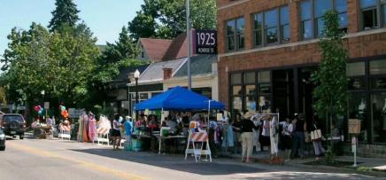
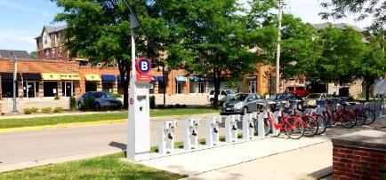
15 Maintain and Support What s Working Healthiest local street retail outside of downtown Madison Thriving restaurant scene High property values Anchor institutions (UW, Edgewood) Numerous local and regional community amenities (Wingra Park, Arboretum, SW Commuter Path, Glenwood Park, etc.) Frequent Metro service Easy access to Downtown, east side and west side
16 Install a Coordinated Mix of Improvements Pedestrian infrastructure Bicycle infrastructure Green infrastructure Bus stops Parking meters Placemaking nodes


17 Pedestrian Infrastructure Rectangular rapid flashing beacons at six intersections Pedestrian countdown timers Leading pedestrian intervals at some intersections Walk signal appears before green light Already installed at Grant Street


18 High-visibility crosswalks at key locations Crossing islands Coordinate with bus stops Pedestrian Infrastructure Pedestrianscale/decorative lighting in business districts Raised intersections at: Harrison Leonard Knickerbocker Glenway Narrowing from Edgewood to Regent


19 Bike Infrastructure Improved signage along the SW Commuter Path Will be completed before or during project On-street bike parking Attached to parking meter markers Post-and-ring Side street parking: At corners where there is space and property owners request
20 Green Infrastructure
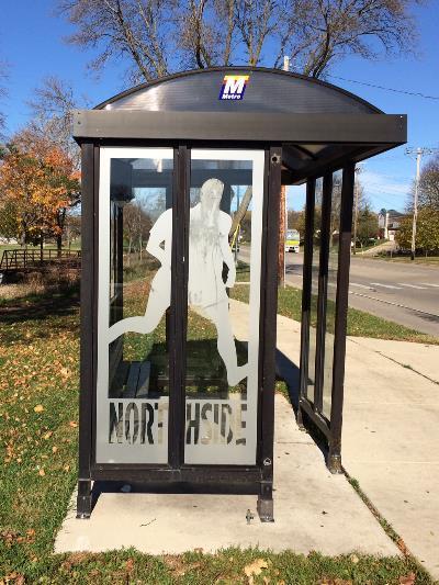
21 Proposed Treatment Options Wingra Park Screen Structure Side Street Bioretention/Rain Gardens Bed Load Trap/Catchbasin Rock Infiltration Trench Expanded Tree Grates


22 Wingra Park Screen Structure Annualized cost per pound of total Phosphorous (TP) = $347- $417

23 Side Street Rain Gardens Constructed as Bioretention 20 suitable locations Property owner has right of refusal Can be maintained by others Construction cost can be absorbed by the city

24 Rock Trench


25 4 x 12 Tree Grates and Soil Improvements Reduce soil compaction More soil volume for trees Terrace excavated from curb to sidewalk No filtering of street water Less risk of tree mortality Suitable where terrace is concrete from building to curb or existing soil is highly compacted
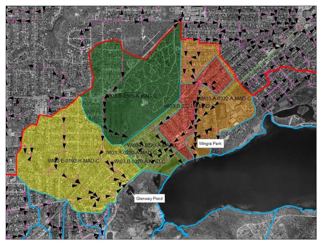
26 Where does this get us? Wingra Screen Rain Gardens Bed Load Traps Rock Trenches Total 36 lb / year 4.6 lb/ year 0.5 lb/ year 1.5 lb/ year 42.6 lb total phosphorus/year Added to existing reduction, total phosphorus reduction will be at 22% for the watersheds draining across Monroe Street.
27 Green Infrastructure Support Policy Policy recommendation to support stormwater management in the Wingra and Monona Bay Watersheds These waterbodies do not benefit from adaptive management Policy would support the installation of stormwater treatment in the adjacent commercial properties.

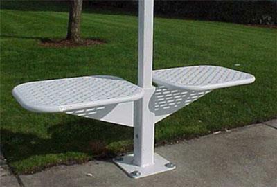
28 Additional Placemaking + Green Infrastructure Crazy Legs Triangle opportunities for: Public art Bus stop Seating Bikes Green design & education Wingra Park entrance opportunities for: Smaller-scale public art Bus stop Landscape design Design alternatives meeting on September 14 th
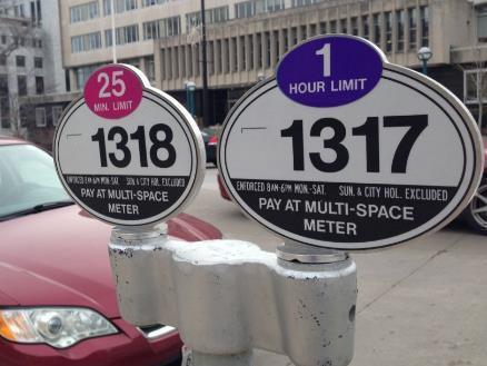
29 Multi-space smart meters Bus stop amenities Parking Meters and Bus Stops
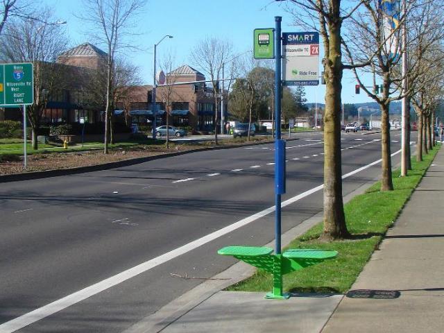
30 Bus Stops New locations adopted by Transit & Parking Commission on 8/9 Total of 9 fewer stops than today Improves on-time performance Average distance is 1,100 feet Most stops located after intersections Improves pedestrian safety and driver visibility For more information:
31 Preliminary Corridor Design
32 Street width between Harrison & Regent now proposed 45 ft. Westbound (uphill) biking spacing Design Updates Width from Edgewood to Prospect narrowed to 42 ft. Changed corner of Prospect RRFB location RRFB moved from Knickerbocker to Sprague RRFB moved from Western to Chapman Updated bus stop locations based on TPC


33 Street Lighting Install new street lighting throughout corridor Pedestrian scale lighting in business districts Prospect to Regent Crandall to east of Commonwealth Lewis Court to east of Glenway All intersections will have tall poles and areas without ped lights will have mid-block tall poles
34 Odana thru Lewis Court
35 Glenway thru Copeland
36 Western Ave to Chapman Wingra School
37 Baltzell to Pickford
38 Crandall to Sprague
39 Commonwealth Ave to West Lawn Ave and Terry Place
40 Woodrow to Edgewood College Drive/Leonard
41 Edgewood Ave to Lincoln Street
42 Prospect Ave to Harrison Street
43 Spooner/Grant to Garfield
44 Breese to Regent (Crazy Legs)
45 Preparing for the Reconstruction
46 Utility Work Project includes replacement of utilities Sanitary sewer main & laterals to property line Existing mains from 1905, 1911, 1922, 1932 Replace water main & reconnect services Replace storm sewer as necessary Street light & traffic signal infrastructure Coordinate with private utilities Replacement of existing facilities Undergrounding work
47 Construction & Access Construction expected to last from end of March until early November Work hours 7am to 7pm Average of 2 planned water shut-offs Minimum 48 hrs notice prior to shut-offs; more notice given when possible Emergency shut-offs possible, notify affected properties ASAP One lane of traffic, moving inbound No signed detour planned Metro detoured Review final design for possible phasing
48 No on-street parking during work hours Construction & Access Access maintained to all commercial driveways during construction Brief delays when working at each driveway Residential driveways closed up to 20 days Residents in 2 hour parking zones may apply for free residential parking permits Review side streets for suspension of street sweeping parking restrictions
49 During construction, sidewalks will remain open on at least one side at all times Construction & Access Sidewalk access open to all businesses, but may be from only 1 end of block Laterals & concrete work Temporary crosswalks installed as necessary
50 Trees 28 planned tree removals, currently Tree health, preemptive ash removals, traffic island installation Locations to be noted on website & in future mailings Additional removals may be necessary as street & utility design is completed Tree protection specifications enforced for all trees that are planned to remain Review with Forestry for new plantings wherever possible during detailed design
51 Assessment Policy Project will include assessments to adjacent property owners Item Property Owner Share City Share Curb and Gutter 50% 50% Pavement 0% 100% Replace Sidewalk/Apron 50% 50% Place Making 0% 100% Storm Sewer 0% 100% Private Storm Connections 100% 0% Sanitary Sewer Main 0% 100% Sanitary Sewer Laterals 25% 75% Water main & services 0% 100% Street Lights (tall poles) 100% 0% Pedestrian Scale Lighting 100% 0%
52 Mail estimated assessments: 9/08/17 BPW public hearing: 9/20/17 Common Council public hearing: 10/03/17 Assessments Assessments can be paid in lump sum or over 8 years with 3% interest Final assessments will be mailed in the summer of 2019, following the project completion Final assessments will be calculated based on bid prices and measured quantities
53 Questions?
54 Next Steps
55 Key Dates: Monroe Street September-October: Public assessment hearings 9/8: Estimated assessments mailed 9/20: Board of Public Works public hearing 10/3: Common Council public hearing November: Project out to bid Starting in February 2018: Public information meetings on what to expect during construction
56 Key Dates: Crazylegs Plaza & Wingra Park Entrance September 14: Design alternatives presentation for Crazylegs Plaza and Wingra Park entrance Wingra School, 6:00-7:30PM Landscape design, public art, green infrastructure, multimodal connectivity, activity spaces October: Final plans submitted for city review November: Project out to bid Final design presentation, date TBD
57 More Information All background materials are posted online on the City s Monroe Street Reconstruction project page: cts/monroe-street Subscribe to updates. Share comments. Alder Eskrich, District 13: Subscribe to updates. Share comments.
Monroe Street Reconstruction. Business Roundtable March 29, 2017
 Monroe Street Reconstruction Business Roundtable March 29, 2017 Thank you to HotelRED and Roman Candle Pizza! Tonight s Agenda 1. Monroe Street Business Strategy Overview 2. Reconstruction Project Scope
Monroe Street Reconstruction. Public Preconstruction Meeting February 21, 2018
 Monroe Street Reconstruction Public Preconstruction Meeting February 21, 2018 Thank you to Edgewood College! Tonight s Agenda 1. Project Overview 2. Initial project schedule and phasing 3. Expectations
Project will Replace: Utilities Curb Pavement Lighting. City of Madison
 Project will Replace: Utilities Curb Pavement Lighting Replace sanitary sewer main & laterals Winnebago: Existing 8 main, 1905 Linden: Existing 6 main, 1915, upsize to 8 main Atwood: Existing 12 main,
Monroe Street Reconstruction Planning
 Monroe Street Reconstruction Planning April 2014 Monroe Street Reconstruction Project What to expect this evening Welcome and introductions Project scope, timeline and process Including past planning efforts
Crazylegs Plaza & Wingra Park Entrance: Mosaic Art Input Session. November 8, 2017
 Crazylegs Plaza & Wingra Park Entrance: Mosaic Art Input Session November 8, 2017 Thank you to HotelRED! Agenda 1. Project Overview Team and scope Public art context Approved site designs & input to-date
Jenifer Street Reconstruction Neighborhood Engagement Meeting November 4, 2015
 Jenifer Street Reconstruction Neighborhood Engagement Meeting November 4, 2015 Hosted by the Marquette Neighborhood Association Facilitated by Urban Assets Funded in part by the City of Madison Neighborhood
Highway 15 Project - Hutchinson
 Highway 15 Project - Hutchinson Agenda What are we going to talk about today? Goals and benefits of the project Details about the proposed work Project schedule and costs Any questions you may have about
FANSHAWE PARK ROAD/RICHMOND STREET INTERSECTION IMPROVEMENTS. PUBLIC INFORMATION CENTRE 2 June 16, 2016
 FANSHAWE PARK ROAD/RICHMOND STREET INTERSECTION IMPROVEMENTS Municipal Class Environmental Assessment PUBLIC INFORMATION CENTRE 2 June 16, 2016 ACCESSIBILITY Under the Accessibility Standards 2015 for
Cottage Grove Road Reconstruction. City of Madison Engineering
 Public Informational Meeting Cottage Grove Road Reconstruction October 8, 2015 Presentation Outline Introduction Project Purpose & Need Proposed Design Overview Environmental Concerns Pedestrian Needs
Prince William Street Project (Grant Avenue to Wellington Road)
") Prince William Street Project (Grant Avenue to Wellington Road) 1 Goals Improve pedestrian and bike traffic safety Improve street drainage with curb & gutter Upsize water mains Enhance overall street appearance
Prince William Street Project (Grant Avenue to Wellington Road) 1 Goals Improve pedestrian and bike traffic safety Improve street drainage with curb & gutter Upsize water mains Enhance overall street appearance
SOUTH UNIVERSITY Street Design Alternatives in Progress
 1 Alternatives in Progress 2016.01.20 Meeting Agenda 2 1. Progress & Schedule 2. Utilizing the Street Design Manual 3. Site Characteristics and Input Received 4. Street Geometry What can we accomplish
Ballston Station Multimodal Study. Stakeholder Meeting October 5, 2010
 Ballston Station Multimodal Study Stakeholder Meeting October 5, 2010 Agenda Welcome and Introductions Update on Short Term Improvements Update on the Multimodal Study Recap of Goals and Key Issues Working
TAC/CAC, TPO Project Update February 2016
 A1A MULTIMODAL CORRIDOR PLANNING AND ENGINEERING ANALYSIS Florida Department of Transportation TAC/CAC, TPO Update February 2016 PRESENTATION FOOTERT Meeting Agenda What We Plan To Discuss Background New
Project Overview. Get Involved. Public Information Meeting. Contact Information
 Get Involved VDOT representatives will review and evaluate information received as a result of this meeting. Please fill out the comment sheet provided in this brochure if you have any comments or questions.
STANDARD SPECIFICATIONS Book 2 ENGINEERING DRAWINGS INCLUDES ADDENDUMS
 STANDARD SPECIFICATIONS Book 2 ENGINEERING DRAWINGS INCLUDES ADDENDUMS July 23, 2018 Page 1 of 7 STANDARD LEGEND SYMBOLS (September, 1973)... AS-101A STANDARD LEGEND SYMBOLS (September, 1973)... AS-101B
open house 3 CITY OF SALEM Downtown Streetscape Plan
 open house 3 Streetscape concepts CITY OF SALEM Downtown Streetscape Plan analysis concepts we are here refined concepts & document Feb 13th 1 2 3 apr 18th KICKOFF OPEN HOUSE Streetscape Work Group Walking
Johnson Street Bridge Public Realm Update
 Johnson Street Bridge Public Realm Update August 20, 2015 Background Johnson Street Bridge Replacement Project impacts a diverse range of stakeholders In addition to a new bridge, the project also includes
Street Flooding Mitigation Plan KYOVA Interstate Planning Commission. Presented to AMPO National Conference October 18, 2017
 Street Flooding Mitigation Plan KYOVA Interstate Planning Commission Presented to AMPO National Conference October 18, 2017 Saleem Salameh, Ph.D., P.E., M.ASCE Chet Parsons, AICP CTP Agenda: Background
Tonight s Agenda. Summary Presentation Open House. Group Discussion Next Steps: online community wide survey
 Community Open House February 22, 2018 Tonight s Agenda Summary Presentation Open House Station 1: Project Overview and Community Input Station 2: Draft Vision and Guiding Principles Station 3: Western,
North Street Reconstruction & Integrated Stormwater Management System
 OWEA Watershed Workshop-October 30 th, 2014 North Street Reconstruction & Integrated Stormwater Management System Ted Blahnik, PE Principal-Williams Creek Consulting North Street: A Case Study for Integrated
Town of Yucca Valley Capital Improvement Projects Report July 24, 2014
 Town of Yucca Valley Capital Improvement Projects Report July 24, 2014 SR 62 Traffic and Pedestrian Improvements from Apache Trail to Palm Avenue (PLHD) The project includes construction of curbs, gutters,
2016 REVISIONS COMMENT FORM RULES AND REGULATIONS FOR CONSTRUCTION IN THE PUBLIC WAY COMMENT PERIOD: JUNE 1 TO JUNE 30, 2015
 AGENCY: 2016 REVISIONS COMMENT FORM Section Title Number Chapter 1 Introduction Comment 1.1 CDOT Mission Statement 1.2 Purpose of Rules and Regulations for Construction in the Public Way 1.3 Chicago Department
Potential Green Infrastructure Strategies May 6, 2015 Workshop
 Potential Green Infrastructure Strategies May 6, 2015 Workshop Background The City of Cortland is developing the Tioughnioga Urban Headwaters Green Infrastructure Action Plan with funding from the National
PLAN ELEMENTS WORKSHOP. April 5, 2016
 PLAN ELEMENTS WORKSHOP April 5, 2016 needs more housing. But there is no one-size fits-all solution. Every neighborhood has its own character. In some places, density is not only appropriate it is badly
FROM DUPONT CIRCLE NORTH TO CALIFORNIA STREET, NW. Welcome!
 FROM DUPONT CIRCLE NORTH TO CALIFORNIA STREET, NW Welcome! Meeting Agenda 6:00 PM Open House 6:30 PM Presentation 7:00 PM Open House / Q&A at the Boards Project Design Team Connecticut Avenue, NW Project
WOONASQUATUCKET RIVER WATERSHED COUNCIL REQUEST FOR PROPOSALS DESIGN OF GREENWAY PALETTE, SIGNAGE AND AMENITIES
 WOONASQUATUCKET RIVER WATERSHED COUNCIL REQUEST FOR PROPOSALS DESIGN OF GREENWAY PALETTE, SIGNAGE AND AMENITIES PROJECT BACKGROUND The Woonasquatucket River Watershed Council (WRWC) is a 501(c)3 organization
Kittson Parkway / Watershed Park Parking Lot
 Kittson Parkway / Watershed Park Parking Lot Date Constructed: Summer 2005 Site Location / Description: Kittson Parkway, North Delta, British Columbia. Permeable parking lot adjacent to Watershed Park;
Future Proposed Development
 Future Proposed Development on and around Link light rail s Capitol Hill Station Meeting September 24, 2012 Tonight s Agenda 6:00 pm Open House 6:30 pm Introductions Richard Conlin, City of Seattle Councilmember/Sound
Maplewood Avenue Downtown Complete Street Project
 Maplewood Avenue Downtown Complete Street Project Second Public Meeting January 24, 2018 Welcome and Introduction of Project Team City Planning and Public Works Staff City of Portsmouth Juliet Walker Planning
REVIEW AND EVALUATION OF REGIONAL LAND USE
 REVIEW AND EVALUATION OF REGIONAL LAND USE AND TRANSPORTATION SCENARIOS #220831 Environmental Justice Task Force October 7, 2014 VISION 2050 Process Development of Guiding Vision for Land Use and Transportation
DC Clean Rivers Project - Green Infrastructure Program. ACEC What s New at DC Water?
 District of Columbia Water and Sewer Authority George S. Hawkins, General Manager Briefing on: DC Clean Rivers Project - Green Infrastructure Program Briefing for: ACEC What s New at DC Water? April 7,
Main Street Reconstruction From Ninth Line to Stouffer Street. Town of Whitchurch-Stouffville. Public Information Centre
 Main Street Reconstruction From Ninth Line to Stouffer Street Town of Whitchurch-Stouffville Public Information Centre November 23, 2016 4:30 to 6:00 pm & 7:00 to 8:00 pm 6240 Main Street, Stouffville
Public Meeting May 20, 2014
 Public Meeting May 20, 2014 Overview Study Purpose Study Area Overview Strategies Potential Opportunities Implementation and Discussion Skeo Solutions Raleigh Walkable Watershed Pilot 2 Purpose Develop
Route 1 Corridor Study
 Route 1 Corridor Study Westbrook, Connecticut A Vision for the Connecticut Shoreline Public Informational Meeting July 28, 2015 Lower Connecticut River Valley Council of Governments Fitzgerald & Halliday,
SFMTA PHELAN LOOP AND PUBLIC PLAZA PHELAN OCEAN AVENUE
 SFMTA Municipal Transportation Agency Image: a bus in front of the Palace of the Legion of honor SFMTA PHELAN LOOP AND PUBLIC PLAZA PHELAN AVENUE @ OCEAN AVENUE Community Meeting May 23, 2012 San Francisco,
California Environmental Quality Act (CEQA) Environmental Review Process
 Environmental Review Process") California Environmental Quality Act (CEQA) Environmental Review Process Los Angeles Union Station Forecourt and Esplanade Improvements constitute a Project Los Angeles County Metropolitan Transportation
California Environmental Quality Act (CEQA) Environmental Review Process Los Angeles Union Station Forecourt and Esplanade Improvements constitute a Project Los Angeles County Metropolitan Transportation
Route 9 Gateway Project. October 9, 2014 Informational Meeting
 Route 9 Gateway Project NYS DOT P.I.N. 1759.67 Town of Lake George, New York October 9, 2014 Informational Meeting Open House 3:00-3:30 Presentation 3:30-4:15 Introductions Town Representatives Dennis
Flooding Hearing: Long and Short Term Strategies
 Services of the San Francisco Public Utilities Commission Flooding Hearing: Long and Short Term Strategies Presentation to San Francisco Board of Supervisors Public Safety and Neighborhood Services Subcommittee
City of Burlington Downtown Street Design & Construction Standards
 City of Burlington Downtown Street Design & Construction Standards Adopted April 16, 2018 b City of Burlington Downtown Street Design Standards CITY OF BURLINGTON, VT The Great Streets Initiative is a
Courthouse Square Planning & Urban Design Study. Courthouse Square Working Group #13 October 15, 2014
 Courthouse Square Planning & Urban Design Study Courthouse Square Working Group #13 October 15, 2014 1 Courthouse Square Process Working Group Community Courthouse Square Advisory Groups & Civic Associations
4/8/2015 Item #10D Page 1
 MEETING DATE: April 8, 2015 PREPARED BY: Christy Villa, Associate Civil Engineer DEPT. DIRECTOR: Glenn Pruim DEPARTMENT: Public Works CITY MANAGER: Larry Watt SUBJECT: NORTH COAST HIGHWAY 101 STREETSCAPE
MAIN STREET RECONSTRUCTION PROJECT PRE-CONSTRUCTION PUBLIC INFORMATION SESSION AGENDA
 MAIN STREET RECONSTRUCTION PROJECT PRE-CONSTRUCTION PUBLIC INFORMATION SESSION 7:00 P.M. TO 8:30 P.M. NOVEMBER 21 st, 2017 PENETANGUISHENE MEMORIAL COMMUNITY CENTRE BRIAN ORSER HALL (61 Maria Street) 1.
The Lincoln Neighborhood Corridor Plan. The LiNC
 October 1, 2014 Planning Commission Study Session The Lincoln Neighborhood Corridor Plan The LiNC Purpose of Tonight s Meeting Introduction to The LiNC Review of Existing Conditions and Community Identified
Fifth and Detroit Street Design May 2017 Capital Improvements Committee. DOWNTOWN Street Design
 1 Fifth and Detroit Street Design May 2017 Capital Improvements Committee Agenda 2 Review Street Configuration Prior Meeting Review Outreach Synopsis Functional Street Design Refinements Curb Edge, Turning
Public Meeting Final Recommendations August 8, 2013
 Public Meeting Final Recommendations August 8, 2013 Meeting Agenda 1. Existing Conditions 2. Plan Building Blocks & Process 3. The Plan Policies 4. What we heard 5. Next Steps Existing Conditions Existing
SCTPO Project Summary September 2014
 A1A MULTIMODAL CORRIDOR PLANNING AND ENGINEERING ANALYSIS Florida Department of Transportation SCTPO Project Summary September 2014 PRESENTATION FOOTER Meeting Agenda What We Plan To Do Project Background
Dundas Place Flexible Street Public Information Centre
 WELCOME TO THE DUNDAS PLACE DESIGN REVEAL Dundas Place Flexible Street Public Information Centre November 8, 2017 This project is funded by the City of London with support from the Government of Canada
Mississippi Drive Corridor Revitalization. A DestinationTransportation Project...
 Mississippi Drive Corridor Revitalization A DestinationTransportation Project... Mississippi Drive Corridor Revitalization Welcome! Tonight s Agenda: Further define the Scope of the Project Discuss the
IOWA HIGHWAY 57 / WEST 1 ST STREET STUDY PUBLIC INFORMATIONAL MEETING APRIL 22, 2014
 IOWA HIGHWAY 57 / WEST 1 ST STREET STUDY PUBLIC INFORMATIONAL MEETING APRIL 22, 2014 INTRODUCTION The City of Cedar Falls and the Iowa Department of Transportation are conducting a Public Informational
New York Avenue Streetscape and Trail Project Public Meeting #1 Summary
 New York Avenue Streetscape and Trail Project Public Meeting #1 Summary I. King Jordan Student Academic Center (SAC) Gallaudet University, Washington, DC February 23, 2017 Table of Contents 1.0 Introduction...
WELCOME! 8 8:30 6: TH STREET IMPROVEMENTS. Open House. Presentation & Q&A
 WELCOME! 168 TH STREET IMPROVEMENTS 6:30 Open House 7 8 Presentation & Q&A 8 8:30 Open House WELCOME Todd Pfitzer City of Omaha Engineer Bob Stubbe City of Omaha Public Works Director Jon Meyer Project
Toronto Complete Streets Guidelines
 Toronto Complete Streets Guidelines 108 110 7.1 Green Infrastructure Design Principles 112 7.2 Context-Sensitive Green Streets 114 7.3 Key Green Street Elements Green infrastructure refers to natural and
RIVERSIDE, Newton MA June 9, 2011
 June 9, 2011 TONIGHT S AGENDA: 1.Project Update (5 min.) 2.Master Plan Update (10 min.) 3.Environmental Update (5 min.) 4.Traffic Plan Update (25 min.) Questions PROJECT STATUS UPDATE Responding / Clarifying
ANCHOR TO ANCHOR. Rescale the street to create an iconic boulevard.
 ANCHOR TO ANCHOR Rescale the street to create an iconic boulevard. UR NE ER UV GO NE LA OBJECTIVES 1. Maintain appropriate traffic flow and prioritize commercial curb access 2. Mark gateways at the street
Old Town Neighborhoods Plan. Choices Event Wednesday, December 9, 2015
 Old Town Neighborhoods Plan Choices Event Wednesday, December 9, 2015 Agenda 6:00 6:10 p.m. Welcome + Sign In 6:10 6:30 p.m. Presentation 6:30 8:00 p.m. Workshop + Open House Seeking your input on: Neighborhood
City of Plattsburgh DRI: Downtown Streetscapes & Riverfront Access. Downtown Streetscape and Riverfront Access Design
 City of Plattsburgh DRI: Downtown Streetscapes & Riverfront Access Welcome Thank you for coming this evening. Agenda PART I - Project Context The Downtown Revitalization Program Our DRI Projects Other
The Vision. Photo provided by The Minervini Group. 46 Vision, Objectives & Strategies
 Vision, Objectives & Strategies The is the public framework and guide for future development of the Grand Traverse Commons. The establishes public polices for infrastructure, the preservation of natural
Don Mills Crossing Study and Celestica Lands Development Application Community Meeting, Open House, and Breakout Discussions
 Consultation Summary Don Mills Crossing Study and Celestica Lands Development Application Community Meeting, Open House, and Breakout Discussions This report is not intended to provide a verbatim transcript
FDOT D4 Complete Streets
 FDOT D4 Complete Streets Context Sensitive Solutions Directs that complete street solutions will complement the context of the community. Collaborative approach to decision making, project development,
Public Meeting. US Highway 14 (6TH Street) from Main Ave to Medary Ave Urban Reconstruction Project Brookings, SD P-PH 0014(179)419 PCN 027B
 from Main Ave to Medary Ave Urban Reconstruction Project Brookings, SD P-PH 0014(179)419 PCN 027B") Public Meeting US Highway 14 (6TH Street) from Main Ave to Medary Ave Urban Reconstruction Project Brookings, SD P-PH 0014(179)419 PCN 027B Mark Leiferman Chief Road Design Engineer April 28, 2014 Why
Public Meeting US Highway 14 (6TH Street) from Main Ave to Medary Ave Urban Reconstruction Project Brookings, SD P-PH 0014(179)419 PCN 027B Mark Leiferman Chief Road Design Engineer April 28, 2014 Why
Building Great Neighbourhoods. Strathcona
 Building Great Neighbourhoods Strathcona March 21, 2018 Becky Redford Project Manager, Planning & Design Building Great Neighbourhoods Integrated Infrastructure Services Welcome and Purpose To provide
12/9/2013. HOLLYWOOD/PINES CORRIDOR PROJECT AMPO 2013 Annual Conference October 24, Our Perspective. Broward.
 HOLLYWOOD/PINES CORRIDOR PROJECT AMPO 2013 Annual Conference October 24, 2013 Our Perspective Broward Fort Lauderdale 1 Broward Metropolitan Planning Organization Fort Lauderdale Fort Lauderdale Skyline
Presentation Item C Annotated Model Outline for a Framework for a Green Infrastructure Plan
 Date: August 17, 2016 To: From: Subject: Management Committee Dan Cloak, Consultant Presentation Item C Annotated Model Outline for a Framework for a Green Infrastructure Plan Recommendation: Receive the
Fall 2017 Construction Update
 Fall 2017 Construction Update Ward 4 Southeast Engineering Department Riverwalk Red Multi-Use Trail Bridge Rehabilitation The Riverwalk Red Multi Use Trail Bridge was awarded to Cramer and Associates,
John M. Fleming Managing Director, Planning and City Planner. Old East Village Dundas Street Corridor Secondary Plan Draft Terms of Reference
 Report to Planning and Environment Committee To: From: Subject: Chair and Members Planning & Environment Committee John M. Fleming Managing Director, Planning and City Planner Old East Village Dundas Street
Living Streets Corridor Pilot Study Potential Alternatives
 Living Streets Corridor Pilot Study Potential Alternatives OCTOBER 16 2012 Tonight s Discussion Project background Recap of April 2012 public meeting Priority site considerations Draft plans Comments/questions
Community Workshop. Tuesday, February 15, 2011 New Haven Free Public Library
 Community Workshop Tuesday, February 15, 2011 New Haven Free Public Library 1 Planning and Engineering Design Team PARSONS BRINCKERHOFF (PB) Lead Planning and Design NEWMAN ARCHITECTS Urban Architecture
Open House RIVER DES PERES GREENWAY: LANSDOWNE SHREWSBURY METROLINK TO FRANCIS R. SLAY PARK
 Open House 10.12.16 RIVER DES PERES GREENWAY: LANSDOWNE SHREWSBURY METROLINK TO FRANCIS R. SLAY PARK MEETING AGENDA Great Rivers Greenway and Project Partners River des Peres Greenway Overview Project
MAIN STREET DESIGN GUIDELINES CONTEXT
 MAIN STREET DESIGN GUIDELINES CONTEXT VISION The re-imagining of Main Street offers an unparalleled opportunity to strengthen and link Fredericton North through the integration of local neighbourhoods,
Hamilton Road Corridor Streetscape Master Plan. Open House October 4 th, 2017
 Hamilton Road Corridor Streetscape Master Plan Open House October 4 th, 2017 Agenda 1. Introductions Agenda Overview 2. Project Background 3. Existing Conditions 4. Strengths, Weaknesses, Opportunities
Public Meeting #3. July 10, 2017
 Public Meeting #3 July 10, 2017 City Staff: Market Analysis Consultant: City Alders: Rebecca Cnare Michael Stumpf David Ahrens Urvashi Martin Place Dynamics, LLC Denise Demarb Jeff Greger Amanda Hall Mike
Lambeth Main Street Streetscape Improvements
 Lambeth Main Street Streetscape Improvements Open House October 5th, 2017 Agenda 1. Introduction 2. Project Background 3. Context 4. Project Objectives 5. Design Principles & Approach 6. Streetscape Design
Broadway Avenue Streetscape Project City of Albert Lea. Streetscape Design Committee Meeting October 29, 2012
 Broadway Avenue Streetscape Project City of Albert Lea Streetscape Design Committee Meeting October 29, 2012 1 Presentation Outline Street Widths, Sidewalk Widths and Bump-Out Configuration Decorative
Expo Light Rail Line. Expo Line Community Meeting Phase 2 Design Update November 2011
 Expo Line Community Meeting Phase 2 Design Update November 2011 Meeting Agenda Phase 2 Design Update Meeting Meeting Purpose and Format Project Status Update Overview of Design Progress Next Steps Open
Sheridan Boulevard S TAT I O N A R E A P L A N S H E R I D A N B O U L E VA R D S TAT I O N A R E A P L A N
 Sheridan Boulevard S TAT I O N A R E A P L A N 1 City of Lakewood Adopted November, 2006 S H E R I D A N B O U L E VA R D S TAT I O N A R E A P L A N The Vision The City of Lakewood s overall vision is
DESIGN & GREEN INFRASTRUCTURE UPDATE December 13, 2016
 DESIGN & GREEN INFRASTRUCTURE UPDATE December 13, 2016 Welcome & Introduction Michael J. Finn, P.E. City Engineer Summary of Public Outreach to Date Ground the work in established principles December 2015
Canal Road City Limits (East of Van Dyke Ave) to Saal Road
 to Saal Road") Canal Road City Limits (East of Van Dyke Ave) to Saal Road Construction Update 9/14/2018 The ashalt paving on the southside of Canal Road is expected to start Saturday, September 15 (weather permitting)
Canal Road City Limits (East of Van Dyke Ave) to Saal Road Construction Update 9/14/2018 The ashalt paving on the southside of Canal Road is expected to start Saturday, September 15 (weather permitting)
Town Center (part of the Comprehensive Plan)
") Town Center (part of the Comprehensive Plan) Mercer Island Town Center Looking North (2014) In 1994, a year-long process culminated in a set of design guidelines and code requirements for the Town Center
Town Center (part of the Comprehensive Plan) Mercer Island Town Center Looking North (2014) In 1994, a year-long process culminated in a set of design guidelines and code requirements for the Town Center
This page left intentionally blank.
 July 2012 This page left intentionally blank. Table of Contents Appendix A : Project Development Checklist Appendix B: At-Grade Rail Crossings Appendix C: Maintenance and Operations Examples Appendix D:
2035 General Plan Update and Belmont Village Specific Plan. Joint Study Session with the City Council and Planning Commission April 12, 2016
 2035 General Plan Update and Belmont Village Specific Plan Joint Study with the City Council and Planning Commission April 12, 2016 Agenda 1. Welcome and Introductions 2. General Plan Update Status of
COMPLETE GREEN STREET CHECKLIST
 COMPLETE GREEN STREET CHECKLIST This document was developed to dissect the structure of an urban street and explore opportunities to make our streets more complete while also integrating green street strategies.
SOUTH UNIVERSITY Street Design Setting a Direction for Schematic Design
 1 SOUTH UNIVERSITY Street Design Setting a Direction for Schematic Design Meeting Agenda 2 1. Project Scope 2. Design Direction 3. Design Details 4. Schedule and Construction Logistics 3 SOUTH UNIVERSITY
West Little Pimmit Storm Sewer & John Marshall Green Street Projects. July 7, 2015 Nottingham Elementary School
 West Little Pimmit Storm Sewer & John Marshall Green Street Projects July 7, 2015 Nottingham Elementary School Project Timeline February 2015: Archeological study of island, including historic spring location,
Department of Planning & Community & Economic Development Planning Division
 Department of Planning & Community & Economic Development Planning Division Website: www.cityofmadison.com Madison Municipal Building 215 Martin Luther King, Jr. Boulevard P.O. Box 2985 Madison, Wisconsin
Denver Moves: Transit Task Force
 Insert transit picture Denver Moves: Transit Task Force Meeting #8 October 5, 2017 1. Welcome & Introductions Opening remarks and housekeeping Task Force and audience introductions Upcoming events and
Carson Street Streetscape Improvements. Request for Proposals
 Carson Street Streetscape Improvements Request for Proposals Complete Design Services for a Landscape/Streetscape Plan for Carson Street (Pioneer Boulevard to Norwalk Boulevard) Submittal Deadline: October
MALLETTS BAY INITIATIVE
 MALLETTS BAY INITIATIVE Stormwater Management & Transportation Scoping Study January 19, 2017 Project Team Bryan Osborne Director of Public Works Sarah Hadd Director of Planning & Zoning Marshall Distel
CITY OF VALPARAISO STORMWATER MASTER PLAN
 CITY OF VALPARAISO STORMWATER MASTER PLAN APPROVED BY THE VALPARAISO CITY UTILITIES BOARD OCTOBER, 2016 Prepared by the City of Valparaiso Engineering Department PLAN SUMMARY Major flash flooding in August
Ashland BRT Environmental Assessment: logos of CTA, CDOT, Chicago Department of Housing and Economic Development
 Ashland BRT Environmental Assessment: logos of CTA, CDOT, Chicago Department of Housing and Economic Development Overview The Chicago Transit Authority (CTA), in partnership with the Chicago Department
Mount Dennis Mobility Hub Study Public Meeting December 12 th, :30pm 9:30pm York Memorial Collegiate, Cafeteria 2690 Eglinton Avenue West
 Mount Dennis Mobility Hub Study Public Meeting December 12 th, 2012 6:30pm 9:30pm York Memorial Collegiate, Cafeteria 2690 Eglinton Avenue West MEETING SUMMARY On December 12 th, 2012, over 89 people participated
TOWN OF NEW CASTLE - Master Plan Update
 Our Presentation Today (1) Recap the Master Planning Process To Date (2) Present the Outline of the Master Planning Work Plan (3) Present the Calendar for the Master Plan (4) Outline the scope of a Downtown
Commercial Node Plan Devine Street/Jackson Blvd. COLUMBIA, SC
 Commercial Node Plan Devine Street/Jackson Blvd. COLUMBIA, SC 9.17.13 AGENDA 1 Introductions 2 Project Update 3 Concepts 4 Recommendations 5 Next Steps Introductions Project Update Process 5-Phase Process
SHERIDAN PARKING STRUCTURE PUBLIC INFORMATION MEETING November 11, :00 pm - 8:00 pm
 SHERIDAN PARKING STRUCTURE PUBLIC INFORMATION MEETING November 11, 2010 6:00 pm - 8:00 pm 1 Project Area 2 Sheridan Parking Structure RTD Ownership 3 Project Elements Structure and amenities include: 1.
PROJECTS UNDER CONSTRUCTION
 Project Name Project Status Project Funding Project Manager PJ 2144 Clayton Rd-Treat Blvd Intersection Improvements Widen the Clayton Road/Treat Blvd intersection and upgrade the traffic signal. Construction
Elm Street Business District: Streetscape and Signage Plan
 Elm Street Business District: Streetscape and Signage Plan VILLAGE OF WINNETKA DOWNTOWN MASTER PLAN VILLAGE COUNCIL MEETING Final Streetscape & Signage Planning Teska Associates 04 June 2018 WHY WE RE
4 January 11, 2012 Public Hearing APPLICANT:
 . 4 January 11, 2012 Public Hearing APPLICANT: MID-ATLANTIC AUTO PROPERTY OWNER: DZR, LLC STAFF PLANNER: Leslie Bonilla REQUEST: Conditional Use Permit (truck rental, automobile service, and automotive/bulk
Mayor Dave Netterstrom and Members of the City Commission. Anthony Caravella, AICP, Director of Development Services
 CITY COMMISSION BRIEFING & DOWNTOWN COCOA BEACH COMMUNITY REDEVELOPMENT AGENCY Planning Board and Landscape Committee Report For Meeting Scheduled for February 7, 2013 Minutemen Causeway Low Impact Design
Welcome. Walk Around. Talk to Us. Write Down Your Comments
 Welcome This is an information meeting introducing the applications for proposed redevelopment of the Yorkdale Shopping Centre site at 3401 Dufferin Street and 1 Yorkdale Road over the next 20+ years,
July 23, 2014 Wilson School. Working Group Meeting #3 Preliminary Site Analysis School Siting Considerations Guiding Principles
 July 23, 2014 Wilson School Working Group Meeting #3 Preliminary Site Analysis School Siting Considerations Guiding Principles Agenda Follow-Up from Meeting #2: WG & community feedback Presentations /
Reconfiguration of The Six Points Interchange. Community Update #2 June 18, 2014
 Reconfiguration of The Six Points Interchange Community Update #2 June 18, 2014 Outline 1. Project overview 2. How did we get here? 3. Etobicoke Centre 4. Existing and future road network 5. Design Update