Bethesda. Downtown Plan Design Guidelines. Approved July access + mobility. community identity. habitat + health. equity. water.
|
|
|
- Jeffery Wilcox
- 5 years ago
- Views:
Transcription

1 Bethesda Downtown Plan Design Guidelines community identity equity habitat + health access + mobility water energy Approved July 2017 THE MONTGOMERY COUNTY PLANNING DEPARTMENT THE MARYLAND-NATIONAL CAPITAL PARK AND PLANNING COMMISSION
2 Abstract The Bethesda Downtown Plan Design Guidelines amend the Urban Design Guidelines included in the approved and adopted 1994 Bethesda CBD Sector Plan and the 2006 Woodmont Triangle Amendment to the Sector Plan for the Bethesda CBD. This document will be used to guide the design of buildings and public spaces towards achieving the Bethesda Downtown Sector Plan vision for a truly sustainable downtown. The guidelines are based on existing conditions analysis, stakeholder input and current best practices in urban design from the region and beyond. Design guidelines help provide information about how plan recommendations and zoning code requirements can be met, and the area or district context for individual sites. Design guidelines are approved by the Montgomery County Planning Board for use by public entities and developers in preparing design proposals, and planners and the Board in reviewing them. These guidelines may need to be reviewed and updated by the Planning Board as best practices and conditions in the downtown evolve over time. Sources of Copies The Montgomery County Planning Department The Maryland-National Capital Park and Planning Commission 8787 Georgia Avenue Silver Spring, MD Online at montgomeryplanning.org/planning/communities/area-1/bethesda-downtown-plan
3 Bethesda Downtown Plan Design Guidelines Prepared by the Montgomery County Planning Department MontgomeryPlanning.org Approved July 2017 THE MONTGOMERY COUNTY PLANNING DEPARTMENT THE MARYLAND-NATIONAL CAPITAL PARK AND PLANNING COMMISSION
4 Table of Contents Chapter 1: Introduction Urban Design Principles How to Use the Guidelines... 4 Chapter 2: Areawide Guidelines Street Types Street Types Overview Urban Boulevard Downtown Mixed-Use Street Neighborhood Main Street Shared Street Neighborhood Connector Neighborhood Local Street Neighborhood Residential Street Public Through-Block Connections and Trails Canopy Corridors Parks and Open Space Park Hierarchy Design Guideline Elements Design Guidelines for each Urban Park and Open Space Type Site Design Environmental Site Design Green Cover Servicing, Access and Parking Building Form Compatibility Base: Building Placement Base: Street Activation Base: Variation and Articulation Corner Treatments Tower: Separation Distance Tower: Step-Back Tower: Menu of Methods to Reduce Bulk Top: Tower Top Retrofitting Existing Buildings Bird-Safe Design Creative Placemaking iv BETHESDA DOWNTOWN PLAN DESIGN GUIDELINES JULY 2017
5 Chapter 3: Districts Wisconsin Avenue Corridor Metro Center Plaza Veteran s Park Civic Green Farm Women s Market Civic Green Bethesda Row District Capital Crescent Civic Green Woodmont Triangle District Norfolk Avenue Eastern Greenway Districts Eastern Greenway Figures Figure 2.01: Street Types...11 Figure 2.02: Sidewalk Zones and Building Placement...12 Figure 2.03: Building Form...13 Figure 2.04: Public Through-Block Connections and Trails...29 Figure 2.05: Guidelines for Public Through-Block Connections Shared by Pedestrians, Cyclists and Vehicles Figure 2.06: Guidelines for Public Through-Block Connections Shared by Pedestrians and Cyclists Only Figure 2.07: Recommended Canopy Corridors...33 Figure 2.08: Recommended Retail Nodes...53 Figure 3.01: Wisconsin Avenue Corridor Key Sites...71 Figure 3.02: Illustrative View of Veteran s Park Civic Green...73 Figure 3.03: Illustrative View of Farm Women s Market Civic Green...75 Figure 3.04: Bethesda Row District Key Site...77 Figure 3.05: Illustrative View of Capital Crescent Civic Green...79 Figure 3.06: Woodmont Triangle District Key Site...81 Figure 3.07: Eastern Greenway Districts Key Sites...83 Tables Table 2.01: Urban Boulevard...14 Table 2.02: Downtown Mixed-Use Street...16 Table 2.03: Neighborhood Main Street...18 Table 2.04: Shared Street...20 Table 2.05: Neighborhood Connector...22 Table 2.06: Neighborhood Local Street...24 Table 2.07: Neighborhood Residential Street...26 BETHESDA DOWNTOWN PLAN DESIGN GUIDELINES JULY 2017 v
6

7 Chapter 1: Introduction BETHESDA DOWNTOWN PLAN DESIGN GUIDELINES JULY


8 1.1 Urban Design Principles Fostering design excellence is becoming increasingly important as the amount of available land for development in Montgomery County is shrinking and building density is increasing in communities like Bethesda. These challenges present a greater need than in the past to create and enhance neighborhoods that are active, walkable and focused around a high quality public realm of pedestrian-oriented streets and lively public and privately owned spaces, all framed by distinguished buildings and landscapes. A Truly Sustainable Downtown The Urban Design Principles outlined below align with the six sustainability performance areas described in the Bethesda Downtown Sector Plan. Performance Areas are quantifiable ways to identify, integrate and measure a community s sustainability. Each have associated goals to help determine the design priorities in Bethesda that will create a truly sustainable Downtown that is economically, environmentally and socially viable. community identity equity habitat + health Community Identity Reflect and enhance the distinct character of Bethesda s existing neighborhoods and centers of activity, while providing opportunities for innovation. Equity Create an inviting public realm and provide a mix of inclusive housing options to improve quality of life for residents of all incomes, ages and abilities. Habitat + Health Improve community health and environmental quality through increased public green spaces and landscapes designed to enhance habitat connectivity. 2 BETHESDA DOWNTOWN PLAN DESIGN GUIDELINES JULY 2017


9 Economics and Design Excellence The Metropolitan Washington Council of Governments 2014 report, Place + Opportunity Strategies for Creating Great Communities and a Stronger Region, argues that urban centers in our region, like Downtown Bethesda, have the highest market potential, and the most opportunity to push the market into creating better design and providing additional parks. By maximizing the market potential of Downtown Bethesda through the implementation of best practices in urban design, the livability and attractiveness of the area will continue to grow. This improved quality of life will help to increase demand for housing, attract new businesses and workers, and bolster existing local businesses. Socially Inclusive Design Many factors contribute to the creation of a vibrant, safe and healthy community. Bethesda has a strong foundation of characteristics that contributes to the livability of the downtown, including proximity to transit, job opportunities, walkability and a mix of uses. Building on this foundation, Bethesda must also strive to be more inclusive and equitable for people of all incomes, ages and abilities. Urban design can play a role in working to achieve this goal by further improving public spaces and connectivity, as well as creating quality living, learning, working and play environments that fulfill the needs of a diverse population. Environmentally Sustainable Design As a compact urban core rich with transit, jobs and housing opportunities, Downtown Bethesda is helping to lead the county towards a more sustainable future less reliant on fossil fuels. The implementation of environmentally sustainable design practices in public improvements and private development will continue to advance Bethesda toward meeting county carbon reduction targets and leading the way on strategies to comprehensively improve the urban ecosystem. access + mobility water energy Access + Mobility Develop a well-connected network of walkable and bikeable streets, trails and open spaces accessible to all users. Water Incorporate water conservation and stormwater treatment measures throughout the design of the public and private realm. Energy Integrate energy-efficient design to address climate change and create healthier living and working environments. BETHESDA DOWNTOWN PLAN DESIGN GUIDELINES JULY
10 1.2 How to Use the Guidelines Purpose One of the main goals of the Bethesda Downtown Sector Plan is to achieve design excellence. Design guidelines are important to any sector plan s implementation, but are crucial in Downtown Bethesda due to several factors, including the scale of future development, the importance of ensuring appropriate relationships between buildings and the pedestrian realm, and the proximity of lower-scale residential neighborhoods. Given the availability of density from a variety of sources in Downtown Bethesda, it is ultimately the combination of building height limits and the design guidelines that is expected to be a more predictable tool than Floor Area Ratio (FAR) to control the shape of future buildings and public spaces. Guidelines may, therefore, serve to limit the amount of density that can be built on a site. However, because of their importance to achieving the planning goals of Downtown Bethesda, these guidelines should be met even where it may not be possible for a site to be developed to its maximum theoretical density. These guidelines will ensure compatibility of new development with neighboring communities and enhance the quality of life for all residents in the area, including those inside and outside the downtown. The surrounding communities are not separate from downtown Bethesda, but closely connected to it. Therefore, the guidelines are intended to maintain and enhance the urban to neighborhood connections in a compatible way that will be successful for Downtown Bethesda and the surrounding communities. Applicability This document should be used in conjunction with the Sector Plan recommendations and Streetscape Standards to guide development projects and public space improvements within the Downtown Bethesda Sector Plan Area. In particular, per the Zoning Ordinance, all Commercial/Residential Zone Standard Method and Optional Method projects under Site Plan review should substantially conform with the Sector Plan and Design Guidelines. 4 BETHESDA DOWNTOWN PLAN DESIGN GUIDELINES JULY 2017
11 Guidelines Flexibility The Planning Board may approve alternative design approaches that better meet the intent of the design guidelines. This review flexibility will allow room for truly exceptional and unexpected creative solutions to improve the downtown. Certain guidelines provide a range of recommended dimensions to appropriately meet the intent. These ranges are not rigid requirements but instead provide more predictability for applicants as to what will be expected during development review, and provide staff and the Planning Board with a framework to guide the review process. Unless dimensions are specifically recommended in the Sector Plan, guidelines that include dimensions also outline opportunities for alternative design solutions to meet the intent of the guidelines. These alternatives address constrained sites and buildings of moderate height. Meeting the recommended dimensions in the guidelines does not ensure approval. Design proposals and alternative solutions will be evaluated during the development review process based on the surrounding context, site conditions, and how the project meets the Sector Plan goals and Design Guidelines intent. Design Advisory Panel Based on direction from the County Council during its review of the Bethesda Downtown Sector Plan and the subsequent Bethesda Overlay Zone, the Montgomery County Planning Department is creating a Design Advisory Panel (DAP) to review and provide direction to the Planning Director and staff on Bethesda development applications submitted to the Planning Department. the CR public benefit points in the CR Guidelines and the Bethesda Downtown Plan. The DAP will be guided by the Bethesda Downtown Sector Plan, the Bethesda Downtown Design Guidelines, the Bethesda Overlay Zone and the CR Zone criteria for granting density incentives for exceptional design. There are three types of projects that may be developed in Bethesda: Standard Method projects, Optional Method Projects utilizing mapped density only and Optional Method projects utilizing additional density through the Bethesda Overlay Zone. Though Standard Method projects under Site Plan review are not required to go to the DAP, it is highly recommended that these projects meet with the panel. All Optional Method projects will be presented to the DAP and review staff. Developers are strongly encouraged to go through the Concept Plan process, and will have an opportunity to meet with the DAP at Concept Plan submission. Even if there is no Concept Plan, the applicant will be required to meet with the DAP to review their project early in the process. In order for projects to be considered for additional density from the Bethesda Overlay Zone, the development design team will have to meet with staff and the DAP early on to review point allocations and to assess urban and architectural design implications. Projects including 25 percent or more MPDUs provide an important public benefit and should be expedited through the DAP and development review process to the greatest extent possible. The goals of the DAP are to ensure the highest quality design for the planned and built environment, assist in resolving issues that arise in the regulatory process where urban design principles conflict with other county regulations by providing review and discussion earlier in the process, and prioritize the allocation of BETHESDA DOWNTOWN PLAN DESIGN GUIDELINES JULY

12 1. Street Types For Development Projects See Section 2.1 Street Types to determine which Street Type your property fronts. This section outlines the building placement and building form guidelines by Street Type. 2. Site and Building Guidelines See Section 2.3 Site Design and 2.4 Building Form for general site layout and building form guidelines for development projects. 3. Guidelines for Key Sites See Chapter 3: Districts for site-specific guidelines organized by district. These guidelines outline recommended circulation, open space design and building form for key sites in each district. 6 BETHESDA DOWNTOWN PLAN DESIGN GUIDELINES JULY 2017

13 For Public Space Improvements 1. Parks and Open Space Guidelines See Section 2.2 Parks and Open Space for general open space guidelines organized by type. 2. Guidelines for Key Sites See Chapter 3: Districts for site-specific guidelines organized by district. These guidelines outline recommended circulation and open space design for key sites in each district. 3. Streetscape Standards See the Bethesda Streetscape Standards document for detailed standards for sidewalk paving, plantings and furnishings. Note: Graphics, renderings and photos throughout the document show possible ways in which the Bethesda Downtown Sector Plan recommendations and design guidelines can be achieved. They are for illustrative purposes only. BETHESDA DOWNTOWN PLAN DESIGN GUIDELINES JULY
14

15 Chapter 2: Areawide Guidelines BETHESDA DOWNTOWN PLAN DESIGN GUIDELINES JULY
16 2.1 Street Types Street Types Overview Buildings are the vertical faces of streets and, together with well-designed sidewalks, are crucial to creating an inviting environment for pedestrians to walk, gather, shop and experience downtown neighborhoods. As Bethesda grows with infill development at greater heights and densities, streetscape guidelines will ensure a strong pedestrian character with sufficient sidewalk widths. The roadway classifications identified in the Bethesda Downtown Sector Plan Figure 2.08 Roadway Classification follow the Montgomery County Code functional classifications defined in Chapter 49 Article 3 Road Design and Construction Code. These classifications provide a general framework for the design of roadways for the safety and convenience of all users, identifying design standards for elements, such as lane widths and curb radii. The county functional classifications generally reflect the surrounding context, but the street types defined in the Bethesda Design Guidelines provide a finer-grained designation of streetscape character based on existing conditions and the Sector Plan vision for the pedestrian realm, building frontages and adjacent land uses. This document updates the street types hierarchy designated in the 1994 Bethesda Sector Plan Chapter 6 Streetscape Plan, creating types that better align with the proposed public space network and urban form goals in the Bethesda Downtown Sector Plan. The street types are also expanded to all streets within and along the Sector Plan boundaries. These street type guidelines should be used in conjunction with the roadway functional classifications to guide future development review and streetscape improvements emphasizing sidewalk zones, building placement and building form. Additional building form guidelines are outlined in Section 2.4 Building Form. Also see p.4 and 5 for guidance on guidelines flexibility for streetscape design, building placement and building form. Note: Developments that front multiple street types on a corner or through-block site should follow the guidelines for each street frontage and provide transitions in the design to mediate between different street types. 10 BETHESDA DOWNTOWN PLAN DESIGN GUIDELINES JULY 2017

17 Figure 2.01: Street Types * * Several properties in the Sector Plan area that front on Neighborhood Residential Streets are designated for greenways. See Section 3.4 Eastern Greenway Districts for additional guidelines. BETHESDA DOWNTOWN PLAN DESIGN GUIDELINES JULY

18 Sidewalk Zones Sidewalks are crucial elements of street networks, economic vitality and pedestrian life. They link the public space network and provide safe and efficient pedestrian connections. Sidewalks are also public spaces. They encourage and promote gathering, dining, vending, seating and play. They also provide opportunities for expanded tree canopy cover and stormwater mitigation. The sidewalk is divided into three zones: Planting/ Furnishing Zone, Pedestrian Through Zone and Frontage Zone. These zones are flexible and can serve multiple functions depending on the street type. However, activities such as outdoor dining, serving and door swings should not encroach into the Pedestrian Through Zone. Utilities should be undergrounded so that poles will not interfere with the sidewalk environment. A. Planting/Furnishing Zone: This zone is the buffer from vehicular traffic. It contains street lighting, street trees and planting strips, a curbside pedestrian loading area, street furnishings and occasionally outdoor dining on some street types. Though adequate Pedestrian Through Zone width should always be prioritized, streets should be lined with healthy, wellmaintained trees to increase pedestrian comfort and canopy cover. B. Pedestrian Through Zone: This zone provides unobstructed passage and should be designed to be accessible for people of all abilities. There should be no encroachments into this zone from the other two zones. C. Frontage Zone: This zone is adjacent to the building and can accommodate elements such as retail display, café seating and plantings for ground-floor residential uses. On streets where a wider clear pedestrian pathway is needed, this zone can also serve as additional space for the Pedestrian Through Zone. Figure 2.02: Sidewalk Zones and Building Placement Curb Zone C Frontage Zone Build-to Line B Pedestrian Through Zone D A Planting / Furnishing Zone 12 BETHESDA DOWNTOWN PLAN DESIGN GUIDELINES JULY 2017

19 Building Placement An important purpose of buildings in an urban setting such as Downtown Bethesda is to frame the public realm of streets and open spaces. Creating a consistent building edge along the public realm helps to define public spaces and delineate the pedestrian sidewalk environment. See Section Base: Building Placement for guidelines. D. Build-to Line: Build-to lines are regulating distances established along a street frontage that delineate the block face. In most cases, the facade of the building base should meet the build-to line along all frontages to create a continuous building wall. Building Form An articulated low to mid-rise building base can provide compatibility with the existing context and increase the comfort of the public realm. See Section 2.4 Building Form for additional building form guidelines. E. Base Height: Recommended base heights vary by street type to align with typical existing building heights or create a human-scaled environment for pedestrians on streets with predominantly high-rise development. F. Step-Back: The upper floor step-back should be retained across the majority of the building frontage. See Section Tower: Step-Back for guidelines. Though step-backs are one of the preferred methods to reduce tower bulk, particularly on small neighborhood street types, alternative methods are outlined in Section Tower: Menu of Methods to Reduce Bulk. Figure 2.03: Building Form Step-back F Base Height E BETHESDA DOWNTOWN PLAN DESIGN GUIDELINES JULY

20 2.1.2 Urban Boulevard Urban Boulevards typically carry a significant amount of pedestrian, bus and vehicular traffic, and connect to major transit nodes. These streets are predominantly lined by highrise buildings with a mix of commercial and residential uses. Examples of Urban Boulevards include Wisconsin Avenue and Old Georgetown Road. Intent: Building and sidewalk design along Urban Boulevards should ensure both efficient pedestrian flow and comfort despite the prominence of large-scale buildings and streets. Table 2.01: Urban Boulevard Sidewalk Zones A. Planting/Furnishing Zone: 6-10 ft. B. Pedestrian Through Zone: ft. C. Frontage Zone*: 0-10 ft. Building Placement D. Build-to Line: ft. from street curb F Building Form E. Base Height: 3-6 stories (35-70 ft.) F. Step-back: ft.** E Alternative Treatments ** On this street type, buildings under 120 ft. may consider alternative methods to reduce tower bulk other than step-backs. These are outlined in Section Tower: Menu of Methods to Reduce Bulk. D C B A * The Frontage Zone can be minimized or eliminated particularly near transit stations to provide a wider Pedestrian Through Zone. 14 BETHESDA DOWNTOWN PLAN DESIGN GUIDELINES JULY 2017


21 Activities such as outdoor dining occur along building frontage Sidewalks buffered from traffic with planting Walkway is wide and clear Source: landscapeperformance.org Mid-rise base frames the sidewalk Upper floors step back from the building base Source: Shalom Baranes Associates Architects Source: Hariri Pontarini Architects BETHESDA DOWNTOWN PLAN DESIGN GUIDELINES JULY

22 2.1.3 Downtown Mixed-Use Street Downtown Mixed-Use Streets typically accommodate high levels of pedestrian activity with frequent parking turnover, as well as loading and service access needs for local businesses and multi-unit residential buildings. These streets are predominantly lined by mid- to high-rise buildings with a mix of commercial and residential uses. Examples of Downtown Mixed-Use Streets include Woodmont Avenue and most streets in the Downtown Bethesda core and Woodmont Triangle District. Intent: Building and sidewalk designs along Downtown Mixed-Use Streets should create a vibrant environment that accommodates the diverse needs of businesses, residents and visitors. Sidewalks should balance ease of walkability for continuous pedestrian flow with space for outdoor uses. Table 2.02: Downtown Mixed-Use Street Sidewalk Zones A. Planting/Furnishing Zone: 5-8 ft. B. Pedestrian Through Zone: 8-12 ft. C. Frontage Zone*: 0-7 ft. Building Placement D. Build-to Line: ft. from street curb Building Form E. Base Height: 3-6 stories (35-70 ft.) F. Step-back: ft.** F Alternative Treatments ** On this street type, buildings under 120 ft. may consider alternative methods to reduce tower bulk other than step-backs. These are outlined in Section Tower: Menu of Methods to Reduce Bulk. E D C B A * The Frontage Zone can be minimized or eliminated to provide a wider Pedestrian Through Zone in areas with heavy foot traffic. 16 BETHESDA DOWNTOWN PLAN DESIGN GUIDELINES JULY 2017


23 A Downtown DC mixed-use street with a Planting Zone, wide and clear Pedestrian Through Zone and Frontage Zone with outdoor dining. This mixed-use building combines commercial lower floors and residential upper floors, which are stepped back. Source: Gensler A high-rise building illustrating a clearly articulated base, stepbacks and vertical elements that extend the full building height. Source: FXFowle BETHESDA DOWNTOWN PLAN DESIGN GUIDELINES JULY

24 2.1.4 Neighborhood Main Street Neighborhood Main Streets typically accommodate high levels of pedestrian activity for shopping and dining with frequent parking turnover, as well as loading and service access needs for local businesses. These streets are predominantly lined by low-rise retail buildings and mid-rise mixed-use buildings with active ground floor retail. Examples of Neighborhood Main Streets include streets in the Bethesda Row District. Intent: Building and sidewalk design along Neighborhood Main Streets should create a humanscaled environment with fine-grained design detail to add visual interest along the street. Sidewalks should be outdoor rooms with areas to accommodate activities, vending and seating, while also ensuring a clear passageway for pedestrians. Table 2.03: Neighborhood Main Street Sidewalk Zones A. Planting/Furnishing Zone: 5-8 ft. B. Pedestrian Through Zone: 8-12 ft. C. Frontage Zone*: 0-7 ft. min. Building Placement D. Build-to Line: ft. from street curb Building Form E. Base Height: 2-4 stories (25-50 ft.) F. Step-back: ft.** Alternative Treatments ** On this street type, buildings under 90 ft. may consider alternative methods to reduce tower bulk other than step-backs. These are outlined in Section Tower: Menu of Methods to Reduce Bulk. F E D C B A * The Frontage Zone can be minimized or eliminated to allow the Pedestrian Through Zone to be directly adjacent to retail storefronts and to expand the Planting/Furnishing Zone for outdoor dining and seating. 18 BETHESDA DOWNTOWN PLAN DESIGN GUIDELINES JULY 2017


25 A Bethesda Row street that is inviting for residents and visitors to shop, stroll, gather, and relax. The Planting/Furnishing Zone, Pedestrian Through Zone and Frontage Zone are all clearly delineated to organize the sidewalk environment. Buildings along 14th Street NW in DC step back from the street above a low to mid-rise base to maintain the main street character and scale. BETHESDA DOWNTOWN PLAN DESIGN GUIDELINES JULY

26 2.1.5 Shared Street Shared Streets provide continuous special paving and slower speeds to allow people who walk, bike and drive to share the entire street, and to encourage street activity. Shared Streets are typically similar to Neighborhood Main Streets and are predominantly lined by low-rise retail buildings and mid-rise mixed-use buildings with active ground-floor retail. Shared streets are also designed to be partially or temporarily closed to vehicular traffic to serve as linear plazas for markets and other community events. Examples of proposed Shared Streets include Norfolk Avenue and Pearl Street in Bethesda. Note: Until the shared street is constructed, use guidelines for Neighborhood Main Street for sidewalk zones, building placement and building form. Intent: Building and streetscape design along Shared Streets should prioritize the pedestrian experience. These streets should provide a linear public open space that is flexible to accommodate all modes of transportation, street activities and occasional large events. Table 2.04: Shared Street Sidewalk Zones A. & C. Planting/Furnishing and Frontage zone dimensions on shared streets are flexible based on the specific street design. B. A clear Pedestrian Through Zone separated from vehicle traffic by bollards or other design elements should be 6-10 ft. Building Placement D. Build-to Line: Sector Plan recommended right-of-way line Building Form E. Base Height: 2-4 stories (25-50 ft.) F. Step-back: ft.* Alternative Treatments * On this street type, buildings under 90 ft. may consider alternative methods to reduce tower bulk other than step-backs. These are outlined in Section Tower: Menu of Methods to Reduce Bulk. F E D B 20 BETHESDA DOWNTOWN PLAN DESIGN GUIDELINES JULY 2017


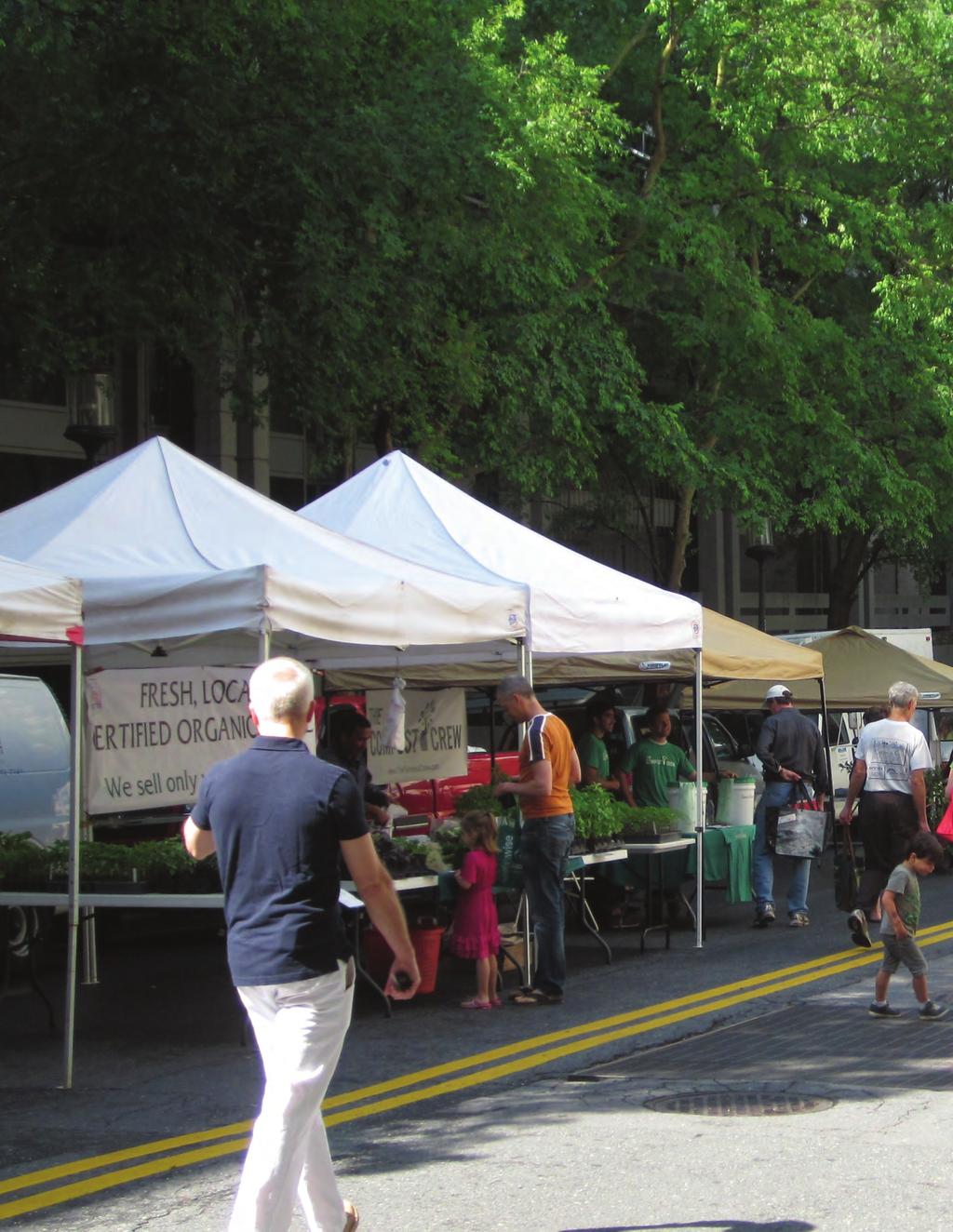
27 Shared streets create a space for all users, where pedestrians and cyclists feel comfortable to share the entire width. Source: GehlArchitects Shared streets create expanded, active public spaces that attract people to gather and socialize. Source: theplanner.co.uk Shared streets can be closed to vehicle traffic for occasional events like farmers markets. With continuous paving, shared streets easily become a plaza-like public open space. Source: Batavia MainStreet BETHESDA DOWNTOWN PLAN DESIGN GUIDELINES JULY

28 2.1.6 Neighborhood Connector Neighborhood Connectors typically accommodate vehicular through traffic for area residents and are often combined with bike facilities and less pedestrian volume than Downtown Mixed- Use and Main Streets. These streets are predominantly lined by multi-unit residential buildings with a range of building heights and auto-oriented commercial uses requiring frequent driveway curb cuts. Examples of Neighborhood Connectors include Bradley Boulevard, Battery Lane and portions of Arlington Road near the outer boundaries of the Downtown Bethesda Plan area. Intent: Building and sidewalk design along Neighborhood Connectors should provide buffering for pedestrians from through traffic, as well as moderate building setbacks to align with the residential neighborhood character. For residential buildings, elements such as ground-floor amenity space and residential entries are encouraged. Table 2.05: Neighborhood Connector Sidewalk Zones A. Planting/Furnishing Zone: 6-8 ft. B. Pedestrian Through Zone: 6-10 ft. C. Frontage Zone: 5-8 ft. min. Building Placement D. Build-to Line: ft. from street curb Building Form E. Base Height: 3-5 stories (35-60 ft.) F. Step-back: ft.* Alternative Treatments * On this street type, buildings under 90 ft. may consider alternative methods to reduce tower bulk other than step-backs. These are outlined in Section Tower: Menu of Methods to Reduce Bulk. F E C B D A 22 BETHESDA DOWNTOWN PLAN DESIGN GUIDELINES JULY 2017


29 Lush landscaping frames and buffers the sidewalk from traffic to provide a pleasant environment for pedestrians to walk between different neighborhoods and districts. Source: City of Seattle Office of Planning and Community Development Mid-rise multi-unit buildings and stepped-back high-rises create a transitional scale for these neighborhood links. Source: Union South Lake Union Larger format and auto-oriented businesses often line Neighborhood Connectors, requiring careful balance with pedestrian and bicycle facilities. BETHESDA DOWNTOWN PLAN DESIGN GUIDELINES JULY

30 2.1.7 Neighborhood Local Street Neighborhood Local Streets are typically narrow side streets that accommodate shared bike uses, access to residential parking, onstreet parking and low traffic volumes with very slow auto speeds. Sidewalks along these streets are often narrower than on other types because of the constrained street width. Intent: Building and sidewalk designs along Neighborhood Local Streets should provide efficient and comfortable access from the urban core to neighborhoods of lowscale buildings and detached homes. Because local streets provide a transition from the downtown core to surrounding neighborhood streets, the height of building frontages should reflect this change in scale. Table 2.06: Neighborhood Local Street Sidewalk Zones A. Planting/Furnishing Zone: 5-8 ft. B. Pedestrian Through Zone: 6-10 ft. C. Frontage Zone: 0-4 ft. Building Placement D. Build-to Line: ft. from street curb Building Form E. Base Height: 2-4 stories (25-50 ft.)* F. Step-back: ft.* * Properties on a Neighborhood Local Street confronting a Residential Detached or Residential Townhouse zone should see the Montgomery County Code Chapter 59 Section Compatibility Requirements for base height and upper floor stepbacks. F E D B A 24 BETHESDA DOWNTOWN PLAN DESIGN GUIDELINES JULY 2017


31 Local street with a narrow sidewalk width that accommodates a clear pedestrian through zone as well as a planting zone to provide shade and buffer. Townhomes on the lower floors of multi-unit buildings provide a transition to adjacent detached residential neighborhoods. Source: Google Street View Taller buildings step back for compatibility with residential areas with detached homes. BETHESDA DOWNTOWN PLAN DESIGN GUIDELINES JULY
32 2.1.8 Neighborhood Residential Street Neighborhood Residential Streets are narrow, low-volume streets that have on-street parking and provide for very slow moving local traffic. They are primarily lined with low-rise residential buildings, townhouses and detached homes. Intent: Building and sidewalk designs along Neighborhood Residential Streets should provide landscaped local access creating a casual walking experience within a garden environment. The height of building frontages should reflect the low-rise scale of surrounding development and include elements such as frequent ground floor residential entries. Table 2.07: Neighborhood Residential Street Sidewalk Zones A. Planting/Furnishing Zone: 6-8 ft. B. Pedestrian Through Zone: 6-10 ft. C. Frontage Zone: 5-8 ft. min. Building Placement D. Build-to Line: ft. from street curb Building Form E. Base Height*: 2-3 stories (25-35 ft.) F. Step-back*: ft. * Properties on a Neighborhood Residential Street confronting a Residential Detached or Residential Townhouse zone should see the Montgomery County Code Chapter 59 Section Compatibility Requirements for base height and upper floor step-backs. F E C B D A 26 BETHESDA DOWNTOWN PLAN DESIGN GUIDELINES JULY 2017


33 Individual entries and stoops create connections to the sidewalk and reflect the character of surrounding townhouses and detached homes. Landscaping in the frontage zone also creates a privacy separation from ground floor residential uses. Source: David Baker Architects Low-rise building frontages relate to residential streets with townhomes and detached homes. Source: ENCORE Architects High density townhouse designs reflect the downtown context while maintaining the lower scale of residential streets. Source: Mithun.com BETHESDA DOWNTOWN PLAN DESIGN GUIDELINES JULY


34 2.1.9 Public Through-Block Connections and Trails Intent: To improve connectivity for people to walk and bike throughout Downtown Bethesda and create additional outdoor public spaces for residents and visitors to enjoy. Public Through-block Connections Public through-block connections are most important within long blocks to provide an efficient pedestrian network to connect to adjacent streets and destinations such as open spaces and transit stations. These connections should be high-quality, open to the sky and wide enough to allow pedestrians and cyclists to pass through comfortably, and others to pause and sit or access building entrances. They should be highlighted through retail that wraps the corner, public art, signage or other design elements, which draw people into the connection from the sidewalk. Landscape can be added to create visual interest, and elements such as paving, lighting, seating, planters or trees should make the connection more inviting. Small-scale, urban recreational uses could also be considered in these spaces. A large, multi-unit development incorporating lush landscaping, individual entries and a clear path for pedestrians and cyclists to pass though. Source: Mithun The aim is to have no more than one through-block connection on a block to not interrupt the continuous building wall. If there are multiple new developments on a block, they are encouraged to have party walls between the base floors to ensure this continuity. If additional gaps are required by building code, consider other uses such as service alleys. Trails The Capital Crescent Trail and North Bethesda Trail are important public connectors for walking and biking to destinations throughout the county and region. In Downtown Bethesda, development should enhance the trail experience for users and minimize negative impacts. The facade of new development should be oriented toward the trail with ground-floor activating uses and landscaping or provide an appropriate transition with setbacks and landscape buffers. The upper floors of buildings should step back from the trail to allow access to sunlight and sky views as well as to provide compatibility with detached homes in close proximity. Building orientation along the trail should include elements such as entrances to common areas or retail, ground-floor transparency, individual unit entrances, outdoor terraces, plantings and seating areas. If the building does not provide orientation to the trail, it should include a larger setback with a planted landscape buffer. Ground-floor retail incorporates transparency and outdoor seating areas oriented onto the Capital Crescent Trail. Properties on a trail confronting a Residential Detached or Residential Townhouse zone should see the Montgomery County Code Chapter 59 Section Compatibility Requirements for base height and upper floor step-backs. 28 BETHESDA DOWNTOWN PLAN DESIGN GUIDELINES JULY 2017


35 Figure 2.04: Public Through-Block Connections and Trails * * Additional public through-block connections are possible. Exact location and alignment to be determined during the development review process. BETHESDA DOWNTOWN PLAN DESIGN GUIDELINES JULY

36 Figure 2.05: Guidelines for Public Through-Block Connections Shared by Pedestrians, Cyclists and Vehicles E. Step back upper floors to allow sunlight into the space. A. Provide upper floor balconies and outdoor common areas oriented to the through-block connection. B. Create active ground floors with entrances and windows facing onto the public space. C. Provide a clear pathway of at least 8-12 feet with adequate lighting for pedestrians and cyclists. D. Integrate trees and vegetated stormwater management or other ESD tools. H. Enclosed arcades with glass above are acceptable if they are at least the height of two stories and are clearly designed as open, public connections. F. Limit the height of the building base fronting onto the through-block connection. G. Limit vehicular traffic to garage entries and prevent cut-through travel through the entire block with bollards or other design elements. 30 BETHESDA DOWNTOWN PLAN DESIGN GUIDELINES JULY 2017


37 Figure 2.06: Guidelines for Public Through-Block Connections Shared by Pedestrians and Cyclists Only C. Step back upper floors to allow sunlight into the space. A. In residential buildings, provide individual unit entries facing onto the public space, where possible. D. Limit the height of the building base fronting onto the through-block connection. E. Integrate trees and vegetated stormwater management or other ESD tools. B. Provide a clear pathway of at least 8-12 feet with adequate lighting for pedestrians and cyclists. F. Enclosed arcades with glass above are acceptable if they are at least the height of two stories and are clearly designed as open, public connections. City Center in DC has active, mixed-use through-block connections with ground-floor retail, planting, lighting and seating areas. Source: City Center DC A residential public through-block connection with individual entries, seating and planting creates an inviting space. BETHESDA DOWNTOWN PLAN DESIGN GUIDELINES JULY

38 Canopy Corridors Intent: The Canopy Corridor recommendations in the Sector Plan aim to create green corridors that connect parks, trails, stream buffers and the denser forest networks beyond the Bethesda boundaries. The canopy corridors align with the recommended bike priority streets where continuous streetscape improvements are most likely. Though bicycle and pedestrian facilities are the priority on these streets, tree canopy is also a crucial element to enhance shade, attractiveness and comfort to encourage people to walk and bike throughout the downtown. Guidelines: A. Prioritize street tree planting along existing and proposed bicycle networks to expand linear green corridors. Woodmont Avenue tree canopy with a double row of trees. B. Use appropriate plant species that will thrive in various site conditions and climates. Species should be a combination of native and locally adaptive species lessening water demand while providing biological benefits. C. Provide soil volumes for canopy trees of no less than 600 cubic feet, as recommended in the Sector Plan. This volume may be achieved through amended soil panels, and where possible, utilize street tree panels for greater soil volumes. D. Design buildings to allow streets to receive sufficient sunlight to maintain healthy trees along these corridors. E. Provide the maximum sidewalk width possible to allow for larger canopy, and consider opportunities for double rows of trees. F. Include additional locations for trees on both private and public property, right-of-way and medians wherever possible. 32 BETHESDA DOWNTOWN PLAN DESIGN GUIDELINES JULY 2017

39 Figure 2.07: Recommended Canopy Corridors * Alignment to be determined during the development review process. BETHESDA DOWNTOWN PLAN DESIGN GUIDELINES JULY
40 2.2 Parks and Open Space Park Hierarchy The proposed system of parks and open spaces in the Bethesda Downtown area will result in a combination of public and private facilities. The new open space system will support a vibrant and sustainable urban center by including open spaces that will be comfortable, attractive, easily accessible, safe, and provide a range of experiences, up to and including festivals and other outdoor events. The Bethesda Downtown Sector Plan Parks and Open Space - includes a system of open spaces based on the roles of each type of open space. The following hierarchy has been applied to the Bethesda Downtown Area: Park Hierarchy For the Sector Plan Area Active Recreation Destinations - spaces including courts, playgrounds, and lawn areas large enough for pick up soccer, festivals or events, etc. Central Civic Green - spaces located in close proximity to a public transit hub, next to activating uses, with a mixture of hard and soft surfaces including a central lawn area for events. Interconnected System of Sidewalks and Trails - to connect parks and open spaces. Wooded Areas - that will provide a sense of contact with nature. For each Urban Neighborhood - spaces for neighborhood greens, and walk-to recreational amenities. For each Block - space for urban square, plaza, or green area. For each Building - space for outdoor recreation space. For each Residence - private outdoor space. 34 BETHESDA DOWNTOWN PLAN DESIGN GUIDELINES JULY 2017

41 Figure 2.08: Park Hierarchy Park Hierarchy Active Recreation Destination Civic Green Interconnected System of Sidewalks Wooded Area Neighborhood Green Plaza BETHESDA DOWNTOWN PLAN DESIGN GUIDELINES JULY

42 2.2.2 Design Guideline Elements The existing and proposed parks are shown in Figure 2.09, and include park and open space types from the Bethesda Downtown Sector Plan. Below is a list of the main elements of these design guidelines. Each element will be described in more detail in the following pages. A. Intent, Key Features, and Size B. Experiences and Mix of Uses C. Relationship to Adjacent Uses D. Site Access and Connectivity/ Social Equity E. Special Features F. Frequency of Use G. Community Benefits Washington Canal Park - linear park with flexible and protected lawn area to play games and appreciate art - Washington, D.C. Source: Land Collective 36 BETHESDA DOWNTOWN PLAN DESIGN GUIDELINES JULY 2017


43 A. Intent, Key Features and Size Each park and open space type help to ensure a complementary park system that is safe, clean, attractive (park design excellence), inclusive, adequate in size, open and welcoming to public. B. Experiences and Mix of Uses Public Spaces are about people gathering and sharing a common place. As such, each space is associated with experiences that will attract people to it. These design guidelines classify the outdoor experiences into three types: A. Active exercise play sports/games run walk Examples of Facilities: fields: open space/grass, hard courts and surfaces trails nature-inspired interactive elements playgrounds, etc B. Contemplative enjoy nature relax meditate, reflect escape chaos Examples of Facilities: natural areas, historic sites benches, trees for shade gardens, small green spaces community open spaces, etc C. Social Gathering community festivals; farmer s market, lunch places, concerts, outdoor movies, parades, historic sites Examples of Facilities: plazas with seating stage area/small courts large community open spaces dog parks, etc. BETHESDA DOWNTOWN PLAN DESIGN GUIDELINES JULY

44 C. Relationship to Adjacent Uses The land use surrounding each urban park is a critical element to its character and function. The scale of the ground floor and its open space needs to provide a welcoming pedestrian -scale relationship. Location of entrances can influence the sense of personal safety by providing: eyes on the place. The following design factors should be considered: Building frontages and entrances facing the park Street Frontage Compatibility Public Spaces as Central Community Focal Points Openness/Welcoming Spaces Interesting Viewsheds Solid & Void Relationships Clear delineation between the public space & adjacent private realm Connectivity to other public spaces and transit Downtown Silver Spring, MD - Spring Creek mosaic fountain - focal point and gathering spaces for the community. Source: M-NCPPC 38 BETHESDA DOWNTOWN PLAN DESIGN GUIDELINES JULY 2017

45 D. Site Access and Connectivity/ Social Equity Successful public spaces are connected and easily accessible to all in an integrated network of streets and sidewalks, mid-block connections, and proximity to transportation. The following design factors should be considered: Locations that accommodate and welcome diversity Meet ADA requirements Clear Entries/Gateways Safe Pedestrian Access/Crossings for all ages, especially children Trail System Connections Street Grid Continuity Public Transit & Bike System Connections Servicing, Access, and Shared Parking Directly connected to a Street Network Grade Transitions Access to Sunlight Wayfinding and Signage Accessibility Multi-modal Access Heart smart trail, Abington Art Center Sculpture Garden, Abington, PA. Source: M-NCPPC BETHESDA DOWNTOWN PLAN DESIGN GUIDELINES JULY

46 E. Special Features In addition to the location and hierarchy of open spaces within the public spaces system, there are special features that provide a unique setting and identity for each public space helping the community to engage and learn in inviting, safe and beautiful open spaces. The following design factors should be considered: Night Lighting Signature Main Open Space Signature Element: Interactive Water, Nature or Art Feature as Focal Point Defined Major Pedestrian Path Signage/Wayfinding, Interpretative Features Large species shade trees Park Furniture: Fixed Elements & Degree of Flexibility Accessible Amenities Cultural Features that create a Sense of Place ARTivity on the Green - urban park in Winston-Salem, NC, highlights the area reputation as The City of Arts and Innovation. Source: ForsythWoman.com 40 BETHESDA DOWNTOWN PLAN DESIGN GUIDELINES JULY 2017
47 F. Frequency of Uses These guidelines describe the frequency of use according to each park type. While all parks are available for every day use, Neighborhood Greens are more likely to be used daily or weekly by the immediate neighborhood, and Civic Greens -- as regional destinations -- provide additional use for special and seasonal events. Frequency of uses include: Special Events Seasonal Events Monthly Functions Weekly Functions Daily Functions G. Community Benefits Parks and open spaces are critical elements to be considered in the planning of a sustainable and resilient community. The presence of parks near neighborhoods promotes key community benefits. The following community benefits should be considered for every park type: Health and Wellness Happiness Connectivity Economic Development & Increased Neighborhood Value Green Infrastructure Air Quality Access to Natural Areas and Historic Sites Education Social Benefit Sense of Place BETHESDA DOWNTOWN PLAN DESIGN GUIDELINES JULY
48 2.2.3 Design Guidelines for each Urban Park and Open Space Type The design elements are described generally for each urban park type, see below: A. Civic Green 1. Veteran s Park 2. Capital Crescent 3. Farm Women s Market 4. Eastern Greenway South (PLD lot #24) B. Plaza 5. Arlington South Gateway Plaza 6. South Bethesda Public Plaza C. Urban Greenway 7. North Bethesda Trail 8. Eastern Greenway North & South 9. Gateway into Norwood Local Park D. Countywide Urban Recreational Park 10. Battery Lane 11. Eastern Greenway North (PLD lot #25) 12. Eastern Capital Crescent Urban Greenway 13. Norwood Local Park E. Neighborhood Green 14. Chase Avenue 15. Cheltenham 16. Old Georgetown Road 17. Western Edge Expansions (2) 18. Caroline Freeland 19. Bethesda-Chevy Chase East 20. Elm Street 21. Wellington Drive 22. Eastern Greenways (2)- (PLD lots #44 & #10) 42 BETHESDA DOWNTOWN PLAN DESIGN GUIDELINES JULY 2017


49 Figure 2.09: Park and Open Spaces Types North BethesdaTrail Civic Green 7 Plaza BaƩery Ln Urban Greenway BaƩery Lane Urban Park Countywide Urban RecreaƟonal Park Neighborhood Green 8 No Chase Ave Urban Park dg rfo lk Rd Veteran s Park Cheltenham Urban Park 1 Cheltenham Dr 16 Wiscons Elm rge to wn oa ve eo 15 Av e St in Ave st Hwy e East-W Arlington Rd ve mery A Montgo Woodmont Ave 19 Caroline Freeland Urban Park Elm Street Urban Park 2 Bethesda Ave 3 en tt rai l Barnes & Noble Plaza 13 Leland Neighborhood Park res c 5 lc 18 Pearl St 18 Ca pit a Ol Lynnbrook Local Park Bradley Blvd Norwood Local Park 9 14 BETHESDA DOWNTOWN PLAN DESIGN GUIDELINES JULY
50 Civic Green - Elements Parks: Veterans Park, Farm Women s Market, Capital Crescent, Eastern Greenway South (PLD lot #24) For more information on each park description, see the Bethesda Downtown Sector Plan 2.7 Parks and Open Space. Intent Formally planned, flexible, programmable for: Informal gathering Large gatherings, markets, concerts, festivals Regional destinations Key Features Large central lawn Surrounded by activating uses Optional: gardens, water features and shade structures. Size - ½ acre minimum, 1 ½ acre ideal Experiences - ensure a mix of uses with a focus on Social Gathering Active Site Access and Connectivity/ Social Equity Ensure physical and visual connections from street Ensure a connection to transit systems Ensure safe pedestrian crossings Ensure access to all Promote diversity Special Features Capitalize on unique views Incorporate identity creating features or artwork Incorporate streetscape enhancements along open space edge Wayfinding, signage, interpretative features Frequency of Use Special Events Seasonal Events Monthly Functions Weekly Functions Daily Functions Contemplative Social gathering/community building Relationship to Adjacent Uses (context) Located at the center of activating uses Building entrances should front on civic green 44 BETHESDA DOWNTOWN PLAN DESIGN GUIDELINES JULY 2017


51 Summer concert in Schenley Plaza s lawn, Pittsburgh, PA. Source: pittsburghgreenstory.com Wooded area across from Schenley Plaza, Pittsburgh, PA. Source: M-NCPPC Madison Square Park - restaurant as anchor use, destination and meeting point - New York City, NY. Source: Revista Sophia BETHESDA DOWNTOWN PLAN DESIGN GUIDELINES JULY
52 Plaza - Elements Arlington South Gateway, South Bethesda Relationship to Adjacent Uses Located at the center of activating uses For more information on each park description, see the Bethesda Downtown Sector Plan 2.7 Parks and Open Space. Building entrances should front on plaza Located in high pedestrian traffic areas Intent Formally planned, predominantly hardscaped spaces for: Areas of high pedestrian traffic Open air markets, concerts, festivals, and special events Key Features Central hardscaped gathering area Public art/water feature as focal point Inclusion of the temporary closure of local streets to enlarge the size of the plaza for special events should be an important element in the design of its boundaries and edges Optional: special lighting, shaded areas, and benches and tables Site Access and Connectivity/ Social Equity Ensure physical and visual connections from street Ensure a connection to transit systems Ensure safe pedestrian crossings Ensure safe play areas Ensure access to all Promote diversity Special Features Unique play areas Destination amenities - Skate parks on the hardscape Wayfinding, signage, interpretative features Size - ½ acre minimum, 1.0 acre ideal (2017 PROS). However, the South Bethesda Plaza has a minimum recommended size of 0.15 acres. Experiences - ensure a mix of uses Active Contemplative Frequency of Use Special Events Seasonal Events Monthly Functions Weekly Functions Daily Functions Social gathering/community building 46 BETHESDA DOWNTOWN PLAN DESIGN GUIDELINES JULY 2017


53 Activation of public spaces - Westlake Center Plaza in Seattle, WA. Source: M-NCPPC Veterans Park - gathering place for the community with fountain as focal point - Bethesda, MD. Source: M-NCPPC BETHESDA DOWNTOWN PLAN DESIGN GUIDELINES JULY
54 Urban Greenway - Elements North Bethesda Trail, Eastern Gateway North & South, Gateway into Norwood Local Park For more information on each park description, see the Bethesda Downtown Sector Plan 2.7 Parks and Open Space. Intent Linear parks that provide: Trails Wide landscaped walkways and bikeways Other recreational and natural amenities A more intimate, slower experience for recreating than a bikeway Small areas for gathering Key Features Trails, walkways and bikeways Vegetative ground cover and trees Experiences - ensure a mix of uses with a focus on active and contemplative Active Contemplative Social gathering/community building Relationship to Adjacent Uses (context) Location is defined by filling the gaps of access to the open space system May occur along road right of ways or paper streets Site Access and Connectivity/ Social Equity Ensure physical and visual connections to the bike and trail network Ensure safe pedestrian crossings Ensure access to all Promote diversity Links to other green spaces and trails Gathering pods Artwork and interpretive displays Natural features - trees landscaped beds Special Features Enhanced natural systems such as streams Unique lighting Wayfinding, signage, interpretative features Size - the width should accommodate a ten foot trail plus the buffer vegetation (AASHTO). For the Gateway into Norwood Local Park a fifteen foot width is recommended. Frequency of Use Special Events Daily Functions 48 BETHESDA DOWNTOWN PLAN DESIGN GUIDELINES JULY 2017


55 Indianapolis Cultural Trail - bike-pedestrian route that connects five downtown cultural districts. Source: nacto.org Hudson River Park - bike and pedestrian path, New York City, NY. Source: brokensidewalk.com BETHESDA DOWNTOWN PLAN DESIGN GUIDELINES JULY
56 Countywide Urban Recreational Park - Elements Battery Lane, Eastern Capital Crescent, Norwood Local Park For more information on each park description, see the Bethesda Downtown Sector Plan 2.7 Parks and Open Space. Intent Oriented to the recreational needs of a densely populated neighborhood and business district, They provide space for: Active recreation Recreational programming Community gatherings Relationship to Adjacent Uses (context) Located within walking distance of high density residential and commercial developments Compatible with other community serving uses such as recreation centers, libraries, etc. Located near transit system Site Access and Connectivity/ Social Equity Ensure physical and visual connections from street Ensure a connection to transit systems Ensure safe pedestrian crossings Ensure access to all Key Features Athletic fields, playing courts, picnicking, dog parks, sitting areas and flexible grassy open space Programming can include farmer s markets, outdoor exercise classes, and community yard sales. Size - varies (see Bethesda Downtown Sector Plan) Promote diversity Special Features Unique recreational amenity Artwork as recreational feature Unique lighting Wayfinding, signage, interpretative features Experiences - ensure a mix of uses with a focus on active uses Active Contemplative Frequency of Use Special Events Weekly Functions Daily Functions Social gathering/community building 50 BETHESDA DOWNTOWN PLAN DESIGN GUIDELINES JULY 2017


57 Stead Park - multi-use field, basketball courts, recreation center and playgrounds - Washington, D.C. Source: borderstan.com Nortpoint Park - Spray-ground, Tacoma, WA. Source: Metro Parks Tacoma BETHESDA DOWNTOWN PLAN DESIGN GUIDELINES JULY
58 Neighborhood Green - Elements Old Georgetown Road, Wellington Drive, Bethesda-Chevy Chase East, Chase Avenue, Eastern Greenway, Cheltenham, Western Edge, Elm Street, Caroline Freeland For more information on each park description, see the Bethesda Downtown Sector Plan 2.7 Parks and Open Space. Intent Formally planned, flexible open spaces for: Informal gathering Lunchtime relaxation Small special event gatherings Walk-to recreation Key Features Lawn area Shaded seating Play area Optional: a skate spot, a community garden, or similar neighborhood serving amenities Size - ¼ acre minimum, ½ acre ideal Experiences - ensure a mix of uses Active Relationship to Adjacent Uses (context) Located in the center of residential developments Within walking distance of residents Site Access and Connectivity/ Social Equity Ensure physical and visual connections from street Ensure safe pedestrian crossings Ensure access to all Promote diversity Special Features Picnic areas Play features and small game spaces Open lawns Neighborhood serving amenities, neighborhood identity features Wayfinding, signage, interpretative features Frequency of Use Seasonal Events Weekly Functions Daily Functions Contemplative Social gathering/community building 52 BETHESDA DOWNTOWN PLAN DESIGN GUIDELINES JULY 2017


59 Lakelands Clubhouse Park - lawn area with flexible uses central to the community and highly used all year round, Lakelands, MD. Source: M-NCPPC Name of Public Space, Facility Type, Location Greater Kennedy Plaza - Kidolnfo Play in the park with games, activities, and a free-play mobile playground. Providence, RI. Source: Downtown Providence Park Conservancy BETHESDA DOWNTOWN PLAN DESIGN GUIDELINES JULY
60 2.3 Site Design Environmental Site Design Objectives New developments, redevelopments or retrofits rely on the application of Environmental Site Design (ESD). ESD is a land planning and engineering design approach to manage and treat stormwater runoff. The purpose of ESD is to distribute small-scale treatment practices uniformly throughout a site, street, or community to provide onsite stormwater treatment. The second aspect of ESD is to mimic nature by simulating woods in good condition which allows water to slowly infiltrate through soil and into the ground water table while filtering out pollutants. ESD treats rain where it falls to manage urban stormwater runoff and reduce overflow into the sanitary sewer system. The objectives of ESD are: Minimize Volume: Reduce or delay the volume of stormwater that enters the sewer system. Minimize Peak Discharge: Reduce the maximum flow rate into the combined system by decreasing the stormwater volume and lengthening the duration of discharge. This reduction inherently lowers the frequency of combined sewer overflows (CSO). Maximize Water Quality: Improve water quality through volume reduction, filtration, and biological and chemical processes. In addition to satisfying the three urban stormwater control requirements, ESDs also fulfill several criteria as follows: Treatment Train: The ESD should be linked to form a treatment train where possible. For example, the overflow from a green roof could be directed into a vegetated planter box which when full, might overflow into a bioretention cell. The development of a treatment train allows for enhanced water quality and runoff reductions. 54 BETHESDA DOWNTOWN PLAN DESIGN GUIDELINES JULY 2017
61 Site Integration: The ESD should be able to be integrated into other functional components of the site, such as the landscaping and infrastructure, without impeding or significantly affecting their function. The land on which the ESD is applied should serve purposes in addition to stormwater management, such as open space, play areas, or walkways. Design Storm: The ESD should satisfy stormwater management objectives for small, frequently occurring storms to reduce the incidence of combined sewer overflow and mitigate urban stormwater pollution. Source Control: ESD should meet the stormwater management objectives for relatively small quantities of stormwater at or near the source, rather than at a centralized collection point. The ESD should be dispersed in different locations on a site, if necessary, to ensure distributed control of stormwater. ESD Tool Box There are many types of ESD tools that can be used in Bethesda. Systems such as vegetated filter strips, green roofs, and bioretention areas, to innovative new technologies such as underground detention vaults. In an urban setting with high amount of impervious cover, and limited land, artful, aesthetically pleasing, and creative ESD is needed. These site design strategies are an opportunity to contribute to the quality of life and place while providing: open space; parks/ recreation/and play; increased biodiversity; contribute to urban greening; and improve air and water quality. A few common types of urban stormwater treatment systems are shown on the following pages. BETHESDA DOWNTOWN PLAN DESIGN GUIDELINES JULY


62 Bioretention Bioretention systems are shallow depressions within small drainage areas using soil and plant materials (bio) to reduce the volume of stormwater runoff, and detain and filter pollutant loads where they are generated. The soil media is engineered to maximize infiltration and pollutant removal. There are many types of bioretention systems, including cells, planters and swales. They can have a variety of plants including herbaceous plants, grasses, shrubs and in some instances, trees. Often, they contain underdrains to convey treated and surplus water to storm drains. Design factors: Existing soils play a significant factor when determining the type of structure and drainage systems. Similar systems without the soil element are called retention systems. A. Bioretention Cells Bioretention cells are landscaped depressions that capture and treat stormwater runoff. The size and design of the bioretention cell depends on the area it drains, underground infrastructure and the type of soil in which the cell is placed. Stormwater is directed into the cell by pipes, swales, or curb openings. The depression temporarily captures and holds the first flush, usually the runoff from one-inch of runoff water from an impermeable area. B. Vegetated Planter Box A stormwater planter treatment box is often made of durable material or designed box with an amended soil media and vegetation. Runoff is piped, channeled or directed to the surface of the planter, where it is temporarily stored in a soil layer before collected in a bottom perforated drain pipe. In general, there are two kinds of planters: infiltration, runoff is detained, infiltrated, and discharged to either another ESD or the local stormwater drainage pipes; and filtration (flowthrough) runoff is filtered through a soil media or filter before discharge. 56 BETHESDA DOWNTOWN PLAN DESIGN GUIDELINES JULY 2017


63 Bioswales Swales are trapezoidal or parabolic drainage paths or vegetated channels designed to attenuate, convey and in some cases infiltrate stormwater runoff away from impervious surfaces. They are designed with layers of vegetation, amended soil, and may have a perforated pipe within the bottom gravel layer. A sloped base to facilitate water movement distinguishes bioswales from bioretention areas. Design factors: There are two primary vegetated swale design variations: dry and wet. A. Dry Swale Dry swales are shallow, gently sloping channels with vegetation and low velocity flows. They contain highly permeable soils and an underdrain to allow the stormwater conveyance or infiltration to move away from the surface of the swale shortly after a storm event. With steeper slopes, check dams may be used to further enhance attenuation and infiltration. Dry swales are more applicable for urban environments than wet swales, as they are designed to drain surface water within 24 to 48 hours. B. Wet Swale Wet swales are designed to retain water and maintain marshy conditions for the support of aquatic vegetation. They typically stay wet by intercepting the shallow groundwater table. They may not be suitable in Bethesda, except perhaps in the Battery Lane area where there is a higher water table near the campus of the National Institutes of Health. BETHESDA DOWNTOWN PLAN DESIGN GUIDELINES JULY


64 Permeable Pavement Permeable pavements are specific types of surfaces with a high porosity that allow rainwater to pass through the ground or into an underdrain system. They significantly reduce the amount of impervious cover, trap sediment and pollutant runoff to improve water quality, and mitigate surface temperature increases. There are many different materials commercially available for such pavements which can be divided into three basic types: porous asphalt, pervious concrete, and permeable interlocking concrete pavements. Design factors: Each type of pavement provides a stable, load-bearing surface without increasing a project s total impervious area and can support parking lots, parking spaces, driveways, plazas, playgrounds, walkways, seating areas, crosswalks, and lower volume access roads. Permeable pavement creates more efficient land use by eliminating the need for additional stormwater management devices and lowering the overall project costs. A. Pervious Asphalt Porous asphalt pavements are used throughout the United States, in every climate and geography. Porous asphalt is an all-natural material using bounded rocks. Below the pavement is a gravel subsurface or recharge bed with void spaces in-between to catch and contain rainfall. B. Pervious Concrete Aggregate particles are coated in a cementitious material with percent void spaces in-between the particles allowing water to filter through the surface. C. Interlocking Pavers Most often, interlocking pavers are made of solid concrete with small, stone-filled joints that allow water to flow into highly permeable, opengraded bedding, base, and subbase aggregates. 58 BETHESDA DOWNTOWN PLAN DESIGN GUIDELINES JULY 2017


65 Vegetated Roofs Green roofs and living roofs are alternative roof surfaces that replace conventional construction materials with a planting media and vegetation. They may be used in place of traditional flat or pitched roofs to reduce impervious cover and more closely mimic natural soil hydrology. Green roofs reduce heat island effect, decrease the buildings demand for heating and cooling, and provide additional habitat and valuable open space in the urban landscape. Design factors: There are three basic green roof designs distinguished by media thickness and the plants that can grow in them. A. Extensive Vegetated Roof A lightweight system (15-25 lbs per square foot) in which the media layer is less than 6 inches. The shallow soil media limits species to primarily mosses, succulents, sedums, selective herbs and a few native grasses. Extensive vegetated roofs provide the least amount of stormwater management. They have limited impact towards County storm water management requirements, and support the fewest varieties of drought tolerant species. B. Semi-Intensive Vegetated Roof A deeper soil media layer between 5-7 inches with a weight between lbs per square foot. Capable of supporting a richer variety of plants, including flowering plants, herbs, taller grasses and small shrubs. This type of roof can retain more stormwater runoff than an extensive system for greater credit toward meeting the county s stormwater management requirement. C. Intensive Vegetated Roof Intensive green roofs have a soil media greater than 8 inches. They can support more diverse plant communities, including tall grasses, vegetables, fruit and other trees, and shrubs which allow for greater biodiversity. They are most often found on commercial buildings, and require a more supportive roof structure. They often include paths, walkways and seating areas allowing for human uses They provide the greatest amount of retention towards meeting the county s stormwater management requirement. BETHESDA DOWNTOWN PLAN DESIGN GUIDELINES JULY


66 Rainwater Harvesting Rainwater harvesting is the practice of intercepting and storing rainfall for future use. Rainwater is collected in gutters and downspouts then directed into catchment cisterns where it can be used or stored when needed. This water may be used for outdoor landscaping irrigation, vehicle washing, greywater (toilets, clothes washers), or other non-potable water needs. Some jurisdictions allow it to be used as potable water when properly treated. The capture and re-use of rainwater promotes water conservation through reuse, as well as reduces stormwater runoff volumes and the discharge of pollutants downstream. Design factors: The elements used in rainwater harvesting can be either hidden from sight underground or within buildings, or they can be celebrated as artful, figural elements on or near a building where people can see them and/or learn about them. Most harvested rainwater is stored in cisterns of many different designs and materials. Each cistern design has advantages and disadvantages. Cistern materials include reinforced concrete, fiberglass, steel, polyethylene, fiberglass and stone or brick. A variety of elements to filter or treat water is available depending on intended water use. A. Above Ground Cisterns Above ground water cisterns/tanks can be constructed onsite, within a building for display, within the landscape, or can be mounted on the roof. They are less expensive than below ground tanks but are subject to sunlight and weather conditions (freezing) that may affect the system and limit use. Above ground storage cisterns are ideal for educating the public on the importance of rainwater harvesting and water conservation B. Below Ground Cisterns Belowground tanks maintain a consistent water temperature throughout the year, take up no surface area, and are protected from UV degradation. Like above ground tanks, there are a variety of options in materials, shapes and forms. In urban areas and for commercial use, modular cisterns are becoming more common as they can be installed under parking areas, courtyards and playgrounds. C. Indoor Rainwater Harvesting Where there is room, be it an attic or basement, indoor cisterns are a viable option. They are less expensive to install and maintain, and can increase the lifespan of a cistern. 60 BETHESDA DOWNTOWN PLAN DESIGN GUIDELINES JULY 2017


67 Underground Detention/Retention Vaults These underground structures designed to manage excess stormwater runoff on a developed site, often in urban areas. Underground facilities can store and slow down water infiltration processes following a storm event. They are frequently used when there is insufficient above ground surface area on the site to infiltrate runoff or build a surface facility such as a bioretention system. They manage the quantity of runoff, but they frequently do not provide water quality treatment. Design factors: Underground stormwater detention allows for high volume storage of runoff in a small area. The storage vessels can be made of a variety of materials, including corrugated metal, aluminum, steel, plastic, fiberglass, pre-cast or poured-in-place concrete. There are many types of underground storage, but most often fall into one of the following four categories. A. Underground Storage Vaults Storage vaults and tanks are typically constructed of pre-cast concrete with or without a bottom slab, depending on the intention to let stormwater runoff infiltrate into the ground or flow into the storm drain system. B. Storage Chambers Storm chambers are underground structures that can be used for detention or retention of stormwater. The open bottom chamber can be used for retention where stormwater infiltrates into the underlying soils or for detention where peak flows are attenuated through an outlet control structure. C. Gravel Beds Gravel beds are excavated subterranean areas filled with uniformly-graded pebbles. They are meant to temporarily detain water and promote infiltration. The spaces within the gravel allow excess water to be stored. D. Perforated Pipes Perforated pipes come in a variety of sizes. They typically combine the methods of gravel and pipe storage to detain water and promote infiltration. BETHESDA DOWNTOWN PLAN DESIGN GUIDELINES JULY


68 Artful Environmental Site Design and Treatment Trains Artful ESD effectively manages stormwater while also creating inviting landscapes and public art to build amenities that enhance a site s open space, aesthetic value, and often create fun places to be. This approach celebrates the treatment of stormwater in an artful, environmentally responsible way. The best artful ESD require a collaboration between engineers, landscape architects, urban designers and architects who work together to improve site amenities while complying with stormwater regulations. The images below illustrate artful ESD resulting in inspirational and aesthetically appealing open space for people to enjoy and learn from. The images below illustrate treatment trains where stormwater cascades from one system to another to meet regulatory requirements. 62 BETHESDA DOWNTOWN PLAN DESIGN GUIDELINES JULY 2017
69 2.3.2 Green Cover Intent: The green cover guidelines are intended to increase overall tree canopy cover, expand green corridors, reduce heat island effect, improve air quality and carbon sequestration capacity and improve ecological biodiversity. See the Sector Plan Section Urban Green. 35% Intensive Green Roof 35% Guidelines: On private property, provide a minimum of 35 percent* green cover, which may include singularly or a combination of the following: A. Intensive green roof (6 inches or deeper) on 35 percent of rooftop. OR B. Tree canopy cover on 35 percent of landscape. C. A combination of tree canopy and intensive green roof for a total green cover of 35 percent or greater. 35% Tree Canopy * If on-site energy generation requires the use of the roof or open space, accommodations for these features may alter the 35 percent minimum green cover requirement. 35% OR 35% Tree Canopy and Intensive Green Roof BETHESDA DOWNTOWN PLAN DESIGN GUIDELINES JULY
70 2.3.3 Servicing, Access and Parking Intent: Loading, servicing and parking should be designed to minimize conflicts between vehicles, pedestrians and cyclists and reduce the visual impacts of vehicle access and parking on the Public Realm. Site design should prioritize the public sidewalk and bikeways over private vehicular crossings. Guidelines: A. Line the ground floor of structured parking with retail or other uses with transparency to maintain an active building edge. Where active uses are infeasible, avoid exposed parking floors along the street through measures outlined in the Zoning Ordinance Section D.1 Structured Parking Requirements. B. Design exterior of the garage portion of the building to be compatible with the rest of the building facade, in order to enhance the overall architectural quality of the building. C. Provide a continuous, level and clearly delineated Pedestrian Through Zone across driveways to encourage drivers to yield to pedestrians. Consider applying the same materials across these vehicle access points as the sidewalk, such as brick pavers. D. Locate loading and servicing within the interior of a building at the rear whenever possible. Service alleys are also recommended where setbacks are required from the side or rear property lines for building code. E. Avoid placing entries to loading docks, service areas and parking garages on neighborhood residential streets when alternative access is feasible. F. Minimize the width and height of driveways and vehicular entrances. Where possible, combine loading dock and garage access. G. Screen vehicle and servicing access areas and trash storage with landscaping or other vertical elements, and design vehicle access doors to incorporate high-quality materials and finishes that are consistent with the building. H. Vehicle access points should not be located adjacent to a public open space other than through-block connections. I. Coordinate location of access points with adjacent and confronting properties where possible to ensure a comfortable sidewalk environment and limited conflicts. J. Provide loading spaces for pick-up and dropoff where feasible to reduce idling in the travel lane. K. Design structured parking floors to be flexible for future retrofit to other uses where possible. L. Ensure continuous tree canopy along service areas and lay-by areas to the greatest extent feasible. M. While not recommended in Downtown Bethesda, surface parking should be designed according to the following: Locate the parking on the back of the building, with the building fronting the primary streets and sidewalks. For interim lots, design the parking to provide flexibility for temporary events such as pop-up events and public gatherings to maintain an active street edge. See Section 2.5 Creative Placemaking. Servicing Operations: The dense urban grid presents both challenges and opportunities for loading and trash collection. Without alleys, trucks and other delivery vehicles have to make complex maneuvers on the streets to access the buildings loading areas where they exist or simply operate from the streets themselves when the buildings they serve don t have off-street loading facilities. When trucks must access buildings from streets, especially high volume corridors, the loading areas create conflicts with pedestrians. When loading 64 BETHESDA DOWNTOWN PLAN DESIGN GUIDELINES JULY 2017


71 operations occur on the street, standing trucks often block curbside travel lanes or designated bikeway facilities. To reduce those conflicts, it is imperative to have thoughtful and strategic traffic operation plans in agreement before occupancy permits are issued. Recognizing that traffic operation plans have to account for the unique design and use of the site, the following includes a list of guidelines that address safety of all travel modes: Loading and trash collection should occur outside of peak hours on weekdays as volumes of pedestrians are likely to be low. If loading is not designed into the mass of the building or underground as preferred, trucks should back into designated loading areas, so they are exiting the site head out. Structured parking floors are screened with a facade treatment consistent with the design of the building. When loading, trucks should operate in designated off-street loading areas. On-street loading and other operations should be avoided. When not in use, loading areas should be shut off from the public with roll-top doors or other enclosures. Loading areas must be clearly marked to inform all users of their presence and to deter inappropriate parking in these areas. Trash for collection must be out of the right-ofway and not obstruct the Pedestrian Through Zone. This parking entrance is designed to blend with the ground floor retail design, and has a limited driveway width to reduce interruption along the sidewalk. Source: Google Street View BETHESDA DOWNTOWN PLAN DESIGN GUIDELINES JULY
72 2.4 Building Form The Sector Plan recommends increases to allowable building heights and the Bethesda Overlay Zone allows the flexibility to transfer and allocate additional density. As a result, building form guidelines are critical to create clear expectations for the development review process and ensure that buildings contribute to a quality public realm. Top Top guidelines apply to buildings in prominent locations and with significant height. See the section below for top guidelines: Tower Top Tower Tower guidelines apply to the portion of buildings taller than the base height designated in Section 2.1 Street Types. See the sections below for tower guidelines: Separation Distance Step-Back Methods to Reduce Bulk Base Base guidelines apply to all building types. See the sections below for base guidelines: Building Placement Street Activation Variation and Articulation 66 BETHESDA DOWNTOWN PLAN DESIGN GUIDELINES JULY 2017


73 The intent of the building form guidelines is to avoid the challenges of poor building design evident today in Downtown Bethesda. Several buildings have large blank walls, imposing massing and bulk, and are incompatible with existing district and neighborhood character. The cumulative effect of these poor design decisions is to create a less inviting environment for pedestrians and building inhabitants, and negatively affect the overall image of the downtown. The building form guidelines are organized by Base, Tower and Top and apply to buildings at specific heights, from low- to high-rise scale. Additional guidelines in this section apply generally to the design of all building types. Source: Leddy Maytum Stacy Architects Source: Hariri Pontarini Architects Source: Lanterra Developments BETHESDA DOWNTOWN PLAN DESIGN GUIDELINES JULY


74 2.4.1 Compatibility Intent: Most new projects in Bethesda will be infill development, therefore design should respect the existing character and scale of the downtown s diverse districts, neighborhoods and public spaces. Guidelines: A. Maintain the character of small-scale retail streets by creating ground-floor retail with awnings, signage and bays that reflect the dimensions and design of adjacent existing stores. Step back upper floors to continue the pedestrian experience along the sidewalk of a low to mid-rise building edge. B. Provide transitions to surrounding neighborhoods by including elements such as: Stepped-down building heights. Individual entries to ground-floor units. Setback transitions to residential properties with front yard setbacks. Increased landscaping in the frontage zone and planting/furnishing zone. Fine-grain building articulation, such as variations in wall planes, colors, materials and textures. C. Study the impacts of new development on public open spaces. Limit shadows where possible and provide active ground floors with entrances and windows onto public open spaces, avoiding orienting the backs of buildings to these spaces. Norfolk Avenue has a unique scale and character that should be reflected in future development. The Bethesda Theater redevelopment maintains the historic building character along Wisconsin Avenue and transitions to adjacent residential neighborhoods. Source: Google Street View Transitions from Wisconsin Avenue to surrounding neighborhoods require stepping down of buildings to mediate between the high-rise and low-rise scales of the two areas. Source: The Vine Condos 68 BETHESDA DOWNTOWN PLAN DESIGN GUIDELINES JULY 2017


75 2.4.2 Base: Building Placement Intent: To create a continuous street wall to frame the sidewalk and create a more comfortable outdoor room for pedestrians to encourage walking throughout the downtown. Guidelines: A. Place the facade of the building base along the recommended build-to-line to create a continuous street edge. B. Buildings taller than 200 feet that do not step back the upper floors should have a build-toline of at least feet. C. Where existing building lines for adjacent properties are set back more than the recommended build-to-line, buildings may be placed to align with this existing building line as long as it is within 5 feet of the recommended build-to line. D. Exceptions to the building placement guidelines include through-block connections and open spaces recommended in the sector plan, entrances and articulation for architectural interest. The building base of Eleven 55 Ripley in Silver Spring creates a continuous edge along the sidewalk at a low-rise scale. Source: Shalom Baranes Associates Architects Build-to Line BETHESDA DOWNTOWN PLAN DESIGN GUIDELINES JULY


76 2.4.3 Base: Street Activation Intent: To encourage pedestrian activity by providing ground-floor and base design elements that engage with the sidewalk environment. Guidelines: A. Provide frequent entries, transparency and operable walls where possible to encourage visual and physical connections between the ground floor and the public sidewalk. Avoid long blank walls along the sidewalk. B. Orient private balconies and terraces toward the street to encourage an interface between the private and public realms and to create eyes on the street. C. Include elements such as textured materials, awnings, plantings, signage and seating to create a visually engaging and inviting building edge to frame the sidewalk and create stopping points to relax, gather and socialize. Operable walls that open to the street, along with various materials and textures, create an inviting and visuallyengaging sidewalk environment for pedestrians. Source: David Baker Architects D. Place particular focus on active ground floor design along the portions of streets identified as the recommended retail nodes in the Retail Planning Strategy for the Downtown Bethesda Plan. B. Orient balconies and terraces toward the street. C. Include elements such as textured materials awnings, signage, plantings and seating. A. Provide frequent entries and ground floor transparency. Commercial ground floor activation 70 BETHESDA DOWNTOWN PLAN DESIGN GUIDELINES JULY 2017

77 Figure 2.10: Recommended Retail Nodes BETHESDA DOWNTOWN PLAN DESIGN GUIDELINES JULY


78 2.4.4 Base: Variation and Articulation Intent: To ensure that facades are not exceedingly long, uninterrupted and rigidly uniform. These variations break up the mass of large buildings, add visual interest and promote human-scaled lower stories to relate to pedestrians. Guidelines: A. Vary base height up to the maximum height designated by the street type. This variation should respond to the street character and typical widths, heights and modulation of existing buildings to create a contextually sensitive building wall along the street. B. Provide plane changes in the facade that create significant vertical and horizontal breaks, and shadow lines on the facade. C. Consider variation in building materials or color to add texture to lower floors most visible to those at pedestrian level. D. Avoid cantilevering the majority of the building mass over the Frontage Zone, public sidewalk or public open space to prevent interfering with street trees and blocking access to sunlight and sky views for pedestrians. C. Consider variation in materials or color Et de laut dolorep tatur, qui omnihil liquibusae sit ullest, sa dolupient ur Source: Building bases with variation in height and articulation can break up a large building, and can also reflect the modulation and character of adjacent structures. Source: Hariri Pontarini Architects (above), Google Street View (below) B. Provide plane changes in the facade A. Vary base height 72 BETHESDA DOWNTOWN PLAN DESIGN GUIDELINES JULY 2017


79 2.4.5 Corner Treatments Intent: To anchor and frame street intersections with a continuous building wall or unique design features. Guidelines: A. Provide signature design elements on prominent corners or intersections as focal points. These prominent locations include sites adjacent to open spaces, with the tallest building heights and buildings that terminate major view corridors such as East-West Highway, Norfolk Avenue, Old Georgetown Road and Bethesda Avenue. B. The full height of tall buildings may be expressed at corners, as a way to provide variation and increased verticality on buildings with tower step-backs. C. Establish block corners with architectural articulation and activating uses. While market forces will dictate actual locations where retail operations are feasible, anchoring key block corners by including activating uses such as retail is encouraged. This innovative design treatment articulates the building and creates an intersection focal point. Source: OMA The curved corner along this major Bethesda Row intersection enhances pedestrian flow and provides an active ground floor. BETHESDA DOWNTOWN PLAN DESIGN GUIDELINES JULY

80 2.4.6 Tower: Separation Distance Intent: To allow access to light and air, limit the impact of shadows on the public realm and reduce the extent of large blank walls as new buildings develop at or near the property line. Guidelines: base street property line separation from the side and rear property line A. Separate tower floors at least 45 to 60 feet (22.5 to 30 feet from the side and rear property lines). tower tower separation tower B. Provide a continuous building base along the lower floors. base C. Avoid building towers to the property line creating expansive blank party walls that are imposing on the pedestrian environment. Alternative Treatments: Buildings below 120 feet or with limited property size/width/depth may reduce tower separation or consider party walls. If party walls are necessary, mitigate their visual impact with elements such as public art, lighting, texture and/or patterning that provide visual interest and are appropriate to the context and architecture of the building. tower ft tower Where existing neighboring building towers are built to or close to the property line, new development should aim to achieve the total tower separation where possible. However, at a minimum, the new building tower levels should provide the separation distance indicated in Guideline A from the side and rear property lines, except where building to the lot line could better address an existing blank wall condition. Varied geometry in a building s upper floors, and facade modulation between buildings can also be used as methods to increase the perception of tower separation and allow access to light and air. continuous base continuous base 74 BETHESDA DOWNTOWN PLAN DESIGN GUIDELINES JULY 2017


81 2.4.7 Tower: Step-Back Intent: To provide a human-scaled building edge along the street that enhances pedestrian comfort and access to sky views. In districts with mostly low to mid-rise buildings, the step-back enables new tall buildings to better relate to existing context and maintain a similar street character. Lower floor units wrap parking structure to achieve step-back Guidelines: A. Retain a tower step-back across the majority of the building frontage. The building s full height may be expressed to the ground on important corners, to mark primary entryways or to balance the massing composition with vertical elements. B. Encourage undulating, curved or angled tower step-backs if the average step-back meets the guidelines for the street type. This expressive geometry can increase visual interest on prominent sites near major open spaces and corners. C. Allow balconies to encroach in the step-back if they do not significantly add to the perceived bulk and mass of the building s upper floors. Alternative Treatments: With step-backs, pedestrians perceive the lower-scale base height Though step-backs are one of the preferred methods to reduce tower bulk, especially on small neighborhood street types, alternative methods are outlined in Section Tower: Menu of Methods to Reduce Bulk. These alternative methods particularly apply to buildings lower than feet as noted in Section 2.1 Street Types, or to sites with limited size or property depth from the street. In cases where a step-back is not provided, another method to relate to the context of adjacent building heights and base conditions is with a change of materials or clear regulating lines. This residential development in Rockville illustrates the relationship between the pedestrian and the building step-back. Source: The Upton (above) BETHESDA DOWNTOWN PLAN DESIGN GUIDELINES JULY


82 2.4.8 Tower: Menu of Methods to Reduce Bulk Intent: Downtown Bethesda is an important location in Montgomery County for increased building heights to accommodate future growth. However, collectively, buildings at taller heights can be an imposing presence on the public realm by casting large shadows, limiting sky views and creating an uncomfortable scale for pedestrians. A. Limit Tower Floor Plate Reduced tower floor plates limit shadows on the public realm and allow access to sky view while also improving the quality of the building s indoor environment. B. Use Unique Geometry Varied geometry adds visual interest and helps to reduce the perceived bulk of a building s upper floors. Angled and curved facades allow a building to be viewed dynamically from different vantage points. They can enhance privacy between towers in close proximity by directing views away from nearby windows. C. Vary Tower Heights Whether creating a large development with several towers, or an infill development between multiple existing towers, variation in building height can reduce the imposing massing of several large structures built adjacent to each other. 76 BETHESDA DOWNTOWN PLAN DESIGN GUIDELINES JULY 2017


83 There are several ways to reduce the actual bulk of a building s upper floors or to creatively reduce the perceived bulk of the building. Below is a menu of design techniques that can be used to sculpt building towers and achieve a varied skyline responsive to human scale. Every project is not required to apply every method; however, several should be used in combination to best meet the guideline intent. D. Modulate and Articulate Facades Techniques to break up large facades and reduce perceived building bulk include shifts in massing to allow for upper floor terraces, green roofs and balconies; changes in facade planes; and varied fins, frames and mullions to add depth to glass facades. E. Vary Tower Placement and Orientation Similar to variation in tower height, variation in tower placement and orientation can increase perceived separation between towers, reduce the perceived imposing massing of several adjacent towers and increase privacy by orienting views in different directions. F. Limit Apparent Face The apparent face is the length of a facade plane that is unbroken by vertical changes in depth. Limiting this length reduces the perceived bulk of a long building facade. vertical facade break Apparent Face base tower BETHESDA DOWNTOWN PLAN DESIGN GUIDELINES JULY


84 2.4.9 Top: Tower Top Intent: The building top or cap contributes to the skyline, adding visual interest and shaping the image of Bethesda from afar. Tower tops should be carefully considered on prominent sites, including those with the tallest building heights, locations adjacent to major public open spaces and those that terminate views. Guidelines: A. Encourage unique design of tower tops that can enhance the image of Bethesda as an innovative downtown, welcoming new businesses, residents and visitors. B. Taper tower tops where possible to reduce the perceived bulk of tall buildings. C. Integrate energy efficiency into the design of tower tops, including solar panels and passive heating and cooling elements. This curved and tapered top adds a unique element to the skyline. D. Consider the views of the rooftop composition from adjacent buildings when designing building tops. E. Not all tall buildings should have a sculptural top. However, mechanical penthouses and rooftop amenity spaces should in all cases be designed to harmonize with the overall building composition. F. Enclosures for rooftop amenity spaces should either contribute to the creation of expressive tops, or otherwise be set back from the roof line and limited to a portion of the roof area so as to not be perceived from surrounding streets and public spaces. The form of the tower top for this Pittsburgh office building is part of the energy efficient solar chimney design. Source: Gensler 78 BETHESDA DOWNTOWN PLAN DESIGN GUIDELINES JULY 2017


85 Retrofitting Existing Buildings Intent: Bethesda has many buildings that are unlikely to be redeveloped for many decades, but that are in need of retrofits to change the building use, add additional floors to accommodate expansion or provide a face-lift to attract new tenants. Retrofits of existing buildings are encouraged because they maintain the existing scale and character of established districts while breathing new life into older building stock. Guidelines: A. Integrate elements such as new materials, transparency, color and enhanced landscapes in retrofits of large buildings with imposing massing and bulk. These elements create human-scaled details that can add visual interest and provide a more inviting pedestrian environment. The Octave in Silver Spring is a retrofitted office building now used for residential condos. Source: Octave 1320 Before B. Consider ground-floor retrofits with liner retail or other active uses for existing buildings and parking structures with a poor relationship to the sidewalk. C. Retrofitted buildings that add additional floors should not be required to step-back upper floors if infeasible due to existing structural design. After 7550 Wisconsin Avenue is a renovated and re-skinned office building that is now LEED Gold certified. Source: Clark Construction BETHESDA DOWNTOWN PLAN DESIGN GUIDELINES JULY
86 Bird-Safe Design The windows, doors, and arches of buildings can be deadly obstacles for birds causing hundreds of millions of bird collisions annually. Glass is transparent to birds. Reflections of the sky, vegetation, clouds, water, and branches lure birds into the glass causing mortality and injury. Intent: To design glass buildings to protect local and migratory birds from deadly strikes. Integrate elements into the building and site design to warn birds before they collide. Guidelines: A. Glass Coverage and Glazing Patterns on Glass: Ceramic dots, or frits, can be screened, printed, applied between layers of insulated glass to reduce transmission of light and prevent bird collisions. These can be applied in different colors and patterns to work effectively. Angled Glass: Not as effective as other strategies, angled glass at degrees has resulted in reduced mortality. Window Surfaces: New one-way transparent opaque films and window surfaces allow sunlight to pass through windows while reducing reflectivity. B. Architectural Features Awnings, Louvers and Overhangs: When designed to eliminate reflections and shadow glass these architectural features have shown to reduce bird collisions. Balconies and Balustrades: Along with providing outdoor spaces for humans, balconies and balustrades can block window reflection. Opaque and Translucent Glass: Frosted, colored, opaque, or stained glass have proven to be significantly successful bird deterrents. C. Facade Treatments Screens: Screens can be integrated into facade elements without blocking view or light and are highly effective in protecting birds. 80 BETHESDA DOWNTOWN PLAN DESIGN GUIDELINES JULY 2017

 can entrap birds reluctant to fly from a lit area into a dark one.")
87 Grilles: Horizontal or vertical grilles can be incorporated into the aesthetic and design of windows. Shutters and Shades: External shutters and shades of various styles and colors enhance a buildings aesthetic while reducing or eliminating reflections. D. Lighting Treatments Lights disrupt birds orientation inhibiting them from seeing their navigational markers like the stars and moon. Night lights and up lights (lights pointing upward) can entrap birds reluctant to fly from a lit area into a dark one. Eliminating unnecessary lighting is one of the easiest ways to reduce bird collisions, with the added advantage of saving energy and expense. Choose down-lighting over up-lighting to keep from directing light into the night sky. Minimize perimeter and vanity lighting and consider filters or special bulbs to reduce red wavelengths where lighting is necessary. As much as possible, lights should be controlled by motion sensors. Lights Out: Turn lights out visible from the outside during spring and fall migration periods. E. Site and Landscape Design Obtain USGBC LEED Green Building Rating Points from the category of Bird Collision Deterrence. Glass windows should not reflect nearby or site vegetation, particularly large, mature trees and water. Where this is not feasible, use window treatments outlined above. Use soil berms, furniture, landscaping, or architectural features to prevent reflection in glazed building facades. Avoid up-lighting rooftop antennas and tall equipment as well as decorative architectural spires. Patterns on this glass building reduce the likelihood of bird collisions. Source: naturalimages.net Balconies provide shadows and limit reflections on glass to deter birds. Source: Merchant Quarter Condominiums BETHESDA DOWNTOWN PLAN DESIGN GUIDELINES JULY

88 What is Creative Placemaking? 2.5 Creative Placemaking Sector plans have a long-range vision for public and private improvements typically over the next 20 years. However, in the short-term, there are many temporary solutions that Bethesda community stakeholders can achieve to improve the livability and enjoyment of the downtown through creative placemaking. The Bethesda Urban Partnership and Montgomery County Department of Parks have spearheaded many of these types of events and opportunities for community gathering and interaction. Building on this momentum, the guidelines provide additional examples to inspire private landowners, community members, artists and public agencies to craft creative ways to use underutilized spaces, streets and other public open spaces. These strategies are particularly useful in the interim before larger development projects or capital improvement projects are completed. Source: Mithun Intent: Creative placemaking is intended to activate public spaces and underutilized spaces throughout Downtown Bethesda, to engage community members and visitors, and to provide opportunities for short-term improvements that enhance community quality of life. In creative placemaking, partners from public, private, nonprofit and community sectors strategically shape the physical and social character of a neighborhood, town, tribe, city or region around arts and cultural activities. Creative placemaking animates public and private spaces, rejuvenates structures and streetscapes, improves local business viability and public safety, and brings diverse people together to celebrate, inspire and be inspired. - National Endowment for the Arts 82 BETHESDA DOWNTOWN PLAN DESIGN GUIDELINES JULY 2017


89 Outbox pop-up office in Downtown Silver Spring. Source: Citylab Public art installations encourage passers-by to look at their surroundings in a different light. Source: illumni Outdoor silent disco where people gather to dance while listening to the music on head phones rather than using a speaker system. Source: pinterest.com BETHESDA DOWNTOWN PLAN DESIGN GUIDELINES JULY


90 Creative Placemaking in Streets Creative Placemaking in Parking Lots and Underutilized Spaces Source: bettercities.net (above), Inhabitat (below) Medians, parklets and sidewalks are great opportunities to transform streets into truly public spaces for play, gathering and relaxing. Active streets can become destinations, enhance foot traffic to local businesses and provide additional outdoor spaces for residents of all ages. Source: Sasaki Portions or all of parking lots can be transformed into pop-up public spaces for interim or seasonal use or on weekends. Adding food trucks, seating, lighting and color can make parking lots and other underutilized spaces inviting and invigorate districts in the downtown that have less street activity, like the emerging Pearl District. 84 BETHESDA DOWNTOWN PLAN DESIGN GUIDELINES JULY 2017
, Downtown Detroit Parks")

 Construction has been and will continue to be a major part of life in")

91 Creative Placemaking in Existing Parks and Open Spaces Creative Placemaking on Construction Sites Source: Delaware River Waterfront (above), Downtown Detroit Parks (below) Creative interventions such as urban beaches, colorful lighting and hammocks can transform existing parks and privately owned public spaces into vibrant destinations in the downtown. Source: Walking Men Worldwide (above), nyclovesnyc. blogspot.com (below) Construction has been and will continue to be a major part of life in Downtown Bethesda. However, there are ways to make construction sites less of an eyesore and, instead, a creative part of the urban landscape through public art. BETHESDA DOWNTOWN PLAN DESIGN GUIDELINES JULY
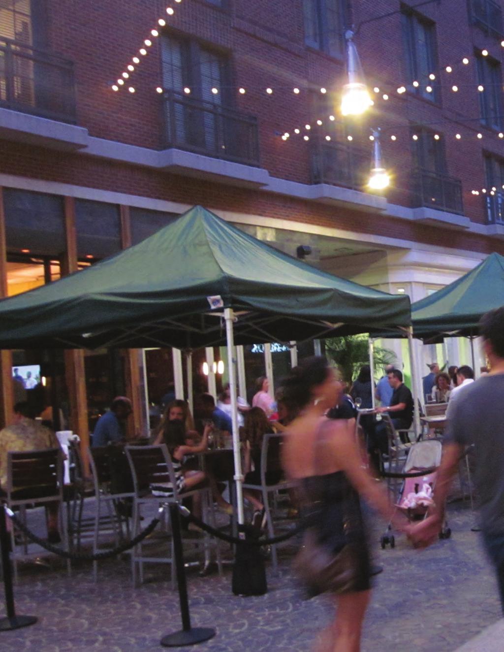
92

93 Chapter 3: Districts Site-Specific Guidelines BETHESDA DOWNTOWN PLAN DESIGN GUIDELINES JULY
94 3.1 Wisconsin Avenue Corridor The Wisconsin Avenue Corridor District contains three key sites in the future development of Downtown Bethesda, including Metro Center Plaza, Veteran s Park Civic Green and the Farm Women s Market Civic Green. These sites are located in the areas of Downtown Bethesda with the tallest buildings, and where several of the primary links between downtown districts meet. Guidelines for these open spaces as well as the surrounding streets and buildings are important to ensure a balanced environment of inviting and connected public spaces in areas with the largest scale developments Metro Center Plaza The Metro Center Plaza is centrally located, surrounded primarily by office development, and for the majority of the year is underutilized except for occasional events. There are many reasons this plaza has failed to become a vibrant public space. Currently, there is no incentive for transit riders to use the plaza because they often connect more efficiently through the back of the lower level bus bay to Bethesda Row and other destinations. The plaza also has many different levels and obstructing design elements that make it feel disconnected from the street. As the first impression for visitors exiting the Metro station, this plaza and surrounding development should be enhanced as a gateway into Downtown Bethesda and a destination for those who live and work in the area. Guidelines: A. Integrate a signature tall building to provide orientation to the symbolic center of Bethesda. This building does not need to meet recommended build-to lines if it creatively relates to the surrounding plaza and pedestrian connections. B. Design future buildings and building retrofits along the plaza with active, visible and accessible ground-floor uses. C. De-clutter plaza spaces by smoothing the grade and limiting large permanent furniture. The plaza 88 BETHESDA DOWNTOWN PLAN DESIGN GUIDELINES JULY 2017


95 Figure 3.01: Wisconsin Avenue Corridor Key Sites should be as close to the elevation of the public sidewalk as feasible to encourage continuous flow between the plaza and the street. D. Integrate green lawn areas and plantings for informal gathering and events. E. Create multiple access points to the Metro station and bus bay below to encourage transit users to come up to the plaza level. Utilize sculptural canopy structures to mark these entrances. F. Improve the bus bay through enhanced lighting, color and public art. G. Use creative wayfinding and public art as beacons to attract visitors. H. Encourage more temporary programming, such as events kiosks and educational opportunities, to draw visitors. I. Consider a destination use, such as an event venue or concert hall, to draw residents and visitors into the plaza space. BETHESDA DOWNTOWN PLAN DESIGN GUIDELINES JULY


96 3.1.2 Veteran s Park Civic Green Veteran s Park Civic Green is envisioned as a green extension of the successful Veteran s Park public open space at the intersections of Woodmont Avenue, Wisconsin Avenue and Cheltenham Drive. This new park would expand the existing public space and could help link the established center of the Woodmont Triangle District and Wisconsin Avenue Corridor District. Pedestrian and Bicycle Circulation Guidelines: Option 1 A. Continue the Norfolk Avenue shared street along the park s south side to create a link to the Woodmont Triangle district from Wisconsin Avenue. B. Ensure safe and comfortable crossings for pedestrians and cyclists across Woodmont Avenue. Open Space Guidelines: A. Provide a large flexible green space that is level and visible from surrounding streets. The exact green space placement will be determined through the development review and parks acquisition process. Option 2 B. Include a double row of shade trees along the park s street frontage as an inviting promenade and seating area. C. Protect the park from vehicular traffic while still allowing visibility from the street. A structure for events could provide this edge. Building Design Guidelines: A. Study the effects of shadows cast by new developments on the proposed park. B. Create active frontages, entries and ground-floor transparency in buildings framing the park and avoid blank walls. Option 3 C. Orient terraces, balconies, and seating areas onto the existing Veteran s Park and proposed civic green. 90 BETHESDA DOWNTOWN PLAN DESIGN GUIDELINES JULY 2017


97 Figure 3.02: Illustrative View of Veteran s Park Civic Green Option 4 Flexible Lawn Space Pavilion Articulated Building Base Wisconsin Ave Woodmont Ave Norfolk Ave Shared Street Double Row of Trees Separated Bike Lanes BETHESDA DOWNTOWN PLAN DESIGN GUIDELINES JULY
98 3.1.3 Farm Women s Market Civic Green This Civic Green is envisioned as a green open space next to the Montgomery Farm Women s Cooperative Market, which is a longstanding community landmark in the historic heart of Bethesda. This space terminates the view along Bethesda Avenue and would act as both a destination and a local gathering spot, providing a space for market customers to shop, eat and relax. It serves as an extension of Elm Street Park and the proposed Eastern Greenway. All improvements to the market site will be reviewed through the Historic Preservation Commission as the site is listed in the Master Plan for historic preservation Pedestrian and Bicycle Circulation Guidelines: A. Create a wide, tree-lined sidewalk along Willow Lane to connect to the greenway and surrounding neighborhoods. B. Provide a through-block connection between the Farm Women s Market site and new development to the south. Open Space Guidelines: A. Provide space for temporary outdoor market stalls along Willow Lane to activate this edge for pedestrians. B. Design a picnicking area with flexible seating and tables for market visitors. C. Provide a large flexible lawn space to the rear of the market along the Eastern Greenway to the extent feasible. Building Design Building design guidelines listed here apply to new development adjacent to the south side of the Farm Women s Market, not to development on the Farm Women s Market site. Guidelines: A. Study the effects of shadows cast by new developments on the proposed park. B. Create a low-rise frontage with individual unit entries on development along the south edge of the civic green and step the upper floors back at least 15 feet. 92 BETHESDA DOWNTOWN PLAN DESIGN GUIDELINES JULY 2017


99 Figure 3.03: Illustrative View of Farm Women s Market Civic Green Flexible Lawn Space Lowrise Frontage with Individual Unit Entries Through-Block Connection Willow Lane Wisconsin Ave Space for Outdoor Market Stalls Picnicking Area BETHESDA DOWNTOWN PLAN DESIGN GUIDELINES JULY

100 3.2 Bethesda Row District Capital Crescent Civic Green The Capital Crescent Civic Green is envisioned as the civic green for the Bethesda Row District and the western gateway of the Capital Crescent Trail. It will build on the success of the existing small plaza at the corner of Woodmont Avenue and Bethesda Avenue, and act as an outdoor civic center for the Bethesda Row District. The Capital Crescent Trail Civic Green would provide an open space with a flexible lawn area. This green would accommodate community events and programming; be a meeting spot for moviegoers, cyclists and restaurant patrons; and serve as a space for casual picnicking, reading and sunbathing. The diagram below illustrates recent and planned development around this central space as well as major infrastructure projects, including the Purple Line and Metro station entrances as well as the Capital Crescent Trail connection. Purple Line Station Entrance (planned) Capital Crescent Civic Green Public Plaza Capital Crescent Trail 7272 Wisconsin Avenue (planned) Artery Plaza (planned) The Darcy The Flats 94 BETHESDA DOWNTOWN PLAN DESIGN GUIDELINES JULY 2017


101 Figure 3.04: Bethesda Row District Key Site BETHESDA DOWNTOWN PLAN DESIGN GUIDELINES JULY


102 Pedestrian and Bicycle Circulation Guidelines: A. Improve the intersection of Woodmont Avenue and Bethesda Avenue to be easily crossed by pedestrians and cyclists and pave the intersection as a plaza extension of the civic green. B. Facilitate pedestrian circulation to the planned Purple Line station and surrounding retail through a large promenade along the east side of the civic green and multiple paths crossing the green. Open Space Pedestrian and Bicycle Circulation Collector Green Open Space Zones Promenade low to mid-rise base Focal Point Guidelines: A. Create a cohesive, singular green space despite fractured ownership of the property proposed for the civic green. B. Provide a shaded green area along Woodmont Avenue with trees and subtle changes in elevation. C. Design a central collector space with paved circulation to the movie theater, market building and other retail destinations. Balance the hardscape with green spaces, seating and a water feature between paths. D. Punctuate the space with a focal point, which could be a vertical public artwork. E. Preserve retail visibility from and across the civic green. Building Design Guidelines: A. Limit the frontage of buildings along the park to a low to mid-rise height and step back upper floors above this height by a minimum of 15 feet to maintain a relationship to the existing height and character of the Bethesda Row District. B. Improve and widen stair access to Elm Street and orient active ground-floor uses and transparency to this connection. Building Design 96 BETHESDA DOWNTOWN PLAN DESIGN GUIDELINES JULY 2017


103 Figure 3.05: Illustrative View of Capital Crescent Civic Green Building Step-backs Separated Bike Lanes Focal Point Splash Pad Promenade Shaded Lawn Mounds Central Collector BETHESDA DOWNTOWN PLAN DESIGN GUIDELINES JULY

104 3.3 Woodmont Triangle District Norfolk Avenue Norfolk Avenue is the main street for the Woodmont Triangle District and is primarily framed by one- to two-story retail structures with fine-grained and varied storefronts, adding visual interest and human-scaled details for those walking along the sidewalk. Design guidelines for this street are intended to balance largescale residential infill development with existing context and character. Guidelines: Step back buildings above a lowto mid-rise base for compatibility A. As recommended in the Sector Plan, step back buildings a minimum of 15 feet above a maximum 50-foot base to maintain the appearance of a lower scale street wall along Norfolk Avenue and to provide a continuous streetscape character for this primary pedestrian link between Veteran s Park and Battery Lane Urban Park. B. Increase public space for activities to create a vibrant streetscape environment through the creation of a shared street with continuous paving. C. Integrate increase tree canopy and stormwater management into the street design. D. Preserve street parking to provide loading and customer access to small businesses. Existing retail buildings with finegrained character Increase public space for activities to create a vibrant streetscape environment 98 BETHESDA DOWNTOWN PLAN DESIGN GUIDELINES JULY 2017


105 Figure 3.06: Woodmont Triangle District Key Site Old Georgetown Rd BETHESDA DOWNTOWN PLAN DESIGN GUIDELINES JULY

106 3.4 Eastern Greenway Districts Eastern Greenway These parks are envisioned as destinations and pockets of larger green space along the edge of the downtown. Height limits and greenways will ensure compatibility, provide public open space, enhance connectivity and improve environmental quality. Guidelines: A. As recommended in the Sector Plan, provide a greenway width that is equal to or greater than the amount of building height proposed. The minimum greenway width is 35 feet. B. Orient ground floor uses, entries, balconies and terraces to the greenway. C. Design greenways as primarily landscaped spaces with limited hardscape. Provide adequate lighting continuous pathways, seating and activity areas. D. Coordinate greenway design and transitions with adjoining properties. E. Avoid cutting driveways across the greenway where possible. If needed, consolidate vehicular access points and provide the minimum width driveway. 100 BETHESDA DOWNTOWN PLAN DESIGN GUIDELINES JULY 2017


107 Figure 3.07: Eastern Greenway Districts Key Sites North South BETHESDA DOWNTOWN PLAN DESIGN GUIDELINES JULY
108
109

110 Bethesda Downtown Plan Design Guidelines Approved July 2017 M-NCPPC The Montgomery County Planning Department 8787 Georgia Avenue Silver Spring, MD MontgomeryPlanning.org THE MONTGOMERY COUNTY PLANNING DEPARTMENT THE MARYLAND-NATIONAL CAPITAL PARK AND PLANNING COMMISSION
Planning Board Briefing
 Planning Board Briefing Why Now? The Sector Plan Implementation Chapter States: Before Stage 1 begins, the following must occur: Approval of the Sectional Map Amendment. Approval of the Greater Lyttonsville
DRAFT. October Wheaton. Design Guidelines
 October 2011 DRAFT Wheaton Design Guidelines 2 Draft - Design Guidelines - Wheaton Sector Plan Contents 04 Section 1: Introduction 06 Section 2: Context 08 Section 3: Design Guidelines 09 Goal 1: Create
Wheaton CBD & Vicinity Sector Plan D E S I G N G U I D E L I N E S
 Wheaton CBD & Vicinity Sector Plan D E S I G N G U I D E L I N E S 1 a b s t r a c t This document contains the design guidelines the property owners, community members, and planners should use to implement
Bethesda Downtown Plan
 Bethesda Downtown Plan Planning Board Update Connecticut Avenue Location Economic Sustainability Social Environmental Scope Coming Soon! Team Listening, Twitter Outreach We Are Here Engagement Challenge
PUBLIC RIGHT-OF-WAY IN THIS CHAPTER PUBLIC REALM
 PUBLIC RIGHT-OF-WAY This section provides design guidelines for improvements in the public right-of-way. The public right-of-way refers to streets, sidewalks, non-vehicular thoroughfares, parks and greenways
DRAFT. 10% Common Open Space
 % OF CHARLOTTE IS CATEGORIZED AS A. LAND USES : Placeholder map displaying location of Place Type GOALS: Accommodate XX% of future growth. Provide a concentration of primarily commercial and civic activity
Policies and Code Intent Sections Related to Town Center
 Policies and Code Intent Sections Related to Town Center The Town Center Vision is scattered throughout the Comprehensive Plan, development code and the 1994 Town Center Plan. What follows are sections
appendix and street interface guidelines
 appendix five: building and street interface guidelines appendix 5 building and street interface guidelines BOULEVARDS Boulevards are generally characterized by higher levels of traffic movement at higher
WEST LOOP DESIGN GUIDELINES CHECKLIST
 WEST LOOP DESIGN GUIDELINES CHECKLIST Section 1.0 General Strategies 1.1 DESIGN EXCELLENCE: ENCOURAGE HIGH QUALITY AND INNOVATIVE DESIGN OF NEW BUILDINGS WITHIN THE WEST LOOP WITHOUT BEING PRESCRIPTIVE
Neighborhood Districts
 NEIGHBORHOOD DISTRICTS SEVEN MAIN DISTRICTS Neighborhood Districts While the Development Plan provides a broad-scale overview of the neighborhood, this section focuses on uses and relationships at the
GUIDING PRINCIPLES IN THIS CHAPTER
 GUIDING PRINCIPLES The guiding principles and design concepts in this chapter work together with the Chapel Hill 2020 Comprehensive Plan to support new public places that can be enjoyed by all while also
East Bayshore Road Neighbourhood
 East Bayshore Road Neighbourhood Northridge Property Management Urban Design Brief 3195 East Bayshore Road City of Owen Sound January 2016 East Bayshore Road Neighbourhood Northridge Property Management
Silverdale Regional Center
 Silverdale Regional Center Vision for Silverdale Regional Center The Silverdale Regional Center Plan (Plan) will guide the evolution of the Silverdale Regional Center from a collection of strip malls and
Metro. Activity Center Design Guidelines. Recommendations For Developing Focused, Mixed-Use Commercial/Residential Centers
 Metro Activity Center Design Guidelines Recommendations For Developing Focused, Mixed-Use Commercial/Residential Centers Metro Activity Centers What is a MAC? Legacy, the adopted guide for the future growth
VILLAGE OF SKOKIE Design Guidelines for Mixed-Use Districts NX Neighborhood Mixed-Use TX Transit Mixed-Use CX Core Mixed-Use
 VILLAGE OF SKOKIE Design Guidelines for Mixed-Use Districts NX Neighborhood Mixed-Use TX Transit Mixed-Use CX Core Mixed-Use TABLE OF CONTENTS CHAPTER 1 SITE DESIGN Purpose 1 CHAPTER 2 SITE DESIGN Streetscape
Town Center (part of the Comprehensive Plan)
") Town Center (part of the Comprehensive Plan) Mercer Island Town Center Looking North (2014) In 1994, a year-long process culminated in a set of design guidelines and code requirements for the Town Center
Town Center (part of the Comprehensive Plan) Mercer Island Town Center Looking North (2014) In 1994, a year-long process culminated in a set of design guidelines and code requirements for the Town Center
McCowan Precinct Plan Study Background & Deliverables
 1 DRAFT & WITHOUT PREJUDICE McCowan Precinct Plan Study Background & Deliverables In September, 2011, City Planning (Scarborough District) began a study of an area within the Scarborough Centre, identified
Complete Neighbourhood Guidelines Review Tool
 Complete Neighbourhood Guidelines Review Tool Prepared By: City of Regina Planning Department October 2014 Page 1 of 14 Community Development Review Checklist for Secondary Plans and Concept Plans The
THE 355/270 CORRIDOR:
 THE 355/270 CORRIDOR: Strategic Ideas for Sustaining a Livable Work Place Project Summary ACCESS LIFE DESIGN HEALTH WORK Montgomery County Planning Department The Maryland-National Capital Park and Planning
Highland Village Green Design Guidelines
 Highland Village Green Design Guidelines Publishing Information Title Highland Village Green Design Guidelins Author The City of Calgary Status DRAFT - Proposed document subject to changes Additional Copies
Seneca Meadows. Block 4 Locate office, technology, and medical development adjacent to I Screen views of garage structures from I-270.
 Seneca Meadows Seneca Meadows has an industrial park in its southern end and a mixed-use employment area planned for the north end. The district benefits from extensive I-270 visibility, stream valley
Buildings may be set back to create small plazas provided that these setbacks do not substantially disrupt the street wall s continuity.
 6-22 Community Design Street Walls and Street-front Setbacks The siting of buildings will play a critical role in establishing the character and sense of place for the District. Siting buildings at the
Figure 3-1: Public Realm Plan
 3 Public Realm Figure 3-1: Public Realm Plan 3.1 Public Realm Concept The public realm concept for the Little Mountain site integrates a clear and accessible movement network with public spaces for social
Agenda. 3. Outstanding Items. How it would work (DRP) Urban Design Guidelines language in Sector Plan (Concepts) vs. Guidelines Document (Detail)
 Urban Design Guidelines language in Sector Plan (Concepts) vs. Guidelines Document (Detail)") Work Session #14 Planning Board June 9, 2016 Agenda 1. Big Picture Items to Confirm Upfront 2. Detailed Topics for Conversation a) Park Impact Payment b) Priority Sending Sites - Additional Incentives
Work Session #14 Planning Board June 9, 2016 Agenda 1. Big Picture Items to Confirm Upfront 2. Detailed Topics for Conversation a) Park Impact Payment b) Priority Sending Sites - Additional Incentives
B L A C K D I A M O N D D E S I G N G U I D E L I N E S for Multi-family Development
 B L A C K D I A M O N D D E S I G N G U I D E L I N E S for Multi-family Development Adopted June 18, 2009 This section of the Design and focuses on site planning and design guidance for new multi-family
URBAN DESIGN BRIEF URBAN DESIGN BRIEF 721 FRANKLIN BLVD, CAMBRIDGE August 2018
 URBAN DESIGN BRIEF URBAN DESIGN BRIEF 721 FRANKLIN BLVD, CAMBRIDGE August 2018 DESIGN BRIEF CONTENTS PART A 1.0 INTRODUCTION 2.0 DESCRIPTION & ANALYSIS OF SITE CONTEXT 3.0 DESIGN CONSTRAINTS AND OPPORTUNITIES
FRUITVALE TRANSIT VILLAGE (Phase 2) Residential Project
 Residential Project") FRUITVALE TRANSIT VILLAGE (Phase 2) Residential Project DEVELOPER: SIGNATURE PROPERTIES ARCHITECT: HKIT ARCHITECTS April 23, 2010 TABLE OF CONTENTS 3 Vision 4 Description of Site 5 Guiding Concepts 6
FRUITVALE TRANSIT VILLAGE (Phase 2) Residential Project DEVELOPER: SIGNATURE PROPERTIES ARCHITECT: HKIT ARCHITECTS April 23, 2010 TABLE OF CONTENTS 3 Vision 4 Description of Site 5 Guiding Concepts 6
Cit of Kitchener Ur 6 an Design Manual PARTA. Desi n for _--::
 Cit of Kitchener Ur 6 an Design Manual Date PARTA Year ) Desi n for k Nodes Corridors _--:: Section Page 01 of 12 2 INTRODUCTION Purpose & Application Nodes and Corridors have been identified as key intensification
The transportation system in a community is an
 7 TRANSPORTATION The transportation system in a community is an important factor contributing to the quality of life of the residents. Without a sound transportation system to bring both goods and patrons
ELMVALE ACRES SHOPPING CENTRE MASTER PLAN
 ELMVALE ACRES SHOPPING CENTRE MASTER PLAN Contents 1.0 INTRODUCTION... 2 2.0 LOCATION... 2 3.0 EXISTING CONTEXT... 2 4.0 VISION & GUIDING PRINCIPLES... 2 5.0 LAND USE AND BUILT FORM... 4 5.1 St. Laurent
CHAPTER 1. Ms. Guajardo s Class - Central Elementary CH 1 1
 INTRODUCTION CHAPTER 1 Ms. Guajardo s Class - Central Elementary CH 1 1 1.1 SETTING South Centre City is a linear corridor south of Downtown Escondido paralleling Centre City Parkway and South Escondido
5.1 Site Plan Guidelines
 5. Community Core Guidelines Development of the Community Core will take place by plan of subdivision and site plan approval. It will occur in a phased manner that will reflect the timing of residential
URBAN DESIGN BRIEF. 2136&2148 Trafalgar Road. Town of Oakville
 URBAN DESIGN BRIEF 2136&2148 Trafalgar Road Town of Oakville Prepared By: METROPOLITAN CONSULTING INC For 2500674 Ontario Inc November 2016 TABLE OF CONTENTS Page No. 1.0 Introduction/Description of Subject
Lehigh Acres Land Development Regulations Community Planning Project
 Lehigh Acres Land Development Regulations Planning Effort Summary In July, 2010 Commissioner Frank Mann invited the Lehigh Acres community to start discussing how to achieve their recently adopted community
Urban Design Manual PLANNING AROUND RAPID TRANSIT STATIONS (PARTS) Introduction. Station Study Areas
 Introduction. Station Study Areas") 111111 PLANNING AROUND RAPID TRANSIT STATIONS (PARTS) Introduction The ION rapid transit system will link Waterloo, Kitchener and Cambridge through a central transit corridor (CTC). There are a number
111111 PLANNING AROUND RAPID TRANSIT STATIONS (PARTS) Introduction The ION rapid transit system will link Waterloo, Kitchener and Cambridge through a central transit corridor (CTC). There are a number
Town Center. Block 5 Existing multifamily residential units are expected to remain.
 Area Guidelines Germantown s districts should be developed as distinct communities with unique features that are supported through the guidelines. The guidelines not only help distinguish these districts
The Village. Chapter 3. Mixed Use Development Plan SPECIFIC PLAN
 The Village SPECIFIC PLAN Chapter 3 3.1 INTRODUCTION 3.1.1 Purpose This Chapter describes the development regulations applicable to the Mixed-Use and Transit Center Planning Areas. These form-based regulations
3.1 community vision. 3.3 required plan elements
 Chapter 3 Community Form 3.1 community vision 3.2 Parks & landscaping concepts 3.3 required plan elements D R A F T 20 Community Form Chapter 3 3.0 Community form 3.1 community vision The Specific Plan
Clairtrell Area Context Plan
 Clairtrell Area Context Plan March 2005 Urban Development Services City Planning Contents 1. Introduction... 4 2. Development Structure... 6 2.1 Streets... 7 2.1.1 Sheppard Avenue and Bayview Avenue...
Transportation. Strategies for Action
 Transportation A major priority for the Overlake Neighborhood is to develop a multimodal transportation system. To achieve this system, a balance has to be found among travel, circulation and access needs;
Community Design Guidelines. Port Wallace DRAFT
 Community Design Guidelines Port Wallace DRAFT Energy 1 2 3 Nature Movement Connections Built Form DRAFT Layout Energy 1 Nature Community Design Guidelines GREAT COMMUNITIES PROTECT, CELEBRATE, AND CONSERVE
ARLINGTON COUNTY, VIRGINIA
 ARLINGTON COUNTY, VIRGINIA County Board Agenda Item Meeting October 15, 2005 DATE: September 28, 2005 SUBJECT: Request to Advertise the adoption of the 2005 Clarendon Sector Plan C. M. RECOMMENDATION:
4.1.3 LAND USE CATEGORIES
 4.1.3 LAND USE CATEGORIES a. City Center District The City Center District incorporates the existing character and mix of uses in downtown Belmont to encourage redevelopment and new development in keeping
(DC1) Direct Development Control Provision DC1 Area 4
 Direct Development Control Provision DC1 Area 4") . General Purpose (DC) Direct Development Control Provision DC Area 4 The purpose of this Provision is to provide for an area of commercial office employment and residential development in support of the
. General Purpose (DC) Direct Development Control Provision DC Area 4 The purpose of this Provision is to provide for an area of commercial office employment and residential development in support of the
COMMUNITY DESIGN. GOAL: Create livable and attractive communities. Intent
 COMMUNITY DESIGN Intent An attractive, well-designed County will attract quality development, instill civic pride, improve the visual character of the community, and create a strong, positive image for
ATTACHMENT A. SILVERDALE DESIGN STANDARDS Amendments to the Waaga Way Town Center Chapter
 ATTACHMENT A SILVERDALE DESIGN STANDARDS Amendments to the Waaga Way Town Center Chapter Chapter 10. Waaga Way Town Center 10.1 Physical Identity Elements & Opportunities The Waaga Way Town Center includes
Site Planning. 1.0 Site Context. 2.0 Pedestrian Circulation Systems. Pag e 2-23
 The following photographs from throughout the country illustrate key urban design principles. Photographs are provided to illustrate the overall urban design concepts described in Chapter 1 of the Downtown
Status Report: MD 355 Project
 Status Report: MD 355 Project OCTOBER 2006 M-NCPPC MONTGOMERY COUNTY PLANNING DEPARTMENT Summary of Community Comments, and break to the Results of the MD 355 Participation Session Brookside Gardens -
MONTGOMERY COUNTY PLANNING DEPARTMENT THE MARYLAND NATIONAL CAPITAL PARK AND PLANNING COMMISSION
 MONTGOMERY COUNTY PLANNING DEPARTMENT THE MARYLAND NATIONAL CAPITAL PARK AND PLANNING COMMISSION Bethesda Downtown Sector Plan, Work Session #8 MCPB Item No.8 Date: 02-25-16 Leslye Howerton, Planner Coordinator,
Uptown Rideau Street Secondary Plan [Amendment #166, January 12, 2016]
![Uptown Rideau Street Secondary Plan [Amendment #166, January 12, 2016]](/thumbs/76/73760497.jpg "Uptown Rideau Street Secondary Plan [Amendment #166, January 12, 2016]") [Amendment #166, January 12, 2016] The policies of this Secondary Plan are in effect, save and except for the property at 560 Rideau Street, for which there remains a site specific appeal to this Secondary
[Amendment #166, January 12, 2016] The policies of this Secondary Plan are in effect, save and except for the property at 560 Rideau Street, for which there remains a site specific appeal to this Secondary
SUBCHAPTER 4-B GUIDELINES FOR THE B-3 COMMERCIAL CHARACTER AREA
 1 SUBCHAPTER 4-B GUIDELINES FOR THE B-3 COMMERCIAL CHARACTER AREA Downtown Bozeman should be the location of buildings of greatest height and intensity in the community. The following guidelines apply
Courthouse Square Planning & Urban Design Study. Courthouse Square Working Group #13 October 15, 2014
 Courthouse Square Planning & Urban Design Study Courthouse Square Working Group #13 October 15, 2014 1 Courthouse Square Process Working Group Community Courthouse Square Advisory Groups & Civic Associations
The University District envisions, in its neighborhood
 Envisioning the University District Link Light Rail in Seattle s neighborhoods CIY OF SEALE CONCEP-LEVEL SAION AREA PLANNING RECOMMENDAION RESOLUION # 30165 EXHIBI L Vision 08.2000 he University District
EXISTING COMPREHENSIVE PLAN
 EXISTING COMPREHENSIVE PLAN Town Center Land Use Element: V. LAND USE POLICIES Town Center Mercer Island's business district vision as described in "Your Mercer Island Citizen-Designed Downtown" was an
V. Gateways GATEWAYS / V-1
 V. GATEWAYS / V-1 Many of Chesapeake s gateways are located on highways and call for bold and attractive designs that motorists can understand, appreciate, and enjoy. can also take the form of natural
Ivywild On The Creek PRELIMINARY CREEK DISTRICT MASTER PLAN
 Ivywild On The Creek PRELIMINARY CREEK DISTRICT MASTER PLAN Introduction: Rejuvenating an extraordinary Creekside neighborhood THE CREEKSIDE DISTRICT The Ivywild On The Creek Neighborhood District Master
FLORIN ROAD CORRIDOR Site Plan and Design Review Guidelines Checklist
 FLORIN ROAD CORRIDOR Site Plan and Design Review Guidelines Checklist Applicant s Name: Project Address: Phone: Email: Applicant shall fill out the design guidelines checklist for all guidelines applicable
A. Background Summary of Existing Challenges and Potential Possibilities. 1. Summary of Existing Assets and Potential Opportunities
 A. Background 1 A Main Street Master Plan Study was performed and completed in October of 2007. The study was initiated to review current land uses and development patterns along Main Street, from Parrish
6. DOWNTOWN. The Downtown Element focuses on supporting and expanding the vitality and enhancement of Downtown Chico as the City s central core.
 VISION In 2030, Downtown Chico is the heart of the community and the center of cultural activity. Engaging and active at the street level, it is a multi-story, mixed-use hub, with specialty retail, restaurants,
DRAFT Northeast Quadrant of Kipling Avenue and Highway 7 DRAFT AUGUST 29, Goals Land Use. The goals of this Plan are to:
 AUGUST 29, 2017 12.15 Northeast Quadrant of Kipling Avenue and Highway 7 12.15.1 Goals 12.15.2 Land Use The goals of this Plan are to: 12.15.2.1 General Provisions: a) Ensure the development of a compact
The Five Components of the McLoughlin Area Plan
 The Five Components of the McLoughlin Area Plan This documents contains the complete language of the five components of the McLoughlin Area Plan: The Vision Statement The Values The Guiding Principles
Future Five. Design/ Development Guidelines. January 2008 Amended June 08 per City Council motion
 Future Five Design/ Development Guidelines January 2008 Amended June 08 per City Council motion 5-Points Design Guidelines Table of Contents I. Introduction 3 II. Area boundaries 4 III. Review Process
38 Queen s University Campus Master Plan Part 1
 38 Queen s University Campus Master Plan Part 1 46 The Campus at the City Scale Chapter 4 The Campus at the City Scale 39 Queen s is an urban University centrally located in Kingston. Decisions made by
open house 3 CITY OF SALEM Downtown Streetscape Plan
 open house 3 Streetscape concepts CITY OF SALEM Downtown Streetscape Plan analysis concepts we are here refined concepts & document Feb 13th 1 2 3 apr 18th KICKOFF OPEN HOUSE Streetscape Work Group Walking
ARTICLE 6: Special and Planned Development Districts
 ARTICLE 6: Special and Planned Development Districts 6-10 Traditional Neighborhood Development (TND) District 6-10.10 Purpose and Intent The Traditional Neighborhood Development (TND) District provides
VEHICULAR AND PEDESTRIAN CIRCULATION
 This perspective sketch communicates the intended character and quality of a proposed streetscape design. Locate benches near a major intersection where people tend to gather. Seating and lighting provide
II. SINGLE FAMILY RESIDENTIAL
 II. SINGLE FAMILY RESIDENTIAL Castle Rock is made up of numerous individually built houses and subdivision tracts that have been developed during the past century. Some of the tracts are diverse in architectural
CONTENTS 6.1 URBAN DESIGN
 6-2 Urban Design and Sustainable Development 6.0 URBAN DESIGN AND SUSTAINABLE DEVELOPMENT CONTENTS 6.1 URBAN DESIGN 6.1.1 General Policies 6.1.2 The Public Realm 6.1.3 Streets and Blocks 6.1.4 Streetscapes
4.9 Mendocino Avenue Corridor Plan Design Guidelines
 4.9 Mendocino Avenue Corridor Plan Design Guidelines The Mendocino Avenue Corridor Plan addresses the area between College Avenue and Steele Lane. Mendocino Avenue is a busy arterial that runs parallel
13. New Construction. Context & Character
 13. New Construction Context & Character While historic districts convey a sense of time and place which is retained through the preservation of historic buildings and relationships, these areas continue
Toronto Complete Streets Guidelines
 Toronto Complete Streets Guidelines 108 110 7.1 Green Infrastructure Design Principles 112 7.2 Context-Sensitive Green Streets 114 7.3 Key Green Street Elements Green infrastructure refers to natural and
Lambeth Main Street Streetscape Improvements
 Lambeth Main Street Streetscape Improvements Open House October 5th, 2017 Agenda 1. Introduction 2. Project Background 3. Context 4. Project Objectives 5. Design Principles & Approach 6. Streetscape Design
B. Blocks, Buildings and Street Networks
 B. Blocks, Buildings and Street Networks Figure IV.4 A rational block pattern with connected streets Introduction The single most important element in the physical and functional integration of mixed use
Establish a network of streetscaped vehicle and pedestrian routes that connect within and outside the Plan area.
 This Plan s urban design goals are to create an urban scale, walkable community with connections to transit, parks, and services and with amenities and facilities for residents and employees. The 1992
Regency Developments. Urban Design Brief. Holyrood DC2 Rezoning
 Regency Developments Urban Design Brief Holyrood DC2 Rezoning Stantec Consulting Ltd. 7-31-2017 1. Overview Regency Developments intends to rezone the lands located at 8510 and 8511 93 Avenue, within the
New-Cast Mixed-use Development Proposal King Street West, Newcastle, Ontario
 URBAN DESIGN BRIEF New-Cast Mixed-use Development Proposal King Street West, Newcastle, Ontario TABLE OF CONTENTS: 1.0 Executive Summary 2.0 Creating Vibrant and Sustainable Urban Places: Excerpts from
Queensborough Eastern Neighbourhood Node. Community Open House
 Queensborough Eastern Community Open House The Vision The Queensborough Eastern will become the heart of eastern Queensborough. Through a sensitive mix of viable commercial and residential areas, the neighbourhood
SDOT DPD. SDOT Director s Rule DPD Director s Rule DCLU DR SED DR of 7 CITY OF SEATTLE
 SDOT SDOT Director s Rule 2-07 DPD Applicant: CITY OF SEATTLE Page 1 of 7 Supersedes: DCLU DR 11-93 SED DR 93-4 Seattle Department of Transportation (SDOT) Department of Planning and Development (DPD)
SECTION TWO: Overall Design Guidelines
 SECTION TWO: Overall Design Guidelines This section provides overall design principles and guidelines for the Gardnerville Mixed-use Overlay. They provide criteria for mixed-use places consisting of residential,
Westwood Shopping Center Sketch Plan, Plan # February 23, 2017 Item # 9
 Westwood Shopping Center Sketch Plan, Plan # 320170010 February 23, 2017 Item # 9 Westwood II Site 64,111 s.f. Manor Care site: vacant two story building HOC-Westwood Towers, 15 story tower To be considered
Good Design Guidelines for Downtown. Preliminary Findings and Recommendations
 Good Design Guidelines for Downtown Preliminary Findings and Recommendations City Council Meeting - February 5, 2017 Advisory Committee Team: Larry Paul: Planning Commission /Architect Bruce Bagnoli: Business
HIGHLAND VILLAGE GREEN URBAN DESIGN PRINCIPLES/GUIDELINES
 URBAN DESIGN GUIDING PRINCIPLES/GUIDELINES CONTEXT/CHARACTER The City of Calgary s Municipal Development Plan (MDP), Transit-Oriented Development (TOD) Policy Guidelines and Main Street/Corridor policy
Community Design Plan
 Gardena General Plan 2006 Authority While the is not a required element of a General Plan, it is included because improving the community appearance and image is paramount to the overall quality of life
10.0 Open Space and Public Realm
 10.0 Open Space and Public Realm 10.0 Open Space and Public Realm The Public Open Space System is comprised of: outdoor spaces available for public use that are either publicly owned (e.g., parks and
Design Guidelines. Roosevelt. Mike Podowski DPD Design Guidelines Ordinance ATT 13 August 13, 2012 Version #1
 Roosevelt Design Guidelines The Roosevelt Neighborhood Design Guidelines apply within the Neighborhood Boundary. Map 1 2 Map 2 3 Map 3 4 CS1 Natural Systems and Site Features Citywide Guideline: Use natural
NORTHGATE AREA. Design Guidelines. Effective, final draft: 2 may 02. City of Seattle Department of Design, Construction & Land Use
 NORTHGATE AREA neighborhood urban village Design Guidelines Effective, final draft: 2 may 02 City of Seattle Department of Design, Construction & Land Use Design Review: Northgate Area Neighborhood Design
FUTURE LAND USE ELEMENT
 FUTURE LAND USE ELEMENT GOAL I: To create and sustain a great place to live, play, and prosper Objective 1: The City of Ocala shall incorporate the principles and strategies of the Ocala 2035 Vision into
SQUAMISH 2010 AND BEYOND COMMUNITY VISION
 Our plan has been imagined and created to be both pragmatic and visionary. At the core of the strategy is a consideration of the highway s role and its impact on the community. First and foremost in creating
4.0 Design Guidelines For The Village Centre. South fields Community Architectural Design Guidelines Town of Caledon
 4.0 Design Guidelines For The Village Centre 4.0 Design Guidelines for the Village Centre The Village Centre is the focal point of the entire South Fields Community and is designed as a traditional commercial
QUEEN-RIVER SECONDARY PLAN
 34 QUEEN-RIVER SECONDARY PLAN 34. QUEEN RIVER SECONDARY PLAN 1. INTRODUCTION The Queen-River area is approximately 6.4 hectares and is located at the eastern edge of the Downtown as shown on Map 34-1.
2.0 THE PLATINUM TRIANGLE VISION
 2.0 THE PLATINUM TRIANGLE VISION The envisions an exciting future for the area surrounding Angel Stadium of Anaheim, the Honda Center and The Grove of Anaheim. 2.1 Planning Principles In order to further
Gold Line Bus Rapid Transit Transit Oriented Development (BRTOD) Helmo Station Area Plan
 Helmo Station Area Plan") Appendix F Gold Line Bus Rapid Transit Transit Oriented Development (BRTOD) Helmo Station Area Plan Introduction and Purpose of the Plan The Gold Line Bus Rapid Transit facility is an eleven-mile dedicated
Appendix F Gold Line Bus Rapid Transit Transit Oriented Development (BRTOD) Helmo Station Area Plan Introduction and Purpose of the Plan The Gold Line Bus Rapid Transit facility is an eleven-mile dedicated
Urban Design & Placemaking
 Urban Design & Placemaking What is Urban Design? Urban Design is the discipline of creating equitable, vibrant, and sustainable places with distinct identities. The profession pulls from other built environment
Mark-up of the effect of the proposed Bronte Village Growth Area OPA No.18 on the text of section 24, Bronte Village, of the Livable Oakville Plan
 Mark-up of the effect of the proposed Bronte Village Growth Area OPA No.18 on the text of section 24, Bronte Village, of the Livable Oakville Plan Notes: This document is provided for information purposes
Draft Memorandum #1: Goals and Vision for Revitalization
 Keizer Revitalization Plan Draft Memorandum #1: Goals and Vision for Revitalization Submitted to: City of Keizer April 12, 2018 (revised) Prepared By: Angelo Planning Group and Otak, Inc. Project No. 17482.A
CHAPTER 3. Design Standards for Business, Commercial, Industrial, Recreational and Institutional Uses
 CHAPTER 3 Design Standards for Business, Commercial, Section Number Title Ordinance Number Date of Ordinance 16-3-1 Applicability 2006-11 2008-04 07-01-08 16-3-2 Uniform Standards for Architectural Design
City of Farmington. Downtown Plan. Amendment to the 1998 Master Plan Adopted October 11, 2004
 City of Farmington Amendment to the 1998 Master Plan Adopted October 11, 2004 Introduction Planning Background 1 Scope and Components of the Plan Amendment 2 Concept Introduction 3 Plan Concepts 3 Conceptual
4- PA - LD - LIVELY DOWNTOWN. LD - Background
 4- PA - LD - LIVELY DOWNTOWN LD - Background The downtown has been the service centre for the community since the city s inception and the area continues to supply people with their personal services,
1.0 VISION STATEMENT. December 6, PRINCIPLES
 Vision Statement Lincoln Regional Airport 1.0 VISION STATEMENT 1.1 City LOCATION of AND OVERVIEW The Easton Lincoln Place Land Use Master Plan identifies the principles, goals, policies, and standards
Chapter PEDESTRIAN COMMERCIAL (PC) ZONING DISTRICT
 ZONING DISTRICT") Chapter 11-17 PEDESTRIAN COMMERCIAL (PC) ZONING DISTRICT Sections: 11-17-01 GENERAL PURPOSE 11-17-02 PERMITTED BUILDING TYPES 11-17-03 USES PERMITTED WITH DESIGN REVIEW 11-17-04 USES PERMITTED BY CONDITIONAL
Chapter 11-17 PEDESTRIAN COMMERCIAL (PC) ZONING DISTRICT Sections: 11-17-01 GENERAL PURPOSE 11-17-02 PERMITTED BUILDING TYPES 11-17-03 USES PERMITTED WITH DESIGN REVIEW 11-17-04 USES PERMITTED BY CONDITIONAL