SITE INTRODUCTIONS AND OVERVIEW
|
|
|
- Emery Hall
- 5 years ago
- Views:
Transcription

1 SITE INTRODUCTIONS AND OVERVIEW

2 The City s formal Open Space Program was established in 1990 to implement long-standing policies that called for the protection of the farmlands and wild areas that surround the community.

3 Program Goals Protect Open Space Secure long-term protection of open space lands around Davis, including maintaining the quality, quantity, and connectivity of agricultural lands and habitats Manage for the Long-Term Provide and improve long-term management and monitoring of natural habitat and other open space values on City-owned lands Foster Use of Public Lands Promote and support the enjoyment of public open space lands, both within the city limits and in the broader Davis Planning Area Engage Citizens Engage citizens in planning and caring for open space areas Work With Others Nurture productive partnerships with other organizations to achieve the above goals.
4 Open Space Sites Around Town
5 The Putah Creek South Fork Preserve is a small habitat preserve a couple miles southeast of Davis. The City restored the portion of the property north of Putah Creek in the mid-1990s. South Fork Preserve The south side of the creek was restored in partnership with the Army Corps of Engineers between The Preserve includes riparian, upper riparian and oak savanna habitats

6 South Fork Preserve The Nature Preserve includes protected land on both sides of Putah Creek. The north side is 20 acres. The 85 acre parcel on the south side is publicly accessible, with a small parking lot and welcome kiosk. In 2017 the City purchased an additional 10 acre parcel immediately adjacent to the current Preserve. The current management priorities for the Preserve are: Broadleaf weed control in grasslands - 3 year control plan already developed Management Plan development, including monitoring elements Grazing plan development Prevent or mitigate effects of trespass and vandalism Resource assessment of new property Location: County Road 104
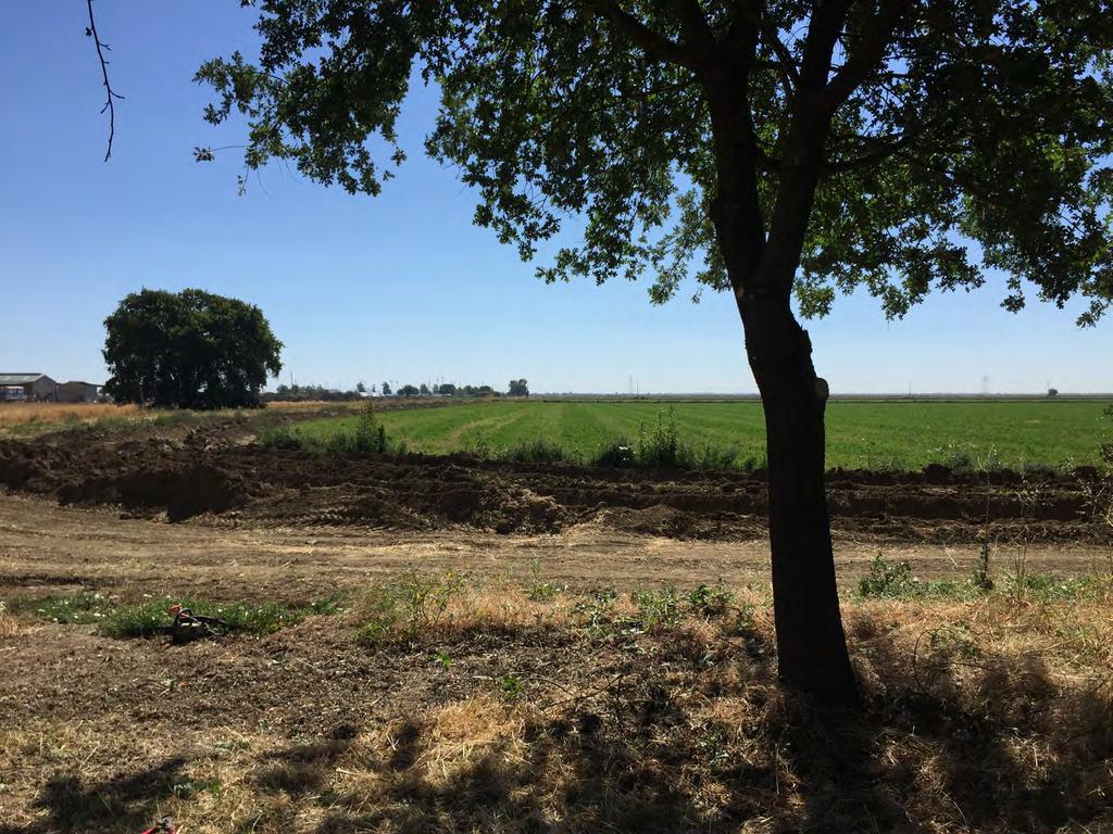
7 Wildhorse Agricultural Buffer The Wildhorse Agricultural Buffer was created in 2000 as a buffer between the Wildhorse residential development and adjacent farmland. The site is 38 acres of open grasslands, oaks, native shrubs and a remnant walnut orchard.
8 Wildhorse Wildhorse is definitely the most popular Open Space site. The two mile gravel trail gets daily use by walkers and bikers of all ages. The Ag Buffer also includes a small, but very popular contingent of protected Burrowing Owls. The northeast corner of the property is actively managed for their resource needs. Current management priorities are: Broadleaf weed control in grasslands Burrowing Owl management Tree and shrub pruning for safety and visibility Fence maintenance Prevent or mitigate effects of trespass and vandalism Fire abatement near structures Location: West entrance at Pole Line Rd. approximately 600 feet north of Moore Blvd. Another entrance at Covell Blvd across from Monarch. Entrances in Wildhorse neighborhood at; Caravaggio Dr, Bellows Ct, Rockwell Ct.
9 Putah Creek Parkway The Putah Creek Parkway is a major bike thoroughfare in South Davis. The Parkway follows the historic channel of Putah Creek, meandering under remnant oaks and walnuts, and links up with the U.C. Davis Arboretum.
10 Putah Creek Parkway The Parkway habitat favors raptors due to the many perches provided by dead and dying walnut trees. Unfortunately, the habitat along the Parkway is threatened by the impacts of camping and trash dumping during warm months. Prevention and mitigation of these activities dominates our management of the Location: Multiple entrances in South Davis between Drummond Ct and the UC Davis Arboretum area. Current management priorities are: Tree pruning for safety Vegetation management for visibility and safety Prevent or mitigate effects of trespass and vandalism Plant protection and establishment Background research on land use and cultural significance Management Plan development
11 Old Lincoln Highway The City of Davis is home to a three mile stretch of the Historic Lincoln Highway. The site is now a well-used bike path lined with native trees and shrubs.

12 Old Lincoln Highway The Lincoln Highway is a long, narrow vegetated corridor that provides nesting bird and pollinator habitat. The location and setting, however, favor camping and trash dumping on a large scale. We are actively managing the vegetation to make the area less desirable for these activities. Current management priorities are: Tree pruning for safety Vegetation management for visibility and safety Prevent or mitigate effects of trespass and vandalism Enhance pollinator forage opportunities Coordinate with Stormwater and Tranportation Management Plan development Location: Entrances at Olive Dr, Mace Blvd and Road 32A at Road 105
13 Mace Ranch Park Passive Recreation Area. The Passive Recreation Area is a natural area located in the heart of a residential development. The one acre site is set within beautiful Mace Ranch Park in east Davis. It's a showcase of native trees, shrubs, grasses and forbs.

14 Mace Ranch Park Passive Recreation Area We manage the Passive Rec Area as a presentation of native plant species in a more landscaped setting. The area is used for environmental education and has hosted several successful volunteer events. Location: 3141 Fifth Street Current management priorities are: Tree pruning for health and safety Annual grass control using solarization method Native forb establishment Ground squirrel control to prevent site damage Management Plan development
15 Woodbridge Area A small site in south Davis adjacent to the Mace Channel, the Woodbridge area is high quality habitat for small animals and pollinators.

16 Woodbridge Area Our Woodbridge site gets its name from a small wooden bridge that crosses the Mace Channel. It is a beautiful collection of native grasses, trees and shrubs nestled into the surrounding neighborhood. Combined with the Mace Channel and Willowbank sites, the area has excellent habitat values for wildlife of all kinds. Current management priorities are: Broadleaf weed control in grasses Pruning for health and safety Fire abatement Management Plan development Location: At the corner of Eucalyptus St. and San Marino Dr.
17 El Macero Agricultural Buffer The El Macero Ag Buffer sits on the far east edge of town. With beautiful views of Sacramento and the Sierras, this small site is at the confluence of development, agriculture and habitat.

18 El Macero Agricultural Buffer Current management priorities are: Tree and shrub pruning for visibility and safety Broadleaf weed control in grasses Management plan development Location: Entrances from the El Macero Neighborhood at; Hoag Pl, Cowell Blvd, Guthrie Pl, Tufts St.

19 Willowbank 9 & 10 The Willowbank sites are small remnants of the original habitat of Putah Creek in southeast Davis. Look for seasonal closures to protect resident Sacramento Valley Red Foxes.
20 Willowbank 9 & 10 Current management priorities are: Broadleaf weed control in grasses Mulching along trail and around native plants Pruning for safety and visibility Management Plan development Willowbank 9 Location: Mace Blvd just north of Blue Oak Dr. Willowbank 10 Location: Corner of Montgomery and Cottonwood Ct.

21 F & Anderson Restoration Site The two acre site at the corner of F Street and Anderson Road in North Davis is currently being restored. This parcel is directly adjacent to the North Davis Pond and will compliment the wetland habitat with appropriate upland vegetation. A walking trail will be part of the final improvements.

22 Other Sites Managed or Co-Managed by Open Space Washoe Ct. Corner Russell Blvd - Hwy 113 west to City Limits John Jones Tank Site North Davis Meadows Hedgerow North Davis Channel
Balancing Conservation and Development on the Jordan River
 Balancing Conservation and Development on the Jordan River Jordan River Parkway Trail Regional Athletic Complex Conservation & Restoration Balancing Conservation and Development on the Jordan River Jordan
Glenborough at Easton Land Use Master Plan
 Public Facilities 102 7.0 PUBLIC FACILITIES 7.1 OVERVIEW This chapter describes the public facilities that will provide high-quality services in the Glenborough at Easton community, to include three schools,
Hidden Pointe Landscape Master Plan. June, archi terra
 Hidden Pointe Landscape Master Plan June, 2006 t h e archi terra g r o u p 1 Table of Contents Background Purpose and Goals of the Master Plan Master Plan Process Existing Conditions Entrance Hidden Pointe
The following principles guide the development of goals and strategies to protect and promote these amenities:
 OPEN SPACE/PARKS/TRAILS/RECREATION GOALS/STRATEGIES Cherry Hills Village is a living environment that offers low density development, open areas, public scenic vistas, public trails and public parks. This
ROARING FORK RAILROAD CORRIDOR
 ROARING FORK RAILROAD CORRIDOR CONSERVATION AREA ASSESSMENT August 28, 2017 Prepared For: Covenant Enforcement Commission Roaring Fork Transportation Authority Prepared By: NEWLAND PROJECT RESOURCES, INC
Limpia Creek Duck Pond. 25 acres, Jeff Davis County
 Limpia Creek Duck Pond 25 acres, Jeff Davis County Limpia Creek Duck Pond Hwy 17 N, 25 acres Jeff Davis County, Texas James Tammy King, Agent Broker Office King Land 432 & 426.2024 Water, LLC 432 426.2024
Conservation Plan. I. Property Information. II. Objectives. Natural Resource Objectives. Sustainability in Practice (SIP) Certified
 Certified") Conservation Plan Sustainability in Practice (SIP) Certified I. Property Information Vineyard Name and Establishment Date: Location: Map (attach showing blocks and acres): II. Objectives Natural Resource
Conservation Plan Sustainability in Practice (SIP) Certified I. Property Information Vineyard Name and Establishment Date: Location: Map (attach showing blocks and acres): II. Objectives Natural Resource
Yadkin River Greenway Feasibility Study Fact Sheet Village of Clemmons, Town of Lewisville, Town of Bermuda Run
 Fact Sheet Village of Clemmons, Town of Lewisville, Town of Bermuda Run Project Background The Yadkin River Greenway Feasibility Study is a joint project with the Village of Clemmons, the Town of Bermuda
MILL POND OVERLOOK. A project of the Town of Oyster Bay. Prepared by Cameron Engineering & Associates, LLP
 MILL POND OVERLOOK A project of the Town of Oyster Bay Prepared by Cameron Engineering & Associates, LLP Funded in part through an EPF grant from the NYS Department of State Project Goals & Advisory Committee
APPENDIX C NATURAL RESOURCES MANAGEMENT PLAN: ACTIONS AND PRIORITIES
 APPENDIX C NATURAL RESOURCES MANAGEMENT PLAN: ACTIONS AND PRIORITIES TABLE C-1: Resource Actions and Priorities GOAL NRM-4 Objective 4.1: Restore Natural floodplain functions. Objective 4.2: Define and
Coyote Hills Restoration and Public Access Project Coyote Hills Regional Park C o n c e p t P l a n a n d S i t e P r o g r a m
 Coyote Hills Restoration and Public Access Project Coyote Hills Regional Park C o n c e p t P l a n a n d S i t e P r o g r a m Chris Barton Environmental Programs Manager Aquisition Stewardship Development
include playgrounds, sports fields, community gardens and picnic areas.
 DEVELOPMENT PLAN OPEN SPACE SYSTEM OPEN SPACE SYSTEM The neighborhood provides for a range of open space types. The Village Square is an important open space in the neighborhood. It serves as a gathering
City of Davis Integrated Pest Management Program 2014 Annual Report of Pesticide Use
 City of Davis Integrated Pest Management Program 2014 Annual Report of Pesticide Use Prepared by: Martin Guerena, IPM Specialist 1.0 Introduction and Background The Integrated Pest Management policy requires
BISCUIT RUN PARK MASTER PLAN
 BOARD OF SUPERVISORS November 14, 2018 BISCUIT RUN PARK MASTER PLAN COUNTY OF ALBEMARLE ANHOLD ASSOCIATES Contents Project Introduction Property Background County Park Planning Process Existing Site &
Study Area Map. Wasatch Hollow Open Space Restoration, Use, & Management Plan. Legend. Harrison Ave East. Roosevelt East.
 Harrison Ave Roosevelt Emerson «4 «5 Rosecrest 1900 East «3 1800 East Wasatch Hollow Open Space Restoration, Use, & Management Plan Study Area Map Legend «2 «1 Potential Access Location Emigration Creek
Turkey Creek Streamway Corridor
 Turkey Creek Streamway Corridor Turkey Creek Corridor Overview History Watershed Corridor Inventory Coalition Corridor Plan Stages of Development Benefits Funding Turkey Creek History Kansas and Missouri
San Diego River Coalition 2012 Work Plan
 San Diego River Coalition 2012 Work Plan Adopted November 18, 2011 The mission of the San Diego River Coalition is preserve and enhance the San Diego River, its watershed, and its natural, cultural and
Bristol Marsh Heritage Conservancy
 Bristol Marsh Heritage Conservancy The Pennsylvania Environmental Council (PEC) protects and restores the natural and built environments through innovation, collaboration, education and advocacy. PEC believes
PICTURE CANYON Planning Riparian-Wetland Refugia in an Urban Setting
 PICTURE CANYON Planning Riparian-Wetland Refugia in an Urban Setting Rio De Flag Existing Conditions. Ephemeral stream; Limited riparian plants, habitats.. & Opportunities Water (effluent) available Restore
Las Colonias Park Master Plan
 2013 Las Colonias Park Master Plan City of Grand Junction June 2013 Introduction Las Colonias Park, a 101 acre parcel on the edge of the Colorado River south of downtown, was deeded to the City of Grand
Master Plan Objectives and Policies
 Master Plan Objectives and Policies Introduction This chapter identifies the Park issues and recommended policies established by this Master Plan. The issues were identified through meetings with staff,
Burrowing Owl Habitat Project at the Albany Plateau. (a component project of the Gilman Street Playing Fields Project City of Berkeley) March 10, 2006
 March 10, 2006") Burrowing Owl Habitat Project at the Albany Plateau (a component project of the Gilman Street Playing Fields Project City of Berkeley) March 10, 2006 Submitted by The City of Berkeley Project history During
Burrowing Owl Habitat Project at the Albany Plateau (a component project of the Gilman Street Playing Fields Project City of Berkeley) March 10, 2006 Submitted by The City of Berkeley Project history During
Parks, Trails, and Open space Element
 Parks, Trails, and Open space Element Parks, Trails, and Open Space element Parks, Recreation, and Open Space are important components of the quality of life desired by the residents of Elk Grove. This
PCAL Case Study Open Spaces: Blayney Heritage Park
 PCAL Case Study Open Spaces: Blayney Heritage Park Introduction Blayney Heritage Park is an area of high quality open space that offers a range of active and passive recreation facilities. The multi-purpose
River Bend Area Plan Map Amendment ARPP Analysis Camp Fire Day Camp November 20, 2014
 Regional Parks Department Jeffrey R. Leatherman, Director County of Sacramento Attachment 2 Divisions Administration Golf Leisure Services Maintenance Rangers Therapeutic Recreation Services River Bend
A Priceless Opportunity
 AN OPPORTUNITY A Priceless Opportunity Whoever you are, wherever you live, whatever you do, access to parks and open space improves your life. FOUR RICHMOND SHORELINE JEWELS TO POINT PINOLE REGIONAL PARK
WETLAND SOD u Bare Root Wetland Plants u Deep Rooted Willows u Coir Logs u Native Trees & Shrubs u Habitat Islands u Custom Growing
 WETLAND SOD u Bare Root Wetland Plants u Deep Rooted Willows u Coir Logs u Native Trees & Shrubs u Habitat Islands u Custom Growing 2009 PROJECT HIGHLIGHTS The following 10 projects highlight the interesting
CAMPUS HISTORY AND STEWARDSHIP
 CHAPTER TWO CAMPUS HISTORY AND STEWARDSHIP The stewardship of the UC Davis campus history and the rich collection of natural and cultural resources is a fundamental task for the LRDP. This chapter is organized
RESPONSES TO PUBLIC CONCERNS AND QUESTIONS
 RESPONSES TO PUBLIC CONCERNS AND QUESTIONS Stations and Summary Questions for Public Meeting #2 June 23, 2015 General Questions / Concerns: 1. Is there any way this development can raise revenue for the
ADDENDUM TO BIOLOGICAL SCOPING SURVEY REPORT, BOTANICAL SURVEY AND WETLAND DELINEATION
 ADDENDUM TO BIOLOGICAL SCOPING SURVEY REPORT, BOTANICAL SURVEY AND WETLAND DELINEATION FOR AVALON INN (APN 069-241-27 & -04) 1201 & 1211 NORTH MAIN STREET FORT BRAGG, CA MENDOCINO COUNTY prepared for:
Chapter 5: Natural Resources and Environment
 NATURAL RESOURCES AND ENVIRONMENT 5-1 5 Chapter 5: Natural Resources and Environment BACKGROUND AND INTENT Urban expansion represents the greatest risk for the future degradation of existing natural areas,
Policy & Procedure Effective Date: Parks Department Page of
 City of Arvada Policy & Procedure Effective Date: Parks Department Page of TITLE: City of Arvada Prairie Dog Habitat Plan APPROVAL: PURPOSE: To establish a plan for the preservation of black-tailed prairie
Natural Resource Protection
 VISION Our Parker community will enhance the quality of life by avoiding development in environmentally hazardous areas and by safeguarding the natural environment. Natural Resource Protection Introduction
Glenborough at Easton Land Use Master Plan
 Vision Statement Sunrise Blvd. Hazel Ave. Prairie City Rd. Gencorp Property Lincoln Regional Airport 1.0 VISION STATEMENT The identifies City of the principles, goals, policies, and standards Lincoln that
Neighborhood Districts
 NEIGHBORHOOD DISTRICTS SEVEN MAIN DISTRICTS Neighborhood Districts While the Development Plan provides a broad-scale overview of the neighborhood, this section focuses on uses and relationships at the
Parks, Trails, and Open Space Element
 P arks, Recreation, and Open Space are important components of the quality of life desired by the residents of Elk Grove. This Element of the General Plan addresses the City s goals, policies, and actions
ECOLOGICALLY-BASED CITY PARK MASTER PLAN
 ECOLOGICALLY-BASED CITY PARK MASTER PLAN AUTHORED BY: KELSEY BLAHO CAYLA COTHRON MAY 12, 2016 Project Summary Table of Contents Existing Conditions Stormwater Management Circulation Wildlife Habitat and
Los Angeles River-Arroyo Seco Confluence Restoration Vision Plan. Professor Meredith McKenzie, JD Urban & Regional Planning Dept Cal Poly Pomona
 Los Angeles River-Arroyo Seco Confluence Restoration Vision Plan Professor Meredith McKenzie, JD Urban & Regional Planning Dept Cal Poly Pomona The Los Angeles River Watershed Arroyo Seco Watershed Map
CRESCENT PARK GREENWAY VISION
 CRESCENT PARK GREENWAY VISION City of Hillsboro Trails Master Plan CRESCENT PARK GREENWAY Members of the Hillsboro community came together to determine the following vision and goals for the Crescent Park
City of Lafayette Study Session Staff Report Design Review Commission
 ++ City of Lafayette Study Session Staff Report Design Review Commission Meeting Date: January 08, 2018 Staff: Subject: Chris Juram, Planning Technician SS12-17 Miramar Homebuilders, R-20 Zoning: Request
The Trinity River Corridor Project Update
 The Trinity River Corridor Project Update Councilmember Carolyn A. Davis Community Meeting October 14, 2008 The project covers 20 miles of the Trinity River, approx. 10,000 acres 2 Trinity River Corridor
COLLIER BOULEVARD (CR 951) CORRIDOR
 CORRIDOR") Project(s) Goals Improve Traffic Circulation, Capacity & Safety Focus on Safety During Design & Construction Address Public Concerns Design an Aesthetically Pleasing Project Limit Environmental Impacts
Project(s) Goals Improve Traffic Circulation, Capacity & Safety Focus on Safety During Design & Construction Address Public Concerns Design an Aesthetically Pleasing Project Limit Environmental Impacts
City of Loveland Natural Areas Sites
 City of Loveland Natural Areas Sites 2007 -insert full page photo- July 2008 In the Nature of Things: City of Loveland Natural Areas Sites An update to the citizens and officials of Loveland, Colorado
PITKIN COUNTY AIRPORT LANDSCAPE MASTERPLAN
 WELCOMING VIEW OF AIRPORT CAMPUS AND AN IM- PORTANT SECTION OF THE EXPERIENCE INTO ASPEN. SOUTH MEADOW IS PART OF THE NATIVE GRASS, SAGE, AND WILDFLOWER MEADOW EXTENDING FROM BUTTERMILK MOUNTAIN DOWN TO
Open Space, Natural Areas, Parks, and Recreation
 Open Space, Natural Areas, Parks, and Recreation WHAT ARE THE CITY S CURRENT VALUES? This section addresses open spaces, natural areas, parks and recreation, and stormwater multi-use projects under separate
GOCO Grants Awarded to Projects in Arapahoe County through June 2015
 Grant Type Open Space Fiscal Year Applicant Project Title Grant Amount 2015 City of Aurora Acres Protected Triple Creek Greenway Corridor Phase 3 $2,050,000.00 0 Planning 2015 Arapahoe County High Line
4.1 AESTHETICS AND VISUAL QUALITY
 SCOPE AND METHODOLOGY 4.1 AESTHETICS AND VISUAL QUALITY This section evaluates the potential impacts to aesthetics and visual quality. Aesthetics refers to visual resources and the quality of what can
Northampton County, Pennsylvania
 Northampton County, Pennsylvania N Grand Central andfill Wind Gap afayette College Bushkill Creek, Delaware River and ehigh River all meet County View Monroe Carbon Northampton ehigh NJ Bushkill Watershed
SOUTH PARK. Construction of a Portion of South Park at Fresh Kills Park, Staten Island
 SOUTH PARK Construction of a Portion of South Park at Fresh Kills Park, Staten Island FRESHKILLS PARK FIRST PHASE OF SOUTH PARK FRESHKILLS PARK CONTEXT SOUTH PARK EXISTING CONDITIONS PROJECT OPPORTUNITIES
Chapter 5: Recreation
 Chapter 5: Recreation Introduction and Setting Recreational opportunities within Nevada County are varied, ranging from public parks with intensively used active recreational facilities, to vast tracts
Greenways as an alternative to traditional infrastructure. Green Infrastructure
 Greenways as an alternative to traditional infrastructure Green Infrastructure What is a Greenway? Little (1990) - A linear open space along a natural or human made corridor. Fabos - linked corridors nature
Member Service Plan Sierra Nevada AmeriCorps Partnership
 Member Service Plan Sierra Nevada AmeriCorps Partnership Service plans lay the framework for what each Member will be doing during their service. Service plans detail the major projects and expected results
III. PROJECT DESCRIPTION
 III. PROJECT DESCRIPTION A. PROJECT LOCATION Regional Setting The project site is located in the southeast quadrant of the City of Chico in Butte County, California and is comprised of four parcels totaling
Goleta Community Plan Update
 Goleta Community Plan Update Ecology, Biology, and Habitats GVPAC Meeting Agenda [Wednesday, December 17, 2008, 6:00PM] Pledge of Allegiance and Roll Call Public Comment Period Administrative December
Hedges Pond Recreation Area & Preserve
 INTRODUCTION Weston & Sampson Master Plan Presentation Hedges Pond Recreation Area & Preserve Plymouth, Massachusetts June 11, 2009 Our Priority: Completion of a Master Plan that establishes realistic
Dalla Mountain Park Management Plan
 Dalla Mountain Park Management Plan Adopted by Durango City Council February 7, 2006 I. INTRODUCTION Dalla Mountain Park, located on the southwestern slope of Animas Mountain, is a 177.8 acre tract rich
Mendota Heights 2040 Comprehensive Plan Draft Vers
 4 Parks and Trails The City of Mendota Heights boasts a variety of recreational and open space opportunities. Few cities can claim access to regional trails, riverside and lakeside parks, scenic bluffs
Draft Stillwater 2030 Comprehensive Plan- Goals and Policies
 Draft Stillwater 2030 Comprehensive Plan- Goals and Policies Instructions- Review each goal and policy and discuss with group any changes, deletions for additions to the list using your groups pen. Keep
Planning for and Managing Open Space and Natural Areas
 Planning for and Managing Open Space and Natural Areas Increasingly, development proposals in Delaware include large amounts of open space and natural areas. While open space is important as a community
PARKS AND RECREATION
 PARKS AND RECREATION WHAT YOU WILL FIND IN THIS CHAPTER: Background information on the development of the Park, Recreation, and System Plan (PRSP). General overview of Ellensburg s parks and recreation
Oakland County s Green Infrastructure Vision. L. Brooks Patterson Oakland County Executive
 Oakland County s Green Infrastructure Vision L. Brooks Patterson Oakland County Executive Southeast Michigan 20 miles northwest of Detroit Consists of 910 square miles Population of 1.2 million More than
NOTICE OF PREPARATION
 NOTICE OF PREPARATION DATE: January 6, 2016 TO: LEAD AGENCY: Responsible Agencies, Organizations, and Interested Parties Contact: Tyler Barrington, Principal Planner Planning Department Community Development
EACCS Goal: provide guidelines for mitigation practices and overall conservation in east Alameda County
 EAST ALAMEDA COUNTY CONSERVATION STRATEGY: A BLUEPRINT FOR ACTION Community Meeting June 11, 2009 Agenda Welcome and Introductions Project Update o Introduction o Progress to Date o Next Steps Perspectives
2018 Eco-Friendly Garden Tour Maps & Directions
 2018 Eco-Friendly Garden Tour Maps & Directions On the Day Tour hours are 10 a.m. to 4 p.m. Bring an electronic or paper ticket with you to gain access to the gardens. Look for the Eco-Friendly Garden
K+P TRAIL EXTENSION FEASIBILITY STUDY PRELIMINARY SITE ANALYSIS PLAN PREPARED FOR THE CITY OF KINGSTON NOT FOR CONSTRUCTION
 YY/MM/DD V:\2015\1415605-000 - Kingston K+P Trail Extension Feasibility\Drawings\K+P - Sheet Layout.dwg TITLEBLOCK: 790mm x 534mm OTTAWA LA 2014 PRELIMINARY SITE ANALYSIS PLAN PREPARED FOR THE NOT FOR
Wisconsin Dept. of Transportation November 2017
 Wisconsin Dept. of Transportation November 2017 Jennifer Gibson WisDOT Environmental Coordinator Mike Helmrick WisDOT Environmental Coordinator Background on compensatory wetland mitigation Site purpose
ATTACHMENT A AERIAL PHOTO OF McINTIRE PARK EAST
 ATTACHMENT A AERIAL PHOTO OF McINTIRE PARK EAST McIntire Botanical Garden Request for Proposals Attachments Page 1 of 33 ATTACHMENT B - MEMORANDUM OF AGREEMENT WITH THE CITY OF CHARLOTTESVILLE McIntire
Your 2016 Thank You Report
 Your 2016 Thank You Report Cover photo: Natural lands purchased and protected by Conservation Halton and partners in 2015. At almost 100 acres, this area protects valleys and headwater streams that flow
Town of Rico Three Mile Plan for Annexation
 Town of Rico Three Mile Plan for Annexation 10.20.2010 Adopted by Resolution 2010-2 Produced with funding support from the Colorado Department of Local Affairs 2 Content Guide Introduction. 3 Annexation
THE LAND CONSERVANCY OF SAN LUIS OBISPO COUNTY
 THE LAND CONSERVANCY OF SAN LUIS OBISPO COUNTY WWW.LCSLO.ORG WHO WE ARE Through voluntary and collaborative measures, we work to permanently protect and enhance lands having important scenic, agricultural,
Department of Community Development. Planning and Environmental Review Division Revised Notice of Preparation
 Department of Community Development Michael J. Penrose, Acting Director Divisions Building Permits & Inspection Code Enforcement County Engineering Economic Development & Marketing Planning & Environmental
Chagrin River Watershed Partners, Inc. Local Regulations. Amy H. Brennan (440)
") Chagrin River Watershed Partners, Inc. Local Regulations Amy H. Brennan (440) 975-3870 www.crwp.org abrennan@crwp.org July 9, 2013 Applicable Zoning and Building Codes Erosion and Sediment Control Grading
Chagrin River Watershed Partners, Inc. Local Regulations Amy H. Brennan (440) 975-3870 www.crwp.org abrennan@crwp.org July 9, 2013 Applicable Zoning and Building Codes Erosion and Sediment Control Grading
Pine Flat Lake Master Plan Update FACT SHEET September 2014
 Pine Flat Lake Master Plan Update FACT SHEET September 2014 PURPOSE AND OBJECTIVE The U.S. Army Corps of Engineers Sacramento District is revising the 1976 Pine Flat Lake Master Plan and is seeking public
AVONDALE ESTATES GREENSPACE AD-HOC COMMITTEE
 AVONDALE ESTATES GREENSPACE AD-HOC COMMITTEE INVENTORY AND RECOMMENDATIONS REPORT November 7, 2018 Our Mission Statement: To provide assistance and support, through professional expertise in matters of
Edgeley Pond + Park Public Meeting
 Edgeley Pond + Park Public Meeting February 21, 2017 Purpose of the meeting This Public Meeting is an opportunity for you to review the project background, process and provide input. City of Vaughan staff
Route 347. New York State Department of Transportation Region 10, Long Island. THE GREENING of ROUTE 347
 The GREENING of Route 347 The Greening of Route 347 The Greening of Route 347: History 3 The Greening of Route 347 4 The Greening of Route 347 5 The Greening of Route 347 Smith Haven Mall 6 The Greening
MCCOYS CREEK RESTORATION 30% DESIGN
 MCCOYS CREEK RESTORATION 30% DESIGN THE MCCOYS CREEK RESTORATION PLAN The restoration plan aims to reduce flooding, restore ecosystem health, expand recreational opportunities along the creek, and connect
Responses to Comments Received on the Notice of Preparation
 Received on the Notice of Preparation APPENDIX A RESPONSES TO COMMENTS RECEIVED ON THE NOTICE OF PREPARATION The Notice of Preparation and Draft Initial Study for the proposed 2003 LRDP were circulated
APPENDIX D: PARKS AND RECREATION ACTION PLAN
 APPENDIX D: PARKS AND RECREATION ACTION PLAN Goals The following goals are specific to the development, maintenance, and operation of the existing parks in the Township, as well as the acquisition and
Lake Nokomis Shoreline Enhancement Project
 Lake Nokomis Shoreline Enhancement Project Community Meeting 2 February 13, 2018 Agenda Current Problems Project Goals Project Status Existing Conditions Community Input Draft Schematic Design Long-term
las vegas wash coordination committee
 las vegas wash coordination committee lvwash.org DU Wetlands No. 1 Weir Planting Plan February 2013 DU Wetlands No. 1 Weir Planting Plan SOUTHERN NEVADA WATER AUTHORITY Las Vegas Wash Project Coordination
Planning for Staten. Habitat Restoration and Green Infrastructure. Island s North Shore
 Habitat Restoration and Green Infrastructure Planning for Staten Island s North Shore Community Board 1 March 1, 2018 NYC Parks Forestry, Horticulture, and Natural Resources Funded by the NYS Department
TABLE OF CONTENTS. Tables Table UC Davis Park and Open Space Resources
 TABLE OF CONTENTS 4.13 Recreation... 4.13-1 4.13.1 Environmental Setting... 4.13-1 4.13.2 Impacts and Mitigation Measures... 4.13-4 4.13.3 References... 4.13-8 Tables Table 4.13-1 UC Davis Park and Open
Working Group Meeting
 April 4,, 2017 Parks Operations Bldg Working Group Meeting Arts Districts Overview Stormwater/RPA/Stream Considerations First Principles Agenda 7:00pm 7:05pm 7:10pm 7:40pm 8:30pm 9:40pm 9:45pm Welcome
Mariposa Lakes. Planned Community. Project Overview. Stockton, CA
 Planned Community Stockton, CA Project Overview March 2007 Summary of Proposed Community is a master-planned community proposed for development on approximately 3,810 acres in southeast Stockton. In 2004,
Mission Bay Park Master Plan Update: Fiesta Island Amendment (Information) Mission Bay Park Committee October 3, 2017
 Mission Bay Park Committee October 3, 2017") Mission Bay Park Master Plan Update: Fiesta Island Amendment (Information) Mission Bay Park Committee October 3, 2017 Tonight s Agenda Introduction & Project Overview Proposed Circulation Changes Overview
Mission Bay Park Master Plan Update: Fiesta Island Amendment (Information) Mission Bay Park Committee October 3, 2017 Tonight s Agenda Introduction & Project Overview Proposed Circulation Changes Overview
MOUNT ROSE AND WASHOE VALLEY SCENIC BYWAY CORRIDOR MANAGEMENT PLANS
 MOUNT ROSE AND WASHOE VALLEY SCENIC BYWAY CORRIDOR MANAGEMENT PLANS PARK COMMISSION JANUARY 5, 2016 PREPARED BY Aspen Asheville Austin Chicago Denver Dubai Houston Lake Tahoe Los Angeles CORRIDOR MANAGEMENT
Clovis Urban Greening Plan. Community Workshop #2 Northwest
 Clovis Urban Greening Plan Community Workshop #2 Northwest Thursday, October 9, 2014 WHAT IS AN URBAN GREENING PLAN? A guide to help the City to improve quality of life for residents Identification of
Parks, Open Space and Trails
 Introduction Parks have often been referred as the lungs of our cities, cleansing the air of pollutants and particulate matter. Parks are also gathering places for families and community. They offer spaces
KTMB Focus on Sparks. presented March 23, 2015
 KTMB Focus on Sparks presented March 23, 2015 Keep Truckee Meadows Beautiful Private nonprofit celebrating 25 years of providing hands-on community solutions Our focus is education about economic and health
Don Narrows Workshop DRAFT MEETING REPORT Saturday, May 24, 2008 South Regent Park Recreation Centre
 Don Narrows Workshop DRAFT MEETING REPORT Saturday, May 24, 2008 South Regent Park Recreation Centre Introduction to the Workshop & this Report On Saturday, May 24, 2008 Toronto and Region Conservation
Landscaping for Wildlife
 Landscaping for Wildlife Mid-Atlantic Ecological Landscape Partnership (MAEscapes) York County Conservation District 2008 YCCD 1 Presenter Gary R. Peacock, Watershed Specialist York County Conservation
Natural Areas Certification Program Guidelines
 Natural Areas Certification Program Guidelines Purpose of the Program The City of Fort Collins Natural Areas Department encourages site management practices that focus on protecting, restoring, and enhancing
POMONA. a place of adventure and discovery adjacent to Lake Arbor Community Park A SNAPSHOT OF ELEMENTS, USES, AND POTENTIAL FOR THE 28 - ACRE SITE
 POMONA a place of adventure and discovery adjacent to Lake Arbor Community Park A SNAPSHOT OF ELEMENTS, USES, AND POTENTIAL FOR THE - ACRE SITE TABLE OF CONTENTS TEAM 0 EXECUTIVE SUMMARY 0 EXISTING CONDITIONS
Community Conservation Workshop. Saranac River Basin Communities
 Community Conservation Workshop Saranac River Basin Communities 2 Community Conservation Program Welcome! We have designed a Community Conservation Program that listens to the needs of community members.
Regulation Changes for Open Space and Similar Uses
 Regulation Changes for Open Space and Similar Uses What is the Project? This project is an analysis of the Zoning Ordinance relating to public lands and open space regulations. The proposed text amendments
RECREATION, OPEN SPACE AND GREENWAYS ELEMENT GOALS, OBJECTIVES, AND POLICIES
 RECREATION, OPEN SPACE AND GREENWAYS ELEMENT GOALS, OBJECTIVES, AND POLICIES GOAL R-1: DEVELOP A RECREATION, OPEN SPACE AND GREENWAYS SYSTEM AS AN INTEGRAL COMPONENT OF AN OVERALL, COUNTY-WIDE ECONOMIC
Development. Within of 25% or greater. ridges anticipated that the. foundations. and walk out. Page 1 of 4
 Ridge Estates May 11, 2016 LAND SUITABILITY ANALYSIS REPORT 1. INTRODUCTION This report is provided in accordance with the submittal requirements of the Planned Development Plan (PPD). The report accompanies
Master Plan Workshop October 25, 2007 Charlotte Mecklenburg Government Center
 Master Plan Workshop October 25, 2007 Charlotte Mecklenburg Government Center Land Discussion 1. What are the most important land related issues we need to address? Protect natural areas Passive walking
Santa Cruz River Master Plan. Presented to the Arizona Floodplain Management Association Spring Conference June 8-10, 2011
 Santa Cruz River Master Plan Presented to the Arizona Floodplain Management Association Spring Conference June 8-10, 2011 Introduction Who is FICO? 2 Project Team Kimley-Horn and Associates, Inc. River