West Kendall Corridor June 11, 2014
|
|
|
- Lawrence Bridges
- 5 years ago
- Views:
Transcription
1 June 11, 2014 Miami-Dade County Department of Regulatory and Economic Resources Development Services Division ā 1 Presentation Outline Review Study Area Review of Citizens Plans and Presentations Planning recommendations Next steps 2

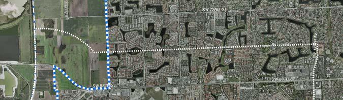
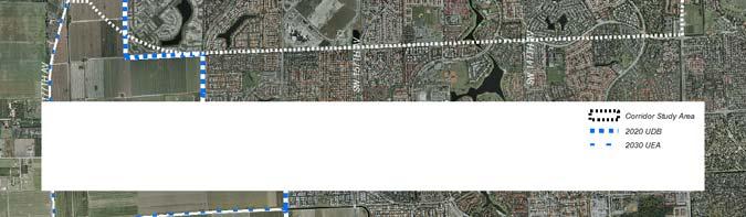
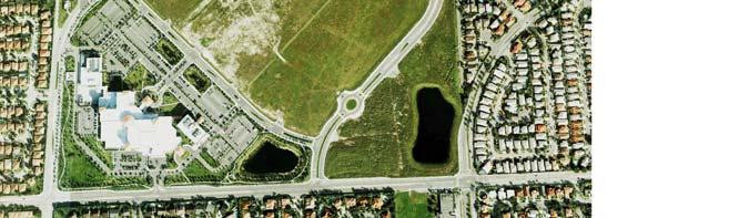
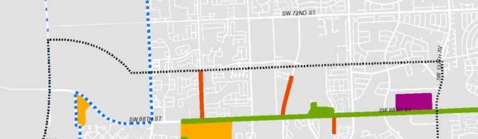
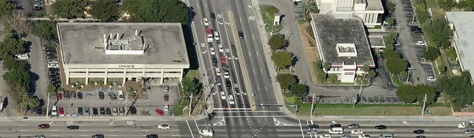
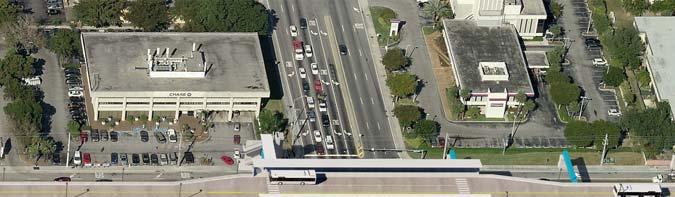
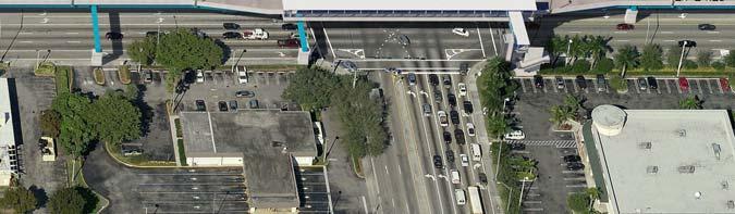
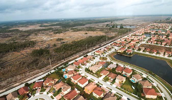
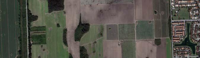
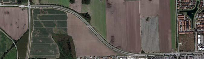
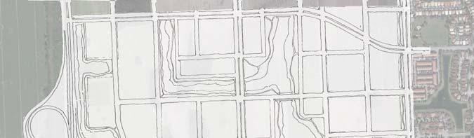
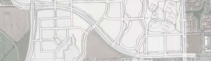
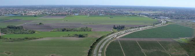
2 Study Area 3 Study Area 4


3 March 1 Public Workshop 5 March 1 Public Workshop 6


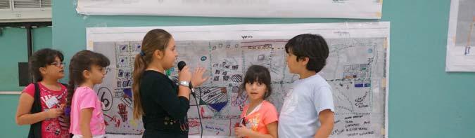

4 March 1 Public Workshop 7 March 1 Public Workshop 8


5 Citizens Plans Consensus Elements Develop mixed uses Provide a civic center Develop more employment areas Provide location for farmer s markets More open space More bicycle/pedestrian paths Improved transit service 9 Citizens Plans Bike lanes with buffers from cars Bike lanes connected to parks More street lights ornamental Entrance markers on Kendall at 137th and Krome Avenues Upscale retail and mixed uses at the Kendall Town Center with parks and civic buildings UEA should be a buffer to Krome Avenue with a farmer s market and horse stables Express buses and park and ride for 836 extension Need lighting and additional activities in parks Need additional spaces at park and ride facilities Need additional employment opportunities 10


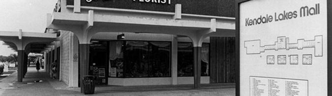
6 Citizens Plans Need Shade trees and gathering places Need mixed uses at the Town center/heart of the community Provide a native animal park north of Kendall Need a farmer s market and trolley service Have an organic institute-place to teach how to grow food More office/work places Provide places for arts and culture Kendale Lakes Mall old and uninviting; add more retail along Kendall for visibility; build parking garages; add more destination shopping, better tenants; add mixed uses inc. residential Make streets safer, increase pedestrian crossing time and have crosswalks on each corner 11 Citizens Plans West Kendall should become a city to provide for enhanced services A Town Center should be developed Land in the Expansion Area should be used for mixed uses, open space, bike lanes and Vertical farming equal to the amount of land being developed Business/industrial park with 10,000 jobs; various densities, mixed uses Increased density needed to provide for desired things 836 Expressway extension needed Provide passenger service on the CSX railroad 12


7 Citizens Plans Improve Kendall Drive with shade trees Improve 137th Avenue to 6 lanes from Kendall to Miller Limit types of businesses such as car dealers and pawn shops Widen Krome Avenue for improved access to the north Implement signage and architecture standards Need to regulate food trucks Need green architecture and development Provide Trolley Service Live/work development in Town Center Extend 836 Expressway to Kendall 13 Citizens Plans Need an upscale hotel Large park and gardens in the UEA with mixed uses along Kendall Kendall Town Center should have shopping, entertainment/movie theater, offices, performing arts/museum, government center/courthouse Dedicated bus lanes/metrorail to FIU Need more traffic calming/traffic circles Need a local trolley service Need shaded sidewalks Need more Bicycle paths 14


8 Citizens Plans Parks Shopping Bicycle trails City hall Hotel Farmer s market 15 Citizens Plans 137th and Kendall area should become mixed-use with civic facilities Mixed-use development at the Kendall Town Center, walkable and attractive, provide workplaces to provide employment Enhanced bus lanes along Kendall in a dedicated right of way, don t remove lanes from Kendall, provide increased frequencies Don t move the UDB Don t build more expressways Provide a trolley service Farmer s market in the UEA Large park in in the UEA 16

9 Planning Process Goals Create a vision for the future Transform West Kendall to a destination Enhance livability Provide transportation options Encourage a mix of uses 17 Comprehensive Plan 18


10 Comprehensive Plan 19 Planning Recommendations - Redevelopment 20

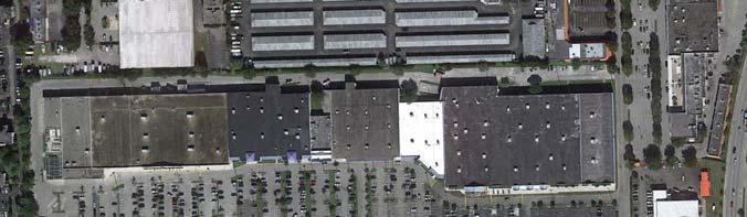
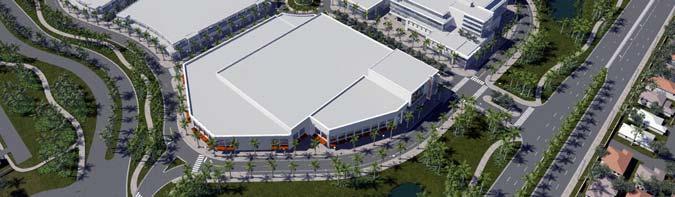
11 Planning Recommendations Kendale Lakes Plaza 21 Planning Recommendations Kendale Lakes Plaza 22

12 Planning Recommendations Kendale Lakes Plaza 23 Planning Recommendations Kendale Lakes Plaza 24
13 Planning Recommendations Kendale Lakes Plaza 25 Planning Recommendations Kendale Lakes Plaza 26
14 Planning Recommendations Kendale Lakes Plaza 27 Planning Recommendations Kendale Lakes Plaza 28
15 Planning Recommendations Kendale Lakes Plaza 29 Planning Recommendations Kendale Lakes Plaza 30
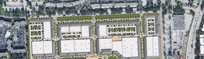
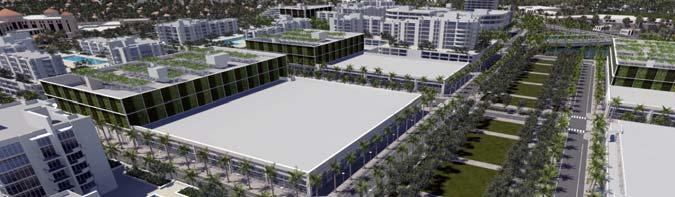
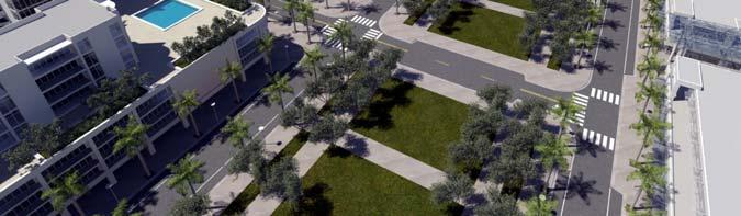
16 Planning Recommendations Kendale Lakes Plaza Designated Community Urban Center 45 acres Concept illustrates: 968,000 sq. ft. office space 620,000 sq. ft. retail space 680 units residential multi-family 15 units/acre 3 acres open space (7%) 31 Policy Recommendations - Redevelopment Future development should be consistent with the CDMP Urban Center standards for building placement and streetscapes Mixed uses, including residential and office space, should be encouraged Pedestrian connectivity to the surrounding area should be provided and/or improved 32


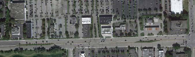
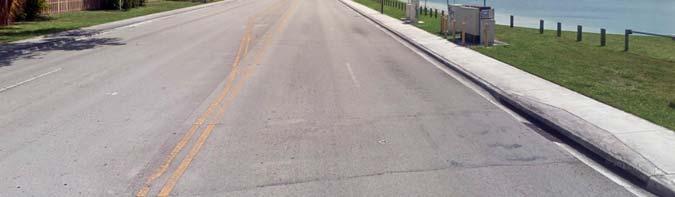
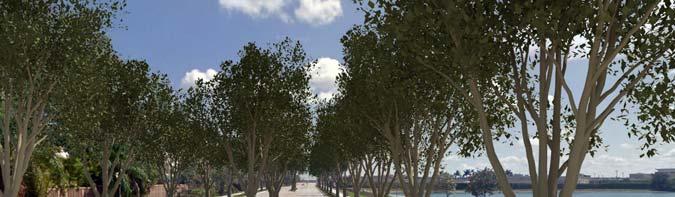
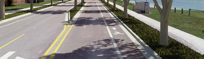
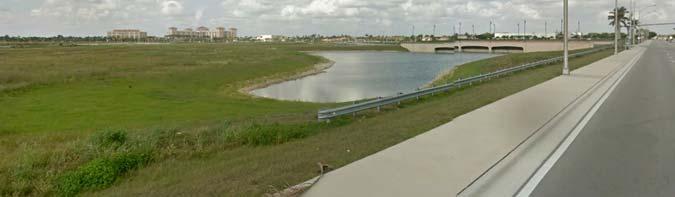
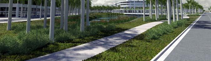
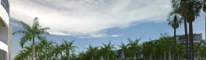
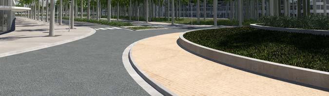
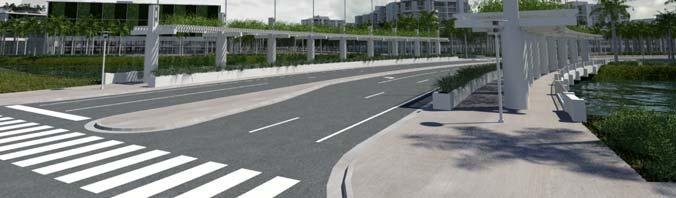
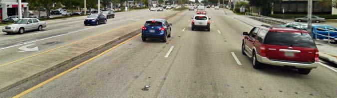
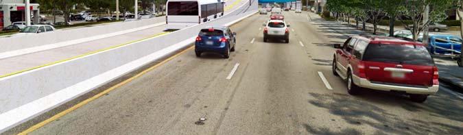
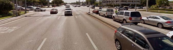
17 Planning Recommendations Street Improvements 33 Planning Recommendations 152nd Avenue 34


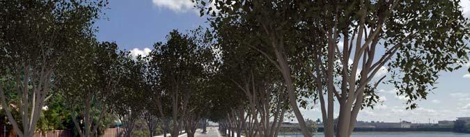
18 Planning Recommendations 152nd Avenue 35 Planning Recommendations 149th Avenue 36


19 Planning Recommendations 149th Avenue 37 Planning Recommendations 149th Avenue 38

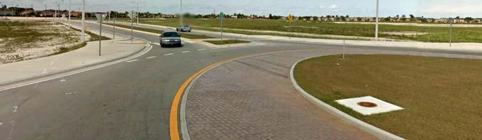
20 Planning Recommendations Street Improvements 39 Planning Recommendations 162nd Avenue 40
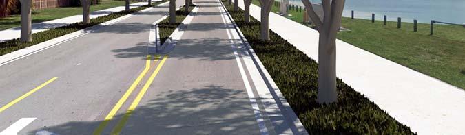
21 Planning Recommendations 162nd Avenue 41 Planning Recommendations 162nd Avenue 42
22 Policy Recommendations Street Improvements Traffic studies should be conducted to identify roadways with excess capacity Sidewalks should be buffered from travel lanes with landscaping and/or on-street parking On-street parking should be provided along streets adjoining commercial and multi-family residential areas 43 Planning Recommendations New Development 44


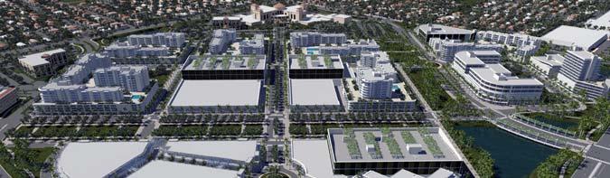
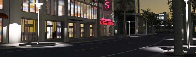
23 Planning Recommendations Kendall Town Center 45 Planning Recommendations Kendall Town Center 46


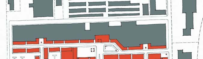
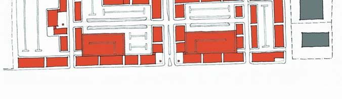
24 Planning Recommendations Kendall Town Center 47 Planning Recommendations Kendall Town Center Hospital Transit Assisted Living 48


25 Planning Recommendations Kendall Town Center Hospital Transit Assisted Living 49 Planning Recommendations Kendall Town Center Hospital Residential/Office Office Hotel Theaters/Retail Residential/Retail Retail/Office Retail Office/Civic Parking/Retail Transit Assisted Living Open Space 50


26 Planning Recommendations Kendall Town Center 51 Planning Recommendations Kendall Town Center 52
27 Planning Recommendations Kendall Town Center 53 Planning Recommendations Kendall Town Center 54

28 Planning Recommendations Kendall Town Center 55 Planning Recommendations Kendall Town Center 56


29 Planning Recommendations Kendall Town Center 57 Planning Recommendations Kendall Town Center 58

30 Planning Recommendations Kendall Town Center 59 Planning Recommendations Kendall Town Center 60


31 Planning Recommendations Kendall Town Center 61 Planning Recommendations Kendall Town Center 62
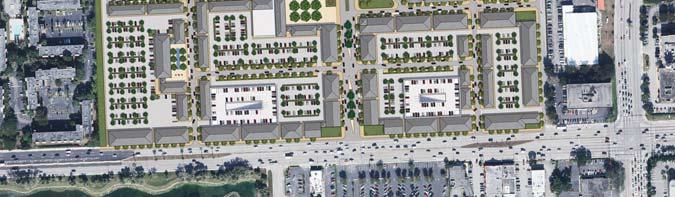
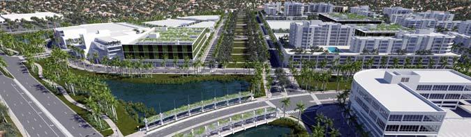
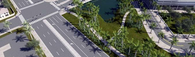
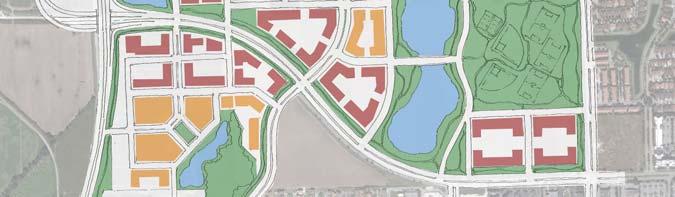
32 Planning Recommendations Kendall Town Center Approved DRI Designated Community Urban Center 83 acres Concept illustrates: 1,088,000 sq. ft. commercial area 1,700 units residential multi-family 20 units/acre 24 acres open space (29%) 0.86 overall FAR 63 Policy Recommendations New Development Future development should be consistent with the CDMP Urban Center standards for building placement and streetscapes Mixed uses, including residential and office space, should be encouraged Pedestrian connectivity to the surrounding area should be provided and/or improved 64
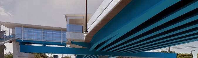
33 Planning Recommendations - Transit 65 Planning Recommendations Park and Ride 66


34 Planning Recommendations Park and Ride 67 Planning Recommendations Park and Ride 68
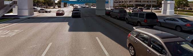
35 Planning Recommendations Park and Ride 69 Planning Recommendations - BRT 70
36 Planning Recommendations - BRT 71 Planning Recommendations - BRT 72
37 Planning Recommendations - BRT 73 Planning Recommendations - BRT 74
38 Planning Recommendations - BRT 75 Planning Recommendations - BRT 76
39 Planning Recommendations - BRT 77 Planning Recommendations - Long-term Development 78
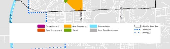
40 Planning Recommendations - UEA 79 Planning Recommendations- UEA 80


41 Planning Recommendations- UEA 81 Planning Recommendations- UEA The Urban Expansion Area is the area where current projections indicate that further urban development beyond the 2020 UDB is likely to be warranted some time between the year 2020 and Until these areas are brought within the year 2020 UDB through the Plan review and amendment process, they are allowed to be used in a manner consistent with the provisions set forth for lands designated as Agriculture or the applicable Open Land area. Adopted CDMP, Land Use Element 82
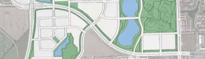
42 Planning Recommendations - UEA 83 Planning Recommendations - UEA 84
43 Planning Recommendations - UEA 85 Planning Recommendations - UEA 86


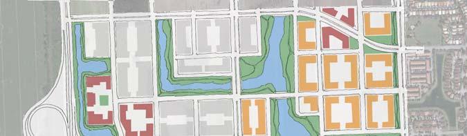
44 Planning Recommendations - UEA 87 Policy Recommendations - UEA Standards should be added to the CDMP for future development in the UEA to require an open grid of streets, connected open spaces and waterways, and building form that contributes to a pedestrian-scaled environment Mixed uses, including residential and office space, should be encouraged Pedestrian connectivity within the UEA and linked the surrounding area should be required 88
45 Next Steps Public Comment Plan Development Planning Advisory Board Board of County Commissioners 89 For more information, visit or call ā 90
Sub Area 2: Downtown Overland Park
 Downtown 132 2.12 encompasses over 600 acres and extends between 71st Street and 87 th Street including Downtown Overland Park. The area is home to several individual historic sites and structures, including
Lower Merion Commercial Districts Issues and Characteristics Handbook November 2013
 Lower Merion Commercial Districts Issues and Characteristics Handbook November 2013 DRAFT TOWNSHIP-WIDE VISION: To maintain and enhance commercial areas to complement the surrounding high-quality residential
Executive Summary. NY 7 / NY 2 Corridor
 Executive Summary NY 7 / NY 2 Corridor Transportation and Land Use Study December 2005 Prepared for: Town of Colonie Capital District Transportation Committee Prepared by: Introduction: Land use decisions
Tyvola & Archdale Transit Station Area Plan. June 5, 2008
 Tyvola & Archdale Transit Station Area Plan Second Public Meeting June 5, 2008 Presentation Outline 1. Purpose and Process 2. Station Area Overview 3. Plan Recommendations 4. Comments Received and Proposed
Welcome & Introductions
 Charrette Week Report Back - Thursday Evening April 25, 2013 Welcome & Introductions A New Master Plan Land Use and Circulation Putting data and information to work to create solutions for the master plan
Metro. Activity Center Design Guidelines. Recommendations For Developing Focused, Mixed-Use Commercial/Residential Centers
 Metro Activity Center Design Guidelines Recommendations For Developing Focused, Mixed-Use Commercial/Residential Centers Metro Activity Centers What is a MAC? Legacy, the adopted guide for the future growth
12/9/2013. HOLLYWOOD/PINES CORRIDOR PROJECT AMPO 2013 Annual Conference October 24, Our Perspective. Broward.
 HOLLYWOOD/PINES CORRIDOR PROJECT AMPO 2013 Annual Conference October 24, 2013 Our Perspective Broward Fort Lauderdale 1 Broward Metropolitan Planning Organization Fort Lauderdale Fort Lauderdale Skyline
Transportation. Strategies for Action
 Transportation A major priority for the Overlake Neighborhood is to develop a multimodal transportation system. To achieve this system, a balance has to be found among travel, circulation and access needs;
Tyvola & Archdale Transit Station Area Plan. May 15, 2008
 Tyvola & Archdale Transit Station Area Plan First Public Meeting May 15, 2008 Presentation Outline 1. Purpose and Process 2. Station Area Overview 3. Plan Recommendations Vision Land Use Transportation
City of Farmington. Downtown Plan. Amendment to the 1998 Master Plan Adopted October 11, 2004
 City of Farmington Amendment to the 1998 Master Plan Adopted October 11, 2004 Introduction Planning Background 1 Scope and Components of the Plan Amendment 2 Concept Introduction 3 Plan Concepts 3 Conceptual
Public input has been an important part of the plan development process.
 Lakewood s Comprehensive Plan recognizes that transportation helps shape the community, and that the way the community provides for the safe and efficient movement of people affects the character of the
Courthouse Square Planning & Urban Design Study. Courthouse Square Working Group #13 October 15, 2014
 Courthouse Square Planning & Urban Design Study Courthouse Square Working Group #13 October 15, 2014 1 Courthouse Square Process Working Group Community Courthouse Square Advisory Groups & Civic Associations
A larger version of this map is located on the last page of this PDF.
 MAP Committee Input McLoughlin Area Draft Vision Map A larger version of this map is located on the last page of this PDF. 1. The map above is intended to portray a vision for the McLoughlin area. It highlights
Lehigh Acres Land Development Regulations Community Planning Project
 Lehigh Acres Land Development Regulations Planning Effort Summary In July, 2010 Commissioner Frank Mann invited the Lehigh Acres community to start discussing how to achieve their recently adopted community
Fifth and Detroit Street Design May 2017 Capital Improvements Committee. DOWNTOWN Street Design
 1 Fifth and Detroit Street Design May 2017 Capital Improvements Committee Agenda 2 Review Street Configuration Prior Meeting Review Outreach Synopsis Functional Street Design Refinements Curb Edge, Turning
The Village of Shirlington
 The Village of Shirlington Suburban Smart Growth Without Rail Transit July 2018 Agenda History (1940 to present) Attributes and Outcomes Lessons Learned Setting the Stage Arlington County Arlington is
Secrest Short Cut and Monroe Expressway Small Area Plan AUGUST 29, 2018
 Secrest Short Cut and Monroe Expressway Small Area Plan AUGUST 29, 2018 Background and Process Monroe Expressway will be open by the end of 2018 Union County and Indian Trail identified a need to revisit
Gold Line Bus Rapid Transit Transit Oriented Development (BRTOD) Helmo Station Area Plan
 Helmo Station Area Plan") Appendix F Gold Line Bus Rapid Transit Transit Oriented Development (BRTOD) Helmo Station Area Plan Introduction and Purpose of the Plan The Gold Line Bus Rapid Transit facility is an eleven-mile dedicated
Appendix F Gold Line Bus Rapid Transit Transit Oriented Development (BRTOD) Helmo Station Area Plan Introduction and Purpose of the Plan The Gold Line Bus Rapid Transit facility is an eleven-mile dedicated
BROOKHILL NEIGHBORHOOD MODEL ZONING MAP AMENDMENT PREFACE TO APPLICATION
 BROOKHILL NEIGHBORHOOD MODEL ZONING MAP AMENDMENT PREFACE TO APPLICATION June 15, 2015 Revised: August 1, 2016 I. VISION Brookhill is a proposed community based upon the principles of Albemarle County
A Vibrant Downtown. Chapter 5 Cary Public Art Opportunities 31
 A Vibrant Downtown Cary s vision for Downtown is a unique, vibrant, dynamic, pedestrian friendly location; a regional destination and a place to live, work, and recreate, according to the 2001 Town Center
V. Vision and Guiding Principles
 V. Vision and Guiding Principles The Master Plan for the Powers Ferry Corridor seeks a foundation in the desires of the community. At times, various elements of the community offered opposing viewpoints,
TRANSIT ORIENTED DEVELOPMENT PINELLAS COUNTY MPO LIVABLE COMMUNITIES INITIATIVE PINELLAS COUNTY COMPREHENSIVE PLAN AMENDMENTS
 PINELLAS COUNTY MPO LIVABLE COMMUNITIES INITIATIVE MODEL LAND DEVELOPMENT CODE TRANSIT ORIENTED DEVELOPMENT PINELLAS COUNTY COMPREHENSIVE PLAN AMENDMENTS MPO Livable Communities Initiative Goal: Improve
Draft Memorandum #1: Goals and Vision for Revitalization
 Keizer Revitalization Plan Draft Memorandum #1: Goals and Vision for Revitalization Submitted to: City of Keizer April 12, 2018 (revised) Prepared By: Angelo Planning Group and Otak, Inc. Project No. 17482.A
Tonight s Agenda. Summary Presentation Open House. Group Discussion Next Steps: online community wide survey
 Community Open House February 22, 2018 Tonight s Agenda Summary Presentation Open House Station 1: Project Overview and Community Input Station 2: Draft Vision and Guiding Principles Station 3: Western,
1.0 VISION STATEMENT. December 6, PRINCIPLES
 Vision Statement Lincoln Regional Airport 1.0 VISION STATEMENT 1.1 City LOCATION of AND OVERVIEW The Easton Lincoln Place Land Use Master Plan identifies the principles, goals, policies, and standards
Northwest Rail Corridor and US 36 BRT Development Oriented Transit Analysis 4.4 STATION AREA FINDINGS
 4.4 STATION AREA FINDINGS Each station is different, and each one requires a separate set of recommendations based on the vision for the site. This section outlines an initial TOD strategy and recommendations
REVIEW AND EVALUATION OF REGIONAL LAND USE
 REVIEW AND EVALUATION OF REGIONAL LAND USE AND TRANSPORTATION SCENARIOS #220831 Environmental Justice Task Force October 7, 2014 VISION 2050 Process Development of Guiding Vision for Land Use and Transportation
Public Meeting Final Recommendations August 8, 2013
 Public Meeting Final Recommendations August 8, 2013 Meeting Agenda 1. Existing Conditions 2. Plan Building Blocks & Process 3. The Plan Policies 4. What we heard 5. Next Steps Existing Conditions Existing
Sahuarita District & Phase 1 Master Plan. Town Council December 11, 2017
 Sahuarita District & Phase 1 Master Plan Town Council December 11, 2017 Visioning Study Visioning Process Advisory Group Meetings Community Questionnaire Town Center Case Studies Community Analysis The
THE 355/270 CORRIDOR:
 THE 355/270 CORRIDOR: Strategic Ideas for Sustaining a Livable Work Place Project Summary ACCESS LIFE DESIGN HEALTH WORK Montgomery County Planning Department The Maryland-National Capital Park and Planning
West Ocala Vision & Community Plan City Council Work Session. Presented by West Ocala Community Plan Steering Committee
 West Ocala Vision & Community Plan City Council Work Session Presented by West Ocala Community Plan Steering Committee November 29,2011 Ocala 2035 Vision West Ocala Community Vision & Master Plan West
DRAFT Civic Center Station Area Plan. Executive Summary
 DRAFT Civic Center Station Area Plan Executive Summary This project is funded in part through the Metropolitan Transportation Commission s Station Area Planning Program. The preparation of this report
MONTGOMERY COUNTY METRO STATION AREA DESIGN CHARRETTE
 MONTGOMERY COUNTY METRO STATION AREA DESIGN CHARRETTE Shady Grove Metro Station Area Charrette Closing Presentation October 25-28, 2000 MONTGOMERY COUNTY, MD M-NCPPC Design Collective, Inc. Architects
The University District envisions, in its neighborhood
 Envisioning the University District Link Light Rail in Seattle s neighborhoods CIY OF SEALE CONCEP-LEVEL SAION AREA PLANNING RECOMMENDAION RESOLUION # 30165 EXHIBI L Vision 08.2000 he University District
Seneca Meadows. Block 4 Locate office, technology, and medical development adjacent to I Screen views of garage structures from I-270.
 Seneca Meadows Seneca Meadows has an industrial park in its southern end and a mixed-use employment area planned for the north end. The district benefits from extensive I-270 visibility, stream valley
4.1.3 LAND USE CATEGORIES
 4.1.3 LAND USE CATEGORIES a. City Center District The City Center District incorporates the existing character and mix of uses in downtown Belmont to encourage redevelopment and new development in keeping
Urban Planning and Land Use
 Urban Planning and Land Use 701 North 7 th Street, Room 423 Phone: (913) 573-5750 Kansas City, Kansas 66101 Fax: (913) 573-5796 Email: planninginfo@wycokck.org www.wycokck.org/planning To: From: City Planning
THE NEIGHBORHOOD TODAY
 THE NEIGHBORHOOD TODAY CORE AREA VISION How are we Good Urbanism A Site s DNA thinking about Elements of great Unique elements urban communities embedded in a place the site and design? ELEMENTS LIKE:
appendix and street interface guidelines
 appendix five: building and street interface guidelines appendix 5 building and street interface guidelines BOULEVARDS Boulevards are generally characterized by higher levels of traffic movement at higher
Subarea 4 Indian Creek. Vision The combination of park networks and transportation amenities make Subarea 4 the greenest hub in the Corridor.
 indian creek 180 extends south from 101st Street to I-435. The I-435 and Metcalf intersection is one of the primary intersections in the Kansas City Metro Area. The area includes several residential neighborhoods
Sheridan Boulevard S TAT I O N A R E A P L A N S H E R I D A N B O U L E VA R D S TAT I O N A R E A P L A N
 Sheridan Boulevard S TAT I O N A R E A P L A N 1 City of Lakewood Adopted November, 2006 S H E R I D A N B O U L E VA R D S TAT I O N A R E A P L A N The Vision The City of Lakewood s overall vision is
WELCOME and introduction
 1 WELCOME and introduction Mobility Hub Locations within Burlington STUDY OVERVIEW STUDY OBJECTIVES The City of Burlington is developing four Area Specific Plans, one for each of Burlington s Mobility
5.1 Site Plan Guidelines
 5. Community Core Guidelines Development of the Community Core will take place by plan of subdivision and site plan approval. It will occur in a phased manner that will reflect the timing of residential
Presentation of the Staff Draft. July 17, 2014 SSRVP Team, Area 3
 Presentation of the Staff Draft July 17, 2014 SSRVP Team, Area 3 Presentation Overview Introduction Plan Framework Plan Recommendations Implementation Next Steps and Request for Public Hearing on September
PLAN ON A PAGE SUMMARY
 Questions? Please Call - 423-989-5518. PLAN ON A PAGE SUMMARY The Plan on a Page is a tool for the City of Bristol to engage Bristol s neighborhoods, community organizations, and interest groups to organize
Status Report: MD 355 Project
 Status Report: MD 355 Project OCTOBER 2006 M-NCPPC MONTGOMERY COUNTY PLANNING DEPARTMENT Summary of Community Comments, and break to the Results of the MD 355 Participation Session Brookside Gardens -
International Blvd. TOD Plan Public Workshop #1
 International Blvd. TOD Plan Public Workshop #1 Add photos or project images September 21 and 22, 2010 Workshop Purpose Introduce the public to the Project Review and discuss the existing conditions analysis
Old Town Neighborhoods Plan. Choices Event Wednesday, December 9, 2015
 Old Town Neighborhoods Plan Choices Event Wednesday, December 9, 2015 Agenda 6:00 6:10 p.m. Welcome + Sign In 6:10 6:30 p.m. Presentation 6:30 8:00 p.m. Workshop + Open House Seeking your input on: Neighborhood
South Davis County COMMUNITY SPOTLIGHT
 South Davis County COMMUNITY SPOTLIGHT Davis/SLC Community Connector Bus Rapid Transit line connecting SLC & Davis County RTP Phase 1 Project Generate 3,100 average weekday riders Relieve congestion on
GPA FALL 2017 CONFERENCE
 Change in Doraville Doraville at the beginning of a new era Design Doraville (Comp. Plan) adopted in 2016 Doraville Town Center Masterplan LCI (2005) Downtown Doraville Masterplan LCI (2010) 2014 Adoption
Small Area Plan. South Gateway
 Small Area Plan Adopted May 12, 2008 South Gateway Purpose. The South Gateway Small Area Plan defines the City s expectations for the future of the southern entrance to the City at Interstate 85 and Highway
What Does It Take To Create A Town Center?
 What Does It Take To Create A Town Center? Context, Design, and Process The Prince Frederick Master Plan Update 1 Background and Overview A Brief History of Town Centers in Calvert County 2 Background
Place-Making Portsmouth
 Place-Making Portsmouth Jane Lafleur, MCRP Lift360 October 31, 2016 On Saturday, October 29, 2016, approximately 45 people gathered at Discover Portsmouth for an afternoon Place-Making session. Jane Lafleur,
The Need to Develop a Transit Ready Community
 Evaluation & Appraisal Report (EAR) Major Issue # 6 The Need to Develop a Transit Ready Community July 3, 2007 EAR Major Issue # 6 Transit Ready Existing Comp Plan policies apply only to Indiantown Road:
Today Land & People. Northeast Nampa Gateway District. Employment. Land Use Characteristics. Demographics. Current Zoning
 Today Land & People Employment Major employers include Saint Alphonsus, the College of Western Idaho, the Auto Mall, Sorrento Lactalis and Walmart. 3,004 jobs in 2010 (COMPASS-CIM 2040 TAZ data) 4,345
Hopkins. Development Guidelines May Overview. Sponsored by: Blake Road Corridor Collaborative City of Hopkins
 Hopkins Blake Road LRT Station Area Development Guidelines May 2015 Sponsored by: Blake Road Corridor Collaborative City of Hopkins Overview Hopkins is a dynamic community of over 17,000 residents located
Port Lavaca Future Land Use
 Port Lavaca Future Land Use Introduction The City of Port Lavaca is beginning to see sustained growth, after many years of relative stable population. New single family homes, apartments, and businesses
3.1 community vision. 3.3 required plan elements
 Chapter 3 Community Form 3.1 community vision 3.2 Parks & landscaping concepts 3.3 required plan elements D R A F T 20 Community Form Chapter 3 3.0 Community form 3.1 community vision The Specific Plan
Courthouse Square Planning & Urban Design Study Working Group Meeting #11 September 2, 2014
 Courthouse Square Planning & Urban Design Study Working Group Meeting #11 September 2, 2014 1 Study Area Courthouse Square DRAFT Design Concepts A B C 3 Public Feedback July 23 Workshop & Online Survey
SPRINGHILL LAKE TRANSIT VILLAGE
 Greenbelt Metro Area Sector Plan - Subarea Design Policies and Guidelines - Springhill Lake Transit Village 113 SPRINGHILL LAKE TRANSIT VILLAGE Residential Neighborhood and Village Center CONCEPT Springhill
Description of Preferred Alternative
 Chapter 2 Description of Preferred Alternative 2.1 Introduction This chapter of the programmatic Sammamish Town Center Sub-area Plan Final EIS provides a more detailed description of the Preferred Alternative
Improve Neighborhood Design and Reduce Non Point Source Water Pollution
 HOW TO Planning Guide Improve Neighborhood Design and Reduce Non Point Source Water Pollution This document was funded by a grant from the New Hampshire Coastal Program with funding from the National Oceanic
March 14, :30 p.m.-city Hall
 March 14, 2012 6:30 p.m.-city Hall Board of Mayor and Commissioners (BOMC) Citizens, Property and Business Owners Planning and Zoning Board (P&Z) Downtown Development Authority (DDA) Architectural Review
Millbrae TOD #2 Project Analysis
 Millbrae TOD #2 Project Analysis Project Description A Site Development Permit and Conditional Use Permit are proposed to allow for a mixed-use transitoriented development on approximately 9 Acres located
Planning Board Briefing
 Planning Board Briefing Why Now? The Sector Plan Implementation Chapter States: Before Stage 1 begins, the following must occur: Approval of the Sectional Map Amendment. Approval of the Greater Lyttonsville
CHAPTER 3 VISION, GOALS, & PLANNING PRINCIPLES. City of Greensburg Comprehensive Plan. Introduction. Vision Statement. Growth Management Goals.
 CHAPTER 3 VISION, GOALS, & PLANNING PRINCIPLES Introduction The Greensburg Comprehensive Plan is intended as a working community document. A combination of long and short-term goals, this document is intended
Wadsworth Boulevard S TAT I O N A R E A P L A N
 Wadsworth Boulevard S TAT I O N A R E A P L A N City of Lakewood Adopted November, 2006 The Vision The City of Lakewood s overall vision is to transform the area around the light rail station into a mixed-use
City Council Presentation November 6, 2017
 City Council Presentation November 6, 2017 Paul Jensen Recap Downtown Vision Key issues 3-D simulation exercise (CivicKnit - Breeze Kinsey) Planning Commissioner Larry Paul Elements of good design Next
Welcome. Walk Around. Talk to Us. Write Down Your Comments
 Welcome This is an information meeting introducing the applications for proposed redevelopment of the Yorkdale Shopping Centre site at 3401 Dufferin Street and 1 Yorkdale Road over the next 20+ years,
A. Background Summary of Existing Challenges and Potential Possibilities. 1. Summary of Existing Assets and Potential Opportunities
 A. Background 1 A Main Street Master Plan Study was performed and completed in October of 2007. The study was initiated to review current land uses and development patterns along Main Street, from Parrish
Proposed Comprehensive Plan Strategies DRAFT for discussion June 28, 2017
 Proposed Comprehensive Plan Strategies DRAFT for discussion June 28, 2017 Land Use Rural Areas Refine the Farm and Forest area (FF) Update FF boundaries to account for existing lots less than five acres
NORTH LAKE SPECIFIC PLAN AREA
 NORTH LAKE SPECIFIC PLAN AREA June 21, 2018 WELCOME Workshop Agenda Introduction Provide information about the program and introduce the team Background Information Share information about the North Lake
April 21, 2007 CCRP Workshop Summary
 April 21, 2007 CCRP Workshop Summary Group 1 1. Reuse around BART with a lot of housing and jobs 2. Greenway around creek 3. Transit and auto connection all through the site from Kirker Pass to Port Chicago
Implementation Guide Comprehensive Plan City of Allen
 Implementation Guide 2030 Comprehensive Plan City of Allen DRAFT 2015 Implementation Guide Allen 2030 Comprehensive Plan INTRODUCTION The Comprehensive Plan serves as a guide for the growth and development
McCowan Precinct Plan Study Background & Deliverables
 1 DRAFT & WITHOUT PREJUDICE McCowan Precinct Plan Study Background & Deliverables In September, 2011, City Planning (Scarborough District) began a study of an area within the Scarborough Centre, identified
EXECUTIVE SUMMARY DRAFT CHAPTER 1 INTRODUCTION EXECUTIVE SUMMARY
 CHAPTER 1 EXECUTIVE SUMMARY INTRODUCTION Through the joint efforts of the City of Tulsa planning staff and the Land Services division of Indian Nations Council of Governments (INCOG), the Berryhill Land
4 C OMMUNITY D ISTRICTS
 4 C OMMUNITY D ISTRICTS N ew development in the Area will include many different types of land uses, including a destination retail area that attracts people from all over the region; recreation opportunities
TRANSPORTATION ELEMENT
 TRANSPORTATION ELEMENT GOAL I: To create and maintain a safe, efficient and aesthetic transportation system that encourages multi-modal transportation and promotes the mobility strategies of the Ocala
NEIGHBORHOOD DESIGN ELEMENT
 NEIGHBORHOOD DESIGN ELEMENT INTRODUCTION The following recommendations constitute an urban design oriented "neighborhood analysis" of Plantation. It is an optional Comprehensive Plan Element. The five
The Project. In 2013, construction was completed between 100 Street and 102 Street.
 The Project Jasper Avenue New Vision (JANV) is a major catalyst project identified in the Capital City Downtown Plan (2010) between 92 Street and 109 Street, including the streets half a block north and
THE GAS PLANT DISTRICT MASTER PLAN SCENARIO 2. COMMUNITY MEETING August 6, 2018
 THE GAS PLANT DISTRICT MASTER PLAN SCENARIO 2 COMMUNITY MEETING August 6, 2018 The Gas Plant Neighborhood in the 1970 s The development should honor the history of the Gas Plant neighborhood and the community
FUTURE LAND USE ELEMENT
 FUTURE LAND USE ELEMENT GOAL I: To create and sustain a great place to live, play, and prosper Objective 1: The City of Ocala shall incorporate the principles and strategies of the Ocala 2035 Vision into
VISION AND GUIDING DESIGN PRINCIPLES
 pleasure point commercial corridor VISION AND GUIDING DESIGN PRINCIPLES Public Draft November 26, 2018 County of Santa Cruz with assistance from MIG CONTENTS PART I: INTRODUCTION AND VISION... 3 Community
Blue Line LRT Extension
 v e Noble Pkwy Noble Pkwy Xerxes Ave N Shingle Creek Penn Ave N Penn Ave N Fremont Ave N Lyndale Ave N S Washington Ave University Ave NE Blue Line LRT Extension LIGHT RAIL PLATFORM AND STATION DESIGN
Public Consultation Summary: Lakeview Place Making Workshop January 30, 2008.
 Page 1 of 11 Public Consultation Summary: Lakeview Place Making Workshop January 30, 2008. 1.0 Introduction: On January 30, 2008 the City of Mississauga, in conjunction with the consulting team of Brook
Integrating Land Use and Transportation
 FEATURE Integrating Land Use and Transportation For years the transportation profession has emphasized mobility in the development of plans, programs, and projects. This emphasis on mobility moving people
CHAPTER 7: Transportation, Mobility and Circulation
 AGLE AREA COMMUNITY Plan CHAPTER 7 CHAPTER 7: Transportation, Mobility and Circulation Transportation, Mobility and Circulation The purpose of the Transportation, Mobility and Circulation Chapter is to
Downtown Huntersville in 2030
 Downtown Huntersville in 2030 In 2030 Huntersville s Downtown will be a thriving, mixed-use town center with a variety of housing types (single-family, townhomes, live-work, and apartments), retail establishments,
Introduction. Chapter 1. Purpose of the Comprehensive Plan Plan Organization Planning Process & Community Input 1-1
 Chapter 1 Introduction Lakewood 2025: Moving Forward Together Purpose of the Comprehensive Plan Plan Organization Planning Process & Community Input 1-1 Purpose of the Comprehensive Plan The Comprehensive
greenprint midtown SUSTAINABILITY ACTION PLAN 2012
 greenprint midtown SUSTAINABILITY ACTION PLAN 2012 MIDTOWN ALLIANCE SOUTHFACE ENERGY INSTITUTE RENAISSANCE PLANNING GROUP SUSTAINABLE ATLANTA PERKINS+WILL 2 GREENPRINT MIDTOWN 1. Introduction Sustainability
RESEDA - WEST VAN NUYS COMMUNITY PLAN
 RESEDA - WEST VAN NUYS COMMUNITY PLAN Executive Summary As part of the initial outreach effort, the Department of City Planning hosted two workshops for the Reseda-West Van Nuys Community Plan Area during
ROBBINSDALE LRT STATION CDI DEVELOPMENT GUIDELINES
 August 2018 OVERVIEW The City of Robbinsdale has a prime-opportunity site in the middle of the 13 mile stretch of the Bottineau LRT corridor / Blue Line extension. Robbinsdale offers a prominent, vital,
Route 1 Corridor Study
 Route 1 Corridor Study Westbrook, Connecticut A Vision for the Connecticut Shoreline Public Informational Meeting July 28, 2015 Lower Connecticut River Valley Council of Governments Fitzgerald & Halliday,
Sacramento Area Council of Governments (SACOG)
") Sacramento Area Council of Governments (SACOG) The Blueprint Vision The SACOG Board of Directors adopted the Preferred Blueprint Scenario in December 2004, a bold vision for growth that promotes compact,
Sacramento Area Council of Governments (SACOG) The Blueprint Vision The SACOG Board of Directors adopted the Preferred Blueprint Scenario in December 2004, a bold vision for growth that promotes compact,
Date: April 10, 2017 City Council Work Session April 24, 2017: Status Report on the Comprehensive Plan Update and Transportation Master Plan
 AGENDA REPORT To: From: By: Honorable Mayor and City Council Members Warren Hutmacher, City Manager Sharon Ebert, Director Community Development Date: April 10, 2017 Agenda: City Council Work Session April
S A C R A M E N T O C O U N T Y JACKSON HIGHWAY & GRANT LINE EAST VISIONING STUDY
 JACKSON HIGHWAY & GRANT LINE EAST S A C R A M E N T O C O U N T Y P L A N N I N G D E P A R T M E N T SUMMARY AND WORKBOOK November 19, 2008 History of the Visioning Study Sacramento County has two growth
7,600 Residential Units 1,700,000 SF Non-Res 300-Room ALF 300-Room Hotel University School, Park, Civic parcels 1,889 ac flow-way/preservation
 4,763 ac undeveloped long-term AG use Over 75% characterized by non-native & invasive species Has severely degraded habitat functions 11,565 of frontage along Northlake Blvd. 1,687 of frontage along Beeline
hermitage town center
 hermitage town center A Community Vision prepared by Strada for The City of Hermitage and The Mercer County Regional Planning Commission January 2007 table of contents introduction 3 design principles
Aloha Tomorrow Study (2017)
") Study (2017) One step toward implementing the community vision from the Aloha-Reedville Study and Livable Community Plan (2014): A walkable, vibrant, livable town center with a mix of commercial and residential
Study (2017) One step toward implementing the community vision from the Aloha-Reedville Study and Livable Community Plan (2014): A walkable, vibrant, livable town center with a mix of commercial and residential
ARTICLE 6: Special and Planned Development Districts
 ARTICLE 6: Special and Planned Development Districts 6-10 Traditional Neighborhood Development (TND) District 6-10.10 Purpose and Intent The Traditional Neighborhood Development (TND) District provides