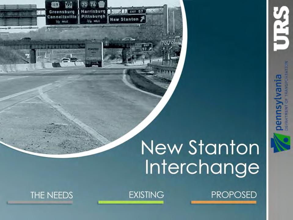
New Stanton Project Update July 3, 2012
|
|
|
- Noreen Rich
- 5 years ago
- Views:
Transcription
1 New Stanton Project Update July 3, 2012
2
3 The Needs BACKGROUND INFO I-70 Geometric Concerns Substandard Horizontal & Vertical Clearance at Center Ave. Bridge (The Center Avenue Bridge is Replaced in all Concepts studied.) Substandard Typical Section Median Width & Shoulder Width Substandard Acceleration & Deceleration Lane Lengths Substandard Interchange Spacing

4 Existing DEFICIENCY AREAS >>> OVERALL VIEW

5 Existing DEFICIENCY LOCATIONS Insufficient Weave Lengths Between New Stanton & PA Turnpike Ramps Due To Close Interchange Spacing Insufficient Accel Lane Length From PA Turnpike Insufficient Decel Lane Length To PA Turnpike

6 Existing DEFICIENCY LOCATIONS Both Ramps Have Substandard Radii Insufficient Accel Lane Length From New Stanton Interchange Existing Structure: Deficient Horizontal & Vertical Clearances Insufficient Decel Lane Length To New Stanton Interchange Insufficient Accel Lane Length From New Stanton Interchange

7 Existing DEFICIENCY LOCATIONS Insufficient Auxiliary Lane Length Skew Angle for Hunker Bridge Insufficient Decel Lane Length To SR 3089 Insufficient Auxiliary Lane Length Insufficient Accel Lane Length From SR 3089 Insufficient Decel Lane Length To New Stanton Interchange

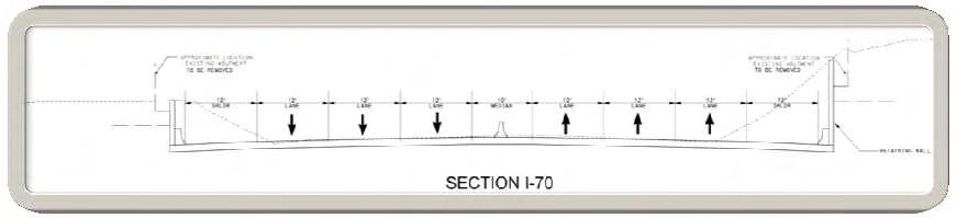
8 Existing DEFICIENCY LOCATIONS Existing I-70 Typical Section Is Substandard
9 The Needs BACKGROUND INFO Crash Rates (5-Year Period from ) Center Avenue (between Post Ave. & Byers Ave.) is more than 6x the statewide average. The EB I-70 crash rate in the Hunker-New Stanton weave area is more than 13x the statewide average. The EB I-70 crash rate in the New Stanton On-ramp merge area is more than 5x the statewide average. Poor Intersection Visibility - I-70 Ramps at Center Avenue Eastbound Off-Ramp (looking left) = 340 available Westbound Off-Ramp (looking left)= 320 available Required Sight Distance for 30 MPH to turn left = 335 (car) 510 (truck)
10 The Needs BACKGROUND INFO Center Avenue Existing Delays (Levels of Service) At Post Ave 11.0 sec (LOS B) At Pennsylvania Ave 46.8 sec (LOS E) At I-70 EB Ramps 40.4 sec (LOS E) At I-70 WB Ramps 24.8 sec (LOS C) At Byers Ave 17.8 sec (LOS C) At Westmore Ave 1.3 sec (LOS A) At Highland Ave 0.8 sec (LOS A) At Bair Blvd 1.2 sec (LOS A) Center Avenue No Pedestrian Connectivity Across SR 0070 High Truck Volume Desire for Town Center Concept Center Avenue Length of Traffic Back-ups (Queuing) See Figure (next slide)

11 2037 No-Build TRAFFIC SIMULATION

12 The Needs TRAFFIC BACK-UP LENGTHS
13 2037 No-Build BACKUPS (QUEUING)
14 Proposed CONCEPTS Concepts to the West WHY? Safety and Mobility of Travelling Public on I-70 and the Local Network Efficient Movement of People and Traffic Decrease Center Avenue Truck Traffic Provide a Safe Pedestrian Facility along Center Avenue Bridge Deficiencies (All Concepts Replace Center Avenue Bridge) Ramps Affected Decreased Residential and Business Displacements FHWA & State Requirements (Concepts #3 thru #5)

15 Proposed CONCEPT #1

16 Proposed CONCEPT #2
17 Proposed CONCEPTS Concepts #1 & #2 - Reasons for Dismissal No Improvement to Safety and Mobility No Improvement on Efficiently Moving Traffic Truck Traffic not Decreased on Center Avenue Closely Spaced Interchanges Remain Entrance and Exit Ramp Lengths Too Short Federal and State Requirements were not Satisfied

18 Proposed CONCEPT #3
19 Proposed CONCEPTS Concept #3 - Reasons for Dismissal Traffic Delays and Back-ups with tying to Byers Avenue Adverse and Unsafe Back-ups on WB Off-Ramp that Spill onto I-70 Mainline Creates a Safety and Mobility Concern

20 Proposed CONCEPT #5
21 Proposed CONCEPTS Concept #5 - Reasons for Dismissal Truck Traffic Increased on Center Avenue, Bair Boulevard, and Pennsylvania Avenue Pedestrian Safety not Greatly Improved Doesn t Provide Detour when Center Ave. Bridge is Replaced Greatest Impact to Businesses and Residences
22 Proposed NO BUILD CONDITIONS Center Avenue Intersection Delays (Levels of Service) CENTER AVENUE INTERSECTIONS Existing 2037 No-Build DELAY LOS DELAY LOS At Post Avenue 11.0 B 14.8 B At Pennsylvania Avenue 46.8 E 1 min sec F At I-70 EB Ramps 40.4 E 3 min 34.3 sec F At I-70 WB Ramps 24.8 C 48.7 D At Byers Avenue 17.8 C 25.7 D At Westmore Avenue 1.3 A 1.3 A At Highland Avenue 0.8 A 0.7 A At Bair Boulevard 1.2 A 1.2 A Center Avenue Length of Traffic Back-ups (Queuing) See Figure (next slide)

23 2037 No-Build BACKUPS (QUEUING)
24 Proposed BENEFITS OF CONCEPT #4 Concepts to the West WHY? Safety within the Entire Corridor is Improved Decreases Residential and Business Displacements Mobility within the Entire Corridor is Improved 1. Ramps are of Sufficient Length 2. Interchanges are Properly Spaced 3. Provides for Efficient Movement of Traffic throughout the Network 4. Decreased Emergency Response Times by Reduced Congestion 5. Provides a Safe Pedestrian Facility along Center Avenue Replaces the Deficient Center Avenue Bridge Enhances and Allows for Growth of Future Economic Development FHWA & State Requirements are Satisfied
25 Proposed CONCEPT #4
26 Proposed CONCEPT 4 VARIATIONS Proposed Traffic Mitigation Considered Signalization Single Point Urban Interchange Roundabouts (Safety & Maintenance) Combination of Both Signals and Roundabouts
27 Proposed CONCEPT 4-1
28 Proposed CONCEPT 4-2
29 Proposed CONCEPT 4-3
30 Proposed CONCEPT 4-4
31 Proposed CONCEPT 4-5

32 Proposed CONCEPT >>> OVERALL

33 Proposed CONCEPTS

34 Proposed CONCEPTS B B
35 Proposed CONCEPTS

36 Proposed CONCEPTS

37 Proposed CONCEPTS C C

38 Proposed CONCEPTS
39 Proposed Public Involvement Meetings Held to Date : Public Officials Briefing : : : : : Local Business Coordination Public Plans Display Business Coordination Business Coordination Business Coordination
40 Proposed Public Involvement Inclusions Considered thru Public Involvement Process Reconstruction of Pennsylvania Avenue Realignment of Bair Blvd. Opposite Highland Avenue Potential Inclusion of Sewickley Creek Bridge Potential Rachel Road Connection Potential Wayfinding Sign Opportunities (see next slide) During Construction After Construction


41 Proposed OPPORTUNITIES FOR PROJECT FIT Participation Gateway to New Stanton Approach-Way Trail Blazer Signs Aesthetics Adopt-a-Highway Program See website: Eligible Logo Types (different requirements for each) Gas Food Lodging Camping Attractions
42 Proposed OPPORTUNITIES FOR PROJECT FIT Getting the Word Out During Construction
43 2037 No-Build DAILY TRAFFIC VOLUMES
44 2037 Proposed DAILY TRAFFIC VOLUMES
45 2037 Proposed VEHICLES PER DAY TRAFFIC COMPARISON Center Avenue Intersection Daily Traffic Comparison With Pennsylvania Avenue = 15,700 (no-build) vs. 19,400 (build) = +24% With Byers Avenue = 21,700 (no-build) vs. 15,200 (build) = -30% With Bair Boulevard = 11,500 (no-build) vs. 23,000 (build) = +100%

46 2037 Proposed TRAFFIC SIMULATION
47 2037 Proposed COMPARISON New Stanton Interchange - Distance and Time Comparison Business Current Distance Proposed Distance Distance Difference Time Difference (10 MPH) Miles Miles Miles Minutes Eastbound Westbound Eastbound Westbound Eastbound Westbound Eastbound Westbound TJ's Sheetz McDonald's Days Inn

48 GET INVOLVED & STAY INVOLVED Visit for More Info

49
ALTERNATIVES. NCDOT made an early decision to first determine how to build the project (construction method) followed by what to build (alternatives).
 followed by what to build (alternatives).") III. ALTERNATIVES A. CONSTRUCTION METHOD ALTERNATIVES NCDOT made an early decision to first determine how to build the project (construction method) followed by what to build (alternatives). One of the
III. ALTERNATIVES A. CONSTRUCTION METHOD ALTERNATIVES NCDOT made an early decision to first determine how to build the project (construction method) followed by what to build (alternatives). One of the
PD&E STUDY SR 9/I-95 FROM SOUTH OF SR 870/COMMERCIAL BOULEVARD TO NORTH OF CYPRESS CREEK ROAD FM # ETDM 14222
 PD&E STUDY SR 870/COMMERCIAL BOULEVARD TO NORTH OF CYPRESS CREEK ROAD FM # 435808-1-22-02 ETDM 14222 WELCOME TO THE KICK-OFF MEETING May 24, 2016 1 1 2 3 4 5 6 PLANNING PROJECT DEVELOPMENT AND ENVIRONMENT
Project Purpose. Project Need
 Project Purpose The purpose of the project is to implement a bridge improvement solution that corrects the existing safety problem at the Strasburg Pike Bridge. The project will provide a structurally
PROPOSED IMPROVEMENTS
 IV. PROPOSED IMPROVEMENTS The proposed improvements for each alternative carried forward are discussed below. A. FUNCTIONAL CLASSIFICATION AND ROADWAY CROSS-SECTIONS The classifications of the roadways
4.1 Build Alternative 1 Construction Phasing
 SECTION 4 Implementation Plan This section discusses potential segmentation of the build alternatives into multiple projects for implementation of improvements to the NSH from Rabbit Creek Road to 36th
PROJECT STATEMENT LOCATION/DESIGN PUBLIC HEARING. 19 th AVENUE NORTH EXTENSION PROJECT FROM SPRINGDALE DRIVE TO NORTH 2 ND STREET/U.S.
 PROJECT STATEMENT LOCATION/DESIGN PUBLIC HEARING 19 th AVENUE NORTH EXTENSION PROJECT FROM SPRINGDALE DRIVE TO NORTH 2 ND STREET/U.S. 67 HEARING LOCATION: ERICKSEN COMMUNITY CENTER 1401 11 TH AVENUE NORTH
Green Book 7 th Edition Summary of Changes. Jim Rosenow NCITE Geometric Design Committee August 30, 2018
 Green Book 7 th Edition Summary of Changes Jim Rosenow NCITE Geometric Design Committee August 30, 2018 Outline 1. The drama 2. Chapter 1 rewrite 3. The rest of the book 2 Outline 1. The drama 2. Chapter
Welcome. Northern Segment of Hwy 100 I-90 to South of Madison Street Meeting Goals:
 Welcome Northern Segment of Hwy 100 I-90 to South of Madison Street Meeting Goals: - Review Environmental Assessment - Share Preferred Alternative -Receive Public Comments 2003 EA Preferred Alternative
The Ambassador Bridge/ Gateway Project
 The Ambassador Bridge/ Gateway Project Connecting Neighbors & Driving the Economy 2008 Ohio Conference on Freight Given by the Toledo Metropolitan Area Council of Governments, National Association of Regional
Access Management and Site Plan Review. Robert W. Hofrichter Asst Administrator, Transportation and Mobility Planning Division April 2014
 Access Management and Site Plan Review Robert W. Hofrichter Asst Administrator, Transportation and Mobility Planning Division April 2014 Access Management 2 Access Management What is Access Management?
I-4 Beyond the Ultimate. Florida Transportation Builders Association February 9, 2018
 I-4 Beyond the Ultimate Florida Transportation Builders Association February 9, 2018 FDOT: Improving Mobility & Safety in Central Florida FDOT is Designing and building a better I-4 through Central Florida
March 1, PWG Meeting #4
 March 1, 2013 PWG Meeting #4 1 Meeting Agenda 2 History & Overview Circle Interchange was built in the late 1950 s and early 1960 s, and the facility is in need of major repair or reconstruction. 3 History
Highway 417 Expansion East
 Highway 417 Expansion East Nicholas Street to Ottawa Road 174 GWP 4091-07-00 & GWP 4320-06-00 Outline Project Overview Highway 417 Widening Bridge Rapid Replacements Traffic & Incident Management Project
SR 483 Clyde Morris Boulevard FDOT District 5
 This project occurs on a 3.0 mile section of SR 483 (Clyde Morris Blvd.) south of Beville Road (SR 400) to north of International Speedway Boulevard (SR 600). Ghyabi is providing project management and
TRANSPORTATION COMMITTEE
 TRANSPORTATION COMMITTEE CITY OF OTTAWA Ministry of Transportation Detailed Design Assignment G.W.P.# 4058-01-00 Highway 417 (Ottawa Queensway) Widening & Rehabilitation from Maitland Avenue to Island
Introduction to the Project
 Chapter 1 Introduction to the Project 1.1 Project Introduction The New Hampshire Department of Transportation (NHDOT) and the Federal Highway Administration (FHWA) have prepared this Environmental Assessment/Draft
AASHTO SUBCOMMITTEE ON DESIGN. June 15, 2006 MARK ROBINSON, P.E. DISTRICT 5 INTERSTATE PROGRAM MANAGER FLORIDA DEPARTMENT OF TRANSPORTATION
 AASHTO SUBCOMMITTEE ON DESIGN June 15, 2006 MARK ROBINSON, P.E. DISTRICT 5 INTERSTATE PROGRAM MANAGER FLORIDA DEPARTMENT OF TRANSPORTATION CENTRAL FLORIDA INTERSTATE 4 FACTS Trucks and Others 12% Tourist
Municipal Class EA Study Public Information Centre No. 1 December 13, :00 pm 7:00 pm. Please sign in so we can keep you updated on this study
 Reconstruction of Regional Road 45 (Creek Road) Between Regional Road 27 (River Road) and Regional Road 63 (Canborough Road) in the Township of Wainfleet Municipal Class EA Study Public Information Centre
FY 2018 TRANSPORTATION CAPITAL PROGRAM New Jersey Department of Transportation Projects
 Schooleys Mountain Bridge Rehabilitation Project ID Numbers: N1707 / 173470 Schooleys Mountain Road Bridge was built in 1920 and widened in 1937. The project is a replacement of the bridge structure and
Interstate 229 Major Investment Study Exit 9 Benson Rd Sub-Study
 60 th Street N. 60 th Street N. Benson Road Benson Road Interstate 229 Major Investment Study Exit 9 Benson Rd Sub-Study Informational Meeting June 2 nd, 2015 5:00 pm to 6:30 pm 2014 HDR, all rights reserved.
PURPOSE AND NEED FOR THE VROOMAN ROAD BRIDGE and ROADWAY IMPROVEMENT PROJECT
 PURPOSE AND NEED FOR THE VROOMAN ROAD BRIDGE and ROADWAY IMPROVEMENT PROJECT PERRY AND LEROY TOWNSHIPS, LAKE COUNTY, OHIO (PID 5669/PID 85131) PREPARED BY: MICHAEL BAKER JR., INC. 1228 EUCLID AVENUE SUITE
Route 347. New York State Department of Transportation Region 10, Long Island. THE GREENING of ROUTE 347
 The GREENING of Route 347 The Greening of Route 347 The Greening of Route 347: History 3 The Greening of Route 347 4 The Greening of Route 347 5 The Greening of Route 347 Smith Haven Mall 6 The Greening
I-84 HARTFORD PROJECT HARTFORD, CONNECTICUT DRAFT PURPOSE AND NEED STATEMENT
 I-84 HARTFORD PROJECT HARTFORD, CONNECTICUT DRAFT PURPOSE AND NEED STATEMENT October 2016 I. PROJECT BACKGROUND AND HISTORY The City of Hartford is the capital of Connecticut, and the largest employment
ARGENTA TRAIL (CSAH 28/63) REALIGNMENT SOUTH PROJECT (CP 63-25)
 REALIGNMENT SOUTH PROJECT (CP 63-25)") ARGENTA TRAIL (CSAH 28/63) REALIGNMENT SOUTH PROJECT (CP 63-25) Preliminary Design Report February 2015 Prepared For: City of Inver Grove Heights Dakota County Prepared By: Kimley-Horn and Associates,
ARGENTA TRAIL (CSAH 28/63) REALIGNMENT SOUTH PROJECT (CP 63-25) Preliminary Design Report February 2015 Prepared For: City of Inver Grove Heights Dakota County Prepared By: Kimley-Horn and Associates,
FY STATEWIDE TRANSPORTATION IMPROVEMENT PROGRAM New Jersey Department of Transportation Projects
 Garden State Parkway, Interchange 67, at Bay Avenue, CR 554 NS0210 NS0210 This project will provide new and modified movements to the Garden State Parkway, Interchange 67 at Bay Avenue (CR 554). Currently,
Proposed FY 2004 TRANSPORTATION CAPITAL PROGRAM New Jersey Department of Transportation Projects
 Carteret Industrial Road 98547 This project will address the upgrade of Carteret Industrial Road. The federal Transportation Equity Act for the 21st Century (TEA-21) provided funding for this project under
NORTH-SOUTH CORRIDOR STUDY EXECUTIVE SUMMARY. Executive Summary
 Executive Summary Background As congestion continues to affect mobility in the region, the Ozarks Transportation Organization (OTO) is particularly concerned with traffic movement. The North-South Corridor
US 24 & SR 66 Interchange Modification and Corridor Improvement Project Public Involvement Meeting December 5, 2007
 US 24 & SR 66 Interchange Modification and Corridor Improvement Project Public Involvement Meeting December 5, 2007 Sponsored by: The Ohio Department of Transportation and The City of Defiance Project
I-75/I-475 Interchange Upgrade Project Informational Meeting Tuesday, July 27, 2010
 I-75/I-475 Interchange Upgrade Project Informational Meeting Tuesday, July 27, 2010 I-75/I-475 Interchange Upgrade Project David R. Dysard, AICP District Two Deputy Director Theresa Pollick Public Information
Southern Gateway Project and Public Green
 Southern Gateway Project and Public Green Transportation and Trinity River Project Committee May 23, 2016 Purpose of Presentation Provide the history and an overview of the Southern Gateway Project (SGP)
Bypass #16 - Bend Parkway (new alignment for US 97) (MP )
 (MP )") Bypass #16 - Bend Parkway (new alignment for US 97) (MP 134.76-141.83) Description: The Parkway is on new alignment for US 97 through Bend. US 97 is a Statewide Highway on the National Highway System that
Bypass #16 - Bend Parkway (new alignment for US 97) (MP 134.76-141.83) Description: The Parkway is on new alignment for US 97 through Bend. US 97 is a Statewide Highway on the National Highway System that
TENNESSEE STATE ROUTE 109 CORRIDOR MANAGEMENT AGREEMENT MEMORANDUM OF UNDERSTANDING CORRIDOR MANAGEMENT ALONG STATE ROUTE 109
 TENNESSEE STATE ROUTE 109 CORRIDOR MANAGEMENT AGREEMENT MEMORANDUM OF UNDERSTANDING CORRIDOR MANAGEMENT ALONG STATE ROUTE 109 I. Purpose The purpose of this Agreement is to provide a framework for the
3.0 Existing Corridor Infrastructure
 3.0 Existing Corridor Infrastructure An analysis was conducted of the existing I-526 highway facility infrastructure to serve as a baseline for consideration of future improvements. The detailed analysis
University Parkway Corridor Plan. Public Workshop Sept. 18, 2017
 University Parkway Corridor Plan Public Workshop Sept. 18, 2017 AGENDA 1. Overview of Process 2. Study Area 3. Components of the Plan 4. What We Know 5. What We Have Heard 6. Tonight s Input 7. Next Steps
Mavis Road Class Environmental Assessment
 Mavis Road Class Environmental Assessment Public Information Centre #2 Wednesday November 9, 2016 6:00 to 8:00 p.m. Please sign in and complete a comment sheet Review the displays on your own or join in
I-90 Mississippi River Bridge & Interchange Project
 I-90 Mississippi River Bridge & Interchange Project Presentation Outline I. Background: Context & Need for Project II. Preferred Alternative Overview III. Project Development IV. Project Management Tools
Henderson County Project Prioritization Discussion
 French Broad River MPO Henderson County Project Prioritization Discussion A discussion on projects considered for MPO Local Input Points in the tier for P 5.0 French Broad River MPO 8-8-2018 INTRODUCTION
Population and Demographics Alternatives Development Design Criteria Stormwater Management Guidelines Alternative 1: No Build
 Table of Contents Executive Summary... 1 Introduction... 1 Purpose and Need... 1 Alternatives Development... 2 Impacts and Costs... 2 Next Steps... 3 Findings Report... 5 Purpose and Need... 5 Introduction...
BACKGROUND, GOALS, STUDY AREA, EVALUATION CRITERIA, ORGANIZATION
 CHAPTER 1 BACKGROUND, GOALS, STUDY AREA, EVALUATION CRITERIA, ORGANIZATION 1.0 INTRODUCTION The Executive Office of Transportation and Public Works Office of Transportation Planning (Planning) initiated
2040 Long Range Transportation Plan
 2040 Long Range Transportation Plan Adopted: April 15, 2013 APPENDIX D HIGHWAY NEEDS PLAN PROJECTS FREDERICKSBURG Existing and Committed Projects Fall Hill Avenue/Mary Washington Blvd. (Fredericksburg)
PUBLIC HEARING. Thursday, December 14, 2017 FDOT Urban Office 2198 Edison Avenue Jacksonville, FL 32204
 DISTRICT TWO PUBLIC HEARING I 10 (SR 8) from I 295 to I 95 Project Development & Environment Study Duval County, Florida Financial Project Number 213326 2 22 01 Efficient Transportation Decision Making
2.0 PURPOSE AND NEED. 2.1 Purpose. 2.2 Need Traffic Congestion in and around Downtown Derry
 2.0 PURPOSE AND NEED Taking into consideration agency and public input, the purpose and need for the Project was identified early in Project planning. As noted in Appendix A, for purposes of meeting the
FANSHAWE PARK ROAD/RICHMOND STREET INTERSECTION IMPROVEMENTS. PUBLIC INFORMATION CENTRE 2 June 16, 2016
 FANSHAWE PARK ROAD/RICHMOND STREET INTERSECTION IMPROVEMENTS Municipal Class Environmental Assessment PUBLIC INFORMATION CENTRE 2 June 16, 2016 ACCESSIBILITY Under the Accessibility Standards 2015 for
A raised and landscaped median will be constructed in South College Avenue between Trilby Road and Skyway Drive.
 5.0 ACCESS CONTROL PLAN This section presents the Access Control Plan Update which has been formulated through the considerable input of the governing agencies, business owners, organized homeowner groups,
SCARBOROUGH RAPID TRANSIT ENVIRONMENTAL PROJECT REPORT CHAPTER 2 PROJECT DESCRIPTION. Table 2-4: North Segment Alignment Analysis 2-21
 Table 2-4: North Segment Alignment Analysis 2-21 SCARBOROUGH RAPID TRANSIT Based on the above analysis (detailed analysis is contained in Appendix A-4), North Alignment 3 is preferred because it: Has the
The Illinois Department of Transportation and Lake County Division of Transportation. Route 173, including the Millburn Bypass
 The Illinois Department of Transportation and Lake County Division of Transportation welcome you to this Public Hearing for U.S. Route 45 from Illinois Route 132 to Illinois Route 173, including the Millburn
FY STATEWIDE TRANSPORTATION IMPROVEMENT PROGRAM New Jersey Department of Transportation Project Descriptions ($ millions)
") ADA Central, Contract 1 DBNUM: 15417 / UPC: 154170 This contract will bring projects into compliance with current ADA design requirements that could not be completed within original design or construction
ADA Central, Contract 1 DBNUM: 15417 / UPC: 154170 This contract will bring projects into compliance with current ADA design requirements that could not be completed within original design or construction
Creative Engineering Group Inc, (Creative) Construction Engineering and Inspection (CEI) Professionals
 Construction Engineering and Inspection (CEI) Professionals") ABOUT US Creative Engineering Group Inc, (Creative) is a Construction Engineering and Inspection (CEI) firm established in 2006 by two Principals Rick Estripeaut & Sri Mavanur. In the last decade Creative
ABOUT US Creative Engineering Group Inc, (Creative) is a Construction Engineering and Inspection (CEI) firm established in 2006 by two Principals Rick Estripeaut & Sri Mavanur. In the last decade Creative
Meeting Purpose: Date and Time: Location: Attendance: Handouts:
 Meeting Purpose: Date and Time: Location: Attendance: Handouts: PA Turnpike / I-95 Interchange Project Design Advisory Committee (DAC)/Public Officials Meeting #8 April 12, 2012 at 1:30 p.m. Project Office,
SR 836 Southwest Extension
 SR 836 Southwest Extension Miami-Dade County, Florida August 8, 2018 MDX WORK PROGRAM NO.: 83618 Project Need Population growth and traffic in southwest Miami-Dade has significantly increased without the
AGENDA ACTION ITEMS INFORMATION ITEMS
 NOACA Bicycle and Pedestrian Advisory Council Meeting Friday, March 21 st, 2014 10:30 a.m. NOACA Office 1299 Superior Avenue Cleveland, Ohio 44114 Phone: (216) 241-2414; website: www.noaca.org AGENDA ACTION
Asheville Design Center March 2010
 Community-Based Design Update Asheville Design Center March 2010 www.ashevilledesigncenter.org 1 introduction contents 1. Introduction 2. Background 3. ovember Design Charrette 4. January Work Session
SBCAG STAFF REPORT. MEETING DATE: March 17, 2016 AGENDA ITEM: 5I
 SBCAG STAFF REPORT SUBJECT: Cabrillo-UPRR Bridge Project MEETING DATE: March 17, 2016 AGENDA ITEM: 5I STAFF CONTACT: Fred Luna RECOMMENDATION: Authorize the chair to sign a Memorandum of Understanding
Meeting Purpose: Date and Time: Location: Attendance: Handouts:
 Meeting Purpose: Date and Time: Location: Attendance: Handouts: PA Turnpike/I-95 Interchange Project Public Officials/Design Advisory Meeting #11 May 28, 2015 at 11:00 a.m. Project Office, 900 Northbrook
North Carolina Department of Transportation Project Development and Environmental Analysis Branch
 North Carolina Department of Transportation Project Development and Environmental Analysis Branch Citizens Informational Workshop I-85, from I-485 to NC 73 Mecklenburg and Cabarrus Counties October 30,
APPENDIX D: Visual and Aesthetic Conditions for NCCU Station Refinement. Durham-Orange Light Rail Transit Project
 APPENDIX D: Visual and Aesthetic Conditions for NCCU Station Refinement Durham-Orange Light Rail Transit Project October 2016 1. Introduction The Combined FEIS/ROD summarizes the effects of the D-O LRT
I-66 EASTBOUND WIDENING INSIDE THE BELTWAY PARDON OUR DUST MEETING
 I-66 EASTBOUND WIDENING INSIDE THE BELTWAY From the Dulles Connector Road (Route 267) to Fairfax Drive (Route 237) PARDON OUR DUST MEETING Bill Cuttler, PE (VDOT District Construction Engineer, Northern
SR-2 Freeway Terminus Improvement Project
 SR-2 Freeway Terminus Improvement Project Welcome! Public Hearing, Mayberry Elementary June 16, 2009, 6:30 p.m. 8:30 p.m. Agenda 6:30 PM 6:50 PM Registration and Open House 6:50 PM 7:00 PM Welcome and
Public Officials/Design Advisory Meeting #12. Bensalem Township Municipal building, 2400 Byberry Road Bensalem, PA
 Meeting Purpose: Date and Time: Location: Attendance: Materials: PA Turnpike/I 95 Interchange Project Public Officials/Design Advisory Meeting #12 June 2, 2016 at 11:00 a.m. Bensalem Township Municipal
Executive Summary. NY 7 / NY 2 Corridor
 Executive Summary NY 7 / NY 2 Corridor Transportation and Land Use Study December 2005 Prepared for: Town of Colonie Capital District Transportation Committee Prepared by: Introduction: Land use decisions
TRANSPORTATION ELEMENT GOALS, OBJECTIVES, AND POLICIES
 TRANSPORTATION ELEMENT GOALS, OBJECTIVES, AND POLICIES GOAL 2 The City shall provide a safe, convenient, effective, and energy efficient multimodal transportation system which is coordinated with the Future
Appendix SPAIN Madrid M30-Río-TUNNEL
 Appendix 2.17 - SPAIN Madrid M30-Río-TUNNEL 1. INTRODUCTION The M30-Río Tunnel is located in Madrid (Spain), a city of about 3,200,000 inhabitants. The M30 is the main ring road, linking all the neighbourhoods
2014 PSPE Philadelphia Chapter Outstanding Engineering Achievement Award Nomination
 2014 PSPE Philadelphia Chapter Outstanding Engineering Achievement Award Nomination Route 29 Roadway Improvement Project SR 0029, Section AL2 Charlestown Township, Chester County, PA Nomination Form Route
Construction Engineering & Inspection
 Construction Engineering & Inspection Serving Florida for 20 Years CEI Engineering Planning Landscape Architecture Urban Design Construction Engineering & Inspection (CEI) I N T R O D U C T I O N Over
Alternatives Development Three conceptual alternatives were developed for the Race Road/Jessup Village Planning Study and are described below:
 Race Road/Jessup Village Planning Study (H550601) Project Newsletter Spring 2015 Project Description The Study Team, consisting of staff from Anne Arundel County (Department of Public Works and Department
Capital Projects in and near Odenton Town Center
 Capital Projects in and near Odenton Town Center Map ID Anne Arundel County Department of Public Works This project provides for the design, right of way acquisition, and construction of approximately
FDOT/FTBA Construction Conference Work Plan
 FDOT/FTBA Construction Conference 19 2019 2023 Work Plan Ben Dreiling, P.E., Director of Construction Central Florida Expressway Authority January 18, 2019 Major Projects Map FY 2019-2023 Work Plan 2 FY
BEST PRACTICES FOR PROJECT NOMINATIONS TA Set-Aside Program
 BEST PRACTICES FOR PROJECT NOMINATIONS 2017 TA Set-Aside Program Focus of this presentation Photos Public Support Maps & Exhibits Proposed Budget Design Details Project Evaluation & Selection Criteria
Goals for Tonight s Meeting
 South Anthony Boulevard Railroad Grade Separation Study Report to Community November 30, 2011 Andorfer Commons Theatre Indiana Tech University Goals for Tonight s Meeting Recap of the meeting from last
Southern Alleghenies ROP Projects
 Pennsylvania Department of Transportation ROP Overview and Summary Southern Alleghenies ROP Projects November 2007 78 B-1: I-99 DMSS, HARS AND CCTVS AT PINECROFT, BELLWOOD, ETC. This project will install
Memorandum CITY OF DALLAS
 Memorandum DATE September 23, 2016 CITY OF DALLAS TO The Honorable Members of the Transportation and Trinity River Project Committee: Lee M. Kleinman (Chair), Deputy Mayor Pro Tem Erik Wilson (Vice-Chair),
Resources Evaluated Relative to the Requirements of Section 4(f) and Proposed De Minimis Determination
 and Proposed De Minimis Determination") Screencheck Draft For Internal Review Only Resources Evaluated Relative to the Requirements of Section 4(f) and Proposed De Minimis Determination 1 INTRODUCTION The US Department of Transportation s (DOT
Screencheck Draft For Internal Review Only Resources Evaluated Relative to the Requirements of Section 4(f) and Proposed De Minimis Determination 1 INTRODUCTION The US Department of Transportation s (DOT
Welcome. Tina Fischer. East Tampa Area Community Working Group September 25, Collaborative Labs, St. Petersburg College
 Welcome East Tampa Area Community Working Group September 25, 2018 Tina Fischer Collaborative Labs, St. Petersburg College Tonight s Agenda Open House Area (6:00 - ongoing) Information about related studies,
Option A FINAL AESTHETIC SIGNATURE BRIDGE PROPOSAL. SR 836/I-395/I-95 Project
 ELECTRONIC COPY AESTHETIC VOLUME 2 2.28.17 APPROVED SIGNATURE BRIDGE PACKAGE, APTES, AND SIGNATURE BRIDGE RELATED ATCS SR 836/I-395/I-95 Project Florida Department of Transportation District 6 & Miami-Dade
Street Flooding Mitigation Plan KYOVA Interstate Planning Commission. Presented to AMPO National Conference October 18, 2017
 Street Flooding Mitigation Plan KYOVA Interstate Planning Commission Presented to AMPO National Conference October 18, 2017 Saleem Salameh, Ph.D., P.E., M.ASCE Chet Parsons, AICP CTP Agenda: Background
Page. I. Introduction 1. II. Project Purpose and Need 2. IV. Description of Section 4(f) Property 2. V. Impacts to Section 4(f) property 3
 Property 2. V. Impacts to Section 4(f) property 3") Table of Contents Programmatic Section 4(f) Evaluation for use of a Historic Bridge Replacement of Route 30/130 Bridge over the Cooper River Structure No. 0405-153 City of Camden, Borough of Collingswood,
Table of Contents Programmatic Section 4(f) Evaluation for use of a Historic Bridge Replacement of Route 30/130 Bridge over the Cooper River Structure No. 0405-153 City of Camden, Borough of Collingswood,
NORTH, NORTH REDWOOD BOULEVARD CORRIDOR STUDY
 BOULEVARD CORRIDOR STUDY Southern Central Northern STUDY AREA OPPORTUNITIES AND CONSTRAINTS BOULEVARD CORRIDOR WORKSHOP Constraints Wetlands For illustrative purposes only BINFORD RD RUSH LANDING RD BOULEVARD
Clay Street Bridge Replacement Project
 Clay Street Bridge Replacement Project Frequently Asked Questions (FAQs) No. 2 April 4, 2018 The project is located in downtown Placerville on Clay Street between US Highway 50 and Main Street and Cedar
I-95 Girard Avenue Interchange Near Neighbors Meeting. Project Status
 I-95 Girard Avenue Interchange Project Status Construction is underway for Phase 1 and 2. Phase 3 construction will begin early 2014. Overall Project Area and Schedule GR0: Completed GR0: Completed in
510 Highways, Streets & Roads Comprehensive Plan Section 510
 511 510 Comprehensive Plan Section 510 Highways, streets, and roads provide for the movement of people and goods from one place to another. These public ways form a network that defines the relationship
Citizen Concerns I-16/I-75 Interchange Design
 Citizen Concerns I-16/I-75 Interchange Design Project # NH-IM-16-1(92), NH-IM-16-1(131), NH-IM-75-2(177), & NM-16-1(104) P.I. # 311000, 311005, 311400, & 311410 Shirley Hills & North Highlands Neighborhood
Proposed FY 2004 TRANSPORTATION CAPITAL PROGRAM New Jersey Department of Transportation Projects
 30 130 Collingswood/Pennsauken ( B) 155C Vicinity of Cooper River Bridge at Park Drive to 200 feet north of PATCO Railroad Bridge This project may provide for the construction of a proposed new bridge
Moving The Metro. A special construction update for the metro Omaha area.
 Moving The Metro A special construction update for the metro Omaha area. ebraska Department of Roads Spring/Summer 2017 I-80 / I-480 / US-75 Interchange The improvements on this project consist of bridge
Parapet/Formliner/Fencing
 Parapet/Formliner/Fencing Cross Parapet/Formliner/Fencing Street Aesthetic Features Context The I-290 Phase I study is evaluating improvements along 13 miles of the Eisenhower Expressway, from west of
ARLINGTON COUNTY, VIRGINIA. County Board Agenda Item Meeting of January 28, 2017 SUPPLEMENTAL REPORT
 ARLINGTON COUNTY, VIRGINIA County Board Agenda Item Meeting of January 28, 2017 SUPPLEMENTAL REPORT DATE: January 26, 2017 SUBJECT: The Virginia Department of Transportation s Transform I-66 Inside the
TRANSPORTATION ELEMENT
 TRANSPORTATION ELEMENT GOAL I: To create and maintain a safe, efficient and aesthetic transportation system that encourages multi-modal transportation and promotes the mobility strategies of the Ocala
Route 7/15 Norwalk. Route 7/15 Norwalk Project Project Advisory Committee Meeting #5. Wednesday, November 14 th, Norwalk City Hall
 Route 7/15 Norwalk Project Project Advisory Committee Meeting #5 Route 7/15 Norwalk PAC Meeting #5 November 14, 2018 Wednesday, November 14 th, Norwalk City Hall Route 7/15 Norwalk - AGENDA Introductions
7.5 Impacts on the Section 4(f) Properties
 Properties") constructive use, such as noise, air quality and visual impacts were also assessed. It was determined that this project would not introduce changes of an external nature that would affect the recreational
constructive use, such as noise, air quality and visual impacts were also assessed. It was determined that this project would not introduce changes of an external nature that would affect the recreational
TRANSPORTATION & STREET DESIGN
 TRANSPORTATION & STREET DESIGN Review of Goals Connect neighborhoods to Square Enable access to the river Improve pedestrian environment Reorient road network to local use Three Specific Areas of Intervention
I-95 Interchange & Ellis Road PD&E Study
 I-95 Interchange & Ellis Road PD&E Study Brevard County, Florida Presentation to the Space Coast TPO October 14, 2010 The Project Provide a New Interchange with I-95 Using the Ellis Road Corridor, Extend
South Davis County COMMUNITY SPOTLIGHT
 South Davis County COMMUNITY SPOTLIGHT Davis/SLC Community Connector Bus Rapid Transit line connecting SLC & Davis County RTP Phase 1 Project Generate 3,100 average weekday riders Relieve congestion on
I-25 / Rio Bravo Interchange. I-25 / Rio Bravo Interchange. Presenters 11/30/2016 THIRD PUBLIC MEETING DECEMBER 1, 2016 NMDOT CN A300280
 I-25 / Rio Bravo Interchange TONIGHT S MEETING SCHEDULE OPEN HOUSE 6:00 PM TO 6:30 PM PRESENTATION BEGINS AT 6:30 PM Q & A FOLLOWING PRESENTATION CN A300280 / PNA300280 I-25 / Rio Bravo Interchange THIRD
Route 1 Corridor Study
 Route 1 Corridor Study Westbrook, Connecticut A Vision for the Connecticut Shoreline Public Informational Meeting July 28, 2015 Lower Connecticut River Valley Council of Governments Fitzgerald & Halliday,
I-84 Karcher Interchange to Franklin Blvd Interchange Summary of Community Workshop #1 December 13, 2017
 I-84 Karcher Interchange to Franklin Blvd Interchange Summary of Community Workshop #1 December 13, 2017 The Idaho Transportation Department hosted a community workshop on Dec. 13, 2017 to gather input
Worcester Regional Mobility Study Technical Committee Meeting 2 August 26, 2008
 Worcester Regional Mobility Study Technical Committee Meeting 2 August 26, 2008 1 TechnicalCommittee Meeting2 Framework/StudyArea Refinement August 26, 2008 10:00 AM 12:00 PM Central Massachusetts Regional
We d like to thank you for attending this Wekiva Parkway Section 8 Preliminary Design Update hosted by the Florida Department of Transportation.
 We d like to thank you for attending this Wekiva Parkway Section 8 Preliminary Design Update hosted by the Florida Department of Transportation. We will provide you information on the overall project and
West Dennis Center: Bass River to Old Main Street. West Dennis Business District: Old Main Street to Dennis Commons
 West Dennis Center: Bass River to Old Main Street West Dennis Business District: Old Main Street to Dennis Commons Dennisport Center: Dennis Commons to Division Street Main Street Project Goals Project
FY STATEWIDE TRANSPORTATION IMPROVEMENT PROGRAM Transportation Authorities Project Descriptions
 Bridge Rehabilitation Burlington County Bridge Commission Burlington-Bristol Bridge This project includes the replacement of the existing span decks, repairs to the existing walkway, railing and ladder
2 Transportation Improvement Alternatives
 Transportation Improvement Alternatives Transportation Improvement Alternatives 5 6 7 8 9 0 5 6 7 8 9 0 5 6 This section documents the development of alternatives for transportation improvements in support
Lake Hazel/Gowen Relocation Alignment Study Report
 Lake Hazel/Gowen Relocation Prepared for 3775 Adams Street Garden City, Idaho 83714 And City of Boise 150 North Capitol Blvd. Boise, Idaho 83702 Prepared by Parametrix 7761 W. Riverside Dr. Suite 201 Boise,