Summary of Public Input & Discussion of Alternatives
|
|
|
- Meredith Hart
- 5 years ago
- Views:
Transcription

1 Meeting #4 Summary of Public Input & Discussion of Alternatives May 6 th, 2009 City of Bellingham, Washington
2 April 1 April 15 April 22 May 6 Introduction, Character and Boundary Study Areas Public Realm: Streets, Neighborhood Connections & Public Spaces Development Character: Permitted Uses, Design, Scale and Transitions Input Summary Discussion of Alternatives


3 Residents from all three neighborhoods Business and commercial property owners Public agencies, nonprofits, and other interested groups and individuals Columbia Cornwall Park Fountain District Village Lettered Streets
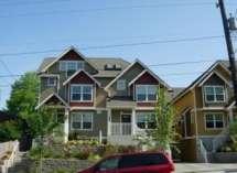
4 Summarize and review public input gathered from previous meetings Opportunity to ask questions and comment on preliminary findings Identify areas that need further study Recruit Focus Group participants

5 Fountain District Urban Village Project Timeline Task April May lune July h!g Sept Oct Nov Dec Jan Feb Mar Public Workshops * Study Alternatl ves Revrew Flncllngs and Draft Concepts * SEPA Review * Release Draft Plan and Regulations Planning Commission * City Council * * Opportunltv for publit tomment Note: Exild: dotes to be posted they ore sc/redil/ed We are HERE * Focus Groups meet to study topic areas
6 6:00 6:45 Introduction and Overview What we ve heard 6:45 7:45 Break-out Sessions Q & A with Staff 7:45 8:00 Final Comments Next steps Focus Groups sign up
7 The alternatives being presented tonight are a baseline for further study and refinement These alternatives may change based on the results of additional studies and input from Focus Groups
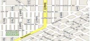
8 Area Strengths and Challenges Neighborhood Connections Preliminary District Boundary and Zones
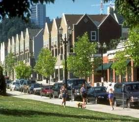

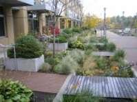

9 Sustainable Variety of Housing Options Population to Support Businesses and Services Walkable Connectivity Quality Design & Materials Supports Multiple Travel Modes Mix of Uses Defined Center and Edge Quality of Life


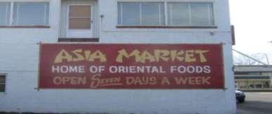
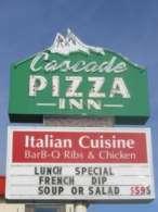
10 Diverse Business Mix - Some Thematic


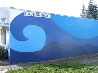
11 Unique identity -- adaptive reuse of former homes as businesses

12 Good Residential and Business Mix
13 Long-term Investment and locally-owned businesses


14 Centrally located. Close to amenities, services, downtown, parks, waterfront

15 Strong Sense of Community


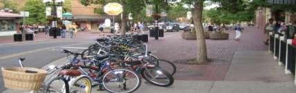
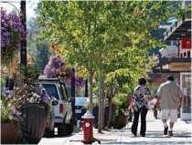
16 Good Grid System for walking and biking opportunities


17 Sense of history, historic district, architectural character

18 Good Quality of Life


19 Fountain Plaza Park: a Gateway

20 Already have an urban village


21 Meridian difficult to cross, too fast to be livable Need safe crossing for bikes and pedestrians

22 Area feels run-down Unsightly utility poles and lines Poor drainage in some areas
23 Need more on-street parking Need more street trees Need more retail, restaurants reasons to linger


24 Fountain Plaza Park need some TLC

25 What We Heard: Neighborhood Connections Calm traffic on arterials Improve pedestrian safety add CROSSWALKS and continuous sidewalks Improve bike safety bike lanes or alternate routes Add street trees and more greenscape Encourage transit use
26 Alternatives: Neighborhood Connections Meridian (Alternative #1) No bike lanes bike routes parallel on Kulshan and Peabody or Vallette


27 What We Heard: Neighborhood Connections Alternative #1 / No Bike Lanes: Would require Kulshan, Peabody and/or Vallette identified as potential alternatives to Meridian Street

28 Alternatives: Neighborhood Connections

29 Alternatives: Neighborhood Connections


30 What We Heard: Neighborhood Connections Alternative #2 / Bike Lanes: Would require new development to set building back from property line to allow for wider sidewalks and street trees. Could plant in bulbout crossings
31 ALTERNATIVE# 3: Sharrow Bike Lanes, New Building Setback Existing Bulld lng Parking Lane - 1' Sharrow Lane Sharrow Lane Parking Lane NEW Building Meridian Street

32 What We Heard: Neighborhood Connections Alternative #3 / Sharrow : Wider vehicle lane allows for bikes to share the lane. Marking provides visual cue to drivers.

33 What We Heard: District Boundary Discussion Existing zoning in commercial core works well Potential for increased height at either end of the district core Keep traffic off local streets Preserve historic character of existing homes and buildings Maintain current quality of life for residents adjacent to commercial areas more information is needed about the Commercial and Residential Transition areas

34 Preliminary Proposed District Boundaries Fountain District Urban Village Allowable Building Heights based on Current Zoning ~~ ~ JS'R ;gh<umo -~~~ 8S1 NoHefttitU"' t ~ Bl ih!tight detuminf'g by - II ~~ 3 SF B 35' ~ W' 10- MIXEO ~- :cu :;".', 3S' ~ a "~ SA Sf 3S' ~~ II ~~ 10-0UPl.EX " II IV 3 SF 35' 88- SF 35' I FOUNTAIN DISTRICT URBAN VILLAGE:! CURRINTUH l e _,. ~~~ MIXEO 45'

35 Preliminary Proposed District Boundaries
36 Fountain District Boundaries: Commercial Core Generally defined as: Highest concentration of employment and housing Direct access to transit Wide range of land uses including retail, office, residential, recreation, public facilities Pedestrian environment is emphasized Preliminary Boundary Recommendation: Due to adjacent residential neighborhood character, the Core should be limited to the Meridian corridor, the Haggen s site, and the Broadway / Girard intersection.

37 Fountain District Land Use: Commercial Core Preliminary Land Use Recommendation: Uses: Allow a variety of commercial as seen today. Encourage upper story residential uses. Currently, a great mix of businesses to build from Bakery and Bookstore would be a great start Height: While many differing opinions, a lowerscaled 3 story building form should be considered for most of the Core study up to 4 stories if set back from alleys, height only to be exceeded in red areas * up to 5 stories.


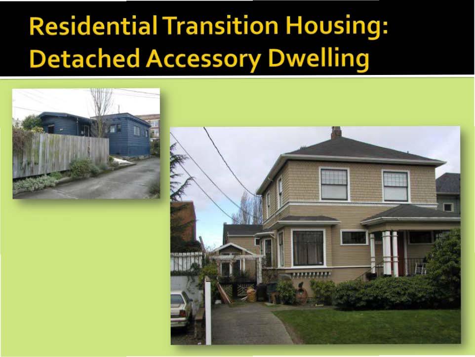
38 Fountain District Design: Commercial Core Preliminary Design Recommendations: Employ Urban Village Design Standards and design review process Require ground floor pedestrian oriented commercial uses along Meridian. Unique design issues for further study: Building design along alley ways Surface Parking Adaptive Reuse (of houses) Setbacks for increased pedestrian ways Others? Please let us know!
39 Fountain District Boundaries: Commercial Transition Generally defined as: Less concentration of commercial uses avoid commercial uses with noise and vehicular impacts Ground floor residential allowed but interface with the street is still important for pedestrian experience Lowering height limits may be appropriate to lessen the impact on the adjacent residential areas
40 Fountain District Boundaries: Commercial Transition Preliminary Boundary Recommendation: Support the current land use pattern, southern portion of the Core area and the WTA Go-line by allowing appropriate residential and commercial uses along Bay and Broadway. In addition, the Commercial Transition area should be used to lessen the intensity between the taller Core buildings and the residential uses to the east.

41 Fountain District Land Use: Commercial Transition Preliminary Land Use Recommendation: Uses: Offices and services. You help us define. Height: A 2 to 3 story building form should be considered for most of the Commercial Transition area particularly along Elm and Monroe Streets study up to 4 stories along Broadway

42 Fountain District Design Character: Commercial Transition / ELM STREET Historical precedents Columbia Neighborhood Plan Area 10: This small area on either side of Elm Street between Washington and Monroe Streets is platted into 5,000 square foot lots. A number of the existing single-family homes along Elm Street have been converted to offices. The high traffic counts on Elm Street make it suitable for medium density residential or office uses.


43 Fountain District Design Character: Commercial Transition / ELM STREET Columbia Neighborhood Plan Area 3 and 3A: Most of the housing is older, including many houses of historical significance. The homes should be encouraged through flexibility in the Land Use and Development Code for repair and replacement of historic features.


44 Fountain District Design: Commercial Transition Preliminary Design Recommendations: This area will be studied further in order to develop design standards that when implemented will reinforce the historic character through adaptive re-use of existing buildings as well as new construction.
45 Fountain District Boundaries: Residential Transition DEFINITION: The Residential Transition Area is immediately adjacent commercial areas A mix of Single Family and additional residential housing types can be selected from BMC Infill Housing designed to fit into existing and historic neighborhoods by providing quality housing choices for people of various incomes, abilities and ages.

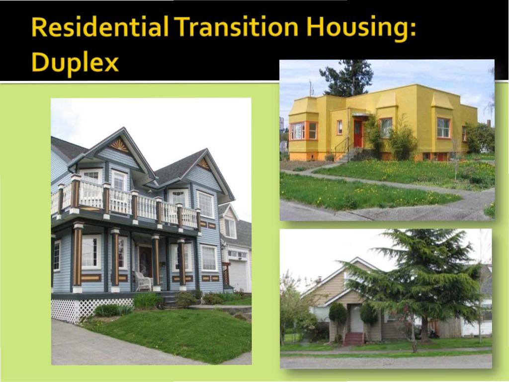
46 Will work with Focus Groups to determine which Toolkit housing types might be appropriate: Small and Smaller Carriage House Detached ADU Duplex

47 Residential Transition Housing: Small & Smaller Lot


48 Maximize opportunities for private outdoor space 100 shared vehicular access possible 30-50
49


50 alley access for parking addresses and connects to the street architecturally consistent with primary residence ADU located behind primary residence
51

")


52 Locate parking in rear (via alley) Entries accessible to street Opportunities for private / shared outdoor space

53 Residential Transition Housing: Carriage House


54 Located in the side or rear of property for auto access Associated with single family residential Pedestrian entrance access to main street
55 TABLE 1: Neighborhood Connections Staff facilitator will host review and comment on Public Realm and Bike / Pedestrian safety TABLE 2: Commercial Core and Transition Zones Staff facilitator will host review and comment on Commercial Core and Commercial Transition Zone uses and development character TABLE 3: Residential Transition Zones Staff facilitator will host review and comment session on which toolkit housing types should be allowed in Residential Transition Zones
56 Search Fountain District Urban Village Katie Franks, Development Specialist II:
57 Peabody and Vallette Street Residential Transition Zone Kulshan Street Residential Transition Zone Commercial Transition Zones allowable uses and design standards Fountain Plaza Park Use Planning
Meeting #2 Public Realm: Streets, Neighborhood Connections & Public Places
 Meeting #2 Public Realm: Streets, Neighborhood Connections & Public Places April 15 th, 2009 City of Bellingham, Washington April 1 April 15 April 22 May 6 Introduction, Character and Boundary Study Areas
ORDINANCE NO. WHEREAS, the Comprehensive Plan directs that master plans be developed for each proposed urban village (FLU-18), and
, and") ATTACHEMENT 1 ORDINANCE NO. AN ORDINANCE RELATED TO LAND USE PLANNING AND ZONING ESTABLISHING THE FOUNTAIN DISTRICT URBAN VILLAGE SUBAREA PLAN, AMENDING PORTIONS OF LAND USE AREAS 3 AND 8, AND ALL OF AREAS
ATTACHEMENT 1 ORDINANCE NO. AN ORDINANCE RELATED TO LAND USE PLANNING AND ZONING ESTABLISHING THE FOUNTAIN DISTRICT URBAN VILLAGE SUBAREA PLAN, AMENDING PORTIONS OF LAND USE AREAS 3 AND 8, AND ALL OF AREAS
SAMISH WAY URBAN VILLAGE. Presentation of Draft Concepts and Regulations
 SAMISH WAY URBAN VILLAGE Presentation of Draft Concepts and Regulations February 26, 2009 The Samish Way Urban Village Project Timeline TASK 200 8 JUNE JUlT AUG SEP OCI Putlic Vforlcshopi * 2009 NOV D
NORTH LAKE SPECIFIC PLAN AREA
 NORTH LAKE SPECIFIC PLAN AREA June 21, 2018 WELCOME Workshop Agenda Introduction Provide information about the program and introduce the team Background Information Share information about the North Lake
Streets, Connectivity & Built Environment Working Group August 2, 2017
 Streets, Connectivity & Built Environment Working Group August 2, 2017 DOWNTOWN OAKLAND SPECIFIC PLAN WELCOME Streets, Connectivity & Built Environment Working Group Social Equity Meeting August 2, 2017
, C-MS I June 3, 2016 $1500 pd chk #216918
 , C-MS-8 LOTS 21 THROUGH 40, INCLUSIVE, BLOCK 299 CLEMENTS ADDITION TO THE CITY OF DENVER SOUTHEAST QUARTER OF SECTION 34, TOWNSHIP 3 SOUTH, RANGE 68 WEST, SIXTH PRINCIPAL MERIDIAN, CITY
Old Town Neighborhoods Plan. Choices Event Wednesday, December 9, 2015
 Old Town Neighborhoods Plan Choices Event Wednesday, December 9, 2015 Agenda 6:00 6:10 p.m. Welcome + Sign In 6:10 6:30 p.m. Presentation 6:30 8:00 p.m. Workshop + Open House Seeking your input on: Neighborhood
TOWN COUNCIL / PLANNING COMMISSION
 Workshop #3 TOWN COUNCIL / PLANNING COMMISSION January 20, 2011 Consultant Team In Attendance Tonight BMS Design Group Nevada City and San Francisco Michael Smiley, AICP, ASLA Partner-in-Charge Nancy L.
Lehigh Acres Land Development Regulations Community Planning Project
 Lehigh Acres Land Development Regulations Planning Effort Summary In July, 2010 Commissioner Frank Mann invited the Lehigh Acres community to start discussing how to achieve their recently adopted community
The Cambie Corridor 2015 Fall workshop series. What we heard WORKSHOP OUTLINE
 The Cambie Corridor 2015 Fall workshop series W 16 AVE Area 5 CAMBIE CORRIDOR Phase 3 What we heard ovember 21, 2015, 9am-noon, 1:30-4:30pm Peretz Centre 89 Participants* WORKSHOP OUTLIE Introductions
Presentation of the Staff Draft. July 17, 2014 SSRVP Team, Area 3
 Presentation of the Staff Draft July 17, 2014 SSRVP Team, Area 3 Presentation Overview Introduction Plan Framework Plan Recommendations Implementation Next Steps and Request for Public Hearing on September
EXISTING COMPREHENSIVE PLAN
 EXISTING COMPREHENSIVE PLAN Town Center Land Use Element: V. LAND USE POLICIES Town Center Mercer Island's business district vision as described in "Your Mercer Island Citizen-Designed Downtown" was an
Shared Principles and Emerging Plan Directions
 Shared Principles and Emerging Plan Directions Introduction Since the Fairfield Neighbourhood planning process launched in June 2016, we have heard from many residents, businesses, groups and other people
Policies and Code Intent Sections Related to Town Center
 Policies and Code Intent Sections Related to Town Center The Town Center Vision is scattered throughout the Comprehensive Plan, development code and the 1994 Town Center Plan. What follows are sections
Plan Framework Report. Attachment A
 Plan Framework Report Attachment A Uptown-Douglas Corridor Plan - Plan Framework Report Contents Introduction... 1 Planning Process... 3 Project Objectives... 4 Vision... 5 Community Values... 6 Structural
SOUTH FLORIDA TOD GRANT UPDATE
 Palm Beach Transportation Planning Agency October 2018 SOUTH FLORIDA TOD GRANT UPDATE Presented by Treasure Coast Regional Planning Council in partnership with SFRTA & SFRPC What is Transit Oriented Development
Town Center (part of the Comprehensive Plan)
") Town Center (part of the Comprehensive Plan) Mercer Island Town Center Looking North (2014) In 1994, a year-long process culminated in a set of design guidelines and code requirements for the Town Center
Town Center (part of the Comprehensive Plan) Mercer Island Town Center Looking North (2014) In 1994, a year-long process culminated in a set of design guidelines and code requirements for the Town Center
DRAFT. 10% Common Open Space
 % OF CHARLOTTE IS CATEGORIZED AS A. LAND USES : Placeholder map displaying location of Place Type GOALS: Accommodate XX% of future growth. Provide a concentration of primarily commercial and civic activity
W O R K S H O P S U M M A R Y. Community Workshop #1: Visioning September 11th, 2007
 W O R K S H O P S U M M A R Y Community Workshop #1: Visioning September 11th, 2007 Upper Market Community Workshop Series and Design Plan Page 1 of 9 INTRODUCTION The Upper Market Community Workshop Series
City of Long Beach. creating vibrant and exciting places
 City of Long Beach creating vibrant and exciting places Land Use Element Urban Design Element Overview of the two draft General Plan elements Discuss areas of change Economic goals of the plans Case study
Sustainability, Health, Safety, Recreation & Open Space Working Group August 3, 2017
 Sustainability, Health, Safety, Recreation & Open Space Working Group August 3, 2017 DOWNTOWN OAKLAND SPECIFIC PLAN WELCOME Sustainability, Health, Safety, Recreation & Open Space Working Group Social
Public Meeting March 10 th 2011
 Public Meeting March 10 th 2011 Agenda 6:00-6:15 6:15-7:00 7:00-8:00 8:00-8:30 8:30-9:00 9:00 Welcome and Introductions Presentation» Project Overview» Recap Existing Conditions / Issues & Opportunities»
Draft Cary Community Plan Review Part 3: Shop, Engage, Serve, Special Area Plans, Other Updates. October 27, 2015 Police Department Training Room
 Draft Cary Community Plan Review Part 3: Shop, Engage, Serve, Special Area Plans, Other Updates Committee for the Future October 27, 2015 Police Department Training Room AGENDA 1. Welcome and Call to Order
Planning Commission March 14, Presented by: City of Bellingham Port of Bellingham
 Planning Commission March 14, 2013 Presented by: City of Bellingham Port of Bellingham 1 Agenda Waterfront District Background Waterfront District Proposal Overview Sub-area Plan Development Regulations
Johnson Street Bridge Public Realm Update
 Johnson Street Bridge Public Realm Update August 20, 2015 Background Johnson Street Bridge Replacement Project impacts a diverse range of stakeholders In addition to a new bridge, the project also includes
ARLINGTON COUNTY, VIRGINIA
 ARLINGTON COUNTY, VIRGINIA County Board Agenda Item Meeting October 15, 2005 DATE: September 28, 2005 SUBJECT: Request to Advertise the adoption of the 2005 Clarendon Sector Plan C. M. RECOMMENDATION:
JANUARY 19, 2011 CENTRAL AVENUE-METRO BLUE LINE TRANSIT-ORIENTED DEVELOPMENT IMPLEMENTATION PROJECT COMMUNITY FORUM
 CENTRAL AVENUE-METRO BLUE LINE TRANSIT-ORIENTED DEVELOPMENT IMPLEMENTATION PROJECT COMMUNITY FORUM JANUARY 19, 2011 THE MARYLAND-NATIONAL CAPITAL PARK AND PLANNING COMMISSION PRINCE GEORGE S COUNTY PLANNING
INDEPENDENCE BOULEVARD AREA PLAN. Economic Development Committee Overview May 25, 2010
 INDEPENDENCE BOULEVARD AREA PLAN Economic Development Committee Overview May 25, 2010 Presentation Outline Plan Purpose and Development Process Draft Plan Policies and Implementation Strategies Request
4.1.3 LAND USE CATEGORIES
 4.1.3 LAND USE CATEGORIES a. City Center District The City Center District incorporates the existing character and mix of uses in downtown Belmont to encourage redevelopment and new development in keeping
appendix and street interface guidelines
 appendix five: building and street interface guidelines appendix 5 building and street interface guidelines BOULEVARDS Boulevards are generally characterized by higher levels of traffic movement at higher
INDEPENDENCE BOULEVARD AREA PLAN
 INDEPENDENCE BOULEVARD AREA PLAN Public Meeting October 28, 2008 Tonight s Agenda Introduction 4:00 4:05 Tom Warshauer Presentation 4:05 5:00 Blake Drury Group Exercises 5:00 5:50 All Wrap Up & Next Steps
The Lincoln Neighborhood Corridor Plan. The LiNC
 October 1, 2014 Planning Commission Study Session The Lincoln Neighborhood Corridor Plan The LiNC Purpose of Tonight s Meeting Introduction to The LiNC Review of Existing Conditions and Community Identified
Tonight s Agenda. Summary Presentation Open House. Group Discussion Next Steps: online community wide survey
 Community Open House February 22, 2018 Tonight s Agenda Summary Presentation Open House Station 1: Project Overview and Community Input Station 2: Draft Vision and Guiding Principles Station 3: Western,
PUBLIC PARKS AND FACILITIES, SERVING NEIGHBORHOOD RECREATIONAL AND COMMUNITY EVENTS BUILDINGS BUILT TO THE LINE AND ORIENTED TOWARD THE STREET
 BUILDINGS BUILT TO THE LINE AND ORIENTED TOWARD THE STREET PUBLIC PARKS AND FACILITIES, SERVING NEIGHBORHOOD RECREATIONAL AND COMMUNITY EVENTS CONNECTED & COMPLETE STREETS AND STREET GRID VIEW SHEDS GROUND
WAC #7 3/14/14. Coachella General Plan Update
 WAC #7 3/14/14 Coachella General Plan Update Agenda 2 Introductions Public Draft General Plan Overview and Discussion of Next Steps Implementation and Evaluation Health Element Process Evaluation (discussion)
PINE CURVE REZONING. Property does not meet criteria for open space preservation and is not a candidate for a park
 PINE CURVE REZONING BACKGROUND Purchased as two parcels in 2001 and 2002 Annexed and Zoned Greater Downtown District Historic Center September 25, 2002 and October 7, 2002 WHAT THE PROJECT IS AND IS NOT
5.1 Site Plan Guidelines
 5. Community Core Guidelines Development of the Community Core will take place by plan of subdivision and site plan approval. It will occur in a phased manner that will reflect the timing of residential
SAFETY AND CONNECTIVITY IN A PLANNED COMMUNITY
 DALE CITY TLC SAFETY AND CONNECTIVITY IN A PLANNED COMMUNITY PROJECT KICKOFF MEETING MARCH 7, 2016 AGENDA 1. Introductions 2. Project Overview 3. Discussion 4. Site Visit PROJECT KICKOFF MEETING MARCH
INDEPENDENCE BOULEVARD AREA PLAN. June 24, 2008
 INDEPENDENCE BOULEVARD AREA PLAN Public Meeting #1 June 24, 2008 Tonight s Agenda Introduction Welcome and Ground Rules Overview Presentation Purpose of the Plan What Brings Us Here? A Tour of the Corridor
Sheridan Boulevard S TAT I O N A R E A P L A N S H E R I D A N B O U L E VA R D S TAT I O N A R E A P L A N
 Sheridan Boulevard S TAT I O N A R E A P L A N 1 City of Lakewood Adopted November, 2006 S H E R I D A N B O U L E VA R D S TAT I O N A R E A P L A N The Vision The City of Lakewood s overall vision is
W O R K S H O P S U M M A R Y
 W O R K S H O P S U M M A R Y Community Workshop #2: Preliminary Design Strategies October 27, 2007 Upper Market Community Workshop Series and Design Plan Page 1 of 13 INTRODUCTION The Upper Market Community
Complete Neighbourhood Guidelines Review Tool
 Complete Neighbourhood Guidelines Review Tool Prepared By: City of Regina Planning Department October 2014 Page 1 of 14 Community Development Review Checklist for Secondary Plans and Concept Plans The
Exhibit Planning and Design Workshop February 3-6, Commissioned by the Maryland-National Capital Park and Planning Commission (M-NCPPC)
") Exhibit Planning and Design Workshop February 3-6, 2014 Commissioned by the Maryland-National Capital Park and Planning Commission (M-NCPPC) Planning and Design Workshop The Montgomery County Planning
Exhibit Planning and Design Workshop February 3-6, 2014 Commissioned by the Maryland-National Capital Park and Planning Commission (M-NCPPC) Planning and Design Workshop The Montgomery County Planning
Planning Charlotte s Future. Planning Committee June 21, 2016
 Planning Charlotte s Future Planning Committee June 21, 2016 Charlotte s Vision Livable city Vibrant economy Thriving natural environment Diverse population Choices for housing, education, employment Safe
Lower Merion Commercial Districts Issues and Characteristics Handbook November 2013
 Lower Merion Commercial Districts Issues and Characteristics Handbook November 2013 DRAFT TOWNSHIP-WIDE VISION: To maintain and enhance commercial areas to complement the surrounding high-quality residential
University of the District of Columbia Van Ness Campus Master Plan Community Open House 3. December 8, 2010
 University of the District of Columbia Van Ness Campus Master Plan Open House 3 December 8, 2010 Introductions Sequence of Work: Campus Master Plan BEGIN: INTRODUCE AND START WORK Project Initiation Team
WEST LOOP DESIGN GUIDELINES CHECKLIST
 WEST LOOP DESIGN GUIDELINES CHECKLIST Section 1.0 General Strategies 1.1 DESIGN EXCELLENCE: ENCOURAGE HIGH QUALITY AND INNOVATIVE DESIGN OF NEW BUILDINGS WITHIN THE WEST LOOP WITHOUT BEING PRESCRIPTIVE
Status Report: MD 355 Project
 Status Report: MD 355 Project OCTOBER 2006 M-NCPPC MONTGOMERY COUNTY PLANNING DEPARTMENT Summary of Community Comments, and break to the Results of the MD 355 Participation Session Brookside Gardens -
Workshop #3 June 13, 2016
 Downtown Ocoee Master Plan Workshop #3 June 13, 2016 Our Team Our Team and Tonight s Goal Quick Recap: Why a Downtown Plan? How are we developing the plan? How can you still be involved? What s left to
Robbinsdale LRT Station. CDI Development Guidelines. August Overview
 Robbinsdale LRT Station August 2018 Overview The City of Robbinsdale may have the coolest opportunity site along the 13 mile stretch of the Bottineau LRT corridor / Blue Line extension. Located a block
ASPEN HILL Minor Master Plan Amendment
 ASPEN HILL Minor Master Plan Amendment Worksession #3 Planning Board Agenda Item #5 MONTGOMERY COUNTY PLANNING DEPARTMENT Maryland-National Capital Park and Planning Commission Area 2 Planning November
17.11 Establishment of Land Use Districts
 17.11 Establishment of Land Use Districts 17.11.010 Purpose. To promote the health, safety, and general welfare of City residents and those who come to South Salt Lake to work, exchange commerce and recreate.
City Council Special Meeting AGENDA ITEM NO. C.
 City Council Special Meeting AGENDA ITEM NO. C. DATE: 01/04/2019 TO: Honorable Mayor and City Council Members SUBJECT: Transit Villages Specific Plan project Study Session (Development Services Director
CITY OF PUYALLUP. Background. Development Services
 CITY OF PUYALLUP Development Services 333 South Meridian Puyallup WA 98371 To: City Council From: Katie Baker, AICP, Planning Division Re: South Hill Neighborhood Plan Adoption Date: (Meeting date: February
PLAN ELEMENTS WORKSHOP. April 5, 2016
 PLAN ELEMENTS WORKSHOP April 5, 2016 needs more housing. But there is no one-size fits-all solution. Every neighborhood has its own character. In some places, density is not only appropriate it is badly
WELCOME and introduction
 1 WELCOME and introduction Mobility Hub Locations within Burlington STUDY OVERVIEW STUDY OBJECTIVES The City of Burlington is developing four Area Specific Plans, one for each of Burlington s Mobility
Welcome to Our Open House
 Welcome to Our Councillor Gerbasi & the Planning, Property, & Development Department welcome you to tonight s open house The open house outlines the proposed Osborne Village Neighbourhood Plan a secondary
Urban Design and Livability
 Urban Design and Livability City of Sacramento Planning Academy April 6, 2015 Bruce Monighan AIA Urban Design Manager, City of Sacramento How do we define cities in their characteristics of livability?
SECTION TWO: Overall Design Guidelines
 SECTION TWO: Overall Design Guidelines This section provides overall design principles and guidelines for the Gardnerville Mixed-use Overlay. They provide criteria for mixed-use places consisting of residential,
Stadium District Masterplan
 Stadium District Masterplan Masterplan (noun): an evolving long-term planning document that establishes the framework and key elements of a site. It reflects a clear vision synthesizing developer goals
Bellingham Comprehensive Plan Community Design Chapter
 Bellingham Comprehensive Plan Community Design Chapter 2016 I. Introduction Urban design is concerned with the arrangement, appearance, and functionality of the community. It focuses on the shaping and
JWN PlanJam Workshop #1
 Planning for a healthy, vibrant neighborhood community JWN PlanJam Workshop #1 Presented by the Jefferson Westside Neighbors jwneugene.org More information on the Web at: jwneugene.org/infillstds Welcome!
Highland Village Green Design Guidelines
 Highland Village Green Design Guidelines Publishing Information Title Highland Village Green Design Guidelins Author The City of Calgary Status DRAFT - Proposed document subject to changes Additional Copies
Table of Contents. Elm Avenue Improvement Plan City of Waco, Texas. Introduction 1. Existing Context 1 Figure 1 2.
 Table of Contents Introduction 1 Existing Context 1 Figure 1 2 Plan Guidelines 3 Future Urban Form 4 The West-End 4 Main Street 6 The East-End 7 Figure 2 9 Public Improvement Recommendations 7 General
Wadsworth Boulevard S TAT I O N A R E A P L A N
 Wadsworth Boulevard S TAT I O N A R E A P L A N City of Lakewood Adopted November, 2006 The Vision The City of Lakewood s overall vision is to transform the area around the light rail station into a mixed-use
ITEM #8. Regional Smart Growth Program. Regional Smart Growth Program. Presentation Overview. Coast Highway Vision and Stategic Plan.
 Regional Smart Growth Program Economic Development Commission What is Smart Growth? Adopted as part of the Regional Comprehensive Plan (RCP) RCP provides vision for region based on Smart Growth and sustainability
Establish a network of streetscaped vehicle and pedestrian routes that connect within and outside the Plan area.
 This Plan s urban design goals are to create an urban scale, walkable community with connections to transit, parks, and services and with amenities and facilities for residents and employees. The 1992
9/19/2018 TODAY S WEBINAR AGENDA CONTINUING EDUCATION UPCOMING TRAINING FROM APBP
 TODAY S WEBINAR AGENDA 3:00 pm: Introduction 3:05 pm: Presentation 3:45 pm: Questions 4:00 pm: Webinar Ends For technical assistance during the webinar: 1-800-263-6317 Choose these prompts: 1, 1, 1 CONTINUING
In partnership with: Harbor Corridor Plan Bali Hi Mobile Home Park July 24, 2013
 In partnership with: Harbor Corridor Plan Bali Hi Mobile Home Park July 24, 2013 Project Intro 2-miles of Harbor Boulevard Westminster/17 th Street to just north of Edinger Avenue Many people use the corridor
Lynn Housing Authority and Neighborhood Development. Washington Street Gateway District Plan A p r i l
 Lynn Housing Authority and Neighborhood Development Washington Street Gateway District Plan A p r i l 2 0 0 8 rendering of sagamore hill from lynnway pedestrian overpass table of contents project area
Metro. Activity Center Design Guidelines. Recommendations For Developing Focused, Mixed-Use Commercial/Residential Centers
 Metro Activity Center Design Guidelines Recommendations For Developing Focused, Mixed-Use Commercial/Residential Centers Metro Activity Centers What is a MAC? Legacy, the adopted guide for the future growth
Broken Arrow Comprehensive Plan Update Public Workshop Meeting #3 January 23,
 Broken Arrow Comprehensive Plan Update Public Workshop Meeting #3 January 23, September 25,2018 2018 26 April 2016 AGENDA 1. Status Presentation - Charrette Recap - Proposed Vision Framework - Preliminary
TRANSIT ORIENTED DEVELOPMENT PINELLAS COUNTY MPO LIVABLE COMMUNITIES INITIATIVE PINELLAS COUNTY COMPREHENSIVE PLAN AMENDMENTS
 PINELLAS COUNTY MPO LIVABLE COMMUNITIES INITIATIVE MODEL LAND DEVELOPMENT CODE TRANSIT ORIENTED DEVELOPMENT PINELLAS COUNTY COMPREHENSIVE PLAN AMENDMENTS MPO Livable Communities Initiative Goal: Improve
Property Profile 2954 WEST FRANKLIN ROAD MERIDIAN, ID
 082614 FOR SALE > MIXED-USE LAND Franklin & Ten Mile Land 2954 WEST FRANKLIN ROAD MERIDIAN, ID Property Profile > ~38 acres for sale, located on the NE corner of Franklin and Ten Mile > Power and gas running
What Does It Take To Create A Town Center?
 What Does It Take To Create A Town Center? Context, Design, and Process The Prince Frederick Master Plan Update 1 Background and Overview A Brief History of Town Centers in Calvert County 2 Background
Introduction. Intent of the Plan. Urban Design and Land Use Approach
 Introduction Intent of the Plan This is the Second Public Open House for the. The intent of the is to update current City policy in order to encourage future development that will ensure a diverse, lively,
Learning Objectives. Introduction. Design at an Ecodistrict Scale can Change Washington, DC s Landscape
 Learning Objectives Design at an Ecodistrict Scale can Change Washington, DC s Landscape Presenters Elizabeth Miller, ASLA, National Capital Planning Commission Diane Sullivan, National Capital Planning
Cobb County Design Guidelines Mableton Parkway & Veterans Memorial Highway Community Design Workshop January 12, 2017
 Community Design Workshop January 12, 2017 Agenda Opening Remarks / Introductions Scope of Work Existing Conditions Key Issues / Opportunities VPS Summary Draft Vision & Goal Statement Implementation Concepts
FLORIN ROAD CORRIDOR Site Plan and Design Review Guidelines Checklist
 FLORIN ROAD CORRIDOR Site Plan and Design Review Guidelines Checklist Applicant s Name: Project Address: Phone: Email: Applicant shall fill out the design guidelines checklist for all guidelines applicable
1 Adapted from the Statewide Transit-Oriented Development Study by CalTrans, 2006
 APPENDIX C: LAND USE PLANNING FOR ENHANCED RAIL SERVICE 72 BACKGROUND One of the consistent themes heard from localities in the Route 29 corridor Planning Forums was the need for expanding rail service
Southern Pines. Downtown Neighborhood Development Plan
 Southern Pines Downtown Neighborhood Development Plan Public Review Draft: March 28, 2013 Table of Contents Overview... 1 Purpose of the Downtown Neighborhood Development Plan... 1 How the Plan was Developed...
India Basin/Hunters Point Shoreline Community Workshop May 21, 2008
 India Basin/Hunters Point Shoreline Community Workshop May 21, 2008 Workshop Agenda Welcome Process Overview Context & Existing Conditions Presentation of Draft Concepts Land Use and Open Space Priorities
City of Farmington. Downtown Plan. Amendment to the 1998 Master Plan Adopted October 11, 2004
 City of Farmington Amendment to the 1998 Master Plan Adopted October 11, 2004 Introduction Planning Background 1 Scope and Components of the Plan Amendment 2 Concept Introduction 3 Plan Concepts 3 Conceptual
PINE CURVE REZONING. BACKGROUND Purchased as two parcels in 2001 and 2002
 BACKGROUND Purchased as two parcels in 2001 and 2002 WHAT THE PROJECT IS AND IS NOT A Rezoning establishes the land use standards for Annexed and Zoned Greater Downtown District Historic Center September
INDEPENDENCE BOULEVARD AREA PLAN. Economic Development Committee Overview March 10, 2011
 INDEPENDENCE BOULEVARD AREA PLAN Economic Development Committee Overview March 10, 2011 Presentation Outline Purpose: To provide an overview of the Independence Boulevard Area Plan and to request a recommendation
Subregion 4 Central Avenue-Metro Blue Line Corridor Transit-Oriented Development (TOD) Implementation Project. Community Meeting April 27, 2011
 Implementation Project. Community Meeting April 27, 2011") Subregion 4 Central Avenue-Metro Blue Line Corridor Transit-Oriented Development (TOD) Implementation Project Community Meeting April 27, 2011 Overview Introduction to Subregion 4 TOD Implementation Program
Subregion 4 Central Avenue-Metro Blue Line Corridor Transit-Oriented Development (TOD) Implementation Project Community Meeting April 27, 2011 Overview Introduction to Subregion 4 TOD Implementation Program
The transportation system in a community is an
 7 TRANSPORTATION The transportation system in a community is an important factor contributing to the quality of life of the residents. Without a sound transportation system to bring both goods and patrons
Horizon 2035 Land Use and Transportation Element
 CITY OF SUNNYVALE Horizon 2035 Land Use and Transportation Element City Council Study Session March 7, 2017 Overview General Plan Context Mixed Use Villages Transportation Mode & Parking General Plan Policy
ORANGE LINE TRANSIT NEIGHBORHOOD PLANS VAN NUYS NEIGHBORHOOD COUNCIL, PLUM COMMITTEE DEPARTMENT OF CITY PLANNING, CITY OF LOS ANGELES
 Photo: Mission Meridian(Moule & Polyzoides) ORANGE LINE TRANSIT NEIGHBORHOOD PLANS VAN NUYS NEIGHBORHOOD COUNCIL, PLUM COMMITTEE DEPARTMENT OF CITY PLANNING, CITY OF LOS ANGELES JULY 18, 2018 Project partially
TOWN OF NEW CASTLE - Master Plan Update
 Our Presentation Today (1) Recap the Master Planning Process To Date (2) Present the Outline of the Master Planning Work Plan (3) Present the Calendar for the Master Plan (4) Outline the scope of a Downtown
EXPO LINE COMMUNITY WORKSHOPS NOVEMBER 27 TH & DECEMBER 3 RD Los Angeles Department of City Planning
 EXPO LINE COMMUNITY WORKSHOPS NOVEMBER 27 TH & DECEMBER 3 RD 2012 Los Angeles Department of City Planning Agenda for Tonight Open House 6:00 to 6:15pm Presentation and Questions 6:15 to 6:50 Small Group
Broadway District Specific Plan. Community Workshop #2 February 23,2016
 Broadway District Specific Plan Community Workshop #2 February 23,2016 1 Agenda Introductions Project Progress Status Upcoming Milestones Emerging Framework Land Use Urban Design Circulation Infrastructure
Don Mills Crossing Study and Celestica Lands Development Application Community Meeting, Open House, and Breakout Discussions
 Consultation Summary Don Mills Crossing Study and Celestica Lands Development Application Community Meeting, Open House, and Breakout Discussions This report is not intended to provide a verbatim transcript
Unique. Livable. Connected. Sustainable. Anticipate and Manage Change. Variety of Housing Choices. Enhanced Arterial Corridors
 Neighborhood Vision The Old Town Neighborhoods are Unique, Livable, Connected, and Sustainable. As mature, established neighborhoods, many of the ideas and opportunities expressed by stakeholders in support
MISSION STREETSCAPE PLAN. Neighborhood Commercial Streets handle continuous activity. Neighborhood Commercial STREET ROW: Main Design Treatments
 Neighborhood Commercial STREET ROW: 64-80 Main Design Treatments CORNER reduce crossing distance for pedestrians, create entrances to a residential area and slow cars down. help widen sidewalk allocating
Imagining Ward 3 Session #2. April 18, :00 pm 8:30 pm
 Imagining Ward 3 Session #2 April 18, 2016 7:00 pm 8:30 pm Project Team City of Mississauga Karen Crouse, Project Leader, Policy Planning Division Frank Marzo, Planner, Policy Planning Division Brook McIlroy
Gold Line Bus Rapid Transit Transit Oriented Development (BRTOD) Helmo Station Area Plan
 Helmo Station Area Plan") Appendix F Gold Line Bus Rapid Transit Transit Oriented Development (BRTOD) Helmo Station Area Plan Introduction and Purpose of the Plan The Gold Line Bus Rapid Transit facility is an eleven-mile dedicated
Appendix F Gold Line Bus Rapid Transit Transit Oriented Development (BRTOD) Helmo Station Area Plan Introduction and Purpose of the Plan The Gold Line Bus Rapid Transit facility is an eleven-mile dedicated
Lambeth Main Street Streetscape Improvements
 Lambeth Main Street Streetscape Improvements Open House October 5th, 2017 Agenda 1. Introduction 2. Project Background 3. Context 4. Project Objectives 5. Design Principles & Approach 6. Streetscape Design
2. Form and Character. 2.1 Introduction. 2.2 The Downtown Addition Plan. 2.1 Introduction
 2.1 Introduction 2.1 Introduction This section of the Specific Plan describes and illustrates the desired form, character and uses of the Downtown Addition and explains the underlying design principles.
F O U N T A I N D I S T R I C T U R B A N V I L L A G E S U B A R E A P L A N. C i t y o f B e l l i n g h a m, W a s h i n g t o n
 F O U N T A I N D I S T R I C T U R B A N V I L L A G E S U B A R E A P L A N C i t y o f B e l l i n g h a m, W a s h i n g t o n Planning & Community Development Department Adopted by Ordinance No. 2010-10-057