Webinar: Economic Impacts from Bicycle and Pedestrian Street Improvements
|
|
|
- Oscar Bates
- 5 years ago
- Views:
Transcription
1 Portland State University PDXScholar TREC Webinar Series Transportation Research and Education Center (TREC) Webinar: Economic Impacts from Bicycle and Pedestrian Street Improvements Jenny H. Liu Portland State University, Let us know how access to this document benefits you. Follow this and additional works at: Part of the Transportation Commons, and the Urban Studies Commons Recommended Citation Liu, Jenny H., "Webinar: Economic Impacts from Bicycle and Pedestrian Street Improvements" (2017). TREC Webinar Series This Book is brought to you for free and open access. It has been accepted for inclusion in TREC Webinar Series by an authorized administrator of PDXScholar. For more information, please contact


2 Economic Impacts from Bicycle and Pedestrian Street Improvements NITC Webinar Jenny H. Liu, Ph.D. Assistant Professor, Urban Studies & Planning Assistant Director, Northwest Economic Research Center


3 Roadmap for Webinar o o o Overview of economic impacts of bike and pedestrian infrastructure Impact of Bike Facilities on Residential Property Prices Data & Methods Findings Policy Implications Limitations Updates on ongoing research 9/9/2016 2

4 Evaluating economic impacts of bike infrastructure Units/ Methods? Geo Scale Econ Impacts Type of Facility Which benefits? For whom? 3
5 Which benefits? How do we estimate them? Transport Economic Development Property Value Ecosystem Services Amenity; Aesthetic Recreation Health 4

 tourism &")
6 Evidence of Economic Impacts from Street Improvements Property Values Impacts of access to transportation facilities Impacts of greenspaces and off-street recreational trails Economic Development Business owner and customer perceptions & attitudes Consumer expenditure by travel modes Retail sales comparison Economic impact analysis (input-output models) tourism & construction 5


7 Impact of Bike Facilities on Residential Property Prices Context & Motivation o Portland Green Loop o Street improvement projects across the country o Urban economics consumer preferences 6


8 Impact of Bike Facilities on Residential Property Prices - Study Objectives o What is the value of bicycle facilities? o How do bicycle facilities access or bike networks impact property values?

 2959 multi family")
9 Data Multnomah County residential property tax roll sale data ( ) single family homes (SFH) 2959 multi family homes (MFH)
10 Key Independent Variables Property Attributes - Age - Size - Tax liability (AV/RMV) Neighborhood Amenities - Location - School quality - Crime rate - Walk score Dependent Variable: Property Sale Price Transaction Characteristics Bike Facilities - Ease of access - Extensiveness of network - Sale year - Seasonality

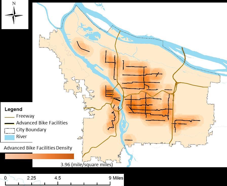
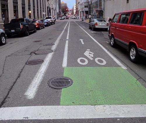
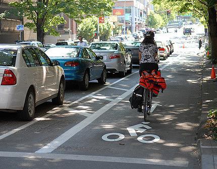
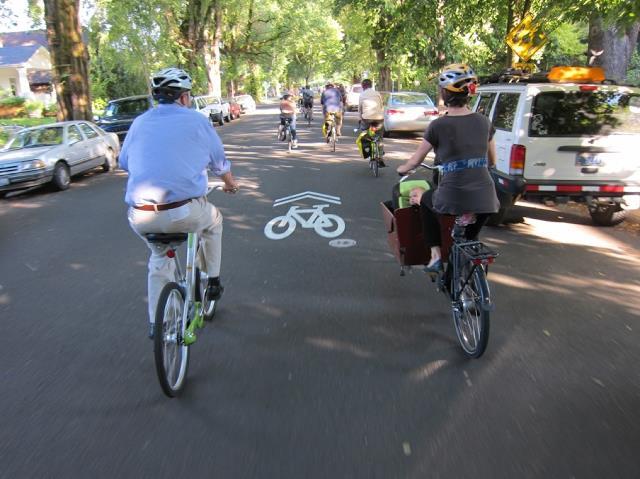
11 Ease of Access Extensiveness of network Advanced Bike Facilities

![squares [OLS] estimation) o](/docs-images/86/94466210/images/12-2.jpg "Spatial autoregressive models")
12 Methods o Hedonic property value model (ordinary least squares [OLS] estimation) o Spatial autoregressive models (SAR)


13 Findings Ease of Access Each quarter mile closer to the nearest advanced bike facility Extensiveness of Network Each quarter mile increase in the density of advanced bike facilities within a halfmile radius OLS SFH: + $686 MFH: + $66 SFH: + $4,039 MFH: + $4,712 SAR + $1,571 + $211 + $1,399 + $3,683


14 Policy Implications Portland
15 Conclusions & Limitations o Preference for high quality bike facilities o Different preferences for SFH and MFH consumers o Both measures of advanced bike facilities impact property values: ease of access (distance) and extensiveness of bike network (density). o Enhancing the model specifications with spatial autocorrelation effects prevents overestimation of coefficient estimates. o Causality o Bike facility types o Portland-specific results

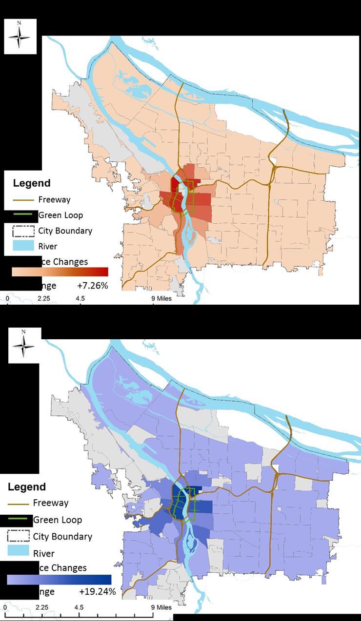
16 Portland Green Loop Economic Impact Analysis Direct, indirect and induced impacts 156 in employment in the low investment scenario to 783 in the high scenario 04/25/
 o Portland 2035 Comprehensive Plan City Greenways Enhanced greenway corridors Trails Heritage parkways Neighborhood")
17 Understanding the economic impacts of urban greenway infrastructure o o Funded by NITC In collaboration with Portland Bureau of Planning and Sustainability (BPS) o Portland 2035 Comprehensive Plan City Greenways Enhanced greenway corridors Trails Heritage parkways Neighborhood greenways
18 Understanding the economic impacts of urban greenway infrastructure o Research Objectives How do we characterize access to the urban greenway network to facilitate our understanding of its impacts on the economy? What are the economic impacts of the existing bicycle/pedestrian (greenway) network in Portland? How would the City Greenways concept further impact the economy?
19 Understanding the economic impacts of urban greenway infrastructure o Characterizing the urban greenway network Access to the network Distance-based measure Topological measure Bikeability measure

20 Understanding Economic and Business Impacts of Street Improvements for Bicycle and Pedestrian Mobility A Multi-City Multi-Approach Exploration o o o Funded by NITC & Summit Foundation In collaboration with PeopleForBikes and Bennett Midland Research Objectives How do corridor-level street improvements impact economic activity? To develop a systematic and rigorous methodological approach that is replicable in different cities and corridors for pre-post implementation evaluation and analysis
 Download: Portland Green")
21 Thank you! Jenny H. Liu, Ph.D. Assistant Professor, School of Urban Studies & Planning, PSU Assistant Director, Northwest Economic Research Center (NERC) Download: Portland Green Loop Econ Analysis 20 Download: Impact of Bike Facilities on Residential Property Prices (TRR 2017 forthcoming)
Atlanta BeltLine Corridor Environmental Study. Scoping Meeting August 2008
 Atlanta BeltLine Corridor Environmental Study Scoping Meeting August 2008 What Will We Be Discussing Today? Study Overview - How Did We Get Here? - What Is the Study About? - Who Is Involved? - Where Is
Midtown Greenway PROJECT REPORT CARD
 Midtown Greenway PROJECT REPORT CARD Project Overview and History The Midtown Greenway is a 5.5-mile multi-use trail that connects the Mississippi River to the Minneapolis Chain of Lakes. The corridor,
Broken Arrow Comprehensive Plan Update Public Workshop Meeting #3 January 23,
 Broken Arrow Comprehensive Plan Update Public Workshop Meeting #3 January 23, September 25,2018 2018 26 April 2016 AGENDA 1. Status Presentation - Charrette Recap - Proposed Vision Framework - Preliminary
DOMINION BOULEVARD CORRIDOR STUDY AND ECONOMIC DEVELOPMENT STRATEGIC PLAN A MODEL FOR CHESAPEAKE S FUTURE
 DOMINION BOULEVARD CORRIDOR STUDY AND ECONOMIC DEVELOPMENT STRATEGIC PLAN A MODEL FOR CHESAPEAKE S FUTURE Overview I. Draft Plan Process II. Draft Plan Overview a. Market Analysis b. Master Land Use Plan
Communities Plan. Parkland-Spanaway-Midland. LUAC Review of Draft Policies
 Parkland-Spanaway-Midland Communities Plan LUAC Review of Draft Policies Presented by: Tiffany O Dell, Senior Planner Planning & Public Works Tiffany.Odell@co.pierce.wa.us 253-798-6859 November 1, 2017
Office of Greenways & Trails Providing Statewide Leadership and Coordination. Southeast Greenways and Trails Summit October 1-3, 2017
 Office of Greenways & Trails Providing Statewide Leadership and Coordination Southeast Greenways and Trails Summit October 1-3, 2017 1 Office of Greenways and Trails The Office of Greenways and Trails
NACCED/NACo CONFERENCE JULY 10, 2015
 NACCED/NACo CONFERENCE JULY 10, 2015 Regional Growth Framework 2 Regional Growth Framework Regional Priorities Preferred Growth Concept Tools to Support Local Governments 3 Top Priorities for the CONNECT
Economy Vision Statements: Social Wellbeing Vision Statements: Natural Environment Vision Statements:
 Economy Vision Statements: 1. Our business environment makes us a region of choice for new employers as we encourage entrepreneurship and have a vibrant, diversified and resilient regional economy. 2.
10.0 Open Space and Public Realm
 10.0 Open Space and Public Realm 10.0 Open Space and Public Realm The Public Open Space System is comprised of: outdoor spaces available for public use that are either publicly owned (e.g., parks and
Subregion 4 Central Avenue-Metro Blue Line Corridor Transit-Oriented Development (TOD) Implementation Project. Community Meeting April 27, 2011
 Implementation Project. Community Meeting April 27, 2011") Subregion 4 Central Avenue-Metro Blue Line Corridor Transit-Oriented Development (TOD) Implementation Project Community Meeting April 27, 2011 Overview Introduction to Subregion 4 TOD Implementation Program
Subregion 4 Central Avenue-Metro Blue Line Corridor Transit-Oriented Development (TOD) Implementation Project Community Meeting April 27, 2011 Overview Introduction to Subregion 4 TOD Implementation Program
Wasatch CHOICE for 2040
 Wasatch CHOICE for 2040 Economic Opportunities We Can Choose a Better Future We enjoy an unparalleled quality of life along the Wasatch Front. People from all over the world are drawn to our stunning scenery,
Visioning Statement and Guiding Principles
 Visioning Statement and Guiding Principles Planning for the Future The General Plan The General Plan represents Woodland's shared vision of the future and defines a path to lead the community toward its
Laberge Group. Town of Coeymans. Draft Comprehensive Plan. Overview of Planning Process
 Draft : Presentation of Goals & Strategies Laberge Group Benjamin H. Syden, A.I.C.P., E.D.P Director in Charge Nicole Allen, A.I.C.P. Senior Planner Anjali Malhotra Planner Presentation Outline Introductions
7 NEXT STEPS. Next Steps 95
 7 NEXT STEPS To move forward with development of the 135th Street corridor, there are a number of key steps and strategies the City and the community can take to turn the vision for this area into a reality,
BUDGETING FOR OUTCOMES TRINITY RIVER CORRIDOR
 BUDGETING FOR OUTCOMES TRINITY RIVER CORRIDOR Trinity River Corridor Team Members: Kelly High, Streets Department Megan Lam, Office of Financial Services Mike Mikeska, Dallas Water Utilities Diana Ochoa,
Cultivate Hopkins: Built Environment. Comprehensive Plan Advisory Committee September 13, 2017
 Cultivate Hopkins: Built Environment Comprehensive Plan Advisory Committee September 13, 2017 Four Dimensions of a Sustainable Plan Land Use Urban Design Housing Transportation Resilience Water Resources
Sherri Ferguson. President/CEO Portland Chamber of Commerce. Tennessee Certified Economic Developer Capstone Project
 Sherri Ferguson President/CEO Portland Chamber of Commerce Tennessee Certified Economic Developer Capstone Project Strategic Plan Development for the North Gateway of Portland, Tennessee The New Gateway
ITEM #8. Regional Smart Growth Program. Regional Smart Growth Program. Presentation Overview. Coast Highway Vision and Stategic Plan.
 Regional Smart Growth Program Economic Development Commission What is Smart Growth? Adopted as part of the Regional Comprehensive Plan (RCP) RCP provides vision for region based on Smart Growth and sustainability
CHAPTER 1 Introduction
 CHAPTER 1 Introduction From sea to summit, Lane County covers almost 4,800 square miles of diverse Oregon landscape. Stretching from the Pacific Ocean through the Coastal Range, the Willamette Valley to
Northwest commuter rail station US 36 BRT. Westminster Station
 Northwest commuter rail station Westminster Station US 36 BRT Westminster Center US 36 & Church Ranch Broomfield Flatiron/96 th St. US 36 & McCaslin Table Mesa Boulder Junction 13-month effort that will
Silver Line CPAM UPDATE. Transportation and Land Use Committee October 14, 2016
 Silver Line CPAM UPDATE Transportation and Land Use Committee October 14, 2016 Purpose Recap Project History and Map Changes Provide Overview of CPAM Components Discuss Transportation Impacts Discuss Fiscal
Plano Tomorrow Vision and Policies
 Plano Tomorrow Vision and Policies PLANO TOMORROW PILLARS The Built Environment The Social Environment The Natural Environment The Economic Environment Land Use and Urban Design Transportation Housing
BROOKHILL NEIGHBORHOOD MODEL ZONING MAP AMENDMENT PREFACE TO APPLICATION
 BROOKHILL NEIGHBORHOOD MODEL ZONING MAP AMENDMENT PREFACE TO APPLICATION June 15, 2015 Revised: August 1, 2016 I. VISION Brookhill is a proposed community based upon the principles of Albemarle County
Midtown Greenway Land Use and Development Plan Executive Summary
 Midtown Greenway Land Use and Development Plan Executive Summary Introduction The Midtown Greenway Land Use and Development Plan sets policy direction for land use and development in the Midtown Greenway
Secrest Short Cut and Monroe Expressway Small Area Plan AUGUST 29, 2018
 Secrest Short Cut and Monroe Expressway Small Area Plan AUGUST 29, 2018 Background and Process Monroe Expressway will be open by the end of 2018 Union County and Indian Trail identified a need to revisit
Joe Zehnder, Chief Planner and Eric Engstrom, Principal Planner. Consolidated Revisions and Corrections to the Portland Plan Recommended Draft
 MEMO DATE: April 25, 2012 TO: FROM: CC: SUBJECT: Mayor Sam Adams and City Council Susan Anderson, Director Joe Zehnder, Chief Planner and Eric Engstrom, Principal Planner Consolidated Revisions and Corrections
The City shall enhance and improve the accessibility of parks and recreational facilities while protecting their quality. by:
 GOALS, OBJECTIVES AND POLICIES GOAL 1: To provide open space and recreation as an essential element needed for the betterment of the City s character and quality of urban life. The City shall plan for
CHAPTER 1. Ms. Guajardo s Class - Central Elementary CH 1 1
 INTRODUCTION CHAPTER 1 Ms. Guajardo s Class - Central Elementary CH 1 1 1.1 SETTING South Centre City is a linear corridor south of Downtown Escondido paralleling Centre City Parkway and South Escondido
A citizen s guide to the. Comprehensive Plan. City of Lakeville, Minnesota 1
 A citizen s guide to the Comprehensive Plan 2008 City of Lakeville, Minnesota 1 Introduction The City of Lakeville completed an update of its Comprehensive Plan in 2008. A comprehensive plan is a tool
Blueprint Denver Task Force Meeting #
 Blueprint Denver Task Force Meeting #1 6.23.16 1. Welcome and Introductions Your name and affiliation Name 1 thing you love about Denver Name 1 thing you d change about Denver All in 30 seconds! Ready,
4 Sustainability and Growth Management
 4 Sustainability and Growth Management Introduction Traditionally, has assumed growth and development with limited consideration for the long-term negative social, environmental or economic impacts on
CHAPTER 8 ISSUES, CONCERNS, CONSTRAINTS AND OPPORTUNITIES
 CHAPTER 8 ISSUES, CONCERNS, CONSTRAINTS AND OPPORTUNITIES Introduction This River Conservation Plan was developed during a time of tremendous activity and effort in planning the transformation of the Delaware
Comprehensive Plan ADOPTED APRIL 2014
 Comprehensive Plan ADOPTED APRIL 2014 8 8. Outstanding Recreational & Cultural Opportunities We are proud of our community s parks and recreation system. Our community will ensure that the legacy of our
DLR Open Space Strategy. Final Draft Report April 2010
 I DLR Open Space Strategy Final Draft Report April 2010 Urban parks and green spaces are an essential part of the urban heritage and infrastructure, being a strong element in the architectural and landscape
V. Vision and Guiding Principles
 V. Vision and Guiding Principles The Master Plan for the Powers Ferry Corridor seeks a foundation in the desires of the community. At times, various elements of the community offered opposing viewpoints,
D-O LRT Zoning Discussion. Chapel Hill Boards & Commissions October 16, 2017
 D-O LRT Zoning Discussion Chapel Hill Boards & Commissions October 16, 2017 Update on Overall D-O LRT Station Area Initiative Objectives Design and educate on principles of Good Transit-Oriented Development
City of St. Thomas New Official Plan
 City of St. Thomas New Official Plan Sustainable & Healthy Community Workshop Ann Joyner and Paddy Kennedy Dillon Consulting Limited Work Shop Outline Introduction Presentation Exercise 1 (individual)
The Five Components of the McLoughlin Area Plan
 The Five Components of the McLoughlin Area Plan This documents contains the complete language of the five components of the McLoughlin Area Plan: The Vision Statement The Values The Guiding Principles
Corridor Vision. 1Pursue Minnehaha-Hiawatha Community Works Project. Mission of Hennepin County Community Works Program
 1Pursue Minnehaha-Hiawatha Community Works Project Minnehaha-Hiawatha Community Works is a project within the Hennepin Community Works (HCW) program. The mission of the HCW program is to enhance how the
INTRODUCTION EXISTING CONDITIONS
 INTRODUCTION The Pedestrian Mobility Study and Plan is a Transportation Planning effort to identify Safe Mobility Alternatives for Pedestrian and Bicycle traffic within the City of Port Aransas. This plan
Denver Moves: Transit Task Force
 Insert transit picture Denver Moves: Transit Task Force Meeting #8 October 5, 2017 1. Welcome & Introductions Opening remarks and housekeeping Task Force and audience introductions Upcoming events and
Greenways Future Developments. David Murphy, Director Environmental Partnership Association
 Greenways Future Developments David Murphy, Director Environmental Partnership Association History of Greenways in 30 seconds or less Central European Greenways Framework for cooperation, Forum for exchange
TRANSIT SUPPORTIVE DEVELOPMENT ANALYSIS
 7 TRANSIT SUPPORTIVE DEVELOPMENT ANALYSIS One of the key comments heard over and over through the public involvement process was that the region needs a more robust transit system to provide a viable alternative
Smart City Governance URBIS Solutions. David Ludlow, Assoc. Professor European Smart Cities University of the West of England, Bristol
 Smart City Governance URBIS Solutions David Ludlow, Assoc. Professor European Smart Cities University of the West of England, Bristol Integrated smart city model Smart Mobility Services focused on decreasing
SAN RAFAEL GENERAL PLAN 2040 INTRODUCTION AND OVERVIEW
 SAN RAFAEL GENERAL PLAN 2040 INTRODUCTION AND OVERVIEW Steering Committee Presentation February 14, 2018 Purpose of General Plan Guide land use and development decisions Coordinate transportation, infrastructure,
Howard W. Peak Greenway Trails
 Howard W. Peak Greenway Trails Program Beginnings 1998 - Mayor Howard Peak and other Council members initiated and supported idea of creating linear parks along San Antonio creekways. 1999 - Program plan
1.0 VISION STATEMENT. December 6, PRINCIPLES
 Vision Statement Lincoln Regional Airport 1.0 VISION STATEMENT 1.1 City LOCATION of AND OVERVIEW The Easton Lincoln Place Land Use Master Plan identifies the principles, goals, policies, and standards
LAND USE DESIGNATIONS AND ZONING CLASSIFICATIONS
 LAND USE DESIGNATIONS AND ZONING CLASSIFICATIONS One of the most significant issues addressed within the community plan process is land use. How land is utilized within a community directly affects the
dr. robert paterson Spring 2016
 sustainable land use planning community and regional planning dr. robert paterson Spring 2016 Contemporary land use planning requires an analysis and understanding of physical and social demographics,
Creating Quality Places: Successful Communities by Design
 Creating Quality Places: Successful Communities by Design Communities across the metropolitan Kansas City area are growing. Our challenge is to shape future development in ways that will maintain and enhance
WELCOME and introduction
 1 WELCOME and introduction Mobility Hub Locations within Burlington STUDY OVERVIEW STUDY OBJECTIVES The City of Burlington is developing four Area Specific Plans, one for each of Burlington s Mobility
LAND USE MODEL UPDATE. Planning and Land Use Advisory Committee Meeting #2 September 4, 2014
 1 LAND USE MODEL UPDATE Planning and Land Use Advisory Committee Meeting #2 September 4, 2014 2 Presentation Outline Introduction and Recap Model Process Study Design Place Types Suitability Factors 3
Stafford County Strategic Plans
 Stafford County Strategic s Strategic Department Description Date Adopted Board of Supervisors Priorities Fiscal Responsibility Education Public Safety Infrastructure Economic Development Service Excellence
Robbinsdale LRT Station. CDI Development Guidelines. August Overview
 Robbinsdale LRT Station August 2018 Overview The City of Robbinsdale may have the coolest opportunity site along the 13 mile stretch of the Bottineau LRT corridor / Blue Line extension. Located a block
BeltLine Corridor Environmental Study
 BeltLine Corridor Environmental Study Citywide Conversation on Transit and Trails April 2, 2009 Agenda & Introductions Introductions Environmental Study Process Overview of the BeltLine Project BeltLine
Blueprint Denver A BLUEPRINT FOR AN INCLUSIVE CITY. Executive Summary
 Blueprint Denver A BLUEPRINT FOR AN INCLUSIVE CITY Executive Summary PUBLIC REVIEW DRAFT 2 1/7/2019 DENVERIGHT BLUEPRINTDENVER Blueprint Denver: A Blueprint for an Inclusive City An Equitable City Planning
But What About the People? The Role of Urban Planning and Green Infrastructure
 But What About the People? The Role of Urban Planning and Green Infrastructure The Southeast Conservation Adaptation Strategy: A Model for Collaborative Conservation David Rouse, FAICP, ASLA Managing Director,
RE-Imagining the Downtown Colorado Springs Master Plan
 RE-Imagining the Downtown Colorado Springs Master Plan 2016 APA Colorado State Conference October 25, 2016 Overview 8:00 Welcome, Introductions, and Overview 8:15 Downtown s Planning History 8:30 A Market
October 25 Downtown Partnership and Action Plan Workshop Record of Group Table Results
 October 25 Downtown Partnership and Action Plan Workshop Record of Group Table Results During the October 25 workshop, participants were asked to rank their top priorities for the Downtown Action Plan.
Overview of the Plan. The Building Blocks of Centers, Neighborhoods and Network INTERNAL DRAFT
 Overview of the Plan 4 East Davidson Ramah Church Rd June Washam Rd Bradford District Park Bradford Shearer Rd Campus District NC 73 Davidson-Concord North Rocky River This Master Plan projects an approximate
RECREATION, OPEN SPACE AND GREENWAYS ELEMENT GOALS, OBJECTIVES, AND POLICIES
 RECREATION, OPEN SPACE AND GREENWAYS ELEMENT GOALS, OBJECTIVES, AND POLICIES GOAL R-1: DEVELOP A RECREATION, OPEN SPACE AND GREENWAYS SYSTEM AS AN INTEGRAL COMPONENT OF AN OVERALL, COUNTY-WIDE ECONOMIC
Route 1 Corridor Study
 Route 1 Corridor Study Westbrook, Connecticut A Vision for the Connecticut Shoreline Public Informational Meeting July 28, 2015 Lower Connecticut River Valley Council of Governments Fitzgerald & Halliday,
I-70 Corridor Enhancement Plan
 i - Table of Contents Table of Contents Chapter I Overview Chapter II Bridge and Roadway Improvements Chapter III Landscape Enhancements Chapter IV Riparian Corridors Chapter V Showcase Missouri Plan Chapter
1.0 Introduction. Purpose and Basis for Updating the TMP. Introduction 1
 1.0 Introduction The Town of Castle Rock is situated between the metropolitan areas of Denver and Colorado Springs, amidst a unique terrain of rolling hills, mesas, ravines, and waterways. Like many Front
Concord Community Reuse Project Goals and Guiding Principles. Overarching Goals (OG)
") Concord Community Reuse Project Goals and Guiding Principles Overarching Goals (OG) No priority is implied by the order of presentation of the goals and guiding principles. Overarching goals for the Concord
Concord Community Reuse Project Goals and Guiding Principles Overarching Goals (OG) No priority is implied by the order of presentation of the goals and guiding principles. Overarching goals for the Concord
The New Planning System 5 June 2015
 The New Planning System 5 June 2015 The Purpose of the Planning System The town and country planning system exists to regulate the development and use of land in the public interest. The public interest
South Meridian. Vision. Action
 South Meridian Vision Action Table of Contents Introduction... 1 Goal of the Vision Process...1 This is a really big deal!...1 A foreword thought...2 The Process... 2 Description of the Workshop Game...3
Implementation Guide Comprehensive Plan City of Allen
 Implementation Guide 2030 Comprehensive Plan City of Allen DRAFT 2015 Implementation Guide Allen 2030 Comprehensive Plan INTRODUCTION The Comprehensive Plan serves as a guide for the growth and development
Ten Mile Creek Planning Area
 PLANNING AREA POLICIES TEN MILE CREEK Ten Mile Creek Planning Area Location and Context The Ten Mile Creek Planning Area ( Ten Mile Creek area ) is located south of the current Boise AOCI, generally south
REQUEST FOR QUALIFICATIONS
 REQUEST FOR QUALIFICATIONS VILLAGE OF HAMBURG COMPREHENSIVE ZONING/LAND USE REGULATIONS UPDATE Prepared By: Village of Hamburg 100 Main Street Hamburg, New York 14075 Village of Hamburg RFQ Page 1 of 10
PREVIOUS PUBLIC PARTICIPATION BRIEF October 2014
 Comprehensive Planning During the development of the county comprehensive plan, Cultivating Community: A Plan for Union County s Future from 2007 through 2009, and three concurrent multi municipal plans
Attachment B: Centers and Corridors Proposal
 Attachment B: Centers and Corridors Proposal B. B This page is intentionally left blank. ATTACHMENT B: CENTERS AND CORRIDORS FRAMEWORK PROPOSAL B-2 Table of Contents Introduction... B-7 Focus Area... B-7
LEED-ND 101: Practical Strategies for Achieving Sustainability Goals. Travis Parker Lakewood Planning Director
 LEED-ND 101: Practical Strategies for Achieving Sustainability Goals Travis Parker Lakewood Planning Director Metro Vision Idea Exchange Oct 11, 2012 West Corridor Stations West Corridor Overview West
1 Adapted from the Statewide Transit-Oriented Development Study by CalTrans, 2006
 APPENDIX C: LAND USE PLANNING FOR ENHANCED RAIL SERVICE 72 BACKGROUND One of the consistent themes heard from localities in the Route 29 corridor Planning Forums was the need for expanding rail service
Moody Centre Station TOD Area Today
 Moody Centre Station TOD Area Today WHAT IS a transit-oriented Murray Street development area? A Transit-Oriented Development (TOD) Area is a dense, walkable residential and commercial area built to support
Description of Preferred Alternative
 Chapter 2 Description of Preferred Alternative 2.1 Introduction This chapter of the programmatic Sammamish Town Center Sub-area Plan Final EIS provides a more detailed description of the Preferred Alternative
Making Transit Oriented Development Work For Boonton, NJ
 Making Transit Oriented Development Work For Boonton, NJ Bloustein School of Planning and Public Policy Studio Dan Burton Loannie Dao Webster Slater Brandon Williams Ian Watson Maria Laham Nicola Mammes
TRANSIT ORIENTED DEVELOPMENT STRATEGIC PLAN t 2014 EXECUTIVE SUMMARY
 TRANSIT ORIENTED DEVELOPMENT STRATEGIC PLAN t 2014 SETTING THE STAGE Development around rail stations is part of Denver striving to become a world-class city where everyone can be part of the community.
Fort Ord Regional Trails Planning
 Fort Ord Regional Trails Planning FORA Board July 11, 2014 Josh Metz, Associate Planner Overview Base Reuse Plan (BRP) trails planning context Trails planning in FORA jurisdictions and related entities
City of Woodinville Planning Commission Study Session. Development Regulations 101: An Overview of Specific Regulatory Items To Help You in 2012
 City of Woodinville Planning Commission Study Session Development Regulations 101: An Overview of Specific Regulatory Items To Help You in 2012 Development Regulations 101 Overview of the Different Zones
CITY CLERK. Parkland Acquisition Strategic Directions Report (All Wards)
") CITY CLERK Clause embodied in Report No. 10 of the, as adopted by the Council of the City of Toronto at its meeting held on November 6, 7 and 8, 2001. 10 Parkland Acquisition Strategic Directions Report
CITY CLERK Clause embodied in Report No. 10 of the, as adopted by the Council of the City of Toronto at its meeting held on November 6, 7 and 8, 2001. 10 Parkland Acquisition Strategic Directions Report
IMPLEMENTATION STRATEGIES. In This Chapter. Goals & Strategies 182 Project List 183 Future Land Use 186 CHAPTER 11 IMPLEMENTATION STRATEGIES
 In This Chapter Goals & Strategies 182 Project List 183 Future Land Use 186 11 IMPLEMENTATION STRATEGIES NORTH AUGUSTA, SC 2017 COMPREHENSIVE PLAN 179 Individual commitment to a group effort that is what
ROBBINSDALE LRT STATION CDI DEVELOPMENT GUIDELINES
 August 2018 OVERVIEW The City of Robbinsdale has a prime-opportunity site in the middle of the 13 mile stretch of the Bottineau LRT corridor / Blue Line extension. Robbinsdale offers a prominent, vital,
CHAPTER VIII Implementation
 CHAPTER VIII Implementation VIII. Implementation The vision for the Marlboro Pike Corridor will require that a variety of participants work together to make it a reality. The following action steps outline
The Economic Value of Protected Open Space in Southeastern Pennsylvania
 The Economic Value of Protected Open Space in Southeastern Pennsylvania SUMMARY REPORT November 2010 Reprinted August 2017 THEY SAY MONEY DOESN T GROW ON TREES. They re right. But the trees, stream valleys,
Potential Green Infrastructure Strategies May 6, 2015 Workshop
 Potential Green Infrastructure Strategies May 6, 2015 Workshop Background The City of Cortland is developing the Tioughnioga Urban Headwaters Green Infrastructure Action Plan with funding from the National
TRANSIT-ORIENTED DEVELOPMENT POLICY DRAFT. City Planning and Development Department Kansas City, Missouri
 TRANSIT-ORIENTED DEVELOPMENT POLICY DRAFT City Planning and Development Department Kansas City, Missouri What is Transit Oriented Development (TOD)? Development that focuses land uses around a transit
Welcome. Comprehensive Plan & Transportation Plan Open House November 7, 2012
 Welcome Comprehensive Plan & Transportation Plan Open House November 7, 2012 Agenda Proposed future land use plan Comprehensive Plan strategies Traffic forecasts Future traffic operations Possible future
Community Open House March 26 th, 2018
 Community Open House March 26 th, 2018 Open House Agenda 1. Overview of Planning Process What we heard 2. Future Land Use Policy 3. Priority Growth Areas 4. Plan Elements Making it happen What is a Comprehensive
BeltLine Corridor Environmental Study
 BeltLine Corridor Environmental Study Joint TAC and SAC Meeting December 8, 2008 What We Will Discuss Today Outreach and Agency Coordination Scoping Results Existing Conditions Historical and Archeological
FOUR MILE RUN VALLEY WORKING GROUP AND CHARGE
 FOUR MILE RUN VALLEY WORKING GROUP AND CHARGE Adopted April 16, 2016 Amended July 19, 2016 Overview of Integrated Effort The overall goal of the Four Mile Run Valley (4MRV) initiative is to develop a comprehensive
HILLSBOROUGH COUNTY Greenways and Trails Plan Update. Executive Summary. Date
 HILLSBOROUGH COUNTY Greenways and Trails Plan Update Executive Summary Date PURPOSE AND PROJECT OVERVIEW The Hillsborough County Greenways Master Plan (1995) and the City of Tampa s Greenways and Trails
City of Hermosa Beach Administrative Policy #
 City of Hermosa Beach Administrative Policy # SUBJECT: Living Streets Policy Date: Approved by: City Council Authority: Public Works Department & Community Development Department Mayor, PURPOSE The City
Large Landscape Restoration and the National Park System
 National Park Service U.S. Department of the Interior Large Landscape Restoration and the National Park System April 21, 2016 National Conference on Ecosystem Restoration Raymond M. Sauvajot, Ph.D. Associate
CHAPTER 3 VISION, GOALS, & PLANNING PRINCIPLES. City of Greensburg Comprehensive Plan. Introduction. Vision Statement. Growth Management Goals.
 CHAPTER 3 VISION, GOALS, & PLANNING PRINCIPLES Introduction The Greensburg Comprehensive Plan is intended as a working community document. A combination of long and short-term goals, this document is intended
MONTGOMERY COUNTY METRO STATION AREA DESIGN CHARRETTE
 MONTGOMERY COUNTY METRO STATION AREA DESIGN CHARRETTE Shady Grove Metro Station Area Charrette Closing Presentation October 25-28, 2000 MONTGOMERY COUNTY, MD M-NCPPC Design Collective, Inc. Architects
Biscuit Run Gateway. TJPDC staff recommends combining the following projects:
 Biscuit Run Gateway I. Summary: The Thomas Jefferson Planning District Commission recommends that the Metropolitan Planning Organization Policy Board vote to combine several existing projects on the Long
Rezoning Frequently Asked Questions
 elcome The City of Vancouver has received an application to rezone 6929-6969 Cambie Street and 515 est 54th Avenue from RS-1 (Single Family) District to CD-1 (Comprehensive Development) District. The proposal
Planning and Public Consultation Process for the Preparation of a General Land Use Plan for South Port Kells TERMS OF REFERENCE
 APPENDIX "B" Planning and Public Consultation Process for the Preparation of a General Land Use Plan for South Port Kells TERMS OF REFERENCE PURPOSE South Port Kells is located in the northeastern quadrant
1 ESRI User Conference Eastside Greenway
 1 ESRI User Conference Eastside Greenway Grand Rapids, Michigan ~200,000 residents 45 sq. miles Leader in smart public investment Green infrastructure program ArtPrize BeerCity USA 2 ESRI User Conference