Technical Advisory Committee
|
|
|
- Gervase Wade
- 5 years ago
- Views:
Transcription

1 CULVER DOWNTOWN STREETSCAPE PLAN STREETSCAPE IDEAS REPORT
2 Project Team Matt Crall, Transportation and Growth Management Quick Response Program Donna McCormack, City of Culver Darrell Newton, Oregon Department of Transportation, Region 4 Matthew Arnold, SERA Architects Allison Wildman, SERA Architects Karen Swirsky, David Evans and Associates Technical Advisory Committee Dan Meader, Tenneson Engineering Corporation EV Smith, City of Culver Ana Jovanovic, Oregon Department of Transportation, Region 4 Jon Jinings, Oregon Department of Land Conservation & Development This project is partially funded by a grant from the Transportation Growth Management (TGM) Program, a joint program of the Oregon Department of Transportation and the Oregon Department of Land Conservation and Development. This TGM grant is financed, in part, by Federal Safe, Accountable, Flexible, Efficient Transportation Equity Act: A Legacy for Users (SAFETEA-LU), local government, and State of Oregon funds. The contents of this document do not necessarily reflect the views or policies of the State of Oregon.


3 Table of Contents Streetscape Ideas, 3 Streetscape Elements: Sidewalks, 4 Pedestrian-Scale Lights, 5 Benches, 6 Trees / Landscaping, 7 Angled Parking, 8 Parking Buffers, 9 Banners, 10 Flower Baskets, 11 Public Art, 12 Safe Crossings, 13 Bike Facilities, 14 Bike Parking, 15 Green Streets, 16 Oregon Streetscape Examples: Prineville, 17 Madras, 19 Redmond, 20 Bend, 22 Joseph, 24 Independence, 25 Grants Pass, 26


4 Building Zone Pedestrian Zone Furnishing Zone Door Zone Portland, OR Walla Walla, WA
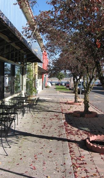
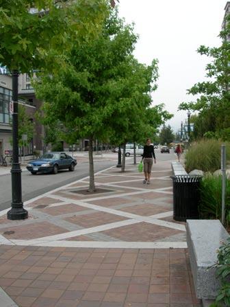
5 The following are general ideas and concepts for creating safe and inviting street for pedestrians, cyclists, and drivers. Following these ideas are a series of illustrated pages showing examples of streetscape elements from around the region and the US, as well as some specific Oregon streetscapes. Sidewalks within a commercial / mixed-use zone should be a minimum of 10 wide, with 12 to 15 preferred. Sidewalks are generally divided into four zones: Building Zone: ~1 to 4 immediately adjacent to a building; often used for outdoor displays or cafe seating Pedestrian Zone: ~6 to 8 unobstructed zone for pedestrians to walk Furnishing Zone: ~3 to 4 for street trees, furniture, plantings, and lights Door Zone: ~2 to 3 for people to get into and out of parked vehicles Sidewalk Paving Materials can vary widely. Concrete is the least expensive, yet can still be versatile. Concrete can be smooth, brushed, stamped, engraved, or colored depending on a community s preferences. Specialty pavers (of concrete, brick, or stone, for example) can be used for entire sidewalks, or can highlight certain areas (such as tree wells, public art, driveways, building zones, or planters). Pavers are generally more expensive, but can make for easier maintenance. Street Furniture can include benches, planters, trash cans, bike racks, water fountains, and public art. These elements often work best when their designs are coordinated, thus giving a streetscape a unified appearance. Street Trees can provide shade and color while softening the often harsh feeling of a city streetscape. Depending on species and placement, trees can also help visually narrow a roadway and contribute to traffic calming. Street Lights can illuminate either the roadway (cobra-head fixtures) or the sidewalk (pedestrian-scale fixtures) to define a streetscape and improve the perception of safety at night. Safe Crossings are an important feature in any streetscape, but are especially important where children, the elderly, STREETSCAPE IDEAS and/or the disabled need to cross. Pedestrian crossings can be improved by slower speed limits (15 to 25 mph), clear crosswalk markings, special crosswalk or intersection paving, clear and consistent signage, curb extensions, and pedestrian refuge islands. Green Streets is a term used to describe on-site stormwater management systems that employ natural systems to handle stormwater run-off. Current designs generally utilize some combination of plantings and infiltration systems, and are often supported by a more traditional storm sewer or culvert system. Because local conditions vary widely, green street systems must be tailored for specific environments and weather patterns. Parking must be provided in order for commercial areas to thrive. Parallel parking is standard in many commercial zones. Where right-of-way width allows, angled parking can help to maximize parking supply. (Back-in angled parking is generally safer, especially when bicyclists are present.) Centrally-located off-street parking can be a great way to both meet customer needs and share parking between complementary uses. Surface lots should be welllandscaped, especially where parking areas abut a sidewalk or public space. Bike Facilities are important for promoting bicycle use and for meeting the needs of those who cannot drive or who choose not to drive. Designated bike lanes are a standard treatment, but other improvements (such as a shared lane, a sharrow or nearby bicycle boulevard treatment) may also be appropriate. Adequate bike parking should be provided. Other Amenities. Streetscapes can often be enhanced by the addition of flags, banners, hanging flower baskets, and holiday decorations. The integration of such elements must be considered during the streetscape planning effort, to ensure that street lights, etc. will be able to accommodate them. Such amenities are often provided by local community organizations (a business or neighborhood association, for example) or private business or property owners through an agreement with the City or governing agency.clear crosswalk markings, special crosswalk or intersection paving, clear and consistent signage, curb extensions, and pedestrian refuge islands. streetscape ideas report


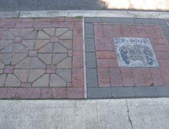
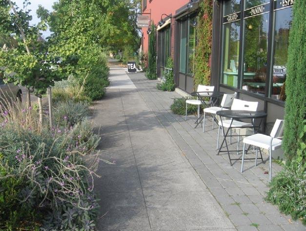
6 SIDEWALKS St. Helens, OR Vancouver, BC Boise, ID Walla Walla, WA Vancouver, BC Culver Downtown Streetscape plan
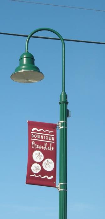
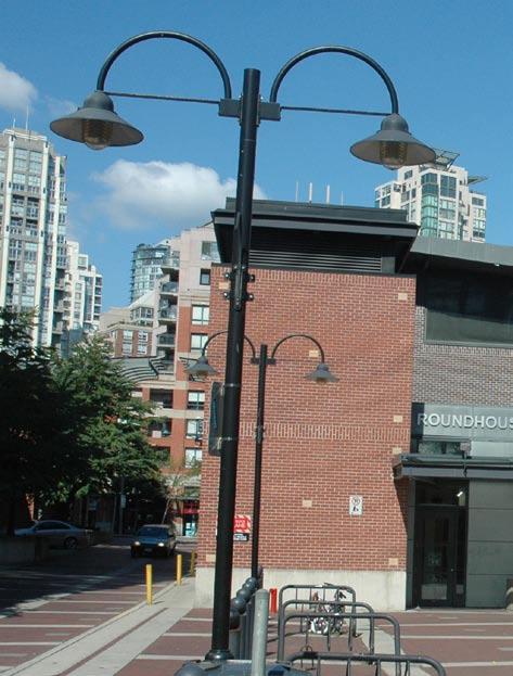
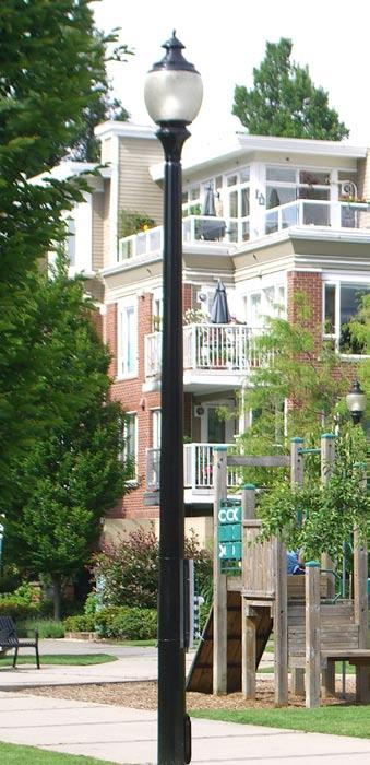
7 PEDESTRIAN-SCALE LIGHTS Beaverton, OR Vancouver, BC OceanLake, OR Vancouver, BC streetscape ideas report
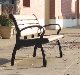
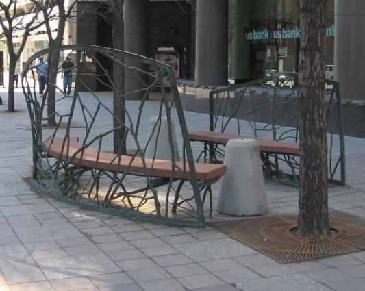
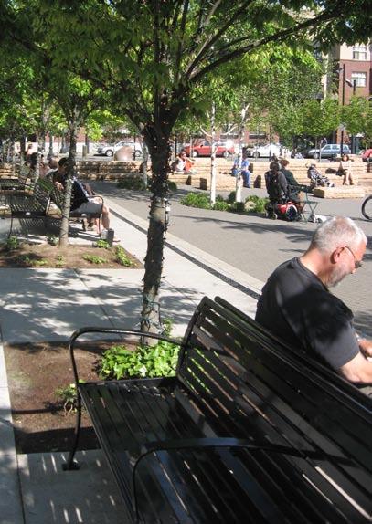
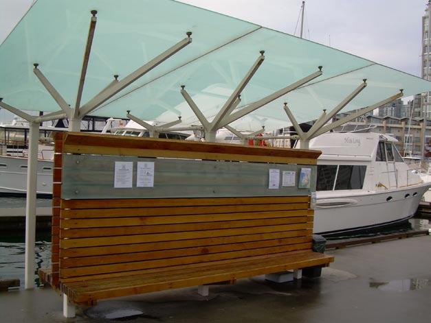
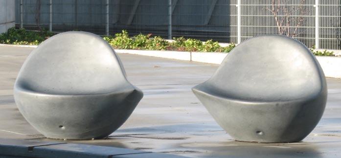
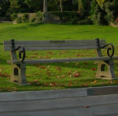
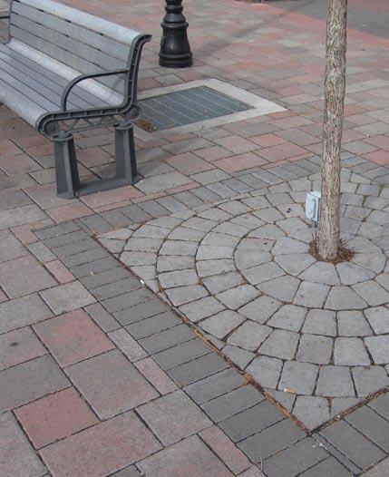
8 BENCHES Vancouver, BC Vancouver, BC Salt Lake City, UT Seattle, WA Independence, OR Culver Downtown Streetscape plan
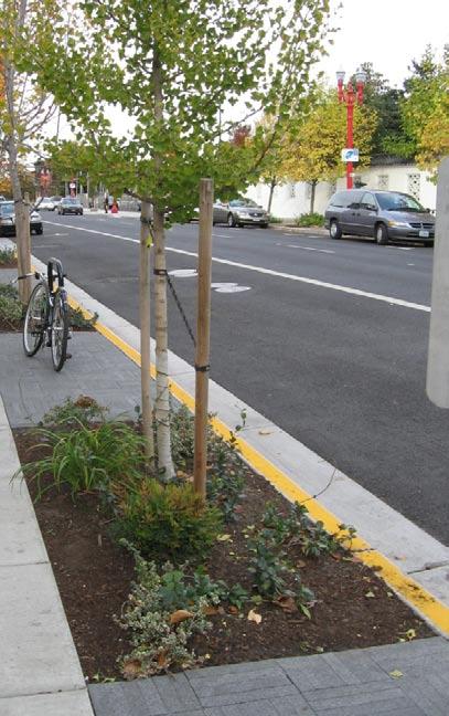
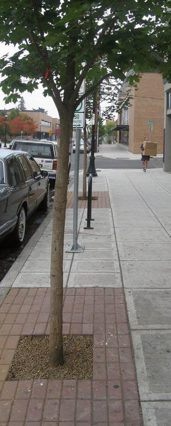
9 TREES/LANDSCAPING Seattle, WA Seattle, WA Lake Oswego, OR streetscape ideas report


10 ANGLED PARKING Ashland, OR Denver, CO Lake Oswego, OR Government Camp, OR Culver Downtown Streetscape plan


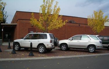
11 PARKING BUFFERS Redmond, OR Redmond, OR Redmond, OR Redmond, OR streetscape ideas report


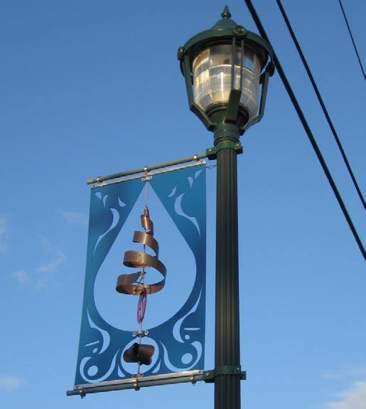
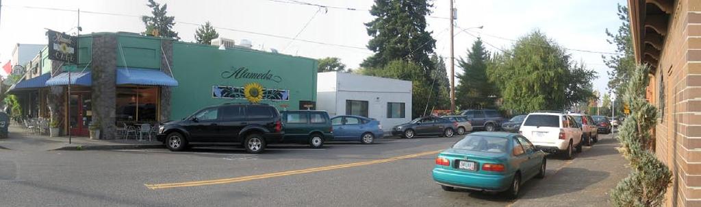
12 BANNERS St. Helens, OR Redmond, OR 10 Culver Downtown Streetscape plan


13 FLOWER BASKETS Redmond, OR Seattle, WA streetscape ideas report 11


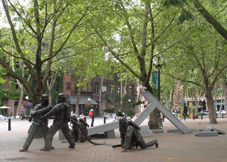
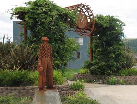
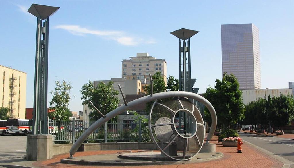
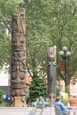
14 PUBLIC ART Raymond, WA Seattle, WA Seattle, WA Seattle, WA Seattle, WA 12 Culver Downtown Streetscape plan


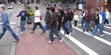
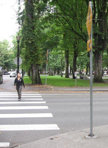
15 SAFE CROSSINGS Bend, OR Gresham, OR Lincoln City, OR Boston, MA Lake Oswego, OR streetscape ideas report 13
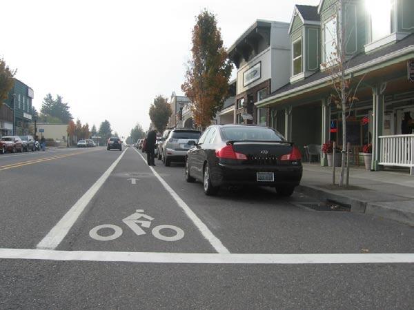
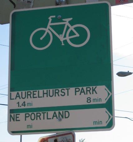
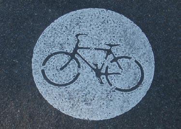
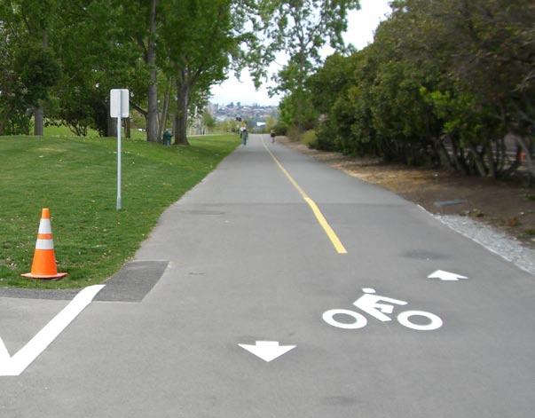
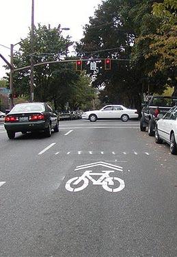
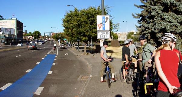
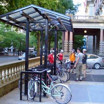
16 BIKE FACILITIES Troutdale, OR Seattle, WA Sharrow symbol, 14 Culver Downtown Streetscape plan

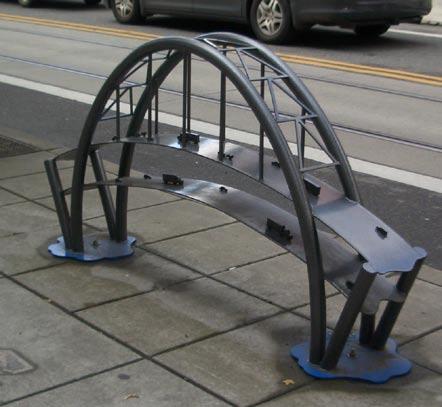
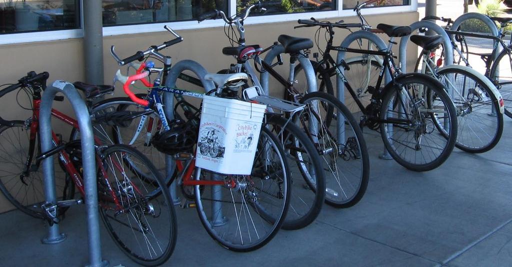
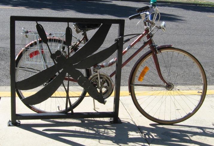
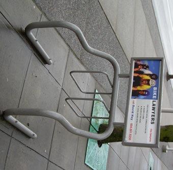
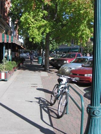
17 BIKE PARKING Vancouver, BC Joseph, OR streetscape ideas report 15


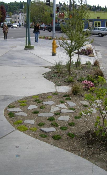
18 GREEN STREETS Bend, OR Bend, OR Bend photos courtesy of GreenWorks, PC; San Francisco photos courtesy of PlantSF.org San Francisco, CA 16 Culver Downtown Streetscape plan

 seasonal light and banner displays primary building entrance")

19 Highway 26 (3rd Street) Main Street Belknap Street Court Street PRINEVILLE street trees seasonal landscaping planter on-street parallel parking metal tree grate landscaping between the building and the back of sidewalk scored concrete buildings built to the back of sidewalk (zero lot line) seasonal light and banner displays primary building entrance oriented to corner 12-foot sidewalk on-street parallel parking light fixtures trash can concrete with inlaid brick for contrast landscaped tree well ornamental benches streetscape ideas report 17
 Main Street Belknap")


20 PRINEVILLE Highway 26 (3rd Street) Main Street Belknap Street Court Street angled parking on side streets can help increase overall parking supply vegetated tree wells can be an inexpensive but attractive option angled parking on side streets can help increase overall parking supply decorative tree grate furnishing zone with brick pavers in a herringbone pattern custom bench permanent hole for mounting decorative flag 18 Culver Downtown Streetscape plan


21 Downtown / SW 4th MADRAS pavers at intersections / curb extensions; concrete pedestrian ramps at 90-degree angles to wellmarked crosswalks concrete sidewalks, pavers in the furnishing zone, holiday lights on street trees pedestrian-scale light fixture bike rack plaza Well-marked parking area and bike lane concrete sidewalks, pavers in the furnishing zone streetscape ideas report 19


22 REDMOND Highway 97 (6th Street) 7th Street SW Evergreen Avenue SW Deschutes pedestrian-oriented business signage on-street parallel parking picture windows provide a transparent streetscape private landscaping pavers recessed entry pedestrian-scale light fixture, seasonal banner, and holiday lights pedestrianscale lighting and banner street trees tree wells accented with pavers and metal grates alternating pavers and concrete provides visual interest along the street landscape planter is too small for the tree 20 Culver Downtown Streetscape plan


23 Highway 97 (6th Street) 7th Street SW Evergreen Avenue SW Deschutes REDMOND curb extension trash can permanent fixture for putting up flags stamped concrete can provide the look and feel of pavers at a fraction of the cost but does not have the flexibility of dry set pavers 6-foot sidewalk is too narrow 10-foot sidewalk with street trees, pavers, pedestrian-scale light fixtures sidewalk art / fountain streetscape ideas report 21


24 BEND Mill District Downtown Colorado Avenue Wall Street parking lot is buffered by landscaping on-street parallel parking off-street parking separated by a sidewalk pedestrian-scale streetlight and banner street trees curb extensions angled parking pedestrianscale lighting street tree with pavers in the tree well curb extension / plaza several types and colors of pavers define spaces and paths in the streetscape lighted bollard stamped concrete crosswalk dry set pavers in the tree well allow the tree to grow without cracking the sidewalk 22 Culver Downtown Streetscape plan


25 Mill District Downtown Colorado Avenue Wall Street BEND small pieces of art add an element of interest to the metal tree grate: custom-made, ornate, locally-manufactured pedestrian-scale streetlight art can be integrated into the building faces stone wall separates pedestrian area from the parking area benches brick pavers street trees with dry set pavers in the tree well continuous pervious landscape strip streetscape ideas report 23


26 JOSEPH Downtown / N Main Street angled parking curb extensions pavers curb extensions improve pedestrian safety while large curb radii accommodate trucks and recreational vehicles pedestrian-scale streetlights, banners and hanging flower baskets art and landscaping landscaping and art features in the curb extensions provide visual interest along the streetscape Joseph photos courtesy of the Oregon Department of Transportation 24 Culver Downtown Streetscape plan


27 Downtown / S Main Street Millennium Park - Independence s downtown civic space INDEPENDENCE pedestrian-scale streetlights and banners on-street parallel parking marked crosswalk with curb extension benches and trash cans curb extensions street trees pedestrian-scale streetlights and banners bike lane street trees driveway consolidation and new sidewlks streetscape ideas report 25


28 GRANTS PASS Downtown / N Main Street pedestrian-scale streetlights, banners, hanging baskets and flags street trees accent pavers on-street parallel parking accent pavers hanging flower baskets awnings pedestrian-scale business signage street trees trash cans recessed business entry outdoor seating unlandscaped tree well 10-foot sidewalk accent pavers 26 Culver Downtown Streetscape plan
COMPLETE GREEN STREET CHECKLIST
 COMPLETE GREEN STREET CHECKLIST This document was developed to dissect the structure of an urban street and explore opportunities to make our streets more complete while also integrating green street strategies.
4.9 Mendocino Avenue Corridor Plan Design Guidelines
 4.9 Mendocino Avenue Corridor Plan Design Guidelines The Mendocino Avenue Corridor Plan addresses the area between College Avenue and Steele Lane. Mendocino Avenue is a busy arterial that runs parallel
VEHICULAR AND PEDESTRIAN CIRCULATION
 This perspective sketch communicates the intended character and quality of a proposed streetscape design. Locate benches near a major intersection where people tend to gather. Seating and lighting provide
BUSINESS DISTRICT DESIGN GUIDELINES
 Des Plaines, Illinois Prepared for the City of Des Plaines by: The Lakota Group Laurie Marston, AICP March 2005 Section 5: Streetscape Elements Business District Design Guidelines STREETSCAPE ELEMENTS
The open space system should provide connective elements, relate to natural resources, and enhance the suburban character of the landscape..
 The open space system should provide connective elements, relate to natural resources, and enhance the suburban character of the landscape.. Mixed-use and infill development should maintain or enhance
Conceptual Design. Main Street Enhancement and Extension Project. Bothell, Washington. June 11, 2009
 Conceptual Design Main Street Enhancement and Extension Project Bothell, Washington June 11, 2009 Berger/ABAM Engineers and Cascade Design Collaborative, Inc For Main Street Bothell to succeed it must
Town Center Design Guidelines
 Adopted by City Council on September 18, 2018 Design Theme The Draper Town Center Design Theme is defined as encompassing those architectural design styles that were prevalent in the construction of civic
Landscape and Streetscape Design 2.5
 Landscape and Streetscape Design 2.5 2.5.1 Goals 2.5.2 Planting 2.5.3 Sidewalks and Pavement 2.5.4 Furnishings 2.5.5 Walls 2.5.6 Lighting 2.5.7 Stormwater 2.5.8 Street Cross Sections 2.5 LANDSCAPE AND
Jewel. Platte. of the. Plattsmouth Main Street Landscape Architecture by HDR
 Jewel of the Platte Plattsmouth Main Street Landscape Architecture by HDR Plattsmouth, Nebraska is a historic community of 6,500 residents located along the west bank of the Missouri River, just south
FREEWAY/TOURIST DISTRICT
 FREEWAY/TOURIST DISTRICT DESIGN STANDARDS FOR THE CITY OF MOUNTLAKE TERRACE March, 2014 MOUNTLAKE TERRACE FREEWAY/TOURIST DESIGN STANDARDS March, 2014 1 TABLE OF CONTENTS Introduction...1 Design Site Design
Broadway Avenue Streetscape Project City of Albert Lea. Streetscape Design Committee Meeting October 29, 2012
 Broadway Avenue Streetscape Project City of Albert Lea Streetscape Design Committee Meeting October 29, 2012 1 Presentation Outline Street Widths, Sidewalk Widths and Bump-Out Configuration Decorative
DRAFT. 10% Common Open Space
 % OF CHARLOTTE IS CATEGORIZED AS A. LAND USES : Placeholder map displaying location of Place Type GOALS: Accommodate XX% of future growth. Provide a concentration of primarily commercial and civic activity
Streets Vision
 streets 86 2.9 Vision : The Most Prevalent and Important Public Spaces Fixed routes of human travel have served as corridors for commerce and places for human interaction from the earliest trails and foot
VILLAGE OF SKOKIE Design Guidelines for Mixed-Use Districts NX Neighborhood Mixed-Use TX Transit Mixed-Use CX Core Mixed-Use
 VILLAGE OF SKOKIE Design Guidelines for Mixed-Use Districts NX Neighborhood Mixed-Use TX Transit Mixed-Use CX Core Mixed-Use TABLE OF CONTENTS CHAPTER 1 SITE DESIGN Purpose 1 CHAPTER 2 SITE DESIGN Streetscape
Roanoke Rapids Streetscape Master Plan. City Council Presentation
 SCHEDULE: Stakeholder Meeting/Kick off November,2016 Master Planning Phase (November March 2017) Public Meeting #1 December 13, 2016 Review Meeting with Key Stakeholders Refine Concepts Based on Input
V. Gateways GATEWAYS / V-1
 V. GATEWAYS / V-1 Many of Chesapeake s gateways are located on highways and call for bold and attractive designs that motorists can understand, appreciate, and enjoy. can also take the form of natural
Potential Green Infrastructure Strategies May 6, 2015 Workshop
 Potential Green Infrastructure Strategies May 6, 2015 Workshop Background The City of Cortland is developing the Tioughnioga Urban Headwaters Green Infrastructure Action Plan with funding from the National
Fifth and Detroit Street Design May 2017 Capital Improvements Committee. DOWNTOWN Street Design
 1 Fifth and Detroit Street Design May 2017 Capital Improvements Committee Agenda 2 Review Street Configuration Prior Meeting Review Outreach Synopsis Functional Street Design Refinements Curb Edge, Turning
Dogpatch/22nd Street Greening
 TEAM MEMBERS Prepared for: GreenTrustSF Central Waterfront www.gtsfcw.org Prepared by: Fletcher Studio San Francisco, CA www.fletcherstudio.com Landscape Architecture Urban Design Environmental Planning
Maplewood Avenue Downtown Complete Street Project
 Maplewood Avenue Downtown Complete Street Project Second Public Meeting January 24, 2018 Welcome and Introduction of Project Team City Planning and Public Works Staff City of Portsmouth Juliet Walker Planning
Streetscape Case Studies. Denver Avenue Streetscape Design Project
 December 4, 2006 The following case studies were compiled as part of the Denver Avenue Streetscape Design Project in order to help inform the design process for Denver Avenue s streetscape. The first part
Chapter 14 Streetscape Improvements
 This chapter presents streetscape design concepts for key streets and gateways in the Downtown Specific Plan area. This chapter is organized as follows: 14 Streetscape Improvements 14.1 Streetscape Treatments
GREENING THE BOULEVARD Master Plan Concepts for Venice Boulevard between Lincoln and Sawtelle
 GREENING THE BOULEVARD Katherine Spitz Associates Inc. 4212½ Glencoe Avenue Marina Del Rey, CA 90292 310 574 4460 Fax 574 4462 January 2008 Table of Contents Overview Proposed Design Improvements Illustration
PIKE PINE RENAISSANCE: ACT ONE. October 19, 2017
 PIKE PINE RENAISSANCE: ACT ONE October 19, 2017 WATERFRONT SEATTLE PROGRAM PROJECT INTRODUCTION Pike and Pine streets, between First and Melrose avenues Pedestrian and streetscape improvements Budget:
Design Guidelines for the Route 30 Corridor Master Plan: Subdivision and Land Development Elements
 Design Guidelines for the Route 30 Corridor Master Plan: Subdivision and Land Development Elements East Whiteland Township- Chester County, PA Prepared by: Draft: May 7, 2018 Design Guidelines for the
TOWN CENTER DESIGN STANDARDS FOR THE CITY OF. August, MOUNTLAKE TERRACE TOWN CENTER DESIGN STANDARDS August,
 TOWN CENTER DESIGN STANDARDS FOR THE CITY OF MOUNTLAKE TERRACE August, 2008 MOUNTLAKE TERRACE TOWN CENTER DESIGN STANDARDS August, 2008 1 TABLE OF CONTENTS Introduction...3 Design Site Design...4 Pedestrian
West Dennis Center: Bass River to Old Main Street. West Dennis Business District: Old Main Street to Dennis Commons
 West Dennis Center: Bass River to Old Main Street West Dennis Business District: Old Main Street to Dennis Commons Dennisport Center: Dennis Commons to Division Street Main Street Project Goals Project
Wayfinding. North Gateway: Integrate a vertical gateway marker on the west side of Ward Street at the south corner of Vernon Street.
 3.3.6.2 Wayfinding Existing Conditions Wayfinding signage is important to direct visitors and tourists to different locations in the downtown. A significant part of the wayfinding signage in the downtown
3.13. Development Guidelines
 3.3 Landscaping Elements Landscaping should be used to frame and soften structures, define site functions, enhance the quality of the environment, and screen undesirable views. Safety, environmental impacts,
Sidewalks Street Lights
 Boston Complete Streets Guidelines 013 Boston Transportation Department Sidewalks Introduction 17 Sidewalk Design Principles 18 Sidewalk Zones 0 Sidewalk Zones Widths Preferred and Minimum Widths for Sidewalk
Streetscape Patterns. Design Guidelines, Ridgewood Village Center Historic District, Ridgewood, N.J. page 20
 North Broad Street has a unique streetscape pattern with broad curving street, tight enclosure on the east side with attached commercial buildings aligned with the sidewalk, and landscaped open space on
open house 3 CITY OF SALEM Downtown Streetscape Plan
 open house 3 Streetscape concepts CITY OF SALEM Downtown Streetscape Plan analysis concepts we are here refined concepts & document Feb 13th 1 2 3 apr 18th KICKOFF OPEN HOUSE Streetscape Work Group Walking
appendix and street interface guidelines
 appendix five: building and street interface guidelines appendix 5 building and street interface guidelines BOULEVARDS Boulevards are generally characterized by higher levels of traffic movement at higher
STREETSCAPE IMPROVEMENTS - RECOMMENDATIONS
 STREETSCAPE IMPROVEMENTS - RECOMMENDATIONS Figure 4.3.1- A map of all of the recommended streetscape improvements. The key component of downtown s public realm, apart from its public spaces, is its street
Public input has been an important part of the plan development process.
 Lakewood s Comprehensive Plan recognizes that transportation helps shape the community, and that the way the community provides for the safe and efficient movement of people affects the character of the
Design Guidelines. Roosevelt. Mike Podowski DPD Design Guidelines Ordinance ATT 13 August 13, 2012 Version #1
 Roosevelt Design Guidelines The Roosevelt Neighborhood Design Guidelines apply within the Neighborhood Boundary. Map 1 2 Map 2 3 Map 3 4 CS1 Natural Systems and Site Features Citywide Guideline: Use natural
Main Street Reconstruction From Ninth Line to Stouffer Street. Town of Whitchurch-Stouffville. Public Information Centre
 Main Street Reconstruction From Ninth Line to Stouffer Street Town of Whitchurch-Stouffville Public Information Centre November 23, 2016 4:30 to 6:00 pm & 7:00 to 8:00 pm 6240 Main Street, Stouffville
Figure Example of out door dining in the public right-of-way.
 Section 2 Core Area Goal 2.2.1 To maintain and enhance the character of existing streets in the Downtown Area. Character Figure 2.2.1 Example of out door dining in the public right-of-way. A. Provide street
PUBLIC RIGHT-OF-WAY IN THIS CHAPTER PUBLIC REALM
 PUBLIC RIGHT-OF-WAY This section provides design guidelines for improvements in the public right-of-way. The public right-of-way refers to streets, sidewalks, non-vehicular thoroughfares, parks and greenways
CHAPTER 8. Mrs. Zimman s Class - Central Elementary
 SUSTAINABILITY CHAPTER 8 Mrs. Zimman s Class - Central Elementary 8.1 OVERVIEW Green infrastructure also known as low impact development (LID) and environmental or sustainable site design is an environmentally
BUILDING SCALE AND SETBACKS 5 ELEMENTS:... 5 FAÇADES (COMMERCIAL/RESIDENTIAL) 5
 5") VISION STATEMENT 3 UTILIZATION OF THE GUIDELINES 3 IMPLEMENTATION 3 PROCEDURES FOR DESIGN REVIEW 3 LAND USE AND ZONING 4 LAND USE 4 ELEMENTS:... 4 ZONING 4 ELEMENTS:... 4 BUILDING SCALE AND SETBACKS 5
VISION STATEMENT 3 UTILIZATION OF THE GUIDELINES 3 IMPLEMENTATION 3 PROCEDURES FOR DESIGN REVIEW 3 LAND USE AND ZONING 4 LAND USE 4 ELEMENTS:... 4 ZONING 4 ELEMENTS:... 4 BUILDING SCALE AND SETBACKS 5
Community Design Plan
 Gardena General Plan 2006 Authority While the is not a required element of a General Plan, it is included because improving the community appearance and image is paramount to the overall quality of life
SITE PLANNING. Raymond Design Guidelines Site Planning
 SITE PLANNING Raymond Design Guidelines Site Planning I/ BACKGROUND INTRODUCTION Each property within the Raymond Commercial District has its own unique set of opportunities and constraints. Site planning
BUSINESS DISTRICT DESIGN GUIDELINES
 Des Plaines, Illinois Prepared for the City of Des Plaines by: The Lakota Group Laurie Marston, AICP March 2005 Section 6: Landscaping Business District Design Guidelines LANDSCAPING GUIDELINES The following
Greater East Wenatchee Urban Growth Area. Design Standards & Guidelines
 Greater East Wenatchee Urban Growth Area Design Standards & Guidelines November 30, 2006 Table of Contents General Guidelines for All Development Site Design - - - - - - - - - - - - - - - - - - - - - -
ATTACHMENT A. SILVERDALE DESIGN STANDARDS Amendments to the Waaga Way Town Center Chapter
 ATTACHMENT A SILVERDALE DESIGN STANDARDS Amendments to the Waaga Way Town Center Chapter Chapter 10. Waaga Way Town Center 10.1 Physical Identity Elements & Opportunities The Waaga Way Town Center includes
WEST LOOP DESIGN GUIDELINES CHECKLIST
 WEST LOOP DESIGN GUIDELINES CHECKLIST Section 1.0 General Strategies 1.1 DESIGN EXCELLENCE: ENCOURAGE HIGH QUALITY AND INNOVATIVE DESIGN OF NEW BUILDINGS WITHIN THE WEST LOOP WITHOUT BEING PRESCRIPTIVE
R STREET CORRIDOR NEIGHBORHOOD Site Plan and Design Review Supplemental Guidelines Checklist
 R STREET CORRIDOR NEIGHBORHOOD Site Plan and Design Review Supplemental Guidelines Checklist Applicant s Name: Project Address: Phone: Email: Applicant shall fill out the design guidelines checklist for
SDOT DPD. SDOT Director s Rule DPD Director s Rule DCLU DR SED DR of 7 CITY OF SEATTLE
 SDOT SDOT Director s Rule 2-07 DPD Applicant: CITY OF SEATTLE Page 1 of 7 Supersedes: DCLU DR 11-93 SED DR 93-4 Seattle Department of Transportation (SDOT) Department of Planning and Development (DPD)
SOUTH UNIVERSITY Street Design Alternatives in Progress
 1 Alternatives in Progress 2016.01.20 Meeting Agenda 2 1. Progress & Schedule 2. Utilizing the Street Design Manual 3. Site Characteristics and Input Received 4. Street Geometry What can we accomplish
The Auburn Plan Designing the Future of Auburn February 28, 2005
 The Auburn Plan Designing the Future of Auburn February 28, 2005 Block-by-Block Bicycle Tour Aerial survey Focus Group Meetings September 7 and 8 Design Workshops October 11, 14, and 21 Revitalization
SUBCHAPTER 4-B GUIDELINES FOR THE B-3 COMMERCIAL CHARACTER AREA
 1 SUBCHAPTER 4-B GUIDELINES FOR THE B-3 COMMERCIAL CHARACTER AREA Downtown Bozeman should be the location of buildings of greatest height and intensity in the community. The following guidelines apply
Appendix A COMMUNITY IMPROVEMENT PLAN DESIGN GUIDELINES
 Appendix A COMMUNITY IMPROVEMENT PLAN DESIGN GUIDELINES INTRODUCTION The continuous and desirable improvement of Arnprior requires a clear understanding of what is envisioned for the Town. These Design
Division VI Community Mixed Use (CMU) Architectural Guidelines and Standards
 Architectural Guidelines and Standards") Division VI 18.40.800 Community Mixed Use (CMU) Architectural Guidelines and Standards 18.40.810 Guidelines The goals of the Comprehensive Plan include a focus on pedestrian safety, amenities and aesthetics
Division VI 18.40.800 Community Mixed Use (CMU) Architectural Guidelines and Standards 18.40.810 Guidelines The goals of the Comprehensive Plan include a focus on pedestrian safety, amenities and aesthetics
180 ZONING 180. ARTICLE XLII STREETSCAPE ENHANCEMENT OVERLAY ( SEO ) DISTRICT [Added Ord. No. 1086]
![180 ZONING 180. ARTICLE XLII STREETSCAPE ENHANCEMENT OVERLAY ( SEO ) DISTRICT [Added Ord. No. 1086]](/thumbs/75/72360049.jpg "180 ZONING 180. ARTICLE XLII STREETSCAPE ENHANCEMENT OVERLAY ( SEO ) DISTRICT [Added Ord. No. 1086]") 180 ZONING 180 ARTICLE XLII STREETSCAPE ENHANCEMENT OVERLAY ( SEO ) DISTRICT [Added 4-6-2016 Ord. No. 1086] 180.145. SEO DISTRICT 180.145.1. Intent. The SEO DISTRICT Regulations are intended to address
180 ZONING 180 ARTICLE XLII STREETSCAPE ENHANCEMENT OVERLAY ( SEO ) DISTRICT [Added 4-6-2016 Ord. No. 1086] 180.145. SEO DISTRICT 180.145.1. Intent. The SEO DISTRICT Regulations are intended to address
B L A C K D I A M O N D D E S I G N G U I D E L I N E S for Multi-family Development
 B L A C K D I A M O N D D E S I G N G U I D E L I N E S for Multi-family Development Adopted June 18, 2009 This section of the Design and focuses on site planning and design guidance for new multi-family
Arterial Mainstreets ottawa.ca
 Urban Design Guidelines for Development along Arterial Mainstreets ottawa.ca Ce document est disponible en français sur ottawa.ca. This document is available in French on ottawa.ca. Approved by City Council
TURN TO THE RIVER CITY PLAZA LANDSCAPE DESIGN CONCEPT May 25, 2016
 Turn to the River is a multi-year project of Art Spaces - Wabash Valley Outdoor Sculpture Collection, Inc. to connect downtown Terre Haute with the Wabash River through public art and design. The four-square
City of Dallas Complete Streets Program. SAME Infrastructure Forum February 2, 2018
 City of Dallas Complete Streets Program SAME Infrastructure Forum February 2, 2018 Complete Streets Design Manual Adopted by City Council January 27, 2016 JANUARY 27, 2016 2 What are Complete Streets?
CHARLOTTESVILLE. Streetscape ENTRANCE CORRIDOR DESIGN GUIDELINES. Amendments adopted by City Council March 7, Design Principles...
 CHARLOTTESVILLE ENTRANCE CORRIDOR DESIGN GUIDELINES Amendments adopted by City Council March 7, 2011 2 Streetscape A. B. C. D. E. F. G. H. I. Design Principles...5 Plantings & Open Space...6 Pedestrian
SPRINGHILL LAKE TRANSIT VILLAGE
 Greenbelt Metro Area Sector Plan - Subarea Design Policies and Guidelines - Springhill Lake Transit Village 113 SPRINGHILL LAKE TRANSIT VILLAGE Residential Neighborhood and Village Center CONCEPT Springhill
City of Burlington Downtown Street Design & Construction Standards
 City of Burlington Downtown Street Design & Construction Standards Adopted April 16, 2018 b City of Burlington Downtown Street Design Standards CITY OF BURLINGTON, VT The Great Streets Initiative is a
Gas Stations ottawa.ca
 Urban Design Guidelines for Gas Stations ottawa.ca Ce document est disponible en français sur ottawa.ca. This document is available in French on ottawa.ca. Approved by City Council May 24, 2006 City of
City of Redlands Architectural Guidelines for Non-Residential Development
 14. Building articulation shall be included in the design of building, in order to create a formal entry statement. Avoid this Do this Page 11 15. Give special attention to creating pedestrian scale and
Study Area. Capitol Way. Greening America s Capitals 11/13/2014. A Greening America s Capitals Project
 Olympia, WA: Greening Capitol Way Supporting Communities move towards sustainability is a priority for the federal government. A Greening America s Capitals Project Office of Sustainable Communities U.S.
ROCKTON DOWNTOWN STREETSCAPE MASTER PLAN. Plan Commission Presentation April 10, 2018 Teska Associates Christopher Burke Engineering
 ROCKTON DOWNTOWN STREETSCAPE MASTER PLAN Plan Commission Presentation April 10, 2018 Teska Associates Christopher Burke Engineering AGENDA 1. Project Scope & Schedule 2. Steering Committee & Community
SFMTA PHELAN LOOP AND PUBLIC PLAZA PHELAN OCEAN AVENUE
 SFMTA Municipal Transportation Agency Image: a bus in front of the Palace of the Legion of honor SFMTA PHELAN LOOP AND PUBLIC PLAZA PHELAN AVENUE @ OCEAN AVENUE Community Meeting May 23, 2012 San Francisco,
Community Mixed Use Zone Districts (CMU)
") 18.28.500 Community Mixed Use Zone Districts (CMU) The Community Mixed Use Zone Districts (CMU) are intended to help implement the land use goals and strategies found in the Golden Vision 2030 values,
18.28.500 Community Mixed Use Zone Districts (CMU) The Community Mixed Use Zone Districts (CMU) are intended to help implement the land use goals and strategies found in the Golden Vision 2030 values,
SOUTH UNIVERSITY Street Design Setting a Direction for Schematic Design
 1 SOUTH UNIVERSITY Street Design Setting a Direction for Schematic Design Meeting Agenda 2 1. Project Scope 2. Design Direction 3. Design Details 4. Schedule and Construction Logistics 3 SOUTH UNIVERSITY
Bethlehem Pike Streetscape Master Plan
 Bethlehem Pike Streetscape Master Plan Prepared for Springfield Township October 2008 By Michael Baker Jr., Inc. Carter Van Dyke Associates Table of Contents 1. Introduction 3 2. General Corridor Wide
Design Guidelines and Standards for Sight Triangles. Sight Triangle MANUAL
 Design Guidelines and Standards for Sight Triangles Sight Triangle MANUAL Table of Contents 1.0 Introduction..............................................7 1.1 Key Terms..............................
lot flankage Y street 16m 6m landscape strip for large site 3m landscape strip for small medium site
 Commercial General Commercial Objectives Create developments compatible with adjacent land uses in scale, function and character Define a consistent and attractive street edge with quality landscaping,
Wheaton CBD & Vicinity Sector Plan D E S I G N G U I D E L I N E S
 Wheaton CBD & Vicinity Sector Plan D E S I G N G U I D E L I N E S 1 a b s t r a c t This document contains the design guidelines the property owners, community members, and planners should use to implement
Hamilton Road Corridor Streetscape Master Plan. Open House October 4 th, 2017
 Hamilton Road Corridor Streetscape Master Plan Open House October 4 th, 2017 Agenda 1. Introductions Agenda Overview 2. Project Background 3. Existing Conditions 4. Strengths, Weaknesses, Opportunities
PARKLET PROPOSAL PACKAGE & PROCESS
 500.3 I PARKLETS The term parklet refers to a small temporary constructed seating or community gathering area over an on-street parking space or an extension of the sidewalk into the operating State highway
COMMERCIAL DESIGN REVIEW APPLICATION
 CITY OF LACEY Community Development Department 420 College Street Lacey, WA 98503 (360) 491-5642 COMMERCIAL DESIGN REVIEW APPLICATION OFFICIAL USE ONLY Case Number: Date Received: By: Related Case Numbers:
Johnson Street Bridge Public Realm Update
 Johnson Street Bridge Public Realm Update August 20, 2015 Background Johnson Street Bridge Replacement Project impacts a diverse range of stakeholders In addition to a new bridge, the project also includes
CENTERS AND CORRIDORS
 INITIAL DESIGN STANDARDS AND GUIDELINES for CENTERS AND CORRIDORS City of Spokane Planning Services Third Floor, City Hall 808 W. Spokane Falls Blvd. Spokane, WA 99201-3329 (509) 625-6300 www.spokaneplanning.org
Good Design. Urban Design, Streetscape, and Sustainable Development Best Practices for Downtown Olympia
 Good Design. Urban Design, Streetscape, and Sustainable Development Best Practices for Downtown Olympia APRIL 2009 TABLE OF CONTENTS BEST PRACTICES 1. Urban Design - 1 2. Design Standards - 3 3. Streetscape
urban design Introduction
 ACHIEVE SP RI NGF I ELD.3 Introduction Urban Design Areas Design Areas are areas within Springfield that have a unique and recognizable character that is different from other areas in the community. The
Metro. Activity Center Design Guidelines. Recommendations For Developing Focused, Mixed-Use Commercial/Residential Centers
 Metro Activity Center Design Guidelines Recommendations For Developing Focused, Mixed-Use Commercial/Residential Centers Metro Activity Centers What is a MAC? Legacy, the adopted guide for the future growth
CHAPTER 3. Design Standards for Business, Commercial, Industrial, Recreational and Institutional Uses
 CHAPTER 3 Design Standards for Business, Commercial, Section Number Title Ordinance Number Date of Ordinance 16-3-1 Applicability 2006-11 2008-04 07-01-08 16-3-2 Uniform Standards for Architectural Design
Concept Design. The Midtown Blocks
 Concept Design The Midtown Blocks May 18, 1999 Contents Introduction Project Package The Urban Garden Design Guidelines Midtown Blocks Concept Plan Urban Garden Concept Plan Appendix The Midtown Blocks
Policies and Code Intent Sections Related to Town Center
 Policies and Code Intent Sections Related to Town Center The Town Center Vision is scattered throughout the Comprehensive Plan, development code and the 1994 Town Center Plan. What follows are sections
MAIN STREET RECONSTRUCTION PROJECT PRE-CONSTRUCTION PUBLIC INFORMATION SESSION AGENDA
 MAIN STREET RECONSTRUCTION PROJECT PRE-CONSTRUCTION PUBLIC INFORMATION SESSION 7:00 P.M. TO 8:30 P.M. NOVEMBER 21 st, 2017 PENETANGUISHENE MEMORIAL COMMUNITY CENTRE BRIAN ORSER HALL (61 Maria Street) 1.
GROUND LEVEL ENLARGEMENT / STREETSCAPE AT PIER AVENUE STRAND & PIER HOTEL HERMOSA BEACH HARDSCAPE MATERIAL KEY MAP PIER AVENUE
 COMPOSITE LANDSCAPE LOT B ( MAX SPACES) WILSHIRE BLVD, SUITE 0 BEVERLY HILLS, CA 0 TH STREET WILSHIRE BLVD, SUITE 0 BEVERLY HILLS, CA 0 BRYANT STREET, SUITE 00 SAN FRANCISCO, CA 0 S. FIGUEROA ST. TH FLOOR
Pedestrian and Bike Bridge LOGO
 6.2.2 Pedestrian and Bike Bridge The proposed pedestrian and bike crossing re-envisions the existing bridge at Pismo Creek on Cypress Street. The bridge is currently underutilized by vehicular through
Main Street Streetscape Plan. Downtown Redevelopment Plan Phase One
 2012 Main Street Streetscape Plan Downtown Redevelopment Plan Phase One Message from Council Council Left to right: Dwight Ganske, Judy Bennett, Darren Badry, Mayor Ken Lemke, Robert Twerdoclib, Pat Hansard,
DRAFT. October Wheaton. Design Guidelines
 October 2011 DRAFT Wheaton Design Guidelines 2 Draft - Design Guidelines - Wheaton Sector Plan Contents 04 Section 1: Introduction 06 Section 2: Context 08 Section 3: Design Guidelines 09 Goal 1: Create
III - design standards
 III - design standards The Circulation Classification and Character section of the Design Standards chapter prescribes the types of circulation routes, the location of the circulation routes, the connections
The George Washington University Streetscape Concept Plan. May 6 th 2009 Public Presentation for Discussion EHRENKRANTZ ECKSTUT & KUHN ARCHITECTS
 The George Washington University Streetscape Concept Plan May 6 th 2009 Public Presentation for Discussion EHRENKRANTZ ECKSTUT & KUHN ARCHITECTS Agenda 1. Introduction & Overview 2. Background & Context
Central Avenue Landscape Architect Record of significant community service Worked with the Heart of Naples Committee to create streetscape plans
 Central Avenue 2005 A. Gail Boorman Landscape Architect Record of significant community service Worked with the Heart of Naples Committee to create streetscape plans Included 10 Street and Central Avenue
ELK GROVE TOWN CENTER DESIGN GUIDELINES
 ......... ELK GROVE TOWN CENTER DESIGN GUIDELINES LAGUNA RIDGE SPECIFIC PLAN... June 2008 ............ DESIGN GUIDELINES Table of Contents Contents Section A: Town Center Overview...1 A.1. Purpose and
Shell Beach Road Streetscape Frequently asked Questions
 Shell Beach Road Streetscape Frequently asked Questions General What is the Shell Beach Road Streetscape Improvements Project? The overall goal of the Shell Beach Road Streetscape Improvement project is
Access Management: An Overview
 Figures 1-5 Below Evolution of development along a highway. In the early stages, land along the road is used for farming with little traffic generated. As time passes, the highway corridor becomes a de
3.0 master plan concept
 3.0 master plan concept 3.1 introduction The purpose of the Huron Church Road Master Plan Concept is to provide an overview of the Master Plan design process, identify preliminary streetscape installations
AESTHETIC APPEARANCE. Design Guidelines for Grade-Separated Pedestrian, Cyclist and Equestrian Structures
 III. AESTHETIC APPEARANCE The aesthetic qualities of a grade-separated structure are as important as the specific design criteria. For example, a structure may be constructed to the exact criteria set
Cleveland Park Streetscape and Drainage Improvement Project 1
 Cleveland Park Streetscape and Drainage Improvement Project 1 Urban Context Washington, D.C. Connecticut Avenue Cleveland Park Streetscape and Drainage Improvement Project 2 Neighborhood Context Contributing
Table of Contents. Elm Avenue Improvement Plan City of Waco, Texas. Introduction 1. Existing Context 1 Figure 1 2.
 Table of Contents Introduction 1 Existing Context 1 Figure 1 2 Plan Guidelines 3 Future Urban Form 4 The West-End 4 Main Street 6 The East-End 7 Figure 2 9 Public Improvement Recommendations 7 General
Integration of Public Realm and Library Precinct Landscape Plan Ground Floor
 Integration of Public Realm and Library Precinct Landscape Plan Ground Floor LANE 1 2 4 10 3 5 10 6 5 7 WEST GEORGIA STREET 4 10 14 HOMER STREET 12 B B 14 11 A A 13 MAIN ENTRY 8 8 9 LIBRARY SQUARE PLAZA