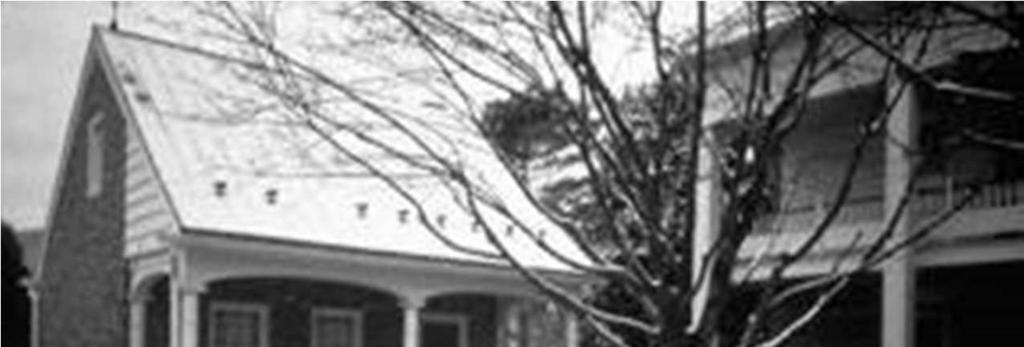
Dwelling: You are how you live
|
|
|
- Maximilian Griffin
- 5 years ago
- Views:
Transcription


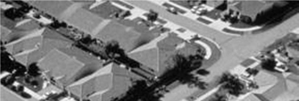
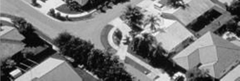
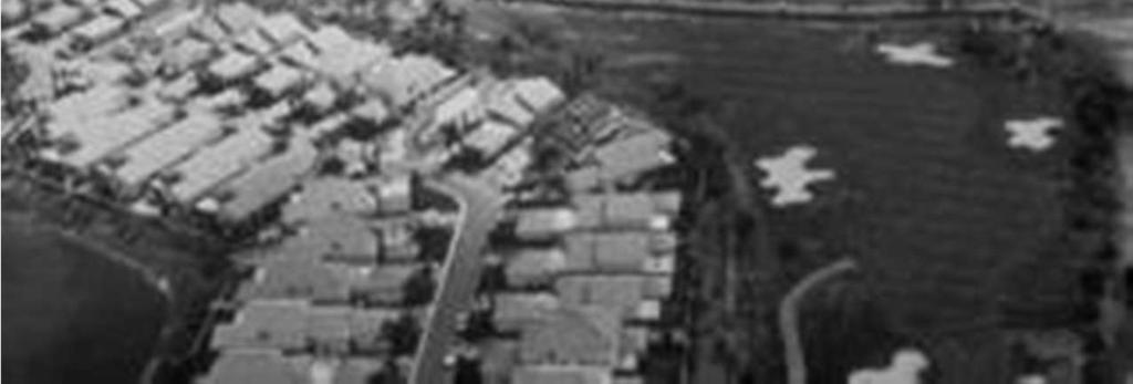
1 Preaching Utopia Dwelling: You are how you live Suburban Nation: The Rise of Sprawl and the Decline of the American Dream Andrea Duany, Platerz-Zyberk, et al. The cities will be part of the country; I shall live 30 miles from my office in one direction, under a pine tree; my secretary will live 30 miles away from it too, in the other direction, under another pine tree. We shall both have our own car. We shall use up tires, wear out road surfaces and gears, consume oil and gasoline. All of which will necessitate a great deal of work enough for all. -- Le Corbusier, The Radiant City (1967) Five Suburban Sprawl Elements 1. Strict Segregation 1. Housing subdivisions 2. Economic segregation 2. Shopping centers (note signs & architecture) 1. Strip malls 2. Car-centric 3. Office parks 4. Marginalized civic institutions: 5. Throughput Roadways 1. Collector Roads, Traffic (protect culdesacs) 2. Everything accommodates the car 3. High pavement/building ratio 4. Far-flung municipal services


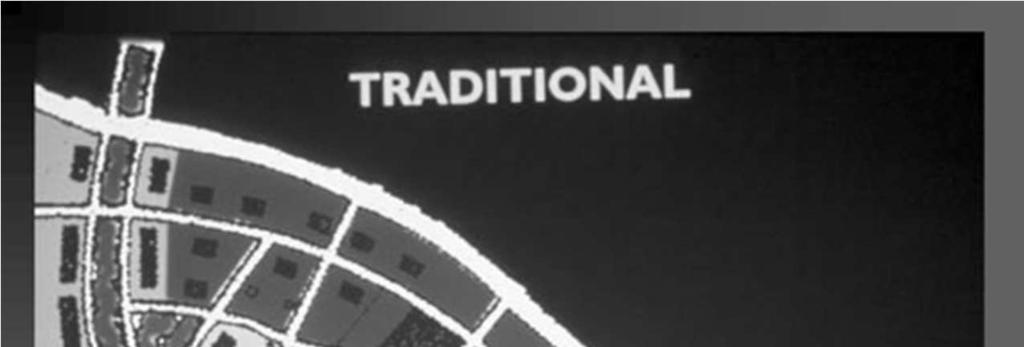
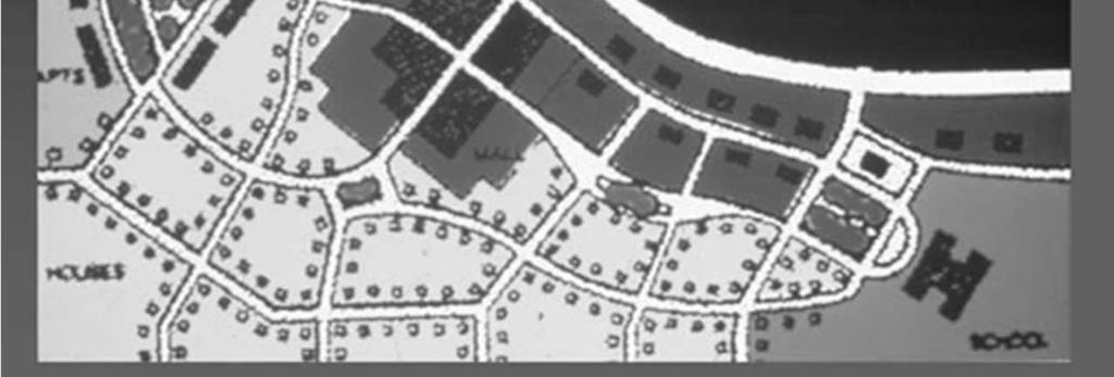
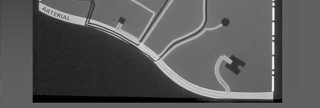
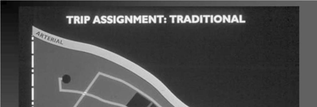
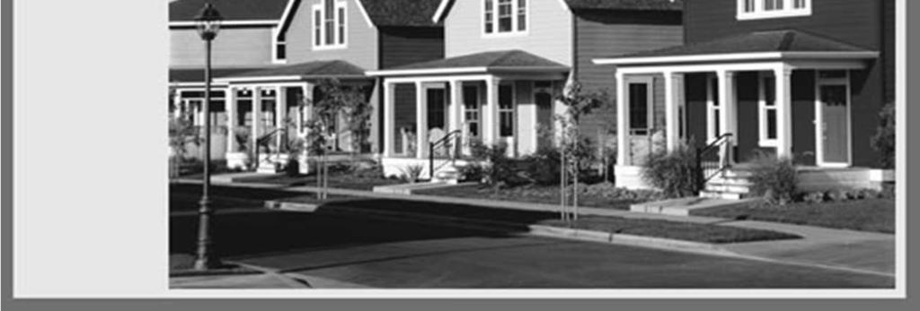
2 Traditional Neighborhood Design 1. Center for each neighborhood commerce, culture, governance villages, or grouped into towns and cities sustainable form of growth 2. Five-minute Walk living, walking, shopping 3. Street Network: web, grid; more interesting & useful Pedestrian-friendly Trees more than FHO s Fixed and Hazardous Objects 4. Narrow, versatile streets 5. Mixed use - size and relation to street controlled. Sprawl Exercise Recognizing Features of Sprawl Psychological & Ecological Consequences Sprawl vs. Traditional Town


3 Transformations: Suburban to Traditional Design


4 Street Network Origins of Sprawl Federal Housing Policies post WWII Interstate Highway Program Collusion to Kill Competition Psychology Ideal life/home: Private vs. Public Independence Trust in technology Whiz Kids Mobility


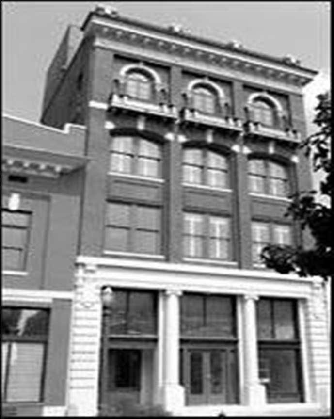
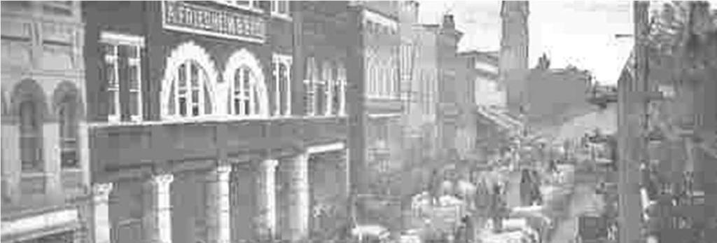
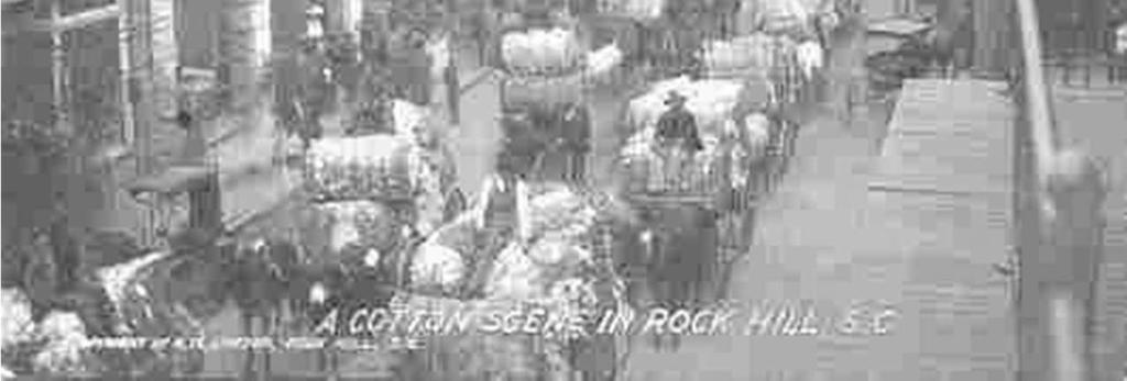
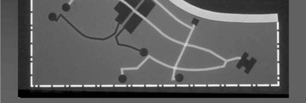
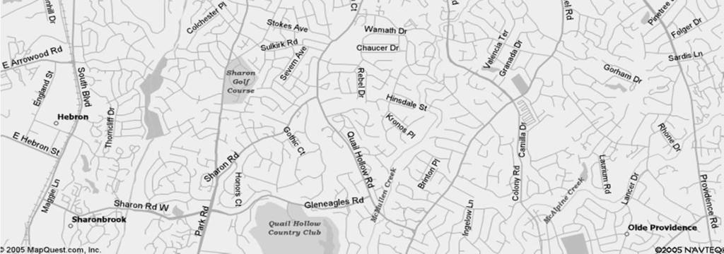
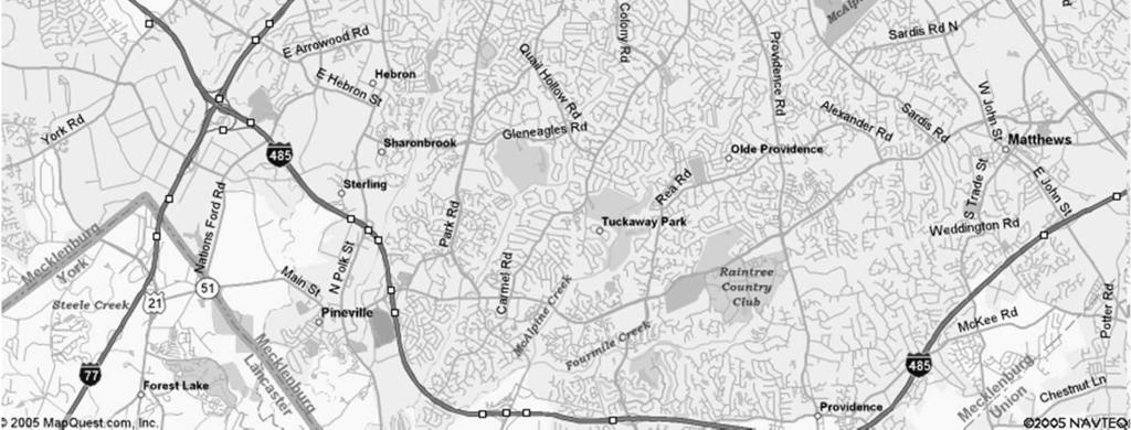
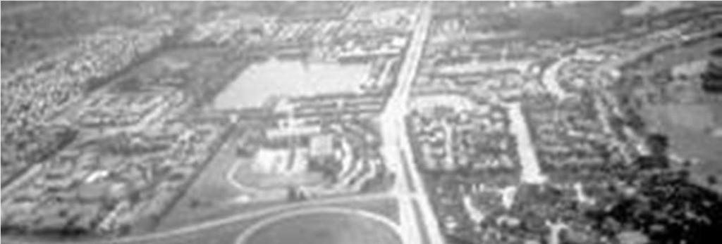
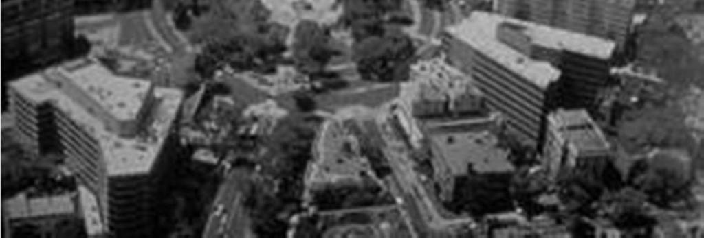
5 Historical Changes #1: Baltimore Historical Changes #2: Rock Hill, Downtown Rock Hill, Downtown, with People!


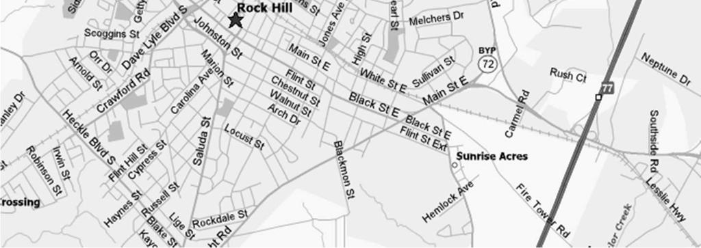
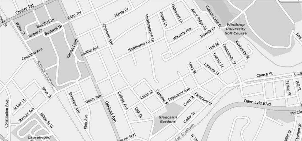
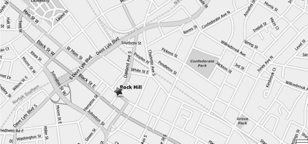
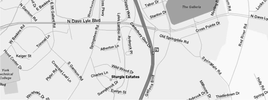
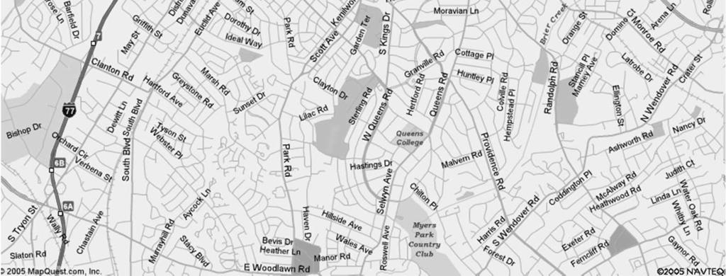
6 Railroad Defined Town Street Grid, Walkable Historical #3: Charlotte, NC??


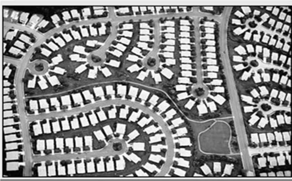

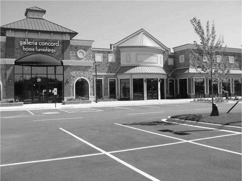
7 Examples of Sprawl Design mono-culture neighborhoods Economic Segregation Strip Malls Lots o Parking


")

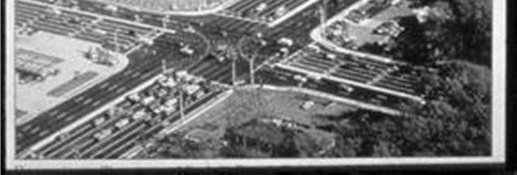
8 Mmm. Parking Home, Sweet Home! Sprawl moves on Office Parks Roads (Virginia Beach) Connector Road


9 Throughput! Sprawl Impacts Psychology: Depression, Anxiety Physical Health Obesity Ecological Health What would mimic approach dictate? Efficiency Synergy Mixed use Work with nature and space, not trying to conquer

10 (Neo-) Traditional Design Fighting the Car Infrastructure! Annapolis Maryland Charleston Traditional Design


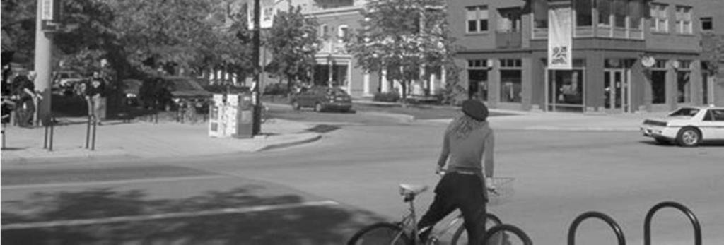


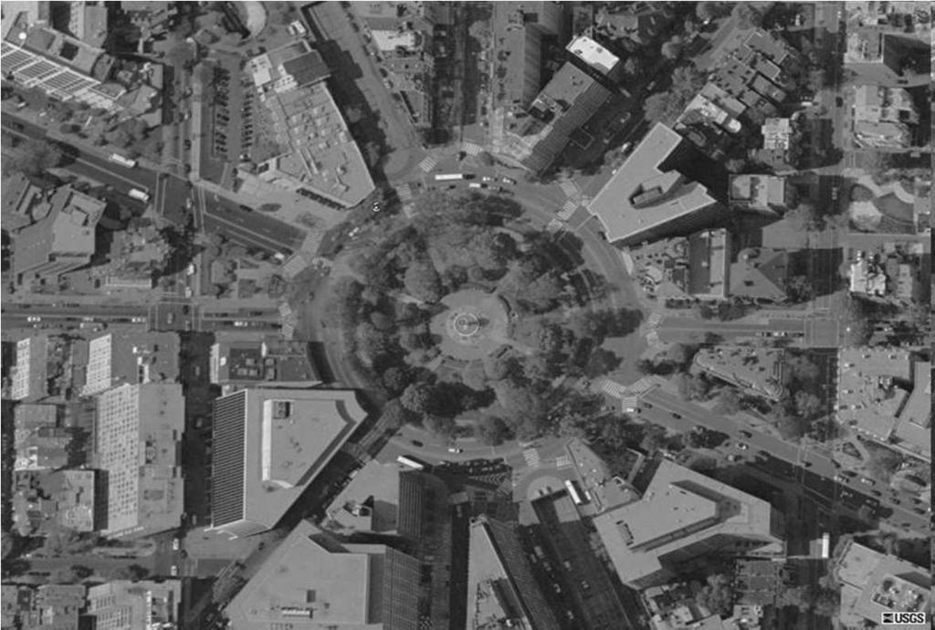
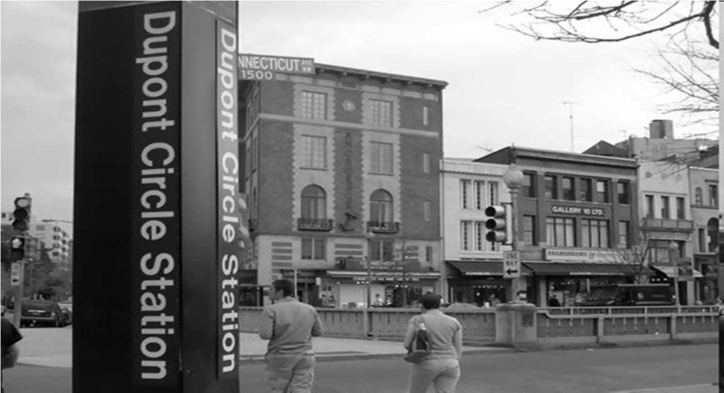
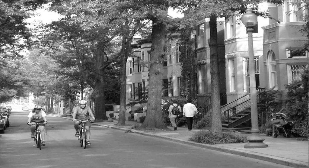
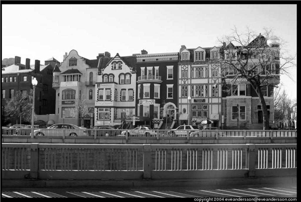
11 Alexandria Virginia Dupont Circle, Washington DC Neo-traditionalism


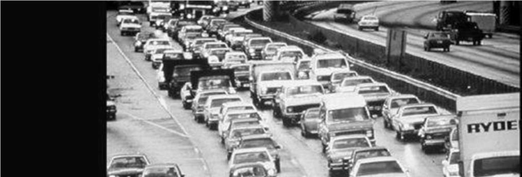
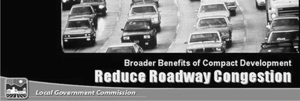
12 The benefits of density Density enables buses to replace cars


13


14


 vs.")

15 The Public Value Shift between Public and Private The Republic The Pub De-privation Space enables discourse and identity Lacking a physical framework conducive to public discourse, our family and communal institutions struggle to persist in our increasingly sub-urban surroundings. And suburban growth seems to have also drained much of the vitality from our inner cities, where a carless underclass finds itself with diminishing access to jobs and services. It doesn t have to be this way. xiii/101 Values and Identity Growth Increased size vs. increased richness of interactions Stupid growth can ruin American Dream Who are you? Private vs. public Private space (McMansions) vs. Public (town square) Physical framework conducive to public discourse (xiii) Freedom No restraints Capacity for rich experience Values and Identity Washington D.C. DuPont Circle Technological Innovation increases freedom car on open road decreases freedom traffic jam & asthma Tragedy of the Commons Aesthetics variety winding roads, wild buildings standardization Wild pigs anyone? Big headed ants? Song-birds? Ideal Organization Segregation Mixed: use, income, alleys Monoculture vs. Polyculture Poor be with you always? live with poor push poor away Houses starting in the low 300,000s


16

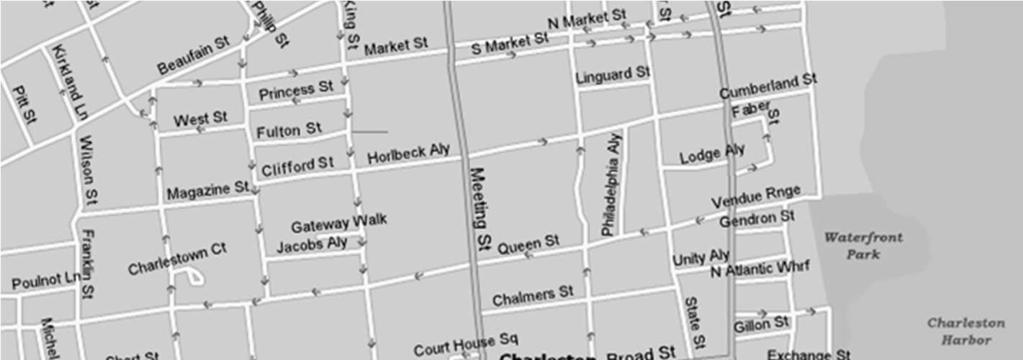
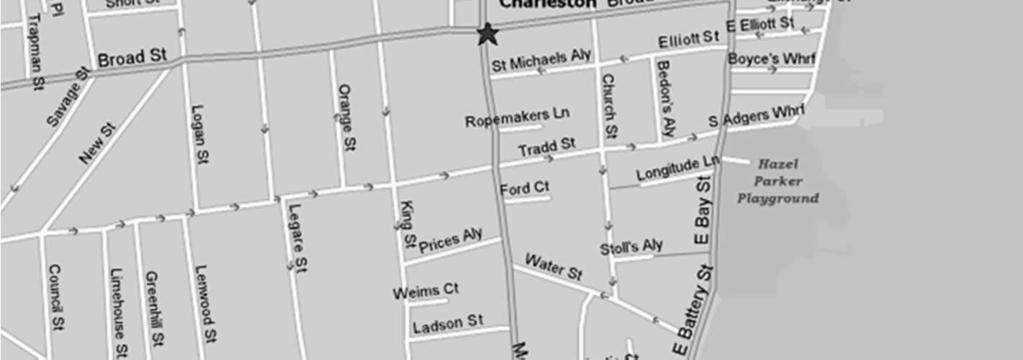
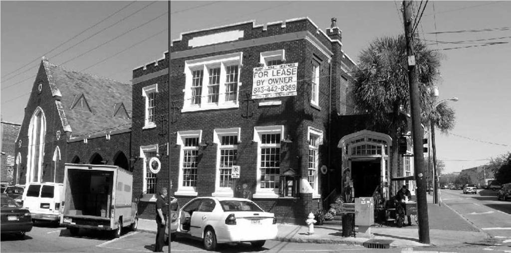
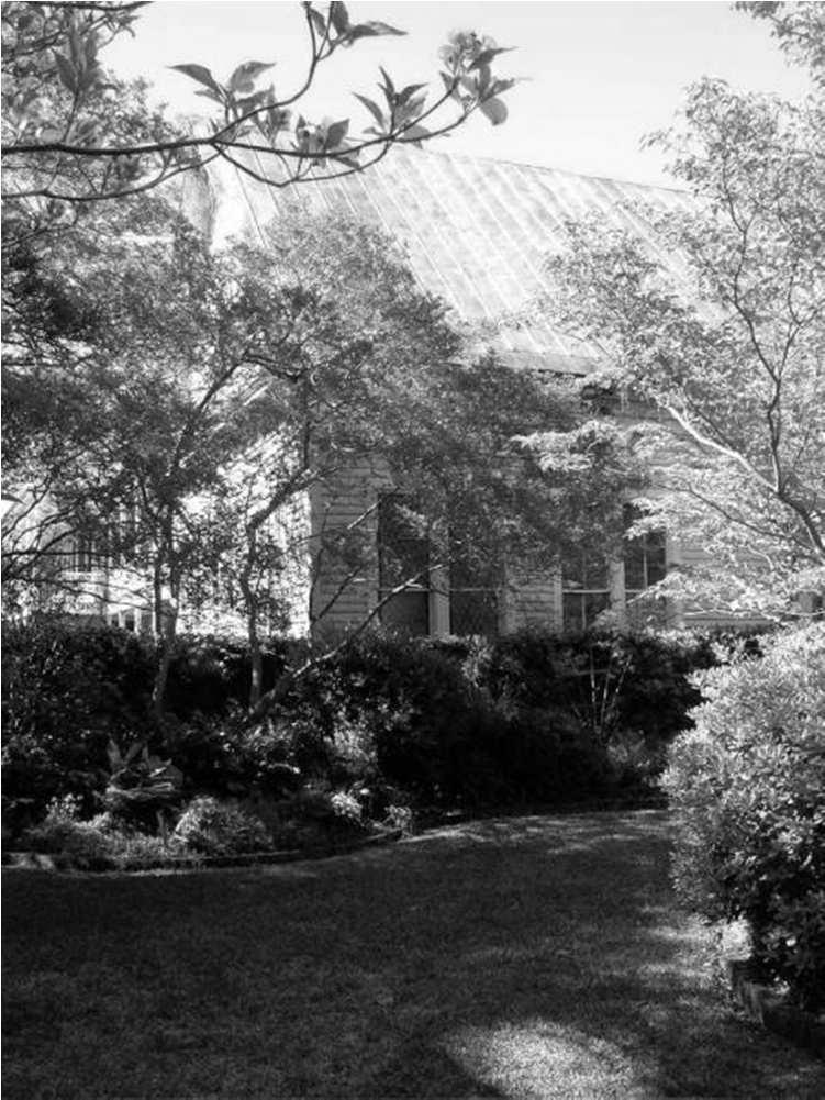
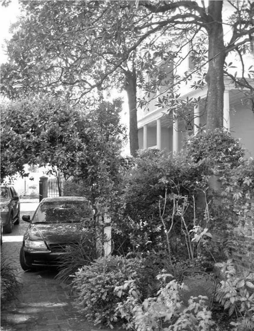
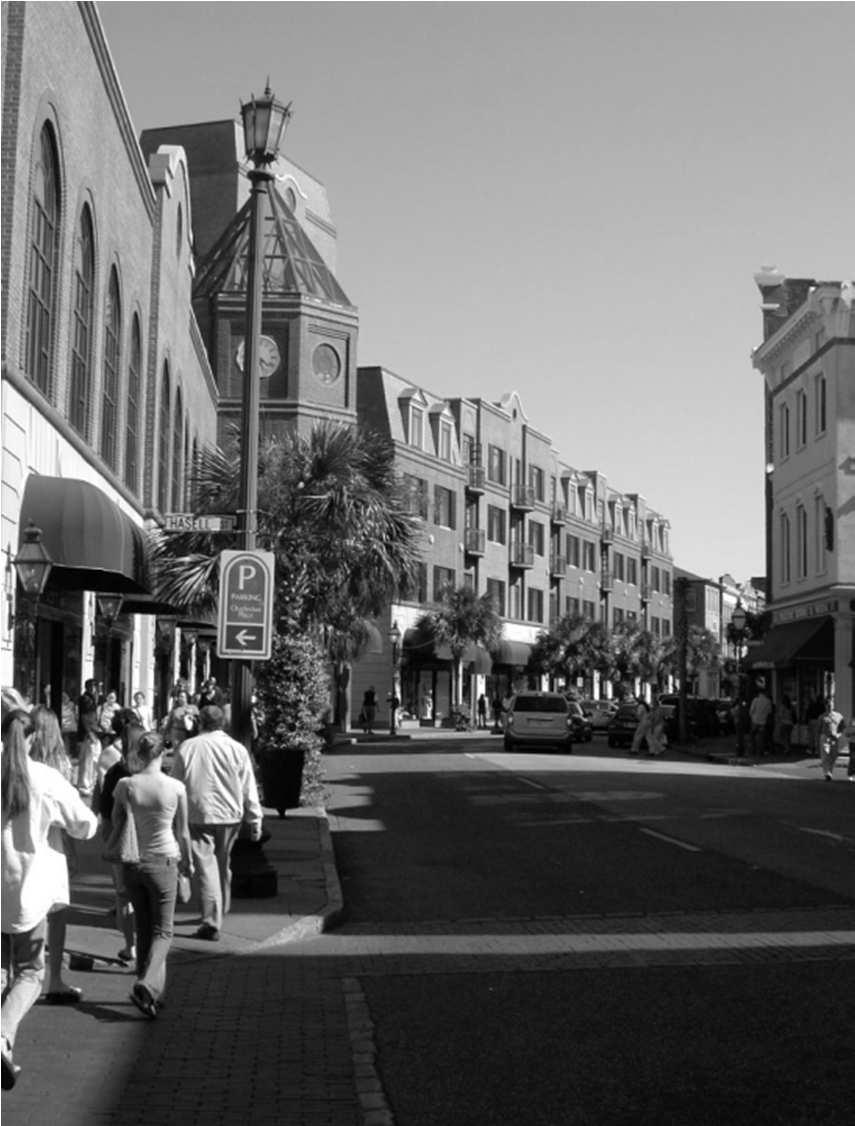
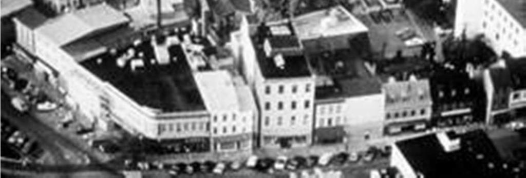
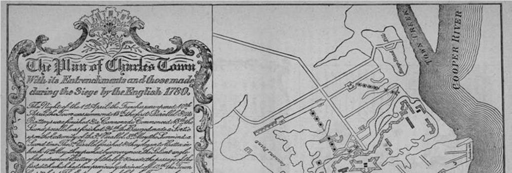
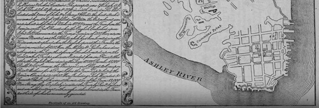
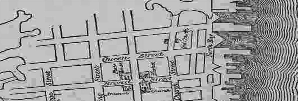
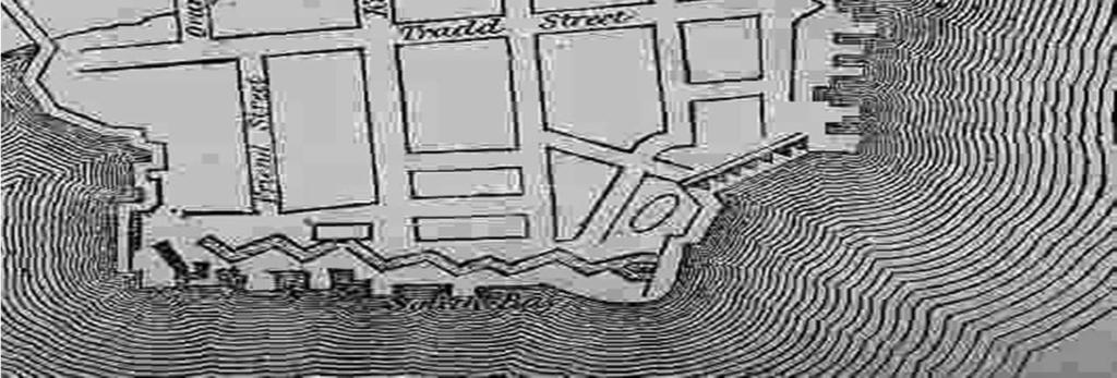
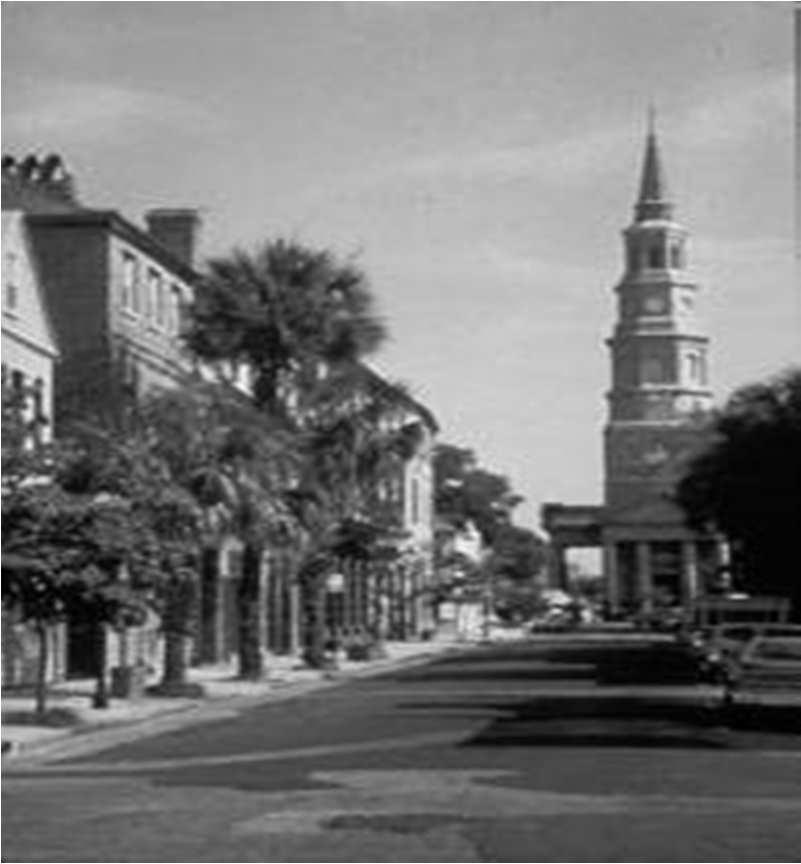
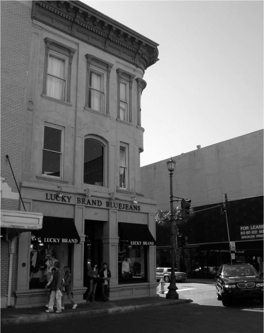
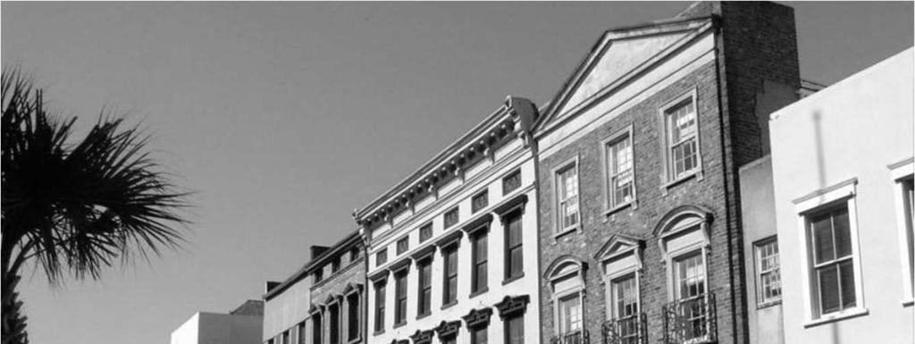
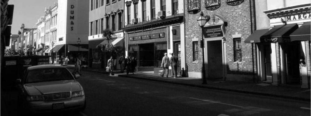
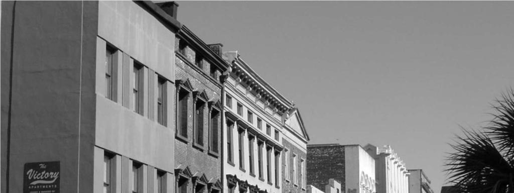
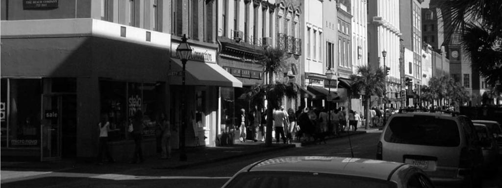
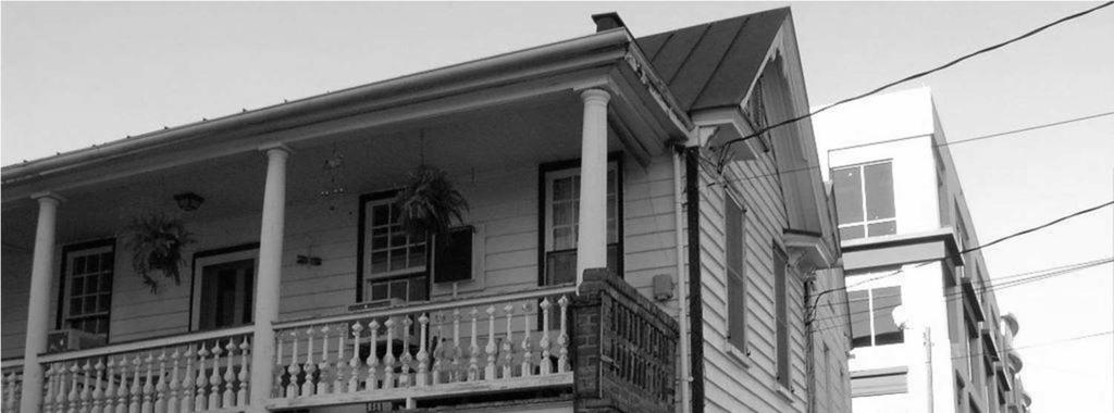
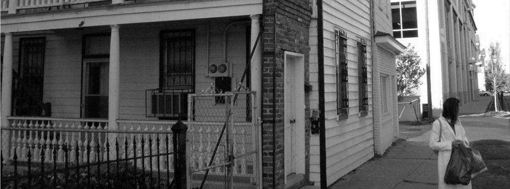
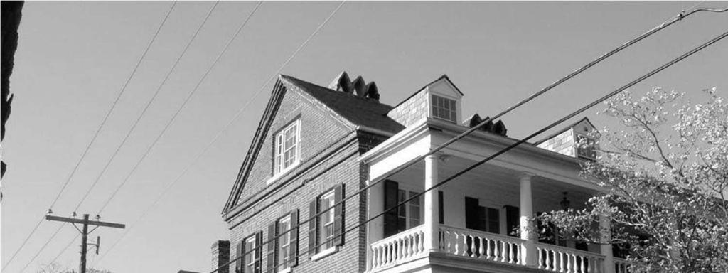
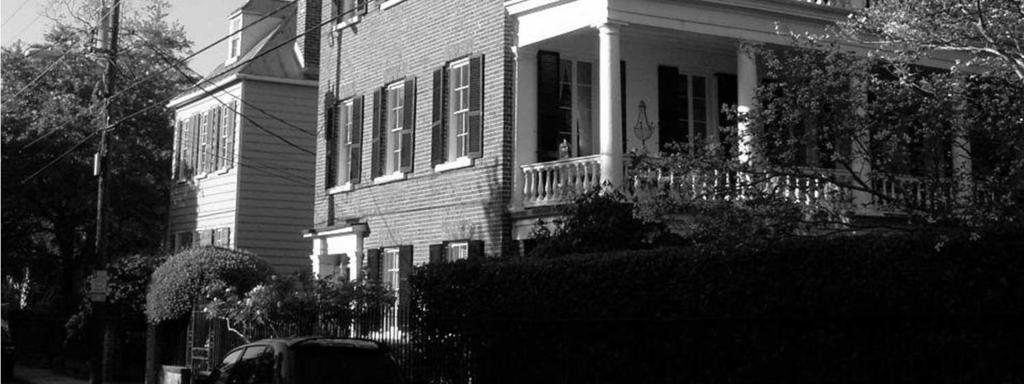
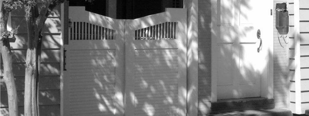
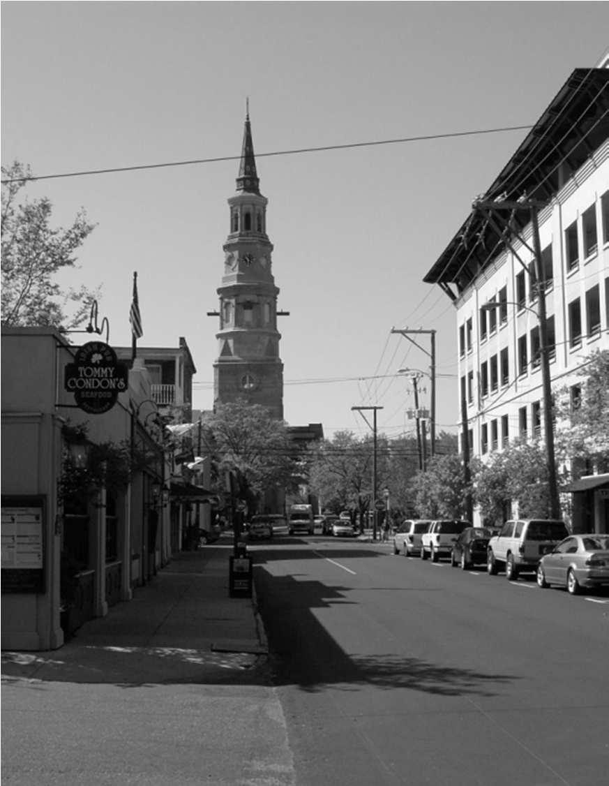
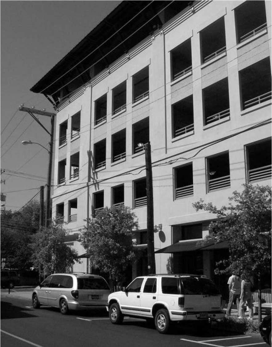
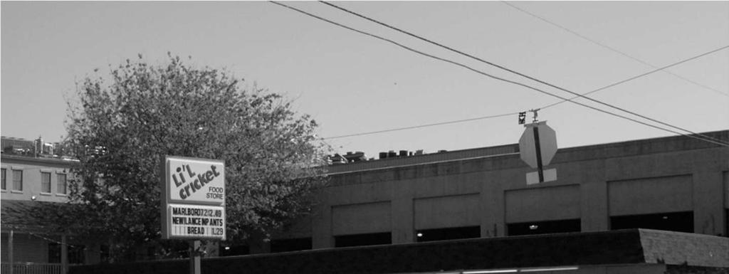
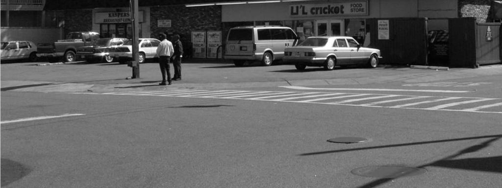
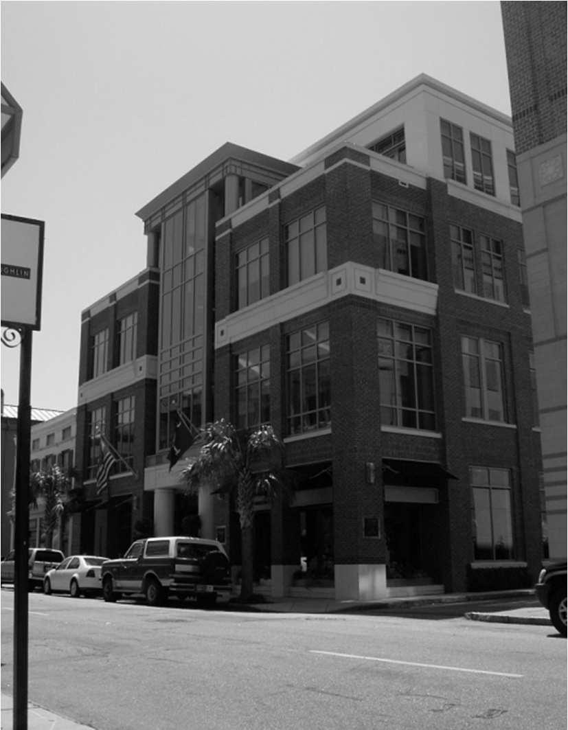
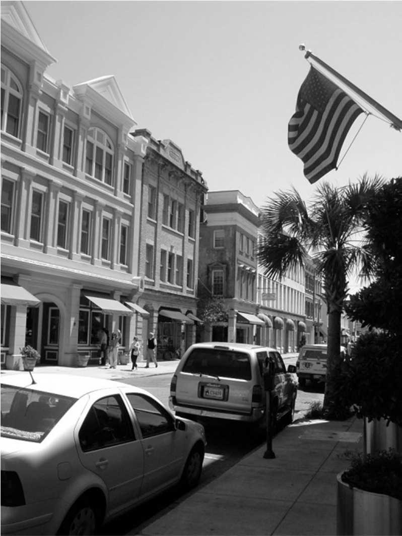
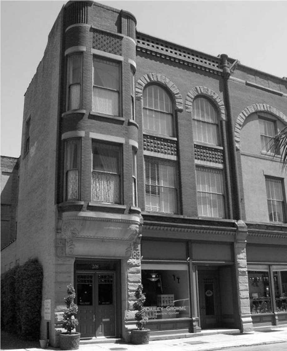
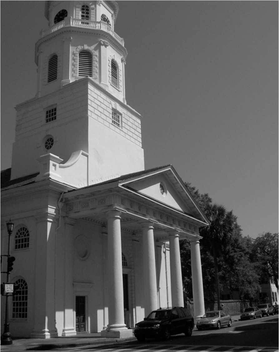
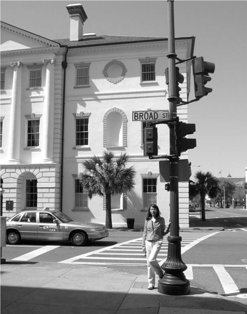
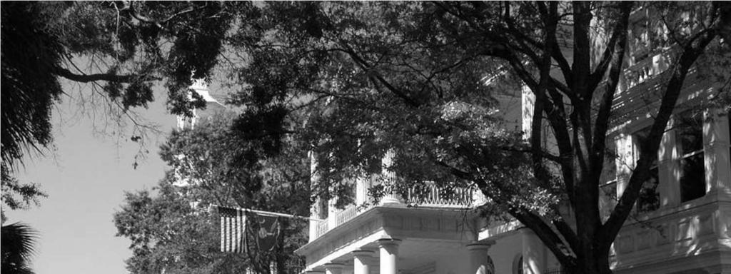
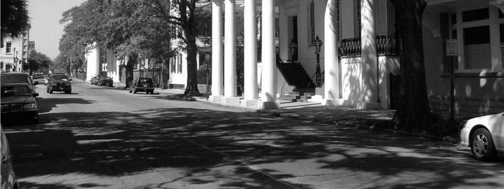
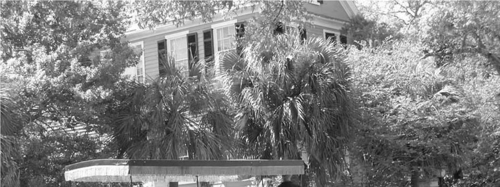
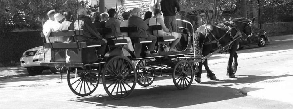
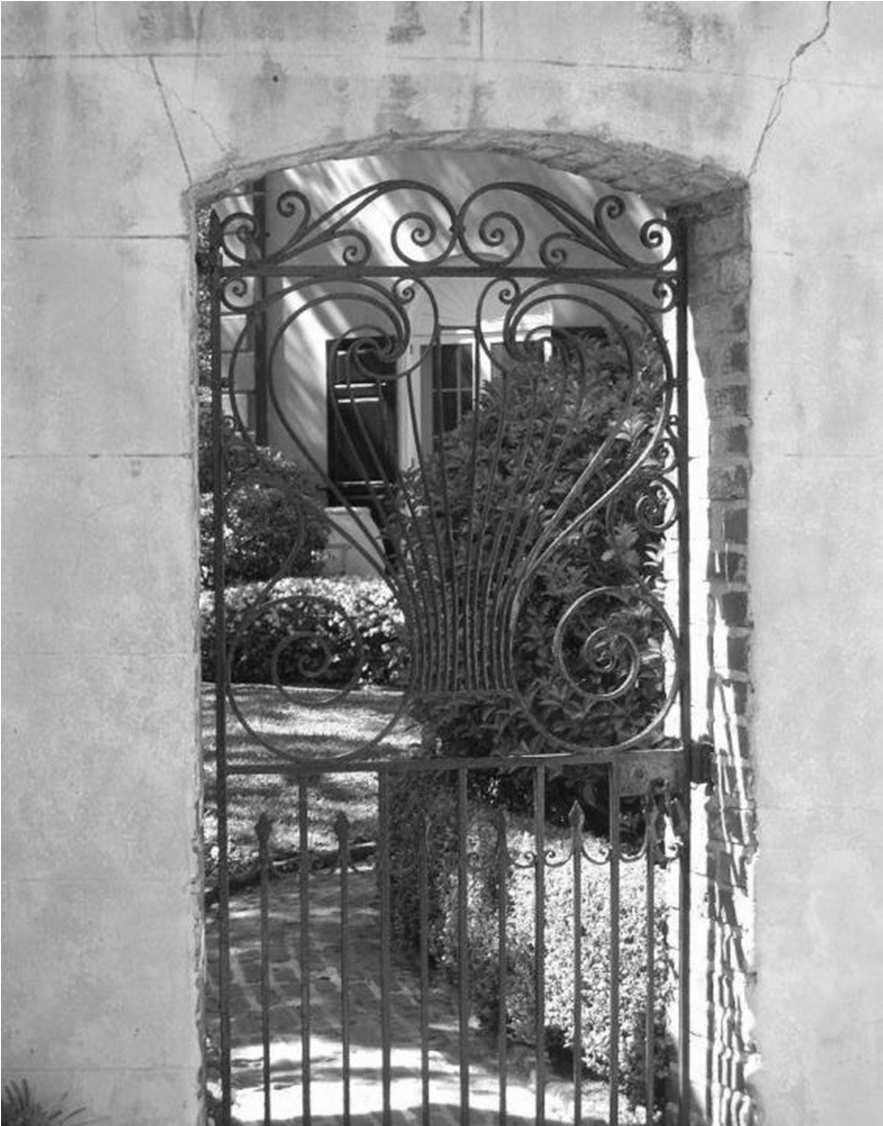
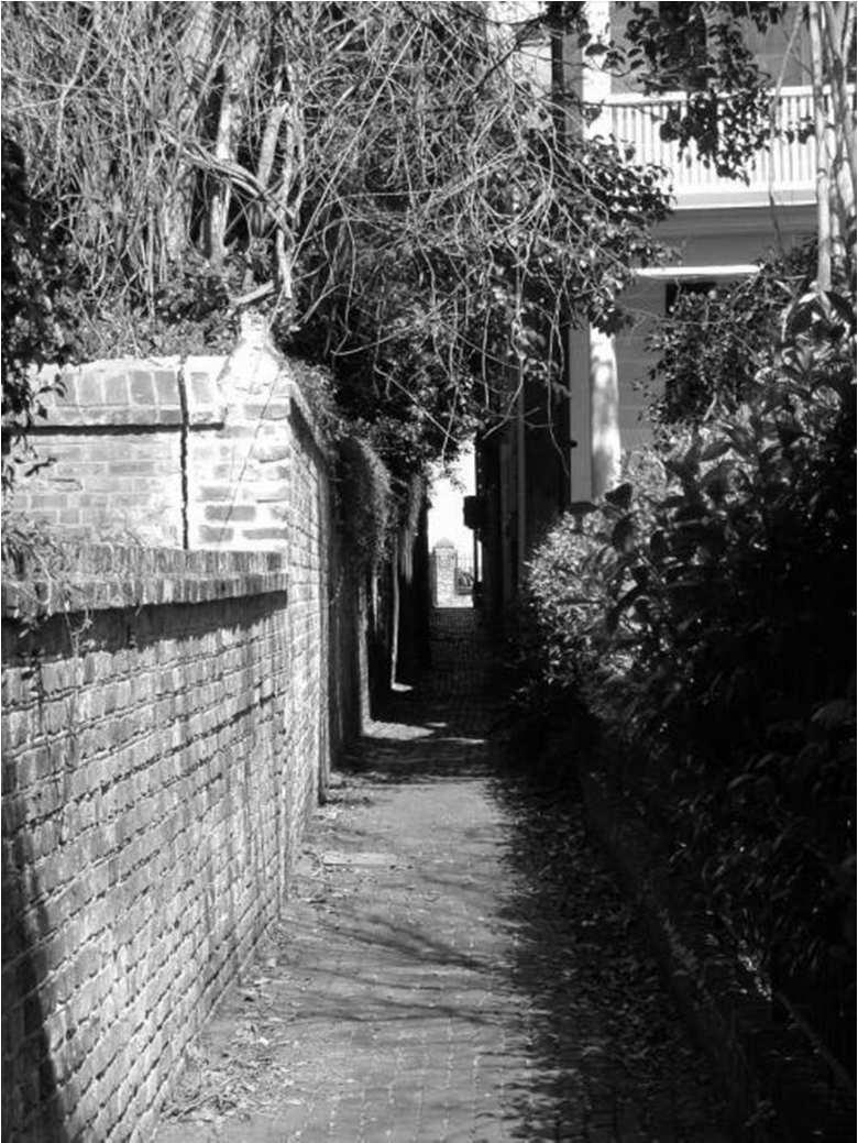
17 Photo Tour of Historic Charleston

18


19
20


21
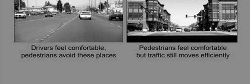
Aesthetics and Design
 University of Connecticut Department of Geography Urban and Regional Planning Lecture 8. Adjunct Lecturer: Donald J. Poland, MS, AICP E-mail: don@donaldpoland.com Web: www.donaldpoland.com Aesthetics and
Nader Obied Abd al raheem hathat. Dr. Farid S. Al-Qeeq
 Submit from Nader Obied Abd al raheem hathat Submit to Dr. Farid S. Al-Qeeq DEC. 2010 NEW URBANISM : is the most important planning movement this century, which emerged during the late 1980s and early
The Neighbourhood Unit
 DESIGN... Site Framework PROCESS IMPLEMENTATION 22 TOOL DESCRIPTION The neighbourhood unit is a holistic planning and design strategy that addresses the configuration of the major physical components of
Access Management: An Overview
 Figures 1-5 Below Evolution of development along a highway. In the early stages, land along the road is used for farming with little traffic generated. As time passes, the highway corridor becomes a de
Downtown Elkton Station Area Plan, Elkton, MD. Difficult enough to get support for new starts challenge to fund Houston transit
 Difficult enough to get support for new starts challenge to fund Houston transit More difficult to build Community Support for dense development at station areas Major Concerns: Traffic, Property values,
One of the components of the sustainable, traditional neighborhood is the neighborhood center.
 One of the components of the sustainable, traditional neighborhood is the neighborhood center. The neighborhood center defines a community s identity and is the place for events, leisure activities, public
Designing Walkable Urban Thoroughfares: A Context Sensitive Approach
 Designing Walkable Urban Thoroughfares: A Context Sensitive Approach Communities Want: Flexibility Compatibility with adjacent land uses Balanced land use/transportation functions Safe and attractive streets
Portland was a beautiful city, but in the 1960s and 1970s, its population grew very fast.
 4 Portland, Oregon, 1973 After reading Section 4, identify three challenges facing Portland in 1973. Record them in the boxes below. Draw a line from each box to the part of the city most affected by that
Places to Flourish: Principles of Placemaking for the New Economy. Townscape, Inc. Town Planning and Urban Design
 Places to Flourish: Principles of Placemaking for the New Economy Cultural and Economic Shifts: Cultural and Economic Shifts: The Creative Class Knowledge workers Bobos Awesome Talent Cultural and Economic
Price Tags. Silver Spring. Washington on Rail 2. Issue 97 / November 7, 2007
 Price Tags Issue 97 / November 7, 2007 Silver Spring Washington on Rail 2 METROHOODS Price Tags 95 explored two Washington neighbourhoods: one shaped by the electric streetcar in the 1890s (Cleveland Park),
There is a new architecture and urban design movement that addresses the ills of our current
 There is a new architecture and urban design movement that addresses the ills of our current sprawl development pattern and promotes the restoration of community and sustainable development practices.
Sustainable Urban Planning:
 Sustainable Urban Planning: A More Energy Efficient Lifestyle with a Return to the Walkable City Elizabeth Monterrosa Energy Law Spring 2009 emonterrosa@kentlaw.edu Walkable City v. Urban Sprawl European
Innovative Land Use Techniques
 Innovative Land Use Techniques A Handbook for Sustainable Development Eric Williams, Assistant Administrator, NHDES Carolyn Russell, Principal Planner, NHDES Cliff Sinnott, Executive Director, RPC Jill
Chapter 13 Learning Guide Urban Patterns
 Chapter 13 Learning Guide Urban Patterns Key Issue 4 Why Do Suburbs Face Distinctive Challenges? Pgs. 424 434 Urban Expansion 1. What is annexation? Process of legally adding land area to a city 2. What
Brian Madigan, RLA, CPESC Director Land Planning & Design
 Brian Madigan, RLA, CPESC Director Land Planning & Design bmadigan@gymodpc.com Architecture, Engineering & Land Surveying, DPC 18969 US Route 11 Watertown, New York 13601 T: (315) 788-3900 F: (315) 788-0668
Context Sensitive Solutions A Process to Achieve Better Results
 Context Sensitive Solutions A Process to Achieve Better Results Brian Bochner 1 Context Sensitive Solutions Collaborating with stakeholders to develop projects that meet their needs Stakeholders views
Pine Island Road Corridor Master Plan
 RECOMMENDED DEVELOPMENT PLAN Figure 9: Del Prado Village District Conceptual Framework The Conceptual Framework (Figure 8) for development of the Pine Island Corridor is to encourage mixed-use development
Ninth Square, New Haven Definition of Form-Based Zoning
 MIXED-USE AND FORM-BASED ZONING Connecticut Land Use Academy Hot Topics in Land Use Conference November 1, 2008 Timothy Bates* *Robert Sitkowski,, Esq., assisted with preparation materials Definition of
Creating Quality Places: Successful Communities by Design
 Creating Quality Places: Successful Communities by Design Communities across the metropolitan Kansas City area are growing. Our challenge is to shape future development in ways that will maintain and enhance
Transit Oriented Development. Overview
 Trammell Crow Residential Sean G. Hyatt, Managing Director Transit Oriented Development What is TOD? TOD in King County TOD Characteristics and Examples Veloce (Alexan Redmond TOD) About Trammell Crow
Living in Albemarle County s Urban Places
 Living in Albemarle County s Urban Places ALBEMARLE COUNTY, VIRGINIA A Closer Look at Albemarle s Approach to Managing Growth and Creating Quality Urban Environments www.albemarle.org Page 2 Living in
PROTOTYPE DESIGN/INTRODUCTION
 PART III: PROTOTYPE DESIGN These concepts and guidelines described earlier were used to develop a prototype design for an emerging suburban area located west of the City of Milwaukee. This was done to
Integrating Land Use and Transportation
 FEATURE Integrating Land Use and Transportation For years the transportation profession has emphasized mobility in the development of plans, programs, and projects. This emphasis on mobility moving people
Spatial Areas of Practice AICP EXAM REVIEW. February 20, 2009 Georgia Tech Student Center Gary A. Cornell, FAICP
 Spatial Areas of Practice AICP EXAM REVIEW February 20, 2009 Georgia Tech Student Center Gary A. Cornell, FAICP Acknowledgement Thanks to Mary M. Shaw, AICP Planning at the National Level Federalism in
Chapter 1 - General Design Guidelines CHAPTER 1 GENERAL DESIGN GUIDELINES
 CHAPTER 1 GENERAL DESIGN GUIDELINES 1.0 INTRODUCTION This Publication has been developed to provide current, uniform procedures and guidelines for the application and design of safe, convenient, efficient
Place Making: Two Decades Town Centers of New Urban Retail. Dr. Charles C. Bohl, University of Miami
 Place Making: Two Decades Town Centers of New Urban Retail Dr. Charles C. Bohl, University of Miami Two slide history of U.S. settlement and development Pre-20th century U.S. - a nation of cities, towns,
Subregion 4 Central Avenue-Metro Blue Line Corridor Transit-Oriented Development (TOD) Implementation Project. Community Meeting April 27, 2011
 Implementation Project. Community Meeting April 27, 2011") Subregion 4 Central Avenue-Metro Blue Line Corridor Transit-Oriented Development (TOD) Implementation Project Community Meeting April 27, 2011 Overview Introduction to Subregion 4 TOD Implementation Program
Subregion 4 Central Avenue-Metro Blue Line Corridor Transit-Oriented Development (TOD) Implementation Project Community Meeting April 27, 2011 Overview Introduction to Subregion 4 TOD Implementation Program
Envision Front Royal Workshop 1 of 2
 Envision Front Royal Workshop 1 of 2 September 12, 2013 Summary The Envision Front Royal project held the first of two public workshops on September 12, 2013. The purpose of the workshop was to evaluate
Introduction and Overview
 Introduction and Overview Articulate local values and priorities Guide land use and development decisions Coordinate transportation, infrastructure, and City services with expected growth and available
Improve Neighborhood Design and Reduce Non Point Source Water Pollution
 HOW TO Planning Guide Improve Neighborhood Design and Reduce Non Point Source Water Pollution This document was funded by a grant from the New Hampshire Coastal Program with funding from the National Oceanic
Land Use & Transportation Primer
 Land Use & Transportation Primer Presented By Smitha Vijayan Center for Urban Transportation Studies University of Wisconsin-Milwaukee Role of Local Government Land use decision-making power mostly given
New Town Mixed Use District
 New Town Mixed Use District Montgomery County Planning Commission 2009 Annual Conference PA Chapter of the American Planning Association October 6, 2009 What is NTMU? More urban style of development Complementary
THE POLICY FRAMEWORK FOR WALKABLE COMMUNITIES. Community Technical Assistance Program Building Active Communities Institute March 2016
 THE POLICY FRAMEWORK FOR WALKABLE COMMUNITIES Community Technical Assistance Program Building Active Communities Institute March 2016 ACTIVE COMMUNITIES BACK THEN ACTIVE COMMUNITIES BACK THEN Lifestyle
Section 9 NEIGHBORHOOD DESIGN
 Section 9 NEIGHBORHOOD DESIGN City of Lancaster Comprehensive Plan D u n k i n, S e f k o & A s s o c i a t e s, I n c. NEIGHBORHOOD DESIGN INTRODUCTION There are many ways in which a neighborhood can
Unique. Livable. Connected. Sustainable. Anticipate and Manage Change. Variety of Housing Choices. Enhanced Arterial Corridors
 Neighborhood Vision The Old Town Neighborhoods are Unique, Livable, Connected, and Sustainable. As mature, established neighborhoods, many of the ideas and opportunities expressed by stakeholders in support
CHAPTER 3 VISION, GOALS, & PLANNING PRINCIPLES. City of Greensburg Comprehensive Plan. Introduction. Vision Statement. Growth Management Goals.
 CHAPTER 3 VISION, GOALS, & PLANNING PRINCIPLES Introduction The Greensburg Comprehensive Plan is intended as a working community document. A combination of long and short-term goals, this document is intended
CONTEXT: the Highway, the River + the Railroads run through us.
 CONTEXT: the Highway, the River + the Railroads run through us. I-25 36 In the past they have divided us, now we have an opportunity to unite us. I-76 I-270 I-76 CSU I-25 LEGEND Cut + Cover River North
10/19/2016. Chapter 22 Lecture Outline Urbanization. Urbanization and Sustainable Cities. Outline
 Chapter 22 Lecture Outline Urbanization 1 Urbanization and Sustainable Cities 2 Outline Urbanization Push and Pull Factors Urban Challenges in the Developing World Urban Challenges in the Developed World
Retrofitting Suburbs Ellen Dunham-Jones, Architecture Program, Georgia Institute of Technology
 We stand for the restoration of existing urban centers and towns within coherent metropolitan regions, the reconfiguration of sprawling suburbs into communities of real neighborhoods and diverse districts,
Repositioning Suburban Corridors: From Souless Strips to Something Better
 Repositioning Suburban Corridors: From Souless Strips to Something Better Moderator: Ed McMahon, Urban Land Institute Presenters: Takis Karatonis, Columbia Pike Revitalization Organization Mike Hallibaugh,
CHAPTER 3. Growth Management
 CHAPTER 3 Growth Management Photo courtesy of J. Sinclair Photography/Visit Winston-Salem Chapter 3. Growth Management Plan Goal: Manage growth and development to reduce sprawl, create a more compact and
Linking Land Use and Transportation
 Linking Land Use and Transportation NJ s Experience January 18, 2006 NYMTC - PFAC Mark Stout Planning & Development New Jersey Department of Transportation Where We Are Los Angeles, CA San Francisco, CA
1 Adapted from the Statewide Transit-Oriented Development Study by CalTrans, 2006
 APPENDIX C: LAND USE PLANNING FOR ENHANCED RAIL SERVICE 72 BACKGROUND One of the consistent themes heard from localities in the Route 29 corridor Planning Forums was the need for expanding rail service
South Meridian. Vision. Action
 South Meridian Vision Action Table of Contents Introduction... 1 Goal of the Vision Process...1 This is a really big deal!...1 A foreword thought...2 The Process... 2 Description of the Workshop Game...3
Transportation Land Use Integration & Regional Planning. Don Kostelec, AICP Senior Planner, Louis Berger Group February 1, 2010
 Transportation Land Use Integration & Regional Planning Don Kostelec, AICP Senior Planner, Louis Berger Group February 1, 2010 Transportation Land Use Integration DOT-HUD-EPA Sustainable Communities Initiative
U T D N o r t h C a m p u s T O D and D o w n t o w n D e n t o n T O D
 U n i v e r s i t y o f T e x a s a t D a l l a s C i t y o f R i c h a r d s o n U T D N o r t h C a m p u s T O D and D o w n t o w n D e n t o n T O D Rick Leisner, AICP Assistant Director of Development
Chapter 22 Cities and Sustainability
 Chapter 22 Cities and Sustainability The city is not an ecological monstrosity. It is rather the place where both the problems and the opportunities of modern technological civilization are most potent
Dwelling Units Max 12 dwelling units per acre/min 8 dwelling units per acre. Development Mix 80% non residential/20% residential
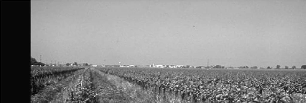
 13. OSTEEN LOCAL PLAN Background: The Osteen Local Plan area is located in southwest Volusia County along the SR 415 corridor between Lemon Bluff Road and Acorn Lake Road and includes 3,990 acres. The
One said, without a clear understanding of what will be annexed, this is an exercise in futility.
 Stakeholder Focus Groups: Summary of Meetings Stakeholder Focus Group meetings were held on at the Pinellas County Planning Department conference room. Focus Group meetings will be held during each of
Proposed Comprehensive Plan Strategies DRAFT for discussion June 28, 2017
 Proposed Comprehensive Plan Strategies DRAFT for discussion June 28, 2017 Land Use Rural Areas Refine the Farm and Forest area (FF) Update FF boundaries to account for existing lots less than five acres
A Unified Auckland The challenge of developing transport based Design Standards for the Auckland Region
 A Unified Auckland The challenge of developing transport based Design Standards for the Auckland Region Chris Beasley Principle Technical Specialist, PMO Section 1 Recap on formation of Auckland Transport
SQUAMISH 2010 AND BEYOND COMMUNITY VISION
 Our plan has been imagined and created to be both pragmatic and visionary. At the core of the strategy is a consideration of the highway s role and its impact on the community. First and foremost in creating
Courtice Main Street Study Community Vision Workshop PLANNING SERVICES DEPARTMENT
 Courtice Main Street Study Community Vision Workshop PLANNING SERVICES DEPARTMENT July 22, 2009 Tonight s Meeting 7:00 pm Introduction David Crome, Director of Planning 7:05 Presentation Stasia Bogdan,
Draft for Public Review. The Market and Octavia Neighborhood Plan
 Draft for Public Review The Market and Octavia Neighborhood Plan San Francisco Planning Department As Part of the Better Neighborhoods Program December 2002 IOverview Why Plan a Better Neighborhood Here
Lesson 6. Corridor Planning
 Lesson 6 Corridor Planning 1 Learning Outcomes Identify land use strategies and solutions that can be incorporated into multimodal transportation corridor plans Identify land use stakeholders and describe
Downtown Huntersville in 2030
 Downtown Huntersville in 2030 In 2030 Huntersville s Downtown will be a thriving, mixed-use town center with a variety of housing types (single-family, townhomes, live-work, and apartments), retail establishments,
TOD 203 CORRIDOR PLANNING and TOD
 2 CORRIDOR PLANNING and Scales of What You Will Learn The Transit Corridor Types of Corridors Objectives and Strategies for Transit and at the Corridor Level Main Street Corridor Planning and Your Trainers
Transportation Working Team Duane Diggs, Co-Chair (VOICE Buffalo) Kelly Dixon, Co-Chair (GBNRTC) Paul Ray, Facilitator (UB Regional Institute)
 Kelly Dixon, Co-Chair (GBNRTC) Paul Ray, Facilitator (UB Regional Institute)") towards a more sustainable Buffalo Niagara Transportation Working Team Duane Diggs, Co-Chair (VOICE Buffalo) Kelly Dixon, Co-Chair (GBNRTC) Paul Ray, Facilitator (UB Regional Institute) Agenda Welcome,
towards a more sustainable Buffalo Niagara Transportation Working Team Duane Diggs, Co-Chair (VOICE Buffalo) Kelly Dixon, Co-Chair (GBNRTC) Paul Ray, Facilitator (UB Regional Institute) Agenda Welcome,
Warren County/Bowling Green Focus 2030 Comprehensive Plan VOLUME 1 INDEX
 Appendix 5: Index VOLUME 1 INDEX A Aesthetics ES-6, FLU-15, FLU-17, FLU-24, NCR-7 Agricultural Base FLU-18, FLU-20 Agricultural Centers, Rural FLU-11 Agricultural District NCR-17-NCR-18 Agricultural Economy
2018 Northampton Township Comprehensive Plan
 2018 BUCKS COUNTY, PENNSYLVANIA What is a? A comprehensive plan is a municipality s main policy document that details the collective vision for the future, the historic, environmental, and cultural facilities
NEW CASTLE COUNTY S ZONING DISTRICTS
 NEW CASTLE COUNTY S ZONING DISTRICTS This is general information about New Castle County s zoning districts. The information included is by no means exhaustive or complete. Before designing plans to develop
Defining and Measuring the Sustainable Transportation Network
 Defining and Measuring the Sustainable Transportation Network Andrew Gast-Bray Norm Marshall Kevin Tilbury Scott McCarey Fred Dock Norman Garrick Ellen Greenberg What is a Network? A structure that serves
THE 355/270 CORRIDOR:
 THE 355/270 CORRIDOR: Strategic Ideas for Sustaining a Livable Work Place Project Summary ACCESS LIFE DESIGN HEALTH WORK Montgomery County Planning Department The Maryland-National Capital Park and Planning
Broadway District Specific Plan. Community Workshop #2 February 23,2016
 Broadway District Specific Plan Community Workshop #2 February 23,2016 1 Agenda Introductions Project Progress Status Upcoming Milestones Emerging Framework Land Use Urban Design Circulation Infrastructure
Creve Coeur is well known
 2.0 Vision Creve Coeur is well known throughout the region as a very desirable place for businesses and residents alike. Reinvestment in new homes and large commercial projects demonstrate the strong demand
DOWNTOWN JACKSONVILLE MASTER PLAN S T R E E T H I E R A R C H Y
 DOWNTOWN JACKSONVILLE MASTER PLAN S T R E E T H I E R A R C H Y Gateway Intra-District Business Inter-District 44 CELEBRATING THE RIVER: A PLAN FOR DOWNTOWN JACKSONVILLE The Transportation Network This
DRAFT. Urban Development Areas Fairfax County. UDA Needs Profile: Tysons Corner 13% Location Characteristics. Socio-Economic Characteristics
 14 Urban Development Areas Fairfax County UDA Needs Profile: Tysons Corner Tysons Corner is located in Fairfax County, surrounded by the town of McLean to the east and Vienna on the west along I-495, the
III - design standards
 III - design standards The Circulation Classification and Character section of the Design Standards chapter prescribes the types of circulation routes, the location of the circulation routes, the connections
Ch. 13 Urbanization. Global urbanizing trends 2/9/2016. Our urbanizing world. Central Case: Managing growth in Portland, Oregon
 Ch. 13 Urbanization Central Case: Managing growth in Portland, Oregon Oregon residents feared sprawling development would ruin their communities Urban Growth Boundaries (UGBs) allow development in urban
SAFETY AND CONNECTIVITY IN A PLANNED COMMUNITY
 DALE CITY TLC SAFETY AND CONNECTIVITY IN A PLANNED COMMUNITY PROJECT KICKOFF MEETING MARCH 7, 2016 AGENDA 1. Introductions 2. Project Overview 3. Discussion 4. Site Visit PROJECT KICKOFF MEETING MARCH
The Need to Develop a Transit Ready Community
 Evaluation & Appraisal Report (EAR) Major Issue # 6 The Need to Develop a Transit Ready Community July 3, 2007 EAR Major Issue # 6 Transit Ready Existing Comp Plan policies apply only to Indiantown Road:
Northwest Rail Corridor and US 36 BRT Development Oriented Transit Analysis 4.4 STATION AREA FINDINGS
 4.4 STATION AREA FINDINGS Each station is different, and each one requires a separate set of recommendations based on the vision for the site. This section outlines an initial TOD strategy and recommendations
What. - Civic anchors including a park and an updated library branch
 SUMMARY What Master Plan aimed at delivering - A walkable, mixed-use downtown in the heart of University City anchored by UNC Charlotte and University Research Park - Civic anchors including a park and
II. SINGLE FAMILY RESIDENTIAL
 II. SINGLE FAMILY RESIDENTIAL Castle Rock is made up of numerous individually built houses and subdivision tracts that have been developed during the past century. Some of the tracts are diverse in architectural
SOUTH FLORIDA TOD GRANT UPDATE
 Palm Beach Transportation Planning Agency October 2018 SOUTH FLORIDA TOD GRANT UPDATE Presented by Treasure Coast Regional Planning Council in partnership with SFRTA & SFRPC What is Transit Oriented Development
What s in a Name Sustainability, Smart Growth, New Urbanism
 What s in a Name Sustainability, Smart Growth, New Urbanism Published in the Summer 2011 Issue of APA s The Commissioner Pete Pointner FAICP Planning commissioners frequently hear abstract terms bantered
Shifting Paradigms Urban Planning and Town Center Development in the United States
 Timothy H. Haahs PE, AIA April 20, 2010 Shifting Paradigms Urban Planning and Town Center Development in the United States Urban Life "The street is the river of life." Trends / 국민일보 2010 년 3 월 1 일자발췌
CHAPTER 7: Transportation, Mobility and Circulation
 AGLE AREA COMMUNITY Plan CHAPTER 7 CHAPTER 7: Transportation, Mobility and Circulation Transportation, Mobility and Circulation The purpose of the Transportation, Mobility and Circulation Chapter is to
City of Le Sueur DOWNTOWN MASTER PLAN
 City of Le Sueur DOWNTOWN MASTER PLAN City Council Update 9/11/2017 Hoisington Koegler Group Inc. Presentation Agenda 01 Schedule Update / Tonight s Objectives 02 What We ve Heard - Engagement Comments
Active Neighbourhoods Canada SUMMARY REPORT
 Prepared by the Toronto Centre for Active Transportation JUNE 2017 Active Neighbourhoods Canada SUMMARY REPORT OF 4 ONTARIO PROJECTS Sharing participatory methods in Ontario Active Neighbourhoods Canada
Belt Line Corridor Vision
 Vision BACKGROUND Belt Line Road is Addison s Main Street. Until recently it was one of the strongest restaurant and retail corridors in the region. However, due to competition from other communities to
1.0 Circulation Element
 5/9/18 1.0 Circulation Element 1.1 Introduction As growth and development occur in Apache County, enhancements to its circulation system will be necessary. With time, more roads will be paved and air and
The "Town Center" Model of Suburban Placemaking: Opportunities and Challenges
 The "Town Center" Model of Suburban Placemaking: Opportunities and Challenges Dr. Tim Chapin Department of Urban & Regional Planning Florida State University What Are Town Center Communities? Town Center
Tacoma Mall Neighborhood Subarea Plan & EIS. Planning Commission January 18, 2017
 Tacoma Mall Neighborhood Subarea Plan & EIS Planning Commission January 18, 2017 Objectives Develop one or more options for connectivity requirement What is the intent? Key considerations Range of options
Status Update (2006 vs. Now) Citizen s Advisory Committee February Plan for Prosperity
 Citizen s Advisory Committee February Plan for Prosperity") Status Update (2006 vs. Now) Citizen s Advisory Committee February 2018 Plan for Prosperity 2000 2017 2000 2017 Gardnerville Population 6,000 5,760 5746 5,500 5,000 5,067 5,550 5,165 5,394 5,412 5,250
Status Update (2006 vs. Now) Citizen s Advisory Committee February 2018 Plan for Prosperity 2000 2017 2000 2017 Gardnerville Population 6,000 5,760 5746 5,500 5,000 5,067 5,550 5,165 5,394 5,412 5,250
Anatomy of A Vibrant Downtown. Anatomy of a Vibrant Downtown
 Anatomy of A Vibrant Downtown The goal of MAIN ST. REVITALIZATION PLANNING is to provide a framework that will help transform your downtown into a VIBRANT DOWNTOWN a place where people love to LIVE, WORK,
Regional Context Statement
 Regional Context Statement REGIONAL CONTEXT STATEMENT 3. REGIONAL CONTEXT STATEMENT In 1995, the Provincial Government passed into law the Growth Strategies Act. The purpose of this provincial initiative
California Preservation Foundation Historic Context Statements HISTORIC RESOURCES GROUP
 California Preservation Foundation Historic Context Statements WHAT IS A HISTORIC CONTEXT STATEMENT? In order to understand the historic significance of resources in a given area, it is necessary to examine
What Does It Take To Create A Town Center?
 What Does It Take To Create A Town Center? Context, Design, and Process The Prince Frederick Master Plan Update 1 Background and Overview A Brief History of Town Centers in Calvert County 2 Background
Corridors. Re-vitalize our Corridors and Gateways
 Corridors Re-vitalize our Corridors and Gateways Artist s rendering from the 287 Strategic Plan, 2015 Corridors are the major throughways of Loveland but they also provide important commercial, community
April 21, 2007 CCRP Workshop Summary
 April 21, 2007 CCRP Workshop Summary Group 1 1. Reuse around BART with a lot of housing and jobs 2. Greenway around creek 3. Transit and auto connection all through the site from Kirker Pass to Port Chicago
The following rules shall be used to determine the precise location of any zone boundary shown on the Official Zoning Map of Auburn:
 ARTICLE III. ESTABLISHMENT OF ZONING DISTRICTS Section 300. Establishment of Zoning Districts. The City of Auburn, Alabama is hereby divided into zoning districts of such number and character as are necessary
Introducing the Main Street Strategic Toolbox
 Ulster County Main Streets: A Regional Approach Ulster County Planning Department, 244 Fair Street, Kingston NY 12401 Why do we take a regional approach to Main Streets? There are many different approaches
Economy Vision Statements: Social Wellbeing Vision Statements: Natural Environment Vision Statements:
 Economy Vision Statements: 1. Our business environment makes us a region of choice for new employers as we encourage entrepreneurship and have a vibrant, diversified and resilient regional economy. 2.
Chapter 6. Conclusions and Recommendations
 Chapter 6 Conclusions and Recommendations The research hypothesized that not all American New Urbanism principles need adaptation to fit in the Egyptian physical and social context. Generally, principles
Urban Development and Upgrading of Unplanned Districts of Jeddah, Saudi Arabia. Bani-Malek East Al-Boughdadiyah. 10th October 2012
 Urban Development and Upgrading of Unplanned Districts of Jeddah, Saudi Arabia Bani-Malek East Al-Boughdadiyah 10th October 2012 Presentation Overview Introduction Effat Team Principle of Sustainable urbanism
Urban Sustainability Strategies in the US: An Examination into the LEED - Neighborhood Development Program
 Urban Sustainability Strategies in the US: An Examination into the LEED - Neighborhood Development Program Russell M. Smith, Ph.D. Associate Professor of Geography Winston-Salem State University August
SECTION TWO: Urban Design Concepts
 SECTION TWO: Urban Design Concepts The Gardnerville Plan for Prosperity shapes economic opportunities presented by regional growth. The Urban Design Concepts provide policies and concepts for land use,
III. Design Principles
 III. Design Principles The design of Bay Meadows Phase II has been guided by a series of Urban Design Principles. These principles, informed by consultant site analysis, City staff recommendations, and
TEAM INPUT SUMMARY. Postcard Image?
 DOWNTOWN MAULDIN TEAM PUBLIC INPUT TEAM INPUT SUMMARY Postcard Image? A nice neighborhood The main city center with government buildings Mauldin entry sign, high school, Cultural Center, Sunset Park, Hall