The Planning Partnership Baird + Associates TCI Management Consultants Ltd. Plan B Natural Heritage Wills Consulting Engineers Poulos & Chung Limited
|
|
|
- Oswin Holmes
- 5 years ago
- Views:
Transcription


1 Little Lake Master Plan The Planning Partnership Baird + Associates TCI Management Consultants Ltd. Plan B Natural Heritage Wills Consulting Engineers Poulos & Chung Limited May 26, 2009


2 Purpose of Study Master Plan process to: Determine and articulate a process of governance, management and decision making of the study area; Determine the recreational and tourism capacity of Little Lake and the surrounding lands for current and future use;


3 Purpose of Study Develop a plan for the study area including: 1. Environmental management; 2. Shoreline management; 3. Land acquisition priority; 4. Acceptable uses policy.
 that answers the following questions: 1.")

4 Purpose of Study Review existing public parkland and open space (public/private) that answers the following questions: 1. Are facilities adequate? 2. What changes are necessary to meet current and future community needs? 3. What opportunities exist for future consideration
5 Most Importantly Produce a Plan which is: Compelling, Practical, and Implementable
6 Work and Schedule PHASE 1 - Context (June - September) - where we are now PHASE 2 - Preparation of Concept Options (June - September) PHASE 3 - Development of Master Plan (September to November) Schedule of Upcoming Workshops Workshop #1 - May 26th, 2009 Workshop #2 - July 7,8th, 2009 (2 Day Charette) Workshop #3 - TBA (Public Open House)


7 Context of the study
8 Our Team The Planning Partnership Planning, Landscape Architecture, Urban Design TCI Management Consultants Ltd. - Urban Design Market and Financial Analysis Baird + Associates Shoreline Specialist Wills Consulting Engineers Environmental Engineering Plan B Natural Heritage Environmental Poulos & Chung Limited Transportation Specialist


9 Purpose of Workshop Issue and Opportunities Identification A presentation on the results of the inventory and analysis of the Little Lake waterfront and surrounding areas; Table group activities to gather input from the public on possibilities for change Preparation of Recreational Opportunities and Uses Report
10 Previous Studies The Peterborough Marina Site Investigation Review (2008) Structural Condition Survey Wolfe Street Wharf (2008) Structural Condition Survey Public Boat Launch, Ramps & Wharves on Little Lake, Peterborough (2008) Functional Review of delcrary Park (2007) Vision A Strategic Plan Update for Recreation, Parks & Culture (2007) Downtown Economic Analysis (2008)
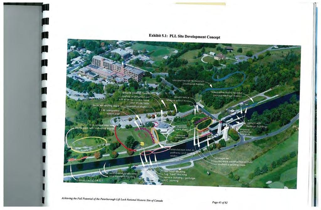
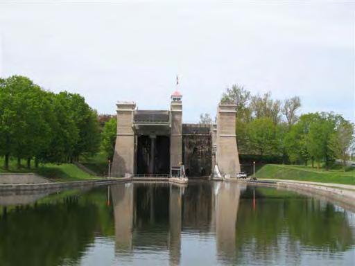
11 Previous Studies Peterborough & the Kawarthas - Premier-ranked tourist destinations project (2008) It's all about the Water - a report of the panel on the future of the Trent-Severn waterway (2008) Planning Peterborough to 2031: How the Growth Plan for the Greater Golden Horseshoe will affect the City of Peterborough (2009) Recreational Use of Little Lake and Environs Study (1986) Achieving the full potential of the Peterborough Lift Lock National Historic Site of Canada (2005)

12 Previous Studies


13 Recent Key Investments


14 Recent Key Investments Marina Millenium Park Ecological Garden Downtown shoreline reconstruction Roger s Cove Playground Facilities North Shore Trail PLL Site Development


15 Existing Conditions


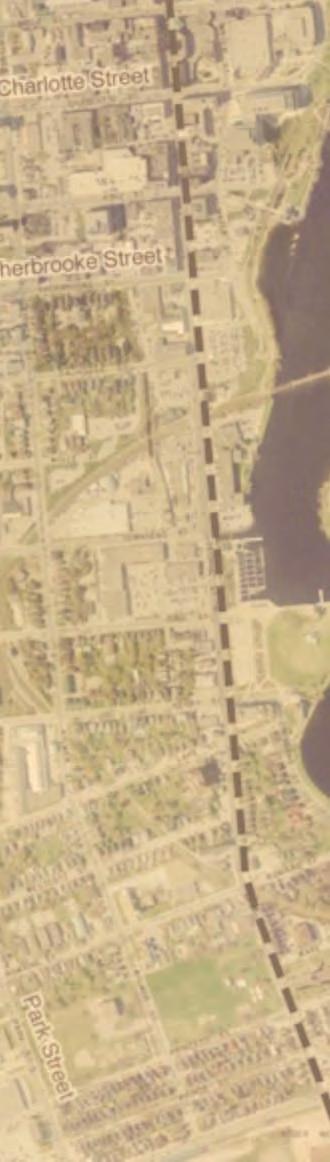
16 Regional Context Otonabee River Part of the Trent Severn Waterway, central on the route from Lake Ontario to Lake Simcoe


17 Regional Context Connections to Trent Trans-Canada Trail Millenium Trail Municipal trails Informal routes


18 Existing Land Use Public Open Space 55 ha Private Open Space 16 ha Significant green space within urban context


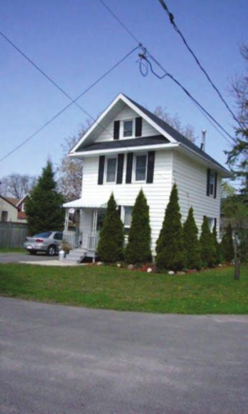
19 Built Form Scaled built form surrounding Lake Front, which transitions from residential to downtown urban to pastoral


20 Environmental Analysis Vegetation Shoreline/riparian forest, wetland and shrub thicket communities Willow, Manitoba/Silver Maple, Ash, Speckled Alder, Cottonwood dominated Manicured/Landscaped Grounds mix of native and non-native trees and shrubs Norway Maple, Willow, Black Locust, Conifers Invasive, non-native species present (buckthorn, honeysuckle, garlic mustard)
21 Fisheries Little Lake supports a warmwater sport fishery (pumpkinseed, bass, perch, carp)
 may occur in the study")
22 Wildlife Osprey nesting (poles, bridges) Habitat for migratory birds, waterfowl, shorebirds and urban species Corridor/Linkage function Otonabee River, Whitlaw Creek, railway corridors Species at Risk - Map Turtle (species of concern) may occur in the study area
23 Habitat Enhancement Opportunites removal of non-native, invasive plants; native plantings utilizing species grown in the Ecology Garden nursery; phased replacement of nonnative landscape plantings with native species; naturalized buffer strips along the shoreline and riparian edge fish and wildlife habitat; creation of bio-swales (wetland) at stormwater outlets; limited use of fertilizer, herbicide and pesticide within manicured grounds; additional shoreline stabilization incorporating bio-engineering measures such as native tree/shrub plantings; creation of specific habitat types such as prairie/savanna; native plantings with species with high wildlife value to provide food, shelter and cover; plant and wildlife linkage enhancement through habitat creation and vegetated buffer strips along the shoreline.


24 Marine Analysis Approx. 5km of shoreline for the lake proper Shoreline strategies Stormwater outfalls Alternative locations for marina Marina feasibility study Boat Launches and wharves


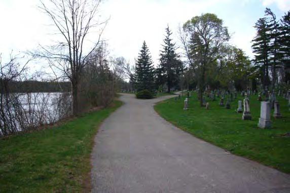
25 Character Areas Downtown Downtown Waterfront North Edge Neighbourhood The Point Canal and Recreational Edge Little Lake Cemetary Crescent Edge


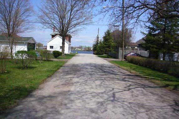
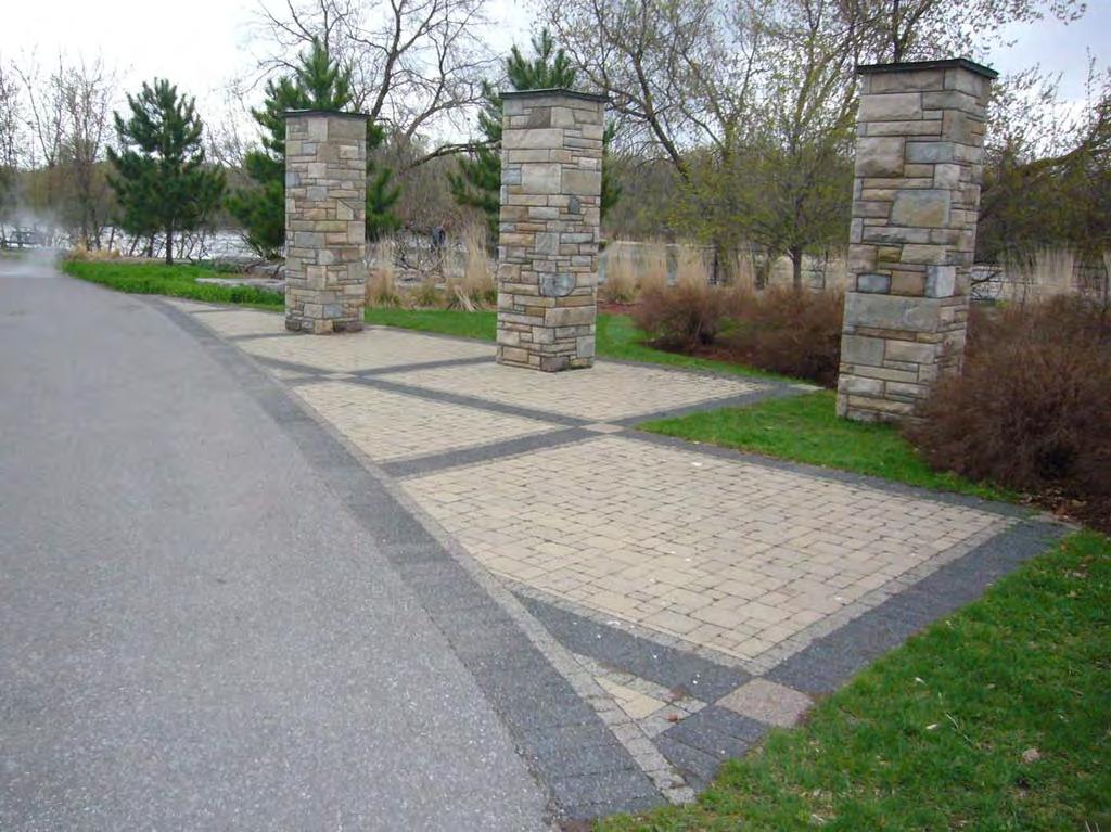
26


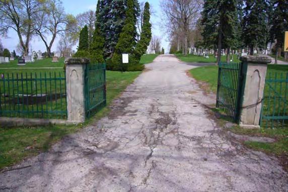
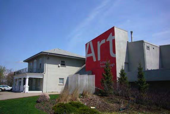
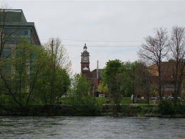
27 Cultural/Civic Heritage Railways and Bridges Little Lake Cemetery Trent Severn Art Gallery, Centennial Museum Canoe Museum
28
29


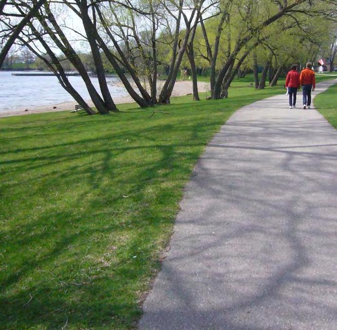
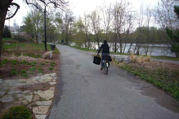
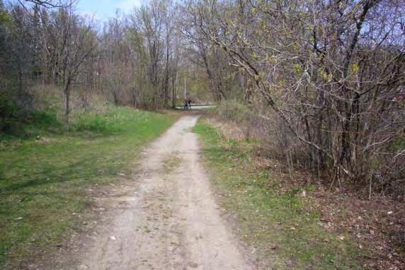
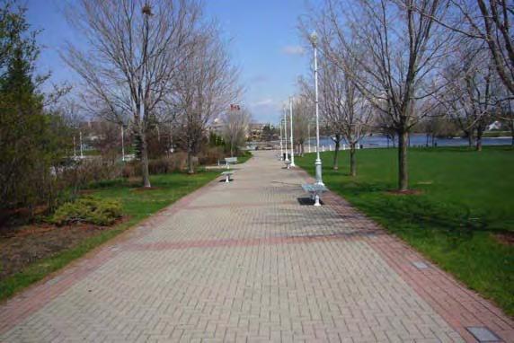
30 xisting Trails and Recreation Extensive network of existing formal walks around lake Extensive Informal walks as provision of side trails or important links
31


32 Trail Character Character of walks broken down by area Informal links provide complete waterfront promenade walk Varied Character provides an diversity in user experience


33 Walk Lengths 1 km walks which average 12 minutes in duration


34 Private Ownership Sections of Lake Shoreline which lay in private ownership


35 Roads & Parking All facilities are well serviced serviced through an existing road and parking network
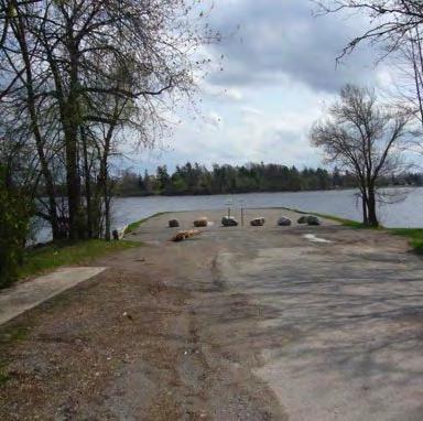


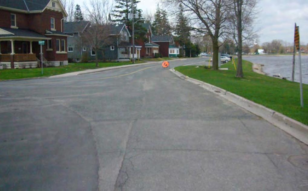
36 Views
37 Key Assets to Leverage


38 1. Public Ownership of Water s Edge


39 2. Visual and Physical Connections to Water s Edge
40

41 3. Significant Investment in Trail System


42 4. Major National Historic Site in Town


43 5. Core of Existing Recreation/Cultural Attractions


44 6. Scale/Character of Built Form Adjacent to Water s Edge

45 7. People living close to Waterfront


46 8. Extensive Natural Features


47 9. PLL is an Integral Part of Larger System

48 10. Well Recognized and Attended Events

49 11. Proximity of Downtown to Water s Edge
50 Little Lake : Big Opportunity
51 Table Group 1 Working as a table group brainstorm a list of questions choose your top question choose a spokesperson
52 Table Group 2 Working as a table group brainstorm a list of the key characteristics/qualities of the Little Lake area Identify the top 5 characteristics
53 Table Group 3 Working as a group brainstorm a list of opportunities that would make the key characteristics of the Little Lake area even better Choose the top 5 opportunities
54 Work and Schedule PHASE 1 - Context (June - September) - where we are now PHASE 2 - Preparation of Concept Options (June - September) PHASE 3 - Development of Master Plan (September to November) Schedule of Upcoming Workshops Workshop #1 - May 26th, 2009 Workshop #2 - July 7,8th, 2009 (2 Day Charrette) Workshop #3 - TBA (Public Open House)
55 Connections & Contact Web: and go to One Click Away to get to the Master Planning Section.
4. What are the goals of the Kawarthas, Naturally Connected project? 7. What are watersheds and why are they being used as the project boundaries?
 Frequently Asked Questions (FAQs) 1. What are Natural Heritage Systems (NHS)? 2. Why are they important? 3. Which areas of the province have undertaken NHS projects? 4. What are the goals of the Kawarthas,
10.0 Open Space and Public Realm
 10.0 Open Space and Public Realm 10.0 Open Space and Public Realm The Public Open Space System is comprised of: outdoor spaces available for public use that are either publicly owned (e.g., parks and
RECREATION, OPEN SPACE AND GREENWAYS ELEMENT GOALS, OBJECTIVES, AND POLICIES
 RECREATION, OPEN SPACE AND GREENWAYS ELEMENT GOALS, OBJECTIVES, AND POLICIES GOAL R-1: DEVELOP A RECREATION, OPEN SPACE AND GREENWAYS SYSTEM AS AN INTEGRAL COMPONENT OF AN OVERALL, COUNTY-WIDE ECONOMIC
{Best Practices. Summary of Tools, Strategies and Best Practices from 11 Michigan Case Study Communities
 Case Studies Michigan Coastal Community Working Waterfronts { Summary of Tools, Strategies and from 11 Michigan Case Study Communities Table of Contents Zoning...2 Community and Stakeholder Collaboration
A. Selma Park, Davis Bay and Wilson Creek
 A. Selma Park, Davis Bay and Wilson Creek This waterfront neighbourhood consists of three separate community areas, linked by Highway 101, but with different character, land use patterns and future potential.
Mississauga Waterfront. Parks Strategy - Draft
 Potential configuration for river s edge seating. Boating on Credit River: A regatta Boating on Credit River: Active enjoyment 5.2 Port Credit Memorial Park West Priority Park 5.2.1 Site Opportunities
City of Missoula and Missoula County Open Space Planning Open House
 City of Missoula and Missoula County Open Space Planning Open House FEBRUARY 6, 2018 The following slides contain the display board content from the open house. Please use boards to answer questions in
A 10-Year Strategic Plan for Recreation, Parks, Arenas and Culture City of Peterborough
 Vision 2025 A 10-Year Strategic Plan for Recreation, Parks, Arenas and Culture City of Peterborough Progress Update Prepared by: The RETHINK GROUP Leisure Services Planning & Management in association
Ashbridges Bay Erosion and Sediment Control Project
 Ashbridges Bay Erosion and Sediment Control Project Project Brief Overview Toronto and Region Conservation Authority, in partnership with the City of Toronto, intends to carry out remedial erosion control
Parks Master Plan Implementation: Phase I Waterfront Use and Design REPORT #: September 7, 2016 File #
 0 'O DI Lan-171-14 1 - THE CORPORATION OF THE TOWN OF COBOURG..,. STAFF REPORT TO: FROM: Mayor and Members of Council Dean A. Hustwick, Director of Recreation and Culture DATE OF MEETING: Committee of
City of Peterborough Draft Official Plan 2016 Part 1 (Sections A to C) Vision and Strategic Policies
 Vision and Strategic Policies") City of Peterborough Draft Official Plan 2016 Part 1 (Sections A to C) Vision and Strategic Policies Includes Figure 2 Commercial Structure and Schedule A-1 City Structure Table of Contents A. INTRODUCTION...
City of Peterborough Draft Official Plan 2016 Part 1 (Sections A to C) Vision and Strategic Policies Includes Figure 2 Commercial Structure and Schedule A-1 City Structure Table of Contents A. INTRODUCTION...
The Rideau Canal Corridor: Planning for a Proud Future. Heather Thomson Heritage Planner Parks Canada
 The Rideau Canal Corridor: Planning for a Proud Future Heather Thomson Heritage Planner Parks Canada Overview What is the Rideau Canal? Planning in the Rideau and Trent-Severn Corridors: Challenges and
UNIVERSITY TOWN NEIGHBOURHOODS 5.2 ECO-CORRIDOR MELBOURNE CAMPUS MASTER PLAN 2014
 5.2 ECO-CORRIDOR 37 ECO-CORRIDOR EXISTING CONDITIONS & VISION NEIGHBOURHOOD VISION Investment in the Eco-corridor Neighbourhood will signify the University s commitment to supporting local ecology and
COMMUNITY SUSTAINABILITY AND ENVIRONMENTAL MASTER PLAN IMPLEMENTATION UPDATE
 Attachment 1 COMMUNITY SUSTAINABILITY AND ENVIRONMENTAL MASTER PLAN IMPLEMENTATION UPDATE Priorities and Key Initiatives Committee May 2013 Page E-1 How we grow Goal 2: To ensure sustainable development
City of Dryden SUSTAINABLE WATERFRONT DEVELOPMENT PLAN. Prepared by: Hilderman Thomas Frank Cram Landscape Architecture and Planning
 City of Dryden SUSTAINABLE WATERFRONT DEVELOPMENT PLAN Prepared by: Hilderman Thomas Frank Cram Landscape Architecture and Planning INTRODUCTION The Sustainable Waterfront Development Plan provides viable
THE GARDEN CITY PLAN. City of St. Catharines Official Plan. City of St. Catharines
 THE GARDEN CITY PLAN City of St. Catharines Official Plan City of St. Catharines August 2010 APPROVAL INFORMATION This Official Plan of the City of St. Catharines Planning Area, known as the Garden City
DISCUSSION TOPIC: ST JOHNS RIVER & ITS TRIBUTARIES (BPII) 2030 COMPREHENSIVE PLAN POLICES AND REGULATORY FRAMEWORK
 2030 COMPREHENSIVE PLAN POLICES AND REGULATORY FRAMEWORK") DISCUSSION TOPIC: ST JOHNS RIVER & ITS TRIBUTARIES (BPII) 2030 COMPREHENSIVE PLAN POLICES AND REGULATORY FRAMEWORK St. John s River & Its Tributaries Issue Summary: The St. Johns River is an important
DISCUSSION TOPIC: ST JOHNS RIVER & ITS TRIBUTARIES (BPII) 2030 COMPREHENSIVE PLAN POLICES AND REGULATORY FRAMEWORK St. John s River & Its Tributaries Issue Summary: The St. Johns River is an important
Edgeley Pond + Park Public Meeting
 Edgeley Pond + Park Public Meeting February 21, 2017 Purpose of the meeting This Public Meeting is an opportunity for you to review the project background, process and provide input. City of Vaughan staff
Provide and maintain sufficient public parks, recreation facilities, and open space to meet the recreational needs of County residents and visitors.
 (ROS) Goal Provide and maintain sufficient public parks, recreation facilities, and open space to meet the recreational needs of County residents and visitors. OBJECTIVE ROS.01 The County shall acquire,
Animating the Rideau Canal December 2013
 Executive Summary Animating the Rideau Canal December 2013 Why study the Rideau Canal? The Rideau Canal has been an important part of Ottawa throughout its history, and has shaped and been shaped by the
Regional Context Statement
 Regional Context Statement REGIONAL CONTEXT STATEMENT 3. REGIONAL CONTEXT STATEMENT In 1995, the Provincial Government passed into law the Growth Strategies Act. The purpose of this provincial initiative
Chairman and Members of the Planning and Development Committee. Thomas S. Mokrzycki, Commissioner of Planning and Building
 LA.09.TOR (Toronto) DATE: TO: FROM: SUBJECT: Chairman and Members of the Planning and Development Committee Thomas S. Mokrzycki, Commissioner of Planning and Building Central Waterfront Secondary Plan
Highland Falls Waterfront Redevelopment Feasibility Study Village Board Meeting March 20, 2017
 Village Board Meeting March 20, 2017 Agenda I. Public Meeting #1 Visioning Summary II. Public Meeting #2 Comment Summary III. IV. IV. Case Study: Milton Train Station Schematic Design Concepts Schedule/Next
RECREATION AND OPEN SPACE ELEMENT GOALS, OBJECTIVES, AND POLICIES
 RECREATION AND OPEN SPACE ELEMENT GOALS, OBJECTIVES, AND POLICIES Goal 7 To provide park facilities, recreation programs, and open space resources that are safe, adequate, and accessible to all City residents,
Arkansas River Corridor
 Planning for Access Welcome to the Access Project. This project is a recreational planning effort in response to an interest by regional communities along the Arkansas River corridor. The project plan
Once Upon a Gravel Pit: Reconnecting Floodplain through Aggregate Extraction
 Once Upon a Gravel Pit: Reconnecting Floodplain through Aggregate Extraction 5 th International Conference on Natural Channel Systems September 26, 2016 1 The Story of Snyder s Flats Historical influences
DRAFT. Waterfronts and Open Spaces. 10 The Riverfront Open Space System
 CHAPTER 4 Waterfronts and Open Spaces 10 The Riverfront Open Space System 12 Planned, proposed and envisioned riverfront recommendations. Figure 4.3.23 The riverfront will become a major new public amenity
Highest & Best Use Study Marina Park Lands
 Executive Summary of Report MARCH 2006 TABLE OF CONTENTS 1. Introduction...1 2. Study Process...2 3. Highest And Best Use Program...3 4. Concept Plan...8 5. Public Area Animation...9 6. Marina Park Implementation
PARKS AND RECREATION
 PARKS AND RECREATION WHAT YOU WILL FIND IN THIS CHAPTER: Background information on the development of the Park, Recreation, and System Plan (PRSP). General overview of Ellensburg s parks and recreation
Design Specifications & Requirements Manual
 11 PARKS & OPEN SPACES 11.1 DEFINITIONS... 1 11.1.1 Neighbourhood Parks... 1 11.1.2 District Parks... 1 11.1.3. Sport Parks... 1 11.1.4 Urban Parks... 1 11.1.5 Civic Spaces... 1 11.1.6 Open Space System...
Objectives and Strategies for the Integration of Recreation, Parks and Open Space in Regional Plans
 BULLETIN 2 Objectives and Strategies for the Integration of Recreation, Parks and Open Space in Regional Plans TABLE OF CONTENTS Introduction 3 Land-use Framework Outcomes 1 4-8 Land-use Framework Outcomes
WILLIAM STREET STORM SEWER OUTFALL. PUBLIC INFORMATION CENTRE March 23, 2017
 WILLIAM STREET STORM SEWER OUTFALL Municipal Class Environmental Assessment PUBLIC INFORMATION CENTRE March 23, 2017 ACCESSIBILITY Under the Accessibility Standards 2015 for Customer Service Regulation
CITY OF PETERBOROUGH OFFICIAL PLAN REVIEW
 CITY OF PETERBOROUGH OFFICIAL PLAN REVIEW Outline Why you are here Official Plan Context Peterborough s Story Planning Peterborough 2 Why you are here Planning for the community by the community Collaborative
RECREATION AND OPEN SPACE VISION
 City of South Lake Tahoe General Plan Policy Document Recreation and Open Space Element INTRODUCTION This element provides the policy context for the City of South Lake Tahoe to achieve its vision for
Please read the entire document
 projects impacting the waterfront revitalization area. The waterfront revitalization area of the town will have to subareas to the west and east of the village. Page 6 of 6 Wayfinding master plan create
Central Lake Ontario Conservation Conservation Lands Master Plan
 Conservation Lands Master Plan Top 13 Frequently Asked Questions 1. What are conservation lands? Where are these conservation lands located in the Central Lake Ontario Conservation watershed? Conservation
G. RECREATION AND OPEN SPACE ELEMENT. The following summarizes the Recreation and Open Space Element:
 G. RECREATION AND OPEN SPACE ELEMENT The purpose of the Element is to provide the framework and direction for a comprehensive system of public and private sites for recreation, including, but not limited
INTRODUCING THE BALTIMORE CITY GREEN NETWORK VISION PLAN
 INTRODUCING THE BALTIMORE CITY GREEN NETWORK VISION PLAN GOALS OF THE GREEN NETWORK PLAN Protect and enhance the unique ecological resources of our city Support economic growth and sustainable redevelopment
Zoning and Development Considerations in the Boothbay Harbor Maritime/Water Dependent District
 Zoning and Development Considerations in the Boothbay Harbor Maritime/Water Dependent District Bob Faunce Lincoln County Planner Lincoln County Regional Planning Commission Board of Selectmen and Planning
Lynn Waterfront Master Plan
 Lynn Waterfront Master Plan Public Meeting #2 December 10th, 2018 1 Project Schedule Update September 26, 2018 December 10, 2018 Development of the Master Harbor Plan Amendment and Revised Waterfront Master
Southwest Fleetwood Enclave
 Southwest Fleetwood Enclave Development Concept Plan Southwest Fleetwood Enclave 1 st Land Owners Meeting April 30 th, 2012 Presentation Overview Why the Plan? ; Overview & Purpose of Study; Constraints
DOWNTOWN PARKS & PUBLIC REALM PLAN
 DOWNTOWN PARKS & PUBLIC REALM PLAN CHALLENGES The Parks and Public Realm Strategy addresses challenges associated with a growing Downtown, including: GOALS 3.3 New buildings will fit within their existing
Town of Whitby Waterfront Parks and Open Space Master Plan Final Report, January 2016
 CMS 20-16 Attachment #1 Town of Whitby Waterfront Parks and Open Space Master Plan Final Report, January 2016 Table of Contents Waterfront Master Plan Study Overview i Introduction 1 Overall Waterfront
T O W N O F H I G H R I V E R
 T O W N O F H I G H R I V E R o p e n s p a c e p l a n The Town of High River, 30 minutes South of Calgary, still retains much of its distinctive small town character and provides residents with a high
Culminating Information Session - April 14, 2010
 Culminating Information Session - April 14, 2010 team The Planning Partnership - project management, landscape architects, urban designers, planners, communications and consultation Plan B Natural Heritage
Town of Cobourg Heritage Master Plan. Statutory Public Meeting
 Town of Cobourg Heritage Master Plan Statutory Public Meeting April 25 th 2016 Presentation Overview 1. Introduction 2. Project background and schedule overview 3. Review of strategic direction content
Yarra Strategic Plan community engagement summary
 Yarra Strategic Plan community engagement summary Between May and August 2018 Melbourne Water undertook community engagement to build the content of the draft Yarra Strategic Plan. This engagement included
Welcome. Tannery and Waterworks Parks Shoreline Improvements Environmental Assessment. Public Information Centre #1 November 27, pm to 8 pm
 Welcome Tannery and Waterworks Parks Shoreline Improvements, Environmental Assessment Tannery and Waterworks Parks Shoreline Improvements Environmental Assessment #1 6 pm to 8 pm Why We Are Here Tannery
Toronto Parks Renaissance Strategy
 Toronto Parks Renaissance Strategy Overview, Emerging Themes and Directions Presentation to EDPC, May 4, 2006 Parks Renaissance Strategy Presentation Agenda Project Overview Emerging Themes and Directions
Meeting Agenda. City of Guelph. River Systems Advisory Committee. Agenda Items. Item 1, 2 and 3. Item 4 Ward to Downtown Pedestrian Bridge
 Meeting Agenda City of Guelph River Systems Advisory Committee September 19, 2018 City Hall, Meeting Room B From 4:00 to 6:00 p.m. Meeting Chair: Mariette Pushkar Agenda Items Welcome to all Item 1, 2
CHONGMING ISLAND SHANGHAI CENTRAL CITY
 Chongming Island CHONGMING ISLAND SHANGHAI CENTRAL CITY Chongming Island Shanghai, China THE VISION: A GREEN ISLAND Chongming Island benefits from a magnificent setting, adjacency to the vibrant center
New Brighton Park Shoreline Habitat Restoration Project
 Vancouver Board of Parks and Recreation and Port Metro Vancouver New Brighton Park Shoreline Habitat Restoration Project Conceptual Design Public Consultation August 26 September 9, 2015 Discussion Paper
Preliminary Sketch Plan for Fort Hunter Park
 Preliminary Sketch Plan for Fort Hunter Park Public Presentation November 19, 2009 Dauphin County Parks and Recreation 100 Fort Hunter Road Harrisburg, PA 17110 (717) 599-5188 www.dauphinc.org THOMAS COMITTA
1 Introduction. Chapter. In this chapter:
 Chapter 1 Introduction In this chapter: 1.1 A Snapshot of the Region 1.2 Towards a Sustainable Region 1.3 The Provincial Context 1.4 Purpose and Organization The Regional Municipality of York Official
OFFICIAL PLAN UPDATE PLANNING ACT SECTION 26
 OFFICIAL PLAN UPDATE PLANNING ACT SECTION 26 Stakeholders Meeting November 20, 2017 EcoVue Consulting Services Inc. 311 George Street North Suite 200 Peterborough, Ontario K9J 3H3 T 705.876.8340 F 705.742.8343
April 11, 2016 Park Board Chair and Commissioners General Manager Vancouver Board of Parks and Recreation New Brighton Salt Marsh - Preferred Concept
 TO: FROM: SUBJECT: April 11, 2016 Park Board Chair and Commissioners General Manager Vancouver Board of Parks and Recreation New Brighton Salt Marsh - Preferred Concept RECOMMENDATION A. THAT the Vancouver
This page has been intentionally left blank.
 This page has been intentionally left blank. Chapter 3 3-2 3. Employment 3.A Niagara Economic Gateway 3.A.1 General The Niagara Economic Gateway comprises: a) The Gateway Economic Zone which includes all
Design Specifications & Requirements Manual
 11 PARKS & OPEN SPACES 11.1 DEFINITIONS... 1 11.1.1 Neighbourhood Parks... 1 11.1.2 District Parks... 1 11.1.3. Sport Parks... 1 11.1.4 Urban Parks... 1 11.1.5 Civic Spaces... 1 11.1.6 Open Space System...
Balancing Conservation and Development on the Jordan River
 Balancing Conservation and Development on the Jordan River Jordan River Parkway Trail Regional Athletic Complex Conservation & Restoration Balancing Conservation and Development on the Jordan River Jordan
WILLAMETTE FALLS LEGACY PROJECT
 OPPORTUNITIES & CONSTRAINTS There are here three falls on a line of rocks extending across the river, which forms the bed of the upper channel. The water is precipitated through deep abrazed gorges, and
The scope of the plan will focus on the Prospect Heights Slough and Hillcrest Lake as one entity.
 Plan for Prospect Heights Natural Resources Commission Plan for Improved Public Access and Enjoyment of the Prospect Heights Slough and Hillcrest Lake July 23, 2018 The City Council has requested the Natural
STUDY AREA. Tonight s Agenda. Project Tasks Completed. Next Steps. Town of Oyster Bay Eastern Waterfront Community Vision & Revitalization Plan
 Town of Oyster Bay Eastern Waterfront Community Vision & Revitalization Plan Public Meeting January 27, 2009 Opening Remarks Presentation Tonight s Agenda Introduction Study Area Overview Public Participation
Blackfriars Bridge Municipal Class Environmental Assessment. Public Information Centre #1 November 19 th, 2014
 Blackfriars Bridge Municipal Class Environmental Assessment Public Information Centre #1 November 19 th, 2014 Why are you here tonight? To determine the future requirements of the river crossing at Blackfriars
Planning for Staten. Habitat Restoration and Green Infrastructure. Island s North Shore
 Habitat Restoration and Green Infrastructure Planning for Staten Island s North Shore Community Board 1 March 1, 2018 NYC Parks Forestry, Horticulture, and Natural Resources Funded by the NYS Department
Lakeview and Port Credit District Policies Review Public Engagement Process
 Lakeview and Port Credit District Policies Review Public Engagement Process Brook McIlroy Planning + Urban Design/PACE Architects MSAi Architects Poulos and Chung Transportation Engineers December 11,
To qualify for federal Transportation Enhancement (TE) funds a project must meet two basic federal requirements:
 funds a project must meet two basic federal requirements:") Eligibility Requirements To qualify for federal Transportation Enhancement (TE) funds a project must meet two basic federal requirements: 1) Relate to surface transportation and 2) Be one of the 12 designated
Eligibility Requirements To qualify for federal Transportation Enhancement (TE) funds a project must meet two basic federal requirements: 1) Relate to surface transportation and 2) Be one of the 12 designated
1. Planning and Development Approvals Commissioner s report dated 06 Oct 2000 is immediately attached.
 3. STATUS UPDATE ON PETRIE ISLAND COMMITTEE RECOMMENDATION AS AMENDED That Council approve that: the status quo continue with the annual lease with the Sand extraction operations (Grandmaitre); and further
Gibsons Foreshore & Seawalk Improvements
 Gibsons Foreshore & Seawalk Improvements Open House (5:00-7:00 pm) Town of Gibsons October 6, 2016 Town of Gibsons Foreshore & Seawalk Improvements 1 Session 3: Open House (Charrette Participants, Designers,
SQUAMISH 2010 AND BEYOND COMMUNITY VISION
 Our plan has been imagined and created to be both pragmatic and visionary. At the core of the strategy is a consideration of the highway s role and its impact on the community. First and foremost in creating
A Field Guide to Common Aquatic Plants of Pennsylvania
 A Field Guide to Common Aquatic Plants of Pennsylvania College of Agricultural Sciences CONTENTS Introduction... 2 Algae... 8 Emergent... 20 Submerged... 48 Floating... 82 Index... 102 INTRODUCTION Pennsylvania
WEST BOGGS LAKE BUFFER ZONE MANAGEMENT. GUIDELINES & Policies FOR SPECIAL PERMITS
 WEST BOGGS LAKE BUFFER ZONE MANAGEMENT GUIDELINES & Policies FOR SPECIAL PERMITS TABLE OF CONTENTS: West Boggs Lake History. 1 Buffer Zone Purpose. 2 Permits and Limits of Use. 2 General Public Use. 3
CITY CLERK. Parkland Acquisition Strategic Directions Report (All Wards)
") CITY CLERK Clause embodied in Report No. 10 of the, as adopted by the Council of the City of Toronto at its meeting held on November 6, 7 and 8, 2001. 10 Parkland Acquisition Strategic Directions Report
CITY CLERK Clause embodied in Report No. 10 of the, as adopted by the Council of the City of Toronto at its meeting held on November 6, 7 and 8, 2001. 10 Parkland Acquisition Strategic Directions Report
Niagara National Heritage Area
 Niagara National Heritage Area What is a National Heritage Area? It is a regional place where natural, cultural, historic and recreational resources combine to form a nationally distinctive landscape and
Taché Promenade Tuesday, October 17, 2017
 Welcome to the Public Information Session for the City of Winnipeg s Taché Promenade Tuesday, October 17, 2017 We want to hear from you. Please participate today by: Viewing the recommended design and
PARKS. Chapter Introduction
 Chapter 4. PARKS 4.1. Introduction This Parks Element of the 2016 Comprehensive Plan Update provides direction and guidance, based on citizen input, in order to improve and maintain the City s existing
CITY OF BARRIE OFFICIAL PLAN (APRIL 2010)
") CITY OF BARRIE OFFICIAL PLAN (APRIL 2010) On April 23, 2010, The Ministry of Municipal Affairs and Housing (MMAH) approved a new Official Plan for the City of Barrie. The MMAH modifications are referenced
CITY OF BARRIE OFFICIAL PLAN (APRIL 2010) On April 23, 2010, The Ministry of Municipal Affairs and Housing (MMAH) approved a new Official Plan for the City of Barrie. The MMAH modifications are referenced
Coquitlam River Riparian Planting
 Coquitlam River Riparian Planting Year Four Year Four Report, March 2016 Prepared for: Fish and Wildlife Compensation Program Prepared by: Watershed Watch Salmon Society and the Kwikwetlem First Nation
Waterfront Land Use Planning Survey! Celebrating 20 years of Partnership
 Waterfront Land Use Planning Survey! Celebrating 20 years of Partnership Waterfront Land Use Planning Survey! 46 respondents 74% Lake Ontario / 26% St Lawrence River 4 Case Studies: Grimsby, Prescott,
Preface. Erie. Scranton. Allentown. Pittsburgh. Harrisburg. Philadelphia
 The Southern Alleghenies Region The Southern Alleghenies Region spans the Laurel Highlands and Allegheny Front in the west across the Appalachians to the east. It is comprised of Blair, Bedford, Cambria,
SUBJECT: Waterfront Hotel Planning Study Update TO: Planning and Development Committee FROM: Department of City Building. Recommendation: Purpose:
 Page 1 of Report PB-23-18 SUBJECT: Waterfront Hotel Planning Study Update TO: Planning and Development Committee FROM: Department of City Building Report Number: PB-23-18 Wards Affected: 2 File Numbers:
Natural Shorelines. for Inland Lakes. A Landowner s Guide to using. to STABLIZE SHORELINES, Michigan s inland lakeshore.
 Natural Shorelines for Inland Lakes A Landowner s Guide to using NATURAL MATERIALS to STABLIZE SHORELINES, IMPROVE WATER QUALITY and ENHANCE WILDLIFE HABITAT along Michigan s inland lakeshore. Natural
City of Surrey Ecosystem Management Study. Integration of ecological processes with land use
 City of Surrey Ecosystem Management Study Integration of ecological processes with land use Natural areas in Surrey are changing as the City grows and evolves. Many important natural areas remain or may
Support the implementation of Cape Coral's Comprehensive Plan. Protect and utilize the unique natural resources in the City.
 7.0 OVERVIEW - RECOMMENDATIONS Chapter 7 The preparation of the Cape Coral Parks and Recreation Master Plan spanned a period of approximately 12 months. Plan preparation included the input of a wide range
This page intentionally blank.
 This page intentionally blank. Parks, Recreation, and Open Space Chapter Relationship to Vision Vision Parks, Recreation and Open Space Chapter Concepts County Government. County government that is accountable
Ship Creek Redevelopment
 Ship Creek Redevelopment Three Concepts May 2013 Cambridge ARCHITECTURE Philadelphia ENGINEERING Raleigh INTERIORS San Francisco PLANNING Washington, DC www.klingstubbins.com contact@klingstubbins.com
CDAC. Update: Downtown Dartmouth Update: CDAC July 25 th Motion
 CDAC Update: Downtown Dartmouth Update: CDAC July 25 th Motion 2018-10-24 Downtown Dartmouth Plan Open House October 22, 2018 6:00 pm Open House 6:30 pm Presentation + Q&A 7:20 pm Open House 8:30 pm Close
PORT UNION VILLAGE COMMUNITY SECONDARY PLAN
 4 PORT UNION VILLAGE COMMUNITY SECONDARY PLAN 4. PORT UNION VILLAGE COMMUNITY SECONDARY PLAN The following policies and principles apply to the area herein referred to as Port Union Village, as outlined
TORTI GALLAS and partners, inc. How to Retrofit Your Suburb to Make a Downtown
 How to Retrofit Your Suburb to Make a Downtown April, 2010 Where to Start What should the Town look like? How do I attract new residents, businesses and visitors?? Should we preserve our heritage? How
Reconnecting to a Forgotten River St. Cloud MN. Aaron Hanson Design Design Thesis LA 572, Thesis, Spring 2012
 Reconnecting to a Forgotten River St. Cloud MN Aaron Hanson Design Design Thesis LA 572, Thesis, Spring 2012 site context 2.5 Miles Sartell St. Cloud to Fargo 170 Miles (2 hrs 45 mins) Hwy 10 infrastructure
City of Surrey Ecosystem Management Study. Integration of ecological processes with land use
 City of Surrey Ecosystem Management Study Integration of ecological processes with land use Natural areas in Surrey are changing as the City grows and evolves. Many important natural areas remain or may
City of Nogales General Plan
 Open Space, Parks, Recreation and Trails City of Nogales General Plan Residents of Nogales place a high priority in the development of a comprehensive system of open space, parks, recreation and trails
Urban runoff in my neighborhood (Capitol Hill) is heavy with trash and other debris.
 is heavy with trash and other debris.") South Platte River Meeting Comments & s #1 I am a huge fan of river areas and would love the Platte and surrounding waterways to improve to allow habitat for wildlife and recreation opportunities for citizens.
South Platte River Meeting Comments & s #1 I am a huge fan of river areas and would love the Platte and surrounding waterways to improve to allow habitat for wildlife and recreation opportunities for citizens.
HALDIMAND COUNTY OBJECTIVE: RECOMMENDATIONS: EXECUTIVE SUMMARY:
 HALDIMAND COUNTY Report PED-COM-09-2018 Community Partnership Program Dunnville Thompson Creek Park Rehabilitation For Consideration by Council in Committee on May 15, 2018 OBJECTIVE: To approve a request
PUBLIC SPACE/AMENITY PROJECTS
 BUFFALO S LWRP 49 A1. Black Rock Canal Park Improvements Erie County Parks Black Rock Canal Park, Ontario and Niagara Street intersection PROJECT DESCRIPTION: Erie County s Black Rock Canal Park is 4.25
One County s Success in Linking Watershed Protection and Land Use Planning
 One County s Success in Linking Watershed Protection and Land Use Planning Bob Thompson Porter County Plan Commission March 28, 2012 Indiana Watershed Leadership Academy Population 160,000 Approximately
Welcome! HORSESHOE BAY PARK. Welcome!
 Welcome! HORSESHOE BAY PARK Welcome! Where are we in the process? Today we would like your input on how Horseshoe Bay Park can be upgraded to serve the community s needs better. CONSULT STAKEHOLDERS TAKE
Strategies/Actions Priority List
 Strengthening the Creative Sector: Build stronger relationships with, and between, cultural organizations and businesses and increase opportunities for working together to build capacity within organizations.
PRELIMINARY DESIGN + DEVELOPMENT PLAN
 WELCOME! To The Public Open House May 30 th, 2017 HARBOUR WEST PARKS Vision Project Overview The City s vision for Port Credit Harbour West Parks is to develop a vibrant waterfront destination that integrates
Surrey Ecosystem Management Study
 Surrey Ecosystem Management Study Green Infrastructure Network Opportunities Public Open House & Information Session June 24 th, 2010 EMS Process Ecological Inventory Ecological Assessment Management Policy
Public Workshop #2 October , Welcome. Former Kingston Penitentiary & Portsmouth Olympic Harbour
 Public Workshop #2 October 12 + 13, 2016 Welcome Former Kingston Penitentiary & Portsmouth Olympic Harbour Cataraqui Golf and Country Club Portsmouth Avenue St. Lawrence College Sir John A. Macdonald Blvd