BUENOS AIRES: THE MICROCENTRO PLAN
|
|
|
- Duane Lang
- 5 years ago
- Views:
Transcription


1 BUENOS AIRES: THE MICROCENTRO PLAN

2 BUENOS AIRES THE MICROCENTRO PLAN Experiences and Lessons Learned _ Metropolis Meeting 2015 INCLUSION INNOVATION SUSTAINABILITY

3 CONTENTS 1. Urban Context 2. Urban Design Framework 3. The Public Realm Design and Implementation 4. Sustainable Mobility Plan 5. Smart City Technology 6. Heritage: Building Facades and Entrances 7. Ambience

4 1. URBAN CONTEXT south vs nor

5 Buenos Aires is the capital and largest city of Argentina, and the second-largest metropolitan area in South America

6 The Greater Buenos Aires State has a population of around fifteen and half million people Buenos Aires City Centre population is approximately 2.9 million people. The city has a density of about 13,680 people per square kilometre

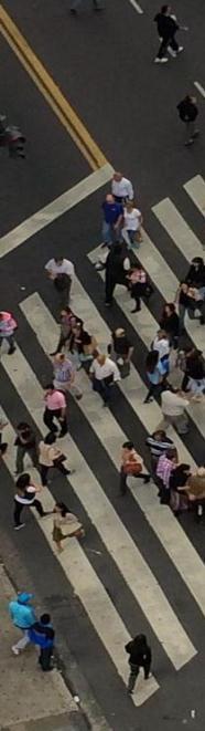
7 A million people and several hundred thousand vehicles pass through the central business district of Buenos Aires -- the Microcentro -- on any given workday The Microcentro Plan aims to: - Flip the 70/30 ratio of space devoted to cars and people in the downtown and in the process - Cut the number of private cars that pass through the area by over half during work hours

8 Buenos Aires, Mexico City and São Paulo, one of the three Latin American cities considered an 'alpha city.

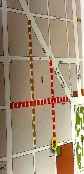
9 MICROCENTRO PLAN STUDY AREA

10 THE OBJECTIVES OF THE MICROCENTRO PLAN: - The coordinated and comprehensive implementation of actions and programs to aid progress toward sustainable urban development - To reduce waste generation, promote more ecological transportation, adapt infrastructure to care for the environment

11 OBJECTIVES - Implement different activities intended to improve citizens quality of life and promote taking care of the planet

12 LOCATION OF MICROCENTRO PLAN STUDY AREA WITHIN THE BIGGER BUENOS AIRES CITY CENTRE
13 MICROCENTRO PLAN: URBAN DESIGN FRAMEWORK

14 THE LOCATION OF THE MICROCENTER PEDESTRAIN AREA IS LOCARTED IN THE PINK COLOR Microcentro Plan is a comprehensive program of technological, spatial, economic, cultural and environmental actions that prioritize people and public spaces first The program is combined with a Sustainable Mobility Plan that puts the emphasis on prioritizing public transport, road organization, and safety and the introduction of technologies that can provide real-time information in order to generate the cultural change needed to attain an inclusive, healthy, and modern city

15 THE MICROCENTRO PLAN As part of the public-space redesign, an urban design and planning project has been implemented which aspires to revitalize the Buenos Aires central business district, called the Microcentro. Microcentro Plan began in November 2012 and will run until August It covers an area of 1.4 square kilometres.

16 The Microcentro Plan respects the original concepts of the architects who designed its streets and buildings, and applies cuttingedge technologies to preserve and modernize and make them sustainable

17 THE LOCATION OF THE MICROCENTER PEDESTRAIN AREA IS LOCARTED IN THE PINK COLOR The Urban Design Framework for the Microcentro Plan uses the existing grid pattern to connect various spaces and districts in the Buenos Aires Microcentro or City Centre

18 n Microcentro is changing the way people move about the siest area of the city ay, the city downtown is more accessible, with cleaner air, mo t, less noise pollution and more-space for the pedestrian and list world's largest cities are all taking such steps to prioritize the estrian in their busy centers and Buenos Aires is keeping pace

19 KEY AREAS OF ACTION Restoration of heritage buildings Traffic and transport management Waste treatment, including underground waste containers and differentiated waste disposal Increase in security Development, Tourism and Culture

20 KEY AREAS OF ACTION Ordering of public space Restoration of heritage buildings Street leveling and pedestrian priority areas Maintenance and enhancement of avenues and walkways

21 The Microcentro Plan Precinct consists of a network of pedestrian streets, key vehicular and BRT distributors and shared streets.

22 The high densities within Buenos Aires activates a vibrant night and street life scene in the Microcentro

23 THE DEVELOPMENT PRINCIPLES OF THE MICROCENTRO PLAN : Coexistence: the interaction in an space between a group of people that recognize each other and have something in common Diversity: of activities, spaces and people

24 DEVELOPMENT PRINCIPLES: Security: a space that seems calm and visible and where people do not feel betrayed Vibrant spaces: spaces considered crowded with activity options that let people share and spend time Local distinctiveness: the identity of a precinct or zone

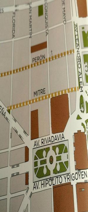
25 Calle Florida or Florida Street is the main pedestrian route through the Microcentro and is approximately 1 km long Calle Florida and the surrounding streets, and shopping malls have become an international shopping destination

26 Calle Florida is one of the city's leading tourist attractions and bustles with shoppers, vendors, and office workers alike because of its proximity to the financial district

27 For decades, Florida and Lavalle have been two of the most attractive and popular streets in downtown Buenos Aires for locals and tourists alike for one simple reason: no vehicular traffic.

28 More recently, more streets were added to the pedestrian-preferred mix creating another tree-lined zone filled with walkers, cyclists and locals lounging at outdoor Happy Hours. The City of Buenos Aires is converting other streets in the downtown grid to either 100% pedestrian only or, pedestrianpreferred with 70% of the street dedicated to pedestrians and only 30% or one lane available for vehicular traffic.

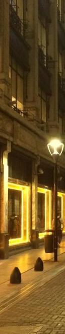
29 PUBLIC REALM DESIGN AND IMPLEMENTATION


30 Certain of the pedestrian zone street corners were expanded to provide more space for pedestrians


31 In certain streets of the Mircocentro public realm the curbs were leveled to form an integrated level with the pedestrian and vehicle zone


32 Part of the implementation strategy of the Microcentro Plan included the expansion of the pedestrian zone; and the construction of new paths; safer pedestrian crossings; the introduction of new robust street furniture components including bollards and benches.


33 One of the design principles for the public realm was to reduce the street furniture clutter; introduce new street furniture components; and the planting of trees.


34 Underground waste disposal and recycling bins with a capacity of 5,000 litres were installed on roads and pedestrian walkways


35 In certain areas of the Microcentro the original paving was incorporated in the design of the public realm


36 Part of the upgrade of the public realm included the design and implementation of new street lighting components which included the incorporation of LED lighting and catenary lights


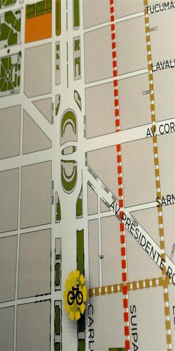
37 Various types of new street lights were incorporated in the public spaces and streets in the Microcentro Plan Zone. The new street lighting components also increase public safety at night.


38 Catenary Lights were incorporated throughout the Pedestrian Precinct. It minimizes clutter in the narrow streets where there is limited space for street furniture components within the public realm zone.


39 Part of the street lighting strategy was the recovery of historical street lamps in the historical sites and in front of key historical buildings


40 Part of the restoration strategy of the Microcentro Plan was the installation of uplighting and bulkhead lights at


41 The manhole covers and services are covered by movable planter boxes

42 SUSTAINABLE MOBILITY PLAN The Sustainable Mobility Plan looks to generate the necessary cultural change so that our next generations are able to live in an inclusive, healthy and modern city FUNDAMENTAL PILLARS GIVING PRIORITY TO PUBLIC TRANSPORT Incentivizing public transport use Sustainable Mobility Promoting walking and bicycle use throughout the city

43 SUSTAINABLE MOBILITY PLAN: TRAFFIC CONTROL AND TRAFFIC SAFETY PLANNING Reducing road accidents and improving traffic control mechanisms. Intelligent Mobility THE INTELLIGENT TRAFFIC SYSTEM includes new traffic planning tools and instruments to facilitate traffic circulation

44 ECOBICI: BUENOS AIRES BIKE SHARE PROGRAM Building on a small, manual system from 2010, the new Ecobici features an expanded coverage area, 24-hour service, and 200 new automated stations Ecobici users are expected to take nearly 36,000 daily trips and over a million trips a year The system gives users new options for transit, and complements Buenos Aires significant investment in bike lanes over the past several years Along with new pedestrian projects, rapidly improving biking amenities, and increased public transit, Ecobici is a cornerstone of Buenos Aires vision for a future of strong sustainable transit
 Now, the system is further expanding, along with a significant technology")
45 When Ecobici first opened in 2010, it offered just three stations and 72 bicycles, all operated out of manual stations (photo ) Now, the system is further expanding, along with a significant technology upgrade.

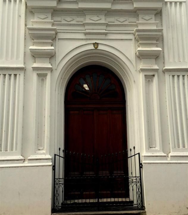
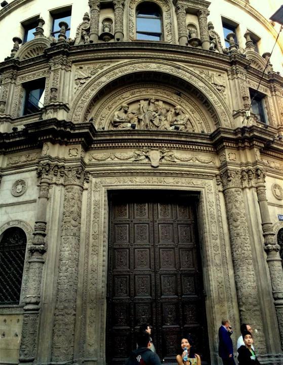
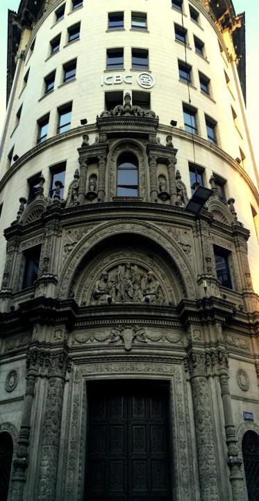
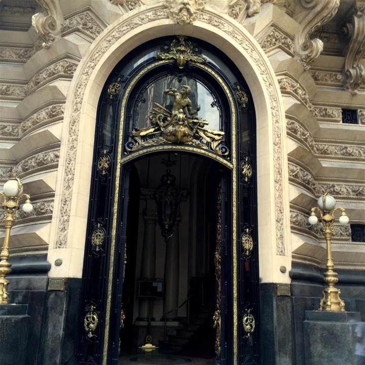
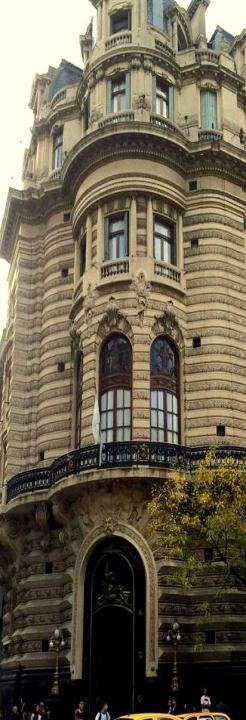
46 There are now 200 new fully automated stations and 3,000 bikes - the system has become large enough to play an important role in the city s transit In addition to being more efficient and easier to use, with automated stations the system is now open 24- hours a day, instead of only during business hours

47 In a manual system, an attendant records the user s information and helps with checking in or out the bike, including payment This information can be recorded on paper or electronically Automated systems are where the user checks in or out the bikes and makes payments electronically either at the terminal or kiosk or directly at the docking station These types of systems often use specialized key cards for the users

48 EcoBici has evolved to meet international best practices with a large, automated system covering significant parts of the city s busiest districts The growth of Ecobici has been complemented by significant investment in biking infrastructure in the city Accompanying the new lanes have been a series of policies encouraging the installation of bike racks, bike education programs, and credits for purchases bicycles

49 Previously used almost exclusively for recreation, biking now represents 3.5% of all trips in the city A bigger, fully modern bike share in Buenos Aires will bring many benefits From enhancing social interaction to improving health and the quality of life, Ecobici will lead to a better urban environment for Buenos Aires residents The project is the latest example of Buenos Aires commitment to sustainable transit

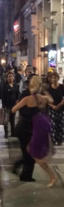
50 Although the City of Buenos Aires encourage non-motorized transport, motorbikes are still a very popular mode of transportation The public realm design of the Microcentro Plan provides dedicated parking areas for motorbikes

51 The preferable means of transportation to reach Florida Street from almost anywhere in the city, is the Buenos Aires Metro (subte, or underground) Metro lines have stations within a short walking distance of Florida Street Most bus lines reaching the downtown area have stops near Florida Street

52 Part of the Microcentro Plan s strategy is to: Limited access to various streets at certain times Ban vehicles except service vehicles on certain streets Allow only drivers with permits to certain streets Vehicular parking in the Microcentro Precinct is very difficult to find and very expensive

53 The Smart City Strategy for the Microcentro Plan include: The introduction of Smart Phone application which provide information of the area Touch-screen information offers live updates on public transport frequency and the availability of city bikes, Interactive maps and sensors to test air and noise pollution and give live weather reports and forecasts Free WiFi in tourist and commuter hotspots and on public transport Free cellular phone and tablet charging stations


54 HERITAGE: BUILDING FACADES AND ENTRANCES The facades of 70 iconic and historical buildings in the centre, are being carefully restored and illuminated with LED lighting, as part of the Microcentro Plan
55

56

57


58 AMBIENCE By evening, the pace relaxes as street performers flock to the area, including tango singers and dancers, living statues, and comedy acts.


59 Day time events are encouraged in certain public spaces and streets in the Microcentro


60 TRADING Informal trading is not allowed in the Microcentro; however; there are a few informal traders occurring at present in a small area in the Microcentro The only vendors allowed within the public realm are small newspaper and magazine kiosks


61 Further public realm and building upgrades are currently implemented as part of the Microcentro Plan.
Blood Alley Square/Trounce Alley Redesign
 June 216 Kick-Off Events Questionnaire and Engagement Summary Background The City of Vancouver is redesigning Blood Alley Square and Trounce Alley, important public spaces in the heart of Gastown, which
Ann Arbor Downtown Street Design Manual. Ann Arbor DDA IDA 2015 Awards Planning Category
 Ann Arbor Downtown Street Design Manual Ann Arbor DDA IDA 2015 Awards Planning Category 1 Ann Arbor s downtown streets are vibrant public spaces that accommodate multi-modal transportation, special events,
DRAFT Subject to Modifications
 TREASURE COAST REGIONAL PLANNING COUNCIL M E M O R A N D U M To: Council Members AGENDA ITEM 8 From: Date: Subject: Staff May 19, 2017 Council Meeting Florida Department of Transportation Complete Streets
Community Design Guidelines. Port Wallace DRAFT
 Community Design Guidelines Port Wallace DRAFT Energy 1 2 3 Nature Movement Connections Built Form DRAFT Layout Energy 1 Nature Community Design Guidelines GREAT COMMUNITIES PROTECT, CELEBRATE, AND CONSERVE
This Review Is Divided Into Two Phases:
 Semiahmoo Town Centre Review The purpose of this review: To review the Semiahmoo Town Centre Concept Plan, originally approved in 1993, to ensure that this centre will continue to serve the needs of South
Animating the Rideau Canal December 2013
 Executive Summary Animating the Rideau Canal December 2013 Why study the Rideau Canal? The Rideau Canal has been an important part of Ottawa throughout its history, and has shaped and been shaped by the
SECTION ONE: INTRODUCTION. introduction
 introduction 1 INTRODUCTION Since it was first established in 1843 as a trading post for the Hudson s Bay Company, Victoria has evolved into a Provincial capital city that is recognized across Canada and
Policies and Code Intent Sections Related to Town Center
 Policies and Code Intent Sections Related to Town Center The Town Center Vision is scattered throughout the Comprehensive Plan, development code and the 1994 Town Center Plan. What follows are sections
Silverdale Regional Center
 Silverdale Regional Center Vision for Silverdale Regional Center The Silverdale Regional Center Plan (Plan) will guide the evolution of the Silverdale Regional Center from a collection of strip malls and
PILLAR FOUR INTEGRATE LAND USE & TRANSPORTATION
 PILLAR FOUR INTEGRATE LAND USE & TRANSPORTATION 8 Scarborough Centre on the Move Transportation Master Plan 123 8 Transportation Pillar Four Integrate Land Use & The fourth pillar focuses on the relationship
Integrated Urban Development. April Reflections from the NZPI Study Tour of Portland, Seattle and Vancouver
 Integrated Urban Development April 2009 Reflections from the NZPI Study Tour of Portland, Seattle and Vancouver Integrated Urban Development Urban Growth Management Transportation Transit Orientated Mixed
Urban Design Manual PLANNING AROUND RAPID TRANSIT STATIONS (PARTS) Introduction. Station Study Areas
 Introduction. Station Study Areas") 111111 PLANNING AROUND RAPID TRANSIT STATIONS (PARTS) Introduction The ION rapid transit system will link Waterloo, Kitchener and Cambridge through a central transit corridor (CTC). There are a number
111111 PLANNING AROUND RAPID TRANSIT STATIONS (PARTS) Introduction The ION rapid transit system will link Waterloo, Kitchener and Cambridge through a central transit corridor (CTC). There are a number
Living in Albemarle County s Urban Places
 Living in Albemarle County s Urban Places ALBEMARLE COUNTY, VIRGINIA A Closer Look at Albemarle s Approach to Managing Growth and Creating Quality Urban Environments www.albemarle.org Page 2 Living in
38 Queen s University Campus Master Plan Part 1
 38 Queen s University Campus Master Plan Part 1 46 The Campus at the City Scale Chapter 4 The Campus at the City Scale 39 Queen s is an urban University centrally located in Kingston. Decisions made by
EXISTING COMPREHENSIVE PLAN
 EXISTING COMPREHENSIVE PLAN Town Center Land Use Element: V. LAND USE POLICIES Town Center Mercer Island's business district vision as described in "Your Mercer Island Citizen-Designed Downtown" was an
Introduction. Community Outreach Approach. Sacramento Valley Station Master Plan. Online Questionnaire Summary of Feedback.
 Introduction Located in the northwest sector of downtown Sacramento, the Sacramento Valley Station (SVS) is the primary rail station in northern California and the seventh busiest station in the country.
4- PA - LD - LIVELY DOWNTOWN. LD - Background
 4- PA - LD - LIVELY DOWNTOWN LD - Background The downtown has been the service centre for the community since the city s inception and the area continues to supply people with their personal services,
1.3 TRANSIT VISION 2040 FROM VISION TO ACTION THEME 1: PUTTING TRANSIT AT THE CENTRE OF COMMUNITIES. Fully integrate transit with community planning
 TRANSIT VISION 2040 FROM VISION TO ACTION TRANSIT VISION 2040 defines a future in which public transit maximizes its contribution to quality of life with benefits that support a vibrant and equitable society,
Wayfinding. North Gateway: Integrate a vertical gateway marker on the west side of Ward Street at the south corner of Vernon Street.
 3.3.6.2 Wayfinding Existing Conditions Wayfinding signage is important to direct visitors and tourists to different locations in the downtown. A significant part of the wayfinding signage in the downtown
appendix and street interface guidelines
 appendix five: building and street interface guidelines appendix 5 building and street interface guidelines BOULEVARDS Boulevards are generally characterized by higher levels of traffic movement at higher
PLAN ELEMENTS WORKSHOP. April 5, 2016
 PLAN ELEMENTS WORKSHOP April 5, 2016 needs more housing. But there is no one-size fits-all solution. Every neighborhood has its own character. In some places, density is not only appropriate it is badly
INTERNATIONAL SOCIETY OF CITY AND REGIONAL PLANNERS 2016 ISOCARP AWARD FOR EXCELLENCE
 INTERNATIONAL SOCIETY OF CITY AND REGIONAL PLANNERS 2016 ISOCARP AWARD FOR EXCELLENCE PROJECT DESCRIPTION WHAT IS ZIBI? Zibi is a world-class sustainable community and redevelopment project by Windmill
Plano Tomorrow Vision and Policies
 Plano Tomorrow Vision and Policies PLANO TOMORROW PILLARS The Built Environment The Social Environment The Natural Environment The Economic Environment Land Use and Urban Design Transportation Housing
BUSINESS DISTRICT DESIGN GUIDELINES
 Des Plaines, Illinois Prepared for the City of Des Plaines by: The Lakota Group Laurie Marston, AICP March 2005 Section 5: Streetscape Elements Business District Design Guidelines STREETSCAPE ELEMENTS
Create Policy Options Draft Plan Plan Approval. Public Consultation Events. Phase 2
 Background Grandview-Woodland Community Plan In the spring of 2012, the City of Vancouver embarked on a comprehensive community planning program in the Grandview-Woodland neighbourhood. The process has
Blueprint Denver A BLUEPRINT FOR AN INCLUSIVE CITY. Executive Summary
 Blueprint Denver A BLUEPRINT FOR AN INCLUSIVE CITY Executive Summary PUBLIC REVIEW DRAFT 2 1/7/2019 DENVERIGHT BLUEPRINTDENVER Blueprint Denver: A Blueprint for an Inclusive City An Equitable City Planning
History: a Grand Urban Boulevard
 History: a Grand Urban Boulevard 1890 1910: At its peak, Euclid Avenue, "Millionaire's Row," was considered the second most beautiful urban street in the country next to Fifth Avenue in Manhattan. 1910-2030:
Subregion 4 Central Avenue-Metro Blue Line Corridor Transit-Oriented Development (TOD) Implementation Project. Community Meeting April 27, 2011
 Implementation Project. Community Meeting April 27, 2011") Subregion 4 Central Avenue-Metro Blue Line Corridor Transit-Oriented Development (TOD) Implementation Project Community Meeting April 27, 2011 Overview Introduction to Subregion 4 TOD Implementation Program
Subregion 4 Central Avenue-Metro Blue Line Corridor Transit-Oriented Development (TOD) Implementation Project Community Meeting April 27, 2011 Overview Introduction to Subregion 4 TOD Implementation Program
Welcome to the Oakridge Centre Open House
 Welcome to the Oakridge Centre Open House Why is the City hosting this event? This open house is to inform you of a rezoning application submitted to the City of Vancouver to amend the existing CD-1 (Comprehensive
PROPOSED REDEVELOPMENT OF THE GLEN ABBEY GOLF CLUB. STREETSCAPE DESIGN STUDY (excerpt from the Urban Design Brief) TOWN OF OAKVILLE.
 TOWN OF OAKVILLE.") PROPOSED REDEVELOPMENT OF THE GLEN ABBEY GOLF CLUB STREETSCAPE DESIGN STUDY (excerpt from the Urban Design Brief) TOWN OF OAKVILLE OCTOBER, 2016 for 2.4.2 STREETS Streets are the single largest component
PROPOSED REDEVELOPMENT OF THE GLEN ABBEY GOLF CLUB STREETSCAPE DESIGN STUDY (excerpt from the Urban Design Brief) TOWN OF OAKVILLE OCTOBER, 2016 for 2.4.2 STREETS Streets are the single largest component
Corridor Vision. 1Pursue Minnehaha-Hiawatha Community Works Project. Mission of Hennepin County Community Works Program
 1Pursue Minnehaha-Hiawatha Community Works Project Minnehaha-Hiawatha Community Works is a project within the Hennepin Community Works (HCW) program. The mission of the HCW program is to enhance how the
Anatomy of A Vibrant Downtown. Anatomy of a Vibrant Downtown
 Anatomy of A Vibrant Downtown The goal of MAIN ST. REVITALIZATION PLANNING is to provide a framework that will help transform your downtown into a VIBRANT DOWNTOWN a place where people love to LIVE, WORK,
Landscape and Streetscape Design 2.5
 Landscape and Streetscape Design 2.5 2.5.1 Goals 2.5.2 Planting 2.5.3 Sidewalks and Pavement 2.5.4 Furnishings 2.5.5 Walls 2.5.6 Lighting 2.5.7 Stormwater 2.5.8 Street Cross Sections 2.5 LANDSCAPE AND
section 3: Vision, Values and Goals
 Vision, Values and Goals 3 2041 Vision: Victoria is an urban sustainability leader inspiring innovation, pride and progress towards greater ecological integrity, livability, economic vitality, and community
Establish a network of streetscaped vehicle and pedestrian routes that connect within and outside the Plan area.
 This Plan s urban design goals are to create an urban scale, walkable community with connections to transit, parks, and services and with amenities and facilities for residents and employees. The 1992
1 Adapted from the Statewide Transit-Oriented Development Study by CalTrans, 2006
 APPENDIX C: LAND USE PLANNING FOR ENHANCED RAIL SERVICE 72 BACKGROUND One of the consistent themes heard from localities in the Route 29 corridor Planning Forums was the need for expanding rail service
SPRINGHILL LAKE TRANSIT VILLAGE
 Greenbelt Metro Area Sector Plan - Subarea Design Policies and Guidelines - Springhill Lake Transit Village 113 SPRINGHILL LAKE TRANSIT VILLAGE Residential Neighborhood and Village Center CONCEPT Springhill
Health and the Built Environment Placemaking Workshop, February 2018
 Health and the Built Environment Placemaking Workshop, February 2018 Vermont Department of Health Suzanne Kelley; Healthy Communities Program Coordinator Vision: Healthy People in Healthy Communities As
Northwest commuter rail station US 36 BRT. Westminster Station
 Northwest commuter rail station Westminster Station US 36 BRT Westminster Center US 36 & Church Ranch Broomfield Flatiron/96 th St. US 36 & McCaslin Table Mesa Boulder Junction 13-month effort that will
Maplewood Avenue Downtown Complete Street Project
 Maplewood Avenue Downtown Complete Street Project Second Public Meeting January 24, 2018 Welcome and Introduction of Project Team City Planning and Public Works Staff City of Portsmouth Juliet Walker Planning
FRUITVALE TRANSIT VILLAGE (Phase 2) Residential Project
 Residential Project") FRUITVALE TRANSIT VILLAGE (Phase 2) Residential Project DEVELOPER: SIGNATURE PROPERTIES ARCHITECT: HKIT ARCHITECTS April 23, 2010 TABLE OF CONTENTS 3 Vision 4 Description of Site 5 Guiding Concepts 6
FRUITVALE TRANSIT VILLAGE (Phase 2) Residential Project DEVELOPER: SIGNATURE PROPERTIES ARCHITECT: HKIT ARCHITECTS April 23, 2010 TABLE OF CONTENTS 3 Vision 4 Description of Site 5 Guiding Concepts 6
Public input has been an important part of the plan development process.
 Lakewood s Comprehensive Plan recognizes that transportation helps shape the community, and that the way the community provides for the safe and efficient movement of people affects the character of the
Unique. Livable. Connected. Sustainable. Anticipate and Manage Change. Variety of Housing Choices. Enhanced Arterial Corridors
 Neighborhood Vision The Old Town Neighborhoods are Unique, Livable, Connected, and Sustainable. As mature, established neighborhoods, many of the ideas and opportunities expressed by stakeholders in support
The Master Plan Framework
 The Master Plan Framework The East Harbour Master Plan advances the development of 60 acres of former industrial lands east of the Don River. The Master Plan outlines a vision for a vibrant, transit-oriented
ANCHOR TO ANCHOR. Rescale the street to create an iconic boulevard.
 ANCHOR TO ANCHOR Rescale the street to create an iconic boulevard. UR NE ER UV GO NE LA OBJECTIVES 1. Maintain appropriate traffic flow and prioritize commercial curb access 2. Mark gateways at the street
CITY OF COLWICH COMPREHENSIVE PLAN LAND USE LAND USE 1
 LAND USE LAND USE 1 WHAT YOU WILL FIND IN THIS CHAPTER: Discussion of today s conditions and tomorrow s projections Discussion of challenges and opportunities Discussion of the environmental quality goals,
Courthouse Square Planning & Urban Design Study. Courthouse Square Working Group #13 October 15, 2014
 Courthouse Square Planning & Urban Design Study Courthouse Square Working Group #13 October 15, 2014 1 Courthouse Square Process Working Group Community Courthouse Square Advisory Groups & Civic Associations
Lehigh Acres Land Development Regulations Community Planning Project
 Lehigh Acres Land Development Regulations Planning Effort Summary In July, 2010 Commissioner Frank Mann invited the Lehigh Acres community to start discussing how to achieve their recently adopted community
1.0 Introduction. Purpose and Basis for Updating the TMP. Introduction 1
 1.0 Introduction The Town of Castle Rock is situated between the metropolitan areas of Denver and Colorado Springs, amidst a unique terrain of rolling hills, mesas, ravines, and waterways. Like many Front
STUDY OF URBAN SMART GROWTH APPROACH BASED ON THE PRINCIPLES AND GUIDELINES FOR NEW PLANNING
 www.arpapress.com/volumes/vol23issue2/ijrras_23_2_05.pdf STUDY OF URBAN SMART GROWTH APPROACH BASED ON THE PRINCIPLES AND GUIDELINES FOR NEW PLANNING Abbas Matloubi Technical and constructive assistant,
CHAPTER 7: Transportation, Mobility and Circulation
 AGLE AREA COMMUNITY Plan CHAPTER 7 CHAPTER 7: Transportation, Mobility and Circulation Transportation, Mobility and Circulation The purpose of the Transportation, Mobility and Circulation Chapter is to
Streets for People, Place-Making and Prosperity. #TOcompletestreets
 COMPLETE STREETS FOR TORONTO Streets for People, Place-Making and Prosperity COMPLETE STREETS: A NEW APPROACH A Complete Streets design approach considers the needs of all users people who walk, bicycle,
GO Station Mobility Hubs: Draft Precinct Plans. Committee of the Whole July 12, 2018
 GO Station Mobility Hubs: Draft Precinct Plans Committee of the Whole July 12, 2018 Purpose of this Workshop Present Draft Precinct Plans for the 3 GO Station Mobility Hubs Continue the conversations that
Study Area. Capitol Way. Greening America s Capitals 11/13/2014. A Greening America s Capitals Project
 Olympia, WA: Greening Capitol Way Supporting Communities move towards sustainability is a priority for the federal government. A Greening America s Capitals Project Office of Sustainable Communities U.S.
greenprint midtown SUSTAINABILITY ACTION PLAN 2012
 greenprint midtown SUSTAINABILITY ACTION PLAN 2012 MIDTOWN ALLIANCE SOUTHFACE ENERGY INSTITUTE RENAISSANCE PLANNING GROUP SUSTAINABLE ATLANTA PERKINS+WILL 2 GREENPRINT MIDTOWN 1. Introduction Sustainability
lot flankage Y street 16m 6m landscape strip for large site 3m landscape strip for small medium site
 Commercial General Commercial Objectives Create developments compatible with adjacent land uses in scale, function and character Define a consistent and attractive street edge with quality landscaping,
Welcome. Walk Around. Talk to Us. Write Down Your Comments
 Welcome This is an information meeting introducing the applications for proposed redevelopment of the Yorkdale Shopping Centre site at 3401 Dufferin Street and 1 Yorkdale Road over the next 20+ years,
See the West Melbourne Transport and Access Study (Phillip Boyle and Associates) for more information on the proposed Spencer Street tram.
 for more information on the proposed Spencer Street tram.") West Melbourne Ideas Workshop - Saturday 18 February 2017 Issues, concerns, ideas and comments On Saturday 18 February, around 150 people attended an ideas workshop at the Angliss Conference Centre to
West Melbourne Ideas Workshop - Saturday 18 February 2017 Issues, concerns, ideas and comments On Saturday 18 February, around 150 people attended an ideas workshop at the Angliss Conference Centre to
2.0 THE PLATINUM TRIANGLE VISION
 2.0 THE PLATINUM TRIANGLE VISION The envisions an exciting future for the area surrounding Angel Stadium of Anaheim, the Honda Center and The Grove of Anaheim. 2.1 Planning Principles In order to further
178 Carruthers Properties Inc.
 178 Carruthers Properties Inc. Planning Rationale for 178 Carruthers Avenue Site Plan Control Application June 2014 Table of Contents 1.0 Introduction 2.0 Overview of Subject Property 3.0 Current Zoning
The Vision. Photo provided by The Minervini Group. 46 Vision, Objectives & Strategies
 Vision, Objectives & Strategies The is the public framework and guide for future development of the Grand Traverse Commons. The establishes public polices for infrastructure, the preservation of natural
Executive Summary. NY 7 / NY 2 Corridor
 Executive Summary NY 7 / NY 2 Corridor Transportation and Land Use Study December 2005 Prepared for: Town of Colonie Capital District Transportation Committee Prepared by: Introduction: Land use decisions
Streets for All East of England
 Streets for All East of England Summary In 2017 Historic England published an updated national edition of Streets for All, a practical guide for anyone involved in planning and implementing highways and
elbridge Core Strategy
 C elbridge Core Strategy Celbridge is designated as a Moderate Growth Town in the RPGs. The County Development Plan reinforces this designation in its settlement strategy. Moderate Growth Towns within
Ivywild On The Creek PRELIMINARY CREEK DISTRICT MASTER PLAN
 Ivywild On The Creek PRELIMINARY CREEK DISTRICT MASTER PLAN Introduction: Rejuvenating an extraordinary Creekside neighborhood THE CREEKSIDE DISTRICT The Ivywild On The Creek Neighborhood District Master
DALY CITY VISIONING PROCESS COMMUNITY WORKSHOP 3 MAY 8, 2008
 DALY CITY VISIONING PROCESS COMMUNITY WORKSHOP 3 MAY 8, 2008 PROCESS General Plan - a statement of the community s values, vision and aspirations for now and into the future... Timeframe LONG TERM - 2030
Implementation Guide Comprehensive Plan City of Allen
 Implementation Guide 2030 Comprehensive Plan City of Allen DRAFT 2015 Implementation Guide Allen 2030 Comprehensive Plan INTRODUCTION The Comprehensive Plan serves as a guide for the growth and development
Urban Design. in the City of Kitchener. MUDR Presentation May 2010
 Urban Design in the City of Kitchener MUDR Presentation May 2010 Highlights Direction: long term commitment to urban design in Kitchener Themes: density, mixed use, community focal points, transit, accessibility
URBAN DESIGN BRIEF URBAN DESIGN BRIEF 721 FRANKLIN BLVD, CAMBRIDGE August 2018
 URBAN DESIGN BRIEF URBAN DESIGN BRIEF 721 FRANKLIN BLVD, CAMBRIDGE August 2018 DESIGN BRIEF CONTENTS PART A 1.0 INTRODUCTION 2.0 DESCRIPTION & ANALYSIS OF SITE CONTEXT 3.0 DESIGN CONSTRAINTS AND OPPORTUNITIES
The Five Components of the McLoughlin Area Plan
 The Five Components of the McLoughlin Area Plan This documents contains the complete language of the five components of the McLoughlin Area Plan: The Vision Statement The Values The Guiding Principles
PUBLIC RIGHT-OF-WAY IN THIS CHAPTER PUBLIC REALM
 PUBLIC RIGHT-OF-WAY This section provides design guidelines for improvements in the public right-of-way. The public right-of-way refers to streets, sidewalks, non-vehicular thoroughfares, parks and greenways
11.0 TRANSPORTATION ELEMENT
 11.0 TRANSPORTATION ELEMENT Transit, Circulation and Parking Sub-Element: For all campuses, FIU's goal is to increase multimodal access. In combination with other measures - such as the development of
URBAN DESIGN BRIEF. 2136&2148 Trafalgar Road. Town of Oakville
 URBAN DESIGN BRIEF 2136&2148 Trafalgar Road Town of Oakville Prepared By: METROPOLITAN CONSULTING INC For 2500674 Ontario Inc November 2016 TABLE OF CONTENTS Page No. 1.0 Introduction/Description of Subject
THEMES, VISION, + PRINCIPLES
 CHAPTER 2: THEMES, VISION, + PRINCIPLES This page intentionally left blank. 20 VISION DRAFT AUGUST 2018 2 2 THEMES, VISION, + GUIDING PRINCIPLES The Key Themes, Vision, and Guiding Principles presented
CONTENTS 6.1 URBAN DESIGN
 6-2 Urban Design and Sustainable Development 6.0 URBAN DESIGN AND SUSTAINABLE DEVELOPMENT CONTENTS 6.1 URBAN DESIGN 6.1.1 General Policies 6.1.2 The Public Realm 6.1.3 Streets and Blocks 6.1.4 Streetscapes
DRAFT FOR PUBLIC REVIEW. Game Plan for a Healthy City
 DRAFT FOR PUBLIC REVIEW 2018 Game Plan for a Healthy City 2 Denveright. Parks & Recreation Game Plan Draft for Public Review Draft for Public Review Executive Summary Game Plan Overview Executive Summary
Figure Example of out door dining in the public right-of-way.
 Section 2 Core Area Goal 2.2.1 To maintain and enhance the character of existing streets in the Downtown Area. Character Figure 2.2.1 Example of out door dining in the public right-of-way. A. Provide street
Chapter 4. Linking Land Use with Transportation. Chapter 4
 Chapter 4 Linking Land Use with Transportation Chapter 4 59 Chapter 4 Linking Land Use with Transportation Community Design and Transportation Program Introduction Since the 1950s, the predominant development
Streets Vision
 streets 86 2.9 Vision : The Most Prevalent and Important Public Spaces Fixed routes of human travel have served as corridors for commerce and places for human interaction from the earliest trails and foot
South Yonge Street Corridor
 South Yonge Street Corridor Streetscape Master Plan Study Draft Final Executive Summary Prepared by: January 2012 In Partnership with: Introduction The Future... Yonge Street is at the forefront of York
Lambeth Main Street Streetscape Improvements
 Lambeth Main Street Streetscape Improvements Open House October 5th, 2017 Agenda 1. Introduction 2. Project Background 3. Context 4. Project Objectives 5. Design Principles & Approach 6. Streetscape Design
Town Center (part of the Comprehensive Plan)
") Town Center (part of the Comprehensive Plan) Mercer Island Town Center Looking North (2014) In 1994, a year-long process culminated in a set of design guidelines and code requirements for the Town Center
Town Center (part of the Comprehensive Plan) Mercer Island Town Center Looking North (2014) In 1994, a year-long process culminated in a set of design guidelines and code requirements for the Town Center
CITY OF CHARLOTTESVILLE, VIRGINIA CITY COUNCIL AGENDA
 CITY OF CHARLOTTESVILLE, VIRGINIA CITY COUNCIL AGENDA Agenda Date: December 16, 2013 Action Required: Adoption of Resolution Presenter: Staff Contacts: Title: James E. Tolbert, AICP, Director of NDS James
John M. Fleming Managing Director, Planning and City Planner. Old East Village Dundas Street Corridor Secondary Plan Draft Terms of Reference
 Report to Planning and Environment Committee To: From: Subject: Chair and Members Planning & Environment Committee John M. Fleming Managing Director, Planning and City Planner Old East Village Dundas Street
A Vibrant Downtown. Chapter 5 Cary Public Art Opportunities 31
 A Vibrant Downtown Cary s vision for Downtown is a unique, vibrant, dynamic, pedestrian friendly location; a regional destination and a place to live, work, and recreate, according to the 2001 Town Center
Environmental Activity Nodes
 Chinese here 环保 Design Eco-Programming and Eco-Programming & Design Environmental Activity Nodes ENVIRONMENTAL EDUCATION WATER CLEANSING +URBAN DESIGN MARKETPLACE FOR LOCAL PRODUCTS Case Studies Xochimilco
The Urban Transit Challenge
 On-Street Priority Transitways Sustainable Transport Using Available Right-of-Ways Mark C. Walker, AICP The Urban Transit Challenge Increase urban mobility & transit speed Use available rights-of-way Minimize
4.9 Mendocino Avenue Corridor Plan Design Guidelines
 4.9 Mendocino Avenue Corridor Plan Design Guidelines The Mendocino Avenue Corridor Plan addresses the area between College Avenue and Steele Lane. Mendocino Avenue is a busy arterial that runs parallel
The Village of Shirlington
 The Village of Shirlington Suburban Smart Growth Without Rail Transit July 2018 Agenda History (1940 to present) Attributes and Outcomes Lessons Learned Setting the Stage Arlington County Arlington is
FDOT D4 Complete Streets
 FDOT D4 Complete Streets Context Sensitive Solutions Directs that complete street solutions will complement the context of the community. Collaborative approach to decision making, project development,
KENDALL SQUARE INITIATIVE. Planned Unit Development Special Permit Application - SoMa September 8, 2015
 KENDALL SQUARE INITIATIVE Planned Unit Development Special Permit Application - SoMa September 8, 2015 GENERAL DEVELOPMENT GOALS Kendall Square PUD 2 PRE-ZONING PUBLIC ENGAGEMENT 2008-2009 2010-2012 2013
COMPLETE GREEN STREET CHECKLIST
 COMPLETE GREEN STREET CHECKLIST This document was developed to dissect the structure of an urban street and explore opportunities to make our streets more complete while also integrating green street strategies.
KENDALL SQUARE INITIATIVE. Planned Unit Development Special Permit Application - SoMa September 8, 2015
 KENDALL SQUARE INITIATIVE Planned Unit Development Special Permit Application - SoMa September 8, 2015 GENERAL DEVELOPMENT GOALS Kendall Square PUD 2 PRE-ZONING PUBLIC ENGAGEMENT 2008-2009 2010-2012 2013
Chapter 3 Community Vision, Values, and Guiding Principles
 Chapter 3 Community Vision, Values, and Guiding Principles This Chapter presents the vision for Grand Rapids in 2030, supporting community values, and principles to guide implementation of the Comprehensive
2017 STRATEGIC PLAN CITY OF ST. AUGUSTINE
 2017 STRATEGIC PLAN CITY OF ST. AUGUSTINE WHO WE ARE CITY OF ST. AUGUSTINE VISION St. Augustine will be a diverse, livable, authentic waterfront city that builds upon its rich history and environment to
Midtown Greenway Land Use and Development Plan Executive Summary
 Midtown Greenway Land Use and Development Plan Executive Summary Introduction The Midtown Greenway Land Use and Development Plan sets policy direction for land use and development in the Midtown Greenway
TRANSIT RICH DEVELOPMENT
 TRANSIT RICH DEVELOPMENT Alan Hart AIA MAIBC AAA There is only one way to reduce congestion and get people out of their cars: design the places where people live around the patterns of their lives; give
Route 347. New York State Department of Transportation Region 10, Long Island. THE GREENING of ROUTE 347
 The GREENING of Route 347 The Greening of Route 347 The Greening of Route 347: History 3 The Greening of Route 347 4 The Greening of Route 347 5 The Greening of Route 347 Smith Haven Mall 6 The Greening
Wasatch CHOICE for 2040
 Wasatch CHOICE for 2040 Economic Opportunities We Can Choose a Better Future We enjoy an unparalleled quality of life along the Wasatch Front. People from all over the world are drawn to our stunning scenery,
3. Endorse the LRT vision in transforming Surrey into Connected-Complete-Livable communities, and more specifically, the official vision statement:
 CORPORATE REPORT NO: R038 COUNCIL DATE: February 20, 2017 REGULAR COUNCIL TO: Mayor & Council DATE: February 16, 2017 FROM: General Manager, Engineering FILE: 8740-01 SUBJECT: Surrey Light Rail Transit