PROPOSED DRAINAGE PATTERNS
|
|
|
- Hester Hood
- 5 years ago
- Views:
Transcription

1 Basin Floor N PROPOSED DRAINAGE PATTERNS Deroiser Drive Riverwood Drive County 260
2 Project Name: Riverwood Drive LITTLE FALLS TOWNHOMES Project Location: LITTLE FALLS, MINNESOTA PROJECT LOCATION: SOUTHWEST OF THE INTERSECTION OF DEROISER DR AND RIVERWOOD DR APPROXIMATE CENTROID OF PROJECT: LATITUDE: N LONGITUDE: W Project Description: N Deroiser Drive THE CONSTRUCTION OF THE LITTLE FALLS TOWNHOMES WILL CONSIST OF THE CONSTRUCTION OF A NEW STREET AND UTILITY EXTENSIONS ON THE NORTH SIDE OF THE CITY OF LITTLE FALLS WITHIN PRIVATE PROPERTY OWNED BY ROACH DEVELOPMENT, LLC. THE ACTIVITIES ASSOCIATED WITH THE CONSTRUCTION OF THE FACILITIES WILL RESULT IN THE DISTURBANCE OF EXISTING SOILS. THIS STORM WATER POLLUTION PREVENTION PLAN (SWPPP) WILL OUTLINE THE STRATEGIES AND STEPS THAT WILL BE TAKEN TO PREVENT DISCHARGING OF SOILS FROM THE CONSTRUCTION SITE. CONSTRUCTION ACTIVITIES AND UNFORESEEN PROCESSES MAY NECESSITATE THE MODIFICATION OF THE SWPPP BY THE CONTRACTOR AND ENGINEER PROJECT LOCATION Project Information: PROJECT SIZE: 8.80 ACRES EXISTING IMPERVIOUS SURFACE AREA IN PROJECT LIMITS: 0.30 ACRES PROPOSED IMPERVIOUS SURFACE IN PROJECT LIMITS: 2.57 ACRES RECEIVING WATERS FROM PROJECT SITE: ON SITE TREATMENT AND OVERFLOW TO AN EXISTING DRAINAGE WAY TOWARD THE MISSISSIPPI RIVER. ACCORDING TO THE MINNESOTA POLLUTION CONTROL AGENCY WEBSITE, THERE IS ONE IMPAIRED WATER WITHIN ONE MILE OF THE PROJECT LIMITS. THE MISSISSIPPI RIVER IS AN IMPAIRED RIVER/STREAM BUT ONLY FOR AQUATIC CONSUMPTION. THERE ARE ALSO NO KNOWN CALCAREOUS FENS NEAR DISCHARGE LOCATIONS. EXISTING SOILS IN THE PROJECT AREA CONSIST PRIMARILY OF LOAMY SANDS (TYPE A). USGS LOCATION MAP Responsible Parties: OWNER: ROACH DEVELOPMENT, LLC MR. TERRY ROACH terryroachnoparking@hotmail.com 1414 PAUL LARSON DRIVE LITTLE FALLS, MN CONTRACTOR: NAME OF CONTRACTOR ADDRESS SWPPP DESIGNER: MR. JADE BERUBE, P.E. APEX ENGINEERING GROUP JADE.BERUBE@APEXENGGROUP.COM STORMWATER SUMMARY: EXISTING CONDITIONS CONTRIBUTING AREAS: PROJECT SITE: 8.80 Acres Soil Type A Time of Concentration: 67.2 MINUTES Design Storm Discharge 100 YEAR POST CONSTRUCTION CONDITIONS CONTRIBUTING AREAS: PROJECT SITE: 8.80 Acres Percent Impervious: EXISTING DRAINAGE PATTERNS County 260 SWPPP SITE INSTALLER: Riverwood Drive SWPPP SITE INSPECTOR: INSPECTION AND MAINTENANCE DOCUMENTS FOR THE PROJECT SHALL BE KEPT AT AN ON SITE LOCATION TO BE DETERMINED BY THE SWPPP SITE INSPECTOR. THE INSPECTOR SHALL BE RESPONSIBLE FOR MAINTAINING THE LOCATION, AS WELL AS PROVIDING THE INFORMATION TO ANY INTERESTED PARTIES. Temporary Erosion Control: THE ITEMS INDICATED BELOW ARE TO BE CONSIDERED A PRELIMINARY ESTIMATE OF THE TEMPORARY EROSION CONTROL DEVICES NECESSARY TO LIMIT EROSION FROM THE SITE. THE CONTRACTOR'S MEANS AND METHODS WILL ULTIMATELY DICTATE THE QUANTITY AND PLACEMENT OF TEMPORARY EROSION CONTROL DEVICES. STORMWATER QUALITY: INFILTRATION BASIN Top of Basin Elevation = (MIN.) Bottom Elevation = (MIN.) Pond Emergency Overflow Elevation = (MIN.) Surface Area at Bottom Elevation = 3,920 S.F. Side Slopes Of Basin = 10:1 Design Infiltration Rate ( 2 1 USGS Rate) = 10"/Hour Design Year (100) High Water = N Deroiser Drive 1120 Basin Floor ITEM TEMPORARY SILT FENCE CULVERT INLET PROTECTION QUANTITY 250 L.F. 5 EACH OTHER POLLUTANT SOURCES ON THE SITE WILL BE THOSE CONSISTENT WITH CONSTRUCTION ACTIVITY AND MUST BE CONTROLLED BY THE CONTRACTOR. THESE SOURCES WILL INCLUDE, BUT ARE NOT LIMITED TO THE FOLLOWING: DUST, OILS, GREASES, GARBAGE, CONSTRUCTION DEBRIS. Permanent Erosion Control: THE IMPROVEMENTS WILL BE TREATED THROUGH A VARIETY OF STORM WATER TREATMENT METHODS INCLUDING VEGETATED STRIPS, HOLDING DITCHES, AND INFILTRATION BASINS. County 260 PROPOSED DRAINAGE PATTERNS Issue # REVISIONS Description Date STORM WATER POLLUTION PREVENTION PLAN (SWPPP) Bismarck - Detroit Lakes - Fargo 1265 Highway 10 West, Suite # 4 Detroit Lakes, Minnesota Office: Apex Project #: Date: April XX, 2015 Drawn By: Cade K. Checked By: Bob S. Approved By: Jade B. I hereby certify that this plan, specification or report was prepared by me or under my direct supervision and that I am a duly Licensed Professional Engineer under the laws of the State of Minnesota. Jade A. Berube Date:X/XX/XXXX PRELIMINARY License Number: Sheet: G-01
3 SYMBOLS LEGEND PLAN NOTES TEMPORARY EROSION CONTROL SILT FENCE INLET PROTECTION PERMANENT EROSION CONTROL INFILTRATION BASIN PROPOSED 15" CULVERT 1. ALL AREAS DISTURBED BY THE CONSTRUCTION ACTIVITY SHALL BE RESTORED BY THE CONTRACTOR AS SOON AS PRACTICAL AND IN ACCORDANCE WITH THE NPDES PERMIT. 2. IN THE EVENT THAT PERMANENT RESTORATION CANNOT BE COMPLETED WITHIN THE PERMITTED TIME FRAMES, THE CONTRACTOR WILL BE RESPONSIBLE FOR TEMPORARY STABILIZATION. 3. ALL TEMPORARY STOCKPILES SHALL BE STABILIZED TO COMPLY WITH THE MPCA NPDES PERMIT. 4. THE DEPICTED EROSION AND SEDIMENT CONTROL PLAN SHOULD BE USED AS A GENERAL GUIDELINE. THE CONTRACTOR'S CONSTRUCTION METHODS MAY REQUIRE ADDITIONAL EROSION AND SEDIMENT CONTROL DEVICES TO REMAIN WITHIN THE REQUIREMENTS OF THE NPDES GENERAL STORM WATER PERMIT. 5. THE CONTRACTOR IS RESPONSIBLE FOR MINIMIZING AREAS OF DISTURBANCE AND MUST ESTIMATE THE AREA THAT WILL REQUIRE TURF RESTORATION BASED ON THE PROPOSED WORK AND THE CONTRACTOR'S CONSTRUCTION METHODS. 6. TURF ESTABLISHMENT SHALL INCLUDE TOPSOIL PLACEMENT/PREPARATION, SEEDING, AND WATERING AS ILLUSTRATED IN THIS STORM WATER POLLUTION PREVENTION PLAN. 7. CONSTRUCTION OF INFILTRATION BASINS SHALL SHALL NOT BE COMPLETED UNTIL THE CONTRIBUTING DRAINAGE AREA HAS BEEN CONSTRUCTED AND FULLY STABILIZED. CULVERT INLET PROTECTION CULVERT INLET PROTECTION Riverwood Drive FLOW 2'-0" DITCH PROFILE NOTE: POINT 'A' MUST BE 6" MINIMUM HIGHER THAN POINT 'B'. Deroiser Drive 6' MAX STEEL "T" POST WITH 3 PLASTIC ZIP TIES (50LB. TENSILE) IN TOP 8" (MACHINE SLICED) OR 2" X 2" WOOD POST WITH STAPLES SPACED DOWN THE LENGTH OF THE POST (PRE-ASSEMBLED) POINT 'A' 5'-0" SIDE VIEW CLASS 1-4 RIPRAP (SPEC. 3601) POINT 'B' GEOTEXTILE FABRIC LINER TYPE 4 (SPEC. 3733) ALONG BOTTOM OF RIPRAP POINT 'A' 2.0' MIN. DIRECTION OF FLOW FRONT VIEW GEOTEXTILE FABRIC LINER TYPE 4 (SPEC. 3733) ALONG BOTTOM OF RIPRAP PLAN VIEW BACKFILLED TRENCH 2 EROSION CONTROL ROCK CHECK DETAIL NO SCALE NOTES: 1. INSPECT AND REPAIR FENCE AFTER EACH STORM EVENT AND REMOVE SEDIMENT WHEN NECESSARY. 2. REMOVED SEDIMENT SHALL BE DEPOSITED TO AN AREA THAT WILL NOT CONTRIBUTE SEDIMENT OFF-SITE AND CAN BE PERMANENTLY STABILIZED. STORM PIPE N 250 L.F. SILT FENCE County SILT FENCE SHALL BE PLACED ON SLOPE CONTOURS TO MAXIMIZE PONDING EFFICIENCY. OVERLAP GEOTEXTILE FABRIC 6" & FASTEN AT 2' INTERVALS. 30" MIN. WIRE MESH DIRECTION OF FLOW 6" MIN. 5.0' MIN. LENGTH POST AT 6.0' MAX. SPACING WIRE MESH REINFORCEMENT GEOTEXTILE FABRIC, 48'' WIDE BACKFILLED TRENCH FABRIC ANCHORAGE IN TRENCH. BACKFILL W/ TAMPED ORIGINAL SOIL 6.0' MINIMUM VARIES VARIES FLARED END SECTION 6.0' MINIMUM ' MIN. POST EMBEDMENT 4" MIN. EXTEND WIRE MESH INTO TRENCH 4.0' MIN. TOE SECTION VIEW FLOW NOTE: PIPE DIA. < 42" = FIBER ROLL 12IN PIPE DIA. > FIBER ROLL 20IN 1 SILT FENCE DETAILS NO SCALE 3 FIBER ROLL END OF PIPE PROTECTION NO SCALE Issue # REVISIONS Description Date SITE EROSION CONTROL PLAN AND DETAILS (SWPPP) Bismarck - Detroit Lakes - Fargo 1265 Highway 10 West, Suite # 4 Detroit Lakes, Minnesota Office: Apex Project #: Date: April XX, 2015 Drawn By: Cade K. Checked By: Bob S. Approved By: Jade B. I hereby certify that this plan, specification or report was prepared by me or under my direct supervision and that I am a duly Licensed Professional Engineer under the laws of the State of Minnesota. Jade A. Berube PRELIMINARY Date:X/XX/XXXX License Number: Sheet: G-02

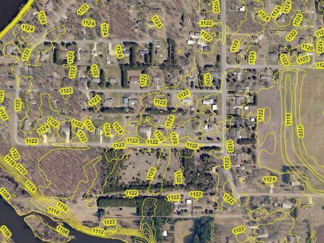
4 94 21' 34'' W Soil Map Morrison County, Minnesota 94 21' 19'' W 46 0' 12'' N ' 12'' N ' 5'' N ' 5'' N 94 21' 34'' W N Map Scale: 1:1,470 if printed on A landscape (11" x 8.5") sheet. Meters Feet Map projection: Web Mercator Corner coordinates: WGS84 Edge tics: UTM Zone 15N WGS ' 19'' W Natural Resources Conservation Service Web Soil Survey National Cooperative Soil Survey 3/12/2015 Page 1 of 3
5 Soil Map Morrison County, Minnesota Map Unit Legend Morrison County, Minnesota (MN097) Map Unit Symbol Map Unit Name Acres in AOI Percent of AOI D67A D67B Hubbard loamy sand, Mississippi River Valley, 0 to 2 percent slopes Hubbard loamy sand, Mississippi River Valley, 2 to 6 percent slopes % % Totals for Area of Interest % Natural Resources Conservation Service Web Soil Survey National Cooperative Soil Survey 3/12/2015 Page 3 of 3
6
7

8 Morrison County, MN Date Created: 4/8/2015 Overview 451 ft Parcel ID Sec/Twp/Rng Property Address Alternate ID Class 4BB-Residential Non-Homestead SFD Acreage Legend Corporate Limits Political Townships Subdivisions Parcels Main Roads State Highway US Highway Road Centerlines Flood Plain IN OUT, 500yr PZ_Feedlots PZ_Zoning AG Owner Address ROACH DEVELOPMENT LLC 1414 PAUL LARSON DR LITTLE FALLS MN C MHB MI R RR SC SP SR PZ_Flood Plain IN OUT, 500yr PZ_Army Compatible Use Buffer PZ_Urban Fringe Zoning District Brief Tax Description LITTLE FALLS EAST-#482-HRA PT OF GOV LOT 2 SEC 27 & OF NW1/4 OF SW1/4 SEC 26 DESC AS: COM AT NE COR OF SAID GOV LOT 2, S 0*01'33" E FT ALG E LN, N 89*54'45" W FT, N 7*33'25" W FT TO SW COR OF DOC PT OF BEG, S 7*33'25" E FT, S 89*54'45" E 232 FT TO CTRLN OF CO RD, S 17*10'39" E FT ALG CTRLN, CONT ALG CTRLN S 19*15'32" E FT TO INTERS WITH N LN OF DOC , S 89*57'19" W FT ALG SAID N LN TO ITS NW COR, S 0*02'41" E FT ALG W LN TO S LN OF N FT OF GOV LOT 2, N 89*54'45" W FT TO


9 Little Falls Townhomes Mar 27, 2015 User Remarks: This map is for general reference only. The US Fish and Wildlife Service is not responsible for the accuracy or currentness of the base data shown on this map. All wetlands related data should be used in accordance with the layer metadata found on the Wetlands Mapper web site.
10
SILT FENCE MACHINE SLICED ERO-1A STEEL FENCE POST (T-POST), MINIMUM 5' LONG, 6' MAXIMUM SPACING.
, MINIMUM 5' LONG, 6' MAXIMUM SPACING.") STEEL FENCE POST (T-POST), MINIMUM 5' LONG, 6' MAXIMUM SPACING. ATTACH FABRIC TO POSTS WITH MINIMUM 3 ZIP TIES (50 LB. TENSILE) PER POST IN TOP 8" OF FABRIC. MONOFILAMENT GEOTEXTILE FABRIC PER MNDOT TABLE
STEEL FENCE POST (T-POST), MINIMUM 5' LONG, 6' MAXIMUM SPACING. ATTACH FABRIC TO POSTS WITH MINIMUM 3 ZIP TIES (50 LB. TENSILE) PER POST IN TOP 8" OF FABRIC. MONOFILAMENT GEOTEXTILE FABRIC PER MNDOT TABLE
CITY OF TUMWATER 555 ISRAEL RD. SW, TUMWATER, WA (360) (360) (FAX)
 (360) (FAX)") CITY OF TUMWATER 555 ISRAEL RD. SW, TUMWATER, WA 98501 (360) 754-4180 (360) 754-4126 (FAX) Email: cdd@ci.tumwater.wa.us APPENDIX II-C SHORT FORM CONSTRUCTION STORMWATER POLLUTION PREVENTION PLAN (SWPPP)
CITY OF TUMWATER 555 ISRAEL RD. SW, TUMWATER, WA 98501 (360) 754-4180 (360) 754-4126 (FAX) Email: cdd@ci.tumwater.wa.us APPENDIX II-C SHORT FORM CONSTRUCTION STORMWATER POLLUTION PREVENTION PLAN (SWPPP)
Checklists. Project Name: Location: File Number: Date of Submittal: Reviewer: Date: Applicant: Contact Name: Phone Number:
 Applicant: Contact Name: Phone Number: Email: Project Name: Location: File Number: Date of Submittal: Reviewer: Date: Concept Plan Requirements: I. General Project Information 1. Address or parcel number
 3" TO 4" OF TOPSOIL 2:1 MIRAFI HP 565 GEO FABRIC OR EQUIVALENT 9' SPILLWAY EL=7147 2:1 SPILLWAY SECTION N.T.S. TOP OF POND EL=7149' RIP-RAP D 50 8" WRAPPED IN FILTER FABRIC 45 MIL HDPE POND LINER OR EQUIVALENT
Huntington Stormwater Utility
 Huntington Stormwater Utility Stormwater Management & Sediment and Erosion Control Requirements for Construction Sites Authorized by Huntington City Code Articles: 971, 970, 930, 935, 955, Revised April
Urban Conservation Practice Physical Effects ESTABLISHMENT, GROWTH, AND HARVEST NUTRIENT MANAGEMENT
 NOT WELL 800 - Urban Stormwater Wetlands A constructed system of shallow pools that create growing conditions for wetland plants to lessen the impacts of stormwater quality and quantity in urban areas.
FOR SALE ± ACRES VALENTINES, VIRGINIA Price: $150,000
 LATITUDE & LONGITUDE 36.566924, -77.764781 Features STRONG RECREATIONAL INVESTMENT opportunity located south of Triplet with access from VSR 600 (Triplet Rd.) to the north. TRACT HAS BEEN RECENTLY CUTOVER
FOR PROJECTS INITIATED AFTER FEBRUARY 1, 2010 REVISION 1 ITEM 709 TRIANGULAR FILTER FABRIC FENCE
 AFTER FEBRUARY 1, 2010 ITEM 709 TRIANGULAR FILTER FABRIC FENCE 709.1 Description. This work shall consist of furnishing, installing, and removing temporary erosion protection and sediment control triangular
PLAN SUBMITTER'S CHECKLIST
 Page 1 of 8 PLAN SUBMITTER'S CHECKLIST FOR EROSION AND SEDIMENT CONTROL PLANS Please fill in all blanks and reference the plan sheets/pages where the information may be found, where appropriate, or write
City of Stoughton Erosion Control Permit Application (effective 2/6/2018)
") City of Stoughton Erosion Control Permit Application (effective 2/6/2018) Incomplete applications will not be accepted Project Name: Address of subject property: Landowner Name(s): Applicant Name: Landowner
City of Stoughton Erosion Control Permit Application (effective 2/6/2018) Incomplete applications will not be accepted Project Name: Address of subject property: Landowner Name(s): Applicant Name: Landowner
Old Mill Community Association Bioretention Facility
 Project Overview This project will install a bioretention facility in a community recreation area owned by the Old Mill Community Association, Inc. Drainage from the area is currently unmanaged and has
Information for File # JTF
 Information for File # 2013-04665-JTF Applicant Corps Contact Enbridge Energy, Limited Partnership Josh Fitzpatrick Address 1554 Highway 2, Suite 2, Two Harbors, MN 55616 E-Mail joshua.t.fitzpatrick@usace.army.mil
Department of Agriculture. Conservation Service. United States. Natural Resources REVISED 8/26/16
 GENERAL NOTES: SYMBOL LEGEND 1. All work shall comply with the constriction specifications, drawings, project-specific quality assurance plan and other contract requirements. 2. All notes on the drawings
Town of Essex Small Site Erosion Control Guide
 Town of Essex Small Site Erosion Control Guide Why do we need to protect against erosion? Water Quality: Erosion and the transport of sediment and pollutants impacts the water quality of nearby streams
CHAPTER 4. SPECIAL CONDITION EROSION CONTROL MEASURES
 CHAPTER 4. SPECIAL CONDITION EROSION CONTROL MEASURES 4.1 INFILTRATION BASIN AND TRENCH Figure 4.1. Infiltration basin and trench (Source: Department of Civil, Construction, and Environmental Engineering,
Wisconsin Contractors Institute Continuing Education
 Wisconsin Contractors Institute Continuing Education Erosion & Sediment Control Course # 12775 2 hours Wisconsin Contractors Institute N27 W23953 Paul Road, Suite 203 Pewaukee, WI 53072 Website: www.wicontractorsinstitute.com
Planning the BMP. Region 2000 Planning District Commission Lynchburg, VA December 13, 20013
 Planning the BMP Region 2000 Planning District Commission Lynchburg, VA December 13, 20013 PLANNING THE BMP AGENDA BMP Selection BMP Design SWM Plan Preparation 2 BMP SELECTION Types of BMPs Structural
Information for File # ARC
 Information for File # 2016-02630-ARC Applicant Corps Contact Will Bomier-Carlton County Transportation Department Andrew R Chambers Address 600 South Lake Avenue, Suite 211, Duluth, MN 55802 E-Mail Andrew.R.Chambers@usace.army.mil
Project: Mooney Lake Preserve Received: Location: 300 Sixth Ave. N., Orono Complete: Noticed:
 Permit Application No.: 15-445 Rules: Erosion Control, Wetland Protection, & Stormwater Management Applicant: BPS Properties, LLC Project: Mooney Lake Preserve Received: 8-24-15 Location: 300 Sixth Ave.
Drainage Analysis-Newgate/Phelps & Hatchett Hill Road Areas Rev. 0 Erosion & Sediment Control Measures
 Drainage Analysis-Newgate/Phelps & Hatchett Hill Road Areas Rev. 0 Erosion & Sediment Control Measures 4.0 EROSION & SEDIMENT CONTROL MEASURES After performing the analysis summarized above, Burns & McDonnell
TOWNSHIP OF LOGAN SOIL & FILL IMPORTATION AND PLACEMENT APPLICATION SUBMITTAL CHECKLIST
 TOWNSHIP OF LOGAN SOIL & FILL IMPORTATION AND PLACEMENT APPLICATION SUBMITTAL CHECKLIST Applications: 5 copies of application - Applicant will reproduce the copies at his/her costs. The Township Clerk
Gloucester County PLAN SUBMITTER'S CHECKLIST
 Page 1 of 9 Gloucester County PLAN SUBMITTER'S CHECKLIST FOR EROSION AND SEDIMENT CONTROL PLANS Please fill in all blanks and please reference the plan sheets/pages where the information may be found,
Florence County Small Commercial Land Disturbance Permit Application
 Florence County Small Commercial Land Disturbance Permit Application Florence County Engineering Division 518 South Irby Street Florence, S.C. 29501 Phone (843) 676-8600 Fax (843) 676-8667 Tax Map Number:
ATTACHMENT 1 WILSON MINE LECROY AREA SEMIPERMANENT DEWATERING SYSTEM
 ATTACHMENT 1 WILSON MINE LECROY AREA SEMIPERMANENT DEWATERING SYSTEM Reclamation plans for the Wilson Mine Lecroy area were approved by the Arkansas Department of Environmental Quality with a passive barrier
STREAM ALTERATION PRACTICES
 STREAM ALTERATION PRACTICES Stream Diversion Channel SDC DEFINITION A temporary channel constructed to convey stream flow around in-stream construction. PURPOSE Stream diversion channels are used to allow
Soil Erosion & Sediment Control Plan Requirements for Submittal to the Cape Atlantic Conservation District
 Soil Erosion & Sediment Control Plan Requirements for Submittal to the Cape Atlantic Conservation District The following is a list of the minimum requirements required on Soil Erosion and Sediment Control
Preliminary Sediment & Stormwater Management Plan Review Checklist DATE RECEIVED: PROJECT NUMBER: PROJECT NAME:
 Preliminary Sediment & Stormwater Management Plan Review Checklist DATE RECEIVED: PROJECT NUMBER: PROJECT NAME: General Information: 1. Completed application signed by the owner, review fee, one set of
Shelbyville, KY Stormwater Best Management Practices. Section 2 EROSION PREVENTION AND SEDIMENT CONTROL PLAN
 Section 2 EROSION PREVENTION AND SEDIMENT CONTROL PLAN 2.1 Requirements The City of Shelbyville, KY will require an Erosion Prevention and Sediment Control (EPSC) Plan for most types of development construction.
Monica Smith, PE President Robinson Engineering Company
 Monica Smith, PE President Robinson Engineering Company Owner Robinson Engineering Masters Degree in Water Resource Management for Colorado State University The Dry Run Creek project got me interested
ENVIRONMENTAL ENGINEERING LAND SURVEYING
 ENVIRONMENTAL ENGINEERING LAND SURVEYING Closure Plan Scrubber Solids Pond No. 3 Sherburne County Generating Plant Introduction This plan describes the closure requirements for Scrubber Solids Pond No.
Project: Developer/Designer: Reviewer: I. Narrative: 1. Project Description: Describes the nature and purpose of the land disturbing activity.
 City of Charlottesville, Virginia Erosion and Sediment Control Plan Review Checklist 610 East Market Street, Charlottesville, VA 22902 Telephone 434-970-3182; Fax 434-970-3359 Project: Developer/Designer:
Stormwater Drainage Assessment For Single Family Residence
 Stormwater Drainage Assessment For Single Family Residence Project Name: SEADER SFD Project Address: 2301 NE Perkins Way, Lake Forest Park, King County WA. Parcel Number(s): Tax Parcel No. 86659-00181
MANUAL OF DESIGN, INSTALLATION, AND MAINTENANCE REQUIREMENTS FOR STORMWATER MANAGEMENT PLANS
 MANUAL OF DESIGN, INSTALLATION, AND MAINTENANCE REQUIREMENTS FOR STORMWATER MANAGEMENT PLANS May 2007 SECTION 1 Responsibility of Applicant TABLE OF CONTENTS A. Stormwater Management Plan Required Information
STORMWATER SITE PLAN INSTRUCTIONS AND SUBMITTAL TEMPLATE Medium and Large Projects
 DEPARTMENT OF COMMUNITY DEVELOPMENT 621 Sheridan Street, Port Townsend, WA 98368 Tel: 360.379.4450 Fax: 360.379.4451 Web: www.co.jefferson.wa.us/communitydevelopment E-mail: dcd@co.jefferson.wa.us STORMWATER
Project Applicant Checklist for NPDES Permit Requirements SAN MATEO COUNTYWIDE STORMWATER POLLUTION PREVENTION PROGRAM
 Project Applicant Checklist for NPDES Permit Requirements SAN MATEO COUNTYWIDE STORMWATER POLLUTION PREVENTION PROGRAM I. PROJECT DATA Project Name Bay Meadows Development Phase II Project Address 2600
A. INTRODUCTION AND SUMMARY OF FINDINGS B. EXISTING CONDITIONS. Table 10-1 Adjacent Storm Drains
 Chapter 10: Stormwater Management A. INTRODUCTION AND SUMMARY OF FINDINGS This chapter describes existing and proposed stormwater management on the Site. Potential impacts to stormwater infrastructure
EROSION PREVENTION BMP SUGGESTED USES MATRIX
 EROSION PREVENTION SUGGESTED USES MATRIX Processed Based Tools Software Aids Slope Waterway Surface Concentrated Flows Large Flat Stock Pile Borrow Adjacent Property Impacts Erosion Prevention Measures
SOP 6: Erosion and Sedimentation Control SOP 6: EROSION AND SEDIMENTATION CONTROL
 Standard Operating Procedures Central Massachusetts Regional Stormwater Coalition SOP 6: Erosion and Sedimentation Control SOP 6: EROSION AND SEDIMENTATION CONTROL Erosion and sedimentation from land-disturbing
PRELIMINARY DRAINAGE REPORT LATHAM 200 MMSCFD GAS PROCESSING PLANT
 PRELIMINARY DRAINAGE REPORT LATHAM 200 MMSCFD GAS PROCESSING PLANT LOTS B, RECORDED EXEMPTION 1211-2-1, RECX13-0096 LOCATED IN THE NORTH 1/2 OF SECTION 2, TOWNSHIP 3 NORTH, RANGE 66 WEST, 6 TH PRINCIPAL
General Information. Site Conditions. 9b 9b. 9a 1b. Best Management Practices Illustration
 Model Construction SWPPP Planning & Development Services 1800 Continental Place Mount Vernon WA 98273 voice 360-416-1320 inspections 360-416-1330 www.skagitcounty.net/stormwaterpermitting Permit #: General
Chapter 4 - Preparation of Stormwater Site Plans
 Chapter 4 - Preparation of Stormwater Site Plans The Stormwater Site Plan is the comprehensive report containing all of the technical information and analysis necessary for the City to evaluate a proposed
Methods, approaches, and procedures to minimize active agricultural land impacts during pipeline construction, surface restoration, and pipeline
 Agricultural Impact Minimization Plan Methods, approaches, and procedures to minimize active agricultural land impacts during pipeline construction, surface restoration, and pipeline operation. PennEast
Erosion Control for Home Builders in the. City of Jacksonville
 Erosion Control for Home Builders in the City of Jacksonville Eroding construction sites are a leading cause of water quality problems in Jacksonville. For every acre under construction, about a dump truck
HILCORP ALASKA, LLC HAPPY VALLEY MIDDLE NATURAL GAS EXPLORATION PROJECT DEEP CREEK UNIT BOUNDARY PROPOSED ACCESS ROAD T02S T03S R14W
 , LLC STERLING HWY. M.P. 142.8 28 33 TIM AVE. DEEP CREEK UNIT BOUNDARY 27 26 25 TIM AVE. CULVERT REPLACEMENT PROPOSED ACCESS ROAD 34 35 36 T2S T3S 31 NINILCHIK, ALASKA 5 4 3 2 BEGIN ROAD CONSTRUCTION 1
SUPPORTING DOCUMENT STORMWATER POLLUTION PREVENTION PLAN (SWPPP) NARRATIVE
 NARRATIVE") SUPPORTING DOCUMENT STORMWATER POLLUTION PREVENTION PLAN (SWPPP) NARRATIVE Please complete this narrative form and submit with your SWPPP drawings. Refer to Kitsap County Stormwater Design Manual Vol.
SUPPORTING DOCUMENT STORMWATER POLLUTION PREVENTION PLAN (SWPPP) NARRATIVE Please complete this narrative form and submit with your SWPPP drawings. Refer to Kitsap County Stormwater Design Manual Vol.
Plan Review Checklist
 Plan Review Checklist FOR EROSION AND SEDIMENT CONTROL PLANS _ Minimum Standards - All applicable Minimum Standards must be addressed. All minimum Standards must be adhered to during the entire project
STORMWATER REPORT FOR WALMART SUPERCENTER STORE # SIOUX FALLS, LINCOLN COUNTY, SOUTH DAKOTA BFA PROJECT NO
 STORMWATER REPORT FOR WALMART SUPERCENTER STORE # 2443-00 SIOUX FALLS, LINCOLN COUNTY, SOUTH DAKOTA BFA PROJECT NO. 3286 March 1, 2012 I hereby certify that this engineering document was prepared by me
Geosynthetics for Erosion Control and Reinforcement
 Geosynthetics for Erosion Control and Reinforcement Stan Boyle, Ph.D., P.E. Shannon & Wilson, Inc. What are Geosynthetics? Geosynthetics are (generally) polymeric products used in civil engineering applications.
Erosion & Sediment Control Plan Application Form & Checklist
 Erosion & Sediment Control Plan Application Form & Checklist GENERAL INFORMATION Application Date: Project Address: Tax Map / Parcel Number(s): PROPERTY OWNER / DEVELOPER Firm Name: Contact Person: Title:
Tour of Nonpoint Source Pollution Reduction Projects in the Western Lake Superior Watershed
 Tour of Nonpoint Source Pollution Reduction Projects in the Western Lake Superior Watershed On September 8 th, 2006 Minnesota's Lake Superior Coastal Program and the South St Louis Soil and Water Conservation
4. Contractor (and subcontractors if applicable) certification statement(s)
 certification statement(s)") CHEMUNG COUNTY STORMWATER COALITION STORMWATER POLLUTION PREVENTION PLAN (SWPPP) SUBMITTAL CHECKLIST GENERAL INFORMATION: 1. Owner/Operator name, legal address, phone number 2. Copy of signed Notice of
CHEMUNG COUNTY STORMWATER COALITION STORMWATER POLLUTION PREVENTION PLAN (SWPPP) SUBMITTAL CHECKLIST GENERAL INFORMATION: 1. Owner/Operator name, legal address, phone number 2. Copy of signed Notice of
Site Formation Excavation - 6' depth square yard $8.00 $0.00 Grading square yard $1.50 $0.00 Hauling off-site - 6' depth square yard $10.00 $0.
 SURFACE SAND FILTER COST ESTIMATE WORKSHEET 2005 Prices Project Title Owner Location Project Number Date Description Units Quantity Unit Cost Total Estimated Price Site Preparation Tree removal - up to
Guidance on Preparation of Construction and Maintenance Costs
 INVER GROVE HEIGHTS Northwest Area Appendix F Guidance on Preparation of Construction and Maintenance Costs Northwest Area (NWA) Inver Grove Heights Stormwater Manual Guidance on Preparation of Construction
Public Works Department 104 W. Magnolia Street, Suite 109 Bellingham, WA (360)
") Public Works Department 104 W. Magnolia Street, Suite 109 Bellingham, WA 98225 (360) 778-7900 STORMWATER PERMIT SUBMITTAL REQUIREMENTS Most development within the City of Bellingham that involves disruption
Public Works Department 104 W. Magnolia Street, Suite 109 Bellingham, WA 98225 (360) 778-7900 STORMWATER PERMIT SUBMITTAL REQUIREMENTS Most development within the City of Bellingham that involves disruption
EROSION & SEDIMENT CONTROL
 EROSION & SEDIMENT CONTROL Surface Water Protection During Well Site Construction Kelly Kees, PE WVDEP, Office of Oil and Gas SEDIMENT & EROSION CONTROL PLANS Per West Virginia State Code 22-6-6(d) 22-6A-7(c),
Preventing Storm Water Pollution: What We Can Do
 Preventing Storm Water Pollution: What We Can Do ~Employee Training Series~ Land Disturbances PREPARED IN COOPERATION WITH THE Texas Commission on Environmental Quality AND U.S. ENVIRONMENTAL PROTECTION
VEGETATED SLOPE STABILIZATION DESCRIPTION APPLICABILITY. Advantages
 4.2-d VEGETATED SLOPE STABILIZATION Alternative Names: Willow Wattles, Live Bundles, Fascines, Live Staking, Joint Planting, Branch Packing, Brush Layering, and Brush Matting DESCRIPTION Vegetated slope
Major Subdivision Sketch Plan Checklist
 This checklist provides specific requirements that are apart of the Sketch process. The entire process is described by the Huntersville Subdivision Review Process which details all the submittal and resubmittal
SOIL EROSION AND SEDIMENT CONTROL
 SOIL EROSION AND SEDIMENT CONTROL SECTION 1: AUTHORITY, TITLE AND PURPOSE 11. STATUTORY AUTHORIZATION This ordinance is adopted pursuant to the provisions of the Federal Water Pollution Control Act 86
Use of Best Management Practices
 Use of Best Management Practices Presented at the ANJEC Flood Hazard Workshop Bordentown, NJ March 13, 2008 Stormwater BMPs "a technique, measure or structural control that is used for a given set of conditions
Methods, approaches, and procedures to minimize active agricultural land impacts during pipeline construction, surface restoration, and pipeline
 Agricultural Impact Minimization Plan Methods, approaches, and procedures to minimize active agricultural land impacts during pipeline construction, surface restoration, and pipeline operation. PennEast
City of Waco Stormwater Management Regulations
 1.0 Applicability: City of Waco Stormwater Management Regulations These regulations apply to all development within the limits of the City of Waco as well as to any subdivisions within the extra territorial
Appendix I. Checklists
 Appendix I Checklists Town of Greenwich Drainage Manual Department of Public Works - Engineering Division Town Hall - 101 Field Point Road, Greenwich, CT 06836-2540 Phone 203-622-7767 - Fax 203-622-7747
RAIN GARDEN ILLINOIS URBAN MANUAL PRACTICE STANDARD. (feet) CODE 897 DEFINITION
 CODE 897 DEFINITION") ILLINOIS URBAN MANUAL PRACTICE STANDARD RAIN GARDEN (feet) CODE 897 Source: Kendall County Soil and Water Conservation District DEFINITION Rain gardens are small, shallow, flat bottomed depressions constructed
ILLINOIS URBAN MANUAL PRACTICE STANDARD RAIN GARDEN (feet) CODE 897 Source: Kendall County Soil and Water Conservation District DEFINITION Rain gardens are small, shallow, flat bottomed depressions constructed
Severn River Sub-Watershed: BMP 09-Retrofit
 Project ID: BMP_09 Total Treated Drainage Area: 4.57 acres Total Treated Impervious Area: 2.9 acres Total Water Quality Volume (WQv): ~10,300 cubic feet; 0.236 acre-foot Rainfall Depth Treated (Pe): 1
NOVEMBER 14, 2016 BURRELL ENGINEERING TROY BURRELL N FLORIDA AVE DUNNELLON, FL 34434
 NOVEMBER, 0 BURRELL ENGINEERING TROY BURRELL 005 N FLORIDA AVE DUNNELLON, FL 33 PROJECT NAME: SECO @ SR 00 PROJECT #9990079 APPLICATION: MAJOR SITE PLAN #9388 Dear Troy: The above referenced project was
Soil Erosion and Sediment Control
 PDHonline Course C188 (3 PDH) Soil Erosion and Sediment Control Instructor: John Poullain, PE 2012 PDH Online PDH Center 5272 Meadow Estates Drive Fairfax, VA 22030-6658 Phone & Fax: 703-988-0088 www.pdhonline.org
Chapter 14. Stormwater Quality Introduction
 14.0 Introduction This chapter addresses requirements and design criteria related to post-construction stormwater best management practices (requirements for construction erosion and sediment control are
Information for File # ARC
 Information for File # 2017-03115-ARC Applicant Consultant Corps Contact Bob Manzoline St. Louis and Lake Counties Regional Rail Authority Natalie White Short Elliot Hendrickson (SEH) Inc. Andrew R Chambers
Post Construction BMPs
 Post Construction BMPs Why are Post Construction BMPs important? With increased development brings the increase of impervious cover Parking lots, rooftops, driveways Storm water runoff volume increases
WQ-23 MOUNTAINOUS AND STEEP SLOPE SITES
 Greenville County Technical Specification for: WQ-23 MOUNTAINOUS AND STEEP SLOPE SITES 1.0 Mountainous and Steep Slope Sites 1.1 Description The geographic locations of portions of Greenville County are
Vegetated Filter Strips and Buffers
 3.15 Sediment Control Description: Buffer strips (existing vegetation) and filter strips (planted vegetation) are sections of vegetated land adjacent to disturbed areas. They are designed with low slopes
Vegetated Filter Strips and Buffers
 3.15 Sediment Control Description: Buffer strips (existing vegetation) and filter strips (planted vegetation) are sections of vegetated land adjacent to disturbed areas. They are designed with low slopes
A. Install all temporary erosion control measures (in accordance with MNDOT General Conditions 2573) prior to site disturbance.
 prior to site disturbance.") The language provided in these specifications is meant to serve as a reminder and provide a generic example of the type of language that should be provided in final construction documents. This language
The language provided in these specifications is meant to serve as a reminder and provide a generic example of the type of language that should be provided in final construction documents. This language
SECTION 1 CLEARING /GRADING PERMIT APPLICATION:
 PLEASE REFER TO THE CLEARING & GRADING PERMIT CHECKLIST BELOW FOR SUBMITTAL REQUIREMENTS. SECTION 1 CLEARING /GRADING PERMIT APPLICATION: PROJECT ADDRESS (Street, Suite #): Parcel(s) #: Total Site Area
CHAPTER 102 REQUIREMENTS CRITCAL STAGES DURING CONSTRUCTION ACTIVITIES
 CHAPTER 102 REQUIREMENTS CRITCAL STAGES DURING CONSTRUCTION ACTIVITIES TOPICS Steps Prior to construction Pre-Construction Meeting Defining the Critical Stages with the Contractor Brady s Run Lake Site
Storm Water Quality and Shoreline Restoration Improvements - Grant Funding Request City of Mound Carlson Park Bolton & Menk Project No.
 September 15, 2016 Brett Eidem Cost Share Grant Administrator Minnehaha Creek Watershed District 15320 Minnetonka Boulevard Minnetonka, MN 55345 RE: Storm Water Quality and Shoreline Restoration Improvements
Urban Planning and Land Use
 Urban Planning and Land Use 701 North 7 th Street, Room 423 Phone: (913) 573-5750 Kansas City, Kansas 66101 Fax: (913) 573-5796 Email: planninginfo@wycokck.org www.wycokck.org/planning To: From: City Planning
FKW PROPERTIES LINDON. Site VINEYARD OREM. Vicinity Map. Timpridge Development 451 East 1000 South Suite A Pleasant Grove, Utah
 Legend LINDON Site VINEYARD OREM Vicinity Map Planning Department Electricity Developer: 240 East Gammon Rd Vineyard, Utah 84058 Phone (801) 226-1929 Community Development Director - Morgan Brim 385.248.7029
/s/ Michael T. Loeffler. Michael T. Loeffler Senior Director, Certificates and External Affairs. Attachment. September 14, 2018.
 Northern Natural Gas Company P.O. Box 3330 Omaha, NE 68103-0330 402 398-7200 September 14, 2018 Via efiling Ms. Kimberly D. Bose, Secretary Federal Energy Regulatory Commission 888 First Street, N.E. Washington,
CHAPTER 9 STORM DRAINAGE. Minimum Requirements for New Development and Redevelopment
 CHAPTER 9 STORM DRAINAGE 9.01 General The standards established by this chapter are intended to represent the minimum standards for the design and construction of storm drainage facilities. 9.02 Design
Design Considerations for Open Channel and Detention Pond Design. Howard Redfearn, City of Mansfield
 Design Considerations for Open Channel and Detention Pond Design Howard Redfearn, City of Mansfield Previous Experience/Criteria/Maintenance Issues New Criteria Discussion Overview Where is Mansfield?
 Stormwater Management Plan Narrative Quality Fleet Services, Inc. SITE RE-DEVELOPMENT 548 New Ludlow Road South Hadley, MA The project proposed by Quality Fleet Services, Inc. consists of the site improvements
STORMWATER MANAGEMENT CODES ANALYSIS RICHLAND COUNTY, SC SITE PLANNING ROUNDTABLE
 STORMWATER MANAGEMENT CODES ANALYSIS RICHLAND COUNTY, SC SITE PLANNING ROUNDTABLE Codes analyses for each subcommittee were completed to assist participants of the Richland County Site Planning Roundtable.
Part IV(a): BMPs for Erosion, Sediment, Velocity Control
: BMPs for Erosion, Sediment, Velocity Control") Part IV(a): BMPs for Erosion, Sediment, Velocity Control Find Design Standards and Specifications for Iowa Erosion and Sediment Control Practices at: www.iowasudas.org Erosion Control Keeping the soil
Part IV(a): BMPs for Erosion, Sediment, Velocity Control Find Design Standards and Specifications for Iowa Erosion and Sediment Control Practices at: www.iowasudas.org Erosion Control Keeping the soil
Information for File #MVP DAS
 Information for File #MVP201702209DAS Applicant: HyVee, Inc. Corps Contact: David Studenski Address: 1114 South Oak Street, La Crescent, Minnesota 559471560 EMail: david.a.studenski@usace.army.mil Phone:
Structural Storm Water Best Management Practices (BMPs)
") Structural Storm Water Best Management Practices (BMPs) Storm Water Permitting: The SWPPP Revealed By Deron Austin, PE January 11, 2006 3:30-5:00 PM Orlando, Florida Presentation Outline Preface About
Structural Storm Water Best Management Practices (BMPs) Storm Water Permitting: The SWPPP Revealed By Deron Austin, PE January 11, 2006 3:30-5:00 PM Orlando, Florida Presentation Outline Preface About
Information for File MMJ Main Stem Bassett Creek Restoration Project
 Information for File 2013-03866-MMJ Main Stem Bassett Creek Restoration Project Applicant: Minneapolis Park and Recreation Board (MPRB) Corps Contact: Melissa Jenny Address: Corps of Engineers, St. Paul
Key elements : Filter Strips must be designed within parameters required by the Fort Wayne s Development Standards/Criteria Manual.
 4.4. Filter Strips Filter Strips are densely vegetated lands that treat sheet flow storm water from adjacent pervious and impervious areas. They function by slowing runoff, trapping sediment and pollutants,
MASTER DEVELOPMENT DRAINAGE PLAN FOR MONUMENT HEIGHTS
 MASTER DEVELOPMENT DRAINAGE PLAN FOR MONUMENT HEIGHTS DRAINAGE REPORT STATEMENT ENGINEER'S STATEMENT: The attached drainage plan and report were prepared under my direction and supervision and are correct
Final Report: Appendix G. LID Driveway Retrofit and Teaching Tool at Bristol County Agricultural High School, Dighton - Supporting Information
 Bridgewater State University Virtual Commons - Bridgewater State University Phase II Final Report Taunton River Watershed Project 2011 Final Report: Appendix G. LID Driveway Retrofit and Teaching Tool
REFERENCE DRAWINGS FOR 332 W. MAIN STREET ROCK HILL, SOUTH CAROLINA
 REFERENCE DRAWINGS FOR REET ROCK HILL, SOUTH CAROLINA COVER SHEET 1 OF 6 GENERAL NOTES 2 OF 6 REMOVE WIRE AND NYLON TWINE FROM BALL AND CANOPY. SOAK ROOT BALL AND PLANT PIT IMMEDIATELY AFTER INSTALLATION.
STREAM BUFFER PROTECTION AND MANAGEMENT
 ORDINANCE NO. 753 AN ORDINANCE AMENDING THE CODE OF ORDINANCES OF THE CITY OF PLEASANT HILL, IOWA 1998, BY ESTABLISHIING CHAPTER 104, STREAM BUFFER PROTECTION AND MANAGEMENT Be it enacted by the City of
Storm Water Basics for Construction Sites Presented by Representatives from the City of Grass Valley and Nevada County
 September 22nd, 2015 3:30PM Sign up at: www.stormwaterawareness.org Workshop is free! Nevada County Contractor s Association 149 Crown Point Ct. Grass Valley, CA 95945 Storm Water Basics for Construction
POND Construction. Perry L. Oakes, PE State Conservation Engineer Natural Resources Conservation Service
 POND Construction Perry L. Oakes, PE State Conservation Engineer Natural Resources Conservation Service DdY Did You Know? Alabama is the only state without any safe dams legislation. Alabama has a very
A. Install all temporary erosion control measures (in accordance with MNDOT General Conditions 2573) prior to site disturbance.
 prior to site disturbance.") The language provided in these specifications is meant to serve as a reminder and provide a generic example of the type of language that should be provided in final construction documents. This language
The language provided in these specifications is meant to serve as a reminder and provide a generic example of the type of language that should be provided in final construction documents. This language
Draft Rhode Island Stormwater Design and Installation Standards Manual
 Draft Rhode Island Stormwater Design and Installation Standards Manual Summary The May 2009 Public Review Draft version of the RI Stormwater Design and Installation Standards Manual consists of approximately
Custom Soil Resource Report Soil Map
 77 11' 22'' W Custom Soil Resource Report Soil Map 77 9' 43'' W 36 48' 13'' N 304700 304900 305100 305300 305500 305700 305900 306100 306300 306500 306700 306900 307100 36 48' 13'' N 36 47' 21'' N 4073800
Using the Updated RI Soil Erosion and Sediment Control Handbook. The Introductory Workshop for RIDEM/CRMC Staff January 23, 2015
 Using the Updated RI Soil Erosion and Sediment Control Handbook The Introductory Workshop for RIDEM/CRMC Staff January 23, 2015 URI Cooperative Extension NEMO URI Cooperative Extension NEMO White Oak,
New Development Stormwater Guidelines
 New Development Stormwater Guidelines CITY OF MOUNTLAKE TERRACE Table of Contents Introduction... 2 Ecology s Minimum Requirements for stormwater management... 2 Description of the 9 Minimum Requirements...