Public Meeting for the Redevelopment of. July 17,2018 7pm to 9pm Rolling Knolls Elementary School
|
|
|
- Melvin Jack Ryan
- 5 years ago
- Views:
Transcription


1 Public Meeting for the Redevelopment of July 17,2018 7pm to 9pm Rolling Knolls Elementary School
2 Meeting Agenda Welcome/ Community Meeting Key Project Information History - Damian Cosby, DRP- Chief of Park Maintenance Golf Course Renovations- Andrew Green, A.H. Green Design- President Stream Restoration Project- Karen Jennings, WPRP- Sr. Engineer and Rich Pfingsten PWS, ENV-SP, Stantec- Principal, Sr. Restoration Ecologist Floodplain Impacts- Rich Pfingsten PWS, ENV-SP, Stantec- Principal, Sr. Restoration Ecologist Questions
 Type of Proposed Product: Active and Passive Open Space Approximate Road Configuration: No new roads on site")
3 Community Meeting Key Project Information Project Name: Redevelopment of Eisenhower Golf Course Grading Permit Number: G (Golf Course) Zoning: OS Open Space Water and Sewer Type: Private well and septic Impacted Schools: Not applicable Number of Proposed Lots: 2 (same as existing) Type of Proposed Product: Active and Passive Open Space Approximate Road Configuration: No new roads on site but improvements to cart paths & parking Bounded by Generals Highway (MD 178) to the north, Honeysuckle Lane to the east, and generally by Crownsville Road to the south and west

4 Community Meeting Key Project Information Approximate Location of Environmental Features On-Site: Throughout open space areas Forests (not in Critical Area), nontidal wetlands/ wetland buffers, streams/stream buffers, and floodplain Impacts of Proposed Development on Environmental Features: Minimal, with overall project resulting in improved environmental conditions Conceptual Stormwater Management: On-site drainage improvements and outfall restoration
5 Modifications Required Forest Conservation / Specimen Trees (> 30 DBH) (Anne Arundel County Code: (b)(5)) The following vegetation and areas are considered priority retention areas and shall be left undisturbed unless the developer demonstrates that reasonable efforts have been made to protect the vegetation and areas but the plan cannot reasonably be altered a tree that has a diameter measured at 4.5 feet above the ground of 30 inches or more or that is 75% or more of the diameter of the current State champion tree of that species. Removal of 1 tree associated with the Golf Course renovation. Restoring a golf course entails working within existing forested areas, including tree removals, followed by replanting. The impacts to forests has been minimized. Streams and Stream Buffers (Anne Arundel County Code: ) Development may not occur within a stream bed or within a 100-foot non-disturbance stream buffer Improved drainage through out the course Removal of cart paths Restoring degraded stream systems entails in-stream work with heavy equipment Stream restoration project will result in improved functionality of stream system
6 Modifications Required(cont.) Non-tidal Wetlands and Wetland Buffers (Anne Arundel County Code: ) Development may not occur within a nontidal wetland or within a 25-foot buffer of a nontidal wetland Restoring degraded stream systems entails working in and within proximity to non-tidal wetlands and their buffers Stream restoration project will result in net increase in wetlands and improved wetland functions Floodplains (Anne Arundel County Code: (b), (g), (a), ) (b)Generally. Development may not occur in the floodplain if an alternative location for the development exists (g)-Filling or construction of structures is prohibited in a floodway (a)-Relocation, alteration, or modification of a watercourse or stream in a floodplain district is prohibited Development in a nontidal floodplain is regulated by Article 16, Title 2 of this Code. The nontidal floodplain shall be conveyed to the County in accordance with Interim grading in some locations of the golf course entails working in, and within proximity to the 100-year floodplain Restoring degraded stream system entails working in, and within proximity to the 100-year floodplain Because the property is already owned by the County additional easements and conveyance to the County will not be required.
7 Timeframe Permits associated with the golf course have been applied for. Stream Restoration is in Design. Community Meeting to discuss Construction Activities: Early Fall 2018 Course Closing: October 2018 Construction begins: October/ November 2018 Course Renovation Complete/ Grass Growing/ WPRP Construction Begin: April 2019 Course Reopens: April 2020
8 History & Background Located in Crownsville, Anne Arundel County Course designed by Edmond Ault Construction began in 1966 by Bracco and was completed by Anne Arundel County road crews Lease agreement between County and City of Annapolis executed June 12, 1966 Opened for play June 1969
9 Course Description 6,659 yard, 18-hole, parkland-style course Mixture of cool-season turf grass on greens, fees, fairways and roughs 19 green complexes (including practice green) 53 green and fairway bunkers 4,200 square-foot clubhouse Golf cart storage facility and 80-cart fleet Pavilion for functions 2,500 square-foot primary and 1,200 square-foot secondary maintenance shop

10 Current Operating Structure Property purchased from the City of Annapolis with Maryland State Project Open Space Funds in Course renovations will be completed under County Project P Property will remain Open Space in perpetuity Managed by Billy Casper Golf since 1998

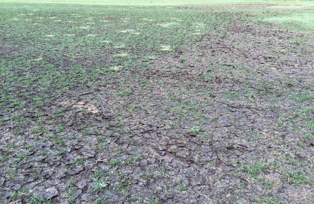
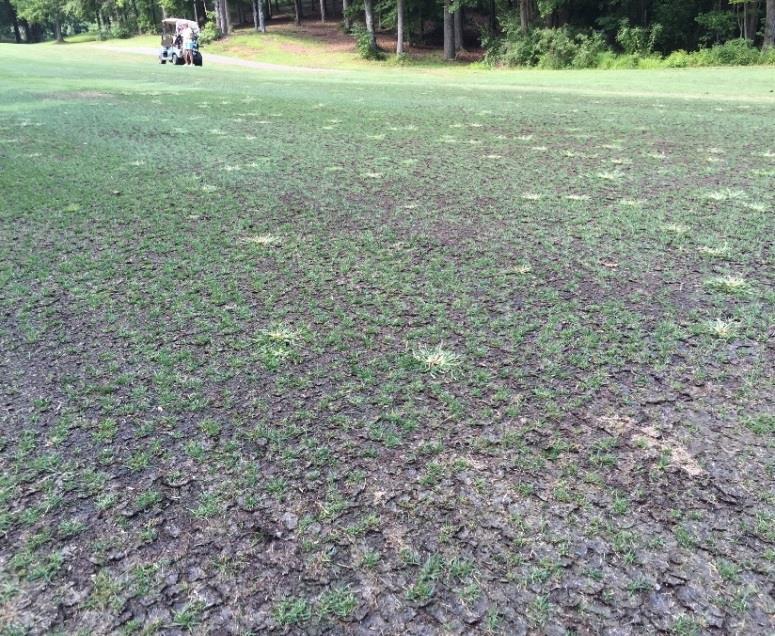
11 Golf Course Challenges 11

12 USGA Recommendations New Double Row irrigation system Rebuild all 19 putting greens and surrounds Upgrade all maintenance equipment Rebuild/Upgrade maintenance facility Extensive drainage plan Complete bunker renovation
13 Why Renovate? Replace critical infrastructure As with a building or car, when a golf course ages, costs increase and the function wavers without a reinvestment To utilize modern advances that make it more sustainable Grass Selections, Improved Irrigation Control, and Design Features reduce waste and improve efficiency of inputs and water Create a fun and inspired version of golf Blend the wonderful natural experience of the property with a great game encourage community and individual wellness
14 Design Features Existing Routing will be used except Holes #5 and #6 Repositioning these holes increases the quality of golf, speed of play, and opportunity for tributary enhancements Expand Tee Options Provide greater accessibility and enjoyment for all players Eliminate Bunkers Remove the costly features in favor of creative more sustainable strategic elements Encourage Play Along the Ground Provide greater opportunity to hit shots that roll along the ground. Utilizing less water and fertility will further expand these options.


15 Specimen Tree Removal There are 177 specimen trees onsite. This work results in the removal of 1 Specimen Tree, ST-13 It is a 30 tulip poplar with a broken crown The tree has been designated as poor condition in the forest conservation plans. Removal is needed for improvements to 7 Green and the cart path between holes 7 and 8.
16 Stream Buffer Impacts Golf Courses make wonderful dedicated open space Golf is played best over the nature topography utilizing exsisting corridors Water Quality Improvements Golf courses provide filter space for water and can store stormwater runoff naturally Replacement of Infrastructure requires grading in Stream Buffers Because golf components are made of earth and grass their replacement requires some grading to maintain positive drainage and eliminate ponding areas that will impact the field of play. Where possible small landscape drains are installed to quickly dry the course after a rain event, however much larger systems are sometimes needed and these systems outfall to the stream. The stream was the original point of discharge for this site. This grading has been minimized and will tie into the stream restoration project. We want to reduce impacts of cart paths Eliminating some of the cart paths will be a temporary impact resulting in less impervious in some areas and more grass.


17 Impacts 100- Ft Stream Buffer Impact 100-Yr Floodplain Impact

18 Stream Buffer Impacts: To maintain 18 holes replacement of components in place


19 Stream Buffer Impacts: To eliminate erosion and impervious surfaces -replace pavement with grasses


20 Stream Buffer Impacts: Because golf course can flood - golf infrastructure is designed to recover
21 Stormwater Improvements & Stream Restoration Project
 According to South River Federation,")
22 Stream Restoration-Project Overview Project consists of: 6,805 LF of Stream, Wetland & Floodplain Restoration along Broad Creek & Tributaries Golf course drainage improvements including boardwalks over stream crossings, stable storm drain outfalls, and pond buffer plantings Restoration project consistent with South River Watershed Implementation Plan (WIP) According to South River Federation, Broad Creek had worst overall score of all South River tributaries in 2017 with a grade of C+ Worst water quality indicator scores for water clarity, chlorophyll, and temperature


23 Existing Conditions Bank erosion and downcutting of Tributary CA1 Unstable banks downstream of pond
24 Targeted Benefits and Goals Reduce stream channel erosion Create new wetlands and enhance/reconnect existing wetlands adjacent to streams Reconnect floodplain with stream Enhance groundwater exchange to stream Improve channel stability and flow functions Replace culverts with natural channels and boardwalks along cart paths Improve aesthetics for golf course Reduce sediments and nutrients to downstream and Bay Control invasive plant species on-site

25 Wetlands and Buffers

26 Stream Restoration Reaches


27 Proposed Stream Restoration Design Raise existing base flow channel to reconnect with wetlands and floodplain Replace existing non-native vegetation and some maintained grasses with native species Replace culverts along golf cart paths with boardwalk bridges to promote better floodplain flow connection linking groundwater and adjacent wetlands Smooth out some of the existing sharp stream meander bends to reduce the stress on the stream banks that causes erosion Incorporate woody structures into stream for grade-control, habitat and wetland creation Create a model project for how to integrate natural resource protection / enhancement into golf course / recreational design


28 Proposed Stream Restoration Example Bedford Springs Resort: Awards: Golf Course Industry Magazine "Affinity Award for Best Environmental Project - Bedford Springs Old Course", 2008 Golf Inc. "Renovation of the Year 2008"

29 Schematic (30%) Stream Restoration Design Example Grading Plan
30 Wetland, Stream & Impervious Summary Existing Proposed Wetland Area (sq. ft.) 413, ,411* Wetland Area (ac) * Perennial Stream Length (ft.) 6,805 7,684 Perennial Stream Area (sq. ft.) 60,269 87,950 Impervious Surface Golf Course Renovation (ac) Impervious Surface - Stream Restoration (Boardwalks for Asphalt Cart Paths) (ac) *Includes riparian planting areas
31 Anticipated Floodplain Impacts Interim Floodplain Impacts (Golf Course Grading Only) 5.22 ac. or 227,235 SF Final Floodplain Impacts (Stream Restoration Complete) 9.01 ac. or 392,511 SF All minor increases in Floodplain Water Surface Elevation will be within Eisenhower Golf Course( Anne Arundel County-Owned Land). No impacts to surrounding properties.
32 Questions
33 Thank you!!! Contact Information: Damian Cosby, DRP- Chief of Park Maintenance, Department of Recreation and Parks- 1 Harry S. Truman Parkway Annapolis, Md phone: Karen Jennings, WPRP- Sr. Engineer Department of Public Works 2662 Riva Rd Annapolis, Md phone:
North Branch of Cypress Creek Ecological Restoration: A Comprehensive Approach to Stream Restoration
 North Branch of Cypress Creek Ecological Restoration: A Comprehensive Approach to Stream Restoration Rocky Powell Clear Creeks Consulting, LLC Keith D. Tate, P.E. BayLand Consultants & Designers, Inc.
When planning stormwater management facilities, the following principles shall be applied where possible.
 2.0 Principles When planning stormwater management facilities, the following principles shall be applied where possible. 2.0.1 Drainage is a regional phenomenon that does not respect the boundaries between
Working Group Meeting
 April 4,, 2017 Parks Operations Bldg Working Group Meeting Arts Districts Overview Stormwater/RPA/Stream Considerations First Principles Agenda 7:00pm 7:05pm 7:10pm 7:40pm 8:30pm 9:40pm 9:45pm Welcome
The use of low head weirs to. perennial streams with their floodplains:
 The use of low head weirs to reconnect severely entrenched perennial streams with their floodplains: An Anne Arundel County TMDL Watershed Implementation Plan Strategy presented by Hala Flores, P.E Mid
Stormwater Management Techniques WMPF LAND USE TRAINING INSTITUTE MARCH 14, 2018
 Stormwater Management Techniques WMPF LAND USE TRAINING INSTITUTE MARCH 14, 2018 Potential Impacts of New Development Urban development can significantly increase stormwater runoff Water quality considerations
STREAM BUFFERS
 88-415 STREAM BUFFERS 88-415-01 PURPOSE In the Kansas City region and throughout the nation, vegetated stream buffers have been clearly shown to protect stream stability and related infrastructure, improve
ST. MARY S SOIL CONSERVATION DISTRICT (SMSCD) AND DPW&T CONCEPT EROSION AND SEDIMENT CONTROL AND STORMWATER MANAGEMENT GUIDELINES AND CHECKLIST
 AND DPW&T CONCEPT EROSION AND SEDIMENT CONTROL AND STORMWATER MANAGEMENT GUIDELINES AND CHECKLIST") St. Mary s Soil Conservation District 26737 Radio Station Way, Suite B Leonardtown, MD 20650 Phone: 301-475-8402 ext. 3 Fax: 301-475-8391 www.stmarysscd.com St. Mary s County Government Department of Public
St. Mary s Soil Conservation District 26737 Radio Station Way, Suite B Leonardtown, MD 20650 Phone: 301-475-8402 ext. 3 Fax: 301-475-8391 www.stmarysscd.com St. Mary s County Government Department of Public
Draft Rhode Island Stormwater Design and Installation Standards Manual
 Draft Rhode Island Stormwater Design and Installation Standards Manual Summary The May 2009 Public Review Draft version of the RI Stormwater Design and Installation Standards Manual consists of approximately
West Little Pimmit Storm Sewer & John Marshall Green Street Projects. July 7, 2015 Nottingham Elementary School
 West Little Pimmit Storm Sewer & John Marshall Green Street Projects July 7, 2015 Nottingham Elementary School Project Timeline February 2015: Archeological study of island, including historic spring location,
Guiding Landowners in Stream Restoration. The Science, Practice & Art of Restoring Native Ecosystems 2015
 Guiding Landowners in Stream Restoration The Science, Practice & Art of Restoring Native Ecosystems 2015 January 24, 2015 Guiding Landowners in Stream Restoration January 24, 2015 Agenda 1Watershed Planning
Chapter 3 Site Planning and Low Impact Development
 CHAPTER 3 Site Planning and Low Impact Development Chapter 3 Site Planning and Low Impact Development 3.0 Introduction The City of Charleston requires that major residential, large commercial (>1 acre),
USF System Campus Master Plan Updates Goals, Objectives and Policies
 2015-2025 USF System Campus Master Plan Updates Goals, Objectives and Policies Tampa Goals, Objectives, and Policies Table of Contents Executive Summary 2015 2025 USF Campus Master Plan Update Introduction
The Benefits and Challenges Associated with Green Infrastructure Practices
 The Benefits and Challenges Associated with Green Infrastructure Practices Thomas M. Evans ASLA, LEED AP Regional Green Infrastructure Design Services Director OWEA Technical Conference, June 20, 2013
Chagrin River Watershed Partners, Inc. Local Regulations. Amy H. Brennan (440)
") Chagrin River Watershed Partners, Inc. Local Regulations Amy H. Brennan (440) 975-3870 www.crwp.org abrennan@crwp.org July 9, 2013 Applicable Zoning and Building Codes Erosion and Sediment Control Grading
Chagrin River Watershed Partners, Inc. Local Regulations Amy H. Brennan (440) 975-3870 www.crwp.org abrennan@crwp.org July 9, 2013 Applicable Zoning and Building Codes Erosion and Sediment Control Grading
Severn River Sub-Watershed: BMP 09-Retrofit
 Project ID: BMP_09 Total Treated Drainage Area: 4.57 acres Total Treated Impervious Area: 2.9 acres Total Water Quality Volume (WQv): ~10,300 cubic feet; 0.236 acre-foot Rainfall Depth Treated (Pe): 1
Cost Effective Low Impact Development
 Cost Effective Low Impact Development An Introductory Guide to Conserve Land, Restore Resources, Protect Water, and Save Money in Massachusetts Stefanie Covino Shaping the Future of Your Community Program
Conservation in South Jersey Being Creative with Restoration
 Conservation in South Jersey Being Creative with Restoration Stewardship on a Shoestring: Public Land Management in Fiscally Constrained Times November, 30, 2011 Conservation and Restoration for Open Space
Checklists. Project Name: Location: File Number: Date of Submittal: Reviewer: Date: Applicant: Contact Name: Phone Number:
 Applicant: Contact Name: Phone Number: Email: Project Name: Location: File Number: Date of Submittal: Reviewer: Date: Concept Plan Requirements: I. General Project Information 1. Address or parcel number
Stormwater Retrofitting: The Art of Opportunity. Presented by the Center for Watershed Protection
 Stormwater Retrofitting: The Art of Opportunity Presented by the Center for Watershed Protection What Are Stormwater Retrofits? Retrofits are stormwater management measures inserted in an urban or ultra-urban
City of Shady Cove Riparian Ordinance Ordinance XXX
 1 Updated October 8, 2015 City of Shady Cove Riparian Ordinance Ordinance XXX This language is to be located in Chapter 155 of the Shady Cove Code of Ordinances. This will affect property inside city limits,
Chapter 5: Natural Resources and Environment
 NATURAL RESOURCES AND ENVIRONMENT 5-1 5 Chapter 5: Natural Resources and Environment BACKGROUND AND INTENT Urban expansion represents the greatest risk for the future degradation of existing natural areas,
LOUISIANA STATE UNIVERSITY COMPREHENSIVE & STRATEGIC CAMPUS MASTER PLAN. APPENDIX G - Stormwater Study Findings & Stormwater Solutions
 LOUISIANA STATE UNIVERSITY COMPREHENSIVE & STRATEGIC CAMPUS MASTER PLAN APPENDIX G - Stormwater Study Findings & Stormwater Solutions LSU: MP Narrative July 2017 3.5 Open Space Existing Conditions The
PROJECT SCOPE OF WORK CITY OF TOWN AND COUNTRY STORMWATER PROGRAM
 PROJECT SCOPE OF WORK CITY OF TOWN AND COUNTRY STORMWATER PROGRAM Project ID Number: 25-5 Problem: Stormwater collected from the neighborhood upstream is released at 9 Muirfield Lane and flows west toward
STORMWATER MANAGEMENT CODES ANALYSIS RICHLAND COUNTY, SC SITE PLANNING ROUNDTABLE
 STORMWATER MANAGEMENT CODES ANALYSIS RICHLAND COUNTY, SC SITE PLANNING ROUNDTABLE Codes analyses for each subcommittee were completed to assist participants of the Richland County Site Planning Roundtable.
Citywide Integrated Stormwater Management Plan (ISMP) DRAFT ACTION PLAN REVIEW Public Consultation November 16 th, 2016
 DRAFT ACTION PLAN REVIEW Public Consultation November 16 th, 2016") Citywide Integrated Stormwater Management Plan (ISMP) DRAFT ACTION PLAN REVIEW Public Consultation November 16 th, 2016 1 Agenda DRAFT ACTION PLAN REVIEW Public Consultation Time 6:00 6:05 6:05 6:20 6:20
Citywide Integrated Stormwater Management Plan (ISMP) DRAFT ACTION PLAN REVIEW Public Consultation November 16 th, 2016 1 Agenda DRAFT ACTION PLAN REVIEW Public Consultation Time 6:00 6:05 6:05 6:20 6:20
Craven Street Stormwater Improvement Projects
 Craven Street Stormwater Improvement Projects The Craven Street Watershed drains the area from Haywood Road to Westwood Place and down Haywood to the French Broad River. The watershed has one main un-named
Sustainable Stormwater Management through Green Infrastructure. Jersey City Public School #5
 Green Infrastructure Site Evaluation Friday, October 25 th, 2013 Sustainable Stormwater Management through Green Infrastructure Jersey City Public School #5 FORMAT: (15 minutes) An Introduction to Stormwater
COMMUNITY DEVELOPMENT DEPARTMENT POLICY DRAINAGE FOR RESIDENTIAL PROJECTS WITH ONE OR TWO UNITS REVISED JANUARY 4, 2018
 COMMUNITY DEVELOPMENT DEPARTMENT POLICY DRAINAGE FOR RESIDENTIAL PROJECTS WITH ONE OR TWO UNITS REVISED JANUARY 4, 2018 A. California Residential Code Requirement - Construction plans shall indicate how
4. Contractor (and subcontractors if applicable) certification statement(s)
 certification statement(s)") CHEMUNG COUNTY STORMWATER COALITION STORMWATER POLLUTION PREVENTION PLAN (SWPPP) SUBMITTAL CHECKLIST GENERAL INFORMATION: 1. Owner/Operator name, legal address, phone number 2. Copy of signed Notice of
CHEMUNG COUNTY STORMWATER COALITION STORMWATER POLLUTION PREVENTION PLAN (SWPPP) SUBMITTAL CHECKLIST GENERAL INFORMATION: 1. Owner/Operator name, legal address, phone number 2. Copy of signed Notice of
Major Subdivision Sketch Plan Checklist
 This checklist provides specific requirements that are apart of the Sketch process. The entire process is described by the Huntersville Subdivision Review Process which details all the submittal and resubmittal
Riparian Buffer on the Bushkill Creek. Policies
 Riparian Buffer on the Bushkill Creek Riparian buffers provide numerous benefits to landowners and the community by protecting groundwater recharge areas, providing flood control, providing stormwater
Northern Branch Corridor DEIS December 2011
 16 Floodplains 161 Chapter Overview 1611 Introduction The flowing chapter identifies floodplains found within the Northern Branch Corridor in accordance with Executive Order 11988, Floodplain Management
SOUTH FOX MEADOW STORMWATER IMPROVEMENT PROJECT
 VILLAGE OF SCARSDALE WESTCHESTER COUNTY, NEW YORK COMPREHENSIVE STORM WATER MANAGEMENT SOUTH FOX MEADOW STORMWATER IMPROVEMENT PROJECT In association with WESTCHESTER COUNTY FLOOD MITIGATION PROGRAM Rob
River Corridor Overlay Zone (RCOZ) Article 5
 Article 5") River Corridor Overlay Zone (RCOZ) Article 5 The site is in one of two designated districts. The first is the CBD (central business district) River District, which recognizes the urban character and unique
River Corridor Overlay Zone (RCOZ) Article 5 The site is in one of two designated districts. The first is the CBD (central business district) River District, which recognizes the urban character and unique
WELCOME! 8 8:30 6: TH STREET IMPROVEMENTS. Open House. Presentation & Q&A
 WELCOME! 168 TH STREET IMPROVEMENTS 6:30 Open House 7 8 Presentation & Q&A 8 8:30 Open House WELCOME Todd Pfitzer City of Omaha Engineer Bob Stubbe City of Omaha Public Works Director Jon Meyer Project
Anne Arundel County s Severn River Watershed Implementation Strategy. Severn River Association
 Anne Arundel County s Severn River Watershed Implementation Strategy Severn River Association Watershed Protection and Restoration Program Anne Arundel County Department of Public Works August 18, 2014
Town of Vershire Road Erosion Inventory Report
 Town of Vershire Road Erosion Inventory Report Taylor Valley Road. Photo taken by TRORC staff. Prepared by: 128 King Farm Road Woodstock, VT 05091 Inventory and report funded by the Vermont Agency of Transportation
Problem Understanding
 Introduction...2-1 Previous Data and Mapping...2-2 Known Problem Areas...2-3 Resident Survey.2-3 Introduction The Village of Downers Grove stormwater system includes storm sewers, streams, wetlands, roadway
Stream Restoration: Working with Nature?
 Stream Restoration: Working with Nature? Greg Jennings, PhD, PE jenningsenv@gmail.com Ecosystem Restoration activities that initiate or accelerate the recovery of ecosystem health, integrity, and sustainability
Stream Restoration: Working with Nature? Greg Jennings, PhD, PE
 Stream Restoration: Working with Nature? Greg Jennings, PhD, PE jenningsenv@gmail.com Ecosystem Restoration activities that initiate or accelerate the recovery of ecosystem health, integrity, and sustainability
Section 3 Non-Structural BMPs
 3.1 Stream Buffers A stream buffer or stream setback is a designated area around a stream, lake, or wetland left in a natural, densely vegetated state so as to protect the receiving water quality and provide
Why a new Food & Farm Ordinance?
 Growing for Kane Why a new Food & Farm Ordinance? 1. Growing obesity issue 64% of Kane adults are overweight or obese 2. Low rates of fruit & vegetable consumption Healthy diets include more fruits & veggies.
Leduc Industrial Outline Plan SE W4
 Leduc Industrial Outline Plan SE 1-50-25-W4 Within the North Leduc Industrial ASP Prepared for: Leduc Energy Park Ltd. Prepared by: Stantec Consulting Ltd. File No. 1161 104655 V5 Table of Contents 1.0
Urban Stormwater Management. Rebecca Leonardson Rui Teles Brooke Ray Smith
 Urban Stormwater Management Rebecca Leonardson Rui Teles Brooke Ray Smith Introduction Stormwater in Portugal Why urban stormwater is currently a problem What is green stormwater management? Why it is
6.5 Lakewood Gulch. Basin Snapshot
 6.5 Lakewood Gulch The Lakewood Gulch Map Unit is comprised of both Lakewood Gulch and Dry Gulch (4800-01 and 4801-01) from the Denver Storm Drainage Master Plan (SDMP) and has a total drainage area of
Water in storm drains does not go to a treatment plant
 Watershed Planning Workshop Upper Mainstem & Middle Four Mile Run November 30, 2011 Fairlington Community Center Arlington s watersheds Chesapeake Bay watershed Watershed Planning Initiated May 2008 Contracted
319 Grant: Baker Creek & Centenary Creek Restoration Initiative
 319 Grant: Baker Creek & Centenary Creek Restoration Initiative Objectives: Overview of Watershed Characteristics: Discussion of Project Tasks: Discussion of Watershed Management Plan: Presented by: Erich
Weston s Wetlands, Stormwater, & Open Space
 Weston s Wetlands, Stormwater, & Open Space Weston s Wetlands, Stormwater, & Open Space Conservation Commission Role and Responsibilities Laws that protect wetlands What residents can do to protect wetlands
SECTION 5: REACH RECOMMENDATIONS/MAPS
 SECTION 5: REACH RECOMMENDATIONS/MAPS This section describes areas of concern and provides specific recommendations for each project reach. Locations of stormwater drains were from GIS coverage supplied
Use of Best Management Practices
 Use of Best Management Practices Presented at the ANJEC Flood Hazard Workshop Bordentown, NJ March 13, 2008 Stormwater BMPs "a technique, measure or structural control that is used for a given set of conditions
SITE PLAN REVIEW APPLICATION AND CHECKLIST
 SITE PLAN REVIEW APPLICATION AND CHECKLIST PROJECT SUMMARY: Project Name: City/ETA Location: City ETA (Application fee & number of copies needed are based on location) Property Location (Legal Description
ADOPTED CAPITAL IMPROVEMENT PROGRAM BUDGET ARROYO PROJECTS
 ADOPTED CAPITAL IMPROVEMENT PROGRAM BUDGET ARROYO PROJECTS HAHAMONGNA FY 212-216 Capital Improvement Program Priority Description Total Estimated Costs Appropriated Through FY 211 Adopted FY 212 FY 213
The Restoration of Reading Creek & Model Stream Buffer Ordinances/ Zoning Regulations for Alabama Streams
 The Restoration of Reading Creek & Model Stream Buffer Ordinances/ Zoning Regulations for Alabama Streams Charlene LeBleu, AICP, ASLA, Associate Professor of Landscape Architecture Auburn University Auburn,
Jill Stachura STORMWATER BMP AND STREAM RESTORATION IN A CITY PARK. October 2013 Southeast Stormwater Association Annual Conference, Charlotte, NC
 Jill Stachura STORMWATER BMP AND STREAM RESTORATION IN A CITY PARK October 2013 Southeast Stormwater Association Annual Conference, Charlotte, NC Project Location Gwinnett County, GA: Population: 825,000
Review Zone Application for D&R Canal Commission Decision
 Review Zone Application for D&R Canal Commission Decision MEETING DATE: July 20, 2016 DRCC #: 16-4803 Latest Submission Received: June 13, 2016 Applicant: Robert McCarthy, PE PSE&G 4000 Hadley Road, 2
Design Specifications & Requirements Manual
 11 PARKS & OPEN SPACES 11.1 DEFINITIONS... 1 11.1.1 Neighbourhood Parks... 1 11.1.2 District Parks... 1 11.1.3. Sport Parks... 1 11.1.4 Urban Parks... 1 11.1.5 Civic Spaces... 1 11.1.6 Open Space System...
Pedestrian Trails Within Regulated Areas
 New Jersey Department of Environmental Protection Pedestrian Trails Within Regulated Areas Joslin Tamagno, Environmental Specialist Division of Land Use Regulation, Bureau of Inland Regulation www.nj.gov/dep/landuse
Tentatively Selected Plan within Harlem River, East River and Western Long Island Sound Planning Region. First Level Costs. Federal Non-Federal Total
 HARLEM RIVER, EAST RIVER AND WESTERN LONG ISLAND SOUND PLANNING REGION Flushing Bay and Creek Ecosystem Restoration Source Feasibility Study Background Study Resolution (1994), Reconnaissance Report (1996),
Old Mill Community Association Bioretention Facility
 Project Overview This project will install a bioretention facility in a community recreation area owned by the Old Mill Community Association, Inc. Drainage from the area is currently unmanaged and has
2.1 Principles & Objectives
 Designing With The Landform 2.1 Principles & Objectives Land planning which integrates the natural features of a site (i.e., designing with the landform ) into the site design is a major component of the
COLLIER BOULEVARD (CR 951) CORRIDOR
 CORRIDOR") Project(s) Goals Improve Traffic Circulation, Capacity & Safety Focus on Safety During Design & Construction Address Public Concerns Design an Aesthetically Pleasing Project Limit Environmental Impacts
Project(s) Goals Improve Traffic Circulation, Capacity & Safety Focus on Safety During Design & Construction Address Public Concerns Design an Aesthetically Pleasing Project Limit Environmental Impacts
SEMSWA s Role in the Land Development Process
 SEMSWA s Role in the Land Development Process One of SEMSWA s responsibilities is to ensure that any new development or redevelopment within its service area is designed and constructed in compliance with
Urban Water Management (ESRM 311 & SEFS 507) Cougar Mtn Regional Wildland Park & Lakemont Blvd, Bellevue WA
 Cougar Mtn Regional Wildland Park & Lakemont Blvd, Bellevue WA") Urban Water Management (ESRM 311 & SEFS 507) Cougar Mtn Regional Wildland Park & Lakemont Blvd, Bellevue WA Lecture Today Urban Water management terms Examples of water management in urban areas Field
Urban Water Management (ESRM 311 & SEFS 507) Cougar Mtn Regional Wildland Park & Lakemont Blvd, Bellevue WA Lecture Today Urban Water management terms Examples of water management in urban areas Field
Lesson 2: Stormwater Best Management Practices (BMPs)
") Lesson 2: Stormwater Best Management Practices (BMPs) Environmental Stewards Class Christopher C. Obropta, Ph.D., P.E. Extension Specialist in Water Resources 732-932-9800 ext. 6209 obropta@envsci.rutgers.edu
Lesson 2: Stormwater Best Management Practices (BMPs) Environmental Stewards Class Christopher C. Obropta, Ph.D., P.E. Extension Specialist in Water Resources 732-932-9800 ext. 6209 obropta@envsci.rutgers.edu
Retrofitting Low Impact Development (LID) for Stormwater at Sacramento State. City of Sacramento Sacramento State Facilities Management
 for Stormwater at Sacramento State. City of Sacramento Sacramento State Facilities Management") Retrofitting Low Impact Development (LID) for Stormwater at Sacramento State City of Sacramento Sacramento State Facilities Management Project Background Campus Storm Drain System Drain Inlet - Campus
Retrofitting Low Impact Development (LID) for Stormwater at Sacramento State City of Sacramento Sacramento State Facilities Management Project Background Campus Storm Drain System Drain Inlet - Campus
CHECKLIST FOR PHASE II DRAINAGE REPORT
 I. COVER SHEET CHECKLIST FOR PHASE II DRAINAGE REPORT A. Name of Project B. Address C. Owner D. Developer E. Engineer F. Submittal date and revision dates as applicable II. GENERAL LOCATION AND DESCRIPTION
Stormwater & South Carolina. A Case for Low Impact Development
 Stormwater & South Carolina A Case for Low Impact Development what is stormwater? stormwater & development Volume of Water stormwater & development Peak Flow Urban Natural Peak Flow Rain Event Time Components
Huntington Stormwater Utility
 Huntington Stormwater Utility Stormwater Management & Sediment and Erosion Control Requirements for Construction Sites Authorized by Huntington City Code Articles: 971, 970, 930, 935, 955, Revised April
Stormwater Regulations & Considerations Morse Study Area. Pam Fortun, P.E. CFM Senior Stormwater Treatment Engineer Engineering Services Division
 Stormwater Regulations & Considerations Morse Study Area Pam Fortun, P.E. CFM Senior Stormwater Treatment Engineer Engineering Services Division Stormwater Regulations Development Considerations Floodplain
Design Specifications & Requirements Manual
 11 PARKS & OPEN SPACES 11.1 DEFINITIONS... 1 11.1.1 Neighbourhood Parks... 1 11.1.2 District Parks... 1 11.1.3. Sport Parks... 1 11.1.4 Urban Parks... 1 11.1.5 Civic Spaces... 1 11.1.6 Open Space System...
Section 11 Grading and Drainage Standards
 Section 11 Grading and Drainage Standards 11.1 INTRODUCTION The proper grading, conveyance, storage and release of storm water is critical to maintain the integrity of the Property. Drainage facilities,
Karen Wiggen, RLA PGM/Planning Bob Harrington, P.E. PGM/CPIS Michael Clar, P.E. - ECOSITE
 Karen Wiggen, RLA PGM/Planning Bob Harrington, P.E. PGM/CPIS Michael Clar, P.E. - ECOSITE Presentation Highlights Background of Grant Award What are the County s grant requirements? Maryland Stormwater
A: Downtown Diversion Pipe
 A: Downtown Diversion Pipe b c with modifications Map highlighting conservation easement. The diversion pipe would run along the railroad. Will divert 40-44% of total flow.; and Reduce the impact on Sand
Stormwater Low Impact Development - A Natural Solution
 Stormwater Low Impact Development - A Natural Solution Sarah U Ren Program Director The Watershed Center of Grand Traverse Bay 231-935-1514, suren@gtbay.org Our Mission: The Watershed Center advocates
The Flow. Green Infrastructure Taking Root in Cities 3/23/2015. Green Infrastructure Evolution City Plans/Projects Measureable and Holistic Benefits
 Green Infrastructure Taking Root in Cities Robert Hopper, P.E. CDM Smith The Flow Green Infrastructure Evolution City Plans/Projects Measureable and Holistic Benefits 2 1 Parts, Systems, Whole The first
STORMWATER CREDITS AND BETTER SITE DESIGN PRACTICES
 ..CHAPTER.. STORMWATER CREDITS AND BETTER SITE DESIGN PRACTICES 5.1 Introduction Stormwater management begins with the site planning and design process. Development projects can be designed to reduce their
Green Infrastructure. NYS Department of Environmental Conservation
 Green Infrastructure Green infrastructure is an interconnected network of natural areas and open spaces that sustains ecosystems. Benedict, M.A. and E.T. McMahon. 2006. Green Infrastructure Linking Landscapes
Planning for Staten. Habitat Restoration and Green Infrastructure. Island s North Shore
 Habitat Restoration and Green Infrastructure Planning for Staten Island s North Shore Community Board 1 March 1, 2018 NYC Parks Forestry, Horticulture, and Natural Resources Funded by the NYS Department
One County s Success in Linking Watershed Protection and Land Use Planning
 One County s Success in Linking Watershed Protection and Land Use Planning Bob Thompson Porter County Plan Commission March 28, 2012 Indiana Watershed Leadership Academy Population 160,000 Approximately
Tennessee Stormwater Management Program. Stormwater Management Site Assessment and Inventory Checklist. Quick Check o Vicinity Map within Watershed
 Tennessee Stormwater Management Program Project Name: Location: File Number: Reviewer: Date of Submittal: Review Date: Project Meeting Chronology: Type of Meeting: Date: Stormwater Management Site Assessment
Buffer Zone (BZ) Stream Protection. The width and plant composition of a buffer zone will determine its effectiveness.
 Stream Protection. The width and plant composition of a buffer zone will determine its effectiveness.") Buffer Zone (BZ) Figure BZ-1 Buffer Zone in Agricultural Area Practice Description A buffer zone is a strip of plants adjacent to land-disturbing sites or bordering streams, lakes, and wetlands that provides
Buffer Zone (BZ) Figure BZ-1 Buffer Zone in Agricultural Area Practice Description A buffer zone is a strip of plants adjacent to land-disturbing sites or bordering streams, lakes, and wetlands that provides
Urban Stormwater: Best Practice Environmental Management Guidelines. CSIRO This electronic edition published by CSIRO PUBLISHING, 2006.
 Urban Stormwater: Best Practice Environmental Management Guidelines. Chapter 5 Water Sensitive Urban Design Key references Department of Planning, 1993, Better Drainage: Guidelines for the Multiple Use
6 August 11, 2010 Public Hearing APPLICANT AND PROPERTY OWNER: CAVALIER GOLF AND YACHT CLUB
 6 August 11, 2010 Public Hearing APPLICANT AND PROPERTY OWNER: CAVALIER GOLF AND YACHT CLUB REQUEST: Conditional Use Permit (outdoor recreational facility) STAFF PLANNER: Faith Christie ADDRESS / DESCRIPTION:
Stormwater Management Plan (SWMP) Revision Date: 11/05
 Revision Date: 11/05") Stormwater Management Plan (SWMP) Revision Date: 11/05 SWMP Purpose: Sustainable stormwater management principles are adopted as Portland State University s (PSU) preferred approach for the management
Stormwater Management Plan (SWMP) Revision Date: 11/05 SWMP Purpose: Sustainable stormwater management principles are adopted as Portland State University s (PSU) preferred approach for the management
Vaughan Metropolitan Centre (VMC) Black Creek Renewal CLASS ENVIRONMENTAL ASSESSMENT
 Black Creek Renewal CLASS ENVIRONMENTAL ASSESSMENT") PUBLIC INFORMATION CENTRE Vaughan Metropolitan Centre (VMC) Black Creek Renewal Wednesday, May 10, 2017 6:00 p.m. to 8:00 p.m. Add photo Project Management, Environmental Assessment, Stormwater Management
PUBLIC INFORMATION CENTRE Vaughan Metropolitan Centre (VMC) Black Creek Renewal Wednesday, May 10, 2017 6:00 p.m. to 8:00 p.m. Add photo Project Management, Environmental Assessment, Stormwater Management
Northeast Ohio Regional Sewer District Stormwater Management Plan Review Policy
 Northeast Ohio Regional Sewer District Stormwater Management Plan Review Policy Introduction As a component of the Northeast Ohio Regional Sewer District s (District) Regional Stormwater Management Program,
Executive Committee Meeting Addendum. #7/15 July 3, :30 A.M. HEAD OFFICE, 101 EXCHANGE AVENUE, VAUGHAN Members:
 Executive Committee Meeting Addendum #7/15 July 3, 2015 9:30 A.M. HEAD OFFICE, 101 EXCHANGE AVENUE, VAUGHAN Members: Maria Augimeri Michael Di Biase David Barrow Ronald Chopowick Vincent Crisanti Glenn
VA DCR STORMWATER DESIGN SPECIFICATION NO. 11 WET SWALE. VERSION 2.0 January 1, 2013 SECTION 1: DESCRIPTION
 VIRGINIA DCR STORMWATER DESIGN SPECIFICATION No. 11 VERSION 2.0 January 1, 2013 SECTION 1: DESCRIPTION Wet swales can provide runoff filtering and treatment within a conveyance system and are a cross between
Lincoln 270. City of Lincoln. Stormwater Management Plan. April 2, 2013
 Lincoln 270 City of Lincoln Stormwater Management Plan April 2, 2013 # 2005.48 Prepared By: Civil Engineering Solutions, Inc. 590 E Street Lincoln, Ca 95648 (916) 645 5700 1.0 Background: The project site
PERMANENT SEEDING. Overview of Sedimentation and Erosion Control Practices. Practice no. 6.11
 Overview of Sedimentation and Erosion Control Practices Practice no. 6.11 PERMANENT SEEDING Permanent vegetation controls erosion by physically protecting a bare soil surface from raindrop impact, flowing
Watershed Planning Workshop
 Watershed Planning Workshop Upper Four Mile Run, Gulf Branch and Donaldson Run March 18, 2010 Langston Brown Community Center Outline Overview of Arlington s s Watersheds Watershed Management in Arlington
FURTHER TO EXECUTIVE COMMITTEE MEETING #11/12 To be held on Friday, January 11, 2013
 FURTHER TO EXECUTIVE COMMITTEE MEETING #11/12 To be held on Friday, January 11, 2013 FURTHER TO: Pages EX10. APPLICATION FOR PERMITS UNDER ONTARIO REGULATION 166/06 Development, Interference with Wetlands
Erosion & Sediment Control Plan Application Form & Checklist
 Erosion & Sediment Control Plan Application Form & Checklist GENERAL INFORMATION Application Date: Project Address: Tax Map / Parcel Number(s): PROPERTY OWNER / DEVELOPER Firm Name: Contact Person: Title:
Non-Residential&Multi-Family PropertyCreditManual
 CityofRichmond DepartmentofPublicUtilities StormwaterManagementProgram Non-Residential&Multi-Family PropertyCreditManual ApprovedFebruary2011 City of Richmond Stormwater Non-Residential & Multi-Family
MANUAL OF DESIGN, INSTALLATION, AND MAINTENANCE REQUIREMENTS FOR STORMWATER MANAGEMENT PLANS
 MANUAL OF DESIGN, INSTALLATION, AND MAINTENANCE REQUIREMENTS FOR STORMWATER MANAGEMENT PLANS May 2007 SECTION 1 Responsibility of Applicant TABLE OF CONTENTS A. Stormwater Management Plan Required Information
Jack Creek Park Capital Improvement Project
 Jack Creek Park Capital Improvement Project Public Information Meeting October 2, 2017 Consultants & Designers, Inc. Integrating Engineering and Environment 7455 New Ridge Road, Suite T Phone: (410) 694-9401
Managing Stormwater within the Road Right-of-Way: An Urban NAI Approach
 Turgay Dabak, Joni Calmbacher, Sara DeGroot, Andrea Ryon Managing Stormwater within the Road Right-of-Way: An Urban NAI Approach Presentation Outline Project Background Project Overview BMPs Evaluated
HICKORY NUT FOREST DESIGN GUIDELINES
 HICKORY NUT FOREST DESIGN GUIDELINES Introduction Hickory Nut Forest is a "net-zero energy", conservation development that is designed to protect and celebrate the property s unique ecology. A conservation
QUESTIONS AND ANSWERS Windsor Woods, Princess Anne Plaza & The Lakes Combined Drainage Project
 QUESTIONS AND ANSWERS Windsor Woods, Princess Anne Plaza & The Lakes Combined Drainage Project Project Overview... 2 Thalia Creek (Windsor Woods) Tide Gate... 6 Club House Road Drainage Project... 9 Updated
PUBLIC MEETING SEPTEMBER 19, 2012
 PUBLIC MEETING SEPTEMBER 19, 2012 M-NCPPC Project Manager Marian Elsasser Project Engineer Kim Paniati PROJECT TEAM Consultants Greenman-Pedersen, Inc. (GPI) Project Manager Liz Marcy Environmental Specialist