PUBLIC MEETING SEPTEMBER 19, 2012
|
|
|
- Lilian Hampton
- 5 years ago
- Views:
Transcription

1 PUBLIC MEETING SEPTEMBER 19, 2012
2 M-NCPPC Project Manager Marian Elsasser Project Engineer Kim Paniati PROJECT TEAM Consultants Greenman-Pedersen, Inc. (GPI) Project Manager Liz Marcy Environmental Specialist Dave Merkey Mahan-Rykiel Associates (MRA) Project Manager Steve Kelly Sabra Wang & Associates Traffic Engineers EAC/Archaeology Archaeologists
3 MEETING AGENDA Introduction Planning Overview Trail Design North Branch Trail Alignment North Branch Trail Opportunities Comments and Questions

4 COUNTYWIDE TRAIL PLAN
5
6 M-NCPPC FACILITY PLANNING PROCESS FACILITY PLANNING Natural Resources Inventory Develop Alternative Alignments Public Participation Detailed Alternative Analysis Final Alignment Permits Planning Board Meeting and Approval
7 ENVIRONMENTAL TRAIL ALIGNMENT CONSIDERATION Natural Resources Inventory Avoid Natural Resources Minimize Impacts to Natural Resources Minimize Impacts to Adjacent Properties USER Mitigate Impacts Safety through American Association of State Highway and Transportation Officials (AASHTO) Safety through Crime Prevention Through Environmental Design (CPTED) Americans with Disabilities Act Compliance Enjoyable Trail Experience


8 Natural Resources Inventory ENVIRONMENTAL CONSIDERATION Forest Stand Delineation Specimen Tree Identification Location Wetland Identification Rare, Threatened, & Endangered Species Steep Slopes Floodplain Location


9 Avoid Valuable Natural Resources ENVIRONMENTAL CONSIDERATION Specimen Trees/Critical Root Zones Hillside Ground Water Seep Wetlands Floodplains / Wetlands Steep Slopes Streams Forested Habitats


10 Minimize Impacts ENVIRONMENTAL CONSIDERATION Utilize Previously Disturbed Areas WSSC Sewer line Existing Dirt and Asphalt Trails Past Land Uses


11 Mitigate Impacts ENVIRONMENTAL CONSIDERATION Correct Problem Drainage Features Stormdrain Outfalls Stream Channel Erosion Invasive Species Removal Reforestation


12 Mitigate Impacts ENVIRONMENTAL CONSIDERATION Boardwalks Retaining Walls Pedestrian Bridges Tree Protection Techniques Root Pruning Tree Pruning Above Grade Trails Tree Protection Devices


13 Safety USER CONSIDERATION American Association of State Highway and Transportation Officials Crime Prevention Through Environmental Design Americans with Disabilities Safe Road Crossing Sight Distance Vehicle Speed Proximity to Intersections


14 Users USER CONSIDERATION Enjoyable Experience Adjacent Homeowners Trail Connections Amenities
15

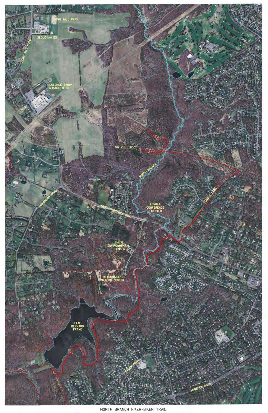
16 OVERALL TRAIL ALIGNMENT: SOUTHERN SECTION


17 OVERALL TRAIL ALIGNMENT: NORTHERN SECTION

18 PROPOSED SECTION W/ GRADING & TREE REMOVAL: EXISTING FOREST 2 10 TRAIL 2 EXISTING FOREST BUFFER BUFFER
19 EXISTING TRAIL CONNECTION TO LAKE FRANK TRAIL CONNECTOR
20 EXISTING 10 WIDE LAKESIDE TRAIL
21 PARKING LOT 1: BEFORE

22 PARKING LOT 1: AFTER 2 BUFFER 10 TRAIL 2 BUFFER NATIVE PLANTINGS

23 EXISTING ROAD: BEFORE

24 EXISTING ROAD: AFTER 2 BUFFER 10 TRAIL 2 BUFFER NATIVE PLANTINGS
25 PARKING LOT 2: BEFORE

26 PARKING LOT 2: AFTER 2 BUFFER 10 TRAIL 2 BUFFER NATIVE PLANTINGS
27 EXISTING LAKESIDE TRAIL: BEFORE

28 EXISTING LAKESIDE TRAIL: AFTER EXISTING FOREST 2 BUFFER 10 TRAIL 2 BUFFER


29 EXISTING WSSC ACCESS SOUTH OF MUNCASTER MILL ROAD: BEFORE

30 EXISTING WSSC ACCESS SOUTH OF MUNCASTER MILL ROAD: AFTER EXISTING FOREST 10 TRAIL 2 BUFFER EXISTING FOREST 2 BUFFER
31 MUNCASTER MILL ROAD AND EMORY LANE INTERSECTION

32 MUNCASTER MILL ROAD AND EMORY LANE INTERSECTION
33 EMORY LANE TRAIL CONNECTION TO MUNCASTER MILL: BY OTHERS LOOKING SOUTH (HOLLY RIDGE RD./EMORY LANE INTERSECTION)

34 EXISTING EMORY LANE TRAIL TO ICC TRAIL LOOKING NORTH (EMORY LANE/HOLLY RIDGE RD. INTERSECTION)

35 EXISTING ICC TRAIL
36 PROPOSED CONNECTION FROM ICC TRAIL: EXISTING CONDITION

37 PROPOSED CONNECTION FROM ICC TRAIL: PLAN
38 TRAIL CONDITION UNDER ICC: BEFORE

39 TRAIL CONDITION UNDER ICC: AFTER 10 TRAIL 2 BUFFER NATIVE PLANTINGS


40 FOLLOWING EXISTING ROAD ALIGNMENT TO PRESERVE: BEFORE

41 FOLLOWING EXISTING ROAD ALIGNMENT TO PRESERVE: AFTER 10 TRAIL EXISTING MEADOW
42 CONNECTION TO TRAIL WITHIN PRESERVE AT ROCK CREEK

43 TRAIL OPPORTUNITIES Community Connections Meadowside Nature Center Smith Environmental Center Neighborhood Connections
44

45 POSSIBLE TRAIL CONNECTIONS: SOUTH OF MUNCASTER MILL RD.

46 PROPOSED TRAIL PARKING LOT: 20 SPACES
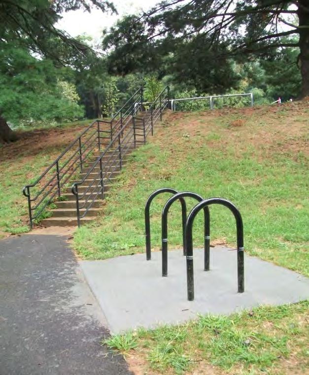
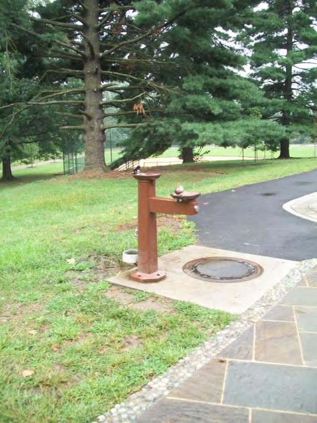
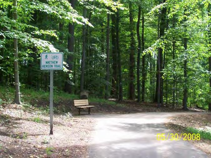
47 TRAIL AMMENITIES
48 SUMMARY Overview Comments & Questions??
49 Marian Elsasser, Project Manager 9500 Brunett Avenue Silver Spring, Md Phone: Fax:
Long Branch-Wayne Local Park Renovation Project
 Montgomery Parks Long Branch-Wayne Local Park Renovation Project Community Meeting #2 September 20, 2016 Oak View Elementary School 7:00-9:00 PM Welcome / Team Introductions M-NCPPC (Montgomery Parks)
Pennsy Greenway Trail
 Town of Schererville Pennsy Greenway Trail DES. #s: 0401062, 1173595 & 1382661 Construction of Pennsy Greenway Trail beginning at Wilhelm Street and continuing northwest along the former Penn Central railroad
Westwood Shopping Center Sketch Plan, Plan # February 23, 2017 Item # 9
 Westwood Shopping Center Sketch Plan, Plan # 320170010 February 23, 2017 Item # 9 Westwood II Site 64,111 s.f. Manor Care site: vacant two story building HOC-Westwood Towers, 15 story tower To be considered
OVERMOUNTAIN VICTORY TRAIL BURKE CALDELL CORRIDOR FEASIBLITY STUDY REQUEST FOR QUALIFICATIONS CALDWELL COUNTY PATHWAYS
 OVERMOUNTAIN VICTORY TRAIL BURKE CALDELL CORRIDOR FEASIBLITY STUDY REQUEST FOR QUALIFICATIONS CALDWELL COUNTY PATHWAYS Caldwell County Pathways along with our co-partners City of Lenoir, Town of Gamewell,
Working Group Meeting
 April 4,, 2017 Parks Operations Bldg Working Group Meeting Arts Districts Overview Stormwater/RPA/Stream Considerations First Principles Agenda 7:00pm 7:05pm 7:10pm 7:40pm 8:30pm 9:40pm 9:45pm Welcome
INTRODUCTION PLANNING HISTORY
 INTRODUCTION The Upper Rock Creek Master Plan Area lies in the east central part of Montgomery County. The Master Plan Area is adjacent to the City of Rockville to the south, the Olney Planning Area to
Attachment 1. Letter from OMCA HOA
 Attachment 1 Letter from OMCA HOA Olney Mill Community Association September 29, 2011 Montgomery County Planning Board The Maryland National Capital Park and Planning Commission 8787 Georgia Avenue Silver
BISCUIT RUN PARK MASTER PLAN
 BOARD OF SUPERVISORS November 14, 2018 BISCUIT RUN PARK MASTER PLAN COUNTY OF ALBEMARLE ANHOLD ASSOCIATES Contents Project Introduction Property Background County Park Planning Process Existing Site &
WELCOME! 8 8:30 6: TH STREET IMPROVEMENTS. Open House. Presentation & Q&A
 WELCOME! 168 TH STREET IMPROVEMENTS 6:30 Open House 7 8 Presentation & Q&A 8 8:30 Open House WELCOME Todd Pfitzer City of Omaha Engineer Bob Stubbe City of Omaha Public Works Director Jon Meyer Project
Zoning Ordinance Article 3
 Article 3 Natural Resources Protection Section 301 Natural Resources Protection 301.1. Purpose - The following natural resources protection standards are established to protect the public health, safety
6Natural. Environment Development Permit Guidelines
 6Natural Bylaw 2600-2016, being "Official Community Plan Bylaw, 2016" Schedule "A" CITY OF ABBOTSFORD OFFICIAL COMMUNITY PLAN Environment Development Permit Guidelines Part V - 6-1 Area Subdivision or
BROOKHILL NEIGHBORHOOD MODEL ZONING MAP AMENDMENT PREFACE TO APPLICATION
 BROOKHILL NEIGHBORHOOD MODEL ZONING MAP AMENDMENT PREFACE TO APPLICATION June 15, 2015 Revised: August 1, 2016 I. VISION Brookhill is a proposed community based upon the principles of Albemarle County
MCCOYS CREEK RESTORATION 30% DESIGN
 MCCOYS CREEK RESTORATION 30% DESIGN THE MCCOYS CREEK RESTORATION PLAN The restoration plan aims to reduce flooding, restore ecosystem health, expand recreational opportunities along the creek, and connect
STREAM BUFFERS
 88-415 STREAM BUFFERS 88-415-01 PURPOSE In the Kansas City region and throughout the nation, vegetated stream buffers have been clearly shown to protect stream stability and related infrastructure, improve
December 11, December 10, 2015
 December 11, 2015 December 10, 2015 2 Welcome & Introductions Project Overview Discussion Questions Group Insights Key Takeaways Next Steps 3 4 5 6 7 8 9 Governed by multiple layers of policy UNESCO World
Note: Staff reports can be accessed at Zone: I-3. Tier:
 The Maryland-National Capital Park and Planning Commission Prince George s County Planning Department Development Review Division 301-952-3530 Note: Staff reports can be accessed at www.mncppc.org/pgco/planning/plan.htm.
The following principles guide the development of goals and strategies to protect and promote these amenities:
 OPEN SPACE/PARKS/TRAILS/RECREATION GOALS/STRATEGIES Cherry Hills Village is a living environment that offers low density development, open areas, public scenic vistas, public trails and public parks. This
Public Open House. Welcome! Presentation at 5:15 p.m. Please sign-in at the registration table
 Public Open House Welcome! Presentation at 5:15 p.m. Please sign-in at the registration table The Grand Avenue Extension Location and Environmental Study will determine the location of the extension of
Introduction to the Shoreline Master Program (SMP) Update. City of Bellingham Planning Department 2005
 Update. City of Bellingham Planning Department 2005") Introduction to the Shoreline Master Program (SMP) Update City of Bellingham Planning Department 2005 Purpose of tonight s meeting: Specify which water-bodies are subject to the SMP. Identify the State
Introduction to the Shoreline Master Program (SMP) Update City of Bellingham Planning Department 2005 Purpose of tonight s meeting: Specify which water-bodies are subject to the SMP. Identify the State
APPENDIX A 6 CONCEPTUAL PRELIMINARY PLAN GUIDE AND CHECKLIST FOR MAJOR SUBDIVISIONS CARRBORO DEVELOPMENT GUIDE APPENDIX A
 6 CONCEPTUAL PRELIMINARY PLAN GUIDE AND CHECKLIST FOR MAJOR SUBDIVISIONS Conceptual Preliminary Guide/Checklist for Major Subdivisions Page 1 FORM: REVIEW DATE: CONCEPTUAL PLAN REVIEW 2000 REVIEWED BY:
Public Meeting for the Redevelopment of. July 17,2018 7pm to 9pm Rolling Knolls Elementary School
 Public Meeting for the Redevelopment of July 17,2018 7pm to 9pm Rolling Knolls Elementary School Meeting Agenda Welcome/ Community Meeting Key Project Information History - Damian Cosby, DRP- Chief of
Better Cycling. The City will update the cycling master plan (London ON Bikes) based on the approved BRT network.
 based on the approved BRT network.") Better Cycling Dedicated bike facilities will be constructed along BRT corridors where space is available. Nearby bike routes will also be upgraded to ensure a complete network is available for cyclists.
Better Cycling Dedicated bike facilities will be constructed along BRT corridors where space is available. Nearby bike routes will also be upgraded to ensure a complete network is available for cyclists.
Draft Stillwater 2030 Comprehensive Plan- Goals and Policies
 Draft Stillwater 2030 Comprehensive Plan- Goals and Policies Instructions- Review each goal and policy and discuss with group any changes, deletions for additions to the list using your groups pen. Keep
The Benefits and Challenges Associated with Green Infrastructure Practices
 The Benefits and Challenges Associated with Green Infrastructure Practices Thomas M. Evans ASLA, LEED AP Regional Green Infrastructure Design Services Director OWEA Technical Conference, June 20, 2013
M-NCPPC Park System in
 Park Planning & Stewardship Division Park & Trail Planning Section East County Science Center Master Plan Parks, Recreation, Trails, and Open Space- Issues and Opportunities PARK PLANNING & STEWARDSHIP
Glenn Highway MP DSR. Landscape Narrative
 Glenn Highway MP 34-42 DSR Landscape Narrative Project Landscape Goals The Glenn Highway MP 34-42 Project extends through a variety of landscape types typical to the Matanuska-Susitna Valley. In general,
2 ALTERNATIVES AND OPTIONS
 2 ALTERNATIVES AND OPTIONS This chapter documents the process used to develop improvement concepts for Oregon Avenue and describes the resulting project alternatives and options, which were developed in
Public Information Centre
 Public Information Centre Sunnidale Road Highway 400 Transmission i Watermain Crossing January 31, 2012 Sir Robert Barrie Room, 2 nd Floor, City Hall 4:00 pm to 7:00 pm As part of the Environmental Assessment
Mendota Heights 2040 Comprehensive Plan Draft Vers
 4 Parks and Trails The City of Mendota Heights boasts a variety of recreational and open space opportunities. Few cities can claim access to regional trails, riverside and lakeside parks, scenic bluffs
7.0 SOCIAL, ECONOMIC, AND ENVIRONMENTAL ISSUES
 7.0 SOCIAL, ECONOMIC, AND ENVIRONMENTAL ISSUES The following list of social, economic, and environmental issues have been identified based on a preliminary inventory of resources in the project area, an
Design Specifications & Requirements Manual
 11 PARKS & OPEN SPACES 11.1 DEFINITIONS... 1 11.1.1 Neighbourhood Parks... 1 11.1.2 District Parks... 1 11.1.3. Sport Parks... 1 11.1.4 Urban Parks... 1 11.1.5 Civic Spaces... 1 11.1.6 Open Space System...
Bostwick Road. Municipal Class Environmental Assessment. October 13, City of London. Bostwick Road Municipal Class Environmental Assessment
 Bostwick Road Municipal Class Environmental Assessment October 13, 2016 Welcome! Welcome to the first Public Information Centre for the Bostwick Road Municipal Class Environmental Assessment. Representatives
PROJECT STATEMENT LOCATION/DESIGN PUBLIC HEARING. 19 th AVENUE NORTH EXTENSION PROJECT FROM SPRINGDALE DRIVE TO NORTH 2 ND STREET/U.S.
 PROJECT STATEMENT LOCATION/DESIGN PUBLIC HEARING 19 th AVENUE NORTH EXTENSION PROJECT FROM SPRINGDALE DRIVE TO NORTH 2 ND STREET/U.S. 67 HEARING LOCATION: ERICKSEN COMMUNITY CENTER 1401 11 TH AVENUE NORTH
The following items summarize the comments from the review of this stage of the planning for the ICC.
 July 8, 2004 MEMORANDUM TO: VIA: FROM: Jorge Valladares Countywide Planning Division John A. Carter, Chief Community-Based Planning Division Khalid Afzal, Team Leader Georgia Avenue Team Community-Based
Mavis Road Class Environmental Assessment
 Mavis Road Class Environmental Assessment Public Information Centre #2 Wednesday November 9, 2016 6:00 to 8:00 p.m. Please sign in and complete a comment sheet Review the displays on your own or join in
Response to Comments (July 28, 2010 Oregon City Determination of Application Completeness Memo)
") Environmental Science & Assessment, LLC MEMORANDUM DATE: August 13, 2010 TO: Oregon City Planning CC: Jill Long Lane Powell FROM: RE: Jack Dalton Response to Comments (July 28, 2010 Oregon City Determination
Environmental Science & Assessment, LLC MEMORANDUM DATE: August 13, 2010 TO: Oregon City Planning CC: Jill Long Lane Powell FROM: RE: Jack Dalton Response to Comments (July 28, 2010 Oregon City Determination
INTRODUCTION Key Issues and Findings Goals, Objectives, and Policies - Natural Resources - Map M18 - Environmental Resources
 Natural, Environmental, Cu INTRODUCTION This Element provides policies related to the preservation and protection of the Centre Region s natural, environmental, cultural, and historic resources. This Element
The Restoration of Reading Creek & Model Stream Buffer Ordinances/ Zoning Regulations for Alabama Streams
 The Restoration of Reading Creek & Model Stream Buffer Ordinances/ Zoning Regulations for Alabama Streams Charlene LeBleu, AICP, ASLA, Associate Professor of Landscape Architecture Auburn University Auburn,
PepsiCo R & D Facility Expansion Town of Mount Pleasant, Westchester County, NY Draft Environmental Impact Statement Scoping Outline
 PepsiCo R & D Facility Expansion Town of Mount Pleasant, Westchester County, NY Draft Environmental Impact Statement Scoping Outline 10-17-2016 This document identifies the issues to be addressed in the
Chapter 5: Natural Resources and Environment
 NATURAL RESOURCES AND ENVIRONMENT 5-1 5 Chapter 5: Natural Resources and Environment BACKGROUND AND INTENT Urban expansion represents the greatest risk for the future degradation of existing natural areas,
COUNTY COUNCIL OF PRINCE GEORGE'S COUNTY, MARYLAND SITTING AS THE DISTRICT COUNCIL 2010 Legislative Session. Council Members Dernoga and Olson
 DR- COUNTY COUNCIL OF PRINCE GEORGE'S COUNTY, MARYLAND SITTING AS THE DISTRICT COUNCIL 00 Legislative Session Bill No. CB--00 Chapter No. Proposed and Presented by Introduced by Co-Sponsors The Chairman
Bostwick Road. Municipal Class Environmental Assessment. Public Information Centre #2 June 14, City of London
 Bostwick Road Municipal Class Environmental Assessment Public Information Centre #2 June 14, 2017 Welcome! Welcome to the 2 nd Public Information Centre for the. Representatives from the and the consulting
ROAD AND CAR PARK DESIGN GUIDELINES
 3.2 ROAD AND CAR PARK DESIGN GUIDELINES PIHA AREA DESIGN GUIDELINES AUCKLAND REGIONAL COUNCIL 37 Existing Road and Car Park Photos: North Piha carpark Anawhata carpark Winstone Track carpark off Piha Road
City of Lafayette Study Session Staff Report Design Review Commission
 ++ City of Lafayette Study Session Staff Report Design Review Commission Meeting Date: January 08, 2018 Staff: Subject: Chris Juram, Planning Technician SS12-17 Miramar Homebuilders, R-20 Zoning: Request
Finger Lakes National Forest. Backbone Horse Camp Water Hydrant Project
 United States Department of Agriculture Forest Service February 2014 Backbone Horse Camp Water Hydrant Project Scoping Information Hector Ranger District Town of Lodi, Seneca County, New York For Information
ENBRIDGE GAS DISTRIBUTION INC. Proposed Relocation for Ninth Line, Markham and Whitchurch-Stouffville. Environmental Screening Report
 Page 1 of 18 ENBRIDGE GAS DISTRIBUTION INC. Proposed Relocation for Ninth Line, Markham and Whitchurch-Stouffville Environmental Screening Report July 2011 Page 2 of 18 Table of Contents 1.0 INTRODUCTION
COMMUNITY DESIGN. GOAL: Create livable and attractive communities. Intent
 COMMUNITY DESIGN Intent An attractive, well-designed County will attract quality development, instill civic pride, improve the visual character of the community, and create a strong, positive image for
ADOPTED CAPITAL IMPROVEMENT PROGRAM BUDGET ARROYO PROJECTS
 ADOPTED CAPITAL IMPROVEMENT PROGRAM BUDGET ARROYO PROJECTS HAHAMONGNA FY 212-216 Capital Improvement Program Priority Description Total Estimated Costs Appropriated Through FY 211 Adopted FY 212 FY 213
WHEREAS, the staff of The Maryland-National Capital Park and Planning Commission recommended APPROVAL of the application with conditions; and
 R E S O L U T I O N WHEREAS, a 503.53-acre parcel of land known as Tax Map 76 in Grid E-3 (Parcels 22, 23 and 30), said property being in the 3rd Election District of Prince George's County, Maryland,
Design Specifications & Requirements Manual
 11 PARKS & OPEN SPACES 11.1 DEFINITIONS... 1 11.1.1 Neighbourhood Parks... 1 11.1.2 District Parks... 1 11.1.3. Sport Parks... 1 11.1.4 Urban Parks... 1 11.1.5 Civic Spaces... 1 11.1.6 Open Space System...
Description of Preferred Alternative
 Chapter 2 Description of Preferred Alternative 2.1 Introduction This chapter of the programmatic Sammamish Town Center Sub-area Plan Final EIS provides a more detailed description of the Preferred Alternative
ST. MARY S SOIL CONSERVATION DISTRICT (SMSCD) AND DPW&T CONCEPT EROSION AND SEDIMENT CONTROL AND STORMWATER MANAGEMENT GUIDELINES AND CHECKLIST
 AND DPW&T CONCEPT EROSION AND SEDIMENT CONTROL AND STORMWATER MANAGEMENT GUIDELINES AND CHECKLIST") St. Mary s Soil Conservation District 26737 Radio Station Way, Suite B Leonardtown, MD 20650 Phone: 301-475-8402 ext. 3 Fax: 301-475-8391 www.stmarysscd.com St. Mary s County Government Department of Public
St. Mary s Soil Conservation District 26737 Radio Station Way, Suite B Leonardtown, MD 20650 Phone: 301-475-8402 ext. 3 Fax: 301-475-8391 www.stmarysscd.com St. Mary s County Government Department of Public
WASHINGTON COUNTY OREGON
 WASHINGTON COUNTY OREGON LONG RANGE PLANNING DIVISION North Bethany Subarea Stream Corridors: Existing Regulations In Oregon, there is a distinct difference between the land use rules that apply in rural
COUNTY COUNCIL OF PRINCE GEORGE'S COUNTY, MARYLAND, SITTING AS THE DISTRICT COUNCIL ORDER AFFIRMING PLANNING BOARD DECISION, WITH CONDITIONS
 Case No. Applicant: VOB Limited Partnership COUNTY COUNCIL OF PRINCE GEORGE'S COUNTY, MARYLAND, SITTING AS THE DISTRICT COUNCIL ORDER AFFIRMING PLANNING BOARD DECISION, WITH CONDITIONS IT IS HEREBY ORDERED,
Chapter 3 Site Planning and Low Impact Development
 CHAPTER 3 Site Planning and Low Impact Development Chapter 3 Site Planning and Low Impact Development 3.0 Introduction The City of Charleston requires that major residential, large commercial (>1 acre),
Monday, September 14, :00 A.M. AV 201 Conference Room AGENDA
 SAN JOAQUIN COUNTY MULTI-SPECIES HABITAT CONSERVATION AND OPEN SPACE PLAN HABITAT TECHNICAL ADVISORY COMMITTEE MEETING & HTAC FINANCIAL SUB-COMMITTEE MEETING San Joaquin Council of Governments Regional
THREE-STEP DESIGN PROCESS FOR OPEN SPACE SUBDIVISIONS
 00216106.DOC NMA/RRK 1/30/14 THREE-STEP DESIGN PROCESS FOR OPEN SPACE SUBDIVISIONS Open space subdivisions, sometimes called cluster developments, maintain a significant portion of a development site in
Applicant Name Phone / Fax / Address City State Zip Code . Property Owner Phone / Fax / Address City State Zip Code
 Master Development Plan Application Community Development Department City of Redmond 411 SW 9 th Street Redmond, Oregon 97756 541-923-7721 541-548-0706 FAX Master Development Plan Fee $38,862.52 File Number
The Illinois Department of Transportation and Lake County Division of Transportation. Route 173, including the Millburn Bypass
 The Illinois Department of Transportation and Lake County Division of Transportation welcome you to this Public Hearing for U.S. Route 45 from Illinois Route 132 to Illinois Route 173, including the Millburn
Secrest Short Cut and Monroe Expressway Small Area Plan AUGUST 29, 2018
 Secrest Short Cut and Monroe Expressway Small Area Plan AUGUST 29, 2018 Background and Process Monroe Expressway will be open by the end of 2018 Union County and Indian Trail identified a need to revisit
CHAPTER 22 Rural Open Space Community Developments
 CHAPTER 22 Rural Open Space Community Developments Section 22.1 Description and Purpose The intent of this Chapter is to offer property owners an alternative to traditional zoning requirements for rural
PICTURE CANYON Planning Riparian-Wetland Refugia in an Urban Setting
 PICTURE CANYON Planning Riparian-Wetland Refugia in an Urban Setting Rio De Flag Existing Conditions. Ephemeral stream; Limited riparian plants, habitats.. & Opportunities Water (effluent) available Restore
SABRE WOODS. Design Standards. In response to the Cit y of Hickor y Hills Plan Commission. A public/private partnership. City of Hickory Hills
 SABRE WOODS Design Standards In response to the Cit y of Hickor y Hills Plan Commission A public/private partnership City of Hickory Hills Koziarz Group II, LLC - Owner Retown - Development Manager (www.retown.com)
Public Information Centre. Welcome
 Transportation Improvements from the Beaver Creek Bridge to the Entrance of Santa s Village District of Muskoka Municipal Class Environmental Assessment Welcome Please sign in Take a comment sheet Staff
Information for File MMJ Main Stem Bassett Creek Restoration Project
 Information for File 2013-03866-MMJ Main Stem Bassett Creek Restoration Project Applicant: Minneapolis Park and Recreation Board (MPRB) Corps Contact: Melissa Jenny Address: Corps of Engineers, St. Paul
DRAFT MAP AMENDMENT FLU 04-4
 DRAFT MAP AMENDMENT FLU 04-4 SW 24 TH AVENUE ROADWAY CORRIDOR The University of Florida participates with the Metropolitan Transportation Planning Organization (MTPO) in its responsibilities for the continuing,
STORMWATER MANAGEMENT CODES ANALYSIS RICHLAND COUNTY, SC SITE PLANNING ROUNDTABLE
 STORMWATER MANAGEMENT CODES ANALYSIS RICHLAND COUNTY, SC SITE PLANNING ROUNDTABLE Codes analyses for each subcommittee were completed to assist participants of the Richland County Site Planning Roundtable.
Westport Master Plan. Town of Westport. Master Plan Master Plan Update Committee. Westport, Massachusetts
 Town of Westport Master Plan 2004 Master Plan Update Committee Westport, Massachusetts Open Space and Recreation 5-1 Table of Contents Table of Contents... i List of Tables... ix List of Figures... ix
Seneca Meadows. Block 4 Locate office, technology, and medical development adjacent to I Screen views of garage structures from I-270.
 Seneca Meadows Seneca Meadows has an industrial park in its southern end and a mixed-use employment area planned for the north end. The district benefits from extensive I-270 visibility, stream valley
River Corridor Overlay Zone (RCOZ) Article 5
 Article 5") River Corridor Overlay Zone (RCOZ) Article 5 The site is in one of two designated districts. The first is the CBD (central business district) River District, which recognizes the urban character and unique
River Corridor Overlay Zone (RCOZ) Article 5 The site is in one of two designated districts. The first is the CBD (central business district) River District, which recognizes the urban character and unique
Recreational Pathway Crossing of Richmond Street Municipal Class Environmental Assessment. Public Information Centre #2 April 22, 2015
 Recreational Pathway Crossing of Richmond Street Municipal Class Environmental Assessment Public Information Centre #2 April 22, 2015 1. Study Process PHASE 1 PHASE 2 PHASE 3 PHASE 1 : Problem/Opportunity
LEMON CREEK AREA PLAN. Steering Committee Meeting April 27, 2017
 LEMON CREEK AREA PLAN Steering Committee Meeting April 27, 2017 Agenda Roll Call (6:00pm) Approval of Minutes April 20, 2017 (5 minutes) Review and Approve the Natural Resources & Recreation Chapter, Goals,
PROJECT BACKGROUND. Preliminary Design Scope and Tasks
 PROJECT BACKGROUND Preliminary Design Scope and Tasks The purpose of this Study is the development of preliminary designs for intersection improvements for Trunk Highway (TH) 36 at the intersections of
Natural Areas Inventory Update. Executive Summary
 Montgomery County planning commission Natural Areas Inventory Update Executive Summary Executive Summary Despite continuing development and resulting suburban sprawl, significant areas of open space remain
Open House Public Involvement Meeting Howland High School Cafeteria, 200 Shaffer Drive NE, Warren, Ohio. Informational Handout
 Open House Public Involvement Meeting Howland High School Cafeteria, 200 Shaffer Drive NE, Warren, Ohio SR 46 (Niles Cortland Road) and SR 82 Proposed Improvements Howland Township, Trumbull County, Ohio
Riparian Buffer on the Bushkill Creek. Policies
 Riparian Buffer on the Bushkill Creek Riparian buffers provide numerous benefits to landowners and the community by protecting groundwater recharge areas, providing flood control, providing stormwater
Gadsden County Planning Commission Agenda Request
 Date of Meeting: November 16, 2017 To: From: Through: Subject: Gadsden County Planning Commission Agenda Request Honorable Chairperson and Members of the Board Jill A. Jeglie, AICP, Senior Planner Clyde
CITY OF TUMWATER 555 ISRAEL RD. SW, TUMWATER, WA (360) (360) (FAX)
 (360) (FAX)") CITY OF TUMWATER 555 ISRAEL RD. SW, TUMWATER, WA 98501 (360) 754-4180 (360) 754-4126 (FAX) Email: cdd@ci.tumwater.wa.us APPENDIX II-C SHORT FORM CONSTRUCTION STORMWATER POLLUTION PREVENTION PLAN (SWPPP)
CITY OF TUMWATER 555 ISRAEL RD. SW, TUMWATER, WA 98501 (360) 754-4180 (360) 754-4126 (FAX) Email: cdd@ci.tumwater.wa.us APPENDIX II-C SHORT FORM CONSTRUCTION STORMWATER POLLUTION PREVENTION PLAN (SWPPP)
Introduction. Integrating Ecological Restoration of Estuarine Shorelines with Urban Community Revitalization Efforts. Ed Morgereth Biohabitats, Inc.
 Introduction Integrating Ecological Restoration of Estuarine Shorelines with Urban Community Revitalization Efforts Ed Morgereth Biohabitats, Inc. 5 th National Conference & Expo on Coastal and Estuarine
Neighborhood Four. Location. Existing Land Use. Environmental Characteristics
 Neighborhood Four Location Neighborhood Four is bounded on the east by Route 20, Route 53 and the eastern portion of the Blue Ridge Hospital property, on the south by a stream tributary to Biscuit Run
Level 1 Downstream Analysis
 Level 1 Downstream Analysis Newcastle Way Apartments Newcastle, Washington King County April 14, 2014 Revised July 10, 2014 Prepared by: Dean A. Furr, P.E. Reviewed by: Donald Scarberry, P.E. Coffman Engineering,
Section 3 Non-Structural BMPs
 3.1 Stream Buffers A stream buffer or stream setback is a designated area around a stream, lake, or wetland left in a natural, densely vegetated state so as to protect the receiving water quality and provide
Part G: Assessment of Effects on the Environment. 11 Environmental Effects Assessment
 Volume 2: Assessment of Environmental Effects 237 Part G: Assessment of Effects on the Environment 11 Environmental Effects Assessment 11.1 Types of Effects Anticipated The proposed works can be summarised,
ARROYO PROJECTS ADOPTED CAPITAL IMPROVEMENT PROGRAM BUDGET
 A RROYO P ROJECTS ADOPTED CAPITAL IMPROVEMENT PROGRAM BUDGET FISCAL YEARS 214-218 HAHAMONGNA Priority Description 1 Hahamongna Watershed Park - Implement Master Plan 211,6 211,6 (77565) 2 Hahamongna -
Checklists. Project Name: Location: File Number: Date of Submittal: Reviewer: Date: Applicant: Contact Name: Phone Number:
 Applicant: Contact Name: Phone Number: Email: Project Name: Location: File Number: Date of Submittal: Reviewer: Date: Concept Plan Requirements: I. General Project Information 1. Address or parcel number
Note: Staff reports can be accessed at
 The Maryland-National Capital Park and Planning Commission Prince George's County Planning Department Development Review Division 301-952-3530 Note: Staff reports can be accessed at www.mncppc.org/pgco/planning/plan.htm.
MONTGOMERY COUNTY PLANNING DEPARTMENT THE MARYLAND-NATIONAL CAPITAL PARK AND PLANNING COMMISSION
 MONTGOMERY COUNTY PLANNING DEPARTMENT THE MARYLAND-NATIONAL CAPITAL PARK AND PLANNING COMMISSION MCPB Item No. Date: 1/15/2015 Bethesda North Marriott Hotel and Conference Center: Limited Site Plan Amendment
Charles P. Johnson and Associates. Annapolis Landscape Architects
 Charles P. Johnson and Associates Annapolis Landscape Architects AGENDA Introduction Project Limits and Scope Site Analysis Opportunities & Constraints Program Goals Image Boards Design Alternatives Pros
Auke Bay Area Plan. Complete List of Goals and Policies for the Auke Bay Area Plan
 Auke Bay Area Plan Complete List of Goals and for the Auke Bay Area Plan Recreation Goals & Pedestrian Access Goal 1: Link the Auke Bay area with an accessible system for recreation and transportation.
Major Subdivision Sketch Plan Checklist
 This checklist provides specific requirements that are apart of the Sketch process. The entire process is described by the Huntersville Subdivision Review Process which details all the submittal and resubmittal
Stream Restoration: Working with Nature?
 Stream Restoration: Working with Nature? Greg Jennings, PhD, PE jenningsenv@gmail.com Ecosystem Restoration activities that initiate or accelerate the recovery of ecosystem health, integrity, and sustainability
Stream Restoration: Working with Nature? Greg Jennings, PhD, PE
 Stream Restoration: Working with Nature? Greg Jennings, PhD, PE jenningsenv@gmail.com Ecosystem Restoration activities that initiate or accelerate the recovery of ecosystem health, integrity, and sustainability
Welcome. Date: Thursday March 2, 2017 Time: 6:30 p.m. 9:00 p.m. Location: Woodview School Gym, 69 Flatt Road, Burlington Presentation Time: 7:00 p.m.
 Welcome Public Information Centre No.2 City of Burlington, City of Hamilton, Region of Halton Waterdown Road Widening Detailed Design Craven Avenue to Mountain Brow Road Date: Thursday March 2, 2017 Time:
East River Waterfront Esplanade and Piers New York, New York Draft Environmental Impact Statement
 East River Waterfront Esplanade and Piers New York, New York Draft Environmental Impact Statement October 12, 2006 CEQR No.: TO COME ULURP Nos.: TO COME Lead Agency: Lower Manhattan Development Corporation
Information for File # SEK
 Information for File # Applicant: Dane County Corps Contact: Simone Kolb Address: 20711 Watertown Rd., Suite F, Waukesha, WI, 53186 E-Mail: simone.e.kolb@usace.army.mil Phone: 262-717-9539 Primary County:
Agenda. Introductions and Overview Study Purpose Study Approach Key Analysis Components Study Context Development Activity ( )
") October 5, 2017 Agenda Introductions and Overview Study Purpose Study Approach Key Analysis Components Study Context Development Activity (2005-2017) Existing Conditions Alternatives Public Engagement
October 5, 2017 Agenda Introductions and Overview Study Purpose Study Approach Key Analysis Components Study Context Development Activity (2005-2017) Existing Conditions Alternatives Public Engagement
2. Analysis. DRAFT Gerald Richards & Pleasantview Park Master Plan
 DRAFT Gerald Richards & Pleasantview Park Master Plan 19 Historic Features According to the National Register of Historic Places and the National Historic Landmarks Program, there is nothing of national
Community Development Planning Division
 Josephine County, Orego n Community Development Planning Division 700 NW Dimmick, Suite C / Grants Pass, OR 97526 (541) 474-5421 / Fax (541) 474-5422 E-mail: planning@co.josephine.or.us Dear Property Owner:
COUNTY COUNCIL OF PRINCE GEORGE'S COUNTY, MARYLAND, SITTING AS THE DISTRICT COUNCIL ORDER AFFIRMING PLANNING BOARD DECISION (CORRECTED)
") Case No. Applicant: Lanham LLLP COUNTY COUNCIL OF PRINCE GEORGE'S COUNTY, MARYLAND, SITTING AS THE DISTRICT COUNCIL ORDER AFFIRMING PLANNING BOARD DECISION (CORRECTED) IT IS HEREBY ORDERED, after review
Case No. Applicant: Lanham LLLP COUNTY COUNCIL OF PRINCE GEORGE'S COUNTY, MARYLAND, SITTING AS THE DISTRICT COUNCIL ORDER AFFIRMING PLANNING BOARD DECISION (CORRECTED) IT IS HEREBY ORDERED, after review
March 21, 2018 ALCA Meeting. March 21, 2018
 March 21, 2018 ALCA Meeting March 21, 2018 Agenda 1. Process and Timeline 2. Original Submission 3. Revised Submission 4. Next Steps The City of Calgary Role: The City is responsible for capturing and