Prioritizing Tidal Wetlands: A Landscape Approach
|
|
|
- Christiana Wells
- 5 years ago
- Views:
Transcription

1 Prioritizing Tidal Wetlands: A Landscape Approach Laura Brophy Director, Estuary Technical Group Institute for Applied Ecology Corvallis, OR College of Earth, Ocean and Atmospheric Sciences, Oregon State University brophyonline@gmail.com Photo by David Pitkin
2 Estuary Module of the Oregon Watershed Assessment Manual Maps and characterizes current and former tidal wetlands from ocean to head of tide, within a single estuary Prioritizes tidal wetlands for restoration and conservation actions Based on field work, literature review Peer-reviewed Developed/tested in 7 Oregon estuaries
; http://pubs.usgs.")
3 Oregon tidal wetland assessments and prioritizations completed by our team Necanicum (2011) Nehalem (2005) Tillamook (2012) Yaquina (1999, 2012) Alsea (1999, 2012) Siuslaw (2005) Umpqua (2005) Reports are available at: (all estuaries except the Tillamook); for a GIS upgrade of the 1999 Yaquina and Alsea study; and for the Tillamook estuary.


4 What is mapped, assessed and prioritized? All tidal wetlands from ocean to head of tide Emergent Forested Scrub-shrub Excludes mudflats, eelgrass beds, open water Excludes urbanized areas Method applies to estuaries S of the Columbia
5 Why map tidal wetlands? Major gaps/inaccuracies in existing maps (e.g. National Wetland Inventory, 1980s documents) Up to half of current/former tidal wetlands missing Problem is greatest in mid/upper estuaries Recent field studies support need for new digital data


6 Why assess tidal wetlands? Valuable ecological functions Habitat Food web Water quality protection Flood/storm protection Highly altered landscape Development pressure Inadequate existing data
7 Why prioritize the resources? Extensive losses (~70%) Urgent need for action Limited funding Grant requirements

8 What is a tidal wetland? Hydrology Soils Vegetation
9 Hydrology Water level is affected by tides Water may be salt, brackish or fresh Some estuaries have extensive freshwater tidal wetlands Illustration courtesy of Dr. James Good, Oregon State Univ.

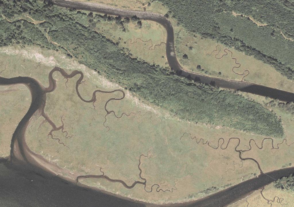
10 Soils Saturation Salinity Organic matter Texture


11 Tidal wetland vegetation: Low marsh I. Tidal marsh High marsh
12

13 Tidal wetland vegetation: Forested II. Tidal swamp Scrub-shrub

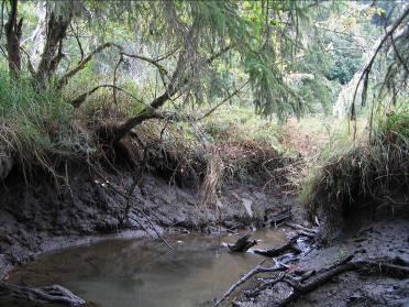

14 Tidal swamp
15
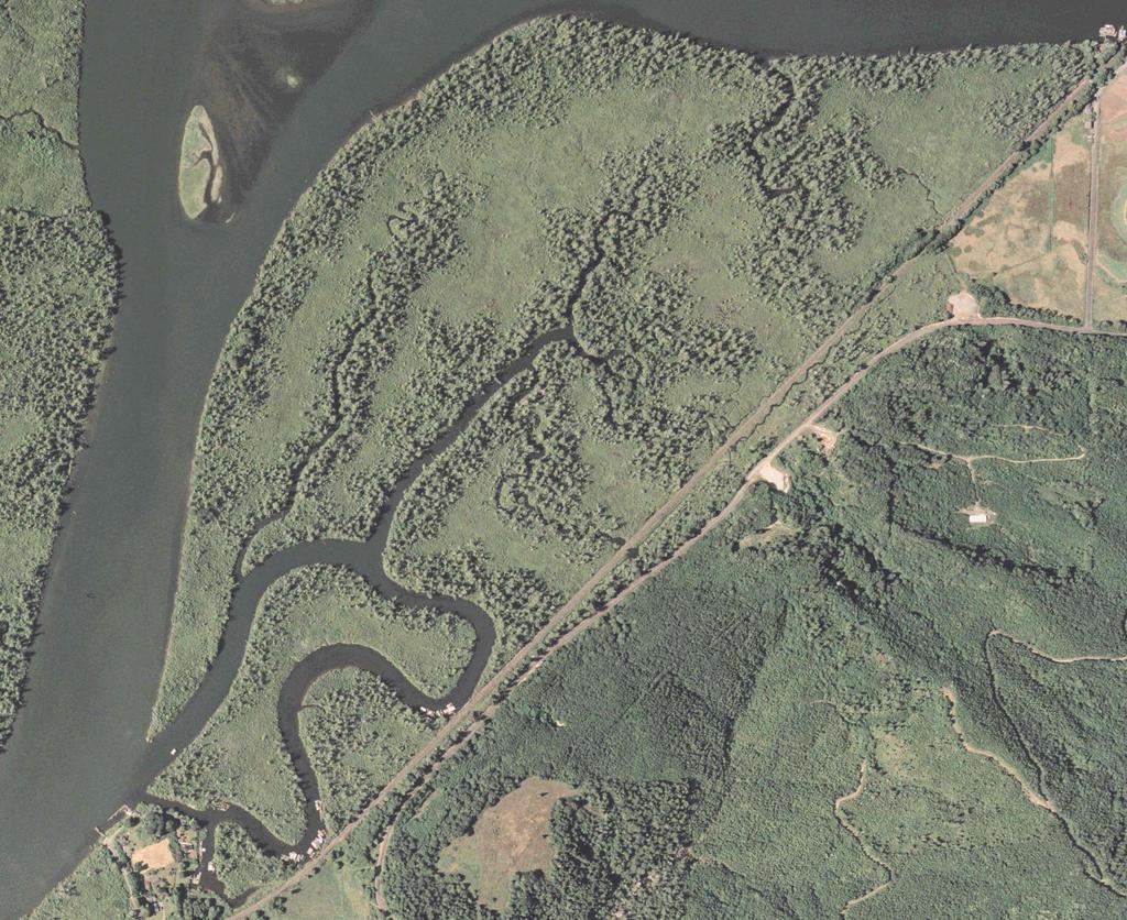
16

17 Landscape array of tidal wetland classes Illustration courtesy of Dr. James Good, Oregon State Univ.

18 Physical features Deep, steep-sided channels High sinuosity Natural levees Internal salinity gradients Vary by landscape setting
19 Why prioritize tidal wetlands for conservation and restoration? Extensive losses (~70%) Urgent need for action Limited funding Grant requirements

20 Tidal wetland loss/conversion estimates Oregon: 70-80% of tidal marshes >> 90% of tidal swamps Washington 70% of tidal wetlands in Puget Sound area California: 90% of tidal wetlands statewide

21 Alterations to tidal wetlands Diking Ditching Tide gates / restrictive culverts Excavation / fill

22 Historic vegetation type, Umpqua River estuary

23 Remaining tidal marsh, Umpqua River estuary

24 Remaining tidal swamp, Umpqua River estuary
25
26
27


28 Key elements of the method 1. Focus on ecological functions 2. Community-based 3. Intended for active use 4. Non-regulatory 5. Combination of field and remote data


29 1. Focus on ecological functions Landscape ecology approach Indicators of multiple wetland functions Focus on controlling factors ("drivers") Potential functions evaluated using remote data and field reconnaissance

30 2. Community-based and user-friendly Local watershed group involvement GIS or paper maps Straightforward, simple method Clear linkages between inputs and results

31 3. Intended for active use Dynamic estuary database Provides a basis for immediate action Improves chances of funding projects

32 4. Non-regulatory Results provide strategic direction Willing landowners No wetland is excluded : used existing wetland mapping 2011-present: elevation and water level data used to define wetland extent Does not delineate wetlands
33 Steps in the method 1. Assessment Historic extent Alterations Current conditions 2. Prioritization Ecological factors 3. Supplementary analyses Land ownership Land use zoning

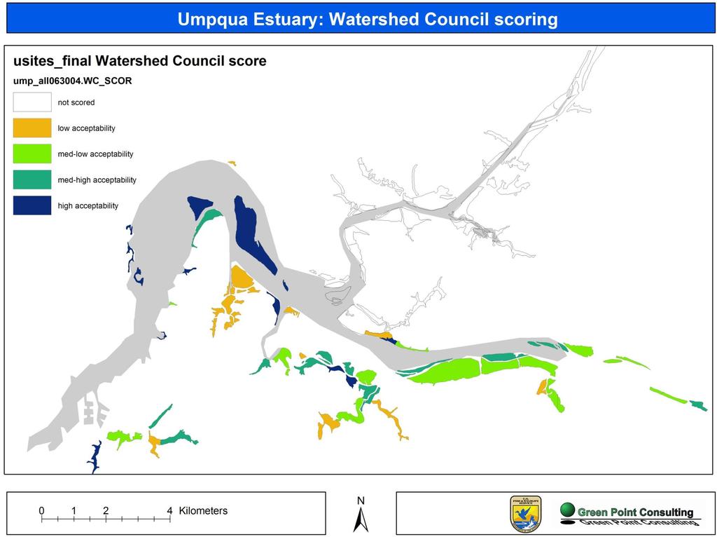
34 Public participation Watershed Council Technical Teams contributed to protocol development and site characterization. At public meetings, Council and community members ranked sites for acceptability of restoration/conservation.
35 Prioritization protocol: Requirements for criteria Should indicate level/quantity of multiple wetland functions Should effectively discriminate among sites Interpretation of levels should be clear Data should be quantitative and accurate Coverage throughout study area should be complete and consistent

36 Existing data sources LIDAR elevation data Map of existing and potential tidal wetlands (Scranton 2004) Estuary Plan Book National Wetland Inventory Local Wetland Inventories Head of tide data Historic vegetation maps NRCS Soil Survey maps
 Data sources:")


37 LIDAR-based mapping of current and historic extent of tidal wetlands Used for more recent assessments (2011 on) Data sources: LIDAR-derived elevation data (DEM) NOAA longterm tide gauge data NOAA models of frequency of inundation Field validation Process involves several steps that s another talk! Maps were completed in 2014 for the Oregon coast - see next slide for links to data Aquatic Setting
38 Links to new maps of Oregon estuary habitats (including tidal wetlands) In 2014, the State of Oregon completed updated estuarine habitat maps for all estuaries on Oregon s outer coast (excluding the Columbia River estuary). The project was a joint effort by Oregon s Department of Land Conservation and Development and the Estuary Technical Group, Institute for Applied Ecology. Links to products: Project flyer, with project lead contact information: Interactive map products: (To find the new maps, look at the catalog on the left, and go to "Planning Inventories / Estuarine Resourcs - Goal 16 / Biological / CMECS Estuary Classification.") GIS layers of the new maps can be downloaded from this site: Methods used for the mapping: Final project report to NOAA:

39 New data development Aerial photograph interpretation Geomorphology Alterations Vegetation type

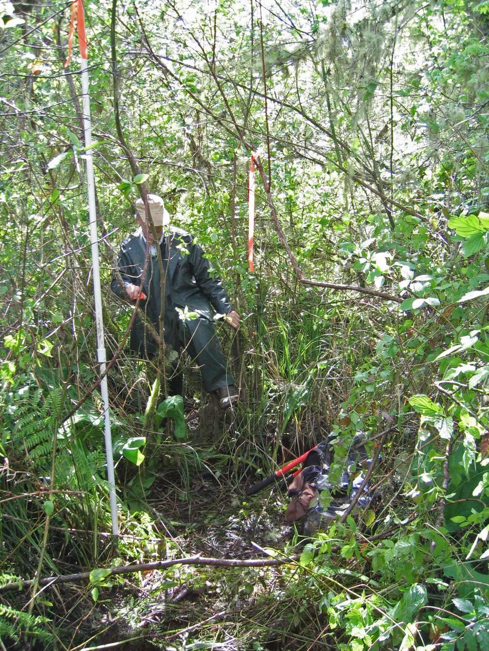
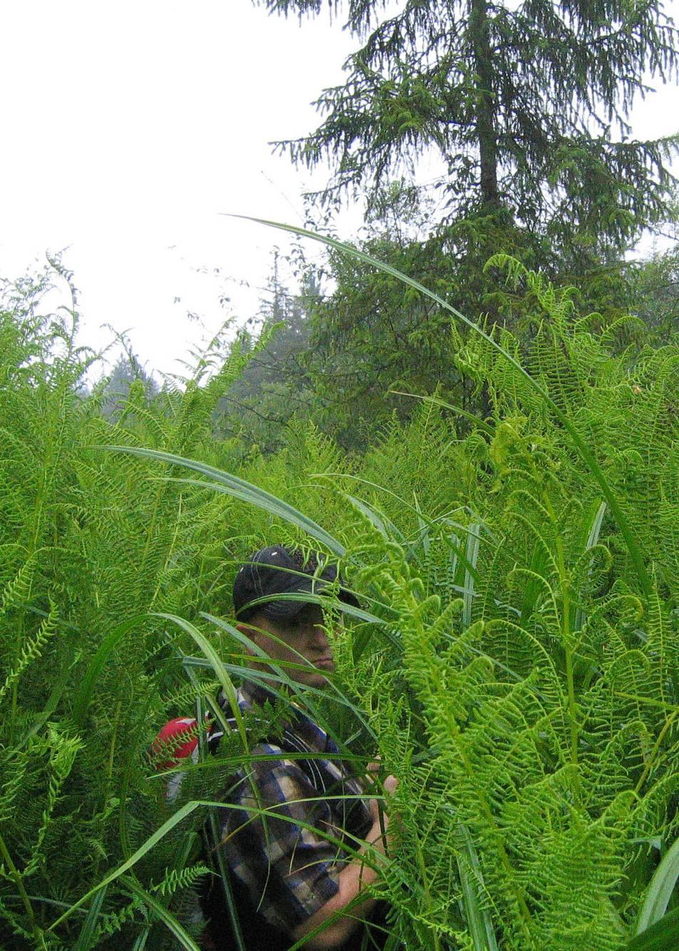
40 New data development Field reconnaissance and local input Ground-truthing Site details Local involvement vital
41 Prioritization criteria 1. Site size 2. Tidal channel condition 3. Wetland connectivity 4. Historic wetland type 5. Diversity of vegetation classes 6. Number of salmon stocks

42 Umpqua River estuary Oregon south coast
43 144 sites

44 Size + Hydrologic condition + Wetland connectivity + # of salmon stocks + # Cowardin classes + % historic tidal swamp = Final score

45
46 Umpqua & Nehalem: Major results I Criteria chosen successfully discriminated among sites Total score range 9 24 out of a possible 6 30 Level of public interest is high Good turnout at public meetings Results have been heavily used for action planning
47 Umpqua & Nehalem: Major results II Area of historic tidal wetlands is much greater than previously estimated. Estuary Past study Current study % increase Umpqua 979 ha 1537 ha 57% Nehalem 848 ha 1350 ha 59%
48 Umpqua & Nehalem: Major results III Proportion of historic tidal wetlands that have been altered is greater than previously estimated, in some areas. Estuary Historic total Relatively unaltered Altered Previous estimate* Umpqua 1537 ha 348 ha 23% 1190 ha 77% 50% lost Nehalem 1350 ha 343 ha 25% 1008 ha 75% 75% lost *Good 2000
49 OREGON: 1999 vs estimated losses 1999 estimated tidal wetland % loss 1850's marsh + swamp (ha) 1850's marsh (ha) 2005 estimated marsh loss (%) 1850's swamp (ha) 2005 estimated swamp loss Estuary Tillamook Coos Bay Umpqua Nehalem Yaquina Coquille Siuslaw Nestucca Salmon Siletz Alsea ALL estimates from Good Losses estimated using Scranton 2004 and Hawes et al Data exclude the Columbia River estuary.

50 Supplementary analyses Land ownership Land use zoning/planning Potential further analyses Economics Community perceptions Salmon habitat Historic vegetation [Climate change/slr]


51 Adjunct data on opportunity # of landowners Landowner type
52 Summary Straightforward, user-friendly approach Extensively reviewed and tested Detailed yet comprehensive Landscape-scale analysis Community-based Facilitates rapid action Easily supports overlays from additional analyses

53 Questions? Laura Brophy Estuary Technical Group, Institute for Applied Ecology
The Napa River Flood Protection Project
 The Napa River Flood Protection Project Creating Flood Protection and Restoring Geomorphic and Biological Processes Jeremy Sarrow, Napa County Flood Control & Water Conservation District June 2, 2014.
Fisher Slough Tidal Marsh Restoration Project Scaling Down the Restoration Planning & Analysis Framework to Evaluate Project Alternatives
 Fisher Slough Tidal Marsh Restoration Project Scaling Down the Restoration Planning & Analysis Framework to Evaluate Project Alternatives Project Sponsor/Partners The Nature Conservancy Dike District #3
systems is available on the Colorado Wetland Information Center (CWIC) website.
 website.") Colorado Natural Heritage Program Wetland Program Plan -- Dec 2015 Status Update and Addendum -- The Colorado Natural Heritage Program (CNHP) developed a Wetland Program Plan (WPP) in 2010 for the planning
Colorado Natural Heritage Program Wetland Program Plan -- Dec 2015 Status Update and Addendum -- The Colorado Natural Heritage Program (CNHP) developed a Wetland Program Plan (WPP) in 2010 for the planning
Restoring Water Ecosystems in NYC Parks
 Restoring Water Ecosystems in NYC Parks Hooked on our Waters Con October 19, 2013 - CUNY Graduate Center Marit Larson NYC Parks Landscape and ecosystem focus Watershed Streams Freshwater wetlands Tidal
Ecosystem Restoration Business Line Budgeting A Systems Approach
 Ecosystem Restoration Business Line Budgeting A Systems Approach Laura Orr (NWS), Shawn Phillips (MVM), Greg Steele (NAO) Introduction Chesapeake Bay Bridge Mouth of Mississippi River Bonneville Dam Fish
Conservation Corridor Base and Thematic Maps
 Conservation Corridor Base and Thematic Maps August 20, 2010 This project is funded in part by the Virginia Coastal Zone Management Program at the Department of Environmental Quality through Grant #NAO9NOS4190163
Landscape Conservation Design April, 2014
 Designing Sustainable Landscapes in the Northeast A project of the North Atlantic Landscape Conservation Cooperative & Northeast Climate Science Center Landscape Conservation Design April, 2014 Conceptual
River Road New Castle Marsh Restoration Recommendations
 University of New Hampshire University of New Hampshire Scholars' Repository PREP Reports & Publications Institute for the Study of Earth, Oceans, and Space (EOS) 6-2010 River Road New Castle Marsh Restoration
Florida Forever Conservation Needs Assessment Overview Maps
 Florida Forever Conservation Needs Assessment Overview Maps Prepared by Florida Natural Areas Inventory, The maps in this document are derived from the Florida Forever Conservation Needs Assessment, an
FISH RESTORATION PROGRAM AGREEMENT Implementing Habitat Restoration Requirements Of The Biological Opinions
 FISH RESTORATION PROGRAM AGREEMENT Implementing Habitat Restoration Requirements Of The Biological Opinions Dennis McEwan Department of Water Resources waterways tidal wetlands Whipple et al. 2012: Sacramento-San
Minnesota Department of Natural Resource - Natural Resource Guidance Checklist Conserving Natural Resources through Density Bonuses
 Minnesota Department of Natural Resource - Natural Resource Guidance Checklist Conserving Natural Resources through Density Bonuses NRDB Why Use Density Bonuses & This Checklist Local units of government
Nature-Based Adaptation Projects Challenges and Opportunities in California Marilyn Latta, Project Manager California State Coastal Conservancy
 Nature-Based Adaptation Projects Challenges and Opportunities in California Marilyn Latta, Project Manager California State Coastal Conservancy Restore America s Estuaries California State Coastal Conservancy
North Bellingham and Urban Growth Boundary Wetland, Stream, Habitat Conservation Area and Buffer Assessment TECHNICAL MEMORANDUM
 Northwest Ecological Services, LLC North Bellingham and Urban Growth Boundary Wetland, Stream, Habitat Conservation Area and Buffer Assessment TECHNICAL MEMORANDUM Prepared For: City of Bellingham Planning
Subject: Sea Level Rise Constraints and Opportunities for India Basin
 Memorandum To: Monica Melkesian, Build Inc Cc: From: Leslie Lazarotti lazarotti@wra-cacom Ext 1300 Subject: Sea Level Rise Constraints and Opportunities for Date: July 8, 2015 The impetus for this study
NJ Department of Environmental Protection
 NJ Department of Environmental Protection COASTAL AND LAND USE PLANNING New Jersey Coastal Management Program Covers NJ coastal waters to limit of tidal influence including 239 municipalities in 19 counties,
Analysis of Landscape Character for Visual Resource Management 1
 Analysis of Landscape Character for Visual Resource Management 1 Paul F. Anderson 2/ Abstract: Description, classification and delineation of visual landscape character are initial steps in developing
Incorporating Traditional Ecological Knowledge and Cultural Information Into Wetland Protection, Management, and Restoration - Tulalip Reservation
 Incorporating Traditional Ecological Knowledge and Cultural Information Into Wetland Protection, Management, and Restoration - Tulalip Reservation By Jonathan Hall, Wetland Biologist, Tulalip Tribes Weallup
PRE-DESIGN CONCEPT REPORT GRAND CANAL RESTORATION
 PRE-DESIGN CONCEPT REPORT GRAND CANAL RESTORATION Project Background November 19, 2007 Executive Summary The Grand Canal is an important tidal waterway in the Venice community of Los Angeles, California,
Pontchartrain Coastal Lines of Defense Program Figure 1 Figure 2 Figure 1
 Pontchartrain Coastal Lines of Defense Program Coastal Sustainability Program February 2006 The Pontchartrain Coastal Lines of Defense Program consists of ten priority project areas within the Pontchartrain
The Art and Science of Stormwater Retrofitting
 The Art and Science of Stormwater Retrofitting April 9, 2008 Michael Novotney, Center for Watershed Protection Deb Caraco, Center for Watershed Protection Dan Frisbee, City of Charlottesville, Virginia
Great Lakes Conservation Blueprint for Terrestrial Biodiversity on the Canadian Shield
 Great Lakes Conservation Blueprint for Terrestrial Biodiversity on the Canadian Shield Bonnie L. Henson 1, Kara E. Brodribb 2 and John L. Riley 3 1 Ontario Ministry of Natural Resources 2,3 The Nature
FAQ S about Restoration Planning FROM THE Department of Ecology WEBSITE:
 FAQ S about Restoration Planning FROM THE Department of Ecology WEBSITE: http://www.ecy.wa.gov/programs/sea/sma/st_guide/smp/restoration/qanda.html Notations in parentheses are staff notes directing you
Peninsular Florida Landscape Conservation Cooperative. Marine and Estuarine Priority Resources and Conservation Targets
 Peninsular Florida Landscape Conservation Cooperative Marine and Estuarine Priority Resources and Conservation Targets Why are we here today? Workshop Goals: Develop a list of potential conservation targets
The Moors at Arne Project, Managing Coastal Change
 General Questions What are we doing? The Environment Agency, RSPB and Natural England are working together to adapt approximately 150ha of The Moors at Arne into a diverse wetland habitat. With the sea
April 11, 2016 Park Board Chair and Commissioners General Manager Vancouver Board of Parks and Recreation New Brighton Salt Marsh - Preferred Concept
 TO: FROM: SUBJECT: April 11, 2016 Park Board Chair and Commissioners General Manager Vancouver Board of Parks and Recreation New Brighton Salt Marsh - Preferred Concept RECOMMENDATION A. THAT the Vancouver
Bristol Marsh Heritage Conservancy
 Bristol Marsh Heritage Conservancy The Pennsylvania Environmental Council (PEC) protects and restores the natural and built environments through innovation, collaboration, education and advocacy. PEC believes
Shoreline Master Program Town of La Conner, Washington
 Shoreline Master Program Town of La Conner, Washington Department of Ecology approval effective Adopted September 24, 2013 by Town of La Conner Ordinance No.1106 Amended May 13, 2014 by Town of La Conner
Design Guidelines for the Enhancement and Creation of Estuarine Habitats in the Middle Reaches of the Lower Columbia River
 Design Guidelines for the Enhancement and Creation of Estuarine Habitats in the Middle Reaches of the Lower Columbia River Astoria, May 16, 2012 1 Outline I. Nature of Project/Background II. Approach to
water resource specialists
 Vaughn Collins, PE, CFM, Northwest Hydraulic Consultants Brad Livingston, Oregon Department of Transportation Melissa Reich, North Coast Land Conservancy Location Necanicum River 75 sq mi watershed Active
Phase I Ecological Network Report Terms of Reference
 Phase I Ecological Network Report Terms of Reference INTRODUCTION In 2007, the City of Edmonton created a new Natural Area Systems Policy (C-531) and a strategic plan, Natural Connections. Together, these
HISTORICAL ECOLOGY OF THE DELTA Emerging Concepts about a Spatially Complex and Temporally Dynamic System
 ITEM REMOVED DUE TO COPYRIGHT STATUS HISTORICAL ECOLOGY OF THE DELTA Emerging Concepts about a Spatially Complex and Temporally Dynamic System Robin Grossinger and Alison Whipple San Francisco Estuary
Overview of Southwestern Pennsylvania Commission s (SPC) 2040 Long Range Transportation Plan (LRTP)
 2040 Long Range Transportation Plan (LRTP)") Overview of Southwestern Pennsylvania Commission s (SPC) 2040 Long Range Transportation Plan (LRTP) Presented to Pennsylvania Agency Coordination Meeting May 27, 2015 Doug Smith & Ryan Gordon 1 Southwestern
Overview of Southwestern Pennsylvania Commission s (SPC) 2040 Long Range Transportation Plan (LRTP) Presented to Pennsylvania Agency Coordination Meeting May 27, 2015 Doug Smith & Ryan Gordon 1 Southwestern
City of Norfolk Coastal Flood Mitigation Program. March 13, 2013
 City of Norfolk Coastal Flood Mitigation Program March 13, 2013 Topics Brief overview of Norfolk s Coastal Flood Program Data-driven analysis and decision making City-wide vulnerability, project concepts,
CONSERVATION ELEMENT GOALS, OBJECTIVES, AND POLICIES
 CONSERVATION ELEMENT GOALS, OBJECTIVES, AND POLICIES Goal 4 To conserve, manage, appropriately use and protect the natural resources of the City ensuring continued resource availability and environmental
Using the Past to Understand the Present Emerging Lessons for Environmental Planning in the Santa Clara Valley
 Using the Past to Understand the Present -- -- -- Emerging Lessons for Environmental Planning in the Santa Clara Valley Robin Grossinger Director of the Historical Ecology Program San Francisco Estuary
Lower Columbia River and Coastal Landscape Conservation Design
 Today s Presenters: Lower Columbia River and Coastal Landscape Conservation Design John Mankowski, North Pacific Landscape Conservation Cooperative Sara Evans-Peters, Pacific Birds Tom Miewald, US Fish
Stormwater Retrofitting: The Art of Opportunity. Presented by the Center for Watershed Protection
 Stormwater Retrofitting: The Art of Opportunity Presented by the Center for Watershed Protection What Are Stormwater Retrofits? Retrofits are stormwater management measures inserted in an urban or ultra-urban
Case Study: City of San Mateo
 Published on GreenPlan-IT (http://greenplanit.sfei.org) Home > Archived Materials > GreenPlan-IT Toolkit Demonstration Report > Chapter 2. Case Study: City of San Mateo Case Study: City of San Mateo Chapter
Making Data Work for You: Free Mapping Tools for Prioritization and Property Research
 Making Data Work for You: Free Mapping Tools for Prioritization and Property Research Ariel Maiorano amaiorano@massaudubon.org Abby Hardy-Moss abby@ecga.org Essex County Open Space Conference March 25,
Point-No-Point Tide-Gate & Outfall Replacement Project. Briefing Memo 2013
 Point-No-Point Tide-Gate & Outfall Replacement Project Briefing Memo 2013 This memo provides an initial outline of the proposed Point-No-Point (PNP) Tide-Gate and Outfall replacement project. The current
NJ Habitat Connectivity Initiative
 NJ Habitat Connectivity Initiative Full Working Group Update #1 Spotted Salamander Crossing Road in Northern NJ Wildlife Habitat Connectivity Initiative A strategic plan to reconnect New Jersey s landscape
Planning for Staten. Habitat Restoration and Green Infrastructure. Island s North Shore
 Habitat Restoration and Green Infrastructure Planning for Staten Island s North Shore Community Board 1 March 1, 2018 NYC Parks Forestry, Horticulture, and Natural Resources Funded by the NYS Department
New Jersey Habitat Connectivity Project
 Mapping Core Team Meeting Two January 25 th, 10 am - noon Assunpink Wildlife Management Area, Main Office Meeting attendees: Patrick Carr, Margaret Conroy, Karl Figueiredo, Gretchen Fowles, Gylla MacGregor,
Hydric Soils - Overview
 Hydric Soils - Overview The Hydric Soils section presents the most current information about hydric soils. It updates information that was previously published in "Hydric Soils of the United States" and
RECREATION, OPEN SPACE AND GREENWAYS ELEMENT GOALS, OBJECTIVES, AND POLICIES
 RECREATION, OPEN SPACE AND GREENWAYS ELEMENT GOALS, OBJECTIVES, AND POLICIES GOAL R-1: DEVELOP A RECREATION, OPEN SPACE AND GREENWAYS SYSTEM AS AN INTEGRAL COMPONENT OF AN OVERALL, COUNTY-WIDE ECONOMIC
Empowering Local Action for Coastal Resilience in Massachusetts. Bruce K. Carlisle MA Office of Coastal Zone Management
 Empowering Local Action for Coastal Resilience in Massachusetts Bruce K. Carlisle MA Office of Coastal Zone Management Context Coastal communities continue to face both chronic and acute storm surge, erosion,
New Tools for Land Management: A Quick Introduction to Ecological Site Descriptions
 New Tools for Land : A Quick Introduction to Ecological Site Descriptions Land management agencies have the job of managing natural resources for multiple uses in a sustainable manner. A sound understanding
Key Elements of Successful Conservation Planning. John Paskus October 17, 2013 Pierce Cedar Creek Institute Michigan Natural Features Inventory
 Key Elements of Successful Conservation Planning John Paskus October 17, 2013 Pierce Cedar Creek Institute Michigan Natural Features Inventory What is Conservation Planning? Pressey et al (2008): The process
Community Conservation Workshop. Lake Placid
 Community Conservation Workshop Lake Placid 2 Community Conservation Program Welcome! We have designed a Community Conservation Program that listens to the needs of community members. We are conducting
TOWN OF SPRINGFIELD, NEW HAMPSHIRE
 TOWN OF SPRINGFIELD, NEW HAMPSHIRE NATURAL RESOURCES INVENTORY EXECUTIVE SUMMARY March 2008 Prepared by: Watershed to Wildlife, Inc. Natural Resource Consultants 42 Mill Street, Suite 3 Littleton, NH 03561
Photo by Carlton Ward Jr. Executive Summary
 Photo by Carlton Ward Jr. Executive Summary The Cooperative Conservation Blueprint (Blueprint) is a multi-partner strategic conservation process developed by the Florida Fish and Wildlife Commission (FWC)
50 Years of Habitat Change in the Mississippi River Delta
 50 Years of Habitat Change in the Mississippi River Delta Wells*, Chris, Larry Handley*, Jason Dugas**, Kelly Mouton**, Dennis Lichtenberg** *NWRC/USGS; **NWRC/IAP World Services U.S. Department of the
TOWN OF BETHLEHEM OPEN SPACE CONSERVATION PLAN PUBLIC MEETING: OCTOBER 12, 2017
 TOWN OF BETHLEHEM OPEN SPACE CONSERVATION PLAN PUBLIC MEETING: OCTOBER 12, 2017 Welcome and Agenda 6:00 6:45: Open House, Part One 6:45 7:15: Presentation and Questions 7:15 8:00: Open House, Part Two
Nate Hough-Snee ESRM 412 Plant Propagation Protocol One 11 APR 2007
 1 of 5 4/7/2008 10:07 AM Family Names Family Scientific Name: Family Common Name: Scientific Names Genus: Species: Species Authority: Common Synonym Genus: Species: Species Authority: General Information
Blue/Green Infrastructure Study Accomack County, VA
 Blue/Green Infrastructure Study Accomack County, VA Draft Asset Maps March 8-9, 2010 Green Infrastructure Center, Inc. 2 Overview What is Green and Blue Infrastructure Project Timeline & Tasks Literature
TITLOW SHORELINE AND ESTUARY RESTORATION PROJECT DESIGN DEVELOPMENT
 TITLOW SHORELINE AND ESTUARY RESTORATION PROJECT DESIGN DEVELOPMENT Request for Qualifications South Puget Sound Salmon Enhancement Group with EarthCorps and Metro Parks Tacoma Request for Qualifications:
THE CORPORATION OF THE CITY OF WINDSOR Office of the City Solicitor Planning Department
 THE CORPORATION OF THE CITY OF WINDSOR Office of the City Solicitor Planning Department REPORT TO THE CITY OF WINDSOR PLANNING ADVISORY COMMITTEE DATE OF REPORT: August 19, 2010 SUBJECT: Official Plan
ALTERNATIVE SHORELINE MANAGEMENT IN COASTAL MISSISSIPPI
 ALTERNATIVE SHORELINE MANAGEMENT IN COASTAL MISSISSIPPI Project supported via financial assistance provided by the Coastal Zone Management Act of 1972, as amended, administered by the Office of the Ocean
Figure 1. Proposed Strategic Habitat Conservation Areas for Florida
 Figure 1. Proposed Strategic Habitat Conservation Areas for Florida Critical Lands and Waters Identification Project (CLIP) Cooperative Effort Century Commission for Sustainable Florida Florida Natural
WASHINGTON COUNTY OREGON
 WASHINGTON COUNTY OREGON LONG RANGE PLANNING DIVISION North Bethany Subarea Stream Corridors: Existing Regulations In Oregon, there is a distinct difference between the land use rules that apply in rural
Green Infrastructure Policies and Ordinances
 Green Infrastructure Policies and Ordinances October 23, 2013 By Karen Firehock, Green Infrastructure Center 2013 Georgia Urban Forest Council s 23 rd Annual Conference The mission of the nonprofit Green
Executive Summary. Essential Connectivity Map (Figure ES-1)
") Executive Summary The California Department of Transportation (Caltrans) and California Department of Fish and Game (CDFG) commissioned the because a functional network of connected wildlands is essential
Executive Summary The California Department of Transportation (Caltrans) and California Department of Fish and Game (CDFG) commissioned the because a functional network of connected wildlands is essential
DRAFT ALDER CREEK FARM MASTER PLAN
 DRAFT ALDER CREEK FARM MASTER PLAN Lower Nehalem Community Trust Mission: To preserve land and nurture conservation values in partnership with an engaged community in the Nehalem region of the Oregon Coast
Ecological Design in the West:
 Ecological Design in the West: Process-based, Performance-driven An AEES Certified Ecological Designer Workshop October 6 8, 2015 University of California, Berkeley The workshop will include a design charrette
1/21/2014. Definitions vary widely Legal vs. functional Not always obvious. Wetlands are legally protected by Clean Water Act (1972)
") What is a Wetland? Freshwater Wetlands of Gulf Coast Plains Definitions vary widely Legal vs. functional Not always obvious What is a Wetland? Wetlands are legally protected by Clean Water Act (1972) Corps
What is a Wetland? Freshwater Wetlands of Gulf Coast Plains Definitions vary widely Legal vs. functional Not always obvious What is a Wetland? Wetlands are legally protected by Clean Water Act (1972) Corps
Florida s Ephemeral Ponds and Pond-Breeding Amphibians
 Florida s Ephemeral Ponds and Pond-Breeding Amphibians What are Ephemeral Ponds? Ephemeral ponds are small, isolated wetlands that dry periodically. These ponds can be deep, sand-bottomed depressions with
BlueHealth Environmental Assessment Tool (BEAT):
:") BlueHealth Environmental Assessment Tool (BEAT): Development and validation of a direct-observation audit tool for planning, design, management and post-occupancy evaluation of urban blue spaces. Himansu
BlueHealth Environmental Assessment Tool (BEAT): Development and validation of a direct-observation audit tool for planning, design, management and post-occupancy evaluation of urban blue spaces. Himansu
WATERSHED. Greg Goodrum Mitchell Donovan Aubie Douglas Christina Morrisett Jenna Keeton
 WATERSHED SCIENCE MEET OUR GRADUATE STUDENT MENTORS Greg Goodrum Mitchell Donovan Aubie Douglas Christina Morrisett Jenna Keeton GREG GOODRUM Master's Student Goodrum.greg@gmail.com Hi! I m Greg, and I
City of Tacoma Shoreline Master Program Update Stakeholder Advisory Committee Meeting September 10, 2009
 City of Tacoma Shoreline Master Program Update Stakeholder Advisory Committee Meeting September 10, 2009 Agenda Overview Progress to Date Upcoming Schedule Structure of the SMP Shoreline Environment Designations
Commercial Launch Site Addendum to Wetland Mitigation Plan. Revision 2. April 25, SpaceX Proprietary
 Commercial Launch Site Addendum to Wetland Mitigation Plan Revision 2 April 25, 2017 SpaceX Proprietary Contents 1.0 Project Information... 1 1.1 Background... 1 2.0 Compensatory Mitigation... 2 2.1 Goals
The Landscape Project. New Jersey Department of Environmental Protection Division of Fish and Wildlife Endangered and Nongame Species Program
 The Landscape Project New Jersey Department of Environmental Protection Division of Fish and Wildlife Endangered and Nongame Species Program New Jersey is One of the smallest states in the country Yet
Mitigation + Adaptation Strategies for Historic Structures and Sites
 Mitigation + Adaptation Strategies for Historic Structures and Sites Adrienne Burke, Esq., MSAS, LEED AP+ Executive Director, Riverside Avondale Preservation, Jacksonville, FL Cultural Resources, Disaster
Community Conservation Workshop. Saranac River Basin Communities
 Community Conservation Workshop Saranac River Basin Communities 2 Community Conservation Program Welcome! We have designed a Community Conservation Program that listens to the needs of community members.
Baylands Segment J. Bay between the Golden Gate and Segment J. Coyote Point. of For managed ponds. included habitat enhancement.
 Baylands Segment J Crissy Field Alameda Naval Air Station Heron's Head Park COLMA CREEK SFO Millbrae San Mateo BAYLANDS 2009 SAN FRANCISCO AREA san francisco area Western side of central San Francisco
Town of Peru Comprehensive Plan Executive Summary
 Town of Peru Comprehensive Plan Executive Communities that plan grow by choice, not by chance. A plan makes growth thoughtful, understandable, and predictable. A plan shows that a community is managing
City of Surrey Ecosystem Management Study. Integration of ecological processes with land use
 City of Surrey Ecosystem Management Study Integration of ecological processes with land use Natural areas in Surrey are changing as the City grows and evolves. Many important natural areas remain or may
Preface. Erie. Scranton. Allentown. Pittsburgh. Harrisburg. Philadelphia
 The Southern Alleghenies Region The Southern Alleghenies Region spans the Laurel Highlands and Allegheny Front in the west across the Appalachians to the east. It is comprised of Blair, Bedford, Cambria,
Chapter XV Maps. The map is not the territory ~Alfred Korzybski
 Chapter XV Maps The map is not the territory ~Alfred Korzybski Chapter XV Maps 15.1 DISCLAIMER These maps are intended for use with the Tamworth Master Plan. The information presented is to be used for
Integration of Planning & Environmental Analysis in Transportation
 Integration of Planning & Environmental Analysis in Transportation How Natural Resources Conservation Fits into SAFETEA-LU Planning Rules Transportation Research Board Annual Meeting January 2008 Jeff
Recent Tidal Creek Restoration Efforts in Tampa Bay
 Recent Tidal Creek Restoration Efforts in Tampa Bay Ed Sherwood Tampa Bay Estuary Program Co-Authors: Brandt Henningsen, SWFWMD, SWIM Overview Tampa Bay Watershed & Tidal Creek Overview Habitat Restoration
Countywide Green Infrastructure
 Montgomery County s Countywide Green Infrastructure F U N C T I O N A L M A S T E R P L A N The Maryland National Capital Park and Planning Commission INFRASTRUCTURE An underlying base or foundation especially
Lower Don River West Remedial Flood Protection Project TABLE OF CONTENTS. Page. Executive Summary
 TABLE OF CONTENTS Page Executive Summary 1.0 INTRODUCTION...1-1 1.1 Purpose of the Undertaking...1-1 1.2 Study Area Description...1-1 1.3 Description of the Undertaking...1-1 1.4 Rationale for the Undertaking...1-2
GIS to Estimate Archaeological Site Loss and Develop Conservation Strategies
 GIS to Estimate Archaeological Site Loss and Develop Conservation Strategies Terry Jackson Office of Decision Support Systems Planning and Environmental Management Division Georgia Department of Community
Town of Vershire Road Erosion Inventory Report
 Town of Vershire Road Erosion Inventory Report Taylor Valley Road. Photo taken by TRORC staff. Prepared by: 128 King Farm Road Woodstock, VT 05091 Inventory and report funded by the Vermont Agency of Transportation
Section 1 TABLE OF CONTENTS
 Section 1 TABLE OF CONTENTS... [M]ineral fertilizer is essential to feed around half of the world s population, and will be fundamental to ensure global food security through the 21 st century. 2013 U.N.
Swan Creek Urban BMP Inventory and Assessment. Jeff Grabarkiewicz, Kari Gerwin, Ann-Drea Hensley TMACOG, Lucas SWCD/Engineers, and Partners
 Swan Creek Urban BMP Inventory and Assessment Jeff Grabarkiewicz, Kari Gerwin, Ann-Drea Hensley TMACOG, Lucas SWCD/Engineers, and Partners Presentation Outline Project Background Methods Inventory Desktop
Outfall Reconnaissance Inventory & Stream Assessment
 CITY OF TUMWATER Outfall Reconnaissance Inventory & Stream Assessment City of Tumwater 555 Israel Road SW Tumwater, WA 98501 ACKNOWLEDGEMENTS City of Tumwater Outfall Reconnaissance Inventory and Stream
Using Soil Attributes for HGM Wetland Classification
 Using Soil Attributes for HGM Wetland Classification Richard Weber Wetland Hydraulic Engineer Wetland Team CNTSC, Fort Worth, TX Slide 1 Hydrogeomorphic (HGM) Landscape Classes Originally for Development
Preparing a Wetland Delineation Report
 Preparing a Wetland Delineation Report Why is the report important? In addition to documenting the wetland determination/delineation, the report often provides the basis for further regulatory permitting/compliance.
Introducing Green Infrastructure for Coastal Resilience
 Introducing Green Infrastructure for Coastal Resilience National Oceanic and Atmospheric Administration (NOAA) Office for Coastal Management Gloucester, MA Office of Travel Courtesy, Tim Grafft What Is
San Francisco Bay Area Upland Habitat Goals Project
 San Francisco Bay Area Habitat Preserving Biological Diversity for Future Generations A of the Bay Area Open Space Council funding provided by: California State Coastal Conservancy Gordon and Betty Moore
Meta-Analysis of Project Effectiveness: Learning at the Regional Scale
 Western Washington University Western CEDAR Salish Sea Ecosystem Conference 2014 Salish Sea Ecosystem Conference (Seattle, Wash.) May 1st, 10:30 AM - 12:00 PM Meta-Analysis of Project Effectiveness: Learning
Wetland Types. Grade Level: Basic. Duration: 30 minutes. Setting: Classroom
 Wetland Types Adapted from: An original Creek Connections activity created by Cassandra Hamilton. Creek Connections, Box E, Allegheny College, Meadville, PA 16335 http://creekconnections.allegheny.edu
Green Infrastructure. NYS Department of Environmental Conservation
 Green Infrastructure Green infrastructure is an interconnected network of natural areas and open spaces that sustains ecosystems. Benedict, M.A. and E.T. McMahon. 2006. Green Infrastructure Linking Landscapes
FEGN Update Goals and Objectives
 FEGN Update Goals and Objectives Update the FEGN to identify a functionally connected statewide ecological network of public and private conservation lands that incorporates new and updated GIS data. Ensure
Introduction. Integrating Ecological Restoration of Estuarine Shorelines with Urban Community Revitalization Efforts. Ed Morgereth Biohabitats, Inc.
 Introduction Integrating Ecological Restoration of Estuarine Shorelines with Urban Community Revitalization Efforts Ed Morgereth Biohabitats, Inc. 5 th National Conference & Expo on Coastal and Estuarine
New Brighton Park Shoreline Habitat Restoration Project
 Vancouver Board of Parks and Recreation and Port Metro Vancouver New Brighton Park Shoreline Habitat Restoration Project Conceptual Design Public Consultation August 26 September 9, 2015 Discussion Paper
Natural Resource Adaptation Action Area Addressing Sea Level Rise in Estuarine Ecosystems TO: TOWN OF YANKEETOWN MAY
 Natural Resource Adaptation Action Area Addressing Sea Level Rise in Estuarine Ecosystems TO: TOWN OF YANKEETOWN MAY 6 2013 University of Florida Conservation Clinic Vivek Babbar, Student Associate, J.D.
Coquitlam River Riparian Planting
 Coquitlam River Riparian Planting Year Four Year Four Report, March 2016 Prepared for: Fish and Wildlife Compensation Program Prepared by: Watershed Watch Salmon Society and the Kwikwetlem First Nation
Northeast Florida Estuary Restoration Initiative: A District Perspective. Ron Brockmeyer, SJRWMD And a cast of thousands!!
 Northeast Florida Estuary Restoration Initiative: A District Perspective Ron Brockmeyer, SJRWMD And a cast of thousands!! Success and Local Partners Impoundment Reconnection / Restoration (Merritt Island