Draft Environmental Impact Statement
|
|
|
- Johnathan White
- 5 years ago
- Views:
Transcription


1 August 2018 Seattle Aquarium Ocean Pavilion Draft Environmental Impact Statement Prepared for City of Seattle Department of Parks and Recreation and Seattle Aquarium Society Draft Environmental Impact Statement 1 August 2018
2 August 2018 Seattle Aquarium Ocean Pavilion Draft Environmental Impact Statement Prepared for City of Seattle Department of Parks and Recreation 100 Dexter Avenue North Seattle, Washington Seattle Aquarium Society 1483 Alaskan Way Seattle, Washington Prepared by Anchor QEA, LLC 720 Olive Way, Suite 1900 Seattle, Washington Heffron Transportation, Inc NE 61st St Seattle, Washington 98115

3 Americans with Disabilities Act (ADA) Information This document has been tagged to meet universal accessibility standards, consistent with Section 508 Standards of the Rehabilitation Act for Information Communication and Technology and Washington State accessibility policies. Persons who are deaf or hard of hearing may make requests for alternative formats through the Washington Relay Service at Civil Rights Act of 1964, Title VI Statement to the Public The City of Seattle hereby gives public notice that it is the policy of the department to assure full compliance with Title VI of the Civil Rights Act of 1964, the Civil Rights Restoration Act of 1987, and related statutes and regulations in all programs and activities. Title VI requires that no person in the United States of America shall, on the grounds of race, color, sex, nation origin, disability, or age, be excluded from the participation in, be denied benefits of, or be otherwise subjected to discrimination under any program or activity for which the department receives federal financial assistance. Persons wishing information may call the City of Seattle Office of Civil Rights at (206)
4 ~,~ Seattle \-ii ~ Parks & Recreation August 30, 2018 Dear Agencies, Tribal Governments, and Members of the Public, The Seattle Aquarium Society (SEAS), in coordination with the City of Seattle Department of Parks and Recreation (Seattle Parks and Recreation), is proposing the Seattle Aquarium Ocean Pavilion (Ocean Pavilion) to further its mission of Inspiring Conservation ofour Marine Environment, accommodate an expected increase in future attendance, provide a continuous connection with the existing Seatt le Aquarium, support programming, and offer opportunities for public open space and enjoyment of the shoreline. This Washington State Environmental Policy Act (SEPA) Draft Environmental Impact Statement (Draft EIS) evaluates a range of alternatives for the proposed Ocean Pavilion. This Draft EIS focuses on potential impacts and proposed mitigation measures for the following elements of the environment: Transportation and Parking Land Use Aesthetics and Scenic Resources Historic and Archaeological Resources Water Quality Fish and Aquatic Resources Based on a technical evaluation of the alternatives that occurred after t he scoping process, the Draft EIS indicates that no significant adverse impacts are ant icipated to occur from the proposed action. According to Seattle Municipal Code (E) and Washington Administrative Code (6)(a), elements of the environment that are not significantly affected do not need to be evaluated. However, Seatt le Parks and Recreation and SEAS believe that it is important to provide this information to decisionmakers and the public. Seattle Parks and Recreation and SEAS invite you to comment on this Draft EIS. The Fact Sheet included in the Draft EIS provides instructions for submitting comments and details regarding the public hearing on the Draft EIS, which is scheduled for September 27, Comments on the Draft EIS are due by October 1, Sincerely, Christopher Williams, Interim Superintendent Seattle Parks and Recreation 100 Dexter Avenue North I Seattle, WA I I seattle.gov/parks
5 TABLE OF CONTENTS Fact Sheet... iv Abbreviations... v Executive Summary... ES-1 1 Introduction Background Relationship to Other Waterfront Projects Environmental Review Process Community, Agency, and Tribal Engagement EIS Scope and Organization Project Alternatives Development of Alternatives Alternative 1: No Action Alternative Alternative Alternative Comparison of Action Alternatives Utilities and Water Management for Alternatives 2 and Off-Site Animal Care Center for Alternatives 2 and Construction Methods for Alternatives 2 and Alternatives Considered but Not Carried Forward Elements of the Environment Determined to Have No Probable Adverse Impact Affected Environment, Impacts, and Mitigation Measures Transportation and Parking Land Use Aesthetics and Scenic Resources Historic and Archaeological Resources Water Quality Fish and Aquatic Resources Cumulative Effects Methodology Past, Present and Reasonably Foreseeable Future Projects Consistency with Seattle Municipal Code Transportation and Parking Land Use...70 Draft Environmental Impact Statement i August 2018
6 4.6 Aesthetics and Scenic Resources Historic and Archaeological Resources Water Quality Fish and Aquatic Resources References List of Preparers TABLES Table 2-1 Comparison of Design Features for Alternative 2 and Alternative Table 2-2 Typical Construction Equipment and Uses Table 3-1 Transportation and Parking Impacts Summary Table 3-2 Projected Increase in Vehicle Trips Generated by Alternatives 2 and Table 3-3 Level of Service Summary 2030 Conditions PM Peak Hour Table 3-4 Land Use Impacts Summary Table 3-5 Summary of Consistency with Applicable Land Use Plan Goals Table 3-6 Aesthetics and Scenic Resources Impacts Summary Table 3-7 Cultural Resources Impacts Summary Table 3-8 Water Quality Impacts Summary Table 3-9 Fish and Aquatic Resources Impacts Summary FIGURES Figure 1-1 Vicinity Map... 2 Figure 1-2 Map of Other Waterfront Projects near the Ocean Pavilion... 6 Figure 2-1 Alternative 1 (No Action) Figure 2-2 Alternative Figure 2-3 Alternative Figure 2-4 Conceptual Layout of Existing and Proposed Water Management System Figure 2-5 South and North Alternatives at Piers 59 and Figure 3-1 Transportation and Parking Study Area with Completion of AWPOW Projects Figure 3-2 Land Use Study Area Figure 3-3 Project Viewshed and Viewpoints Figure 3-4 Cultural Resources Study Area Figure 3-5 Water Quality Study Area Figure 3-6 Existing Drainage Areas Figure 3-7 Fish and Aquatic Resources Study Area Draft Environmental Impact Statement ii August 2018
7 Figure 4-1 Reasonably Foreseeable Future Projects and Actions in the Vicinity of the Proposed Action APPENDICES Appendix A Appendix B Appendix C Appendix D Appendix E Scoping Summary Report Transportation and Parking Technical Memorandum Land Use Technical Memorandum Aesthetics and Scenic Resources Technical Memorandum Cultural Resources Technical Memorandum Draft Environmental Impact Statement iii August 2018
8 ABBREVIATIONS ADA Americans with Disabilities Act AWPOW Alaskan Way, Promenade, and Overlook Walk AWVRP Alaskan Way Viaduct Replacement Program bgs below ground surface BMP best management practice City City of Seattle CSO combined sewer overflow DJC Daily Journal of Commerce DPS distinct population segment EBSP Elliott Bay Seawall Project Ecology Washington State Department of Ecology EIS Environmental Impact Statement ESU evolutionarily significant unit gpm gallon per minute LOS Level of Service Metro King County Metro MLLW mean lower low water NRHP National Register of Historic Places NPDES National Pollutant Discharge Elimination System NPGIS non-pollutant generating impervious surface Ocean Pavilion Seattle Aquarium Ocean Pavilion PCB polychlorinated biphenyl POTW publicly owned treatment works RCW Revised Code of Washington SDOT Seattle Department of Transportation SEAS Seattle Aquarium Society Seattle Parks and City of Seattle Department of Parks and Recreation Recreation SEPA State Environmental Policy Act SMC Seattle Municipal Code SPU Seattle Public Utilities SR State Route WAC Washington Administrative Code WHR Washington Heritage Register WSDOT Washington State Department of Transportation WSF Washington State Ferries Draft Environmental Impact Statement iv August 2018
9 FACT SHEET Project Name Seattle Aquarium Ocean Pavilion Proposed Action The proposed action would create a new building to the east of the existing Aquarium, which is located on Piers 59 and 60, and east of the future Waterfront Promenade. The proposed building would be adjacent to the City of Seattle s future Overlook Walk and would include approximately 48,000 gross square feet of public Aquarium exhibits and associated support space. The proposed action would also include an off-site Animal Care Center to address both short- and long-term animal care, veterinary, and rehabilitation needs. Project Proponent Seattle Aquarium Society 1483 Alaskan Way Seattle, Washington State Environmental Policy Act Lead Agency City of Seattle Department of Parks and Recreation 100 Dexter Avenue North Seattle, Washington State Environmental Policy Act Responsible Official Christopher Williams, Interim Superintendent City of Seattle Department of Parks and Recreation Date of Issuance for the Draft Environmental Impact Statement (EIS) August 30, 2018 Comment Period The comment period will begin on the date the Notice of Availability is published in the State Environmental Policy Act register: Notice is anticipated to be published on August 30, 2018, and the 32-day comment period will conclude on October 1, Comments Due October 1, 2018 Draft Environmental Impact Statement v August 2018
10 Fact Sheet Comment Submittal and Contact Information Written comments can be submitted through the website at by at or by mail: Seattle Aquarium EIS Comments c/o Anchor QEA 720 Olive Way, Suite 1900 Seattle, Washington Draft EIS Public Meeting A public meeting to provide project-related information and receive comments from the public and interested parties on the Draft EIS will be held as follows: Thursday, September 27, 2018, from 5:00 to 7:00 p.m. Friends of Waterfront Seattle Waterfront Space 1400 Western Avenue Seattle, Washington The meeting location is accessible to persons with disabilities. Printed copies of public hearing materials or requests for sign language interpretation for the hearing impaired or other special assistance needs may be provided by prior request at least 24 hours before the meeting via (opeiscomments@seattleaquarium.org). Document Availability and Cost The Draft EIS is available online at: Printed copies of the Draft EIS and supporting are available for review at no cost at the following locations: Seattle Department of Construction and Inspections Public Resource Center 700 Fifth Avenue, Suite 2000 Seattle, Washington Seattle Public Library, Central Library 1000 Fourth Avenue Seattle, Washington Additional copies may be purchased for the cost of reproduction ( opeiscomments@seattleaquarium.org). Permits and Approvals Clean Water Act Section 402 National Pollutant Discharge Elimination System (NPDES) Construction Stormwater General Permit (Washington State Department of Ecology [Ecology]) NPDES Industrial Wastewater Discharge Permit (Ecology) Master Use Permit with Shoreline Substantial Development component (City of Seattle) Building Permit (City of Seattle) Draft Environmental Impact Statement vi August 2018
11 Fact Sheet Term Permit (Seattle City Council) Street Use Permit (City of Seattle) Seattle Design Commission review (City of Seattle) Related Documents Background data and materials used for this Draft EIS are listed in Section 5. Key documents used in this analysis include the following: Seattle Department of Transportation (SDOT) Alaskan Way, Promenade, and Overlook Walk Draft EIS (SDOT 2015a), Supplemental Draft EIS (SDOT 2016a), Final EIS (SDOT 2016b), and appended discipline reports Documents available at: Washington State Department of Transportation Alaskan Way Viaduct Replacement Program environmental documentation, including Draft EIS (WSDOT 2004), two Supplemental Drafts (WSDOT 2006, 2010), Final EIS (WSDOT 2011), and appended discipline reports Documents available at: SDOT Elliott Bay Seawall Project Draft EIS (SDOT 2012), Final EIS (SDOT 2013a), Draft Supplemental EIS (SDOT 2013b), Final Supplemental EIS (SDOT 2014), and appended discipline reports Documents available at: Subsequent Environmental Review After the Draft EIS comment period concludes, the lead agency will review and respond to comments. Then, a Final EIS will be prepared that includes responses to the comments and potential updates to the environmental documents. The Final EIS is anticipated to be published in late Authors and Principal Contributors The list of authors and principal contributors can be found in Section 6. Draft Environmental Impact Statement vii August 2018
 to further its mission of Inspiring Conservation of our Marine Environment, accommodate an expected increase in future attendance, provide a continuous")
12 Executive Summary Introduction The Seattle Aquarium Society (SEAS), in coordination with the City of Seattle Parks and Recreation Department (Seattle Parks and Recreation), is proposing the Seattle Aquarium Ocean Pavilion (Ocean Pavilion) to further its mission of Inspiring Conservation of our Marine Environment, accommodate an expected increase in future attendance, provide a continuous connection with the existing Seattle Aquarium and support programming, and offer opportunities for public open space and enjoyment of the shoreline. This Washington State Environmental Policy Act (SEPA) Environmental Impact Statement (EIS) has been prepared to evaluate a range of alternatives for the proposed Ocean Pavilion. The proposed Ocean Pavilion would be located along Seattle s central waterfront, just east of the existing Seattle Aquarium facilities on Piers 59 and 60 (Figure ES-1). The proposed action also includes an off-site Animal Care Center, which may be located on Harbor Island at the former Fisher Flour Mill or a similar facility, to address both short- and long-term animal care and veterinary and rehabilitation needs, and to meet the Association of Zoos and Aquariums standards. The Animal Care Center would support the objectives of the proposed action by providing necessary animal care for ongoing and future Aquarium exhibits and programs. Draft Environmental Impact Statement ES-1 August 2018
13 Executive Summary Figure ES-1 Vicinity Map Draft Environmental Impact Statement ES-2 August 2018
14 Executive Summary As the SEPA lead agency, Seattle Parks and Recreation had initially determined during scoping that this proposed action would likely have a significant adverse impact on the environment. Therefore, this EIS has been prepared to meet the SEPA procedural requirements outlined in Revised Code of Washington Chapter 43.21C and Seattle Municipal Code (SMC) Chapter SEPA requires lead agencies to evaluate how the proposed action would be implemented, along with the potential impacts and mitigation that could result from the implementation of the action alternatives and the No Action Alternative, prior to making a project decision. Existing environmental documents are incorporated by reference, to the extent practicable, to support the evaluation of proposed actions, alternatives, or environmental impacts, consistent with SMC and Washington Administrative Code (WAC) The construction of an Aquarium Pavilion was reviewed by the City of Seattle (City) as part of the Alaskan Way, Promenade, and Overlook Walk (AWPOW) SEPA EIS (SDOT 2016a, 2016b). Information and analysis from the AWPOW EIS is incorporated by reference into the analysis and findings of this Draft EIS, in accordance with the previously referenced regulations. Based on a technical evaluation of the alternatives that occurred after scoping, the Draft EIS indicates that no significant adverse impacts are anticipated to occur from the proposed action. According to SMC (E) and WAC (6)(a), elements of the environment that are not significantly affected do not need to be evaluated. However, Seattle Parks and Recreation and SEAS believe that it is important to provide this information to decision-makers and the public. Background The Seattle Aquarium opened on May 20, 1977, and was initially owned and operated by Seattle Parks and Recreation. SEAS assumed management and operations of the Aquarium in 2010 under an agreement with Seattle Parks and Recreation. Since then, Seattle Parks and Recreation has continued to provide design support and funding to SEAS for expansion of the Seattle Aquarium through subsequent agreements, including the east end renovation of the shell and core of Pier 59 in 2007 and the replacement of piling and decking on the finger pier of Pier 60 in The proposed Ocean Pavilion represents a culmination of recent master planning efforts, starting in 2014, in coordination with the City. This refined concept is based on outreach to tribes, regulatory agencies, and the affected community and results in a reduced level of impacts as compared to previous Seattle Aquarium overwater expansion planning efforts. The Ocean Pavilion is being proposed as a separate and independent project from Waterfront Seattle, including the AWPOW projects, and other ongoing projects. However, the proposed action is intended to anchor these projects and reconnect the city with Puget Sound and its central waterfront. Proposal Objectives The following Ocean Pavilion objectives will be used as the basis for evaluating the alternatives: Accommodate a 40% increase in expected attendance and visitors, which requires an approximately 48,000-square-foot building and pedestrian and Americans with Disabilities Act (ADA) pathways Draft Environmental Impact Statement ES-3 August 2018
15 Executive Summary Provide a continuous connection with the existing Seattle Aquarium to facilitate movement of visitors, volunteers, and staff, and to support Aquarium programming Provide opportunities for public open space and enjoyment of the shoreline Create a space that supports the Aquarium s mission of Inspiring Conservation of Our Marine Environment and provides the public with a global ocean experience Community, Agency, and Tribal Engagement Seattle Parks and Recreation and SEAS issued a Determination of Significance and Scoping Notice for the Ocean Pavilion on May 7, As part of the scoping process, Seattle Parks and Recreation and SEAS invited comment from agencies, tribal governments, and members of the public during the scoping period (May 7 to May 28, 2018). During this time, interested parties were encouraged to provide input on the EIS scope relating to the objectives, range of alternatives, probable significant adverse impacts, and elements of the affected environment to be analyzed in this EIS. A public scoping meeting was held on May 24, 2018, which included a presentation introducing the proposed action, informational poster boards, and comment forms and boxes. SEAS also conducted individual outreach to parties within the community to discuss the proposed action. Alternatives Evaluated Development of Alternatives In 2015, SEAS published a master plan showing design concepts that included renovating Pier 59, renovating and expanding Pier 60 over water, and introducing a Seattle Aquarium facility aligned with the future Overlook Walk the City s planned pedestrian bridge between the Seattle waterfront and Pike Place Market (SEAS 2015). The range of potential action alternatives for the Ocean Pavilion were refined during and after development of the 2015 master plan and are based on the results of scoping. The following three alternatives have been evaluated in this EIS: Alternative 1: No Action Alternative Alternative 2 Alternative 3 Alternative 1: No Action Alternative Under Alternative 1 (No Action Alternative), the Ocean Pavilion would not be built. However, conditions in the area would be different from those that exist at the time this EIS is published (2018). The analysis for the No Action Alternative is based on the expected conditions in 2030, which is the year used for the assessment of future conditions. The following major changes are assumed to be in place under the No Action Alternative: The AWPOW projects identified in the preferred alternative within the AWPOW EIS would be completed. The AWPOW projects would continue to be refined through the Office of the Waterfront and Civic Projects design process. Draft Environmental Impact Statement ES-4 August 2018
16 Executive Summary The Alaskan Way Viaduct Replacement Program (AWVRP) would be completed, with the viaduct eliminated and the State Route 99 tunnel in operation. The Elliott Bay Seawall Project (EBSP) would be completed. Ongoing public and private development projects that are currently being permitted through the Seattle Department of Construction and Inspections would be completed, with an additional projected baseline growth of 1% per year. A description of the AWPOW s selected preferred alternative is included in Section 2.3 of the AWPOW EIS (SDOT 2016a and 2016b). The main difference between the two proposals is that the No Action Alternative for the Ocean Pavilion does not include construction of the Aquarium Pavilion, which was one option described as part of the AWPOW s preferred alternative. Descriptions of the AWVRP and EBSP are included in Section 2.2 of the AWPOW EIS (SDOT 2016a, 2016b). Office of the Waterfront and Civic Projects Potential Design Refinements As stated previously, the AWPOW projects would continue to be refined through the Office of the Waterfront and Civic Projects design process. As of the publication of this EIS, the conceptual design of the Overlook Walk lid (or bridge) connecting the waterfront to Pike Place Market over Elliott Way would be narrower (90 feet versus 190 feet) and higher (50 feet versus 40 feet) than the design in the AWPOW EIS. In addition, Building B would be replaced by a smaller one-story building with a covered outdoor café and seating area on its roof. Public stairs and elevators would maintain connections from the Overlook Walk to the waterfront. These refined conditions were used in assessing the range of impacts of the action alternatives as compared to No Action Alternative and potential design refinements. Action Alternatives Alternative 2 Alternative 2 includes the Ocean Pavilion concept evaluated as one option for the preferred alternative under the AWPOW EIS (referred to as the Aquarium Pavilion in the AWPOW EIS). Alternative 3 The Ocean Pavilion concept in Alternative 3 would be located farther south from Pine Street than Alternative 2, with closer connections to the existing Seattle Aquarium facility, enhanced public access and views of the water, and better integration with the future Overlook Walk design refinements. Preferred Alternative Selection Seattle Parks and Recreation and SEAS have selected Alternative 3 as the preferred alternative. The Ocean Pavilion design best meets the objectives with the least environmental impacts during construction and in the long term. As compared to the other alternatives, Alternative 3 provides closer connections to the existing Seattle Aquarium facility, enhanced public access and views of the water, and better integration with the future Overlook Walk design refinements. Draft Environmental Impact Statement ES-5 August 2018
17 Executive Summary Comparison of Action Alternatives Table ES-1 provides a comparison of the action alternatives based on orientation, height, floors, dimensions, façade, rooftop public open space, and public circulation. Table ES-1 Comparison of Design Features for Alternative 2 and Alternative 3 Feature(s) Alternative 2 Alternative 3 Orientation Height Floors Dimensions Façade Rooftop Public Open Space Public Circulation The Ocean Pavilion would be located farther north toward Pine Street than Alternative 3, resulting in a greater distance from the entrance to the existing Seattle Aquarium entrance, thereby slightly reducing accessibility for visitors, volunteers, staff, and Aquarium programs compared to Alternative 3. The north and westward orientation of the Ocean Pavilion from the future Overlook Walk would constrict the public open space between the building and Pier 60, Piers 62/63, and the Elliott Bay shoreline. The 40-foot building height would provide partially obstructed public views of Elliott Bay from the rooftop. The Ocean Pavilion would have three aboveground floors and one basement floor. 48,000 gross square feet; approximately 165 feet long and 140 feet wide (at maximum, width varies); basement approximately 26,100 square feet (0.6 acre) Various façades, with reinforced concrete for the structural components of the building The rooftop public open space would be approximately 13,100 square feet (0.3 acre). The roof would include limited landscaping. An interior public elevator and stairs (accessible from the exterior of the building) would be located on the exterior of the southwest corner of the Ocean Pavilion building. The public elevator and south stairs would provide a direct connection from the Aquarium Plaza and promenade to the Elliott Bay shoreline, while the north stairs would connect the Pike Place Market to Elliott Bay. Direct views to the water from the public stairs may be blocked by the Ocean Pavilion building. The Ocean Pavilion would be located farther south from Pine Street than Alternative 2, resulting in a shorter distance from the entrance to the existing Seattle Aquarium entrance, thereby improving accessibility for visitors, volunteers, staff, and Aquarium programs compared to Alternative 2. The orientation of the Ocean Pavilion would provide additional public open space between the building and Pier 60, Piers 62/63, and the Elliott Bay shoreline, including space to provide a wider stairwell in the future Overlook Walk design. The 50-foot building height would provide unobstructed public views of Elliott Bay from the rooftop. Same as Alternative 2 with a smaller basement floor 48,000 gross square feet; approximately 180 feet long and 106 feet wide (at maximum, width varies); basement approximately 17,400 square feet (0.4 acre) Same as Alternative 2 The rooftop public open space would be approximately 17,400 square feet (0.4 acre). The roof would include approximately 3,500 square feet of landscaped area. A public elevator and stairs would be located on the exterior of the southeast corner of the Ocean Pavilion building. Additional interior elevator(s) would be provided for visitor access in the Ocean Pavilion (for ticketed guest use only). The exterior public elevator would be more visible than Alternative 2, and both the elevator and stairs would connect directly to the new public open space created by the Aquarium roof as well as the sidewalk on the west side of the new Alaskan Way, adjacent to the plaza and promenade, near the Elliott Bay shoreline. Direct views to the water from the exterior public elevator and stairs would be provided. Draft Environmental Impact Statement ES-6 August 2018
18 Executive Summary Off-Site Animal Care Center for Alternatives 2 and 3 As previously described, an off-site Animal Care Center is proposed to address both short- and long-term animal care, veterinary, and rehabilitation needs and to meet the Association of Zoos and Aquariums standards. The most immediate need is to provide necessary animal care to support the opening of the Ocean Pavilion and the turtle rehabilitation program. The Animal Care Center would also be a long-term care facility that supports SEAS exhibit animal population, animal rehabilitation, and research efforts. The Animal Care Center would be designed to meet peak animal care demand for the Seattle Aquarium exhibits and programs. The center is intended to meet the care needs of both warm- and cold-water fish, birds and mammals, and rehabilitating animals. The center would also provide long-term care, including life support systems, with flexibility in the design to accommodate future needs. Alternatives Considered but Not Carried Forward As part of the Seattle Aquarium master planning process, expansion alternatives included two overwater options (north and south of the Seattle Aquarium facilities) and one upland location. All of the alternatives were determined to offer sufficient site area to accommodate future growth. However, the overwater options were not carried forward due to the permitting challenges, cost and complexity of in-water construction, and potential impacts on the aquatic environment. Additionally, SEAS determined that an expansion at the south location could affect views of Elliott Bay and the Olympic Mountains from Waterfront Park. The overwater options were also determined to be inconsistent with the objective of providing increased opportunities for public open space. SEAS also considered alternatives to expand the Seattle Aquarium facilities off site from the Seattle central waterfront location. It was determined through the alternatives evaluation process that constructing the Ocean Pavilion, or a similar building, at an off-site location would break up the campus and be inconsistent with the objective of providing a continuous connection with the existing Seattle Aquarium to facilitate movement of visitors, volunteers, and staff, and to support Aquarium programming. Summary of Impacts and Mitigation Table ES-2 provides a summary of construction, long-term, and cumulative benefits and impacts for the three alternatives. These impacts are described in more detail following the table. Draft Environmental Impact Statement ES-7 August 2018
19 Executive Summary Table ES-2 Summary of Construction, Long-Term, and Cumulative Benefits and Impacts for Alternatives Element of the Environment Transportation and Parking Land Use Type of Impact Construction Alternative 1: No Action Alternative 2 Alternative 3 Comparison of Alternatives No Adverse Impact Minor to Moderate Impact Minor to Moderate Impact No substantive difference Long-Term No Adverse Impact 1 Minor Impact Minor Impact No substantive difference Cumulative No Adverse Impact Minor Impact 2 Minor Impact 2 No substantive difference Construction No Adverse Impact Minor Impact Minor Impact No substantive difference Long-Term No Adverse Impact 1 Minor Benefit Minor Benefit As compared to Alternative 2, Alternative 3 would: Further the goals of applicable land use plans and policies (such as increased multimodal connectivity, open space, and recreation) to a greater degree Provide unobstructed public views (versus partially obstructed) of Elliott Bay over Pier 59, preserving views of the water consistent with policies and goals of the City s Comprehensive Plan Provide improved access to Pike Place Market from the waterfront to a greater degree, because pedestrian access would have a more level connection with the Overlook Walk and a more visible elevator connection Include more landscaping on the Ocean Pavilion roof Cumulative No Adverse Impact Minor Impact 2 / Minor Benefit Minor Impact 2 / Minor Benefit No substantive difference Construction No Adverse Impact Moderate Impact Moderate Impact No substantive difference Aesthetics and Scenic Resources Long-Term Moderate Benefit 3 Minor Impact Minor Impact SEPA-protected views of the downtown skyline to the north from Waterfront Park s adjacent sidewalk may be affected for both action alternatives, but SEPA-protected views of Puget Sound from Victor Steinbrueck Park may not be affected. As compared to Alternative 3, Alternative 2 would obstruct slightly less of the view of the water and background landforms from viewpoints looking west. Alternative 3 may provide unobstructed public views of Elliott Bay from the rooftop and better visual integration within the Overlook Walk. Cumulative No Adverse Impact Minor Impact Minor Impact No substantive difference Draft Environmental Impact Statement ES-8 August 2018
20 Executive Summary Element of the Environment Historic and Archaeological Resources Water Quality Fish and Aquatic Resources Type of Impact Construction Alternative 1: No Action Alternative 2 Alternative 3 Comparison of Alternatives No Adverse Impact Minor to Moderate Impact Long-Term No Adverse Impact 1 No Adverse Impact Cumulative No Adverse Impact Minor to Moderate Impact 2 Minor to Moderate Impact No Adverse Impact Minor to Moderate Impact 2 As compared to Alternative 2, Alternative 3 has slightly less potential for disturbance due to the reduced horizontal footprint of the basement and reduced potential disturbance of archaeological resources during construction. No substantive difference No substantive difference Construction No Adverse Impact Minor Impact Minor Impact No substantive difference Long-Term No Adverse Impact No Adverse Impact No Adverse Impact No substantive difference Cumulative No Adverse Impact Minor Impact 2 Minor Impact 2 No substantive difference Construction No Adverse Impact Minor Impact Minor Impact No substantive difference Long-Term No Adverse Impact No Adverse Impact No Adverse Impact No substantive difference Cumulative No Adverse Impact Minor Impact 2 Minor Impact 2 No substantive difference Notes: 1. No additional adverse impacts beyond what was previously analyzed in the AWPOW EIS 2. Minor cumulative effects would be temporary during construction, due to ongoing construction projects occurring in the area. With the implementation of best management practices during Alternative 2 or 3 construction, these effects are anticipated to be minor. 3. Alternative 1 would maintain public open space and access consistent with the goals of applicable land use plans and policies, as analyzed in the AWPOW EIS. Draft Environmental Impact Statement ES-9 August 2018
21 Executive Summary Transportation and Parking Construction Under Alternative 1: No Action Alternative, the Ocean Pavilion would not be constructed and no construction activities would occur. Therefore, no adverse impacts on transportation and parking related to construction from Alternative 1 are anticipated. Construction of the Ocean Pavilion under either action alternative is anticipated to have minor to moderate impacts related to truck trips, construction employee trips and parking, and short-term lane or sidewalk closures during some construction activities. Because estimates are preliminary, impacts are conservatively high. Construction activities associated with the Animal Care Center would generate a small number of trucks that would be spread out and would not have a noticeable effect on traffic operations. Construction-generated parking needs for the Animal Care Center would be accommodated on site and would not result in adverse impacts. For the action alternatives, the contractor would be required to develop and implement a Construction Management Plan to avoid and minimize impacts. Long Term Alternative 1 would have no additional transportation or parking impacts beyond what was previously analyzed in the AWPOW EIS. For the action alternatives, minor impacts on transportation or parking are anticipated from operation of the Ocean Pavilion and off-site Animal Care Center. The additional vehicle trips generated by additional visitors to the Ocean Pavilion are projected to add a small amount of average delay to some intersections, but are not expected to change their overall level of service. New visitors and employees would generate additional parking demand. Parked vehicles generated by Aquarium visitors would be spread throughout the day and would not all be parked at the same time. With the additional parking demand generated by either of the action alternatives, the Pike Place Market Garage is expected to have more than 300 spaces available throughout the weekday to accommodate demand generated by increased visitors and employees. It is expected that additional visitors to the Ocean Pavilion would also generate parking demand at other private and public lots and garages throughout downtown (as visitors often include a visit to the Aquarium with visits to other downtown attractions), but there is ample capacity to accommodate the expected increases. Additional pedestrians, bicyclists, and transit riders would be accommodated by improvements planned by the AWPOW to support those modes of travel. The action alternatives would be designed in accordance with the City s standards for bus loading and truck deliveries; no adverse impacts related to loading are anticipated from the Ocean Pavilion. No significant long-term transportation or parking impacts are anticipated to result from Alternatives 1, 2, or 3; therefore, no mitigation is proposed. Land Use Construction Under Alternative 1: No Action Alternative, the Ocean Pavilion would not be constructed and no construction activities would occur. Therefore, no adverse impacts on land use related to construction from Alternative 1 Draft Environmental Impact Statement ES-10 August 2018
22 Executive Summary are anticipated. For construction of the Ocean Pavilion building, the action alternatives would have minor impacts due to effects associated with noise, dust, congestion, loss of parking, and access. The Animal Care Center would have no adverse impacts on land use given the minimal construction activity and industrial setting. Mitigation measures for construction impacts would include maintaining access to businesses and recreational facilities, communicating with residents, businesses, and stakeholders, and applying measures developed for other environmental topics, such as controlling noise, light and glare, and dust. Long Term No long-term adverse impacts on land use are anticipated from any of the alternatives. Alternative 1 would maintain public open space and access consistent with the goals of applicable land use plans and policies as analyzed in the AWPOW EIS. The action alternatives are anticipated to provide minor long-term benefits because the Ocean Pavilion would increase educational opportunities, multimodal connectivity, and open space and recreation, and support anticipated land uses in the area. Alternative 3 would have slightly more benefit because it preserves unobstructed public views of Elliott Bay (versus partially obstructed in Alternative 2) and would also provide improved access to the Pike Place Market from the waterfront to a greater degree than Alternative 2 because pedestrian access would have a more level connection with the Overlook Walk and a more visible elevator connection. Under both action alternatives, public right-of-way would be reduced because the Ocean Pavilion would occupy a greater extent of the Aquarium Plaza space. However, both action alternatives would provide additional public open space on the roof of the Ocean Pavilion, which is a partially dedicated right-of-way. Therefore, no land use or access restrictions related to public space are identified with the action alternatives. The operation of the Animal Care Center would continue industrial uses of Harbor Island and is consistent with land use plans and policies and would not convert or restrict land use. No significant long-term land use impacts are anticipated to result from Alternatives 1, 2, or 3; therefore, no mitigation is proposed. Aesthetics and Scenic Resources Construction Under Alternative 1: No Action Alternative, the Ocean Pavilion would not be constructed and no construction activities would occur. Therefore, no adverse impacts on aesthetics and scenic resources related to construction from Alternative 1 are anticipated. For the action alternatives, moderate construction-related impacts are anticipated from construction equipment, temporary facilities and staging, soil/dust/exhaust, temporary lighting, and traffic pattern changes. Additionally, SEPA-protected views of portions of the city skyline and Puget Sound from Waterfront Park s adjacent sidewalk and Victor Steinbrueck Park may be affected by the construction of the building and construction equipment (e.g., crane) depending on the height and location of equipment. Draft Environmental Impact Statement ES-11 August 2018
23 Executive Summary Because changes to the Animal Care Center are all interior to an existing building, no visual impacts are anticipated to occur during construction. Mitigation measures to avoid or minimize construction-related impacts for the action alternatives could include the following: Protecting visual resources through the development of a Construction Screening Plan, which could include integrating temporary public artwork murals and select windows into construction areas to provide an attractive screen and opportunities for interested parties to observe construction progress Limiting nighttime construction activities and thus lighting, and considering light barriers or directing lighting away from residential buildings that could be disturbed by glare Long Term No long-term impacts are anticipated from Alternative 1: No Action Alternative beyond those analyzed in the AWPOW EIS, although moderate benefits to the general public are anticipated from increasing the visual quality of existing important views of the water, sky, and background landforms. SEPA-protected views of the downtown skyline (to the north) from Waterfront Park s adjacent sidewalk may be affected for both action alternatives, but SEPA-protected views of Puget Sound from Victor Steinbrueck Park may not be affected. Minor long-term impacts from the two action alternatives are anticipated from slight impacts on visual quality, which would be most pronounced from viewpoints looking south or looking east, due to the Ocean Pavilion building projecting out from the Overlook Walk. The potential difference in height of the Ocean Pavilion in the action alternatives could result in impacts to public views of the water and background landforms from viewpoints looking west; though again, no SEPA-protected views of Puget Sound from Victor Steinbrueck Park would be affected. For Alternative 3, the building would have better visual integration with the Overlook Walk to a much greater degree compared to Alternative 2. Alternative 3 s building height would allow for enhanced public views from the roof by elevating the viewpoint above Pier 59, allowing unobstructed public views of the water. Alternative 3 also has a more level connection with the Overlook Walk as well as connections to Pike Place Market that increases legibility and wayfinding at this location. With the building located farther south, there would be closer proximity and more direct connection to the existing Seattle Aquarium, contributing to project coherence. Because changes to the Animal Care Center would be to the interior of an existing building, no visual impacts are anticipated during construction or in the long term. No significant adverse impacts on aesthetic and scenic resources are anticipated from SEPA-designated viewpoints; however, limited views of the downtown skyline from Waterfront Park s adjacent sidewalk may be partially blocked and thus impacted by the proposed building for both action alternatives. No mitigation measures are proposed. However, as the preferred design for the Ocean Pavilion is selected and undergoes review through the Design Commission process, design refinements to minimize potential impacts would be incorporated. Draft Environmental Impact Statement ES-12 August 2018
24 Executive Summary Historic and Archaeological Resources Construction Under Alternative 1: No Action Alternative, the Ocean Pavilion would not be constructed and no construction activities would occur. Therefore, no adverse impacts on historic and archaeological resources related to construction from Alternative 1 are anticipated. For the action alternatives, minor impacts on historic buildings during construction of the Ocean Pavilion are anticipated due to impacts associated with construction noise, dust, and/or access limitations. Potential moderate impacts on unrecorded archaeological sites may occur, associated with excavation in sediment with archaeological potential between 22 to 40 feet below ground surface (bgs). Alternative 2 has slightly more potential to affect archaeological materials than Alternative 3, because the horizontal footprint of the basement is larger (26,100 square feet [0.6 acre] for Alternative 2 versus 17,400 square feet [0.4 acre] for Alternative 3). The build out of the Animal Care Center would not result in any modifications to the exterior of the building, and therefore has no potential to affect the potential historic integrity of the building. No ground disturbance is proposed, so there is no potential to affect archaeological materials. Mitigation measures to address potential impacts on archaeological materials between 22 to 40 feet bgs during the installation of drilled shafts for piles could include preparation of an Archaeological Monitoring Plan to provide monitoring of any sediments that are safely visible and accessible, if any. An Inadvertent Discovery Plan would be prepared and maintained on-site during construction. Long Term No long-term impacts are anticipated from Alternative 1: No Action Alternative beyond those analyzed in the AWPOW EIS. The Ocean Pavilion would not operate in, or affect the use of, any historic buildings. The operation of the Animal Care Center would not include any activities that would alter or diminish the Fisher Flour Mill building. No long-term impacts on archaeological sites, historic buildings, or traditional cultural properties are anticipated under any of the alternatives; therefore, no mitigation measures are proposed. Water Quality Construction Under Alternative 1: No Action Alternative, the Ocean Pavilion would not be constructed and no construction activities would occur. Therefore, no adverse impacts on water quality from Alternative 1 are anticipated. The action alternatives would have similar water quality impacts, including minor impacts on water quality during construction. Construction activities with the potential to affect water quality in Elliott Bay include nearby staging of construction materials, ground-disturbing activities with the potential to release dust or affected groundwater if improperly dewatered, overwater work, and potential leaks or spills from construction equipment. The duration of excavation and associated stockpile areas for Alternative 2 may be greater than Alternative 3. It is anticipated that any stormwater runoff from upland construction activities would be contained by the AWPOW projects drainage system and treated prior to discharge to Elliott Bay. No in-water work is currently proposed and would be avoided or minimized to the extent practicable. No new or modified outfalls are proposed as part of the action alternatives. Draft Environmental Impact Statement ES-13 August 2018
25 Executive Summary With implementation of best management practices (BMPs), construction-related impacts associated with the action alternatives are anticipated to be minor. Therefore, no mitigation measures are proposed. Long Term Under Alternative 1, the area would be maintained as an open plaza covered with a non-pollutant generating impervious surface, or similar a surface, to accommodate pedestrian traffic. Stormwater would be managed by the AWPOW projects drainage system and treated prior to discharge to Elliott Bay. Therefore, no long-term impacts on water quality from Alternative 1 are anticipated. During operation of the Ocean Pavilion, there would be a minor increase (less than 10%) in saltwater intake and discharges from the current Seattle Aquarium operations to Elliott Bay at Piers 59 and 60. Water that encounters non-native invertebrates and any other water used for maintenance would continue to be discharged to the sanitary sewer and publicly owned treatment works (POTW). SEAS will continue consulting with the Washington State Department of Ecology, King County Wastewater Treatment Division, and Seattle Public Utilities to determine the appropriate level of engineering controls required to pre-treat and/or sterilize Ocean Pavilion discharges to the sanitary sewer and POTW. No long-term impacts on water quality are anticipated from the action alternatives, and no mitigation is proposed. Fish and Aquatic Resources Construction Under Alternative 1: No Action Alternative, the Ocean Pavilion would not be constructed and no construction activities would occur. Therefore, no adverse impacts on fish and aquatic resources related to construction from Alternative 1 are anticipated. The action alternatives would have similar impacts on fish and aquatic resources, including minor impacts during construction such as barging, staging, stockpiling, ground-disturbing activities, overwater work, and potential leaks or spills from equipment. It is expected that any stormwater runoff from upland construction activities would be contained by the AWPOW projects drainage system and treated prior to discharge to Elliott Bay. No in-water work is currently proposed and would be avoided or minimized to the extent practicable. With implementation of BMPs, construction-related impacts associated with the action alternatives are anticipated to be minor. Therefore, no mitigation measures are proposed. Long Term No long-term impacts to fish and aquatic resources from Alternative 1 are anticipated beyond what was previously analyzed in the AWPOW EIS. Potential long-term impacts from operation of the Ocean Pavilion are anticipated to be commensurate for the action alternatives. Under the action alternatives, the minor increase in saltwater intake and discharges to Elliott Bay at Piers 59 and 60 would occur (as described in Section 2.6). No long-term impacts on fish and aquatic resources from the minor increase in intake and discharges for the Ocean Pavilion are anticipated from the action alternatives, and no mitigation is proposed. Next Steps The Final EIS is expected to be published in the fourth quarter of In 2019, the Seattle City Council will meet to consider issuing a Development Agreement for the Ocean Pavilion. Draft Environmental Impact Statement ES-14 August 2018
.")
26 1 Introduction This Washington State Environmental Policy Act (SEPA) Environmental Impact Statement (EIS) has been prepared to evaluate a range of alternatives for the proposed Seattle Aquarium Ocean Pavilion (Ocean Pavilion). The proposed Ocean Pavilion would be located along Seattle s central waterfront, just east of the existing Seattle Aquarium facilities on Piers 59 and 60 managed and operated by the Seattle Aquarium Society (SEAS; Figure 1-1). The Seattle Aquarium funded by King County Forward Thrust funds in 1968 opened its doors in 1977 and has been serving its mission of Inspiring Conservation of our Marine Environment through exhibits, education, outreach, and research ever since. SEAS, in coordination with the City of Seattle Department of Parks and Recreation (Seattle Parks and Recreation), is proposing the Ocean Pavilion to further that mission, accommodate an expected increase in future attendance, provide a continuous connection with the existing Seattle Aquarium and support programming, and offer opportunities for public open space and enjoyment of the shoreline. The proposed action also includes an off-site Animal Care Center, which may be located on Harbor Island at the former Fisher Flour Mill or a similar facility, to address both short- and long-term animal care veterinary and rehabilitation needs, and to meet the Association of Zoos and Aquariums standards. The Animal Care Center would support the objectives of the proposed action by providing necessary animal care for ongoing and future Aquarium exhibits and programs. This introductory section provides information on the location of the proposed action, background on the previous planning efforts to expand and modernize the Seattle Aquarium, the relationship of the proposed Ocean Pavilion to other waterfront projects, an explanation of the environmental review process for the proposed action, and a summary of community, agency, and tribal engagement conducted to date. Draft Environmental Impact Statement 1 August 2018
27 1 Introduction 2 Project Alternatives 3 Affected Environment, Impacts, and Mitigation Measures 4 Cumulative Effects 5 References 6 List of Preparers Figure 1-1 Vicinity Map Draft Environmental Impact Statement 2 August 2018
28 1 Introduction 2 Project Alternatives 3 Affected Environment, Impacts, and Mitigation Measures 4 Cumulative Effects 5 References 6 List of Preparers 1.1 Background The Seattle Aquarium opened on May 20, 1977, and was initially owned and operated by Seattle Parks and Recreation. The Seattle Aquarium has undergone several planning efforts to modernize its facilities, beginning in The timeline on the following pages illustrates some of the history of the planning processes and design concepts that have been considered for new and renovated Aquarium facilities. These planning efforts have included coordination with many parties to accommodate ongoing transformations along the Seattle waterfront. As shown in the timeline on the following page, SEAS assumed management and operations of the Aquarium in 2010 under an agreement with Seattle Parks and Recreation. Since then, Seattle Parks and Recreation has continued to provide design support and funding to SEAS for expansion of the Seattle Aquarium through subsequent agreements, including the east end renovation of the shell and core of Pier 59 in 2007 and the replacement of piling and decking on the finger pier of Pier 60 in In 2013, a Memorandum of Understanding between the City of Seattle (City) and SEAS identified four main options being considered for expansion of the Seattle Aquarium: Pier 59 west end renovation; Pier 60 renovation and new elements; a new building on the Aquarium Plaza and partially underneath the Overlook Walk; and a new south wing (south of Pier 59). The subsequent master planning process for the Seattle Aquarium included options for renovating the Pier 60 superstructure to construct an expanded exhibit space and improve circulation with Pier 59 (SEAS 2015). The master plan also included options for a new upland pavilion concept across from the existing Seattle Aquarium facilities, situated at the future Overlook Walk to the north of the proposed Aquarium Plaza. 1.2 Relationship to Other Waterfront Projects Several important infrastructure projects are underway along the Seattle waterfront, led by the Washington State Department of Transportation (WSDOT) and the City. WSDOT, in coordination with the City and Federal Highway Administration, is demolishing the existing Alaskan Way Viaduct and replacing it with a new underground State Route (SR) 99 bored tunnel as part of the Alaskan Way Viaduct Replacement Program (AWVRP). With the removal of the viaduct, designs for the open space created along the Seattle waterfront have been developed through the Alaskan Way, Promenade, and Overlook Walk (AWPOW) projects, which are part of the Waterfront Seattle program led by the City s Office of the Waterfront and Civic Projects. Waterfront Seattle is a multi-year, multi-project program featuring projects such as the Pike Place MarketFront, Elliott Bay Seawall Project (EBSP), Piers 62/63 Rebuild, AWPOW projects, Pike Pine Renaissance: Act One, and the Waterfront Park Rebuild. Other waterfront projects include Washington State Ferries (WSF s) Seattle Multimodal Terminal at Colman Dock Project, which is under construction and expected to be completed by Seattle Public Utilities (SPU) is also planning the Vine Basin Combined Sewer Overflow (CSO) Control Project, to be completed by The Ocean Pavilion is being proposed as a separate and independent project from Waterfront Seattle and other ongoing projects. However, the proposed action is intended to anchor these projects and reconnect the city with Puget Sound and its central waterfront. Locations of other waterfront projects near the proposed Ocean Pavilion are shown in Figure 1-2. Draft Environmental Impact Statement 3 August 2018

29 1 Introduction 2 Project Alternatives 3 Affected Environment, Impacts, and Mitigation Measures 4 Cumulative Effects 5 References 6 List of Preparers Draft Environmental Impact Statement 4 August 2018
 assumed management of the Seattle Aquarium under an operations and maintenance agreement with the City of Seattle, which identified a master plan process to guide")
30 1 Introduction 2 Project Alternatives 3 Affected Environment, Impacts, and Mitigation Measures 4 Cumulative Effects 5 References 6 List of Preparers Aquarium Operations On July 1, 2010, the nonprofit Seattle Aquarium Society (SEAS) assumed management of the Seattle Aquarium under an operations and maintenance agreement with the City of Seattle, which identified a master plan process to guide future improvements, long-range capital projects, and potential future expansion. Strategic Plan SEAS published the Seattle Aquarium Strategic Plan , providing goals and strategies for targeted growth over the next 20 years. The plan's facilities outlook included expanding beyond Piers 59 and 60 to provide for new programming and visitor capacity, consistent with the City's Central Waterfront design. Expansion Master Plan Following extensive stakeholder outreach and planning sessions, SEAS published A Master Plan for Expansion in 2015, including design concepts for renovating Pier 59, renovating and expanding Pier 60, creating a major new exhibit building, and connections to an improved public waterfront. The plan was designed to align with the City of Seattle's future Overlook Walk and proposed pedestrian improvements. Renovated Harbor Seal Exhibit Opens Seattle Aquarium opened the renovated harbor seal exhibit in 2013, the first step in the 20-year strategic plan. Concept Design Planning SEAS began early visual concepts of expansion locations to the north and south of Pier 59 in The upland expansion and integration of the Seattle Aquarium into the City's proposed Overlook Walk was incorporated into the Waterfront Seattle Framework Plan for the Central Waterfront Committee. Pier 60 Improvements On the finger pier of Pier 60, the Seattle Aquarium replaced approximately 100 creosote-treated timber pilings with 35 steel piles and t imber decking with concrete decking in Office of the Waterfront Ordinance In 2017, the City of Seattle Office of the Waterfront passed an ordinance (which was an amendment to the 2013 Memorandum of Understanding) to continue a cost-share agreement through the completion of the Aquarium Expansion Project, known as the"ocean Pavilion," as a key element of the Waterfront Seattle vision, confirming t he close coordination between Waterfront Seattle projects and the separate and independent Seattle Aquarium expansion efforts. Draft Environmental Impact Statement 5 August 2018

31 1 Introduction 2 Project Alternatives 3 Affected Environment, Impacts, and Mitigation Measures 4 Cumulative Effects 5 References 6 List of Preparers Figure 1-2 Map of Other Waterfront Projects near the Ocean Pavilion Draft Environmental Impact Statement 6 August 2018
32 1 Introduction 2 Project Alternatives 3 Affected Environment, Impacts, and Mitigation Measures 4 Cumulative Effects 5 References 6 List of Preparers 1.3 Environmental Review Process As the SEPA lead agency, Seattle Parks and Recreation had initially determined during scoping that this proposed action would likely have a significant adverse impact on the environment. Therefore, this EIS has been prepared to meet the SEPA procedural requirements outlined in Revised Code of Washington (RCW) Chapter 43.21C and Seattle Municipal Code (SMC) Chapter SEPA requires lead agencies to evaluate how the proposed action would be implemented, along with the potential impacts and mitigation that could result from the implementation of the action alternatives and the No Action Alternative, prior to making a project decision. Existing environmental documents are incorporated by reference, to the extent practicable, to support the evaluation of proposed actions, alternatives, or environmental impacts, consistent with SMC and Washington Administrative Code (WAC) The construction of an Aquarium Pavilion was reviewed by the City as part of the AWPOW SEPA EIS (SDOT 2016a, 2016b). Information and analysis from the AWPOW EIS is incorporated by reference into the analysis and findings of this Draft EIS, in accordance with the previously referenced regulations. In accordance with SEPA, a scoping period was conducted in May 2018 to provide input on the content and scope of this EIS. Information related to the scoping process is described in Section 1.4. Based on a technical evaluation of the alternatives that occurred after scoping, the Draft EIS indicates that no significant adverse impacts are anticipated to occur from the proposed action. According to SMC (E) and WAC (6)(a), elements of the environment that are not significantly affected do not need to be evaluated. However, Seattle Parks and Recreation and SEAS believe that it is important to provide this information to decisionmakers and the public Objectives The following objectives of the Ocean Pavilion will be used as the basis for evaluating the alternatives: Accommodate a 40% expected increase in future attendance and visitors, which requires an approximately 48,000-square-foot building and pedestrian and Americans with Disabilities Act (ADA) pathways Provide a continuous connection with the existing Seattle Aquarium to facilitate movement of visitors, volunteers, and staff, and to support Aquarium programming Provide opportunities for public open space and enjoyment of the shoreline Create a space that supports the Aquarium s mission of Inspiring Conservation of Our Marine Environment and provides the public with a global ocean experience 1.4 Community, Agency, and Tribal Engagement Seattle Parks and Recreation and SEAS issued a Determination of Significance and Scoping Notice for the Ocean Pavilion on May 7, As part of the scoping process, Seattle Parks and Recreation and SEAS invited comment from agencies, tribal governments, and members of the public during the scoping period (May 7 to May 28, 2018). During this time, interested parties were encouraged to provide input on the EIS scope relating to the objectives, range of alternatives, probable significant adverse impacts, and elements of the affected environment to be analyzed in this EIS. A public scoping meeting was held on May 24, 2018, Draft Environmental Impact Statement 7 August 2018
33 1 Introduction 2 Project Alternatives 3 Affected Environment, Impacts, and Mitigation Measures 4 Cumulative Effects 5 References 6 List of Preparers which included a presentation introducing the proposed action, informational poster boards, and comment forms and boxes. A court reporter was also available at the scoping meeting to receive and transcribe comments from participants. Other activities and resources used to encourage public engagement included the following: Publishing the Determination of Significance and Scoping Notice in the Daily Journal of Commerce (DJC), City s Land Use Information Bulletin, and Washington State Department of Ecology (Ecology) SEPA Register Publishing a legal notice in the DJC Sending an containing the scoping notice to agencies, tribes, and stakeholders Posting a public scoping meeting announcement on the SEAS project website ( including the time and location of the public scoping meeting and instructions on how to comment Conducting outreach to businesses, property owners, and other interested parties near the proposed action, including meetings with representatives and/or residents of the Fix Madore building and Waterfront Landings, the Suquamish Tribe, and the League of Women Voters During the scoping period, SEAS received an from the Seattle Fire Department stating they had no comments on the proposed action at that time; no other comments were received. Outreach, through meetings and s, to businesses and residents near the proposed action is ongoing, to keep interested parties up to date on the status of the planning and design processes. Details on the information provided during the scoping period are further described in the Scoping Summary Report (see Appendix A). 1.5 EIS Scope and Organization The rest of this EIS is organized into the following sections to meet the requirements of SEPA: 2 Project Alternatives: Describes the range of alternatives evaluated during the EIS process as well as alternatives that were considered but not carried forward 3 Affected Environment, Impacts, and Mitigation Measures: Describes the existing environment, analyzes potential impacts of the alternatives, and provides proposed avoidance, minimization, and mitigation measures 4 Cumulative Effects: Describes cumulative impacts of the proposed action relative to the No Action Alternative and identifies potential mitigation measures to reduce potential cumulative effects of the proposed action 5 References: Provides a list of references used to support preparation of this EIS 6 List of Preparers: Identifies individuals who participated in the preparation of this EIS Draft Environmental Impact Statement 8 August 2018
34 2 Project Alternatives 2.1 Development of Alternatives In 2015, SEAS published a master plan showing design concepts that included renovating Pier 59, renovating and expanding Pier 60 over water, and introducing a Seattle Aquarium facility aligned with the future Overlook Walk the City s planned pedestrian bridge between the waterfront and Pike Place Market (SEAS 2015). The refined direction, consistent with SEAS objectives, is to focus on coordination with the Waterfront Seattle program. As an integrated yet separate component of the future Overlook Walk, the location for the Ocean Pavilion was chosen because it would provide the most benefit with the least environmental impacts. The range of potential action alternatives for the Ocean Pavilion were refined during and after development of the 2015 master plan and are based on the results of scoping, resulting in the two action alternatives described in the following sections. A comparison of both action alternatives is included in Section Alternative 1: No Action Alternative Under Alternative 1 (No Action Alternative), the Ocean Pavilion would not be built. However, conditions in the area would be different from those that exist at the time this EIS is published (2018). The analysis for the No Action Alternative is based on the expected conditions in 2030, which is the year used for the Draft Environmental Impact Statement 9 August 2018
35 1 Introduction 2 Project Alternatives 3 Affected Environment, Impacts, and Mitigation Measures 4 Cumulative Effects 5 References 6 List of Preparers assessment of future conditions. The following major changes are assumed to be in place under the No Action Alternative: The AWPOW projects identified in the preferred alternative within the AWPOW EIS would be completed. The AWPOW projects would continue to be refined through the Office of the Waterfront and Civic Projects design process. The AWVRP would be completed, with the viaduct eliminated and the SR 99 tunnel in operation. The EBSP would be completed. Ongoing public and private development projects that are currently being permitted through the Seattle Department of Construction and Inspections would be completed, with an additional projected baseline growth of 1% per year. A description of the AWPOW s selected preferred alternative is included in Section 2.3 of the AWPOW EIS (SDOT 2016b). The main difference between the two proposals is that the No Action Alternative for the Ocean Pavilion does not include construction of the Aquarium Pavilion, which was one option described as part of the AWPOW s preferred alternative. Descriptions of the AWVRP and EBSP are included in Section 2.2 of the AWPOW EIS (SDOT 2016b). Figure 2-1 shows the No Action Alternative, which serves as the baseline against which the potential impacts of the action alternatives are evaluated Office of the Waterfront and Civic Projects Potential Design Refinements As stated previously, the AWPOW projects would continue to be refined through the Office of the Waterfront and Civic Projects design process. As of the publication of this EIS, the conceptual design of the Overlook Walk lid (or bridge) connecting the waterfront to Pike Place Market over Elliott Way would be narrower (90 feet versus 190 feet) and higher (50 feet versus 40 feet) than the design in the AWPOW EIS. In addition, Building B would be replaced by a smaller one-story building with a covered outdoor café and seating area on its roof. Public stairs and elevators would maintain connections from the Overlook Walk to the waterfront. These refined conditions were used in assessing the range of impacts of the action alternatives as compared to No Action Alternative and potential design refinements. Draft Environmental Impact Statement 10 August 2018
36 1 Introduction 2 Project Alternatives 3 Affected Environment, Impacts, and Mitigation Measures 4 Cumulative Effects 5 References 6 List of Preparers Figure 2-1 Alternative 1 (No Action) Source: LMN Architects Draft Environmental Impact Statement 11 August 2018
37 1 Introduction 2 Project Alternatives 3 Affected Environment, Impacts, and Mitigation Measures 4 Cumulative Effects 5 References 6 List of Preparers 2.3 Alternative 2 Alternative 2 (Figure 2-2) includes the Ocean Pavilion concept evaluated as one option for the preferred alternative under the AWPOW EIS (referred to as the Aquarium Pavilion in the EIS). The proposed building would include an approximately 48,000-square-foot public aquarium featuring exhibits and associated support space, which is expected to accommodate a 40% increase in attendance and visitors. The orientation of the proposed building would place it farther north and closer to Pine Street compared to Alternative 3, which would be located farther south. The building would be approximately 40 feet tall, or a height that would comply with applicable height restrictions, and would feature three floors, plus a subgrade basement floor, with public space and a view area on the roof that would be contiguous with and accessible from the future Overlook Walk. The height of the building would provide some views of Elliott Bay; however, these views would be partially obstructed by the existing Seattle Aquarium building on Pier 59. Under Alternative 2, the interior of the building would include a flexible design for future exhibits and associated support space, including a large central tank as the main exhibit with multiple other exhibits throughout the building. Reservoirs for animal care, water storage, and transfer would also be installed within the building. The entrance would be located at the south side of the building at the Aquarium Plaza. An ADA-accessible public elevator and stairs (accessible via the exterior of the building) is included in the design to provide access between the Aquarium Plaza s ground level and rooftop, to the future Overlook Walk. The rooftop would be approximately 13,100 square feet (0.3 acre) and include limited landscaping. The basement floor would be larger than the footprint of the above-grade portion of the building (approximately 26,100 square feet [0.6 acre]) and would provide additional necessary space for animal life support, reservoirs, and building mechanical systems. Service routes to the Ocean Pavilion would be primarily on the east side of the building, with an entrance from Alaskan Way that would allow service vehicles to access the Seattle Aquarium facilities. An off-site Animal Care Center would be included under the action alternatives, as described in Section 2.7. Draft Environmental Impact Statement 12 August 2018
38 1 Introduction 2 Project Alternatives 3 Affected Environment, Impacts, and Mitigation Measures 4 Cumulative Effects 5 References 6 List of Preparers Figure 2-2 Alternative 2 Source: LMN Architects Draft Environmental Impact Statement 13 August 2018
39 1 Introduction 2 Project Alternatives 3 Affected Environment, Impacts, and Mitigation Measures 4 Cumulative Effects 5 References 6 List of Preparers 2.4 Alternative 3 Alternative 3 (Figure 2-3) includes building the Ocean Pavilion east of the existing Aquarium on Alaskan Way and the future Waterfront Promenade. The proposed building would include an approximately 48,000-square-foot public aquarium featuring exhibits and associated support space, which is expected to accommodate a 40% increase in attendance and visitors. The building would be approximately 50 feet tall and would feature three floors plus a subgrade basement floor, with public space and a viewing area on the roof that is contiguous with and accessible from the future Overlook Walk. The height of the building would provide unobstructed public views of Elliott Bay over the existing Seattle Aquarium on Pier 59. Preferred Alternative Selection Seattle Parks and Recreation and SEAS have selected Alternative 3 as the preferred alternative. The Ocean Pavilion design best meets the objectives with the least environmental impacts during construction and in the long term. As compared to the other alternatives, Alternative 3 provides closer connections to the existing Seattle Aquarium facility, enhanced public access and views of the water, and better integration with the future Overlook Walk design refinements. Under Alternative 3, the interior of the building would include a flexible design for future exhibits and associated support space, including an approximately 330,000-gallon tank as the main exhibit and multiple other exhibits throughout the building. Reservoirs for animal care, water storage, and transfer would also be installed within the building. A portion of the main exhibit would be integrated into the exterior of the Ocean Pavilion and viewable from the entrance on the south side of the building at the Aquarium Plaza. The façade on the western-facing side of the Ocean Pavilion would replicate the design of the future Overlook Walk and accommodate public stairs, which would wrap around the façade from the rooftop to the ground level. An exterior, ADA-accessible public elevator and stairs would be included in the design to provide ground-level and rooftop access for visitors. The Ocean Pavilion entrance would be on the south side of the building. The east side of the building would face Alaskan Way and house the mechanical components and utilities. The rooftop would be approximately 17,400 square feet (0.4 acre), with public open space facing Elliott Bay and approximately 3,500 square feet of open space with landscaping. The basement floor would be similar in size to the above-grade footprint of the building (approximately 17,400 square feet [0.4 acre] in size) and would provide animal life support services, reservoirs, and building mechanical systems. Service routes to the Ocean Pavilion would be primarily on the south side of the building, with an entrance near the intersection of Alaskan Way and Pine Street that would allow service vehicles to access the Seattle Aquarium facilities via the promenade and Aquarium Plaza. An off-site Animal Care Center would be included under the action alternatives, as described in Section 2.7. Draft Environmental Impact Statement 14 August 2018
40 1 Introduction 2 Project Alternatives 3 Affected Environment, Impacts, and Mitigation Measures 4 Cumulative Effects 5 References 6 List of Preparers Figure 2-3 Alternative 3 Source: LMN Architects Draft Environmental Impact Statement 15 August 2018
41 1 Introduction 2 Project Alternatives 3 Affected Environment, Impacts, and Mitigation Measures 4 Cumulative Effects 5 References 6 List of Preparers 2.5 Comparison of Action Alternatives Table 2-1 provides a comparison of the action alternatives based on orientation, height, floors, dimensions, façade, rooftop public open space, and public circulation. Table 2-1 Comparison of Design Features for Alternative 2 and Alternative 3 Feature(s) Alternative 2 Alternative 3 Orientation Height Floors Dimensions Façade Rooftop Public Open Space Public Circulation The Ocean Pavilion would be located farther north toward Pine Street than Alternative 3, resulting in a greater distance from the entrance to the existing Seattle Aquarium entrance, thereby slightly reducing accessibility for visitors, volunteers, staff, and Aquarium programs compared to Alternative 3. The north and westward orientation of the Ocean Pavilion from the future Overlook Walk would constrict the public open space between the building and Pier 60, Piers 62/63, and the Elliott Bay shoreline. The 40-foot building height would provide partially obstructed public views of Elliott Bay from the rooftop. The Ocean Pavilion would have three aboveground floors and one basement floor. 48,000 gross square feet; approximately 165 feet long and 140 feet wide (at maximum, width varies); basement approximately 26,100 square feet (0.6 acre) Various façades, with reinforced concrete for the structural components of the building The rooftop public open space would be approximately 13,100 square feet (0.3 acre). The roof would include limited landscaping. An interior public elevator and stairs (accessible from the exterior of the building) would be located on the exterior of the southwest corner of the Ocean Pavilion building. The public elevator and south stairs would provide a direct connection from the Aquarium Plaza and promenade to the Elliott Bay shoreline, while the north stairs would connect the Pike Place Market to Elliott Bay. Direct views to the water from the public stairs may be blocked by the Ocean Pavilion building. The Ocean Pavilion would be located farther south from Pine Street than Alternative 2, resulting in a shorter distance from the entrance to the existing Seattle Aquarium entrance, thereby improving accessibility for visitors, volunteers, staff, and Aquarium programs compared to Alternative 2. The orientation of the Ocean Pavilion would provide additional public open space between the building and Pier 60, Piers 62/63, and the Elliott Bay shoreline, including space to provide a wider stairwell in the future Overlook Walk design. The 50-foot building height would provide unobstructed public views of Elliott Bay from the rooftop. Same as Alternative 2 with a smaller basement floor 48,000 gross square feet; approximately 180 feet long and 106 feet wide (at maximum, width varies); basement approximately 17,400 square feet (0.4 acre) Same as Alternative 2 The rooftop public open space would be approximately 17,400 square feet (0.4 acre). The roof would include approximately 3,500 square feet of landscaped area. A public elevator and stairs would be located on the exterior of the southeast corner of the Ocean Pavilion building. Additional interior elevator(s) would be provided for visitor access in the Ocean Pavilion (for ticketed guest use only). The exterior public elevator would be more visible than Alternative 2, and both the elevator and stairs would connect directly to the new public open space created by the Aquarium roof as well as the sidewalk on the west side of the new Alaskan Way, adjacent to the plaza and promenade, near the Elliott Bay shoreline. Direct views to the water from the exterior public elevator and stairs would be provided. Draft Environmental Impact Statement 16 August 2018
42 1 Introduction 2 Project Alternatives 3 Affected Environment, Impacts, and Mitigation Measures 4 Cumulative Effects 5 References 6 List of Preparers 2.6 Utilities and Water Management for Alternatives 2 and 3 The Seattle waterfront includes a major utility corridor with access to most utilities. The Ocean Pavilion would require connections to electricity, gas, internet, sewer, and water. Existing utility connections would be maintained to the extent practicable. Although not included in the AWPOW EIS, it is assumed that utilities and water management requirements would be similar for the action alternatives. The Ocean Pavilion exhibits would connect to the existing Seattle Aquarium water intake, filtration, and discharge system. The existing intake pumping station is at the southwest corner of Pier 59 and includes an intake pump system that extracts saltwater from Elliott Bay at a rate of approximately 2,200 gallons per minute (gpm). The Ocean Pavilion would require an increase of approximately 200 gpm (approximately 10%) using the existing intake system, for a total of approximately 2,400 gpm. The saltwater is directed to filtration systems at Piers 59 and 60 that remove particulates and distribute the water to the Seattle Aquarium exhibits. Saltwater is circulated through the exhibits by a series of pipes and pumps. Fish exhibit and holding tank overflow water and filter backwash is discharged from various locations on Piers 59 and 60 back to Elliott Bay. The connection from the existing water management system to the Ocean Pavilion would occur at dedicated utility pipe penetration areas at the face of the adjacent seawall under Pier 60. This feature was constructed between Piers 59 and 60 for the EBSP to allow new utility pipes to pass through the seawall for future upland connections. The connection between the existing filtration system and the Ocean Pavilion would be made by a belowground pipe that distributes filtered seawater to a heating system at the Ocean Pavilion. The heating system would heat the water to approximately 78 F to 80 F, or a similar temperature suitable for tropical animal exhibits. It is expected that the existing intake pumping station would be sufficient to feed saltwater to the Ocean Pavilion. Similar to the existing operations, saltwater would be routed back to Piers 59 and 60 through underground pipes, for discharge of approximately 200 gpm to Elliott Bay. To the extent practicable, heat exchange would be engineered into the incoming and outgoing Ocean Pavilion water piping system to reduce water temperature prior to discharge back into Elliott Bay. Similar to the existing facilities, water that encounters invertebrates, warm water exhibit filter return water, freshwater filter backwash, and other water used for maintenance would likely be discharged to the sanitary sewer and publicly owned treatment works (POTW). No new or modified outfalls are proposed as part of the action alternatives. Figure 2-4 shows a conceptual layout of the existing and proposed water management system. Draft Environmental Impact Statement 17 August 2018

43 1 Introduction 2 Project Alternatives 3 Affected Environment, Impacts, and Mitigation Measures 4 Cumulative Effects 5 References 6 List of Preparers Figure 2-4 Conceptual Layout of Existing and Proposed Water Management System Draft Environmental Impact Statement 18 August 2018
44 1 Introduction 2 Project Alternatives 3 Affected Environment, Impacts, and Mitigation Measures 4 Cumulative Effects 5 References 6 List of Preparers 2.7 Off-Site Animal Care Center for Alternatives 2 and 3 An off-site Animal Care Center is proposed to address both short- and long-term animal care, veterinary, and rehabilitation needs and to meet the Association of Zoos and Aquariums standards. The most immediate need is to provide necessary animal care to support the opening of the Ocean Pavilion and the turtle rehabilitation program. The Animal Care Center would also be a long-term care facility that supports SEAS exhibit animal population, animal rehabilitation, and research efforts. The Animal Care Center would be designed to meet peak animal care demand for the Seattle Aquarium exhibits and programs. This would include approximately 15,000 square feet of interior space, plus an additional 5,000 to 7,000 square feet of area surrounding the facility for outdoor animal holding, water storage, and parking. The center is intended to meet the care needs of both warm- and cold-water fish, birds and mammals, and rehabilitating animals. The center would also provide long-term care, including life support systems, with flexibility in the design to accommodate future needs. The Seattle Aquarium plans to have the Animal Care Center constructed and operational 2 to 3 years prior to the opening of the Ocean Pavilion. This would allow for coral propagation, animal quarantine, and acclimation of the animals for the exhibits. The Aquarium has identified a potential site at the former Fisher Flour Mill property on Harbor Island, which is owned by King County. While the Fisher Flour Mill site is a potential location for the center, a similar location could be pursued. It is not anticipated that the impacts identified in this analysis would differ at a similar location. 2.8 Construction Methods for Alternatives 2 and 3 Construction methods for the action alternatives are described in the following subsection. It is anticipated that construction methods would be similar for both action alternatives. During construction, access to existing utilities would be maintained for surrounding property uses Construction Activities It is anticipated that construction at the Ocean Pavilion would require the following activities: Open excavation for the basement of the Ocean Pavilion, which would reach about 20 feet below ground surface (bgs), with 48-inch-diameter piles extending at varying depths It should be noted that for Alternative 2, the AWPOW EIS shows 60 to 80 feet of excavation proposed in this area (SDOT 2016b: Figure 10-2, page 245). It is expected that this depth is specific to the future Overlook Walk and other improvements, and depths of that magnitude would not be required to construct the Ocean Pavilion. Dewatering of excavation areas below the water table or implementing soil freezing treatments to provide a dry work area as necessary Protecting, relocating, and/or connecting utilities Using best management practices (BMPs) to protect water quality and reduce erosion (may include installation of silt fencing, covering of stockpiled soil, and collection and treatment of construction stormwater runoff) Drilling shafts for piers to support the building, including exterior elevators or stairs as necessary Draft Environmental Impact Statement 19 August 2018
45 1 Introduction 2 Project Alternatives 3 Affected Environment, Impacts, and Mitigation Measures 4 Cumulative Effects 5 References 6 List of Preparers Removing existing knock-outs in the adjacent seawall under Pier 60 to connect the overwater intake pipe, seawater discharge, and utilities and infrastructure between the Ocean Pavilion and existing Seattle Aquarium buildings Erecting structural components and installing mechanical and other building features, using a crane tower for hoisting Potentially using one barge for 3 to 8 weeks, located between Piers 62/63 and Pier 60, for delivery of acrylic windows for the exhibits Construction at the Animal Care Center would be limited to the building interior. No substantial modifications or new construction would be required to the exterior or surrounding areas. Table 2-2 includes a typical list of construction equipment and uses that could be employed during construction. Table 2-2 Typical Construction Equipment and Uses Equipment Backhoe Concrete pump Concrete saw Crane Excavator Forklift Generator Haul truck Jackhammer Loader Pump Pneumatic tools Service truck Tractor trailer truck Utility truck Vibratory or impact drivers Typical Use General construction Concrete placement Concrete removal and utility access Materials handling, removal, and replacement General construction and materials handling Staging area work and materials hauling General construction work Materials delivery and fill and excavated material transport Pavement removal General construction and materials handling General construction use and excavation dewatering Miscellaneous construction work (e.g., air compressors) Equipment repair and maintenance Material removal and delivery General project work Support pile installation Construction Staging It is anticipated that areas within or near the proposed action (e.g., Aquarium Plaza) would be used for staging construction and storing materials, equipment, and temporary construction trailers. Draft Environmental Impact Statement 20 August 2018
46 1 Introduction 2 Project Alternatives 3 Affected Environment, Impacts, and Mitigation Measures 4 Cumulative Effects 5 References 6 List of Preparers Construction Timing Construction of the Ocean Pavilion is expected to take up to approximately 4 months for early foundation work and 24 months for general construction. Preparation of the off-site Animal Care Center is expected to take approximately 9 months and would occur in advance of construction of the Ocean Pavilion Worker Parking, Access, and Haul Routes The Ocean Pavilion contractor is expected to establish a worksite office, which could be located in existing office space near the Seattle Aquarium or in a mobile facility in the established staging area or nearby. A limited number of construction workers may be able to park at the worksite office or on the work site; others could use off-street parking garages near the Aquarium, and some may use transit and walk to the work site. The Animal Care Center contractor is anticipated to establish a construction office in existing space within the building that would house the Animal Care Center. Very little parking demand is expected to be generated during build out of the Animal Care Center. Construction activities would generate traffic for equipment and removing debris and soil. The contractor would determine the best construction methods, as permitted by the City and in conformance with the project construction plans. 2.9 Alternatives Considered but Not Carried Forward As part of the 2015 Master Plan (see timeline in Section 1.2), expansion alternatives included two overwater options (north and south of the Seattle Aquarium facilities) and one upland location (see Figure 2-5). All of these alternatives were determined to offer sufficient site area to accommodate future growth. However, the overwater options were not carried forward due to the permitting challenges, cost and complexity of in-water construction, and potential impacts on the aquatic environment. Additionally, SEAS determined that an expansion at the south location could affect views of Elliott Bay and the Olympic Mountains from Waterfront Park. The overwater options were also determined to be inconsistent with the objective of providing increased opportunities for public open space. SEAS also considered alternatives to expand the Seattle Aquarium facilities off site from the Seattle central waterfront location. It was determined that constructing an Ocean Pavilion, or similar building, at an off-site location would break up the campus and be inconsistent with the objective of providing a continuous connection with the existing Seattle Aquarium to facilitate movement of visitors, volunteers, and staff, and to support Aquarium programming. Draft Environmental Impact Statement 21 August 2018

47 1 Introduction 2 Project Alternatives 3 Affected Environment, Impacts, and Mitigation Measures 4 Cumulative Effects 5 References 6 List of Preparers Figure 2-5 South and North Alternatives at Piers 59 and 60 Source: SEAS Elements of the Environment Determined to Have No Probable Adverse Impact The following elements of the environment were considered, but it was determined during the public scoping period that no further evaluation was necessary as part of this EIS due to no probable adverse impacts: Air Quality Vegetation and Wildlife Energy Resources Public Services and Utilities Noise Hazardous Materials Draft Environmental Impact Statement 22 August 2018

48 3 Affected Environment, Impacts, and Mitigation Measures The proposed action would be located on Seattle's central waterfront, a developed urban corridor that abuts the marine waters of Elliott Bay. This section describes the affected environment and the proposed action s potential construction and long-term impacts on elements of the built and natural environment. Avoidance, minimization, and compensatory mitigation measures are provided to demonstrate how the proposed action would address potential impacts on these elements of the environment. The following elements of the environment are evaluated in this Draft EIS : Transportation and Parking Land Use Aesthetics and Scenic Resources Historic and Archaeological (Cultural) Resources Water Quality Fish and Aquatic Resources Mitigation Considerations When considering mitigation, the first step is to avoid or minimize impacts through design or siting. The next step is to rectify the impact by repairing the affected environment. For impacts that cannot be avoided or minimized, compensatory mitigation is identified, which could include restoration or rehabilitation, preservation, or monitoring the impact and taking appropriate corrective measures. This analysis draws from information provided in the technical memoranda prepared for and appended to this Draft EIS, including Transportation and Parking (Appendix B); Land Use (Appendix C); Aesthetics and Scenic Resources (Appendix D); and, Cultural Resources (Appendix E). Draft Environmental Impact Statement 23 August 2018
49 1 Introduction 2 Project Alternatives 3 Affected Environment, Impacts, and Mitigation Measures 4 Cumulative Effects 5 References 6 List of Preparers 3.1 Transportation and Parking This section provides a summary of the findings within Appendix B. Existing transportation and parking facilities within the vicinity of the proposed Ocean Pavilion are expected to be modified by completion of the AWVRP and AWPOW projects, with construction anticipated to begin for these projects in late 2018 and mid-2019, respectively, as of the publication of this Draft EIS. Because the action alternatives are located within an area being modified by the AWPOW projects, this analysis incorporates by reference the AWPOW EIS documents (SDOT 2015a, 2016a, and 2016b) and AWPOW EIS Appendix A: Transportation Discipline Report as applicable (SDOT 2016c) Affected Environment The study area for the transportation and parking analysis includes the site access points (vehicular and non-motorized) and nearby off-site intersections in the area bounded by Alaskan Way to the west, Lenora Street to the north, Western Avenue to the east, and Union Street to the south. The Pike Place Market Garage, which is located across the street from the Aquarium, provides the nearest available public parking. This parking facility includes the original garage combined with the garage expansion that was completed in 2017 as part of the MarketFront project. The garages connect internally and share driveways on Western Avenue and Alaskan Way; together they have 820 spaces. The parking and transportation study area is shown in Figure 3-1. Draft Environmental Impact Statement 24 August 2018
50 1 Introduction 2 Project Alternatives 3 Affected Environment, Impacts, and Mitigation Measures 4 Cumulative Effects 5 References 6 List of Preparers Figure 3-1 Transportation and Parking Study Area with Completion of AWPOW Projects Source: Heffron Transportation, July 2018 Draft Environmental Impact Statement 25 August 2018
51 1 Introduction 2 Project Alternatives 3 Affected Environment, Impacts, and Mitigation Measures 4 Cumulative Effects 5 References 6 List of Preparers Streets The following key roadways are within the transportation study area (described as reconfigured following completion of the AWPOW projects; Figure 3-1): Alaskan Way is a Principal Arterial that is oriented roughly parallel to the waterfront between Broad Street to the north and Yesler Way to the south. It will have two vehicle lanes in each direction, sidewalks on both sides, and a two-way protected bicycle lane on the east side. Western Avenue is a Minor Arterial that is parallel to Alaskan Way, one block to the east. Between Lenora Street and Yesler Way, it has one travel lane in each direction with left-turn pockets at some intersections; on-street parking is allowed along much of its length. It has sidewalks on both sides and is marked with a combination of painted bicycle lanes where street width allows, and sharrows (pavement markings that indicate vehicles and bicyclists should share the travel lane) along the other portions. A new Elliott Way Connector will be constructed between Western Avenue at Bell Street and Alaskan Way at Pine Street. Lenora Street is a Minor Arterial that provides a connection between Western Avenue and Denny Way. It has a southwest-northeast orientation. Between First Avenue and Western Avenue, it has one travel lane in each direction, sidewalks on both sides, and angled parking on the south side. East of First Avenue, Lenora Street is a one-way in the southwest direction. Its intersection with Western Avenue is signalized. The Lenora Street pedestrian bridge connects from Elliott Avenue at the top of the bluff to the Pier 66 building, with elevators connecting to grade on the east and west sides of Alaskan Way. With the completion of the AWPOW projects, the pedestrian bridge will remain largely intact, with just the east end rebuilt to connect to the new segment of Elliott Way. There is an existing pedestrian signal across Alaskan Way at Lenora Street. Pine Street has a short segment within the study area designated as a local access street that provided access to some on-street parking across Alaskan Way from Piers 62/63 prior to the construction of the AWPOW projects. The segment of Pine Street near the Aquarium will provide direct local access to Piers 62/63 on the west side of Alaskan Way; its intersection with Alaskan Way will be signalized. The study area does not include the portion of Pine Street east of Pike Place Market. Union Street within the study area is also separated from the primary portion that connects downtown and Capitol Hill. There is a stairway for pedestrians that provides a connection from just west of First Avenue to Alaskan Way, but no through vehicular access is provided. The intersection of Union Street and Alaskan Way will be improved with a stair and elevator connection for pedestrian traffic, and it will continue to provide local access. Its intersection with Alaskan Way is signalized. The transportation analysis reflects expected conditions in 2030, which is the year used for the assessment of future conditions, including the completion of the AWPOW projects. In addition to the transportation improvements described in Appendix B, the AWPOW projects will also signalize the intersection of the Pike Place Market Garage driveway at Alaskan Way, adjacent to the Seattle Aquarium. Draft Environmental Impact Statement 26 August 2018
52 1 Introduction 2 Project Alternatives 3 Affected Environment, Impacts, and Mitigation Measures 4 Cumulative Effects 5 References 6 List of Preparers Parking The Seattle Aquarium does not have dedicated on-site parking. All parking is provided off site by surface parking lots and garages throughout downtown as well as on-street parking. Most of the existing on-street parking along Alaskan Way will be eliminated by the AWPOW projects. As part of WSDOT s SR 99 Tunnel Project Parking Mitigation Program, off-street parking utilization of surface lots and garages along the waterfront and in Pioneer Square is monitored annually in late summer and during midweek days when commuter parking demand generated by downtown employees and visitors is the highest. The SR 99 Tunnel Project Parking Mitigation Program area extends approximately from Alaskan Way to First Avenue and from Wall Street to King Street. The WSDOT data indicate that parking occupancy (number of vehicles parked divided by the number of parking spaces) in the Pike Place Market Garage was 29% in the morning and 50% in the afternoon. Within the entirety of the SR 99 Tunnel Project Parking Mitigation Program area, parking occupancy was 58% in the morning and 71% in the afternoon. During the peak afternoon period when occupancy was highest, there were more than 500 unused parking spaces within 0.25 mile of the Seattle Aquarium, most in the adjacent Pike Place Market Garage. More detailed analysis was completed specifically for the Pike Place Market Garage (see Appendix B). A full month of driveway entry and exit data were compiled for July 2017, and the last week in that month had the highest volumes. Saturday and Sunday had slightly higher occupancy than the peak weekday. This is expected at Pike Place Market, which attracts local and regional visitors on weekends. However, throughout the rest of downtown, the volume of weekend parking is much lower than on a weekday. Because the cumulative demand among downtown office and recreational parking is highest overall on weekdays, the peak weekday condition was evaluated for the Ocean Pavilion alternatives. During the peak three weekdays in July, the Pike Place Market Garage had an average occupancy of 440 vehicles, with a peak occurring midday. This is about half of the garage s capacity of 820 parking stalls. Even on the peak season weekday, more than 300 parking stalls were unused during the period of highest parking demand Transit Downtown serves as the largest transit hub in Seattle, with bus transit, light rail, streetcar, commuter rail, ferries, and water taxis all servicing this area. Bus transit service in Seattle is primarily provided by King County Metro (Metro) and Sound Transit. Snohomish County s Community Transit and Pierce County s Pierce Transit also provide limited bus service to and from Seattle, typically during the weekday commute periods. Metro has implemented ongoing plans to enhance transit service along high-demand corridors with RapidRide bus service, which provides frequent two-way bus service along high-demand routes, with amenities that include buses with low floors to facilitate faster passenger loading and unloading, ORCA card readers at stations that allow riders with cards to pay before they board, and electronic signs that provide arrival time information (King County Metro 2018). Metro is evaluating re-establishing transit along Alaskan Way to replace service on SR 99 that will be lost with the removal of the Alaskan Way Viaduct. There are several options being evaluated, including extending other routes to this corridor. Draft Environmental Impact Statement 27 August 2018
53 1 Introduction 2 Project Alternatives 3 Affected Environment, Impacts, and Mitigation Measures 4 Cumulative Effects 5 References 6 List of Preparers The Seattle Streetcar provides fixed-guideway service between Westlake and South Lake Union, and between Pioneer Square and Capitol Hill. The City s Center City Connector project plans to connect these two separate systems with a streetcar line along First Avenue and Stewart Street in downtown Seattle. Construction of the connector is being reviewed and could be resumed after the Alaskan Way Viaduct demolition is complete. Sound Transit operates Link light rail service that serves downtown Seattle. The light rail connects the University of Washington and Angle Lake, with stops in the Capitol Hill, downtown, Central Seattle, and South Seattle neighborhoods as well as SeaTac Airport. Light rail service will be extended north to the University District, Roosevelt, and Northgate neighborhoods in 2021, and north to Lynnwood by East Link will extend light rail service to Overlake in Additional light rail lines have been approved as part of Sound Transit s ST3 program, with the largest element of that plan creating new lines to Ballard and West Seattle and a new transit tunnel through downtown Seattle scheduled to open in Sound Transit also operates the Sounder commuter rail service, which operates Monday through Friday during commute peak hours. In Seattle, the Sounder trains stop at the King Street Station, downtown at South King Street and Second Avenue South. Sounder trains travel between Lakewood and Seattle and between Everett and Seattle (Sound Transit 2018). WSF operates ferry service accommodating both vehicle and walk-on traffic. Two ferry routes operate from the Colman Dock Terminal in downtown Seattle: the Seattle-Bainbridge ferry and the Seattle-Bremerton ferry. Metro operates the King County Water Taxi, which provides service between Pier 50 at the Seattle waterfront to West Seattle and Vashon Island. The ferry and water taxi terminals are about 1,500 feet walking distance from the Seattle Aquarium Non-Motorized Use Very high levels of bicycle and pedestrian activity characterize the Seattle downtown and waterfront areas. The downtown sidewalk system is generally complete. Marked crosswalks with pedestrian crossing signals are provided at all signalized intersections. The City has constructed protected bicycle lanes along Second Avenue and continues to implement bicycle facility improvements throughout the downtown area. In addition to protected bike lanes, the AWPOW projects include constructing pedestrian enhancements along the waterfront such as crossing improvements, buffers between pedestrian and vehicle travel ways, and pedestrian amenities along the sidewalks. The Alaskan Way non-motorized improvements will also provide connection between the sections of the Elliott Bay Trail located along the waterfront to the north and south of the corridor Summary of Potential Impacts Construction-related activities under the action alternatives may have impacts related to truck trips, construction employee trips and parking, and short-term lane or sidewalk closures. The transportation and parking impact analysis also considers the long-term effects the Ocean Pavilion could have on elements of the transportation system that include the different modes of travel visitors may use to access the Ocean Pavilion, including walking, biking, driving, or taking transit. Table 3 in Appendix B describes the impact indicators for transportation and parking. Based on a combination of quantitative and qualitative assessments, Draft Environmental Impact Statement 28 August 2018
54 1 Introduction 2 Project Alternatives 3 Affected Environment, Impacts, and Mitigation Measures 4 Cumulative Effects 5 References 6 List of Preparers the degree of impact is determined as minor, moderate, or significant. Table 3-1 provides a summary of anticipated construction and long-term impacts for each alternative related to transportation and parking. Table 3-1 Transportation and Parking Impacts Summary Alternative During Construction Long Term 1 (No Action) No Adverse Impact No construction, therefore no construction impacts 2 Minor to Moderate Impact Potential temporary impacts associated with truck and construction employee trips, construction employee parking, and street lane or sidewalk closures adjacent to construction activities; impacts can be reduced through implementation of a Construction Management Plan and are anticipated to be minor to moderate depending on the construction activity 3 Same as Alternative 2 Same as Alternative 2 No Adverse Impact No additional transportation or parking impacts beyond what was previously analyzed in the AWPOW EIS Minor Impact Additional visitors accommodated by Alternative 2 would generate additional vehicle, transit, and non-motorized trips, which could be accommodated by existing and planned future infrastructure without the need for transportation capacity improvements, and additional vehicle parking demand which could be accommodated by available parking garage capacity Construction Impacts and Mitigation Measures Alternative 1 would not include construction beyond what was analyzed in Section 3.3 of the AWPOW EIS, which considered the transportation and parking impacts of the overall improvements along the waterfront between Wall Street and South King Street, but did not explicitly consider the potential impacts of construction of the Ocean Pavilion. No additional construction impacts are identified for this alternative. The following impact analysis addresses the action alternatives Construction-Generated Vehicle Trips and Parking For the action alternatives, estimates of vehicle trips generated by construction activities including trucks hauling site materials and construction employee trips were based on the preliminary design and construction phasing anticipated for these alternatives. Because estimates are preliminary, they are conservatively high. For the action alternatives, trips would be generated by trucks traveling to support construction activities and also by construction workers commuting to and from the work site. Trucks are expected to average between about 10 and 20 round trips per day, over the duration of the 28-month construction period. The highest daily truck trips (about 50 round trips per day) are expected to occur during the period when excavation and foundation construction occurs. It is anticipated that construction workers would arrive at the work site before the morning peak traffic period on area streets and depart the work site prior to the evening commute peak period. Vehicle trips generated by construction workers may be constrained by the amount of available parking at the work site; if measures are needed to eliminate potential parking overspill, they would also serve to reduce vehicle trips. An average of 100 construction employees are expected to be at the work site on any given day; the exact number would vary from day to day depending on the construction activities taking place. Draft Environmental Impact Statement 29 August 2018
55 1 Introduction 2 Project Alternatives 3 Affected Environment, Impacts, and Mitigation Measures 4 Cumulative Effects 5 References 6 List of Preparers Construction employees who drive to the work site would generate parking demand. For downtown projects, any employee parking that cannot be accommodated at the work site may require the use of off-site parking and transit or employee shuttles between the parking location and the work site, to prevent overspill to the public parking supply. However, it may be possible for some construction-generated parking to occur within the Pike Place Market Garage during periods or times of year when there is excess capacity. With mitigation in place (as described in the following section), construction-generated parking impacts would be minor. Construction-generated trips and parking demand were estimated based on preliminary design and anticipated construction phasing. They would be refined as part of ongoing design Street Lane or Sidewalk Closures For the action alternatives, construction would be coordinated along the Alaskan Way frontage with the AWPOW projects to minimize lane and sidewalk closures. To the extent possible, truck staging would be located off Alaskan Way. No major street closures are expected to occur with construction of the action alternatives. If necessary, lane or sidewalk closures during construction would be localized and limited in duration. Any closures that occur would need to be managed through measures developed as part of a Construction Management Plan, described in the following mitigation section. With mitigation measures in place, impacts related to street lane or sidewalk closures are anticipated to be minor to moderate, depending on the duration, level of capacity reduction, and length of detour Animal Care Center Construction activities associated with the Animal Care Center would generate a small number of trucks that would be spread out and would not have noticeable effect on traffic operations. Construction-generated parking for the Animal Care Center would be accommodated on site and would not result in adverse impacts Mitigation For the action alternatives, the contractor would be required to develop and implement a Construction Management Plan, which could potentially include, but not be limited to, the following avoidance and minimization measures: Prepare Maintenance of Traffic plans for any work within the public right-of-way that affects vehicular, transit, bicycle, or pedestrian traffic. These plans would be required to show the location of traffic cones, traffic control personnel, and signs; and indicate special treatments for pedestrian and bicycle access. Coordinate with the City to determine appropriate times of travel and haul routes for construction-generated truck traffic. In general, construction-generated truck traffic may be prohibited during weekday peak periods (6:00 a.m. to 9:00 a.m. and 3:00 p.m. to 6:00 p.m.). Haul routes generally would be on arterial streets through commercial areas and consist of the most direct path to and from the state highway system. Maintain access for driveways near the work site. Provide adequate staging areas for construction-related vehicles. Draft Environmental Impact Statement 30 August 2018
56 1 Introduction 2 Project Alternatives 3 Affected Environment, Impacts, and Mitigation Measures 4 Cumulative Effects 5 References 6 List of Preparers Provide on-site loading areas for removal and delivery of material. Encourage construction workers to commute via alternative modes, or provide shuttle service to and from the site for construction employees, to minimize added vehicle trips and parking demand at or near the site. Maintain pedestrian and bicycle access and circulation during project construction. Provide access for emergency vehicles at all times. During lane closures, notify police and fire departments of construction locations to ensure that alternative evacuation and emergency routes are designed to maintain response times during construction periods, if necessary. Through its Street Use Permit process and consistent with SMC , SDOT would coordinate the construction needs and potential construction-related impacts of this project with the other infrastructure and development projects in the study area, including potential overlapping elements of the AWPOW projects construction. SEAS would participate in construction coordination processes that SDOT establishes for major projects. Implementation of these measures is expected to reduce construction traffic and parking impacts to less-than-significant levels. Therefore, no mitigation measures are proposed Long-Term Impacts and Mitigation Measures Traffic Volume Traffic volume impacts were analyzed by estimating visitor and employee trips as well as travel mode, average vehicle occupancy, and parking data to determine changes likely to occur at peak volumes. For Alternative 1, PM peak hour volumes at the study area intersections were obtained from Section of the AWPOW EIS (SDOT 2016a, 2016b) and reflect the AWPOW s selected preferred alternative in 2030 without the proposed Ocean Pavilion. The forecast volumes at the Pike Place Market Garage driveways were refined based on the July 2017 usage data and analysis that was completed for the garage expansion. The forecast volumes at the Pike Place Market Garage driveways used in that analysis assumed traffic associated with the increased garage capacity and reflected growth in area visitors as well as vehicles that may be displaced from nearby on-street parking. Some of this growth could be associated with the existing Aquarium. Figure 7 in Appendix B shows the projected 2030 PM peak hour volumes for Alternative 1. The action alternatives reflect different configurations of the Ocean Pavilion; however, it is anticipated that the future visitor volumes with the Ocean Pavilion, and in turn the trips they would generate to and from the facility, would be the same for both alternatives. Traffic forecasts for the action alternatives were based on existing and projected future Aquarium visitor data combined with visitor travel survey data collected by the Seattle Aquarium. Travel surveys indicated that about 51% of Aquarium visitors travel by car, with an average of 3.4 persons per car. Vehicle trips generated by Aquarium visitors are spread throughout the day, peaking in mid-afternoon. Future visitor volumes are projected to increase with the addition of the Ocean Pavilion. It is likely that some level of increase would occur without the Ocean Pavilion, but for the purpose of this analysis, the increased traffic volumes are conservatively attributed entirely to the two action alternatives. Overall, future visits are expected to increase by slightly more than 40% compared to existing conditions. Draft Environmental Impact Statement 31 August 2018
57 1 Introduction 2 Project Alternatives 3 Affected Environment, Impacts, and Mitigation Measures 4 Cumulative Effects 5 References 6 List of Preparers With Alternative 1, about 140 current paid employees and about 50 part-time volunteers would continue to work at the Aquarium on a typical peak season day. This daily number is projected to increase by about 60 staff persons and 40 volunteers with the Ocean Pavilion in full operation. With the action alternatives, additional employees are projected to generate 14 vehicle trips departing during the PM peak hour. The additional trips taken by visitors and employees that would be generated by this growth was added to the Alternative 1 study area volumes to estimate the projected 2030 PM peak hour volumes for the action alternatives. The trip projections assume that new visitors and employees would travel directly to the Aquarium before their visit or work shift and depart directly after; and that all trips to and from the Pike Place Market Garage via Western Avenue would occur at one driveway. This results in a conservatively high estimate of PM peak hour vehicle trips and operating conditions associated with garage access. Table 3-2 shows the projected increase in vehicle trips as a result of the operation of the action alternatives. Figure 9 in Appendix B shows the projected 2030 PM peak hour volumes for the action alternatives. Table 3-2 Projected Increase in Vehicle Trips Generated by Alternatives 2 and 3 Typical Day In Out Total Peak Season Day In Out Total Daily Vehicle Trips Visitor Rideshare and Taxi Trips Visitor Trips to/from Pike Place Market Garage Staff/Volunteer Commute Trips to/from Pike Place Market Garage Visitor Trips to/from On-Street Parking and Other Garages (Outside Study Area) Increase in Vehicle Trips per Day PM Peak Hour Vehicle Trips (4-5 p.m.) Visitor Rideshare and Taxi Trips Visitor Trips to/from Pike Place Market Garage Staff/Volunteer Commute Trips to/from Pike Place Market Garage Increase in PM Peak Hour Vehicle Trips within Study Area Visitor Trips to/from On-Street Parking and Other Garages (Outside Study Area) Total Increase in Vehicle Trips in PM Peak Hour Source: Heffron Transportation Intersection Level of Service Level of Service (LOS) designations are qualitative descriptions of traffic operating conditions, designated with letters ranging from LOS A, which is indicative of good operating conditions with little or no delay, to LOS F, which is indicative of stop-and-go conditions with frequent and lengthy delays. All study area intersections are expected to operate at LOS D or better with Alternative 1. The additional vehicle trips generated in the study area by the action alternatives are projected to add a small amount of Draft Environmental Impact Statement 32 August 2018
58 1 Introduction 2 Project Alternatives 3 Affected Environment, Impacts, and Mitigation Measures 4 Cumulative Effects 5 References 6 List of Preparers average delay to some intersections but are not expected to change their overall LOS (Table 3-3). Based on these results, the long-term traffic impacts resulting from the action alternatives are anticipated to be minor. Table 3-3 Level of Service Summary 2030 Conditions PM Peak Hour Intersection Alternative 1 LOS Delay 1 Alternative 2 or 3 LOS Delay 1 Signalized Western Avenue/Lenora Street D 39 D 39 Elliott Avenue/Lenora Street B 16 B 16 Alaskan Way/Pine Street C 34 C 35 Alaskan Way/Pike Place Market Garage driveway A 5 A 6 Alaskan Way/Union Street B 12 B 13 Stop Sign-Controlled Western Avenue/Pike Place Market Garage driveway (overall) A 1 A 1 Eastbound movement C 19 C 20 Northbound left-turn movement A 9 A 9 Source: Heffron Transportation, June 2018 Note: 1. Average seconds of delay per vehicle Site Access and Circulation The site access evaluation addresses deliveries and buses accessing the existing Aquarium and proposed Ocean Pavilion. A loading configuration was developed as part of the AWPOW projects and is used here with Alternatives 1, 2, and 3. A loading area would be provided on the west side of Alaskan Way, next to the proposed Ocean Pavilion, and separated from the adjacent sidewalk (to the west) and Alaskan Way vehicle lanes (to the east) by landscaped buffers. The loading area would accommodate both delivery vehicles and buses. A curb cut within the loading area would allow direct east-west access to the waterfront piers via the Waterfront Promenade (located between Piers 59 and 60 and the Ocean Pavilion) for emergency, freight, delivery, garbage, and recycling vehicles. These vehicles would have access to the piers at all times, but any loading directly on or off the Waterfront Promenade would be discouraged during peak pedestrian periods, and loading activities would be managed by staff, to maintain safety. Alternative 1 is expected to generate 4 to 6 truck deliveries per day, and the action alternatives are expected to generate about 6 to 8 trucks per day. Deliveries primarily are spread out during off-peak periods and are expected to have a minor effect on traffic operations. All three alternatives include service routes to the Seattle Aquarium that cross the Aquarium Plaza that would be used by a small number of trucks per day. Alternative 1 is expected to result in about 8 to 10 buses per day that carry groups to and from the Seattle Aquarium, and the action alternatives are expected to result in an increase to about 15 to 20 buses per day during peak day conditions. Bus traffic is typically generated by the Aquarium during daytime Draft Environmental Impact Statement 33 August 2018
59 1 Introduction 2 Project Alternatives 3 Affected Environment, Impacts, and Mitigation Measures 4 Cumulative Effects 5 References 6 List of Preparers hours, between 9:00 a.m. and 3:00 p.m., to correspond with typical school hours and is not expected to affect PM peak hour traffic conditions for all three alternatives. With either action alternative, delivery and passenger loading infrastructure would be designed to meet City standards and would adequately accommodate loading without adversely affecting pedestrian or vehicle circulation at and near the Ocean Pavilion. Because delivery and passenger loading activities are not expected to adversely affect traffic operation at site access points and loading needs would adequately accommodated through adherence to City standards, impacts resulting from loading activities are anticipated to be minor Parking With Alternative 1, there would be no changes to parking demand or supply, beyond what was evaluated in Section 3.7 of the AWPOW EIS. With the action alternatives, new visitors and employees would generate additional parking demand: an additional 258 vehicles parked per day on a typical day and 329 vehicles parked per day on a peak day. Parked vehicles generated by Aquarium visitors would be spread throughout the day and would not all be parked at the same time. Applying the visitors by hour of day, as well as the typical duration of stay reflected in the Aquarium visitor surveys, results in a peak hour demand of 89 parked vehicles on a typical day and 116 parked vehicles on a peak day. Based on employee vehicle trip projections, each action alternative is expected to generate an additional 25 vehicles parked by Aquarium staff and volunteers per peak season day. On a typical weekday during the peak visitor season, when parking demand is highest in the downtown core area of Seattle, including garages along the waterfront, the action alternatives are projected to generate an additional peak parking demand of about 45 vehicles in the Pike Place Market Garage at midafternoon, compared to Alternative 1. With the additional parking demand generated by either of the action alternatives, the Pike Place Market Garage is expected to have more than 300 spaces available throughout the weekday to accommodate demand generated by other uses. While the Pike Place Market Garage would have adequate capacity to accommodate all increased parking demand, the action alternatives are projected to generate about 94 additional vehicles at other locations spread throughout downtown during the peak demand hour. However, the visitor travel survey showed that these vehicles would be spread out between on-street parking and private lots and garages throughout the downtown area and would be less concentrated than the demand generated within the study area. Downtown parking capacity illustrated in Table 2 of Appendix B shows that there is ample capacity in private lots and garages to accommodate this demand. Because parking capacity would be available to accommodate the additional parking demand generated by the action alternatives, parking impacts are anticipated to be minor Freight Consistent with the AWPOW EIS analysis, and as described in Section of the Appendix A: Transportation Discipline Report (SDOT 2016c) prepared for that document, the Alternative 1 operational analysis assumes the same percentage of heavy (freight) vehicles in the study area as under 2017 existing conditions. Action alternative analysis assumes the same percentage of heavy (freight) vehicles in the study area as under Draft Environmental Impact Statement 34 August 2018
60 1 Introduction 2 Project Alternatives 3 Affected Environment, Impacts, and Mitigation Measures 4 Cumulative Effects 5 References 6 List of Preparers 2017 existing conditions. None of the alternatives would affect citywide freight routes because they are outside of the study area. Therefore, no freight impacts are anticipated Transit With Alternative 1, there would be no changes to transit demand or supply, beyond what was evaluated in the AWPOW EIS. The action alternatives are projected to result in an increased number of visitors who travel to and from the Seattle Aquarium by transit. The 224 (typical day) to 285 (peak day) additional visitors who travel by transit translates to 448 to 570 new transit trips per day, as each visitor makes one inbound transit trip to the Seattle Aquarium and one outbound trip at the end of their visit. The peak transit demand would occur mid-day and would not overlap with the commuter peak hours into and out of downtown. The collective transit options for downtown Seattle provide capacity that is more than adequate to support the increased transit demand generated by the action alternatives. Increased transit ridership is considered beneficial because it supports, local, regional, and statewide policies that encourage the use of alternative transportation modes instead of driving. None of the alternatives would affect transit stops, stations, or routes. No adverse transit impacts are anticipated to result from the proposed action Non-Motorized Travel With Alternative 1, there would be no changes to non-motorized facilities or conditions, beyond what was documented in Section of the AWPOW EIS. The existing Seattle Aquarium would be incorporated into the extensive pedestrian and bicycle improvements that are being constructed along the waterfront as part of the AWPOW projects. Additional non-motorized demand generated by the action alternatives was estimated by applying the survey travel mode data previously described to the forecast visitor increases. Since the site has no added parking, all new patron trips are assumed to be non-motorized trips between the site and parking, transit, or other walking destinations. The impact of the increased demand was qualitatively evaluated with respect to available non-motorized facilities in the area, including pedestrian connections and at-grade crossings of Alaskan Way, and also consistency with local and regional policies (described in the Regulatory Context section of Appendix B) that encourage use of alternative travel modes. Both action alternatives are projected to result in an increased number of visitors who travel to and from the Aquarium by walking or biking. The 482 (typical day) to 613 (peak day) additional visitors who travel by walking or biking translates to 964 to 1,226 new walking and biking trips per day, as each visitor makes one inbound trip to the Aquarium and one outbound trip at the end of their visit. In addition, since the Seattle Aquarium has no on-site parking, all new patron trips would include a non-motorized component. With the action alternatives, the Ocean Pavilion would be integrated with the AWPOW projects improvements, providing additional pedestrian space and meeting all accessibility standards. The existing and planned future pedestrian and bicycle facilities would adequately accommodate additional non-motorized demand generated by the expanded facility. Increases in people walking or biking is considered beneficial because it supports, local, regional and statewide policies that encourage the use of alternative transportation modes instead of driving. No adverse non-motorized impacts are anticipated to result from the action alternatives. Draft Environmental Impact Statement 35 August 2018
61 1 Introduction 2 Project Alternatives 3 Affected Environment, Impacts, and Mitigation Measures 4 Cumulative Effects 5 References 6 List of Preparers Event Conditions The Seattle Aquarium currently hosts special events, and the Ocean Pavilion could increase event capacity. The existing facility has an event capacity of 800 guests. In 2017, 113 events were held over the course of the year, with an average attendance of 230. In July 2017, the month with the highest level of overall visitor activity, 19 events were held, ranging in size from 15 to 800 guests, with an average attendance of 176. With the action alternatives, event capacity would increase to about 1,200 guests. The frequency of events is not expected to materially change, but an average attendance of about 600 is projected with full operation of these alternatives. Because these events primarily occur during off-peak hours (during weekends or weekdays after the Aquarium is closed to the general public, after the PM peak hour) the overall typical traffic volumes are expected to be lower than the PM peak hour condition, and intersection operations would typically be better than the results summarized in Table 3-3. Therefore, no operational analysis was conducted for event conditions. Typically, peak parking occupancy at the Pike Place Market Garage and other garages in the area occurs in the mid-afternoon and occupancy steadily declines later in the afternoon on all days of the week. During the evening hours, there is ample parking capacity available to accommodate event parking demand, and no adverse impacts on parking are anticipated from event activities Animal Care Center The proposed Animal Care Center may be located on Harbor Island or a similar warehouse location, about 5 miles from the Seattle Aquarium. It is expected that up to 2 to 4 employees would typically generate about 2 to 4 commute trips per day. Fewer than 3 trips per day would typically be generated by operation of the facility and would primarily occur during off-peak periods. Because trips generated by the Animal Care Center would be small in number and spread through the day, they would have a negligible effect on traffic operations. On-site parking supply and loading facilities would meet City code requirements and standards; therefore, no adverse impacts related to parking or loading are anticipated Mitigation No significant long-term transportation or parking impacts are anticipated to result from Alternatives 1, 2, or 3, or the Animal Care Center; therefore, no mitigation is proposed. 3.2 Land Use This section provides a summary of the findings contained in Appendix C. The land uses surrounding the Ocean Pavilion are expected to be modified by completion of the AWVRP and AWPOW projects, with construction for these projects anticipated to begin in late 2018 and mid-2019, respectively, as of the publication of this Draft EIS. Because the action alternatives are located within an area being modified by the AWPOW projects, this analysis incorporates by reference the AWPOW EIS documents (SDOT 2015a, 2016a, and 2016b). Draft Environmental Impact Statement 36 August 2018
62 1 Introduction 2 Project Alternatives 3 Affected Environment, Impacts, and Mitigation Measures 4 Cumulative Effects 5 References 6 List of Preparers Affected Environment The land use study area includes the building footprints of the Ocean Pavilion and Animal Care Center (potential location), with a 500-foot buffer from the footprint boundaries to include adjacent properties where impacts may occur (Figure 3-2). The two parcels in the footprint of the building in the action alternatives include King County Parcel No at 1529 Alaskan Way, which is currently a parking lot, and the Alaskan Way right-of-way. The parcel at 1529 Alaskan Way is zoned Downtown Harborfront 2, as are the other parcels in the study area between Alaskan Way and the Alaskan Way Viaduct. Zoning of the remaining parcels in the study area is Downtown Harborfront 1 west of Alaskan Way, and Pike Market Mixed east of the Alaskan Way Viaduct. To the west, the building footprint and a portion of the surrounding study area is within the Shoreline District and regulated by the Shoreline Master Program. This area is designated as an Urban Harborfront shoreline environment. Pier 59 is also within the Urban Harborfront Historic Character Area. The 1529 Alaskan Way parking lot and the Alaskan Way roadway are currently used for transportation purposes. According to King County Assessor s records and direct observation, land use of surrounding parcels includes the following: Museum (Seattle Aquarium) Park/Open Space (Piers 62/63 Park and Waterfront Park) Multifamily Residential (Waterfront Landings Viaggio building, Hillclimb Court Condominiums, and Fix Madore building) Parking (lot bounded by Union Street, Alaskan Way South, and Western Avenue) Commercial Office and Retail (antiques market at 1400 Alaskan Way, offices at 1415 Western Avenue and 1426 Alaskan Way) Mixed Use (MarketSpace development, consisting of multifamily residential, parking, and commercial space) A parcel to the north of the Ocean Pavilion area was previously a commercial office building at 1528 Alaskan Way, but the building is scheduled for demolition under the AWVRP. The 1528 Alaskan Way parcel is currently identified for transportation use, and is a planned staging area for AWVRP. Two Seattle Parks and Recreation-owned and operated parks are located in the study area: Piers 62/63 Park and Waterfront Park. The potential location of the Animal Care Center on Harbor Island is King County Parcel No , which is zoned Industrial General 1. The established land use of the parcel is Warehouse, and the building is currently used for light industrial activities and storage. Parcels to the north, west, and east are classified as Industrial, and to the south as Parking. Part of the parcel is within the Urban Industrial shoreline environment. Draft Environmental Impact Statement 37 August 2018
63 1 Introduction 2 Project Alternatives 3 Affected Environment, Impacts, and Mitigation Measures 4 Cumulative Effects 5 References 6 List of Preparers Figure 3-2 Land Use Study Area Draft Environmental Impact Statement 38 August 2018
64 1 Introduction 2 Project Alternatives 3 Affected Environment, Impacts, and Mitigation Measures 4 Cumulative Effects 5 References 6 List of Preparers Summary of Potential Impacts The land use impact analysis considers whether the proposed action is consistent with existing plans and policies, and whether the proposed action includes land use conversions that disrupt communities or land use restrictions or changes. Table 2 in Appendix C describes the impact indicators for land use. These impacts may be adverse or beneficial, and are categorized as minor, moderate, or significant. Table 3-4 provides a summary of anticipated construction and long-term impacts for each alternative related to land use. Construction of either action alternative would result in minor impacts. The action alternatives are anticipated to provide minor long-term benefits because the Ocean Pavilion would increase educational opportunities and support anticipated land uses in the area, consistent with local plans and policies. Alternative 3 would have slightly more benefit because it preserves unobstructed public views of Elliott Bay, whereas Alternative 2 would have partially obstructed public views. Additionally, both action alternatives would improve access to Pike Place Market from the waterfront, although this would occur to a greater extent with Alternative 3 because pedestrian access would have a more level connection with the Overlook Walk and a more visible elevator connection. Table 3-4 Land Use Impacts Summary Alternative During Construction Long Term 1 (No Action) No Adverse Impact No construction, therefore no construction impacts 2 Minor Impacts Potential impacts associated with noise, dust, congestion, loss of parking, and access changes 3 Minor Impacts Potential impacts associated with noise, dust, congestion, loss of parking, and access changes No Adverse Impact Would maintain public open space and access consistent with the goals of applicable land use plans and policies as analyzed in the AWPOW EIS (SDOT 2016b) No Adverse Impact, Minor Benefit Would further the goals of applicable land use plans and policies for education, increased multimodal connections, and open space and recreation Would provide public open space and access to the rooftop and partially obstructed public views of Elliott Bay, preserving some views of the water No Adverse Impact, Minor Benefit Would further the goals of applicable land use plans and policies to a greater degree than Alternative 2 for increased multimodal connections and open space and recreation Would provide public open space and access to the rooftop; the higher elevation would provide unobstructed public views of Elliott Bay over Pier 59, preserving views of the water consistent with policies and goals of the City s Comprehensive Plan Would also provide improved access to the Pike Place Market from the waterfront to a greater degree than Alternative 2 because pedestrian access would have a more level connection with the Overlook Walk and a more visible elevator connection; there would also be more landscaping on the Ocean Pavilion roof as compared to Alternative 2 Draft Environmental Impact Statement 39 August 2018
65 1 Introduction 2 Project Alternatives 3 Affected Environment, Impacts, and Mitigation Measures 4 Cumulative Effects 5 References 6 List of Preparers Construction Impacts and Mitigation Measures No construction impacts are anticipated from Alternative 1: No Action Alternative beyond those analyzed in the AWPOW EIS. Therefore, no mitigation would be required. Both action alternatives would have the same construction-related impacts and mitigation. Access to land uses such as residences, parks and recreational facilities, and the Seattle Aquarium would change temporarily during construction. None of these disruptions would change or convert any land uses. Temporary occupation of the right-of-way at sidewalks, streets, and utility corridors would occur; however, local access would be provided at all times. Other disruptions that could affect land uses include an increase in traffic congestion around work zones, road closures, traffic diversions, and detour routes affecting access to residences, parks and recreational facilities, and the Seattle Aquarium. Construction equipment, staging or stockpiling of materials, fencing, or scaffolding could make the area less convenient or appealing to potential visitors. Noise levels in areas of active construction could be intermittently high, resulting in higher ambient noise levels for nearby land uses. These impacts would be minor because there would be no conversions of existing land uses, land uses would remain consistent with existing plans and policies and land use changes (such as detours or short-term occupations of sidewalks) would be temporary. Construction at the potential Animal Care Center would occur under either action alternative. Because no exterior construction is planned, construction would be of a much lesser magnitude. No disruptions to traffic patterns or access are anticipated. The area where the potential Animal Care Center would be located is already industrial in character; no residences, parks, or recreational or educational facilities are in the vicinity. Given the minimal construction activity and industrial setting, construction at the potential Animal Care Center would have no adverse impacts on land use. Avoidance and minimization measures for minor temporary construction impacts on land uses in the area include maintaining transportation and parking as well as access to residences and parks/open space (SDOT 2016b; Appendix B). These would include clearly marking roadway detours and pedestrian and bicycle routes, accommodating loading and delivery access, and use of traffic control devices and flaggers. Avoidance and mitigation measures for minor impacts from increased noise levels and reduced visual quality would include minimizing light and glare (especially near condominium residences) through such means as directional lighting or light barriers, screening the construction area and adding interpretive display elements or viewing windows in screening, using low-noise emission equipment or installing silencers or sound-deadening materials, minimizing the use of generators, and limiting high-noise activities to daytime hours to the extent practicable. The contractor would need to comply with the City s Noise Ordinance for construction activities and would be anticipated to obtain any required variances from the City during construction, as necessary Long-Term Impacts and Mitigation Measures All three alternatives are compatible with applicable land use plans and policies and are expected to accomplish the following: Improve pedestrian connections through the waterfront Draft Environmental Impact Statement 40 August 2018
66 1 Introduction 2 Project Alternatives 3 Affected Environment, Impacts, and Mitigation Measures 4 Cumulative Effects 5 References 6 List of Preparers Encourage and support planned growth Develop water-oriented uses of the shoreline and waterfront public facilities Provide opportunities for public open space and enjoyment of the shoreline and water views (although this would occur to a greater extent for Alternative 3, as described in Appendix D, in particular because Alternative 3 would provide additional public open space between the building and Pier 60, Piers 62/63, and the Elliott Bay shoreline, including space to provide expanded stairs and viewing areas in the Overlook Walk design; additionally, the 50-foot building height in Alternative 3 would provide unobstructed public views of Elliott Bay, consistent with the goals and policies of the City s Comprehensive Plan [City of Seattle 2017]) Improve access to the Pike Place Market from the waterfront, although this would occur to a greater extent with Alternative 3 because pedestrian access would have a more level connection with the Overlook Walk and a more visible elevator connection Table 3-5 provides additional detail on the consistency of the three alternatives with land use goals, which shows that Alternative 3 has a greater beneficial impact than the other two alternatives, because it is more consistent with land use plans and policies and better promotes some of the stated goals. Draft Environmental Impact Statement 41 August 2018
67 1 Introduction 2 Project Alternatives 3 Affected Environment, Impacts, and Mitigation Measures 4 Cumulative Effects 5 References 6 List of Preparers Table 3-5 Summary of Consistency with Applicable Land Use Plan Goals Alternative Increased Multimodal Connectivity Economic Development Urban Growth Environmental Protection and Education Open Space and Recreation Public Facilities and Services 1 (No Action) No change to existing pedestrian connectivity No additional infrastructure to draw visitors Compatible with planned growth in the waterfront area No changes related to environmental protection or enhancement; no environmental education component because there would be no Ocean Pavilion No change in open space and recreation opportunities No change in public facilities and services 2 No change to existing pedestrian connectivity as compared to the No Action Alternative Provides substantial investment in infrastructure that supports tourist destinations and small businesses Compatible with planned growth in the waterfront area No changes related to environmental protection or enhancement; improved opportunity for environmental education No change in open space and recreation opportunities; elevated viewpoint (40-foot building height) would provide partially obstructed public views of the water from the roof Includes an exterior public elevator and stairs 3 Provides an enhanced connection with the Overlook Walk as well as connections to Pike Place Market Provides substantial investment in infrastructure that supports tourist destinations and small businesses Compatible with planned growth in the waterfront area Allows for more landscaping on the public plaza and roof, improved opportunity for environmental education Elevated viewpoint (50-foot building height) allows for 180-degree views of the water above Pier 59 from the roof; moving the building south creates direct public open space with public views of the water on the north side of the Ocean Pavilion As a result of moving the public elevator and stairs to the south, there would be closer proximity and more direct connection to the existing Seattle Aquarium Draft Environmental Impact Statement 42 August 2018
68 1 Introduction 2 Project Alternatives 3 Affected Environment, Impacts, and Mitigation Measures 4 Cumulative Effects 5 References 6 List of Preparers Under both action alternatives, public right-of-way would be reduced because the Ocean Pavilion would occupy a greater extent of the Aquarium Plaza space. However, both action alternatives would provide additional public open space on the roof of the Ocean Pavilion, which is partially dedicated right-of-way. Therefore, no land use or access restrictions related to public space are identified with the action alternatives. The two action alternatives would develop an Ocean Pavilion to accommodate an increase in future attendance and meet the objectives of the proposed action consistent with the SEAS Seattle Aquarium Strategic Plan (2011) and A Master Plan for Expansion (2015). These planning documents were developed in coordination with the City to integrate expansion of the Seattle Aquarium in concert with planned waterfront development. The two action alternatives would also increase educational opportunities in the area. Providing opportunities for environmental education is identified as a goal (Land Use Goal 17.7) in the City s Comprehensive Plan (City of Seattle 2017a). Under the No Action Alternative, this goal would not be met by development at the site; whereas under either action alternative, an immersive environmental education opportunity related to conservation of the marine environment would be provided by the Ocean Pavilion. The operation of the Animal Care Center would continue industrial uses of Harbor Island. It is consistent with land use plans and policies, and would not convert or restrict land use. No adverse impacts are anticipated from operation of the Animal Care Center. No significant long-term land use impacts are anticipated to result from Alternatives 1, 2, or 3; therefore, no mitigation is proposed. 3.3 Aesthetics and Scenic Resources This section provides a summary of the findings contained in Appendix D Affected Environment The study area delineates places in the surrounding landscape where viewers may perceive a change in visual character and visual quality. Because changes to the Animal Care Center would be to the interior of an existing building, and no visual impacts are anticipated with the Animal Care Center, it is not included in the study area. The study area for aesthetics and scenic resources is adapted from the project viewshed presented in the AWPOW EIS, using a smaller study area and refining project-level views to include a foreground view area where changes to the view would be more noticeable and, barring obstructions, would be seen from the street and public lands, and a background view area where view changes would be less perceptible to viewers, except for those looking west from upper floor windows. The aesthetics and scenic resources study area is shown in Figure 3-3. The study area boundary is described herein, and defines the one landscape unit used for the analysis. Landscape units are the geographic unit of a visual assessment and have a particular visual identity Draft Environmental Impact Statement 43 August 2018
69 1 Introduction 2 Project Alternatives 3 Affected Environment, Impacts, and Mitigation Measures 4 Cumulative Effects 5 References 6 List of Preparers (U.S. Department of Transportation 2015). Because of the limited project footprint compared to AWPOW, only one landscape unit is established. The project landscape unit is centered around the waterfront along Alaskan Way and is bounded by Puget Sound to the west, downtown s Fourth Avenue to the east, Belltown s Battery Street to the north, and Pioneer Square s Yesler Way to the south. The waterfront and Pike Place Market are regional destinations for tourism, and the surrounding area hosts a wide range of commercial, office, residential, and open space uses. The affected environment represents the conditions in the study area as of 2018, before construction of the Ocean Pavilion, including the overall visual character, affected viewers, and visual quality levels (based on natural harmony, cultural order, and project coherence). The analysis compares the No Action Alternative with the action alternatives and is described in detail within Appendix D. Draft Environmental Impact Statement 44 August 2018
70 1 Introduction 2 Project Alternatives 3 Affected Environment, Impacts, and Mitigation Measures 4 Cumulative Effects 5 References 6 List of Preparers Figure 3-3 Project Viewshed and Viewpoints Source: LMN Architects (modified from SDOT 2016b) Draft Environmental Impact Statement 45 August 2018
71 1 Introduction 2 Project Alternatives 3 Affected Environment, Impacts, and Mitigation Measures 4 Cumulative Effects 5 References 6 List of Preparers Visual Character The natural environment is dominated by the open water of Puget Sound, views of West Seattle and Bainbridge Island, and background views of the Olympic Mountains to the south and west of Elliott Bay. The landform includes flat, filled land along the waterfront and steep, terraced hillsides rising up east of Alaskan Way to First Avenue. Given the highly urbanized landscape, vegetation is limited and mostly consists of ornamental species (e.g., a variety of mostly deciduous street trees, perennial plantings within medians), turf within Victor Steinbrueck Park, and west of Alaskan Way temporary grey-metal planter boxes with a variety of small trees and ornamental flowers and grasses. The built environment is quite legible, aided by a strong street grid, though a grid that pivots at Stewart Street. Buildings and structures comprise a mixture of styles and ages, ranging from historic piers and low-rise buildings to modern steel and glass high-rises. In general, continuity of building heights exists with low-rise structures along the waterfront, predominately mid-rise structures in the hillclimb areas, and high-rise buildings farther east. The exception to this continuity on the waterfront is the Seattle Great Wheel, a Ferris wheel that stands 175 feet tall above Pier 57. Ground-level parking lots and loading areas are interspersed throughout the landscape unit, but are fairly limited given development trends in the city. Affected viewers include a mixture of tourists, local workers, residents, and commuters. Viewers with closer proximity views, longer exposure to views (office workers or residents), or who are explicitly visiting the area for views (tourists) will be more sensitive to visual quality changes. Commuters passing through the area who have more limited view extents and/or limited duration of views will be less sensitive to visual quality changes Key Viewpoints The terraced development and landforms combined with view protection policies (SMC , SMC 23.60A.170, and SMC P) have preserved a number of view locations overlooking the project footprint. Within the study area, Waterfront Park and Victor Steinbrueck Park have SEPA-protected views of Puget Sound and the downtown skyline. Preservation of open space on piers and street or hillclimb rights-of-way also provide ground-level views of the project footprint. Four key viewpoints were selected based on the project footprint s visibility from them, their public accessibility and popularity of use, and, for some viewpoints, their protected status under SEPA. Two of these viewpoints are located in public open spaces with SEPA-protected views (Waterfront Park and Victor Steinbrueck Park), and two more viewpoints are in well-used public open spaces that have good visibility of the proposal and currently contain views of the city skyline (Piers 62/63) or limited peep-hole views of Puget Sound (Pike Street Hillclimb). Although private views are not protected under SEPA rules and policies,, an analysis was undertaken of the view impacts on adjacent residential uses, using the Waterfront Landings Viaggio building and the Fix Madore building as representative of private viewpoints Summary of Potential Impacts Impacts on aesthetic and scenic resources relate to changes to the environment and how viewers perceive them. Specifically, the analysis examines whether alternatives are compatible with the surrounding environment and can be visually absorbed into the environment. How viewers perceive views includes an Draft Environmental Impact Statement 46 August 2018
72 1 Introduction 2 Project Alternatives 3 Affected Environment, Impacts, and Mitigation Measures 4 Cumulative Effects 5 References 6 List of Preparers examination of whether viewers will be sensitive to changes in the views and also relates to whether scenic views for this population will increase or decrease. Table 2 in Appendix D describes the impact indicators for aesthetics and scenic resources. Taken together, these changes define the degree of impact as either minor, moderate, or significant. Because changes to the Animal Care Center would be to the interior of an existing building, no visual impacts are anticipated to occur during construction. Table 3-6 provides a summary of anticipated construction and long-term impacts for each alternative related to aesthetics and scenic resources. Table 3-6 Aesthetics and Scenic Resources Impacts Summary Alternative During Construction Long Term 1 (No Action) No Adverse Impact No construction, therefore no construction-related impacts 2 Moderate Impact Potential short-term impacts associated with construction equipment, temporary facilities and staging, soil/dust/exhaust, temporary lighting, and traffic pattern changes; SEPA-protected view impacts may include loss of some views of the downtown city skyline to the north from Waterfront Park s adjacent sidewalk and potential loss of some views of Puget Sound from Victor Steinbrueck Park dependent on the location and height of the construction crane and other equipment. 3 Moderate Impact Potential short-term impacts associated with construction equipment, temporary facilities and staging, soil/dust/exhaust, temporary lighting, and traffic pattern changes; SEPA-protected view impacts may include loss of some views of the downtown city skyline to the north from Waterfront Park s adjacent sidewalk and potential loss of some views of Puget Sound from Victor Steinbrueck Park dependent on the location and height of the construction crane and other equipment. Moderate Benefit Beneficial effects to the general public from increasing the visual quality of existing important views of the water, sky, and background landforms as described in the AWPOW EIS (SDOT 2016b) Minor Impact SEPA-protected view impacts may include a change to of some views of the downtown city skyline to the north from Waterfront Park s adjacent sidewalk Slight impact from public and private views through the limited obstruction of natural and city skyline views (natural harmony), and obstruction of the street grid limiting viewer understanding and wayfinding cues (project coherence); these impacts would be most pronounced from viewpoints looking south or looking east and are due to the building location projecting out prominently from the Overlook Walk However, this alternative is currently designed to a 40-foot-tall building and adjoining Overlook Walk, while current code would allow for a 50-foot-tall building; this alternative s current height obstructs slightly less views of the water and background landforms from viewpoints looking west, compared to Alternative 3 Minor Impact SEPA-protected view impacts may include changes to some views of the downtown city skyline to the north from Waterfront Park s adjacent sidewalk Slight impact from public and private views through the limited obstruction of natural and city skyline views (natural harmony), and obstruction of the street grid limiting viewer understanding and wayfinding cues (project coherence); these impacts would be most pronounced from views looking west and looking north due to the building s location and taller height (50 feet) compared to Alternative 2 However, the building has better integration within the Overlook Walk compared to Alternative 2. Alternative 3 also has a more level connection with the Overlook Walk and connections to Pike Place Market that increases legibility and wayfinding at this location Draft Environmental Impact Statement 47 August 2018
73 1 Introduction 2 Project Alternatives 3 Affected Environment, Impacts, and Mitigation Measures 4 Cumulative Effects 5 References 6 List of Preparers Construction Impacts and Mitigation Measures No construction impacts are anticipated from Alternative 1: No Action Alternative. The Ocean Pavilion would be constructed under the action alternatives. The action alternatives would have similar temporary adverse impacts on aesthetics. Visual quality would be temporarily degraded due to the following conditions: Construction equipment including a land-based crane, land-based equipment, and material staging and stockpiling areas around the site would obstruct some water and background landform views High-visibility (likely orange-colored) barriers and fencing for safety and sediment and erosion control would be installed and detract from the orderliness of the views Soil, dust, and exhaust from equipment and activities could detract from the air and visual quality Temporary lighting could brighten the area during nighttime construction activity (if needed) Traffic patterns for motorists, pedestrians, and cyclists would be disrupted, potentially leading to more congestion In general, construction of both action alternatives has some potential to affect visual resources; but in both cases, impacts are likely to be moderate and there would not be substantial differences in impacts between the two action alternatives. Additional information regarding construction-related impacts on aesthetics and scenic resources from the action alternatives are included in Appendix D. Measures to avoid or minimize construction-related impacts for both action alternatives could include the following: Protecting visual resources through the development of a construction screening plan, which could include integrating temporary public artwork murals and select windows into construction areas to both provide an attractive screen and opportunities for interested parties to observe the progress of construction Limiting nighttime construction activities and thus lighting, and considering light barriers or directing lighting away from residential buildings that could be disturbed by glare Long-Term Impacts and Mitigation Measures No long-term impacts are anticipated from Alternative 1: No Action Alternative beyond those analyzed in the AWPOW EIS, although moderate benefits to the general public are anticipated from increasing the visual quality of existing important views of the water, sky, and background landforms. For Alternative 2, the AWPOW EIS identified substantial view benefits during operation but also moderate adverse impacts due to view blockages and changes to form, texture, and materials of the view within the AWPOW waterfront landscape unit. The Aquarium Pavilion described in the AWPOW EIS would contribute to potential impacts by blocking some views of the city skyline from a few viewpoints but was not identified as a primary contributor of impacts; these contributors were identified as the Overlook Walk, kiosks, and new street trees (SDOT 2016b, Section 5.3.2). Draft Environmental Impact Statement 48 August 2018
74 1 Introduction 2 Project Alternatives 3 Affected Environment, Impacts, and Mitigation Measures 4 Cumulative Effects 5 References 6 List of Preparers Alternative 3 provides a greater degree of aesthetic improvement as compared to Alternative 2 through the following components: The building s rooftop design would allow for rooftop landscaping that, together with the Overlook Walk public plaza landscaping, has more vegetation contributing to natural harmony Building height would allow for enhanced public views from the Overlook Walk/rooftop, by elevating the viewpoint above Pier 59, allowing 180-degree views of the water A more level connection with the Overlook Walk and connections to Pike Place Market would be provided and increases legibility and wayfinding at this location With the Ocean Pavilion located farther south, the following benefits would be provided: The creation of a public open space directly opposite the opening between Piers 62/63 and Pier 60, providing direct public views to the water from the open space Fewer waterfront views would be blocked from the public space on the Overlook Walk or from the public stairs Location of the public elevator to the south would provide more visible access for visitors on the Alaskan Way sidewalk, contributing to project coherence SEPA-protected view impacts would include changes to the view of the downtown city skyline to the north from portions of Waterfront Park s adjacent sidewalk. No view impacts to Puget Sound from SEPA-protected view locations were identified. The action alternatives would affect views of the open sky present in the No Action Alternative view at the base of the Pike Street Hillclimb, but only to a minor degree (approximately 6% of the view for Alternative 2 and 24% of the view for Alternative 3), the existing view has very limited views of the sky and water due to the existing Alaskan Way Viaduct. Background views of the city skyline and open sky present in the No Action Alternative view from Waterfront Park would be obstructed depending on a viewer s location in the park (approximately 18% of the view for Alternative 2 and 37% of the view for Alternative 3); but the proposed development would fit into the surrounding urban view, and a plaza rather than a street foreground view from this location would provide a visual benefit. The building would not obstruct views for visitors looking toward the city skyline from interior locations in the park (30 feet west of the sidewalk, note that the Waterfront Park assessment includes the adjacent sidewalk); approximately 49% of the pedestrian-accessible park (total area including the sidewalk portion of park but not the water portion) has views of the building. Under the action alternatives, private views from Fix Madore would likely have moderate impacts on waterfront views, with the height of the proposed buildings reaching halfway past the second-highest floor; however, views from most of the west-facing windows appear to be obstructed by existing vegetation and the existing Alaskan Way Viaduct. Views from Waterfront Landings Viaggio would likely have moderate impacts on city skyline views, though only limited waterfront views to the south may be obstructed. Because changes to the Animal Care Center would be to the interior of an existing building, no long-term visual impacts are anticipated during construction. Draft Environmental Impact Statement 49 August 2018
75 1 Introduction 2 Project Alternatives 3 Affected Environment, Impacts, and Mitigation Measures 4 Cumulative Effects 5 References 6 List of Preparers Overall, the action alternatives would have minor adverse impacts on scenic views of the open water and background landforms from street-level views, due to existing waterfront buildings currently obstructing these views and the proposed building heights being low enough to avoid further view obstruction. Mitigation Measures No significant adverse impacts on aesthetic and scenic resources are anticipated; therefore, no mitigation measures are proposed. However, as the preferred design for the Ocean Pavilion is selected and undergoes review through the Design Commission process, design refinements to minimize potential impacts will be incorporated. These refinements may relate to the building envelope s material selection, landscaping, or changes to more prominent aspects of the building. The design refinement process will ensure that the Ocean Pavilion is integrated with the overall Waterfront Seattle program. 3.4 Historic and Archaeological Resources This section provides a summary of the findings contained within Appendix E. Sensitive information on archaeological and tribal resources is exempt from public disclosure requirements and is described only in general terms in this section Affected Environment Cultural resources include archaeological sites and objects as well as historic buildings and traditional tribal properties that have been determined eligible for national, state, or local preservation registers. The study area is defined using SEPA guidelines for cultural resources. It includes the area where project work would occur and a larger area to include indirect potential effects on cultural resources. This includes the geographic scope of potential construction effects from excavation and other ground disturbance, noise, dust, vibration, and changes in access or traffic patterns during construction and operation of the Ocean Pavilion and Animal Care Center. It also accommodates the City Historic Preservation Officer s adjacency review of potential impacts on City of Seattle Landmarks. The historic and archaeological resources study area is shown in Figure Ocean Pavilion Location The combined footprint of Alternatives 1, 2 and 3 would have been under glacial ice until the late Pleistocene, after which it would have been an upland area due to lower sea levels. Sea levels stabilized around the mid-holocene, and the bluffs that now host the Belltown neighborhood would have dropped to a narrow beach. The Ocean Pavilion area itself would have been in intertidal and subtidal waters. By the 1880s, this area was likely on piles as part of Railroad Avenue, and then filled by the construction of the Elliott Bay Seawall in 1934, and home to an office building and parking lot since Draft Environmental Impact Statement 50 August 2018
76 1 Introduction 2 Project Alternatives 3 Affected Environment, Impacts, and Mitigation Measures 4 Cumulative Effects 5 References 6 List of Preparers Figure 3-4 Cultural Resources Study Area Draft Environmental Impact Statement 51 August 2018
77 1 Introduction 2 Project Alternatives 3 Affected Environment, Impacts, and Mitigation Measures 4 Cumulative Effects 5 References 6 List of Preparers Consistent with this history, previous archaeological and geotechnical coring in the vicinity revealed buried beach deposits between approximately 28 and 40 feet bgs, between Pleistocene till below and historical/modern fill above (Hudson et al. 2013: Figure 5-34). Geotechnical investigations conducted for the Ocean Pavilion alternatives indicate that the buried beach deposits are thicker to the west (nearer the shoreline), and can be expected in the project area between 22 and 32 feet bgs (possibly as deep as 40 feet bgs). The historical/modern fill has limited potential for intact significant archaeological materials, and none will be found in Pleistocene till. Therefore, the buried beach deposits represent the only stratum where there is moderate potential for intact, significant cultural resources. One archaeological site has been recorded in the study area (but not within an area of ground disturbance): 45KI1099, a historic debris scatter, is located in water under Pier 62. Seven other archaeological sites have been recorded within 0.5 mile of the study area. They are primarily historic sites (remnants of structures and debris scatters/concentrations), with the notable exception of a site in Belltown where a shell midden and human remains were found. Two historic buildings are located within the Ocean Pavilion portion of the study area, the Fix Madore building (1507 Western Avenue) and the Ton of Gold and Sailing of Willapa Site, a historic marker. The Fix Madore building has been determined eligible for listing in the National Register of Historic Places (NRHP). The Ton of Gold marker has been determined eligible for listing in the Washington Heritage Register (WHR). Neither is a designated City of Seattle Landmark. Pier 62 is in the study area, but it was determined not eligible for listing in the NRHP and is not part of the Central Waterfront Piers Seattle Landmark (Piers 54, 55, 56, 57, and 59). The office building constructed in 1947 is expected to be demolished by the AWVRP. The Ocean Pavilion portion of the study area is in the traditional territory of the Duwamish, a Southern Coast Salish group speaking the Southern Lushootseed language who lived in villages from Lake Washington to the Black River. No traditional cultural properties have been recorded in the Ocean Pavilion portion of study area. Tribal consultation for the proposed action would occur under SEPA requirements Potential Animal Care Center Location The Harbor Island area near the potential site of the proposed Animal Care Center was deeply subtidal in the early Holocene. It was part of an embayment that extended south as far as present-day Auburn. The Duwamish River delta began to aggrade about 5,700 years ago after a large eruption of Mount Rainier. The eruption created the Osceola mudflow, which introduced massive amounts of sediment into the Duwamish drainage and caused the river mouth to move northward as the river valley filled with sediment. The Duwamish River delta was near its historical location by 1,500 to 2,200 years ago, and was a shifting intertidal zone prior to historic land modifications. Dredging of the East and West waterways of the Duwamish River occurred in 1895 to 1905, creating Harbor Island. Due to this history, there is minimal potential for significant archaeological resources to be present in the Harbor Island area. William P. Fisher began the Fisher Flouring Mill on Harbor Island in Production and capacity at the mill grew steadily through the twentieth century (with a dip during the Great Depression). In the 1990s, the flour milling operation was moved to Portland, and the building was sold to the Pendleton Flour Mills in Draft Environmental Impact Statement 52 August 2018
78 1 Introduction 2 Project Alternatives 3 Affected Environment, Impacts, and Mitigation Measures 4 Cumulative Effects 5 References 6 List of Preparers King County purchased the building in 2003 and currently leases the warehouse and office portions; the Animal Care Center may be located in this potentially historic building. Currently, the building is not a City of Seattle Landmark and has not been evaluated for listing in the WHR or NRHP. The Harbor Island area is also within the traditional territory of the Duwamish. No traditional cultural properties have been recorded in the Harbor Island portion of study area. Tribal consultation for the proposed action would occur under SEPA requirements Summary of Potential Impacts The impact indicators for assessing potential impacts on cultural resources are identified in Table 2 of Appendix C, along with the criteria that was used to determine the degree of impact. These indicators can also be used to identify differences between action alternatives and the associated potential impacts, including actions such as ground disturbance in areas with potential for buried archaeological resources; demolition modification of structures; increased noise, vibration, or dust that diminishes the integrity of the building; changes to vehicle or pedestrian access that affect the viability of a building; or impacts on the setting of a historic building. Table 3-7 provides a summary of anticipated construction and long-term impacts for each alternative related to historic and archaeological resources. In general, construction of the Ocean Pavilion under both the action alternatives has some potential to affect historic or archaeological resources. However, in both cases impacts are likely to be minor to moderate. Alternative 2 has slightly more potential to affect archaeological materials than Alternative 3, because the horizontal footprint of the basement is larger (26,100 square feet [0.6 acre] for Alternative 2 versus 17,400 square feet [0.4 acre] for Alternative 3). Table 3-7 Cultural Resources Impacts Summary Alternative During Construction Long Term 1 (No Action) No Adverse Impact No construction, therefore no construction impacts 2 Minor to Moderate Impacts Historic buildings: Potential minor impacts associated with construction noise, dust, and/or access limitations Archaeological sites: Potential moderate impacts associated with excavation in sediment with archaeological potential between 22 to 40 feet bgs; slightly more potential for disturbance than Alternative 3 due to the increased horizontal footprint of the basement (26,100 square feet [0.6 acre]) 3 Minor to Moderate Impacts Historic buildings: Potential minor impacts associated with construction noise, dust, and/or access limitations Archaeological sites: Potential moderate impacts associated with excavation in sediment with archaeological potential between 22 to 40 feet bgs; slightly less potential for disturbance than Alternative 2 due to the reduced horizontal footprint of the basement (17,400 square feet [0.4 acre]) No Adverse Impact No ongoing effects beyond what was previously analyzed in the AWPOW EIS (SDOT 2016b) No Adverse Impact No ongoing effects No Adverse Impact No ongoing effects Draft Environmental Impact Statement 53 August 2018
79 1 Introduction 2 Project Alternatives 3 Affected Environment, Impacts, and Mitigation Measures 4 Cumulative Effects 5 References 6 List of Preparers Construction Impacts and Mitigation Measures Ocean Pavilion Location No construction activities would occur under Alternative 1; therefore, no construction impacts on cultural resources are anticipated. Potential minor impacts on historic buildings during construction may occur under both action alternatives. Potential impacts on the Fix Madore building could include those typical of large construction projects, such as noise, vibration, and airborne dust. There may be short-term access limitations, traffic congestion, and reduced parking in the study area. These impacts are considered minor because they are not expected to alter or diminish the historic significance or integrity of the property. Mitigation measures would include maintaining access to businesses, communicating with residents, and applying measures developed for other environmental topics, such as controlling noise and dust. No adverse impacts are anticipated on the Ton of Gold and Sailing of Willapa Site, a historic location and marker that would remain in place. Potential moderate impacts during construction on archaeological resources may occur under both action alternatives due to ground-disturbing activities that may affect archaeological sites or objects. Ground disturbance for Alternative 2 could reach 60 to 80 feet bgs for the building basement and foundation. Under Alternative 3, ground disturbance is expected to extend approximately 40 feet bgs. Open excavation for the basement of the Ocean Pavilion would reach about 20 feet bgs, with 48-foot-diameter piles extending an additional 20 feet beneath the open excavation. The buried beach deposits in between (22 to 40 feet bgs) have moderate potential for archaeological materials. Alternative 2 has slightly more potential to affect archaeological materials than Alternative 3 because the horizontal footprint of the basement is larger. Mitigation measures to address potential impacts on archaeological materials between 22 to 40 feet bgs during installation of drilled shafts for piles could include preparation of an Archaeological Monitoring Plan to provide monitoring of any sediments between 22 to 40 feet bgs that are safely visible and accessible, if any. An Inadvertent Discovery Plan would be prepared and maintained on-site during construction Potential Animal Care Center Location The build out of the Animal Care Center would not result in any modifications to the exterior of the building, and therefore has no potential to affect the potential historic integrity of the building. No ground disturbance is proposed, so there is no potential to affect archaeological materials Long-Term Impacts and Mitigation Measures The Ocean Pavilion would not operate in, or affect the use of, any historic buildings. The operation of the Animal Care Center would not include any activities that would alter or diminish the Fisher Flour Mill building. No long-term impacts on archaeological sites, historic buildings, or traditional cultural properties are currently anticipated under any of the alternatives; therefore, no mitigation measures are proposed. Draft Environmental Impact Statement 54 August 2018
80 1 Introduction 2 Project Alternatives 3 Affected Environment, Impacts, and Mitigation Measures 4 Cumulative Effects 5 References 6 List of Preparers 3.5 Water Quality This section provides an analysis of potential impacts on water quality from the proposed alternatives. The topography and drainage system surrounding the Ocean Pavilion is expected to be modified by completion of the AWVRP and AWPOW projects, with construction anticipated to begin for these projects in late 2018 and mid-2019, respectively, as of the publication of this Draft EIS. Because the action alternatives are located in an area being modified by the AWPOW projects, this analysis incorporates by reference the AWPOW EIS documents (SDOT 2015a, 2016a, 2016b), including Appendix J: Water Quality Discipline Report to the extent practicable (SDOT 2015b) Affected Environment The study area for water quality includes the footprint of the proposed Ocean Pavilion and extends west to include the saltwater intake/discharge connection with the existing Seattle Aquarium facilities and Piers 59 and 60. The water quality study area is shown in Figure 3-5. Elliott Bay is a marine waterbody that extends from West Point to the north to Alki Point to the south and is characterized by developed shorelines supporting industrial and commercial activities dating back to the mid-1800s. Elliott Bay is an embayment of Puget Sound, which connects to the Pacific Ocean through the Strait of Juan de Fuca to the northwest and the Strait of Georgia to the north. Puget Sound and Elliott Bay provide habitat for a variety of aquatic and terrestrial species including birds, fish, invertebrates, and marine mammals. Elliott Bay also supports a variety of commercial, industrial, and recreational uses. The Duwamish/Green River is a riverine system to the south of Elliott Bay at Harbor Island and is the primary freshwater input into the bay. The Duwamish/Green River estuary is highly modified by dredging and industrial development since it was dredged and developed in the early- Relevant Water Quality Regulations Ecology administers the Clean Water Act in Washington State, including Impaired Waters and Total Maximum Daily Loads (Section 303(d)), Water Quality Certification for discharge of dredge or fill material (Section 401), and National Pollutant Discharge Elimination System (Section 402). The primary Washington State Water Quality Standards are codified in the state s Water Pollution Control (RCW 90.48) and Water Quality Standards for Surface Waters of the State of Washington (WAC A). In the City of Seattle, water quality standards are promulgated under the Stormwater Code (SMC Title 22, Subtitle VIII). Water quality is also protected under the state and local Shoreline Management Act regulations (in RCW and SMC 23.60A) and critical areas (in RCW 36.70a and SMC 25.09). 1900s. The area immediately surrounding the study area is developed, and no streams, wetlands, or other surface waters are present. Ecology is the agency that oversees compliance with Washington State Water Quality Standards. According to WAC A-612, water quality in Elliott Bay is designated by Ecology as Excellent for supporting aquatic life uses and supports uses such as shellfish harvest, recreational uses, and other uses such as wildlife habitat, harvesting, commercial navigation, boating, and aesthetics. The study area is on Ecology s Clean Water Act 303(d) list as Category 5 for polychlorinated biphenyls (PCBs) and dioxin tissue impairments (Ecology 2016). Category 5 waters are impaired and require a water improvement project under the direction of Ecology. Draft Environmental Impact Statement 55 August 2018
81 1 Introduction 2 Project Alternatives 3 Affected Environment, Impacts, and Mitigation Measures 4 Cumulative Effects 5 References 6 List of Preparers The Seattle central waterfront also contains a network of major storm outfalls, CSOs and other minor storm outfalls that discharge into Elliott Bay. SPU owns the Pine Street 16-inch major storm outfall that discharges just north of Pier 60. Other nearby storm outfalls and CSOs include the University Street major storm and CSO outfall to the south and a network of minor storm outfalls to the north that discharge to Bell Harbor Marina. Water not discharged directly to the outfalls is conveyed to the sanitary sewer system and POTW. Figure 3-6 shows the location of nearby outfalls and associated drainage basin types within the study area. The AWPOW projects will modify the topography and drainage system, and the area surrounding the Ocean Pavilion would be covered with non-pollutant generating impervious surfaces (NPGIS) or pervious landscaping (SDOT 2016b: page 11-5). Only a small portion to the north and east along the Alaskan Way corridor would be covered in a pollutant generating impervious surface and treated prior to discharging to Elliott Bay (SDOT 2015b: Figure 7-1, page 7-4). Stormwater runoff from the Overlook Walk would be diverted to a separated drain system (SDOT 2016b; page 11-6). Therefore, the drainage area would be limited to the immediate footprint of the Ocean Pavilion as shown in Figure 3-6. As described in Section 2.6, the Ocean Pavilion would connect to the existing Seattle Aquarium water management system located at Piers 59 and 60 (see Figure 2-4). The existing intake pumping station, located at the southwest corner of Pier 59, includes an intake pump system that extracts saltwater from Elliott Bay at a rate of approximately 2,200 gpm. Saltwater is then circulated through filters and exhibits before discharging back to Elliott Bay at various locations under Piers 59 and 60. Consultation with Ecology previously indicated that a National Pollutant Discharge Elimination System (NPDES) permit would not be required due to demonstrated compliance with Washington State Water Quality Standards per WAC A (LeVander 2005). Based on ongoing consultation with Ecology, SEAS would obtain an NPDES permit for its existing Seattle Aquarium facilities and future Ocean Pavilion facilities as necessary. Filter return water from marine mammal exhibits and other freshwater filter backwash would be discharged to the sanitary sewer system and POTW. Draft Environmental Impact Statement 56 August 2018

82 1 Introduction 2 Project Alternatives 3 Affected Environment, Impacts, and Mitigation Measures 4 Cumulative Effects 5 References 6 List of Preparers Figure 3-5 Water Quality Study Area Draft Environmental Impact Statement 57 August 2018

83 1 Introduction 2 Project Alternatives 3 Affected Environment, Impacts, and Mitigation Measures 4 Cumulative Effects 5 References 6 List of Preparers Figure 3-6 Existing Drainage Areas Draft Environmental Impact Statement 58 August 2018
84 1 Introduction 2 Project Alternatives 3 Affected Environment, Impacts, and Mitigation Measures 4 Cumulative Effects 5 References 6 List of Preparers Summary of Potential Impacts The indicators for assessing potential impacts on water quality include stormwater runoff, work in or over water during installation of the pipe connection from the existing Seattle Aquarium to the future Ocean Pavilion, dust or debris entering surface waters, or potential leaks or spills from construction equipment, including the barge or skiffs. The indicators for assessing potential impacts on water quality during operation of the proposed facilities are related to stormwater treatment and saltwater intake and discharge. These potential impacts are classified as minor, moderate, or significant. Table 3-8 provides a summary of anticipated construction and long-term impacts for each alternative related to water quality. Table 3-8 Water Quality Impacts Summary Alternative During Construction Long Term 1 (No Action) No Adverse Impact No construction; therefore, no construction impacts 2 Minor Impacts Minor impacts anticipated from construction activities including staging, stockpiling, ground-disturbing activities, overwater work, and potential leaks or spills from equipment; BMPs would be implemented to avoid or minimize impacts during construction, including avoiding or minimizing in-water work to the extent practicable 3 Minor Impacts Same as Alternative 2 No Adverse Impact No ongoing adverse effects beyond what was previously analyzed in the AWPOW EIS (SDOT 2016b) No Adverse Impact No ongoing adverse effects No Adverse Impact No ongoing adverse effects Construction Impacts and Mitigation Measures Under Alternative 1, no construction activities would occur; therefore, no construction impacts on water quality are anticipated. The Ocean Pavilion would be constructed under the action alternatives, the action alternatives. The extent of construction and ground-disturbing activities is anticipated to be similar for both action alternatives, with more excavation and potential dewatering required under Alternative 2. The duration of excavation and associated stockpile areas for Alternative 2 may be greater than Alternative 3. Construction activities with the potential to affect water quality in Elliott Bay include nearby staging of construction materials, including stockpiles with the potential to release dust or stormwater runoff if not properly controlled; ground-disturbing activities with the potential to release dust or impacted groundwater if improperly dewatered; overwater work including sawcutting and installation of piping with the potential to release dust or debris into surface waters if not properly contained; potential leaks or spills from construction equipment, including the barge or skiffs. It is expected that any stormwater runoff from upland construction activities would be contained by the AWPOW projects drainage system and treated prior to Draft Environmental Impact Statement 59 August 2018
85 1 Introduction 2 Project Alternatives 3 Affected Environment, Impacts, and Mitigation Measures 4 Cumulative Effects 5 References 6 List of Preparers discharge to Elliott Bay. No in-water work is currently proposed and would be avoided or minimized to the extent practicable; no new or modified outfalls are proposed as part of the action alternatives. The following BMPs would be implemented to avoid or minimize potential impacts on water quality during construction of the action alternatives. All applicable permits would be obtained prior to construction. Construction activities would be performed according to the requirements and conditions of these permits. Construction activities would be completed in compliance with the City s Stormwater Code (SMC Title 22, Subtitle VIII) and Stormwater Manual (City of Seattle 2017b). The contractor would be responsible for the preparation of a Spill, Prevention, Control, and Countermeasures Plan to be used for the duration of the project to safeguard against unintentional spills of fuel, lubricants, or hydraulic fluid from construction equipment. Erosion control measures would be implemented during construction as part of a Temporary Erosion and Sediment Control Plan prepared for the project. No petroleum products, fresh cement, lime or concrete, chemicals, or other toxic or deleterious materials would be allowed to enter surface waters. Construction activities would comply with Washington State Water Quality Standards pursuant to WAC A. The contractor would implement dust control measures as needed during construction. With implementation of BMPs, construction-related impacts associated with the action alternatives are anticipated to be minor. Therefore, no mitigation measures are proposed Long-Term Impacts and Mitigation Measures Under Alternative 1, the area would be maintained as an open plaza covered with NPGIS, or a similar surface, to accommodate pedestrian traffic. Stormwater would be managed by the AWPOW projects drainage system and treated prior to discharge to Elliott Bay. Therefore, no long-term impacts on water quality from Alternative 1 are anticipated. Potential impacts from operation of the Ocean Pavilion are anticipated to be similar for both action alternatives. Under the action alternatives, there would be no increase in impervious surface compared to the No Action Alternative (Alternative 1) and stormwater would be managed by the AWPOW projects drainage system and treated prior to discharge to Elliott Bay. Saltwater intake and discharges to Elliott Bay at Piers 59 and 60 from the Ocean Pavilion would increase by less than 10% from existing conditions (as described in Section 2.6). SEAS will continue ongoing Ecology consultation and obtain permits as necessary to maintain compliance with Washington State Water Quality Standards per WAC A. As described in Section 2.6, water that encounters non-native invertebrates and any other water used for maintenance would continue to be discharged to the sanitary sewer and POTW. SEAS will continue consulting with Ecology, King County Wastewater Treatment Division, and SPU to determine the appropriate level of engineering controls required to pre-treat and/or sterilize Ocean Pavilion discharges to the sanitary sewer and POTW. Therefore, no long-term impacts on water quality are anticipated from the action alternatives and no mitigation is proposed. Draft Environmental Impact Statement 60 August 2018
86 1 Introduction 2 Project Alternatives 3 Affected Environment, Impacts, and Mitigation Measures 4 Cumulative Effects 5 References 6 List of Preparers 3.6 Fish and Aquatic Resources This section describes existing fish and aquatic resources occurring in the study area and analyzes the potential construction-related and long-term impacts on these resources by the proposed alternatives. As the action alternatives are within an area being modified by the AWPOW projects, this analysis incorporates by reference the AWPOW EIS documents (SDOT 2015a, 2016a, and 2016b) Affected Environment The study area for fish and aquatic resources includes the footprint of the proposed Ocean Pavilion and extends west to include Piers 59 and 60 over Elliott Bay where the connection between the proposed Ocean Pavilion and the existing Seattle Aquarium saltwater intake, filtration, and discharge system would be made. The study area also includes the aquatic area north of Pier 60 where a barge would be temporarily moored during construction (up to 8 weeks). The fish and aquatic resources study area is shown in Figure 3-7. The study area includes Elliott Bay, a marine waterbody that provides habitat to a variety of fish and aquatic resources. Elliott Bay also supports a variety of commercial, industrial, and recreational uses. The Elliott Bay shoreline also contains a network of major storm outfalls, CSOs, and other minor storm outfalls that discharge into Elliott Bay, as described in Section and shown on Figure 3-6. Fish and Aquatic Resources Regulatory Context Several federal, state, and local laws and regulations exist to protect fish and aquatic resources. The Endangered Species Act (Section 7(a)(2)) and Marine Mammal Protection Act are federal laws that are intended to conserve and protect listed species and their habitats. State regulations to protect fish and aquatic resources include Water Quality Standards for Surface Waters of the State of Washington (WAC A), which are intended to ensure the purity of state waters and protect fish and other species that use waters of the state. The State and Protected Species (WAC ) regulations are designed to protect state endangered, threatened, sensitive, or candidate species, or species proposed to be Endangered Species Act-listed. Fish and aquatic resources are also protected under the state and local Shoreline Management Act regulations (in RCW and SMC 23.60A) and critical areas (in RCW 36.70a and SMC 25.09). Elliott Bay provides habitat for several Endangered Species Act-listed fish species including Chinook salmon (Oncorhynchus tshawytscha) Puget Sound evolutionarily significant unit (ESU), steelhead (O. mykiss) Puget Sound distinct population segment (DPS), bull trout (Salvelinus confluentus) Coastal-Puget Sound DPS, bocaccio (Sebastes paucispinis) Puget Sound/Georgia Basin DPS, and yelloweye rockfish (S. ruberrimus) Puget Sound/Georgia Basin DPS (WSDOT 2018). Other Endangered Species Act-listed species that occur in Elliott Bay include the southern resident killer whale (Orcinus orca) and humpback whale (Megaptera novaeangliae) (WSDOT 2018). The Washington Department of Fish and Wildlife Priority Habitats and Species list shows additional state candidate fish species occurring in Elliott Bay to include chum salmon (O. keta) Puget Sound/Strait of Georgia ESU, sockeye salmon (O. nerka), canary rockfish (S. pinniger) Puget Sound/Georgia Basin DPS, and Pacific herring (Clupea pallasii) (WDFW 2016). Draft Environmental Impact Statement 61 August 2018
87 1 Introduction 2 Project Alternatives 3 Affected Environment, Impacts, and Mitigation Measures 4 Cumulative Effects 5 References 6 List of Preparers Figure 3-7 Fish and Aquatic Resources Study Area Draft Environmental Impact Statement 62 August 2018
88 1 Introduction 2 Project Alternatives 3 Affected Environment, Impacts, and Mitigation Measures 4 Cumulative Effects 5 References 6 List of Preparers Habitat conditions along the Elliott Bay shoreline are highly modified by development and the area along the Seattle central waterfront is defined by a vertical seawall face and large overwater piers extending to the outer harbor line. The recent replacement of the existing seawall as part of the EBSP provides some habitat opportunities including textured seawall face panels to support macroalgae growth and a 10- to 15-foot-wide habitat bench along the face of the seawall that is elevated to provide intertidal habitat for migrating salmonids. To the north of Pier 60, and between Pier 60 and Piers 62/63, is an intertidal habitat bench extending approximately 80 feet from the seawall face and consisting of modified loose substrate and quarry spalls. Aquatic vegetation, including species of chlorophyta, phaeophyte, and rhodophyta, is generally present along the nearshore areas of Elliott Bay (Tetra Tech 2012). However, the presence of aquatic vegetation can be affected by overwater structures, waves and currents, substrate type, and nearshore development. Aquatic vegetation within the study area between Pier 60 and Piers 62/63 includes a variety of kelp and other species. Surveys completed for the EBSP indicate patches of bull kelp (Nereocystis luetkeana) located in the northern portion between approximately -21 and 2 feet mean lower low water (MLLW); red algae (Rhodophyta phylum) between approximately -23 and 2 feet MLLW, sea lettuce (Ulva fenestrate) between approximately -13 and 2 feet MLLW, and sugar kelp (Laminaria saccharina) between approximately -28 and 2 feet MLLW (SDOT 2011) Summary of Potential Impacts The indicators for assessing potential impacts on fish and aquatic resources include fish habitat impairment from stormwater runoff, work in or over water during installation of the pipe connection from the existing Seattle Aquarium to the future Ocean Pavilion, dust or debris entering surface waters, potential leaks or spills from construction equipment, including the barge or skiffs, or shading from barge moorage and use. Table 3-9 provides a summary of anticipated construction and long-term impacts for each alternative related to fish and aquatic resources. Table 3-9 Fish and Aquatic Resources Impacts Summary Alternative During Construction Long Term 1 (No Action) No Adverse Impact No construction; therefore, no construction impacts 2 Minor Impacts Minor impacts anticipated from construction activities including staging, stockpiling, ground-disturbing activities, overwater work, potential leaks or spills from equipment, including barges and skiffs, and shading from barge moorage; BMPs would be implemented to avoid or minimize impacts during construction, including avoiding or minimizing in-water work to the extent practicable 3 Minor Impacts Same as Alternative 2 No Adverse Impact No ongoing adverse effects beyond what was previously analyzed in the AWPOW EIS (SDOT 2016b) No Adverse Impact No ongoing adverse effects No Adverse Impact No ongoing adverse effects Draft Environmental Impact Statement 63 August 2018
89 1 Introduction 2 Project Alternatives 3 Affected Environment, Impacts, and Mitigation Measures 4 Cumulative Effects 5 References 6 List of Preparers Construction Impacts and Mitigation Measures Under Alternative 1, no construction activities would occur; therefore, no adverse impacts on fish and aquatic resources are anticipated. The Ocean Pavilion would be constructed under the action alternatives, the action alternatives. Construction impacts would be temporary and vary in intensity based on the construction activity. Overall, minor impacts on fish and aquatic resources are anticipated under both action alternatives. Construction activities with the potential to affect fish and aquatic resources in Elliott Bay are similar to those described for water quality in Section 3.5 for staging, stockpiling, ground-disturbing activities, overwater work, and potential leaks or spills from equipment. It is expected that any stormwater runoff from upland construction activities would be contained by the AWPOW projects drainage system and treated prior to discharge to Elliott Bay. No in-water work is currently proposed and would be avoided or minimized to the extent practicable. The barge proposed during construction of the Ocean Pavilion is anticipated to be located between Pier 60 and Piers 62/63 for up to 8 weeks. Extended barge moorage has the potential to affect aquatic plant communities in the nearshore environment during the growing season, which generally occurs between late spring and fall (Mumford 2007; SDOT 2013c). Similar to overwater structures, salmonid species would be expected to avoid the shade cast by the barge and stay in unshaded areas between the piers (Anchor QEA 2012). The barge would be located outside of the intertidal and habitat areas provided by the EBSP to avoid potential impacts on fish use and habitat. Therefore, minor impacts on fish or fish use of the area are anticipated from barge use in the area. In addition to those BMPs described in Section 3.5.2, the following BMPs would be implemented during construction of the action alternatives to avoid or minimize potential impacts on fish and aquatic resources: The barge would not be allowed to ground out during construction. The barge would be located to avoid potential impacts on the EBSP habitat bench and other habitat features between Pier 60 and Piers 62/63. The barge would be used outside of the growing season for macroalgae to the extent practicable and moored at depths greater than -20 feet MLLW when not in use to minimize potential impacts on aquatic vegetation. With implementation of the BMPs, construction-related impacts associated with the action alternatives are anticipated to be minor. Therefore, no mitigation measures are proposed Long-Term Impacts and Mitigation Measures No long-term impacts on fish and aquatic resources from Alternative 1 are anticipated beyond what was previously analyzed in the AWPOW EIS (SDOT 2016b). Potential long-term impacts from operation of the Ocean Pavilion are anticipated to be commensurate for the action alternatives. Under the action alternatives, the minor increase in saltwater intake and discharges to Elliott Bay at Piers 59 and 60 would occur as described in Section 2.6. Similar to the analysis in Section 3.5.3, no long-term impacts on fish and aquatic resources from the minor increase in intake and discharges for the Ocean Pavilion are anticipated from the action alternatives, and no mitigation is proposed. Draft Environmental Impact Statement 64 August 2018

90 4 Cumulative Effects This section describes how the effects of the proposed action may contribute to the environmental effects of other past, present, and reasonably foreseeable future actions. Cumulative effects are those that could result in the combination of effects from individual project actions occurring over time. If left unmitigated, the cumulative or incremental effects of these actions have the potential to result in significant environmental impacts. This analysis is also helpful for decision-makers evaluating the sustainability of a proposed action and how it may interact with other projects that are reasonably foreseeable but have not yet been built. The following section describes the methodology, reasonably foreseeable future projects and consistency with SMC , and the potential cumulative effects of each element of the environment evaluated in this Draft EIS. Cumulative Effects Regulatory Context The term cumulative impacts is defined in 40 CFR as the impact on the environment which results from the incremental impact of the action when added to other past, present, and reasonably foreseeable future actions regardless of what agency (Federal or non-federal) or person undertakes such other actions. Cumulative effects can result from individually minor but collectively significant actions taking place over a period of time. SEPA requires a range of impacts to be evaluated as part of environmental review including direct, indirect, and cumulative impacts and associated mitigation measures per WAC and The City of Seattle requires the environmental review to include an analysis of cumulative effects of present, simultaneous, and known future actions on public facilities, public services, and natural systems per SMC Draft Environmental Impact Statement 65 August 2018
91 1 Introduction 2 Project Alternatives 3 Affected Environment, Impacts, and Mitigation Measures 4 Cumulative Effects 5 References 6 List of Preparers 4.1 Methodology In order to address the potential for cumulative effects, the direct and indirect impacts of the EIS alternatives, as described in Section 3, were further evaluated in the context of other past, present, or reasonably foreseeable future projects. This analysis was completed for those elements of the environment, for which potential environmental effects may occur as determined by Seattle Parks and Recreation and SEAS, and refined during the scoping process. The study area used to address direct and indirect effects for each element of the environment in Section 3 was also used in the cumulative effects analysis, because it represents the area where the proposed action, in combination with other past, present, or reasonably foreseeable future development, could potentially result in cumulative impacts. Past, present, and reasonably foreseeable future projects were identified using a variety of resources, including reviewing proposed infrastructure projects proposed along the Seattle central waterfront in coordination with the City s Office of the Waterfront and Civic Projects and performing web searches through resources such as the City s Department of Construction and Inspections database. The following includes an analysis of the cumulative effects of these reasonably foreseeable future projects and actions together with the direct and indirect impacts of the proposed action. The methodology is designed to be consistent with the Cumulative Effects Policy per SMC , SEPA per RCW 43-21C, and SEPA Rules per WAC and Past, Present and Reasonably Foreseeable Future Projects As described in Section 1.2, the proposed action is located within the Seattle central waterfront and in the vicinity of several important infrastructure projects that are transforming the area, including the AWVRP and Waterfront Seattle projects such as the Pike Place MarketFront, EBSP, Piers 62/63 Rebuild, AWPOW projects, Pike Pine Renaissance Act One, and the Waterfront Park Rebuild. Other projects include the WSF Seattle Multimodal Terminal at Colman Dock Project and SPU Vine Basin CSO Control Project. There are also a variety of planned commercial and residential developments proposed downtown and within the Seattle central waterfront. These planned developments are in various stages of planning from Design Commission approval to building permits issued. These reasonably foreseeable future projects and actions occurring near the study area are shown on Figure 4-1. Draft Environmental Impact Statement 66 August 2018


92 1 Introduction 2 Project Alternatives 3 Affected Environment, Impacts, and Mitigation Measures 4 Cumulative Effects 5 References 6 List of Preparers Figure 4-1 Reasonably Foreseeable Future Projects and Actions in the Vicinity of the Proposed Action Draft Environmental Impact Statement 67 August 2018
93 1 Introduction 2 Project Alternatives 3 Affected Environment, Impacts, and Mitigation Measures 4 Cumulative Effects 5 References 6 List of Preparers Construction of the Ocean Pavilion would take approximately 24 months to complete and is anticipated to occur in Some early Ocean Pavilion foundation work may occur prior to that timeframe, in coordination with the AWPOW projects, and would take approximately 4 months to complete. There is a likelihood that construction of the Ocean Pavilion could overlap with present, simultaneous, and future infrastructure projects within or near the Seattle central waterfront. Construction of past, present, and reasonably foreseeable future infrastructure projects is estimated to occur at the following times: AWVRP: AWPOW: Pike Place MarketFront: Completed in 2017 EBSP (Central Seawall): EBSP (North Seawall): On hold Piers 62/63 Rebuild: Pike Pine Renaissance: Act One: Waterfront Park Rebuild: Seattle Multimodal Terminal at Colman Dock: Vine Basin CSO Control Project: Each of these projects are required to conduct a separate, project-specific SEPA environmental review, as appropriate. It is anticipated that mitigation measures implemented for each project would decrease the potential for cumulative adverse effects on the environment. Preparing the Animal Care Center would take approximately 9 months, and construction is anticipated around This work is not expected to contribute to any cumulative effects because the analysis of impacts on elements of the environment in Section 3 indicates that no construction or long-term impacts from the Animal Care Center are anticipated. In these cases, there is a potential for a cumulative impact, but the impact would only be during construction and would be temporary for the duration of the construction activity. 4.3 Consistency with Seattle Municipal Code SMC calls for an analysis of cumulative effects of prior, simultaneous, and known future actions on public facilities, public services, and natural systems Public Facilities The present and planned capacity of public facilities were considered in the transportation and water quality analyses for the proposed action. The proposed action, along with other simultaneous projects, is anticipated to have temporary minor cumulative impacts on transportation and parking and water quality during construction, but no long-term cumulative impacts. Through its Street Use Permit process and consistent with SMC , SDOT would coordinate the construction needs and impacts of this project with the other infrastructure and development projects in the study area, including potential overlapping Draft Environmental Impact Statement 68 August 2018
94 1 Introduction 2 Project Alternatives 3 Affected Environment, Impacts, and Mitigation Measures 4 Cumulative Effects 5 References 6 List of Preparers elements of the AWPOW projects construction. SEAS would participate in construction coordination processes that SDOT establishes for major projects. With this mitigation, no significant adverse cumulative effects from construction of the proposed action are anticipated. Overall, transportation and parking within the study area would be improved by the AWPOW projects and would further the goals of regional and local land use and transportation plans (SDOT 2016b). It is also anticipated that there would be adequate long-term parking within the study area to accommodate the Ocean Pavilion and other simultaneous and planned projects. It is expected that the City would continue to assess parking needs and require parking be provided, as needed, for future development. Therefore, it is anticipated that there would be no cumulative effects from operation of the proposed action on transportation and parking. The Ocean Pavilion would result in a minor increase in discharges to the sanitary sewer and POTW as described in Section 2.6. SEAS would continue to coordinate with Ecology, King County Wastewater Treatment Division, and SPU to comply with applicable standards and ensure that the proposed action is coordinated with other present, simultaneous, and future known projects. Therefore, no cumulative effects on sewers are anticipated from the proposed action. No cumulative effects on storm drains, solid waste disposal, parks, schools, or utilities are anticipated from the proposed action Public Services The proposed action would have no cumulative effects on present and planned public services including transit, health, police and fire protection, and social services. As described in Section 3.1, downtown Seattle is the largest transit hub in the region; the waterfront area is served by light rail, streetcar, commuter rail, ferry, water taxi, and dozens of local, regional, and RapidRide bus routes provided by Metro, Sound Transit, Community Transit, and Pierce Transit. Therefore, it is expected that there would be adequate transit capacity to accommodate planned and future development in the area. Additionally, the AWPOW projects are anticipated to have a beneficial effect on access to the Seattle central waterfront by health, police and fire protection, and social services due to improvements to the Alaskan Way and Elliott Way improvements (SDOT 2016b) Natural Systems The capacity of natural systems to absorb the effects of the proposed action were considered in the water quality and fish and aquatic resource analyses in Section 3. The proposed action, along with other present, simultaneous, and future known projects, is anticipated to have minor temporary cumulative effects on natural systems during construction. As described in the AWPOW EIS, a variety of construction activities, including earthwork, stockpiling, material transport, utility work (including storm drains), and operation of heavy construction equipment have the potential to affect waters in Elliott Bay (SDOT 2016b: Section 15.11). Mitigation measures and BMPs described in Section 3 would be implemented to minimize potential individual and cumulative impacts on natural systems, including air, water, light, and land, during construction. No cumulative effects on natural systems are anticipated from operation of the proposed action. As described in Section 2.6, the proposed action would not contribute to an increase in impervious surfaces Draft Environmental Impact Statement 69 August 2018
95 1 Introduction 2 Project Alternatives 3 Affected Environment, Impacts, and Mitigation Measures 4 Cumulative Effects 5 References 6 List of Preparers within the study area, and stormwater would be improved and managed by the City under the AWPOW projects. Saltwater intake and discharges to Elliott Bay at Piers 59 and 60 from the Ocean Pavilion would increase by less than 10% from existing conditions. SEAS would continue ongoing Ecology consultation and obtain permits if necessary to maintain compliance with Washington State Water Quality Standards per WAC A. As described in Section 2.6, water that encounters non-native invertebrates and any other water used for maintenance would continue to be discharged to the sanitary sewer and POTW. SEAS would also continue consulting with Ecology, King County Wastewater Treatment Division, and SPU to determine the appropriate level of engineering controls required to pre-treat and/or sterilize Ocean Pavilion discharges to the sanitary sewer and POTW. This coordination would also ensure that the proposed action is coordinated with other present, simultaneous, and future known projects Therefore, no cumulative operational impacts on water quality are anticipated from the action alternatives, and no mitigation is proposed. 4.4 Transportation and Parking There may be minor temporary cumulative construction effects on transportation and parking as described in Section 3.1. The AWPOW EIS identifies other planned and programmed projects with construction activities that could potentially overlap. These projects would be coordinated through the SDOT Street Use Permit process, as described in Section , which would mitigate for potential impacts on transportation and parking. With this mitigation, no significant adverse cumulative effects from construction of the proposed action are anticipated. The transportation and parking analysis in this EIS builds on the AWPOW EIS, which included additional background traffic forecasted to result from regional development growth through 2030, and incorporates planned future actions and growth. No cumulative effects on public facilities related to transportation or parking are anticipated during operation of the proposed action. 4.5 Land Use A number of projects are expected to be completed before and during the construction and operation of the Ocean Pavilion as described previously. For most of the reasonably foreseeable future projects and actions, temporary construction impacts are anticipated. These are primarily due to temporary changes in access and use during construction. While there may be minor temporary cumulative effects on access and transportation and parking, these would be mitigated through avoidance and minimization measures as described Section 3.1. However, SDOT manages transportation and access through its Street Use Permit process to avoid or minimize impacts from projects constructed simultaneously or sequentially. With this mitigation, no significant adverse cumulative effects on land use from construction of the proposed action are anticipated. The proposed action is consistent with land use goals and policies and planned future development. Additionally, none of the reasonably foreseeable future projects or actions have been identified as having long-term adverse impacts on land use. Most would be beneficial, increasing pedestrian and bicycle connectivity, promoting public use of and access to the waterfront, and protecting the environment. Because no moderate or significant long-term impacts are anticipated from any of the action alternatives Draft Environmental Impact Statement 70 August 2018
96 1 Introduction 2 Project Alternatives 3 Affected Environment, Impacts, and Mitigation Measures 4 Cumulative Effects 5 References 6 List of Preparers and no long-term impacts have been identified for other reasonably foreseeable projects, no long-term cumulative impacts are anticipated from the proposed action and no mitigation measures are proposed. 4.6 Aesthetics and Scenic Resources There are multiple projects that could be near or built at the same time as the Ocean Pavilion, as described in Section 4.2. These projects would contribute additional minor temporary construction effects on aesthetics and scenic resources. The City s urban design goals and policies for the waterfront and downtown areas would be enforced through Design Commission review and the AWPOW projects, Piers 62/63 Rebuild, Waterfront Park, and CSO reduction projects in particular would contribute to an enhancement of visual resources when completed. No long-term cumulative effects are anticipated from the proposed action and no mitigation measures are proposed. 4.7 Historic and Archaeological Resources The proposed action is anticipated to have minor to moderate impacts on historic and archaeological resources during construction within the footprint or immediate vicinity of the Ocean Pavilion site. No long-term impacts or cumulative effects are anticipated. 4.8 Water Quality Minor cumulative effects on water quality from construction are anticipated. With the proposed avoidance, minimization, and mitigation measures described in Sections 3.1 through 3.6, no moderate or significant adverse cumulative effects from construction on water quality are anticipated from the proposed action. The proposed action is anticipated to have no cumulative effects from operation on water quality and no mitigation is proposed. The proposed action would not contribute to an increase in impervious surfaces within the study area, and stormwater would be improved and managed by the City under the AWPOW projects. Additionally, saltwater intake and discharges to Elliott Bay at Piers 59 and 60 from the Ocean Pavilion would be coordinated with Ecology, King County Wastewater Treatment Division, and SPU to ensure that the proposed action is compliant with Washington State Water Quality Standards per WAC A and coordinated with other present, simultaneous, and future known projects. 4.9 Fish and Aquatic Resources Minor cumulative effects on natural systems, including Elliott Bay waters that host a variety of fish and aquatic resources, from construction are anticipated. With the proposed avoidance, minimization, and mitigation measures described in Sections 3.1 through 3.6, no moderate or significant adverse cumulative effects from construction on fish and aquatic resources are anticipated from the proposed action. Potential impacts on fish and aquatic resources are anticipated from impacts on water quality from the proposed action and other present, simultaneous, and future known projects. Therefore, similar to Section 4.8, the proposed action is anticipated to have no cumulative effects from operation on fish and aquatic resources and no mitigation is proposed. Draft Environmental Impact Statement 71 August 2018

97 5 References Anchor QEA (Anchor QEA, LLC), Elliott Bay Seawall Project Elliott Bay Fish Survey Study. Final. Prepared for the City of Seattle Department of Transportation. April. City of Seattle, 2017a. Seattle 2035: Comprehensive Plan Managing Growth to Become an Equitable and Sustainable City Accessed June Available at: City of Seattle, 2017b. City of Seattle Stormwater Manual. August. Available at: Ecology (Washington State Department of Ecology), Ecology Washington State Water Quality Assessment 303(d) List. Updated in Accessed: July 13, Available at: Shorelines/Water-quality/Water-improvement/Assessment-of-state-waters-303d Ecology (Washington Department of Ecology), Ecology Washington State Water Quality Assessment: 303(d)/305(b) List. Approved: July Accessed: July 17, Available at: Hudson, L., B. Rinck, S. Boswell, M. Sheridan, and J. Marcotte, Elliott Bay Seawall Cultural Resources Assessment. Report on file at the Department of Archaeology and Historic Preservation, Olympia, Washington. King County Metro, Rapid Ride information. Accessed June Available from: kingcounty.gov/depts/transportation/metro/travel-options/bus/rapidride.aspx. Draft Environmental Impact Statement 72 August 2018
98 1 Introduction 2 Project Alternatives 3 Affected Environment, Impacts, and Mitigation Measures 4 Cumulative Effects 5 References 6 List of Preparers LeVander, L., Letter to: Ms. Sophie Lagace, RIDOLFI Inc. Regarding: Seattle Aquarium Upgrades. November 18, Mumford, T.F Kelp and Eelgrass in Puget Sound. Puget Sound Nearshore Partnership Report No Published by Seattle District, U.S. Army Corps of Engineers, Seattle, Washington. SDOT (Seattle Department of Transportation), Survey of Aquatic Habitats and Biological Communities Along Elliott Bay Seawall. Prepared by Anchor QEA, LLC for SDOT. March. SDOT, Draft Environmental Impact Statement: Elliott Bay Seawall Project. November. SDOT, 2013a. Final Environmental Impact Statement: Elliott Bay Seawall Project. March. SDOT, 2013b. Draft Supplemental Environmental Impact Statement: Elliott Bay Seawall Project. December. SDOT, 2013c. Elliott Bay Seawall Project Barge Operations Plan. April. SDOT, Final Supplemental Impact Statement: Elliott Bay Seawall Project. April. SDOT, 2015a. Draft Environmental Impact Statement: Waterfront Seattle Alaskan Way, Promenade, and Overlook Walk. June. SDOT, 2015b. Appendix J: Water Quality Discipline Report. Appended to the Waterfront Seattle Alaskan Way, Promenade, and Overlook Walk Draft Environmental Impact Statement. Seattle, Washington. May. SDOT, 2016a. Supplemental Draft Environmental Impact Statement: Waterfront Seattle Alaskan Way, Promenade, and Overlook Walk. April. SDOT, 2016b. Final Environmental Impact Statement: Waterfront Seattle Alaskan Way, Promenade, and Overlook Walk. October. SDOT, 2016c. Appendix A: Transportation Discipline Report. Appended to the Waterfront Seattle Alaskan Way, Promenade, and Overlook Walk Draft Environmental Impact Statement. Seattle, Washington. October. SEAS (Seattle Aquarium Society), Seattle Aquarium Strategic Plan SEAS, A Master Plan for Expansion. July. Sound Transit, Route, schedule and project information. Available from: Accessed June Tetra Tech (Tetra Tech, Inc.), Elliott Bay Seawall Project Fish, Wildlife, and Vegetation Discipline Report. Prepared for the Seattle Department of Transportation. October. U.S. Department of Transportation, Guidelines for the Visual Impact Assessment of Highway Projects. January. Draft Environmental Impact Statement 73 August 2018
99 1 Introduction 2 Project Alternatives 3 Affected Environment, Impacts, and Mitigation Measures 4 Cumulative Effects 5 References 6 List of Preparers WDFW (Washington Department of Fish and Wildlife), State of Washington Priority Habitats and Species List. Prepared by WDFW. Updated June Available at: WSDOT (Washington State Department of Transportation), Draft Environmental Impact Statement: SR 99: Alaskan Way Viaduct and Seawall Replacement Project. Prepared for the Federal Highway Administration, WSDOT, and City of Seattle. March. WSDOT, Supplemental Draft Environmental Impact Statement and Section 4(f) Evaluation. SR 99: Alaskan Way Viaduct and Seawall Replacement Project. Prepared for the Federal Highway Administration, WSDOT, and City of Seattle. July. WSDOT, Supplemental Draft Environmental Impact Statement and Section 4(f) Evaluation. Alaskan Way Viaduct Replacement Project. Prepared for the Federal Highway Administration, WSDOT, and City of Seattle. July. WSDOT, Final Environmental Impact Statement and Section 4(f) Evaluation. Alaskan Way Viaduct Replacement Project. Prepared for the Federal Highway Administration, WSDOT, and City of Seattle. July. WSDOT, Washington State s Threatened and Endangered Species: As Regulated by the USFWS and NOAA Fisheries. Update April 13, Available at: Draft Environmental Impact Statement 74 August 2018

100 1 Introduction 2 Project Alternatives 3 Affected Environment, Impacts, and Mitigation Measures 4 Cumulative Effects 5 References 6 List of Preparers Image Credits All photographs courtesy of Seattle Aquarium Society unless otherwise noted. Seattle Aquarium Timeline (pages 4 and 5): City of Seattle Terry Farrell and Partners Seattle Aquarium Society Terry Farrell and Partners Seattle Aquarium Society Mithūn Draft Environmental Impact Statement 75 August 2018

101 6 List of Preparers Name and Employer SEATTLE PARKS AND RECREATION David Graves SEPA Lead SEATTLE AQUARIUM SOCIETY Susan Bullerdick, Ph.D. Project Director CONSULTANT TEAM Heather Page Project Manager and EIS Reviewer Anchor QEA Ann Costanza EIS Manager Anchor QEA Josh Jensen Assistant Project Manager and EIS Author Water Quality Author Fish and Aquatic Resources Author Anchor QEA Degree and Relevant Licenses Certificate, Planning and Community Development, University of Washington M.S., Environmental Law, Vermont Law School B.S., Forest Management/Land Surveying, University of Maine Ph.D., University of Minnesota-Twin Cities M.S., Michigan State University Certificate, Environmental Law and Regulation, University of Washington B.A., English, University of Washington M.F.R., Forest Resources, University of Washington B.S., Forest Resources, University of Washington Certificate, Environmental Law and Regulation, University of Washington M.E.M., Environmental Management, Duke University B.A., Economics and Environmental Studies, Western Washington University Relevant Years of Experience Draft Environmental Impact Statement 76 August 2018
102 1 Introduction 2 Project Alternatives 3 Affected Environment, Impacts, and Mitigation Measures 4 Cumulative Effects 5 References 6 List of Preparers Aileen Manley Technical Editor Anchor QEA Zheng Fang Graphic Designer Anchor QEA B.S., Psychology, California Polytechnic State University 18 B.S., Product Design, Ohio State University 13 Transportation and Parking Jennifer Barnes M.S., Civil Engineering/Transportation, University of Transportation and Parking Author Washington Heffron Transportation B.S., Civil Engineering, Iowa State University Professional Civil Engineer State of Washington Land Use and Historic and Archaeological Resources Barbara Bundy, Ph.D., RPA Ph.D., Anthropology, University of Oregon Historic and Archaeological M.A., Anthropology, University of Arkansas Resources and Land Use Author B.A., Anthropology, University of Oregon Anchor QEA Register of Professional Archaeologists Aesthetics and Scenic Resources Betsy Severtsen M.L.A., Landscape Architecture, University of Washington Aesthetics and Scenic Resources M.S., Natural Resources, University of Michigan Author B.A., Geography, University of Washington Anchor QEA Registered Landscape Architect Draft Environmental Impact Statement 77 August 2018
103 Appendix A Scoping Summary Report

104 June 2018 Seattle Aquarium Ocean Pavilion SEPA EIS Scoping Summary Report Prepared for City of Seattle Department of Parks and Recreation Seattle Aquarium Society Prepared by Anchor QEA, LLC
105 SEPA EIS Scoping Summary Report June 2018 Page 1 Introduction The City of Seattle Department of Parks and Recreation (Seattle Parks and Recreation), in coordination with the Seattle Aquarium Society (SEAS), is preparing a State Environmental Policy Act (SEPA) Environmental Impact Statement (EIS) to evaluate the Seattle Aquarium Ocean Pavilion (herein referred to as Ocean Pavilion ), which includes two different building options located near the existing aquarium at Pier 59 along the Seattle waterfront and a proposed off-site Animal Care Center that would be established at the former Fisher Flour Mill on Harbor Island or a similar location. A Determination of Significance and Scoping Notice for the EIS was published by Seattle Parks and Recreation on May 7, 2018, which initiated the environmental review process. The scoping period ended on May 28, 2018, and included one public scoping meeting on May 24, This report provides an overview of the proposed action and preliminary alternatives considered, followed by a summary of the scoping process and comments received. Also included in this report are the notices, news releases, and meeting materials. No comments were received during the scoping comment period. Proposed Action The Ocean Pavilion would be located in Seattle, King County, Washington. The proposed action would create a new building to the east of the existing aquarium, which is located on Piers 59 and 60 and east of the future Waterfront Promenade. The proposed building would be adjacent to the City of Seattle s future Overlook Walk, enhancing the pedestrian experience between the waterfront and Pike Place Market, and would include approximately 48,000 gross square feet of public aquarium exhibits and associated support space. The proposed action would also include an off-site Animal Care Center to address both short- and long-term animal care, veterinary, and rehabilitation needs. The off-site Animal Care Center would be located at the former Fisher Flour Mill on Harbor Island in Seattle or a similar location. The location of the proposed action is shown in Figure 1.

106 Figure 1-1 Vicinity Map SEPA EIS Scoping Summary Report June 2018 Page 2
107 Objectives SEPA EIS Scoping Summary Report June 2018 Page 3 The following objectives of the Ocean Pavilion will be used as the basis for evaluating the alternatives: Accommodate a 40% increase in expected attendance and visitors, which requires an approximately 48,000-square-foot building and multimodal pathways Provide a continuous connection with the existing Seattle Aquarium to facilitate movement of visitors, volunteers, and staff, and to support Aquarium programming Provide opportunities for public open space and enjoyment of the shoreline Create a space that supports the Aquarium s mission of Inspiring Conservation of Our Marine Environment and provides the public with a global ocean experience Preliminary Alternatives Three alternatives have been developed for the Ocean Pavilion: a No Action Alternative and two action alternatives. All of the alternatives evaluated in the EIS are based on the expected conditions in The No Action Alternative is intended to represent the most likely future expected in the absence of implementing the proposed action alternative. Under the No Action Alternative, the Seattle Aquarium Ocean Pavilion would not be built. However, conditions in the area would be different from those that exist at the time this EIS is published (2018). The No Action Alternative serves as the baseline against which the potential impacts of the action alternatives are evaluated. Alternative 2 includes the Ocean Pavilion design evaluated as part of the preferred alternative under the Alaskan Way, Promenade, and Overlook Walk (AWPOW) EIS (referred to as the Aquarium Pavilion in the AWPOW EIS; SDOT 2016). Alternative 3 includes building the Ocean Pavilion east of the future Waterfront Promenade, located farther south than Alternative 2 to accommodate better connections to the existing Aquarium facilities. Scoping Process SEPA Scoping Requirements and Purpose The purpose of scoping is to establish and confirm the focus of the EIS by seeking input from agencies, tribal governments, and members of the public on the content and emphasis (scope) of the EIS. Scoping also provides notice to agencies and the public that an EIS is being prepared and initiates their involvement in the process. Seattle Parks and Recreation and SEAS conducted a scoping period from May 7 to May 28, 2018, in accordance with SEPA requirements per Washington Administrative Code and Seattle Municipal Code SEAS and Seattle Parks and Recreation invited agencies, tribal governments, and members of the public to provide input on the EIS scope relating to the objectives, range of alternatives, probable significant adverse impacts, and elements of the affected environment to be analyzed in the EIS.
108 SEPA EIS Scoping Summary Report June 2018 Page 4 The following elements of the environment were identified in scoping materials as preliminarily proposed for discussion in the EIS: Transportation Construction Water quality Land use Public view protection Historic and archaeological resources Determination of Significance and Scoping Notice Scoping under SEPA began with the issuance and publication of a Determination of Significance and Scoping Notice. The Scoping Notice included a description and location of the proposal and scope of elements of the environment to be considered in the EIS. The Scoping Notice also announced public scoping meeting dates and the duration of the scoping comment period. This Scoping Notice initiated the request for public comments and was distributed via multiple publication outlets, described herein. The following attachments include the publication records establishing the SEPA scoping process: Attachment 1: SEPA Determination of Significance and Scoping Notice Attachment 2: City of Seattle Department of Construction and Inspections (SDCI) Land Use Information Bulletin (LUIB) Public Notice Attachment 3: Washington State Department of Ecology (Ecology) SEPA Register Notice Attachment 4: Seattle Daily Journal of Commerce (DJC) Legal Notices Outreach Summary Timeline Seattle Parks and Recreation and SEAS conducted the following outreach activities to notify agencies, tribal governments, and members of the public of the scoping comment period and to announce the public scoping meeting date: The Determination of Significance and Scoping Notice, including scoping meeting announcements, was published in SDCI s LUIB and Ecology s SEPA register on May 7, 2018 (see Attachments 1 through 3) The legal notice was placed in the Seattle DJC on May 7, 2018, and a correction was placed on May 15, 2018, to correct the public scoping meeting date, which was incorrectly advertised as Tuesday instead of Thursday, May 24, 2018 (see Attachment 4) An containing the scoping notice was sent to agencies, tribes, and stakeholders on May 7, 2018 (see Attachment 5) A public scoping meeting announcement was posted on the SEAS website ( on May 7, 2018, and included the time and location of the public scoping meeting and instructions on how to provide comments
109 SEPA EIS Scoping Summary Report June 2018 Page 5 Adjacent property owner outreach was also conducted, including meetings with Waterfront Landings residents on May 27, 2018, and a representative from the Fix Madore building on May 9, 2018 Public Scoping Meeting A public scoping meeting was held from 5:00 p.m. to 7:00 p.m. on May 24, 2018, near the project area at the Friends of Waterfront Seattle Waterfront Space at 1400 Western Avenue in Seattle, Washington. The meeting opened with a 15-minute presentation, including a question-and-discussion period, followed by an open house. The presentation outlined SEAS mission, environmental review process, proposed action, and objectives and preliminary alternatives considered. The public had an opportunity to provide formal public comment at the meeting by written comment cards or oral comments to a court reporter. The SEAS website ( was also developed at the onset of the scoping period to provide information on the proposal and allow online scoping comments to be submitted. The website will be maintained and updated throughout the environmental review process. Staff from SEAS, Seattle Parks and Recreation, and the consultant team were available throughout the open house portion of the scoping meeting to discuss the proposal and answer questions from the public. Display boards were provided to show the environmental review process, proposed action alternatives, and anticipated project schedule. The following materials from the scoping process and public scoping meeting are attached: Attachment 6: Scoping Meeting Presentation Attachment 7: Scoping Meeting Presentation Boards Attachment 8: Scoping Meeting Comment Card Handout Scoping Comments During the scoping comment period, no comments on the proposal were received by , mail, comment card, or via the court reporter at the public scoping meeting. This includes one from the Seattle Fire Department received on May 8, 2018, stating that the Seattle Fire Department does not have any input or comments on the proposed action. Next Steps This report will be posted on the SEAS website. Public and agency outreach will continue for the duration of the environmental review process, including website updates and meetings with agencies, tribal governments, and members of the public. References SDOT (Seattle Department of Transportation), Final Environmental Impact Statement: Waterfront Seattle Alaskan Way, Promenade, and Overlook Walk. October.
110 Attachment 1 SEPA Determination of Significance and Scoping Notice
111 Seattle Aquarium Ocean Pavilion SEPA Determination of Significance and Request for Comments on the Scope of the Environmental Impact Statement DESCRIPTION OF PROPOSAL: The proposed action would create a new structure located east of the existing aquarium on Alaskan Way and the future Waterfront Promenade. The proposal would be adjacent to the City of Seattle's Overlook Walk, enhancing the pedestrian experience between the waterfront and the Pike Place Market. The proposed structure would include the development of approximately 50,000 gross square feet of public aquarium exhibits and associated support space. No construction in Elliott Bay would be required. Alternatives will be considered, including the configuration of the proposed structure, public open space and rooftop waterfront viewing space, as well as options for an off-site animal care facility. PROPONENTS: City of Seattle through Seattle Parks and Recreation (City) and Seattle Aquarium Society LOCATION OF PROPOSAL: The project area would be located within public property and bounded to the east, by Alaskan Way and to the west by the future pedestrian promenade along the waterfront. The northern boundary of the project area would be at Pine Street and the approximate southern boundary would be at Pike Street. The off-site animal care facility location would be determined during preparation of the environmental impact statement (EIS). LEAD AGENCY: City EIS REQUIRED: The lead agency has determined this proposal is likely to have a significant adverse impact on the environment. A State Environmental Policy Act EIS is required under Revised Code of Washington 43.21C.030 (2)(c) and will be prepared. The lead agency has preliminarily identified the following areas for discussion in the EIS: transportation, construction, water quality, land use, public view protection, and historic and archaeological resources. SCOPING: Scoping is an opportunity for interested stakeholders to provide input on the content and emphasis (the scope) of the EIS. The City invites agencies, tribal governments, and members of the public to provide input on the EIS scope relating to alternatives, probable significant adverse impacts, potential mitigation measures, and licenses or other approvals that may be required. HOW TO COMMENT: You can provide comments on the scope of the EIS by submitting written comments, as well as additional comments at the public scoping meetings, as described below. Comments will be accepted through May 28, MEETING DATE: A scoping meeting will be held from 5 PM to 7 PM on May 24, 2018 at Friends of the Waterfront located at 1400 Western Avenue, Seattle, WA 98101
112 WRITTEN COMMENTS: Send written scoping comments, requests to be added to the mailing list, or requests for sign language interpretation for the hearing impaired or other special assistance needs, through the website at by at or by mail at: Seattle Aquarium EIS Scoping Comments c/o Anchor QEA 720 Olive Way, Suite 1900 Seattle, WA RESPONSIBLE OFFICIAL: Christopher Williams, Interim Superintendent Seattle Parks and Recreation C/0 David Graves 100 Dexter Avenue N Seattle, WA 98109
113 Attachment 2 SDCI LUIB Publication
114 Seattle Services Portal seattle.gov 1 of 3 6/8/2018, 10:10 AM If you have questions about the Seattle Services Portal, please search our Help Center and read our information article. If you still need help, please contact SeattleServices_ITHelp@seattle.gov. Thank you for your patience as we transition to the new system. Home My Records Help Logged in as:josh W JENSEN Collections (0) Cart (0) Account Management Logout Announcements Search All Records aquarium
115 Seattle Services Portal seattle.gov 2 of 3 6/8/2018, 10:10 AM Public Notice Record Status: Published Record Info : Record Details Status Related Records Attachments SEATTLE WA Project Description: OTHER LAND USE NOTICE SEPA Determination of Significance and Request for Comments on the Scope of the Environmental Impact Statement for Seattle Aquarium Ocean Pavilion
116 Seattle Services Portal seattle.gov 3 of 3 6/8/2018, 10:10 AM Notice Type: OTHER LAND USE NOTICE Publication Date: 05/07/2018 Comments: See attachments link above for complete notice and supporting documents. ADA Notice Notice of Nondiscrimination Privacy City of Seattle
117 Seattle Aquarium Ocean Pavilion SEPA Determination of Significance and Request for Comments on the Scope of the Environmental Impact Statement DESCRIPTION OF PROPOSAL: The proposed action would create a new structure located east of the existing aquarium on Alaskan Way and the future Waterfront Promenade. The proposal would be adjacent to the City of Seattle's Overlook Walk, enhancing the pedestrian experience between the waterfront and the Pike Place Market. The proposed structure would include the development of approximately 50,000 gross square feet of public aquarium exhibits and associated support space. No construction in Elliott Bay would be required. Alternatives will be considered, including the configuration of the proposed structure, public open space and rooftop waterfront viewing space, as well as options for an off-site animal care facility. PROPONENTS: City of Seattle through Seattle Parks and Recreation (City) and Seattle Aquarium Society LOCATION OF PROPOSAL: The project area would be located within public property and bounded to the east, by Alaskan Way and to the west by the future pedestrian promenade along the waterfront. The northern boundary of the project area would be at Pine Street and the approximate southern boundary would be at Pike Street. The off-site animal care facility location would be determined during preparation of the environmental impact statement (EIS). LEAD AGENCY: City EIS REQUIRED: The lead agency has determined this proposal is likely to have a significant adverse impact on the environment. A State Environmental Policy Act EIS is required under Revised Code of Washington 43.21C.030 (2)(c) and will be prepared. The lead agency has preliminarily identified the following areas for discussion in the EIS: transportation, construction, water quality, land use, public view protection, and historic and archaeological resources. SCOPING: Scoping is an opportunity for interested stakeholders to provide input on the content and emphasis (the scope) of the EIS. The City invites agencies, tribal governments, and members of the public to provide input on the EIS scope relating to alternatives, probable significant adverse impacts, potential mitigation measures, and licenses or other approvals that may be required. HOW TO COMMENT: You can provide comments on the scope of the EIS by submitting written comments, as well as additional comments at the public scoping meetings, as described below. Comments will be accepted through May 28, MEETING DATE: A scoping meeting will be held from 5 PM to 7 PM on May 24, 2018 at Friends of the Waterfront located at 1400 Western Avenue, Seattle, WA 98101
118 WRITTEN COMMENTS: Send written scoping comments, requests to be added to the mailing list, or requests for sign language interpretation for the hearing impaired or other special assistance needs, through the website at by at or by mail at: Seattle Aquarium EIS Scoping Comments c/o Anchor QEA 720 Olive Way, Suite 1900 Seattle, WA RESPONSIBLE OFFICIAL: Christopher Williams, Interim Superintendent Seattle Parks and Recreation C/0 David Graves 100 Dexter Avenue N Seattle, WA 98109
119 Attachment 3 Ecology SEPA Register Notice
120 SEATTLE CITY OF - SEPA Administration of 2 5/7/2018, 2:36 PM Search (../../) / SEATTLE CITY OF State Environmental Policy Act (SEPA) Register SEPA and NEPA documents posted by the Department of Ecology since 2000 Lead Agency SEATTLE CITY OF Website SEPA # Document DS/SCOPING Type Date Issued 05/07/2018 Contact Christopher Williams Comments Due Proposal Description 05/28/2018 Seattle Aquarium Ocean Pavilion - create a new structure located east of the existing aquarium on Alaskan Way and opeiscomments@seattleaquarium.org (mailto:opeiscomments@seattleaquarium.org) the future Waterfront Promenade. Would include the development of approximately 50,000 gross square feet of public aquarium exhibits and associated support space. County Region Alternatives will be considered, including the configuration KING NW of the proposed structure, public open space and rooftop waterfront viewing space, as well as options for an off-site animal care facility. Related Record Notes Location Applicant Applicant Contact Address: within public property and bounded to the east by Alaskan Way and to the west by the future pedestrian promenade along the waterfront. The northern boundary of the project area would be at Pine St. and the southern boundary would be at Pike St. Seattle, WA City of Seattle through Parks and Recreation and Seattle Aquarium Society Seattle Aquarium EIS Scoping Comments c/o Anchor QEA 720 Olive Way Ste Seattle WA Documents Aquarium Ocean Pavilion SEPA Determination of Significance.pdf (Document/DocumentOpenHandler.ashx?DocumentId=36514) (98 KB)
121 SEATTLE CITY OF - SEPA Administration of 2 5/7/2018, 2:36 PM Please SEPA Help (mailto:sepahelp@ecy.wa.gov) with any updates, problems, or questions about SEPA Register Washington State Department of Ecology - Shorelands Environmental Assistance Program
122 Attachment 4 Seattle DJC Legal Notices
123 Notice of Determination of Significance (DS) and Scoping Meeting Notice for the Seattle Aquarium Ocean Pavilion The City of Seattle Department of Parks and Recreation, in coordination with the Seattle Aquarium Society (SEAS), is preparing a State Environmental Policy Act Environmental Impact Statement (EIS) for the Seattle Aquarium Ocean Pavilion. The proposed action would create a new structure located east of the existing aquarium on Alaskan Way and the future Waterfront Promenade. The proposal would be adjacent to the City of Seattle's Overlook Walk, enhancing the pedestrian experience between the waterfront and the Pike Place Market. SEAS invites agencies, tribal governments, and members of the public to provide input on the EIS scope relating to alternatives, probable significant adverse impacts, potential mitigation measures, and licenses or other approvals that may be required. A public meeting is being held to obtain information about and provide comments on the EIS scope. Presentations will begin at 5:15 PM, followed by an open house until 7:00 PM. Date and Location: Tuesday, May 24, Friends of Waterfront Seattle Waterfront Space 1400 Western Avenue Seattle, WA, :00 PM to 7:00 PM Written scoping comments, requests to be added to the mailing list, or requests for sign language interpretation for the hearing impaired or other special assistance needs, can be submitted through the website at org/planning, by at opeiscomments@jseattleagua1 ium.org. or by mail at: Seattle Aquarium EIS Scoping Comments c/o Anchor QEA 720 Olive Way, Suite 1900 Seattle, WA Date of publication m the Seattle Daily Journal of Commerce, May 7, /7(361639) State of Washington, King County

124 STATE OF WASHINGTON -- KING COUNTY --ss No. ANCHOR QEA,LLC Affidavit of Publication The undersigned, on oath states that he is an authorized representative of The Daily Journal of Commerce, a daily newspaper, which newspaper is a legal newspaper of general circulation and it is now and has been for more than six months prior to the date of publication hereinafter referred to, published in the English language continuously as a daily newspaper in Seattle, King County, Washington, and it is now and during all of said time was printed in an office maintained at the aforesaid place of publication of this newspaper. The Daily Journal of Commerce was on the 12 th day of June, 1941, approved as a legal newspaper by the Superior Court of King County. The notice in the exact fonn annexed, was published in regular issues of The Daily Journal of Commerce, which was regularly distributed to its subscribers during the below stated period. The annexed notice, a PN:SEA TILE AQUARIUM EIS was published on 05/07/18
125 State of Washington, King County *CORRECTION Notice of Determination of Significance (DS) and Scoping Meeting Notice for the Seattle Aquarium Ocean Pavilion The City of Seattle Depar tment of Parks and Recreation, in coordination with the Seattle Aquarium Society (SEAS), is preparing a State Environmental Policy Act Environmental Impact Statement (EIS) for the Seattle Aquarium Ocean Pavilion. The proposed action would create a new structure located east of the existing aquarium on Alaskan Way and the future Waterfront Promenade. The proposal would be adjacent to the City of Seattle's Overlook Walk, enhancing the pedestrian experience between the waterfront and the Pike Place Market. SEAS invites agencies, tribal governments, and members of the public to provide input on the EIS scope relating to alternatives. probable significant adverse impacts, potential mitigation measures, and licenses or other approvals that may be required. A public meeting is being held to obtain information about and provide comments on the EIS scope. Presentations will begin at 5: 15 Pl\!, followed by an open house until 7:00 PM. Date and Location: *Thursday. May Friends of Waterfront Seattle Waterfront Space 1400 Western Avenue Seattle. WA :00 PM to 7:00 PM Written scoping comments, requests to be added to the mailing list. or requests for sign la n guage interpretation for the hearing impaired or other special assistance needs, can be submitted through the website at org/planning by at opeiscomments(<ilseattleaguarium.org, or by mail at: Seattle Aqua, ium EIS Scoping Comments c/o Anchor QEA 720 Olive Way, Suite 1900 Seattle, WA Date of publication in the Seattle Daily Journal of Commerce, May 15, /15(361965)

126 STATE OF WASHINGTON --KING COUNTY --ss ANCHOR QEA,LLC No. Affidavit of Publication The undersigned, on oath states that he is an authorized representative of The Daily Journal of Commerce, a daily newspaper, which newspaper is a legal newspaper of general circulation and it is now and has been for more than six months prior to the date of publication hereinafter referred to, published in the English language continuously as a daily newspaper in Seattle, King County, Washington, and it is now and during all of said time was printed in an office maintained at the aforesaid place of publication of this newspaper. The Daily Journal of Commerce was on the 12 th day of June, I 941, approved as a legal newspaper by the Superior Court of King County. The notice in the exact form annexed, was published in regular issues of The Daily Journal of Commerce, which was regularly distributed to its subscribers during the below stated period. The annexed notice, a PN:SEATTLE AQUARIUM DS was published on 05/15/18
127 Attachment 5 Scoping Notice to Agencies, Tribes, and Stakeholders
128 From: To: Cc: Bcc: Subject: Date: Heather Page "Susan Bullerdick"; Ben Franz-Knight; Josh Jensen; Heather Page; Holly D. Golden Seattle Aquarium Ocean Pavilion: Scoping Notice Monday, May 7, :10:00 PM The City of Seattle Department of Parks and Recreation, in coordination with the Seattle Aquarium Society, is preparing a State Environmental Policy Act Environmental Impact Statement (EIS) for the Seattle Aquarium Ocean Pavilion. The proposed action would create a new structure located east of the existing aquarium on Alaskan Way and the future Waterfront Promenade. The proposal would be adjacent to the City of Seattle s Overlook Walk, enhancing the pedestrian experience between the waterfront and the Pike Place Market. The Seattle Aquarium Society invites agencies, tribal governments, and members of the public to provide input on the EIS scope relating to alternatives, probable significant adverse impacts, potential mitigation measures, and licenses or other approvals that may be required. A public meeting is being held to obtain information about and provide comments on the EIS scope. Presentations will begin at 5:15 PM, followed by an open house until 7:00 PM. Date and Location: Thursday, May 24, 2018 Friends of Waterfront Seattle Waterfront Space 1400 Western Avenue Seattle, WA, :00 PM to 7:00 PM Written scoping comments, requests to be added to the mailing list, or requests for sign language interpretation for the hearing impaired or other special assistance needs, can be submitted through the website at by at opeiscomments@seattleaquarium.org, or by mail at: Seattle Aquarium EIS Scoping Comments c/o Anchor QEA 720 Olive Way, Suite 1900 Seattle, WA 98101
129 We look forward to working with you on this exciting project. Sending on behalf of: David Graves Seattle Parks and Recreation
130 Attachment 6 Scoping Meeting Presentation

131 SeattleAquarium OceanPavilion EI S SCOPING MEET ING MAY 24TH,
132 PRESENTATION OVERVIEW OCEAN PAVILION EIS SCOPING I. WELCOME, MEETING PURPOSE, AND AGENDA II. SEPA EIS PROCESS III. OCEAN PAVILION OVERVIEW IV. OBJECTIVES AND PRELIMINARY ALTERNATIVES V. QUESTIONS AND DISCUSSION 2
133 MEETING AGENDA MAY 24TH, :00-5:15 - RECEPTION / SIGN-IN 5:15-5:30 - PRESENTATION 5:30-6:00 - QUESTIONS AND DISCUSSION 6:00-7:00 - OPEN HOUSE / STATIONS / COURT REPORTER 3


134 SEATTLE AQUARIUM MISSION INSPIRING CONSERVATION OF OUR MARINE ENVIRONMENT AN OCEAN ETHIC OUR ONE OCEAN MAKES POSSIBLE LIFE ON EARTH: FROM THE OXYGEN WE BREATHE, TO THE WATER WE DRINK, TO THE FOOD WE EAT... WE AIM TO SERVE AS A CONVENING SPACE AND PLATFORM TO HELP SUPPORT, GROW AND CHAMPION AN OCEAN ETHIC 4


135 CIVIC LIFE AQUARIUM VISITOR EXPERIENCE WATERFRONT VISION EDUCATION CONSERVATION ECOLOGY SENSE OF PLACE RESEARCH 5 AQUARIUM TROPICAL PLAZA PACIFIC OUTER SEAWALL COAST WALK OVERLOOK SOUND PUGET PARK WATERFRONT WOWW ENADE SHED WATER VOLUNTEER SERVICES BANDRY CLASS- HUS- SERVICE FOOD HOLDING & QUARANTINE SPACES EVENT VET SERVICES SHOP GIFT LABS HUBS VISITOR FOOD STORAGE TICKETING PROM- SYSTEMS LIFE SUPPORT ROOMS FLEX LEARNING SCHOOL BUILDING BUSES SYSTEMS
136 SEPA EIS PROCESS 6
137 STEPS TO PREPARE AN EIS I. SCOPING AS FIRST STEP II. FINAL EIS INFORMS FUTURE DECISIONS SPRING 2018 SPRING 2018 SPRING/SUMMER 2018 FALL 2018 FALL 2018 PUBLIC SCOPING PERIOD DATA COLLECTION & ANALYSIS DRAFT EIS COMMENTS ON DRAFT EIS FINAL EIS 7
138 SCOPING PURPOSE / DESCRIPTION SCOPING COMMENTS HELP DETERMINE THE ISSUES AND ALTERNATIVES TO FOCUS ON WITHIN THE EIS, BASED ON YOUR INPUT. SCOPING PROVIDES AN OPPORTUNITY TO OBTAIN INFORMATION AS A KEY PART OF DEVELOPING THE EIS, INCLUDING: What are the potential issues and environmental resources we should be reviewing? What other alternatives do you think should be considered? 8
139 OCEAN PAVILION PROJECT OVERVIEW 9

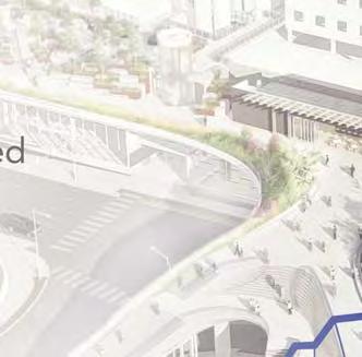
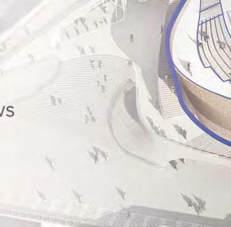
140


141 CENTRAL WATERFRONT PROJECT AREA SEATTLE AQUARIUM OCEAN PAVILION EXISTING SEATTLE AQUARIUM 11

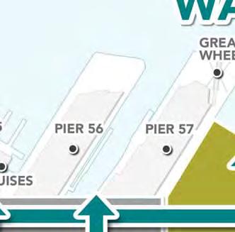
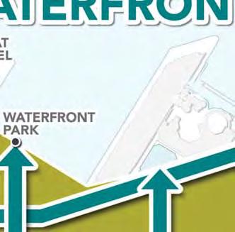
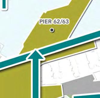
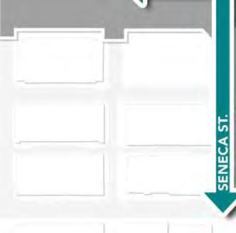
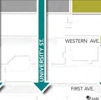
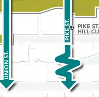
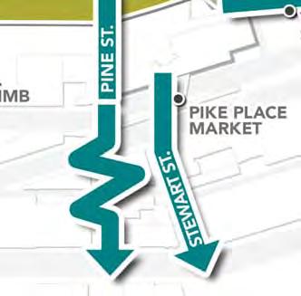
142 CENTRAL WATERFRONT EXISTING PEDESTRIAN CONNECTIONS OVERLOOK WALK CENTRAL PUBLIC SPACE EXISTING SEATTLE AQUARIUM SEATTLE AQUARIUM OCEAN PAVILION 12

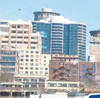
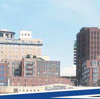
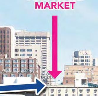
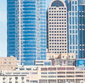
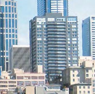
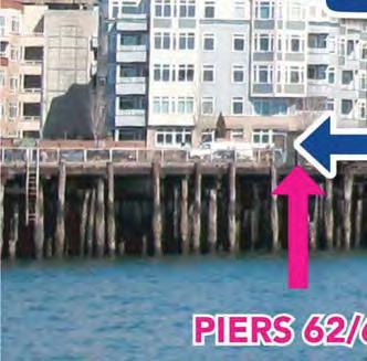
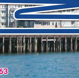
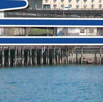
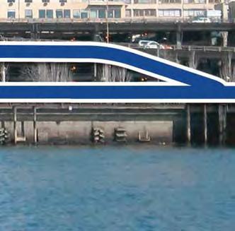
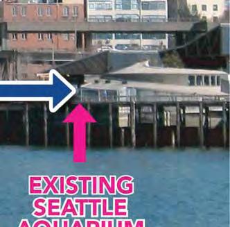
143 CENTRAL WATERFRONT PROPOSED PEDESTRIAN CONNECTIONS 13

144 PROJECT SCHEDULE 14
145 OBJECTIVES AND PRELIMINARY ALTERNATIVES 15
146 OBJECTIVES The objectives of the Aquarium Ocean Pavilion include the following, which will be used as the basis for evaluating the alternatives: Accommodate a 40% increase in expected attendance and visitors, which requires an approximately 48,000 square foot building and multi-modal pathways Provide a continuous connection with the existing Seattle Aquarium to facilitate movement of visitors, volunteers, and staff, and to support Aquarium programming Provide opportunities for public open space and enjoyment of the shoreline Create a space that supports the Aquarium s mission of Inspiring Conservation of Our Marine Environment and provides the public with a global ocean experience 16
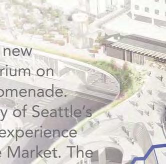
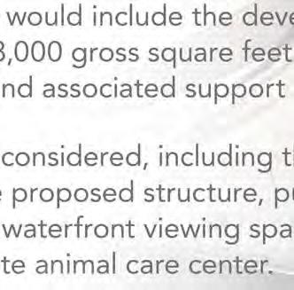
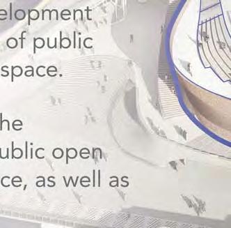
147
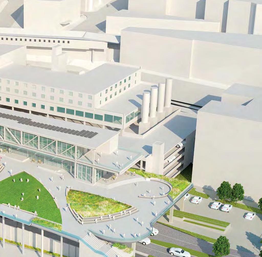

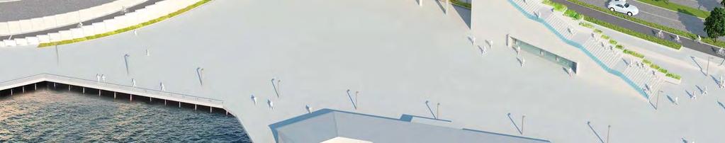
148 ALTERNATIVE 1 NO ACTION 18
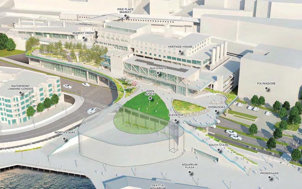
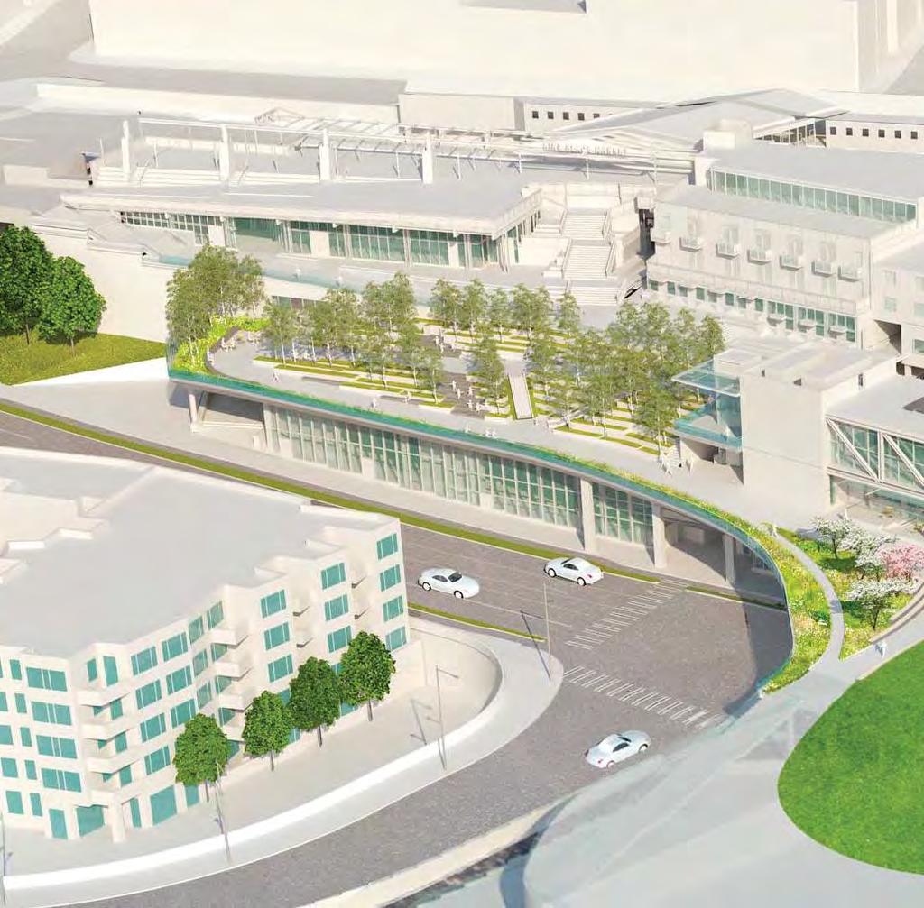
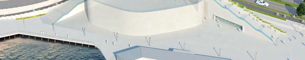
149 ALTERNATIVE 2 19

150 ALTERNATIVE 3 PREFERRED ALTERNATIVE 20
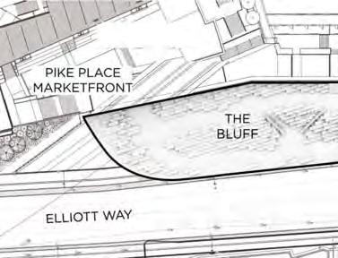
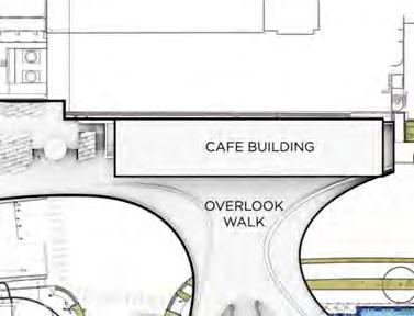
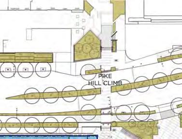
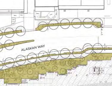
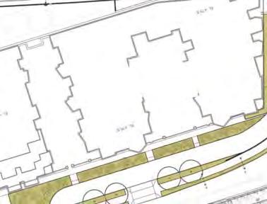
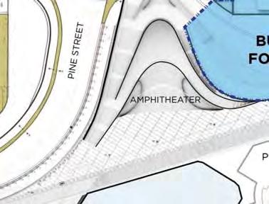
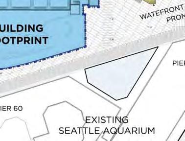
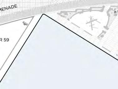
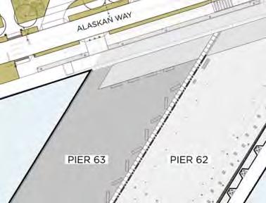

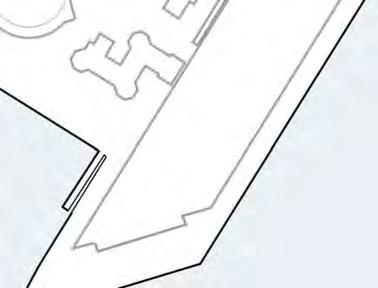
151 ALTERNATIVE 3 PREFERRED ALTERNATIVE 21

152 ALTERNATIVE 3 PREFERRED ALTERNATIVE NOT E: -DR DRAW WI NGS REPR PRESE SEN TCONC ONCE NCEP EPTUA UAL DESI SIGN OF THE AQU QUAR ARIUM EXPANSION N -EL EM MENTS OF THE CIT ITY TY S WAT ERF RONT P ROGRA RAM ARE NOT PART OF THIS EIS 22

153 ALTERNATIVE 3 PREFERRED ALTERNATIVE NOT E: -D DRA AWING GS REPR PRESE SENT TCONC EPT UAL DESIG SIGN O OF FTHE AQU ARIUM EXPANS NSION -EL ELEM EME NTS OF THE EC CIT ITY S WATER ERFRO RONT PROG ROGRA OGRAM ARE ENOT PART TO OF FTHIS EIS 23

154 ALTERNATIVE 3 PREFERRED ALTERNATIVE NOT E: -DR AWI NG GS REPRE PRESE NT CONCEP PTUA UAL DESIG SIGN NOF FT THE AQUAR ARI UM EXPAN ANS ION -E EL EMENTS OF THE CIT ITY S WAT ERF RFRO RONT TP RO OGRA RAM ARE ENO NOT PART TOF FTH THIS EI S 24

155 ALTERNATIVE 3 PREFERRED ALTERNATIVE NOT E: -DRAW AWING NGS RE PRESEN ENT CONC ONCEP EPTUAL DESIG SIGN OF THE AQU QUARI UM EXPANS NSION -EL EMENT NTS OF THE EC CIT TY S WATER ERFRO RONT TP PROG ROGRA RAM ARE N OT PART TOF FTHIS EIS 25

156 ALTERNATIVE 3 PREFERRED ALTERNATIVE NOT TE: -DR DRAW AWINGS REPR PRESEN SENT CONC ONCE EPTUA UAL DESIG SIGN OF THE AQUA ARIUM EXP ANSION -EL ELEM EMENTS OF THE EC ITY S WATERF ERFRONT RONT TP PROG ROGRA RAM AREN NOT PART OF THIS EIS 26
157 ENVIRONMENTAL ASSESSMENT ELEMENTS OF THE ENVIRONMENT ASSESSED THE LEAD AGENCY HAS PRELIMINARILY IDENTIFIED THE FOLLOWING AREAS FOR ANALYSIS IN THE EIS: - TRANSPORTATION - CONSTRUCTION - WATER QUALITY - LAND USE - AESTHETICS - HISTORIC AND ARCHAEOLOGICAL RESOURCES 27
158 SCOPING INPUT OCEAN PAVILION I. STATIONS - ENVIRONMENTAL REVIEW - PREFERRED ALTERNATIVE CONCEPT OVERVIEW PROJECT SCHEDULE - SITE MODEL - II. COURT REPORTER III. COMMENT CARDS IV. SCOPING PERIOD CLOSES MAY 28,

159 ThankYou 29
160 Attachment 7 Scoping Meeting Presentation Boards

161 1 = 1/ ENVIRONMENTAL REVIEW SEATTLE AQUARIUM OCEAN PAVILION LOCATION OF PROPOSAL WHAT IS SEPA? WHAT IS SCOPING? VICTOR STEINBRUECK PARK PIKE PLACE MARKETFRONT PIKE PLACE MARKETFRONT ELLIOTT WAY PINE STREET BUILDING FOOTPRINT PIKE HILL CLIMB ALASKAN WAY WATEFRONT PROMENADE THE STATE ENVIRONMENTAL POLICY ACT (SEPA) IS AN ENVIRONMENTAL REVIEW PROCESS THAT PROVIDES A WAY TO IDENTIFY AND STUDY POSSIBLE ENVIRONMENTAL EFFECTS OF A PROPOSAL. THE PROCESS HELPS DECISION-MAKERS AND THE PUBLIC UNDERSTAND HOW A PROPOSED ACTION WILL AFFECT THE ENVIRONMENT. SCOPING IS THE FIRST STEP IN THE EIS PROCESS. THE PURPOSE OF SCOPING IS TO SEEK INPUT FROM THE PUBLIC, AGENCIES, TRIBES, AND STAKEHOLDERS ON THE ALTERNATIVES AND AFFECTED ENVIRONMENT PROPOSED TO BE DISCUSSED IN THE EIS. PIER 59 PIER 60 EXISTING SEATTLE AQUARIUM ALASKAN WAY ALASKAN WAY WHAT IS AN EIS? HOW CAN YOU HELP? CONTEXT PLAN PIER 63 PIER 62 ELLIOTT BAY AN ENVIRONMENTAL IMPACT STATEMENT (EIS) PROVIDES AN IMPARTIAL EVALUATION OF SIGNIFICANT ENVIRONMENTAL IMPACTS AND INFORMS DECISION MAKERS AND THE PUBLIC OF REASONABLE ALTERNATIVES, INCLUDING MITIGATION MEASURES, THAT WOULD AVOID OR MINIMIZE ADVERSE IMPACTS OR ENHANCE ENVIRONMENTAL QUALITY. YOUR THOUGHTS ON THIS PROPOSAL ARE IMPORTANT TO US. PLEASE PROVIDE YOUR INPUT ON WHAT TO ANALYZE IN THE EIS AND IF THERE ARE OTHER ALTERNATIVES TO CONSIDER AT THIS TIME. LOCATION OF PROPOSAL: THE PROJECT AREA WOULD BE LOCATED WITHIN PUBLIC PROPERTY AND BOUNDED TO THE EAST BY ALASKAN WAY AND TO THE WEST BY THE FUTURE PEDESTRIAN PROMENADE ALONG THE WATERFRONT. THE NORTHERN BOUNDARY OF THE PROJECT AREA WOULD BE AT PINE STREET AND THE APPROXIMATE SOUTHERN BOUNDARY WOULD BE AT PIKE STREET. THE OFF-SITE ANIMAL CARE CENTER LOCATION WOULD BE DETERMINED DURING PREPARATION OF THE ENVIRONMENTAL IMPACT STATEMENT (EIS). DESCRIPTION OF PROPOSAL: THE PREFERRED ALTERNATIVE WOULD CREATE A NEW STRUCTURE LOCATED EAST OF THE EXISTING AQUARIUM ON ALASKAN WAY AND THE FUTURE WATERFRONT PROMENADE. THE PROPOSAL WOULD BE ADJACENT TO THE CITY OF SEATTLE S OVERLOOK WALK, ENHANCING THE PEDESTRIAN EXPERIENCE BETWEEN THE WATERFRONT AND THE PIKE PLACE MARKET. THE PROPOSED STRUCTURE WOULD INCLUDE THE DEVELOPMENT OF APPROXIMATELY 48,000 GROSS SQUARE FEET OF PUBLIC AQUARIUM EXHIBITS AND ASSOCIATED SUPPORT SPACE. ALTERNATIVES WILL BE CONSIDERED, INCLUDING THE CONFIGURATION OF THE PROPOSED STRUCTURE, PUBLIC OPEN SPACE AND ROOF TOP WATERFRONT VIEWING SPACE, AS WELL AS OPTIONS FOR AN OFF-SITE ANIMAL CARE CENTER. NOTE: -DRAWINGS REPRESENT CONCEPTUAL DESIGN OF THE AQUARIUM EXPANSION -ELEMENTS OF THE CITY S WATERFRONT PROGRAM ARE NOT PART OF THIS EIS
162 ENVIRONMENTAL REVIEW SEATTLE AQUARIUM OCEAN PAVILION SEPA EIS PROCESS AND TIMELINE SPRING 2018 SPRING 2018 SPRING/SUMMER 2018 FALL 2018 FALL 2018 PUBLIC SCOPING PERIOD DATA COLLECTION & ANALYSIS DRAFT EIS COMMENTS ON DRAFT EIS FINAL EIS PUBLIC INPUT: PUBLIC, AGENCIES, TRIBES, AND STAKEHOLDERS ARE ASKED TO HELP IDENTIFY WHAT THE DRAFT EIS SHOULD ANALYZE. - DOCUMENT EXISTING CONDITIONS - DEVELOP ENVIRONMENTAL ANALYSIS AND METHODOLOGY THE DRAFT EIS INCLUDES: - ALTERNATIVES - AFFECTED ENVIRONMENTS - EXISTING CONDITIONS - POTENTIAL IMPACTS - THE DRAFT EIS WILL BE AVAILABLE FOR REVIEW AND COMMENT - THE PUBLIC WILL PROVIDE COMMENTS VIA WEBSITE, , OR MEETING THE FINAL EIS DECISION MAKING - FINAL EIS INCLUDES RESPONSES TO COMMENTS AND IS USED TO INFORM DECISION MAKING - MITIGATION MEASURES AREAS OF THE AFFECTED ENVIRONMENT PROPOSED FOR DISCUSSION IN THE EIS LAND USE CONSTRUCTION HISTORIC AND ARCHAEOLOGICAL RESOURCES AESTHETICS WATER QUALITY TRANSPORTATION


163 PREFERRED ALTERNATIVE CONCEPT OVERVIEW SEATTLE AQUARIUM OCEAN PAVILION PIKE PLACE MARKET HERITAGE HOUSE FIX/MADORE WATERFRONT LANDING CONDOS PIKE HILL CLIMB NT PIKE PLACE MARKETFRONT THE BLUFF CAFE BUILDING OVERLOOK WALK PIKE HILL CLIMB ALASKAN WAY PIER 62/63 OCEAN PAVILION PROMENADE ELLIOTT WAY EXISTING SEATTLE AQUARIUM PINE STREET PROPOSED SEATTLE T AQUARIUMUM OCEAN PAVILION WATEFRONT PROMENADE TO V.S.P PIKE PLACE MARKET MARKETFRONT ELEVATOR HERITAGE HOUSE PRIMARY CONNECTIONS SECONDARY CONNECTIONS AT-GRADE CONNECTIONS AMPHITHEATER PIER 59 WATERFRONT LANDING CONDOS BRIDGE BUILDING B ELEVATOR FIX/MADORE PIKE HILL CLIMB +67 PIER 60 EXISTING SEATTLE AQUARIUM NORTH STAIRS SOUTH STAIRS OCEAN PAVILION ROOF ELEVATOR +16 STORAGE ALASKAN WAY PIER 62/63 PUBLIC RESTROOM +16 PROMENADE EXISTING SEATTLE AQUARIUM PIER 63 PIER 62 ELLIOTT BAY NOTE: -DRAWINGS REPRESENT CONCEPTUAL DESIGN OF THE AQUARIUM EXPANSION -ELEMENTS OF THE CITY S WATERFRONT PROGRAM ARE NOT PART OF THIS EIS

164 PREFERRED ALTERNATIVE CONCEPT OVERVIEW SEATTLE AQUARIUM OCEAN PAVILION NOTE: -RENDERINGS REPRESENT CONCEPTUAL DESIGN OF THE AQUARIUM EXPANSION -ELEMENTS OF THE CITY S WATERFRONT PROGRAM ARE NOT PART OF THIS EIS

165 PREFERRED ALTERNATIVE CONCEPT OVERVIEW SEATTLE AQUARIUM OCEAN PAVILION NOTE: -RENDERINGS REPRESENT CONCEPTUAL DESIGN OF THE AQUARIUM EXPANSION -ELEMENTS OF THE CITY S WATERFRONT PROGRAM ARE NOT PART OF THIS EIS
166 PREFERRED ALTERNATIVE CONCEPT OVERVIEW SEATTLE AQUARIUM OCEAN PAVILION NOTE: -RENDERINGS REPRESENT CONCEPTUAL DESIGN OF THE AQUARIUM EXPANSION -ELEMENTS OF THE CITY S WATERFRONT PROGRAM ARE NOT PART OF THIS EIS

167 PREFERRED ALTERNATIVE CONCEPT OVERVIEW SEATTLE AQUARIUM OCEAN PAVILION NOTE: -RENDERINGS REPRESENT CONCEPTUAL DESIGN OF THE AQUARIUM EXPANSION -ELEMENTS OF THE CITY S WATERFRONT PROGRAM ARE NOT PART OF THIS EIS
168 PROJECT SCHEDULE SEATTLE AQUARIUM OCEAN PAVILION OCEAN PAVILION EIS SCHEDULE TASK START FINISH ICON Q3 Q4 Q1 Q2 Q3 Q4 Q1 Q2 Q3 Q4 Q1 Q2 Q3 Q4 Q1 Q2 Q3 Q4 Q1 Q2 Q3 Q4 8/8/ /30/2022 Concept Design 8/8/2017 1/18/2018 Concept Design EIS 4/4/ /30/2018 EIS EIS Scoping 5/24/2018 5/24/2018 EIS Scoping EIS Draft - Comments 9/5/2018 9/5/2018 EIS Draft - Comments EIS Final 12/4/ /4/2018 EIS Final Design Development 10/6/2018 9/15/2019 Design Development Construction Documents 9/16/2019 7/24/2020 Construction Documents Early Foundation Work 10/1/2019 1/31/2020 Early Foundation Work Offsite Animal Care Center 3/17/2019 7/1/2020 Offsite Animal Care Center Ocean Pavilion Construction 1/4/ /30/2022 Ocean Pavilion Construction MUP/Permits 3/20/ /24/2020 MUP/Permits
169 Attachment 8 Scoping Meeting Comment Card Handout
170 REQUEST FOR COMMENTS ON THE SCOPE OF THE ENVIRONMENTAL IMPACT STATEMENT: Seattle Aquarium Ocean Pavilion The City of Seattle through Seattle Parks and Recreation (City), in coordination with the Seattle Aquarium Society (SEAS), is preparing an Environmental Impact Statement (EIS) under the State Environmental Policy Act for the Ocean Pavilion, a new structure that would include approximately 50,000 gross sq/ft of public aquarium exhibits and associated support space and would be integrated into the City of Seattle's Overlook Walk. SEAS invites members of the public, tribes, and governmental agencies to provide input on the EIS scope and to identify elements of the environment to analyze in the EIS and other alternatives to consider How to comment: Scoping comments will be accepted through May 28, You can provide comments on the scope of the EIS by submitting written comments, as well as at the public scoping meeting. Provide scoping comments online at: or by mail: Ocean Pavilion EIS, c/o Anchor QEA, 720 Olive Way, Suite 1900, Seattle, WA Before including your name or other personal identifying information in your comment, please be aware that your entire comment-including your personal identifying information-may be made publicly available at any time. Comment: -: Name: Phone#: Zip:
171 Appendix B Transportation and Parking Technical Memorandum

172 Technical Memorandum August 2018 Seattle Aquarium Ocean Pavilion Transportation and Parking Technical Memorandum Prepared for City of Seattle Department of Parks and Recreation Seattle Aquarium Society Prepared by Heffron Transportation, Inc.
173 Executive Summary Transportation and Parking Technical Memorandum August 2018 Page 1 The purpose of this technical memorandum is to describe the potential impacts on transportation and parking associated with the proposed Seattle Aquarium Ocean Pavilion (Ocean Pavilion). This memorandum evaluates the potential effects of project construction and operation on these resources for two action alternatives as well as a No Action Alternative. The City of Seattle Department of Parks and Recreation, in coordination with the Seattle Aquarium Society (SEAS), is preparing a State Environmental Policy Act (SEPA) Environmental Impact Statement (EIS) to evaluate the proposal, which includes two different building options located near the existing Aquarium at Piers 59 and 60 along the Seattle waterfront and an off-site Animal Care Center that may be located on Harbor Island at the former Fisher Flour Mill or similar facility. The construction of an Aquarium Pavilion was reviewed by the City of Seattle (City) as part of the Alaskan Way, Promenade, and Overlook Walk (AWPOW) SEPA EIS and AWPOW EIS Appendix A: Transportation Discipline Report (SDOT 2016a, 2016b). Information and analysis from the AWPOW EIS is incorporated by reference into the analysis and findings of this memorandum, in accordance with Seattle Municipal Code (SMC) and Washington Administrative Code (WAC) The Ocean Pavilion is being proposed as a separate and independent project from the AWPOW and other ongoing projects along the central waterfront. However, the proposal is intended to anchor these projects and reconnect the city with Puget Sound and its central waterfront. This memorandum summarizes the relevant findings from the AWPOW EIS, describes changes to the Ocean Pavilion proposal that have occurred since that time, and evaluates whether the changes would result in any potential additional construction and long-term impacts on transportation and parking. The findings of this analysis indicate that no significant long-term impacts to transportation or parking would result from operation of the Ocean Pavilion. The additional vehicle trips generated by additional visitors to the Aquarium would have a small effect on intersection operations nearby, but would not change overall operational level. Vehicle trips generated by the action alternatives, including the off-site Animal Care Center, would be spread out and would not have a noticeable effect on traffic operations surrounding either site. The Pike Place Market Garage, which was expanded in 2017 from 529 to 820 spaces specifically to accommodate future increases in visitors to area attractions, including the proposed Ocean Pavilion, is located adjacent to the existing Seattle Aquarium. The analysis found that there is adequate parking at the Pike Place Market Garage to accommodate the additional parking demand generated by increased visitors and employees. It is anticipated that additional visitors to the Ocean Pavilion would also generate parking demand at other private and public lots and garages throughout downtown (as visitors often include a visit to the Aquarium with visits to other downtown attractions) but there is ample capacity to accommodate the anticipated increases. Additional pedestrians, bicyclists, and transit riders would be accommodated by improvements planned by the AWPOW to support those modes of travel. The action alternatives would be designed in accordance with the City s standards for bus loading and truck deliveries; no adverse impacts related to loading would result from the Ocean Pavilion. Construction of the action alternatives is anticipated to have impacts related to truck trips, construction employee trips and parking, and short-term lane or sidewalk closures during some elements of
174 Transportation and Parking Technical Memorandum August 2018 Page 2 construction activity. With the recommended mitigation, these impacts are anticipated to be minor to moderate. Table 1 provides a summary of impacts. Table 1 Transportation and Parking Impacts Summary Alternative During Construction Long Term 1 (No Action) No Adverse Impact No construction, therefore no construction impacts 2 Minor to Moderate Impact Potential temporary impacts associated with truck and construction employee trips, construction employee parking, and street lane or sidewalk closures adjacent to construction activities; impacts can be reduced through implementation of a Construction Management Plan and are anticipated to be minor to moderate depending on the construction activity 3 Same as Alternative 2 Same as Alternative 2 No Adverse Impact No additional transportation or parking impact beyond what was previously analyzed in the AWPOW EIS Minor Impact Additional visitors accommodated by Alternative 2 would generate additional vehicle, transit, and non-motorized trips, which could be accommodated by existing and planned future infrastructure without the need for transportation capacity improvements, and additional vehicle parking demand which could be accommodated by available parking garage capacity Introduction and Project Description The Ocean Pavilion would be located in Seattle, King County, Washington (Figure 1). The building would be constructed east of the existing Aquarium, and east of the future pedestrian promenade along the waterfront constructed as part of the AWPOW projects. A potential off-site Animal Care Center may be located on Harbor Island at the former Fisher Flour Mill or a similar facility (Figure 1). Three alternatives have been developed for the Ocean Pavilion: a No Action Alternative and two action alternatives. A full description of these alternatives is included in the Draft Ocean Pavilion EIS, with summary descriptions provided within this technical memorandum.
175 Figure 1 Vicinity Map Transportation and Parking Technical Memorandum August 2018 Page 3
176 Alternative 1: No Action Alternative Transportation and Parking Technical Memorandum August 2018 Page 4 Under Alternative 1 (No Action Alternative), the Ocean Pavilion would not be built. However, conditions in the area would be different from those that exist at the time this EIS is published (2018). The analysis for the No Action Alternative is based on the expected conditions in 2030, which is the year used for the assessment of future conditions. The following major changes are assumed to be in place under the No Action Alternative: The AWPOW projects identified in the preferred alternative within the AWPOW EIS would be completed. The AWPOW projects would continue to be refined through the Office of the Waterfront and Civic Projects design process. The Alaskan Way Viaduct Replacement Project (AWVRP) would be completed, with the viaduct eliminated and the State Route (SR) 99 tunnel in operation. The Elliott Bay Seawall Project (EBSP) would be completed. Ongoing public and private development projects that are currently being permitted through the Seattle Department of Construction and Inspections would be completed, with an additional projected baseline growth of 1% per year. A description of the AWPOW s selected preferred alternative is included in Section 2.3 of the AWPOW EIS (SDOT 2016a). The main difference between the two is that the No Action Alternative for Ocean Pavilion does not include construction of the Aquarium Pavilion, which was one option described as part of the AWPOW s preferred alternative. Descriptions of the AWVRP and EBSP are described in Section 2.2 of the AWPOW EIS. Figure 2 shows the No Action Alternative, which serves as the baseline against which the potential impacts of the action alternatives are evaluated. Office of the Waterfront and Civic Projects Potential Design Refinements The AWPOW projects would continue to be refined through the Office of the Waterfront and Civic Projects design process. As of the publication of this EIS, the conceptual design of the Overlook Walk lid (or bridge) connecting the waterfront to Pike Place Market over Elliott Way would be narrower (90 feet versus 190 feet) and higher (50 feet versus 40 feet) than the design in the AWPOW EIS. In addition, Building B would be replaced by a smaller one-story building with a covered outdoor café and seating area on its roof. Public stairs and elevators would maintain connections from the Overlook Walk to the waterfront. These refined conditions were used in assessing the range of impacts of the action alternatives as compared to No Action Alternative and potential design refinements. Alternative 2 Alternative 2 includes the Ocean Pavilion concept evaluated as one option for the preferred alternative under the AWPOW EIS (referred to as the Aquarium Pavilion in the AWPOW EIS). Alternative 2 includes an approximately 48,000-square-foot building featuring an interior elevator and connections to a fully accessible route between the waterfront and Pike Place Market. The orientation of the proposed building would locate it farther north and closer to Pine Street, compared to Alternative 3 which would be located farther south. The building would be approximately 40 feet tall with a rooftop waterfront viewing space accessible
177 Transportation and Parking Technical Memorandum August 2018 Page 5 from the Overlook Walk. An off-site Animal Care Center would be included under Alternative 2, as described herein. Figure 3 shows Alternative 2. Alternative 3 Alternative 3 includes building the Ocean Pavilion east of the existing Aquarium on Alaskan Way and the future Waterfront Promenade. The Ocean Pavilion would be located farther south than Alternative 2, resulting in a shorter distance from the Ocean Pavilion entrance to the existing Seattle Aquarium entrance and improved accessibility for visitors, volunteers, staff, and Aquarium programs. The proposed building would include an approximately 48,000-square-foot public aquarium featuring an exterior elevator and connections to a fully accessible route between the waterfront and Pike Place Market. The building would be approximately 50 feet tall with unobstructed public views of Elliott Bay over the existing Seattle Aquarium on Pier 59 and would be accessible from the future Overlook Walk. This alternative also includes an off-site Animal Care Center, as described herein. Figure 4 shows Alternative 3.
178 Transportation and Parking Technical Memorandum August 2018 Page 6 Figure 2 Alternative 1 (No Action) Source: LMN Architects
179 Transportation and Parking Technical Memorandum August 2018 Page 7 Figure 3 Alternative 2 Source: LMN Architects
180 Transportation and Parking Technical Memorandum August 2018 Page 8 Figure 4 Alternative 3 Source: LMN Architects
181 Off-Site Animal Care Center for Alternatives 2 and 3 Transportation and Parking Technical Memorandum August 2018 Page 9 An off-site Animal Care Center is proposed to address both short- and long-term animal care, veterinary, and rehabilitation needs and to meet the Association of Zoos and Aquariums standards. The most immediate need is to provide necessary animal care to support the opening of the Ocean Pavilion and the turtle rehabilitation program. The Animal Care Center would also be a long-term care facility that supports SEAS exhibit animal population, animal rehabilitation, and research efforts. The Animal Care Center would be designed to meet peak animal care demand for the Aquarium exhibits and programs. This would include approximately 15,000 square feet of interior space, plus an additional 5,000 to 7,000 square feet of area surrounding the facility for outdoor animal holding, water storage, and parking. The center is intended to meet the care needs of both warm- and cold-water fish, birds and mammals, and rehabilitating animals. The center would also provide long-term care, including life support systems, with flexibility in the design to accommodate future needs. The Seattle Aquarium plans to have the Animal Care Center constructed and operational 2 to 3 years prior to the opening of the Ocean Pavilion. This would allow for coral propagation, animal quarantine, and acclimation of the animals for the exhibits. The Aquarium has identified a potential site at the former Fisher Flour Mill property on Harbor Island, which is owned by King County. While the Fisher Flour Mill site is a potential location for the center, a similar location could be pursued. It is not anticipated that the identified impacts would differ at a similar location. Construction Methods for Alternatives 2 and 3 Construction methods for the action alternatives are described in the following subsection. It is anticipated that construction methods would be similar for both action alternatives. During construction, access to existing utilities would be maintained for surrounding property uses. Construction Activities It is anticipated that construction at the Ocean Pavilion would require the following activities: Open excavation for the basement of the Ocean Pavilion, which would reach about 20 feet below the ground surface, with 48-inch-diameter piles extending at various depths It should be noted that for Alternative 2, the AWPOW EIS shows 60 to 80 feet of excavation proposed in this area (SDOT 2016b: Figure 10-2, page 245). It is expected that this depth is specific to the future Overlook Walk and other improvements, and depths of that magnitude would not be required to construct the Ocean Pavilion. Dewatering of excavation areas below the water table or implementing soil freezing treatments to provide a dry work area as necessary Protecting, relocating, and/or connecting utilities Using best management practices to protect water quality and reduce erosion (may include installation of silt fencing, covering of stockpiled soil, and collection and treatment of construction stormwater runoff) Drilling shafts for piers to support the building, including exterior elevators or stairwells as necessary
182 Transportation and Parking Technical Memorandum August 2018 Page 10 Removing existing knock-outs in the adjacent seawall under Pier 60 to connect the overwater intake pipe, seawater discharge, and utilities and infrastructure between the Ocean Pavilion and existing Seattle Aquarium buildings Erecting structural components and installing mechanical and other building features, using a crane tower for hoisting Potentially using one barge for 3 to 8 weeks, located between Piers 62/63 and Pier 60 for delivery of acrylic windows for the exhibits Construction at the Animal Care Center would be limited to the building interior. No substantial modifications or new construction would be required to the exterior or surrounding areas. Construction Staging It is anticipated that areas within or near the proposed action (e.g., Aquarium Plaza) would be used for staging construction and storing materials, equipment, and temporary construction trailers. Construction Timing Construction of the Ocean Pavilion is expected to take up to approximately 4 months for early foundation work and 24 months for general construction. Preparation of the off-site Animal Care Center is expected to take approximately 9 months and would occur in advance of construction of the Ocean Pavilion. Worker Parking, Access, and Haul Routes The Ocean Pavilion contractor is expected to establish a worksite office, which could be located in existing office space near the Seattle Aquarium or in a mobile facility in the established laydown area or nearby. A limited number of construction workers may be able to park at the worksite office or on the work site, others could use off-street parking garages near the Aquarium, and some may use transit and walk to the work site. The Animal Care Center contractor is anticipated to establish a construction office in existing space within the building that would house the Animal Care Center. Very little parking demand is expected to be generated during build out of the Animal Care Center. Construction activities would generate traffic for equipment and removing debris and soil. The contractor would determine the best construction methods, as permitted by the City and in conformance with the project construction plans. Regulatory Context Transportation facilities and functions are governed by state, regional, and local laws, plans, and policies that identify infrastructure needs, priorities, and performance standards for the transportation system elements, including pedestrian, bicycle, vehicular, and transit modes. The following laws, plans, and policies apply to the transportation and parking analysis.
183 Transportation and Parking Technical Memorandum August 2018 Page 11 State Laws, Plans, and Policies State Environmental Policy Act The SEPA process considers short- and long-term direct and indirect impacts as well as cumulative impacts on transportation (WAC and WAC ). Washington State Growth Management Act Established under Revised Code of Washington 37.70A.070, the Growth Management Act (GMA) sets goals and provides guidance for state and local governments to manage Washington s population and employment growth, including identifying and funding the transportation infrastructure and services needed to support it. The GMA includes a set of planning goals that local governments use to guide planning efforts, through the establishment of comprehensive plans and development regulations. Seattle s Comprehensive Plan, including its Transportation Element (described herein), was developed in compliance with the GMA. In addition to establishing long-term planning needs, the GMA requires that local governments and agencies to annually prepare and adopt a 6-year transportation improvement program, which must be consistent with the transportation element of the local comprehensive plan as well as other state and regional plans and policies. Regional Plans and Policies Puget Sound Regional Council, Transportation 2040 Transportation 2040 is the region s long-range transportation plan developed by the Puget Sound Regional Council (PSRC 2010). It addresses critical issues such as congestion and mobility, the environment, and transportation finance in the central Puget Sound region. The plan calls for improved mobility through a combination of effective land use planning, demand management, efficiency enhancements, and strategic capacity investments. It lays out strategies to guide transportation investment decisions to meet growing travel needs for people and freight, calling for more transit, biking and walking facilities, and more complete streets. The plan lays out strategies for all modes, including local roads, non-motorized transportation, vehicle and passenger ferries, aviation, and rail. Local Plans and Policies Seattle Municipal Code (Environmental Policies and Procedures) The City has established rules to implement SEPA under SMC Chapter For projects in which the City is the lead SEPA agency, these rules interpret and administer the SEPA policies, regulations, and laws set forth by the State of Washington. The City s SEPA regulations about parking impacts are included in SMC M, and regulations about traffic and transportation impacts in SMC R. Seattle 2035: A Comprehensive Plan for Managing Growth The Seattle Comprehensive Plan identifies the City s land use strategy for accommodating future job and housing growth, and shows how transportation infrastructure, policies and programs will be developed to ensure that the transportation system can efficiently support that growth; this includes mode shift goals
184 Transportation and Parking Technical Memorandum August 2018 Page 12 that promote a transition away from single-occupant vehicles toward walking, biking, transit, and carpools. The City has developed a number of plans that focus on specific transportation modes, as described in the following sections. These more focused plans are all consistent with the Comprehensive Plan and build on the policy framework it establishes (City of Seattle 2016). Seattle Bicycle Master Plan The City s Bicycle Master Plan sets forth a vision that riding a bicycle be a comfortable and integral part of daily life in Seattle for people of all ages and abilities; it provides a blueprint to make it easier to decide to ride a bike. The plan identifies existing and recommended future trails, bicycle lanes, shared use facilities, and neighborhood greenways (SDOT 2014). The Implementation Plan, which is typically updated on an annual basis, identifies the master plan projects that are targeted for completion within the next 5 years (SDOT 2017a). The installation of protected bicycle lanes (PBLs) along Alaskan Way is included in the Bicycle Master Plan (SDOT 2014). The current Implementation Plan identifies construction of PBL connections along the Alaskan Way Corridor, south to South King Street and north to the Elliott Bay Trail, with target completion by 2020 or 2021 (SDOT 2017a). The bicycle facilities along Alaskan Way are part of the AWPOW projects. Pedestrian Master Plan The City s Pedestrian Master Plan defines the actions needed to improve walkability in Seattle. The pedestrian improvements included in the AWPOW projects support the plan s objectives to complete and maintain the citywide pedestrian system, improve walkability and pedestrian safety on all streets, and to get more people walking for transportation, recreation, and health reasons (SDOT 2017b). Transit Master Plan Seattle s Transit Master Plan (SDOT 2016c) defines the critical role that transit plays in meeting the City s goals related to sustainability, equity, economic productivity, and livability. Developed with feedback from King County Metro (Metro) and Sound Transit, the Transit Master Plan identifies the types of transit facilities, services, programs, and system features that will be required to meet Seattle s transit needs through 2030, based on market analysis, review of future growth patterns, and evaluation of transit needs. The Transit Master Plan also identifies Seattle s Frequent Transit Network (FTN), which is a vision for a network of transit corridors that connect the city s urban centers and villages with frequent, reliable transit service within a short walk for most residents and identifies the corridor as a high priority for transit investments (SDOT 2016c). Downtown Seattle is the largest transit hub in the region, and continued transit improvements along the FTN will serve to improve transit connectivity between the Aquarium and regional destinations. Affected Environment Transportation Study Area The study area for the transportation and parking analysis, shown in Figure 5, includes the site access points (vehicular and non-motorized) and nearby off-site intersections in the area bounded by Alaskan Way to the west, Lenora Street to the north, Western Avenue to the east, and Union Street to the south.
185 Transportation and Parking Technical Memorandum August 2018 Page 13 The Pike Place Market Garage, located across the street from the Aquarium, provides the nearest available public parking. This parking facility includes the original garage combined with the garage expansion that was completed in 2017 as part of the MarketFront project. The garages connect internally and share driveways on Western Avenue and Alaskan Way; together they have 820 spaces. It should be noted that the 2030 analysis presented in this memorandum reflects conditions with the completion of the AWPOW projects, as shown in Figure. 5 The planned street configuration changes are described in the following section. Street Characteristics The following key roadways are within the transportation study area: Alaskan Way is a Principal Arterial that is oriented roughly parallel to the waterfront between Broad Street to the north and Yesler Way to the south. It will be reconfigured as part of the AWPOW projects; when complete, it will have two vehicle lanes in each direction, sidewalks on both sides, and a two-way PBL on the east side. Western Avenue is a Minor Arterial that is parallel to Alaskan Way, one block to the east. Between Lenora Street and Yesler Way, it has one travel lane in each direction with left-turn pockets at some intersections; on-street parking is allowed along much of its length. It has sidewalks on both sides and is marked with a combination of painted bicycle lanes where street width allows (generally in the uphill direction), and sharrows (pavement markings that indicate vehicles and bicyclists should share the travel lane) along the other portions. North of Lenora Street, it becomes a one-way street in the northwest direction, forming a couplet with Elliott Avenue which carries traffic in the southeast direction. The transition between these segments will be reconfigured with completion of the AWPOW project, which includes a new Elliott Way Connector between Western Avenue at Bell Street and Alaskan Way at Pine Street. Lenora Street is a Minor Arterial that provides connection between Western Avenue and Denny Way. It has a southwest-northeast orientation. Between First Avenue and Western Avenue, it has one travel lane in each direction, sidewalks on both sides, and angled parking on the south side. East of First Avenue, Lenora Street is a one-way in the southwest direction. Its intersection with Western Avenue is signalized and will remain so with the intersection reconfiguration that is completed with the AWPOW projects. The Lenora Street pedestrian bridge connects from Elliott Avenue at the top of the bluff to the Pier 66 building, with elevators connecting to grade on the east and west sides of Alaskan Way. With the completion of the AWPOW projects, the pedestrian bridge will remain largely intact, with just the east end rebuilt to connect to the new segment of Elliott Way. There is an existing pedestrian signal across Alaskan Way at Lenora Street. Pine Street has a short segment within the study area designated as a local access street that provided access to some on-street parking across Alaskan Way from Piers 62/63 prior to the construction of the AWPOW projects. The segment of Pine Street near the Aquarium will also be reconfigured with AWPOW, providing direct local access to Piers 62/63 on the west side of Alaskan Way; its intersection with Alaskan Way will be signalized. The study area does not include the portion of Pine Street east of Pike Place Market. Union Street within the study area is also separated from the primary portion that connects downtown and Capitol Hill. There is a stairway for pedestrians that provides a connection from just
186 Transportation and Parking Technical Memorandum August 2018 Page 14 west of First Avenue to Alaskan Way, but no through vehicular access is provided. The intersection of Union Street and Alaskan Way will be improved with the AWPOW projects; the grade separation will remain, with a stair and elevator connection for pedestrian traffic, and it will continue to provide local access. Its intersection with Alaskan Way is currently signalized and will remain so with completion of the AWPOW projects. The transportation analysis reflects expected conditions in 2030, which is the year used for the assessment of future conditions, including the completion of the AWPOW projects. In addition to the transportation improvements described previously, the AWPOW projects will also signalize the intersection of the Pike Place Market Garage driveway at Alaskan Way, adjacent to the proposed action.

187 Transportation and Parking Technical Memorandum August 2018 Page 15 Figure 5 Transportation and Parking Study Area with Completion of AWPOW Projects Source: Heffron Transportation, July 2018
188 Parking Characteristics Transportation and Parking Technical Memorandum August 2018 Page 16 The Seattle Aquarium does not have dedicated on-site parking. All parking is provided off site by surface parking lots and garages throughout downtown as well as on-street parking. Most of the existing on-street parking along Alaskan Way will be eliminated by the AWPOW projects. As part of the Washington State Department of Transportation s SR 99 Tunnel Project Parking Mitigation Program, off-street parking utilization of surface lots and garages along the waterfront and in Pioneer Square is monitored annually (WSDOT and SDOT 2018). Monitoring is conducted for a weekday condition in late summer because that is when commuters and visitors combine to generate the highest level of parking demand. The SR 99 Tunnel Project Parking Mitigation Program area extends approximately from Alaskan Way to First Avenue and from Wall Street to King Street. Table 2 summarizes the results of monitoring surveys that were conducted over the period between August 22 and 31, 2017; all counts were performed on midweek days when the cumulative parking demand generated by downtown employees and visitors is highest. In addition to the Pike Place Market Garage within the study area (the nearest available public parking), results are shown for the broader SR 99 Tunnel Project study area, and also for facilities that are located within about 0.25 mile walking distance from the Seattle Aquarium. As shown, parking occupancy (number of vehicles parked divided by the number of parking spaces) in the Pike Place Market Garage was 29% in the morning and 50% in the afternoon. In the SR 99 Tunnel Project Parking Mitigation Program area, it was 58% in the morning and 71% in the afternoon (WSDOT and SDOT 2018). In the smaller area within 0.25 mile of the Aquarium, occupancy was slightly lower in the morning and slightly higher in the afternoon. During the peak afternoon period when occupancy was highest, there were more than 500 unused parking spaces within 0.25 mile of the Seattle Aquarium, most in the adjacent Pike Place Market Garage. Table 2 Parking Garage Occupancy Weekdays SR 99 Tunnel Project Parking Mitigation Program Area 1 Within.25 Mile Walking Distance of Aquarium 2 Pike Place Market Garage 2 Parking Supply (Number of Stalls) 3 7,158 2, Morning (8:30 to 11:30 a.m.) Parking Occupancy 58% 50% 29% Unused Spaces 3,036 1, Afternoon (1:00 to 3:00 p.m.) Parking Occupancy 71% 70% 50% Unused Spaces 2, Source: Heffron Transportation, SR 99 Tunnel Project Parking Mitigation Plan, Monitoring of Off-Street Parking Facilities, Notes: Counts were performed in August 2017 (included in WSDOT and SDOT 2018). 1. Area bounded generally by Alaskan Way, Wall Street, First Avenue, and South King Street 2. The area within 0.25 mile walking distance is a subarea included in the Parking Mitigation Program Study Area; the Pike Place Market Garage is included in each of these larger areas. 3. Supply was adjusted to include 91 additional spaces at the Pike Place Market Garage that were still under construction during the monitoring period, but now are open and available for general parking
189 Transportation and Parking Technical Memorandum August 2018 Page 17 More detailed analysis was completed for the Pike Place Market Garage, which is located within the study area directly across Alaskan Way from the Aquarium and provides the closest public parking. A full month of driveway entry and exit data were compiled for July 2017, and the last week in that month had the highest volumes. Figure 6 shows the parking accumulation by day of week. As shown, Saturday and Sunday had slightly higher occupancy than the peak weekday. This is expected at Pike Place Market, which attracts local and regional visitors on weekends. However, throughout the rest of downtown, the volume of weekend parking is much lower than on a weekday. The City s 2016 Downtown Off-Street Parking Study, Supply and Occupancy Survey in June 2016 determined that all off-street parking in Seattle s downtown core areas (including the financial district, retail district, and waterfront) was 69% to 71% occupied during the weekday but decreased to 43% on a Saturday (Heffron Transportation 2017). Because the cumulative demand among downtown office and recreational parking is highest overall on weekdays, the peak weekday condition was evaluated for the Ocean Pavilion alternatives. Figure 6 shows the average hourly garage entries and exits for three peak-season weekdays as well as parking occupancy. As shown, during the peak three weekdays in July, the Pike Place Market Garage had an average occupancy of 440 vehicles, with a peak occurring midday. This is about half of the garage s capacity of 820 parking stalls. Even on the peak season weekday, more than 300 parking stalls were unused during the period of highest parking demand.
190 Peak Week in July 2017 Transportation and Parking Technical Memorandum August 2018 Page 18 Garage Capacity = 820 Spaces Number of Vehicles in Garage Garage Occupancy :00 3:45 7:30 11:15 15:00 18:45 22:30 2:15 6:00 9:45 13:30 17:15 21:00 0:45 4:30 8:15 12:00 15:45 19:30 23:15 3:00 6:45 10:30 14:15 18:00 21:45 1:30 5:15 9:00 12:45 16:30 20:15 0:00 3:45 7:30 11:15 15:00 18:45 22:30 2:15 6:00 9:45 13:30 17:15 21: /24/2017 7/25/2017 7/26/201 7/27/2017 7/28/2017 7/29/2017 7/30/2017 Monday Tuesday Wednesday Thursday Friday Saturday Sunday Garage Capacity = 820 vehicles Average of Peak Three Weekdays in July Vehicle Volume Peak occupancy = 440 vehicles Hour Begin Vehicles In Vehicles Out Garage Occupancy Garage Capacity Figure 6 Pike Place Market Garage Hourly Use on Peak Season Weekday Source: Pike Place Market Garage Usage Data for July 2017, compiled by Heffron Transportation, June 2018
191 Transit Characteristics Transportation and Parking Technical Memorandum August 2018 Page 19 Downtown serves as the largest transit hub in Seattle, with bus transit, light rail, streetcar, commuter rail, ferries, and water taxis all servicing this area (King County Metro 2018a). Bus transit service in Seattle is primarily provided by Metro and Sound Transit. Snohomish County s Community Transit and Pierce County s Pierce Transit also provide limited bus service to and from Seattle, typically during the weekday commute periods. Metro has implemented ongoing plans to enhance transit service along high-demand corridors with RapidRide bus service, which provides frequent two-way bus service along high-demand routes, with amenities that include buses with low floors to facilitate faster passenger loading and unloading, ORCA card readers at stations that allow riders with cards to pay before they board, and electronic signs that provide arrival time information (King County Metro 2018b). Metro is evaluating re-establishing transit along Alaskan Way to replace service on SR 99 that will be lost with the removal of the Alaskan Way Viaduct. There are several options being evaluated, including extending other routes to this corridor. The Seattle Streetcar provides fixed-guideway service between Westlake and South Lake Union, and between Pioneer Square and Capitol Hill. The City s Center City Connector project plans to connect these two separate systems with a streetcar line along First Avenue and Stewart Street in downtown Seattle. Construction of the connector is being reviewed and could be resumed after the Alaskan Way Viaduct demolition is complete. Sound Transit operates Link light rail service that serves downtown Seattle. The light rail connects the University of Washington and Angle Lake, with stops in the Capitol Hill, downtown, Central Seattle, and South Seattle neighborhoods, as well as SeaTac Airport. Light rail service will be extended north to the University District, Roosevelt, and Northgate neighborhoods in 2021, and north to Lynnwood by East Link will extend light rail service to Overlake in Additional light rail lines have been approved as part of Sound Transit s ST3 program, with the largest element of that plan creating new lines to Ballard and West Seattle and a new transit tunnel through downtown Seattle scheduled to open in Sound Transit also operates the Sounder commuter rail service, which operates Monday through Friday during commute peak hours. In Seattle, the Sounder trains stop at the King Street Station, downtown at South King Street and Second Avenue South. Sounder trains travel between Lakewood and Seattle and between Everett and Seattle (Sound Transit 2018). Washington State Ferries operates ferry service accommodating both vehicle and walk-on traffic. Two ferry routes operate from the Colman Dock Terminal in downtown Seattle: the Seattle-Bainbridge ferry and the Seattle-Bremerton ferry. Metro operates the King County Water Taxi, which provides service between Pier 50 at the Seattle waterfront to West Seattle and Vashon Island. The ferry and water taxi terminals are about 1,500 feet walking distance from the Seattle Aquarium. Non-Motorized Characteristics Very high levels of bicycle and pedestrian activity characterize the downtown and waterfront areas. The downtown sidewalk system is generally complete. Marked crosswalks with pedestrian crossing signals are provided at all signalized intersections. The City has constructed PBLs along Second Avenue and continues
192 Transportation and Parking Technical Memorandum August 2018 Page 20 to implement bicycle facility improvements throughout the downtown area. In addition to PBLs, the AWPOW projects include constructing pedestrian enhancements along the waterfront such as crossing improvements, buffers between pedestrian and vehicle travel ways, and pedestrian amenities along the sidewalks. The Alaskan Way non-motorized improvements will also provide connection between the sections of the Elliott Bay Trail located along the waterfront to the north and south of the corridor. Analysis of Impacts and Mitigation Overview This section incorporates by reference the analysis completed for the AWPOW Preferred Alternative (SDOT 2016a), which reflects 2030 transportation conditions for Alternative 1 (No Action Alternative) for the Ocean Pavilion. Refined Alternative 1 would have no differences in transportation or parking characteristics or impacts as compared to what was studied in the AWPOW EIS; therefore, when comparing action alternatives with Alternative 1, there is no change to the Office of Waterfront and Civic Projects Potential Design Refinement. This section also incorporates analysis completed for the Pike Place Market Garage expansion (Heffron Transportation 2013), which found that no significant transportation or parking impacts would result from the expanded garage at full occupancy. Construction of the Ocean Pavilion under the action alternatives may have impacts related to truck trips, construction employee trips and parking, and short-term lane or sidewalk closures during some elements of construction activity. With the recommended mitigation, these impacts during construction are anticipated to be minor to moderate. Construction activities associated with the Animal Care Center would generate a small number of trucks that would be spread out and would not have a noticeable effect on traffic operations. Construction-generated parking for the Animal Care Center would be accommodated on site and would not result in adverse impacts. No long-term operational impacts are anticipated to result from the action alternatives, or the Animal Care Center. Impact Thresholds The transportation and parking impact analysis considers the long-term effects the Ocean Pavilion could have on elements of the transportation system that include the different modes of travel visitors may use to access the Ocean Pavilion, including walking, biking, driving, or taking transit. The short-term impacts on these transportation elements resulting from construction activities is also considered. The degree of impact depends on both quantitative and qualitative assessments. Table 3 describes the impact indicators for transportation and parking. Based on a combination of quantitative and qualitative assessments, the degree of impact is determined as minor, moderate, or significant.
193 Transportation and Parking Technical Memorandum August 2018 Page 21 Table 3 Impact Thresholds for Transportation and Parking Impact Indicators Long-Term Operations Intersection LOS Site Access and Circulation Parking Transit Non-Motorized Short-Term Construction Truck and Employee Trips Criteria Determining Degree of Impact Minor Impacts: Increase in delay small enough that LOS does not change Moderate Impacts: Increase in delay changes LOS, but does not result in congested conditions, or small increase in delay at already-congested location Significant Impacts: For signalized intersections, increase in delay changes operation from uncongested to congested condition, or adds more than 5 seconds of delay to an already congested condition; for unsignalized intersections, increase in delay results in long queues that affect other operations Minor Impacts: Same as intersection (above) at vehicular access points, loading needs adequately accommodated Moderate Impacts: Same as intersection (above) at vehicular access points, loading needs adequately accommodated Significant Impacts: Same as intersection (above) at vehicular access points, and/or loading needs not adequately accommodated Minor Impacts: Increases in parking demand could be accommodated with existing Pike Place Market Garage capacity Moderate Impacts: Increases in parking demand could exceed Pike Place Market Garage capacity, but could be accommodated by other parking capacity within the SR 99 Tunnel Parking Mitigation Program Area (see Table 2) and/or parking management measures Significant Impacts: Increases in parking demand could not be accommodated by capacity within the SR 99 Tunnel Parking Mitigation Program Area (see Table 2) parking capacity or through parking management measures Minor Impacts: Little to no increase in transit demand Moderate Impacts: Increase in transit demand could be accommodated with existing and/or planned future service Significant Impacts: Increase in transit demand could not be accommodated with existing and/or planned future service Minor Impacts: Little to no increase in non-motorized demand Moderate Impacts: Increase in non-motorized demand could be accommodated with existing and/or planned facilities Significant Impacts: Increase in non-motorized demand could not be accommodated with existing and/or planned facilities Minor Impacts: Construction traffic would have a negligible effect on traffic operations Moderate Impacts: Construction traffic would be noticeable to adjacent residents or businesses but would have small effect on peak hour traffic operations Significant Impacts: Construction traffic would worsen peak hour congestion and could not be shifted to off-peak times
194 Transportation and Parking Technical Memorandum August 2018 Page 22 Impact Indicators Long-Term Operations Employee Parking Street Lane or Sidewalk Closures Note: LOS: level of service Criteria Determining Degree of Impact Minor Impacts: Construction-generated parking demand could be accommodated on the site, or through implementation of parking management measures, without affecting public parking Moderate Impacts: Construction-generated parking demand could extend to off-site parking and have modest effect on public parking Significant Impacts: Construction-generated parking demand could not be accommodated on-site parking, or through parking management measures, and would adversely affect public parking in area Minor Impacts: Closure would have little to no effect on vehicular or non-motorized travel Moderate Impacts: Closure would affect vehicular or non-motorized travel, but could be accommodated with a detour Significant Impacts: Closure would affect vehicular or non-motorized travel and could not be accommodated with a detour Long-Term Impacts and Mitigation Measures The transportation and parking impact analysis considers the long-term effects the Ocean Pavilion could have on elements of the transportation system that include the different modes of travel visitors may use to access the Seattle Aquarium, including walking, biking, driving, or taking transit. The degree of impact depends on both quantitative and qualitative assessments. Based on a combination of quantitative and qualitative assessments, the degree of impact is determined as minor, moderate, or significant. These potential impacts are described in the following sections. Traffic Volume Impacts Traffic volume impacts were analyzed by estimating visitor and employee trips as well as travel mode, average vehicle occupancy, and parking data to determine changes likely to occur at peak volumes. Alternative 1: No Action Alternative Alternative 1 PM peak hour volumes at the study area intersections were obtained from Section of the AWPOW EIS (SDOT 2016a) and reflect the AWPOW s selected preferred alternative in 2030 without the proposed Ocean Pavilion. The forecast volumes at the Pike Place Market Garage driveways were refined based on the July 2017 usage data, previously described, and analysis that was completed for the garage expansion (Heffron Transportation 2013). The forecast volumes at the Pike Place Market Garage driveways used in that analysis assumed traffic associated with the increased garage capacity and reflected growth in area visitors as well as vehicles that may be displaced from nearby on-street parking. Some of this growth could be associated with the existing Aquarium. The AWPOW traffic volume forecasts reflect removal of the viaduct, completion of the SR 99 tunnel, and completion of the Alaskan Way reconstruction including the Elliott Way Connection that will link Alaskan Way to Elliott and Western avenues. They also account for expected tolls to use the SR 99 tunnel. This basis for the traffic volume forecasts is consistent with the methodology used for the Waterfront
195 Transportation and Parking Technical Memorandum August 2018 Page 23 Seattle Framework Plan traffic analysis, which was used to establish the lane configuration for the Preferred Alternative described in the AWPOW EIS. Sensitivity analysis completed for the AWPOW projects of the effect of different SR 99 tunnel tolling rates indicated that the travel demand forecasts represent a conservatively high estimate of travel demand volumes. They reflect summer conditions, which is also at the conservatively high end of the potential range of volumes. Figure 7 shows the projected 2030 PM peak hour volumes for Alternative 1.
196 Transportation and Parking Technical Memorandum August 2018 Page 24 Figure Traffic Volumes for Alternative 1 PM Peak Hour Source: Heffron Transportation, July 2018
197 Transportation and Parking Technical Memorandum August 2018 Page 25 Alternatives 2 and 3 The action alternatives reflect different configurations of the Ocean Pavilion; however, it is anticipated that the future visitor volumes with the Ocean Pavilion, and in turn the trips they would generate to and from the facility, would be the same for both alternatives. Traffic forecasts for the action alternatives were based on existing and projected future Aquarium visitor data (Orca Consulting 2018) combined with visitor travel survey data collected by the Seattle Aquarium (Seattle Aquarium 2015). Table 4 summarizes the existing visitor volumes for the design day (typical) and peak days, and the future visitor volumes projected with the addition of the Ocean Pavilion. It is likely that some level of increase would occur without the Ocean Pavilion, but for the purpose of this analysis, the increased traffic volumes are conservatively attributed entirely to the two action alternatives. Overall, future visits are expected to increase by slightly more than 40% compared to existing conditions. Over the 12-year horizon evaluated for this transportation study, that relates to an annual growth rate of 2.9% per year. Table 4 Existing and Projected Future Aquarium Visitors by Hour of Day Existing 1 Future with Ocean Pavilion Visitor Increase Time Period Design Day Peak Day Design Day Peak Day Design Day Peak Day Daily Attendance 4,180 5,280 5,900 7,470 1,720 2,190 Hourly Attendance 9 10 a.m a.m a.m. 12 p.m p.m p.m , p.m ,075 1, p.m , p.m p.m Source: Seattle Aquarium 2018 Note: 1. Based on average visitor data compiled for 2015 and 2016 To estimate the trips that would be generated by the visitor increases, travel mode, average vehicle occupancy, and parking data obtained from visitor surveys conducted by SEAS were applied. The survey, conducted in July 2015, collected travel information from 193 visitor groups, which included a total of 605 visitors. Of the respondents, about 40% were residents of the area and 60% were tourists. About two-thirds of responses were provided during peak visiting periods at the Aquarium (Wednesday through Friday between 9:30 a.m. and 1:00 p.m., and all day on weekends), and one-third were provided during off-peak visiting periods. In addition to the size of visiting groups, the survey data provided information
198 Transportation and Parking Technical Memorandum August 2018 Page 26 about the mode of transportation used by visitors (walk, bike, transit, ferry, taxi/rideshare, and drive), and duration of stay. For those who drove, the surveys provided information about where they parked. Figure 8 shows the travel mode shares of the Aquarium visitors. Walk 27% Car 51% Bike 1% Transit 10% Ferry 3% Taxi/Rideshare 8% Figure 8 Travel Mode Shares for Visitors to the Seattle Aquarium Source: Seattle Aquarium, July 2015; compiled by Heffron Transportation, June 2018 The Seattle Aquarium is not open during the commuter AM peak period and would generate few trips during that time. The highest visitor-generated volumes during the commuter PM peak period (period in which the highest traffic volumes typically occur on Seattle streets due to trips generated by evening commutes, typically between about 4:00 and 6:00 p.m.) is expected to occur between 4:00 and 5:00 p.m. The vehicle trips would be generated by visitors who travel by car or use a taxi or rideshare service. The vehicle trips they would generate were estimated by applying the following assumptions obtained from the Aquarium visitor travel surveys: Visitors who travel by car were assumed to generate one inbound trip to the downtown area, park their car, and make one outbound trip after their visit is complete. Visitors who travel by taxi or a rideshare service were assumed to generate four total trips: one inbound trip to be dropped off at the site, one outbound trip without passengers after drop-off, one inbound trip to pick up passengers at the site after the Aquarium visit, and one outbound trip with passengers after pick-up. This is a conservative assumption since some taxis or rideshare may pick up or drop off another visitor (either to or from the Aquarium or another nearby attraction).
199 Transportation and Parking Technical Memorandum August 2018 Page 27 Assignment of trips to hour of the day was based on typical duration of visit information obtained from the survey data, which indicated that about 80% of visitors stay for 1 to 2 hours, and 20% stay for 3 hours or more. The travel surveys indicated an average of 3.4 persons travel together per vehicle, both for groups who drive and those who use taxi or rideshare service. The Aquarium does not have its own parking supply, and none is proposed to be constructed. Visitor survey data indicated that about 19% of vehicles generated by Aquarium visitors are parked in the Pike Place Market Garage, which is the closest parking option. The remaining vehicles are parked on the street or in other garages outside the immediate study area (often chaining a visit to the Aquarium with visits to other downtown attractions). These vehicles would be spread out over the downtown area. The net new vehicle trips generated at the Pike Place Market Garage would enter and exit at either the Western Avenue or Alaskan Way driveways. The vehicle trips generated by taxis or rideshare vehicles are assumed to drop off and pick up passengers on Alaskan Way, next to the Aquarium. The PM peak hour trips calculated for the action alternatives, using the method described previously, were added to the Alternative 1 volumes, to project future traffic conditions with the Ocean Pavilion. The action alternatives reflect different configurations of the proposed action. As described previously, it is expected that the future visitor volumes with the Ocean Pavilion, and in turn the trips they would generate to and from the facility, would be similar for both alternatives. Table 5 summarizes the visitor estimates by travel mode for both the design (typical) and peak day conditions. Table 5 Projected Visitor Increases by Travel Mode Alternatives 2 and 3 Walk/Bike (28%) Transit/Ferry (13%) Taxi/Rideshare (8%) Car (51%) Time Period Design Peak Design Peak Design Peak Design Peak Daily ,117 Hourly 9 10 a.m a.m a.m. 12 p.m p.m p.m p.m p.m p.m p.m Source: Seattle Aquarium 2018 Notes: Based on average visitor data compiled for 2015 and 2016 Design = Design day Peak = Peak day
200 Transportation and Parking Technical Memorandum August 2018 Page 28 Currently, about 140 paid employees and about 50 part-time volunteers work at the Aquarium on a typical peak season day; this is assumed to continue with Alternative 1. This daily number is projected to increase by about 60 staff persons and 40 volunteers with the Ocean Pavilion in full operation. Of these, about 55 people are expected to work daytime shifts, by which they could depart from the Seattle Aquarium during the PM peak hour (Seattle Aquarium 2018). It should be noted that these estimates are based on the most current information available at the time of EIS development; it is possible that they could be further refined as planning for the Ocean Pavilion progresses. Commute mode-of-travel data for the area in which the Aquarium is located, compiled for the greater downtown area, indicate that about 28% of employees in the commercial core area commute by vehicle, with an average of about 1.14 persons per vehicle (Commute Seattle 2015). Applying these factors to the employees projected to depart the site during the PM peak hour results in an estimated 14 employee vehicle trips departing at this time. The analysis presented in this memorandum assumes that all would park at the Pike Place Market Garage; this results in conservatively high estimate within the study area, since some employees could park at other locations throughout downtown. Table 6 summarizes the vehicle trips projected to be generated by the visitor and employee increases with the action alternatives, for design (typical) and peak days. It also summarizes trips by type and location. Table 6 Projected Increase in Vehicle Trips Generated by Alternatives 2 and 3 Design (Typical) Day Peak Season Day In Out Total In Out Total Daily Vehicle Trips Visitor Rideshare and Taxi Trips Visitor Trips to/from Pike Place Market Garage Staff/Volunteer Commute Trips to/from Pike Place Market Garage Visitor Trips to/from On-Street Parking and Other Garages (Outside Study Area) Increase in Vehicle Trips per Day PM Peak Hour Vehicle Trips (4-5 p.m.) Visitor Rideshare and Taxi Trips Visitor Trips to/from Pike Place Market Garage Staff/Volunteer Commute Trips to/from Pike Place Market Garage Increase in PM Peak Hour Vehicle Trips within Study Area Visitor Trips to/from On-Street Parking and Other Garages (Outside Study Area) Total Increase in Vehicle Trips in PM Peak Hour Source: Heffron Transportation 2018 The PM peak hour vehicle trips that would be generated within the study area on a peak season day those generated by rideshare, taxi, and visitor and employee vehicles parked at the Pike Place Market
201 Transportation and Parking Technical Memorandum August 2018 Page 29 Garage, calculated as 19 inbound and 40 outbound trips were distributed to the street network, assuming similar overall traffic patterns as Alternative 1. The additional trips generated by visitors and employees were added to the Alternative 1 study area volumes to estimate the projected 2030 PM peak hour volumes for the action alternatives, shown in Figure 9. It should be noted that the action alternative trip projections assume that new visitors and employees would travel directly to the Aquarium before their visit or work shift and depart directly after. This results in a conservatively high estimate of PM peak hour vehicle trips because it is likely that some would walk to other destinations (e.g., shopping, errands, other attractions) before or after their visit or shift at the Aquarium and therefore would be less concentrated than the analysis assumes. Also, all trips to and from the Pike Place Market Garage via Western Avenue were assumed to occur at one driveway. Since they could be spread between the two driveways on Western Avenue, this results in a more conservative estimate of operating conditions associated with garage access.

202 Transportation and Parking Technical Memorandum August 2018 Page 30 Figure Traffic Volumes for Alternative 2 or 3 PM Peak Hour Source: Heffron Transportation, July 2018
203 Transportation and Parking Technical Memorandum August 2018 Page 31 Intersection Level of Service Levels of service (LOS) of study area intersections apply the same methods that were applied in the AWPOW EIS. LOS designations are qualitative descriptions of traffic operating conditions, designated with letters ranging from LOS A, which is indicative of good operating conditions with little or no delay, to LOS F, which is indicative of stop-and-go conditions with frequent and lengthy delays. LOS for this analysis was developed using procedures presented in the Highway Capacity Manual (Transportation Research Board 2016) and is consistent with the analysis method applied for the AWPOW EIS, as described in Section 4.5 of the Appendix A: Transportation Discipline Report prepared for that EIS (SDOT 2016c). All LOS calculations were performed with Trafficware s Synchro 10.1 analysis software. LOS for intersections is defined by the average delay per vehicle in seconds. Delay at a signalized intersection is a complex measure and is dependent on a number of variables including: lane geometry, traffic volumes for each turning movement, signal phasing and whether some movements need to yield to oncoming vehicles, cycle length and time allocated to each signal phase, bus stops and adjacent parking, and the number of pedestrian crossings. Delay at a side-street stop is related to the availability of gaps in the main street's traffic flow, and the ability of a driver to enter or pass through those gaps. The delay at an all-way stop sign-controlled intersection is based on saturation headways, departure headways, and service times. Table 7 shows the LOS criteria for signalized and unsignalized intersections. Table 7 Level of Service Thresholds Average Delay (seconds per vehicle) LOS General Description Signalized Intersections Unsignalized Intersections A Free flow <10.0 Less than 10.0 B Stable flow (slight delays) C Stable flow (intermediate delays) D Stable flow (intermediate delays) E Unstable flow (approaching forced flow) F Forced flow (jammed) > 80.0 > 50.0 Source: Transportation Research Board, Highway Capacity Manual 2010 The 2030 analysis presented in this memorandum reflects conditions with the completion of the AWPOW projects. In addition to the street improvements described in the Affected Environment section of this memorandum, the AWPOW projects will also signalize the intersection of the Pike Place Market Garage driveway at Alaskan Way, adjacent to the Aquarium site. Intersection operations for Alternative 1 reflect the condition without the Ocean Pavilion. Table 8 shows the anticipated LOS at the study area intersections for the alternatives for the year As described previously, all transportation improvements included in the AWPOW projects are expected to be in place by that year. The table shows that all study area intersections are anticipated to operate at LOS D
204 Transportation and Parking Technical Memorandum August 2018 Page 32 or better with Alternative 1. The additional vehicle trips generated in the study area by the action alternatives are projected to add a small amount of average delay to some intersections but are not expected to change their overall LOS. Based on these results, the long-term traffic impacts resulting from the action alternatives are anticipated to be minor. Table 8 Level of Service Summary 2030 Conditions PM Peak Hour Alternative 1 (or Refined Alternative 1) Alternative 2 or 3 Intersection LOS Delay 1 LOS Delay 1 Signalized Western Avenue/Lenora Street D 39 D 39 Elliott Avenue/Lenora Street B 16 B 16 Alaskan Way/Pine Street C 34 C 35 Alaskan Way/Pike Place Market Garage driveway A 5 A 6 Alaskan Way/Union Street B 12 B 13 Stop Sign-Controlled Western Avenue/Pike Place Market Garage driveway (overall) A 1 A 1 Eastbound movement C 19 C 20 Northbound left-turn movement A 9 A 9 Source: Heffron Transportation, June 2018 Note: 1. Average seconds of delay per vehicle Site Access and Circulation The site access evaluation addresses deliveries and buses accessing the existing Aquarium and proposed Ocean Pavilion. The loading configuration was developed as part of the AWPOW projects and would be the same with Alternatives 1, 2, and 3. A loading area would be provided on the west side of Alaskan Way, next to the proposed Ocean Pavilion, and separated from the adjacent sidewalk (to the west) and Alaskan Way vehicle lanes (to the east) by landscaped buffers. The loading area would accommodate both delivery vehicles and buses. A curb cut within the loading area would allow direct east-west access to the waterfront piers via the Waterfront Promenade (located between Piers 59 and 60 and the Ocean Pavilion) for emergency, freight, delivery, garbage, and recycling vehicles. These vehicles would have access to the piers at all times, but any loading directly on or off the Waterfront Promenade would be discouraged during peak pedestrian periods, and loading activities would be managed by staff, to maintain safety. The evaluation presented in Section of the AWPOW EIS found that overall freight mobility on Alaskan Way would improve with the AWPOW projects, and that curb space and loading zones would be adequate to accommodate loading needs. The action alternatives are expected to generate about 6 to 8 trucks per day (including deliveries, facility maintenance contractors, and trash, recycling and compost removal), including 4 to 6 truck deliveries that
205 Transportation and Parking Technical Memorandum August 2018 Page 33 are typically generated by the existing Aquarium, and would continue with Alternative 1 (Seattle Aquarium 2018). Deliveries primarily are spread out during off-peak periods and are anticipated to have a minor effect on traffic operations. All three alternatives include service routes to the Seattle Aquarium that cross the Aquarium Plaza that would be used by a small number of trucks per day. With either action alternative, the loading dock and site frontages would be designed to meet City standards and would adequately accommodate loading without adversely affecting pedestrian or vehicle circulation at and near the Ocean Pavilion. Based on overall visitor increases that are expected to result from the Ocean Pavilion, the current range of about 8 to 10 buses per day that carry groups to and from the Ocean Pavilion is expected to increase to about 15 to 20 buses per day during peak day conditions. The loading zone would be designed to meet City standards to adequately accommodate passenger loading. Bus traffic is typically generated by the Aquarium during daytime hours, between 9:00 a.m. and 3:00 p.m., to correspond to typical school hours and is not expected to affect PM peak hour traffic conditions for all three alternatives. Because delivery and passenger loading activities are not expected to adversely affect traffic operation at site access points and loading needs would adequately accommodated through adherence to City standards, impacts resulting from loading activities are anticipated to be minor. Parking With Alternative 1, there would be no changes to parking demand or supply, beyond what was evaluated in Section 3.7 of the AWPOW EIS. The AWPOW EIS analysis inventoried on-street and off-street parking in its study area and evaluated parking utilization within that area during several times per day. The Affected Environment section of this memorandum provides updated parking utilization data for off-street parking near the site and in the broader waterfront study area. Findings of the updated utilization information are consistent with the findings of the AWPOW analysis; while parking is priced and tightly controlled, there is unused parking available during all times of day. No additional assessment was conducted for Alternative 1. Parking demand increase for Alternative 2 was forecast utilizing the survey results described for the traffic volume forecasts. As previously described, the Aquarium does not have its own parking supply, and none is proposed to be constructed. Visitor survey data indicated that about 19% of vehicles generated by Aquarium visitors are parked in the Pike Place Market Garage, which is the closest parking option. The remaining vehicles are parked on the street or in other garages outside the immediate study area (often chaining a visit to the Aquarium with visits to other downtown attractions). It is anticipated that most parking generated by Aquarium events occurs at the adjacent Pike Place Market Garage. The capacity of the garage to accommodate increased event-related parking demand was evaluated, based on the parking usage data described previously in the Affected Environment section. Additional parking demand generated by new visitors with the action alternatives is summarized in Table 9. The visitor survey data indicated that visitors who travel to the Aquarium by car have an average of 3.4 persons per car. Applying this average vehicle occupancy to the additional visitors projected to travel by car with the action alternative results in a total additional 258 vehicles parked per day on a design
206 Transportation and Parking Technical Memorandum August 2018 Page 34 (typical) day and 329 vehicles parked per day on a peak day. Parked vehicles generated by Aquarium visitors would be spread throughout the day and would not be all parked at the same time. Applying the visitors by hour of day, shown previously in Table 5, as well as the typical duration of stay reflected in the Aquarium visitor surveys, results in a peak hour demand of 89 parked vehicles on a design (typical) day and 116 parked vehicles on a peak day. Table 9 Additional Parking Demand Generated by Visitor Increases Alternatives 2 and 3 Design Day Peak Day Additional Daily Visitors Traveling by Car 876 1,117 Additional Cars Parked Per Day Peak Hour Additional Demand Peak hour demand at Pike Place Market Garage Peak hour demand on street and at other downtown garages Source: Seattle Aquarium 2018; compiled by Heffron Transportation, June 2018 Notes: 1. Daily parking demand estimated by dividing the number of daily visitors traveling by car by an average vehicle occupancy of 3.4 persons per vehicle 2. Peak hour parking demand estimated by applying the projected visitor demand profile by hour (see Table 5) and calculating the cumulative parking demand based on typical durations of stay reflected in the visitor travel surveys Based upon the parking occupancy shown previously in Figure 6, the Pike Place Market Garage has adequate capacity to accommodate all of this additional parking demand. However, based on the visitor survey data, about 19% are expected to park at the Pike Place Market Garage, and the rest are expected to park on street or at other downtown garages. Based on employee vehicle trip projections summarized in Table 4, each action alternative is expected to generate an additional 25 vehicles parked by Aquarium staff and volunteers per peak season day. As discussed previously, the analysis presented in this memorandum assumes that all employees and staff would park at the Pike Place Market Garage; this results in conservatively high estimate within the study area, because some employees could park at other public and private lots and garages throughout downtown. Additional staff generated by the action alternatives were assumed to arrive between 8:00 and 11:00 a.m. and depart between 3:00 and 7:00 p.m. (with a little over half departing during the PM peak hour, as previously described). Figure 10 shows the projected distribution by hour, with the additional parking demand expected to be generated by visitors and staff with the action alternatives. The figure shows that on a typical weekday during the peak visitor season, when parking demand is highest in the downtown core area of Seattle, including garages along the waterfront, the action alternatives are projected to generate an additional peak parking demand of about 45 vehicles in the Pike Place Market Garage at mid-afternoon, compared to Alternative 1, as shown in Figure 6.
207 Transportation and Parking Technical Memorandum August 2018 Page Garage Capacity = 820 vehicles 700 Vehicle Volume Peak occupancy = 485 vehicles :00 AM 7:00 AM 8:00 AM 9:00 AM 10:00 AM 11:00 AM 12:00 PM 1:00 PM 2:00 PM 3:00 PM Hour Begin 4:00 PM 5:00 PM 6:00 PM 7:00 PM 8:00 PM 9:00 PM 10:00 PM 11:00 PM Baseline Vehicles In Alternative 2 or 3 Vehicles In Occupancy with Alt 2 or 3 Trips Baseline Vehicles Out Alternative 2 or 3 Vehicles Out Garage Capacity Figure 10 Pike Place Market Garage Hourly Use on Peak Season Weekday with Alternative 2 or 3 Demand Source: Heffron Transportation 2018 With additional parking demand generated by either of the action alternatives, the Pike Place Market Garage is expected to have more than 300 spaces available throughout the weekday to accommodate demand generated by other uses. As described previously, while the Pike Place Market Garage would have adequate capacity to accommodate all increased parking demand, the action alternatives are expected to generate about 94 additional vehicles at other locations spread throughout downtown during the peak demand hour (as patrons often chain a visit to the Aquarium with visits to other downtown attractions). However, the visitor travel survey showed that these vehicles would be spread out between on-street parking and private lots and garages throughout the downtown area and would be less concentrated than the demand generated within the study area. Downtown parking capacity illustrated in Table 2 shows that there is ample capacity in private lots and garages to accommodate this demand. If more visitors opted to park at the Pike Place Market Garage than the visitor travel surveys indicated, analysis completed for the garage expansion project concluded that even at full garage occupancy, parking demand would not result in significant adverse transportation impacts (Heffron Transportation 2013). Because parking capacity
208 Transportation and Parking Technical Memorandum August 2018 Page 36 would be available to accommodate the additional parking demand generated by the action alternatives, parking impacts are anticipated to be minor. Freight Consistent with the AWPOW EIS analysis, and as described in Section of the Appendix A: Transportation Discipline Report prepared for that document, the Alternative 1 operational analysis assumes the same percentage of heavy (freight) vehicles in the study area as under 2017 existing conditions (SDOT 2016c). This assumption was based on the EBSP analysis, which determined that removal of the viaduct and opening of the bored tunnel would not affect the percentage of freight traffic on the study area streets. The number of truck trips would increase with the increased traffic forecast for 2030 conditions. Consistent with the AWPOW EIS and Alternative 1 operational analysis described previously, the action alternative analysis assumes the same percentage of heavy (freight) vehicles in the study area as under 2017 existing conditions. None of the alternatives would affect citywide freight routes. Therefore, no freight impacts are anticipated. Transit With Alternative 1, there would be no changes to transit demand or supply, beyond what was evaluated in the AWPOW EIS. As described in Section of the AWPOW EIS Appendix A: Transportation Discipline Report, analysis included future public transportation volumes in the study area, as provided by Metro, in the traffic operations model (SDOT 2016c). Changes to public transportation routing as a result of AWPOW improvements, including anticipated impacts on ridership and bus stops, were qualitatively analyzed to evaluate impacts on public transportation. No additional assessment was conducted for Alternative 1. Additional transit demand generated by the action alternatives was estimated by applying the survey travel mode data previously described to the forecast visitor increases. The data indicated that 13% of visitors travel to the Aquarium by transit for ferry. The impact of the increased demand was qualitatively evaluated with respect to available transit service and facilities in the area, and also consistency with local and regional policies (described previously in the Regulatory Context section of this memorandum) that encourage use of alternative travel modes. As shown in Table 5, the proposed Ocean Pavilion under the action alternatives is projected to result in an increased number of visitors who travel to and from the Seattle Aquarium by transit. The 224 (typical day) to 285 (peak day) additional visitors who travel by transit translates to 448 to 570 new transit trips per day, as each visitor makes one inbound transit trip to the Seattle Aquarium and one outbound trip at the end of their visit. The peak transit demand would occur mid-day and would not overlap with the commuter peak hours into and out of downtown. As described previously, downtown Seattle is the largest transit hub in the region; the waterfront area is served by light rail, streetcar, commuter rail, ferry, water taxi, and dozens of local, regional, and RapidRide bus routes provided by Metro, Sound Transit, Community Transit, and Pierce Transit. These collective transit options for downtown Seattle provide capacity that is more than adequate to support the increased transit demand generated by the action alternatives. Increased transit ridership is considered beneficial because it supports, local, regional, and statewide policies that encourage the use of alternative transportation modes instead of driving. None of the alternatives would affect transit stops, stations, or routes. No adverse transit impacts are anticipated to result from the action alternatives.
209 Transportation and Parking Technical Memorandum August 2018 Page 37 Non-Motorized Travel With Alternative 1, there would be no changes to non-motorized facilities or conditions, beyond what was documented in Section of the AWPOW EIS for the reconfiguration of Alaskan Way next to the Ocean Pavilion. The AWPOW pedestrian comfort and safety analysis was qualitative and considered the types of driveways, roadways, and impediments pedestrians will encounter and the types of intersection control provided. It also considered the width of facilities and the separation provided to pedestrians from bicyclists and vehicular traffic. A qualitative analysis was conducted of bicycle comfort and safety through the study area. The bicycle analysis was also qualitative and considered the number of driveways and roadways cyclists would cross and the types of intersection control provided. The width of facilities and the separation provided to bicyclists from pedestrians and vehicular traffic were also considered. No additional assessment was conducted for Alternative 1. Additional non-motorized demand generated by the action alternatives was estimated by applying the survey travel mode data previously described to the forecast visitor increases. The data indicated that 27% of visitors walk to the Aquarium (many of whom are tourists staying at downtown hotels) and 1% bike. Since the Seattle Aquarium has no added parking, all new patron trips are assumed to be non-motorized trips between the site and parking, transit, or other walking destinations. The impact of the increased demand was qualitatively evaluated with respect to available non-motorized facilities in the area, including pedestrian connections and at-grade crossings of Alaskan Way, and also consistency with local and regional policies (described previously in the Regulatory Context section of this memorandum) that encourage use of travel modes. As shown in Table 5, the proposed Ocean Pavilion under the action alternatives is projected to result in an increased number of visitors who travel to and from the Aquarium by walking or biking. The 482 (typical day) to 613 (peak day) additional visitors who travel by walking or biking translates to 964 to 1,226 new walking and biking trips per day, as each visitor makes one inbound trip to the Aquarium and one outbound trip at the end of their visit. In addition, since the Seattle Aquarium has no on-site parking, all new patron trips would include a non-motorized component, as visitors traveling by other modes would walk between the site and parking, transit, or other walking destinations. With Alternative 1, the existing Aquarium site would be incorporated into the extensive pedestrian and bicycle improvements that are being constructed along the waterfront as part of the AWPOW projects. With the action alternatives, the Ocean Pavilion would be integrated with the AWPOW projects improvements, providing additional pedestrian space and meeting all accessibility standards. The existing and planned future pedestrian and bicycle facilities would adequately accommodate additional non-motorized demand generated by the Ocean Pavilion. Increases in people walking or biking is considered beneficial because it supports, local, regional, and statewide policies that encourage the use of alternative transportation modes instead of driving. No adverse non-motorized impacts are anticipated to result from the action alternatives. Event Condition Impacts The Seattle Aquarium also currently hosts special events, and the Ocean Pavilion could increase event capacity. Information about the current size and frequency of events at the Aquarium, as well as information about how they are expected to change with under the action alternatives, was provided by the Aquarium staff.
210 Transportation and Parking Technical Memorandum August 2018 Page 38 The existing facility has an event capacity of 800 guests. In 2017, 113 events were held over the course of the year, with an average attendance of 230. In July 2017, the month with the highest level of overall visitor activity, 19 events were held, ranging in size from 15 to 800 guests, with an average attendance of 176. With the action alternatives, event capacity would increase to about 1,200 guests. The frequency of events is not expected to materially change, but an average attendance of about 600 is projected with full operation of these alternatives. Because these events primarily occur during off-peak hours (during weekends or weekdays after the Aquarium is closed to the general public, after the PM peak hour) the overall typical traffic volumes are anticipated to be lower than the PM peak hour condition, and intersection operations would typically be better than the results summarized in Table 8. Therefore, no operational analysis was conducted for event conditions. As shown in Figure 6, peak parking occupancy at the Pike Place Market Garage typically occurs in the mid-afternoon and occupancy steadily declines later in the afternoon on all days of the week. During the evening hours, there is ample parking capacity available to accommodate event parking demand, and no adverse impacts on parking are anticipated from event activities. Animal Care Center Impacts The proposed Animal Care Center may be located on Harbor Island or a similar warehouse location, about 5 miles from the Seattle Aquarium. It is anticipated that up to 2 to 4 employees would typically generate about 2 to 4 commute trips per day. Fewer than 3 trips per day would typically be generated by operation of the facility and would primarily occur during off-peak periods. Because trips generated by the Animal Care Center would be small in number and spread through the day, they would have a negligible effect on traffic operations. On-site parking supply and loading facilities would meet City code requirements and standards; therefore, no adverse impacts related to parking or loading are anticipated. Mitigation No significant long-term transportation or parking impacts are anticipated to result from Alternatives 1, 2, or 3, or the Animal Care Center; therefore, no mitigation is proposed. Construction-Related (Short-Term) Impacts and Mitigation Measures Construction-related activities may have impacts related to truck trips, construction employee trips and parking, and short-term lane or sidewalk closures. The degree of the impact depends on both quantitative and qualitative assessments. Based on a combination of quantitative and qualitative assessments, the degree of impact is defined as minor, moderate, or significant. These potential impacts are described in the following sections. Alternative 1 Impacts Alternative 1 would not include construction beyond what was analyzed in Section 3.3 of the AWPOW EIS, which considered the transportation and parking impacts of the overall improvements along the waterfront between Wall Street and South King Street, but did not explicitly consider the potential impacts of construction of the Ocean Pavilion. No additional construction impacts are identified for this alternative.
211 Alternatives 2 and 3 Impacts Transportation and Parking Technical Memorandum August 2018 Page 39 The following transportation and parking impacts are anticipated to result during the construction of either action alternative. Construction-Generated Vehicle Trips and Parking For the action alternatives, estimates of vehicle trips generated by construction activities including trucks hauling site materials and construction employee trips were based on the preliminary design and construction phasing anticipated for these alternatives. It should be noted that because estimates are preliminary, they are conservatively high. For the action alternatives, trips would be generated by trucks traveling to support construction activities and also by construction workers commuting to and from the work site. Trucks are expected to average between about 10 and 20 round trips per day, over the duration of the 28-month construction period. The highest daily truck trips (about 50 round trips per day) are expected to occur during the period when excavation and foundation construction occurs. It is anticipated that construction workers would arrive at the work site before the morning peak traffic period on area streets and depart the site prior to the evening commute peak period. Vehicle trips generated by construction workers may be constrained by the amount of available parking at the work site; if measures are needed to eliminate potential parking overspill, they would also serve to reduce vehicle trips. An average of 100 construction employees are expected to be at the work site on any given day; the exact number would vary from day to day depending on the construction activities taking place. Construction employees who drive to the work site would generate parking demand. For downtown projects, any employee parking that cannot be accommodated at the site may require the use of off-site parking and transit or employee shuttles between the parking location and the site, to prevent overspill to the public parking supply. However, it may be possible for some construction-generated parking to occur within the Pike Place Market Garage during periods or times of year when there is excess capacity. With mitigation in place, construction-generated parking impacts would be minor. Construction-generated trips and parking demand were estimated based on preliminary design and anticipated construction phasing. They would be refined as part of ongoing design. Street Lane or Sidewalk Closures The Ocean Pavilion would coordinate construction along its Alaskan Way frontage with the AWPOW projects to minimize lane and sidewalk closures. To the extent possible, truck staging would be located off Alaskan Way. No major street closures are anticipated to occur with construction of the action alternatives. If necessary, lane or sidewalk closures during construction would be localized and limited in duration. Any closures that occur would need to be managed through measures developed as part of a Construction Management Plan, described in the following mitigation section. With mitigation measures in place, impacts related to street lane or sidewalk closures are anticipated to be minor to moderate, depending on the duration, level of capacity reduction, and length of detour.
212 Transportation and Parking Technical Memorandum August 2018 Page 40 Animal Care Center Impacts Construction activities associated with the Animal Care Center would generate a small number of trucks that would be spread out and would not have noticeable effect on traffic operations. Construction-generated parking for the Animal Care Center would be accommodated on site and would not result in adverse impacts. Mitigation For the action alternatives, the Ocean Pavilion contractor would be required to develop and implement a Construction Management Plan, which could potentially include, but not be limited to, the following avoidance and minimization measures: Prepare Maintenance of Traffic plans for any work within the public right-of-way that affects vehicular, transit, bicycle, or pedestrian traffic. These plans would be required to show the location of traffic cones, traffic control personnel, and signs, and indicate special treatments for pedestrian and bicycle access. Coordinate with the City to determine appropriate times of travel and haul routes for construction-generated truck traffic. In general, construction-generated truck traffic may be prohibited during weekday peak periods (6:00 a.m. to 9:00 a.m. and 3:00 p.m. to 6:00 p.m.). Haul routes generally would be on arterial streets through commercial areas and consist of the most direct path to and from the state highway system. Maintain access for driveways near the work site. Provide adequate staging areas for construction-related vehicles. Provide on-site loading areas for removal and delivery of material. Encourage construction workers to commute via alternative modes, or provide shuttle service to and from the work site for construction employees, to minimize added vehicle trips and parking demand at or near the work site. Maintain pedestrian and bicycle access and circulation during project construction. Provide access for emergency vehicles at all times. During lane closures, notify police and fire departments of construction locations to ensure that alternative evacuation and emergency routes are designed to maintain response times during construction periods, if necessary. Through its Street Use Permit process and consistent with SMC , SDOT would coordinate the construction needs and potential construction-related impacts of this project with the other infrastructure and development projects in the study area, including potential overlapping elements of the AWPOW projects construction. SEAS would participate in construction coordination processes that SDOT establishes for major projects. Implementation of these measures is expected to reduce construction traffic and parking impacts to less-than-significant levels. Therefore, no mitigation measures are proposed. Cumulative Effects and Mitigation Measures Since the analysis in this report builds on the AWPOW EIS, which included additional background traffic forecasted to result from regional development growth through 2030, all operational transportation and parking analysis provided is cumulative.
213 Transportation and Parking Technical Memorandum August 2018 Page 41 AWPOW identifies other planned and programmed projects with construction activities that could potentially overlap. As described in the mitigation section, through its Street Use Permit process and consistent with SMC , SDOT would coordinate the construction needs and impacts of this project with the other infrastructure and development projects in the study area, including potential overlapping elements of the AWPOW construction. SEAS would participate in construction coordination processes that SDOT establishes for major projects. With this mitigation, no significant adverse cumulative effects are anticipated. Overall, transportation and parking within the study area would be improved by the AWPOW projects and would further the goals of regional and local land use and transportation plans (SDOT 2016b). It is also anticipated that there would be adequate long-term parking within the study area to accommodate the Ocean Pavilion and other simultaneous and planned projects. It is expected that the City would continue to assess parking needs and require parking be provided, as needed, for future development. Therefore, it is anticipated that there would be no cumulative effects from operation of the proposed action on transportation and parking. References City of Seattle, Seattle Comprehensive Plan, Managing Growth to Become an Equitable and Sustainable City, November. Commute Seattle, Center City Commuter Mode Split Survey Results. Prepared by EMC Market & Opinion Research Services. Heffron Transportation, Inc., Pike Place Market Waterfront Entrance, Traffic and Access Analysis. November 13. Heffron Transportation, Inc Downtown Off-Street Parking Study, Supply and Occupancy Survey in June April 26. King County Metro, 2018a. Transit System Map: Central Area. Updated March Accessed June Available from: kingcounty.gov/depts/transportation/metro.aspx King County Metro, 2018b. Rapid Ride information. Accessed June Available from: kingcounty.gov/depts/transportation/metro/travel-options/bus/rapidride.aspx. Orca Consulting, Seattle Aquarium Attendance Analysis. April 27. PSRC (Puget Sound Regional Council), Transportation 2040: Toward a Sustainable Transportation System. May 10. Seattle Aquarium, Visitor Travel Survey Data. July. Seattle Aquarium, Employee, Delivery, and Bus Estimates for Ocean Pavilion. June. SDOT (Seattle Department of Transportation), Bicycle Master Plan. April.
214 Transportation and Parking Technical Memorandum August 2018 Page 42 SDOT, 2016a. Final Environmental Impact Statement: Waterfront Seattle Alaskan Way, Promenade, and Overlook Walk. October. SDOT, 2016b. Appendix A: Transportation Discipline Report. Appended to the Waterfront Seattle Alaskan Way, Promenade, and Overlook Walk Draft Environmental Impact Statement. Seattle, Washington. October. SDOT, 2016c. Transit Master Plan. Originally adopted in 2012, amended in SDOT, 2017a. Seattle Bicycle Master Plan: Implementation Plan. April. SDOT, 2017b. Pedestrian Master Plan. June. Sound Transit, Route, Schedule, and Project Information. Available from: Accessed June Transportation Research Board, Highway Capacity Manual, 6 th Edition. WSDOT (Washington State Department of Transportation) and SDOT (Seattle Department of Transportation), SR 99 Tunnel Project Parking Mitigation Plan, Monitoring Report for End of Year April.
215 Appendix C Land Use Technical Memorandum

216 Technical Memorandum Source: City of Seattle August 2018 Seattle Aquarium Ocean Pavilion Land Use Technical Memorandum Prepared for City of Seattle Department of Parks and Recreation Seattle Aquarium Society Prepared by Anchor QEA, LLC
217 Land Use Technical Memorandum August 2018 Page 1 Executive Summary The purpose of this technical memorandum is to describe the potential impacts on land use associated with the proposed Seattle Aquarium Ocean Pavilion (Ocean Pavilion). This memorandum evaluates the potential effects of project construction and operation on these resources for two action alternatives as well as a No Action Alternative. The City of Seattle Department of Parks and Recreation (Seattle Parks and Recreation), in coordination with the Seattle Aquarium Society (SEAS), is preparing a State Environmental Policy Act (SEPA) Environmental Impact Statement (EIS) to evaluate the proposal, which includes two different building options located near the existing Aquarium at Piers 59 and 60 along the Seattle waterfront and an off-site Animal Care Center that may be located on Harbor Island at the former Fisher Flour Mill or similar facility. The construction of an Aquarium Pavilion was reviewed by the City of Seattle (City) as part of the Alaskan Way, Promenade, and Overlook Walk (AWPOW) SEPA EIS (SDOT 2016). Information and analysis from the AWPOW EIS is incorporated by reference into the analysis and findings of this memorandum, in accordance with Seattle Municipal Code (SMC) and Washington Administrative Code (WAC) The Ocean Pavilion is being proposed as a separate and independent project from the AWPOW and other ongoing projects along the central waterfront. However, the proposal is intended to anchor these projects and reconnect the city with Puget Sound and its central waterfront. This memorandum summarizes the relevant findings from the AWPOW EIS, describes changes to the Ocean Pavilion proposal that have occurred since that time, and evaluates whether the changes would result in any potential additional construction and long-term impacts on land use. The findings of this Ocean Pavilion EIS land use analysis indicate that Alternative 1 would have no construction-related impacts to adjacent land uses, while the action alternatives (Alternatives 2 and 3) would have minor construction-related impacts due to effects associated with noise, dust, congestion, loss of parking, and access (Table 1). Mitigation measures for construction impacts would include maintaining access to businesses and recreational facilities, communicating with residents, businesses, and stakeholders, and applying measures developed for other environmental topics, such as controlling noise and dust. The action alternatives are anticipated to provide minor long-term benefits because the Ocean Pavilion would increase educational opportunities and support anticipated land uses in the area, consistent with local plans and policies. Alternative 3 would have slightly more benefit because it preserves unobstructed public views of Elliott Bay, whereas Alternative 2 would have partially obstructed public views. Additionally, both action alternatives would improve access to the Pike Place Market from the waterfront, although this would occur to a greater extent with Alternative 3 because pedestrian access would have a more level connection with the Overlook Walk and a more visible elevator connection
218 Land Use Technical Memorandum August 2018 Page 2 Table 1 Land Use Impacts Summary Alternative During Construction Long Term 1 (No Action) No Adverse Impact No construction, therefore no construction impacts 2 Minor Impacts Potential impacts associated with noise, dust, congestion, loss of parking, and access changes 3 Minor Impacts Potential impacts associated with noise, dust, congestion, loss of parking, and access changes No Adverse Impact Would maintain public open space and access consistent with the goals of applicable land use plans and policies as analyzed in the AWPOW EIS (SDOT 2016) No Adverse Impact, Minor Benefit Would further the goals of applicable land use plans and policies for education, increased multimodal connections, and open space and recreation Would provide public open space and access to the rooftop and partially obstructed public views of Elliott Bay, preserving some views of the water No Adverse Impact, Minor Benefit Would further the goals of applicable land use plans and policies to a greater degree than Alternative 2 for increased multimodal connections and open space and recreation Would provide public open space and access to the rooftop; the higher elevation would provide unobstructed public views of Elliott Bay over Pier 59, preserving views of the water consistent with policies and goals of the City s Comprehensive Plan Would also provide improved access to the Pike Place Market from the waterfront to a greater degree than Alternative 2 because pedestrian access would have a more level connection with the Overlook Walk and a more visible elevator connection; there would also be more landscaping on the Ocean Pavilion roof as compared to Alternative 2 Introduction and Project Description The Ocean Pavilion would be located in Seattle, King County, Washington (Figure 1). The building would be constructed east of the existing Aquarium, and east of the future pedestrian promenade along the waterfront constructed as part of the AWPOW projects. A potential off-site Animal Care Center may be located on Harbor Island at the former Fisher Flour Mill or a similar facility (Figure 1). Three alternatives have been developed for the Ocean Pavilion: a No Action Alternative and two action alternatives. A full description of these alternatives is included in the Draft Ocean Pavilion EIS, with summary descriptions provided within this technical memorandum.
219 Figure 1 Vicinity Map Land Use Technical Memorandum August 2018 Page 3
220 Alternative 1: No Action Alternative Land Use Technical Memorandum August 2018 Page 4 Under Alternative 1 (No Action Alternative), the Ocean Pavilion would not be built. However, conditions in the area would be different from those that exist at the time this EIS is published (2018). The analysis for the No Action Alternative is based on the expected conditions in 2030, which is the year used for the assessment of future conditions. The following major changes assumed to be in place under the No Action Alternative: The AWPOW projects identified in the preferred alternative within the AWPOW EIS would be completed. The AWPOW projects would continue to be refined through the Office of the Waterfront and Civic Projects design process. The Alaskan Way Viaduct Replacement Project (AWVRP) would be completed, with the viaduct eliminated and the State Route 99 tunnel in operation. The Elliott Bay Seawall Project (EBSP) would be completed. Ongoing public and private development projects that are currently being permitted through the Seattle Department of Construction and Inspections would be completed, with an additional projected baseline growth of 1% per year. A description of the AWPOW s selected preferred alternative is included in Section 2.3 of the AWPOW EIS (SDOT 2016). The main difference between the two is that the No Action Alternative for Ocean Pavilion does not include construction of the Aquarium Pavilion, which was one option described as part of the AWPOW s preferred alternative. Descriptions of the AWVRP and EBSP are described in Section 2.2 of the AWPOW EIS. Figure 2 shows the No Action Alternative, which serves as the baseline against which the potential impacts of the action alternatives are evaluated. Office of the Waterfront and Civic Projects Potential Design Refinements The AWPOW projects would continue to be refined through the Office of the Waterfront and Civic Projects design process. As of the publication of this EIS, the conceptual design of the Overlook Walk lid (or bridge) connecting the waterfront to the Pike Place Market over Elliott Way would be narrower (90 feet versus 190 feet) and higher (50 feet versus 40 feet) than the design in the AWPOW EIS. In addition, Building B would be replaced by a smaller one-story building with a covered outdoor café and seating area on its roof. Public stairs and elevators would maintain connections from the Overlook Walk to the waterfront. These refined conditions were used in assessing the range of impacts of the action alternatives as compared to No Action Alternative and potential design refinements. Alternative 2 Alternative 2 includes the Ocean Pavilion concept evaluated as one option for the preferred alternative under the AWPOW EIS (referred to as the Aquarium Pavilion in the AWPOW EIS). Alternative 2 includes an approximately 48,000-square-foot building featuring an interior elevator and connections to a fully accessible route between the waterfront and Pike Place Market. The orientation of the proposed building would locate it farther north and closer to Pine Street, compared to Alternative 3 which would be located farther south. The building would be approximately 40 feet tall with a rooftop waterfront viewing space accessible
221 Land Use Technical Memorandum August 2018 Page 5 from the Overlook Walk. An off-site Animal Care Center would be included under Alternative 2, as described herein. Figure 3 shows Alternative 2. Alternative 3 Alternative 3 includes building the Ocean Pavilion east of the existing Aquarium on Alaskan Way and the future Waterfront Promenade. The Ocean Pavilion would be located farther south than Alternative 2, resulting in a shorter distance from the Ocean Pavilion entrance to the existing Seattle Aquarium entrance and improved accessibility for visitors, volunteers, staff, and Aquarium programs. The proposed building would include an approximately 48,000-square-foot public aquarium featuring an exterior elevator and connections to a fully accessible route between the waterfront and Pike Place Market. The building would be approximately 50 feet tall with unobstructed public views of Elliott Bay over the existing Seattle Aquarium on Pier 59 and would be accessible from the future Overlook Walk. This alternative also includes an off-site Animal Care Center, as described herein. Figure 4 shows Alternative 3.
222 Land Use Technical Memorandum August 2018 Page 6 Figure 2 Alternative 1 (No Action) Source: LMN Architects
223 Land Use Technical Memorandum August 2018 Page 7 Figure 3 Alternative 2 Source: LMN Architects
224 Land Use Technical Memorandum August 2018 Page 8 Figure 4 Alternative 3 Source: LMN Architects
225 Off-Site Animal Care Center for Alternatives 2 and 3 Land Use Technical Memorandum August 2018 Page 9 An off-site Animal Care Center is proposed to address both short- and long-term animal care, veterinary, and rehabilitation needs and to meet the Association of Zoos and Aquariums standards. The most immediate need is to provide necessary animal care to support the opening of the Ocean Pavilion and the turtle rehabilitation program. The Animal Care Center would also be a long-term care facility that supports SEAS exhibit animal population, animal rehabilitation, and research efforts. The Animal Care Center would be designed to meet peak animal care demand for the Aquarium exhibits and programs. This would include approximately 15,000 square feet of interior space, plus an additional 5,000 to 7,000 square feet of area surrounding the facility for outdoor animal holding, water storage, and parking. The center is intended to meet the care needs of both warm- and cold-water fish, birds and mammals, and rehabilitating animals. The center would also provide long-term care, including life support systems, with flexibility in the design to accommodate future needs. The Seattle Aquarium plans to have the Animal Care Center constructed and operational 2 to 3 years prior to the opening of the Ocean Pavilion. This would allow for coral propagation, animal quarantine, and acclimation of the animals for the exhibits. The Aquarium has identified a potential site at the former Fisher Flour Mill property on Harbor Island, which is owned by King County. While the Fisher Flour Mill site is a potential location for the center, a similar location could be pursued. It is not anticipated that the impacts identified in this analysis would differ at a similar location. Construction Methods for Alternatives 2 and 3 Construction methods for the action alternatives are described in the following subsection. It is anticipated that construction methods would be similar for both action alternatives. During construction, access to existing utilities would be maintained for surrounding property uses. Construction Activities It is anticipated that construction at the Ocean Pavilion would require the following activities: Open excavation for the basement of the Ocean Pavilion, which would reach about 20 feet below the ground surface, with 48-inch-diameter piles extending at varying depths It should be noted that for Alternative 2, the AWPOW EIS shows 60 to 80 feet of excavation proposed in this area (SDOT 2016: Figure 10-2, page 245). It is expected that this depth is specific to the future Overlook Walk and other improvements, and depths of that magnitude would not be required to construct the Ocean Pavilion. Dewatering of excavation areas below the water table or implementing soil freezing treatments to provide a dry work area as necessary Protecting, relocating, and/or connecting utilities Using best management practices to protect water quality and reduce erosion (may include installation of silt fencing, covering of stockpiled soil, and collection and treatment of construction stormwater runoff) Drilling shafts for piers to support the building, including exterior elevators or stairs as necessary
226 Land Use Technical Memorandum August 2018 Page 10 Removing existing knock-outs in the adjacent seawall under Pier 60 to connect the overwater intake pipe, seawater discharge, and utilities and infrastructure between the Ocean Pavilion and existing Seattle Aquarium buildings Erecting structural components and installing mechanical and other building features, using a crane tower for hoisting Potentially using one barge for 3 to 8 weeks, located between Piers 62/63 and Pier 60 for delivery of acrylic windows for the exhibits Construction at the Animal Care Center would be limited to the building interior. No substantial modifications or new construction would be required to the exterior or surrounding areas. Construction Staging It is anticipated that areas within or near the proposed action (e.g., Aquarium Plaza) would be used for staging construction and storing materials, equipment, and temporary construction trailers. Construction Timing Construction of the Ocean Pavilion is expected to take up to approximately 4 months for early foundation work and 24 months for general construction. Preparation of the off-site Animal Care Center is expected to take approximately 9 months and would occur in advance of construction of the Ocean Pavilion. Worker Parking, Access, and Haul Routes The Ocean Pavilion contractor is expected to establish a worksite office, which could be located in existing office space near the Seattle Aquarium or in a mobile facility in the established laydown area or nearby. A limited number of construction workers may be able to park at the worksite office or on the work site, others could use off-street parking garages near the Aquarium, and some may use transit and walk to the work site. The Animal Care Center contractor is anticipated to establish a construction office in existing space within the building that would house the Animal Care Center. Very little parking demand is expected to be generated during build out of the Animal Care Center. Construction activities would generate traffic for equipment and removing debris and soil. The contractor would determine the best construction methods, as permitted by the City and in conformance with the project construction plans. Regulatory Context Land use plans and policies, required by local, state, and federal laws and regulations, guide development in the study area. The plans and policies establish goals for growth locally, regionally, and statewide. State Laws, Plans, and Policies The SEPA process considers short- and long-term direct and indirect impacts as well as cumulative impacts on land use (WAC and WAC ). This includes review of current land use and zoning, shoreline master program (SMP) designations, critical areas, economic and residential activity, and consistency with land use plans.
227 Land Use Technical Memorandum August 2018 Page 11 The Growth Management Act (Revised Code of Washington [RCW] Chapter 36.70A) requires state and local governments to prepare comprehensive plans, capital improvement programs, and development regulations. The Shoreline Management Act (RCW ) requires local governments to plan shoreline use as well as environmental protection and public access to the shoreline. Regional Plans and Policies The Puget Sound Regional Council (PSRC) develops policies and coordinates decisions about regional growth, transportation, and economic development planning in Northwestern Washington. PSRC s Vision 2050 includes a regional economic strategy that sets development priorities (PSRC 2017). Local Plans and Policies The SMC includes the following laws: Policies and procedures for implementing the City s SEPA responsibilities (SMC 25.05) Land Use Code (SMC Title 23), specifically: Downtown Zoning including Downtown Harborfront 2 (SMC 23.49) SMP (SMC 23.60A), which guides and regulates development of the shorelines Regulations governing environmentally critical areas (SMC 25.09) A number of other plans and policies govern the study area. The City s Comprehensive Plan (2017) fulfills requirements of the Growth Management Act, and aims to manage growth in a way that benefits residents and preserves the natural environment. The Downtown Urban Center Neighborhood Plan (City of Seattle 1999a) includes the Ocean Pavilion area in the Commercial Core neighborhood. The plan provides detailed goals to support the City s Comprehensive Plan. The Seattle Commercial Core Neighborhood Plan (City of Seattle 1999b) tiers off of the Downtown Urban Center Neighborhood Plan and provides specific recommendations for the Commercial Core. The SEAS Seattle Aquarium Strategic Plan (2011) and A Master Plan for Expansion (2015) describe plans for expansion to accommodate an increase in future attendance that is integrated with other planned waterfront development in coordination with the City. To the east, a portion of the study area is within the Pike Place Market Historical District (SMC 25.24). There are no design or use changes proposed within this area. In the potential Animal Care Center area, the Greater Duwamish Manufacturing and Industrial Center Plan provides goals and strategies for maintaining manufacturing and industrial character (GDPC 1999). If the Animal Care Center is located elsewhere, it is anticipated that the center would be consistent with surrounding land use plans and policies.
228 Land Use Technical Memorandum August 2018 Page 12 Methodology Study Area The study area was defined based on the expected impacts of the proposed action during construction and operation. The study area includes the building footprints of the Ocean Pavilion and Animal Care Center (potential location), with a 500-foot buffer from the footprint boundaries, to include adjacent properties where impacts may occur (Figure 5). Current zoning and land uses were identified by reviewing local, state, and regional land use plans and policies documents, including online resources such as King County Assessor s records. These uses were verified by observing current conditions. Existing Zoning, Land Use, and Other Classifications Ocean Pavilion The two parcels in the footprint of the building in the action alternatives include King County Parcel No at 1529 Alaskan Way, which is currently a parking lot, and the Alaskan Way right-of-way (Figure 6). The parcel at 1529 Alaskan Way is zoned Downtown Harborfront 2, as are the other parcels in the study area between Alaskan Way and the Alaskan Way Viaduct. Zoning of the remaining parcels in the study area is Downtown Harborfront 1 west of Alaskan Way, and Pike Market Mixed east of the Alaskan Way Viaduct (Figure 7). To the west, the building footprint and a portion of the surrounding study area is within the Shoreline District and regulated by the SMP. This area is designated as an Urban Harborfront shoreline environment. Pier 59 is also within the Urban Harborfront Historic Character Area. The 1529 Alaskan Way parking and the Alaskan Way roadway are currently used for transportation purposes. According to King County Assessor s records and direct observation, land use of surrounding parcels includes the following: Museum (Seattle Aquarium) Park/Open Space (Piers 62/63 Park and Waterfront Park) Multifamily Residential (Waterfront Landings Viaggio building, Hillclimb Court Condominiums and Fix Madore building) Parking (lot bounded by Union Street, Alaskan Way South, and Western Avenue) Commercial Office and Retail (Antiques Market at 1400 Alaskan Way, Offices at 1415 Western Avenue and 1426 Alaskan Way) Mixed Use (MarketSpace development, consisting of multifamily residential, parking, and commercial space)
229 Land Use Technical Memorandum August 2018 Page 13 A parcel to the north of the Ocean Pavilion area was previously a commercial office building at 1528 Alaskan Way, but the building is scheduled for demolition under the AWVRP. The 1528 Alaskan Way parcel is currently identified for transportation use, and is a planned staging area for AWVRP. Two Seattle Parks and Recreation-owned and operated parks are located in the study area: Piers 62/63 Park and Waterfront Park. The Piers 62/63 Park previously hosted special events and is now in the process of being rebuilt in partnership with Friends of Waterfront Seattle. The rebuilt pier will be a place to view Elliott Bay, the Olympic Mountains, and the Seattle skyline to the east, and host events and activities. There will also be a floating dock for access to the water. Waterfront Park hosts two viewing platforms, benches, and picnic tables, and will be redesigned by the City to improve access, safety, and flexibility, while offering views of Elliott Bay and the Olympic Mountains. Animal Care Center The King County parcel in the study area is No It is zoned Industrial General 1, as are the surrounding parcels. The established land use of the parcel is Warehouse, and the building is currently used for light industrial activities and storage. Parcels to the north, west, and east are classified as Industrial, and to the south as Parking. Although the former Fisher Flour Mill building is more than 50 years old, the land use is not classified as Historic Property; the building is not a City of Seattle Landmark and has not been evaluated for listing in state or national preservation registers. There are no retail businesses or residences on the parcel or surrounding parcels. Part of the parcel is within the Shoreline District and regulated by the SMP. This area is designated as an Urban Industrial shoreline environment.

230 Figure 5 Land Use Study Area Land Use Technical Memorandum August 2018 Page 14

231 Figure 6 Existing Land Use Land Use Technical Memorandum August 2018 Page 15

232 Figure 7 Existing Zoning Land Use Technical Memorandum August 2018 Page 16
233 Technical Approach Land Use Technical Memorandum August 2018 Page 17 The analysis of impacts included reviewing existing land use plans and primary goals, current zoning, critical areas, shoreline designations, special districts, parks, and recreational facilities. Long-term impacts were evaluated by identifying conversions, restrictions, and potential long-term land use changes within the study area. Construction impacts were evaluated by identifying construction activities that could temporarily limit, disrupt, or displace current land uses in the study area. If necessary, avoidance or minimization measures, or compensatory mitigation for unavoidable impacts, have been recommended. Impact Thresholds The indicators for assessing potential impacts on land use are identified in Table 2, along with the criteria that was used to determine the degree of impact. Table 2 Impact Thresholds for Land Use Impact Indicators Consistency with existing plans and policies Land use conversions that disrupt communities, either natural or anthropogenic Land use restrictions or changes that may occur as a result of new facilities or programs Criteria for Determining Degree of Impact Beneficial Impacts: Results in uses that are more compatible with, and promote the stated goals of, existing plans and policies Minor Impacts: Compatibility with surrounding uses and applicable land use planning documents; limited change to zoning or designations that does not have an associated negative economic or environmental effect Moderate Impacts: Compatibility with surrounding uses and with applicable land use planning documents; limited change to zoning or designations that has a limited negative economic or environmental effect Significant Impacts: Incompatible with applicable land use planning documents and causes substantial economic or environmental effects Beneficial Impacts: Conversions from existing land uses to uses that promote the function of communities or neighborhoods Minor Impacts: No conversions to existing land use(s) occur(s), or the conversions are so minor that the role and function of a community or neighborhood is not affected Moderate Impacts: Conversion of existing land use(s) would occur and there is a limited negative economic or environmental effect Significant Impacts: Conversion of existing land uses that causes substantial economic or environmental effects Minor Impacts: No land use changes are anticipated as a result of project actions, or the changes are temporary (e.g., access restrictions during construction) or are not anticipated to have effects on surrounding land uses Moderate Impacts: Changes or restrictions in land use that are consistent with applicable land use planning documents and are anticipated to have limited effects on surrounding land uses Significant Impacts: Land use restrictions or changes as a result of project actions that have substantial effects on surrounding land uses
234 Land Use Technical Memorandum August 2018 Page 18 Results Overview Construction of either action alternative would result in minor construction impacts. Although both action alternatives would result in a change in land use of 1529 Alaskan Way, a long-term minor benefit is anticipated. The parcel would retain its existing transportation use because the building would incorporate pedestrian transportation as part of connectivity with the Overlook Walk. As compared to the No Action Alternative, however, the action alternatives would include a building in a space that could otherwise be fully open to the public. Both action alternatives would also add a water-oriented education use with the Ocean Pavilion. No changes would occur to zoning or other classifications, and both action alternatives are consistent with applicable plans and policies. Alternative 3 would have slightly more benefit because it preserves unobstructed public views of Elliott Bay, whereas Alternative 2 would have partially obstructed public views. Additionally, both action alternatives would improve access to the Pike Place Market from the waterfront, although this would occur to a greater extent with Alternative 3 because pedestrian access would have a more level connection with the Overlook Walk and a more visible elevator connection. Construction-Related Impacts and Mitigation Measures For the No Action Alternative, no construction would occur; therefore, no mitigation would be required. Both action alternatives would have the same construction-related impacts and mitigation. Access to land uses such as residences, parks and recreational facilities, and the Seattle Aquarium would change temporarily during construction. None of these disruptions would change or convert any land uses. Temporary occupation of the right-of-way at sidewalks, streets, and utility corridors would occur; however, local construction access would be provided at all times. Other disruptions that could affect land uses include an increase in traffic congestion around work zones, road closures, traffic diversions, and detour routes affecting access to residences, parks and recreational facilities, and the Seattle Aquarium. Construction equipment, staging or stockpiling of materials, fencing, or scaffolding could make the area less convenient or appealing to potential visitors. Noise levels in areas of active construction could be intermittently high, resulting in higher ambient noise levels for nearby land uses. In general, the loudest construction activities would be limited to daylight hours to the extent practicable. These impacts would be minor because there would be no conversions of existing land uses, land uses would remain consistent with existing plans and policies and land use changes (such as detours or short-term occupations of sidewalks) would be temporary. Construction at the potential Animal Care Center would occur under either action alternative. Because no exterior construction is planned, construction would be of a much lesser magnitude. No disruptions to traffic patterns or access are anticipated. The area where the potential Animal Care Center would be located is already industrial in character; no residences, parks, or recreational or educational facilities are in the vicinity. Given the minimal construction activity and industrial setting, construction at the potential Animal Care Center would have no adverse impacts on land use. For Alternative 2, the AWPOW EIS identified temporary adverse impacts on land use during construction, primarily related to noise, dust, congestion, loss of parking, and access changes associated with
235 Land Use Technical Memorandum August 2018 Page 19 construction (see Section 4.2 of the AWPOW EIS). No significant long-term impacts were identified; instead, the long-term impacts were anticipated to be positive (see Section 4.3 of the AWPOW EIS). Within the study area, full property acquisitions and associated land use conversions were also evaluated. The conversion of land use was not anticipated to have permanent impacts on land use trends or development activity. The AWPOW EIS identified a number of avoidance and minimization measures for potential impacts on land use during construction, including the following (see Section of the AWPOW EIS): Maintaining access to businesses and recreational facilities Communicating with residents, businesses, and stakeholders Applying measures developed for other environmental topics, such as controlling noise and dust Avoidance and minimization measures for minor temporary construction impacts on land uses in the area include transportation and parking as well as access to residences and parks/open space (SDOT 2016; Appendix B to the Draft EIS). These would include clearly marking roadway detours and pedestrian and bicycle routes, accommodating loading and delivery access, and use of traffic control devices and flaggers. Avoidance and minimization measures to address increased noise levels and reduced visual quality would include minimizing light and glare (especially near condominium residences) through such means as directional lighting or light barriers, screening the construction area and adding interpretive display elements or viewing windows in screening, using low-noise emission equipment or installing silencers or sound-deadening materials, minimizing the use of generators, and limiting high-noise activities to daytime hours to the extent practicable. The contractor would need to comply with the City s Noise Ordinance for construction activities and would be expected to obtain any required variances from the City during construction, as necessary. Long-Term Impacts and Mitigation Measures All three alternatives are compatible with applicable land use plans and policies and are expected to accomplish the following: Improve pedestrian connections through the waterfront Encourage and support planned growth Develop water-oriented uses of the shoreline and waterfront public facilities Provide opportunities for public open space and enjoyment of the shoreline and water views (although this would occur to a greater extent for Alternative 3, as described in Appendix D of the Draft EIS, in particular because Alternative 3 would provide additional public open space between the building and Pier 60, Piers 62/63, and the Elliott Bay shoreline, including space to provide a wider stairwell and viewing areas in the Overlook Walk design; additionally, the 50-foot building height in Alternative 3 would provide unobstructed public views of Elliott Bay, consistent with the policies and goals of City s Comprehensive Plan [City of Seattle 2017]) Improve access to the Pike Place Market from the waterfront, although this would occur to a greater extent with Alternative 3 because pedestrian access would have a more level connection with the Overlook Walk and a more visible elevator connection
236 Land Use Technical Memorandum August 2018 Page 20 The two action alternatives would develop an Ocean Pavilion to accommodate an increase in future attendance and meet the objectives of the proposed action consistent with the SEAS Seattle Aquarium Strategic Plan (2011) and A Master Plan for Expansion (2015). These planning documents were developed in coordination with the City to integrate expansion of the Seattle Aquarium in concert with planned waterfront development. The two action alternatives would also increase educational opportunities in the area. Providing opportunities for environmental education is identified as a goal (Land Use Goal 17.7) in the City s Comprehensive Plan (City of Seattle 2017). Under the No Action Alternative, this goal would not be met by development at the site; whereas under either action alternative, an immersive environmental education opportunity related to conservation of the marine environment would be provided by the Ocean Pavilion. The two action alternatives would result in beneficial impacts on land use due to increased compatibility with land use plans and policy goals. As described in Table 3, Alternative 3 has a greater beneficial impact than the other two alternatives, because it better promotes several of the stated goals. Specifically, the height of the building provides for increased views of the water, more open space and better pedestrian connectivity consistent with the goals (Downtown Harborfront 2 zoning and Shoreline Access [Goal SA G7]) and policies (Shoreline Use Policy [SA P16.3]; General Development Standards Land Use Policy [LU 5.15]) of the City s Comprehensive Plan (2017). The increased landscaping on the Ocean Pavilion rooftop also better promotes the City s Comprehensive Plan Urban Design Policy for extended sustainable landscaping on typically underdesigned sites such as rooftops (Policy GS 3.6; City of Seattle 2017). Under both action alternatives, public right-of-way would be reduced because the Ocean Pavilion would occupy a greater extent of the Aquarium Plaza space. However, both action alternatives would provide additional public open space on the roof of the Ocean Pavilion, which is a partially dedicated right-of-way. Therefore, no land use or access restrictions related to public space are identified with the action alternatives. The operation of the Animal Care Center would continue industrial uses of Harbor Island. It is consistent with land use plans and policies, and would not convert or restrict land use. No adverse impacts are anticipated from operation of the Animal Care Center.
237 Table 3 Summary of Consistency with Applicable Land Use Plan Goals Land Use Technical Memorandum August 2018 Page 21 Alternative Increased Multimodal Connectivity Economic Development Urban Growth Environmental Protection and Education Open Space and Recreation Public Facilities and Services 1 (No Action) No change to existing pedestrian connectivity No additional infrastructure to draw visitors Compatible with planned growth in the waterfront area No changes related to environmental protection or enhancement; no environmental education component because there would be no Ocean Pavilion No change in open space and recreation opportunities No change in public facilities and services 2 No change to existing pedestrian connectivity as compared to the No Action Alternative Provides substantial investment in infrastructure that supports tourist destinations and small businesses Compatible with planned growth in the waterfront area No changes related to environmental protection or enhancement improved opportunity for environmental education No change in open space and recreation opportunities; elevated viewpoint (40-foot building height) would provide partially obstructed public views of the water from the roof Includes an exterior public elevator and stairs 3 Provides an enhanced connection with the Overlook Walk as well as connections to Pike Place Market Provides substantial investment in infrastructure that supports tourist destinations and small businesses Compatible with planned growth in the waterfront area Allows for more landscaping on the public plaza and roof, improved opportunity for environmental education Elevated viewpoint (50-foot building height) allows for 180-degree views of the water above Pier 59 from the roof; moving the building south creates direct public open space with public views of the water on the north side of the Ocean Pavilion As a result of moving the public elevator and stairs to the south, there would be closer proximity and more direct connection to the existing Seattle Aquarium
238 Land Use Technical Memorandum August 2018 Page 22 No adverse impacts are anticipated under either action alternative; therefore, no mitigation measures are proposed. The range of potential long-term impacts associated with the Office of the Waterfront and Civic Projects potential design refinements would be similar to those described previously, including consistency with applicable land use plan goals described in Table 3. Cumulative Effects and Mitigation Measures A number of projects are expected to be completed before and during the construction and operation of the Ocean Pavilion. As discussed previously, these include AWPOW, AWVRP, and EBSP, in addition to renovations of Piers 62/63 and Waterfront Park (Seattle Parks and Recreation), pedestrian improvements at Pike and Pine Streets (Office of the Waterfront and Civic Projects), utilities renovation and reduction of Combined Sewer Outfalls (Seattle Public Utilities), replacement of the Seattle Ferry Terminal at Colman Dock (Washington State Department of Transportation), and extension of the streetcar line (Seattle Streetcar). See the Ocean Pavilion Draft EIS for more detailed information on these projects. For the action alternatives and most of the reasonably foreseeable future projects and actions, temporary construction impacts are expected to occur. These are primarily due to temporary changes in access and use during construction. Through its Street Use Permit process and consistent with SMC , SDOT would coordinate the construction needs and impacts of this project with the other infrastructure and development projects in the study area, including potential overlapping elements of the AWPOW projects construction. SEAS would participate in construction coordination processes that SDOT establishes for major projects. With this mitigation, no significant adverse cumulative effects from construction are anticipated. The proposed action is consistent with land use goals and policies and planned future development as described here. Additionally, none of the reasonably foreseeable future projects or actions have been identified as having long-term adverse impacts on land use. Most would be beneficial, increasing pedestrian and bicycle connectivity, promoting public use of and access to the waterfront, and protecting the environment. Because no moderate or significant long-term impacts are anticipated from any of the action alternatives and no long-term impacts have been identified for other reasonably foreseeable projects, no long-term cumulative effects are anticipated and no mitigation measures are proposed. References City of Seattle, 1999a. The Downtown Urban Center Neighborhood Plan. Accessed June Available at: City of Seattle, 1999b. Seattle Commercial Core Neighborhood Plan. Accessed June Available at: Core-plan.pdf. City of Seattle, Seattle 2035: Comprehensive Plan Managing Growth to Become an Equitable and Sustainable City Accessed June Available at:
239 Land Use Technical Memorandum August 2018 Page 23 GDPC (Greater Duwamish Planning Committee), Greater Duwamish Manufacturing and Industrial Center Plan. Accessed June Available at: andsstudy/finalduwamishdraftrecommendations.pdf. PSRC (Puget Sound Regional Council), Amazing Place: Growing Jobs and Opportunity in the Central Puget Sound Region. Accessed June Available at: SDOT (Seattle Department of Transportation), Final Environmental Impact Statement: Waterfront Seattle Alaskan Way, Promenade, and Overlook Walk. October. SEAS (The Seattle Aquarium Society), Seattle Aquarium Strategic Plan SEAS, A Master Plan for Expansion. Prepared by SEAS. July.
240 Appendix D Aesthetics and Scenic Resources Technical Memorandum

241 Technical Memorandum August 2018 Seattle Aquarium Ocean Pavilion Aesthetics and Scenic Resources Technical Memorandum Prepared for City of Seattle Department of Parks and Recreation Seattle Aquarium Society Prepared by Anchor QEA, LLC
242 Aesthetics and Scenic Resources Technical Memorandum August 2018 Page 1 Executive Summary The purpose of this technical memorandum is to describe the potential impacts on aesthetics and scenic resources associated with the proposed Seattle Aquarium Ocean Pavilion (Ocean Pavilion). This memorandum evaluates the potential effects of project construction and operation on these resources for two action alternatives as well as a No Action Alternative. The evaluation was performed consistent with State Environmental Policy Act (SEPA) policies, following Federal Highway Administration visual analysis guidelines. In addition to SEPA-protected views, other public, and private views were assessed. The City of Seattle Department of Parks and Recreation, in coordination with the Seattle Aquarium Society (SEAS), is preparing a SEPA Environmental Impact Statement (EIS) to evaluate the proposal, which includes two different building options located near the existing Aquarium at Piers 59 and 60 along the Seattle waterfront and an off-site Animal Care Center that may be located on Harbor Island at the former Fisher Flour Mill or similar facility. The construction of an Aquarium Pavilion was reviewed by the City of Seattle (City) as part of the Alaskan Way, Promenade, and Overlook Walk (AWPOW) SEPA EIS (SDOT 2016). Information and analysis from the AWPOW EIS is incorporated by reference into the analysis and findings of this memorandum, in accordance with Seattle Municipal Code (SMC) and Washington Administrative Code (WAC) The Ocean Pavilion is being proposed as a separate and independent project from the AWPOW and other ongoing projects along the central waterfront. However, the proposal is intended to anchor these projects and reconnect the city with Puget Sound and its central waterfront. This memorandum summarizes the relevant findings from the AWPOW EIS, describes changes to the Ocean Pavilion proposal that have occurred since that time, and evaluates whether the changes would result in any potential additional construction and long-term impacts on aesthetics and scenic resources. The findings of this aesthetics and scenic resources analysis indicate that while moderate constructionrelated impacts are anticipated, only minor long-term impacts from the two action alternatives are anticipated. Table 1 provides a summary of impacts.
243 Aesthetics and Scenic Resources Technical Memorandum August 2018 Page 2 Table 1 Aesthetics and Scenic Resources Impacts Summary Alternative During Construction Long Term 1 (No Action) No Adverse Impact No construction, therefore no construction-related impacts 2 Moderate Impact Potential short-term impacts associated with construction equipment, temporary facilities and staging, soil/dust/exhaust, temporary lighting, and traffic pattern changes; SEPA-protected view impacts may include loss of some views of the downtown city skyline to the north from Waterfront Park s adjacent sidewalk and potential loss of some views of Puget Sound from Victor Steinbrueck Park dependent on the location and height of the construction crane and other equipment 3 Moderate Impact Potential short-term impacts associated with construction equipment, temporary facilities and staging, soil/dust/exhaust, temporary lighting, and traffic pattern changes; SEPA-protected view impacts may include loss of some views of the downtown city skyline to the north from Waterfront Park s adjacent sidewalk and potential loss of some views of Puget Sound from Victor Steinbrueck Park dependent on the location and height of the construction crane and other equipment Moderate Benefit Beneficial effects to the general public from increasing the visual quality of existing important views of the water, sky, and background landforms as described in the AWPOW EIS (SDOT 2016b) Minor Impact SEPA-protected view impacts may include changes to some views of the downtown city skyline to the north from Waterfront Park s adjacent sidewalk Slight impact from public and private views through the limited obstruction of natural and city skyline views (natural harmony), and obstruction of the street grid limiting viewer understanding and wayfinding cues (project coherence); these impacts would be most pronounced from viewpoints looking south or looking east and are due to the building location projecting out prominently from the Overlook Walk However, this alternative is currently designed to a 40-foot-tall building and adjoining Overlook Walk, while current code would allow for a 50-foot-tall building; this alternative s current height obstructs slightly less views of the water and background landforms from viewpoints looking west, compared to Alternative 3 Minor Impact SEPA-protected view impacts may include changes to some views of the downtown city skyline to the north from Waterfront Park s adjacent sidewalk Slight impact from public and private views through the limited obstruction of natural and city skyline views (natural harmony), and obstruction of the street grid limiting viewer understanding and wayfinding cues (project coherence); these impacts would be most pronounced from views looking west and looking north due to the building s location and taller height (50 feet) compared to Alternative 2 However, the building has better integration within the Overlook Walk compared to Alternative 2 Alternative 3 also has a more level connection with the Overlook Walk and connections to Pike Place Market that increases legibility and wayfinding at this location Introduction and Project Description The Ocean Pavilion would be located in Seattle, King County, Washington (Figure 1). The building would be constructed east of the existing Aquarium, and east of the future pedestrian promenade along the waterfront constructed as part of the AWPOW projects. A potential off-site Animal Care Center may be located on Harbor Island at the former Fisher Flour Mill or a similar facility (Figure 1). Three alternatives
244 Aesthetics and Scenic Resources Technical Memorandum August 2018 Page 3 have been developed for the Ocean Pavilion: a No Action Alternative and two action alternatives. A full description of these alternatives are is included in the Draft Ocean Pavilion EIS, with summary descriptions provided within this technical memorandum.
245 Figure 1 Vicinity Map Aesthetics and Scenic Resources Technical Memorandum August 2018 Page 4
246 Alternative 1: No Action Alternative Aesthetics and Scenic Resources Technical Memorandum August 2018 Page 5 Under Alternative 1 (No Action Alternative), the Ocean Pavilion would not be built. However, conditions in the area would be different from those that exist at the time this EIS is published (2018). The analysis for the No Action Alternative is based on the expected conditions in 2030, which is the year used for the assessment of future conditions. The following major changes are assumed to be in place under the No Action Alternative: The AWPOW projects identified in the preferred alternative within the AWPOW EIS would be completed. The AWPOW projects would continue to be refined through the Office of the Waterfront and Civic Projects design process. The Alaskan Way Viaduct Replacement Project (AWVRP) would be completed, with the viaduct eliminated and the State Route 99 tunnel in operation. The Elliott Bay Seawall Project (EBSP) would be completed. Ongoing public and private development projects that are currently being permitted through the Seattle Department of Construction and Inspections would be completed, with an additional projected baseline growth of 1% per year. A description of the AWPOW s selected preferred alternative is included in Section 2.3 of the AWPOW EIS (SDOT 2016). The main difference between the two is that the No Action Alternative for Ocean Pavilion does not include construction of the Aquarium Pavilion, which was one option described as part of the AWPOW s preferred alternative. Descriptions of the AWVRP and EBSP are described in Section 2.2 of the AWPOW EIS. Figure 2 shows the No Action Alternative, which serves as the baseline against which the potential impacts of the action alternatives are evaluated. Office of the Waterfront and Civic Projects Potential Design Refinements The AWPOW projects would continue to be refined through the Office of the Waterfront and Civic Projects design process. As of the publication of this EIS, the conceptual design of the Overlook Walk lid (or bridge) connecting the waterfront to Pike Place Market over Elliott Way would be narrower (90 feet versus 190 feet) and higher (50 feet versus 40 feet) than the design in the AWPOW EIS. In addition, Building B would be replaced by a smaller one-story building with a covered outdoor café and seating area on its roof. Public stairs and elevators would maintain connections from the Overlook Walk to the waterfront. These refined conditions were used in assessing the range of impacts of the action alternatives as compared to No Action Alternative and potential design refinements. Alternative 2 Alternative 2 includes the Ocean Pavilion concept evaluated as one option for the preferred alternative under the AWPOW EIS (referred to as the Aquarium Pavilion in the AWPOW EIS). Alternative 2 includes an approximately 48,000-square-foot building featuring an interior elevator and connections to a fully accessible route between the waterfront and Pike Place Market. The orientation of the proposed building would locate it farther north and closer to Pine Street, compared to Alternative 3 which would be located farther south. The building would be approximately 40 feet tall with a rooftop waterfront viewing space accessible
247 Aesthetics and Scenic Resources Technical Memorandum August 2018 Page 6 from the Overlook Walk. An off-site Animal Care Center would be included under Alternative 2, as described herein. Figure 3 shows Alternative 2. Alternative 3 Alternative 3 includes building the Ocean Pavilion east of the existing Aquarium on Alaskan Way and the future Waterfront Promenade. The Ocean Pavilion would be located farther south than Alternative 2, resulting in a shorter distance from the Ocean Pavilion entrance to the existing Seattle Aquarium entrance and improved accessibility for visitors, volunteers, staff, and Aquarium programs. The proposed building would include an approximately 48,000-square-foot public aquarium featuring an exterior elevator and connections to a fully accessible route between the waterfront and Pike Place Market. The building would be approximately 50 feet tall with unobstructed public views of Elliott Bay over the existing Seattle Aquarium on Pier 59 and would be accessible from the future Overlook Walk. This alternative also includes an off-site Animal Care Center, as described herein. Figure 4 shows Alternative 3.
248 Aesthetics and Scenic Resources Technical Memorandum August 2018 Page 7 Figure 2 Alternative 1 (No Action) Source: LMN Architects
249 Aesthetics and Scenic Resources Technical Memorandum August 2018 Page 8 Figure 3 Alternative 2 Source: LMN Architects
250 Aesthetics and Scenic Resources Technical Memorandum August 2018 Page 9 Figure 4 Alternative 3 Source: LMN Architects
251 Off-Site Animal Care Center for Alternatives 2 and 3 Aesthetics and Scenic Resources Technical Memorandum August 2018 Page 10 An off-site Animal Care Center is proposed to address both short- and long-term animal care, veterinary, and rehabilitation needs and to meet the Association of Zoos and Aquariums standards. The most immediate need is to provide necessary animal care to support the opening of the Ocean Pavilion and the turtle rehabilitation program. The Animal Care Center would also be a long-term care facility that supports SEAS exhibit animal population, animal rehabilitation, and research efforts. The Animal Care Center would be designed to meet peak animal care demand for the Aquarium exhibits and programs. This would include approximately 15,000 square feet of interior space, plus an additional 5,000 to 7,000 square feet of area surrounding the facility for outdoor animal holding, water storage, and parking. The center is intended to meet the care needs of both warm- and cold-water fish, birds and mammals, and rehabilitating animals. The center would also provide long-term care, including life support systems, with flexibility in the design to accommodate future needs. The Seattle Aquarium plans to have the Animal Care Center constructed and operational 2 to 3 years prior to the opening of the Ocean Pavilion. This would allow for coral propagation, animal quarantine, and acclimation of the animals for the exhibits. The Aquarium has identified a potential site at the former Fisher Flour Mill property on Harbor Island, which is owned by King County. While the Fisher Flour Mill site is a potential location for the center, a similar location could be pursued. It is not anticipated that the impacts identified in this analysis would differ at a similar location. Construction Methods for Alternatives 2 and 3 Construction methods for the action alternatives are described in the following subsection. It is anticipated that construction methods would be similar for both action alternatives. During construction, access to existing utilities would be maintained for surrounding property uses. Construction Activities It is anticipated that construction at the Ocean Pavilion would require the following activities: Open excavation for the basement of the Ocean Pavilion, which would reach about 20 feet below the ground surface, with 48-inch-diameter piles extending at varying depths It should be noted that for Alternative 2, the AWPOW EIS shows 60 to 80 feet of excavation proposed in this area (SDOT 2016: Figure 10-2, page 245). It is expected that this depth is specific to the future Overlook Walk and other improvements and depths of that magnitude would not be required to construct the Ocean Pavilion. Dewatering of excavation areas below the water table or implementing soil freezing treatments to provide a dry work area as necessary Protecting, relocating, and/or connecting utilities Using best management practices to protect water quality and reduce erosion (may include installation of silt fencing, covering of stockpiled soil, and collection and treatment of construction stormwater runoff) Drilling shafts for piers to support the building, including exterior elevators or stairwells as necessary
252 Aesthetics and Scenic Resources Technical Memorandum August 2018 Page 11 Removing existing knock-outs in the adjacent seawall under Pier 60 to connect the overwater intake pipe, seawater discharge, and utilities and infrastructure between the Ocean Pavilion and existing Seattle Aquarium buildings Erecting structural components and installing mechanical and other building features, using a crane tower for hoisting Potentially using one barge for 3 to 8 weeks, located between Piers 62/63 and Pier 60 for delivery of acrylic windows for the exhibits Construction at the Animal Care Center would be limited to the building interior. No substantial modifications or new construction would be required to the exterior or surrounding areas. Construction Staging It is anticipated that areas within or near the proposed action (e.g., Aquarium Plaza) would be used for staging construction and storing materials, equipment, and temporary construction trailers. Construction Timing Construction of the Ocean Pavilion is expected to take up to approximately 4 months for early foundation work and 24 months for general construction. Preparation of the off-site Animal Care Center is expected to take approximately 9 months and would occur in advance of construction of the Ocean Pavilion. Worker Parking, Access, and Haul Routes The Ocean Pavilion contractor is expected to establish a worksite office, which could be located in existing office space near the Seattle Aquarium or in a mobile facility in the established laydown area or nearby. A limited number of construction workers may be able to park at the worksite office or on the work site, others could use off-street parking garages near the Aquarium, and some may use transit and walk to the work site. The Animal Care Center contractor is anticipated to establish a construction office in existing space within the building that would house the Animal Care Center. Very little parking demand is expected to be generated during build out of the Animal Care Center. Construction activities would generate traffic for equipment and removing debris and soil. The contractor would determine the best construction methods, as permitted by the City and in conformance with the project construction plans. Regulatory Context State and local regulations and policies related to visual resources in the Ocean Pavilion study area are discussed in this section. The aesthetic preferences of viewers that can be derived from these documents include the importance of preserving scenic waterfront and natural area views and design of new development that sensitively fits within the character of the surrounding built environment. State Laws, Plans, and Policies Revised Code of Washington (RCW) 43.21C.020 notes the responsibility to assure for all people of Washington safe, healthful, productive, and aesthetically and culturally pleasing surroundings. The SEPA
253 Aesthetics and Scenic Resources Technical Memorandum August 2018 Page 12 process considers short- and long-term direct and indirect impacts as well as cumulative impacts on aesthetics (WAC and WAC ). Aesthetic elements of the environment consider height of proposed structures, principal exterior building material, altered/obstructed views, and measures to reduce impacts. Separate from the SEPA rules and policies, there is also a provision of the Shoreline Management Act related to residential view impacts. RCW states: No permit shall be issued pursuant to this chapter for any new or expanded building or structure of more than 35 feet above average grade level on shorelines of the state that will obstruct the view of a substantial number of residences on areas adjoining such shoreline except where a master program does not prohibit the same and only then when overriding considerations of public interest will be served. Regional Plans and Policies The Vision 2040, Puget Sound Regional Council (2009) plan s Environmental Goal notes the aesthetic value of natural environments, noting these benefits occur within as well as outside urban growth areas. Local Plans and Policies The Seattle Comprehensive Plan: Seattle 2035 (City of Seattle 2017) has an urban design goal (Goal GS G3) to preserve and enhance the City s unique character and sense of place that includes the historical and natural setting, community identity, and human-scaled development. The urban design section provides specific natural environment policies that emphasize protection and respect of natural features, and access through both visual and physical connections to natural surroundings and the waterfront (GS 3.1, 3.2, 3.4, and 3.5). Built environment policies note the importance of tree canopy for aesthetics (GS 3.8), and promoting neighborhood development that has varied building forms/heights and is legible to contribute to an attractive and walkable character (GS 3.10 and GS 3.18). Urban form goals for the downtown neighborhood include protecting the special character of the neighborhood s many parts, enhancing the pedestrian environment including ensuring light and air at the street level, preserving important views, and promoting the spectacular natural context (DT-G4). Shoreline goals include enhancing public access opportunities and maintaining historic characteristics (DT-G8). The SMC establishes land use codes, Shoreline Master Program, and SEPA policies for the protection of public views including from specific public parks, corridors, and scenic routes (SMC , SMC 23.60A.170, and SMC P), and ensuring light and glare of considered in project design (SMC K). SEPA-protected views include Puget Sound waterfront and natural scenic landforms (Olympic Mountains, Mount Rainier), the downtown skyline, and specific views of distinctive structures (e.g., Space Needle) from specified parks, view corridors, scenic routes, and parks. There are no private view protections provided under SEPA rules and policies.
254 Aesthetics and Scenic Resources Technical Memorandum August 2018 Page 13 Methodology The approach that was applied in this analysis is similar to that of the AWPOW EIS, in its use of the Federal Highway Administration visual impact assessment process (FHWA-VIA), but also uses the updated FHWA-VIA guidance developed in 2015 (U.S. Department of Transportation 2015). The FHWA-VIA process includes the following four phases: Establishment: Defines the regulatory context and the study area based on project visibility and the visual character of the proposed project Inventory: Defines key viewpoints based on project visibility and affected populations that would experience view changes, and describes the visual character and visual quality of the affected environment Analysis: Evaluates impacts on visual quality based on the compatibility of impacts (ability of the environment to absorb project changes in surrounding environment) and the sensitivity of viewers Mitigation: Defines enhancement efforts to be included in the project design; this phase is often completed following selection of a preferred alternative The study area boundary is described herein, and defines the one landscape unit used for the analysis. Landscape units are the geographic unit of a visual assessment and have a particular visual identity (U.S. Department of Transportation 2015). Because of the limited project footprint compared to AWPOW, only one landscape unit is established. Within the foreground views of this landscape unit, key viewpoints were selected and representative photographs were taken. These photographs and field observations were used to provide a baseline assessment of existing conditions, and the photographs were also used as a base with modeled structure modifications and design features to illustrate changes to the existing views. Following publication of the visual assessment within the AWPOW EIS in 2015, new updates to the FHWA-VIA guidance were made that relate to the inventory and analysis phases through the components of visual quality, which have changed from levels of vividness, intactness, and unity to levels of natural harmony, cultural order, and project coherence. Visual quality is the experience of having pleasing visual perceptions, and can depend somewhat on the congruity of what the eye sees and the mind wants to see (U.S. Department of Transportation 2015). Viewers evaluate the degree of natural harmony (pleasing combination of elements), cultural order (regular, neat arrangement of elements), and project coherence (ease of understanding of a view) in determining how pleasing a view is. The change to these components in the latest FHWA-VIA guidance may reflect an understanding that while views of important and memorable visual landmarks should be inventoried and preserved, vivid elements of a project may not sensitively fit into the surrounding environment in effect, distinctive proposals are not always aesthetically pleasing. Study Area The study area delineates places in the surrounding landscape where viewers may perceive a change in visual character and visual quality. Because changes to the Animal Care Center would be to the interior of an existing building, and no visual impacts are anticipated with the Animal Care Center, it is not included in
255 Aesthetics and Scenic Resources Technical Memorandum August 2018 Page 14 the study area. The study area is adapted from the project viewshed presented in the AWPOW EIS, using a smaller study area and refining project-level views to include a foreground view area where changes to the view would be more noticeable and, barring obstructions, would be seen from the street and public lands, and a background view area where view changes would be less perceptible to viewers, except for those looking west from upper floor windows. Affected Environment The affected environment represents the conditions in the study area as of 2018, before construction of the Ocean Pavilion. The analysis would compare the No Action Alternative with the action alternatives. This section provides an overview of the affected environment and describes the overall visual character, affected viewers, and visual quality levels (based on natural harmony, cultural order, and project coherence). Overview The project landscape unit is centered around the waterfront along Alaskan Way and is bounded by Puget Sound to the west, Downtown s Fourth Avenue to the east, Belltown s Battery Street to the north, and Pioneer Square s Yesler Way to the south. The waterfront and Pike Place Market are regional destinations for tourism, and the surrounding area hosts a wide range of commercial, office, residential, and open space uses. Visual Character The natural environment is dominated by the open water of Puget Sound, views of West Seattle and Bainbridge Island, and background views of the Olympic Mountains to the south and west of Elliott Bay. The landform includes flat, filled land along the waterfront and steep, terraced hillsides rising up east of Alaskan Way to First Avenue. Given the highly urbanized landscape, vegetation is limited and mostly consists of ornamental species (e.g., a variety of mostly deciduous street trees, perennial plantings within medians), turf within Victor Steinbrueck Park, and west of Alaskan Way temporary grey-metal planter boxes with a variety of small trees and ornamental flowers and grasses. The built environment is quite legible, aided by a strong street grid, though a grid that pivots at Stewart Street. Buildings and structures comprise a mixture of styles and ages, ranging from historic piers and low-rise buildings to modern steel and glass high-rises. In general, continuity of building heights exists with low-rise structures along the waterfront, predominately mid-rise structures in the hillclimb areas, and high-rise buildings farther east. The exception to this continuity on the waterfront is the Seattle Great Wheel, a Ferris wheel that stands 175 feet tall above Pier 57. Ground-level parking lots and loading areas are interspersed throughout the landscape unit, but are fairly limited given development trends in the city. Affected viewers include a mixture of tourists, local workers, residents, and commuters. Viewers with closer proximity views, longer exposure to views (office workers or residents), or who are explicitly visiting the area for views (tourists) will be more sensitive to visual quality changes. Commuters passing through the area who have more limited view extents and/or limited duration of views will be less sensitive to visual quality changes.
256 Aesthetics and Scenic Resources Technical Memorandum August 2018 Page 15 Key Viewpoints The terraced development and landforms combined with view protection policies (SMC , SMC 23.60A.170, and SMC P) have preserved a number of view locations overlooking the project footprint. Preservation of open space on piers and street or hillclimb rights-of-way also provide ground-level views of the project footprint. Four key viewpoints (Figure 5) were selected based on the project footprint s visibility from them, their public accessibility and popularity of use, and, for some viewpoints, their protected status under SEPA. Two of these viewpoints are located in public open spaces with SEPA-protected views (Waterfront Park and Victor Steinbrueck Park), and two more viewpoints are in well-used public open spaces that have good visibility of the proposal and currently contain views of the city skyline (Piers 62/63) or limited peep-hole views of Puget Sound (Pike Street Hillclimb). All protected viewpoints, scenic routes, and view corridors are presented in Figure 6. A scenic route viewpoint along Alaskan Way was considered, but not included within this analysis because the reconfiguration of the Alaskan Way scenic route through the AWPOW projects would change some of the direct views of the water and Olympic Mountains from this route. Although private views are not protected under SEPA rules and policies, an analysis was undertaken of the view impacts on adjacent residential uses, using the Waterfront Landings Viaggio (Waterfront Landings) building and the Fix Madore building as representative of private viewpoints. Technical Approach The technical approach to evaluating aesthetic and scenic resource impacts follows FHWA-VIA guidance by evaluating the change to visual quality compared to the No Action Alternative. Daytime view, visual simulations were developed using three-dimensional modeling software (Rhino) for the two action alternatives, adding representative photographs of associated landscaping and people, and combining these over existing photos using Adobe Photoshop.

257 Aesthetics and Scenic Resources Technical Memorandum August 2018 Page 16 Figure 5 Project Viewshed and Viewpoints Source: LMN Architects (modified from SDOT 2016)

258 Aesthetics and Scenic Resources Technical Memorandum August 2018 Page 17 Figure 6 SEPA-Protected Viewpoints, Scenic Routes, and View Corridors Source: LMN Architects (modified from SDOT 2016)
259 Aesthetics and Scenic Resources Technical Memorandum August 2018 Page 18 Impact Thresholds Impacts on visual resources relate to changes to the environment and how viewers perceive them. Specifically the analysis examines whether the proposed action alternatives are compatible with the surrounding environment and can be visually absorbed into the environment. How viewers perceive views includes an examination of whether viewers will be sensitive to changes in the views and also relates to whether scenic views for this population will increase or decrease. Taken together, these changes define the degree of impact as either minor, moderate, or significant. Table 2 presents impact thresholds for both the construction phase and built condition of the Ocean Pavilion. Table 2 Impact Thresholds for Aesthetics and Scenic Resources Impact Indicators Assessment of the loss of SEPA-protected public views (from specified public places including parks, scenic routes, and view corridors) Assessment of the visual quality rating of the affected environment against the visual quality rating of the construction phase and the built conditions (e.g., operational) Criteria Determining Degree of Impact No Impacts: Protected public views of significant features (i.e., Olympic Mountains, downtown skyline, or Puget Sound) are not blocked Impact: Protected public views of significant features are blocked Beneficial Impacts: Physical changes will enhance the natural harmony, cultural order, and project coherence (criteria of visual quality) and increase the quality of existing important views Minor Impacts: No or few physical changes, important views are not affected, viewers are not likely to notice visual changes, changes in shadow or light levels and glare are not noticeable Moderate Impacts: Changes in qualities of natural harmony, cultural order, and project coherence (criteria of visual quality) are noticeable, important views may be affected but are still available, viewers are aware of visual changes, changes in shadow or light level are noticeable Significant Impacts: Changes in qualities of natural harmony, cultural order, and project coherence (criteria of visual quality) are pronounced, important views are blocked, viewers see and are sensitive to view changes, changes in shadow or light level are obvious Results Overview The inventory phase of the analysis defines the existing conditions, affected population, and projections based on professional observations of what this population likes or dislikes about the existing visual character of the views. The visual character, affected viewers, and visual quality levels for each key viewpoint are presented in Tables 3 and 4 for the existing conditions. Tables 5 and 6 present the visual quality levels for each key viewpoint, which will be compared against the action alternative visual quality levels to determine impacts. Potential design refinements to the
260 Aesthetics and Scenic Resources Technical Memorandum August 2018 Page 19 Overlook Walk are discussed in the operational visual quality levels and impacts for the action alternatives in Tables 7 and 8. These design refinements include a narrower Overlook Walk and heights that would meet the roof of the building. Alternative 2 in the current design would reach 40 feet but design refinements could allow for a height of up to 50 feet. The Alternative 3 building and Overlook Walk height would reach 50 feet. Because changes to the Animal Care Center would be to the interior of an existing building, there are no visual impacts anticipated during construction or in the long term.
261 Aesthetics and Scenic Resources Technical Memorandum August 2018 Page 20 Table 3 Public Viewpoint Summary Existing 2018 Conditions Viewpoint Description SEPA- Protected View Location Visual Character Affected Viewers Natural Harmony With the exception of the Alaskan Way Viaduct, the view includes a favorable mixture of built and natural environment elements (e.g., planters). Visual Quality Cultural Order Current construction activities with temporary utility poles and temporary barriers somewhat detract from the order of the view. Project Coherence Alaskan Way viaduct is distinctive and somewhat jarring in its scale and unique materials compared to surrounding buildings and structures. Overall Level Mediumlow Waterfront Park/ sidewalk west of Alaskan Way looking north Yes Foreground views of existing Aquarium building, sidewalk (with light-penetrating surface) and planter boxes Midground view of Alaskan Way and Alaskan Way Viaduct Background views of low- and mid-rise buildings (city skyline falls under SEPA-protected view) and the sky Predominately tourists and locals visiting the waterfront, also commercial employees working along the waterfront and office employees working in select buildings near the area Park users including tourists visiting Pike Place Market, local residents, and employees of businesses near the market South end of Victor Steinbrueck Park looking south Yes Foreground views of the Alaskan Way Viaduct, lighting associated with this structure, the back side of Waterfront Landings, and the Pike Place Market Garage deck Midground views of Elliott Bay open water (Puget Sound falls under SEPA-protected view), existing Aquarium buildings, Great Wheel, low-rise waterfront and mid- to high-rise buildings east of the viaduct, stadiums, and Port of Seattle cranes Background views of the Duwamish green belt, West Seattle, and the sky The Alaskan Way Viaduct deck and structure bisects the view and detracts from the natural harmony of the view; however, open views of the water, sky, background greenery, and interesting built environment fabric provide some harmony. The two different leveled viaduct decks, the signage associated with the viaduct and the temporary facilities (temporary utilities, water tanks, fencing) associated with waterfront construction detract from the order of the view. The two decks of the viaduct cutting across this view with only minimal views of the street below detract from the legibility of this view. Mediumlow
262 Aesthetics and Scenic Resources Technical Memorandum August 2018 Page 21 Viewpoint Description SEPA- Protected View Location Visual Character Affected Viewers Natural Harmony Foreground views with construction operation and staging in addition to the viaduct bisecting the city skyline view make a large portion of the view unharmonious Visual Quality Cultural Order Construction operations including water treatment, temporary facilities, and staging all detract from the order of the view. Project Coherence Temporary facilities including rerouting of surface streets detract from legibility in the foreground. The viaduct acts as an obstruction to the legibility of the city skyline view in the midground. Overall Level Low South edge of Piers 62/63 looking east No Foreground views of the seawall and promenade currently under construction, Alaskan Way, and waterfront condominiums and other nearby low-rise buildings Midground views of the Alaskan Way Viaduct, Aquarium buildings, and mid-rise buildings rising up behind the viaduct Background views of the high-rise, building-dominated city skyline as well as the sky Predominately tourists and locals visiting the waterfront, possibly more cruise terminal passenger and employees at this location; residents of waterfront condos and employees at commercial, office, and hospitality businesses nearby Predominately tourists and locals visiting the waterfront, also commercial and office employees working along the waterfront or hillclimb areas and some residents living along the waterfront Pike Street Hillclimb base looking west No Foreground views of lighting fixtures, brick paving, retaining walls/railings, and vegetation including atlas cedar, linden, and ginkgo trees with ivy groundcover Midground views of the Alaskan Way Viaduct and street, surface parking lots, Aquarium buildings, and sidewalks Background views of the sky, Elliott Bay open water, and Bainbridge Island While the natural vegetation creates an attractive room at the base of the hillclimb and peep-hole views of the water are available, the parking lot and viaduct detract from the natural harmony. Construction staging along Alaskan Way as well as irregularly spaced surface parking spaces somewhat detract from the order of the view. The viaduct acts as an obstruction to the legibility of the view, blocking views of the waterfront through its spans, and views of the street through its columns. Mediumlow
263 Aesthetics and Scenic Resources Technical Memorandum August 2018 Page 22 Table 4 Private Viewpoint Summary Existing 2018 Conditions Viewpoint Description SEPA- Protected View Location Visual Character Affected Viewers Natural Harmony Visual Quality Cultural Order Project Coherence Overall Level Private residences (Fix Madore and Waterfront Landings) No Generally foreground views of built structures, buildings, and/or transportation elements Midground views of waterfront buildings and structures including the Seattle Aquarium, Elliott Bay, and West Seattle Background views of Puget Sound, Bainbridge Island, Olympic Mountains, and the sky Private residents and employees within businesses With the exception of the Alaskan Way Viaduct, the view includes a favorable mixture of built and natural environment elements, including views of the water and vistas of the Olympic Mountains. Current construction activities and staging somewhat detract from the order of the view. Alaskan Way Viaduct is distinctive and somewhat jarring in its scale and unique materials compared to surrounding buildings and structures. Medium Table 5 Public Viewpoint Visual Quality No Action Alternative Viewpoint Description SEPA- Protected View Location Visual Quality Natural Harmony Cultural Order Project Coherence Overall Level Waterfront Park/ sidewalk west of Alaskan Way looking north Yes While the removal of the Alaskan Way Viaduct would benefit the view, removal of the existing, moderately mature natural vegetation currently in the foreground with a paved plaza would decrease some of the softer elements of the view that contribute to natural harmony. Removal of temporary facilities would contribute greater order to the view. The Overlook Walk would be a distinctive element but is anticipated to make wayfinding and travel through the space and uphill quite legible. Medium South end of Victor Steinbrueck Park looking south Yes Removal of the viaduct and rerouting of Alaskan Way with additional street trees would increase the natural harmony of the view in the foreground. Removal of the viaduct and removal of construction staging and temporary facilities would increase the order of this view. Removal of the viaduct would increase the viewer s understanding of this view, though the underpass of the Overlook Walk would slightly detract from this legibility by blocking a full view of the street below. Medium
264 Aesthetics and Scenic Resources Technical Memorandum August 2018 Page 23 Viewpoint Description SEPA- Protected View Location No Visual Quality Natural Harmony Cultural Order Project Coherence Overall Level Medium South edge of Piers 62/63 looking east Completion of the seawall and promenade combined with removal of the viaduct and installation of new street trees would contribute to a harmonious urban view. Finishing installation of the seawall and updated street grid would increase the order of the view. The removal of the viaduct would benefit coherence of the city skyline view, although viewing the underside of the Overlook Walk would still slightly detract from coherence of this view. The removal of the viaduct and surface parking lots would benefit coherence, although the underside of the Overlook Walk would still slightly detract from coherence of this view at the street level by blocking midground building views somewhat. Pike Street Hillclimb base looking west No Most vegetation would likely remain or be replaced following removal of the viaduct; these soft elements combined with removal of the viaduct opening up greater views of the sky and replacement of disjointed surface parking with the rerouted Alaskan Way would result in an increase in natural harmony. Removal of staging areas and replacement of parking areas on Alaskan Way would increase the order in this view. Medium Table 6 Private Viewpoint Visual Quality No Action Alternative Viewpoint Description Private residences (Fix Madore and Waterfront Landings) SEPA- Protected View Location No Visual Quality Natural Harmony Cultural Order Project Coherence Overall Level Mediumhigh The removal of the Alaskan Way Viaduct would greatly benefit the view. The Overlook Walk, with its mix of built structure and natural vegetation, would contribute to harmony of the view. Removal of construction activities, staging, and temporary facilities would contribute greater order to the view. The Overlook Walk would be a distinctive element, but, combined with the rerouting of Alaskan Way surface streets, would maintain overall coherence and legibility of the view.
265 Aesthetics and Scenic Resources Technical Memorandum August 2018 Page 24 Construction-Related Impacts and Mitigation Measures The AWPOW EIS, through the preferred alternative, identified substantial temporary construction-related impacts, primarily related to construction of the Overlook Walk (SDOT 2016, Section 5.2.2). These impacts are incorporated by reference for Alternative 1. For Alternative 2, the AWPOW EIS identified substantial temporary adverse impacts on aesthetics during construction within the waterfront landscape unit, primarily related to construction of the Overlook Walk, but the Aquarium Pavilion construction was also determined to contribute temporary impacts (SDOT 2016, Section 5.2.2). The action alternatives would have similar temporary adverse impacts on aesthetics. Visual quality would be temporarily degraded due to the following conditions: Construction equipment including a land-based crane, land-based equipment, and material staging and stockpiling areas around the site may obstruct some water and background landform views. The construction crane and other equipment could block SEPA-protected Puget Sound views from Victor Steinbrueck Park depending on its height and location. High-visibility (likely orange-colored) barriers and fencing for safety and sediment and erosion control would be installed and detract from the orderliness of the views. Soil, dust, and exhaust from equipment and activities could detract from the air and visual quality. Temporary lighting could brighten the area during nighttime construction activity (if needed). Traffic patterns for motorists, pedestrians, and cyclists would be disrupted, potentially leading to more congestion. In general, construction of both action alternatives has some potential to affect visual resources; but in both cases, impacts are likely to be moderate and there would not be substantial differences in impacts between the two action alternatives. Action alternative construction-related impacts for each key viewpoint are provided in Tables 7 and 8, these impact ratings are based upon the change in overall visual quality level compared to the No Action Alternative for each viewpoint. The overall impact for each alternative is based on a combination of these ratings. For both action alternatives, a moderate impact on visual quality was determined during construction.
266 Aesthetics and Scenic Resources Technical Memorandum August 2018 Page 25 Table 7 Public View Construction Visual Quality Levels and Impacts for Action Alternatives Viewpoint Description SEPA- Protected View Location Visual Quality Natural Harmony Cultural Order Project Coherence Overall Level SEPA-Protected View Impact Construction Period Impact Rating Waterfront Park/ sidewalk west of Alaskan Way looking north Yes Temporary loss of natural vegetation, and construction activities and staging in the foreground may detract from the city skyline view and affect harmony. This viewpoint may have prominent views of construction activities that may contribute to cluttered, disorderly views. Legibility and wayfinding during construction at this location may decrease. Low for both alternatives Impact: Views of downtown city skyline to the north affected from Waterfront Park s adjacent sidewalk Moderate for both alternatives South end of Victor Steinbrueck Park looking south Yes Changes to this view may be shielded by Alaskan Way and Overlook Walk. Disorderly effects of construction may be shielded by foreground and midground views. Legibility at this viewpoint may be minimally disrupted as changes may occur in the background. Medium for both alternatives Impact: Portion of view of Puget Sound may be blocked by construction crane and other equipment depending on its height and location Minor for both alternatives South edge of Piers 62/63 looking east No Construction activities may detract from harmonious aspects of open water and city skyline views. This viewpoint may have prominent views of construction activities that may contribute to cluttered, disorderly views. Legibility and wayfinding during construction at this location may decrease. Low for both alternatives No Impact: Not a SEPA-protected view location Moderate for both alternatives Pike Street Hillclimb base looking west No Changes to the view may be shielded by foreground vegetation and the midground Overlook Walk. Disorderly effects of construction may be shielded by foreground and midground views. Legibility at this viewpoint may be minimally disrupted as changes may occur in the background. Medium for both alternatives No Impact: Not a SEPA-protected view location Minor for both alternatives Table 8 Private View Construction Visual Quality Levels and Impacts for Action Alternatives Viewpoint Description SEPA- Protected View Location Visual Quality Natural Harmony Cultural Order Project Coherence Overall Level Construction Period Impact Private residences (Fix Madore and Waterfront Landings) No May be affected by crane use, construction activities, and staging Prominent views of construction activities that may contribute to cluttered, disorderly views Less applicable; affected viewers may be less sensitive to this from interior viewpoints Low for both alternatives Moderate for both alternatives
267 Aesthetics and Scenic Resources Technical Memorandum August 2018 Page 26 Measures to avoid or minimize construction-related impacts for both action alternatives could include the following: Protecting visual resources through the development of a construction screening plan, which could include integrating temporary public artwork murals and select windows into construction areas to provide an attractive screen to construction activities and opportunities for interested parties to observe the progress of construction Limiting nighttime construction activities and thus lighting and considering light barriers or the direction of lighting away from residential buildings that could be disturbed by glare Long-Term Impacts and Mitigation Measures Under the No Action Alternative, visitor levels to the study area could increase due to planned development (Alaskan Way Viaduct removal, Overlook Walk, Alaskan Way promenade), adding more viewers to the study area. The planned development would be moderately beneficial to the general public in the study area. Figures 7 through 11 present the No Action Alternative (Alternative 1) and action alternatives (Alternatives 2 and 3) from four key public viewpoints as well as private residential views. For Alternative 2, the AWPOW EIS identified substantial view benefits during operation but also moderate adverse impacts due to view blockages and changes to form, texture, and materials of the view within the waterfront landscape unit. The Aquarium Pavilion described in the AWPOW EIS was not identified as a primary contributor of impacts, which were identified as the Overlook Walk, kiosks, and new street trees, but the building envelope would contribute to potential impacts by blocking some public views of the city skyline from a few viewpoints (SDOT 2016, Section 5.3.2). Alternative 3 provides a greater degree of aesthetic improvement compared to Alternative 2, through the following components: The building s rooftop design would allow for rooftop landscaping that, together with the Overlook Walk public plaza landscaping, has more vegetation contributing to natural harmony Building height would allow for enhanced public views from the Overlook Walk/rooftop, by elevating the viewpoint above Pier 59, allowing 180-degree views of the water A more level connection with the Overlook Walk and connections to Pike Place Market would be provided and increase legibility and wayfinding at this location With the Ocean Pavilion located farther south, the following benefits would be provided: The creation of a public open space directly opposite the opening between Piers 62/63 and Pier 60, providing direct public views to the water from the open space Fewer waterfront views would be blocked from the public space on the Overlook Walk or from the public stairs Location of the public elevator to the south would provide more visible access for visitors on the Alaskan Way sidewalk, contributing to project coherence

268 Figure 7 Viewpoint 1: Waterfront Park/Sidewalk West of Alaskan Way Looking North Aesthetics and Scenic Resources Technical Memorandum August 2018 Page 27

269 Figure 8 Viewpoint 2: South End of Victor Steinbrueck Park Looking South Aesthetics and Scenic Resources Technical Memorandum August 2018 Page 28

270 Figure 9 Viewpoint 3: South Edge of Piers 62/63 Looking East Aesthetics and Scenic Resources Technical Memorandum August 2018 Page 29

271 Figure 10 Viewpoint 4: Pike Street Hillclimb Base Looking West Aesthetics and Scenic Resources Technical Memorandum August 2018 Page 30

272 Figure 11 Private Building Views Aesthetics and Scenic Resources Technical Memorandum August 2018 Page 31
273 Aesthetics and Scenic Resources Technical Memorandum August 2018 Page 32 Overall, the action alternatives would have minor adverse impacts on scenic views of the open water and background landforms from street-level views, due to existing waterfront buildings currently obstructing these views and the proposed building heights being low enough to avoid further view obstruction. Views from Fix Madore would likely have moderate impacts on waterfront views, with the height of the proposed buildings reaching halfway past the second-highest floor; however, views from most of the west-facing windows appear to be obstructed by existing vegetation and the existing Alaskan Way Viaduct. Views from Waterfront Landings would likely have moderate impacts on city skyline views, though only limited waterfront views to the south may be obstructed. The action alternatives would affect views of the open sky present in the No Action Alternative view at the base of the Pike Street Hillclimb, but only to a minor degree (approximately 6% of the view for Alternative 2 and 24% of the view for Alternative 3), the existing view has very limited views of the sky and water due to the existing Alaskan Way Viaduct. Background views of the city skyline and open sky present in the No Action Alternative view from Waterfront Park would be obstructed depending on a viewer s location in the park (approximately 18% of the view for Alternative 2 and 37% of the view for Alternative 3); but the proposed development would fit into the surrounding urban view, and a plaza rather than a street foreground view from this location would provide a visual benefit. The building would not obstruct views for visitors looking toward the city skyline from interior locations in the park (30 feet west of the sidewalk, note that the Waterfront Park assessment includes the adjacent sidewalk); approximately 49% of the pedestrian-accessible park (total area including the sidewalk portion of park but not the water portion) has views of the building. Figure 12 shows SEPA-protected viewpoints currently obstructed by buildings or other infrastructure and would not be affected by the proposed action. Action alternative long-term impacts for each key viewpoint are provided in Tables 9 and 10.

274 Figure 12 Obstructed View Corridor and SEPA-Protected Views Aesthetics and Scenic Resources Technical Memorandum August 2018 Page 33
275 Aesthetics and Scenic Resources Technical Memorandum August 2018 Page 34 Table 9 Public Views Operational Visual Quality Levels and Impacts for Action Alternatives Viewpoint Description Waterfront Park/ sidewalk west of Alaskan Way looking north SEPA- Protected View Location Alternative Yes 2 There are benefits from a plaza that will include planter and street tree vegetation rather than a surface street view. Alternative 2 would have slightly higher levels of natural harmony from this viewpoint due to the buildings being located farther from the viewpoint. Visual Quality Natural Harmony Cultural Order Project Coherence 3 There are benefits from a plaza that will include planter and street tree vegetation rather than a surface street view. Alternative 3 would have slightly lower levels of natural harmony from this viewpoint due to the buildings being located closer to the viewpoint. There would be minimal impact from this view, because the building fits neatly into the urban context of the scene. The refined Overlook Walk that meets the height of the building with a narrower structure provides a slight aesthetic improvement from the previous design at this location because it would minimally obstruct city skyline views to the north from Waterfront Park s adjacent sidewalk. There would be obstruction of Alaskan Way beyond limit legibility and of wayfinding somewhat, though this also occurs in the No Action Alternative. Coherence of the path towards the Overlook Walk may be slightly higher for Alternative 2, but legibility/wayfinding towards Alaskan Way may be lower compared to Alternative 3. Design refinements of the Overlook Walk would have minimal effects from this view. There would be obstruction of Alaskan Way beyond limit legibility and of wayfinding somewhat, though with the narrower Overlook Walk this will be improved upon compared to Alternative 2. Coherence of the path towards the Overlook Walk may be slightly lower for Alternative 3, but legibility/wayfinding towards Alaskan Way may be better for Alternative 3. Design refinements of the Overlook Walk would have minimal effects from this view. Overall Level Medium Operational Impact Rating No Adverse Impact SEPA- Protected View Impact Impact: Views of downtown city skyline to the north are affected from Waterfront Park s adjacent sidewalk Medium Minor Impact: Views of downtown city skyline to the north are affected from Waterfront Park s adjacent sidewalk
276 Aesthetics and Scenic Resources Technical Memorandum August 2018 Page 35 Viewpoint Description South end of Victor Steinbrueck Park looking south SEPA- Protected View Location Alternative Yes 2 Slight obstruction of the existing Aquarium building along the pier detracts slightly from the natural harmony. This obstruction is more pronounced for Alternative 2 because the building is more prominent in this view. Additionally, while the current height of this alternative s building and Overlook Walk is 40 feet, current code would allow for up to 50 feet, which would further obstruct this view. 3 Slight obstruction of the existing Aquarium building along the pier detracts slightly from the natural harmony. This obstruction is more pronounced for Alternative 2 than Alternative 3, because Alternative 3 is more tucked behind the Overlook Walk. Visual Quality Natural Harmony Cultural Order Project Coherence Minimal impact from this view due to changes occurring within the background of this viewpoint The gap in the line of street trees along Alaskan Way at the detracts slightly from the coherence of the view. Narrowing the Overlook Walk through design refinement in both action alternatives would provide slight benefits, because the structure would obstruct less of Elliott Way and the Aquarium Plaza. Overall Level Operational Impact Rating SEPA- Protected View Impact Medium Minor No Impact: Views of Puget Sound would not be blocked by the building Mediumhigh Minor No Impact: Views of Puget Sound would not be blocked by the building
277 Aesthetics and Scenic Resources Technical Memorandum August 2018 Page 36 Viewpoint Description South edge of Piers 62/63 looking east SEPA- Protected View Location Alternative No 2 The larger size of the building compared to surrounding low-rise buildings in the foreground detracts slightly from harmony. This would be more pronounced in Alternative 2 due to the building being closer to the viewpoint and taking up much more of the foreground plaza space compared to Alternative 3. Visual Quality Natural Harmony Cultural Order Project Coherence 3 The larger size of the building compared to surrounding low-rise buildings in the foreground detracts slightly from harmony. This would be less pronounced for Alternative 3 due to the building being farther from the viewpoint and taking up much less of the foreground plaza space compared to Alternative 2. There would be minimal impact from this view. The building fits neatly into the urban context of the scene. The refined Overlook Walk that meets the height of the building with a narrower structure provides a slight aesthetic improvement from the previous design. While low-rise background buildings would be slightly more obstructed, the overall city skyline view is minimally affected. There would be obstruction of Alaskan Way beyond limit legibility and of wayfinding somewhat, though this also occurs in the No Action Alternative. The building in Alternative 2 is slightly more exposed in front of the Overlook Walk stairs, detracting somewhat from coherence in terms of wayfinding both toward the street and to the Overlook Walk. While the narrowing of the Overlook Walk through design refinements may improve views to Alaskan Way, the building still obstructs most of these views. There would be obstruction of the street beyond limit legibility and of wayfinding somewhat, though with the narrower Overlook Walk this will be improved upon compared to Alternative 2. Alternative 3, which has the building tucked behind both Overlook Walk stairs, has moderately better coherence in terms of wayfinding, both toward the street and to the Overlook Walk. Overall Level Operational Impact Rating SEPA- Protected View Impact Medium Minor No Impact: Not a SEPAprotected view location Mediumhigh Minor No Impact: Not a SEPAprotected view location
278 Aesthetics and Scenic Resources Technical Memorandum August 2018 Page 37 Viewpoint Description Pike Street Hillclimb base looking west SEPA- Protected View Location Alternative No 2 The natural vegetation foreground, street trees, and balanced built environment midground contribute to harmony. The sky would be slightly less obstructed in this view because the building would be located farther north. 3 The natural vegetation foreground, street trees, and balanced built environment midground contribute to harmony. The open sky would be slightly less visible for Alternative 3 because the building would be located farther south. Visual Quality Natural Harmony Cultural Order Project Coherence There would be minimal impact from this view due to changes occurring within the background of this viewpoint. Provided foreground vegetation is preserved, the design refinements of the Overlook Walk would be minimally visible from the location. There would be minimal impact from this view due to changes occurring within the background of this viewpoint. Design refinements of the Overlook Walk would have minimal effects from this view. Overall Level Mediumhigh Operational Impact Rating Minor SEPA- Protected View Impact No Impact: Not a SEPAprotected view location Medium Minor No Impact: Not a SEPAprotected view location
279 Aesthetics and Scenic Resources Technical Memorandum August 2018 Page 38 Table 10 Private Views Operational Visual Quality Levels and Impacts for Action Alternatives Viewpoint Description SEPA- Protected View Location Alternative Natural Harmony No 2 There would be a slight obstruction of waterfront views (both locations) and city skyline views (Waterfront Landings) due to the building and the future Overlook Walk. These obstructions would detract from the natural harmony for both alternatives, but would be more pronounced in Alternative 2 for views from Waterfront Landings. The refinements of the Overlook Walk would provide slight improvements compared to the earlier design through a narrower structure, and the lower building and Overlook Walk height would obstruct less water views from Fix Madore compared to Alternative 3. 3 There would be a slight obstruction of waterfront views (both locations) and city skyline views (Waterfront Landings) due to the building and the future Overlook Walk would detract from the natural harmony for both alternatives, but would be less pronounced for Alternative 3 for views from Waterfront Landings. The refinements of the Overlook Walk would provide slight improvements compared to the earlier design through a narrower structure, but the walk and the building that are higher in this alternative would obstruct more water views from Fix Madore. Visual Quality Cultural Order There would be minimal impact from this view. The building fits neatly into the urban context of the scene. Project Coherence The building would slightly detract from coherence by obstructing views of the shoreline s edge Overall Level Medium Operational Impact Rating Minor Private residences (Fix Madore and Waterfront Landings) Medium Minor
280 Aesthetics and Scenic Resources Technical Memorandum August 2018 Page 39 Mitigation Measures No significant adverse impacts on aesthetic and scenic resources are anticipated; therefore, no mitigation measures are proposed. However, as the preferred design is selected and undergoes review through the Design Commission process, design refinements to minimize potential impacts will be incorporated. These refinements may relate to the building envelope s material selection, landscaping, or changes to more prominent aspects of the building. The design refinement process will ensure that the Ocean Pavilion is integrated with the overall Waterfront Seattle program. Cumulative Effects and Mitigation Measures There are multiple projects that could be near or built at the same time as the Ocean Pavilion including the AWPOW projects, Piers 62/63 Rebuild, Pike Pine Renaissance: Act One, the Waterfront Park Rebuild, Seattle Multimodal Terminal at Colman Dock, Vine Basin Combined Sewer Overflow (CSO) Control Project, and multiple commercial and residential development projects along the Seattle central waterfront and downtown area. These projects would contribute additional temporary construction-related cumulative effects on aesthetics and scenic resources. The City s urban design goals and policies for the waterfront and downtown areas would be enforced through Design Commission review and the AWPOW projects, Piers 62/63 Rebuild, Waterfront Park Rebuild, and CSO reduction projects in particular would contribute to enhancement of visual resources when completed. No long-term cumulative effects are anticipated from the proposed action and no mitigation measures are proposed. References City of Seattle, Seattle 2035: Comprehensive Plan. Accessed June Available at: Puget Sound Regional Council, Vision December. SDOT (Seattle Department of Transportation), Final Environmental Impact Statement: Waterfront Seattle Alaskan Way, Promenade, and Overlook Walk. October. U.S. Department of Transportation, Guidelines for the Visual Impact Assessment of Highway Projects. January.
281 Appendix E Cultural Resources Technical Memorandum

282 Technical Memorandum Source: U.S. General Land Office 1856 August 2018 Seattle Aquarium Ocean Pavilion Cultural Resources Technical Memorandum Prepared for City of Seattle Department of Parks and Recreation Seattle Aquarium Society Prepared by Anchor QEA, LLC
283 Cultural Resources Technical Memorandum August 2018 Page 1 Executive Summary The purpose of this technical memorandum is to describe the potential impacts on cultural resources, which includes historical and archaeological resources, associated with the proposed Seattle Aquarium Ocean Pavilion (Ocean Pavilion). This memorandum evaluates the potential effects of project construction and operation on these resources for two action alternatives as well as a No Action Alternative. The City of Seattle Department of Parks and Recreation, in coordination with the Seattle Aquarium Society (SEAS), is preparing a State Environmental Policy Act (SEPA) Environmental Impact Statement (EIS) to evaluate the proposal, which includes two different building options located near the existing Aquarium at Piers 59 and 60 along the Seattle waterfront and an off-site Animal Care Center that may be located on Harbor Island at the former Fisher Flour Mill or similar facility. The construction of an Aquarium Pavilion was reviewed by the City of Seattle (City) as part of the Alaskan Way, Promenade, and Overlook Walk (AWPOW) SEPA EIS (SDOT 2016). Information and analysis from the AWPOW EIS is incorporated by reference into the analysis and findings of this memorandum, in accordance with Seattle Municipal Code (SMC) and Washington Administrative Code (WAC) The Ocean Pavilion is being proposed as a separate and independent project from the AWPOW and other ongoing projects along the central waterfront. However, the proposal is intended to anchor these projects and reconnect the city with Puget Sound and its central waterfront. This memorandum summarizes the relevant findings from the AWPOW EIS, describes changes to the Ocean Pavilion proposal that have occurred since that time, and evaluates whether the changes would result in any potential additional construction and long-term impacts on historical and archaeological resources. The findings of this Ocean Pavilion EIS cultural resources analysis indicate that minor construction-related impacts on historic buildings are anticipated, as well as potential moderate impacts on unrecorded archaeological sites. Alternative 2 has slightly more potential to affect archaeological materials than Alternative 3, because the horizontal footprint of the basement is larger (26,100 square feet [0.6 acre] for Alternative 2 versus 17,400 square feet [0.4 acre] for Alternative 3). Mitigation measures during construction would include maintaining access to businesses, communicating with residents, and applying measures developed for other environmental topics, such as controlling noise and dust. Depending on construction methods, mitigation measures could also include development of an Archaeological Monitoring Plan and Inadvertent Discovery Plan. No long-term impacts are anticipated from the built condition of the Ocean Pavilion. Table 1 provides a summary of impacts.
284 Cultural Resources Technical Memorandum August 2018 Page 2 Table 1 Cultural Resources Impacts Summary Alternative During Construction Long Term 1 (No Action) No Adverse Impact No construction, therefore no construction impacts 2 Minor to Moderate Impacts Historic buildings: Potential impacts associated with construction noise, dust, and/or access limitations Archaeological sites: Potential moderate impacts associated with excavation in sediment with archaeological potential between 22 to 40 feet below ground surface; slightly more potential for disturbance than Alternative 3 due to the increased horizontal footprint of the basement (26,100 square feet [0.6 acre]) 3 Minor to Moderate Impacts Historic buildings: Potential impacts associated with construction noise, dust, and/or access limitations Archaeological sites: Potential moderate impacts associated with excavation in sediment with archaeological potential between 22 to 40 feet below ground surface; slightly less potential for disturbance than Alternative 2 due to the reduced horizontal footprint of the basement (17,400 square feet [0.4 acre]) No Adverse Impact No ongoing effects beyond what was previously analyzed in the AWPOW EIS (SDOT 2016) No Adverse Impact No ongoing effects No Adverse Impact No ongoing effects Introduction and Project Description The Ocean Pavilion would be located in Seattle, King County, Washington (Figure 1). The building would be constructed east of the existing Aquarium, and east of the future pedestrian promenade along the waterfront constructed as part of the AWPOW projects. A potential off-site Animal Care Center may be located on Harbor Island at the former Fisher Flour Mill or a similar facility (Figure 1). Three alternatives have been developed for the Ocean Pavilion: a No Action Alternative and two action alternatives. A full description of these alternatives is included in the Draft Ocean Pavilion EIS, with summary descriptions provided within this technical memorandum.

285 Figure 1 Vicinity Map Cultural Resources Technical Memorandum August 2018 Page 3
286 Alternative 1: No Action Alternative Cultural Resources Technical Memorandum August 2018 Page 4 Under Alternative 1 (No Action Alternative), the Ocean Pavilion would not be built. However, conditions in the area would be different from those that exist at the time this EIS is published (2018). The analysis for the No Action Alternative is based on the expected conditions in 2030, which is the year used for the assessment of future conditions. The following major changes are assumed to be in place under the No Action Alternative: The AWPOW projects identified in the preferred alternative within the AWPOW EIS would be completed. The AWPOW projects would continue to be refined through the Office of the Waterfront and Civic Projects design process. The Alaskan Way Viaduct Replacement Project (AWVRP) would be completed, with the viaduct eliminated and the State Route 99 tunnel in operation. The Elliott Bay Seawall Project (EBSP) would be completed. Ongoing public and private development projects that are currently being permitted through the Seattle Department of Construction and Inspections would be completed, with an additional projected baseline growth of 1% per year. A description of the AWPOW s selected preferred alternative is included in Section 2.3 of the AWPOW EIS (SDOT 2016). The main difference between the two is that the No Action Alternative for Ocean Pavilion does not include construction of the Aquarium Pavilion, which was one option described as part of the AWPOW s preferred alternative. Descriptions of the AWVRP and EBSP are described in Section 2.2 of the AWPOW EIS. Figure 2 shows the No Action Alternative, which serves as the baseline against which the potential impacts of the action alternatives are evaluated. Office of the Waterfront and Civic Projects Potential Design Refinements The AWPOW projects would continue to be refined through the Office of the Waterfront and Civic Projects design process. As of the publication of this EIS, the conceptual design of the Overlook Walk lid (or bridge) connecting the waterfront to Pike Place Market over Elliott Way would be narrower (90 feet versus 190 feet) and higher (50 feet versus 40 feet) than the design in the AWPOW EIS. In addition, Building B would be replaced by a smaller one-story building with a covered outdoor café and seating area on its roof. Public stairs and elevators would maintain connections from the Overlook Walk to the waterfront. These refined conditions were used in assessing the range of impacts of the action alternatives as compared to No Action Alternative and potential design refinements. Alternative 2 Alternative 2 includes the Ocean Pavilion concept evaluated as one option for the preferred alternative under the AWPOW EIS (referred to as the Aquarium Pavilion in the AWPOW EIS). Alternative 2 includes an approximately 48,000-square-foot building featuring an interior elevator and connections to a fully accessible route between the waterfront and Pike Place Market. The orientation of the proposed building would locate it farther north and closer to Pine Street, compared to Alternative 3 which would be located farther south. The building would be approximately 40 feet tall with a rooftop waterfront viewing space accessible
287 Cultural Resources Technical Memorandum August 2018 Page 5 from the Overlook Walk. An off-site Animal Care Center would be included under Alternative 2, as described herein. Figure 3 shows Alternative 2. Alternative 3 Alternative 3 includes building the Ocean Pavilion east of the existing Aquarium on Alaskan Way and the future Waterfront Promenade. The Ocean Pavilion would be located farther south than Alternative 2, resulting in a shorter distance from the Ocean Pavilion entrance to the existing Seattle Aquarium entrance and improved accessibility for visitors, volunteers, staff, and Aquarium programs. The proposed building would include an approximately 48,000-square-foot public aquarium featuring an exterior elevator and connections to a fully accessible route between the waterfront and Pike Place Market. The building would be approximately 50 feet tall with unobstructed public views of Elliott Bay over the existing Seattle Aquarium on Pier 59 and would be accessible from the future Overlook Walk. This alternative also includes an off-site Animal Care Center, as described herein. Figure 4 shows Alternative 3.
288 Cultural Resources Technical Memorandum August 2018 Page 6 Figure 2 Alternative 1 (No Action) Source: LMN Architects

289 Cultural Resources Technical Memorandum August 2018 Page 7 Figure 3 Alternative 2 Source: LMN Architects
290 Cultural Resources Technical Memorandum August 2018 Page 8 Figure 4 Alternative 3 Source: LMN Architects
291 Off-Site Animal Care Center for Alternatives 2 and 3 Cultural Resources Technical Memorandum August 2018 Page 9 An off-site Animal Care Center is proposed to address both short- and long-term animal care, veterinary, and rehabilitation needs and to meet the Association of Zoos and Aquariums standards. The most immediate need is to provide necessary animal care to support the opening of the Ocean Pavilion and the turtle rehabilitation program. The Animal Care Center would also be a long-term care facility that supports SEAS exhibit animal population, animal rehabilitation, and research efforts. The Animal Care Center would be designed to meet peak animal care demand for the Aquarium exhibits and programs. This would include approximately 15,000 square feet of interior space, plus an additional 5,000 to 7,000 square feet of area surrounding the facility for outdoor animal holding, water storage, and parking. The center is intended to meet the care needs of both warm- and cold-water fish, birds and mammals, and rehabilitating animals. The center would also provide long-term care, including life support systems, with flexibility in the design to accommodate future needs. The Aquarium plans to have the Animal Care Center constructed and operational 2 to 3 years prior to the opening of the Ocean Pavilion. This would allow for coral propagation, animal quarantine, and acclimation of the animals for the exhibits. The Aquarium has identified a potential site at the former Fisher Flour Mill property on Harbor Island, which is owned by King County. While the Fisher Flour Mill site is a potential location for the center, a similar location could be pursued. It is not anticipated that the impacts identified in this analysis would differ at a similar location. Construction Methods for Alternatives 2 and 3 Construction methods for the action alternatives are described in the following subsection. It is anticipated that construction methods would be similar for the action alternatives. During construction, access to existing utilities would be maintained for surrounding property uses. Construction Activities It is anticipated that construction at the Ocean Pavilion would require the following activities: Open excavation for the basement of the Ocean Pavilion, which would reach about 20 feet below ground surface (bgs), with 48-inch-diameter piles extending at varying depths It should be noted that for Alternative 2, the AWPOW EIS shows 60 to 80 feet of excavation proposed in this area (SDOT 2016: Figure 10-2, page 245). It is expected that this depth is specific to the future Overlook Walk and other improvements and depths of that magnitude would not be required to construct the Ocean Pavilion. Dewatering of excavation areas below the water table or implementing soil freezing treatments to provide a dry work area as necessary Protecting, relocating, and/or connecting utilities Using best management practices to protect water quality and reduce erosion (may include installation of silt fencing, covering of stockpiled soil, and collection and treatment of construction stormwater runoff) Drilling shafts for piers to support the building, including exterior elevators or stairwells as necessary
292 Cultural Resources Technical Memorandum August 2018 Page 10 Removing existing knock-outs in the adjacent seawall under Pier 60 to connect the overwater intake pipe, seawater discharge, and utilities and infrastructure between the Ocean Pavilion and existing Seattle Aquarium buildings Erecting structural components and installing mechanical and other building features, using a crane tower for hoisting Potentially using one barge for 3 to 8 weeks, located between Piers 62/63 and Pier 60 for delivery of acrylic windows for the exhibits Construction at the Animal Care Center would be limited to the building interior. No substantial modifications or new construction would be required to the exterior or surrounding areas. Construction Staging It is anticipated that areas within or near the proposed action (e.g., Aquarium Plaza) would be used for staging construction and storing materials, equipment, and temporary construction trailers. Construction Timing Construction of the Ocean Pavilion is expected to take up to approximately 4 months for early foundation work and 24 months for general construction. Preparation of the off-site Animal Care Center is expected to take approximately 9 months and would occur in advance of construction of the Ocean Pavilion. Worker Parking, Access, and Haul Routes The Ocean Pavilion contractor is expected to establish a worksite office, which could be located in existing office space near the Seattle Aquarium or in a mobile facility in the established laydown area or nearby. A limited number of construction workers may be able to park at the worksite office or on the work site, others could use off-street parking garages near the Aquarium, and some may use transit and walk to the work site. The Animal Care Center contractor is anticipated to establish a construction office in existing space within the building that would house the Animal Care Center. Very little parking demand is expected to be generated during build out of the Animal Care Center. Construction activities would generate traffic for equipment and removing debris and soil. The contractor would determine the best construction methods, as permitted by the City and in conformance with the project construction plans. Regulatory Context At this time, there are no applicable federal or regional laws, plans, or policies relevant to the proposed Ocean Pavilion. The state and local regulatory policies related to cultural resources are described here. State Laws, Plans, and Policies The SEPA process considers short- and long-term direct and indirect impacts as well as cumulative impacts on historic and cultural preservation (WAC and WAC ).
293 Cultural Resources Technical Memorandum August 2018 Page 11 RCW (Archaeological Sites and Records) prohibits unpermitted excavation of archaeological sites. RCW (Indian Graves and Records) and RCW (Protection of Historic Graves) guides actions following a discovery of human remains. Executive Order 05-05, which requires a cultural resources review of state capital projects, is not applicable because the Ocean Pavilion is not a state capital project. Local Plans and Policies Under SMC (Historic Landmark Preservation Ordinance), sites or improvements older than 25 years and having significant character, interest, or value to the history or culture of Seattle may become landmarks. A Certificate of Approval is required before alterations or significant changes can be made to a landmark. Chapter SMC (Environmental Policies and Procedures) authorizes the Seattle Department of Construction and Land Use (now the Seattle Department of Construction and Inspections) through Director s Rule 2-98 to grant, deny, or condition construction or use permit applications. This rule clarifies SEPA historic preservation requirements with respect to a project s potential for impacts on significant archaeological sites and requirements for archaeological assessments. The City s Shoreline Master Program requires that development avoid disruption to historic and cultural resources, and requires procedures in the event of an inadvertent discovery of archaeological resources during construction (SMC 23.60A Standards for Archaeological and Historic Resources). The Pike Place Market Historical Commission Revised Guidelines would apply if any impacts are identified within the Pike Place Market Historic District. Methodology Study Area The study area has been defined using SEPA guidelines for cultural resources. It includes the area where project work would occur and a larger area to include indirect potential effects on cultural resources (Figure 5). Cultural resources include archaeological sites and objects as well as historic buildings and traditional tribal properties that have been determined eligible for national, state, or local preservation registers. Within the study area, the geographical scope of analysis differs for the various types of cultural resources. The study area includes the geographic scope of potential construction effects from noise, dust, vibration, and changes in access or traffic patterns during construction and operation of the Ocean Pavilion and Animal Care Center. Generally, it includes all parcels in or adjacent to the construction area. It also accommodates the City Historic Preservation Officer s adjacency review of potential impacts on City of Seattle Landmarks.

294 Figure 5 Cultural Resources Study Area Cultural Resources Technical Memorandum August 2018 Page 12
295 Environmental and Cultural Context Cultural Resources Technical Memorandum August 2018 Page 13 The history and geomorphology of the Seattle waterfront has been extensively reviewed for the recent AWVRP (Miss and Hodges 2007; Miss et al. 2007) and EBSP (Hudson et al. 2013). The AWPOW EIS also reviewed cultural resources information in the study area (SDOT 2016: Sections 9 and 10). A summary is presented here, to support the assessment of archaeological potential and potential impacts on cultural resources. Geologic Context The study area is in the Puget Trough physiographic province, a valley system that extends from Puget Sound south through the Willamette Valley and that separates the Olympic Mountains from the Western Cascades (Franklin and Dyrness 1973). During the last glacial advance, the Vashon Stade of the Late Wisconsin glaciation, glaciers extended as far as Centralia, 85 miles south of Seattle. Glaciers began to recede about 15,000 years ago, leaving behind a rapidly changing landscape of proglacial lakes, meltwater streams, and other alluvial features. This process created the Vashon till, which is the thick layer of Pleistocene glacial outwash underlying Holocene sediments in the project vicinity. As the glaciers retreated, land formerly depressed by the weight of the ice began to rebound, a process of uplift that lasted until approximately 9,000 years ago (Dragovich et al. 1994). By the time sea levels stabilized in the mid-holocene, the downtown waterfront was characterized by steep topography. The bluffs that now host the Belltown neighborhood would have dropped to a narrow beach. The Ocean Pavilion location area itself would have been in intertidal and subtidal waters (Figure 6). Previous archaeological and geotechnical coring has revealed buried beach deposits between approximately 28 and 40 feet bgs, between Pleistocene till below and historical/modern fill above (Hudson et al. 2013: Figure 5-34). The Harbor Island area near the potential site of the proposed Animal Care Center was deeply subtidal in the early Holocene. It was part of an embayment that extended south as far as present-day Auburn. The Duwamish River delta began to aggrade about 5,700 years ago after a large eruption of Mount Rainier. The eruption created the Osceola mudflow, which introduced massive amounts of sediment into the Duwamish drainage and caused the river mouth to move northward as the river valley filled with sediment (Dragovich et al. 1994). The Duwamish River delta was near its historical location by 1,500 to 2,200 years ago. Cultural Context The study area is in the traditional territory of the Duwamish, a Southern Coast Salish group speaking the Southern Lushootseed language who lived in villages from Lake Washington to the Black River (Suttles and Lane 1990). Southern Coast Salish villages were occupied part of the year, largely in winter, and residents made seasonal journeys to camps near resource gathering areas. Coastal villages relied on fish (Suttles and Lane 1990), which they caught with various weirs and traps, as well as shellfish and sea mammals (Ruby and Brown 1986). These food sources were supplemented by various berries, roots, and bulbs (Suttles and Lane 1990; Ruby and Brown 1986). A Duwamish place in the project vicinity was mapped in the early twentieth century by geographer T.T. Waterman; the home of Princess Angeline, Chief Seattle s daughter, was said to be at the foot of Pike Street near what is now the northbound lanes of the Alaskan Way Viaduct (Hilbert et al. 2001).

296 Figure 6 Historical Maps Cultural Resources Technical Memorandum August 2018 Page 14
297 Cultural Resources Technical Memorandum August 2018 Page 15 Captain George Vancouver s 1792 exploration of Puget Sound marked the first Euroamerican intrusion in the region (Kirk and Alexander 1990). However, Euroamerican settlement in the region was not established until 1832; the earliest instance was at Fort Nisqually at the southern end of Puget Sound. The Wilkes Expedition of 1841 used the fort as a base for explorations in southern Puget Sound, which included mapping in proximity to the project area (Kirk and Alexander 1990). The earliest Euroamericans in what would become Seattle settled on Denny Island, near what is now Second Avenue South and South King Street, in the 1850s. Site Development History Yesler s Mill was constructed in the Pioneer Square area in 1853, and the settlement grew quickly. By 1875, a U.S. Coast and Geodetic Survey chart shows the Seattle Coal & Transportation Company s wharf and railroad in the study area (see Figure 6). Various rail lines were constructed along the waterfront after 1882, including numerous lines in the rail right-of-way on the waterfront known as Railroad Avenue. The Great Northern Rail tunnel from South Washington Street to Alaskan Way between Virginia Street and Stewart Street was built in 1903; the north portal to the tunnel is about 250 feet northwest of the study area. In 1916, the first portion of the Seattle seawall was built, in the Pioneer Square area. Brought to a halt by the Great Depression, construction resumed in 1934 and reached as far north as Broad Street. The Duwamish River outlet was a shifting intertidal zone prior to historic land modifications. Dredging of the East and West waterways of the Duwamish River occurred in 1895 to 1905, creating Harbor Island. William P. Fisher began the Fisher Flouring Mill shortly thereafter, in Production and capacity at the mill grew steadily through the twentieth century (with a dip during the Great Depression). In the 1990s, the flour milling operation was moved to Portland, and the building was sold to the Pendleton Flour Mills in King County purchased the building in 2003 and currently leases the warehouse and office portions (DAHP 2018); the Animal Care Center may be located in this building. At the proposed Ocean Pavilion location, an office building was constructed at 1528 Alaskan Way in 1947, soon after the completion of the seawall. It is scheduled for demolition under the AWVRP. Based on the historical development of Elliott Bay and contemporaneous maps, the history of the Ocean Pavilion location was likely intertidal and subtidal habitat prior to historic contact and into the early historic period. By the 1880s, this area was likely on piles as part of Railroad Avenue, and then filled by the seawall construction in 1934, and home to an office building and parking lot since The EBSP, substantially completed in 2017, included excavation and soil improvements from the southern curb of the project property to the waterfront. No significant cultural resources were observed during monitoring of the new seawall construction project, which reached approximately 25 feet bgs. Previous Research and Historic Properties One archaeological site has been recorded in the study area: 45KI1099, a historic debris scatter, is located under Pier 62. Seven other archaeological sites have been recorded within 0.5 mile of the study area (Table 2). They are primarily historic sites, with the notable exception of the Baba k w ob site, where shell midden and human remains were found. A deeply buried precontact shell midden (45KI1353) was found within 0.5 mile of the potential location of the Animal Care Center. However, it is across the West
298 Cultural Resources Technical Memorandum August 2018 Page 16 Waterway from the location, and is in a context that would have been upland prior to historic land modifications. No external construction will be required for the Animal Care Center. Table 2 Cultural Resources Within 0.5 Mile of the Study Area Site Number/ Historic Building Description Distance from Study Area 45KI1099 Submerged debris scatter at Piers 62/63 In water underneath Pier 62 45KI1161 Foundation of Municipal Market Commercial 0.06 mile north of Ocean Pavilion Building 45KI1085 Concrete wall near Western Avenue 0.12 mile south of Ocean Pavilion 45KI1084 Historic wood wall underneath Alaskan Way Viaduct 0.20 mile south of Ocean Pavilion 45KI0456 Baba k w ob site precontact shell midden, historic 0.25 mile northwest of Ocean Pavilion debris, human remains 45KI1011 Submerged debris scatter under Pier mile south and in water of Ocean Pavilion 45KI0482 World Trade Center North site historic debris scatter 0.39 mile northwest of Ocean Pavilion 45KI1353 Fix Madore building Ton of Gold and Sailing of Willapa Site Deeply buried shell midden identified in a geotechnical boring Built in 1920, formerly a small hotel Marker commemorating a historic location related to the Klondike Gold Rush 0.5 mile southwest of potential Animal Care Center location 160 feet west of Ocean Pavilion building 60 feet southwest of Ocean Pavilion building Two historic buildings are located within the Ocean Pavilion portion of the study area, the Fix Madore building (1507 Western Avenue) and the Ton of Gold and Sailing of Willapa Site, a historic marker (Figure 7). The Fix Madore building has been determined eligible for listing in the National Register of Historic Places (NRHP). The Ton of Gold marker has been determined eligible for listing in the Washington Heritage Register (WHR). Neither is a designated City of Seattle Landmark. Pier 62 is in the study area, but it was determined not eligible for listing in the NRHP and is not part of the Central Waterfront Piers Seattle Landmark (Piers 54, 55, 56, 57, and 59). There are more than 350 historic and potentially historic buildings within 0.5 mile of the study area, but none would be affected and are not discussed further in this memorandum. The Fisher Flour Mill (also known as the Fisher Flouring Mill or Pendleton Mill), the potential location of the Animal Care Center, dates to Although the former Fisher Flour Mill building is older than 50 years, the land use is not classified as Historic Property; the building is not a City of Seattle Landmark and has not been evaluated for listing in state or national preservation registers. The construction of the Animal Care Center would not result in any modifications to the exterior of the mill, and therefore has no potential to affect the potential historic integrity of the building.

299 Figure 7 Existing Cultural Resources in the Study Area Cultural Resources Technical Memorandum August 2018 Page 17
EXECUTIVE SUMMARY. Final Environmental Impact Statement Alaskan Way, Promenade, and Overlook Walk
 EXECUTIVE SUMMARY Final Environmental Impact Statement Alaskan Way, Promenade, and Overlook Walk October 2016 Final Environmental Impact Statement Executive Summary Alaskan Way, Promenade, and Overlook
Alaskan Way, Promenade, and Overlook Walk
 Draft Environmental Impact Statement Executive Summary Alaskan Way, Promenade, and Overlook Walk Prepared for Seattle Department of Transportation Seattle, Washington June 2015 Americans with Disabilities
Alaskan Way, Promenade, and Overlook Walk Final EIS Appendix D - Supplemental Draft EIS Comments and Responses October 2016.
 B-001-001 The use of Columbia Street for two-way transit was a decision made by King County Metro as part of its Southwest Transit Pathway evaluation. This project is separate from AWPOW. B-001-002 Modeling
RESOLUTION NO. R Refining the route, profile and stations for the Downtown Redmond Link Extension
 RESOLUTION NO. R2018-32 Refining the route, profile and stations for the Downtown Redmond Link Extension MEETING: DATE: TYPE OF ACTION: STAFF CONTACT: Capital Committee Board PROPOSED ACTION 09/13/2018
Appendix H Historic Resources Discipline Report. Draft Environmental Impact Statement Alaskan Way, Promenade, and Overlook Walk
 Appendix H Historic Resources Discipline Report Draft Environmental Impact Statement Alaskan Way, Promenade, and Overlook Walk May 2015 Alaskan Way, Promenade, and Overlook Walk Draft Environmental Impact
Appendix G Public Services and Utilities Discipline Report. Draft Environmental Impact Statement Alaskan Way, Promenade, and Overlook Walk
 Appendix G Public Services and Utilities Discipline Report Draft Environmental Impact Statement Alaskan Way, Promenade, and Overlook Walk May 2015 Alaskan Way, Promenade, and Overlook Walk Draft Environmental
APPENDIX C Discipline Report Errata Sheets. Final Environmental Impact Statement Alaskan Way, Promenade, and Overlook Walk
 APPENDIX C Discipline Report Errata Sheets Final Environmental Impact Statement Alaskan Way, Promenade, and Overlook Walk October 2016 Alaskan Way, Promenade, and Overlook Walk Final Environmental Impact
Appendix K Vegetation and Wildlife Discipline Report. Draft Environmental Impact Statement Alaskan Way, Promenade, and Overlook Walk
 Appendix K Vegetation and Wildlife Discipline Report Draft Environmental Impact Statement Alaskan Way, Promenade, and Overlook Walk May 2015 Alaskan Way, Promenade, and Overlook Walk Draft Environmental
PURPOSE: The purpose is to provide commercial facilities in the Vancouver and Clark County vicinity.
 US Army Corps of Engineers Seattle District Joint Public Notice Application for a Department of the Army Permit and a Washington Department of Ecology Water Quality Certification and/or Coastal Zone Management
4.0 AFFECTED ENVIRONMENT AND ENVIRONMENTAL CONSEQUENCES
 4.0 AFFECTED ENVIRONMENT AND ENVIRONMENTAL CONSEQUENCES The following sections discuss the impacts associated with environmental resources for the tunneling method Alternatives A and B. The construction
Institutional Master Plan The Arnold Arboretum of Harvard University
 Institutional Master Plan The Arnold Arboretum of Harvard University Submitted to: Boston Redevelopment Authority One City Hall Square Boston, MA 02201 Submitted by: The Arnold Arboretum of Harvard University
1.1 WATERFRONT SEATTLE
 1.1 WATERFRONT SEATTLE Over the past few years, the City of has been actively re-imagining the future of its Central Waterfront. The imminent replacement of the Elliott Bay Seawall and removal of the Alaskan
PROJECT BACKGROUND. Preliminary Design Scope and Tasks
 PROJECT BACKGROUND Preliminary Design Scope and Tasks The purpose of this Study is the development of preliminary designs for intersection improvements for Trunk Highway (TH) 36 at the intersections of
PUBLIC HEARING. Thursday, December 14, 2017 FDOT Urban Office 2198 Edison Avenue Jacksonville, FL 32204
 DISTRICT TWO PUBLIC HEARING I 10 (SR 8) from I 295 to I 95 Project Development & Environment Study Duval County, Florida Financial Project Number 213326 2 22 01 Efficient Transportation Decision Making
City of Richland Comprehensive Plan: Integrated Non-project Final Environmental Impact Statement
 City of Richland Comprehensive Plan: Integrated Non-project Final Environmental Impact Statement September 12, 2017 Prepared for: City of Richland Prepared by: Oneza & Associates With assistance from:
East River Waterfront Esplanade and Piers New York, New York Draft Environmental Impact Statement
 East River Waterfront Esplanade and Piers New York, New York Draft Environmental Impact Statement October 12, 2006 CEQR No.: TO COME ULURP Nos.: TO COME Lead Agency: Lower Manhattan Development Corporation
The Illinois Department of Transportation and Lake County Division of Transportation. Route 173, including the Millburn Bypass
 The Illinois Department of Transportation and Lake County Division of Transportation welcome you to this Public Hearing for U.S. Route 45 from Illinois Route 132 to Illinois Route 173, including the Millburn
DOWNTOWN REDMOND LINK EXTENSION SEPA Addendum to the East Link Project Final Environmental Impact Statement
 DOWNTOWN REDMOND LINK EXTENSION 2018 SEPA Addendum to the East Link Project Final Environmental Impact Statement AUGUST 2018 Downtown Redmond Link Extension SEPA Addendum to the 2011 East Link Project
Shoreline Master Program Town of La Conner, Washington
 Shoreline Master Program Town of La Conner, Washington Department of Ecology approval effective Adopted September 24, 2013 by Town of La Conner Ordinance No.1106 Amended May 13, 2014 by Town of La Conner
14 October 10, 2012 Public Hearing APPLICANT: MPB, INC
 14 October 10, 2012 Public Hearing APPLICANT: MPB, INC PROPERTY OWNER: MUNDEN & ASSOCIATES, LP STAFF PLANNER: Karen Prochilo REQUEST: Conditional Change of Zoning (AG-1 & AG-2 to Conditional O-2) ADDRESS
Chapter 22. Alternatives to the Proposed Project
 Page 22-1 Chapter 22. Alternatives to the Proposed Project Introduction This chapter assesses the potential environmental effects of alternatives to the Proposed Project. The alternatives analyzed include
Transportation. Strategies for Action
 Transportation A major priority for the Overlake Neighborhood is to develop a multimodal transportation system. To achieve this system, a balance has to be found among travel, circulation and access needs;
WELCOME! 8 8:30 6: TH STREET IMPROVEMENTS. Open House. Presentation & Q&A
 WELCOME! 168 TH STREET IMPROVEMENTS 6:30 Open House 7 8 Presentation & Q&A 8 8:30 Open House WELCOME Todd Pfitzer City of Omaha Engineer Bob Stubbe City of Omaha Public Works Director Jon Meyer Project
D1 September 11, 2013 Public Hearing APPLICANT:
 D1 September 11, 2013 Public Hearing APPLICANT: BEACH MUNICIPAL FEDERAL CREDIT UNION PROPERTY OWNER: SISTERS II, LLC STAFF PLANNER: Karen Prochilo REQUEST: Conditional Change of Zoning (AG-2 Agriculture
LOS ANGELES MISSION COLLEGE MASTER PLAN Master Plan DESIGN & DEVELOPMENT PRINCIPLES
 LOS ANGELES MISSION COLLEGE MASTER PLAN DESIGN & DEVELOPMENT PRINCIPLES 34 Quality Learning Along the Arroyo PROGRAM SUMMARY BY PROJECT The following are program summaries for each of the projects planned
ROCKEFELLER UNIVERSITY
 ROCKEFELLER UNIVERSITY NEW RIVER BUILDING AND FITNESS CENTER Draft Environmental Impact Statement CEQR No. : 14DCP019M Lead Agency: New York City Department of City Planning Prepared By: AKRF, Inc. November
GLEN ROAD PEDESTRIAN BRIDGE ENVIRONMENTAL ASSESSMENT STUDY PUBLIC INFORMATION CENTRE #2 OCTOBER 24, 2017
 GLEN ROAD PEDESTRIAN BRIDGE ENVIRONMENTAL ASSESSMENT STUDY PUBLIC INFORMATION CENTRE #2 OCTOBER 24, 2017 Glen Road Pedestrian Bridge Class Environmental Assessment 1 WELCOME! Welcome to the second Public
Ashbridges Bay Erosion and Sediment Control Project
 Ashbridges Bay Erosion and Sediment Control Project Project Brief Overview Toronto and Region Conservation Authority, in partnership with the City of Toronto, intends to carry out remedial erosion control
PLANNING BOARD REPORT PORTLAND, MAINE
 PLANNING BOARD REPORT PORTLAND, MAINE Zero Canal Plaza Development 0 Canal Plaza 2016-162 Cow Plaza 1, LLC Submitted to: Portland Planning Board Date: August 4, 2016 Public Hearing Date: August 9, 2016
112th Avenue Light Rail Options Concept Design Report JUNE 2010 PREPARED FOR PREPARED BY TBG PGH
 112th Avenue Light Rail Options Concept Design Report JUNE 2010 PREPARED FOR PREPARED BY TBG060310124909PGH C ontents Introduction 1 Project Overview 1 Public Involvement and Technical Coordination 4 Description
Right-of-Way Acquisitions and Relocations Technical Memorandum
 Right-of-Way Acquisitions and Relocations Technical Memorandum Southeast Extension Project Lincoln Station to RidgeGate Parkway Prepared for: Federal Transit Administration Prepared by: Denver Regional
Approved: CITY OF ARDEN HILLS, MINNESOTA PLANNING COMMISSION WEDNESDAY, AUGUST 5, :30 P.M. - ARDEN HILLS CITY HALL
 Approved: CITY OF ARDEN HILLS, MINNESOTA PLANNING COMMISSION WEDNESDAY, AUGUST 5, 2015 6:30 P.M. - ARDEN HILLS CITY HALL PLANNING CASES A. Planning Case 15-016; Final Planned Unit Development Arden Plaza;
Chapter 4 - Preparation of Stormwater Site Plans
 Chapter 4 - Preparation of Stormwater Site Plans The Stormwater Site Plan is the comprehensive report containing all of the technical information and analysis necessary for the City to evaluate a proposed
Visual and Aesthetic Resources
 Visual and Aesthetic Resources 7.1 INTRODUCTION This chapter evaluates the effects of the Modified Design on visual and aesthetic resources, in comparison to the effects of 2004 FEIS Design. The 2004 FEIS
2.3 Housing Affected Environment 2009 SEIS. Current Conditions
 Discussion: After further planning efforts subsequent to issuance of the CMP-Seattle in 2003, the University determined that it is infeasible and cost prohibitive to renovate the existing Lander Hall and
PSRC REVIEW REPORT & CERTIFICATION RECOMMENDATION
 PSRC REVIEW REPORT & CERTIFICATION RECOMMENDATION KITSAP COUNTY COUNTYWIDE PLANNING POLICIES July 2, 2012 BACKGROUND A major emphasis of the Washington State Growth Management Act (GMA) is the need to
SDOT DPD. SDOT Director s Rule DPD Director s Rule DCLU DR SED DR of 7 CITY OF SEATTLE
 SDOT SDOT Director s Rule 2-07 DPD Applicant: CITY OF SEATTLE Page 1 of 7 Supersedes: DCLU DR 11-93 SED DR 93-4 Seattle Department of Transportation (SDOT) Department of Planning and Development (DPD)
4.1 LAND USE AND HOUSING
 4.1 This section provides a project-level analysis of potential impacts to land use, Shorelines of the State (shorelines), and housing. The study area for the land use and housing analysis in the Final
St. Clair Avenue West Area Transportation Master Plan
 1 (Between Keele Street and Old Weston Road) Public Information Centre 1 December 2, 2015 2 Welcome Welcome to the first Public Information Centre for the St. Clair Avenue West Area. The panels will present
Appendix E Section 4(f) Evaluation
 Evaluation") Appendix E Section 4(f) Evaluation Appendix E Draft Section 4(f) Evaluation E.1 Introduction This appendix addresses a federal regulation known as Section 4(f), which protects parks, recreation areas,
Appendix E Section 4(f) Evaluation Appendix E Draft Section 4(f) Evaluation E.1 Introduction This appendix addresses a federal regulation known as Section 4(f), which protects parks, recreation areas,
What s Up Next In The Seattle Squeeze. PSRC Transportation Policy Board April 11
 What s Up Next In The Seattle Squeeze PSRC Transportation Policy Board April 11 1 Current construction Alaskan Way Viaduct removal Removes the viaduct (including foundations and ramps) and restores the
City of Larkspur. Notice of Mitigated Negative Declaration for the 285
 Notice of Mitigated Negative Declaration for the 285 Magnolia Avenue Mixed-Use Project Date: December 2, 2013 Responsible Agency: Project Title: 285 Magnolia Avenue Mixed-Use Project Project Address: 285
Town Center (part of the Comprehensive Plan)
") Town Center (part of the Comprehensive Plan) Mercer Island Town Center Looking North (2014) In 1994, a year-long process culminated in a set of design guidelines and code requirements for the Town Center
Town Center (part of the Comprehensive Plan) Mercer Island Town Center Looking North (2014) In 1994, a year-long process culminated in a set of design guidelines and code requirements for the Town Center
Gold Line Bus Rapid Transit Transit Oriented Development (BRTOD) Helmo Station Area Plan
 Helmo Station Area Plan") Appendix F Gold Line Bus Rapid Transit Transit Oriented Development (BRTOD) Helmo Station Area Plan Introduction and Purpose of the Plan The Gold Line Bus Rapid Transit facility is an eleven-mile dedicated
Appendix F Gold Line Bus Rapid Transit Transit Oriented Development (BRTOD) Helmo Station Area Plan Introduction and Purpose of the Plan The Gold Line Bus Rapid Transit facility is an eleven-mile dedicated
Chapter Master Planned Communities (MPC) District
 District") Sections 14.53.010 Purpose and Intent 14.53.020 Applicability 14.53.030 Procedure 14.53.040 MPC Standards 14.53.050 Required Findings 14.53.010 Purpose and Intent Chapter 14.53 Master Planned Communities
Sections 14.53.010 Purpose and Intent 14.53.020 Applicability 14.53.030 Procedure 14.53.040 MPC Standards 14.53.050 Required Findings 14.53.010 Purpose and Intent Chapter 14.53 Master Planned Communities
SUBMITTAL REQUIREMENTS
 WHEN PROCESS TYPE III IS USED References to Process Type III applications are found in several places in the Milton Municipal Code (MMC), indicating that the development, activity, or use, is permitted
3.8 CUMULATIVE IMPACTS
 TIER II DRAFT ENVIRONMENTAL IMPACT STATEMENT 3.8 CUMULATIVE IMPACTS 3.8.1 What are the results of the Cumulative Impacts analysis? The No Action Alternative along with the four action alternatives were
LEGAL NOTICE. City of Tacoma Determination of Environmental Nonsignificance. Fred Wagner, Wagner Development. Demolition of Manitou school buildings
 LEGAL NOTICE City of Tacoma Determination of Environmental Nonsignificance Lead Agency: Applicant: Proposal: Location: City of Tacoma Fred Wagner, Wagner Development Demolition of Manitou school buildings
DRAFT SECTION 4(F) EVALUATION KOLLINER PARK
 EVALUATION KOLLINER PARK") DRAFT SECTION 4(F) EVALUATION I. DESCRIPTION OF SECTION 4(F) RESOURCE The Section 4(f) resource potentially affected by the proposed action is Kolliner Park. The Alternative B-1 and C bridge crossings
DRAFT SECTION 4(F) EVALUATION I. DESCRIPTION OF SECTION 4(F) RESOURCE The Section 4(f) resource potentially affected by the proposed action is Kolliner Park. The Alternative B-1 and C bridge crossings
FANSHAWE PARK ROAD/RICHMOND STREET INTERSECTION IMPROVEMENTS. PUBLIC INFORMATION CENTRE 2 June 16, 2016
 FANSHAWE PARK ROAD/RICHMOND STREET INTERSECTION IMPROVEMENTS Municipal Class Environmental Assessment PUBLIC INFORMATION CENTRE 2 June 16, 2016 ACCESSIBILITY Under the Accessibility Standards 2015 for
DETERMINATION OF SIGNIFICANCE FOR THE LONGWOOD PUBLIC LIBRARY EXPANSION & RENOVATION; STATE ENVIRONMENTAL QUALITY REVIEW ACT (SEQRA) RESOLUTION
 RESOLUTION") Longwood Public Library Resolution Library Board of Trustees August 13, 2012 DETERMINATION OF SIGNIFICANCE FOR THE LONGWOOD PUBLIC LIBRARY EXPANSION & RENOVATION; STATE ENVIRONMENTAL QUALITY REVIEW ACT
Longwood Public Library Resolution Library Board of Trustees August 13, 2012 DETERMINATION OF SIGNIFICANCE FOR THE LONGWOOD PUBLIC LIBRARY EXPANSION & RENOVATION; STATE ENVIRONMENTAL QUALITY REVIEW ACT
5.8 Visual Resources and Aesthetic Qualities
 I-70 East Supplemental Draft EIS 5.8 Visual Resources and Aesthetic Qualities 5.8 Visual Resources and Aesthetic Qualities This section discusses the visual resources and aesthetic qualities of the study
Planning Commission Report
 Planning Commission Report To: From: Subject: Planning Commission Meeting: January 6, 2016 Agenda Item: 8-B Planning Commission David Martin, Planning & Community Development Director Introduction to the
Workshop 3. City of Burlington Waterfront Hotel Planning Study. September 14, The Planning Partnership
 Workshop 3 City of Burlington Waterfront Hotel Planning Study September 14, 2017 The Planning Partnership The Waterfront Hotel Planning Study 01 The Brant & Lakeshore Planning Study will establish a Strategic
MONTGOMERY COUNTY PLANNING DEPARTMENT THE MARYLAND-NATIONAL CAPITAL PARK AND PLANNING COMMISSION
 MONTGOMERY COUNTY PLANNING DEPARTMENT THE MARYLAND-NATIONAL CAPITAL PARK AND PLANNING COMMISSION MCPB Item No. Date: 3.10.2016 Site Plan 820160040 Nora School Parker Smith, Planning Technician, Area 1,
POTOMAC YARD METRORAIL STATION
 POTOMAC YARD METRORAIL STATION DRAFT ENVIRONMENTAL IMPACT STATEMENT EXECUTIVE SUMMARY R Introduction Environmental Impact Statement for a New Metrorail Station at Potomac Yard The Federal Transit Administration
Hockessin Community Redevelopment Plan
 Hockessin Community Redevelopment Plan 3.1 Introduction The Community Redevelopment Plan for the Village of Hockessin is the result of the people s vision for a distinct village center that serves as the
SUBJECT: Waterfront Hotel Planning Study Update TO: Planning and Development Committee FROM: Department of City Building. Recommendation: Purpose:
 Page 1 of Report PB-23-18 SUBJECT: Waterfront Hotel Planning Study Update TO: Planning and Development Committee FROM: Department of City Building Report Number: PB-23-18 Wards Affected: 2 File Numbers:
LAND USE AMENDMENT DOWNTOWN COMMERCIAL CORE (WARD 7) MACLEOD TRAIL SE AND 5 AVENUE SE BYLAW 254D2017
 MACLEOD TRAIL SE AND 5 AVENUE SE BYLAW 254D2017") Page 1 of 10 EXECUTIVE SUMMARY This Land Use Amendment application seeks to redesignate a full downtown block (currently the YWCA site) from a Direct Control based on the CM-2 District (Land Use Bylaw
Page 1 of 10 EXECUTIVE SUMMARY This Land Use Amendment application seeks to redesignate a full downtown block (currently the YWCA site) from a Direct Control based on the CM-2 District (Land Use Bylaw
Chelsea Creek Municipal Harbor Plan
 Chelsea Creek Municipal Harbor Plan Public Meeting #1 June 11th, 2018 1 Presentation outline I. Introduction: Why are we doing this plan? II. Evolution of Chelsea Creek III. State of Chelsea Creek IV.
FAQ S about Restoration Planning FROM THE Department of Ecology WEBSITE:
 FAQ S about Restoration Planning FROM THE Department of Ecology WEBSITE: http://www.ecy.wa.gov/programs/sea/sma/st_guide/smp/restoration/qanda.html Notations in parentheses are staff notes directing you
Errata 1 Landmark Apartments Project Final Environmental Impact Report
 Errata 1 Project Final Environmental Impact Report This document addresses proposed refinements to the Project evaluated in the (EIR or Final EIR) prepared in September 2016. Specifically, in response
NOTICE OF AVAILABILITY (NOA) OF A DRAFT ENVIRONMENTAL IMPACT REPORT AND NOTICE OF PUBLIC HEARING 2190 Shattuck Avenue Mixed-Use Project
 OF A DRAFT ENVIRONMENTAL IMPACT REPORT AND NOTICE OF PUBLIC HEARING 2190 Shattuck Avenue Mixed-Use Project") Planning and Development Department Land Use Planning Division NOTICE OF AVAILABILITY (NOA) OF A DRAFT ENVIRONMENTAL IMPACT REPORT AND NOTICE OF PUBLIC HEARING 2190 Shattuck Avenue Mixed-Use Project Notice
Planning and Development Department Land Use Planning Division NOTICE OF AVAILABILITY (NOA) OF A DRAFT ENVIRONMENTAL IMPACT REPORT AND NOTICE OF PUBLIC HEARING 2190 Shattuck Avenue Mixed-Use Project Notice
8 October 14, 2015 Public Hearing
 8 October 14, 2015 Public Hearing APPLICANT & PROPERTY OWNER: PRICE S HOLDINGS, LLC STAFF PLANNER: Karen Lasley REQUEST: A. Conditional Use Permit (Automobile Repair Garage) B. Change in Nonconforming
City of Leavenworth Department of Development Services
 City of Leavenworth Department of Development Services Combined Notice of Complete Application, Notice of Application and Preliminary SEPA Determination Date of Notice: February 26, 2018 Project Name:
A. INTRODUCTION. Julie Cowing 5/22/13 11:47 AM Deleted: Considered
 Julie Cowing 5/22/13 11:47 AM Considered Chapter 2: Alternatives A. INTRODUCTION Under the federal Land and Water Conservation Fund Act (LWCFA) and applicable U.S. Department of Interior (DOI) regulations
Northern Branch Corridor SDEIS March Table of Contents
 Table of Contents Executive Summary... ES-1 ES.1 Introduction... ES-1 ES.2 Project Background... ES-1 ES.3 Purpose and Need... ES-5 ES.4 Alternatives... ES-6 ES.5 Operating Plan... ES-11 ES.6 Cost Analysis...
400 Seventh Street SW 1904 Third Ave, Suite 105 Washington, D.C Seattle, WA Phone: (202) Phone: (206)
 Phone: (206)") Fact Sheet Abstract of Proposed Action The Seattle Popular Monorail Authority ( Seattle Monorail Project or SMP ) proposes to construct and operate a 14-mile monorail system, called the Green Line, within
Fact Sheet Abstract of Proposed Action The Seattle Popular Monorail Authority ( Seattle Monorail Project or SMP ) proposes to construct and operate a 14-mile monorail system, called the Green Line, within
ALL SECURE SELF STORAGE SEPA APPEAL RECOMMENDATION TO THE HEARING EXAMINER
 KITSAP COUNTY DEPARTMENT OF COMMUNITY DEVELOPMENT 619 DIVISION STREET MS-36, PORT ORCHARD WASHINGTON 98366-4682 LOUISA GARBO, DIRECTOR (360) 337-5777 FAX (360) 337-4415 HOME PAGE - www.kitsapgov.com ALL
HEALTH SCIENCES BUILDING REDEVELOPMENT PROJECT
 INTRODUCTION In recent years, the University of Cincinnati (University) has demonstrated a commitment to identifying and implementing sustainable goals and objectives throughout University s Uptown Campuses.
SECTION 4(f) DE MINIMIS DOCUMENTATION
 DE MINIMIS DOCUMENTATION") SECTION 4(f) DE MINIMIS DOCUMENTATION Illinois Route 60/83 IL 176 to the intersection of IL 60 (Townline Road) Lake County P-91-084-07 Mundelein Park and Recreation District Project Limit SECTION 4(f)
SECTION 4(f) DE MINIMIS DOCUMENTATION Illinois Route 60/83 IL 176 to the intersection of IL 60 (Townline Road) Lake County P-91-084-07 Mundelein Park and Recreation District Project Limit SECTION 4(f)
REPORT TO PLANNING COMMISSION
 CITY OF Meeting Date: October 25, 2011 Agenda Item: Community Development Department Planning Division P. O. Box 151560, San Rafael, CA 94915-1560 PHONE: (415) 485-3085/FAX: (415) 485-3184 Case Numbers:
The principal elements of the NTC Strategic Vision plan are as follows.
 The proposed project would improve the NTC site plan, circulation, visitor amenities, and landscaping, and would include construction of two new stadiums to replace the existing Louis Armstrong Stadium
McDonald s Restaurant - Purcellville Town of Purcellville Special Use Permit Statement of Justification July 24, 2014
 Introduction / Written Statement McDonald s Restaurant - Purcellville McDonald s Corporation is proposing to redevelop the existing McDonald s eating establishment with a drive-through located at 121 N
ARTICLE VI: SITE PLAN REVIEW
 Section 6.01 - Site Plan Review (All Districts) ARTICLE VI: SITE PLAN REVIEW Site plans give the Planning commission an opportunity to review development proposals in a concise and consistent manner. The
Chapter 1: General Program Information
 Chapter 1: General Program Information 1.1 Introduction The Montgomery County Stormwater Management Resolution (#03-1-5) was adopted by the County Board of Commissioners on January 22, 2003. The purpose
STAFF REPORT. To: Planning Commission Meeting Date: April 12, City of North Las Vegas
 STAFF REPORT #3) AMP-02-17 AMENDMENT TO THE COMPREHENSIVE MASTER PLAN PUBLIC HEARING To: Planning Commission Meeting Date: April 12, 2017 Item: AMP-02-17 Prepared By: Johanna Murphy GENERAL INFORMATION:
III. PROJECT DESCRIPTION
 III. PROJECT DESCRIPTION LOCATION AND BOUNDARIES The City of Manhattan Beach is located in the South Bay region of Los Angeles County, California, approximately 2 miles south of the Los Angeles International
DRAFT SECTION 4(F) EVALUATION STILLWATER MUNICIPAL BARGE FACILITY
 EVALUATION STILLWATER MUNICIPAL BARGE FACILITY") DRAFT SECTION 4(F) EVALUATION I. DESCRIPTION OF SECTION 4(F) RESOURCE The Section 4(f) resource discussed in this evaluation is known as the Stillwater Municipal Barge Facility property, known previously
DRAFT SECTION 4(F) EVALUATION I. DESCRIPTION OF SECTION 4(F) RESOURCE The Section 4(f) resource discussed in this evaluation is known as the Stillwater Municipal Barge Facility property, known previously
Ashland BRT Environmental Assessment: logos of CTA, CDOT, Chicago Department of Housing and Economic Development
 Ashland BRT Environmental Assessment: logos of CTA, CDOT, Chicago Department of Housing and Economic Development Overview The Chicago Transit Authority (CTA), in partnership with the Chicago Department
STAFF REPORT TO COUNCIL PLANNING AND DEVELOPMENT
 DATE: April 29, 2013 STAFF REPORT TO COUNCIL PLANNING AND DEVELOPMENT 1100 Patricia Boulevard, Prince George, B.C., V2L 3V9 TO: FROM: SUBJECT: MAYOR AND COUNCIL JESSE DILL, PLANNER Development Variance
Nob Hill Pipeline Improvements Project EIR
 Section 3.1 Aesthetics This section addresses the visual aspects that may affect the views experienced by the public, including the potential to impact the existing character of each area that comprises
DRAFT SCOPE OF SERVICES PEER REVIEW OF BAKER PARK. Request for Qualifications (RFQ)
") DRAFT SCOPE OF SERVICES PEER REVIEW OF BAKER PARK Request for Qualifications (RFQ) The following scope of services is presented for consideration and development of firm qualifications submittal. Some
DRAFT SCOPE OF SERVICES PEER REVIEW OF BAKER PARK Request for Qualifications (RFQ) The following scope of services is presented for consideration and development of firm qualifications submittal. Some
MONTGOMERY COUNTY PLANNING DEPARTMENT THE MARYLAND-NATIONAL CAPITAL PARK AND PLANNING COMMISSION
 MONTGOMERY COUNTY PLANNING DEPARTMENT THE MARYLAND-NATIONAL CAPITAL PARK AND PLANNING COMMISSION MCPB Item No. Date: 1/15/2015 Bethesda North Marriott Hotel and Conference Center: Limited Site Plan Amendment
Leadership This is currently a multi-disciplinary effort, led by the following students:
 To: CSF Committee From: Patrick Green, HSS RE: Feasibility Report: Considerations for Stormwater Remediation Using the Campus Sustainability Fund Winter Quarter Draft Date: February 21, 2012 This report
North York Centre South Service Road
 North York Centre South Service Road Municipal Class Environmental Assessment Addendum Potential Changes to Doris Avenue, Bonnington Place & Tradewind Avenue Study Summary (June 11, 2015) toronto.ca/nyc-south-road.
SEATTLE PACIFIC UNIVERSITY MIMP Condition Status Matrix: July 1, 2015 June 30, 2016
 SEATTLE PACIFIC UNIVERSITY MIMP Condition Status Matrix: July 1, 2015 June 30, 2016 # CITY COUNCIL CONDITION FULFILLED/ 1 Modify the MIMP to replace the last sentence of the first paragraph on page 43
~P'~'~; SAN FRANCISCO
 ~o counr~, ~P'~'~; SAN FRANCISCO ~'.~ PLANNING DEPARTMENT a 2 757 O~~~S 0 Case No.: Project Address: Zoning: Certificate of Determination COMMUNITY PLAN EVALUATION UMU (Urban Mixed Use) District 58-X Height
DRAFT MAP AMENDMENT FLU 04-4
 DRAFT MAP AMENDMENT FLU 04-4 SW 24 TH AVENUE ROADWAY CORRIDOR The University of Florida participates with the Metropolitan Transportation Planning Organization (MTPO) in its responsibilities for the continuing,
Manchester. Vision for Manchester
 Manchester Vision for Manchester The Manchester Community Plan is a statement of the community values and aspirations for the future. This is an effort to recognize what originally attracted visitors in
Table of Contents. Executive Summary...S-1
 Table of Contents Executive Summary...S-1 1: Project Description... 1-1 A. Project Identification... 1-1 B. Background to the Proposed Project... 1-5 C. Description of the Project Site... 1-8 D. Description
Chesterfield County Project Update
 Chesterfield County Project Update SOUTHEAST HIGH SPEED RAIL TIER II ENVIRONMENTAL IMPACT STATEMENT RICHMOND, VA, TO RALEIGH, NC CHESTERFIELD COUNTY, VA OFFICIALS BRIEFING February 2013 Federal Railroad
2017 Downtown Waterfront District Municipal Harbor Plan & Public Realm Activation Plan Supplement - February 16, 2018
 Harbor Garage and New England Aquarium Throughout the Downtown Waterfront planning process and the state s consultation sessions protections and assurances for the New England Aquarium s ongoing operations
Request Conditional Rezoning (R-15 Residential to Conditional A-24 Apartment) Staff Recommendation Approval. Staff Planner Jimmy McNamara
 Staff Recommendation Approval. Staff Planner Jimmy McNamara") Applicant Franklin Johnston Group Management & Development, LLC Property Owner Virginia Wesleyan College Public Hearing July 12, 2017 City Council Election District Bayside Agenda Item 3 Request Conditional
Applicant Franklin Johnston Group Management & Development, LLC Property Owner Virginia Wesleyan College Public Hearing July 12, 2017 City Council Election District Bayside Agenda Item 3 Request Conditional
Rhode Island Shoreline Change Special Area Management Plan
 Rhode Island Shoreline Change Special Area Management Plan Draft Document Outline REVISED 10/12/2017 VOLUME 1 Executive Summary & How to Use this Document (Draft by Dec 2017) 1. Introduction (Revised draft
CITY OF CHARLOTTESVILLE, VIRGINIA CITY COUNCIL AGENDA
 CITY OF CHARLOTTESVILLE, VIRGINIA CITY COUNCIL AGENDA Agenda Date: December 16, 2013 Action Required: Adoption of Resolution Presenter: Staff Contacts: Title: James E. Tolbert, AICP, Director of NDS James
GENERAL INFORMATIONaaaaaaaaaaaaaaaaaaaaaaaaaaaaaaaa
 To: Planning and Zoning Commission From: City Staff Date: November 15, 2016 Re: Case #16026 Raymore Activity Center Site Plan GENERAL INFORMATIONaaaaaaaaaaaaaaaaaaaaaaaaaaaaaaaa Applicant/ Property Owner:
PLANNING ADVISORY BOARD AGENDA OCTOBER
 ! City of Langley PLANNING ADVISORY BOARD AGENDA OCTOBER 1, 2014 3-5pm LANGLEY CITY HALL - 112 2 nd Street, Langley WA 1) Call to Order and Roll Call 2) Approval of the Minutes September 10, 2014 3) Public
Transportation Improvements
 Transportation Improvements 0 0 Volume II of the Final EIS for the DHS Headquarters consolidation at St. Elizabeths includes analysis to transportation improvements for the DHS Headquarters Consolidation
PepsiCo R & D Facility Expansion Town of Mount Pleasant, Westchester County, NY Draft Environmental Impact Statement Scoping Outline
 PepsiCo R & D Facility Expansion Town of Mount Pleasant, Westchester County, NY Draft Environmental Impact Statement Scoping Outline 10-17-2016 This document identifies the issues to be addressed in the