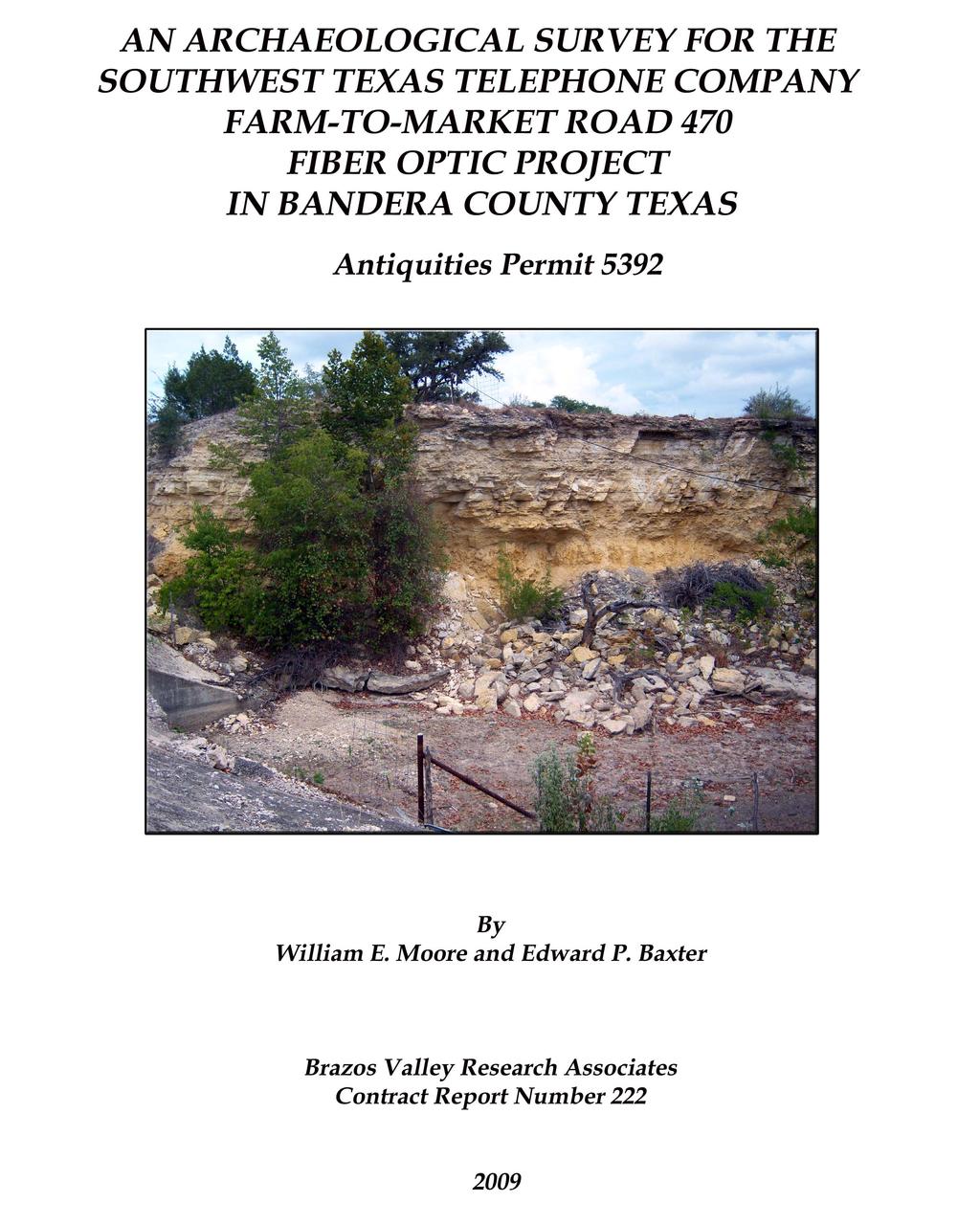
AN ARCHAEOLOGICAL SURVEY FOR THE SOUTHWEST TEXAS TELEPHONE COMPANY FARM-TO-MARKET ROAD 470 FIBER OPTIC PROJECT IN BANDERA COUNTY TEXAS
|
|
|
- Lizbeth Booker
- 5 years ago
- Views:
Transcription
1
2 AN ARCHAEOLOGICAL SURVEY FOR THE SOUTHWEST TEXAS TELEPHONE COMPANY FARM-TO-MARKET ROAD 470 FIBER OPTIC PROJECT IN BANDERA COUNTY TEXAS Antiquities Permit 5392 BVRA Project Principal Investigator William E. Moore, RPA Prepared for Southwest Texas Telephone Company Post Office Box 128 Rocksprings, Texas Prepared by Brazos Valley Research Associates 813 Beck Street Bryan, Texas
3 ABSTRACT An archaeological survey of approximately six miles of new fiber optic line in southwest Bandera County, Texas was performed on September 9 and 10, 2009 by Brazos Valley Research Associates (BVRA) under Antiquities Permit The archival research indicated that there are no known previously recorded archaeological sites within the Area of Potential Effect (APE). Archaeologists from SWCA Environmental Consultants of Austin had surveyed a small portion of the western end of the project area in 2005 with negative results. The current field survey consisted of a 100% Pedestrian Survey that inspected the exposed surface that had been disturbed by highway improvements and trench profiles that were still open during the installation of a portion of the fiber optic line. No evidence of an archaeological site was found, and no artifacts were collected and curated. It is recommended that the client be allowed to continue with the installation of the fiber optic line. The project area is 0.73 acre in size. Copies of the final report are on file at the Texas Historical Commission (THC), the Texas Archeological Research Laboratory (TARL), the Southwest Texas Telephone Company, TRC Engineering, and BVRA. ii
4 ACKNOWLEDGMENTS The authors are appreciative of the assistance provided by others during this project. Gary Gilmer is the Owner and President of the Southwest Texas Telephone Company in Rocksprings, Texas, and he was our contact with that agency. The engineering firm responsible for this project is TRC Engineering of Kerrville, Texas. Maps and other information were provided by Donna Bogart at TRC Engineering. We are grateful to Steve Carpenter at SWCA Environmental Consultants of Austin who took time from his busy schedule to discuss work by his firm in the area. The site records at TARL were checked by Jean Hughes for previously recorded sites in the project area. Lili G. Lyddon of LL Technical Services drafted some of the figures that appear in this report. She also edited the report. iii
5 CONTENTS ABSTRACT...II ACKNOWLEDGMENTS...III INTRODUCTION...1 ENVIRONMENTAL SETTING...4 ARCHAEOLOGICAL BACKGROUND...5 METHODS...10 RESULTS AND CONCLUSIONS...16 RECOMMENDATIONS...18 REFERENCES CITED...19 Figures FIGURE 1. GENERAL LOCATION MAP... 2 FIGURE 2. PROJECT AREA ON TOPOGRAPHIC QUADRANGLES... 3 FIGURE 3. CENTRAL REGION OF TEXAS... 6 FIGURE 4. PREVIOUS SURVEYS IN BANDERA COUNTY... 7 FIGURE 5. BORE HOLE BACK DIRT (FACING EAST) FIGURE 6. RIP RAP (FACING EAST) FIGURE 7. BACKFILLED TRENCH (FACING EAST) FIGURE 8. OPEN TRENCH (FACING EAST) iv
6 INTRODUCTION The Southwest Texas Telephone Company of Rocksprings, Texas plans to install new fiber optic line in rural Bandera County (Figure 1). The project area is within the right-of-way of Farm-to-Market Road 470. The length of the proposed fiber optic line is approximately six miles. The line is 1.25 inches in diameter, and it will be placed in a ditch 10 to 12 inches wide and 36 inches deep. Boring will be used at all creek crossings, and the fiber optic line will be encased. No cemeteries are within 100 feet of the APE. Funding for this project will be provided by the Southwest Texas Telephone Company from their General Fund. Because of the presence of significant archaeological sites in the area, the THC required a formal survey by a professional archaeologist. The reviewer for this project is William A. Martin, Staff Archaeologist at the THC. In order to comply with these requirements, the Southwest Texas Telephone Company retained BVRA of Bryan, Texas to conduct this investigation. The project area is depicted on two USGS 7.5 topographic quadrangles. They are Seco Pass ( ) and Vanderpool ( ) (Figure 2). 1
7 Figure 1. General Location Map 2

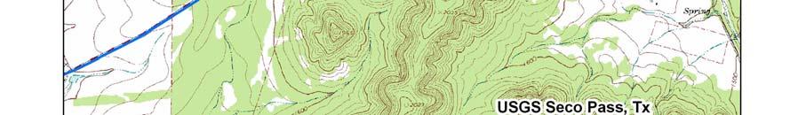
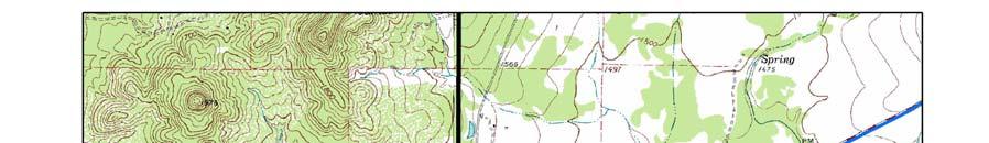
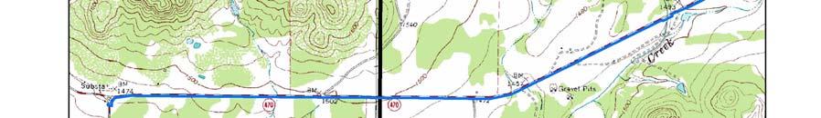
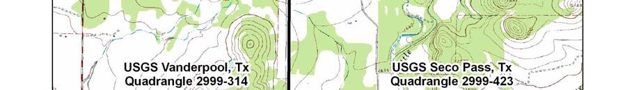

8 Figure 2. Project Area on Topographic Quadrangles 3
9 ENVIRONMENTAL SETTING Bandera County is located within the Edwards Plateau of Central Texas. To the west is the Stockton Plateau, and the two plateaus are bounded on the south and east by the Balcones Escarpment. To the north is the Llano Estacado, and to the west are the mountains of the Big Bend. The uplands of the Edwards Plateau are relatively level, and they contain karstic features such as playas and sinkholes that fill with water during the rainy season. The area is also characterized by deep canyons, valleys, and divides that contain steep bluffs and overhangs or rock shelters. Terraces and floodplains are present along the major streams. Limestone outcrops dominate the surface geology, and the local soils have developed from the weathering of limestone and marls. According to Fisher (1983), the project area is located within the Glen Rose formation and undivided Quaternary deposits. The Glen Rose formation consists of alternating beds of limestone, dolomite, and marl. The Quaternary deposits consist of slope wash, alluvium, and colluvium made up of silt to cobble-sized derivates of Cretaceous limestone, dolomite, and chert. In this area, most of the soils are shallow to very shallow and stony on moderate to steep slopes. Deeper soils are found in floodplain settings along major streams and the tops of plateaus (Anonymous 1958). The project area is located in a region defined as dry humid mesothermal (Blair 1950:113). Pollen data from a number of localities in Southwest Texas indicate that a gradual increase in aridity prevailed in this region from post-glacial times to the present (Bryant 1969:124). There are no major streams within the project area. Drainages present include ephemeral streams and headwaters of ephemeral streams. 4
10 ARCHAEOLOGICAL BACKGROUND Bandera County is located in the Central Texas Cultural-Geographical Region of Texas as defined by Biesaart et al. (1985) in a planning document published by the THC. The counties in this region correspond roughly with the Edwards Plateau region (Figure 3). This region has been delineated for management purposes, and it may not coincide exactly with regions defined by other researchers. There were 3507-recorded sites in the region in 1985, and Bandera County was eighteenth in the region that consists of thirty-four counties. Of the thirty-three recorded sites in Bandera County in 1985, fourteen are described as General Archaic, and four are described as Late Prehistoric. There is no information for the remaining fifteen sites. Disturbance to sites in the county is listed by Biesaart et al. (1985:110) as erosion (n=11), construction (n=4), dispersed (n=11), and vandalized (n=5). Ten sites are described as destroyed, and one site is described as pristine. Investigation at sites in the county in 1985 consisted of excavated (n=3), tested by hand (n=9), and surface collected (n=24). According to the Texas Archeological Sites Atlas, there were 214 recorded prehistoric and historic sites in the county at the time of this survey. There are five sites currently listed in the in the National Register of Historic Places, and they are all within the city limits of Bandera. There are nine sites that have been designated as a State Archeological Landmark, and not one of these sites are within the boundaries of the current project area. Types of prehistoric sites in the county include camps (temporary and permanent) located on terraces near streams and buried in the floodplains of major streams, lithic scatters, middens in rock shelters and sinkholes, burned rock mounds, and burned rock middens. Historic sites in the rural areas of the county are not always tied to water and include the remains of farming and ranching activities in the form of standing structures (i.e. houses and outbuildings), features associated with farming and ranching such as wells, cisterns, watering troughs, cattle dip tanks, and cemeteries. When the archeological bibliography for the Central Texas region was published in 1997 by the THC (Simons and Moore 1997), there were forty-nine references to fieldwork and research projects relating to Bandera County. The Texas Archeological Sites Atlas, shows fourteen area surveys and twenty linear surveys as having been conducted in Bandera County (Figure 4), and most of these were for the Texas Department of Transportation (TxDOT) and are along highways. These surveys date from 1975 to Only one of these is included within the boundaries of the current project area, and it is discussed below. As stated above, there have been several area and linear surveys by state agencies and private contract firms in addition to three field schools by The University of Texas at Austin in 1989, the Texas Archeological Society in 1990, and Trinity University in
11 Figure 3. Central Region of Texas 6
12 Figure 4. Previous Surveys in Bandera County 7
13 Sue Amini-Minor recorded twenty-five sites in the county, and this is the most by any individual. Archeological Steward C. K. Chandler recorded twentytwo sites (TARL site files). Together they recorded forty-seven sites, which is 22 percent of the known sites in Bandera County. Other individuals who recorded sites in the county are J. W. Beavin, M. L. Beadles, David Calame, Mary Frances Chadderdon, Roy Heidman, Thomas R. Hester, Al Leippe, Leland W. Patterson, Wayne Roberson, Bryant Saner, Jr., Herb Uecker, Jay Woodward, and Woody Woodward. Archaeological surveys in the county include work at Lost Maples State Park (Kegley 1977) and the Hill Country State Natural Area (Turpin 1994) by archaeologists from the Texas Parks and Wildlife Department; work along Ranch-to-Market Road 187 (Lawrence et al. 2005) and for the Hill Country Telephone Cooperative (Chavez 2008a, 2008b) by SWCA Environmental Consultants; the Bandera Centerpoint project (Labadie 1987) by The University of Texas at San Antonio; Texas Forest Service Oak Wilt Project by the Texas Forest Service, Texas A&M University and The University of Texas at Austin (report not found); proposed development at Koyote Ranch by Cojeen Archeological Services (Cojeen and Burkhalter 2003); Love Creek Preserve by the Texas Historical Commission (report not found); work on Farm-to Market Road 475 (TxDOT 1983), a bridge replacement at Farm-to-Market Road 689 (TxDOT 1989) and the Ranch-to-Market Road 337 project (1977, 1992) by the Texas Department of Transportation; the Medina Lake Transmission Line project by the Lower Colorado River Authority (Malof 2007). The only survey in close proximity to the current project area is the 2005 investigation along Farm-to- Market Road 187 by SWCA Environmental Consultants in 2005 (Lawrence et al. 2005). This project paralleled the highway in a north-to-south direction from Utopia northward along the highway to just beyond the Lost Maples State Park entrance. Their project area intersects Farm-to-Market Road 470 at the western end of the current project area. Three previously unrecorded sites (41BN190 41BN192) and one isolated find were recorded, but not one of these sites is within or near the current project area. These sites are described as two surface lithic scatters and one buried site. They were not considered by the recorders as potentially eligible for listing in the National Register of Historic Places or for designation as a State Archeological Landmark. Excavation and testing projects include work at the Rainey site (41BN33) by Jerry Henderson (2001) at the Texas Department of Transportation and the Mingo site (41BN101) by Brett A. Houk and John C. Lohse (1991), members of the Texas Archeological Society. In 1989 and 1990, The Texas Archeological Society held its annual field school near Utopia in Bandera County. Information documenting this field school is found in Texas Archeology (33(4):17, 34(2):4, and 34(2):5-6) and the Southern Texas Archaeological Association Newsletter 15(3):1. 8
14 Additional information regarding the prehistory of Bandera County can be found in the statistical overview by Biesaart et al. (1985), the bibliography for the Central Region of Texas (Simons and Moore 1997), a planning document prepared by the THC entitled Archeology in the Central and Southern Planning Region, Texas: A Planning Document (Mercado-Allinger, et al. 1996), and a thesis by Paul Maslyk (1992) entitled Prehistoric Settlement in the Sabinal River Valley, Uvalde and Bandera Counties, Texas. 9
15 METHODS Records Check Prior to entering the field, the Texas Archeological Site Atlas and the files at TARL were checked for previously recorded sites and past surveys in the project area and vicinity. Several documents were reviewed during the planning stages of this project. These are a planning document by the THC (Biesaart et al. 1985), an Archeological Bibliography for the Central Region of Texas published by the THC (Simons and Moore 1997), and all volumes of the Abstracts in Texas Contract Archeology published by the THC. The interested reader is referred to these sources for additional information regarding the prehistory of the area. The survey was documented through the utilization of Microsoft Word and Excel documents. Location data was collected and documented with a Garmin GPSaided computer topographic program, National Geographic Topo and ESRI ArcMap. A Kodak digital camera was used to document the project, and all photographs were enhanced using Adobe Photoshop software. The field survey was conducted on September 9 through September 11, Field Survey The field methods employed for this survey were developed to fit the conditions of the project area at the time of the survey and were influenced by past surveys in the area and information regarding the types of previously recorded sites in the general area. The only previously recorded sites near the project area are in the low floodplain areas of Seco Creek to the east of the current project area. These sites are restricted to the surface with a maximum depth below the ground surface of one foot. The only previous professional survey touches the western end of the project area and runs in a north-south direction along the right-of-way of Ranch-to-Market Road 187 (Lawrence et al. 2005). Only three sites were found during this survey that included 175 acres of right-of way. Of these, two were restricted to the surface, and the third was found to exist in a buried soil in the Sabinal River floodplain. No such geomorphic features exist in the current project area. The western end of the project area was included in the survey along Ranch-to-Market Road 187 survey. However, the soils in this area are very shallow with areas of limestone bedrock at or near the surface. The majority of the project area had shallow rocky clay soil with bedrock exposed in many areas. The deepest soils encountered were clay silts deposited by slope wash deposition, not alluvium from stream high-energy events. 10
16 The project area was investigated through a 100% Pedestrian Survey. Surface visibility was excellent due to the lack of vegetation. At the time of this survey, the client was in the process of installing the fiber optic line, and the presence of exposed trenches afforded excellent profiles that exposed the subsurface the depth of the APE. In addition, much of the right-of-way had been disturbed by past and present work along the highway by the Texas Department of Transportation. The surface survey was accomplished by walking each segment twice. The Project Archaeologist parked his vehicle and examined the right-of-way. On the return trip to the vehicle, he looked across the fence from the edge of the right-of-way to see if he could observe any indications of a site on the surface such as flakes or burned rock that might extend into the right-of-way of the project area. Piles of back dirt were present in areas where boring had been conducted, and these piles were examined (Figure 5), and rip rap or concrete slabs had been added by the Texas Department of Transportation in areas of high erosion such as the low intermittent stream crossings and the slopes above them (Figure 6). Exposed backhoe trenches were present in areas where phone connection boxes were to be installed, and the profiles of these trenches were examined. The section of the project area where the cable had been installed and backfilled offered an excellent view of the subsurface fill (Figure 7). The method of trench backfilling utilized a machine that rolled the fill from both sides of the trench back into the trench. This action mixed the fill making the portion left on the surface a composite of the various strata. This area was examined for displaced artifacts or burned rock. The area of open trenches presented a profile of the trench walls and scattered trench back dirt (Figure 8), and these were also examined. The remainder of the area had not been trenched, but some road and creek crossings had been bored. These areas, as well as the rest of the project area, were also visibly inspected. 11
17 Figure 5. Bore Hole Back Dirt (facing east) 12
18 Figure 6. Rip Rap (facing east) 13
19 Figure 7. Backfilled Trench (facing east) 14
20 Figure 8. Open Trench (facing east) 15
21 RESULTS AND CONCLUSIONS Records Check The records check revealed that there are no known prehistoric or historic sites within the project area, and no cemeteries are located within 100 feet of the APE. Only one survey has been conducted near the project area. This was a study along Ranch-to-Market Road 187 by SWCA Environmental Consultants in 2005 (Lawrence et al. 2005). This survey is discussed in the Archaeological Background section above. Field Survey The project area is approximately six miles long and is completely within the right-of-way of Farm-to-Market Road 470. Highway construction activities had completely altered the original ground surface within the right-of way. Hills and rises had been cut through, low areas had been filled, and all areas had been graded and ditched. Recent highway activities included grading and the addition of either rock rip rap or concrete slabs in areas of high erosion such as the low intermittent stream crossings and the slopes above them. The field investigations found that much of the proposed project had been completed, and construction was continuing in the remainder of the area. The western 6740 meters of the project area in the right-of way on the south side of the road had been trenched, the cable had been laid, and the trench backfilled. The small, intermittent stream crossings and the intermittent headwaters of Little Creek had been crossed by boring. Installation of the fiber optic line was in progress from the east side of the small intermittent section of Bravo Creek eastward to a location where Farm-to-Market Road 470 had been crossed by boring. The length of this segment was 1090 meters. An open trench with the fiber optic cable in place was present throughout this area. The soil map indicated that this area has some of the deepest soils in an area containing mainly shallow soils. Observations of the open trench and the completed line revealed that the trench had been placed within the footprint of an earlier cable construction disturbance. Portions of a previously installed cable were observed lying next to the new cable in the open trench, and some twisted sections of old cable was observed on the backfilled surface. The cable route then crossed to the right-of-way on the north side of the highway and continued eastward for 2285 meters to a point above the west bank of Seco Creek where it had been bored under Farm-to-Market Road 470 to connect to an existing telephone building on the south right-of-way. This section had not been trenched, but areas such as rocky hilltops and an intermittent stream crossing Farm-to-Market 470 in two areas had been bored. 16
22 This survey found no evidence of an archaeological site on the surface, exposed in the trench profiles, or across the fence on private property. It is concluded that the potential for deeply buried sites within the right-of-way along Farm-to-Market Road 470 is low. This conclusion is based on the surface survey, an examination of the profiles exposed by the trenches associated with the on-going installation of the fiber optic line, the fact that the previously recorded sites in the vicinity of the project area are restricted to the surface, and the presence of shallow soils in the right-of-way. 17
23 RECOMMENDATIONS No archaeological sites were found within the current project area. Therefore, it is recommended that the client be allowed to install the remainder of the fiber optic line as planned. Should construction plans change that will add new line in an area not previously surveyed by a professional archaeologist, the THC must be notified in case additional survey is warranted. Also, if prehistoric or historic cultural materials are unearthed in areas during construction, all work in the area of the find must stop until the THC can evaluate the situation. This study was performed in accordance with the Minimum Survey Standards as defined by the Archaeology Division of the THC. 18
24 REFERENCES CITED Anonymous 1958 Watershed Work Plan for Watershed Protection and Flood Prevention of Dry Devils River and Lowery Draw Watershed, Schleicher and Sutton Counties, Texas. Manuscript prepared under the authority of the United States Department of Agriculture and the Soil Conservation Service. Biesaart, Lynne A., Wayne R. Roberson, and Lisa Clinton Spotts 1985 Prehistoric Archeological Sites in Texas: A Statistical Overview. Office of the State Archeologist, Special Report 28, Texas Historical Commission. Birkeland, Peter W Soils and Geomorphology. (3 rd Edition) Oxford University Press, New York. Blair, W. Frank 1950 The Biotic Provinces of Texas. The Texas Journal of Science 2(1): Bryant, Vaughn M., Jr Late Full Glacial and Postglacial Pollen Analyses of Texas Sediments. Unpublished Ph.D. dissertation presented to the Graduate College at The University of Texas at Austin. Bureau of Economic Geology 1981 Geologic Atlas of Texas, Sonora Sheet (1:250,000 scale) The University of Texas at Austin. Chavez, Michael R. 2008a Hill Country Telephone Cooperative Zones 1-4 Project: Comfort Hasenwinkle Road Route, Bandera County, Texas. Interim report by SWCA Environmental Consultants. 2008b Hill Country Telephone Cooperative Zones 1-4 Project: Tarpley 4F Route, Bandera County, Texas. Interim report by SWCA Environmental Consultants. Cojeen, Christopher A., and Roger Burkhalter 2003 Report on the Archeological Survey of the Koyote Ranch-Bandera Unit L.P. Recreational Vehicle Park Project, Bandera and Kerr Counties, Texas. Unnumbered report by Cojeen Archeological Services, Norman, Oklahoma. 19
25 Fisher, W. L Geologic Atlas of Texas, San Antonio Sheet. Bureau of Economic Geology, The University of Texas at Austin. Henderson, Jerry 2001 Excavations at the Rainey Site (41BN33): A Late Prehistoric Sinkhole Site in Bandera County, Texas. Texas Department of Transportation, Environmental Affairs Division, Archeological Studies Program, Report 5. Houk, Brett A., and John C. Lohse 1991 Archeological Investigations at the Mingo Site (41BN101), Bandera County, Texas. Bulletin of the Texas Archeological Society 61: Kegley, George B A Preliminary Cultural Inventory of Lost Maples State Park, Bandera County, Texas. Unnumbered report. Labadie, Joseph H A Reconnaissance of Electrical Transmission Line Rights-of-Way in Bandera and Kerr Counties, Texas. The University of Texas at San Antonio, Center for Archaeological Research, Survey Report 164, Lawrence Ken, Michael R. Chavez, and Laura Acuna 2005 An Archaeological Survey of the RM 187 Improvement Project, Bandera County, Texas. Interim report prepared by SWCA Environmental Consultants. Malof, Andrew F An Intensive Cultural Resources Survey of the Lower Colorado River Authority s Proposed Medina Lake Transmission Line Project, Bandera and Medina Counties, Texas. Lower Colorado River Authority, Parks and Resource Conservation Service, Interim Report Number Maslyk, Paul 1992 Prehistoric Settlement in the Sabinal River Valley, Uvalde and Bandera Counties, Texas. M.A. Thesis, Department of Anthropology, The University of Texas at Austin. Mercado-Allinger, Patricia A., Nancy A. Kenmotsu, and Timothy K. Perttula 1996 Archeology in the Central and Southern Planning Region, Texas: A Planning Document. Office of the State Archeologist, Special Report 35 and the Department of Antiquities Protection, Cultural Resource Management Report 7. Texas Historical Commission. 20
26 Schoeneberger, P. J., D. A. Wysocki, E. C. Benham, and W. D. Broderson (editors) 2002 Field Book for Describing and Sampling Soils, Version 2.0. Natural Resources Conservation Service, National Soil Survey Center, Lincoln, Nebraska. Simons, Helen, and William E. Moore 1997 Archeological Bibliography for the Central Region of Texas. Office of the State Archeologist, Special Report 36, Texas Historical Commission. Texas Department of Transportation 1977 RM 337: from SH in Medina, West to RM 187, South of Vanderpool, CRA, Bandera County. Unnumbered letter report by the Texas Department of Transportation. * 1983 FM 475 from the Kendall County Line, West to SH 16, Cultural Resources Assessment, Bandera County. Unnumbered letter report by the Texas Department of Transportation FM 689: Bridge Rehabilitation at Bandera Creek and No Name Creek, Cultural Resources Survey, Bandera County Cultural Resources Survey Report: RM 337 Reconstruction. Unnumbered letter report by the Texas Department of Transportation. Turpin, Jeff 1994 Hill Country State Natural Area: A Survey of High Traffic and High Potential Areas, Bandera and Medina Counties, Texas. Texas Parks and Wildlife Department, Cultural Resources Program, Report * The State Highway number was not legible 21
AN ARCHAEOLOGICAL SURVEY FOR THE RICHARDS, TEXAS FARM-TO-MARKET ROAD 149 FIBER OPTIC CABLE PROJECT IN MONTGOMERY COUNTY, TEXAS
 AN ARCHAEOLOGICAL SURVEY FOR THE RICHARDS, TEXAS FARM-TO-MARKET ROAD 149 FIBER OPTIC CABLE PROJECT IN MONTGOMERY COUNTY, TEXAS Antiquities Permit 6097 By William E. Moore Brazos Valley Research Associates
AN ARCHAEOLOGICAL SURVEY FOR THE NAVIDAD RESOURCES, LLC FERGUSON STATE PRISON FARM UNIT PROJECT IN MADISON COUNTY, TEXAS
 AN ARCHAEOLOGICAL SURVEY FOR THE NAVIDAD RESOURCES, LLC FERGUSON STATE PRISON FARM UNIT PROJECT IN MADISON COUNTY, TEXAS Antiquities Permit 5714 By William E. Moore Brazos Valley Research Associates Contract
AN ARCHAEOLOGICAL SURVEY OF THE TIGER CREEK COMPARTMENT 3 JASPER COUNTY TEXAS
 AN ARCHAEOLOGICAL SURVEY OF THE TIGER CREEK COMPARTMENT 3 JASPER COUNTY TEXAS By William E. Moore Brazos Valley Research Associates Contract Report Number 89 2001 AN ARCHAEOLOGICAL SURVEY OF THE TIGER
AN ARCHAEOLOGICAL SURVEY FOR THE DIALVILLE-OAKLAND WATER SUPPLY CORPORATION IN CENTRAL CHEROKEE COUNTY, TEXAS. BVRA Project Number 03-25
 AN ARCHAEOLOGICAL SURVEY FOR THE DIALVILLE-OAKLAND WATER SUPPLY CORPORATION IN CENTRAL CHEROKEE COUNTY, TEXAS BVRA Project Number 03-25 Author and Principal Investigator William E. Moore Prepared by Brazos
AN ARCHAEOLOGICAL SURVEY OF PROPOSED SYSTEM IMPROVEMENTS FOR THE ALTO RURAL WATER SUPPLY CORPORATION IN SOUTHEAST CHEROKEE COUNTY, TEXAS
 AN ARCHAEOLOGICAL SURVEY OF PROPOSED SYSTEM IMPROVEMENTS FOR THE ALTO RURAL WATER SUPPLY CORPORATION IN SOUTHEAST CHEROKEE COUNTY, TEXAS Antiquities Permit 3126 by William E. Moore Brazos Valley Research
AN ARCHAEOLOGICAL SURVEY FOR THE DOGWOOD SPRINGS WATER SUPPLY CORPORATION WATER SYSTEM IMPROVEMENTS PROJECT IN ANDERSON COUNTY, TEXAS
 AN ARCHAEOLOGICAL SURVEY FOR THE DOGWOOD SPRINGS WATER SUPPLY CORPORATION WATER SYSTEM IMPROVEMENTS PROJECT IN ANDERSON COUNTY, TEXAS Antiquities Permit 4709 By William E. Moore Brazos Valley Research
STAGE 1 ARCHAEOLOGICAL ASSESSMENT OF RATHBURN ROAD, FROM DUKE OF YORK BOULEVARD TO SHIPP DRIVE, CITY OF MISSISSAUGA. Submitted to:
 STAGE 1 ARCHAEOLOGICAL ASSESSMENT OF RATHBURN ROAD, FROM DUKE OF YORK BOULEVARD TO SHIPP DRIVE, CITY OF MISSISSAUGA Submitted to: McCormick Rankin Corporation 2655 North Sheridan Way, Suite 280 Mississauga,
W.H. Bonner Associates
 15619 Ogram Avenu Gardena, CA 90249-444 W.H. Bonner Associates Archaeofaunal Studies Archaeological Surveys Historical & Genealogical Research (310) 675-274 E-mail: whbonner@aol.com April 21, 2014 Wendy
Phase One Archaeological Investigation Results, James Madison Park Master Development Plan Project, City of Madison, Dane County, Wisconsin
 Phase One Archaeological Investigation Results, James Madison Park Master Development Plan Project, City of Madison, Dane County, Wisconsin Prepared for the City of Madison Parks Department 28 January
Ivol Buildings, Woodcote Road, South Stoke, Oxfordshire
 Ivol Buildings, Woodcote Road, South Stoke, Oxfordshire An Archaeological Watching Brief For Christ Church, Oxford by Pamela Jenkins Thames Valley Archaeological Services Ltd Site Code IBSS 04/03 March
PennDOT. single spann lanes and 3- mayy need to be to accommodate. any bridge. addition to III. Date: CRP 07/27/2015 CRP.
 (10/27/14) PennDOT Section 106 Field Assessments and Finding Combined Early tification/finding? Yes Concurrence required or requested: Yes MPMS: 51507 ER# (if consultation with PHMC required) ): County:
7.0 SOCIAL, ECONOMIC, AND ENVIRONMENTAL ISSUES
 7.0 SOCIAL, ECONOMIC, AND ENVIRONMENTAL ISSUES The following list of social, economic, and environmental issues have been identified based on a preliminary inventory of resources in the project area, an
Florida Department of TRANSPORTATION. Technical Memorandum Cultural Resource Assessment Survey of the Proposed VE Pond
 Florida Department of TRANSPORTATION Technical Memorandum Cultural Resource Assessment Survey of the Proposed VE Pond Malabar Road (SR 514) PD&E Study From East of Babcock Street (SR 507) to US 1 Brevard
Summary of Other State Archeological Guidelines
 Summary of Other State Archeological Guidelines This is a summary all guidelines for archeology from 17 other states. This information was gathered in order to see what type of guidelines other states
Archaeological Survey Report
 Archaeological Survey Report for UNION STREET RAILROAD BRIDGE (Trail Connection Project) Key No. 11085 ODOT, Region 2 Local Agency On-Call ATA 23456 WOC 1 City of Salem, Urban Development HDR Project No.
Employing Non-Invasive Remote Sensing Technology in Cultural Resource Investigations Ashley E. Jones, M.A., RPA Project Archaeologist
 Employing Non-Invasive Remote Sensing Technology in Cultural Resource Investigations Ashley E. Jones, M.A., RPA Project Archaeologist April 19, 2018 Raba Kistner San Antonio (HQ) Austin Brownsville Dallas/Fort
ENBRIDGE GAS DISTRIBUTION INC. Proposed Relocation for Ninth Line, Markham and Whitchurch-Stouffville. Environmental Screening Report
 Page 1 of 18 ENBRIDGE GAS DISTRIBUTION INC. Proposed Relocation for Ninth Line, Markham and Whitchurch-Stouffville Environmental Screening Report July 2011 Page 2 of 18 Table of Contents 1.0 INTRODUCTION
Submitted: July 23, 2009
 Stage I and II Archaeological Assessment Jock River Estates Phase 2 PML Project No. 0801-01 Client: 773804 Ontario Inc. Lot 21, Concession 2 Geographic Township of Goulbourn City of Ottawa Submitted: July
ARCHAEOLOGICAL INVESTIGATIONS FOR THE OLD DAVIS ROAD REALIGNMENT PROJECT ON THE UNIVERSITY OF CALIFORNIA, DAVIS CAMPUS YOLO COUNTY, CALIFORNIA
 Cultural Resources Consultants ARCHAEOLOGICAL INVESTIGATIONS FOR THE OLD DAVIS ROAD REALIGNMENT PROJECT ON THE UNIVERSITY OF CALIFORNIA, DAVIS CAMPUS YOLO COUNTY, CALIFORNIA Prepared for: Matt Dulcich,
PRELIMINARY DRAINAGE REPORT LATHAM 200 MMSCFD GAS PROCESSING PLANT
 PRELIMINARY DRAINAGE REPORT LATHAM 200 MMSCFD GAS PROCESSING PLANT LOTS B, RECORDED EXEMPTION 1211-2-1, RECX13-0096 LOCATED IN THE NORTH 1/2 OF SECTION 2, TOWNSHIP 3 NORTH, RANGE 66 WEST, 6 TH PRINCIPAL
WQ-23 MOUNTAINOUS AND STEEP SLOPE SITES
 Greenville County Technical Specification for: WQ-23 MOUNTAINOUS AND STEEP SLOPE SITES 1.0 Mountainous and Steep Slope Sites 1.1 Description The geographic locations of portions of Greenville County are
An Archeological Reconnaissance of the Eagle Creek and Chandler Bridge Creek Channelization Project, Dorchester County, South Carolina
 University of South Carolina Scholar Commons Research Manuscript Series Archaeology and Anthropology, South Carolina Institute of 10-1-1980 An Archeological Reconnaissance of the Eagle Creek and Chandler
Centre for Archaeological Fieldwork, School of Archaeology and Palaeoecology, Queen s University Belfast.
 Centre for Archaeological Fieldwork, School of Archaeology and Palaeoecology, Queen s University Belfast. Monitoring Report No. 04 Duneight Motte and Bailey, May 2004. On behalf of Monitoring Report: Duneight
Unit II Soil Management
 Unit II Soil Management Lesson 2: Using Soil Survey Manuals Soil survey manuals provide useful information for grassland management. Soil scientists evaluate the soil for chemical and physical properties,
NON-TECHNICAL SUMMARY
 Proposed Sand and Gravel Extraction and Associated Processing Operations with Restoration to a Mixture of Agriculture and Nature Conservation including Areas of Shallow Water at Hedgeley, Northumberland
ARTICLE IV: DEVELOPMENT STANDARDS 404 MASTER PLANNING
 IV 13 404 MASTER PLANNING Master Planning through the Site Analysis (Master Planning Site Analysis) or Planned Development (Master Planning Planned Development) is provided to encourage development which
ELIGIBILITY CRITERIA CHECKLIST OPEN SPACE CLASSIFICATION
 THURSTON COUNTY DEVELOPMENT SERVICES OPEN SPACE TAX PROGRAM ELIGIBILITY CRITERIA CHECKLIST OPEN SPACE CLASSIFICATION Use this checklist to help you determine whether your property is eligible for open
A CULTURAL RESOURCES SURVEY OF THE SITE OF THE PROPOSED NAVASOTA RECREATION CENTER IN SOUTHWESTERN GRIMES COUNTY, TEXAS. Antiquities Permit 2832
 A CULTURAL RESOURCES SURVEY OF THE SITE OF THE PROPOSED NAVASOTA RECREATION CENTER IN SOUTHWESTERN GRIMES COUNTY, TEXAS Antiquities Permit 2832 by William E. Moore Brazos Valley Research Associates Contract
MOUNTAIN VIEW HERITAGE ASSESSMENT, GAUTENG
 MOUNTAIN VIEW HERITAGE ASSESSMENT, GAUTENG A Phase I report prepared for Seaton Thompson and Associates P.O. Box 936, IRENE, 0062 Professor T.N. Huffman Archaeological Resources Management School of Geography,
EVALUATION REPORT No. 300
 EVALUATION REPORT No. 300 Southwest of 2A Cloughey Road, Portaferry, Co. Down Licence No.: AE/135/85E Sapphire Mussen Report Date: 14 th May 2015 Site Specific Information Site Name: [Southwest of 2a]
TAKANINI STRUCTURE PLAN AREAS 6A & 6B: ARCHAEOLOGICAL ASSESSMENT
 TAKANINI STRUCTURE PLAN AREAS 6A & 6B: ARCHAEOLOGICAL ASSESSMENT Report prepared for Hosken & Associates Ltd By Barry Baquie (MA) Rod Clough (PhD) April 2006 Clough & Associates Ltd heritage@clough.co.nz
MEMORANDUM OF BOG TURTLE HABITAT INVESTIGATION
 MEMORANDUM OF BOG TURTLE HABITAT INVESTIGATION 410-728-2900 Fax: 410-728-3160 www.rkk.com To: From: CC: U.S. Fish and Wildlife Service, Pennsylvania Fish and Boat Commission Jennifer A Ottenberg Miller,
Cedar Niles Future Park Site Wetland #1
 Date: October 20, 2014 Site: Landowner: Johnson County Parks Designer: Thomas R. Biebighauser Individuals Present: Thomas R. Biebighauser, Dr. Eliodora Chamberlain (US EPA), Jason Daniels (US EPA), Jeannette
This definition is from the Soil Science Glossary (Soil Science Society of America).
.") What is Soil? This definition is from the Soil Science Glossary (Soil Science Society of America). soil - (i) The unconsolidated mineral or organic material on the immediate surface of the earth that serves
What is Soil? This definition is from the Soil Science Glossary (Soil Science Society of America). soil - (i) The unconsolidated mineral or organic material on the immediate surface of the earth that serves
MONITORING REPORT: No. 283
 MONITORING REPORT: No. 283 Dunluce Castle Visitor Centre Option Site D Magheracross Co. Antrim AE/14/109E Dermot Redmond List of Contents Site Specific Information 1 Account of the Monitoring 2 Discussion
APPENDIX 9: Archaeological Assessment by Ken Phillips
 APPENDIX 9: Archaeological Assessment by Ken Phillips ARCHAEOLOGICAL ASSESSMENT PROPOSED SERVICE STATION DEVELOPMENT BRUCE ROAD, PAPAMOA TAURANGA Prepared by KEN PHILLIPS (MA HONS) MARCH 2016 ARCHAEOLOGY
Map Figure 1 prepared by Ardaman & Associates and included in the Conceptual Design Report dated June 20, 2007
 VIII. Site Analysis A. SITE TOPOGRAPHY Site Dynamics Map 3.1 from Inventory & Analysis Section of Campus Master Plan Existing Conditions Topography Map C1.0 from Walter Fedy USF Lakeland Conceptual Design
APPENDIX G. Historical Resources Overview Documentation
 APPENDIX G Historical Resources Overview Documentation Statement of Justification for Historical Resources Act Requirements for projects other than small-scale oil and gas This document contains sensitive
INTRODUCTION Key Issues and Findings Goals, Objectives, and Policies - Natural Resources - Map M18 - Environmental Resources
 Natural, Environmental, Cu INTRODUCTION This Element provides policies related to the preservation and protection of the Centre Region s natural, environmental, cultural, and historic resources. This Element
Analysis of Landscape Character for Visual Resource Management 1
 Analysis of Landscape Character for Visual Resource Management 1 Paul F. Anderson 2/ Abstract: Description, classification and delineation of visual landscape character are initial steps in developing
TRCA Field Staking Protocol December 2016
 Page 1 of 6 TRCA Field Staking Protocol December 2016 This Protocol describes TRCA staff s current practice for field staking the physical top of bank, the physical toe of slope, and the limit of existing
The 13 th Century Depopulation of Cedar Mesa: The View from Ceramic Design Elements. Diane C. Curewitz Washington State University
 The 13 th Century Depopulation of Cedar Mesa: The View from Ceramic Design Elements Diane C. Curewitz Washington State University R.G. Matson University of British Columbia Utah Colorado The Four Corners
Peoria Riverfront Development (Ecosystem Restoration) Upper Mid-sized Island Critical Restoration Project (September 2011)
 Upper Mid-sized Island Critical Restoration Project (September 2011)") Peoria Riverfront Development (Ecosystem Restoration) Upper Mid-sized Island Critical Restoration Project (September 2011) Description The Corps of Engineers, Rock Island District (District) and the Illinois
Peoria Riverfront Development (Ecosystem Restoration) Upper Mid-sized Island Critical Restoration Project (September 2011) Description The Corps of Engineers, Rock Island District (District) and the Illinois
COUNTY COUNCIL OF PRINCE GEORGE'S COUNTY, MARYLAND SITTING AS THE DISTRICT COUNCIL 2010 Legislative Session. Council Members Dernoga and Olson
 DR- COUNTY COUNCIL OF PRINCE GEORGE'S COUNTY, MARYLAND SITTING AS THE DISTRICT COUNCIL 00 Legislative Session Bill No. CB--00 Chapter No. Proposed and Presented by Introduced by Co-Sponsors The Chairman
24. ARCHAEOLOGY & BUILT HERITAGE
 24. ARCHAEOLOGY & BUILT HERITAGE Overview There are no known archaeological or built heritage sites within or adjacent to the Project designation boundaries. There is a history of both Māori and European
Project: Developer/Designer: Reviewer: I. Narrative: 1. Project Description: Describes the nature and purpose of the land disturbing activity.
 City of Charlottesville, Virginia Erosion and Sediment Control Plan Review Checklist 610 East Market Street, Charlottesville, VA 22902 Telephone 434-970-3182; Fax 434-970-3359 Project: Developer/Designer:
Revised License Report
 STAGE 1 2 ARCHAEOLOGICAL ASSESSMENT OF THE EGLINTON CROSSTOWN LIGHT RAIL TRANSIT CORRIDOR, EGLINTON AVENUE FROM JANE STREET TO BRICKNELL STREET, CONCESSION 5, LOT 11, CONCESSION 6, LOT 41, YORK TOWNSHIP,
REQUEST FOR PROPOSALS. Preparation of National Register of Historic Places. Nominations for the following:
 REQUEST FOR PROPOSALS Preparation of National Register of Historic Places Nominations for the following: The Conner Swales Site, The Baumann Village Site, The Bird Point Heaven Village Site, The Wise Village
2. Analysis. DRAFT Gerald Richards & Pleasantview Park Master Plan
 DRAFT Gerald Richards & Pleasantview Park Master Plan 19 Historic Features According to the National Register of Historic Places and the National Historic Landmarks Program, there is nothing of national
2.0 Hi s t o r y & Existing Co n d i t i o n s
 2.0 Hi s t o r y & Existing Co n d i t i o n s 2.1 Plan Area History The Lincoln East Specific Plan (Specific Plan) area is a significant part of the history of Sutter County. A 48,000 acre land grant
Mitchell Ranch South MPUD Application for Master Planned Unit Development Approval Project Narrative. Introduction
 Mitchell Ranch South MPUD Application for Master Planned Unit Development Approval Project Narrative Introduction Mitchell Ranch South is a proposed single family (detached) residential development on
13. PRELIMINARY PLAT NO MILLS FARM - Vicinity of the southeast corner of 159 th Street and Quivira Road
 13. corner of 159 th Street and Quivira Road 1. APPLICANT: HNTB Corporation is the applicant for this request. 2. REQUESTED ACTION: The applicant is requesting approval of a preliminary plat for a 383-lot
Non-Metallic Mining Reclamation Checklist
 Eau Claire County DEPARTMENT OF PLANNING AND DEVELOPMENT Eau Claire County Courthouse, Rm. 1510 721 Oxford Avenue Eau Claire, Wisconsin 54703-5481 (715) 839-4741 f Housing & Community Development 839-6240
OVERMOUNTAIN VICTORY TRAIL BURKE CALDELL CORRIDOR FEASIBLITY STUDY REQUEST FOR QUALIFICATIONS CALDWELL COUNTY PATHWAYS
 OVERMOUNTAIN VICTORY TRAIL BURKE CALDELL CORRIDOR FEASIBLITY STUDY REQUEST FOR QUALIFICATIONS CALDWELL COUNTY PATHWAYS Caldwell County Pathways along with our co-partners City of Lenoir, Town of Gamewell,
Environmental Protection Ordinances (Performance Zoning) Bedminster Township, Bucks County
 Bedminster Township, Bucks County") Environmental Protection Ordinances (Performance Zoning) Bedminster Township, Bucks County ARTICLE VI. PERFORMANCE STANDARDS Section 600 Compliance All uses, activities, subdivisions and/or land developments
Environmental Protection Ordinances (Performance Zoning) Bedminster Township, Bucks County ARTICLE VI. PERFORMANCE STANDARDS Section 600 Compliance All uses, activities, subdivisions and/or land developments
Highway Alignment and Route Location Survey
 CHAPTER 2 Highway Route Surveys and Location Introduction To determine the geometric features of road design, the following surveys must be conducted after the necessity of the road is decided. Type of
Appendix E Preliminary Location Hydraulic Study
 Appendix E Prepared for: State of Alaska Department of Transportation and Public Facilities Prepared by: HDR Alaska, Inc. 2525 C Street, Suite 305 Anchorage, Alaska 99503 February 2014 This page intentionally
Final Initial Study. Chalice Unitarian Universalist Congregation Conditional Use Permit
 5 Final Initial Study Chalice Unitarian Universalist Congregation Conditional Use Permit Appendix B Chalice Unitarian Universalist Congregation Cultural Resources Memorandum TRC 9685 Research Drive Irvine,
Decision Notice. Proposed Action
 Decision Notice Paving Weld County Road 105 USDA Forest Service Arapaho and Roosevelt National Forest and Pawnee National Grassland Pawnee National Grassland Ranger District Weld County, Colorado November
 108 40' 29'' W Soil Map Mesa County Area, Colorado 108 36' 55'' W 39 10' 11'' N 39 6' 31'' N 4331700 4332500 4333300 4334100 4334900 4335700 4336500 4337300 4338100 701100 701900 702700 703500 704300 705100
Architectural Inventory Form
 COLORADO CULTURAL RESOURCE SURVEY Page 1 of 8 Official Eligibility Determination (OAHP use only) Rev. 9/98 OAHP1403 Date Initials Determined Eligible National Register Determined Not Eligible National
Technical Memorandum 5
 Technical Memorandum 5 Environmental Resources August 2015 PREPARED BY AECOM Table of Contents Introduction... 3 Natural Features... 6 Watersheds... 6 Rivers, Lakes, Creeks... 6 Wetlands... 8 Floodplains...
Pinnocks Wood Equestrian Centre, Burchett s Green, Maidenhead, Berkshire
 Pinnocks Wood Equestrian Centre, Burchett s Green, Maidenhead, Berkshire An Archaeological Watching Brief For Mr David Eyles by Andrew Mundin Thames Valley Archaeological Services Ltd Site Code POB 08/69
Soil & Site Evaluator - Need to Know
 Soil & Site Evaluator - Need to Know I. The professional will understand the factors of soil development and demonstrate their importance to site evaluations. A. Topography 1. Landscape & landform description
Daniels Park Master Plan
 Daniels Park Master Plan Prepared for: Douglas County & The City and County of Denver October, 2007 EXHIBIT A Contents Daniels Park Overview 2 Project History & Goals 2-3 Regional Context Map 4 Park Zone
Meeting Agenda. City of Guelph. River Systems Advisory Committee. Agenda Items. Item 1, 2 and 3. Item 4 Ward to Downtown Pedestrian Bridge
 Meeting Agenda City of Guelph River Systems Advisory Committee September 19, 2018 City Hall, Meeting Room B From 4:00 to 6:00 p.m. Meeting Chair: Mariette Pushkar Agenda Items Welcome to all Item 1, 2
Alternatives Development Three conceptual alternatives were developed for the Race Road/Jessup Village Planning Study and are described below:
 Race Road/Jessup Village Planning Study (H550601) Project Newsletter Spring 2015 Project Description The Study Team, consisting of staff from Anne Arundel County (Department of Public Works and Department
PARK CITY MUNICIPAL CODE TABLE OF CONTENTS TITLE 15 LAND MANAGEMENT CODE - CHAPTER 2.21
 PARK CITY MUNICIPAL CODE TABLE OF CONTENTS TITLE 15 LAND MANAGEMENT CODE - CHAPTER 2.21 TITLE 15 - LAND MANAGEMENT CODE CHAPTER 2.21 - SENSITIVE LAND OVERLAY ZONE (SLO) REGULATIONS 15-2.21-1. PURPOSE...1
Florence County Small Commercial Land Disturbance Permit Application
 Florence County Small Commercial Land Disturbance Permit Application Florence County Engineering Division 518 South Irby Street Florence, S.C. 29501 Phone (843) 676-8600 Fax (843) 676-8667 Tax Map Number:
WELCOME TO THE PUBLIC INFORMATION CENTRE. Please Sign In
 WELCOME TO THE PUBLIC INFORMATION CENTRE Replacement of Oxtongue Lake Narrows Bridge & Oxtongue River Bridge, Highway 60 (G.W.P. 93-89-00 & G.W.P. 5550-04-00) Class Environmental Assessment (Group B) Please
JOINT PUBLIC NOTICE. 26 June United States Army Corps of Engineers State of Louisiana
 JOINT PUBLIC NOTICE 26 June 2017 United States Army Corps of Engineers State of Louisiana New Orleans District Department of Environmental Quality Regulatory Branch Office of Environmental Services 7400
Prepared for Stantec Consulting Services, Inc. 23 June 2017
 Phase I Archaeological and Cultural Resource Investigation Results: Proposed Lower Eastern Beaver River Course Realignment Project, Silver Bay Golf Course, Beaver Bay Township, Lake County, Minnesota.
BIG COOK S POND COTTAGE DEVELOPMENT PLAN ENVIRONMENTAL ASSESSMENT REGISTRATION
 GOVERNMENT OF NEWFOUNDLAND AND LABRADOR Department of Environment and Conservation Lands Branch, Land Management Division BIG COOK S POND COTTAGE DEVELOPMENT PLAN ENVIRONMENTAL ASSESSMENT REGISTRATION
STAGE 1 ARCHAEOLOGICAL ASSESSMENT OF THE MISSISSAUGA BRT (EAST), CITY OF MISSISSAUGA. Submitted to:
, CITY OF MISSISSAUGA. Submitted to:") STAGE 1 ARCHAEOLOGICAL ASSESSMENT OF THE MISSISSAUGA BRT (EAST), CITY OF MISSISSAUGA Submitted to: Ecoplans Limited 2655 North Sheridan Way, Suite 280 Mississauga, Ontario L5K 2P8 Telephone (905) 823-4988
STAGE 1 ARCHAEOLOGICAL ASSESSMENT OF THE MISSISSAUGA BRT (EAST), CITY OF MISSISSAUGA Submitted to: Ecoplans Limited 2655 North Sheridan Way, Suite 280 Mississauga, Ontario L5K 2P8 Telephone (905) 823-4988
Erosion Control for Home Builders in the. City of Jacksonville
 Erosion Control for Home Builders in the City of Jacksonville Eroding construction sites are a leading cause of water quality problems in Jacksonville. For every acre under construction, about a dump truck
Erosion & Sediment Control Plan Application Form & Checklist
 Erosion & Sediment Control Plan Application Form & Checklist GENERAL INFORMATION Application Date: Project Address: Tax Map / Parcel Number(s): PROPERTY OWNER / DEVELOPER Firm Name: Contact Person: Title:
Environmental Assessment for a New Landfill Footprint at the West Carleton Environmental Centre
 Waste Management of Canada Corporation Environmental Assessment for a New Landfill Footprint at the West Carleton Environmental Centre ARCHAEOLOGY EXISTING CONDITIONS REPORT Prepared by: Archaeological
Sanford/Lee County Technical Review Committee (TRC) DEADLINES & MEETING DATES
 DEADLINES & MEETING DATES") Sanford/Lee County Technical Review Committee (TRC) DEADLINES & MEETING DATES The following 2019 information is based on the information available to staff at the time of creation. Dates & time may change
Sanford/Lee County Technical Review Committee (TRC) DEADLINES & MEETING DATES The following 2019 information is based on the information available to staff at the time of creation. Dates & time may change
INTRODUCTION PLANNING HISTORY
 INTRODUCTION The Upper Rock Creek Master Plan Area lies in the east central part of Montgomery County. The Master Plan Area is adjacent to the City of Rockville to the south, the Olney Planning Area to
COMBINED PHASE I ARCHAEOLOGICAL SURVEY BUILDING/LANDSCAPE AND ARCHAEOLOGICAL ASSESSMENT PLAN
 COMBINED PHASE I ARCHAEOLOGICAL SURVEY BUILDING/LANDSCAPE AND ARCHAEOLOGICAL ASSESSMENT PLAN ST. ELIZABETHS HOSPITAL - WEST CAMPUS 2700 MARTIN LUTHER KING, JR. AVENUE, SE DISTRICT OF COLUMBIA [SITE NUMBER
Presentation to Parks and Open Space Advisory. Committee September 22, 2016
 Flood Planning & Preliminary Design Services for South St. Vrain Creek Restoration at Hall Ranch Presentation to Parks and Open Space Advisory Prepared for: Boulder County, Colorado Committee September
TO: Mayor & Council DATE: April 12, The Planning and Development Department and the Engineering Department recommend that Council:
 CORPORATE REPORT NO: R080 COUNCIL DATE: April 12, 2010 REGULAR COUNCIL TO: Mayor & Council DATE: April 12, 2010 FROM: SUBJECT: General Manager, Planning and Development General Manager, Engineering Neighbourhood
V. ENVIRONMENTAL IMPACT ANALYSIS D. CULTURAL RESOURCES
 V. ENVIRONMENTAL IMPACT ANALYSIS D. CULTURAL RESOURCES Incorporated into this section are the findings and conclusions of two archaeological investigations conducted on the Project Site: a site survey
General Terms Property, as used to describe eligibility for the National Register of Historic Places:
 Key Definitions Historic Landscapes Compiled by Camille Fife and Barbara Wyatt The field of historic landscape preservation has generated a specific vocabulary. Definitions have been published by two National
Oweninny Wind Farm. Oweninny Environmental Impact Statement Appendix 13. Cultural Heritage Correspondence
 Oweninny Wind Farm Oweninny Environmental Impact Statement Appendix 13 Cultural Heritage Correspondence Copyright ESB International Limited, all rights reserved. Farm Document Number File Reference: Oweninny
Original License Report. Submitted to: New Horizon Development Inc. 69 John Street South, Suite 304 Hamilton, Ontario L8N 2B9 Phone (905)
") STAGE 1 ARCHAEOLOGICAL ASSESSMENT OF 2480-2496 OLD BRONTE ROAD, PART OF LOT 31, CONCESSION 1 SOUTH OF DUNDAS STREET, GEOGRAPHIC TOWNSHIP OF TRAFALGAR, TOWN OF OAKVILLE, REGIONAL MUNICPALITY OF HALTON Original
STAGE 1 ARCHAEOLOGICAL ASSESSMENT OF 2480-2496 OLD BRONTE ROAD, PART OF LOT 31, CONCESSION 1 SOUTH OF DUNDAS STREET, GEOGRAPHIC TOWNSHIP OF TRAFALGAR, TOWN OF OAKVILLE, REGIONAL MUNICPALITY OF HALTON Original
STATE OF NEW MEXICO DEPARTMENT OF CULTURAL AFFAIRS HISTORIC PRESERVATION DIVISION
 STATE OF NEW MEXICO DEPARTMENT OF CULTURAL AFFAIRS HISTORIC PRESERVATION DIVISION Susana Martinez Governor BATAAN MEMORIAL BUILDING 407 GALISTEO STREET, SUITE 236 SANTA FE, NEW MEXICO 87501 PHONE (505)
Working Group Meeting
 April 4,, 2017 Parks Operations Bldg Working Group Meeting Arts Districts Overview Stormwater/RPA/Stream Considerations First Principles Agenda 7:00pm 7:05pm 7:10pm 7:40pm 8:30pm 9:40pm 9:45pm Welcome
Architectural Inventory Form (page 1 of 5)
") OAHP1403 Rev. 9/98 COLORADO CULTURAL RESOURCE SURVEY (page 1 of 5) I. IDENTIFICATION 1. Resource number 5RT-2050 2. Temporary resource number: 145008005 3. County: Routt County 4. City: Steamboat Springs
OAHP1403 Rev. 9/98 COLORADO CULTURAL RESOURCE SURVEY (page 1 of 5) I. IDENTIFICATION 1. Resource number 5RT-2050 2. Temporary resource number: 145008005 3. County: Routt County 4. City: Steamboat Springs
AD-A SDl '"TIC --,.. AUGUST 19 A T n.. n Y E
 AD-A262 970 AUGUST 19 A T n.. n Y E 1, AGENCY USE ONLY 2, e r I REPORT DATE 13 O T Y g. a{ O D A Cultural Resources Survey of the Yazo-s-Mississippi D~lta Levee Slide Repair DeSoto Co.,MS A Negativet '":'
OCEAN POND COTTAGE DEVELOPMENT PLAN
 Edinburgh Group Limited 36 Cabot Avenue St. John s, NL A1A 5L9 OCEAN POND COTTAGE DEVELOPMENT PLAN ENVIRONMENTAL ASSESSMENT REGISTRATION JULY, 2014 TABLE OF CONTENTS Page 1. NAME OF UNDERTAKING... 1 2.
STAGE 1 2 ARCHAEOLOGICAL ASSESSMENT OF YONGE STREET SUBWAY EXTENSION, LOTS 37-41, CONCESSION EYS, TOWNSHIP OF MARKHAM, CITY OF TORONTO, YORK COUNTY
 STAGE 1 2 ARCHAEOLOGICAL ASSESSMENT OF YONGE STREET SUBWAY EXTENSION, LOTS 37-41, CONCESSION EYS, TOWNSHIP OF MARKHAM, CITY OF TORONTO, YORK COUNTY Original License Report Submitted to: Ecoplans Limited
Yates Cattle & Conservation Ranch
 Yates Cattle & Conservation Ranch Yates Cattle and Conservation Ranch 385 +/- acres Hays & Travis Counties, Texas James King, Agent Office 432.426.2024 James@KingLandWater.com Location There is a property
TOWN OF AURORA HERITAGE IMPACT ASSESSMENTS AND CONSERVATION PLANS GUIDE
 PLANNING AND DEVELOPMENT SERVICES Development Planning Division Heritage Planning Section Phone: 905-727-3123 ext. 4226 Fax: 905-726-4736 Email: planning@aurora.ca Town of Aurora 100 John West Way, Box
Methods, approaches, and procedures to minimize active agricultural land impacts during pipeline construction, surface restoration, and pipeline
 Agricultural Impact Minimization Plan Methods, approaches, and procedures to minimize active agricultural land impacts during pipeline construction, surface restoration, and pipeline operation. PennEast
WELCOME! 8 8:30 6: TH STREET IMPROVEMENTS. Open House. Presentation & Q&A
 WELCOME! 168 TH STREET IMPROVEMENTS 6:30 Open House 7 8 Presentation & Q&A 8 8:30 Open House WELCOME Todd Pfitzer City of Omaha Engineer Bob Stubbe City of Omaha Public Works Director Jon Meyer Project
Appendix I. Checklists
 Appendix I Checklists Town of Greenwich Drainage Manual Department of Public Works - Engineering Division Town Hall - 101 Field Point Road, Greenwich, CT 06836-2540 Phone 203-622-7767 - Fax 203-622-7747
McKay Road Interchange and Salem / Lockhart Crossing
 McKay Road Interchange and Salem / Lockhart Crossing The McKay Road Interchange Class EA has two components: 1. A new MacKay Road Interchange at Highway 400; and 2. A new bridge crossing of Highway 400
glenwood canyon design process I-70 Statement of Direction TRG Recreation Subcommittee Colorado Division of Highways August 11, 1976 prepared by the
 glenwood canyon I-70 design process Statement of Direction TRG Recreation Subcommittee August 11, 1976 prepared by the TRG Recreation Subcommittee for the Colorado Division of Highways glenwood canyon
ARTICLE VI: SITE PLAN REVIEW
 Section 6.01 - Site Plan Review (All Districts) ARTICLE VI: SITE PLAN REVIEW Site plans give the Planning commission an opportunity to review development proposals in a concise and consistent manner. The