Trails & Greenways. Elise Bremer-Nei NJDOT Mike Dannemiller NV5 Cyndi Steiner NJBWC Brandee Chapman NJDEP
|
|
|
- Derrick Gilmore
- 5 years ago
- Views:
Transcription

1 Trails & Greenways 1 Elise Bremer-Nei NJDOT Mike Dannemiller NV5 Cyndi Steiner NJBWC Brandee Chapman NJDEP
2 Trails & Greenways 2 Elise Bremer-Nei NJDOT Bicycle and Pedestrian Advocate and Safe Routes to School Coordinator

3 Why are Walking and Bicycling Important? 3

4 4 NJ s Walkers & Bikers

5 5 NJ s Walkers & Bikers

6 How does NJ get to work? 6
7 7


8 Who ME? 8 Build it for Isabella 12 year old girl if her Mom is comfortable with her riding, then all is well

9 NJDOT LOCAL BICYCLE & PEDESTRIAN ASSISTANCE PROGRAM Almost 20 years Over 80 plans 9
10 LTA PROJECTS ACROSS THE STATE 10
11 LOCAL TECHNICAL ASSISTANCE (LTA)..WHAT IS IT? Plan capital projects that will lead to enhancements for walking, bicycling and all modes of transportation Facilitate planning activities that address the safety and access needs of pedestrians and bicyclists Department has retained the services of several consultants with expertise in local bicycle and pedestrian planning. Consultant services provided at no cost to qualifying counties and municipalities 11


12 GOAL OF LTA Pedestrian & Bicycle PLAN 12


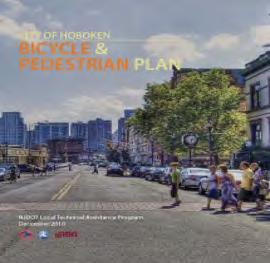
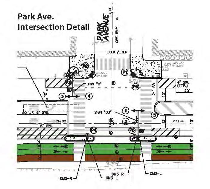
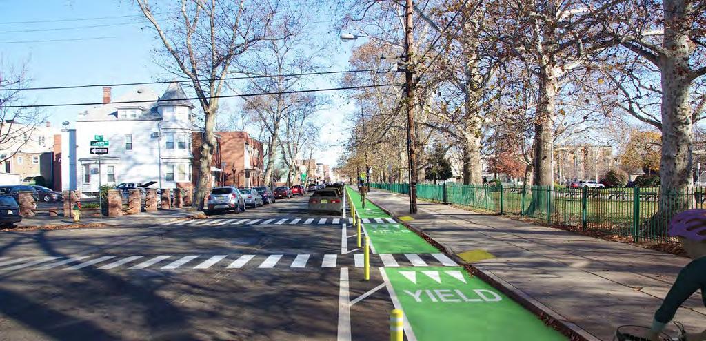
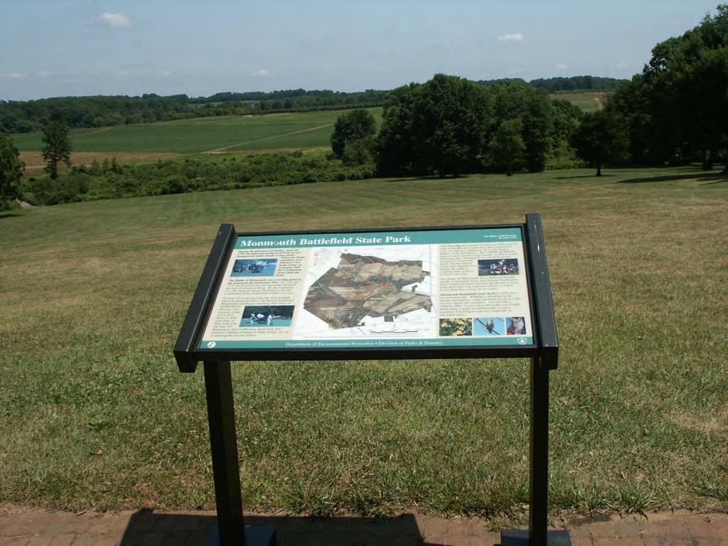
13 LTA SUCCESS STORIES CITY OF HOBOKEN BICYCLE & PEDESTRIAN MASTER PLAN 13


14 LTA SUCCESS STORIES OCEAN CITY RAIL TRAIL & BICYCLE BOULEVARD PROJECT 14

15 LTA SUCCESS STORIES BIKEIRONBOUND Before Proposed Implemented 15

16 16 How do we get more people comfortable walking and biking?
17 Trails & Greenways 17 Mike Dannemiller Principal Engineer NV5, Inc. (formerly called The RBA Group)

18 STORY MAP

19 19 Overview Map

20 20 OVERALL ALIGNMENT

21 21 NORTHERN SECTION (Columbia to Ground Zero)


22 Waterloo Village 22 Waterloo is a restored living history village on the banks of the Musconetcong River. Tour Victorian homes, a blacksmith shop, grist and saw mill, the recreated Lenape Indian Village and much more. Enjoy music and ethnic festivals, historic programs, antiques and craft shows. Photo Credits:


23 23 Morris Canal Greenway at Waterloo Village

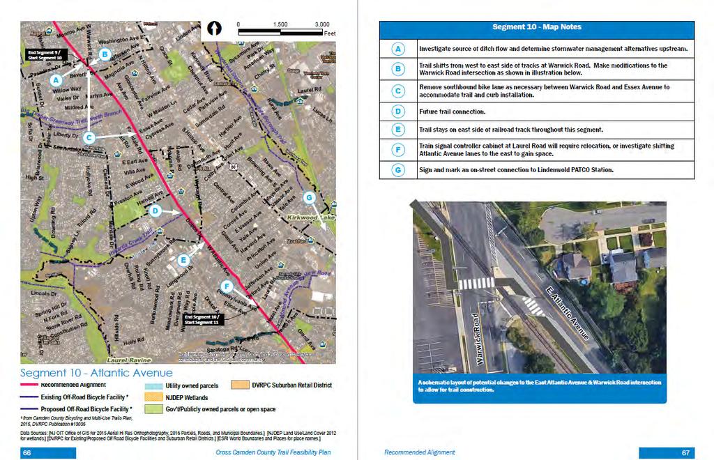
24 24 SOUTHERN SECTION (Ground Zero to Trenton)


25 Empty Sky 9/11 Memorial 25 Located in Liberty State Park in Jersey City, "Empty Sky" is the official State of New Jersey's Memorial that honors the memory of the 749 people that lived in or had ties to New Jersey that lost their lives at the World Trade Center on September 11, The memorial, designed by Jessica Jamroz and Frederic Schwartz, was dedicated on September 11, 2011, the 10-year anniversary. The brushed stainless steel twin walls are 210 feet long, the width of each side of the World Trade Center Towers. They rise 30 feet, standing parallel to each other with a 12-foot wide paved path of bluestone between them. Like the World Trade Center, the stainless steel reflects the constantly changing light of day. Photo Credits: The RBA Group


26 Somerset County 9/11 Memorial 26 The Somerset County 9/11 Memorial is located on the Courthouse Green and has a clock tower with Time to Remember inscribed on it. Names of the Somerset Country residents who died is inscribed on a plaque mounted on a piece of steel recovered from the World Trade Center. The steel beam will be mounted within the base of the clock tower. Photo Credits:
27 27
28 28

29 29 The Circuit NJ Side

30 30 Circuit in Camden County


31 31 Cross Camden County Trail


32 Why was this route selected? While Camden County and its partners are committed to building out the entire proposed trail network someday, this trail is being routed to minimize design and construction constraints and build early momentum for a county-wide network. Create High Credit: jessicarlin.wordpress.com Demand Economic Development Credit: haddonhts.com Open Space Right-of-Way Conrail Line Bridges Existing Trails Floodplains 4

33 33 Leave the car behind

34 34 Find hidden treasures


35 Finalizing the Route

36 MORRIS CANAL GREENWAY CORRIDOR STUDY SUMMARY

37 Can we create a greenway along the historic Morris Canal corridor? Yes we can June 29,

38 Vision TO PRESERVE AND ENHANCE the historic Morris Canal route, TO PRESERVE THE CANAL s scenic, recreational, and historic resources, TO TELL THE STORY OF LIFE along the canal, TO HIGHLIGHT ITS DISTINCTIVE mountain climbing characteristics and inclined planes, TO PROVIDE CONVENIENT urban, suburban, and rural access to a trail. source: Morris Canal Working Group June 29,

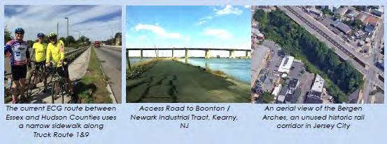
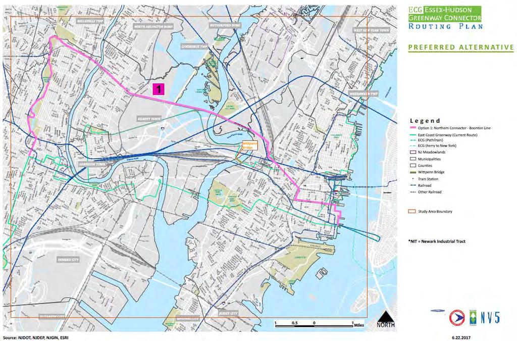
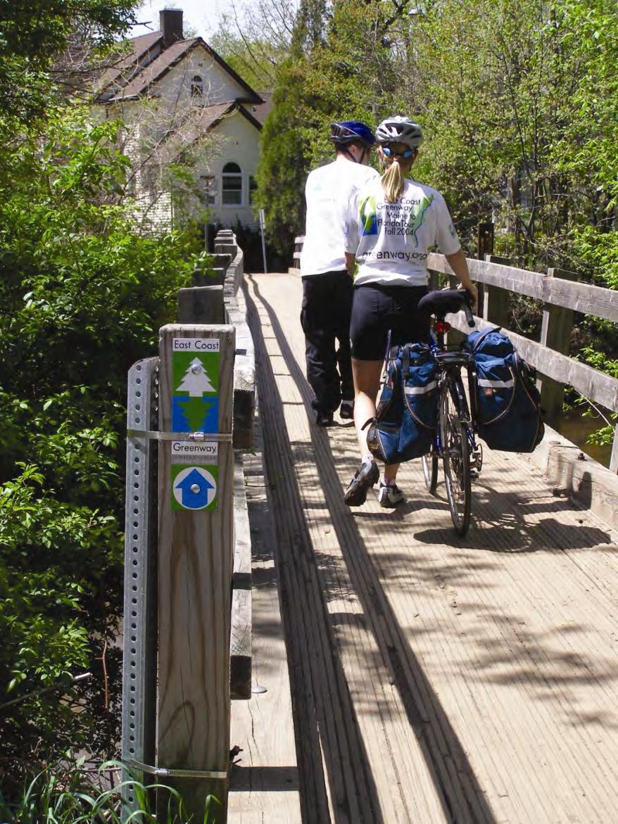
39 Destinations June 29,

40 Regional Trails porating NJTPA s review d to replace the version June 29,
 June 29,")
41 Preferred Greenway Alignment Eastern Section (6 of 6) June 29,


42 Phased Alternatives The Greenway will improve over time June 29,

43 Next Steps Getting the greenway completed June 29,


44 See you on The Greenway June 29,
45 Trails & Greenways Cyndi Steiner Executive Director New Jersey Bike & Walk Coalition 45

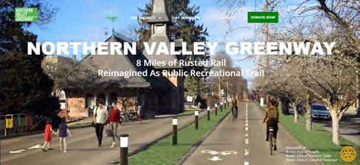
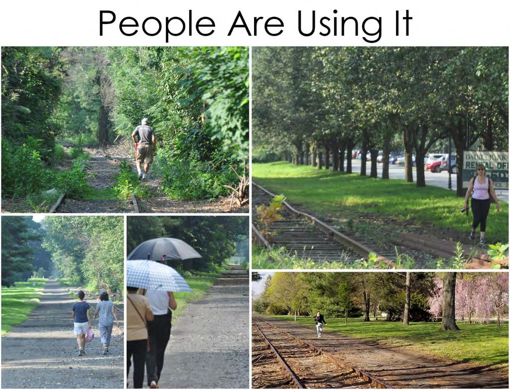
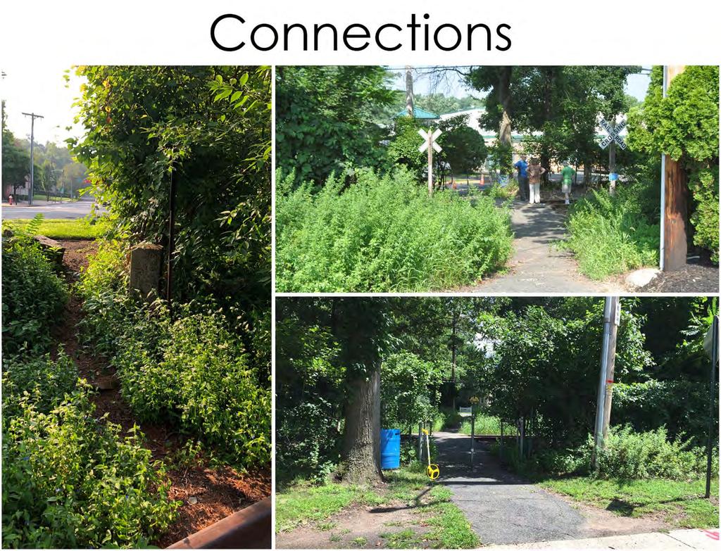
46 Discover the East Coast Greenway Discover the ECG/Essex-Hudson Greenway Connector Routing Plan June 21, 2017 East Coast Greenway REI Soho, NYC, June 6, 2017 East Coast Greenway Alliance Connecting people to places, Maine to Florida greenway.org


47 East Coast Greenway by the numbers: East Coast Greenway Alliance Connecting people to places, Maine to Florida greenway.org
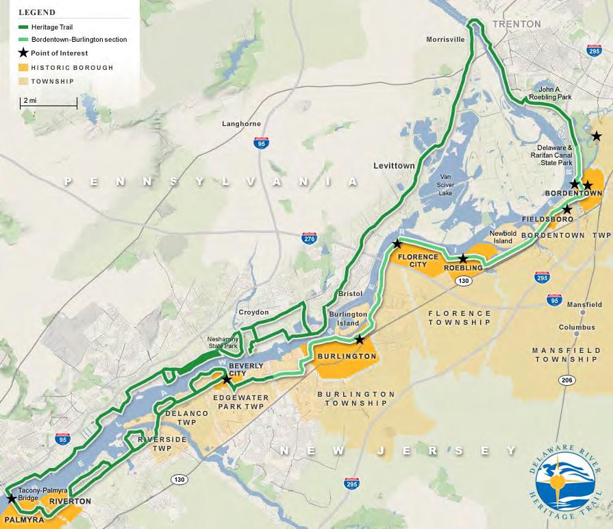
48 ECG IN NEW JERSEY 93 miles between PA & NY Connects Trenton, Princeton, New Brunswick, Newark, and Jersey City plus rural and suburban communities. Over 50% off road one of the most built-out states in the system. 35-mile D&R Canal State Park from Trenton to New Brunswick. The Delaware River Heritage Trail is an alternate route from Trenton to Camden. Major gap Newark to Jersey City East Coast Greenway Alliance Connecting people to places, Maine to Florida greenway.org

49 ECG IN NEW JERSEY East Coast Greenway Alliance Connecting people to places, Maine to Florida greenway.org

50 50
51 51

52 52 Essex Hudson snap shots


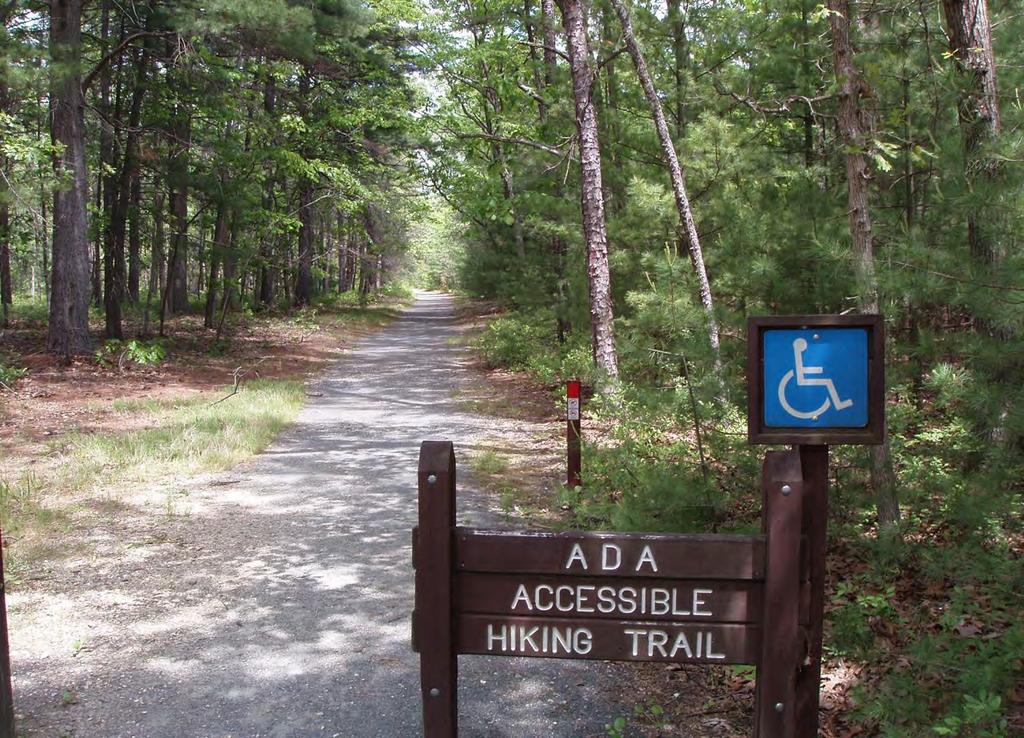
53
54 Northern Valley Greenway Overview ± 8 miles long Right-of-way is typically 60 wide Traverses 6 boroughs Opportunity to connect to: Proposed Northern Branch Corridor Light Rail (NJ TRANSIT) Joseph B. Clarke Trail in Orangetown, NY Range of contexts, conditions, at-grade crossings, etc.
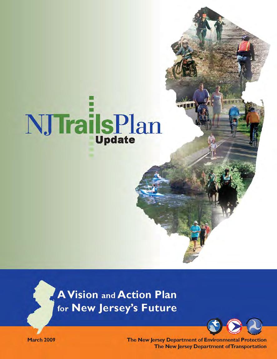
55 Context & Considerations


56 Context & Considerations Roadway Crossings Blanch Ave., Norwood Madison Ave., Union Ave., Cresskill Tenafly Station Area Range in Complexity
57 Context & Considerations
58 Trails & Greenways 58 Brandee Chapman NJDEP State Trails Coordinator, Recreational Trails Program
59 New Jersey Trails Program 59 New Jersey Trails Program Origins of the State Trails Program New Jersey Trails Council New Jersey Trails Plan Funding for Trails DOT Transportation Alternatives Program DEP Recreational Trails Program Grassroots Efforts How can Environmental Commissions and local citizens get involved in these efforts?
60 New Jersey Trails Program The New Jersey Trails System Act (1974) - to institute a Statewide system of recreation and scenic trails. New Jersey Trails Council (1975) - to study and devise a plan for a coordinated system of trails ( New Jersey Trails Plan ) - to serve as an advisory board to DEP and DOT to implement the Plan.
61 New Jersey Trails Program New Jersey Trails Council Represents a variety of trail uses, including: Hiking trails Bicycling trails Equestrian trails Motorized trails Water trails Urban trails ADA accessible trails
62 62
63 New Jersey Trails Program New Jersey Trails Plan First plan was developed in 1982 Updated in 1996 and again in 2009 Outlines goals and strategic actions to help guide and coordinate the efforts of all those who plan, build, operate and maintain New Jersey s trails. Reaffirms importance of providing trails for all and emphasize the value of trails in supporting a wide range of benefits.

 Requires a competitive project selection")
64 Transportation Alternatives Program (TAP) What is TAP? Established in 2012 under MAP-21 and continues under FAST $15 million programmed in FY % of NJ s TAP funds are sub-allocated based on population through NJ s Metropolitan Planning Organizations (MPOs) Requires a competitive project selection process Hudson River Waterfront Walkway


65 Transportation Alternatives Program (TAP) What are TAP projects? Community-based Non-traditional Transportation projects (land & water) Expand travel choice Strengthen local economy Improve quality of life Protect the environment $150,000 1 million per project

66 Transportation Alternatives Program (TAP) Who is eligible to apply? Local Governments School districts or schools Non profits are now eligible under FAST Act Regional Transportation Authorities Transit Agencies Natural resource or public land agencies Tribal Governments Any other local or regional governmental entity with responsibility for oversight of transportation (other than an MPO or State Agency)


67 Transportation Alternatives Program (TAP) 7 Eligible Categories : 1. Provision of facilities for bikes and pedestrians 2. Landscaping and other scenic beautification 3. Historic preservation 4. Rehabilitation of historic transportation buildings, structures and facilities (including historic RR facilities and canals)


68 Transportation Alternatives Program (TAP) 7 Eligible Categories (continued): 5. Preservation of abandoned RR corridors (including conversion to pedestrian and bike trails transportation element) 6. Environmental mitigation to address water pollution due to highway runoff 7. Mitigation to reduce vehicle caused wildlife mortality while maintaining habitat connectivity

 transportation Benefits quality of life, the community or")
69 Transportation Alternatives Program (TAP) Selection Criteria: Local maintenance commitment Municipal/County Resolutions of Support Economic and/or tourism benefits Promotes the use of non-motorized (active) transportation Benefits quality of life, the community or the environment
: Part of a larger transportation, land use or")

70 Transportation Alternatives Program (TAP) Selection Criteria (continued): Part of a larger transportation, land use or economic development plan. Enhances, preserves or protects historical resources. Urgency. Is it possible the resource could be lost?
71 Recreational Trails Program (RTP) What is the Recreational Trails Program? The Recreational Trails Program (RTP) is a grant program that returns federal gas tax proceeds to states to develop and maintain recreational trails and trail-related facilities for both non-motorized and motorized recreational trail uses.
72 72
73 Recreational Trails Program (RTP) Who can Sponsor a Project?


74 Recreational Trails Program (RTP)
75 Recreational Trails Program (RTP) What Can the Funding be Used for?
76
77
78

79 Smithville County Park, Burlington County
80
81
82
83
84
85
86
87
88
89

90 Estell Manor County Park, Atlantic County
91 Recreational Trails Program (RTP) Trail length Trail linkage Project partnerships Multi-use trails Barrier-free access Other criteria Project Evaluating Factors
92 Recreational Trails Program (RTP) What Has Been Accomplished? Since the inception of the program in 1993 New Jersey has provided over $18 million dollars in financial assistance to more than 900 trail construction and improvement projects.
93 93
94 Getting Involved 94 - Make sure trails and greenways are included in your Township s master plan. - Improve your Township s development regulations to protect areas designated for future greenways and trails. - Help your Township qualify for Green Acres funding for trail and greenway projects by establishing an open space tax.
95 Grassroots Efforts 95 - Lead trail/greenway walks - Talk to officials at the local, county and state levels including township committees/councils and your County freeholders - Attend town meetings and get information out there about any local greenway development or trail building initiatives - Write letters to the editor at your local paper
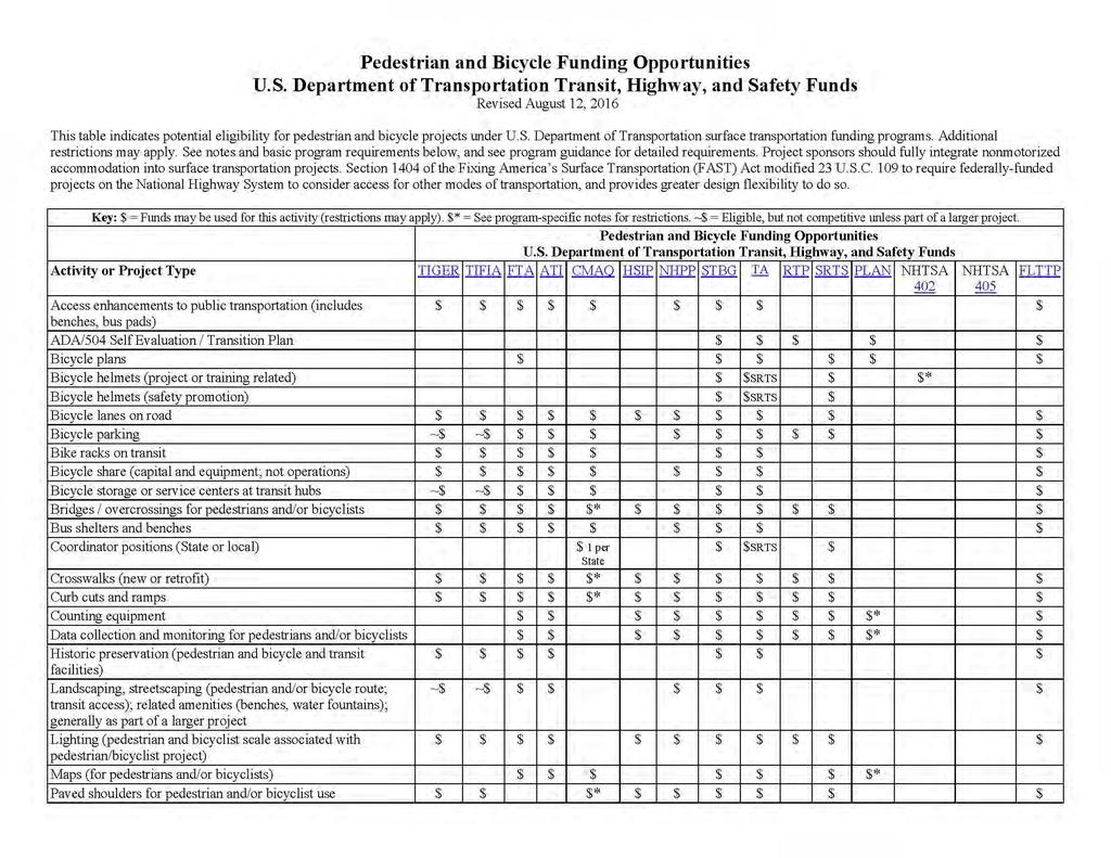
96 Handouts Project Development Guidance Trail Building Resource List USDOT Pedestrian and Bicycle Funding Opportunities Chart (by project type) How to Get Involved!
97 New Jersey Trails Program New Jersey Trails Plan New Jersey Trails Council Members Sign up to the NJ Trails Program list to be notified about trail-related webinars, grant opportunities, etc. by ing
98 Trails & Greenways 98 Elise Bremer-Nei NJDOT Mike Dannemiller NV5 Cyndi Steiner NJBWC Brandee Chapman NJDEP
Office of Greenways & Trails Providing Statewide Leadership and Coordination. Southeast Greenways and Trails Summit October 1-3, 2017
 Office of Greenways & Trails Providing Statewide Leadership and Coordination Southeast Greenways and Trails Summit October 1-3, 2017 1 Office of Greenways and Trails The Office of Greenways and Trails
Pattern 7: Natural Environment
 Pattern 7: Natural Environment The landscape features of the city: the vegetation or the water, were often noted with care and with pleasure [People] were sharply aware of the few green oases in their
Transportation Enhancements TE-2012-US Fish and Wildlife Service Quality of Life. Type of Improvement
 Transportation Enhancements 2012 Quality_of_Life Type of Improvement Infrastructure Bikeway Pedestrian Safety Quality of Life Purpose Primary project purpose is for constructing new bikeways (e.g. bike
Welcome to the 2018 FRPA Conference!
 Welcome to the 2018 FRPA Conference! Learning Objectives Describe the benefits of regional multipurpose trails Recall Florida s Priority Regional Trails and recognize their general locations across the
NEW JERSEY DEPARTMENT OF TRANSPORTATION TRANSPORTATION ENHANCEMENT PROGRAM
 NEW JERSEY DEPARTMENT OF TRANSPORTATION TRANSPORTATION ENHANCEMENT PROGRAM Chris Christi Governor James Simpson Commissioner NEW JERSEY DEPARTMENT OF TRANSPORTATION DIVISION OF LOCAL AID AND ECONOMIC DEVELOPMENT
Linking Land Use and Transportation
 Linking Land Use and Transportation NJ s Experience January 18, 2006 NYMTC - PFAC Mark Stout Planning & Development New Jersey Department of Transportation Where We Are Los Angeles, CA San Francisco, CA
CHAPTER 1 Introduction
 CHAPTER 1 Introduction From sea to summit, Lane County covers almost 4,800 square miles of diverse Oregon landscape. Stretching from the Pacific Ocean through the Coastal Range, the Willamette Valley to
IMPLEMENTING SOMERSET COUNTY S INVESTMENT FRAMEWORK
 IMPLEMENTING SOMERSET COUNTY S INVESTMENT FRAMEWORK SMART CONSERVATION THROUGH SMART GROWTH NJ LAND CONSERVATION RALLY March 22, 2014 Laurette Kratina, PP, AICP, Supervising Planner Somerset County Planning
Great Rivers Greenway CLEAN GREEN CONNEC TED T RAILS
 Great Rivers CLEAN GREEN CONNEC TED T RAILS Great Rivers (GRG) was established in 2000 to create a clean, green, connected St. Louis region. Today, many new and exciting projects demonstrate the social,
This page intentionally blank.
 This page intentionally blank. Parks, Recreation, and Open Space Chapter Relationship to Vision Vision Parks, Recreation and Open Space Chapter Concepts County Government. County government that is accountable
Regional Context Statement
 Regional Context Statement REGIONAL CONTEXT STATEMENT 3. REGIONAL CONTEXT STATEMENT In 1995, the Provincial Government passed into law the Growth Strategies Act. The purpose of this provincial initiative
Potential Green Infrastructure Strategies May 6, 2015 Workshop
 Potential Green Infrastructure Strategies May 6, 2015 Workshop Background The City of Cortland is developing the Tioughnioga Urban Headwaters Green Infrastructure Action Plan with funding from the National
The Palisades Interstate Parkway and Henry Hudson Drive designated a New Jersey State Scenic Byway, 2005
 The Palisades Interstate Parkway and Henry Hudson Drive designated a New Jersey State Scenic Byway, 2005 What are scenic byways? How Did Scenic Byways Come About? National Scenic Byways Program Administered
Yadkin River Greenway Feasibility Study Fact Sheet Village of Clemmons, Town of Lewisville, Town of Bermuda Run
 Fact Sheet Village of Clemmons, Town of Lewisville, Town of Bermuda Run Project Background The Yadkin River Greenway Feasibility Study is a joint project with the Village of Clemmons, the Town of Bermuda
Transportation Planning to Protect Lancaster County s Heritage Resources
 Transportation Planning to Protect Lancaster County s Heritage Resources Presented by Harriet Parcells, AICP Senior Transportation Planner Lancaster County Planning Commission July 10, 2015 Topics to be
FY STATEWIDE TRANSPORTATION IMPROVEMENT PROGRAM New Jersey Department of Transportation Projects
 69th Street Bridge 02311 02311 A grade separation at 69th Street would eliminate the current at-grade crossing which causes frequent automobile delays due to long freight trains moving through this area.
Florida Greenways and Trails System (FGTS) Plan Goals, Strategies and Objectives
 Plan Goals, Strategies and Objectives") Identification and Prioritization of the FGTS The Florida Greenways and Trails System (FGTS) is made up of existing, planned and conceptual trails and ecological greenways that form a connected, integrated
Identification and Prioritization of the FGTS The Florida Greenways and Trails System (FGTS) is made up of existing, planned and conceptual trails and ecological greenways that form a connected, integrated
Planning Roles. Responsibilities
 Lesson 3 Planning Roles & Responsibilities 3-1 Learning Outcomes Identify and describe transportation and land use planning processes Describe the relationships among these processes and how they can be
Working together to leverage limited Funds
 Working together to leverage limited Funds ARAPAHOE COUNTY OPEN SPACES 10 County Budget Conference September 20, 2013 The Power of Partnerships 2013 SORP Conference 5/23/2014 Why Talk About Open Space?
To qualify for federal Transportation Enhancement (TE) funds a project must meet two basic federal requirements:
 funds a project must meet two basic federal requirements:") Eligibility Requirements To qualify for federal Transportation Enhancement (TE) funds a project must meet two basic federal requirements: 1) Relate to surface transportation and 2) Be one of the 12 designated
Eligibility Requirements To qualify for federal Transportation Enhancement (TE) funds a project must meet two basic federal requirements: 1) Relate to surface transportation and 2) Be one of the 12 designated
HILLSBOROUGH COUNTY Greenways and Trails Plan Update. Executive Summary. Date
 HILLSBOROUGH COUNTY Greenways and Trails Plan Update Executive Summary Date PURPOSE AND PROJECT OVERVIEW The Hillsborough County Greenways Master Plan (1995) and the City of Tampa s Greenways and Trails
NJ s Land Use and Transit Policies
 1 NJ s Land Use and Transit Policies NJ TRANSIT created in 1979 to reverse decline of public transportation State Development & Redevelopment Plan adopted (1986) encourages growth in areas where population,
Philadelphia Trail Master Plan
 Philadelphia Trail Master Plan Jeannette Brugger, AICP Philadelphia City Planning Commission April 30, 2013 Delaware Valley Regional Planning Commission 190 N. Independence Mall West, 8 th Floor Philadelphia2035
Overview of Southwestern Pennsylvania Commission s (SPC) 2040 Long Range Transportation Plan (LRTP)
 2040 Long Range Transportation Plan (LRTP)") Overview of Southwestern Pennsylvania Commission s (SPC) 2040 Long Range Transportation Plan (LRTP) Presented to Pennsylvania Agency Coordination Meeting May 27, 2015 Doug Smith & Ryan Gordon 1 Southwestern
Overview of Southwestern Pennsylvania Commission s (SPC) 2040 Long Range Transportation Plan (LRTP) Presented to Pennsylvania Agency Coordination Meeting May 27, 2015 Doug Smith & Ryan Gordon 1 Southwestern
Attachment 1 PFAC Resolution #394 of December 4, 2014
 Attachment 1 PFAC Resolution #394 of December 4, 2014 Sections of Plan 2040 updated to reflect current status of the Nassau Hub study (revisions attached): Chapter 1, page 1 8 Chapter 1, page 1 19 Chapter
Northeast Everglades Natural Area
 Northern Palm Beach County Natural Areas Master Plan Northeast Everglades Natural Area August 3, 2006 GLATTING JACKSON KERCHER ANGLIN LOPEZ RINEHART, INC. Community Planning 1 Public Land Partners Agenda
COASTAL CONSERVANCY. Staff Recommendation June 5, 2008 SAN DIEGO RIVER TRIBUTARY CANYONS PROJECT. File No Project Manager: Megan Johnson
 COASTAL CONSERVANCY Staff Recommendation June 5, 2008 SAN DIEGO RIVER TRIBUTARY CANYONS PROJECT File No. 08-059 Project Manager: Megan Johnson RECOMMENDED ACTION: Authorization to disburse an amount not
495/MetroWest Development Compact Plan Citizen Planner Training Collaborative Conference. March 17, 2012
 495/MetroWest Development Compact Plan Citizen Planner Training Collaborative Conference March 17, 2012 Project Process Local and Regional Priority Areas Growth Scenarios Transportation Investment Categories
RECREATION, OPEN SPACE AND GREENWAYS ELEMENT GOALS, OBJECTIVES, AND POLICIES
 RECREATION, OPEN SPACE AND GREENWAYS ELEMENT GOALS, OBJECTIVES, AND POLICIES GOAL R-1: DEVELOP A RECREATION, OPEN SPACE AND GREENWAYS SYSTEM AS AN INTEGRAL COMPONENT OF AN OVERALL, COUNTY-WIDE ECONOMIC
ROUND ONE PROJECTS. Capital Grants 18 DELAWARE VALLEY REGIONAL PLANNING COMMISSION
 ROUND ONE PROJECTS DVRPC awarded the first round Take Me to the River grants in 2008 (see Figure 5 for project locations). The 13 projects selected were chosen based on their ability to reconnect citizens
3. VISION AND GOALS. Vision Statement. Goals, Objectives and Policies
 Vision Statement Queen Creek s interconnected network of parks, trails, open spaces and recreation opportunities provide safe and diverse activities and programs that sustain its unique, small town, equestrian
TOWN OF BETHLEHEM MEETING SUMMARY LOCAL WATERFRONT REVITALIZATION PROGRAM UPDATE
 TOWN OF BETHLEHEM LOCAL WATERFRONT REVITALIZATION PROGRAM UPDATE MEETING SUMMARY Purpose: LWRP Update Public Workshop #3 Date and Time: October 24, 2017, 6:00 pm - 8:00 pm Location: Town Hall, 445 Delaware
PREVIOUS PUBLIC PARTICIPATION BRIEF October 2014
 Comprehensive Planning During the development of the county comprehensive plan, Cultivating Community: A Plan for Union County s Future from 2007 through 2009, and three concurrent multi municipal plans
Enhance the High Line Canal Projects
 Enhance the High Line Canal Projects Joint Project Proposal for Arapahoe County Open Spaces Funding Partner Sponsors: South Suburban Park and Recreation District City of Centennial City of Littleton October
6. Consistency with Local Plans
 6. Consistency with Local Plans 6.1. Chapter Overview 6.1.1. Introduction This section presents the goals, objectives and policies of municipal, county and state planning entities, as well as known development/redevelopment
Trail Feasibility and Planning Project for Northern Dutchess County, New York
 for Northern Dutchess County, New York Funded in Part by Grants from the Hudson River Valley Greenway, Land Trust Alliance Conservation Partnership Program and the Thomas Thompson Trust 1 STEERING COMMITTEE
Regional and Local Perspectives
 Regional and Local Perspectives Transportation Engineering and Safety Conference Tom Zilla Principal Transportation Planner Centre County Metropolitan Planning Organization We are here! We are here! 1
Northern Branch Corridor SDEIS March 2017
 Northern Branch Corridor SDEIS March 2017 15. 15.1. Chapter Overview 15.1.1. Introduction This chapter discusses changes to the Preferred Alternative resulting in the potential for project improvements
1.0 Circulation Element
 5/9/18 1.0 Circulation Element 1.1 Introduction As growth and development occur in Apache County, enhancements to its circulation system will be necessary. With time, more roads will be paved and air and
Statewide Greenways Vision
 Greenways Vision The formation of a greenways vision is based on a thorough analysis of the current state of recreation and open space in a region and the existing pressures that threaten it. Lehigh and
Parks Master Plan Implementation: Phase I Waterfront Use and Design REPORT #: September 7, 2016 File #
 0 'O DI Lan-171-14 1 - THE CORPORATION OF THE TOWN OF COBOURG..,. STAFF REPORT TO: FROM: Mayor and Members of Council Dean A. Hustwick, Director of Recreation and Culture DATE OF MEETING: Committee of
JERSEY CITY. CONTACT HEADQUARTERS Parsippany New Jersey 300 Kimball Drive 4th Floor Parsippany NJ
 JERSEY CITY CONTACT HEADQUARTERS Parsippany New Jersey 300 Kimball Drive 4th Floor Parsippany NJ 07054 973.560.4900 973.560.4901 CONTACT Mark Devaney LEED AP Principal HUDSON EXCHANGE WEST Forest City
Northern Branch Corridor SDEIS March Table of Contents
 Table of Contents Executive Summary... ES-1 ES.1 Introduction... ES-1 ES.2 Project Background... ES-1 ES.3 Purpose and Need... ES-5 ES.4 Alternatives... ES-6 ES.5 Operating Plan... ES-11 ES.6 Cost Analysis...
Turkey Creek Streamway Corridor
 Turkey Creek Streamway Corridor Turkey Creek Corridor Overview History Watershed Corridor Inventory Coalition Corridor Plan Stages of Development Benefits Funding Turkey Creek History Kansas and Missouri
Secrest Short Cut and Monroe Expressway Small Area Plan AUGUST 29, 2018
 Secrest Short Cut and Monroe Expressway Small Area Plan AUGUST 29, 2018 Background and Process Monroe Expressway will be open by the end of 2018 Union County and Indian Trail identified a need to revisit
CHAPTER 8 ISSUES, CONCERNS, CONSTRAINTS AND OPPORTUNITIES
 CHAPTER 8 ISSUES, CONCERNS, CONSTRAINTS AND OPPORTUNITIES Introduction This River Conservation Plan was developed during a time of tremendous activity and effort in planning the transformation of the Delaware
Greenway. Two Rivers. Design Guidelines and Signage Plan. Broome County. Tioga County. Prepared For: The Binghamton Metropolitan Transportation Study
 Broome County Two Rivers Greenway Design Guidelines and Signage Plan Tioga County Prepared For: The Binghamton Metropolitan Transportation Study Prepared By: 2012 This project is included in the 2011-2012
Mississippi Skyway Preliminary Engineering Report
 EXECUTIVE SUMMARY Mississippi Skyway Preliminary Engineering Report CITY OF RAMSEY, MINNESOTA DECEMBER 2014 City of RAMSEY EXECUTIVE SUMMARY Project Need and Intent The Mississippi Skyway pedestrian bridge
A larger version of this map is located on the last page of this PDF.
 MAP Committee Input McLoughlin Area Draft Vision Map A larger version of this map is located on the last page of this PDF. 1. The map above is intended to portray a vision for the McLoughlin area. It highlights
Improve Neighborhood Design and Reduce Non Point Source Water Pollution
 HOW TO Planning Guide Improve Neighborhood Design and Reduce Non Point Source Water Pollution This document was funded by a grant from the New Hampshire Coastal Program with funding from the National Oceanic
Complete Streets in Lancaster County
 Complete Streets in Lancaster County PRESENTED BY: Robert Bini, AICP Director for Transportation Planning November 14, 2017 Lancaster County is a growing county of over 534,000 and the bottom line is...
Summary of Action Strategies
 Strategic Action Plan 6 Summary of Action Strategies Action Strategy Categories: 1. Organization and Management 2. Implementation 3. Marketing and Promotion This chapter summarizes all of the action strategies
Meeting Purpose: Date and Time: Location: Attendance: Handouts:
 Meeting Purpose: Date and Time: Location: Attendance: Handouts: PA Turnpike / I-95 Interchange Project Design Advisory Committee (DAC)/Public Officials Meeting #8 April 12, 2012 at 1:30 p.m. Project Office,
Chapter 5: Recreation
 Chapter 5: Recreation Introduction and Setting Recreational opportunities within Nevada County are varied, ranging from public parks with intensively used active recreational facilities, to vast tracts
Executive Summary. Parks and Recreation Plan. Executive Summary
 Parks and Recreation Plan Executive Summary The Whitemarsh Township Parks and Recreation Plan sets forth a vision for how Whitemarsh Township can provide a premiere parks and recreation system reflective
County Transportation Plan Workshop
 Poughkeepsie Dutchess County Transportation Council County Transportation Plan Workshop Harlem Valley Area July 20, 2011 1 Moving Dutchess Harlem Valley Area 2 1. Introductions 2. PDCTC Overview (15 min.)
Route 1 Corridor Study
 Route 1 Corridor Study Westbrook, Connecticut A Vision for the Connecticut Shoreline Public Informational Meeting July 28, 2015 Lower Connecticut River Valley Council of Governments Fitzgerald & Halliday,
Preliminary Plan Framework: Vision and Goals
 Preliminary Plan Framework: Vision and Goals Draft: May 2015 Introduction Since the Town of Milliken s comprehensive plan was last updated in 2010, the community was heavily impacted by the 2013 flood,
PARKS AND RECREATION
 PARKS AND RECREATION WHAT YOU WILL FIND IN THIS CHAPTER: Background information on the development of the Park, Recreation, and System Plan (PRSP). General overview of Ellensburg s parks and recreation
GREEN STREETS & INFRASTRUCTURE: A COUNTY APPROACH. Mimicking Nature to Manage Stormwater in Developed Areas
 GREEN STREETS & INFRASTRUCTURE: A COUNTY APPROACH Mimicking Nature to Manage Stormwater in Developed Areas Jennifer Gonzalez, Environmental Planner Passaic County Depar tment of Planning & Economic Development
TRANSPORTATION AND LAND USE
 CHAPTER 10 TRANSPORTATION AND LAND USE Transportation and land use are intimately linked. The expansion of a highway typically spurs housing, employment growth and land development in the communities that
BLOOMSBURY BOROUGH. Regional Master Plan Overlay Zone Designation. 1 inch = 0.28 miles. Zone. Sub-Zone FRANKLIN TOWNSHIP GREENWICH TOWNSHIP
 Regional Master Plan Overlay Zone Designation Zone Protection Lakes Greater Than 10 acres Conservation Existing Community Sub-Zone Existing Community Environmentally Constrained Conservation Environmentally
I. STAFF POLICY RECOMMENDATIONS. The following RMP policy strategies are proposed by staff in support of a Scenic Resource Protection Program:
 Policy Consideration: Scenic Resource Protection Program Status: For Consideration by the Highlands Council at September 14, 2006 Work session Date: September 12, 2006 I. STAFF POLICY RECOMMENDATIONS The
Somers Point Master Plan
 Somers Point Master Plan Progress Report and Public Meeting August 20, 2014 Master Plan Reexamination Municipal Land Use Law require that all municipalities reexamine their master plan every ten years.
Making Transit Oriented Development Work For Boonton, NJ
 Making Transit Oriented Development Work For Boonton, NJ Bloustein School of Planning and Public Policy Studio Dan Burton Loannie Dao Webster Slater Brandon Williams Ian Watson Maria Laham Nicola Mammes
Pinellas County Greenways
 Pinellas County Greenways USING GREENWAYS TO LINK OPEN SPACES The Florida Greenways Commission has defined a greenway as...a corridor of protected open space that is managed for conservation and/or recreation.
SALISBURY TOMORROW Our Vision
 SALISBURY TOMORROW Our Vision Salisbury is committed to supporting a high quality of life and sense of community for all residents. These commitments need to be reflected in our community programs, services
Transit-Oriented Development
 Transit-Oriented Development Path to Sustainability West Windsor February 22, 2007 George S. Hawkins Context for Presentation NJ Future is a non-partisan, 501(c)3 non-profit organization. Offer perspective,
Preface. Erie. Scranton. Allentown. Pittsburgh. Harrisburg. Philadelphia
 The Southern Alleghenies Region The Southern Alleghenies Region spans the Laurel Highlands and Allegheny Front in the west across the Appalachians to the east. It is comprised of Blair, Bedford, Cambria,
10.0 Open Space and Public Realm
 10.0 Open Space and Public Realm 10.0 Open Space and Public Realm The Public Open Space System is comprised of: outdoor spaces available for public use that are either publicly owned (e.g., parks and
Pittsfield Action Plan (West Branch of the Housatonic River)
") An initiative of the Massachusetts Executive Office of Energy and Environmental Affairs in partnership with the City of Pittsfield Pittsfield Action Plan (West Branch of the Housatonic River) The spring
An initiative of the Massachusetts Executive Office of Energy and Environmental Affairs in partnership with the City of Pittsfield Pittsfield Action Plan (West Branch of the Housatonic River) The spring
Please read the entire document
 projects impacting the waterfront revitalization area. The waterfront revitalization area of the town will have to subareas to the west and east of the village. Page 6 of 6 Wayfinding master plan create
Phase I Redevelopment Plan. First Community Meeting
 Hoboken Terminal and Yard Phase I Redevelopment Plan First Community Meeting May 31, 2011 One Hudson Place Phase I Redevelopment Plan Redevelopment Plan First Community Meeting Agenda 1. Redevelopment
Animating the Rideau Canal December 2013
 Executive Summary Animating the Rideau Canal December 2013 Why study the Rideau Canal? The Rideau Canal has been an important part of Ottawa throughout its history, and has shaped and been shaped by the
The following principles guide the development of goals and strategies to protect and promote these amenities:
 OPEN SPACE/PARKS/TRAILS/RECREATION GOALS/STRATEGIES Cherry Hills Village is a living environment that offers low density development, open areas, public scenic vistas, public trails and public parks. This
S.R.7/U.S.441 COLLABORATIVE THE COLLEGE OF CORRIDOR KNOWLEDGE
 S.R.7/U.S.441 COLLABORATIVE THE COLLEGE OF CORRIDOR KNOWLEDGE S.R.7 Corridor : A Sense of Place? ANYWHERE USA SR 7: Civilizing the Corridor Bad rules = Bad development! The SR 7 Collaborative A model for
NASSAU COUNTY TOWN HALL NEW YORK & CONNECTICUT SUSTAINABLE COMMUNITIES. A Unique Bi-State Partnership to Improve Jobs, Housing and Transportation
 NASSAU COUNTY TOWN HALL NEW YORK & CONNECTICUT SUSTAINABLE COMMUNITIES A Unique Bi-State Partnership to Improve Jobs, Housing and Transportation Police Headquarters Auditorium Mineola, NY December 9 th,
Mendota-Lebanon Hills Greenway Master Plan Executive Summary. August draft for more information visit
 Mendota-Lebanon Hills Greenway Master Plan Executive Summary August 2013 draft for more information visit www.hkgi.com/projects/dakota INTRODUCTION The Mendota-Lebanon Hills Greenway Master Plan portrays
Town of Peru Comprehensive Plan Executive Summary
 Town of Peru Comprehensive Plan Executive Communities that plan grow by choice, not by chance. A plan makes growth thoughtful, understandable, and predictable. A plan shows that a community is managing
Manchester. Vision for Manchester
 Manchester Vision for Manchester The Manchester Community Plan is a statement of the community values and aspirations for the future. This is an effort to recognize what originally attracted visitors in
Green Infrastructure The Indianapolis Greenways Connection
 Green Infrastructure The Indianapolis Greenways Connection Fewer things in the transportation industry today make better since than combining the needs for pedestrian and bike trails with the need to locate,
Historic Preservation:
 Historic Preservation: A Historic Preservation Perspective Department of Environmental Protection Natural & Historic Resources Historic Preservation Office This article originally appeared in the Office
Executive Summary Purpose of the Plan Defining Open Space and Greenways
 Executive Summary Bucks County possesses a vast array of open space resources including natural areas, parks, farmland and historic and cultural resources that contribute to a high quality of life valued
Tricia Millington, RLA New York State Department of Transportation
 Tricia Millington, RLA New York State Department of Transportation pmillington@dot.state.ny.us Context Sensitive Principles: Context Sensitive Solutions is a philosophy wherein safe transportation solutions
Arlington, Virginia is a worldclass
 EXECUTIVE S U M M A RY Arlington maintains a rich variety of stable neighborhoods, quality schools and enlightened land use policies, and received the Environmental Protection Agency s highest award for
The transportation system in a community is an
 7 TRANSPORTATION The transportation system in a community is an important factor contributing to the quality of life of the residents. Without a sound transportation system to bring both goods and patrons
Neuse River Corridor Plan
 The One NC Naturally Initiative will not be a large scale state buyout of land in North Carolina. Over the next 10 years, the Million Acre Initiative will provide incentives and information for voluntary
{Best Practices. Summary of Tools, Strategies and Best Practices from 11 Michigan Case Study Communities
 Case Studies Michigan Coastal Community Working Waterfronts { Summary of Tools, Strategies and from 11 Michigan Case Study Communities Table of Contents Zoning...2 Community and Stakeholder Collaboration
I-70 Corridor Enhancement Plan
 i - Table of Contents Table of Contents Chapter I Overview Chapter II Bridge and Roadway Improvements Chapter III Landscape Enhancements Chapter IV Riparian Corridors Chapter V Showcase Missouri Plan Chapter
Onondaga County Sustainable Streets Project. Onondaga County Planning Federation June 7, Onondaga County Sustainable Streets Project 1
 Onondaga County Sustainable Streets Project Onondaga County Planning Federation June 7, 2012 Onondaga County Sustainable Streets Project 1 Sustainable Streets 1. Introduction to the SMTC 2. Sustainable
Atlanta BeltLine Corridor Environmental Study. Scoping Meeting August 2008
 Atlanta BeltLine Corridor Environmental Study Scoping Meeting August 2008 What Will We Be Discussing Today? Study Overview - How Did We Get Here? - What Is the Study About? - Who Is Involved? - Where Is
Corridor Vision. 1Pursue Minnehaha-Hiawatha Community Works Project. Mission of Hennepin County Community Works Program
 1Pursue Minnehaha-Hiawatha Community Works Project Minnehaha-Hiawatha Community Works is a project within the Hennepin Community Works (HCW) program. The mission of the HCW program is to enhance how the
Support the implementation of Cape Coral's Comprehensive Plan. Protect and utilize the unique natural resources in the City.
 7.0 OVERVIEW - RECOMMENDATIONS Chapter 7 The preparation of the Cape Coral Parks and Recreation Master Plan spanned a period of approximately 12 months. Plan preparation included the input of a wide range
ADOPTION OF THE REVISED OPEN SPACE AND CONSERVATION ELEMENT OF THE GENERAL PLAN
 TO: FROM: SUBJECT: Honorable Mayor and City Council Planning Department ADOPTION OF THE REVISED OPEN SPACE AND CONSERVATION ELEMENT OF THE GENERAL PLAN RECOMMENDATION: It is recommended that the City Council:
The Illinois Department of Transportation and Lake County Division of Transportation. Route 173, including the Millburn Bypass
 The Illinois Department of Transportation and Lake County Division of Transportation welcome you to this Public Hearing for U.S. Route 45 from Illinois Route 132 to Illinois Route 173, including the Millburn
ULI St. Louis Technical Assistance Panel
 ULI St. Louis Technical Assistance Panel ULI St. Louis Technical Assistance Panel Sponsored by: Citizens for Modern Transit in partnership with METRO ULI St. Louis Mission Statement The mission of the
1.0 INTRODUCTION 1.1 TH 14 WEST STUDY AREA Project Description Functional Classification Purpose of the Project
 1.0 INTRODUCTION 1.1 TH 14 WEST STUDY AREA 1.1.1 Project Description The Trunk Highway (TH) 14 West Corridor is a two-lane roadway approximately 22 miles in length. Located in Nicollet County, the corridor
The Economic Value of Protected Open Space in Southeastern Pennsylvania
 The Economic Value of Protected Open Space in Southeastern Pennsylvania SUMMARY REPORT November 2010 Reprinted August 2017 THEY SAY MONEY DOESN T GROW ON TREES. They re right. But the trees, stream valleys,
EXECUTIVE SUMMARY DRAFT CHAPTER 1 INTRODUCTION EXECUTIVE SUMMARY
 CHAPTER 1 EXECUTIVE SUMMARY INTRODUCTION Through the joint efforts of the City of Tulsa planning staff and the Land Services division of Indian Nations Council of Governments (INCOG), the Berryhill Land
Presenting a Vision for Thread Lake
 Presenting a Vision for Thread Lake FEBRUARY 20, 2014 SPECIAL THANKS TO: International Academy of Flint Flint River Watershed Coalition South Saginaw Business and Resident Association South Side Neighborhood