APPENDIX K. Visual Impact Assessment
|
|
|
- Camron Ramsey
- 5 years ago
- Views:
Transcription

1 APPENDIX K Visual Impact Assessment
2 Integra Open Cut Project VISUAL IMPACT ASSESSMENT Prepared for URS Australia Pty Ltd 3 rd December 2008 GREEN BEAN DESIGN l a n d s c a p e a r c h I t e c t s GREEN BEAN DESIGN PO Box 3178 Austral NSW
3 Author:.. Andy Homewood Registered Landscape Architect Principal, Green Bean Design Date: Reference: Status: 3rd December 2008 VA V1 GREEN BEAN DESIGN PO Box 3178 Austral NSW
4 Contents 1 Introduction 1.1 Introduction 2 Methodology 2.1 Introduction 2.2 Assessment of visibility and visual impact 2.3 Cross Sections 3 Proposed Operations 3.1 Proposed Operations 3.2 Potential Lighting Impacts 4 Existing Environment 4.1 Site character and surrounding landscape character 4.2 Landform and Vegetation 4.3 Potential Catchment 4.4 Visual Absorption Capability 4.5 Photo Locations 5 Visual Assessment 5.1 Visual Assessment Criteria 5.2 Visibility Matrix and Visual Impact Assessment 6 Potential Visual Impact Summary 6.1 Visual Impact Summary 6.2 Final Landform Design 6.3 Site Rehabilitation and Re-vegetation 7 Cumulative Visual Impact 7.1 Cumulative Visual Impact 8 Mine Plan south of Dulwich property 8.1 Mine Plan south of Dulwich 9 Cross Sections 9.1 Cross Sections 10 Mitigation Measures 10.1 Mitigation Measures 11 Open Cut Project 11.1 Open Cut Project 12 Conclusions 12.1 Conclusions GREEN BEAN DESIGN PO Box 3178 Austral NSW
5 Figures Figure 1 Figure 2 Landform and Vegetation Photo & Cross Section Locations Figure 3 Photo Sheet 1 Figure 4 Photo Sheet 2 Figure 5 Locations Figure 6 Cross Sections Sheet 1 Figure 7 Cross Sections Sheet 2 GREEN BEAN DESIGN PO Box 3178 Austral NSW
6 Introduction SECTION Introduction In order to assess the potential visual impacts of the planned extension of the existing approved Integra Open Cut, a visual assessment was undertaken by Landscape Architects, Green Bean Design. The visual assessment involved a comprehensive evaluation of the existing visual character of the landscape surrounding the proposed extension area, and an assessment of the potential visual impacts that may result from the development and operation of the proposed extension to the existing Integra Coal Open Cut South Pit and the proposed rehabilitation and revegetation of the final landform design. GREEN BEAN DESIGN PO Box 3178 Austral NSW
7 Assessment of Visibility and Visual Impact SECTION Introduction The methodology for the visual assessment included the following activities. Desktop study addressing the visual character of the proposed Open Cut Project Area and the surrounding area. Site inspection and fieldwork. An assessment of visual impact. Preparation of cross sections from key view locations. 2.2 Assessment of Visibility and Visual Impact The potential visibility of the Open Cut Extension Area is generally deined by a combination of factors including: The level of visibility or extent to which the Open Cut Extension Area would be visible from surrounding area. The degree of visual contrast between the Open Cut Extension Area and the landscape surrounding the area that would be visible from surrounding view locations. The potential visual impact of the Open Cut Extension would result primarily from the combination of factors including: The category and type of situation from which people may view the Open Cut Extension (e.g. resident or motorist); The potential number of people with a view toward the Open Cut Extension from any one view location; The distance between the view location and the proposed Open Cut Extension; and The duration of time that a receptor may view the proposed Open Cut Extension 2.3 Cross Sections In order to illustrate the potential influence of the surrounding landscape on views toward the Open Cut Extension Area and final landform, cross sections were prepared from three view locations with views towards the Open Cut Extension Area. GREEN BEAN DESIGN PO Box 3178 Austral NSW
8 Proposed Operations SECTION Proposed Operations The principal operations would be similar those that are currently undertaken within the existing South Pit, and include: Site establishment and ground preparation clearing existing vegetation, soil stripping and storage; Mining operations removal, haulage and tipping of overburden material, drilling and blasting, coal extraction, haulage and processing. Mining operations would utilise machinery which is either existing or similar to that currently employed at the existing South Pit, including excavators, trucks, graders and dozers; and shovel. Rehabilitation works formation of final landform grades and finished surface levels, placement of soil material and establishment of vegetation. 3.2 Potential Lighting Impacts As operations associated with the Open Cut Extension are proposed to be carried out 24 hours a day, night time lighting will be required. The main sources of light that may create an impact at surrounding view locations include potential views toward: High pressure sodium or metal halide safety or floodlighting; Lights moving on the working face of the Mine Area; Vehicle headlights including dump truck movements on the haulage roads; and Flashing safety lights mounted on moving vehicles. Types of light sources are likely to be similar in nature to those currently employed across other sections of the Integra Open Cut, while other light sources including lighting along the haulage corridor and around the CHPP are likely to remain essentially unchanged. Lighting is likely to create either a direct impact, for example, when a receptor has a direct line of sight to a generally static light source or to a continuously visible moving source of light, or an indirect impact, for example light viewed as a glow above the pit or CHPP area. The visible glow is likely to be more noticeable on overcast nights Integra will comply with the Australian Standard AS4282 (INT) 1995 Control of Obtrusive Effects of Outdoor Lighting where reasonably practicable. Lighting is utilised for safety purposes and will be directed in such a way as to minimise any impact on the surrounding environment. GREEN BEAN DESIGN PO Box 3178 Austral NSW
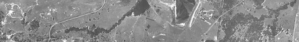
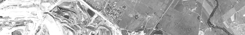
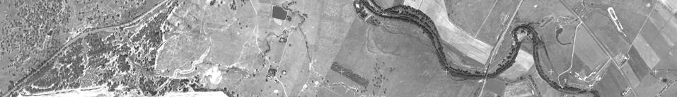
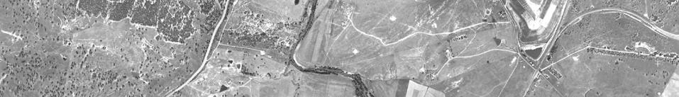
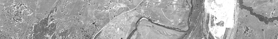
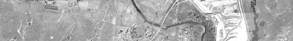
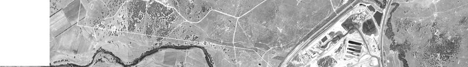
9 Existing Environment SECTION Site context and surrounding landscape character The Open Cut Area is generally bounded by: The Main Northern Railway to the north; The existing Integra Open Cut to the east and south east; Pasture and wooded land rising to the New England Highway to the south and south west; and Low lying land extending to the Glennies Creek corridor to the west. The landscape surrounding the Open Cut Extension Area contains a number of constructed elements that contribute to the local visual character including: Existing open cut coal mines with a combination of active overburden tipping areas and rehabilitated landforms, including Ashton Mine to the west and Rix s Creek to the south; Existing communication towers located on distant ridgelines and hilltops; Overhead transmission lines; Large scale built structures including the CHPP within mine areas; buildings and agricultural structures; New England Highway and local road corridors; and Main Northern Railway Line. A number of rural residential properties are also located in the landscape surrounding the existing Integra Open Cut. Some of the surrounding rural residential properties are not visually prominent due to screening by surrounding undulating landform or the presence of trees around them. The Dulwich residence is located within the footprint of the Mine Area. For the purpose of the overall visual assessment it is assumed that Integra will acquire the Dulwich property; however an alternative configuration for the Open Cut Area has been prepared should the property not be acquired. The potential visual impact for the Dulwich view location is considered separately within this report. 4.2 Landform and Vegetation The major aspects of the local landform and surrounding vegetation are summarised below and illustrated in Figure 1. GREEN BEAN DESIGN PO Box 3178 Austral NSW
10
11 The Open Cut Extension Area generally occupies an upper portion of gently undulating and sloping land extending west from a low north to south ridgeline at around the 100m AHD contour. From the upper portions of the low ridgeline, the landform tends to slope gently east to west toward the 70m AHD contour before extending across a relatively level flood plain adjoining the east side of the Glennies Creek riparian corridor. Glennies Creek extends in an approximate north east to south west alignment to the west of the Project Area Boundary. A series of low ridgelines occur to the west of the Glennies Creek corridor with highpoints generally ranging between the 100m AHD to the west of the Project Area, extending north and north east up to around 200m AHD. A small number of ridgelines extend in a north west to south east alignment to the east of the Project Area and extend to highpoints around 150m AHD and slightly higher as the discontinuous ridgelines extend further east. Long distance views from some elevated locations surrounding the Open Cut Extension Area also extend north and north west to a series of larger and visually prominent hills to the south east and north east of Muswellbrook. 4.3 Potential Catchment The key aspects of the potential view catchment of the proposed Open Cut Extension Area are summarised below. The view catchment to the east of the proposed Open Cut Extension is generally restricted by the Integra Open Cut Project Area and the Rix s Creek mine to the south. The view catchment to the south of the Open Cut Extension Area is generally contained by a gently sloping landform rising to the New England Highway road corridor; however the view catchment is likely to extend toward a small number of view locations, including residential properties, on sloping ground to the west of the New England Highway road corridor. The view catchment to the west of the Open Cut Extension Area generally extends toward a ridgeline running approximately parallel to, and to the east of, Glennies Creek. The view catchment is likely to extend toward a small number of residential properties located on the side slope and south end of the ridgeline. The potential view catchment of the final landform will extend beyond the area from which active mining operations may be visible and will be largely deined by the influence of surrounding topography and vegetation. It is likely that views toward the final landform will be generally restricted to largely upper portions of the landform from areas beyond 2 to 3km from the proposed Open Cut Extension Area. 4.4 Visual Absorption Capability Visual absorption capability is a classification system used to describe the relative ability of the landscape to accept human modifications and alterations without the loss of landscape GREEN BEAN DESIGN PO Box 3178 Austral NSW
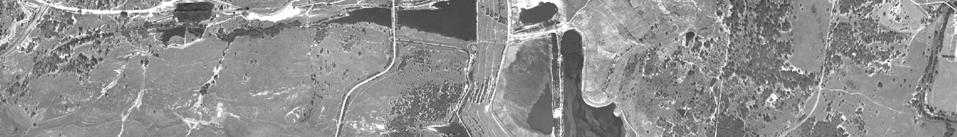
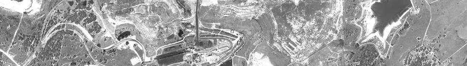
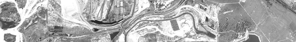
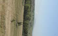
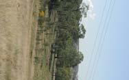
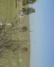
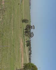
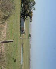
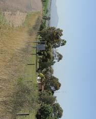
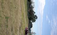
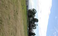
12 character or deterioration of visual amenity. Visual absorption capability generally relates to physical characteristics of the existing landscape that are often inherent and often quite static in the long. For the purposes of this visual assessment, the potential visual absorption capability of the landscape surrounding the proposed Open Cut Extension to the South Pit has been deined to be moderate to high. This moderate to high visual absorption capability generally results from the position of the proposed Open Cut Extension relative to the existing mining activities associated within the Integra Open Cut Project Area and adjoining mining operations at the Rix s Creek Open Cut Coal Mine and surrounding open cut coal operations including the Ashton Open Cut Coal Mine. 4.5 Photo Locations A series of photographs were taken during the course of the fieldwork to illustrate views from a range of typical view locations inspected and assessed as part of the visual impact assessment. The photo locations are illustrated on Figure 2 and photo images illustrated on Figure 3 and Figure 4. GREEN BEAN DESIGN PO Box 3178 Austral NSW
13
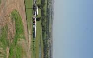
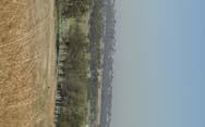
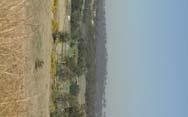
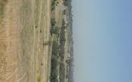
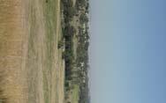
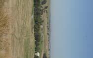
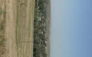
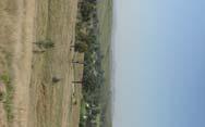

14
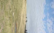
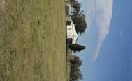
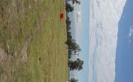
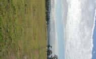
15
16 Visual Assessment SECTION Visual Assessment Criteria The visual impact of the proposed Open Cut Extension from the potential view locations has been assessed against the criteria described in Table 1 Table 1 Location Assessment Criteria Criteria Number of ers High Moderate Low Very Low Distance Long Short Very short Period of Long Moderate Short Definition >1,000 people per day people per day people per day <100 people per day >4km 2km 4km 1km 2km <1km >120 minutes minutes <10 minutes The levels of visibility resulting from various combinations of the above criteria are listed in Table 2. Table 2 Visibility Criteria Matrix Long Short Very Short Distance Distance Distance Distance Period of L M S L M S L M S L M S High No. of ers M L L H M M H H M H H H No. of ers L L L M M L H M M H H M Low No. of ers L L L M L L M M L H M L Very Low No. of ers L L L L L L L L L M L L Period of L=long, M=medium, S=short Levels of visibility L=low, M=medium and H=high The visibility criteria matrix is used as a guide to deine a potential level of visibility. GREEN BEAN DESIGN PO Box 3178 Austral NSW
17 The overall visual impact for each view location is also considered against other factors which include the potential level of visibility, sensitivity of the receptor type and the potential visual absorption capability of the landscape within which the proposed Open Cut Extension is located. The general relationship between receptor category and their potential level of sensitivity is outlined below: Receptor Category Sensitivity esidential Properties Pedestrians (recreational) Public Recreational Space Pedestrians (non-recreational) Motorists Business (commercial) Industry High Low 5.2 Visibility Matrix and Visual Impact Assessment Table 3 presents the results of the visibility assessment and the assessed level of potential visual impact at the identified view locations that may result as a consequence of the proposed mining operations. The view locations are illustrated on Figure 5. GREEN BEAN DESIGN PO Box 3178 Austral NSW
18
19 Table 3 Visibility Matrix Location Category Of er Approx. Distance To Site Approx. Period Of Relative No. Of ers Receptor Sensitivity Visibility Assessment Potential Visual Impact Location 1. property 2 dwellings within Open Cut Extension Area Very Short (around 270m). Low High Very short and direct view across proposed Open Cut Extension Area. Existing views extend east and north east toward the former North and existing South Pit overburden emplacement areas as well as a portion of the Rix s Creek mine. High Location 2 Very Short (around 492m) Low High Very short and potentially direct view across and into portions of the proposed Open Cut Extension Area Existing views extend east and north east toward the former North and existing South Pit overburden emplacement areas as well as a portion of the Rix s Creek mine. to High Location 3 occasional occupation Very Short (around 721m) Low High Very short and potentially direct view toward and into portions of the proposed Open Cut Extension Area, although some potential exists for screening by scattered tree cover between the residence and the Open Cut Area. to High Location 4 Short (around 1 km) Low High Short and potentially direct view toward and into portions of the proposed Open Cut Extension Area. Existing views extend toward the former North and existing South Pit overburden emplacement areas as well as across extensive areas of the surrounding landscape, including other mine sites within the general vicinity of the Integra Open Cut Project Area. to High Location 5 Short (around 1.8km) Low High Short distance view toward the proposed Open Cut Extension Area is potentially screened by rising landform and vegetation to the east of the residence. Low (possibly nil) GREEN BEAN DESIGN PO Box 3178 Austral NSW
20 Location Category Of er Approx. Distance To Site Approx. Period Of Relative No. Of ers Receptor Sensitivity Visibility Assessment Potential Visual Impact Location 6 Short (around 1.8km) Low High Short distance view toward the proposed Open Cut Extension Area is potentially screened by rising landform and vegetation to the east of the residence. Low (possibly Nil) Location 7 Short (around 1.3km) Low High Potential for direct and short distance view toward the proposed Open Cut Extension Area, including views toward the existing north and south overburden emplacement areas. to High Location 8 (around 2.4km) Low High s toward the proposed Open Cut Extension Area from residences north and south of Mayfield property along Glennie Street. s are generally screened by a combination of rising landform and vegetation. Nil Location 9 Short (around 1.7km) Low High Elevated view from rear of residence on McInerney Road toward the proposed Open Cut Extension Area and the Integra Open Cut Project Area beyond. Location 10 Short (around 1.7km) Low High Elevated view from rear of residence on McInerney Road toward the proposed Open Cut Extension Area and the Integra Open Cut Project Area beyond. Location 11 (around 2.9km) Low High s toward the proposed Open Cut Extension Area from residences of Glennie Street. s are generally screened by a combination of rising landform and vegetation. Nil Location 12 (around 2.2km) Low High s toward the proposed Open Cut Extension Area from residences between Dyrring and Alpha Streets are generally screened by a combination of rising landform and vegetation. Nil Location 13 (around 2.2km) Low High s toward the proposed Open Cut Extension Area from residence at the east end of Dawson Street, Camberwell, is screened by a combination of landform Nil GREEN BEAN DESIGN PO Box 3178 Austral NSW
21 Location Category Of er Approx. Distance To Site Approx. Period Of Relative No. Of ers Receptor Sensitivity Visibility Assessment Potential Visual Impact and vegetation alongside Glennies Creek. Location 14 (around 3km) Low High s toward the proposed Open Cut Extension Area from residences in Camberwell are generally screened by landform rising to the east of the village. Nil Location 15 (around 3.6km) Low High Elevated view from rear of residence toward the proposed Open Cut Extension Area and former North and existing South Pit overburden emplacement areas. Low Location 16 Short (around 1.6km) Low High Potential direct and short distance view toward proposed Open Cut Extension Area from Glenville residence including view toward former North and existing South Pit overburden emplacement areas. to High Location 17 Mine owned (around 2.2km) Low High Potential direct and medium distance view toward proposed Open Cut Extension Area, although the majority of the area is screened by a low undulating landform as well as vegetation surrounding the view location. Existing views toward former North and existing South Pit overburden emplacement areas. Low to Location 18 Mine owned (around 2.2km) Low High Potential direct and medium distance view toward proposed Open Cut Extension Area, although the majority of the area is screened by a low undulating landform as well as vegetation surrounding the view location. Existing views toward former North and existing South Pit overburden emplacement areas. Low to Location 19 Short (around 1.4km) Low High Potential direct and short distance view toward proposed Open Cut Extension Area, although the majority of the area is potentially screened by vegetation along Glennies Creek. Low to Location 20 (around 2km) Low High s from residence toward proposed Open Cut Extension Area are generally screened by low Low (possibly Nil) GREEN BEAN DESIGN PO Box 3178 Austral NSW
22 Location Category Of er Approx. Distance To Site Approx. Period Of Relative No. Of ers Receptor Sensitivity Visibility Assessment Potential Visual Impact (Mine owned) undulating landform between the receptor and Glennies Creek. s extend toward the former North and existing South Pit overburden emplacement areas. Location 21 (Mine owned) Short (around 1km) Low High Potential direct and short distance view toward proposed Open Cut Extension Area, including view toward the former North and existing South Pit overburden emplacement areas. to High Location 22 (Mine owned) Short (around 1.3km) Low High Potential direct and short distance view toward proposed Open Cut Extension Area is partially screened by low undulating landform. Existing views extend toward north and south pit overburden emplacement areas. Low to Location 23 (Mine owned) Short (around 1.7km) Low High Potential direct and short distance view toward proposed Open Cut Extension Area is generally screened by existing vegetation alongside Glennies Creek. Low Location 24 (Mine owned) group of 4 dwellings along Glennies Creek Road (around 2km) Low High Generally indirect views toward the proposed Open Cut Extension Area from residences that are also partially screened by vegetation that surrounds them. Potential for view toward the former North and existing South Pit overburden emplacement areas. Low (Potentially Nil) Location 25 (around 2km) Low High Potential direct and medium distance view toward proposed Open Cut Extension Area may be partially screened by existing vegetation alongside Glennies Creek. Existing views extend toward the former North and existing South Pit overburden emplacement areas. Low to Location 26 (around 2.4km) Low High Potential direct and medium distance view toward proposed Open Cut Extension Area may be partially Low to GREEN BEAN DESIGN PO Box 3178 Austral NSW
23 Location Category Of er Approx. Distance To Site Approx. Period Of Relative No. Of ers Receptor Sensitivity Visibility Assessment Potential Visual Impact screened by existing vegetation alongside Glennies Creek. Existing views extend toward the former North and existing South Pit overburden emplacement areas. Location 27 group of 6 dwellings along Glennies Creek Road (around 2.7km) Low High Indirect views toward proposed Open Cut Extension Area are generally screened by surrounding tree cover. Potential for glimpsed views toward the former North and existing South Pit overburden emplacement areas. Low (Potentially Nil) Location 28 (around 2.7km) Low High toward proposed Open Cut Extension Area is generally screened by low undulating landform. Potential for view toward the former North and existing South Pit overburden emplacement areas. Low (Potentially Nil) Location 29 (around 3.1km) Low High toward proposed Open Cut Extension Area is generally screened by low undulating landform. Potential for view toward the former North and existing South Pit overburden emplacement areas. Low (Potentially Nil) Location 30 (around 3.7km) Low High toward proposed Open Cut Extension Area is generally screened by low undulating landform. Potential for view toward the former North and existing South Pit overburden emplacement areas. Low (Potentially Nil) Location 31 group of 4 dwellings Long (around 4.3km) Low High s toward proposed Open Cut Extension Area are generally screened by low undulating landform. Potential for view toward upper portions of the former North and existing South Pit overburden emplacement areas. Low (Potentially Nil) Location 32 group of 3 dwellings Long (around 4.3km) Low High s toward proposed Open Cut Extension Area are generally screened by low undulating landform. Potential for view toward upper portions of the former Low (Potentially Nil) GREEN BEAN DESIGN PO Box 3178 Austral NSW
24 Location Category Of er Approx. Distance To Site Approx. Period Of Relative No. Of ers Receptor Sensitivity Visibility Assessment Potential Visual Impact North and existing South Pit overburden emplacement areas. Location 33 group of 3 dwellings Long (around 3.4km) Low High s toward proposed Open Cut Extension Area are generally screened by low undulating landform and vegetation alongside Glennies Creek. Low (Potentially Nil) Location 34 group of 2 dwellings (around 2.8km) Low High s toward proposed Open Cut Extension Area are generally screened by low undulating landform and vegetation alongside Glennies Creek. Potential for view toward upper portions of the former North Pit overburden emplacement area. Low (Potentially Nil) Location 35 (around 3.1km) Low High s toward proposed Open Cut Extension Area are generally screened by surrounding tree cover. Nil Location 36 group of 3 dwellings Long (around 4.6km) Low High s toward proposed Open Cut Extension Area are generally screened by undulating or rising landform around the residences. Potential view toward upper portion of the former North Pit overburden emplacement area. Low (Potentially Nil) Location 37 group of 5 dwellings Long (around 4.4km) Low High s toward proposed Open Cut Extension Area and existing overburden emplacement areas are generally screened by undulating landform and stands of tree cover. Nil Location 38 generally along Bridgman Road Long (around 4.2km) Low High s toward proposed Open Cut Extension Area are screened by the east portions of the Integra Open Cut Project Area. Nil GREEN BEAN DESIGN PO Box 3178 Austral NSW
25 Location Category Of er Approx. Distance To Site Approx. Period Of Relative No. Of ers Receptor Sensitivity Visibility Assessment Potential Visual Impact Location 39 generally along Bridgman Road Long (around 4.0km) Low High s toward proposed Open Cut Extension Area are screened by the eastern landform of the Integra Open Cut Project Area. Nil Location 40 generally along Bridgman Road Long (around 5.2km) Low High s toward proposed Open Cut Extension Area are screened by the eastern landform of the Integra Open Cut Project Area. Nil Location 41 generally along Rix s Creek Lane Long (around 4.2km) Low High s toward proposed Open Cut Extension Area are screened by the southern landform of the Integra Open Cut Project Area. Nil Location 42 generally west and north Singleton Heights Long (around 5.7km) Low High s toward proposed Open Cut Extension Area are screened by the southern landform of the Integra Open Cut Project Area. Nil Location T1 Motorists New England Highway Varies (around 1.5 to 2km) Short and generally less than 30 seconds. High Low s from vehicles travelling north west, toward the proposed Open Cut Extension Area, are screened by a combination of landform and tree cover. Very short, and indirect views toward the Open Cut Extension Area boundary may occur from vehicles travelling south east for around 500m of carriageway south of Camberwell Village Low (Potentially Nil) Location T2 Motorists Glennies Creek Road Varies Varies generally short. Moderate Low Generally indirect views from road corridor in both directions are partially obstructed by roadside vegetation. Nil GREEN BEAN DESIGN PO Box 3178 Austral NSW
26 Location Category Of er Approx. Distance To Site Approx. Period Of Relative No. Of ers Receptor Sensitivity Visibility Assessment Potential Visual Impact south of railway line Location T3 Location T4 Locations P1 and P2 Motorists Glennies Creek Road east of railway line Passengers Main Northern Railway Varies Very Short (around 150m) Varies generally short. Varies generally short Moderate Low Generally indirect views from road corridor in both directions crossing relatively low lying land before rising along ridgeline. Extensive views from top of ridgeline including portions of the former North and existing South Pit overburden emplacement areas. Moderate Moderate Short distance view toward proposed Open Cut Extension Area as railway line passes alongside north boundary of the Open Cut Extension Area, as well as existing portions of the Integra Open Cut Project Area. N/A These residential dwellings are located within the footprint of the Mine Area Full Pit Extent. These privately owned and occupied properties are under negotiations for purchase and have not been included in the visibility matrix assessment. Refer to additional comments provided for Location P1, Dulwich. Nil Low GREEN BEAN DESIGN PO Box 3178 Austral NSW
27 1 Assessment Summary Visual Impact Summary SECTION Visual Impact Summary A total of 47 view locations were identified as part of the visual assessment process, and included views from: rural residential properties; road corridors; and rail corridors An assessment of the visual impact of the development and operation of the proposed Open Cut Extension for each view location indicated that: 14 of the 47 view locations have a NIL visual impact; 18 of the 47 view locations have a LOW visual impact; 8 of the 47 view locations have a MEDIUM visual impact; and 7 of the 47 view locations have a MEDIUM to HIGH visual impact. The majority of views from surrounding residential view locations toward the proposed Open Cut Extension are partially restricted or completely screened by the undulating nature of the local landscape, or by modified landforms created by both existing former mining activities. A small number of residential properties may experience a medium to high visual impact during periods of mining operations; however the significance and magnitude of the impacts would tend to vary during the life of the mine depending on the final relationship of the residence to the proposed staging of works and the positioning of topsoil bunds and overburden emplacement areas. s toward the Open Cut Extension from passenger trains travelling along the Main Northern Railway will generally be of very short duration and occur within the context of the existing Integra Open Cut Project Area through which the railway line currently runs. Potential publicly accessible view locations with views toward the proposed Mine Area and overburden emplacement area, are generally restricted to sections of road corridor along, and adjacent to, the New England Highway and Glennies Creek Road. Both of these view locations offer some limited potential for elevated views toward, and possibly into, the proposed Mine Area, although views are predominantly indirect and from motor vehicles travelling at varying speeds and range between 1.5 to 2.5km in distance from the proposed Open Cut Extension Area. Overall, the potential visual impact for view locations within public areas is likely to low. GREEN BEAN DESIGN PO Box 3178 Austral NSW
28 6.2 Final Landform Design Details of the final landform design are detailed in the Rehabilitation and Mine Closure Plan, included in Appendix I of this EAR. It is generally proposed to create a landform that is visually contiguous with surrounding landforms, including those areas that have been formerly mined and have been, or are now subject to, rehabilitation. The final height of the proposed landform, at around 150m AHD, is generally in accordance with, and in some areas below, the height of existing ridgeline and hilltop areas in the landscape surrounding the Integra Open Cut Project Area. The proposed height of the final landform design would not tend to make the proposed Open Cut Extension overburden emplacement any more conspicuous than the existing final landform designs of surrounding mine sites. Although the final landform design includes a generally consistent grade of slope, around 10 degrees above the natural surface of the land, the form of the final landform design is articulated to a small degree and avoids the creation of long and visually continuous slopes and an upper surface that may appear artificially engineered from surrounding view locations. Some upper slope areas above the void, located in the south west corner of the site, may be visible from a small number of surrounding residential properties located to the west of the proposed Open Cut Extension Area; however the indicative cross sections illustrate that there are unlikely to be direct views from surrounding residential properties into the void itself. The overall visual impact of the final landform design, following rehabilitation and the establishment of proposed vegetation treatments, has been deined to be low for the surrounding view locations, including the residential view locations that have been deined to have a medium to high potential visual impact during mining operations. 6.3 Site rehabilitation and revegetation Details of the proposed progressive site rehabilitation and revegetation are described in the Rehabilitation and Mine Closure Plan, included in Appendix I of the Environmental Assessment Report. The overall revegetation plan proposes to combine a mixture of pasture grasses, native groundcover and tree species that will combine over time to compliment the visual form of the Open Cut Extension Area with that of the surrounding landscape. GREEN BEAN DESIGN PO Box 3178 Austral NSW
29 Cumulative Visual Impacts SECTION Cumulative Visual Impacts Cumulative visual impacts can result from changes to the landscape caused by the proposed Open Cut Extension in conjunction with existing and future open cut mining projects in the surrounding landscape that may be visible from the view locations identified in this visual assessment. The regional landscape of the Hunter Valley has a long historical association with the extraction and export of coal, with the first coal exported around A number of open cut coal mines have been established and progressively developed in the region, with the majority generally extending in a north to north west alignment to the west of Integra Open Cut Project Area. Existing open cut coal mines that operate in general proximity to the proposed Open Cut Extension include the Integra South Pit, Rix s Creek Mine to the south of the proposed Open Cut Extension, and the Ashton Mine to the north of Camberwell Village. Future open cut coal mine operations include the Glendell and Integra North Open Cut projects to the north and north east of the proposed Open Cut Extension. A small number of receptors, including residential receptors on elevated ground to the north west and west of the proposed Open Cut Extension, are likely to view portions of the existing South Pit and Rix s Creek Mine within the same view catchment as the proposed Open Cut Extension. However, there will only be a small degree of visual change to the landscape for the majority of these receptors as the Open Cut Extension extends from the existing active mining area. Existing views from these view locations toward established open cut mines are generally restricted to overburden emplacements or rehabilitated landforms due to the undulating nature of existing landform and the occurrence of tree vegetation within the surrounding landscape. The existing Ashton Mine and proposed Integra North Open Cut and Glendell Mines, located to the north and north east of the proposed Open Cut Extension, are unlikely to occur within the same view catchment as the proposed Open Cut Extension. A very small number of residential receptors may have an opportunity for panoramic views across and beyond the proposed Open Cut Extension. At a regional level, the proposed Open Cut Extension is unlikely to have a significant cumulative visual impact. The intervisibility of the majority of existing open cut mines is limited by the distance between them from the view locations identified in this visual assessment. As the visibility of the proposed Open Cut Extension is generally restricted from the New England Highway road corridor, the proposed Open Cut Extension is also unlikely to have a significant cumulative impact on the existing visual experience from the Highway. Although the development and rehabilitation of open cut coal mines in the Hunter Valley has, in places, resulted in a highly modified landscape, the historical association of mining activities is a familiar and recognised activity within the regional landscape. GREEN BEAN DESIGN PO Box 3178 Austral NSW
30 There is some potential for a proportion of the existing population who reside in the landscape surrounding the existing open cut coal mines to be employed, directly or indirectly, in the mining industry, and as such local residents may have a more positive perception of mined landscapes than people not associated with mining activities. GREEN BEAN DESIGN PO Box 3178 Austral NSW
31 Mine Plan South of Dulwich SECTION Mine Plan South of Dulwich An alternative mine plan for the proposed Open Cut Extension has been developed should Integra not acquire the Dulwich property. The alternative plan, Part Pit Extent, would result in the ination of mining approximately 250m to the south of the Dulwich residence. Although the primary views from the Dulwich residential property appear to be orientated in an east west direction, there is a significant potential for visual impacts to occur from some areas within the residence, as well as areas within the immediate curtilage of the main residential building. Given the extent of the mine area that may be visible, and the relatively short distance of the mine area from the residence, it is likely that any potential visual impacts will be high from the Dulwich view location. Although some existing tree and shrub planting surrounding the Dulwich residence provides a degree of potential screening, it is likely that additional screen planting, together with the construction of visual amenity bunds, will be required to reduce the overall visual impact at this view location. GREEN BEAN DESIGN PO Box 3178 Austral NSW
32 Cross Sections SECTION Conclusion In order to illustrate the potential extent to which portions of the proposed Open Cut Extension Area may be visible, a series of indicative cross-sections were prepared extending from three of the residential view locations surrounding the proposed Open Cut Extension Area. The indicative cross sections represent the views from view locations R2, R4 and R16. The indicative cross section locations are illustrated in Figure 2 and presented in Figure 6 and Figure 7. Each cross-section has been drawn with the same horizontal and vertical scales and therefore does not include any vertical exaggeration. The cross sections generally indicate that surrounding view locations are unlikely to have direct views into the void area located within the south west corner of the Mine Area, but are likely to extend toward upper portions of slopes above the void, as well as extending across the side slopes and top of the proposed final landform. GREEN BEAN DESIGN PO Box 3178 Austral NSW
33
34
35 Mitigation Measures SECTION Mitigation Measures The purpose of mitigation is to avoid, reduce or, where possible, remedy or offset any significant negative impact arising from mining activities associated with the Open Cut Extension of the South Pit. Integra will implement a variety of mitigation measures to reduce the potential visual impact of the Open Cut Extension, including the construction of visual amenity bunds, or topsoil storage areas that may temporarily screen views toward the proposed Open Cut Area. Work programs will also be arranged, where possible, so that some activities to be carried out across surface areas of the Open Cut Extension Area or with the Open Cut Area that may be visible from surrounding view locations, occur within daylight hours of operation. Shields will be installed on floodlights within the Open Cut Extension Area to minimise the potential for lighting to impact sensitive receptors, including positioning of lights to avoid shining directly at residences. Where possible, haulage roads and overburden tipping areas will be configured to minimise the potential impact associated with headlights and flashing lights associated with vehicles travelling across the Integra Open Cut Project Area. Integra will consider any reasonable request by a residential receptor for assistance to establish a visual screen within their property through planting and/or landscape works, where such works will effectively reduce the visual impact of activities associated with the proposed Open Cut Extension during the life of the project. GREEN BEAN DESIGN PO Box 3178 Austral NSW
36 Open Cut Project SECTION Open Cut Project In addition to the proposed Open Cut Extension, the Integra Open Cut Project application seeks approval for the long- use of the CHPP, train loader, infrastructure and facilities required to support mining, processing and despatch of coal from the Integra Open Cut Project, and to replace DA 86/2889 (the existing Integra Open Cut Development Approval) and PA 06_0073 (the Glennies Creek Open Cut Project Approval (pending)) through the provision of a consolidated project approval. Green Bean Design has reviewed the North Open Cut visual assessment undertaken by R W Corkery & Co Pty Ltd, which identifies a number of view locations with either partial or full visibility toward the proposed North Open Cut. Overall the North Open Cut visual assessment deined that potential impacts were acceptable for day time visual amenity or likely to result in impacts that would not be considered unacceptable for night time visual impacts. Some of the view locations identified in the North Open Cut visual assessment have also been deined to have views toward the Open Cut Extension. These locations are illustrated on Figure D23 for the North Open Cut visual assessment and Figure 5 for the Open Cut Extension. The view locations identified in the Open Cut Extension visual assessment with a potential view toward the North Open Cut include R20 (71), R23 (68), R24 (64, 65, 66 and 67), R25 (63), R26 (62), R27 (56, 57, 59 and 60), and R30 (58). The reference number in brackets corresponds to the view location reference illustrated in Figure D23 of the North Open Cut visual assessment. Figure D23 illustrates that the majority of the above view locations will experience a partial view toward the North Open Cut and will experience a Low to or a Low (Potentially Nil) visual impact from the development of the Open Cut Extension. Given the overall low level of visual impact deined for the North Open Cut and Open Cut Extension projects, together with the degree of visual separation between the open cut areas by former mine works currently undergoing rehabilitation; it is unlikely that any additional significant impact will occur from view locations where both projects may be visible. GREEN BEAN DESIGN PO Box 3178 Austral NSW
37 Conclusions SECTION Conclusions Overall, the visual impact assessment concludes that the proposed Open Cut Project will have a low to moderate visual impact on the majority of people travelling through and residing in areas surrounding the proposed Open Cut Extension. Following decommissioning, rehabilitation and revegetation works, the overall visual impact will be low. A small number of residential properties, including those located on elevated ground, or along ridgelines to the south west and west of the proposed Open Cut Extension, may experience moderate and occasional high visual impacts during mining operations, which may include night time views toward light sources within, or moving around the Open Cut Extension. The design, implementation and maintenance of mitigation measures will help to minimise the magnitude of the visual impact experienced by this small number of surrounding residential properties. The majority of view locations inspected and assessed resulted in a nil or low level of visibility. The low level of visibility is generally due to a combination of the following factors. The proposed Open Cut Extension represents an ongoing operation to the existing South Pit area. The majority of visual elements (including lighting and traffic movements) associated with the current open cut mining operations are unlikely to be significantly different to those associated with the proposed Open Cut Extension. The Hunter Valley regional area contains numerous open cut mining operations that reflect and deine the character of the landscape visible from a range of view locations including residences and road or rail corridors. The potential Visual Absorption Capability of the surrounding landscape has been deined as moderate to high due to the proximity of existing open cut mining operations in the surrounding regional area of the Hunter Valley. Many of the surrounding mining operations exhibit a range of similar landscape characteristics to those that will be associated with the proposed Open Cut Extension. 7 of the view locations included in the visual assessment were deined to have a potential to High visual impact during active mining operations as a result of the development and operation of the proposed extension. 33 of the 47 view locations included in the visual assessment were deined to have a Nil or Low visual impact, which resulted largely from the localised influence of undulating landform, low ridgelines and the presence of tree cover both within the general landscape and surrounding individual properties. GREEN BEAN DESIGN PO Box 3178 Austral NSW
38 Given the physical characteristics of the surrounding landscape, and proximity of existing and former mine operations at the Integra Open Cut, as well as the general occurrence of open cut mines within the regional area, it has been deined that the landscape has a moderate to high visual absorption capability, and that the proposed extension to the existing South Pit will modify the landscape without a significant loss of landscape character or deterioration of visual amenity. The majority of view locations deined to have a medium to high visual impact during the operational life of the proposed extension will have their visual impact reduced to low following completion of mining operations and progressive rehabilitation and revegetation. The indicative cross sections illustrate that there are unlikely to be any direct views into the void area located in the south west portion of the Mine Area. The final landform design will generally be visually contiguous with adjacent surrounding areas that have been subject to, or are likely to be rehabilitated, following open cut mining activities. The overall visual scale of the final landform will be reduced by the establishment of trees across bench, side slope and crest areas. Tree planting will also assist in providing some variation in the line of the final landform, together with a visual colour contrast with portions of surrounding pasture, which together will tend to reduce the visual prominence of the final landform from surrounding view locations. Visual impacts associated with the Main Northern Railway will be minimised over the long by the establishment of a native tree corridor alongside the railway line. The majority of views from surrounding view locations toward the final void will be completely or partially screened by a combination of proposed and existing landform, together with existing and proposed tree planting. GREEN BEAN DESIGN PO Box 3178 Austral NSW
MOREE SOLAR POWER STATION
 MOREE SOLAR POWER STATION LANDSCAPE & VISUAL IMPACT ASSESSMENT Prepared for: December 2010 Prepared by: GREEN BEAN DESIGN l a n d s c a p e a r c h I t e c t s GREEN BEAN DESIGN l a n d s c a p e a r c
14 Visual Amenity 14-1
 Visual Amenity 14 CONTENTS 14 Visual Amenity 14.1 14.1 Introduction Introduction 14.2 14.2 Project Setting Project Setting 14.3 14.3 Project Overview Project Overview 14.4 14.4 Viewing Locations Viewing
site appraisals and reconnaissance, conducted in October 2008, to capture photographic images of the existing visual environment;
 15. Visual Amenity 15.1. Introduction This Chapter provides a description of the existing landscape character and visual amenity of the Project area. It also identifies potential visual impacts of the
Visual Impact Assessment - December Figure 5.2: Viewshed analysis of the haul route.
 Visual Assessment - December 2014 Figure 5.2: Viewshed analysis of the haul route. 21 Baobab Resources (Pty) Ltd 5.1.3 Visual Exposure The following can be deduced from the Figure 5.1: the area to the
Genex Kidston Connection Project: Draf t Environmental Assessment Report Powerlink Queensland
 : Draf t Environmental Assessment Report Powerlink Queensland Chapter 14 \\autsv1fp001\projects\605x\60577456\6. Draft Docs\6.1 Reports\4. Compiled draft 17 September\Covers\Chapters\Ch 14.docx Rev ision
LYNWOOD QUARRY. Earth Bund Options Environmental Impact Analysis FINAL
 LYNWOOD QUARRY Earth Bund Options Environmental Impact Analysis FINAL October 2014 LYNWOOD QUARRY Earth Bund Options Environmental Impact Analysis FINAL October 2014 Prepared by on behalf of Holcim (Australia)
I539. Smales 2 Precinct
 I539. Smales 2 Precinct I539.1. Precinct Description The Smales 2 Precinct applies to a 4.8 hectare block of land located on the southern side of Northcote Road and fronting Lake Pupuke, Takapuna. The
TIDAPA Structure Plan
 TIDAPA Structure Plan Prepared by Tract Consultants 28 MARCH 2017 0217-0074 Table of Contents 01 STRATEGIC CONTEXT Executive Summary Regional Context Page 3 Page 4 02 LOCAL CONTEXT Aerial Photograph Local
Chapter 7: Landscape and Visual Impact Assessment
 Chapter 7: Landscape and Visual Impact Assessment Landscape Character and Visual Impact Assessment 7. Landscape Character and Visual Impact Assessment... 2 7.1 Methodology... 2 7.2 Assessment Findings...
Landscaping Management Plan. Woodlawn Mechanical Biological Treatment Facility. Veolia Environmental Services Australia Pty Ltd
 Landscaping Management Plan Woodlawn Mechanical Biological Treatment Facility Veolia Environmental Services Australia Pty Ltd May 2014 THIS PAGE INTENTIONALLY LEFT BLANK Landscaping Management Plan Page
Assessment of Landscape, Visual and Natural Character Effects
 Assessment of Landscape, Visual and Natural Character Effects Consent Footprint Amendments Mangamaunu Half Moon Bay Okiwi Bay South Report prepared for: New Zealand Transport Agency and KiwiRail Holdings
CHAPTER 20 VISUAL AMENITY
 Central Eyre Iron Project Mining Lease Proposal CHAPTER 20: VISUAL AMENITY CHAPTER 20 VISUAL AMENITY COPYRIGHT Copyright IRD Mining Operations Pty Ltd and Iron Road Limited, 2015 All rights reserved This
FINAL AND TEMPORARY REHABILITATION PRINCIPLES. BLOOMFIELD GROUP REPORT 2013 Rix s Creek
 Rix s Creek Lane Singleton NSW 2330 AUSTRALIA PO Box 4 East Maitland NSW 2323 T: 61 2 6578 8888 F: 61 2 6571 1066 ABN 25 003 824 244 FINAL AND TEMPORARY REHABILITATION PRINCIPLES BLOOMFIELD GROUP REPORT
Request for a Scoping Opinion by Provectus. Proposed Surface Mining of Coal on Land west off the A61, Hill Top Farm, Clay Cross, Derbyshire
 Request for a Scoping Opinion by Provectus Proposed Surface Mining of Coal on Land west off the A61, Hill Top Farm, Clay Cross, Derbyshire January 2012 Contents 1 Introduction & Background... 1 2 Site
North West Rail Link - Environmental Assessment Urban Design and Visual Assessment Prepared for Transport Infrastructure Development Corporation
 North West Rail Link - Environmental Assessment Urban Design and Visual Assessment Prepared for Transport Infrastructure Development Corporation November 2006 HASSELL Ltd 007 711 435 88 Cumberland Street
MERIDAN PLAINS SAND RESOURCE AREA
 MERIDAN PLAINS SAND RESOURCE AREA INFORMATION SHEET October 2010 BACKGROUND The Meridan Plains Extractive Resource Area is located on the western fringe of the coastal urban communities of Caloundra West
3. Highway Landscaping Assessment
 Guidelines for Highway Landscaping 3-1 3. Highway Landscaping Assessment 3.1 Introduction This section outlines the steps necessary to assess the highway landscaping component of a state highway construction
Longbridge Town Centre Phase 2 Planning Application
 Longbridge Town Centre Phase 2 Planning Application Non-Technical Summary of the Environmental Statement December 2013 Introduction A full application for Planning Permission has been submitted to Birmingham
CHAPTER 21 LANDSCAPE AND VISUAL AMENITY GULF ALUMINA LTD SKARDON RIVER BAUXITE PROJECT
 CHAPTER 21 LANDSCAPE AND VISUAL AMENITY GULF ALUMINA LTD SKARDON RIVER BAUXITE PROJECT TABLE OF CONTENTS 21.1 Introduction... 21-1 21.1.1 Definition of the Assessment Areas for the Project... 21-1 21.2
Tāhuhu whakaruruhau ā-taone The sheltering ridge pole
 B2. Tāhuhu whakaruruhau ā-taone - Urban growth and form B2.1. Issues Tāhuhu whakaruruhau ā-taone The sheltering ridge pole Auckland s growing population increases demand for housing, employment, business,
3.1 This evidence is based on the landscape and visual impact assessment included in Chapter 10 and Appendix I of the EIS.
 LANDSCAPE & VISUAL 1 QUALIFICATIONS AND EXPERIENCE 1.1 My name is Raymond Holbeach and I am a Regional Director for RPS Planning & Environment with full responsibility for management of the RPS Belfast
Summary Note on Landscape and Visual Impact and Mitigation
 East Anglia TWO Offshore Windfarm Appendix 4.4 Summary Note on Landscape and Visual Impact and Mitigation Preliminary Environmental Information Volume 3 Document Reference EA2-DEVWF-ENV-REP-IBR- 000799_004
NON-TECHNICAL SUMMARY
 Proposed Sand and Gravel Extraction and Associated Processing Operations with Restoration to a Mixture of Agriculture and Nature Conservation including Areas of Shallow Water at Hedgeley, Northumberland
Landscape Assessment CEUGP/SR9B
 Landscape Assessment CEUGP/SR9B TABLE OF CONTENTS 1 STUDY PHILOSOPHY... 3 2 GENERAL DESCRIPTION OF SITE... 4 3 LANDSCAPE THEMES... 8 TABLE OF FIGURES Table 1: Landscape... 5 Table 2: Landscape Themes...
4.0 AFFECTED ENVIRONMENT AND ENVIRONMENTAL CONSEQUENCES
 4.0 AFFECTED ENVIRONMENT AND ENVIRONMENTAL CONSEQUENCES The following sections discuss the impacts associated with environmental resources for the tunneling method Alternatives A and B. The construction
Section Three, Appendix 17C Multiple Unit Housing Design Assessment Criteria
 APPENDIX 17C MULTIPLE UNIT HOUSING DESIGN ASSESSMENT CRITERIA Purpose of Appendix 17C In the Residential 9 Zone the construction and use of multiple household units located within the Multiple Household
RURAL ZONE - POLICY. Rural Zone Policy. Issue: Rural Environment. Ruapehu District Plan Page 1 of 8
 Rural Zone Policy RU2 RURAL ZONE - POLICY RU2.1 Introduction The natural resources of the rural environment in the Ruapehu District provide the basis for the existing and potential character, intensity
I615. Westgate Precinct
 I615. Westgate Precinct I615.1. Precinct Description The Westgate Precinct is located approximately 18km west of the Auckland city centre. There are seven Sub-precincts in the Westgate Precinct: Sub-precinct
MOOLARBEN COAL PROJECT
 MOOLARBEN COAL PROJECT Stage 2 APPENDIX 14 Visual and Lighting Impact Assessment STAGE 2 MOOLARBEN COAL PROJECT VISUAL & LIGHTING IMPACT ASSESSMENT Prepared for MOOLARBEN COAL MINES PTY LTD 29 th July
Section Three, Appendix 16C Medium Density Housing, Design Assessment Criteria (Residential 8A zone)
") APPENDIX 16C MEDIUM DENSITY HOUSING, DESIGN ASSESSMENT CRITERIA (RESIDENTIAL 8A ZONE) PURPOSE OF APPENDIX 16C (RESIDENTIAL 8A ZONE) In the Residential 8A Zone the following are defined as restricted discretionary
APPENDIX 16C MEDIUM DENSITY HOUSING, DESIGN ASSESSMENT CRITERIA (RESIDENTIAL 8A ZONE) PURPOSE OF APPENDIX 16C (RESIDENTIAL 8A ZONE) In the Residential 8A Zone the following are defined as restricted discretionary
Draft Ada Street Cardiff Area Plan
 Draft Ada Street Cardiff Area Plan (Draft Amendment to Lake Macquarie Development Control Plan 2014) Exhibition: The draft Area Plan is on public exhibition from 29 February 2016 to 29 March 2016. Submissions:
BUSHFIRE MANAGEMENT PLAN (BMP)
") Established 1907 BUSHFIRE MANAGEMENT PLAN (BMP) December 2015 Version Date Section Modified 1 February 2005 All 2 3 December 2010 December 2015 All All Reason for Modification Original Management Plan
Established 1907 BUSHFIRE MANAGEMENT PLAN (BMP) December 2015 Version Date Section Modified 1 February 2005 All 2 3 December 2010 December 2015 All All Reason for Modification Original Management Plan
4 RESIDENTIAL ZONE. 4.1 Background
 4 RESIDENTIAL ZONE 4.1 Background The residential areas within the City are characterised by mainly lowrise dwellings sited on individual allotments. Past architectural styles, settlement patterns and
M7 Naas to Newbridge Bypass Upgrade Scheme. Landscape and Visual Impact Assessment Brief of Evidence
 M7 Naas to Newbridge Bypass Upgrade Scheme Landscape and Visual Impact Assessment Brief of Evidence Presented by Richard Butler, Cunnane Stratton Reynolds Landscape Architect: BL Arch (University of Pretoria,
7. The Landscape. 7.1 Introduction. Environmental Impact Statement (EIS) Scoping Report
 Scoping Report") 7. The Landscape 7.1 Introduction The purpose of this section of the EIS Scoping Report is to describe the scope of work and methods to be applied in the identification and assessment of landscape and
7. The Landscape 7.1 Introduction The purpose of this section of the EIS Scoping Report is to describe the scope of work and methods to be applied in the identification and assessment of landscape and
16 LANDSCAPE AND VISUAL IMPACT
 16 LANDSCAPE AND VISUAL IMPACT 16.1 Introduction The term landscape refers primarily to the visual appearance of an area, including its shape, form and colour and the interaction of these elements to create
Plan Modification to Chapter B2 of the Auckland Unitary Plan(AUP) Operative in part (15 November 2016)
 Operative in part (15 November 2016)") UNITARY PLAN UPDATE REQUEST MEMORANDUM TO FROM Phill Reid Linley Wilkinson DATE 25 September 2018 SUBJECT Plan Modification to Chapter B2 of the Auckland Unitary Plan(AUP) Operative in part (15 November
UNITARY PLAN UPDATE REQUEST MEMORANDUM TO FROM Phill Reid Linley Wilkinson DATE 25 September 2018 SUBJECT Plan Modification to Chapter B2 of the Auckland Unitary Plan(AUP) Operative in part (15 November
BUSHFIRE CONSTRAINTS ASSESSMENT FOR THE SHONE AVENUE WEST DAPTO ROAD NEIGHBOURHOOD PLAN HORSLEY
 BUSHFIRE CONSTRAINTS ASSESSMENT FOR THE SHONE AVENUE WEST DAPTO ROAD NEIGHBOURHOOD PLAN HORSLEY Australian Bushfire Protection Planners Pty Limited ACN 083 085 474 32 Old Dog Trap Road, SOMERSBY 2250 NSW.
Subdivision Design Criteria. Penihana North GUIDELINES TO THE RULES
 Created September 2013 Penihana North Subdivision Design Criteria GUIDELINES TO THE RULES This part of the Plan sets out the design criteria for subdivision in Penihana North. The criteria will be considered
64 Mineral Extraction Area Rules
 64 Mineral Extraction Area Rules 64.1 Introduction For the purposes of this Chapter: Active Area, in relation to a Mineral Extraction Area (MEA), is that part of the Mineral Extraction Area which is owned
Mollers Lane, Leopold, Victoria Significant Landscape Overlay Re-assessment
 XURBAN Mollers Lane, Leopold, Victoria Significant Landscape Overlay Re-assessment For: TGM Group November 2016 Final Mollers Lane, Leopold, Victoria Significant Landscape Overlay Re-assessment Client
Sydney Construction Materials. Newnes Junction Sand and Kaolin Extraction Proposal. Supplementary Visual Impacts Assessment
 Sydney Construction Materials Newnes Junction Sand and Kaolin Extraction Proposal Supplementary Visual Impacts Assessment December 2004 Executive Summary Sydney Construction Materials is seeking approval
Development in the setting of the Cotswolds AONB
 COTSWOLDS CONSERVATION BOARD POSITION STATEMENT Development in the setting of the Cotswolds AONB.1. Introduction Areas of Outstanding Natural Beauty (AONBs) are designated by the Government for the purpose
LANDSCAPE AND VISUAL IMPACT ASSESSMENT
 HARE STREET ROAD BUNTINGFORD LANDSCAPE AND VISUAL IMPACT ASSESSMENT Prepared by ACD Chartered Landscape Architects for Written By: SJD Checked By: JS Date: Document File Ref: TWNT18550lvia Revision: A-
Planning Proposal Concurrent DA/LEP Amendment for Belmont North Pharmacy Amendment No. 24 to Lake Macquarie Local Environmental Plan (LMLEP) 2014
 2014") Planning Proposal Concurrent DA/LEP Amendment for Belmont North Pharmacy Amendment No. 24 to Lake Macquarie Local Environmental Plan (LMLEP) 2014 Local Government Area: Name of Draft LEP: Subject Land:
Planning Proposal Concurrent DA/LEP Amendment for Belmont North Pharmacy Amendment No. 24 to Lake Macquarie Local Environmental Plan (LMLEP) 2014 Local Government Area: Name of Draft LEP: Subject Land:
Neighbourhood Planning Site Assessment Pro-forma and Guide Version 2
 Neighbourhood Planning Site Assessment Pro-forma and Guide Version 2 September 2014 Site HNP 006 Land East of Stanbridge Road and North of Lower Road 1. Background information Site location and use Site
Warwickshire County Council. Upper and Lower Brailes. Landscape Study
 Warwickshire County Council Upper and Lower Brailes Landscape Study Produced by WCC Landscape Architects March 2016 Landscape Assessment of Potential Development Sites within the parish of Brailes 1.0
Section 6A 6A Purpose of the Natural Features and Landscapes Provisions
 Section 6A 6A Purpose of the Natural Features and Landscapes Provisions This Chapter addresses the protection and management of natural features and landscapes within the City. The City has a number of
LANDSCAPE AND VISUAL ASSESSMENT
 Hertfordshire County Council LAND AT BALDOCK SITE 3 LANDSCAPE AND VISUAL ASSESSMENT JULY 2008 Jon Etchells Consulting Barn A, Dixies High Street Ashwell Herts SG7 5NT 01462 744662 HERTFORDSHIRE COUNTY
ESKOM PROPOSED CONSTRUCTION OF A 88KV POWER LINE BETWEEN CLOCOLAN AND FICKSBURG VISUAL IMPACT ASSESSMENT DRAFT REPORT
 ESKOM PROPOSED CONSTRUCTION OF A 88KV POWER LINE BETWEEN CLOCOLAN AND FICKSBURG VISUAL IMPACT ASSESSMENT DRAFT REPORT April 2013 PREPARED BY PO BOX 2122, WESTVILLE, 3630, SOUTH AFRICA FOR ACER Environmental
ARTICLE VI: SITE PLAN REVIEW
 Section 6.01 - Site Plan Review (All Districts) ARTICLE VI: SITE PLAN REVIEW Site plans give the Planning commission an opportunity to review development proposals in a concise and consistent manner. The
INCREMENTAL CHANGE AREA REVIEW March 2015 Page 1
 INCREMENTAL CHANGE AREA REVIEW March 2015 Page 1 Table of Contents Introduction... 3 Background to Review... 3 Comparison of the Schedules to the General Residential Zone... 7 Methodology... 7 Policy Context...
Lower Sensitivity. VS Classification Level 2: Hills, Lower Plateau & Scarp Slopes (74%)/ Lowland Valleys (17%) / Exposed Upland/Plateau (7%)
/ Lowland Valleys (17%) / Exposed Upland/Plateau (7%)") S06 Coedwig Gwydyr Reproduced from the Ordnance Survey map with the permission of Ordnance Survey on behalf of the Controller of Her Majesty s Stationery Office, Crown copyright Licence No. 100023387 Location
S06 Coedwig Gwydyr Reproduced from the Ordnance Survey map with the permission of Ordnance Survey on behalf of the Controller of Her Majesty s Stationery Office, Crown copyright Licence No. 100023387 Location
INTRODUCTION. Land south of Bishopswood Lane, Tadley
 0 INTRODUCTION THE SITE Introduction Gladman Developments Ltd. has successfully invested in communities throughout the UK over the past 0 years, developing high quality and sustainable residential, commercial
Sandy Creek Road and 1720 Bacchus Marsh Road, Little River
 405 455 Sandy Creek Road and 1720 Bacchus Marsh Road, Little River Planning Permit Application for Development and Use of Land for Stone (Sand and Soil) Extraction and Removal of Native Vegetation Reference:
BREEDON NORTHERN LIMITED
 Non Technical Summary CONTENTS 1 INTRODUCTION... 1 2 SITE DESCRIPTION... 1 3 DESCRIPTION OF THE DEVELOPMENT... 6 4 NEED FOR THE DEVELOPMENT... 8 5 KEY ISSUES CONSIDERED IN THE ENVIRONMENTAL IMPACT ASSESSMENT...
Part 4.25 Pasminco Area Plan
 1 INTRODUCTION The purpose of this Area Plan is to guide the redevelopment of the former Pasminco Cockle Creek Smelter site and the former Incitec Pivot Fertilizer site. The Pasminco and Incitec sites
Chapter 4. Route Window C12: Mile End Park and Eleanor Street Shafts
 Chapter 4 Route Window C12: Mile End Park and Eleanor Street Shafts 48 Crossrail Amendment of Provisions 4 Route Window C12: Mile End Park and Eleanor Street Shafts Location plan of Mile End Park and Eleanor
Western Sydney Parklands Australia s Largest Urban Park
 Western Sydney Parklands Australia s Largest Urban Park 37 WLA 1 MAGAZINE 21 38 WESTERN SYDNEY PARKLANDS AUSTRALIA S LARGEST URBAN PARK Large urban parks have dual roles to play in meeting the demands
STATEMENT OF EVIDENCE OF DAVID JOHN COMPTON-MOEN FOR ROAD METALS COMPANY LIMITED
 In the matter of the Resource Management Act 1991 And In the matter of an application for Resource Consents by Road Metals Company Limited to extend quarry operations onto adjoining land and operate an
Project Title: Deephams Sewage Works Upgrade. Figure Title: Viewpoint 8. For Information Only. Figure 13.4
 Project Title: Deephams Sewage Works Upgrade Figure Title: Viewpoint 8 For Information Only Figure 13.4 June 2014 13.9 Visual Impact Assessment 13.9.1 Likely visual effects are assessed for significance
3.1 AESTHETICS Background and Methodology
 3.1 AESTHETICS 3.1.1 Background and Methodology 3.1.1.1 Regulatory Context The California Environmental Quality Act (CEQA) requires that project sponsors evaluate the project s potential to cause aesthetic
Section 12C Subdivision in the Rural Residential Zone
 Section 12C 12C Subdivision in the Rural Residential Zone The Rural Residential Zone provides part of the range of residential opportunities within the City. Land zoned rural residential is considered
Great Easton Sustainable Housing Development Sites - Site Seven, Broadgate extension site SHLAA Ref HSG/03)
") Great Easton Sustainable Housing Development Sites - Site Seven, Broadgate extension site SHLAA Ref HSG/03) 1. Introduction The Great Easton Neighbourhood Plan Group are preparing a Neighbourhood Plan
Great Easton Sustainable Housing Development Sites - Site Seven, Broadgate extension site SHLAA Ref HSG/03) 1. Introduction The Great Easton Neighbourhood Plan Group are preparing a Neighbourhood Plan
McCormick Pit Category 1 Class A License, Pit Below Water For Blueland Farms Limited. Visual Impact Assessment Report February 2013
 McCormick Pit Category 1 Class A License, Pit Below Water For Blueland Farms Limited Visual Impact Assessment Report February 2013 TABLE OF CONTENTS EXECUTIVE SUMMARY... v 1.0 BACKGROUND... 1 Figure 1.
Digital Terrestrial Television Infrastructure Rollout. Environmental Impact Assessment - Corridor -
 Digital Terrestrial Television Infrastructure Rollout Environmental Impact Assessment - Corridor - 1 1 ENVIRONMENTAL IMPACT ASSESSMENT (EIA): CORRIDOR 1.1 INTRODUCTION Corridor is a small farming community
I611. Swanson North Precinct
 I611. Swanson North Precinct I611.1. Precinct Description Swanson North is located in the north eastern foothills of the Waitakere Ranges. It is outside the Waitakere Ranges Heritage Area Act and the Waitakere
Division 13 Local Business and Industry Buffer Zone: Assessment Criteria and Assessment Tables
 Division 13 Local Business and Industry Buffer Zone: Assessment Criteria and Assessment Tables 4.13.1 Local Business and Industry Buffer Zone The provisions in this division relate to the Local Business
Toddington Central Bedfordshire Stage 3 Green Belt Study December 2017
 Toddington Central Bedfordshire Stage 3 Green Belt Study December 2017 Site: ALP086 - Middle Lakes, Toddington Site size (ha): 2.83 Site: ALP086 - Middle Lakes, Toddington Site size (ha): 2.83 Site description
5.1.1 The streetscape along US Highway 64 (Brevard Road); and, The built environment within new residential developments; and,
; and, The built environment within new residential developments; and,") Article 5. Landscaping 5.1 Purpose The Town of Laurel Park s landscape standards are designed to create a beautiful, aesthetically pleasing built environment that will complement and enhance community
Article 5. Landscaping 5.1 Purpose The Town of Laurel Park s landscape standards are designed to create a beautiful, aesthetically pleasing built environment that will complement and enhance community
FRUITVALE TRANSIT VILLAGE (Phase 2) Residential Project
 Residential Project") FRUITVALE TRANSIT VILLAGE (Phase 2) Residential Project DEVELOPER: SIGNATURE PROPERTIES ARCHITECT: HKIT ARCHITECTS April 23, 2010 TABLE OF CONTENTS 3 Vision 4 Description of Site 5 Guiding Concepts 6
FRUITVALE TRANSIT VILLAGE (Phase 2) Residential Project DEVELOPER: SIGNATURE PROPERTIES ARCHITECT: HKIT ARCHITECTS April 23, 2010 TABLE OF CONTENTS 3 Vision 4 Description of Site 5 Guiding Concepts 6
I609. Penihana North Precinct
 I609. Penihana North Precinct I609.1. Precinct description The Penihana North Precinct is located south of the Swanson Railway Station, adjacent to the Rural Urban Boundary (RUB) and Waitakere Ranges Heritage
GENERAL PLAN CONSISTENCY ANALYSIS
 GENERAL PLAN CONSISTENCY ANALYSIS Prepared by Planning Staff 10/28/2013 APPLICABLE GOALS, POLICIES AND PROGRAMS FROM the LAND USE CHAPTER Goal LU-1 Policy LU-1.1 Policy LU-1.2 Goal LU-2 Protect the character
WELCOME. Olney Road, Lavendon INTRODUCTION. The Site. The Application. The Need for Housing. A Sustainable Location LAVENDON TURVEY OLNEY ROAD
 0 WELCOME INTRODUCTION Gladman Developments Ltd have successfully invested in communities throughout the UK over the past 0 years, developing high quality and sustainable residential, commercial and industrial
OVERBURDEN MANAGEMENT PLAN APPENDIX ENVIRONMENTAL IMPACT STATEMENT
 OVERBURDEN MANAGEMENT PLAN APPENDIX V ENVIRONMENTAL IMPACT STATEMENT Overburden Management Plan BORAL Gold Coast Quarry, Reedy Creek B12119MR004 April 2013 TABLE OF CONTENTS GLOSSARY OF TERMS III EXECUTIVE
WELCOME GYPSY LANE. Wider Site Location plan. Proposals for the development of LAND OFF FOXLYDIATE LANE WEBHEATH. Proposals for the development of
 WELCOME The developers are preparing an outline planning application for a residential led development and need the community s views in order to develop the proposals further WHAT IS PROPOSED? A high
Lower Sensitivity. VS Classification Level 2: Exposed Upland/Plateau
 S05 Y Moelwynion Reproduced from the Ordnance Survey map with the permission of Ordnance Survey on behalf of the Controller of Her Majesty s Stationery Office, Crown copyright Licence No. 100023387 Location
4 Residential and Urban Living Zones
 4 Residential and Urban Living Zones Refer to Chapters 11 to 20 for additional rules that may apply to these zones. 4.1 OBJECTIVES AND POLICIES Objective Res1 Policy 1 Policy 2 Policy 3 Policy 4 Policy
Viewpoint 1. Location: View from Murch Road on the north eastern boundary of Application Site. Viewing south / southwest.
 Application Site (eastern field) Former site of St. Cyres Lower School Murch Road 1 Location: View from Murch Road on the north eastern boundary of Application Site. Viewing south / southwest. Baseline
ASSESSMENT OF LANDCAPE PROVISIONS FOR PROPOSED PLAN CHANGE 5. Local Business Zone PALMERSTON NORTH CITY COUNCIL FINAL
 Hawke s Bay Office: PO Box 8823 Havelock North john@hudsonassociates.co.nz Ph 06 877 9808 M 021 324 409 A division of Hudson Group Ltd ASSESSMENT OF LANDCAPE PROVISIONS FOR PROPOSED PLAN CHANGE 5 Local
6.3 VISUAL RESOURCES. Landscape Character
 6.3 VISUAL RESOURCES 6.3.1 Affected Environment The DMR discussion is divided into two areas, DMR and Dillingham Trail, which would extend from SBMR to DMR. The ROI includes all areas within the line of
DEVELOPMENT MANAGEMENT REPORT
 ITEM A08-1 DEVELOPMENT MANAGEMENT REPORT TO: BY: DATE: DEVELOPMENT: SITE: WARD: APPLICATION: APPLICANT: Development Management Committee Development Manager Proposed live/work unit in connection with existing
CA.1 Coastal Area. Index. CA.1.1 Description and Expectations
 Index.1.2.3.4 CA.2 CA.2.1 CA.2.2 CA.2.3 CA.3 CA.3.1 CA.3.2 CA.3.1 CA.4 CA.4.1 CA.4.2 CA.4.3 CA.4.4 CA.5 CA.5.1 CA.5.2 Description and Expectations Objectives Policies Guidance Note Landuse Eligibility
Statement of Community Involvement LAND OFF SOUTHDOWN ROAD HORNDEAN, HAMPSHIRE
 LAND OFF SOUTHDOWN ROAD HORNDEAN, HAMPSHIRE CONTENTS Page 1. Introduction 3 2. Pre-application Discussions 4 3. The Consultation Process 5 4. Consultation Feedback 7 5. Responses to Consultation Feedback
Section 3b: Objectives and Policies Rural Environment Updated 19 November 2010
 Page 1 of Section 3b 3b RURAL ENVIRONMENT 3b.1 Introduction The Rural Environment comprises all the land outside of the Residential, Town Centre and Industrial Environments. Most land within the District
Planning Proposal Toronto Road, Booragul. Amendment to Lake Macquarie Local Environmental Plan (LMLEP) 2014
 2014") Planning Proposal Toronto Road, Booragul Amendment to Lake Macquarie Local Environmental Plan (LMLEP) 2014 Local Government Area: Name of Draft LEP: Subject Land: Land Owner: Applicant: Folder Number:
Planning Proposal Toronto Road, Booragul Amendment to Lake Macquarie Local Environmental Plan (LMLEP) 2014 Local Government Area: Name of Draft LEP: Subject Land: Land Owner: Applicant: Folder Number:
COMPLIANCE CHECKLIST HILLSIDE RESIDENTIAL DESIGN GUIDELINES MANUAL
 COMPLIANCE CHECKLIST HILLSIDE RESIDENTIAL DESIGN GUIDELINES MANUAL The following checklist summarizes development guidelines and standards. See the appropriate section for a complete explanation of the
Part 12 Precinct Area Plans - Wyee West
 TABLE OF CONTENTS 1 INTRODUCTION... 1 1.1 BACKGROUND... 1 1.2 EXTENT OF AREA PLAN... 1 1.3 EXISTING CHARACTER... 2 1.4 ENVIRONMENTAL ATTRIBUTES AND CONSTRAINTS... 2 1.5 DESIRED FUTURE CHARACTER... 3 1.6
Red Hill Quarry. West Quarry Extension Area A. Screening and Rehabilitation Plan. Ministerial Statement 912
 Red Hill Quarry West Quarry Extension Area A Screening and Rehabilitation Plan Ministerial Statement 912 March 2014 PURPOSE AND METHODOLOGY This Screening and Rehabilitation Plan for the West Quarry Extension
Tables. J339 OMAS ESIA Page 1 of 28
 TABLE OF CONTENTS 12. VISUAL... 2 12.1 INTRODUCTION... 2 12.1.1 Objectives... 2 12.2 SUMMARY POLICY CONTEXT... 2 12.2.1 International Standards... 2 12.2.2 International Conventions and Treaties... 2 12.2.3
Oxford Green Belt Study. Summary of Final Report Prepared by LUC October 2015
 Oxford Green Belt Study Summary of Final Report Prepared by LUC October 2015 Project Title: Oxford Green Belt Study Client: Oxfordshire County Council Version Date Version Details Prepared by Checked by
SECTION ONE North East Industrial Zone Design Guide Palmerston North City Council June 2004
 SECTION ONE North East Industrial Zone Design Guide Palmerston North City Council June 2004 young heart easy living 1 Preface Industrial areas are a very important component of the economic well-being
Draft Eastern District Plan
 Draft Eastern District Plan Submission_id: 31238 Date of Lodgment: 13 Dec 2017 Origin of Submission: Online Organisation name: Turrulla Gardens Pty Ltd C/- Mecone Organisation type: Industry First name:
The analysis of key visual characteristics and attributes that contribute to variations in the
 15.0 CHIGWELL/CHIGWELL ROW 15.1 Overview 15.1.1 Chigwell and Chigwell Row settlements are situated in the south of Epping Forest District, to the south of Abridge and southwest of Stapleford Abbotts. Both
National Policy Statement for National Networks (NPSNN), (Dept for Transport, Dec 2014)
, (Dept for Transport, Dec 2014)") 11 EXTERNAL LIGHTING 11.1 INTRODUCTION 11.1.1 This chapter sets out the approach to assessing any likely significant effects of the Proposed Development in terms of external lighting. It describes the
11 EXTERNAL LIGHTING 11.1 INTRODUCTION 11.1.1 This chapter sets out the approach to assessing any likely significant effects of the Proposed Development in terms of external lighting. It describes the
Ref: A073350/SM/sm Date: 13 September 2013
 Ref: A073350/SM/sm Date: 13 September 2013 Ian Parkinson Development Control Team Leader Planning Portsmouth City Council Civic Offices Guildhall Square Portsmouth PO1 2AY Dear Ian LIGHT & GLEAVE VILLA
The West Vaughan Employment Area Secondary Plan Policies
 Part 2: The West Vaughan Employment Area Secondary Plan Policies 2.1 General Policies It is the policy of Council: 2.1.1. That the West Vaughan Employment Area (the WVEA), identified on Schedule 1, will
CHATSWOOD TO SYDENHAM. Project Update NORTHERN SURFACE TRACK WORKS - CHANGES IN CONSTRUCTION METHODOLOGY
 CHATSWOOD TO SYDENHAM Project Update NORTHERN SURFACE TRACK WORKS - CHANGES IN CONSTRUCTION METHODOLOGY AUGUST 2016 1 rthern surface track works changes in construction methodology 1.1 Introduction Section
South of Hillside Road West, Rothbury. Design and Access Statement with Design Code. Outline Planning Application May 2016
 Outline Planning Application May 2016 Design and Access Statement with Design Code Jane Darbyshire and David Kendall Ltd This Design and Access Statement has been produced by Jane Darbyshire and David
Ensure that development within the Arrowtown Urban Growth Boundary provides:
 URBAN DEVELOPMENT 4 4.2.5.2 Ensure that development within the Arrowtown Urban Growth Boundary provides: an urban form that is sympathetic to the character of Arrowtown, including its scale, density, layout