CAPITOL HILL Light Rail Station Sites Urban Design Framework DRAFT. May 9, 2011
|
|
|
- Howard Burke
- 5 years ago
- Views:
Transcription

1 CAPITOL HILL Light Rail Station Sites Urban Design Framework DRAFT May 9, 2011
2
3 EXECUTIVE SUMMARY Though a series of engaging workshops, meetings and conversations and the advocacy of many community leaders, a clear community vision is emerging for the sites surrounding the future Broadway light rail station: A dynamic heart for the Capitol Hill Community- mixing vibrant retail, community services, active public places and residences with the new Sound Transit light rail station. A model for transit-oriented communities; new development that integrates good urban design and placemaking with the opportunity to provide affordable housing and community services that support the diversity of the neighborhood. An opportunity to grow the Broadway Corridor, connecting it to Cal Anderson Park and reaching south to Seattle Central Community College and the Pike Pine corridor. Key elements of the vision include: Sustainable and collaborative design and development Design and development of a civic quality, resulting in a dynamic place people want to be, A dynamic place that houses people and activities reflective of the diversity and vibrancy of Capitol Hill. The Urban Design Framework provides a tool for the City and the Capitol Hill Community to work together with Sound Transit, Seattle Central Community College and other partners to leverage public and private actions to achieve the community s overall vision for the immediate Broadway Station area. This once-in-a-generation opportunity demands a bold and compelling vision; one that succinctly articulates the aspirations and ambitions of the Capitol Hill community. This Urban Design Framework describes that vision providing direction and guidance to the future developers of the Sound Transit owned properties in the immediate vicinity of the light rail station.
4 TABLE OF CONTENTS Overview Purpose and process Guiding Principles Context Policy Background Physical Setting and Development Potential Site Organization and Hierarchy Sound Transit s response to community comments Recommendations Desired Uses Retail, Service, and Community Space Housing Bicycle Parking Automobile Parking Design Quality and Scale Context and Site Public Life Design Concept Scale Streetscape Management, Programming and Maintenance of Publicly Accessible Space Other Great Ideas Implementation Contributors Technical Appendix and Related Resources see separate document
5 OVERVIEW Purpose and Process The purpose of this Urban Design Framework (Framework) is to memorialize a shared vision for the Sound Transit-owned properties on Capitol Hill with the goal of that vision being implemented through Sound Transit s Request for Qualifications and Proposals process for the disposition and eventual development of those properties. This Framework will not only inform the future developers of these sites, but provide a foundation of design guidance for reviewing future redevelopment proposals. The Framework is not a regulatory mechanism but represents a detailed vision for these properties shared by the community, the City and Sound Transit. This Urban Design Framework provides a set of recommendations focused on addressing a range of physical planning opportunities (urban design, land use mix, street and public spaces, sustainable design, etc.). The Framework is a bridge connecting broad goals and policies in the Seattle Comprehensive Plan and Capitol Hill Neighborhood Plan to specific physical planning and development recommendations. The Framework focuses on the integration of urban design and place-making into zoning and other land use tools. The Framework addresses how the physical development on the light rail station sites will affect quality of life and the role that place-making and urban design play in creating a successful neighborhood. In the case of the Capitol Hill light rail station sites, the Framework also addresses uses, programming and maintenance desirable to the community. This Framework builds upon the work and discussions of the community to date including the efforts of the Schemata Workshop Makers consultant team hired by the Capitol Hill Chamber of Commerce as summarized in the February 2010 Capitol Hill Broadway TOD Development Guidelines and Urban Design Recommendations Report as well as the summary of the August 3rd 2010 Nagle Place Extension Workshop. Three workshops were convened between October 2010 and February 2011 to discuss the essential elements of the Framework programming and design of the four Sound Transit-owned sites on Capitol Hill. The workshops were comprised of Capitol Hill Champion Steering committee members and other interested community members; invited professionals suggested by community members; as well as relevant City staff and Sound Transit staff. A core group of community members, City and Sound Transit staff, participated in all three sessions. Capitol Hill Light Rail Station Sites Urban Design Framework Page 3 DRAFT - May 9, 2011
6 OVERVIEW Guiding Principles Seize upon this is a once-in-a-generation opportunity to shape the future of the Broadway retail district, create community-oriented public uses and spaces around the station, and set the stage for high-quality architecture and urban development that can be a model for other transit oriented communities in the city. Community and Sustainability Build community through the innovative and collaborative development of these parcels, providing an assembly of the highest quality buildings and public spaces capable of housing the diversity of uses identified by the community as priorities and the diversity of community members of Capitol Hill, improving the livability and quality of life in the neighborhood. Seek opportunities for innovative and integrated sustainable building practices across the development sites. Public Participation Engage in an inclusive, open and on-going public participation process in the development and application of the Urban Design Framework vision to the Sound Transit-owned parcels. Continue to actively engage the Capitol Hill community in the physical space developed above the light rail facility through high quality and context-responsive design and innovative, inclusive programming of the public spaces. Collaborative Development Projects of the Highest Quality Collaboratively design this development. Should the properties be developed by more than one development team, ensure all teams collaborate early regarding programming, design direction and decisions. Respond to the neighborhood context while recognizing that redevelopment will set a design precedent for future redevelopment along Broadway. A Station Plaza that becomes the civic heart of Capitol Hill Design and program the Station Plaza so that is attracts and sustains vibrant public life. Affordable Housing and Business Space Provide residential and commercial spaces that meet the needs of a diversity of Capitol Hill residents. A Cultural Center and Community Space Pursue the inclusion of a community cultural / gathering space in the redevelopment. Low-Ratio Parking Provide a lower ratio of parking to residential units in recognition of the proximity to transit and neighborhood enthusiasm for alternate modes of transportation. DRAFT - May 9, 2011 Page 4 Capitol Hill Light Rail Station Sites Urban Design Framework
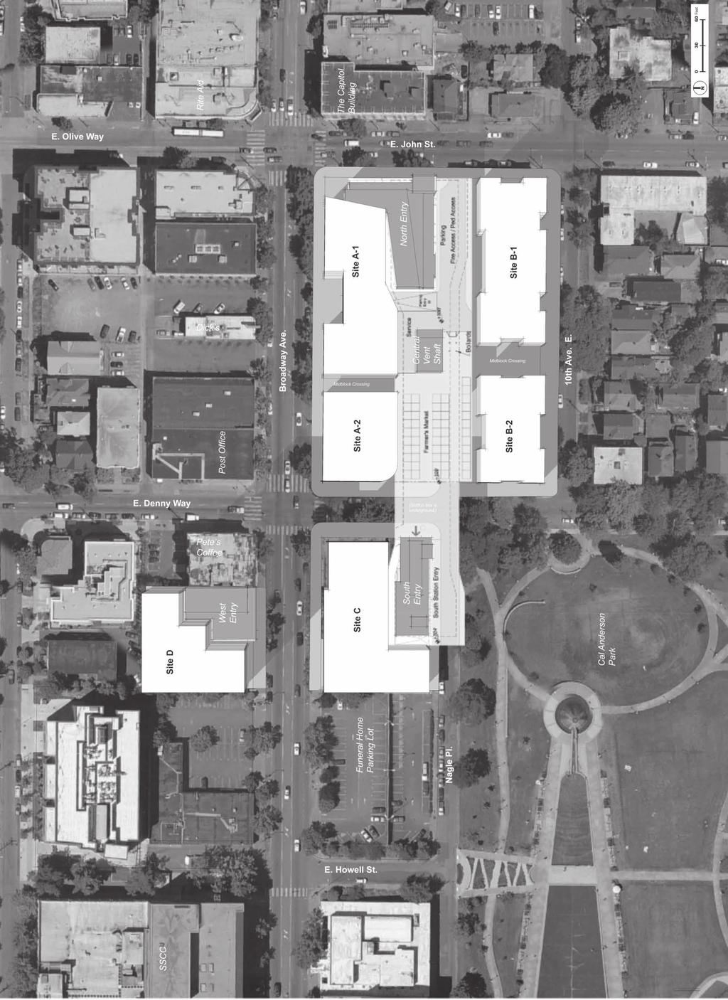
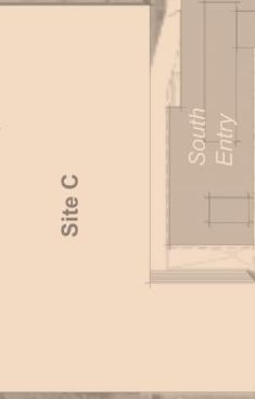
7 CONTEXT Policy Background The recommendations in this framework are consistent with and guided by Comprehensive Plan and Capitol Hill Neighborhood Plan goals and the February 2010 Capitol Hill-Broadway Transit Oriented Development Guidelines and Urban Design Recommendations Report. As an Urban Center Village, Capitol Hill s functional designation is primarily residential. The goals of the Capitol Hill community as stated in the Comprehensive and Neighborhood plans are to achieve a neighborhood character with distinct residential areas, active business districts, accessible transportation services, and strong institutions, which is diverse and densely populated. (Comprehensive Plan, Neighborhood Planning Element, Capitol Hill Community Character Goal, (CH-G1)). Physical Setting and Development Potential The assembled sites acquired by Sound Transit in order to construct the Capitol Hill light rail station, will include three at-grade station entries to the below grade transit facility. Capitol Hill prides itself in being one of the densest and most transit friendly neighborhoods in Seattle. The significant Broadway frontage of the sites, especially at the key intersection of Broadway and E John Street, combined with ready access to a variety of public transportation choices and proximity to Cal Anderson park emphasize the once in a generation opportunity presented by redevelopment. The Site Capitol Hill Station Project Area Sound Transit parcel assemblage represented by the designation of Site A, B, C & D shown in the map below. EAST DENNY WAY EAST JOHN STREET The community aspires to be a diverse and densely populated neighborhood where a range of housing types and levels of affordability are offered. Additionally, a balanced transportation environment is a goal, with an emphasis on the pedestrian environment while addressing the parking needs of residents and visitors. BROADWAY AVENUE EAST NAGLE PLACE Site D Site C Site A Site B BROADWAY AVENUE EAST 10TH AVENUE EAST EAST DENNY WAY EAST JOHN STREET Lightrail Station Street-level Floor Plans courtesy of Hewitt From the Capitol Hill - Broadway TOD Development Guidelines and Urban Design Recommendations Report schemata workshop + MAKERS 9 Capitol Hill Light Rail Station Sites Urban Design Framework Page 5 DRAFT - May 9, 2011

8 CONTEXT Site Organization and Hierarchy During the UDF process, community members and design and planning professionals reviewed the four sites and came to many of the same or similar conclusions about overall site organization and hierarchy. The diagram below is a summary of major site organization concepts around which many of the findings and recommendations in the UDF are organized. Bordering street character is an important determinant: Broadway and John Streets are busy and vibrant main streets, while 10th Ave. E, E. Denny Way and Nagle Pl. are quieter, more local and green in character. The corner of Broadway and John St. is the most prominent focal point on the sites a location to mark a key corner. It is adjacent to the most prominent station entry. A location of secondary prominence is the vicinity of the south station entry near Station Plaza and the edge of Cal Anderson Park an important human scaled, public space. A sweeping pedestrian desire line, shown in a red diagonal line from the corner of Broadway Ave and E John Street to Cal Anderson Park, should connect the two locations of prominence and provide an inviting linkage through Station Plaza. The overall development and massing should re-orient the sites to frame and define the central Station Plaza. This informs recommendations for siting additional development potential and mass. A continually linked sequence of public spaces should connect the Park, across E. Denny Way, through Station Plaza, midblock crossings to station entrances. DRAFT - May 9, 2011 Page 6 Capitol Hill Light Rail Station Sites Urban Design Framework
9 CONTEXT The 10th Avenue frontage should gently transition to the low-rise residential character of that street, while acknowledging that over time, additional density may be desirable in the immediate vicinity of the transit station. Sound Transit s Response to Community Comment Over the past several years Sound Transit has made an exceptional good faith effort to partner with the Capitol Hill community to plan for development above their station. As a result Sound Transit has incorporated many of the good ideas the community has championed. Sound Transit s original site concept for their sites included an alley that would separate development sites A and B. After hearing substantial community support for a permanent home for the Broadway Farmers Market, Sound Transit revisited their original site plan and proposed a significant public plaza, referred to as Station Plaza, between the two development sites. This Plaza meets the community s request as well as Sound Transit s operational requirements. Additionally, in recent conceptual site plans, Sound Transit has shown mid block crossings through the A and B sites, in response to community concern over a block-long uninterrupted street frontage and limited Sound Transit properties site plan, modified per community input. June 2010 Capitol Hill Light Rail Station Sites Urban Design Framework Page 7 DRAFT - May 9, 2011


 with spaces designed to accommodate a variety of retailers at a range of")
10 Example of activating use spilling onto pedestrian alley in Pike Place Market. D C A B A B Site map with parcel designations An activated and interesting mid-block crossing. Alley 24 Seattle. FRAMEWORK RECOMMENDATIONS Recommendations Recommendations throughout are organized into points of Development Guidance and points of Design Guidance. Development Guidance describes expectations of the community of actions and decisions that are critical to the realization of the overall vision. Design Guidance refers to subjective or discretionary elements of the sites development. Desired Uses The following recommendations address the program and use of the sites, their design and scale and the programming and maintenance of the publicly accessible public spaces. Retail, Service and Community Space Retail uses should be distinguishable, diverse, active, and occupied (by station opening) with spaces designed to accommodate a variety of retailers at a range of rental or ownership costs. Ideally retailers and services that are not currently represented in the neighborhood (e.g. office supplies, home furnishings, hardware, men s clothing, etc.) are encouraged. A community/cultural gathering space within the redevelopment is strongly supported by the community, ideally located facing the Station Plaza. This space could serve as a community meeting and gathering space, contain office spaces for non-profits and possible performance and/ or arts spaces. Additional work needs to be done within the community to further refine the vision of the center and its identity as well as to continue to explore funding mechanisms and partnerships. The following recommendations are intended to activate the streetscape around and plaza respecting residents on the site, to realized a significant amount of affordable housing and to help provide for a community /cultural gathering space. Development Guidance for Sites A Vibrant ground floor retail or active service should front Broadway If destination retail is part of the retail portfolio, orient this use towards Broadway Housing should be located on the third floor and above (possibly floor two as well if there are no offices). See housing discussion for specifics. Locate smaller, more locally serving retail on midblock crossing between Broadway and Station plaza. Design these spaces to be flexible to accommodate a variety of potential uses and shared uses. Locate active uses on the ground floor fronting the plaza and E Denny with the intention of helping activate the Station Plaza and the Festival Street through the ground floor use. Design these spaces to be flexible to accommodate a variety of potential uses and shared uses. Development Guidance for Sites B Provide affordable housing for a range of residents. Consider families and the elderly in the range of residents seeking affordable housing. Locate ground related housing with individual unit entries on the 10th Avenue frontage. DRAFT - May 9, 2011 Page 8 Capitol Hill Light Rail Station Sites Urban Design Framework

 in the ground level facades fronting the interior of the sites to provide eyes on Station Plaza")
11 FRAMEWORK RECOMMENDATIONS Design Guidance for Sites B Provide for activating use (e.g. artist work and display spaces, active live-work units, services and retail with robust foot traffic) in the ground level facades fronting the interior of the sites to provide eyes on Station Plaza and other publicly accessible spaces during the day and evening. House a range of activating uses in the ground level facades fronting the interior of the sites to provide eyes on the Plaza and other publicly accessible spaces during the day and evening. Uses could include artist work and display spaces, active live-work units, services and retail with robust foot traffic. Consider the southern, plaza facing end of this site as a potential location for a community/ cultural gathering space. Development Guidance for Sites C Orient vibrant ground floor retail or active service along Broadway. Provide housing on the third and above floors (possibly floor two as well if there are no offices). See housing discussion for specifics. Locate active uses on the ground floor fronting E Denny with the intention of helping activate the Festival Street through the ground floor use. Development Guidance for Site D Provide affordable student housing and other uses affiliated with the College according to the needs of the college.. Development Guidance for Station Plaza (see also Management, Programming and Maintenance of Station Plaza section) Make the Station Plaza available to the Broadway Farmers market as a permanent home to host their weekly or biweekly Farmers Market Make the plaza available to other public uses and programs during non-market times. Limit vehicular movements within the plaza to loading and unloading for the Farmers Market and other service and delivery functions. Consider uses that will activate the Station Plaza on non-farmers Market days such as A food court using semi-permanent food vendors Art/craft markets Performances Buskers Housing Residential development is a high priority for both the Capitol Hill community and Sound Transit, providing increased ridership for the light rail and street car lines and more housing options for Seattle s densest neighborhood. The 2010 Capitol Hill Chamber of Commerce s Transit Oriented Development Subcommittee s Development Guidelines and Urban Design Report recommended to encourage creative partnerships between affordable housing developers and market rate developers to create a mixed-income project...in an effort to bring investment to the community while mitigating displacement. The idea that the existing community should benefit from rather than be displaced by any new development was prevalent throughout the discussions of housing. A market held during certain times in a central plaza. Recent infill housing development on Capitol Hill. Capitol Hill Light Rail Station Sites Urban Design Framework Page 9 DRAFT - May 9, 2011

12 FRAMEWORK RECOMMENDATIONS Example of ground related housing Image courtesy of Schemata Workshop A May 2010 Sound Transit sponsored apartment study in the greater Capitol Hill area analyzed the area s rental housing needs and affirmed the community s prioritization of affordable housing. It identified an unmet demand for 8,263 units affordable to households earning up to 60% AMI, which is expected to increase to 9,982 units by 2016 when light rail opens. The eventual development above the station should absorb some of this demand. In 2008 Sound Transit first heard the community s desire for affordable housing above the light rail station. The Sound Transit Capitol Hill Station TOD Sites Baseline Report stated affordable housing is market-driven and will be an issue that the community will pursue. What constitutes a significant goal also needs to be defined. The Urban Design Framework planning process successfully developed consensus among stakeholders to define housing goals and identified a set of clear strategies to accomplish these goals. Development Guidance 50% of all housing units on sites A, B and C should be affordable for 50 years for households that make at or less than 80% of area median income (AMI). Half of those units, 25% of the total, should be affordable for households that make less than 50% of area median income. Make Site B available for the development of affordable housing built with public subsidy. Most of the affordable housing units needed to achieve the overall 50% affordable housing goal should be provided on Site B.Provide an amount of affordable housing within development on sites A and/or C needed to reach the overall 50% affordable housing goal. Affordable student housing is recommended for the upper levels of site D. Population and unit type needs should be considered in the RFQ/RFP. There is a need for more affordable housing that meets the needs of seniors, families and artists in the neighborhood. Design Guidance Townhome style units with individual unit entries facing the 10th Ave E side of Site B could be an appropriate location for affordable family sized units as well as incorporating design features to better transition to the L3 zoned block to the east. Activity generating uses should face Station Plaza on the ground floor. Should these uses be housing, active live/work units should be considered. A combination of development incentives and subsidies is needed to implement the housing recommendations. Public subsidy will provide much of the capital needed to develop the affordable housing units on Site B while the City of Seattle s Multi-Family Tax Exemption Program and Residential Bonus Program will be critical to provide affordable units in the market rate residential developments on Site A and Site C. This analysis did not factor in the student housing developed on Site D because no City housing funding can be used. Bicycle Parking Plentiful bicycle parking should serve a variety of users, from long-term commuter/tenant parking to short-term transit/shopper (non-commute) parking. Short-term bicycle parking can be provided via bike racks, on-street bicycle parking and covered bike DRAFT - May 9, 2011 Page 10 Capitol Hill Light Rail Station Sites Urban Design Framework

 users is advisable.")

13 parking. Long-term bicycle parking should be provided with secured bicycle parking facilities via bike lockers, pre-fabricated modules with membership access, and BikeStation type of ground floor retail facility that could be arranged with the developers. As there will be limited bike parking turnover for a relatively long period, a nearly a one-to-one correspondence between parking demand and parking supply for long-term (commuter) users is advisable. Light rail will generate many short trips to the stations that it is certain to increase levels of bicycling to gain access to the station. Adequate space and locations for bicycle parking, is essential to making bicycling a convenient and desirable choice to access light rail. Although the Land Use Code states that at least 20 spaces should be provided for long-term bicycle parking at rail transit facilities, the City may require more parking spaces based on the following factors: area topography, pattern and volume of expected bicycle users, nearby residential and employment density, proximity to trails, projected transit ridership and expected access to transit by bicycle, and other relevant transportation and land use information. Sound Transit supports actively promoting bicycling to stations as a way of increasing ridership and reducing motor vehicle trips to the station (per the December 2008 Sound Transit Capitol Hill Station TOD Sites Baseline Report). Development Guidance Accommodate at least 169 bicycle parking spaces in 2016 (a mix of long-term and short-term parking facilities) see technical appendix for source for forecasted numbers. FRAMEWORK RECOMMENDATIONS Accommodate at least 336 bicycle parking spaces by 2020 (a mix of long-term and shortterm parking facilities). Locate bicycle parking at or as close as possible to station entrances. Make ground floor area within a building available for a potential BikeStation membership type of facility in order to accommodate bicycle parking demand that might not be able to be located within, due to limited space, close proximity to station entrances. Locate a pre-fabricated secured bicycle parking facility within the project area in partnership with SDOT. Automobile Parking Parking strategies should promote light rail, bus, and streetcar ridership and pedestrian and bicycle use, as well as discourage automobile use and commuter parking. Shared parking among developments is advantageous and necessary to reduce the number of stalls and the cost of providing parking. Parking costs should be unbundled from building rent costs. Sound Transit should require the developer to provide alternatives to car parking, such as additional secured bicycle parking and the use of car sharing (Zipcar, etc.). Given the proximity to transit, there should be less total parking than market rate developments typically provide. SDOT will consider modifying Nagle Place current unrestricted parking and load zones prior to light rail opening in 2016 to provide more short-term, on-street parking spaces for retail customers. Secure bike storage in Leiden, the Netherlands. Copyright SciFi Laura, Flickr. Secure Bike parking in Denmark: Copyright Meaghan K, Flickr. On street bike racks are good for short term parking. Capitol Hill Light Rail Station Sites Urban Design Framework Page 11 DRAFT - May 9, 2011
14 FRAMEWORK RECOMMENDATIONS Any increase of automobile parking space is inconsistent with Sound Transit s mission of providing transit service. Sound Transit has indicated that developers will not be asked to provide commuter (park and ride) parking or additional parking to serve the business district. Initial assumptions by Sound Transit articulated in their December 2008 Baseline Report regarding future transit oriented development sites are that a minimum amount of parking equal to less than one stall per unit would be supplied. The adjacency of alternative modes of transportation should encourage tenants and customers to arrive at the developable sites without the use of a car, thus a smaller demand for parking. *A graphic of desired uses follows on pages 14 and 15. Development Guidance Use on-street parking and shared parking strategies to address retail parking demand. Provide car sharing opportunities for tenants and customers. Provide less than 0.7 stalls/unit of housing, for market rate housing less for affordable housing units. Aim to provide less parking than the demand suggested through standard modeling, given the ready access to high capacity transit. Design Guidance Consider incorporating electric car charging stations in the redevelopment. Unbundle parking from residential and retail rental cost. DRAFT - May 9, 2011 Page 12 Capitol Hill Light Rail Station Sites Urban Design Framework
15 FRAMEWORK RECOMMENDATIONS Page left intentionally blank Capitol Hill Light Rail Station Sites Urban Design Framework Page 13 DRAFT - May 9, 2011
16 FRAMEWORK RECOMMENDATIONS DRAFT - May 9, 2011 Page 14 Capitol Hill Light Rail Station Sites Urban Design Framework


17 FRAMEWORK RECOMMENDATIONS N Capitol Hill Light Rail Station Sites Urban Design Framework Page 15 DRAFT - May 9, 2011


18 FRAMEWORK RECOMMENDATIONS Building mass and modulation can open up a plaza or open space to sun and air. Image courtesy of Schemata Workshop. Taking advantage of the grade change, providing places to sit and observe amidst activity. Image courtesy of Schemata Workshop. A modern example of ground related housing. Alley 24 Seattle Design Quality and Scale Since design is inherently subjective and a variety of treatments can achieve desired intent, all recommendation in the Design Quality and Scale section are Design Guidance except those offering Development Guidance. Context and Site The bordering street character, planned station facilities, Cal Anderson Park and the proposed Station Plaza establish a hierarchy of spaces within the sites. Broadway and John Streets are busy and vibrant main streets, and the most prominent station entrance is the north entry near this intersection. This corner marks the most prominent focal point on the sites. A location of secondary prominence is the vicinity of the south station entry near the Station Plaza and the edge of Cal Anderson Park. The proposed Station Plaza is an important linking space at the heart of the sites. E. Denny Way and 10th Ave. E. have quieter local residential character. This general hierarchy of spaces drives many of the following urban design recommendations. Key Corner at the Broadway Ave. E. & E. John St. Intersection Include a strong form or focus on site A-1 at the intersection of Broadway Ave. E & E. John St. near the main (north) station entry. This could be a prominent retail entry, an architectural expression or other feature. Compatible Residential Character of the 10th Ave. E. Frontage Development Guidance: Respond to the lowrise multifamily zoning along 10th Ave. E. by providing ground-related or live-work housing on the first floor of the B sites facing 10th Ave. E. with a townhouse or rowhouse character. Favorable Sun and Air Exposure onto the Station Plaza and E. Denny Way Festival Street Allow for increased mass and scale away from the Station Plaza and the E. Denny Way Festival street on the north portions of site A and B and the southernmost portion of site C. Reduce the scale of buildings directly on the plaza in ways that preserve solar access. Include upper level setbacks on sites A-2, and C, and step down the scale of building B-2 towards the Plaza and park edge. Capitalize on the Grade Change The grade change - roughly a 7 drop from the Broadway Ave. E. elevation to the Station Plaza floor is a critical site element. Address the grade change as an integral feature of the design. Techniques may include the use of stepped terraces, a prominent stair or ramp element on the plaza side of the A sites, retail that steps down or an activated loading dock type treatment that takes up 3 to 4 feet of the grade change. Development Guidance In no case should an exposed portion of a parking structure, portion of a foundation, blank wall or similar result from the grade change across the sites. DRAFT - May 9, 2011 Page 16 Capitol Hill Light Rail Station Sites Urban Design Framework


 or dynamic displays including movies, green wall treatments, or public art installations.")
19 FRAMEWORK RECOMMENDATIONS Favorable Relationships of Buildings to Station Entries and Facilities The design of Sound Transit s Station facilities and their associated functions are fixed elements of site context. Infill development should maximize compatibility and synergy with these site elements. Configure the base of the building at A-1 for an integrated connection with the north station entry. Consider pulling design elements from the station across the base of the building on A-1, especially at the corner of Broadway and E John Street as the building turns the corner onto Broadway. Integrate the central vent shaft facility as a focal point of Station Plaza. Techniques could include information (potentially transit or train related) or dynamic displays including movies, green wall treatments, or public art installations. Consider streetscape design near the south station entry that makes a clear link between the station entry and the station plaza space across E. Denny Way. Carefully Integrate Vehicle Accesses Points into and Through the Sites Preferred locations for vehicle entry points to parking, loading and service for and within the sites are as follows: E. John St. in the midblock between Broadway and 10th Avenues E. (sites A and B); Nagle Place (building C); local pick up and drop-offs including kiss and ride Nagle Pl. and E. Denny Way south of Station Plaza. Design the drivecourt entry from E. John St. as a shared pedestrian / vehicle space. Vehicles should be encouraged to move slowly, and urban design elements and softening features such as pavement treatments, landscaping, lighting fixtures and other elements should be used to indicate it as a shared space. Public Life The following recommendations relate to public life. Proposed design features are intended to: support the use of public transit; contribute to the network of public realm spaces around the site; create a safe, comfortable and interesting environment that encourages walking; and encourage human activity and interaction at the street level. A Sweeping Pedestrian Desire Line from the Broadway & John St. Intersection to Cal Anderson Park Reinforce the site s hierarchy by including a sweeping pedestrian pathway leading from the main station entry at the Broadway Ave E. and E John St. intersection through the midblock crossing of Site A, through Station Plaza to Cal Anderson Park. Consider a gradually increasing space along Broadway at site A-1 that leads pedestrians to the midblock crossing to help create the pedestrian desire line. Design the midblock crossing of Site A in a way that invites visitors into Station Plaza. Consider pulling the building back from the corner at the base of Building A-1 at the corner Chicago s Crown Fountain draws participants and onlookers. Shared right of way between pedestrians, bikes and vehicles. A sweeping pedestrian desire line. Capitol Hill Light Rail Station Sites Urban Design Framework Page 17 DRAFT - May 9, 2011
 station egress to the south.")
 Designate E Denny Way between 10th Ave. and Broadway as a Festival Street.")
20 Plazas are activated through adjacent use and building design. Image courtesy of Schemata Workshop. Balconies provide eyes on the plaza below, artfully done they provide visual interest. Image courtesy of Schemata Workshop. FRAMEWORK RECOMMENDATIONS of Broadway Ave E and E John Street, to facilitate pedestrian movement from the main (north) station egress to the south. Create a Network of Public Space Connections between all Public Spaces on the Sites Development Guidance: Restrict vehicular access on E. Denny Way between Broadway Ave and Nagle Place (see Streetscape section for additional detail) Designate E Denny Way between 10th Ave. and Broadway as a Festival Street. Design the Festival Street as a curbless environment for seamless linkage between the Festival Street and the Station Plaza. Consider high interior transparency on site B-2 that enhances the link from Cal Anderson Park to Station Plaza. Consider a light jewelbox concept for the structure or portion of the structure on B-2, and explore a design that enables the plaza to extend through the B-2 building. Explore this site/structure for a potential focus for the civic and community functions. Intensely Activate Station Plaza with Adjacent Building Design The ground levels of buildings A-2, B-2 and C where facing Station Plaza and the E. Denny Way Festival Street should house retail spaces with strong potential for interaction with the public realm. Design features to reinforce this interaction might include: space for sidewalk cafes\ storefront windows and doors that completely open; generous canopies; and/or associated vendor kiosks and stalls. Development Guidance: Provide continuous overhead weather protection along all building edges fronting Station Plaza. Within Station Plaza consider appropriate sub-structures and built elements to inhabit the plaza space to provide interest and variety in Station Plaza. Explore architectural features within ground level facades at the Plaza such as recesses, bays, colonnades, to ensure interest and variety. Consider placing prominent building entries directly on Station Plaza where feasible especially on site B-2. Include Upper Level Overlooks of the Station Plaza for Oversight Include amenity areas on upper levels of structures around the station plaza that contribute to eyes-on-the-plaza. Explore the inclusion of shared upper level patios and decks with vistas over the plaza. Include useable balconies and terraces associated with individual housing units facing onto the plaza to provide oversight and to contribute to architectural interest facing the plaza. Highly Civic Broadway Streetscape Character Enhance Broadway s character as a vibrant shopping and public life main street. Include substantial retail spaces on the Broadway Ave.-facing ground floors of buildings A-1, A-2 and C. Consider designing flexible retail spaces facing Broadway Ave. to potentially accommodate a larger anchor or destination retail tenant. DRAFT - May 9, 2011 Page 18 Capitol Hill Light Rail Station Sites Urban Design Framework


21 FRAMEWORK RECOMMENDATIONS Design a civic streetscape facing Broadway. Consider a palette of streetscape elements that includes: special pavers and detailing; abundant planting in appropriate locations; pedestrian lighting; signage and wayfinding; and street furniture. Design Concept The following recommendations relate to an overall design concept. The direction and guidance is intended to encourage: an optimized arrangement of uses and activities on the sites; unified, balanced and harmonious building forms that fit with their surroundings; an architectural concept that results in functional and harmonious design; open spaces integrated with building design; and use of civic-quality materials for the building and open spaces. A Massing Concept that Steps Down Towards the Central Station Plaza Development Guidance: To orient structures to Station Plaza, an overall massing concept that steps down towards or addresses the Central Station Plaza / E. Denny Way Festival Street / Cal Anderson Park edge is recommended. Increased building mass and scale should be focused at the north of sites A1 and B1 (to NC3-85 and NC3-65 respectively) and the south edge of site C (NC3-85). Retain existing zoning on the south of sites A-2 and B-2 (NC3-65 and NC2-40 respectively). Provide upper level setbacks on the north end of site C at the 4th story level, and at the 6th story level stepping down towards the plaza. Provide an upper level setback on the plaza side of building A-2 at the 4th story level. Retain a moderate scale of building on Site B-2 explore design treatments (such as transparency) that minimize bulk and scale and integrate the structure into the fabric of Station Plaza. Pursuit of Environmentally Sustainable Design and Programming Solutions Development Guidance: Work with efforts already underway to explore the viability of shared design solutions that result in more environmentally responsible form and function, such as the use of district energy, water and stormwater resources, management of waste, optimizing food production & composting, etc. Explore flow through ventilation, maximization of passive heating and cooling systems. Edges That Respond to Context All buildings facing outward to the street should respond to the context of those edges. The 10th Ave. E. frontage should visually integrate with low-rise multifamily across the street, and strengthen the residential character of the area. Individual unit entries Capitol Hill Light Rail Station Sites Urban Design Framework Page 19 Broadway is Capitol Hill s main commercial street. An example of building forms stepping down towards a public place. DRAFT - May 9, 2011


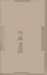
22 An example of a midblock crossing that retains buildable space above. Alley 24 Seattle An example of expressive architectural expression. Image courtesy of Kanner Architects. FRAMEWORK RECOMMENDATIONS facing 10th Ave. E. should incorporate features such as stoops, porches or other features that enhance residential character. A setback is recommended at the 3rd or 4th story of building B-2 along 10th Ave. E. to create a scale compatible with low-rise development across the street. A setback of at least 10 is recommended. Address possibility of change in zoning in the future. Enhance Broadway s character as one of Capitol Hill s most prominent and vibrant shopping and public life main streets. Facades facing Broadway should hold the street edge, and buildings may go to allowed height limits at the streetwall as consistent with other newer developments on the street. Midblock Crossings to Strengthen Plaza Orientation and Break Up Building Mass Development Guidance: While flexibility in the specific location and form of the midblock crossings is encouraged, mid-block crossings within site A and B should help achieve the following design objectives: Enhance orientation to Station Plaza. Midblock crossings are expected to have a relationship to the plaza. The two midblock crossings should create a logical pedestrian link through the block between Broadway and 10th Ave. E. Flexibility in Mid-Block Crossings for Creative Solutions The location of the midblock crossings between the building volumes within the A site and the B site should be flexible to encourage creative design solutions to this connection. Designers are encouraged to explore creative treatments and configurations that make the mid-block crossings an important element of the design concept. Treatments could include: An inviting entry feature such as cascading stair or terrace (especially Site A) Commercial and retail uses that activate the street and that turn-the-corner into the mid-block crossing. (especially Site A) Using the mid-block crossing as a transition point of building character, scale or mass. Treatment of the midblock crossings as a penetration of a linked building form (Within A-1 to A-2, or B1 to B-2). However in this scenario, the crossing should remain open to the public, be of a highly transparent nature, and be a prominent feature of building design. Inspired Design of Exemplary Station Plaza The central Station Plaza is a focal point of future development and the Capitol Hill community as a whole; it should be designed as a unique and special public space. The relationship of Station Plaza to the surrounding buildings as well as to the E. Denny Festival Street and Cal Anderson Park is a primary design consideration one that will orient and raise the bar for the design of adjacent streets and building facades. DRAFT - May 9, 2011 Page 20 Capitol Hill Light Rail Station Sites Urban Design Framework

23 FRAMEWORK RECOMMENDATIONS Design of Station Plaza should inform and be informed by that of the E Denny Festival Street. Collaboration between designers of these two spaces is essential. Design of Station Plaza should ideally accommodate and not preclude provisions for erecting temporary overhead protection across the Plaza. Integrally accommodate programming needs of the plaza such as access to electricity and water for the functional program of future users. Treatments to consider may include: (See also Sound Transit Nagle Place Extension Workshop summary) A progression of treatments from green/soft at the park edge to more urban/hard at Broadway. Textures and interest in the ground plane. Places to sit, gather and rest Restrict vehicular access across Station Plaza Explore integration of an artistic, removable weather protection cover/canopy over Station Plaza. Opportunity for Expressive Architectural Treatments This is a special location in a unique neighborhood. Designers are encouraged to propose expressive and creative architecture and site design within the parameters of the urban design framework. Bird s eve concept diagrams of the development sites follow on pages 22 and 23. Please note these diagrams are meant to convey one of many massing configurations that would achieve the overall vision of the redevelopment. These diagrams are a starting point for future developers, rather than a proscriptive design. An example of bold architectural expression. Image courtesy of Schemata Workshop. Capitol Hill Light Rail Station Sites Urban Design Framework Page 21 DRAFT - May 9, 2011


24 FRAMEWORK RECOMMENDATIONS B Options N DRAFT - May 9, 2011 Page 22 Capitol Hill Light Rail Station Sites Urban Design Framework


25 FRAMEWORK RECOMMENDATIONS N Capitol Hill Light Rail Station Sites Urban Design Framework Page 23 DRAFT - May 9, 2011


26 FRAMEWORK RECOMMENDATIONS Capitol Hill TOD Scale & Design B-Site Options Note: These bird s eye diagrams are concepts for general illustrative purposes only. Diagrams depict one of many massing configurations that could result from design principles of the Urban Design Framework. Volumes are intended to show general mass and scale, and are not to suggest particular architectural design concepts. Option Concept: 3 Part-Step Down The B site is broken into 3 masses that stair-step down towards the park and plaza. Two midblock crossings are included to further reduce the scale of buildings fronting 10th Ave. This concept accommodates a suite of uses on the B sites that do not include a sizeable community / cultural center. Option Concept: Stand Alone Jewel Box The portion of the B site facing the park and plaza is occupied by a small stand-alone retail pavilion that is incorporated into the chain of public spaces. Development on the B sites is configured in two primary masses with a midblock crossing. The concept also accommodates a suite of uses that do not include a substantial community / cultural center. 6 story mixed use. 5 story mixed use. Jewel box retail pavilion. 4 and 3 story mixed use. E AV AY W D VE YA WA D A RO B OA TH H E. 10 T E AV AV E E. BR 10 L. EP GL NA DRAFT - May 9, 2011 E. D L. EN NY EP GL NA W AY Page 24 E. D EN NY WA Y Capitol Hill Light Rail Station Sites Urban Design Framework

27 FRAMEWORK RECOMMENDATIONS Design Quality and Scale Streetscape Active, ground floor commercial uses should face on Broadway Ave., E John St and E Denny Way. The 10th Ave E façade should continue to incorporate the feel and character of a residential street and access to parking should be discouraged from 10th Ave E. Provide active uses (artist live/work) along the west side of site B1 to help activate the area between the northern station entrance, the alley access to parking from E John St and the north portion of Station Plaza. It is understood that this area would need to accommodate vehicles for service and parking as well as pedestrians traveling to Station Plaza from the E John St station entrance. A shared festival street is recommended for E Denny Way between Broadway Ave and 10th Ave E and should have a special pedestrian-focused design with café, restaurant or other use providing outdoor seating to activate the right-of-way. The goal for E Denny Way is to make walking and biking to the E Denny Way Link Light Rail station entrance more comfortable, convenient and safe. The vision for E. Denny Way between Broadway and Nagle Place is a flexible public right of way that accommodates pedestrians, bikes and occasionally cars; an extension of Station Plaza and a gateway to Cal Anderson Park. While there are differing opinions regarding the specific operational function of E. Denny Way, it is clear that the character of the right-of-way should change. The goals for the space include: Pedestrian and bicycle focused Limited access for local circulation and commercial load zones Contiguous surface with Station Plaza ADA accessible Ability to close the entire street for specific events Festival Street designation Creation of a pedestrian plaza, through the re-purposing of the right-of-way, attempts to increase not only walkability, but the livability of the neighborhood. The vision for E Denny Way is one that creates a sense of place and interconnects visually with Station Plaza, while accommodating spillover of events taking place there, such as live music and performances, kid-friendly activities, and promotion of local businesses. It can be a public gathering place for residents and visitors, a place for shoppers to rest and eat in the public realm, a vibrant open space, with adjacent ground floor commercial uses to keep the space active. An example of the character sought on E Denny Way is that of Pike Place. The sense of place is apparent and vehicles are able to enter onto the space, but do not overwhelm nor dominate the space. East of Broadway, E Denny Way becomes a residential street with a very different feel than Denny Way to the west of Broadway - slower moving traffic, a pleasant pedestrian environment with Cal Anderson Park to the south, large street trees and on-street parking on both sides of the street announce this change in character. Woonerf, shared street Capitol Hill Light Rail Station Sites Urban Design Framework Page 25 DRAFT - May 9, 2011
28 FRAMEWORK RECOMMENDATIONS The Seattle Streetcar First Hill line will terminate on Broadway Ave. south of E. Denny Way adjacent to the west Sound Transit station entry. Streetscapes should be designed to enhance pedestrian connectivity between the streetcar stop, the station plaza and other portions of the redevelopment. This may include future enhancement of crosswalks at the Broadway and John intersection. Consistency of streetscape elements including paving materials, street furnishings and lighting fixtures between the streetcar stop area and the E. Denny Way Festival Street and Station Plaza are recommended for visual continuity. The consistency should extend southward along the length of collegerelated development on site D. A widened sidewalk is recommended along Broadway for the length of the Site D college-related development. Development Guidance Design E Denny Way between Broadway and Nagle Place to reflect the desire for an enhanced pedestrian and bicycle environment which allows the street to operate with restricted access. Design considerations: Operational design: Design E. Denny Way between Nagle Place and Broadway with the intention to prioritize pedestrian and bicycle access and provide commercial vehicle access only. Main access for the new development should be from 10th Ave. E. and E. John St. Depending on site development configurations, determine if the E. Denny closure requires revisiting to allow one lane for westbound traffic as well as commercial load zones to support the new TOD development (approximately 17 feet of drivable surface). Prohibit non-emergency vehicular eastbound traffic on E Denny between Broadway and Nagle Place. Local circulation can still proceed adjacent to the Sound Transit owned properties by use of 10th Ave E, E Denny Way and Nagle Place. 10th Ave E will act more positively as a bicycle boulevard with less traffic using E Denny Way as a cut-through opportunity. Allow commercial load zone parking spaces along the south side of E Denny Way between Nagle Place and Broadway in order to service the developments on Sites A. Aesthetic design: Prioritize pedestrians and bicyclists. Use planters and/or lighted bollards to reflect pedestrian space versus vehicular space. Use removable bollards to close the roadway for specific events or for spillover events at Nagle Plaza. Create a curbless environment in which the rightof-way height matches that of Nagle Plaza to establish a strong link between the two spaces. The change in grade (speed humps) will help to distinguish E Denny Way as a special space that requires lower speeds. Install do not enter signs at E Denny Way and Broadway. Additional details: Pedestrian-scaled lighting Trees Natural drainage/landscaping Utility connections to facilitate opportunities for mobile vending and Festival Street programming Pavers or other materials to distinguish placemaking Secured bike parking facility DRAFT - May 9, 2011 Page 26 Capitol Hill Light Rail Station Sites Urban Design Framework

29 FRAMEWORK RECOMMENDATIONS N Capitol Hill Light Rail Station Sites Urban Design Framework Page 27 DRAFT - May 9, 2011
30 FRAMEWORK RECOMMENDATIONS Continuous awnings for weather protection Signage and wayfinding Design the Station Plaza alley (between E John Street and Station Plaza) as a woonerf type of street to allow for a shared environment for pedestrians/bicyclists and vehicles. This area should safely accommodate pedestrian movement and vehicular access - both service/maintenance and parking - for the development. Active uses on the ground floor of site B could help generate foot traffic and maintain the space as evenly shared between pedestrians, Bicycles and automobiles. Management, Programming and Maintenance of Station Plaza It is well understood that the success of the redevelopment will be greatly influenced by the function of Station Plaza. An active and vibrant station plaza can act as a magnet, drawing people into the space and therefore the ground floor uses bordering the plaza. An empty plaza may have the opposite effect, deterring people from entering. The commitment to house the Broadway Farmers Market will bring activity to the plaza as well as help introduce people to the space when it first opens. It is critical that the plaza be managed, maintained and actively programmed so it becomes the civic heart of the development on Broadway. Design Guidance Engage existing community organization such as the Broadway Business Improvement Association, the Capitol Hill Housing Public Development Authority, the Greater Seattle Business Association, or other entity to manage and program the space. Create an advisory board of members from other existing organizations, property owners and residents. The managing entity should be integrally connected to the neighborhood. Ideally entity offices would be located on site. Assure compatibility between uses on the plaza with resident s life above. Develop an agreement between Sound Transit and property owners that establishes criteria for space activation that considers the comfort of nearby residents. Consider requiring all users of non residential space to covenant management and programming. Procedural Site Redevelopment: Redevelopment of sites owned by a transit agency above a light rail station presents complex procedural and organizational challenges. The following recommendations relate to procedural steps that can help to realize successful reuse of the sites for the mutual benefit of the community, City, and Sound Transit. DRAFT - May 9, 2011 Page 28 Capitol Hill Light Rail Station Sites Urban Design Framework
31 FRAMEWORK RECOMMENDATIONS Design Guidance Consider a Master Developer for sites A, B and C. Absent a Master Developer, combine the A sites (A1 with A2) and the B sites (B1 with B2) into consolidated singular parcels for the purposes of development. This will encourage more coordinated development. Site configuration for shared features such as continuous below grade parking (below the A site, and below the B site), and upper level building connections for circulation. If a Master Developer is not selected for sites A, B and C, structure a process by which individual development teams can collaborate, share design ideas and coordinate efforts throughout design and construction so the development reads as a comprehensive whole. In the RFQ/RFP, ask proposing development teams for demonstrated experience collaborating with other developer teams and programming spaces similar to Station Plaza. Capitol Hill Light Rail Station Sites Urban Design Framework Page 29 DRAFT - May 9, 2011

32 OTHER GREAT IDEAS Other Great Ideas In the course of the workshops and other community meetings that informed and shaped the recommendations in this report, several other great ideas emerged. These ideas are noted below for further comment and exploration as well as to provide future developers of the sites with the range of fertile, creative ideas from the community regarding redevelopment of these sites. Desired Uses Hotel on sites A or C Community center located on southern portion of site A Food carts in the plaza Transparent and removable/retractable roof over Station Plaza during inclement weather Publicly accessible rooftop plaza on A or C Locate a LGBTQ community center here that provides services as well as generates additional business by becoming a LGBTQ destination. Accommodate jobs instead of primarily housing. Office space would help concentrate the number of people in the neighborhood and thereby better activate the redevelopment and neighborhood during business hours. Design Quality and Scale Raise the height limit on A1 to between 240 and 400 tall, with 45 to 48 podiums on sites A2, B1, B2 and C. Assume 10,500 SF floor plates so as to avoid overly bulky mass. Make the development on A1 a stellar, singular and iconic tower that serves as a beacon for this civic town square (Station Plaza) Keep the height of site C at 65 and step down to 45 at the edges fronting E. Denny Way and Cal Anderson Park. Explore opportunities for cantilevers over the station entries so as to increase available square footage for redevelopment and better integrate the single story station entries with the surrounding development. Management, Programming and Maintenance of Publicly Accessible Space Solicit from groups interested in managing and programming Station Plaza a financial plan to program space. Community organizations could then propose these plans to potential developers to provide services as well as to generate additional business by becoming a LGBTQ destination. An example of the type of slender tower supported by some participants for the A-1 site. Image courtesy of Calatrava Turning Torso Malmö: Copyright teteracomonde, Flickr. DRAFT - May 9, 2011 Page 30 Capitol Hill Light Rail Station Sites Urban Design Framework
33 OTHER GREAT IDEAS Consider a parking management district A parking management district for the Broadway neighborhood could reduce parking needs at the light rail station sites. This strategy has allowed other cities more efficient use of local parking capacity, and reduced congestion. It offers savings in overall parking development, allowing more affordable housing. Parking management coordinates supply and demand of parking stalls within an area, with devices such as synchronized signs to available spaces. It can offer parking owners a more round-theclock market for their stalls. While an innovation for Seattle, the Broadway neighborhood could provide an appropriate demonstration of this approach. The Capitol Hill neighborhood holds the notably lowest percentage of carownership in the city. An organization such as the Capitol Hill Chamber of Commerce might be appropriate to explore potential parking management for the Light Rail Station / Broadway neighborhood. Capitol Hill Light Rail Station Sites Urban Design Framework Page 31 DRAFT - May 9, 2011
34 IMPLEMENTATION Implementation Partnership options between City and Sound Transit The City and Sound Transit will continue to pursue partnership opportunities that will implement the direction and offer the guidance provided in this Framework to the future developer(s) of these properties. Streetscape Concept Plans SDOT will develop streetscape concept plans for E Denny Way, Nagle Place, Broadway (abutting Site A frontage) and 10th Ave E. Design approval, Director s rule. Amendments to the Right of Way Improvement Manual (ROWIM) should occur before Sound Transit issues the RFP for the developable parcels to ensure that private entities build the streetscape as envisioned for each street. Include consideration of green stormwater infrastructure. Develop appropriate design and management practices for Festival Streets. Neighborhood groups will be responsible for activating these streets through regular events. Design Guidelines When finalized, guidance offered in this Framework will be amended to the Capitol Hill Neighborhood Design Guidelines so as to guide future development as it goes through the City s Design Review process. Housing The City of Seattle Office of Housing will pursue opportunities with Sound Transit to incorporate the affordable housing goals into the development of these properties. Any developer who is selected by Sound Transit through their RFQ/RFP process to build subsidized affordable housing will be eligible to apply for Seattle Housing Levy Rental Preservation and Production Program funds, federal funds, and other fund sources administered by OH. At least once per year, OH publishes a Notice of Funds Available (NOFA) for the Rental Housing Program. In addition, any developer selected by Sound Transit can apply to use the City s Multi-Family Tax Exemption Program, providing 20% of all units affordable to households making 85% of median income or below in exchange for property tax exemption on all residential improvements. Ecodistrict effort by CHH ($50K funding) Capitol Hill Housing (CHH) is exploring the creation of an ecodistrict on Capitol Hill at the properties over the future light rail station. Focusing on shared sustainable, environmentally responsible and well-designed new development CHH will convene stakeholders and research possible solutions for the mixed use buildings on the site, including the possibility of using district energy. DRAFT - May 9, 2011 Page 32 Capitol Hill Light Rail Station Sites Urban Design Framework
35 CONTRIBUTORS Contributors This Framework was developed by City of Seattle staff, the Capitol Hill Champion a joint committee of the Capitol Hill Chamber of Commerce and the Capitol Hill Community Council and Sound Transit staff, building on findings and comments stemming from community meetings and workshops held over the past several years including the Sound Transit sponsored four community forums in 2009 and the August 2010 Nagle Place Extension TOD workshop and three workshops held between October of 2010 and February 2011 by City of Seattle staff. Capitol Hill Champion Steering Committee Catherine Hillenbrand, Chair John Feit, Architect, Capitol Hill resident Betsy Hunter, Chief Real Estate Development Officer, Capitol Hill Housing Mike Kent, Capitol Hill Community Council Mike Mariano, Architect, Capitol Hill Chamber of Commerce member Jen Power, Capitol Hill Community Council Chip Ragen, Capitol Hill Chamber of Commerce Alison Van Gorp, Urban Policy Director, Cascade Land Conservancy; Creative Crossroads Project Manager Zev Wagner, Capitol Hill Community Council Michael Wells, Executive Director, Capitol Hill Chamber of Commerce Capitol Hill Light Rail Station Sites Urban Design Framework Page 33 DRAFT - May 9, 2011
36 CONTRIBUTORS Workshop Participants Leslie Bain Maria Barrientos Kathryn Beck Pamela Belyea Ellen Blair Christina Bollo Josh Brevoort Rachel Brister Melissa Burchett Dawn Bushnaq Jim Castanes Louise Chernin Bob Corwin Chris Curtis Michael Dobie Randy Engstrom John Feit Pat Fels Andy Fife Becki Frestedt Daniel Goddard Sandy Ha Catherine Hillenbrand Betsy Hunter Paul Iano Todd Illy Douglas Ito Aaron Jacobs Cheryl Jacobs Marty Jacobs Allan Jones Mike Kent Paul Killpatrick Laura Mansfield Mike Mariano Jonathan Morely Teresa Mozur Brianna Murray Michael Oaksmith Tony Ogilvie Jen Power Chip Ragen Matt Rowe Tony Russo Dennis Saxman Douglas Smith Ian Story Sharon Sutton Janice Tufte Alison Van Gorp Cathryn Vandenbrink Don Vehige Zef Wagner Michael Wells City of Seattle Vanessa Murdock, Department of Planning and Development Geoff Wentlandt, Department of Planning and Development Ryan Curren, Office of Housing Sara Robertson, Seattle Department of Transportation Sound Transit Scott Kirkpatrick, TOD Program Manager Kate Lichtenstein, Project Coordinator Jeff Munnoch, Community Outreach Specialist DRAFT - May 9, 2011 Page 34 Capitol Hill Light Rail Station Sites Urban Design Framework
37 Page left intentionally blank

38 CAPITOL HILL Light Rail Station Sites Urban Design Framework DRAFT MAY 9, 2011
Future Proposed Development
 Future Proposed Development on and around Link light rail s Capitol Hill Station Meeting September 24, 2012 Tonight s Agenda 6:00 pm Open House 6:30 pm Introductions Richard Conlin, City of Seattle Councilmember/Sound
Town Center (part of the Comprehensive Plan)
") Town Center (part of the Comprehensive Plan) Mercer Island Town Center Looking North (2014) In 1994, a year-long process culminated in a set of design guidelines and code requirements for the Town Center
Town Center (part of the Comprehensive Plan) Mercer Island Town Center Looking North (2014) In 1994, a year-long process culminated in a set of design guidelines and code requirements for the Town Center
Policies and Code Intent Sections Related to Town Center
 Policies and Code Intent Sections Related to Town Center The Town Center Vision is scattered throughout the Comprehensive Plan, development code and the 1994 Town Center Plan. What follows are sections
EXISTING COMPREHENSIVE PLAN
 EXISTING COMPREHENSIVE PLAN Town Center Land Use Element: V. LAND USE POLICIES Town Center Mercer Island's business district vision as described in "Your Mercer Island Citizen-Designed Downtown" was an
PLAN ELEMENTS WORKSHOP. April 5, 2016
 PLAN ELEMENTS WORKSHOP April 5, 2016 needs more housing. But there is no one-size fits-all solution. Every neighborhood has its own character. In some places, density is not only appropriate it is badly
Ivywild On The Creek PRELIMINARY CREEK DISTRICT MASTER PLAN
 Ivywild On The Creek PRELIMINARY CREEK DISTRICT MASTER PLAN Introduction: Rejuvenating an extraordinary Creekside neighborhood THE CREEKSIDE DISTRICT The Ivywild On The Creek Neighborhood District Master
Clairtrell Area Context Plan
 Clairtrell Area Context Plan March 2005 Urban Development Services City Planning Contents 1. Introduction... 4 2. Development Structure... 6 2.1 Streets... 7 2.1.1 Sheppard Avenue and Bayview Avenue...
FRUITVALE TRANSIT VILLAGE (Phase 2) Residential Project
 Residential Project") FRUITVALE TRANSIT VILLAGE (Phase 2) Residential Project DEVELOPER: SIGNATURE PROPERTIES ARCHITECT: HKIT ARCHITECTS April 23, 2010 TABLE OF CONTENTS 3 Vision 4 Description of Site 5 Guiding Concepts 6
FRUITVALE TRANSIT VILLAGE (Phase 2) Residential Project DEVELOPER: SIGNATURE PROPERTIES ARCHITECT: HKIT ARCHITECTS April 23, 2010 TABLE OF CONTENTS 3 Vision 4 Description of Site 5 Guiding Concepts 6
Buildings may be set back to create small plazas provided that these setbacks do not substantially disrupt the street wall s continuity.
 6-22 Community Design Street Walls and Street-front Setbacks The siting of buildings will play a critical role in establishing the character and sense of place for the District. Siting buildings at the
Table of Contents. Elm Avenue Improvement Plan City of Waco, Texas. Introduction 1. Existing Context 1 Figure 1 2.
 Table of Contents Introduction 1 Existing Context 1 Figure 1 2 Plan Guidelines 3 Future Urban Form 4 The West-End 4 Main Street 6 The East-End 7 Figure 2 9 Public Improvement Recommendations 7 General
The University District envisions, in its neighborhood
 Envisioning the University District Link Light Rail in Seattle s neighborhoods CIY OF SEALE CONCEP-LEVEL SAION AREA PLANNING RECOMMENDAION RESOLUION # 30165 EXHIBI L Vision 08.2000 he University District
5.1 Site Plan Guidelines
 5. Community Core Guidelines Development of the Community Core will take place by plan of subdivision and site plan approval. It will occur in a phased manner that will reflect the timing of residential
WEST LOOP DESIGN GUIDELINES CHECKLIST
 WEST LOOP DESIGN GUIDELINES CHECKLIST Section 1.0 General Strategies 1.1 DESIGN EXCELLENCE: ENCOURAGE HIGH QUALITY AND INNOVATIVE DESIGN OF NEW BUILDINGS WITHIN THE WEST LOOP WITHOUT BEING PRESCRIPTIVE
Highland Village Green Design Guidelines
 Highland Village Green Design Guidelines Publishing Information Title Highland Village Green Design Guidelins Author The City of Calgary Status DRAFT - Proposed document subject to changes Additional Copies
Design Guidelines. Roosevelt. Mike Podowski DPD Design Guidelines Ordinance ATT 13 August 13, 2012 Version #1
 Roosevelt Design Guidelines The Roosevelt Neighborhood Design Guidelines apply within the Neighborhood Boundary. Map 1 2 Map 2 3 Map 3 4 CS1 Natural Systems and Site Features Citywide Guideline: Use natural
Planning Board Briefing
 Planning Board Briefing Why Now? The Sector Plan Implementation Chapter States: Before Stage 1 begins, the following must occur: Approval of the Sectional Map Amendment. Approval of the Greater Lyttonsville
ROBBINSDALE LRT STATION CDI DEVELOPMENT GUIDELINES
 August 2018 OVERVIEW The City of Robbinsdale has a prime-opportunity site in the middle of the 13 mile stretch of the Bottineau LRT corridor / Blue Line extension. Robbinsdale offers a prominent, vital,
Urban Design Manual PLANNING AROUND RAPID TRANSIT STATIONS (PARTS) Introduction. Station Study Areas
 Introduction. Station Study Areas") 111111 PLANNING AROUND RAPID TRANSIT STATIONS (PARTS) Introduction The ION rapid transit system will link Waterloo, Kitchener and Cambridge through a central transit corridor (CTC). There are a number
111111 PLANNING AROUND RAPID TRANSIT STATIONS (PARTS) Introduction The ION rapid transit system will link Waterloo, Kitchener and Cambridge through a central transit corridor (CTC). There are a number
BROOKLYN PARK / 85TH AVE LRT STATION CDI DEVELOPMENT GUIDELINES DRAFT
 August 2018 Page intentionally left blank The Brooklyn Park Library adjacent to the 85th Ave LRT Station Area. OVERVIEW The Blue Line LRT Extension / Bottineau corridor offers a unique opportunity to leverage
VILLAGE OF SKOKIE Design Guidelines for Mixed-Use Districts NX Neighborhood Mixed-Use TX Transit Mixed-Use CX Core Mixed-Use
 VILLAGE OF SKOKIE Design Guidelines for Mixed-Use Districts NX Neighborhood Mixed-Use TX Transit Mixed-Use CX Core Mixed-Use TABLE OF CONTENTS CHAPTER 1 SITE DESIGN Purpose 1 CHAPTER 2 SITE DESIGN Streetscape
SDOT DPD. SDOT Director s Rule DPD Director s Rule DCLU DR SED DR of 7 CITY OF SEATTLE
 SDOT SDOT Director s Rule 2-07 DPD Applicant: CITY OF SEATTLE Page 1 of 7 Supersedes: DCLU DR 11-93 SED DR 93-4 Seattle Department of Transportation (SDOT) Department of Planning and Development (DPD)
New-Cast Mixed-use Development Proposal King Street West, Newcastle, Ontario
 URBAN DESIGN BRIEF New-Cast Mixed-use Development Proposal King Street West, Newcastle, Ontario TABLE OF CONTENTS: 1.0 Executive Summary 2.0 Creating Vibrant and Sustainable Urban Places: Excerpts from
CENTERS AND CORRIDORS
 INITIAL DESIGN STANDARDS AND GUIDELINES for CENTERS AND CORRIDORS City of Spokane Planning Services Third Floor, City Hall 808 W. Spokane Falls Blvd. Spokane, WA 99201-3329 (509) 625-6300 www.spokaneplanning.org
North Downtown Specific Plan MEMORANDUM
 North Downtown Specific Plan MEMORANDUM MEETING DATE: November 13, 2017 TO: Members of the North Downtown Specific Plan Advisory Committee FROM: Jeanine Cavalli, Senior Planner SUBJECT: Materials for the
City of Long Beach. creating vibrant and exciting places
 City of Long Beach creating vibrant and exciting places Land Use Element Urban Design Element Overview of the two draft General Plan elements Discuss areas of change Economic goals of the plans Case study
PUBLIC RIGHT-OF-WAY IN THIS CHAPTER PUBLIC REALM
 PUBLIC RIGHT-OF-WAY This section provides design guidelines for improvements in the public right-of-way. The public right-of-way refers to streets, sidewalks, non-vehicular thoroughfares, parks and greenways
Hockessin Community Redevelopment Plan
 Hockessin Community Redevelopment Plan 3.1 Introduction The Community Redevelopment Plan for the Village of Hockessin is the result of the people s vision for a distinct village center that serves as the
SECTION TWO: Overall Design Guidelines
 SECTION TWO: Overall Design Guidelines This section provides overall design principles and guidelines for the Gardnerville Mixed-use Overlay. They provide criteria for mixed-use places consisting of residential,
City of Farmington. Downtown Plan. Amendment to the 1998 Master Plan Adopted October 11, 2004
 City of Farmington Amendment to the 1998 Master Plan Adopted October 11, 2004 Introduction Planning Background 1 Scope and Components of the Plan Amendment 2 Concept Introduction 3 Plan Concepts 3 Conceptual
8. Urban Villages. Other Relevant Policies & Bylaws Official Community Plan Development Permit Area Designations and Guidelines
 8. Urban Villages Urban villages provide walkable shops and services, encourage a neighbourhood social life, create a sense of place and provide different housing options. More housing near Urban Villages
URBAN DESIGN BRIEF URBAN DESIGN BRIEF 721 FRANKLIN BLVD, CAMBRIDGE August 2018
 URBAN DESIGN BRIEF URBAN DESIGN BRIEF 721 FRANKLIN BLVD, CAMBRIDGE August 2018 DESIGN BRIEF CONTENTS PART A 1.0 INTRODUCTION 2.0 DESCRIPTION & ANALYSIS OF SITE CONTEXT 3.0 DESIGN CONSTRAINTS AND OPPORTUNITIES
DRAFT Land Use Chapter
 Stevens Creek Urban Village DRAFT 1 18 17 Land Use Chapter INTRODUCTION This Land Use Chapter describes how the Stevens Creek Urban Village will accommodate the growth that is planned for it in the Envision
ARLINGTON COUNTY, VIRGINIA
 ARLINGTON COUNTY, VIRGINIA County Board Agenda Item Meeting October 15, 2005 DATE: September 28, 2005 SUBJECT: Request to Advertise the adoption of the 2005 Clarendon Sector Plan C. M. RECOMMENDATION:
Nagle Place Extension Workshop August 3, 2010
 Nagle Place Extension Workshop August 3, 2010 Overview On Tuesday, August 3, 2010, Sound Transit, the Capitol Hill Community Council, the Capitol Hill Chamber of Commerce and the City of Seattle teamed
Chapter 1: Introduction
 Chapter 1: Introduction The Penn Avenue Community Works Corridor Vision and Implementation Framework presents an integrated communitybased vision and a coordinated, long-term implementation framework for
Lehigh Acres Land Development Regulations Community Planning Project
 Lehigh Acres Land Development Regulations Planning Effort Summary In July, 2010 Commissioner Frank Mann invited the Lehigh Acres community to start discussing how to achieve their recently adopted community
Create Policy Options Draft Plan Plan Approval. Public Consultation Events. Phase 2
 Background Grandview-Woodland Community Plan In the spring of 2012, the City of Vancouver embarked on a comprehensive community planning program in the Grandview-Woodland neighbourhood. The process has
FUTURE LAND USE ELEMENT
 FUTURE LAND USE ELEMENT GOAL I: To create and sustain a great place to live, play, and prosper Objective 1: The City of Ocala shall incorporate the principles and strategies of the Ocala 2035 Vision into
Transportation. Strategies for Action
 Transportation A major priority for the Overlake Neighborhood is to develop a multimodal transportation system. To achieve this system, a balance has to be found among travel, circulation and access needs;
McCowan Precinct Plan Study Background & Deliverables
 1 DRAFT & WITHOUT PREJUDICE McCowan Precinct Plan Study Background & Deliverables In September, 2011, City Planning (Scarborough District) began a study of an area within the Scarborough Centre, identified
AMITY STATION Revised Concept Plan Review West Rosemary Street Chapel Hill, NC September 27, 2016
 AMITY STATION Revised Concept Plan Review West Rosemary Street Chapel Hill, NC September 27, 2016 DEVELOPER'S PROGRAM Introduction This is a request for review of a Revised Concept Plan by Chapel Hill
WELCOME and introduction
 1 WELCOME and introduction Mobility Hub Locations within Burlington STUDY OVERVIEW STUDY OBJECTIVES The City of Burlington is developing four Area Specific Plans, one for each of Burlington s Mobility
DRAFT. 10% Common Open Space
 % OF CHARLOTTE IS CATEGORIZED AS A. LAND USES : Placeholder map displaying location of Place Type GOALS: Accommodate XX% of future growth. Provide a concentration of primarily commercial and civic activity
DALY CITY VISIONING PROCESS COMMUNITY WORKSHOP 3 MAY 8, 2008
 DALY CITY VISIONING PROCESS COMMUNITY WORKSHOP 3 MAY 8, 2008 PROCESS General Plan - a statement of the community s values, vision and aspirations for now and into the future... Timeframe LONG TERM - 2030
East Bayshore Road Neighbourhood
 East Bayshore Road Neighbourhood Northridge Property Management Urban Design Brief 3195 East Bayshore Road City of Owen Sound January 2016 East Bayshore Road Neighbourhood Northridge Property Management
CITY OF CHARLOTTESVILLE, VIRGINIA CITY COUNCIL AGENDA
 CITY OF CHARLOTTESVILLE, VIRGINIA CITY COUNCIL AGENDA Agenda Date: December 16, 2013 Action Required: Adoption of Resolution Presenter: Staff Contacts: Title: James E. Tolbert, AICP, Director of NDS James
4.1.3 LAND USE CATEGORIES
 4.1.3 LAND USE CATEGORIES a. City Center District The City Center District incorporates the existing character and mix of uses in downtown Belmont to encourage redevelopment and new development in keeping
7Page 91 CLEMMONS COMMUNITY COMPASS 7 COMMUNITY CHARACTER
 7 Community Character The beauty of Clemmons won t necessarily be a reflection of our past, but our future. This quote from Comprehensive Plan Steering Committee member Wayne Dodson captures the essence
3.0 URBAN DESIGN. December 6, OVERVIEW
 Urban Design 3.0 URBAN DESIGN December 6, 2007 3.1 OVERVIEW The highly urban character of Easton Place is defined by the overall design of the community. The following sections provide an overview of the
V. Vision and Guiding Principles
 V. Vision and Guiding Principles The Master Plan for the Powers Ferry Corridor seeks a foundation in the desires of the community. At times, various elements of the community offered opposing viewpoints,
VISION AND GUIDING DESIGN PRINCIPLES
 pleasure point commercial corridor VISION AND GUIDING DESIGN PRINCIPLES Public Draft November 26, 2018 County of Santa Cruz with assistance from MIG CONTENTS PART I: INTRODUCTION AND VISION... 3 Community
Robbinsdale LRT Station. CDI Development Guidelines. August Overview
 Robbinsdale LRT Station August 2018 Overview The City of Robbinsdale may have the coolest opportunity site along the 13 mile stretch of the Bottineau LRT corridor / Blue Line extension. Located a block
hermitage town center
 hermitage town center A Community Vision prepared by Strada for The City of Hermitage and The Mercer County Regional Planning Commission January 2007 table of contents introduction 3 design principles
1 October Dear Citizens of Charlotte and Mecklenburg County,
 1 October 2011 Dear Citizens of Charlotte and Mecklenburg County, As co-chairs of the Center City 2020 Vision Plan Steering Committee, we are proud to present the Center City 2020 Vision Plan, which sets
Draft Memorandum #1: Goals and Vision for Revitalization
 Keizer Revitalization Plan Draft Memorandum #1: Goals and Vision for Revitalization Submitted to: City of Keizer April 12, 2018 (revised) Prepared By: Angelo Planning Group and Otak, Inc. Project No. 17482.A
Millbrae TOD #2 Project Analysis
 Millbrae TOD #2 Project Analysis Project Description A Site Development Permit and Conditional Use Permit are proposed to allow for a mixed-use transitoriented development on approximately 9 Acres located
A. Background Summary of Existing Challenges and Potential Possibilities. 1. Summary of Existing Assets and Potential Opportunities
 A. Background 1 A Main Street Master Plan Study was performed and completed in October of 2007. The study was initiated to review current land uses and development patterns along Main Street, from Parrish
The transportation system in a community is an
 7 TRANSPORTATION The transportation system in a community is an important factor contributing to the quality of life of the residents. Without a sound transportation system to bring both goods and patrons
R STREET CORRIDOR NEIGHBORHOOD Site Plan and Design Review Supplemental Guidelines Checklist
 R STREET CORRIDOR NEIGHBORHOOD Site Plan and Design Review Supplemental Guidelines Checklist Applicant s Name: Project Address: Phone: Email: Applicant shall fill out the design guidelines checklist for
A. WHAT IS A GENERAL PLAN?
 I. Introduction A. WHAT IS A GENERAL PLAN? A general plan is the planning guideline for the future of a city. It contains goals and policies which regulate urban development, the protection of the natural
38 Queen s University Campus Master Plan Part 1
 38 Queen s University Campus Master Plan Part 1 46 The Campus at the City Scale Chapter 4 The Campus at the City Scale 39 Queen s is an urban University centrally located in Kingston. Decisions made by
ELMVALE ACRES SHOPPING CENTRE MASTER PLAN
 ELMVALE ACRES SHOPPING CENTRE MASTER PLAN Contents 1.0 INTRODUCTION... 2 2.0 LOCATION... 2 3.0 EXISTING CONTEXT... 2 4.0 VISION & GUIDING PRINCIPLES... 2 5.0 LAND USE AND BUILT FORM... 4 5.1 St. Laurent
6. DOWNTOWN. The Downtown Element focuses on supporting and expanding the vitality and enhancement of Downtown Chico as the City s central core.
 VISION In 2030, Downtown Chico is the heart of the community and the center of cultural activity. Engaging and active at the street level, it is a multi-story, mixed-use hub, with specialty retail, restaurants,
City of Hermosa Beach Administrative Policy #
 City of Hermosa Beach Administrative Policy # SUBJECT: Living Streets Policy Date: Approved by: City Council Authority: Public Works Department & Community Development Department Mayor, PURPOSE The City
Metro. Activity Center Design Guidelines. Recommendations For Developing Focused, Mixed-Use Commercial/Residential Centers
 Metro Activity Center Design Guidelines Recommendations For Developing Focused, Mixed-Use Commercial/Residential Centers Metro Activity Centers What is a MAC? Legacy, the adopted guide for the future growth
appendix and street interface guidelines
 appendix five: building and street interface guidelines appendix 5 building and street interface guidelines BOULEVARDS Boulevards are generally characterized by higher levels of traffic movement at higher
Figure 3-1: Public Realm Plan
 3 Public Realm Figure 3-1: Public Realm Plan 3.1 Public Realm Concept The public realm concept for the Little Mountain site integrates a clear and accessible movement network with public spaces for social
Gold Line Bus Rapid Transit Transit Oriented Development (BRTOD) Helmo Station Area Plan
 Helmo Station Area Plan") Appendix F Gold Line Bus Rapid Transit Transit Oriented Development (BRTOD) Helmo Station Area Plan Introduction and Purpose of the Plan The Gold Line Bus Rapid Transit facility is an eleven-mile dedicated
Appendix F Gold Line Bus Rapid Transit Transit Oriented Development (BRTOD) Helmo Station Area Plan Introduction and Purpose of the Plan The Gold Line Bus Rapid Transit facility is an eleven-mile dedicated
Colchester Northern Gateway Master Plan Vision Review Draft. July 2016
 Colchester Northern Gateway Master Plan Vision Review Draft July 2016 Contents Introduction 4 Context 8 Purpose of the Report 8 Strategic Position 9 Overview of the Process 11 2012 Master Plan Vision 12
4.9 Mendocino Avenue Corridor Plan Design Guidelines
 4.9 Mendocino Avenue Corridor Plan Design Guidelines The Mendocino Avenue Corridor Plan addresses the area between College Avenue and Steele Lane. Mendocino Avenue is a busy arterial that runs parallel
Public input has been an important part of the plan development process.
 Lakewood s Comprehensive Plan recognizes that transportation helps shape the community, and that the way the community provides for the safe and efficient movement of people affects the character of the
Courthouse Square Planning & Urban Design Study. Courthouse Square Working Group #13 October 15, 2014
 Courthouse Square Planning & Urban Design Study Courthouse Square Working Group #13 October 15, 2014 1 Courthouse Square Process Working Group Community Courthouse Square Advisory Groups & Civic Associations
Urban Design & Placemaking
 Urban Design & Placemaking What is Urban Design? Urban Design is the discipline of creating equitable, vibrant, and sustainable places with distinct identities. The profession pulls from other built environment
Pedestrian and Bike Bridge LOGO
 6.2.2 Pedestrian and Bike Bridge The proposed pedestrian and bike crossing re-envisions the existing bridge at Pismo Creek on Cypress Street. The bridge is currently underutilized by vehicular through
North Fair Oaks Community Plan Summary and Information
 North Fair Oaks Community Plan Summary and Information WHAT IS THE NORTH FAIR OAKS COMMUNITY PLAN? The North Fair Oaks Community Plan is part of the San Mateo County General Plan, and establishes policies
SDOT DCLU. Director s Rule Seattle Design Guidelines for Link Light Rail, Beacon Hill Station. City of Seattle
 SDOT DCLU Director s Rule 11-2003 Applicant: Page Supersedes: City of Seattle Department of Transportation (SDOT) Department of Design, Construction and Land Use (DCLU) 1 of 10 Publication: 7/3/03, 8/29/02*
Future Five. Design/ Development Guidelines. January 2008 Amended June 08 per City Council motion
 Future Five Design/ Development Guidelines January 2008 Amended June 08 per City Council motion 5-Points Design Guidelines Table of Contents I. Introduction 3 II. Area boundaries 4 III. Review Process
PIKE PINE RENAISSANCE: ACT ONE. October 19, 2017
 PIKE PINE RENAISSANCE: ACT ONE October 19, 2017 WATERFRONT SEATTLE PROGRAM PROJECT INTRODUCTION Pike and Pine streets, between First and Melrose avenues Pedestrian and streetscape improvements Budget:
Midtown Greenway Land Use and Development Plan Executive Summary
 Midtown Greenway Land Use and Development Plan Executive Summary Introduction The Midtown Greenway Land Use and Development Plan sets policy direction for land use and development in the Midtown Greenway
CITY OF FARGO PARKING RAMP SITE EVALUATION
 CITY OF FARGO PARKING RAMP SITE EVALUATION EXECUTIVE SUMMARY Helenske Design Group (architect) and Carl Walker Inc (Parking Consultant) were retained by the City of Fargo to complete a downtown parking
Report to: Development Services Committee Report Date: April 24, 2017
 SUBJECT: Cornell Rouge National Urban Park Gateway - Report on Design Charrette and Next Steps PREPARED BY: Lilli Duoba, MES, MCIP, RPP, Manager, Natural Heritage (ext. 7925) REVIEWED BY: Marg Wouters,
HIGHLAND VILLAGE GREEN URBAN DESIGN PRINCIPLES/GUIDELINES
 URBAN DESIGN GUIDING PRINCIPLES/GUIDELINES CONTEXT/CHARACTER The City of Calgary s Municipal Development Plan (MDP), Transit-Oriented Development (TOD) Policy Guidelines and Main Street/Corridor policy
Agenda. 7 Wright Crescent Urban Design Study. Public Meeting and Urban Design Workshop. 1 INTRODUCTION AND BACKGROUND (City of Kingston)
") Urban Design Study Public Meeting and Urban Design Workshop October 02, 2013 Agenda 1 INTRODUCTION AND BACKGROUND (City of Kingston) 2 URBAN DESIGN STUDY PRESENTATION (Antonio Gomez-Palacio, DIALOG) 3
Urban Design Study Public Meeting and Urban Design Workshop October 02, 2013 Agenda 1 INTRODUCTION AND BACKGROUND (City of Kingston) 2 URBAN DESIGN STUDY PRESENTATION (Antonio Gomez-Palacio, DIALOG) 3
GUIDING PRINCIPLES IN THIS CHAPTER
 GUIDING PRINCIPLES The guiding principles and design concepts in this chapter work together with the Chapel Hill 2020 Comprehensive Plan to support new public places that can be enjoyed by all while also
SLIDE TITLE TRANSIT-ORIENTED DEVELOPMENT PLAN RED-PURPLE BYPASS STUDY AREA PUBLIC MEETING #2 RED AND PURPLE MODERNIZATION. RPM TOD Plan Update
 SLIDE TITLE TRANSIT-ORIENTED DEVELOPMENT PLAN RED-PURPLE BYPASS STUDY AREA PUBLIC MEETING #2 RED AND PURPLE MODERNIZATION 1 SLIDE TITLE AGENDA Project Introduction TOD s and Development Trends Real Estate
NORTHGATE AREA. Design Guidelines. Effective, final draft: 2 may 02. City of Seattle Department of Design, Construction & Land Use
 NORTHGATE AREA neighborhood urban village Design Guidelines Effective, final draft: 2 may 02 City of Seattle Department of Design, Construction & Land Use Design Review: Northgate Area Neighborhood Design
DRAFT. October Wheaton. Design Guidelines
 October 2011 DRAFT Wheaton Design Guidelines 2 Draft - Design Guidelines - Wheaton Sector Plan Contents 04 Section 1: Introduction 06 Section 2: Context 08 Section 3: Design Guidelines 09 Goal 1: Create
Community Design Plan
 Gardena General Plan 2006 Authority While the is not a required element of a General Plan, it is included because improving the community appearance and image is paramount to the overall quality of life
Chapter 2: Vision, Goals and Strategies
 Chapter 2: Vision, Goals and Lake Elmo Today & Tomorrow Comprehensive Plan 2040 2 VISION, GOALS & STRATEGIES - DRAFT 4-6-2018 INTRODUCTION Comprehensive Plan Purpose Perhapse the most important objective
The Village. Chapter 3. Mixed Use Development Plan SPECIFIC PLAN
 The Village SPECIFIC PLAN Chapter 3 3.1 INTRODUCTION 3.1.1 Purpose This Chapter describes the development regulations applicable to the Mixed-Use and Transit Center Planning Areas. These form-based regulations
Seneca Meadows. Block 4 Locate office, technology, and medical development adjacent to I Screen views of garage structures from I-270.
 Seneca Meadows Seneca Meadows has an industrial park in its southern end and a mixed-use employment area planned for the north end. The district benefits from extensive I-270 visibility, stream valley
Santa Monica Chamber of Commerce DSP Subcommittee s DSP EIR Scoping Comments and Preliminary Comments on the DSP Framework
 Santa Monica Chamber of Commerce DSP Subcommittee s DSP EIR Scoping Comments and Preliminary Comments on the DSP Framework The Chamber of Commerce s DSP Subcommittee s comments on the scope of the DSP
Tonight s Agenda. Summary Presentation Open House. Group Discussion Next Steps: online community wide survey
 Community Open House February 22, 2018 Tonight s Agenda Summary Presentation Open House Station 1: Project Overview and Community Input Station 2: Draft Vision and Guiding Principles Station 3: Western,
Forest Hills Improvement Initiative A Partnership for Building a Better Community. Use & Design Guidelines September 23, 2008
 Forest Hills Improvement Initiative A Partnership for Building a Better Community City of Boston Thomas M. Menino, Mayor Emerging Community Vision p. 2 Site Use & Design Guidelines p. 3 to 21 Arborway
The Five Components of the McLoughlin Area Plan
 The Five Components of the McLoughlin Area Plan This documents contains the complete language of the five components of the McLoughlin Area Plan: The Vision Statement The Values The Guiding Principles
Silverdale Regional Center
 Silverdale Regional Center Vision for Silverdale Regional Center The Silverdale Regional Center Plan (Plan) will guide the evolution of the Silverdale Regional Center from a collection of strip malls and
Urban Planning and Land Use
 Urban Planning and Land Use 701 North 7 th Street, Room 423 Phone: (913) 573-5750 Kansas City, Kansas 66101 Fax: (913) 573-5796 Email: planninginfo@wycokck.org www.wycokck.org/planning To: From: City Planning
C. Westerly Creek Village & The Montview Corridor
 C. Westerly Creek Village & The VISION Community Vision When the goals of the city are achieved Westerly Creek Village, a distinctive community defined by Montview Boulevard and Westerly Creek, is a strong
Walnut Creek BART Station
 Walnut Creek BART Station Mixed Use Transit Oriented Project Design Review Commission Study Session May 17, 2006 Applicant: Walnut Creek Transit Lifestyles Associates Joint Venture: Transit Village Associates
TRANSIT-ORIENTED DEVELOPMENT POLICY DRAFT. City Planning and Development Department Kansas City, Missouri
 TRANSIT-ORIENTED DEVELOPMENT POLICY DRAFT City Planning and Development Department Kansas City, Missouri What is Transit Oriented Development (TOD)? Development that focuses land uses around a transit