EAST. city center sub-area plan
|
|
|
- Alaina Miller
- 5 years ago
- Views:
Transcription


1 EAST city center sub-area plan December 27, 2017
2

3 Table of Contents Introduction Section One Context 1 Plan Organization 3 Table of Contents Vision and Guiding Principles 4 Framework Elements Section Two Framework Elements Overview 8 Land Use and Urban Design 10 Districts within the City Center 12 Parks and Open Space 18 Architecture 22 Sustainability and Smart Technology 24 Transportation and Connectivity 25 Character and Identity 30 Attainable Housing 32 Civic Use Dedication 33 Guidelines Section Three Attribution: This plan was prepared through a collaboration between Coventry Development Corporation, RidgeGate, MIG Consulting, and the City of Lone Tree. Feedback was received through public open houses and Planning Commission and City Council Meetings. Prepared by: Prepared for: COVENTRY DEVELOPMENT CORPORATION Guidelines Overview 36 A - General Site Planning Guidelines 38 B - General Architecture Guidelines 42 C - General Landscape Guidelines 48 D - Mixed Use Districts Guidelines 50 E - Commercial Districts Guidelines 52 F - Residential Districts Guidelines 54 G - Office Districts Guidelines 56 Variation Guidelines and Procedures Section Four Appendix Section Five Acreages by Block 64 Development Visualizations 65 Street Types 66 Accessory Dwelling Units (ADU) 74 Other Resources 75 Glossary 76
4 This page intentionally left blank.
5 city center sub-area plan SECTION ONE introduction EAST


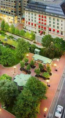
6 AERIAL OF SUB-AREA PLAN BOUNDARY WITH LIGHT RAIL TRANSIT (LRT) NODES
7 Context The Denver Metropolitan Region is growing at a rate faster than any other point in its history due to strong business relocation and job growth, population growth, emerging innovation and a high quality of life. The City of Lone Tree (Lone Tree) has set a high standard for its quality neighborhoods and parks, high level of services, cultural amenities and mixed use developments. Still, many people are attracted to more urban, mixed use areas in Denver. The Lone Tree City Center (City Center) provides a unique opportunity to cultivate a dynamic and inclusive mixed use urban center south of Denver. The 3,500 acre RidgeGate community plan has been approached with an understanding of the infrastructure investments and timing decisions required to make the project and Lone Tree a lasting success. The Regional Transportation District's (RTD) Southeast Line includes three stops in RidgeGate, making the area a key destination on a growing urban light rail network, soon to be one of the largest in the nation. will be a major mixed use core and the RidgeGate Parkway Station will serve as the new end-of-line station for rail commuters. Major vehicular access is provided by Lincoln Avenue and RidgeGate Parkway and supported by interchanges where they intersect I-25. RidgeGate partnered with the Colorado Department of Transportation and the City of Lone Tree to build the new interchange at I-25 and RidgeGate Parkway in Peoria Street is carrying a growing number of people north towards E-470. Havana Street south of RidgeGate Parkway connects to the Castle Pines Parkway interchange. The City Center also has close proximity to Centennial Airport, providing even broader connectivity to the area. SITE OVERVIEW Approximately 440 acres, the City Center is located in Lone Tree, Colorado, on the southern end of the Denver Metropolitan Region. The City Center includes two rail stations on the Southeast Light Rail Line: the Lone Tree City Center Station (City Center Station) and the end-of-line RidgeGate Parkway Station (RidgeGate Station). Lone Tree has already experienced significant growth since A key driving factor is the RidgeGate West Village, which has developed with residential, retail and office uses that are complemented by key services and amenities, including the Sky Ridge Medical Center, the Lone Tree Arts Center, the Lone Tree Library (in partnership with Douglas County Libraries), and the Lone Tree Recreation Center (in partnership with the South Suburban Parks and Recreation District). 1 To the south of the City Center is the historic Schweiger Ranch and over 400 acres of dedicated open space within RidgeGate. To the southeast is the Reuter Hess Reservoir and to the east is the new University of Colorado South Denver Campus. Sky Ridge Avenue is the primary connection between the West Village and the City Center for cars, pedestrians and cyclists. These nearby amenities and connections will help support and activate the City Center as it evolves over time. There are three new rail stations adjacent to and in the City Center. West of I-25, the Sky Ridge Station will be a crucial connection to a growing regional medical cluster. The Lone Tree City Center Station RidgeGate EAST Lone Tree City Center Sub-Area Plan
8 2 CENTENNIAL AIRPORT AND THE FEDERAL AVIATION ADMINISTRATION (FAA) The City Center is located southwest of Centennial Airport. This close proximity to the airport provides strong regional connectivity and myriad economic benefits to RidgeGate. Applicants are responsible for providing any prior required notice to the Federal Aviation Administration (FAA) of the proposed construction or alteration of a structure that may constitute an obstruction to the safe navigation, landing, or takeoff of aircraft at a publicly used airport, as required by regulations at 14 C.F.R. Part 77. Copies of all written communications with and final determinations by the FAA shall be submitted to the Lone Tree Community Development department prior to approval of an SIP application. Upon the issuance by the FAA of a determination of no hazard to air navigation which includes mitigation measures, the measures recommended by the FAA may be required. Upon the issuance by the FAA of a determination of hazard to air navigation, the SIP application shall be denied. For all residential dwelling units constructed in the City Center, the applicant shall disclose to all prospective purchasers, in writing, that they are located within an area that will be impacted by aircraft and aircraft noise. Disclosure will be required to be provided on subdivision plats and SIP Notes, and included at the time of sales contract of a residential property sale. CITY OF LONE TREE COMPREHENSIVE PLAN The vision for the City Center is consistent with the City s Comprehensive Plan which supports compact, mixed use and pedestrian friendly development. PLANNED DEVELOPMENT DISTRICT (PDD) The RidgeGate PDD is a long range plan that governs the zoning and development of the entire 3,500 acre RidgeGate community. PUBLIC PARTICIPATION PROCESS Shortly after submitting this Plan, two public open houses were conducted in the Fall of 2017 to share information and gather community feedback. The open houses included a brief presentation and information tables that covered RidgeGate's history, highlights of the West Village, the City Center vision, the Villages vision, and an update from South Suburban Parks and Recreation District. INTENT OF THE SUB-AREA PLAN The Sub-Area Plan (the Plan) provides a summary of goals aimed towards achieving a sense of community and maintaining consistency of development quality throughout the City Center. This Plan recognizes that the realization of the vision articulated here is ultimately formed by numerous individual, private, and public decisions. This Plan takes a district approach to further define the standards of the development by providing development goals and guidelines unique to the opportunities and challenges within each district. This Plan establishes criteria by which the City of Lone Tree will evaluate future plats and Site Improvement Plans (SIPs) for developments to occur in the City Center. RIDGEGATE EAST TECHNICAL SUPPLEMENT Separate from this Plan, Lone Tree and RidgeGate have developed and will maintain and update the RidgeGate East Technical Supplement. This document contains technical information in support of the Plan, including master plans for utility infrastructure systems, master traffic studies, and technical street standards for execution by the Rampart Range Metropolitan District (RRMD). The Technical Supplement is initially approved by the City Council. Updates and changes to the Supplement may be administratively approved by the City. RIDGEGATE DESIGN REVIEW COMMITTEE (DRC) PROCESS AND CITY OF LONE TREE SUBDIVISION AND SITE IMPROVEMENT PLAN (SIP) PROCESS Prior to this City process, any project within RidgeGate must go through the RidgeGate Design Review Committee (DRC) for review and approval. The DRC must approve the plans prior to proceeding through the Lone Tree development review process. The City of Lone Tree requires plans for development to go through staff review followed by a public review by the City Planning Commission, and final approval by the City Council. RELATIONSHIP TO CITY REGULATIONS AND OTHER MUNICIPAL CODES Where provisions of this Plan do not address a particular subject, the relevant provisions of the City of Lone Tree Zoning Code, as amended, or any other applicable ordinances, standards and guidelines, or regulations of the City of Lone Tree shall be applicable. SECTION ONE: Introduction
9 Plan Organization The Plan is organized into five sections. The headings of each major plan topic are summarized by section below. SECTION ONE: INTRODUCTION Context»» Centennial Airport and the Federal Aviation Administration»» City of Lone Tree Comprehensive Plan»» Planned Development District»» Public Participation Process»» Intent of the Sub-Area Plan»» RidgeGate East Technical Supplement»» RidgeGate Design Review Committee Process and City of Lone Tree Subdivision and Site Improvement Plan Process»» Relationship To City Regulations And Other Municipal Codes Plan Organization Vision and Guiding Principles SECTION TWO: FRAMEWORK ELEMENTS Framework Elements Overview Land Use and Urban Design Districts within the City Center»» Mixed Use Districts Overview»» Commercial Districts Overview»» Residential Districts Overview»» Office Districts Overview Parks and Open Space Architecture Sustainability and Smart Technology Transportation and Connectivity Character and Identity Attainable Housing Civic Use Dedication SECTION THREE: GUIDELINES Guidelines Overview General Site Planning Guidelines General Architecture Guidelines General Landscape Guidelines Mixed Use District Guidelines Commercial District Guidelines Residential District Guidelines Office District Guidelines SECTION FOUR: VARIANCE GUIDELINES AND PROCEDURES Potential Variations and Recommended Conditions SECTION FIVE: APPENDIX Acreages by Block Development Visualizations Street Types Map Typical Street Sections»» Mixed Use Street»» Local Street»» Festival Street»» Parkway»» Collector»» Minor Arterial»» Campus Access Road Accessory Dwelling Units Other Resources Glossary 3 RidgeGate EAST Lone Tree City Center Sub-Area Plan
10 4 Vision and Guiding Principles Collectively, the Vision and Guiding Principles provide the overall direction for how the City Center will develop. All subsequent chapters and sections of this document are an outgrowth of the Vision and Guiding Principles. To accomplish this future, it is critical that all partners work toward this common vision. THE VISION FOR LONE TREE CITY CENTER Lone Tree City Center will become an authentic downtown environment known for its districts that are tied together by robust transit, a comfortable pedestrian environment and a network of bikeways. It will be supported by employment centers, shopping areas and housing choices. The quality open spaces, parks and plazas throughout the City Center will provide users a diverse network of placemaking spaces, offering plenty of opportunities for recreation, relaxation and community gathering. GUIDING PRINCIPLES The following Guiding Principles establish a framework to guide the development and evolution of the City Center for the coming decades. The Guiding Principles articulate the direction while framing a set of criteria for evaluating unanticipated opportunities. The five Guiding Principles are: 1. Mixture of Uses. Development will consist of a wide variety of uses, encouraging people to live, work and play within the City Center, activating the area throughout the day and year, establishing a vibrant urban center. 2. Vibrant Public Spaces. The City Center will be organized around signature public spaces that are flexible, scalable, programmable and designed to support strong placemaking. 3. Quality Design. Buildings in the City Center will be of a massing and scale that is appropriate for the context, with architectural features, high quality materials and design details that contribute to the human scale, identity and overall character of the City Center. 4. Transportation Options. Pedestrian, bicycle and transit facilities will be balanced with vehicular accommodations, promoting a system of connected, multimodal transportation facilities, dispersing peak traffic demands and parking needs. 5. Innovative Districts. The City Center will lead the region in Smart Cities Technologies and sustainability, providing infrastructure, buildings and open spaces that contribute positively to an efficient, adaptive and environmentally responsible heart of the community. SECTION ONE: Introduction


11 5 The City Center will become an authentic downtown environment. The City Center will lead the region in Smart City Technology. High quality materials and design details will contribute to the overall identity and character. RidgeGate EAST Lone Tree City Center Sub-Area Plan

12 6 RidgeGate EAST Lone Tree City Center Sub-Area Plan
13 city center sub-area plan SECTION TWO framework elements EAST


14 Framework Elements Overview The following pages provide the framework for the City Center and how it will emerge in the coming years, with a vibrant downtown, bustling station areas, varying districts and high quality open spaces. The framework establishes an approach for creating districts within the City Center that develop into unique character areas; creates a hierarchy for great plazas, parks and open spaces; develops the City Center's approach and commitment to sustainability; shapes the height, massing and architectural detailing of buildings; ensures strong, multimodal connections throughout the City Center; outlines the approach to character and identity; and develops specific land use and policy positions to support the City Center vision. The pedestrian environment is strengthened by street activation. The framework elements in this section are organized in the following categories: Land Use and Urban Design Districts within the City Center 8 Parks and Open Space Sustainability and Smart Technology Architecture Transportation and Connectivity Character and Identity Both City Center and RidgeGate Stations will have bustling station areas. Attainable Housing Civic Use Dedication Development will consist of a wide variety of uses, encouraging people to live, work and play within the City Center. SECTION TWO: Framework Elements


15 LINCOLN AVE acres 99 acres SKY RIDGE AVE 38 acres FESTIVAL STREET 58 acres Lone Tree City Center Station 43 acres RIDGEGATE PKWY PARKWAY PEORIA ST To Villages Cycle Track 9 RidgeGate Station 11 acres Park -n- Ride City Center Framework and District Map RidgeGate EAST Lone Tree City Center Sub-Area Plan


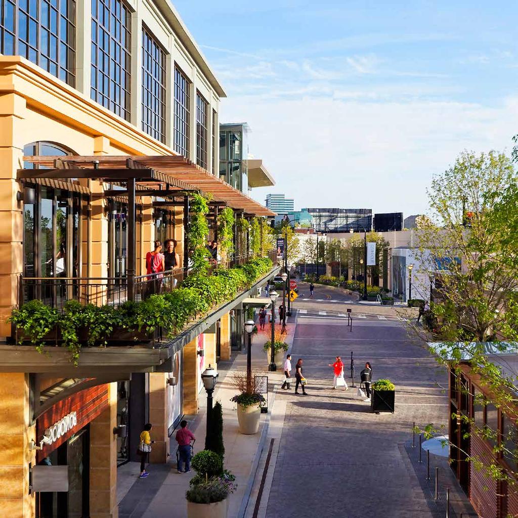
16 Land Use and Urban Design A coordinated land use and urban design strategy is key to creating a cohesive experience that is in line with the overall vision and guiding principles of the City Center. This broad understanding of land uses, block configuration and street alignments provides the framework for the following elements and guidelines. 10 STRATEGIC PLACEMENT OF DIVERSE USES The City Center will consist of a variety of uses to attract visitors and users to the area. Therefore, the plan locates uses strategically throughout the City Center, creating a variety of interconnected spaces and districts. Northern and southern portions of the City Center have strong retail and greenway connections. Western portions of the City Center appeal to office uses and are consistent with the surrounding context. Eastern portions of the City Center are primarily high density residential and provide a smooth transition to the Villages. Transitions in scale and mass are considered across the districts and in connections to development adjacent to the City Center. The pedestrian environment is strengthened by street activation including, active ground floor uses, a higher degree of transparency along the ground floor and cafe style sidewalk uses. Hotels are expected in the City Center and should contribute positively to the adjacent area.»» Hotels are encouraged to be located in mixed use, office and commercial areas. A variety of hotel types is recommended to provide for a diversity of choices for visitors to the City Center.»» The most prominent hotels are encourage to be within mixed use areas. Office uses are encouraged to contain hotel types that best integrate with the needs of an office campus. Locate uses strategically throughout the City Center, creating a variety of spaces and districts that connect with surrounding uses. Hotels should contribute positively to the adjacent area. SECTION TWO: Framework Elements


17 PROTOTYPICAL BLOCK CONFIGURATIONS Within mixed use areas, the plan creates blocks that are of a consistent size and pattern, which will provide unity and coordination throughout the district. In limited cases, other districts may have more flexibility in terms of block configuration to accommodate the site development pattern; see page 60 for specific criteria. The ideal mixed use block size is 265' x 365 in order to create walkable environments. STRATEGIC ALIGNMENT OF STREETS Align streets along a typical grid, creating a walkable, easy to navigate City Center. A mix of uses helps to create an active environment at most times of day. Continuation of the existing street pattern into adjacent areas allows for traffic dispersal and integration. The majority of roads and pathways feed into the mixed use core where traffic is dispersed along a grid of streets. The orientation of streets and blocks creates and protects many views and vistas, while creating a pedestrian-oriented environment. The Parkway and Festival Street provide an organizing element for the City Center and help to transition medium density residential development into higher density mixed use development. 11 A continuous east-west minor arterial, Sky Ridge Avenue, connects the City Center to Peoria Street and the RidgeGate West Village. Public spaces should be designed with unique feel and character. Streets will be supplemented by the creation of an "urban trail" for pedestrians and cyclists that promotes multimodal transportation and connects to existing cycling facilities including the Cycle Track along RidgeGate Parkway. Align streets to create a walkable, easy to navigate City Center. RidgeGate EAST Lone Tree City Center Sub-Area Plan


, Mixed Use Edge (MU-2), and Mixed Use Commuter Station (MU-3) COMMERCIAL DISTRICTS: Commercial at RidgeGate Parkway (C-R) and Commercial at Lincoln Avenue")

18 Districts within the City Center LINCOLN AVE The City Center will feature identifiable districts, each with its own unique character and sense of place, which is in support of the vision and guiding principles established earlier in the Plan. Each district has a distinct set of land uses, urban form, streetscape, and architectural character. The districts are intended to develop a unique character, while supporting the overall vision for the City Center as a whole and allowing flexibility in response to changing market demands. The City Center has been divided into four district types: Mixed Use, Commercial, Residential and Office Districts. Furthermore, the Plan identifies and provides specific guidelines for 25 CO CO UO SKY RIDGE AVE MU-2 C-L R-HD FESTIVAL STREET R-MD 12 nine individual districts, which are: MIXED USE DISTRICTS: Mixed Use Core (MU-1), Mixed Use Edge (MU-2), and Mixed Use Commuter Station (MU-3) COMMERCIAL DISTRICTS: Commercial at RidgeGate Parkway (C-R) and Commercial at Lincoln Avenue (C-L) RESIDENTIAL DISTRICTS: High Density (R-HD) and Medium Density (R-MD) OFFICE DISTRICTS: Urban Office (UO) and Corporate/ Campus Office (CO) Lone Tree City Center Station RidgeGate Station Park -n- Ride MU-1 C-R RIDGEGATE PKWY MU-3 MU-2 C-R R-HD PEORIA ST C-L CO R-HD UO MU-2 R-MD MU-1 CO C-R MU-3 Mixed Use Districts ACRES MU-1 19 MU-2 19 MU-3 5 Commercial Districts ACRES C-L 45 C-R 43 Residential Districts ACRES R-HD 22 R-MD 36 Office Districts ACRES CO 82 UO 17 SECTION TWO: Framework Elements
19 Distinguishing Elements of the Districts The matrix below summarizes the key distinguishing elements of each district, providing specific detail relating to urban form, character and use. Following this matrix is an overview summary of each district, relating the individual districts to the framework established in this section. DISTRICT DENSITY/ INTENSITY BUILDING HEIGHT STREET SETBACKS PUBLIC AMENITIES PARKING LAND USE ACTIVATION MU-1 High (Core) 5-10 stories minimal to none required Station Park/Plaza, Festival Street, Urban Trail on-street, structured retail, mixed use, office, civic, hotel MU-2 High 5-10 stories minimal (flexible) encouraged Western Pocket Park, Festival Street, Urban Trail on-street, structured retail, mixed use, office, civic, hotel MU-3 Medium 3-5 stories minimal (flexible) encouraged urban plazas, Urban Trail on-street, structured retail, residential, office, civic, hotel C-L Low/Medium 1-3 stories developer discretion - informal plazas, Urban Trail structured retail, hotel, general services 13 C-R Low/Medium 1-3 stories developer discretion - South Greenway Vista Park, Urban Trail structured retail, office, hotel general services R-HD High (40 du/acre) 2-6 stories minimal - Neighborhood Park, Parkway, Urban Trail on-street, tuck-under residential R-MD Medium (5-20 du/acre) 1-3 stories medium - Eastern Pocket Park, Urban Trail on-street, surface lots, tuck-under, structured residential UO Medium/High (flexible) 3-6 stories minimal - Office Vista Park, Urban Trail garage, on-street, structured office, retail, hotel, commercial CO Low (flexible) 2-6 stories large (flexible) - Office Vista Park, Urban Trail structured encouraged, surface lots allowed office RidgeGate EAST Lone Tree City Center Sub-Area Plan

20 Mixed Use Districts The Mixed Use Districts are adjacent to RidgeGate's light rail stations and incorporate easy access and seamless transitions within the public spaces for a diverse group of users. These districts should have the highest density and will strongly support transit-oriented development. The flexibility and various scales that mixed use buildings can accommodate make this an appealing location for development and adds value by offering a variety of building program opportunities. These districts provide key bicycle circulation that will be integrated into the right-of-way and includes ample buffers and well-designed crossings for pedestrians. The majority of parking will be located in structures behind or below buildings. 25 Western Pocket Park Office Vista Park LINCOLN AVE SKY RIDGE AVE MU-2 MU-1 Neighborhood Park Eastern Pocket Park 14 The Mixed Use Districts are divided into the Mixed Use Core District (MU-1), the Mixed Use Edge District (MU-2), and the Mixed Use Commuter Station District (MU-3). MU-1: MIXED USE CORE The Mixed Use Core is intended to be 19 acres of iconic urbanstyle development adjacent to City Center Station. Structures are anticipated to have heights of 5-10 stories with high intensity of use. The Mixed Use Core includes minimal to no setbacks and quality amenities and materials. Ground floor retail and other active uses that engage the street are required. The Station Park/Plaza and Festival Street will be major community assets and are intended to activate and provide connection to transit. Parking is to be primarily on-street or in parking structures. Lone Tree City Center Station RidgeGate Station Park -n- Ride Station Park/ Plaza RIDGEGATE PKWY MU-3 Festival Street MU-2 Parkway South Greenway Vista Park PEORIA ST ACRES MU-1 19 MU-2 19 MU-3 11 MU-2: MIXED USE EDGE Located immediately outside of MU-1 is the 19 acres of MU-2. This district will contain many similarities to MU-1, such as alleys, the Festival Street and Urban Trail, and building heights of 5-10 stories. However, MU-2 is anticipated to have a lower intensity of use than MU-1, as it should scale down to the surrounding residential area. To accommodate this transition, MU-2 has more flexibility for the ground floor activation and amenity zones, parking and open space. Encouraged uses include residential, office, commercial and hotel, and ground floor active uses are encouraged, though not required. The Urban Trail traverses this area and a Pocket Park is located in the district along the light rail tracks. MU-3: MIXED USE COMMUTER STATION The Mixed Use Commuter Station District (MU-3) is 11 acres, and is adjacent to the RidgeGate Station. This district will have a pedestrianoriented urban fabric, serving the end-of-line station, which contains a 1300 car Park-n-Ride, and drop-off and pick-up locations. The density of MU-3 is lower, with suggested building heights of 3-5 stories. Active ground floor uses are strongly encouraged within this area, with recommended uses including residential, office, commercial, hotel, and civic. For more detail on the Mixed Use Districts, see page 50 of the General Guidelines in Section Three. SECTION TWO: Framework Elements

21 Commercial Districts LINCOLN AVE The Commercial Districts support a sustainable economy with a mix of local and national retail businesses as driven by market opportunities. The Commercial Districts are located on the north and 25 Office Vista Park C-L south of the City Center and have similar conditions along the major east-west arterials, where the high volumes of traffic will allow for visibility. The proximity of the Commercial Districts to I-25 provides quick access to these sites from a variety of distances. SKY RIDGE AVE Eastern Pocket Park Commercial development is to be highly functional, easily accessible and practical yet uniquely identifiable as part of the Lone Tree City Western Pocket Park Neighborhood Park Center. The Commercial Districts are intended to be flexible and driven by the market for the development of parcels and allow for retail/commercial uses of various footprint sizes and configurations. The Commercial Districts are divided into the Commercial at Lincoln District (C-L) and the Commercial at RidgeGate District (C-R). C-L: COMMERCIAL AT LINCOLN Currently the 45 acres of the Commercial at Lincoln District (C-L) comprises the largest contiguous retail/commercial parcels in the City Center. Commercial at Lincoln, located directly south of Lincoln Avenue, will have a relatively low density. Anticipated development includes larger footprint structures and can accommodate a variety of uses including large retailers, restaurants, shopping centers, hotels and general services. The Urban Trail passes through and around this Lone Tree City Center Station RidgeGate Station Park -n- Ride Station Park/ Plaza C-R Festival Street RIDGEGATE PKWY C-R Parkway South Greenway Vista Park PEORIA ST ACRES C-L 45 C-R district, and plazas are encouraged between large buildings. It is expected that the C-L District, in particular, will have much in common with the Corporate/Campus Office District (CO), which is described in the Office District section. Given this close relationship and similar intended character and experience between the two districts, the C-L District can take on a character and development pattern similar to that of the Corporate/Campus Office District as market demand evolves. C-R: COMMERCIAL AT RIDGEGATE The Commercial at RidgeGate Parkway District (C-R) is 43 acres spanning both sides of RidgeGate Parkway and containing large parcels of land which can be developed for retail/commercial uses. Similar to C-L, this district will be low density with large parcels. While accessible via vehicle, this area is intended to be walkable between commercial properties on each side of RidgeGate Parkway, with a traffic signal providing ample pedestrian crossing time upon demand at Havana and RidgeGate Parkway. Land uses include general retail and restaurant, commercial, office, hotels and general services. The Urban Trail here will provide an important connection between the MU-3 district and the rest of the development. Adjacent to Commercial at RidgeGate is the South Greenway Vista Park. For more detail on the Commercial Districts, see page 52 of the General Guidelines in Section Three. RidgeGate EAST Lone Tree City Center Sub-Area Plan

22 Residential Districts LINCOLN AVE The Residential Districts are intended to be higher density and urban in character. These districts offer options for housing that is vibrant and close to employment and transit centers. 25 Office Vista Park 16 The Residential Districts vary in density. The urban context of the City Center and RidgeGate Parkway Station areas can better support higher density development in the Residential Districts than the surrounding residential areas. The Residential Districts form the eastern edge of the City Center and serve as a transition zone between the high density Mixed Use Districts to the lower density residential villages to the east. These districts can provide a variety of residential developments including and not limited to condominiums, apartments, townhomes, and rowhouses. The Residential Districts are divided into the Residential High-Density District (R-HD) and the Residential Medium-Density District (R-MD). R-HD: RESIDENTIAL HIGH-DENSITY The 36 acres of the Residential High-Density District (R-HD) consist of primarily multifamily housing developments in an urban fabric. Developments in this district can include a variety of heights with a suggested density of approximately 40 dwelling units per acre or higher. Building types include small apartment buildings and townhomes. Setbacks and landscapes are variable. The typical block size is 365 x 265 and alleys are encouraged for access, service and utilities. This district is adjacent to the Festival Street and Parkway, and includes the larger Neighborhood Park as a primary community gathering space that accommodates the district's higher density. Western Pocket Park Lone Tree City Center Station RidgeGate Station Park -n- Ride R-HD SKY RIDGE AVE Station Park/ Plaza Neighborhood Park Festival Street RIDGEGATE PKWY Parkway R-HD South Greenway Vista Park Eastern Pocket Park PEORIA ST R-MD ACRES R-HD 36 R-MD 22 For more detail on the Residential Districts, see page 54 of the General Guidelines in Section Three. R-MD: RESIDENTIAL MEDIUM-DENSITY The Residential Medium-Density District (R-MD) is 22 acres of multifamily housing and single-family attached or detached housing in a semi-urban fabric. Development in this district includes one and two story structures with a suggested density of 5-20 dwelling units per acre. The district will also function as a transition to the surrounding single family residential areas. Setbacks are variable and the landscaping caters to a dense and diverse residential setting. Streets with curbs and sidewalks define medium sized blocks. The Eastern Pocket Park and the Urban Trail comprise the main public spaces within the district. SECTION TWO: Framework Elements
23 Office Districts LINCOLN AVE The Office Districts make up the west side of the City Center. This appealing location is highly visible from both inside and outside the City Center. The light rail is adjacent to a majority of the Office Districts and provides exposure to riders and great access to transit. Flexibility within the Office Districts allows developments to incorporate a strong business identity within the City Center. Both districts provide opportunities for large office developments with related land uses, including hotels and other commercial developments. 25 CO Office Vista Park Western Pocket Park UO UO SKY RIDGE AVE Neighborhood Park Eastern Pocket Park The Office Districts are divided into the Corporate/Campus Office District (CO) and the Urban Office District (UO). CO Festival Street CO: CORPORATE/CAMPUS OFFICE The Corporate/Campus Office District (CO) is 82 acres of large, contiguous parcels of land that can be available for development by a single user or multiple users. The district's density and building height is intended to be lower than that of the Urban Office district, and is mostly reliant on developer discretion. The CO district is located along I-25 and stretches from Lincoln Avenue to RidgeGate Parkway. The parcels are large and allow flexibility for future tenants to create an identity with these large, ready-to-develop sites. The contiguous parcels adjacent to I-25 have appeal to developments that desire a standalone identity, prefer a flexible campus scale and/ or would like to capitalize on the visibility along I-25. The Office Vista Park on the eastern side of the district provides access to the outdoors for office workers. UO: URBAN OFFICE The Urban Office District (UO) is 17 acres of office development, resembling an urban scale and form while providing space large enough for office users. The density and building height is higher than the Corporate/Campus Office District and functions as a transition to the Mixed Use Districts. Additionally, the Urban Office District can accommodate a variety of land uses such as office, retail, hotel and commercial. The close proximity of the Urban Office District to the Mixed Use Districts, and the possibility of compatible Lone Tree City Center Station RidgeGate Station Park -n- Ride Station Park/ Plaza RIDGEGATE PKWY Parkway South Greenway Vista Park PEORIA ST land uses, allows for easy pedestrian and bicycle connectivity. Buildings would be developed with pedestrian connections and building frontages near the street. The Office Vista Park, Urban Trail, and adjacency to the Western Pocket Park provide gathering and outdoor space for those employed within the district. The Urban Office District is easily accessible by car from Sky Ridge Avenue. The light rail is elevated above Sky Ridge Avenue, where a turn in the tracks provides riders an expansive view of the Urban Office District. For more detail on the Office Districts, see page 56 of the General Guidelines in Section Three. ACRES CO 82 UO RidgeGate EAST Lone Tree City Center Sub-Area Plan
24 Parks and Open Space The parks and open space system is intended to be urban in context. In support of the vision and guiding principles articulated at the beginning of this section, the parks and open space system will provide vibrant public spaces, including pockets of respite and open areas amid the relatively dense built environment. In response, the majority of the parks within the City Center should be well-maintained and designed for large crowds of active and passive users. However, depending on the immediate context, design solutions that echo the natural landscape should be encouraged where appropriate. 25 Western Pocket Park LINCOLN AVE Office Vista Park SKY RIDGE AVE Neighborhood Park Buffer Park Eastern Pocket Park 18 The City Center will provide a green connection to the East Villages via a gas line easement that extends east from the intersection of RidgeGate Parkway and Peoria Street. This green space will connect directly to the Parkway and bring people along the Festival Street to the Station Park/Plaza and the heart of the City Center. The following parks and open space recommendations are to ensure that the development and building practices foster successful and engaging public open space with the desired aesthetic and functional qualities. It is important to take into consideration the natural features of the site including landforms, large drainage areas, vegetation and wildlife that may visit the site. These existing features present both opportunities and constraints for the park system and will need to be addressed accordingly. Five types of parks exist within the City Center:»» Station Park/Plaza»» Neighborhood Park»» Pocket Parks»» Vista Parks»» Festival Street PARK AREAS Lone Tree City Center Station RidgeGate Station PARK Station Park/Plaza Park -n- Ride Neighborhood Park Western Pocket Park Eastern Pocket Park Station Park/ Plaza Festival Street RIDGEGATE PKWY South Station Park Schweiger Ranch ACRES 3.6 acres 4.6 acres 1.2 acres 1.7 acres Gas Line Connector Parkway PEORIA ST South Greenway Vista Park For more detail on Parks and Open Space, see page 48 of the General Guidelines in Section Three. Neighborhood Park requirements for residential projects in City Center are deemed satisfied by the City Center Parks and Open Space Program. Office Vista Park South Greenway Vista Park Buffer Park South Station Park 1.2 acres 0.6 acres 0.9 acres 0.7 acres SECTION TWO: Framework Elements


25 STATION PARK/PLAZA The 3.6 acre Station Park/Plaza is the heart of the City Center. It will be the most urban park, with bustling traffic and transit connections. From the City Center Station, the Station Park/Plaza will transition down in elevation to the mixed use district in a creative manner that accommodates all user groups. Transit-related iconic features should be included within the Station Park/Plaza; appropriate features may include a clock tower or displays for real-time arrival and departure information. This park should allow for a variety of organized uses, including, but not limited to: outdoor concerts, movies in the park, gallery events, company gatherings and festivals. NEIGHBORHOOD PARK The 4.6 acre Neighborhood Park will be the community gathering place of the Residential Districts. The largest in size, this park should serve as the major, formal outdoor recreation venue for the residents of the City Center. Uses should be both active and passive in nature. Iconic features should be included within the Station Park/Plaza. Programmed active uses should include playgrounds, sports courts or emerging sports facilities. Unprogrammed active uses should include multi-use fields, temporary striping or portable nets/goals. 19 Unprogrammed passive uses and space should include open grass areas, trails and multi-use paths, and facilities for picnicking. Stormwater detention should be integrated as a feature for both active and passive uses within the park. The Neighborhood Park should serve as the major, formal outdoor recreation venue for the residents the City Center. WESTERN POCKET PARK The 1.2 acre Western Pocket Park will serve a unique role in the community. As the parcel is largely undevelopable due to its unusual shape, this space will be more urban in nature. Being tucked against the light rail bridge and bounded by the City Center s only minor arterial will allow for active uses that build upon the area's atmosphere. Places to gather should be located towards the southern portion, so that people can sit and watch activities in the park. The retaining wall for the light rail bridge presents an opportunity to include some form of public art or vertical gardens. The park's urban nature requires particular attention to safety and access; these should be emphasized in the design and programing. The retaining wall for the light rail bridge presents opportunities for public art. RidgeGate EAST Lone Tree City Center Sub-Area Plan


26 EASTERN POCKET PARK The 1.7 acre Eastern Pocket Park will provide a blend of urban, suburban and natural environments. This park provides a connection to the neighborhood park. The uses in the park should be relatively passive in nature with facilities such as benches, a small playground, a dog park, and picnic areas. The Urban Trail should be a key asset to this pocket park as it will traverse the park and provide a connection to other areas of the City Center. Opportunities to sit and gather should be located to the eastern portion of the park, away from Sky Ridge Avenue. The uses in the Eastern Pocket Park should be relatively passive in nature. 20 OFFICE VISTA PARK The 1.2 acre Office Vista Park will be a key resting and interpretative location along the Urban Trail network and a space for office workers to access the outdoors. This park is intended to provide views of the natural drainage area on the site, and to serve the Urban Office and Corporate/Campus Office developments. This park should provide amenities for individuals who are traveling via bicycle or on foot, as it will be a key stop along the Urban Trail. Interpretive opportunities should be incorporated in and around the park focusing on the view of the Corporate/Campus Office District and providing outdoor amenities for office workers. SOUTH GREENWAY VISTA PARK The 0.6 acre South Greenway Vista Park shall take advantage of vistas to the Happy Canyon Creek, the proposed community park and the Villages. It should be a maintained park along the Urban Trail with a vista overlook and passive uses. The park will be more maintained than the adjacent open space. The Office Vista Park will be a key resting and interpretive location along the Urban Trail and a space for office workers to access the outdoors. Interpretative opportunities exist around the natural features, cultural elements and natural environment. The zone between the maintained park and the natural vegetation should be designed as an intentional transition. This park should be passive in nature, utilizing elements, such as: benches, water fountains, picnic tables and shade structures. The zone between the maintained park and the natural vegetation should be designed as an intentional transition. SECTION TWO: Framework Elements

 to calm traffic and promote a design speed of approximately 10 miles per")

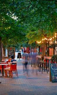
27 FESTIVAL STREET The Festival Street is one of the signature spaces that helps to define the core of the City Center. It is flanked by the Station Park/Plaza to the west and a the Parkway to the east. The Festival Street is on an axis that extends from Peoria Street to the City Center Station. The Festival Street should be designed as a curbless environment with flexibility to function optimally when the street is open to auto traffic and when it is designated as pedestrian-only. The Festival Street should be designed with narrow travel lanes and vertical elements (trees, light standards and public art) to calm traffic and promote a design speed of approximately 10 miles per hour. The Festival Street should be designed as a permanent pedestrian environment with opportunities for formal and informal programming. At locations where other streets cross the Festival Street, design elements and pedestrian movements along the Festival Street should be prioritized. The center of the Festival Street should be designed as a permanent pedestrian environment with opportunities for formal and informal programming. The sidewalks along the Festival Street should be of a sufficient width to accommodate cafe seating, streetscape furnishings and large groups of pedestrians. 21 Graphic rendering of Festival Street looking west to City Center Station. Graphic rendering of Festival Street looking west to City Center Station. RidgeGate EAST Lone Tree City Center Sub-Area Plan


28 Architecture 22 The City Center will be a mixed use, transit-oriented community with the greatest intensity of activity near the City Center Station. The scale of development should generally step down when moving away from the mixed use core and eastward. The construction of pedestrian-scaled buildings in the near term with the structural capacity and vertical infrastructure to support the addition of towers in the future could also help the City Center test and grow market demand while activating the area in the shorter term. The use of an upper story setback will create larger bases and a comfortable street edge with narrower upper stories that preserve views and provide additional density. This approach also reduces the canyon effect that occurs when tall buildings front all the way to the street edge. The design of ground floors throughout the City Center should provide maximum flexibility to adjust as the market warrants. A vibrant pedestrian realm with smaller building footprints is encouraged through the creation of development parcels within blocks, market-scaled ground floor spaces, and articulation of individual storefronts. It is expected that the station area and highway frontage will be most attractive to larger scale office developers and tenants. While market demand should be leveraged in this regard, it is important that taller buildings contribute positively to the skyline. The ground floor of all new development should be well-designed with active uses to engage the street. Tall buildings should step down to street level to create a height transition from high density areas, and a more comfortable pedestrian environment. Buildings should have sufficient degree of façade articulation and maximum aesthetic interest to ensure an engaging pedestrian experience. SECTION TWO: Framework Elements


29 Height, scale and massing of buildings will define the City Center s streetscape experience, provide access to sunlight, and create a decidedly pedestrian-friendly environment. New mid-rise and high-rise towers should have sufficient degree of façade articulation and maximum aesthetic interest to ensure the pedestrian experience is nuanced, comfortable, diverse, and visually engaging. The user experience in the City Center will largely be defined by the ground floor design and programming. BUILDING FORM AND COMPOSITION Building form and composition should be sensitive to the architectural scale, massing and proportion, and district context. It should balance the pedestrian realm with the overall building architecture. Transition between building massing and density by stepping down adjacent buildings, especially on the east side where the City Center meets the single-family development. Buildings should have an upper story setback at three stories along streets to provide a comfortable pedestrian environment. New mid-rise and high-rise towers should have sufficient degree of façade articulation and maximum aesthetic interest For more detail on Architecture, see page 42 of the General Guidelines in Section Three. 23 Transition between massing and density by stepping down adjacent buildings. RidgeGate EAST Lone Tree City Center Sub-Area Plan


; free bicycle/scooter parking and repair stations integrated into parking garages;")
30 Sustainability and Smart Technology 24 As a greenfield site, the City Center has a unique opportunity to integrate innovative and sustainable technologies into the development from the beginning, and to assess and evolve those applications as the City grows, driving patterns change, and technology advances. The intent is to leverage sustainable practices and technologies where they will result in improved efficiencies, conveniences and livability in the City Center. Initial phases of development will target innovative solutions related to traffic management, parking, transit and public safety. A vision for complete streets includes: circulation for bicycles; the Urban Trail; sharrows; detached and attached bike lanes; bike sharing; car-charging stations; space for vehicle pick-up and drop-off areas; bus routes considered in infrastructure design; smart parking Integrated Technology Solutions (ITS); free bicycle/scooter parking and repair stations integrated into parking garages; and consideration for Last Mile Transportation Options (free shuttle, other programs) from rail stations to homes and neighborhood centers. This plan also establishes a sustainable framework to guide development with sensitivity towards stormwater management and energy conservation. Blocks are oriented to optimize passive solar opportunities and building heights are responsive to the surrounding context; Green or vegetated roofs and living walls can be used to combat the urban heat island effect and maintain air quality; Solar and other renewable energy should be integrated into architecture and infrastructure; Landscape design solutions should allow for sustainable drainage and buffers along amenities such as the Urban Trail; Electric vehicle charging stations should be encouraged in parking areas; and Materials should be locally sourced, sustainably produced, and environmentally responsible when possible and reasonable. Charging stations should be encouraged in parking areas. Bike sharing is included in the Complete Streets vision. See RidgeGate East Technical Supplement for specific details on Sustainability and Smart Technology strategies. Green or vegetated roofs can be used to combat the urban heat island effect. SECTION TWO: Framework Elements

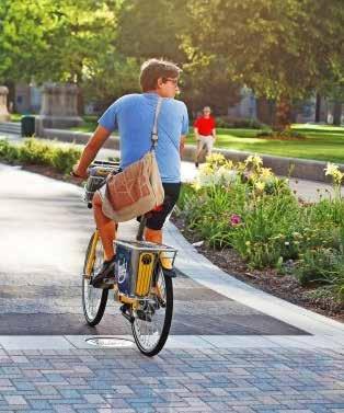
31 Transportation and Connectivity A clear network of light rail transit, bus transit, vehicular, bicycle and pedestrian circulation options should operate simultaneously and safely, with a hierarchy of intuitive signage and wayfinding features that guide the user through the City Center. The infrastructure should provide clear routes for people to move safely through the City Center and it should be designed in a way to enhance the district in which it is located, working in concert with the development type and open space that is found within the district. Convenient routes in and out of the City Center to destinations such as the CU South Campus or the Sky Ridge Medical Center will be facilitated by larger thoroughfares including RidgeGate Parkway, Sky Ridge Avenue and Lincoln Avenue. The East Villages are easily accessed via Peoria Street and RidgeGate Parkway. Connections to the Meridian Development north of Lincoln Avenue are also strongly encouraged. TRANSIT It is critical to provide transit stops that are attractive, safe and convenient places to wait for the light rail or bus. With the two light rail stops, the City Center has great proximity to transit with 1/4-mile and 1/2-mile walking distances covering the majority of the area. An existing bus runs along Lincoln Avenue and additional transit opportunities are anticipated when the City Center becomes developed, making the entire City Center highly accessible by transit. Reduce vehicle dependence by encouraging use of the Urban Trail and alternative methods for commuting. Integrate the transit stops, waiting areas, information and associated amenities into the design of adjacent buildings where possible. 'Vehicle Drop Off Zones' where passengers can be picked-up and dropped-off should be integrated in infrastructure design for ridesharing services and the future evolution of autonomous vehicle technologies. Incorporate benches, shade structures and other outdoor urban furnishings into the design of transit stops. Include high density Smart City Principles such as complete streets for all transportation modes and denser development near stations. 25 Lincoln Ave Bus Stop Lone Tree City Center Station RidgeGate Station Park -n- Ride Distance to Major Transit Stops LINCOLN AVE SKY RIDGE AVE FESTIVAL STREET RIDGEGATE PKWY PEORIA ST 25 RidgeGate EAST Lone Tree City Center Sub-Area Plan


32 STREETSCAPES All streets in the City Center are intended to be multifunctional, accommodating transportation and connectivity needs while providing public space for people to congregate. Street sections are included in the Appendix of this document and provide an overview of the conditions proposed along the major roads. All streets in the City Center are intended to be multidirectional. Two and four-lane roads are suggested for the City Center, as shown in the diagram below. See RidgeGate East Technical Supplement for specific details on streets in the City Center. The planned street types include: LINCOLN AVE LINCOLN AVE SKY RIDGE AVE SKY RIDGE AVE Lone Tree City Center Station RidgeGate Station RIDGEGATE PKWY PEORIA ST Lone Tree City Center Station RidgeGate Station FESTIVAL STREET RIDGEGATE PKWY PEORIA ST Park -n- Ride Park -n- Ride Street Types Lane Widths of Roadways NOTE: The overall grid pattern shall remain; however, specific street alignments shown are conceptual and subject to refinement. SECTION TWO: Framework Elements


33 ALLEYS Alleys are a key component of the block structure and can enhance the pedestrian realm by encouraging utilities, service and trash to be located away from the pedestrian space. Alleys are intended to be used by trucks and must accommodate dumpsters. The dumpsters need to be set back at least 15' from the pedestrian zone and screened. Alleys will need to be paved to the edges and can contain an inverted crown so the drainage from the alley does not flow into the surrounding streets. Continue primary facade materials a distance that covers the pedestrians field of view at alley or service locations. Alleys shall cross the sidewalk in a safe manner. Provide sufficient accommodations in alleys for loading, service vehicles, trash removal, and utilities so that these uses do not affect the public realm and do not conflict with the required "clear zone" in the alley. Orient alleys away from major pedestrian areas such as the Festival Street. In those situations, a traditional alley form of an I shape should bend and form an L shape or "T shape" so that the alley feeds into a street with vehicular priority. Adequate turning radii for trash trucks and service vehicles to be provided at "L" or "T" intersection in alleys. Alleys should be posted as "one way." PARKING Parking is an essential component of the Plan and more specific parking guidelines can be found in Section Three Site Guidelines. With the desired urban character of the City Center, surface parking lots are generally discouraged, though they may be appropriate during phased construction or as a temporary use. Overall, parking areas should be screened from sidewalks with landscaping, small walls or fences while maintaining clear sight lines and easy access. Lighting around parking lots and structures will conform to the City Center's lighting guidelines and parking signage should conform to the signage guidelines. The Plan encourages shared and on-street parking in many districts; see the District Distinguishing Elements Matrix on page 13 for more details on parking specific to each district. With the focus on bicycle access and trails, the City Center will have ample bicycle parking and storage. Parking for carshare, carpool, vanpool and electric vehicles should be provided and located in priority areas. Strategic encouragement of transit/carpool options can be introduced by reducing the parking required by 15% or more. Prior to the first SIP in the Downtown Area (north of RidgeGate Parkway), a Parking Management Plan will be developed and approved. Elements that could be considered in the plan include: creation of a parking district; oversight of shared parking; provision of on-street meters; bicycles, scooter and motorcycle parking; vehicle drop-off; and autonomous vehicle parking. 27 ALLEY FORMS AND MAJOR PEDESTRIAN AREAS RidgeGate EAST Lone Tree City Center Sub-Area Plan


34 PEDESTRIAN AND BICYCLE CIRCULATION Throughout the City Center there are connections to regional trails as identified in the Walk and Wheel Plan, the City of Lone Tree's pedestrian and bicycle framework. Trails should be consistent with the construction standards in the regional network. Development is 25 LINCOLN AVE encouraged around the pedestrian and bike infrastructure. Bike infrastructure includes: Urban Trail Raised Off-Street Bike Lanes SKY RIDGE AVE Striped Bike Lanes Sharrow/Shared Routes See RidgeGate East Technical Supplement for specific details on bicycle standards in the City Center. FESTIVAL STREET 28 Urban Trail The Urban Trail is intended to be an off-street route for seamless, safe and pleasant bicycle travel throughout the City Center. The Urban Trail crosses all the districts and connects notable areas of the site. Development around the outer edges of the City Center must Lone Tree City Center Station RidgeGate Station RIDGEGATE PKWY PEORIA ST To Villages Cycle Track make connections to the Urban Trail and are strongly encouraged to add to it. With quality accent materials such as colored, stamped, and patterned concrete, the character of the trail is differentiated from other bikeways and pedestrian routes. In addition, interpretive wayfinding and signage is incorporated throughout, including highlights of the community, trail side art, history and current tenants. Park -n- Ride In addition, the Urban Trail is designed to include destination routes Bicycle Routes that would encourage the exploration of the City Center by bicycle or foot. The loop passes many of the City Center's main attractions including the Station Park/Plaza, Neighborhood Park, Festival Street and RidgeGate Station. This adds value to the adjoining properties, creates a cohesive network of routes and provides an attraction for visitors. The trail also connects the City Center Station to the RidgeGate Station (approximately ¾ miles away). SECTION TWO: Framework Elements


35 When the Urban Trail crosses major streets, special care should be taken in the design of the facility to ensure safe cycling conditions. The RidgeGate East Technical Supplement will incorporate best practices and should be consulted when the bike facility is being designed. Bicycle sharing can be available at select locations throughout the City Center, which would allow visitors to ride from one side of the City Center and leave a bicycle on the other, as well as allow for visitors to experience the City Center on bike without having to bring their own. Throughout the City Center, the Urban Trail, like the rest of the pedestrian realm, should be buffered from areas of high traffic or service uses and alleys. The Urban Trail can provide sustainable drainage in buffer areas, when appropriate. The Urban Trail crosses all the districts and connects notable areas of the site. Raised/Separated Bike Lanes Raised bike lanes are designed with safety in mind for travel along certain minor and major arterials. Cyclist comfort should be a major consideration in the design of these lanes, and they should complement the overall streetscape. See the Bicycle Routes map for locations of proposed raised bike lanes. These lanes cross through all districts and also can connect the Urban Trail and striped bike lanes. 29 Striped Bike Lanes Striped bike lanes with a 3' striped buffer zone are located along certain roads leading to major destinations. These lanes are adjacent to and at the same grade as vehicles and are intended to improve connections to the Urban Trail. Designed with safety in mind, designating a bike lane in the road allows for better separation and awareness of cyclists and motorists. Striped bike lane Shared bicycle facility Sharrow/Shared Routes Shared routes are vehicle roads designed to accommodate bicycles with the marking of a sharrow and appropriate signage throughout. These routes are designated throughout the Mixed Use Districts. Shared routes are designed with safety in mind and are flexible, as they can be added or removed to streets as development emerges. For more detail on Streetscape Design, see the Typical Street Sections page of the Appendix and the RidgeGate East Technical Supplement. With quality accent materials, the character of the Urban Trail is differentiated from other bikeways and pedestrian routes. RidgeGate EAST Lone Tree City Center Sub-Area Plan


36 Character and Identity The unique character of the City Center will create a sense of place through the physical quality of the built form. Public art, signs and programming will also strengthen the identity of the City Center, while tying into the City's overall branding and character. SIGNAGE AND WAYFINDING Utilize signage and wayfinding to reinforce the City Center character, placemaking elements, and navigation. A comprehensive strategy will help people navigate and provide understanding of the City Center's identity, layout, landmarks, transportation, and destinations. A Comprehensive Wayfinding and Signage Program will be created for approval by the City. The Sign Program will identify allowable sign types, square footage and design standards to create cohesion while still allowing flexibility. This Sign Plan will apply to identification and wayfinding signs, while the guidelines in this document focus on both wayfinding and private signs. Signage and wayfinding features should contribute to navigation and identity. 30 An integrated program for signs will reinforce the City Center s place within the City of Lone Tree. City signs should be strategically located at key gateways into the City Center. Other City Center identification and wayfinding signs should incorporate reference to the City in the design of the signs. All signs and wayfinding shall promote a distinct and unified district identity and establish a hierarchy for pedestrians, bicyclists and motorists to navigate through the City Center and adjacent areas. Urban Trail signage should be highly recognizable, as it will be a signature part of the development and consistent along the trail. Arrival and departure signs along Lincoln Avenue and RidgeGate Parkway should include clearly visible directionality. Building signage should complement architecture and fasteners and be integrated into the building aesthetics. Transit signage should be consistent and reflect standards established by the Regional Transportation District (RTD). A comprehensive strategy will help people navigate and provide understanding of the City Center's identity. Universal Design information should be incorporated using a variety of visual, auditory, and tactile communication techniques. These techniques can be incorporated into wayfinding tools that include, but are not limited to: ADA Mobility Route Maps; ADA Building Entrance Signs; ADA Parking Signs. Specify site furnishing to accommodate event signage. Special consideration should be given to temporary and event signage along the Festival Street. SECTION TWO: Framework Elements


37 GATEWAYS AND MONUMENTS The traditional application of gateways and monuments as the primary and signature wayfinding strategy does not translate to the City Center's complex urban context. Intersections of major roadways and station areas are the primary gateways for the City Center as they denote points of confluence. Major vehicular entryways into the City Center should have a unique treatment and should be coordinated with the commercial developments. At the entry locations, large vegetated buffers will allow for a pleasant and safe pedestrian and cyclist experience. Landmark intersections are major crossings and points of arrival. Gateway and monument signage should signal the significance of these intersections. The City Center Sign Plan will identify the landmark intersections within the City Center. The scale of the gateways and monuments should reflect their placement in relation to the street hierarchy. Gateways and monuments should be vertical in nature. Gateways and monuments should generally be vertical in nature, and should distinguish the City Center as a unique place within the City of Lone Tree. For more detail on Character and Identity, see page 46 of the General Architecture Guidelines in Section Three, Building Signage. 31 The scale of the gateways and monuments should reflect their placement in relation to the street hierarchy. RidgeGate EAST Lone Tree City Center Sub-Area Plan


38 Attainable Housing The shared intent of the City and developer is to provide for attainable housing units, or AHUs, that provide opportunities for people who work in the City Center to also live there, and to meet a need for affordable housing. Design of AHUs will be compatible with the character and context of the area in which they are located. The City and RidgeGate have agreed to AHUs as described in the Amended and Restated Annexation and Development Agreement with respect to the East Side Property, and further details will be provided in a separate Attainable Housing Plan. 32 Attainable housing units will meet a need for affordable housing. AHUs will allow opportunities for people who work in the City Center to also live there. Design of AHUs will be compatible with the character and context of the area in which they are located. SECTION TWO: Framework Elements


39 Civic Use Dedication Sites in the City Center have been identified as suitable for civic and municipal uses, in addition to event spaces. These uses can add significant value to the City Center. Because the timing of development is unknown, the Plan introduces an 'Alternate Sites' approach to the availability of developable parcels. Alternative 1 parcels offer the greatest level of visibility and potential prominence in the City Center, but can also be the most detrimental to the character and sense of place if left vacant for too long. Alternative 2 and Alternative 3 parcels still provide a high degree of visibility and potential prominence, however these parcels may not be as detrimental to the City Center if left vacant in the near future. 25 LINCOLN AVE SKY RIDGE AVE Lone Tree City Center Station RidgeGate Station RIDGEGATE PKWY PEORIA ST 33 Park -n- Ride Alternative Sites for City/Civic Facilities Vibrant civic space can add value to the City Center. RidgeGate EAST Lone Tree City Center Sub-Area Plan
40
41 city center sub-area plan SECTION THREE guidelines EAST
42 Guidelines Overview The guidelines in this section are organized into general guidelines and district-specific guidelines; the first part of this section contains the general guidelines, which apply throughout the City Center. The second part of this section contains the district-specific guidelines, which were developed specifically for each district within the City Center to achieve the nuanced and, at times, subtle difference between the various districts of the City Center. A - GENERAL SITE PLANNING GUIDELINES Setbacks and Public Space 39 Utilities and Equipment 39 Parking [and Parking Ratio Table] 40 B - GENERAL ARCHITECTURE GUIDELINES C - GENERAL LANDSCAPE GUIDELINES Parks and Open Space 46 Landscape 46 Irrigation Landscape Lighting Public Art 36 Building Form and Composition Guidelines 41 Facade Composition and Articulation 42 Windows Building Entries Architectural Lighting 43 Materials and Color 43 Roof 44 Building Signage 44 Structured Parking 45 The following guidelines apply only to specific districts, and are in addition to the General Guidelines presented in the first portion of this section. D - MIXED USE DISTRICTS GUIDELINES E - COMMERCIAL DISTRICTS GUIDELINES F - RESIDENTIAL DISTRICTS GUIDELINES G - OFFICE DISTRICTS GUIDELINES SECTION THREE: Guidelines


43 DISTRICT GUIDELINES The City Center is made up of nine districts, organized into four primary district types: Mixed Use, Commercial, Residential, and LINCOLN AVE Office. This section provides general guidelines that apply to the entire City Center to ensure consistency within the City Center framework, and 25 CO C-L it provides district-specific guidelines that are unique to each district to achieve the focused vision for that nuanced character area; the UO guidelines in this section are organized into the following categories: SKY RIDGE AVE General Guidelines Mixed Use Districts Guidelines Commercial Districts Guidelines CO MU-2 R-HD R-MD Residential Districts Guidelines Office Districts Guidelines HIERARCHY The guidelines, regardless of category, following the same organization, and are closely related and stem from the Plan's vision and guiding principles. Both the general guidelines and the districtspecific guidelines include: Lone Tree City Center Station RidgeGate Station FESTIVAL STREET MU-1 MU-2 C-R R-HD RIDGEGATE PKWY C-R PEORIA ST 37 Design Topics. Subject areas, such as setbacks, parking and facade MU-3 articulation, that provide organization within the guidelines. Intents. Provide an overview of what the following guidelines Park -n- Ride are seeking to accomplish, and are related to the Plan's vision and guiding principles. Intents are included to provide users the reasoning behind the guidelines. Guidelines. Provide guidance as to how one may meet the intents. Guidelines are performance-based and suggest possible ways for achieving the intent. The guidelines do not impose a specific solution and are not intended to limit creativity and innovation. Rather, they provide a flexible framework within which design professionals can develop their own response to any given issue. Guidelines are numbered for ease of reference. RidgeGate EAST Lone Tree City Center Sub-Area Plan


44 A - General Site Planning Guidelines SETBACKS AND PUBLIC SPACE Intent: To strategically locate buildings along the street to provide better use of public space and context-sensitive site design. A.1 When setting a building back from the street, design the space between the building and the street to enhance the public realm with high quality and detailed design features such as furnishings and plantings. A.2 When a building is at or near the property line, use the ground floor of the building to activate the street to which it is facing by using tall windows, entrances, active uses and cafe seating where restaurant type uses occur. Intent: To utilize building setbacks as appropriate in response to the character of each district, adjacent uses and site context. The ground floor of a building should activate the street it is facing. 38 A.3 Locate buildings in the Mixed Use Districts at or near the property line to establish a strong street edge. Locate space for small plazas, outdoor cafes and other publicly accessible spaces that enhance the Mixed Use Districts with activity within the setback as approved by the City. See page 50, Mixed Use Districts Guidelines, for more detail. A.4 For commercial developments along RidgeGate Parkway and Lincoln Avenue use a setback to provide a buffer space between the street and the building. See page 52, Commercial Districts Guidelines, for more detail. A.5 Set residential buildings back from the street to allow a transition between the public street and the private residential space; balconies, stoops and front porches can be effective semi-private spaces in these transition zones. See page 54, Residential Districts Guidelines, for more detail. A.6 Locate buildings in the Urban Office District at or near the property line to establish a strong street edge. For buildings in the Corporate/Campus District use setbacks as appropriate to meet program needs. See page 56, Office Districts Guidelines, for more detail. Balconies and front porches serve as transition zones for residential buildings. SECTION THREE: Guidelines

45 UTILITIES AND EQUIPMENT Intent: To address utilities and equipment in a consistent manner throughout the City Center and minimize adverse impacts on the public realm. A.7 Locate utilities in the right-of-way of alleys or streets, where feasible. A.8 Locate mechanical equipment and utilities where not be visible from public spaces or otherwise screen these elements from the public realm. A.9 Continue primary facade materials into alleys to minimize visual impact on the pedestrian realm. A.10 Locate trash collection either internal to the building or in the alley for pick-up service. A.11 Use screening materials that are visually compatible with building materials and do not detract from the site. A.12 Screen roof-mounted mechanical equipment from street level. A.13 Consolidate utilities for large developments, multiple units and structures. Intent: To create sustainable, flexible and innovative infrastructure throughout the City Center. A.14 Provide sustainable storm water facilities using strategies such as Low Impact Development (LID), where feasible. LID techniques aim to manage stormwater runoff using green infrastructures such as bioretention, green roofs, porous pavement, and swales to protect water quality. A.15 Incorporate sustainability, solar orientation, energy efficiency, LEDs, and new technologies into site planning. A.16 Use lighting techniques that prevent light trespass and avoid light pollution; strategies such as down-lighting or "smart" lighting are encouraged. All lighting should be energy efficient. Designate loading and delivery areas in the alley outside of the required Clear Zone, next to or behind buildings to maintain an aesthetic streetscape. SERVICE Intent: To locate service, delivery and loading areas for functional use while reducing the visual impacts on public spaces. A.17 Designate loading and delivery parking areas in the alley, outside of the required Clear Zone, next to or behind buildings to maintain a safe and aesthetic streetscape. A.18 Provide clear, unobstructed space for on-street deliveries. A.19 Trash dumpster collection by service trucks is prohibited in public streets. A.20 Provide adequate space free from obstructions for on-street deliveries with a minimum dimension of 12' by 40'. A.21 Integrate areas for pick-up and drop-off to maximize service and site planning efficiencies. A.22 Consolidate trash and recycling receptacles into centralized areas internal to buildings. 39 RidgeGate EAST Lone Tree City Center Sub-Area Plan

46 PARKING Intent: To encourage innovative strategies with street and surface parking and create pleasing, sustainable and high-functioning spaces. A.23 Locate surface parking lots away from the street edge, behind buildings, and away from corners to minimize visual impacts. A.24 Integrate "Vehicle Drop Off Zones" into the site via striping or deletion of parallel parking. A.25 Integrate Low Impact Development (LID) storm water techniques into the landscape.»» Interrupt large areas of pavement with sustainable infrastructure features and landscaping materials such as planting islands, bioswales, rock features, or similar elements.»» Integrate sustainable features, such as pervious pavement, water quality planters, and a robust tree canopy. A.26 Surface parking cannot be a standalone and must be accessory to a primary use. Surface lots are not appropriate in Urban Office and Mixed Use Districts. Integrate sustainable features such as attractive and restorative drainage into surface parking lots. PARKING RATIOS DISTRICT MINIMUM MAXIMUM 40 A.27 Design site to accommodate snow plowing and storage. This effort can be managed by a Downtown Development Authority Mixed Use (Office) 2.0 spaces per 1000 sq. ft. 4.0 spaces per 1000 sq. ft. or other group. On-site snow may not be plowed into, nor stored within the public right-of-way. Snow storage should be designated in areas of high solar gain. A.28 Develop a site design that encourages users to park once and walk to nearby businesses, buildings, services and destinations. A.29 Explore on-street parking management strategies such as meters and time limits to reduce parking duration. A.30 Provide safe, convenient pedestrian connections from parking areas to public sidewalks, building entries, street crossings, open space and adjacent uses. Mixed Use (Residential) Commercial at RidgeGate Commercial at Lincoln (General, Shopping Center) Commercial at RidgeGate Commercial at Lincoln (Restaurant) Residential - High Density (40+ DU/acre) 1.0 spaces per bedroom 2.5 spaces per 1000 sq. ft. 5.0 spaces per 1000 sq. ft..75 space per bedroom 1.25 spaces per bedroom 4.0 spaces per 1000 sq. ft spaces per 1000 sq. ft. 1 spaces per bedroom Intent: To reduce demand for and construction of surface parking over Residential - Medium Density (20 DU/acre) 1.0 space per bedroom 1.25 spaces per bedroom time, as advancements in technology and driving patterns change. A.31 Emphasize walking and biking connections to transit and Corporate/Campus Office 2.5 spaces per 1000 sq. ft. 5.0 spaces per 1000 sq. ft. throughout the City Center, extending to adjacent areas. A.32 Promote rideshare, shared parking and reduced minimum Urban Office 2.5 spaces per 1000 sq. ft. 4.0 spaces per 1000 sq. ft. parking requirements. SECTION THREE: Guidelines


47 PUBLIC REALM Intent: To create an active public realm and strong connection between public space and private development. A.33 Create active ground floors, such as retail storefronts; cafes and restaurants; lobbies; art or recreation facilities; and arts and cultural facilities. A.34 Maintain a consistent ground floor at sloping block conditions. Buildings and the adjacent public realm should address grade change in a creative manner that is comfortable for all user groups. Intent: To invite pedestrians to pause and inhabit a comfortable, safe and amenity-rich pedestrian environment. A.35 Provide street amenities, including trees, paved pedestrian use areas, street furniture and lighting. A.36 Provide street furnishings, including benches, trash containers and bicycle racks. Locate public art at prominent locations. A.37 Encourage evening uses by providing pedestrian-scaled lighting. Strategies include lower-height and soft lighting at frequent intervals. 41 Intent: To encourage public art in strategic, prominent, and surprising locations, adding interest and value to public spaces with a variety of art. A.38 Locate art installations at prominent locations throughout the City Center. A.39 Construct art of materials safe for pedestrians and users of the district and that does not disrupt traffic. A.40 Scale art appropriately. Provide street amenities and furnishings. A.41 Create a public art program to fund, select, install, and maintain public art or these tasks can be assigned to other relevant parties. RidgeGate EAST Lone Tree City Center Sub-Area Plan

48 B - General Architecture Guidelines BUILDING FORM AND COMPOSITION GUIDELINES Intent: To encourage building form, mass and scale that enhances the pedestrian realm. B.1 Relate architectural scale, massing and proportion to adjacent properties and the district character. B.2 For buildings greater than 3 stories in height that are located adjacent to single-family attached or detached homes step back the massing of the building and use design strategies to ensure appropriate massing transitions and architectural compatibility. B.3 Coordinate building composition with design details, material choices, fenestration, signage and lighting to enhance the pedestrian environment; use a variety of high-quality building materials at the street level. B.9 Use the human proportions to define building massing, rhythm and proportion that enhances the walkable pedestrian environment. B.10 For long building frontages, set portions of the building back along the street to create small recesses, pocket parks or entry plazas with programmatic elements to diversify the streetscape and to increase activation. B.11 For residential buildings use stoops, porches and balconies to create places of refuge and privacy from the street. B.12 For residential buildings, design internal courtyards to allow daylight into internally-oriented units or windows; size these courtyards appropriately to allow for privacy, light, air and functionality within the courtyard. B.4 Reduce building mass and scale through proportioning and articulation strategies and avoid long expanses of walls. 42 B.5 Provide a 15' upper story setback for taller buildings (over 75') along the street frontage at a height of three stories. B.6 Integrate sustainable building practices and smart building techniques into the overall massing and form. B.7 Ensure a building's foundation, massing and facade follow the grade of the site and that the frontage and pedestrian realm remain consistent and comfortable in sloped areas. B.8 Define corners at street intersections with prominent architectural form. Many design techniques can achieve this goal; a few strategies include:»» Use negative space of the building massing to create a notable corner. Negative space can be a reduction in massing, upper story setback or ground level plaza at the corner. If stepping a portion of the building back at the corner for prominence, use vertical elements, like trees, lights or an art feature, to imply a continuation of the street edge.»» Provide active uses near the corner.»» Increase the massing and change materials at corners to provide emphasis. Provide a 15' upper story setback along the street at a height of three stories. SECTION THREE: Guidelines

49 FACADE COMPOSITION AND ARTICULATION Intent: To use articulation and design details to enhance the massing, form and composition of the building, creating human scaled design elements and a high-quality pedestrian realm. B.13 Enhance the character of the district and the entire City Center by utilizing design strategies that are context sensitive and appropriate. Buildings should not copy historic styles or details and translate them literally to the City Center. B.14 Provide articulation and changes in massing to break down long expanses of continuous facade. B.15 Anticipate future sign placement into the design of the façade, locating areas to mount signs and hiding any conduit and hardware that may be needed. When locating future signs, consider the rhythm and pattern of signage along the streetscape and landscaping placement. B.16 Integrate public and private pedestrian space into the design of façades with features such as recesses, entryways, plazas, and arcades. B.17 Avoid building features that encroach into the public right of way such as awnings, roof overhangs, balconies and patios. If, and when, allowed, a license agreement request must be submitted as part of the SIP process. Such features also must maintain ADA accessibility, retain a minimum 8' clearance, and require a license agreement with the City. Windows Intent: To strengthen the connection between active ground floors and the streetscape. B.18 Use highly transparent glazing along active ground floors, to enhance the inside-outside connection and encourage street activation.»» Glazing should have a reflectance value under 20%. Ground level glazing should have lower reflectance values. B.19 Use awnings or shading devices to manage glare at ground level retail. B.20 Choose fenestration style based on building function.»» For residential buildings, consider a higher ratio of punched windows instead of unbroken expanses of glass.»» For office buildings, consider curtain walls and higher proportion of glass. B.21 Integrate fenestration into the function and design of the building. The desired exposure, daylight and connection between the building and the street may impact final design. Building Entries Intent: To activate the streetscape with identifiable building entries. B.22 Design obvious, pedestrian scaled entries that are inviting and reduce the scale of the building façade. B.23 Create building entries that are identifiable within the building façade and integrated with the building s massing and articulation. B.24 Recess the building at entrances to create an entry plaza or enhance the entry experience. B.25 Use entry canopies or other strategies to define main entry locations. B.26 For multifamily residential buildings orient the ground story units toward the street; porches, stairs or landscaping can provide units privacy while creating interest along the street. 43 Intent: To enhance the façade design through appropriate fenestration techniques. Glazing should be highly transparent along active ground floors. RidgeGate EAST Lone Tree City Center Sub-Area Plan

50 44 ARCHITECTURAL LIGHTING Intent: To enhance the building architecture and public spaces to create safe and attractive environments at night and minimize light pollution and glare. B.27 Complement the architectural style with appropriate fixtures. B.28 Use lighting and other building illumination tools to highlight the architecture while providing safe and vibrant environments and unifying the streetscape. B.29 Provide full cutoff fixtures. B.30 Enhance safety with consistent, even lighting. B.31 Use uplighting only for accenting building features. Uplighting shall not project into the sky. B.32 Provide safety lighting at service areas, utilities and access lanes. B.33 Use high-efficiency lighting and LED fixtures, when feasible. B.34 Integrate smart technologies as appropriate. B.35 Use controls, daylight sensors and/or timers to control exterior architectural lighting. B.36 Ensure lighting does not spill past property line, except at means of egress locations, main entries or where required for safety. MATERIALS AND COLOR Intent: To encourage the use of quality, durable and sustainable building materials that are complementary to the district and surrounding landscape. B.37 Specify local and regional materials that complement the surrounding landscape. B.38 Choose a scale and pattern of materials that enhances the pedestrian experience. B.39 Choose color palettes to complement the architecture of the building, the character of the surrounding area and that are durable under the bright, Colorado sunlight. B.40 Choose materials to compose a unified, cohesive palette. B.41 Use materials in a hierarchical manner, signifying prominence of architectural features with quality materials, finishes and details. B.42 Use preferred and/or secondary materials for building facades. Other materials may be allowed, provided they complement the appearance and quality of these preferred materials. B.43 Preferred Materials. Preferred materials should constitute 60% or more of the building façade and are encouraged to be utilized on facades facing public streets. Preferred materials include: stone; brick; metal; glass storefront and curtain wall; precast concrete; and architectural cast-in-place concrete. B.44 Secondary Materials. Secondary materials are supporting materials that complement preferred materials and should constitute 40% or less of the building facade. Secondary materials include: stucco; integrally colored split face CMU; cast stone; and fiber cement. B.45 Prohibited Materials. Prohibited materials are not allowed on building facades. These materials are: painted CMU; EIFS; non-colored CMU; and vinyl siding. Uplighting should accent building features and shall not project into the sky. SECTION THREE: Guidelines


51 ROOF Intent: To encourage thoughtful design at the tops of buildings to strengthen building identity and minimize visibility of mechanical units. B.46 Relate roof forms to the function of the building. B.47 Use parapets and other design strategies to screen roof-mounted mechanical equipment. B.48 Use light-colored "cool roof" surfaces to minimize the heat island effect. B.49 Integrate photovoltaic, solar hot water systems or other sustainable building elements into the overall roof form and orientation when feasible. Conduits, wiring and piping must be hidden from view if these systems are used. Integrate sustainable building elements into the overall roof form. B.50 Support future Smart City Technology with electrical and telecom infrastructure. Integrate as extra chases or empty conduit as spare paths from the ground to the roof. Locate technology on the roof and screen it from pedestrian view. B.51 Encourage green roofs and/or occupied roofs that enhance the building design and provide amenity space for building users. 45 Occupied roofs that provide amenity space for building users are encouraged. Roof forms should relate to the function of the building. RidgeGate EAST Lone Tree City Center Sub-Area Plan

52 BUILDING SIGNAGE Intent: To promote high quality signs that clearly identifies the building or tenant while respecting the public realm. B.52 Design ground floor uses with pedestrian-oriented signs. B.53 Include a comprehensive signage plan with each Site Improvement Plan to define conceptual sign locations. All signs are subject to a sign permit through the City Building Division. B.54 Rooftop signs and pole mounted signs are prohibited. B.55 Create an organized and interrelated system of quality signs, sign structures and lighting. B.56 Encourage a variety of signs that are compatible with the character of the surrounding district. B.57 Strobe, flashing and blinking signs are prohibited. B.58 Portable signs are prohibited with the exception of A-frame/ sandwich board signs within 6 feet of the business entry that are not blocking pedestrian circulation and are removed at the end of business hours. Intent: To allow for building and tenant identification that is compatible with the district and the entire City Center. B.65 For building mounted signs above the ground story, limit signs to one sign per façade. Intent: To provide signs that are integrated into the architecture of the building. B.66 Fit signs within the architectural features of the building façade and complement the building's architecture. Signs should not overlap and conceal architectural elements. B.67 Integrate signs into the building architecture, anticipating future locations and providing consistent zones for retail signs. B.68 Conceal electrical raceways and/or conduit from view. 46 B.59 Refer to street type when scaling signs for pedestrians and vehicles. B.60 For ground floor tenants, locate signs on tenant frontages, separate from the main building lobby. B.61 Coordinate sign placement with tree planting to avoid trees blocking signs. B.62 Ensure that blade signs and canopy signs contribute to an enhanced streetscape experience. B.63 Use controls, daylight sensors or clocks to control lighted signs. B.64 Incorporate address signs near main entries and into the building architecture. Additional address signs as required by the Fire Department are allowed. Blade signs should contribute to an enhanced streetscape experience. SECTION THREE: Guidelines


53 STRUCTURED PARKING Intent: To encourage parking structures that are designed to provide a safe environment and enhance the built environment and pedestrian experience. B.69 Screen structured parking from the public realm or design to be compatible with the surrounding architectural character. B.70 Incorporate free bicycle, scooter, and motorcycle parking into garages. B.71 Locate ramping internal to the parking garage to avoid sloped edges on public streets. On occasion due to site constraints this may be impossible to do. If so, appropriate garage screening should mask the ramp edges. Design structured parking to enhance the built environment. B.72 Design parking structures at an appropriate scale, responding to adjacent properties, districts and open spaces. B.73 Provide adequate floor to ceiling heights in parking garages to not preclude conversion to another use at a future date. Adequate floor to ceiling heights are those that can accommodate habitable spaces and incorporate mostly level floors as opposed to speed ramps or other continually sloping surfaces. 47 B.74 Locate structured parking under a building or wrapped with an active or habitable space, when feasible. Limit signs above ground story to one sign per façade Use pedestrian-oriented signage. RidgeGate EAST Lone Tree City Center Sub-Area Plan


54 C - General Landscape Guidelines Projects in City Center are exempt from City of Lone Tree minimum landscaping percentages. PARKS AND OPEN SPACE Intent: To provide parks and open spaces that are safe, inviting and respectful of natural systems. C.1 Coordinate amenities in parks and open space and create a palette that reflects the character and identity of the City Center. C.2 Utilize natural and developed open spaces and provide opportunities for the public to gather. C.3 Incorporate Crime Prevention Through Environmental Design techniques. 48 IRRIGATION Intent: To encourage irrigation systems that provide adequate moisture to plants while being water-conscious and efficient. C.4 Choose plants that require low water and are easy to maintain. C.5 Irrigate with reclaimed water, if available. C.6 Use drip irrigation systems, other low volume systems and newer technologies in design. C.7 Provide water on site naturally with water harvesting, where applicable. C.8 Capture stormwater with bioswales and on-site detention. Use underground detention and newer technologies such as Silva cells, which provide water retention and room for tree roots, when feasible. C.9 Plantings and vegetation on private property shall be watered and well maintained by tenants. Use underground detention and newer technologies such as Silva cells. Utilize open spaces and provide opportunities for the public to gather. SECTION THREE: Guidelines


55 LANDSCAPE LIGHTING Intent: To foster safe environments with appropriate lighting techniques and fixtures. C.10 Provide lighting that is safe, efficient and meets illumination and coverage requirements. Provide adequate light that is respectful of the surrounding areas. C.11 Use down-lighting in the plazas, parks and public right-of-way when possible and incorporate a variety of lighting products at a hierarchy of scales. C.12 Avoid light pollution and specify efficient and sustainable lighting fixtures, utilizing LED and advanced technologies. LANDSCAPE WITHIN AND ALONG PUBLIC RIGHTS-OF-WAY Intent: To promote attractive streetscapes, sustainable landscapes, and promote public safety. C.13 Plan, design, and maintain landscaping within and along public rights-of-way according to the City of Lone Tree s Landscape Design Guidelines for Public Rights-of-Way. Bioswales and on site detention are encouraged. 49 Lighting in the plazas shall incorporate a variety of lighting products at a hierarch of scales. RidgeGate EAST Lone Tree City Center Sub-Area Plan
56 50 D - Mixed Use Districts Guidelines SETBACKS AND PUBLIC SPACE Intent: To utilize setbacks and street edges to activate public spaces. D.1 Encourage development to be located within 5-10' of the lot line to establish a strong street edge. D.2 Maximize lot coverage in the Mixed Use District, as the most densely developed parcels in the City Center should be located in this district. D.3 Create spaces for users to enjoy, relax, and spend time in the district such as plazas, seating and gathering areas. Intent: To encourage ground floor uses that stimulate pedestrian activity, creating a quality mixed use environment. D.4 Activate the street and respond to the adjacent rights-of-way and public spaces using tall windows, entrances, active uses and cafe seating where restaurant type uses occur. D.5 Activate vacant lots to temporarily show the potential for economic activity. This can include non-traditional retail and service vendors, container retail pods, food trucks, artists and groups interested in urban agriculture. D.6 Receive prior approval from the City for outdoor display areas. Display encroachment into the public right-of way requires a ROW Special Use Permit and/or a License Agreement. Intent: To integrate site and building design, creating durable, interesting and sustainable environments that provide a positive experience and spaces for large community events. D.7 Design public spaces between structures to be flexible, scalable and programmable. D.8 Use streets with curbs, sidewalks and pedestrian crossings to define mixed use blocks in a consistent and predictable manner. D.9 Provide clear and coherent connections to parks, plazas, transit stops and adjacent parcels and buildings. D.10 Provide cultural gathering spaces with public art, markets and events, which can foster community development along the Festival Street, at the City Center Station Park/Plaza and at the RidgeGate Station Park/Plaza. D.11 Take advantage of solar orientation in design when possible. ACCESS AND SERVICE Intent: To balance the need of service areas with the desire to create an appealing pedestrian environment. D.12 Reduce the visual and functional impact of service areas on public spaces. D.13 Consolidate trash and recycling receptacles into centralized areas. D.14 Designate delivery zones, passenger drop off and valet parking zones in street design. D.15 Provide clear, logical vehicle access that is designed to receive a high volume of visitors. When access to a parking structure or internal area of the site exists, consider the impacts of curb cuts on pedestrian zone and the streetscape. D.16 Plan and design for ADA access, integrating universal design into the site. D.17 Locate curb cuts away from the highest concentration of pedestrian uses when they are necessary. Intent: To incorporate multimodal transportation networks and unique site features in site design. D.18 Integrate the Urban Trail into the streetscape, providing access to other areas of the City Center. D.19 Connect transit stops to adjacent sites with clear signs and pedestrian access and provide amenities such as shade structures and benches. SECTION THREE: Guidelines

57 LANDSCAPE CHARACTER AND IDENTITY Intent: To create a distinct landscape character that adds value to the City Center through strategies for sustainability, water conservation, a high level of use and a comfortable and attractive pedestrian realm. D.20 Plan event spaces to facilitate evening and year-round activities. D.21 Create spaces with a variety of hardscapes, using durable and sustainable materials. D.22 Design and maintain parks with irrigated turf in limited quantities, well defined plantings, and a variety of city-approved street trees in the rights-of-way and along edges of properties. D.23 Emphasize seasonal variety in the planting palette. D.24 Choose plant species that are adapted to the Colorado Front Range over non-native plant species; choose plants based on the City of Lone Tree Approved Plant Material. D.25 Incorporate accent plantings and formal street trees into the landscape. D.26 Design and plan cultural gathering spaces with public art, markets and events to foster community development. D.27 Use landscape and exterior areas as extensions for commercial uses when possible with patios, outdoor rooms and exterior elements to enhance the streetscape. Intent: To select appropriate materials for hardscape and softscape, adding value to the district. D.28 Choose materials thoughtfully and integrate the horizontal and vertical landscapes, when possible. D.29 Use a palette of materials to define the landscape of the City Center that is modern, sustainable, durable and able to blend in a manner that does not aesthetically clash. FENCING AND WALLS Intent: To create additional usable space, integrate architectural style and materials into the landscape and provide appropriate fencing and walls. D.30 Screen and complement fences and walls with landscape elements. D.31 Structural walls of significant size are discouraged. D.32 Use walls to retain the earth and as benches and features in the pedestrian landscape. D.33 Construct seat walls and non-structural walls with durable, high-end materials that are aesthetically pleasing and able to handle high use. D.34 Integrate walls and planting areas into attractive terraces that provide usable space. D.35 Design walls with prominent features that complement the architecture when integrated outside a structure. D.36 Permanent chain link and wood fences are not allowed. D.37 Use local materials, when feasible. D.38 Choose materials and develop design details based on maintenance, lifespan, safety and aesthetic value. D.39 Contact the City of Lone Tree Engineering Division for more information about wall policies and requirements. 51 Create spaces with a variety of hardscapes, using durable and sustainable materials. RidgeGate EAST Lone Tree City Center Sub-Area Plan
58 E - Commercial Districts Guidelines SETBACKS AND PUBLIC SPACE Intent: To utilize setbacks and site design throughout the district in an integrated manner, as appropriate to the site context. E.1 Create a consistent street edge by locating parking predominantly behind buildings. E.2 Locate buildings to encourage pedestrian circulation. E.3 Create commercial areas that are visible and inviting, allowing individual business owners to provide goods and services easily and successfully. Intent: To create intuitive and organized site developments that are well connected and integrated within the surrounding district. E.9 Service areas shall not negatively impact public spaces. E.10 Locate back-of-house functions out of sight from main entrances, primary parking, plazas and access routes. E.11 Incorporate and respond to the major arterial corridors along RidgeGate Parkway and Lincoln Avenue in site design and allow for access while addressing and eliminating congestion on and off the site. E.12 Provide bus stops with clear pedestrian access to adjacent sites and amenities such as shade structures and benches. 52 Intent: To integrate site and building design, creating quality public spaces that enhance the pedestrian experience. E.4 Design the site to allow pedestrians to walk to and from adjacent buildings. E.5 Create public plazas and pedestrian connections when multiple building footprints exist in one parcel. ACCESS AND SERVICE Intent: To facilitate safe, multimodal traffic patterns and inviting entry points. E.6 Minimize curb cuts, encourage the use of designated ingress/ egress and improve traffic flow. E.7 Provide clear, logical vehicle access that is designed to receive a high flux of visitors. When access to a parking structure or internal area of the site exists, mitigate the impacts of curb cuts on pedestrian zone and the streetscape. E.8 Strategically design the circulation within parking lots and access to the commercial developments and locate it to avoid crossing the Urban Trail whenever possible. Intent: To create a positive user experience that encourages visitors to return. E.13 Place monument signs, gateway and wayfinding elements strategically to invite visitors into the City Center. E.14 Provide connections and provisions that allow pedestrians to walk comfortably between adjacent buildings within the district and easily access adjacent open spaces and trails. E.15 Clearly mark pedestrian circulation and vehicle circulation crossings and intersections. SECTION THREE: Guidelines

59 LANDSCAPE CHARACTER AND IDENTITY Intent: To create identity, add value and develop a distinct landscape character through thoughtful design. E.16 Use landscape materials to complement architecture, fences, walls, signage and related materials. E.17 Select appropriate drainage and detention features dependent on the function of the development. E.18 Select landscape materials that can visually frame buildings and buffer parking, garages, and service areas. E.19 Create inviting front doors to developments. E.20 Integrate connections among landmarks, walls, signs and art while maintaining clear access beyond the Commercial Districts to the rest of the City Center. Intent: To select appropriate materials for hardscape and softscape, adding value to the district. E.21 Select materials suitable for the Colorado Front Range sunlight intensity and seasonality. E.22 Choose landscape planting for seasonality and combine plant material that peaks at different times. E.23 Use native plant materials when feasible. E.24 Plant swales with contextually appropriate species and maintain them appropriately; swales often need maintenance after a large storm event. `FENCING AND WALLS Intent: To provide appropriate fencing and walls that create additional usable space and integrate architectural style and materials into the landscape. E.27 Choose materials and develop design details based on maintenance, lifespan, safety and aesthetic value. E.28 Enhance fences and walls with landscaping and features (such as berms). E.29 Integrate fences and walls into the landscape, streetscape and as barriers to major traffic areas. E.30 Use local materials, when feasible. E.31 Design walls at smaller scales instead of large expanses of tall walls; integrate walls into attractive terraces, and minimize structurally engineered walls. E.32 Break up large solid walls with interest and variation in materials, scales, breaks in the walls and landscaping. E.33 Identify Wall and Fence Plans in the Landscape and Site Improvement Plans to be approved by the City of Lone Tree. 53 Intent: To provide visual interest by strategically locating landscape elements, plantings and accent materials. E.25 Use dense plantings to create a visual interest in front of low walls and fences. E.26 Identify maintenance plans for all landscaped areas. Integrate public space connections among landmarks, walls, signage and art. RidgeGate EAST Lone Tree City Center Sub-Area Plan

60 F - Residential Districts Guidelines SETBACKS AND PUBLIC SPACE Intent: To utilize setbacks and building frontages to create quality public and private spaces that respond to the site context, the district and the development type. F.8 For units fronting the Neighborhood Park provide a consistent street frontage with shallow to medium front and side yard setbacks. F.9 Set buildings back approximately 20' on properties fronting the Parkway (continuation of Festival Street); this will complement the Parkway s design and further enhance this unique streetscape. F.1 Provide a variety of building types to create interest. F.2 Incorporate public or semi-private open spaces such as courtyards, walkways, entry plazas and small gathering areas, as appropriate to the site and the development. F.3 Provide stoops, porches and balconies to act as refuge from the street while interacting with it in a semi-private manner. F.4 Locate loading areas and utilities away from open spaces, avoid blocking walkways, drives and alleys. Intent: To promote the residential character of the district, providing flexibility in building placement for medium scale residential developments. F.10 Encourage amenities such as playgrounds, urban gardens and other community gathering spaces in shared spaces. F.11 Activate the pedestrian zone along street frontages and internal building facades with doors, windows, porches, canopies and balconies. 54 Intent: To promote the residential character of the district, balancing high quality public realm with the need for transition zones and private spaces. F.5 Within high density developments establish a strong street edge and enhance the public realm surrounding the building with appropriate setbacks.»» Large courtyards or entry plazas create a gathering space at the building entry and provide a transition zone from the public realm of the streetscape to the private property within the building.»» A successful balance of both a strong street edge and an entry courtyard is appropriate for high density residential development. F.6 Design plazas and courtyards to be functional and pleasing spaces for the residential units adjacent to the space. These spaces should add value to the properties and provide communal open space. F.7 Provide buffers and appropriate setbacks to help avoid negative impacts to units fronting arterial streets. Stoops and front porches serve as transition zones for residential buildings. SECTION THREE: Guidelines
61 ACCESS AND SERVICE Intent: To create healthy, safe and livable environments. F.12 Respect adjacent spaces and context. Units fronting the Neighborhood Park shall not impede access to the park, and access to the park shall not impede access to these units. F.13 Design plazas and courtyards that occur between units in a manner that highlights and emphasizes open space connections and other public amenities. F.14 Consolidate services such as mail delivery locations. F.15 Provide buffers along arterial streets to mitigate negative impacts from the high traffic road. F.16 Provide short term deliveries and short term parking options in front of or near building entries. Intent: To provide vehicular access and parking areas that contribute positively to the district. F.17 Locate loading, unloading and parking away from public view. F.18 Provide designated spaces for moving vans and delivery trucks, preventing vehicles from blocking travel lanes or alleys. LANDSCAPE CHARACTER AND IDENTITY Intent: To foster community engagement with shared landscapes. F.19 Maintain lawns, parks and shared semi-private spaces within the Residential Districts. F.20 Provide spaces for community landscapes such as gardens, play areas, plazas, dog runs and picnic areas. F.21 For high and medium density housing, provide designed landscapes with durable materials for high activity and impact. FENCING AND WALLS Intent: To provide fences and walls that reflect the architectural character of the district and complement open spaces. F.22 Choose materials and develop design details based on maintenance, lifespan, safety and aesthetic value. Use local materials, when feasible. F.23 Minimize fences and walls in front and side yard areas or where visible from public streets and open spaces. F.24 Minimize large engineered walls over 4' when alternative methods of retaining are feasible. F.25 Break up large solid walls with interest and variation in materials, scale, breaks in the walls and landscaping. F.26 Utilize metro districts or Home Owners Associations (HOAs) for consistency and standards on residential fencing in order to create a cohesive environment and create standards on approved fencing options. F.27 CENTENNIAL AIRPORT NOISE MITIGATION Intent: To minimize exposure of residential uses from aircraft noise with Airport Influence Area (AIA) regulations. F.28 For all residential dwelling units to be constructed within the AIA, the applicant shall disclose to prospective purchasers, in writing, that they are located within an area that will be impacted by aircraft and aircraft noise. Disclosure will be required to be provided on subdivision plats and included in contract documents for a residential property sale. 55 RidgeGate EAST Lone Tree City Center Sub-Area Plan
62 56 G - Office Districts Guidelines SETBACKS AND PUBLIC SPACE Intent: To provide setbacks and public spaces that organize the site or area, aiding in access, circulation, security and privacy, and provide environmental benefits such as stormwater drainage, water quality, urban forests and open spaces. G.1 Employ flexible design strategies that could help development adapt if or when users and tenants change over time. Intent: To create meaningful pedestrian and vehicular connections within the site and to adjacent areas. G.2 Prioritize the pedestrian experience and design the site to allow the user to walk to and from adjacent buildings. Consider shortcuts and maximum pedestrian convenience, especially for big box stores or commercial centers. G.3 Maximize uninterrupted public sidewalks. G.4 Consider security in design for the pedestrian realm, providing clear lines of site and adequate lighting. G.5 Enhance the site with sidewalks, designated crossing areas, and pleasant amenity zones. Intent: To accommodate the intended use of the site while maintaining a quality environment through the thoughtful use of site design and setbacks. G.6 In the Corporate/Campus District (CO), provide setbacks and public spaces that accommodate the specific needs of the campus. It is expected that setbacks will be larger based on these needs however this can be flexible if necessary. G.7 Encourage public spaces that are accessible and appealing. G.8 Design public spaces for site users, which will include employees, clients, and visitors. Intent: In the Urban Office District (UO), to support development that is of an urban form, establishing a strong street edge while providing areas of open space. G.9 Encourage building frontages near the street and provide minimal setbacks to establish an urban edge within the development, and create a transition between the Mixed Use District and the Corporate/Campus District. FENCES AND WALLS Intent: To provide screening materials around the district that are compatible with building materials and do not detract from the district. G.10 Design walls with prominent features that complement the architecture when integrated outside a structure. G.11 Break up large solid walls with interest and variation in materials, scale, breaks in the walls and landscaping. G.12 Fences and walls can enhance the entrance into the individual CO sites, but should not act as a barrier to the pedestrian scale along the Urban Trail. G.13 Entry signs can be incorporated in fences and walls to direct the visitors into the site. G.14 Use local materials, when feasible. G.15 No permanent chain link fences are allowed. G.16 Consider maintenance, lifespan and safety in fence and wall design and selection. Intent: To discourage fences in the Urban Office District (UO). G.17 The use of walls, stone and plazas are preferred to fences when screening or terracing a site. SECTION THREE: Guidelines
63 ACCESS AND SERVICE Intent: To integrate site design with intentional vehicular and pedestrian circulation, common spaces, wayfinding elements and incorporation of natural features. G.18 Incorporate access and service areas into the site so that the loading and unloading areas area not visible from public streets. G.19 Screen service areas when visible from the first two floors of adjacent developments. Intent: To provide flexibility in site design in the Corporate/Campus District (CO). G.20 Allow for the unique identity of the business, when multiple structures exist on one parcel. G.21 When a large parcel is owned by a single corporate owner, establish an overarching identity for the site. Intent: To encourage access and service areas that are consistent with the district s urban character in the Urban Office District (UO). G.22 Encourage access into and out of the site along the edges of the parcels. G.23 Depending on the development, parcels within UO can be developed with alleys. G.24 If alleys are included, the trash service should occur in the alleys. G.25 If alleys are included, loading and unloading should occur at the back of the building in alleys. G.26 If alleys are included, utilize them as utility corridors. G.27 If alleys are not incorporated, consider screening services and locate trash receptacles away from high pedestrian areas. G.28 Consolidate delivery and mail services where possible. LANDSCAPE CHARACTER AND IDENTITY Intent: To establish a distinct character that creates identity and adds value to the development. G.29 Create intentional and well designed landscapes. G.30 The setting will be dictated by the development but shall consider integration with the landscape. G.31 The landscape can be a combination of native grasslands, maintained lawns and formal plaza space. G.32 Include plants in the planting palette that have been approved by the City of Lone Tree. G.33 Conserve water and incorporate low water flow and sensor controlled irrigation technology in plantings. G.34 When undeveloped parts of the site exist, plant native plant species to discourage the excess use of water and runoff. G.35 Integrate the Urban Trail into the adjacent streetscape and/ or landscape and provide access to other areas of the site. Illuminate the Urban Trail at night and ensure that surrounding vegetation does not interfere with cyclists. Intent: To support a distinct urban landscape character that creates an identity and adds value to the development. G.36 Design spaces that encourage users to congregate. G.37 Accommodate outdoor work environments, when feasible. G.38 Provide an array of outdoor amenities. G.39 Landscape plans shall be reviewed by the City of Lone Tree as part of the Site Improvement Plan review. 57 RidgeGate EAST Lone Tree City Center Sub-Area Plan
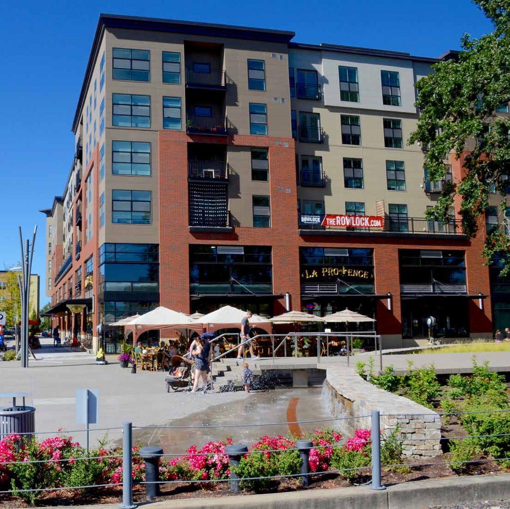
64
65 city center sub-area plan SECTION FOUR variation guidelines and procedures EAST

66 Variation Guidelines and Procedures The Lone Tree City Center Sub-Area Plan should not be interpreted or utilized as an unchangeable mandate for the type, size and location of development within Lone Tree City Center and the RidgeGate Parkway Station Area. Rather, the Plan is intended to establish a robust framework to guide development based on the vision, guiding principles and guidelines. A variation from this Plan should be evaluated based on two conditions: (1) a development proposal supports the vision for the City Center and the intent communicated throughout this document; and (2) the variation from the Plan would not have a detrimental effect on the ability to realize the vision and framework elements set forth in this document, albeit it in a different way than may be depicted in the Plan. Recommended Conditions: A well-designed mid-block connection should be provided within close proximity to the original alignment of the street (see diagram below). The alignment does not need to be identical, but should minimize out of direction travel for pedestrians and bicyclists using the mid-block connection. Combining blocks will not be allowed immediately adjacent to blocks that have already been combined in the same orientation. Combining blocks should not be allowed on three or more blocks per district identified in the Plan. Combining blocks should not be allowed if either block in question is located within the MU-1 district. 60 Variations will be evaluated through the Site Improvement Plan approval process. The City of Lone Tree Community Development Director, in consultation with the City Manager, will determine if an update to the Sub-Area Plan is required. All Sub-Area Plan amendments will be reviewed by the Planning Commission and acted on by the City Council. POTENTIAL VARIATIONS AND RECOMMENDED CONDITIONS This section highlights potential variations that might be requested throughout the development process and provides recommended conditions for those exceptions to the recommendations included within this Plan. Combining Two Blocks It is not uncommon for a developer or end user of a development to combine two blocks in an urban environment. Combining blocks may potentially eliminate a multimodal connection from the street grid, thereby decreasing visual and physical connectivity. Combining blocks may change the intended character for an area if it becomes the predominant development pattern as opposed to the exception. SECTION FOUR: Variation Guidelines and Procedures
67 Excluding Alleys in Blocks Where Designated Certain developments and designs may result in a preference for excluding alleys where they may be designated in the Plan. Recommended Conditions: Utilities planned for or already utilizing the alley corridor must be accommodated in a manner acceptable to the City of Lone Tree and the utility providers prior to an exception being granted. Services, loading and other typical alley uses should be accommodated within the footprint of the development proposed for the block and screened from pedestrians on the adjacent sidewalks and public realm. Setting Buildings Back Further Than Recommended Situations may arise in which a developer may prefer to exceed the recommended setback for a particular district within the City Center. Additional setbacks may be additive to the character and activation of the street if done with the following conditions in mind. Recommended Conditions: The additional space created by the setback must contribute to public or private pedestrian, plaza or park space. The additional space created by the setback should be well-designed and appointed with hardscape and landscaping commensurate with the adjacent open space or right-of-way. The additional setback shall not be utilized for parking. Adjusting the Alignment of Roadways In certain instances, a developer or end user of a development may have interest in adjusting the alignment of a roadway designated in the Sub-Area Plan. Developing on an Area or Block Designated for Open Space or Civic Use In order to achieve desired adjacencies, frontages or combinations of land uses, it might be of interest to develop an area or block that is designated for open space or a civic use in the Sub-Area Plan. So long as the open space or civic use can still be accommodated in the same general location and to the degree originally intended, exceptions should be considered and are subject to approval from the City. Recommended Conditions: An adjacent block with equally good access and sufficient acreage should be available for the intended use. The development proposed for the original open space or civic use site should not overshadow the new site identified. Developing with a Different Land Use Than Designated Finally, a developer or end user of a development may be interested in a particular location, roadway or adjacent amenity within the Sub-Area, but imagine the area or block with a different use than suggested in the Sub-Area Plan. Recommended Conditions: The proposed land use should be deemed compatible and complementary to existing and planned uses on adjacent blocks and parcels. The proposed land use should not significantly detract from the level of street activity that would have been generated by the original designated use. Ground floors should not be developed for a land use different than designated within the MU-1 district. 61 Recommended Conditions: The two intersections that a roadway was intended to connect should still be connected with the adjusted alignment. The adjusted alignment should not decrease connectivity and options for pedestrians, cyclists or automobiles. The adjusted alignment should not result in a remnant area, block or parcel that is deemed undevelopable or that is not easily combined with another development opportunity. RidgeGate EAST Lone Tree City Center Sub-Area Plan
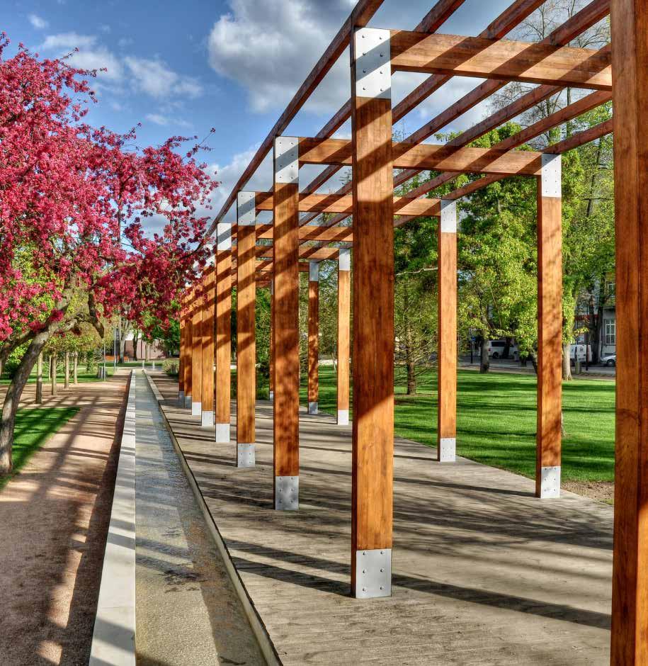
68
69 city center sub-area plan SECTION FIVE appendix EAST

70 Acreages by Block 64 SECTION FIVE: Appendix


71 Development Visualizations 65 View of the proposed City Center from RidgeGate West. View of the proposed City Center from RidgeGate West. View of the proposed City Center from Lincoln Avenue. NOTE: All graphics on this page are for concept only. RidgeGate EAST Lone Tree City Center Sub-Area Plan


72 Street Types Map There are seven designated street types in the Lone Tree City Center. Refer to Figures 1-7 for details. 25 LINCOLN AVE SKY RIDGE AVE 66 FESTIVAL STREET Lone Tree City Center Station RIDGEGATE PKWY PEORIA ST RidgeGate Station Park -n- Ride NOTE: All street alignments shown are subject to refinement. SECTION FIVE: Appendix

73 FIGURE 1: MIXED USE STREET (TYPICAL) Above graphic for concept only. For adopted details, refer to RidgeGate East Technical Supplement. 67 RidgeGate EAST Lone Tree City Center Sub-Area Plan

74 FIGURE 2: LOCAL STREET 68 Above graphic for concept only. For adopted details, refer to RidgeGate East Technical Supplement. SECTION FIVE: Appendix

75 FIGURE 3: FESTIVAL STREET Above graphic for concept only. For adopted details, refer to RidgeGate East Technical Supplement. 69 RidgeGate EAST Lone Tree City Center Sub-Area Plan

76 FIGURE 4: PARKWAY 70 Above graphic for concept only. For adopted details, refer to RidgeGate East Technical Supplement. SECTION FIVE: Appendix

77 FIGURE 5: COLLECTOR Above graphic for concept only. For adopted details, refer to RidgeGate East Technical Supplement. 71 RidgeGate EAST Lone Tree City Center Sub-Area Plan

78 FIGURE 6: MINOR ARTERIAL (SKY RIDGE AVENUE) 72 Above graphic for concept only. For adopted details, refer to RidgeGate East Technical Supplement. SECTION FIVE: Appendix


79 FIGURE 7: CAMPUS ACCESS ROAD Above graphic for concept only. For adopted details, refer to RidgeGate East Technical Supplement. 73 RidgeGate EAST Lone Tree City Center Sub-Area Plan
 are independent housing units within a home or on a lot.")
80 74 Accessory Dwelling Units (ADU) SUMMARY AND RECOMMENDATIONS This narrative and provisions are largely based on a Model Local Ordinance developed by APA in 2000 for AARP and APA Zoning Practice, 2012, Issue #7 and other research. Definition Accessory Dwelling Units (ADUs) are independent housing units within a home or on a lot. They can be an accessory unit built within the principal dwelling unit or an attached or unattached accessory structure. ADU FRAMEWORK AND REQUIREMENTS: Use Encourage ADUs on residential detached lots where they meet the minimum requirements below. ADUs may be incorporated into a new or an existing dwelling. ADUs include an accessory unit within a detached dwelling unit (such as a basement), above a garage, or an attached or detached accessory structure. Detached accessory cottages would be allowed on lots with a minimum 6,000 square foot lot size. ADUs would not be allowed on residential lots for attached development. This includes townhomes, apartments, or condos (unless the ADU is above a detached garage), as there would likely be insufficient parking, infrastructure, yard or unit space to accommodate ADUs; the unit configuration makes it more difficult to build ADUs in these developments; and building requirements, such as firewalls may preclude such. Parking ADUs shall not result in excess automobiles, defined as any vehicle or vehicles owned or operated by members of a household that cannot be accommodated on the dwelling unit s driveway or parked in a common lot. One additional off-street parking space may be added to the lot, and the space must meet minimum side setbacks of 5'. Maintenance The owner of the lot shall occupy either the principal unit or the ADU to help ensure the property is maintained (included in a deed restriction, form supplied by the City of Lone Tree). Covenants Covenants for detached residential development shall not preclude ADUs. Safety ADUs must meet building and fire codes. Services ADUs shall be connected to the water and sewer utilities of the principal dwelling unit and may not have separate water and sewer service. Such service must be deemed adequate by the service provider. Density Addressed by Size To help maintain the residential character of the neighborhood, limit the size and density of ADUs per the following: Size - maximum of 600 square foot Number allowed - maximum of 1 ADU per lot Bedrooms maximum of 2 bedrooms ADUs benefit communities by providing affordable housing opportunities. SECTION FIVE: Appendix
EAST. city center sub-area plan
 EAST city center sub-area plan November 22, 2017 Table of Contents Introduction Section One Context 1 Plan Organization 3 Table of Contents Vision and Guiding Principles 4 Framework Elements Section Two
Urban Design Manual PLANNING AROUND RAPID TRANSIT STATIONS (PARTS) Introduction. Station Study Areas
 Introduction. Station Study Areas") 111111 PLANNING AROUND RAPID TRANSIT STATIONS (PARTS) Introduction The ION rapid transit system will link Waterloo, Kitchener and Cambridge through a central transit corridor (CTC). There are a number
111111 PLANNING AROUND RAPID TRANSIT STATIONS (PARTS) Introduction The ION rapid transit system will link Waterloo, Kitchener and Cambridge through a central transit corridor (CTC). There are a number
URBAN DESIGN BRIEF URBAN DESIGN BRIEF 721 FRANKLIN BLVD, CAMBRIDGE August 2018
 URBAN DESIGN BRIEF URBAN DESIGN BRIEF 721 FRANKLIN BLVD, CAMBRIDGE August 2018 DESIGN BRIEF CONTENTS PART A 1.0 INTRODUCTION 2.0 DESCRIPTION & ANALYSIS OF SITE CONTEXT 3.0 DESIGN CONSTRAINTS AND OPPORTUNITIES
Gold Line Bus Rapid Transit Transit Oriented Development (BRTOD) Helmo Station Area Plan
 Helmo Station Area Plan") Appendix F Gold Line Bus Rapid Transit Transit Oriented Development (BRTOD) Helmo Station Area Plan Introduction and Purpose of the Plan The Gold Line Bus Rapid Transit facility is an eleven-mile dedicated
Appendix F Gold Line Bus Rapid Transit Transit Oriented Development (BRTOD) Helmo Station Area Plan Introduction and Purpose of the Plan The Gold Line Bus Rapid Transit facility is an eleven-mile dedicated
Complete Neighbourhood Guidelines Review Tool
 Complete Neighbourhood Guidelines Review Tool Prepared By: City of Regina Planning Department October 2014 Page 1 of 14 Community Development Review Checklist for Secondary Plans and Concept Plans The
WEST LOOP DESIGN GUIDELINES CHECKLIST
 WEST LOOP DESIGN GUIDELINES CHECKLIST Section 1.0 General Strategies 1.1 DESIGN EXCELLENCE: ENCOURAGE HIGH QUALITY AND INNOVATIVE DESIGN OF NEW BUILDINGS WITHIN THE WEST LOOP WITHOUT BEING PRESCRIPTIVE
Additional information about land use types is given in Chapter 5. Design guidelines for Centers and Neighborhoods are given in Chapter 7.
 4. Place Types Introduction In Albemarle County s Development Areas, the Neighborhood is the fundamental unit of community planning. The County s Neighborhood Model, an adopted part of the Comprehensive
ELMVALE ACRES SHOPPING CENTRE MASTER PLAN
 ELMVALE ACRES SHOPPING CENTRE MASTER PLAN Contents 1.0 INTRODUCTION... 2 2.0 LOCATION... 2 3.0 EXISTING CONTEXT... 2 4.0 VISION & GUIDING PRINCIPLES... 2 5.0 LAND USE AND BUILT FORM... 4 5.1 St. Laurent
Neighborhood Districts
 NEIGHBORHOOD DISTRICTS SEVEN MAIN DISTRICTS Neighborhood Districts While the Development Plan provides a broad-scale overview of the neighborhood, this section focuses on uses and relationships at the
Highland Village Green Design Guidelines
 Highland Village Green Design Guidelines Publishing Information Title Highland Village Green Design Guidelins Author The City of Calgary Status DRAFT - Proposed document subject to changes Additional Copies
Planning Board Briefing
 Planning Board Briefing Why Now? The Sector Plan Implementation Chapter States: Before Stage 1 begins, the following must occur: Approval of the Sectional Map Amendment. Approval of the Greater Lyttonsville
3.0 URBAN DESIGN. December 6, OVERVIEW
 Urban Design 3.0 URBAN DESIGN December 6, 2007 3.1 OVERVIEW The highly urban character of Easton Place is defined by the overall design of the community. The following sections provide an overview of the
Town Center (part of the Comprehensive Plan)
") Town Center (part of the Comprehensive Plan) Mercer Island Town Center Looking North (2014) In 1994, a year-long process culminated in a set of design guidelines and code requirements for the Town Center
Town Center (part of the Comprehensive Plan) Mercer Island Town Center Looking North (2014) In 1994, a year-long process culminated in a set of design guidelines and code requirements for the Town Center
The transportation system in a community is an
 7 TRANSPORTATION The transportation system in a community is an important factor contributing to the quality of life of the residents. Without a sound transportation system to bring both goods and patrons
3.1 community vision. 3.3 required plan elements
 Chapter 3 Community Form 3.1 community vision 3.2 Parks & landscaping concepts 3.3 required plan elements D R A F T 20 Community Form Chapter 3 3.0 Community form 3.1 community vision The Specific Plan
FRUITVALE TRANSIT VILLAGE (Phase 2) Residential Project
 Residential Project") FRUITVALE TRANSIT VILLAGE (Phase 2) Residential Project DEVELOPER: SIGNATURE PROPERTIES ARCHITECT: HKIT ARCHITECTS April 23, 2010 TABLE OF CONTENTS 3 Vision 4 Description of Site 5 Guiding Concepts 6
FRUITVALE TRANSIT VILLAGE (Phase 2) Residential Project DEVELOPER: SIGNATURE PROPERTIES ARCHITECT: HKIT ARCHITECTS April 23, 2010 TABLE OF CONTENTS 3 Vision 4 Description of Site 5 Guiding Concepts 6
C. Westerly Creek Village & The Montview Corridor
 C. Westerly Creek Village & The VISION Community Vision When the goals of the city are achieved Westerly Creek Village, a distinctive community defined by Montview Boulevard and Westerly Creek, is a strong
Midtown Greenway Land Use and Development Plan Executive Summary
 Midtown Greenway Land Use and Development Plan Executive Summary Introduction The Midtown Greenway Land Use and Development Plan sets policy direction for land use and development in the Midtown Greenway
Right-of-Way Acquisitions and Relocations Technical Memorandum
 Right-of-Way Acquisitions and Relocations Technical Memorandum Southeast Extension Project Lincoln Station to RidgeGate Parkway Prepared for: Federal Transit Administration Prepared by: Denver Regional
Lehigh Acres Land Development Regulations Community Planning Project
 Lehigh Acres Land Development Regulations Planning Effort Summary In July, 2010 Commissioner Frank Mann invited the Lehigh Acres community to start discussing how to achieve their recently adopted community
Appendix C: Interim Mixed-Use Evaluation Criteria
 Appendix C: Interim Mixed-Use Evaluation Criteria C-1 Appendix C: Interim Mixed-Use Evaluation Criteria PURPOSE: The implementation of numerous policies contained within the Master Plan hinges on the creation
Official Plan Review: Draft Built Form Policies
 PG.30.1 REPORT FOR ACTION Official Plan Review: Draft Built Form Policies Date: May 15, 2018 To: Planning and Growth Management Committee From: Chief Planner and Executive Director, City Planning Division
New-Cast Mixed-use Development Proposal King Street West, Newcastle, Ontario
 URBAN DESIGN BRIEF New-Cast Mixed-use Development Proposal King Street West, Newcastle, Ontario TABLE OF CONTENTS: 1.0 Executive Summary 2.0 Creating Vibrant and Sustainable Urban Places: Excerpts from
4.1.3 LAND USE CATEGORIES
 4.1.3 LAND USE CATEGORIES a. City Center District The City Center District incorporates the existing character and mix of uses in downtown Belmont to encourage redevelopment and new development in keeping
Overview of the Plan. The Building Blocks of Centers, Neighborhoods and Network INTERNAL DRAFT
 Overview of the Plan 4 East Davidson Ramah Church Rd June Washam Rd Bradford District Park Bradford Shearer Rd Campus District NC 73 Davidson-Concord North Rocky River This Master Plan projects an approximate
ARLINGTON COUNTY, VIRGINIA
 ARLINGTON COUNTY, VIRGINIA County Board Agenda Item Meeting October 15, 2005 DATE: September 28, 2005 SUBJECT: Request to Advertise the adoption of the 2005 Clarendon Sector Plan C. M. RECOMMENDATION:
Regency Developments. Urban Design Brief. Holyrood DC2 Rezoning
 Regency Developments Urban Design Brief Holyrood DC2 Rezoning Stantec Consulting Ltd. 7-31-2017 1. Overview Regency Developments intends to rezone the lands located at 8510 and 8511 93 Avenue, within the
CHAPTER 1. Ms. Guajardo s Class - Central Elementary CH 1 1
 INTRODUCTION CHAPTER 1 Ms. Guajardo s Class - Central Elementary CH 1 1 1.1 SETTING South Centre City is a linear corridor south of Downtown Escondido paralleling Centre City Parkway and South Escondido
Former Rockcliffe Airbase Community Design Plan Guiding Design Vision and Principles December 4, 2013
 APPENDIX 5 - Guiding Design Vision and Principles Former Rockcliffe Airbase Community Design Plan Guiding Design Vision and Principles December 4, 2013 Vision Statement The redevelopment of the former
URBAN DESIGN BRIEF. 2136&2148 Trafalgar Road. Town of Oakville
 URBAN DESIGN BRIEF 2136&2148 Trafalgar Road Town of Oakville Prepared By: METROPOLITAN CONSULTING INC For 2500674 Ontario Inc November 2016 TABLE OF CONTENTS Page No. 1.0 Introduction/Description of Subject
Policies and Code Intent Sections Related to Town Center
 Policies and Code Intent Sections Related to Town Center The Town Center Vision is scattered throughout the Comprehensive Plan, development code and the 1994 Town Center Plan. What follows are sections
2.0 THE PLATINUM TRIANGLE VISION
 2.0 THE PLATINUM TRIANGLE VISION The envisions an exciting future for the area surrounding Angel Stadium of Anaheim, the Honda Center and The Grove of Anaheim. 2.1 Planning Principles In order to further
PUBLIC RIGHT-OF-WAY IN THIS CHAPTER PUBLIC REALM
 PUBLIC RIGHT-OF-WAY This section provides design guidelines for improvements in the public right-of-way. The public right-of-way refers to streets, sidewalks, non-vehicular thoroughfares, parks and greenways
Transportation. Strategies for Action
 Transportation A major priority for the Overlake Neighborhood is to develop a multimodal transportation system. To achieve this system, a balance has to be found among travel, circulation and access needs;
North Oakville East Parks Facilities Distribution Plan. November, 2009
 North Oakville East November, 2009 POLICY CONTEXT 1) Purpose a) The purpose of this document is to be a guide for the location, configuration, design and development of the parks system for the North Oakville
EXISTING COMPREHENSIVE PLAN
 EXISTING COMPREHENSIVE PLAN Town Center Land Use Element: V. LAND USE POLICIES Town Center Mercer Island's business district vision as described in "Your Mercer Island Citizen-Designed Downtown" was an
URBAN DESIGN BRIEF 181 Burloak Drive, Oakville
 URBAN DESIGN BRIEF 181 Burloak Drive, Oakville February 2017 Our File: 1730B 230-7050 WESTON ROAD / WOODBRIDGE / ONTARIO / L4L 8G7 / T: 905 761 5588/ F: 905 761 5589/WWW.MHBCPLAN.COM TABLE OF CONTENTS
1.0 VISION STATEMENT. December 6, PRINCIPLES
 Vision Statement Lincoln Regional Airport 1.0 VISION STATEMENT 1.1 City LOCATION of AND OVERVIEW The Easton Lincoln Place Land Use Master Plan identifies the principles, goals, policies, and standards
APPENDICES DESIGNING PUBLIC SPACES - ENERGIZED PUBLIC SPACES DESIGN GUIDELINES WORKING DRAFT DECEMBER 2018 A1
 APPENDICES DESIGNING PUBLIC SPACES - ENERGIZED PUBLIC SPACES DESIGN GUIDELINES WORKING DRAFT DECEMBER 2018 A1 App.1 Case Studies by Park Types The upcoming (in-progress) online library will house several
Seneca Meadows. Block 4 Locate office, technology, and medical development adjacent to I Screen views of garage structures from I-270.
 Seneca Meadows Seneca Meadows has an industrial park in its southern end and a mixed-use employment area planned for the north end. The district benefits from extensive I-270 visibility, stream valley
THE NEIGHBORHOOD TODAY
 THE NEIGHBORHOOD TODAY CORE AREA VISION How are we Good Urbanism A Site s DNA thinking about Elements of great Unique elements urban communities embedded in a place the site and design? ELEMENTS LIKE:
North Downtown Specific Plan MEMORANDUM
 North Downtown Specific Plan MEMORANDUM MEETING DATE: November 13, 2017 TO: Members of the North Downtown Specific Plan Advisory Committee FROM: Jeanine Cavalli, Senior Planner SUBJECT: Materials for the
Ivywild On The Creek PRELIMINARY CREEK DISTRICT MASTER PLAN
 Ivywild On The Creek PRELIMINARY CREEK DISTRICT MASTER PLAN Introduction: Rejuvenating an extraordinary Creekside neighborhood THE CREEKSIDE DISTRICT The Ivywild On The Creek Neighborhood District Master
DRAFT. 10% Common Open Space
 % OF CHARLOTTE IS CATEGORIZED AS A. LAND USES : Placeholder map displaying location of Place Type GOALS: Accommodate XX% of future growth. Provide a concentration of primarily commercial and civic activity
ARTICLE 6: Special and Planned Development Districts
 ARTICLE 6: Special and Planned Development Districts 6-10 Traditional Neighborhood Development (TND) District 6-10.10 Purpose and Intent The Traditional Neighborhood Development (TND) District provides
4 C OMMUNITY D ISTRICTS
 4 C OMMUNITY D ISTRICTS N ew development in the Area will include many different types of land uses, including a destination retail area that attracts people from all over the region; recreation opportunities
The Vision. Photo provided by The Minervini Group. 46 Vision, Objectives & Strategies
 Vision, Objectives & Strategies The is the public framework and guide for future development of the Grand Traverse Commons. The establishes public polices for infrastructure, the preservation of natural
Metro. Activity Center Design Guidelines. Recommendations For Developing Focused, Mixed-Use Commercial/Residential Centers
 Metro Activity Center Design Guidelines Recommendations For Developing Focused, Mixed-Use Commercial/Residential Centers Metro Activity Centers What is a MAC? Legacy, the adopted guide for the future growth
Courthouse Square Planning & Urban Design Study. Courthouse Square Working Group #13 October 15, 2014
 Courthouse Square Planning & Urban Design Study Courthouse Square Working Group #13 October 15, 2014 1 Courthouse Square Process Working Group Community Courthouse Square Advisory Groups & Civic Associations
FORMER CANADIAN FORCES BASE (CFB) ROCKCLIFFE SECONDARY PLAN. Official Plan Amendment XX to the Official Plan for the City of Ottawa
 ROCKCLIFFE SECONDARY PLAN. Official Plan Amendment XX to the Official Plan for the City of Ottawa") FORMER CANADIAN FORCES BASE (CFB) ROCKCLIFFE SECONDARY PLAN Official Plan Amendment XX to the Official Plan for the City of Ottawa 1 INDEX THE STATEMENT OF COMPONENTS PART A THE PREAMBLE PAGE Purpose...
FORMER CANADIAN FORCES BASE (CFB) ROCKCLIFFE SECONDARY PLAN Official Plan Amendment XX to the Official Plan for the City of Ottawa 1 INDEX THE STATEMENT OF COMPONENTS PART A THE PREAMBLE PAGE Purpose...
Bourne Downtown Site Planning
 Prepared for: The Town of Bourne, MA In Cooperation with: Bourne Financial Development Corporation Prepared by:, Inc. June 24, 2009 Table of Contents Introduction and Summary... 1 Site Existing Conditions...
Chapter 1.0 Introduction
 Chapter 1.0 Introduction 1.1 Background The North Metro commuter rail line is part of the RTD FasTracks regional transit system expansion program to build more than 100 miles of rail transit throughout
Urban Design Brief. Watson Parkway North & Watson Road North Guelph, Ontario. Prepared by Coletara Development
 Urban Design Brief Watson Parkway North & Watson Road North Guelph, Ontario Prepared by Coletara Development December, 2013 Urban Design Brief, Coletara Development 1 Introduction This Urban Design Brief
CHAPTER 3 VISION, GOALS, & PLANNING PRINCIPLES. City of Greensburg Comprehensive Plan. Introduction. Vision Statement. Growth Management Goals.
 CHAPTER 3 VISION, GOALS, & PLANNING PRINCIPLES Introduction The Greensburg Comprehensive Plan is intended as a working community document. A combination of long and short-term goals, this document is intended
URBAN DESIGN BRIEF 305, 309, & 315 SOUTHDALE ROAD WEST LONDON ONTARIO
 URBAN DESIGN BRIEF 305, 309, & 315 SOUTHDALE ROAD WEST LONDON ONTARIO CARVEST PROPERTIES LTD. December 2013 Section 1 - Land Use Planning Context 1.1 Subject Lands The subject lands are located immediately
Town Center. Block 5 Existing multifamily residential units are expected to remain.
 Area Guidelines Germantown s districts should be developed as distinct communities with unique features that are supported through the guidelines. The guidelines not only help distinguish these districts
Table of Contents. Elm Avenue Improvement Plan City of Waco, Texas. Introduction 1. Existing Context 1 Figure 1 2.
 Table of Contents Introduction 1 Existing Context 1 Figure 1 2 Plan Guidelines 3 Future Urban Form 4 The West-End 4 Main Street 6 The East-End 7 Figure 2 9 Public Improvement Recommendations 7 General
5.1 Site Plan Guidelines
 5. Community Core Guidelines Development of the Community Core will take place by plan of subdivision and site plan approval. It will occur in a phased manner that will reflect the timing of residential
DRAFT. October Wheaton. Design Guidelines
 October 2011 DRAFT Wheaton Design Guidelines 2 Draft - Design Guidelines - Wheaton Sector Plan Contents 04 Section 1: Introduction 06 Section 2: Context 08 Section 3: Design Guidelines 09 Goal 1: Create
CHAPTER 7: Transportation, Mobility and Circulation
 AGLE AREA COMMUNITY Plan CHAPTER 7 CHAPTER 7: Transportation, Mobility and Circulation Transportation, Mobility and Circulation The purpose of the Transportation, Mobility and Circulation Chapter is to
Chapter 1: Introduction
 Chapter 1: Introduction The Penn Avenue Community Works Corridor Vision and Implementation Framework presents an integrated communitybased vision and a coordinated, long-term implementation framework for
Chapter 4. Linking Land Use with Transportation. Chapter 4
 Chapter 4 Linking Land Use with Transportation Chapter 4 59 Chapter 4 Linking Land Use with Transportation Community Design and Transportation Program Introduction Since the 1950s, the predominant development
Further input invited as Colchester Growth Strategy nears final phase
 IUE 3 / NOVEMBER 2015 Further input invited as Colchester Growth trategy nears final phase trathcona County is seeking public feedback as it enters the final phase of work on a Growth Management trategy
Subarea 4 Indian Creek. Vision The combination of park networks and transportation amenities make Subarea 4 the greenest hub in the Corridor.
 indian creek 180 extends south from 101st Street to I-435. The I-435 and Metcalf intersection is one of the primary intersections in the Kansas City Metro Area. The area includes several residential neighborhoods
38 Queen s University Campus Master Plan Part 1
 38 Queen s University Campus Master Plan Part 1 46 The Campus at the City Scale Chapter 4 The Campus at the City Scale 39 Queen s is an urban University centrally located in Kingston. Decisions made by
Mark-up of the effect of the proposed Bronte Village Growth Area OPA No.18 on the text of section 24, Bronte Village, of the Livable Oakville Plan
 Mark-up of the effect of the proposed Bronte Village Growth Area OPA No.18 on the text of section 24, Bronte Village, of the Livable Oakville Plan Notes: This document is provided for information purposes
Glenborough at Easton Land Use Master Plan
 Vision Statement Sunrise Blvd. Hazel Ave. Prairie City Rd. Gencorp Property Lincoln Regional Airport 1.0 VISION STATEMENT The identifies City of the principles, goals, policies, and standards Lincoln that
Silverdale Regional Center
 Silverdale Regional Center Vision for Silverdale Regional Center The Silverdale Regional Center Plan (Plan) will guide the evolution of the Silverdale Regional Center from a collection of strip malls and
BROOKLYN PARK / 85TH AVE LRT STATION CDI DEVELOPMENT GUIDELINES DRAFT
 August 2018 Page intentionally left blank The Brooklyn Park Library adjacent to the 85th Ave LRT Station Area. OVERVIEW The Blue Line LRT Extension / Bottineau corridor offers a unique opportunity to leverage
Figure 3-1: Public Realm Plan
 3 Public Realm Figure 3-1: Public Realm Plan 3.1 Public Realm Concept The public realm concept for the Little Mountain site integrates a clear and accessible movement network with public spaces for social
PINE CURVE REZONING. BACKGROUND Purchased as two parcels in 2001 and 2002
 BACKGROUND Purchased as two parcels in 2001 and 2002 WHAT THE PROJECT IS AND IS NOT A Rezoning establishes the land use standards for Annexed and Zoned Greater Downtown District Historic Center September
A. Background Summary of Existing Challenges and Potential Possibilities. 1. Summary of Existing Assets and Potential Opportunities
 A. Background 1 A Main Street Master Plan Study was performed and completed in October of 2007. The study was initiated to review current land uses and development patterns along Main Street, from Parrish
This Review Is Divided Into Two Phases:
 Semiahmoo Town Centre Review The purpose of this review: To review the Semiahmoo Town Centre Concept Plan, originally approved in 1993, to ensure that this centre will continue to serve the needs of South
Establish a network of streetscaped vehicle and pedestrian routes that connect within and outside the Plan area.
 This Plan s urban design goals are to create an urban scale, walkable community with connections to transit, parks, and services and with amenities and facilities for residents and employees. The 1992
Plano Tomorrow Vision and Policies
 Plano Tomorrow Vision and Policies PLANO TOMORROW PILLARS The Built Environment The Social Environment The Natural Environment The Economic Environment Land Use and Urban Design Transportation Housing
Small Area Plan. South Gateway
 Small Area Plan Adopted May 12, 2008 South Gateway Purpose. The South Gateway Small Area Plan defines the City s expectations for the future of the southern entrance to the City at Interstate 85 and Highway
Corridor Vision. 1Pursue Minnehaha-Hiawatha Community Works Project. Mission of Hennepin County Community Works Program
 1Pursue Minnehaha-Hiawatha Community Works Project Minnehaha-Hiawatha Community Works is a project within the Hennepin Community Works (HCW) program. The mission of the HCW program is to enhance how the
Draft Memorandum #1: Goals and Vision for Revitalization
 Keizer Revitalization Plan Draft Memorandum #1: Goals and Vision for Revitalization Submitted to: City of Keizer April 12, 2018 (revised) Prepared By: Angelo Planning Group and Otak, Inc. Project No. 17482.A
9 th Street Sub Area Plan
 9 th Street Sub Area Plan In the 1990 s, when the Township prepared the last Master Plan, the 9 th Street corridor was studied as part of a larger 9 th Street Focus Area that included the West Main Street
Throughout. square. (Crystal City Vision Plan 2050)
") 1: Terms related to the PSMP document 1 public space (see also public realm, civic space) An open space designated on the regulating plan, accessible to all, including Plazas, Mini Parks, and Neighborhoods
1: Terms related to the PSMP document 1 public space (see also public realm, civic space) An open space designated on the regulating plan, accessible to all, including Plazas, Mini Parks, and Neighborhoods
4.9 Mendocino Avenue Corridor Plan Design Guidelines
 4.9 Mendocino Avenue Corridor Plan Design Guidelines The Mendocino Avenue Corridor Plan addresses the area between College Avenue and Steele Lane. Mendocino Avenue is a busy arterial that runs parallel
[PLANNING RATIONALE] For Site Plan Control and Lifting of Holding Zone By-Law 101 Champagne Avenue. May 23, 2014
![[PLANNING RATIONALE] For Site Plan Control and Lifting of Holding Zone By-Law 101 Champagne Avenue. May 23, 2014](/thumbs/75/71599615.jpg "[PLANNING RATIONALE] For Site Plan Control and Lifting of Holding Zone By-Law 101 Champagne Avenue. May 23, 2014") [PLANNING RATIONALE] For Site Plan Control and Lifting of Holding Zone By-Law 101 Champagne Avenue May 23, 2014 Contents 1.0 Introduction... 2 2.0 Site Context... 2 2.1 Adjacent Uses... 2 Figure 1: Site
[PLANNING RATIONALE] For Site Plan Control and Lifting of Holding Zone By-Law 101 Champagne Avenue May 23, 2014 Contents 1.0 Introduction... 2 2.0 Site Context... 2 2.1 Adjacent Uses... 2 Figure 1: Site
Urban Design 9Identity
 Urban Design 9Identity URBAN DESIGN IDENTITY Urban design is about connecting people to their places through the built environment, nature, and overall urban form. Done well, it creates a memorable space
THE 355/270 CORRIDOR:
 THE 355/270 CORRIDOR: Strategic Ideas for Sustaining a Livable Work Place Project Summary ACCESS LIFE DESIGN HEALTH WORK Montgomery County Planning Department The Maryland-National Capital Park and Planning
FUTURE LAND USE ELEMENT
 FUTURE LAND USE ELEMENT GOAL I: To create and sustain a great place to live, play, and prosper Objective 1: The City of Ocala shall incorporate the principles and strategies of the Ocala 2035 Vision into
TRANSIT-ORIENTED DEVELOPMENT POLICY DRAFT. City Planning and Development Department Kansas City, Missouri
 TRANSIT-ORIENTED DEVELOPMENT POLICY DRAFT City Planning and Development Department Kansas City, Missouri What is Transit Oriented Development (TOD)? Development that focuses land uses around a transit
iii. Visioning framework
 III. VISION iii. Visioning framework III.1 Overview A vision is a clear and succinct description of what an institution and its community should look like after it successfully implements its goals and
SPRINGHILL LAKE TRANSIT VILLAGE
 Greenbelt Metro Area Sector Plan - Subarea Design Policies and Guidelines - Springhill Lake Transit Village 113 SPRINGHILL LAKE TRANSIT VILLAGE Residential Neighborhood and Village Center CONCEPT Springhill
6. DOWNTOWN. The Downtown Element focuses on supporting and expanding the vitality and enhancement of Downtown Chico as the City s central core.
 VISION In 2030, Downtown Chico is the heart of the community and the center of cultural activity. Engaging and active at the street level, it is a multi-story, mixed-use hub, with specialty retail, restaurants,
PLAN ELEMENTS WORKSHOP. April 5, 2016
 PLAN ELEMENTS WORKSHOP April 5, 2016 needs more housing. But there is no one-size fits-all solution. Every neighborhood has its own character. In some places, density is not only appropriate it is badly
GUIDING PRINCIPLES IN THIS CHAPTER
 GUIDING PRINCIPLES The guiding principles and design concepts in this chapter work together with the Chapel Hill 2020 Comprehensive Plan to support new public places that can be enjoyed by all while also
Behnke Ranch Property, Pasco County: Master Plan Development Approach
 February 24, 2014 , Pasco County: Master Plan Development Approach Location & Program The (Legacy PUD) is located in southwest Pasco County along State Road 54 approximately 1.5 miles west of the Suncoast
Future Five. Design/ Development Guidelines. January 2008 Amended June 08 per City Council motion
 Future Five Design/ Development Guidelines January 2008 Amended June 08 per City Council motion 5-Points Design Guidelines Table of Contents I. Introduction 3 II. Area boundaries 4 III. Review Process
Queensborough Eastern Neighbourhood Node. Community Open House
 Queensborough Eastern Community Open House The Vision The Queensborough Eastern will become the heart of eastern Queensborough. Through a sensitive mix of viable commercial and residential areas, the neighbourhood
Sahuarita District & Phase 1 Master Plan. Town Council December 11, 2017
 Sahuarita District & Phase 1 Master Plan Town Council December 11, 2017 Visioning Study Visioning Process Advisory Group Meetings Community Questionnaire Town Center Case Studies Community Analysis The
City of Farmington. Downtown Plan. Amendment to the 1998 Master Plan Adopted October 11, 2004
 City of Farmington Amendment to the 1998 Master Plan Adopted October 11, 2004 Introduction Planning Background 1 Scope and Components of the Plan Amendment 2 Concept Introduction 3 Plan Concepts 3 Conceptual
BROOKHILL NEIGHBORHOOD MODEL ZONING MAP AMENDMENT PREFACE TO APPLICATION
 BROOKHILL NEIGHBORHOOD MODEL ZONING MAP AMENDMENT PREFACE TO APPLICATION June 15, 2015 Revised: August 1, 2016 I. VISION Brookhill is a proposed community based upon the principles of Albemarle County
Westwind Developments Ltd. PIONEER LANDS AREA STRUCTURE PLAN - PROPOSED AMENDMENT
 FEBRUARY 2013 TABLE OF CONTENTS 1.0 BACKGROUND... 1 1.1 Amendment... 1 2.0 LOCATION & CONTEXT... 2 2.1 Land Ownership... 2 3.0 POLICY CONTEXT... 3 3.1 Municipal Development Plan... 3 3.2 Capital Region
REGIONAL ACTIVITY CENTER
 DRAFT REGIONAL ACTIVITY CENTER 70 EAST BENCH MASTER PLAN DRAFT 06 Introduction The East Bench Regional Activity center is comprised of large educational, research, medical, and employment centers. These
Staff Report and Recommendation
 Community Planning and Development Planning Services 201 W. Colfax Ave., Dept. 205 Denver, CO 80202 p: 720.865.2915 f: 720.865.3052 www.denvergov.org/cpd TO: City Council Neighborhoods and Planning Committee