|
|
|
- Clarissa Adams
- 5 years ago
- Views:
Transcription
1
2
3
4
5
6 BEFORE ± Mcgregor Road Jones Road 151 Parcel boundary Rural - Rural Production Zone Rural - Mixed Rural Zone Road [i] AFTER Mcgregor Road Jones Road 151 Parcel boundary Rural - Rural Production Zone Rural - Mixed Rural Zone Road [i] Metres Whilst due care has been taken, Auckland Council gives no warranty as to the accuracy and completeness of any information on this map/plan and accepts no liability for any error, omission or use of the information. Date: 5/07/2018 Rezoning at 151 Jones Road, Drury. Rezoned from road and Mixed Rural zone to Rural Production zone Plans and Places
7
8
9 6.32 Hingaia 2 Precinct Description The Hingaia 2 precinct comprises 57 hectares of land located in the western portion of the Hingaia Peninsula, to the west of the existing Karaka Lakes and Karaka Harbourside residential developments, and to the east of the established residential settlement at Bottle Top Bay. The underlying zones of the Hingaia 2 precinct are: Mixed Housing Suburban Mixed Housing Urban Neighbourhood Centre; and Green Infrastructure Corridor (the location and extent of which will be confirmed at the time of subdivision). The purpose of the Hingaia 2 precinct is to provide for comprehensive and integrated residential subdivision and development that will contribute towards increasing the supply of housing (including affordable housing), and to enable the efficient use of land and the provision of infrastructure prior to, or concurrent with, development. The precinct enables a range of lot sizes and house types and will ensure that residential subdivision and development is integrated with the provision of key road links, appropriately manages stormwater, the water quality of streams and water bodies, and the ecological and amenity values of the coastal margin. The Hingaia 2 precinct also enables a neighbourhood centre to establish on the north-western corner of the intersection of Oakland Road with Hingaia road. This centre will provide for a range of retail, commercial and community facilities that will meet the day-to-day needs of the local population. Objectives The objectives are as listed in the underlying Mixed Housing Urban, Mixed Housing Suburban and Neighbourhood Centre zones and the relevant Auckland-wide objectives, in addition to those below. 1.Subdivision and development occurs in a coordinated manner that implements the Hingaia 2 precinct plan. 2.Development achieves a range of housing types and densities, living environments and affordability options while ensuring that a high standard of amenity is provided, particularly adjoining the coastal edge where larger lots are generally provided for. 3.Subdivision and development maintains coastal landform, streams and riparian corridors, and enhances the ecological and amenity values of the coastal, estuarine and stream environments. Public access is provided along streams and adjacent to the coast. Neighbourhood parks of up to 4,000m² in area are provided in appropriate locations for recreation. 4.Subdivision and development occurs in a manner that retains, where practicable, trees that have high amenity value in subdivision design and layout. 5.Subdivision and development occurs in a manner that facilitates views of, and access to, the coast. 6.Subdivision and development occurs in a manner that achieves the coordinated delivery of infrastructure including transport, wastewater, stormwater and water services. 7.Subdivision and development implements stormwater management that: a.uses water sensitive design as a core development approach; b.protects and, where practicable, enhances the ecological values of the receiving environment; and c.integrates with open space, road and pedestrian/cycling networks. Auckland Unitary Plan Operative in part 1
10 8.Promote the development of a defined neighbourhood centre that is developed in a manner that achieves its key function and role of providing a small scale centre for convenience retail, service and commercial activities that meets the day to day needs of the area, and which does not undermine the viability and role of the Hingaia Mixed Use Town Centre or the Papakura Metropolitan Centre. 9.Ensure that affordable housing is distributed throughout the location in which resource consent is sought. 10.Promote the availability of affordable housing to first home buyers and/or community housing providers. 11.Adverse effects of stormwater runoff on communities, the marine receiving environment and freshwater systems are avoided to the extent practical or otherwise mitigated using water sensitive design principles. 12.Major overland flow paths are retained or provided for within the site layout to manage risks from flood events up to the 1 percent AEP, taking into account maximum probable development in the upstream catchment. Policies The policies are as listed in the underlying Mixed Housing Urban, Mixed Housing Suburban zone and Neighbourhood Centre zones and the Auckland-wide policies, in addition to those specified below: 1.Require the structural elements of the Hingaia 2 precinct plan to be incorporated into all subdivision and development to achieve: a.a range of housing choice and section sizes that enable views from public roads to the coast; b.key roads that promote an integrated road network; c.restricted vehicle access along specified roads to safeguard safety for road users and cyclists and to reinforce the stormwater management approach; d.a viable and sustainable neighbourhood centre that will meet the day-to-day convenience needs of local residents; e.two Neighbourhood Parks; f.a network of pedestrian and cycle paths; and g.public access to the coast, including the provision of Coastal Places. 2.Enable a range of residential living opportunities (including a range of lot sizes) with more intensive housing to be generally located in close proximity to the neighbourhood centre and locations with high amenity (e.g. locations close to public open space) and lower density forms of housing along the coastal margin. 3.Ensure that subdivision and development, including road design, achieves a high standard of amenity, and contributes to a positive sense of place and identity consistent with the existing urban areas on the Hingaia Peninsula. 4.New residential development containing 15 or more dwellings/sites provide for affordable housing that is distributed throughout the development. 5.New retirement village developments containing 15 or more dwellings provide for affordable housing. 6.Ensure that subdivision development adjacent to the coast and esplanade reserve safeguards the visual and other amenities of the coastal environment and, in particular, that dwellings are located, Auckland Unitary Plan Operative in part 2
11 and are of a scale, form and design, to maintain views of the coast, and to enhance the amenities of, and safe public access to, the esplanade reserve. 7.Ensure that subdivision and land use activities provide an interconnected road network which: a.is consistent with the locations and road types identified on the Hingaia 2 precinct plan to achieve an appropriate hierarchy of roads on the Hingaia 2 precinct as well as connections to the wider Hingaia Peninsula. b.enables a transport network that provides for the safe and efficient movement of motor vehicles, pedestrians, and cyclists. c.provides and aligns, where practicable, north-south roads that provide viewshafts and public access to the coast. d.makes appropriate provision for stormwater management and low impact stormwater management devices, consistent with the principles of the Hingaia 2 precinct Stormwater Management plan. e.contributes to a positive sense of place and identity through in-street landscape elements, including retention of existing landscape features, and maximising coastal vistas. 8.Require subdivision and development to provide coordinated infrastructure, including stormwater, wastewater, water, public utilities and transport infrastructure. 9.Require all new developments to manage stormwater impacts on receiving environments in a manner that is consistent with the Hingaia 2 Stormwater Management plan, and which has regard to principles of water sensitive design. 10.Ensure that riparian corridors and recreational and amenity spaces are provided in the Hingaia 2 precinct by requiring: a.restoration and enhancement of the riparian corridors identified on the precinct plan and to provide the long term protection of these areas. b.vesting of esplanade reserve adjacent to the coast. c.the creation of Coastal Places as identified on the precinct plan. d.connectivity within, and through, the precinct to the coastal and riparian margins by providing and aligning, where practicable, north-south roads that provide viewshafts and public access to the coast, and by providing pedestrian and cycle paths and open space linkages. 11.Neighbourhood Parks as shown indicatively on the Hingaia 2 precinct plan. Ensure that subdivision design and layout appropriately considers, and responds to, opportunities to retain existing trees that have high amenity value and that are suitable to be retained in an urban environment. 12.Ensure that, in the Neighbourhood Centre zone: a.the total land area for the neighbourhood centre is limited in extent to a maximum of 4,000m² in the Hingaia 2 precinct; b.a range of convenience retail and commercial services are provided that meet the day-to-day needs of residents and wider public; c.a maximum of 1,000m² gross floor area of convenience retail and commercial activities is provided; d.activities do not detract from the amenities of, and are not incompatible with, adjoining residential land uses; e.development of the neighbourhood centre achieves a high standard of amenity and is designed to be pedestrian and cycle friendly; and Auckland Unitary Plan Operative in part 3
12 f.development of the neighbourhood centre occurs in a manner that protects and safeguards the viability and roles of the Hingaia Mixed Use Town centre and the Papakura Metropolitan centre. 13.Facilitate the safe and effective movement of all modes of transport between the precinct and Hingaia road through signalisation of the Oakland road and Hingaia road intersection if and when required Hingaia 2 The activities, controls and assessment criteria in the underlying Mixed Housing Suburban, Mixed Housing Urban and Neighbourhood Centre zones and the Auckland-wide rules apply in the Hingaia 2 precinct unless otherwise specified. Refer to the planning maps for the location and extent of the precinct. In addition, the following rules apply. 1. Activity Table The activities in the Auckland-wide rules, the Mixed Housing Urban and Mixed Housing Suburban and Neighbourhood Centre zones apply in the Hingaia 2 precinct unless otherwise specified in the activity table below. Table 1: Activity status in the Mixed Housing Suburban zone Activity Residential Dwelling(s) on sites that adjoin the esplanade reserve and that have a net site area of 600m² or less per dwelling Activity Status The activities in the Auckland-wide rules and Neighbourhood Centre zone apply in the Hingaia precinct unless otherwise specified in the activity table below. Table 2 - Activity Status in the Neighbourhood Centre zone Activity Retail Individual retail tenancies not exceeding 450m² (gross floor area) RD Activity Status Individual retail tenancies exceeding 450m² (gross floor area) NC Any Retail Activity that results in the total gross floor area of NC all Commercial and Retail Activities in the Neighbourhood Centre zone exceeding 1,000m² Commerce Commercial sexual services Drive-through facilities Taverns Entertainment Facilities Service Stations Any Commercial Activity that results in the total gross floor area of all Commercial and Retail Activities in the Neighbourhood Centre zone of the Hingaia 2 precinct exceeding 1,000m² P NC NC D NC NC NC Auckland Unitary Plan Operative in part 4
13 Industry Repair and maintenance services NC 2. Notification The notification provisions outlined in G2.4 General and I1.2 Residential apply to the Hingaia 2 precinct. 3. Land use controls in all zones The land use controls in the underlying zones apply except as varied below. 3.1 Affordable housing Purpose: To ensure that the precinct contains affordable housing to help address Auckland s housing affordability needs. 1.New residential developments containing 15 or more dwellings/vacant sites must provide for affordable dwellings/vacant sites that are either (b) relative affordable or (c) retained affordable that will meet the requirements of rules 2-9 below. 2.All resource consent applications requiring the provision of affordable dwellings/vacant sites must be accompanied by details of the location, number and percentage of affordable dwellings/vacant sites. 3.Affordable dwellings/vacant sites must be spread throughout the development, with no more than six in any one cluster. 4.For staged developments, a proportionate number of affordable dwellings and/or vacant sites must be provided at each respective stage on a pro-rata basis and spread throughout the development in accordance with rule 3 above. 5.For apartments, no more than one-third of the total number of identified affordable dwellings shall be located on a single building level/storey, unless the development is two levels, in which case no more than half of the identified affordable dwellings shall be located on a single level. 6.If the calculation of the percentage of dwellings (and/or vacant sites) that must be affordable dwellings (and/or vacant sites) results in a fractional dwelling (or vacant site) of one-half or more, that fraction is counted as 1 dwelling (or vacant sites) and any lesser fraction may be disregarded. 7.For avoidance of doubt, the land use rules in this section do not apply to resource consent applications processed under the Housing Accords and Special Housing Areas Act 2013 ( HASHAA ) as the provisions specified in the relevant order in council apply. The above provisions apply to consents that are not processed under the HASHAA. 3.2 Relative Affordable Purpose: To ensure that the precinct contains price relative affordable housing available to first home buyers to help address Auckland s housing affordability needs. 1.For new residential developments containing 15 or more dwellings or involving the creation of 15 or more vacant sites, (or a mixture of both with the total cumulative number of dwellings and/or vacant sites being 15 or more), at least 10 percent of the total number of dwellings/vacant sites must be relative affordable and meet the following criteria: Auckland Unitary Plan Operative in part 5
14 a.the price at which a dwelling may be sold does not exceed 75 percent of the Auckland region median house price (calculated as an average of 3 calendar months previous to the date the application for resource consent is approved or the date on which all appeals on the resource consent application are finally resolved, whichever is the later) that is published by the Real Estate Institute of New Zealand. b.if the application is for a subdivision consent, the applicant must identify the sites of the subdivision allocated for the building of relative affordable dwellings and must specify the mechanism (consent notice for example) for ensuring that the combined value of the building and the land upon completion will meet that criterion or is a building associated with such a dwelling. c.dwellings must be sold to first home buyers who must reside in the dwelling and retain ownership from the date of transfer Eligibility for relative affordable housing Purpose: To ensure relative affordable housing is purchased by appropriate persons. 1.Prior to the first transfer of affordable dwellings (including new dwellings that have never been occupied and are built on vacant sites that are identified for affordable dwellings), the consent holder shall provide the council with a statutory declaration that confirms the sale complies with the following eligibility requirements: a.the purchaser has a gross household income, as at the date of the statutory declaration, that does not exceed 120 percent of the Auckland median household income at the date the sale and purchase agreement was made unconditional. b.the consent holder has sold the dwelling (and any associated parking that is required by resource consent and storage) at a price which is not more than that defined by the 75 percent median price in accordance with rule 3.2.1(a). c.the purchaser is a first home buyer and has never owned any other real property. d.the purchaser is a natural person purchasing the affordable dwelling in their own name and not in the name of any other person or entity. 2.Prior to the transfer of a vacant site identified for affordable dwellings, the purchaser shall be made aware of the consent notice mechanism required to ensure any building built on the site is a dwelling that will meet the relative affordable criteria in or is a building associated with such a dwelling. 3.Prior to the transfer of a vacant site identified for an affordable dwelling, the consent holder shall provide the council with a statutory declaration executed by the intended purchaser that confirms the sale complies with the following eligibility requirements: a.the purchaser has a gross household income, as at the date of the statutory declaration, that does not exceed 120 percent of the Auckland median household income as set at the date the sale and purchase agreement became unconditional; b.any development of the site shall be such that the combined value of the dwelling and the land on completion, as confirmed by a registered valuation, shall be no more than that defined by the 75 percent median price in accordance with rule 3.2.1(a); c.the purchase is a first home buyer and has never owned any other real property; d.the purchaser is a natural person purchasing the affordable dwelling in their own name and not in the name, or on behalf, of any other person or entity. Auckland Unitary Plan Operative in part 6
15 4.A consent notice shall be placed on the computer freehold register for the respective affordable dwellings/vacant sites requiring the above eligibility criteria be met for 3 years from the date of transfer to the eligible purchaser. 3.3 Retained Affordable Eligibility for retained affordable housing Purpose: To ensure that the precinct contains income related retained affordable housing to help address Auckland s housing affordability needs and to ensure retained housing is appropriately managed by community housing providers to achieve ongoing provision and availability where required. 1.Purchasers in respect of retained affordable housing must be a registered community housing provider or the Housing New Zealand Corporation. This rule does not apply to Retirement Villages which are dealt with by rules and below Number of retained affordable dwellings or sites 1.For new residential developments containing 15 or more dwellings or involving the creation of 15 or more vacant sites, (or a mixture of both with the total cumulative number of dwellings and/or vacant sites being 15 or more), at least 5 percent of the total number of dwellings, or vacant sites, in any development must be retained affordable and meet the following criteria. a.the price at which a dwelling may be sold would mean that the monthly mortgage payments for a household receiving the Auckland median household income (as published by Statistics New Zealand for the most recent June quarter calculated as an average of 3 calendar months previous to the date the application for resource consent is approved or the date on which all appeals on the resource consent application are finally resolved, whichever is the later) would not exceed 30 percent of the household s gross monthly income, based on the assumptions that: i.the dwelling is purchased with a 10 percent deposit; and ii.the balance of the purchase price is financed by a 30-year reducing loan, secured by a single mortgage over the property, at a mortgage interest rate equal to the most recent average two year fixed rate. The interest rate used is to be that published most recently by the Reserve Bank of New Zealand, in relation to the date the application for resource consent is made. 2.As part of the resource consent application evidence shall be provided to demonstrate a community housing provider will purchase the dwellings/sites. Prior to transfer of the retained affordable dwellings/sites a council approved statutory declaration must be returned to the council by the consent holder to demonstrate the dwellings/sites are sold at the price point outlined in clause 1. above. 3.4 Affordable housing in retirement villages Purpose: To ensure affordable housing is provided in retirement village complexes 1.For retirement village developments (including any redevelopment creating additional units) containing 15 or more units: a.at least 10 percent of the total number of units must be relative affordable for three years from the date of purchase. If a dwelling is transferred (including by way of lease or licence) during this time frame it must continue to meet the required price point set out below in clause (i); i.the units classed as relative affordable will be valued at no more than 65 percent of the Auckland region median house price published by the Real Estate Institute of New Zealand for the most recent full calendar month preceding the date on which the application for resource consent is approved or Auckland Unitary Plan Operative in part 7
16 the date on which all appeals on the resource consent application are finally resolved, whichever is the later. ii.the price point required by clause (i) above shall include annual charges for maintenance and refurbishment at the retirement village but exclude entry costs, transfer costs, periodical charges, rates and insurance Eligibility for relative affordable in a retirement village Purpose: To ensure relative affordable housing is purchased by qualified persons 1.The purchaser(s)/resident(s) shall have a gross household income that does not exceed 150 percent of the NZ superannuation income receivable, current at the date of purchase. 4. Land use controls - neighbourhood centre zone 1.The land use controls in the Neighbourhood Centre zone apply in the Hingaia 2 precinct unless otherwise specified in the precinct rules. The total gross floor area for all retail and commercial activities (refer to the nesting table for definition) that establish in the Neighbourhood Centre zone shown on the Hingaia 2 precinct plan shall not exceed 1,000m². 5. Development controls - mixed housing surburban zone The development controls in the Mixed Housing Suburban zone apply in the Hingaia 2 precinct unless otherwise specified below: 5.1 Building height Purpose: To manage the height of buildings to generally maintain a low-rise suburban residential character of the zone while ensuring that the height provides for diversity of built form. 1.Buildings must not exceed 9m in height. 5.2 Rear yards Purpose: To provide additional setback and open space areas between the rear of buildings. Table 3 Activity Sites with a density less than or equal to one dwelling per 400m² Rear sites Yard (m) 3m 1m 5.3 Maximum impervious area Purpose: To provide for flexibility of built form for higher density development while managing stormwater runoff generated by development. 1.All developments with a density less than or equal to one dwelling per 400m² the maximum impervious area shall not exceed 60 percent. 2.All developments with a density greater than one dwelling per 400m² the maximum impervious area shall not exceed 70 percent. Auckland Unitary Plan Operative in part 8
17 5.4 Landscaping Purpose: To provide for on-site amenity and an attractive streetscape character, to improve stormwater absorption on-site, and to provide for an attractive interface between residential lots located adjacent to the esplanade reserve, and the coast. 1.Developments with a density less than or equal to one dwelling per 400m², at least 40 percent of a site must comprise landscaped area. 2.Developments with a density greater than one dwelling per 400m², at least 30 percent of a site must comprise landscaped area. 3.For clause 2. above, the following must be met a.at least 10 percent of the required landscaped area must be planted with shrubs including at least one tree that is PB95 or larger at the time of planting. b.at least 40 percent of the front yard must comprise landscaped area. 4.For proposed sites that are adjacent to the esplanade reserve, landscaping must be provided along the esplanade reserve boundary in conjunction with any boundary fence that exceeds 1.2m in height. Landscaping must be undertaken within the site (not within the esplanade reserve), have a minimum depth of 1.5m, and be provided along the entire length of the fence. 5.5 Landscaping for coastal retaining walls Purpose: To soften the visual impact of the retaining walls when viewed from the esplanade reserve. Retaining walls of 1.0m or more in height adjoining the esplanade reserve boundary must have trees planted for a depth 0.6m in front of the retaining wall and within the site as illustrated in the diagram below: 5.6 Dwellings fronting the street Purpose: To ensure dwellings are oriented to provide for passive surveillance of the street and to contribute to streetscape amenity. 1.The front façade of a dwelling or dwellings on a front site must contain: Auckland Unitary Plan Operative in part 9
18 a.glazing that overall comprises at least 20 per cent of the area of the front façade (excluding the garage door) b.a main entrance door that is visible from the street. 5.7 Fences Purpose: To maintain and enhance passive surveillance of the street and public open space, including the esplanade reserve, and to enhance the visual amenity of, and view from, sites that are located adjacent to the esplanade reserve, to the coast. 1.Fences in the front yard must not exceed 1.2m in height. 2.Fences along any boundary that adjoins public open space, including the esplanade reserve, must have a maximum height of 1.5m and be a minimum of 70 percent visually permeable. The exception to this rule is that where fences are proposed on retaining walls or structures that are more than 0.5m above the ground level at the base of the retaining wall or structure, the maximum fence height shall be 1m. 5.8 Garages Purpose: To ensure garages are not a dominant feature in the streetscape. 1.A garage door facing a street must be no greater than 50 percent of the width of the front façade of the dwelling to which the garage relates. 2.Garage doors must not project forward of the front façade of a dwelling. 3.The garage door must be set back at least 5m from the site frontage. 5.9 On-site stormwater management - new impervious surfaces 1.In catchments shown on the Hingaia Indicative Stormwater Management Plan as draining to intermittent or permanent streams all new impervious surfaces of 50m² and over must be designed to achieve the following: a.provide retention (volume reduction) of at least 5mm of runoff depth for the impervious area for which hydrology mitigation is required. b.provide detention (temporary storage) and a drain down period of 24 hours for the difference between the pre-development and post-development runoff volumes from the 90th percentile, 24 hour rainfall event minus the 5mm retention volume (11.5mm) or any greater retention volume that is achieved over the impervious area for which hydrology mitigation is required. 2.In catchments shown on the Hingaia Indicative Stormwater Management plan as draining to the coast all new impervious surfaces of 50m² and over are designed to achieve the following: a.provide retention (volume reduction) of at least 5mm of runoff depth for the impervious area. 3.In catchments shown on the Hingaia Indicative Stormwater Management Plan shown as requiring retention and half the detention volume, all new impervious surfaces of 50m² and over are designed to achieve the following: a.provide retention (volume reduction) of at least 5mm of runoff depth for the impervious area for which hydrology mitigation is required. b.provide half the detention (temporary storage) and a drain down period of 24 hours for the difference between the pre-development and post-development runoff volumes from the 90th percentile, 24 hour rainfall event minus the 5mm retention volume (5.75mm) or any greater retention volume that is achieved over the impervious area for which hydrology mitigation is required; provided that Auckland Unitary Plan Operative in part 10
19 c.the remaining detention volume (5.75mm) is directed to a communal device designed and sized to accommodate flows from the site. 4.In catchments shown on the Hingaia Indicative Stormwater Management plan as draining to a wetland all new impervious surfaces are to be directed to a wetland that has been designed and sized to accommodate flows from the site OR are to be directed to devices designed to achieve the following: a.provide retention (volume reduction) of at least 5mm of runoff depth for the impervious area for which hydrology mitigation is required. b.provide detention (temporary storage) and a drain down period of 24 hours for the difference between the pre-development and post-development runoff volumes from the 90th percentile, 24 hour rainfall event minus the 5mm retention volume (11.5mm) or any greater retention volume that is achieved over the impervious area for which hydrology mitigation is required. 5.Stormwater runoff must be directed to an on-site device designed and sized to accommodate stormwater runoff from 1, 2, 3 (a) and (b), and 4 (a) and (b) above. 6.Stormwater device/s on private land: a.must be maintained by the site owner in perpetuity. A consent notice must be registered on the Certificate of Title to that effect. b.if rainwater tanks are proposed for a dwelling to achieve the retention requirements of clause (a) above, the rainwater tank must be dual plumbed to non-potable uses such as the toilet as a minimum. 7.Compliance shall be demonstrated to the council in conjunction with any application for building consent, or by way of certificate of compliance or at the time of subdivision. 8.Non-compliance with clauses 1-7 above is a restricted discretionary activity. 6. Development controls - mixed housing urban zone The development controls in the Mixed Housing Urban zone apply in the Hingaia 2 precinct unless otherwise specified below. 6.1 Rear yards Purpose: To provide additional setback and open space areas between the rear of buildings 1.For developments less than or equal to one dwelling per 300m² the rear yard setback is 3m. 2.For developments more than one dwelling per 300m² the rear yard setback is 1m. 3.For all rear sites yards the setback is 1m. 6.2 Landscaping Purpose: To provide for on-site amenity and an attractive streetscape character, to improve stormwater absorption on-site. 1.Developments with a density less than or equal to one dwelling per 400m², at least 40 percent of a site must comprise landscaped area. 2.Developments with a density greater than one dwelling per 400m², at least 30 percent of a site must comprise landscaped area. 3.For clause 2 above, the following must be met: a.at least 10 percent of the required landscaped area must be planted with shrubs including at least one tree that is PB95 or larger at the time of planting; and Auckland Unitary Plan Operative in part 11
20 b.at least 40 percent of the front yard must comprise landscaped area. 6.3 Dwellings fronting the street Purpose: To ensure dwellings are oriented to provide for passive surveillance of the street and contribute to the streetscape amenity. 1.The front façade of a dwelling or dwellings on a front site must contain: a.glazing that overall comprises at least 20 percent of the area of the front façade (excluding the garage door). b.a main entrance door that is visible from the street. 6.4 Fences Purpose: To maintain and enhance passive surveillance of the street and public open space, including the esplanade reserve, and to enhance the visual amenity of, and views from, sites that are located adjacent to the esplanade reserve, to the coast. 1.Fences in the front yard must not exceed 1.2m in height. 2.Fences along any boundary that adjoins public open space, including the esplanade reserve, must have a maximum height of 1.5m and be a minimum of 70 percent visually permeable. The exception to this rule is where fences are proposed on retaining walls or structures that are more than 0.5m above the ground level at the base of the retaining wall or structure, the maximum fence height shall be 1m. 6.5 Garages Purpose: To ensure garages are not a dominant feature of the streetscape. 1.A garage door facing a street must be no greater than 50 percent of the width of the front façade of the dwelling to which the garage relates. 2.Garage doors must not project forward of the front façade of a dwelling. 3.The garage door must be set back at least 5m from the site frontage. 6.6 On-site stormwater management - new impervious surfaces 1.In catchments shown on Hingaia Indicative Stormwater Management plan as draining to intermittent and permanent streams all new impervious surfaces of 50m² and over are designed to achieve the following: a.provide retention (volume reduction) of at least 5mm of runoff depth for the impervious area for which hydrology mitigation is required. b.provide detention (temporary storage) and a drain down period of 24 hours for the difference between the pre-development and post-development runoff volumes from the 90th percentile, 24 hour rainfall event minus the 5mm retention volume (11.5mm) or any greater retention volume that is achieved over the impervious area for which hydrology mitigation is required. 2.In catchments shown on Hingaia Indicative Stormwater Management plan as draining to coast the all new impervious surfaces of 50m² and over are designed to achieve the following: a.provide retention (volume reduction) of at least 5mm of runoff depth for the impervious area. Auckland Unitary Plan Operative in part 12
21 3.In catchments shown on Hingaia Indicative Stormwater Management plan shown as requiring retention and half the detention volume, all new impervious surfaces of 50m² and over are designed to achieve the following: a.provide retention (volume reduction) of at least 5mm of runoff depth for the impervious area for which hydrology mitigation is required. b.provide half the detention (temporary storage) and a drain down period of 24 hours for the difference between the pre-development and post-development runoff volumes from the 90th percentile, 24 hour rainfall event minus the 5mm retention volume (5.75mm) or any greater retention volume that is achieved over the impervious area for which hydrology mitigation is required; provided that c.the remaining detention volume (5.75mm) is directed to a communal device designed and sized to accommodate flows from the site. 4.In catchments shown on Hingaia Indicative Stormwater Management plan as draining to a wetland all new impervious surfaces are to be directed to a wetland that has been designed and sized to accommodate flows from the site OR are to be directed to devices designed to achieve the following: a.provide retention (volume reduction) of at least 5mm of runoff depth for the impervious area for which hydrology mitigation is required. b.provide detention (temporary storage) and a drain down period of 24 hours for the difference between the pre-development and post-development runoff volumes from the 90th percentile, 24 hour rainfall event minus the 5mm retention volume (11.5mm) or any greater retention volume that is achieved over the impervious area for which hydrology mitigation is required. 5.Stormwater runoff must be directed to an on-site device designed and sized to accommodate stormwater runoff from 1, 2, 3 (a) and (b), and 4 (a) and (b) above. 6.Stormwater device/s on private land: a.must be maintained by the site owner in perpetuity. b.if rainwater tanks are proposed for a dwelling to achieve the retention requirements of clause (a) above, the rainwater tank must be dual plumbed to non-potable uses such as the toilet as a minimum. 7.Compliance shall be demonstrated to the council in conjunction with any application for building consent or by way of a certificate of compliance, or at the time of subdivision. 8.Non-compliance with clauses 1-7 above is a restricted discretionary activity. 7. Subdivision activity table 1.The Activity Table 1 General, and Activity Table 2 Residential zones, and Table 4 Standards for vacant site subdivision in the City Centre and Business zones in H5 Subdivision and related controls, apply in the Hingaia 2 precinct, except as specified in the following Activity Table 4: Table 4 - Activity table Hingaia 2 precinct Subdivision activity Activity status Subdivision in accordance with the Hingaia 2 precinct plan RD Subdivision not in accordance with the Hingaia 2 precinct plan D Subdivision adjoining the existing or proposed esplanade in which all proposed sites are RD 600m² net site area or more Vacant lot subdivision adjoining the existing or proposed esplanade with proposed sites of NC less than 600m² net site area Subdivision of sites in accordance with an approved land use consent or a concurrent RD Auckland Unitary Plan Operative in part 13
22 comprehensive subdivision and land-use consent for subdivision adjoining the existing or proposed esplanade with proposed sites of less than 600m² net site area Subdivision of a site with road access to a vehicle access restriction (VAR) road RD 8. Subdivision development controls 1.The subdivision controls in the Neighbourhood Centre zone of the Hingaia 2 precinct are those listed inh Auckland-wide Rules- Subdivision. 2.The subdivision controls in the Mixed Housing Suburban and the Mixed Housing Urban zones of the Hingaia 2 precinct are those listed in H Auckland-wide rules Subdivision, except as specified in rule below. 8.1 Residential zones - site size 1.In addition to the controls in Table 1 [of H Subdivision rule] subdivision of a parent site of 1ha or more, and where 15 or more vacant sites are proposed, each site that will contain a building must comply with the average net site area below for the zone, provided that the proposed minimum net site area is no less than 20 percent of the required minimum net site areas for the relevant zone and that the average lot size is not less than: a.600m² net site area for vacant sites adjoining the coast in the Mixed Housing Suburban zone b.400m² net site area for the Mixed Housing Suburban zone c.300m² net site area for the Mixed Housing Urban zone. 2.Any site which is 1,200m² or greater (and identified for future development) will be excluded from the calculation of average lot size in relation to clause 1 above. 8.2 Roading standards 1.Roads, apart from those local roads marked as indicative, must be provided in general accordance with the Hingaia 2 precinct plan. 2.The road network shall be constructed to the standards contained in Table 5: Road Construction Standards for Additional Road Types and be consistent with the applicable Figure or, where contained in Table 5, the relevant Auckland-wide rules shall apply. Table 5 - Road construction standards Types of road Road width Carriage Footpath Cycleway (metres) Figure (metres) way (metres) Width (metres) Hingaia road NA 3m combined footpath/cycleway (both sides) 1 Collector road m (one 3m combined N/A Auckland Unitary Plan Operative in part 14
23 (Oakland road) side) footpath/cycleway (one side) Hayfield way m (one side) 3.6m combined footpath/cycleway (one Swale street m (one side) Local road m (both sides) side) 3m combined footpath/cycleway (one side) N/A 4 3.Where local roads are proposed along the north-south pedestrian and cycle path shown on the precinct plan, the local road typology shall include a 3.0m combined cycle and footpath on one side. 4.Direct vehicle access to any Mixed Housing Urban lots located on the south side of the Swale street should not be obtained from the road. 5.Direct access to any lots located on the north side of Hingaia road shall not be obtained from Hingaia road. 6.Unsealed berm, free of planting and of sufficient dimensions, shall be made available immediately adjacent to the road boundary of all lots for the installation, operation, maintenance and upgrading of electricity supply infrastructure on all categories of road, consistent with the road construction standards in Table 5 and the applicable figure. 8.3 Riparian margin Riparian margins shall be established either side of the banks of a stream (shown on the precinct plan as riparian corridor) to a minimum width of 10m measured from the bank of the stream, where the location of the bank can be physically identified by ground survey, or from the centreline of the stream where the bank cannot be physically identified by ground survey. These margins shall be planted in native vegetation and shall be offered to the council as local purpose drainage reserves. 8.4 Landscaping Purpose: To ensure that landscaping on lots adjoining public open space, including the esplanade reserve, is provided in perpetuity. 1.A consent notice must be registered on the Titles for all lots that adjoin public open space, including the esplanade reserve, requiring that landscaping be undertaken in accordance with land use rule and , of the Hingaia 2 precinct. 2.The detailed design of landscaping in roads and public open spaces (including the esplanade reserve), and on lots that adjoin public open space areas, shall be undertaken in parallel with the Engineering Plans Approval process. 8.5 Fences Purpose: To maintain and to enhance passive surveillance of the street and public open space, including the esplanade reserve, and to enhance the visual amenity of, and views to the coast from, sites located adjacent to the esplanade reserve. 1.A consent notice must be registered on the titles for lots requiring that fences are erected in accordance with the relevant land use rule , of the Hingaia 2 precinct. Auckland Unitary Plan Operative in part 15
24 8.6 Affordable housing 1.Refer to the affordable housing clauses in the land use and development control sections above. 8.7 On-site stormwater management 1.Where the detention component of the On-site Stormwater Management rule ( , ) is to be provided in a communal device, the device must be provided at the time of subdivision and be designed and constructed to council standards. 2.Stream channels shall be used to convey flood flows and shall be capable of passing the 1 percent AEP without generating effects on adjacent properties and designed to council standards. 9. Assessment of restricted discretionary activities Matters for discretion 9.1 Subdivision in the Hingaia 2 precicnt The council will restrict its discretion to those matters listed for subdivision under the Auckland-wide rules as well as the following matters: 1.Consistency with the Hingaia 2 precinct plan; 2.Limitations or restrictions on access for future lots adjoining the Swale street (Mixed Housing Urban lots) and Hingaia road; 3.The extent to which the proposed subdivision facilitates views of, and access to, the coast; 4.The extent to which proposed subdivision at the coastal interface minimises the need for retaining structures and, where retaining structures are required, the extent to which the proposal minimises the length, height and visual prominence of all retaining structures; 5.The extent to which the proposed subdivision will provide for an appropriate connection between public open space and any esplanade reserves; 6.Opportunities to retain existing trees and vegetation where practicable and to integrate them into subdivision design and layout; 7.Consistency with the Hayfield way Stormwater Management plan; 8.The matters for discretion outlined in H5.4 Subdivision, Table 13; and i) Vehicle access: 9.Vehicle access: The council will restrict its discretion on vehicle access to the following matters: a.the location and design of vehicle and pedestrian access. b.the effects on safety, particularly for pedestrians and cyclists. 9.2 Buildings on sites that have a net site area of less than 600m2 that adjoin the esplanade reserve in the Hingaia 2 precinct The council will restrict its discretion to the following matters: 1.Dwelling location, scale, form and design, and the extent to which the dwelling will maintain viewshafts to the coast from public places, support surveillance of the esplanade reserve, and present an overall design that respects high amenity values at the coastal edge. 9.3 Development control infringements Auckland Unitary Plan Operative in part 16
25 The council will restrict its discretion to those matters listed in I1.11 Residential, and Chapter G, G2.3 General, for development in the Hingaia 2 precinct except where otherwise specified below. 1.Landscaping and Landscaping for Coastal Retaining Walls a.those matters listed in I b.the amenity values and landscape character of the esplanade reserve and coastal environment c.the interface between residential lots and the esplanade reserve d.the nature of the landscaping proposed at the interface with the esplanade reserve, including the species to be planted and the density of planting proposed. 2.Fences a.the matters listed in I b.the effect on amenity values and character of the public open space. 3.On-site Stormwater Management Impervious areas unable to comply with rules: , and : The council will restrict its discretion to: i.items (a)-(d) listed in H Stormwater Management Flow in the Auckland-wide rules; ii.h Stormwater quality management requirements for minimising adverse effects. 9.4 Assessment criteria For development that is a restricted discretionary activity in the Hingaia 2 precinct, the following assessment criteria apply in addition to the criteria specified for the relevant restricted discretionary activities in the Mixed Housing Suburban zone, Mixed Housing Urban zone, the Neighbourhood Centre zone and the Auckland-wide rules: Subdivision 1.The structural elements of the Hingaia 2 precinct plan are incorporated into the subdivision design including: a.key roads; b.vehicle access or no access restrictions along Hingaia road and along the Mixed Housing Urban land on the southern side of Swale street c.riparian (green infrastructure) corridors; and d.neighbourhood Parks (which may be relocated). 2.Development is consistent with the Hingaia 2 precinct objectives and policies. 3.Where any lots are created that are affected by the Vehicle Access Restriction notation on the precinct plan, the lots shall be provided with rear vehicle accessways, and pedestrian access only should be provided off the road. 4.Where any lots are created adjacent to the esplanade reserve, or to a public open space, use of retaining structures should be minimised where possible. Where retaining structures are required, they will be assessed having regard to: a.the location of the retaining structure and its visual impact on the amenity of the public open space and/or the coast; b.the length, height and design of the retaining structure, including the materials to be used in its construction; and c.what landscaping is proposed in order to minimise the prominence of the retaining structures. Auckland Unitary Plan Operative in part 17
26 5.Whether existing trees are to be retained, having regard to the following: a.the health, form and condition of the tree (or group of trees); b.the extent to which the tree (or group of trees) can be appropriately accommodated into the subdivision design and layout in a manner that will safeguard the future health, form and condition of the tree; and c.the amenity value of the tree (or group of trees) and its contribution to the overall landscape character and visual amenities of the precinct. 6.Compliance with the on-site stormwater management solutions in the approved Stormwater Management plan for the Hingaia 2 precinct; 7.The assessment criteria outlined in H5.4 Subdivision Buildings on sites that have a net site area of less than 600m2 that adjoin the esplanade reserve in the Hingaia 2 precinct 1.The location, scale, form and design of the building; 2.The extent to which the location, scale, form and design of any building will facilitate or maintain views of the coast; 3.The extent to which the building will respect the amenity values of the coastal environment; and 4.The extent to which the building will provide an appropriate interface with the coast, in particular the extent to which the design encourages surveillance of the esplanade reserve Landscaping and landscaping for coastal retaining walls 1.Those matters listed in I ; 2.Whether the proposed planting will eventually grow to soften the visual effects of the retaining wall/fencing as viewed from the esplanade reserve; and 3.Whether the materials selected for the retaining wall/fence are appropriate to the location and context Vehicle access 1.Vehicle crossings and accessways should be designed to reduce vehicle speed, be visually attractive by using quality paving and landscaping, and clearly signal the presence of a vehicle crossing or accessway. 2.Vehicle crossings and accessways should enable pedestrian access. The spaces may be integrated where designed as a shared space with pedestrian priority. 3.The design of pedestrian routes between dwelling entries, car park areas, private and communal open space and the street should provide equal physical access for people of all ages and physical abilities and provide a high level of pedestrian safety and convenience. 4.Whether vehicle access to lots adjoining shared paths on Oakland road and Hayfield way can be practicably provided by way of a rear access or from an alternative road boundary where possible. Where this is not practical or feasible, alternative solutions for access to individual properties should be provided which minimise the frequency and extent to which the berm is crossed by vehicles entering or exiting the properties and maximise the safety of users of the berm. 5.Ramps, where necessary, should be integrated into the design of the building and landscaping. Auckland Unitary Plan Operative in part 18
27 6.Effects on safety for all road users and on the streetscape amenity Impervious areas unable to comply with rules , and The council will consider assessment criteria H (a) (f) listed under Stormwater Management Flow in the Auckland-wide rules; and 2.Assessment criteria H (a) to (f) listed under Stormwater Management Quality in the Auckland-wide rules. 3.Whether consent notices are required to be registered on the Certificates of Title for new lots to ensure compliance with the on-site stormwater management requirements. 10. Special information requirements For subdivision, the relevant special information requirements in the Auckland-wide subdivision rules apply as well as the following: 1.A coastal erosion and geotechnical report should be provided with subdivision and land use applications. 11. Definitions Community housing provider Means a housing provider (other than the Housing New Zealand Corporation) that has, as one of its objectives, the provision of one or both of the following types of housing: 1.Social rental housing 2.Affordable rental housing Household income Household income shall include all taxable income as defined by the New Zealand Inland Revenue Department. Relative affordable Housing that is: 1.Bought by first home buyers, where the purchaser has a gross household income that does not exceed 120 per cent of the Auckland median household income as set at the date of signing the sale and purchase agreement. 2.Sold at a price that does not exceed 75 per cent of the Auckland region median house price published by the Real Estate Institute of New Zealand and calculated as an average of 3 calendar months previous to the date of application for resource consent is approved or the date on which all appeals to the resource consent application are finally resolved, whichever is the later. Retained affordable Housing that is: 1.Built by a registered community housing provider or the Housing New Zealand Corporation; or 2.Sold to a registered community housing provider or the Housing New Zealand Corporation; and 3.Sold at a price defined by the Auckland median household income as published by Statistics New Zealand for the most recent June quarter before the date the application for resource consent is approved or the date on which all appeals on the resource consent application are finally resolved, whichever is the later. 12. Precinct plans Auckland Unitary Plan Operative in part 19

28 Figure 1 - Zoning Plan Auckland Unitary Plan Operative in part 20

29 Figure 2 - Precinct Plan Auckland Unitary Plan Operative in part 21

30 Figure 3a - Stormwater Plan Auckland Unitary Plan Operative in part 22
 Auckland Unitary Plan Operative in part")
31 Figure 3b - Stormwater Plan Diagram 1 - Hingaia Road (Arterial) Auckland Unitary Plan Operative in part 23

32 Diagram 2 - Hayfield Way (Connector) Diagram 3 - Swale Street Auckland Unitary Plan Operative in part 24

33 Diagram 4 - Local Road Diagram 5 - Local Road With Cyclepath Auckland Unitary Plan Operative in part 25
34 Memo 21 June 2018 To: Phill Reid, Auckland-wide Manager From: Rebecca Greaves Principal Planner, Central-South Planning Subject: Plan Modification: Clause 20A Amendment to Chapter I332 Tāmaki Precinct of the Auckland Unitary Plan (AUP) Operative in part (15 November 2016). Delegated authority to Tier 4 manager through Schedule 2A of the Auckland Council Combined Chief Executive s Delegation Register (Updated May 2017). This plan modification requires decision-making pursuant to clause 20A of the First Schedule to the Resource Management Act 1991, as corrections are required to the Auckland Unitary Plan (Operative in Part). Rule or Section of Unitary Plan Subject Site Legal Description Nature of change Chapter I332 Tāmaki Precinct Morrin Road, Glen Innes Lots 1 and 2 DP A minor wording change is required to correct I332.4 in the Tāmaki Precinct within the Auckland Unitary Plan, Operative in Part version. Discussion The activity table for the precinct, and the explanation as to how provisions elsewhere in the Unitary Plan apply, are set out at I332.4 Tāmaki Precinct. Tāmaki precinct land is zoned Mixed Use, and all the provisions of H13 apply, except where the precinct specifically directs otherwise. The preamble to the table has text advising relevant overlays etc apply but there is a word missing from the sentence: Effect of change The missing word should be inserted to I332.4 The clause 20A change corrects cross referencing to the intended provisions. Ideally the phrase should be rewritten to conform to the 2017 revised precinct template: The provisions in any relevant overlays, zone and the Auckland-wide apply in this precinct unless otherwise specified below. All relevant overlay, Auckland-wide and zone activity tables apply unless the activity is specifically provided for by a rule in Activity Table I below. The plain meaning of the word is the same. However, if this correction is considered beyond the scope of a clause 20A change, the alternative correction is suggested The provisions in any relevant overlays, zone and the Auckland-wide chapter apply in this precinct unless otherwise specified below. Changes required Amend I332.4 in the Operative in Part version.
35 Prepared by: Approved by: Rebecca Greaves Principal Planner, Central-South Planning Signature: Marc Dendale Central-South Planning Team Leader Signature: Page 2
36 I332 Tāmaki Precinct I332. Tāmaki Precinct I Precinct Description The Tāmaki Precinct applies to land located at 231 and 261 Morrin Road, Glen Innes (being Lots 1 and 2 DP ). The site is over 12 hectares in area. It has been owned by the University of Auckland since 1945 and was developed as its Tāmaki Innovation Campus. The precinct is occupied by the University of Auckland, Landcare Research and the Ministry for Primary Industries. The University will be exiting the site in the short to medium term. The purpose of the precinct is to enable the land to be used for other uses than those provided for in the Business - Mixed Use Zone along with on-going use for a range of teaching, research and associated activities. In addition to development of the site for future uses, possible changes to the existing buildings are provided for which allows flexibility for on-going tertiary education activities until such time as the precinct is comprehensively redeveloped. The precinct fronts Merton Road, Morrin Road and the land designated for the future extension of Te Horeta Road (as proposed by Auckland Transport in the Auckland Manukau Eastern Transport Initiative). It has Morrin Reserve on part of its southern boundary and Colin Maiden Park is located on the other side of its Morrin Road frontage. The land is located adjacent to the Glen Innes Town Centre, has excellent access to a range of transport modes (rail station, the various access improvements proposed in the Auckland Manukau Eastern Transport Initiative, cycling and bus routes), is in close proximity to amenities and community facilities, and is surrounded by a range of commercial, light industrial and recreation uses but does not adjoin any residentially zoned land. The strategic location and other characteristics of this land and existing buildings provide an opportunity for the establishment of a wide range of commercial, health, education, residential, and limited retail uses. The site also presents an opportunity for substantial new buildings, including more intensive uses having regard to its large size and locational attributes. The site characteristics support a maximum height limit of 24m although the impact of the two Volcanic Viewshaft overlays (W12 and W13) will restrict development in the southern part of the precinct. To ensure integrated development of this large land area in a comprehensive manner, the applicant is required to produce design guidelines and an overall plan for all the land included in the precinct as part of the first land use or subdivision resource consent on the site to demonstrate how the land would be developed. The first and subsequent land use and subdivision consent applications are required to be consistent with the design guidelines and overall plan approved as part of the first land use or subdivision resource consent on the site, or any approved variation. New buildings, including additions to existing buildings and accessory buildings will be assessed against specified urban design matters in a comprehensive manner, in addition to assessment criteria set out in H13 Business Mixed Use Zone policies H13.3 (3), (4) and (5) to achieve quality urban design outcomes and ensure that the land is used efficiently. Site-specific controls are set out below with regards to height, the front yard and landscaping along Morrin Road and Merton Road, height in relation to boundary for Auckland Unitary Plan Operative in part 1
37 I332 Tāmaki Precinct buildings near public open space boundaries, and a vehicle access restriction applying to Merton Road. To ensure appropriate site development and support the amenity outcomes sought by the 6m yard to Merton Road and Morrin Road, motor vehicles sales, drive-through restaurants with entry/exits onto Merton Road or Morrin Road, as well as service stations fronting onto Merton Road or Morrin Road are listed as non-complying activities. A requirement for the preparation of a comprehensive stormwater management plan prior to any development and/or subdivision of the site will ensure that appropriate measures are put in place to manage water quality and quantity. Car parking maximums apply in the precinct and these will ensure an efficient use of the land and encourage patronage of public transportation, given the close proximity of the site to the Glen Innes bus and rail station facilities. A car parking limit, including a maximum number of 1530 office spaces which are required to be marked out at all times, is intended to mitigate congestion effects on the wider road network. The zoning of land within this precinct is Business Mixed Use Zone. I Objectives (1) Tertiary education facilities and industrial laboratories are enabled to meet the education needs of their students, facilitate research and economic development, and provide for the well-being of employees, students and visitors. (2) Tertiary education facilities and industrial laboratories integrate positively with the wider community and environment and mitigate potential adverse effects. (3) Tertiary education facilities, industrial laboratories and business activities benefit from co-location in this precinct. (4) New buildings and structures respond to and positively contribute to the amenity values of streets, public open spaces and surrounding context, thereby reinforcing sense of place. (5) A range of activities is enabled as appropriate to the precinct s location adjacent to a town centre and surrounding commercial, recreation and transportation uses in an area with extensive amenities and community facilities. (6) New buildings and structures will be able to attain a greater scale given the site s large size and absence of sensitive adjoining land uses, while maintaining regionally significant views to Maungarei/Mount Wellington. (7) The new development and activities: (a) are comprehensively planned; (b) support the rapid and frequent service network; (c) avoid effects on the safety and efficiency of the road network; (d) avoid adverse effects on the function and amenity of Morrin Reserve; Auckland Unitary Plan Operative in part 2
38 I332 Tāmaki Precinct (8) Future subdivision and development can accommodate the management of stormwater generated by new development in the precinct applying a water sensitive design. (9) Parking provision is restricted to reduce traffic congestion and provide opportunities to improve amenity. The overlay, Auckland-wide and zone objectives apply in this precinct in addition to those specified above. I Policies (1) Enable a range of activities and building development in the Tāmaki Precinct, including tertiary education, research, health, recreation, student accommodation and appropriate ancillary development and activities which are consistent with the precinct s location adjacent to the Glen Innes Town Centre and close proximity to public transport modes, recreation facilities, community facilities and other amenities. (2) Provide for activities which contribute to and benefit from co-location with a tertiary education facility, including research, innovation, learning, and related work experience. (3) Provide for detailed site-specific planning, development and implementation for a range of activities including those ancillary to tertiary education facilities with the requirement for the preparation of design guidelines and an overall plan at the time of the first land use or subdivision consent application for the precinct. (4) Require screening or landscaping of waste management facilities, service areas/buildings and parking to enhance their appearance when viewed from public places. (5) Provide for accessory activities to meet the needs of employees, students and visitors without undermining the function of nearby town centres as the primary location for business activities, and while avoiding, remedying or mitigating adverse effects on the transport network. (6) Provide for a 24m building height to recognise and provide for the opportunity for buildings of greater scale resulting from the strategic location and characteristics of the land and absence of sensitive adjoining land uses. (7) Promote the comprehensive development and redevelopment of the precinct. (8) Manage stormwater runoff comprehensively and require water sensitive stormwater management solutions to be integrated into the site design and development and to be implemented. (9) Enable direct access to public transport, pedestrian and cycle networks and Glen Innes Town Centre. Auckland Unitary Plan Operative in part 3
39 I332 Tāmaki Precinct (10) Restrict vehicular access to Merton Road. (11) Manage parking by placing a control on the amount of parking that can be provided on the precinct. (12) Manage shading effects on Morrin Reserve. The overlay, Auckland-wide and zone policies apply in this precinct in addition to those specified above. I Activity table [rp/dp] All relevant overlay, Auckland-wide and zone activity tables apply unless the activity is specifically provided for by a rule in Activity Table I below. The provisions in any relevant overlays, zone and the Auckland-wide apply in this precinct unless otherwise specified below. Table I Activity table specifies the activity status of land use, development and subdivision activities in the Tamaki Precinct pursuant to sections 9(2), 9(3) and 11 of the Resource Management Act 1991 or any combination of all of these sections where relevant. Table I Activity table Activity Use (A1) Activities not provided for Accommodation (A2) Commerce (A3) Student accommodation Drive-through restaurant with entry/exit on to Merton Road or Morrin Road Activity status NC P NC (A4) Motor vehicle sales NC (A5) Offices P (A6) Service stations fronting Merton Road or Morrin Road NC Community (A7) Community use of education and tertiary education facilities P (A8) Hospitals with up to 50 beds P Development (A9) External alterations and additions that are less than 10 per cent of the existing GFA of the building P Auckland Unitary Plan Operative in part 4
40 I332 Tāmaki Precinct (A10) New buildings, or external alterations and additions that are more than 10 per cent of the existing GFA of the building RD (A11) Parking in excess of numbers specified in I RD (A12) (A13) (A14) (A15) (A16) Development that is inconsistent with the overall plan for the precinct Changes to the overall plan for the precinct Development inconsistent with the approved Stormwater Management Plan for the precinct Maintenance of stormwater management devices consistent with the approved Stormwater Management Plan for the precinct Flood mitigation works consistent with the approved Stormwater Management Plan for the precinct RD RD RD P P Subdivision (A17) (A18) Subdivision inconsistent with the approved design guidelines and overall plan for the precinct Subdivision inconsistent with the approved Stormwater Management Plan for the precinct RD RD I Notification (1) Any application for resource consent for an activity listed in Table I Activity table above will be subject to the normal tests for notification under the relevant sections of the Resource Management Act (2) When deciding who is an affected person in relation to any activity for the purposes of section 95E of the Resource Management Act 1991 the Council will give specific consideration to those persons listed in Rule C1.13(4). I Standards The overlay, zone and Auckland-wide standards apply in this precinct, except for Standard H Building height. All activities listed as permitted or restricted discretionary in Table I must comply with the following permitted activity standards. I Maximum Building Height (1) Buildings must not exceed 24m in height I Yards and landscaping (1) A 6m front yard is required adjoining the road boundary of Merton and Morrin Roads. No less than 60 per cent of the front yard must be landscaped and Auckland Unitary Plan Operative in part 5
41 I332 Tāmaki Precinct maintained to the satisfaction of the Council at all times and in such a manner as to create and preserve a good standard of amenity. (2) Café decks and patios are eligible to count as landscaping. (3) Individual site entries, car manoeuvring areas or carpark areas must not exceed 8 metres in width within the front yard required in (1) above. I Parking In addition to the parking standards set out in Standard E Number of parking and loading spaces, the following parking standards apply. (1) Parking may either be provided on the same site as the activity to which it relates, or on another site within the precinct. (2) Permitted parking on the land within the precinct: (i) is restricted to a maximum of 3,780 spaces overall and, of that quantum, a maximum of 1,530 parking spaces for office activity, unless parking spaces for office activity are 1000 or less in which case a maximum of 4,250 spaces overall; and (ii) all parking spaces for office activity must be clearly marked as such. (3) In the event that parking required by Table E Parking rates - area 1 exceeds the parking maximum in I (2) above, then the parking maximum in I (2)applies. I Vehicle access (1) There must be no vehicle ingress or egress to the land in the Tāmaki Precinct from Merton Road. I Assessment controlled activities I Matters of control There are no controlled activities in this precinct. I Assessment criteria There are no controlled activities in this precinct. I Assessment restricted discretionary activities I Matters of discretion The Council will restrict its discretion to all of the following matters when assessing a restricted discretionary activity resource consent application, in addition to the matters specified for the relevant restricted discretionary activities in the overlay, Auckland-wide or zone provisions. (1) Stormwater Management Plan, amendments to a Stormwater Management Plan, a replacement Stormwater Management Plan or variations to the approved Stormwater Management Plan. Auckland Unitary Plan Operative in part 6
42 I332 Tāmaki Precinct (a) The extent to which the design, location and capacity of infrastructure servicing is likely to meet the needs for such services in an appropriate manner. (b) Whether adequate provision has been made to ensure integration of development with neighbouring areas. (c) Whether adequate provision has been made for staging of development. (d) Whether adequate provision has been made for integrated stormwater management. (e) Whether adequate provision has been made to ensure appropriate water quality outcomes. (f) The extent to which provisions has been made to manage potential impact on overland flow paths including: (i) obstruction of flows; (ii) any change to location and capacity; (iii) any change to overland flow on other properties. (g) Whether adequate provision has been made to manage effects on existing infrastructure. (h) The extent to which provision has been made to manage potential changes in flood depth and frequency upstream and downstream of the site and potential flooding of habitable floors. (i) Whether adequate provision has been made for the treatment of stormwater and ensuring appropriate standards of stormwater quality before discharge from the site. (j) Whether adequate provision has been made for on-going access and maintenance requirements. (k) Whether appropriate methods of providing for long term maintenance and protection such as easements are identified. (2) Parking in excess of numbers specified in I (a) Whether adequate provision has been made to ensure accessibility to public transport and active mode networks. (b) The extent to which provision has been made to manage the effects of traffic generated by activities in the precinct. (c) The extent to which provision has been made to manage the effects of traffic generated by development in the precinct on capacity and safety of the road network. Auckland Unitary Plan Operative in part 7
43 I332 Tāmaki Precinct (3) New buildings, or external alterations and additions that are more than 10 per cent of the existing GFA of the building. (a) Whether the relationship of buildings to the street edges is appropriately managed. (b) The extent to which provisions has been made to manage the effects arising from the height of development. (c) The extent to which provision has been made to manage the sustainability of the design (reuse of existing buildings, passive solar design). (d) The extent to which provision has been made to manage the quality and adaptability of buildings. (e) Whether the orientation of buildings to roads and public places (existing and future) is appropriately managed. (f) Whether the effects of fences and walls, along frontages and adjoining public places including reserves are appropriately managed. (g) The extent to which provisions has been made to ensure provision of active frontages and continuity of frontages. (h) Whether clear and legible entrances to buildings (including for vehicles) are provided to enhance the sense of pedestrian access and to minimise conflict. (i) The methods used to integrate car parking underground or within buildings so it is not highly visible from the street, and to minimise any new areas of at-grade parking areas other than kerbside. (4) The overall plan for the use and development of all land within the Tāmaki Precinct. (a) The appropriateness of the design of the site layout having regard to the policies for the development of the precinct. (b) The adequacy of the proposed arrangements for travel demand management having regard to the policies for the development of the precinct. (c) The adequacy of the provision made for open space and the suitability of the proposed locations having regard to the policies for the development of the precinct. (d) The adequacy of the provision made for infrastructure servicing to meet the needs for the planned development outcomes for the precinct. (e) The arrangements made for the integration of development and use having regard to the policies for the development of the precinct. Auckland Unitary Plan Operative in part 8
44 I332 Tāmaki Precinct (f) The proposed methods and arrangements for staging of development, infrastructure and services to ensure that the policies for the development of the precinct are applied to the extent practicable throughout the progress of the development of the precinct. I Assessment criteria The Council will consider the relevant assessment criteria below for restricted discretionary activities, in addition to the assessment criteria specified for the relevant restricted discretionary activities in the overlay, Auckland wide or zone provisions. (1) Stormwater Management Plan including amendments to a Stormwater Management Plan, a replacement Stormwater Management Plan or variations to the approved Stormwater Management Plan. (a) The location and capacity of infrastructure servicing including the extent to which the proposed infrastructure is adequate to service all the land in the Tāmaki Precinct, including the proposed development having regard to Council standards. (b) Whether the design of stormwater management devices has regard to Council standards for management of quality, volume and discharge and achieves appropriate water quality outcomes. (c) Whether appropriate maintenance plans for the stormwater management devices are provided and whether access for maintenance is adequately provided. (d) Consistency with any relevant network discharge consent or publicly available and current Council stormwater management plans and/or analysis. (e) The extent to which the stormwater management plan has achieved integrated and effective stormwater management across all the land in the Tāmaki Precinct. (f) Whether there is clear identification of those elements that are to be vested in Council and that they meet the Council requirements for vested infrastructure. (g) The extent to which adverse effects of stormwater diversions and discharges are prevented or mitigated, including cumulative effects, to the extent possible having regard to: (i) the nature, volume and peak flow of the stormwater discharge; (ii) avoiding the creation or increase of flood risk to other properties; (iii) options to manage stormwater on-site or the use of communal stormwater management measures. Auckland Unitary Plan Operative in part 9
45 I332 Tāmaki Precinct (h) The extent to which floodplains and development are managed and whether overland flow paths have been identified and protected. (2) Parking in excess of numbers specified in I (a) Whether the provision of facilities on site is sufficient to accommodate the expected numbers of pedestrians, cyclists, moped, motorbike and public transport users. (b) The extent to which the proposal achieves greater accessibility to existing or new pedestrian and cycle and public transport networks. (c) The adequacy of provision for integration with, and avoidance of adverse effects on the safety and efficiency of the transport network of the surrounding area, including any necessary upgrades to the surrounding road network. (d) The adequacy of any measures to mitigate adverse effects on the capacity of the adjacent roading network caused by expected traffic generation of a proposal. (e) Whether the effects on existing and probable future traffic volumes on adjacent roads can be appropriately managed. (f) Whether the proposal demonstrates the ability of the adjacent existing or planned roading network systems to handle increased traffic and the feasibility of improving the roading network systems to handle increased traffic. (3) The policies set out in H3.3 (4), (5) and (6) are to be applied for new buildings, or external alterations and additions that are more than 10 per cent of the existing GFA of the building. (4) The overall plan to manage the use and development of all land in the Tāmaki Precinct, and any proposed change to the plan are to be assessed in terms of the extent to which the layout of all the land in Tāmaki Precinct will achieve an urban structure that addresses the following matters: (a) A network of roads, intersections and connections providing for safe and efficient vehicle, pedestrian and cycle circulation through the site. (b) Provision for convenient and direct pedestrian and cycle access to the Glen Innes town centre and public transport services. (c) The layout of blocks and building platforms having regard to the circulation network and any open space. (d) The relationship of the urban structure to surrounding development including Morrin Reserve, Colin Maiden Park and the Auckland Manukau Eastern Transport Initiative project. Auckland Unitary Plan Operative in part 10
46 I332 Tāmaki Precinct (e) The number and location of vehicle access points, the form of roads, streets and intersections, and the extent to which proposed new access points, roads, streets and intersections integrate with existing transportation infrastructure. (5) The provisions made for the management of travel demand including: (a) the measures provided as part of the development to manage traffic demand, alternative transport options, including a travel management plan, and connections to public transport and key connections to and within the wider area; (b) any travel management plan methods for the purposes of encouraging increased use of public transport and active modes (such as walking and cycling) as a means of travel to the site designed to discourage low occupancy private vehicle use for most users of the offices, and to meet or exceed the desired travel mode splits, would need to be finalised as a condition of consent. (6) The adequacy and appropriateness of the provision for open space and any connections to a public place the public open space network (parks, reserves and streets). (7) The availability of infrastructure and/or the ability to install and/or upgrade infrastructure to service the proposed development for stormwater, wastewater and water supply. (8) The extent to which the proposed development and use on the land in the Tāmaki Precinct, including any provision for the transport network or open space, integrates into a coherent form and function with any intended or consented use or development of the balance of the site. (9) Whether the timing of infrastructure coincides and is coordinated with the expected staging of development to facilitate integrated transport and land use planning. Note: The staging of development of the land within the Tāmaki Precinct should be linked with the timing of infrastructure upgrades and where development is proposed ahead of upgrades the developer will be required to make development contributions or pay infrastructure growth charges to contribute towards the cost of any necessary infrastructure upgrades in the local area, resulting from the associated growth impacts resulting from development of the land. I Special information requirements (1) An application for the first: (a) subdivision consent (excluding any boundary adjustment or subdivision to provide for the existing Landcare parking shortfall; and the subdivision from the parent site (Lot 1 DP ) of a new title sufficient to contain the Auckland Unitary Plan Operative in part 11
47 I332 Tāmaki Precinct existing University of Auckland Data Centre building and the necessary curtilage, car parking and site access); or, (b) land use consent application (excluding additions to buildings that are less than 10 per cent of the existing GFA of the building); must be accompanied by: (a) a comprehensive Stormwater Management Plan including stormwater quality and quantity management devices to service the development for all the land in the precinct which is in accordance with the additional matters of discretion and assessment criteria set out above; (b) an overall plan to manage the use and development for all the land in the Tāmaki Precinct that address the matters in paragraphs (i) to (xiii) below: (i) (ii) site layout and circulation; the number and location of vehicle access points; (iii) building platforms; (iv) proposed new roads and intersections; (v) internal pedestrian and cycle network and connections to existing and future public pedestrian and cycle networks; (vi) provision for the safe movement of pedestrians and cyclists across Merton Road to connect to the Glen Innes to Tāmaki Drive Shared Path; (vii)maximum block size; (viii) the relationship with the Auckland Manukau Eastern Transport Initiative project; (ix) the form and location of roads and streets; (x) the location of any open space; (xi) travel demand management; (xii)infrastructure servicing; and (xiii) staging of development and infrastructure provision. I Precinct plans There are no precinct plans for this precinct. Auckland Unitary Plan Operative in part 12
48
49
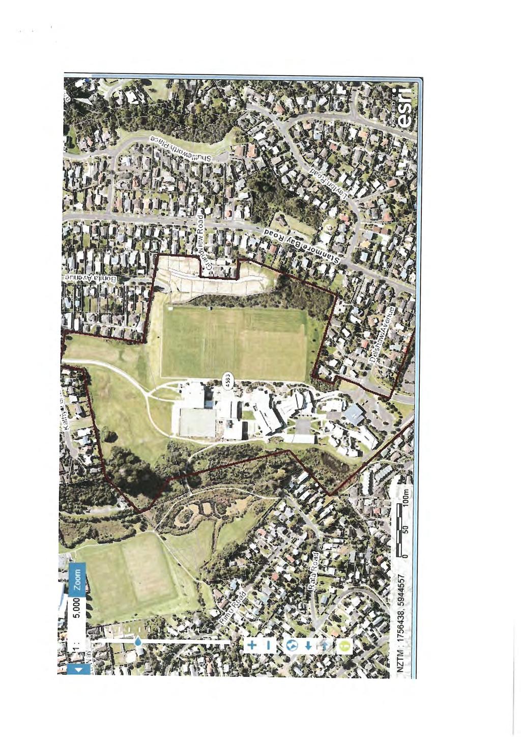
50
51
52
53
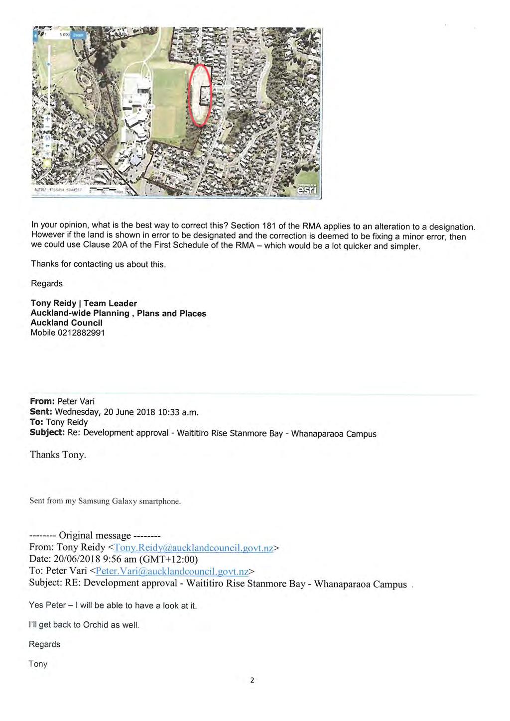
54
55
56
57
58
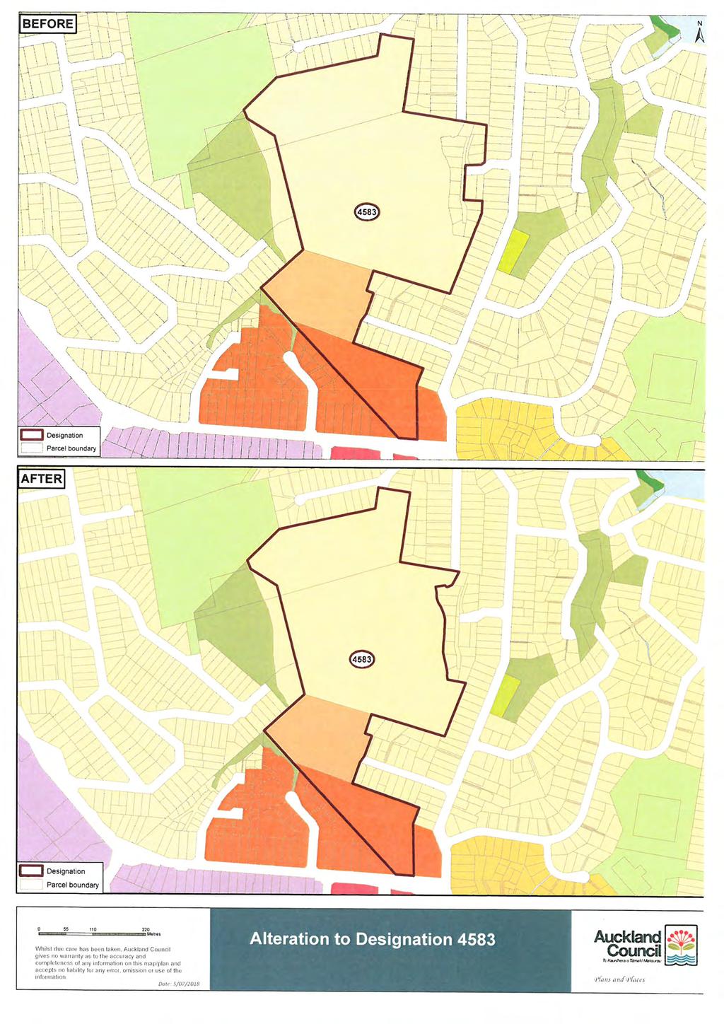
59
60
PROPOSED AUCKLAND UNITARY PLAN, PART 2 - REGIONAL AND DISTRICT OBJECTIVES AND POLICIES, CHAPTER F: PRECINCT OBJECTIVES AND POLICIES, 6: SOUTH
 1 PROPOSED AUCKLAND UNITARY PLAN, PART 2 - REGIONAL AND DISTRICT OBJECTIVES AND POLICIES, CHAPTER F: PRECINCT OBJECTIVES AND POLICIES, 6: SOUTH 6.15: Mangere Gateway The objectives and policies of the
I615. Westgate Precinct
 I615. Westgate Precinct I615.1. Precinct Description The Westgate Precinct is located approximately 18km west of the Auckland city centre. There are seven Sub-precincts in the Westgate Precinct: Sub-precinct
I403 Beachlands 1 Precinct
 I403. Beachlands 1 I403.1. Precinct Description Beachlands is a rural and coastal village located on the eastern side of Auckland, adjoining the Tamaki Strait coastline. The original Beachlands village
I609. Penihana North Precinct
 I609. Penihana North Precinct I609.1. Precinct description The Penihana North Precinct is located south of the Swanson Railway Station, adjacent to the Rural Urban Boundary (RUB) and Waitakere Ranges Heritage
I539. Smales 2 Precinct
 I539. Smales 2 Precinct I539.1. Precinct Description The Smales 2 Precinct applies to a 4.8 hectare block of land located on the southern side of Northcote Road and fronting Lake Pupuke, Takapuna. The
H14. Business General Business Zone
 H14. Business General Business Zone H14.1. Zone description The Business General Business Zone provides for business activities from light industrial to limited office, large format retail and trade suppliers.
I611. Swanson North Precinct
 I611. Swanson North Precinct I611.1. Precinct Description Swanson North is located in the north eastern foothills of the Waitakere Ranges. It is outside the Waitakere Ranges Heritage Area Act and the Waitakere
I602. Birdwood Precinct
 I602. Birdwood Precinct I602.1. Precinct description The Birdwood Precinct applies to an area west of Don Buck Road and south of Red Hills Road in west Auckland. It incorporates subdivision and development
I404 Beachlands 2 Precinct
 I404. Beachlands 2 I404.1. Precinct Description The Beachlands 2 precinct covers approximately 6 hectares of land at the corner of Beachlands and Whitford Maraetai Roads. Its purpose is to provide for
Tāhuhu whakaruruhau ā-taone The sheltering ridge pole
 B2. Tāhuhu whakaruruhau ā-taone - Urban growth and form B2.1. Issues Tāhuhu whakaruruhau ā-taone The sheltering ridge pole Auckland s growing population increases demand for housing, employment, business,
H9. Business Metropolitan Centre Zone
 H9. Business Metropolitan Centre Zone H9.1. Zone description The Business Metropolitan Centre Zone applies to centres located in different subregional catchments of Auckland. These centres are second only
H13. Business Mixed Use Zone
 H13. Business Mixed Use Zone H13.1. Zone description The Business Mixed Use Zone is typically located around centres and along corridors served by public transport. It acts as a transition area, in terms
H10. Business Town Centre Zone
 H10. Business Town Centre Zone H10.1. Zone description The Business Town Centre Zone applies to suburban centres throughout Auckland, the satellite centres of Warkworth and Pukekohe, and the rural towns
This sub-precinct covers the Mixed Housing Suburban areas located adjacent to the Otuataua Stonefields Historic Reserve.
 6.15 Māngere Gateway Precinct description Subprecinct E This sub-precinct covers the Mixed Housing Suburban areas located adjacent to the Otuataua Stonefields Historic Reserve. Sub-precinct E is comprised
H7 Open Space zones. (a) provide for the needs of the wider community as well as the needs of the community in which they are located;
 provide for the needs of the wider community as well as the needs of the community in which they are located;") H7. Open Space zones H7.1. Background The majority of land zoned as open space is vested in the Council or is owned by the Crown. However some areas zoned open space are privately owned. While the open
H7. Open Space zones H7.1. Background The majority of land zoned as open space is vested in the Council or is owned by the Crown. However some areas zoned open space are privately owned. While the open
H1. Residential Large Lot Zone
 H1. Residential Large Lot Zone H1.1. Zone description The Residential Large Lot Zone provides for large lot residential development on the periphery of urban areas. Large lot development is managed to
Plan Modification to Chapter B2 of the Auckland Unitary Plan(AUP) Operative in part (15 November 2016)
 Operative in part (15 November 2016)") UNITARY PLAN UPDATE REQUEST MEMORANDUM TO FROM Phill Reid Linley Wilkinson DATE 25 September 2018 SUBJECT Plan Modification to Chapter B2 of the Auckland Unitary Plan(AUP) Operative in part (15 November
UNITARY PLAN UPDATE REQUEST MEMORANDUM TO FROM Phill Reid Linley Wilkinson DATE 25 September 2018 SUBJECT Plan Modification to Chapter B2 of the Auckland Unitary Plan(AUP) Operative in part (15 November
Subdivision Design Criteria. Penihana North GUIDELINES TO THE RULES
 Created September 2013 Penihana North Subdivision Design Criteria GUIDELINES TO THE RULES This part of the Plan sets out the design criteria for subdivision in Penihana North. The criteria will be considered
Appendix 1 Structure plan guidelines
 Appendix 1 Structure plan guidelines This appendix forms part of the regional policy statement [rps]. 1.1. Introduction Structure plans are an important method for establishing the pattern of land use
Section 12C Subdivision in the Rural Residential Zone
 Section 12C 12C Subdivision in the Rural Residential Zone The Rural Residential Zone provides part of the range of residential opportunities within the City. Land zoned rural residential is considered
4 Residential and Urban Living Zones
 4 Residential and Urban Living Zones Refer to Chapters 11 to 20 for additional rules that may apply to these zones. 4.1 OBJECTIVES AND POLICIES Objective Res1 Policy 1 Policy 2 Policy 3 Policy 4 Policy
I331. St John s Theological College Precinct
 I331. St John s Theological College Precinct I331.1. Precinct Description The precinct contains the existing St John s Theological College which is a residential college for the Anglican Church in New
Section Three, Part 16 Takanini Structure Plan Area
 PART 16 TAKANINI STRUCTURE PLAN AREA 16.1 Residential 8 zone 16.1.1 Objectives and Policies 16.1.2 Rules: General 16.1.3 Rules: Activity Status Subdivision (Except within the Addison Neighbourhood Centre)
I412. Flat Bush Precinct
 I412. Flat Bush Precinct I412.1. Precinct description The Flat Bush precinct covers approximately 1730ha of land adjacent to the Rural Urban Boundary. The Flat Bush Precinct incorporates the provisions
The Proposed Auckland Unitary Plan (notified 30 September 2013)
") 3 Business zones Introduction There are 10 business zones in the Unitary Plan: City Centre Metropolitan Centre Town Centre Local Centre Neighbourhood Centre Mixed Use General Business Business Park Light
3 Business zones Introduction There are 10 business zones in the Unitary Plan: City Centre Metropolitan Centre Town Centre Local Centre Neighbourhood Centre Mixed Use General Business Business Park Light
Section Three, Appendix 16C Medium Density Housing, Design Assessment Criteria (Residential 8A zone)
") APPENDIX 16C MEDIUM DENSITY HOUSING, DESIGN ASSESSMENT CRITERIA (RESIDENTIAL 8A ZONE) PURPOSE OF APPENDIX 16C (RESIDENTIAL 8A ZONE) In the Residential 8A Zone the following are defined as restricted discretionary
APPENDIX 16C MEDIUM DENSITY HOUSING, DESIGN ASSESSMENT CRITERIA (RESIDENTIAL 8A ZONE) PURPOSE OF APPENDIX 16C (RESIDENTIAL 8A ZONE) In the Residential 8A Zone the following are defined as restricted discretionary
Section Three, Appendix 17C Multiple Unit Housing Design Assessment Criteria
 APPENDIX 17C MULTIPLE UNIT HOUSING DESIGN ASSESSMENT CRITERIA Purpose of Appendix 17C In the Residential 9 Zone the construction and use of multiple household units located within the Multiple Household
Subdivision and Development
 Subdivision and Development 8.0 Introduction - Subdivision and Development The principle purpose of subdivision is to provide a framework for land ownership so that development and activities can take
Memorial Business Park Site. Proposed Future Development. Design guidelines. August
 Memorial Business Park Site Proposed Future Development Design guidelines August 2014 www.designenvironment.co.nz 0064 3 358 3040 Contents 1.0 Background 1.1 Introduction 3 1.2 Objectives 4 2.0 Context
15 Rural Residential Zone
 15 Rural Residential Zone Section 15A 15A Purpose of the Rural Residential Zone... 1 15A.1 Objectives and Policies of the Rural Residential Zone... 1 15A.2 Activity Status Rules... 5 15A.3 Permitted Activity
I333 Three Kings Precinct
 I333. Three Kings I333.1. Precinct description The Three Kings Precinct provides for the development of a vibrant, sustainable urban village on the former quarries and the adjacent land at Three Kings.
I209 Quay Park Precinct
 I209. Quay Park I209.1. Precinct description The Quay Park Precinct is located on reclaimed land at the eastern end of the city centre and along the City Centre waterfront. It is dissected to the east
Section 6A 6A Purpose of the Natural Features and Landscapes Provisions
 Section 6A 6A Purpose of the Natural Features and Landscapes Provisions This Chapter addresses the protection and management of natural features and landscapes within the City. The City has a number of
I511. Hatfields Precinct
 I511. Hatfields Precinct I511.1. Precinct Description The Hatfields Precinct is a contiguous 183.8 hectare block of rural land held in 8 freehold titles, located immediately to the north of Hatfields Beach.
1. Assessment of Environmental Effects
 1. Assessment of Environmental Effects Table of Contents 1. Introduction and Overview 1 2. Statutory Assessment 3 3. Site Description 5 4. Proposal Description 7 5. Assessment of Effects on the Environment
open space environment
 This section updated August 09 GUIDELINE TO THE RULES The Open Space Environment Rules apply to activities on sites within the Open Space Environment as shown on the Human Environments Maps. Most of the
THREE PARKS ZONE Three Parks Special Zone The process of applying for resource consents in the zone.
 .25 Three Parks Special Zone The purpose of this zone is to provide for growth and to give effect to the Wanaka 2020 Community (2002) and the more recent Wanaka Structure (2007) and Wanaka Transport Strategy
AOTEA SUPERMARKET ZONE. Zone Introduction
 C18 AOTEA SUPERMARKET ZONE Zone Introduction C18.1 Objective This zone identifies a specific area in Aotea for a stand alone supermarket. The zone is site specific and has a range of objectives, policies
QUEENSTOWN LAKES DISTRICT COUNCIL SUBDIVISION DESIGN GUIDELINES
 Attachment C: Draft QLDC Subdivision Design Guidelines QUEENSTOWN LAKES DISTRICT COUNCIL DESIGN GUIDELINES A DESIGN GUIDE FOR AND DEVELOPMENT IN THE URBAN ZONES QUEENSTOWN OFFICE 10 Gorge Road Queenstown
Chapter 13 Residential Areas: Appendices APPENDIX 1 Residential Areas
 Chapter 13 Residential Areas: Appendices Page 1 Chapter 13 Residential Areas: Appendices APPENDIX 1 Residential Areas Design Code for Intensive Housing INTRODUCTION DESIGN ELEMENTS A NEIGHBOURHOOD DESIGN
NORTH EAST INDUSTRIAL ZONE
 SECTION 12A: NORTH EAST INDUSTRIAL ZONE CONTENTS 12A.1 Introduction 1 12A.2 Resource Management Issues 2 12A.3 Objectives and Policies 3 12A.4 Rules: Permitted Activities 8 R12A.4.1 Permitted Activities
11.3 SPECIAL CHARACTER ZONE HAWKE S BAY REGIONAL SPORTS PARK
 11.3 SPECIAL CHARACTER ZONE HAWKE S BAY REGIONAL SPORTS PARK 11.3.1 INTRODUCTION The availability of sports and recreation activities and facilities is important for the maintenance and enhancement of
I604. Hobsonville Marina Precinct
 I604. Hobsonville Marina Precinct I604.1. Precinct description Hobsonville Marina Precinct is located at Clearwater Cove, Hobsonville in Auckland s upper Waitemata Harbour. The precinct includes the coastal
SPECIAL 35 (HIBISCUS COAST GATEWAY) ZONE
 ZONE") `` 12.8.35 SPECIAL 35 (HIBISCUS COAST GATEWAY) ZONE 12.8.35.1 Issues The following provisions relate to the Hibiscus Coast Gateway Zone. This zone is located at Silverdale in the area bounded by State
`` 12.8.35 SPECIAL 35 (HIBISCUS COAST GATEWAY) ZONE 12.8.35.1 Issues The following provisions relate to the Hibiscus Coast Gateway Zone. This zone is located at Silverdale in the area bounded by State
Section 12B 12B Subdivision in Residential Zones
 Section 12B 12B Subdivision in Residential Zones The Residential Zones provide for a range of infill and greenfield living opportunities across the City for the community to accommodate current and future
SECTION 7A: WHAKARONGO RESIDENTIAL AREA
 SECTION 7A: WHAKARONGO RESIDENTIAL AREA CONTENTS 7A.1 Introduction 1 7A.2 Resource Management Issues 1 7A.3 Objectives and Policies 1 7A.4 Methods 4 7A.5 Residential Zone 4 7A.5.1 Rules: Controlled Activities
12 Subdivision, Services and Infrastructure
 12 Subdivision, Services and Infrastructure Section 12A 12A Purpose of Subdivision Provisions... 1 12A.1 General Subdivision Objectives and Policies... 2 12A.2 Activity Status Rules... 4 12A.3 General
I207. Learning Precinct
 I207. Learning Precinct I207.1. Precinct description The Learning Precinct is centred on the Symonds Street ridge where the University of Auckland and Auckland University of Technology have the majority
I326. Ōrākei 1 Precinct
 I326. Ōrākei 1 recinct I326.1. recinct Description The Ōrākei 1 recinct includes the land identified as hapu reservation (land held for the purposes of a marae, church, urupa and related hapu amenities)
FORMER CANADIAN FORCES BASE (CFB) ROCKCLIFFE SECONDARY PLAN. Official Plan Amendment XX to the Official Plan for the City of Ottawa
 ROCKCLIFFE SECONDARY PLAN. Official Plan Amendment XX to the Official Plan for the City of Ottawa") FORMER CANADIAN FORCES BASE (CFB) ROCKCLIFFE SECONDARY PLAN Official Plan Amendment XX to the Official Plan for the City of Ottawa 1 INDEX THE STATEMENT OF COMPONENTS PART A THE PREAMBLE PAGE Purpose...
FORMER CANADIAN FORCES BASE (CFB) ROCKCLIFFE SECONDARY PLAN Official Plan Amendment XX to the Official Plan for the City of Ottawa 1 INDEX THE STATEMENT OF COMPONENTS PART A THE PREAMBLE PAGE Purpose...
2A District-wide Policies
 2A Introduction This Chapter contains policies which are relevant to subdivision, use and development activities occurring across all zones and areas of the District. The policies in this Chapter implement
King s College Proposed Private Plan Change 41 Golf Avenue, Otahuhu URBAN DESIGN ASSESSMENT
 King s College Proposed Private Plan Change 41 Golf Avenue, Otahuhu URBAN DESIGN ASSESSMENT CONTENTS 1.0 EXCECUTIVE SUMMARY... 1 2.0 INTRODUCTION... 2 2.1 Purpose of document... 2 2.2 Report structure...
Woodbrook - Shanganagh
 Section 4: Key Sites Framework Strategy Woodbrook - Shanganagh Local Area Plan 2017-2023 4. Site Framework Strategies The Master Plans shall have regard to the thematic objectives under the LAP Development
Keystone Business Park Precinct Structure Plan North East Industrial Precinct. Part 2 Design Principles
 Keystone Business Park Precinct Structure Plan North East Industrial Precinct Part 2 Design Principles Context Issues Services Landform Issues Geotech and contamination Ecology Traffic and access Issues
UNITARY PLAN. Your Easy Guide to understanding the Residential Standards. Version 35. waste. outlook. landscapes. context. parking
 UNITARY PLAN Your Easy Guide to understanding the Residential Standards waste outlook landscapes height context fencing parking street interface daylight Version 35 June March 2017 2018 The Easy Guide
I422. Māngere Gateway Precinct
 I422. Māngere Gateway Precinct I422.1. Precinct description The Māngere Gateway Precinct is comprised of land generally north of the Auckland International Airport and west of George Bolt Memorial Drive
PINE HARBOUR MARINA ZONE PLAN CHANGE NO
 PINE HARBOUR MARINA ZONE PLAN CHANGE NO. 34 TO THE AUCKLAND COUNCIL DISTRICT PLAN (MANUKAU SECTION) PURSUANT TO THE FIRST SCHEDULE TO THE RESOURCE MANAGEMENT ACT 1991 1 REPLACE Planning Map No. 57 with
RESIDENTIAL. QLDC PROPOSED DISTRICT PLAN [PART THREE] DECISIONS VERSION 8 medium density residential
![RESIDENTIAL. QLDC PROPOSED DISTRICT PLAN [PART THREE] DECISIONS VERSION 8 medium density residential](/thumbs/84/89275880.jpg "RESIDENTIAL. QLDC PROPOSED DISTRICT PLAN [PART THREE] DECISIONS VERSION 8 medium density residential") 8 MEDIUM DENSITY RESIDENTIAL QLDC PROPOSED DISTRICT PLAN [PART THREE] DECISIONS VERSION 8 medium density residential QLDC PROPOSED DISTRICT PLAN [PART THREE] DECISIONS VERSION 8 medium density residential
8 MEDIUM DENSITY RESIDENTIAL QLDC PROPOSED DISTRICT PLAN [PART THREE] DECISIONS VERSION 8 medium density residential QLDC PROPOSED DISTRICT PLAN [PART THREE] DECISIONS VERSION 8 medium density residential
18 Industrial Zones. Section 18A. Appendices
 18 Industrial Zones Section 18A 18A Purpose of the Industrial Zones... 1 18A.1 Purpose of the Industry Zone... 1 18A.2 Purpose of the Port Industry Zone... 1 18A.3 Purpose of the Tauriko Industry Zone...
Chapter Pine Harbour Marina Page 1
 Chapter 17.15 Pine Harbour Marina Page 1 Chapter 17.15 Pine Harbour Marina 17.15.1 Introduction Pine Harbour Marina (Pine Harbour) at Beachlands was established following a planning application in 1985
I505. Chelsea Precinct
 I505. Chelsea Precinct I505.1. Precinct Description This precinct covers land and water areas owned and/or formerly used by the Chelsea Sugar Refinery at Birkenhead. Chelsea Estate Heritage Park is owned
The West Vaughan Employment Area Secondary Plan Policies
 Part 2: The West Vaughan Employment Area Secondary Plan Policies 2.1 General Policies It is the policy of Council: 2.1.1. That the West Vaughan Employment Area (the WVEA), identified on Schedule 1, will
39 WALLACEVILLE STRUCTURE PLAN
 39 WALLACEVILLE STRUCTURE PLAN PRECINCT DESCRIPTIONS, INTENTIONS AND OUTCOMES Wallaceville Living Precinct Area A At approximately 13.4ha, this precinct is the largest precinct and the precinct provides
RESIDENTIAL ACTIVITY PERFORMANCE STANDARDS
 Preferred Options Consultation Q&A Sheet RESIDENTIAL ACTIVITY PERFORMANCE STANDARDS What are the key goals for managing the design of residential buildings in the Second Generation Plan (2GP)? The key
Section 3b: Objectives and Policies Rural Environment Updated 19 November 2010
 Page 1 of Section 3b 3b RURAL ENVIRONMENT 3b.1 Introduction The Rural Environment comprises all the land outside of the Residential, Town Centre and Industrial Environments. Most land within the District
LOW DENSITY RESIDENTIAL
 LOW DENSITY RESIDENTIAL Corner lots with coach houses to increase diversity, provide unity to the streetscape and increase eyes on the street. Garages and ancillary units accessed via rear lanes. Parking
I311. Ellerslie 1 Precinct
 I311. Ellerslie 1 Precinct I311.1. Precinct Description The Ellerslie 1 precinct applies to 6.0974 ha of land within the Auckland Racing Club s Ellerslie Racecourse. The land, most of which is not used
22.15 OUTDOOR ADVERTISING SIGNAGE POLICY
 22.15 OUTDOOR ADVERTISING SIGNAGE POLICY This policy applies to all land where a planning permit is required to construct or display a sign under the provisions of the Kingston Planning Scheme. 22.15-1
6.0 Land Use Policies for Rural Settlements. 6.1 Rural Settlement Strategy
 6.0 Land Use Policies for Rural Settlements 6.1 Rural Settlement Strategy INTRODUCTION AMENDMENT NO. 131 PURPOSE Designated rural settlements comprise Rural Clusters, Villages and Serviced Villages as
Part 12 Precinct Area Plans - Wyee West
 TABLE OF CONTENTS 1 INTRODUCTION... 1 1.1 BACKGROUND... 1 1.2 EXTENT OF AREA PLAN... 1 1.3 EXISTING CHARACTER... 2 1.4 ENVIRONMENTAL ATTRIBUTES AND CONSTRAINTS... 2 1.5 DESIRED FUTURE CHARACTER... 3 1.6
Nelson Residential Street Frontage Guideline
 DRAFT 22-06-2012 Nelson Residential Street Frontage Guideline June 2012 1317273 Contents and purpose Residential s are important Residential s are much more than corridors which move traffic. Streets allow
subdivision GUIDELINES TO THE RULES
 This section updated September 2013 GUIDELINES TO THE RULES This part of the Plan contains rules relating to the of land. Other rules in the Plan also need to be referred to, including the following: The
Rural (Urban Expansion) Environment
 Environment") RUEE.1 Rural (Urban Expansion) Environment Subsequent to the receipt of appeals, a 'marked up' version of the Proposed District Plan was prepared. The provisions of the Proposed Version of the Plan subject
RUEE.1 Rural (Urban Expansion) Environment Subsequent to the receipt of appeals, a 'marked up' version of the Proposed District Plan was prepared. The provisions of the Proposed Version of the Plan subject
Proposed Kapiti Coast District Plan
 5 This Chapter primarily implements Objectives 2.1 Tāngata Whenua, 2.3 Development Management, 2.11 Character and Amenity Values, and 2.12 Housing Choice and Affordability as set out in Chapter 2. The
Urban Design Guidelines
 Urban Design Guidelines These Urban Design Guidelines comprise the Key Design Objectives below, the Roads Design Guidelines overleaf and Neighbourhood Framework Plans. Together with Section 3: Urban Design
The Proposed Auckland Unitary Plan (notified 30 September 2013)
") 8 Special Purpose zones 8.1 Airport zone The Airport zone applies to the Kaipara Flats Airfield, North Shore Airfield, Auckland International Airport and Ardmore Airport. Auckland International Airport
8 Special Purpose zones 8.1 Airport zone The Airport zone applies to the Kaipara Flats Airfield, North Shore Airfield, Auckland International Airport and Ardmore Airport. Auckland International Airport
RLE.1 Rural Living Environment
 Index.1 Description and Expectations.2 Objectives.3 Policies.4 Guidance RLE.2 Landuse RLE.2.1 Eligibility Rules RLE.2.2 Notification Rules RLE.2.3 Discretionary Activities RLE.3 Subdivision RLE.3.1 Eligibility
Draft Ada Street Cardiff Area Plan
 Draft Ada Street Cardiff Area Plan (Draft Amendment to Lake Macquarie Development Control Plan 2014) Exhibition: The draft Area Plan is on public exhibition from 29 February 2016 to 29 March 2016. Submissions:
INCREMENTAL CHANGE AREA REVIEW March 2015 Page 1
 INCREMENTAL CHANGE AREA REVIEW March 2015 Page 1 Table of Contents Introduction... 3 Background to Review... 3 Comparison of the Schedules to the General Residential Zone... 7 Methodology... 7 Policy Context...
AUCKLAND COUNCIL DISTRICT PLAN PAPAKURA SECTION
 AUCKLAND COUNCIL DISTRICT PLAN PAPAKURA SECTION OPERATIVE 16 JUNE 1999 D P Hawkins, Mayor T McLean, Chief Executive Officer Given under the Common Seal of the Papakura District Council this 16th day of
Huapai North. Variation 127 DECISIONS VERSION. Variation 127 Special 29 Zone
 Huapai North Variation 127 DECISIONS VERSION DECISIONS VERSION The amendments to the Variation that have been made as a result of decisions on submissions are shown as strikethrough or underlined. RESOURCE
medium desnity housing
 This section updated September 2013 This part of the Plan sets out the assessment criteria for medium density housing. The criteria are designed to give designers and builders flexibility and to provide
COMMUNITY DESIGN. GOAL: Create livable and attractive communities. Intent
 COMMUNITY DESIGN Intent An attractive, well-designed County will attract quality development, instill civic pride, improve the visual character of the community, and create a strong, positive image for
Part 9 Specific Land Uses - Housing on Small and Narrow Lots
 19 HOUSING ON SMALL AND NARROW LOTS This section of the DCP applies where development for the purpose of a dwelling house, attached dwellings, or semi-detached dwellings is or are proposed in the R2 Low
Complete Neighbourhood Guidelines Review Tool
 Complete Neighbourhood Guidelines Review Tool Prepared By: City of Regina Planning Department October 2014 Page 1 of 14 Community Development Review Checklist for Secondary Plans and Concept Plans The
Rural (Urban Expansion) Environment
 Environment") RUEE.1 Rural (Urban Expansion) Environment Index RUEE.1 RUEE.1.1 RUEE.1.2 RUEE.1.3 RUEE.1.4 RUEE.2 RUEE.2.1 RUEE.2.2 RUEE.2.3 RUEE.2.4 RUEE.3 Rural (Urban Expansion) Environment Description and Expectations
RUEE.1 Rural (Urban Expansion) Environment Index RUEE.1 RUEE.1.1 RUEE.1.2 RUEE.1.3 RUEE.1.4 RUEE.2 RUEE.2.1 RUEE.2.2 RUEE.2.3 RUEE.2.4 RUEE.3 Rural (Urban Expansion) Environment Description and Expectations
54.18 DRURY SOUTH STRUCTURE PLAN AREA
 54.18 DRURY SOUTH STRUCTURE PLAN AREA 54.18.1 CONTEXT The Drury South Structure Plan Area has been identified as a logical location in the southern sector of the Auckland region for addressing part of
REMARKABLES PARK ZONE
 .10 Remarkables Park Zone.10.1 Resources, Activities and Values The Remarkables Park Area comprises approximately 150 hectares of perimeter urban land in the vicinity of Frankton and occupies a strategic
4 RESIDENTIAL ZONE. 4.1 Background
 4 RESIDENTIAL ZONE 4.1 Background The residential areas within the City are characterised by mainly lowrise dwellings sited on individual allotments. Past architectural styles, settlement patterns and
Section 18A Purpose of the Industrial Zones
 Section 18A 18A Purpose of the Industrial Zones The purpose of the Industrial Zones is to provide consolidated areas that are strategically located near higher order roads, rail lines and shipping routes
RURAL ZONE - POLICY. Rural Zone Policy. Issue: Rural Environment. Ruapehu District Plan Page 1 of 8
 Rural Zone Policy RU2 RURAL ZONE - POLICY RU2.1 Introduction The natural resources of the rural environment in the Ruapehu District provide the basis for the existing and potential character, intensity
ARTICLE 6: Special and Planned Development Districts
 ARTICLE 6: Special and Planned Development Districts 6-10 Traditional Neighborhood Development (TND) District 6-10.10 Purpose and Intent The Traditional Neighborhood Development (TND) District provides
CONTENTS 8.0 LAND USE 8.1 GENERAL LAND USE 8.2 RESIDENTIAL 8.3 MIXED USE 8.4 COMMERCIAL 8.5 EMPLOYMENT LANDS
 8-2 Land Use 8.0 LAND USE CONTENTS 8.1 GENERAL LAND USE 8.1.1 Uses provided for in all Land Use Designations 8.1.2 Uses prohibited in Hazardous Lands, Hazardous Sites and Special Policy Areas 8.1.3 Uses
SCHEDULE 10 TO THE URBAN GROWTH ZONE. Shown on the planning scheme map as UGZ10. Truganina Precinct Structure Plan. 1.0 The Plan
 SCHEDULE 10 TO THE URBAN GROWTH ZONE Shown on the planning scheme map as UGZ10 Truganina Precinct Structure Plan 1.0 The Plan Map 1 shows the future urban structure proposed in the Truganina Precinct Structure
6 PORT SYDNEY SETTLEMENT AREA
 Section 6 Port Sydney Page 61 6 PORT SYDNEY SETTLEMENT AREA 6.1 Basis and Principles Village of Port Sydney Waterfront Community Existing Services 6.1.1 Port Sydney is an historic settlement that has developed
6 Site Framework Strategies
 6 Site Framework Strategies 6.1 Introduction Section 6 identifies a number of specific areas which are considered to be key sites within the Plan area and which may have potential for development / redevelopment.
Contents of Part 6. Part 6 Zones
 Contents of Part 6 Part 6 Zones... 6-1 6.1 Preliminary... 6-1 6.2 Zone codes... 6-3 6.2.1 Low density residential zone code... 6-3 6.2.1.1 Application... 6-3 6.2.1.2 Purpose and overall outcomes... 6-3
6.6.2 Emerging Community Zone Code Application Purpose and overall outcomes. s6 Zone Codes Emerging Community and Township Zone Codes
 6.6.2 Emerging Community Zone Code 6.6.2.1 Application This code applies to assessable development:- (1) within the Emerging Community Zone as identified on the zoning maps contained within Schedule 2
Division 13 Local Business and Industry Buffer Zone: Assessment Criteria and Assessment Tables
 Division 13 Local Business and Industry Buffer Zone: Assessment Criteria and Assessment Tables 4.13.1 Local Business and Industry Buffer Zone The provisions in this division relate to the Local Business
GIBBSTON CHARACTER ZONE. QLDC PROPOSED DISTRICT PLAN [PART FOUR] AUGUST gibbston character zone
![GIBBSTON CHARACTER ZONE. QLDC PROPOSED DISTRICT PLAN [PART FOUR] AUGUST gibbston character zone](/thumbs/75/72573993.jpg "GIBBSTON CHARACTER ZONE. QLDC PROPOSED DISTRICT PLAN [PART FOUR] AUGUST gibbston character zone") 23 GIBBSTON CHARACTER ZONE QLDC PROPOSED DISTRICT PLAN [PART FOUR] AUGUST 2015 23 gibbston character zone QLDC PROPOSED DISTRICT PLAN [PART FOUR] AUGUST 2015 23 gibbston character zone 23.1 Zone Purpose
23 GIBBSTON CHARACTER ZONE QLDC PROPOSED DISTRICT PLAN [PART FOUR] AUGUST 2015 23 gibbston character zone QLDC PROPOSED DISTRICT PLAN [PART FOUR] AUGUST 2015 23 gibbston character zone 23.1 Zone Purpose