City of Richmond Chesapeake Bay Preservation Program. Public Information Manual
|
|
|
- Howard Stone
- 5 years ago
- Views:
Transcription

1 City of Richmond Chesapeake Bay Preservation Program Public Information Manual Department of Public Utilities Water Resources Division Adoption Date March 9, 2009 Revised August 2017
2 Table of Contents Page Purpose/Organization 1 1. Introduction and Program Overview 2 The Virginia Chesapeake Bay Preservation Act 2 City of Richmond Chesapeake Bay Program Overview 3 Chesapeake Bay Preservation Areas 4 2. The Chesapeake Bay Site Plan Submission and Review Process 5 Determination of a Site s Location in Relation to Chesapeake Bay Preservation Areas 5 Determine Development, Redevelopment, or Exempt Activity 6 Submission of Chesapeake Bay Site Plan 7 Determine Stormwater Management Requirements for Proposed Project 8 Develop Improvement Options to meet Calculated Non-Point Source Pollutant Removal Requirements 10 Maintenance of Best Management Practice Improvements 11 Adjustments to the Program Requirements 13 Revision to Approve Plan 17 Appeals of Decisions of the Program Administrator 17 Procedures for Review of Chesapeake Bay Site Plans Performance Criteria 19 Define the Limits of Land Disturbance 19 Preserve Existing Vegetation 20 Reduce Impervious Cover 22 Comply with Erosion and Sediment Control Regulations 24 Comply with Stormwater Quality Requirements Appendices Appendix A- Chesapeake Bay Checklist 29 Appendix B- Maintenance Agreements, Exception/Waiver Application 35 Appendix C-Plants List 48 Appendix D-Stream Determination Resources Figures Figure 1. Chesapeake Bay Preservation Program Flow Chart 12
3 City of Richmond Chesapeake Bay Preservation Program Public Information Manual City of Richmond Chesapeake Bay Preservation Program Public Information Manual Purpose/Organization The purpose of this manual is to guide both property owners and City administrative personnel through the land development review process within designated preservation areas where proposed development could potentially affect the Chesapeake Bay. This manual also establishes procedures and requirements necessary for implementation of the program with a level of specificity beyond what is described in the ordinance. While the ordinance adopted by Richmond City Council meet the minimal requirements of the Chesapeake Bay Preservation Act and the Chesapeake Bay Preservation Area Designation and Management Regulations, this Public Information Manual expands upon the City's ordinance and provides both guidance and specific techniques to provide flexibility, yet ensure compliance with both the letter and intent of the State and City requirements. The manual is organized into four chapters: 1. Introduction and Program Overview This section will be used by the applicant to understand the relationship of Chesapeake Bay Preservation Act goals and objectives established by the City's program and to help determine its applicability to a specific project. A flow diagram of the Chesapeake Bay Preservation Program review process (Figure 1, page 12) 2. Chesapeake Bay Site Plan submission/review procedures Once an applicant determines that a project is subject to Chesapeake Bay Site Plan review, this section will provide the detailed procedures to follow, including a checklist of Site Plan requirements. 3. Performance Criteria The applicant must comply with performance criteria outlined in this section when preparing a Chesapeake Bay Site Plan. 4. Program Mechanics The appendices include a checklist, maintenance agreements and additional information which is helpful in addressing program requirements. 1
4 City of Richmond Chesapeake Bay Preservation Program Public Information Manual Chapter I - Introduction and Program Overview Purpose of the Chesapeake Bay Preservation Act The Virginia Chesapeake Bay Preservation Act In 1989 the Virginia General Assembly enacted the Chesapeake Bay Preservation Act (the "Act") (Chapter 14, Title 180 of the Code of Virginia) for the express purpose... to protect and improve the water quality of the Chesapeake Bay, its tributaries, and other state waters by minimizing the effects of human activity upon these waters and implementing the Act, which provides for the definition and protection of certain lands called Chesapeake Bay Preservation Areas, which if improperly used or developed may result in substantial damage to the water quality of the Chesapeake Bay and its tributaries. The Act has matured through time into a cooperative state-local program that states: Healthy state and local economies and a healthy Chesapeake Bay are integrally related; balanced economic development and water quality protection are not mutually exclusive. The protection of the public interest in the Chesapeake Bay, its tributaries, and other state waters and the promotion of the general welfare of the people of the Commonwealth require that (i) the counties, cities, and towns of Tidewater Virginia incorporate general water quality protection measures into their comprehensive plans, zoning ordinances, and subdivision ordinances; (ii) the counties, cities, and towns of Tidewater Virginia establish programs, in accordance with criteria established by the Commonwealth, that define and protect certain lands, hereinafter called Chesapeake Bay Preservation Areas, which if improperly developed may result in substantial damage to the water quality of the Chesapeake Bay and its tributaries;." 9VAC The Chesapeake Bay Preservation Area Designation and Management Regulations promulgated in October 1989 and revised in 2013 by the State Water Control Board, establish criteria to be used by counties, cities and towns in determining the extent of Chesapeake Bay Preservation Areas within their jurisdictions, and for "granting, denying, or modifying requests 2
5 to rezone, subdivide, or to use and develop land in [such designated] areas". The regulations set forth guidelines for local governments to implement the Act through their comprehensive plans, zoning ordinances and subdivision ordinances to protect the quality of state waters. City of Richmond Chesapeake Bay Preservation Program Public Information Manual City of Richmond Chesapeake Bay Program Overview In response to the adoption by the Commonwealth of Virginia of the Chesapeake Bay Preservation Act and Regulations, the City has adopted a program which both meets the objectives of the Act and Regulations and addresses the complexities of an urban environment. The objective of the program as outlined in the ordinance adopted by the City of Richmond in implementing the Act and the Regulations is to "prevent a net increase in nonpoint source pollution from new development and development on previously developed land... The City is an urban community within which approximately 85 percent of the land area is currently developed. Richmond also has an urbanized waterfront, and yet, it has developed over the past 200 years in a manner which has retained much of the scenic qualities and natural features of the James River and its tributaries. Devising achievable means to ensure improved water quality is a challenge for urban areas, particularly with the focus of the Act on rural and suburban conditions and mechanisms for the protection of water quality through the appropriate development of land from a natural to a built environment. The City of Richmond is an urban environment with conditions such as structured stormwater drainage systems, large amounts of impervious cover, artificially enhanced green space, man-made tributary streams, and other elements not specifically addressed or provided for in the Act. Sec (a) City of Richmond Ordinance -- Chapter 14, Article IV Chesapeake Bay Preservation Areas The City s program consists of (1) Chapter 14 (Floodplain Management) of the Code of the City of Richmond, 2017, as amended (referred to as "Ordinance"), (2) preservation area designations shown as a layer in the City's Geographic Information System (GIS) mapping system, (3) and a written set of administrative guidelines, policies, and procedures, contained herein. This manual provides a program overview within the context of implementation, concentrating on procedures and reasonable results rather than on the details of how the program was developed. The program is administered by an appointee of the Director of Public Utilities, referred to as the Program 3
6 City of Richmond Chesapeake Bay Preservation Program Public Information Manual Program Administrator Administrator. The Program Administrator may be consulted for additional information not contained in this manual. Chesapeake Bay Preservation Areas In implementing the requirements of the Act and Regulations, the City of Richmond has designated and mapped Chesapeake Bay Preservation Areas that cover approximately thirty five percent (35%) of the City's land area. The three types of areas designated are: Resource Protection Areas, Resource Management Areas, and Intensely Developed Areas. Sec (b) Resource Protection Area (RPA): (1) tidal wetlands (2) non-tidal wetlands connected by surface flow to water bodies with perennial flow (3) tidal shores (4) other lands considered necessary to protect state waters (5) buffer of 100 feet landward of water bodies with perennial flow and any of the above. Sec (a) Permitted uses in the RPA: (1) water-dependent development (2) redevelopment (3) development or redevelopment within an IDA (4) established new use (5) road or driveway crossings (6) flood control and stormwater management facilities Sec (a) Intensely Developed Areas (IDA) as overlay to RPA- (1) Downtown Richmond (2) Port of Richmond Resource Protection Area (RPA). This area is designated in accordance with the provisions of Section of the Ordinance and include "lands adjacent to water bodies with perennial flow that have an intrinsic water quality value due to the ecological and biological processes they perform or lands that are sensitive to impacts which may cause significant degradation to the quality of state waters. In delineating the RPA the City has included: (1) tidal wetlands; (2) non-tidal wetlands connected by surface flow and contiguous to tidal wetlands or water bodies with perennial flow; (3) tidal shores; (4) other lands considered by the City to be necessary to protect the quality of State waters; and (5) buffer areas 100 feet in width landward of, and adjacent to, those components listed in items (1) through (4) above. The land area within the designated RPA makes up approximately three percent (3%) of the City s land area. Land within the RPA may be developed only if the proposed use is water-dependent; constitutes a redevelopment project or is located within an Intensely Developed Area (IDA); or is a management facility satisfying specific conditions of the ordinance; and the proposed use complies with performance criteria established by the Ordinance. Intensely Developed Areas (IDA). Designated as an overlay to the Resource Protection Area, this category includes "areas of existing development and infill sites where little of the natural environment remains. The City's program limits IDA designation to the downtown area and the Port of Richmond property as the only areas where further non-water dependent waterfront development should occur. 4
7 City of Richmond Chesapeake Bay Preservation Program Public Information Manual Resource Management Area (RMA). This area consists of the land area contained within the limits of the 100-year floodplain, non-tidal wetlands that are not included in the RPA, a 500-foot wide setback from the landward edge of the RPA, and a 600 foot buffer from the landward edge of a stream or where water body is not determined. Development within the RMA is to be regulated in accordance with the Performance Criteria (see page 19) in order to lessen negative impacts to water quality and retain the functional value of the RPA. The land area within the designated RMA constitutes approximately sixteen percent (16%) of the City s land area. The areas designated RPA, IDA or RMA are shown on the Chesapeake Bay Preservation Areas Map, consisting of a layer in the City's GIS mapping system, and adopted as such by City Council. Sec (b) Resource Management Area (RMA): (1) 100-year floodplain (2) highly erodible soils (3) highly permeable soils (4) non-tidal wetlands, not included in the RPA (5) 500 foot buffer from the edge of any RPA or 600 feet from the landward edge of a stream or water body where perenniality has not been determined. (6) other lands considered by the City to be necessary to protect the quality of State waters. Chapter II - The Chesapeake Bay Site Plan submission and review process In addition to the customary permitting process of the City (basic requirements shown in Figure 1, page 12), the Chesapeake Bay site planning process will add one layer of coordinated site plan review for any development of land determined to be within a designated RPA, IDA or RMA (also referred to collectively as Chesapeake Bay Preservation Areas). The following 7 steps describe the process and requirements for preparation and submission of the required Chesapeake Bay Site Plan. This process is also summarized in the flow diagram, Figure 1 on page 12. Step 1: Determination of a site s location in relation to Chesapeake Bay Preservation Areas Any application for one of the following - See the Code of Ordinances City of Richmond, Virginia for specifics on when these permits are required Preliminary Subdivision Plat Plan of Development Land Disturbing Permit Richmond Stormwater Management Permit Application for Relief of Requirements of the Chesapeake Bay Program 5
8 City of Richmond Chesapeake Bay Preservation Program Public Information Manual - will initiate a separate determination by the Program Administrator of the site s location in relationship to designated preservation areas. The location determination will be made by the Program Administrator based on the examination of Chesapeake Bay Preservation Area maps or other City maps, as necessary. Additionally, the Program Administrator has the authority to request additional information from the applicant to make this determination. In accordance with Sections and of the Ordinance, site specific boundaries of the RPA and RMA shall be established by the Program Administrator during the Chesapeake Bay Site Plan review process. The applicant may be required to supply additional technical and field data to assist the Program Administrator in the determination of site specific boundaries. In the case of an application for a special use permit, plan of development, a community plan or a rezoning/conditional rezoning, the Program Administrator shall inform the applicant of potential impact to a Preservation Area. For these applications, a Chesapeake Bay Site Plan may not be required. If a site is determined to be within a preservation area, the Program Administrator will request the submission of a Chesapeake Bay Site Plan (see Appendix A for Checklist of Submission Items). If a site is determined to be within a preservation area, the site's location within a particular watershed will also be determined at this step of the process. Sec (definitions) Step 2: Determine development, redevelopment, or exempt activity A project which requires any one of the permits or approvals listed in Step 1 will be classified as either development or redevelopment. Development is defined in Sec of the Ordinance as land disturbance and the resulting landform associated with the construction of residential, commercial, industrial, institutional, recreation, transportation or utility facilities or structures or the clearing of land for nonagricultural or non-silvicultural purposes. Redevelopment is defined as the process of developing land that is or has been previously developed. In accordance with Sec of the Ordinance, certain types of development may be exempt from the requirements of the ordinance. These uses may include: public utilities, railroads, public roads and facilities, and water, sewer, natural gas, and 6
9 City of Richmond Chesapeake Bay Preservation Program Public Information Manual underground telecommunication lines. Only a limited number of uses are permitted within Resource Protection Areas (RPA s). These include: water dependent uses (such as marinas), redevelopment, and specific exempt uses. If that portion of the RPA is also classified as an IDA, additional uses are also permitted. Step 3: Submission of Chesapeake Bay Site Plan: The submission of a Chesapeake Bay Site Plan is required by Ordinance Section (10) for approval of any development or activity in a RMA or RPA. A Chesapeake Bay Site Plan also incorporates much of what is required by the other land permitting processes. The relationship between Chesapeake Bay Site Plan submission items and those required for other related City permits are shown on Figure 1, on page 12. A Chesapeake Bay Site Plan shall be required from any land disturbance, development, or redevelopment within a designated Chesapeake Bay Preservation Area Sec (10) The submission and review of a Chesapeake Bay Site plan will meet the requirement of "Plan of Development review" described in the Ordinance. The Chesapeake Bay Site Plan is the one document that best enables the Program Administrator to evaluate the conditions on the site to be developed and determine if the requirements of the program are being met. The following list outlines the requirements for a Chesapeake Bay Site Plan: A. Site Plan A site plan showing the following on multiple plan sheets or a single plan sheet for smaller, residential projects Existing physical site characteristics, including the location of all Chesapeake Bay Preservation Area components Proposed improvements and/or any impervious cover Erosion and Sediment Control Plan Landscape Mitigation Plan B. Checklist Items A complete checklist of items required on a Chesapeake Bay Site Plan is provided in Appendix A. All of the indicated items should be shown on the site plan, and a copy of the checklist submitted with the plan. C. Copies of wetlands permits Wetlands permits required by law, i.e. Army Corps of Engineers permits, which are required for a host of activities affecting wetlands, shore-lines and navigable waters. 7
10 City of Richmond Chesapeake Bay Preservation Program Public Information Manual Evidence of a determination that wetlands permits are not required may also be required by the Program Administrator. Sec (1)(b) Water Quality Impact Assessment required for Development in RPA and in an RMA if determined necessary by the Program Administrator Sec (6)(a) D. Water Quality Impact Assessment (WQIA) In addition to the basic Chesapeake Bay Site Plan submission items, any development in a Resource Protection Area or in a Resource Management Area if determined necessary by the Program Administrator, will require additional information in the form of a Water Quality Impact Assessment concentrating on hydrological system impacts. The Program Administrator may request a Water Quality Impact Assessment in a Resource Management Area. As described in the Ordinance, the purpose of a Water Quality Impact Assessment is to: identify the impacts of proposed development on water quality and lands in the resource protection areas consistent with the goals and objectives of the Act, this article, and the city's programs, and to determine specific measures for mitigation of those impacts Using plan sheet #5 (see description under Checklist, Appendix A), the WQIA must demonstrate the absence of significant adverse impacts of nonpoint source pollution (NPS) on topography, soils, environmentally sensitive areas, hydrology and the quality of State waters and mitigation of any unavoidable adverse impacts. Step 4: Determine stormwater management requirements for proposed project Sec VAC Stormwater management requirements for a development will vary dependent upon several factors; whether the project is considered New Development or Redevelopment, the project site area, the land disturbance within the site area, and the amount of impervious, managed turf, or open space cover within the project area. The City of Richmond reviews stormwater management strategies utilizing the approach described in the current version of the Virginia Stormwater Management Handbook (VSMH). Compliance with the most current water quality design criteria set out in the VSMH shall be determined utilizing the Virginia Runoff Reduction Method or equivalent methodology that is approved by the Department of Environmental Equality (DEQ). 8
11 City of Richmond Chesapeake Bay Preservation Program Public Information Manual For projects that are considered New Development, use the most current version of DEQ s Virginia Runoff Reduction Method (VRRM) New Development Spreadsheet. For projects that are considered Redevelopment, use the most current version of DEQ s Virginia Runoff Reduction Method (VRRM) Redevelopment Spreadsheet. The standard VRRM Spreadsheets for calculating the required water quality removals can be found at the Virginia Stormwater BMP Clearinghouse-Virginia Runoff Reduction Method (VRRM) website: n%20method.html Sec (Definitions) Development means land disturbance and the resulting landform associated with the construction of residential, commercial, industrial, institutional, recreation, transportation or utility facilities or structures or the clearing of land for non-agricultural or nonsilvicultural purposes. Redevelopment means the process of developing land that is or has been previously developed. These calculations should be used when determining the required pollutant removal for a particular project. The website also includes guidance on the VRRM equations and spreadsheet usage. Compliance with the most current water quantity design criteria set out in the VSMH shall be determined utilizing energy balance or appropriate methodology depending on the outfall conditions of the project. This includes compliance with Erosion and Sediment Control Regulations minimum standard 19. 9VAC VAC
12 City of Richmond Chesapeake Bay Preservation Program Public Information Manual Step 5: Develop improvement options to meet calculated NPS pollutant removal requirements The amount of NPS pollutant removal required resulting from either a new development or redevelopment project will dictate the level of stormwater management improvements to be required. In accordance with the Ordinance, effective stormwater management can be achieved through three options, the most common of which is the implementation of what are referred to as Best Management Practices (BMPs). Sec A Best Management Practice is defined as schedules of activities, prohibitions of practices (including both structural and nonstructural practices), maintenance procedures, and other management practices to prevent or reduce the pollution of surface water and groundwater systems from the impacts of land-disturbing activities. Water quality goals in terms of the required pollutant removal are determined for both new development and redevelopment projects under Step 4. The Ordinance specifies that effective stormwater management requirements may be achieved for sites through one of the following options: Sec (7)(a)(1-3) A. Compliance with a locally adopted regional stormwater management program that meets the conditions described in the Ordinance. B. Compliance with a site-specific VPDES permit issued by the Commonwealth of Virginia, provided that the City specifically determines that the permit requires measures that collectively achieve water quality protection equivalent to that required by the Ordinance. C. Incorporation of Best Management Practices (BMPs) that meet water quality protection as described in the Ordinance. Examples of different types of BMPs which may be considered by the Administrator to achieve NPS pollution reduction from the site include a combination of structural and nonstructural BMPs. Selection of the appropriate BMP for a particular site will primarily be guided by performance criteria discussed in the current version of the Virginia Stormwater Management Handbook. All approvable BMPs may be found at the Virginia Stormwater BMP Clearinghouse Virginia Approved 10
13 Stormwater BMP Standards and Specifications website: City of Richmond Chesapeake Bay Preservation Program Public Information Manual Step 6: Maintenance of Best Management Practice improvements In compliance with Sec (3) of the Ordinance, the applicant will be required to enter into a maintenance agreement (See Appendix B) with the City when Best Management Practices, which require periodic maintenance, are installed to meet the performance criteria outlined by the following section. The agreement outlines appropriate responsibilities for the long-term maintenance of the facility and includes general specifications for construction. Such an agreement will be recorded with the deed on the property as a matter of general public record, not as a deed restriction, and as such will transfer with the property as it is sold. Sec (3) General Performance Criteria Sec Long-term maintenance of permanent stormwater facilities 11
14 City of Richmond Chesapeake Bay Preservation Program Public Information Manual Figure 1 Chesapeake Bay Preservation Program Flow Chart If you need one of the following: Preliminary Subdivision Plat Plan of Development (POD) Land Disturbing Permit Richmond Stormwater Management Permit Application for Relief of Requirements of the Chesapeake Bay Program Is activity in a Chesapeake Bay Preservation Area? NO If not, follow all other requirements. No special reviews required Resource Protection Area Is site in a Resource Protection Area or in a Resource Management Resource Management Area Make sure Use or activity is allowed. Allowed activities: Water Dependent uses Redevelopment Specific Uses defined as Exempt Development, if located within an IDA Submit Chesapeake Bay Site Plan Include: Water Quality Impact assessment, if in RPA Copies of Wetlands permits required by law Checklist items from Appendix A. NO Is activity within 600 feet of a stream NO YES Conduct stream evaluation to determine if water body has perennial flow Perennial flow YES If classified as New Development complete DEQ VRRM New Development Compliance Spreadsheet If classified as Redevelopment complete DEQ VRRM Re-Development Compliance Spreadsheet Activity is located in RPA. Follow RPA requirements GOALS MET STOP GOALS NOT MET GOALS NOT MET GOALS MET STOP Review and Approval of BMP Strategy Relevant Permits Issued 12
15 Step 7: Adjustments to the program requirements The following opportunities exist for the revision of program requirements as they pertain to a specific site: A. Establishment of site specific boundaries In accordance with the Chesapeake Bay Preservation Act and Regulations, the City used the best available mapping resources to determine approximate boundaries of the Resource Protection Area and the Resource Management Area. These boundaries are shown on the Chesapeake Bay Preservation Areas layer of the City's GIS mapping system. City of Richmond Chesapeake Bay Preservation Program Public Information Manual The applicant may be in a position to provide more detailed information and additional technical data that provides greater accuracy than the City s mapping, particularly when applied to the individual site. Upon submission of technical and field data which is acceptable to the Program Administrator, site specific boundaries shall be established for the RPA and RMA. (See Step 1, page 5). Sec ; Sec Establishment of site-specific boundaries of the RPA and the RMA As the Program Administrator becomes aware of RPA or RMA features, they will be identified on the appropriate layer in the City's GIS mapping system and identified as "determined eligible, but not adopted." The Program Administrator will treat these areas as Chesapeake Bay Preservation Areas (or excluded from) until such time as City Council formally amends the map. B. Waiver for nonconforming use For structures in existence prior to November 11, 1991, and which have been determined by the Program Administrator to not conform to the current requirements of this Division, the Administrator may waive the requirements of the Ordinance, provided that: There will be no net increase in nonpoint source pollutant load; Any development or land disturbance exceeding an area of 2,500 square feet complies with all erosion and sediment control requirements. Request for Exception Form is used for requesting both exceptions and waivers for nonconforming uses. The reconstruction of existing structures destroyed by casualty loss within Chesapeake Bay Preservation areas is permitted providing that they are not otherwise restricted by City ordinance. Property owners requesting waivers for nonconforming structures or uses should complete the Application for 13
16 City of Richmond Chesapeake Bay Preservation Program Public Information Manual Relief from Requirements of the Chesapeake Bay preservation Program form located in Appendix B. All applications must be submitted with a WQIA, Chesapeake Bay site plan, and a landscape mitigation plan. Sec (b) Exemptions C. Exemptions to Program Requirements Certain public utilities, railroads, public roads, and facilities are exempt from the requirements of this program. All such construction, installations operation and maintenance must however meet the requirements of: (1) regulations promulgated and ordinances enacted pursuant to the Erosion and Sediment Control Law and the Stormwater Management Act, or (2) an erosion and sediment control plan and stormwater management plan approved by the City or State, where required; or (3) Local water quality protection criteria at least as stringent as the above State requirements will be deemed compliant. Exemptions for public roads is further conditioned on the optimization of the road alignment and design to prevent or minimize encroachment in the RPA and adverse effects on water quality, and otherwise meet the definition of public roads. Construction, installation, and maintenance of underground utilities are exempt provided that: They are located to the maximum degree possible outside RPA's; No more land is disturbed than is necessary for the utility installation; It is done in compliance with all applicable state and federal permits and designed and conducted in a manner that protects water quality; Land disturbance in excess of 2,500 square feet Complies with all City erosion and sediment control requirements. Upon reviewing the Chesapeake Bay Site Plan, the Program Administrator will determine if the use or any features of the use meet the conditions required for an exemption and may require the completion of an application for an exemption. The Program Administrator will note on the approved Chesapeake Bay Site Plan those features or activities that are exempt, and will condition any other permit approvals to ensure that all applicable code requirements are met and any other conditions he/she determines necessary to protect water quality. 14
17 City of Richmond Chesapeake Bay Preservation Program Public Information Manual D. Exceptions Property owners may find in rare circumstance that a desired use or development of a property that is otherwise in conformance with all other City and State requirements cannot meet all requirements of this program. To accommodate these situations, the City's ordinance allows the property owner to apply for an exception to the program requirements. Request for exceptions to the program requirements may be granted by the Program Administrator or in certain situations only by the City Planning Commission, following adequate public notice and a public hearing. Exceptions to the criteria outlined in the Ordinance may be granted by the Administrator or City Planning Commission if the following conditions are met: 1. The degree of the exception requested is the minimum necessary to afford relief; 2. Granting the exception will not confer upon the applicant any special privileges denied to other property owners subject to the requirements and are similarly situated; 3. The exception is in harmony with the purpose and intent of the Chesapeake Bay Preservation Act, and is not of substantial detriment to water quality; 4. The exception request is not based upon conditions or circumstances that are self-created or self-imposed; 5. Reasonable and appropriate conditions are imposed, as warranted, that will prevent the allowed activity from causing a degradation of water quality; 6. Reasonable and appropriate conditions upon any other findings, as appropriate and required by the City, are met. Sec (c) Exceptions Specific conditions must be met in order for exceptions to be granted. Conditions for Exceptions Sec (c)(1) Property owners requesting exceptions will need to submit a "Request for Exception" as provided in Appendix B. All applications must be submitted with a WQIA, Chesapeake Bay site plan, landscape mitigation plan and required fee. Requests for exceptions in CBPA's are submitted to the Program Administrator. Upon reviewing the application package for completeness, the Program Administrator will determine if the exception can be approved administratively, or must be approved by the City Planning Commission. Exceptions to the general performance criteria in Section of the Ordinance may be approved by the Program Administrator. Exceptions to the development criteria for 15
18 City of Richmond Chesapeake Bay Preservation Program Public Information Manual Resource Protection Areas in Section may only be approved by the City Planning Commission. For exceptions to be considered by the City Planning Commission the following process will apply: Submission and review of application Scheduling of City Planning Commission meeting date Notice by US mail to abutting property owners (including those across the street) no less than 5 days and not more than 21 days prior to the City Planning Commission meeting. The notice will specify the time and place of the hearing. The City Planning Commission will conduct a public hearing before voting on the requested exception. The decision of the City Planning Commission is final. The Planning Commission can take any of the following actions on the request: approve as submitted, deny, or approve with conditions. The City Planning Commission may not send an exception request to a consent agenda. If the exception request is approved, Planning Commission must recommend landscape mitigation in accordance with the Riparian Buffers Modification & Mitigation Guidance Manual. Upon approval by the City Planning Commission, the Administrator will approve the Chesapeake Bay Site Plan. E. Permitted Encroachments into the RPA buffer The Program Administrator can approve development proposals that would result in the encroachment into the RPA buffer area when the application of the buffer area would otherwise render a lot unbuildable. This authority can be applied to lots or parcels recorded prior to October 1, 1989 and also for certain lots recorded between October 1, 1989 and March 1, Sec (4) Encroachments into the buffer must also meet the following criteria: 1. The encroachment is the minimum necessary to achieve a reasonable buildable area for a principal structure and necessary utilities. 2. Where practical, a vegetated area that will maximize water quality protection, mitigate the effects of the buffer encroachment, and is equal to the area of encroachment into the buffer area shall be established elsewhere on the lot or parcel. 3. The encroachment does not extend seaward into the 16
19 City of Richmond Chesapeake Bay Preservation Program Public Information Manual buffer area by more than 50 feet. For lots or parcels recorded between October 1, 1989 and March 1, 2002, the following additional criteria for encroachments must be met: 1. The lot or parcel was created as a result of a legal process conducted in conformity with the City s subdivision ordinance. 2. Conditions or mitigation measures imposed through a previously approved exception. 3. If the use of BMP s was previously required, the BMP shall be evaluated to determine if it continued to function effectively and if necessary the BMP shall be reestablished or repaired and maintained as required. Property owners meeting the criteria described above may request authorization for the encroachment by completing the application for an Exception to the Requirements of the Chesapeake Bay Preservation Program provided in Appendix B. Such encroachments can be approved by the Program Administrator and require neither City Planning Commission approval nor public notice. All applications must be submitted with a WQIA, Chesapeake Bay site plan, and landscape mitigation plan prior to administrative approval. Revisions to approved plan Any revisions to an approved plan will require review and approval by the Program Administrator. Appeals of Decisions of the Program Administrator Any applicant who is aggrieved by any action of the City in disapproving a request for use or development within a Chesapeake Bay Preservation Area as described on the submitted Chesapeake Bay Site Plan shall have the right to file an appeal of such action with the Director. Such appeal must be filed within 30 days from the date of the action appealed and must be accompanied by a fee of as set forth in Appendix A of the City Code to be paid into the City treasury. Sec The Director will schedule a hearing on the appeal within 15 days of receipt of the appeal. 17
20 City of Richmond Chesapeake Bay Preservation Program Public Information Manual Procedures for Review of Chesapeake Bay Site Plans Sec The Program Administrator shall review the Site Plan and associated materials submitted by the applicant in relation to the performance criteria outlined by this manual and the ordinance and the elements required for a Chesapeake Bay Site Plan as outlined in Appendix A. The Program Administrator will have 45 days from the receipt of the plan and all requested documentation, or revisions thereof, to approve or reject the plan submission. No action by the Program Administrator within 45 days shall constitute approval. 18


21 Chapter III - Performance Criteria Section and of the City s Ordinance provides a concise list of performance criteria with which all development within the designated preservation areas must comply. Expansion and interpretation of these criteria forms the basis for the following guidelines to be followed when preparing a Chesapeake Bay Site Plan: A. Define the limits of land disturbance City of Richmond Chesapeake Bay Preservation Program Public Information Manual Basic site planning considerations to reduce the amount and degree of land disturbance: 1. Define the buildable area The buildable area is the portion of the parcel which can be devoted to buildings and structures. All area excluding property setbacks, buffers, wetlands, preservation areas, etc. are considered buildable area. The buildable area must be shown on the Chesapeake Bay site plan. 2. Work with the existing topography The existing topographic conditions of the site will aid substantially in the placement of uses and features on a site. For example, when laying out a subdivision, new streets should follow the natural contours whenever possible. In other types of development, buildings should be sited to take advantage of the natural topography. Large industrial buildings should be built only where the land is flat enough (3-5% slope) to permit construction with minimal grading. Likewise, large parking lots should be reserved for the flatter areas of a site. In areas where the topography becomes steeper (15% or greater), building sizes should be minimized, tucking smaller structures into the topography and terracing the slope to accommodate separate buildings. 3. All efforts should be made to limit grading operations Retaining walls can be used in order to maintain more closely the conditions of existing grades, thus protecting more vegetation and minimizing disruptive grading activity. Terracing of buildings down steeper slopes will have the same effect. This is achieved by splitting floor levels with access from opposite sides of the building at existing grade, minimizing the amount No more land shall be disturbed than is necessary for the proposed use Sec (1) Work with existing topography Limit grading operations Preserve existing vegetation 19
. 5.")
22 City of Richmond Chesapeake Bay Preservation Program Public Information Manual of grading and land disturbance. 4. Existing vegetation, especially on steep slopes, should be preserved (See Preservation of existing vegetation, page 20). 5. Limits of clearing should be clearly marked in the field as well as on plans so that equipment operators do not disturb vegetation to be preserved. Clearing limits should remain 10 from the RPA line to create a buffer as a best practice. 6. Development should take place in staged increments whenever possible, thereby reducing the period of time that soil is exposed and diminishing the possibility of serious damage by erosion. 7. Temporary vegetation shall be applied within 7 days to areas: (a) at final grade, or (b) which will be inactive for longer than 14 days. Development shall minimize impervious cover consistent with the proposed use or development Sec (5) Development zones 8. Define a reasonable building "envelope" by concentrating the building and its support facilities within as small an area as possible and avoiding any natural or environmentally sensitive areas. The Chesapeake Bay Preservation program requires that impervious cover be minimized, defining impervious cover as "a surface composed of any material that significantly impedes or prevents the natural infiltration of water into the soil." This definition includes parking areas, driveways, sidewalks and patios, among other uses. The building envelope, and consequently impervious cover, can be minimized via careful site design and layout. Design techniques which are effective in integrating the natural and the built environment include efficient layout of parking areas, minimizing the size and extent of driveways and designing multi-story buildings or parking decks where appropriate. 9. Development should be concentrated in upland zones, as a general rule, leaving steeper slopes, lowlands and natural drainage systems undisturbed. Environmentally sensitive areas wetlands, 100-year floodplains, slopes exceeding fifteen percent (15%), forested areas, wildlife habitats, and natural drainage ways should be avoided. 20

23 City of Richmond Chesapeake Bay Preservation Program Public Information Manual B. Preserve existing vegetation Existing vegetation is to be preserved and a buffer established wherever possible when it does not exist. The following provisions describe methods to be used when protecting existing vegetation. Should it be necessary to remove vegetation, such vegetation shall be replaced with plant material deemed by the Program Administrator to be equally effective in retarding runoff, preventing erosion and filtering NPS pollution. 1. Define existing vegetation, especially tree groupings or individual trees for preservation in the field and on the site plan. All trees to be retained within the limits of disturbance shall be field marked, root pruned and protected by physical devices installed prior to clearing or grading to ensure protection. Protection measures shall remain in place until construction is complete. Considerations for preservation: All tree elements include tops, trunks and roots. Devices such as fencing shall be installed along the limits of clearing before clearing, construction work or movement of machinery occurs within 50 feet of the protected areas. Heavy equipment, vehicular traffic, stockpiling of materials, or deposition of sediment will not be permitted within the drip line of trees to be retained. Trees to be removed shall not be felled, pushed or pulled onto trees being retained. No toxic materials--such as paint, acid, nails, gypsum board, wire, chemicals, fuels and lubricants--shall be stored or disposed of within 100 feet of the protected vegetation areas. Controlled fires shall not be permitted within 100 feet of the protected areas. 2. Protection measures to employ when lowering the grade: Grade cuts of 3-inches or more within the drip line of the retained vegetation which, in the determination of the Program Administrator, are harmful to trees shall be reduced or Indigenous vegetation shall be preserved to the maximum extent practical consistent with the use or development proposed. Indigenous vegetation may be replaced with other vegetation that is equally effective in retarding runoff, preventing erosion and filtering nonpoint source pollution. Sec (3) Tree protection Lowering the grade 21

24 City of Richmond Chesapeake Bay Preservation Program Public Information Manual eliminated by construction of a tree wall within two (2) weeks of the grading work. Tree roots exposed and/or damaged when excavating shall be trimmed cleanly and covered temporarily with moist peat moss, burlap, or other material to keep them from drying out. Backfill shall consist of topsoil to retain moisture and aid root development; fertilizer should be mixed with soil. Retaining walls shall be constructed in accordance with the Virginia Uniform Statewide Building Code, including drain holes as appropriate. Raising the grade Sec (5) 3. Protection measures to employ when raising the grade: Fill of three inches or more within the drip line of a retained tree may necessitate a tree well. The tree well shall be constructed to allow for tree trunk diameter growth, allowing adequate growth clearance for a younger tree. The well shall be constructed of large stones, brick, building tile, concrete blocks or cinder blocks and should be built high enough to extend above the level of the proposed fill. One or more drain lines shall begin at the lowest point inside the well and extend down and outward from the tree trunk. A layer of stone shall be placed under the tree from the well to at least the drip line; this layer will vary in depth according to the depth of the fill. To prevent accumulation of leaves and debris, the area between the trunk and the well wall may either be covered by an iron grate or filled with crushed charcoal and sand. C. Reduce impervious cover "Impervious cover" is defined as "a surface composed of any material that significantly impedes or prevents natural infiltration of water into the soil. Impervious surfaces include, but are not limited to roofs, buildings, streets, 22

25 parking areas, and any concrete, asphalt or compacted gravel surface." (Sec ). Zoning requirements specify by district certain lot coverage standards, as well as open space ratios, floor-area ratios, building setbacks, height restrictions and off-street parking requirements which, together will dictate a maximum building envelope. Many different options for the arrangement of buildings and supporting space (i.e. parking, open space) may exist depending on the size and configuration of the site and proposed use(s). The mapping of natural features and limits of disturbance developed through the Chesapeake Bay site planning process should work in tandem with the identification of the maximum building envelope for a particular site to ultimately limit the impervious surface. Specific site planning guidelines to consider which will aid in the reduction of impervious surface on the site include the following: City of Richmond Chesapeake Bay Preservation Program Public Information Manual 1. Recognition of open space in site plan Through an efficient site layout, efforts should be made to achieve the correct allowable proportion of building square footage while satisfying the parking requirements and retaining a reasonable proportion of the site in open space; this proportion will vary from a high of 75 percent in the less dense residential subdivisions to almost 0 in the highly developed city center. Bonus provisions in the Zoning Ordinance allow for additional floor area in a building if lot coverage is reduced in the B-4 District. Parking Structure 2. Parking structure options Structured parking to replace surface lots should be considered. Additionally, the Zoning Ordinance provides for bonuses allowing for additional floor area in the B-4 District when enclosed parking is provided within a main building. 3. Arrangement of buildings Buildings should be clustered in groups instead of being spread over the entire site; such clustering can reduce the amount of grading, impervious surface, and allow for efficient treatment of parking. 4. Parking lot layout Parking lots should always be arranged with doubleloaded aisles if possible. The most efficient layout of Layout plan 23
26 City of Richmond Chesapeake Bay Preservation Program Public Information Manual parking is with stalls at 90 degrees to the collector aisles. Pavement techniques which promote infiltration are encouraged for any parking areas or other low traffic driveways. This could be porous paving materials, paving stones or other techniques. Any such application must be approved by the Program Administrator. Any land disturbing activity that exceeds an area of 2,500 square feet shall comply with the requirements of the City's erosion and sediment control ordinance Sec (6) D. Comply with erosion and sediment control regulations An erosion and sediment control plan is a document which describes the potential for erosion and sediment problems on a site during construction and explains and illustrates the measures which are to be taken to control the problems. Important considerations when developing such an element of the site plan include: 1. The potential for soil erosion should be an ongoing consideration when deciding upon the layout of buildings, parking lots, roads and other facilities. 2. The size of the site, topography, and soil type will largely dictate the complexity of the plan; plans will be more involved for large sites having steeper slopes and highly erodible soils. 3. "Rules of thumb" in selecting vegetation to aid in reducing soil erosion (See the publication Riparian Buffers Modification and Mitigation Guidance Manual published by the Department of Conservation and Recreation, Division of Chesapeake Bay Local Assistance for planting guidance. A suggested Plant List, from that document is reprinted in Appendix C: Appropriateness for the time of year, soil conditions of the site and environmental conditions of the area Resistance to heat, cold, insects and diseases Potential for rapid growth Capacity for compact growth Potential for nitrogen fixation Maintenance requirements Drought resistance Indigenous vegetation 24
27 City of Richmond Chesapeake Bay Preservation Program Public Information Manual 4. Use of mulch (i.e. straw, wood chips, asphalt emulsions, jute netting) is one of the most effective temporary erosion control measures because it holds seed and fertilizer in place, retains soil moisture and helps to maintain temperatures conducive to germination. 5. Surface roughening of a graded slope by the vertical movement of a cleated bulldozer creates horizontal grooves that spread the runoff and slows its movement, thereby aiding in erosion control. 6. Existing BMP facilities on site should be protected from the addition of sediment from construction activity. Filters placed around inlet drains or constructed as berms on slopes will protect the drains from infiltration by coarser sediment. 7. Establishment and maintenance of vegetation along stream banks should be a first consideration to control erosion. Existing stream channel erosion will occur when increased demands are placed by increased urban runoff. When upstream runoff cannot be held to pre-development levels, a protective layer of rip-rap along the banks may prove effective. If the slopes are too steep or the stream is swift moving, more rigid structures made of concrete or metal may be necessary. E. Comply with stormwater quality and quantity requirements Sec (7) For both new developments with low imperviousness and redevelopment sites not served by existing BMPs, construction of a BMP will most likely be needed to accomplish the reduction in NPS pollutants. For the calculations of required pollutant removal and design of BMPs, refer to the current version of the Virginia Stormwater Management Handbook available through the Department of Environmental Quality and the Virginia Stormwater BMP Clearinghouse website ( The standard calculation spreadsheets for calculating the required water quality removals can be found at the Virginia Stormwater BMP Clearinghouse-Virginia Runoff Reduction Method (VRRM) website: 25
28 City of Richmond Chesapeake Bay Preservation Program Public Information Manual eduction%20method.html These calculations should be used when determining the required pollutant removal for a particular project. The website includes guidance on the VRRM equations and spreadsheet usage. A few of the basic guidelines from these documents are as follows: 1. Provide channel and flood protection Potential downstream impacts of proposed development should be recognized and planned for. As part of the Richmond Stormwater Management Permit process (Sec ), the City requires that sufficient engineering calculations be performed to address channel and flood protection for all storm water conveyance systems as specified within the City s Ordinance. Keystone pollutant - phosphorous 2. Provide moderate pollutant removal capability By increasing the volume of runoff that has been effectively treated or by adding design features, removal rates may be enhanced. For purposes of the Act and the City s Ordinance, phosphorous is the "keystone" pollutant which is to be measured for reduction through the calculation procedures. A keystone pollutant shares the general characteristics of most other pollutants. By removing or reducing the keystone pollutant, other important pollutants which have a negative effect on the Bay will also be removed. 3. BMP selection Per the Virginia Stormwater Management Handbook (VSMH), there are several factors to consider when selecting a BMP. These factors include land use, physical feasibility, climate conditions, critical watershed resources, design requirement capability, pollutant removal capability, community and environmental factors, regulatory restrictions and setbacks, and spatial factors. Refer to the VSMH for a thorough discussion of BMP selection and several matrix tables to assist in selecting the best BMP for a particular site. The Virginia Stormwater BMP Clearinghouse Design Standards and Specifications also includes a thorough discussion of the siting and design considerations for each BMP. The Virginia Stormwater BMP Clearinghouse Standards and Specifications are available at: 26
29 City of Richmond Chesapeake Bay Preservation Program Public Information Manual 4. Cost effectiveness Due to the wide range of costs for constructing BMPs, costs should be a consideration along with other site development costs; the designer should perform cost analyses to determine ultimate expense to be passed on to the end users of the development. 5. Long-term maintenance of permanent BMPs The Ordinance requires a Stormwater Utility Maintenance Agreement (SUMA) for all stormwater management facilities, including BMPs and other techniques specified to manage quality and quantity runoff for their full lifespan. The execution of a maintenance agreement (see Appendix B) is between the owner and the City to ensure continued viability of the BMP constructed. Such agreement provides for a vesting of responsibility for ongoing maintenance: how and when specified maintenance will be performed, who will pay for the routine and non-routine tasks, and who will inspect and how regularly inspections will be made. Maintenance requirements and related costs can largely be pre-determined at the design stage; this should be built into the design process. 6. Develop BMPs which have a neutral impact on the site and its surroundings Consideration should be given to the aesthetic impact of a BMP on the environment (see related discussion on pages 19-22). If an existing BMP is utilized to reduce the transport of pollutants from the site, the following information shall be provided: An "as-built" design of the existing BMP; Calculations showing that the existing BMP will accommodate the increased NPS load and/or proposed BMP design improvements required to provide adequate pollutant removal; A maintenance inspection report; inspection to be made during wet weather; A maintenance agreement. A variety of urban BMPs have been developed and refined over the years to mitigate the adverse impacts associated with development. Five types of structural BMPs commonly used are: 27
30 City of Richmond Chesapeake Bay Preservation Program Public Information Manual (1) extended dry ponds, (2) wet ponds, (3) infiltration trenches and basins, and (4) grassed swales with check dams. (5) manufactured structures. Design guidelines for sizing and constructing these structures are outlined in the Virginia Stormwater BMP Clearinghouse. If BMPs not listed in Virginia BMP Clearinghouse are used, the applicant agrees to not seek credits toward their stormwater utility fees and maintain their BMP in perpetuity. 28
31 City of Richmond Chesapeake Bay Preservation Program Public Information Manual Appendix A: Department of Public Utilities 730 East Broad Street-8 th Richmond, Virginia / (fax) CHECKLIST FOR CHESAPEAKE BAY Chesapeake Bay Site Plan - Requirements and Submission Checklist Address of Project: Application/Permit Number: IMPORTANT: This checklist is to be completed by the plan preparer and submitted with the permit application package; in time, submittals will be rejected without it. All items must be fully addressed and indicated so by checking the box for that item or entering a comment as to why it has not been addressed (upon review, the plan reviewer may still require the item to be addressed). The comments N/A or not applicable are not acceptable responses. Note that plan sheets may be combined as long as all required information is legible. A. Submission Provide 4 copies of all plan sheets All plan sheets must be certified by the appropriate professional B. Basic information required to appear on each sheet: Name of project, developer, preparer of plan (Name, address, phone, fax, and .) Engineer/Architect s stamp (seal). North arrow Scale (suitable scale for base/plan information) Plan date/revision dates Property lines with dimensions and bearings taken from deed or survey Limits of Chesapeake Bay Preservation Areas Area of site Vicinity map (to show location of site in relation to nearby landmarks) 29
32 City of Richmond Chesapeake Bay Preservation Program Public Information Manual C. Existing physical site characteristics (sheet #1) Existing topography, depending on the scale of the base sheet, contour intervals should be no greater than 5-feet; intervals of 2-feet or 1-foot are desirable. Location of Mean High Water Line (MHWL) of the shores on which the site is located as determined by the best available information acceptable to the Program Administrator. If such line is not within the confines of the property, a locator map at a scale of 1"=200' shall be required to show its proximity to the site. Limits of 100-year floodplain, taken from the latest edition of the Flood Insurance Rate Maps of the City (available from the Division of Permits and Engineering Services) or other available sources and site specific studies. Location and boundaries of tidal and non-tidal wetlands, as delineated on the National Wetland Inventory (NWI) Maps prepared by the U.S. Department of the Interior (available from the Program Administrator). In cases of either direct or indirect impact on NWI identified wetlands, the Program Administrator may require a delineation of wetlands to be performed by a technical professional acceptable to the Administrator in the field by type, following the classification system found in the Classification of Wetlands and Deep Water Habitats of the United States, U.S. Department of the Interior, Fish and Wildlife Service. Limits of the boundary line for the established buffers for the RPA and/or RMA. Location of all significant plant material, including all trees on site six inches or greater in diameter at breast height; groupings of trees or significant vegetation may be outlined. Physical features, including streets, alleys (including all improved and unimproved rights-of-way), parking areas and existing site improvements to remain, such as structures and their use, parking areas, driveways and all areas of impervious cover. Existing utilities, including storm sewer, curb and gutter, sewer (including existing septic drainfields), water, electrical, gas, and easements or other improved or unimproved rights-of-way for utilities. Land uses immediately adjacent to the site. D. Proposed improvements (sheet #2) Areas of proposed impervious surface, including: Streets, alleys, easements or other rights-of-way, including proposed improvements to existing rights-of-way New sidewalks, curbs and gutters, driveways and access, loading and other paved areas, including location and materials to be used. Proposed structures, including building footprint, dimensions, and use. The location of any sewage disposal system or reserve drainfields. E. Preliminary grading plan and/or cross-section drawings (if necessary to evaluate site drainage and conservation of natural features). 30
33 City of Richmond Chesapeake Bay Preservation Program Public Information Manual F. Limits of the proposed area of disturbance based on all anticipated improvements, including buildings, driveways, parking spaces, utilities, etc. G. Proposed location and basic layout of planned structural Best Management Practice (BMP) facilities. H. Additional supporting information including calculations shown in a table format on plan sheet #2 Total gross square footage area Total land area covered by buildings Amount of open space on site Amount of paved or graveled area (impervious surface) on the site (acreage and percent of site coverage) Number of parking spaces Number of residential units of each type Pre and Post-development runoff rate from 2 and 10 design year storms Pollutant load calculations (Refer to the Virginia BMP Clearinghouse - Virginia Runoff Reduction Method (VRRM) website for VRRM Compliance spreadsheets and VRRM Guidance Document - BMP design calculations (See VA Stormwater Management Handbook) 31
34 City of Richmond Chesapeake Bay Preservation Program Public Information Manual I. Erosion and Sediment Control Plan (sheet #3) Requirements in accordance with Chapters 3, through 6 of the Virginia Erosion and Sediment Control Handbook: Erosion and Sediment Control Checklist with required E & S plans as per the Virginia Erosion & Sediment Control Handbook, 1992 Third Ed. Detailed narrative and notes on all E & S measures used including but not limited to any stream crossings or wetland disturbance. Assessment of existing shoreline conditions and a determination of required erosion control measures. Directional arrows of drainage flow to the planned sediment control measures (if applicable). Existing and proposed grades. Existing natural and/or developed features on site or directly adjacent to the site. Pre- and post-development drainage (including off-site) for all permanent and temporary sediment control measures for the 10-year storm. 100-year floodplain under proposed channel conditions. Means proposed to preserve any existing vegetation during construction and retention as part of completed project in accordance with guidelines established in the following section (see Performance Criteria, page 19). Phasing and sequencing of development, and provisions for handling surface water throughout the stages of development. J. Landscape Plan (sheet #4) Major landscaping features, including existing vegetation, to be retained. Clear delineation of all trees proposed for removal. Description of plant species to be disturbed or removed. Treatment of the RPA buffer, indicating proposed landscaping and vegetation to be retained by type and quantity. Replanting schedule for trees and other significant vegetation removed for construction, including list of trees and plants to be used. Demonstration that the design will preserve to the greatest extent possible any significant trees and vegetation on site and provide maximum erosion control and overland flow benefits. Demonstration that indigenous plants (See Plant List, Appendix C) are to be used to the greatest extent possible. 32
35 City of Richmond Chesapeake Bay Preservation Program Public Information Manual K. Narrative Accompanying sheets 1 through 4 shall be a narrative that describes the following: A description of the impact the development will have on existing vegetation A description, including location and design, of all measures to be taken to meet the performance criteria outlined in the ordinance L. Water Quality Impact Assessment (WQIA) (sheet #5) Required for all development proposed in an RPA or any other area warranted as determined by the Program Administrator. The WQIA consists of the following elements in addition to information contained on previous sheets: Hydrological element Describe existing topography, soils, hydrology and geology of the site and immediately adjacent lands. Describe impacts of the proposed development on topography, soils, hydrology and geology on site and adjacent lands. In addition to the information shown on the CBSP, the WQIA plan sheet must show: 1. Disturbance/destruction of wetlands and justification for such action; 2. Disruption/reduction in supply of water to wetlands, streams, lakes, rivers or other water bodies; 3. Disruption to existing hydrology, including wetland and stream circulation patterns; 4. Source, location and description of proposed fill material; 5. Location of dredge material and location of dumping area for such material; 6. Location of, and impacts on, shellfish beds, submerged aquatic vegetation, and fish spawning areas; Provide evidence of required permits in addition to wetlands permits from all applicable agencies necessary to develop the project. Describe proposed mitigation measures for the potential hydrological impacts. Potential mitigation measures include: 1. Proposed erosion and sediment control concepts which may include minimizing the extent of the cleared area, perimeter controls, reduction of runoff velocities, measures to stabilize disturbed areas, schedule and personnel for site inspection; 2. Proposed stormwater management system; 3. Creation of wetlands to replace those lost; 4. Minimizing cut and fill. 33
36 City of Richmond Chesapeake Bay Preservation Program Public Information Manual Landscape Element The standard requirements of the Landscape Plan (sheet #4), satisfy this section. At the discretion of the Program Administrator, the applicant may be required to provide additional information, particularly in support of significant mitigation requirements for a project that disturbs more than 50,000 square feet of area. Wastewater Element Include calculations and locations of anticipated changes which affect existing septic drainfield or wastewater irrigation areas; Provide justification for sewer line locations in environmentally sensitive areas and describe construction techniques and standards; Discuss any proposed on-site collection and treatment systems, their treatment levels and impacts on receiving water courses. Describe the potential impacts of any proposed wastewater systems, including the proposed mitigative measures for these impacts. M. Additional documentation that must be provided A copy of any stream perennial flow determination A copy of any US Army Corps of Engineer wetland delineation approval A copy of all required Federal permits A copy of all State permits Signature of preparer: Date of signature: Preparer s professional seal: 34
37 Appendix B: Forms and Instructions BMP Stormwater Utility Maintenance Agreement (SUMA) SUMA Plat Sample Attachment A Application Instructions for Exceptions, Waivers, Exemptions, and Buffer Encroachments Application for Relief from Requirements of the Chesapeake Bay Preservation Program Exceptions, Waivers, Exemptions, and Buffer Encroachments 35
38 AFTER RECORDING RETURN TO: City of Richmond, Department of Public Utilities Water Resources Division 730 E. Broad Street, 8 th Floor Richmond, Virginia CITY OF RICHMOND, VIRGINIA TAX MAP NO: STORMWATER UTILITY MAINTENANCE AGREEMENT THIS STORMWATER UTILITY MAINTENANCE AGREEMENT (this Agreement ) is made this day of, 20 by and between, (the "Owner") and the CITY OF RICHMOND, a municipal corporation organized under the laws of the Commonwealth of Virginia (the "City"). RECITALS WHEREAS, the Owner holds fee simple title to certain real property situated in the City of Richmond, Virginia, designated as Tax Parcel No. and being a portion of the same real estate conveyed to the Owner by deed recorded in the Clerk s office of the Circuit Court of the City of Richmond, Virginia, as Instrument No., or in Deed Book at page (the Property ); and WHEREAS, the Owner has submitted to the City, and the City has approved, a plat showing the location of, and the City s route of access to, one or more stormwater management facilities and associated appurtenances (the Facilities ) on the Property intended to manage the quality and quantity of stormwater runoff from the Property, which plat is entitled, prepared by, dated and marked as Attachment A, attached hereto and incorporated herein; and WHEREAS, the Facilities are described as follows: ; and WHEREAS, pursuant to Sections and of the 2015 Richmond City Code (the Code ), the Owner must sign and record in the local land records an instrument to run with the land that, i) obligates the Owner and any future owner of the Facilities to inspect and maintain the Facilities for their full lifespan, and ii) provides the City with a route of access to the Facilities through the Property for purposes of inspection and, when the City deems it necessary and convenient, maintenance of the Facilities; and WHEREAS, the City and the Owner intend for this Agreement to serve as the instrument described in the previous paragraph. 36
39 AGREEMENT NOW, THEREFORE, in accordance with the rights and obligations described in the Richmond Stormwater Management Program, set forth in Chapter 14, Article V of the Code, the parties agree as follows: 1. Recitals. The foregoing Recitals are true and correct and are incorporated herein by reference. 2. Inspection and Maintenance of Facilities by the Owner. The Owner agrees to regularly maintain and inspect the Facilities to ensure the Facilities function at design capacity ( Good Working Order ) throughout their expected lifespan, as determined by the City s Department of Public Utilities (the Department ). The Owner shall inspect the Facilities at least once every three (3) years, and the Owner s maintenance of the Facilities must, at minimum, be in accordance with guidance provided in the latest edition of the Virginia Stormwater Management Handbook and at the Virginia Stormwater BMP Clearinghouse website. 3. Submission of Inspection and Maintenance Reports. The Owner agrees to submit an inspection and maintenance report to the Department, on a form to be provided by the City, within thirty (30) days following any inspection or maintenance of the Facilities by the Owner. 4. Inspection and Maintenance of Facilities by the City. Pursuant to Section of the Code, the City has the right to access the Property from time to time to inspect the Facilities to ensure they are in Good Working Order. In the event the Facilities are not in Good Working Order, the City will provide the Owner with written notice of corrective action needed to restore Good Working Order ( Corrective Action Notice ). Upon failure by the Owner to take such corrective action within thirty (30) days following receipt of a Corrective Action Notice, the City may take whatever steps it deems necessary to restore the Facilities to Good Working Order. The Owner expressly understands and agrees the City is under no obligation to maintain or repair the Facilities, and in no event will this Agreement be construed to impose any such obligation on the City. 5. Response to Facilities Emergency. In the event of an emergency involving the Facilities, as determined by the Department in its sole discretion, the City will have the right, but not an obligation, to take whatever steps it deems necessary to abate the emergency condition. Before, or in place of, exercising such right, the City may to instruct the Owner by telephone or to abate the emergency condition within a specified period of time. 6. Reimbursement of the City s Expenditures; No Cost to the City. In the event the City performs work or expends any funds to maintain or repair the Facilities or to respond to an emergency related thereto, including, but not limited to, performance of labor and purchase of equipment, supplies and materials, the Owner agrees to reimburse the City in full within sixty (60) days after the City provides written notice to the Owner of all compensation due. In no event will the City pay any compensation to the Owner relating to the City s exercise of its rights set forth in this Agreement. 37
40 7. Indemnification. a. The Owner hereby agrees to indemnify, defend and hold the City harmless from and against any and all actual, threatened, or alleged claims, liabilities, penalties, fines, costs, losses, damages, causes of action, judgments, and administrative actions, including without limitation attorney s fees and court costs, resulting either directly or indirectly from the acts or omissions of the City and its officers, employees, agents and contractors in the performance of activities on the Property permitted by this Agreement. b. The City, in its performance of activities on the Property permitted by this Agreement, shall not be liable for any personal injury or property damage to the Owner, its employees, contractors, agents, invitees or licensees, irrespective of how such injury or damage may be caused. c. No causes of action of, or defenses of, or claims of the Owner against the City shall derogate from or in any way invalidate, offset, or prevent the enforcement of the indemnification owed by the Owner to the City under this section 7, and such enforcement may proceed whether or not caused or contributed to by any negligence or act or omission of the City and notwithstanding any fault or uncured default of the City under this Agreement. d. None of the provisions within the paragraphs of this section 7 may be construed as a waiver of the sovereign immunity granted to the City by the Commonwealth of Virginia Constitution, statutes and case law to the extent that it applies. e. Every provision within the paragraphs of this section 7 shall survive the expiration or termination of this Agreement. 8. Notices. Notices under this Agreement shall be in a signed writing and shall be considered given when mailed by certified mail return receipt requested or hand delivered to the other party at the following addresses stated in this Section 8. Any signed written notice to the Owner shall be sent to: Any signed written notice to the City shall be sent to: City of Richmond, Department of Public Utilities Water Resources Division 730 East Broad Street, 8 th Floor Richmond, Virginia
41 with a copy of the signed written notice sent to: City of Richmond, Office of the City Attorney 900 East Broad Street, 4 th Floor Richmond, Virginia Either party may change any of its contact and address information given above by giving notice in writing stating its new address to the other party. 9. Waiver. The failure of the City to insist upon the strict performance of any provision of this Agreement shall not be deemed to be a waiver of the right to insist upon strict performance of such provision or of any other provision of this Agreement at any time. Waiver of any breach of this agreement shall not constitute waiver of a subsequent breach. 10. Enforcement. Pursuant to Section (a)(5) of the Code, this Agreement shall be enforceable by all appropriate governmental parties. 11. Agreement to Run with Land. This Agreement shall run with the land and be binding upon the Owner s heirs, successors and assigns in title. 12. Authorization. The individual executing this Agreement on behalf of the Owner represents that he or she is duly authorized to bind the Owner to the terms and provisions of this Agreement. SIGNATURE ON FOLLOWING PAGE 39
42 IN WITNESS WHEREOF, the Owner has hereunto affixed their signature as of the day and year first hereinabove written. Owner BY: NAME: TITLE: COMMONWEALTH OF VIRGINIA CITY/COUNTY OF, to-wit: I,, Notary Public in and for the City/County and State aforesaid, do hereby certify that, whose name is signed to the foregoing agreement, bearing date day of, 20, personally appeared before me in my City/County and State aforesaid and acknowledged the same to be their act and deed. Given under my hand this day of, 20. Notary Registration Number: My commission expires: Notary Public 40
43

44 CHESAPEAKE BAY PRESERVATION PROGRAM Application Instructions EXCEPTIONS, WAIVERS, EXEMPTIONS AND BUFFER ENCROACHMENTS PURPOSE The Chesapeake Bay Preservation Program as defined in city code Chapter 14, Article IV, implements the requirements of the Virginia Chesapeake Bay Preservation Act and the Chesapeake Bay Preservation Area Designation and Management Regulations. As an element of the program, there are four opportunities for property owners to seek partial relief from specific requirements of the requirements. Some of this relief can be provided administratively by the City s Program Administrator; other relief can only be granted by the City Planning Commission, following public notice and a pubic hearing. Property owners requesting relief from requirements of the program must complete the application form for Relief from Requirements of the Chesapeake Bay Preservation Program. In consultation with the program Administrator, the most appropriate avenue of relief can be determined. EXCEPTIONS TO THE PROGRAM REQUIREMENTS When the application of the Chesapeake Bay Preservation Area Ordinance to a lot or parcel located within a Chesapeake Bay Preservation Area would unreasonably restrict the utilization of the property under its current zoning, a CBPA Exception can be requested. Submission of the Exception Application is required for approval of any activity or use in the Resource Protection Area not specifically permitted by ordinance. Activities include grading, filling, building, paving, removal of vegetation, and any other disturbances. Exceptions to the program requirements can only be granted by the City Planning Commission. There are no specific deadlines for the filing of an application for an exception. In general, however, the staff review and public notice period mandated by the City Code combine to result in an approval process of approximately 30 to 60 days. The City Planning Commission considers approval of Chesapeake Bay Program Exceptions at its regular meetings on the first and third Monday of each month. Incomplete submissions or major changes to the plans during the review process may cause delays in this schedule. WAIVERS FOR NONCONFORMING USES Under specific circumstances, for structures that existed prior to November 11, 1991, the City s Chesapeake Bay Program Administrator may waive the requirements of the ordinance. There is no fee to request a waiver, nor are there specific deadlines for the application or review process. EXEMPTIONS TO PROGRAM REQUIREMENTS Specific uses and development processes are identified in the Ordinance as exempt from the requirements of the program. Property owners should complete the Relief from Requirements of the Chesapeake Bay Preservation Program form in order to provide documentation of the necessity of the uses in the locations identified on the submitted plans. Exemptions are granted by the Program Administrator and do not require additional approval or review. ENROACHMENTS Encroachments into the Resource Protection Area buffer may be approved by the Program Administrator, for lots recorded prior to the effective date of the program, provided they meet the conditions described in Section (4) of the Richmond City Code 41
45 FILING Applications for all forms of relief are filed with the: Department of Public Utilities Water Resources Division 730 East Broad Street, 8 th Floor Richmond, Virginia Phone: (804) Fax: (804) Attn: Chesapeake Bay Program Administrator Requests for Exceptions will be forwarded to the Secretary to the City Planning Commission to schedule a hearing and provide public notice. DEADLINES There are no specific deadlines for the filing of an application. Applications for Exceptions must be approved by the City Planning Commission, which requires public notice, generally resulting in an approval process of approximately 30 to 60 days. All other requested forms of relief are generally responded to within 15 days upon receipt of a completed application. PRE-APPLICATION CONFERENCE Applicants must schedule a pre-application conference with the Program Administrator or his/her designee prior to submittal to review the request and other permitting issues that may be involved. Staff may reject any request without a pre-application conference. Staff will review submitted applications to ensure all required materials and information are provided. If the application is not acceptable, the required information must be provided prior to formal staff review. SUBMITTAL REQUIREMENTS Applications must include the following elements: 1) completed request form; 2) Chesapeake Bay Site Plan; 3) Chesapeake Bay Water Quality Impact assessment. Applications for Exceptions will be forwarded to the City Planning Commission for their consideration and available for public review. 1) Application Form: The application form for relief from the Requirements of the Chesapeake Bay Preservation Program is available in the Bureau of Permits and Inspections and from the City s web site at It must be signed by all the owners of the property. If a legal representative signs for a property owner, a copy of the executed power of attorney is required. 2) Chesapeake Bay Site Plan Applicants should submit four (4) copies of a Chesapeake Bay Site Plan with all required elements as described in the City of Richmond Chesapeake Bay Preservation Program Public Information Manual and any additional information required by the Program Administrator. Depending on the type of relief requested, additional documentation as described in the Public Information Manual may also be required. 3) Chesapeake Bay Water Quality Impact Assessment As part of the Chesapeake Bay Site Plan, the submission of a Water Quality Impact Assessment is required. The submission requirements are described in the City of Richmond Chesapeake Bay Preservation Program Public Information Manual which may be supplemented by any other information determined necessary by the Program Administrator for evaluation of the Application. 42
46 CITY PLANNING COMMISSION APPROVAL PROCESS for requests for exceptions Exceptions to the Chesapeake Bay Program requirements can only be approved by the City Planning Commission. Scheduling of the hearing by the Planning Commission will be undertaken by the Planning Commission Secretary. Prior to consideration by the Planning Commission, notice of the hearing is posted on the property and is advertised in a daily newspaper, and mailed to nearby property owners. The Planning Commission will receive a report from the staff and conduct a public- hearing prior to considering and voting on the request. The decision of the City Planning Commission is final. 43
47 APPLICATION FOR RELIEF FROM REQUIREMENTS OF THE CHESPEAKE BAY PRESERVATION PROGRAM EXCEPTIONS, WAIVERS, EXEMPTIONS AND BUFFER ENCROACHMENTS To: Department of Public Utilities Water Resources Division 730 East Broad Street, 8 th Floor Richmond, Virginia Phone (804) Fax (804) Date: Type of Relief Requested (check one) Exception Waiver Encroachment Exemption Please attach required documents. Property Address(es): Tax Parcel No(s): Brief Description of Exception: Applicant/Contact Person: Mailing Address: Telephone: ( ) Fax: ( ) address: Property Owner: Mailing Address: Property Owner's Signature: 44 Telephone: ( ) Fax: ( ) The signatures of all owners of the property are required. Please attach additional sheets as required. If a legal representative signs for a property owner, please attach an executed power of attorney.
48 Project Information (check appropriate boxes) Current Use of Property (check one) Vacant Land to be developed Single Family Residential Other: Commercial/Office/Industrial Parking or other paved surface Multi-family residential Subdivision Name, Lot and Section Number: Lot was last recorded: Prior to October 1989 Between October 1989 and February 2002 After February 2002 Area of Property (square footage) Within RPA: Outside RPA: Total: Activity requiring relief is located in (check all that apply) Resource Protection Area Buffer land ward 50 feet Resource Protection Area Buffer seaward 50 feet Slopes greater than percent Wetlands Resource Management Area Activity requiring relief involves (check all that apply) Construction of New principal structure Accessory (detached) structure Addition to principal structure Parking area, or driveway, or roadway Paved pathways Tree/vegetation removal Utilities Other: Total square footage of RPA impacted: Are there any additional approvals or permits from local, state, or federal agencies required for any portion of this project (zoning variances, wetland permits, etc)? No Yes, Please describe: 45
49 Description of the Activity and reason for the request: For Exceptions, Please complete the following APPLICANT S JUSTIFICATION FOR THE REQUESTED EXCEPTION In accordance with Section (c) (1) of the Richmond City code, an exception cannot be granted unless specific findings are made. Please describe how the particular CBPA exception request would meet these six findings: 1. The requested exception to the criteria is the minimum necessary to afford relief; 2. Granting the exception will not confer upon the applicant any special privileges that are denied by the ordinance to other property owners who are subject to its provisions and who are similarly situated; 3. The exception request is in harmony with the purpose and intent of the Ordinance and is not of substantial detriment to water quality; 4. The exception request is not based upon conditions or circumstances that are self-created or selfimposed; 5. Reasonable and appropriate conditions are imposed, as warranted, to prevent the proposed activity from causing degradation of water quality; 6. Other findings and conditions, required by the City have been met. 46
50 For EXCEPTIONS and ENROACHMENTS, please complete the following. Describe all mitigation measures, including BMPs and vegetation enhancement*, Note: all vegetation enhancement should be in accordance with the Riparian Buffers Modification and Mitigation Manual available at Do not mark below this line Approvals Program Administrator City Planning Commission Date Date Comments: 47
51 City of Richmond Chesapeake Bay Preservation Program Public Information Manual Appendix C: List of Plants Recommended for Riparian Buffers and Vegetative Replacement Standards Reprinted from Riparian Buffers Modification and Mitigation Guidance Manual, Chesapeake Bay Local Assistance Department, September Recommended Plant List for Bioretention Facilities Fairfax County, Virginia Reprinted from Recommended Plant List for Bioretention Facilities, Fairfax County Public Works and Environmental Services, February
52 City of Richmond Chesapeake Bay Preservation Program Public Information Manual - PLANT LISTS These lists are suggestions for recommended plants and are not to be construed as exclusive lists. There are many other suitable plants for riparian buffer planting. These lists are a place to start. MEDIUM TO LARGE DECIDUOUS CANOPY TREES Red maple - Acer rubrum Acer saccharum - Silver maple Betula lenta - Black birch River birch - Betula nigm Shagbark hickory - Carya ovata Mockernut hickory - Caiya tomentosa Hackberry - Celtis occidentalis Washington hawthorn - Craetagus phaenopynitm Persimmon - Diospyros virginiana American Beech - Fagus grandifoha White ash - Fraxinus americana Green ash - Fraxinus pennsylvanica Water locust - Gleditsia aquatica Black walnut - Juglans nigm Sweetgum - Liquidamber sfracitlua Tulip poplar - Liriodendron tulipifera Water tupelo Nyssa aquatica Black gum - Nyssa sylvatica Sourwood - Oxydendron arboreum Sycamore - Platanus occidentalis Cottonwood poplar Populus deltoids Swamp cottonwood - Populus heterophylla Black cheny - Prunis serotina Swamp white oak - Quercus bicolor Shingle oak - Quercus imbricata Laurel oak - Quercus laurifolia Overcup oak - Quercus lyrata Swamp chestnut oak - Quercus michauxii Water oak - Quercus nigra Pin oak - Quercus palustris Willow oak - Quercus phellos Shumard oak - Quercus shumardii Swamp willow, Black willow - Salix nigra Weeping willow - Salix babylonica American basswood - Tilia Americana SMALL CANOPY/UNDERSTORY TREES Red buckeye - Aesculus pavia Smooth alder - Alnus serrulata Serviceberry - Amelanchier canadensis Devil s walkingstick - Aralia spinosa Pawpaw - Asimia triloba American hornbeam- Carpinus caroliniana Sugar hackbeny - Celtis laevigata Redbud, Judas tree - Cercis canadensis Fringetree - Chionanthus virginicus Dogwood - Cornus florida Cockspur hawthorn - Crataegus crus-galli Green hawthorn - Cmtaegus viridis Parsley hawthorne - Crataegus marshalli Swamp cyrilla - Cyrilla racemosa Two-winged Silverbell - Halesia diptera American holly flex opaca Possumhaw - Ilex deciduas Spicebush - Lindera benzom Sweetbay Magnolia - Magnolia virginiana Eastern hophornbeam - Ostrya virginiana Sourwood - Oxydendron arboreum Elderberry - Sambucus canadensissassafras - Sassafras albidum Sparkleberry - Vaccinium arboreum Nannyberry - Viburnum lentago 49
53 City of Richmond Chesapeake Bay Preservation Program Public Information Manual EVERGREEN TREES American holly llex opaca Eastern red cedar Juniperus virginiana Southern magnolia Magnolia gmndiflom Shortleaf pine Pinus echinata Pitch pine Pinus rigida Eastern white pine Pinus strobus Loblolly pine Pinus taeda Virginia pine - Pinus virginiana Darlington oak Quercus laurifolia Darlingtonia Live oak Quercus virginiana EVERGREEN SHRUBS Inkberry holly - hex glabra Common juniper Juniperus communis Shore juniper - Juniperus conferta Southern wax myrtle Myrica cerifera Bayberry Myrica pennsylvanica Swamp azalea Rhododendrona viscosum Farklebeny Vaccinium arboreum LARGE SHRUBS Alder - Alnus sernilata False indigo - Amorpha fruiticosa Red chokeberry Aroma arbutifolia American beautybeny Calicarpa americana Eastern sweetshmb Calycanthus floridus Buttonbush Cephalanthus occidentalis Silky dogwood - Cornus amonum Greystem dogwood Cornus racemosa Red twig dogwood Cornus stolomfera Witch hazel - Harnmamelis virginiana Wild hydrangea - Hydrangea arborescens Oakleaf hydrangea Hydrangea quercifolia Winterberry holly flex verticilata Yaupon holly flex vomitoria Virginia sweetspire Itea virginica Fetterbush/Sweetbells Leucothoe racemosa Fetterbush Lyonia lucida Male-berry - Lyonia ligustrina Southern wax myrtle Myrica cerifera Bayberry Myrica pennsylvanica Common ninebark Physocarpus opulifolius Choke cherry - Pmnus virigniana Swamp azalea Rhododendrona viscosum Smooth sumac Rhus glabra Allegheny blackberry Rubus allegheniensis Pussy willow Salix discolor Silky willow Salix sericea Elderberry Sambucus canadensms American snowbeil Styrax atnerieanus Highbush blueberry - Vaccinium corybosum Arrowwood viburnum Viburnum dentatum Swamphaw Viburnum - Viburnum nudum Blackhaw viburnum - Vibtumim pmnifolium 50
54 City of Richmond Chesapeake Bay Preservation Program Public Information Manual SMALL SHRUBS Obovate serviceberry - Amelanchier obovalis Black chokecherry - Aroma melanocarpa Sweet pepperbush - Clethra alnifolia Sweet fern - Comptonia peregrina Strawberry bush - Euonymus americanus Fothergilla - Fothergilla gardenii Black huckleberry - Gaylussacia baccata Dangleberry - Gaylussacia frondosa Wild hydrangea - Hydrangea arborescens Oakleaf hydrangea - Hydrangea quercifolia Mountain laurel - Kiiimia latifolia Staggerbush - Lyonia mariana Scrubby cinquefoil - Potentilla fruticosa Beach plum - Prunus maritime Sand blackberry - Rubus cuneifolius Bankers willow - Salix cottettii White meadowsweet - Spiraea alba Meadowsweet - Spiraea latifolia Steeplebush - Spiraea tomentosa Common snowbeny - Coralberry - Symphocarpos orbiculatus Lowbush blueberry - Vaccinium angustifolium Maple-leaved viburnum - Vaccimum acerifolium Adam s needle - Yucca fllamentosa NATIVE GRASSES Big Bluestem Andropogon gerardi Broomsedge Andropogon virglnicus lindian woodoats Chasmanthmum latifolium Coastal panic grass Panicum amarum Switch grass Panicum virgatum Little bluestem Schizachyrium scoparium Indian grass Sorghastrum nutans Easternn gama grass Tripsacum dactyloides HERBACEOUS PLANTS Black-eyed Susan Rudbeckia fimlgida Cardinal Flower Lobelia cardinalis Coralbells Heuchera Americana Creeping Phlox Phlox stolonifera Crested Iris Iris cristata Foamflower Tiarella cordifolia Goldenrod Solidago Canadensis Great Blue Lobelia Lobelia siphilitica Green and Gold - Crysogonum virginianum Ironweed Vernonia noveboracensis Jack-in-the-Pulpit - Arisaema triphyllum Joe-Pye Weed Eupatorium purpureum Mayapple Podophyllurn peltatum Mistflower Eupatorium coelestinum Mouse-ear Coreopsis Coreopsis auriculata New York Aster - Aster novi-belgii Pink Turtlehead Chelone lyonii Purple Coneflower Echinacea purpurea Small Solomon s Seal Polygonatum biflorum Swamp Milkweed - Asclepias incarnata Sweet Flag - Acorns americanus Tall Gayfeather Liatris scanos Three-toothed Cinquefoil Potentilla tridentata Tickseed Coreopsis grandiflora Virginia Bluebells Metensia virginica Virginia Blue flag - his virginica Wild Columbine - Aquilegia Canadensts Woodland Phlox - Phlox divaricata 51
55 City of Richmond Chesapeake Bay Preservation Program Public Information Manual SHADE TOLERANT PLANTS Trees Red maple Sugar maple Serviceberry, Shadbush Pawpaw Yellow birch Hornbeam American beech White ash Sweetbay magnolia Hop hornbeam American basswood Canada hemlock PART SUN (semi-shade intolerant) Trees Silver maple Sweet birch Bitternut hickory Shagbark hickory Hackberry Tulip poplar Easter white pine Sycamore White oak Swamp white oak Chestnut oak Willow oak Northern red oak Slippery elm Small Trees & Shrubs Dogwood Redbud Fringetree Sweet pepperbush Gray dogwood American hazelnut Witchhazel Inkberry Mountain laurel Spicebush Staghorn sumac Elderberry Highbush blueberry Witherod Southern arrowwood Highbush cranberry Virginia sweetspire Small Trees & Shrubs Red chokeberry Black choke berry Black huckleberry Winterberry Swamp azalea Meadowsweet Nannyberry Smooth alder Pinxterbloom azalea 52
56 City of Richmond Chesapeake Bay Preservation Program Public Information Manual FULL SUN (Shade intolerant) Trees Persimmon Black ash Red ash Honey-locust Kentucky coffee-tree Black walnut Sweet gum Black gum Eastern cottonwood Black cherry Pin oak Black willow Sassafras FLOOD TOLERANT Trees Red maple Shadbush Yellow birch Black Ash Red ash Sweet gum Sweetbay magnolia Eastern cottonwood Swamp white oak Willow oak Black willow Slippery elm Small Trees & Shrubs Groundsel bush Buttonbush Silky dogwood Red-osier dogwood Bayberry Wax myrtle Ninebark Rosebay rhododendron Blackhaw viburnum Small Trees & Shrubs Smooth alder Red chokeberry Black chokeberry Groundsel bush Buttonbush Silky Dogwood Red-osier dogwood Inkberry Winterberry Bayberry Ninebark Rosebay rhododendron Swamp azalea Swamp rose Meadowsweet Highbush blueberry Witherod Southern arrowwood Northern arrowwood Highbush cranberry 53
57 City of Richmond Chesapeake Bay Preservation Program Public Information Manual SEMI-FLOOD TOLERANT (good for wet sites) Trees Atlantic white cedar Allegheny servicebeny Bald cypress Black gum Bitternut hickory Eldebeny Grey birch Green ash Hackberry Persimmon White ash Honey-locust Kentucky coffee-tree Black walnut Tulip poplar Black gum Sycamore Northern red oak River birch Shrubs Serviceberry Fringe tree American hazelnut Black huckleberry Grey dogwood Spicebush Witchhazel Mountain laurel Staghorn sumac Nannybeny viburnum Blackhaw viburnum SALT TOLERANT SPECIES Trees Serviceberry, Shadblow Groundsel tree Hackberry American holly Eastern red cedar Sweetbay magnolia Black gum Pitch pine Elderberry Shrubs Bearberry Red cokeberry Black chokeberry Buttonbush Sweet pepperbush Inkberry Spicebush Southern wax myrtle Bayberry High tide bush Beach plum Winged sumac Smooth sumac Staghorn sumac Rugosa rose Arrowwood viburnum Blackhaw viburnum Highbush bluebeny 54
58
59
60
61
62
63
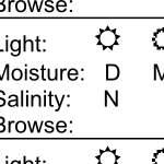
64
65
66
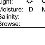
67
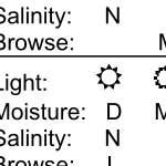
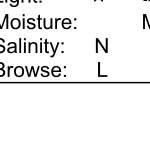
68
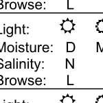
69

70
71
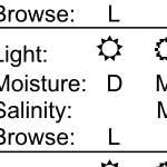
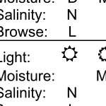
72
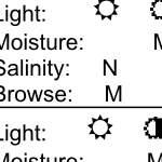
73
74
75

76
77
78
79
80 City of Richmond Chesapeake Bay Preservation Program Public Information Manual Appendix D: Stream Determination Resources Included in this appendix are the protocols and checklists for stream determination methods in both Fairfax County, Virginia and the state of North Carolina. Both methods have been approved by the Department of Environmental Quality and for use in the City of Richmond. 55
81
82
83
84
85
86
87
88
89
90

91
92
93
94
95
96
97
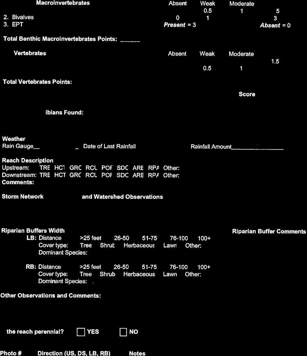
98
99
100
101
102
103
104

105
106
107
108

109
110

111
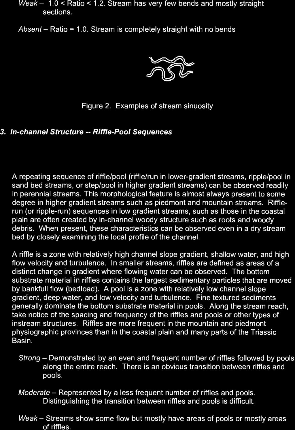
112

113
114
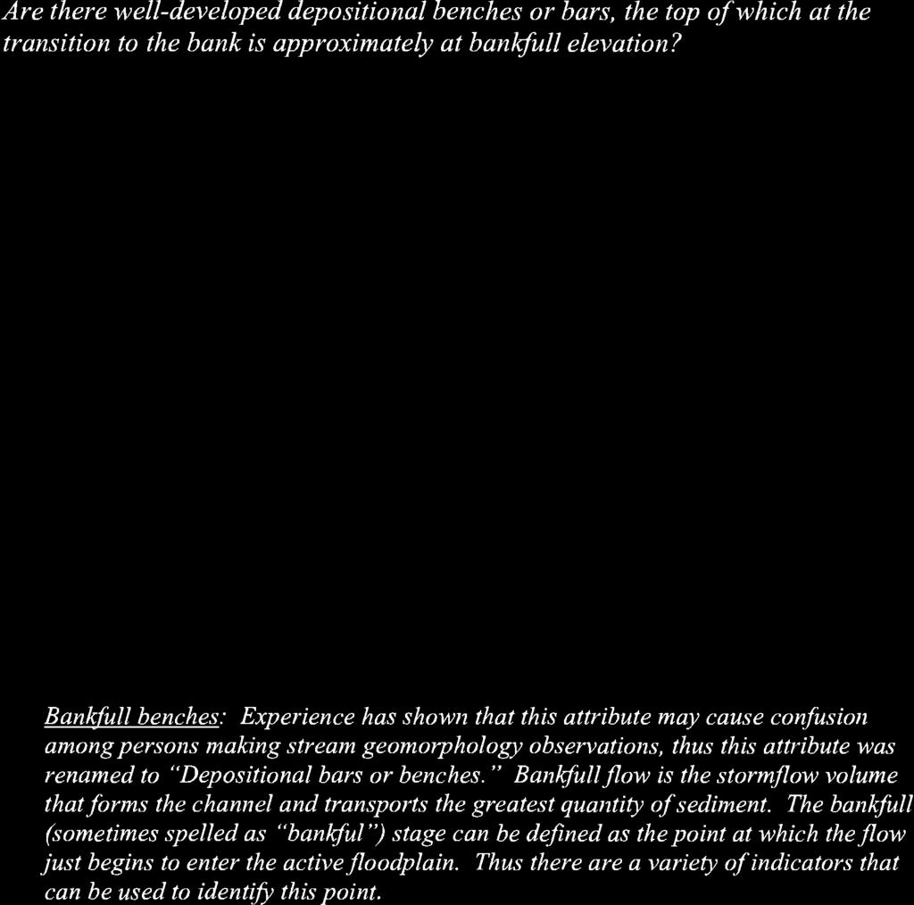
115
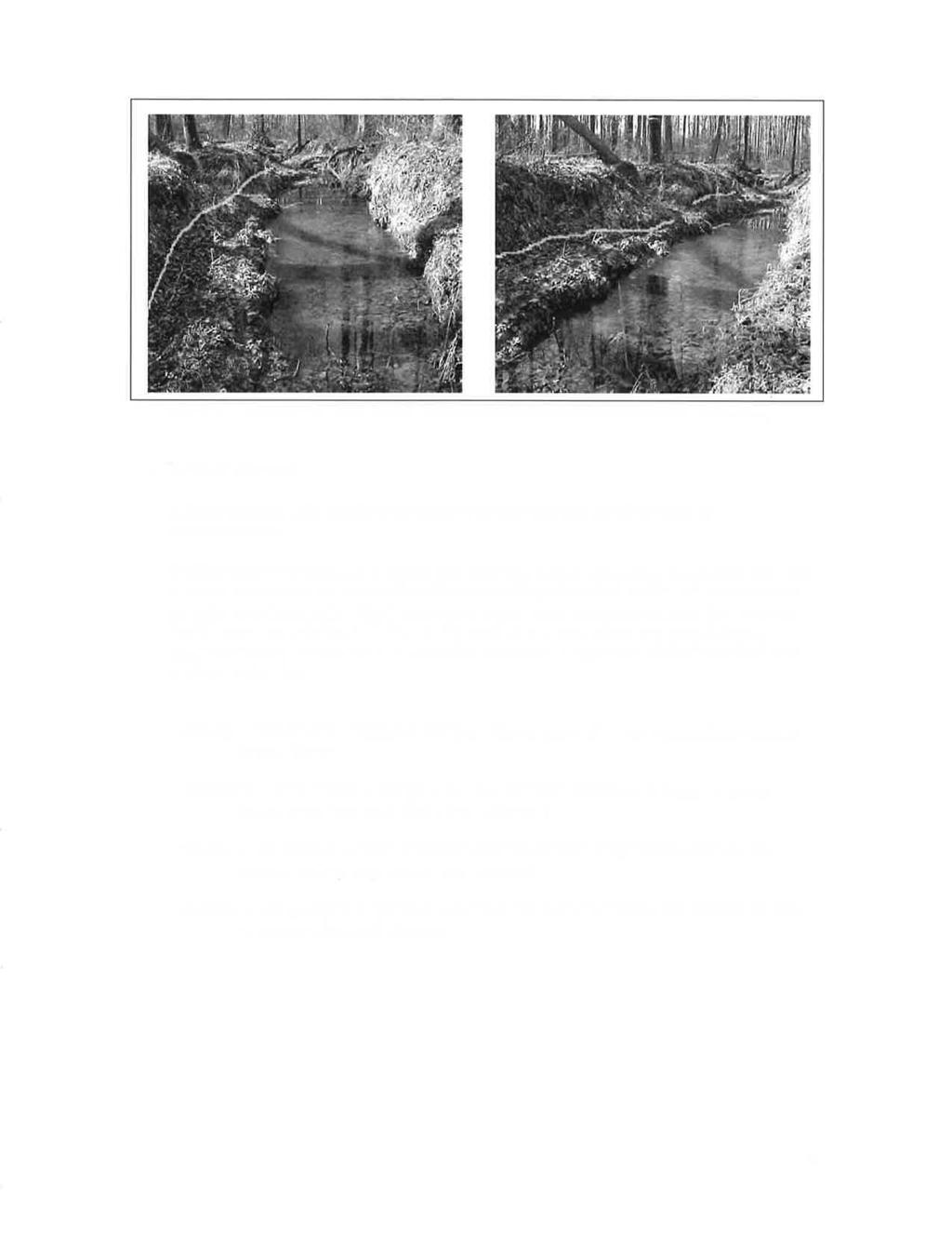
116
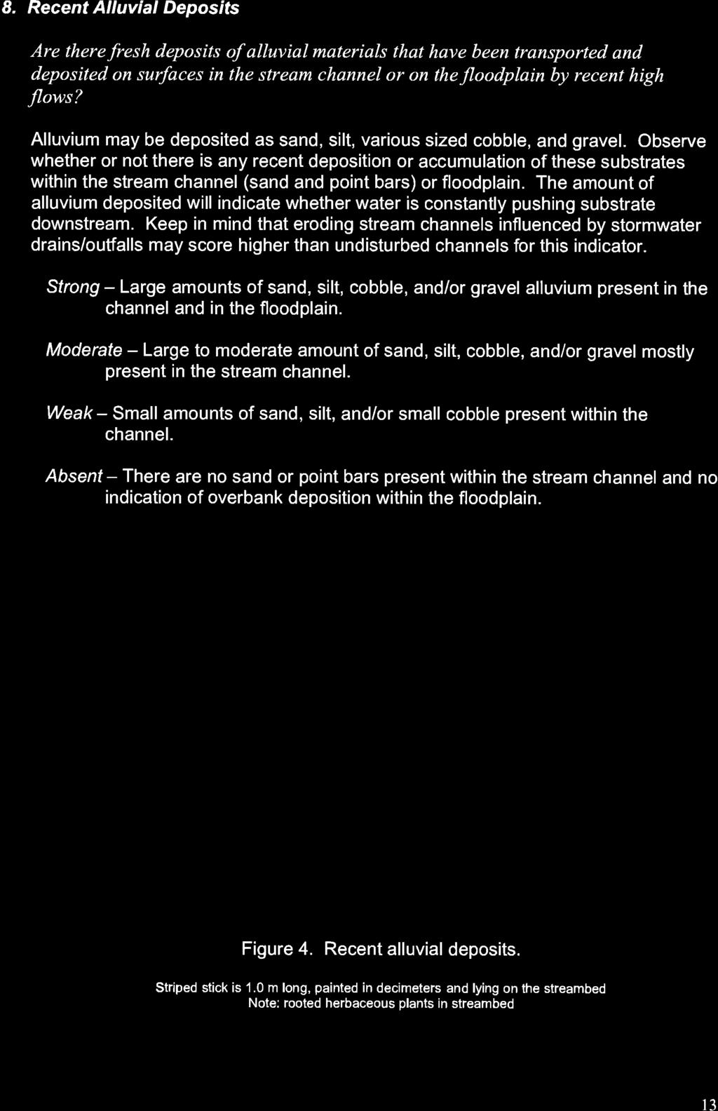
117
118
119
120
121
122
123
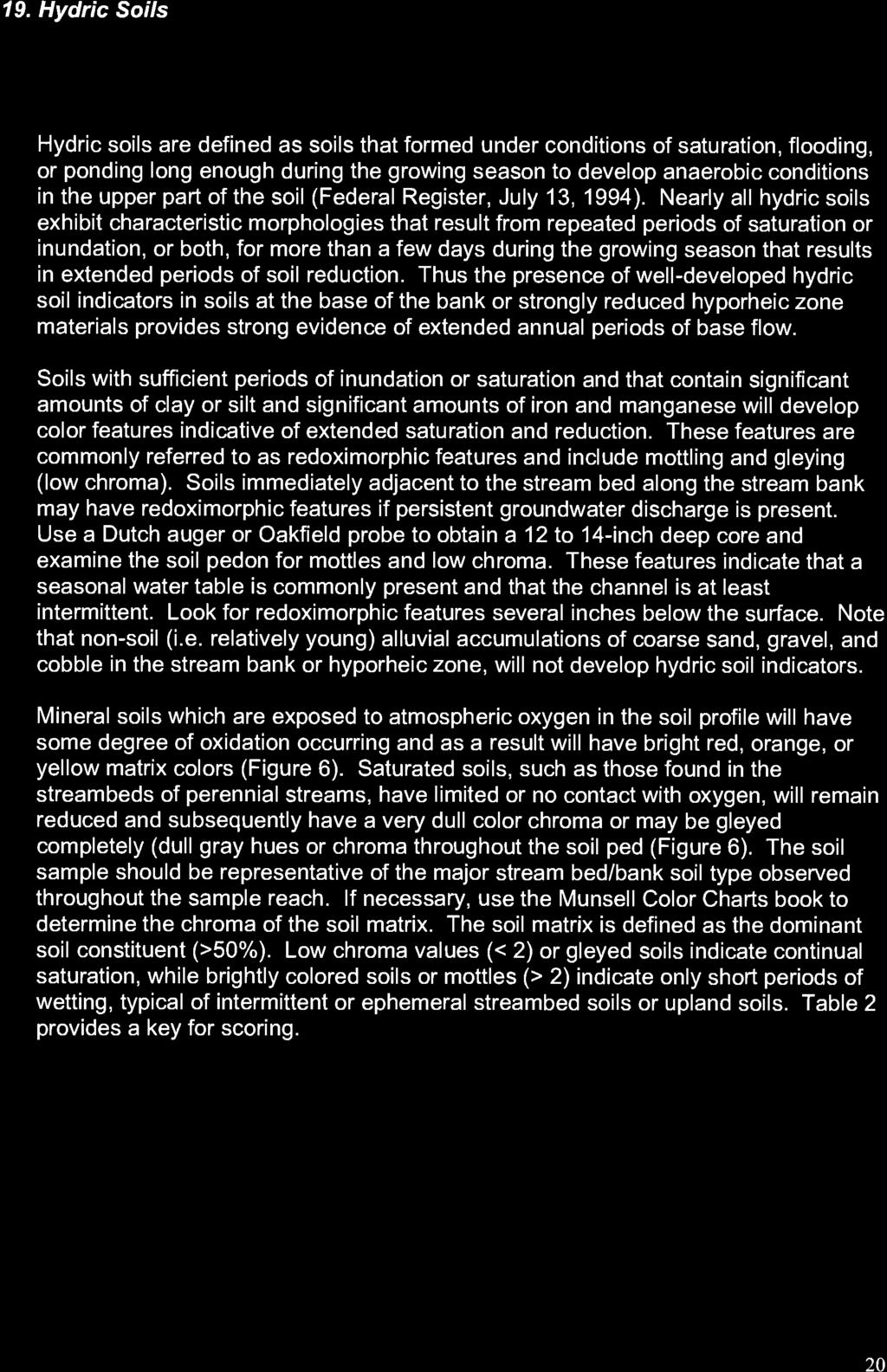
124
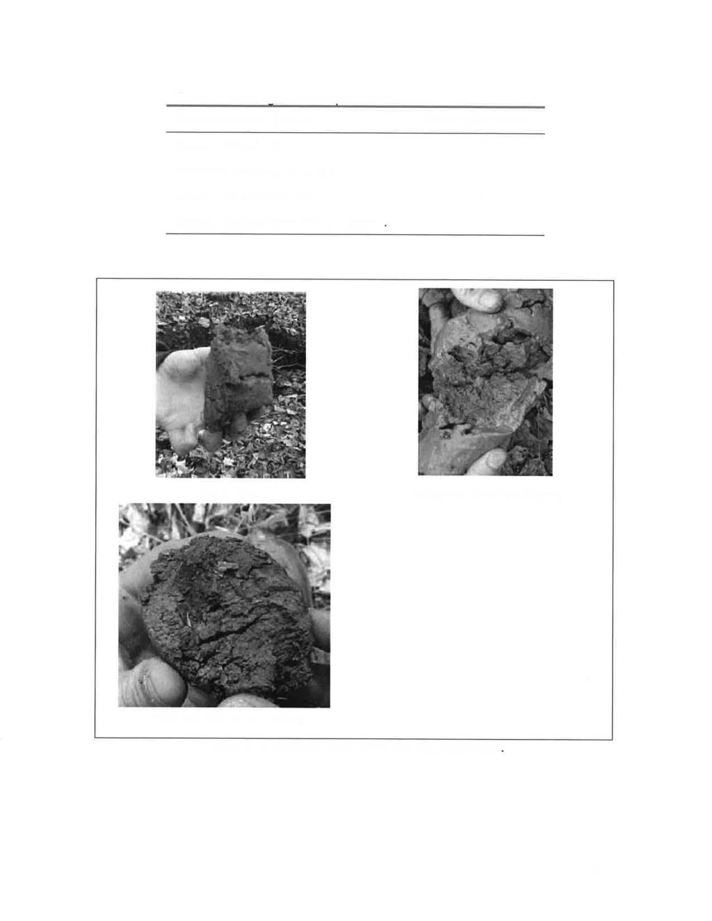
125

126
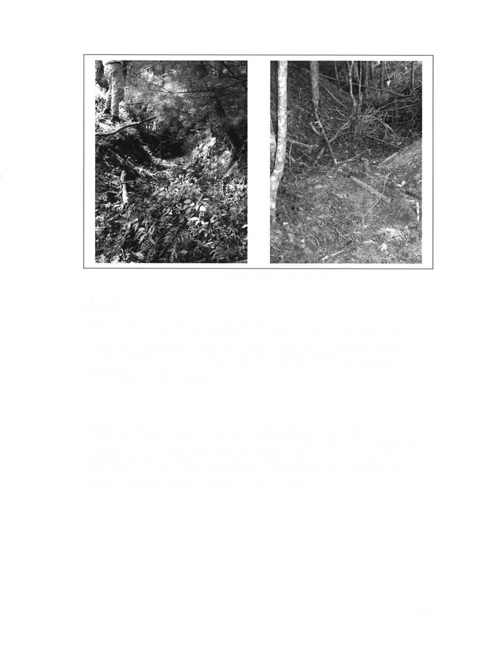

127
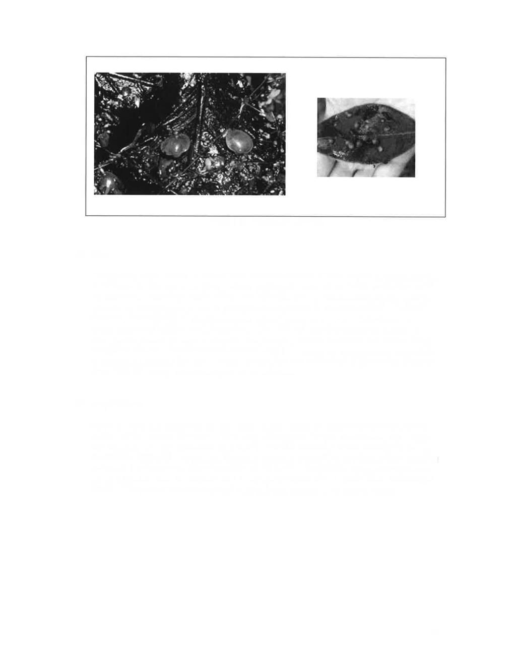
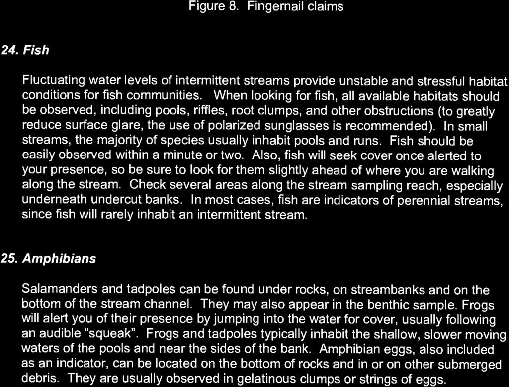
128
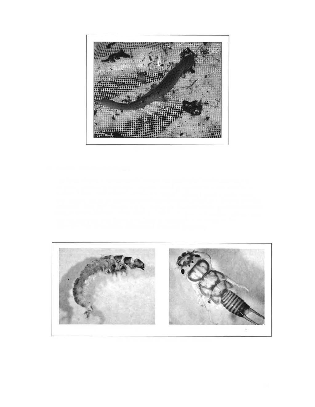
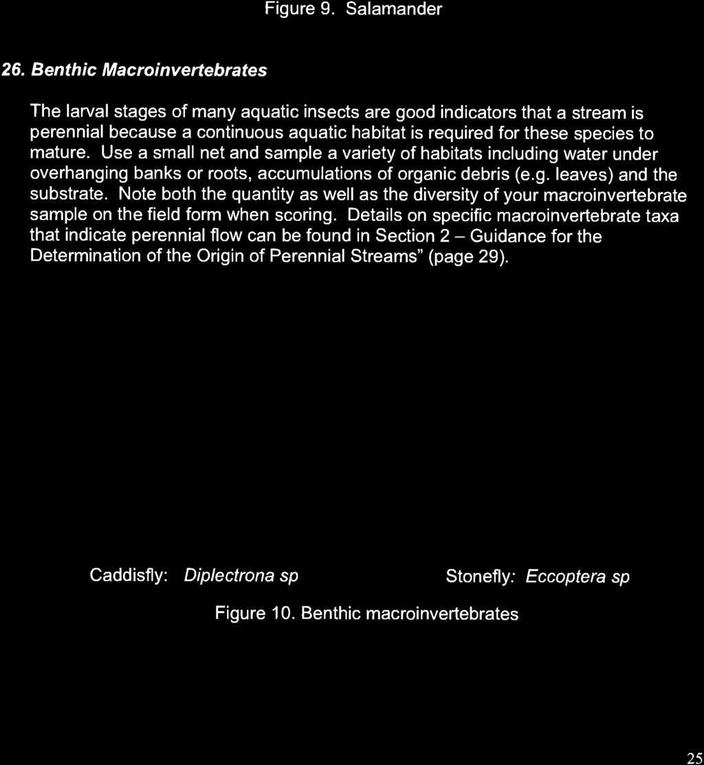
129
130
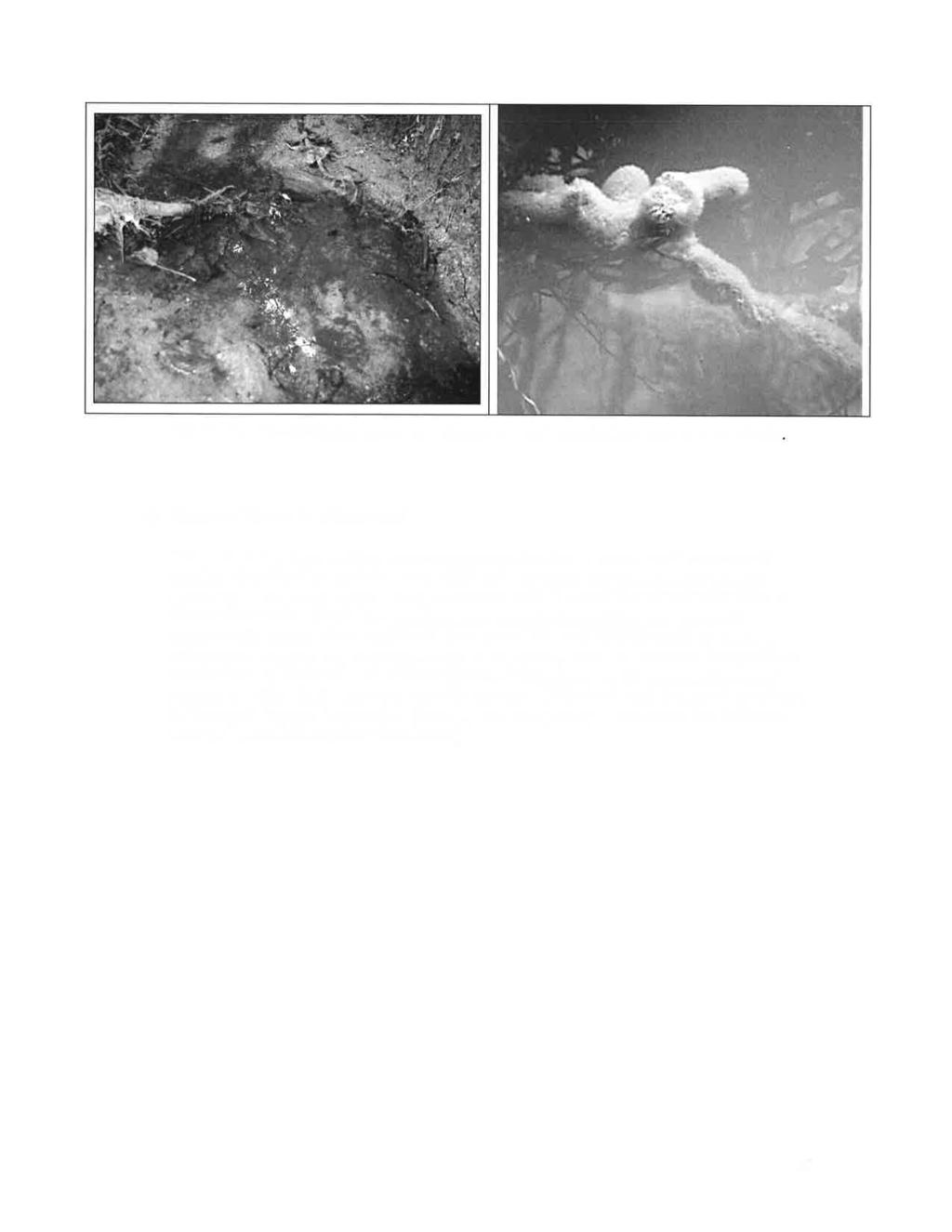
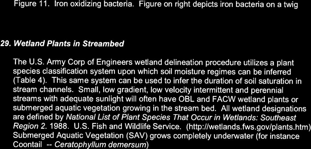
131
132
133
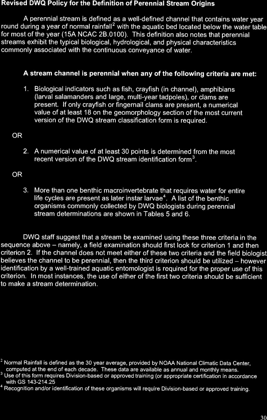
134
135
136
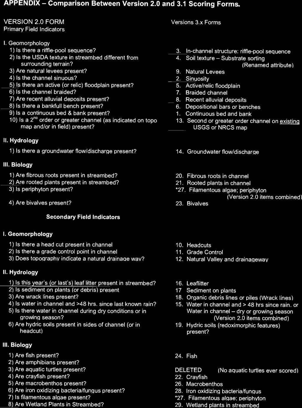
137
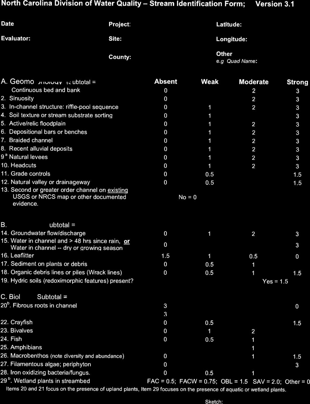
138
WATER QUALITY IMPACT ASSESSMENT (WQIA) FORM
 FORM") WATER QUALITY IMPACT ASSESSMENT (WQIA) FORM Name: CCW Development Associates, L.L.C. Street Address: Telephone Number(s): 1209 Laskin Road, Virginia Beach, VA 23451 (757) 491-1996 Email: chris@vbhomesliving.com
WATER QUALITY IMPACT ASSESSMENT (WQIA) FORM Name: CCW Development Associates, L.L.C. Street Address: Telephone Number(s): 1209 Laskin Road, Virginia Beach, VA 23451 (757) 491-1996 Email: chris@vbhomesliving.com
ARTICLE 22 CHESAPEAKE BAY PRESERVATION AREA (CBPA) OVERLAY DISTRICT. Statement of Intent
 OVERLAY DISTRICT. Statement of Intent") ARTICLE 22 CHESAPEAKE BAY PRESERVATION AREA (CBPA) OVERLAY DISTRICT Statement of Intent A. This ordinance is enacted to implement the requirements of Section 10.1-2100 et seq. of the Code of Virginia (The
ARTICLE 22 CHESAPEAKE BAY PRESERVATION AREA (CBPA) OVERLAY DISTRICT Statement of Intent A. This ordinance is enacted to implement the requirements of Section 10.1-2100 et seq. of the Code of Virginia (The
MINUTES CHESAPEAKE BAY PRESERVATION AREA BOARD VIRGINIA BEACH, VIRGINIA JULY 24, 2017
 MINUTES CHESAPEAKE BAY PRESERVATION AREA BOARD VIRGINIA BEACH, VIRGINIA JULY 24, 2017 Chair Mr. Jester, called to order the Chesapeake Bay Preservation Area Board meeting in the City Council Chambers,
APPENDIX A SIMPLIFIED APPROACH TO STORMWATER MANAGEMENT FOR SMALL PROJECTS. In West Sadsbury Township, Chester County, Pennsylvania
 APPENDIX A SIMPLIFIED APPROACH TO STORMWATER MANAGEMENT FOR SMALL PROJECTS In West Sadsbury Township, Chester County, Pennsylvania TABLE OF CONTENTS I. Introduction 3 II. Importance of Stormwater Management
ST. MARY S SOIL CONSERVATION DISTRICT (SMSCD) AND DPW&T CONCEPT EROSION AND SEDIMENT CONTROL AND STORMWATER MANAGEMENT GUIDELINES AND CHECKLIST
 AND DPW&T CONCEPT EROSION AND SEDIMENT CONTROL AND STORMWATER MANAGEMENT GUIDELINES AND CHECKLIST") St. Mary s Soil Conservation District 26737 Radio Station Way, Suite B Leonardtown, MD 20650 Phone: 301-475-8402 ext. 3 Fax: 301-475-8391 www.stmarysscd.com St. Mary s County Government Department of Public
St. Mary s Soil Conservation District 26737 Radio Station Way, Suite B Leonardtown, MD 20650 Phone: 301-475-8402 ext. 3 Fax: 301-475-8391 www.stmarysscd.com St. Mary s County Government Department of Public
Chapter 4 - Preparation of Stormwater Site Plans
 Chapter 4 - Preparation of Stormwater Site Plans The Stormwater Site Plan is the comprehensive report containing all of the technical information and analysis necessary for the City to evaluate a proposed
MINUTES CHESAPEAKE BAY PRESERVATION AREA BOARD VIRGINIA BEACH, VIRGINIA NOVEMBER 21, 2018
 MINUTES CHESAPEAKE BAY PRESERVATION AREA BOARD VIRGINIA BEACH, VIRGINIA NOVEMBER 21, 2018 Chair Mr. Jester, called to order the Chesapeake Bay Preservation Area Board meeting in the City Council Chambers,
Zoning Ordinance Article 3
 Article 3 Natural Resources Protection Section 301 Natural Resources Protection 301.1. Purpose - The following natural resources protection standards are established to protect the public health, safety
PROPOSED BOARD OF SUPERVISORS COUNTY OF STAFFORD STAFFORD, VIRGINIA ORDINANCE
 PROPOSED BOARD OF SUPERVISORS COUNTY OF STAFFORD STAFFORD, VIRGINIA ORDINANCE At a regular meeting of the Stafford County Board of Supervisors (the Board) held in the Board Chambers, Stafford County Administration
STREAM BUFFERS
 88-415 STREAM BUFFERS 88-415-01 PURPOSE In the Kansas City region and throughout the nation, vegetated stream buffers have been clearly shown to protect stream stability and related infrastructure, improve
Chesapeake Bay Critical Area Conservation Plan
 The Maryland-National Capital Park and Planning Commission Prince George s County Planning Department Development Review Division 301-952-3530 Note: Staff reports can be accessed at www.mncppc.org/pgco/planning/plan.htm.
BUFFERS, TREE PROTECTION AND LANDSCAPING. Sec Purpose and Intent.
 ARTICLE 20 BUFFERS, TREE PROTECTION AND LANDSCAPING Sec. 20.1. Purpose and Intent. Trees improve air and water quality, reduce soil erosion, reduce noise and glare, provide habitat for desirable wildlife,
Chapter 1: General Program Information
 Chapter 1: General Program Information 1.1 Introduction The Montgomery County Stormwater Management Resolution (#03-1-5) was adopted by the County Board of Commissioners on January 22, 2003. The purpose
COUNTY COUNCIL OF PRINCE GEORGE'S COUNTY, MARYLAND SITTING AS THE DISTRICT COUNCIL 2010 Legislative Session. Council Members Dernoga and Olson
 DR- COUNTY COUNCIL OF PRINCE GEORGE'S COUNTY, MARYLAND SITTING AS THE DISTRICT COUNCIL 00 Legislative Session Bill No. CB--00 Chapter No. Proposed and Presented by Introduced by Co-Sponsors The Chairman
Chapter 3 Site Planning and Low Impact Development
 CHAPTER 3 Site Planning and Low Impact Development Chapter 3 Site Planning and Low Impact Development 3.0 Introduction The City of Charleston requires that major residential, large commercial (>1 acre),
Minnesota Department of Natural Resource - Natural Resource Guidance Checklist Conserving Natural Resources through Density Bonuses
 Minnesota Department of Natural Resource - Natural Resource Guidance Checklist Conserving Natural Resources through Density Bonuses NRDB Why Use Density Bonuses & This Checklist Local units of government
CHESAPEAKE LANDSCAPE ORDINANCE
 CHESAPEAKE LANDSCAPE ORDINANCE CONSERVATION PRESERVATION CZO 19-600 Effective October 16, 2008 BUFFER YARD C PARKING LOT REFORESTATION YEAR 1 REFORESTATION YEAR 4 BUFFER YARD F CBPA REFORESTATION Page
MINUTES CHESAPEAKE BAY PRESERVATION AREA BOARD VIRGINIA BEACH, VIRGINIA JUNE 25, 2018
 MINUTES CHESAPEAKE BAY PRESERVATION AREA BOARD VIRGINIA BEACH, VIRGINIA JUNE 25, 2018 Chair Mr. Jester, called to order the Chesapeake Bay Preservation Area Board meeting in the City Council Chambers,
Town of West Point Plan of Development
 Town of West Point Plan of Development Plan Submission In accordance with Section 70-51(b) of the Town Code, the Zoning Administrator shall establish a written policy for the form, format, content and
SENSITIVE LANDS OVERLAY
 SENSITIVE LANDS OVERLAY Chapter 22 Sensitive Lands Overlay 22.1 PURPOSE 22.2 APPLICATION AND ANALYSIS REQUIREMENTS 22.3 SENSITIVE LAND REGULATIONS 22.4 ADMINISTRATIVE PROVISIONS 22.5 DESIGN STANDARDS 22.6
When planning stormwater management facilities, the following principles shall be applied where possible.
 2.0 Principles When planning stormwater management facilities, the following principles shall be applied where possible. 2.0.1 Drainage is a regional phenomenon that does not respect the boundaries between
Three threshold measures will be applied together to capture project scale and scope and impacts:
 The regulatory consequences to the County from State and Federal water quality regulations if the pollution impacts are not addressed by each project. The extreme difficulty, cost, and equity issues associated
ARTICLE VI: SITE PLAN REVIEW
 Section 6.01 - Site Plan Review (All Districts) ARTICLE VI: SITE PLAN REVIEW Site plans give the Planning commission an opportunity to review development proposals in a concise and consistent manner. The
Erosion & Sediment Control Plan Application Form & Checklist
 Erosion & Sediment Control Plan Application Form & Checklist GENERAL INFORMATION Application Date: Project Address: Tax Map / Parcel Number(s): PROPERTY OWNER / DEVELOPER Firm Name: Contact Person: Title:
Major Subdivision Sketch Plan Checklist
 This checklist provides specific requirements that are apart of the Sketch process. The entire process is described by the Huntersville Subdivision Review Process which details all the submittal and resubmittal
6 August 11, 2010 Public Hearing APPLICANT AND PROPERTY OWNER: CAVALIER GOLF AND YACHT CLUB
 6 August 11, 2010 Public Hearing APPLICANT AND PROPERTY OWNER: CAVALIER GOLF AND YACHT CLUB REQUEST: Conditional Use Permit (outdoor recreational facility) STAFF PLANNER: Faith Christie ADDRESS / DESCRIPTION:
Appendix I. Checklists
 Appendix I Checklists Town of Greenwich Drainage Manual Department of Public Works - Engineering Division Town Hall - 101 Field Point Road, Greenwich, CT 06836-2540 Phone 203-622-7767 - Fax 203-622-7747
GENERAL ASSEMBLY OF NORTH CAROLINA SESSION 2007 SESSION LAW SENATE BILL 1967
 GENERAL ASSEMBLY OF NORTH CAROLINA SESSION 2007 SESSION LAW 2008-211 SENATE BILL 1967 AN ACT TO PROVIDE FOR IMPROVEMENTS IN THE MANAGEMENT OF STORMWATER IN THE COASTAL COUNTIES IN ORDER TO PROTECT WATER
CHAPTER 3 REGULATED LAND-DISTURBING ACTIVITIES AND APPLICABLE REQUIREMENTS
 CHAPTER 3 REGULATED LAND-DISTURBING ACTIVITIES AND APPLICABLE REQUIREMENTS 3.1 INTRODUCTION As discussed in Chapter 1, development in Henrico County is subject to numerous environmental programs required
ARTICLE 9: LANDSCAPING AND FENCING REQUIREMENTS
 ARTICLE 9: LANDSCAPING AND FENCING REQUIREMENTS Section 9.01 Intent The intent of the landscaping requirements are to improve the appearance of lot areas and soften paved areas and buildings; to provide
Huntington Stormwater Utility
 Huntington Stormwater Utility Stormwater Management & Sediment and Erosion Control Requirements for Construction Sites Authorized by Huntington City Code Articles: 971, 970, 930, 935, 955, Revised April
ARTICLE 17 SITE PLAN REVIEW
 ARTICLE 17 SITE PLAN REVIEW 17.01 INTENT AND PURPOSE The intent of this section is to provide for consultation and cooperation between the applicant and the township planning commission so that the applicant
TOWNSHIP OF LOGAN SOIL & FILL IMPORTATION AND PLACEMENT APPLICATION SUBMITTAL CHECKLIST
 TOWNSHIP OF LOGAN SOIL & FILL IMPORTATION AND PLACEMENT APPLICATION SUBMITTAL CHECKLIST Applications: 5 copies of application - Applicant will reproduce the copies at his/her costs. The Township Clerk
Shoreline Master Program Town of La Conner, Washington
 Shoreline Master Program Town of La Conner, Washington Department of Ecology approval effective Adopted September 24, 2013 by Town of La Conner Ordinance No.1106 Amended May 13, 2014 by Town of La Conner
STORMWATER MANAGEMENT CODES ANALYSIS RICHLAND COUNTY, SC SITE PLANNING ROUNDTABLE
 STORMWATER MANAGEMENT CODES ANALYSIS RICHLAND COUNTY, SC SITE PLANNING ROUNDTABLE Codes analyses for each subcommittee were completed to assist participants of the Richland County Site Planning Roundtable.
County of Fairfax, Virginia
 County of Fairfax, Virginia To protect and enrich the quality of life for the people, neighborhoods, and diverse communities of Fairfax County DATE: July 16, 2007 TO: SUBJECT: All Architects, Attorneys,
Environmental Protection Ordinances (Performance Zoning) Bedminster Township, Bucks County
 Bedminster Township, Bucks County") Environmental Protection Ordinances (Performance Zoning) Bedminster Township, Bucks County ARTICLE VI. PERFORMANCE STANDARDS Section 600 Compliance All uses, activities, subdivisions and/or land developments
Environmental Protection Ordinances (Performance Zoning) Bedminster Township, Bucks County ARTICLE VI. PERFORMANCE STANDARDS Section 600 Compliance All uses, activities, subdivisions and/or land developments
STORMWATER SITE PLAN INSTRUCTIONS AND SUBMITTAL TEMPLATE Medium and Large Projects
 DEPARTMENT OF COMMUNITY DEVELOPMENT 621 Sheridan Street, Port Townsend, WA 98368 Tel: 360.379.4450 Fax: 360.379.4451 Web: www.co.jefferson.wa.us/communitydevelopment E-mail: dcd@co.jefferson.wa.us STORMWATER
Glenborough at Easton Land Use Master Plan
 Implementation 114 9.0 IMPLEMENTATION 9.1 OVERVIEW This chapter summarizes the administrative procedures necessary to implement the proposed land use plan, infrastructure improvements, development standards,
SOIL EROSION AND SEDIMENT CONTROL
 SOIL EROSION AND SEDIMENT CONTROL SECTION 1: AUTHORITY, TITLE AND PURPOSE 11. STATUTORY AUTHORIZATION This ordinance is adopted pursuant to the provisions of the Federal Water Pollution Control Act 86
Working Group Meeting
 April 4,, 2017 Parks Operations Bldg Working Group Meeting Arts Districts Overview Stormwater/RPA/Stream Considerations First Principles Agenda 7:00pm 7:05pm 7:10pm 7:40pm 8:30pm 9:40pm 9:45pm Welcome
Rule D Wetland and Creek Buffers
 Rule D Wetland and Creek Buffers 1 Policy It is the policy of the Board of Managers to ensure the preservation of the natural resources, recreational, habitat, water treatment and water storage functions
APPENDIX J PERFORMANCE STANDARDS FOR GRAVEL MINE, PIT MINE, OR QUARRY
 APPENDIX J PERFORMANCE STANDARDS FOR GRAVEL MINE, PIT MINE, OR QUARRY A. Purpose: 1. Regulatory Requirement and Use Mitigation: The purpose of this appendix is to provide a regulatory context (standards)
MINUTES CHESAPEAKE BAY PRESERVATION AREA BOARD VIRGINIA BEACH, VIRGINIA DECEMBER 20, 2017
 MINUTES CHESAPEAKE BAY PRESERVATION AREA BOARD VIRGINIA BEACH, VIRGINIA DECEMBER 20, 2017 Chair Mr. Jester, called to order the Chesapeake Bay Preservation Area Board meeting in the City Council Chambers,
Nick Sigmund, Sr. Zoning Officer
 Nick Sigmund, Sr. Zoning Officer Wisconsin Department of Natural Resources Administrative Code NR 115 under the authority of Wisconsin Statute 59.692, establishes and provides that shoreland zoning regulations
Plat Requirements CHECKLIST FOR SITE PLAN REVIEW
 This checklist is to be used as a guide for complying with the Town of Hollis Site Plan Regulations. It is to be used for each individual site plan review application submitted. Applicants are encouraged
Planned Development Review Revisions (Project No. PLNPCM )
") Planned Development Review Revisions (Project No. PLNPCM2014-00139) Standard residential development Planned Development Example: Smaller lot sizes than what is allowed to create open space amenity. What
Planned Development Review Revisions (Project No. PLNPCM2014-00139) Standard residential development Planned Development Example: Smaller lot sizes than what is allowed to create open space amenity. What
Appendix 3-D LOCAL CODE AND ORDINANCE REVIEW AND EVALUATION
 Appendix 3-D LOCAL CODE AND ORDINANCE REVIEW AND EVALUATION Table of Contents Appendix Section Headings 3-D.1.0 INTRODUCTION 3-D-2 3-D.2.0 PREPARING TO COMPLETE A CODE AND ORDINANCE WORKSHEET 3-D-3 3-D.2.1
CITY OF CYPRESS 5275 Orange Avenue Cypress, California (714) DESIGN REVIEW COMMITTEE PERMIT PROCESS
 DESIGN REVIEW COMMITTEE PERMIT PROCESS") CITY OF CYPRESS 5275 Orange Avenue Cypress, California 90630 (714) 229-6720 DESIGN REVIEW COMMITTEE PERMIT PROCESS 1. Discuss project with Planning staff to determine zoning regulations, any unusual characteristics
CITY OF CYPRESS 5275 Orange Avenue Cypress, California 90630 (714) 229-6720 DESIGN REVIEW COMMITTEE PERMIT PROCESS 1. Discuss project with Planning staff to determine zoning regulations, any unusual characteristics
Article 6 Tree Protection
 Article 6 Tree Protection 8.1 Purpose 8.2 Applicability 8.2.1 General Provisions 8.2.2 Exemptions 8.3 Permitting Procedure 8.4 Planting Procedure 8.5 Performance Guarantee Required for Belated Planting
5. LOW IMPACT DEVELOPMENT DESIGN STANDARDS
 5. LOW IMPACT DEVELOPMENT DESIGN STANDARDS Low Impact Development (LID) requires a shift in stormwater management away from conveying runoff to a small number of downstream points through hydraulically
SECTION 1 CLEARING /GRADING PERMIT APPLICATION:
 PLEASE REFER TO THE CLEARING & GRADING PERMIT CHECKLIST BELOW FOR SUBMITTAL REQUIREMENTS. SECTION 1 CLEARING /GRADING PERMIT APPLICATION: PROJECT ADDRESS (Street, Suite #): Parcel(s) #: Total Site Area
ARTICLE V PLANNED UNIT DEVELOPMENT DISTRICT
 ARTICLE V PLANNED UNIT DEVELOPMENT DISTRICT A. Purpose and Objective The Planned Unit Development (PUD) procedure provides a flexible land use and design regulation through the use of performance criteria
Section General Tree Preservation Requirements for New Nonresidential and Residential Development
 DIVISION 2: TREE PRESERVATION AND PROTECTION Section 5.5.2.1 General Tree Preservation Requirements for New Nonresidential and Residential Development (a) Application. The provisions of this Section apply
SECTION 11.07: WETLAND BUFFER ORDINANCE
 11.07. Wetland Buffer Ordinance 1.0 Council Findings, Purpose, and Means. SECTION 11.07: WETLAND BUFFER ORDINANCE Section 11.07: Wetland Buffer Ordinance Subdivision 1.0: Council Findings, Purpose, and
Deb Grube, Sr. Zoning Officer
 Deb Grube, Sr. Zoning Officer Wisconsin Department of Natural Resources Administrative Code NR 115 under the authority of Wisconsin Statute 59.692, establishes and provides that shoreland zoning regulations
Town of Windham. Planning Department 8 School Road Windham, ME voice fax
 Town of Windham Planning Department 8 School Road Windham, ME 04062 voice 207.864-5960 fax 207.892.1916 MEMO DATE: TO: Staff Review Committee FROM: Amanda Lessard, Planner Cc: Ellen Rathbone, St. Germain
A. Reducing noise pollution, air pollution, and visual pollution;
 A well designed landscape, when made an integral part of a development plan, provides aesthetic appeal and makes an important contribution to the health, safety, and general welfare of the community by:
IV. Development in the Rural Overlay District
 Intracoastal Waterway Route 17 Route 168 Great Dismal Swamp VIRGINIA NORTH CAROLINA IV. Development in the Rural Overlay District IV-1 Route 17 in Chesapeake s Rural Overlay District affords distant views
V-5 TREE PROTECTION AND LANDSCAPING REQUIREMENTS
 V-5 TREE PROTECTION AND LANDSCAPING REQUIREMENTS V-5.1 General A. Intent: It is the intent of this section to establish protective regulations for trees within the City of Milton, in order to better control
City of Stoughton Erosion Control Permit Application (effective 2/6/2018)
") City of Stoughton Erosion Control Permit Application (effective 2/6/2018) Incomplete applications will not be accepted Project Name: Address of subject property: Landowner Name(s): Applicant Name: Landowner
City of Stoughton Erosion Control Permit Application (effective 2/6/2018) Incomplete applications will not be accepted Project Name: Address of subject property: Landowner Name(s): Applicant Name: Landowner
Checklists. Project Name: Location: File Number: Date of Submittal: Reviewer: Date: Applicant: Contact Name: Phone Number:
 Applicant: Contact Name: Phone Number: Email: Project Name: Location: File Number: Date of Submittal: Reviewer: Date: Concept Plan Requirements: I. General Project Information 1. Address or parcel number
MINUTES CHESAPEAKE BAY PRESERVATION AREA BOARD VIRGINIA BEACH, VIRGINIA APRIL 27, 2015
 MINUTES CHESAPEAKE BAY PRESERVATION AREA BOARD VIRGINIA BEACH, VIRGINIA APRIL 27, 2015 Vice Chair Mr. Jester, called to order the Chesapeake Bay Preservation Area Board meeting in the City Council Chambers,
CHAPTER 22 Rural Open Space Community Developments
 CHAPTER 22 Rural Open Space Community Developments Section 22.1 Description and Purpose The intent of this Chapter is to offer property owners an alternative to traditional zoning requirements for rural
SITE PLAN REVIEW APPLICATION AND CHECKLIST
 SITE PLAN REVIEW APPLICATION AND CHECKLIST PROJECT SUMMARY: Project Name: City/ETA Location: City ETA (Application fee & number of copies needed are based on location) Property Location (Legal Description
PROTECTIVE MEASURES FOR TREES DURING CONSTRUCTION
 PROTECTIVE MEASURES FOR TREES DURING CONSTRUCTION NO CONSTRUCTION OR EXCAVATION IS TO OCCUR ON LOTS THAT REQUIRE TREE PRESERVATION UNTIL PROPER APPROVALS HAVE BEEN GIVEN BY A CITY ARBORIST 1. When trees
Neo-Traditional Overlay Application
 MAYOR AND CITY COUNCIL OF LAUREL DEPARTMENT OF ECONOMIC AND COMMUNITY DEVELOPMENT 8103 Sandy Spring Road Laurel, Maryland 20707 (301) 725-5300 Internet Address http://www.cityoflaurel.org E-mail: ecd@laurel.md.us
STREAM BUFFER PROTECTION AND MANAGEMENT
 ORDINANCE NO. 753 AN ORDINANCE AMENDING THE CODE OF ORDINANCES OF THE CITY OF PLEASANT HILL, IOWA 1998, BY ESTABLISHIING CHAPTER 104, STREAM BUFFER PROTECTION AND MANAGEMENT Be it enacted by the City of
PARK CITY MUNICIPAL CODE TABLE OF CONTENTS TITLE 15 LAND MANAGEMENT CODE - CHAPTER 2.21
 PARK CITY MUNICIPAL CODE TABLE OF CONTENTS TITLE 15 LAND MANAGEMENT CODE - CHAPTER 2.21 TITLE 15 - LAND MANAGEMENT CODE CHAPTER 2.21 - SENSITIVE LAND OVERLAY ZONE (SLO) REGULATIONS 15-2.21-1. PURPOSE...1
ARTICLE 9: Landscaping
 ARTICLE 9: Landscaping 9-10 Legislative Intent The purpose of this Article is to regulate the planting and preservation of landscape materials; to facilitate the creation of an attractive and healthy environment;
Zoning Ordinance Chapter 10
 CHAPTER 10 - WASHES SECTION 10.0 GENERAL: A. The purpose of this Ordinance is to establish standards for development in or near Major and Minor Washes as defined in Appendix A Glossary of Terms and Definitions
Landscaping Standards
 CHAPTER 29 ARTICLE 403 29.403 Landscaping Standards Purpose: The purpose of this section is to protect and promote the public health, safety and general welfare by requiring landscaping in relation to
COMPLIANCE CHECKLIST HILLSIDE RESIDENTIAL DESIGN GUIDELINES MANUAL
 COMPLIANCE CHECKLIST HILLSIDE RESIDENTIAL DESIGN GUIDELINES MANUAL The following checklist summarizes development guidelines and standards. See the appropriate section for a complete explanation of the
A BILL FOR AN ORDINANCE TO AMEND CHAPTER 9, KAUAI COUNTY CODE 1987, RELATING TO STREET REQUIRE:MENTS FOR SUBDIVISIONS
 ORDINANCE NO. BILL NO. { vy"yj1j A BILL FOR AN ORDINANCE TO AMEND CHAPTER 9, KAUAI COUNTY CODE 1987, RELATING TO STREET REQUIRE:MENTS FOR SUBDIVISIONS BE IT ORDAINED BY THE COUNCIL OF THE COUNTY OF KAUA'I,
DRIVEWAY REGULATIONS
 TOWN OF NEW LONDON PLANNING BOARD DRIVEWAY REGULATIONS INSTRUCTIONS TO APPLICANTS FOR THE CONSTRUCTION OR ALTERATION OF DRIVEWAYS IMPORTANT: READ CAREFULLY BEFORE FILLING OUT ATTACHED APPLICATION Revised
CITY OF ST. AUGUSTA STEARNS COUNTY MINNESOTA ORDIANCE NO AN ORDINANCE ESTABLISHING REGULATIONS FOR STORMWATER MANAGEMENT
 CITY OF ST. AUGUSTA STEARNS COUNTY MINNESOTA ORDIANCE NO. 2017-05 AN ORDINANCE ESTABLISHING REGULATIONS FOR STORMWATER MANAGEMENT In the interest of the health, safety, and welfare of its citizens, the
Landscape area requirement compliance and landscape plans
 ARTICLE 6 LANDSCAPING 6-1. Statement of Intent The purpose of this Article is to promote the public health, safety and welfare by providing for the preservation, installation and maintenance of trees and
ARTICLE 6: Special and Planned Development Districts
 ARTICLE 6: Special and Planned Development Districts 6-10 Traditional Neighborhood Development (TND) District 6-10.10 Purpose and Intent The Traditional Neighborhood Development (TND) District provides
Draft Rhode Island Stormwater Design and Installation Standards Manual
 Draft Rhode Island Stormwater Design and Installation Standards Manual Summary The May 2009 Public Review Draft version of the RI Stormwater Design and Installation Standards Manual consists of approximately
ADDENDUM TO BIOLOGICAL SCOPING SURVEY REPORT, BOTANICAL SURVEY AND WETLAND DELINEATION
 ADDENDUM TO BIOLOGICAL SCOPING SURVEY REPORT, BOTANICAL SURVEY AND WETLAND DELINEATION FOR AVALON INN (APN 069-241-27 & -04) 1201 & 1211 NORTH MAIN STREET FORT BRAGG, CA MENDOCINO COUNTY prepared for:
Gloucester County PLAN SUBMITTER'S CHECKLIST
 Page 1 of 9 Gloucester County PLAN SUBMITTER'S CHECKLIST FOR EROSION AND SEDIMENT CONTROL PLANS Please fill in all blanks and please reference the plan sheets/pages where the information may be found,
St. Croix County Shoreland Overlay Zoning Districts. Public Hearing Community Development Committee December 19, 2013
 St. Croix County Shoreland Overlay Zoning Districts Public Hearing Community Development Committee December 19, 2013 Timeline CDC Review October 17 Public Information Meeting October 29 (6:00-8:00 pm)
MINUTES CHESAPEAKE BAY PRESERVATION AREA BOARD VIRGINIA BEACH, VIRGINIA FEBRUARY 25, 2019
 MINUTES CHESAPEAKE BAY PRESERVATION AREA BOARD VIRGINIA BEACH, VIRGINIA FEBRUARY 25, 2019 Chair Mr. Jester, called to order the Chesapeake Bay Preservation Area Board meeting in the City Council Chambers,
3. Are there any projects exempt from the definition of Regulated Projects?
 STORMWATER REQUIREMENTS: OVERVIEW OF PROVISION C.3 Background: On October 14, 2009, the Regional Water Quality Control Board, San Francisco Bay Region, issued a municipal regional stormwater permit (MRP)
Introduction Post Construction Stormwater Management Performance Requirements
 Introduction Post Construction Stormwater Management Performance Requirements The primary objective of these Post Construction Stormwater Management Performance Requirements is to minimize the downstream
CITY OF SCANDIA ORDINANCE NO. 174
 CITY OF SCANDIA ORDINANCE NO. 174 AN ORDINANCE AMENDING ORDINANCE NO. 122, THE SCANDIA DEVELOPMENT CODE, CHAPTER 2, SECTION 4.34, REGARDING SOLAR FARMS AND COMMUNITY SOLAR GARDENS The City Council of the
City of Fort Lupton Administrative Site Plan Process
 City of Fort Lupton Administrative Site Plan Process Purpose The Site Plan process is meant to promote orderly and sound development standards as they apply to the City. These site development standards
COMMUNITY DESIGN. GOAL: Create livable and attractive communities. Intent
 COMMUNITY DESIGN Intent An attractive, well-designed County will attract quality development, instill civic pride, improve the visual character of the community, and create a strong, positive image for
CLACKAMAS COUNTY ZONING AND DEVELOPMENT ORDINANCE
 704 RIVER AND STREAM CONSERVATION AREA (RSCA) 704.01 PURPOSE Section 704 is adopted to: A. Maintain the integrity of the rivers and streams in the County by minimizing erosion, promoting bank stability,
River Corridor Overlay Zone (RCOZ) Article 5
 Article 5") River Corridor Overlay Zone (RCOZ) Article 5 The site is in one of two designated districts. The first is the CBD (central business district) River District, which recognizes the urban character and unique
River Corridor Overlay Zone (RCOZ) Article 5 The site is in one of two designated districts. The first is the CBD (central business district) River District, which recognizes the urban character and unique
Riparian Buffer on the Bushkill Creek. Policies
 Riparian Buffer on the Bushkill Creek Riparian buffers provide numerous benefits to landowners and the community by protecting groundwater recharge areas, providing flood control, providing stormwater
5.1.1 The streetscape along US Highway 64 (Brevard Road); and, The built environment within new residential developments; and,
; and, The built environment within new residential developments; and,") Article 5. Landscaping 5.1 Purpose The Town of Laurel Park s landscape standards are designed to create a beautiful, aesthetically pleasing built environment that will complement and enhance community
Article 5. Landscaping 5.1 Purpose The Town of Laurel Park s landscape standards are designed to create a beautiful, aesthetically pleasing built environment that will complement and enhance community
Net Land Area (NLA): Area within zoning lot boundaries NLA= sq. ft. a) Credited Street Area (total adjacent frontage) x ½ width of public rightof-way
: Area within zoning lot boundaries NLA= sq. ft. a) Credited Street Area (total adjacent frontage) x ½ width of public rightof-way") PROJECT FACT SHEET Section A: Project Information Application type: Date: Project Name: Use Type: (check/list all that apply) Office/Institutional Residential Mixed-Use Other: Overlay District: (check
PROJECT FACT SHEET Section A: Project Information Application type: Date: Project Name: Use Type: (check/list all that apply) Office/Institutional Residential Mixed-Use Other: Overlay District: (check
Chapter 19.5 LANDSCAPING REQUIREMENTS
 Chapter 19.5 LANDSCAPING REQUIREMENTS Sec. 19.5-1. Intent The intent of the landscaping requirements stated herein are as follows: To aid in stabilizing the environment's ecological balance by contribution
Christopher M. Price, AICP Director of Planning February 7, 2014 STAFF REPORT
 COUNTY OF PRINCE WILLIAM 5 County Complex Court, Prince William, Virginia 22192-9201 PLANNING MAIN (703) 792-7615 FAX (703) 792-4758 OFFICE www.pwcgov.org/planning Christopher M. Price, AICP Director of
Landscape and fencing requirements of this Chapter shall apply to all new landscaped areas.
 Chapter 19.06. Landscaping and Fencing. Sections: 19.06.01. Purpose. 19.06.02. Required Landscaping Improvements. 19.06.03. General Provisions. 19.06.04. Landscaping Plan. 19.06.05. Completion of Landscape
ARTICLE IX SPECIAL PERMIT USES
 ARTICLE IX SPECIAL PERMIT USES All special permit uses cited in Article IX and Attachment A of this Ordinance or any other Section of this Ordinance shall be subject to Site Plan Review. The procedures
Town of Excelsior, Sauk County, Wisconsin DRIVEWAY ORDINANCE
 Town of Excelsior, Sauk County, Wisconsin DRIVEWAY ORDINANCE 1.01 PURPOSE The purpose of this ordinance is to regulate the establishment, construction, improvement, modification or reworking of a driveway
Chapter 10 IMPLEMENTATION RECOMMENDATIONS
 Chapter 10 IMPLEMENTATION RECOMMENDATIONS The recommended land use plan presented in the previous chapter provides a design for the attainment of the urban and rural development and open space preservation
PRELIMINARY CONDITIONAL USE SUBMITTAL CHECKLIST REQUIREMENTS
 This checklist must accompany your submittal as the cover page. CONDITIONAL USE Application Submittal Checklist for PRELIMINARY AND FINAL APPROVAL Per Winter Park Land Development Code Sec. 58-90 PRELIMINARY