Grand Rounds History
|
|
|
- Ethelbert Gilmore
- 6 years ago
- Views:
Transcription

1 Grand Rounds History 1883 Plan for Minneapolis Park System prepared by Landscape Architect Horace W. S. Cleveland. The system of connecting parks and parkways was first called the Grand Rounds by William Watts Folwell in 1891.
2 Grand Rounds History s Land for parks and parkways acquired and constructed except for a gap in NE Minneapolis. 1931, 1939 Plans prepared form Missing Link Parkway under direction of Superintendents Theodore Wirth and Christian Bossen. 1970s Eckbo Dean Austin & Williams, landscape architects, hired to improve the Grand Rounds. A Missing Link route is sketched but not executed. The Bicycle Grand Rounds were developed to parallel parkways Grand Rounds is designated a National Scenic Byway Missing Link Parkway planning renewed.

3 Historic Missing Link Plans Proposed Extensions 1910 Note showing the general location of a proposed NE link to be planned in the near future. Proposed link connects East River Road, the University of Minnesota, Van Cleve Park, and Stinson Parkway.

4 Historic Missing Link Plans Proposed Extensions 1918 The NE Link has been constructed through St. Anthony to East Hennepin Ave. at the Minneapolis St. Paul border. Stinson Blvd. is green landscaped parkway to Hennepin Ave. Potential parkway extension into St. Paul. Note: Portions of Stinson and NE Link (now Industrial Blvd.) later to be abandon as parkways

5 Historic Missing Link Plans Proposed Extensions 1920 Victory Memorial Drive has been completed and two proposed cross town boulevards at Broadway and Lowry would join Victory Memorial Drive to NE Minneapolis.

6 Historic Missing Link Plans Proposed Extensions 1930 The note Proposed Missing Link to Grand Rounds is shown on the plan


7 Historic Missing Link Plans Proposed Extensions 1931 The link is a tree-lined route that extends from Stinson Blvd. through Van Cleve Park, over two railroad bridges to the University of Minnesota campus and the East River Road. 1945

8 Historic Missing Link Plans Proposed Extensions 1939 The link begins at Stinson Blvd. and goes through Van Cleve Park, but then is routed further west to cross the river on the Cedar Avenue Bridge.
9 1945

10 Historic Missing Link Plans Proposed Extensions 1970 East Connection Plan by EDAW (Eckbo Dean Austin & Williams)


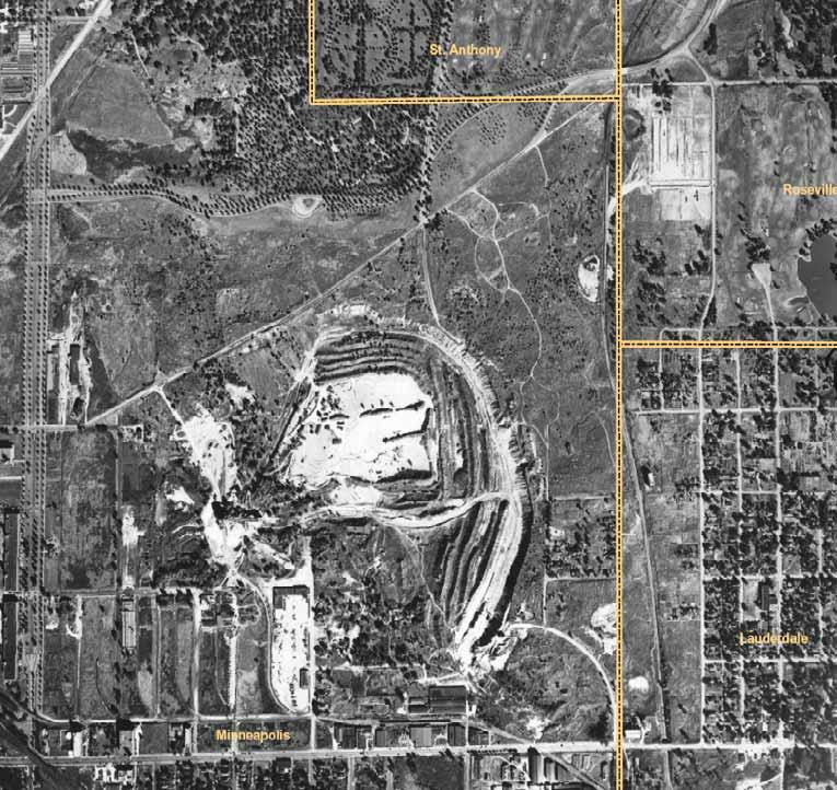
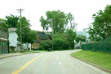
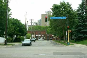
11 Historic Mississippi River St. Anthony Planned Missing Link Northeast Minneapolis Routes Downtown Minneapolis Southeast Minneapolis University of Minnesota St. Paul


12 Mississippi River St. Anthony Destinations and Barriers Northeast Minneapolis Downtown Minneapolis University of Minnesota St. Paul
13 Park Classifications Draft Classifications from the Minneapolis Park and Recreation Board Community Park: Minimum of two blocks (6 acres) - provide facilities for entire community. Neighborhood Park: Up to one block in size - provide basic facilities within a neighborhood. Open Space: An undeveloped piece of land that is accessible to the public and is suitable for future park development. Regional Park: Owned, operated, and maintained by the Minneapolis Park and Recreation Board - designated as part of Metropolitan Council System of Regional Parks and Trails - usually large in size - contain most of the natural areas in Minneapolis - serve regional visitors and Minneapolis residents - eligible for regional funding through the Metropolitan Council.

14 Regional Parks and Other Large Parks

15 St. Anthony Mississippi River Neighborhood Northeast Minneapolis Park Service St. Paul

16 Mississippi River St. Anthony Trails and Northeast Minneapolis Bikeways Downtown Minneapolis St. Paul

17 St. Anthony Mississippi River Public Land Northeast Minneapolis Downtown Minneapolis St. Paul
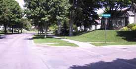
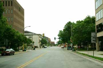
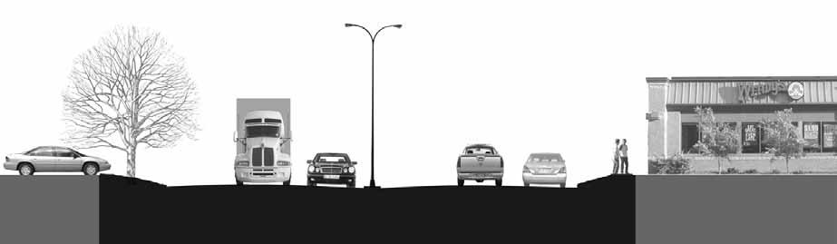
18 Minimum Parkway Requirements 80 minimum right-of-way width Two lane road 12' drive lane in each direction and curb/gutter. Intermittent 8' parking bays on both sides of road. Separated 8 pedestrian and 10 biking trails The Grand Rounds is part of the Federal Highway Administration's National Scenic Byways Program, which recognizes and supports outstanding roads.
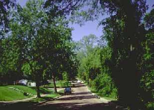
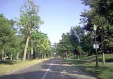
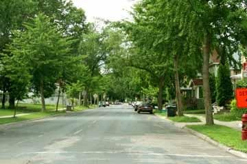
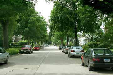
19 Existing Parkway Examples Minnehaha Parkway Victory Memorial Parkway River Road Summit Avenue St. Anthony Parkway

20 Minnehaha Parkway

21 Victory Memorial Parkway

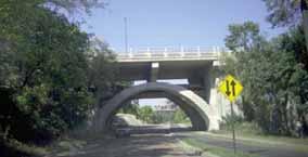
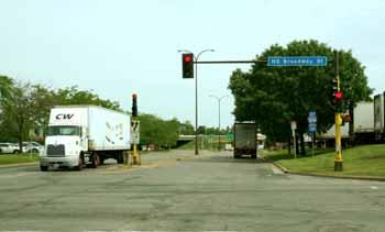
22 River Road

23 Summit Avenue

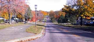
24 St. Anthony Parkway

25 Study Area Road Right of Way

26 27 th Ave SE 54 FT ROW

27 Como Avenue 64 FT ROW

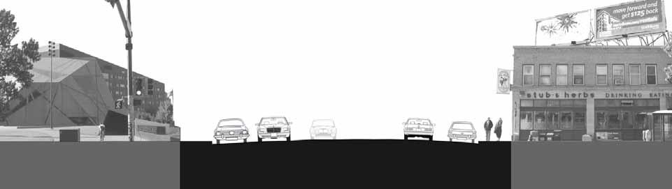
28 Oak Street 80 FT ROW
29 Industrial Boulevard 100 FT ROW


30 Stinson Blvd N. of NB Blvd 135 FT ROW


31 Stinson Blvd N. of Hennepin 200FT ROW
Missing Link Study Grand Rounds Parkway Planning and Design Introduction
 Missing Link Study Grand Rounds Parkway Planning and Design Introduction June 19, 2007 Minneapolis Park and Recreation Board HNTB Hoisington Koegler Group Inc. Hess Roise 1 The Missing Link Study The Minneapolis
METROPOLITAN COUNCIL 390 North Robert Street, St. Paul, MN Phone (651) TDD (651) Metropolitan Parks and Open Space Commission
 TDD (651) Metropolitan Parks and Open Space Commission") METROPOLITAN COUNCIL 390 North Robert Street, St. Paul, MN 55101 Phone (651) 602-1000 TDD (651) 291-0904 DATE: November 29, 2010 TO: Metropolitan Parks and Open Space Commission FROM: Jan Youngquist, Senior
METROPOLITAN COUNCIL 390 North Robert Street, St. Paul, MN 55101 Phone (651) 602-1000 TDD (651) 291-0904 DATE: November 29, 2010 TO: Metropolitan Parks and Open Space Commission FROM: Jan Youngquist, Senior
Grand Rounds Missing Link Development Study Report Minneapolis Park and Recreation Board Missing Link Citizen s Advisory Committee
 Grand Rounds Missing Link Development Study Report Minneapolis Park and Recreation Board Missing Link Citizen s Advisory Committee May 2008 Citizen s Advisory Committee (CAC) John Erwin (Chair) Larry Lamb
REGIONAL TRAIL: THE GRAND ROUNDS MISSING LINK
 REGIONAL : THE GRAND ROUNDS MISSING LINK One regional trail system was included in the ERPMP planning process. The Grand Rounds Missing Link (GRML) Master Plan from 2009 needs an update and to be approved
Corridor Vision. 1Pursue Minnehaha-Hiawatha Community Works Project. Mission of Hennepin County Community Works Program
 1Pursue Minnehaha-Hiawatha Community Works Project Minnehaha-Hiawatha Community Works is a project within the Hennepin Community Works (HCW) program. The mission of the HCW program is to enhance how the
Tracking the Blue Line Extension
 BROOKLYN PARK CRYSTAL ROBBINSDALE GOLDEN VALLEY MINNEAPOLIS Tracking the Blue Line Extension Issue 11 April 2018 Goals to finish designs, apply for federal funds in 2018 Rendering of the 63rd Avenue Station
Blue Line LRT Extension
 v e Noble Pkwy Noble Pkwy Xerxes Ave N Shingle Creek Penn Ave N Penn Ave N Fremont Ave N Lyndale Ave N S Washington Ave University Ave NE Blue Line LRT Extension LIGHT RAIL PLATFORM AND STATION DESIGN
Welcome! Community Meeting FOR YOUR NEW WEBBER PARK LIBRARY
 Community Meeting FOR YOUR NEW WEBBER PARK LIBRARY Tuesday, April 21, 6 p.m. to 7:30 p.m. Webber Community Center Multipurpose Room 4400 Dupont Ave. N., Minneapolis, MN 55412 Welcome! Please join Hennepin
GRAND ROUNDS SCENIC BYWAY MISSING LINK ADDENDUM 1
 GRAND ROUNDS SCENIC BYWAY master PLAN for THE: MISSING LINK ADDENDUM 1 August 2010 Gr and Rounds scenic by way missing LINK Master Pl an A-1 I. AFFECTED JURISDICTION REVIEW As presented in the Grand Rounds
MINNESOTA ARCHITECTURE - HISTORY INVENTORY FORM
 Identification Historic Name Dean Parkway Bridge Current Name Bridge 90661 Field # Address Midtown Greenway over Dean Parkway City/Twp Minneapolis County Hennepin Legal Desc. Twp 29N Range 24W Sec 32 QQ
Midtown Greenway to lake street
 Making the connection: Midtown Greenway to lake street May 2016 Design experiment: site amenities, wayfinding, and activities at Cepro, near the Midtown Global Market Recent Greenway Development Highlights
HILLSBOROUGH COUNTY Greenways and Trails Plan Update. Executive Summary. Date
 HILLSBOROUGH COUNTY Greenways and Trails Plan Update Executive Summary Date PURPOSE AND PROJECT OVERVIEW The Hillsborough County Greenways Master Plan (1995) and the City of Tampa s Greenways and Trails
5. Father Hennepin Blufs Park and Hennepin Island Father Hennepin Bluffs Park Supporting Initiatives (see Figure 36): 7-22
: 7-22") 5. Father Hennepin Blufs Park and Hennepin Island As described in existing conditions portion of Chapter 2, Father Hennepin Blufs Park lies on the upland portion of the park and Hennepin Island spans the
5. Father Hennepin Blufs Park and Hennepin Island As described in existing conditions portion of Chapter 2, Father Hennepin Blufs Park lies on the upland portion of the park and Hennepin Island spans the
Mississippi Skyway Preliminary Engineering Report
 EXECUTIVE SUMMARY Mississippi Skyway Preliminary Engineering Report CITY OF RAMSEY, MINNESOTA DECEMBER 2014 City of RAMSEY EXECUTIVE SUMMARY Project Need and Intent The Mississippi Skyway pedestrian bridge
VISUALIZATION TOOLS FOR COMMUNICATION & DECISION MAKING REAL MINNESOTA EXAMPLES
 REAL MINNESOTA EXAMPLES 23rd Annual CTS Transportation Research Conference Leif Garnass, P.E., PTOE Senior Engineer lgarnass@srfconsulting.com Sean Jergens, ASLA, LEED AP Senior Landscape Architect sjergens@srfconsulting.com
MINNESOTA ARCHITECTURE - HISTORY INVENTORY FORM
 Identification Historic Name Nicollet Avenue Bridge Current Name Nicollet Avenue Bridge Field # Address Nicollet Avenue over Minnehaha Creek City/Twp Minneapolis SHPO Inventory Number Review and Compliance
Whittier Greenway Trail. Est. 2009
 Whittier Greenway Trail Est. 2009 The Whittier Greenway Trail begins in the northwest corner of Whittier, near the 605 Freeway, and closely parallels Whittier Boulevard. When it reaches Painter Avenue,
Community Development Committee Meeting date: July 20, 2015 For the Metropolitan Council meeting of August 12, 2015
 Business Item No. 2015-167 Community Development Committee Meeting date: July 20, 2015 For the Metropolitan Council meeting of August 12, 2015 Subject: Nokomis-Hiawatha Regional Park Master Plan, Minneapolis
September 28, 2017 Wentworth Avenue (CR 8) Sidewalk Improvements Open House
 Sidewalk Improvements Open House") TIME Anytime from 5:00 PM to 7:00 PM LOCATION City Hall Council Chambers Learn about the project Speak with project representatives Provide input YOU RE INVITED! September 28, 2017 Wentworth Avenue (CR
TIME Anytime from 5:00 PM to 7:00 PM LOCATION City Hall Council Chambers Learn about the project Speak with project representatives Provide input YOU RE INVITED! September 28, 2017 Wentworth Avenue (CR
Corridor Background. Defining the Corridor Study Area. Lake Street. 38th Street. 46th Street
 1 Corridor Background Defining the Corridor Study Area Minnehaha Avenue (CSAH 48) and Hiawatha Avenue (MN 55) are parallel diagonal roadways, approximately three blocks apart, that provide two direct arterial
Classroom Science Building
 Classroom Science Building Public Realm Presented by: Gary Branville, Joe Moore, Justin Rechtzigel, Tom Roth & Hailey Wall Proposal Objective: To create a node on the Grand Rounds Parkway Connect the public
Mendota Heights 2040 Comprehensive Plan Draft Vers
 4 Parks and Trails The City of Mendota Heights boasts a variety of recreational and open space opportunities. Few cities can claim access to regional trails, riverside and lakeside parks, scenic bluffs
SECTION 1. Planning Framework. ABOVE THE FALLS REGIONAL PARK MASTER PLAN Minneapolis Park & Recreation Board PARK MASTER PLAN PAGE 1-1 MPRB, 2012
 MPRB, 2012 SECTION 1 Planning Framework PAGE 1-1 Metropolitan Council 2030 Regional Parks Policy Plan Amended July 25, 2012 INTENT The purpose of this Above the Falls Regional Park Master Plan (2019 ATF
West Broadway Transit Study Initial Screening of Alternatives Memo
 West Broadway Transit Study Initial Screening of Alternatives Memo 5/22/2015 Prepared by the SRF Consulting Group Team for Table of Contents Purpose... 1 Methodology... 1 Screening... 5 Screening Criteria...
Tricia Millington, RLA New York State Department of Transportation
 Tricia Millington, RLA New York State Department of Transportation pmillington@dot.state.ny.us Context Sensitive Principles: Context Sensitive Solutions is a philosophy wherein safe transportation solutions
Draft Stillwater 2030 Comprehensive Plan- Goals and Policies
 Draft Stillwater 2030 Comprehensive Plan- Goals and Policies Instructions- Review each goal and policy and discuss with group any changes, deletions for additions to the list using your groups pen. Keep
Community Engagement Committee Meeting #1 December 10, :30pm-8:30pm
 Community Engagement Committee Meeting #1 December 10, 2014 6:30pm-8:30pm Welcome and Introductions Dana Murdoch Minneapolis Park and Recreation Board Project Manager Ryan French Walker Art Center Director
Infrastructure Engineering Planning Construction Suite 300 Minneapolis, MN Tel: Fax:
 Infrastructure Engineering Planning Construction 701 Xenia Avenue outh uite 300 Minneapolis, MN 55416 Tel: 763-541-4800 Fax: 763-541-1700 Memorandum To: Minnehaha Creek Watershed District Board From: Tony
2030 Comprehensive Plan VISION STATEMENT
 RESOURCE DOCUMENT for Steering Committee Meeting #2 July 12, 2017 2030 Comprehensive Plan VISION STATEMENT Steering Committee from 2008 Established the Lauderdale s Vision as: Creating a livable, lovable
Subject: City of Richfield Cedar Avenue Corridor Plan Comprehensive Plan Amendment, Review File No
 Committee Report Business Item No. 2017-21 Community Development Committee For the Metropolitan Council meeting of January 25, 2017 Subject: City of Richfield Cedar Avenue Corridor Plan Comprehensive Plan
Easton. Smart Growth Through Innovation. Easton
 Hazel Ave. Sunrise Blvd. Prairie City Rd. Smart Growth Through Innovation offers a unique opportunity to meet the region s future need for jobs and housing. It embodies smart growth principles advocated
Transportation Committee
 Transportation Committee Business Item No. 2013-286SW Meeting date: October 14, 2013 For the Metropolitan Council meeting of October 16, 2013 Subject: Southwest Light Rail Transit (Green Line Extension):
#27. Timing: Short term. Costs: $$
 Land Use & Physical Resources PROJECT #27 Mobility S t u d y a n d i m p l e m e n t H i a w a t h a A v e n u e / M N 5 5 traffic signal improvements Environment & Natural Resources Economic Development
DRAFT ROOSEVELT ROAD. District Recommendations. Figure 5.23 The Roosevelt Road Corridor
 CHAPTER 5 Figure 5.23 The Road Corridor Road will develop as a mixed-use corridor, emphasizing regional retail, west of the river and mixed-use development east of the river. KEY RECOMMENDATIONS 1. High
Capital Projects in and near Odenton Town Center
 Capital Projects in and near Odenton Town Center Map ID Anne Arundel County Department of Public Works This project provides for the design, right of way acquisition, and construction of approximately
Above the Falls DRAFT FOR PUBLIC COMMENT. Minneapolis Park & Recreation Board
 DRAFT DRAFT Above the Falls Regional DRAFT FOR PUBLIC COMMENT June, 2013 Acknowledgements The is grateful to the many individuals, organizations and agency staff who contributed to this regional park plan.
Ann Arbor Intermodal Station Environmental Review
 Ann Arbor Intermodal Station Environmental Review Park Advisory Commission September 19, 2017 AGENDA 1. Project Update 2. Draft Environmental Assessment 3. Draft Preferred Alternative 4. Next Steps 5.
Midtown Greenway PROJECT REPORT CARD
 Midtown Greenway PROJECT REPORT CARD Project Overview and History The Midtown Greenway is a 5.5-mile multi-use trail that connects the Mississippi River to the Minneapolis Chain of Lakes. The corridor,
Public Meeting & Workshop 1 April 26,2016
 Public Meeting & Workshop 1 April 26,2016 Northeast Ohio Areawide Coordinating Agency City of Cleveland ODOT Bike Cleveland Downtown Cleveland Alliance Ohio City Incorporated Warehouse District Agenda
Capital Projects impacting Odenton Town Center
 Capital Projects impacting Odenton Town Center 1 2 E549700 W801600/ W801602 Anne Arundel County Department of Public Works Manor View Elementary School Transmission Main - MD 32 @ Meade Phase 2 $34,399,000
4 Park Planning and Design
 4 Park Planning and Design Park Constellations Elliot Gateway/Mills Loring North Loop Commons Twins Minneapolis Park & Recreation Board Downtown Service Area Master Plan 4-1 PROJECT APPROACH REFERENCE
June 14, 2017 for the June 20, 2017 Parks and Trails Commission Meeting
 105 South Fifth Avenue Suite 513 Minneapolis, MN 55401 Tel: 612-252-9070 Fax: 612-252-9077 www.landform.net TO: FROM: DATE: Corcoran Parks and Trails Commission Kendra Lindahl, Landform June 14, 2017 for
ROBBINSDALE LRT STATION CDI DEVELOPMENT GUIDELINES
 August 2018 OVERVIEW The City of Robbinsdale has a prime-opportunity site in the middle of the 13 mile stretch of the Bottineau LRT corridor / Blue Line extension. Robbinsdale offers a prominent, vital,
State Highway 121 Southwest Parkway. Fort Worth s Transportation Success Story in Design and Cooperation
 State Highway 121 Southwest Parkway Fort Worth s Transportation Success Story in Design and Cooperation Greater Fort Worth Association of Realtors October 24, 2007 Presented by: Dan Lamers, P.E. North
Planning Committee 2117 West River Road N Minneapolis, MN Committee Meeting
 Planning Committee 2117 West River Road N Minneapolis, MN 55411 Committee Meeting www.minneapolisparks.org October 1, 2014 ~ Agenda ~ Wednesday 5:20 PM Meeting Times are subject to change based on discussion
CHAPTER 7: VISION AND ACTION STATEMENTS. Noble 2025 Vision Statement
 CHAPTER 7: VISION AND ACTION STATEMENTS This chapter presents the vision, policy and action statements that transform the comprehensive planning study, an analysis of Noble s past, future trends and community
MAY 2012 CITY OF ST. LOUIS PARK, MINNESOTA SAINT LOUIS PARK BELTLINE AREA FRAMEWORK & DESIGN GUIDELINES
 30YEARS SAIN LOUIS PARK BELLINE AREA FRAMEWORK & DESIGN GUIDELINES CIY OF S. LOUIS PARK, MINNESOA MAY 2012 ACKNOWLEDGEMENS MAYOR AND CIY COUNCIL: FOR FURHER INFORMAION CONAC: BELLINE ADVISORY COMMIEE:
Robbinsdale LRT Station. CDI Development Guidelines. August Overview
 Robbinsdale LRT Station August 2018 Overview The City of Robbinsdale may have the coolest opportunity site along the 13 mile stretch of the Bottineau LRT corridor / Blue Line extension. Located a block
2017 General Obligation Bond
 2017 General Obligation Bond Presentation of Public and Council Projects to the Transportation & Mobility Stakeholder Committee April 13, 2017 Agenda Deferred Maintenance Project Development Process Projects
Design Charrettes Description of Winning Designs
 Design Charrettes Description of Winning Designs I. Introduction Community and business leaders were invited to participate in a Station Design Charrette hosted by the Pinellas Metropolitan Planning Organization
Wildflowers grow in the new community park on Oakwood Road
 Wildflowers grow in the new community park on Oakwood Road PLANNING AREA - NEW PARKS An important element in the plan for the City of Delafield is to look ahead for future park needs. The City has the
Abingdon Urban Path System
 Abingdon Urban Path System Transportation Enhancement Program Application (FY 2012-2013) Submitted by: Town of Abingdon,Virginia P. O. Box 789 133 West Main Street Abingdon, VA, 24212 November 1, 2011
Comanche Creek Greenway IMPROVEMENT PROJECT
 Comanche Creek Greenway IMPROVEMENT PROJECT City of Chico 2012 INTRODUCTION The City of Chico owns approximately 20 acres along Comanche Creek between Midway and the Union Pacific Railroad line, referred
7.0 SECTION 4(F) EVALUATION
 EVALUATION") Chapter 7 Section 4(f) Evaluation 7.0 SECTION 4(F) EVALUATION 7.1 Background Information and Regulatory Requirements This chapter presents the existing conditions and potential effects to parklands and
Chapter 7 Section 4(f) Evaluation 7.0 SECTION 4(F) EVALUATION 7.1 Background Information and Regulatory Requirements This chapter presents the existing conditions and potential effects to parklands and
The Trust for Public Land. in Minnesota
 The Trust for Public Land in Minnesota Protecting Minnesota s Natural Legacy In Minnesota, The Trust for Public Land (TPL) is protecting strategic land and water resources for people to enjoy as parks,
West Dennis Center: Bass River to Old Main Street. West Dennis Business District: Old Main Street to Dennis Commons
 West Dennis Center: Bass River to Old Main Street West Dennis Business District: Old Main Street to Dennis Commons Dennisport Center: Dennis Commons to Division Street Main Street Project Goals Project
PROJECT STATEMENT LOCATION/DESIGN PUBLIC HEARING. 19 th AVENUE NORTH EXTENSION PROJECT FROM SPRINGDALE DRIVE TO NORTH 2 ND STREET/U.S.
 PROJECT STATEMENT LOCATION/DESIGN PUBLIC HEARING 19 th AVENUE NORTH EXTENSION PROJECT FROM SPRINGDALE DRIVE TO NORTH 2 ND STREET/U.S. 67 HEARING LOCATION: ERICKSEN COMMUNITY CENTER 1401 11 TH AVENUE NORTH
Tailored Approach INDUSTRIAL LAND OPPORTUNITIES. Larpenteur Ave W TO NB. W Hoyt Ave
 Midland Hills Rd Fulham St Pleasant St Malvern St N W W 35 35 TE TE TA TA RS RS TE TE IN Carl St t er S Tailored Approach ChapterTransition, 2: Vision, & Strategies Opportunity,Goals Redevelopment m Sum
CND Committee Meeting April 10, 2018
 CND Committee Meeting April 10, 2018 Projects must: Serve a public purpose/benefit Have a detailed budget reflecting accurate project costs and match sources Have a detailed and achievable timeline including
4 Circulation. Master Plan Recommendations: Access and
 45 4 Circulation Master Plan Recommendations: Access and 46 Chapter 4 MASTER PLAN RECOMMENDATIONS: Access and Circulation Access and Circulation Lake Calhoun/Bde Maka Ska and Lake Harriet are heavily used
Corridor Management Committee. April 14, 2016
 Corridor Management Committee April 14, 2016 1 Today s Topics Chair s Update Corridor-wide Safety/Security Golden Valley Rd Park & Ride, Trails and Intersection Section 106 (Historic Properties) Update
Great Rivers Greenway CLEAN GREEN CONNEC TED T RAILS
 Great Rivers CLEAN GREEN CONNEC TED T RAILS Great Rivers (GRG) was established in 2000 to create a clean, green, connected St. Louis region. Today, many new and exciting projects demonstrate the social,
Elliot Park 2. Neighborhood Master Plan. Historical Perspective
 Elliot Park 2 Neighborhood Master Plan Historical Perspective August 2002 Early History Development patterns and the growth of Minneapolis largely grew out of the city s historical response to its geography.
Office of Greenways & Trails Providing Statewide Leadership and Coordination. Southeast Greenways and Trails Summit October 1-3, 2017
 Office of Greenways & Trails Providing Statewide Leadership and Coordination Southeast Greenways and Trails Summit October 1-3, 2017 1 Office of Greenways and Trails The Office of Greenways and Trails
Chapter 1: Introduction
 Chapter 1: Introduction The Penn Avenue Community Works Corridor Vision and Implementation Framework presents an integrated communitybased vision and a coordinated, long-term implementation framework for
Northwest Rail Corridor and US 36 BRT Development Oriented Transit Analysis 4.4 STATION AREA FINDINGS
 4.4 STATION AREA FINDINGS Each station is different, and each one requires a separate set of recommendations based on the vision for the site. This section outlines an initial TOD strategy and recommendations
PARK & PORTLAND: VISION FOR DEVELOPMENT
 2025 PLAN EAST TOWN DEVELOPMENT GROUP East Town is a thriving district of 120 square blocks (300 acres) in the most accessible and visible sector of Downtown Minneapolis. It is bounded by the Minneapolis
Public input has been an important part of the plan development process.
 Lakewood s Comprehensive Plan recognizes that transportation helps shape the community, and that the way the community provides for the safe and efficient movement of people affects the character of the
Little Neck Planning Area
 Little Neck Planning Area Current Reality The Little Neck Planning Area is characterized by established residential neighborhoods, Town Center and Pembroke. The Eastern and Western Branches of the Lynnhaven
Chapter 5: Recreation
 Chapter 5: Recreation Introduction and Setting Recreational opportunities within Nevada County are varied, ranging from public parks with intensively used active recreational facilities, to vast tracts
4 C OMMUNITY D ISTRICTS
 4 C OMMUNITY D ISTRICTS N ew development in the Area will include many different types of land uses, including a destination retail area that attracts people from all over the region; recreation opportunities
Hopkins. Development Guidelines May Overview. Sponsored by: Blake Road Corridor Collaborative City of Hopkins
 Hopkins Blake Road LRT Station Area Development Guidelines May 2015 Sponsored by: Blake Road Corridor Collaborative City of Hopkins Overview Hopkins is a dynamic community of over 17,000 residents located
Potential Green Infrastructure Strategies May 6, 2015 Workshop
 Potential Green Infrastructure Strategies May 6, 2015 Workshop Background The City of Cortland is developing the Tioughnioga Urban Headwaters Green Infrastructure Action Plan with funding from the National
Pine Avenue Improvement Project
 Seaside Way to ocean Boulevard ocean Boulevard to 7 th Street 7 th Street to anaheim Street L O ng BeACh DeveLOpment ServiC e S Building a Better long Beach Pine Avenue Improvement Project Seaside Way
1.0 Introduction. Purpose and Basis for Updating the TMP. Introduction 1
 1.0 Introduction The Town of Castle Rock is situated between the metropolitan areas of Denver and Colorado Springs, amidst a unique terrain of rolling hills, mesas, ravines, and waterways. Like many Front
METRO Gold Line BRT CBAC Meeting. August 23, 2018
 METRO Gold Line BRT CBAC Meeting August 23, 2018 1 Today s Topics Introductions Corridor Management Committee Update Public Engagement Update History of Alignment Project Scope Discussions Upcoming CBAC
Mississippi Drive Corridor Revitalization. A DestinationTransportation Project...
 Mississippi Drive Corridor Revitalization A DestinationTransportation Project... Mississippi Drive Corridor Revitalization Welcome! Tonight s Agenda: Further define the Scope of the Project Discuss the
Section4 Design Vision & Implementation Plan
 Section4 Design Vision & Implementation Plan W Woodschurch Rd 4.1 Design Focus Areas The Framework Plan is simply the starting point for directing the design and implementation of a wide range of transportation
Oroville Area Urban Greening Plan. Second Communitywide Workshop
 Oroville Area Urban Greening Plan Second Communitywide Workshop Monday, November 18, 2013 PROJECT TEAM Lead Agency Butte County Department of Development Services Claudia Stuart, Principal Planner Chris
Community Working Group Meeting #3. Agenda
 METRO Blue Line extension (Bottineau LRT) Phase 1: Station Area Planning Community Working Group Meeting #3 Wednesday, December 17, 2014 6:00 8:00 pm Urban Research and Outreach-Engagement Center (UROC)
APPENDIX D2: PARKS AND TRAILS
 APPENDIX D2: PARKS AND TRAILS Cultivate Hopkins Comprehensive Plan 8/15/18 DRAFT Cultivate Hopkins Appendix D2 1 Existing Conditions Local Parks and Trails Figure D2.1 shows the existing park and trail
Guiding Principles for the SR 520 Replacement Project
 Guiding Principles for the SR 520 Replacement Project Presentation to the Board of Regents Theresa Doherty Assistant Vice President for Regional Affairs May 18, 2006 F-14 The University of Washington is
REGIONAL TRANSPORTATION COMMISSION OF SOUTHERN NEVADA AGENDA ITEM
 REGIONAL TRANSPORTATION COMMISSION OF SOUTHERN NEVADA AGENDA ITEM Metropolitan Planning Organization [ X ] Transit [ ] Administration and Finance [ ] SUBJECT: PROJECT SELECTION PROCESS FOR TRANSPORTATION
7.0 DRAFT SECTION 4(f) EVALUATION
 EVALUATION") 7. DRAFT SECTION 4(f) EVALUATION 7.1 Background Information and Regulatory Requirements This chapter presents the existing conditions and potential effects on parks, recreation areas, wildlife and waterfowl
7. DRAFT SECTION 4(f) EVALUATION 7.1 Background Information and Regulatory Requirements This chapter presents the existing conditions and potential effects on parks, recreation areas, wildlife and waterfowl
Oroville Area Urban Greening Plan. Joint Meeting of the Oroville Planning, Park, and Arts Commissions October 12, 2015
 Oroville Area Urban Greening Plan Joint Meeting of the Oroville Planning, Park, and Arts Commissions October 12, 2015 Project Team Lead Agency Butte County Department of Development Services Claudia Stuart,
Yadkin River Greenway Feasibility Study Fact Sheet Village of Clemmons, Town of Lewisville, Town of Bermuda Run
 Fact Sheet Village of Clemmons, Town of Lewisville, Town of Bermuda Run Project Background The Yadkin River Greenway Feasibility Study is a joint project with the Village of Clemmons, the Town of Bermuda
C. Westerly Creek Village & The Montview Corridor
 C. Westerly Creek Village & The VISION Community Vision When the goals of the city are achieved Westerly Creek Village, a distinctive community defined by Montview Boulevard and Westerly Creek, is a strong
THREE-YEAR CAPITAL IMPROVEMENT PLAN FY
 THREE-YEAR CAPITAL IMPROVEMENT PLAN FY2016 2018 Annual CIP Development Process Public Works & Engineering Divisions Prepare List of Capital Needs and Recommended Deferred Maintenance Public Works & Engineering
CITY OF BOYNTON BEACH SE 1 ST STREET COMPLETE STREETS IMPROVEMENTS
 CITY OF BOYNTON BEACH SE 1 ST STREET COMPLETE STREETS IMPROVEMENTS N Project Location -Town Square -Villages at Ocean SE 1st St, between E Woolbright Rd and SE 2nd Ave Project Location -Boynton One -Publix
TOWN COUNCIL / PLANNING COMMISSION
 Workshop #3 TOWN COUNCIL / PLANNING COMMISSION January 20, 2011 Consultant Team In Attendance Tonight BMS Design Group Nevada City and San Francisco Michael Smiley, AICP, ASLA Partner-in-Charge Nancy L.
University Avenue District
 University Avenue District UPDATE ON THE OPPORTUNITY 07.8.15 1 University Avenue District The new century nexus of live, work, learn, research, and engage. An intentional partnership of developers, businesses,
BUDGETING FOR OUTCOMES TRINITY RIVER CORRIDOR
 BUDGETING FOR OUTCOMES TRINITY RIVER CORRIDOR Trinity River Corridor Team Members: Kelly High, Streets Department Megan Lam, Office of Financial Services Mike Mikeska, Dallas Water Utilities Diana Ochoa,
Pennsy Greenway Trail
 Town of Schererville Pennsy Greenway Trail DES. #s: 0401062, 1173595 & 1382661 Construction of Pennsy Greenway Trail beginning at Wilhelm Street and continuing northwest along the former Penn Central railroad
Fort Ord Regional Trails Planning
 Fort Ord Regional Trails Planning FORA Board July 11, 2014 Josh Metz, Associate Planner Overview Base Reuse Plan (BRP) trails planning context Trails planning in FORA jurisdictions and related entities
PARKS AND RECREATION
 PARKS AND RECREATION WHAT YOU WILL FIND IN THIS CHAPTER: Background information on the development of the Park, Recreation, and System Plan (PRSP). General overview of Ellensburg s parks and recreation
Sherman Oaks - Studio City - Toluca Lake - Cahuenga Pass Non-Parcel Resources 02/26/13
 Non-Parcel Resources Adina Dr between Oakshire and Ellington Adina-Passmore Public Stairway Year built: 1930 Context: Residential Development and Suburbanization, 1850-1980 Theme: Automobile Suburbanization,
Subarea 4 Indian Creek. Vision The combination of park networks and transportation amenities make Subarea 4 the greenest hub in the Corridor.
 indian creek 180 extends south from 101st Street to I-435. The I-435 and Metcalf intersection is one of the primary intersections in the Kansas City Metro Area. The area includes several residential neighborhoods
Por favor, levanten la mano si necesita traduccion en espanol Please raise your hand if you need Spanish translation
 FEDERAL BOULEVARD CORRIDOR WIDE STUDY PUBLIC MEETING #1 APRIL 27, 2016 Por favor, levanten la mano si necesita traduccion en espanol Please raise your hand if you need Spanish translation HDR DESIGN WORKSHOP
Stadium Village Public Realm and Connectivity Study
 City of Minneapolis Stadium Village Public Realm and Connectivity Study Prepared for Hennepin County, City of Minneapolis, University of Minnesota and the Prospect Park Neighborhood March 2012 Stadium
City of Dallas Plans
 City of Dallas Plans Name Year 1. A Report on a Sheltered Pedestrian System in CBD 1979 2. A Report on the Public Uses of Block 250 1980 3. Achieving the Goals for Dallas 1978 4. Amendments to the City