Glenborough at Easton Land Use Master Plan
|
|
|
- Vivien Mosley
- 5 years ago
- Views:
Transcription
1 Public Facilities
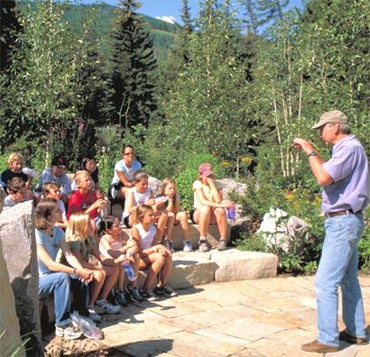
2 PUBLIC FACILITIES 7.1 OVERVIEW This chapter describes the public facilities that will provide high-quality services in the Glenborough at Easton community, to include three schools, a fire station, and the Community Resource Area, as identified in Figure 7.1, Public Facilities Schools Forty acres are dedicated to the three schools in Glenborough at Easton, including a 20-acre middle school site and two 10-acre elementary school sites. All of the schools are located within the Folsom Cordova Unified School District. The schools have been located near open space corridors with trails to facilitate access from nearby neighborhoods. The schools are colocated with neighborhood parks to encourage shared use of recreational facilities. The middle school, located southeast of the intersection of Easton Valley Parkway and the extension of Aerojet Road, is adjacent to the Market District in Easton Place and will serve both the Glenborough at Easton and Easton Place communities. An approximately 12.9-acre park is located immediately south of the middle school to encourage sharing of sports facilities. The two elementary schools are located within residential neighborhoods north and south of Easton Valley Parkway. Neighborhood parks adjacent to each school expand the total area for each site to a minimum of 15 acres. These joint-use school/park sites serve as the focal point of their respective neighborhoods, creating a central gathering place. These schools and parks are linked to the off-street trail system for pedestrian or bicycle trips. Aerojet Rd. Folsom Blvd. MS Birkmont Dr. LDS Temple Site Figure 7.1, Public Facilities NAPOTS Glenborough Fire and Sheriff U.S. 50 Easton Valley Pkwy. The Sacramento Metropolitan Fire District provides fire protection to the community. One 2.5-acre facility will be located in Glenborough at Easton to serve the community s fire protection needs. Sheriff s services will be provided by the Sacramento County Sheriff s Department from the Rockingham Station, East Division, Rockingham Drive, Sacramento. With the buildout of Easton Place, an additional sheriff s substation will be constructed at Easton Place. Drive ES ES Public Facilities School Community Resource Area Kimball Pl. Community Resource Area Prairie City Rd. NORTH Community Resource Area The 25.6-acre Community Resource Area, located at the intersection of Easton Valley Parkway and Prairie City Road, is a key gateway into Glenborough at Easton. The land is gently rolling and covered by mature oak trees, making it one of the most picturesque landscapes on the property. The site will be preserved with minimal development, providing for small community facilities and parking lots. The facilities will be designed for environmental and historical site education and recreation staging to the Alder Creek trail system. Chapter 7 - Public Facilities


3 7.2 PUBLIC FACILITIES GOALS The policies set forth in this chapter are guided by the following public facilities goals. Goal 7.1 Locate adequate schools within Glenborough at Easton to serve the elementary and middle school-age populations. Goal 7.2 Provide adequate fire and emergency facilities to serve the community. Goal 7.3 Create a Community Resource Area within a natural setting that focuses on environmental education, community services and facilities, and Glenborough at Easton wayfinding. Schools should be located next to neighborhood parks to encourage sharing of facilities. A fire station will be developed in Village J. 7.3 PUBLIC FACILITIES POLICIES School Policies Fire Station Policies School facility demand, sizing, location, and generation rates have been coordinated with the Folsom Cordova Unified School District and are reflected in the schools shown in the Glenborough at Easton Land Use Master Plan. Policy 7.1 Schools and Neighborhood Parks All schools within Glenborough at Easton must be located next to a neighborhood park and connected by sidewalks and trails for safe and convenient access. Fire station siting and design will be coordinated with the Sacramento Metropolitan Fire District. Policy 7.2 Fire Station Location and Size A 2.5-acre parcel in Glenborough at Easton shall be developed as a fire station. The site will be located near the intersection of Kimball Drive and Easton Valley Parkway in Village J. This location affords convenient access to Easton Valley Parkway, facilitating rapid response times. Glenborough at Easton s schools will be easily accessible from local neighborhoods. 103 Public Facilities - Chapter 7

4 7.3.3 Community Resource Area Policies Entry Policy 7.3 Community Resource Area Program Growing Grounds The Community Resource Area will be developed with public facilities that provide information and host events to inform residents and visitors about a variety of topics, including the history, natural resources, and public facilities of Glenborough at Easton (see Figure 7.2, Community Resource Area Concept ). The Community Resource Area will include the following facilities: Pioneer Parking (15 cars) Wetland Nature Center Bus/Car Drop Off Area Amphitheater Paved Parking (87 cars) Future Reastaurant Site Bus Parking Area Pedestrian/Vehicular Bridge Wetlands Welcome Center The Welcome Center will be 5,000 square feet in size or less and will provide orientation and community services to residents and visitors. The building will contain maps, models, brochures, and other materials that describe the various components of Glenborough at Easton, including the neighborhoods, parks, and community services and facilities. The Welcome Center will be located close to Easton Valley Parkway for visibility and easy access. Community Center Creek Paved Parking (63 cars) Pioneer Parking Welcome Center Trails Wetlands Community Center The Community Center will be 10,000 square feet or less, and will contain flexible events space for public and private meetings, small conferences, and concerts. The facility will include a kitchen and outdoor patio space with areas for outdoor grilling. Entry Meadow One Way / In Only Future Signalized Intersection 104 Figure 7.2, Community Resource Area Concept Chapter 7 - Public Facilities


5 Nature Center The Nature Center will be approximately 5,000 square feet or less and will be located near the Community Center. The Nature Center will be the primary place for learning about the past, present, and future of Glenborough at Easton s ecological niche in the Sacramento region. In addition, the site s past gold dredging history and role in the development of modern rocketry will be explained. Both static and video exhibits could be included, along with small interactive displays. A small museum shop may also be incorporated into the facility. Policy 7.6 Building Height Buildings shall not exceed two stories. While most buildings will be single-story, a second story is acceptable. Refer to the Community Resource Area Development Standards for height restrictions. Outdoor Amphitheater Located near the Nature Center, the amphitheater will provide seats for approximately 150 people. The Community Resource Area will provide educational resources to the community and wider region. Policy 7.7 Building Articulation Buildings within the Community Resource Area shall not appear massive, but shall have changes in elevation and floor plan to create interest and blend into the site topography. Large floor-plate buildings, particularly those with long walls and little facade articulation or windows, are highly discouraged. Given the special nature of the Community Resource Area, all four facades of the buildings should be treated with equal attention. Native Plant Nursery This facility will be linked to the Nature Center and used for growing native plants for site restoration purposes. Trail Staging Area Trails from the Nature Center will lead to other points of interest in the Community Resource Area and the main Alder Creek trail. Policy 7.4 Building Locations Buildings shall be located to minimize disturbance to the mature oak trees on the site. All facilities shall be located in the field and surveyed accurately to avoid trees. All buildings shall be within 150 feet of the nearest parking lot and shall have handicap accessibility. To minimize grading, buildings shall not be placed on steep slopes. Short-range views of the Alder Creek corridor and long-range views of the Sierra Nevada are desirable for key gathering places. Views into the site should allow for some recognition of where the key buildings and entries are located to provide orientation to visitors. Policy 7.5 Building Materials Building materials should be natural in appearance, and may include wood, stone, or other materials that are complementary to the natural features on the site. Buildings such as the Nature Center shall not exceed two stories and should be designed to blend into the surrounding landscape. 105 Public Facilities - Chapter 7


6 Policy 7.8 Landscape Plants To preserve the oak-dominated landscape, the use of ornamental, non-native trees is discouraged in the Community Resource Area. Where appropriate, other trees and shrub species are acceptable around buildings and parking lots, if they are native to the Sacramento Valley or considered acceptable noninvasive introduced species. Policy 7.9 Trail Accessibility The main trail leading from the Nature Center to the Alder Creek corridor shall be handicap accessible and conform to Americans with Disabilities Act standards for grade and width. Surfaces shall be durable and have positive drainage. Smaller trails within the Community Resource Area can be less formal and conform to the contours of the slope. Policy 7.10 Parking Parking for the Community Resource Area shall be in the smallest groupings feasible to minimize disturbance to the land. Parking lots serving the facilities can be shared. Trails will connect the Community Resource Area to the Alder Creek corridor. A native plant nursery will be used for restoration, mitigation, and landscaping in Glenborough at Easton. Landscape plants should include native species such as this ceanothus. 106 Landscape plantings should blend with the existing oak savanna. Chapter 7 - Public Facilities
Glenborough at Easton Land Use Master Plan
 Vision Statement Sunrise Blvd. Hazel Ave. Prairie City Rd. Gencorp Property Lincoln Regional Airport 1.0 VISION STATEMENT The identifies City of the principles, goals, policies, and standards Lincoln that
Glenborough at Easton Land Use Master Plan
 Land Use Framework November 30, 2007 2.0 LAND USE FRAME- WORK 2.1 LAND USE HISTORY and Setting Glenborough at Easton is located on property that was used for mining in the 19th and 20th centuries and rocket
1.0 VISION STATEMENT. December 6, PRINCIPLES
 Vision Statement Lincoln Regional Airport 1.0 VISION STATEMENT 1.1 City LOCATION of AND OVERVIEW The Easton Lincoln Place Land Use Master Plan identifies the principles, goals, policies, and standards
3.0 URBAN DESIGN. December 6, OVERVIEW
 Urban Design 3.0 URBAN DESIGN December 6, 2007 3.1 OVERVIEW The highly urban character of Easton Place is defined by the overall design of the community. The following sections provide an overview of the
Glenborough at Easton Land Use Master Plan
 Circulation 5.0 CIRCULATION 5.1 CIRCULATION PLAN This chapter describes Glenborough at Easton s circulation system, which has been designed to accommodate automobile, bus transit, bicycle, and pedestrian
SITE INTRODUCTIONS AND OVERVIEW
 SITE INTRODUCTIONS AND OVERVIEW The City s formal Open Space Program was established in 1990 to implement long-standing policies that called for the protection of the farmlands and wild areas that surround
Easton. Smart Growth Through Innovation. Easton
 Hazel Ave. Sunrise Blvd. Prairie City Rd. Smart Growth Through Innovation offers a unique opportunity to meet the region s future need for jobs and housing. It embodies smart growth principles advocated
Mark-up of the effect of the proposed Bronte Village Growth Area OPA No.18 on the text of section 24, Bronte Village, of the Livable Oakville Plan
 Mark-up of the effect of the proposed Bronte Village Growth Area OPA No.18 on the text of section 24, Bronte Village, of the Livable Oakville Plan Notes: This document is provided for information purposes
The Vision. Photo provided by The Minervini Group. 46 Vision, Objectives & Strategies
 Vision, Objectives & Strategies The is the public framework and guide for future development of the Grand Traverse Commons. The establishes public polices for infrastructure, the preservation of natural
APPENDIX C. Architectural and Environmental Design Standards. Environmentally sensitive areas should be protected.
 APPENDIX C Architectural and Environmental Design Standards Environmentally Sensitive Areas Goal A. Environmentally sensitive areas should be protected. Development, such as roads, houses, and other structures,
Community Design Guidelines. Port Wallace DRAFT
 Community Design Guidelines Port Wallace DRAFT Energy 1 2 3 Nature Movement Connections Built Form DRAFT Layout Energy 1 Nature Community Design Guidelines GREAT COMMUNITIES PROTECT, CELEBRATE, AND CONSERVE
7 PUBLIC SERVICES ELEMENT
 7 PUBLIC SERVICES ELEMENT 7.1 PURPOSE The (RDOSP) will provide public services necessary to meet the needs of the Plan Area residents, in accordance with the policies of the City of Rancho Cordova s General
Gold Line Bus Rapid Transit Transit Oriented Development (BRTOD) Helmo Station Area Plan
 Helmo Station Area Plan") Appendix F Gold Line Bus Rapid Transit Transit Oriented Development (BRTOD) Helmo Station Area Plan Introduction and Purpose of the Plan The Gold Line Bus Rapid Transit facility is an eleven-mile dedicated
Appendix F Gold Line Bus Rapid Transit Transit Oriented Development (BRTOD) Helmo Station Area Plan Introduction and Purpose of the Plan The Gold Line Bus Rapid Transit facility is an eleven-mile dedicated
Courthouse Square Planning & Urban Design Study. Courthouse Square Working Group #13 October 15, 2014
 Courthouse Square Planning & Urban Design Study Courthouse Square Working Group #13 October 15, 2014 1 Courthouse Square Process Working Group Community Courthouse Square Advisory Groups & Civic Associations
CHAPTER 5 Public Realm Improvements
 5.1 OVERVIEW This chapter focuses on the public realm, that is, spaces within and directly adjacent to public rights-of-way (ROWs), including streets, Oso Creek, the rail corridor, and the freeway edge.
Welcome! to Keller Town Hall
 Welcome! to Keller Town Hall Keller Town Center Planning a New Downtown What is Keller Town Center? A new, growing downtown district planned as an urban village A combination of retail and office spaces,
Seneca Meadows. Block 4 Locate office, technology, and medical development adjacent to I Screen views of garage structures from I-270.
 Seneca Meadows Seneca Meadows has an industrial park in its southern end and a mixed-use employment area planned for the north end. The district benefits from extensive I-270 visibility, stream valley
FLORIN ROAD CORRIDOR Site Plan and Design Review Guidelines Checklist
 FLORIN ROAD CORRIDOR Site Plan and Design Review Guidelines Checklist Applicant s Name: Project Address: Phone: Email: Applicant shall fill out the design guidelines checklist for all guidelines applicable
B L A C K D I A M O N D D E S I G N G U I D E L I N E S for Multi-family Development
 B L A C K D I A M O N D D E S I G N G U I D E L I N E S for Multi-family Development Adopted June 18, 2009 This section of the Design and focuses on site planning and design guidance for new multi-family
4. INDUSTRIAL 53 CASTLE ROCK DESIGN
 4. INDUSTRIAL 53 CASTLE ROCK DESIGN CASTLE ROCK DESIGN 54 4. INDUSTRIAL Overview Well-designed and attractive industrial centers are the product of blending economic realities with both functional and
COMMUNITY DESIGN. GOAL: Create livable and attractive communities. Intent
 COMMUNITY DESIGN Intent An attractive, well-designed County will attract quality development, instill civic pride, improve the visual character of the community, and create a strong, positive image for
4 C OMMUNITY D ISTRICTS
 4 C OMMUNITY D ISTRICTS N ew development in the Area will include many different types of land uses, including a destination retail area that attracts people from all over the region; recreation opportunities
public review draft Key objectives for this chapter are:
 5 - parks & open space Providing a rich collection of outdoor places for informal gathering and recreation, as well as planned promotional activities and community events, is a key concept for Midtown.
Policies and Code Intent Sections Related to Town Center
 Policies and Code Intent Sections Related to Town Center The Town Center Vision is scattered throughout the Comprehensive Plan, development code and the 1994 Town Center Plan. What follows are sections
Urban Design 9Identity
 Urban Design 9Identity URBAN DESIGN IDENTITY Urban design is about connecting people to their places through the built environment, nature, and overall urban form. Done well, it creates a memorable space
Glenborough at Easton Land Use Master Plan
 Implementation 114 9.0 IMPLEMENTATION 9.1 OVERVIEW This chapter summarizes the administrative procedures necessary to implement the proposed land use plan, infrastructure improvements, development standards,
Standards (R-3) Figure B-11: R-3 Residential Standards Exhibit
 Figure B-11: R-3 Residential Standards Exhibit") Avila Ranch Avila Ranch Specific Plan Development Standards High Medium Density - High Residential Density Residential Lot and Building Lot and Standards Building (R-3) Standards (R-3) EXAMPLES These sketches
Avila Ranch Avila Ranch Specific Plan Development Standards High Medium Density - High Residential Density Residential Lot and Building Lot and Standards Building (R-3) Standards (R-3) EXAMPLES These sketches
Ten Mile Creek Planning Area
 PLANNING AREA POLICIES TEN MILE CREEK Ten Mile Creek Planning Area Location and Context The Ten Mile Creek Planning Area ( Ten Mile Creek area ) is located south of the current Boise AOCI, generally south
3. VISION AND GOALS. Vision Statement. Goals, Objectives and Policies
 Vision Statement Queen Creek s interconnected network of parks, trails, open spaces and recreation opportunities provide safe and diverse activities and programs that sustain its unique, small town, equestrian
Courthouse Square Planning & Urban Design Study. Clarendon / Courthouse Civic Association October 21, 2014
 Courthouse Square Planning & Urban Design Study Clarendon / Courthouse Civic Association October 21, 2014 1 Courthouse Square Process Working Group Community Courthouse Square Advisory Groups & Civic Associations
CHAPTER FIVE COMMUNITY DESIGN
 CHAPTER FIVE COMMUNITY DESIGN CHAPTER FIVE - COMMUNITY DESIGN Assumptions Frazier Park and Lebec have historically developed according to different patterns of spatial form. While both communities are
BROOKHILL NEIGHBORHOOD MODEL ZONING MAP AMENDMENT PREFACE TO APPLICATION
 BROOKHILL NEIGHBORHOOD MODEL ZONING MAP AMENDMENT PREFACE TO APPLICATION June 15, 2015 Revised: August 1, 2016 I. VISION Brookhill is a proposed community based upon the principles of Albemarle County
River Corridor Overlay Zone (RCOZ) Article 5
 Article 5") River Corridor Overlay Zone (RCOZ) Article 5 The site is in one of two designated districts. The first is the CBD (central business district) River District, which recognizes the urban character and unique
River Corridor Overlay Zone (RCOZ) Article 5 The site is in one of two designated districts. The first is the CBD (central business district) River District, which recognizes the urban character and unique
ITA and Vicinity Master Plan Update
 1 ITA and Vicinity Master Plan Update PHASE 3 SEPTEMBER 27, 2017 Three Phase Process 2 Phase 1 - Understanding October 13th Public Meeting Phase 2A - Exploring Ideas November 17th Public Meeting Phase
Chapter 5: Natural Resources and Environment
 NATURAL RESOURCES AND ENVIRONMENT 5-1 5 Chapter 5: Natural Resources and Environment BACKGROUND AND INTENT Urban expansion represents the greatest risk for the future degradation of existing natural areas,
II. SINGLE FAMILY RESIDENTIAL
 II. SINGLE FAMILY RESIDENTIAL Castle Rock is made up of numerous individually built houses and subdivision tracts that have been developed during the past century. Some of the tracts are diverse in architectural
A larger version of this map is located on the last page of this PDF.
 MAP Committee Input McLoughlin Area Draft Vision Map A larger version of this map is located on the last page of this PDF. 1. The map above is intended to portray a vision for the McLoughlin area. It highlights
Girdwood Cemetery Girdwood, Alaska
 Miners Pond Shelter Council Circle Woodl Trails Overlooks Committal Shelter Courts Woodl Burial Bridge to Beaver Pond Trail Protected Stream Valleys Columbarium Court Shelter Woodl Trails Woodl Cremation
PUBLIC RIGHT-OF-WAY IN THIS CHAPTER PUBLIC REALM
 PUBLIC RIGHT-OF-WAY This section provides design guidelines for improvements in the public right-of-way. The public right-of-way refers to streets, sidewalks, non-vehicular thoroughfares, parks and greenways
Hockessin Community Redevelopment Plan
 Hockessin Community Redevelopment Plan 3.1 Introduction The Community Redevelopment Plan for the Village of Hockessin is the result of the people s vision for a distinct village center that serves as the
SHEFFIELD PARK Paulding County, GA DRI #588
 SHEFFIELD PARK Paulding County, GA DRI #588 Supplemental Information for RDC s DRI (Form 2) Review August 16, 2004 Prepared for: Mr. David Howerin Coosa Valley RDC 1 Jackson Hill Drive Rome, GA 30161 P.O.
The following principles guide the development of goals and strategies to protect and promote these amenities:
 OPEN SPACE/PARKS/TRAILS/RECREATION GOALS/STRATEGIES Cherry Hills Village is a living environment that offers low density development, open areas, public scenic vistas, public trails and public parks. This
Hidden Pointe Landscape Master Plan. June, archi terra
 Hidden Pointe Landscape Master Plan June, 2006 t h e archi terra g r o u p 1 Table of Contents Background Purpose and Goals of the Master Plan Master Plan Process Existing Conditions Entrance Hidden Pointe
include playgrounds, sports fields, community gardens and picnic areas.
 DEVELOPMENT PLAN OPEN SPACE SYSTEM OPEN SPACE SYSTEM The neighborhood provides for a range of open space types. The Village Square is an important open space in the neighborhood. It serves as a gathering
Preliminary Sketch Plan for Fort Hunter Park
 Preliminary Sketch Plan for Fort Hunter Park Public Presentation November 19, 2009 Dauphin County Parks and Recreation 100 Fort Hunter Road Harrisburg, PA 17110 (717) 599-5188 www.dauphinc.org THOMAS COMITTA
Courthouse Square Planning & Urban Design Study
 Courthouse Square Planning & Urban Design Study Pedestrian Advisory Committee November 12, 2014 Kris Krider, AICP, Planning Supervisor Center for Urban Design and Research Department of Community Planning,
The Village. Chapter 3. Mixed Use Development Plan SPECIFIC PLAN
 The Village SPECIFIC PLAN Chapter 3 3.1 INTRODUCTION 3.1.1 Purpose This Chapter describes the development regulations applicable to the Mixed-Use and Transit Center Planning Areas. These form-based regulations
The transportation system in a community is an
 7 TRANSPORTATION The transportation system in a community is an important factor contributing to the quality of life of the residents. Without a sound transportation system to bring both goods and patrons
Additional information about land use types is given in Chapter 5. Design guidelines for Centers and Neighborhoods are given in Chapter 7.
 4. Place Types Introduction In Albemarle County s Development Areas, the Neighborhood is the fundamental unit of community planning. The County s Neighborhood Model, an adopted part of the Comprehensive
Transportation. Strategies for Action
 Transportation A major priority for the Overlake Neighborhood is to develop a multimodal transportation system. To achieve this system, a balance has to be found among travel, circulation and access needs;
Open Space, Natural Areas, Parks, and Recreation
 Open Space, Natural Areas, Parks, and Recreation WHAT ARE THE CITY S CURRENT VALUES? This section addresses open spaces, natural areas, parks and recreation, and stormwater multi-use projects under separate
The University District envisions, in its neighborhood
 Envisioning the University District Link Light Rail in Seattle s neighborhoods CIY OF SEALE CONCEP-LEVEL SAION AREA PLANNING RECOMMENDAION RESOLUION # 30165 EXHIBI L Vision 08.2000 he University District
EXISTING COMPREHENSIVE PLAN
 EXISTING COMPREHENSIVE PLAN Town Center Land Use Element: V. LAND USE POLICIES Town Center Mercer Island's business district vision as described in "Your Mercer Island Citizen-Designed Downtown" was an
Chapter 5: Recreation
 Chapter 5: Recreation Introduction and Setting Recreational opportunities within Nevada County are varied, ranging from public parks with intensively used active recreational facilities, to vast tracts
ATTACHMENT A. SILVERDALE DESIGN STANDARDS Amendments to the Waaga Way Town Center Chapter
 ATTACHMENT A SILVERDALE DESIGN STANDARDS Amendments to the Waaga Way Town Center Chapter Chapter 10. Waaga Way Town Center 10.1 Physical Identity Elements & Opportunities The Waaga Way Town Center includes
FOR SALE PRICE: $10,500,000 PLACER VINEYARDS - PROPERTY 12A Acres. South Line of Baseline Rd. East of Palladay Rd. Placer County, California
 PLACER VINEYARDS 12A BASELINE ROAD PALLADAY ROAD FOR SALE 193.40 Acres (8,424,504 SF) PRICE: $10,500,000 South Line of Baseline Rd. East of Palladay Rd. Placer County, California CUSHMAN & WAKEFIELD INC.
1. Lenox Dale Community Character Strengths and Opportunities Identified by Residents: Strong neighborhood identity and sense of community.
 LENOX DALE ISSUES AND OPPORTUNITIES -- EIGHT CATEGORIES: Concerns and opportunities identified by Lenox residents and in previous Community Surveys, along with thought-starter suggestions on possible Town
ESTABLISH AN EFFICIENT TOWN CENTER
 ESTABLISH AN EFFICIENT TOWN CENTER 4 Overview Lisbon residents are proud of the history of Newent and at the same time recognize its current importance as a centralized location for a variety of municipal
WASHINGTON COUNTY OREGON
 WASHINGTON COUNTY OREGON July 9, 2009 Revisions to Chapter 2 of the Bethany Community Plan The North Bethany Subarea Plan Exhibit pages 7 and 8 The sections for the Core and Flexible Streets were amended
section five BEAUTIFICATION PLAN
 section five BEAUTIFICATION PLAN BEAUTIFICATION PLAN Section Five Beautification Plan The goal of the Beautification Plan is to improve the Route 8-Sunnyland Corridor in terms of aesthetics and to create
Dowdy Park. Concept Plans TOWN OF NAGS HEAD NORTH CAROLINA. Developed by: Albemarle & Associates, Ltd VHB/ Vanasse Hangen Brustlin, Inc.
 TOWN OF NAGS HEAD NORTH CAROLINA Concept Plans Developed by: Albemarle & Associates, Ltd VHB/ Vanasse Hangen Brustlin, Inc. Site Looking Southeast Dowdy Park Existing Conditions Nags Head Woods Sound Future
Planning Board Briefing
 Planning Board Briefing Why Now? The Sector Plan Implementation Chapter States: Before Stage 1 begins, the following must occur: Approval of the Sectional Map Amendment. Approval of the Greater Lyttonsville
Town Center (part of the Comprehensive Plan)
") Town Center (part of the Comprehensive Plan) Mercer Island Town Center Looking North (2014) In 1994, a year-long process culminated in a set of design guidelines and code requirements for the Town Center
Town Center (part of the Comprehensive Plan) Mercer Island Town Center Looking North (2014) In 1994, a year-long process culminated in a set of design guidelines and code requirements for the Town Center
Planned Development Review Revisions (Project No. PLNPCM )
") Planned Development Review Revisions (Project No. PLNPCM2014-00139) Standard residential development Planned Development Example: Smaller lot sizes than what is allowed to create open space amenity. What
Planned Development Review Revisions (Project No. PLNPCM2014-00139) Standard residential development Planned Development Example: Smaller lot sizes than what is allowed to create open space amenity. What
UNIVERSITY OF MICHIGAN:
 Chapter Eight UNIVERSITY OF MICHIGAN: North Campus I. Introduction The University of Michigan currently owns approximately 800 acres of land in the northeast section of Ann Arbor. North Campus refers to
East Bench Master Plan Update
 Community & Economic Development Office of the Director East Bench Master Plan Update To: From: Planning Commission Wayne Mills, Senior Planner Date: November 18, 2015 CC: Re: Nora Shepard, City Planning
SECTION II SECTION II STATEMENT OF GOALS, OBJECTIVES, PRINCIPLES, ASSUMPTIONS, POLICIES AND STANDARDS
 STATEMENT OF GOALS, OBJECTIVES, PRINCIPLES, ASSUMPTIONS, POLICIES AND STANDARDS 1 2 STATEMENT OF GOALS, OBJECTIVES, PRINCIPLES, ASSUMPTIONS, POLICIES AND STANDARDS INTRODUCTION The New Jersey Municipal
RESIDENTIAL DESIGN STANDARDS AND GUIDELINES
 DRAFT RESIDENTIAL DESIGN STANDARDS AND GUIDELINES Resident ial Standards and Guidelines For the Unincorporated Communities of West Alameda County TASK FORCE MEETING March 22, 2010 Tonight s Meeting Overview
Appendix A. Park Land Definitions
 Appendix A Park Land Definitions Mini Park May serve specific function for any and all ages, depending on need of the user area. Size range 1-5 acres with optimum size being 3 acres. Service area is sub-neighborhood
Reconnecting to a Forgotten River St. Cloud MN. Aaron Hanson Design Design Thesis LA 572, Thesis, Spring 2012
 Reconnecting to a Forgotten River St. Cloud MN Aaron Hanson Design Design Thesis LA 572, Thesis, Spring 2012 site context 2.5 Miles Sartell St. Cloud to Fargo 170 Miles (2 hrs 45 mins) Hwy 10 infrastructure
City of Heath. Town Center Concept
 In the give-and-take of getting projects designed, financed, and approved, the famous refrain from the film Field of Dreams is heard often: if you build it, they will come. From the perspective of the
2.0 PROJECT DESCRIPTION
 2.0 PROJECT DESCRIPTION 2.1 PROJECT LOCATION The proposed Arboretum project (hereafter referred to as the proposed project ) is located on 1,349 acres within the Grant Line North Planning Area of the City
Yadkin River Greenway Feasibility Study Fact Sheet Village of Clemmons, Town of Lewisville, Town of Bermuda Run
 Fact Sheet Village of Clemmons, Town of Lewisville, Town of Bermuda Run Project Background The Yadkin River Greenway Feasibility Study is a joint project with the Village of Clemmons, the Town of Bermuda
Neighborhood Districts
 NEIGHBORHOOD DISTRICTS SEVEN MAIN DISTRICTS Neighborhood Districts While the Development Plan provides a broad-scale overview of the neighborhood, this section focuses on uses and relationships at the
Illustration of Eastlake Farmer s Cooperative Grain Elevator. Chapter 5: implementation 5-1
 Illustration of Eastlake Farmer s Cooperative Grain Elevator Chapter 5: implementation 5-1 chapter 5: implementation Introduction The Eastlake Subarea Plan includes a wide range of recommendations intended
Clair-Maltby Community visioning
 Clair-Maltby Community visioning workshop #1 Summary April 27th, 2017 Table of Contents INTRODUCTIon 1 PURPOSE 1 CONSULTATION STRUCTURE 2 PARTICIPANT FEEDBACK 3 VISIONING EXERCISE 8 ONLINE SURVEY RESULTS
Walnut Creek BART Station
 Walnut Creek BART Station Mixed Use Transit Oriented Project Design Review Commission Study Session May 17, 2006 Applicant: Walnut Creek Transit Lifestyles Associates Joint Venture: Transit Village Associates
2. Would the proposed project comply with the Land Use map? 3. Would the proposed project require a rezoning? 4. What is the proposed zoning district?
 TOWN OF CHAPEL HILL Planning and Sustainability Department 405 Martin Luther King Jr. Blvd. Chapel Hill, NC 27514 www.townofchapelhill.org phone (919) 9682728 Concept Plans are intended to be an opportunity
SECTION TWO: Overall Design Guidelines
 SECTION TWO: Overall Design Guidelines This section provides overall design principles and guidelines for the Gardnerville Mixed-use Overlay. They provide criteria for mixed-use places consisting of residential,
2. Would the proposed project comply with the Land Use map? 3. Would the proposed project require a rezoning? 4. What is the proposed zoning district?
 TOWN OF CHAPEL HILL Planning and Sustainability Department 405 Martin Luther King Jr. Blvd. Chapel Hill, NC 27514 www.townofchapelhill.org phone (919) 968 2728 Concept Plans are intended to be an opportunity
WARM SPRINGS PARK MASTER PLAN
 TABLE OF CONTENTS page 1.0 Introduction and Overview 1 2.0 Information Gathering 2 3.0 Conceptual Alternative Development 8 4.0 Master Plan Development 14 5.0 Construction Cost Estimates 19 LIST OF FIGURES
Regulation Changes for Open Space and Similar Uses
 Regulation Changes for Open Space and Similar Uses What is the Project? This project is an analysis of the Zoning Ordinance relating to public lands and open space regulations. The proposed text amendments
VILLAGE OF SKOKIE Design Guidelines for Mixed-Use Districts NX Neighborhood Mixed-Use TX Transit Mixed-Use CX Core Mixed-Use
 VILLAGE OF SKOKIE Design Guidelines for Mixed-Use Districts NX Neighborhood Mixed-Use TX Transit Mixed-Use CX Core Mixed-Use TABLE OF CONTENTS CHAPTER 1 SITE DESIGN Purpose 1 CHAPTER 2 SITE DESIGN Streetscape
Jackson Highway Master Plans
 Jackson Highway Master Plans West Jackson Highway Master Plan (PLNP2008-00240) Jackson Township Specific Plan (PLNP2011-00095) NewBridge Specific Plan (PLNP2010-00081) Mather South Community Master Plan
Blue Line LRT Extension
 v e Noble Pkwy Noble Pkwy Xerxes Ave N Shingle Creek Penn Ave N Penn Ave N Fremont Ave N Lyndale Ave N S Washington Ave University Ave NE Blue Line LRT Extension LIGHT RAIL PLATFORM AND STATION DESIGN
Design Specifications & Requirements Manual
 11 PARKS & OPEN SPACES 11.1 DEFINITIONS... 1 11.1.1 Neighbourhood Parks... 1 11.1.2 District Parks... 1 11.1.3. Sport Parks... 1 11.1.4 Urban Parks... 1 11.1.5 Civic Spaces... 1 11.1.6 Open Space System...
RESIDENTIAL GUIDELINES CHECKLIST
 RESIDENTIAL GUIDELINES CHECKLIST The following checklist was created to provide you with an easy way to ensure that your project complies with the Residential Design Guidelines. RESIDENTIAL DESIGN GUIDELINES
for Master Planned Development Framework Design Standards & Guidelines
 B L A C K D I A M O N D DE S I G N G U I D E L I N E S for Master Planned Development Framework Design Standards & Adopted June 18, 2009 Introduction and Purpose The Master Planned Development (MPD) Framework
DRAFT Land Use Chapter
 Stevens Creek Urban Village DRAFT 1 18 17 Land Use Chapter INTRODUCTION This Land Use Chapter describes how the Stevens Creek Urban Village will accommodate the growth that is planned for it in the Envision
Mendota Heights 2040 Comprehensive Plan Draft Vers
 4 Parks and Trails The City of Mendota Heights boasts a variety of recreational and open space opportunities. Few cities can claim access to regional trails, riverside and lakeside parks, scenic bluffs
City of Woodinville Planning Commission Study Session. Development Regulations 101: An Overview of Specific Regulatory Items To Help You in 2012
 City of Woodinville Planning Commission Study Session Development Regulations 101: An Overview of Specific Regulatory Items To Help You in 2012 Development Regulations 101 Overview of the Different Zones
Planning Commission Staff Report March 15, 2007
 Planning Commission Staff Report Project: Request: Madeira East Tentative Subdivision Map, Design Review for Subdivision Layout & Abandonment of Easements Location: Phase IV of the Laguna Ridge Specific
Design Considerations
 Essential to the development of a successful Master Plan for the Park Complex is input from the community that the park will serve. The community outreach component of the planning process included numerous
SECTION TWO: Urban Design Concepts
 SECTION TWO: Urban Design Concepts The Gardnerville Plan for Prosperity shapes economic opportunities presented by regional growth. The Urban Design Concepts provide policies and concepts for land use,
NWI Wetland Public Waters Inventory Low Density Residential Medium Density Residential. High Density Residential. Public or Institutional
 Map 1.1 Future Land Use Jennings Bay West Arm Dutch Lake Harrisons Bay Lake Langdon Seton Lake Emerald Lake Black Lake Cooks Bay Halstead Bay Priest Bay Phelps Bay NWI Wetland Public Waters Inventory Low
124 Subarea Visions. Vision Plan. A. Nelessen Associates, INC I Visioning I Planning I Urban Design
 Subareas 124 Subarea Visions The next seven sections describe specific recommendations tailored to each subarea. Each subarea is discussed separately except for certain aspects of 95th Street and Antioch
14825 Fruitvale Ave.
 REPORT TO THE PLANNING COMMISSION Meeting Date: August 26, 2015 Application: PDR14-0017 Location/APN: 14825 Fruitvale Ave. / 397-18-028 Applicant/Owner: Staff Planner: Sin Yong Michael Fossati 14825 Fruitvale
Community Design Plan
 Gardena General Plan 2006 Authority While the is not a required element of a General Plan, it is included because improving the community appearance and image is paramount to the overall quality of life
Easton Development Company LLC County of Sacramento, Department of Regional Parks Alder Creek Parkway Recreation & Management Plan
 Easton Development Company LLC County of Sacramento, Department of Regional Parks Alder Creek Parkway Recreation & Management Plan Table of Contents 1. Introduction/Purpose of Plan.....page 2-3 2. Description
G. RECREATION AND OPEN SPACE ELEMENT. The following summarizes the Recreation and Open Space Element:
 G. RECREATION AND OPEN SPACE ELEMENT The purpose of the Element is to provide the framework and direction for a comprehensive system of public and private sites for recreation, including, but not limited