Fire Detection and Prediction Systems of
|
|
|
- Kenneth Riley
- 5 years ago
- Views:
Transcription
1 JPTM2013, Bangkok, Thailand, , Nov Fire Detection and Prediction Systems of Peat-Forest t Fires in JST-JICA JSTJICA Project Toshihisa Honma, Kazuya Kaku 1, Aswin Usup 2 and 3 Agus Hidayat 3 Hkkid Hokkaido Ui University, i Japan 1 JAXA, Japan 2 UNPAR, Indonesia 3 LAPAN, Indonesia
2 Criteria 1Relevance Very high 2Effectiveness Medium to high 3Efficiency High 4Impact Very highh 5Sustainability High Evaluation Questions Are the Objectives of the Project still relevant? (Do they meet with the needs of beneficiaries?) e es Is the Project consistent with the development policy of the partner country? Is the Project consistent with Japan s foreign and policy and JICA s plan for country-specific program implementation? Is the Project purpose specific enough? Has the Project purpose been achieved? Did the achievement result from outputs? Is there any influence of important assumption on attainment of the Project purpose? Is the output production adequate? Were the activities sufficient to produce the output? Was the input of an adequate quantity and quality performed at the right time to conduct the activities? Does the output justify the invested cost compared to similar project? Has the Overall Goal likelyl been achieved? What are the social, economic, technical, environmental and other effects on individuals, communities, and institutions as a result of the Project? Is there any influence of important assumption on attainment of overall goal? Is there any unexpected positive or negative influence including ripple effects? Are the outcomes (activities and effects) of the Project likely to be maintained after the Project period? Institutional, technical, human resource, and financial aspect, etc.
3 Project Purpose Before Mid-term Evaluation Peat-forest management model in Indonesia is established. Output 1 Fire Detection and Fire Prediction System are established. Indicator: Activity 1.1 Improve the hotspot algorithms. 1.2Estimate carbon emission by biomass burning among different ecotypes 1.3Transfer in-situ fire information to each region 1.4 Construct prediction model of wild fire occurrence 1.5 Construct model of water regime 1.6 Make map of land cover/land use change 1.7Establish spectral library (plant/soil) in investigation area Project Purpose After Mid-term Evaluation Peat-forest management method to reduce carbon emission is developed. Indicator: 1) Carbon management method which can contribute to carbon reduction of 1/3 to 1/5 amount compared to current level in peatland is proposed. 2) Peat-forest management method is utilized in policy decision in developing international rules and bilateral off set mechanism. 3) Results of researches are published (Number and quality of research papers is good enough) Output 1 Fire Detection and Fire Prediction System are established. Indicator: 1) In the event of a fire with more than 1 km 2 coverage, 3 target communities can obtain fire information within 16 hours, and moreover they can obtain information on fire spread prediction within 8hours. 2) Fire detection accuracy can reach the level of more than 80%. 3) Rate between predicted fire spread coverage and real fire coverage can reach the level of more than 50%. Activity 1-1 Improve the hotspot algorithms 1-2 Estimate carbon emission by biomass burning among different ecotypes 1-3 Transfer in-situ fire information to each region 1-4 Construct prediction model of wild fire occurrence 1-5 Construct model of water regime 1-6 Make map of land cover/land use change 1-7 Establish s spectral library y(plant/soil) in investigation area 1-8 Validate established system
4 Major achievements to data for output 1 are as follows. Target has been achieved at 80% completion level. Fire detection and fire prediction system was established and tried. Further calculation of accuracy of models will be elaborated by the end of the project period.
5 1) In the event of a fire with more than 1 km 2 coverage, 3 target communities can obtain fire information within 16 hours, and moreover they can obtain information on fire spread prediction within 8hours. In the event of a fire with more than 1 km 2 coverage, 4 target communities (Tarunajaya, Tumbang Nusa, Pilang and Djabiren) can obtain fire information at an average of hours (Average satellite detection time is 6 8 hours, hotspot data analysis time is 4 hours, fire information data production time is 1 hour and SMS data transmission time is 2 3 hours). Fire spread prediction time for 2km area from the target villages is about 4 hours applying simplified fire extension model in accordance with the needs of villages. This current radius (2km) of fire alert target area is adjustable in accordance with demand. MODIS hotspot map and ground water table map are available at jst.lapanrs.com/
6 2) Fire detection accuracy can reach the level of more than 80%. All record of 10 hotspot data (July 2009) and 2 current firing hotspot data (September 2012) detected by the improved algorithm were confirmed to be burnt or burning area by UAV photographs (100%). Considering bothomissionomission and commission errors, hotspot detection accuracy is assumed to be able to achieve 80% level though further monitoring is required for statistic accuracy.
7 3) Rate between predicted fire spread coverage and real fire coverage can reach the level of more than 50%. By using the simplified fire extension model, 1km square hotspot is approximated by either an inscribed circle with the radius 1/2 km or a circumscribed circle with the radius 2/2 km. Considering the interval of satellite image acquisition, predicted fire spread coverage error becomes within 50% if the velocity of hotspot center is less than 2m/min (f (if it is faster than that, it is detected as different fire, not the extension of the same fire by this algorithm).
8 Activity 1-1 Improve the hotspot algorithms 1-2 Estimate carbon emission by biomass burning among different ecotypes 1-3 Transfer in-situ fire information to each region 1-4 Construct prediction model of wild fire occurrence 1-5 Construct model of water regime 1-6 Make map of land cover/land use change 1-7 Establish spectral library (plant/soil) in investigation area 1-8 Validate established system
9 Established Systems FF1: Construct wild/peat fire control systems Step1:Detection 1 of Fire Hot Spots by Satellites (resolution:1kmx1km) Step 2:Validation V i of Hot Spots by UAV (Ground Truth) Step 3:Transmission T i i of Fire Information by SMS FF2: Mapping and modeling the land cover Step 4:Calculation of Burnt Area Step 5:Estimation Eti of CO2 Emission i by Biomass Burning among Different Type Ecosystems Step 6:Estimation Eti of CO2 Emission i from Burnt tarea
10 1 : 6~8 hours STEP 1 1 STEP 2 : 2~3 hours STEP 3 2 STEP 4 6 : 4~5 hours
11 1. Improve fire hotspot algorithms
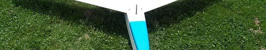
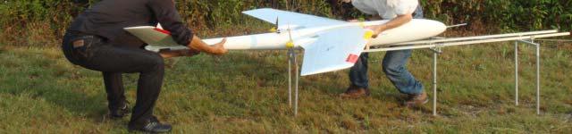
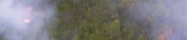
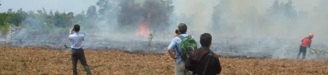
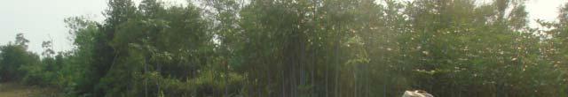
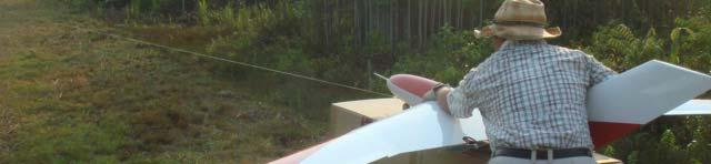
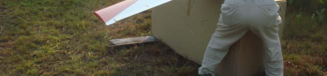
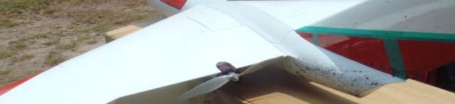
12 MODIS (1 km 2 mesh) fire hot spot detection system was transferred to the server in LAPAN. Data has been accumulated every day since 20 May To verify the hot spot dt data obtained by satellites, aerial photography was taken by the electrically powered unmanned aerial ilvehicle (UAV) equipped with optical camera and infrared camera. During the project, two UAV design were developed dand tried. The improved UAV which can fly about 1 hour took kthe forest tfire photography h dt detected tdby the satellite for the first time in September 6, 2012.
13 In order to validate the satellite detection accuracy of hotspots data, thehotspotsmapdetected hotspots injuly, 2009 was utilized because there were no fires occurred in study site duringdrydry seasons in
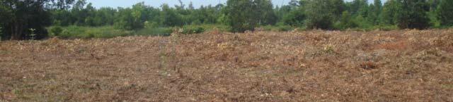
14 All 10 hotspots in the 2009 map were confirmed to be burnt area by UAV aerial photography in 2011 and km 38km 7km 6km 4km 6km 10km F 1 ( ) F 2 ( ) F 3 ( ) 43km


15 F-2(2011)

 Canal")


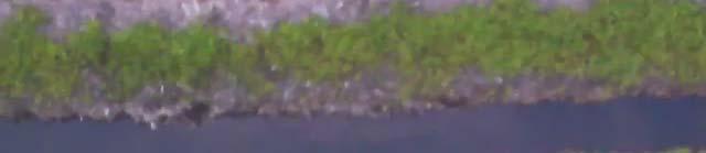
16 Ground Validation with UAV(Sep. 2011) Canal UAV Route Taruna Jaya Site Sebangau River Burned Area Mapping Source : JAXA, PALSAR 10m Mosaic Image, Central Kalimantan
")


17 F-3 (2012)
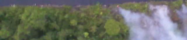
18 3 September, 2012 Two hotspots detected by satellite in 3rd September, 2012 were also confirmed to be real on going fires by UAV aerial photography taken in 6th September, km 20km


19
20 MODIS pixel Observed by UAV Flight Distance A~B: 10km Burnt Area: 15~20% A Flight Height: 200m B Plantation Area: Oil Palm
21 The improved hotspot detection algorithm could find the fire at 100% accuracy though the sample cases are limited. It is concluded that hotspots are detected by the algorithm with the very high precision.
22 3. Transfer in situ fire information to each region
23 Village center Taking aerial photography by UAV was conducted above Tarunajaya and Tumbang Nusa, and the possibility of translating the geographical information including its latitude and longitude into the local language was considered,
24 Fire extension extension direction Peat forest fire information: Velocity < 2m/min date of fire detection distance & direction to hotspots fire dangerous index (FDI) fire extension direction 2 km Time sequence hotspots t Village center Time sequence hotspots t 1 km 1 km : Hotspot inside village : Hotspot outside village Fire extension direction Velocity > 2m/min 4 pilot villages : Tarunajaya, Tumbang Nusa, Pilang and Djabiren
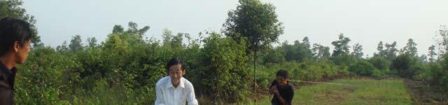
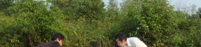
25 village heads leaders of fire fighting teams LAPAN The first trial to send SMS was successfully conducted in September through the activity 8.
26 4. Construct prediction model of wild fire occurrence
27 Wind field around Palangka Raya, at 13:00 local time, 4 September 2006 Palangka Raya A climate prediction model, MM5, was installed in the server in Hokkaido University, it and data dt inputs as well as parameter setting which h reflect the weather condition in Indonesia was examined, and a wind atlas was developed with 5km resolution. by Mr.Hatanaka

) consideration the vegetation data, was developed and its validity was")
28 Eo 1.0 (= a o /(a F +a o )) A S = k A F A F=a F+a o K=0.5 K=0.75 K=1.0 K= K20 K=2.0 Ec<Eo<0.5 a o a F a c A S =a F +a c Eo<Ec< A simulation model on forest tfire spread, tki taking into Ec (= a c /(a F +a c )) consideration the vegetation data, was developed and its validity was examined.
29 Simplified fire extension model Calculation of burnt area based on time series of 2 km hotspot data b km 36 h c km 1< x km 60 h 72 h 48 h Non extended hotspot 24 h Non extended hotspot 60 h 2< x km 0 h 12 h 24 h Elapsed time Burnt area 72 h a km 1 km 12h a km 2 24h (a + 1) km Movement distance of hotspot center x(km) 2 36h (a b) km 0 km < x < 1 km : 2 an inscribed circle approx. 48h (a b π/8) km 1 km < x < 2 2 km: a circumscribed circle approx. 60h (a b + 2+ π/8 + c π/8) km 2 The time sequence of 1km 2 hotspot data was examined and the fire occurrence process in time was clarified. The simplified fire extension model was developed based on time series hotspot data and the fire extension area was estimated as the movement distance of the hotspot center.
30 5. Construct model of water regime


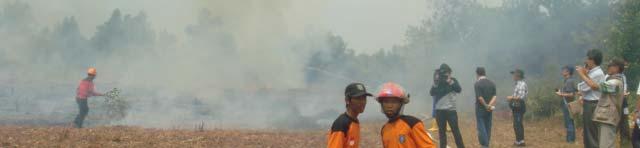
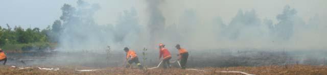
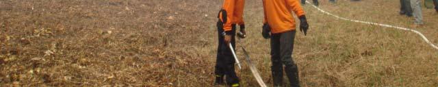
31 By Wataru Takeuchi, University of Tokyo, Japan A model was established to estimate the spatial distribution of soil moisture based on satellite data, and the validity of the model was verified by comparing the measurement data of ground water level with the model. By integrating the data from fixed point observation into the satellite data, the spatial distribution of soil moisture was presented with high precision for the first time in the world.
32 :no peat/forest fire small damage of peat/forest fire heavy damage of peat/forest fire Ground Surface Fires Surface Layer Peat Fires Deep Layer Peat Fires 250 Plot 2 50 Plot 1B Camp Plot 1B no data itation (m mm) 日雨量 (mm) Dail ly Precip no data Groun nd Water 地下水位 Level (cm) (c cm) Ground water level in a peat swamp forest and the level of damages of peat/forest fire for 11 years The validity of the established water fluctuation/soil il moisture estimation i model Water level for was examined though the accumulation of data and fixed point measurement. 11 years
33 Fire Dangerous Index (FDI) Ground Water Table, CO2 Emission and Peat Fire Index FDI 1 :Ground Water Level 20cm~ 50cm Ground Surface Fire FDI 2:Ground Water Level 50 cm ~ 100cm Surface Layer Peat Fire FDI 3:Ground Water Level 100cm~ Deep Layer Peat Fire The level lof the peat fire index (PFI) was dfi defined dby the correlation of the ground water level with the number of fire occurrence and the fire dangerous index based on PFI was developed.
34 8. Validate established system


35 The practical operation of fire detection and prediction based on the integrated systems and SMS, is carried out. The several fire processes such as satellite hotspot detection hotspot data The several fire processes such as satellite hotspot detection, hotspot data analysis, fire information production and delivery, and UAV verification is integrated.


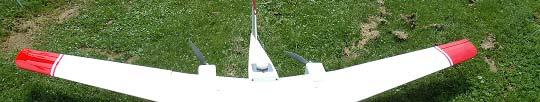
36 Specification of F 4 UAV : Length/Wing Length/Height 21m/2 2.1m/2.76m/0.47m Weight:5.5kg with Battery Power:Brushless Motors : 2 units Flight Speed:Max 100km/h Cruising Speed 50 80km/h Flight Time: Max 90 min. Payload: Max 1kg Data Link: 2.4GHz (Specified Low Power Wireless) Communication Distance: 10km
37 100 Comparison of UAV Specification Electric Motors 300 Electricity vs. Gasoline F 2 F 3 F F 4 Gasolin Eng Wing Length Length Weight Flight Time 0 Wing Length Length Weight Flight Time


38 Specification of UAV with Engine Length/Wing Length/Height 2.6m/3.2m/0.9m Weight:35kg with Engine Engine: BT 86B7.5HP 86cc 2 Cycle Gasoline Engine 2 Cylinders Flight Speed: Max 180km/h Cruising Speed: 120km/h Flight Time:Max 4hours Flight Height :Max 4500m(14800f) Payload: Max 6kg Data Link:2.4GHz (Specified Low Power Wireless) Communication Distance: 10km


39


40


41 After suppression of fires, leaders of fire fighting teams reported to participants at meeting about the suppression activities based on fire information delivered through SMS, in which suppression starting and ending time, the type of fire, the fire burned area size and personal impression etc. are reported. In addition, leader of UAV monitoring team explained the UAV flight performance and current moving images of real fires taken by UAV. The usefulness of the information system for suppression of real fires by fire fighters is confirmed.
42 Conclusion
43
44 Green
JST-JICA Project Wild Fire and Carbon Management in Peat-Forest in Indonesia
 2011.07.13 JPTM2011 Putrajaya Status of JST/JICA Peat and Carbon Management Project Toshihisa HONMA (Hokkaido Univ.) JST-JICA Project Wild Fire and Carbon Management in Peat-Forest in Indonesia Hokkaido
FOREST FIRE GROUP Current Status & Planning
 2010.07.07 JPTM Manila FOREST FIRE GROUP Current Status & Planning JST-JICA Project Wild Fire and Carbon Management in Peat-Forest in Indonesia Hokkaido University, The University of Tokyo, JAXA University
Sentinel Asia. Disaster Management Support System. Wild Fire Working Group
 Sentinel Asia Disaster Management Support System Wild Fire Working Group Impact to future global warming Carbon Cycle Sink Source Contribution to Kyoto Protocol Sustainable Forest Management Reports on
Sentinel Asia Wildfire Monitoring
 Sentinel Asia Wildfire Monitoring Masami FUKUDA Institute of Low Temp. Sci. Hokkaido Univ. 3rd Sentinel Asia JPT Meeting 13 March 2007, Singapore Objective of Sentinel Asia Wildfire Monitoring Contribution
NEAR REAL TIME DETECTION OF BURNED SCAR AREA USING LANDSAT-8 IMAGERIES
 NEAR REAL TIME DETECTION OF BURNED SCAR AREA USING LANDSAT-8 IMAGERIES Danang Surya Candra Kustiyo - Indonesian National Institute of Aeronautics and Space (LAPAN) - Outline INTRODUCTION: Background, Problems,
ALBERTA FOREST PROTECTION THERMAL INFRARED PROGRAM
 ALBERTA FOREST PROTECTION THERMAL INFRARED PROGRAM Eleventh Biennial USDA Forest Service Remote Sensing Applications Conference Salt Lake City, Utah April 25 Ken Dutchak, P. Biol. Reconnaissance and Remote
Fire Detection and Monitoring
 Fire Detection and Monitoring Akli Benali Forest Research Center, University of Lisbon aklibenali@gmail.com Conference & Summer School on Forest Fire Management Istituto Superiore Antincendi, Rome, September
Fire Detection and Fire Prediction Systems:FF
 Fire Detection and Fire Prediction Systems:FF Toshihisa HONMA*, Ratih D. DIMYATI**(FF) Kazuya KAKU***, Orbita ROSWINTIARTI**, Aswin USUP****(FF1) Keiji KIMURA*, Agus KRISTIYONO***** and Hendrik SEGAH****(FF2)
Forest fire detection based on MODIS satellite imagery, and Comparison of NOAA satellite imagery with fire fighters' information
 Forest fire detection based on MODIS satellite imagery, and Comparison of NOAA satellite imagery with fire fighters' information *Koji Nakau, Masami Fukuda, Keiji Kushida, Hiroshi Hayasaka, Keiji Kimura,
DETECTION AND MONITORING OF ACTIVE FIRES USING REMOTE SENSING TECHNIQUES
 DETECTION AND MONITORING OF ACTIVE FIRES USING REMOTE SENSING TECHNIQUES Source: Unknown n.d., http://www.hotrodsandclassics.net/featuredpictures/featurepictures2.htm. by Claire Riddell DETECTION AND MONITORING
Verification and Validation of OOV-TET1 Multispectral Camera Observations within the FireBIRD Project
 DLR.de Chart 1 Verification and Validation of OOV-TET1 Multispectral Camera Observations within the FireBIRD Project O. Frauenberger **, A. Börner *, E. Borg **, W Halle *, E. Lorenz *, S. Mitchell *,
the EU-Japan Support Mission in the Space Sector
 Astro- und Feinwerktechnik Adlershof GmbH the EU-Japan Support Mission in the Space Sector 07 th of September 2017 Sapporo, Japan Dr.-Ing. Sebastian Scheiding s.scheiding@astrofein.com www.astrofein.com
Global Biomass Burning Emissions from a Constellation of Geostationary Satellites for Global Model Forecast Applications
 1 Global Biomass Burning Emissions from a Constellation of Geostationary Satellites for Global Model Forecast Applications Shobha Kondragunta NOAA/NESDIS Center for Satellite Applications and Research
Strategic Research Agenda for. High-Altitude Aircraft and Airship. Remote Sensing Applications
 Strategic Research Agenda for USE HAAS High-Altitude Aircraft and Airship Remote Sensing Applications Christian Barbier (CSL, B), Bavo Delauré (VITO, B), Arie Lavie (CTI, Is) 1 OUTLINE 1. The USE HAAS
Wildfire Mapping Using FireBIRD Data
 Wildfire Mapping Using FireBIRD Data Global Wildfire Information System (GWIS) GOFC GOLD Fire IT 20-23 rd November 2017, Cumberland Lodge Christian Fischer on behalf of the FireBIRD-Team German Aerospace
Fire Information for Resource Management System (FIRMS)
") Fire Information for Resource Management System (FIRMS) Diane Davies 1, Chris Justice 1, Jacques Descloitres 2, John Latham 3 John Musinsky 4 1 Department of Geography, University of Maryland 2 SSAI /
Fire Information for Resource Management System (FIRMS) Diane Davies 1, Chris Justice 1, Jacques Descloitres 2, John Latham 3 John Musinsky 4 1 Department of Geography, University of Maryland 2 SSAI /
Interim evaluation of the New IR Sensor Technology (NIRST) as a wildfire monitoring tool
 as a wildfire monitoring tool") Interim evaluation of the New IR Sensor Technology (NIRST) as a wildfire monitoring tool Joshua Johnston Forest Fire Analyst Canadian Forest Service Great Lakes Forestry Centre Sault Ste. Marie, Ontario
Interim evaluation of the New IR Sensor Technology (NIRST) as a wildfire monitoring tool Joshua Johnston Forest Fire Analyst Canadian Forest Service Great Lakes Forestry Centre Sault Ste. Marie, Ontario
Evaluation of remote sensing-based active fire datasets in Indonesia
 INT. J. REMOTE SENSING, 20JANUARY, 2004, VOL. 25, NO. 2, 471 479 Evaluation of remote sensing-based active fire datasets in Indonesia F. STOLLE*{, R. A. DENNIS{, I. KURNIWAN{ and E. F. LAMBIN {Global Forest
UWB Stepped-FM Sensor for Home Security
 SAS2012 UWB Stepped-FM Sensor for Home Security Y. Ota, R. Nakamura, and A. Kajiwara Graduate School of Environmental Engineering, The University of Kitakyushu, Japan Kajiwara lab. Overview Background
Recent Developments and Prospects for Innovative Remote Sensing of High-Temperature Events and Vegetation Fire Impacts
 Recent Developments and Prospects for Innovative Remote Sensing of High-Temperature Events and Vegetation Fire Impacts by D. Oertel, E. Lorenz, B. Zhukov German Aerospace Center, (DLR-OS) Berlin Adlershof
Development of a Canadian Wildland Fire Monitoring Sensor (CWFMS)
") Unclassified Development of a Canadian Wildland Fire Monitoring Sensor (CWFMS) Helena (Marleen) van Mierlo 1 Linh Ngo Phong 1 Steeve Montminy 1 Joshua M. Johnston 2 Denis Dufour 3 (1) Canadian Space Agency
Unclassified Development of a Canadian Wildland Fire Monitoring Sensor (CWFMS) Helena (Marleen) van Mierlo 1 Linh Ngo Phong 1 Steeve Montminy 1 Joshua M. Johnston 2 Denis Dufour 3 (1) Canadian Space Agency
Advances in Leak Detection in the Manufacturing Process
 Advances in Leak Detection in the Manufacturing Process Víctor Hermosillo / Michael Broglio / Mike Kelly ALSTOM Grid Inc., 1 Power Lane, Charleroi, PA 15022 Agenda 1. Introduction 2. SF 6 Leak Detection
Use of new spatially refined satellite remote sensing fire detection data in support of advanced wildfire mapping and modeling
 Use of new spatially refined satellite remote sensing fire detection data in support of advanced wildfire mapping and modeling Dr. Wilfrid Schroeder 1 Dr. Janice Coen 2 Dr. Patricia Oliva 1 Dr. Louis Giglio
Smart Fire Prevention
 Smart Fire Prevention Using VIP Vision Thermal Cameras to Detect Fire Release 1.0 Contents 1 Introduction to Thermal Imaging... 2 2 Detecting Fires with VIP Vision Thermal Cameras... 3 2.1 Mode Selection...
Modeling of Ceiling Fan Based on Velocity Measurement for CFD Simulation of Airflow in Large Room
 Modeling of Ceiling Fan Based on Velocity Measurement for CFD Simulation of Airflow in Large Room Y. Momoi 1, K. Sagara 1, T. Yamanaka 1 and H. Kotani 1 1 Osaka University, Graduate School of Eng., Dept.
A Forest Fire Warning Method Based on Fire Dangerous Rating Dan Wang 1, a, Lei Xu 1, b*, Yuanyuan Zhou 1, c, Zhifu Gao 1, d
 International Conference on Applied Science and Engineering Innovation (ASEI 2015) A Forest Fire Warning Method Based on Fire Dangerous Rating Dan Wang 1, a, Lei Xu 1, b*, Yuanyuan Zhou 1, c, Zhifu Gao
Advanced Fire Information System
 Advanced Fire Information System Karen Steenkamp Philip Frost CSIR Meraka Institute www.sac.co.za Meraka Institute - RSRU RSRU Mission: To conduct basic and applied remote sensing research for the advancement
Welcome to Shenzhen Keweitai Enterprise Development Co,.ltd. Safety, Professional, Easy, Long endurance, Long distance
 Welcome to Shenzhen Keweitai Enterprise Development Co,.ltd Safety, Professional, Easy, Long endurance, Long distance Preface About us UAV applications UAV design and features About us Keweitai, found
SEVIRI/MSG sensor early fire detection performances assessment
 SEVIRI/MSG sensor early fire detection performances assessment G. Laneve, E. Cadau CRPSM Università di Roma La Sapienza e-mail: laneve@psm.uniroma1.it 2 nd GOFC/GOLD Workshop on GEO Fire Monitoring, Darmstadt,
SIEMENS ULTRAMAT 6 IR CARBON MONOXIDE ANALYZER METHOD VALIDATION FOR TESTING CARBON MONOXIDE IN NITROGEN, NF
 2015 SIEMENS ULTRAMAT 6 IR CARBON MONOXIDE ANALYZER METHOD VALIDATION FOR TESTING CARBON MONOXIDE IN NITROGEN, NF FINAL APPROVAL REVISION #: 0 ISSUE DATE: December 4, 2015 PAGE: 1 of 13 This Methods
eature Enhancement of Functions of Tokaido Shinkansen Earthquake Disaster Prevention System Tadayoshi Arashika and Shigeru Nakajima
 eature Earthquake Disaster Countermeasures Enhancement of Functions of Tokaido Shinkansen Earthquake Disaster Prevention System Tadayoshi Arashika and Shigeru Nakajima The Tokaido Shinkansen has always
International Journal of Scientific & Engineering Research, Volume 7, Issue 7, July ISSN
 International Journal of Scientific & Engineering Research, Volume 7, Issue 7, July-2016 554 Forest Fire Detection using Wireless Sensor Harjinder Singh Department of Instrumentation and Control Engineering,
Leakage detection in hydraulic and pneumatic systems through infrared thermography and CO2 as tracer gas
 Leakage detection in hydraulic and pneumatic systems through infrared thermography and CO2 as tracer gas Borja Rodríguez 1, Rosario Fernández 1, Mario Lahera 2, Fernando Lasagni 1 1 Materials & Processes
Understanding total measurement uncertainty in power meters and detectors
 Understanding total measurement uncertainty in power meters and detectors Jay Jeong, MKS Instruments. Inc. INTRODUCTION It is important that users of calibrated power meters and detectors understand and
HALON FLIGHTLINE EXTINGUISHER EVALUATION: DATA SUPPORTING STANDARD DEVELOPMENT [INCLUDES NOVEMBER 2007 ADDENDUM]
![HALON FLIGHTLINE EXTINGUISHER EVALUATION: DATA SUPPORTING STANDARD DEVELOPMENT [INCLUDES NOVEMBER 2007 ADDENDUM]](/thumbs/77/74926656.jpg "HALON FLIGHTLINE EXTINGUISHER EVALUATION: DATA SUPPORTING STANDARD DEVELOPMENT [INCLUDES NOVEMBER 2007 ADDENDUM]") AFRL-RX-TY-TR-2008-4573 HALON FLIGHTLINE EXTINGUISHER EVALUATION: DATA SUPPORTING STANDARD DEVELOPMENT [INCLUDES NOVEMBER 2007 ADDENDUM] John R. Hawk Applied Research Associates P.O. Box 40128 Tyndall
AFRL-RX-TY-TR-2008-4573 HALON FLIGHTLINE EXTINGUISHER EVALUATION: DATA SUPPORTING STANDARD DEVELOPMENT [INCLUDES NOVEMBER 2007 ADDENDUM] John R. Hawk Applied Research Associates P.O. Box 40128 Tyndall
The New DUSTTRAK II and DRX Aerosol Monitors
 The New DUSTTRAK II and DRX Aerosol Monitors HEALTH AND SAFETY Exposure Monitoring TRUST. SCIENCE. INNOVATION. Real-Time Dust Monitoring Takes A Giant Leap Forward. The Revolution in Real-Time Dust Monitoring
OBSERVING THE EXPANSION OF THE BUILT-UP AREAS OF REGIONAL CAPTAIL CITIES IN YANGTZE RIVER DELTA BY SATELLITE IMAGES
 OBSERVING THE EXPANSION OF THE BUILT-UP AREAS OF REGIONAL CAPTAIL CITIES IN YANGTZE RIVER DELTA BY SATELLITE IMAGES Kiyoshi TORII 1), Yoshiaki MORI 1), Zengmin JI 2), Yohei SATO 3), Kuninobu OTSUBO 4)
Demands on Electro-optical Cameras for Sensing and Mapping
 Claus 37 Demands on Electro-optical Cameras for Sensing and Mapping MICHAEL CLAUS, Oberkochen ABSTRACT Electro-optical cameras installed in satellites circling the globe at altitudes of several 100 kilometers
Real-Time Remote Monitoring System Utilizing New Electronic Personal Dosimeter
 Real-Time Remote Monitoring System Utilizing New Electronic Personal Dosimeter NAKASHIMA, Sadao * MAEKAWA, Osamu * ABE, Shigeru * A B S T R A C T Conventional radiation exposure management methods included
The New DUSTTRAK II and DRX Aerosol Monitors
 The New DUSTTRAK II and DRX Aerosol Monitors HEALTH AND SAFETY Exposure Monitoring TRUST. SCIENCE. INNOVATION. Real-Time Dust Monitoring Takes A Giant Leap Forward. The Revolution in Real-Time Dust Monitoring
Google-Earth use as a monitoring tool for EUMETSAT s active fire product
 Google-Earth use as a monitoring tool for EUMETSAT s active fire product Assist.Prof. İbrahim SÖNMEZ Ondokuz Mayıs University Department of Meteorology Samsun, TURKEY isonmez@omu.edu.tr 1 OUTLINE Google-Earth
STACK EFFECT IN LIGHT WELL OF HIGH RISE APARTMENT BUILDING
 STACK EFFECT IN LIGHT WELL OF HIGH RISE APARTMENT BUILDING H. Kotani, R. Satoh, T. Yamanaka Dept. of Architectural Engineering, School of Engineering, Osaka University, Osaka, Japan ABSTRACT The purpose
LP GAS LEKAGE ALARM. M. G.. D. D. Wickramasinghe 1*, N. Abhayasinghe 2
 - 32 - LP GAS LEKAGE ALARM M. G.. D. D. Wickramasinghe 1*, N. Abhayasinghe 2 1* Corresponding Author, Department of Electronic and Computer Engineering, Sri Lanka Institute of Information Technology (SLIIT),
Phumza Matitiba Assistant General Manager Eastern Cape
 Phumza Matitiba Assistant General Manager Eastern Cape Implemented by What is the Working on Fire Programme Multi-departmental, multi disciplinary Government and private sector response to address the
Long-term Inventory of Fire Burned Areas and Emissions of North America s Boreal and Temperate Forests
 Long-term Inventory of Fire Burned Areas and Emissions of North America s Boreal and Temperate Forests P.Gong, Z. Li, I. Csiszar, W. Hao, R. Fraser J.Z. Jin, R. Pu Objectives 1. Map burn scars in boreal
state of the art methane leak detection CHARM and GasCam 2011 October 13 th Dr. Axel Scherello
 state of the art methane leak detection CHARM and GasCam 2011 October 13 th Dr. Axel Scherello Overview CHARM for buried pipelines (active principle) GasCam for above ground installations (passive method)
Control of temperature and humidity surrounding the stone chamber of Takamatsuzuka tumulus during its dismantlement
 Control of temperature and humidity surrounding the stone chamber of Takamatsuzuka tumulus during its dismantlement Daisuke Ogura 1, Masahide Inuzuka 2, Shuichi Hokoi 1, Takeshi Ishizaki 2, Hiroyuki Kitahara
Healthy Buildings 2017 Europe July 2-5, 2017, Lublin, Poland
 Healthy Buildings 217 Europe July 2-5, 217, Lublin, Poland Paper ID 95 ISBN: 978-83-7947-232-1 Verification of gymnasium designed by high thermal insulation considering elderly people in disaster Koki
Unmanned Aerial Systems for Supporting Decision Makers at Forest Fires
 Unmanned Aerial Systems for Supporting Decision Makers at Forest Fires Ágoston Restás H-3752 Szendrő, Nagyállomás 1/K; arestas@r-fire.hu Abstract: The author try to present the possibility of using an
J. R. Qualey III, L. Desmarais, J. Pratt Simplex Time Recorder Co., 100 Simplex Drive, Westminster, MA 01441
 J. R. Qualey III, L. Desmarais, J. Pratt Simplex Time Recorder Co., 100 Simplex Drive, Westminster, MA 01441 Response-Time Comparisons of Ionization and Photoelectric/Heat Detectors 1. Introduction Despite
FIRE-RS Project A Nanosatellite & UAVs hybrid system for wildfire characterization.
 FIRE-RS Project A Nanosatellite & UAVs hybrid system for wildfire characterization. Fernando Aguado, Franco Pérez, Diego Nodar López, Alberto González, Miguel Castro Rome 04/12/2017 II Congreso de Ingneniería
The operational MSG SEVIRI fire radiative power products generated at the Land-SAF
 Environmental Monitoring & Modelling Research Group The operational MSG SEVIRI fire radiative power products generated at the Land-SAF Martin Wooster, Gareth Roberts, Weidong Xu, Patrick Freeborn, Jianping
Development of Seismic-induced Fire Risk Assessment Method for a Building
 Development of Seismic-induced Fire Risk Assessment Method for a Building AI SEKIZAWA National Research Institute of Fire and Disaster 3-14-1, Nakahara, Mitaka, Tokyo 181-8633, Japan sekizawa@fri.go.jp
DEMONSTRATION OF A SEMI-OPERATIONAL FIRE RECOGNITION SERVICE USING BIRD MICRO- SATELLITE - DEMOBIRD
 DEMONSTRATION OF A SEMI-OPERATIONAL FIRE RECOGNITION SERVICE USING BIRD MICRO- SATELLITE - DEMOBIRD Jesús Gonzalo, Gonzalo Martín de Mercado Ingeniería y Servicios Aeroespaciales, S.A. (INSA), Spain Paseo
Risk Management of Fire using Video Based Detection
 Risk Management of Fire using Video Based Detection Measuring the Threat The annual risk of a fire can be estimated using fire statistics and a thorough evaluation of the impact that an actual fire would
A study on the regional landscape planning framework on the relationships between urban and rural areas: case study of Tokachi region, Hokkaido, Japan
 A study on the regional landscape planning framework on the relationships between urban and rural areas: case study of Tokachi region, Hokkaido, Japan K. Yamagishi & H. Kobayashi Laboratory of Urban Planning
GOES-R AWG Land Team: Fire Detection and Characterization
 GOES-R AWG Land Team: Fire Detection and Characterization June 8, 2010 Presented By: Christopher C. Schmidt 1 1 UW-Madison/SSEC/CIMSS 1 FIRE Product Team AWG Land Team Chair: Yunyue (Bob) Yu FIRE Product
SYNERGY IN LEAK DETECTION: COMBINING LEAK DETECTION TECHNOLOGIES THAT USE DIFFERENT PHYSICAL PRINCIPLES
 Proceedings of the 2014 10 th International Pipeline Conference IPC2014 September 29-October 3, 2014, Calgary, Alberta, Canada IPC2014-33387 SYNERGY IN LEAK DETECTION: COMBINING LEAK DETECTION TECHNOLOGIES
HELPCOS THE HELICOPTER BASED PIPELINE CONTROL SYSTEM OF VNG - VERBUNDNETZ GAS AG
 23rd World Gas Conference, Amsterdam 2006 HELPCOS THE HELICOPTER BASED PIPELINE CONTROL SYSTEM OF VNG - VERBUNDNETZ GAS AG Main author Olaf Meyer, VNG - Verbundnetz Gas AG, Leipzig, Germany Co-authors
Hi, welcome to the topic on Fire Detection and Alarm Systems. This topic forms one of the critical knowledge areas for prospective fire safety
 Hi, welcome to the topic on Fire Detection and Alarm Systems. This topic forms one of the critical knowledge areas for prospective fire safety manager. As the appointed fire safety manager for a premise,
Optech Thermal IR Sensing Solutions Expanding the Industry
 Optech Thermal IR Sensing Solutions Expanding the Industry Optech Overview Strategic Growth through acquisitions of camera manufacturers 20 Years of Patented & Proven Camera System Experience Broader Imaging
THE NORTHSTAR SYSTEM: A NEW ERA IN EARTH OBSERVATION
 THE NORTHSTAR SYSTEM: A NEW ERA IN EARTH OBSERVATION Daniel O Connell 1, Derek R. Peddle 2, 6, Stewart Bain 3, Douglas W. Bancroft 4, Kjell Stakkestad 5,7 NorthStar, Montréal, Québec, Canada. http://www.northstar-data.com
Case Study. A Geothermal Energy Generation Facility Embraces Infrared. Polymer Window Inspections. Overview: iriss.com
 A Geothermal Energy Generation Facility Embraces Infrared Polymer Window Inspections By Dominique Capili, Spectrum Scientific Corporation (An IRISS Distributor) Overview: A prominent geothermal energy
Automated Fire and Flood Hazard Protection System
 De la Riva, J., Pérez-Cabello, F. & Chuvieco, E. (Eds) 2005 Proceedings of the 5 th International Workshop on Remote Sensing and GIS Applications to Forest Fire Management: Fire Effects Assessment: 167-172
Aquarius - Spectrum. multi-layer acoustic water pipe monitoring solutions. Game changer in water network management
 Aquarius - Spectrum multi-layer acoustic water pipe monitoring solutions Game changer in water network management ID Founded in 2009 20 Employees Invested by Hutchinson Water Over 3,000 correlation sensors
Automatic Detection of Defects on Radiant Heaters Based on Infrared Radiation
 ECNDT 2006 - Poster 73 Automatic Detection of Defects on Radiant Heaters Based on Infrared Radiation Francisco J. MADRUGA, Daniel A. GONZÁLEZ, Jesús MIRAPEIX, José-Miguel LÓPEZ HIGUERA, Photonics Engineering
Further Development of an Ion current Combustion Control System (ICCS)
") Further Development of an Ion current Combustion Control System (ICCS) Copyright 1998 Society of Automotive Engineers, Inc. Morito Asano, Atsushi Ito, Tetsuo Kuma, Mitsunobu Kajitani DAIHATSU Motor Co.
Further Development of an Ion current Combustion Control System (ICCS) Copyright 1998 Society of Automotive Engineers, Inc. Morito Asano, Atsushi Ito, Tetsuo Kuma, Mitsunobu Kajitani DAIHATSU Motor Co.
State-of-the-art Developments to Save Energy in Coating Drying
 State-of-the-art Developments to Save Energy in Coating Drying Executive Summary Coating drying is expensive. A great deal of energy is needed to effectively evaporate sufficient water to dry the coating.
The use of Slocum gliders to deliver near real-time environmental data for the Oil & Gas and Mining industries Ross Dinsdale General Manager -
 The use of Slocum gliders to deliver near real-time environmental data for the Oil & Gas and Mining industries Ross Dinsdale General Manager - Australia 1 Blue Ocean Monitoring Leader in providing innovative
Link loss measurement uncertainties: OTDR vs. light source power meter By EXFO s Systems Engineering and Research Team
 Link loss measurement uncertainties: OTDR vs. light source power meter By EXFO s Systems Engineering and Research Team INTRODUCTION The OTDR is a very efficient tool for characterizing the elements on
University of Puerto Rico at Mayagüez Direct Broadcast Polar Orbiter Workshop
 University of Puerto Rico at Mayagüez Direct Broadcast Polar Orbiter Workshop 27 April 2016 Lab 2 Part 4: Investigating VIIRS and MODIS Fire Detection Capabilities 1.1. Use Hydra to open the VIIRS directory
A temporal active fire detection algorithm applied to geostationary satellite observations
 8 th 10 th June LSA-SAF Workshop 2015 A temporal active fire detection algorithm applied to geostationary satellite observations Gareth Roberts (University of Southampton) Outline Active fire detection
Wildland fire phenomenology experiments:
 Wildland fire phenomenology experiments: 2001-2002 RIT: Bob Kremens Stef VanGorden Andy Fordham Bryce Nordgren Dave Pogolarza Adam Cisz RMSC: Dan Latham Colin Hardy Brett Butler We plan to measure unknown
VIIRS FIRE PRODUCTS UPDATE
 VIIRS FIRE PRODUCTS UPDATE Ivan Csiszar 1, Wilfrid Schroeder 2, Louis Giglio 2, Brad Wind 2, Evan Ellicott 2, Christopher O. Justice 2 1 NOAA/NESDIS Center for Satellite Applications and Research, Camp
Ombrogenous Peat Swamps and Development
 Ombrogenous Peat Swamps and Development 1. Background 1.1. Formation of ombrogenous peat swamps Formation of ombrogenous peat is a geogenic process that results in the accumulation of plant debris in an
Computer Modelling and Simulation of a Smart Water Heater
 Computer Modelling and Simulation of a Smart Water Heater Maria Kathleen Ellul University of Malta ellul_maria@yahoo.com Adrian Muscat University of Malta adrian.muscat@um.edu.mt Abstract A computational
A Comprehensive Approach to Leak Detection
 A Comprehensive Approach to Leak Detection Real Water Loss: A Real Issue for Water Utilities Every day, water utilities lose billions of gallons of water designated for public use. In many areas of the
Coupling Multiple Hypothesis Testing with Proportion Estimation in Heterogeneous Categorical Sensor Networks
 Advancing the Science of Information Coupling Multiple Hypothesis Testing with Proportion Estimation in Heterogeneous Categorical Sensor Networks DTRA SBIR Phase II Contract: W911SR-10-C-0038 Chris Calderon,
FALCON EYE Land Based Surveillance System
 Land Based Surveillance System SpecOps Group is a global technology innovation leader in security systems and autonomous border protection platforms. SpecOps Group provides a unique autonomous situational
Leak Detection. Ron Threlfall Manager, Leak Detection, Maintenance and Integration
 Leak Detection Ron Threlfall Manager, Leak Detection, Maintenance and Integration 1 Introduction Enbridge Liquids Pipeline Energy Transportation Map Operates world s longest liquids pipeline and Canada
DEVELOPMENT OF THE INFRARED INSTRUMENT FOR GAS DETECTION
 DEVELOPMENT OF THE INFRARED INSTRUMENT FOR GAS DETECTION Ching-Wei Chen 1, Chia-Ray Chen 1 1 National Space Organization, National Applied Research Laboratories ABSTRACT MWIR (Mid-Wave Infrared) spectroscopy
Figure 1: Low energy dwellings testsite
 Seventh International IBPSA Conference Rio de Janeiro, Brazil August 13-15, 2001 SIMULATION OF DEMAND CONTROLLED VENTILATION IN A LOW-ENERGY HOUSE Netherlands Energy Research Foundation J.C. Römer P.O.
Development of the CMS Phase-1 Pixel Online Monitoring System and the Evolution of Pixel Leakage Current
 Development of the CMS Phase-1 Pixel Online Monitoring System and the Evolution of Pixel Leakage Current Fengwangdong Zhang On behalf of CMS Pixel Collaboration The 9th International Workshop on Semiconductor
The Role of Satellite Observations in Assessing Impacts of Wildfire Occurrence on Respiratory Health of Population
 The Role of Satellite Observations in Assessing Impacts of Wildfire Occurrence on Respiratory Health of Population Tatiana Loboda University of Maryland Outline Wildfire and human health Interdisciplinary
Time-resolved infrared imaging and spectroscopy for engine diagnostics
 Time-resolved infrared imaging and spectroscopy for engine diagnostics Volker Sick, Lucca Henrion, Ahmet Mazacioglu, Michael C. Gross Department of Mechanical Engineering, University of Michigan Contact:
1.1. SYSTEM MODELING
 1 INTRODUCTION Electro-optical imaging system analysis is a mathematical construct that provides an optimum design through appropriate trade studies. A comprehensive model includes the target, background,
Global fire hotspots detected by NASA satellite to help United Nations
 Global fire hotspots detected by NASA satellite to help United Nations Published on 24 Sep 2010 is Image NASA's not found Moderate or type unknown Resolution Imaging Spectroradiometer (MODIS), an instrument
Current Status of the Mid-Term Management Plan
 Current Status of the Mid-Term Management Plan May 9, 2013 ZEON CORPORATION Naozumi Furukawa President & CEO Contents 2 I. FY2012 and Business Environment II. Mid-term Management Plan III. Business Topics
Innovative protection that combines power and flexibility
 Innovative protection that combines power and flexibility Desigo Fire Safety Modular outpaces industry standards and includes cutting-edge detection and communication capabilities usa.siemens.com/desigo-fs-modular
Fan Laws. Keith Miller. Samuel Tepp Associates. Paul Cenci, P. E.-Principal Brian England-Principal. Samuel Tepp Associates 1/6/10
 Fan Laws Keith Miller Samuel Tepp Associates Paul Cenci, P. E.-Principal Brian England-Principal Basic Terms CFM - Cubic Feet per Minute, volume (amount) of air being moved SP - Static Pressure, resistance
Healthy Buildings 2017 Europe July 2-5, 2017, Lublin, Poland
 Healthy Buildings 2017 Europe July 2-5, 2017, Lublin, Poland Paper ID 0141 ISBN: 978-83-7947-232-1 Prediction of exhaust gas stagnation in common corridor of apartments with gas water heater Takuro Nakamura
GOFC/GOLD Fire IT Strategic Planning. Day 1 - Break Out Group Discussion
 GOFC/GOLD Fire IT Strategic Planning Day 1 - Break Out Group Discussion Aims of the Fire IT refining and articulating the international requirements for fire related observations making the best possible
Smart Wellness. Yoshio Sekiguchi Sr. General manager, Micro Devices H.Q. OMRON Corporation
 Smart Wellness Yoshio Sekiguchi Sr. General manager, Micro Devices H.Q. OMRON Corporation Corporate Overview OMRON s Origins OMRON s history OMRON was established in 1933 as Tateisi Electric Manufacturing
Physical concepts. Remote sensing of fires and vegetation. Applications of SEVIRI channels.
 Physical concepts Remote sensing of fires and vegetation Applications of SEVIRI channels jose.prieto@eumetsat.int Contents Applications of SEVIRI channels Characteristics of the 3.9µm channel Differences
RLDS - Remote LEAK DETECTION SYSTEM
 RLDS - Remote LEAK DETECTION SYSTEM Asel-Tech has spent considerable time and resources over the past 8 years to improve our technology, to the point where it is unparalleled in reliability and performance
About HGH Systemes Infrarouges About HGH
 www.hgh.fr About HGH Systemes Infrarouges About HGH More than 30 years old - started in 1982 Rene Houis Gilbert Gaussorgues Francois Hubert Headquartered at IGNY-PARIS, France Global presence & installations
Quick start. 2. Turn on the power. When all the led indicator light turns off, the device status is normal, has entered the work state.
 Multi 3G MODULE Content Quick start...2 Features...3 Specifications...3 Keys and Parts...4 SMS Commands...5 Example...7 Setting the alert number...7 Delete the alert number...8 Email and GPRS APN setting...8
Gerd Koffmane, Henrik Hoff, AP Sensing GmbH, Böblingen
 Linear Heat Series Under Test: Extensive fire tests prove Distributed Temperature Sensing (DTS) enables fast and reliable control of fire protection systems in road and rail tunnels Gerd Koffmane, Henrik
I NTRODUCTI ON. Oil Palm Immature
 I NTRODUCTI ON The objective of the planter is to establish a uniform stand of productive palms in each block in the plantation with the minimal requirement for supply planting, the shortest possible period
Documentation on NORTHSTAR. Jeremy Ma PhD Candidate California Institute of Technology May 17th, 2006
 Documentation on NORTHSTAR Jeremy Ma PhD Candidate California Institute of Technology jerma@caltech.edu May 17th, 2006 1 Introduction The Northstar Detector-Projector Bundle Kit comes with a detector and