soil CLASSIFICATION A global desk reference
|
|
|
- Edward Byrd
- 6 years ago
- Views:
Transcription
1
2 soil CLASSIFICATION A global desk reference
3
4 soil CLASSIFICATION A global desk reference EDITED BY Hari eswaran THOMAS rice robert ahrens Bobby A. Stewart CRC PRESS Boca Raton London New York Washington, D.C.
5 Cover art courtesy of USDA Natural Resources Conservation Service Library of Congress Cataloging-in-Publication Data Soil classiþcation : a global desk reference / edited by Hari Eswaran [et al.]. p. cm. Includes bibliographical references and index. ISBN (alk. paper) 1. Soils ClassiÞcation. I. Eswaran, Hari. S S dc CIP This book contains information obtained from authentic and highly regarded sources. Reprinted material is quoted with permission, and sources are indicated. A wide variety of references are listed. Reasonable efforts have been made to publish reliable data and information, but the author and the publisher cannot assume responsibility for the validity of all materials or for the consequences of their use. Neither this book nor any part may be reproduced or transmitted in any form or by any means, electronic or mechanical, including photocopying, microþlming, and recording, or by any information storage or retrieval system, without prior permission in writing from the publisher. All rights reserved. Authorization to photocopy items for internal or personal use, or the personal or internal use of speciþc clients, may be granted by CRC Press LLC, provided that $.50 per page photocopied is paid directly to Copyright Clearance Center, 222 Rosewood Drive, Danvers, MA USA. The fee code for users of the Transactional Reporting Service is ISBN /03/$0.00+$1.50. The fee is subject to change without notice. For organizations that have been granted a photocopy license by the CCC, a separate system of payment has been arranged. The consent of CRC Press LLC does not extend to copying for general distribution, for promotion, for creating new works, or for resale. SpeciÞc permission must be obtained in writing from CRC Press LLC for such copying. Direct all inquiries to CRC Press LLC, 2000 N.W. Corporate Blvd., Boca Raton, Florida Trademark Notice: Product or corporate names may be trademarks or registered trademarks, and are used only for identiþcation and explanation, without intent to infringe. Visit the CRC Press Web site at by CRC Press LLC No claim to original U.S. Government works International Standard Book Number Library of Congress Card Number Printed in the United States of America Printed on acid-free paper
6 Preface Activities in soil classiþcation reached their zenith in the 1990s. In the 1950s, the increasing demands on land use and developments in soil management required a new assessment of soil resources. Many national classiþcation systems were developed, and the initiation of the World Soil Map project by the Food and Agricultural Organization provided a forum for scientists to develop the needed new approaches. Perhaps more than anybody else, the United States Soil Conservation Service decided to develop a totally new approach, and this decision propelled new research and documentation of soil information. By the 1970s, many of the systems had matured and during the next decade, the systems were validated and enhanced. In the 1980s and 1990s, other countries continued the trend of modifying their national systems, relying on the new concepts and approaches, modifying them for local applications. At the dawn of the new century, there were still many systems but unlike before, there was a tremendous congruence of the systems. There are differences in nomenclature, but in general, many of the national systems were built on the framework designed by Soil Taxonomy. Notable exceptions are the French and Russian systems. The purpose of this monograph is to bring together these systems so that students of soils have a common source in one language to consult. Many of the papers in this monograph were presented at a special symposium held in Charlottesville, NC, in 2001 under the auspices of the Soil Science Society of America. During the last two decades, the International Union of Soil Sciences (IUSS) also sponsored a Working Group to develop a World Reference Base (WRB) for Soil Resources. WRB has evolved into a classiþcation system, but is yet to be widely accepted as the international soil classiþcation system. The divergence of views, as shown in this monograph, illustrates some of the difþculties in obtaining a global consensus. However, the editors hope that this monograph will help to rally soil scientists around the world to develop an acceptable classiþcation system for soils, for it is only when the global soil science community agrees to such a system that we can truly say that we have a science. Hari Eswaran Washington, D.C. Thomas Rice San Luis Obispo, California Robert Ahrens Lincoln, Nebraska Bobby Stewart Amarillo, Texas
7
8 About the Editors Dr. Hari Eswaran is the National Leader for World Soil Resources at USDA Natural Resources Conservation Service. He provides the Agency s leadership in information and documentation of global soils resources and their use and management. He is also the Chairman of the Working Group on Land Degradation and DesertiÞcation of the International Union of Soil Sciences and a former Chairman of the Commission on Soil Genesis and ClassiÞcation of the Society. As a member of the Soil Science Society of America, Dr. Eswaran has assisted in organizing several symposia and editing their proceedings. He is a Fellow of the Soil Science Society of America and has received the International Award from the Society. He has also received the USDA Superior Service Award and other awards from many countries. hari.eswaran@usda.gov. Dr. Robert Ahrens is Director of the National Soil Survey Center in Lincoln, Nebraska. The Center provides technical leadership for soil interpretations, soils data, laboratory analyses, soil survey investigations, and standards and soil classiþcation. He led the effort to revise soil taxonomy and was responsible for several editions of the Keys to Soil Taxonomy. Dr. Ahrens has been a regional correlator and state correlator, and was a Þeld soil scientist for several years. He provided quality assurance for the soil survey of Kuwait. He is a member of the Soil Science Society of America and the International Union of Soil Sciences. bob.ahrens@usda.gov. Dr. Thomas J. Rice is a Professor of Soil Science and Chairman of the Soil Science Department, California Polytechnic State University, San Luis Obispo, where he is responsible for teaching soil science, land use planning, soil geomorphology, soil resource inventory, and advanced land management. He has been a CertiÞed Professional Soil Scientist (C.P.S.S.) since Dr. Rice has published numerous journal articles, research reports, and popular press articles. He has been the project director for funded studies involving soil taxonomy updates in California, Nevada, and Utah; a comprehensive soils database for California; non-point source pollution study in western range-lands; mercury pollution study in a California watershed; soil mapping of a national wildlife refuge; and soil map unit interpretation record updates for California. trice@calpoly.edu. Dr. B.A. Stewart is Distinguished Professor of Agriculture and Director of the Dryland Agriculture Institute at West Texas A&M University. Before joining West Texas A&M University in 1993, he was the Director of the USDA Conservation and Production Research Laboratory, Bushland, Texas. Dr. Stewart is a past president of the Soil Science Society of America, and was a member of the Committee on Long Range Soil and Water Policy, National Research Council, National Academy of Sciences. He is a Fellow of the Soil Science Society of America, American Society of Agronomy, and Soil and Water Conservation Society, a recipient of the USDA Superior Service Award, and a recipient of the Hugh Hammond Bennet Award of the Soil and Water Conservation Society. bstewart@mail.wtamu.edu.
9
10 Contributors Mario Luiz D. Aglio Ciencia do Solo EMBRAPA Solos Rua Jardim Botanico Rio de Janeiro, Brazil Robert J. Ahrens National Soil Survey Center USDA-NRCS Lincoln, NE Richard W. Arnold Retired Soil Scientist USDA Natural Resources Conservation Service Fairfax, VA Fred H. Beinroth Department of Agronomy and Soils University of Puerto Rico Mayaguez, PR Frank Berding Land and Water Development Division FAO Rome, Italy Winfried E.H. Blum Institute for Soil Research Universität für Bodenkultur Wien, Austria Johan Bouma Member, ScientiÞc Council for Government Policy The Hague Professor of Soil Science Wageningen University Wageningen, The Netherlands Ray B. Bryant USDA-ARS Pasture Systems and Watershed Management Research Unit University Park, PA Stanley W. Buol Department of Soil Science North Carolina State University Raleigh, NC Zhi-Cheng Chen Institute of Soil Science Academy of Sciences Nanjing, China Jozef Deckers Institute for Land and Water Management Catholic University Leuven Leuven, Belgium Craig A. Ditzler National Soil Survey Center USDA-NRCS Lincoln, NE Humberto G. dos Santos Ciencia do Solo EMBRAPA Solos Rua Jardim Botanico Rio de Janeiro, Brazil Paul Driessen International Institute for Aerospace Survey and Earth Sciences Enschede, The Netherlands
11 Rudi Dudal Institute for Land and Water Management Katholic University Leuven Leuven, Belgium Robert J. Engel National Soil Survey Center USDA-NRCS Lincoln, NE Hari Eswaran USDA Natural Resources Conservation Service Washington, DC R.W. Fitzpatrick CSIRO Land & Water CRC for Landscape Environments and Mineral Exploration Glen Osmond, South Australia John M. Galbraith Crop and Soil Environmental Sciences Department Virginia Polytechnic Institute and State University Blacksburg, VA Maria I. Gerasimova Geographical Department Moscow State University Moscow, Russia Idarê A. Gomes Ciencia do Solo EMBRAPA Solos Rua Jardim Botanico Rio de Janeiro, Brazil Zi-Tong Gong Institute of Soil Science Academy of Sciences Nanjing, China Sergey Goryachkin Institute of Geography Russian Academy of Sciences Moscow, Russia Allen E. Hewitt Landcare Research Lincoln, New Zealand D.W. Jacquier CSIRO Land and Water Canberra, Australia Marcel Jamagne Institut National de la Recherche Agronomique (INRA) Olivet, France Dominique King Institut National de la Recherche Agronomique (INRA) Olivet, France Michiel C. Laker Department of Plant Production and Soil Science University of Pretoria Pretoria, South Africa Irina I. Lebedeva Dokucharv Soil Science Institute Moscow, Russia José F. Lumbreras Ciencia do Solo EMBRAPA Solos Rua Jardim Botanico Rio de Janeiro, Brazil D.J. Maschmedt Department of Water, Land and Biodiversity Conservation Adelaide, South Australia
12 N.J. McKenzie CSIRO Land & Water Canberra, Australia Freddy O.F. Nachtergaele Land and Water Development Division FAO Rome, Italy Francesco Palmieri Ciencia do Solo EMBRAPA Solos Rua Jardim Botanico Rio de Janeiro, Brazil B. Powell Department of Natural Resources and Mines Indooroopilly, Queensland, Australia Thomas J. Rice, Jr. Soil Science Department California Polytechnic State University San Luis Obispo, CA N. Schoknecht Agriculture Western Australia South Perth, Western Australia Lev L. Shishov Dokuchaev Soil Science Institute Moscow, Russia Otto Spaargaren International Soil Reference and Information Center Wageningen, The Netherlands Victor O. Targulian Institute of Geography Russian Academy of Sciences Moscow, Russia Valentin D. Tonkonogov Dokuchaev Soil Science Institute Moscow, Russia Goro Uehara Tropical Plant and Soil Sciences Department University of Hawaii Honolulu, Hawaii Gan-Lin Zhang Institute of Soil Science Academy of Sciences Nanjing, China
13
14 Contents Part I Concepts and Innovations in Soil Classification Chapter 1 Philosophies of Soil ClassiÞcations: From Is to Does...3 S.W. Buol Chapter 2 How Good Is Our Soil ClassiÞcation?...11 R. Dudal Chapter 3 Soil ClassiÞcation: Past and Present...19 Robert J. Ahrens, Thomas J. Rice, Jr., and Hari Eswaran Chapter 4 Conceptual Basis for Soil ClassiÞcation: Lessons from the Past...27 Richard W. Arnold and Hari Eswaran Chapter 5 Soil ClassiÞcation and Soil Research...43 Winfried E.H. Blum and Michiel C. Laker Chapter 6 Back to the Old Paradigms of Soil ClassiÞcation...51 J. Bouma Chapter 7 Incorporating Anthropogenic Processes in Soil ClassiÞcation...57 Ray B. Bryant and John M. Galbraith Chapter 8 Developments in Soil Chemistry and Soil ClassiÞcation...67 Goro Uehara Part II Developments in Classification Systems Chapter 9 Demands on Soil ClassiÞcation in Australia...77 R.W. Fitzpatrick, B. Powell, N.J. McKenzie, D.J. Maschmedt, N. Schoknecht, and D.W. Jacquier Chapter 10 Development of Soil ClassiÞcation in China Zi-tong Gong, Gan-lin Zhang, and Zhi-cheng Chen Chapter 11 The Brazilian Soil ClassiÞcation System Francesco Palmieri, Humberto G. dos Santos, Idarê A. Gomes, José F. Lumbreras, and Mario L.D. Aglio
15 Chapter 12 The Future of the FAO Legend and the FAO/UNESCO Soil Map of the World Freddy O.F. Nachtergaele Chapter 13 The Current French Approach to a Soilscapes Typology Marcel Jamagne and Dominique King Chapter 14 New Zealand Soil ClassiÞcation Purposes and Principles A.E. Hewitt Chapter 15 Changing Concepts of Soil and Soil ClassiÞcation in Russia S.V. Goryachkin, V.D. Tonkonogov, M.I. Gerasimova, I.I. Lebedeva, L.L. Shishov, and V.O. Targulian Chapter 16 Advances in the South African Soil ClassiÞcation System Michiel C. Laker Chapter 17 Soil Taxonomy and Soil Survey C.A. Ditzler, R.J. Engel, and Robert J. Ahrens Chapter 18 ClassiÞcation of Soils of the Tropics: A Reassessment of Soil Taxonomy Friedrich H. Beinroth and Hari Eswaran Chapter 19 Anticipated Developments of the World Reference Base for Soil Resources Jozef Deckers, Paul Driessen, Freddy O.F. Nachtergaele, Otto Spaargaren, and Frank Berding Index...257
16 PART 1 Concepts and Innovations in Soil Classification
17
18 CHAPTER 1 Philosophies of Soil Classifications: From Is to Does S.W. Buol CONTENTS Abstract...3 Introduction...4 Indigenous ClassiÞcations...4 Anthology of Soil ClassiÞcations...4 Philosophy of Selecting a Unit of Soil to Classify...5 Philosophy of ClassiÞcation to Accommodate Soil Mapping...6 Utilitarian Expectations of Soil ClassiÞcation...7 Benchmark Philosophies of Soil ClassiÞcation...8 Multiple Systems...9 Conclusions...9 References...10 ABSTRACT Philosophies of soil classiþcation are guided by existing knowledge and pragmatic circumstances. Soil is a natural entity that connects the inorganic minerals of earth to the organic organisms of life, and is therefore germane to several academic disciplines. Each of these disciplines seeks to identify and classify soil in relation to its entity of study. Pedologists have established, through deþnition and classiþcation, that soil is an entity worthy of independent academic recognition. People who seek nourishment and utilitarian support from soil identify and classify it by criteria that relate to what it does as it interacts with their attempts to utilize land resources. Political entities seek guidance in evaluating the impact of policies and regulations on soil-related natural resources. Soil classiþcation provides a link between soil samples and the natural entities on the land surfaces of earth, and is a communicator of soil properties as spatially represented on maps of diverse scales and in soil property aggregation. No single classiþcation can equally serve all who seek to study and obtain sustenance from soil. Several classiþcations, each guided by a philosophy of service to an identiþed audience, are required /03/$0.00+$ by CRC Press LLC 3
19 4 SOIL CLASSIFICATION: A GLOBAL DESK REFERENCE INTRODUCTION Show me your [classiþcation] system and I will tell you how far you have come in the perceptions of your research (Kubiëna, 1948). Soil is so universal that all people know of its existence, and therefore have individual concepts of what soil is and what soil does. The universality of soil, the individuality of people, and the limited geographic exposure to soil each person has experienced ensure an inþnite array of philosophies about how to classify soils. To some people, soil is a singular entity, but many have some appreciation for more than one kind of soil, abstractly referring to simplistic classiþcations of fertile, wet, black, red, sandy, clayey, etc. Others classify soil by association with geology, geography, climate, and vegetation. Philosophies of soil classiþcation are fascinating. INDIGENOUS CLASSIFICATIONS Everyone who uses soil classiþes it. Most indigenous classiþcations are in reference to a speciþc use. Indigenous people are directly interested in what a soil does with respect to their intended use of the land. Indigenous classiþcations are often quite colorful and informative. At an early age, I understood that push-dirt in southern Wisconsin referred to soil that adhered to the plow, and, if slightly too wet, would not be inverted by a moldboard plow. I later learned push-dirt was an apt classiþcation for some Newglarus (Þne-silty over clayey, mixed, superactive, mesic Typic Hapludalfs) soils, wherein a moldboard plow sometimes reached into the upper part of the claytextured 2Bt2 horizon that, early in the spring, was often wetter than was predicted by looking at the surface soil. The wet, sticky 2Bt2 material adhered to the moldboard and pushed forward, rather than inverting as intended. Black Jack, pipe clay, and Beeswax land (Hearn and Brinkley, 1912) referred to distinct soils on the piedmont of North Carolina. Local farmers were said to also call them dinner-bell soils because they were too wet to plow in the morning and so dry and hard in the afternoon that a mule could not pull the plow. Plowing was best done at noon, i.e., dinner-time on the farm. We now know dinner-bell or Black Jack soils as an Iredell (Þne, mixed, active, thermic Oxyaquic Vertic Hapludalfs). Indigenous people who till the soil are concerned with what a soil does when it is interacting with their activities. Soil scientists attempt to identify what a soil is and to classify it using measurable chemical and physical criteria. ANTHOLOGY OF SOIL CLASSIFICATIONS Scientists in the latter part of the 19 th century were actively seeking to deþne soil in a context that separated soil science from geology. Dokuchaev (1883) related soil properties to elements of vegetation and climate, in addition to the inßuence of geologic parent material. Vegetation and climate were not considered to inßuence geology, and soil could be deþned as a scientiþc entity apart from geology. In 1927, Glinka (quoted in Jenny, 1941) reported that Russian soil scientists regarded soil type as a summary of the external and internal properties of a soil, so as to include climate, vegetation, and animal life as a unit for soil classiþcation, rather than as volumes of soil, i.e., modern day pedons. Although he clearly recognized soil as an independent entity, Hilgard (1914) deþned soil as the more or less loose and friable material in which plants, by means of their roots, may or do Þnd a foothold and nourishment, as well as other conditions of growth. Thus he considered soil primarily to be a means of plant production. Perhaps the inscription on Hilgard Hall on the University of California-Berkeley campus best relates his concern for the concepts of soil held
20 PHILOSOPHIES OF SOIL CLASSIFICATIONS: FROM IS TO DOES 5 by indigenous people: TO RESCUE FOR HUMAN SOCIETY THE NATIVE VALUES OF RURAL LIFE. The Bureau of Soils in the United States recognized the need to communicate soil science to indigenous people with regard to how it interacted with various crops and management practices, and produced practical reports that deal with everyday problems (of the indigenous farmer) and are written with as little use of technical terms as possible (Whitney, 1905, p. 11). While concerns for what a soil does for human endeavors to obtain sustenance dominated soil mapping efforts in the United States, soil classiþcation efforts sought to establish what is a natural entity worthy of independent recognition. Perhaps the infant science of soil reached a status of scientiþc adulthood, independent of its geologic parent, with the widely read treatise of Jenny (1941). The expression S = f (cl, pm, r, o, t) served to identify soil (S) as a distinct natural entity, but identiþed it in terms of climate (cl), parent material (pm), relief (r), organisms (o), and time (t). Jenny (1941) concluded that the requirements necessary for establishing correlation of soil formation factors to soil properties were possible only under controlled experimental conditions, and in the Þeld we must be satisþed with approximations and general trends. When the soil-forming factors are considered over time, each becomes a criterion that cannot be measured. Climate consists of weather averages, but one extreme weather event may leave an indelible imprint in a soil. Parent material may be the material below the soil, but incremental aerosol additions made to the soil are often not represented. Tectonic movements and erosion alter relief. Organisms in and on the soil change with natural succession, Þre, wind, and human intervention. Jenny (1941) reasoned that the use of soil-forming factors in classiþcation was handicapped by an inability to determine the exact composition of the initial (parent material) and the Þnal (mature soil) stages of soil development. However, in view of the many correlations between soil properties and soil-forming factors, many soil classiþcations identiþed soils by association with soil-forming factors, i.e., forest soils, prairie soils, tropical soils, tundra soils, etc. PHILOSOPHY OF SELECTING A UNIT OF SOIL TO CLASSIFY Cursory observation of a soil reveals a vertical arrangement of soil components that change, often gradually, as one traverses the landscape. Our understanding of soil is limited without the use of chemical, mineralogical, biological, and physical quantiþcation of soil samples. Soil can be dismembered, sampled, and autopsied, but only if we know where each soil sample is located within a body of soil do the analyses help us understand both what a soil is and what a soil does. IdentiÞcation of the depth and vertical arrangement of a soil s component parts through several degrees of sophistication, i.e., topsoil, subsoil, generic horizon nomenclature, and diagnostic horizons, is necessary in all attempts to classify soil. Perhaps no single problem has plagued soil classiþcation more than the identiþcation of the spatial boundaries of a soil individual on the landscape that is to be sampled for study and used as a unit of classiþcation. As soil science struggled to claim adulthood as an independent science, a basis of identifying a soil individual suitable for classiþcation was at the root of many philosophies. Soil classiþcation is closely allied with soil mapping, and most practitioners intertwined pragmatic realities of mapping into their philosophies of identifying an appropriate volume of soil for classiþcation. From the inception of soil surveys in the United States, three categories were employed in classifying soils in the Þeld: series, type, and phase. Series names were place names of cities, towns, etc. in the area where the soil was Þrst deþned. Type identiþed the texture of the surface horizon, and phase referred to slope, rockiness, and other features of the area being identiþed. The grouping of soils into categories above series was not discussed in the 1937 Soil Survey Manual (Kellogg, 1937). At that time, a series was deþned as a group of soils having genetic horizons similar as to differentiating characteristics and arrangement in the soil proþle, and developed from
21 6 SOIL CLASSIFICATION: A GLOBAL DESK REFERENCE a particular type of parent material (Kellogg, 1937, p. 88). It is clear from the discussion that differentiae from higher categories were not imposed on series. Instead, All mappable differences in the proþle signiþcant to the growth of plants should be recognized in the classiþcation (Kellogg, 1937, p. 89). Clearly, a spatial area that could be identiþed on a soil map was considered germane to the concept of series. Most soil mapping in the United States at that time was done on 1:63,360 scale maps. The concept of mappable differences as classiþcation criteria caused severe confusion. Mappable differences in one area (in which soils belonged to a named series because of genetic horizon similarities) often were not mappable in other areas, or at different mapping scales. By 1951, problems associated with aligning genetic horizon criteria with mappability were recognized, but no clear protocol was established to overcome the problems (Soil Survey Staff, 1951). It was simply stated that the time and expense involved in separating two soil series could not always be justiþed. Moreover, the criteria for using only similarity of genetic horizons to deþne series were extended to other, often geologic, features below the soil proþle. This was pragmatically justiþed in response to increasing use of soil survey information for engineering purposes that relied on soil properties not always present in the genetic horizons but violating a basic tenet of classiþcation, i.e., that criteria used to classify an object should be observable within the object classiþed. IdentiÞcation of an individual volume of soil that could be used for classiþcation had to be addressed before progress could be made in the development of quantitative soil classiþcation. The conceptual philosophy for identifying an individual soil paralleled the concept of the unit cell used to identify minerals. The unit cell of a mineral identiþes all the elements present in that mineral, and is the basic unit for identiþcation and classiþcation. That exact unit cell composition, however, may not be present in each mineral particle belonging to that mineral class. In the process of developing Soil Taxonomy, the concept of pedon, the smallest volume that can be called a soil, was developed and used as a basic unit for soil identiþcation (Soil Survey Staff, 1960; Johnson, 1963). Individual pedons can be identiþed, sampled, and studied much like the study of an individual mineral particle. But more than one pedon has to be included to represent the range of properties deþned by a soil individual, just as many mineral particles belonging to the same mineral class must be studied to observe the entire composition of that mineral class. Soil series as a unit of classiþcation was deþned in the 7 th Approximation as a collection of soil individuals that, within deþned depth limits, are uniform in all soil properties diagnostic for series. Soil individuals are real things, but series are conceptual. (Soil Survey Staff, 1960, p.15). By 1993, soil series were deþned as a class, a series is a group of soils or polypedons that have horizons similar in arrangement and in differentiating characteristics (Soil Survey Staff, 1993, p. 20). Mappability as a criterion was dropped from earlier concepts of series and it was emphatically stated that, When the limits of soil taxa are superimposed on the pattern of soil in nature, areas of taxonomic classes rarely, if ever, coincide with mappable areas (Soil Survey Staff Division, 1993, p. 21). Unfortunately, the task of conveying the fundamental differences between soil classiþcation and soil mapping has proven difþcult (Cline, 1977) and remains so today (Soil Survey Staff, 1999). PHILOSOPHY OF CLASSIFICATION TO ACCOMMODATE SOIL MAPPING Every attempt to convey spatial distribution of soils using a soil map results in the inclusion of more than one pedon of the same soil class, and invariably pedons of other soil classes within each delineation. The fact that many different pedons are included within every map unit delineation on a soil map should not be any more disturbing than Þnding individual deciduous trees of different
22 PHILOSOPHIES OF SOIL CLASSIFICATIONS: FROM IS TO DOES 7 ages, sizes, and morphologies, with perhaps a few coniferous trees and some grass species growing within a delineation of deciduous forests on a vegetative map. Maps are representations of the spatial distribution of classiþed objects identiþed at a reduced scale. Soil maps are of many scales and are therefore best served by a classiþcation system that provides aggregation of the objects mapped in several levels of generalization this is one obvious function of a hierarchical system of classiþcation. The philosophies that guide the structure of hierarchical systems for classifying objects subject to spatial mapping are in large part determined by the mapping experience of the people constructing the classiþcation system. Comparisons among all soil classiþcation systems are not possible, but one example illustrates philosophies guided by a desire to reßect soil properties vs. a desire to accommodate pragmatic soil mapping concerns. All soil classiþcation systems recognize poorly drained soils and welldrained soils as distinct entities. Most soil scientists will agree that there are major differences in composition and function associated with drainage characteristics. Most humid areas of the world have a mosaic of well-drained and poorly drained soils spatially related to landscape features. Hierarchical systems driven by a philosophy that identiþes major contrasting soil properties have poorly drained soils identiþed at a high categorical level. Systems driven by experience with detailed soil mapping at rather large scales tend to recognize poor drainage in subordinate categories, and use higher hierarchical categories to identify soil properties spatially related to parent material or broad physiographic regions, rather than local topography. This latter arrangement is compatible for both small-scale maps that use taxonomic units of the higher categories for soil identiþcation and large-scale detailed maps that are able to delineate spatially intricate landscape positions and use the taxonomic units of the lower, more detailed, categories to identify mapping units. UTILITARIAN EXPECTATIONS OF SOIL CLASSIFICATION Human need for soil information takes many forms. Each person can prioritize the following needs, and perhaps others, that are expected of soil classiþcation. Individual needs for information shape individual philosophies of what a classiþcation should entail. Analytical needs: Analytical need-based philosophy of classiþcation seeks to accommodate the needs of scientists as they seek fuller understanding of soil. A sample of soil material is a discrete entity, but not a soil. Information obtained from the analysis of a soil sample contributes to our knowledge of soil only if the location of that sample can be identiþed both within an individual soil and among all soils. Soil is a basic reagent for all land use. Quantitative transfer of technology and research results to other sites requires that basic soil components be identiþed with the same rigor as the purity and normality of reagents are identiþed in chemical experiments. Political needs: The philosophy of politically-based classiþcation identiþes projected response to policy initiatives. Soil is a natural resource claimed by all political entities. Expenditures from governmental coffers for soil-related technologies need to be directed to soils in which policydirected technology is applicable. The ability of soil scientists to correctly guide political decisions has a pragmatic impact on Þnancial support, and thus the sustainability of classiþcation. Governmental priorities arise, then wane. For example, assistance for installation of drainage systems in wet lands was a goal of U.S. government policy in the 1950s, while preservation of wet lands became the policy in the 1990s. Concerns for erosion control led to the land capability classiþcation system that guided the expenditure of funds for terraces, strip crops, and other soil conservation practices to soils where erosion could be reduced, and avoided soils where such practices were of little or no value. Political needs often require that classiþcations identify soil and land subject to speciþc laws and regulations. Regulatory requirements are of all spatial scales. Some are sitespeciþc and require identiþcation of soil properties within pedons, i.e., elemental concentrations in speciþc horizons or depths. Land use regulations often relate to transient soil conditions, such as saturation and ßooding. In the absence of statistically signiþcant long-term observations of sporadic events, pedogenic features are frequently used as evidence.
23 8 SOIL CLASSIFICATION: A GLOBAL DESK REFERENCE Single property economic evaluations: When certain soil properties are of concern to the economic evaluation of a soil for a speciþc use, that property dominates the philosophy of the persons seeking to classify soils. For example, construction engineers digging a pipeline or constructing a highway are concerned with the depth to hard rock, where excavation with a drag-line or bulldozer is not feasible and blasting may be required. Economic concerns for speciþc soil properties foster philosophies of simple, single-property classiþcation systems. Management response classiþcations: Vegetative growth relies on many soil parameters. Some soil conditions can be effectively ameliorated by cost-effective management practices, whereas others are cost-prohibitive. Some management objectives require initial capital investments that must be recouped over the life of the project, whereas others require recurring expenditures to sustain the project. ClassiÞcations guided by soil response to speciþc management practices are often transient, as alternative technologies are implemented. Ecological interactions: Soil is the site of interaction between the organic and inorganic chemistries on the land areas of earth. Soil classiþcation based solely on undisturbed or ambient vegetativesoil associations is useful, but it often fails to adequately convey alternative associations, especially in human-dominated ecosystems. BENCHMARK PHILOSOPHIES OF SOIL CLASSIFICATION With the many and diverse expectations humans have of soil classiþcation systems, there can be little doubt that a single classiþcation will not satisfy all who desire systematic identiþcation of soil properties. Experience in dealing with expectations, both internal and external, of soil science has inßuenced philosophies of soil classiþcation. Indigenous classiþcation: Tillers of the land classify the soil they till in terms of response to the tillage practices they employ. Within the geographic conþnes of their individual experience, most indigenous civilizations are adept at harmonizing soil properties and locally available management technologies. Experience with sporadic weather conditions has honed their ability to time their management operations with temporal soil conditions. Indigenous classiþcations are locally useful, but they lack insight into technologies not practiced in that locale. Experienced soil scientists have learned to communicate with and carefully evaluate indigenous classiþcations, but must expand on that base of knowledge to evaluate applicability of technology not experienced by indigenous populations. Political pragmatism: A classiþcation system that fails to deliver practical responses to a signiþcant portion of people who use soil is doomed to obsolescence, regardless of scientiþc innovation. Numerous scientiþcally sound soil classiþcation systems have been developed by individuals and groups of individuals, but have failed to provide the practical information necessary to capture the sustained Þnancial support necessary to expand those systems beyond the initial expertise of the individuals involved. Most political bodies are concerned with inventories of soil resources. Broad groupings and small-scale maps often satisfy their needs, and they then withdraw support for further soil study. Sustained support for soil science is best obtained when masses of indigenous people are served by spatially detailed information to which they can readily relate within their local community, and then communicate their satisfaction to political entities. Expediency of change: All classiþcation systems are subject to demise if they do not respond to new information and user needs. No single individual or group of individuals has equal experience with all soils. Intensively studied soils tend to be identiþed by minute differences, while unfamiliar soils tend to be broadly grouped. ClassiÞcation systems mature, and as more scientists participate, more uniformity results. User needs are often closely related to changes in technology related to soil use, or to politically driven land use regulations, and involve only a geographically limited number of soils. Rapid response to user needs must be locally addressed, but each should be carefully analyzed within the context of all that is known about soil before incorporation into more geographically extensive classiþcation systems.
24 PHILOSOPHIES OF SOIL CLASSIFICATIONS: FROM IS TO DOES 9 MULTIPLE SYSTEMS Several indigenous proverbs can be paraphrased: Serve all masters and serve none well. Philosophies of classiþcation may themselves be classiþed into three categories: Natural or universal systems: Such systems provide stability through time so that scholars can relate past experience with new experience, as the science of soil continues to develop. A natural or universal classiþcation system is analogous to a major library: A major library must accommodate ever-expanding needs, as new books are cataloged and arranged in an orderly fashion without destroying old books. From time to time old books may be moved to different locations within the library as new books are assimilated, but they are never destroyed. Continued professional effort and sound Þnancial backing are required to maintain universal systems of classiþcation. Geographic subsets: Geographic subsets of a natural or universal soil classiþcation system are often required by the pragmatic requirements of acceptance and funding by political bodies. Soil is a natural resource, and is viewed as such by political entities. Soil scientists dependent on government and ultimately indigenous support are not likely to be viewed favorably if they must engage in time-consuming dialogue before responding to requests for new categories of soil properties within the political domain that funds their operations. While geographic subset classiþcations of soil are worrisome to the larger body of soil scientists who seek a universal format upon which to communicate their research, they are a necessary reality. With time and understanding, they can contribute to more universal classiþcations. Technical subsets: Like geographic subsets, technical subsets are vital to the well-being of soil science and soil scientists. Technical subsets are deþned by those who seek speciþc information about the interaction of soils and speciþc technologies. Soil scientists are seldom in a position to determine categories within technical classiþcation systems. Technical systems must address the needs of the technicians and scientists most knowledgeable about the needs of speciþc technologies. Soil scientists apply their expertise by identifying soil-based criteria for the categories outlined by the technical experts. Technical systems are numerous and transient, but soil scientists must devote considerable time and energy to technical classiþcations to insure indigenous and political support for soil science. CONCLUSIONS Smith (1986) credited John Stuart Mill (8th edition, 1891) for pointing out that objects had to be classiþed for a purpose, and that if there were different purposes, there could be several classiþcations of the same objects. After over 100 years of formal soil science and fathomless ages of indigenous efforts the surviving philosophy of soil classiþcation is based on the use of several classiþcation systems that, in concert, serve two distinct objectives: scientiþc and technical (Cline, 1949). Among the systems used, at least one must provide wholeness for categorization of all accumulated knowledge of soil properties, thereby providing a basis to study relationships with other biological and physical entities of earth. This scientiþc system must provide exact and quantitative deþnitions of what an individual kind of soil is. A multitude of technical systems must be pragmatic in providing discrete categories that are meaningful and useful to a host of practitioners whose technology interacts with what a soil does. Given the diversity of technologies that interact with soil, no single technical classiþcation is sufþcient. One cannot say that one taxonomic classiþcation is better than another without reference to the purposes for which both were made, and comparisons of the merits of taxonomies made for different purposes can be useless (Soil Survey Staff, 1999, p. 15). ScientiÞc classiþcation systems that incorporate detailed identiþcation of all soils may receive great acclaim from scientists, but sustained Þnancial support is difþcult to assure. Technical classiþcations that relate speciþc interactions of only a limited range of soil properties are transient, as political concerns and technologies
25 10 SOIL CLASSIFICATION: A GLOBAL DESK REFERENCE change, but they garner public support for soil science. There is mutual dependence. Technical classiþcations rely on the existence of sound identiþcation of soil properties provided by a scientiþc system. The scientiþc system relies on the technical system to garner Þnancial support and political conþdence in the value of soil science expertise. Without a philosophy that encompasses both scientiþc wholeness of what soil is and temporal response to technological and political needs by identifying what soil does, soil classiþcation is incomplete. REFERENCES Cline, M.G Basic principles of soil classiþcation. Soil Sci. 67: Cline, M.G Historical highlights in soil genesis and classiþcation. Soil Sci. Soc. Am. J. 41: Dokuchaev, V.V Russian Chernozem (Russkii Chernozem). (Transl. from Russian by N. Kaner.) Israel Prog. for Sci. Transl., Jerusalem, Hilgard, E.W Soils. Macmillan, New York. Jenny, H Factors of Soil Formation: A System of Quantitative Pedology. McGraw-Hill, New York, p Johnson, W.M The pedon and polypedon. Soil Sci. Soc. Am. Proc. 27: Kubiena, W.L Entwicklungslehre des Bodens. Springer-Verlag, Wien. Kellogg, C.E Soil Survey Manual. USDA Miscellaneous Publ. No. 274, p Mill, J.S A System of Logic. 8th ed. Harper Bros., New York. Smith, G.D The Guy Smith Interviews: Rationale for Concepts in Soil Taxonomy. SMSS Tech. Monogr. No. 11. USDA-SCS and Cornell University, p Soil Survey Division Staff Soil Survey Manual. USDA Handbook No. 18, U.S. Government Printing OfÞce, Washington, DC, p Soil Survey Staff Soil Survey Manual. USDA, Agr. Res. Adm. Agric. Handbook No. 18, U.S. Government Printing OfÞce, Washington, DC, p Soil Survey Staff Soil ClassiÞcation: A Comprehensive System 7 th Approximation. USDA-SCS, p Soil Survey Staff Soil Taxonomy: A Basic System of Soil ClassiÞcation for Making and Interpreting Soil Surveys (2 nd edition). Agric. Handbook No USDA-NRCS, U.S. Government Printing OfÞce, Washington, DC, p Whitney, M The Work of the Bureau of Soils. USDA, Bur. of Soils. Circular No. 13, p.15.
26 CHAPTER 2 How Good Is Our Soil Classification? R. Dudal CONTENTS A Taxonomy...11 Making Soil Surveys...13 Interpretation...14 Approaches for the Future...15 References...17 Although the applications of soil science are many, few analyses have been made on the actual impact of soil classiþcation on the optimization of land use. The question arises as to whether sufþcient use has been and is being made of soil survey and soil classiþcation. Many feasibility studies include soil survey information, but it is frequently overlooked in subsequent development plans. When soils information is sought, data supplied through a medium of soil classiþcation are difþcult to interpret for speciþc purposes. This situation has been ascribed to inadequate presentation of results; lack of communication between soil scientists, agriculturists, and economists; difþculties with specialized terminology; or lack of interest by planners. One may wonder, however, if the root cause is more fundamental, and if soil surveys and soil classiþcation, as currently conceived, are entirely suitable to serve the needs of potential users. An assessment of the adequacy of a classiþcation system has to be made regarding the purposes for which it has been designed. Soil classiþcation systems generally aim at establishing a taxonomy, making soil surveys, serving as a tool for interpretation, and being a means of communication. Can a single system effectively meet these different objectives? In any system of classiþcation, groups about which the greatest number, most precise and most important statements can be made for the objective serve the purpose best. As the things important for one objective are seldom important for another, a single system will rarely serve two objectives equally well (Cline, 1949). A TAXONOMY Taxonomy is that branch of science dedicated to discovering, characterizing, naming, and classifying objects or organisms so as to understand relationships between them and with the factors of their formation. Taxonomy is about identiþcation and recognition, as well as the establishment /03/$0.00+$ by CRC Press LLC 11
27 12 SOIL CLASSIFICATION: A GLOBAL DESK REFERENCE of a hierarchy of classes which allows an orderly overview of the diversity of the objects concerned. The success of taxonomic classiþcations of organisms has prompted its application to soils. However, unlike plants and animals, which can easily be identiþed, soils constitute a continuum that needs to be broken into classes by convention. In the early days of soil science, genesis was considered to be the basis for classifying soils. The concept, borrowed from the biosciences, was actually not appropriate for soils that do not have phylogenetic relationships and that cannot be grouped by descent from common ancestors. The successive systems of soil classiþcation that were developed reßected different concepts of soil formation, as well as the state of knowledge at the time. Various hypotheses included much conjecture. Soil formation spans long time intervals during which soil-forming factors vary considerably. Hence links of soil formation to present climate were not proven to be applicable in different parts of the world. Soil classiþcation schemes based mainly on genesis have retarded rather than enhanced the development of a comprehensive soil taxonomy. Recent systems of soil classiþcation reßect considerable progress in this respect. The USDA Soil ClassiÞcation (Soil Survey Staff, 1960) was a breakthrough toward classifying soil in terms of its own properties and toward deþning taxa on the basis of quantitative differentiae that could be observed or measured. The selection of differentiating properties took soil formation into account, but soil-forming processes as such were no longer criteria for separating classes. SigniÞcance to plant growth also had a bearing on the selection of differentiae. As the number of soil taxa far exceeds the amount of information that the mind can comprehend and remember, a hierarchy of six categories was established, from orders down to series, somewhat analogous to the hierarchy from phylum to species in plant science. The branching sequence of organisms has evolution as an objective basis. For soils, however, the hierarchy is a matter of opinion (Swanson, 1993). Although soil-forming processes are no longer taxonomic differentiae as such, it appears that concepts of soil formation still inßuence the ranking of the hierarchical categories. The genetic signiþcance and the importance to use ascribed to the argillic horizon have led to the distinction of two orders in the USDA Soil Taxonomy (Soil Survey Staff, 1999): the AlÞsols and the Ultisols. The overriding weight given to the argillic horizon has been questioned because of the constraints presented by strong weathering in soils of the tropics ferralic attributes that are more pronounced than the apparent advantage of clay increase with depth (Eswaran, 1990). In the South African Soil Taxonomy (Soil ClassiÞcation Working Group, 1991), textural differentiation is a major differentiating characteristic, however, with much more strongly expressed textural differences than those of the argillic horizon. While AlÞsols and Ultisols are separated at order level by a difference in base saturation in the subsurface, base saturation in South Africa is taken into account only at family level. The wide geographic extension of steppes in North America and Europe justiþed the distinction of Mollisols or Humus Accumulative Soils at order level in Soil Taxonomy, and in the Russian Soil ClassiÞcation (Shishov et al., 2001), respectively. An equivalent higher category is absent in the Australian (Isbell, 1996) and South African soil classiþcation systems. Hydromorphic soils are distinguished at order level in Australia and Russia, in contrast to the suborder ranking to which they are assigned in the USDA Soil Taxonomy. In the Russian soil classiþcation, Halomorphic soils are recognized at order level, while in South Africa, no distinct provision has been made for saline soils. Both the Australian and the Russian classiþcation systems acknowledge strong human inßuence on soil formation at order level, as Anthroposols and Agrozems. There are 12 orders in Soil Taxonomy, 14 in Australia, 23 in Russia, and 73 soil forms in South Africa, reßecting different opinions as to the weighting of soil characteristics as well as to the impact of the geographic setting in which the classiþcations were developed. The rationale for the distinction and number of classes at different levels of generalization is not always apparent, and neither is the justiþcation for the very high number of classes in the higher categories, which is in the range of thousands for the subgroups. Considering that their interpretation value is limited, a clariþcation of the rationale for this elaborate hierarchy is called for.
28 HOW GOOD IS OUR SOIL CLASSIFICATION? 13 Recently developed soil classiþcation systems have greatly contributed to the taxonomy of soils, i.e., their identiþcation, recognition, and relationships to the factors of their formation. Further consultations will, however, be required in order to ensure that the weighting and hierarchy of differentiae be harmonized, and that taxonomy concurrently becomes a means of communication. MAKING SOIL SURVEYS Soil surveys started well before the creation of soil taxonomies. In the United States, the phrase soil types was adopted as a label for mapping units set apart in the Þrst surveys made in 1899 (Simonson, 1997). A few years later, the soil series was introduced in order to group types. Distinguishing kinds of soils was based on features that appeared to inßuence their relations to crops. Primary emphasis was given to texture. A secondary purpose of the surveys was to distinguish kinds of soils that differed in their formation, such as those derived from different kinds of rocks. The impact of the Dokuchaev s concepts of soil formation and distribution (Glinka, 1914) led to the creation of a more comprehensive system of soil classiþcation, including great soil groups as a higher category (Marbut, 1928). The lowest categories, the soil series and types, created on the basis of the work of the soil survey, were considered to be the base upon which the whole structure rested. It was decided that all the criteria for classes in higher categories were to be series criteria as well. The justiþcation for the higher categories was that grouping the very large number of series into a smaller number of classes would allow concepts and relationships to be more easily understood, and soils in different areas could be compared. Early efforts to place the series into great soil groups on the basis of existing descriptions were not successful. Improvements in the categories above the soil series were needed to complete the scheme. It was realized that higher categories, although helpful in organizing knowledge, had a decreasing value for interpretation and for transferring experience. Hence the series remained the principal units of mapping, not only on a large and intermediale scale, but also on a smaller scale. In the latter case, mapping units were expressed in terms of associations of series, rather than on the basis of higher categories. One of the reasons for this approach was the realization that the use of taxa, higher in the hierarchy, sacriþces information because of the greater heterogeneity of the classes. The question arises as to whether the higher categories have been designed to group the lower categories, or if the higher categories have been developed separately, imposing on the lower categories differentiations with no clearly known signiþcance in utility. The development of the taxonomy actually proceeded at both ends of the level of generalization, resulting in a difþcult matching of differentiae and in a hiatus between the higher, more genetically inspired categories and the more pragmatic lower ones, geared toward responses to management and manipulation for use. Cline (1980), in his assessment of the use of Soil Taxonomy in the United States, felt that the precision and detail of Þeld description had improved, but that standards of mapping had not markedly changed. With the emphasis on lower categories as mapping units, the role of the higher categories of a soil taxonomy for making soil surveys requires clariþcation. Current soil surveys record soil classes that are characterized by the description and analysis of sampling units. The soil cover is represented in terms of one class, in homogenous areas, or of an association of classes when contrasting kinds of soils occur. However, associations as presently conceived do not necessarily reßect the relationships between the soils they contain, the sequence in which they occur, or the proportion of the area that they occupy. They seldom reßect the structure and the dynamics of the soil-landscape. Soils are characterized not only by a vertical succession of horizons, but also by spatial variations in their properties, related to lateral movements at the surface and within the soil. The soil moisture regime along a slope, the lateral ßow of nutrients and weathering products, runoff and erosion, and the development of salinity and waterlogging are functions of the dynamics of soil formation in the landscape. The three-dimensional nature of soil is barely reßected by a 10-m 2 pedon. Its fourth dimension, time, is mostly overlooked. The properties
29 14 SOIL CLASSIFICATION: A GLOBAL DESK REFERENCE of a soil proþle, which we have become so accustomed to seek and appreciate, may not, in the Þnal analysis, be as important as their spatial or temporal variance. Alternative approaches advocate a more comprehensive representation of the soil pattern. Soil sociology (Schlichting, 1970) rather than soil taxonomy has been proposed as a basis for mapping soil scapes (Buol et al., 1975), soil landscape (Hudson, 1995), soil cover (Fridland, 1980), genons (Boulaine, 1978), or ensembles pédologiques (Ruellan, 1984). The approach is a dynamic rather than a static characterization of soils. The leaching and accumulation processes in the solum have their equivalent in the discharge and recharge ßows in the landscape (Richardson et al., 1992). The emphasis on the use of taxa in soil surveys, carrying precise criteria for separating them, may have reduced awareness of the lateral and gradual links in the soil landscape. Boundaries between taxa are sometimes difþcult to establish in the Þeld, as real soils may not abide by the rules that govern a taxonomic hierarchy. Boundaries based on the visible landscape might better reßect the three-dimensional nature of the soil cover. There is a need for devices that will adapt quantitative limits of criteria more realistically to soil variation in the Þeld in order to reconcile the conceptual framework of taxonomy with the reality of soils in nature (Cline, 1980). INTERPRETATION Interpretation of soil surveys and predictions of the effect of management practices require that soils be grouped according to their qualities and limitations for different types of use. It is assumed that basic taxonomic classes can be grouped, or subdivided and regrouped, to permit speciþc predictions. The shift from a qualitative genetic approach in soil classiþcation to a quantitative expression of properties of the soil itself has led to a more effective assessment of soil-use relationships. Most soil classiþcation systems use a limited number of class differentiae, preferably those that are stable, and can be measured or observed. Transient properties of the surface layers, which vary with soil management practices, are generally avoided to accommodate both cultivated and undisturbed soils. In the early stage of the development of the USDA Soil Taxonomy, it was decided that soil management should not change the classiþcation. The emphasis on stable subsoil characteristics and the genetically inspired selection of taxa differentiae do not necessarily provide the criteria relevant to soil use. It is striking that parameters of soil hydraulics are given little consideration in soil classiþcation, even though they are of prime importance to plant growth and to the assessment of water ßows, which strongly affect environmental issues. Soil texture, as a distinctive characteristic, appears only in the lower categories, even though it is a main indicator of moisture retention, workability, and trafþcability. It is signiþcant that a number of technical classiþcations have been designed in which only a part of the data gathered in a soil survey is combined with added information collected for the speciþc purpose. The soil fertility capability classiþcation (Buol et al., 1975) is an example of a classiþcation based on characteristics that have been speciþcally selected for their relevance to soil fertility management. Similar groupings have been made to accommodate land capability, suitability for irrigation, erosion control, engineering, wildlife habitats, drainage design, land remediation, and others. Boundaries of these utilitarian groupings may not correspond to those of the mapping units of a soil survey, and are often more accessible to users than the taxonomic nomenclature. However, taxonomy may provide a scientiþc base for the recognition and characterization of the soil pattern. In many instances, phases rather than taxonomic differentiae are the factors that determine land use choices, such as slope, landform, stoniness, ßooding, and erosion. Special attention is called to the properties of the surface layer, of paramount importance to plant growth. Soil surface layers inßuence germination, are the seat of biological activity, store a large part of plant nutrients, contain a major portion of the roots of annual crops, and are determining factors for tillage practices. Yet these properties are not reßected in the deþnition of taxa because they are transient. The human factor of soil formation is underemphasized, though it is a major component of soil production
30 HOW GOOD IS OUR SOIL CLASSIFICATION? 15 potential. To overcome the gap between the interpretative value of soil classes and actual production potential, a comprehensive characterization of topsoils (Purnell et al., 1994) has been proposed for the practical purpose of assessing and monitoring fertility status and guiding management practices. Topsoil characterization should, at an appropriate scale, become an adjunct to current soil classi- Þcation and provide a way to link soil classes with soil management. The proposal identiþes about 60 main topsoil properties related to organic matter status, biological activity, and physical, chemical, and moisture conditions, allowing for the characterization of topsoil over and above the diagnostic horizons and features required for deþning a soil class. This approach could help overcome criticisms by other disciplines and by land users regarding shortcomings in the application value of taxonomic systems. Recently, a proposal was even made (Krogh and Greve, 1999) to adopt a two-tier soil classiþcation system, the Þrst tier consisting of largely undisturbed soils, while a second tier would accommodate signiþcantly changed cultivated soils with anthric properties. Soil classiþcation has traditionally been considered a means to optimize land use and to transfer technology between comparable soils in different areas. This approach is based on the assumption that soil classiþcation stratiþes the environment in sufþcient detail that transfer by analogy can take place. This assumption may be valid when the emphasis is on broad assessments, but it should be fully realized that technology transfer should rely not only on soil attributes, but on other factors as well, such as climate, relief, hydrology, level of inputs, and socioeconomic conditions. If any of these factors vary between locations, similarity of soil classes will not result in successful transfers. Hence soil survey interpretation has progressively evolved into land evaluation (FAO, 1976), encompassing soil, atmosphere, geology, hydrology, plant and animal populations, and the results of past and present human activity. Special attention needs to be given to the climatic conditions that determine the upper limits of crop production. Since soils with similar morphology and chemical characteristics can occur under different climates, some soil classiþcation systems have introduced climatic data at various levels of generalization. The number of climatic subdivisions that can be made must of necessity be limited if the number of taxa in the classiþcation system is to remain manageable. However, annual means of soil moisture and temperature do not provide sufþcient information for the transfer of site-speciþc experience. An overlay of more detailed climatic data, independent of soil classiþcation, may be preferable. An attempt in this direction was made in a study of the land use potential of major agro-ecological zones (FAO, 1978) in which the climatic inventory was expressed in terms of the length of the growing period, based on moisture availability, temperature, and radiation at intervals of 30 days (e.g., days, days, days, etc.). Combining climatic and soil requirements made it possible to establish and map suitability ratings for speciþc types of land use. The adoption of climatic phases, rather than broad temperature and moisture regimes, could enhance the application of soil surveys for development purposes. APPROACHES FOR THE FUTURE The continuum of the soil cover at the earth s surface can hardly be apprehended in its entirety. Hence a subdivision is required in order to recognize and remember the different components of this continuum and to understand the relationships with the factors of their formation. Classes are constructions of the mind, and differentiae are selected and weighted according to their signiþcance in soil formation and land use. Opinions regarding the rationale of establishing and ordering classes, and regarding the importance of differentiating characteristics, vary widely. The assumption that a soil classiþcation should provide for a taxonomy, for making soil surveys, and for interpreting them led to the development of elaborate hierarchies to capture and oversee the great number of differentiae involved. It appears, however, that the three purposes can hardly be served equally well. Concerns in this respect have been voiced previously, but no major adjustments have been made so far (Dudal, 1986).
31 16 SOIL CLASSIFICATION: A GLOBAL DESK REFERENCE A future approach could be inspired from the plant sciences, which clearly separate plant taxonomy, phytosociology, and phytotechnology. Plant taxonomy aims at producing a system of classiþcation that best reßects the totality of similarities and differences among plants. Phytosociology handles the distribution of plant communities, reßecting the interdependence of the species and the environmental relationships that inßuence their distribution. Phytotechnology classiþes plants in terms of their use (cereals, tubers, Þber, fruits, oil crops, etc.) across taxonomic boundaries and on the basis of speciþcally utilitarian differentiae. With regard to soil classiþcation, a taxonomy in a global context could consist of two levels, a Þrst one comprising reference soil groups, which would accommodate the major high-level classes of different national systems, and a second level of qualiþers, allowing for a more precise description and deþnition of subdivisions of the reference groups. Several qualiþers could be used to classify a soil in a sequence that best suits the purpose, or in accordance with an agreed-upon ranking. The development of such a World Reference Base for Soil Resources started in the 1980s (Dudal, 1980; 1990) and has recently materialized in a concrete proposal (FAO/ISRIC/ISSS, 1998; Deckers, 2000; Nachtergaele et al., 2000) that was endorsed by the IUSS in It has allowed for a balanced overview of the world s soil resources and serves the purpose of small-scale soil resource inventories (FAO, 1991). The reference base serves as a means of communication and as a bridge between national systems that, at lower levels of generalization, can accommodate geographically speciþc differentiae. Increased attention should be given in soil surveys to the mapping of soil landscapes, and highlighting temporal and spatial dynamics within a landform, rather than merely recording the distribution of taxa as single units or as unqualiþed associations. The spatial structure of the soil cover does not usually correspond with the hierarchy in systems based on taxonomic differentiae. Environmental issues require information of variation within the landscape, which is not provided by the prevailing soil survey procedures. A World Soils and Terrain database (SOTER) (UNEP/ISSS/ISRIC/FAO, 1995) is being established, containing digitized map units and their attributes composed of sets of Þles for use in relational database management systems. In addition to soil and terrain boundaries, observation points should be recorded and georeferenced, making full use of tools and techniques of information technology. Interpretation of soil characteristics toward land use requirements should continue to rely on soil-landscape models of variation. However, modern demands on soils require that data, as well as the differentiae of taxa, be measured and recorded. The limits of the human mind are no longer constraining; data storage and processing can now be handled digitally. Systematic surveys are not required to obtain the necessary information. Georeferenced databases lend themselves to selecting and grouping clusters of relevant data in function of demand. They allow for a ßexible weighting of properties in accordance with purpose (Burrough, 1993). Hence the boundaries in technical groupings often cut across taxonomic subdivisions. Although the three purposes of soil classiþcation taxonomy, soil survey, and interpretation would beneþt from being handled more independently, it is imperative that the experience gained with the relationship among soils, landform, and climate be blended with the new methods of data processing. Blind mathematical approaches could lead to stratiþcations of doubtful significance. A geographic dimension of the soil cover is essential for ensuring sound applications of soil science. Our soil classiþcation has served us well. It has enabled us to explain and characterize soil diversity in function of different sets of soil-forming factors. However, with increasing demands for targeted soil information and with the advent of modern tools for data storage and processing, soil classiþcation now needs to be addressed more speciþcally to the purposes that it is meant to serve. The rationale of its hierarchy and of the selection and weighting of its differentiae has to be clearly spelled out. Additional research is required on the relationships among soil characteristics, their effects on plant growth, and their use for different purposes. FAO (1998) initiated a database for identifying plant species appropriate for given environments and uses, and for assessing crop response to environmental and management factors. Soil
32 HOW GOOD IS OUR SOIL CLASSIFICATION? 17 classiþcation needs to be made more accessible and relevant to a wider range of users to remedy a widely prevailing soil resource illiteracy. REFERENCES Buol, S.W., Sanchez, P.A., Cate, R.B., and Granger, M.A Soil fertility capability classiþcation, in Soil Management in Tropical America. E. Bornemisza and A. Alvarado, Eds. North Carolina State University, Raleigh, Burrough, P.A The technologic paradox in soil survey: New methods and techniques of data capture and handling. Enschede, ITC J. 3: Cline, M.G Basic principles of soil classiþcation. Soil Sci. 67: Cline, M.G Experience with soil taxonomy of the United States. Adv. Agron. 33: Deckers, J World Reference Base for Soil Resources (WRB), IUSS endorsement, World-Wide Testing and Validation. Letter to the Editor. Soil Sci. Soc. Am. J. 64:2187. Dudal, R Towards an international reference base for soil classiþcation. Bull. Int. Soc. Soil Sci. 57: Dudal, R., The role of pedology in meeting the increasing demands on soils. Transactions 13 th International Congress of Soil Science. Plenary papers. DBG, Göttingen, Vol. I: Dudal, R An international reference base for soil classiþcation, in Recent Development in the Preparation of an International Soil Reference Base. Transactions 14 th International Congress of Soil Science, Kyoto, Japan, Symposium V2: Eswaran, H Soils with ferralic attributes, in Recent Development in the Preparation of an International Soil Reference Base. Transactions 14 th International Congress of Soil Science, Kyoto, Japan, Symposium V2: Food and Agricultural Organization of the United Nations A framework for land evaluation. Soils Bulletin 32. FAO, Rome. p. 72 Food and Agricultural Organization of the United Nations Report on the Agro-Ecological Zones Project. World Soil Resources Reports, 48. Vol. I-IV, FAO, Rome. Food and Agricultural Organization of the United Nations ECOCROP, the crop environmental requirements (1) and crop environment response (2) data base. Land and Water Digital Media Series, 4. FAO, Rome. Food and Agricultural Organization of the United Nations/ISRIC/ISSS World Reference Base for Soil Resources. World Soil Resources Report 84. FAO, Rome. p. 88 Fridland, V.M Pattern of the Soil Cover. Academy of Sciences of the USSR. Geographical Institute and All-Union Academy of Agricultural Sciences, Dokuchaev Soil Institute. Translated from Russian, Israel Program for ScientiÞc Translations, p Glinka, K.D Die Typen der Bodenbildung, ihre KlassiÞkation und geographische Verbreitung. Bornträger, Berlin. p Hudson, B.D The soil survey as paradigm-based science. Soil Sci. Soc. Am. J. 56: Isbell, R.F The Australian Soil ClassiÞcation System. Australian Soil and Land Survey Handbook. CSIRO, Australia. p Krogh, L. and Greve, M.H Evaluation of World Reference Base for Soil Resources and FAO Soil Map of the World using nationwide grid soil data from Denmark. Soil Use Manage. 15.3: Marbut, C.F A scheme of soil classiþcation. Proceedings First International Congress of Soil Science, Washington, DC, Vol. 4: Nachtergaele, F.O., Spaargaren, O., Deckers, J.A., and Ahrens, R New developments in soil classiþcation. World Reference Base for Soil Resources. Geoderma 96: Purnell, M.F., Nachtergaele, F.O., Spaargaren, O.C., and Hebel, A Practical topsoil classiþcation FAO proposal. Transactions 15th International Congress of Soil Science, Acapulco. Vol. 6b: 360. Richardson, J.L., Wilding, L.P., and Daniels, R.B Recharge and discharge of groundwater in the aguic moisture regime, , in J.M. Kimble, Ed., Proceedings 8 th Int. Soil Correlation Meeting (VIII ISCOM): Characterization, ClassiÞcation and Utilization of Wet Soils. USDA Soil Conservation Service/Soil Management Support Services, p Ruellan, A Les apports de la connaissance des sols intertropicaux au développement de la pédologie. Science du Sol, Bulletin de l Association française pour l Etude du Sol, No. 2.
33 18 SOIL CLASSIFICATION: A GLOBAL DESK REFERENCE Schlichting, E Bodensystematik und Bodensoziologie., Zeitschrift für Pßanzenernährung und Bodenkunde, 127 Band, I. Heft. Shishov, L.L., Tonkonogov, V.D., Lebedeva, I.I., and Gerasimova M.I Russian Soil ClassiÞcation System, V.V. Dokuchaev Soil Science Institute, Moscow, p Simonson, R.W Evolution of Soil Series and Type Concepts in the United States, in History of Soil Science. Yaalon, D.H. and Berkowicz, S., Eds., Catena Verlag, Advances in Geoecology 29: Soil ClassiÞcation Working Group, Soil classiþcation, a taxonomic system for South Africa. Memoirs on Agricultural Natural Resources of South Africa, No. 15, Pretoria. Soil Survey Staff, Soil classiþcation: a comprehensive system. 7 th Approximation. USDA, Soil Conservation Service. Washington, DC, p Soil Survey Staff Soil taxonomy, a basic classiþcation for making and interpreting soil surveys. Agriculture Handbook 436, 2 nd ed. USDA, Natural Resources Conservation Service. Washington, DC, p Swanson, D.K Comments on The Soil Survey as Paradigm-Based Science. Soil Sci. Soc. Am. J. 57:1164. United Nations Environmental Programme/ISSS/ISRIC/FAO Global and National Soils and Terrain Digital Databases (SOTER). Procedures Manual (revised edition). World Soil Resources Report 74. FAO, Rome, p. 125.
34 CHAPTER 3 Soil Classification: Past and Present Robert J. Ahrens, Thomas J. Rice, Jr., and Hari Eswaran CONTENTS Background and History...19 Modern Soil ClassiÞcation...20 Improvements Needed...24 Summary...24 References...25 BACKGROUND AND HISTORY Although not recognized as disciplines until the nineteenth century, pedology and soil science in general have their rudimentary beginnings in attempts to group or classify soils based on productivity. Early agrarian civilizations must have had some way to communicate differences and similarities among soils. The earliest documented attempt at a formal classiþcation of soils seems to have occurred in China about 40 centuries ago (Lee, 1921). The Chinese system included nine classes based on productivity. The yellow, soft soils (soils derived from loess) were considered the best, followed by the rich, red soils. The evidence suggests that the Chinese soil classiþcation system was used to levy taxes based on soil productivity (Simonson, 1962). Cato ( BC), a Roman scientist, contrived a classiþcation of soils based on farming utility. His system employed 9 classes and 21 subclasses, and it guided decisions about use and care of the land for production of food and Þber (Stremski, 1975). The decline of the Roman Empire coincided with a general stagnation in the Þeld of soil science, as noted by the low number of major contributions in the discipline until the nineteenth century. The nineteenth century saw renewed interest in studying soil characteristics, in order to relate tax assessment to soil productivity. In Russia, this effort helped establish the discipline of pedology. The Russian government in 1882 hired V. V. Dokuchaiev to guide a program that would map and classify soils as a basis for tax assessment (Simonson, 1962). Dokuchaiev and his students launched a new era in pedology that promoted the description and characterization of soils as natural bodies with a degree of natural organization, rather than viewing soils simply as mantles of weathered rock. This important notion fostered the concept of the pedon, from which data could be collected and compared. Even after the concept of the pedon took hold among pedologists to facilitate data collection, soil science still lacked standards to classify soils 19
35 20 SOIL CLASSIFICATION: A GLOBAL DESK REFERENCE Table 3.1 Families of Reddish Prairie Soils in the Southern Great Plains Correlation Area Family Stage Texture Class Drainage Degree of Weathering Size of Solum Craig Maximal Medium Good Strong Medium Dennis Medial Medium to Good to moderately good Strong Medium moderately fine Hockley Maximal Moderately coarse Good to moderately good Strong Medium Kirkland Medial Moderately fine Good to moderately good Medium Medium La Bette Medial Loamy Good Medium Medium Pratt Minimal Coarse Good Weak Medium Teller Minimal Loamy Good Weak Medium Tishomingo Medial Moderately coarse Good Strong Thin Wilson Maximal Loamy Moderately good Strong Medium and describe the morphology and properties of soil proþles. This lack of standards hampered pedology and resulted in classiþcation schemes shrouded with cloudy concepts that lacked operational deþnitions. As an example, the U.S classiþcation system (USDA, 1938) followed the concepts of zonal and azonal soils, lacked operational deþnitions, and consequently failed to meet all the needs of the soil science community. In the 1938 system, one of the zonal soils, Reddish Prairie Soils, is described as dark-brown or reddish-brown soil grading through reddish-brown heavier subsoil, medium acid. This description is very vague, and without the knowledge that these soils occur in the southern Great Plains of the United States, the soil scientist might believe that these soils are in several parts of the world. Aside from the indistinct categories within the 1938 scheme, the system did not offer a means to differentiate soils both among taxa and within the same taxa. For example, Table 3.1 illustrates the families from a card dated November 26, 1951, used presumably by the correlators and Þeld soil scientists to differentiate among the Reddish Prairie Soils. Obvious deþciencies include a lack of deþnitions for column headings such as stage, degree of weathering, and size of solum. Additionally, there are no operational deþnitions to differentiate any of the classes within the columns. This means that the differences among the differentiae, such as the degrees of weathering, are based on judgment and experience. The terms may have valid meaning to the local soil scientists. Soil scientists from different parts of the world, however, converging on the southern Great Plains, could engage in interesting discussions, but likely not reach agreement on whether a given soil exhibits medium or strong weathering. Furthermore, the differentiae are deþned in neither the Soil Survey Manual (Soil Survey Staff, 1951) nor anywhere else. The information in Table 3.1 is useful only to those who already have a familiarity with these soils. The differentiae provide little value in distinguishing these soils, even for the most experienced soil scientist. Table 3.2 is also a card dated November 25, 1951, that attempts to provide facts about the Craig soils. Again, the information is scant and provides little value for a soil scientist unfamiliar with these soils or the area in general. Table 3.3 is a modern description of the same soil series. MODERN SOIL CLASSIFICATION After World War II, agriculture felt the effects of economic reconstruction and the expansion of global markets, and there was a renewed interest in soil conservation and alternative land uses, which helped invigorate soil survey activities. Soil scientists began identifying many new soils, and classiþcation systems needed to track all the newly recognized soils. The United States Soil Conservation Service (now the Natural Resources Conservation Service), under the leadership of Guy Smith, accepted the challenge and made giant strides in improving soil classiþcation. Work to develop a new U.S. soil classiþcation system commenced in 1951.
36 SOIL CLASSIFICATION: PAST AND PRESENT 21 Table 3.2 Description of Craig Soil (circa 1952) Great Soil Group Family Series included Drainage class Texture class Horizons A1 A3 & B1 B2 C Degree of weathering Size of profile Kind of phases Parent material Climate Reddish Prairie (maximal) Craig Craig Good Loamy (medium) Degree of Development Strong Medium Strong Strong (moderately strong) Medium Depth, slope, erosion Residuum from interbedded cherty limestone and shale Moderately humid, temperate Table 3.3 A Modern Description of the Craig Series LOCATION CRAIG OK + MO The Craig series is a member of the clayey-skeletal, mixed, thermic family of Mollic Paleudalfs. These soils have very dark brown and very dark grayish brown silt loam A horizons, dark grayish brown silt loam E horizons, brown silt loam BE horizons, dark yellowish brown and yellowish red very cherty clay loam Bt horizons, and BC horizons. TAXONOMIC CLASS: Clayey-skeletal, mixed, thermic Mollic Paleudalfs TYPICAL PEDON: Craig silt loam rangeland. (Colors are for moist soil unless otherwise stated.) A1 0 7 in., very dark brown (10YR 2/2) silt loam, dark gray (10YR 4/1) dry; moderate medium and fine granular structure; hard, friable; many fine roots; common fine pores; medium acid; gradual smooth boundary (6 to 12 in. thick) A in., very dark grayish brown (10YR 3/2) silt loam, grayish brown (10YR 5/2) dry; weak fine granular structure; hard, friable; common fine roots and pores; few medium fragments of chert; strongly acid; gradual smooth boundary (0 to 10 in. thick) E in., dark grayish brown (10YR 4/2) silt loam, light brownish gray (10YR 6/2) dry; weak medium granular structure; hard, friable; common fine roots and pores; few medium fragments of chert; strongly acid; gradual wavy boundary (3 to 5 in. thick) BE in., brown (10YR 5/3) silt loam, pale brown (10YR 6/3) dry; weak medium subangular blocky structure; hard, friable; few fine roots and pores; 10% medium fragments of chert; common 2 to 8 mm dark concretions; strongly acid; gradual wavy boundary (3 to 12 in. thick) Bt in., dark yellowish brown (10YR 4/4) very cherty clay loam; yellowish brown (10YR 5/4) dry; moderate very fine blocky structure; hard, friable; few fine roots and pores; 60 to 70% by volume of chert fragments from 2 mm to 100 mm in diameter; thin patchy clay films on faces of peds and chert fragments; common 2 to 5 mm dark concretions; strongly acid; gradual wavy boundary (4 to 16 in. thick) Bt in., yellowish red (5YR 5/6) very cherty clay loam; common fine, medium, and coarse reddish and brownish mottles on the chert fragments; weak very fine blocky structure; hard, friable; few fine roots and pores; 75 to 85% by volume chert fragments from 2 to 100 mm; thin patchy clay films on faces of peds, on chert fragments, and in pores; strongly acid; gradual wavy boundary (10 to 30 in. thick) BC in., yellowish red (5YR 5/6) very cherty clay loam; common reddish and brownish mottles; structure is obscured by the chert; hard, friable; fractured chert ranges from 2 to 100 mm in diameter and occupies about 85% of the volume; strongly acid TYPE LOCATION: Craig County, Oklahoma; about 5 miles southeast of Vinita; about 3150 ft south and 50 ft east of the northwest corner of sec. l2, T. 24 N., R. 20 E. RANGE IN CHARACTERISTICS: Solum thickness ranges from 60 to more than 80 in. The depth to horizons containing more than 35% chert by volume ranges from 15 to 30 in. The soil ranges from medium acid through very strongly acidic throughout. The A horizon is black (10YR 2/1), very dark brown (10YR 2/2), very dark gray (10YR 3/1), very dark grayish brown (10YR 3/2), or dark brown (10YR 3/3). It is loam, silt loam, cherty loam, or cherty silt loam. Coarse fragments more than 3 in. diameter range from 0 to 5% of the volume and coarse fragments less than 3 in. diameter range from 0 to 35% of the volume. continued
37 22 SOIL CLASSIFICATION: A GLOBAL DESK REFERENCE Table 3.3 (continued) A Modern Description of the Craig Series LOCATION CRAIG OK + MO The E horizon is dark gray (10YR 4/1), dark grayish brown (10YR 4/2), brown (10YR 4/3, 5/3), gray (10YR 5/1), or grayish brown (10YR 5/2). Texture and coarse fragments are similar to those in the A horizon. The BE horizon is very dark grayish brown (10YR 3/2), dark brown (10YR 3/3; 7.5YR 3/2), dark yellowish brown (10YR 3/4, 4/4), dark grayish brown (10YR 4/2), brown (10YR 4/3, 5/3; 7.5YR 4/2, 4/4, 5/2, 5/4), grayish brown (10YR 5/2), or yellowish brown (10YR 5/4). It is loam, silt loam, clay loam, silty clay loam, cherty loam, cherty silt loam, cherty clay loam, or cherty silty clay loam. Coarse fragments more than 3 in. in diameter range from 0 to 5% of the volume and coarse fragments less than 3 in. diameter make up 1 to 50% of the volume. The Bt horizon is brown (10YR 4/3, 5/3; 7.5YR 4/4, 5/4), dark yellowish brown (10YR 4/4), yellowish brown (10YR 5/4, 5/6), strong brown (7.5YR 5/6), reddish brown (5YR 4/3, 4/4, 5/3, 5/4), or yellowish red (5YR 4/6, 5/6). The lower Bt horizon also includes yellowish brown (10YR 5/8), pale brown (10YR 6/3); light yellowish brown (10YR 6/4), brownish yellow (10YR 6/6, 6/8), strong brown (7.5YR 5/8), light brown (7.5YR 6/4), reddish yellow (7.5YR 6/6, 6/8), or yellowish red (5YR 4/8, 5/8). The Bt horizon is cherty silty clay loam, cherty clay, cherty silty clay, very cherty silty clay loam, very cherty clay loam, very cherty clay, or very cherty silty clay. The upper 20 in. clay percentage ranges from 35 to 45. Coarse fragments more than 3 in. in diameter range from 5 to 10% of the volume and coarse fragments less than 3 in. in diameter range from 35 to 90% of the volume. The BC horizon is strong brown (7.5YR 5/6, 5/8), reddish yellow (7.5YR 6/6, 6/8; 5YR 6/6, 6/8), yellowish red (5YR 4/6, 4/8, 5/6, 5/8), red (2.5YR 4/6, 4/8, 5/6, 5/8), or light red (2.5YR 6/6, 6/8). It is very cherty clay loam or very cherty clay. Coarse fragments more than 3 in. diameter range from 5 to 10% of the volume and coarse fragments less than 3 in. diameter range from 65 to 90% of the volume. An R layer of cherty limestone occurs at depths ranging from 5 ft to 30 ft below the surface. COMPETING SERIES: These are the Boxville, Braxton, Eldon, Eldorado, and Riverton series. Boxville and Braxton soils have clayey control sections. Eldon soils have mesic temperatures. Eldorado and Riverton soils have loamy-skeletal control sections. GEOGRAPHIC SETTING: The Craig soils are on uplands. Slope gradients range from 0 to 5%, mainly less than 3%. The Craig soils are formed in residuum weathered from cherty limestones. The average annual precipitation ranges from about 37 to 47 in., the annual Thornthwaite P-E indices from 64 to about 80, and the average annual air temperature ranges from 57 to about 62 F. GEOGRAPHICALLY ASSOCIATED SOILS: These are the competing Eldorado series, and the Bates, Dennis, and Parsons series. Bates, Dennis, and Parsons soils contain little or no chert. DRAINAGE AND PERMEABILITY: Well drained; medium runoff; moderately slow permeability. USE AND VEGETATION: Some areas cultivated to small grains and sorghums. Some areas are in native range of tall prairie grasses or in improved pasture. The native vegetation is tall grass prairie. DISTRIBUTION AND EXTENT: Northeastern Oklahoma and possibly in southwestern Missouri, northwestern Arkansas, and southeastern Kansas. The series is minor in extent. MLRA OFFICE RESPONSIBLE: Salina, Kansas. SERIES ESTABLISHED: Craig County, Oklahoma; During the same period, there were intensive activities under way in Europe to develop national systems. A most notable contribution was that of the French pedologists who had begun to develop their system in the early Þfties, and published it in 1967 (CPCS, 1967). The U.S. System saw its debut in 1960 as the 7 th Approximation, which was the Þrst operational version of Soil Taxonomy. In the meantime, there were other groups developing concepts and terminology for speciþc uses. Two outstanding contributions include the Soil Map of the World Project, for which a legend was developed by the Food and Agricultural Organization of the United Nations (FAO, ). Another group published the Soil Map of Africa (D hoore, 1964). Later, the Þrst effort toward a Soil Map of Europe was initiated (Dudal et al., 1970). Although legends were developed for these small-scale maps, the process also helped to develop units at the higher levels of classiþcation. The maps then became a technique for validating the higher levels. Similar discussions occurred in Europe. FAO organized several working meetings to develop the legend for the world map. Field trips during such meetings were critical in testing concepts and developing criteria. Commission V of the International Society of Soil Science (ISSS) also played an important role in this process through conferences and symposia. Each national, regional, or international group had an opportunity to report on its progress and obtain critical evaluation of
38 SOIL CLASSIFICATION: PAST AND PRESENT 23 its efforts. The universities and research communities developed methods for soil characterization and testing of the theoretical concepts. Thus the sixties and seventies were a period of intense activity in the development of soil classiþcation systems; the activities were spurred both by national needs and a soft competition. Perhaps the greatest modern breakthrough in soil classiþcation is the recognition that the soilforming processes frequently leave markers in the forms of diagnostic horizons and features. In turn, diagnostic horizons and features can be deþned in terms of observable and measurable properties. One of the most difþcult considerations in establishing concise deþnitions is that soils are not discontinuous natural units. Gradual transitions of soil properties and soil bodies occur on any landscape. The choice for the differentiating criteria becomes of paramount importance in applying the deþnitions of the diagnostic horizons or features in the Þeld. When the deþnitions are written using well-deþned differentiating criteria and are applied consistently, soil scientists with different backgrounds and experiences should arrive at the same conclusions, regardless of any differing views on the genetic aspects of the soil. The genesis of the soil is important to the classiþcation because it permits us to place similar soils in the same or similar taxa. Additionally, the genesis plays a major role in mapping soils because it helps us develop our predictive model of soil-landscape segments that can be delineated into usable soil maps with viable interpretations. In summary, the diagnostic horizons represent the genetic aspects of soils, but genesis does not appear in the deþnitions. Well-deÞned diagnostic horizons and features allow soil scientists with different views and experiences to describe the same horizons and features, even though all the genetic processes that produced the horizons and features are not known or fully understood. The diagnostic horizons and features form the building blocks of the various taxa of a soil classiþcation system, and provide a powerful tool for communicating information about the soil and for differentiating among soils. According to Soil Taxonomy (Soil Survey Staff, 1999), the Craig series from Table 3.1 is in the family of clayey-skeletal, mixed, active, thermic Mollic Paleudalfs. Soil scientists, who are familiar with Soil Taxonomy, will know that the Craig soil has a thick argillic horizon with at least 35% clay and 35% rock fragments, and adequate bases. The Craig soil occurs in a warm, humid, or semihumid climate on stable landscapes. The surface layer is dark, likely from the accumulation of organic matter. The classiþcation of the soil provides signiþcant information about the properties of the soil. The classiþcation also provides a way to compare the soils quantitatively. The Dennis series from Table 3.1 is a Þne, mixed, active, thermic Aquic Argiudolls (Soil Survey Staff, 1999). This series has more bases and fewer rock fragments than does the Craig series. The Craig series is also better drained than the Dennis series. The differences between the two series can be quantiþed: The Dennis series has a mollic epipedon that is 25 cm or more thick and less than 35% rock fragments. The Craig series has an umbric epipedon and more than 35% rock fragments in the upper 50 cm of the argillic horizon. Soil classiþcation systems have come a long way from their humble beginnings as a means of levying taxes based on production, and have progressed through various stages, including the descriptive stage illustrated above to rather sophisticated, quantitative systems. Most modern soil classiþcation systems are developed to complement and support soil survey activities. Many countries have curtailed soil survey activities, thus the long-term value to pedologists is as a means of communicating important properties about the soil, and helping to differentiate among soils in a consistent manner. Cline (1949) indicated that classiþcations are not truths that are discovered, but contrivances made by humans to suit their purposes. It is quite apparent from this book that many countries have developed sophisticated soil classiþcation systems that Þt their needs. Although Soil Taxonomy and the World Resource Base have been adopted by several nations, one of the lingering criticisms is that there is no universal soil taxonomic system, as there is for plants and animals. The Australian (Isbell, 1996), New Zealand (Hewitt, 1998), and Canadian (Agriculture Canada Expert Committee
39 24 SOIL CLASSIFICATION: A GLOBAL DESK REFERENCE on Soil Survey, 1987) soil classiþcation systems, to name a few, are directed toward a national effort. Although many countries have developed national soil classiþcation systems, there are common features among them. Most national soil classiþcation systems have shifted toward more quantitative deþnitions and criteria for diagnostic horizons and features, permitting the formation of mutually exclusive taxa. Concepts and models of soil genesis have guided the selection of diagnostic horizons and features, and it is no surprise that many national soil classiþcation systems share common or roughly equivalent diagnostic horizons and features that provide a means of communication among soil scientists from various countries. IMPROVEMENTS NEEDED The diagnostic horizons and features represent a major innovation in soil classiþcation that has been embraced by most pedologists, but there remain issues that have not been resolved to everyone s satisfaction. Soils, unlike discrete plants or animals, form a continuum over the earth s surface. Soil delineations are represented by one or more soils as a map unit; in reality, however, the map units contain many soils, not just the few designated in the map unit name. The confusion lies in classifying the pedon and its dimensions, and using the classiþcation to represent the map unit. The concept of the pedon has been scrutinized (Holmgren, 1988), but not resolved. The map unit and pedon appear simple and straightforward at Þrst, but continue to be sources of confusion or discomfort for many pedologists. Anthropogenic soils pose another challenge to the soil science community. Humans have inßuenced and drastically changed the soil for centuries. At what point does the human inßuence change the classiþcation of a soil? We have altered the surface by plowing and adding fertilizers, but when is the soil signiþcantly changed to warrant different taxa from the native soil? Are there markers in the soil that capture the impact of humans on the soil resource? Or must we rely on sources outside the soil, such as the history of the area? The World Resource Base (WRB, 1998) and other classiþcation systems have made bold attempts to capture the human inßuences. The Anthrosol order in WRB tries to group together all the agricultural soils that are signiþcantly impacted by humans. The Anthrosol order is required to have diagnostic horizons that are human-inßuenced. For example, the terric horizon is one of the diagnostic horizons used to key to the Anthrosol order. According to WRB (1998), The terric horizon develops through additions of earthy manure, compost or mud over a long period of time. It has a non-uniform textural differentiation with depth. Its color is related to the source material or the underlying substrate. Base saturation is more than 50%. The requirement of base saturation is quantitative. The criterion of nonuniform textures requires some judgment on the part of the pedologist and may not be applied uniformly by all. Additions of earthy manure, compost or mud refers to the mode of deposition, and may be difþcult to differentiate from nonhuman eolian and alluvial deposition. Does the mode of deposition affect use or management of the soil? Should soils like this have separate taxa because of the anthropogenic inßuences? These questions will be debated, and the answers depend largely on the purposes of the classiþcation system. The soil science community is discussing the issues raised above, but will not likely reach agreement. SUMMARY Soil classiþcation systems have evolved into sophisticated communication tools. Probably the greatest contribution in the last 50 years is the development of diagnostic horizons and features with associated quantitative deþnitions, which allow pedologists with different experiences to classify soils the same way. Many countries have developed their own classiþcation systems, whose features depend on the needs and soils of the country. Although there is no one-soil classiþcation system that is used by
40 SOIL CLASSIFICATION: PAST AND PRESENT 25 all countries, most pedologists are familiar with diagnostic horizons and features, and have used them as an international means of communication. Even with all the advances in soil classiþcation, there are still classiþcation difþculties between the soils that we classify and the soils that we map. Soils inßuenced and forever modiþed by humans present one of the greatest classiþcation challenges. Although some classiþcation systems have developed taxa for these soils, there are still questions as to their utility. REFERENCES Agriculture Canada Expert Committee on Soil Survey The Canadian system of soil classiþcation. 2 nd. Edition. Agric. Can. Publ Cline, M.G Basic principles of soil classiþcation. Soil Sci. 67:81. Commission de Pédologie et de Cartographie des Sols ClassiÞcation des sols. Lab. Geol. Pedol., Ecole Nat. Supr. Agron. (Grignon, France). D Hoore, J.L Soil Map of Africa, Scale 1:5,000,000. Joint Project No. 11. Commission for Technical Cooperation in Africa Publ. Ceuterick, Louvain, Belgium. Dudal, R., Tavernier, R., and Osmond, D Soil Map of Europe, 1:2,500,000; explanatory text. FAO, Rome. Food and Agricultural Organization of the United Nations FAO/UNESCO Soil Map of the World, 1:5 million. Vols FAO/UNESCO, Rome. Hewitt, A.E New Zealand Soil ClassiÞcation, Manaaki Whenua Press, p Holmgren, G.G.S The point representation of soil. Soil Sci. Soc. Am. J. 52: Isbell, R.F The Australian Soil ClassiÞcation, CSIRO Publishing, Collingwood, p Lee, M. Ping-Hua Columbia University. Studies in History, Economics, and Public Law 99. Simonson, R.W Soil classiþcation in the United States. Science. 137(3535): Soil Survey Staff Soil Survey Manual. U.S. Dept. Agrie. Handbook No. 18. U.S. Government Printing OfÞce, Washington, DC. Soil Survey Staff Soil Taxonomy: A Basic System of Soil ClassiÞcation for Making and Interpreting Soil Surveys. 2nd ed. Agric. Handbook No. 436, U.S. Government Printing OfÞce, Washington, DC, p Stremski, M Ideas underlying soil systematics. Polish Edition. TT , Foreign ScientiÞc Publ. Dept., National Center for ScientiÞc, Technical and Economic Information, Warsaw. United States Department of Agriculture Soils and Men. Yearbook of Agriculture. U.S. Government Printing OfÞce, Washington, DC. World Reference Base for Soil Resources FAO, Rome.
41
42 CHAPTER 4 Conceptual Basis for Soil Classification: Lessons from the Past Richard W. Arnold and Hari Eswaran CONTENTS Abstract...27 Introduction...28 Why Soils...29 What is Soil?...29 Why ClassiÞcation?...30 What Objectives?...30 The Architecture of the System...30 Hierarchies...31 Principles...35 The Categories of the System...36 Accomplishing the Objective...36 Purpose...36 Minimizing Prejudice for the Future...40 ReÞning the System: Rules of Engagement...41 References...41 ABSTRACT The publication of a second edition of Soil Taxonomy in 1999 was a benchmark event that, among other things, enabled us to evaluate the progress of soil classiþcation over Þve decades. The quest for a single international system will continue to be elusive for another few decades, and Soil Taxonomy will still have imperfections. However, it is a living system in the sense that it serves a function. Because of this and the fact that it has been amenable to changes without major alterations to the basic structure, the system will continue to serve in the future, needing reþning only when knowledge and applications warrant it. Facts determined by precise observation, experimentation, and measurement minimize prejudicing the future, and are the building blocks of a classiþcation system. Systems built solely on empirical relationships among facts or genetic theories falter quickly. As there are relics of classiþcation systems around the world, we considered that it would be useful to elucidate some of the lessons learned during this glorious period of Pedology. These 27
43 28 SOIL CLASSIFICATION: A GLOBAL DESK REFERENCE lessons will be useful when further reþnements are attempted. They will also be useful to others when they embark on a similar exercise, and to some countries that are developing national systems. INTRODUCTION Science is a process of discovery, not conþrmation. Let us allow for the occasional, delicious surprise that makes us rethink all we thought we knew. P. Shipman With the publication of the second edition of Soil Taxonomy (Soil Survey Staff, 1999), a new era in the development of the system was put in place. In the 25 years since the Þrst edition (Soil Survey Staff, 1975), signiþcant changes in our understanding of soils have taken place as a result of systematic investigations accompanying the progress in soil survey. The progress has been worldwide, with developments in other classiþcation systems and with the contributions of many foreign scientists to Soil Taxonomy. Many countries are in the process of or contemplating revisions of their respective systems. A notable event is the publication of the World Reference Base for soil classiþcation (Deckers et al., 1998), an effort by the International Union of Soil Science supported by the Food and Agriculture Organization of the United Nations. Historical developments leading to the publication of the Þrst edition of Soil Taxonomy (Soil Survey Staff, 1975) were reviewed by Smith (1983). Changes in the second edition (Soil Survey Staff, 1999) have been mainly in the addition of new classes at different categoric levels, requiring reorganization of the categories and deþnitions. The Orders of Andisols and Gelisols were introduced, and Aridisols and Oxisols were signiþcantly modiþed. Appropriate changes in the lower categoric levels were made with new deþnitions or new classes. The basic structure of the system has not changed since its 1975 debut (Soil Survey Staff, 1975). The basic principles that guided the development of the system have been explained in several publications (Arnold, 1990; Arnold et al., 1997; Cline, 1949, 1963, 1971; Simonson, 1963; Smith, 1963; Witty and Eswaran, 1990). Most of the accepted notions of Soil Taxonomy and its relationship to soil genesis were brought together in two volumes of a book edited by Wilding, Smeck, and Hall (1983). Despite the voluminous amount of information on Soil Taxonomy, students of the system and knowledgeable users still have questions that are not adequately addressed or elaborated on. Guy Smith, the prime coordinator for development of the system, provided answers for some of the major decisions made in designing the system, and Forbes (1986) summarized these. However, Guy Smith stated at the outset of his interviews, I rather concealed the reason for doing this when I wrote Soil Taxonomy. If I had explained why we did this or that, the reader would be more apt to pay attention to the reason than to the actual deþnition. We wanted a test of the deþnition, not of the reason. The reasoning for the structure of the system would perhaps remain speculative. Some of the rationale, however, was explained later by Guy Smith and others for various reasons: (a) to better appreciate the system, (b) to compare it with other systems to test for potential weaknesses in Soil Taxonomy, and (c) to use it as an exercise for developing an ideal classiþcation system. The purpose of this paper is to evaluate Soil Taxonomy in a retrospective manner, and to enunciate some principles related to the architecture of the system. Such an analysis could help others develop national systems, or at least suggest areas for their consideration. We have organized the paper around questions that lead us to concepts that are the foundation of soil classiþcation throughout the world. The questions are these: Why soils? What is soil? Why classiþcation? and What objectives? These points are followed by consideration of the consequences of the answers to these questions. We conclude with some ideas on minimizing prejudice for the future.
44 CONCEPTUAL BASIS FOR SOIL CLASSIFICATION: LESSONS FROM THE PAST 29 WHY SOILS? Throughout history, there have been numerous soil classiþcations. Our concern is why people were interested in soils. What was their purpose? Below are four different perspectives, among many options. 1. Soil survey. Want to understand soils well enough to predict the consequences of alternative uses and where they will occur. Because many soil survey programs were initiated in Agriculture Ministries, there was major emphasis on agriculture and forestry. Those in Ministries of Natural Resources dealt more with soil as geologic deposits and engineering materials. Today there is a new emphasis on environmental aspects. 2. Genesis. Want to understand soils well enough to reveal the genetic relationships among them. This entails the history of evolution of soils and the pedological development of soil features. Emphasis has often been on how soil-forming factors and processes have inßuenced the evolution and development of the pedosphere. 3. Use interpretation. Want to understand soils well enough to predict their behavior and response to management. Emphasis is on the dynamics of current interactions in the environment, with special emphasis on human-induced changes and expectations. In developing countries, managing soils is linked to processes of desertiþcation and the goal of food security. 4. Correlation. Want to provide a uniform way to link equivalent and near-equivalent soil classes in different systems together to provide an integrated global overview. Emphasis is on providing a reference base that reveals the commonality of soils, regardless of their original classiþcation. WHAT IS SOIL? Above are some good reasons to study soils, but what is the user s perception of soil, and will that concept satisfy his or her purpose? What is the universe of soils, what is a population, and what kind of an individual is needed? As we shall see, there are choices. 1. Geographic body. Soil is accepted as a function of climate, organisms, relief, parent material, and time. Because these factors are distributed geographically, so are the functional processes by which soils occur in landscapes. If observed at points on the landscape, they seem to be individuals; but if observed in a trench, they are a continuum. A soil has many properties: physical, chemical, and biological. The evolution of soils and their distribution patterns are of interest: where and why do the soils occur where they do? Soils, as such, are little geographic bodies; they are polypedons or their equivalent (Knox, 1965). 2. Small representative volume. Soil (Jenny, 1963) is conceived as S = f(cl, o, r, p, t). These factors inßuence processes that produce properties. There is interest in (a) the factors and how they interact; (b) the processes that occur and have occurred; (c) the many properties that result from the soilforming processes; (d) the sets of properties, how they formed, and how they inßuence or are being inßuenced now. The details of the pedosphere are less important for the primary purpose. It may be critical, however, for the genetic study of soils as landscapes. Soils are small volumes with many features; they are pedons or their equivalent. 3. ProÞle data sets. A soil is a set of properties physical, chemical, biological that behave or interact in unique ways with the ambient environment. Based on relationships of properties, environmental conditions, use, and management, it is possible to predict what will happen and why. Extrapolation to landscapes is, at some time, necessary, and can build on the knowledge of others. ProÞles and data sets are the entities of interest. There is general agreement that all soils (regardless of size or shape) have morphology. This body or individual requires deþnition to recognize it either as a member of a population or as a part of a continuum. Two attributes of interest are the central concept of the individual, and the boundary limits of the individual. There are options and there are choices.
45 30 SOIL CLASSIFICATION: A GLOBAL DESK REFERENCE WHY CLASSIFICATION? ClassiÞcation (Smith, 1963) is a system contrived by humans to organize ideas, as they know them, according to their concepts of order (relationships). There is uncertainty associated with the facts that are obtained, in the degree of association among the facts, and in the ideas and concepts whose relationships to each other indicate patterns of order. ClassiÞcation is not a truth that can be discovered it is only a set of relationships, an abstraction of knowledge, a scientiþc model of the subject of interest. As an abstraction of knowledge, a classiþcation relies on facts. The facts are data that have been derived from observations and measurements that are known in terms of the operations by which they were acquired. As a set of relationships, a classiþcation relies on the correlations (relationships) among various facts that are determined empirically, without the necessity of reasons for them. And as a model, it deals with concepts that describe and explain the elements and relationships of our current understanding. Insofar as the relationships are believed to be causeand-effect ones, and not merely empirical ones, they form the basis of explanations. We need classiþcation because there are too many objects (soils) to remember and too many relationships that may exist (Cline, 1963). We need a way to organize information into patterns that we can recognize and use more efþciently and effectively. This means there will be groupings and separations in such a system. The adequacy of a classiþcation system is evaluated against its purpose and not the expectations of the evaluator. If a purpose is implied or assumed but not stated, then any evaluation becomes somewhat tenuous. There are options; there are choices. WHAT OBJECTIVES? We expect a classiþcation to achieve our objectives, which are conveniently grouped as applied and scientiþc objectives. Applied objectives commonly require direct interpretations. These have been called technical groupings (Bartelli, 1978), and each one is a type of classiþcation. Some are based on a single property, such as stony soils, wet soils, or organic matter content. Others are based on simple interpretations, such as capability groupings or land-use potentials. There are as many technical groupings as there are objectives (reasons) for grouping soils. Most soil information systems, such as USDA-NRCS s National Soil Information System (NASIS), contain information and classes of numerous technical groupings. The general public and users of soil-related information are more familiar with these objectives, because the groupings can be applied directly to answer speciþc questions of interest to them. ScientiÞc objectives are expectations that concepts of order (in nature) will be revealed and, as such, a system needs to (a) give identity to otherwise unidentiþed individuals in the population, (b) provide identiþed groups of individuals, and (c) organize classes in such a manner that they will abstract concepts of order. Most hierarchical systems (Allen and Starr, 1982) provide identity to the objects of interest, however, they require at least one step of reasoning to reveal either genetic relationships or applications to practical problems. There are many options and many choices. THE ARCHITECTURE OF THE SYSTEM The decade of the 1950s was a remarkable period in the development of soil science. Many national soil classiþcation systems were being conceived, and the Food and Agriculture Organization of the United Nations was embarking on a major effort to produce the soil map of the world. National and global soil survey programs required an acceptable classiþcation system, but soil databases were sparse. The path of least resistance (for acceptance by peers) was to enhance existing
46 CONCEPTUAL BASIS FOR SOIL CLASSIFICATION: LESSONS FROM THE PAST 31 systems. In the United States, Dr. Guy Smith was charged with the task of developing a system, and he decided to be guided by principles and concepts that deviated from existing molds. Hierarchies Soil Taxonomy is structured as a nested hierarchy, in which classes of the lower levels are an integral part of and conþned by the deþning properties of the classes at higher levels. With the established linkages between the levels or categories in a hierarchy, the user can appreciate and remember the functional relations of the classes. Use of a hierarchy is facilitated by appropriate design of the nomenclature of the categories and the classes therein, in which the name signiþes the position of the category and its membership in the system, including some deþning properties. The process of building up hierarchies is generally one of aggregation. Entities with similar behavior or that result from similar sets of processes are clustered together; unique objects may deserve a separate cluster, or another rationale may be used in the aggregation process. The rationale of this aggregation process leads to the principles upon which the system is developed. Hierarchies are conceptual. However, the system that is developed has a deþned purpose, which is the making and interpreting of soil surveys. Thus it is desirable that each of the categoric levels has a meaningful relationship to the range of scales to which the information could be applied. This linkage to scale adds value to the system and assists in deþning the functions of the category. It is also a check on the information content (categoric relevance) in the context of the scale (cartographic accuracy) as conceived by Orvedal and Edwards (1941). Unlike the hierarchy, which is a conceptual construct, scale is real and quantiþable. In using agro-ecological information, Fresco (1995) indicates that there is an optimal scale at which each process can and must be studied, so that scale-sensitivity is built into the system, helping to link one category to another. A fundamental problem in developing hierarchies of natural systems is that they are continua, rather than discrete objects. Breaking a continuum using deþned limits of selected properties introduces subjectivity into the system, and is frequently the source of disagreement. This is particularly the case with soils for which not only the absolute value of the property has to be considered, but also the position in the soil where that feature is exhibited. The case for discussions on limits is reduced with the use of scientiþc rationale, the selection of properties that have a number of co-related properties, or a property that exhibits an extreme value from the population. As the information content increases in the lower categories, it is in the categories that properties with narrow limits are introduced to deþne the categories. In the higher categoric levels, concepts about processes and factors, or conditions that determine the processes, can be used to provide aggregation of the lower level units. Table 4.1 lists the major deþning process(es) employed at the Order categoric level in Soil Taxonomy. DeÞnition of the processes is given by Buol et al. (1980). All classiþcation systems employ such sets of concepts, and Table 4.2 attempts to show how other classiþcation systems (Russian by Shishov and Sokolov, 1990; WRB by Deckers et al., 1998; and Brasilian by SPI, 1999) deþne their higher categories using similar concepts. These are more abstract concepts based on the understanding of the nature of the population (Arnold, 1990). Selection of controls of processes, or sets of conditions, also needs good rationale. A number of soil classiþcation systems have evolved with time. Soil Taxonomy has six categories and the World Reference Base (WRB) (Deckers et al., 1998), which is being considered as a classiþcation system, has only two. The objectives of a system obviously determine the number of categories. The question, however, remains: Having decided on the number of categories, have the objectives been satisþed? Authors of systems usually indicate that the number is adequate for their purpose. It would be useful to have some guidelines for making this determination. The decision relates to the purpose of the classiþcation and the function of the categories, and to the scale at which the use of the category is relevant. Recently, TriantaÞlis et al. (2001) developed a procedure to classify soil information. With the use of appropriate algorithms, they attempted to reduce the subjectivity of conventional soil classiþcations in deciding the number of classes and
47 32 SOIL CLASSIFICATION: A GLOBAL DESK REFERENCE Table 4.1 Assumed Processes and Soil Properties Characteristics of Soil Orders Order Dominant Processes Description Dominant Properties Gelisols Histosols Spodosols Andisols Oxisols Gelification Cryoturbation Paludization Humification Mineralization Podzolization Eluviation, Illuviation Cumulization Mineral alteration Melanization Ferralitization Allitization Extended periods of freezing conditions followed by thawing above the permafrost result in volume changes, dislocation of material, and unique conditions. Slow accumulation of organic matter in waterlogged conditions with or without low temperatures; mineralization related to hydrologic conditions. Acid complexation and removal of Fe and Al with organic matter from upper part of soil leading to a bleached horizon and deposition of the complexes in a subhorizon called spodic horizon. Alteration of material with dominance of weatherable minerals, formation of organomineral complexes, and darkening of material due to humus enrichment. Alteration of primary weatherable minerals to their oxyhydrate state through extreme weathering; clay colloids enriched with iron and/or aluminum-reducing ability to be translocated. Vertisols Pedoturbation High shrink/swell potential due to high clay content, with a dominance of smectites in the clay, resulting in slickenside formation and shrinkage cracks. Aridisols Ultisols Mollisols Alfisols Inceptisols Calcification Salinization Alkalization Leaching Eluviation, Illuviation Melanization Humification Mineralization Eluviation, Illuviation Calcification Mineral alteration Decomposition Accumulation of carbonates and salts more soluble due to net upward movement of moisture in the soil; minimal expression of products of translocation or alteration due to low intensity of processes. Translocation and subsequent accumulation of clay in a lower horizon in an acid environment. Humus enrichment in a cool climate in base-rich environments. Translocation and subsequent accumulation of clay in a lower horizon in a base-rich environment. Minimal expression of development due to low intensity of accumulation of material, alteration of minerals, or other processes. Entisols Cumulization Absence of profile development except for some accumulation of organic matter due to rapid accretion or removal of soil material or very low intensity of processes. Definition of processes given by Buol et al., 1980 Freeze-thaw reworked soils with or without high amounts of organic matter, with high proportion of raw humus. Characterized by organic soil materials; mineral soil materials may be present as strata in the deposit or as minor component of the deposit. A coarse textured soil with a spodic horizon, with or without an albic horizon. Very high variable charge, low permanent charge colloids, and a net charge close to zero. Layering of material indicating periodicity of deposition. Low weatherable mineral content in the sand fraction, low permanent charge and proportionately high phdependent charge, yellowish to reddish colors, and deep zones of alteration. Negation of any translocation process, and homogenization of material through pedoturbation accompanying shrink/swell processes. Accumulation of solubles. Translocation of mineral particles or alteration of minerals takes place at the margins of the areas with aridic moisture regimes. Products of previous processes, preserved. A coarse-textured surface horizon overlying a horizon with a clay augmentation. Dark, organic matter-rich surface horizon in a base-rich soil. A coarse-textured surface horizon overlying a horizon with a clay augmentation. Weak subsurface structure development or evidence of alteration and hydrolysis to release iron resulting in some reddening of soil material. Evidence of deposition of soil material not erased by soilforming processes, or only ochric epipedon present as evidence of soil formation.
48 CONCEPTUAL BASIS FOR SOIL CLASSIFICATION: LESSONS FROM THE PAST 33 Table 4.2 Determinants of Processes and Their Use in Some National and International Classification Systems Dominant Determinants of Processes Major Processes Soil Taxonomy WRB Soil Classes Russian Classification Brazilian Classification Nature of material Organic Paludization, Humification, Mineralization Histosols Histosols Peat Latossolos Sesquioxidic Ferralitization, Allitization Oxisols Ferralsols Residual peat Vitric volcanic Cumulization, Mineral Andisols Andosols Soddy organoaccumulative alteration, Smectitic Melanization Vertisols Vertisols Volcanic Rock at shallow depth Pedoturbation Leptosols Lithozems Vertissolos Extremes of climate Low temperature Gelification, Cryoturbation Gelisols Cryosols Cryozems Low moisture availability Calcification, Salinization, Alkalization Aridisols Flux of water in the soil Accumulation of discrete particles Eluviation, Illuviation, Calcification Accumulation as organo-mineral complexes Accumulation through dissolution and crystallization Alfisols Albeluvisols Texture differentiated Alissolos Alisols Nitisols Acrisols Leaching, Eluviation, Illuviation Ultisols Luvisols Lixisols Podzolization, Eluviation, Spodosols Podzols Alfe-humus Nitossolos Illuviation Calcification, Gypsification, Solonetz Alkaline clay-differentiated Argissolos Salinization, Alkalization Solonchaks Halomorphic Luvissolos Gypsisols Crusty Esposossolos Durisols Calcisols continued
49 34 SOIL CLASSIFICATION: A GLOBAL DESK REFERENCE Table 4.2 (continued) Determinants of Processes and Their Use in Some National and International Classification Systems Dominant Determinants of Processes Major Processes Soil Taxonomy WRB Soil Classes Russian Classification Brazilian Classification Favorable Moisture and Temperature Conditions or Anthropic Modifications Accumulation of organic matter Melanization, Humification, Mineralization Mollisols Chernozems Metamorphic Chernossolos Low-humus accumulative calcareous Accumulation of anthropic products Cumulization, Eutrophication Kastanozems Anthropogenic-accumulative Phaeozems Umbrisols Anthrosols Favorable aerobic subsurface conditions Periodic water saturation leading to redoximorphic conditions Rates of erosional or depositional processes exceed pedogenesis Mineral alteration, Decomposition Gleyfication, Paludization, Humification Inceptisols Cambisols Fersiallitic Cambissolos Gleysols Gleyzems Gleissolos Ferrification Plinthosols Plintossolos Cumulization Entisols Fluvisols Weakly developed Neossolos Planosols Alluvial Planossolos Arenosols Regosols
50 CONCEPTUAL BASIS FOR SOIL CLASSIFICATION: LESSONS FROM THE PAST 35 how individuals are allocated to them. This, or a modiþed approach, will enable a better rationalization for the number and selection of categories in a classiþcation system. Although aggregation of Þeld-level units to higher and more abstract groups is probably the most appropriate procedure in natural systems, some soil classiþcation systems have begun by deþning the highest category, usually based on traditional systems or preconceived notions. Many of the early systems, including WRB, have adopted this procedure. Lack of detailed information on the soil individual is usually the reason. The Russian system (Shishov and Sokolov, 1990) adopts both procedures. Having deþned the Types, higher units (Order and Trunk) of the Russian system are formed by aggregation of the Type, whereas lower units are formed by desegregation of the Types. In Soil Taxonomy, the soil series is the lowest category, and these are aggregated in Þve higher levels. Conceptually, the soil individual is the polypedon, which is constituted by the pedon and acceptable variability. Principles The principles of Soil Taxonomy set forth by Cline (1949) and others provide the basis for the architecture of the classiþcation system that has been developed. They have served to guide the modiþcation of the system since its publication in Many listed below are re-enforcement of the principles existing in the Þrst edition (Soil Survey Staff, 1975). A few reßect the changes that have evolved with the systematic application of the system in the United States and globally. The fundamental principles were guided by the system of logic enunciated by John Stuart Mill (Cline, 1963) and do not change. Soil Taxonomy is designed for the making and interpreting of soil surveys, which is the most important use of Soil Taxonomy. It was and is designed as a tool for correlation in soil survey programs. It was also designed as the technical language of communication between soil scientists and those knowledgeable about soils. The categories of the system (Ahrens and Arnold, 1999) enable one to make interpretations regarding use and performance of soils; the accuracy of such interpretations is a function of the categoric level, with speciþcity increasing at lower categories. For site-speciþc predictions and management, information contained in the lowest category must be supplemented with information about those properties that show spatial (short distance) and temporal variability. Basic considerations for the principles include notions of the following: 1. Equity. Each category in the system should provide a place for all soils in a landscape, or have the capability to provide such a place without distortion of the system. 2. Transparency. The categories of the system must have unambiguous deþnitions and clearly stated functions; knowledgeable persons equipped with the same information must arrive at the same classiþcation. 3. Science-based. The system should not prejudice future applications. This is ensured by adhering to logical scientiþc rules and by minimizing the use of biases, popular feelings, and traditional approaches; historical information must be continually validated for its relevance and acceptance. 4. Architecture and linkage. The design of a classiþcation system should facilitate its use in digital processing systems, and where possible, with easy linkage to other natural resource classiþcation systems. 5. Ecosystem links. As soils are a component of an ecosystem, ecosystem parameters are valid as surrogates for deþning categories, particularly at the high categories. 6. Flexibility. To serve its intended purpose and to reduce subjectivity in application of the system, ßexibility should not result in distortion of system integrity.
51 36 SOIL CLASSIFICATION: A GLOBAL DESK REFERENCE The Categories of the System The categories of the hierarchical system are designed to serve speciþc functions, and the use of any categoric level has restrictions imposed by its information content. Conceptually, categories follow these rules: A category has completeness, because it permits all members of the population with similar attributes to be included. A category is deþned by an abstract concept that characterizes the population. The deþnition is the only basis by which the individuals of the population can be separated; different properties or marks may be used to recognize or satisfy that basis. The usefulness of a category is judged in terms of its deþnition, its function(s), and its potential uses. In Soil Taxonomy, the categories are Þxed, but other evolving classiþcation systems usually rely on their previous system to determine the number of categories. Determining or developing a rationale for each of the categories in the three terms could augment this approach. Table 4.3 summarizes the rationale for each of the categories in the Soil Taxonomy. The deþnition is a statement of the conceptual framework that permits the construction of classes in that category providing the boundary conditions for lower categories within each class. It provides the raison d etre for that category. The function determines the need for the category and is a statement of the purpose for which it was constructed. If a category does not perform its function, or if it is believed that the designated functions could be achieved by other means, then the role of the category must be examined. Potential uses provide examples of the application of the categoric level. It also suggests appropriate scale and the smallest land area where the information content of the category is applicable. Table 4.1 provides a basis for reþning current systems or developing new national systems. ACCOMPLISHING THE OBJECTIVE The questions we set out with were these: Why soils, what is soil, why classiþcation, and what objectives? Herein lies the foundation of systems and the biases that they promulgate. Purpose Purpose is the driving force of any classiþcation, and it is the only real basis for judging the adequacy of the system. Does the system satisfy its own purpose and objectives? 1. Soil survey is a complex process because it is designed to allow predictions of behavior of soils (applied objectives) and to support the recognition and mapping of soils (scientiþc objectives). The geography of factors and processes implies that soils are pieces of landscapes, and that genesis based on static property correlations will be needed. Interpreting behavior implies current interactions of properties and environments (dynamics), including manipulations by humans. Its purpose is to do both, mainly by identifying bodies and kinds of soils. Some have argued that because of the contrasting (though interrelated) nature of objectives, one system will not accomplish both objectives. 2. Genesis is less of a mixed bag, as genetic relationships can be separated into facets that emphasize special factors, features, or concepts. Particular attention can be given to what, where, and why parent materials are the initial stage of evolution. Deciphering pathways of processes that seem to result in speciþc kinds of soils may be a main purpose. Development of morphology has always been important, and so the static-historical properties are given more emphasis. Geographic distributions of kinds of soils as a consequence of evolution and pedogenetic development are valued purposes as well.
52 CONCEPTUAL BASIS FOR SOIL CLASSIFICATION: LESSONS FROM THE PAST 37 Table 4.3 Defining Characteristics of the Categories in Soil Taxonomy Category Definition Functions Potential Uses Order Soils having properties (marks) or conditions resulting from major soil-forming processes that are sufficiently stable in a pedologic sense, and that help to delineate broad zonal groups of soils. Suborder Soils within an order having additional properties or conditions that are major controls, or reflect such controls on the current set of soil-forming processes, and delineate broad ecosystem regions. Great Group Soils within a suborder having additional properties that constitute subordinate or additional controls, or reflect such controls, on the current set of soil-forming processes, including landscape-forming processes. Subgroup Soils within a great group having additional properties resulting from a blending or overlapping of sets of processes in space or time that causes one kind of soil to develop from, or toward, another kind of soil: Intergrades show the linkage to the great group, suborder, or order level; Extragrades have sets of processes or conditions that have not been recognized as criteria for any class at a higher level, including non-soil features; The soil is considered to be the typic member of the class if the set of properties does not define intergrades or extragrades. Depict zones where similar soil conditions have occurred for general understanding of global patterns of soil resources Establish global geographic areas within which more specific factors and processes result in the diversity of soils Demarcate broad areas where dominant soil moisture conditions generally result from global atmospheric conditions Delineate contiguous areas with similar natural resource endowments Ecosystems with distinct vegetation affinities usually determined by limiting factor/s of soil moisture or conditions To demarcate contiguous areas with similar production systems or performance potentials To demarcate production land units with similar land use and management requirements General global/continental/regional assessment global climate change studies AMS: < 1:10,000,000 MSD: > 40,000 Demarcate areas in regions or large countries for assessment and implementation of economic development Analysis of international production and trade patterns Priority setting for multipurpose uses of land resources AMS: 1:1,000,000 to 1:10,000,000 MSD: 4,000 to 40,000 Development of strategic plans for regional development Basis for coordinating national resource assessment and monitoring programs Infrastructure development to assure equity in development AMS: 1:250,000 to 1:1,000,000 MSD: 250 to 4,000 Targeting research and development for specific land use or cropping systems Implementing conservation practices and ecosystems-based assistance Community development projects and monitoring sustainability Basis for diversification of agriculture and uses of land resources Basis for implementing environmental management programs and modeling ecosystem performance AMS = 1:100,000 to 1:250,000 MSD: 40 to 250 continued
53 38 SOIL CLASSIFICATION: A GLOBAL DESK REFERENCE Table 4.3 (continued) Defining Characteristics of the Categories in Soil Taxonomy Category Definition Functions Potential Uses Family Soils within a subgroup having additional properties that characterize the parent material and ambient conditions; the three most important properties are particle size, mineralogy, and the soil temperature regime. Series Soils within a family having additional properties that reflect relatively narrow ranges of soilforming factors and of processes, determined by small variations in local physiographic conditions, that transform parent material into soil. Demarcate resource management domains characterized by similar management technology and production capabilities To delineate land units for site-specific management of farms. Basic units for extension/technology transfer Modeling cropping systems performance Addressing socioeconomic concerns AMS: 1:25,000 to 1:100,000 MSD: 2.5 to 40 Implementing soil-specific farming Designing farm-level conservation practices AMS: >1:25,000 MSD: <2.5 AMS = Appropriate map scale. MSD = Minimum size delineation; smallest area that can be delineated on a map with a legible identification; in hectares.
54 CONCEPTUAL BASIS FOR SOIL CLASSIFICATION: LESSONS FROM THE PAST Use interpretations have technical groupings to provide estimates of behavior and responses when soils are used or managed. The set of properties, their environmental interactions, and expected changes when managed do not rely on why or how the properties came into being; rather, they require empirical relationships of properties and their measured behavior. 4. Equivalency is a means of comparing units or classes in different systems of classiþcation and indicating their similarity. Traditionally, it has not itself been a classiþcation. It has, however, many similarities regarding deþnitions and their applications. With careful attention to details, each system can be adjusted so that it satisþes its own purpose and objectives. There will not be a truth discovered, nor will there be a perfect Þt only a satisfactory agreement of a purpose and a system. It is absolutely essential that a carefully designed and worded purpose be stated for a proposed classiþcation. Without it there can be no testing or evaluation of the suitability of a system of classiþcation. A system may be very adequate for its stated purpose, but not serve other purposes or desires well. It seems that very few soil classiþcation schemes have been independently evaluated, although opinions about their usefulness are abundant. Each purpose implies that soils exist and may be recognized, identiþed, and their characteristics used to group or segregate individuals (or components of a continuum). Most scientists agree that soils have morphology with sets of associated chemical and biological features that uniquely specify entities that may be treated as individuals of a population of interest. Soil survey and genetic soil geography require that members of a population be bodies or segments of landscapes. Many genetic schemes need a small arbitrary volume and associated features, but do not require geographic attributes to organize them in ways that reveal concepts of order (especially in nature). Interpretations do not require genetically determined bodies, or proþles, and mainly rely on data sets and their behavior patterns. Why and how a proþle evolved may be interesting but not necessary for valid predictions of behavior and response. Correlation tools likely work best with proþles or small volumes and data sets for the comparisons that are made to determine membership in new classes. What does matter is whether the basic unit is a higher level one, such as a Russian Soil Type or American Great Group, or a member of the lowest level, such as the Series in Soil Taxonomy. In the former, extra information is used to subdivide the unit; in the latter, features and properties are generalized or removed from consideration, as new higher level units and groups are formed and considered. If soils are individuals as well as bodies, or represent bodies in landscapes, when are they scale dependent? The question of soil classiþcation is less of an issue, because everyone recognizes the improbability of remembering all the kinds of soils, their myriad properties, and their relationships with each other. Whether dealing with proþles, pedons, or polypedons, the number is overwhelming thus a multilayered or nested scheme seems appropriate. Kellogg (1936) remarked that soil classiþcation helps us to remember the signiþcant characteristics of soils, to synthesize our knowledge about them, to see the relationships to one another and to their environments, and to develop predictions of their behavior and responses to management and manipulation. This exempliþes the functions or objectives of a classiþcation. The sheer numbers commonly dictate a hierarchical system. It can be a word/text document or a mathematical expression of a multicategorical system with dendrograms and similarity indices or their equivalent. Each is constructed to abstract characteristics of the population, and to reveal patterns associated with concepts of order. In addition, there is a need to have inclusive classes that generalize and group the individuals. This is especially needed when developing generalized maps. It does not imply, however, that generalized classes provide large areas on generalized maps. It means that large areas may be named in terms of a few classes. There is a need for an orderly organization of understanding. Classes at successively higher levels imply segregation of successively more important qualities, and it is the relationships among the categorical levels that depict concepts of order.
55 40 SOIL CLASSIFICATION: A GLOBAL DESK REFERENCE As interpretations are important, there should be devices or means that can be adapted to different organizational schemes that have hierarchies of classes that are different from those of the system being devised. No one system can emphasize attributes or concepts that are equally important for all perspectives. Classes (groups of soils) can be combined or separated in many ways outside of the system, and a multicategorical system makes this possible. There can be a group of all soils having an aquic moisture regime in a separate scheme, even though they do not exist as such in the present one. We note the following stated objectives of a soil classiþcation system: Remember signiþcant characteristics of soils; mnemonics may be helpful. Use relationships to help synthesize knowledge. Show relationships among classes and categories to each other and to their environments. Enable predictions of behavior and responses to management. Group soils of similar genesis, or by other desired concepts. Give identity to otherwise unidentiþed individuals of a population. Provide groups that can be regrouped or subdivided for applied objectives. Abstract concepts of order in nature. Provide classes that have real counterparts in nature (mainly as mappable soil bodies). Component bodies in nature must be pertinent to applied objectives. A system that can be applied consistently by competent scientists working independently needs to be objective in the sense that the system uses the properties of soils, and not the beliefs of the classiþer. Group soils according to a maximum number of common properties that reßect a common genesis. There are so many variables in deþnitions, purposes, and in concepts that chaos can be the only result. Nevertheless, there have been many classiþcations that have worked well for their intended purpose, and have met their objectives with varying degrees of success. In many places, conscious and unconscious biases creep in and prejudice the future. MINIMIZING PREJUDICE FOR THE FUTURE A classiþcation scheme is based on experiences that obtained facts and developed relationships. Consequently, it is subject to inadequacies of that experience. The base of specialized knowledge now involves some 20,000 scientiþc journals (Yaalon, 1999). A soil classiþcation system is a human contrivance thus it is subject to inadequacies of the human mind. It is said that geniuses have habits of thought that constantly involve alternative solutions, employ innovative and continual questioning, and have more dead ends than most synthesizers of soil knowledge. Thus there are many possibilities for future information and the obsolescence of what exists today. As we draw closer to accepting a classiþcation as a truth, the concepts on which it is constructed are accepted as facts, and then we resist change. Research in soil science may be molded in the same patterns as previous research efforts. Small incremental conþrmations of the same kind of information obtained in the same or similar ways lull us into complacence. Observations of soils, landscapes, interactions, and relationships tend to be limited to the features that were known previously. Many years passed before fragipans were recognized as possible pedological features. The analysis of empirical relationships is often limited to those noted in the past. Even our explanations of new facts and hypotheses may be channeled into the patterns of the past. The probabilities of accepting or rejecting facts and relationships suggest that both classiþcation and understanding are not truths. New experiences and facts are a certainty, and a classiþcation scheme attempts to organize current understanding. Such understanding is largely composed of explanations that relate unfamiliar things with familiar things. Genetic concepts and hypotheses are based mainly on what we believe are cause-and-effect correlations; however, such relationships
56 CONCEPTUAL BASIS FOR SOIL CLASSIFICATION: LESSONS FROM THE PAST 41 can be supported by empirical correlations that do not require reasons. That is, a soil may be placed in a taxon without knowing its genesis if the theory was not a criterion of recognition. Facts determined by precise observation, experimentation, and measurement minimize prejudicing the future, as do empirical relationships among facts. REFINING THE SYSTEM: RULES OF ENGAGEMENT As we venture into the new millennium, there will be constant new demands for soil survey information. As science progresses, our understanding of soils will change. Soil classiþcation, which is a scientiþc reßection of the state of the science, must change and even adapt to the new technologies of processing information. Owners of systems must be alert and must respond to changing needs. Some countries are in the process of developing national systems or revising their systems. The following is a set of ideas that may be useful: 1. Clearly state the purpose and objectives of the system. 2. Describe and deþne a basic unit to be classiþed. 3. Be clear about whether or not geographic attributes are required. 4. Quantify and use measurable soil properties. (If temperature and moisture patterns in soils are not soil attributes, know why not.) 5. Understand the scientiþc method and use it. 6. Understand and use categories and classes correctly in a hierarchical system. There are accepted protocols for such systems. Do not violate them without providing viable alternatives (e.g., mutually exclusive classes vs. fuzzy set classes). 7. Constantly evaluate classes for appropriate central concepts (within-class attributes) and boundary limits (among class attributes). 8. If showing concepts of order in nature, critically evaluate the bases of differentiation for categories as meaningful cause-and-effect relationships. 9. If showing interpretive groupings for applied objectives, deþne the classes in terms of the interpretation, and not soils per se. 10. Do not use concepts or theories as criteria of recognition. 11. Evaluate the criteria that are deliberately chosen to see if they show what is desired. 12. Accept new facts and relationships as approximations of the moment. 13. Search for failure to accommodate new facts and relationships in a classiþcation system. 14. Let each experience test the theory behind the system. 15. Establish a mechanism to constantly ensure that testing of past experience will occur. REFERENCES Ahrens, R.J. and Arnold, R.W Soil Taxonomy, in Handbook of Soil Science. M.E. Sumner, Ed. CRC Press, Boca Raton, E-117 E-135. Allen, T.F.H. and Starr, T.B Hierarchy: Perspectives for Ecological Complexity. The University of Chicago Press, Chicago. Arnold, R.W Soil taxonomy, a tool of soil survey, in Soil ClassiÞcation. B.G. Rozanov, Ed. Publ. Centre for International Projects, USSR State Committee for Environmental Protection, Moscow, Arnold, R.W., Ahrens, R.J. and Engel, R.J Trends in soil taxonomy a shared heritage. Comm. Austrian Soil Sci. Soc. Heft. 55: Bartelli, L.J Technical classiþcation system for soil survey interpretation. Adv. Agron., 30: Buol, S.W., Hole, F.D. and McCracken, R.J Soil Genesis and ClassiÞcation. Iowa State University Press, Ames. Cline, M.G Basic principles of soil classiþcation. Soil Sci. 67: Cline, M.G Logic of the new system of soil classiþcation. Soil Sci. 96:17 22.
57 42 SOIL CLASSIFICATION: A GLOBAL DESK REFERENCE Cline, M.G Historical highlights in soil genesis, morphology, and classiþcation. Soil Sci. Soc. Am. J. 41: Deckers, J.A., Nachtergaele, F.O. and Spaargaren, O.C., Eds World Reference Base for Soil Resources: Introduction. International Society of Soil Science (ISSS), International Soil Reference and Information Centre (ISRIC), and Food and Agriculture Organization of the United Nations (FAO). Leuven, Belgium. Forbes, T.R The Guy D. Smith Interviews. Rationale for Concepts in Soil Taxonomy. Soil Management Support Services, Tech. Mono. 11. Publ. Dept. of Agronomy, Cornell University, Ithaca, New York. Jenny, H Factors of Soil Formation. McGraw-Hill, New York. Kellogg, C.E Development and signiþcance of the Great Soil Groups of the United States. USDA Misc. Publ. 229:1 40. Knox, E.G Soil individuals and soil classiþcation. Soil Sci. Soc. Am. Proc. 29: Orvedal, A.C. and Edwards, M.J General principles of technical grouping of soils. Soil Sci. Soc. Am. Proc. 6: Shishov, L.L. and Sokolov, I.A Genetic classiþcation of soils in the USSR, in Soil ClassiÞcation. B.G. Rozanov, Ed. Publ. Centre for International Projects, USSR State Committee for Environmental Protection, Moscow Simonson, R.W Soil correlation and the new classiþcation system. Soil Sci. 96: Smith, G.D Objectives and basic assumptions of the new classiþcation system. Soil Sci. 96:6 16. Smith, G.D Historical developments of Soil Taxonomy: Background, in L.P. Wilding, N.E. Smeck, and G.F. Hall, Eds. Pedogenesis and Soil Taxonomy I. Concepts and Interactions. Elsevier, New York, Soil Survey Staff Soil Taxonomy: A Basic System of Soil ClassiÞcation for Making and Interpreting Soil Surveys. U.S. Dept. Agric. Handbook 436. U.S. Government Printing OfÞce, Washington, DC. Soil Survey Staff Soil Taxonomy: A Basic System of Soil ClassiÞcation for Making and Interpreting Soil Surveys, 2 nd edition. U.S. Dept. Agric. Handbook 436. U.S. Government Printing OfÞce, Washington, DC. SPI Sistema Brasileiro de ClassiÞcacao de Solos. Publ. Serviço de Produção de Informação (SPI), EMBRAPA, Brasilia, Brazil. TriantaÞlis, J., Ward, W.T., Odeh, I.O.A., and McBratney, A.B Creation and interpolation of continuous soil layer classes in the Lower Namoi Valley. Soil Sci. Soc. Am. J. 65: Wilding, L.P., Smeck, N.E., and Hall, G.F., Eds Pedogenesis and Soil Taxonomy I. Concepts and Interactions. Elsevier, Amsterdam. Wilding, L.P., Smeck, N.E., and Hall, G.F., Eds Pedogenesis and Soil Taxonomy II. The Soil Orders. Elsevier, Amsterdam. Witty, J., and Eswaran, H Recent changes in Soil Taxonomy, in Soil ClassiÞcation. B.G. Rosanov, Ed. Report of Int. Conf. Alma-Ata. UNEPCOM, Moscow Yaalon, D.H On the importance of international communication in Soil Science. Eurasian Soil Sci. 32:22 24.
58 CHAPTER 5 Soil Classification and Soil Research Winfried E.H. Blum and Michiel C. Laker CONTENTS Introduction...43 Soil ClassiÞcation...44 Types of ScientiÞc Research and Types of Soil ClassiÞcation Systems...45 Interrelationships between Soil ClassiÞcation and Soil Research...45 D1: Division 1 Soil in Space and Time...46 D2: Division 2 Soil Properties and Processes...47 D3: Division 3 Soil Use and Management...48 D4: Division 4 The Role of Soils in Sustaining Society and the Environment...48 Interrelationship between Soil ClassiÞcation and Research in Other Fields of Science...48 Conclusions...49 References...49 INTRODUCTION Since the middle of the 20th century, society has been generous in funding research (Lubchenco, 1998), and this was a period when almost every Þeld of scientiþc endeavor saw great advances. The development of new research techniques and technologies greatly boosted research outputs during this period. One of the most important results of these endeavors was to raise of the world average life expectancy at birth from about 45 years in 1970 to about 65 years in the year As lifetime expectancy, for hundreds of years, was only about 45 years, the increase of about 20 years over three decades can be considered as one of the most outstanding achievements of science, especially the medical sciences, but also the natural sciences, such as biology, chemistry, hydrology, agricultural sciences, nutritional sciences, environmental sciences in general, and soil sciences. In this context, soils play a prominent role in two aspects: One is in a positive sense, because soil inßuences the lifetime of humans through adequate nutrition, including clean water, clean air, and the maintenance of biodiversity. It is also in a negative sense, however, in the case of contamination and pollution of soil and the food chain, of drinking water resources, and of the space in which we live. Therefore soil research is of great importance for sustainable development but in /03/$0.00+$ by CRC Press LLC 43
59 44 SOIL CLASSIFICATION: A GLOBAL DESK REFERENCE which sense? How important is soil classiþcation? What is the relationship between soil research and soil classiþcation? SOIL CLASSIFICATION ClassiÞcation is a basic requirement of all science and needs to be revised periodically as knowledge increases (Isbell, 1996). This is the case for all natural systems. For natural sciences, classiþcation serves as a framework for organizing our knowledge of natural systems including soils and provides a means of communication among scientists, and between scientists and users of the land (Isbell, 1996). Unlike other natural systems, soils do not occur as discrete entities but as a continuum over the landscape. This has led to much controversy regarding what should and can be classiþed in terms of soils: Does it make sense to classify individual soil proþles, or should larger soil bodies, even soil landscapes ( soilscapes ) be classiþed? Much of this controversy stems from failure to distinguish between soil classiþcation senso stricto and soil surveying (soil mapping), of which soil classiþcation is a component, at different levels of detail. Individual soil proþles can be classiþed perfectly, but proþles that are very similar can seldom be mapped out separately, and units such as soil associations need to be used in mapping. Unfortunately, there is a tendency to see this as something unique to soils, which is not the case. A similar situation is found with natural vegetation; for example, individual plants can be classiþed perfectly, but very seldom, if ever, will a pure stand of a single plant species be found that can be mapped separately. However, for aspects such as determining the broad vegetation patterns of a country, it is necessary to map different vegetation units. They also form a continuum over the landscape. These are (like soils) deþned and mapped at different levels of detail from biomes (at national level) to plant communities (at detailed level). Unlike for plants and animals, a universal soil classiþcation system does not yet exist that is used globally in all countries, and a wide array of classiþcation systems exists. Soil classiþcation has historically been linked to agricultural uses of soils. Because dominant soils and agricultural systems differ widely among different countries, a broad range of systems exists today. As the demands for soil information are becoming broader and include nonagricultural uses, such as those concerning environmental issues, soil classiþcation systems are expected to be modiþed. There is an inherent danger in the development of purely technical or utilitarian classiþcation systems, because their actual utility is often low, and with new developments they tend to become quickly obsolete (Kellogg, 1961; Laker, 1978). Laker (1981) listed the following three criteria for a welldesigned soil classiþcation system (at national level): 1. It must be comprehensive that is, it must be capable of accommodating all of the soils found in the country. Class deþnitions must be clear, rigorous, mutually exclusive, and based on factual statements of soil properties. 2. Only soil properties that are easy to measure and to comprehend should be used as criteria for higher classiþcation levels. 3. ClassiÞcation systems must be well-structured, so that the similarities and differences among soils can be easily understood. Several decades ago, Manil (1959) was hoping, however, that in the not too distant future pedologists would agree on a universal classiþcation, i.e., universally accepted after discussion and mutual concessions. It might simply be a system universally accepted as a system of reference without necessarily being universally applied. In 1998 the IUSS adopted a motion requesting that all soil scientists adopt the World Reference Base for Soil Resources (WRB), developed under the auspices of the IUSS, as a reference soil classiþcation system. In the WRB publication,
60 SOIL CLASSIFICATION AND SOIL RESEARCH 45 it is stated that WRB is designed as an easy means of communication amongst scientists to identify, characterize and name major groups of soils. It is not meant to replace national soil classiþcation systems, but to be a tool for better correlation between national systems (WRB Working Group, 1998). TYPES OF SCIENTIFIC RESEARCH AND TYPES OF SOIL CLASSIFICATION SYSTEMS Before discussing the interrelationships between soil classiþcation and soil research, it is necessary to deþne the kinds of research that are relevant. Essentially, two kinds of scientiþc research can be distinguished: Basic research, which is curiosity driven, has no speciþc targets except to understand nature through rational, analytical approaches, e.g., the morphology of a soil body, surface reactions of soil constituents, soil organisms, and their function within soils and others. Targeted research, which responds to problem-oriented questions, mostly so-called applied empirical/practical research with a background within soil sciences or in other natural, social, economic, and technical sciences, e.g., soil quality for speciþc uses, etc. ClassiÞcation systems are conceptual frameworks for dividing a continuum into units. Analogous to the above two kinds of research, most soil classiþcation systems can also be divided into two main groups: Taxonomic systems that are developed essentially for scientiþc communication. These are systems, which deal only with the higher categories, in which case its chief interest lies in the scientiþc side (Manil, 1959). Pragmatic (utilitarian, technical) systems, which deal with the lower categories which are essential for more immediate practical purposes (Manil, 1959). These are developed for technical communications in regard to aspects such as land suitability, etc. Since these classiþcations are developed for speciþc purposes, the purpose of the system determines the manner in which it is structured and the emphasis given to diagnostic properties and attributes. During the 1950s and 1960s, a large debate was waged in the Journal of Soil Science regarding natural and artiþcial soil classiþcation systems, the latter supposedly being the practical system (Leeper, 1956; Kubiëna, 1958; Manil, 1959; Jones, 1959; and Muir, 1962). INTERRELATIONSHIPS BETWEEN SOIL CLASSIFICATION AND SOIL RESEARCH Information on properties of the soil is used to structure a soil classiþcation system. ScientiÞc research from other Þelds within Soil Sciences, such as Soil Physics, Soil Chemistry, and Soil Mineralogy, provides the basis for the identiþcation and selection of appropriate diagnostic soil properties and attributes for classiþcation, especially for the development of meaningful class limits. Without the necessary input from specialists in these Þelds, no proper classiþcation system can be constructed. But to make useful contributions, these specialists must, like the pedologists, know what the actual soils in the Þeld are like, and not try to mold classiþcations in terms of pure ideas, abstractions (Manil, 1959). Just as the specialists from other Þelds must realize their responsibility for the development of a soil classiþcation system, the pedologists must realize that they cannot do it alone, and must interact with their colleagues. If one part isolates itself it can become sterile because soil biology, chemistry, physics, mineralogy, and pedology interact with
61 46 SOIL CLASSIFICATION: A GLOBAL DESK REFERENCE each other. In this narrow sense we should all be holists at heart even though developments in science require us to specialize (Wild, 1989). An ideal classiþcation system should be able to deliver the appropriate kind of information, or at least infer the major attributes of the soil through the names of the taxa, thus enabling researchers in other Þelds of soil science to select appropriate soils for their (basic or applied) research. From basic research as well as from applied (targeted) research, the following questions may be directed to soil classiþcation: What type of information can be delivered? Conceptual (e.g., type of classiþcation, type of hierarchical order, etc.) Morphological/micromorphological information (e.g., pedality types, grades, and sizes of aggregates within diagnostic horizons, etc.) Physical information (e.g., color, texture, pore space distribution, shearing resistance, etc.) Chemical information (e.g., ph, CEC, base saturation, etc.) Mineralogical information (e.g., type of minerals etc.) Biological information (e.g., habitat functions, biological activities, etc.) At what scale can this information be delivered? In space: macro- to microscale? In time: information about short-, medium-, long-term processes Most of these questions have to be answered in order to meet the demands from soil scientists and other scientists with regard to the range of uses of the soil. The tools to generate the data or information (including concepts and principles) are provided by soil research. The classiþcation system is the tool that enables the assimilation of the information and the delivery of the information to the user. It must be kept in mind that not all of the types of information listed above or other important information can be built into a formal classiþcation system. These (usually more practical) criteria are handled as soil phases during soil surveying (Manil, 1959; Van Wambeke and Forbes, 1986). This is, unfortunately, often seen as something that is unique to soil classiþcation, although that is by no means the case. Manil (1959) makes it clear that the best system of classiþcation will never be able to give all the information necessary for all practical purposes. In botany, for instance, it is not possible to include in one and the same systemization the classiþcation by anatomical and physiological characteristics and the utilitarian properties of plants. Within soil sciences, basic and applied (targeted) research is differentiated as shown in Table 5.1, which shows the new scientiþc structure of the International Union of Soil Sciences. This new scientiþc structure for determining, in a systematic manner, the range of inter-relationships between soil science research and soil classiþcation (Blum, 2000). D1: Division 1 Soil in Space and Time The commissions under this division are the following: Commission 1.1: Soil Morphology Commission 1.2: Soil Geography Commission 1.3: Soil Genesis Commission 1.4: Soil ClassiÞcation All commissions within this division are focusing on soil classiþcation issues in their respective research Þelds, looking into soil morphology, the geographical distribution of soil morphological features, and processes of soil genesis before they come to soil classiþcation itself. Research under Commissions 1.1 to 1.3 is indispensable for improving soil classiþcation.
62 SOIL CLASSIFICATION AND SOIL RESEARCH 47 Table 5.1 Soil Classification and Scientific Research in Soil Science D1 Soil in Space and Time C1.1 Soil Morphology C1.2 Soil Geography C1.3 Soil Genesis C1.4 Soil Classification D2 Soil Properties and Processes C2.1 Soil Physics C2.2 Soil Chemistry C2.3 Soil Biology C2.4 Soil Mineralogy D3 Soil Use and Management C3.1 Soil Evaluation and Land Use Planning C3.2 Soil and Water Conservation C3.3 Soil Fertility and Plant Nutrition C3.4 Soil Engineering and Technology C3.5 Soil Degradation Control, Remediation, and Reclamation D4 The Role of Soils in Sustaining Society and the Environment C4.1 Soils and the Environment C4.2 Soils, Food Security and Human Health C4.3 Soils and Land Use Change C4.4 Soil Education and Public Awareness C4.5 History, Philosophy, and Sociology of Soil Science The basic research in soil morphology can of course be done without reßecting on soil classi- Þcation issues; the same is true for soil genetic approaches and soil geography, which may aim only at the distribution of speciþc soil types. But it will run into problems if soil classiþcation is not respected as a basis of soil geographical distribution. D2: Division 2 Soil Properties and Processes The commissions under this division are the following: Commission 2.1: Soil Physics Commission 2.2: Soil Chemistry Commission 2.3: Soil Biology Commission 2.4: Soil Mineralogy The different Commissions dealing with soil physics, soil chemistry, soil biology, and soil mineralogy are less interested in soil classiþcation, as long as they are focusing on basic research in their respective Þelds. Generally, the smaller the size of the research topic, especially at microand sub-micro-scale, the less important are soil classiþcation issues. This is, for example, true in research on speciþc soil physical parameters, such as pressure resistance, shearing resistance, solute movement in soil pores and others, as well as in soil chemistry, looking at element distribution in different soil particles, or exchange and precipitation processes at inner soil surfaces and others. Also, research in basic soil biology, looking, for example, at different distribution patterns of soil microorganisms such as bacteria and fungi, their relation to mineral surfaces, or their reactions in relation to ph, organic matter distribution, and others, must not be linked to soil classiþcation. This is also true for basic soil mineralogical research, as far as it is focused on speciþc soil minerals and their characterization. In general, it can be said that the classical, disciplinary Þelds in soil sciences, such as physics, chemistry, biology, and mineralogy, are not very much focused on soil classiþcation issues. Frequently scientists working in these Þelds have very little or no soil classiþcation information, because of a lack of scientiþc interest. Only in cases in which these soil disciplines are asking
63 48 SOIL CLASSIFICATION: A GLOBAL DESK REFERENCE about the geographical distribution of speciþc soil properties and processes are they obliged to look into soil classiþcation issues in order to understand their geographical distribution in space and time. This is, then, more related to applied research than to basic research. This frequent apathy, and in the worst cases even antagonism, of specialists in these Þelds toward soil classiþcation is very unfortunate, because they should play a very important role in constructive interaction with pedologists during the development of classiþcation systems. After all, soil physical (texture; soil water relations), chemical (CEC; base content; etc.), and mineralogical (clay minerals; sesquioxides) criteria are the most important parameters for determination within a classiþcation system. D3: Division 3 Soil Use and Management The commissions under this division are the following: Commission 3.1: Soil Evaluation and Land Use Planning Commission 3.2: Soil and Water Conservation Commission 3.3: Soil Fertility and Plant Nutrition Commission 3.4: Soil Engineering and Technology Commission 3.5: Soil Degradation and Control, Remediation, and Reclamation All commissions within this division depend very strongly on high quality soil classiþcation, because it is the basis for efþcient land suitability evaluation, planning, and management. On the other hand, soil classiþers should carefully note the requirements of the experts in these Þelds regarding soil classiþcation. D4: Division 4 The Role of Soils in Sustaining Society and the Environment The commissions in this division are the following: Commission 4.1: Soils and the Environment Commission 4.2: Soils, Food Security and Human Health Commission 4.3: Soils and Land Use Change Commission 4.4: Soil Education and Public Awareness Commission 4.5: History, Philosophy, and Sociology of Soil Science All the commissions under this division have an interest in soil classiþcation, because they need information about the distribution of speciþc soil characteristics or clusters of different soil characteristics relevant in space and time, for their speciþc research needs. INTERRELATIONSHIP BETWEEN SOIL CLASSIFICATION AND RESEARCH IN OTHER FIELDS OF SCIENCE Soil classiþcation also has a role in other natural, social, economic, and technical sciences. In Table 5.2, Þelds other than soil sciences are listed, as well as possible questions regarding soil classiþcation. In this table, it is clear that soil classiþcation is important for many scientiþc Þelds: agriculture, horticulture, forestry, many Þelds within biology (such as botany, plant sociology, and zoology), ecology, hydrology, geography, geology, land use planning, urban planning and architecture, archaeology, social sciences (such as ethno-sociology and economic sciences), and technical sciences, in which soils and their distribution may play an important role, especially in the foundation work for technical infrastructures, such as roads and buildings.
64 SOIL CLASSIFICATION AND SOIL RESEARCH 49 Table 5.2 Soil Classification and Scientific Research in Other Natural, Technical, Social, and Economic Sciences Field of Science Possible Questions to Soil Classification Agriculture: Horticulture: Forestry: Biology (e.g., Botany, Zoology): Ecology: Hydrology: Geography: Geology: Land use planning: Urban planning and architecture: Archaeology: Social Sciences (e.g., ethno-sociology): Economic Sciences: soil fertility, precision agriculture, etc. selection of species according to soil type, etc. forest growth, reforestation, etc. plant sociology, species distribution, etc. resilience, etc. ground water protection against contamination, etc. soil distribution and land use, etc. soil distribution and weathering processes, etc. soil distribution, etc. soil distribution and rainwater infiltration, etc. soil distribution and conservation status of remnants, etc. survival strategies of indigenous people, etc. life (health) insurance risks and environmental conditions, etc. The following are general conclusions: CONCLUSIONS Soil classiþcation is important not only for scientiþc research in soil sciences themselves, but also for many other natural, social, economic, cultural, and technical sciences. The main contribution of soil classiþcation is to allow for the deþning of clusters of different soil characteristics, relevant in space and time to the speciþc research needs in the respective Þelds of sciences. The access of nonsoil scientists to soil classiþcation is very limited because there is not enough information available in a written form to understand soil classiþcation, which must be urgently improved. A user-friendly key to soil classiþcation must be developed as soon as possible. REFERENCES Blum, W.E.H Challenge for Soil Science at the Dawn of the 21 st Century, in Soil 2000: New Horizons for a New Century. Australian and New Zealand Second Joint Soils Conference, Volume 1: Plenary Papers. J.A. Adams and A.K. Metherell, Eds. 3 8 December 2000, Lincoln University, New Zealand Society of Soil Science, Isbell, R.F The Australian Soil ClassiÞcation. CSIRO Publishing, Collingwood. Jones, T.A Soil ClassiÞcation A destructive criticism. J. Soil Sci. 10: Kellogg, C.E Soil interpretation in the soil survey. U.S. Government Printing OfÞce, Washington, DC. Kubiëna, W.L The classiþcation of soils. J. Soil Sci. 9:9 19. Laker, M.C Soil science in relation to development processes in less developed areas. Proc. 8 th Nat. Congr. Soil Sci. Soc. S. Afr., Laker, M.C The value of soil resource inventories in national research planning. SMSS Tech. Monogr. 1, SMSS, USDA, Washington, DC. Leeper, G.W The classiþcation of soils. J. Soil Sci. 7: Lubchenco, J Entering the century of the environment: A new social contract for science. Science. 279: Manil, G General considerations on the problem of soil classiþcation. J. Soil Sci. 10:5 13. Muir, J.W The general principles of classiþcation with reference to soils. J. Soil Sci. 13: Van Wambeke, A. and Forbes, T Guidelines for using Soil Taxonomy in the names of soil map units. SMSS Tech. Monoger. No. 10. SCS, USDA, Washington, DC. Wild, A Soil scientists as members of the scientiþc community. J. Soil Sci. 40: WRB Working Group, World Reference Base for Soil Resources. FAO World Soil Resources Report 84. FAO, Rome.
65
66 CHAPTER 6 Back to the Old Paradigms of Soil Classification J. Bouma CONTENTS Abstract...51 Introduction...52 Soil ClassiÞcation as a Purpose in Itself...52 Soil Survey Interpretation, Old and New...53 Variability in Space and Time: Distinguishing Means and Purposes...53 Back to Living Soils in Living Landscapes...54 The Effect of Soil Management...54 The Importance of Communication...55 Conclusions...55 References...56 ABSTRACT Though soil taxonomies will further evolve as our knowledge grows, we should now primarily focus on application of the existing systems, and use insights gained to further improve taxonomies in the future. The analogy with plant and animal taxonomy shows that they have moved on to processoriented studies and, lately, to biotechnology. The latter is, as yet, no option for soil science, but a strong focus on soil processes and the effects of various forms of management is a realistic parallel development, considering the demands of society. As taxonomy has evolved into a de facto twodimensional pedon-oriented activity, its natural links with dynamic three-dimensional landscape processes and soil survey have been weakened. Those links should be re-established in terms of considering soils as living bodies in living landscapes, and reviving intense interaction with land users, which has always been a key element of soil survey. Soil taxonomy provides an excellent way to stratify soil information. A plea is made to extend soil survey interpretations beyond the current empirical level, and to add dynamic characterizations using computer simulation models. This includes the effects of management on any given soil series, to be observed in the Þeld at many locations that are identiþed through soil maps. Two examples are presented in which effects of past management on soil organic matter content, within a given soil series, could be deþned by regression analysis. Any type of soil, as deþned by soil classiþcation, has a unique window of opportunity. Such windows should be communicated much more effectively to our many known and as yet unknown customers /03/$0.00+$ by CRC Press LLC 51
67 52 SOIL CLASSIFICATION: A GLOBAL DESK REFERENCE INTRODUCTION Soil classiþcation has played a central role in soil science over the last century. As soil surveys were made, the understanding of relationships between soils and the soil-forming factors has increased, and this is reßected in the classiþcation systems. Distinction among different types of soil helped to categorize and stratify the large body of information being assembled during soil survey, and this was certainly important in the pre-computer period but it remains important now. The earlier notion that the instant availability of basic data retrieved using information systems would make soil classiþcation less relevant has proven to be unrealistic. Huge volumes of unstratiþed data tend to confuse, rather than enlighten, the prospective user. As time went by, soil classiþcation systems developed using different categories, ranging from orders to soil series. Their practical application under Þeld conditions was facilitated by emphasis on soil morphological features, allowing classiþcations to be made in the Þeld without having to take and analyze many samples. The problem, of course, has always been the fact that soils are not separate individuals, as are animals and plants. Soils form continuous bodies in landscapes, thus soil taxonomic systems have a different character from that of other taxonomic systems. But several taxonomic systems have been completed, and are now in use, such as Soil Taxonomy (Soil Survey Staff, 1998) and the FAO ClassiÞcation system (FAO, 1998). The time is right to ask whether these systems have now found their Þnal form, or whether new developments are to be expected or desirable. Also, it is of interest to see what the impact of soil classiþcation has been on pedology, which is described here as the study of soils in the broadest sense, and how, in turn, pedological studies have shaped soil classiþcation. In this paper we argue that soil classiþcation appears to have lost its original links with soil survey, as expressed by relations between soils and landscapes, and by independent Þeld observations by surveyors who were in touch with a wide variety of land users. This observation is relevant as we face developments in regional land-use studies involving many new forms of interaction with different types of stakeholders (e.g., Bouma, 2001). Given such developments, in what way can soil classiþcation still contribute to the effective communication of soil expertise to a wide variety of soil users, including not only farmers, contractors, and sanitarians, but also planners, politicians, and involved citizens? Developments in plant and animal taxonomy are relevant to soil science. Attention from these professions has moved from static taxonomy to studies of dynamic processes and, lately, to genetic engineering, which is now providing a major thrust to biological work, making it the hottest area in science. This happened because funding for taxonomic studies was difþcult to obtain even though taxonomies were far from complete. In soil science, there is a corresponding analogy in terms of a shift from static classiþcation to process studies, while genetic modiþcation of soils has, of course, as yet no practical signiþcance. The closest analogy is the effect of soil management on soil properties, which is characteristically different for different soils. Soil classiþcation systems will never be completed, because our increasing knowledge about soil processes is reßected in these systems. There is good reason, however, to temporarily stop modifying systems at this time, because classiþcation activities tend to become rather self-centered and inward-looking. Emphasis on dynamic process-studies of soils in a landscape context and on assessing the effects of soil management deserves priority now to broaden our insights which, in time, can and should be the basis for further development of taxonomic systems. SOIL CLASSIFICATION AS A PURPOSE IN ITSELF For many decades, soil classiþcation has been a separate object of study within soil science. Development of a universally accepted classiþcation system was a worthwhile objective requiring a lot of data, particularly that derived from chemical and mineralogical studies. All scientists who were involved with pedological studies that had a focus on soil classiþcation remember Þeld
68 BACK TO THE OLD PARADIGMS OF SOIL CLASSIFICATION 53 excursions where long discussions were held on Soil Taxonomy in and next to large pits, testing keys of taxonomic systems. To some, this emphasis on classiþcation was problematic, as little attention was paid to quantitative process-studies, to soil-landscape analysis, and to land use and its effect on soils. Still, as long as classiþcation systems were being developed, one could support such a focus. Now, however, systems have reached a certain degree of maturity, and it is wise to Þrst signiþcantly advance our understanding of dynamic soil processes before focusing on the development of yet another revision of existing classiþcation systems. SOIL SURVEY INTERPRETATION, OLD AND NEW Soil survey interpretations have been a prime vehicle for introducing soil classiþcation to a wide variety of soil users. Particularly in the United States, interpretations of soil maps for uses ranging from agricultural suitability to suitability for on-site application of septic tank efßuent have been quite succesful over the years. They demonstrated the implications for land use of having a wide variety of soils occurring in landscapes. Standard soil survey interpretations were made in terms of deþning relative suitabilities or limitations for a wide variety of land uses. Increasingly, more detailed and quantitative information was needed to answer more speciþc questions, and better monitoring methods and computer simulation models have been used to provide such information (e.g., Bouma and Jones, 2001). At Þrst, questions associated with water movement in soils received the most emphasis, but applications were later extended to plant growth and movement of solutes (e.g., Bouma et al., 1980). Unfortunately, use of simulation modeling in the context of soil survey interpretation has remained limited in the United States. Elsewhere, simulation has been widely used in the context of land evaluation, which was often based on soil maps deþning regional soil patterns. As models became more advanced, lack of appropriate data to feed the models formed an increasing problem. The advance of pedotransferfunctions, which relate available soil survey data (that cannot be used as such) to data that can be used in modeling has been an important justiþcation for using soil survey data (e.g., Wosten, 1997; Wosten et al., 1999). Also, simulations could be improved by a functional characterization of a given soil pedon. In other words, pedological soil horizons were compared to see whether they were different in terms of physical (Wosten et al., 1985) or chemical (Breeuwsma et al., 1986) behavior. When different pedological horizons showed comparable behavior, they were lumped into thicker functional horizons. Thus fewer functional horizons could be used in the simulations, making the work more efþcient. Functional characterization has also been applied recently to farmers Þelds, deþning management units for precision agriculture (Van Alphen and Stoorvogel, 2001). Soil survey interpretations or land evaluation, whether qualitative or quantitative, are provided for soil taxa, often at the soil series level. This has remained attractive over the years because the occurrence of soil taxa in the Þeld is expressed on soil maps through the map legend. As of old, interpretations relate to areas of land which is crucial for all applied work. Of course, much variability is involved here, which explains all the work that has been done on spatial and temporal variability in soil science, to be discussed next. VARIABILITY IN SPACE AND TIME: DISTINGUISHING MEANS AND PURPOSES Classical soil survey interpretations stratify landscapes in mapping units that are each represented by a representative proþle, for which assessments are made that are implicitly expected to apply to the entire units, ignoring spatial variability within the units and assuming sharp boundaries among them. Geostatistics, as recently reviewed by Heuvelink and Webster (2001), has been developed and perfected as a tool during the last decades to deal with variations in space and time. These authors
69 54 SOIL CLASSIFICATION: A GLOBAL DESK REFERENCE conclude that a combination of soil classiþcation and geostatistics is advantageous, as this can deal with the occurrence of sharp boundaries, while internal variation within mapping units can be expressed in quantitative terms. Both approaches were compared for the Þrst time by van Kuilenburg et al. (1982). Merging the discrete and continuous models of spatial variation, however, is more promising for practical applications. Stein et al. (1988) applied the continuous model in each stratum, which excludes spatial autocorrelation across boundaries. An alternative technique was presented by Heuvelink and Huisman (2000). Another approach that aims to escape from the abrupt boundary assumptions of soil maps is based on fuzzy set theory. Objects do not belong to one class only, but can be members of multiple classes, with class-speciþc membership values that add up to 1 (e.g., McBratney, 1992). Geostatistics and fuzzy sets allow us to express variability within mapping units on soil maps. This variability can be expressed in terms of occurrence of different soil series (at detailed levels), which provides a link with interpretations as discussed above. BACK TO LIVING SOILS IN LIVING LANDSCAPES Soil classiþcation is essentially an expression for a two-dimensional feature the soil proþle, or pedon. Functioning of soil is, of course, a three-dimensional process, which is highly affected by landscape processes: InÞltration higher up the slope is often associated with seepage at lower parts of the slope, for example. Computer techniques are currently available to characterize such landscape processes in quantitative terms using Digital Terrain Models and simulation models of various forms (e.g., Schoorl and Veldkamp, 2001). Remote sensing techniques can be used to Þnetune such models to real conditions (e.g., Cloutis et al., 1999; Baban and Luke, 2000). Landforms and environmental attributes, such as local relief, upstream area, and vegetation, serve as additional information to the soil mapping process, which may include interpolation of point data (Lagacherie and Voltz, 2000; McKenzie and Ryan, 1999). Modern applications of pedology call for dynamic characterization of soil behavior in a landscape context, and modern techniques add new dimensions to the possibilities available to soil scientists. The Effect of Soil Management Soil classiþcation is focused on natural soil proþles that are, in principle, unaffected by recent human management. As is stated in the introduction to Soil Taxonomy, ploughing a soil does not change its classiþcation. Of course, severe erosion may change soil classiþcations dramatically, but this is different from the effects of soil management. Soil management may, however, strongly change soil properties of a given soil series in a manner that is quite signiþcant for soil use. This does not necessarily correspond with a change in classiþcation. For instance, Droogers and Bouma (1997) showed that about 40 years of different types of management in a prime agricultural soil in the Netherlands (a loamy, mixed, mesic Fluventic Eutrudept) resulted in signiþcantly different soil properties, even though the classiþcation did not change. Biological farming resulted in a higher soil quality, expressed by higher organic matter contents, while traditional arable farming led to depletion of organic matter and a lower soil quality. Computer simulations showed that nitrogen transformations were different as well. Pulleman et al. (2000) followed up these studies by documenting the land-use history of 40 sites where this type of soil occurred in the region, using the soil map to identify the sites. They derived the following equation by regression analysis: SOM = C- I C-V M-IV (r square = 0.74) where SOM = soil organic matter content; C-I and C-V = crop types in periods I (1 0 years from now) and V (3 1 years from now) (C = 1 for grass and 0 for arable land). M-IV = management type in period IV (7 3 years from now) (M = 1 for organic and 0 for conventional farming).
70 BACK TO THE OLD PARADIGMS OF SOIL CLASSIFICATION 55 This study shows that soils in the landscape reßect past management practices and can thus provide a treasure of information to the soil scientist. Using soil classiþcation and soil maps as a means of stratiþcation, one can obtain more speciþc results, compared to a hypothetical situation in which the landscape is sampled at random, without beneþting from stratiþcation made possible by soil classiþcation. This procedure clearly presents an alternative to complex generic deterministic simulation models, and can also be used to predict organic matter contents. We recommend that more studies be done on different conditions in a given soil type, with the objective of relating these conditions to different types of documented management or land-use practices of the past. Once such relations are established, they allow predictions to be made about the effects of different types of management. This is important information for many users, and represents a signiþcant step beyond deþning relative suitabilities of a given soil type for a given type of land use, which is the classic mode of soil survey interpretation. The Importance of Communication Soil classiþcation has a somewhat dusty image both inside and outside soil science. This can be improved by demonstrating the signiþcance of using soil classiþcation as a means to stratify soil information. Rather than talk about soils in general, we talk about soil units, which occur in characteristic spots in the landscape and which are constituted by a unique combination of soil properties. So far, such properties have been expressed mostly in terms of classic soil survey interpretations, which list relative suitabilities of soils for a wide variety of uses. The modern user of soil information wants more. He or she does not look for a judgment, but for indications as to which options are realistic when dealing with various types of land use (e.g., Bouma, 2000; 2001). Such options can be listed for any soil series, providing a window of opportunity that is characteristic for each soil series. Modern land-use problems indicate that the old paradigm that anything can be done anywhere does not apply anymore. Conßicting demands have to be balanced, and soil information showing the options for different soil series can be very important, because non-soil scientists tend to lump all soils together, considering areas to be developed as blank sheets of paper. Communication of soil information, perhaps in the format of The Story of [the Miami silt loam] could be a means to freshen up the image of soil science to a broad audience, certainly when it includes speciþc examples of the effects of different types of management on soil properties as described above. CONCLUSIONS 1. Even though classiþcation systems will evolve further as more information becomes available, we should temporarily stop further modiþcations of these systems, and focus more strongly on using the available classiþcations, applying them as a medium to stratify soil information for a wide range of modern applications. 2. Plant and animal scientists have moved on from taxonomy to process-studies and biotechnology. We should follow this example by emphasizing process-studies in soils in a landscape context, and by studying real and potential effects of different types of management within a given type of soil. 3. Taxonomy has increasingly become a two-dimensional pedon-oriented activity. We should go back to our roots and consider dynamic three-dimensional landscape processes, and recall the intense interaction with stakeholders that was an essential ingredient of soil survey. The latter is crucial for communicating effectively with our modern stakeholders. 4. Effects of different management practices on any given type of soil are out there to be observed in the Þeld. Such observations should be made more often. Together with process-studies supported by simulation modeling, they can provide unique and characteristic windows of opportunity for every soil type, and will be effective in communicating our expertise to our many customers.
71 56 SOIL CLASSIFICATION: A GLOBAL DESK REFERENCE REFERENCES Baban, S.M.J. and Luke, C Mapping agricultural land use using retrospective ground reßective data. Satellite sensor imagery and GIS. Int. J. Remote Sensing. 21: Bouma, J Land evaluation for landscape units. in Handbook of Soil Science, M.E. Summer, Ed. CRC Press. Boca Raton. E Bouma, J The role of soil science in the land use negotiation process. Soil Use Manage. 17:1 6. Bouma, J. and Jones, J.W An international collaborative network for agricultural systems applications (ICASA). Agricultural Systems, CRC Press, Boca Raton. Bouma, J., de Laat, P.J.M., van Holst, A.F., and van den Nes, Th.J Predicting the effects of changing water table levels and associated moisture regimes for soil survey interpretations. Soil Sci. Soc. Am. J. 44: Breeuwsma, A., Wosten, J.H.M., Vleeshouwer, J.J., van Slobbe, A.M. and Bouma, J Derivation of land qualities to assess environmental problems from soil surveys. Soil Sci. Soc. Am. J. 50: Cloutis, E.A., Connery, D.R. and Dover, F.J Agricultural crop monitoring using airborne multi-spectoral imagery and C-band synthetic aperture radar. Int. J. Remote Sensing. 20: Droogers, P. and Bouma, J Soil survey input in exploratory modeling of sustainable soil management practices. Soil Sci. Soc. Amer. J. 61: Food and Agricultural Organization of the United Nations World Reference Base for Soil Resources. World Soil Resources Report 84. FAO. Rome, Italy. Heuvelink, G.B.M. and Webster, R Modeling soil variation: Past, present and future. Geoderma. 100: Heuvelink, G.B.M. and Huisman, J.A Choosing between abrupt and gradual spatial variation? in Quantifying Spatial Uncertainty in Natural Resources: Theory and Applications for GIS and Remote Sensing. H.T. Mowrer and R.G. Congalton, Eds. Ann Arbor Press. Chelsea, MI. pp Lagacherie, P. and Voltz, M Predicting soil properties over a region using sample information from a mapped reference area and digital elevation data: A conditional probability approach. Geoderma 97: McBratney, A.B On variation, uncertainty and informatics in environmental soil management. Aust. J. Soil Res. 30: McKenzie, N.J. and Ryan, P.J Spatial prediction of soil properties using environmental correlation. Geoderma 89: Pulleman, M.M., Bouma, J., van Essen, E.A. and Meijles, E.W Soil organic matter content as a function of different land use history. Soil Sci. Soc. Am. J. 64: Schoorl, J.M. and Veldkamp, A Linking land use and landscape process modeling: A case study for the Alora region (south Spain). Agric. Ecosyst. Environ. 85: Soil Survey Staff Keys to Soil Taxonomy. 8th Edition. U.S. Government Printing OfÞce, Washington, DC. Stein, A., Hoogerwerf, M. and Bouma, J Use of soil-map delineations to improve (co)kriging of point data on moisture deþcits. Geoderma. 43: Van Alphen, B.J. and Stoorvogel, J.J A functional approach to soil characterization: Support of precision agriculture. Soil Sci. Soc. Am. J. 64: Van Kuilenburg, J., de Gruijter, J.J., Marsman, B.A., and Bouma, J Accuracy of spatial interpolation between point data on moisture supply capacity, compared with estimates from mapping units. Geoderma. 27: Wosten, J.H.M., Bouma, J., and Stoffelsen, G.H The use of soil survey data for regional soil water simulation models. Soil Sci. Soc. Am. J. 49: Wosten, J.H.M Pedotransfer functions to evaluate soil quality, in E.G. Gregorich, and M.R. Carter, Eds., Soil Quality for Crop Production and Ecosystem Health. Developments in Soil Science. Vol. 25. Elsevier, Amsterdam. pp Wosten, J.H.M., Lilly, A., Nemes, A. and le Bas, C Development and use of a database of hydraulic properties of European soils. Geoderma. 90:
72 CHAPTER 7 Incorporating Anthropogenic Processes in Soil Classification Ray B. Bryant and John M. Galbraith CONTENTS Abstract...57 Introduction...58 The Need for Incorporating Anthropogenic Processes...58 Fundamental Approaches to Soil ClassiÞcation...60 Incorporating Classes of Anthropogenic Soils...61 Diagnostic Criteria for Anthropogenic Soils...62 Conclusions...64 References...64 ABSTRACT This chapter considers the need for incorporating anthropogenic processes in soil classiþcation systems, describes fundamental approaches to soil classiþcation and their underlying concepts that affect the incorporation of anthropogenic processes, and proposes possible approaches to incorporating anthropogenic processes in Soil Taxonomy and like systems. Soil classiþcation schemes serve to facilitate communication about soils by organizing the tremendous number of individual soils into groups of soils according to similarity. A problem facing Soil Taxonomy is that soils that may contain garbage, coal ash, or construction debris are grouped with Entisols or Inceptisols, and this results in a loss of credibility in the system. Additionally, wide ranges of properties within classes that include anthropogenic soils result in large numbers of series that are unwieldy when one attempts to correlate series and interpret map units. There are major problems with incorporating anthropogenic processes in systems such as Soil Taxonomy that use morphology-based criteria, because not all anthropogenic soils contain morphological evidence of anthropogenic processes. Three approaches to incorporating anthropogenic processes are proposed for use, singularly or in combination, to minimize impacts on Soil Taxonomy and like systems that rely on morphological criteria for deþning classes. Previously unused observations, such as landforms, could be used as criteria for classiþcation; relational observations and data (to include historical records) could be used as criteria for classiþcation; and the knowledge of process of formation could be allowed for use in a single order. These approaches do 57
73 58 SOIL CLASSIFICATION: A GLOBAL DESK REFERENCE not present a complete solution to the problem, but do provide a means of separating soils in which anthropogenic processes are the primary process of formation. INTRODUCTION Anthropogenic (also appears as Anthrogenic in some publications) soil-forming processes are deþned as those actions by humans that modify and control soil-forming processes. Humans themselves are not a process, but they act as a factor of soil formation (Pouyat and Efßand, 1999). These anthropogenic processes can be generally grouped into physical alterations, hydrologic alterations, and geochemical alterations. Examples of speciþc processes are excavation and deposition of soil, sediment, and rock; deposition of artifacts (human-manufactured or modiþed objects and materials); mechanical mixing or compaction; long-term increase in phosphorous and organic matter through agriculture and waste disposal; long-term protection from natural ßooding, artiþcial ßooding and drainage; accelerated erosion; alteration of soil reaction by chemical additions; and contamination with pollutants. Some of these processes may lead to formation of anthropogenic soils, deþned as those soils that have been profoundly affected by anthropogenic soil processes and have morphological characteristics and properties that are irreversible, or very slowly reversible (Galbraith and Bryant, 1999). Anthropogenic soils may fall into two distinct categories, based on their content of artifacts (Galbraith et al., 1999). There is no set of morphological characteristics or properties that uniquely typify anthropogenic soils that have few artifacts. In fact, most physically altered anthropogenic soils exhibit soil proþles that, in terms of morphology, are indistinguishable from stratiþed or weakly developed soils in natural landscapes. Although many processes related to long-term agricultural use have profoundly affected soil properties over a time scale of a few thousand years, these anthropogenic processes are relatively fast-acting, compared to natural processes of soil formation, and are usually documented in historical records (Fanning and Fanning, 1989). The morphological characteristics and properties of anthropogenic soils are usually not congruent with neighboring soils that formed under natural soil-forming processes. For example, the anthropic epipedon (Soil Survey Staff, 1999) that formed under long-term irrigation has high organic matter content relative to the expected levels in nonirrigated soils, and in comparison to surrounding non-irrigated soils. Soils forming in transported material, such as mine spoil, occupy landforms that can usually be identiþed as artiþcial or out of sync with the surrounding naturally occurring landforms. Although the soils that form on these artiþcial landforms often have morphology that can be explained by anthropogenic processes, their morphology ranges from strikingly dissimilar to indistinguishable, in comparison to soils formed under natural processes. Identical classiþcation of anthropogenic soils and surrounding natural soils, in some systems, is the cause of much frustration for those attempting to identify the major reason for their existence, behavior, properties, and location (Sencindiver and Ammons, 2000). This chapter considers the need for incorporating anthropogenic processes in soil classiþcation systems, describes fundamental approaches to soil classiþcation and their underlying concepts that affect the incorporation of anthropogenic processes, and proposes possible approaches to incorporating anthropogenic processes in Soil Taxonomy and similar systems. THE NEED FOR INCORPORATING ANTHROPOGENIC PROCESSES Anthropogenic processes should be incorporated into existing soil classiþcation systems because they are widely found, impact large numbers of people and extensive land areas, and may produce soils that are distinctly different from existing soils. Additionally, in some current systems such as Soil Taxonomy, the lack of sufþcient classes for anthropogenic soils and processes results in areas
74 INCORPORATING ANTHROPOGENIC PROCESSES IN SOIL CLASSIFICATION 59 that are often not mapped correctly or are not mapped at all. Anthropogenic soils are found on all continents, but are most likely to be found in areas of long-term human habitation, where population density is high, and in countries where large mechanical equipment is readily available. For example, three major land types with anthropogenic soils are high-density residential, transportation corridors, and mining areas. There are estimated to be about 150 Mha of urban land, about 1% of the world s land surface area (Grubler, 1994). The amount of urban land and urban population is expected to increase rapidly (National Institute of Urban Affairs, 1994). Countries in Europe and Asia that have long-term habitation have felt the need to distinguish urban soils from natural soils, especially those with pollutants, garbage, and artifacts (Burghardt, 1994; Kimble et al., 1999). Highdensity residential areas include less than 20% of natural soils (Smith, 1999) and include a high percentage of impervious materials such as buildings and pavements that cover the soil (Hernandez and Galbraith, 1997). These residential areas are also the home to several million metric tons of municipal wastes each year. In addition, there are probably over 30 MKm of roads in the world, and most of these have a corridor of 15 to 125 m where the soil has been highly altered. This equates to anywhere from 28.1 to Mha of anthropogenic soils in the world (United States Central Intelligence Agency, 2000). Although the global geographical extent is difþcult to estimate, major and minor surface mining of soil, rocks, and minerals is by far the most extensive anthropogenic process. Anthropogenic processes often have profound and permanent effects on soils. For example, human activity may lead to destruction or removal of soil horizons; burial of soil with pavements, other soil, rock, garbage, or debris; contamination of the soil by air- or water-borne pollutants; removal of the soil; or permanent alteration of the soil hydrology (Galbraith and Bryant, 1999; Stroganova, 1999). Upland soils that contain garbage and other artifacts at depth are certain to have been mixed or transported by humans. Human-altered upland soils frequently lack highly developed genetic soil horizons, as compared to surrounding natural soils, and may be easily distinguished from natural soils by virtue of their occurrence on anthropogenic landforms. Humans that live around anthropogenic soils are usually aware of their history, and do not consider them to be natural soils. Resource managers prefer that anthropogenic soils be classed separately from natural soils because of the important management and interpretive differences (Craul, 1999). In particular, Craul cites problems in sustainably vegetating urban soils because of improper respect paid to soil properties and microclimates by planners. Urban soils are unique, thus the USDA-NRCS has established an urban soils program (Scheyer, 1999), and urban soils are recognized and classiþed in numerous taxonomies around the world (Burghardt, 1994; Kimble et al., 1999). Soil Taxonomy was designed to be a tool for making and interpreting soil surveys of agricultural land and other areas where soils formed dominantly from natural soil-forming processes. Disturbances in the surface or plow layer were speciþcally addressed by the system to prevent separation of agricultural soils from their undisturbed equivalents. There are a few categories in Soil Taxonomy that distinguish anthropogenic soils (Ahrens and Engel, 1999; Galbraith and Bryant, 1999), and some mapping of urban landscapes in the United States has begun (Levin, 1999; Hernandez, 1999; Smith, 1999). However, complete acceptance of these maps into the existing National Cooperative Soil Survey system of mapping has not been achieved, and challenges to research (Pouyat and Efßand, 1999) and mapping of anthropogenic soils remain (Southard, 1999), especially with regard to soils polluted with heavy metals (Russell-Anelli et al., 1999) and toxic organic compounds. European countries have longer experience with industrial development and have developed several categories of toxic or polluted urban soils (Gerasimova, 1999; Sobocká, 1999; Tonkonogov and Lebedeva, 1999). The need for incorporating anthropogenic processes into soil classiþcation systems may be evaluated in terms of the purpose of existing classiþcation schemes. All soil classiþcation schemes facilitate communications by organizing the tremendous number of individual soils (those soils having similar characteristics that are signiþcantly different from other soils) into groups that have more similarity and less differentiation within the group than in comparison with other soils. A
75 60 SOIL CLASSIFICATION: A GLOBAL DESK REFERENCE classiþcation system loses credibility as a tool of communication when members of a single group have vastly different morphological characteristics, as is often the case with soils in urban environments (Burghardt, 1994). For example, human-transported soils that contain garbage, coal ash, or construction debris are currently grouped with naturally formed Entisols or Inceptisols at the subgroup and family levels in Soil Taxonomy, even though their morphology and behavior are easily recognized as being distinct (Hernandez and Galbraith, 1997). A recognized purpose of many classiþcation systems is to group like soils for purposes of correlation and interpretation. Correlating and interpreting soils forming in mine spoil is a major concern on large acreages in the U.S. and other countries (Sencindiver and Ammons, 2000). Soil scientists working with these soils would prefer a taxonomic class that excludes soils that are not derived from mine spoil, to focus on distinguishing characteristics that are important to the use and management of these anthropogenic landscapes. At the very least, those anthropogenic soils that have been modiþed to the extent that they would be considered dissimilar to their parent soil and have limiting interpretations should be placed into a separate class. Some classiþcation schemes, such as Soil Taxonomy, were purposely designed to provide a framework for research on soil-forming processes. To meet that objective, classes were constructed to imply processes of genesis, but criteria are based on observed morphology or measurable properties. Although the major anthropogenic process responsible for the formation of an anthropogenic soil may be a matter of historical record, the processes of future change and development in response to the active factors of soil formation, climate, and organisms is of interest to researchers. Incorporating anthropogenic processes into soil classiþcation would provide a framework for these research efforts. FUNDAMENTAL APPROACHES TO SOIL CLASSIFICATION Concepts valid during the development of a system necessarily prejudice the future modiþcations of the system, and may or may not complicate the incorporation of anthropogenic processes. Fundamental concepts that affect the incorporation of anthropogenic processes can be discussed in terms of three broad approaches to soil classiþcation. The ecologically based soil classiþcation system, typiþed by the 1938 U.S. Soil ClassiÞcation System and the Russian Soil ClassiÞcation System contemporary to that time, used the ecological zone in which soils formed as criteria for classiþcation. For example, the Mountain Meadow soils included those soils that formed in a mountain meadow. In accordance with that concept, anthropogenic soils could easily be grouped according to the anthropogenic environment in which they formed. Mine soils could be deþned as those formed on mined lands; urban soils could be deþned as those formed in urban environments. Two other more recent approaches to soil classiþcation can be described as process-based with descriptive morphology and morphology-based with implied process of formation. The Chinese Soil Taxonomic ClassiÞcation (Chinese Soil Taxonomy Research Group, 1995; Zitong et al., 1999), the Revised Legend of the Soil Map of the World (Food and Agriculture Organization, 1996), and the World Reference Base for Soil Resources (International Soil Science Society Working Group RB, 1998) are examples of systems that use processes of soil formation as criteria for identifying soil class, and describe the central concept of the class in terms of morphological characteristics that are typical of soils that belong in the class. For example, as deþned in the World Reference Base, a Luvisol is a soil in which clay has been washed out of the upper part of the soil and accumulated in the lower part of the soil. Moderate to high activity clays and low aluminum saturation further characterize Luvisols. These speciþcally named systems and other systems of this kind do include anthropogenic processes. In the World Reference Base, Anthrosols are deþned as those soils that have been transformed by anthropogenic processes to the extent that the original soil is no longer recognizable or remains only as a buried soil. In these systems, the process of formation is the essential criteria for classiþcation thus including anthropogenic processes is not
76 INCORPORATING ANTHROPOGENIC PROCESSES IN SOIL CLASSIFICATION 61 problematic. Similarly, soils in China that formed over centuries of sedimentation resulting from long-term irrigation have morphologies identical to naturally occurring Fluvents that formed on ßoodplains. Although the physical process of sedimentation is the same, Chinese Soil Taxonomy separates these soils where anthropogenic activities controlled the processes of sedimentation, and recognizes the anthropogenic nature of their origin. Soil Taxonomy (Soil Survey Staff, 1999) and the Brazilian System of Soil ClassiÞcation (EMBRAPA, 1999) are examples of systems that use morphology-based criteria for deþning classes, but processes of soil formation are implied in the construct of the classes. The use of perceived knowledge of the processes of soil formation is expressly avoided. Neither of these systems completely incorporates anthropogenic processes, although some horizons and conditions that developed as a result of anthropogenic processes are recognized. These systems share concepts and structural characteristics that complicate the incorporation of anthropogenic processes; the problems associated with incorporating anthropogenic processes are discussed in terms of Soil Taxonomy. As previously described, anthropogenic soils may or may not contain morphological evidence of anthropogenic processes. Although soils forming in mine spoil do contain some morphological features that can be speciþcally and uniquely related to processes of their origination, those features are not always present in all polypedons. The same is true of artifacts that may or may not be present in deeply mixed soils that supported ancient civilizations. As such, these features do not provide a means of consistently distinguishing these soils from naturally occurring Entisols, Inceptisols, or other orders. Additionally, reclamation practices can and do result in reconstructed morphologies that Þt the technical description of Mollisols or other soil orders, further complicating any effort to group anthropogenic soils and separate them from naturally occurring soils with similar morphology. The heart of the problem lies in the desire to clearly and consistently identify those soils that formed primarily as a result of anthropogenic processes, although soil morphology does not always provide clues to these processes. For example, destructive processes, such as excavation and accelerated erosion, may have profound impacts on pedon and landform morphology, but leave little or no morphological evidence behind that can be tied conclusively to human activities. Entisols and many Oxisols and Andisols that have been deeply mixed (>1 m) would still meet the criteria for inclusion in their respective orders, as would some Histosols and Inceptisols (Soil Survey Staff, 1999), and many soils that have been thoroughly mixed to between 50 and 100 cm deep would still qualify in the same soil order as their undisturbed analogs. Credibility with users will be lost if anthropogenic soils are grouped with soils that formed under natural processes because the morphological evidence to separate them is lacking, especially when the true process of soil formation is a matter of historical record, the soils contain abundant artifacts, or they occur on evident anthropogenic landforms. INCORPORATING CLASSES OF ANTHROPOGENIC SOILS Additions to Soil Taxonomy have been faced and dealt with many times in the last 25 years, although there has been a reluctance to add new soil orders. There is a question of whether anthropogenic soils resemble recent additions. In the 1960s, the authors of Soil Taxonomy were considering whether to have a separate soil order for soils with aquic conditions, or whether to add an aquic suborder to each order. The unifying character of these soils was their aquic soil moisture regime that gives them similarities of behavior and interpretation. They have representatives that meet the requirements of all other soil orders. They are distributed throughout the world, although they are more common in level, low-lying areas, and less common in arid areas. It was decided to add an aquic suborder to each order, rather than classify them as a separate order (Smith, 1986). The two most recent soil orders that were added to Soil Taxonomy are the Andisols and Gelisols. It was decided that soils that had andic soil properties (or high potential to develop them) had unique andic or vitric properties that governed their behavior and management. Soils with andic
77 62 SOIL CLASSIFICATION: A GLOBAL DESK REFERENCE soil properties existed previously in the system (mainly as Anthrepts), but were not represented in all orders. Andisols have some similarity of occurrence in areas of geologically recent volcanism, and are not found across all continents. The Gelisols were separated because of their current or former permafrost content, which gives them similar behavior and interpretation. These frozen soils were found in a few soil orders, mainly Histosols, Inceptisols, and Spodsols. Gelisols have a predictable zone of occurrence and are not ubiquitous (Soil Survey Staff, 1999). In accordance with the logic used to classify aquic conditions, Andisols and Gelisols, we should Þrst consider whether anthropogenic soils have more in common with each other than they do with the soils from which they originated (their parents). As noted earlier, there is a wide variety of distinct processes that control formation of anthropogenic soils. Although they formed under anthropogenic processes, they may or may not share common, unique properties or behaviors that are distinct from existing natural soils. Those anthropogenic soils that have had signiþcant additions of artifacts potentially have unique properties that govern their behavior and interpretation, and cause them to be distinctly different from any existing soil classes. Conversely, other anthropogenic soils do not have a unique set of characteristics that are distinctly different from existing soils. For example, reclamation practices can result in soil proþles that have the morphological characteristics of Mollisols, and mechanically disturbed Oxisols, Vertisols, and Gelisols might very well still meet the criteria for classiþcation within the order of their respective parent soils. If classiþed with their natural soil counterparts, it can be assumed that anthropogenic soils would be represented in most, if not all, soil orders, because they occur in all climates and land areas. The categorical structure of Soil Taxonomy and existing class structure poses additional challenges for incorporating anthropogenic soil processes in an efþcient and logical manner. The most efþcient method of incorporation would be to add a new soil order at the very beginning of the Keys, to avoid proliferation of classes throughout Soil Taxonomy and disruption of existing classes. All other classiþcation systems that recognize anthropogenic soil processes do include a separate order of Anthrosols. Suborders and great groups could be structured to group soils according to dominant anthropogenic process, anthropogenic materials, and properties important to interpretation. Alternatively, the formation of new suborders of Entisols based on anthropogenic materials, as proposed by Fanning and Fanning (1989), would be an expedient approach if classes of soils were added only after proof of their existence. This would temporarily capture most of the soils with drastic physical or hydrologic alteration, and would keep the number of new classes at a minimum. However, there would eventually be similar suborders (or exclusion statements) added to all other orders, or the addition of a great number of suborders to Entisols. Logic would demand that aquic characteristics of Entisols be recognized after anthropogenic characteristics, thereby disrupting existing classes and leading to constraints in recognizing other characteristics, because of a limited number of categories within the system. Given the problems of classifying soils formed by anthropogenic processes within Soil Taxonomy and other systems that use morphology-based criteria for deþning classes, the challenge becomes one of modifying the system, but with minimal impact on existing classes, procedures of identiþcation, and underlying concepts and principles that guided the original development of the system. Addition of a new soil order at the beginning of the Keys appears to be the most efþcient means of incorporating anthropogenic processes in the long run. DIAGNOSTIC CRITERIA FOR ANTHROPOGENIC SOILS There are two major approaches to developing diagnostic criteria for anthropogenic processes in Soil Taxonomy and like systems that rely on morphological criteria for deþning classes. The Þrst approach would involve working within existing Soil Taxonomy procedures and protocols by deþning new anthropogenic soil diagnostic horizons and materials, along with new rules and classes.
78 INCORPORATING ANTHROPOGENIC PROCESSES IN SOIL CLASSIFICATION 63 For example, diagnostic horizons with high content of speciþed kinds of artifacts and an anthroturbic horizon of highly mixed soil materials that contain remnants of diagnostic horizons could be deþned. However, if limited to morphological evidence in the pedon, this approach would fail to capture many of the anthropogenic soils, because of their lack of morphological evidence of anthropogenesis. As a result, soils of similar process of origin would occur both in classes of anthropogenic soils and soils formed under natural conditions. The second approach to incorporating anthropogenic processes is to allow previously unused observations, such as landform type (anthropogenic vs. natural), relational observations and data (to include historical records), and the knowledge of process of formation, to be used to identify the anthropogenic soil order at the beginning of the key to soil orders. These new types of evidence could be used to distinguish different types of anthropogenic soils, but would be restricted from use in other parts of the keys. As precedent for restricting the use of these criteria from other parts of the key, separate control sections, epipedons, diagnostic horizons, and diagnostic materials already exist for organic soils in Soil Taxonomy (Soil Survey Staff, 1999), and most of them cannot be used in mineral soil orders. Additionally, the family level is full of examples where classes and categories are applied only to a restricted set of mineral soils. Alternative particle-size classes, mineralogy classes, and reaction classes are used and deþned based on the higher classiþcation of the soil in question. Anthropogenic soils occur on anthropogenic landforms, such as rice paddiess, old raised Þelds, landþlls, mine spoils, excavation areas, Þll areas, disturbed construction sites, and others. Experienced soil classiþers are also experienced in landform identiþcation, which is an integral component of soil survey. The identiþcation of an anthropogenic landform could be used as criteria or partial criteria for identifying an anthropogenic soil and placing it in a class apart from soils that formed in natural, undisturbed landscapes. This approach would work well for those soils that have experienced signiþcant physical alteration, but it does not address anthropogenic processes that result only in chemical alteration. Decisions will have to be made regarding the kind and degree of anthropogenic alteration to be recognized in Soil Taxonomy at various levels. Relational observations in combination with data could be used to address issues such as anthropogenic alteration of soil chemical properties. The use of relational data is not unprecedented in Soil Taxonomy, although it may only be used with respect to the identiþcation of anthropogenic processes as originally included in the system. Anthropic epipedons found in soils of kitchen middens are described as having high base saturation, compared to adjacent soils. Data alone do not address the source of an observed property, but if used in conjunction with relational data, such as comparisons between limed soils and soils that have not been limed, criteria could be developed for identifying the effects of these kinds of anthropogenic processes. Similarly, eroded Mollisols could be identiþed in comparison to uneroded counterparts to assess the degree of accelerated erosion. However, a proposal to use relational data for this purpose was recently considered and rejected by the Soil Taxonomy Committee. The review expressed the concern that consistency among soil scientists in interpreting the deþnition of taxa would be threatened if the classiþcation of soils based on properties that may have been present were to be allowed. This decision may restrict the use of relational data as criteria for classes of naturally formed soils, but it may not be viewed negatively if restricted for use within classes of anthropogenic soils. Although strictly avoided for classifying soils formed under natural soil-forming conditions, the use of knowledge of process of formation could be allowed for use in classifying anthropogenic soils. Classifying soils developed in mine spoil as Spolanths could be simply based on knowledge that the soil in question is formed in material that originated as a result of the mining process (Sencindiver and Ammons, 2000). Diagnostic horizons may not be required to identify a soil to the order or suborder level, but they may be very helpful in deþning classes in the lower categories. Meaningful separations within suborders (Spolanths, for example) should be based more on observable morphological characteristics or chemical properties that affect the use and management of these soils, or that imply the direction of genesis of these soils in response to the active factors of
79 64 SOIL CLASSIFICATION: A GLOBAL DESK REFERENCE soil formation under ambient conditions. If this approach is used, an Anthrosol order should be placed at the beginning of the key to allow use of these restricted criteria for Þrst identifying a soil as a member of this order. This approach is used in the Australian Soil Taxonomy, in which knowledge of process is allowed in classifying anthropogenic soils, but subsequent orders are deþned using morphology-based criteria. Their experience should be evaluated prior to adopting this approach. It seems probable that the most common debatable classiþcation would arise from the inclusion of a soil that some might argue has not been sufþciently modiþed by anthropogenic processes to warrant inclusion in Anthrosols. Restricting modiþed rules for deþning criteria to a single Anthrosols order is not a perfect solution. DifÞculties in deþning extragrades within other orders would continue to be a problem. For example, most taxonomists would probably prefer that a moderately eroded Mollisol be classiþed as an anthropogenic extragrade of Mollisols, rather than an Anthrosol. Nevertheless, a separate soil order of Anthrosols that allows special rules for identifying anthropogenic soils and the broad spectrum of anthropogenic properties seems to be the best option for incorporating anthropogenic processes in Soil Taxonomy, with minimal disturbance to the rest of the system. CONCLUSIONS To those taxonomists who are purists with respect to the original fundamental principles of Soil Taxonomy, the proposed approaches to incorporating anthropogenic processes in soil classiþcation systems such as Soil Taxonomy that utilize morphology-based criteria are sure to be unacceptable. It could also be argued that adopting different rules of classiþcation within a single soil order in Soil Taxonomy is little more than publishing two separate classiþcation systems within the same book. However, it is our opinion that incorporating all anthropogenic soil processes in Soil Taxonomy under the present set of principles of classiþcation is not possible, because some anthropogenic soil processes do not leave morphological evidence. The evidence of anthropogenic activity is often expressed in the lack of horizonation, altered chemistry, or difference in landform relative to surrounding parent soils. Soil Taxonomy was designed in part for the purpose of classifying, in an objective manner, soils that formed by natural processes of soil formation. It provides a framework for assessing our knowledge of soil formation. By exempting all or part of the system from the principles that provide for the objective classiþcation of soils without the use of knowledge of process of their formation, the system may be weakened with respect to this purpose of classiþcation. However, the injury may be minimized if the new rules are restricted for use within a single soil order that falls out Þrst in the key to soil orders. Taxonomists should decide just how important this aspect of the system is for future applications. In our opinion, weakening this aspect of Soil Taxonomy in one soil order is a reasonable alternative to restructuring classes throughout Soil Taxonomy, and to being unable to incorporate anthropogenic soils into our classiþcation (and mapping) system at all. REFERENCES Ahrens, R.J. and Engel, R.J Soil Taxonomy and anthropogenic soils, in J.M. Kimble, R.J. Ahrens, and R.B. Bryant, Eds. ClassiÞcation, Correlation, and Management of Anthropogenic Soils. Proceedings Nevada and California, Sept. 21-Oct. 2, USDA-NRCS, Nat. Soil Survey Center, Lincoln, NE. Burghardt, W Soils in urban and industrial environments. Z. Pßanzenern Bodenkunde 157: Chinese Soil Taxonomy Research Group Chinese Soil Taxonomy (Revised Proposal). Chinese Agri Sci. Tech. Press, Beijing, China (in Chinese). Craul, P.J Urban Soils: Applications and Practices. John Wiley & Sons, New York.
80 INCORPORATING ANTHROPOGENIC PROCESSES IN SOIL CLASSIFICATION 65 EMBRAPA Brazilian Soil ClassiÞcation System. EMBRAPA, National Center for Soil Research, Rio de Janeiro, Brazil. Fanning, D.S. and Fanning, M.C Soil Morphology, Genesis, and ClassiÞcation. John Wiley & Sons, New York. Food and Agriculture Organization of the United Nations Digital Soil Map of the World and Derived Soil Properties. Land and Water Development Division. UNESCO. Computer optical disc (CD-ROM) Version 3.5. Galbraith, J.M. and Bryant, R.B ICOMANTH Circular Letter Number 2, in J.M. Kimble, R.J. Ahrens, and R.B. Bryant, Eds. ClassiÞcation, Correlation, and Management of Anthropogenic Soils. Proceedings Nevada and California, Sept. 21-Oct. 2, USDA-NRCS, Nat. Soil Surv. Center, Lincoln, NE. Galbraith, J.M., Russell-Anelli, J.M., and Bryant, R.B Major kinds of humanly altered soils, in J.M. Kimble, R.J. Ahrens, and R.B. Bryant, Eds. ClassiÞcation, Correlation, and Management of Anthropogenic Soils. Proceedings Nevada and California, Sept. 21-Oct. 2, USDA-NRCS, Nat. Soil Surv. Center, Lincoln, NE. Gerasimova, M Heavy metals in Soddy-podzolic soils and Chernozems of European Russia (an overview of the literature), in J.M. Kimble, R.J. Ahrens, and R.B. Bryant, Eds. ClassiÞcation, Correlation, and Management of Anthropogenic Soils. Proceedings Nevada and California, Sept. 21-Oct. 2, USDA-NRCS, Nat. Soil Surv. Center, Lincoln, NE. Grubler, A Technology, in W.B. Meyer and B.L. Turner II, Eds. Changes in Land Use and Land Cover: A Global Perspective. Cambridge University Press, Cambridge, UK. Hernandez, L.A New York City Soil Survey Program, in J.M. Kimble, R.J. Ahrens, and R.B. Bryant, Eds. ClassiÞcation, Correlation, and Management of Anthropogenic Soils. Proceedings Nevada and California, Sept. 21-Oct. 2, USDA-NRCS, Nat. Soil Surv. Center, Lincoln, NE. 226 pp. Hernandez, L.A. and Galbraith, J.M Soil Survey of South Latourette Park, Staten Island, New York City, NY. Dept. of Soil, Crop, and Atm. Sci., Cornell University, Ithaca, NY. International Society of Soil Science Working Group RB World Reference Base for Soil Resources: Introduction, J.A. Deckers, F.O. Nachtergaele and O.C. Spaargaren, Eds. First Edition. International Society of Soil Science (ISSS), International Soil Reference and Information Centre (ISRIC) and Food and Agriculture Organization of the United Nations (FAO). Wageningen/Rome. Kimble, J.M., Ahrens, R.J. and Bryant, R.B. Eds ClassiÞcation, Correlation, and Management of Anthropogenic Soils, Proceedings Nevada and California, Sept. 21-Oct. 2, USDA-NRCS, Nat. Soil Surv. Center, Lincoln, NE. 226 pp. Levin, M.J Soil mapping in an urban environment the city of Baltimore, Maryland, in Kimble, J.M., R.J. Ahrens, and R.B. Bryant, Eds. ClassiÞcation, Correlation, and Management of Anthropogenic Soils, Proceedings Nevada and California, Sept. 21-Oct. 2, USDA-NRCS, Nat. Soil Surv. Center, Lincoln, NE. National Institute of Urban Affairs Urban Environmental Maps: Delhi, Bombay, Vadodara, Ahmedabad. NIUA, New Delhi, India. Pouyat, R.V. and Efßand, W.R The investigation and classiþcation of humanly modiþed soils in the Baltimore Ecosystem Study, in J.M. Kimble, R.J. Ahrens, and R.B. Bryant, Eds. ClassiÞcation, Correlation, and Management of Anthropogenic Soils. Proceedings Nevada and California, Sept. 21-Oct. 2, USDA-NRCS, Nat. Soil Surv. Center, Lincoln, NE. Russell-Anelli, J.M., Bryant, R.B., and Galbraith, J.M Evaluating the predictive properties of soil survey soil characteristics, land practices, and concentration of elements, in J. M. Kimble, R.J. Ahrens, and R.B. Bryant, Eds. ClassiÞcation, Correlation, and Management of Anthropogenic Soils. Proceedings. USDA-NRCS-NSSC, Lincoln, NE, pp Scheyer, J.M Overview of the USDA-NRCS Urban Soils Program, in J.M. Kimble, R.J. Ahrens, and R.B. Bryant, Eds. ClassiÞcation, Correlation, and Management of Anthropogenic Soils. Proceedings Nevada and California, Sept. 21-Oct. 2, USDA-NRCS, Nat. Soil Surv. Center, Lincoln, NE. Sencindiver, J.C. and Ammons, J.T Minesoil Genesis and ClassiÞcation, in R.I. Barnhisel, R.G. Darmody, and W.L. Daniels, Eds. Reclamation of Drastically Disturbed Lands. Ch. 23, Agronomy No. 41. Am. Soc. Agronomy, Madison, WI.
81 66 SOIL CLASSIFICATION: A GLOBAL DESK REFERENCE Smith, H Soil Survey of the District of Columbia. 1976, in J.M. Kimble, R.J. Ahrens, and R.B. Bryant, Eds. ClassiÞcation, Correlation, and Management of Anthropogenic Soils. Proceedings Nevada and California, Sept. 21-Oct. 2, USDA-NRCS, Nat. Soil Surv. Center, Lincoln, NE. Smith, G.D The Guy Smith Interviews: Rationale for Concepts in Soil Taxonomy, in T.R. Forbes, Ed. SMSS Tech. Monogr. No. 11. USDA-NRCS. U.S. Government Printing OfÞce, Washington, DC. Sobocká, J Anthropogenic soils and problems of their classiþcation in Slovokia, in J.M. Kimble, R.J. Ahrens, and R.B. Bryant, Eds. ClassiÞcation, Correlation, and Management of Anthropogenic Soils. Proceedings Nevada and California, Sept. 21-Oct. 2, USDA-NRCS, Nat. Soil Surv. Center, Lincoln, NE. Soil Survey Staff Soil Taxonomy: A Basic System of Soil ClassiÞcation for Making and Interpreting Soil Surveys, 2 nd ed. U.S. Dept. Agric. Handbook 436. U.S. Government Printing OfÞce, Washington, DC. Southard, S Work Group 3 mapping altered landscapes, in J.M. Kimble, R.J. Ahrens, and R.B. Bryant, Eds. ClassiÞcation, Correlation, and Management of Anthropogenic Soils. Proceedings Nevada and California, Sept. 21-Oct. 2, USDA-NRCS, Nat. Soil Surv. Center, Lincoln, NE. Stroganova, M.N Urban soils their concept, classiþcation, and origin, in J.M. Kimble, R.J. Ahrens, and R.B. Bryant, Eds. ClassiÞcation, Correlation, and Management of Anthropogenic Soils. Proceedings Nevada and California, Sept. 21-Oct. 2, USDA-NRCS, Nat. Soil Surv. Center, Lincoln, NE. Tonkonogov, V. and Lebedeva, I A system for categorizing technogenic surface formations (humanly modiþed soils), in J.M. Kimble, R.J. Ahrens, and R.B. Bryant, Eds. ClassiÞcation, Correlation, and Management of Anthropogenic Soils. Proceedings Nevada and California, Sept. 21-Oct. 2, USDA-NRCS, Nat. Soil Surv. Center, Lincoln, NE. United States Central Intelligence Agency National basic intelligence factbook. Supt. of Documents, U.S. Government Printing OfÞce, Washington, DC. Also: The World Factbook [computer Þle]. Online version latest edition: Zitong, G., Ganlin, Z., and Guobao, L The Anthrosols in Chinese Soil Taxonomy, in J.M. Kimble, R.J. Ahrens, and R.B. Bryant, Eds. ClassiÞcation, Correlation, and Management of Anthropogenic Soils. Proceedings Nevada and California, Sept. 21-Oct. 2, USDA-NRCS, Nat. Soil Surv. Center, Lincoln, NE.
82 CHAPTER 8 Developments in Soil Chemistry and Soil Classification Goro Uehara CONTENTS Abstract...67 Quantifying Amorphous Materials...68 Implications...69 Conclusion...72 References...72 ABSTRACT The best predictors of soil chemical behavior are mineralogy and speciþc surface. Mineralogy yields information on the physicochemical nature of surfaces, and speciþc surface provides information on the extent of the surface. Recent advances in quantitative mineralogy enable soil scientists to apply knowledge of mineral properties to predict soil behavior and performance. If, in addition to this, quantitative mineralogy is supplemented with total chemical analysis, the elements can be allocated to minerals and the amorphous fraction. Accessory properties that can be predicted from knowledge of mineralogy, speciþc surface, and elemental composition include surface charge characteristics, ion exchange capacity, noncoulombic adsorption-desorption reactions, aggregation, aggregate stability, pore size distribution, and water, energy, and gas transport coefþcients. A classiþcation system that includes mineralogy, including the amount and composition of the amorphous fraction, and speciþc surface as differentiating criteria should enable users to make better predictions of soil behavior and performance. The goal of advancing soil chemistry and soil classiþcation is to enable individuals who are responsible for the care and management of land to make better long-term predictions of how soils will behave and perform when used for speciþed purposes. Two ways to achieve this goal are to develop better prediction models and to improve the characterization of soil constituents. The latter is the more critical, because a model can only be as good as the knowledge we have about a soil s characteristics. While soil surveys and classiþcation enable users to Þnd useful information about how a soil will behave and perform, users are increasingly asked to make more precise predictions about the /03/$0.00+$ by CRC Press LLC 67
83 68 SOIL CLASSIFICATION: A GLOBAL DESK REFERENCE long-term consequences of land use practices. These include, for example, predictions of agronomic crop performance, the fate and whereabouts of agricultural and industrial chemicals in the vadose zone, and rheologic behavior of materials for engineering interpretation and use of soils. The irony is that soil characterization data are primarily used for soil survey and classiþcation, and are rarely used as inputs for prediction models. Ideally, soil characterization data should be the same as input data for dynamic, process-based simulation models. If this were the case, it would result in greater demand and use of soil surveys and soil characterization data. But soil science is far from being ready for use as identical parameters for classifying soils and for use as input in prediction models. Soil texture and clay content are still the most commonly used predictors of soil behavior, but too often fail when used alone for this purpose. We know, for example, that a very Þne Vertisol and very Þne Oxisol will behave and perform differently. For this reason, the family category of Soil Taxonomy (Soil Survey Staff, 1999) speciþes particle size as well as mineralogy for grouping soils into performance classes. But there are instances in which samples with nearly identical texture and mineralogy produce unexpectedly different results in the Þeld and when analyzed in the laboratory for accessory properties, such as absorption isotherms, potentiometric titration curves, and zero points of charge. The failure of particle size and mineralogy to predict soil behavior stems from the fact that both are surrogates of two other more fundamental soil properties, namely, speciþc surface and surface charge density. Although particle size substitutes for speciþc surface, we expect a very Þne kaolinitic sample to have a lower surface area than a very Þne montmorillonitic sample. Mineralogy also provides additional information about the sample s surface charge characteristics. This implies that if speciþc surface and quantitative mineralogy were used as differentiating criteria in place of particle size and qualitative mineralogy, more consistent results would follow. I believe there is still some unþnished business in soil science that needs to be resolved before better prediction will be possible. This unþnished business is the quantitative analysis and characterization of noncrystalline or amorphous materials in soils. QUANTIFYING AMORPHOUS MATERIALS Amorphous materials are generally thought to be conþned to Andisols and related soils formed from volcanic rock. Well-known minerals with short-range-order, such as allophane and imogolite, are often grouped with, and treated as, amorphous materials. Amorphous materials have properties normally associated with high speciþc surface, but do not lend themselves to particle size analysis or mineralogical analysis. Allophane and imogolite exceed smectites in speciþc surface, and posses high water retention capacity. But unlike smectitic soils, allophanic soils are endowed with very high saturated hydraulic conductives. The surface charge on amorphous materials, including allophane and imogolite, are ph dependent, and the net surface charge can be net negative, net zero, or net positive, depending on ph and the silica-sequioxide ratio of the material. Characterization data for a range of materials of this kind can be found in SCS, USDA (1976). Amorphous materials would not be a cause for concern if they were conþned to Andisols. Tenma (1965) applied a method proposed by Hashimoto and Jackson (1965) to measure amorphous silica and alumina content of Andisols, Oxisols, and Ultisols of Hawaii. Hashimoto s and Jackson s (1958) method involves boiling samples in 0.5 NaOH for 2.5 min, and was designed to dissolve amorphous silica and alumina without affecting crystalline minerals. Tenma (1965) performed the dissolution analysis on the clay fraction separated from deferrated samples previously treated with H 2 O 2 to remove organic carbon. His results conþrmed the high amorphous silica and alumina levels in Andisols, but showed unexpectedly high levels in the Oxisols and Ultisols. The amorphous silica and alumina content in the clay fraction ranged from 3.9% to 11.6% and 3.2% to 12.7%, respectively, in the Oxisols and 1.3% to 7.4% and zero to 6.7% in the Ultisols. The results of Tenma s (1965) Master s degree thesis were not published because of the uncertainty of the dissolution procedure to discriminate between amorphous materials and crystalline minerals. But signs of large
84 DEVELOPMENTS IN SOIL CHEMISTRY AND SOIL CLASSIFICATION 69 quantities of amorphous materials in non-andisols would not go away. Electron microscope examination of clays consistently showed what appeared to be coatings on all particles (Jones and Uehara, 1973). The coatings were in fact ubiquitous and the problem was not in Þnding them, but in locating uncoated mineral surfaces. Uehara and Jones (1974) published electron micrographs of Þnely ground quartz, albite, and obsidian, all showing coatings as thick as 400 A, and speculated on the role such coatings might play in crust cementation. In the same article they showed coatings on gibbsite and goethite particles from a highly weathered Oxisol, and guessed that the coating was mainly alumina. The electron micrographs seem to show the coatings occupying a large fraction of the soil volume. The reviewers of the paper wondered if the coatings, which we assumed were amorphous, were artifacts produced during sample preparation. In Soil Taxonomy (Soil Survey Staff, 1999), acid oxalate extractable Al and Fe are used as criteria for andic soil properties. This method is used to selectively extract organically complexed Fe and Al, noncrystalline hydrous oxides of Fe and Al, allophane, and amorphous aluminosilicate (Wada, 1989). What is needed, however, is not simply a criterion for andic properties, but a method to quantify and characterize noncrystalline components of soils. The most recent work by Jones et al. (2000) overcomes many of the uncertainties connected with earlier effort to study amorphous soil materials. The method depends on spiking a sample with a known amount of crystalline mineral, and comparing the measured with the added amount. If the sample is free of amorphous materials, the measured and the added amount of spike would be the same. If not, the measured amount would exceed the added value, because the x-rays upon which this method depends cannot detect the amorphous fraction, and in the normalization process, the missing fraction is allocated to the spike. What is remarkable about the Jones et al. (2000) study is the high amorphous mass fractions measured in the clay fraction of non-andisols. In eight samples collected from 0 15 cm depth of Þve Oxisols, two Mollisols, and one Ultisol, they measured mass fraction of amorphous materials between 29% and 40%. These amorphous contents would be even higher if they were expressed in terms of volume fraction, owing to higher water content and lower density of amorphous materials. The average loss on ignition of the crystalline phases for ten samples, including two Andisols, was 30%, whereas the water and other volatiles associated with the amorphous fraction was 70% by weight, indicating that the latter has a low speciþc gravity. The above raises new questions about amorphous materials in soils. Are the samples studied by Jones et al. unique because of their volcanic origin? Would the clay fraction of soils developed from nonvolcanic parent rock also contain signiþcant amounts of amorphous materials? We know from experience that quartz, when crushed to near clay-size particles, produces large quantities of amorphous silica (Uehara and Jones, 1994), and that amorphous silica can be seen by electron microscopy to be associated with montmorillonite (Uehara and Jones, 1994). But do soils formed from glass-free parent material produce amorphous coatings? For answers to this question, samples were obtained from the International Institute of Tropical Agriculture Þeld station in Ibadan, Nigeria. The samples were taken from the plow layer of the upper (Oxic Paleustalf) and middle (Typic Plinthusalf) section of a toposequence in alley cropping plots, established by Dr. B.T. Kang many years earlier. Clay fractions from the two soil samples were analyzed by R.C. Jones using the method described by Jones et al. (2000). The amorphous mass fraction for the AlÞsols was 19.1% for the upper and 15.7% for the middle member of the toposequence. These numbers are sufþciently high to make me believe that amorphous materials are more common in soil clays than is currently believed. IMPLICATIONS If amorphous materials occur as coating on mineral surfaces, the chemical properties of the soil should be dominated by the chemistry of coating. In electron micrographs (see Figure 8.1),
 the amorphous fraction appears as a coat of paint on particles. The coatings on adjoining particles seem to coalesce when they come in contact, and appear to serve as a binding or aggregating agent.")
85 70 SOIL CLASSIFICATION: A GLOBAL DESK REFERENCE Figure 8.1 Halloysite particle from an Oxisol coated with a substance that appears to be amorphous. (EM by R.C. Jones.) the amorphous fraction appears as a coat of paint on particles. The coatings on adjoining particles seem to coalesce when they come in contact, and appear to serve as a binding or aggregating agent. The picture changes when the volume fraction of amorphous materials exceeds 25%. In Andisols, particles are few and far between. There is no meaning to particle size distribution or even to speciþc surface. Amorphous materials behave more like liquids than solids when moist, but turn into elastic solids when dried. Uehara and Jones s (1974) speculation about the role of amorphous silica on crust formation in arid regions was based on this model. Crusts that form in irrigation furrows lose their strength when rewetted, and Uehara and Jones (1974) speculated that high silica amorphous materials tended to soften and harden with wetting and drying. On the other extreme, we have low silica, high iron, and aluminum materials, such as in plithite, that dry irreversibly. If we return to the earlier example of the very Þne Oxisol and Vertisol, we can visualize not only particle size and mineralogical differences, but differences in soil structure and the resistance of structural units to the slaking action of water. What causes the self-mulching behavior of Vertisols, and why do soil aggregates of Oxisols so often resist slaking in water? It is easy to explain these characteristics in terms of the swelling or nonswelling properties of clay materials, but what cements the particles in a dry, self-mulching aggregate of a Vertisol, or water-resistant aggregate of an Oxisol? Are they the clay minerals themselves that act as cementing agents, or does a ubiquitous amorphous fraction that varies in composition and reaction with water play some role in soil cementation? Many more questions come to mind when one views surface coating on soil particles, as shown in Figures 8.2 to 8.5.


86 DEVELOPMENTS IN SOIL CHEMISTRY AND SOIL CLASSIFICATION 71 Figure 8.2 Microaggregate from an Oxisol coated with a substance that appears to be amorphous. (EM by R.C. Jones.) Figure 8.3 Halloysite particles are still recognizable in the amorphous matrix from a Haplustand. (EM by R.C. Jones.) Figure 8.4 The solid matrix from a Hydrudand is virtually all amorphous. (EM by R.C. Jones.)
 CONCLUSION The chemistry and physics of soils depend so much on the nature and extent of surfaces that renewed research in this area may be worthwhile. Jones et al.")
87 72 SOIL CLASSIFICATION: A GLOBAL DESK REFERENCE Figure 8.5 Cheto montmorillonite associated with amorphous silica (arrow). (EM by R.C. Jones.) CONCLUSION The chemistry and physics of soils depend so much on the nature and extent of surfaces that renewed research in this area may be worthwhile. Jones et al. s (2000) method for quantifying and determining the chemical composition of amorphous materials provides that basis for new research to answer the following questions: 1. How extensive is the occurrence of amorphous materials in non-andisols? 2. Will, for example, 5% to 10% by weight in the clay fraction be common for most soils? 3. Will knowledge of the amount and chemical composition of amorphous materials in clay fractions add signiþcantly to explaining variances in soil behavior and performance? 4. How important are amorphous coatings on the behavior of coarse-textured soils? 5. Will the silica-sesquioxide ratio of the amorphous fraction inßuence its surface charge characteristics? 6. Does the amount and composition of the amorphous fraction inßuence the carbon sequestration potential of soils? REFERENCES Hashimoto, I. and Jackson, M.L Rapid Dissolution of Allophane and Kaolinite-halloysite after Dehydration. Reprint from 7 th National Conference on Clays and Clay Minerals. Pergomon Press, New York, Jones, R.C., Babcock, C.J., and Knowlton, W.B Estimation of the total amorphous content of Hawaii soils by the Rietveld Method. Soil Sci. Soc. Am. J. 64: Jones, R.C. and Uehara, G Amorphous coatings on mineral surfaces. Soil Sci. Soc. Am. Proc. 37: Soil Survey Staff Soil taxonomy: A basic system of soil classiþcation for making and interpreting soil surveys. 2 nd Ed. USDA Agric. Handbook 436. U.S. Government Printing OfÞce, Washington, DC.
88 DEVELOPMENTS IN SOIL CHEMISTRY AND SOIL CLASSIFICATION 73 SCS, USDA Soil Survey Laboratory data and description for some soils of Hawaii. Soil survey investigation report No. 29. Soil Conservation Service, USDA in Cooperation with Hawaii Agric. Expt. Sta. and Hawaii Sugar Planters Association. U.S. Government Printing OfÞce, Washington, DC. Tenma, H.H Some characteristics of non-crystalline constituents in Hawaiian soils. M.S. Thesis. Department of Agronomy and Soil Science, University of Hawaii, Honolulu, HI. Uehara, G., and R.C. Jones Particle surfaces and cementing agents, in J.W. Cary and D.D. Evans, Ed. Soil Crusts. Chap. 3, Part 1, Agricultural Experiment Station, University of Arizona, Tucson, Arizona,
89
90 PART 2 Developments in Classification Systems
91
92 CHAPTER 9 Demands on Soil Classification in Australia R.W. Fitzpatrick, B. Powell, N.J. McKenzie, D.J. Maschmedt, N. Schoknecht, and D.W. Jacquier CONTENTS Introduction...77 Needs of End-users...79 Appraisal of Soil ClassiÞcation Systems in Australia...79 The Early Systems of Soil ClassiÞcation...79 The Australian Soil ClassiÞcation System...80 Application and Future Improvements...80 General-purpose Soil ClassiÞcation Systems...82 Improved Communication Through a CD-based Interactive Key...82 Improved Communication Through Use of Soil ProÞle Class and Soil Group Taxonomic ClassiÞcations...83 Soil Groups and Classes of South Australia...83 Soil Supergroups and Groups of Western Australia...86 Special-purpose Soil ClassiÞcation Systems...87 Engineering Applications: Optical Fiber Cables...87 Minesoils...88 Saline Soils...90 Viticultural Soils...92 Coastal Acid Sulfate Soils...93 Future Directions...94 Summary...95 Dedication...96 Acknowledgments...96 References...96 INTRODUCTION Soil classiþcation in Australia has had a checkered history with one of several contrasting systems acting as the national scheme at various times. Sometimes the use of these systems has been concurrent (see the Early Systems of ClassiÞcation) and also used alongside Soil Taxonomy /03/$0.00+$ by CRC Press LLC 77
93 78 SOIL CLASSIFICATION: A GLOBAL DESK REFERENCE or FAO. There have been periods of aggressive debate over the role and application of generalpurpose national schemes. A persistent problem has been the limited appreciation of how the utility of a general-purpose soil classiþcation is constrained by contrasting patterns of covariance in soil populations at local, regional, and national levels. For practical reasons, most Australian classiþcation systems have depended heavily on morphological criteria. However, covariance between soil morphological properties and more relevant chemical, physical, and mineralogical properties is complex and sometimes poor (e.g., MacArthur et al., 1966; Webster and Butler, 1976; Butler and Hubble, 1977; McKenzie and MacLeod, 1989; Fitzpatrick, 1996; Fitzpatrick et al., 1999). The substantial literature on spatial variability (e.g., Beckett and Webster, 1971; Wilding and Drees, 1983; Burrough, 1993) demonstrates that soil properties have varying levels of covariance. As a consequence, we should have modest expectations of the capacity of general-purpose classi- Þcation systems to discriminate effectively against a broad range of criteria (e.g., soil fertility, hydraulic properties, engineering, genesis) across a wide range of soil conditions. Several critics contend that general-purpose systems have inherent, and sometimes severe, limitations (e.g., Gibbons, 1961; Webster, 1968, 1977; FitzPatrick, 1971; Butler, 1980). A typical opinion is shown in the following statement by White (1996): The effort put in to developing general-purpose soil classiþcation systems in Australia seems to have been largely unrewarded in terms of the use made of this information by land managers. Basher (1997) in a paper titled Is pedology dead and buried? and others (e.g., Dudal, 1987; Zinck, 1993; White, 1993; Yaalon, 1996) suggest that the decline in the use of general-purpose soil classiþcation systems can be ascribed to a range of factors, including the following: The specialized terminology used to name and classify soils in soil map legends and reports, and the range of systems in use for classifying soils The need for adjustments in soil survey techniques and soil classiþcation to meet the requirements of potential users InsufÞcient attention given to presenting information in an accessible, purpose-orientated, userfriendly language and format Inadequate use of soil class criteria that are important to land use (i.e., physical properties such as porosity, inþltration rate, and permeability properties of the surface layer of soil) and an overemphasis on taxonomic class criteria In this chapter, our Þrst objective will be to show that general-purpose classiþcations are being modiþed to remedy the limitations. The enduring value of good general-purpose classiþcation systems will be as a tool to communicate soil information nationally. Australians have recognized this more clearly in recent times. Agencies undertaking soil and land resource surveys now provide predictions and interpretations of how a range of land qualities (e.g., salinity) vary across the landscape, rather than provide a single map of soil types. Various special-purpose classiþcation systems have been developed for utilitarian ends, and some examples are considered in later sections. Descriptions of soils using national taxonomic schemes are used to aid communication, and this is increasingly being supported by good visual material to highlight differences between soils. Some critics have also dismissed general-purpose soil classiþcation systems as having limited value for soil fertility work (e.g., White, 1996). There are few who would expect general-purpose systems to provide good predictions of nutrient availability because of the covariance issues already mentioned and the strong dependence of these attributes on management history. Furthermore, most classiþcation systems use less dynamic variables as differentiae to ensure stable allocations of proþles to classes over time. However, classiþcation systems do have considerable value for stratifying behavior of soil groups in terms of nutrient dynamics. Such recognition (e.g., Fitzpatrick et al., 1999; NLWRA, 2001) has led to more constructive dialogue between the soil testing and pedological communities in Australia.
94 DEMANDS ON SOIL CLASSIFICATION IN AUSTRALIA 79 The general trend of soil and land resource survey programs away from pedological objectives toward practical land evaluation has also coincided with an improvement in the state of soil classiþcation in Australia. This culminated in the publication of the Australian Soil ClassiÞcation (Isbell, 1996), which ofþcially replaced the Handbook of Australian Soils (Stace et al., 1968) and The Factual Key for the Recognition of Australian Soils (Northcote, 1979). Needs of End-Users Our focus here is on the provision of practical soil class information for a broad range of land management issues required by land holders, private enterprises, researchers, and government agencies. There has been some excellent research leading to the development of numerical methods for soil classiþcation (e.g., McBratney, 1994), but these are beyond the scope of the present paper. Our emphasis here is guided by four questions that are most frequently asked by users of land resource information: What soil properties are changing, vertically and laterally, in the landscape and with time? What are the most suitable approaches to characterize, monitor, predict, and manage the changes in soils? What soil measurements and user-friendly soil classiþcations are required to make suitable predictions about soil and landscape conditions and about sustainable land use? To what extent do soil processes and the management of soils, inßuence engineering infrastructure and water quality? These four questions can be answered by using combinations of pedological data along with soil physical, chemical, hydrological, and mineralogical data relevant to a particular use. The combined information assists the understanding of how soils vary in landscapes, so that strategies can be developed for managing both spatial and temporal changes within them. This may often involve the development of a user-friendly speciþc purpose or technical soil classiþcation systems. Recently, pedologists in Australia have used existing information from soil maps in combination with data such as soil physics and mineralogy, to work in nonagricultural contexts. This chapter presents several case studies illustrating how applied soil science information has been classiþed and used to solve a wide range of practical problems for end-users. APPRAISAL OF SOIL CLASSIFICATION SYSTEMS IN AUSTRALIA The Early Systems of Soil Classification The sophistication and effectiveness of classiþcation can indicate the level of scientiþc maturity and understanding of a particular area of study, i.e., the level of knowledge and understanding of the entity under consideration. A major aim of classiþcation is to usefully summarize the natural variability of forms the entity takes, and enhance communication about that entity. The Þrst soil classiþcation of Australian soils was devised by Prescott (1931, 1947) and incorporated concepts of the Russian system of soil classiþcation, an approach that was followed broadly by others (Stephens, 1952; 1956; 1962; Stace et al., 1968). However, the Handbook of Australian Soils (Stace et al., 1968) also had many features in common with the American Great Group system with its 40 Great Groups, which were familiar to soil scientists throughout Australia (Moore et al., 1983). Leeper (1943; 1956) criticized these traditional classiþcation schemes and emphasized proþle criteria such as marked texture contrast features (Isbell, 1992). Although Leeper s classiþcation was never used, many of its features were used by Northcote in his Factual Key to develop an objective system based solely on observed soil proþle features. This classiþcation became the basis for mapping of the continent through the Atlas of Australian Soils (Northcote, et al., 1960 to 1968).
95 80 SOIL CLASSIFICATION: A GLOBAL DESK REFERENCE Soil classiþcation may spur or deter scientists with an interest in soils. If a classiþcation system proves to be relevant and user-friendly, it stimulates and encourages further work because it is recognized for its inherent capacity to create order and enhance the useful understanding of soils. For example, The Factual Key for the Recognition of Australian Soils by Northcote (1979) provided a generation of Australian scientists with valuable conceptual understanding of soils in terms of textural-differentiation of proþles, the relative development of A2 (E) horizons, soil reaction trends, subsoil color and mottle differences. Many of the concepts in his classiþcation also provided effective pedotransfer functionality (Bouma, 1989), particularly in terms of soil-water attributes (e.g., McKenzie et al., 2000). If a classiþcation is not useful, it hinders research. The Handbook of Australian Soils, by Stace et al. (1968), described 43 Great Soil Groups as central concepts, supported by representative proþles. Because of the lack of distinct separation between classes, many soils were inconsistently classiþed and distinguished, leading to conceptual confusion and pointless argument of subtle differences. While useful in many ways in a pedological context, it was signiþcantly biased toward the population of agricultural soils, the subject of study for most of Australia s soil scientists. Many soils found in forests, rangelands, and nonagricultural contexts could not be allocated, as they did not match the central concepts. The Australian Soil Classification System The most recent national classiþcation, the Australian Soil ClassiÞcation (Isbell, 1996), is broad in its application, and its hierarchical structure generally allows for unambiguous allocation of unknowns to particular classes. It draws on concepts of the two previous systems mentioned and borrows from overseas classiþcation schemes as well. A simpliþed outline is provided in Figure 9.1. There are 14 Soil Orders at the highest level that reßect important features of the soil continuum in Australia. For example, as an arid and strongly weathered continent with an absence of glaciation, it has soil orders that reßect this. For instance, the Sodosol order is deþned by a high subsoil exchangeable sodium percentage (ESP). It includes diverse soils that have been affected by salt during formation, often the consequence of past semi-arid or arid conditions. Other examples are the Kandosol and Ferrosol orders that usually have a history of signiþcant weathering and leaching. The Australian Soil ClassiÞcation not only deals with agricultural soils, but also all soils of the rangelands, the tidal zone, the arid zone, and humanmade soils, which were less understood. Its strengths are derived from the large national and state databases used to develop the classiþcation, its general-purpose orientation, and a set of clearly stated principles. Many management-related properties of the scheme are revealed at the lowest level the Family level. The Family level classiþes soils based on soil depth, thickness, texture, and gravel content of A horizon and the maximum texture of the B horizon. For water-related devised functions (Bouma, 1989), the family criteria could well be the most technically useful part of the classiþcation. Application and Future Improvements In the six years since its release, the Australian Soil ClassiÞcation has been found to be very applicable to agricultural soils and adequate for many engineering purposes. However, it has attracted criticism regarding wet soils in general (Hydrosols soil order), tidal soils in particular, saline soils, arid zone soils, sands, and soils rich in ferruginous gravel. Its formulation has been an advance in that it focused attention on the limits of existing datasets and the inadequate knowledge of many soils, thus providing challenges for soil scientists and the direction of further useful research.
96 DEMANDS ON SOIL CLASSIFICATION IN AUSTRALIA 81 ALL SOILS Human-made soils ANTHROPOSOLS Dominated by organic materials ORGANOSOLS Negligible pedological organization RUDOSOLS Minimal pedological organization TENOSOLS Bs, Bhs or Bh horizon PODOSOLS Clay ³ 35% in all horizons, cracks, slickensides VERTOSOLS Prolonged seasonal saturation HYDROSOLS Strong texture-contrast between A and B horizons ph < 5.5 in Non-sodic in upper B Sodic in upper B upper B horizon with ph ³ 5.5 horizon with ph ³ 5.5 KUROSOLS CHROMOSOLS SODOSOLS Lacking strong texture- contrast between A and B horizons Calcareous through High free iron B2 Structured B2 Massive B2 profile or below A1 CALCAROSOLS FERROSOLS DERMOSOLS KANDOSOLS Figure 9.1 Structure of the Australian Soil Classification. A major conceptual challenge relates to disturbed soils. At present they can be allocated to the suborder level of the Anthroposols soil order, or possibly as phases of other soil orders, such as drained, bunded, or artiþcially ßooded soils. The properties of such soil materials are not found in current soil databases, but their inclusion should lead to further improvement as more information is accumulated (e.g., a proposed classiþcation of minesoils by Fitzpatrick and Hollingsworth, 1995). Other areas that require further development include the following: Better treatment of soil proþles with seasonal or more frequent changes in salinity. Improved characterization of sodic soils. The current dependence on exchangeable sodium percentage without reference to soil solution electrolyte concentration or composition is insufþcient for predicting clay dispersion and related properties affecting soil behavior. Acid sulfate soils. ReÞnements to the Tenosol Order (this is being incorporated into a revised edition due for publication late in 2002). Australian soil science and the classiþcation schemes that reßect it may be considered to be young science, as compared to the discipline of geology and its rock stratigraphic classiþcation systems. Even when a tried and accepted general-purpose classiþcation system is developed, there
97 82 SOIL CLASSIFICATION: A GLOBAL DESK REFERENCE will always be a need for local or special-purpose schemes that provide distinctions and predictions not possible with a national, general-purpose scheme (e.g., Butler, 1980). GENERAL-PURPOSE SOIL CLASSIFICATION SYSTEMS The following case studies illustrate some of the new developments and the signiþcant effort being devoted to public communication by developing better visual information relating to soils. A poster illustrating 48 common soils based on Isbell (1996) was published in 2001, and an illustrated guide to Australian Soils will be published in 2003 (similar to Deckers et al., 1998 and Bridges et al., 1998 for the World Reference Base). Several CDs have also been developed for teaching purposes. Improved Communication Through a CD-based Interactive Key The Australian Soil ClassiÞcation has provided an excellent means for communication among scientists, and to a lesser extent among scientists and those in allied disciplines. However, training and access to the classiþcation was initially restricted due to publication as a traditional key with a supporting volume on the underlying concepts and rationale (Isbell, 1996; Isbell et al., 1997). While this format suited pedologists, it was inappropriate for teaching and broader adoption. The Interactive Key to the Australian Soil ClassiÞcation (Jacquier et al., 2001) aimed to change this state of affairs. The Interactive Key is a CD-based system that uses innovative allocation and information retrieval software developed by CSIRO, originally for biological systematics (numerous interactive keys have been published for various groups of plants and animals). The Key allows allocation of soil proþles to the Order, Suborder, Great Group, or Subgroup levels within the Australian Soil ClassiÞcation. A separate option within the Interactive Key allows allocation to the Family level. The Australian Soil ClassiÞcation assumes soil proþles have been described according to the Australian Soil and Land Survey Field Handbook (McDonald et al., 1990). The interactive method makes reliable allocation of soils to classes in the Australian Soil ClassiÞcation more accessible to individuals without specialist knowledge. Use of the Interactive Key quickly provides users with an understanding of the Australian Soil ClassiÞcation. The Interactive Key includes access to an abridged digital version of the Australian Soil ClassiÞcation. The Interactive Key uses a DELTA database (Dallwitz, 1980; Dallwitz et al., 1993 onwards). The software includes an interactive allocation and information retrieval system using the program Intkey (Dallwitz et al., 1995 onwards; 1998), descriptions, illustrations, references, and other subsidiary material. The database consists of a set of over 11,000 taxa (speciþed to Subgroup level) deþned by 115 characters. A character is a feature or property that can be used to describe or compare taxa (e.g., clear or abrupt textural A/B horizon boundary). Characters include binary, ordinal, nominal, and numeric variables. In most cases, character states have been taken directly from the Australian Soil ClassiÞcation (Isbell, 1996). Most levels of the Australian Soil ClassiÞcation require laboratory data from the proþle of interest. The Interactive Key introduces surrogates for the characters requiring laboratory data, allowing allocation to be conducted to the Suborder level without laboratory data. Most steps during the allocation process have supporting graphical material to aid decisions, and images of typical proþles and their distribution are displayed when an allocation has been completed. The system allows for uncertainties and mistakes during the allocation process, with all possible options being displayed at each step. Copies of the Interactive Key are available from
98 DEMANDS ON SOIL CLASSIFICATION IN AUSTRALIA 83 Improved Communication Through Use of Soil Profile Class and Soil Group Taxonomic Classifications A Soil ProÞle Class is a group, or class, of soil proþles, not necessarily contiguous, which may be grouped on the similarity of their morphological characteristics and possibly some laboratorydetermined properties. In Australia, the Soil ProÞle Class is deþned at various levels of generalization (e.g., series, family, great soil group or phase, depending on the information available and the purpose of the survey and map scale (Gunn et al., 1988; Chapman and Atkinson, 2000). Soil classes and mapping units are not identical. Butler (1980) discusses the distinction between soil classiþcation units and soil mapping units: The search for a merging between soil taxonomic entities (soil classes) with landscape area units (mapping units) has not been very successful either we adopt a soil classiþcation from the landscape itself in which case it Þts in the landscape but not the rest of a soil taxonomic system designed to cover a wider area, or we impose the classes of a general taxonomic system on the landscape, and then it is unlikely to Þt local soil modes or the individual character of the local landscape scene. Butler (1980) supports the concept to develop and use the soil classiþcation that arises from the landscape itself, and contrasts this approach with national classiþcations, which may in some instances coincide with soil classes, but may even cross boundaries in the national scheme (Butler, 1980; McKenzie and Austin, 1989). Soil classes are usually based to some extent on a national classiþcation scheme (e.g., deþning them by incorporating their local uniqueness but also recognizing afþliations with a national scheme). For example, this has been done in various ways in each state by combining a local name with the taxonomic name, e.g., Dorrigo Red Ferrosols. In several states and regions in Australia, a soil classiþcation system or key has been devised especially to assist with the communication of soils information at a general level and to be suitable for use at the mapping scales required (i.e., regional). Each classiþcation system has taken into account the most important features of that state or region. For example, in the western region of New South Wales, the devised soil classiþcation system (Murphy and Murphy, 2000) uses soil physical properties (inferred from soil texture) as an indicator of inþltration rate and water-holding capacity, presence of root-restricting layers, along with micro-topography (e.g., Gilgai) (Table 9.1). Use is also made of Special Soil Groups (Murphy et al., 2000; Table 9.1) as a basis for problemoriented investigations, because the existing general-purpose soil classiþcation systems do not adequately describe or account for them. In South Australia, Soil Groups and Soil Classes were developed using the presence of calcium carbonate (e.g., calcareous soils or depth to calcrete) at the highest level of classiþcation, because calcareousness is a major component of South Australian soils, and has particular impact on speciþc needs for assessment and management work (Wetherby and Oades, 1975; Table 9.2). In contrast, many readily recognized soils with related management implications in Western Australia are distinguished by the relative abundance of ironstone gravels present (Figure 9.2). Soil Groups and Classes of South Australia Despite the trend toward mapping and land description based on speciþc soil and landscape attributes, there remains a need for a form of soil classiþcation, which distinguishes key soils at the regional level. This is considered necessary for communication, and indeed for some GIS-based modeling applications. The Great Soil Groups described by Stace et al. (1968), although still widely used locally for convenience, are inadequate due partly to loose deþnitions, but mainly to the reality that many South Australian soils simply do not Þt into any of the Groups. The Australian Soil ClassiÞcation (Isbell, 1996) was extremely useful in the development of a labeling system for soil
99 84 SOIL CLASSIFICATION: A GLOBAL DESK REFERENCE Table 9.1 Broad Soil Groups and Special Soil Groups for New South Wales Broad Soil Groups for Western Region of NSW a Soft red soils Hard red soils Solonized brown soils Texture contrast soils Skeletal soils Heavy soils Granite soils Brown gibber soils Desert loam soils Special Soil Groups for NSW b Sodic and Dispersible Soils Hardsetting Surface Soils or Fragile, Light-textured Surface Soils Self-mulching Soils Acid Surface Soils Acid Sulfate Soils Aggregated or Subplastic Clays Expansive Soils Saline Soils Desert loam Soils a Adapted from Murphy and Murphy (2000) b Adapted from Murphy et al. (2000) Table 9.2 Soil Groups for South Australia Soil Groups for South Australia a Calcareous soils Shallow soils on calcrete Gradational soils with highly calcareous lower subsoils Hard red-brown texture contrast soils with highly calcareous lower subsoils Cracking clay soils Deep loamy texture contrast soils with brown or dark subsoils Sand over clay soils Deep sands Highly leached sands Ironstone soils Shallow moderately deep acidic soils on rock Shallow soils on rock Deep uniform to gradational soils Wet soils Volcanic ash soils a Adapted from PIRSA Land Information (2001) landscape mapping units, but it is too complex for communication with those lacking a pedological background (the vast majority of users of land resource assessment). The system developed in South Australia (PIRSA Land Information, 2001) sought to deþne a series of soil classes, which reßected the morphological characteristics having the greatest impact on agricultural land use and management in South Australia. The initial aim was to deþne sufþcient classes to allow for meaningful discrimination of different soils, but not so many as to overwhelm the user. The target was 50 classes. In the end, 61 classes were deþned. The 61 classes are aggregated into 15 groups (Table 9.2). Classes within a group may vary in terms of surface or subsoil texture, presence of pans, ph trend, subsoil structure and so on. For example, calcareous soils are widespread in South Australia, as are soils with calcrete pans at
 depth.")
100 DEMANDS ON SOIL CLASSIFICATION IN AUSTRALIA 85 > 10% of area Geraldton 3-9% of area < 2% of area Kalgoorie Perth Bunbury Esperance Albany kilometres Perth Western Australia AUSTRALIA Figure 9.2 Distribution of ironstone gravelly soils in southwest Western Australia. shallow (less than 50 cm) depth. While presence of a calcrete pan is used as a class deþnition at the Great Group or Subgroup level in the Australian Soil ClassiÞcation, in the South Australian context this feature warrants separation at the highest level. Discriminators within this group of soils are the presence of Þne earth carbonates above the calcrete, the presence of a more clayey subsoil, structure of subsoil, and surface texture. All soils in the group have the overriding limitation of restricted water holding capacity the nine classes deþned within the group separate other key properties related to fertility, drainage, and erosion potential. The system is easy to use and understand, has real practical implications for users of agricultural land in South Australia, and complements the national system. The latter is essential for providing the higher resolution capacity needed to satisfy the classiþcation demands of a much wider usergroup over the whole continent.
101 86 SOIL CLASSIFICATION: A GLOBAL DESK REFERENCE Soil Supergroups and Groups of Western Australia The Soil Groups of Western Australia (Schoknecht, 2001) were developed to satisfy a need for a simple, standardized and easy-to-understand way to recognize the most common soils in Western Australia a state covering about 250 million hectares. The three main objectives of Soil Groups are to provide common nomenclature to the main soils of Western Australia; provide a simple method of soil identiþcation; and assist with the communication of soil information at a general level. The Soil Groups aim to create common names that are more consistent than current terms, which are based on location, geology, and native vegetation. As a consequence, current common names describe very different soils in different geographic areas. Soil Group names have provided a standardized substitute for locally used common names. Soil Groups can be allocated by non-technical people who usually have difþculty using formal soil classiþcation systems such as the Australian Soil ClassiÞcation (Isbell, 1996). It aims to categorize soils giving emphasis to soil characteristics that are relevant to land management and easy to identify by people with little soil description experience. For example, many soils in the southwest portion of the state are dominated by ironstone gravels (Figure 9.2). These gravels are used locally to identify these soils and are known to have a major effect on their management. Their presence is used as a primary division in the key for allocation to Soil Supergroups. The Soil Supergroups and their deþnitions are presented in Table 9.3. Within the soil classiþcation structure, two levels of generalization are identiþed: Soil Supergroups and Soil Groups. Thirteen Soil Supergroups for Western Australia are deþned using three primary criteria: texture or proþle permeability; coarse fragments (presence and nature); and water regime. Soil Supergroups are further divided into 60 Soil Groups based on one or more of the following secondary and tertiary criteria: calcareous layer (presence of carbonates); color; depth of horizons/proþle; ph; and structure. The deþnitions of the criteria for determining Soil Supergroups and Soil Groups are deþned in Schoknecht (2001). An example of how one of the Soil Supergroups (Deep sands) is subdivided into Soil Groups using a simple key is presented in Table 9.4. Table 9.3 The Soil Supergroups for Western Australia Soil Supergroup a Definition Wet or waterlogged soils Soils seasonally wet within 80 cm of surface for a major part of the year. Rocky or stony soils Soils, generally shallow, with > 50% of coarse fragments >20 mm in size (coarse gravels, cobbles, stones or boulders) throughout the profile. Includes areas of rock outcrop (all lithologies). Ironstone gravelly soils Soils that have an ironstone gravel layer (> 20% and > 20 cm thick) or duricrust/cemented gravels within the top 15 cm, and ironstone gravels a dominant feature of the profile. Sandy duplexes Soils with a sandy surface and a texture contrast or a permeability contrast (reticulite) at 3 to 80 cm. Sandy earths Soils with a sandy surface and grading to loam by 80 cm. May be clayey at depth. Shallow sands Sands 80 cm over rock, hardpan, or other cemented layer. Deep sands Sands >80 cm deep. Loamy duplexes Soils with a loamy surface and a texture contrast at 3 to 80 cm. Loamy earths Soils with loamy surface and either loamy throughout or grading to clay by 80 cm. Shallow loams Loams 80 cm over rock, hardpan, or other cemented layer. Cracking clays Soils with clayey surface at least 30 cm thick and crack strongly when dry. Non-cracking clays Soils with clayey surface at least 30 cm thick and do not crack strongly when dry. Miscellaneous soils Other soils. a Adapted from Schoknecht (2001)
102 DEMANDS ON SOIL CLASSIFICATION IN AUSTRALIA 87 Table 9.4 Key to the Soil Groups a within the Deep Sands Soil Supergroup (Western Australia) Calcareous within top 30 cm of surface, and usually throughout: Calcareous deep sand Yellow within top 30 cm, ironstone gravel common at depth: Yellow deep sand Brown within top 30 cm: Brown deep sand Red within top 30 cm: Red deep sand Gravelly below 15 cm and gravels a dominant feature of the profile, with Gravelly pale deep sand a minimum gravel layer requirement of 30 cm thick and > 20% ironstone gravels starting within the top 80 cm. White, grey or Munsell value of 7 or greater (pale yellow) within top 30 cm. The sandy subsoil matrix may be colored: White, grey or Munsell value of 7 or greater (pale yellow) within top 30 cm: Pale deep sand (Figure 9.3) Other deep sands: (use DEEP SANDS Supergroup) a Adapted from Schoknecht (2001) The Soil Groups have proven to be a very useful and practical tool for describing and communicating soil information. The terms used are simple and easy to understand for most people. The system is not designed to replace the national classiþcation system (Isbell, 1996), but is a userfriendly tool and complements it, as shown in Figure 9.3. SPECIAL-PURPOSE SOIL CLASSIFICATION SYSTEMS The following case studies have been selected to illustrate some of the developments in devising special-purpose soil classiþcation systems in Australia, to solve a wide range of practical problems for end-users. The case studies discussed are selective, but various other classiþcation systems have also been developed and summarized in Table 9.5. These technical or special-purpose soil classi- Þcation systems rely mainly on soil attributes, but rarely also include other important environmental aspects such as geology, terrain, vegetation, or hydrology, which may be relevant to a particular end-user (Table 9.5). The combined use of soil and other information assists the understanding of how soils vary in landscapes so that strategies can be developed for managing both spatial and temporal changes within them. Engineering Applications: Optical Fiber Cables This case study summarizes the development of a suitable special-purpose soil classiþcation system to minimize soil damage to the Australian telecommunication optical Þber cable network (Fitzpatrick et al., 1995; 2001). Some types of optical Þber cables can develop transmission faults by soil movements caused from soil shrink-swell properties, and corrosion from saline soil solutions. Such faults are very costly to repair and, if avoided, can save millions of dollars. Field and laboratory investigations on a representative range of soils known to cause faults in optical Þber cables were undertaken (Fitzpatrick et al. 1995). Close liaison between soil scientists and engineers ensured that research investigations led to the development of a practical soil classiþcation system comprising a user-friendly 1 10 rating of soil shrink-swell risk, which can be derived logically by using a series of questions and answers set out in a manual titled: Soil Assessment Manual: A Practical Guide for Recognition of Soils and Climatic Features with Potential to Cause Faults in Optical Fibre Cables. The manual describes practical, surrogate methods to assist engineers in estimating soil shrink-swell indices by using either published soil maps in ofþce assessments (Atlas of Australian Soils, Northcote, ) or by undertaking simple visual observations and chemical measurements of soil properties in the Þeld (Table 9.5). This information is incorporated in a planning operations and procedure manual for engineers. Guided by the Manual, telecommunication engineers have learned how to use pedological, climatic, and soil chemical information to, Þrst, avoid the shrink-swell and corrosive soils along

103 88 SOIL CLASSIFICATION: A GLOBAL DESK REFERENCE Pale deep sand Sand >80 cm deep with white, grey or pale yellow topsoil Characteristics White, grey or pale yellow (Munsell value 7 or higher) within top 30 cm Neutral to acid ph Ironstone gravel may be present, but not in large quantities Coffee rock, clay, or duricrust may occur at >80 cm A weak coffee rock layer may occur within 80 cm A colored sand may be present at cm Local names Spillway sand, Gutless sand, Silver loam, Tincurrin/Harrismith sand, Christmas tree and Banksia sand, Deep mallee sand, Mungie sand Typical Australian Soil Classification (ASC) (dominant ASC in italics) Bleached-Orthic Tenosol Aeric Podosol Main occurrences in Western Australia Common in the southwest agricultural area on the Swan Coastal Plain, the Scott River Plain and Cape Arid east of Esperance Also in broad valleys in lateritic terrain throughout the southwest, notably in the West Midlands north of Perth Scattered in other southwest areas Soil attributes (dominant values) Water repellence High Subsurface compaction Low to moderate Soil structure decline Low ph 0-10 cm Neutral to acid Subsurface acidification Low to moderate ph cm Neutral to acid Surface condition Soft to loose Soil permeability Very rapid Unrestricted rooting depth Deep to very deep Soil workability Good Available water storage Low Wind erodibility High Land-use considerations Poor fertility and water-holding characteristics Nutrient leaching and groundwater recharge are significant issues Prone to wind erosion in exposed positions Prone to water repellence, especially after legume cropping Figure 9.3 Example of a Soil Group description (pale deep sand). optical Þber cable routes. Secondly, it enables them to use the appropriate type of cable for a particular soil, thereby using more expensive, heavy-duty cables in a cost-effective manner while ensuring the reliability of the optical link. Finally, they can then correct problems affecting cables previously installed in troublesome soil types, and rectify problems of reinstatement of fragile soils following cable burial. Minesoils A wide range of distinct types of minesoils forming on waste-rock and spoil dumps at open-cut mining operations in Australia has been recognized and described by Fitzpatrick and Hollingsworth
104 DEMANDS ON SOIL CLASSIFICATION IN AUSTRALIA 89 Table 9.5 Examples of Special-purpose Soil Classification Systems in Australia Practical issue (Classification/Soil Classes) Soil and Other Attributes Used Soil damage on the telecommunication optic fiber cable network. (10 soil shrink-swell risk classes/soil assessment key to select cable type) Minesoils on waste-rock and spoil dumps. (14 new subgroup classes of Spolic, Anthromorphic Anthroposols; Isbell, 1996) Saline soils across Australia. Linking hydrology and soil chemical hazards. (29 categories or classes of primary, secondary and transient salinity) Saline and waterlogged soils in catchments. Linking to options for land use and remediation (8 soil classes). Viticultural soils of Australia. Identification of restrictive soil layers that limit effective root depth. (9 categories and 36 subcategories) Coastal ASS. Identify actual and potential acidification hazard. (2 soil classes: Actual ASS AASS; Potential ASS PASS). Site productivity for hardwood and softwood plantations in Tasmania. (4 site productivity classes). Site productivity for Pinus radiata plantations. Drainage and root growth. Irrigation/farming (6 carbonate classes). Abrasive wear of cultivation equipment. Abrasive soils. (3 soil classes: highly and moderately abrasive; non-abrasive). Topdressing materials. Procedure for selection of suitable materials (3 classes: suitable, restricted and not suitable). Soil shrink-swell and corrosion risk classes: rock type (geology), cracks, gilgai, soil color, structure (slickensides), texture, depth, dispersibility (sodicity), soil salinity. Soil assessment key: shrink-swell & corrosion risk, soil maps, vegetation, climate hydrology. Rockiness and stoniness, rock type, soil color and mottling, structure, texture, depth, dispersibility (sodicity), soil salinity, ph, acid sulfate soils, impermeable crusts, watertables. Halitic (sodium chloride dominant), gypsic (gypsum or calcium sulfate dominant), sulfidic (pyrite dominant), sulfuric (sulfuric acid dominant), and sodic (high exchangeable sodium on clay surfaces), hydrology (presence or absence of groundwater), water status (natural or primary as opposed to induced or secondary status). Rockiness and stoniness, soil consistence (ease of excavation), color and mottling, structure, texture, depth, dispersibility (sodicity), soil salinity (EC), ph, sulfidic material, topography, watertables, vegetation type. Depth to characteristic changes in waterlogging (mottling), hard (non-rippable) or soft rock (rippable), rockiness and stoniness, soil consistence, color, texture and structure, calcareousness in different restrictive layers, cracking, texture change with depth: contrast (duplex character), uniform (little change) or gradational (gradual change). Coastal acid sulfate soils (ASS): mangroves, reeds, rushes, estuaries, scalded, sulfurous smell. AASS: soil ph < 4, shells, yellow, jarositic horizons, water of ph < 5.5, iron stains, scalds. PASS: waterlogged, unripe muds, black to blue grey color, ph > 7, positive peroxide test, shells. Soil color, texture, depth of each soil layer to a minimum depth of 80 cm or to an impeding layer if shallower, native vegetation type and species, and rock type (geology), elevation, rainfall, soil drainage, tree-rooting conditions and nutrient availability Reference (Section in Text) Fitzpatrick et al. (1995; 2001) (Special-Purpose Soil Classification Systems) Fitzpatrick and Hollingsworth (1995) (Special-Purpose Soil Classification Systems) Fitzpatrick et al. (2001; Table 9.6) (Special-Purpose Soil Classification Systems) Fitzpatrick et al. (1997), Cox et al. (1999) (Special-Purpose Soil Classification Systems) Maschmedt et al. (2002) (Special-Purpose Soil Classification Systems) Ahern et al. (1998). (Special-Purpose Soil Classification Systems) Laffan (1997) Similar to Laffan (1997) Turner et al. (1990) Amount of calcrete fragments, fine carbonates, soil texture, and consistency. Highly abrasive soils: hardsetting, high bulk density, ploughpan, many rough-surfaced magnetic ironstone gravels, high silt and sand content. Moderately abrasive soils: few ironstone gravels; moderate organic matter, calcareous gravel, silt and sand contents. Non-abrasive soils: friable, no gravels; high clay, fine carbonate and organic matter contents. Soil structure, soil coherence, soil mottling, macrostructure, ped strength, soil texture, gravel and sand content, acidity, salt content, soil color, cutans, other toxic features (sulfides, metals, etc.). Wetherby and Oades (1975) Fitzpatrick et al. (1990); Fitzpatrick and Riley (1990) Elliot and Reynolds (2000) continued
105 90 SOIL CLASSIFICATION: A GLOBAL DESK REFERENCE Table 9.5 (continued) Examples of Special-purpose Soil Classification Systems in Australia Practical issue Reference (Classification/Soil Classes) Soil and Other Attributes Used (Section in Text) Urban planning. Capability, limitations. (5 primary classes, and several subclasses). (1995). The formation of minesoils has proceeded in response to varying times of exposure (i.e., ranging from days to up to 20 years) of the materials to the surface weathering environment, and to varying rates of weathering depending on the nature of the rock types, in climates ranging from tropical to arid and Mediterranean. This information, together with proposed amendments to Soil Taxonomy (Smith and Sobek, 1978; Fanning and Fanning, 1989), has been used to develop preliminary proposals to modify both the Australian Soil ClassiÞcation (Isbell, 1996) and Soil Taxonomy (Soil Survey Staff, 1999). Minesoils generally have high contents of weathered rock fragments (ranging from 10% to >30%), a thin friable vesicular surface crust (5 to 10 mm), very weakly developed A and B horizons (100 mm thick and usually at depths of 50 to 500 mm) with silty-sandy-clay loam to silty light clay textures and saline to sodic properties. The following four broad categories of minesoils have been identiþed: lithosolic minesoils with minimal pedogenic development, stony/gravelly lags, vesicular crusts, and weak development of B horizons (e.g., Lithic and Typic Ustispolents/Xerispolents); polysequal soils indicative of erosion events (e.g., Fluventic and Aeric Ustispolents/Xerispolents); acid sulfate soils characteristic of waterlogged situations (e.g., SulÞc Spolaquents and SulÞc Ustispolents); and soils characteristic of seasonally waterlogged situations (e.g., Aquic Ustispolents). Major factors that inßuence the use of minesoils in rehabilitation strategies are stoniness, impermeable crust formation, and acid sulfate, saline, or sodic conditions. ClassiÞcation of the different types of minesoils using the proposed amendments to Soil Taxonomy has been undertaken (Fitzpatrick and Hollingsworth, 1995). As a result, suggestions for updating the classiþcation of minesoils at subgroup level (Spolic, Anthromorphic Anthroposols) in the Australian Soil ClassiÞcation (Isbell, 1996) have also been generated. This information can be used as the basis to construct a user-friendly technical soil classiþcation for mine-site rehabilitation. The classiþcation so proposed can include management-related properties. Saline Soils Soil properties: depth, permeability, shrink-swell potential, Gilgai, bearing strength, drainage properties, erodibility, salinity, and ph. Terrain properties: mass movement, watertables, subsidence and flooding. Hicks and Hird (2002) Urban planning. Similar to above Sheard and Bowman (1996) Soil sampling medium for mineral exploration. (6 soil classes or materials). Saline seepages, acid sulfate soils (ASS), iron- and aluminium-rich precipitates, sulfidic material, mottles in sulfuric horizons, salinity, ph, geochemical analyses. Skwarnecki et al. (2002) Several workers (e.g., Williams and Bullock, 1989) have attempted to categorize the wide range of dryland saline soils using hydrology (presence or absence of groundwater) and water status (natural or primary as opposed to induced or secondary status). Based on the Williams and Bullock (1989) system and newly acquired morphological, hydrological, and chemical information about saline soil-landscapes across Australia, a new classiþcation has been developed to categorize saline soils using hydrological, soil water, and soil chemical status (sodicity or type of soluble salt) (Fitzpatrick et al., 2001; Tables 9.5 and 9.6). The important soil chemical features are halitic (sodium chloride dominant), gypsic (gypsum or calcium sulfate dominant), sulþdic (pyrite dominant), sulfuric (sulfuric acid dominant), and sodic (high exchangeable sodium on clay surfaces). Most of these terms are deþned in Isbell (1996). Current general-purpose classiþcation systems (e.g., Isbell,
106 DEMANDS ON SOIL CLASSIFICATION IN AUSTRALIA 91 Table 9.6 Categories of Saline Soils as Defined by Hydrology, Soil Water Status, and Soil Chemistry Groundwater/ Perched Water? Hydrology Primary/ Secondary/ Transient? Soil Water Soil Chemistry Saline Soil Category Groundwater present in root zone: salinity process driven by groundwater. Groundwater absent from root zone: salinity process driven by seasonal perched watertable in root zone. Primary salinity (natural) Secondary salinity (induced, dryland salinity) Mangrove swamp Sulfidic Primary, mangrove swamp, sulfidic, saline soil Coastal marsh Sulfidic Primary, coastal marsh, sulfidic, saline soil Gypsic Primary, coastal marsh, gypsic, saline soil Salt pan Halitic Primary, salt pan, halitic, saline soil Gypsic Primary, salt pan, sulfidic, saline soil Seepage scald Halitic Primary, seepage scald, halitic, saline soil Sulfidic Primary, seepage scald, sulfidic, saline soil Salt seepage Halitic Primary, salt seepage, halitic, saline soil Sulfidic Primary, salt seepage, sulfidic, saline soil Mangrove swamp Sulfidic Secondary, mangrove swamp, sulfidic, saline soil Drained mangrove Sulfuric Secondary, drained mangrove swamp, sulfuric, saline soil swamp Coastal marsh Sulfidic Secondary, coastal marsh, sulfidic, saline soil Gypsic Secondary, drained coastal marsh, gypsic, saline soil Drained coastal Sulfuric Secondary, drained coastal marsh, sulfuric, saline soil marsh Gypsic Secondary, drained coastal marsh, gypsic, saline soil Salt pan Halitic Secondary, salt pan, halitic, saline soil Gypsic Secondary, salt pan, gypsic, saline soil Salt seepage Halitic Secondary, salt seepage, halitic, saline soil Sulfidic Secondary, salt seepage, sulfidic, saline soil Sulfuric Secondary, salt seepage, sulfuric, saline soil Eroded seepage Halitic Secondary, eroded seepage scald, halitic, saline soil scald Sulfuric Secondary, eroded seepage scald, sulfuric, saline soil Transient salinity (natural) Topsoil Halitic Transient, natural, topsoil, halitic, saline soil Magnesia patch Sodic Transient, natural, topsoil, sodic, saline soil Subsoil Sodic Transient, natural, subsoil, sodic, saline soil Transient salinity (induced) Surface soil Halitic Transient, induced, surface soil, halitic, saline soil Magnesia patch Sodic Transient, induced, surface soil, sodic, saline soil Subsoil Sodic Transient, induced, subsoil, sodic, saline soil Eroded Halitic Transient, induced, eroded, sodic, saline soil Adapted from Fitzpatrick et al., 2001
107 92 SOIL CLASSIFICATION: A GLOBAL DESK REFERENCE 1996; Soil Survey Staff, 1998) are not intended to distinguish between the causes of soil salinity. However, this classiþcation conveys important information on hydrology, soil water status, and soil chemistry of saline soils to non-soil specialists, especially hydrologists dealing with rehabilitation of saline land. The capacity to reverse established salinization in soils will depend strongly on the speciþc category or class of saline soil that is present (Fitzpatrick et al., 2001). The range of likely treatment options may also be very different between the salinity categories, as shown in Table 9.6. Management strategies for saline soils must be designed with processes of salt accumulation and mobilization in mind. Different management techniques are necessary for soils with different salt compositions and water regimes, as emphasized in this special-purpose classiþcation. Fitzpatrick et al. (2002) have recently summarized an approach and procedure for developing a user-friendly soil classiþcation that is linked directly to land-use options and management in localized regions with speciþc types of salt-affected soils (Fitzpatrick et al., 1997; Cox et al., 1999; Table 9.5). These publications provide an account of how user-friendly soil classiþcations have been developed and applied to soils affected by dryland salinity and waterlogging in two landscapes in southern Australia (Mount Lofty Ranges, South Australia, and western Victoria). The descriptive soil information is pictorially integrated along toposequences (i.e., using colored cross-sectional diagrams and photographs of soils) and applied to also identify soil and hydrological features to overcome some of the perceived barriers to adoption of best management practices. In this way, complex scientiþc processes and terminology are more easily communicated to community groups. Detailed Þeld and laboratory investigations were used to develop the diagnostic soil attributes (Table 9.5) for use in the user-friendly soil classiþcation system. Examples include the presence and amounts (or absence) of grey bleached and yellow colors in the form of distinct mottles (iron depletions), and black and red stains (iron concentrations), which are similar to the redoximorphic features described by Vepraskas (1992). These features have developed under particular conditions of water saturation, salinization, sodiþcation, sulþdization, and water erosion, in surface and subsurface horizons, and are easily identiþed by farmers and land managers. The key enables classiþcation of soils in relation to position along a toposequence and groundwater discharge areas. It was shown that information written in this format helped farmers and regional advisers to identify options for remediation of saline and waterlogged areas, and to improve planning at property and catchment scales. The approach is considered to have generic application to other regions in Australia (Fitzpatrick et al., 2002). Viticultural Soils All the Australian classiþcation systems were found to lack user-friendly keys for identifying soil proþles in vineyards by people who are not experts in soil classiþcation. It was clear from their lack of use in the viticulture industry in Australia that the existing systems were not suitable, because they were seen as too complex. Viticultural information in Australian and overseas literature, based on soils classiþed using these schemes, often could not be applied correctly to Australian conditions, because there was no means to link these identiþers to local understanding of the nature and properties of soils. Consequently, the Australian viticulture industry called for the development of a user-friendly soil key, which could be used by viticulturists to help select and match grapevine rootstocks to appropriate Australian soils (May, 1994). Using the data set provided by the survey of the rootstock trials and other resources (Cass et al., 2002), Maschmedt et al. (2002) developed an Australian Viticultural Soil Key. This key provides the means to describe Australian soils in terms of attributes meaningful to viticulture, and to correlate these attributes with local (Isbell, 1996; Stace et al., 1968) and international (Soil ClassiÞcation Working Group, 1991; FAO, 1998; Soil Survey Staff, 1999) soil classiþcation schemes. The key uses, as far as is possible, non-technical terms to categorize soils in terms of attributes that are important for vine growth. The soil features used in the key are easily recognized in the Þeld by people with limited soil classiþcation experience.
108 DEMANDS ON SOIL CLASSIFICATION IN AUSTRALIA 93 It focuses on the following viticulturally important and mostly visual diagnostic features: depth to certain characteristic changes in waterlogging, consistency, color, structure, calcareousness in different restrictive layers, cracking, and texture trends down proþles (e.g., texture contrast at A/B horizon boundary or duplex character) (Table 9.5). The key layout is bifurcating, based on the presence or absence of the particular keying property, which is usually a diagnostic property. The key is seen as an important tool for correlating rootstock performance and soil properties, and as a vehicle for delivering soil-speciþc land development and soil management packages to grape growers. Coastal Acid Sulfate Soils Acid sulfate soils (ASS) are saline soils or sediments containing pyrites, which once drained (as part of land management or development measures) become acidic, and release large amounts of acidity and other contaminants to the environment with consequent adverse effects on plant growth, animal life, and urban infrastructures. These coastal ASS occur in tidal ßoodplains where sources of sulfates, iron, and other salts originate from seawater and estuarine sediments, which are less than 5 meters above sea level (AHD < 5 m). Nationally, there is an estimated 40,000 km 2 of coastal ASS, and potentially they contain over one billion tonnes of sulfuric acid. When undisturbed and saturated by water, ASS remain relatively benign. The source of acid sulfate problems is pyrite, FeS 2, which when oxidized produces sulfuric acid that brings the ph below 4, sometimes even below 3, thereby causing minerals in soils to dissolve and liberate soluble and colloidal aluminium and iron, which may leak to drainage and ßoodwaters, killing vegetation and aquatic life; and steel and concrete infrastructures then corrode (White et al., 1995; Sammut et al., 1996). Drainage of acid sulfate soils also results in the substantial production of greenhouse gases, carbon dioxide, and N 2 O (Hicks et al., 1999). Development and primary industries around Australia are facing a $10 billion legacy of acid sulfate soils (National Working Party on Acid Sulfate Soils, 2000). Public recognition of this serious problem has been reßected in government legislation in New South Wales, Queensland, and South Australia. There is much support from councils and industries to develop statutory requirements for rehabilitation. Although the Australian Soil ClassiÞcation (Isbell, 1996) does recognize ASS, there has been a need to develop a user-friendly and effective classiþcation to meet the needs of local governments and coastal authorities in a policy and jurisdiction sense, as well as to guide potential users of these environments to information regarding processes of rehabilitation. The classiþcation system needs to be used in the context of a product that enables clients to use technical information (Table 9.5). Although a plethora of complex terminology and standards have evolved in the literature in relation to acid sulfate soils, these have been simpliþed (Ahern et al., 1998; Department of Natural Resources, 2000) to support the planning process, and comprise the following: Acid sulfate soils: Soil or sediment containing highly acidic soil horizons or layers affected by the oxidation of iron sulþdes (actual acid sulfate soils) and/or soil or sediment containing iron sulþdes or other sulþdic material that has not been exposed to air and oxidized (potential acid sulfate soils). The term acid sulfate soil generally includes both actual and potential acid sulfate soils. Actual and potential acid sulfate soils are often found in the same soil proþle, with actual acid sulfate soils generally overlying potential acid sulfate soil horizons. Actual acid sulfate soils (AASS): Soil or sediment containing highly acidic soil horizons or layers affected by the oxidation of soil materials that are rich in iron sulþdes, primarily pyrite. This oxidation produces hydrogen ions in excess of the sediment s capacity to neutralize the acidity, resulting in soils of ph 4 or less. These soils can usually be identiþed by the presence of bright yellow or straw-colored mottles of jarosite. Potential acid sulfate soils (PASS): Soil or sediment containing iron sulþdes or sulþdic material that have not been exposed to air and oxidized. The Þeld ph of these soils in their undisturbed state is ph 4 or more, and may be neutral or slightly alkaline.
109 94 SOIL CLASSIFICATION: A GLOBAL DESK REFERENCE For management purposes, classiþcation needs to account for the thickness and severity of acid sulfate soil horizons present, whether as actual or potential acid sulfate soil. These require speci- Þcation of sulþde content, lime requirement, and an assessment of risk based on proposed volume of soil disturbance. This information is used to develop comprehensive, technically valid soil management plans. Since the 1990s, this demand has led to the establishment of acid sulfate soils mapping programs, training programs on identiþcation and management, and policy development to regulate use of these high-risk soils. These activities are most advanced in the states of New South Wales (Naylor et al., 1995) and Queensland, and include the establishment of advisory committees and acid sulfate soil-speciþc planning policies/regulations, technical management guidelines, and training programs. The mapping programs aided by research have led to a vast increase in knowledge about Australia s acid sulfate soils. This was not available when the Australian Soil ClassiÞcation of Isbell (1996) was being constructed, but provides the basis for improvement in the future. Such new information (e.g., Ahern et al., 2000; Slavich, 2000) relates to better methods of Þeld assessment, the hydrological and chemical changes and processes that occur following drainage or remediation, the variety of sedimentary facies possibly involved, improved methods of soil testing, and recognition of distinctions in various sulfur minerals and organic peats formed under contrasting ph and redox conditions. Acid sulfate soils with sapric material and intense reducing conditions (low redox potentials) have been identiþed in South Australia (Fitzpatrick et al., 1993). These conditions appear to originate from high input of detritus from seagrass and mangroves in the low energy environments and increased nutrient loads. This information was used to amend Soil Taxonomy (Fitzpatrick et al., 1993) and to develop preliminary proposals to modify the Australian Soil ClassiÞcation (Isbell, 1996). In this case, soil properties and processes must be better understood if effective approaches to management are to be developed and changes to classiþcation systems made. FUTURE DIRECTIONS In Australia, land managers, planners, and researchers often operate with poor spatial information on soil, and this limits their capacity to analyze and implement optimal systems of land use. Conventional survey programs and national soil classiþcation schemes have not always provided appropriate information at relevant scales. New demands for information in Australia are exposing further weaknesses in the land resource survey coverage and the communication capacity of existing soil classiþcation schemes. Dryland salinity, soil acidiþcation, declining stream water quality and a range of other emerging problems have created a strong environmental imperative for large-scale land-use change in Australia. Government, industry, and community groups wish to identify and analyze proþtable production systems that alleviate serious land and water degradation. Likewise, a range of other natural resource management issues relating to international agreements (e.g., Kyoto Protocol, Montreal Convention), environmental regulation, and trading systems (e.g., for water, salt, carbon) are stimulating an unprecedented demand for analysis and prediction of soil and landscape function. Methods of landscape analysis with a process-basis are required to provide spatial and temporal predictions of properties controlling the function of agro-ecological systems. There is a need to develop improved simulation models depicting spatial and temporal processes; measurement and prediction technologies to provide appropriate model inputs; and monitoring and experimentation to validate modeling predictions. Both special-purpose and general-purpose soil classiþcation systems are predicted to have a role in these developments, but in generally different directions. Like the examples presented in this chapter (Table 9.5), the special-purpose classiþcation schemes will continue to be developed to meet the speciþc and practical needs of users of soil information. The general-purpose schemes,
110 DEMANDS ON SOIL CLASSIFICATION IN AUSTRALIA 95 such as the Australian Soil ClassiÞcation, will continue to evolve and have a place in the development of landscape models with spatial soil attributes. Innovative methods for broad-scale mapping of land resources have been developed during the last decade using digital terrain analysis, geophysical remote sensing, direct Þeld measurement and pedological knowledge (e.g., Cook et al., 1996; Fitzpatrick et al., 1999; McKenzie and Ryan, 1999; Davies et al., 2001; Merry et al., 2001). The new methods overcome many of the problems of conventional survey by providing predictions of individual soil and land properties (i.e., predict Þrst, classify later). Substantial improvements to the methods are possible, and these will be necessary before they can be generalized to the broad range of landscapes occupying the productive zones of Australia. A critical requirement is the development of more process-based models of soil and regolith distribution. Current methods rely on statistical correlations between soil properties and various attributes computed from terrain models and related sources. While these are always assessed for their process signiþcance, it would be much better to have a set of predictor variables and models that reßect processes active in landscape evolution at scales that can be applied across regions. Powerful PC-based geographic information systems and web technology have created much better ways for communicating the results of landscape analysis for a range of purposes. Effective systems have been developed that provide simple access to these: Primary survey data Digital images of soil proþles and sites Summaries of laboratory data Spatial predictions of individual soil properties and land qualities High resolution digital surfaces of environmental variables Access to publications A logical extension would be the integration of simulation modelling outputs. It is within this environment, driven by information technology, remote sensing, and conceptual models of landscape development, that Þeld-based and practical soil classiþcation schemes must operate if they are to be relevant. SUMMARY Soil classiþcation systems in Australia are brießy reviewed. The recent Australian Soil ClassiÞcation is a signiþcant improvement over older systems, but it remains weak for soils from non-agricultural areas where few data exist, such as for acid sulfate, saline, and hydromorphic soils. Transfer of technology has been traditionally advocated and achieved by pedologists relying heavily on morphologically deþned soil types the morphological criteria have pedological signiþcance, but their relevance to practical land management is less clear. The rationale is not necessarily true that general-purpose soil classiþcation systems stratify the soil population in ways that are relevant to agronomic and engineering applications, and in sufþcient detail to facilitate information transfer. Transfer of soil information has become less pedocentric and is tailored more to suit client needs. This has involved improvements in the communication of general-purpose classiþcation systems and the development of several special-purpose schemes tailored to particular problems (i.e., infocentric). Case studies are presented to demonstrate innovations incorporating these philosophies. They include improved communication of general-purpose classiþcation systems through the development of a CD-based interactive key, and user-friendly soil classiþcations at state or regional levels in Western Australia (Soil Supergroup Groups), South Australia (Soil Groups and Classes), and NSW (Broad Soil Groups and Special Soil Groups) to assist with the communication
111 96 SOIL CLASSIFICATION: A GLOBAL DESK REFERENCE of soils information and account for the occurrence of soils that impact speciþc needs for assessment and management work. Several user-friendly special-purpose classiþcation systems, covering a variety of practical issues, were presented: engineering applications (optical Þber cable installations); minesoils; saline soils; soils used for viticulture; coastal acid sulfate soils (links to policy and jurisdiction); and others (e.g., forestry, abrasive soils, topdressing materials, urban planning, and mineral exploration). These special-purpose or technical classiþcation systems all involve soil assessment criteria and recommendations for soil management practices to end-users. DEDICATION In 1996, The Australian Soil ClassiÞcation was published by an eminent CSIRO pedologist, Ray Isbell. This achievement was remarkable, given the previous disarray of soil taxonomic work in Australia, and was due to extraordinary effort by Ray over more than a decade. Though he received support from many pedologists, it was Ray s dogged commitment, outstanding knowledge of Australian soils, and tremendous diplomacy that led to completion of the system against all odds. Sadly, Ray died at the end of This contribution is dedicated to Ray, who was a loyal colleague of us all. ACKNOWLEDGMENTS Richard Merry, Ken Lee, and Phil Slade from CSIRO Land and Water, Adelaide made useful corrections and suggestions to improve the manuscript. REFERENCES Ahern, C.R., Hey, K.M., Watling, K.M., and Eldershaw V.J., Eds Acid Sulfate Soils: Environmental Issues, Assessment and Management, Technical Papers, Brisbane, June, Department of Natural Resources, Indooroopilly, Queensland, Australia. Ahern, C.R, Stone, Y., and Blunden, B Acid Sulfate Soils Assessment Guidelines. Section 2: Acid Sulfate Soil Manual. Acid Sulfate Soils Management Advisory Committee (ASSMAC), Wollongbar, NSW, Australia. Basher, L.R Is pedology dead and buried? Aust. J. Soil Res. 35: Beckett P.H.T., Webster R Soil variability: a review. Soils Fert. 34:1 15. Bouma, J The role of quantitative approaches in soil science when interacting with stakeholders. Geoderma. 78:1 12. Bridges, E.M., Batjes, N.H., and Nachtergaele, F.O. Eds World Reference Base for Soil Resources: Atlas. ISRIC-FAO-ISSS. Acco: Leuven. Burrough, P.A Soil variability: A late 20 th century view. Soils Fert. 56: Butler, B.E Soil ClassiÞcation for Soil Survey. Oxford Univerity Press, Oxford, U.K. Butler, B.E. and Hubble, G.D Morphologic properties, in J.S. Russell and E.L. Greacen, Eds. Soil Factors in Crop Production in a Semi-arid Environment. Chapter 2. University of Queensland Press, St. Lucia, Queensland, Cass, A., Fitzpatrick, R., Maschmedt, D., Thomson, K., Dowley, A., and Van Goor, S Soils of the Australian Rootstock Trials. The Australian and New Zealand Grapegrower & Winemaker, Annual Technical issue, 461A: Chapman G.A. and Atkinson, G Soil survey and mapping, in P.E.V. Charman and B.W. Murphy, Eds. Soils: Their Properties and Management. Soil Conservation Commission of New South Wales. Chapter 7. Oxford University Press, Australia, Cook, S.E., Corner, R.J., Grealish, G., Gessler, P.G., and Chartres, C.J A rule based system to map soil properties. J. Soil Soc. Am. 60:
112 DEMANDS ON SOIL CLASSIFICATION IN AUSTRALIA 97 Cox, J.W., Fitzpatrick, R.W., Mintern, L., Bourne, J., and Whipp, G Managing waterlogged and saline catchments in south-west Victoria: A soil-landscape and vegetation key with on-farm management options. Woorndoo Land Protection Group Area Case Study: Catchment Management Series No. 2. CRC for Soil & Land Management, CSIRO Publishing, Melbourne, Australia. Dallwitz, M.J A general system for coding taxonomic descriptions. Taxon. 29:41 6. Dallwitz, M.J., Paine, T.A., and Zurcher, E.J onward. User s Guide to the DELTA System: A General System for Processing Taxonomic Descriptions. 4th ed. Online at Dallwitz, M.J., Paine, T.A., and Zurcher, E.J onward. User s Guide to Intkey: A Program for Interactive IdentiÞcation and Information Retrieval. 1st ed. Online at Dallwitz, M.J., Paine, T.A., and Zurcher, E.J Interactive keys, in P. Bridge, P. Jeffries, D.R. Morse, and P.R. Scott, Eds. Information Technology, Plant Pathology and Biodiversity. CAB International, Wallingford, Davies, P.J., Fitzpatrick, R.W., Bruce, D.A., Spouncer, L.R., and Merry, R.H Land degradation assessment in the Mount Lofty Ranges: Upscaling from points to regions via toposequences, in T.R. McVicar, L. Rui, J. Walker, R.W. Fitzpatrick, and C. Liu, Eds. Regional Water and Soil Assessment for Managing Sustainable Agriculture in China and Australia. ACIAR Monog. 84. CSIRO Publishing, Melbourne, Australia, Deckers, J.A., Nachtergaele, F.O., and Spaargaren, O.C., Eds World Reference Base for Soil Resources: Introduction. ISSS-ISRIC-FAO. Acco, Leuven. Department of Natural Resources State Planning Policy 1/00: Planning and management of coastal development involving acid sulfate soils. Queensland Government, Australia. Dudal, R The role of pedology in meeting the increasing demands on soils. Soil Survey Land Evaluation. 7: Elliot, G.L. and Reynolds, K.C Soils and extractive industries, in P.E.V. Charman and B.W. Murphy, Eds. Soils: Their Properties and Management. Soil Conservation Commission of New South Wales. Chapter 22. Oxford University Press, Australia, FAO The world reference base for soil resources (WRB). World Soil Resources Report No. 84. Food and Agriculture Organisation for the United Nations (FAO)/ISSS/AISS/IBG/ISRIC, Rome, Fanning, D.S. and Fanning, M.C Soil, Morphology, Genesis and ClassiÞcation. John Wiley & Sons, New York. FitzPatrick, E.A Pedology: A Systematic Approach to Soil Science. Oliver and Boyd, Edinburgh. Fitzpatrick, R.W Morphological indicators of soil health, in J. Walker and D.J. Reuter, Eds. Indicators of Catchment Health: A Technical Perspective. CSIRO Multidivisional Program on Dryland Farming Systems for Catchment Care. CSIRO Publishing, Melbourne, Australia, Fitzpatrick, R.W., Bruce, D.A., Davies, P.J., Spouncer, L.R., Merry, R.H., Fritsch, E., and Maschmedt, D Soil Landscape Quality Assessment at Catchment and Regional Scale. Mount Lofty Ranges Pilot Project: National Land & Water Resources Audit. CSIRO Land & Water Technical Report. 28/99. Fitzpatrick, R.W., Cox, J.W., and Bourne, J Managing waterlogged and saline catchments in the Mt. Lofty Ranges, South Australia: A soil-landscape and vegetation key with on-farm management options. Catchment Management Series. CRC for Soil and Land Management. CSIRO Publishing, Melbourne, Australia. Fitzpatrick, R.W., Cox, J.W., Munday, B., and Bourne, J Development of soil-landscape and vegetation indicators for managing waterlogged and saline catchments. Aust. J. Exp. Agric. Special Issue featuring papers on Application of Sustainability Indicators (in press). Fitzpatrick, R.W. and Hollingsworth, I.D Towards a new classiþcation of minesoils in Australia based on proposed amendments to Soil Taxonomy. Proceedings of the National cooperative soil survey conference. San Diego, California, July 10 14, U.S. Dept. of Agric., Natural Resources Conservation Service, Washington, DC., Fitzpatrick, R.W., Hudnall, W.H., Self, P.G., and Naidu, R Origin and properties of inland and tidal saline acid sulfate soils in South Australia, in D.L. Dent and M.E.F. van Mensvoort, Eds. Selected papers of the Ho Chi Minh City Symposium on Acid Sulfate Soils. International Inst. Land Reclamation and Development Publication 53. Fitzpatrick, R.W., McKenzie, N.J., and Maschmedt, D Soil morphological indicators and their importance to soil fertility, in K. Peverell, L.A. Sparrow, and D.J. Reuter, Eds. Soil Analysis: An Interpretation Manual. CSIRO Publishing, Melbourne, Australia,
113 98 SOIL CLASSIFICATION: A GLOBAL DESK REFERENCE Fitzpatrick, R.W., Rengasamy P., Merry R.H, and Cox, J.W Is dryland soil salinisation reversible? National Dryland Salinity Program (NDSP). Online at 05_project_descriptions/35_environment_protection/project_25.htm. Fitzpatrick, R.W., Riley, T.W., Wright, M.J., Fielke, J.M., Butterworth, P.J., Richards, B.G., Peter, P., McThompson, J., Slattery, M.G., Chin, D., McClure, S.G., and Lundy, J Highly abrasive soils and ground engaging tool performance. End of Grant Report ( ) for the Australian Wheat Research Council (Project No. SAIT 1W), Canberra, Australia. Fitzpatrick, R.W. and Riley, T.W Abrasive soils in Australia: Mineralogical properties and classiþcation. Transactions of the 14th International Soil Science Society Conference, Kyoto, Japan, August VII: Fitzpatrick, R.W., Slade, P.M., and Hazelton, P Soil-related engineering problems: identiþcation and remedial measures, in V.A. Gostin, Ed. Gondwana to Greenhouse: Australian Environmental Geoscience. Chapter 3. Geological Society of Australia Special Publication 21. GSA, Australia. Fitzpatrick, R.W., Wright, M.J., Slade, P.G., Hollingsworth, I.D., and Peter, P Soil Assessment Manual: A Practical Guide for Recognition of Soils and Climatic Features with Potential to Cause Faults in Optical Fibre Cables. ConÞdential Report to Telstra. CSIRO Land and Water, Australia. Gibbons, F.R Some misconceptions about what soil surveys can do. J. Soil Sci. 12: Gunn, R.H., Beatie, J.A., Reid, R.E., and van de Graaff, R.H.M., Eds Australian Soil and Land Survey Handbook: Guidelines for Conducting Surveys, Inkata Press, Melbourne. Hicks, R.W. and Hird, C Soils and urban land use, in P.E.V. Charman and B.W. Murphy, Eds. Soils: Their Properties and Management. Soil Conservation Commission of New South Wales. Chapter 21. Oxford University Press, Australia, Hicks, W.S., Bowman, G.M., and Fitzpatrick, R.W East Trinity Acid Sulfate Soils 1. Environmental hazards. CSIRO Land and Water Technical Report No. 14/99. Isbell, R.F A brief history of national soil classiþcation in Australia since the 1920 s. Aust. J. Soil Sci. 30: Isbell, R.F The Australian Soil ClassiÞcation. CSIRO Publishing, Melbourne, Australia. Isbell, R.F., McDonald, W.S., and Ashton, L.J Concepts and rationale of the Australian soil classiþcation. CSIRO Land and Water, Australia. Jacquier, D.W., McKenzie, N.J., Brown, K.L., Isbell, R.F., and Paine, T.A The Australian Soil Classi- Þcation. An Interactive Key. CSIRO Publishing, Melbourne. Laffan, M Site selection for hardwood and softwood plantations in Tasmania: A methodology for assessing site productivity and suitability for plantations using land resource information. Soils Technical Report 3, 2 nd ed. Forestry Tasmania and the Forest Practices Board, Hobart. Leeper, G.W The classiþcation and nomenclature of soils. Aust. J. Soil Sci. 6: Leeper, G.W The classiþcation of soils. J. Soil Sci. 7: MacArthur, W.M., Wheeler, J.L., and Goodall, D.W The relative unimportance of certain soil properties as determinants of growth of forage oats. Aust. J. Exp. Agric. Animal Husbandry. 6: Maschmedt, D.J., Fitzpatrick, R.W., and Cass, A Key for identifying categories of vineyard soils in Australia. CSIRO Land and Water, Technical report No. 30/02. May, P Using grapevine rootstocks: The Australian perspective. Winetitles, Adelaide, South Australia. McBratney A.B Allocation of new individuals to continuous soil classes. Aust. J. Soil Res. 32: McDonald, R.C., Isbell, R.F., Speight, J.G., Walker, J., and Hopkins, M.S Australian Soil and Land Survey Field Handbook, 2nd ed. Inkata Press, Melbourne. McKenzie, N.J. and Austin, M.P Utility of the Factual Key and Soil Taxonomy in the Lower Macquarie Valley, N.S.W. Aust. J. Soil Res. 27: McKenzie, N.J., Jacquier, D.W., Ashton, L.J., and Cresswell, H.P Estimation of soil properties using the Atlas of Australian Soils. CSIRO Land and Water Technical Report 11/00, February McKenzie, N.J. and McLeod, D.A Relationships between soil morphology and soil properties relevant to irrigated and dryland agriculture. Aust. J. Soil Res. 27: McKenzie, N.J. and Ryan, P.J Spatial prediction of soil properties using environmental correlation. Geoderma. 89:67 94.
114 DEMANDS ON SOIL CLASSIFICATION IN AUSTRALIA 99 Merry, R.H., Spouncer, L.R., Fitzpatrick, R.W., Davies, P.J., and Bruce, D.A Regional prediction of soil proþle acidity and alkalinity, in T.R. McVicar, L. Rui, J. Walker, R.W. Fitzpatrick, and C.L. Changming, Eds. Regional Water and Soil Assessment for Managing Sustainable Agriculture in China and Australia. ACIAR Monograph 84. CSIRO Publishing, Melbourne, Australia, Moore A.W., Isbell, R.F., and Northcote, K.H ClassiÞcation of Australian soils, in Soil An Australian Viewpoint. CSIRO Division of Soils, CSIRO, Melbourne/Academic Press, London, Murphy, B.W., Chapman, G.A., Eldridge, D.J., Atkinson, G., and McKane, D.J Soils of New South Wales, in P.E.V. Charman and B.W. Murphy, Eds. Soils: Their Properties and Management. Soil Conservation Commission of New South Wales. Chapter 8. Oxford University Press, Australia, Murphy, B.W. and Murphy, C.L Systems of soils classiþcation, in P.E.V. Charman and B.W. Murphy, Eds. Soils: Their Properties and Management. Soil Conservation Commission of New South Wales. Chapter 6. Oxford University Press, Australia, National Working Party on Acid Sulfate Soils National Strategy for the Management of Acid Sulfate Soils. NSW Agriculture, Wollongbar, New South Wales, Australia. Naylor, S.D., Chapman, G.A., Atkinson, G., Murphy, C.L., Tulau, M.J., Flewin, T.C., Milford, H.B., and Morand, D.T Guidelines for the use of acid sulfate soils risk maps. NSW Soil Conservation Service, New South Wales Department of Land and Water Conservation, Sydney. NLWRA Australian agricultural assessment National Land and Water Resources Audit, Canberra, Australia. Northcote, K.H A Factual Key for the Recognition of Australian Soils. 4th ed. Rellim, Adelaide. Northcote K.H., Beckmann, G.G., Bettenay, E., Churchward, H.M., Van Dijk, D.C., Dimmock, G.M., Hubble, G.D., Isbell, R.F., MacArthur, W.M., Murtha, G.G., Nicholls, K.D., Paton, T.R., Thompson, C.H., Webb, A.A., and Wright, M.J Atlas of Australian Soils. Sheets 1 10 with explanatory booklets. CSIRO Publishing, Melbourne, Australia. Soil maps may be purchased at AUSLIG Sales, PO Box 2, Belconnen, ACT PIRSA Land Information Soils of South Australia s Agricultural Lands. CD-ROM. Primary Industries and Resources South Australia. Prescott, J.A The soils of Australia in relation to vegetation and climate. CSIRO Bulletin 52. Prescott, J.A The soil map of Australia. Bulletin No. 177, CSIRO, Melbourne. Sammut, J., Callinan, R.B., and Fraser, G.C An overview of the ecological impacts of acid sulfate soils in Australia. In Proceedings of the 2nd National Conference of Acid Sulfate Soils, Coffs Harbour, 5 6 September, Robert J. Smith and Associates and Acid Sulfate Soils Management Advisory Committee, Australia. Schoknecht, N.R., Ed Soil Groups of Western Australia. Resource Management Technical Report 193. Agriculture Western Australia. Sheard, M. and Bowman, G.B Soils, stratigraphy and engineering geology of near surface materials of the Adelaide Plains. Department of Mines and Energy, South Australia. Report Book 94/9. Skwarnecki, M., Fitzpatrick R.W., and Davies P.J Geochemical dispersion at the Mount Torrens leadzinc prospect, South Australia, with emphasis on acid sulfate soils. Cooperative Research Centre for Landscape Environments and Mineral Exploration (CRC LEME) Report 174. (plus 13 appendices), Perth, Australia. Slavich, P.G., Ed Remediation and assessment of broadacre acid sulfate soils. Acid Sulfate Soil Advisory Committee (ASSMAC), Wollongbar, New South Wales, Australia. Smith, R.M. and Sobek, A.A Physical and chemical properties of overburdons, spoils, wastes and new soils, in F.W. Schaller and P. Sutton, Eds. Reclamation of Drastically Disturbed Lands. American Society of Agronomy, Crop Science Society of America, and Soils Science Society of America, Madison, WI. Soil ClassiÞcation Working Group Soil ClassiÞcation: A Taxonomic System for South Africa. Memoirs on the Agricultural Natural Resources of South Africa No. 15. Soil Survey Staff Soil Taxonomy: A Basic System of Soil ClassiÞcation for Making and Interpreting Soil Surveys, 2th ed. Agriculture Handbook No U.S. Dept. of Agric., Natural Resources Conservation Service, Washington, DC. Stace, H.C.T., Hubble, G.D., Brewer, R., Northcote, K.H., Sleeman, K.H., Mulcahy, M.J., and Hallsworth, E.G A Handbook of Australian Soils. Rellim, Glenside, South Australia.
115 100 SOIL CLASSIFICATION: A GLOBAL DESK REFERENCE Stephens, C.G. 1952, 1956, A Manual of Australian Soils. 1 st, 2 nd, and 3 rd eds. CSIRO, Melbourne. Turner, J., Thompson, C.H., Turvey, N.D., Hopman, S.P., and Ryan, P.J A soil technical classiþcation for Pinus radiata plantations 1. Development of the classiþcation. Aust. J. Soil Res. 28: Vepraskas, M.J Redoximorphic features for identifying aquic conditions. North Carolina State University Technical Bulletin 301, NCSU, Raleigh, NC. Webster, R Fundamental objections to the 7 th Approximation. J. Soil Sci. 19: Webster, R Quantitative and Numerical Methods in Soil ClassiÞcation and Survey. Oxford University Press, Oxford, UK. Webster, R. and Butler, B.E Soil survey and classiþcation studies at Ginninderra. Aust. J. Soil Res. 14:1 24. Wetherby, K.G. and Oades, J.M ClassiÞcation of carbonate layers in highland soils of the Northern Murray Mallee, S.A., and their use in stratigraphic and land-use studies. Aust. J. Soil Res. 13: White, I., Melville, M.D., Lin, C., Sammut, J., van Oploo, P., Wilson, B.P., and Yang, X Fixing problems caused by acid sulfate estuarine soils, in C. Copeland, Ed. Ecosystem Management: The Legacy of Science. Halstead Press, Sydney. White, R.E The role of soil science in shaping policies for sustainable land management. Soil News. 93:1 4. White, R.E Soil science raising the proþle. Proceedings of the Australian and New Zealand Soils Conference 1996: Soil Science Raising the ProÞle. Vol. 2, N. Uren, Ed. Plenary papers, Australian Society of Soil Science Inc., Parkville, Wilding, L.P. and Drees, L.R Spatial variability and pedology, in L.P. Wilding, N.E. Smeck, and G.F. Hall, Eds. Pedogenesis and Soil Taxonomy. I. Concepts and Interactions. Developments in Soil Science 11A, Elsevier, Amsterdam. Williams, B.G. and Bullock, P.R The classiþcation of salt-affected land in Australia. CSIRO Division of Water Resources, Technical Memorandum 89/8. Canberra, Australia. Yaalon, D.H Soil science in transition: Soil awareness and soil care research strategies. Soil Sci. 161:3 8. Zinck, J.A Introduction. International Institute for Aerial Survey and Earth Sciences Journal , 2 6.
116 CHAPTER 10 Development of Soil Classification in China Zi-tong Gong, Gan-lin Zhang, and Zhi-cheng Chen CONTENTS Introduction Background of Natural Environment of China Environmental Factors Major Ecological Regions of China Soil IdentiÞcation in Ancient China Long History of Agriculture Agriculture in Ancient China The Earliest Records of Soil Knowledge The Earliest Soil ClassiÞcation The Earliest Soil Exhibition Development of Modern Soil ClassiÞcation in China Early Marbut System Genetic Soil ClassiÞcation Taxonomic Soil ClassiÞcation SpeciÞc Characteristics of CSTC Based on the Diagnostic Horizons and Diagnostic Characteristics Using Soil Genetic Theories as the Guide Linkages with International Soil ClassiÞcation Unique Features of the Soils of China Soil Orders in CSTC Keys to Soil Orders Characteristics and Distribution of Soil Orders Correlation to Other Systems Anthrosols in CSTC Human Inßuence in Modern Times Diagnostic Horizons of Anthrosols Anthraquic Epipedon Hydragric Horizon /03/$0.00+$ by CRC Press LLC 101
117 102 SOIL CLASSIFICATION: A GLOBAL DESK REFERENCE Irragric Epipedon Cumulic Epipedon Fimic Epipedon Agric Horizon The Classification of Anthrosols Key to Suborders Key to Groups of Stagnic Anthrosols Key to Groups of Orthic Anthrosols The Relationship of Anthrosols with Other Soil Orders Acknowledgment References INTRODUCTION The development of soil classiþcation in China has experienced a long progressive process. Soil characterization and attempts to group soils appeared in Chinese literature as early as two thousand years ago. Modern soil classiþcation began around 1930, and was inßuenced by early American experiences. Since the mid-1980s, the Chinese Academy of Science, under the leadership of the Soil Science Institute at Nanjing, commenced working toward a Chinese Soil Taxonomic ClassiÞcation system (CSTC or CST). This decision was made for several reasons. First, by then there were several systematic soil surveys of the country and many detailed soil investigations. Second, western and international classiþcations, which had been developed and reþned since about 1950, had established new concepts and approaches in soil classiþcation. In preparation for this effort, several international workshops and meetings were held in China, and Chinese scientists participated in many similar meetings in other countries. A Þrst step in the process was to establish the need for a classiþcation system. With a land mass of about 9.6 million km 2 and a wide range of climatic and topographic conditions, the variety of soils that exist in the country is immense. International soil classiþcation systems, such as the United States Soil Taxonomy (ST), could provide a name for almost all the soils. However, one fundamental difference between the soil systems in China and in many parts of the world, specifically the United States, is the inßuence of humans on land. CST felt that almost all other classiþcation systems did not emphasize this. We felt strongly that the characteristics of our cultivated soils were largely determined by the management regimes in previous eons, and that a classiþcation system that failed to express this has inherent weakness. For these reasons, it was decided that although we should incorporate many of the innovations of international systems, the identity of CST must be maintained with an appropriate emphasis on the speciþc conditions in China and the demands of our agricultural and environmental systems. The First Proposal was distributed in 1991, and this was followed in 1995 by a second Revised Proposal. The 3rd Edition of the Chinese Soil Taxonomic ClassiÞcation was published in 2001 as a set of Keys for Þeld testing. A more detailed monograph describing the rationale and concepts was distributed earlier in The English edition of Chinese Soil Taxonomy appeared in With the acceptance of CST by the Chinese scientiþc community, it is now being used in universities and research institutions. However, it is recognized that the process of developing a classiþcation system is dynamic, and a permanent committee has the responsibility to continue testing, modify and reþne when necessary, and keep the system as current as possible. The purpose of this paper is to describe the salient features of CST. For details of the system, the reader is invited to consult the larger monograph (CSTS, 2001).
118 DEVELOPMENT OF SOIL CLASSIFICATION IN CHINA 103 Environmental Factors BACKGROUND OF NATURAL ENVIRONMENT OF CHINA China has an area of about 9,600,000 square kilometers, extending from about 22 to 55 ο N and 78 to 135 ο E. Within the vast territory, there are various soil types developed under different bioclimatic conditions and derived from various parent materials in diversiþed topographical environments. The relief of China can be divided into three steps or levels. The highest level is the Qinghai-Xizang Plateau with an altitude of more than 4000 m. The second level is from the plateau going northward and eastward to the line of the Da Hinggan Ling, the Taihang Mountains, the Wushan Mountains, east slope of the Yunnan-Guizhou Plateau, and most of the basins in the regions are between 1000 to 2000 m above sea level. The third level is composed of rolling hills and coastal plains where the hills rarely exceed 500 meters in height (Figure 10.1). This highly contrasting topography inßuences orographic changes and the penetration of the humid tropical PaciÞc air mass into the western inland. The range of climatic conditions superimposed on the geologic and topographic situations results in a wide variety of soils and soil conditions. In the Tertiary and Quaternary Periods, geologic activities affected the soil formation predominantly, and consequently the formation of the main soil types is strongly inßuenced by their parent rocks. Thus in the mountainous regions of northeastern China, Inner Mongolia, and eastern and southern China, the soil-forming materials are mainly granite, rhyolite, andesite, and basalt. In the coastal and delta areas, they are mainly alluvial deposits, and in the northwestern plateau and the North China Plain, they are loessial deposits. Red earths of southern China are mainly derived from Quaternary red clay and Tertiary red sandstone, while the glacial deposits often appear on the Qinghai-Xizang Plateau. Redox processes govern the geochemistry of soil formation and, as a result, the weathering products are divided into oxidizing and reducing crusts. The oxidizing crust is further divided into Þve types, i.e., fragmental crust resulting from mechanical disintegration of rocks; gypsum and salt crust in the inland basins and salt lakes of the desert areas in Xinjiang Basins and Qinghai-Xizang Plateau; carbonate crust in the Northwest Plateau, the North China Plain, and the central and southern parts of the Qinghai-Xizang Plateau; siallitic crust containing laminated clays of 2:1 type as dominant clay minerals associated with vermiculite and transitional clay minerals; and allitic crust in South China (Gong et al., 1997). China has a very distinctive monsoon climate. In summer, high temperature prevails in both North and South China, but in winter, the climate is very cold in the north and rather warm and mild in the south. According to the temperature variations, Þve climate zones can be classiþed, i.e., the cool temperate zone, temperate zone, warm temperate zone, subtropical zone, and tropical zone. The regions are differentiated using an index called accumulated temperature which is the product of the number of days when the temperature is >10 ο C and the temperature of each of these days. Northern Heilongjiang Province, where the frostless season is about three months with an accumulated temperature of 10 ο C being less than 1,700 ο C belongs to the cool temperate zone. West (m) 8,000 6,000 4,000 2,000 0 Himalayas 80 East longitude The first level Qinghai Xizang Plateau 90 Hengduan Mt. The second level Sichuan Basin The third level Nanjing 120 Plains in the middle and lower Changjiang River East Huanghai Sea Figure 10.1 Sketch of topographic section of China. (From Xiong et al., With permission.)
119 104 SOIL CLASSIFICATION: A GLOBAL DESK REFERENCE Northeast China and Inner Mongolia having a frostless season of 4 to 7 months, with an accumulated temperature of 10 ο C being about 1,700 to 3,500 ο C, belong to the temperate zone. North China having a frostless season of 5 to 8 months, with an accumulated temperature of 10 ο C being 3,500 4,500 ο C, belongs to the warm temperate zone. The regions south of the Changjiang River are subtropical zones. The regions north of the Changjiang River and south of the Huaihe River having a frostless season of 8 months, with an accumulated temperature of 10 ο C being 4,500 to 5,300 ο C, are recognized as the northern subtropical zone. The vast areas between the Nanling Range and the Changjiang River having a frostless season of 9 to 10 months and an accumulated temperature of 10 ο C being 5,300 to 6,500 ο C belong to the middle subtropical zone. The regions south of the Nanling Range and Southern Yunnan Province, with no winter and no snow, with an accumulated temperature of 10 ο C being 6,500 to 8,000 ο C, belong to the southern subtropical zone. Hainan Province, the southern extremity of Guangdong Province Taiwan Province, and Yunnan Province, generally have no temperature below 0 ο C and no frost all year round; with an accumulated temperature of 10 ο C being 8,000 to 8,500 ο C or more than 8,500 ο C, these regions belong to the tropical zone. In China, the coastal areas have a much higher annual rainfall, which decreases northwestwards, while the evaporation rate is changing in the reverse direction. According to annual precipitation and aridity, China is divided into four climatic regions, i.e., the humid region, semihumid region, semiarid region, and arid region. Southeast China and the northern part of Northeast China, where the annual precipitation is over 800 mm and the degree of aridity is less than 1.0, belong to the humid region, covered by good forests and with rare incidence of drought. The Northeast China and North China Plains and southern part of the Qinghai-Xizang Plateau where the annual precipitation is about 400 mm, with an aridity degree of about 1.5, belong to the semihumid region; in this region, the natural vegetations are forests and steppe (or meadow), the soils are mostly calcareous, and drought happens rather frequently in spring. The semiarid region covers Inner Mongolia, the Loess Plateau, and Qinghai-Xizang Plateau, where the annual precipitation is usually less than 400 mm, with an aridity degree of about 2.0. In this region, the soils are calcareous and are usually salinized, and drought is rather serious in spring. The natural vegetation is mainly steppe, and the soils are used for agriculture with appropriate irrigation. The arid desert region includes Xin-jiang, western Inner Mongolia Plateau, and northwestern Qinghai-Xizang Plateau, where the annual precipitation is less than 200 mm with an aridity degree of 2.0 to 8.0. The natural vegetation in China is divided into three belts, i.e., the forest belt, the grassland belt, and the desert belt. The forest belt covers the conifer-broadleaf mixed forest areas in the northern part of Northeast China, the deciduous broadleaf forest areas in the hilly lands of Liaoning and the Shandong Peninsulas, the North China Plain and the Loess Plateau in warm temperate zone, the subtropical ever-green broadleaf forest areas south of the Qinling Mountains, and the Huaihe River and tropical rain forest areas of the southernmost China. The grassland belt is located in the northwest of the forest belt. It covers the Song-Liao Plain, the Hulunbeier Plateau, the Inner Mongolia Plateau, the central part of the Loess Plateau, and the central and southern parts of the Qinghai-Xizang Plateau. The desert belt is located in the inland basins of the Qinghai-Xizang Plateau and the Xinjiang Plateau. It is covered by desert bushes and steppe. Major Ecological Regions of China China is divided into six major ecological regions, based upon a broad climatic and physiographic zonation (Figure 10.2). The cool, subhumid Dongbei Plain (1a) in the Northeast and the humid temperate Huabei and Changjiang Plains (1b) in the East comprise the Chinese lowlands. 1. The cool, subhumid Da Hinggan, Xiao Hinggan, and Changbai Mountain ranges in the Northeast. 2. The semiarid to arid Nei Mongol Plateau with the adjacent, partly dissected, and subhumid Loess Plateau in the central northern part.

120 DEVELOPMENT OF SOIL CLASSIFICATION IN CHINA a 2 1a Urumqi 1a Harbin Sbenyang Beijing Xining Xian 1b Zhengzhou Lhasa Chongqing Shanghai 20 Guangzhoiu 1a Cool, subhumid plain 20 1b Humid temperate plains 2 Cool, subhumid mountain ranges 15 3 Semi-arid to arid & subhumid plateaus 4 Arid basins & mountain ranges 5 Cold plateau & basin 10 6 Temperate to subtropical plateau subtropical basin & subtropical to tropical hills & islands Haikou 5 South China Sea Is Kunming 6 Guangzhou Taibei Figure 10.2 Ecological zones of China. (From Zhao, With permission.) 3. The arid Junggar and Tarim Basins and surrounding mountain ranges in the Northwest. 4. The cold Qinghai-Xizang Plateau (including the Qaidam basin) bordered by the Himalayan mountain range in the Southwest. 5. The temperate to subtropical Yunnan-Guizhou Plateau, the subtropical Sichuan Basin, and the subtropical to tropical Dongnan Hills and Hainan Island in the South and Southeast. Long History of Agriculture SOIL IDENTIFICATION IN ANCIENT CHINA The relics of the Yangshao Culture and the Hemudu Culture in the New Stone Age were discovered in the Banpo village, Xi an, located in the reaches of the Yellow River, and in many places in the delta of the Yangtze River, respectively, both of which are the Chinese culture cradles. The carbonized grains in those relics date back to 6000 to 7000 years ago. Much of the pottery of the New Stone Age, unearthed in the middle reaches of the Yangtze River in 1988, may be traced back to 8200 to 9100 years ago (Gong and Liu, 1994). These and other archeological studies demonstrate that as early as the New Stone Age, our ancestors had already cultivated cereal crops. Afterwards, the farming activities gradually spread nationwide, with the propagation of Chinese culture. Agriculture in Ancient China During the Spring and Autumn Period and the Warring States Period (770 to 221 BC), some famous water projects were built, such as the Zhengguo Channel, Ximen Bao Channel, Dujiang Weir and Ling Channel. Many of these still play an important role in agricultural production today. During the Han Dynasty (206 BC to 8 AD), the technology of breeding and transplanting rice seedlings and planting vegetables in a greenhouse was introduced. Since then, the cultivation in

121 106 SOIL CLASSIFICATION: A GLOBAL DESK REFERENCE Plant Aboveground part of a plant Topsoil Underground part of a plant Subsoil Figure 10.3 Interpretation of Chinese character ± (i.e., soil). (From Wang, With permission.) the Yellow River Valley has developed gradually toward traditional agriculture with plowing, harrowing, and hoeing as the main cultivation techniques, applying huge amounts of farmyard manure, conserving soil and water, planting green-manure crops, carrying out the rotation system, and combining land use with land maintenance. Ancient people also created terraces to take full advantage of mountainous lands. In the aridic region, our ancestors built the Kanerjing wells for the development of irrigation agriculture. Ancient people also introduced the planting and use of green manure, improving cultivation measures and renewing soil fertility, which greatly increased agricultural productivity (Gong et al., 2000). The Earliest Records of Soil Knowledge Xushen ( AD) pointed out that the soil is that part of the land bearing living things. In the Chinese character ± (i.e., soil), the upper horizontal stroke refers to the topsoil, the lower horizontal stroke to the subsoil, and vertical stroke to both aboveground and underground parts of plants (Figure 10.3). It illustrates that the soil nurtures and supports plant growth, revealing the close relationship between the soil and plant, and shares the same meaning with the soil deþnition in modern pedology. This is probably regarded as the earliest scientiþc interpretation of soil and its integral function. The Earliest Soil Classification In Yugong, a book appeared about 2500 years ago in which soil fertility, soil color, soil texture, soil moisture regime and salinity were used as the criteria of soil classiþcation. Based on these criteria, the soil distribution of soils in ancient China was described and is reproduced in Figure 10.4 and Table 10.1 (Lin, 1996). The Earliest Soil Exhibition Chinese emperors in many dynasties established the land and grains altar in order to show their reverence to the Land God and Grain God, for a good harvest and the security of the country. The altar was Þrst established in the Zhou Dynasty ( BC). The Þve-color sacriþcial altar established in 1421 of the Ming Dynasty has been preserved at Zhongshan Park, Beijing. Its highest layer is 15.8 m 2 in area, paved with Þve types of soils with different colors: soils in the east are blue, south red, west white, north black, and center yellow (Figure 10.5). It is consistent with the general soil distribution of the country: in the east of the country, most soils are blue because of gleization; in the south, the dominant soils, Ferrosols, are red; in the northwest, Aridosols and saline soils are white; and in the center, Cambosols in the Loess Plateau are yellow. Therefore, this is the preliminary, but scientiþc, knowledge of the soil classiþcation and distribution in the country, and is also the earliest public portrayal of the nation s soil resources.

122 DEVELOPMENT OF SOIL CLASSIFICATION IN CHINA 107 Yong Liang Ji Yu Yan Xu Qing Figure 10.5 The sketch showing a five-color sacrificial altar. (From Gong, With permis- Jing Yang Black soils White soils Yellow soils Blue soils km miles Red soils Figure 10.4 Sketch map of the nine provinces of China (Yugong, about 2500 B.P.) (Adapted from Lin, With permission.) Table 10.1 Province of Ancient China Distribution of Soils in the Nine Provinces of Ancient China Description from Yugong (Lin,1996) Soil Color Texture Corresponding Soils in Chinese Soil Taxonomy Ji Bai Rang White Loam Halosols, Aquic Cambosols Jing Tu Ni Grey Loamy clay (clay) Gleyosols with Ferrosols Liang Qing Li Dark Loamy clay Aquic Cambosols and Gleyosols Qing Bai Fen, Hai White Clay loam Argosols, Halosols Bin Guan Chi Xu Chi Zhi Fen Red Loamy clay Udic Argosols on limestone Yan Hei Fen Black Clay loam Vertosols, Argosols Yang Tu Ni Grey Loamy clay (clay) Gleyosols with Ferrosols Yong Huang Rang Yellow Silty loam Ustic Cambosols on loess Yu Rang, Fen Lu Yellow Loam Ustic Argosols, Aquic (black) Cambosols and Vertosols From Lin, With permission. DEVELOPMENT OF MODERN SOIL CLASSIFICATION IN CHINA Early Marbut System China has a longstanding history and rich experience in soil classiþcation, but the study of modern soil classiþcation only began in the 1930s. By combining the experience of Marbut s system developed in the United States (Marbut, 1927) with that of the Chinese, the concept of Great Groups was adopted, and more than 2,000 soil series were established. A comprehensive monograph Soil Geography of China was published to present a brief introduction to soils and their formation. Because of poor working conditions, simple equipment, and only a few people involved in the Þeld of soil science before 1949, most of the work related to soil survey and soil mapping was done in eastern China. Soil classiþcation made much progress after 1949, when many soil resource investigations, watershed planning, and general detailed soil surveys on a large scale were carried out.
123 108 SOIL CLASSIFICATION: A GLOBAL DESK REFERENCE At the beginning of the 1950s, Chinese classiþcation still followed the Marbut concept according to Song Daquan in the paper, Discussion on Chinese Soil ClassiÞcation Criterion. A soil group was a basic soil unit, and soil series were classes of the lowest category. At the soil order level, there were Zonal, Azonal, and Intrazonal soils. At the second level (suborders) there were Pedocals, Pedalfers, Hydromorphic, Halomorphic, Calcimorphic, Alpine, and Young soils. These were divided into 18 soil groups, such as Chernozems, Chestnut, Brown, Red, and Yellow Soils. Soil subgroups and soil series were further subdivisions of the soil groups. The unique Shangdong brown, Shajiang black, and Paddy soils are soil groups of long standing in China, and the soil series established in this system are still well known by many soil scientists, although they are not directly used in the new system. Genetic Soil Classification In 1954 the Chinese economy was in the restoration and development period, and the working group of soil science was expanded. The resulting genetic classiþcation can be divided into the following three stages: 1. The Þrst stage is from 1954 to The pattern of the system followed that of the Soviet Union. A soil classiþcation system was designed in the National Soil Congress (1954), which was based on the geographical genesis of soils and soil-forming conditions. The soil type was the basic unit, and the system had Þve levels: type, subtype, genus, species, and variety. After additional study, the following new soil types were proposed: Meadow, Drab, Yellow brown, Brown taiga, Black, Albic bleached, Heilu, Gray brown desert, Takyric, Latosols, Lateritic red, and Mountain meadow soils. According to zonality, soil distribution was identiþed, and soil maps at small and medium scales were compiled. 2. The second stage is from 1958 to Throughout the Þrst General Detailed Soil Survey of the entire country ( ) and the practice of soil improvement, in which more attention was paid to cultivated soils, it was deemed important to distinguish natural soils and cultivated soils at different categorical levels with their actual situation. Chao soils (cultivated ßuviogenetic soils), Irrigated soils, Oasis soils, and Mien soils (loessial soils) were proposed, in addition to Paddy soils. In the monograph, Soils of China (1978), these soils were described in separate chapters. After the Cultural Revolution, the Chinese Soil Science Society held its Þrst soil classiþcation meeting in 1978 and made up a national soil classiþcation system, The Provisional Chinese Soil ClassiÞcation, in which natural and cultivated soils were combined, and the Alpine and Phospho-calcic soils were established. Because of wide and open discussion, this system was accepted broadly and became the ofþcial system used in the Second General Detailed Soil Survey in whole country. 3. The third stage is from 1978 to With increasing international exchanges, Soil Taxonomy and the FAO Legend of Soil Map of the World were introduced into China. Although the soil classiþcation system was still based on genetic concepts, it was inßuenced to a certain extent and also absorbed some ideas and names. In Chinese Soil ClassiÞcation System (1984), which was edited by the OfÞce of Second General Detailed Soil Survey, there were soil orders of Humosols and Primarisols, whose names are similar to other systems. Meanwhile, the Chinese forest soil scientists submitted evidence for 11 soil orders, including Frostic, Organic, Primitic, and Anthric Soils, and 13 diagnostic horizons were presented. Undoubtedly, soil genetic concepts played vital roles in the research and application of soil science. Besides comprehensive monographs, Soils of China and Agricultural Soils of China, a series of regional monographs, focusing on Northeast China, Xinjiang, Tibet, Inner Mongolia, North China, South China, Central China, East China, and Islands of South Sea, etc., were also published. Some soil groups were intensively studied for example, Paddy, Black, Albic bleached,
124 DEVELOPMENT OF SOIL CLASSIFICATION IN CHINA 109 Luo, Alpine meadow, Podzols, Purplish, and Phospho-calcic soils. For the national soil inventory, many soil maps at scales from 1:50,000 to 1:250,000 were compiled, in addition to national ones at scales of 1:4 million and 1:10 million. All were based on the existing genetic soil classiþcation system. Thus the school of genetic classiþcation has inßuenced Chinese thinking and will continue to do so. Genetic classiþcation is generally based on the soil-forming hypotheses, and the relationships are usually only qualitative. Consequently, people may classify the same soil into different soil groups with different understanding of genesis. In 1959, Albic bleached soils were classiþed as Podzols because of confusion about the spodic and bleaching processes. Genetic classiþcation tended to emphasize bio-climatic conditions but ignored the time factor, and consequently there was sometimes confusion about which process was to be used for classiþcation of a particular group of soils. For example, this permitted the Purplish soils to be mistakenly classiþed as Yellow soils. Most genetic classiþcations have described well the central concept of a soil group, but often there are not well-deþned boundaries between soil groups. It is often difþcult to properly place a soil, and the classiþcation is ambiguous. The lack of quantitative criteria made it difþcult to establish an information system or to develop an automated system of classiþcation. Taxonomic Soil Classification In 1960, American soil scientists, in cooperation with others, created a classiþcation system later to be known as Soil Taxonomy. It took 10 years and was revised seven times, based on the research results around the world. During that time, research on soil classiþcation in China was at a standstill for 10 years. When the Chinese soil delegation took part in the 12 th International Soil Science Society World Soil Congress, they were astonished that it was so difþcult to exchange ideas with other soil scientists because of misunderstandings about Soil Taxonomy and the World Soil Map Legend, which were being widely used throughout the world. Consequently, Chinese soil scientists began to introduce ideas from abroad about progress in soil classiþcation. To facilitate our understanding, important publications such as, Keys to Soil Taxonomy, Rationale for Concepts in Soil Taxonomy, and Comments on International Soil ClassiÞcation were translated and published in Chinese. In order to Þll the gap, since 1984 the Institute of Soil Science, Chinese Academy of Sciences, has led a research group on Chinese Soil Taxonomic ClassiÞcation. This collaborative effort comprises a number of researchers from more than 30 universities or institutions in the country. In 1985, China began research on a soil taxonomic classiþcation. As mentioned above, Chinese Soil Taxonomic ClassiÞcation (First proposal), the Chinese Soil Taxonomic ClassiÞcation (Revised proposal), and Keys to Chinese Soil Taxonomic ClassiÞcation (3 rd Edition) were successively published in 1991, 1995, and Meanwhile, a comprehensive monograph of Chinese Soil Taxonomic ClassiÞcation Theory/Method/Practice was published in But all of these publications are in Chinese only. In 1994, an English draft version of Chinese soil taxonomic classi- Þcation was edited and distributed in some international meetings (Gong, 1994) and was used for soil study (ISSAS and ISRIC, 1995). The Chinese Soil Taxonomic ClassiÞcation (Revised proposal) was fully translated and published in Japanese. Chinese Soil Taxonomy was published in English in Meanwhile this classiþcation was introduced in detail by Handbook of Soil Science (Sumner, 2000) and Soil Terminology and Correlation (1999) in Russian. The classiþcation of Anthrosols in Chinese Soil Taxonomic ClassiÞcation has been adopted as the classiþcation of Anthrosols in World Reference Base for Soil Resources. In the last 10 years there have been more than 400 papers published in different journals and proceedings, not only in Chinese but also in English, Japanese, French, and Russian. Thus the classiþcation became more acceptable both in China and abroad.
125 110 SOIL CLASSIFICATION: A GLOBAL DESK REFERENCE SPECIFIC CHARACTERISTICS OF CSTC Based on the Diagnostic Horizons and Diagnostic Characteristics Diagnostic horizons are the horizons used to identify the soil types and that have a series of quantiþed properties. They are the building blocks of the taxonomy. There are several taxonomic soil classiþcations, developed by individuals, institutions, or through international cooperation. They all have features in common, but differ in some other major aspects. Most national systems tend to highlight soils that are of largest extent, form their major agricultural base, or even that have major constraining properties. In highlighting some, there is a concomitant effect to de-emphasize others, and this results in differences in the systems. Over the last few years, however, there has been increasing similarity in the approaches to identiþcation and deþnition of diagnostic horizons. Consequently, a common language for international exchange and understanding on taxonomic soil classiþcations is now becoming available. In view of the practical needs of Chinese Soil Taxonomy, we have established a set of 33 diagnostic horizons and 25 diagnostic characteristics. These were established based on the following considerations: Some are adopted directly from other systems, if they are applicable to the Chinese situation; in such cases, we have used the original terms and deþnitions. Examples include mollic, umbric, and ochric epipedon; albic, glossic, spodic, hypersalic, gypsic, hypergypsic, calcic, hypercalcic horizons, lithic contact, paralithic contact, permafrost layer, n value, andic property, and alic property. Only the petrocalcic horizon was renamed as calcipan, according to the traditional use in China. In some cases, terms and deþnitions of other systems were modiþed or expanded to serve our local needs. These are histic epipedon, cambic horizon, ferralic horizon, agric horizon, agric horizon, alkalic horizon, salic horizon, sulfuric horizon, organic soil materials, vertic features, soil moisture regimes, soil temperature regimes, gleyic features, humic property, sodic property, calcaric property, and sulþdic materials. A number of diagnostic horizons and diagnostic characteristics, totaling 12 and 9, respectively, are proposed based on the special soil resources, especially anthropogenic soils in old agricultural areas, apline soils in Tibet plateau, extreme arid-desert soils in Xinjiang, etc., and their available information in China, such as mattic, irragric, cumulic, Þmic, anthrostagnic, aridic epipedon, salic crust, LAC-ferric horizon, hydragric horizon, claypan, salipan, phosphipan, lithologic characteristics, anthro-silting materials, anthroturbic layer, frost thawic features, redoxic features, isohumic property, allitic property, phosphic property, and base saturation. Using Soil Genetic Theories as the Guide Following the Russian approach in soil genesis, soils were divided into clastic soils, halogenic soils, carbonate-genetic soils, siallitic soils, and ferrallitic soils, according to the developing stages of soil geochemistry. These divisions may be stable, but difþcult to be identiþed in Þelds. Soil taxonomy paid great attention to the morphogenesis, which was not very stable. We emphasize the historical genesis in the First Proposal, and combine it with morphogenesis in our system, shown in the table below: Historical Geno-sequence Clastic Soil Halogenic Soils Carbonate-genetic Soils Siallitic Soils Ferrallitic Soil CSTC system: Primosols Halosols Aridosols Aridosols Isohumosols Cambosols Cambosols Argosols Spodosols Ferrosols Ferralosols

126 DEVELOPMENT OF SOIL CLASSIFICATION IN CHINA 111 Linkages with International Soil Classification Both plant classiþcation and animal classiþcation are world-uniform classiþcations. Thus soil classiþcation should develop similarly. In addition to using the traditional diagnostic horizons and diagnostic characteristics, we had to create new ones, according to the same principles and methods, to meet our speciþc needs. Despite these additional horizons, higher categories in our system can still be compared with those of Soil Taxonomy, FAO/UNESCO map units, and WRB. We have tried to retain the international nomenclature as much as possible and retained the following terms: Histosols, Anthrosols, Spodosols, Andosols, Ferralosols, Vertosols, Aridosols, Halosols, Gleyosols, Isohumosols, Ferrosols, Argosols, Cambosols, and Primosols. Unique Features of the Soils of China Anthrosols. China is an ancient agricultural country in which the inßuences of human activities upon soil development is much greater in depth and intensity than that of any other country in the world, especially for the paddy soils that occupy one-fourth of the total area of the world paddy soils (Gong, 1986). Based on anthropogenic horizons as an anthrostagnic epipedon and hydragric horizon, a Þmic epipedon and phos-agric horizon, and a irragric epipedon or cumulic epipedon, Anthrosols are grouped into Stagnic Anthrosols, Fimic Anthrosols, Cumulic Anthrosols, and Irragric Anthrosols. Aridosols. The soils are characterized by a long dry period, high aridity degree, and possession of various types of special characteristics. Aridosols are identiþed by the aridic epipedon (Figure 10.6) and one or more of the following diagnostic horizons: salic, hypersalic, salipan, gypsic, hypergypsic, calcic, hypercalcic, calcicpan, argic, or cambic horizon, whose upper boundaries are within 100 cm of the mineral soil surface (Eswaran and Gong, 1991). Subtropical soils. The soils possess the characteristics of strong leaching but not very strong weathering under the inßuence of monsoon climate. In tropical and subtropical China, there are Ferrosols based on low activity clay (LAC) ferric horizon (diagnostic subsurface horizon), which has low activity clays and is rich in free iron oxides (CEC 7 = 24 cmol (+) kg; -1 free iron/total iron > 40%). Such soils occupy a total area of 2 million km 2. Alpine soils. The soils resemble, but are not the same as, the arctic soils. Tibet area is called the third polar, where the climate is cold and dry. The soils are classiþed as Cryic Aridosols that have a cryic soil temperature regime, and Gelic Cambosols that have both a cryic or colder soil temperature regime and frost-thawic features (Gong and Gu, 1989). Figure 10.6 Thin section photo (_ 2.1) of vesicular crust (black parts being vesicles) of the aridic epipedon, 0 1.5(2) cm (Miquan, Xinjiang). (From Cao and Lei, With permission.)
127 112 SOIL CLASSIFICATION: A GLOBAL DESK REFERENCE Keys to Soil Orders A. Soils that: SOIL ORDERS IN CSTC Do not have andic soil properties in 60% or more of the thickness between the soil surface and either a depth of 60 cm, or a lithic or paralithic contact if shallower Have organic soil materials that meet one or more of the following: Overlie cindery, fragmental, or pumiceous materials and/or Þll their interstices, and directly below these materials either a lithic or paralithic contact When added with underlying cindery, fragmental, or pumiceous materials, total 40 cm or more between the soil surface and a depth of 50 cm Constitute two thirds or more of the total thickness of the soil to a lithic or paralithic contact, and minerals soils which, if present, have a total thickness of 10 cm or less Are saturated with water for 6 months or more per year in most years (or artiþcially drained), have an upper boundary within 40 cm of the soil surface, and have a total thickness of either 60 cm or more if three fourths or more of their volume consists of moss, or if their bulk density, moist, is less than 0.1 Mg/m 3 40 cm or more if they consist either of sapric or hemic materials, or of Þbric materials with less than three fourths (by volume) moss Þbers and a bulk density, moist, of Mg/m 3 Histosols B. Other soils that have the following combination of horizons: Have an anthrostagnic epipedon and hydragric horizon Have a Þmic epipedon and phos-agric horizon Have a siltigic epipedon or cumulic epipedon Anthrosols C. Other soils that do not have anthropic epipedon and do not have argic horizon above a spodic horizon, but have: A spodic horizon that has its upper boundary within 100 cm of the minerals soil surface No andic property in 60% or more of the thickness either Within 60 cm either of the minerals soil surface, or of the top of an organic layer with andic property, whichever is shallower, if there is no lithic or paralithic contact within that depth Between the minerals soil surface, or the top of an organic layer with andic properties, whichever is shallower, and a lithic or paralithic contact that is present within 60 cm either of the mineral soil surface or of the top of an organic layer with andic property, whichever is shallower Spodosols D. Other soils that have andic soil property in 60% or more of the thickness either Within 60 cm either of the mineral soil surface, or of the top of an organic layer with andic property, whichever is shallower, if there is no lithic or paralithic contact, within that depth Between the minerals soil surface, or the top of an organic layer with andic properties, whichever is shallower, and a lithic or paralithic contact that is present within 60 cm either of the mineral soil surface or of the top of an organic layer with andic property, whichever is shallower
128 DEVELOPMENT OF SOIL CLASSIFICATION IN CHINA 113 Andosols E. Other soils that have a ferralic horizon with its upper boundary within 150 cm of the mineral soil surface. Ferralosols F. Other soils that have: Vertic features within 100 cm of the mineral soil surface No lithic or paralithic contact within 50 cm of the mineral soils surface Vertosols G. Other soils that have: An aridic epipedon One or more of the following diagnostic horizons: salic, hypersalic, salipan, gypsic, hypergypsic, calcic, hypercalcic, calcipan, argic, or cambic horizon, whose upper boundaries are within 100 cm of the mineral soil surface Aridosols H. Other soils that have: Halosols A salic horizon whose upper boundary is within 30 cm of the mineral soil surface An alkalic horizon whose upper boundary is within 75 cm of the mineral soil surface I. Other soils that have gleyic features at least in some horizon 10 cm or more thick within 50 cm of the mineral soil surface Gleyosols J. Other soils that have: A mollic epipedon An isohumic property A base saturation of 50% or more (by NH 4 OAc) in all horizons, either between the mineral soil surface and a depth of 180 cm, or between the upper boundary of any argic horizon and a depth of 125 cm below that boundary, or between the mineral soil surface and a lithic or paralithic contact, whichever depth is shallowest Isohumosols K. Other soils that have a LAC-ferric horizon with its upper boundary within 125 cm of the mineral soil surface Ferrosols L. Other soils that have either: An argic horizon which has its upper boundary within 100 cm from the mineral soil surface A claypan which has illuviation argillan 0.5 mm or more thick in some parts, and which has its upper boundary within 100 cm of the mineral soil surface
129 114 SOIL CLASSIFICATION: A GLOBAL DESK REFERENCE Argosols M. Other soils that have: A cambic horizon Within 100 cm of the mineral soil surface, any one of the following: an albic, calcic, hypercalcic, gypsic, hypergypsic horizon, or a calcipan At least in one horizon (10 cm or more thick) between 20 cm and 50 cm below the mineral soil surface, either a n value of less than 0.7, or less than 80 g/kg clay in the Þne-earth fraction; and one of the following: a histic, a mollic, or an umbric epipedon A permafrost layer and stagnic soil moisture regime within 50 cm of the mineral soil surface for at least 1 month per year in 6 or more out of 10 years Cambosols N. Other soils. Primosols Characteristics and Distribution of Soil Orders In CSTC, 14 dominant soil orders are set up, based on diagnostic horizons and diagnostic characteristics. Histosols. Histosols are soils composed mainly of organic soil materials that are accumulated from plant residuals, and they have a soil organic carbon content of at least 12 18%, depending on soil clay content. They occur dominantly in northeastern China as well as the eastern and northern margin areas of the Qinghai-Xizang Plateau, in cool temperate and temperate zones. Their total area is 14,000 km 2. Anthrosols. Anthrosols are soils with an anthraquic epipedon and hydragric horizon, a Þmic epipedon and phos-agric horizon, an irragric epipedon, or cumulic epipedon. Covering an area of about 313,000 km 2, these soils occur nearly throughout China. However, they mainly occur in the eastern and southern parts of China, especially in the deltas, which have intensive human activities and a long history of agriculture and dense population, such as the Yangtze Delta and Zhujiang Delta. Spodosols. Spodosols are soils that have a spodic horizon within 100 cm of the mineral soil surface. Spodosols occur mostly in the cool and humid northern Da Hinggan mountains and in the Changbai Mountains and southern margins of Qinghai-Tibet Plateau. They are in very small areas, commonly covered by coniferous trees. Andosols. Andosols are soils that developed from tephra or lava and that have andic soil properties. They occur in volcanic areas of northeastern and southern China, with a total area of only about 2,000 km 2. Ferralosols. Ferralosols are soils that have a ferralic horizon within 150 cm of the mineral soil surface. This ferralic horizon is at least 30 cm thick. It has a texture of sandy loam or Þner, and has a clay content of 80 g/kg or more. It has a CEC 7 of lower than 16 mol (+)/kg clay and an ECEC of lower than 12 mol (+)/kg clay, and it has a weatherable minerals content of <10% in fractions of mm, or a total potassium content of <8 g/kg (K 2 O <10 g/kg) in the Þne-earth fraction. It has <5% by volume that has rock structure, or it has sesquans on the weatherable mineral fragments. These soils occur in low hills and terraces in hot and humid tropical and southern subtropical regions. Their area totals 103,000 km 2. Vertosols. Vertosols are soils that have vertic features within 100 cm of the mineral soil surface. They are mainly derived from river and lacustrine deposit, and occur dominantly on the Huaibei Plain and in the Nanyang Basin and Xiangfan Basin, in the eastern and central parts of China. They cover an area of 52,000 km 2.
130 DEVELOPMENT OF SOIL CLASSIFICATION IN CHINA 115 Aridosols. Aridosols are soils that have an aridic epipedon and one or more diagnostic subsurface horizons, such as salic horizon, salipan, gypsic horizon, calcic horizon, argic horizon, or cambic horizon, within 100 cm of the mineral soil surface. The aridic epipedon is a surface horizon with special morphological differentiation formed under an aridic moisture regime, and has one of the following land surface features: desert pavements consisting of gravel or stones with varnish or wind carving striae sand layer sand gravel layer or small dune polygonal cracks and organic crusts with dark color bare land with polygonal cracks Þlled with sands and/or silts grains; very thin clay capping on the top surface of polygons; does not have a salic or natric puffed crust or the mixed layer of soils and salts from the surface; has a puffed crust with a thickness of 0.5 cm or more from the surface, or a sheet layer in squama structure Aridosols occur mainly in arid regions of northwest China and in the Qinghai-Xizang Plateau. They cover a large area of 2,020,000 km 2. Halosols. Halosols are soils that have a salic horizon within 30 cm of the mineral soil surface or an alkalic horizon within 75 cm of the mineral soil surface. The salic horizon is at least 15 cm thick, has a salt content of 20 g/kg or more in arid regions or 10 g/kg or more in other regions, and has a product of salt content multiplied by the thickness, equaling 600 or more. Halosols occur mainly in arid, semiarid, and desert regions of northern China. Their area totals about 312,000 km 2. Gleyosols. Gleyosols are soils that have a horizon (>10 cm thick) with gleyic features (violently reduced features due to long-term water-logging) within 50 cm of the mineral soil surface. These soils are distributed in depressions, low land, ßood land, and valleys. Their total area in China is 94,400 km 2. Isohumosols. Isohumosols are soils that have a mollic epipedon and isohumic property and base saturation of 50% or more. They occur mostly in grassland and meadowland in semiarid and temperate regions. They cover an area of 624,000 km 2. Ferrosols. Ferrosols are soils that have a LAC-ferric horizon within 125 cm of the mineral soil surface. This LAC-ferric horizon is a horizon formed in the preceding moderate ferralization, and which contains low-activity clay and free iron oxides, and is at least 30 cm thick. It has a texture of sand loam or Þner, and has a clay content of 80 g/kg or more. It has a hue of 5YR or redder, or a DCB extractable iron content of 14 g/kg or more in Þne-earth clay, and has CEC of < 24 cmol (+)/kg clay in subhorizons (10 cm or thicker). It does not meet the requirements of a ferralic horizon. These soils occur mainly in southern China, in central and southern subtropical and tropical regions. Their area totals about 350,000 km 2. Argosols. Argosols are soils that have an argic horizon or claypan with illuviation cutans within 125 cm of the mineral soil surface. Argosols are distributed in the central and northern parts of eastern China, in areas inßuenced by monsoonal climate, mainly in low mountains and hills. Their area totals km 2. Cambosols. Cambosols are soils that have a cambic horizon, which has no illuviation of materials and no argilliþcation, and has a color of brown or reddish-brown or red, yellow or purple, etc., and has a weakly developed B horizon, or has one diagnostic subsurface horizon (e.g., albic horizon, calcic horizon, etc.) within 100 cm of the mineral soil surface. These soils occur throughout the country, mainly in the east and south of the Qinghai-Xizang Plateau and in the Huang-Hui-Hai Plain. They cover the largest area of the 14 dominant soil orders, 2,320,000 km 2. Primosols. Primosols are soils that have one surface layer and no diagnostic subsurface horizon. Primosols occur extensively in China, with an area totaling 608,000 km 2, commonly in the semiarid and arid regions of northern China and the Sichuan Basin. The Sketch Soil Map of China (compiled by CSTC Group, ISSAS) shows the broad distribution of the soil orders as mentioned above.

131 Sketch soil map of China. (Map compiled by the Chinese Soil Taxonomic Classification Research Group of the Institute of Soil Science, Academia Sinica.) 116 Figure _C10.fm Page 116 Wednesday, November 20, :01 PM SOIL CLASSIFICATION: A GLOBAL DESK REFERENCE
132 DEVELOPMENT OF SOIL CLASSIFICATION IN CHINA 117 Correlation to Other Systems Chinese Soil Taxonomic classiþcation has become gradually known to the world after being suggested to its members by the Soil Science Society of China in 1996, translated into Japanese in Japan in 1997, and adopted by WRB, especially for the Anthrosols, in The correlation among CSTC, ST, and WRB systems is shown in Table Table 10.2 Correlation between CSTC, ST, and WRB Systems Chinese Soil Taxonomy, 2001 ST, 1999 WRB.1998 Histosols Arithrosols Spodosols Andosols Ferralosols Vertosols Aridosols Halosos Gleyosols Isohumosols Ferrosols Argosols Cambosols Primosols Histosols** Spodosols Andosols Oxisols Vertisols Aridisols Aridisols*, Alfisols*, Inceptisols* Inceptisols, Gelisols, Entisols Mollisols Ultisols**, Alfisols*, Inceptisols* Alfisols**, Ultisols*, Mollisols* Inceptsols**, Mollisols*, Gelisols* Entisols**, Gelisols* Histosols Anthrosols** Podosols Andosols**, Cryosols* Ferralosols**, Plinthosols*, Acrisols*, Lixisols* Vertisols Calcisols, Gypsisols Solonchaks, Solonetz Gleysols**, Cryosols* Chernozems, Kastanozems, Phaeozems Acrisols**, Lixisols*, Plinthosols*, Nitisols* Luvisols**, Alisols* Cainbisols** Fluvisols, Leptisols, Arenosols, Regosols, Cryosols ** mostly corresponding * partly corresponding Human Influence in Modern Times ANTHROSOLS IN CSTC The impact of human inßuences on soils is progressively increasing with major changes not only to the intrinsic properties of the soil but also its functions on the landscape. This impact is affected by farming systems, fertilization, irrigation, and tillage. To evaluate the extent of the impact, an index has been proposed by Gong and Luo (1998). Pi/Max Pi Human Inßuence Index (HII) Pi: (population/farmland area) (production output/farmland area) Max Pi: maximal HII within the period of statistics From Figure 10.8, we can see that the HII in China is progressively increasing with time. The HII before 1700 AD was under 0.1, and went up exponentially afterwards, especially during the last several hundred years after several wars. The national population of China has doubled in less than one hundred years, while chemical fertilizer input came up from less than T(ton) to T in 50 years. Organic fertilizer input and irrigation area increased 4 and 16 times during the same period. Production output increased from 1.0 T/ha 50 years ago to 4.5 T/ha today. With these changing trends, the anthropogenic soils have been formed. Simultaneously there has been some degree of land degradation because of increasing social pressures in land use.
133 118 SOIL CLASSIFICATION: A GLOBAL DESK REFERENCE HII (year) Figure 10.8 Historical change of Human Influence Index (HII). (From Gong et al., With permission.) Diagnostic Horizons of Anthrosols Under the condition of submerged cultivation, with the alternation of redox and fertilization, anthraquic horizon sequence has been formed, which includes anthraquic epipedon and hydragric horizon. Under the upland farming systems with irrigating siltigation or cumulating cultivation or planting vegetable cultivation, irragric epipedon, cumulic epipedon, or Þmic epipedon has been formed (Gong, 1984; Gong and Zhang, 1998; Gong et al., 1999). Anthraquic Epipedon The anthraquic epipedon is an anthropic surface horizon that includes the cultivated horizon and the plow-pan formed under the condition of submerging cultivation (Figure 10.9). An anthraquic epipedon has all of the following characteristics: a thickness of 18 cm or more in most years, when the soil temperature is more than 5 C, an anthrostagnic moisture regime for at least 3 months per year in most years, when soil temperature is more than 5 C, in the upper part of the epipedon (the cultivated horizon), puddling for at least half a month per year due to soil mixing by submerging cultivation under a submerged condition, a color value (moist) of 4 or less and a chroma (moist) of 2 or less and a hue of 7.5 YR or yellower showing GY, B, or BG more rusty spots and rusty streaks after drainage in a dry condition after drainage, a ratio of the soil bulk density in the lower subhorizon (plowpan) to that in the upper subhorizon (cultivated horizon) being 1.10 or more Hydragric Horizon The hydragric horizon is a subsurface horizon formed by the reductive leaching of iron and manganese from surface layer or reductive upward movement of iron and manganese from underlying gleyic layer, and the successive oxidation of reduced materials. It meets the following requirements: a thickness of 20 cm or more with the upper limit located in the bottom of the surface layer having one or more of the following redox features:

134 DEVELOPMENT OF SOIL CLASSIFICATION IN CHINA 119 A p1 A p2 B rl(ir) B r2(mn) B r3 B r4(mn) B r5(ir) G Cultivated horizon Plowpan Fe-agric horizon Mn-agric horizon } } Mn-accumulation horizon Fe-accumulation horizon Anthraquic epipedon Hydragric horizon Anthraquic horizon sequence Figure 10.9 Sketch of the profile of typical Hydragric Anthrosols. (From Gong et al., With permission.) nonobvious iron-manganese deposition, mainly in the form of mottles an iron-manganese deposition differentiation formed by surface water, with the upper part containing mainly iron oxides concretion (mottles, concretions, and nodules), and the lower part black manganese oxides deposition (black spots, mottles, concretions, and nodules), besides new formation of iron oxides iron-manganese oxides, newly formed by both surface water and underground water, and from top-to-bottom appearance of iron-manganese-manganese-iron deposition subhorizon a greyish iron-depleted subhorizon adjacently underlying anthraquic epipedon, which, however, does not meet the requirements of albic horizon, and the iron-depleted matrix with a hue of 10YR 7.5Y, a color value (moist) of 5 6, a chroma of 2 or less, and a few mottles except iron-depleted subhorizon, free iron content in the other layers being at least 1.5 times more than that of plough horizon grey humus-silt-clay cutans 0.5 mm or more in thickness on ped faces and voids an obvious prismatic and/or angular structure Irragric Epipedon The irragric epipedon (siltigic epipedon) is an anthropic surface horizon formed by gradual deposition of suspended particles during long-term irrigation and the mixture of cultivation. An irragric epipedon meets the following requirements: a thickness of 50 cm or more a uniform color, texture, structure, consistency, calcium carbonate content, etc., in the whole epipedon, and the textures of the adjacent subhorizons located in the adjacent positions of triangular textural diagram stipulated by the United States Department of Agriculture (USDA) (Figure 10.10) the weighted average of organic carbon being 4.5 g kg -1 or more within 50 cm of the soil surface, and gradually decreasing with increasing depth, but at least 3 g kg -1 at the bottom of the horizon after soaking for an hour and screening through a 0.2-mm wet sieve, showing sub-rounded and dense soil plates, within which the silted micro-beddings may be seen using hand lens; or micromorphologically, having the agripedoturbation features showing sub-rounded or rounded plasmic aggregates, inside which, sometimes, residual silted laminae may be found having coal cinders, charcoals, brick, or tile fragments and other artiþcial intrusions throughout the horizon
 Figure 10.10 Distribution of CaCO 3 and clay contents in Irragric Anthrosols.")
135 120 SOIL CLASSIFICATION: A GLOBAL DESK REFERENCE 0 50 Depth (cm) X 1 x X 3 G-1 X 2 x X 3 G-1 L 1 L 2 G 2 L 1 L CaCO 3 (g kg -1 ) Clay (g kg -1 ) Figure Distribution of CaCO 3 and clay contents in Irragric Anthrosols. X-l, X-2, X-3, G-l, G-2, L-l, and L-2 are Irragric Anthrosols sampled from Xinjiang, Gansu, and Ningxia, which were described in detail by Shi and Gong (1995). (From Gong et al., With permission.) Cumulic Epipedon The cumulic epipedon is an anthropic surface horizon formed by long-term intensive cultivation and frequent irrigation, application of large amounts of manure, earthy compost, pond muds, etc. (Figure 10.11). A cumulic epipedon meets the following requirements: a thickness of 50 cm or more a fairly uniform color, texture, structure, consistency, etc. throughout the whole epipedon, and the textures of the adjacent subhorizons located in the same or adjacent positions of the triangular texture table stipulated by USDA the weighted average of organic carbon being 4.5 g kg -1 or more within 50 cm of the soil surface besides the soil particle composition similar to that in the original soil, which is adjacent, inßuenced by the sources of cumulic materials, having one of the following characteristics: the characteristics of hydromorphic soils and half-hydromorphic soils: residual or recently formed rusty spots, rusty streaks, gley spots, or additional aquatic animal residuals such as shells of conches and shellþsh (mud-cumulic features); or some diagnostic horizons and characteristics similar to the adjacent automorphic soils (earth-cumulic features) having coal cinders, charcoals, brick or tile fragments, ceramic pieces, and other artiþcial intrusions Intrusive bodies Wormcasts Wormholes Cultivated horizon Overburden Plowpan layer Old anthro mellowed soil horizon Ancient cultivated horizon Agric horizon Anthro mellowed soil horizon Burrows holes Snail Lime concretion Calic horizon C horizon Original soil profile Figure Sketch of the profile of typical Earth-cumuli-orthic Anthrosols. (From Gong et al., With permission.)

136 DEVELOPMENT OF SOIL CLASSIFICATION IN CHINA 121 A+AB Bp Fimic epipedon ( 25 cm) P-accumulated agric horizon ( 10 cm) Anthropogenic horizon B Cambic or other horizon Natural horizon C/R Parent material or bedrock Figure Sketch of the profile of Typic Fimic Anthrosols. (From Gong et al., With permission.) Fimic Epipedon The Þmic epipedon is an anthropic surface horizon with high mellowness formed by long-term plantation of vegetables, application of large amounts of night soil, manure, organic trash, etc., and intensive cultivation and frequent irrigation (Figure 10.12). A Þmic epipedon meets the following requirements: a thickness of 25 cm or more, in which the upper part is highly Þmic subhorizon and the lower part is transitional Þmic subhorizon the weighted average of organic carbon being 6 g kg -1 or more the weighted average of extractable P contents (by 0.5 mol L -1 NaHCO 3 ) being 35 mg kg -1 or more (80 mg kg -1 or more P 2 O 5 ) having large amounts of worm casts, and wormholes with intervals of less than 10 cm, which occupy half or more of the total having coal cinders, charcoals, brick or tile fragments, ceramic pieces, and other artiþcial intrusions Agric Horizon An illuviation horizon formed by cultivation in upland soils, the agric horizon directly underlies the plough horizon, and is generally derived from one or another diagnostic subsurface horizon. It meets the following requirements: a thickness of 10 cm or more one of the following: macromorphologically, having humus-clay or humus-silt-clay coatings on voids and ped faces with both of color value and chroma lower than those of matrix, which are darker and as thick as 0.5 mm or more, and account for 5% or more by volume; or micromorphologically, with coatings which account for 1% or more in thin section, or higher color value and lower chroma in chromic soils than those of underlying layers, and the hue does not change or becomes a little yellower a higher or much higher ph and base saturation in the acid soil in this horizon than in underlying horizon, which is not inßuenced by illuviation due to cultivation a phosphorus content (extracted by 0.5 mol L -1 NaHCO 3 ) of 18 mg kg -1 or more in Þmic soils, which is much higher than that in the underlying horizon
137 122 SOIL CLASSIFICATION: A GLOBAL DESK REFERENCE Key to Suborders THE CLASSIFICATION OF ANTHROSOLS Anthrosols that have an anthrostagnic moisture regime, and that have an anthraquic epipedon and a hydragric horizon. Stagnic Anthrosols Other Anthrosols. Orthic Anthrosols Key to Groups of Stagnic Anthrosols Stagnic anthrosols that have gleyic features in some layers (10 cm or more thick) within 60 cm of the soil surface. Gleyi-Stagnic Anthrosols Other Stagnic Anthrosols that have an iron-percolated grayish subhorizon immediately beneath the anthrostagnic epipedon. Fe-leachi-Stagnic Anthrosols Other Stagnic Anthrosols in which hydragric horizon has at least 1.5 times as much DCB extractable Fe as the the anthrostagnic epipedon. Fe-accumuli-Stagnic Anthrosols Other Stagnic Anthrosols Hapli-Stagnic Anthrosols Key to Groups of Orthic Anthrosols Orthic Anthrosols that have a Þmic epipedon and a phos-agric horizon. Fimi-Orthic Anthrosols Other Orthic Anthrosols that have an irragric epipedon. Siltigi-Orthic Anthrosols Other Orthic Anthrosols that have a cumulic epipedon with hydromorphic characteristics, and have both of the following: rusty spots and rusty streaks with a high chroma value in reduced materials with a low chroma; and relicts of aquatic animals, such as snails and shells. Mud-cumuli-Orthic Anthrosols Other Orthic Anthrosols. Earth-cumuli-Orthic Anthrosols The classiþcation of Anthrosols in CSTC (Chinese Soil Taxonomy Research Group, 1995) has been adopted as the classiþcation of Anthrosols in WRB (ISSS/ISRIC/FAO, 1998). But there are no Anthrosols as an independent soil order in Soil Taxonomy (ST) (Soil Survey Staff, 1999). The Relationship of Anthrosols with Other Soil Orders The genetic relationship between Anthrosols and other soil orders is given in Figure On the natural soils, by the irrigation-accumulation and plow, the Irragri-Orthic Anthrosols were
138 DEVELOPMENT OF SOIL CLASSIFICATION IN CHINA 123 Primosols Halosols Aridosols Cambosols Argosols Spodosols Isohumosols Ferralosols Ferrosols Argosols Cambosols Primosols Cambosols Vertosols Gleyosols Histosols Irrigation-accumulation Irrigation-accumulation Irrigation-accumulation Irrigation-accumulation Artificial accumulation and fertilization Intensive fertilization Disturbance Intensive fertilization accumulation and disturbance Wet cultivation Drainage and wet cultivation Anthric (Irragric) Anthric (Cumulic or Plaggic) Anthric (Fimic) Anthric Hydragric Figure Linkage of Anthrosols with other soil orders as related to Anthropogenesis. (From Gong et al., With permission.) formed. By the transport accumulation and intensive fertilization, the Cumuli-Orthic and Fimi- Orthic anthrosols were formed, and by the wet cultivation, the Stagnic Anthrosols were formed (Gong, 1994). The spatial relationship between Anthrosols and other soil orders is given in Figure By the anthropogenic activity, various Anthrosols have been formed, although the original soils are quite different. ACKNOWLEDGMENT Chinese Soil Taxonomic classiþcation is a key project in the soil science Þeld of China, which is continuously supported by both the National Natural Science Foundation of China and the Chinese Academy of Sciences for almost 15 years. More than 100 soil scientists from 35 institutes and universities are involved. Although it is organized by the Institute of Soil Science (the Chinese Academy of Sciences), it is a joint achievement belonging to all the soil scientists in China, as well as many international colleagues. We would like to express our thanks to both the National Natural Science Foundation of China and the Chinese Academy of Sciences for their Þnancial support, and we should remember nationally famous soil scientists Li Qingkui, Li Lianjie, Sun Honglie, Zhao Qiguo, and Tang Yaoxian for their guidance and concern for the project. We extend our sincere thanks to international colleagues R.W. Arnold, H. Eswaran, J.M. Kimble, R. Ahrens (USDA), L.P. Wilding (Texas A&M University), and staff from ISRIC and WRB for their valuable assistance.
139 124 SOIL CLASSIFICATION: A GLOBAL DESK REFERENCE A Irragric B Irragric C Depression Developing direction D Groundwater Anthrosols Other soils Figure Spatial linkage and limits of Anthrosols with other soil orders: Primosols, Aridosol, and Cambosols (A); Halosols, Primosols, Cambosols (B); gleysols, Cambosols and Primosols (C); and Ferrosols, Argosols, and Cambosols (D). REFERENCES Cao-Shenggeng and Wenjing, L Characteristics of aridic epipedon and its signiþcance in soil taxonomic classiþcation (with English summary), Acta Pedologica Sinica. 32(l): Chinese Soil Taxonomy Research Group Chinese Soil Taxonomy (revised version), China Agricultural Science and Technology Press, Beijing. CSTC (Cooperative Research Group on Chinese Soil Taxonomy) Chinese Soil Taxonomy, Science Press, Beijing, New York. Eswaran, H. and Zitong, G Properties, classiþcation and distribution of soils with gypsum. Occurrence, Characteristics, and Genesis of Carbonate, Gypsum and Silica Accumulation in Soil. SSSA, Special Publication No. 26: Gong, Z Origin, evalution and classiþcation of paddy soils in China. Ad. Soil Sci. 5: Gong, Z. and Guoan, G Altocryic Aridisols in China. Proceedings of Sixth International Soil Correlation Meeting (VI ISCOM). Characterization, ClassiÞcation and Utilization of Cold Aridisols and Vertisols SMSS. Washington, DC Gong, Z Formation and ClassiÞcation of Anthrosols: China s Perspective. Transaction of World Congress of Soil Science. Acapulco, Mexico. 6a: Gong, Z. and Liangwu, L Soil and archaeological research. Transaction of World Congress of Soil Science. Acapulco, Mexico. 6a: Gong, Z., Ed Chinese Soil Taxonomy (First Proposal). Institute of Soil Science, Academia Sinica, Nanjing, China. Gong, Z., Hongzhao, C., and Helin, W The distribution regularity of higher categories in Chinese Soil Taxonomy. Chinese Geographical Science, 7(1):1 10.
140 DEVELOPMENT OF SOIL CLASSIFICATION IN CHINA 125 Gong, Z., Xiaopu, Z., Guobao, L., Han, S., and Spaargaren, O Extractable phosphorus in soils with Þmic epipedon. Geoderma. 75: Gong, Z. and Ganlin, Z New horizon formed by human activities, in Proceedings CD-ROM of 16th World Soil Congress, Symposium 16, No Gong, Z. and Guobao, L The human-induced soil degradation in China. International Symposium on Soil, Human and Environment Interaction. China Science & Technology Press, Gong, Z., Ganlin, Z. and Guobao, L Diversity of Anthrosols in China. Pedosphere. 9(3): Gong, Z., Putian, L., Jie, C., and Xuefeng, H Classical farming systems of China. J. Crop Production. 3: ISSAS & ISRIC Reference Soil ProÞles of the People s Republic of China, Field and Analytical Data. Country Report 2 (compiled by Gong Zitong, Luo Guobao and Zhang Ganlin (ISSAS) and O.C. Spaargarent and J. H. Kauffman (ISRIC), Wageningen, Netherlands. ISSS/ISRIC/FAO World Reference Base for Soil Resource. World Soil Resources Reports 84, FAO, Rome. Lin, P Soil ClassiÞcation and Land Utilization in Ancient China (with English Summary). Science Press, Beijing, Marbut, C.F A scheme for soil classiþcation. Proc. First Int. Cong. Soil Sci. 4:1 31. Soil Survey Staff, Soil Taxonomy, 2nd ed. Agriculture Handbook 436. U.S. Government Printing OfÞce, Washington, DC. Sumner, M.E., Ed Handbook of Soil Science. CRC Press, Boca Raton, FL, 161. Wang, Y Soil Science in Ancient China (in Chinese), Science Press, Beijing. Xiong, Y. et al., Soils of China. Science Press. Beijing. Zhao, S, Physical Geography of China. Science Press. Beijing.
141
142 CHAPTER 11 The Brazilian Soil Classification System Francesco Palmieri, Humberto G. dos Santos, Idarê A. Gomes, José F. Lumbreras, and Mario L.D. Aglio CONTENTS Abstract Introduction An Overview of the Current System The Brazilian Soil ClassiÞcation System Attributes of the Order Classes Approximate Equivalents with Other Systems The Rationale of the System Distribution of Soils in Brazil Conclusion References ABSTRACT Systematic surveys of Brazilian soils began in the decade of 1950, and since the beginning they have been inßuenced by both U.S. system and FAO-UNESCO legend. The main objective was to make an inventory of Brazilian soils. This was accomplished with the publication of the Brazilian Soil Map at scale 1:5,000,000 in During the course of subsequent soil surveys, criteria and attributes for characterization of soil classes under varied environments were reþned. This process also provided the information and data for developing the next version of the Brazilian Soil ClassiÞcation and the Soil Map of Brazil. Phases of soil classes were also devised to highlight limitations for land use, constraints for speciþc uses, and the ecological relationship concerning potential land use. The current Brazilian system, published in 2000, presents adaptations of criteria and concepts established in Soil Taxonomy and in the World Reference Base for Soil ClassiÞcation. However, the structure of the system and the emphasis given to various criteria differ from these international systems. These differences reßect the experience of Brazilian soil scientists, speciþcally in the context of use and management of the soils. It is structured in six categorical levels, arranged in a hierarchy of increasing information content: Order, Suborder, Great Group, Subgroup, Family, and Series /03/$0.00+$ by CRC Press LLC 127
143 128 SOIL CLASSIFICATION: A GLOBAL DESK REFERENCE INTRODUCTION Brazil, with a land area of about 8,511,940 km 2 (IBGE, 1987), has a wide variety of soils. The soil moisture regime (Soil Survey Staff, 1999) ranges from perudic to aridic, and the soil temperature regime ranges from isohyperthermic to thermic. The geologic history indicates rocks ranging in age from Pre-Cambrian to recent volcanic. Geomorphologically, a signiþcant part of the country is occupied by extensive peneplains. Much of the country is also part of the catchment of the Amazon River, which has helped to shape the landscape, particularly in the north part of the country. The volcanic Andes mountains aligned north-south on the western part of the continent have active volcanoes, and pyroclastics have been added to many of the soils of the country. All of these factors provide the complexity of conditions that has resulted in the array of soils. The extensive planation surfaces are the sites of highly weathered soils, and as Brazil has the largest contiguous extent of such soils in the world, international soil classiþcation systems have relied on Brazilian contributions toward the evaluation and classiþcation of such soils. The soils are called Latosols, a term introduced in the United States in 1949 (Cline, 1975). With the advent of modern classiþcation systems, they are now referred to as Oxisols in Soil Taxonomy, and Ferralsols in the legend of the FAO-UNESCO (1974) Soil Map of the World. In the recent World Reference Base for Soil ClassiÞcation (Nachtergaele et al., 2000), they are still referred to as Ferralsols. Transitions to and from these weathered soils are also extensive, and thus the country presents a natural laboratory for the study of such soils, particularly soils in their pristine environment. Systematic surveys of Brazilian soils began in the decade of 1950, and with them the use of soil classiþcation criteria and principles developed in the United States by Baldwin et al. (1938), Thorp and Smith (1949), and Cline (1949). Bennema and Camargo (1964) reviewed the existing Brazilian soil survey data, and proposed a partial classiþcation of Brazilian soils titled Second Partial Draft of the Brazilian Soil ClassiÞcation. Twelve soil classes were recognized at the highest categorical level. The classes were deþned based on the presence or absence of diagnostic horizons, most of them equivalent to those of the 7 th Approximation (Soil Survey Staff, 1960). An attempt was made to develop the lower categories of the well-drained Latosol class on the basis of clay activity, base saturation, Al extracted by KCl, type of A horizon, color, texture, amount of total Fe 2 O 3, silica/alumina ratio, and alumina/total Fe 2 O 3 ratio. The nonhydromorphic soils with textural B horizons were split into two classes at the highest level. One class was made up of soils with clay activity of less than 24 me/100 g of clay and either aluminum saturation >50% or base saturation <35% (approximately equivalent to Ultisols). The other classes were differentiated by having a clay activity of >24 me/100 g of clay and either aluminum saturation <50% or base saturation >35% (approximately equivalent to AlÞsols). In this scheme, the diagnostic clay activity criteria (cation exchange capacity, CEC, by NH 4 OAC/pH 7) does not include the CEC of the organic matter. The Brazilian soil survey program was accelerated in 1965 in order to make an inventory of Brazilian soils. A number of soil surveys at several levels have been completed and interpreted for agricultural purposes. During this soil survey program, fundamental concepts and criteria of other systems (Soil Survey Staff, 1975; FAO-UNESCO, 1974) were incorporated and adapted for developing the Brazilian soil classiþcation approaches, along with several soil Þeld special investigations and technical meetings. This goal was reached with the publication of the Brazilian Soil Map at scale 1:5,000,000 in 1981 (Serviço Nacional de Levantamento e Conservação de Solos, 1981). During the course of subsequent soil surveys, criteria and attributes for characterization of soil classes were reþned to cope with soil characteristics under varied environments. Phases of soil classes were also devised to highlight limitations for land use, constraints for speciþc uses, and ecological relationship concerning potential land use. On a Þeld trip for special soil investigation and correlation, driving on a newly open gravel road of about 800 km, from Porto Velho to Manaus in the Amazon region, a predominant occurrence of soils with plinthite was observed. For this reason, it received a nickname of Plinthic Route by
144 THE BRAZILIAN SOIL CLASSIFICATION SYSTEM 129 the soil scientists. Because of the great geographic extent of soils with plinthite, it was recognized as a unique soil class in the new Brazilian Soil ClassiÞcation System (EMBRAPA, 1982). AN OVERVIEW OF THE CURRENT SYSTEM The current Brazilian Soil ClassiÞcation System, developed and adapted by soil survey staff of EMBRAPA and its partners, is believed to cover all known soils of the Brazilian Territory. It was published in 1999 (EMBRAPA, 1999) and presents adaptations of criteria and concepts established in Soil Taxonomy (Soil Survey Staff, 1975; 1999) as well as in the World Reference Base for Soil ClassiÞcation (FAO-UNESCO, 1988; FAO/ISRIC/ISSS, 1998). However, the structure of the system and the emphasis given to criteria differ from these international systems. These differences reßect the experience of Brazilian soil scientists, speciþcally in the context of use and management of the soils. The system deþnes a number of diagnostic characteristics that form the building blocks of the classiþcation. As the characteristics have quantitative limits, class deþnitions are simpliþed. Class-deÞning characteristics are incorporated into the key of the hierarchy, and in this manner, the presence or absence of diagnostic characteristics deþnes a class. Position in the hierarchy also ensures that mutually exclusive classes are structured. Subordinate expression of the characteristics is expressed through the use of intergrades and extragrades, particularly at the subgroup level. By quantiþcation and through the use of keys, ambiguity is reduced, enabling all users to arrive at the same classiþcation for a soil. All classiþcations attempt to partition nature, and there are no perfect systems. The ultimate test of a system is when multiple users arrive at the same classiþcation and the same kinds of interpretations, with respect to use and management. Research and discussions toward a more perfect system will be focused on better ways to characterize the soils, the rationale for prioritizing the classes, and the ultimate challenge of meeting the developmental needs of the nation. Differences in emphasis and variations in the structure between the Brazilian system and other national and international systems will become evident in this paper. The differences stem from perceptions, experiences, and the desire to serve the objectives of the classiþcation system. The intent in this paper is to elaborate on some of these. THE BRAZILIAN SOIL CLASSIFICATION SYSTEM Presently it is structured in six categorical levels, arranged in a hierarchy of increasing information content. It comprises 14 classes at Order level, separated by presence or absence of diagnostic horizons and attributes that reßect predominant soil-forming processes or mechanisms. Characteristics or properties that represent important variations within the Order level differentiate the 44 classes at Suborder level. These characteristics include color, accumulation of organic matter, complexed organic matter and sesquioxide, degree of salinity, presence of sulfuric horizon, etc. The 150 classes at Great Group are deþned on the basis of kind and arrangement of horizons with depth, exchangeable bases and aluminum saturation, clay activity, presence of sodium or soluble salts, presence of iron or aluminum oxides, carbonates, etc. Finally, the 580 classes at Subgroup level comprise the central concept (the typic) and all kinds of intergrades and extragrades soil classes. Table 11.1 presents the categories and the classes recognized within each category. Family and Soil Series levels have not yet been developed. They will be deþned on the basis of physical, chemical, and mineralogical characteristics that reßect pedon-environment conditions that are very important for interpreting soil classes for agriculture and non-agricultural purposes. Every soil class deþnition is based on diagnostic soil attributes and properties, according to a classiþcation key that reaches to the subgroup level.
145 130 SOIL CLASSIFICATION: A GLOBAL DESK REFERENCE Table 11.1 Outline of the Four Highest Categories of the Brazilian Soil Classification System Order Suborder Great Group Subgroup Organossolos Thiomorphic Fibric Saline; Solodic; Terric; Typic Hemic Saline; Solodic; Terric; Typic Sapric Saline; Solodic; Terric; Typic Folic Fibric Lithic; Typic Mesic Hemic Salic; Saline; Sodic; Solodic; Carbonatic; Terric; Typic Sapric Salic; Saline; Sodic; Solodic; Carbonatic; Terric; Typic Haplic Fibric Solodic; Terric; Typic Hemic Salic; Saline; Solodic; Carbonatic; Terric; Typic Sapric Salic; Saline; Solodic; Terric; Typic Neossolos Litholic Histic Typic Humic Spodic; Typic Carbonatic Typic Psamitic Typic Eutrophic Chernosolic; Typic Dystrophic Typic Fluvic Salic Solodic;Typic Sodic Vertic; Saline; Typic Carbonatic Typic; Psamitic Typic Tb 1 Dystrophic Gleyic;Typic Tb 1 Eutrophic Gleyic; Solodic; Typic Ta 2 Eutrophic Gleyic; Vertic-solodic; Vertic; Solodic; Solodic-saline; Calcaric; Typic Regolithic Psamitic Fragic-leptic; Fragic; Leptic; Gleyic-solodic; Solodic; Typic Dystrophic Fragic-leptic; Fragic; Humic-leptic; Humic; Typic Eutrophic Fragic-leptic; Fragic; Solodic-leptic; Leptic; Solodic; Typic Quartzarenic Hydromorphic Histic; Spodic; Plinthic; Typic Orthic Humic; Fragic; Solodic; Eutric; Leptic; Spodic; Plinthic; Gleyic; Latosolic; Argisolic; Typic Vertissolos Hydromorphic Sodic Saline; Carbonatic; Typic Salic Solodic; Typic Carbonatic Solodic; Typic Orthic Chernosolic; Solodic; Typic Ebanic Sodic Saline; Typic Carbonatic Chernosolic; Typic Orthic Solodic; Chernosolic; Typic Chromic Salic Lithic; Gleyic-solodic; Gleyic; Solodic; Typic Sodic Lithic; Gleyic; Saline; Typic Carbonatic Lithic; Chernosolic; Gleyic-solodic; Gleyic; Solodic; Typic Orthic Lithic; Chernosolic-solodic; Chernosolic-gleyic; Chernosolic; Saline; Solodic; Gleyic; Typic Espodossolos Carbic Hydromorphic Histic; Duric; Arenic; Typic Hypertick Typic Orthic Duric; Duripanic; Fragic; Espesarenic-solodic; Espesarenic; Arenic; Typic
146 THE BRAZILIAN SOIL CLASSIFICATION SYSTEM 131 Table 11.1 (continued) Outline of the Four Highest Categories of the Brazilian Soil Classification System Order Suborder Great Group Subgroup Ferrocarbic Hydromorphic Histic; Duric; Arenic; Typic Hypertick Typic Orthic Duric; Duripanic; Fragic; Carbonatic; Solodic; Eutric; Espesarenic; Arenic-solodic; Argiluvic; Typic Alissolos Chromic Humic Cambic; Typic Argiluvic Epiaquic; Abruptic; Typic Orthic Nitosolic; Typic Hypochromic Argiluvic Epiaquic; Abruptic; Typic Orthic Nitosolic; Typic Planossolos Natric Carbonatic Vertic; Typic Salic Arenic; Duripanic; Fluvic; Typic Orthic Espesarenic; Arenic; Vertic; Plinthic; Duripanic; Typic Hydromorphic Salic Arenic; Solodic; Plinthic; Typic Eutrophic Espesarenic; Arenic; Solodic; Plinthic; Typic Dystrophic Arenic; Solodic; Plinthic; Typic Haplic Carbonatic Solodic; Vertic; Typic Salic Arenic; Solodic; Vertic; Typic Eutrophic Espesarenic; Arenic; Solodic; Chernosolic-vertic; Vertic; Typic Dystrophic Espesarenic; Arenic; Plinthic; Solodic; Aluminic; Typic Gleissolos Thiomorphic Histic Sodic; Solodic; Typic Humic Sodic; Salic-solodic; Solodic; Typic Orthic Sodic; Salic-solodic; Solodic; Anthropogenic; Typic Salic Sodic Thionic; Argisolic; Typic Orthic Vertic; Solodic; Typic Melanic Aluminic Histic; Inseptic; Typic Dystrophic Histic; Inseptic; Plinthic; Typic Carbonatic Vertic; Inseptic; Typic Eutrophic Leptic; Vertic; Inseptic-vertic; Inseptic; Typic Haplic Ta 2 Aluminic Typic Ta 2 Dystrophic Solodic; Typic Tb 1 Dystrophic Solodic; Plinthic; Argisolic-fragic; Argisolic; Inseptic; Typic Ta 2 Carbonatic Typic Ta 2 Eutrophic Vertic; Luvisolic; Plinthic; Solodic; Typic Tb 1 Eutrophic Argisolic; Inseptic; Thionic; Plinthic; Typic Nitossolos Red Dystroferric Latosolic; Typic Dystrophic Argisolic; Latosolic; Typic Eutroferric Chernosolic; Plinthic; Latosolic; Typic Eutrophic Leptic; Latosolic; Typic Haplic Aluminic Latosolic; Typic Dystrophic Humic; Argisolic; Latosolic; Typic Eutrophic Ferric-chernosolic; Chernosolic; Leptic; Typic Latossolos Brown Acric Humic; Typic Aluminic Humic-cambic; Humic; Cambic; Typic
147 132 SOIL CLASSIFICATION: A GLOBAL DESK REFERENCE Table 11.1 (continued) Outline of the Four Highest Categories of the Brazilian Soil Classification System Order Suborder Great Group Subgroup Dystrophic Humic-cambic; Humic; Cambic; Typic Yellow Cohesive Anthropic; Humic; Cambic; Argisolic; Petroplinthic; Plinthic; Lithoplinthic; Typic Acriferric Humic; Argisolic; Typic Acric Humic; Argisolic; Petroplinthic; Plinthic; Typic Dystroferric Humic; Typic Dystrophic Humic; Cambic; Psamitics; Argisolic; Petroplinthic; Typic Eutrophic Cambic; Argisolic; Typic Red Perferric Humic; Cambic; Typic Alumiferric Humic; Cambic; Typic Acriferric Humic; Cambic; Typic Dystroferric Humic; Cambic; Nitosolic; Plinthic; Typic Eutroferric Cambic; Chernozemic; Nitosolic; Typic Acric Humic; Cambic; Argisolic; Typic Dystrophic Humic; Cambic; Psamitic; Argisolic; Typic Eutrophic Cambic; Psamitic; Argisolic; Chernozemic; Typic Red yellow Acriferric Cambic; Argisolic; Typic Acric Humic; Cambic; Argisolic; Typic Dystroferric Cambic; Argisolic; Typic Dystrophic Humic; Psamitic; Cambic; Plinthic; Nitosolic; Argisolic; Typic Eutrophic Psamitics; Cambic; Argisolic; Typic Chernossolos Rendzic Lithic Typic Saprolithic Typic Ebanic Carbonatic Vertic; Typic Orthic Vertic; Typic Argiluvic Ferric Saprolithic; Typic Carbonatic Vertic; Abruptic; Saprolithic; Typic Orthic Leptic; Abruptic-saprolithic; Saprolithic; Abruptic-vertic; Vertic; Abruptic-solodic; Solodic; Epiaquic; Typic Haplic Ferric Typic Carbonatic Vertic; Leptic; Nitosolic; Saprolithic; Typic Orthic Vertic; Leptic; Nitosolic; Typic Cambissolos Histic Aluminic Leptic; Spodic; Typic Dystrophic Leptic; Typic Humic Aluminiferric Leptic; Latosolic; Spodic; Typic Aluminic Leptic; Gleyic; Sombric, Latosolic; Typic Dystroferric Leptic; Latosolic; Typic Dystrophic Leptic; Gleyic; Latosolic; Typic Haplic Aluminic Gleyic; Argisolic; Typic Carbonatic Vertic-saprolitic; Vertic; Leptic; Typic Salic Gleyic-solodic; Gleyic; Solodic; Leptic; Typic Sodic Gleyic-saline; Gleyic; Saline; Vertic; Leptic; Typic Dystroferric Leptic; Typic
148 THE BRAZILIAN SOIL CLASSIFICATION SYSTEM 133 Table 11.1 (continued) Outline of the Four Highest Categories of the Brazilian Soil Classification System Order Suborder Great Group Subgroup Eutroferric Leptic; Latosolic; Typic Perferric Latosolic; Typic Ta 2 Eutrophic Lithic; Leptic-calcaric; Leptic; Vertic; Gleyic; Solodic; Typic Ta 2 Dystrophic Lithic; Leptic; Gleyic; Typic Tb 1 Eutrophic Leptic; Gleyic; Latosolic-petroplinthic; Latosolic; Argisolic; Typic Tb Dystrophic Leptic; Gleyic; Latosolic; Argisolic; Plinthic; Typic Plintossolos Petric Lithoplinthic Arenic; Typic Concretionary Lithic; Leptic; Typic Dystrophic Concretionary Lithic; Leptic; Typic Eutrophic Argiluvic Aluminic Abruptic; Typic Dystrophic Espesarenic; Arenic; Abruptic-solodic; Abruptic; Solodic Typic Eutrophic Espesarenic; Arenic; Abruptic-solodic; Abruptic; Solodic; Typic Haplic Dystrophic Lithic; Solodic; Typic Eutrophic Lithic; Solodic; Typic Luvissolos Chromic Carbonatic Vertic; Planosolic; Typic Paleic Planosolic; Arenic; Abruptic-plinthic; Abruptic; Cambic; Saprolithic; Typic Orthic Lithic; Planosolic-vertic; Planosolic-solodic; Planosolic; Vertic-solodic; Vertic; Solodic-saline; Solodic; Typic Hypochromic Carbonatic Typic Orthic Planosolic; Aluminic; Typic Argissolos Gray Dystrophic Espesarenic; Arenic-fragic; Arenic; Abruptic-fragic; Abruptic; Fragic; Latosolic; Plinthic; Typic Eutrophic Abruptic; Duripanic; Typic Yellow Dystrophic Arenic-fragic; Arenic; Planosolic-fragic; Planosolic; Abruptic-fragic-spodic; Abruptic-fragic; Abruptic-spodic; Abruptic-petroplinthic; Abruptic-plinthic; Abrupticsolodic; Abruptic; Fragic-spodic; Fragic-plinthic; Fragic; Epiaquic; Spodic; Plinthic; Latosolic; Cambic; Typic Eutrophic Abruptic-leptic; Abruptic-chernosolic; Abruptic-plinthic; Abruptic; Plinthic; Leptic; Typic Red yellow Aluminic Alisolic; Typic Dystrophic Espesarenic; Arenic-fragic; Arenic; Planosolic; Abrupticfragic; Abruptic; Fragic; Plinthic; Latosolic; Typic Eutrophic Planosolic-fragic; Planosolic; Abruptic-fragic; Abrupticleptic; Abruptic; Fragic; Latosolic; Typic Red Dystrophic Arenic; Planosolic; Abruptic-plinthic; Abruptic; Latosolic; Plinthic; Typic Eutroferric Abruptic-saprolithic; Abruptic; Chernosolic; Latosolic; Typic Eutrophic Espesarenic; Arenic; Planosolic; Abruptic-chernosolic; Abruptic-plinthic-solodic; Abruptic-plinthic; Abrupticsolodic; Abruptic; Leptic; Latosolic; Chernosolic; Saprolithic; Cambic; Typic 1 Low-activity clay CEC less than 27 cmol c /kg of clay. 2 High-activity clay CEC equal to or higher than 27 cmol c /kg of clay.
149 134 SOIL CLASSIFICATION: A GLOBAL DESK REFERENCE ATTRIBUTES OF THE ORDER CLASSES Organossolos Grouping of soils formed by organic soil materials with variable decomposition stages under an environment saturated with water for long periods. They have at least 30 cm of soil organic material when overlying a lithic contact; 40 cm or more thickness either from the surface or taken cumulatively within the upper 80 cm of the surface; 60 cm or more if the organic material consists mainly of sphagnum or moss Þbers or has a bulk density of less than 0.15 g cm -3. This class includes mainly those soils that have been previously identiþed as Solos Orgânicos, Semi-Orgânico, Solos TiomórÞcos Turfosos, and Solos Litólicos with histic horizon. They are not representative in small scale map. Neossolos Grouping of soils showing absence of diagnostic B horizons and weakly developed, because of either reduced performance of pedological processes or predominant characteristics inherited from the parent material. InsufÞcient manifestation of diagnostic attributes characteristic of soil-forming processes. Having little horizon differentiation, other than an A horizon followed by C horizon or R. This class includes mainly those soils that have been previously identiþed as Litossolos, Solos Litólicos, Regossolos, Solos Aluviais, and Areias Quartzosas (DistróÞcas, Marinhas, and Hidromór- Þcas). The spatial distribution of this soil class secluded from the 1:5,000,000 scale of the Brazilian soil map is shown in Figure It comprises 1,251,255 km 2 corresponding to 14.7% of the country. Vertissolos Soils showing a diagnostic vertic horizon with and without gilgai. Limited horizon development because of the shrinking and swelling nature of clay. They have 30% or more clay in all horizons, show vertical cracks during the dry season that are at least 1 cm wide to a depth of 50 cm, except for shallow soils in which the minimum depth is 30 cm. Further, they have slinckensides or parallelepipedic structural aggregates and COLE index equal to or more than 0.06 and/or linear expansibility of 6 cm or more. They also do not have any diagnostic B horizon above the vertic horizon. This class includes mainly those soils that have been previously identiþed as Vertissolos, including the hydromorphic ones. The geographical distribution of this soil class secluded from the 1:5,000,000 scale of the Brazilian soil map is shown in Figure It comprises 8,512 km 2 corresponding to 0.1% of the country. Figure 11.1 A map of Brazil showing the main distribution of Neossolos.
150 THE BRAZILIAN SOIL CLASSIFICATION SYSTEM 135 Figure 11.2 A map of Brazil showing the main distribution of Vertissolos. Espodossolos Grouping of soils with spodic horizon below an eluvial E horizon or surface H horizon less than 40 cm thick or subjacent to any other kind of A horizon. The soil is characterized by a predominance of podzolization process showing eluviation, followed by accumulation of aluminum compounds along with humic acids, with or without iron. This class includes mainly those soils that have been previously identiþed as Podzol, including the hydromorphic ones. The geographical distribution of this soil class secluded from the 1:5,000,000 scale of the Brazilian soil map is shown in Figure It comprises 136,191 km 2 corresponding to 1.6% of the country. Alissolos Soils having a textural B or nitic horizon with CEC equal to or higher than 20 cmol c /kg of clay and aluminum saturation equal to or more than 50% and extractable aluminum Al 3+ equal to or more than 4.0 cmol c /kg of soil. Plinthic and/or gley horizons, if present, they are below the Figure 11.3 A map of Brazil showing the main distribution of Espodossolos.
151 136 SOIL CLASSIFICATION: A GLOBAL DESK REFERENCE Figure 11.4 A map of Brazil showing the main distribution of Alissolos. upper boundary of the B horizon or 50 cm of the surface. They lack horizon diagnostic for Plintossolos and Gleissolos, respectively. This class includes mainly those soils that have been previously identiþed as Rubrozem, Podzólico Bruno-Acinzentado DistróÞco or Álico, Podzólico Vermelho-Amarelo DistróÞco, or Álico Ta and a few Podzólicos Vermelho-Amarelos DistróÞcos or Álicos Tb (with clay activity equal to or more than 20 cmol c /kg of clay). The geographical distribution of this soil class secluded from the 1:5,000,000 scale of the Brazilian soil map is shown in Figure It comprises 374,525 km 2 corresponding to 4.4% of the country. Planossolos Soils with a planic B horizon immediately below an A or E horizon and abrupt textural change; soils having permeability restrictions and evidence of reduction processes with or without mottles of iron segregation. They lack a spodic B horizon. This class includes mainly those soils that have been previously identiþed as Planossolos, Solonetz-Solodizado, and HidromórÞcos Cinzentos with abrupt textural change. The geographical distribution of this soil class secluded from the 1:5,000,000 scale of the Brazilian soil map is shown in Figure It comprises 153,214 km 2 corresponding to 1.8% of the country. Gleissolos Grouping of soils with gleyzation characteristics within 50 cm of the surface and usually saturated permanently or seasonally by groundwater. Lacking diagnostic characteristics of Vertissolos, Espodossolos, Planossolos, Plintossolos, or Organossolos. This class includes mainly those soils that have been previously identiþed as Glei Pouco Húmico, Glei Húmico, HidromórÞco Cinzento without abrupt textural change, Glei TiomórÞco, and Solonchak with gley horizon. The geographical distribution of this soil class secluded from the 1:5,000,000 scale of the Brazilian soil map is shown in Figure It comprises 323,453 km 2 corresponding to 3.8% of the country. Nitossolos Clayey soils showing an advanced development of pedological ferralitization process along with formation of a kaolinitic-oxidic colloid. They have a nitic B horizon with CEC less than 27cmol c /kg of clay at least within the upper 50 cm of the nitic B horizon, and show gradual to diffuse horizon boundaries between A and B horizons. They have moderate to strong
152 THE BRAZILIAN SOIL CLASSIFICATION SYSTEM 137 Figure 11.5 A map of Brazil showing the main distribution of Planossolos. development of blocky and prismatic soil structure, and shiny ped faces that are either clay skins or pressure faces. This class includes mainly those soils that have been previously identiþed as Terra Roxa Estruturada, Terra Roxa Estruturada Similar, Terra Bruna Estruturada, Terra Bruna Estruturada Similar, and a few of both Podzólicos Vermelho-Escuros Tb and Podzólico Vermelhos-Amarelos Tb. The geographical distribution of this soil class secluded from the 1:5,000,000 scale of the Brazilian soil map is shown in Figure It comprises 110,655 km 2 corresponding to 1.3% of the country. Figure 11.6 A map of Brazil showing the main distribution of Gleissolos.
153 138 SOIL CLASSIFICATION: A GLOBAL DESK REFERENCE Figure 11.7 A map of Brazil showing the main distribution of Nitossolos. Latossolos Grouping of soils showing strongly weathered pedological development along with kaolinitic-oxidic soil genesis, resulting in intensive weathering of both less resistant primary and secondary minerals, except for hydroxy interlayer vermiculites. They have a latosolic B horizon, which is at least 50 cm thick immediately below any surface diagnostic horizon except histic H horizon. The CEC is less than 17 cmol c /kg of clay; texture sandy loam or Þner; has less than 4% of weatherable minerals and less than 6% of muscovite in the sand fraction. They do not have more than trace of smectite and have less than 5% by volume showing rock structure. The silt-clay ratio is less than 0.6 for soils having more than 35% clay, and 0.7 for soils with less than 35% clay. They also have gradual to diffuse boundaries between the subhorizons. This class includes mainly those soils that have been previously identiþed as Latossolos, except a few varieties identiþed as Latossolos Plinticos. The geographical distribution of this soil class secluded from the 1:5,000,000 scale of the Brazilian soil map is shown in Figure It comprises 3,277,096 km 2 corresponding to 38.5% of the country. Chernossolos Grouping of soils showing rather moderate weathering resulting from bisialitization process, resulting in a highly saturated exchange complex with mainly calcium as basic exchangeable cation. They have a chernozemic A horizon overlying a cambic B, textural B, or a nitic B horizon. All B horizons have both CEC of the clay fraction equal to or higher than 27cmol c /kg of clay, and base saturation of 50% or more, with or without either a calcic horizon or carbonatic properties. They lack diagnostic characteristics of Vertissolos, Planossolos, and Gleissolos. This class includes mainly those soils that have been previously identiþed as Brunizem, Rendzina, Brunizem Avermelhado, Brunizem HidromórÞco. The geographical distribution of this soil class secluded from the 1:5,000,000 scale of the Brazilian soil map is shown in Figure It comprises 42,559 km 2 corresponding to 0.5% of the country. Cambissolos Grouping of weakly developed soils having a cambic B horizon. Little development with features representing genetic soil development without extreme weathering; showing stronger chroma and redder hue than the underlying horizon. If the cambic B horizon occurs under a chernozemic A horizon, it must have either a low-activity clay (CEC less than 27 cmol c /kg of clay) or base saturation less than 50%. The cambic horizon may occur immediately below any kind

154 THE BRAZILIAN SOIL CLASSIFICATION SYSTEM 139 Figure 11.8 A map of Brazil showing the main distribution of Latossolos. of A horizon; if a histic A horizon is present, it is less than 40 cm. They lack diagnostic characteristics of Vertissolos, Chernossolos, Plintossolos, or Gleissolos. This class includes mainly those soils that have been previously identiþed as Cambissolos EutróÞcos, DistróÞcos e Álicos all Ta and Tb, except those with chernozemic A horizon and eutrophic cambic B with high-activity clay. The geographical distribution of this soil class secluded from the 1:5,000,000 scale of the Brazilian soil map is shown in Figure It comprises 229,822 km 2 corresponding to 2.7% of the country. Figure 11.9 A map of Brazil showing the main distribution of Chernossolos.
155 140 SOIL CLASSIFICATION: A GLOBAL DESK REFERENCE Figure A map of Brazil showing the main distribution of Cambissolos. Plintossolos Grouping of soils with a dominance of plinthite and with or without petroplinthite. Soils having within 40 cm of the surface a lithoplinthic or a plinthic horizon showing 15% or more plinthite by volume or petroplinthic material that is at least 15 cm thick. The above diagnostic characteristics may occur within a depth of 200 cm when underlying horizons show evidence of reduction processes and/or gleyic conditions. This class includes mainly those soils that have been previously identiþed as Lateritas Hidromór- Þcas; part of Podzólicos Plinticos, part of Glei Húmico Plintico and Glei Pouco Húmico Plintico; and a few Latossolos Plinticos. The geographical distribution of this soil class secluded from the 1:5,000,000 scale of the Brazilian soil map is shown in Figure It comprises 510,716 km 2 corresponding to 6.0% of the country. Luvissolos Soils lacking a chernozemic A horizon but having a nitic B or textural B horizon with CEC of the clay fraction equal to or higher than 27 cmol c /kg of clay and base saturation of 50% or more. Nitic or textural B horizon may occur immediately below an albic E horizon or a weak, a moderate, or a prominent A horizon. Plinthic and/or gley horizons, if present, occur below the upper boundary of the B horizon or 50 cm of the surface; therefore they are not diagnostic for Plintossolos and Gleissolos, respectively. This class includes mainly those soils that have been previously identiþed as Bruno Não Cálcico, Podzólico Vermelho-Amarelo EutróÞco with high-activity clay, Podzólico Bruno-Acinzetado Eutró- Þco, and Podzólico Vermelho-Escuro EutróÞco with high-activity clay. The geographical distribution of this soil class secluded from the 1:5,000,000 scale of the Brazilian soil map is shown in Figure It comprises 178,610 km 2 corresponding to 2.7% of the country. Argissolos Grouping of soils showing a rather moderate development of pedological ferralitization process along with kaolinitic-oxidic soil genesis. Have a textural B horizon with CEC less than 27 cmol c /kg of clay. Plinthic and/or gley horizons, if present, occur below the upper boundary of the B horizon or 50 cm of the surface, and are therefore not diagnostic for Plintossolos and Gleissolos, respectively. They lack diagnostic characteristics of Alissolos and Planossolos.
156 THE BRAZILIAN SOIL CLASSIFICATION SYSTEM 141 Figure A map of Brazil showing the main distribution of Plintossolos. This class includes mainly those soils that have been previously identiþed as Podzólico Vermelho-Amarelo; Podzólico Vermelho-Escuro; Podzólico Amarelo, all with low-activity clay; small part of Terra Roxa Estruturada and Terra Roxa Estruturada Similar, Terra Bruna Estruturada; and Terra Bruna Estruturada Similar, all of them with textural B horizon. The geographical distribution of this soil class secluded from the 1:5,000,000 scale of the Brazilian soil map is shown in Figure It comprises 1,711,040 km 2 corresponding to 19.8% of the country. Figure A map of Brazil showing the main distribution of Luvissolos.
157 142 SOIL CLASSIFICATION: A GLOBAL DESK REFERENCE Figure A map of Brazil showing the main distribution of Argissolos. APPROXIMATE EQUIVALENTS WITH OTHER SYSTEMS Although the Brazilian system of soil classiþcation is a national system, there has been a consistent desire to relate it to international systems to permit easy translations. As there are differences in deþnitions and the structure, direct equivalence may not always be possible. Table 11.2 attempts to provide broad equivalence with Soil Taxonomy and the units of the World Reference Base. As evident in Table 11.2, there are direct equivalents for some classes, while others may have more than one. Vertissolos and Latossolos are examples where all systems have equivalent deþnitions. The exact classiþcation in any system is best made for a soil based on its unique properties. Table 11.2 Equivalents of the Order Category in the Brazilian System Brazilian System Soil Taxonomy World Rreference Base Organossolos Histosols Histosols Neossolos Entisols Fluvisols, Leptosols, Regosols, Arenosols Vertissolos Vertisols Vertisols Espodossolos Spodosols Podzols Alissolos Ultisols Acrisols, Alisols Planossolos Alfisols, Ultisols, Mollisols, Aridisols Planosols Gleissolos Inceptisols, Ultisols, Mollisols, Alfisols, Fluvisols, Gleysols Entisols Nitossolos Ultisols, Alfisols Nitisols Latossolos Oxisols Ferralsols Chernossolos Mollisols Leptosols, Kastanozems, Greyzems, Chernozems, Phaeozems Cambissolos Inceptisols Cambisols Plintossolos Oxisols, Ultisols, Inceptisols, Entisols, Alfisols Plinthosols Luvissolos Alfisols Luvisols Argissolos Ultisols, Alfisols Acrisols, Lixisols
158 THE BRAZILIAN SOIL CLASSIFICATION SYSTEM 143 THE RATIONALE OF THE SYSTEM The rationale of the Brazilian system follows the current understanding of soil genesis. The knowledge of the Brazilian soil scientist regarding soil genesis under equatorial, tropical, and subtropical conditions has grown, but even so, the soil scientists agree that using the effects of the soil genesis expressed by soil morphology is basic for land suitability appraisal for agricultural and non-agricultural purposes. Grouping soils in terms of morphogenetics attributes and properties is a good mechanism for building, fence-like, around a track of land in order to get somewhat homogenous and similar individual soil classes. The differences in relation to other international systems arise because of the emphasis placed on speciþc attributes from the point of view of use and management. The system is still highly biased toward agricultural use of soils. There are some fundamental changes that have been introduced since our previous version, and also with respect to the international systems. Unlike other systems, we have preferred to evaluate soils by using the degree of expression and relative importance of diagnostic horizons that are readily identiþed or inferred in the Þeld. This follows the mental process of the Þeld soil scientist who looks for diagnostic horizons and, in general, an ease of recognition. The orders have been set apart based on the presence or absence of diagnostic horizons, attributes, and properties believed to be the expression(s) of predominant(s) soil-forming process(es) or mechanism(s). The logic for distinguishing the fourteen orders will be sketched brießy. The Þrst order to be keyed out, the Organossolos, is not a mineral soil, but rather organic soils, distinguished from the others by having a high content of organic matter at several decomposition stages, and developed under environments saturated with water for long periods. Thereafter is followed by mineral soil classes. The second order, the Neossolos, consists of mineral soils with low horizonation, a minimal expression, or no diagnostic horizons. This is followed by an order in which the soil shows intense internal stresses because of its special mineralogical composition: the Vertissolos. The vertic properties are considered a special expression of the cambic horizon, though cambic horizons are expressions of an initial stage of soil formation. The next soils keyed out, the Espodossolos, are characterized by having a subsurface E horizon with a subsurface horizon of illuvial accumulation of organic matter and aluminum, with or without iron. They are followed by the Alissolos, with high content of aluminum, and Planossolos, with an abrupt textural change. The Gleissolos is the next order which is saturated with water for long periods, and shows evidence of reduction processes. These are followed by groups of soils showing expressions of intensive weathering processes, Nitossolos and Latossolos, unique to the tropics and extensive in Brazil. The Nitossolos show the blocky structure of the B horizon with shiny ped faces that are either clay coatings or pressure faces. In some respects, these are with properties transitional to the Latossolos, but they are better soils than the Latossolos and, for this reason, we have made the deþnition of the Latossolos more restrictive than Soil Taxonomy. The latosolic B horizon must be more than 50 cm to be diagnostic for the Latossolos. At the same time, we tried to ensure that the charge is because of the mineral colloid, and not to organic matter. We have also included a factor (silt/clay ratio) that is an indicator of the weathering intensity. This ensures that the low activity is less inßuenced by the parent material and is essentially due to intense weathering. The Latossolos are weathered, generally with low fertility, excessively to moderately well drained, with deep solum generally thicker than 2 m. They are most common on ßat to gentle slopes on old geomorphic surfaces, and very extensive in Brazil. The Chernossolos keyed out next are characterized by thick organic-rich surface horizon, solum high in base saturation and B horizon showing high-activity clay with expressive amounts of calcium, with or without accumulation of calcium carbonate. The next group of soils, the Cambissolos, is characterized by a subsurface incipient B horizon showing higher chroma and redder hue than the underlying horizon. These are followed by Plintossolos, a group of soil having plinthite as predominant feature. The next group, the Luvissolos, comprises soils lacking chernozemic A
159 144 SOIL CLASSIFICATION: A GLOBAL DESK REFERENCE Table 11.3 Frequency of Occurrence of Soil Order Classes in Brazil Soil Order Area (km 2 ) Percent Soil Order Area (km 2 ) Percent Alissolos 374, Luvissolos 178, Argissolos 1,711, Neossolos 1,251, Cambissolos 229, Nitossolos 110, Chernossolos 42, Organossolos 1 Not Significant Espodossolos 136, Planossolos 153, Gleissolos 323, Plintossolos 510, Latossolos 3,277, Vertissolos Usually associated with Gleissolos. horizon and having a textural B horizon with high-activity clay. Finally we have a group of soils with both a textural B horizon and low-activity clay. This is a conventional approach and we believe that, with a small amount of training, most soil scientists and other users of the soil information can identify the soil order without too much difþculty. This is important for agronomists, soil fertility specialists, and land evaluation specialists, as much of the land use recommendations are still based on the highest level of the classiþcation. At this moment, environmental applications of soil information is still limited. But as our knowledge base on environmental and other applications of soils grows, we will modify the system accordingly. DISTRIBUTION OF SOILS IN BRAZIL The Latossolos order is the most extensive soil class comprising about 38.5% of the Brazilian Territory. Considerable areas are on the central plateaus, on the lower portion of the Amazon River Basin, and signiþcant areas on the upper part of the Paraná River Basin in the South region. This class is followed by the Argissolos, with about 19.8%, and they occur mainly among the latosolic plateaus on the Brazilian rock shield. Together they represent about 58% of Brazilian soil classes. The Neossolos Class is the third in area, representing 14.7% of the total area. The Plintossolos class is the fourth most extensive, performing 6% of Brazilian soils. This class commonly occurs on pediments and/or on the footslopes of plateaus. The other classes occur at lower percentages, as shown in Table The Organossolos, in terms of Brazilian soils, occupy very small areas, and they always occur in association with the Gleissolos. The distribution of the soil classes at Order category is shown in Figure CONCLUSION The elaboration of any soil classiþcation is inßuenced by the knowledge of soil formation and genesis. The selection of differentiating criteria and attributes for setting apart soil classes in the higher categories was guided by grouping similar soils based upon ease of identiþcation of morphogenetic features in the soil environment. These are believed to carry out expressive amounts of accessory characteristics that commonly have great importance for agricultural use and management requirements of each class. The current Brazilian system represents a major reorganization of the outline of the restricted distribution of the fourth approximation, which circulated in 1997 among the partners. The system comprises 14 orders, frameworked in six categorical levels in a hierarchy of increasing information content for the known Brazilian soils. It is an open system that allows inclusion of classes if it becomes necessary to introduce new one. The Brazilian system was published in 2000, and presents adaptations of criteria and concepts established in Soil Taxonomy and in the World Reference Base for Soil ClassiÞcation. However, the structure of the system and emphasis given to criteria differ from these international systems. The system is not considered a

160 THE BRAZILIAN SOIL CLASSIFICATION SYSTEM 145 Figure A map of Brazil showing the main distribution of soil order classes. Þnal one; it was schemed to permit changes as knowledge of Brazilian soils increases. During the July 2001 Brazilian Soil Science Society meetings, various proposals were made and questions were raised that are believed to improve the system. All of them are being examined by the soil classiþcation committee. REFERENCES Baldwin, M., Kellog, C.E., and Thorp, J Soil classiþcation, in Soils and Men. Yearbook of Agriculture. USDA. U.S. Government Printing OfÞce, Washington, DC. Bennema, J. and Camargo, M.N Segundo esbôço parcial de classiþcação de solos brasileiros. Divisão de Pedologia e Feritlilidade do Solo. Seção de Pedologia e Levantamento de Solos. Ministério da Agricultura. Departamento de Pesquisa e Experimentação Agropecuária. Rio de Janeiro, RJ., Brazil.
161 146 SOIL CLASSIFICATION: A GLOBAL DESK REFERENCE Cline, M.G Basic principles of soil classiþcation. Soil Sci. 67: EMBRAPA Conceituação sumária de algumas classes de solos recém reconhecidas nos levantamentos e estudos de correlação do SNLCS. EMBRAPA-SNLCS, Circular Técnica, 1. Rio de Janeiro, RJ., Brazil. EMBRAPA Sistema Brasileiro de ClassiÞcação de Solos. Embrapa: Produção de Informação. Brasilia, D.F. Rio de Janeiro: Embrapa Solos. FAO-UNESCO Soil Map of the World. 1:5,000,000 legend. Paris: Unesco. FAO-UNESCO Soil Map of the World. Revised Legend, with corrections. World Resources Report 60, FAO, Rome. Reprinted as Technical Paper, 20, ISRIC, Wageningen, FAO/ISRIC/ISSS World Reference Base for Soil Resources. World Soil Resources Reports, 84, FAO. Rome, Italy. IBGE Anuário estatístico do Brasil. Fundação Instituto Brasileiro de GeograÞa e Estatística. Rio de Janeiro, RJ, Brasil. Vol. 48, p.20. Serviço Nacional de Levantamento e Conservação de Solos Mapa de Solos do Brasil. Escala 1: Empresa Brasileira de Pesquisa Agropecuária-EMBRAPA. Sev. Nac. Lev. Cons. Solos- SNLCS. Rio de Janeiro, RJ, Brazil. Soil Survey Staff, USDA Soil classiþcation, A Comprehensive System. 7th Approximation. U.S. Dept. of Agric. U.S. Government Printing OfÞce, Washington, DC. Soil Survey Staff, USDA Soil Taxonomy. A Basic System of Soil ClassiÞcation for making and Interpreting Soil Surveys. Agric. Handbook No U.S. Dept. Agric. Washington, DC. Soil Survey Staff, USDA Soil Taxonomy. A basic system of soil classiþcation for making and interpreting soil surveys. USDA-NRCS, Washington, DC. AH-436. Thorp, J. and Smith, G.D Higher categories of soil classiþcation: Order, suborder, and great groups. Soil Sci. 67:
162 CHAPTER 12 The Future of the FAO Legend and the FAO/UNESCO Soil Map of the World Freddy O.F. Nachtergaele CONTENTS Abstract Development of the Soil Map of the World and the Global SOTER Database Development of the FAO Legend Future Developments Conclusion References ABSTRACT The development of the FAO legend is intimately linked with the development of the FAO/UNESCO Soil Map of the World. Therefore the historical development of the map is discussed Þrst, including its present update under the global SOTER (Soil and Terrain Database) program. Then the evolution from the FAO Legend toward the World Reference Base (WRB), an internationally endorsed soil correlation system, is documented. Anticipated and desirable future developments for both the global SOTER and the WRB are highlighted. DEVELOPMENT OF THE SOIL MAP OF THE WORLD AND THE GLOBAL SOTER DATABASE At the global level, the 1:5 million scale FAO/UNESCO Soil Map of the World (FAO, ) is still, 20 years after its Þnalization, the only worldwide, consistent, harmonized soil inventory that is readily available in digital format, and comes with a set of estimated soil properties for each mapping unit. The project started in 1961 and was completed over a span of 20 years. The Þrst draft of the Soil Map of the World was presented to the Ninth Congress of the ISSS in Adelaide, Australia, in The Þrst sheets, those covering South America, were issued in The results of Þeld correlation in different parts of the world and the various drafts of the legend were published as /03/$0.00+$ by CRC Press LLC 147
163 148 SOIL CLASSIFICATION: A GLOBAL DESK REFERENCE issues of FAO World Soil Resources Reports (FAO, ). The Þnal Legend for the map was published in The last and Þnal map sheets for Europe appeared in With the rapidly advancing computer technology and the expansion of geographical information systems during the 1980s, the Soil Map of the World was Þrst digitized by ESRI (1984) in vector format, and contained a number of different layers of land resource-related information (vegetation, geology), often incomplete and not fully elaborated upon. In 1984, a Þrst rasterized version of the soil map was prepared by Zöbler, using the ESRI map as a base and using 1 ο 1 ο grid cells. Only the dominant FAO soil unit in each cell was indicated. This digital product gained popularity because of its simplicity and ease of use, and is still considered a standard, particularly in the United States, in spite of its drawbacks. In 1993, FAO and the International Soil Reference and Information Centre (ISRIC) jointly produced a raster map with a cell size in the interest of the WISE (World Inventory of Soil Emissions) project (Batjes et al., 1995). This database contains the distribution of up to ten different soil units and their percentages in each cell. In 1995, FAO produced its own raster version, which had the Þnest resolution with a 5 5 cell size (9 km 9 km at the equator), and contained a full database corresponding with the information in the paper map in terms of composition of the soil units, topsoil texture, slope class, and soil phase in each of the more than 5000 mapping units. In addition to the vector and raster maps discussed above, the CD-ROM contains a large number of databases and digital maps of statistically derived (or expert guestimates of) soil properties (ph, OC, C/N, soil moisture storage capacity, soil depth, etc.). The CD-ROM also contains interpretation by country on the extent of speciþc problem soils, the fertility capability classiþcation results by country, and corresponding maps. For more information, see CULT/AGL/lwdms.htm An overview of the publication stages of the paper Soil Map and its digitized version is given in Table The development of the SOTER (SO = SOil, TER = TERrain) program started in 1986 (The ISSS Congress in Hamburg) with the aim of providing the framework for an orderly arrangement of natural resource data, in such a way that these data can be readily accessed, combined, and analyzed. Fundamental in the SOTER approach is the mapping of areas with a distinctive, often repetitive pattern of landform, morphology, slope, parent material, and soils at 1:1 million scale (SOTER units). Each SOTER unit is linked through a geographic information system with a computerized database containing, ideally, all available attributes on topography, landform and terrain, soils, climate, vegetation, and land use. In this way, each type of information or each combination of attributes can be displayed spatially as a separate layer or overlay or in tabular form. The SOTER methodology was developed by the International Soil Reference and Information Centre (ISRIC) in close cooperation with the Land Resources Research Centre of Canada, FAO, Table Important Dates in the Development of the Soil Map of the World ISSS recommends the preparation of the soil maps of continents FAO and UNESCO start the Soil Map of the World project Publication of the first sheet of the paper map (South America) Publication of the FAO Legend Publication of the last sheet of the paper map (Europe) ESRI digitizes the map and other information in vector format Publication of the Revised Legend Zöbler produces a 1 º x 1 º raster version FAO produces an Arc/Info vector map including country boundaries ISRIC produces a 30 x 30 raster version under the WISE project FAO produces a CD ROM raster (5 x 5 ) and vector map with derived soil properties FAO-UNESCO reissues the digital version with derived soil properties, including corrections
164 THE FUTURE OF THE FAO LEGEND AND THE FAO/UNESCO SOIL MAP OF THE WORLD 149 and ISSS. After initial testing in three areas, involving Argentina, Brazil, Uruguay, the United States, and Canada, the methodology was endorsed by the ISSS Working Group on World Soils and Terrain Digital Database (DM). In 1993, the Procedures Manual for Global and National Soils and Terrain Digital Databases was jointly published by UNEP, ISSS, FAO, and ISRIC, thus obtaining international recognition. The Procedures Manual is available in English, French, and Spanish (UNEP/ISRIC/FAO/ISSS, 1995). The SOTER concept was originally developed for application at country (national) scale and national SOTER maps have been prepared, with ISRIC s assistance, for Uruguay (1:1 M), Kenya (1:1 M), Hungary (1:500,000), and Jordan and Syria (1:500,000). More information is available from ISRIC s SOTER website at the Kenya data are downloadable at The original idea of SOTER was to develop this system worldwide at an equivalent scale of 1:1 M in order to replace the paper Soil Map of the World (Sombroek, 1984). It soon became obvious that the resources were lacking to tackle and complete this huge task in a reasonable timeframe. However, this still remains the long-term objective pursued on a country-by-country basis. In the early 1990s, FAO recognized that a rapid update of the Soil Map of the World would be a feasible option if the original map scale of 1:5 M were retained, and started, together with UNEP, to fund national updates at 1:5 M scale of soil maps in Latin America and Northern Asia. At the same time, FAO tested the physiographic SOTER approach in Asia (Van Lynden, 1994), Africa (Eschweiler, 1993), Latin America (Wen, 1993), the CIS, the Baltic States, and Mongolia (Stolbovoy, 1996). These parallel programs of ISRIC, UNEP, and FAO merged together in mid-1995, when at a meeting in Rome the three major partners agreed to join the resources devoted to these programs and work toward a common world SOTER approach, covering the globe at 1:5 M scale by the 17th IUSS Congress of 2002, to be held in Thailand. Since then, other international organizations have shown support and collaborated to develop SOTER databases for speciþc regions. This is, for instance, the case for Northern and Central Eurasia, where the International Institute for Applied System Analysis (IIASA) joined FAO and the national institutes that were involved, and for the European Soils Bureau (ESB) in the countries of the European Union. The ongoing and planned activities are summarized in Table 12.2 and Figure Table 12.2 Operational Plan for a World SOTER: Region Status Main Agencies Involved Published Date Latin America and the Caribbean Published ISRIC, UNEP, FAO, CIAT, national 1998 soil institutes Northeastern Africa Published FAO-IGAD 1998 South and Central Africa North and Central Eurasia Ongoing Published FAO-ISRIC-national inst. IIASA, Dokuchaev Institute, Academia Sinica, FAO Eastern Europe Published FAO-ISRIC-Dutch Governmentnational 2000 inst. Western Europe Mahreb Ongoing Ongoing ESB-FAO-national inst. ESB-FAO-ISRIC-national inst West Africa Proposal submitted Awaits funding (ISRIC, IITA) Southeast Asia Proposal discussed Awaits funding U.S. and Canada Own Effort NRCS Own effort Australia Own Effort CSIRO Own effort

165 150 SOIL CLASSIFICATION: A GLOBAL DESK REFERENCE STATUS OF SOTER DATABASES IN 2002 SOTER database 1 :5M Comprehensive 1 :2.5M 1 :2M Without profile data Terrain units only In progress Comprehensive Comprehensive In progress 1.1M Comprehensive Without profile data 1 :500,000 1 :250,000 Comprehensive Comprehensive km Figure 12.1 World Soter status (October, 2001).
166 THE FUTURE OF THE FAO LEGEND AND THE FAO/UNESCO SOIL MAP OF THE WORLD 151 It should be noted that although the information is collected according to the same SOTER methodology, the speciþc level of information in each region results in a variable scale of the end products presented. The soils and terrain database for northeastern Africa, for instance, contains information at equivalent scales between 1:1 million and 1:2 million, but the soil proþle information is not fully georeferenced (reference is done by polygon or mapping unit, not by latitude and longitude). The same will be true for the soil proþle information to be provided by ESB for the European Community, to be released as a SOTER database at 1:5 M. For north and central Eurasia, proþle information contained in the CD-ROM is very limited. Fully comprehensive SOTER information is available for South and Central America and the Caribbean (1:5 M scale), and includes more than 1800 georeferenced soil proþles. Data are available from and viewable using a viewer program at For Central and Eastern Europe (1:2.5 M scale), this SOTER database contains more than 600 georeferenced soil proþles and the results are also available on CD-ROM (URL: Notable gaps in harmonized soil information occur in southern and eastern Asia and in western and northern Africa. Northern America and Australia are expected to join the program (Figure 12.1). The effort to harmonize these various formats in a global SOTER product should not be underestimated. It should also be noted that the SOTER methodology and manual are in need of a thorough review, given the recent developments in remotely sensed technologies and the availability of high-resolution digital elevation models, which should permit reþnements and automation of the physiographic terrain units to be introduced. It has also been recommended that WRB become the standard classiþcation to be used for the soil proþles stored in SOTER, instead of the FAO revised legend. Finally, attention should be drawn to the fact that SOTER is not a methodology to carry out soil surveys or to produce maps, but is in essence a relational database storing, in a systematic way, related physiographic and soil information. This reßects the modern practice of digital storage of existing soil information. On the other hand, when soil information is incomplete or inexistent, the difþculties of creating SOTER databases should not be underestimated. DEVELOPMENT OF THE FAO LEGEND The FAO Legend (FAO/UNESCO, 1974) for the Soil Map of the World had the following characteristics: It was largely based on the diagnostic horizon approach developed under Soil Taxonomy (Soil Survey Staff, 1960) by the USDA during the 1950s and 1960s. Similar horizons were deþned, and where deþnitions of the diagnostic horizons were slightly simpliþed, different names were used for comparable horizons such as the ferralic horizon equivalent to the oxic horizon, or the argic horizon equivalent to the argillic horizon in Soil Taxonomy. As the Legend was the outcome of a vast international collaboration of soil scientists, it was by necessity a compromise. Certain historical soil names were retained to accommodate some national sensitivities. Examples of these at the highest level were Rendzina s, Solonetzes, Solonchaks, and Chernozems. Some of the names had a dubious scientiþc connotation (such as the Podzoluvisols in which no Podzolization takes place), while others were nearly identical as those developed in Soil Taxonomy, such as the Vertisols. In contrast with Soil Taxonomy, climatic characteristics were not retained in the FAO Legend, although the Xerosols and Yermosols largely coincided with soils developed under an aridic moisture regime. The FAO Legend of 1974 recognized 26 Great Soil Groups subdivided in 106 Soil Units, which were the lowest category recognized on the world soil map. In addition, twelve soil phases were
167 152 SOIL CLASSIFICATION: A GLOBAL DESK REFERENCE recognized, three general texture classes (Þne, medium, and coarse) and three general slope classes (with slopes less than 8%, 8 to 30%, and more than 30%). Most soil mapping units were in fact soil associations, the composition of which was indicated at the back of each paper map sheet. The dominant soil unit gave its name (and appropriate color) to the mapping unit, followed by a number unique to the associated soils and inclusions. Texture (1, 2, and 3) and slope symbols (a, b, and c) were included in the mapping unit symbol. In 1984, during the initial Agro-ecological Zones study (FAO, 1978), the mapping composition was formalized, and the proportional distribution of soil units and their corresponding soil phases (if any), textures, and slopes in the mapping unit could be expressed as a percentage. The rules used to do this were logical (a function of the number of soil units associated and included), but obviously resulted only in a very rough estimate of the proportions of each unit present in the mapping unit. Although initially developed as a Legend for a speciþc map, not a soil classiþcation system, the FAO Legend found quick acceptance as an international soil correlation system, and was used, for instance, as a basis for national soil classiþcations (Bangladesh, Brammer et al., 1988; Kenya, Sombroek et al., 1982), and regional soil inventories as in the soil map of the European Union (CEC, 1985). With the applications as a soil classiþcation, numerous comments and suggestions were received to improve the coherence of the system. In fact, some combinations of diagnostic horizons could not be classiþed, while one soil unit identiþed in the key (gelic Planosols) did not occur in the map. The revision effort undertaken in the 1980s Þnally resulted in the publication of the Revised Legend of the FAO/UNESCO Soil Map of the World (FAO/UNESCO/ISRIC, 1988). This revised legend was applied to the World Soil Resources Map at 1:25,000,000 scale, accompanied by a report (FAO, 1993) and presented at the Kyoto ISSS Congress. The revised legend retained many features of the original FAO legend. The number of Great Soil groupings increased from 26 to 28: the Rankers and Rendzinas were grouped with the Leptosols, the aridic Yermosols and Xerosols disappeared, and new Great Soil groups of Calcisols and Gypsisols were created. The Luvisols (AlÞsols) Acrisols (Ultisols) division was further divided according to the activity of the clay fraction resulting in four symmetric groups (Luvisols, high base saturation, high-activity clays; Acrisols, low base saturation, low-activity clays; Lixisols, high base saturation, low-activity clays; and Alisols with low base saturation and high-activity clays). The revised legend also created at the highest level the Anthrosols, grouping soils strongly inßuenced by human activities. The number of soil units increased from 106 to 152. Texture and slope classes remained unchanged, but were not represented on the map produced for obvious reasons of scale. A start was made with the development of a set of names at the third level. The latter were further elaborated in a comprehensive set of third level qualiþers by Nachtergaele et al. (1994) and presented at the 15 th ISSS Congress in Acapulco. As had happened with the Legend, the Revised Legend was used as a basis for the national map legends as in Botswana (Remmelzwaal and Verbeek, 1990). In a parallel development, a working group of the ISSS had been active in the development of an internationally acceptable soil classiþcation system (Þrst meeting in SoÞa, 1982). In 1992, at a meeting of the Working Group RB (Reference Base), the strong recommendation was made that rather than developing a fully new soil classiþcation system, the Working Group should consider the FAO Revised Legend as a base and give it more scientiþc depth and coherence. This principle was accepted, and the Þrst draft of the World Reference Base (WRB) appeared in 1994 (ISSS/ISRIC/FAO, 1994), still showing large similarities with the FAO revised legend. WRB aims to satisfy at the same time two very different kinds of users of soil information: one, the occasional interested user, who should be able to differentiate the 30 reference soil groups, and second, the professional soil scientist who needs a universal nomenclature for soils in a simple system that enables him to communicate about the soils classiþed in his national soil classiþcation.
168 THE FUTURE OF THE FAO LEGEND AND THE FAO/UNESCO SOIL MAP OF THE WORLD 153 The Þrst version of WRB (Working Group RB, 1998a, b, c) was presented in 1998 at the 16 th ISSS Congress in Montpelier and was endorsed, in a historical motion, as the ofþcial soil correlation system of the International Union of Soil Sciences. The detailed characteristics of the system (Nachtergaele et al., 2000; Deckers et al., 2001) are described by others and will not be treated here, but major changes with the Þrst draft (and implicitly the FAO Revised Legend) include the following: The development of a two-tier system in which the Þrst level describes and deþnes, in simple terms, 30 Soil Reference Groups and classiþes them with a key. The second level is composed of a list of uniquely deþned qualiþers (121 of them) that can be attached to the Soil Reference Groups. For international soil correlation purposes, a speciþc preferred priority ranking is given for each Soil Reference Group. This approach results in a very compact system. The deþnition of a number of preþxes that permit the precise description for where a soil phenomena occurs (epi, endo, bathy, etc.) or how strongly it is expressed (hypo, hyper, petri). This results in the ability to give a very precise characterization of the soil. The explicit emphasis put on morphological characterization of soils rather than analytical procedures. This aim is not always fully realized, but it is at least an attempt to permit soil classiþcation to take place in the Þeld, rather than in the laboratory. The parallel publication of a WRB topsoil characterization system (Purnell et al., 1994; URL: ftp://ftp.fao.org/agl/agll/docs/topsoil.pdf), with about 70 different topsoil combinations recognized, that permits classiþcation in a much more elaborated way than possible with six epipedons, the most important portion of the soil for most of its uses. The WRB system as such has met with considerable success since its ofþcial endorsement by the IUSS in In the 3 years since its appearance, 3000 WRB books have been sold or distributed, a web site was established ( the system has been translated into 10 languages, it has been adopted in several regions (European Union, West Africa, Global SOTER) and countries (Italy, Lithuania) for national correlations or classiþcation purposes, and has led to a revival of the interest in soil classiþcation and soil nomenclature. The developments described above and the association of FAO with the WRB effort indicate that the latter has effectively replaced the FAO legend with a FAO-backed and internationally endorsed World Soil Reference system. FUTURE DEVELOPMENTS The World Reference Base for Soil Resources will be re-edited as a one-volume student version that includes some minor changes and additions (Driessen et al., 2001), including rules for arriving at the preferred ranking of qualiþers. The book will be followed by a CD-ROM containing more than 1500 pictures of landscapes and soil proþles classiþed using WRB. Future developments of WRB could include the following: A much more explicit emphasis on soil characteristics as the base for soil classiþcation and correlation, rather than continuing to provide lip service to pedogenesis as the underlying central factor for combining soils in classes or for subdividing them. An explicit recognition that the subdivisions of the Soil Reference Groups are largely arbitrary and that the hierarchical ranking of these subdivisions makes little scientiþc sense. This can be achieved by using all relevant qualiþers as a single ßat second level. The order in which the qualiþers are used would be left open and be a function of the purpose of the soil survey. For international soil correlation purposes, a reasoned preferred ranking order is proposed (Nachtergaele et al., 2001). The application would result in greater transparency, permit further simpliþcations, and, more importantly, would allow a full transfer of soil proþle information, which is
169 154 SOIL CLASSIFICATION: A GLOBAL DESK REFERENCE often hampered in other classiþcation systems by hierarchical rules (permitting only a very limited number of predeþned names per hierarchical level). The adaptation of soil classiþcation systems to soil map legends in smaller scale maps rather than the reverse. When soil map legends are based on soil classiþcation criteria alone, the natural context of their occurrence in a landscape is sometimes lost, and the resulting maps have units with boundaries that have little relationship to the environment in which they occur (Soil map of Rwanda, AGCD, personal communication). The linkage between the scale of the soil map and the hierarchical level of the soil classiþcation used puts a further burden on the transfer of information. A SOTER-like approach largely avoids this problem, and WRB would be the ideal tool to classify the soil proþles characterizing the SOTER units. A better deþnition and characterization of anthropogenic horizons to deal with Anthrosols that are growing at a faster rate than any other soil group because of population growth and continued intensiþcation of agriculture. Concurrently, more marginal lands are brought under cultivation, changing forever the characteristics of the soils and hence their nomenclature and classiþcation. Much greater attention paid to topsoil characterization and to subsoil physical soil characteristics than has been the case in the past, if soil information is to be taken seriously by agricultural users, environmental planners, and engineers. Incorporation of certain family level criteria of Soil Taxonomy. It is suggested that the texture and mineralogy classes, as presently deþned, should be tested in a WRB context. Future developments of the global SOTER database would include the following: A correlation of all soil proþles present in the database with the WRB soil correlation system. A review of the physiographic elements incorporating new data and techniques related to DEM. A completed harmonized World SOTER database to be presented at the 18 th IUSS Congress in None of the above developments will lead anywhere without a general revival of awareness among users that soil information does make a difference in economic terms for the projects in which they are involved. CONCLUSION The FAO Legend for the Soil Map of the World has evolved over time, and its ideas are presently incorporated into the World Reference Base for Soil Resources, a universal soil correlation system endorsed by the IUSS. The application of WRB to the global SOTER database and the completion of this database is a task presently undertaken by FAO and ISRIC with the assistance of many international and national organizations. Progress has been adequate, but has slowed because of a lack of resources to Þnalize large areas in South and Southeast Asia and West and Central Africa. In the foreseeable future, the Global SOTER database will replace the FAO/UNESCO Soil Map of the World. REFERENCES Batjes, N.H., Bridges, E.M., and Nachtergaele, F.O World Inventory of Soil Emission Potentials: Development of a Global Soil Database of Process Controlling Factors, in Climatic Change and Rice. S. Peng et al., Eds. Springer Verlag, Heidelberg, Brammer H., Antoine, J., Kassam, A.H., and van Velthuizen, H.T Land Resources Appraisal of Bangladesh for Agricultural Development. Report 3. Land Resources Data Base, Vol. II. Soil, Landform and Hydrological Database. UNDP/FAO, Rome.
170 THE FUTURE OF THE FAO LEGEND AND THE FAO/UNESCO SOIL MAP OF THE WORLD 155 CEC (Commission of the European Communities) Soil Map of the European Communities 1:1,000,000. Directorate General for Agriculture, Coordination of Agricultural Research, Luxemburg. Deckers, J., Driessen, P., Nachtergaele, F., Spaargaren, O., and Berding, F Anticipated Developments of the World Reference Base for Soil Resources (in this volume). Driessen, P., Deckers, J., Spaargaren, O., and Nachtergaele, F Lecture Notes on the Major Soils of the World. World Soil Resources Report #94. FAO, Rome (in preparation). Eschweiler, H. 1993: Draft Physiographic Map of Africa.Working Paper. FAO/AGLS, Rome. ESRI Final Report. UNEP/FAO World and Africa GIS Database. Environmental Systems Research Institute, Redlands, CA. FAO Report on the Agro-ecological Zones project, Vol 1. Methodology and results forafrica. World Soil Resources Reports #48. FAO, Rome. FAO World Soil Resources. An explanatory note on the FAO World Soil Resources map at 1:25,000,000 scale, Rev World Soil Resources Reports # 66. FAO, Rome. FAO The Digitized Soil Map of the World Including Derived Soil Properties (version 3.5). FAO Land and Water Digital Media Series 1. FAO, Rome. FAO/IGAD/Italian Cooperation Soil and terrain database for northeastern Africa and crop production zones. Land and Water Digital Media Series 2. FAO, Rome. FAO/IIASA/Dokuchaiev Institute/Academia Sinica Soil and Terrain. Database for northand central Eurasia at 1:5 million scale. FAO Land and Water Digital Media series 7. FAO, Rome. FAO/ISRIC Soil and terrain database, soil degradation status, and soil vulnerability assessments for Central and Eastern Europe (scale 1:2.5 million; version 1.0). Land and Water Digital Media Series 10, FAO, Rome. FAO/UNEP/ISRIC/CIATT Soil and terrain digital database for Latin America and the Caribbean at 1:5 million scale. FAO Land and Water Digital Media series 5. FAO, Rome. FAO/UNESCO FAO-UNESCO Soil Map of the World. Volume 1 Legend. UNESCO, Paris. FAO/UNESCO The FAO-UNESCO Soil Map of the World. Legend and 9 volumes. UNESCO, Paris. FAO/UNESCO/ISRIC FAO-UNESCO Soil Map of the World. Revised Legend. World Soil Resources Report #60. FAO, Rome. ISSS/ISRIC/FAO World Reference Base for Soil Resources. Draft. O. Spaargaren, Ed. Wageningen/Rome. Nachtergaele, F.O., Berding, F.R., and Deckers, J Pondering hierarchical soil classiþcation systems. Proceedings Soil ClassiÞcation University of Godollo, Hungary. Nachtergaele, F.O., Remmelzwaal, A., Hof, J., van Wambeke, J., Souirji, A., and Brinkman, R Guidelines for distinguishing soil subunits. In Transactions 15 th World Congress for Soil Science. Volume 6a. Commission V: Symposia, Etchevers, BJD, Ed. Instituto Nacional de Estadistica, GeograÞa e informatica. Mexico, Nachtergaele, F.O., Spaargaren, O., Deckers, J.A., and Ahrens, R New developments in soil classiþcation. World Reference Base for Soil Resources. Geoderma. 96: Purnell, M.F., Nachtergaele, F.O., Spaargaren, O.C., and Hebel, A Practical topsoil classiþcation FAO proposal. Transactions 15th International Congress of Soil Science, Acapulco. 6b:360. Remmelzwaal, A. and Verbeek, K., 1990: Revised general soil legend of Botswana. AG/BOT/85/011. Field Document 32. Ministry of Agriculture, Gaberone, Botswana. Soil Survey Staff, Soil ClassiÞcation, a Comprehensive System. 7 th Approximation. SCS, USDA. U.S. Government Printing OfÞce, Washington, DC. Soil Survey Staff Soil Taxonomy: A basic system of soil classiþcation for making and interpreting soil surveys. 2 nd ed. Agricultural Handbook 436. NCS, USDA. U.S. Government Printing OfÞce, Washington, DC. Sombroek, W.G Towards a Global Soil Resources Inventory at Scale 1:1 Million. Discussion Paper. ISRIC, Wageningen, The Netherlands. Sombroek, W.G., Braun, H.M.H., and van der Pouw, B.J.A Exploratory soil map and agro-climatic zone map of Kenya, Scale 1:1,000,000. Stolbovoy, V Draft Physiographic Map of the Former Soviet Union and Mongolia at scale 1:5 million. Working Paper. FAO/AGLS, Rome.
171 156 SOIL CLASSIFICATION: A GLOBAL DESK REFERENCE UNEP/ISRIC/FAO/ISSS Global and National Soils and Terrain Digital Databases (SOTER) Procedures Manual. World Soil Resources Report No. 74. FAO, Rome. Van Lynden, G.W.J Draft Physiographic Map of Asia. FAO/ISRIC Working Paper. FAO/AGLS. Rome. Wen Ting-Tiang Draft Physiographic Map of Latin America. FAO/ISRIC Working Paper. FAO/AGLS, Rome. Working Group RB. 1998a. World Reference Base for Soil Resources. Introduction, in J. Deckers, F.O. Nachtergaele, and O. Spaargaren, Eds. Acco, Leuven. Working Group RB. 1998b. World Reference for Soil Resources. Atlas, in N.H. Batjes, M. Bridges, and F. Nachtergaele, Eds. Acco, Leuven. Working Group RB. 1998c. World Reference Base for Soil Resources (ISSS/ISRIC/FAO). World Soil Resources Report #84. FAO, Rome. Zöbler, L A World Soil Hydrology File for Global Climate Modeling, in Proceedings, International Geographic Information Systems (IGIS) Symposium: The Research Agenda.
172 CHAPTER 13 The Current French Approach to a Soilscapes Typology Marcel Jamagne and Dominique King CONTENTS Abstract Introduction Short Review of the Concepts of Soilscape and Soil-systems Development in Typologies and Soil Mapping Cartography and ClassiÞcation Current French Ideas on Spatial Analysis in Pedology The Pedological Cover or Soil Cover Characterization and Arrangement of Soils The Different Levels of Soils Organization Subdivision or Partitioning of the Soil Cover Soilscapes, Soil Sequences: Necessity for a ClassiÞcation Spatial Scale Interarrangement of Soils Differentiation Factors Relationships Soil-Systems Soil-systems and Soilscapes in France Examples of Soil-systems in France Soils of the Paris Basin Soils of Loamy Landscapes Soils of Calcareous Landscapes Example from a Hilly Loessic Region of the Paris Basin Soils on the Detritic Formations of the Centre Region Example from a Depressed Area on a Detritic Cover in the Central Region Soils of the Massif Vosgien Example from a Medium Mountain Region of the Massif Vosgien Possibilities of Generalizing the Approach Conclusion Acknowledgments References /03/$0.00+$ by CRC Press LLC 157
173 158 SOIL CLASSIFICATION: A GLOBAL DESK REFERENCE ABSTRACT The Soil Science Department of the French National Institute for Agronomic Research is currently undertaking a test to better understand and formulate the arrangement of soils in landscapes, no longer done solely on soil deþnitions according to various taxonomies or referentials, but based on the relationships between the main components of the soil cover. Our approach stresses a three-dimensional and spatial view of the soil cover. We introduce the concepts of Soilscapes and Soil-systems and discuss their usefulness in landscapes where the functions of the soil cover can be detemined. The Þrst part of the paper reviews the concepts of Soil Cover and Soilscape, followed by comments on recent developments in taxonomic and cartographic Þelds, stressing the introduction of modern techniques. We then summarize the most current ideas of French pedologists on the use of spatial analysis in pedology. This is based on the analysis of successive organizations of soil components in the continuum of the Soil Cover in the landscape, leading to the notions of soil typological units, soil mapping units, soil functioning units, and spatial organization models of soils. We also discuss the feasibility and advisability of classifying different soil sequences on the basis of the dominant pedogenetic factors involved in their differentiation (e.g., relief for toposequences, parent material for lithosequences, time for chronosequences). Finally, we detail an approach that progressively builds an actual typology of the main Soilscapes in the French territory. Priority was given, for perhaps the Þrst time, to toposequences within catchments in which the functions of the soil cover can be at least partly determined, and which can be considered as Soil-systems. Three examples from representative areas of the French territory are described: a loessic region of the Paris Basin, a detritic zone of the Centre, and a mountainous granite area of the Vosges Massif. These examples represent a Þrst application of a new typology of French Soilscapes, which could therefore be based, in the Þrst instance, on geomorphological and lithological parameters. An attempt to extend the representativeness of the three presented Soilsystems has been carried out. The basis has Þrst been a delimitation of watersheds with DEM, combined with dominant parent materials selected from the Geographical Soil Database of France. The present work remains to be completed and validated. However, this general approach is being applied to other important natural regions of the French territory. In conclusion, the deþnition of Soilscapes and Soil-systems makes it necessary to consider all of the parameters used in soil taxonomy. There is a strong linkage between the proposed approach and the different soil classi- Þcation systems. INTRODUCTION The Soil Research Unit of the French National Institute for Agronomic Research (INRA) is currently attempting to better understand and formulate the arrangement of soils in landscapes. The approach is no longer based solely on soil deþnitions according to various taxonomies or reference systems, but on the relationships between the main components of the soil mantle; in other words, it is based on a three-dimensional and spatial view of this mantle. Most soil classiþcations are based on the study of the pedon, or pedological proþle, according to a selective and mainly point-speciþc view. These rarely take into account the three-dimensional soil arrangements in a space that is sufþciently large to demonstrate the origin of both the horizontal and vertical differentiations of soil horizons. Henceforth, we must evaluate soil distributions more dynamically, considering both their spatial and temporal variabilities. As a starting point, the approach consists of studying the soils in the Þeld with the notion of spatial organization models of soils, which leads to the analysis of the structural arrangement of the landscape s pedological volumes essentially the horizons, the sola or pedons, and the pedolandscapes or soilscapes.
174 THE CURRENT FRENCH APPROACH TO A SOILSCAPES TYPOLOGY 159 It is known that many mapping units correspond with organized systems for which the distribution of soil units, like pedons, is not random but follows the laws of pedological evolution. Consequently, different soil types are not independent entities. Instead, their relative geographical position frequently indicates the pedogenetic relationships in the arrangement of the soil mantle. These spatially linked structures inßuence present soil and landscape functions, such as the orientation and importance of the vertical or lateral ßow of water and matter. The aim is to determine the existence of structures at appropriate levels that may range from the basic catchment area to the regional landscape unit. Thus we attempt to reveal the role played by this geographic arrangement in the general functioning of natural systems. This has led to the notion of pedological systems or soil-systems linked, within the landscapes, to geomorphologic units formed by toposequences and catchment areas of different size. SHORT REVIEW OF THE CONCEPTS OF SOILSCAPE AND SOIL-SYSTEMS From the early inception of the idea of soilscape in the 1970s, the importance of soil/landscape relationships was brought to the fore by a number of authors, relating them to the concepts of Soil landscape systems and Soil-systems, and stressing the importance of modelling these arrangements (Hugget, 1975). The formalization of the concept of Soil Cover also dates from this time (Fridland, 1975; 1976), with different levels of soil combinations. A structured approach to the analysis of the relationships between landscapes and soilscapes, the latter being a geographic subdivision of the former, was proposed by Hole (1978). He indicated the advantage of this approach for structuring the whole of the existing cartographic data. Northcote (1984) elaborated on the relationships between Soilscapes or Soil-landscapes, taxonomic units, and soil proþles. However, the understanding of the arrangement of soils within their soilscapes raises numerous methodological problems (Wilding, 1989). The study of the morphogenetic processes of the landscapes themselves should enable the prediction of soil distribution. It seems evident that the landscapes should be described in three dimensions, including vertical and lateral changes in the composition of parent materials (Hall and Olson, 1991). The authors appear to consider the catena model (Milne, 1935; 1936) as the best model for this type of analysis. This period sees the development of various models. Hewitt (1993) highlights in particular the existence of two types of complementary models for spatial analysis: one concerning soilscapes and the other taking into account soil properties. These modelling approaches are widely used by Slater et al. (1994) and McSweeney et al. (1994) to introduce different types of models. They reveal the necessity of combining pedogenetic models with models describing the overall landscape context. The soil-landscape models offer a genuine spatial context for the application of pedogenetic models. They propose a methodological and conceptual approach, consisting of several steps, for a three-dimensional modelling of the soil-landscape continuum. The subsequent soillandscape modelling enables the prediction of certain soil properties, particularly by the use of appropriate indexes (Gessler et al., 1995). Fridland s ideas have been further elaborated by other Russian scientists working on the structure of the soil cover (Kozlovskiy and Goryachkin, 1994). In 1997, a comprehensive evaluation of the approaches was made by Sommer and Schlichting (1997), who synthesized the many works carried out on the catena concept. The authors propose here a preliminary approach to the structuring and typology of toposequences in relation to their functioning. The Global Soil and Terrain Database (SOTER) programme (FAO-ISRIC, 1995), whose aim is to elaborate a worldwide geographic database, uses in part the ideas that have been mentioned. More recently, the European program Georeferenced Soil Database for Europe is based on the concepts of Soil Body, Soilscape, and Soil Regions (EC, 1998), stressing the necessity of describing with precision the spatial structure of the soils within mapping units.
175 160 SOIL CLASSIFICATION: A GLOBAL DESK REFERENCE French researchers have been particularly active in this Þeld for some years. Erhart (1956) and later on Kilian (1974) introduced the importance of geomorphology in soil genesis, and that the assessment of morphogenesis/pedogenesis is at the basis of the functioning of soils on slopes. A team from the ScientiÞc Research OfÞce for Overseas Territories (ORSTOM), led by Boulet (Boulet et al., 1982), revealed, essentially in tropical environments, the importance of differentiating between lateral transfers within a toposequence and those of the transformation systems at the level of the interfaces between horizons (Boulet et al., 1984; Fritsch et al., 1986). These studies were carried out through an approach titled structural analysis, based mainly on the observation of morphological parameters. At this time, Boulaine (1986) described several pedosystems stemming from the lateral dispersion of certain constituents. Therefore a methodology was proposed that considers the need for knowledge of soil arrangements within the landscape as a prerequisite for mapping as a whole (Brabant, 1989). Different syntheses on the approaches to the understanding of spatial soil arrangements and their mapping, in temperate as well as in Mediterranean and tropical environments, were carried out (Ruellan et al., 1989; Jamagne and King, 1991; Jamagne et al., 1993; Ruellan and Dosso, 1993; King et al., 1994a). The concepts of a spatial organization model of soils and soil functioning units were consequently introduced by King et al. (1994b). DEVELOPMENT IN TYPOLOGIES AND SOIL MAPPING During the last decades, there have been tremendous advances in information technology and manipulation of spatial data. Quality control in data acquisition has been achieved by development of manuals such as the Soil Survey Manual (Soil Survey Staff, 1961; USDA-SCS, 1993), and through the recognition of the importance of the relationships between soil mapping and classiþcation (Simonson, 1989). Concerning the processing of collected data, statistical methods and especially geo-statistics have been used more and more frequently for the drawing up of Spatial Information Systems (Webster, 1977; Webster and Oliver, 1990). Computer technology has become a very powerful tool that is essential for the processing of georeferenced data, especially with the introduction of the Geographic Information Systems (GIS) (Burrough, 1986). The combination of all existing statistical and computing techniques led to very powerful methods, notably those for assessing the uncertainties linked to the interpretations. Nevertheless, a judicious use of these tools is necessary (McBratney, 1992). Mermut and Eswaran (2001) have recently synthesized the major developments in soil science that have occurred since the 1960s, highlighting the application of these new techniques in soil science: computers, statistics, remote sensing, GIS, etc. The use of DEMs (Digital Elevation Models) in the thematic domain in soil science dates from a little over 10 years ago. The variation intervals are inconsistent, going from grids of a few meters up to 1000 m. Recent contributions to the use of DEMs for modelling Landscapes and Soil-Landscapes include those of Skidmore et al. (1991), Bell et al. (1994), Odeh et al. (1994), Thompson et al. (1997), Sinowski and Auerswald (1999), King et al. (1999), Chaplot et al. (2000), and Thompson et al. (2001). These modern techniques, enabling a more dynamic approach to spatial analysis, have resulted in the progressive abandonment of traditional mapping procedures in favor of an approach that gives priority to soil arrangements in the landscape, as elaborated by Jamagne (1993), King et al. (1994), Jamagne et al. (1995), FAO-ISRIC (1995), and EC (1998). Cartography and Classification An important development has taken place, over the years and by the experience acquired, in the conceptions of the deþnition and of the contents of the mapping units. This started from the notion of soil series introduced by the American school of thought (Soil Survey Staff, 1961;
176 THE CURRENT FRENCH APPROACH TO A SOILSCAPES TYPOLOGY 161 Simonson, 1989). The soil series is designated by the name of the place where the soil was Þrst identiþed. When the series is established, it carries a description of the modal proþle with information on its distribution and relations to associated soils. The original idea considered that all soils belonging to the same series constituted a taxonomic unit corresponding to a group of similar soils (polypedons). For all practical purposes, series or phases of series have similar management properties and respond similarly to management. As the basic map unit for detailed soil maps, the series therefore represents both a taxonomic unit and a map unit. The evolution of the ideas concerning the concept of series eventually led to more precise tests of deþnition by selecting the most striking features enabling their differentiation: texture, drainage class, organic matter content and distribution, color, and, eventually, diagnostic horizons. The inþnite combinations have thus enabled the deþnition of a very large number of soil series (currently about 22,000 in the U.S.). The higher categoric levels in Soil Taxonomy are then built up by an aggregation of the lower series, with adjustments made to the deþnition of the higher levels to accommodate the preconceived group of soil series. Because of the conceptual difþculties associated with this approach, a progressive dissociation between taxonomy and cartography appeared, and the format of typology was developed. The typology approach attempts to differentiate the concept of mapping, in the strictest sense, from those of classiþcation and taxonomy, which we believe are devices to structure our knowledge. Subsequent to developing the two components independently of each other, their linkage could or should occur (Baize, 1986; Jamagne, 1993; Buol et al., 1997). Principles of classiþcation, taxonomy, or reference may differ according to the school of thought. The basis of several worldwide soil classiþcation systems has been presented in a number of works (Duchaufour, 1983; 1997). However, the majority of classiþcation and taxonomic systems (CPCS, 1967; Soil Survey Staff, 1975; 1999), such as the Referential Systems (AFES-INRA, 1992; FAO- ISRIC-ISSS, 1998) or map legends (FAO, 1988) concern the proþles, sola, or pedons, and take very little account of soil-landscape arrangements. The relationships between classiþcation and pedogenesis within the framework of ecosystems and soil-systems have nevertheless been revealed on several occasions (Buol et al., 1997). CURRENT FRENCH IDEAS ON SPATIAL ANALYSIS IN PEDOLOGY The Pedological Cover or Soil Cover Soils, as we observe them today, are a result of transformations that affect the material of the earth s crust. Successive climates and biological and human activities are the agents directly responsible. Their effect depends not only on the nature of the rocks and their derived formations that have resulted from them, but also the relief and the migration of matter in solution or in suspension in water. The original arrangement of geological material disappears, leaving an entirely new arrangement of pedological origin. We are obliged to recognize that soils are frequently, if not always, a legacy of the past. The processes of soil differentiation at the expense of a geological material are regrouped under the designation of pedogenesis. It is precisely this differentiation and the processes involved that place soils in different soil systems. The factors of pedogenesis are well known: parent material, climate, relief, water balance, land cover, time factor, and anthropic inßuences. The Pedological Cover, or Soil Cover, is a continuum that consists of all the soils distributed throughout an area, an idea that tends to progressively overtake the more familiar concept of soil that appears today as a portion of this cover (Fridland, 1975; 1976). The distinction between soil covers and the original rocks or materials is not always easy to carry out. However, some criteria that enable soil to be distinguished from geological materials are the following:
177 162 SOIL CLASSIFICATION: A GLOBAL DESK REFERENCE Structure with speciþc aggregates Chemical and mineralogical transformations Presence of organic matter and living organisms All the components of these mantles (clods, aggregates, horizons, empty spaces, cracks, channels, diverse concretions, and concentrations) represent many volumes, sizes, and shapes which Þt together or juxtapose according to an architecture whose design is a result of complex laws of distribution. This important variety in structure, differentiation, and distribution is due to the variations of the different pedogenetic factors. The soil cover is notably the main body through which water ßows, both vertically and laterally. Gradients exist as a result of many variables, including structure, calcium content, organic material, and clay content. Under the effect of these water transfers, and according to environmental conditions, a double phenomenon is observed. First, an impoverishment of the surface layers in certain constituents, which represent the exiting or out-let structures. Second, a concomitant enrichment of the underlying or lateral layers play the part of accumulative structures for the migrant elements, whether they be in solution, colloidal, or as particles. These mechanisms impart to structures different morphologies and properties speciþc to the materials on which they have acted. The nature of the dynamics recorded during the pedogenesis depends a lot on the topography. The movement of soil particles and attached chemical elements generally occurs mostly vertically on soils that develop on level to gently sloping surfaces, more laterally on steeper slopes. The observed variability is not random, and it is advisable to try to identify and locate in space the factors responsible for their respective pedogenesis. Further, each cover also has a historical context, which can be lengthy. The numerous arrangements that it presents are often the result of the action of several pedogenetic processes that have operated successively, simultaneously, or sporadically during the evolution of the soil. It is also advisable to know how to Þnd this history, by going back in time, in order to better understand the present functioning of this soil cover. CHARACTERIZATION AND ARRANGEMENT OF SOILS Soil formation factors are closely interdependent, and therefore act together in the process of pedogenesis. Processes, such as alteration, humiþcation, migration, etc., which either progressively erase the original structures of the geological materials, while substituting, or at least superimposing, new structures on it, result in pedological organizations. The examination of these arrangements is essential to the understanding of the relationships that the soil maintains with its environment, and may determine land use and management practices. The characterization of soil mantles covers several categories of investigation. It is necessary to identify the components, as well as to understand how these components are associated according to different arrangements or organizations. The reciprocal arrangement of the constituents of the solid phase, at different scales, is considered basic to the understanding of soils. The Different Levels of Soils Organization Some concepts, though well accepted, could be reiterated. Generally, soil presents an internal architecture at several levels of organization. At each of these levels, we can identify volumes of similar dimensions, presenting the same morphological features that enable their identiþcation. Elementary arrangements and structural aggregates. The former arise from the direct assembly of basic soil constituents and have dimensions that start at the microscopic level (Eswaran and Banos, 1976) to reach that of the Þrst aggregates that can be seen with the naked eye. These aggregates, whose dimensions range from a millimeter to one or several decimeters, constitute what
178 THE CURRENT FRENCH APPROACH TO A SOILSCAPES TYPOLOGY 163 is commonly called the soil structure, one of the parameters essential to its morphological description. Pedological or Soil horizons have volumes that are more or less parallel to the surface of the terrain, the lateral dimensions being far larger than the vertical dimension. They show one or more types of structural aggregates, Þtted together for the most part, and a certain number of associated pedological features such as color staining on ped faces, clay skins, iron, and manganese concretions in the mass, concentrations of organic products, etc. The upper horizon is characterized by the presence or even accumulation of organic matter. The genetic conditions of soils result in a double differentiation: in their vertical arrangement and in their spatial distribution. The former corresponds to the common notion of soil proþle, or solum, or pedon: succession of the soil horizons viewed in vertical cross-section. The latter corresponds with the lateral arrangement of different types of horizon within the landscape, thus allowing for the deþnition of Soil-systems. Soil-systems or Pedological-systems are often large fragments of the soil cover within which we can distinguish different soil horizons organized in vertical superposition and lateral successions, at the scale of a geomorphologic relief unit. Therefore a Soil-system is described in terms of horizons and relationships between horizons, both horizontal and vertical. This constitutes the origin of our current approach to typology. Subdivision or Partitioning of the Soil Cover Analysis of soil mantle arrangements proceeds from an approach whose primary aim is to establish and formulate the laws of spatial distribution of soils at different levels of organization in a geographic area. Historically, this analysis has been expressed as a soil map. However, new technology has provided this expression in the form of Spatial Soil Databases and Geographical Information Systems (GIS). These constitute spatial analytical tools and bring considerable ßexibility of choice in representative modes, thus facilitating the management and processing of data. The usual job of soil surveyors, however, remains to divide the soil mantle into approximately similar conceptual volumes to describe the contents and to locate them in space (Simonson, 1989; Wilding, 1989; Girard, 1984; Buol et al., 1997). The continuum constituted by the soil cover may be subdivided into two types of compartments (Figure 13.1): Homogenous compartments: the horizons, enabling a better characterization, and corresponding to vertical subdivisions within a proþle Heterogeneous compartments, constituting the territorial groups enabling the mapping: the typological and mapping units of soils, corresponding to a horizontal sequence of combinations of horizons For the Þrst of those divisions, we Þnd here the well-known concept of diagnostic horizons, introduced in many taxonomies and reference systems (Soil Survey Staff, 1975; FAO, 1998). For the second, we can distinguish several types of Soil Units as shown below. Soil Typological Units (STU) These are made up of what we have deþned as ProÞle, Solum, or Pedon that is to say a volume of soil mantle showing the same superposition of horizons. These units have been the basis of the conventional soil classiþcations. Soil Mapping Units (SMU) By drawing their boundaries onto a map, each STU should, in principle, correspond to one SMU. However, the correspondence between STUs and SMUs is more complex than it would appear. Actually, due to graphic limitations, it is scarcely possible to delimit the so-called simple or pure SMUs, each corresponding to a given STU, except on large-scale topographic bases (1/5,000, 1/10,000). In most cases, a SMU has to regroup several STUs, so as to give the Þnal document a
 - in heterogeneous volumes, by vertical subdivision : Solums «Profiles» - «Pedons» - Typological and Mapping Units. satisfactory legibility.")
179 164 SOIL CLASSIFICATION: A GLOBAL DESK REFERENCE Figure 13.1 Compartments of the Pedological Cover (M.C. Girard, 1984). (a) - in homogeneous volumes, by horizontal subdivision : Horizons. (b) - in heterogeneous volumes, by vertical subdivision : Solums «Profiles» - «Pedons» - Typological and Mapping Units. satisfactory legibility. This is the reason for the creation of the well-known soil associations. These SMUs thus clearly concern the numerous soil map legends elaborated over a long time. In this case we have to try to describe the spatial arrangement of the STUs within the so-called complex SMUs. In this way, three main types of arrangement within these complex units are recognized (Duchaufour, 1983): Soil sequence: group of soils having a succession that is always in a given order; the reason for this consistency is the dominating inßuence, regularly repeated, of one of their pedogenetic factors Soil chain : group of soils that are genetically linked, each one having received from the others, or given to the others, certain of its constituents Soil juxtaposition: group of soils whose coexistence within a map unit seems to be linked to no evident rule of distribution Soil Functioning Units (SFU) There is also a need for a method of subdivision that takes into account the functional relationships between typological units, essentially by means of hydric ßows and transfer of constituents. Thus the concept of SFUs came about: fragments of a landscape unit for which we know the arrangement, and can therefore predict the functional dynamics. Thus all the STUs belonging to the same catchment area may be perfectly well grouped into a single SFU, in order to describe an overall functioning, for example, a generator of an erosive run-off or sub-soil transfers. (See Figures 13.2 to 13.4). Therefore it is possible to propose a Spatial Organization Model of Soils (King et al., 1994a; King et al., 1994b), which takes into account the nested combination of the structures previously described: horizons typological units mapping units functioning units. Finally, there is the concept of Soilscape or pedolandscape, which is deþned as the soil cover, or part of cover, whose spatial arrangement results from the integration of a group of arranged soil horizons and other landscape elements. This appears to be near the concept of the so-called soil sequence, or catena (Milne, 1935; Fridland, 1976; Buol et al., 1997; Sommer and Schlichting, 1997).
180 THE CURRENT FRENCH APPROACH TO A SOILSCAPES TYPOLOGY 165 Soilscapes, Soil Sequences: Necessity for a Classification Numerous works in soil survey have shown the existence of repetitive soil organizations in many landscapes in France (INRA, ) and many other countries (Buol et al., 1997). Soil scientists have often used this concept to deþne SMUs. The concept of Soilscapes and soil sequences involves morphological and pedogenetic criteria at the origin of their differentiation. Examples include scale and spatial arrangement for morphological criteria, factors of differentiation, degree of relationships, and time for pedogenetic ones. The authors recommend classifying various soil sequences according to these criteria. Spatial Scale Soils constituing a sequence are, geographically, generally quite close. However, this proximity is relative, and may cover landscape groups of a varied range, simple slope or extensive natural regions. Scale of investigation here is the most important element to take into account. Interarrangement of Soils The taking into consideration of this arrangement as soil patterns and the functional relationships necessitates a description of the three-dimensional spatial structure of soil types, and if possible, horizons. Methods of description and expression of the results of these spatial structures exist (Fridland, 1976; Buol et al., 1997; King et al., 1994; EU-JRC, 1998). Differentiation Factors Different genetic factors prove to be dominant in the deþnition of certain Soilscapes or sequences; if: The nature of the parent material is the dominant factor, there is a lithosequence (gentle slopes cutting across contrasted stratigraphic units, or variable substrate depth) It is a question of relief, there is a toposequence (transfer of dissolved products or particles from upstream to downstream) It is a question of climate, there is a climosequence (oceanic to continental sequences, or elevation sequences) It is a question of the inßuence of water tables, there is a hydrosequence (inßuence of a permanent water table, distance to the hydrographic collector) It is a question of time, there is a chronosequence (progressive soil differentiation of different materials, geomorphological origins of relief units such as the succession of terraces) Human action is the dominant factor, there is an anthroposequence (resulting from deforestation, input or out-take of material, construction of agricultural terraces) Of course, different qualiþers may be applied to the same Soilscape. The most frequent sequences that are closely linked to the dominance of one genetic factor seem to be topographical and lithological sequences. Relationships The functional relationships between soils lead to classifying also the sequences, or catenas (Sommer and Schlichting, 1997): A catena of transformation : vertical but no lateral exchange of matter between the soils and horizons of the sequence A catena of translocation : vertical and lateral exchanges of matter between the soils and horizons of the sequence
181 166 SOIL CLASSIFICATION: A GLOBAL DESK REFERENCE A catena of loss : exportation of matter from the whole soil sequence (erosion processes) A catena of gain : importation of matter for all the soils of the sequence (eolian deposits) The age of the differentiation must also be taken into account. The sequences can be named as paleo, if inherited from an ancient process, or current if they are characteristic of an active pedogenesis. There are many chronosequences that integrate both these temporal aspects. In reality, soil formation results from a series of pedogeneses, each of which creates conditions favorable to the appearance of the following one. This leads to the concept of sequential evolution, associated with that of pedogenetic phyllum. This concept of pedogenetic chronosequence, well represented in the evolution of soils on the loessic formations of Western Europe (Jamagne, 1978), has been supported by other works reconstructing the historical alteration and progressive pedological differentiation of soils on other types of materials. Its importance has been emphasized as much in the Þeld of pedology as in the Þeld of pedo-geomorphology (Bornand, 1978; Vreeken, 1984; Boulet et al., 1995). SOIL-SYSTEMS Our concern for a typology of Soilscapes has led us to give initial priority to the more evident soil sequences from a spatial viewpoint. These are the toposequences where the differentiation is linked with a functioning process. This type of Soilscape we consider Soil-systems. Numerous lateral transfers affect the majority of the formations covering the slopes. In many landscapes, the landform dictates the distribution of precipitation, by surface run-off and inþltration. Flow transfer varies according to the permeability of the surface layers, and leads to a differentiation by transport of matter in solution or of particles in suspension. This differentiation which is as much vertical as lateral, is particularly explicative of the functioning of the landscape units, and their detailed analysis has often aided the comprehension of soil distribution on slopes and in watersheds. The reference relief unit is therefore made up of the catchment or watershed area. The analysis of the lateral transfers: on the surface, hypodermic, in depth, must be considered to understand the functioning of the landscape units. This understanding and analysis is accomplished through on-site monitoring. The concept of Soil Functioning Unit (part of a slope or catchment that we can use to estimate the transformation kinetics), with all the signiþcance of the mechanisms and processes acting at the interfaces of the arranged groups, particularly those of the transformation interfaces between horizons, is the basis (Boulet et al., 1994). Numerous studies that focused on the analysis of Soil-systems showed factors of soil differentiation, as well as the results of this differentiation in morphological, geochemical, and mineralogical terms. The most recent and signiþcant studies include the analysis of a hydromorphic planosols/hydromorphic soil-system (Lamotte et al., 1992); the soil types and altitude relationships on volcanic material, taking into account the amplitude of the toposequences under study (Alexander et al., 1993); the mechanical and geochemical transfers within catenas (Sommer and Stahr, 1996); upstream-downstream mineralogical evolution on a basaltic toposequence (Righi et al., 1999); geochemical evolution in a typical Luvisols/Cambisols toposequence (Brahy et al., 2000); the advantage of working on micro-catchment areas and catenas rather than on proþles, in the context of the biodiversity of forest regions (Thwaites, 2000); and bringing to the fore the signiþcance of the length of the slope on different attributes of the soils in question (Applegarth and Dahms, 2001). Soil-systems and Soilscapes in France Elaboration of a typology involves possibilities of generalization, and we have to think about ways of deþning a structure of the approach in the whole French territory. The Þrst global information on the soils of the national territory comes from the pedological map of France at 1/1 M,
182 THE CURRENT FRENCH APPROACH TO A SOILSCAPES TYPOLOGY 167 published in 1966 (Dupuis, 1966). This was subsequently greatly supplemented by other studies so as to be integrated into the European Community soil map (EEC, 1985; 1986). These additions were carried out using the work of the Soil Survey Staff of France (SESCPF) of INRA for the drawing up of soil maps at 1/100,000, a program which is still underway (INRA-SESCPF, ). The European program Geographical Soil Database of Europe subsequently harmonized and structured the whole of the collected information in the information system EUSIS: European Soil Information System (EU-JRC, 2001). The French Soil Database contains, at an accuracy of 1/1 M, 917 STUs regrouped in 318 SMUs (Jamagne et al., 1995). These STUs belong mostly to the following Reference Soil Groups of the WRB (FAO-ISRIC, 1998): Histosols, Anthrosols, Leptosols, Vertisols, Fluvisols, Gleysols, Andosols, Podzols, Planosols, Calcisols, Albeluvisols, Luvisols, Umbrisols, Cambisols, Arenosols, Regosols, and to the following Orders of Soil Taxonomy (Soil Survey Staff, 1999): AlÞsols, Andisols, Entisols, Histosols, Inceptisols, Mollisols, Spodosols, Ultisols, Vertisols. There are a great number of soils in the French territory, and we can see quite easily the major fundamental pedogenetic processes that control the evolution of the surface formations of this territory. These dominant processes are essentially bruniþcation (weathering without important transfer of matter within the pedon) and leaching, and, to a lesser degree, podzolization. However, when a dominant factor, such as signiþcant calcium content or excess water, intervenes in the genesis, other types of evolution can occur. Among the different genetic factors that have a great signiþcance in the evolution of French soils are, Þrst, the geolithological context, then the geomorphological context, and lastly the climatic and paleoclimatic inßuences. Different types of Soil-systems have been deþned, cartographically delimited, and described in the course of the many works of cartographic inventory (INRA, ), and are made up of groups of pedons or STUs linked among each other by functional processes. It is sometimes difþcult to select soil systems that are sufþciently representative of large areas, and some rules had to be followed (Bui et al., 1999). The Soilscapes in question are essentially deþned by the nature of the parent material and by a certain number of topographic criteria enabling the deþnition of these types of relief, that is to say, the landforms (FAO, 1995), as well as by the different soils distributed on the slopes. A Þrst framework for a typology of the French soil-systems could therefore be based on these parameters. The lithological information is provided, for areas mapped at scales ranging between 1/10,000 and 1/250,000, by the dominant parent material identiþed during the surveys at the level of the map units. Geomorphology and topography are of fundamental importance, and the information has, until recently, been obtained by simple analysis of topographic levels contours and specialists descriptions. The Digital Elevation Models (DEMs) now enable higher precision in this domain, as well as the possibilities of quantiþcation. From DEMs, it is possible to locate and delimit catchments or watershed areas of varying surfaces (IRD-ORSTOM, 1995). Independently of the numerous results obtained with reduced resolutions, 10 m to 30 m, we have been able to test the relevance of DEM at much larger grids: 250 m for the territory of France and 1000 m for Europe. Our current approach, which is to attempt a typology of the principal soilscapes represented in the French territory, will be illustrated with three concrete examples of toposequences that are Soil-systems. Examples of Soil-systems in France These examples come from three representative areas that are geomorphologically and lithologically different, including the following: a hilly loessic region in the Paris Basin a region of depression on a detritic cover in the Central Region a medium mountainous region in the Massif Vosgien The distribution of the main soil types of the three regions are brießy discussed.
183 168 SOIL CLASSIFICATION: A GLOBAL DESK REFERENCE Soils of the Paris Basin Different geological beds show up in a number of types, belonging to Secondary formations made up of the Lias, the Jurassic, and the chalky Cretaceous. However, the most extensive cover is that of the Quatenary formations, comprising numerous sediments. The Pleistocene is essentially made up of Loess. Several types of loess of different ages are present, the most recent cover dating from the end of the last glaciation (Würm III), with quite signiþcant original carbonate contents. The presence of loess from Würm II and I has been noted. During the Quaternary, alternations of glacial periods and thaws permitted erosive phenomena, typical of these climates, which included gelifraction, cryoturbation, and solißuction, signiþcantly affecting the surface layers. It appeared that a loess sheet covered the whole landscape during the Upper Pleistocene. The late glacial erosive phenomena at the end of the Pleistocene left only the present day cover of the plateau, as well as outliers located on the ßats and terraces, or maintained on local topographic units. Soils of Loamy Landscapes These materials, most often of loess origin, are favorable to a rapid differentiation by clay leaching. However, a number of them were initially calcareous and have previously undergone decarbonation, successively giving rise to calcareous brown soils then calcic (Calcaric or Eutric Cambisols [WRB]; Typic or Rendollic Eutrudepts [Soil Taxonomy]). The continuation of this evolution leads to brown soils (Haplic Cambisols [WRB]; Typic Eutrudepts [Soil Taxonomy]), which differentiates itself to a well-structured and colored horizon at shallow depth. The progressive desaturation of the soil by leaching then creates conditions favorable to eluviation. We then witness the differentiation of leached brown soils (Leptic Luvisols [WRB]); Inceptic Hapludalfs [Soil Taxonomy]), and then of leached soils (Eutric or Haplic Luvisols [WRB]; Typic Hapludalfs [Soil Taxonomy]), typiþed by a horizon impoverished in clay and iron overlying a horizon enriched in these same elements. Mobilized clay distributes itself by concentrating in the pores and on faces of the structural elements, in characteristic coatings. Soils of Calcareous Landscapes Soils of calcareous landscapes consist of numerous areas in chalky, marly regions, and on hard limestones. The majority of the parent materials are made up of the products of chalk alteration, most often resulting from mechanical or physical phenomena, due to freezing and to the different modes of displacement closely linked to the climatic ßuctuations. The soils developed from chalk are typical rendzinas or brown rendzinas (Rendzic, Calcaric, or Mollic Leptosols [WRB]; Lithic or Typic Haplrendolls, Typic Udorthents [Soil Taxonomy]), calcareous brown soils and mostly calcic brown soils (Calcaric or Eutric Cambisols [WRB]; Typic or Rendollic Eutrudepts [Soil Taxonomy]). A progressive decarbonation may occur, which results in the differentiation of a structural horizon within the insoluble residual products that form in the upper part of the solum. On these deposits of chalky origin, we Þnd allochtonous Pleistocene material of eolian, niveoeolian or land Þll origin, having a mostly silty texture. Example from a Hilly Loessic Region of the Paris Basin The example shown comes from a silty-chalky landscape in Picardy (Figure 13.2), in the northwest of the Paris Basin, and corresponds with one of the most representative Soil-systems in this region. A loessic cover dating from the recent Quaternary (Würm III) overlies a Cretaceous chalky substrate strongly marked by phenomena of cryoturbation dating from the last glacial period. This substrate is exposed at the slight break of slope, while the depression is characterized by the
184 THE CURRENT FRENCH APPROACH TO A SOILSCAPES TYPOLOGY 169 Figure 13.2 Soil-system 1 in a Loamy Landscape of the Paris Basin Region (Picardy). Diagram showing the organization of the Soil-system with Soil Typological Units (STU): 1 to 6, Soil Mapping Units (SMU): I to III, and the Soil Functioning Unit (SFU). The SFU is represented by run-off and erosion processes.
185 170 SOIL CLASSIFICATION: A GLOBAL DESK REFERENCE superposition of solißucted material, apparently dating from the late glacial period and by colluviated materials, the uppermost of which are contemporary with present-day phenomena. The typological units comprising this landscape are, from top to bottom of the hill slope, Eutric Luvisols, Rendzic Leptosols, Haplic Calcisols, and Eutric Fluvisols (WRB), corresponding successively to Typic Hapludalfs, Lithic Haplrendolls, Rendollic Eutrudepts, and Typic Udißuvents (Soil Taxonomy). Figure 13.2 shows the arrangement of this system, comprising the STUs distributed on the slopes of the catchment area (from 1 to 6). The SMUs that could be distinguished using detailed mapping (from I to III), as well as the SFU characterizing the dynamics of this Soil-system, are also included. The dominant functioning is represented here by the phenomenon of degradation of surface layers by rain (structure breakdown and crusting/surface sealing), resulting in intense runoff and water erosion processes. The system described also corresponds with numerous landscapes of southwest France, where loamy material covers marly calcareous formations. Soils on the Detritic Formations of the Centre Region Large areas of the central region are covered by old weathering products of the French Massif Central. Therefore soils of the region have different origins consisting mainly of ancient detritus of the Sologne, which is frequently resting on clay sediments, and ßuviatile deposits, which are linked to the hydrologic network of the Loire, and are located on terraces and along riverbanks. These formations may present varied granulometric distributions; in other words, the riverbanks show a dominance of the sandy fraction, while a large part of the recent alluvial deposits are richer in silty fractions. Soil differentiation is extremely complex, and in it we can observe numerous transitions between the well-known evolutionary types, with the frequent intervention of a clay substrate at shallow or medium depth, creating occasionally predominant hydromorphic conditions. The Soil-systems of the type planosols/hydromorphic soils (Planosols/Gleysols [WRB]; Aquic or Albaquic Hapludalfs/Aquepts [Soil Taxonomy]) or hydromorphic soils/podzolic soils (Gleysols/Spodic Gleysols or Entic Podzols [WRB]); Aqualfs or Aquepts/Entic Haplorthods [Soil Taxonomy]) typify numerous landscape units. Leaching may be followed by a moderate podzolization. Example from a Depressed Area on a Detritic Cover in the Central Region This example typiþes numerous Soilscapes of the detritic zones, located in the foothills of the mountainous and hilly massifs. They extend furthest to the approaches of the hydrologic network that drains the northern slopes of the Massif Central. These sediments constitute the accumulation of alteration products resulting from the geomorphological phenomena representative of different geological periods. The detritic materials are comprised of a sedimentary superposition of clayey sands and compact clay formations. The two main typological units present and generating this soil system are, from the interßuve to the depression, Dystric Planosols giving way to Umbric Gleysols (WRB), that is to say Albaquic Hapludalfs, which pass into Typic Humaquepts (Soil Taxonomy). Figure 13.3 shows the arrangement of the system, which is composed of the STUs following one another on a very gentle slope (from 1 to 5). The SMUs shown by a detailed mapping (from I to III), as well as the SFU linked to the dominance of the hydric ßows in this system, are also illustrated. The dominant functioning is represented by the mainly lateral orientation of the hydric transfers at the level of the particularly prominent planic contact. The system described here is also found very often in the northern foothill zones of the Massif Central.
186 THE CURRENT FRENCH APPROACH TO A SOILSCAPES TYPOLOGY 171 Figure 13.3 Soil-system 2 in a Detrital Landscape of Centre Region (Orleans Loire Valley). Diagram showing the organization of the Soil-system with Soil Typological Units (STU): 1 to 5, Soil Mapping Units (SMU): I to III, and the Soil Functioning Unit (SFU). The SFU is represented by hypodermic hydric transfers along the planic contact.
187 172 SOIL CLASSIFICATION: A GLOBAL DESK REFERENCE Soils of the Massif Vosgien In the Vosges, analysis of the soil cover shows two zones of podzolized soils. They are especially well represented in the zone that corresponds with the presence of the Vosgian sandstones. The second zone is that of the granitic Vosges; here, the podzolized soils occupy smaller surfaces, and are limited to the coarsest Þltering quartz arenites. The weathered and decayed matter of the granitic rocks is, however, one of the types of material susceptible, in France, to be affected by podzolization. On the ancient crystalline massifs of the Vosges and the Massif Central, the podzolization shows up mainly at altitudes above 800 m; the climatic conditions are therefore cool and humid. The morphology of the proþles rarely shows a marked podzolization, but more often than not, expresses a moderate podzolization characterized by the presence of podzolic ochric soils and moderately differentiated podzols (Dystric or Spodic Cambisols and Entic or Haplic Podzols [WRB]; Typic or Spodic Dystrudepts [Soil Taxonomy]). The products resulting from the alteration of crystalline, volcanic, or metamorphic rocks constitute arenites of varied granulometry according to the quantity and quality of the original weatherable minerals and to the intensity of the argilization processes. The migrations-redistributions in the form of organo-metallic complexes result in the formation, at depth, of spodic horizons. In addition, this distribution is modulated by the topography; the podzols are situated on the ßats where the coarse arenites tend to accumulate and where the stability of the materials favors vertical migrations, as well as the concentration of constituents coming from uphill by lateral migration. Example from a Medium Mountain Region of the Massif Vosgien The toposequence shown here comes from a catchment area that is very representative of the granitic zone of the Massif Vosgien. The parent material is a granite which has been altered to a granitic arenite with a clayey-sandy texture, but whose weatherable mineral content leads to a moderate argilization. We therefore have a Soil-system that has differentiated within a lithologically homogenous material, the pedological evolution being the only process responsible for the soil distribution. We can observe, from top to bottom of the relief, the different typological units making up the Soil-system: Dystric Cambisols, Haplic Podzols, and Dystric Fluvisols (WRB), corresponding to Typic Dystrudepts, Typic Haplorthods, and Typic Udißuvents (Soil Taxonomy). In Figure 13.4 the preferential location of the podzolization processes on the ßat in the middle of the slope is clearly shown. The system is arranged from the top toward the bottom of this relatively steep slope by the succession of STUs (from 1 to 7) and the SMUs (from I to III), which have been deþned by medium scale mapping. Two SFUs can be deþned here; both, however, generated by the lateral hydric transfers at the level of the structural transition between the granitic arenite and the underlying rock. The former, situated on the upper part, is at the origin of the observed podzolisation. The dominant general functioning is therefore constituted by the action of the lateral ßows mobilizing and displacing certain constituents in the subsoil at the level of the contact between B horizons and underlaying granite. The Massif Central presents, in its granitic domain, Soil-systems that are very similar to those that have just been described for the Massif Vosgien. Possibilities of Generalizing the Approach There has always been a problem with generalizing the collected information at a given level of detail over greater territories. The concepts of downscaling approach (starting from detailed maps for smaller scale representations over larger territories), or upscaling approach (going from general broad-scale knowledge to the choice of representative zones to be inventoried at a more detailed level), have led to the perfecting of diverse approaches according to environmental conditions.
188 THE CURRENT FRENCH APPROACH TO A SOILSCAPES TYPOLOGY 173 Figure 13.4 Soil-system 3 in a Granitic Landscape of the Vosges Region. Diagram showing the organization of the Soil-system with Soil Typological Units (STU): 1 to 7, Soil Mapping Units (SMU): I to III, and the Soil Functioning Units (SFU). The SFUs are represented by lateral underground fluxes transfers at B/C contact.
189 174 SOIL CLASSIFICATION: A GLOBAL DESK REFERENCE These difþculties have been mentioned in several contexts: the challenge of scale transfer from pedon to landforms and up to the pedosphere (Arnold and Wilding, 1991), structuring of the ecological and pedological diversity at different levels (Ibanez et al., 1995), and the necessity of utilizing reference areas (Lagacherie and Voltz, 2000), difþcult generalizations due to the number of factors involved, particularly historical and polygenetic (Philips, 2001). An attempt to validate the representativeness of the three Soil-systems presented here has been carried out. The basis has Þrst been a delimitation of the watershed areas of less than 100,000 ha obtained from the DEM available for the whole French territory at 250 m intervals, associated with the hydrologic network that constitutes the main collector of these watershed areas (IRD-ORSTOM, 1995). Next, catchment areas comprising different materials and their associated soils were selected from the Soil Geographical Database of France (Jamagne et al., 1995), corresponding to a preeminence of the Soil-systems thus described, which allowed a zonage of the areas of extension represented in Figure Watersheds of less than 100,000 ha delimitated from France DEM at 250 meters grid size Modelling Hydrographic Network Soil-system 1: on eolian loam covering cretaceous formations (secondary chalk) Soil-system 2: on detrital formations and old sedimentary deposits Soil-system 3: on crystalline rocks and migmatite Generally, the main axes of these systems are respected, although adaptations will be necessary according to the particularities of the physiographic environments under consideration. The examples presented are thus typical of three major Soilscapes of the French territory: North- West for System 1 on loessic formations, Central depression zones for System 2 on detritic materials, medium altitude mountain ranges of the Vosges, and the Massif Central for System 3 on granitic alteration products. The geographical databases from which the cartographic outline presented here is taken should enable a Þrst generalization of the results obtained by means of the chosen approach. CONCLUSION This approach is based mainly on the analysis of spatial soil organizations, and thus complements the taxonomic references systematically attributed to the different soils that make up the landscape groups concerned. This method would allow for a better understanding and clariþcation of the soil distribution in the landscape than would the sole allocation of a denomination to a soil based on a classiþcation or a referential system. We hope that it will contribute to the research of the principal processes of soil genesis and differentiation, and that it will permit a structuring of our knowledge in this Þeld with the possibility of large transmission of that knowledge. The test that we present here remains to be completed and validated. A similar typological test based on the principal Soilscapes belonging to the most important natural regions of the French territory is currently under way. In the future, we intend to apply this approach in zones that are particularly representative of the wide open European spaces, territories for which the information required for this structuring exists and is available. ACKNOWLEDGMENTS We would like to express our thanks to all our colleagues at the soil science research unit, whose ideas have been synthesized in these pages, and in particular, Odile Duval, Nicolas Saby, Sacha Desbourdes, and Alain Couturier for their help with the more technical aspects. We also express our thanks to the scientiþc reviewers who have greatly helped us to improve this work.
190 THE CURRENT FRENCH APPROACH TO A SOILSCAPES TYPOLOGY 175 Figure 13.5 Sketch of concerned areas, by Watersheds, of the described Soil-systems.
191 176 SOIL CLASSIFICATION: A GLOBAL DESK REFERENCE REFERENCES AFES-INRA D. Baize and M.C. Girard, coord. Référentiel Pédologique, principaux sols d Europe. INRA, Paris. Alexander, E.B., Mallory, J.I., and Colwell, W.L Soil-elevation relationships on a volcanic plateau in the Southern Cascade Range, North Carolina. Catena. 20:1 2, Applegarth, M.T. and Dahms, D.E Soil catenas of calcareous tills, Whiskey Basin, Wyoming. Catena. 42:1, Arnold, R.W. and Wilding, L.P The Need to Quantify Spatial Variability, in Spatial Variabilities of Soils and Landforms. SSSA Special Publication 28. Baize, D Couvertures pédologiques, cartographie et taxonomie. Science du Sol. 24: Bell, J.C., Thompson, J.A., Butler, C.A., and McSweeney, K Modeling Soil Genesis from a Landscape Perspective. 15th International Congress of Soil Science, Transactions. Acapulco, Mexico. 6a: Bornand, M Genèse et évolution des sols sur terrasses. Thèse ENSAM. INRA Montpellier. Boulaine, J La dispersion latérale dans les sols ou: de l horizontalisme au verticalisme; essai sur la loxostasie, Cah. ORSTOM, sér. Pédol. Vol. XXII, 3: Boulet, R., Chauvel, A., Humbel, F.X., and Lucas, Y Analyse structurale et cartographie en pédologie. Cah. ORSTOM Pédologie. Vol. XIX, 4: Boulet, R., Chauvel, A., and Lucas Y Les sytèmes de transformation en pédologie, in Livre Jubilaire AFES Paris Boulet, R., Curmi, P., Pellerin, J., and Pereira de Queiroz-Neto, J Contribution de l analyse morphologique tridimensionnelle de la couverture pédologique à la reconstitution de l évolution du modelé (Paulinia, Sao Paulo, Brazil). Géomorphologie, 1: Brabant, P La connaissance de l organisation des sols dans le paysage, un préalable à la cartographie et à l évaluation des terres. In SOLTROP 89. ORSTOM, Coll. Colloques et Séminaires, Brahy, V., Deckers, J., and Delvaux, B Estimation of soil weathering stage and acid neutralizing capacity in a toposequence Luvisol Cambisol on loess under deciduous forest in Belgium. European J. Soil Sci. 51:1, Bui, E.N., Loughead, A., and Corner, R Extracting soil-landscape rules from previous soil surveys. Aust. J. Soil Res. 37: Buol, S.W., Hole, F.D., McCracken R.J., Southard, R.J Soil Genesis and ClassiÞcation. Ed. 4, Iowa State University Press, Ames. XVI. Burrough, P.A Principles of geographical information systems for land resources assessment. Monographs on soil and resources survey 12. Oxford Science Publications. Chaplot, V., Walter C., and Curmi, P Improving soil hydromorphy prediction according to DEM resolution and available pedological data. Geoderma. 97: C.P.C.S ClassiÞcation des Sols. INRA. Duchaufour, P Pédologie. T 1. Pédogénèse et ClassiÞcation. 2nd ed. Masson, Paris. Duchaufour, P Abrégé de pédologie. Sol, Végétation, Environnement. 5th ed. Masson, Paris. Dupuis, J Carte Pédologique de France à 1/ INRA. SESCPF, Paris. ECC Soil Map of the European Communities 1/ CEC-DGVI, Luxembourg. EEC ISSS Soil Map of Middle Europe 1:1 M. EEC publications, Luxembourg. EC-JRC Georeferenced Soil Database for Europe. Manual of Procedures. Version 1.0. European Soil Bureau. JRC. Ispra. EU-JRC Instructions. Guide for the Elaboration of the Soil Geographical Database of Euro-Mediterranean Countries. Version 4.0. Ispra. Erhart, H Biostasie et Rhexistasie. CR. Acad. Sci. Paris. 241: Eswaran, H. and Banos, C Related distribution patterns in soils and their signiþcance. Anal. Edafol. Agro. Espana. XXV: FAO Soil Map of the World. Revised Legend. 60, Rome. FAO ISRIC-IUSS Global and National Soils and Terrain Digital Databases (SOTER). Procedures Manual. UNEP-ISSS-ISRIC-FAO. ISRIC. Wageningen, Netherlands. FAO ISRIC. ISSS World Reference Base for Soil Resources. FAO, Rome. Fridland, V.M Structure of the soil cover. X e Congrès A.I.S.S., II Moscou
192 THE CURRENT FRENCH APPROACH TO A SOILSCAPES TYPOLOGY 177 Fridland, V.M Levels of organization of the soil mantle and regularities of soil geography. 23 rd Geographical Conference, Section 4. Biogeography and Soil Geography. Moscow, Russia. Fritsch, E., Bocquier, G., Boulet, R., Dosso, M., and Humbel, F.X Les systèmes transformants d une couverture ferrallitique de Guyane française. Cah. ORSTOM, série Pédol., Vol. XXII, 4: Gessler, P.E., Moore, I.D., McKenzie, N.J., and Ryan, P.J Soil-landscape modeling and spatial prediction of soil attributes. Int. J. Geogr. Inf. Systems. 9(4): Girard, M.C Analyse spatiale de la couverture pédologique. Cartographie. Cartogenèse. AFES. Ouvrage jubilaire, Hall, G.F., and Olson, C.G Predicting Variability of Soils from Landscape Models. SSSA Special Publication 28. Hewitt, A.E Predictive modelling in soil survey. Soils Fert. 56 (3): Hole, F.D An approach to landscape analysis with emphasis on soils. Geoderma. 21:1 23. Huggett, R.J Soil landscape systems: a model of soil genesis. Geoderma. 13:1, Ibanez, J.J., De-Alba, S., Bermudez, F.F., and Garcia, A.A Pedodiversity: concepts and measures. Catena. 24:3, INRA SESCPF. Cartes Pédologiques de la France Vichy L15 (1969), Perpignan L (1970), Toulon P23 (1974), Moulins L14 (1974), Angoulème H16 (1975), Condom H21 (1975), Dijon 012 (1976), Brive J18 (1976), Privas N19 (1977), Tonnerre M10 (1978), Saint-Dié Q19 (1978), Lesparre F17 (1978), Châteaudun I9 (1978), Chartres J8 (1981), Montpellier M22 (1983), Langres 010 (1986), Saint Dizier N8 (1992), Lodève L22 (1993), Arles N22 (1994), Beaune N12 (1996), Digne P21 (2000). IRD-ORSTOM Notice d instructions du logiciel DEMIURGE 2, 3, module LAMONT, Montpellier. Jamagne, M Les processus pédogénétiques dans une séquence évolutive progressive sur formations limoneuses en zone tempérée froide et humide. C.R. Acad. Sci. 286, D, Jamagne, M. and King, D Mapping methods for the 1990s and beyond, in Soil survey, a basis for European soil protection. Silsoe, 11 12/12/1989. Soil and groundwater research report I. CEC Jamagne, M., King, D., Girard, M.C., and Hardy, R Quelques conceptions actuelles sur l analyse spatiale en pédologie. Sci. Sol. 31(3): Jamagne, M., Evolution dans les conceptions de la cartographie des sols. Pédologie, XLIII, 1: Jamagne, M., Hardy, R., King, D., and Bornand, M La base de données géographique des sols de France. Etude et Gestion des Sols. 2(3): Kilian, J Etude du milieu physique en vue de son aménagement. L Agronomie Tropicale, XXIX (2 3): King, D., Daroussin, J., and Jamagne, M. 1994a. Proposal for a Model of a Spatial Organization in Soil Science: Example of the European Communities Soil Map. J. Am. Soc. Info. Sci. 45(9): King, D., Jamagne, M., Chrétien, J., and Hardy, R. 1994b. Soil-space organization model and soil functioning units in Geographic Information Systems. 15th International Congress of Soil Science, Transactions. Vol. 6a, Commision V, Symposia, Acapulco, Mexico, King, D., Bourennane, H., Isambert, M., and Macaire, J.J Relationship of the presence of a noncalacareous clay-loam horizon to DEM attributes in a gently sloping area. Geoderma. 89: Kozlovskiy, F.I. and Goryachkin, S.V Current status and future direction of the theory of soil-mantle structure. Eurasian Soil Sci.. 26(11):1 18. Lagacherie, P. and Voltz, M Predicting soil properties over a region using sample information from a mapped reference area and digital elevation data: a conditional probability approach. Geoderma. 97: Lamotte, M., Duval, O., Humbel, F.X., and Jamagne, M Une démarche itérative pour l identiþcation et la cartographie d un système pédologique en Orléanais. ORSTOM. Séminaire: Organisation et fonctionnement des altérites et des sols. Paris, McBratney, A.B On Variation, Uncertainty and Informatics in Environmental Soil Management. Aust. J. Soil Res. 30: McSweeney, K., Slater, B.K., Hammer, R.D., Bell, J.C., Gessler, P.E., and Petersen, G.W Towards a New Framework for Modeling the Soil-Landscape Continuum. SSSA Special Publication 33. Mermut, A.R. and Eswaran, H Some major developments in soil science since the mid-1960s. Geoderma. 100: Milne, G Some suggested units of classiþcation and mapping. Soil. Res. 4.
193 178 SOIL CLASSIFICATION: A GLOBAL DESK REFERENCE Milne, G A provisional soil map of East Africa. Am. Mem. no. 28; East. Afric. Agr. Res. Stn.. Tanganiyka Territory. Moore, I.D., Grayson, R.B., and Ladson, A.R Digital Terrain Modelling: a review. Hydrological, Geomorphological, and Biological Applications, Hydrological Processes. 5:3 30. Moore, I.D., Gessler, P.E., Nielsen, G.A., and Peterson, G.A Soil attribute prediction using terrain analysis. SSSA J. 57: Nachtergaele, F.O., Spaargaren, O., Deckers, J.A. and Ahrens, R New developments in soil classiþcation. World Reference Base for Soil Resources. Geoderma. 96: Northcote, K.H Soil-landscapes, taxonomic units and soil proþles. A personal perspective on some unresolved problems of soil survey. Soil Surv. Evaluation. 4(1):1 7. Odeh, I.O.A., McBratney, A.B., and Chittleborough. D.J Spatial prediction of soil properties from landform attributes derived from a digital elevation model. Geoderma. 63: Philips, J.D Contingency and generalization in pedology, as exempliþed by texture-contrast soils. Geoderma. 102: Righi, D., Terribile, F., and Petit, S Pedogenic formation of kaolinite-smectite mixed layers in a soil toposequence developed from basaltic parent material in Sardinia (Italy). Clays & Clay Minerals. 47(4): Ruellan, A., Dosso, M., and Fritsch, E L analyse structurale de la couverture pédologique. Science du Sol. 27: Ruellan, A. and Dosso, M Regards sur le sol. Faucher. Aupelf, Paris. Simonson, R.W Historical highlights of soil survey and soil classiþcation with emphasis on the United States, ISRIC Wageningen. Sinowski, W. and Auerswald, K Using relief parameters in a discriminant analysis to stratify geological areas with different spatial variability of soil properties. Geoderma. 89(1): Skidmore, A.K., Ryan P.J. et al Use of an expert system to map forest soil from a geographical information system. Int. J. GIS. 5(4): Slater, B.K., McSweeney, K., Ventura, S.J., Irvin, B.J. and McBratney, A.B A Spatial Framework for Integrating Soil-Landscape and Pedogenic Models. SSSA Special Publication 39. Soil Survey Staff Soil Survey Manual. Washington. Soil Survey Staff Soil Taxonomy. U.S. Department of Agriculture Handbook 436, Washington, DC. Soil Survey Staff Soil Taxonomy. 2 nd Edition, Washington. Sommer, M. and Schlichting, E Archetypes of catenas in respect to matter a concept for structuring and grouping catenas. Geoderma. 76:1 33. Sommer, M. and Stahr, K The use of element:clay-ratios assessing gains and losses of iron, manganese and phosphorus in soils of sedimentary rocks on a landscape scale. Geoderma. 71(3/4): Thompson, J.A., Bell, J.C., and Butler, C.A Quantitative soil-landscape modeling for estimating the areal extent of hydromorphic soils. SSSA J. 61: Thompson, J.A., Bell, J.C. and Butler, C.A Digital elevation model resolution: effects on terrain attribute calculation and quantitative soil-landscape modeling. Geoderma. 100: Thwaites, R.N From biodiversity to geodiversity and soil diversity. A spatial understanding of soil in ecological studies of the forest landscape. J. Tropical Forest Sci. 12(2): USDA SCS Soil Survey Manual. U.S. Dept. Agric. Handbook 18. Washington, DC. Vreeken, W.J. 1984, Soil-landscape chronograms for pedochronological analysis. Geoderma. 34(2): Webster, R Quantitative and Numerical Methods in Soil ClassiÞcation and Survey. Clarendon Press, Oxford. Webster, R. and Oliver, M.A Statistical methods in soil and land resource survey. Spatial Information Systems. Oxford University Press. Wilding, L.P Improving our understanding of the composition of the soil-landscape, in Soil Resources: Their Inventory, Analysis and Interpretation for Use in the 1900 s. Proc. International Workshop, University of Minnesota
194 CHAPTER 14 New Zealand Soil Classification Purposes and Principles A.E. Hewitt CONTENTS Introduction Purposes for Soil ClassiÞcation in the Context of Numerical Analysis Outline of the Principles ClassiÞcation Structure and IdentiÞcation of the Soil Individual Hierarchical Position of the Hydromorphic Soils Field Assignment to Soil Classes Nomenclature Priority of Classes over Key Distinctive Character of New Zealand Soils Conclusion References INTRODUCTION The New Zealand Soil ClassiÞcation was published in 1993 (Hewitt, 1993a) and replaced the New Zealand genetic soil classiþcation (Taylor, 1948; Taylor and Pohlen, 1968) as the national system of soil classiþcation in New Zealand. A comprehensive description of the New Zealand Soil ClassiÞcation is not given in this account. Instead the reader is referred to publications in the References list. The aim here is to discuss some features of the classiþcation (some of which are distinctive) that guided its development and application. PURPOSES FOR SOIL CLASSIFICATION IN THE CONTEXT OF NUMERICAL ANALYSIS The New Zealand Soil ClassiÞcation was developed at a time when computing power was beginning to show its potential for rapid and convenient numerical analysis. The classiþcation was /03/$0.00+$ by CRC Press LLC 179
195 180 SOIL CLASSIFICATION: A GLOBAL DESK REFERENCE challenged as being largely unnecessary; numerical analysis of soil data, it was argued, would replace the former functions of soil classiþcation. In reply (Hewitt, 1987), it was noted that classiþcation is basic to human thought processes. We observe similar objects and Þnd it efþcient to group them and provide a label as a mental key to the class. For example, we label the group of objects with a ßat surface and four legs table. Likewise the word soils assumes classiþcation. A grouping of soil entities together constitutes a kind of soil. Our formal soil classiþcation is a codiþcation of these soils, deþned so that we can all communicate efþciently. Soil classiþcation is, therefore, primarily designed for human cognition. Data is the currency of computers, and no matter how sophisticated the analyses, the results must be summarized and reduced to make the results comprehensible for humans. A soil classiþcation provides a framework that greatly facilitates understanding and application of the results of numerical analysis. With this in mind, four purposes were given priority in development of the New Zealand Soil ClassiÞcation: 1. Communication and understanding. Soil scientists and allied specialists are able to efþciently carry on informed discussion about a set of soils when there is prior agreement on concepts and deþnitions. As well as facilitating specialist communication, there is a pressing need to make soil information more accessable to nonspecialists. Soil classiþcation is the human face of soil science, and often a soil name is the Þrst contact the nonspecialist or nonscientist will make with it. When it is learned that a soil name can be given to a soil, and what that name implies, new vistas of understanding open up. 2. Soil survey support and application. Soil survey is becoming more quantitative with greater focus placed on soil attributes rather than classes. However, the traditional role of soil classiþcation to support soil survey and interpretations, as promoted by Soil Taxonomy (Soil Survey Staff, 1999), will remain as far as the need for human understanding of the process and results remain. There will always be a need to express an overview of soil entities. 3. Key soil database Þeld. Soil classiþcation provides a frequently used key when using the New Zealand National Soils Database, particularly when deþning the data sets relevant to a query, summarizing the results, and checking the regional and national representativeness of data. 4. New synthesis of knowledge. The new classiþcation provides a synthesis of several decades of intensive research on New Zealand soils. Providing a statement of our understanding or conception of the natural soil system would be sufþcient reason alone to develop a new national soil classi- Þcation. This is work that holds cultural as well as scientiþc values. Synthesis is extremely important in science. It is our responsibility to push our general model of the soil system so that our minds and understanding do not become reduced to mere software; reduced to match our neatly regimented data sets. OUTLINE OF THE PRINCIPLES To accomplish these purposes, the following principles guided development of the New Zealand Soil ClassiÞcation: 1. The classiþcation should be hierarchical, providing ascending levels of generalization. 2. The grouping of soils into classes should be based on similarity of measurable soil properties, rather than presumed genesis. 3. Classes must be designed to allow the greatest number and most precise accessory statements to be made about them, consistent with their level in the hierarchy. 4. Differentiae should be based on soil properties that can be reproducibly and precisely measured or observed. 5. Differentiae should, where possible, allow Þeld assignment of soils to classes, either directly or by tested inferences.
196 NEW ZEALAND SOIL CLASSIFICATION PURPOSES AND PRINCIPLES The nomenclature of higher categories should be based, where possible, on connotative English words chosen for their acceptability to nonspecialists. 7. Where possible, continuity with successful parts of the New Zealand genetic classiþcation should be maintained. 8. The soil classiþcation must be valid for the main islands of New Zealand. Classes must be correlated with Soil Taxonomy (Soil Survey Staff, 1999) to support international extension. The application of some of these principles is illustrated following an outline of the structure of the classiþcation. CLASSIFICATION STRUCTURE AND IDENTIFICATION OF THE SOIL INDIVIDUAL The New Zealand Soil ClassiÞcation is hierarchical, comprising four categories above the level of soil series. Classes of the order, group, and subgroup categories are deþned in Hewitt (1993a). Classes of the fourth category, soilform, are deþned in Clayden and Webb (1994). There are 15 orders (Table 14.1), 76 groups, and currently 253 subgroups. Unlike the Australian Soil ClassiÞcation, which was developed at a similar time, the New Zealand Soil ClassiÞcation has a prescribed number of subgroups. This does not allow the ßexibility of the Australian system, but aids reproducibility in assignment and greater clarity in making soil survey correlation decisions. New subgroups can be added, and a number of them were, at the time that the second edition was printed (Hewitt, 1998). The number of soilforms is not prescribed. Soilform classes are formed from a combination of parent material, particle size, and permeability proþle classes (Clayden and Webb, 1994). They are applied to subgroups in the same manner as Families are applied in Soil Taxonomy. The keys to orders, groups, and subgroups use diagnostic horizons, pans, layers, soil materials, contacts, proþle forms, features, and other differentiae. These are deþned primarily for efþcient application of the keys. The order of classes in the keys is determined mainly by considering potency and uniqueness of class attributes. Potent attributes such as wetness, that override other attributes in their effect on the utility of the soils, key out Þrst. Classes with some unique character that depart clearly from the central concept of the group are keyed out next. The assignment of key soil series also affected Table 14.1 List of Orders of the New Zealand Soil Classification (NZSC) and Their Correlation with Soil Taxonomy NZSC order Correlation with Soil Taxonomy Allophanic Soils Anthropic Soils Brown Soils Gley Soils Granular Soils Melanic Soils Organic Soils Oxidic Soils Pallic Soils Podzols Pumice Soils Raw Soils Recent Soils Semiarid Soils Ultic Soils Andisols excluding vitric soils Drastically disturbed, mixed, or truncated soils, or soils made from humandeposited material. Mostly correlated with the Arents Dystrudepts and Dystrustepts Aquents, Aquepts, and Aquox Aquults, Humults and Udalfs, in basic igneous parent materials Ustolls, Aquolls, Rendolls, Vertisols Histosols Oxisols Aquepts, Aqualfs, Fragiaquepts, Dystrustepts Aquods, Orthods Vitraquands, Vitrands, Vitricryands Entisols or not-soil Aquents, Orthents, Psamments, Fluvents Aridisols (mainly Xeric subgroups) Aquults, Humults, Udults A more detailed correlation at soil group level is given in Hewitt, 1997.
197 182 SOIL CLASSIFICATION: A GLOBAL DESK REFERENCE keying-order decisions. The last class in any key is usually the class closest to the central concept of the classes in that category. For this reason, many of the Þnal groups to be keyed out are named orthic, in the sense of ordinary or central. Similarly, many of the Þnal subgroups to be keyed out are named typic. The soil individual is the fundamental unit of soil that is assigned to classes, and the population of soil individuals may be seen as the foundation of the hierarchy. Cline (1949) deþned an individual as the smallest natural body that can be deþned as a thing complete in itself. Soil Taxonomy (Soil Survey Staff, 1999) regards the polypedon as the soil individual. This deþnition was rejected in the New Zealand Soil ClassiÞcation because, as argued by Hewitt (1982), it does not fulþll Cline s (1949) or Johnson s (1963) requirements for a soil individual. In New Zealand, the soil individual has traditionally been the soil proþle. Usually conceived as a two-dimensional section exposed by a soil pit, it is in fact a three-dimensional slice sufþciently thick to sample and examine hand specimens. With the realization that soils should be examined in successive horizontal sections as well as the vertical proþle, there is increasing acceptance in New Zealand that a volume of soil the size of the pedon (Soil Survey Staff, 1975) represents a better soil individual than the soil proþle slice. Accordingly, the pedon, as deþned in Soil Taxonomy (Soil Survey Staff, 1975), is applied as the soil individual for the New Zealand Soil ClassiÞcation. It is understood, however, that assignments are often made from the examination of volumes of soil smaller than a complete pedon, where they are assumed representative of the pedon. HIERARCHICAL POSITION OF THE HYDROMORPHIC SOILS The operation of principles 2 and 3 is illustrated by treatment of soils with evidence of wetness and biochemical reduction, identiþed as Gley or Mottled classes. Gley classes may be deþned in terms of either measures of water saturation, reduction morphology, chemical measures of reduction, or some combination of these. Problems in the use of water saturation as the basis for identiþcation have been discussed by Childs and Clayden (1986). Probably the most convincing argument against reliance upon water saturation differentiae is that the required data are seldom available, and where they are available, extrapolations must be made to other soils by use of the reduction morphology. Emphasis in the New Zealand soil classiþcation has been placed on reduction morphology as the alternative that enables assignment based on direct Þeld observations in any season. The New Zealand Soil ClassiÞcation recognizes two kinds of Gley soil classes. Where features associated with strong gleying occur together with the distinct marks of other soil-forming processes of soil in deþned orders, then the soils are recognized as either Perch-gley or Groundwater-gley groups of these orders. The Gley Soils order, however, was deþned for soils in which such distinct marks of other soil-forming processes were absent. Gley Soils therefore comprise soils that are either too young to display the distinct marks of other soil-forming processes, or in which the marks of those soil-forming processes have been retarded or destroyed by gleying. Two other means of classifying gley soils were considered. All gley soils could have been collected into the Gley Soils order, as in European soil classiþcations (e.g., Avery, 1980), or distributed among other orders, as in Soil Taxonomy. Although either approach would have produced a more symmetrical classiþcation, they both had disadvantages for the New Zealand Soil Classi- Þcation. The collection of all gley soils into one order would have defeated principle 3 of the New Zealand Soil ClassiÞcation. That is, classes must be designed to allow the greatest number and most precise accessory statements to be made about them. Such an order would have incorporated a very diverse set of soils for which the only possible accessory statements would concern wetness. It should be noted that other soil classiþcations that recognize gley soils at order level do not incorporate all gley soils into that one class. The Soil ClassiÞcation for England and Wales (Avery,
198 NEW ZEALAND SOIL CLASSIFICATION PURPOSES AND PRINCIPLES ) and the Canadian system of soil classiþcation (Canada Soil Survey Committee, 1978) both place strongly gleyed podzols with Podzols, rather than with Gley Soils. Thus the precedent is established that, for some soils, features other than gleying are marked so that they determine order assignment. The New Zealand Soil ClassiÞcation applies this not only to the Podzols but also to nine other orders. FIELD ASSIGNMENT TO SOIL CLASSES Principle 5 addresses a dilemma faced in the development of any soil classiþcation concerning the choice of differentiae. Should they be based on high-precision laboratory-derived measurements or on lower-precision Þeld-based measurements or observations? Laboratory-based attributes provide for more certainty and reproducibility in assignments. The disadvantage is that assignment decisions frequently cannot be made in the Þeld and must await the results of costly laboratory procedures. As a consequence, few pedons in a survey area can be conþdently assigned to the classiþcation. Although Þeld-based differentiae have lower precision, they enable frequent Þeld assignment of pedons. In the development of the New Zealand Soil ClassiÞcation, it was judged that better characterization of survey areas would result from frequent assignments based on lower-precision Þeld differentiae than from few assignments based on higher-precision laboratory differentiae. ConÞdence that this was possible was based on improved deþnition of morphological properties in New Zealand (Milne et al., 1991; GrifÞths et al., 1999) that has resulted in more reproducible Þeld measurements. This principle was adhered to in the deþnition of most classes, but it was found necessary to include ph, phosphate retention, Þne earth dry bulk density, and electrical conductivity as differentiae. Where possible, lab-based differentiae were used to back up Þeld-based differentiae. For example, in the deþnition of allophanic soil materials, Þeld differentiae involving stickiness, soil strength, sensitivity, and the reactive-aluminium test were backed up by an alternative: phosphate retention limit. NOMENCLATURE In the 1960s, the New Zealand genetic soil classiþcation was recast as the New Zealand Technical ClassiÞcation (Taylor and Pohlen, 1968). It did not endure, largely because of an unfortunate nomenclature. The elegant nomenclature of Soil Taxonomy is efþcient and connotative, and suitable for an international system, but the New Zealand Technical ClassiÞcation presented an unnecessary initial barrier for a national audience, which restricted effective use to the specialist. Consequently it was decided that the nomenclature of the New Zealand Soil ClassiÞcation should be acceptable to nonspecialists, and even to the general public. Names are obviously important in marketing a product for which acceptability depends on initial appeal and public exposure. An elitist scientiþc nomenclature was to be avoided, especially at order level. It was noted that, after all, English is now the international language of science and diplomacy. Accordingly, a system of connotative, common, English words was used in an initial draft of the classi- Þcation. It was found, however, that common English words could easily create confusion between common and technical uses of the same word. The nomenclature of the published classiþcation represents a somewhat uneasy compromise between apparently appealing technical names and simple or modiþed common English words. Names such as Brown Soils are differentiated as nouns by capitalization. Other names such as Allophanic Soils are clearly not based on connotative recognizable English words. In this case,
199 184 SOIL CLASSIFICATION: A GLOBAL DESK REFERENCE because of the prominence of allophanic soil materials in New Zealand, it was decided to introduce an academic word to help popularize knowledge of the important soils derived from them. PRIORITY OF CLASSES OVER KEY Principle 3 places attention on the function of classes and on class intent. It is useful to separate in our minds the intention of a class and the keying differentiae. The intention of a class and its ability to carry accessory information is the most important, and keying differentiae should be less important. If priority is Þxed on the keying differentiae, the classiþcation may force the user to make inappropriate assignments that violate principle 3. The introduction to the New Zealand Soil ClassiÞcation states that the classes are the most important part of the soil classiþcation. The key is merely a means of assigning soils to these classes, and by its nature it is imperfect, because only a sample of all the possible soils that might potentially be assigned were used in its development. Soils will be found that are not assigned to the appropriate class by the key. This will be apparent when an assigned soil does not conform to the concept and accessory statements that can normally be made about the class. Because the key is the servant of the classes, the allocator is justiþed in placing the soil misþt into a more appropriate class. If this is done, however, it must be registered with the person who has responsibility for the national soil classiþcation system, so that appropriate adjustments may be made to the key when the soil classiþcation is next revised. An assignment contrary to the key must also be noted in any records or publication of the allocation. DISTINCTIVE CHARACTER OF NEW ZEALAND SOILS Many New Zealand soils are representative of major world soils, such as the Allophanic Soils and Pumice Soils, which were studied during development of the Andisols order of Soil Taxonomy (ParÞtt and Clayden, 1991). However, some soils and the relationships they display in the landscape are apparently unique, and are probably related to the following characteristics: New Zealand loess, which is a prominent soil parent material, is predominantly acidic. Calcium carbonate is not present in the unweathered loess. The loess source rocks have low contents of calcium, compared to similar loess source basement rocks in North America and Europe (Hewitt, 1997). Fragipans developed in loess occur in ustic rather than udic moisture regimes. Consequently the Fragiudepts and Fragiudalfs of Soil Taxonomy are not appropriate great groups for New Zealand; rather, Fragiustept and Fragiusalf great groups are needed. Argillic horizons do not have the same prominence of expression and widespread occurrence in New Zealand as they have in other regions of the globe, although they might be expected from environmental relationships. Udepts with ochric epipedons and cambic horizons are almost exclusively dystric. The broad-scale sequence of soils on quartzo-feldpathic parent materials, not inßuenced by tephra, on late Pleistocene or early Holocene land surfaces, in mesic and cryic temperature regimes, from aridic through ustic to udic and to preudic moisture regimes, is different in New Zealand from that found in North America. The expectation from North America is the sequence Aridisols Mollisols AlÞsols Spodosols. In New Zealand, however, the sequence is Aridisols Usepts/Usalfs Udepts/Udalfs Spodosols. The New Zealand ustic and udic soils in this sequence were recognized early in the history of pedological investigations in New Zealand, and were deþned, respectively, as the yellow-grey earths and yellow-brown earths (Taylor and Pohlen, 1968). Following principles 7 and 8, development of the new New Zealand Soil ClassiÞcation maintained the concepts of the soils that expressed
200 NEW ZEALAND SOIL CLASSIFICATION PURPOSES AND PRINCIPLES 185 Table 14.2 Areas of Soil Orders in New Zealand Area (km 2 ) % of Total NZ Soil Areas Allophanic Soils 13,670 5 Anthropic Soils 180 <1 Brown Soils 108, Gley Soils 7,120 3 Granular Soils 2,930 1 Melanic Soils 3,220 1 Organic Soils 2,260 1 Oxidic Soils 440 <1 Pallic Soils 30, Podzols 32, Pumice Soils 17,210 7 Raw Soils 7,090 3 Recent Soils 14,020 6 Semiarid Soils 2,220 1 Ultic Soils 7,620 3 soil environmental relationships and had proven utility, and deþned them, respectively, as the Pallic Soils and Brown Soils. Discrimination between the extensive (Table 14.2) Pallic Soils and Brown Soils orders was based on the effects of relative differences in leaching and weathering. The Pallic Soils had relatively low contents of dispersed secondary iron and aluminium oxides expressed in low phosphate retention values (Hewitt, 1993a) of less than 30%, with consequent pale colors (hence the name Pallic ). Fragipans are ubiquitous in soils in loess on stable sites. The Brown Soils have relatively higher content of dispersed secondary iron and aluminium oxides expressed in phosphate retention values of 30% or more. They are generally more acid with lower base saturation than the Pallic Soils. CONCLUSION Development of a soil classiþcation system requires a multitude of decisions. There is no shortage of opinions offered by those involved, and there is pressure to make ad hoc decisions that may have the effect of distorting the logic of the system. A clear statement of purpose and widely agreed-upon principles, focused on at debates during the development of the New Zealand Soils ClassiÞcation, greatly aided decision making. In New Zealand, we were fortunate in having a soil science community that was supportive and enthusiastic, and it was this support that has resulted in a system that shows it can achieve its purposes. REFERENCES Avery, B.W Soil classiþcation for England and Wales (higher categories). Soil Survey Technical Monograph 14. Rothamstead Experimental Station, Harpendon, UK. Canada Soil Survey Committee The Canadian system of soil classiþcation. Research Branch, Canada Department of Agriculture. Publication Childs, C.W. and Clayden, B On the deþnition and identiþcation of aquic soil moisture regimes. Aust. J. Soil Res. 24: Clayden, B. and Hewitt, A.E A new system of soil horizon notation of New Zealand soils. Catena 19: Clayden, B. and Webb, T.H Criteria for deþning the soilform the fourth category of the New Zealand Soil ClassiÞcation. Landcare Research Science Series 3, Manaaki Whenua Press, Lincoln, New Zealand.
201 186 SOIL CLASSIFICATION: A GLOBAL DESK REFERENCE Cline, M.G Basic principles of soil classiþcation. Soil Sci. 2: GrifÞths, E., Webb, T.H., Watt, J. P.C., and Singleton, P.L Development of soil morphological descriptors to improve Þeld estimation of hydraulic conductivity. Aust. J. Soil Res. 37:1 12. Hewitt, A.E Decisions in the establishment of soil series. Ph.D. thesis, Agronomy Dept., Cornell University. Hewitt, A.E Perfume and promise. N.Z. Soil News. 35: Hewitt, A.E A new soil classiþcation for New Zealand, Proceedings of the 14th International Congress of Soil Science, Kyoto, Japan, August p V, Hewitt, A.E New Zealand soil classiþcation. DSIR Land Resources, ScientiÞc Report 19. Reprinted in 1993 as Landcare Research Science Series 1, Manaaki Whenua Press, Lincoln, New Zealand. Hewitt, A.E. 1993a. Methods and rationale of the New Zealand Soil ClassiÞcation. Landcare Research Science Series 2. Manaaki Whenua Press, Lincoln, New Zealand. Hewitt, A.E. 1993b. New Zealand Soil ClassiÞcation: legacy and lessons. Aust. J. Soil Res. 30: Hewitt, A.E Soil map of South Island, New Zealand Soil ClassiÞcation, 1:1,000,000 scale. Hewitt, A.E ClassiÞcacion de los suelos de Nueva Zelanda. Spanish version of the New Zealand Soil ClassiÞcation, translated by D.P. Huertas and J.L.G. Rodriguez of Programa de Edafologia, Instituto de Reecurso Naturales, Colegio de PostGraduados, Montecillo, Edo. De Mexico. C.P Hewitt, A.E Are New Zealand soils distinctive? A subterranean view of NZ ecosystems. Norman Taylor lecture, November N.Z. Soil News. 45:7 16. Hewitt, A.E New Zealand soil classiþcation. 2 nd edition. Landcare Research Science Series 1. Manaaki Whenua Press, Lincoln, New Zealand. Johnson, W.M The pedon and the polypedon. Soil Sci. Soc. Am. Proc. 27: Milne, J. D.G., Clayden, B., Singleton, P.L., Wilson, A.D Soil description handbook. DSIR Land Resources, Lower Hutt, New Zealand. ParÞtt, R.L. and Clayden, B Andisols the development of a new order in Soil Taxonomy. Geoderma. 49: Rijkse, W.C. and Hewitt, A.E Soil map of North Island, New Zealand soil classiþcation, 1,000,000 scale. Soil Survey Staff, Soil Taxonomy: A Basic System of Soil ClassiÞcation for Making and Interpreting Soil Surveys. U.S. Dept. Agric. Handbook 436. U.S. Government Printing OfÞce, Washington, DC. Soil Survey Staff, Soil Taxonomy: A Basic System of Soil ClassiÞcation for Making and Interpreting Soil Surveys. USDA Agricultural Handbook 436. Washington, DC. Taylor, N.H Soil map of New Zealand, 1:2,027,520 scale. DSIR, Wellington, New Zealand. Taylor, N.H. and Pohlen, I ClassiÞcation of New Zealand soils, in Soils of New Zealand, Part 1. Soil Bureau Bulletin 26 with 1:1,000,000 scale soil map of New Zealand. DSIR, Wellington, New Zealand,
202 CHAPTER 15 Changing Concepts of Soil and Soil Classification in Russia S.V. Goryachkin, V.D. Tonkonogov, M.I. Gerasimova, I.I. Lebedeva, L.L. Shishov, and V.O. Targulian CONTENTS Abstract Introduction Changing Concepts Early Soil ClassiÞcation Systems in Russia Factor-genetic ClassiÞcation Systems Evolutionary Approach to Soil ClassiÞcation ProÞle-genetic Approaches to Soil ClassiÞcation and Relevant Systems The OfÞcial ClassiÞcation System and Diagnostics of Soils of the Soviet Union The Modern Soil ClassiÞcation System of Russia Goals and Challenges Facing the Development of Soil ClassiÞcation in Russia Conclusions References ABSTRACT The main concepts of soil classiþcation in Russia advanced during the last centuries are analyzed. The early classiþcation systems, the different approaches to soil classiþcation, the ofþcial classiþcation of soils of the Soviet Union, and the new classiþcation of Russian soils that is based on the proþle-genetic concept are elucidated. The prospects of the Russian soil classiþcation development are discussed. INTRODUCTION During the life of Dokuchaev, the founding father of modern Pedology in Russia, the problem of soil classiþcation has received considerable attention and become an important component of scientiþc research. Soil classiþcation presents a state-of-the-art of soil science, with results from /03/$0.00+$ by CRC Press LLC 187
203 188 SOIL CLASSIFICATION: A GLOBAL DESK REFERENCE Kostychev, 1886 Russian Soil Classification System, 1997; English version, 2001 Shishov and Sokolov, 1989 Fridland, 1982 Gerasimov, 1975 Kovda et al., 1967 Glazovskaya, 1966; English version 1983 Neustruev, 1926; English version 1967 Gedroits, 1925; English version 1966 Dokuchaev, 1886 Polynov, 1932 Classification and Diagnostics of Soils of USSR, 1977; English version, 1986 Classsification and determination of soil types, 1966; English version 1970 Ivanova, Rozov, 1956 Gerasimov et al., 1939 Zakharov, 1927 Afanasiev, 1922 Glinka, 1908, 1924 Kossovich, 1910 Sabanin, 1909 Vysotsky, 1906 Dokuchaev, 1900 Sibirtsev, 1895; English version 1966 Geological Profile-genetic Evolutional Factor-genetic Approaches to Soil Classification Figure 15.1 The development of different approaches to soil classification in Russia. systematic research in the different aspects of the science, and attempts to show the linkages and interrelationships between the soil bodies as they occur on the landscape. The approaches to the different global soil classiþcation systems stem from the stated purposes and functions they are expected to fulþll. There have been considerable discussions on this in Russia, as illustrated in the contributions of Strzemski (1975), Sokolov (1979), Gennadiev and Gerasimova (1994), Dobrovolsky and TroÞmov (1996), and Tonkonogov et al. (1999). The main goal of this paper is to elucidate the main concepts and systems of soil classiþcation in Russia, and to analyze the change of concepts of soil classiþcation in recent times. CHANGING CONCEPTS An analysis was made of the development of the system, represented in Figure The approach was based mainly on the work of Dobrovolsky and TroÞmov (1996), but modiþed by the authors. The different approaches to soil classiþcation were grouped into four categories: 1. Geological, pre-dokuchaev approach based on mineralogical, physical, and chemical characteristics of substrates 2. Factor-genetic approaches, based mainly on linkages of soils with climatic zones and other soilforming factors, such as topography and parent materials 3. Evolutionary approaches that take into account the development of soils in time 4. ProÞle-genetic approaches based on soil characteristics (horizons, features) formed by pedogenesis Figure 15.2 shows the photos of the late principals who contributed to these developments.


204 CHANGING CONCEPTS OF SOIL AND SOIL CLASSIFICATION IN RUSSIA 189 P.A. Kostychev V.V. Dokuchaev N.M. Sibirtsev K.D. Glinka K.K. Gedroitz S.S. Neustruev B.B. Polynov I.P. Gerasimov E.N. Ivanova N.N. Rozov V.A. Kovda V.M. Fridland Figure 15.2 Russian pedologists the authors of different classification systems.
205 190 SOIL CLASSIFICATION: A GLOBAL DESK REFERENCE EARLY SOIL CLASSIFICATION SYSTEMS IN RUSSIA The pre-dokuchaev period of soil classiþcation in Russia was the same as in other European countries agro-geological, chemical, and physical approaches to soil classiþcation predominated (Dobrovolsky and TroÞmov, 1996). The more advanced system was proposed by P.A. Kostychev in 1886 (cited from Sibirtsev, 1966). The principal dimensions were based on physical properties, whereas secondary groupings were chemical. The main divisions were the following: I. Clayey soils (containing at least 50% particles smaller than 0.01 mm) 1. Quartz or silicate 2. Clayey 3. Marly, calcareous, and dolomitic 4. Humus soils a. bog (marsh) b. muck c. chernozem 5. Ferruginous (ferric and ferrous oxides) 6. Sulfate (gypsum) 7. Solonchaks II. Loess soils (the term loess being, in the physical sense, a rock or soil with a predominance of particles from 0.01 to 0.05 mm in diameter); the same seven secondary groups as in main division I above. III. Sandy loams with a predominance (50% and more) of particles from 0.05 to 0.5 mm; the same seven secondary groups as in main division I above. IV. Sandy soils with a predominance of particles larger than 0.5 mm 1. Quartz or silicate 2. Calcareous V. Gravelly soils, with a predominance of particles larger than 2 mm in diameter 1. Quartz or silicate 2. Calcareous This system could be named as a physicochemical (Dobrovolsky and TroÞmov, 1996) or a geological one, as it is based mainly not on soils but on geological characteristics of substrates. In the same year (1886), V.V. Dokuchaev proposed the Þrst genetic classiþcation of soils (Sibirtsev, 1966). The main scheme is as follows: I. Normal A. Terrestrial-vegetal: 1. Light gray northern 2. Gray forest 3. Chernozem 4. Chestnut 5. Brown solonetsous (Each of these Þve types is subdivided as follows: sandy, sandy-loamy, light loamy, medium loamy, heavy loamy, and clayey.) B. Terrestrial-bog (these are soils of acid non-ßoodplain meadows and chernoramens ) C. Bog soils (peat bogs, tundras, and plavni )
206 CHANGING CONCEPTS OF SOIL AND SOIL CLASSIFICATION IN RUSSIA 191 II. Transitional A. Eroded B. Terrestrial-deposited III. Abnormal (Deposited-ßuvial and lacustrine alluvium; aeolian deposits) According to V.V. Dokuchaev, all soils may be subdivided into the following three groups: normal, transitional, and abnormal. This division is based on the permanence or temporary occurrence of a soil, and whether it retains those properties and features that are the product of undisturbed processes of weathering and activities of organisms, converting the bedrock to soil. Soil, which was formed and remained in situ, is a normal soil. Soils of disturbed occurrence, separated from the rock from which they were formed, deposited or alluvial, were termed abnormal soils by V.V. Dokuchaev. Thus the Þrst classiþcation system of V.V. Dokuchaev was not based on climatic zones, but on the real combination of pedogenic and geomorphic processes, reßected in soils, and it was more proþle-genetic or substantive than the zonal system (Sokolov, 1979). The person who introduced the zonal, or factor-genetic, approach to soil classiþcation was N.M. Sibirtsev (Sokolov, 1979). Because of the contribution of N.M. Sibirtsev, the Russian pedology became climatic for many decades. Even V.V. Dokuchaev, under the inßuence of his colleague, changed his approach to soil classiþcation to a zonal one in The system, proposed by N.M. Sibirtsev in 1895, was as follows (Sibirtsev, 1966): Class A. Zonal, melkozem (Þne earth)-humus, complete soils, including the following types: Laterite soils Atmospheric-pulverulent or aeolian-loess soils Desert soils, or soils or arid steppes Chernozem soils Gray forest soils Sod-podzolic (or ramen -podzolic) soils Tundra soils Class B. Intrazonal soil Solonets soils Bog (marshy) soils Humus-carbonate (and other) soils Class C. Azonal, incomplete soils Subclass. Soils beyond ßoodplains Skeletal Coarse Subclass. Alluvial soils Floodplain soils This approach, termed the factor-genetic system, inßuenced the development of soil classiþcation systems in Russia for about a century. FACTOR-GENETIC CLASSIFICATION SYSTEMS In 1906, G.N. Vysotsky proposed the classiþcation system that was very similar to the system of N.M. Sibirtsev. He developed the class of intrazonal soils. G.N. Vysotsky divided this class into Intrazonal soils becoming zonal ones in adjacent soil-climatic areas (for example, podzols in chernozem zone), Absolutely intrazonal soils (for example, swampy soils), and Skeletal soils.
207 192 SOIL CLASSIFICATION: A GLOBAL DESK REFERENCE In 1908, K.D. Glinka, while proposing a similar classiþcation system, introduced the terms ektodynamomorphic and endodynamomorphic soils. The Þrst term was used for the soils with a genesis mainly related to outer soil-forming agents (climate, organisms), and the second was used for soils closely connected to the speciþc rock, as Rendzinas for hard calcareous substrate. The second innovation was the proposal of six classes of moistening and drainage. The close relationship of soils with vegetation type was the basis for the system proposed in 1909 by A.N. Sabanin: Soils of evergreen-deciduous type: 1 st class ferrugenious soils (laterites, red soils) Soils of coniferous-deciduous type: 2 nd class podzolic soils, 3 rd class nonpodzolic silica soils Soils of black-forest type: 4 th class angular-blocky soils Soils of meadow-forest type: 5 th class chernozems, 6 th class chestnut soils Soils of wormwood-grass (semidesert) type: 7 th class platy-columnar soils, 8 th class solonchaks and solonetz soils Soils of swampy-vegetal type: 9 th class meadow-swampy soils, 10 th class peaty dry soils, 11 th class marshy soils The next stage in the development of approaches to soil classiþcation was the system proposed in 1910 by P.S. Kossovich. He divided all the soils into two classes: genetically autonomous soils and genetically subordinated soils. The Þrst class embraced the zonal soils and the second one, oversaturated, saline, and solonetzic soils of depressions and micro-lows of different soil-climatic zones. In 1924, K.D. Glinka introduced a major change in the approach in which the type of pedogenesis was recognized at the highest level. This is perhaps the Þrst instance in which soil development was considered in the classiþcation, and this approach was soon to be adopted worldwide. There were Þve such types: Laterite, Podzolic, Steppe, Solonetzic, Swampy. They contain all the well-drained and poorly drained soils at the second level. Until about 1939, the interrelationships between classes were the result of class deþnition, and there was no direct emphasis on priorities. The Þrst hierarchical system, from which modern systems were developed, was developed in 1939 by I.P. Gerasimov, A.A. Zavalishin and E.N. Ivanova (Gerasimov et al., 1939). They distinguished ten genetic soil types: 1. Solonchaks 2. Solonetz 3. Serozem desert soils 4. Chestnut soils of dry steppes 5. Chernozem steppe soils 6. Gray podzolized soils of forest-steppe 7. Brown forest soils of southern forest areas 8. Sod soils of forest areas 9. Podzolic soils of northern forest areas 10. Swampy soils These types were divided into subtypes using differences in vegetation as criteria. The lowest level of the system was species, determining the stage of development of pedogenic processes. This is an important stage in the development of the Russian system of soil classiþcation. It recognized the genetic aspects of soils, it provided a prioritization in the ranking of soils, it used soil properties to deþne the classes, it showed the linkage with geographic patterns of other factors, speciþcally vegetation, and it attempted to evaluate or differentiate the stage of development of the soil. The reþnement of factor-genetic approach in Russian pedology is connected with the names of E.N. Ivanova and N.N. Rozov. In the 1950s to 1960s, they proposed several schemes of classiþcation systems, mostly reßected in the book ClassiÞcation and Determination of Soil Types
208 CHANGING CONCEPTS OF SOIL AND SOIL CLASSIFICATION IN RUSSIA 193 (Ivanova and Rozov, 1970). They distinguished 110 soil types in the Soviet Union in accordance with climatic zones, drainage, and such soil characteristics as organic matter, base saturation, and salinization. The second hierarchical level is subtype. Subtypes are divided on the base of subdominant soil features (for example, calcareous or noncalcareous, saline or nonsaline chernozems). The third level is genera, which is based on the genetically important speciþcity of parent material, groundwater, etc. The fourth level is species. Species is distinguished by quantitative criteria depth of humic or bleached horizons, humus content, percentage of salts. These reþnements reßect the hierarchical approach and the quantiþcation of the classiþcation criteria, becoming the basis for the ofþcial soil classiþcation system of the Soviet Union. EVOLUTIONARY APPROACH TO SOIL CLASSIFICATION Developments in the understanding of pedogenesis, as illustrated previously, were a dominant factor contributing to the modiþcations of the classiþcation systems. The Þrst classiþcation system that considered evolution of the soil as an important factor was proposed in 1932 by B.B. Polynov. According to him pedogenesis is a stage in the process of formation of a weathering mantle. He distinguished four trends of pedogenesis: 1. Eluvial with downward movement of soil solutions 2. Lacustrine-swampy-solonchakous with weak or upward movement of soil moisture 3. Swamping and salinization 4. Draining and leaching Trends are divided into chemical or mineralogical groups (for example, alkaline and acid), and groups are divided into types by the stages of development (for example, alkaline group is divided into primitive-alkaline, pre-chernozemic and chernozemic types). The lower levels of Polynov s systems are subtypes based on temperature; stages differentiated by quantitative parameters of the leading process; forms differentiated by the development of soil proþles; species differentiated by the presence or absence of the laterally transported material; and variations differentiated by land use. The total number of variants in Polynov s systems is So, this system was a major deviation from existing systems but it considered only the mineral composition of the soil. Further, it was considered to be too theoretical, and was ignored to some extent. Another major development was introduced by Kovda in the 1960s. Perception of soils as results of broad geochemical mass-energy exchange processes, interacting in time in accordance with the evolution of landscapes, was the background for the world system elaborated from 1967 to 1975 by V.A. Kovda with his colleagues (Kovda et al., 1967). The Þrst entry, or the upper category, is presented by broad soil-geochemical formations differentiated by major trends of weathering, types of humus, clay minerals, acid-base properties, and neoformations, supplemented with characteristics of climate and vegetation. The second entry is stadial groups of soils, corresponding to hypothetical evolution stages, from submerged sites to excessively drained ones. The following stadial groups were proposed: hydroaccumulative, hydromorphic, mesohydromorphic, paleohydromorphic, proterohydromorphic, automorphic (including mountain soils), paleoautomorphic. The number of stadial groups, as well as that of soil-geochemical formations, varied in different versions of this system. Moreover, climatic zones or belts were introduced in the early ones, and climatic facies (sections) in the Þnal version. Such theoretical considerations in soil classiþcation were scientiþcally interesting, but were considered speculative to some extent, as they were not supported by data or experimentation. They were considered to be based only on the author s hypotheses, and many of the assumed processes or trends were debatable. However, they reßected a stage in the evolution of Soviet Soil Science
209 194 SOIL CLASSIFICATION: A GLOBAL DESK REFERENCE and even contributed to study of soils as an independent discipline. Many of the concepts that emerged were to be adopted later, and paved the way for new thinking in soil classiþcation. PROFILE-GENETIC APPROACHES TO SOIL CLASSIFICATION AND RELEVANT SYSTEMS The proþle-genetic approach to soil classiþcation implies that soil horizons should be analyzed with due respect to their interdependence; in other words, the attention should be focused on the system of these horizons that make up the genetic proþle of soil. Unfortunately, after Dokuchaev, this approach has never been fully realized in Russia, although it was taken into account in many other soil classiþcations. None of the ofþcial classiþcations, however, were based on the pro- Þle-genetic concept. The Þrst example of the elaboration of soil classiþcation on the basis of internal soil parameters in Russia is that of K.K. Gedroits in 1925 (Gedroits, 1966). The author was a well-known specialist in physical chemistry. For decades he studied soil absorptive complex. He decided to develop a soil classiþcation system based on the parameters of the absorptive complex. He distinguished two soil groups (with and without H + ) and four types of pedogenesis chernozemic, solonetzic, podzolic, and latheritic. K.K. Gedroits recognized that he did not have enough information to elaborate on the working soil classiþcation, but he believed in the future of this approach. His attempt should be evaluated as a substantive approach to soil classiþcation; but further data on soil absorptive complex showed the severe limitation of this approach, and the impossibility of reßecting real soil diversity by only this parameter. A more holistic approach to soil classiþcation was proposed by S.S. Neustruev in 1926 (Neustruev, 1967). He produced a system of classiþcation of pedogenic processes, rather than that of soils. The same criteria elementary pedogenic processes were used about 50 years later by I.P. Gerasimov (Gerasimov, 1975) for diagnostics and classiþcation of soils. The problem of process approach to soil classiþcation in both cases is lack of information and speculative character of understanding of soil processes. In later years, the processes were deþned in terms of products and, consequently, the process concept became an integral part of classiþcation. The most comprehensive soil classiþcation system in the world based on proþle-genetic approach was proposed by M.A. Glazovskaya in 1966 (Glazovskaya, 1983). The system is strictly hierarchical, in that there are three above-type levels: associations, generations (classes), and families, and soil types are arranged in families in accordance with distinct rules. Lower categories were traditionally preserved, as in the above-mentioned system of Ivanova-Rozov. Thus criteria for the highest category of geochemical associations of soils were ph and soil features indicative of redox conditions; members of the second category are differentiated by broad processes of organic matter accumulation, formation of secondary minerals, translocation of substances, effects of ground water, etc. The difference in composition of pedogenetic accumulations (humus, neoformations, illuvial horizons, etc.) permit the speciþcation of families within classes. As is evident from this brief review, by the end of the 20 th century, concepts were sufþciently well tested to develop a scientiþc system that also has practical value. The development of soil classiþcation in Russia in the 1980s and 1990s is related to proþle-genetic approach only. After Soil Taxonomy (Soil Survey Staff, 1975) and the FAO-UNESCO map legend, it became increasingly evident that the approach was rational, and clearly subscribed to by the global soil science community. This approach was actually deemed the basis of classiþcation principles and schemes developed by V.M. Fridland (Fridland, 1981, 1982). The classiþcation schemes suggested by L.L. Shishov and I.A. Sokolov (1989; 1991) are also based on soil proþle morphology, along with some other substantive and dynamic characteristics of soils. This experience was used for elaborating the new soil classiþcation system of Russia.
210 CHANGING CONCEPTS OF SOIL AND SOIL CLASSIFICATION IN RUSSIA 195 THE OFFICIAL CLASSIFICATION SYSTEM AND DIAGNOSTICS OF SOILS OF THE SOVIET UNION The ofþcial system of soil classiþcation in the Soviet Union was published in Russian in An English translation was also published in Thus this classiþcation is well known not only in Russia, but also abroad. The classiþcation of 1977 developed the earlier system suggested by Ivanova and Rozov (1970). The authors considered this classiþcation as ecologic genetic-based; it was based on the analysis of the factors-processes-properties triad. It was believed that the components of this triad are strictly interrelated, i.e., that a particular combination of pedogenetic agents strictly corresponds to a particular soil proþle morphology and vice versa. It should be noted that, while analyzing the agents of soil formation, the authors did not consider them as equally important. To a certain extent, this was a deviation from Dokuchaev s principle of the equal importance of all soil-forming agents. This was a matter of much debate; many foreign pedologists considered this system of soil classiþcation too climate oriented. Indeed, the highest taxa (soil types and subtypes) were differentiated with respect to bioclimatic conditions, or, more precisely, to the geographic position of soils in the system of bioclimatic zones, subzones, and facies determined by temperature criteria (inßuenced by the zonal concept). The degree of soil hydromorphism (drainage) was also taken into account at these taxonomic levels. This principle was strictly followed. The inner logic and consistency of this classiþcation made it very popular in the Soviet Union. It was efþciently used in all soil survey works, including the systematic large-scale soil mapping of agricultural soils performed by regional institutes for land management (Giprozem) for more than 20 years. This classiþcation reveals the essence of soil formation in different zones, and allows for forecasting soil development in a changing environment. The inßuence of this classiþcation, its genetic principles, and its adherence to the traditional nomenclature of Russian soils can be traced in many national classiþcations throughout the world, in the legend to the FAO-UNESCO soil map, and in the more recent World Reference Base system. However, with time and better understanding of soils and their distribution (resulting from the large number of soil survey and accompanying databases), the ofþcial system required modiþcation. Information and data came not only from Russia but from all over the world. Communication among international soil scientists encouraged debates on the merits and demerits of different systems and, as a result, the last 20 years of the 20 th century saw a ßurry of activities to enhance national systems around the world. (This book is the Þrst documentation of these efforts). It was determined that the 1977 Russian system did not satisfy the demands of agriculture, and did not incorporate the newly accumulated knowledge on the soils of Russia. Another important drawback of the system of 1977 was that it did not take into account the soils lying outside the zone of active agriculture; in particular, Siberian soils were not included. Thus soils occupying two-thirds of the country were not included in the ofþcial soil classiþcation! Little attention was paid to anthropogenically transformed soils. At the same time, it contained too many virtually similar soil subtypes distinguished on the basis of exclusively hydrothermic criteria. Being based on the bioclimatic approach, this classiþcation could not provide distinct morphological diagnostics of soil types and subtypes. Finally, this classiþcation virtually excluded the soils that did not Þt the criteria of zonal soil types and subzonal subtypes. Most of the recently described Siberian and northern soils (that were shown on small-scale soil maps of the Soviet Union) could not be placed into this classiþcation without considerable changes in its principles and structure, including the approaches to soil diagnostics. The need for a totally new system was evident. THE MODERN SOIL CLASSIFICATION SYSTEM OF RUSSIA As mentioned previously, the ofþcial classiþcation of soils of the Soviet Union could not satisfy the growing demands of the applied sciences such as agriculture, forestry, and ecology. A new
211 196 SOIL CLASSIFICATION: A GLOBAL DESK REFERENCE classiþcation had to be developed. Theoretically, there were three possible ways to achieve this purpose: 1. To reþne and supplement the classiþcation of 1977 without considerable changes to its basic principles 2. To adapt Soil Taxonomy (the U.S. system of soil classiþcation) to Russian conditions 3. To develop a new classiþcation that would have its own principles and would combine the advantages of both above-mentioned classiþcation systems The special commission on soil classiþcation at the USSR Soil Science Society, which started its work in 1979, decided that the new classiþcation should be based on the principles suggested by V.M. Fridland (Fridland, 1981). The rationale of this system is summarized as follows: the proþle-genetic component of soil classiþcation is based on the morphology of soil proþles and on soil properties that are considered the results of pedogenic processes. To realize this basic principle, the nomenclature and diagnostics of most important genetic soil horizons had to be developed. Many of these horizons were not separately distinguished in previous classiþcation systems, and this became the Þrst challenge. The new ideas introduced in the Russian Soil ClassiÞcation System (Shishov et al., 2001) distinguish this system from both the ClassiÞcation of Soils of the Soviet Union and Soil Taxonomy. First, the new classiþcation is a proþle-genetic system. Therefore, in contrast to its predecessors, the highest taxonomic categories of this classiþcation (soil orders and soil types) are distinguished on the basis of analysis of a conjugated system of genetic soil horizons that make up the soil proþle. In turn, the deþnitions of these horizons are based on the integrity of substantive soil features and properties, dictated by pedogenic processes. Environmental agents, including climatic parameters (soil water and temperature regimes), are virtually excluded from the diagnostics of most soil taxa. Second, special attention is paid to anthropogenically (agrogenically and technogenically) transformed soils. These soils are considered the results of soil evolution under the impact of human activities. Several stages of this evolution are distinguished. Thus, taken together with corresponding natural soils, anthropogenically transformed soils form evolutionary sequences (from natural soils to transformed natural-anthropogenic soils and, Þnally, to nonsoil surface formations). The reverse trend of soil evolution after the release from anthropogenic impact is also possible in some cases (the restoration of natural soils from anthropogenically transformed ones). The classiþcation position of anthropogenically transformed soils does not take into account the goals and character of human-induced impacts on soil and the level of soil fertility; it is fully dictated by the morphology of the soil proþle (Tonkonogov and Shishov, 1990; Lebedeva et al., 1996b). The ClassiÞcation of Soils of the Soviet Union considered some of such soils only in the context of the degree of soil cultivation and the character of soil transformation upon irrigation. At present, Soil Taxonomy (Soil Survey Staff, 1999) does not separate anthropogenically transformed soils into a special category, except for very strongly transformed soils (Lebedeva et al., 1996a), though the suggestions on the inclusion of the order of Anthrosols into this classiþcation is being discussed. Third, the new classiþcation system of the soils of Russia is an open system; i.e., it provides a means of introducing new soils into it, independently of their position in the system of geographical zones and subzones and of environmental conditions. In this context, it is closer to Soil Taxonomy than to the previous ofþcial classiþcation of the Soviet Union. In spite of the fact that the new classiþcation system is formally limited by the territory of Russia, the proþle-genetic approach to soil classiþcation allows us to expand the system; in the future, it can be transformed into the classiþcation of soils of the world. The system of diagnostic soil horizons and soil properties has been specially developed for the diagnostics of soil types and subtypes. A particular combination of soil horizons serves as the basis for separation of soil orders and soil types. Qualitative peculiarities of soil horizons (genetic soil features) that are not taken into account at the type level specify the separation of soil subtypes.
212 CHANGING CONCEPTS OF SOIL AND SOIL CLASSIFICATION IN RUSSIA 197 The concepts of diagnostic soil horizons (including epipedons) and diagnostic soil properties are similar to U.S. Soil Taxonomy. However, according to Soil Taxonomy, all these diagnostic horizons have virtually the same weight in deþnitions of soil taxa. In the new classiþcation of Russian soils, taxonomic values of different diagnostic horizons are also different. Initially, the system of diagnostic horizons was elaborated by V.M. Fridland (1982); however, the authors of the new classiþcation have revised it considerably and introduced new quantitative and qualitative indices for soil diagnostics. The list of diagnostic horizons has been enlarged. For the Þrst time, the group of anthropogenically transformed horizons has been distinguished; these horizons differ from natural soil horizons by speciþc structural status, substantive composition, morphology, and some other indices. The deþnitions of diagnostic soil horizons in the new classiþcation differ much from the system of strictly deþned quantitative characteristics that are used for soil diagnostics in Soil Taxonomy. Mainly qualitative morphological and analytical characteristics are used in these deþnitions. In most cases, quantitative indices are rather diffuse, which is conditioned by the continual nature of soil bodies that usually have no distinct boundaries in nature. Strictly deþned quantitative criteria are used only in exceptional cases. The absence of overly long and complicated keys to soil diagnostics with numerous quantitatively deþned parameters (as in Soil Taxonomy) simpliþes the procedure of soil correlation during a Þeldwork. The new classiþcation retains most of the soil names that have been traditionally used in Russia, including the nomenclature decisions of the previous (1977) classiþcation. The names of taxonomic categories (soil types, subtypes, genus, species, etc.) are also retained. However, all soil names that had certain indications of environmental conditions (e.g., forest soils, meadow soils, hydromorphic soils, etc.) are excluded from the new soil classiþcation. GOALS AND CHALLENGES FACING THE DEVELOPMENT OF SOIL CLASSIFICATION IN RUSSIA The recently published Russian Soil ClassiÞcation System is considered the Þrst version of a comprehensive (basic) soil classiþcation. The most important challenge for the near future is the improvement of the diagnostics of soil horizons and other criteria; quantitative indices that are used for soil classiþcation at low taxonomic levels should also be reþned. The changes in diagnostic criteria will result in some changes in the system of soil taxa. The soils that currently are not included in the classiþcation because of the complexity of their diagnostics should Þnd their adequate place in the next version of this classiþcation. The basic classiþcation of soils is a uniþed language of scientiþc communication, the means to explain the character of soil formation, and the means to encode information on the genetic diversity and properties of soils. It should serve as the basis for soil mapping, evaluation of land resources, environmental monitoring of the soil cover, and other applied purposes. In this context, the problem of revealing not only stable features, but also dynamic characteristics of soils (including their water [moisture] and temperature regimes, the status of soil biota, and the current conditions of soil functioning that control the level of soil fertility and many other practically important soil features), emerges. The authors of the previous ofþcial classiþcation of soils (1977) directly introduced these important characteristics in their classiþcation; moreover, the environmental approach to soil grouping prevailed over the substantive approach in this classiþcation. From our point of view, the combination of both substantive (stable soil features) and environmental (information on environmental factors) diagnostic indices in the integral system of soil classiþcation is not an appropriate decision. Fridland (1982) and Sokolov (1991) suggested that the proþle-genetic component of the basic soil classiþcation should be supplemented by additional and independent components bearing information on soil regimes (dynamic characteristics of soils) and soil mineralogical and textural features. However, we should admit that the currently available data on soil
213 198 SOIL CLASSIFICATION: A GLOBAL DESK REFERENCE temperature and soil moisture regimes are insufþcient in Russia for elaboration of their separate classiþcation. As for the second mineralogical (or lithological) component of soil classiþcation, the main problem is to distinguish between proper soil (pedogenic) and lithogenic features. From our point of view, the more promising way is to create a special ecological-landscape classiþcation on the basis of the proþle-genetic classiþcation of soils. The ecological classiþcation of landscapes should take into account not only climatic and lithological indices, but also the geomorphic position of soils, the character of natural and anthropogenic vegetation, the presence of geochemical barriers in soils, etc. (Lebedeva et al., 2000). CONCLUSIONS 1. Russia has more than 100 years history of soil classiþcation. The Þrst Dokuchaev s soil classiþcation system of 1886 was mainly a proþle-genetic one. 2. The approaches to soil classiþcation in Russia were changing in the following sequence: geological factor-genetic evolutionary proþle-genetic systems. 3. The current and new Russian soil classiþcation system is based on substantive approach taking into account genetically signiþcant soil features. It includes both natural and human-modiþed soils (that are specially classiþed) and it preserves old traditional names of soils. 4. The reasonable way to include soil climatic parameters and other important nonpedogenic features into soil classiþcation systems is to develop a special soil-ecological-landscape system that is an adjunct to the soil classiþcation system. REFERENCES Anon ClassiÞcation and Diagnostics of Soils of the USSR. Oxonian Press Pvt. Ltd., New Delhi. Dobrovolsky, G.V. and TroÞmov, S.Ya Soil Systematrics and ClassiÞcation (History and Up-to-date Status). Moscow State University Press, Moscow (in Russian). Fridland, V.M Fundamentals of the proþle-genetic component of the basic soil classiþcation. Pochvovedenie. 6: (in Russian). Fridland, V.M Main Principles and Elements of the Basic Soil ClassiÞcation and the Working Program for Its Realization. Moscow (in Russian). Gedroits, K.K Genetic soil classiþcation based on the absorptive soil complex and absorbed soil cations. Israel Program for ScientiÞc Translation. Jerusalem. Gennadiev, A.N. and Gerasimova, M.I The Evolution of Approaches to Soil ClassiÞcation in Russia and United States: Divergence and Convergence Stages. Pochvovedenie. 6:34 40 (in Russian). Gerasimov, I.P Elementary pedogenic processes as a basis for genetic diagnostics of soils. Pochvovedeniye. 5:3 9 (in Russian). Gerasimov, I.P., Zavalishin, A.A., and Ivanova, E.N A new pattern of the general classiþcation of soils in the Soviet Union. Pochvovedenie. 7:10 43 (in Russian). Glazovskaya, M.A Soils of the World. Vol. 1. Soil Families and Soil Types. Amerind Publishing Co. Pvt. Ltd., New Delhi. Ivanova, E.N. and N.N. Rozov, Eds ClassiÞcation and determination of soil types. Nos Israel Program for ScientiÞc Translation, Jerusalem. Kossovich, P.S Pedogenic processes as the basis of the genetic soil classiþcation, ZJL Opytn. Agron.,11 (in Russian). Kovda, V.A., Lobova, E.V., and Rozanov, B.G Problem of world soils classiþcation. Pochvovedenie. 7:3 15 (in Russian). Lebedeva, I.I., Tonkonogov, V.D., and Gerasimova, M.I. 1996a. Anthropogenically transformed soils in world soil classiþcations, Eurasian Soil Sci. 29(8): Lebedeva, I.I., Tonkonogov, V.D., and Gerasimova, M.I An experience in developing the factor-based classiþcation of soils. Eurasian Soil Sci. 33(2):
214 CHANGING CONCEPTS OF SOIL AND SOIL CLASSIFICATION IN RUSSIA 199 Lebedeva, I.I., Tonkonogov, V.D., and Shishov, L.L. 1996b. Agrogenically transformed soils: Evolution and taxonomy. Eurasian Soil Sci. 29(3): Neustruev, S.S A tentative classiþcation of soil-forming processes as related to soil genesis. Israel Program for ScientiÞc Translation. Jerusalem. Shishov, L.L. and Sokolov, I.A Genetic classiþcation of soils of the Soviet Union, Pochvovedenie. 3: (in Russian). Shishov, L.L., Tonkonogov, V.D., Lebedeva, I.I., and Gerasimova, M.I Russian Soil ClassiÞcation System. Moscow. Sibirtsev, N.M Selected Works. Vol.1. Soil Science. Israel Program for ScientiÞc Translation. Jerusalem. Soil Survey Staff Soil Taxonomy: A Basic System of Soil ClassiÞcation for Making and Interpreting Soil Surveys. U.S. Dept. Agric. Handbook 436. U.S. Government Printing OfÞce, Washington, DC. Soil Survey Staff Soil Taxonomy: A Basic System of Soil ClassiÞcation for Making and Interpreting Soil Surveys. 2 nd edition. U.S. Dept. Agric. Handbook 436. U.S. Government Printing OfÞce, Washington, DC. Sokolov, I.A Problem of ClassiÞcation in Soil Science. Results of Science and Technique. VINITI Moscow (in Russian). Sokolov, I.A The basic substantive-genetic classiþcation of soils. Pochvovedenie. 3: (in Russian). Strzemski, M Ideas Underlying Soil Systematics. Warsaw, Poland. Tonkonogov, V.D. and Shishov, L.L ClassiÞcation of anthropogenically transformed soils. Soviet Soil Sci. 22(6): Tonkonogov, V.D., Lebedeva, I.I., and Gerasimova, M.I The development and current status of soil classiþcation. Eurasian Soil Sci. 32(1):37 42.
215
216 CHAPTER 16 Advances in the South African Soil Classification System Michiel C. Laker CONTENTS Abstract Introduction: The Pioneer and Leaders of Soil ClassiÞcation in South Africa The Third Major Soil Region Historical Review of Soil ClassiÞcation in South Africa Development of Soil ClassiÞcation: A Binomial System for South Africa Soil ClassiÞcation: A Binomial System for South Africa Development of Soil ClassiÞcation: A Taxonomic System for South Africa Soil ClassiÞcation: A Taxonomic System for South Africa Advances in Soil ClassiÞcation in South Africa since The Road Ahead References ABSTRACT South Africa is part of the relatively unknown Third Major Soil Region of the world. The dominant soils of this major soil region differ signiþcantly from those of the other two major soil regions, namely, the soils of the high latitude big continents of the northern hemisphere and the soils of the humid tropics. Development of a systematic soil classiþcation system for South Africa started about 1960 and culminated in the publication of Soil ClassiÞcation: A Binomial System for South Africa in The system had two categories: the soil form and the soil series. The form was the higher category. The system was based on a number of well-deþned diagnostic horizons. Easy to determine, mainly morphological criteria were used to deþne diagnostic horizons. Each soil form had a speciþc diagnostic horizon sequence. A revised version of the system, Soil ClassiÞcation: A Taxonomic System for South Africa, was published in The soil family became the lower category, instead of the series. A series category is supposed to be developed below the family, but this has become totally bogged down, and thus no progress is being made because of a decision that series should represent natural soil bodies and not pragmatic entities. In the interest of efþcient land use planning and sustainable land use, /03/$0.00+$ by CRC Press LLC 201
217 202 SOIL CLASSIFICATION: A GLOBAL DESK REFERENCE it is imperative that series should be deþned as soon as possible, especially for the higher potential soils. INTRODUCTION: THE PIONEER AND LEADERS OF SOIL CLASSIFICATION IN SOUTH AFRICA Before embarking on a discussion of soil classiþcation in South Africa, it is Þt to pay tribute to the pioneer and subsequent leaders of soil classiþcation in the country. There is no doubt that Dr. C.R. van der Merwe was the pioneer of soil classiþcation in South Africa. In the foreword to the report on South African soil series by MacVicar et al., (1965), it is stated: Others have made important contributions from time to time, but in the Þeld of soil classiþcation and soil genesis in South Africa, he stands supreme. Concepts will change with time, old ideas will be discarded, names will be forgotten, but not the name of C.R. van der Merwe. When the 7 th Approximation (Soil Survey Staff, 1960) confronted the world with a new approach to soil classiþcation and brought a new impetus to soil classiþcation, Drs. C.N. MacVicar, R.F. Loxton, and J.M. de Villiers became the leaders of a new movement to develop a systematic soil classiþcation system, according to the new lines of thinking, for South Africa. Their strength was a combination of brilliant intellectual understanding of pedology coupled with extensive Þeld experience. One of their biggest challenges was to develop a useful soil classiþcation system for a country that forms part of the internationally little understood Third Major Soil Region of the world. THE THIRD MAJOR SOIL REGION When I became involved with international soil classiþcation, as a member of the World Reference Base for Soil Resources (WRB) Working Group of the International Soil Science Society (now the International Union of Soil Sciences), I battled with the question of why so many of the most important soils in Southern Africa (and Australia) are not catered for adequately (or at all) in the two major international soil classiþcation systems, namely, the USA s Soil Taxonomy (Soil Survey Staff, 1975) and the FAO system (FAO, 1988). Looking at a world map, it then dawned upon me that the world can be divided into three broad different major soil regions. These are the following: 1. The soils of the relatively high to high latitudes of the big continents of the northern hemisphere, i.e., those at latitudes 35 ο N and higher. These include, inter alia, the whole of Europe, and nearly the whole of North America and the former Soviet Union. These soils have been well studied and their classiþcation has been developed to a high degree of reþnement. In the southern hemisphere, there is almost no land at these latitudes, not forgetting the ice-covered Antarctica, of course. Habitable land at these latitudes in the southern hemisphere includes virtually only New Zealand and minute parts of Australia and South America. 2. The soils of the humid and subhumid tropical areas. These soils have been fairly well studied, documented, and classiþed by soil scientists from Europe, and to some extent from the U.S. Between the two aforementioned major soil regions is found, in both hemispheres, the internationally quite unknown and relatively poorly understood third major soil region of the world. 3. In the southern hemisphere, it lies between approximately 20 ο and 35 ο S latitudes. It includes the whole of Southern Africa and almost the whole of Australia. These include large desert and semidesert areas. Where it rains somewhat more, potential evapotranspiration greatly exceeds rainfall. Rainfall is also strongly seasonal and unreliable. Moist periods and periods of intense desiccation
218 ADVANCES IN THE SOUTH AFRICAN SOIL CLASSIFICATION SYSTEM 203 alternate. The parent materials are predominantly weathering hard rock. These factors have a profound inßuence on the nature of the soils. In the northern hemisphere, this major soil region starts closer to the equator than in the southern hemisphere, but also extends to about 35 ο N latitude. Here it includes all the big deserts of the world. HISTORICAL REVIEW OF SOIL CLASSIFICATION IN SOUTH AFRICA MacVicar et al. (1965), MacVicar (1978), and Turner (2000) have given comprehensive historical reviews of soil classiþcation in South Africa. A start was made, with studies of South Africa s soils in the early 1890s, with Juritz being the pioneer in this Þeld (MacVicar et al., 1965). By 1910, Vipond pointed out that chemical analyses alone were not adequate and suggested soil surveys, recommending that these should be based on parent material (MacVicar et al., 1965). After that, a few loose-standing small soil surveys were done by different individuals, without any coordination or development of a soil classiþcation system. During the same period, the Soil Survey Section of the Division of Chemistry of the Department of Agriculture conducted various detailed soil surveys for the development of irrigation schemes. The soils were classiþed into types, based on their morphology as observed in proþle pits and some chemical analyses. SpeciÞc attention was given to soil properties that would determine the behavior of soils under irrigation (MacVicar et al., 1965). During these irrigation surveys, C.R. van der Merwe, as OfÞcer-in-charge of irrigation surveys, inspected the work of Þeld teams in various parts of the country. He identiþed characteristic soils, describing and sampling them for further analysis. On the basis of these studies, Van der Merwe (1941; 1962) classiþed the soils of South Africa into soil groups and subgroups according to their characteristic morphology as inßuenced by soil forming factors (MacVicar et al., 1965). In this classiþcation system, Van der Merwe embraced the zonality concept under the inßuence of the Russian pedologists and Marbut, and upon observing such large tracts of uniform soil as the red Kalahari sands, the black clays on norite and the highly weathered soils of the eastern escarpment (MacVicar, 1978). In many areas his system placed dissimilar soils in the same class or put similar soils in different classes (MacVicar, (1978). Because of the overriding effects of other factors, especially parent material, the zonality approach did not work in many areas. Its failure to group soils according to similarity in properties was the downfall of this classiþcation system. The units display the character of map units rather than taxonomic units (MacVicar, 1978). Despite these criticisms, the following must be kept in mind: 1. This was the Þrst attempt at a systematic classiþcation of the soils of the country. 2. It was done in line with the international views on classiþcation at that time. 3. The delineations of present-day generalized small-scale soil maps of the country do not differ dramatically from those of Van der Merwe. Basically, only the terminology differs. During the late 1930s, Rosenstrauch conducted surveys of the soils of the Sugar Belt in the KwaZulu-Natal lowlands, and in the process was the Þrst to make broad series classiþcations of soils in South Africa (MacVicar et al., 1965). Beater continued this work and published the Þrst series deþnitions of soils in South Africa (Beater, 1944). His reþnement of the series deþnitions of the soils of the Sugar Belt was published in three volumes, covering the three main sugar production regions of that time (Beater, 1957; 1959; 1962). Parent material was the dominant factor that determined classes in Beater s classiþcation. Since the effect of drift is minimal, each rock type has its own suite of soils, due mainly to drainage differences. These geological groupings were in fact well deþned and hence useful map units (associations of soils) (MacVicar, 1978). They were not taxonomic units, as most contained dissimilar soils because of position in the landscape (MacVicar, 1978).
219 204 SOIL CLASSIFICATION: A GLOBAL DESK REFERENCE MacVicar et al. (1965) pointed out that outside the sugar industry and apart from soil surveys for irrigation purposes, hardly any progress was made with systematic soil survey and classiþcation between 1941 and 1958 in South Africa. DEVELOPMENT OF SOIL CLASSIFICATION: A BINOMIAL SYSTEM FOR SOUTH AFRICA In 1958, the Natal Town and Regional Planning Commission initiated a number of natural resource surveys of the Tugela River catchment, including a systematic reconnaissance soil survey, to serve as a basis for sound regional planning (MacVicar et al., 1965). The survey was completed in 1962 (MacVicar, 1978), and a comprehensive outline of the soil studies conducted during the survey, including the soil classiþcation system that was developed, was published in 1969 (Van der Eyk et al., 1969). In the process, provisional deþnitions of soil series were developed by De Villiers (1962) and MacVicar (1962). MacVicar et al. (1965) pointed out that the Tugela basin survey was the Þrst systematic soil survey executed in South Africa using modern concepts of series deþnition and classiþcation. The Tugela basin survey and an upsurge in soil surveying in various other parts of South Africa coincided with the publication of the 7 th Approximation (Soil Survey Staff, 1960), which brought a new dimension and new interest in soil classiþcation worldwide. The possibility to use the 7 th Approximation as a means to classify South Africa s soil series was considered very strongly (MacVicar, 1978). South Africa had only a small number of soil scientists, and any classiþcation had to be easy to use by nonsoil scientists if it was to have any practical value. It was believed that the 7 th Approximation, with its strange nomenclature, would not be generally accepted (MacVicar, 1978). I have always believed that this notion that the 7 th Approximation and later Soil Taxonomy (Soil Survey Staff, 1975; 1999) had a strange or difþcult nomenclature is unfounded and unfair. It is very simple and easy to use by teaching oneself to break up the name of a soil into its small individual pieces, and to look at what each little piece tells you about the soil. After analyzing the name of the soil in this way, you can then synthesize the soil to get a very clear picture of the actual properties and characteristics of the soil. The other reason given by MacVicar (1978) for not using the 7 th Approximation is valid, namely, that it often separated soils that local soil scientists (for good reasons) wanted in one class into different classes, or, conversely, grouped soils together that local soil scientists wanted in separate classes. The most important reason why the 7 th Approximation could not be used that it does not cater to a number of our most important soils is not listed by MacVicar. This is also true for Soil Taxonomy and the FAO system, as will be pointed out later. The 7 th Approximation did have a very positive effect on soil classiþcation in South Africa, however, for the following reasons: 1. It stimulated new interest in systematic taxonomic soil classiþcation. 2. It emphasized that soil attributes should be used to classify soils. 3. It established the principle of using well-deþned diagnostic horizons as the key building blocks for soil classiþcation. Points 2 and 3 became cornerstones of the South African soil classiþcation system that was developed from about 1960 onward. During reconnaissance soil surveys in the then Eastern Transvaal Highveld (now called the Mpumalanga Highveld) by AOC, the soil scientists were confronted with the problem of conveying to their clients the nature of the very large number of soils in this area (MacVicar, 1978). This led MacVicar and Loxton to group the soil series into soil forms, each form having
220 ADVANCES IN THE SOUTH AFRICAN SOIL CLASSIFICATION SYSTEM 205 a speciþc diagnostic horizon sequence (MacVicar, 1978). The two-tier form-series approach was also used for the classiþcation of soils in the Tugela basin survey (Van der Eyk et al., 1969). The Tugela Basin classiþcation met with considerable success. It gave planners, soil scientists, agronomists and farmers a good understanding of the soils of the area, non-soil scientists found soil identiþcation easy, and its terminology was rapidly and widely taken into use (MacVicar, 1978). This success led to the establishment of a soil classiþcation working group in the early 1970s under the chairmanship of Þrst De Villiers, then MacVicar, with the purpose of developing a form-series classiþcation for the whole country. This culminated in the publication of Soil ClassiÞcation: A Binomial System for South Africa (MacVicar et al., 1977). SOIL CLASSIFICATION: A BINOMIAL SYSTEM FOR SOUTH AFRICA As its name implies, the system was meant for soil classiþcation in South Africa, from national level right down to farm level. It therefore did not need a large number of categories (tiers) of classiþcation, in contrast to the case with Soil Taxonomy (Soil Survey Staff, 1975; 1999). Because it had to be used in detailed surveys at farm level, its categories had to be low ones. The system was therefore constructed to have two categories in the lowest tiers. In line with the approach elsewhere, the soil series is the lowest category in the system. Related series are grouped into soil forms. Each soil form has a characteristic diagnostic horizon sequence (MacVicar et al., 1977). In some cases, soils with similar diagnostic horizon sequences are grouped into different forms on the basis of the presence of other materials in the soil proþle. Thus the Valsrivier and Swartland forms both have Orthic A horizons over Pedocutanic B horizons, but in the case of the Valsrivier the underlying material is unconsolidated material (drift), while in the case of the Swartland it is saprolite. Well-deÞned diagnostic horizons form the basis of the classiþcation system. Diagnostic horizons are all designated in terms of classical traditional master horizon coding, i.e., each diagnostic horizon is indicated as being an A, E, B, or G horizon, e.g., Orthic A, Melanic A, Red apedal B, Prismacutanic B, etc. In the classiþcation book, it is clearly stated that, in the procedure for the identiþcation of soils according to this system, the Þrst step is the demarcation of the master horizons present in the proþle. This is in direct contrast to the big international soil classiþcation systems, such as Soil Taxonomy (Soil Survey Staff, 1975; 1999) and the FAO system (FAO, 1990), which have steered away completely from giving diagnostic horizons any master horizon labels. The system distinguished Þve diagnostic topsoil horizons: Organic O, Humic A, Melanic A, Vertic A, and Orthic A. The Humic A, Melanic A, and Orthic A are similar in concept to the umbric, mollic, and ochric epipedons/horizons, respectively, of Soil Taxonomy (Soil Survey Staff, 1999) and the FAO/WRB systems (FAO, 1988; WRB Working Group, 1998). The latter names were not adopted, because in the case of Humic/umbric and Melanic/mollic, the respective concepts are similar, but the horizons are not identical and the deþnitions differ somewhat. Orthic is thought to be a better description of the ordinary ( orthodox ) topsoil horizons, which do not have any special features as do the others, because these horizons are not all pale ( ochric ). The Vertic A horizon was a special feature of the system. Although the 7 th Approximation, Soil Taxonomy, and the FAO system recognize Vertisols, they do not have vertic diagnostic horizons. The WRB system (WRB Working Group, 1998) has a vertic diagnostic horizon, but deþnes it as a clayey subsurface horizon. I believe the latter is a mistake, and that the South African approach is the correct one. Surely the classical concept of a Vertisol is a soil in which the topsoil has strong swell-shrink properties, which affect the land use suitabilities and management requirements of these soils, setting them aside from other soils which may have clayey topsoils. This aspect will be debated further later in this chapter.
221 206 SOIL CLASSIFICATION: A GLOBAL DESK REFERENCE Thirteen diagnostic subsurface horizons and two diagnostic materials (regic sand and stratiþed alluvium) were deþned (MacVicar et al., 1977). The thirteen subsurface horizons included eleven diagnostic B horizons, plus an E and a G horizon. For each horizon, a set of speciþcations was given, followed by a general discussion explaining the underlying concept of the horizon and its linkages with other horizons. To be deemed diagnostic, the upper limit of a horizon had to be within 120 cm (the normal length of a soil auger) from the surface. Morphological features, which could be easily observed in the Þeld, were almost exclusively used for the identiþcation of different diagnostic horizons. Most of these implied certain land qualities. This characteristic of the system greatly contributed to its success. Two of the most important features used for the identiþcation of diagnostic subsurface horizons were soil color and structure. Extensive color speciþcations were given, especially for the so-called Red apedal B, Yellow-brown apedal B, and Red structured B horizons, in terms of permissible hues, values, and chromas. In addition to the color speciþcations, the colors of these horizons had to be substantially uniform. Horizons with signiþcant color variegation were not permitted. This was to ensure that only perfectly drained and aerated horizons were included under these brightly colored subsoils, which included the best subsoils from a crop production viewpoint in the country. A consequence of this color emphasis was that a soil form such as the Hutton form, having an Orthic A horizon over a Red apedal B horizon, included soils as diverse as an almost pure eutrophic sand (with less than 6% clay) at the one extreme and a highly weathered dystrophic clay at the other extreme. That is, it spanned several orders in the U.S. Soil Taxonomy. This has drawn heavy international criticism. It should be kept in mind that the soils in a form were separated very neatly into several texture and weathering/leaching class combinations at series level. The most important aspect is that it worked successfully in practice. Soil structure was another important feature used for separating certain diagnostic subsoil horizons. Again, as in the case with the chromic horizons discussed above, it has important implications with regard to land suitability for rainfed cropping or irrigation. The B horizons with moderate to strong blocky structure have poor qualities (unfavorable for root development; highly erodable) and must therefore be separated from their more weakly structured counterparts, which normally have much better qualities. An important example with regard to differentiation on the basis of structure, not only from a land suitability point of view but also in terms of understanding pedogenesis, is the distinction between the Neocutanic B horizon and the Pedocutanic B horizon. The concept of the Neocutanic B horizon is that it is a young (neo = new) horizon which has developed in transported material. The Pedocutanic B horizon is a mature horizon which has developed from clay illuviation over adequate time. The difference between the two is that the Neocutanic B horizon has structure that is weaker than moderate, while the Pedocutanic B horizon has at least moderate to strong structure. It is easy to perceive that in most cases Neocutanic B horizons, over a long period of time, will reach the stage at which it can become a Pedocutanic B horizon. This sequence is clearly seen on some narrow river terraces in South Africa, e.g., along the Tyumie River, near Alice in the Eastern Cape. The soil on the youngest terrace on the river bank has alluvial stratiþcations throughout the proþle below the A horizon. The subsoil on the second (older) terrace has a typical Neocutanic B horizon alluvial stratiþcations have been obliterated, but no structure has developed. The subsoil on the third (oldest) terrace is clay-enriched and has strong course blocky, and in places even prismatic, structure. Conceptually, the Neocutanic B horizon is similar to the cambic horizon of Soil Taxonomy and the FAO/WRB system, while the Pedocutanic B horizon could be expected to resemble the majority of the argillic/argic horizons of the latter systems. In these international systems, however, minimal structure requirements are reversed: The cambic horizon must have structure which is at least moderately developed, whereas the argic horizon has no minimal structure requirement (WRB Working Group, 1998). For our purposes, I believe that the South African approach toward differ-
222 ADVANCES IN THE SOUTH AFRICAN SOIL CLASSIFICATION SYSTEM 207 entiation between the ( young ) Neocutanic B horizon and the ( mature ) Pedocutanic B horizon is correct. A case in which the morphological approach of the South African system was (and still is) far superior to the two big international systems is that of the B horizon of the solonetzic soils. In the South African system, the two key requirements for a Prismacutanic B horizon are: An abrupt transition from the overlying horizon in terms of texture, structure, and consistency (or at least two of them) Prismatic or columnar structure There are numerous soils with typical solonetz morphology and, more importantly, solonetz behavior, in which the B horizons do not qualify as natric horizons because they do not have ESP values of 15% or more at some depth in the proþle. Many have the ancillary requirement of lopsided Ca:Mg ratios, but some do not even have this. Low sodium solonetzes are also found in other countries in the third major soil region, such as Australia and Zimbabwe (Nyamapfene, 1991), and have also been reported by Soviet soil scientists to be common in parts of the former Soviet Union (Laker, 1997). The subsoils of soils with typical solonetz morphology are notorious for their dispersivity and extreme susceptibility to erosion, especially gully erosion and piping (tunneling). It is, therefore, very important to classify these soils together, irrespective of the ESP of the Prismacutanic B horizon. Nyamapfene (1991) pointed out that rigorously deþned morphological requirements would be needed in such a case. This is exactly what was done in the South African classiþcation system: Structured B horizons that occur under an abrupt transition, but do not have prismatic or columnar structure, are not classiþed as Prismacutanic B horizons but as Pedocutanic B horizons. Likewise, structured B horizons that have prismatic structure, but are not under abrupt transitions, are classiþed as Pedocutanic B horizons, not as Prismacutanic B horizons. Two horizons that deserve special attention, because of their uniqueness, are the Soft plinthic B and Lithocutanic B horizons. The Soft plinthic B horizon is a horizon that is characterized by the presence of abundant vesicular high chroma (bright red or reddish brown and/or bright yellow or yellow-brown) mottles in a matrix that has at least some gray areas in it. The cores of the mottles are often black, and occasionally some of the mottles may be black, indicating the presence of manganese oxides. Some mottles may be hard in the dry state and some individual mottles might have hardened into iron or iron-manganese concretions. The presence of gray colors in the matrix and the localization of ferric oxides (indicated by the vesicular nature and bright red or yellow colors of the mottles) indicate that this horizon is formed in a zone of the soil proþle that is subject to a ßuctuating water table (alternate wetting and drying). Although the Soft plinthic B horizons form under the same conditions as the plinthite of Soil Taxonomy (Soil Survey Staff, 1999) or plinthic horizon of the FAO/WRB systems (FAO, 1988; WRB Working Group, 1998), these horizons do not qualify as plinthite or plinthic horizons because they do not harden irreversibly upon alternative wetting and drying. It was initially (in 1993) extremely difþcult to convince the members of the WRB Working Group that such horizons actually exist, although we South African soil scientists knew that we had several million hectares of soils with Soft plinthic B horizons. It was only when they saw these horizons in the Þeld during the 1996 WRB workshop that the WRB members had to agree that it was different from plinthite, and made provision for it as a paraplinthic horizon (WRB Working Group, 1998). None of the South African soil scientists that I contacted have ever found plinthite, i.e., soft plinthite that hardens irreversibly, in South Africa. These include P.A.L. le Roux, who did his Ph.D. on plinthic soils (Le Roux, 1996). It should be pointed out that large areas with Hard plinthic B horizons (petroplinthite) are found in South Africa. From a land suitability and land use planning point of view, it is very important to identify Soft plinthic B horizons correctly in soils, especially for rainfed cropping. For example, in the
223 208 SOIL CLASSIFICATION: A GLOBAL DESK REFERENCE drier western part of the maize quadrangle, maize yields (summer crop/summer rainfall) are, during normal years and especially during low-rainfall years, higher (and more reliable) on soils with Soft plinthic B horizons than on other soils. This horizon indicates a ßuctuating water table, i.e., a much higher plant-extractable water reservoir in the deeper soil layers. In the higher-rainfall eastern parts of the quadrangle, maize does not perform as well on the soils with Soft plinthic B horizons as on the better drained soils, because the former tend to be too wet during the growing season. In these areas, the soils with the Soft plinthic B horizons are the best wheat (winter crop grown totally on stored water) soils, however, and outyield the better soils. From a land suitability evaluation point, it is very important to distinguish correctly between Soft plinthic B horizons and the following situations, which do not qualify as Soft plinthic B horizons: Horizons with abundant low chroma (dull) yellow, usually streaky and not vesicular, mottles. These indicate unfavorable, excessively wet conditions. Uniformly red horizons with abundant iron or iron-manganese concretions. Absence of gray colors indicates that these horizons are not under the inßuence of ßuctuating water tables, and thus much drier than Soft plinthic B horizons. Light gray horizons with abundant iron or iron-manganese concretions that have formed from the weathering of ferricretes (hard plinthite; petroplinthite). These horizons have not formed under the inßuence of a ßuctuating water table. They have extremely poor physical properties (being hardsetting when dry) and are very infertile. Hubble et al., (1983) also refer to such infertile young soils formed in lateritic detritus and exposed remnants of laterite proþle following dissection. The concept of the Lithocutanic B horizon is one of minimal development of an illuvial B horizon in weathering rock (MacVicar et al., 1977). It is typically characterized by prominent tonguing of soil into partly weathered rock. It often shows clear signs of illuviation in the form of clay skins, which are often deposited around a small stone. In a country where shallow soils predominate, it is important to distinguish soils with these horizons from other shallow soils, because these horizons offer at least some room for root development and for additional storage of plant-extractable water. This type of material is classiþed as a Lithocutanic B horizon only if it occurs directly under an Orthic A, Humic A, or Melanic A or E horizon. Soils of the Glenrosa form (Orthic A over a Lithocutanic B) are possibly the most widespread soils which are found in South Africa. We are consequently so used to them that they are not regarded as special. We were, therefore, very surprised when Hari Eswaran, at the time Chairman of Commission V of the then ISSS, in 1993 insisted that we must include it when an international soil classiþcation workshop is held because no provision is made for it in the international classiþcation systems. An example of a Glenrosa soil likewise attracted intense interest and debate during the 1996 WRB workshop in South Africa. During the workshop we noted that the WRB Working Group classiþed a noncalcareous series of our Mayo form, which has a Melanic A (mollic horizon) over a Lithocutanic B horizon as a Glossic Phaeozem, the Glossic indicating the tonguing nature of the horizon. Once all the diagnostic horizons in a soil proþle have been identiþed, the diagnostic horizon sequence of the soil can be determined. Once the diagnostic horizon sequence has been determined, the soil form is determined by using the Key to the soil forms in the classiþcation book (Table 16.1). Thus no reading through a descriptive key is required to determine the soil form. Each soil form was given the name of a place, normally where the Þrst good example of such soil was identiþed, e.g., Hutton, Clovelly, etc. The key to soil forms also indicates the page on which a matrix table with the series for each form is given, with a color photograph of a typical proþle for that form on the opposite page. The three types of soil properties most widely used as series differentiae in the South African binomial system were texture, degree of leaching/weathering, and presence or absence of lime. It must be kept in mind that these were not the only properties used and that they were not used in all soil forms. Two textural parameters were used, namely, clay content and sand grade. The clay content classes were 0 6%, 6 15%, 15 35%, 35 55%, and >55%. Not all the classes were used in all
224 ADVANCES IN THE SOUTH AFRICAN SOIL CLASSIFICATION SYSTEM 209 Table 16.1 Key to the Soil Forms in Soil Classification: A Binomial System for South Africa* UNDERLYING DIAGNOSTIC HORIZONS/ MATERIALS DIAGNOSTIC TOPSOIL HORIZONS Organic Humic Vertic Melanic Orthic Gleyed material Champagne (34) G horizon Rensburg (44) Willowbrook(48) Katspruit (60) Pedocutanic B/ Swartland (62) saprolite Pedocutanic B/ Valsrivier (64) unconsolidated material Pedocutanic B Bonheim (50) Prismacutanic B Sterkspruit (66) E horizon/ Estcourt (68) Prismacutanic B E horizon/ Kroonstad (70) Gleycutanic B E/Yellow-brown Constantia (72) apedal B E/Red apedal B Shepstone (74) E/Neocutanic B Vilafontes (76) E/Ferrihumic B/ Houwhoek (78) saprolite E/Ferrihumic B/ Lamotte (80) unconsolidated material E/Lithocutanic B Cartref (82) E horizon/hard Wasbank (84) plinthic B E horizon/soft Longlands (86) plinthic B Soft plinthic B Tambankulu (52) Westleigh (88) Yellow-brown Avalon (90) apedal B/Soft plinthic B Yellow-brown Glencoe (92) apedal B/Hard plinthic B Yellow-brown apedal B/ Gleycutanic B Pinedene (94) Yellow-brown Kranskop (36) Griffen (96) apedal B/Red apedal B Yellow-brown Magwa (38) Clovelly (98) apedal B Red apedal B/Soft Bainsvlei (100) plinthic B Red apedal B Inanda (40) Hutton (102) Red structured B Shortlands(104) Neocutanic B Inhoek (54) Oakleaf (106) Regic sand Fernwood (108) Stratified Inhoek (54) Dundee (110) alluvium Lithocutanic B Nomanci (42) Mayo (56) Glenrosa (112) Hard rock, etc. Milkwood (58) Mispah (114) Not specified Arcadia (46) * Pages for matrix tables in brackets. Adapted from MacVicar et al., 1977.
225 210 SOIL CLASSIFICATION: A GLOBAL DESK REFERENCE forms. In some, the sandy classes (0 6% and 6 15% clay) were excluded, because no soils in the form had such low clay content. In other forms, the high clay classes were excluded, because no soils in the form had such high clay content. Three sand grade classes Þne, medium, and coarse were used. Sand grades were derived from a sand grade triangular diagram similar in concept to the well-known texture triangles (MacVicar et al., 1977). Sand grade subclasses were distinguished only in the relatively low clay classes. This is because in these classes, the sand grade has major effects on soil physical conditions, such as plant-available water storage capacity and susceptibility to soil compaction or hard-setting. Where the B21 (upper B) horizon was the series classiþcation control horizon, sand grades were used in the 0 6% and 6 15% clay classes only. Where an Orthic A or E horizon was the control horizon for series classiþcation, sand grades were used in the 0 6%, 6 15%, and 15 35% clay classes. Although the concept of control horizons was nowhere mentioned in the classiþcation system, it was in fact applied. Some examples are the following: In all soils with Red apedal B or Yellow-brown apedal B horizons, the B21 (upper B) horizon was the horizon which had to meet certain requirements with regard to the two textural parameters and degree of leaching/weathering (where the latter was applicable). In the case of all soils with E horizons, the E horizon had to meet certain requirements with regard to the two textural parameters and was the control horizon, although in some cases certain properties of the underlying horizon were also used in series classiþcation. In the case of all soils with Melanic A (mollic) horizons, properties of the A horizon, including clay content classes, were used for series classiþcation. Three leaching/weathering classes were distinguished. These were deþned in terms of the amount of exchangeable (i.e., not including soluble) bases (Ca, Mg, K, and Na) per unit clay, as expressed in me/100 g clay, i.e., the system did not use percentage base saturation, as is done in Soil Taxonomy and the FAO/WRB systems. The following three classes were distinguished: Dystrophic: < 5 me exchangeable bases/100 g clay Mesotrophic: 5 15 me exchangeable bases/100 g clay Eutrophic: > 15 me exchangeable bases/100 g clay These criteria were applied to the upper parts (B21 horizons) of the high quality B horizons, namely, the Red apedal B, Yellow-brown apedal B, and Red structured B horizons. Table 16.2 gives the series classiþcation matrix for the Hutton form, the form generally considered to include the highest potential soils in the country. The diagnostic horizon sequence for this form is an Orthic A over a Red apedal B horizon. The system quickly found wide acceptance in the country, not only among soil scientists, but also among the users of soil information. This can be attributed to the following: Its simple, straightforward structure Its emphasis on morphological features, making it easy to identify soils The fact that only a few simple routine laboratory analyses are required The fact that most of the parameters used in the classiþcation can be directly related to some practical land use implication The fact that no difþcult terminology was used An advantage of the system was its open nature, i.e., if new diagnostic horizon sequences were found in nature, these could be added as new forms without disrupting the existing classiþcation. The same would be true if the need arose for deþning additional diagnostic horizons.
226 ADVANCES IN THE SOUTH AFRICAN SOIL CLASSIFICATION SYSTEM 211 Table 16.2 Clay Content of B21 Horizon (%) Series Matrix Table for the Hutton form* in Soil Classification: A Binomial System for South Africa Grade of Sand in B21 Horizon Dystrophic in B21 Horizon The main weaknesses of the system were: Noncalcareous in B Horizon Mesotrophic in B21 Horizon Eutrophic in B21 Horizon Calcareous in B Horizon 0 6 Fine Alloway 10 Whithorn 20 Roodepoort 30 Lowlands 40 Medium Arnot 11 Joubertina 21 Gaudam 31 Nyala 41 Coarse Stonelaw 12 Chester 22 Moriah 32 Quaggafontein Fine Wakefield 13 Lichtenburg 23 Mangano 34 Maitengwe 43 Medium Middelburg 14 Clansthal 24 Zwartfontein 35 Malonga 44 Coarse Kyalami 15 Bontberg 25 Portsmouth 36 Vergenoeg Undifferentiated Hutton 16 Msinga 26 Shorrocks 37 Shigalo Undifferentiated Farningham 17 Doveton 27 Makatini 38 Hardap 47 * Adapted from MacVicar et al., Each soil form had a series (with a much narrower range of properties) with the same name as the form, e.g., the Hutton form included a Hutton series (Table 16.2). This often led to confusion when people just talked about Hutton soils, for example. Knowledge about the soils of the vast semiarid and arid parts of the country was very poor when the classiþcation system was constructed, and the system did not cater well for the classiþcation of these soils. DEVELOPMENT OF SOIL CLASSIFICATION: A TAXONOMIC SYSTEM FOR SOUTH AFRICA In 1981 a new classiþcation working group, still under chairmanship of MacVicar, started with revision of Soil ClassiÞcation: A Binomial System for South Africa. Aspects initially identiþed for special attention included, inter alia, the following: Possible creation of new soil forms for soils with diagnostic horizon sequences for which provision has not been made in the 1977 system Improved deþnitions for some existing diagnostic horizons according to new information that has become available More subdivisions of the podzolic soils. This was requested by the people in forestry because of the importance of this in suitability evaluations of such soils for different Pinus species ClassiÞcation of the soils of the semiarid and arid regions Creation of a soil family category to Þt in between the form and series categories At the second meeting of the Working Group in 1983, two new (interrelated) issues came on the agenda and would not only become controversial, but would bog down progress with regard to important classiþcation issues. Neither of these has thus far been resolved. The issues are these: A proposal that soil series should be natural soil bodies and not artiþcial classes. The soil textural classes of the 1977 system were identiþed as the culprit in this regard. How provision should be made for silt in the use of soil texture as classiþcation criterion. In the 1977 series classiþcation, silt was ignored. This was because the silt content of the vast majority of South African soils is low to very low, and can be ignored. There are soils with enough silt (20% or more) to signiþcantly affect soil properties, such as plant-available water capacity and the susceptibility of the soil to compaction. Special concern was expressed with regard to the
227 212 SOIL CLASSIFICATION: A GLOBAL DESK REFERENCE identiþcation of hard-setting soils and the possible role of silt, in combination with Þne sand, in these subsoils (Turner, 2000). The work of the Working Group culminated in the publication of Soil ClassiÞcation: A Taxonomic System for South Africa in 1991 to replace the 1977 binomial system as South Africa s soil classiþcation system (Soil ClassiÞcation Working Group, 1991). SOIL CLASSIFICATION: A TAXONOMIC SYSTEM FOR SOUTH AFRICA Soil ClassiÞcation: A Taxonomic System for South Africa is again a system with two categorical levels (Soil ClassiÞcation Working Group, 1991). The soil form is again the higher category, as in the 1977 binomial system, but now the soil family is the lower category, instead of the soil series. The system was supposed to have had the soil series as lowest (third) category, but since no series could be deþned, this category fell away. This is because the majority decision, with which I totally disagree, was that series should represent natural soil bodies in terms of their textural ranges. Series classiþcation could not be done on this basis, because the data required to do it were simply not available, and are still not available. In the 1991 taxonomic system, the upper boundary of a horizon had to be within 150 cm from the soil surface to qualify as a diagnostic horizon, and not within 120 cm, as in the 1977 binomial system. Master horizon designations were changed to Þt in with the newer international trend. The new designations were as follows (with the old equivalents used in the 1977 system in parentheses): A(A1), E(E or A2), AB(A3), BA(B1), B(B2), BC(B3). As in the 1977 binomial system, each soil form still had a characteristic diagnostic horizon (or diagnostic material) sequence. In the 1991 taxonomic system, there are 73 soil forms, as opposed to 41 in the 1977 binomial system. With one exception, i.e., the Gleycutanic B horizon, which was merged with the G horizon, all the diagnostic horizons and materials of the 1977 system were retained. Slight changes to the deþnitions of some were made, however. The following are some of the most important changes: Plasticity index was made one of the criteria that can (on its own) be used to distinguish between Vertic A and Melanic A horizons. In the 1977 system, the E horizon had to meet the gray color criteria in either the dry or the moist state. In the 1991 system, it must meet these criteria in the dry state. Youthful, cross-bedded aeolian sands, usually in the form of dunes, with color that is predominantly red or yellow, no longer qualify as red or yellow-brown apedal B horizons; provision is made for these regic sands in the Namib form (Soil ClassiÞcation Working Group, 1991). Meanwhile, the deep light gray sands, with or without lamellae, of the Fernwood form are now considered to be E horizons and not regic sand, as was the case in the 1977 classiþcation. A number of new diagnostic horizons and materials have been added. Of these, the following deserve mentioning: The placic pan, found in some Podzol B horizons. The Neocarbonate B horizon, including all the calcareous apedal B horizons that were formerly classiþed as calcareous Red or Yellow-brown apedal B or Neocutanic B horizons. The Soft carbonate (hypercalcic) and Hardpan carbonate (petrocalcic) horizons. These are horizons of which the morphology is totally dominated by the lime. From a practical land-use point, in marginal rainfall areas it is very important to distinguish between the two. It has been found that large quantities of plant-extractable water are stored in the Soft carbonate horizons. Because of this, much more consistent, and in the long term considerably higher average, maize yields are obtained under these rainfall conditions on these soils than on the better deep soils in the same
228 ADVANCES IN THE SOUTH AFRICAN SOIL CLASSIFICATION SYSTEM 213 areas. The Hardpan carbonate horizons do not have this advantage because they are impenetrable to water and roots. Dorbank (Afrikaans: dor = very dry; bank = pan). The deþnition of the dorbank is like that of the duripan of Soil Taxonomy and the FAO/WRB systems. Its name indicates that it is associated with extremely arid conditions, typically drier areas than where Soft carbonate or Hardpan carbonate horizons are found. Man-made soil deposits. Laker (2000) gives very short descriptions of the basic concepts of all the diagnostic horizons and materials distinguished in the 1991 South African system. (He also discusses the distribution, main properties, and land-use suitabilities of the main South African soils.) The key to the identiþcation of soil forms in the 1991 system (Table 16.3) is structured differently from that of the 1977 system (Table 16.1), and is more logical and user-friendly than the latter. With the exception of the texture criteria, which were eliminated, all the soil properties used for series differentiation in the 1977 system are used for family differentiation in the 1991 system. Twelve new criteria were added for family differentiation, i.e., the number of family criteria is more than double the original number of series criteria. Some of the most noteworthy new criteria are the following: Differentiation between bleached and nonbleached Orthic A horizons in some soil forms. Some Orthic A horizons have bleached (light gray as deþned for E horizons) colors. These are not E horizons that have been exposed at the surface. They are found mainly in relatively dry areas, with gray mudstones or shales as parent materials. The bleached A horizons have very poor physical properties, being especially prone to severe surface sealing (crusting). For this reason, it is important to recognize them and to classify these soils separately from Orthic A horizons that are not bleached. This has since also been recognized in the WRB system (WRB Working Group, 1998). Gray and yellow E horizons. Some E horizons assume uniform high chroma yellow colors, as deþned for the Yellow-brown apedal B horizon, in the moist state. These horizons are classiþed as E horizons on the basis of their light gray colors in the dry state. At family level, a distinction is made between those that remain gray in the moist state and those that become yellow in the moist state. After the WRB workshop in South Africa in 1996, this phenomenon has also been recognized in the deþnition of the albic horizon in the WRB system (WRB Working Group, 1998). Luvic B horizons. Some apedal B horizons (i.e., some Red apedal B, Yellow-brown apedal B, Neocutanic B, and Neocarbonate B horizons) have markedly more clay in B horizon than in the overlying A or E horizon. The luvic criterion was introduced to distinguish these horizons. To qualify as luvic, the following conditions must be met (quoted from Soil ClassiÞcation Working Group, 1991): When any part of the A or E horizon has 15% clay or less, the B1 horizon must contain at least 5% more clay than the A or E. When any part of the A or E has more than 15% clay, the ratio of clay percentage in the B1 to that in the A or E must be 1:3 or greater. Subangular/Þne angular and medium/coarse angular structure in Pedocutanic B and Red structured B horizons. By deþnition the blocky structure in these horizons must be at least moderately developed in the moist state. Horizons with medium to coarse angular blocky structure are more common than those with subangular/þne angular blocky structure, and are much less suitable for crop production than the latter. In fact, soils with such horizons are usually rated unsuitable for crop production, both rainfed and under irrigation. Soils with Pedocutanic B horizons with medium to coarse blocky structure are also highly erodable. Hard and not hard Lithocutanic B horizons (and saprolite). Because they are found in such shallow soils, Lithocutanic B horizons are important for root development and storage of plant-available water. Its capacity for water storage and its space for root development are determined by how much actual soil the horizon has. If more than 70% by volume of a Lithocutanic B horizon is bedrock, fresh or party weathered, with at least hard consistence in the dry, moist and wet states, the horizon is classiþed as hard (Soil ClassiÞcation Working Group, 1991). Because of the smaller rooting volume and lower water storage capacity, the hard Lithocutanic B horizons are less favorable for plant growth than the not hard ones.
229 214 SOIL CLASSIFICATION: A GLOBAL DESK REFERENCE Table 16.3 First Approximately Half of the Key to the Identification of Soil Forms in Soil Classification: A Taxonomic System for South Africa Diagnostic Horizons and Materials Topsoil Subsoil Soil Form Page Organic Unspecified Champagne 48 Humic Yellow-brown apedal B Red apedal B Kranskop 50 Humic Yellow-brown apedal B Unspecified Magwa 52 Humic Red apedal B Unspecified Inanda 54 Humic Pedocutanic B Unspecified Lusiki 56 Humic Neocutanic B Unspecified Sweetwater 58 Humic Lithocutanic B Nomanci 60 Vertic G horizon Rensburg 62 Vertic Unspecified Arcadia 64 Melanic G horizon Willowbrook 66 Melanic Pedocutanic B Unspecified Bonheim 68 Melanic Soft carbonate Steendal 70 Melanic Hardpan carbonte Immerpan 72 Melanic Lithocutanic B Mayo 74 Melanic Hard rock Milkwood 76 Melanic Unspecified Inhoek 78 Orthic G horizon Katspruit 80 Orthic E G horizon Kroonstad 82 Orthic E Soft plinthic B Longlands 84 Orthic E Hard plinthic B Wasbank 86 Orthic E Yellow-brown apedal B Constantia 88 Orthic E Podzol B + placic pan Tsitsikamma 90 Orthic E Podzol B Unconsolidated Lamotte 92 material with signs of wetness Orthic E Podzol B Unconsolidated Concordia 94 material without signs of wetness Orthic E Podzol B Saprolite Houwhoek 96 Orthic E Prismacutanic B Estcourt 98 Orthic E Pedocutanic B Klapmuts 100 Orthic E Neocutanic B Vilafontes 102 Orthic E Neocarbonate B Kinkelbos 104 Orthic E Lithocutanic B Cartref 106 Orthic E Unspecified Fernwood 108 Orthic Soft plinthic B Westleigh 110 Orthic Hard plinthic B Dresden 112 Orthic Yellow-brown apedal B Soft plinthic B Avalon 114 Orthic Yellow-brown apedal B Hard plinthic B Glencoe 116 Orthic Yellow-brown apedal B Unspecified material with Pinedene 118 signs of wetness Orthic Yellow-brown apedal B Red apedal B Griffin 120 Orthic Yellow-brown apedal B Soft carbonate Molopo 122 Orthic Yellow-brown apedal B Hardpan carbonate Askham 124 Orthic Yellow-brown apedal B Unspecified Clovelly 126 Adated from Soil Classification Working Group, For each soil form there is a matrix table for family identiþcation. The structure of the family tables is different from those of the series tables of the 1977 system. (Compare Tables 16.4 and 16.5 for the Glenrosa form.) The new family tables allow a very simple and easy stepwise keying out of families until the right one is found. New names were created for all of the families. None of the former series names was retained.
230 ADVANCES IN THE SOUTH AFRICAN SOIL CLASSIFICATION SYSTEM 215 Table 16.4 Series Matrix Table for the Glenrosa Form* in Soil Classification: A Binomial System for South Africa Clay content of A horizon (%) Sand grade of A horizon B horizon and directly below it non-calcareous B horizon or directly below it calcareous 0 6 Fine Martindale 10 Malgas 20 Medium Oribi 11 Majeng 21 Coarse Paardeberg 12 Knapdaar Fine Kanonkop 13 Southfield 23 Medium Platt 14 Dunvegan 24 Coarse Glenrosa 15 Lomondo Fine Williamson 16 Lekfontein 26 Medium Trevanian 17 Dothole 27 Coarse Robmore 18 Achterdam 28 Above 35 Undifferentiated Saitfaiths 19 Ponda 29 Diagnostic horizon sequence for the Glenrosa form: Orthic A/Lithocutanic B. Adapted from MacVicar et al.,1977. Table 16.5 Family Matrix for the Glenrosa form in Soil Classification: A Taxonomic System for South Africa 1000 A horizon not bleached 1100 B1 horizon not hard 1110 No signs of wetness in B1 horizon Noncalcareous in B horizon 1111 DUMISA Calcareous B horizon 1112 KEURKLOOF 1120 Signs of wetness in B1 horizon Noncalcareous in B horizon 1121 KILSPINDIE Calcareous in B horizon 1122 KAMMIEVLEI 1200 B1 horizon hard 1210 No signs of wetness in B1 horizon Noncalcareous B horizon 1211 TSENDE Calcareous B horizon 1212 BERGSIG 1220 Signs of wetness in B1 horizon Noncalcareous B horizon 1221 MARINGO Calcareous B horizon 1222 WHEATLAND 2000 A horizon bleached 2100 B1 horizon not hard 2110 No signs of wetness in B1 horizon Noncalcareous B horizon 2111 OVERBERG Calcareous B horizon 2112 INVERDOORN 2120 Signs of wetness in B1 horizon Noncalcareous B horizon 2121 BOTRIVIER Calcareous B horizon 2122 TEVIOT 2200 B1 horizon hard 2210 No signs of wetness in B1 horizon Noncalcareous B horizon 2211 BISHO Calcareous B horizon 2212 KAKAMAS 2220 Signs of wetness in B1 horizon Noncalcareous in B horizon 2221 SOLITUDE Calcareous in B horizon 2222 MERWESPONT Adapted from Soil Classification Working Group, 1991.
231 216 SOIL CLASSIFICATION: A GLOBAL DESK REFERENCE Some of the deþnite improvements of the 1991 classiþcation system over the 1977 system include the following: Good provision for the classiþcation of most soils of the semiarid and arid regions. From a practical land-use point, the clear separation between soils with Soft carbonate and Hardpan carbonate horizons, respectively, is very good. There are still some outstanding issues regarding soils of the semiarid and arid regions, however, as will be pointed out later. The much Þner subdivision of soils with Podzol B horizons. Although these soils are of limited geographic extent and of little agricultural value, they are very important for the forestry industry. RedeÞnition of the E horizon to force soil surveyors to determine their color in the dry state. Some important new family criteria, such as recognition of the yellow E horizons, provision for the separation of bleached A horizons from nonbleached A horizons, provision for thin Humic A horizons, and the distinction between structured B horizons with subangular/þne angular blocky structure and those with medium/coarse angular blocky structure. Improved structures for the key to soil forms and the family matrix tables to make them easier to use. The 1991 system has a number of deþciencies, some minor and some serious. These are a few of these deþciencies: The change in deþnition of the Vertic A horizon. In the 1977 system, it had to have one or more of the following: clearly visible slickensides or cracks wider than 25 cm throughout at least half of the thickness of the horizon when it is dry, or self-mulching properties at the surface. In the 1991 system, it must have at least one of the following: clearly visible slickensides or a plasticity index greater than 32 (using the standard SA Casagrande cup to determine liquid limit) or greater than 36 (using the British Standard cone to determine liquid limit). According to P.A.L. Le Roux (University of the Free State, personal communication), there are many soils with higher plasticity values than these that are not Vertic A horizons. Van der Merwe (2000) found clearly that plasticity index cannot be used as criterion to differentiate between Vertic A and Melanic A horizons. She also showed that the statement in the discussion on Melanic A horizons in the 1991 classiþcation book, that the difference between Melanic A and Vertic A horizons in regard to swell-shrink properties can mainly be ascribed to differences in clay mineralogy, is not true (Van der Merwe et al., 2001). The biggest deþciency of the 1991 system is that the deþnition of new soil series was left hanging in the air. For many soil forms this is not a problem, because their family deþnitions cover just about everything that is of practical importance that can be used in taxonomic classiþcation. The remaining criteria that can be used in soil surveying are those that are normally used as phase criteria (Van Wambeke and Forbes, 1986). In these forms, there is actually no space for series below the soil family. Unfortunately, these include almost exclusively the low quality soil forms, which are unsuitable, or at best only marginally suitable for crop production, either rainfed or irrigated. The shallow Glenrosa form had 20 in series in the 1977 system, and has 16 well-deþned families in the 1991 system (Tables 16.4 and 16.5). The problem lies with the good quality soils, for which the family deþnitions are very wide and do not allow good land suitability evaluation, especially with regard to management requirements, as will be pointed out. The Hutton form, for example, had 27 noncalcareous series in the 1977 system, but has only six families in the 1991 system (Tables 16.2 and 16.6). ADVANCES IN SOIL CLASSIFICATION IN SOUTH AFRICA SINCE 1991 From 1991 to 1996, nothing much happened with regard to soil classiþcation in South Africa. The main emphasis during this period was supposed to be on the development of new soil series. For various reasons, this became bogged down completely. One reason was that the majority feeling in 1983 was already that series should be deþned as natural soil bodies regarding soil texture, and not as artiþcial entities, subdivided into arbitrary textural classes. But it was never
232 ADVANCES IN THE SOUTH AFRICAN SOIL CLASSIFICATION SYSTEM 217 Table 16.6 Family Matrix for the Hutton Form in Soil Classification: A Taxonomic System for South Africa 1000 Dystrophic B1 horizon Nonluvic B1 horizon 1100 LILLIEBURN Luvic B1 horizon 1200 KELVIN 2000 Mesotrophic B1 horizon Nonluvic B1 horizon 2100 HAYFIELD Luvic B1 horizon 2200 SUURBEKOM 3000 Eutrophic B1 horizon Nonluvic B1 horizon 3100 STELLA Luvic B1 horizon 3200 VENTERSDORP Adapted from Soil Classification Working Group, made clear what exactly was meant with natural bodies, and no guidelines were given about how to Þnd and deþne these natural bodies. Furthermore, no institution/organization was given the responsibility or the funding to give the necessary guidance or to do the coordination and correlation needed to avoid chaos. The consequence is that from 1983 to 2001, no progress was made on this issue. At the 1992 Congress of the Soil Science Society of South Africa, Duvenhage et al., (1992) already highlighted the problem that there were no guidelines in the 1991 classi- Þcation system to guide scientists on how to deþne series. They emphasized that the information provided by series was essential for any land user, and therefore guidelines for series differentiation should be a high priority. Yet it was only at the meeting of the new soil classiþcation working group in January 2001 (nearly 10 years later), under the agenda point Soil series/natural soil bodies, that the chairman (Lambrechts) invited discussion by asking the question: How should this issue be tackled? (Soil ClassiÞcation Working Group, 2001). He further added: The issue of unclear concepts is still not resolved. We have a responsibility to deþne what we want to establish locally as a series concept. It was decided that We need a concept deþnition of what we want soil series to be in South Africa. It should be understandable by all and within the context of the Blue Book. (The Blue Book is the 1991 South African soil classiþcation system.) Turner was given the task of writing the Þrst draft, because he recently completed a comprehensive study on the recognition of natural soil bodies in two of South Africa s nine provinces under my supervision, studying data of over 4000 proþles in the process (Turner, 2000). Ever since the natural soil body issue was raised in 1983, I could not agree with the idea that series should be deþned in terms of natural soil bodies. I agree with the series concept explained in Soil Taxonomy (Soil Survey Staff, 1975): The function of the soil series is pragmatic, and differences within a family that are important to use the soil should be considered in classifying the soil series. Differences in particle size, texture, mineralogy, amount of organic matter, structure, and so on that are not family differentiae should be considered at series level. Duvenhage et al. (1992) compared soils of the Avalon form (Orthic A/Yellow-brown apedal B/Soft plinthic B), one of the most important soils for rainfed cropping in the maize quadrangle, in two districts in the somewhat drier western part of the quadrangle. In the 1977 system, they were placed in two different series on the basis of clay content of the B21 (now B1) horizon, one falling in the 6 15% clay range, and the other in the 15 35% clay range. The management techniques applied by farmers differ in at least nine respects between the two series: crop selection, type of cultivation, depth of cultivation, tractor power used, planting density, planting depth, row width, weed control measures, and fertilizer placement. The fertilizer advisors, extension ofþcers, farmers, etc., knew the names of the series and the management requirements of each. In the natural soil body approach, the big question will be how to handle this type of
233 218 SOIL CLASSIFICATION: A GLOBAL DESK REFERENCE practical requirement in natural bodies with wide textural ranges, as in some cases found by Turner (2000). Another question is how confusing it is going to be to the users of soil information if series are not mutually exclusive and overlap partially in regard to something such as texture. Reactivation of a soil classiþcation working group was started toward the end of 1996 by the Soil Science Society of South Africa (SSSSA). This was stimulated by the WRB workshop in South Africa in September A small steering committee met in February 1997 to set things in motion. The two most important recommendations by the steering committee from an international perspective are these: That the other countries from the Southern African Development Community (SADC) should also be included, and that the activities of the working group should not be limited to South Africa. Unfortunately this has not yet materialized. That greater liaison and coordination with the World Reference Base for Soil Resources (WRB) Working Group must be encouraged. It was emphasized that the working group must strive to satisfy the needs of our clients (land users, students, consultants, etc.) and not alienate them. The working group met just after the SSSSA congress in July 1999 to get some points on the agenda, and held a fruitful workshop just before the SSSSA congress in January Progress is slow because there is no funding for the working group, and no institution has been given the responsibility to drive its activities. The 2001 workshop was encouraging because a number of deþnite proposals were discussed in depth. These included the creation of new forms for soils with new diagnostic horizon sequences that have been found. At last someone has been assigned the task of coming up with a deþnite proposal for a concept deþnition for what we want soil series to be, as previously discussed. From an international perspective, the two most relevant points handled at the workshop are: The deþnition and classiþcation of soils with vertic properties. The WRB s decision to deþne the vertic horizon as a subsurface horizon caused quite a stir, and the question was whether South Africa should go the same way, instead of having a Vertic A horizon. In South Africa, there are many Prismacutanic B and Pedocutanic B horizons with vertic properties, i.e., strong swell-shrink properties and perfect slickensides. The vast majority of soils with these horizons have relatively sandy topsoils with no swell-shrink properties and no structure. It was decided to keep the Vertic A horizon, because the classical Vertisol is not only a soil with a clayey topsoil, but which is distinguished from other structured clayey topsoils (Melanic A horizons) on the basis of its strong swell-shrink properties. The swell-shrink properties of the topsoil cause it to have speciþc landuse problems and to have special management requirements. From an engineering point in particular, it is important to map out soils with vertic subsoils. Thus it was decided to also recognize vertic properties in subsoils, and to probably make provision for these at family level in the soils with Prismacutanic B and Pedocutanic B and G horizons. How gypsic and salic diagnostic horizons/properties should be handled in the classiþcation system. No provision is made for these in the 1991 classiþcation system. The need for attention to them was expressed by WRB Working Group members during the 1996 workshop in South Africa. Soils with gypsiferous horizons are found in the extreme aridic western part of the country (Ellis, 1988). Salic soils are found in various parts of the semiarid and arid regions. Ellis was given the task of drawing up proposals for their handling in the classiþcation system. My proposal was that the handling of these in the WRB system should be used as a starting point, and adapted for South African conditions. THE ROAD AHEAD It seems that the approach and structure for the deþnition of diagnostic horizons and the classiþcation of soil forms seem well accepted and do not have to be changed. New diagnostic horizons (e.g., gypsic and salic) and new forms can be added as new information becomes
234 ADVANCES IN THE SOUTH AFRICAN SOIL CLASSIFICATION SYSTEM 219 available. Minor adjustments can also be made as required. The main challenge will be to solve the deadlock regarding series deþnition as soon as possible so that useful series can be deþned again, especially for the higher potential soils, as was the case in the old 1977 classiþcation. This is absolutely essential to ensure efþcient land suitability evaluation and sustainable use of the country s limited soil resources. It is hoped that the proposal to include the whole SADC region in the further development of the classiþcation system will as soon as possible become a reality. This would greatly enhance efþcient cross-border technology transfer among the different countries. Optimum, sustainable land use would be promoted by this. It is foreseen that there will be closer liaison between the South African soil classiþcation working group and the WRB working group, and that greater efforts will be made to Þt in with the WRB system. During the January 2001 workshop of the South African working group, it was striking how much reference was made to relevant aspects in the WRB system by various members of the working group. The 1996 WRB workshop in South Africa brought about a big turnaround regarding the attitude of the South African pedologists. For the Þrst time, they are really looking at interfacing with an international system while improving their own system. Much of this is due to the open-minded approach of the WRB working group members during the 1996 South African workshop. They acknowledged that there are important soils that have been continuously ignored in international systems, and started making provision for them in the WRB system. These include the following, inter alia: Acknowledging that soft plinthite, i.e., non-hardening plinthite, actually exists and making provision for it as paraplinthite (WRB Working Group, 1998) Making provision for the yellow E horizons Making provision for the bleached A horizons. Creating the Durisol reference group, for the soils of extreme aridic regions with duripans, acknowledging that these duripans are associated with extreme aridity and not with volcanic activity Unfortunately, reaching the above ideals is hamstrung by lack of funding of systematic soil classiþcation programs and the pedological research required to support them. Funding problems increased when the Agricultural Research Council (ARC) was formed some years ago, and all the specialist research institutes of the Department of Agriculture were transferred to it. These included the Institute for Soil Climate and Water, the country s national soil research institute, which earlier formed the backbone for the development of the 1977 and 1991 classiþcation systems. Now the institute is simply struggling for survival. The situation regarding soil classiþcation in the country is well illustrated by the fact that Jan Lambrechts, present Chairman of the Soil ClassiÞcation Working Group, gave me the following three points in response to my request for a list of the things that he would like me to highlight in this paper: Such a working group can be active and productive only if it has ofþcial/statutory status, e.g., a project registered and funded by the ARC. (Note by MCL: Unfortunately, the ARC is not a funding body and is battling to Þnd funds from outside, especially for something such as a national soil classiþcation system.) A loose group of volunteers, as is the case now, has no obligation to complete/þnalize any task. The arid regions are neglected because there is no loose funding available to conduct intensive pedological work in such areas. REFERENCES Beater, B.E The soils of the Sugar Belt. A classiþcation and a review. Proc. S. Afr. Sugar Technol. Assoc. 18:25 37.
235 220 SOIL CLASSIFICATION: A GLOBAL DESK REFERENCE Beater, B.E Soils of the Sugar Belt.I. Natal North Coast. Oxford University Press, Cape Town. Beater, B.E Soils of the Sugar Belt. II. Natal South Coast. Oxford University Press, Cape Town. Beater, B.E Soils of the Sugar Belt. III. Zululand. Oxford University Press, Cape Town. De Villiers, J.M A study of soil formation in Natal. Ph.D. thesis, University of Natal. Duvenhage A.J., Laker, M.C., and Turner, D.P n Vergelyking tussen twee gronde van die Avalon grondvorm met die oog op seriedifferensiasie. (A comparison between two soils of the Avalon soil form with a view to series differentiation), Proc. 17 th Congress of the Soil Science Society of South Africa, Ellis, F Gronde van die Karoo. (Soils of the Karoo) Ph.D. thesis, University of Stellenbosch. FAO FAO-UNESCO Soil Map of the World. Revised legend. FAO World Soil Resources Report No. 60. FAO, Rome. Laker, M.C DeÞnition and classiþcation of Solonetz. Commun. Austrian Soil Sci. Soc. 55: Laker, M.C Soil resources: distribution, utilization, and degradation, in R. Fox and K. Rowntree, Eds. The Geography of South Africa in a Changing World. Oxford University Press, Cape Town. Le Roux, P.A.L Die aard, verpreiding en genese van geselekteerde redoksmorfe gronde in Suid-Afrika. (The nature, distribution and genesis of selected redoxmorphic soils in South Africa) Ph.D. thesis, University of the Orange Free State. MacVicar, C.N Soil studies in the Tugela Basin. Ph.D. thesis, University of Natal. MacVicar, C.N Advances in soil classiþcation and genesis in Southern Africa. Proc. 8 th National Congress of the Soil Science Society of South Africa. Tech. Comm. 165: Dept. Agric. Tech. Services, Pretoria. MacVicar, C.N., De Villiers, J.M., Loxton, R.F., Verster, E., Lambrechts, J.J.N., Merryweather, F.R., Le Roux, J., Van Rooyen, T.H., and Harmse, H.J. von M Soil ClassiÞcation: A Binomial System for South Africa. Dept. Agric. Tech. Services, Pretoria. MacVicar, C.N., Loxton, R.F., and Van der Eyk, J.J South African soil series. Part I. DeÞnitions and key. Dept. Agric. Tech. Services, Pretoria. Nyamapfene, K Soils of Zimbabwe. Nehanda Publishers, Harare. Soil ClassiÞcation Working Group Soil ClassiÞcation: A Taxonomic System for South Africa. Dept. Agric. Dev., Pretoria. Soil ClassiÞcation Working Group Unpublished minutes of workshop held in Pretoria, January Soil Sci. Soc. S. Afr., Pretoria. Soil Survey Staff Soil ClassiÞcation. A Comprehensive System. 7 th Approximation. USDA SCS, Washington, DC. Soil Survey Staff Soil Taxonomy. A Basic System of Soil ClassiÞcation for Making and Interpreting Soil Surveys. Agriculture Handbook No USDA SCS, Washington, DC. Soil Survey Staff Soil Taxonomy. A Basic System of Soil ClassiÞcation for Making and Interpreting Soil Surveys. 2 nd Edition. Agriculture Handbook No USDA NRCS, Washington, DC. Turner, D.P Soils of KwaZulu-Natal and Mpumalanga: Recognition of Natural Soil Bodies. Ph.D. thesis, University Pretoria. Van der Eyk, J.J., MacVicar, C.N., and De Villiers, J.M Soils of the Tugela Basin. A study in subtropical Africa. Natal Town and Regional Planning Reports Vol. 15. Natal Town and Regional Planning Commission, Pietermaritzburg. Van der Merwe, C.R Soil groups and subgroups of South Africa. Science Bull. 231, Chemistry Series No Dept. Agric. and Forestry, Pretoria. Van der Merwe, C.R Soil groups and subgroups of South Africa. Science Bull Chemistry Series No Dept. Agric. Tech. Services, Pretoria. Van der Merwe, G.M.E Melanic soils in South Africa: Compositional characteristics and parameters that govern their formation. M.Sc. dissertation, University Pretoria. Van der Merwe, G.M.E., Laker, M.C., and Bühmann, C Clay mineral associations in melanic soils of South Africa. Aust. J. Soil Res. 40: Van Wambeke, A. and Forbes, T Guidelines for using Soil Taxonomy in the names of soil map units. SMSS Tech. Monogr. No. 10. USDA SCS SMSS, Washington, DC. WRB Working Group World Reference Base for Soil Resources. FAO, Rome.
236 CHAPTER 17 Soil Taxonomy and Soil Survey C.A. Ditzler, R.J. Engel, and Robert J. Ahrens CONTENTS Abstract Introduction Impact of the Use of Quantitative Criteria Parity and Consistency in Classifying Soils Quantity and Quality of Data Collection ReÞnement of Soil Series Concepts Improvement in Soil Correlation Some Problems with Quantitative Limits Taxonomic Units and Map Units Soil Individuals Taxonomic Purity of Map Units References ABSTRACT Soil taxonomy was developed primarily for the practical purpose of supporting the National Cooperative Soil Survey (NCSS) Program in the United States. It was adopted nearly 40 years ago by all of the NCSS partners, and is recognized as one of our most important standards. The adoption of the classiþcation system had several important impacts on the soil survey program. The emphasis on observable diagnostic horizons and features for deþning classes tended to make all competent soil scientists, regardless of experience and rank, equally capable of accurately and consistently classifying soils. By focusing attention on qualitative class differentiae, the quantity of Þeld data collection has increased and the quality has improved. Property ranges of soil series and their geographic distribution have generally been narrowed over time, allowing us to make more precise interpretations. Soil Taxonomy has beneþted the soil correlation process by grouping the nearly 22,000 series currently established in the United States in ways that allow us to efþciently compare and differentiate competing soil series, and coordinate their use among survey areas. One area that has presented difþculty and confusion from the beginning of Soil Taxonomy s use has been reconciling the difference between map units and taxonomic units. Our soil maps are an attempt to depict our understanding of how natural soil bodies occur within the landscape. The 221
237 222 SOIL CLASSIFICATION: A GLOBAL DESK REFERENCE delineated boundaries reßect the constraints of map scale and the conceptual landscape model of the surveyor (Hudson, 1992). We do not attempt to map taxonomic concepts. Rather, we use the taxonomy to classify the soil bodies we have mapped. Concepts such as pedons, polypedons, series, taxadjuncts, ranges in characteristics, map unit components, similar soils, dissimilar soils, and multi-taxa map units take signiþcant effort to be mastered by soil surveyors, and are little understood outside of our profession. We must always remember that the taxonomy is simply a tool to help us organize our knowledge and transfer our experience and technology from place to place in the landscape. Our primary goal is to help individuals and society understand the soil resource by showing them where the soils are and interpreting, in as simple a manner as possible, their suitability and limitations for intended uses. INTRODUCTION The coupling of Soil Science, Soil ClassiÞcation, and Soil Survey provides a powerful resource for the beneþt of humankind. Soil science provides the foundation for our understanding of the physical, chemical, and biological properties of the soils we depend on to grow crops, sustain forests and grasslands, and support our homes and society s structures. Soil surveys put our knowledge into a spatial context so that we know the geographic distribution of the soils. Soil classiþcation helps to organize our knowledge, facilitates the transfer of experience and technology from one place to another, and helps us to compare soil properties. It provides a link between soil science and soil survey. A major force driving the development of Soil Taxonomy was the practical need to support the National Cooperative Soil Survey (NCSS). Dr. Guy Smith wrote The system is being developed by the Soil Survey Staff to facilitate the soil survey of the United States, a cooperative work involving more than fourteen hundred soil scientists working for more than Þfty different institutions. Soil maps are being made at a rate of more than sixty million acres each year. The classiþcation, therefore, is being developed to serve a program that has a practical objective (Smith, 1963, p. 6). The leaders of the NCSS program recognized the need for a classiþcation system that could be applied by a cadre of soil scientists with varying education and experience, in a uniform manner. To do this, they devised a system that used objective criteria that focused on the properties of the soil itself, rather than on theories of its genesis, as was required by the previous classiþcation system (Smith, 1963; Cline, 1963). One of the more ingenious devices of the system is the use of observable, quantitative diagnostic horizons and features, which reßect our understanding about soil genesis. By recognizing these diagnostic horizons and features, and by observing other key differentiating characteristics, a competent soil scientist is able to objectively observe the soil and place it into appropriate taxa. Since 1965, Soil Taxonomy has been a standard recognized by all members of the NCSS. It has been taught in our universities, and is recognized by many scientiþc journals as the appropriate way to communicate about soils in scientiþc research. IMPACT OF THE USE OF QUANTITATIVE CRITERIA The adoption of Soil Taxonomy impacted soil survey operations in a number of ways. These impacts were primarily the result of the shift from a qualitative to a quantitative emphasis in observing, describing, and classifying soils (Cline, 1980). Before the adoption of Soil Taxonomy, the concept of each category in the classiþcation scheme focused on a central concept, or typifying
238 SOIL TAXONOMY AND SOIL SURVEY 223 individual. The limits of the classes were not well deþned, thus there was much latitude for soil scientists to make classiþcation decisions, based on their judgment as to the degree of similarity to one central concept as opposed to another. Soil Taxonomy put a greater focus on observable and measurable class limits deþning diagnostic horizons, features, and other differentiating characteristics. This shift from a qualitative to a quantitative emphasis had several practical effects. Parity and Consistency in Classifying Soils The use of Soil Taxonomy has effectively placed all soil scientists on an equal footing with regard to their ability to classify a soil. Smith (1963) explained that the choice of differentiating criteria was intended to group soils with similar genesis, but genesis itself was not in the deþnitions. Instead, it was one step removed from the deþnitions. This allowed soil scientists to focus on soil properties, and to classify soils rather than processes. This leveled the playing Þeld for all soil scientists, regardless of status within the NCSS Program. No longer did one have to theorize about the genesis of the soil in order to classify it, something that must have been a serious problem when there were either competing theories regarding a soil s genesis, or when the genesis was simply not known by those attempting to classify the soil. With a good morphological description and key laboratory data, a junior Þeld soil scientist was on equal footing with the most senior correlator. As a result, Soil Taxonomy could be applied universally and consistently by any competent soil scientist. Quantity and Quality of Data Collection The attention of Þeld scientists became focused on those characteristics selected as class differentiae, thus inßuencing the kind of information being recorded. It increased the quantity and quality of data gathering by encouraging the recording of greater detail in soil descriptions, and by encouraging laboratory analyses to document properties not readily observable in the Þeld but required for determining taxonomic placement. The kind of information obtained was directly inßuenced by the need to determine the presence of diagnostic horizons and features, and to document other differentiating characteristics used as class limits. A potential downside to this focus on the properties used as differentiae was recorded in the report of the committee on the New Soil ClassiÞcation System to the 1963 NCSS National Work Planning Conference (Soil Survey Division, 1999, p ). Guy Smith is reported as commenting As Dr. Simonson has pointed out again and again, it is possible to become a prisoner of one s classiþcation. The differentiae that are used in the 7 th Approximation will get very great emphasis and those that have not been used can easily be overlooked. Yet, in deþning a soil, one must think of all of its properties and not just the ones that have been used in differentiae. We have been able to use only a very few soil properties to deþne our taxa. Soils have a great many other properties, and we must be on our guard to be sure that these others, which actually may be more important from some viewpoints than those we have used, do not get overlooked. This caution is as valid today as it was then. As observers of soils, we tend to see what we are taught to see, and may not strive to observe more once we know enough to complete the task of classifying a soil. When the need for change in the system is recognized, however, adding or changing differentiae at the higher categories can be (and has been) done, but it requires that a proposal be developed, reviewed widely, and approved, and this can take considerable time. However, at the series level of classiþcation, there are no predetermined differentiating properties, allowing considerable freedom to deþne a series based on virtually any soil property observed within the series control section. This approach, however, is only useful for separating soils that the classiþcation system has grouped into the same family. It cannot be used to group soils that taxonomy has set apart at a higher level.
239 224 SOIL CLASSIFICATION: A GLOBAL DESK REFERENCE Refinement of Soil Series Concepts Another consequence of the shift to a quantitative system was a change in the range of characteristics, geographic distribution, and precision of interpretation for some series. The soil series evolved from an early concept based on parent rock and geographic province (USDA, 1903), to one that included the recognition of common genetic horizons and morphology (Kellogg, 1937), and Þnally to becoming the lowest level of the classiþcation system, thus sharing limits with each of the higher taxa to which it belongs (Soil Survey Staff, 1975). With the use of class limits for particle size, mineralogy, temperature, and other family criteria, along with soil property limits in the higher categories (including moisture class), some series ranges had to be trimmed and geographic distributions limited. As a result, some new series were established. Bailey (1978) described the impact of the implementation of Soil Taxonomy on the Miami series. Before the adoption of Soil Taxonomy in 1962, the concept of the Miami series included pedons with subsoil clay contents straddling the family particle-size class limit of 35%. Since a series could not range beyond the limit of the family, the Miamian series (Þne, mixed, mesic, Typic Hapludalfs) was split out of the Miami series (Þne-loamy, mixed, mesic, Typic Hapludalfs) in As Soil Taxonomy continues to be amended by revising or adding new differentiating criteria (Soil Survey Staff, 1999), series concepts continue to be reþned. For example, in 1992 the International Committee on Aquic Soils introduced the Oxyaquic subgroup within several great groups to recognize soils with seasonally high water tables within 100 cm, but not meeting the criteria for higher aquic taxa. In 1996, the International Committee on Families introduced additional family classes for cation-exchange activity classes (CEC). Today, the family to which the Miami soils were originally classiþed has been subdivided into three (semiactive, active, and superactive) of the four CEC classes, and the new Oxyaquic subgroup. These subdivisions resulted in further narrowing the range of the series and recognition of six families, where previously there had been one. Today, the Miami series is a member of the family of Þne-loamy, mixed, active, mesic Oxyaquic Hapludalfs. The use of quantitative criteria deþning class limits, with the resultant reþnement of series ranges, has allowed for the development of increasingly precise interpretations. For example, the introduction of the Oxyaquic subgroup to separate soils with water tables of short duration within 100 cm of the soil surface (such as Miami) from otherwise similar soils in the typic subgroup of Hapludalfs (such as Amanda) allows us to better describe the suitability of these classes of soils for homes with basements or on-site sewage disposal. We must remember, however, that providing interpretations for soil series (a conceptual taxonomic class) is not the same as interpreting a soil map unit. Map units contain not only the soil(s) for which they are named, but also similar and dissimilar inclusions (Soil Survey Division Staff, 1993). ReÞnements to the concept and distribution of individual soil series, while providing the beneþt of improved interpretations, also present some problems. Coordination between survey areas mapped at different times requires careful correlation to achieve adequate joining of yesterday s and today s series concepts on each side of the survey boundary. This has been especially evident in recent efforts to accelerate the digitizing of soil surveys that were mapped over a period of 30 years or more in the United States. Unless adequately coordinated and joined, GIS users cannot easily achieve effective analysis across survey area boundaries. Changing series concepts are also a burden for others who use soil survey information, because they must periodically learn new names for the soils they have become familiar with. They don t understand why the soils change. Improvement in Soil Correlation Soil correlation is the process the NCSS uses to deþne, map, name, classify, and interpret soils and to join soil map units consistently within and among soil survey areas (Simonson, 1963; Soil Survey Staff, 2001a). It is our most important quality control process. The need to provide comprehensive Þeld descriptions and associated laboratory data to adequately classify the soils tended
240 SOIL TAXONOMY AND SOIL SURVEY 225 to result in more uniform descriptions than in the earlier periods of soil survey (Simonson, 1963). One manifestation of this improvement in the detail and precision of soil descriptions was the development and adoption of the standard form (SCS-SOI-232) for recording soil descriptions. Although this was ofþcially a form used within the Soil Conservation Service, it was commonly used or adapted by other NCSS partners. These standard Þeld description templates had the beneþcial effect of reminding soil scientists to record many of the important properties of the soil, such as moist and dry color, percentage of coarse fragments, mottles, ped coatings, ph, horizon boundaries, etc.; and to identify diagnostic horizons and features that are present. However, Dr. Simonson (then Director, Soil ClassiÞcation and Correlation in the Soil Conservation Service) expressed the concern that while it tended to set a standard for the minimum set of data to be recorded, it may also have had the unintended consequence of setting the maximum (Simonson, 1987). Another important way that Soil Taxonomy has improved the soil correlation process is by grouping soils with similar properties into classes, thereby making it easier to understand how they relate to one another. The number of soil series recognized in the United States has grown from about 10,500 in 1975 to nearly 22,000 today, clearly too many for the human mind to organize and remember. With the aid of the classiþcation to group the soils with similar properties, and computer technology (Soil Survey Staff, 2001c) to query our soil database and quickly deliver series descriptions for comparison, it is fairly easy for today s soil scientists to Þnd the names of all the soil series in a given class, or closely similar class, and to coordinate the naming and interpreting of soil map units from one survey project to another. Some Problems with Quantitative Limits The use of quantitative class limits has also had some drawbacks. Webster (1968) expressed several objections regarding the system. A major problem with the approach is that while the class limits are Þxed, there is inherent uncertainty in the observation and measurement of many of the properties, such as recording color by comparison to color charts, or determining rupture resistance class by attempting to crush peds in the Þeld. Laboratory measurement of properties such as particle size, base saturation percentage, or organic matter content also contain inherent measurement error. As a result of these uncertainties, data obtained by repeating a Þeld observation or laboratory analysis could result in a different classiþcation for the soil. Also, with no provision for overlapping of class limits, some soil bodies that have natural distributions of one or more properties that straddle artiþcial class boundaries will be forced into separate taxa, even though they clearly form a natural cluster in their landscape setting. As Soil Taxonomy has evolved, it has become increasingly dependent on the need for laboratory data for supplying the required quantitative values that successfully classify a soil (e.g., spodic materials, andic soil properties, cation exchange activity classes, etc.). While this reliance on laboratory measurements can be a positive addition to the quality of the data in the soil survey, obtaining it can be time-consuming and expensive, thus hindering our ability to classify pedons with conþdence at the time they are being observed. Also, it is an impediment to the effective use of Soil Taxonomy in places where analytical laboratory services are not readily available. TAXONOMIC UNITS AND MAP UNITS Cline (1977, p. 253), in an attempt to anticipate future developments in soil survey, wrote At the lowest level of the system, we will have to acknowledge the differences between taxonomic soil series and mapping units that bear the same name and will probably have to rectify the confusion
241 226 SOIL CLASSIFICATION: A GLOBAL DESK REFERENCE this causes. It is conceivable that soil families could become the lowest category of taxonomy, but some ingenious person may Þnd a better solution. Soil Individuals The concepts of the pedon and polypedon were introduced by Johnson (1963) to relate map units depicted in soil surveys to the new classiþcation system. These were intended to bridge the gap between the conceptual taxonomic categories of soil series with the soil bodies delineated on maps. The pedon was conceived to be the basic soil unit consisting of a volume just large enough to depict the horizons present and their relationships to one another. The pedon is likened to the unit cell of a crystal (Soil Survey Staff, 1975). It is generally considered to be the entity that we describe and sample in the Þeld. Inherent weaknesses of the pedon concept are that while its relatively small size is convenient for study, it is too small to exhibit the full range of properties for a series, and it cannot show the nature of the boundary with adjacent soils in the landscape, the surface shape, or other site characteristics of the soil. Additionally, rarely if ever have soil scientists truly identiþed, described, and sampled the three-dimensional pedon in the Þeld. It has been argued that we more commonly describe and sample soil proþles rather than pedons (Holmgren, 1988). The concept of the polypedon was introduced to overcome some of the weaknesses inherent in the pedon concept. Johnson (1963, p. 215) described it as a real soil body consisting of contiguous pedons all falling within the range of a single soil series. It was conceived to provide a link between pedons and the taxonomy on one hand, and to relate taxonomic units to map units on the other hand. The polypedon was considered to be the individual we classify, and, in Johnson s words, comparable to individual pine trees, individual Þsh, and individual men. These concepts presented practical difþculties. First, the relationship between real soil bodies (i.e., polypedons) and the conceptual taxonomic class of the soil series presented a serious dilemma. Soil properties within a three-dimensional soil body are not mindful of arbitrary class limits of our taxonomy. The report of the Committee on the Application of the New ClassiÞcation System recorded in the 1965 NCSS Conference Proceedings (Soil Survey Division, 1999) includes a discussion of guidelines for allowable tolerances in the stretching of family class limits by series class limits. The debate was whether the range of characteristics for a series must be within the limits of the family. Alternatively, only the typical pedon itself would be required to Þt within the family, thus allowing the range of characteristics to stretch beyond the family range. It was agreed that series, as the lowest level of the taxonomy, must have ranges no wider than the family to which they belong. Having made this decision, however, the NCSS leaders wanted to avoid the possible proliferation of new series simply to cover pedons and polypedons slightly beyond the rigid family class limits. They decided to study the problem further. Two years later at the 1967 NCSS conference (Soil Survey Division, 1999) there was discussion of taxonomic inclusions, plesioseries, and taxal deviants as devices to classify pedons close to, but outside the range of, a given series. These concepts evolved into the taxadjunct and variant. While we no longer correlate variants (we establish new series for these), we frequently use the taxadjunct to this day when the pedon used to typify a series in a survey area is outside the limits of the family to which the series belongs. The difþculties presented by the concept of pedons and polypedons, and the constraints on allowable ranges for soil series, have been debated ever since that time. Soon after Johnson s introduction of the pedon and polypedon, Knox (1965, p. 83) pointed out that polypedons have no real existence apart from series concepts. He stated that their signiþcance as individuals seems less than the signiþcance of individual pine trees, individual Þsh, and individual men. Webster (1968) suggested that in order to deþne and maintain effective series concepts, there is a need for an unconformity between the series and higher taxonomic classes. Guthrie (1982) recognized that the use of the correlation devices of taxadjuncts and variants are a manifestation of the problem. He suggested two alternatives when a pedon is chosen to typify the central concept of a series that
242 SOIL TAXONOMY AND SOIL SURVEY 227 is slightly beyond the concept of a taxonomic class. Either the soil can be classiþed at the lowest taxonomic level that it Þts, or it can be correlated to the closest available series and any properties that are outside the range of the selected series can simply be disregarded in the taxonomic description (presumably to be handled as inclusions in mapping). In most instances, soil survey practitioners have followed the second alternative, although not always. For example, the soil survey of the Flathead National Forest (Martinson and Basko, 1998) correlated the soils at the family level, and constructed map unit names using phases of higher categories for brevity. Two examples are Fluvents, alluvial fans and Typic Eutroboralfs, silty till substratum, hilly. Despite the passage of 18 years since the decision was made to restrict series ranges to the limits of higher categories, Alexander (1983) and Borst (1983), each reacted to Guthrie by arguing that series should be allowed to encompass a range reßecting the properties observed in the Þeld, even if they cross higher class limits. Nettleton et al. (1991), describing what they called the taxadjunct problem, reported that about half of the pedons analyzed by the National Soil Survey Laboratory have one or more properties outside the family limits for the series identiþed in the Þeld. They suggested that we classify the central concept of the soil and allow the described range in characteristics to cross the boundaries of higher taxa (one of the original alternatives discussed 28 years earlier at the NCSS conference). Holmgren (1988) suggested that an operational deþnition should have been developed to depict the procedure for describing a pedon in a spatial context. He contends it was a mistake to develop an operational deþnition for the pedon itself. While he did not propose an operational deþnition, it seems that he envisioned a set of multiple observations, related to each other geographically (similar to satellite sampling ), to characterize the pedon. In this way, there would be multiple possible outcomes that could be realized as one observes a pedon repeatedly. A polypedon, then, would have some probability or expectation of meeting a particular classiþcation. Today we still talk of pedons, although rarely do we truly identify, describe, and sample this three-dimensional body. More often than not, the pedon becomes a spoil pile next to the pit and we describe a two-dimensional soil proþle. Perhaps we need a procedure to dissect a pedon rather than simply digging a pit. The polypedon concept has been largely ignored because it is too difþcult to locate it s boundary in the Þeld, and it s very concept is contradictory and relies on circular reasoning (Soil Survey Division Staff, 1993). Taxonomic Purity of Map Units A number of pedologists have looked at the taxadjunct problem in the context of the composition of map unit delineations to estimate the proportion of pedons not Þtting within the taxonomic class for which the map unit is named. McCormack and Wilding (1969) studied a portion of northwestern Ohio that had been mapped before the introduction of Soil Taxonomy. It was considered to have very complex soil patterns, resulting in a high degree of variability. Overall, they found that 74% of the more than 200 pedons observed Þt the expected Order, while just 17% Þt the expected Family and Series. An additional 26%, however, were close enough to be considered taxadjuncts. Despite the low taxonomic purity, they concluded that only a few of the delineations observed were improperly mapped. Nordt et al. (1991) studied the taxonomic makeup of four map units in east Texas. The soils observed were Crockett (Þne, montmorillonitic, thermic Udertic Paleustalfs), Rader (Þne-loamy, mixed, thermic Aquic Arenic Paleustalf), Robco (loamy, mixed, thermic Aquic Arenic Paleustalfs), and Spiller (Þne, mixed, thermic Udic Paleustalfs). The taxonomic purity of the map units, following a pattern similar to that found by McCormack and Wilding (1969), is highest at the Order, Suborder, and Great group levels, and drops with progressively lower taxa, with the percent of pedons classifying in the named series ranging from just 11% for Rader to 49% for Crockett. In addition to the taxonomic purity, they also considered the interpretive purity of the map units. When soils considered to be similar to the named series were added, the percentage of interpretive purity was estimated to be 48 for Rader, 52 for Robco, 81 for Spiller, and 86 for Crockett. The Rader
243 228 SOIL CLASSIFICATION: A GLOBAL DESK REFERENCE and Robco map units, therefore, do not meet the deþnition of a consociation type of map unit as deþned in the Soil Survey Manual (Soil Survey Division Staff, 1993), and the authors recommended that a multitaxa unit be correlated. If done, the two map units would presumably have signiþcantly higher taxonomic and interpretive purities. Other authors have conducted assessments of the taxonomic purity of map units, and have reported results similar to the two studies described above. Edmonds et al. (1982) suggested that taxonomic criteria that require laboratory methods to be determined often cannot be reliably inferred in the Þeld, and therefore are not easily mapped. They showed that for an area studied in Virginia, variability that gives rise to mixed and oxidic mineralogy classes could be found within a distance of 7 m. In this landscape, then, not only is it impractical to map this class difference at scales commonly used in soil survey, soil volumes as small as individual pedons will likely contain properties of both classes. Ransom et al. (1981), Edmonds et al. (1985), and Edmonds and Lentner (1986) all point out that because soil series have property ranges limited by taxonomic boundaries, and interpretations have generally been generated based on series properties, our ability to interpret map units adequately is hampered. They suggest that we need to be able to record property ranges for map units themselves, and then interpret the map units. Today, by taking advantage of improved computer technology, we have begun to move from interpreting soil series in our survey reports to interpreting components of map units. Soil series are conceptual soil classes deþned by limits of key diagnostic properties. Components of map units are natural bodies of soils in a particular landscape. Whereas the soil series is the lowest class in our taxonomy and is constrained by higher class limits, a soil component is that portion of a map unit either Þtting within the concept of the series or is close enough in its properties to interpret in essentially the same way for most uses. In the past, interpretations were generated and stored for each series nationally, and then used locally for the soil survey. While they could be adjusted, this was a cumbersome process. Today we can store soil property values for individual map unit components and generate interpretations based on the property ranges recorded for that speciþc soil survey area. While our OfÞcial Series Descriptions remain the lowest level of Soil Taxonomy, and are therefore required to have ranges extending no further than higher taxa limits, the National Soil Information System (NASIS) allows soil scientists to record soil property values for components of map units that more closely reßect ranges of properties in the Þeld. Low and high values depicting the range, along with a representative value (RV), are recorded. The RV is required to be within the range of the taxonomic class (generally series), but the low and/or high value may extend beyond the established limits of the taxon from which the component gets its name, but only to the extent that interpretations do not change (Soil Survey Staff, 2001b). Thus in effect, the soil survey has developed a procedure to effectively accomplish what was debated by the NCSS leaders at the 1963 conference. Rather than allowing the series to stretch family class limits, we have allowed the map unit component to stretch the series class limits. Interpretive criteria are then applied to the component data. REFERENCES Alexander, E.B Comment on The relationship between Soil Taxonomy and soil mapping. Soil Surv. Horiz. 24: Bailey, G.D A brief history of the Miami soil series. Soil Surv. Horiz. 19:9 14. Borst, G Taxonomy and soil mapping units: A reply to R.L. Guthrie., Soil Surv. Horiz. 23: Cline, M.G Logic of the new system of soil classiþcation. Soil Sci. 96: Cline, M.G Historical highlights in soil genesis, morphology, and classiþcation. Soil Sci. Soc. Am. Proc. 41: Cline, M.G Experience with soil taxonomy of the United States, Adv. Agron. 33: Edmonds, W.J., Iyengar, S.S., Zelazny, L.W., Lentner, M., and Peacock, C.D Variability in Family differentia of soils in a second-order soil survey mapping unit. Soil Sci. Soc. Am. J. 46:88 93.
244 SOIL TAXONOMY AND SOIL SURVEY 229 Edmonds, W.J., Baker, J.C., and Simpson, T.W Variance and scale inßuences on classifying and interpreting soil map units. Soil Sci. Soc. Am. J. 49: Edmonds, W.J. and Lentner, M Statistical evaluation of the taxonomic composition of three soil map units in Virginia. Soil Sci. Soc. Am. J. 50: Guthrie, R.L The relationship between soil taxonomy and soil mapping. Soil Surv. Horiz. 3:5 9. Holmgren, G.S The point representation of soil. Soil Sci. Soc. Am. J. 52: Hudson, B.D The soil survey as a paradigm-based science. Soil Sci. Soc. Am. J. 56: Johnson, W.M The pedon and the polypedon. Soil Sci. Soc. Am. Proc. 27: Kellogg, C.E Soil Survey Manual. USDA Misc. Publ. 274, Washington, DC. Knox, E.G., Soil individuals and soil classiþcation. Soil Sci. Soc. Am. Proc. 29: Martinson, A.H. and Basko, W.J Soil Survey of Flathead National Forest Area, Montana. USDA Forest Service and Natural Resources Conservation Service. McCormack, D.E. and Wilding, L.P Variation of soil properties within mapping units of soils with contrasting substrata in Northwestern Ohio. Soil Sci. Soc. Am. Proc. 33: Nettleton, W.D., Brasher, B.R., and Borst, G The taxadjunct problem. Soil Sci. Soc. Am. J. 55: Nordt, L.C., Jacob, J.S., and Wilding, L.P Quantifying map unit composition for quality control in soil survey, in M.J. Mausbach and L.P. Wilding, Eds. Spatial Variability of Soils and Landforms. SSSA Spec. Publ. No. 28, Soil Sci. Soc. Am., Inc., Madison, WI. Ransom, M.D., Phillips, W.W., and Rutledge, E.M Suitability for septic tank Þlter Þelds and taxonomic composition of three soil mapping units in Arkansas. Soil Sci. Soc. Am. J. 45: Simonson, R.W Soil correlation and the new classiþcation system. Soil Sci. 96: Simonson, R.W Historical aspects of soil survey and soil classiþcation. Part VI Soil Surv. Horiz. 28: Smith, G.D Objectives and basic assumptions of the new soil classiþcation system. Soil Sci. 96:6 16. Soil Survey Division Proceedings of the National Cooperative Soil Survey conferences and other soil survey documents CD-ROM computer Þle. National Soil Survey Center, Lincoln, NE. Soil Survey Division Staff Soil Survey Manual. USDA-SCS Agric. Handbook 18, U.S. Government Printing OfÞce, Washington, DC. Soil Survey Staff Soil Taxonomy: A basic system of soil classiþcation for making and interpreting soil surveys. USDA-SCS Agric. Handbook. 436, U.S. Government Printing OfÞce, Washington, DC. Soil Survey Staff Soil Taxonomy: A basic system of soil classiþcation for making and interpreting soil surveys, Second Edition. USDA-NRCS Agric. Handbook 436, U.S. Government Printing OfÞce, Washington, DC. Soil Survey Staff. 2001a. National Soil Survey Handbook. Soil Correlation (Part ). Online at (veriþed October 8, 2002). Soil Survey Staff. 2001b. National Soil Survey Handbook. Soil Properties and Qualities (Part ). Online at (veriþed October 8, 2002). Soil Survey Staff. 2001c. OfÞcial Soil Series Descriptions. Online at (veriþed October 8, 2002). USDA. Bureau of Soils Instructions to Þeld parties and descriptions of soil types. Washington, DC. Webster, R Fundamental objections to the 7 th Approximation. J. Soil Sci. 19:
245
246 CHAPTER 18 Classification of Soils of the Tropics: A Reassessment of Soil Taxonomy Friedrich H. Beinroth and Hari Eswaran CONTENTS Abstract Introduction Evolution of Concepts The Dawn of Soil ClassiÞcation A Consensus for Modern ClassiÞcation Purpose and Principles of Soil Taxonomy Issues of Concern The Unsubstantiated Change in the DeÞnition of the iso Limit The Flawed DeÞnition of Spodic Materials The Case of Aridic Mollisols The Problem of Extremely Acid Vertisols The Ambiguity of Pale Great Groups The Dilemma of Paddy Soils The Predicament of the Kandic Horizon in Oxisols Conclusion References ABSTRACT We brießy review the history of soil classiþcation in the tropics and trace the development of Soil Taxonomy relative to tropical soils. Although signiþcant progress has been made in this regard, there remain several areas that need improvement. These include the following issues that are addressed in this chapter: (1) the undocumented change in the deþnition of the iso- soil temperate regimes, which increased the delta T from 5 o C to 6 o C; (2) the questionable criteria for the spodic horizon, which disagree with classical concepts of pedology; (3) the case of Mollisols with an aridic soil moisture regime, which are illogically classiþed as Ustolls; (4) the problem of extremely acid, wet Vertisols, some of which are now classiþed as Aquerts, thus being recognized for their /03/$0.00+$ by CRC Press LLC 231
247 232 SOIL CLASSIFICATION: A GLOBAL DESK REFERENCE most limiting characteristic only at the subgroup level; (5) the ambiguity of Pale great groups, which include soils with thick argillic horizons and soils in which the subsoil high clay content is inherited from the parent material; (6) the dilemma of paddy soils, whose classiþcation fails to capture the particular conditions of these soils; and (7) the predicament of the kandic horizon, whose introduction may not have been warranted. We examine these issues in some depth, and present possible solutions. INTRODUCTION Documenting the soil resources of the world is a formidable task, and modern classiþcation systems have made great strides toward this goal. In the United States, efforts to build a modern classiþcation commenced in the early 1950s, and an operational system called the 7 th Approximation (Soil Survey Staff, 1960) became available in Major revisions since then led to the Þrst edition of Soil Taxonomy (Soil Survey Staff, 1975), and eventually the second edition in 1999 (Soil Survey Staff, 1999). Between the 1975 and 1999 editions, major revisions were made, and many of the changes were directed at classifying the soils of the tropics. This was made possible through a project (Soil Management Support Services SMSS) funded by the U.S. Agency for International Development (Eswaran et al., 1987) under which benchmark soils in the tropical regions were sampled, and studies and international committees were initiated to help reþne Soil Taxonomy. SMSS established a process and protocol for evaluating, testing, and validating proposals to change Soil Taxonomy emanating from outside the U.S. With the termination of SMSS in 1994, this process was no longer operational, and the information delivery and feedback mechanism from international sources declined. The focus during the SMSS program was on major issues articulated by international experts. However, there are many other issues embedded in Soil Taxonomy that affect the classiþcation of soils of the tropics, which were not considered, and there still remain problem areas waiting for resolution. In the interim period between 1975 and 1999, SMSS and later the Natural Resources Conservation Service (NRCS) issued a biannual publication called Keys to Soil Taxonomy that incorporated all accepted changes and modiþcations to the system. The Keys served a very important function by permitting persons to Þeld-test the changes, thereby validating the system. With the termination of the SMSS process, validation from outside the U.S. has become an ad hoc activity. The consequences of this are observed in some of the changes recently introduced in Soil Taxonomy. It should be pointed out at the outset that the issues presented in this chapter do not detract from the excellent quality of Soil Taxonomy, and that Soil Taxonomy still remains the most advanced soil classiþcation in the world. Having been intimately involved with and having contributed to the process of enhancing Soil Taxonomy, the authors of are keenly aware of the difþculties of obtaining a consensus, even on scientiþc concepts. Thus in identifying the issues and suggesting solutions, we have attempted to make them in the context of the guiding principles and concepts of the system (see Arnold and Eswaran, this publication). We are also cognizant of the fact that the classiþcation of natural systems must necessarily be, to some extent, arbitrary and qualitative, and that subdividing a natural continuum is always artiþcial. Hallberg (1984) states that the best of classiþcation schemes, at any given time, are merely an index of the evolution of our knowledge. Such schemes must be tested, and must be capable of growth and change as our knowledge changes. It is in the spirit of the last statement that we attempt to evaluate the classiþcation of soils of the tropics according to Soil Taxonomy.
248 CLASSIFICATION OF SOILS OF THE TROPICS: A REASSESSMENT OF SOIL TAXONOMY 233 The Dawn of Soil Classification EVOLUTION OF CONCEPTS When Dokuchaev (1896) formalized his concept of soils and the Russian classiþcation, it became a benchmark event in soil science, marking the starting point of a new science. The basic concepts he enunciated inßuenced developments in soil classiþcation, and elements of his concepts and principles are integral parts of modern classiþcation efforts. The importance of soil moisture in determining soil attributes was emphasized by Vysotskii (1906), and the notion of soil zonality was born. The role of climate was further elaborated by Lang (1922), who also considered temperature, and perhaps is one of the Þrst to recognize soils in the tropics as a separate set of soils. This was another major step in the development as aspects of this principle became incorporated into other classiþcation systems, including Soil Taxonomy (Soil Survey Staff, 1999). By the time of the Þrst International Congress of Soil Science in 1924 in Washington, DC, the climatic aspects were reþned. Because of the difþculties of acceptable climatic parameters, soil cover was used as differentiae (Afanasev, 1928). By this time, two large groups of soils in the tropics were known: the red soils and the black soils. The red colors and the deep weathering proþles of many soils in the tropics are distinctive, and most of the earlier classiþcation systems in the world differentiate these soils from the soils of temperate regions, which have good horizonation and generally do not exceed a meter in thickness. Traditionally, there has also been a tendency to view the soils of the tropics differently from the colder temperate region soils. The vegetation and land use were additional reasons for making this distinction. The highly weathered soils of the tropics were grouped under red soil, red loam, or red earth until about the middle of the last century. Among others, the work of Kubiëna (1953) inßuenced the thinking of the period. Kubiëna was already working with soil micromorphological analysis and developed his Erde and Lehm concepts, which did not have much acceptance among the soil scientists who were more familiar with physical and chemical properties. These concepts were the basis for the later differentiation between argillic and cambic horizons. With the description of laterites by Buchanan (Buchanan, 1807), the term laterite (and lateritic soils) became prevalent in the soils literature (Alexander and Cady, 1962). With more studies, other adjectives were added to the term lateritic soils. In 1949, a group of scientists created the term Latosol (Cline, 1975) that soon became very popular (Bennema et al., 1959) despite the fact that it was not deþned in rigid terms. In the soil survey of Hawaii, the terms Humic Latosols, Hydrol-humic Latosols, etc. were used (Cline et al., 1955). This was also the period when the concept of podzolic soils was being accepted (Baldwin, 1928; Baldwin et al., 1938) and the Latosols (Kellogg, 1949) were considered to be a distinct group of soils. In the United States, Thorp and Smith (1949) formalized this state of soil classiþcation after the war, but difþculties in the use of the system and the rapid increase in information required the development of new concepts and approaches. Dr. Guy D. Smith was charged by the Soil Conservation Service of USDA to develop a new system, which today is known as Soil Taxonomy. In the 1950s and 1960s, several other classiþcation systems became in vogue, and other terms to describe these highly weathered soils of the tropics were coined. By about the mid-1950s, the concept of Latosols as highly weathered or low negatively charged soils became Þrmly established, and paved the way for the modern concept of Oxisols. The decade of the 1950s also saw great advances in mineralogical studies, and with increasing studies on soils of the tropics, the processes responsible for Latosol formation were better understood. The 1950s perhaps mark the second renaissance of pedology, launched by several events or factors. First were aspirations to develop national classiþcation systems. More important, however, was the decision of the Food and Agricultural Organization of the United Nations to embark on a Soil Map of the World program. During this period, the term Ferralitic Soils appeared in the French (Aubert, 1958)
249 234 SOIL CLASSIFICATION: A GLOBAL DESK REFERENCE and Portuguese (Botelho da Costa, 1954; 1959) literature. The Belgians introduced the term Kaolisols (Sys et al., 1961; Tavernier and Sys, 1965). Charter (1958), working in Ghana, used the terms Oxysols and Ochrasols. Though many descriptive terms were introduced to describe the highly weathered soils of the tropics, most were not accompanied by quantitative deþnitions. The transitions of the Podsolics and the Latosols remained subjective and unresolved. The term Oxisol was created around 1954, during the development of Soil Taxonomy (Soil Survey Staff, 1960; 1975), and the deþnition was based largely on the Latosol concept. Thus the class of Oxisols included many of the present-day Andisols, some Inceptisols, and some of the AlÞsols and Ultisols. A more comprehensive deþnition of the term Oxisols was published in 1960 by the USDA (Soil Survey Staff, 1960), and the concept, deþnition, and classiþcation were gradually modiþed and reþned until the publication of Soil Taxonomy in 1975 (Soil Survey Staff, 1975). A comprehensive review of Oxisols, including their use and management, is provided by Van Wambeke (1992) and by Buol and Eswaran (2000). A Consensus for Modern Classification By the early 1970s, soil classiþcation systems that had been initiated in the 1950s were maturing. Soil Taxonomy was published in 1975 (Soil Survey Staff, 1975). But Dr. Guy D. Smith, the principal contributor to Soil Taxonomy, felt that the knowledge and thus the classiþcation of soils of the tropics was incomplete, and indicated that these taxa and others in Soil Taxonomy should be considerably modiþed. FAO-UNESCO ( ) began to publish the Soil Map of the World. The legend of the soil map was developed and tested throughout the duration of the program, and the Þnal global soil map is good evidence that the legend served its purpose. The soil map of the world, however, had areas where it was acknowledged that adequate information was not available, and many such areas occur in the tropics. After publication of the global soil maps by FAO and Soil Taxonomy by USDA-NRCS, an atmosphere of fait accompli descended on the richer countries, and there was a visible decline in enthusiasm for reþnements or other activities. Soil survey and soil research in the tropics were also reduced, except in countries such as Brazil or in countries that still maintained strong interest in the tropics, such as France and Belgium. The cold war, ironically, turned out to be a boon for soil science in the tropics. The principal global adversaries provided generous Þnancial and technical support for Third World countries in an attempt to garner political inßuence. Some of the donor largesse trickled down to the technical level and resulted, inter alia, in increased soil resource inventory and pedological research. When the relationships thawed during the decade of the last century, the richer countries lost interest in the tropics and the tropical countries could not afford to support a similar research effort. In the U.S., the international politics of the 1970s resulted in a major effort to improve Soil Taxonomy for better application in the tropics. With funding from the U.S. Agency for International Development, the Soil Management Support Services (SMSS) was created to enable the USDA Soil Conservation Service (now the Natural Resources Conservation Service NRCS) to work in the tropics (Eswaran et al., 1987). Guy Smith, in collaboration with soil scientists from the U.S. and Europe, identiþed many areas in Soil Taxonomy that required priority attention. Several international committees (ICOMs) were established by SMSS (Table 18.1) to rally soil scientists around the world to help improve Soil Taxonomy. Simultaneously, there was an effort to develop a database of soils of the tropics to backstop the ICOMs. In addition, the University of Puerto Rico, in collaboration with SMSS, organized workshops (Beinroth, 1978a; 1978b; 1983; 1986) at which scientists could meet and discuss the classiþcation issues. Many of these activities are summarized by Eswaran et al. (1987). The second edition of Soil Taxonomy (Soil Survey Staff, 1999) has incorporated many of the changes proposed by the ICOM as well as other changes submitted to NRCS from outside the U.S. or suggested by soil scientists working in the U.S. Because of the investments involved and the time available, not all soils in the tropics could be scrutinized in the manner done by the ICOMs
250 CLASSIFICATION OF SOILS OF THE TROPICS: A REASSESSMENT OF SOIL TAXONOMY 235 Table 18.1 International Committees Organized to Revise Soil Taxonomy Year Name of International Committee Chairperson/s 1976 International Committee on Classification of Soils with Low Activity Clays (ICOMLAC) F.R. Moormann Netherlands 1978 International Committee on Oxisols (ICOMOX) S.W. Buol N. Carolina 1978 International Committee on Soil Moisture Regimes (ICOMMORT) Van Wambeke New York 1980 International Committee on Andisols (ICOMAND) M.L. Leamy New Zealand 1980 International Committee on Aridisols (ICOMID) Osman Syria 1981 International Committee on Vertisols (ICOMERT) J. Comerma Venezuela 1982 International Committee on Classification of Soils with Aquic Soil Water Regimes (ICOMAQ) J. Bouma Netherlands 1982 International Committee on Spodosols (ICOMOD) R. Rourke Maine 1987 International Committee on Soil Families (ICOMFAM) Hajek Alabama (Table 18.1) and by the process developed by SMSS. Such activities were phased out beginning in 1990, and further changes to the system only resulted from ad hoc international meetings. The process of consensus-seeking based on data and validation is critical for Soil Taxonomy to reduce personal biases and to ensure that basic tenets of the system are not corrupted. Only an institution can sustain such a process, and the continued success of Soil Taxonomy is because the Natural Resources Conservation Service (NRCS) nurtures it. In contrast, classiþcation systems developed by individuals become academic exercises after the demise of the author. The 1999 edition of Soil Taxonomy made some important changes based largely on the U.S. experience. Most of the changes are by any measure signiþcant improvements to the system. There are, however, a few that have not been validated by wide testing (as had happened in the past, through the SMSS program), and gave rise to reasonable questions when applied to the tropical context. One of the continuing shortcomings is the inability of soil scientists working in the tropics to provide the kinds of documentation needed to support their case for changes in Soil Taxonomy. As a result, many proposals from tropical countries are ignored, and consequently, although the understanding of soils and their management has improved during the last decade, changes in Soil Taxonomy have not accommodated these. At the beginning of the new millennium, there was a general consensus that the system has improved considerably, thereby realizing the dream of Guy Smith. But there were still areas for improvement. One such area is soils of the tropics. PURPOSE AND PRINCIPLES OF SOIL TAXONOMY The purpose and principles of Soil Taxonomy are well enunciated by Smith (1963; 1965) and Soil Survey Staff (1999). These have been strictly adhered to in many of the changes to the system that took place in the past. Recently, however, the process appears to be less stringent, perhaps because of the haste to publish the second edition by the end of the century. As indicated earlier, apart from the mandated areas of the ICOMs, there were few investigations and critical assessments of the needs of soils of the tropics. Further, in the last decade, there have been minimal changes to the system. As a result, there were few opportunities to address the many questions or inconsistencies related to soils of the tropics. As there were few opportunities to initiate such discussions in formal meetings, they have remained unanswered. Some of these are presented here, with our opinion, to initiate discussion, research, and eventual changes to the system.
251 236 SOIL CLASSIFICATION: A GLOBAL DESK REFERENCE ClassiÞcation systems portray the state of knowledge of the science, but as Smith (1965) has warned, they can become a potent factor limiting the possibilities of new experience. Smith states: If its criteria are theories without some device for constant and inescapable scrutiny in relation to fact, the concepts in the system become accepted as fact. Such acceptance can mold research experience into patterns of the past and can limit understanding of even new experience to concepts established in the past. As Soil Taxonomy evolved from previous systems, it inherited many useful notions, but also became entrapped in accepted concepts of a previous era from which it has become extremely difþcult to dissociate itself. Guy Smith recognized this difþculty, as he was confronted with formidable obstacles when he tried to make paradigm shifts. At the end of his career and in retrospect, he conþded to the authors that, to some extent, he had failed to make those important changes that he deemed were necessary, but rested with the conþdence that he had helped develop a system that will be capable of modiþcations with new knowledge. He indicated in his interviews (Forbes, 1986) that if a system is not ßexible when challenged by new knowledge, it is a mark of failure of the system. In this respect, it is evident that soil classiþcation systems are a series of approximations that must be continuously evaluated and modiþed for a changing knowledge base and the needs of society. ISSUES OF CONCERN More than 25 years have passed since the Þrst edition of Soil Taxonomy. With the advent of Soil Taxonomy and the acceptance of many of its concepts and terminology, modern soil surveys have been conducted with a better scientiþc basis. In the last quarter-century, many countries have published national soil maps with supporting data, and many have also commenced detailed mapping supported with pedological studies. The cumulative effect of this progress is that some concepts have been questioned and many new proposals have been formulated. These have been reported at scientiþc meetings or as technical papers in journals. The authors have also had the opportunity to discuss them with scientists in their countries. Some of the major issues are presented here. Inconsistencies in the system may be inherent or introduced consequent to changes made to parts of the system. A change in one part of the system may have repercussions across the system. These require time and effort to locate and correct, and are an ongoing task of the Soil Survey Staff. The change in deþnition of the Vertisols and the introduction of a suborder of Aquerts are examples that are discussed later. Those inherent in the system are usually those inherited during the development of the system, and there is a general reluctance to change them. Mollisols with aridic soil moisture regime is an example. Some changes were introduced without adequate testing and evaluation of the consequences. The change in the deþnition of the iso soil temperature regime is a case in question, and reßects the situation in which the process for accepting changes was violated. Other examples of changes that were introduced result from compromises among well-meaning scientists. The introduction of the kandi concept is an example. The concept, as elaborated later, not only violated the principles of the Soil Taxonomy (Cline, 1949, 1963), but was also not a major improvement to the system. Finally, there are examples of situations in which an absence of detailed studies has prevented an acceptable consensus on the subject. Rice-growing soils of the tropics is a good example. Such soils were not included in the effort of SMSS, and little has been done by NRCS since the termination of SMSS. The problems of seasonally ßooded soils, as elaborated later, are not only one of classiþcation but have relevance to larger questions of soil management and global warming.
252 CLASSIFICATION OF SOILS OF THE TROPICS: A REASSESSMENT OF SOIL TAXONOMY 237 The Unsubstantiated Change in the Definition of the iso Limit The isohypothermic, isothermic, isomesic, and isofrigid soil temperature regimes were introduced in the Þrst edition of Soil Taxonomy (Soil Survey Staff, 1975). Their common characteristic was mean summer and mean winter soil temperatures that differ by less than 5 ο C at a depth of 50 cm. This value was selected because the area having such temperature ßuctuations corresponds closely to the intertropical region between the Tropic of Capricorn and the Tropic of Cancer. In the second edition of Soil Taxonomy (Soil Survey Staff, 1999), the limit for the iso condition was increased to 6 ο C. No rationale or reasons to substantiate the change were provided. Apparently, the change was made to accommodate small areas with ustic or aridic soil moisture regimes on the islands of Hawaii and Maui in the State of Hawaii, so that all of both islands could be considered tropical. Classifying these areas as non-iso would have indicated their different soil temperature attributes and would have served the same purpose for use and management. But this was not considered. Although there was no widely circulated proposal, the change was accepted by the classiþcation team of the NRCS and incorporated into the system. We analyzed the climatic data for 55 stations in Hawaii and Puerto Rico, and calculated the difference between mean summer and winter air temperatures. The delta T values ranged from 1.7 to 4.0 ο C. The amplitude in soils is normally smaller, and in the Newhall (1972) model, a factor of 0.6 is used to reduce the delta T in the soil. As the islands of the State of Hawaii are located near the Tropic of Cancer, there may well exist small areas where delta T exceeds 5 ο C. It appears, however, that extrapolating this situation to the rest of the world is not warranted. The T 5 ο C break to differentiate the iso or tropical conditions from the non-iso was based on general land use conditions prevailing in the tropics. In the tropics, though winter months could become cool (at transition zones to the high latitudes), there is no frost to affect plant growth. Although the change has worldwide implications, its effect has not been documented and there appear to be no factual global data to substantiate the need for change. However, we understand that the issue is now being reexamined by the NRCS to study the impact and implication of the new deþnition. Unless extensive testing produces convincing evidence that the original 5 ο C limit was ßawed, and that the new delta T of 6 ο C constitutes a signiþcant improvement, we consider the change unnecessary and indeed unfortunate. We further believe that changes in Soil Taxonomy of such magnitude and consequence should not be made in an impromptu fashion on the basis of isolated, ad hoc information. The Flawed Definition of Spodic Materials Spodic materials, the indispensable characteristic of the spodic horizon and Spodosols, are deþned in Soil Taxonomy (Soil Survey Staff, 1999) as mineral soil materials [that] are dominated by active amorphous materials that are illuvial and composed of organic matter and aluminum, with or without iron. Yet a soil material may qualify for spodic solely on the basis of ph, organic carbon content, and color. In the northern coastal plain of Puerto Rico, there are clayey deposits that are overlain by almost pure quartz sand sediments of varying thickness. At the abrupt lithological discontinuity, a black horizon has formed, likely due to lateral seepage from the surrounding lagoons with which they are geographically associated. This horizon qualiþes as a spodic horizon by current deþnition, and the soils are therefore Spodosols. Similar soils are extensive elsewhere in the tropics, notably in Southeast Asia, in the southern part of the Congo Basin and in the Amazon Basin of South America. A major river draining the basin, the Rio Negro, is loaded with dissolved organic matter making the water black (hence the name). Along some coastal plains of Southeast Asia, there is a back-swamp separating the inland from the raised coastal dune sands. Peat or muck occurs in the swamp and the dissolved organic matter laterally permeates the sandy beach deposits. A transect from the swamp to the sea shows that the horizon of accumulation reduces in thickness toward the sea. Above this horizon is a layer
253 238 SOIL CLASSIFICATION: A GLOBAL DESK REFERENCE of bleached sand. The soils have a very poor vegetative cover, further indicating that there is an inadequate supply of organic matter to enrich the spodic horizon and develop the giant podzols of the Amazon described by Jenny (1941). On the raised coastal plains around Miri, Sarawak, further accumulation of organic matter is terminated because of the uplift. Since the uplift, the material has hardened to form a rock-hard pan, for which there is no adequate term. We believe that the present deþnition of the spodic horizon can result in Spodosols that fail to conform to the genetic concept of Spodosols. This is a situation in which similar morphology results from distinct and different processes, and this must be alluded to in the system. The process described earlier is not exclusive to the tropics, and could occur in other similar landscape conditions. There are many ways in which the deþnition and concept could be modiþed to reduce the ambiguity. Regarding large areas of soils that now, perhaps illogically, key out as Spodosols, we propose that the deþnition of spodic materials be revised to require the presence of active amorphous materials. This is the unifying feature of all Spodosols. In view of the tropical evidence, it should also be examined if the spodic horizon should always be illuvial. Subsequent to geomorphic and laboratory studies of such soils, it would be useful to differentiate them from the classical Spodosols of the temperate regions. The Case of Aridic Mollisols Soils that have a mollic epipedon, an isomesic or warmer iso soil temperature regime, and a drier than ustic soil moisture regime are currently placed in aridic, torrertic, torripsammentic, torriorthentic, or torroxic subgroups of Ustolls. The soil moisture regime of these subgroups requires them to be moist in some or all parts for fewer than 90 days, and dry in some or all parts for six tenths of a year (i.e., 220 days) or more of cumulative days. This regime is similar but not identical to the aridic soil moisture regime, as the control section in soils with an aridic regime must be dry in all parts for more than 180 cumulative days. The mentioned subgroups, therefore, may be more or less dry than soils with an aridic regime. Also, there may not be too many such subgroups, as item 8 of the deþnition of the mollic epipedon requires that some part of the epipedon is moist for 90 days or more (cumulative) in normal years (Soil Survey Staff, 1999). We are not familiar with the rationales that support these deþnitions, but we Þnd them somewhat confusing and difþcult to establish. In the absence of extensive Þeld measurements, which would allow a positive placement in one of the subgroups, there is the possibility that many soils are misclassiþed, leading to erroneous interpretations. Further, the soils are indicated as Ustolls or Xerolls on small-scale maps, although the actual moisture regime is aridic. In order to reduce the margin of error in taxonomy and interpretation, we propose that item 8 be deleted from the deþnition of the mollic epipedon, that the mentioned subgroups be eliminated, and that a suborder of Torrolls for Mollisols is established with an aridic soil moisture regime. The proposed change would have a precedent in the Torrand, Torrert, and Torrox suborders and in the Torriarent, Torrißuvent, Torrifolist, Torriorthent, and Torripsamment great groups. The change would make the system logical and would maintain the integrity of the system. The Problem of Extremely Acid Vertisols The suborder of Aquert was recently introduced based on extensive occurrence of such soils. However, though the need was established and rationale was defensible, the consequences of the change were not anticipated. There are soils with shrink-swell potential that are continuously wet and as they did not crack, they were classiþed as Inceptisols in the previous versions of Soil Taxonomy. Those with a sulfuric horizon were classiþed as Sulfaquepts, or the actual acid sulfate soils. Some with only sulþdic materials (the potential acid sulfate soils) are the Sulfaquents. With the change in deþnition of Vertisols and the introduction of Aquerts, some of these soils are currently classiþed as Haplaquerts or Dystraquerts, and at the subgroup level, as Sulfaqueptic
254 CLASSIFICATION OF SOILS OF THE TROPICS: A REASSESSMENT OF SOIL TAXONOMY 239 Dystraquerts. In central Thailand and elsewhere in Southeast Asia, there are extensive areas of hydromorphic Vertisols that have a sulfuric horizon, and are therefore extremely acid. Their classiþcation as Sulfaqueptic Dystraquerts implies, at the great group level, that the soils have a ph value of 4.5 or less within 50 cm depth, and, at the subgroup level, jarosite concentrations and a ph value of 4.0 or less within 100 cm depth. The most constraining property of the soil is its extreme acidity, and this attribute is only considered at the subgroup level. The Asian pedologists argue that the shrink-swell nature of the soil is less important to the use and management of the soil. As the soil is classiþed as a Vertisol, it is also not shown on small-scale soil maps at the great group level, and hence misleads potential interpretations. They believe these soils should be classiþed as Vertic Sulfaquepts. This classiþcation would indicate, at the great group level, that these soils have a ph value of 3.5 or less within 50 cm of the mineral soil surface. This taxonomic change could be accomplished by amending item F in the Key to Soil Orders to deþne Vertisols (Soil Survey Staff, 1999) as Other soils that do not have a sulfuric horizon or sulþdic materials within 1 m of the mineral soil surface. It would further require establishing and deþning a Vertic subgroup of Sulfaquepts. The Ambiguity of Pale Great Groups Soil Taxonomy recognizes pale great groups in the AlÞsols, Aridisol, Mollisol, and Ultisol orders. Most of the 14 great groups have an argillic horizon, although some Palecryalfs, Paleudolls, and Palexerolls qualify on the basis of other differentiae. The common feature of the pale great groups with argillic horizons is a vertical clay distribution in which the clay content does not decrease by as much as 20 percent from the maximum clay content within a vertical distance of 150 cm below the soil surface (Soil Survey Staff, 1999). In the Palexeralfs and Palexerolls, this clay distribution must occur within the argillic horizon; in all other pale great groups only depth is diagnostic. Consequently, pale great groups may have argillic horizons that do not extend to 150 cm below the soil surface. This situation is common throughout the tropics where Ultisols and AlÞsols are developed in clayey parent materials. In these soils, the clay distribution is a lithological rather than pedogenetic feature. In Puerto Rico, for example, all of the 13 series of Paleudalfs, Paleudults, and Paleustalfs are developed in clayey sediments on late-pleistocene or younger surfaces, and have not been found on autochthonous parent materials. According to Soil Taxonomy (Soil Survey Staff, 1999), pale is derived from the Greek word paleos, meaning old, and has the connotation of excessive development. The narrative descriptions in Soil Taxonomy also refer to old and stable land surfaces of mid-pleistocene or older age, and occasionally mention thick argillic horizons. The current deþnitions of pale great groups result in a pedogenetically heterogeneous group of soils. Although the argument could be made that for practical interpretations, it is irrelevant whether the clay is pedogenic or lithological, we believe the present deþnitions do not conform to the original intent of the pale concept. We propose, therefore, that they be changed to specify clay distribution in argillic or kandic horizons that extend to a depth of 150 cm below the soil surface. Part of the problem also stems from the fact that the lower limit of the argillic horizon is not deþned in Soil Taxonomy, in contrast to the upper boundary. More studies are needed to arrive at an appropriate resolution to this issue. The Dilemma of Paddy Soils Paddy soils, or soil used for wetland rice cultivation, have yet to be appropriately classiþed. The problem is shared by all classiþcation systems. The puddling action of management that is a prerequisite for rice cultivation destroys all surface attributes in the upper 25 to 40 cm of the soil surface. In addition, in these seasonally ßooded soils, the anthropic change induces changes in
255 240 SOIL CLASSIFICATION: A GLOBAL DESK REFERENCE hydrologic properties of the soil, altering the innate pedological processes. Seasonally ßooded soils are water saturated for 4 to 6 months of the year, and are subject to the climate-induced moisture stress for the remaining part of the year. The use of soil moisture regimes, as deþned in Soil Taxonomy, is inappropriate. During some parts of the year, the soil has an aquic soil water condition, while during the remaining parts, the soil moisture regime is undeþned (as it would not meet the deþnition of ustic, xeric, aridic, or udic). This periodicity in soil water conditions, either natural or human-induced, affects land use and directs the mode of genesis of the soil. Soils converted to paddy soils from former well-drained upland soils have the previously stated difþculties in classiþcation, hence application of the system for use and management. An example is the sequence of soils studied by Hseu and Chen (1996). The unmodiþed upland soil developed on basic materials is a red Paleudult. After about 30 years of rice cultivation, iron is removed from the upper 30 cm of the soil and the reduction and removal of the iron proceeds in the subsoil as vertical streaks. The present-day subsoil has the morphology of plinthite, but would not qualify as plinthite as deþned by Daniels et al. (1978). This is a clear example of anthropogenesis, except that the process is not implied by the classiþcation. The solution rests in the concept and deþnition of anthropic processes and speciþcally as it applies to paddy soils. It also requires the identiþcation and deþnition of contrasting soil moisture conditions, as in the case of paddy soils. The Predicament of the Kandic Horizon in Oxisols The kandic horizon (Beinroth et al., 1986; Moorman, 1985), which was introduced on the recommendation of the International Committee on the ClassiÞcation of Soils with Low Activity Clays (ICOMLAC), is a hybrid between an argillic horizon and an oxic horizon. Its introduction constitutes the revival of an old concept, and it may be appropriate to cite what Guy Smith (1965) had to say about this issue: In the 7 th Approximation we tested the possibility that a single horizon might be both an oxic and an argillic horizon. This was not well received, so we have abandoned the idea. Apparently, this notion has now, in the form of the kandic horizon, become acceptable again. As a consequence, soils that have 40% or more clay in the surface horizon and a kandic horizon that has the weatherable-mineral properties of an oxic horizon, with an upper boundary within 100 cm of the mineral soil surface, key out as Oxisols. Unlike the argillic horizon and most other horizons, which have a morphogenetic connotation, the origin of the kandic horizon is attributed to several processes. As far as we know, no systematic testing of the implications of the kandic horizon has been conducted, and we therefore have no factual basis for assessing the faults and virtues of the new horizon. One consequence was that it resulted in the reclassiþcation of many Ultisols and some AlÞsols as Oxisols, and thus in a signiþcant increase in the area occupied by Oxisols. In Puerto Rico, for example, the Oxisol area increased from 2.5 to 6.2%. (The reclassiþcation may not stand close scrutiny, however, as the amount of weatherable minerals was not determined). There is also an inconsistency in the deþnition of the kandic horizon, which states that the percentage of clay is either measured by the pipette method or estimated to be 2.5 times [percentage of water retained at 1500 kpa tension minus percent organic carbon], whichever is higher, but not more than 100 (Soil Survey Staff, 1999). However, the default coefþcient for the oxic horizon is 3. (We have not been able to establish the reason for this discrepancy.) Further, to qualify for Oxisols, a kandic horizon must have more than 40% clay in the surface horizon. Yet there are soils, for example the Rengam series in Malaysia (Paramanathan, 1977), which have less than 40% clay in the surface horizon and a kandic horizon with distinctly oxic properties, but nevertheless classiþed as Ultisols. The Rengam Series of Malaysia lacks cutans (as conþrmed by micromorphological analysis by Eswaran and Wong, 1978) to a depth of 18 m. Many such studies have shown that
256 CLASSIFICATION OF SOILS OF THE TROPICS: A REASSESSMENT OF SOIL TAXONOMY 241 many of the Kandiudults have properties more akin to Oxisols than to Ultisols (Beinroth et al., 1974; Eswaran and Tavernier, 1980). Another concern is that management-induced soil erosion may selectively remove part of the Þne fraction from the surface horizon. The resulting textural differentiation may cause a change in the classiþcation from Oxisols to Ultisols or AlÞsols that is anthropogenic rather than pedogenic in nature (Eswaran et al., 1986). From a management point of view, the low nutrient holding capacity and absence of a potential to supply some of the nutrients (characteristics of Oxisols) are more restricting than the small clay increase required by a kandic horizon (Herbillon, 1980). Van Wambeke (1989) also objected to the use of the kandic horizon in two opposite directions at the same level in the hierarchical structure, as the rationale is difþcult to understand: The horizon is used, on the one hand, to include soils in the Oxisols, and on the other hand, to exclude soils from the Oxisols. Although we believe that there were no compelling reasons for introducing the kandic horizon, it is now a fait accompli. Nevertheless, if there was a consensus that the kandic horizon properties should be diagnostic for Oxisols, they could have been considered more elegantly. It could have been accomplished by deleting item 5 (clay increase with depth) from the deþnition of the oxic horizon, and changing item E in the Key to Soil Orders (Soil Survey Staff, 1999) to read: Other soils that have an oxic horizon that has its upper boundary within 150 cm of the mineral soil surface. The Oxisols that have an argillic horizon (as currently deþned) would become Argi or Kandi great groups. The AlÞsols and Ulltisols would then have a CEC greater than 16 cmol per kg clay, and those with CEC between 16 and 24 cmol per kg clay would become Kandi great groups. Such a change would maintain class purity and the logic of the system. Sys (1968) already proposed this option. CONCLUSION Soil Taxonomy is a dynamic system that must be updated periodically to accommodate new knowledge and thus to ensure that it can accomplish its stated purpose of making and interpreting soil surveys. However, necessary revisions should only be considered after a thorough review of adequately documented proposals has conþrmed their validity. Moreover, as Soil Taxonomy aspires to be an international system, such reviews should involve the global pedologic community. This protocol is not always followed, as the recent change in the deþnition of the iso soil temperature regimes exempliþes. Yet to abide by the proper procedures is often easier said than done. This is particularly true for users of Soil Taxonomy in less-developed tropical countries. They may have solid qualitative and intuitive evidence for needed changes, but lack the human and capital resources to document their concern with factual Þeld and laboratory data. Regrettably, the USDA Natural Resources Conservation Service, the custodian of Soil Taxonomy, cannot provide assistance as it is constrained by its Congressional mandate that requires it to use allocated funds only for domestic programs. In the past, the Soil Management Support Services, a project funded by the U.S. Agency for International Development (USAID), provided such technical assistance and also a forum for discussion of issues of concern. The project was set up to advance the adoption of Soil Taxonomy in the interest of global communication and agrotechnology transfer. In spite of its success, it was terminated by USAID. We consider this unfortunate, as the new users of Soil Taxonomy are now left without technical support. This may result in unilateral and haphazard changes to the system. As a consequence, Soil Taxonomy may gradually lose global relevance and degenerate into a parochial scheme of national applicability. We regret this development and believe that it would be in the interest of USAID to again contribute to a process, which will foster the global use and application of the system. The second edition of Soil Taxonomy, which was published in 1999, is the result of enormous efforts to improve the system. Nonetheless, the process appears to have been ad hoc to some extent,
257 242 SOIL CLASSIFICATION: A GLOBAL DESK REFERENCE because of a lack of a clear enunciation of the role and limits of the categories of the system. These and some other principles incorporated in the system must be periodically revisited to ensure that changes are made according to reasonable rationales. Expediency and strong views of peers are insufþcient reasons to make changes. Today s enviro- and infocentric world demands good databases and for soil resources, Soil Taxonomy is probably the best system to guide their use and management. Its hierarchical nature enables data clustering at all scales, from Þeld to farm to watersheds and continents. The quantitative approach reduces bias in the clustering of individuals, and enhances the ability to aggregate units into higher categories. These attributes have attained a greater importance than when the system was conceived in These and issues of the kind highlighted in the paper are aspects of the system that we must bear in mind as we continue the task of making this an international soil classiþcation system. REFERENCES Afanasev, I.N Soil classiþcation problems in Russia. Proc. 1st Int. Congr. of Soil Sci. 4:498. Washington, DC. Alexander, L.T. and Cady, J.G Genesis and hardening of laterites in soils. USDA Tech. Bull., Aubert, G ClassiÞcation des Sols. Compte Rendu, Reunion Sous-comite, Congo, Brazzaville. Baldwin, M., Kellogg, C.E., and Thorp, J Soil ClassiÞcation. Soils and Men. U.S. Dept. Agric. Yearbook. U.S. Government Printing OfÞce, Washington, DC, Baldwin, M The gray-brown podzolic soils of the eastern United States. First Int. Congr. Soil Sci., Washington, DC. 4: Beinroth, F.H. and Panichapong, S., Eds. 1978a. Proceedings of Second International Soil ClassiÞcation Workshop. Part II, Thailand. Publ. Dept. of Land Development, Bangkok, Thailand. Beinroth, F.H. and Paramanathan, S. Eds. 1978b. Proceedings of Second International Soil ClassiÞcation Workshop. Part I, Malaysia. Publ. Dept. of Land Development, Bangkok, Thailand. Beinroth, F.H., Uehara, G., and Ikawa, H Geomorphic relations of Oxisols and Ultisols on Kauai, Hawaii. Soil Sci. Soc. Am. Proc. 38: Beinroth, F.H., Neel, H., and Eswaran, H., Eds Proceedings of the Fourth International Soil ClassiÞcation Workshop, Rwanda. Part 1: Papers; Part 2: Field Trip Background and Soil Data. Agric. Editions 4, ABOS-AGDC, Brussels, Belgium. Beinroth, F.H., Camargo, M.N., and Eswaran, H., Eds Proceedings of the Eighth International Soil ClassiÞcation Workshop: Characterization, ClassiÞcation, and Utilization of Oxisols. Brazil Publ. EMBRAPA-SNLCS, Rio de Janeiro, Brazil. Bennema, J., Lemos, R.C., and Vetturs, L Latosols in Brazil. IIIrd Inter-African Soils Conference, Dalaba. I: Botelho da Costa, J.V Sure quelques questions de nomenclature des sols des regions tropicales. Compte Rendu Conf. Int. Sols Africains, Leopoldville, Congo. 2: Botelho da Costa, J.V Ferralitic, tropical fersiallitic and tropical semi-arid soils: deþnitions adopted in the classiþcation of the soils of Angola. IIIrd Inter-African Soils Conference, Dalaba. I: Buchanan, F A journey from Madras through the countries of Mysore, Kanara and Malabar. East India Co., London, 2: Buol, S.W. and Eswaran, H Oxisols. Adv. Agron. 68: Charter, C.F Report on the environmental conditions prevailing in Block A, Southern Province, Taganyika Territory, with special reference to the large-scale mechanized production of ground-nuts. Ghana Department of Soil and Land Use Survey, Occasional Paper 1. Cline, M.G Basic principles of soil classiþcation. Soil Sci. 67: Cline, M.G Logic of the new system of soil classiþcation. Soil Sci. 96: Cline, M.G Origin of the term Latosol. Soil Sci. Soc. Am. Proc. 39:162. Cline, M.G. et al Soil survey of the territory of Hawaii. USDA Soil Survey Series No. 25.
258 CLASSIFICATION OF SOILS OF THE TROPICS: A REASSESSMENT OF SOIL TAXONOMY 243 Daniels, R.R., Perkins, H.F., Hajek, B.F., and Gamble, E.E Morphology of discontinuous phase plinthite and criteria for its Þeld identiþcation in the Southeastern United States. Soil Sci. Soc. Am. J. 42: Dokuchaev, V.V O novoi klassiþkatsii Pochv (On new soil classiþcation). Trudy Imperatorskogo Volnogo Ekonomicheskogo Obshch., 6: 87 pp. Eswaran, H. and Bin, W.C A study of a deep weathering proþle on granite in peninsular Malaysia. Part I. Physico-chemical and micromorphological Properties. Part II. Mineralogy of the clay, silt and sand. Part III. Alteration of feldspars. Soil Sci. Soc. Am. J. 42: Eswaran, H. and Tavernier, R ClassiÞcation and genesis of Oxisols, in B.K.G. Theng, Ed. Soils with Variable Charge. Publ. Soils Bureau, DSIR, Lower Hutt, New Zealand Eswaran, H., Kimble, J., Cook, T., and Mausbach, M World Benchmark Soils Project of SMSS. Soil Surv. Land Evaluation. 7: FAO-UNESCO, Soil Map of the World. FAO, Rome, Italy. Forbes, T.R The Guy D. Smith Interviews: Rationale for Concepts in Soil Taxonomy. Soil Management Support Services, Tech. Monogr. 11. Publ. Dept. of Agronomy, Cornell University, Ithaca, New York. Hallberg, G.R The U.S. system of Soil Taxonomy: From the outside looking in, in R.B. Grossman, R.H. Rust, and H. Eswaran, Eds. Soil Taxonomy: Achievements and Challenges. Soil Sci. Soc. Am. Special Publ. 14: Herbillon, A Mineralogy of Oxisols and oxic materials, in B.K.G. Theng, Ed. Soils with Variable Charge, New Zealand Society of Soil Science, Lower Hutt, New Zealand Hseu, Z.Y. and Chen, Z.S Saturation, reduction, and redox morphology of seasonally ßooded AlÞsols in Taiwan. Soil Sci. Soc. Am. J. 60: Jenny, H Factors of Soil Formation. McGraw-Hill, New York. Kellogg, C.E Preliminary suggestions for the classiþcation of great soil groups in tropical and equatorial regions. Commonwealth Bur. of Soil Sci. Tech. Commun.n No. 46: Kubiëna, W.L Bestimmungsbuch und Systematik der Böden Europas. Enkke, Stuttgart. Lang, R Über die Nomenklatur der Böden. Comptes Rendus de la Conference extraordinaire Agropedologique. Prague Moormann, F.R Excerpts from the Circular Letters of the International Committee on Low Activity Clay Soils (ICOMLAC). Soil Management Support Services, Tech. Monogr. No. 8. Washington, DC. Paramanathan, S Soil Genesis on Igneous and Metamorphic Rocks in Malaysia. Ph.D. thesis, Univ. Gent, Belgium. Smith, G.D Objectives and basic assumptions of the new classiþcation system. Soil Sci. 96:6 16. Smith, G.D Lectures on Soil ClassiÞcation. Special Bull. No. 4. Pedological Society, Ghent, Belgium. Soil Survey Staff Soil ClassiÞcation, A Comprehensive System, 7 th Approximation. USDA, Washington, DC. Soil Survey Staff Soil Taxonomy: A Basic System of Soil ClassiÞcation for Making and Interpreting Soil Surveys. U.S. Department of Agriculture, Agric. Handbook No Wshington. DC. Soil Survey Staff Soil Taxonomy: A Basic System of Soil ClassiÞcation for Making and Interpreting Soil Surveys. 2 nd ed. U.S. Dept. Agric. Handbook 436. Government Printing OfÞce, Washington, DC. Sys, C Suggestions for the classiþcation of tropical soils with lateritic materials in the American ClassiÞcation. Pedologie. 18: Sys, C. et al La Cartographie des Sols au Congo. Ses principes et ses methods. Publ. INEAC, Serie Technique No. 66, Brussels, Belgium. Tavernier, R. and Sys, C ClassiÞcation of the soils of the Republic of Congo. Pedologie Thorp, J. and Smith, G.D Higher categories of soil classiþcation: Order, suborder, and great soil groups. Soil Sci. 67: Van Wambeke, A Tropical soils and soil classiþcation updates. Adv. Soil Sci. 10: Van Wambeke, A Soils of the Tropics: Properties and Appraisal. McGraw-Hill, New York. Vysotskii, G.N On orogenic and climatological foundations of soil classiþcation. Pochvovedenie. 1 4:3 18.
259
260 CHAPTER 19 Anticipated Developments of the World Reference Base for Soil Resources Jozef Deckers, Paul Driessen, Freddy O.F. Nachtergaele, Otto Spaargaren, and Frank Berding CONTENTS Abstract Introduction WRB Concepts: Diagnostic Horizons, Properties, and Materials Two-tier Approach in the WRB The Reference Base: Accommodating the World Soil Cover in 30 Reference Soil Groups The WRB as a Soil Correlation System Correlation: The WRB (1998) with USDA s Soil Taxonomy (1999) The Ranking of WRB QualiÞers General Principles for Distinguishing (Second Level) Soil Units in the WRB The Challenge of Capturing the Complexity of Soil Systems References ABSTRACT Since its endorsement by the IUSS in 1998, the World Reference Base for Soil Resources has established itself as a comprehensive soil correlation system. The system has so far been translated into nine languages and is used and tested all over the world. This paper summarizes the main attributes of the WRB, outlines preliminary results of its Þeld-testing, and reßects on the place of WRB in the future. Although originally designed for general-purpose soil correlation at world scale, WRB is increasingly used as a classiþcation system. This paper discusses how WRB correlates with the USDA Soil Taxonomy and draws attention to some major differences between the WRB and Soil Taxonomy. The issue of strict ranking of taxa and the rationale behind ranking have been major points of debate; a ranking scenario is presented here, mainly to stimulate the discussion. In addition, WRB deþnitions of diagnostic horizons, properties, and materials are discussed with reference to modern soil information systems. It is hypothesized that the IUSS Working Group RB might explore the zone between its present area of application and a detailed horizon classiþcation system as elaborated by Fitzpatrick and Aitkenhead (2000) /03/$0.00+$ by CRC Press LLC 245
261 246 SOIL CLASSIFICATION: A GLOBAL DESK REFERENCE INTRODUCTION Soil is a three-dimensional body with properties that reßect the impact of (1) climate; (2) vegetation, fauna, and Man; and (3) topography on the soil s surface; (4) parent material over a variable (5) time span. The nature and relative importance of each of these Þve soil-forming factors vary in time and in space. With few exceptions, soils are still in a process of change; they show in their soil proþle signs of differentiation or alteration of the soil material incurred in a process of soil formation, or pedogenesis (Driessen et al., 2001). Unlike plants and animals, which can be identiþed as separate entities, the world s soil cover is a continuum. Its components occur in temporal and/or spatial successions. In the early days of soil science, soil classiþcation was based on the (surmized) genesis of the soils. Many traditional soil names refer to the soil-forming factor considered to be dominant in a particular pedogenetic history, for instance, desert soils (climate being the dominant factor), plaggen soils (human interference), prairie soils (vegetation), mountain soils (topography), or volcanic ash soils (parent material). Alternatively, soil names referred to a prominent single factor, for instance, Brown Soils (color), alkali soils (chemical characteristic), hydromorphic soils (physical characteristic), sandy soils (texture), or lithosols (depth). The many soil classiþcation schemes developed over the years reßect different views held on concepts of soil formation, and mirror differences of opinion about the criteria to be used for classiþcation. In the 1950s, international communications intensiþed while the number of soil surveys increased sharply both in temperate regions and in the tropics. The experience gained in those years and the exchange of data between scientists rekindled interest in (the dynamics of) the world s soil cover. ClassiÞcation systems were developed, which aimed at embracing the full spectrum of the soil continuum. In addition, emphasis shifted away from the genetic approach, which often contained an element of conjecture, to the use of soil properties as differentiating criteria. By and large, consensus evolved as to the major soil bodies, which needed to be distinguished in broad level soil classiþcation, although differences in deþnitions and terminology remained. In 1998, the International Union of Soil Sciences (IUSS) adopted the World Reference Base for Soil Resources (WRB) as the Union s system for soil correlation. The structure, concepts, and deþnitions of the WRB are strongly inßuenced by the legend of the FAO-UNESCO 1/5,000,000 Soil Map of the World (FAO, 1974; FAO-UNESCO-ISRIC, 1988; 1990), which in turn borrowed the diagnostic horizons and properties approach from USDA Soil Taxonomy. At the time of its inception, the WRB proposed 30 Soil Reference Groups, accommodating more than 200 (second level) Soil Units. The World Reference Base for Soil Resources provides an opportunity to create and reþne a common and global language for soil classiþcation. The WRB aims to serve as a framework through which ongoing soil classiþcation throughout the world can be harmonized. The ultimate objective is to reach international agreement on the major soil groups to be recognized at a global scale, as well as on the criteria and methodology to be applied for deþning and separating them. Such an agreement is needed to facilitate the exchange of information and experience, to provide a common scientiþc language, to strengthen the applications of soil science, and to enhance the communication with other disciplines and make the major soil names into household names (Dudal, 1996). WRB CONCEPTS: DIAGNOSTIC HORIZONS, PROPERTIES, AND MATERIALS The taxonomic units of the WRB are deþned in terms of measurable and observable diagnostic horizons, the basic identiþers in soil classiþcation. Diagnostic horizons are deþned by (combinations of) characteristic soil properties and/or soil materials. Diagnostic horizons, properties, and materials and a selection of qualiþers that are used to differentiate between Reference Soil Groups are
262 ANTICIPATED DEVELOPMENTS OF THE WORLD REFERENCE BASE FOR SOIL RESOURCES 247 Table 19.1 Surface horizons Anthropogenic horizons Histic horizon Umbric horizon Yermic horizon A Sample of Diagnostic Horizons in WRB Surface and subsurface horizons resulting from long-continued anthropedogenic processes, notably deep working, intensive fertilization, addition of earthy materials, irrigation, or wet cultivation (Peaty) surface horizon, or subsurface horizon occurring at shallow depth, consisting of organic soil material Well-structured, dark surface horizon with low base saturation and moderate to high organic matter content Surface horizon of rock fragments (desert pavement) usually, but not always, embedded in a vesicular crust and covered by a thin aeolian sand or loess layer Subsurface horizons Cryic horizon Duric horizon Fragic horizon Vertic horizon Perennially frozen horizon in mineral or organic soil materials Subsurface horizon with weakly cemented to indurated nodules cemented by silica (SiO 2 ), known as durinodes Dense, noncemented subsurface horizon that can only be penetrated by roots and water along natural cracks and streaks Subsurface horizon rich in expanding clays and having polished and grooved ped surfaces (slickensides), or wedge-shaped or parallelepiped structural aggregates formed upon repeated swelling and shrinking Table 19.2 Descriptive Summary of Sample Diagnostic Properties Examples of Unique Qualifier Definitions Albeluvic tonguing Iron-depleted material penetrating into an argic horizon along ped surfaces Alic properties Permafrost Stagnic properties Very acid soil material with a high level of exchangeable aluminium Indicates that the soil temperature is perennially at or below 0 ο C for at least two consecutive years Visible evidence of prolonged waterlogging by a perched water table summarized in Tables 19.1, 19.2, 19.3, and For a comprehensive overview of all WRB elements, reference is made to FAO World Soil Resources Reports Number 84 (FAO et al., 1998). Note that the generalized descriptions of diagnostic horizons, properties, and soil materials given in Tables 19.2, 19.3, and 19.4 are solely meant as an introduction to WRB terminology. For exact concepts and full deþnitions, reference is made to FAO Soil Resources Reports Number 84 (FAO/ISRIC/ISSS, 1998). TWO-TIER APPROACH IN THE WRB The WRB comprises two tiers of detail (Nachtergaele et al., 2000a): 1. The Reference Base, which is limited to the Þrst (highest) level, having 30 Reference Soil Groups 2. The WRB ClassiÞcation System, suggesting combinations of adjectives to the Reference Soil Groups, which allows precise characterization and classiþcation of individual soil proþles The Reference Base: Accommodating the World Soil Cover in 30 Reference Soil Groups In the current text, the WRB s 30 Reference Soil Groups are summarized in a simpliþed key to the Reference Soil Groups in Table 19.5 (after ISSS/ISRIC/FAO, 1998b). The following successive steps have to be taken to classify a soil:
263 248 SOIL CLASSIFICATION: A GLOBAL DESK REFERENCE Table 19.3 Anthropogenic soil material Organic soil material Sulfidic soil material Tephric soil material Descriptive Summary of Sample Diagnostic Materials Examples of Unique Qualifier Definitions Unconsolidated mineral or organic material produced largely by human activities and not significantly altered by pedogenetic processes Organic debris, which accumulates at the surface and in which the mineral component does not significantly influence soil properties Waterlogged deposit containing sulphur, mostly sulphides, and not more than moderate amounts of calcium carbonate Unconsolidated, non- or only slightly weathered products of volcanic eruptions, with or without admixtures of material from other sources Table 19.4 Carbi- Carbonati- Chloridi- Cryi- Sample of WRB Qualifiers and Their Definitions Examples of Unique Qualifier Definitions Having a cemented spodic horizon which does not contain enough amorphous iron to turn redder on ignition (in Podzols only) Having a soil solution with ph > 8.5 (1:1 in water) and HCO 3 > SO 4 >> Cl (in Solonchaks only) Having a soil solution (1:1 in water) with Cl >> SO 4 > HCO 3 (in Solonchaks only) Having a cryic horizon within 100 cm of the soil surface IdentiÞcation of soil properties/materials in the Þeld, further evidenced by laboratory analyses if needed IdentiÞcation of the presence and kind of soil horizons IdentiÞcation of the vertical arrangement of horizons IdentiÞcation of the applicable WRB Reference Soil Group(s) in the WRB Key Final classiþcation of the soil; considers the list of (ranked) qualiþers as described in the following paragraph for the example of a Ferralsol The WRB as a Soil Correlation System The World Reference Base has a modular (building-block) structure. The building blocks are the uniquely deþned qualiþers discussed above; a sample set of qualiþers and their deþnitions are given in Table Once the Reference Soil Group is identiþed, applicable qualiþers deþne individual Soil Units. The following example classiþes a Soil Unit in the Reference Soil Group of the Ferralsols: EXAMPLE In Ferralsols the following qualiþers have been recognized so far (in ranking order): Strong expression qualiþers: Gibbsic Geric Posic >25% gibbsite in Þne earth fraction, within 100 cm depth Having geric properties within 100 cm Having a zero or positive charge within 100 cm Intergrade qualiþers (in the order of the key): Histic Gleyic Andic Plinthic Mollic Acric intergrade with Histosols reference soil group intergrade with Gleysols reference group intergrade with Andosols reference group intergrade with Plinthosols intergrade with Phaeozems intergrade with Acrisols
264 ANTICIPATED DEVELOPMENTS OF THE WORLD REFERENCE BASE FOR SOIL RESOURCES 249 Table 19.5 Simplified Key to the WRB Reference Soil Groups 1 Organic materials > 40 cm deep yes HISTOSOLS 11 Plinthite or petroplinthite within 50 cm yes PLINTHOSOLS no no no 2 Cryic horizon yes CRYOSOLS 12 Ferralic horizon yes FERRALSOLS no no no 3 Human modifications yes ANTHROSOLS 13 Natric horizon yes SOLONETZ no no no 4 Depth < 25 cm yes LEPTOSOLS 14 Abrupt textural change yes PLANOSOLS no no no 5 > 35% swell-clay vertic horizon yes VERTISOLS 15 Chernic or dark mollic horizon yes CHERNOZEMS no no no 6 Fluvic materials yes FLUVISOLS 16 Brownish mollic horizon yes and secondary CaCO 3 KASTANOZEMS no no no 7 Salic horizon yes SOLONCHAKS 17 Mollic horizon yes PHAEOZEMS no no no 8 Gleyic properties yes GLEYSOLS 18 Gypsic or petrogypsic horizon yes GYPSISOLS no no no 9 Andic or vitric horizon yes ANDOSOLS 19 Duric or petroduric horizon yes DURISOLS 21 Argic horizon and albeluvic tonguing 22 Argic horizon with CEC c > 24, Al sat > 60% yes ALBELUVISOLS yes ALISOLS 23 Argic and nitic horizons yes NITISOLS 24 Argic horizon with CEC c < 24, BS < 50% 25 Argic horizon with CEC c > Argic horizon with CEC c < 24, BS > 50% yes ACRISOLS yes LUVISOLS yes LIXISOLS 27 Umbric horizon yes UMBRISOLS 28 Cambic horizon yes CAMBISOLS 29 Coarse texture > 100 cm yes ARENOSOLS no no no 30 Other soils REGOSOLS 10 Spodic horizon yes PODZOLS no no Adapted from ISSS/ISRIC/FAO, 1998b. 20 Calcic or petrocalcic horizon yes CALCISOLS
265 250 SOIL CLASSIFICATION: A GLOBAL DESK REFERENCE Lixic Umbric Arenic intergrade with Lixisols intergrade with Umbrisols intergrade with Arenosols Secondary characteristics qualiþers directly related to diagnostic horizons, properties or soil materials: Endostagnic Humic Ferric stagnic properties between 50 and 100 cm strongly humic properties presence of a ferric horizon within 100 cm Secondary characteristics qualiþers not directly related to deþned diagnostic horizons, properties, or soil materials: Vetic Alumic Hypereutric Hyperdystric ECEC clay of less than 6 cmolc/kg Al saturation (ECEC) of 50% or more Having a base saturation of 80% or more Having a base saturation of less than 50% in all parts between 20 and 100 cm and less than 20% in some part QualiÞers related to soil colors: Rhodic Xanthic ferralic horizon with hue redder than 5YR, etc ferralic horizon with hue of 7.5YR or yellower, etc. Remaining characteristics qualiþer: Haplicother ferralic horizons To classify a Ferralsol, one would go down the list of qualiþers and note that qualiþer #2 applies. Therefore, the soil is classiþed as a Geric Ferralsol. On the basis of available information on clay distribution (clay increase meets minimum speciþcations of an argic horizon) and base saturation (less than 50% in at least part of the ferralic B horizon) that is available (qualiþer #9), one would further classify this soil as an Acri-Geric Ferralsol. If more than two qualiþers apply, these can be added between brackets behind the standard name. If, for instance, the Ferralsol discussed also features strongly humic properties (qualiþer #14) and a dark red color (qualiþer #20), the soil would be named an Acri-Geric Ferralsol (Humic, Rhodic). In addition, the Soil Unit name might express the depth (from shallow to deep: Epi, Endo, Bathi) and intensity (from weak to strong: Proto, Para, Hypo, Ortho, and Hyper) of features, important for management interpretations. In poly-sequential soil proþles, the qualiþers Cumuli or Thapto can be used to indicate accumulation or burial. For each Reference Soil Group there is a deþned list of qualiþers available, with suggested qualiþer ranking. For a comprehensive discussion of qualiþers, reference is made to the FAO World Soil Resources Reports Number 84 (FAO et al., 1998). Note that the issue of qualiþer ranking is still a point of debate (Nachtergaele et al., 2001). CORRELATION: THE WRB (1998) WITH USDA S SOIL TAXONOMY (1999) Table 19.6 correlates the WRB (1998) Reference Groups and Soil Orders/Suborders of Soil Taxonomy (1999). The table demonstrates that international consensus on soil naming is growing; near-perfect correlation exists for many groups such as Histosols, Vertisols, Andosols, and Podzols. Evidently the match can only be partial for several reasons:
266 ANTICIPATED DEVELOPMENTS OF THE WORLD REFERENCE BASE FOR SOIL RESOURCES 251 Table 19.6 Correlation between WRB (1998) and Soil Taxonomy (1999) WRB Histosols Cryosols Anthrosols Leptosols Vertisols Fluvisols Solonchaks Gleysols Andosols Podzols Plinthosols Ferralsols Solonetz Planosols Chernozems Kastanozems Phaeozems Gypsisols Durisols Calcisols Albeluvisols Alisols Nitisols Acrisols Luvisols Lixisols Umbrisols Cambisols Arenosols Regosols * pp. = pro parte Soil Taxonomy Histosols pp **. Gelisols pp. Inceptisols pp., Plaggepts Entisols, Lithic subgroups pp. Vertisols Entisols Fluvents Aridisols Salorthids pp. Inceptisols Aquepts pp., Entisols Aquents pp. Andisols Spodosols Oxisols Plinthaquox pp. Oxisols pp. Aridisols Natrargids pp. Alfisols Abruptic Albaqualf pp., Ultisols Abruptic Albaquults pp. Mollisols Borolls pp. Mollisols Ustolls, Xerolls pp. Mollisols Udolls pp. Aridisols Gypsids pp. Aridisols Durids pp. Aridisols Calcids pp. Alfisols Fraglossudalfs Ultisols Udults pp. Oxisols Kandiudox pp., Ultisols Kandiudults pp. Ultisols Udults, Ustults, Haplustalfs pp. Alfisols pp. Alfisols Paleustalfs, Ustalfs, Udalfs, Ustalfs pp. Inceptisols pp. Inceptisols pp. Entisols Psamments pp. Entisols pp. In Soil Taxonomy, climatic factors are used to differentiate at Soil Order level (e.g., Gelisols, Aridisols) as indicated by pp. (pro parte) in Table WRB avoids climatic criteria and argues that an overlay with precise climatic information (as result of modelling) may result in a more accurate analysis for the purpose of land evaluation. Another reason for the less than complete match between Soil Taxonomy and the WRB is that the WRB distinguishes 30 Reference Soil Groups at the highest categorical level, whereas Soil Taxonomy differentiates between 12 Soil Orders. For instance, the Mollisols of Soil Taxonomy cover the WRB Reference Soil Groups of the Chernozems, Kastanozems, and Phaeozems. WRB uses only two categorical levels, whereas Soil Taxonomy comprises six levels. WRB uses more diagnostic horizons, properties, and materials than does Soil Taxonomy. Though there is great similarity between names of diagnostic horizons in Soil Taxonomy and WRB, the differences in deþnition are sometimes large (e.g., argic and salic horizons). WRB has made a special effort to simplify analytical requirements to classify soils. It should also be noted that WRB recognizes at the highest level processes such as prolonged hydromorphy or intense man-made changes, whereas these are recognized at the second level only in Soil Taxonomy. THE RANKING OF WRB QUALIFIERS A rather comprehensive list of lower level names for the World Reference Base has been arrived at after reviewing the uses that have been made of a second level by FAO (1988), Soil Survey Staff (1999), and WRB (ISSS-ISRIC-FAO, 1994), and at the third level in soil classiþcations of Botswana (Remmelzwaal and Verbeek, 1990), northeastern Africa (FAO, 1998), Bangladesh (Brammer et al, 1988), and the European Union (CEC, 1985), and by reclassifying a large number of typifying
267 252 SOIL CLASSIFICATION: A GLOBAL DESK REFERENCE pedons of all reference soil groups. The use of these qualiþers has been tested in WRB Þeld correlation tours in Vietnam, China, Sicily, Spain, Georgia, Benin, Hungary, and France. An issue in all meetings was the rationale behind the WRB system. Although WSR Number 84 (FAO et al., 1998) provides a rationale for WRB as a whole, the report is rather scanty on the rationale underlying the qualiþer listings of the 30 Reference Soil Groups. The question of qualiþer priority ranking is not easy inter alia because there is often a personal bias in ranking. A road constructor and a farmer will attach different weights to certain soil qualiþers. Prominent WRB authors have suggested to do away with priority ranking altogether, and use the alphabetical order instead. Others maintain that predetermined ranking makes the system easier, e.g., for students. The following presents the provisional outcome of three years of discussions. General Principles for Distinguishing (Second Level) Soil Units in the WRB The general rules for differentiating Soil Units are the following: The second level of the WRB classiþcation system is deþned by one or more diagnostic criteria named qualiþer. Each qualiþer has a unique meaning, which, as far as possible, has been applied to all Reference Soil Groups in which it occurs. Diagnostic criteria are derived from established deþnitions of diagnostic horizons, properties, and soil materials. They may include additional (new) elements, as well as criteria used for phase deþnitions in other taxonomies. Criteria related to climate, parent material, vegetation, or physiographic features such as slope, geomorphology, or erosion are not considered. Neither are criteria referring to soil-water relationships, such as depth of water table or drainage. Characteristics/properties of the substratum (below the control section) are not used for the differentiation of lower level units. Normally two qualiþers are sufþcient to characterize most soils. If additional qualiþers are needed, these should be listed after the Reference Soil Group name between brackets, e.g., Geri-Acric Ferralsol (Humic and Xanthic). DeÞnitions of qualiþers used may not overlap or conßict either with each other or with the Reference Soil Group deþnitions to which they are attached. For instance, a Dystri-Petric Calcisol is a contradiction (Dystri clashes with Calcisol), whereas a Eutri-Petric Calcisol is an overlap because the preþx Eutri adds no information to the Calcisol Reference Group. New units may only be established after being documented by soil proþle descriptions and supporting laboratory analyses. Priority rules for the use of second level soil units. It is recommended that priority rules for the use of qualiþers follow the qualiþer categories and ranking as given below: Þrst (if any) one or more strong expression qualiþers secondly (if any) an intergrade qualiþer thirdly (if any) one or more secondary characteristics qualiþers, directly derived from deþned diagnostic horizons, properties, or soil materials fourthly (if any) one or more secondary characteristics qualiþers, not directly related to deþne diagnostic horizons, properties, or soil materials Þfthly (if any) a qualiþer related to soil color the Haplic qualiþer is used for other situations not covered in the foregoing list THE CHALLENGE OF CAPTURING THE COMPLEXITY OF SOIL SYSTEMS As Nachtergaele et al. (2000b) rightly point out, much confusion exists about the requirements that soil classiþcations and map legends must meet. Soil surveys, and particularly large-scale surveys, require a measure of detail that cannot be provided by a comprehensive soil classiþcation system. It is argued here that the morphogenetic approach to soil classiþcation, which underlies
268 ANTICIPATED DEVELOPMENTS OF THE WORLD REFERENCE BASE FOR SOIL RESOURCES 253 Qualifier Categories and Ranking per WRB Reference Soil Group HISTOSOLS CRYOSOLS ANTHROSOLS LEPTOSOLS VERTISOLS Glacic Thionic Cryic Gelic Salic Folic Fibric Sapric Ombric Rheic Alcalic Toxic Dystric Eutric Haplic Turbic Glacic Histic Lithic Leptic Salic Gleyic Andic Natric Mollic Gypsic Calcic Umbric Thionic Stagnic Yermic Hydragric Irragric Terric Plaggic Hortic Gleyic Spodic Ferralic Luvic Arenic Regic Stagnic Haplic Lithic Hyperskeletic Rendzic Gelic Vertic Gleyic Mollic Umbric Humic Gypsiric Calcaric Yermic Aridic Dystric Eutric Haplic Thionic Salic Natric Gypsic Duric Calcic Alic Gypsiric Grumic Mazic Mesotrophic Hyposodic Eutric Pellic Chromic Haplic Aridic Oxyaquic Haplic FLUVISOLS SOLONCHAKS GLEYSOLS ANDOSOLS PODZOLS Thionic Histic Gelic Salic Gleyic Mollic Umbric Arenic Tephric Stagnic Humic Gypsiric Calcaric Takyric Yermic Aridic Skeletic Sodic Dystric Eutric Haplic Histic Gelic Vertic Gleyic Mollic Gypsic Duric Calcic Petrosalic Hypersalic Stagnic Takyric Yermic Aridic Hyperochric Aceric Chloridic Sulphatic Carbonatic Sodic Haplic Thionic Histic Gelic Anthraquic Vertic Endosalic Andic Vitric Plinthic Mollic Gypsic Calcic Umbric Arenic Tephric Stagnic Abruptic Humic Calcaric Takyric Alcalic Toxic Sodic Alumic Dystric Eutric Haplic Vitric Silandic Aluandic Eutrisilic Melanic Fulvic Hydric Histic Leptic Gleyic Mollic Duric Luvic Umbric Arenic Placic Pachic Calcaric Skeletic Acroxic Vetic Sodic Dystric Eutric Haplic Densic Carbic Rustic Histic Gelic Anthric Gleyic Umbric Placic Skeletic Stagnic Lamellic Fragic Entic Haplic PLINTHOSOLS FERRALSOLS SOLONETZ PLANOSOLS CHERNOZEMS Petric Endoduric Alic Acric Umbric Geric Stagnic Abruptic Pachic Glossic Humic Albic Ferric Skeletic Vetic Gibbsic Geric Posic Histic Gleyic Andic Plinthic Mollic Acric Lixic Umbric Arenic Endostagnic Humic Ferric Vertic Salic Gleyic Mollic Gypsic Duric Calcic Stagnic Humic Albic Takyric Yermic Aridic Magnesic Haplic Thionic Histic Gelic Vertic Endosalic Gleyic Plinthic Mollic Gypsic Calcic Alic Luvic Umbric Arenic Geric Chernic Vertic Gleyic Calcic Glossic Siltic Vermic Haplic
269 254 SOIL CLASSIFICATION: A GLOBAL DESK REFERENCE Qualifier Categories and Ranking per WRB Reference Soil Group (continued) PLINTHOSOLS FERRALSOLS SOLONETZ PLANOSOLS CHERNOZEMS Alumic Endoeutric Haplic Vetic Alumic Hyperdystric Hypereutric Rhodic Xanthic Haplic Calcaric Albic Ferric Alcalic Sodic Alumic Dystric Eutric Rhodic Chromic Haplic KASTANOZEMS PHAEOZEMS GYPSISOLS DURISOLS CALCISOLS Histic Gleyic Alic Umbric Arenic Gelic Stagnic Abruptic Ferric Fragic Siltic Alumic Endoeutric Haplic Vertic Gleyic Andic Plinthic Nitic Umbric Arenic Stagnic Abruptic Humic Albic Profondic Lamellic Ferric Skeletic Hyperdystric Rhodic Chromic Haplic Andic Ferralic Mollic Alic Umbric Humic Vetic Alumic Dystric Eutric Rhodic Haplic Leptic Gleyic Vitric Andic Plinthic Umbric Arenic Stagnic Abruptic Geric Humic Albic Profondic Lamellic Ferric Hyperochric Skeletic Vetic Alumic Hyperdystric Rhodic Chromic Haplic Petric Hypercalcic Leptic Vertic Endosalic Gleyic Luvic Takyric Yermic Aridic Hyperochric Skeletic Sodic Haplic LIXISOLS UMBRISOLS CAMBISOLS ARENOSOLS REGOSOLS Leptic Gleyic Vitric Andic Plinthic Calcic Arenic Geric Stagnic Abruptic Humic Albic Profondic Lamellic Ferric Hyperochric Skeletic Vetic Rhodic Chromic Haplic Thionic Gelic Anthric Leptic Gleyic Ferralic Arenic Stagnic Humic Albic Skeletic Haplic Gelic Hyposalic Gleyic Hyperalbic Plinthic Hypoferralic Hypoduric Hypoluvic Tephric Gypsiric Calcaric Albic Lamellic Fragic Yermic Aridic Protic Dystric Eutric Rubic Haplic Thionic Gelic Leptic Vertic Fluvic Endosalic Gleyic Vitric Andic Plinthic Ferralic Gelistagnic Stagnic Humic Calcaric Gypsiric Takyric Yermic Aridic Hyperochric Skeletic Sodic Dystric Eutric Rhodic Chromic Haplic Gelic Leptic Hyposalic Gleyic Thaptovitric Thaptoandic Arenic Aric Garbic Reductic Spolic Urbic Tephric Gelistagnic Stagnic Humic Gypsiric Calcaric Takyric Yermic Aridic Hyperochric Anthropic Skeletic Hyposodic Vermic Dystric Eutric Haplic
270 ANTICIPATED DEVELOPMENTS OF THE WORLD REFERENCE BASE FOR SOIL RESOURCES 255 the WRB, and the ßexibility in qualiþer use lend themselves admirably to describe, characterize, and classify the fuzzy complexity of natural soilscapes (Duchaufour, 2001). The WRB has opted for precise deþnitions of a large number of diagnostic horizons, most of which express one or more prominent pedogenetic processes. However, when working in the Þeld, one inevitably comes across border cases, which triggers the question of whether it is wise to (attempt to) accommodate the world s highly variable soil resources in a simple categorical system such as the WRB. It appears that for detailed soil classiþcation and for the purpose of computerized data management, the WRB ought to be linked to a more detailed horizon-based system, e.g., the one suggested by Fitzpatrick and Aitkenhead (2000). The latter, also called the Fitz system, identiþes soil horizons by properties of the horizons themselves, in a multidimensional space. The properties are conceived as coordinates, which intersect in space to create conceptual segments with centroids, or reference points. Each horizon is uniquely deþned by its central concept and has a mathematical centroid, which can be used for quantitative assessment by models or in evaluation schemes. As the Fitz system pursues greater detail than the broad deþnitions used in the WRB, there are many horizons (sub-types) for each diagnostic horizon in the WRB. The Fitz system considers soils to be unique individuals whose identity (border case or not) can be established by considering the vertical arrangement and thickness of soil horizons. The Fitz system has adopted the WRB as a reference platform for its own diagnostic horizons. This presents the WRB with the challenge of harmonizing its diagnostic horizons, properties, and materials to make the Fitz system and the WRB compatible. Both systems have strengths and weaknesses, but when used in conjunction they should greatly enhance the usefulness of large soil databases for quantitative land evaluation. The FAO stated in its objectives (FAO et al., 1998) that it views the WRB as an easy means of communication between scientists, to identify, characterize, and name major types of soils. It is not meant to replace national soil classiþcation systems, but to be a tool for better correlation between national systems (Deckers, 2000). National systems are invited to forge a bridge to the WRB. A logical next step might be to use the WRB as a basic framework and overlay it with the FAO Topsoil ClassiÞcation. Adding information on soil texture and clay mineralogy may enhance the system further. Nachtergaele et al. (2000a) suggest that in the European context, the WRB presents an opportunity for regional soil services to overcome their differences and adopt the WRB as a common approach to soil classiþcation in line with IUSS recommendations. The future success of the WRB will depend on how compatible the WRB will be with modern information tools and technology, such as computer databases, Geographic Information Systems, and quantitative land evaluation procedures. Considering that the WRB is a single-level system (with a second level if one prefers), regardless of the number of qualiþers used, the WRB is not hindered by an imposed, strictly hierarchical structure, which is in line with the requirements of digital information transfer. REFERENCES Deckers, J Letter to the Editor on World Reference Base for Soil Resources (WRB), IUSS Endorsement, World-Wide Testing, and Validation. SSSA J. 64: Driessen, P., Deckers, J., Spaargaren, O., and Nachtergaele, F., Eds Lecture Notes on the Major Soils of the World. World Soil Resources Reports 94, FAO, Rome, Italy. Duchaufour, P Introduction à la science du sol. Sol, végétation, environment. 6e édition de l4 Abrégé de pédologie. Dunot, Paris, ISBN Dudal, R A World Reference Base for Soil Resources: Background, Principles and Challenges. Proceedings International WRB Workshop 1996, Pretoria. FAO UNESCO, Soil Map of the World Volume 1, Legend. FAO, Rome, Italy. FAO/ISRIC/ISSS World Reference Base for Soil Resources. World Soil Resources Report #84. FAO, Rome.
271 256 SOIL CLASSIFICATION: A GLOBAL DESK REFERENCE FAO-UNESCO-ISRIC Revised Legend of the Soil Map of the World. World Soil Resources Report no , FAO, Rome. Fitzpatrick, E.A. and Aitkenhead, M.J., Horizon indentiþcation, Test Version 1.1. February 2000, Interactive CD-ROM. ISSS Working Group RB, World Reference Base for Soil Resources. Deckers, J.A., Nachtergaele, F.O., and Spaargaren, O.C., Eds. First edition. ISSS/ISRIC/FAO 1998a, Acco Leuven. ISSS Working Group RB, World Reference Base for Soil Resources. Atlas. Bridges, E.M,. Batjes, N.H., and Nachtergaele, F.O., Eds. First edition. ISSS/ISRIC/FAO 1998b, Acco Leuven. Nachtergaele, F.O., Spaargaren, O., Deckers, J.A., and Ahrens, B. 2000a. New developments in soil classiþcation. World Reference Base for Soil Resources. Geoderma. 96: Nachtergaele, F.O., Spaargaren, O., and Deckers, J. 2000b. An overview of the WRB Reference Soil Groups with special attention to West-Africa. Paper presented at the International Symposium on Integrated Plant Nutrient Management in Sub-Saharan Africa, Cotonou, October Nachtergaele F., Berding, F., and Deckers, J. 2001c. Pondering hierarchical soil classiþcation systems. Proc. Int. Symposium, Soil ClassiÞcation 2001, October 8 12, 2001, Hungary. Soil Survey Staff Keys to Soil Taxonomy. USDA Natural Resources Conservation Service. Washington DC.
272 Index A Acid sulfate soils, Agric horizon, 121 AlÞsols, 32 Alissolos order, in Brazilian soil classiþcation system, 131, Alpine soils in China, 111 Amorphous materials, Andisols amorphous materials, 68, 70 characteristics of, 32, Anthraquic epipedon, 118 Anthropogenic processes classiþcation of, 58 deþnition of, 58 overview of, soil classiþcation incorporation of, soil effects, 59 Anthropogenic soil categories of, 58 description of, 24 diagnostic criteria for, land types with, 59, 63 morphological characteristics of, 58 Soil Taxonomy incorporation of, sources of, 63 Anthrosols characteristics of, 24 Chinese Soil Taxonomic ClassiÞcation agric horizon, 121 anthraquic epipedon, 118 cumulic epipedon, 120 description of, 112, 114 diagnostic horizons of, Þmic epipedon, 121 human inßuences, 117 hydragric horizon, irragric epipedon, orthic, 122 soil orders and, stagnic, 122 deþnition of, 60 qualiþers, 253 Arenosols, 254 Argissolos order, in Brazilian soil classiþcation system, 133, Argosols, Aridic mollisols, 238 Aridosols characteristics of, 32, 115 in China, 111 deþnition of, 113 Australia, soil classiþcation systems in Australian Soil ClassiÞcation, computer-based systems, 95 early systems, future directions for, general-purpose systems CD-based interactive key for communication improvements, 82 decline in use, 78 soil group taxonomic classiþcations, 83 soil proþle class, 83 Great Soil Groups, 83 overview of, soil groups and classes, soil supergroups, spatial variability, 78 special-purpose systems acid sulfate soils, coastal acid sulfate soils, description of, 87 minesoils, optic Þber cable applications, saline soils, types of, viticultural soils, summary of, Western, Australian Soil ClassiÞcation, Azonal soils, 20 B Brazilian soil classiþcation system background, categorical levels of alissolos, 131, argissolos, 133, cambissolos, , chernossolos, 132,
273 258 SOIL CLASSIFICATION: A GLOBAL DESK REFERENCE description of, 129 distribution of, 144 espodossolos, , 135 gleissolos, 131, latossolos, , luvissolos, 133, neossolos, 130, 134 nitossolos, 131, organossolos, 130, 134 planossolos, 131, plintossolos, 133, vertissolos, 130, description of, 127 equivalents with other systems, 142 overview of, 129 purpose of, 129 rationale of, soil distribution, 144 soil survey program, 128 summary overview of, Bureau of Soils, 5 C Calcisols, 254 Cambisols, 254 Cambissolos order, in Brazilian soil classiþcation system, , Cartography, Cato, 19 Chernossolos order, in Brazilian soil classiþcation system, 132, Chernozems, 253 China agricultural history, ancient, Chinese Soil Taxonomic ClassiÞcation, see Chinese Soil Taxonomic ClassiÞcation development of, 102 ecological regions, environmental factors, geographical considerations, history of, soil classiþcation in genetic system, history of, 106 Marbut system, taxonomic, 109 soil exhibitions in, 106 soil in anthrosols, 111 features of, 111 types of, 107 soil map of, 116 temperature considerations, vegetation in, 104 Chinese Soil Taxonomic ClassiÞcation anthrosols in agric horizon, 121 anthraquic epipedon, 118 classiþcation of, 109 cumulic epipedon, 120 description of, 112, 114 diagnostic horizons of, Þmic epipedon, 121 human inßuences, 117 hydragric horizon, irragric epipedon, orthic, 122 soil orders and, stagnic, 122 correlation with other systems, 117 description of, 60, 102 diagnostic characteristics, 110 diagnostic horizons, 110 history of, 109 international soil classiþcations linked with, 111 soil genetic theories used as guide, 110 soil orders in andosols, 114 anthrosols, 112, 114 argosols, aridosols, 113, 115 cambosols, 115 characteristics of, ferralosols, 112 ferrosols, gleyosols, 113, 115 halosols, 113, 115 histosols, 112, 114 isohumosols, 113, 115 keys to, primosols, 115 spodosols, 112, 114 vertosols, 112, 114 Climate, 5 Coastal acid sulfate soils, Craig soil, Crop production, 15 Cryosols, 253 Cumulic epipedon, 120 Diagnostic horizons Chinese Soil Taxonomic ClassiÞcation, 110 Russian soil classiþcation, 197 South African soil classiþcation system, 205 World Resource Base, Diagnostic properties, 247 Digital elevation models, 160 Dokuchaiev, V.V., 19 20, Dorbank, 213 Durisols, 254 Entisols, 32, 62 Epipedon anthraquic, 118 D E
274 INDEX 259 cumulic, 120 Þmic, 121 irragric, mollic, 238 Espodosslos order, in Brazilian soil classiþcation system, , 135 Extragrades, 37 Gleycols, 253 Gleycutanic B horizon, 212 Gleyosols, 113, 115 Glinka, K.D., 192 Great Group category, 37 Gypsisols, 254 Family category, 38 FAO legend description of, 147 development of, Ferralosols, , 115, 250 Ferralsols, 253 Fimic epipedon, 121 Fitz system, 255 Fluvisols, 253 France cartography, French Soil Database, 167 National Institute of Argonomic Research, soil characterization and arrangement description of, 162 elementary arrangements, organizational levels, structural aggregates, soil cover description of, subdivision/partitioning of, soil mapping in, soil systems in calcareous landscapes, 168 description of, , detritic formations of Centre Region, examples of, 167 hilly loessic region, 168, 170 loamy landscapes, 168 Massif Vosgien, 172 medium mountain region, 172 Paris basin, validation of, 174 soilscapes, , typologies in, F Halosols, 113, 115 Hierarchies description of, 31 development of, 31 Histosols characteristics of, 32 in China, 112 deþnition of, 112 qualiþers, 253 Hydragric horizon, H I Inceptisols, 32 Indigenous soil classiþcation, 4, 8 Intergrades, 37 International Society of Soil Science, 22 International Soil Reference and Information Centre, 148 International Union of Soil Sciences, 246 Irragric epipedon, Isohumosols, 113, 115 Kandic horizon, Kastanozems, 254 Kossovich, P.S., 192 Kovda, V.A., 193 K Gedroits, K.K., 194 Gelisols, 32, 62 Geographic information systems, 160 Geomorphology, 167 Geostatistics, 53 Glazovskaya, M.A., 194 Gleissolos order, in Brazilian soil classiþcation system, 131, Gley soil classes, 182 G Land use potential, 15 Latosols, 233 Latossolos order, in Brazilian soil classiþcation system, , Leptosols, 253 Lithocutanic B horizon, 208 Lixisols, 254 Luvissolos order, in Brazilian soil classiþcation system, 133, L
275 260 SOIL CLASSIFICATION: A GLOBAL DESK REFERENCE Marbut system, Mineralogy, 68 Minesoils, Mollic epipedon, 238 Mollisols, 32 National Cooperative Soil Survey, National Institute of Argonomic Research, National Soil Information System, 228 Neocutanic B horizon, Neossolos order, in Brazilian soil classiþcation system, 130, 134 Neustruev, S.S., 194 New Zealand soil classiþcation Gley soil classes, 182 hydromorphic soils, nomenclature, principles of, purpose for, soil characterizations, soil classes description of, 182 Þeld assignment to, 183 soil identiþcation, soil orders, , 185 structure of, udic soil, 184 ustic soil, 184 Nitossolos order, in Brazilian soil classiþcation system, 131, M N O Order category, 37 Organossolos order, in Brazilian soil classiþcation system, 130, 134 Oxisols amorphous materials, 68 characteristics of, 32 history of, 234 kandic horizon in, P Paddy soils, Pale great groups, 239 Pedocutanic B horizon, Pedogenesis, 161, 193 Pedons, 6, 158, 226 Pedotransferfunctions, 53 Phaeozems, 254 Phytotechnology, 16 Planosols, 253 Planossolos order, in Brazilian soil classiþcation system, 131, Plant taxonomy, 16 Plinthosols, 253 Plintossolos order, in Brazilian soil classiþcation system, 133, Podzols, 253 Polynov, B.B., 193 Polypedon, 226 Primosols, 115 ProÞle-genetic approach, R Regosols, 254 Russia soil classiþcation approaches to, 188 challenges associated with, concepts in, 188 early systems of, evolutionary approach to, factor-genetic systems, genetic soil types, goals of, modern system of, ofþcial system of, 195 principal contributors to, 189 proþle-genetic approaches, secondary groups, soil diagnostics, 195 trends in, 193 Sabanin, A.N., 192 Saline soils, ScientiÞc Research OfÞce for Overseas Territories, 160 Series category, 38 Simulation modeling, 53 Soft plinthic B horizon, Soil abnormal, 191 anthropogenic categories of, 58 description of, 24 diagnostic criteria for, land types with, 59, 63 morphological characteristics of, 58 Soil Taxonomy incorporation of, sources of, 63 categories of, 13 characteristics of, 246 clay content, 68 coastal acid sulfate, composition variations in, 57 S
276 INDEX 261 deþnition of, 4, description of, 3 erosion of, 54, 241 functions of, grouping of, 5 6 moisture regime, 13 natural, 59 normal, 191 paddy, quantitative comparisons of, 23 saline, subsoil characteristics, 14 surface layers, 14 texture of, 14, 68 transitional, 191 urban, 59 vertical arrangement of, 5 viticultural, Soil and Terrain Database program description of, 159 development of, future developments for, 154 Soil behavior, 53, 67 Soil chemistry amorphous materials, coatings, overview of, Soil classiþcation analytical needs, 7 anthology of, 4 5 anthropogenic processes incorporated in, Australia, see Australia background, benchmark philosophies of, 8 Brazil, see Brazil China, see China communication regarding, 55 criteria for, 44 deþnition of, 44 description of, 3 ecological interactions, 8 erosion effects on, 54 evolution of, France, see France fundamental approaches, future approaches for, genetic, geographic subsets of, 9 history of, improvements in, 24 indigenous, 4, 8 limitations of, 40 management response, 8 mappable differences, 6 modern system of, natural systems of, 9, 44 New Zealand system, see New Zealand soil classiþcation objectives of, 40 ongoing change in, 41 parity and consistency in, 223 political needs, 7 pragmatic, 45 processes used in, purposes of, 16, 36, 39, 52 53, 60 reasons for, 30 revising of, 41 Russia, see Russia science Þelds that use, soil research and, relationship between, soil series, 5 6 South Africa, see South Africa taxonomic, 45 technical subsets of, 9 Tropics, see Tropics two-tier system, 15 universal system, 44 utilitarian expectations of, 7 8 Soil correlation description of, World Resource Base as system for, Soil cover description of, 13, 159, subdivision/partitioning of, World Resource Base, Soil fertility capability classiþcation, 14 Soil formation description of, 12 markers of, 23 Soil functioning units, 164, 166 Soil horizon, 163 Soil individuals, Soil management, Soil Management Support Services, 232, 234 Soil Map of the World development of, , 234 FAO legend, Soil mapping China, 116 description of, 5 7 in France, Soil mapping units description of, taxonomic purity of, Soil proþle, 13 14, 54 Soil proþle class, 83 Soil research description of, soil classiþcation and, relationship between, types of, 45 Soil Science Society of South Africa, 218 Soil series deþnition of, 5 6 history of, 13 reþnements of, 224 Soil sociology, 14 Soil surveys deþnition of, 29 interpretations of, 14 15, 53 making of, requirements, 39
277 262 SOIL CLASSIFICATION: A GLOBAL DESK REFERENCE Soil Taxonomy anthropogenic processes incorporated into, anthropogenic soils incorporated into, architecture of, categories of, 31, 36 38, 62 classiþcation, 30 concerns for aridic mollisols, 238 description of, 236 extremely acid vertisols, iso limit, 237 kandic horizon in oxisols, paddy soils, pale great groups, 239 spodic materials, description of, 51, 221 hierarchies, history of, 28 mapping units, morphology-based criteria for class deþnition, 61 nested hierarchy classiþcation of, 31 objectives of, 30, 36 40, 64 overview of, 27 28, 222 principles of, 35, purpose of, 59 60, 221, quantitative data data collection quantity and quality, 223 overview of, parity and consistency in soil classiþcation, 223 problems associated with, 225 soil correlation, soil series concepts, 224 reasons for, 29 soil deþnition of, reasons for studying, 29 taxonomic units, World Resource Base and, correlations between, Soil typological units, 163 Soil-landscapes, 16 Soilscapes, , Solonchaks, 253 Solonetz, 253 SOTER database, see Soil and Terrain Database program South African soil classiþcation system advances in, binomial system of, clay content, deþciencies of, 216 description of, development of, diagnostic horizons, 205 future of, Gleycutanic B horizon, 212 history of, key for, leaching/weathering classes, 210 leaders of, 202 lithocutanic B horizon, 208 Neocutanic B horizon, Pedocutanic B horizon, pioneers of, 202 sandy content, 210 soft plinthic B horizon, Soil Science Society of South Africa, 218 soil structure, 206 taxonomic systems, third major soil region status, topsoil horizons, Tugela Basin classiþcation, Vertic A horizon, Spodic materials, Spodosols characteristics of, 32, 238 deþnition of, 112 Subgroup category, 37 Suborder category, 37 Subtropical soils, 111 Taxonomy characteristics of, deþnition of, 11, 51 description of, hierarchy of, international committees for, 235 levels of, 16 principles of, purpose of, regional differences, soil, see Soil Taxonomy South African soil classiþcation system, Topsoil characterization, 15 Tropics, soil classiþcation in concerns for aridic mollisols, 238 description of, 236 extremely acid vertisols, iso limit, 237 paddy soils, pale great groups, 239 spodic materials, difþculties associated with, 232 evolution of, modern classiþcation, overview of, Soil Management Support Services, 232, 234 summary overview of, Ultisols, 32 Umbrisols, 254 United States Soil Conservation Service, 20 U.S. Agency for International Development, 241 T U
278 INDEX 263 van der Merwe, C.R., 203 Vertic A horizon, Vertisols characteristics of, 32 extremely acid, qualiþers, 253 Vertissolos order, in Brazilian soil classiþcation system, 130, Viticultural soils, Vysotsky, G.N., V W World Resource Base beneþts of, 255 description of, 24, 31, 245 development of, diagnostic horizons, diagnostic properties, 247 FAO views of, 255 Fitz system use of, 255 future developments for, goals of, overview of, 246 qualiþers, soil correlation system, soil cover, soil groups, 249 Soil Taxonomy and, correlations between, soil units in, 252 soil-system complexities, 55, 252 South African involvement, 218 success of, 153 taxonomic units, two-tier approach, World Soils and Terrain database, 16 Z Zonal soils, 20
279
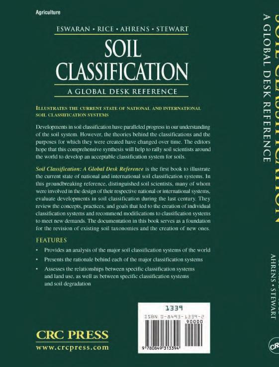
280
Prof. Lúcia Helena C. Anjos Soils Department, Federal Rural University of Rio de Janeiro (UFRRJ)
") Guy Smith Medal Award 2014 Laudation for Dr. Otto Spaargaren By Prof. Jozef(Seppe) Deckers Chair of the Selection Committee of the IUSS Guy Smith Award Distinguished authorities, delegates, Mr. President
Guy Smith Medal Award 2014 Laudation for Dr. Otto Spaargaren By Prof. Jozef(Seppe) Deckers Chair of the Selection Committee of the IUSS Guy Smith Award Distinguished authorities, delegates, Mr. President
Making Sense of Soil Series
 Making Sense of Soil Series Larry A. Morris Forest Soils Professor UGA WSF&NR The type, organization, and degree of development of soil horizons (layers) we observe in a soil profile such as pictured below
Cotswolds AONB Landscape Strategy and Guidelines. June 2016
 Cotswolds AONB Landscape Strategy and Guidelines June 2016 Cotswolds AONB Landscape Strategy and Guidelines Introduction The evolution of the landscape of the Cotswolds AONB is a result of the interaction
Soil Classification: Outline
 Soil Classification: Outline Introduction Soil moisture regimes Soil temperature regimes The Soil Taxonomy Diagnostic horizons soil orders Why Classify? Organize knowledge in an attempt to find order in
P. Blaser Swiss Federal Institute for Forest, Snow and Landscape Research CH Birmensdorf,
 FIELD TECHNIQUES: SOIL SYSTEMS P. Blaser Swiss Federal Institute for Forest, Snow and Landscape Research CH 8903 Birmensdorf, Switzerland Keywords : Soil matrix, soil solution, soil sampling, soil acidification,
This definition is from the Soil Science Glossary (Soil Science Society of America).
.") What is Soil? This definition is from the Soil Science Glossary (Soil Science Society of America). soil - (i) The unconsolidated mineral or organic material on the immediate surface of the earth that serves
What is Soil? This definition is from the Soil Science Glossary (Soil Science Society of America). soil - (i) The unconsolidated mineral or organic material on the immediate surface of the earth that serves
Soil characteristics that influence nitrogen and water management
 Section C Soil characteristics that influence nitrogen and water management Soil characteristics vary across the landscape Soils vary from one field to another, and often within the same field. Soil differences
The Soils That We Classify
 The Soils That We Classify 2 Abstract Soil is the natural medium for the growth of land plants, whether or not it has discernible soil horizons. People consider soil important because it supports plants
3. What are the five master horizons? Give distinguishing features of each. 5. List three means by which plant roots come into contact with nutrients.
 Study Questions Exam 1 1. What are the four general components of soil? 2. Define regolith and solum. 3. What are the five master horizons? Give distinguishing features of each. 4. What is meant by an
SCIENCE AND RESEARCH INTERNAL REPORT NO.75 DATABASES AND THEIR APPLICATION TO MANAGEMENT PLANNING. W. Mary McEwen
 SCIENCE AND RESEARCH INTERNAL REPORT NO.75 DATABASES AND THEIR APPLICATION TO MANAGEMENT PLANNING by W. Mary McEwen This is an internal Department of Conservation report and must be cited as Science and
Introduction. Introduction
 Introduction Introduction I MAGINE that in the next 10 to 20 years, we can begin to reshape Grounds to reflect the civic intent and environs created by Thomas Jefferson s Academical Village. Through a
Working Paper Series 09/2008. The strategic role of the plant in international networks: a longitudinal study
 Working Paper Series 09/2008 The strategic role of the plant in international networks: a longitudinal study Vereecke, A., De Meyer, A. and Van Dierdonck, R. These papers are produced by Judge Business
A Study on Landscape Design Paradigm from the Perspective of Visual Impact and Experience
 2017 3rd International Conference on Social Science, Management and Economics (SSME 2017) ISBN: 978-1-60595-462-2 A Study on Landscape Design Paradigm from the Perspective of Visual Impact and Experience
Chapter 15 Soil Resources
 Chapter 15 Soil Resources Overview of Chapter 15 What is Soil? Soil Horizons Nutrient Cycling Soil Properties and Major Soil Types Soil Problems Soil Conservation and Regeneration Soil Uppermost layer
Unit II Soil Management
 Unit II Soil Management Lesson 2: Using Soil Survey Manuals Soil survey manuals provide useful information for grassland management. Soil scientists evaluate the soil for chemical and physical properties,
HAVE YOU NOTICED at construction sites how a
 Explaining a Soil Profile HAVE YOU NOTICED at construction sites how a cross section of soil has a layered look? Soil near the top of the cross section is often dark, and soil below appears lighter. What
Dr Mechtild Rossler (UNESCO World Heritage Centre): World Heritage and Cultural Heritage Management: New Conservation Challenges
: World Heritage and Cultural Heritage Management: New Conservation Challenges") Dr Mechtild Rossler (UNESCO World Heritage Centre): World Heritage and Cultural Heritage Management: New Conservation Challenges Presented on the XV th International Summer University at ISES 2 nd of July
Dr Mechtild Rossler (UNESCO World Heritage Centre): World Heritage and Cultural Heritage Management: New Conservation Challenges Presented on the XV th International Summer University at ISES 2 nd of July
Soil Resources. Soil Horizons
 Soil Resources Soil Uppermost layer of earth s crust that supports plants, animals and microbes Soil Forming Factors Parent Material Time Climate Organisms Topography Soil Composition Mineral Particles
LANDSCAPE CHARACTER ASSESSMENT
 THE COUNTY DURHAM LANDSCAPE CHARACTER ASSESSMENT FOREWORD The landscape of County Durham is one of great contrast and diversity. From the North Pennines in the west to the Durham Coast in the east it contains
systems is available on the Colorado Wetland Information Center (CWIC) website.
 website.") Colorado Natural Heritage Program Wetland Program Plan -- Dec 2015 Status Update and Addendum -- The Colorado Natural Heritage Program (CNHP) developed a Wetland Program Plan (WPP) in 2010 for the planning
Colorado Natural Heritage Program Wetland Program Plan -- Dec 2015 Status Update and Addendum -- The Colorado Natural Heritage Program (CNHP) developed a Wetland Program Plan (WPP) in 2010 for the planning
Explaining a Soil Profile
 Lesson C1 3 Explaining a Soil Profile Unit C. Basic Principles of Agricultural/Horticultural Science Problem Area 1. Using Basic Soil Science Principles Lesson 3. Explaining a Soil Profile New Mexico Content
Fire Sprinklers Working Group Final Report
 Introduction The Building Act received Royal Assent on March 25, 2015. The Act aims to establish more consistent building requirements across British Columbia and create a more robust and modern building
Explaining a Soil Profile
 Lesson A4-8: Explaining a Soil Profile Horticulture Cluster Illinois Agricultural Education Curriculum Unit A. Horticultural Science Problem Area 4. Growing Media Nutrients, and Fertilizers Lesson 8. Explaining
Land Capability Classifications
 Land Capability Classifications Unit: Soil Science Problem Area: Basic Principles of Soil Science Student Learning Objectives. Instruction in this lesson should result in students achieving the following
Tools to facilitate the use of Soil Maps in Emilia-Romagna region (Italy) Paola Tarocco
 Paola Tarocco") Tools to facilitate the use of Soil Maps in Emilia-Romagna region (Italy) Paola Tarocco Soil maps Vs Thematic maps Soil maps are not easy to manage. Legends are usually based on soil classifications (e.g.
Tools to facilitate the use of Soil Maps in Emilia-Romagna region (Italy) Paola Tarocco Soil maps Vs Thematic maps Soil maps are not easy to manage. Legends are usually based on soil classifications (e.g.
Overview of Chapter 14
 14 Soil Resources Overview of Chapter 14 The Soil System Soil Properties and Major Soil Types Environmental Problems Related to Soil Soil Conservation and Regeneration Soil Uppermost layer of earth s crust
Soil Maps for Production Agriculture. Jarrod O. Miller, Extension Agronomist
 Soil Maps for Production Agriculture Jarrod O. Miller, Extension Agronomist Origination of Soil Mapping Originally mapped by Division of Soils Federal Bureau of Soils Soil Conservation Service (SCS) started
ACHIEVEMENT LEVEL DESCRIPTORS
 ACHIEVEMENT LEVEL DESCRIPTORS FOR THE PLANT SYSTEMS ASSESSMENT Please note: Students performing at the Meets Expectations level also meet all standards at the Approaches Expectations level, and students
Establishing the Risk Basis of Building Size Limits
 Establishing the Risk Basis of Building Size Limits A look at the history of development of our building codes and safety opportunities to facilitate wood design initiatives. Presented on January 27, 2015
USER APPROVAL OF SAFETY INSTRUMENTED SYSTEM DEVICES
 USER APPROVAL OF SAFETY INSTRUMENTED SYSTEM DEVICES Angela E. Summers, Ph.D., P.E, President Susan Wiley, Senior Consultant SIS-TECH Solutions, LP Process Plant Safety Symposium, 2006 Spring National Meeting,
Presented By: Lisa Dizengoff Science Facilitator Pembroke Pines Charter School - East Campus Pembroke Pines, Florida
 Presented By: Lisa Dizengoff Science Facilitator Pembroke Pines Charter School - East Campus Pembroke Pines, Florida ldizengoff@pinescharter.com The purpose of this interactive, enlightening and engaging
4/23/2018. Soil John Wiley & Sons, Inc. All rights reserved. Lecture 14
 Lecture 14 Soil Lecture 14 1. The Soil System 2. Soil Properties and Major Soil Types 3. Environmental Problems Related to Soil 4. Soil Conservation and Regeneration 1 The Soil System Soil Uppermost layer
SOIL DATA: Avondale. in Allen, TX. This information was taken from NRCS web soil survey of Collin County, Texas.
 SOIL DATA: Avondale in Allen, TX This information was taken from NRCS web soil survey of Collin County, Texas. United States Department of Agriculture Soil Conservation Service in cooperation with Texas
CALGARY: City of Animals Edited by Jim Ellis
 CALGARY: City of Animals Edited by Jim Ellis ISBN 978-1-55238-968-3 THIS BOOK IS AN OPEN ACCESS E-BOOK. It is an electronic version of a book that can be purchased in physical form through any bookseller
NATURALNESS AND BIODIVERSITY: POLICY AND PHILOSOPHY OF CONSERVING NATURAL AREAS
 NATURALNESS AND BIODIVERSITY: POLICY AND PHILOSOPHY OF CONSERVING NATURAL AREAS Gordon Steinhoff ENVIRONMENTAL LAW INSTITUTE Washington, D.C. ELI publishes books that contribute to education of the profession
Overview of Soil Properties
 Willie Harris apatite@ufl.edu Acknowledgments: Wade Hurt Mike Vepraskas FAESS Soil Scientists Overview of Soil Properties Website to download files of talks: wgharris.ifas.ufl.edu.hsw.htm Meaning of Soil
RE: 2018 CENTRAL STATES ASLA AWARDS PROGRAM CALL FOR ENTRIES
 January 02, 2018 RE: 2018 CENTRAL STATES ASLA AWARDS PROGRAM CALL FOR ENTRIES Dear ASLA members, The Prairie Gateway Chapter of the American Society of Landscape Architects is pleased to issue this formal
Overview of Soil Properties
 Willie Harris apatite@ufl.edu Acknowledgments: Wade Hurt Mike Vepraskas FAESS Soil Scientists Overview of Soil Properties Website to download files of talks: wgharris.ifas.ufl.edu.hsw.htm Meaning of Soil
NYC Envirothon 2017 Soil Science Review. Richard K Shaw USDA-NRCS
 NYC Envirothon 2017 Soil Science Review Richard K Shaw USDA-NRCS Introduction Who Are We? U.S. Department of Agriculture (1862) Natural Resources Conservation Service (1935) What Do We Do? Provide leadership
HORT 102: Soil Properties. Cultivated Plants: Lecture 15. [Teresa Koenig] Slide #: 1 Slide Title: Intro Information Slide
![HORT 102: Soil Properties. Cultivated Plants: Lecture 15. [Teresa Koenig] Slide #: 1 Slide Title: Intro Information Slide](/thumbs/76/74082590.jpg "HORT 102: Soil Properties. Cultivated Plants: Lecture 15. [Teresa Koenig] Slide #: 1 Slide Title: Intro Information Slide") HORT 102: Soil Properties Cultivated Plants: Lecture 15 [Teresa Koenig] Slide #: 1 Slide Title: Intro Information Slide Title: Lecture 15 Soil Properties Speaker: Teresa Koenig Created by: Teresa Koenig,
HORT 102: Soil Properties Cultivated Plants: Lecture 15 [Teresa Koenig] Slide #: 1 Slide Title: Intro Information Slide Title: Lecture 15 Soil Properties Speaker: Teresa Koenig Created by: Teresa Koenig,
2.1 Decision Making Matrix
 2.1 Decision Making Matrix The following decision-making matrix merges the elements of architectural and historical significance and current condition within the over-arching treatment recommendation of
Specification of urban planning regulation in a sustainable city
 Sustainable Development and Planning III 165 Specification of urban planning regulation in a sustainable city E. Salehi Faculty of Environment, University of Tehran, Iran Abstract The city form is shaped
2012 FINAL SOILS AREA 2 Envirothon Questions Answer KEY
 2012 FINAL SOILS AREA 2 Envirothon Questions Answer KEY Questions 1-6 to be answered at the soil pit: 1. Soil scientists categorize soils by drainage classes. What is the drainage class of the soil at
2014 Iowa FFA Soil Judging CDE Exam
 2014 Iowa FFA Soil Judging CDE Exam 1. Landscape position is one aspect of evaluating the surface features of a certain tract of land. Identifying the correct landscape position will indicate: a. If the
THE ARCHITECTURAL POLICY OF ESTONIA. Passed at the Parliamentary sitting , protocol no. 43, item no. 5
 THE ARCHITECTURAL POLICY OF ESTONIA Passed at the Parliamentary sitting 22.10.2002, protocol no. 43, item no. 5 THE ARCHITECTURAL POLICY OF ESTONIA With the development of a market economy the responsibility
January 02, 2019 RE: 2019 CENTRAL STATES ASLA AWARDS PROGRAM CALL FOR ENTRIES
 January 02, 2019 RE: 2019 CENTRAL STATES ASLA AWARDS PROGRAM CALL FOR ENTRIES The St. Louis Chapter of the American Society of Landscape Architects is pleased to issue this formal Call for Entries for
Landscape Architecture (LARC)
") Landscape Architecture (LARC) 1 Landscape Architecture (LARC) Courses LARC 0841. Sustainable Design. 3 Credit Hours. What's the big deal about global warming and how should we respond to it? Explore the
Landscape Architecture (LARC) 1 Landscape Architecture (LARC) Courses LARC 0841. Sustainable Design. 3 Credit Hours. What's the big deal about global warming and how should we respond to it? Explore the
IRRIGATION AND DRAINAGE PERFORMANCE ASSESSMENT
 00Prelims 7/3/05 14:29 Page i IRRIGATION AND DRAINAGE PERFORMANCE ASSESSMENT Practical Guidelines 00Prelims 30/3/05 13:43 Page ii This book is the result of long-term cooperation between the members of
Creating Complete Roadway Corridors:
 Creating Complete Roadway Corridors: The AASHTO Guide to Transportation Landscape Architecture and Environmental Design NCHRP Project 15-33 Status Report AASHTO Standing Committee on Design Technical Committee
TECHNICAL SPECIFICATION
 TECHNICAL SPECIFICATION IEC/TS 62443-1-1 Edition 1.0 2009-07 colour inside Industrial communication networks Network and system security Part 1-1: Terminology, concepts and models INTERNATIONAL ELECTROTECHNICAL
Biodiversity Action Plan Background Information for discussion purposes
 Biodiversity Action Plan Background Information for discussion purposes Our commitment As directed by Council, The City of Calgary has agreed to sign the Durban Commitment, an international agreement on
Medical electrical equipment
 AS IEC 60601.1.12:2017 IEC 60601-1-12:2014 AS IEC 60601.1.12:2017 Medical electrical equipment Part 1.12: General requirements for basic safety and essential performance Collateral Standard: Requirements
SOCIETY OF FIRE PROTECTION ENGINEERS POSITION STATEMENT P THE ROLE OF THE FIRE PROTECTION ENGINEER IN THE CONSTRUCTION DESIGN PROCESS
 SOCIETY OF FIRE PROTECTION ENGINEERS POSITION STATEMENT P-02-07 THE ROLE OF THE FIRE PROTECTION ENGINEER IN THE CONSTRUCTION DESIGN PROCESS March, 2007 Society of Fire Protection Engineers - 1 - Position
In 1983, the town evacuated and purchased by government for $36 million
 1 2 3 4 5 6 7 8 9 Introduction to Environmental Geology, 5e Chapter 17 Soil and Environment Weathering: summary in haiku form Rocks brought to surface decompose to sediment and that's weathering. Case
Peter Shaw Ashton papers
 Finding aid prepared by Liz Francis This finding aid was produced using the Archivists' Toolkit September 11, 2013 Archives of the Arnold Arboretum of Harvard University 125 Arborway Boston, Massachusetts,
ENVIRONMENTAL ETHICS AND PROJECT MANAGEMENT OF ARCHITECTURE
 19-004 The 2005 World Sustainable Building Conference, ENVIRONMENTAL ETHICS AND PROJECT MANAGEMENT OF ARCHITECTURE Seiki TAGAWA Ph.D 1 1 Department of Design and ure, Hokkaido Tokai University, 224 Chuwa
Rocky Areas Project Guidance HABITAT
 Rocky Areas Project Guidance HABITAT Introduction Rocky habitats are surface areas dominated by exposed rock, such as mountain peaks, inland cliffs, buttes and rocky outcrops. In many cases, rocky areas
Fire Hazard and Fire Risk Assessment
 STP 1150 Fire Hazard and Fire Risk Assessment Marcelo M. Hirschler, editor ASTM Publication Code Number (PCN) 04-011500-31 ASTM 1916 Race Street Philadelphia, PA 19103 Library of Congress Cataloging-in-Publication
RESUME University of Massachusetts, Amherst, Massachusetts Master of Science, Plant and Soil Sciences Department May 1979
 ` RESUME Peter C. Fletcher 27 Shore Acres Road South Dartmouth, MA 02748 (774) 202-5695 EDUCATION: 1975-1979 University of Massachusetts, Amherst, Massachusetts Master of Science, Plant and Soil Sciences
Preserving Soils How can fertile soil be protected?
 Activitydevelop Preserving Soils How can fertile soil be protected? Overview Students explore a map showing cropland density around the world. They discover how soil is formed and explore how plants get
Alternative Crop Suitability Methodology
 Alternative Crop Suitability Methodology The Alternative Agriculture in Missouri Hub on Community Commons includes model-based ratings of natural suitability for selected alternative crops. These ratings
Waco Mammoth Site Special Resource Study
 Waco Mammoth Site Waco, Texas Newsletter #2 August 2007 National Park Service U.S. Department of the Interior Waco Mammoth Site Special Resource Study We are pleased to share with you an update on the
Lecture: Landscape Ecology
 Borderland: Border Landscapes Across Europe 2013 Lecture: Landscape Ecology Dr Iwona Markuszewska Department of Landscape Ecology iwmark@amu.edu.pl Presentation schedule: Landscape ecology as a scientific
Impact of roads on the landscape of a suburban area
 Impact of roads on the landscape of a suburban area D. Marušić & T. Stazić Faculty of Civil Engineering, University of Split, Department for Roads, Croatia Abstract New planned roads change the landscape
LANDSCAPE ARCHITECTURE
 Landscape Architecture 1 LANDSCAPE ARCHITECTURE Dexter Bldg.(34), Room 251 Phone: 805.756.1319 https://landscape.calpoly.edu Department Chair: Omar Faruque Academic Program Program name Landscape Architecture
MADRID MINING LANDSCAPE Western Planner/Nevada APA Conference. A New Mexico Abandoned Mine Land (AML) Program Community-Based Planning Project
 Program Community-Based Planning Project") MADRID MINING LANDSCAPE 2013 Western Planner/Nevada APA Conference A New Mexico Abandoned Mine Land (AML) Program Community-Based Planning Project Presented by: Ken Romig, ASLA Associate, Dekker/Perich/Sabatini
MADRID MINING LANDSCAPE 2013 Western Planner/Nevada APA Conference A New Mexico Abandoned Mine Land (AML) Program Community-Based Planning Project Presented by: Ken Romig, ASLA Associate, Dekker/Perich/Sabatini
A Guide to the Standardized Framework Project for Puget Sound Stormwater System Mapping
 A Guide to the Standardized Framework Project for Puget Sound Stormwater System Mapping Produced by with a grant from the Washington State Department of Ecology Stormwater Services Project Team: Mark Preszler,
Team number Page 1 of Canon Envirothon Soils Station Test. Soils and Climate Change
 Team number Page 1 of 9 2006 Canon Envirothon Soils Station Test Soils and Climate Change There are many kinds of soil on the surface of the earth. The kind of soil that is present at a given location
TECHNICAL REPORT IEC TR 62987
 TECHNICAL REPORT IEC TR 62987 Edition 1.0 2015-09 colour inside Nuclear power plants Instrumentation and control systems important to safety Use of Failure Mode and Effects Analysis (FMEA) and related
New Tools for Land Management: A Quick Introduction to Ecological Site Descriptions
 New Tools for Land : A Quick Introduction to Ecological Site Descriptions Land management agencies have the job of managing natural resources for multiple uses in a sustainable manner. A sound understanding
Chapter 3 Site Planning and Low Impact Development
 CHAPTER 3 Site Planning and Low Impact Development Chapter 3 Site Planning and Low Impact Development 3.0 Introduction The City of Charleston requires that major residential, large commercial (>1 acre),
Explaining a Soil Profile
 Lesson C6 5 Explaining a Soil Profile Unit C. Plant and Soil Science Problem Area 6. Basic Principles of Soil Science Lesson 5. Explaining a Soil Profile Content/Process Statement: PLS3 Core Content Standard:
Relationship of Soil Moisture and Drainage Conditions to Tree Decline in Avocado Orchards *
 California Avocado Society 1943 Yearbook 28: 34-37 Relationship of Soil Moisture and Drainage Conditions to Tree Decline in Avocado Orchards * E. R. PARKER and M. B. ROUNDS Citrus Experiment Station, University
The Nature of Soil Soil Conservation Sustainable Ag.
 Chapter 6 & 7 The Nature of Soil Soil Conservation Sustainable Ag. Climate Soil Forming Factors Parent material Organisms Topography Time Value of Soil Soil is under appreciated Condition of soil affects
INTERNATIONAL STANDARD
 INTERNATIONAL STANDARD IEC 61508-2 First edition 2000-05 BASIC SAFETY PUBLICATION Functional safety of electrical/electronic/ programmable electronic safety-related systems Part 2: Requirements for electrical/electronic/
Soil Taxonomy. A Basic System of Soil Classification for Making and Interpreting Soil Surveys. Second Edition, 1999 By Soil Survey Staff
 Soil Taxonomy A Basic System of Soil Classification for Making and Interpreting Soil Surveys Second Edition, 1999 By Soil Survey Staff United States Department of Agriculture Agriculture Handbook Natural
People, Places and Landscapes
 People, Places and Landscapes Landscape Series Volume 14 Series Editors: Henri Décamps Centre National de la Recherche Scientifique Toulouse, France Bärbel Tress TRESS & TRESS GbR Munich, Germany Gunther
Great Lakes Conservation Blueprint for Terrestrial Biodiversity on the Canadian Shield
 Great Lakes Conservation Blueprint for Terrestrial Biodiversity on the Canadian Shield Bonnie L. Henson 1, Kara E. Brodribb 2 and John L. Riley 3 1 Ontario Ministry of Natural Resources 2,3 The Nature
Fire Collars for Floor Wastes Understanding BCA Compliance Options
 Fire Collars for Floor Wastes Understanding BCA Compliance Options February 2005 Introduction There has been a great deal of discussion in recent times regarding fire testing requirements for fire collars
An Environmental History of Twentieth-Century Britain
 An Environmental History of Twentieth-Century Britain An Environmental History of Twentieth-Century Britain John Sheail John Sheail 2002 All rights reserved. No reproduction, copy or transmission of this
Assessing the integration of biodiversity priorities in local land-use planning using international and local case studies.
 Assessing the integration of biodiversity priorities in local land-use planning using international and local case studies. Khumbelo Makhuvha (UKZN & MTPA) 09/06/2016 Overview Introduction Types of integration
Portrait of Place Lesson Plan
 Portrait of Place Lesson Plan Utah Museum of Fine Arts www.umfa.utah.edu Educator Resources Fall 2015 samples from lesson plan activity 1 Portrait of Place Lesson Plan Utah Museum of Fine Arts www.umfa.utah.edu
2017 Iowa FFA Soil Judging CDE Exam
 2017 Iowa FFA Soil Judging CDE Exam 1. Landscape positions vary in soil composition and makeup. What landscape position would be characterized by having strata and lenses of different textures in the profile:
LAND USE, LAND COVER AND SOIL SCIENCES Vol. IV - Land Use Planning and Managment in Urban and Peri-Urban Areas - H.Vejre
 LAND USE PLANNING AND MANAGEMENT IN URBAN AND PERIURBAN AREAS H.Vejre Department of Economy and Natural Resources, Royal Veterinary and Agricultural University, Denmark Keywords: Urban fringe, Multifunctional
SOIL SURVEY OF PORTIONS 81 AND 82 OFTHE FARM VAALBANK 512JQ, NEAR MAGALIESBURG, SOUTH-WEST OF PRETORIA
 REPORT For Newtown Landscape Architects SOIL SURVEY OF PORTIONS 81 AND 82 OFTHE FARM VAALBANK 512JQ, NEAR MAGALIESBURG, SOUTH-WEST OF PRETORIA By N.M. Mushia, D.G. Paterson and S.D. Mkula Report Number
2018 Iowa FFA Soil Judging CDE Exam 1. Landscape positions characterizes the location of the soil on the landscape and identifies potential risks.
 2018 Iowa FFA Soil Judging CDE Exam 1. Landscape positions characterizes the location of the soil on the landscape and identifies potential risks. Which landscape position is considered the floodplain
DID YOU GET USED TO THE NEW CPR? HERE S A QUICK REVIEW!
 June 2018 DID YOU GET USED TO THE NEW CPR? HERE S A QUICK REVIEW! How to recognize compliant cables? The new CPR defines the rules and the requirements of construction products to be manufactured, distributed
MSU Extension Publication Archive. Scroll down to view the publication.
 MSU Extension Publication Archive Archive copy of publication, do not use for current recommendations. Up-to-date information about many topics can be obtained from your local Extension office. Soil Organic
The Origin of Soil and Its Properties
 www.dal.ca The Origin of Soil and Its Properties Andrew Hammermeister Organic Agriculture Centre of Canada Dalhousie University, Faculty of Agriculture How can I live my life stepping on this stuff and
 108 40' 29'' W Soil Map Mesa County Area, Colorado 108 36' 55'' W 39 10' 11'' N 39 6' 31'' N 4331700 4332500 4333300 4334100 4334900 4335700 4336500 4337300 4338100 701100 701900 702700 703500 704300 705100
Analysis of Landscape Character for Visual Resource Management 1
 Analysis of Landscape Character for Visual Resource Management 1 Paul F. Anderson 2/ Abstract: Description, classification and delineation of visual landscape character are initial steps in developing
Ecological Impact Assessment; the conformance of guidelines and environmental impact statements
 Ecological Impact Assessment; the conformance of guidelines and environmental impact statements Kanokporn Swangjang Department of Environmental Science, Faculty of Science, Silpakorn University, Thailand
BOISE HP Inc. CAMPUS PROJECT OVERVIEW
 PROJECT OVERVIEW: ALREADY RECOGNIZED AS A LEADER IN REDUCING THE ENVIRONMENTAL FOOTPRINT AND ENSURING STRONG SOCIOLOGICAL ETHICS; HP INC CONTINUES TO IMPROVE PRACTICES WHICH ALIGN WITH THE COMPANY S CORE
Loam: About 40% sand, 40% silt, 20% clay. Mixture of pore sizes to balance water retention and aeration. Considered the best soil for growing crops.
 Soil Characteristics Soil is formed from a combination of two Primary sources: Weathering of Parent Rock ( ) = material introduced by plants, animals, and decomposers Minor sources: Nutrients incorporated
SPC GUIDE NAAB 2014 STUDENT PERFORMANCE CRITERIA School of Architecture - University of Arizona NAAB SCHOOL OF ARCHITECTURE
 SPC GUIDE NAAB 2014 STUDENT PERFORMANCE CRITERIA NAAB SCHOOL OF ARCHITECTURE s partial s introductory s SPC as defined by the National Architectural Accrediting Board, Inc. A course assigned a Claim is
Professionals Role in Implementation the Habitat Agenda and Agenda 21 Habitat Professionals Forum
 Professionals Role in Implementation the Habitat Agenda and Agenda 21 Habitat Professionals Forum Dr. Irene WIESE-VON OFEN, President of the International Federation of Housing and Planning (IFHP) and
A review of ecology in landscape architecture publications
 A review of ecology in landscape architecture publications Leslie Haines Unitec Institute of Technology, Auckland, New Zealand ABSTRACT: In landscape architecture publications, landscape designs that incorporate
Introduction to the FLL Guidelines for the Planning, Construction and Maintenance of Green Roofing
 Page 1 Introduction to the FLL Guidelines for the Planning, Construction and Maintenance of Green Roofing - 2008 Edition of the Green Roofing Guideline By Jörg Breuning & Andrew C. Yanders Green Roof Service
Image and the Built Environment
 Chapter 1 Image and the Built Environment A land ethic, then, reflects the existence of an ecological conscience, and this in turn reflects a conviction of individual responsibility for the health of the
List of Equipment, Tools, Supplies, and Facilities:
 Unit C: Traits of Soil Lesson 3: Understanding Soil Color Student Learning Objectives: Instruction in this lesson should result in the students achieving the following objectives: 1. Identify physical