2/10/2011. Arizona FFA Soil CDE Reference
|
|
|
- Lynette Carson
- 6 years ago
- Views:
Transcription

1 Arizona FFA Soil CDE Reference 1


2 Soil On the first soils in the first season of the Earth, individualization began. Separated now by solid matrix instead of by the shifting waters of the sea, organisms found it possible to wave without moving away. Things could stay in one place. Soil. William Logan 2


3 Rob Wilson NRCS Primary Authors 3


4 Primary Authors Karen Geldmacher Central Arizona College Dr. Donald Post The University of Arizona 4


5 Contributing Authors Dr. Tom Wilson University of Arizona Dr. Craig Rasmussen University of Arizona Dr. Jeff Silvertooth University of Arizona 5


6 Technical Review Team Ms. Davida Molina FFA Advisor Ms. April White FFA Advisor Ms. Katy Groseta FFA Advisor Mr. Pat Wellert FFA Advisor Mr. Curt Willems FFA Advisor Ms. Cathy McGuire NRCS State Soil Scientist Mr. Bill Johnson NRCS Soil Scientist 6


7 Arizona FFA The authors wish to thank the Arizona FFA for their contributions to this project. 7


8 The Arizona FFA Soil Judging CDE consists of two parts: 1. A WRITTEN EXAM that concentrates on general knowledge of soils from this PowerPoint and the UA Soil Reference Unit. 2. A FIELD PIT TEST that evaluates the soil physical and chemical properties. 8
9 Arizona FFA Soils CDE Contestant Information Contestants are allowed to bring the following to the CDE: Clipboard No. 2 Pencils Knife or Putty Knife Drinking Water Spray bottle to moisten soil for texturing (bottles will be provided by the test hosts) Clean up cloth or towel. 9
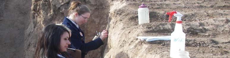
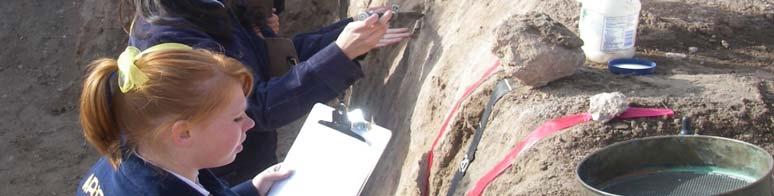
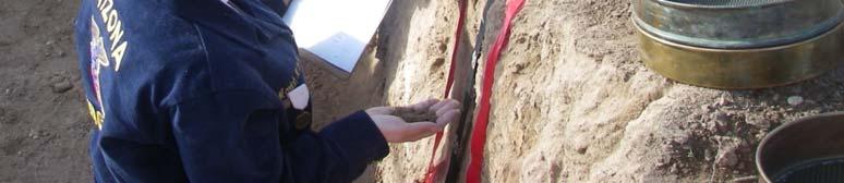
10 At Each Pit Site: A soil pit will be opened to a depth of more than three feet when possible. Buckets of soil from each horizon will be provided at each judging site for the students to use for texturing. Hydrochloric acid will be provided to test for effervescence. #10 sieves will be provided. Measuring tape will be present. Spray bottles of water for texturing. The slope stakes will be set by the site host. Site Condition Sheet. 10


11 A Good Site Layout Spray bottle Hydrochloric acid Condition Sheet #10 Sieve for texturing required at each site Boundary markers no touching between the ribbons Tape in inches required at each site 11
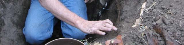
12 FFA Contestants Evaluating a Site 12


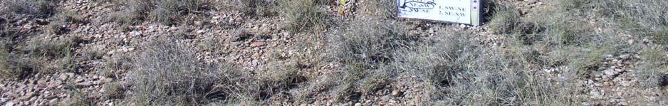
13 Site Condition Sheets Each Site will have a Condition Sheet. The following two slides are examples of Site Condition Sheets 13


14 Site Number Value for Erosion Calculation Value for Erosion Calculation Optimal ph Reference Range Optimal Nitrogen Reference Range Optimal Phosphorous Reference Range Optimal Potassium Reference Range 14


15 Site number Value for Erosion Calculation Value for Erosion Calculation Optimal ph Reference Range Optimal Nitrogen Reference Range Optimal Phosphorous Reference Range Optimal Potassium Reference Range 15
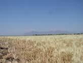
16 PowerPoint Contents Part I General Soil Information: 5 Soil Forming Factors The Soil Profile Soil Textural Triangle Soil Color Soil Geomorphic Landform 16
17 PowerPoint Contents Part II Arizona Soil Pit Evaluation Score Card Soil Structure Percent Rock Fragments Soil Texture Effervescence Stickiness Plasticity Thickness of the Surface Soil Total Depth of the Soil Slope Soil Parent Material Erosion Surface Runoff Potential Cont 17
18 PowerPoint Contents Part II cont. Ai Arizona Soil Pit Evaluation Score Card cont. ph Nitrogen (N) Phosphorus (P) Potassium (K) Soil Water Holding Capacity Soil Permeability Land Capability Class 18
19 General Soil Information Part I 19


20 The Five Soil Forming Factors Soil is a three dimensional, dynamic natural body, a product of the environment in which it is developing. 20
21 Five Factors of Soil Formation Soils are defined as having properties derived from the combined effects of: Climate Organisms (Biota) Parent Material Relief (Topography) Time These are the Five major factors controlling the formation of soil, or THE 5 SOIL FORMING FACTORS. 21
22 Climate Climate is the long term pattern of temperature and precipitation for a region. Climate is a major factor in determining the kind of plant and animal life lf on and in the soil. It determines the amount of water available for weathering minerals, transporting the minerals and releasing elements. Climate, through its influence on soil temperature, determines the rate of chemical weathering. 22


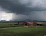
23 Arizona enjoys a great variety of climatic environments 23


24 Climate affects the Mechanical & Chemical breakdown of Soil Parent Materials wind rain hail ice Heat and cold mechanical weathering chemical weathering parent material sand silt clay 24


25 Plants affect soil development by supplying upper layers with organic matter as the plants die or lose leaves. Leaves, twigs, and bark from large plants fall onto the soil and are broken down by fungi, g, bacteria, insects, earthworms, and burrowing animals. Organisms 25


26 Organisms Deep rooted plants, such as grasses, contribute more to soil development than shallow rooted plants. 26


27 Organisms Grass roots hold soil in place and are very effective in controlling soil loss by wind or water. 27
28 Microorganisms Microorganisms eat and break kdown organic matter releasing plant nutrients They recycle nutrients from lower to upper layers, and help prevent erosion by wind or water. Some organisms change elements such as sulfur and nitrogen into usable forms for plants. 28


29 Microbiotic Crusts Stabilize the Soil Surface: Surface protected by microbotic crust Eroded surface 29


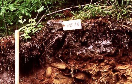
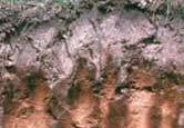
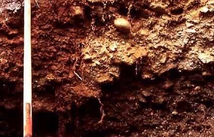
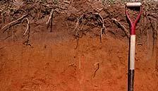
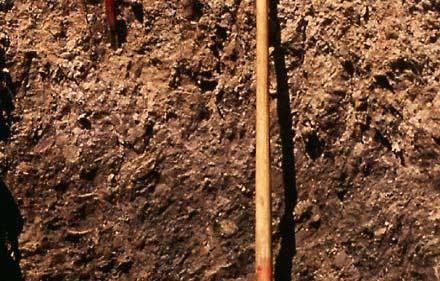
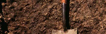
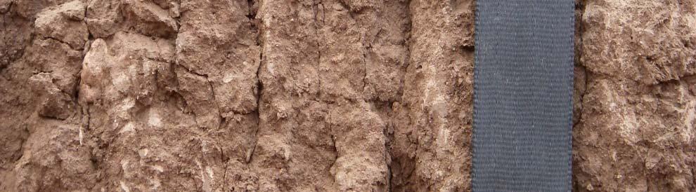
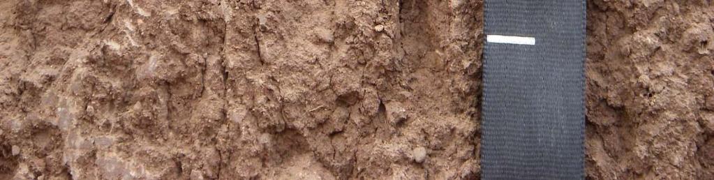
30 Organisms Microscopic organisms and the humus they produce act as a kind of glue to hold soil particles together in aggregates. Well aggregated soil is ideal for providing the right combination of air and water to plant roots. 30

31 Organisms Burrowing animals such as foxes, moles, badgers and so on affect decomposition of waste materials and how soil materials are moved around in the soil profile. 31


32 Organisms Burrows open the soil to air and water movement and mix in organic matter. 32


33 Parent Material Parent Material refers to that great variety of unconsolidated rock and organic matter in which soil formation begins. 33
34 Topography Landscape position has a great deal of influence on soil development. Topography includes the degree and direction of slope. A hillside will erode during rainstorms and the soil will be thinner. The soil at the base of the hill will be thicker because it receives material from the side slope. A river bottom will receive some material after flood events and portions of the bottom may have material removed by swift flowing water. 34
35 Time Time is required for horizon formation. The longer a surface has been exposed to soil forming agents like rain and growing plants, the greater the development of the soil profile. Soils in recent alluvial materials or soils on steep slopes where erosion has been active may show little horizon development. Soils on older, stable surfaces generally have well defined horizons because the rate of soil formation is greater than the rate of erosion. 35


36 5 Soil Forming Factors Review 36


37 The Soil Profile A soil profile is a cross section sample of a soil body. It has horizons (layers) that are approximately parallel to the earth s surface. 37


38 Soil Profiles 38

39 Soil Profiles 39
40 Soil Horizons Soil material is arrayed in layers that are roughly parallel to the surface. These layers are called horizons and each soil pit may express several horizons. A typical soil profile consists of three master horizons: A B and C 40
41 Master Soil Horizons The soil horizons are designated with alphabetic characters from the surface down: HORIZON O A E B C R DEFINITION Organic Horizon Topsoil. Surface Mineral Horizon. Horizon of Eluviation or Leaching. Horizon of Accumulation of Clay Parent Material Bedrock 41
42 The O Horizon O is the Organic Horizon. The O horizon consists of decomposed or partially decomposed organic matter that is being added to the underlying A horizon over time. It may be leaves, grass blades, twigs, etc. In many parts of Arizona the O horizon never forms due to high heat and relative lack of dead organic material. 42
43 The A Horizon The A horizon is known as the 'topsoil' and it is the uppermost layer of the mineral soil. The A horizon is mainly mineral material. It is generally somewhat darker than the lower horizons because of greater amounts of decomposed organic matter. This horizon is where much root activity occurs and is usually the most productive layer of the soil. It may be referred to as a surface horizon. 43
44 The E Horizon The E Horizon is the horizon of eluviation, or exiting. The main feature of the E horizon is loss of clay, iron and aluminum leaving a light colored layer dominated by silt and sand. These are present only in older, well developed soils, and generally occur between the A and B Horizons. In Arizona they are usually not very thick and the horizon below E is high h in clay. 44
45 The B Horizon B Horizons are commonly referred to as subsoil, and consist of mineral layers which may contain concentrations of clay or minerals such as iron or aluminum. In addition, they are defined by having a distinctly different structure or consistence to the A horizon above and the horizons below. 45
46 The B Horizon In general the B horizon displays the maximum structural development and maximum clay content. Structure tends to be angular or sub angular blocky, prismatic or columnar. 46


47 The C Horizon The C horizon includes parent material. 47
48 The R Horizon The R horizon is the layer of bedrock at the base of the soil profile. Unlike the above layers, R horizons largely comprise continuous layers of hard rock that cannot easily be excavated by hand. 48


49 O horizon A horizon E horizon B horizon C Horizon 49


50 Soil Horizons Review 50
51 The Surface Soil The surface soil consists of the total thickness of the A horizon, and the E horizon if it is present. For example; the A horizon thickness is 7 thick and the E horizon is 2 thick then the thickness of the surface soil is 7 +2 =9 51
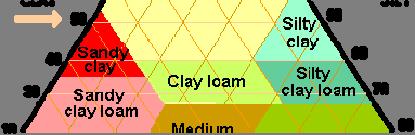
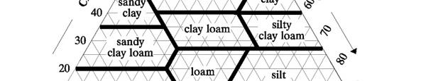
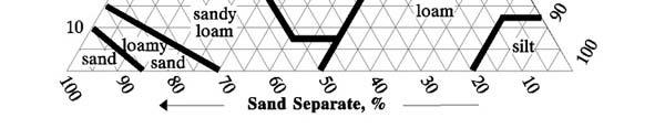
52 Characteristics of the Surface and Subsurface Horizons Soil Texture size and relative abundance of the soil separates (sand, silt and clay) Soil Stickiness how strongly particles adhere to each other and your fingers Soil Plasticity how well wet soil can be molded and rolled into wires. Think of making pottery. 52
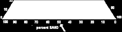
53 Characteristics of the Surface and Subsurface Horizons Soil Structure how soil particles form aggregates with different shapes Rock Fragments presence of particles > 2mm Soil Color dry and moist conditions Soil Effervescence how a soil reacts or forms bubbles with 10% hydrochloric acid HCl 53
54 Soil Texture Soil Texture refers to the relative proportion of the sand, silt and clay in the fine earth fraction of the soil. Texture has a major influence on the productivity and use and management of the soil resource. Texture influences root penetration, water holding capacity, aeration, and erosion potential
55 Soil Texture Texture is a very important soil characteristic. It influences other properties significant to use and management such as soil water holding capacity. Texture is a measure of a soils potential to transmit water downward through the profile. Texture is also an important component in a soils potential to hold plant nutrients. 55


56 Soil Texture An important soil property is the size of the particles, and the relative proportion, or percent of these particles in the soil. A particle size category is called a soil separate. The three main soil separates are called: sand, silt and clay
57 Soil Texture Particle Sizes Sand 2.0 mm to 0.05 mm Silt 0.05 mm to Clay >0.002 mm 57


58 Soil Texture Sand and Silt develop from broken down rock fragments consisting of quartz, feldspar, mica and other minerals. Clay particles are very small, plate lt shaped, crystal tl structures consisting of oxygen, silica and aluminum
59 Soil Texture A textural class has a defined range of particle sizes (sand, silt, and clay) The NRCS recognizes 12 textural classes: Sand Silt loam Silt Loamy sand Silty clay loam Sandy loam Silty clay Sandy clay loam Clay loam Sandy clay Clay Loam 59 59


60 The USDA Soil Textural Triangle 60
61 USDA Soil Textural Triangle The USDA textural triangle estimates the relative amounts of sand, silt and clay in a soil sample. These components make up 100% of your soil sample. 61


62 USDA Soil Textural Triangle The triangle consists of the intersections of 3 separate sets of lines. One set of lines represent sand One represents clay And one represents silt 62
63 USDA Textural Triangle The left side leg represents the percent of clay in the soil sample and that line is read straight across or level and parallel with the bottom. The right side leg represents the percent of silt in the soil sample. That line is read from the leg down and to the left. The bottom of the triangle represents the percent of sand in the sample and is read from the bottom and up and to the left 63
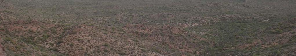
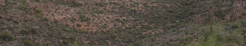
64 For the percent of silt follow these lines For the percent of clay follow these lines Clay Silt For the percent of sand follow these lines Sand 64


65 USDA Textural Triangle The block on the triangle where the lines intersect is the textural class for that soil. Since there are only three components and they must add up to 100% you need to find the intersection of any two of the components and they define the percent of the other component. 65

66 66


67 Soil Color The color of the soil is an important indication of soil conditions and properties that help to determine the various uses of soil. 67


68 Soil Color Soil color gives clues to the organic matter content, the surface drainage, the salt content, the general fertility of the soil. Soil color is used to help classify soils. 68


69 Soil Color Light colored desert soils are normally low in fertility and have <1% organic matter. These soils can be highly productive when properly irrigated and fertilized. Dark brown to black soils indicate high organic matter content (>5%) and good fertility. 69


70 Soil Color Some soils are red to yellow which is indicative of high iron content. 70

71 Geomorphic Landforms This illustrates t the geologic setting or the landscape where the soil occurs. Upland or Mountains Colluvium Foothills or Alluvial Fan Flood plain, stream, terrace or basin floor 71 71


72 Gullies formed by water erosion Bottomland subject to flooding Stable upland 72


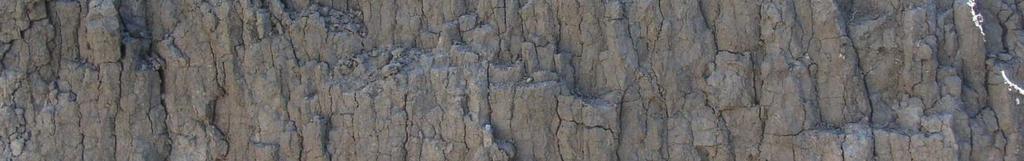
73 mountains fan terrace basin floor 73
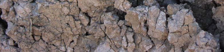
74 End of Part 1 General Soil Information 74
75 Arizona Soil Pit Evaluation Score Card PowerPoint P tpart tii 75
76 PowerPoint Contents Part II Arizona Soil Pit Evaluation Score Card Soil Structure Percent Rock Fragments Soil Texture Effervescence Stickiness Plasticity Thickness of the Surface Soil Total Depth of the Soil Slope Soil Parent Material Erosion Surface Runoff Potential Cont 76
77 PowerPoint Contents Part II cont. Ai Arizona Soil Pit Evaluation Score Card cont. ph Nitrogen (N) Phosphorus (P) Potassium (K) Soil Water Holding Capacity Soil Permeability Land Capability Class 77
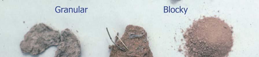
78 Field Pit Question: Soil Structure 78

 to form natural")
79 Soil Structure Soil Structure is the arrangement of soil particles, (sand, silt and clay) to form natural aggregates. 79


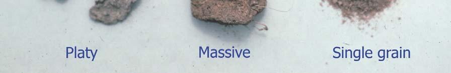
80 Soil Structure is best observed while it is in place in the soil wall of the pit. 80


81 Soil Structure in a Soil Profile Soil texture and organic matter content are the two most important soil characteristics that determine the structure formed. Clayey soils often exhibit blocky or massive structure whereas soils high h in organic matter may exhibit granular structure. Granular 81 81
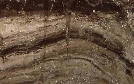
82 Soil structure is important because structure influences air and water movement. 82
83 Soil Structure Typically in the surface horizon of cultivated fields the structure will be granular. However if the field is muddy the structure will appear massive. In a range setting the surface structure may typically be a very weak platy or granular. Structure is influenced by clay content. Structure in the subsurface horizon of a profile that p has high clay may typically be blocky and prismatic. 83
84 Soil Structure Soil structure is important because, to a great degree, it helps determine availability of soil nutrients, movement of air and water in the soil profile, and ease of plant root establishment and growth. There are six categories of soil structure to select from in both the surface and subsurface soil horizons. 84
85 Soil Structure 6 types: Granular Platy Prismatic or Columnar Blocky Massive Single Grained 85
86 Soil Structure Granular If soil particles are arranged in small aggregates with round edges the soil structure is termed granular. Commonly found in the A horizons that are enriched with organic matter. This type of structure is very desirable for plant growth because it provides a combination of large and small pores


87 Granular Structure 87
88 Soil Structure Platy Platy structure units are thin, flat and plate like. Soils may develop a platy structure naturally or through the action of man. Thin layers of platy structure can effectively seal the soil against air and water movement. Therefore, platy structure is usually indicative of very slow permeability and infiltration

89 Platy Structure 89 89
90 Soil Structure Prismatic and Columnar Prismatic structure units resemble blocky structure except that they are longer than they are wide. Prismatic aggregates are flat on the top whereas columnar aggregates have rounded tops. This structural type usually indicates a higher clay content than the horizons above
91 Prismatic Structure Prisms can be different sizes, but have the same shape


92 PRISMATIC STRUCTURE in the soil wall 92

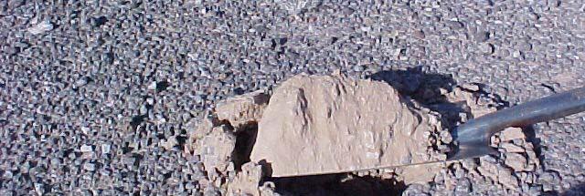
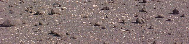
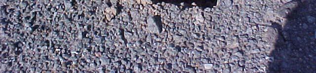
93 Prismatic Structure 93


94 Soil Structure Blocky When particles cling together in nearly square cube like units the structure is termed blocky. 94


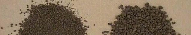
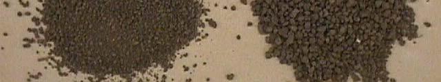
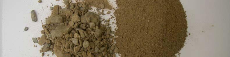
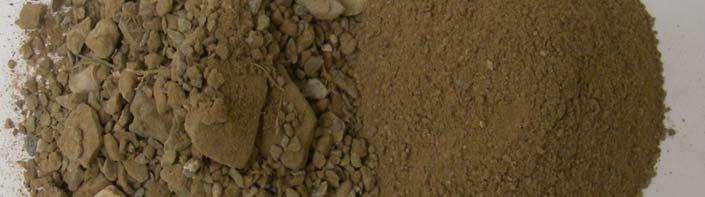
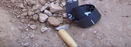
95 Note: The mass of soil readily breaks into aggregates when manipulated. Blocky 95


96 Blocky Structure in the Soil Wall 96


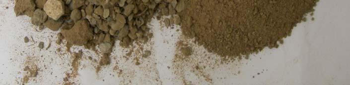
97 Soil Structure Massive Massive soil is when the soil particles are stuck together in a mass and there are no individual aggregates


98 Soil Structure Single Grain In single grained structure the particles will not stick together, and no aggregates are formed

99 Soil Structure 99 99
100 Field Pit Question: Percent Rock Fragments 100


101 Examples of Rock Fragments on the Surface Horizon


102 Example of Rock Fragments within the Sub Surface Horizon 102
103 Percent Rock Fragments Rock fragments are commonly present in Arizona soil horizons. Percent Rock Fragments are expressed as: Less than 15% by volume 15 35% by volume Greater than 35% by volume
104 Percent Rock Fragments In the field you can estimate the percent rock fragments by completely sieving a measured sample and then comparing the amounts of material left on the screen and that which passed through the screen. For example the entire sample represents 100% and if you estimate that 30% passed through the screen then that leaves 70% rock fragments


105 A #10, 2mm sieve is used to separate the fine earth fraction, or portion of the soil sample that is <2.0 mm from the rock fragments


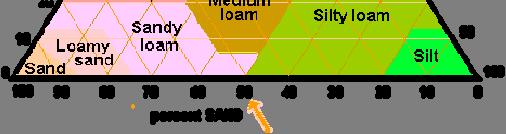
106 The fine earth portion of the soil sample passes through the 2.0mm screen The coarse fragments are retained on the mesh Fine earth passes through the mesh


107 Estimating percent of rock fragments in a soil sample: To get a frame of reference take a hand full of soil and that will represent 100% of your sample. 107


108 Or you may fill the sieve pan. Reference what 100% of the sample looks like. 108


109 Sieve the material completely and compare the volume of the material that passed through the mesh against what you remember as 100% of the total. The scorecard choices are <15%, 15 35% or >35% based on volume. 109


110 Place the material side by side and make an estimate of fine and coarse material by comparing them. <15% coarse fragments: 110


111 15 35% coarse fragments: 111

112 >35% coarse fragments: 112
113 Field Pit Question: Soil Texture 113
114 The scorecard groups the 12 USDA textural classes into 5 options: Coarse Sand/ Loamy Sand Moderately Coarse Sandy Loam/ Fine Sandy Loam Medium Loam/Silt Loam/Silt Moderately Fine Clay Loam/Sandy Clay Loam/Silty Clay Loam Fine Clay/Silty Clay/Sandy Clay The following triangle illustrates the 12 USDA classes consolidated into the 5 field pit test textural classes. 114

115 Fine Moderately Fine Coarse Moderately Coarse Medium 115


116 Soil Texture by Feel Method Texture by feel is the physical skill set developed, through practice, to determine the approximate percentage of sand, silt and clay in a sample by rubbing the moistened soil between your finger and thumb. 116
117 117


118 The Feel Method Moisten the soil in your palm to the consistency of putty. Push your thumb gradually forward to form the soil into a ribbon. 118


119 Texture by Feel Coarse (Sand/Loamy Sand) Air and water move readily through sandy soils. Sand feels gritty. When sand is wetted, formed into a ball and tossed into the air, it will not remain in the form of a ball when it lands back in your hand. 119
120 Texture by Feel Moderately Coarse (Sandy Loam/Fine Sandy Loam) A sandy loam contains much sand but has enough silt and clay to make it stick together more than the loamy sand or sand. The individual sand grains can be seen and felt. A short ribbon can be formed (< 2 cm) A sandy loam soil contains 43 85% sand, 0 50% silt, and 0 20% clay. 120
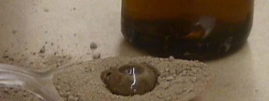
 These")


121 Soil Texture by Feel Medium (Loam/Silt Loam/Silt) These textural classes can be molded in your hand when moistened. They form short ribbons. They are typically slightly sticky and slightly yplastic. 121
122 Loam Loam is a soil that t feels and behaves like it has about equal proportion of sand, silt, and clay. It is mellow, with a somewhat gritty feel, yet fairly smooth and slightly plastic. Squeezed when moist, the ball can be handled without breaking, and it will form a short ribbon. Soils termed Loam contain 23 52% sand, 28 50% silt, and 8 27% clay
123 Silt A soil high in silt feels floury, smooth, or like velvet cloth. Silt particles stain the fingers and will leave a fingerprint. Silty soils hold more water for plans than sandy soils. Silt sticks together better than sand
124 Silt Loam A silt loam soil has a moderate amount of the fine grades of sand and only a small amount of clay; over half the particles are silt size. Squeezed when moist, it will form a ball, but will form only a short ribbon. It can be molded into a thin wire, and is plastic and sticky. This soil contains 0 50% sand, 50 88% silt, and 0 27% clay
125 Texture by Feel Moderately Fine (Clay Loam/Sandy Clay Loam/Silty Clay Loam) The moist soil is plastic and will form a ball which will bear much handling. When the moist soil is pinched between the thumb and forefinger, it will form a thin ribbon (2 5 cm in length). Clay Loams contain 20 45% sand, 15 23% silt and 27 40% clay. 125
 Very sticky and very plastic.")

126 Texture by Feel Fine (Clay, Silty Clay, Sandy Clay) Very sticky and very plastic. Forms a long ribbon (> 5 cm) when pressed between the thumb and forefinger


127 Clay Clay textured soils feel sticky when moist. A soil high in clay will form a tight ball when tossed in the air and caught. When moist, clay textured soils will form a long ribbon (> 5 cm) and stain your fingers with shiny color. 127
128 Field Pit Question: Effervescence 128
129 Soil Effervescence This test uses 10% hydrochloric acid (HCl) dropped on soil to determine if carbonates are present. The reaction or effervescence indicates the presence of carbonates. There are four classifications of Soil Effervescence: None Slight Strong Violent 129


130 Soil Effervescence None A drop of 10% HCl is added to the soil. The bubbling reaction is observed. If there is no reaction, none is recorded. 130


131 Soil Effervescence Slight or Strong Slight bubbles readily seen Strong bubbles form low foam

132 Soil Effervescence Violent Violent thick foam forms quickly
133 Field Test Question: Stickiness 133
134 Soil Stickiness Stickiness refers to the capacity of a soil to adhere to other objects. The determination is made on soil <2mm in diameter. Stickiness is estimated at the moisture content that displays the greatest adherence when pressure is pressed between thumb and forefinger
135 Soil Stickiness There are four classes of stickiness: Non Sticky Slightly Sticky Moderately Sticky Very Sticky


136 Soil Stickiness: Non Sticky After release of pressure, practically no soil material adheres to thumb or forefinger


137 Soil Stickiness: Slightly Sticky After release of pressure soil material sticks to both fingers. As the fingers are separated the material tends to come off cleanly and the material does not stretch

138 Soil Stickiness: Moderately Sticky After release of pressure, soil material adheres to both fingers and tends to stretch slightly rather than pull completely free from either finger


139 Soil Stickiness: Very Sticky After release of pressure, soil material adheres so strongly to both fingers that it stretches decidedly when the fingers are separated. Soil material remains on both fingers
140 Field Pit Question: Field Pit Question: Plasticity 140


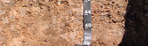
141 Soil Plasticity Plasticity is the pliability and the capacity of soil to be molded to form a wire (or worm orm ) ). Soils containing more than about 15% clay exhibit plasticity. Plasticity is determined on material smaller than 2mm and the soil is very moist
142 Soil Plasticity There are four plasticity classes: Non Plastic Slightly Plastic Moderately Plastic Very Plastic


143 Plasticity: Non Plastic Make a wire 4 cm long. Will not form a 6 mm diameter wire; or if formed, cannot support itself if held on end. Sandy soils are nonplastic

144 Plasticity: Slightly Plastic Make a wire 4 cm long. 6 mm diameter wire supports itself; 4 mm diameter roll does not support itself


145 Plasticity: Moderately Plastic Make a wire 4 cm long. 4 mm diameter wire supports itself, 2 mm diameter wire does not support itself


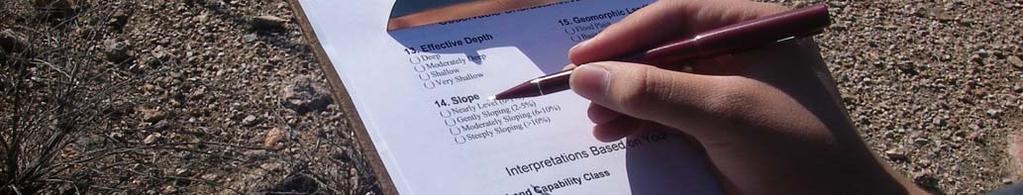
146 Plasticity: Very Plastic Make a wire 4 cm long. 2 mm diameter wire supports its weight
147 Field Pit Questions: Observable Characteristics of the Site 147
148 Field Pit Question: Thickness of the Surface Soil 148
149 Thickness of thesurface Soil Observe the thickness of the surface in the soil wall of the pit. Select from the following choices: 0 No surface soil >4 149
150 Field Pit Question: Total Depth of the Soil 150
151 Total Soil Depth This is the thickness of the soil horizons to bedrock or a layer which restricts the growth of plant roots. The categories are: Very Deep: Deep: Moderately Deep: Shallow: > 60 inches to Limiting Layer 40 to 60 inches to Limiting Layer 20 to 40 inches to Limiting Layer 10 to 20 inches to Limiting Layer Very Shallow: < 10 inches to Limiting Layer This dimension will be posted in inches on the Site Condition Sheet


152 Deep Soil > 40 inches


153 Very shallow soil <10 inches Root restrictive layer
154 Field Pit Question: Soil Slope 154
155 155
156 Slope of Soil Landscape The setting of the soil must be observed and the percent slope measured. <1% Nearly level 1 3% Gently sloping 3 5% Moderately sloping 5 8% Strongly sloping 8 15% Steeply sloping >15% Very steeply sloping

 is 1 foot")

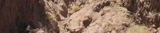
157 Soil Slope Slope is measured as the difference in elevation over a distance of 100 If the fall (difference in elevation) is 1 foot then the slope is 1%. If the fall is 5 feet then the slope is 5% and so on


158 Soil Slope Basic Instructions Students who are determining slope may want to pair up with another student of nearly the same height. This way you know that your eyes are about the same distance from the ground giving ii you a zero baseline. 158


159 Hold the clipboard level with your eyes and use it as a sighting device to establish a leve sight line 159


160 When you are on the high or up slope side your sight line could be above your partners head My partner is almost 6 tall. I estimate there is 1 more of him above the base line and a couple of feet extra so I estimate 8 or 8%. Sight line Base line: 0% slope 160


161 When you are on the low or down slope side your sightline could be lower than your part Sight line Estimate 2 feet from the sight line to base 161


162 The ribbons on the stakes are the same distance from the ground. (Stakes are closer than 100 for purposes of illustration) 162
163 Soil Slope Working alone you can determine the slope by using the clipboard and the opposite stake. If and you ll need to ask the site host to confirm this, the ribbons are the same distance from the ground then set the clipboard as a level from one of the ribbons and then estimate the rise or fall from that sight line. 163


164 Setting a level sightline from the down slope stake: 164


 Estimate")
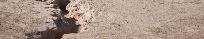
165 View from the downslope stake (stakes are closer than 100 for illustration purposes) Estimate vertical distance Sight line 165


166 View from the upslope stake Estimate difference from level clipboard to top of ribbon on the downslope stake 166
167 Field Pit Question: Field Pit Question: Soil Parent Material 167
168 Soil Parent Material Parent material is the rock or mineral material from which soil is formed. The parent material determines the elemental, mineralogical, and particle size properties of soil. Soil parent material occurs in place, through weathering, or it can be transported by various geologic agents, such as water, wind and gravity
169 Parent Material Alluvium material deposited by water Colluvium material moved by gravity Eolian wind blown sands or silts Residuum formed in place through the physical and chemical process of weathering rock 169


170 Landscapes and potential soil parent materials Alluvium Bottomland subject to flooding Colluvial position Side slope subject to erosion upland


171 Alluvium Alluvial soils are deposited by water. They can be recognized by stratification of material of contrasting sizes which represent different flood events. Depending on the intensity of the flood event, material may be added or removed from a specific point on the landscape


172 Colluvium Colluvial soils are deposited by gravity. Colluvial landscape position 172


173 Colluvial landscape position Energy
174 Eolian soils can be recognized by being composed of material Eolian of uniform size because eolian material has been moved from another location by the wind
175 Residuum Residual soils formed in place. 175
176 Field Pit Question: Erosion by Wind or Water 176
177 Soil Erosion Soil erosion is the detachment and removal of soil particles through the effects of wind or water. This question speaks to the observable effect of erosion. Major factors include percent slope, length of slope, ground cover and duration and intensity of rainfall There are four erosion classes: None to Slight Moderate Severe Very Severe 177
178 Soil Erosion None to Slight More than 75% of the surface soil is present and no gullies are present. Moderate 25 to 75% of the original soil surface is still present however there may be some mixing of the A and B horizons. Small rills and a few crossable gullies may be present. Severe Less than 75% of the original soil surface is present. Frequent crossable and occasional uncrossable gullies are present.* V S L th % f th i i l il f i Very Severe Less than 75% of the original soil surface is present. Frequent uncrossable gullies are present.* 178


179 Example of a crossable gully 179


180 Example of a non crossable gully 180
181 Soil Erosion To answer the erosion question measure the thickness of the topsoil of the soil profile in the soil wall. Read the original i thickness of the topsoil on the site condition sheet. Following are examples of the process: 181
182 Soil Erosion Example #1 The site condition sheet lists the original i top soil thickness as 13. While in the soil pit you measure 5 of top soil = 8 of topsoil removed by erosion 8 / 13 = 61% of top soil removed. 100% 61% = 39% topsoil still present. 39% topsoil present = Moderate Erosion 182
183 Soil Erosion Example #2 The site condition sheet lists the original top soil thickness as 7. While in the soil pit you measure 2 of top soil. 7 2 = 5 of topsoil removed by erosion 5 / 7 = 71% of top soil removed. 100% 71% = 29%. 29% topsoil still present = Moderate Erosion 183
184 Soil Erosion Example #3 The site condition sheet lists the original top soil thickness as 14. While in the soil pit you measure 12 of top soil = 2 of topsoil removed by erosion 2 / 14 = 14% of top soil removed. 100% 14% = 86% 86% still present = None or Slight Erosion 184
185 Field Pit Question: Field Pit Question: Surface Runoff Potential 185


186 Surface Runoff Potential Surface runoff is the rate in which water is removed by flowing over the soil surface. Rainfall, irrigation water and water from adjacent upland slopes are considered. 186
187 Surface Runoff Potential Surface runoff is the combination of slope and permeability. Four classes of runoff are recognized: Rapid Moderate Slow Very Slow 187
188 Surface Runoff Potential Rapid Rapid water movement has the potential to erode soil at an accelerated rate. The amount of water entering the soil profile is influenced by: Slopes are greater than 3% Low Permeability 188
189 Surface Runoff Potential Moderate surface runoff Water drains away readily but allows water to enter the soil profile freely. Slopes can range from 1 up to 3%. Permeability is moderately low 189
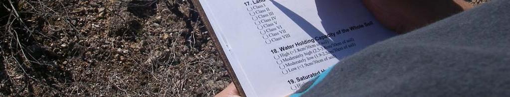
190 Surface Runoff Potential Slow water flows away slowly and water stands on the surface. The downside is it may interfere with farming operations. Slopes range from 0 to 1%. Permeability is slow. 190
191 Surface Runoff Potential Very Slow Water stands on the surface for very long periods of time. Much of the water is lost through evaporation. Slope is 0% or concave Permeability is very slow. 191
192 Soil Pit Questions: Recommended Fertilizer and Soil Amendments 192
193 Information for Fertilizer & Soil Amendment Pit Questions will be posted on the Condition Sheet at each site. 193
194 Fertilizer & Soil Amendments The purpose of this section is to make the students aware of the ranges of soil amendments needed to produce crops in Arizona. Awareness is a necessary step in cost effective fertilizer application as a Best Management Practice (BMP.) It is difficult, if not impossible, to make blanket nutrient recommendations due to Arizona having such a variety of soils, climates and crops. 194

195 Fertilizer & Soil Amendments Nutrient availability is dependent on many factors such as soil ph, soil moisture, method of application, and soil texture. The questions will relate to recommendations for upland cotton grown on a moderately coarse textured soil in Maricopa, Pinal & Pima Counties. 195
196 Fertilizer & Soil Amendments Soil ph Optimum soil ph for plant growth ranges from 6.5 to 7.5 but many soils in Arizona have a ph of greater than 8.0 Consider ph to be an issue for cotton if the level is greater than 7.5 or less than 6.5 If the ph shown on the site condition card is outside this range then farmers traditionally add an amendment to adjust the ph. 196
197 Fertilizer & Soil Amendments Soil Nitrogen (N) Soil Nitrogen (N) nitrogen levels of 80 lbs/acre to 300 lbs/acre are sufficient for irrigated, continuous cotton in central Arizona. If the N level on the site is less than 80 lbs/ac or greater than 300 lbs/acre, N is outside the optimum range for cotton. 197
198 Fertilizer & Soil Amendments Soil Phosphorus (P) Phosphorus availability to the plants is very dependent on soil ph. The higher the ph the less plant available phosphorus h becomes. P levels of 80 to 100 pounds per acre are considered sufficient for cotton production. If the P level on the site condition card is lower than 80 lbs/ac or greater than 150 lbs/ac, P is outside the optimum range for cotton. 198
199 Fertilizer & Soil Amendments Soil Potassium (K) 150 pounds of potassium (K) per acre is considered the base critical level for the production of cotton. If the amount of K is less or greater than 150 lbs/ac, K is outside the optimum range for cotton. 199
200 Fertilizer & Soil Amendments Nutrient trientavailability Both phosphorus (P) and potassium (K) are insoluble nutrients in soil. The level of these nutrients in the soil does not change rapidly and does not depend on weather conditions. A fundamental point to consider is that there is usually a rather poor relationship between the total amount of a given nutrient found in the soil (i.e. P or K) and the amount actually available to the plant for uptake and utilization. 200
201 Soil Pit Questions: Interpretations Based on Your Observations 201
202 Soil Pit Question: Water Holding Capacity of the Soil 202
203 Soil Water Holding Capacity Soil Water Holding Capacity is important in agriculture because it is the soil property that holds water against the pull of gravity. For the purposes of the contest the soil water holding capacity is evaluated using the soil in the bucket marked subsoil


204 Soil Water Holding Capacity The water holding capacity of a soil refers to the portion of water in a soil that can be readily absorbed by plant roots. 204
205 Soil Water Holding Capacity Water Holding Capacity has 4 ranges and is expressed as: High Moderately high Moderately low Low
206 Soil Water Holding Capacity Subsoil Texture COARSE MODERATELY COARSE MEDIUM MODERATELY FINE FINE Water Holding Capacity LOW MODERATELY LOW MODERATELY HIGH MODERATELY HIGH HIGH 206
207 Soil Pit Question: Soil Water Permeability 207
208 Permeability Introduction Permeability refers to the movement of water and air in the soil. This is very important in agriculture because it is the property p that affects the supply of nutrients, air and water to the root zone. Permeability is directly related to soil texture in that the coarser the soil texture the easier it is for water to move through the soil profile. 208
209 Permeability Introduction Soils that have rapid permeability will transmit water downward through the soil profile very quickly, removing water needed for plant growth. Such soils will require more frequent irrigation for less duration than soils with slower permeability. This increases the cost of growing ga crop. 209
210 Permeability Introduction Soils that are slowly permeable will transmit water slowly and if irrigation water is not managed carefully the saturated subsoil condition may cause root rot in crops. Each soil textural group has a permeability rating, but, for contest purposes, the soil s permeability rating is determined using the soil in the bucket marked Subsoil. 210
211 Guide for Determining Permeability Subsoil Texture Permeability Class COARSE MODERATELY COARSE MEDIUM MODERATELY FINE FINE RAPID MODERATE SLOW SLOW VERY SLOW 211
212 Soil Pit Question: Soil Pit Question: Land Capability Classification 212
213 Land Capability Classes LCC Land Capability Classes, LCC, are designated by Roman Numerals I through VIII. The increasing numerals indicate progressively greater limitations and narrower choices for practical use in production agriculture. 213
214 Land Capability Classification Land Capability Classes (LCC) are arrayed from Class I thru Class VIII. By definition Class I is the best for cultivated crops while Class VIII is primarily used for recreational activities. In Arizona, we are combining Classes VI and VII, and eliminating Class V for the purposes of this CDE. There are differences and the NRCS recognizes them, but it takes a professional to recognize the differences in the field. This decision simplifies the test and eliminates guesswork on the students part. 214
215 Land Capability Classification Cultivated Land Class: Non Cultivated Land Class: I VI / VII II VIII III IV So if you are evaluating a crop field you have 4 choices to make Class I, II, III or IV In a rangeland situation you have only 2 choices to make, Class VI / VII or VIII 215


216 LCC Irrigated Arizona Farmland 216


217 LCC Arizona Rangeland 217
218 LCC Class I Class I represents agricultural land that has no limitations for use. This class represents Arizona s best soil for cropland. Class I land has water available in a working irrigation system, nearly level or gently sloping, and medium or moderately fine dominant texture. 218
219 LCC Class II Class II soils have moderate limitations that reduce the choice of plants or that require moderate conservation practices. These soils are moderately sloping and have moderately coarse dominant texture. 219
220 LCC Class III Class III soils have severe limitations that reduce the choice of plants or that require special conservation practices, or both. These soils are moderately sloping and have a dominant texture of fine 220
221 LCC Class IV Class IV soils have very severe limitations that reduce the choice of plants or that require very careful management, or both. These moderately sloping soils have a coarse dominant texture. 221
222 LCC Class VI/VII Class VI/VII soils have severe limitations that make them generally unsuitable for cultivation. These soils are nearly level to strongly sloping and may These soils are nearly level to strongly sloping and may display all dominant textures. 222


223 LCC Class VIII Class VIII soils have limitations that nearly preclude their use for any production and are often just used for recreation. They are steeply and very steeply sloping. 223


224 Class VIII Class VI/VII 224
225 Land Capability Classification In order to place a site in the correct Land Capability Class (LCC), evaluate the soil and the site using four observations: 1. Irrigation water does the site have an irrigation water delivery system in place? 2. Dominate texture observe the depth of the surface soil and its texture and the thickness and texture of the subsoil. 3. Depth to contrasting texture this very important concept because contrasting textures will impede downward water movement in a soil. 4. Slope Influences cropping limitations. 225
226 Land Capability Classification Irrigation Dominant Depth to Water Texture Contrasting Texture YES Medium or Moderately Fine Very deep Slope Nearly level or gently sloping YES Moderately Coarse Deep Moderately sloping YES Fine Moderately deep Moderately sloping YES Coarse Shallow Moderately sloping NO All All Nearly level to strongly sloping NO All All Steeply and very steeply sloping LCC Class I II III IV VI/VII VIII 226
227 Land Capability Classification Use the previous table. Follow each example from irrigation water on the left side through LCC Class on the right side. Answering the questions in order: Does it have irrigation water? What is the dominate texture? What is the depth to a contrasting texture? What is the slope? Answering these questions will lead you to the LCC Class. 227


228 Evaluate the Site: Does it have Irrigation Water? 228
229 Land Capability Classification Irrigation In Arizona, as in most western states, LCC is dependent on irrigation water. A specific site can be classified as class I, irrigated or class VI, non irrigated as illustrated in the following photograph from southeast Arizona. The soil and site conditions are the same. If field 1 were not irrigated it would be classed as class VI, non irrigated. but because it is irrigated is becomes class I, irrigated. Remove the water, the LCC changes. 229
230 Land Capability Classification Irrigation Bothfields are nearly level, have moderately fine textures, are very deep to contrasting textures and are deeper than 60 Field 1 Class I if irrigated Field 2 class VI non irrigated 230
231 Land Capability Classification Dominant Texture The dominant texture is that textural class that makes up the bulk of a profile. For example if you observe a moderately fine surface soil that t is 10 thick and a subsurface soil that is 30 thick and is also moderately fine then the dominant texture is moderately fine. If the subsurface texture in this example is coarse, a common occurrence, thenthedominate texture is coarse. 10 of moderately fine texture and 30 of coarse texture. 231
232 Land Capability Classification Dominant Texture Caution! When applying this thickness rule be aware of the texture and thickness of subsequent horizons. If the surface is moderately fine and you encounter a horizon that is coarse but is only 4 thick the rule is not met, but if the next horizon is moderately coarse and is 11 thick thetwo two combined are 15 andthey are more than one class apart from moderately fine. The rule is met. 232


233 Land Capability Classification Dominant Texture In this example the dominant texture is moderately coarse and depth to contrasting texture is of moderately coarse material 16 fine textured material 16 of coarse material 233
234 Land Capability Class Depth to Contrasting Texture Depth to contrasting texture The following 3 slides address how contrasting soil textures are to be taken into account in a soil contest. In a best case scenario the texture remains the same throughout 60 inches of the soil profile. For example if the texture is moderate throughout the 60 inch profile then the computation tti 234
235 Land Capability Class Depth to Contrasting Texture Requirements In order to be considered a contrasting texture the textural class must be at least two classes different. For example if one horizon has a moderately fine texture and the other horizon(s) have fine textures the requirement is not met as these classes are only one apart. If the other horizon were moderately coarse the condition is met. For the purposes of this contest the contrasting horizon must be at least 1 foot thick. This will rule out thin lenses of sand or gravel that you may encounter. 235
236 Land Capability Class Depth to Contrasting Texture The soil profiles in Arizona may display one of the following characteristics: uniform texture throughout the total depth a moderately fine or fine cap over a coarse substratum a coarse cap over a fine or moderately fine substratum 236


237 Land Capability Class Depth to Contrasting Texture This illustrates a horizon 35 thick that is medium texture overlying a horizon of coarse material. loam Sand and gravel 237

238 Land Capability Class Depth to Contrasting Texture This illustrates >40 inches of medium textured soil. Water will move through this profile at a consistent rate. Water can be stored in the whole profile. 238


239 LCC Depth to Contrasting Texture 30 of medium textured cap over coarse textured soil. Water storage is limited to the surface cap. Once water reaches the coarse material it will move stack up until the overlying material is completely saturatedand and them move downward rapidly and be lost to the plants. 239


240 LCC Depth to Contrasting Texture Sand over clay. Clay starts t at 2 6. Water will move rapidly through the upper 2 6 of the profile effectively reducing the storage capacity of the soil by that amount. 240
241 Land Capability Class Slope Refer back to Question 15 on the Pit Scorecard. 0th through h 3% slopes may fall in classes I through h IV. Slopes above 4% will fall into classes VI-VIII 241
242 Examples of the LCC Matrix When using the matrix to place a site in the correct land capability class remember the most limiting property will determine the class placement. For example if a site meets all the requirements for Class IV but is very steeply sloping then it is class VIII, with Slope being the one property that is in a lower class. The following three slides are further examples. 242
243 Land Capability Classification Irrigation Water Dominant Texture Depth to Contrasting Texture YES Medium or Moderately Very deep Fine Slope Nearly level or gently sloping YES Moderately Coarse Deep Moderately sloping YES Fine Moderately deep Moderately sloping YES Coarse Shallow Moderately sloping NO All All Nearly level to strongly sloping NO All All Steeply and very steeply sloping Class I II III IV VI/VII VIII 243
244 Land Capability Classification Irrigation Water Dominate Texture Depth to Contrasting Texture YES Medium or Moderately Very deep Fine Slope Nearly level or gently sloping YES Moderately Coarse Deep Moderately sloping YES Fine Moderately deep Moderately sloping YES Coarse Shallow Moderately sloping NO All All Nearly level to strongly sloping NO All All Steeply and very steeply sloping Class I II III IV VI/VII VIII 244
245 Land Capability Classification Irrigation Water Dominant Texture Depth to Contrasting Texture YES Medium or Moderately Very deep Fine Slope Nearly level or gently sloping YES Moderately Coarse Deep Moderately sloping YES Fine Moderately deep Moderately sloping YES Coarse Shallow Moderately sloping NO All All Nearly level to strongly sloping NO All All Steeply and very steeply sloping Class I II III IV VI/VII VIII 245
246 References Resource unit on Soils for Core Curriculum Resource Unit #10, Agricultural Education Section, Department of vocational Education, Phoenix and Department of Agricultural Education, Uof A, Tucson structure 246


247 Soil If we take the time to learn the language of the land, the soil will speak to us. 247
2018 Iowa FFA Soil Judging CDE Exam 1. Landscape positions characterizes the location of the soil on the landscape and identifies potential risks.
 2018 Iowa FFA Soil Judging CDE Exam 1. Landscape positions characterizes the location of the soil on the landscape and identifies potential risks. Which landscape position is considered the floodplain
Iowa FFA Soil Career Development Event 2008
 Iowa FFA Soil Career Development Event 2008 1. In Iowa, corn suitability ratings for soil mapping units specifies a. natural weather conditions b. surface and subsurface drainage installed where needed
2014 Iowa FFA Soil Judging CDE Exam
 2014 Iowa FFA Soil Judging CDE Exam 1. Landscape position is one aspect of evaluating the surface features of a certain tract of land. Identifying the correct landscape position will indicate: a. If the
2016 Iowa FFA Soils Evaluation CDE Exam
 2016 Iowa FFA Soils Evaluation CDE Exam 1. Which of the following is true regarding soil horizons? a. A horizon is darker in color and has more organic matter b. B horizon is darker in color and has more
Soil Interpretations Erosion and Sedimentation Control Planning and Design Workshop
 Soil Interpretations Erosion and Sedimentation Control Planning and Design Workshop Presented by Richard Brooks Presentation prepared by Kristin May Resource Soil Scientists USDA-Natural Resources Conservation
Land Capability Classifications
 Land Capability Classifications Unit: Soil Science Problem Area: Basic Principles of Soil Science Student Learning Objectives. Instruction in this lesson should result in students achieving the following
4H HPS 101 Land Judging In Oklahoma
 4H HPS 101 Land Judging In Oklahoma Extension 4-H MEMBER S GUIDE Oklahoma Cooperative Extension Service Division of Agricultural Sciences and Natural Resources Oklahoma State University 1 Table of Contents
Soil Notes. General Soil Information
 Soil Notes General Soil Information Definition Soil relatively thin surface layer of the Earth s crust consisting of mineral and organic matter that is affected by agents such as weather, wind, water,
2017 Iowa FFA Soil Judging CDE Exam
 2017 Iowa FFA Soil Judging CDE Exam 1. Landscape positions vary in soil composition and makeup. What landscape position would be characterized by having strata and lenses of different textures in the profile:
1 Describe the concept of soil texture and its importance. 2 Determine the texture of a soil sample.
 Interest Approach Provide students with various samples of soil. One sample should be nearly all sand, one nearly all clay, and one nearly all silt. Ask students to determine how the samples differ. Would
Land Judging and Homesite Evaluation Guidebook
 Land Judging and Homesite Evaluation Guidebook Kansas State University Agricultural Experiment Station and Cooperative Extension Service INTRODUCTION The study of land and its wise use should be important
Soil testing Page 1. Contrary to what is widely believed, the colour of the soil reveals very little about its fertility.
 Soil testing Page 1 Soil The Basics Soil is the uppermost surface of the earth, which has been slowly transformed by decomposition due to the effects of weather, vegetation and human activities. The parent
HORT 102: Soil Properties. Cultivated Plants: Lecture 15. [Teresa Koenig] Slide #: 1 Slide Title: Intro Information Slide
![HORT 102: Soil Properties. Cultivated Plants: Lecture 15. [Teresa Koenig] Slide #: 1 Slide Title: Intro Information Slide](/thumbs/76/74082590.jpg "HORT 102: Soil Properties. Cultivated Plants: Lecture 15. [Teresa Koenig] Slide #: 1 Slide Title: Intro Information Slide") HORT 102: Soil Properties Cultivated Plants: Lecture 15 [Teresa Koenig] Slide #: 1 Slide Title: Intro Information Slide Title: Lecture 15 Soil Properties Speaker: Teresa Koenig Created by: Teresa Koenig,
HORT 102: Soil Properties Cultivated Plants: Lecture 15 [Teresa Koenig] Slide #: 1 Slide Title: Intro Information Slide Title: Lecture 15 Soil Properties Speaker: Teresa Koenig Created by: Teresa Koenig,
Pits 1 & 3 Questions. 7. Subsurface: Texture (5 pts) A. Coarse B. Moderately course C. Medium D. Fine E. Very Fine
 A. Coarse B. Moderately course C. Medium D. Fine E. Very Fine") Minnesota Soils Scorecard Questions for Pits 1-4 Scantron # 105481 Use your soils scorecard to fill out the answers on your scantron Bubble in the front side of the sheet for Pit 1 (# 1-45) and Pit 2 (#51-95)
Minnesota Soils Scorecard Questions for Pits 1-4 Scantron # 105481 Use your soils scorecard to fill out the answers on your scantron Bubble in the front side of the sheet for Pit 1 (# 1-45) and Pit 2 (#51-95)
2014 Envirothon Georgia Soil Study Guide
 2014 Envirothon Georgia Soil Study Guide In addition to materials in this document, 2014 Georgia Envirothon contestants are responsible for materials found in the following documents: From The Surface
Lesson 1: Identifying Texture in Soil
 Lesson 1: Identifying Texture in Soil 1 Clods Loam Peds Permeability Soil structure Soil texture Soil workability Textural triangle Water-holding capacity 2 I. A. Soil texture is the fineness or coarseness
EDULABZ. Ans. (b) 7. The soft, porous layer with a good water-retaining capacity forms the
 7. The soft, porous layer with a good water-retaining capacity forms the") 3 SOIL I. Multiple choice questions: Tick ( ) the correct choice. 1. The process of soil formation is called (a) conservation (b) weathering (c) erosion (d) none Ans. (b) 2. Soil profile consists of (a)
3 SOIL I. Multiple choice questions: Tick ( ) the correct choice. 1. The process of soil formation is called (a) conservation (b) weathering (c) erosion (d) none Ans. (b) 2. Soil profile consists of (a)
5.1 Introduction to Soil Systems IB ESS Mrs. Page
 5.1 Introduction to Soil Systems IB ESS Mrs. Page 2015-2016 I Am Soil Thinking Routine: See, Think, Wonder Look at the following images. For each image write down what you see Then write down what you
IOWA FFA STATE SOILS CDE SATURDAY, OCTOBER 13, 2007 AMES, IOWA
 IOWA FFA STATE SOILS CDE SATURDAY, OCTOBER 13, 2007 AMES, IOWA 1. Moderately sloping has what percent slope: a. 9-14% b. 2-5% c. 5-9% d. over 14% 2. Which of the following horizons is the loose underlying
Soil is. Pieces of rock Minerals Decaying organic matter Water Air Living organisms All mixed together!
 Soil is. Pieces of rock Minerals Decaying organic matter Water Air Living organisms All mixed together! Soil Horizons the layers of soil O-horizon: the surface litter. Mainly black or brown A-horizon:
DIRT! APES Laboratory Activity
 Name: Part I: Soil Texture DIRT! APES Laboratory Activity Can one determine the texture of soil by examining the particles found in a particular sample? The purpose of this activity is to determine the
 Soils Soil is one of the world's most important natural resources. Together with air and water it is the basis for life on planet earth. Most of our food depends on soil - it is where we find the plants
There are different types of weathering weathering and weathering. Both types work together to change Earth s surface.
 Weathering effects Classifying Sediment The surface processes that break down rock are called. Weathering breaks rock into smaller and smaller pieces. Tiny moss plants, earthworms, wind, rain, and even
Loam: About 40% sand, 40% silt, 20% clay. Mixture of pore sizes to balance water retention and aeration. Considered the best soil for growing crops.
 Soil Characteristics Soil is formed from a combination of two Primary sources: Weathering of Parent Rock ( ) = material introduced by plants, animals, and decomposers Minor sources: Nutrients incorporated
4/23/2018. Soil John Wiley & Sons, Inc. All rights reserved. Lecture 14
 Lecture 14 Soil Lecture 14 1. The Soil System 2. Soil Properties and Major Soil Types 3. Environmental Problems Related to Soil 4. Soil Conservation and Regeneration 1 The Soil System Soil Uppermost layer
2011 Wisconsin Envirothon Soils and Land Use Exam
 2011 Wisconsin Envirothon Soils and Land Use Exam USE THE OCONTO COUNTY SOIL SURVEY TO ANSWER QUESTIONS 1-4 The Pensaukee River Wetland Complex is a mixture of state (Pensaukee Wildlife Area) and privately
Soil Resources. Soil Horizons
 Soil Resources Soil Uppermost layer of earth s crust that supports plants, animals and microbes Soil Forming Factors Parent Material Time Climate Organisms Topography Soil Composition Mineral Particles
Recommended Resources: The following resources may be useful in teaching this lesson:
 Unit E: Basic Principles of Soil Science Lesson 4: Understanding Soil Texture and Structure Student Learning Objectives: Instruction in this lesson should result in students achieving the following objectives:
WEATHERING AND SOIL FORMATION. 8th Grade- Mr. Stelma
 WEATHERING AND SOIL FORMATION 8th Grade- Mr. Stelma WEATHERING EFFECTS The surface processes that break down rock are called weathering. Weathering breaks rock into smaller and smaller pieces. Tiny moss
3 PHYSICAL PROPERTIES
 3 PHYSICAL PROPERTIES 3.1 Introduction Physical properties are those which deal with aspects of the material that are related to the bulk properties of the material. In other words, if chemical properties
Land Judging in West Virginia
 Guide 406R-LJ Revised 2017 Land Judging in West Virginia A program of WVU Extension Service 4-H and Agriculture and Natural Resources extension.wvu.edu/youth-family/youth-evaluation/landjudging Land Judging
Section 1. Judging the soil pit (questions 1-4)
") CONNECTICUT ENVIROTHON 2009 SOILS QUESTIONS Please select the best response to the following questions. There are 25 questions; each question is worth 4 points. Section 1. Judging the soil pit (questions
CONNECTICUT ENVIROTHON 2009 SOILS QUESTIONS Please select the best response to the following questions. There are 25 questions; each question is worth 4 points. Section 1. Judging the soil pit (questions
Soil Texture = %Sand, Silt & Clay in a soil.
 Soils Soil Texture = %Sand, Silt & Clay in a soil. Soil texture is the single most important physical property of the soil. Knowing the soil texture alone will provide information about: 1) water flow
Team number Page 1 of Canon Envirothon Soils Station Test. Soils and Climate Change
 Team number Page 1 of 9 2006 Canon Envirothon Soils Station Test Soils and Climate Change There are many kinds of soil on the surface of the earth. The kind of soil that is present at a given location
Soil Physical Properties
 Soil Physical Properties ESRM 311 SEFS 507 Some examples of mineral soil development eg, Rock Weathering Types of Weathering Physical/Mechanical Chemical Biological Photo by D Vogt CO 2 + H 2 O H 2 CO
2012 FINAL SOILS AREA 2 Envirothon Questions Answer KEY
 2012 FINAL SOILS AREA 2 Envirothon Questions Answer KEY Questions 1-6 to be answered at the soil pit: 1. Soil scientists categorize soils by drainage classes. What is the drainage class of the soil at
Unit 5: Soil - Stages of Soil formation
 Biology Form 3 Page 68 Ms. R. Buttigieg Unit 5: Soil - Stages of Soil formation Soil is the layer of material covering parts of the land, the home of many organisms and the area from which land plants
Soil Horizons cont. Oa- highly decomposed Oi-undecomposed
 Soils Soil Basics Soil Horizons Soil Horizons cont. O Horizon: Or organic layer Organic layer of decomposing plant and animal tissue. Wooded upland areas have thin O horizons Wetlands may have thick O
EXAMPLE Point A: Sandy Loam: 65% Sand _ 20% Silt _ 15% Clay. Point B: %Sand % Silt % Clay. Point C: %Sand % Silt % Clay. Point D: %Sand % Silt % Clay
 SOIL TEXTURE Refers to proportions of sand, silt and clay size particles. These proportions determine water infiltration rates, permeability rates, and water holding rates. Using a soil texture triangle.
Recommended Resources: The following resources may be useful in teaching
 Unit B: Establishing a Fruit Garden Lesson 1: Recognize the Characteristics of Soils and the Soil Requirements for Fruit and Nut Crops Student Learning Objectives: Instruction in this lesson should result
Soil Geography Notes JC-Learn. JC-Learn. Geography Notes Soil. 1 P a g e
 JC-Learn Geography Notes Soil 1 P a g e Soil Soil is the thin covering of loose material that makes up the outermost layer of our planet. It is a living thing and a rich natural resource. Plants need soil
THE SCORE CARD. Observed Soil Properties. Interpretive Soil Properties
 Rev. 07/18/2008 Jim Doolittle Doug Malo Tom Schumacher Plant Science Department SDSU and Kent Cooley Lance Howe Bruce Kunze Jim Millar Walt Schaefer Dan Shurtliff Steve Winter USDA Natural Resources Conservation
DO YOU KNOW YOUR SOILS? (Rev. 10/11)
") DO YOU KNOW YOUR SOILS? (Rev. 10/11) Circle all the correct answers. 1. What is the layer normally present on the surface of the soil in cropped fields? a. O c. Ap e. B g. R b. A d. E f. C 2. Available
DO YOU KNOW YOUR SOILS? (Rev. 10/11) Circle all the correct answers. 1. What is the layer normally present on the surface of the soil in cropped fields? a. O c. Ap e. B g. R b. A d. E f. C 2. Available
1. Position (2 pts.) 2. Parent Material (2 pts.) 3. Slope Characteristics (2 pts.) 4. Surface Stoniness or Rockiness (2 pts.)
 2. Parent Material (2 pts.) 3. Slope Characteristics (2 pts.) 4. Surface Stoniness or Rockiness (2 pts.)") Maryland Envirothon SOILS Exam Guidance Information (revised 2017) Objective: To test students' knowledge and awareness of basic soil science and its application in wise land-use planning and therefore
Maryland Envirothon SOILS Exam Guidance Information (revised 2017) Objective: To test students' knowledge and awareness of basic soil science and its application in wise land-use planning and therefore
Understanding Soils. 1. What is Soil? 2. What does soil do for us?
 Understanding Soils 1. What is Soil? Soil: (i) The unconsolidated mineral or organic material on the immediate surface of the earth that serves as a natural medium for the growth of land plants. (ii) The
Using Land Capability Classifications
 Lesson C7 2 Using Land Capability Classifications Unit C. Plant and Soil Science Problem Area 7. Soil Erosion and Land Management Lesson 2. Using Land Capability Classifications New Mexico Content Standard:
Lesson 1: Recognizing the Characteristics of Soils and the Soil Requirements for Fruit and Nut Crops
 Lesson 1: Recognizing the Characteristics of Soils and the Soil Requirements for Fruit and Nut Crops 1 Mineral matter Organic matter Pore spaces Tilth Hygroscopic water Soil aeration 22 I. Soil is a layer
O horizon: the O-horizon is made up of organic material. The horizon is found at the soil surface.
 A Good Dirty n Soil Lab: References: Wagner & Sanford. Environmental Science. Wiley & Sons, 2005. Molnar. Laboratory Investigations for AP* Env. Science. Peoples Ed, 2005. Soil Porosity & Permeability
Horner-McLaughlin Woods: Soil Types
 Horner-McLaughlin Woods: Soil Types Not present at HMW Adrian Muck Conover Loam 0-4% Slopes Houghton Muck Miami Loam 2-6% Slopes Miami Loam 6-12% Slopes Miami Loam 12-18% Slopes t 0 0.125 0.25 Miles Mary
Soil characteristics that influence nitrogen and water management
 Section C Soil characteristics that influence nitrogen and water management Soil characteristics vary across the landscape Soils vary from one field to another, and often within the same field. Soil differences
LAND JUDGING AND SOIL EVALUATION
 LAND JUDGING AND SOIL EVALUATION June 1998 W. J. Edmonds, P. J. Thomas, T. W. Simpson, and J. C. Baker Virginia Polytechnic Institute and State University Department of Crop and Soil Environmental Sciences
Examining soils in the field. Examining soils in the field. Environment Agency thinksoils examining soils in the field
 Examining soils in the field thinksoils Examining soils in the field Environment Agency thinksoils examining soils in the field 31 Examining soils in the field 32 Environment Agency thinksoils examining
Homework Activity Jar Test for Soil Texture
 Homework Activity Jar Test for Soil Texture Background: 1. What is soil? 2. What natural factors influence the formation of soil? 3. How will the depth of each horizon in your soil profile affect your
2016 Area 3 Envirothon Muskingum County Soils Test ANSWER KEY
 2016 Area 3 Envirothon Muskingum County Soils Test ANSWER KEY 1. The majority of the bedrock in Muskingum County is. a. sedimentary bedrock b. glacial bedrock c. igneous bedrock d. metamorphic bedrock
FFA Urban Soil CDE. Items necessary for soil judging. FFA Land Judging Contest 2015
 FFA Urban Soil CDE FFA Land Judging Contest 2015 Changes are coming to the Soil Judging Career Development Event (CDE), starting in the upcoming school year, to better reflect today s challenges with soil.
Soil Characterization Protocol
 Soil Characterization Protocol Purpose To characterize the physical and chemical properties for each horizon in a soil profile and prepare samples for further analysis Overview Students identify the horizons
List of Equipment, Tools, Supplies, and Facilities:
 Unit A: Principles of Soil Lesson 4: Formation of Soil Student Learning Objectives: Instruction in this lesson should result in the students achieving the following objectives: 1. Identify 5 factors involved
The Nature of Soil Soil Conservation Sustainable Ag.
 Chapter 6 & 7 The Nature of Soil Soil Conservation Sustainable Ag. Climate Soil Forming Factors Parent material Organisms Topography Time Value of Soil Soil is under appreciated Condition of soil affects
Chapter 15 Soil Resources
 Chapter 15 Soil Resources Overview of Chapter 15 What is Soil? Soil Horizons Nutrient Cycling Soil Properties and Major Soil Types Soil Problems Soil Conservation and Regeneration Soil Uppermost layer
Unit 1 Lesson 5 Soil Formation. Copyright Houghton Mifflin Harcourt Publishing Company
 The Dirt on Soil What causes soil to form? Soil is a loose mixture of rock fragments, organic matter, water, and air that can support the growth of vegetation. The first step in soil formation is the weathering
Soil 1/18/2012. Soils, Nutrients and Fertilizers Part I. Soil Profile
 Soils, Nutrients and Fertilizers Part I Handouts: Soil Texture Triangle ph Nutrient Availability Soil Diverse combination of weathered rock fragments and minerals, with decaying remains of plants and animals
Understanding Soil Texture and Structure
 Lesson C6 4: Understanding Soil Texture and Structure Unit C. Plant and Soil Science Problem Area 6. Basic Principles of Soil Science Lesson 4. Understanding Soil Texture and Structure Learning Goal: Understand
AY-362-W. INDIANA SOIL Evaluation Field Book. Don Franzmeier, Gary Steinhardt, Cathy Egler Purdue University Department of Agronomy
 AY-362-W INDIANA SOIL Evaluation Field Book Don Franzmeier, Gary Steinhardt, Cathy Egler Purdue University Department of Agronomy Table of Contents PREFACE 3 CHAPTER 1 Soil Formation, Soil Properties,
Why do soils differ across the landscape?
 Today s Objectives: Elements of soil formation Describe important soil physical & chemical properties Describe the ability to use and interpret soil survey information (printed and digital) List some site
a. OVERALL PROFILE DEPTH: Assess the depth to the first restrictive layer, which can be a tree root, a rock or an
 OBSERVING SOIL PROCEDURE Using a shovel, soil probe, or soil auger, collect a soil profile. (Go as deep as you can with the equipment). Arrange the soil you remove from the ground on newspaper or in a
This definition is from the Soil Science Glossary (Soil Science Society of America).
.") What is Soil? This definition is from the Soil Science Glossary (Soil Science Society of America). soil - (i) The unconsolidated mineral or organic material on the immediate surface of the earth that serves
What is Soil? This definition is from the Soil Science Glossary (Soil Science Society of America). soil - (i) The unconsolidated mineral or organic material on the immediate surface of the earth that serves
Soil Characteristics. Soil Science 101
 Craig R. Miller Parks & Open Space Manager www.cpnmd.org Soil Characteristics There are several ways to describe soil. Understanding the characteristics of soil helps the gardener amend soil. Urban soil
CfE Higher Geography BIOSPHERE
 CfE Higher Geography BIOSPHERE WHAT ARE THE OUTCOMES? 1. Use a range of mapping skills and techniques in physical environment contexts by: 1.1 Interpreting complex geographical information from at least
DELHI PUBLIC SCHOOL TAPI
 DELHI PUBLIC SCHOOL TAPI CLASS VII SUBJECT: SCIENCE Ch 9- SOIL Subjective Type Exercises A. Very Short Answer Questions 1. What is weathering? Ans: The process of breaking down of rocks by the action of
Soil Structure, Density, and Porosity. Laboratory #4
 Soil Structure, Density, and Porosity Laboratory #4 Objectives Understand the concept of soil structure and how it differs from soil texture. Understand how soil structure influences other soil properties.
3. What are the five master horizons? Give distinguishing features of each. 5. List three means by which plant roots come into contact with nutrients.
 Study Questions Exam 1 1. What are the four general components of soil? 2. Define regolith and solum. 3. What are the five master horizons? Give distinguishing features of each. 4. What is meant by an
What is Soil? Depends on who you ask.
 SOIL What is Soil? Depends on who you ask. To a geologist: residual material formed in situ from weathering of a parent material either bedrock or sediment. not a sediment Profile from alteration of parent
3 From Bedrock to Soil
 CHAPTER 10 3 From Bedrock to Soil SECTION Weathering and Soil Formation BEFORE YOU READ After you read this section, you should be able to answer these questions: What is soil? How do the features of soil
Unit II Soil Management
 Unit II Soil Management Lesson 2: Using Soil Survey Manuals Soil survey manuals provide useful information for grassland management. Soil scientists evaluate the soil for chemical and physical properties,
Factoids on SC soils. Soils. What is Soil? Variability of soils in your yard. Soil Components. Soil Tilth 6/23/14
 Factoids on SC soils Soils Managing Soils Over 100 different soil types Soil type covering largest areas 7.0% Ben Lomond Complex 50-70% slope 5.6% Lompoc Felton Complex 50-75% slope 5.8% Lompoc Felton
Soil. More to Learn. More to Learn
 More to Learn More to Learn Soil In Learning Set 3 of Digging In, you spent a lot of time working with soil. You read how weathering is a natural process. It breaks down rock into smaller pieces. Weathering
Soils and Land Use Test
 SOIL PROPERTIES Total Score /50 1) List two of the five main functions of soil. (2 points) Habitat for organisms, Engineering medium, Filters and stores water, Anchor for plants, Cycles nutrients 2) Small
Presented By: Lisa Dizengoff Science Facilitator Pembroke Pines Charter School - East Campus Pembroke Pines, Florida
 Presented By: Lisa Dizengoff Science Facilitator Pembroke Pines Charter School - East Campus Pembroke Pines, Florida ldizengoff@pinescharter.com The purpose of this interactive, enlightening and engaging
Soil aggregates-significance-soil consistency-soil crusting
 Soil aggregates-significance-soil consistency-soil crusting Soil aggregates Soil aggregates are clumps of soil particles that are held together by moist clay, organic matter (such as roots), by organic
Overview of Chapter 14
 14 Soil Resources Overview of Chapter 14 The Soil System Soil Properties and Major Soil Types Environmental Problems Related to Soil Soil Conservation and Regeneration Soil Uppermost layer of earth s crust
From Space to Soils. Take a moment to think about what we can learn about our world by studying Earth from space.
 From Space to Soils Take a moment to think about what we can learn about our world by studying Earth from space. Satellites moving around Earth collect valuable information about the Earth s surface including
Soils in the Field. Agronomy 105 1
 Agronomy 105 1 Soils in the Field Objectives Soil pores and water quality Soil texture and plant available water Tile drainage The Revised Universal Soil Loss Equation Definitions Field Trip Study Guide
Reference Card S-2, Side A: Delineating Horizon Boundaries
 Reference Card S-2, Side A: Delineating Horizon Boundaries Distinguishing Soil Horizons Soil horizons are delineated based on differences in: Texture Color Structure and Consistence Redoximorphic Features
The relationship between soil (growing
 4 Plant, Soil and Water Relationships The relationship between soil (growing media), air, and water is one of the least understood aspects in production and maintenance of plants. As a result, a significant
Soils and the Environment. A Summary of RI Envirothon Study Materials Compiled by Sally Paul
 Soils and the Environment A Summary of RI Envirothon Study Materials Compiled by Sally Paul Why Soils Food and water resources Disposing of waste Support for human structures Growing timber and fibers
Alluvium Bedrock Chemical Weathering Climate Glacial Till Loess Native Vegetation
 1 Alluvium Bedrock Chemical Weathering Climate Glacial Till Loess Native Vegetation Organic Matter Outwash Parent Material Physical Weathering Prairie Soils Timber Soils Topography 2 There are five primary
Recommended Resources: The following resources may be useful in teaching this lesson:
 Unit A: Principles of Soil Lesson 1: Importance of Soil to Afghanistan Student Learning Objectives: Instruction in this lesson should result in students achieving the following objectives: 1. Explain how
A Guide for High School Land Judging Contests
 NATURAL RESOURCES ASSESSMENTS Soil Evaluations in Washington State A Guide for High School Land Judging Contests August 2014 PURPOSES OF LAND JUDGING CONTEST Land judging serves as a tool to teach youth
Agricultural Science II Soil Science Soil Structure 50 minutes
 Student Outcome Course Unit Lesson Estimated Time Agricultural Science II Soil Science Soil Structure 50 minutes Explain the importance of soil structure. Learning Objectives 1. Explain the term soil structure
ASTOUNDING as it may seem, a shovelful of soil
 The Nature of Soil ASTOUNDING as it may seem, a shovelful of soil holds more living things than all the humans that have ever been born. Living things are just one component of soil, a material undervalued
AGRONOMY 255, 251, 270 SOIL DIFFERENCES
 Name AGRONOMY 255, 251, 270 SOIL DIFFERENCES Soils differ strikingly from each other. This week we illustrate the great differences and ask you to learn how they differ and to become skilled in describing
Overview of Soil Properties
 Willie Harris apatite@ufl.edu Acknowledgments: Wade Hurt Mike Vepraskas FAESS Soil Scientists Overview of Soil Properties Website to download files of talks: wgharris.ifas.ufl.edu.hsw.htm Meaning of Soil
Introduction to Environmental Science. Soil Characteristics. Chapter 11 Soil
 Chapter 11 Soil Soil Characteristics It s more than dirt Most soils are 100s of years old Weathering breaks down parent rock Soil Separates (particle types) Sand (largest) Silt Clay (smallest) Plants contribute
Overview of Soil Properties
 Willie Harris apatite@ufl.edu Acknowledgments: Wade Hurt Mike Vepraskas FAESS Soil Scientists Overview of Soil Properties Website to download files of talks: wgharris.ifas.ufl.edu.hsw.htm Meaning of Soil
California FFA Soil and Land Evaluation Manual
 California FFA Soil and Land Evaluation Manual Sixth Edition Kelly S. Carter Brent G. Hallock Terence H. Cooper Logan S. Carter Copyright 1980, 1986, 1989, 1997, 2017 California Polytechnic State University
FFA Rural Soil CDE. Items necessary for soil judging. FFA Land Judging Contest 2015
 FFA Rural Soil CDE FFA Land Judging Contest 2015 Changes are coming to the Soil Judging Career Development Event (CDE), starting in the upcoming school year, to better reflect today s challenges with soil.
SOIL BASICS & CONSERVATION
 SOIL BASICS & CONSERVATION What Is Soil? Soil is a mix of eroded rock, minerals, water, air, living things, and decaying matter. Ecosystem Services of Soil Provides nutrients for plants Provides support
The GEOGRAPHY of SOILS. Physical Geography (Geog. 300) Prof. Hugh Howard American River College
 Prof. Hugh Howard American River College") The GEOGRAPHY of SOILS Physical Geography (Geog. 300) Prof. Hugh Howard American River College SOIL and SOIL- FORMING FACTORS SOIL and FORMING FACTORS Soil Natural surface layer of Earth Composed of mineral
The GEOGRAPHY of SOILS Physical Geography (Geog. 300) Prof. Hugh Howard American River College SOIL and SOIL- FORMING FACTORS SOIL and FORMING FACTORS Soil Natural surface layer of Earth Composed of mineral
4-H Land Judging in Kentucky
 COOPERATIVE EXTENSION SERVICE UNIVERSITY OF KENTUCKY COLLEGE OF AGRICULTURE, LEXINGTON, KY, 40546 4BA-08MG 4-H Land Judging in Kentucky David Ditsch, Lloyd Murdock, Bill Thom, Monroe Rasnake, and Greg
STATE TAX COMMISSION OF MISSOURI ASSESSOR MANUAL
 STATE TAX COMMISSION OF MISSOURI ASSESSOR MANUAL CHAPTER: REVISION DATE: 10/1/2008 Page 1 of 18 7.3 The purpose of this section of the Assessor s Manual is to supplement the State Tax Commission s published