Bratislava, May 2015, Slovakia.
|
|
|
- Clyde Glenn
- 6 years ago
- Views:
Transcription
1 THE CONTENT OF HEAVY METALS IN THE SOILS OF DUMPS IN THE PROCESS OF RE-CULTIVATION, EASTERN HERCEGOVINA Vesna Tunguz, Goran Perković, Ljubiša Cvijić, Bosnia and Herzegovina Ljiljana Nešić, Milivoj Belić, Lazar Pavlović, Vladimir Ćirić Serbia Bratislava, May 2015, Slovakia.
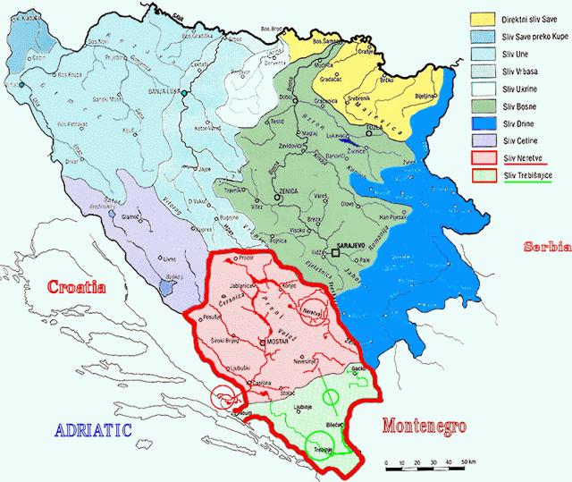
2 Bosnia and Herzegovina Bosnia Herzegovina

3 Thermal power plants is one of the major sources of environmental pollution
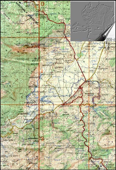
4 The subject of this research is the site of "Dražljevo" where the ashes have been deposited since the first day of the commissioning of the mine and thermal power plant Gacko, eastern Hercegovina.

5 Re-cultivation on the territory of BiH started to be applied during the second half of the fifties. The largest volume of re-cultivation was achieved in BiH in mines of Tuzla region.
 of soils of dumps in the process of re-cultivation for the purposes of obtaining an objective insight into the type, degree and damage to the")
6 The aim of this study is to determine, by pedological researches, the total content of heavy metals: cadmium (Cd), lead (Pb), copper (Cu), zinc (Zn), nickel (Ni) of soils of dumps in the process of re-cultivation for the purposes of obtaining an objective insight into the type, degree and damage to the soil.
7 Used FBiH legislation according to the Law on Agricultural Soil (Official Gazette of FBiH, no. 52/09) i.e. the Instructions on determining the allowable amount of harmful and dangerous substances in soil and methods of their investigation (Official Gazette of FBiH no. 72/09) treats pollution i.e. soil contamination with heavy metals in terms of growing the crop plants, i.e. as agricultural soil, based on textural characteristics. In Serbia, the criteria for the assessment of soil contamination with heavy metals (MAC) are given in the Regulations on permitted amounts of dangerous and harmful substances in soil and water for irrigation and methods for their investigation (Official Gazette of RS, no. 23/94) and the Regulation on the program for systematic monitoring of soil quality, indicators for risk assessment of soil degradation and methodology for development of remediation programs (Official Gazette of RS, no. 88/2010).
 MO+OG Internal morphology of the soils of dumps in the process of re-cultivation External morphology of soils of dumps in the process of")
8 Soils of dumps Profile 35 Relief: slightly wavy Vegetation: spontaneous natural vegetation Location: within the thermal power plant On the pedolgical map of BiH R 1:50000 soil described as: The mineral-marsh gleyic and organo-mineral gley soils (70%+30%) MO+OG Internal morphology of the soils of dumps in the process of re-cultivation External morphology of soils of dumps in the process of re-cultivation I (0-33 cm) - a layer of brown color (10 YR 3/3) when dry and when wet dark brown color (10 YR 2/4). Texture is silty clay loam soil, lumps structures, calcareous. II (33-68cm) - a layer of brown (10 YR 3/3) when dry and when wet dark brown color (10 YR 2/4). Texture is silty clay loam, prismatic structure, calcareous. III ( cm) a layer of grey color (10 YR 5/1) when dry and when wet dark gray (10 YR 4/1). Texture is loam, powdery structure, calcareous. Pedological researches
9 The total content of heavy metals (mg/kg) of soils of dumps in the process of re-cultivation Heavy metals (mg/kg) Sites MAC (mg/kg) Corrected limit value (mg/kg) Remediation value (mg/kg) Cadmium (Cd) Lead (Pb) Copper (Cu) Zinc (Zn) Nickel (Ni) In all investigated samples of the content of total Pb and Zn is below the corrected limit value. The content of total Cd and Cu is above the corrected limit value in samples at sites 1, 2 and 4

10 In all investigated samples, the total Ni content is above the corrected limit value. The contents of all investigated elements in the soil dumps in the process of re-cultivation are under remediation values.


11 Mineralogical composition of the limestone substrate can be the source of the presence of Cd, Cu and Ni of geochemical origin, while the ashes of thermal power plants can be the cause of anthropogenic origin. Origin of high concentrations of Cd, Cu and Ni can be objectively explained only after determining readily available content which requires further research.
 MO+OG Internal morphology of slag dump External morphology of slag dump I (0-20 cm) - a layer of dark gray")
 - a layer of dark gray color (10 YR 3/1) when dry and in the wet state almost black color (10 YR 2/1). The texture is sandy, powdery structure, calcareous.")
12 Profile 38 Location: within the thermal power plant Relief: more conical elevations with diameter of about 200 m Vegetation: no vegetation Date of study: Summer 2010 On the pedological map of BiH R 1:50000 soil described as: The mineral-marsh gleyic and organo-mineral gley soils (70%+30%) MO+OG Internal morphology of slag dump External morphology of slag dump I (0-20 cm) - a layer of dark gray color (10 YR 3/1) when dry and in the wet state almost black color (10 YR 2/1). The texture is loamy sand, powdery structure, calcareous. II (20-40 cm) - a layer of dark gray color (10 YR 3/1) when dry and in the wet state almost black color (10 YR 2/1). The texture is sandy, powdery structure, calcareous. III (20-40 cm) - a layer of dark gray color (10 YR 3/1) when dry and in the wet state almost black color (10 YR 2/1). The texture is loamy sand, powdery structure, calcareous. IV (20-40 cm) - a layer of dark gray color (10 YR 3/1) when dry and in the wet state almost black color (10 YR 2/1). The texture is loamy sand, powdery structure, calcareous.
 MO+OG External morphology of ash dump Internal morphology of ash dump I (0-20 cm) - a layer of grey-yellow color (10 YR 6/4) in the dry state and in the")
 - a layer of grey-yellow color (10 YR 6/2) in the dry state and the in wet state darker gray yellow (10 YR 5/2 Texture is sandy loam, crumb structure, calcareous.")
13 Profile 41 Relief: flat Vegetation: no vegetation Location: within the thermal power plant Date of study: Summer 2010 On the pedological map of BiH R 1:50000 soil described as: The mineral-marsh gleyic and organo-mineral gley soils (70%+30%) MO+OG External morphology of ash dump Internal morphology of ash dump I (0-20 cm) - a layer of grey-yellow color (10 YR 6/4) in the dry state and in the wet state darker gray yellow (10 YR 5/3 Texture is sandy loam, powdery structure, calcareous. II (20-40 cm) - a layer of grey-yellow color (10 YR 6/2) in the dry state and the in wet state darker gray yellow (10 YR 5/2 Texture is sandy loam, crumb structure, calcareous. III (20-40 cm) - a layer of grey-yellow color (10 YR 6/2) in th dry state and in the wet state darker gray yellow (10 YR 5/2 Texture is sandy loam, powdery structure, calcareous. IV (20-40 cm) - a layer of grey-yellow color (10 YR 6/2) in th dry state and in the wet state darker gray yellow (10 YR 5/2 Texture is loamy sand soil, powdery structure, calcareous. Pedological researches
 MO+OG Internal morphology of mullock dump External morphology of mullock dumps I (0-20 cm) - a layer of")
 - a layer of gray color (10 YR 6/2) when dry and in the wet state darker gray (10 YR 5/2). Texture is clays, crumb structure, calcareous.")
14 Profile 44 Relief: more conical elevations with diameter of about 50 m Vegetation: no vegetation Location: within the thermal power plant Date of study: Summer 2010 On the pedological map of BiH R 1:50000 soil described as: The mineral-marsh gleyic and organo-mineral gley soils (70%+30%) MO+OG Internal morphology of mullock dump External morphology of mullock dumps I (0-20 cm) - a layer of light gray color (10 YR 7/2) when dry and in the wet state darker gray (10 YR 6/3). Texture is silty loam, powdery structure, calcareous. II (20-40 cm) - a layer of gray color (10 YR 6/2) when dry and in the wet state darker gray (10 YR 5/2). Texture is clays, crumb structure, calcareous. III (20-40 cm) - a layer of gray color (10 YR 6/2) when dry and in the wet state darker gray (10 YR 5/2). Texture is silty loam, powdery structure, calcareous. IV (20-40 cm) - a layer of gray color (10 YR 6/2) when dry and in the wet state darker gray (10 YR 5/2). Texture is loamy sand, crumb structure, calcareous. Pedological researches


15 RIVER ZALOMKA SUMMER SPRING

16 Save Our Soil S.O.S Thank you for attention Agrosym 2015 Welcome to the VI International Scientific Agriculture Symposium "Agrosym 2015" Jahorina, October 2015, Hotel Bistrica*** Bosnia and Herzegovina VEB: Gatačko goveče
EDULABZ. Ans. (b) 7. The soft, porous layer with a good water-retaining capacity forms the
 7. The soft, porous layer with a good water-retaining capacity forms the") 3 SOIL I. Multiple choice questions: Tick ( ) the correct choice. 1. The process of soil formation is called (a) conservation (b) weathering (c) erosion (d) none Ans. (b) 2. Soil profile consists of (a)
3 SOIL I. Multiple choice questions: Tick ( ) the correct choice. 1. The process of soil formation is called (a) conservation (b) weathering (c) erosion (d) none Ans. (b) 2. Soil profile consists of (a)
PHYSICAL CHARACTERISTICS REPORT INCORPORATING AGRICULTURAL LAND CLASSIFICATION LAND AT BOLE INGS, WESTBURTON, NOTTINGHAMSHIRE (SK805875)
") (krahs 2% I?5 PHYSICAL CHARACTERISTICS REPORT INCORPORATING AGRICULTURAL LAND CLASSIFICATION LAND AT BOLE INGS, WESTBURTON, NOTTINGHAMSHIRE (SK805875) 1.0 INTRODUCTION 1.1 The site, an area of 84.5 hectares,
(krahs 2% I?5 PHYSICAL CHARACTERISTICS REPORT INCORPORATING AGRICULTURAL LAND CLASSIFICATION LAND AT BOLE INGS, WESTBURTON, NOTTINGHAMSHIRE (SK805875) 1.0 INTRODUCTION 1.1 The site, an area of 84.5 hectares,
(iv) Middle layer of the soil (d) Small particles and packed tight
 Middle layer of the soil (d) Small particles and packed tight") NCERT solution Soil 1 Question 1 In addition to the rock particles, the soil contains (i) air and water (ii) water and plants (iii) minerals, organic matter, air and water (iv) water, air and plants (iii)
NCERT solution Soil 1 Question 1 In addition to the rock particles, the soil contains (i) air and water (ii) water and plants (iii) minerals, organic matter, air and water (iv) water, air and plants (iii)
27/01/2017. This event is being run by SAC Consulting. What is Soil?
 This event is being run by SAC Consulting What is Soil? 1 Soil Texture It describes the physical composition of the soil % of sand, silt and clay Refers to the mineral fragments of the soil only water
STATEMENT OF PHYSICAL CHARACTERISTICS AND AGRICULTURAL LAND CLASSIFICATION
 STATEMENT OF PHYSICAL CHARACTERISTICS AND AGRICULTURAL LAND CLASSIFICATION BIRKWOOD FARM, ALTOFTS WEST YORKSHIRE Proposed Opencast Extraction of Clay and coal ADAS January 1990 Leeds Regional Office File
1 Describe the concept of soil texture and its importance. 2 Determine the texture of a soil sample.
 Interest Approach Provide students with various samples of soil. One sample should be nearly all sand, one nearly all clay, and one nearly all silt. Ask students to determine how the samples differ. Would
PROPOSED OPEN CAST COAL SITE SEPTEMBER 1992
 AGRICULTURAL LAND CLASSIFICATION AND STATEMENT OF PHYSICAL CHARACTERISTICS SKIERS SPRING, HOYLAND, SOUTH YORKSHIRE PROPOSED OPEN CAST COAL SITE SEPTEMBER 1992 ADAS LEEDS STATUTORY GROUP Job No. 98/92 MAFF
LAB 12: Soils. Name School. Patrich Physical Geography Lab 1
 Name School LAB 12: Soils Soil is a mixture of weathered rock & organic matter that usually covers bedrock (solid rock that underlies all soil). Both chemical & mechanical processes are involved in the
List of Equipment, Tools, Supplies, and Facilities:
 Unit A: Principles of Soil Lesson 2: Overview of Soil Science Student Learning Objectives: Instruction in this lesson should result in the students achieving the following objectives: 1. Understand the
Horner-McLaughlin Woods: Soil Types
 Horner-McLaughlin Woods: Soil Types Not present at HMW Adrian Muck Conover Loam 0-4% Slopes Houghton Muck Miami Loam 2-6% Slopes Miami Loam 6-12% Slopes Miami Loam 12-18% Slopes t 0 0.125 0.25 Miles Mary
MAFF Ministry of Ifinil Agriculture Rsheries and Food
 MAFF Ministry of Ifinil Agriculture Rsheries and Food STATEMENT OF PHYSICAL CHARACTERISTICS AND AGRICULTURAL LAND CLASSIFICATION SHILBOTTLE COLLIERY RECLAMATION SCHEME NORTHUMBERLAND DECEMBER 1994 ADAS
2014 Iowa FFA Soil Judging CDE Exam
 2014 Iowa FFA Soil Judging CDE Exam 1. Landscape position is one aspect of evaluating the surface features of a certain tract of land. Identifying the correct landscape position will indicate: a. If the
Soil Management Site Selection, Soil Fertility. Warren Roberts George Kuepper
 Soil Management Site Selection, Soil Fertility Warren Roberts George Kuepper Where We re Going Soil Texture and Drainage Site Selection Soil Fertility & ph Fertilizers & Nutrients Later Sessions Soil Biology
ATTACHMENT A BIORETENTION SOIL SPECIFICATION
 1.00 BIORETENTION SOIL ATTACHMENT A BIORETENTION SOIL SPECIFICATION Bioretention soil shall achieve an initial infiltration rate of at least 8-inch per hour nor more than 20 inches per hour in situ and
Soil Geography Notes JC-Learn. JC-Learn. Geography Notes Soil. 1 P a g e
 JC-Learn Geography Notes Soil 1 P a g e Soil Soil is the thin covering of loose material that makes up the outermost layer of our planet. It is a living thing and a rich natural resource. Plants need soil
TEXTBOOK QUESTIONS AND THEIR ANSWERS. Q.1. Can the soil from a field be used to make toys?
 9 SOIL TEXTBOOK QUESTIONS AND THEIR ANSWERS Q.1. Can the soil from a field be used to make toys? Ans. No, soil from a field cannot be used to make toys. In order to make toys the soil should be clayey.
Agricultural Land Classification and Statement of Physical Characteristics Higbfield Farm Whitley Bridge North Yorkshire October 1996
 Agricultural Land Classification and Statement of Physical Characteristics Higbfield Farm Whitley Bridge North Yorkshire October 1996 Resource Planning Team ADAS Reference: 82/96 Leeds Statutory Group
Soil testing Page 1. Contrary to what is widely believed, the colour of the soil reveals very little about its fertility.
 Soil testing Page 1 Soil The Basics Soil is the uppermost surface of the earth, which has been slowly transformed by decomposition due to the effects of weather, vegetation and human activities. The parent
2011 Wisconsin Envirothon Soils and Land Use Exam
 2011 Wisconsin Envirothon Soils and Land Use Exam USE THE OCONTO COUNTY SOIL SURVEY TO ANSWER QUESTIONS 1-4 The Pensaukee River Wetland Complex is a mixture of state (Pensaukee Wildlife Area) and privately
SOILS IN URBAN / SUBURBAN LANDSCAPES. Lisa Krall Soil Scientist CT USDA NRCS Tolland, CT
 SOILS IN URBAN / SUBURBAN LANDSCAPES Lisa Krall Soil Scientist CT USDA NRCS Tolland, CT What is Urban Soil? Is This Soil? Is This Soil? active gravel pit pavement and buildings vegetated roadside areas
Special Assignment for Wednesday: Watch video on soil texture analysis https://youtu.be/ioyabxj767s
 Special Assignment for Wednesday: Watch video on soil texture analysis https://youtu.be/ioyabxj767s Lecture 3: Soil Physical Properties Important Physical Properties Soil Color: Most obvious physical property;
STATEMENT OF PHYSICAL CHARACTERISTICS AND AGRICULTURAL LAND CLASSIFICATION WITTON PARK, COUNTY DURHAM PROPOSED QUARRY EXTENSION DECEMBER 1992

Soil CLASS. VII Soil Soil is an inseparable part of our life. Explain Humus Weathering The nature of soil: Soil Profile Horizons.
 Soil CLASS. VII Soil : The mixture of soil particles with humus is called soil. Soil is an inseparable part of our life. Explain 1. Soil is one of the most important natural resources. 2. It supports the
SUMMARY. alcholnie.doc\ih\jk
 SUMMARY A detailed Statement of Physical Characteristics and Agricultural Land Classification survey of ha of land at Stainton ("Holme Hall Quarry Extension") was carried out in September 1994. At the
Homework Activity Jar Test for Soil Texture
 Homework Activity Jar Test for Soil Texture Background: 1. What is soil? 2. What natural factors influence the formation of soil? 3. How will the depth of each horizon in your soil profile affect your
AGRICULTURAL LAND CLASSIFICATION AND STATEMENT OF PHYSICAL CHARACTERISTICS
 AGRICULTURAL LAND CLASSIFICATION AND STATEMENT OF PHYSICAL CHARACTERISTICS SEGHILL, NORTHUMBERLAND PROPOSED VASTE DISPOSAL SITE ADAS January 1989 Leeds Regional Office REF: 3/89 2FCS 4191 lds.rpg3.seghill
Soil Texture = %Sand, Silt & Clay in a soil.
 Soils Soil Texture = %Sand, Silt & Clay in a soil. Soil texture is the single most important physical property of the soil. Knowing the soil texture alone will provide information about: 1) water flow
Overview of Soil Properties
 Willie Harris apatite@ufl.edu Acknowledgments: Wade Hurt Mike Vepraskas FAESS Soil Scientists Overview of Soil Properties Website to download files of talks: wgharris.ifas.ufl.edu.hsw.htm Meaning of Soil
Overview of Soil Properties
 Willie Harris apatite@ufl.edu Acknowledgments: Wade Hurt Mike Vepraskas FAESS Soil Scientists Overview of Soil Properties Website to download files of talks: wgharris.ifas.ufl.edu.hsw.htm Meaning of Soil
Scientific registration no : 43 Symposium no : 27 Presentation : poster. GOBRAN Omar 1), EL-BARBARY Serry 2)
, EL-BARBARY Serry 2)") Scientific registration no : 43 Symposium no : 27 Presentation : poster Morphological Changes of Newly Reclaimed Soils In Egypt Cultivated For Different Periods Modifications morphologiques au cours du
Scientific registration no : 43 Symposium no : 27 Presentation : poster Morphological Changes of Newly Reclaimed Soils In Egypt Cultivated For Different Periods Modifications morphologiques au cours du
Know Your Soil Getting the Dirt on Your Dirt FWAA. Dr. Steve Petrie Director of Agronomic Services
 Know Your Soil Getting the Dirt on Your Dirt FWAA Dr. Steve Petrie Director of Agronomic Services Crop productivity Genetics Soil Temperature Environ ment Crop Yield Moisture Manage ment Take the time
Soil Maps for Production Agriculture. Jarrod O. Miller, Extension Agronomist
 Soil Maps for Production Agriculture Jarrod O. Miller, Extension Agronomist Origination of Soil Mapping Originally mapped by Division of Soils Federal Bureau of Soils Soil Conservation Service (SCS) started
AGRICULTURAL LAND CLASSIFICATION AND SOIL PHYSICAL CHARACTERISTICS BIRCH PIT, NEAR COLCHESTER ESSEX
 AGRICULTURAL LAND CLASSIFICATION AND SOIL PHYSICAL CHARACTERISTICS BIRCH PIT, NEAR COLCHESTER ESSEX AGRICULTURAL LAND CLASSIFICATION AND SOIL PHYSICAL CHARACTERISTICS SEMI-DETAILED SURVEY BIRCH PIT, NEAR
DELHI PUBLIC SCHOOL TAPI
 DELHI PUBLIC SCHOOL TAPI CLASS VII SUBJECT: SCIENCE Ch 9- SOIL Subjective Type Exercises A. Very Short Answer Questions 1. What is weathering? Ans: The process of breaking down of rocks by the action of
SOIL SURVEY FOR PROPOSED WET ASH DISPOSAL FACILITY, HENDRINA POWER STATION, MPUMALANGA PROVINCE
 REPORT for Lidwala Environmental and Planning Servives by the INSTITUTE FOR SOIL CLIMATE AND WATER AGRICULTURAL RESEARCH COUNCIL SOIL SURVEY FOR PROPOSED WET ASH DISPOSAL FACILITY, HENDRINA POWER STATION,
Soils and Land Use Test
 SOIL PROPERTIES Total Score /50 1) List two of the five main functions of soil. (2 points) Habitat for organisms, Engineering medium, Filters and stores water, Anchor for plants, Cycles nutrients 2) Small
Vietnam soils. Soil K and soil P status. Rich in phosphorus >0.10% P 2 O 5. in hydromorphous soils >0.20% P 2. in ferralitic soils
 Vietnam soils K and soil P status Rich in phosphorus >0.0% P O in hydromorphous soils >0.% P O in ferralitic soils Medium in phosphorus >0.0 0.0% P O in hydromorphous soils >0.0 0.% P O in ferralitic soils
Soil Formation. 6.E.2.3 Explain how the formation of soil is related to the parent rock type and the environment in which it develops.
 Soil Formation 6.E.2.3 Explain how the formation of soil is related to the parent rock type and the environment in which it develops. What is soil? A loose mixture of weathered rock, organic material,
AGRICULTURAL LAND CLASSIFICATION
 AGRICULTURAL LAND CLASSIFICATION GOOLE/HOOK LOCAL PLAN SITES SURVEYED FOR BOOTHFERRY BOROUGH COUNCIL'S INDUSTRIAL LAND SUITABILITY STUDY ADAS February 1991 Leeds Regional Office 2FCS 5205 CONTENTS 1. Introduction
If A rr Ministry of. IfiriEI. Agriculture Fisheries and Food
 If A rr Ministry of IfiriEI. Agriculture Fisheries and Food AGRJCULTURAL LAND CLASSIFICATION CLEETHORPES DISTRICT LOCAL PLAN SITE H2 (SOUTH WEST) OCTOBER 1993 ADAS Leeds Statutory Group Job No:- 164/93
AGRICULTURAL LAND CLASSIFICATION VULCAN VILLAGE (PROPOSED GOLF COURSE) ST HELENS MBC
 ST HELENS MBC") AGRICULTURAL LAND CLASSIFICATION VULCAN VILLAGE (PROPOSED GOLF COURSE) ST HELENS MBC MJW WOOD ADAS Ref: 25/RPT/0709 Resource Planning Team Job No: 155/94 ADAS Statutory Group MAFF Ref: EL 25/10811 WOLVERHAMPTON
AGRICULTURAL LAND CLASSIFICATION VULCAN VILLAGE (PROPOSED GOLF COURSE) ST HELENS MBC MJW WOOD ADAS Ref: 25/RPT/0709 Resource Planning Team Job No: 155/94 ADAS Statutory Group MAFF Ref: EL 25/10811 WOLVERHAMPTON
EXAMPLE Point A: Sandy Loam: 65% Sand _ 20% Silt _ 15% Clay. Point B: %Sand % Silt % Clay. Point C: %Sand % Silt % Clay. Point D: %Sand % Silt % Clay
 SOIL TEXTURE Refers to proportions of sand, silt and clay size particles. These proportions determine water infiltration rates, permeability rates, and water holding rates. Using a soil texture triangle.
Soil is a Natural Resource. February 12, 2015
 February 12, 2015 February 12, 2015 Soil types differ in how they hold water. Soil that is mostly humus absorbs water like a sponge with only a little runoff, and this water is then available to the plants.
DIRT! APES Laboratory Activity
 Name: Part I: Soil Texture DIRT! APES Laboratory Activity Can one determine the texture of soil by examining the particles found in a particular sample? The purpose of this activity is to determine the
SOIL SEPARATES. Soil Evaluator Day 2, Presentation 3-3/27/2018. Soil Texture, Page 1 TITLE 5 SOIL EVALUATOR CERTIFICATION TRAINING SOIL TEXTURE
 Soil Evaluator Day 2, Presentation 3-3/27/18 TITLE 5 SOIL EVALUATOR CERTIFICATION TRAINING SOIL TEXTURE Prepared for: Commonwealth of Massachusetts Department of Environmental Protection By L.A. Spokas,
The Dirt on Soil Science
 The Dirt on Soil Science Dr. Laura Deeter deeter.7@osu.edu Ohio State ATI 1 Rough Outline Basic Michigan soil history Soil Basics What is soil Soil texture/particles ph Plant nutrients Organic Matter 2
Lecture 5: Introduction to Soil Classification; Soil Physical Properties
 Lecture 5: Introduction to Soil Classification; Soil Physical Properties Soil Classification Argillic Horizon Alfisols Moderately leached soils with a clay-rich B-horizon Typically found in forests Andisols
DO YOU KNOW YOUR SOILS? (Rev. 10/11)
") DO YOU KNOW YOUR SOILS? (Rev. 10/11) Circle all the correct answers. 1. What is the layer normally present on the surface of the soil in cropped fields? a. O c. Ap e. B g. R b. A d. E f. C 2. Available
DO YOU KNOW YOUR SOILS? (Rev. 10/11) Circle all the correct answers. 1. What is the layer normally present on the surface of the soil in cropped fields? a. O c. Ap e. B g. R b. A d. E f. C 2. Available
Terminology & Soil Science. Andy Spetch
 Terminology & Soil Science Andy Spetch 1 Presentation Soil Profile Soil Structure Soil Texture Compaction Cation Exchange Capacity Soil ph Nutrients / Organic Matter / EC / PTE s 2 What is Soil: A blend
AGRICULTURAL LAND CLASSIFICATION AND STATEMENT OF PHYSICAL CHARACTERISTICS
 AGRICULTURAL LAND CLASSIFICATION AND STATEMENT OF PHYSICAL CHARACTERISTICS DALE PIT FARM. HATFIELD VOODHOUSE PROPOSED EXTRACTION OF SAND AHD GRAVEL ADAS April 1989 Leeds Regional office File Ref: 2FCS
a. OVERALL PROFILE DEPTH: Assess the depth to the first restrictive layer, which can be a tree root, a rock or an
 OBSERVING SOIL PROCEDURE Using a shovel, soil probe, or soil auger, collect a soil profile. (Go as deep as you can with the equipment). Arrange the soil you remove from the ground on newspaper or in a
Lesson 1: Recognizing the Characteristics of Soils and the Soil Requirements for Fruit and Nut Crops
 Lesson 1: Recognizing the Characteristics of Soils and the Soil Requirements for Fruit and Nut Crops 1 Mineral matter Organic matter Pore spaces Tilth Hygroscopic water Soil aeration 22 I. Soil is a layer
URBAN SOILS & SEATTLE EXAMPLES
 Class Results - Mystery Soil #1 14 12 10 8 6 4 2 0 Sandy Clay Loam Sandy Loam Silty Loam Class Results - Mystery Soil #2 6 5 4 3 2 1 0 Silty Clay Clay Loam Sandy Sandy Silty Sandy Silty Loamy Loam Clay
GEOL 408/508 INTRODUCTORY SOILS
 GEOL 408/508 INTRODUCTORY SOILS Lecture = 3 hrs/week Lab = 3hrs/week Course = 4 credits Name/Define the Following 1. N 2 2. NH 3 3. NH + 4 4. NO - 2 5. NO - 3 6. protein 7. organics 8. organic matter 9.
Bell Ringer. d) Erosion e) Decomposition of organic compounds
 Erosion e) Decomposition of organic compounds") Bell Ringer 1) A rock exposed to high winds, over a long period of time, loses half of its original size. This is an example of a) Physical weathering b) Chemical weathering c) Biological weathering d)
Bell Ringer 1) A rock exposed to high winds, over a long period of time, loses half of its original size. This is an example of a) Physical weathering b) Chemical weathering c) Biological weathering d)
M AFT Ministry of Ifin&l. Agriculture Rsheries and Food
 ^ M AFT Ministry of Ifin&l. Agriculture Rsheries and Food AGRICULTURAL LAND CLASSIFICATION BARNSLEY UDP (AREA OF SEARCH FOR AIRFIELD) SOUTH YORKSHIRE JANUARY 1995 ADAS Job No:- 9/95 Leeds Statutory Group
Objectives: Students will learn about the types and textures of soil within a soil profile.
 Objectives: Students will learn about the types and textures of soil within a soil profile. Materials: Soil profile pictures with description (mounted with Velcro) Soil profile poster board Soil Word Scramble
Girtridge Monitor Farm Meeting
 Girtridge Monitor Farm Meeting 15 th August 2018 1 Managing Soil Drainage and Compaction in Pasture Key factors for movement of water in the soil Soil Texture Soil Structure Soil Compaction 2 1 Soil Texture
2012 FINAL SOILS AREA 2 Envirothon Questions Answer KEY
 2012 FINAL SOILS AREA 2 Envirothon Questions Answer KEY Questions 1-6 to be answered at the soil pit: 1. Soil scientists categorize soils by drainage classes. What is the drainage class of the soil at
AGRICULTURAL USE & QUALITY OF LAND NEAR MINDALE HOUSE PRESTATYN. Report 762/1
 AGRICULTURAL USE & QUALITY OF LAND NEAR MINDALE HOUSE PRESTATYN Report 762/1 11 th April, 2012 AGRICULTURAL USE & QUALITY OF LAND NEAR MINDALE HOUSE PRESTATYN F W Heaven, BSc, MISoilSci Report 762/1 Ltd
Fig.15.1 Soil Textural Triangle
 Exercise 15 Fig.15.1 Soil Textural Triangle Procedure Three methods are suggested here. Any one of these may be followed. Method I (i) Collect about 300 500g of soil from two different locations. Label
Land Capability Classifications
 Land Capability Classifications Unit: Soil Science Problem Area: Basic Principles of Soil Science Student Learning Objectives. Instruction in this lesson should result in students achieving the following
Preliminary Soil Survey at N Fifikh Site
 Feasibility Study on Water Resources Development in Rural Area in the Kingdom of Morocco Final Report Volume VII Data Book Data Book SO Soil Survey SO2 Preliminary Soil Survey at N Fifikh Site Preliminary
Lesson 1: Identifying Texture in Soil
 Lesson 1: Identifying Texture in Soil 1 Clods Loam Peds Permeability Soil structure Soil texture Soil workability Textural triangle Water-holding capacity 2 I. A. Soil texture is the fineness or coarseness
Unit 5: Soil - Stages of Soil formation
 Biology Form 3 Page 68 Ms. R. Buttigieg Unit 5: Soil - Stages of Soil formation Soil is the layer of material covering parts of the land, the home of many organisms and the area from which land plants
2016 Iowa FFA Soils Evaluation CDE Exam
 2016 Iowa FFA Soils Evaluation CDE Exam 1. Which of the following is true regarding soil horizons? a. A horizon is darker in color and has more organic matter b. B horizon is darker in color and has more
5.1 Introduction to Soil Systems IB ESS Mrs. Page
 5.1 Introduction to Soil Systems IB ESS Mrs. Page 2015-2016 I Am Soil Thinking Routine: See, Think, Wonder Look at the following images. For each image write down what you see Then write down what you
AGRONOMY 255, 251, 270 SOIL DIFFERENCES
 Name AGRONOMY 255, 251, 270 SOIL DIFFERENCES Soils differ strikingly from each other. This week we illustrate the great differences and ask you to learn how they differ and to become skilled in describing
Tim O Hare Associates LLP Howbery Park Wallingford Oxfordshire OX10 8BA T:
 Mr Andy Spetch British Sugar plc Co-Products Oundle Road Peterborough PE2 9QU Dear Sirs 26 th April 2016 Our Ref: TOHA/16/6623/SS Your Ref: O/N 50098076 Topsoil Analysis Report: Wissington Hort Loam We
STATEMENT OF PHYSICAL CHARACTERISTICS OLDWICK FARM, WEST LAVANT, WEST SUSSEX
 STATEMENT OF PHYSICAL CHARACTERISTICS OLDWICK FARM, WEST LAVANT, WEST SUSSEX STATEMENT OF PHYSICAL CHARACTERISTICS OLDWICK FARM, WEST LAVANT, WEST SUSSEX 1. BACKGROUND 1.1 This 37.1 ha site was surveyed
CLAY, SANDY AND PEAT SOILS, AND SOIL ORGANIC MATTER
 CLAY, SANDY AND PEAT SOILS, AND SOIL ORGANIC MATTER Background Most normal soils ( mineral soils ) consist of tiny particles of rock that have been broken into small pieces by such things as wind, water,
SOILS AND AGRICULTURAL USE & QUALITY OF LAND OFF HOLT ROAD, ROSSETT. Report 1067/1
 SOILS AND AGRICULTURAL USE & QUALITY OF LAND OFF HOLT ROAD, ROSSETT Report 1067/1 2 nd March, 2015 SOILS AND AGRICULTURAL USE AND QUALITY OF LAND OFF HOLT ROAD, ROSSETT M W Palmer, MSc, PhD, MISoilSci
Recommended Resources: The following resources may be useful in teaching this lesson:
 Unit E: Basic Principles of Soil Science Lesson 4: Understanding Soil Texture and Structure Student Learning Objectives: Instruction in this lesson should result in students achieving the following objectives:
HORT 102: Soil Properties. Cultivated Plants: Lecture 15. [Teresa Koenig] Slide #: 1 Slide Title: Intro Information Slide
![HORT 102: Soil Properties. Cultivated Plants: Lecture 15. [Teresa Koenig] Slide #: 1 Slide Title: Intro Information Slide](/thumbs/76/74082590.jpg "HORT 102: Soil Properties. Cultivated Plants: Lecture 15. [Teresa Koenig] Slide #: 1 Slide Title: Intro Information Slide") HORT 102: Soil Properties Cultivated Plants: Lecture 15 [Teresa Koenig] Slide #: 1 Slide Title: Intro Information Slide Title: Lecture 15 Soil Properties Speaker: Teresa Koenig Created by: Teresa Koenig,
HORT 102: Soil Properties Cultivated Plants: Lecture 15 [Teresa Koenig] Slide #: 1 Slide Title: Intro Information Slide Title: Lecture 15 Soil Properties Speaker: Teresa Koenig Created by: Teresa Koenig,
Soil Horizons cont. Oa- highly decomposed Oi-undecomposed
 Soils Soil Basics Soil Horizons Soil Horizons cont. O Horizon: Or organic layer Organic layer of decomposing plant and animal tissue. Wooded upland areas have thin O horizons Wetlands may have thick O
PASTURE AND HAY FIELDS: SOIL FUNDAMENTALS. Sanders County April 8, Clain Jones
 PASTURE AND HAY FIELDS: SOIL FUNDAMENTALS Sanders County April 8, 2015 Clain Jones clainj@montana.edu 994-6076 Objectives Present soil properties and how they interact with plant nutrients Illustrate the
Soil Physical Properties
 Soil Physical Properties ESRM 311 SEFS 507 Some examples of mineral soil development eg, Rock Weathering Types of Weathering Physical/Mechanical Chemical Biological Photo by D Vogt CO 2 + H 2 O H 2 CO
P/2014/00830 Received 27/06/2014 SOIL RESOURCES AND AGRICULTURAL USE & QUALITY OF LAND AT ROLLESTON PARK FARM TUTBURY, STAFFORDSHIRE.
 P/2014/00830 Received 27/06/2014 SOIL RESOURCES AND AGRICULTURAL USE & QUALITY OF LAND AT ROLLESTON PARK FARM TUTBURY, STAFFORDSHIRE Report 953/1 28 th May, 2014 SOIL RESOURCES AND AGRICULTURAL USE & QUALITY
Do Now: From which materials do you think soil is made? Are all soils the same? Think of some ways that they are different?
 Do Now: From which materials do you think soil is made? Are all soils the same? Think of some ways that they are different? Basics Soil is a major component of the biosphere It contains solids, liquids
A Plant & Soil Ecosystem
 Introductory Study of Soils For the Master Gardeners Wendy Sue Harper, Ph.D. What We Will Cover Tonight Introduction Agroecological perspective to understanding the physical, chemical and biological properties
HUMBLEBURN OCCS, CRAGHEAD, COUNTY DURHAM SURVEY OF RESTORED LAND OCTOBER RPT Job Number: 73/97 MAFF Reference: EL LURET Job Number: ME3RTP
 HUMBLEBURN OCCS, CRAGHEAD, COUNTY DURHAM SURVEY OF RESTORED LAND OCTOBER 1997 Resource Planning Team Northern Region FRCA, Leeds RPT Job Number: 73/97 MAFF Reference: EL 10387 LURET Job Number: ME3RTP
Unit D: ph of Soil. Lesson : Identifying the ph Changes in Soil
 Unit D: ph of Soil Lesson : Identifying the ph Changes in Soil 1 KEY TERMS Soil ph Acid Lime Requirement 2 I. The ph scale measures how acidic or basic a substance is. A. It ranges from 0 to 14. 1. A ph
Soils and the Environment. A Summary of RI Envirothon Study Materials Compiled by Sally Paul
 Soils and the Environment A Summary of RI Envirothon Study Materials Compiled by Sally Paul Why Soils Food and water resources Disposing of waste Support for human structures Growing timber and fibers
Soil characteristics that influence nitrogen and water management
 Section C Soil characteristics that influence nitrogen and water management Soil characteristics vary across the landscape Soils vary from one field to another, and often within the same field. Soil differences
Declaration of Compliance BS3882:2015
 Declaration of Compliance BS3882:2015 Soil source: British Sugar TOPSOIL This declaration confirms that the topsoil represented by the attached Topsoil Analysis Report conforms to the requirements of the
Unit 6 Lesson 3 What Is Soil? Copyright Houghton Mifflin Harcourt Publishing Company
 Soil Is Not Just Dirt When you are in a forest or garden, what is under your feet? Below the sticks, rocks, and plants, there is soil. Soil Is Not Just Dirt What is soil? What are parts of soil? Soil is
Field Indicators of Hydric Soils in the United States: For All Soils. Field Indicators. Indicators for all soils regardless of texture
 Field Indicators of Hydric Soils in the United States: For All Soils From Vasilas, L.M., G.W. Hurt, and C.V. Noble. 2010. Field indicators of hydric soils in the United States (Version 7.0), USDA, NRCS,
2018 Iowa FFA Soil Judging CDE Exam 1. Landscape positions characterizes the location of the soil on the landscape and identifies potential risks.
 2018 Iowa FFA Soil Judging CDE Exam 1. Landscape positions characterizes the location of the soil on the landscape and identifies potential risks. Which landscape position is considered the floodplain
S9. Thin Dark Surface
 Dominant Field Indicators of Hydric Soils in Florida S9. Thin Dark Surface For use in LRRs R, S, U, and T; for testing in LRRs K and L. A layer 5 cm (2 inches) or more thick within the upper 15 cm (6 inches)
AGRICULTURAL LAND CLASSIFICATION AND SOIL PHYSICAL CHARACTERISTICS LAND NEAR SHIRE HILL FARM SAFFRON WALDEN ESSEX
 AGRICULTURAL LAND CLASSIFICATION AND SOIL PHYSICAL CHARACTERISTICS LAND NEAR SHIRE HILL FARM SAFFRON WALDEN ESSEX AGRICULTURAL LAND CLASSIFICATION (ALC) AND SOIL PHYSICAL CHARACTERISTICS LAND NEAR SHIRE
Team number Page 1 of Canon Envirothon Soils Station Test. Soils and Climate Change
 Team number Page 1 of 9 2006 Canon Envirothon Soils Station Test Soils and Climate Change There are many kinds of soil on the surface of the earth. The kind of soil that is present at a given location
Soil Science Curriculum
 Soil Science Curriculum Content and lab derived from the USDA-NRCS Guides for Educators. Go to www.nrcs.usda.gov/soils for the Guides and additional pictures and diagrams. This lesson plan was adapted
Soil is. Pieces of rock Minerals Decaying organic matter Water Air Living organisms All mixed together!
 Soil is. Pieces of rock Minerals Decaying organic matter Water Air Living organisms All mixed together! Soil Horizons the layers of soil O-horizon: the surface litter. Mainly black or brown A-horizon:
AGRICULTURAL LAND CLASSIFICATION GREAT GRIMSBY LOCAL PLAN SITE AG 2. GREAT COATES AUGUST 1993
 AGRICULTURAL LAND CLASSIFICATION GREAT GRIMSBY LOCAL PLAN SITE AG 2. GREAT COATES AUGUST 1993 ADAS Job No:- 131/93 Leeds Statutory Group MAFF Ref- EL 51/5 SUMMARY An Agricultural Land Classification survey
PHYSICAL CHAtlACTERISTICS REPORT FOR THE PROPOSED SAND AND GRAVEL SITE AT MANOR FARM, UFFINGTON
 PHYSICAL CHAtlACTERISTICS REPORT FOR THE PROPOSED SAND AND GRAVEL SITE AT MANOR FARM, UFFINGTON Introduction Following the" request for detailed information on the physical characteristics of soil at Manor
IOWA FFA STATE SOILS CDE SATURDAY, OCTOBER 13, 2007 AMES, IOWA
 IOWA FFA STATE SOILS CDE SATURDAY, OCTOBER 13, 2007 AMES, IOWA 1. Moderately sloping has what percent slope: a. 9-14% b. 2-5% c. 5-9% d. over 14% 2. Which of the following horizons is the loose underlying
STAFFORDSHIRE AND STOKE-ON- TRENT STRUCTURE PLAN Site 7: Priory Farm. Agricultural Land Classification ALC Map and Report November 1998
 STAFFORDSHIRE AND STOKE-ON- TRENT STRUCTURE PLAN Site 7: Priory Farm Agricultural Land Classification ALC Map and Report November 1998 A J Spalding Resource Planning Team RPT Reference: 008/98 & 25/RPT/Ol
 *2301001* Pit #1 ontestant #1 Team #1 alifornia DE - Soil and Land Evaluation Group: 1 ontestant: 1 SURFE SOIL (Fill in ONE bubble for each item). D 1. OLOR (5) 2. TEXTURE (5) 3. GRVEL ND ROK (3) 4. THIKNESS
Eco new farmers. Module 2 Soil and Nutrient Cycling. Section 1 Soils and soil fertility
 Eco new farmers Module 2 Soil and Nutrient Cycling Section 1 Soils and soil fertility Module 2 Soil and Nutrient Cycling Section 1 - Soils and soil fertility www.econewfarmers.eu 1. Introduction You will
STATEMENT OF PHYSICAL CHARACTERISTICS AND AGRICULTURAL LAND CLASSIFICATION
 STATEMENT OF PHYSICAL CHARACTERISTICS AND AGRICULTURAL LAND CLASSIFICATION DRAX AND BARLOV: Proposed Waste (PFA) disposal and Industrial development site ADAS MAY 1989 LEEDS REGIONAL OFFICE FILE REF: 2FCS