Pontiac Trail 1" = 80' B-1 B-2 B-3 B-4 B-5. to WB S23 C SB U M 14. a c Trl
|
|
|
- Hilary Reynolds
- 5 years ago
- Views:
Transcription


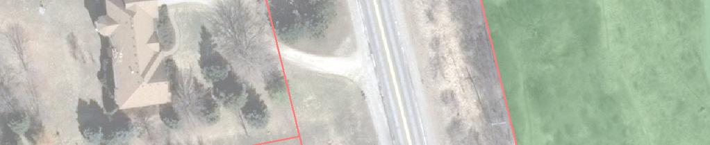


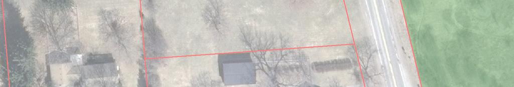

1 Pontiac Trail ONN S23 C SB U 4 M1 EB to WB M 14 B B a Ponti c Trl 318 B B B " = 80'


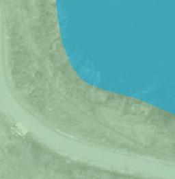
2 Pontiac Trail Dhu Varren Rd " = 80' B Pontiac Trl B NK n ig ht s brid ge C ir idge Cir S Knightsbr B B


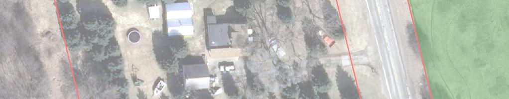
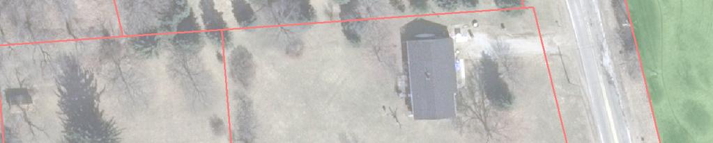
3 Pontiac Trl 26 B-12 B-13 B B Pontiac Trail 1" = 80' B-11
4 CTI and Associates Inc BORING NUMBER: Pontiac Trail B-1 PAGE 1 OF 1 CLIENT City of Ann Arbor PROJECT NAME Miscellaneous Geotechnical Services PROJECT NUMBER PROJECT LOCATION Ann Arbor, Michigan DATE STARTED 11/28/12 COMPLETED 11/28/12 GROUND ELEVATION N/A DRILLING CONTRACTOR Stearns Drilling GROUND WATER LEVELS: DRILLING METHOD 4-1/4 inch Hollow Stem Auger DURING DRILLING None LOGGED BY G. Geerlings CHECKED BY T. Marsik AFTER DRILLING NOTES Boring backfilled with auger cuttings and patched. COLLAPSE DEPTH 1' 6" None DEPTH ft) 0 GRAPHIC LOG MATERIAL DESCRIPTION inches ASPHALT PAVEMENT 13 inches of dark brown moist silty fine to medium SAND with gravel - FILL) Brown moist fine to medium SAND with some silt and trace of gravel - FILL) Dark brown moist sandy CLAY with silt and trace of gravel - FILL) SAMPLE TYPE NUMBER 1 2 RECOVERY % RQD) BLOW COUNTS N VALUE) ) ) POCKET PEN. tsf) UNC. STRENGTH psf) NATURAL MOISTURE CONTENT %) SPT N VALUE PL MC LL FINES CONTENT %) 10 Rubbelized ASPHALT with occasional clay seams and pieces of slag - FILL) Brown moist medium dense clayey fine SAND with trace of gravel and occasional clay seams - SC) Brown moist dense fine to medium SAND with some silt, trace of gravel and occasional cobbles - SP-SM) ) ) ) 20 Brown moist dense to very dense fine SAND with silt, some gravel and occasional cobbles - SM) ) 2 Bottom of borehole at 2.0 feet ) Boring performed 2' east of west edge of road, 61' north of address 318 driveway
5 CTI and Associates Inc BORING NUMBER: Pontiac Trail B-2 PAGE 1 OF 1 CLIENT City of Ann Arbor PROJECT NAME Miscellaneous Geotechnical Services PROJECT NUMBER PROJECT LOCATION Ann Arbor, Michigan DATE STARTED 10/11/12 COMPLETED 10/11/12 GROUND ELEVATION N/A DRILLING CONTRACTOR Stearns Drilling GROUND WATER LEVELS: DRILLING METHOD 2-1/4 inch HSA DURING DRILLING None LOGGED BY NOTES G. Geerlings Boring backfilled with auger cuttings. CHECKED BY T. Marsik AFTER DRILLING COLLAPSE DEPTH None 1'6" DEPTH ft) 0 GRAPHIC LOG MATERIAL DESCRIPTION 12 inches of dark brown moist sandy TOPSOIL with traces of gravel Brown moist medium dense clayey fine to medium SAND with silt and some gravel - SC) SAMPLE TYPE NUMBER 1 RECOVERY % RQD) BLOW COUNTS N VALUE) ) POCKET PEN. tsf) UNC. STRENGTH psf) NATURAL MOISTURE CONTENT %) SPT N VALUE PL MC LL FINES CONTENT %) Brown moist hard sandy CLAY with silt, trace of gravel and frequent silt partings - CL) ) Brown moist medium dense silty fine to coarse SAND with some gravel and occasional cobbles - SM) ) ) ) 20 Brown moist medium dense silty, clayey fine SAND with trace of gravel - SC-SM) ) Brown moist medium dense silty fine SAND with traces of gravel and clay - SM) 2 Bottom of borehole at 2.0 feet ) Boring performed 20' west of west edge of road, 40' north of center of Dhu Varren Road
6 CTI and Associates Inc BORING NUMBER: Pontiac Trail B-3 PAGE 1 OF 1 CLIENT City of Ann Arbor PROJECT NAME Miscellaneous Geotechnical Services PROJECT NUMBER PROJECT LOCATION Ann Arbor, Michigan DATE STARTED 10/11/12 COMPLETED 10/11/12 GROUND ELEVATION N/A DRILLING CONTRACTOR Stearns Drilling GROUND WATER LEVELS: DRILLING METHOD 2-1/4 inch HSA DURING DRILLING 13' LOGGED BY G. Geerlings CHECKED BY T. Marsik AFTER DRILLING None NOTES Boring backfilled with auger cuttings and patched. COLLAPSE DEPTH 16'6" DEPTH ft) 0 GRAPHIC LOG MATERIAL DESCRIPTION 6 inches of ASPHALT PAVEMENT 18 inches of brown moist fine to medium SAND with some gravel and clay - FILL) Brown moist medium dense gravelly fine to coarse SAND with some clay and occasional clay lenses - SP-SC) SAMPLE TYPE NUMBER 1 2 RECOVERY % RQD) 83 BLOW COUNTS N VALUE) ) ) POCKET PEN. tsf) UNC. STRENGTH psf) NATURAL MOISTURE CONTENT %) SPT N VALUE PL MC LL FINES CONTENT %) Brown moist hard CLAY with silt, traces of gravel and sand and occasional silt partings - CL) ) Brown moist dense fine SAND with some silt, trace of gravel and occasional cobbles - SP-SM) ) Brown wet dense sandy SILT - ML) ) Light brown moist dense to medium dense fine SAND with some silt - SP-SM) ) 2 Bottom of borehole at 2.0 feet ) Boring performed 10' west of east curb, 20' south of Knightsbridge Circle
7 CTI and Associates Inc BORING NUMBER: Pontiac Trail B-4 PAGE 1 OF 1 CLIENT City of Ann Arbor PROJECT NAME Miscellaneous Geotechnical Services PROJECT NUMBER PROJECT LOCATION Ann Arbor, Michigan DATE STARTED 10/12/12 COMPLETED 10/12/12 GROUND ELEVATION N/A DRILLING CONTRACTOR Stearns Drilling GROUND WATER LEVELS: DRILLING METHOD 2-1/4 inch HSA DURING DRILLING None LOGGED BY NOTES G. Geerlings Boring backfilled with auger cuttings. CHECKED BY T. Marsik AFTER DRILLING COLLAPSE DEPTH None None DEPTH ft) 0 GRAPHIC LOG MATERIAL DESCRIPTION 2 inches of dark brown TOPSOIL Brown moist medium dense silty, sandy GRAVEL - GM) SAMPLE TYPE NUMBER 1 RECOVERY % RQD) 94 BLOW COUNTS N VALUE) ) POCKET PEN. tsf) UNC. STRENGTH psf) NATURAL MOISTURE CONTENT %) SPT N VALUE PL MC LL FINES CONTENT %) Brown moist hard CLAY with silt, traces of gravel and sand and frequent silt partings - CL) ) ) ) Light brown moist dense to medium dense fine SAND with some silt - SP-SM) ) ) 2 Bottom of borehole at 2.0 feet ) Boring performed 1' west of west edge of road, 260' north of driveway to address 273 Pontiac Trail
8 CTI and Associates Inc BORING NUMBER: Pontiac Trail B- PAGE 1 OF 1 CLIENT City of Ann Arbor PROJECT NAME Miscellaneous Geotechnical Services PROJECT NUMBER PROJECT LOCATION Ann Arbor, Michigan DATE STARTED 11/29/12 COMPLETED 11/29/12 GROUND ELEVATION N/A DRILLING CONTRACTOR Stearns Drilling GROUND WATER LEVELS: DRILLING METHOD 4-1/4 inch Hollow Stem Auger DURING DRILLING 13' 6" LOGGED BY G. Geerlings CHECKED BY T. Marsik AFTER DRILLING 13' NOTES Boring backfilled with auger cuttings. COLLAPSE DEPTH 14' DEPTH ft) 0 GRAPHIC LOG MATERIAL DESCRIPTION 6 inches of brown moist silty fine to medium SAND with gravel - FILL) Brown moist fine to medium SAND with some gravel and silt - FILL) Brown moist CLAY with silt, traces of gravel and sand and occasional silt seams - FILL) Brown moist silty fine SAND with trace of gravel and occasional clay lenses - FILL) SAMPLE TYPE NUMBER 1 2 RECOVERY % RQD) BLOW COUNTS N VALUE) ) ) POCKET PEN. tsf) UNC. STRENGTH psf) 0.7 NATURAL MOISTURE CONTENT %) 17 SPT N VALUE PL MC LL FINES CONTENT %) 10 Brown moist loose fine to medium SAND with some silt, trace of gravel and occasional organic clay seams - SP-SM/Poss. FILL) Loss-on-Ignition organic content) = 3.% Brown moist stiff CLAY with silt, traces of gravel and sand and occasional silt seams - CL) ) ) Brown wet very loose to medium dense fine to medium SAND with some silt and occasional clay lenses - SP-SM) ) ) 2 Gray wet loose clayey fine to medium SAND with trace of gravel and occasional clay seams - SC) Bottom of borehole at 2.0 feet ) Boring performed 4' east of east edge of road, 2 feet north of address 2672 driveway
9 CTI and Associates Inc BORING NUMBER: Pontiac Trail B-6 PAGE 1 OF 1 CLIENT City of Ann Arbor PROJECT NAME Miscellaneous Geotechnical Services PROJECT NUMBER PROJECT LOCATION Ann Arbor, Michigan DATE STARTED 11/29/12 COMPLETED 11/29/12 GROUND ELEVATION N/A DRILLING CONTRACTOR Stearns Drilling GROUND WATER LEVELS: DRILLING METHOD 4-1/4 inch Hollow Stem Auger DURING DRILLING None LOGGED BY G. Geerlings CHECKED BY T. Marsik AFTER DRILLING NOTES Boring backfilled with auger cuttings. COLLAPSE DEPTH 17' None DEPTH ft) 0 GRAPHIC LOG MATERIAL DESCRIPTION 6 inches of brown moist silty fine to medium SAND with gravel - FILL) Brown moist loose fine to coarse SAND with some gravel and silt - SP-SM) SAMPLE TYPE NUMBER 1 RECOVERY % RQD) 78 BLOW COUNTS N VALUE) ) POCKET PEN. tsf) UNC. STRENGTH psf) NATURAL MOISTURE CONTENT %) SPT N VALUE PL MC LL FINES CONTENT %) Brown moist loose fine to coarse SAND with some gravel and clay - SP-SC) ) Brown moist loose fine SAND with some silt and trace of gravel - SP-SM) ) ) Brown moist medium dense fine to medium SAND with silt and some gravel - SM) ) 20 Brown moist medium dense fine to medium SAND with some gravel, trace of silt and occasional cobbles - SP) ) 2 Bottom of borehole at 2.0 feet ) Boring performed 1' east of east edge of road, 6' south of address 2600 driveway

10 CTI and Associates Inc BORING NUMBER: Pontiac Trail B-7 PAGE 1 OF 1 CLIENT City of Ann Arbor PROJECT NAME Miscellaneous Geotechnical Services PROJECT NUMBER PROJECT LOCATION Ann Arbor, Michigan DATE STARTED 11/29/12 COMPLETED 11/29/12 GROUND ELEVATION N/A DRILLING CONTRACTOR Stearns Drilling GROUND WATER LEVELS: DRILLING METHOD 4-1/4 inch Hollow Stem Auger DURING DRILLING None LOGGED BY NOTES G. Geerlings CHECKED BY Boring backfilled with auger cuttings and patched. T. Marsik AFTER DRILLING None COLLAPSE DEPTH 21' 6" DEPTH ft) 0 GRAPHIC LOG MATERIAL DESCRIPTION 6 inches of ASPHALT PAVEMENT 6 inches of dark brown moist silty fine to medium SAND with gravel - FILL) 12 inches of gray moist fine to coarse SAND and GRAVEL - FILL) Brown moist medium dense silty fine sand with traces of gravel and clay and occasional clay seams - SM) SAMPLE TYPE NUMBER 1 2 RECOVERY % RQD) BLOW COUNTS N VALUE) ) ) POCKET PEN. tsf) UNC. STRENGTH psf) NATURAL MOISTURE CONTENT %) SPT N VALUE PL MC LL FINES CONTENT %) Brown moist loose silty fine SAND - SM) ) ) Brown moist to very moist loose sandy SILT - ML) 1 Light brown moist loose fine to medium SAND with some gravel, trace of silt and occasional silt lenses - SP) ) 2 20 Brown moist medium dense to loose fine to medium SAND with some gravel and silt - SP-SM) ) 2 Bottom of borehole at 2.0 feet ) Boring performed 11' west of east edge of road, 61' south of address 220 driveway
11 Pontiac Trail ONN S23 C SB U 4 M1 EB to WB M 14 B B a Ponti c Trl 318 B B B " = 80'
12 Pontiac Trail Dhu Varren Rd " = 80' B Pontiac Trl B NK n ig ht s brid ge C ir idge Cir S Knightsbr B B
13 Pontiac Trl 26 B-12 B-13 B B Pontiac Trail 1" = 80' B-11
14
15
16
17
18
19
20
21
22
23
24
25
26
27
SITE AND PROJECT DESCRIPTION
 51331 W. Pontiac Trail, Wixom, MI 48393 248.486.5 Main 248.486.5050 Fax February 11, 2015 Ms. Amy Kuras, Landscape Architect City of Ann Arbor Parks and Recreation Services 301 E. Huron Street Ann Arbor,
The City of Winnipeg Bid Opportunity No GEOTECHNICAL REPORT - TEST HOLE LOGS
 The City of Winnipeg Bid Opportunity No. 88-6 GEOTECHNICAL REPORT - TEST HOLE LOGS The City of Winnipeg Bid Opportunity 88-6 Template Version: C44 TEST HOLE LOGS TABLE OF CONTENTS TEST HOLE LOGS FOR DEARBORN
SOIL BORING LOCATION SKETCH GEOTECHNICAL EVALUATION ST. CROIX TRAVEL AND INFO CENTER POND 1-94, WEST OF STAGECOACH TRAIL LAKELAND, MINNESOTA
 F:\16\B16326.dwg,Geotech.00,3/1/17 6:17:41 PM N DENOTES APPROXIMATE LOCATION OF STANDARD PENETRATION TEST BORING 7' 0 10' SCALE: 1"= 10' Sheet: of Fig: Project No: B16326.00 Drawing No: B16326 Scale: 1"=
APPENDIX E: UC Berkeley Laboratory Testing and ILIT In-Situ Field Vane Shear Testing
 New Orleans Systems Independent Levee Hurricane Katrina Investigation Team July 31, 26 APPENDIX E: UC Berkeley Laboratory Testing and ILIT In-Situ Field Vane Shear Testing A series of laboratory tests
JULY 23, 2018 PROJECT REPORT OF GEOTECHNICAL EXPLORATIONS CASS GILBERT MEMORIAL PARK SOLAR GARDEN CAPITOL COMPLEX ST.
 This document is made available electronically by the Minnesota Legislative Reference Library as part of an ongoing digital archiving project. http://www.leg.state.mn.us/lrl/lrl.asp Independent Indepedent
M. Block & Associates Ltd.
 Consulting Engineers CSA CERTIFIED CONCRETE LABORATORY Geotechnical Investigations Environmental Assessments CSA Certified Material Testing August 22 nd, 2013 P O Box 25094 Mission Park Kelowna, B C V1W
Sydney Road Reclaimed Water Main, Plant City, Florida. Prepared for: Jones Edmunds & Associates, Inc.
 . Geotechnical Report Sydney Road Reclaimed Water Main, Plant City, Florida Prepared for: Jones Edmunds & Associates, Inc. Prepared by: MADRID ENGINEERING GROUP, INC. 2030 Hwy 60 E. Bartow, FL 33830 863-533-9007
B & W Engineering Laboratories, Inc. P.O. Box Memphis, Tennessee (901)
") B & W Engineering Laboratories, Inc. P.O. Box 341091 Memphis, Tennessee 38184-1091 (901) 373-7957 SLOPE STABILITY ANALYSIS WOODLAND LAKE DAM EUDORA, MISSISSIPPI B & W Engineering Laboratories, Inc. P.O.
B & W Engineering Laboratories, Inc. P.O. Box 341091 Memphis, Tennessee 38184-1091 (901) 373-7957 SLOPE STABILITY ANALYSIS WOODLAND LAKE DAM EUDORA, MISSISSIPPI B & W Engineering Laboratories, Inc. P.O.
Test Pit Observation Report. Albertville Business Park 67th Street to 70th Street NE Albertville, Minnesota. Prepared for.
 Test Pit Observation Report Albertville Business Park 67th Street to 70th Street NE Albertville, Minnesota Prepared for Fehn Companies Professional Certification: I hereby certify that this plan, specification,
Prof. B V S Viswanadham, Department of Civil Engineering, IIT Bombay
 08 Soil Compaction -1 Activity (After Bell, 1993) Swell-Shrinkage response of clay = f (Period, magnitude of precipitation and evapotranspiration) Kaolinite Smallest swelling capacity Illite May swell
Subsoil conditions are examined using test borings, provided by soil engineer (geotechnical).
.") SOIL & FOUNDATION TYPES: Subsurface investigations: Subsoil conditions are examined using test borings, provided by soil engineer (geotechnical). Number of borings and location of borings depends on building
SOIL & FOUNDATION TYPES: Subsurface investigations: Subsoil conditions are examined using test borings, provided by soil engineer (geotechnical). Number of borings and location of borings depends on building
Geotechnical Exploration and Evaluation Report
 Geotechnical Exploration and Evaluation Report UNF Transportation Projects Osprey Ridge Road Extension Jacksonville, Florida CSI Geo Project No.: --- Arcadis Project No.: JK. Prepared by CSI Geo, Inc.
APPENDIX E COMPACTION CHARACTERISTICS AND EQUIPMENT
 APPENDIX E COMPACTION CHARACTERISTICS AND EQUIPMENT When the Materials Division designs a pavement structure, there are a number of factors that influence it s outcome. Projected traffic counts, percentage
(Refer Slide Time: 03:23)
") Geology and Soil Mechanics Prof. P. Ghosh Department of Civil Engineering Indian Institute of Technology Kanpur Lecture - 07 Classification of Soils- A Keywords: Need for soil classification, IS soil classification
Geology and Soil Mechanics Prof. P. Ghosh Department of Civil Engineering Indian Institute of Technology Kanpur Lecture - 07 Classification of Soils- A Keywords: Need for soil classification, IS soil classification
Road Soil. Curtis F. Berthelot Ph.D., P.Eng. Department of Civil Engineering. Road Soil Introduction
 Road Soil Characterization ti By: Curtis F. Berthelot Ph.D., P.Eng. Department of Civil Engineering Road Soil Introduction Roads are constructed of layered heterogeneous multiphase geo-materials that exhibit
SP # (Braun Intertec Project Number B ) From approximately 1,250 feet south to 1,250 feet north of CR 50 (202nd Street North)
 From approximately 1,250 feet south to 1,250 feet north of CR 50 (202nd Street North)") Braun Intertec Corporation 11001 Hampshire Avenue S Minneapolis, MN 55438 Phone: 952.995.2000 Fax: 952.995.2020 Web: braunintertec.com TO: FROM: Becky Haydon, PE Washington County Public Works Neil Lund,
Braun Intertec Corporation 11001 Hampshire Avenue S Minneapolis, MN 55438 Phone: 952.995.2000 Fax: 952.995.2020 Web: braunintertec.com TO: FROM: Becky Haydon, PE Washington County Public Works Neil Lund,
REFERENCE NO S066 JUNE 2017
 0 WEST BEAVER CREEK ROAD, SUITE #0, RICHMOND HILL, ONTARIO, L4B 1E TEL (416) 4-1 FAX (0) 1-33 A REPORT TO 2413 ONTARIO LTD. A GEOTECHNICAL INVESTIGATION FOR PROPOSED RESIDENTIAL DEVELOPMENT BETTY BOULEVARD
This document downloaded from vulcanhammer.net vulcanhammer.info Chet Aero Marine
 This document downloaded from vulcanhammer.net vulcanhammer.info Chet Aero Marine Don t forget to visit our companion site http://www.vulcanhammer.org Use subject to the terms and conditions of the respective
ATT-19/95 MOISTURE-DENSITY RELATION, Standard Compaction, µm Material
 1.0 Scope ATT-19/95 MOISTURE-DENSITY RELATION, Standard Compaction, + 5 000 µm Material 1.0 SCOPE This method describes the procedures for determining the maximum dry density and optimum moisture content
-AIHL NOISE UNIFIED SOIL CLASSIFICATION SYSTEM. Aqx. R CORPS OF ENGINEERS, U. S. ARMY APPENDIX A
 Aqx. R CORPS OF ENGINEERS, U. S. ARMY -AIHL NOISE THE UNIFIED SOIL CLASSIFICATION SYSTEM APPENDIX A CHARACTERISTICS OF SOIL GROUPS PERTAINING TO EMBANKMENTS AND FOUNDATIONS TECHNICAL MEMORANDUM NO. 3-357
Geotechnical Exploration and Evaluation Report Revision No. 01
 Geotechnical Exploration and Evaluation Report Revision No. UNF Transportation Projects Eco Road Extension Jacksonville, Florida CSI Geo Project No.: --- Arcadis Project No.: JK. Prepared by CSI Geo, Inc.
Reference No S053 MARCH 2012
 A REPORT TO MARIANNEVILLE DEVELOPMENTS LIMITED A SOIL INVESTIGATION FOR PROPOSED RESIDENTIAL SUBDIVISION ESTATES OF GLENWAY NEWMARKET GLENWAY GOLF CLUB DAVIS DRIVE WEST AND BATHURST STREET TOWN OF NEWMARKET
Minnesota Department of Transportation MEMO Office of Materials Mailstop Gervais Avenue Maplewood, MN 55109
 Minnesota Department of Transportation MEMO Office of Materials Mailstop 64 00 Gervais Avenue Maplewood, MN 9 Date: July 31, 08 To: Robert Evbayekha, Final Design Waters Edge From: Jeff Narr, Graduate
Indirect Design Comparison of the structural strength of the pipe (Three- Edge-Bearing Test) to the field supporting strength of a buried pipe.
 to the field supporting strength of a buried pipe.") 2 Indirect Design Comparison of the structural strength of the pipe (Three- Edge-Bearing Test) to the field supporting strength of a buried pipe. Direct Design The design of pipe in the installed condition.
2 Indirect Design Comparison of the structural strength of the pipe (Three- Edge-Bearing Test) to the field supporting strength of a buried pipe. Direct Design The design of pipe in the installed condition.
STATEMENT OF PHYSICAL CHARACTERISTICS AND AGRICULTURAL LAND CLASSIFICATION WITTON PARK, COUNTY DURHAM PROPOSED QUARRY EXTENSION DECEMBER 1992

PHYSICAL CHARACTERISTICS REPORT INCORPORATING AGRICULTURAL LAND CLASSIFICATION LAND AT BOLE INGS, WESTBURTON, NOTTINGHAMSHIRE (SK805875)
") (krahs 2% I?5 PHYSICAL CHARACTERISTICS REPORT INCORPORATING AGRICULTURAL LAND CLASSIFICATION LAND AT BOLE INGS, WESTBURTON, NOTTINGHAMSHIRE (SK805875) 1.0 INTRODUCTION 1.1 The site, an area of 84.5 hectares,
(krahs 2% I?5 PHYSICAL CHARACTERISTICS REPORT INCORPORATING AGRICULTURAL LAND CLASSIFICATION LAND AT BOLE INGS, WESTBURTON, NOTTINGHAMSHIRE (SK805875) 1.0 INTRODUCTION 1.1 The site, an area of 84.5 hectares,
PHYSICAL CHAtlACTERISTICS REPORT FOR THE PROPOSED SAND AND GRAVEL SITE AT MANOR FARM, UFFINGTON
 PHYSICAL CHAtlACTERISTICS REPORT FOR THE PROPOSED SAND AND GRAVEL SITE AT MANOR FARM, UFFINGTON Introduction Following the" request for detailed information on the physical characteristics of soil at Manor
Seabed Soil Classification, Soil behaviour and Pipeline design N. I. Thusyanthan, Cape Group Pte Ltd
 OTC-23297 Seabed Soil Classification, Soil behaviour and Pipeline design N. I. Thusyanthan, Cape Group Pte Ltd Copyright 212, Offshore Technology Conference This paper was prepared for presentation at
Slope Stability Evaluation and Determination of Location of Long Term Stable Top of Slope 233 to 245 Dunlop Street West, Barrie, Ontario
 geotechnics construction materials testing Ref No.: 17-048 Trinity Consultants Ontario Inc. 885 Don Mills Road, Suite 106 Toronto, ON. M3C 1V9 Attn: Brian J. Schuyler, C.E.T., Senior Consultant Subject:
SOIL ENGINEERING (EENV 4300)
") SOIL ENGINEERING (EENV 4300) Chapter 5 Classification of Soil Why Classification? Classification systems provide a common language to concisely express the general characteristics of soils, which are infinitely
SOIL ENGINEERING (EENV 4300) Chapter 5 Classification of Soil Why Classification? Classification systems provide a common language to concisely express the general characteristics of soils, which are infinitely
Advanced Foundation Engineering. Soil Exploration
 Shahrood University of Technology Department of Geotechnical Engineering Advanced Foundation Engineering Soil Exploration Mohsen Keramati, Ph.D. Assistant Professor 1 - Introduction The field and laboratory
Introduction. A soil is an earth concrete. Composition of a soil
 Introduction Soil is the result of the transformation of the underlying rock under the influence of a range of physical, chemical and biological processes related to biological and climatic conditions
SOIL SEPARATES. Soil Evaluator Day 2, Presentation 3-3/27/2018. Soil Texture, Page 1 TITLE 5 SOIL EVALUATOR CERTIFICATION TRAINING SOIL TEXTURE
 Soil Evaluator Day 2, Presentation 3-3/27/18 TITLE 5 SOIL EVALUATOR CERTIFICATION TRAINING SOIL TEXTURE Prepared for: Commonwealth of Massachusetts Department of Environmental Protection By L.A. Spokas,
Soils SECTION I. FORMATION, CLASSIFICATION, AND FIELD IDENTIFICATION SOIL FORMATION
 RETURN TO TOC Chapter 2 Soils The soil in an area is an important consideration in selecting the exact location of a structure. Military engineers, construction supervisors, and members of engineer reconnaissance
Gary Person, Foundation Engineer Geotechnical Engineering Section
 Minnesota Department of Transportation MEMO Mailstop 64 14 Gervais Avenue Maplewood, MN 9 DATE: November 3 rd, 214 TO: FROM: CONCUR: Bruce Johnson, Project Manager Metro Design Hossana Teklyes, Assist.
ONSITE EFFLUENT DISPOSAL ASSESSMENT AND DESIGN.
 Official Use Only DATE:.. RECEIPT: Waitaki District Council Private Bag 50058, Oamaru Tel: 03-433 0300 Fax: 03-433 0358 20 Thames Street, Oamaru New Zealand ONSITE EFFLUENT DISPOSAL ASSESSMENT AND DESIGN.
DRIVABLE GRASS. Permeable, Flexible and Plantable Concrete Pavement System
 DRIVABLE GRASS Permeable, Flexible and Plantable Concrete Pavement System Simply the best permeable, flexible and plantable pavement system in the marketplace today! DRIVABLE GRASS is a permeable, flexible
1 SITE AND PROJECT DESCRIPTION
 February 14, 2017 Our File Ref.: 160796 Denis Lacroix 6909 Notre Dame Street Ottawa, Ontario K1C 1H6 Subject: Slope Stability Analysis 6909 Notre Dame Street Ottawa, Ontario Pursuant to your request, LRL
Swelling Treatment By Using Sand for Tamia Swelling Soil
 Swelling Treatment By Using Sand for Tamia Swelling Soil G. E. Abdelrahman 1, M. M. Shahien 2 1 Department of Civil Engineering, Cairo University-Fayoum Branch, Fayoum, Egypt 2 Department of Civil Engineering,
Master Gardeners Irrigation
 Master Gardeners Irrigation Today we ll learn about: Sources of irrigation water: culinary vs. secondary water Matching available water to soils and plants Determining when it s time to irrigate Methods
A. Contractor shall provide product data for each type of product indicated.
 31 13 00 SELECTIVE TREE AND SHRUB REMOVAL AND TRIMMING SECTION 1 GENERAL 1.1 SUMMARY A. This section includes general protection and pruning of existing trees and plants that are affected by execution
Compaction. Compaction purposes and processes. Compaction as a construction process
 Compaction Compaction purposes and processes Specification and quality control Moisture condition value Compaction is a process that brings about an increase in soil density or unit weight, accompanied
11 March 2015 Our Ref: /356573
 land development consultants land & hydrographic surveyors civil, structural, geotechnical & environmental engineers resource management planners landscape architects 11 March 2015 Our Ref: 356565/356573
E R O S I O N C O N T R O L
 E R O S I O N C O N T R O L GEOTEXTILES T O U G H O V E R T I M E EROSION CONTROL 1.0 Features of PERMANENT PG 2 EROSION CONTROL 2.0 How Typar geotextiles PG 2 work 4.0 Installation guide PG 6 5.0 Overlap
2011 Wisconsin Envirothon Soils and Land Use Exam
 2011 Wisconsin Envirothon Soils and Land Use Exam USE THE OCONTO COUNTY SOIL SURVEY TO ANSWER QUESTIONS 1-4 The Pensaukee River Wetland Complex is a mixture of state (Pensaukee Wildlife Area) and privately
III.DRAINAGE. This section describes the use of geotextiles in underdrains for two different field conditions:
 III.DRAINAGE This section describes the use of geotextiles in underdrains for two different field conditions: Protected (or light duty installations) and, Unprotected (for heavy duty installations). Both
Merrill Zwanka Geotechnical Materials Engineer SCDOT Research and Materials Lab February Definitions Sampling and Testing Classification
 Soil as a Construction Material Merrill Zwanka Geotechnical Materials Engineer SCDOT Research and Materials Lab February 1999 Soil as a Construction Material Definitions Sampling and Testing Classification
MOA Project # Campbell Airstrip Road Upgrade Mile 0.3 to 0.7
 II. Existing Conditions A. Area Context The north end of Campbell Airstrip Road begins at Tudor Road and extends south into Far North Bicentennial Park (FNBP). It leads to at least six popular trailheads
SR 28, Washoe County, from Miles North of. East Lakeshore Boulevard, Incline Village, to. NV/CA Stateline
 STATE OF NEVADA DEPARTMENT OF TRANSPORTATION MATERIALS DIVISION GEOTECHNICAL SECTION LINE SAMPLING SR 28, Washoe County, from 0.242 Miles North of East Lakeshore Boulevard, Incline Village, to NV/CA Stateline
STATEMENT OF PHYSICAL CHARACTERISTICS AND AGRICULTURAL LAND CLASSIFICATION
 STATEMENT OF PHYSICAL CHARACTERISTICS AND AGRICULTURAL LAND CLASSIFICATION BIRKWOOD FARM, ALTOFTS WEST YORKSHIRE Proposed Opencast Extraction of Clay and coal ADAS January 1990 Leeds Regional Office File
Soils and Land Use Test
 SOIL PROPERTIES Total Score /50 1) List two of the five main functions of soil. (2 points) Habitat for organisms, Engineering medium, Filters and stores water, Anchor for plants, Cycles nutrients 2) Small
STATEMENT OF PHYSICAL CHARACTERISTICS OLDWICK FARM, WEST LAVANT, WEST SUSSEX
 STATEMENT OF PHYSICAL CHARACTERISTICS OLDWICK FARM, WEST LAVANT, WEST SUSSEX STATEMENT OF PHYSICAL CHARACTERISTICS OLDWICK FARM, WEST LAVANT, WEST SUSSEX 1. BACKGROUND 1.1 This 37.1 ha site was surveyed
a. OVERALL PROFILE DEPTH: Assess the depth to the first restrictive layer, which can be a tree root, a rock or an
 OBSERVING SOIL PROCEDURE Using a shovel, soil probe, or soil auger, collect a soil profile. (Go as deep as you can with the equipment). Arrange the soil you remove from the ground on newspaper or in a
SETEC SOIL AND ENVIRONMENTAL TECHNOLOGY, INC
 Drainfield Location Information (Tracts 1-3) Note: Tract (Lot) 3 is not part of the Auction SETEC SOIL AND ENVIRONMENTAL TECHNOLOGY, INC 111 N. Franklin Street, Christiansburg, VA 4073 Phone: (540) 381-0309
SOILS AND AGRICULTURAL USE & QUALITY OF LAND OFF HOLT ROAD, ROSSETT. Report 1067/1
 SOILS AND AGRICULTURAL USE & QUALITY OF LAND OFF HOLT ROAD, ROSSETT Report 1067/1 2 nd March, 2015 SOILS AND AGRICULTURAL USE AND QUALITY OF LAND OFF HOLT ROAD, ROSSETT M W Palmer, MSc, PhD, MISoilSci
THE ROLE OF SUCTION IN THE PERFORMANCE OF CLAY FILL RONALD F. REED, P.E. 1 KUNDAN K. PANDEY, P.E. 2
 THE ROLE OF SUCTION IN THE PERFORMANCE OF CLAY FILL RONALD F. REED, P.E. 1 KUNDAN K. PANDEY, P.E. 2 Abstract Plastic clay is commonly used as fill. Proper placement is the key to the performance of the
My Soil Won t Drain, Can I Still Use LID? Rob Buchert, John Knutson, Erik Pruneda
 My Soil Won t Drain, Can I Still Use LID? Rob Buchert, John Knutson, Erik Pruneda Presentation Topics Background information Designing LID for cold and snow prone conditions Applying LID in Pullman s low
Section 1. Judging the soil pit (questions 1-4)
") CONNECTICUT ENVIROTHON 2009 SOILS QUESTIONS Please select the best response to the following questions. There are 25 questions; each question is worth 4 points. Section 1. Judging the soil pit (questions
CONNECTICUT ENVIROTHON 2009 SOILS QUESTIONS Please select the best response to the following questions. There are 25 questions; each question is worth 4 points. Section 1. Judging the soil pit (questions
Team number Page 1 of Canon Envirothon Soils Station Test. Soils and Climate Change
 Team number Page 1 of 9 2006 Canon Envirothon Soils Station Test Soils and Climate Change There are many kinds of soil on the surface of the earth. The kind of soil that is present at a given location
Soil Mechanics Prof. B.V.S. Viswanadham Department of Civil Engineering Indian Institute of Technology, Bombay Lecture - 11 Compaction of Soils - 1
 Soil Mechanics Prof. B.V.S. Viswanadham Department of Civil Engineering Indian Institute of Technology, Bombay Lecture - 11 Compaction of Soils - 1 Welcome to Compaction of Soils Part 1. Compaction is
SOIL SURVEY OF PORTIONS 81 AND 82 OFTHE FARM VAALBANK 512JQ, NEAR MAGALIESBURG, SOUTH-WEST OF PRETORIA
 REPORT For Newtown Landscape Architects SOIL SURVEY OF PORTIONS 81 AND 82 OFTHE FARM VAALBANK 512JQ, NEAR MAGALIESBURG, SOUTH-WEST OF PRETORIA By N.M. Mushia, D.G. Paterson and S.D. Mkula Report Number
Soil Properties and Plant Survival
 You and your family are taking a vacation and are driving a long way. You drive through a few different states along the way. When you stop in the first state, you observe that the soil is dark and rocky.
Page 19 L.L.C. (Previously the United Salad Co. Garage) 939 SE Alder St.
 939 SE Alder St.") Page 19 L.L.C. (Previously the United Salad Co. Garage) 939 SE Alder St. Project Summary Project Type: Technologies: Major Benefits: Light industrial retrofit (parking lot) - demonstration project Landscape
Page 19 L.L.C. (Previously the United Salad Co. Garage) 939 SE Alder St. Project Summary Project Type: Technologies: Major Benefits: Light industrial retrofit (parking lot) - demonstration project Landscape
Vineyard Variability Due To Differences in Soil. Ann Tan UC Davis
 Vineyard Variability Due To Differences in Soil Ann Tan UC Davis Background We know that soils are important, but how much do they affect grape productivity and fruit quality? Some studies suggest a role
STATEMENT OF PHYSICAL CHARACTERISTICS AND AGRICULTURAL LAND CLASSIFICATION
 STATEMENT OF PHYSICAL CHARACTERISTICS AND AGRICULTURAL LAND CLASSIFICATION DRAX AND BARLOV: Proposed Waste (PFA) disposal and Industrial development site ADAS MAY 1989 LEEDS REGIONAL OFFICE FILE REF: 2FCS
AGRICULTURAL USE & QUALITY OF LAND NEAR MINDALE HOUSE PRESTATYN. Report 762/1
 AGRICULTURAL USE & QUALITY OF LAND NEAR MINDALE HOUSE PRESTATYN Report 762/1 11 th April, 2012 AGRICULTURAL USE & QUALITY OF LAND NEAR MINDALE HOUSE PRESTATYN F W Heaven, BSc, MISoilSci Report 762/1 Ltd
Soil Texture = %Sand, Silt & Clay in a soil.
 Soils Soil Texture = %Sand, Silt & Clay in a soil. Soil texture is the single most important physical property of the soil. Knowing the soil texture alone will provide information about: 1) water flow
Introduction to Compaction
 Introduction to Compaction By Wade McCone Copyright 2006 The Evergreen Marketing Group Includes material courtesy of Stone Construction Equipment Co.; used by permission Overview - Compaction Principles
AGRICULTURAL LAND CLASSIFICATION AND STATEMENT OF PHYSICAL CHARACTERISTICS
 AGRICULTURAL LAND CLASSIFICATION AND STATEMENT OF PHYSICAL CHARACTERISTICS DALE PIT FARM. HATFIELD VOODHOUSE PROPOSED EXTRACTION OF SAND AHD GRAVEL ADAS April 1989 Leeds Regional office File Ref: 2FCS
V. EROSION CONTROL. -Drainage swales separation -Under rip-rap protected -Under rip-rap unprotected
 V. EROSION CONTROL This section describes three different types of erosion control applications where geotextiles can be used in conjunction with some form of stone or other energy dissipating material
Subgrade Preparation. Subgrade Preparation. Subgrade 3/27/2016. Tim Crosby: Grading Superintendent Chris DeJulio: Site Manager
 Subgrade Preparation Tim Crosby: Grading Superintendent Chris DeJulio: Site Manager Subgrade Preparation What is Subgrade Subgrade verses Subbase Poor Subgrade Types of Subgrade preparation Grading Compaction
 LABORATORY REPORT GEOTECHNICAL / ENVIRONMEAL / MATERIALS ENGINEERS 3331 EAST WOOD STREET, PHOENIX, ARIZONA 85040 Physical Properties of Soils and Aggregates Client: Pace Pacific Corp. ATTN: Sean Moore
Reference No S082
 A REPORT TO DUNPAR DEVELOPMENTS INC. A SOIL INVESTIGATION FOR PROPOSED 3.-STOREY TOWNHOUSE DEVELOPMENT 28, 2168, 2180 AND 2192 TRAFALGAR ROAD TOWN OF OAKVILLE Reference No. 120-S082 JUNE 2012 DISTRIBUTION
September 20, 2016 Soils Investigation for Agricultural Designation Windemere Place, Missoula County, Montana
 September 20, 201 Soils Investigation for Agricultural Designation Windemere Place, Missoula County, Montana The purpose of this report is to compare on-site soils of the proposed subdivision with the
The Education Staff at the State Arboretum of Virginia
 Teachers: With this close-up look, students learn that soil is more than dirt! The students explore outside where they will play a game focusing on soil types. In the classroom they will perform an experiment
Technical Specification Guidelines
 SECTION I- DESIGN CONSIDERATIONS PAGE 1.01 APPLICABILITY...I.2 1.02 PROTECTION AND PRECAUTIONS...I.3 1.03 SITE AND SUBSTRATE CONSIDERATIONS...I.3 1.04 PRODUCT CONSIDERATIONS...I.8 1.05 FASTENING CONSIDERATIONS...I.9
Rapid Drawdown with Multi-Stage
 1 Introduction Rapid Drawdown with Multi-Stage Stability analysis during rapid drawdown is an important consideration in the design of embankment dams. During rapid drawdown, the stabilizing effect of
Appendix 3A Soil augering descriptions: land type Pediment
 Appendix 3A Soil augering descriptions: land type Pediment W. de Neef Auger T1 492260 / 5043110 35% limestone coverage at surface. Sized stones at surface around 5 m, some larger up to 20 m 0 0.22 m Loam,
Topoclimate Southland Soil Technical Data Sheet No Waiau
 This Technical Data Sheet describes the typical average properties of the specified soil. It is essentially a summary of information obtained from one or more profiles of this soil that were examined and
AGRICULTURAL LAND CLASSIFICATION AND STATEMENT OF PHYSICAL CHARACTERISTICS
 AGRICULTURAL LAND CLASSIFICATION AND STATEMENT OF PHYSICAL CHARACTERISTICS SEGHILL, NORTHUMBERLAND PROPOSED VASTE DISPOSAL SITE ADAS January 1989 Leeds Regional Office REF: 3/89 2FCS 4191 lds.rpg3.seghill
Earthen embankments, which
 Design and Construction of Earthen Embankments for Animal Liquid-Waste Containment Howard Neibling and Dean Falk Earthen embankments, which can be used to contain water for a variety of purposes, may also
CAVIL HEAD OCCS ACKLINGTON NOVEMBER 1997
 CAVIL HEAD OCCS ACKLINGTON Agricultural Land Classification (ALC) and Statement of Physical Characteristics Report NOVEMBER 1997 Resource Planning Team RPT Job Number: 67/97 Northern Region MAFF Reference:
University Park Subdivision Street Assessment Report
 University Park Subdivision Street Assessment Report Prepared for: University Park Subdivision TABLE OF CONTENTS Introduction... 3 Existing Conditions Analysis... 4 Street Improvements... 5 Existing:...
Rural Soils Career Development Event
 Rural Soils Career Development Event Effective August 1, 2014 Important Note: Please thoroughly read the Introduction and General Rules Section at the beginning of this handbook for complete rules and
04.SOIL MOISTURE MEASUREMENT
 04.SOIL MOISTURE MEASUREMENT Soil moisture is estimated both by direct and indirect method. Direct methods involves the determination of moisture in the soil while indirect methods estimate amount of water
Forterra- Kimbolton Red Multi (sample ordered but awaited)
") Adeyfield church Discharge of pre- commencement planning conditions Planning reference: 4/00518/13/MFA To be read in conjunction with revised drawings: 1115 PL2-01D1 / 1115 PL2-02b / 1115 PL2-03B Pre-
Adeyfield church Discharge of pre- commencement planning conditions Planning reference: 4/00518/13/MFA To be read in conjunction with revised drawings: 1115 PL2-01D1 / 1115 PL2-02b / 1115 PL2-03B Pre-
Rioy A. Dugan. J. Young for degree of. IaSTEh OF SCIENCE IIN
 {! ' r.,;... t A P 2.61 I of A'.de:u. i4, r' ^ ' SOIL AITLALYS OF' DOUGLAS LMKE SA111JIES by Rioy A. Dugan Submitted. to L. J. Young for degree of IaSTEh OF SCIENCE IIN FORESTRY University of Michigan
AGRICULTURAL LAND CLASSIFICATION
 AGRICULTURAL LAND CLASSIFICATION GOOLE/HOOK LOCAL PLAN SITES SURVEYED FOR BOOTHFERRY BOROUGH COUNCIL'S INDUSTRIAL LAND SUITABILITY STUDY ADAS February 1991 Leeds Regional Office 2FCS 5205 CONTENTS 1. Introduction
Submitted to. Federal Aviation Administration Alaskan Region, Airports Division Anchorage, Alaska. Juneau International Airport Juneau, Alaska.
 Results of Presence/Absence Testing for Subsurface and Obscured Archaeological Resources within Higher Probability Areas of the Juneau International Airport, Juneau, Alaska Submitted to Federal Aviation
Urban Soils Career Development Event
 Urban Soils Career Development Event Effective August 1, 2014 Important Note: Please thoroughly read the Introduction and General Rules Section at the beginning of this handbook for complete rules and
1. RETAINING WALL SELECTION PROCEDURE
 1. RETAINING WALL SELECTION PROCEDURE a. Select the appropriate design table(s) depending on whether or not there are fences located above the retaining wall. Go to Section 3.1 or 4.1 of this document
DRIVABLE GRASS. Permeable, Flexible and Plantable Concrete Pavement System
 DRIVABLE GRASS Permeable, Flexible and Plantable Concrete Pavement System DRIVABLE GRASS is a permeable, flexible and plantable concrete pavement system that is environmentally friendly, aesthetically
2018 Iowa FFA Soil Judging CDE Exam 1. Landscape positions characterizes the location of the soil on the landscape and identifies potential risks.
 2018 Iowa FFA Soil Judging CDE Exam 1. Landscape positions characterizes the location of the soil on the landscape and identifies potential risks. Which landscape position is considered the floodplain
Nuts and Bolts (or Gravel and Asphalt) of the Main Street Project
 of the Main Street Project") Nuts and Bolts (or Gravel and Asphalt) of the Main Street Project What is the Main Street Project? The Main Street Project is a roadway project that addresses pavement, infrastructure and safety issues
Nuts and Bolts (or Gravel and Asphalt) of the Main Street Project What is the Main Street Project? The Main Street Project is a roadway project that addresses pavement, infrastructure and safety issues
Horner-McLaughlin Woods: Soil Types
 Horner-McLaughlin Woods: Soil Types Not present at HMW Adrian Muck Conover Loam 0-4% Slopes Houghton Muck Miami Loam 2-6% Slopes Miami Loam 6-12% Slopes Miami Loam 12-18% Slopes t 0 0.125 0.25 Miles Mary
Russell WTP and Associated Works MWSB#; : AE#: APPENDIX A GEOTECHNICAL INVESTIGATION REPORT
 Municipality of Russell Binscarth Russell WTP and Associated Works MWSB#; : 1335 - AE#: 2016-4866 Section z Appendix A APPENDIX A APPENDIX A GEOTECHNICAL INVESTIGATION REPORT Letter of Transmittal Revision
ATTACHMENT A BIORETENTION SOIL SPECIFICATION
 1.00 BIORETENTION SOIL ATTACHMENT A BIORETENTION SOIL SPECIFICATION Bioretention soil shall achieve an initial infiltration rate of at least 8-inch per hour nor more than 20 inches per hour in situ and
Iowa FFA Soil Career Development Event 2008
 Iowa FFA Soil Career Development Event 2008 1. In Iowa, corn suitability ratings for soil mapping units specifies a. natural weather conditions b. surface and subsurface drainage installed where needed
DO YOU KNOW YOUR SOILS? (Rev. 10/11)
") DO YOU KNOW YOUR SOILS? (Rev. 10/11) Circle all the correct answers. 1. What is the layer normally present on the surface of the soil in cropped fields? a. O c. Ap e. B g. R b. A d. E f. C 2. Available
DO YOU KNOW YOUR SOILS? (Rev. 10/11) Circle all the correct answers. 1. What is the layer normally present on the surface of the soil in cropped fields? a. O c. Ap e. B g. R b. A d. E f. C 2. Available
THE PERFORMANCE OF STRENGTHENING SLOPE USING SHOTCRETE AND ANCHOR BY FINITE ELEMENT METHOD (FEM)
") THE PERFORMANCE OF STRENGTHENING SLOPE USING SHOTCRETE AND ANCHOR BY FINITE ELEMENT METHOD (FEM) Tri Harianto 1*, Lawalenna Samang 2, Takenori Hino 3, Fakhriyah Usman 4 and Akbar Walenna 5 1 Associate
THE PERFORMANCE OF STRENGTHENING SLOPE USING SHOTCRETE AND ANCHOR BY FINITE ELEMENT METHOD (FEM) Tri Harianto 1*, Lawalenna Samang 2, Takenori Hino 3, Fakhriyah Usman 4 and Akbar Walenna 5 1 Associate