5 RESULTS FOR THE REJECT EMPLACEMENT AREA
|
|
|
- Noah Potter
- 5 years ago
- Views:
Transcription
1 SPECIALIST CONSULTANT STUDIES 9b - 21 NARRABRI COAL OPERATIONS PTY LTD of the REA, BSA and Water Pipeline Report No. 674/17 5 RESULTS FOR THE REJECT EMPLACEMENT AREA 5.1 Introduction From the information gained from the detailed soil profile descriptions, one soil mapping unit [SMU] was identified. The locations of the sampled soil profiles are shown in Figure 1. It is important to note that not all soil layers described for the soil mapping units are present in every profile. Soils are inherently variable in nature and while they may have similar overall characteristics they may vary in layer detail and properties. Appendix 1 contains detailed information of the layers present in the five pits that were described in detail. 5.2 Soil Mapping Unit Descriptions Descriptions of the layers found in the profiles of the single SMU [SMU R1] identified within the Reject Emplacement Area are set out below. Figure 2 presents an interpretation of the soil mapping units of the Mine Site features and Water Pipeline Route. The soil within the unit is described in two ways a Plain English version followed by a technical description. Definitions of the technical terms used in the descriptions can be found in Appendix 3 or by consulting McDonald et al [1990] or Houghton and Charman [1986] Description of SMU R1 Soils of the Reject Emplacement Area Plain English Description: Soil to 250cm+ deep, lower to mid-slope or midslope location; surface condition loose, soft,self mulching and cracked; some rounded and angular surface stone2-15cm present, sometimes stones up to 50cm x 30cm present. Topsoil to 25cm - light to medium clay, medium clay; medium to heavy clay; roots common to many; no lime present; no manganese present; ph , occasionally 8.0; some to much angular gravel to 1-3cm; not mottled; not bleached; brown to reddish brown colour, moderately to highly structured; usually not hydrophobic. Subsoil of up to four layers, light, medium clay or heavy clay texture in upper layers, indurated or gravel beds at base of excavation; few to many roots; lime stains and nodules present or absent; manganese stains and concretions present or absent; ph 6.0 to ph 9.0 to ; stones and gravel absent or some to much gravel present; some large stones and floaters present in some profiles; brown, reddish brown or yellowish brown coloured; not mottled; usually highly structured, sometimes massive with depth; not hydrophobic


2
3 SPECIALIST CONSULTANT STUDIES 9b - 23 NARRABRI COAL OPERATIONS PTY LTD of the REA, BSA and Water Pipeline Report No. 674/ Technical Description [based on test pits] a) Australian Soil Classification Name Red and Brown Vertosols b) Field Description: Layer 1 [always present] [10 25cm thick] - light to medium clay, medium clay; medium to heavy clay; roots common to many; no lime present; no manganese present; ph , occasionally 8.0; some to much angular gravel to 1-3cm; not mottled; not bleached; dark brown [7.5YR3/4], dark reddish brown [2.5YR3/4, 5YR3/4], reddish brown [5YR4/4] dry, dark reddish brown ]5YR3/3, 2.5YR3/3, 2.5YR3/4], very dark brown [7.5YR2.5/3] moist; peds roughfaced or rough- / smooth-faced, moderately [50%] to highly pedal [100%], polyhedral, <5-10 mm in size; very firm to very strong consistence dry; usually not hydrophobic, sometimes slightly so; abrupt to:- Layer 2 [always present] [31-61cm thick] - light to medium clay, medium to heavy clay to heavy clay; roots few to common; no lime present or scattered lime nodules present; no manganese present; ph 6.0 to 8.0; gravel and stones absent or some to much angular or rounded gravel to 2-10cm; not mottled; not bleached; dark brown [7.5YR3/3], dark reddish brown [5YR3/3], reddish brown [2.5YR2.5/4] dry, dark brown [7.5YR3/4], dark reddish brown [2.5YR3/4, 5YR3/2], reddish brown [5YR4/3] moist; peds rough- / smooth faced or smoothfaced, highly pedal [100%], polyhedral, <5-15mm in size; very strong consistence dry; not hydrophobic; clear or gradual to:- Layer 3 [always present] [53-123cm thick] - medium to heavy clay to heavy clay; few roots; no lime present or no lime visible or many lime nodules present; no manganese present or manganese stains present; ph 8.0 to 9.5/10, occasionally ph 6.5; gravel and stones absent or some to much angular gravel to 1-2cm or scattered lenses of angular gravel to 8cm or mainly gravel / stone / rock with soil in between; not mottled; not bleached; dark reddish brown [2.5YR3/4], dark red [2.5YR3/6], reddish brown [2.5YR4/4], red [2.5YR4/6] dry, dark red [2.5YR3/6], dark reddish brown [2.5YR3/4], red [2.5YR4/6], reddish brown [2.5YR4/4] moist; peds rough- / smooth faced, highly pedal [100%], polyhedral or polyhedral / platy,, <5-10 mm in size; very firm to very strong consistence dry; OR massive, fabric rough / smooth, very strong coherence dry; ; very strong consistence dry; not hydrophobic; gradual to next layer or bedrock Layer 4 [usually present] [36 148cm thick] - sandy, gritty light to medium clay, gritty medium clay; medium clay; few roots; or roots absent; no lime visible or scattered lime nodules or flecks present, no manganese present; ph 9.0 to occasionally ph 7.0; gravel and stones absent or mainly angular gravel to 3cm and floaters to 30x50cm or layer of larger angular stones 20x15cm with gravel and soil between; not mottled; not bleached; brown [7.5YR5/4], red [2.5YR4/6, 2.5YR5/6] dry, red [2.5YR4/6], reddish brown [5YR4/4], strong brown [7.5YR5/6], weak red [10R4/4] moist; peds rough- / smooth faced, highly pedal [100%], polyhedral, <5-10 mm in size; very strong consistence dry; OR massive, fabric rough / smooth, very firm to very strong coherence dry; not hydrophobic; diffuse to another layer or decomposing rock with crystalline quartz stones to 10-15cm.
4 NARRABRI COALOPERATIONS PTY LTD 9b - 24 SPECIALIST CONSULTANT STUDIES Report No. 674/17 of the REA, BSA and Water Pipeline Layer 5 [rarely present] [recorded to 104 cm thick] - [indurated]; few roots; no lime visible; no manganese present; ph ; mainly stone cm; not mottled; not bleached; very pale brown [10YR7/4] dry, yellowish brown [10YR5/4] moist; massive, fabric rough / smooth, very strong coherence dry; not hydrophobic. 5.3 Soil Laboratory Analyses Reject Emplacement Area Twenty samples from five soil profiles were selected for laboratory analysis at the Department of Lands' Soil and Water testing Laboratory at Scone. The tests performed aimed at assessing the potential erodibility of the soils [Particle Size Analysis [PSA], Dispersion % [D%] and Emerson Aggregate Test [EAT]] and the likely salinity risk using Electrical Conductivity [EC] as a primary measure Soil Physical Analyses - Reject Emplacement Area Tables 1, 2 and 3 show the results obtained from laboratory analysis of the samples from the five pits Soil Chemical Attributes Laboratory testing of the samples extended only to an examination of the electrical conductivity and soil ph. This latter attribute was also measured in the field using the Raupach method. The results of the laboratory analyses are contained in Table 3. PIT No. LAYER TEXTURE [fine earth]# Table 1 Physical Laboratory Analysis Data for Selected Soil Profiles [Whole Soil Particle Size Analysis] DEPTH [cm] CLAY SILT FINE SAND PSA% COARSE SAND TOTAL SAND Page 1 of 2 GRAVEL 1 1 clay clay <1 3 clay clay clay <1 2 clay clay clay y sand
5 SPECIALIST CONSULTANT STUDIES 9b - 25 NARRABRI COAL OPERATIONS PTY LTD of the REA, BSA and Water Pipeline Report No. 674/17 PIT No. LAYER TEXTURE [fine earth]# Table 1 [cont d] Physical Laboratory Analysis Data for Selected Soil Profiles [Whole Soil Particle Size Analysis] DEPTH [cm] CLAY SILT FINE SAND PSA% COARSE SAND TOTAL SAND Page 2 of 2 GRAVEL 3 1 clay clay clay y sand 4 1 clay / clay 2 clay clay silt clay clay clay Note: PSA = Particle Size Analysis # texture based on laboratory measurements PIT No. LAYER TEXTURE [fine earth]# Table 2 Physical Laboratory Analysis Data for Selected Soil Profiles [Whole Soil Particle Size Analysis] DEPTH [cm] D% D% level of dispersion EAT EAT level of dispersion 1 1 clay slight 3[1] slight 2 clay moderate 2[1] high / moderate 3 clay moderate / 3[1] slight high 4 clay very high 2[1] high / moderate 2 1 clay slight 5 slight 2 clay slight 4 negligible 3 clay moderate 4 negligible 4 clay slight 4 negligible 5 y sand moderate 4 negligible 3 1 clay slight 3[1] slight 2 clay slight 3[1] slight 3 clay slight 3[3] moderate 4 y sand moderate 3[1] slight 4 1 clay / clay slight 3[3] moderate 2 clay slight 4 negligible 3 clay slight 4 negligible 4 silt slight 4 negligible 5 1 clay slight 3[3] moderate 2 clay slight 5 slight 3 clay slight 3[2] slight Notes: D = Dispersion EAT = Emerson Aggregate Test # texture based on laboratory measurements PIT No. LAYER Table 3 Chemical Analyses Laboratory Analysis Data for Selected Soil Profiles TEXTURE [fine earth]# DEPTH [cm] ph EC [ds/m]# MULTI- LIER CALCULATED EC e SOIL SALINITY STATUS 1 1 clay non-saline 2 clay non-saline 3 clay slightly saline 4 clay slightly saline
6 NARRABRI COALOPERATIONS PTY LTD 9b - 26 SPECIALIST CONSULTANT STUDIES Report No. 674/17 of the REA, BSA and Water Pipeline PIT No. LAYER Table 3 [cont d] Chemical Analyses Laboratory Analysis Data for Selected Soil Profiles TEXTURE [fine earth]# DEPTH [cm] ph EC [ds/m]# MULTI- LIER CALCULATED EC e SOIL SALINITY STATUS 2 1 clay non-saline 2 clay non-saline 3 clay non-saline 4 clay non-saline 5 y sand slightly saline 3 1 clay non-saline 2 clay non-saline 3 clay non-saline 4 y sand non-saline 4 1 clay / clay non-saline 2 clay non-saline 3 clay non-saline 4 silt non-saline 5 1 clay non-saline 2 clay non-saline 3 clay non-saline Particle Size Analysis The Particle Size Analysis [PSA] test shows the amounts of gravel, clay, silt, fine sand and coarse sand contained within each sample. The results shown in Tables 1 and 2 are those contained in the laboratory test report. From this data it is evident that the topsoils in both profiles contain relatively low levels of gravel and consequently the material is suitable for use in rehabilitation works. The subsoils generally contained low amounts of gravel contents although one horizon reached the 50% level. The texture class of each soil layer is determined by analysis of the material [fine earth fraction] that is less than 2mm in size i.e. the sample from each tested horizon with the gravel removed. The calculated texture of the fine earth fraction of each of the layers tested in the laboratory is shown in Tables 1 and 2. It should be noted that the field textures of almost all layers of the five profiles that were examined indicated that the soils were generally more clayey than was shown in the laboratory analyses Dispersion Percentage The Dispersion Percentage [D%] test indicates the proportion of the soil material less than mm in size that will disperse on wetting [ie. the clay and some of the silt fractions]. Hazelton and Murphy [in press] provide the following guides to the interpretation of D% values [Table 4].
7 SPECIALIST CONSULTANT STUDIES 9b - 27 NARRABRI COAL OPERATIONS PTY LTD of the REA, BSA and Water Pipeline Report No. 674/17 Table 4 Interpretation of Dispersion Percentage Values [after Hazelton and Murphy, in press] D% Value Dispersion Rating < 6 Negligible 6 30 Slight Moderate High > 65 very high In interpreting the results of the values of dispersion percentage obtained in laboratory testing it is important to consider other related soil attributes such as the Particle Size Analysis [PSA] and Emerson Aggregate Test [EAT] data. Soil horizons with high clay contents and high Dispersion % values will be more dispersive in practice than those with a high Dispersion % value and a low clay content in the soil. The D% values shown in Tables 1 and 2 indicate that the topsoils all showed low levels of dispersibility. The subsoil D% values were also usually low although some layers showed moderate to very high values. Despite the generally low dispersibility values measured for both topsoils and subsoils, there is enough dispersible material indicated to be present requires appropriate measures to be taken to protect the stockpiles of stripped soil. The same material, when respread, should be afforded rapid protection from soil erosion in the form of vegetative cover Emerson Aggregate Test This test provides a measure of the coherence of soil aggregates when they are immersed in water. Natural peds are used [Houghton and Charman, 1986] and the method used by the Department of Land and Water Conservation to determine the Emerson Class Number is fully described in Craze et al [1993]. Basically, the degree of soil aggregate stability increases from Class 1 through to Class 8. Classes 2 and 3 have a number of subclasses based on the degree of dispersion. Aggregates in Emerson Classes 1 and 2 are generally regarded as being unstable while those in classes 4 to 8 are considered to be stable. Hazelton and Murphy [in press] present a summary of the Emerson Aggregate Classes. This is contained in Table 5. The EAT values shown in Tables 1 and 2 indicate that the topsoils all showed low levels of dispersibility. The subsoil EAT values were also usually low although some layers showed moderate to very high values. These values closely mirrored the results from the D% tests.
8 NARRABRI COALOPERATIONS PTY LTD 9b - 28 SPECIALIST CONSULTANT STUDIES Report No. 674/17 of the REA, BSA and Water Pipeline Table 5 Comparison of Aggregate Dispersibility and Emerson Aggregate Classes [after Hazelton and Murphy, in press] Aggregate Dispersibility Emerson Aggregate Classes* Very High 1 and 2[3] High 2[2] High to Moderate 2[1] Moderate 3[4] and 3[3] Slight 3[2], 3[1] and 5 Negligible / Aggregated 6,7,and 8 * NOTE the subclasses of the Emerson Aggregate Test [EAT] Classes are as follows: 1. slight milkiness immediately adjacent to the aggregate, 2. obvious milkiness, less than 50% of the aggregate affected, 3. obvious milkiness, more than 50% of the aggregate affected, 4. total dispersion, leaving only sand grains [nb Class 2[4] is equivalent to Class 1]. Despite the generally low dispersibility values measured for both topsoils and subsoils, there is enough dispersible material indicated to be present requires appropriate measures to be taken to protect the stockpiles of stripped soil. The same material, when respread, should be afforded rapid protection from soil erosion in the form of vegetative cover. 5.4 Soil Chemical Attributes Laboratory testing of the samples extended to an examination of the electrical conductivity and soil ph. The results of the laboratory analyses are contained in Table Soil ph In general, the ph [water] range in most soils is between 4.0 and 8.5 although ph values above and below this range are measured at times [Glendinning, 1990]. This range of soil ph levels is generally accepted as being one that is suitable for plant growth. The ph 6.0 to 6.5 range is usually regarded as the optimum for growth of most plants and there are some more serious impacts on the growth of many species at the lower, or acid, end of the range. As the ph scale [between 0 and 14] is a logarithmic one, a soil with a ph of 5.0 is ten times as acid as a soil of ph 6.0 and 100 times as acid as one with a ph of 7.0. Perusal of the data in the ph column in Table 3 indicates that the topsoil samples tested all showed ph levels within the 4.0 to 8.5 range and generally near the ph 7.0 level. The subsoils were generally within the acceptable range but some of the deeper samples showed values that were at or exceeded the higher acceptable level. The ph tests indicate that the ph values of the topsoils for the tested profiles that would be stripped for use in rehabilitation are well within acceptable limits.
9 SPECIALIST CONSULTANT STUDIES 9b - 29 NARRABRI COAL OPERATIONS PTY LTD of the REA, BSA and Water Pipeline Report No. 674/17 With the subsoils, the ph values of the upper subsoil layers is generally acceptable but there is usually a general increase in ph with depth to levels that are outside the acceptable range in some profiles. These higher ph values would not be of concern as the mixing with lower ph soils during the stripping process would result in a composite medium of within acceptable limits Electrical Conductivity Soil salinity is a measure of the presence of water-soluble salts, mainly of sodium, calcium and magnesium in the soil solution. These salts may be chlorides, sulphates or carbonates and can have a major impact on plant growth if they occur in sufficiently large quantities. The level of salinity in a soil sample is determined by measuring the electrical conductivity [EC] of a 1:5 soil / water suspension. As the published salinity tolerance data for crops and pastures is based on the electrical conductivity of a saturated extract of the soil solution, a series of conversion factors, based on the estimated water holding capacity of soil sample, are used to convert the measured EC value to one for the conductivity of the saturated extract [EC e ]. The electrical conductivity of the 1:5 soil / water suspension and that of the saturated extract are measured in units called decisiemens / metre [ds/m]. The measured level of electrical conductivity of the 1:5 soil / water suspension is multiplied by the appropriate factor in Table 6 [extracted from Hazelton and Murphy, in press] based on the measured soil texture. Table 3 shows the calculated EC e values for the samples analysed in the laboratory and shows the salinity status of the various horizons based on these EC e values. Table 6 Texture Class Multipliers for Calculating EC e Values Soil Texture Class Multiplier Factor y sand, clayey sand, sand 23 sandy, fine sandy, light 14, fine sandy, silt, 9.5 clay, silty clay, fine, sandy 8.6 clay, silty clay, light clay light medium clay 7.5 medium clay 5.8 Heavy clay 5.8 Hazelton and Murphy [in press] note that EC e values below 2.0 indicate non-saline horizons while values between 2 and 4 indicate slight salinity. Values between 4 and 8 indicate moderate salinity while those between 8 and 16 indicate high salinity. The data in Table 3 indicate that topsoils in all profiles are non-saline.
10 NARRABRI COALOPERATIONS PTY LTD 9b - 30 SPECIALIST CONSULTANT STUDIES Report No. 674/17 of the REA, BSA and Water Pipeline The lower layers of the subsoil of profiles 1 and 2 are slightly saline while the remaining subsoils [in three profiles] were non-saline. Given these results there should not be any salinity problems associated with the storage of topsoil and subsoil material from the Reject Emplacement Area as the slightly saline material would be well mixed with non-saline material during the stripping and stockpiling processes. 5.5 Erosion Potential The soils within the Study Area are currently generally stable except for some minor areas of sheet erosion on the slopes. Groundcover varies over the site, but most of the area supported a low level of ground cover at the time of inspection. It will be essential, if erosion is to be prevented, to maintain an adequate groundcover on the existing landscape, on any stockpiles during the proposed mining and on the reformed landscapes after rehabilitation work is carried out. 5.6 SOILOSS Program An appropriate method of assessing the erosion hazard associated with the soils of the study area is to use the SOILOSS computer program devised by Rosewell and Edwards [1988] and updated by Rosewell [1993]. This program computes soil loss values for a given site under various land uses and climatic [rainfall] conditions and so provides an indication of erosion hazard. SOILOSS is based on the Universal Soil Loss Equation or USLE described by Wischmeier and Smith [1978] and subsequently updated as the Revised Universal Soil Loss Equation or RSLE [Renard et al, 1993]. The USLE is A = R * K * L * S * P * C where A R K L S P C is the average annual soil loss [tonnes / hectare] is the rainfall erosivity factor, a measure of the erosive power of the rain is the soil erodibility factor, a measure of the resistance of the soil to erosion is the slope length factor is the slope steepness factor is the support practice factor, a measure of the effect on erosion of soil conservation measures such as contour cultivation and bank systems is the crop and cover management factor In using SOILOSS, the rainfall erosivity factor is obtained from maps provided with the program manual [Rosewell, 1993].
11 SPECIALIST CONSULTANT STUDIES 9b - 31 NARRABRI COAL OPERATIONS PTY LTD of the REA, BSA and Water Pipeline Report No. 674/17 Soil erodibility is either estimated from details of the soil type and soil surface texture by comparison with a table of soils presented by the program or is derived from a knowledge of soil particle size analysis, organic matter content, surface soil structure and profile permeability. Slope length and steepness factors are derived from field measurements and / or examination of topographic maps or airphotos. The support practice factor is estimated by the program from a description of the land management practices in use, details of cultivation direction and information on bank systems if these are present. To determine the value of the K factor for use in the program, a generic or standard method can be utilised from within the program to indicate the likely soil losses from a range of crop rotations and management practices. In addition, a more detailed approach can be used to determine likely soil loss given the availability of precise detail relating to sowing dates, cultivation practices etc. Provision is made within the program for estimating soil loss from areas with a range of nonarable uses. Table 7 provides details of the calculated erodibility values [K] and erodibility ratings for topsoils and subsoils from two soil profiles from the Reject Emplacement Area that were tested in the laboratory. The erodibility estimates contained in Table 7 for these topsoils and subsoils have been calculated using part of the overall SOILOSS program capability. PIT NUMBER Table 7 Soil Erodibility Values and Ratings for a Selection of Soils TOPSOIL LAYER [cm] TOPSOI L K RATING SUBSOIL LAYER [cm] SUBSOIL K RATING AVERAGE K RATING [WHOLE SOIL] SOIL MAPPING UNIT ERODIBILITY R1 [SMU R1] 0-12cm cm LOW R3 [SMU R1] 0-18cm cm LOW The only value for which estimates were used in the calculations were those for % organic matter. After a perusal of the data for this variable for the Tally Ho Soil Landscape [roughly equivalent to SMU R1] within Soil Landscapes of the Curlewis 1: Sheet Report [Banks, 1995], mean values of 5.5% [topsoil] and 0.98% [subsoil] for SMU R1 were chosen. The Erodibility classes used were: <0.020 = LOW; = MODERATE; and >0.040 = HIGH. These two soil profiles were allotted a LOW erodibility by the SOILOSS model based on their physical characteristics.
12 NARRABRI COALOPERATIONS PTY LTD 9b - 32 SPECIALIST CONSULTANT STUDIES Report No. 674/17 of the REA, BSA and Water Pipeline Despite the LOW erodibility, as assessed by the SOILOSS analysis and field observations, the soils of all SMUs should be managed carefully during the stripping and rehabilitation stages to ensure that soil structure damage is minimal and that they are suitably protected by vegetation or some other medium after rehabilitation. 6 DESIGN AND OPERATIONAL SAFEGUARDS FOR THE REJECT EMPLACEMENT AREA 6.1 Stripping Suitability of the Soil Materials An approach has been developed by Elliott and Veness [1981] to determine the stripping suitability of soil materials found at a site where stripping of upper soil layers is required. The key used in this method of stripping suitability assessment is contained in Appendix 4. This method has been used in the present study. The basis for the Elliott and Veness approach is that not all soil material that might be available for topdressing of disturbed sites is suitable for agricultural or pastoral use: some may be poorly structured, too sandy or gravelly or too poorly drained to allow a stabilising vegetative cover to develop. In their work, Elliott and Veness established that there are a number of critical soil physical attributes that can be used to distinguish between suitable and unsuitable topdressing materials. These are: soil structure. soil macrostructure. soil coherence. soil texture. the force necessary to disrupt peds. 6.2 Stripping Recommendations SMU R1 Area Layer 1 [0-15cm depth] - light to medium clay, medium clay; medium to heavy clay; roots common to many; no lime present; no manganese present; ph , occasionally 8.0; some to much angular gravel to 1-3cm; not mottled; not bleached; dark brown [7.5YR3/4], dark reddish brown [2.5YR3/4, 5YR3/4], reddish brown [5YR4/4] dry, dark reddish brown ]5YR3/3, 2.5YR3/3, 2.5YR3/4], very dark brown [7.5YR2.5/3] moist; peds rough-faced or rough- / smooth-faced, moderately [50%] to highly pedal [100%], polyhedral, <5-10 mm in size; very firm to very strong consistence dry; usually not hydrophobic, sometimes slightly so; Suitability Assessment [based on Elliott and Veness key]: structure grade 2 and 3; strongly coherent dry, mottles absent; macrostructure always suitable; force to disrupt peds suitable; texture suitable; sand and gravel content suitable; ph levels generally suitable; salt content suitable.
13 SPECIALIST CONSULTANT STUDIES 9b - 33 NARRABRI COAL OPERATIONS PTY LTD of the REA, BSA and Water Pipeline Report No. 674/17 This material is suitable for topsoiling on the basis of the Elliott and Veness key. It contains valuable seed, organic matter, nutrient reserves and should be stockpiled and used later for rehabilitation of the final landscape or moved direct from stripped areas to areas being rehabilitated. Recommendations for Layer 1 Materials. 1. Strip all of the Layer 1 material to a depth of 15cm. 2. Layer 1 materials should be stockpiled as topsoil provided suitable stripping and storage methods are used [see Section 11]. In order to maximise the regeneration of native species in the soil it is recommended that topsoil from areas currently vegetated by native and introduced species is transferred directly to areas to be revegetated whenever this is possible. 3. Topsoil stripping should be carried out on all areas that would be disturbed by the construction of the reject emplacement Layer 2 [15 100cm depth] - light to medium clay, medium to heavy clay to heavy clay; roots few to common; no lime present or no lime visible or scattered to many lime nodules present; no manganese present or manganese stains present; ph 6.0 to 8.0 sometimes ph 9.5/10 near the base, gravel and stones absent or some to much angular or rounded gravel to 2-10cm; not mottled; not bleached; dark brown [7.5YR3/3], dark reddish brown [2.5YR3/4, 5YR3/3], reddish brown [2.5YR4/4, 2.5YR2.5/4], dark red [2.5YR3/6], reddish brown], red [2.5YR4/6] dry, dark brown [7.5YR3/4], dark reddish brown [2.5YR3/4, 5YR3/2], reddish brown [2.5YR4/4, 5YR4/3], dark red [2.5YR3/6], red [2.5YR4/6] moist; peds rough- / smooth faced or smoothfaced, highly pedal [100%], polyhedral or polyhedral / platy, <5-15mm in size; very firm to very strong consistence dry; occasionally massive, fabric rough / smooth, very strong coherence dry; not hydrophobic. Suitability Assessment [based on Elliott and Veness key]: structure grade three; very strongly coherent dry, mottles absent; macrostructure suitable; force to disrupt peds suitable; texture suitable; sand and gravel content generally suitable; ph levels generally suitable; salt content suitable. This material is suitable for subsoiling on the basis of the Elliott and Veness key. It contains valuable organic matter, nutrient reserves and should be stockpiled and used later for rehabilitation of the final landscape or moved direct from stripped areas to areas being rehabilitated. In some sections the ph levels near the base of the stripped subsoil layer may be outside the acceptable limits but the process of stripping and mixing will ensure that the overall ph levels are suitable.
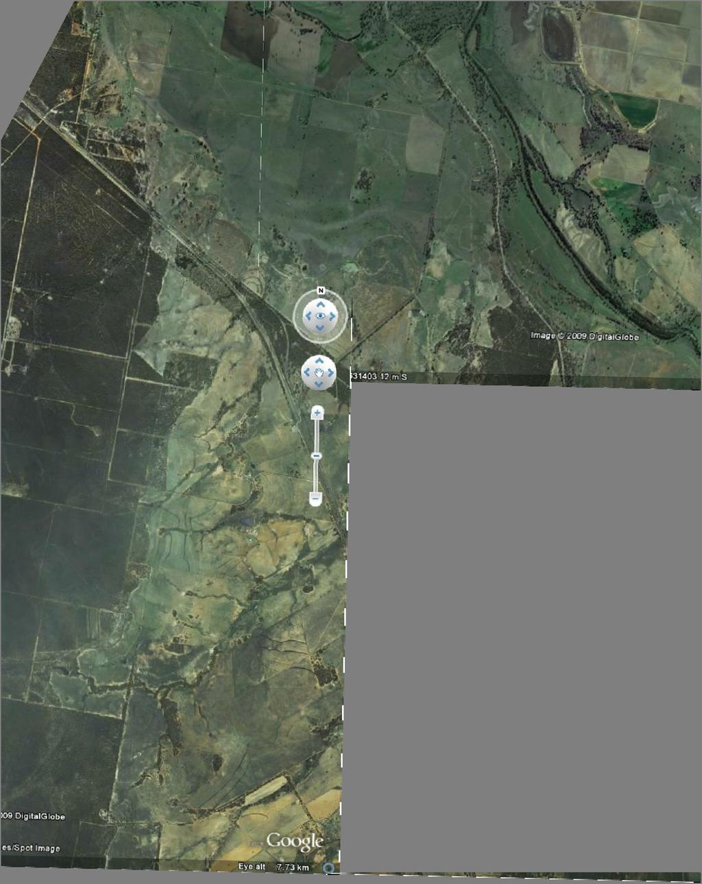
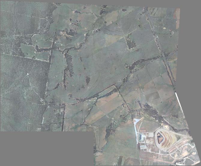
14 NARRABRI COALOPERATIONS PTY LTD 9b - 34 SPECIALIST CONSULTANT STUDIES Report No. 674/17 of the REA, BSA and Water Pipeline Recommendations for Layer 2 Materials. Strip all of the Layer 2 subsoil to a depth of 100cm below the current soil surface [ie a layer 85cm thick] over the whole reject emplacement area. Layer 2 material should be stockpiled as subsoil provided suitable stripping and storage methods are used. [See Section 11] or moved direct from stripped areas to areas being rehabilitated whenever this is possible Layer 3 [Remainder of the Profile] Do not strip unless required for use in forming a cover over the reject material before the subsoil is spread during rehabilitation of the emplacement. Recommendations for Layer 3 Materials Leave in situ or strip, if necessary, and stockpile for use in rehabilitation as a layer over the final reshaped landform prior to re-spreading of subsoil and topsoil. 7 RESULTS FOR THE BRINE STORAGE AREA Introduction From the information gained from the detailed soil profile descriptions, three soil mapping units [SMUs] were identified (see Figure 2). The first SMU [SMU B1] comprises Clay Soils that are generally medium to heavy clay textured for the whole of the excavated profile or which may have a coarser textured layer at the base. These soil occur near the Kurrajong Creek tributary as well as on level areas further to the north. The second [SMU B2] is limited to a single profile that has a sandy textured profile throughout. The occurrence suggests that the profile may be associated with a prior stream bed but no other similar profiles were encountered and there were no surface indications that the profile was in any way different from the surrounding soils. The third [SMU B3] is comprised of duplex soils that have a sandy surface texture overlying the remaining profile of clay material. Some profiles comprise a single coarser textured layer overlying the clay material while others have two or three distinct layers of sandy material overlying the clay. The locations of the twenty two sampled soil profiles are shown in Figure 1. It is important to note that not all soil layers described for the soil mapping units are present in every profile. Soils are inherently variable in nature and while they may have similar overall characteristics they may vary in layer detail and properties. Appendix 2 contains detailed information of the layers present in the twenty two pits that were described in detail.
15 SPECIALIST CONSULTANT STUDIES 9b - 35 NARRABRI COAL OPERATIONS PTY LTD of the REA, BSA and Water Pipeline Report No. 674/ Soil Mapping Unit Descriptions Descriptions of the layers found in the profiles of the three SMUs [SMU B1, SMU B2, SMU B3] identified within the Brine Storage Area are set out below. The soils within the units are described in two ways a Plain English version followed by a technical description. Definitions of the technical terms used in the descriptions can be found in Appendix 3 or by consulting McDonald et al [1990] or Houghton and Charman [1986] Description of SMU B1 Clay Soils Plain English Description: Soil to 250cm+ deep, lower slope [floodplain] location; surface condition hardsetting; some surface stone present. Topsoil to 20cm - silty clay; light clay; gritty light to medium clay, light to medium clay; medium clay, medium to heavy clay; roots common to many; no lime present; no manganese present; ph 5.0 to7.5; gravel and stones usually absent, sometimes flat angular gravel <5mm to 4cm present; not mottled; not bleached; brown to reddish brown coloured moderately structured or sometimes massive; usually not hydrophobic. Subsoil of up to four layers, silty clay to heavy clay textured; roots absent to many; no lime present or no lime visible or scattered to many large lime nodules present; no manganese present or small manganese stains and concretions present; ph 5.0 to 7.5 or ph 9.0 to 9.5/10; gravel and stones usually absent, some profiles with layers of rounded water-washed gravel to 5-6cm gravel and stones to 20cm;coloured brown, red or yellow; usually not mottled; highly structured; not hydrophobic Technical Description [based on test pits] [a] [b] Australian Soil Classification Name Red and Brown Vertosols Field Description: Layer 1 [always present] [10-20cm thick] - silty clay; light clay; gritty light to medium clay, light to medium clay; medium clay, medium to heavy clay; roots common to many; no lime present; no manganese present; ph 5.0 to7.5; gravel and stones usually absent, sometimes flat angular gravel <5mm to 4cm present; not mottled; not bleached; brown [7.5YR4/3, 7.5YR4/4, 7.5YR5/3, 7.5YR5/4], reddish brown [5YR4/3] dry, dark brown [7.5YR3/2, 7.5YR3/3, 7.5YR4/2], dark reddish brown [5YR3/2], very dark brown [7.5YR2.5/2] moist; mostly structured; peds rough-faced or rough- / smooth-faced, moderately pedal [70%] to highly pedal [100%], polyhedral, <5-15 mm in size; weak to strong consistence dry; sometimes massive, fabric rough, firm to strong coherence dry; usually not hydrophobic; abrupt to clear to:
16 NARRABRI COALOPERATIONS PTY LTD 9b - 36 SPECIALIST CONSULTANT STUDIES Report No. 674/17 of the REA, BSA and Water Pipeline Layer 2 [always present] [17-79cm thick] - silty clay, sticky light to medium clay, medium clay, medium to heavy clay, heavy clay; roots common to many; no lime present; no manganese present; ph 5.5 to 7.5 or ph 9.0; gravel and stones absent; not mottled; not bleached; brown [7.5YR4/2, 7.5YR4/3, 7.5YR5/4], dark reddish brown [5YR3/2], dusky red [10R3/2, reddish brown [5YR4/3, 5YR4/4] dry, dark brown [7.5YR3/3], dark reddish brown [5YR3/2, 5YR3/3], dusky red [10R3/2] moist; peds rough- / smooth-faced, highly pedal [100%],angular blocky or polyhedral; <5-20 mm in size; strong consistence dry; not hydrophobic; abrupt, clear or gradual to:- Layer 3 [always present] [34-112cm thick] - medium clay, medium to heavy clay; heavy clay; few to many roots; no lime present or no lime visible to scattered to many lime stains and nodules present; ; no manganese present or some managanese concretions present; Usually ph 8.5 to 9.5/10, sometimes ph 7.0; gravel and stones absent; not mottled; not bleached; brown [7.5YR4/2, 7.5YR4/4], reddish brown [2.5YR5/4, 5YR4/4], strong brown [7.5YR4/6], yellowish brown [10YR5/4] dry, brown [7.5YR4/3, 7.5YR4/4], dark brown [7.5YR3/3], dark yellowish brown [10YR4/4], reddish brown [2.5YR4/3, 2.5YR4/4], strong brown [7.5YR4/6], yellowish brown [10YR5/4] moist; peds rough- / smooth-faced, highly pedal [80% - 100%], polyhedral, <5-20 mm in size; firm to strong consistence dry; not hydrophobic; clear to gradual to:- Layer 4 [always present] [36-118cm thick] -, medium clay, medium to heavy clay heavy clay, heavy clay; roots usually absent, rarely roots common; no lime present or no lime visible or some to many lime nodules present; no manganese present or manganese staining and concretions common; ph often 9.5/10, sometimes ph 6.0 to 6.5; gravel and stones usually absent, some profiles with layers of rounded water-washed gravel to 5-6cm gravel and stones to 20cm; not bleached; usually whole coloured brown [10YR4/3, 7.5YR4/4,7.5YR5/3, 7.5YR5/4] [sometimes with a reddish tinge], strong brown [7.5YR5/6] dry, brown [7.5YR4/3, 7.5YR4/4, 7.5YR5/3, 7.5YR5/4] [sometimes with a reddish tinge], dark brown [10YR3/3] moist; rarely mottled yellowish red [5YR4/6], brown [10YR5/3] dry, brown [7.5YR4/4], brown [10YR5/3] moist; peds smooth-faced or usually rough- / smoothfaced, highly pedal [100%], polyhedral, <5-15 mm in size; strong consistence dry; not hydrophobic; layer continues or gradual or diffuse to:- Layer 5 [usually present but sometimes as a layer of water-washed gravel and stones to 20cm] [40-161cm thick] - sandy medium clay [indurated], sandy light to medium clay, light to medium clay, medium clay, medium to heavy clay; roots absent; no lime present or no lime visible or scattered to many large lime nodules present; no manganese present or small manganese stains and concretions present; usually ph 9.5/10, sometimes ph 4.5; gravel and stones absent or some small gravel <5mm to 1cm or comprised of decomposing rock; not bleached; sometimes whole coloured brown [7.5YR5/3, 7.5YR5/4], yellowish brown [10YR5/4] with red stains dry, brown [7.5YR4/4, 7.5YR5/3], yellowish brown [10YR5/4] with red stains moist; at times mottled brown [7.5YR5/3], light grey [10YR7/2], pale brown [10YR6/3], reddish yellow [7.5YR6/6], strong brown [7.5YR4/6], yellowish red[5yr4/6] dry, brown [7.5YR4/2, 10YR5/3], grey [7.5YR6/2], strong brown [7.5YR4/6, 7.5YR5/6], yellowish red[5yr4/6] moist; sometimes structured with peds smooth- faced or rough- / smooth-faced, highly pedal [100%], polyhedral,<5-15 mm in size; sometimes massive, fabric rough, very firm to strong coherence dry; strong consistence dry; not hydrophobic.
17 SPECIALIST CONSULTANT STUDIES 9b - 37 NARRABRI COAL OPERATIONS PTY LTD of the REA, BSA and Water Pipeline Report No. 674/ Description of SMU B2 Deep Sandy Soils Plain English Description: Soil to 250cm+ deep, level plain location; surface condition firm; surface stone absent Topsoil sandy ; roots common; no lime present; no manganese present; ph 6.0; gravel and stones absent; not mottled; not bleached; yellowish brown coloured; weakly structured; not hydrophobic. Subsoil consisting of two horizons; clayey sand, sandy textured; no lime visible; no manganese present; ph 6.5 to 8.0; not mottled; sometimes bleached; grey, brown and yellowish brown coloured; massive to highly structured; not hydrophobic Technical Description [based on one test pit] [a] [b] Australian Soil Classification Names Brown Kandosol Field Description: Layer 1 [40cm thick] - sandy ; roots common; no lime present; no manganese present; ph 6.0; gravel and stones absent; not mottled; not bleached; light yellowish brown [10YR6/4] dry, dark yellowish brown [10YR4/4] moist; peds rough- faced, weakly pedal [15%], polyhedral, 5-15 mm in size; weak consistence dry; not hydrophobic; gradual to: Layer 2 [70cm thick] - clayey sand; roots common; no lime present; no manganese present; ph 6.5; gravel and stones absent; not mottled; bleached; light grey [10YR7/2] dry, brown [7.5YR5/3] moist; massive; fabric rough; firm coherence dry; not hydrophobic; abrupt to: Layer 3 [140cm thick] - fine ; few roots; no lime visible; no manganese present; ph 8.0; gravel and stones absent; not mottled; not bleached; brownish yellow 10YR6/6] dry, yellowish brown [10YR5/4] moist; peds rough- / smooth-faced, highly pedal [100%], polyhedral, mm in size; firm consistence dry; not hydrophobic Description of SMU B3 Duplex Soils Plain English Description: Soil to250cm+ deep; level plain, depression, level crest, mid and upper slope locations ; surface condition loose, firm or hardsetting, sometimes cracked; surface stone absent or some rounded / angular surface stone to 2-10cm [sometimes to 15cm] present. Topsoil to 34cm deep, clayey sand, sandy,, fine sandy clay ; roots common to many; no lime present; no manganese present; ph 4.5 to 6.5; gravel and stones usually absent, occasionally small angular and round gravel to 1-2cm present; not mottled; not bleached; brown, yellowish brown or reddish brown coloured; usually weakly to highly structured, sometimes massive not hydrophobic.
18 NARRABRI COALOPERATIONS PTY LTD 9b - 38 SPECIALIST CONSULTANT STUDIES Report No. 674/17 of the REA, BSA and Water Pipeline Subsoil consisting of up to six layers, clayey sand,, sandy light clay, medium clay, sandy medium clay, gritty medium to heavy clay, heavy clay; roots absent to common; ph 4.5 to 7.0 or ph 9.0 to 9.5/10; no lime present or no visible lime present or scattered lime nodules present; usually no manganese present, sometimes some manganese stains present; usually whole coloured in shades of brown, red, yellow and grey; sometimes mottled in similar tones; usually weakly to highly structured, sometimes massive; rarely hydrophobic Technical Description [based on test pits] [a] [b] Australian Soil Classification Names Brown and Yellow Chromosols Field Description: Layer 1 [always present] [10-34cm thick] - clayey sand, sandy,, fine ; roots common to many; no lime present; no manganese present; ph 4.5 to 6.5; gravel and stones usually absent, occasionally small angular and round gravel to 1-2cm present; not mottled; not bleached; brown [7.5YR4/3, 7.5YR4/4, 7.5YR5/3, 7.5YR5/4], light yellowish brown [10YR6/4], reddish brown [5YR4/3], strong brown [7.5YR4/6], yellowish brown [10YR5/4] dry, dark brown [7.5YR3/2, 10YR3/3, 7.5YR3/3, 5YR3/4, 7.5YR3/4], dark reddish brown [5YR3/3, 2.5YR3/3], dark yellowish brown [10YR4/4] moist; usually structured peds rough- faced, weakly pedal [15%-30%], moderately pedal [40%-50% or highly pedal [80%- 100%], polyhedral, 5-15 mm in size; weak to strong consistence dry; sometimes massive; fabric rough; weak to firm coherence dry; not hydrophobic, sharp, abrupt [usually], clear or gradual to:- NOTE: Layers 2 and 3 are usually not present and the profiles comprise layer above layer 4 and subsequent layers Layer 2 [occasionally present] [4-48cm thick] - clayey sand, ; roots common to many; no lime present; no manganese present; ph 6.0 to 7.5; gravel and stones absent or some rounded gravel to 2cm present; not mottled; sometimes bleached; brown [7.5YR5/3], light brown [7.5YR6/4], pinkish grey [7.5YR7/2] dry, brown [7.5YR4/3, 7.5YR4/4, 7.5YR5/4] moist; massive; fabric rough; weak, firm or strong coherence dry; not hydrophobic; sharp, abrupt or clear to:- Layer 3 [rarely present] [one profile 21] [27cm thick] - clayey sand; few roots; no lime present; no manganese present; ph 7.5; angular and rounded gravel to 4cm; not mottled; not bleached; red [5YR4/6] dry, red [5YR4/6] moist; massive, fabric rough, weak coherence dry ; not hydrophobic; clear to:- Layer 4 [always present] [23-66cm thick] -, sandy light clay, medium clay, sandy medium clay, gritty medium to heavy clay, heavy clay; roots few to common; no lime present or no visible lime present or scattered lime nodules present; usually no manganese present, sometimes some manganese stains present; ph 4.5 to 7.0 or ph 9.0 to 9.5/10; gravel and stones usually absent, sometimes some rounded gravel to 2cm present; not bleached; usually whole coloured brown [7.5R4/4, 7.5YR4/3, 7.5YR5/4, 10YR5/3], brownish yellow [10YR6/6], dark reddish brown [5YR3/3], reddish brown [2.5YR4/4, 5YR4/3, 5YR4/4], yellow [10YR5/4] dry, brown [7.5YR4/4, 7.5YR5/4], dark brown [7.5YR5/4], dark reddish brown [5YR2.5/2], dark
19 SPECIALIST CONSULTANT STUDIES 9b - 39 NARRABRI COAL OPERATIONS PTY LTD of the REA, BSA and Water Pipeline Report No. 674/17 yellowish brown [10YR4/4, 10YR4/6], reddish brown [2.5YR4/4, 5YR4/3, 5YR4/4], yellow [10YR5/4] moist; rarely mottled light reddish brown [5YR6/3], reddish brown [2.5YR4/4, 2.5YR5/4]; peds rough- / smooth-faced, highly pedal [80% - 100%], polyhedral, <5-20 mm in size; weak to strong consistence dry; not hydrophobic; clearor gradual to:- Layer 5 [always present] cm thick] - medium clay, medium to heavy clay, heavy clay, rarely clayey sand; few roots; no lime present or no lime visible or scattered to many lime concretions present; manganese stains and concretions sometimes present; ph 5.5 to 6.5 or ph 9.5/10; gravel and stones absent or some to much small [ cm] or large gravel [4-8cm] present; not bleached; usually whole coloured brown [7.5YR5/3, 7.5YR5/4], brownish yellow [10YR6/6], reddish brown [5YR5/4], yellowish red [5YR5/6] dry, brown [7.5YR4/3, 7.5YR5/3, 7.5YR5/4], reddish brown [5YR4/4, yellowish brown [10YR5/6, 5YR4/6] moist; sometimes mottled pale brown [10YR6/3] red [10YR4/6], reddish brown [5YR5/4, 7.5YR4/6], strong brown [7.5YR5/6], very pale brown [10YR7/3], yellowish red [10YR5/6] dry, brown [7.5YR4/4, 7.5YR5/4], greyish brown [10YR5/2], pale brown [10YR6/3], strong brown [7.5YR4/6], weak red [10R4/4], yellowish red [10YR5/6] moist; peds rough- / smooth-faced, occasionally roughfaced, highly pedal [100%], polyhedral, <5-20 mm in size; strong consistence dry; rarely hydrophobic; clear or gradual to bedrock or underlying horizon:- Layer 6 [often present][30-139cm thick] - medium clay, medium to heavy clay, heavy clay, rarely ; few roots or roots absent; no lime visible or some to many lime flecks and / or nodules present; ; no manganese present or some to many manganese stains and small concretions common; ph 8.0 to 9.5/10; rarely ph 6.5; gravel and stones usually absent, occasionally scattered rounded and angular gravel to 5cm present; not bleached; usually whole coloured brown [10YR5/3, 7.5YR5/4], brownish yellow [10YR6/6[, dark yellowish brown [10YR4/4], light brown [7.5YR6/4], light brownish grey [2.5Y6/2], strong brown [7.5YR5/6], yellowish brown [10YR5/4], yellowish red [5YR4/6] dry, brown [7.5YR5/3, 7.5YR5/4], dark yellowish brown [10YR4/6], light brown [7.5YR6/4], light brownish grey [2.5Y6/2], pale brown [10YR6/3], reddish brown [5YR4/4], strong brown [7.5YR4/6], yellowish brown [10YR5/4] moist; sometimes mottled brownish yellow [10YR6/6], light brownish grey [10YR6/2], light grey [10YR7/2], light yellowish brown [10YR6/4], pinkish grey [7.5YR6/2], yellowish red [5YR5/6] dry, brown [10YR5/3], light brown [7.5YR6/4], light brownish grey [10YR6/2], light grey [10YR7/2], weak red [10R4/4], yellowish brown [10YR5/6] moist; usually structured peds rough- / smooth-faced, highly pedal [100%], polyhedral or polyhedral / platy, <5-15mm in size; very firm to strong consistence dry; sometimes massive, smooth, rough or rough / smooth fabric, strong coherence dry; not hydrophobic; bedrock / refusal or horizon continues or gradual / diffuse to next horizon:- Layer 7 [occasionally present] [58-120cm thick] sandy light clay, heavy clay, gritty heavy clay, rarely ; few roots or roots absent; no lime visible or some to many lime concretions present; no manganese present or present; some manganese stains present; no lime present; no manganese present; manganese stains and small concretions common; ph 9.0 to 9.5/10; gravel and stones usually absent, sometimes some gravel to 5cm present or material is decomposing rock; usually whole coloured brown [7.5YR5/4], light brown [7.5YR6/4] with light grey staining, light yellowish brown [10YR6/4, 2.5Y6/3], reddish brown [7.5YR5/4] dry, brown [7.5YR5/4], dark brown [7.5YR3/4], light brownish grey [2.5Y6/2], strong brown [7.5YR4/6], yellowish brown [10YR5/4] moist; occasionally mottled light yellowish brown [10YR6/4], brown [7.5YR5/3, 7.5YR5/4], reddish brown [5YR5/3], dry, light yellowish brown [10YR6/4], brown [7.5YR5/3, 7.5YR5/4] reddish brown [5YR5/3], moist; peds rough- /
20 NARRABRI COALOPERATIONS PTY LTD 9b - 40 SPECIALIST CONSULTANT STUDIES Report No. 674/17 of the REA, BSA and Water Pipeline smooth-faced, highly pedal [90%], polyhedral, angular blocky or polyhedral / platy, <5-20 mm in size; very firm to strong consistence dry; occasionally massive, fabric rough, strong coherence dry; not hydrophobic. 7.3 Soil Laboratory Analyses Brine Storage Area All samples from twenty two soil profiles were selected for laboratory analysis at the Land and Property Management Authority [Soil Conservation Service Division] Soil and Water testing Laboratory at Scone. The tests performed aimed at assessing the potential erodibility of the soils [Particle Size Analysis [PSA], Dispersion % [D%] and Emerson Aggregate Test [EAT]] and the likely salinity risk using Electrical Conductivity [EC] as a primary measure Soil Physical Analyses - Brine Storage Area Tables 7 and 8 show the results obtained from laboratory analysis of the samples from the five pits. PIT No. LAYER Table 8 Physical Laboratory Analysis Data for Selected Soil Profiles [Whole Soil Particle Size Analysis] TEXTURE [fine earth]# DEPTH [cm] CLAY SILT FINE SAND PSA% COARSE SAND TOTAL SAND Page 1 of 3 GRAVEL 1 1 y sand y sand clay <1 4 clay clay sand <1 2 sand <1 3 sandy <1 3 1 y sand <1 2 clay <1 3 clay <1 4 clay <1 5 y sand <1 4 1 sandy < <1 3 clay <1 4 clay <1 5 clay y sand clay <1 3 clay <1 4 clay < <1
APPENDIX I Soils, Land Capability & Agricultural Assessment Report
 APPENDIX I Soils, Land Capability & Agricultural Assessment Report APPENDIX I Soils, Land Capability and Agricultural Assessment 21/18113/148861 Orange Resource Recovery and Waste Management Project Environmental
Muswellbrook Coal Company No.1 Open Cut Extension Soil Study
 Muswellbrook Coal Company No.1 Open Cut Extension Soil Study November 2001 Table of Contents 1. Introduction... 1 2. Methodology... 1 3. Description of Soil Units Observed... 2 3.1 Yellow Duplex Soils
STATEMENT OF PHYSICAL CHARACTERISTICS AND AGRICULTURAL LAND CLASSIFICATION
 STATEMENT OF PHYSICAL CHARACTERISTICS AND AGRICULTURAL LAND CLASSIFICATION BIRKWOOD FARM, ALTOFTS WEST YORKSHIRE Proposed Opencast Extraction of Clay and coal ADAS January 1990 Leeds Regional Office File
PHYSICAL CHAtlACTERISTICS REPORT FOR THE PROPOSED SAND AND GRAVEL SITE AT MANOR FARM, UFFINGTON
 PHYSICAL CHAtlACTERISTICS REPORT FOR THE PROPOSED SAND AND GRAVEL SITE AT MANOR FARM, UFFINGTON Introduction Following the" request for detailed information on the physical characteristics of soil at Manor
Horner-McLaughlin Woods: Soil Types
 Horner-McLaughlin Woods: Soil Types Not present at HMW Adrian Muck Conover Loam 0-4% Slopes Houghton Muck Miami Loam 2-6% Slopes Miami Loam 6-12% Slopes Miami Loam 12-18% Slopes t 0 0.125 0.25 Miles Mary
AGRICULTURAL LAND CLASSIFICATION AND STATEMENT OF PHYSICAL CHARACTERISTICS
 AGRICULTURAL LAND CLASSIFICATION AND STATEMENT OF PHYSICAL CHARACTERISTICS DALE PIT FARM. HATFIELD VOODHOUSE PROPOSED EXTRACTION OF SAND AHD GRAVEL ADAS April 1989 Leeds Regional office File Ref: 2FCS
2011 Wisconsin Envirothon Soils and Land Use Exam
 2011 Wisconsin Envirothon Soils and Land Use Exam USE THE OCONTO COUNTY SOIL SURVEY TO ANSWER QUESTIONS 1-4 The Pensaukee River Wetland Complex is a mixture of state (Pensaukee Wildlife Area) and privately
SOIL CHARACTERIZATION USING DIAGNOSTIC PROPERTIES
 SOIL CHARACTERIZATION USING DIAGNOSTIC PROPERTIES The following are the characters of the pedologically important properties used in categorizing soils: SOIL CHARACTERIZATION Soil Profile Description:
2018 Iowa FFA Soil Judging CDE Exam 1. Landscape positions characterizes the location of the soil on the landscape and identifies potential risks.
 2018 Iowa FFA Soil Judging CDE Exam 1. Landscape positions characterizes the location of the soil on the landscape and identifies potential risks. Which landscape position is considered the floodplain
AGRICULTURAL LAND CLASSIFICATION AND SOIL PHYSICAL CHARACTERISTICS LAND NEAR SHIRE HILL FARM SAFFRON WALDEN ESSEX
 AGRICULTURAL LAND CLASSIFICATION AND SOIL PHYSICAL CHARACTERISTICS LAND NEAR SHIRE HILL FARM SAFFRON WALDEN ESSEX AGRICULTURAL LAND CLASSIFICATION (ALC) AND SOIL PHYSICAL CHARACTERISTICS LAND NEAR SHIRE
PROPOSED OPEN CAST COAL SITE SEPTEMBER 1992
 AGRICULTURAL LAND CLASSIFICATION AND STATEMENT OF PHYSICAL CHARACTERISTICS SKIERS SPRING, HOYLAND, SOUTH YORKSHIRE PROPOSED OPEN CAST COAL SITE SEPTEMBER 1992 ADAS LEEDS STATUTORY GROUP Job No. 98/92 MAFF
Appendix 22 Soils and Land Capability
 Appendix 22 Soils and Land Capability March 2009 March 2009 Table of Contents Page No. 1. INTRODUCTION... 1 2. SOIL PROFILING AND MAPPING... 2 2.1 Soil Survey Methodology... 2 2.2 Soil Landscapes... 3
STATEMENT OF PHYSICAL CHARACTERISTICS AND AGRICULTURAL LAND CLASSIFICATION WITTON PARK, COUNTY DURHAM PROPOSED QUARRY EXTENSION DECEMBER 1992

AGRICULTURAL LAND CLASSIFICATION AND STATEMENT OF PHYSICAL CHARACTERISTICS
 AGRICULTURAL LAND CLASSIFICATION AND STATEMENT OF PHYSICAL CHARACTERISTICS SEGHILL, NORTHUMBERLAND PROPOSED VASTE DISPOSAL SITE ADAS January 1989 Leeds Regional Office REF: 3/89 2FCS 4191 lds.rpg3.seghill
2016 Area 3 Envirothon Muskingum County Soils Test ANSWER KEY
 2016 Area 3 Envirothon Muskingum County Soils Test ANSWER KEY 1. The majority of the bedrock in Muskingum County is. a. sedimentary bedrock b. glacial bedrock c. igneous bedrock d. metamorphic bedrock
Unearthing problem soils in the Lachlan Valley
 Vol 24, No 1, page 32 February-March, 2003 The Australian Cottongrower Unearthing problem soils in the Lachlan Valley By Edward Cay and Stephen Cattle, The University of Sydney and Australian Cotton CRC
Examining soils in the field. Examining soils in the field. Environment Agency thinksoils examining soils in the field
 Examining soils in the field thinksoils Examining soils in the field Environment Agency thinksoils examining soils in the field 31 Examining soils in the field 32 Environment Agency thinksoils examining
The entire site supports grass on which sheep had been grazing recently.
 PHYSICAL CHARACTERISTICS REPORT FOR LAND AT HORSEHAY A^ Agricultural Land Classification of approximately 14 hectares of land to the southwest of Horsehay was undertaken in November 1989. The site lies
SUMMARY. alcholnie.doc\ih\jk
 SUMMARY A detailed Statement of Physical Characteristics and Agricultural Land Classification survey of ha of land at Stainton ("Holme Hall Quarry Extension") was carried out in September 1994. At the
Agricultural Land Classification and Statement of Physical Characteristics Higbfield Farm Whitley Bridge North Yorkshire October 1996
 Agricultural Land Classification and Statement of Physical Characteristics Higbfield Farm Whitley Bridge North Yorkshire October 1996 Resource Planning Team ADAS Reference: 82/96 Leeds Statutory Group
Iowa FFA Soil Career Development Event 2008
 Iowa FFA Soil Career Development Event 2008 1. In Iowa, corn suitability ratings for soil mapping units specifies a. natural weather conditions b. surface and subsurface drainage installed where needed
Topoclimate Southland Soil Technical Data Sheet No. 8. Sobig
 This Technical Data Sheet describes the typical average properties of the specified soil. It is essentially a summary of information obtained from one or more profiles of this soil that were examined and
2012 FINAL SOILS AREA 2 Envirothon Questions Answer KEY
 2012 FINAL SOILS AREA 2 Envirothon Questions Answer KEY Questions 1-6 to be answered at the soil pit: 1. Soil scientists categorize soils by drainage classes. What is the drainage class of the soil at
2014 Iowa FFA Soil Judging CDE Exam
 2014 Iowa FFA Soil Judging CDE Exam 1. Landscape position is one aspect of evaluating the surface features of a certain tract of land. Identifying the correct landscape position will indicate: a. If the
Topoclimate Southland Soil Technical Data Sheet No Waiau
 This Technical Data Sheet describes the typical average properties of the specified soil. It is essentially a summary of information obtained from one or more profiles of this soil that were examined and
Historic soils of NSW
 Historic soils of NSW This project was initiated by the NSW branch of the Australian Society of Soil Science (ASSSI) for the Sydney 2004 Supersoil conference but not completed until after the conference.
Soil Notes. General Soil Information
 Soil Notes General Soil Information Definition Soil relatively thin surface layer of the Earth s crust consisting of mineral and organic matter that is affected by agents such as weather, wind, water,
Soil Physical Properties
 Soil Physical Properties ESRM 311 SEFS 507 Some examples of mineral soil development eg, Rock Weathering Types of Weathering Physical/Mechanical Chemical Biological Photo by D Vogt CO 2 + H 2 O H 2 CO
Topoclimate Southland Soil Technical Data Sheet No. 11. Pukemutu
 This Technical Data Sheet describes the typical average properties of the specified soil. It is essentially a summary of information obtained from one or more profiles of this soil that were examined and
1. Position (2 pts.) 2. Parent Material (2 pts.) 3. Slope Characteristics (2 pts.) 4. Surface Stoniness or Rockiness (2 pts.)
 2. Parent Material (2 pts.) 3. Slope Characteristics (2 pts.) 4. Surface Stoniness or Rockiness (2 pts.)") Maryland Envirothon SOILS Exam Guidance Information (revised 2017) Objective: To test students' knowledge and awareness of basic soil science and its application in wise land-use planning and therefore
Maryland Envirothon SOILS Exam Guidance Information (revised 2017) Objective: To test students' knowledge and awareness of basic soil science and its application in wise land-use planning and therefore
3.44b. Soil Classification AK & BR
 3.44b Soil Classification AK & BR Why look at soil? Because soil and its constituents are the base material for growing trees. History Why a Forestry Commission soil classification? There is a need for
2017 Iowa FFA Soil Judging CDE Exam
 2017 Iowa FFA Soil Judging CDE Exam 1. Landscape positions vary in soil composition and makeup. What landscape position would be characterized by having strata and lenses of different textures in the profile:
HUMBLEBURN OCCS, CRAGHEAD, COUNTY DURHAM SURVEY OF RESTORED LAND OCTOBER RPT Job Number: 73/97 MAFF Reference: EL LURET Job Number: ME3RTP
 HUMBLEBURN OCCS, CRAGHEAD, COUNTY DURHAM SURVEY OF RESTORED LAND OCTOBER 1997 Resource Planning Team Northern Region FRCA, Leeds RPT Job Number: 73/97 MAFF Reference: EL 10387 LURET Job Number: ME3RTP
PHYSICAL CHARACTERISTICS REPORT INCORPORATING AGRICULTURAL LAND CLASSIFICATION LAND AT BOLE INGS, WESTBURTON, NOTTINGHAMSHIRE (SK805875)
") (krahs 2% I?5 PHYSICAL CHARACTERISTICS REPORT INCORPORATING AGRICULTURAL LAND CLASSIFICATION LAND AT BOLE INGS, WESTBURTON, NOTTINGHAMSHIRE (SK805875) 1.0 INTRODUCTION 1.1 The site, an area of 84.5 hectares,
(krahs 2% I?5 PHYSICAL CHARACTERISTICS REPORT INCORPORATING AGRICULTURAL LAND CLASSIFICATION LAND AT BOLE INGS, WESTBURTON, NOTTINGHAMSHIRE (SK805875) 1.0 INTRODUCTION 1.1 The site, an area of 84.5 hectares,
Soil Maps for Production Agriculture. Jarrod O. Miller, Extension Agronomist
 Soil Maps for Production Agriculture Jarrod O. Miller, Extension Agronomist Origination of Soil Mapping Originally mapped by Division of Soils Federal Bureau of Soils Soil Conservation Service (SCS) started
AGRICULTURAL USE & QUALITY OF LAND NEAR MINDALE HOUSE PRESTATYN. Report 762/1
 AGRICULTURAL USE & QUALITY OF LAND NEAR MINDALE HOUSE PRESTATYN Report 762/1 11 th April, 2012 AGRICULTURAL USE & QUALITY OF LAND NEAR MINDALE HOUSE PRESTATYN F W Heaven, BSc, MISoilSci Report 762/1 Ltd
MAFF Ministry of Ifinil Agriculture Rsheries and Food
 MAFF Ministry of Ifinil Agriculture Rsheries and Food STATEMENT OF PHYSICAL CHARACTERISTICS AND AGRICULTURAL LAND CLASSIFICATION SHILBOTTLE COLLIERY RECLAMATION SCHEME NORTHUMBERLAND DECEMBER 1994 ADAS
Topoclimate Southland Soil Technical Data Sheet No. 76. Mossburn
 This Technical Data Sheet describes the typical average properties of the specified soil. It is essentially a summary of information obtained from one or more profiles of this soil that were examined and
Land Capability Classifications
 Land Capability Classifications Unit: Soil Science Problem Area: Basic Principles of Soil Science Student Learning Objectives. Instruction in this lesson should result in students achieving the following
AGRICULTURAL LAND CLASSIFICATION AND SOIL PHYSICAL CHARACTERISTICS BIRCH PIT, NEAR COLCHESTER ESSEX
 AGRICULTURAL LAND CLASSIFICATION AND SOIL PHYSICAL CHARACTERISTICS BIRCH PIT, NEAR COLCHESTER ESSEX AGRICULTURAL LAND CLASSIFICATION AND SOIL PHYSICAL CHARACTERISTICS SEMI-DETAILED SURVEY BIRCH PIT, NEAR
Soil Colors, Texture & Structure
 Application Soil Colors, Texture & Structure Limiting conditions Soil color type/depth of system Bedrock type/depth of system Soil texture, structure, percolation rate size and type of system Sara Heger,
AGRONOMY 255, 251, 270 SOIL DIFFERENCES
 Name AGRONOMY 255, 251, 270 SOIL DIFFERENCES Soils differ strikingly from each other. This week we illustrate the great differences and ask you to learn how they differ and to become skilled in describing
Learning Objectives Part 1. Chapter 4 Soil Physical Properties. Soil Physical Properties. Color. Physical properties part 1
 Learning Objectives Part 1 Chapter 4 Soil Physical Properties Know what color tells you about a soil Describe the concept of soil texture and its importance Use the textural triangle to determine a soil
Soil Texture = %Sand, Silt & Clay in a soil.
 Soils Soil Texture = %Sand, Silt & Clay in a soil. Soil texture is the single most important physical property of the soil. Knowing the soil texture alone will provide information about: 1) water flow
 Soils Soil is one of the world's most important natural resources. Together with air and water it is the basis for life on planet earth. Most of our food depends on soil - it is where we find the plants
DO YOU KNOW YOUR SOILS? (Rev. 10/11)
") DO YOU KNOW YOUR SOILS? (Rev. 10/11) Circle all the correct answers. 1. What is the layer normally present on the surface of the soil in cropped fields? a. O c. Ap e. B g. R b. A d. E f. C 2. Available
DO YOU KNOW YOUR SOILS? (Rev. 10/11) Circle all the correct answers. 1. What is the layer normally present on the surface of the soil in cropped fields? a. O c. Ap e. B g. R b. A d. E f. C 2. Available
1 Describe the concept of soil texture and its importance. 2 Determine the texture of a soil sample.
 Interest Approach Provide students with various samples of soil. One sample should be nearly all sand, one nearly all clay, and one nearly all silt. Ask students to determine how the samples differ. Would
APPENDIX. Soil and Land Capability Impact Assessment
 APPENDIX P P P FINAL Maules Creek Coal Project Soil and Land Capability Assessment November 2010 HAN17-001 P GSS Environmental TABLE OF CONTENTS 1.0 INTRODUCTION... 1 1.1 BACKGROUND... 1 1.2 PROJECT DESCRIPTION...
TAXONOMIC CLASS: Loamy-skeletal, mixed, mesic Vitrandic Durochrepts
 ESRM311/SEFS507 Important Soil Series in Seattle Area ALDERWOOD SERIES The Alderwood series consists of moderately deep, moderately well drained soils formed in glacial till. Alderwood soils are on glacially
STATE TAX COMMISSION OF MISSOURI ASSESSOR MANUAL
 STATE TAX COMMISSION OF MISSOURI ASSESSOR MANUAL CHAPTER: REVISION DATE: 10/1/2008 Page 1 of 18 7.3 The purpose of this section of the Assessor s Manual is to supplement the State Tax Commission s published
SITE TOPSOIL & FINISH GRADING
 CITY OF BRAMPTON LANDSCAPE SPECIFICATIONS SECTION 02911-1 PART 1 GENERAL 1.1 Related Work.1 Section 02311 Site Grading.2 Section 02315 Excavating, Trenching, & Backfilling.3 Section 02906 Planting of Trees,
BENGALLA Mining Company. Soils and Land Capability Impact Assessment
 BENGALLA Mining Company Soils and Land Capability Impact Assessment Soil and Land Capability Impact Assessment Continuation of Bengalla Mine July 2013 HAN05-001 Continuation of Bengalla Mine 1 Prepared
Topoclimate Southland Soil Technical Data Sheet No. 23. Waikiwi
 This Technical Data Sheet describes the typical average properties of the specified soil. It is essentially a summary of information obtained from one or more profiles of this soil that were examined and
Soils in the Field. Agronomy 105 1
 Agronomy 105 1 Soils in the Field Objectives Soil pores and water quality Soil texture and plant available water Tile drainage The Revised Universal Soil Loss Equation Definitions Field Trip Study Guide
Soil Horizons cont. Oa- highly decomposed Oi-undecomposed
 Soils Soil Basics Soil Horizons Soil Horizons cont. O Horizon: Or organic layer Organic layer of decomposing plant and animal tissue. Wooded upland areas have thin O horizons Wetlands may have thick O
STATEMENT OF PHYSICAL CHARACTERISTICS AND AGRICULTURAL LAND CLASSIFICATION
 STATEMENT OF PHYSICAL CHARACTERISTICS AND AGRICULTURAL LAND CLASSIFICATION DRAX AND BARLOV: Proposed Waste (PFA) disposal and Industrial development site ADAS MAY 1989 LEEDS REGIONAL OFFICE FILE REF: 2FCS
EDULABZ. Ans. (b) 7. The soft, porous layer with a good water-retaining capacity forms the
 7. The soft, porous layer with a good water-retaining capacity forms the") 3 SOIL I. Multiple choice questions: Tick ( ) the correct choice. 1. The process of soil formation is called (a) conservation (b) weathering (c) erosion (d) none Ans. (b) 2. Soil profile consists of (a)
3 SOIL I. Multiple choice questions: Tick ( ) the correct choice. 1. The process of soil formation is called (a) conservation (b) weathering (c) erosion (d) none Ans. (b) 2. Soil profile consists of (a)
Soil Survey and Land Resource Assessment
 Karuah East Pty Ltd FINAL Soil Survey and Land Resource Assessment Karuah East Quarry Project July 2011 HQP05-002 Table of Contents TABLE OF CONTENTS 1.0 INTRODUCTION... 1 1.1 BACKGROUND... 1 1.2 PROJECT
Pits 1 & 3 Questions. 7. Subsurface: Texture (5 pts) A. Coarse B. Moderately course C. Medium D. Fine E. Very Fine
 A. Coarse B. Moderately course C. Medium D. Fine E. Very Fine") Minnesota Soils Scorecard Questions for Pits 1-4 Scantron # 105481 Use your soils scorecard to fill out the answers on your scantron Bubble in the front side of the sheet for Pit 1 (# 1-45) and Pit 2 (#51-95)
Minnesota Soils Scorecard Questions for Pits 1-4 Scantron # 105481 Use your soils scorecard to fill out the answers on your scantron Bubble in the front side of the sheet for Pit 1 (# 1-45) and Pit 2 (#51-95)
THE TENNESSEE VEGETABLE GARDEN
 THE BACKYARD SERIES BACKYARD VEGETABLES W 346-A THE TENNESSEE VEGETABLE GARDEN SITE SELECTION AND SOIL TESTING Natalie Bumgarner, Assistant Professor and UT Extension Residential and Consumer Horticulture
5.1 Introduction to Soil Systems IB ESS Mrs. Page
 5.1 Introduction to Soil Systems IB ESS Mrs. Page 2015-2016 I Am Soil Thinking Routine: See, Think, Wonder Look at the following images. For each image write down what you see Then write down what you
Soil Interpretations Erosion and Sedimentation Control Planning and Design Workshop
 Soil Interpretations Erosion and Sedimentation Control Planning and Design Workshop Presented by Richard Brooks Presentation prepared by Kristin May Resource Soil Scientists USDA-Natural Resources Conservation
 Cci
Cci SOILS AND AGRICULTURAL USE & QUALITY OF LAND OFF HOLT ROAD, ROSSETT. Report 1067/1
 SOILS AND AGRICULTURAL USE & QUALITY OF LAND OFF HOLT ROAD, ROSSETT Report 1067/1 2 nd March, 2015 SOILS AND AGRICULTURAL USE AND QUALITY OF LAND OFF HOLT ROAD, ROSSETT M W Palmer, MSc, PhD, MISoilSci
Soils and the Environment. A Summary of RI Envirothon Study Materials Compiled by Sally Paul
 Soils and the Environment A Summary of RI Envirothon Study Materials Compiled by Sally Paul Why Soils Food and water resources Disposing of waste Support for human structures Growing timber and fibers
CORNFORTH EAST QUARRY COUNTY DURHAM
 CORNFORTH EAST QUARRY COUNTY DURHAM AgricuUural Land Classification (ALC) and Statement of Physical Characteristics Report and Map MARCH 1999 Resource Planning Team RPT Job Number: 5/99 Northern Region
Team number Page 1 of Canon Envirothon Soils Station Test. Soils and Climate Change
 Team number Page 1 of 9 2006 Canon Envirothon Soils Station Test Soils and Climate Change There are many kinds of soil on the surface of the earth. The kind of soil that is present at a given location
SOIL SURVEY OF PORTIONS 81 AND 82 OFTHE FARM VAALBANK 512JQ, NEAR MAGALIESBURG, SOUTH-WEST OF PRETORIA
 REPORT For Newtown Landscape Architects SOIL SURVEY OF PORTIONS 81 AND 82 OFTHE FARM VAALBANK 512JQ, NEAR MAGALIESBURG, SOUTH-WEST OF PRETORIA By N.M. Mushia, D.G. Paterson and S.D. Mkula Report Number
Reference Card S-2, Side A: Delineating Horizon Boundaries
 Reference Card S-2, Side A: Delineating Horizon Boundaries Distinguishing Soil Horizons Soil horizons are delineated based on differences in: Texture Color Structure and Consistence Redoximorphic Features
Overview of Soil Properties
 Willie Harris apatite@ufl.edu Acknowledgments: Wade Hurt Mike Vepraskas FAESS Soil Scientists Overview of Soil Properties Website to download files of talks: wgharris.ifas.ufl.edu.hsw.htm Meaning of Soil
Overview of Soil Properties
 Willie Harris apatite@ufl.edu Acknowledgments: Wade Hurt Mike Vepraskas FAESS Soil Scientists Overview of Soil Properties Website to download files of talks: wgharris.ifas.ufl.edu.hsw.htm Meaning of Soil
Soil testing Page 1. Contrary to what is widely believed, the colour of the soil reveals very little about its fertility.
 Soil testing Page 1 Soil The Basics Soil is the uppermost surface of the earth, which has been slowly transformed by decomposition due to the effects of weather, vegetation and human activities. The parent
STATEMENT OF PHYSICAL CHARACTERISTICS OLDWICK FARM, WEST LAVANT, WEST SUSSEX
 STATEMENT OF PHYSICAL CHARACTERISTICS OLDWICK FARM, WEST LAVANT, WEST SUSSEX STATEMENT OF PHYSICAL CHARACTERISTICS OLDWICK FARM, WEST LAVANT, WEST SUSSEX 1. BACKGROUND 1.1 This 37.1 ha site was surveyed
Lesson 1: Identifying Texture in Soil
 Lesson 1: Identifying Texture in Soil 1 Clods Loam Peds Permeability Soil structure Soil texture Soil workability Textural triangle Water-holding capacity 2 I. A. Soil texture is the fineness or coarseness
27/01/2017. This event is being run by SAC Consulting. What is Soil?
 This event is being run by SAC Consulting What is Soil? 1 Soil Texture It describes the physical composition of the soil % of sand, silt and clay Refers to the mineral fragments of the soil only water
Soil Structure, Density, and Porosity. Laboratory #4
 Soil Structure, Density, and Porosity Laboratory #4 Objectives Understand the concept of soil structure and how it differs from soil texture. Understand how soil structure influences other soil properties.
The Nature of Soil Soil Conservation Sustainable Ag.
 Chapter 6 & 7 The Nature of Soil Soil Conservation Sustainable Ag. Climate Soil Forming Factors Parent material Organisms Topography Time Value of Soil Soil is under appreciated Condition of soil affects
Soil is a Natural Resource. February 12, 2015
 February 12, 2015 February 12, 2015 Soil types differ in how they hold water. Soil that is mostly humus absorbs water like a sponge with only a little runoff, and this water is then available to the plants.
feels very sandy, visible sand grains loamy sand (LS) Ball holds together fine sand can be felt fine sandy loam (FSL)
 Ball holds together fine sand can be felt fine sandy loam (FSL)") Module 5. Soil characterisation data 5. Soil characterisation data What soil type? 3. Soil Map of the Central Downs identifies the major soil groupings for the Darling Downs. Overlaid on these major groups
Module 5. Soil characterisation data 5. Soil characterisation data What soil type? 3. Soil Map of the Central Downs identifies the major soil groupings for the Darling Downs. Overlaid on these major groups
GUIDELINE SPECIFICATIONS FOR SOIL MEDIA IN BIORETENTION SYSTEMS
 GUIDELINE SPECIFICATIONS FOR SOIL MEDIA IN BIORETENTION SYSTEMS The following guideline specifications for soil media in bioretention systems have been prepared on behalf of the Facility for Advancing
SECTION SOIL PREPARATION
 SECTION 329113 SOIL PREPARATION PART 1 - GENERAL 1.1 SUMMARY A. Section Includes: 1. Components of planting mediums. 2. Testing and certification of components. 3. Mixing of planting mediums. 4. Transporting
Loam: About 40% sand, 40% silt, 20% clay. Mixture of pore sizes to balance water retention and aeration. Considered the best soil for growing crops.
 Soil Characteristics Soil is formed from a combination of two Primary sources: Weathering of Parent Rock ( ) = material introduced by plants, animals, and decomposers Minor sources: Nutrients incorporated
Recommended Resources: The following resources may be useful in teaching this lesson:
 Unit E: Basic Principles of Soil Science Lesson 4: Understanding Soil Texture and Structure Student Learning Objectives: Instruction in this lesson should result in students achieving the following objectives:
DIRT! APES Laboratory Activity
 Name: Part I: Soil Texture DIRT! APES Laboratory Activity Can one determine the texture of soil by examining the particles found in a particular sample? The purpose of this activity is to determine the
CAVIL HEAD OCCS ACKLINGTON NOVEMBER 1997
 CAVIL HEAD OCCS ACKLINGTON Agricultural Land Classification (ALC) and Statement of Physical Characteristics Report NOVEMBER 1997 Resource Planning Team RPT Job Number: 67/97 Northern Region MAFF Reference:
CLAY SPREADING AND DELVING FACT SHEET
 JANUARY 2015 CLAY SPREADING AND DELVING FACT SHEET EYRE PENINSULA CLAY SPREADING AND DELVING IN LIGHT, SANDY SOILS Clay spreading or delving can significantly improve yields of sandy soils but it is vital
CLAY SPREADING AND DELVING FACT SHEET
 JANUARY 2015 CLAY SPREADING AND DELVING FACT SHEET EYRE PENINSULA CLAY SPREADING AND DELVING IN LIGHT, SANDY SOILS Clay spreading or delving can significantly improve yields of sandy soils but it is vital
Erosion and Deposition & Land Use. Erosion & Deposition 2/18/2016. Soil Conservation Safeguarding soil from depletion and/or deterioration
 Soils & Land Use ESRM311- SEFS507 Erosion and Deposition & Land Use Redmond Ridge & Snoqualmie Valley Erosion & Deposition Definitions of erosion and deposition Examples of erosion and deposition Examples
Do Now: From which materials do you think soil is made? Are all soils the same? Think of some ways that they are different?
 Do Now: From which materials do you think soil is made? Are all soils the same? Think of some ways that they are different? Basics Soil is a major component of the biosphere It contains solids, liquids
THE SCORE CARD. Observed Soil Properties. Interpretive Soil Properties
 Rev. 07/18/2008 Jim Doolittle Doug Malo Tom Schumacher Plant Science Department SDSU and Kent Cooley Lance Howe Bruce Kunze Jim Millar Walt Schaefer Dan Shurtliff Steve Winter USDA Natural Resources Conservation
Soil Management: the basis of sustainable agriculture
 Soil Management: the basis of sustainable agriculture FAB-465 Lecture 11 Lecture Outline Soil Formation Soil Structure/Texture Indicators of Soil Health or Fertility Soil Conservation Practices 1 Soil
4/23/2018. Soil John Wiley & Sons, Inc. All rights reserved. Lecture 14
 Lecture 14 Soil Lecture 14 1. The Soil System 2. Soil Properties and Major Soil Types 3. Environmental Problems Related to Soil 4. Soil Conservation and Regeneration 1 The Soil System Soil Uppermost layer
Agricultural Science II Soil Science Soil Structure 50 minutes
 Student Outcome Course Unit Lesson Estimated Time Agricultural Science II Soil Science Soil Structure 50 minutes Explain the importance of soil structure. Learning Objectives 1. Explain the term soil structure
IOWA FFA STATE SOILS CDE SATURDAY, OCTOBER 13, 2007 AMES, IOWA
 IOWA FFA STATE SOILS CDE SATURDAY, OCTOBER 13, 2007 AMES, IOWA 1. Moderately sloping has what percent slope: a. 9-14% b. 2-5% c. 5-9% d. over 14% 2. Which of the following horizons is the loose underlying
Section 1. Judging the soil pit (questions 1-4)
") CONNECTICUT ENVIROTHON 2009 SOILS QUESTIONS Please select the best response to the following questions. There are 25 questions; each question is worth 4 points. Section 1. Judging the soil pit (questions
CONNECTICUT ENVIROTHON 2009 SOILS QUESTIONS Please select the best response to the following questions. There are 25 questions; each question is worth 4 points. Section 1. Judging the soil pit (questions
LAND JUDGING AND SOIL EVALUATION
 LAND JUDGING AND SOIL EVALUATION June 1998 W. J. Edmonds, P. J. Thomas, T. W. Simpson, and J. C. Baker Virginia Polytechnic Institute and State University Department of Crop and Soil Environmental Sciences
SUBSURFACE DRIP DISPERSAL OF EFFLUENT for LARGE SYSTEMS. Presented by: David Morgan and Rodney Ruskin
 SUBSURFACE DRIP DISPERSAL OF EFFLUENT for LARGE SYSTEMS Presented by: David Morgan and Rodney Ruskin Program Map Making Program Soil Parent material, Relief, Time. Organisms, Color, Texture, Depth, Profile
Kenya Agricultural Research Institute Kenya Soil Survey P.O. Box Tel: /
 Kenya Agricultural Research Institute Kenya Soil Survey P.O. Box 14733-00800 Tel: 4443376/4440903 E-mail - kss@iconnect.co.ke NAIROBI THE SOIL CONDITIONS OF SIX EXPERIMENTAL SITES IN MACHANG A, EMBU, KIREGE,
Mature basalt volcanic soils
 MANAGING NORTHLAND SOILS Mature basalt volcanic soils 8.1.2 Soil types in this group Kerikeri friable clay (KE) Kerikeri friable clay with large boulders (KEb) Matarau friable clay (MC, MCH*) Matarau friable
Cumberland State Forest Earth and Environmental Science Year 11 (Stage 6) Lesson Plan
 Lesson Plan") Cumberland State Forest Earth and Environmental Science Year 11 (Stage 6) Lesson Plan Syllabus Links 8.3 The Local Environment 2. The properties of local soils affect the local biological environment Students
Cumberland State Forest Earth and Environmental Science Year 11 (Stage 6) Lesson Plan Syllabus Links 8.3 The Local Environment 2. The properties of local soils affect the local biological environment Students