COMMUNITY DESIGN ELEMENT
|
|
|
- Patience Chrystal Houston
- 5 years ago
- Views:
Transcription
1 Chapter IV. COMMUNITY DESIGN ELEMENT 1. Vision and Goals To preserve and enhance Eastlake h existing and future community character as a residential lakej-ont community. This character is best dej%ed as a desired mix of elements including low to moderate residential density, pedestrian-scaled mixed-use development, appropriate neighborhood services, Lake Union maritime uses, and compatible architectural styles. Eastlake is a unique community that draws its strength from its people and from its waterfront and upland attributes. We are a community that values diversity in people and in our natural and built environment. Eastlake has a legacy of advocating for economic diversity and low-income housing, for a mix of land uses that support but do not dominate one another, and for architecture that respects our historical traditions while providing new interpretations of our culture and technology. We enjoy being a community of homeowners and renters, a community where all people can live comfortably throughout the stages of their lives. Providing housing for different household types and for households with varying income levels is an important and challenging component of Eastlake s diversity. Eastlake s proximity to Downtown and to the University District makes it an attractive place to live for people of varying circumstances. Eastlake is also home to a growing number of resident business owners and employees who work in their homes or in Eastlake businesses. Ensuring Eastlake has affordable housing and a full range of housing types for students, seniors, families, single person households, low-income families, households with special needs, professionals, and households desiring a yard-is perhaps one of Eastlake s greatest challenges. The use of land-whether it be for commercial or residential uses, new or old buildings, rental or homeownership opportunities, single-family or multiflunily homes, office or industrial uses is an equally important component of Eastlake s diversity. Eastlake has maintained a fragile balance between competing land uses, and has worked to promote uses that support, protect and enhance one another. Our dry land residential community, the floating homes, the working waterfront, neighborhood-serving businesses, street-end parks and Seward School are fundamental to Eastlake s past and future. The Eastlake community has been active in determining the appropriate mix of land uses in Eastlake. Many (but not all) land use and development concerns were addressed during several periods of prior neighborhood rezoning and IV 1

2 City-wide zoning code changes, including the multifamily rezone in 1982, the commercial rezoning in 1986, and the multifamily zoning code revisions in See Figure IV. 1. Diversity in Eastlake is further enhanced by a century of residential and commercial architecture. Architecture from many different decades of Eastlake s development history can be found on any given block. This eclectic mix of architectural styles documents our community s past. and preservation of existing structures has been consistently supported during the review of individual project developments as well as the current neighborhood planning process. Eastlakers also recognize that many of these existing structures provide Eastlake s most affordable housing and commercial spaces, and offer types of units and spaces that often are not provided in new construction. While some valued buildings have been demolished for ne~v construction, many others have been creatively preserved through renovations. conversions, and shared-lot development (where new construction occurs only on the unbuilt portion of a lot). Eastlake s architectural diversity is also characterized and enhanced by commercial and residential development that is relatively small in scale. Much of Eastlake \vas platted into small lots during the 1880s, and most of the development that has occurred since that time has reflected this historical platting pattern. Although lot assemblages to create larger building sites have occurred, the predominant historical and contemporary development pattern consists of 1 or 1-1/2 lots. The result is more but smaller individual buildings, streetscapes that are architecturally diverse, finely textured and human-scaled; and more opportunities for a variety of housing types and commercial spaces. See photo, belo~~. View of Eastlakefiom Queen Anne shows fineiy ta-tured, srnall-scaleddevelopmentpattern of the neighborhood, Iv 2


,, 11")
3 Neighborhood Commercial Core/Corners < Nodes Resldentlal Mixed Use {B, Residential Lowrlse Upper \ ~ Readent,ai Lowr,se - Lower ~~ Parks $ Publlc Access..... *&;:???@ ~2&& ffg$f$ Commercial/ Industrial Falrvlew Residential Di5trlct 1 ṛ L L r 6 1 Roa -5, Vail e / noke,flllll?kxwmiifd m n :ward --~ :hooil- ~-sgap i NW Captol HIII -,,),, 11 + ).. J (+!!!.., St. Mark 5 Cathedral.-q.. T Figure IV. I
4 Intrinsic to Eastlake s character is a commitment to hands-on, community stewardship of its environment. Eastlake s natural resources occur on public and private lands, in all shapes and sizes. A climbing vine along a street or alley fence is just as much a part of Eastlake s natural character as large parks like the Fairview Olmsted Park. Community initiatives created Eastlake s first street-end park (Terry Pettus Park), and individual Eastlakers excel at creating and maintaining unique, funky and diverse landscapes along our streets and alleys, and in the smallest of private spaces. In a community of ever-increasing density, finding places for nature-to be enj eyed by the private individual, the general public, and by non-human members of the Eastlake community is a challenge of high priority. Thus, Eastlake s character is shaped by many qualities and diversity within each of those qualities. The following Community Design goals reflect these qualities by embracing the best of the past as the foundation for what we would like to become: Goal CD-1 Goal CD-2 Goal CD-3 Goal CD-4 Goal CD-5 Goal CD-6 Goal CD-7 Goal CD-8 Preserve the traditional diversity and scale of Eastlake development Establish identifiable districts, nodes and gateways Create and enhance Eastlake viewscapes and view corridors Encourage pedestrian activity along streetscapes, alleys and hillclimbs Improve the ecological health of Eastlake and avoid or minimize environmental impacts Encourage pedestrian-scaled mixed-use development Promote compatibility between commercial and residential Manage residential growth The vision and goals provide the basis for nineteen Community Design recommendations and related policies that are intended to help preserve and enhance the character of Eastlake s built and natural environment. 2. Definitions of Terms Definitions of terms, as used in the Community Design chapter, can be found in Appendix D and include the following: Building setback Commercial (C) Conditional use DCLU Density Department of Construction and Land Use Design guidelines Design review IV 3 District Development standards Facade Land Use Code Lowrise zone Mixed-use uses Neighborhood Commercial Core/Comers (NCc)
5 Neighborhood Commercial zone Node Overlay Pedestrian amenity Residential (R) Residential/Mixed-Use (R/MU) Roofscape Seattle SEPA Ordinance SEPA Slot view State Environmental Policy Act (SEPA) Storefront Streetscape View corridor Viewscape Walk-up entry Zone (or zoning) 3. Relationship to the Comprehensive Plan The City of Seattle s Comprehensive Plan is based on four core values: community, environmental stewardship, economic opportunity, and social equity. These core values are the ultimate measure of success for the Comprehensive and neighborhood plans. The Community Design vision, goals, policies and recommendations for Eastlake are based on these core values. A key component of the Comprehensive Plan is the urban village strategy. Eastlake is designated as a residential urban village, and the Eastlake Neighborhood Plan recommends adoption of this designation (see Chapter III). The qualities of an urban village described in the Comprehensive Plan that are particularly relevant to Eastlake s Community Design recommendations include the following:. Vibrant, pedestrian-oriented commercial areas A variety of housing types. A strong relationship between residential and commercial areas. A unique identity reflecting local history The purpose of the Community Design recommendations is to tailor the Comprehensive Plan s citywide perspective to the issues specific to the Eastlake residential urban village. The Comprehensive Plan includes numerous neighborhood planning goals and policies, some of which are particularly relevant to the Community Design recommendations:. Develop neighborhood plans that reflect the knowledge of the people of each neighborhood about local conditions, history, neighborhood character, needs, and values (GI, Neighborhood Planning Element goal). Each neighborhood planning process may vary to reflect the different characteristics of the neighborhood (N12, Neighborhood Planning Element policy). Establish growth targets for the designated area urban village that either confirm or modify the growth planning estimates or growth targets in this plan (N 14, Neighborhood Planning Element policy) IV4
6 A neighborhood plan may also make neighborhood-specific policy recommendations on other issues of interest to the neighborhood (N 14, Neighborhood Planning Element policy) These goals and policies are reflected throughout the Community Design recommendations outlined in the following sections. Each reco-&rnendation includes a disc~ssion of additional, more specific Comprehensive Plan goals or policies that are relevant to the recommendation. 4. Planning Background Planning Activities Prior to 1996 During the last 20 years, the Eastlake community has participated extensively in citywide and neighborhood-specific land use and development processes that combined to shape Eastlake s landscape. Eastlake drafted neighborhood goals and policies, including many related to design and development issues, that were recognized in 1979 by City Council resolution. The community s first neighborhood plan was prepared in 1980 and focused on residential development; many of the zoning recommendations in this plan were adopted as part of the 1982 citywide rezone for multifh.mily development. When the development standards for the new multifamily zones proved to create unacceptable impacts and produce out-of-scale buildings, Eastlake community members were instrumental in working with other neighborhoods to initiate and help develop citywide changes to the multifamily code that were adopted by City Council in These changes established, among other things, the maximum height, width, and density that are currently permitted in Eastlake s Iowrise multifamily zones all development standards that have been the focus of much land use debate in Eastlake. The vision for Eastlake Avenue that is reflected in this Eastlake Neighborhood Plan evolved, in part, from the community s activities during the citywide rezoning of Seattle s commercial areas in the mid-1980s. Eastlake identified nodes and districts for commercial, mixed-use and residential development along Eastlake Avenue, many of which were implemented with the City s adoption of new, citywide commercial zoning in The Eastlake community has also had direct and fundamental roles in shaping other types of land use legislation with direct effects on Eastlake development, including legislation regulating seaplane traffic and office uses on Lake Union, and, most notably, the floating home community. In addition to legislative activities, Eastlake has an extensive tradition of involvement with individual development projects, resulting in a relatively refined, community-wide awareness of Eastlake s design and development issues. The community has worked to shape all types of development projects, and participated in the redevelopment of two of its historic landmarks, the Lake Union Steam Plant/Hydro House and Seward School. Although much has been accomplished through legislation and individual project review, Eastlake recognized the need for more comprehensive neighborhood planning and solutions, IV 5
7 especially for issues that had not been satisfactorily addressed through other development-related processes. Prior to the current Comprehensive Plan-initiated neighborhood planning. the Eastlake community began its first Eastlake Tomorrow neighborhood planning in 1990 with the help of a grant from the Neighborhood Matching Fund, and in 1992 provided the framework for today s Eastlake Tomorrow planning efforts. Topics identified during this first phase of Eastlake Tomorrow planning that have been more filly explored, developed and refined in the Community Design planning team activities and recommendations include: the distribution of residential and commercial growth along Eastlake Avenue; the strengthening of the commercial/retail core; making the retail core, Rogers Play field and Seward School the primary activity center of Eastlake; creating a pedestrian-friendly streetscape along Eastlake Avenue; creating an east gateway along Lynn Street (between Boylston and Eastlake avenues); and building design guidelines. The recommendations in the Community Design Element of the Eastlake Neighborhood Plan address issues that were identified in the earlier Eastlake Tomorrow planning process, as well as those that have been identified through the community s other extensive planning and development-related activities. Community Design Planning Team Activities ( ) Like the recommendations of other Eastlake Tomorrow planning teams, the Community Design recommendations have evolved through the work of planning team volunteers, the team s consultants and hundreds of community members who participated in numerous workshops, surveys, fairs, inventories and other events. A summary of the Phase I and Phase 11 activities of the Community Design planning team is provided below. Many of the documents relevant to the various planning activities, such as public notices, surveys, and inventory and building rating forms, can be found in the Eastlake Tomorrow resource files (a list of such documents is in Appendix B). Phase I. A kick-off organizational workshop for all Eastlake Tomorrow planning teams was held in January The Community Design planning team met regularly at least once a month, and frequently met more often as needed to respond to planning deadlines. Notice of Community Design planning team meetings was published in several ways, including on the Eastlake web site, in the Eastlake News and in Eastiake Tomorrow Updates. Phase I focused on identifying the Community Design study area, establishing a list of important community elements that should be potentially addressed and inventoried, and conducting a volunteer-based inventory of elements of Eastlake s built structures (including, for example, the width of buildings, rooftypes, number of units in a building, and location of vehicle access). The planning team s goal was to gain an understanding of how existing design elements shape our perception of Eastlake and how Eastlake fhnctions, and whether there are established patterns that should be replicated or avoided. At a May 22, 1996, event for all planning teams, the Community Design planning team asked participants to develop a draft list of design elements that were of importance to the community and that should be inventoried; the draft list was distributed to Lake Union Mail (Eastlake IV-6
8 I 8 Tomorrow s official location for public review of documents) and other places for additional public comment. Two handouts describing the Comprehensive Plan and neighborhood design guidelines, along with potential related issues that might be addressed by the Community Design planning team, were distributed at the May event, at Lake Union Mail and at other locations. An assistant was hired in June 1996 to help prepare the inventory form and compile the data. During this month, the Community Design planning team also prepared a list of the types of regulatory and other planning tools that were available for addressing design- and developmentrelated issues, which was distributed as appropriate at various meetings throughout the planning process. The neighborhood inventory-eastlake Counts!--+ccurred in July 1996 with the help of resident and business volunteers from the community. At least three orientation forums were held for volunteers participating in the inventory, and inventory information was obtained for much of Eastlake Avenue and Eastlake s Iowrise residential areas. The inventory data were compiled and the most relevant were prepared in a series of charts and graphs. Questions were also prepared for the September 1996 Phase I Eastlake Tomorrow survey (distributed neighborhood-wide, with 402 responses) that solicited opinion on retaining Eastlake s cobblestone streets, studying various elements of buildings, and Eastlake s urban village boundary and designation. Responses to these questions were tabulated, and helped to guide the focus of Phase II planning. During fall 1996, the Community Design planning team also began tracking the number of new residential units (households) constructed in Eastlake, and also compiled information about Eastlake s single-family house sales (dry-land only) for 1992 through October The Community Design planning team presented highlights from its inventory, the results of its questions on the Phase I Eastlake Tomorrow survey, and summaries of the planning team s household counts and single-family house sales at three community-wide events hosted by all the planning teams: the two open houses on September 24 and October 1, and the town meeting on October 22, Phase I work concluded in November 1996 with the preparation of a preliminary work plan and budget for Phase II. Phase II. The focus of Phase II planning was to develop goals and recommendations for inclusion in the Eastlake Neighborhood Plan. Community Design planning team activities for Phase II generally began in March Again, the planning team met regularly at least once a month (its regular meeting date was the third Thursday of the month), and frequently met more often as needed to respond to planning deadlines. A team assistant, Sharon Rose Vonasch, was hired in July 1997 to help with team outreach, meeting presentations and preparations, and record keeping. Much of the summer of 1997 was spent evaluating and developing alternatives for Eastlake s urban village boundary, and on the team s continuing evaluation of Eastlake s household count. IV 7
9 I I Two boundary concerns and possible areas for revision were identified by the planning teanw one along Eastlake s northeast boundary and one along its southern boundary. A public meeting focused on the southern boundary issue was held on September 17, 1997 at NOAA (in the maritime district affected by the boundary alternatives). A showcase for all planning teams was held three days later on September 20, at which the Community Design planning team presented its evaluation of the south and northeast boundary alternatives and the status of Eastlake s household counts. A questionnaire seeking community opinion about the boundary issues and alternatives was distributed at both meetings and to people residing and working in the area that was the focus of the southern boundary concerns. For more detailed information on Eastlake s urban village boundary, see Chapter III. Interviews for a design consultant to assist with developing community design recommendations were conducted in November and December 1997, and a consultant team, Sustainable Development Group, was hired in January The consultant team was given a walking tour of the Eastlake neighborhood on a sunny but frigid day in January, during which design and development issues were discussed. Also in early January, the Community Design planning team developed a detailed list of topics that were to be addressed in Phase II. The list was distributed at several Steering Committee meetings, at least one Main Street meeting, and at other meetings where appropriate. A public visual design preference survey was held on January 22, 1998, consisting of a slide presentation of buildings, passageways, viewscapes and other elements that make up Eastlake s and other neighborhoods urban settings. These elements represented a variety of design issues that had been identified by the Community Design planning team and consultant team. Participants were asked to rate the images, and then discussed each after the rating was completed. The purpose of the survey was to gain fiu-ther insight into the preferences of the neighborhood about what works and what does not. The event was publicized in several places, including a special flyer posted in and delivered to Eastlake Avenue businesses and residences, and was attended by about 30 people. Draft goals and recommendations for a variety of design and development issues were prepared, based on the results of the visual design preference survey and responses from other previous planning events and questionnaires. These were included in the Eastlake Tomorrow Options Guide and presented at the two Options Fairs that were held in April Materials prepared for the Options Fairs included a detailed handout on the Eastlake Avenue Pedestrian District zoning changes, a large map showing Eastlake s land use districts, and several photo boards illustrating many of the design issues addressed by the draft Community Design recommendations. Materials prepared earlier regarding Eastlake s household count and boundary were also available. After the Options Fairs, the Community Design planning team evaluated the results of the Options Guide questionnaire and revised its recommendations based on the response. In particular, the potential recommendations for relaxing height or parking requirements for new development that would preserve existing structures, or provide views or public passageways on private property were not pursued

 was hand-distributed along Eastlake Avenue and throughout the neighborhood and mailed to all out-of-neighborhood property owners.")

10 During the preparation of its recommendations, the Community Design planning team met with representatives from DCLU on three occasions in February, May and August. The focus of these meetings were the Eastlake Avenue Pedestrian District zoning changes and the neighborhood guidelines that were proposed by the planning team. The Community Design planning team recommendations were included in the August validation brochure, and a special detailed flyer describing the Eastlake Avenue Pedestrian District zoning changes (with a map insert) was hand-distributed along Eastlake Avenue and throughout the neighborhood and mailed to all out-of-neighborhood property owners. 9 II Focus of Community Design Recommendations The results of the Community Design planning team s process are nineteen Community Design policies and recommendations that address a wide range of topics related to design and development issues and are of importance to the Eastlake community. These topics generally include: Eastlake Avenue Pedestrian District Public and private views Building preservation Household growth The City s design review program Building facades (both width and character of facades) Live/work units Kiosks and other public notice fixtures o Lowrise 3 and Lowrise 4 rezone criteria Public hillclimbs and passageways Cobblestone streets A Lynn Street pedestrian improvement project Landscaping integrated with development projects Noise Re-development of shoreline properties, including NOAA Residential/commercial development compatibility Permit monitoring Seward School Skybridges Iv 9
11 This is by no means the extent of developmentidesign concerns or issues that are important to Eastlake. For example, throughout Eastlake s involvement with zoning and development projects, building height has been an issue of overriding concern (Eastlake Tomorrow s survey results continue to reflect this as an important issue). Many building height concerns have been addressed in prior citywide zoning activities (during the multifamily code revisions and the 1986 commercial rezoning); thus, there are no recommendations to reduce or increase building heights in Eastlake. However, it would be a gross misrepresentation of the Eastlake Neighborhood Plan to conclude, from the absence of a specific recommendation for zoning change, that height is not an important characteristic of Eastlake development. It is also highly likely that new issues, deemed as important as those addressed by the Community Design recommendations, will arise. Such issues are sometimes precipitated by new development proposals not foreseen at the time the Eastlake Neighborhood Plan was prepared, or by a degradation of community character that reached unacceptable levels over time, or by an opportunity that was not know or available during the planning process. For example, a reported proposal for a skybridge in the community created new concerns about streetscape character, views, and historic preservation, and resulted in the Steering Committee approving a recommendation addressing sky bridges during the later stages of the draft plan. Moreover, it was simply not possible, with the budget allowed and length of the current Eastlake Plan, to identifi all design and development issues that are important to Eastlake. Thus, the nineteen Community Design recommendations should be regarded as an attempt to identi~ some of the most important currently known problems that need to be resolved or opportunities that the community would like to pursue. 5. Community Design Recommendations The Community Design element of the Eastlake Plan includes nineteen recommendations and related policies that address a variety of issues and concerns relating to Eastlake s land use, architectural design, streetscapes, views, history, and character. Several Community Design recommendations involve changes to the Land Use Code (Title 23) and supplements to the Citywide design guidelines. One of these recommendations CD-9, relating to rezone criteria for Iowrise residential zones is intended for adoption at the time City Council acts on the Eastlake Neighborhood Plan. Recommendations CD- 1.1 (the Eastlake Avenue Pedestrian District) and CD-5. 1 (expanding the design review process) both involve changes to Title 23; CD-2.2, CD-3, and CD-6.1 and CD-6.2 are all Eastlake design guidelines. Although initially proposed for concurrent City Council adoption, these recommendations are intended to be reviewed and developed in more detail as part of the early 1999 work program for the Department of Construction and Land Use. However, the underlying objectives or components of these recommendations are to be included in a City Council resolution that, if passed, will provide the direction and basis for fhrther DCLU and public review. A list of the recommendations in abbreviated form is provided below, along with a notation as to whether the recommendation is a key, near-term, or long-term recommendation. The list is followed by a more detailed description of each recommendation that includes relevant IV 10
12 background information as well as Comprehensive Plan and Community Design goals and policies that support the recommendation. List of Abbreviated Recommendations CD-1 CD-2 CD-3 CD-4 CD-5 CD-6 Adopt zoning changes for the Eastlake Avenue Pedestrian District (EAPD) Adopt the first phase zoning changes of the EAPD, creating residential and commercial districts, relocating vehicle access and parking away from Eastlake Avenue, and requiring street-level neighborhood-serving uses in most commercial and mixed-use buildings. [Key] In a subsequent phase of the EAPD, develop and implement streetscape standards for Eastlake Avenue. [Key] Develop and adopt design standards and guidelines to preserve and improve public and private views. 1. Adopt development standards and guidelines for public viewscapes and view corridors. ~ear-term] 2. Adopt an Eastlake Roof Sightlines and Roofscapes design guideline. ~ear-term] 3. Adopt a design guideline that provides incentives for slot views through private property. [Long-term] Adopt a design guideline that provides incentives for the preservation, renovation and continued use of existing structures. [Key] Monitor Eastlake s residential growth and adopt measures to pace residential growth. [Key] Adopt changes to the design review program that expand the types of projects included in mandatory design review and creates more neighborhood participation. 1. Revise the current permitting process by adopting a mandatory design review program for Eastlake projects in L 1, L2 and C zones that also require environmental review. ~ear-term] 2. For all neighborhoods, support adoption of a interactive design review process. ~ear-term] Adopt the following design guidelines to achieve human-scaled building fagades: 1. Eastlake Facade Width design guideline for zones. ~ear-term] more neighborhood-based, interesting, contextual and L 1, L2 and L3 residential 2. Eastlake Facade and Storefront Character design guideline. ~ear-term] IV 1 1

13 CD-7 CD-8 CD-9 CD-10 CD-1 1 CD-12 CD-13 CD-14 CD-15 CD-16 CD-17 Encourage the development of live/work units in areas that already allow commercial development, beginning with preparation of an evaluation of live/work units in Eastlake. ~ear-term] Identi~ appropriate locations on public and private property throughout Eastlake for community kiosks, bulletin boards, and other methods of posting notices of community interest. 1. Prepare a community notice study. ~ear-term] 2. Install community notice fixtures where and when opportunities arise. ~earterm] Adopt rezone locational criteria for L3 and L4 zones in Eastlake that emphasize scale and density compatibility with existing development. ~earterm] Prepare and implement a plan, with design standards, guidelines and incentives, for key Eastlake Neighborhood Hillclimbs and Passageway s. ~ear-term] Prepare and implement a plan to preserve, restore and maintain Eastlake s cobblestone street surfaces. ~ear-term] Develop a Lynn Street pedestrian improvement project. [Long-term] Prepare development standards and guidelines to increase the amount and creative use of vegetation on public and private properties and buildings. [Long-tern] Adopt an Eastlake Natural Sound Absorption design guideline to reduce noise on and emanating from public and private properties. [Long-term] Conduct a neighborhood-based plan for the redevelopment of NOAA and other major properties along the Fairview shoreline in a way that strengthens Eastlake s existing maritime uses, recreational uses, shoreline habitat and floating home community. [Key] Develop and adopt zoning standards and/or an Eastlake Transitional Massing design guideline that would increase the compatibility of commercial and residential uses on abutting properties in Eastlake. [Long-term] Develop tracking and enforcement mechanisms for elements of Eastlake projects, including: 1. Amount and location of parking required for all approved Eastlake projects and for Transportation Management Programs (TMPs). ~ear-term] 2. Other important elements of all approved development projects in Eastlake, including types and square footage of non-residential approved uses, and approved height. [Long-term] IV 12
14 CD-18 CD-19 Ensure Seward School remains a public school and focus of community identity and activities. [Key] 1. Participate in the Seward SAC and TOPS Site Council. 2. Continue to support landmark designation of Seward School. 3. Work with TOPS and the School District on matters of mutual interest, as opportunities arise. Prohibit skybridges on public property and rights-of-way in Eastlake, and work with the City and applicants of development projects to enhance the public streetscape. [Key]
15 CD-1 Eastlake Avenue Pedestrian District (EAPD) Community Design Goals: Establish identifiable districts, nodes and gateways (Goal CD-2). Encourage pedestrian activity along streetscapes, alley and hillclimbs (Goal CD-4). Encourage pedestrian-scaled mixed-use development (Goal CD-6). Promote compatibility between commercial and residential uses (Goal CD-7) Background and Problem. Eastlake Avenue provides a dual function as an important north/south route for through traffic and as a key neighborhood street. However, until recently, the arterial was the source of more problems than benefits for the Eastlake neighborhood. Like its larger I-5 counterpart, the Avenue created a swath through the community that isolated Eastlake s eastern and western halves. The Avenue s lack of amenities, such as retail and service businesses and landscaping, and chaotic traffic conditions, including speeding vehicles, few designated crosswalks and numerous driveway crossings, made the area a harsh environment for pedestrians. During the last decade, Eastlakers and the City have made incremental but significant changes to Eastlake Avenue in an effort to reclaim the street as a destination for the neighborhood and a bridge between the east and west residential communities. Many improvements have helped to transform the Avenue from an auto-oriented commercial strip to a neighborhood street: street trees (which mark the beginning of the Avenue s upgrade); the left-turn lane and medians; reducing lanes from two to one in each direction during non-peak hours; a pedestrian-activated traffic signal at Boston and a new full signal at Blaine; re-timing the pedestrian signal at Louisa; new ADA ramps at intersections; the North Gateway and Fairview Olmsted parks; and the Drearnboats, Cornerstones and Trolley art projects. In addition to these physical street improvements, land uses and new construction have contributed significant y to the de-stripping of Eastlake Avenue. During the citywide rezoning of commercial areas in 1986, the height limits along most of the Avenue were reduced to provide a more human-scaled, three- to four-story building, and mixed-use residential-commercial zones were adopted for some blocks. More neighborhood-serving businesses have successfully located in new and existing buildings along the Avenue, attracting residents and employees to the street. The Avenue is also the location of much of Eastlake s residential growth since 1990, most of it occurring in mixed-use development (with retail uses at street level) that are on Neighborhood Commercial (NC)-zoned land. The above improvements and land use developments have created the conditions for a 24-hour community on Eastlake Avenue, but more work is needed to enhance the streetscape, encourage more pedestrian activity, strengthen the Avenue s commercial identity, develop a residential community, and reduce conflicts between residential and commercial uses along the Avenue. The 1986 commercial rezone and numerous development projects along Eastlake Avenue illuminated several issues that have been addressed through the neighborhood planning process. First, the 1986 rezone along Eastlake Avenue recognized the historical and current importance of residential development on the Avenue, and produced a more appropriately scaled, contextual IV 14

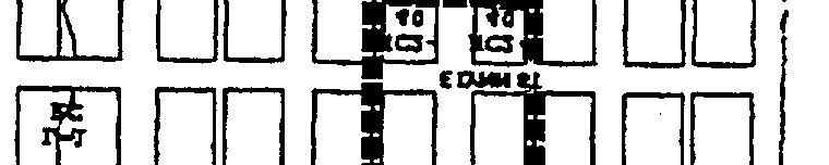
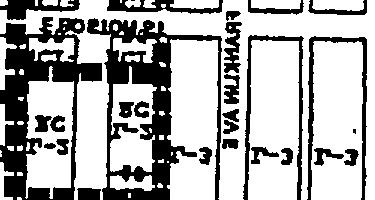
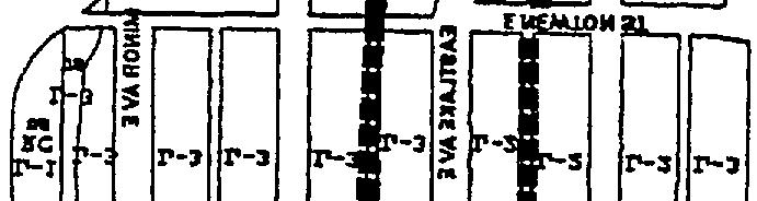
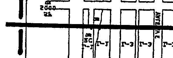
16 building. However, in some places, the resulting zoning was not fully successful in creating a strong community identity that is essential to compete with the strip-arterial nature of the street. The rezoning also did not resolve conflicts that sometimes occurred between abutting residential and commercial uses along the Avenue. Other concerns focused on the streetscape and the need to develop Eastlake.AvcnLlc as a destination for neighborhood residents and employees. One of the most destructi~e elements of development along Eastlake Avenue has been the location of surface parking in front of buildings and in garages along the street-level facade of a building. and the interruption of sidewalks with numerous driveways. Individually and collectively, such parking areas and driveways preclude the development of neighborhood-serving uses and pedestrian amenities that are necessary to create a community on Eastlake Avenue. The street lwel of these buikiings at the corner of EastIake Avenue and Lynn Street is jidly committed to parking garages that do little to enhance the streetscape. Four drivewqu cross the sidewalks in front of these two buiidings. If not changes through the Eastlake Plan, buildings such as these, with parking garages and drivewqls at street Iwel, could stiil be built throughout Eastlake A venue. The Eastlake Plan recommends a comprehensive, package of zoning changes for Eastlake Avenue from the University Bridge to the Steam Plant that consists of several inter-related elements. This area is identified as the Eastlake Avenue Pedestrian District (EAPD), and key elements of the proposed zoning changes include:. Identification and consolidation of commercial and residential development into districts or nodes that will strengthen the identity of each area, increase pedestrian activity along IV 15
17 Eastlake Avenue. and reduce the potential for conflicts that can occur between abutting commercial and residential uses. The designations are Neighborhood Commercial Core and Corners (NCC), Residential/Mixed-Use (l?/mu); Residential (R) and Commercial (C). For NCC and R/NW areas, specific neighborhood-serving uses would be required along the street-level facade in commercial and mixed-use buildings.. For R/MU areas, commercial development would be permitted only at street-level and not on upper floors; residential uses would be permitted at the street level and on upper (and lower) floors without any specials use approvals. This is a change only for NCzoned properties.. For properties with existing NC zoning in R/MU areas, the density of single-purpose residential buildings may be increased from 1 unit per 1200 square feet of lot area to 1 unit per square feet of lot area (the appropriate density to be determined during future review).. For NCC and R/MU areas, parking and other low-priority uses (other than residential or neighborhood-serving commercial) can only be located at street level if behind allowed neighborhood-serving use.. For R areas, only residential development would be allowed on these blocks. This is a change only for the C 1-zoned east block face between Newton and Howe. The density of new single-purpose residential buildings on this block face may be increased from 1 unit per 1200 square feet of lot area to 1 unit per square feet of lot area (the appropriate density to be determined during fiture review).. For all properties in the EAPD, vehicle access must be provided from the alley or side street, if feasible and safe.. Street development standards and a storefront character design guideline (the guideline is addressed in CD-6) will help to fhrther shape the streetscape. These elements received a high level of support fi-om those who responded to the April 1998 Options Guide questionnaire:. 57% of the respondents strongly or somewhat supported a requirement for neighborhoodserving businesses at street-level (only 20 /0 opposed the requirement, and 23 /0 had no opinion or did not answer);. 64 % of the respondents strongly or somewhat supported a prohibition on commercial uses above the street-level floor (only 16 /0 opposed the use limitation, and 20 /0 had no opinion or did not answer); and. 75% of the respondents strongly or somewhat supported a prohibition on new Eastlake Avenue driveways if alley or side street access was available and safe (only 10?40 opposed the access restriction, and 15 %0 had no opinion or did not answer). IV 16 u I
.")
18 In addition, 51% of the respondents supported focusing residential growth along certain areas of Eastlake Avenue as a means of pacing residential growth (only 11% opposed the recommendation, and 3 8 /0 had no opinion or did not answer). The elements described above for the Eastlake Avenue Pedestrian District are consistent with, and in some cases mimic, development standards that are already applied to Eastlake properties or are provided in the Land Use Code as tools for neighborhood planning. For example, all of Eastlake s lowrise residential zones and residential-commercial zones are required to locate vehicle access off the alley and not the street, and many of Eastlake Avenue s block faces have zoning that is for mixed-use or single-purpose residential use. Similarly, the Code has pedestrian overlays that prescribe street-level facade uses and parking locations, and has provisions for allowing increased density and permitting of single-purpose residential structures in commercial zones. However, after reviewing the existing zones and overlays that are available in the Code, it was found that the existing zoning tools would significantly compromise Eastlake s objectives, produce an inferior development, or restrict development more than intended. An overlay tailored according to Eastlake s needs and existing conditions would accomplish Eastlake s objectives, but created administrative concerns for the Department of Construction and Land Use (DCLU). If the framework of Eastlake s zoning changes is approved by City Council, Eastlake will work with DCLU to determine the best zoning tool(s) to implement the changes. The details of the EAPDO are provided in the recommendation below. Eastlake s analysis of existing Code tools is provided in Appendix E. Comprehensive Plan Support. Some of the goals and policies of the Comprehensive Plan that support this Community Design recommendation are listed below:. Promote development in compact mixed-use neighborhoods (L 1, Land Use Element policy) Increase public safety by making urban villages people places at all times of the day (G12, Land Use Element goal). Maintain and enhance retail commercial services throughout the city with special emphasis on serving urban villages (G 18, Land Use Element goal). In pedestrian-oriented commercial zones, promote residential development that is both livable for residents and compatible with the desired commercial function of the area (G58, Land Use Element goal). In pedestrian-oriented commercial zones, maintain an active, attractive, accessible pedestrian environment (G58, Land Use Element goal). Establish use and development standards for pedestrian oriented commercial zones which promote an environment conducive to walking and a mix of commercial and residential uses that promote the goals for these zones (L 105, Land Use Element policy) IV 17
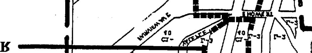
19 . Permit, through neighborhood planning processes, recommendations for the revision of zoning to better reflect community preferences for the development character of an area (L9, Land Use Element, policy) Recommendations Policy CD-I. Create a communip identity for Eastlake Avenue that includes an enhanced, safe and interesting streetscape, pedestrian activity, a strengthened commercial identity and residential community, and reduced conjlicts between residential and commercial uses. Accomplish these characteristics by: consolidating commercial and residential uses into districts or nodes that would strengthen the identity of each area, reduce the potential for conjlicts that can occur between abutting commercial and residential uses, and increase residential development along parts of Eastlake Avenue; developing neighborhood-serving businesses at street level,. and directing vehicle access and parking to alleys and side streets. CD-1. Implement zoning changes for the Eastlake Avenue Pedestrian District (EAPD) that establish identifiable residential and commercial districts and nodes along Eastlake Avenue and improve the pedestrian qualities of the District. Specific implementation recommendations are listed below: 1. Adopt zoning changes for the EAPD area shown on Figure IV.2 to: tailor existing zoning to create a neighborhood commercial core and designated properties) differentiated by increased residential character between these nodes (R/MU and R designated properties); develop neighborhood-serving businesses and uses at street level; and direct vehicle access and parking to the alleys and side streets. Elements of the EAPD zoning changes are described below: A. Specific properties shall be designated as Neighborhood Commercial Comers (NCC), Residential/Mixed-use (R/MU), Residential (R) and Commercial (C) as shown on Figure IV.2. B. For RIMU designated properties, the following new development standards are proposed:. Commercial use is limited to the first 13 feet above street level; only residential use is allowed above the 13-foot street-level floor.. Street-level commercial uses are limited to those neighborhood serving businesses and uses described on Figure IV.3, and must be developed along the building facade to an average depth of 30 feet. Residential densities in single purpose residential structures on Neighborhood Commercial (NC) zoned properties shall be increased from 1 unit per 1200 SF to 1 unit per SF of lot area (the appropriate density to be determined during fiture review). Single purpose residential structures on NC-zoned properties shall be allowed outright, without the administrative conditional use approval currently required by the Land Use Code. IV 18
20 . Parking and other non-specified uses can only be located at street level if behind allowed neighborhood-serving uses. C. For NCC designated properties, the following new development standards are proposed:. Street-level commercial uses are limited to those neighborhood serving businesses and uses described on Figure IV.3 and must be developed along the building facade to an average depth of 30 feet.. Parking and other non-specified uses can only be located at street level if behind allowed neighborhood-serving uses. D. For R designated properties, the following new development standards are proposed:. Only residential uses, together with typical accessory uses, will be permitted in new construction on C-zoned property.. Residential densities in single purpose residential structures on C-zoned properties shall be increased from 1 unit per 1200 SF to 1 unit per SF of lot area (the appropriate density to be determined during future review).. Single purpose residential structures on C-zoned properties shall be allowed outright, without the administrative conditional use approval currently required by the Land Use Code. E. For all properties within the EAPD, there will be no vehicular access from Eastlake Avenue East unless: the property does not abut a platted alley or side street; use of the alley for access would create a significant safety hazard; topography makes alley access infeasible; the alley is not or cannot be improved to the standard of SMC ; or access to barrier free parking must be off Eastlake Avenue in order to meet the barrier free parking requirements of the Washington State Building Code. 2. Develop and implement additional streetscape standards for Eastlake Avenue to shape a consistent street facade, guide street improvements, and enhance Eastlake Avenue s character as a pedestrian street. The standards would address pedestrian features such as walk-up entries, building setbacks, sidewalk widths, street trees, street furniture and other pedestrian amenities. IV 19


21 I I Eastlake Pedestrian District Planning Areas N UNIVMWTYDISTIUCT -- mmmmmmm=ml Neighborhood-Proposed Urban Village Boundary Eastlake Avenue Pedestrian District Overlay (EAPDO) fi!!!i -i!%-%
 are just as important as panoramic views from penthouses.")
23 9 CD-2 Public and Private Views Community Design Goals: Create and enhance Eastlake viewscapes and view corridors (Goal CD-3) Background and Problem. Views are an important part of Eastlake s character and come in a variety of types, locations and sizes. Eastlake s western-sloping topography and lakefront location create many opportunities to view Lake Union water and activities from public and private spaces. Peeks of the water between buildings (or slot views) are just as important as panoramic views from penthouses.. However, Eastlake s views are not limited to waterscapes, and Eastlakers appreciate distant views of Queen Anne hill, the Aurora Bridge and Olympics, Downtown and the Space Needle, as well as more close-in views of tree-lined streets, maritime activities, historic structures and unique streetscapes. Eastlake s topography creates another viewscape rooftops-that can be seen from many residences, commercial spaces and rights-of-way. Roofs can preserve, create or obstruct views. A flat roof may preserve a Lake Union view but become a unsightly part of the foreground. Carefully oriented pitched roofs can preserve views between ridges, and in places where there are no distant views, and a variety of pitched roofs can create an interesting new viewscape. Similarly, views can be created or obstructed at ground level. A resident s desire to create front yard privacy by erecting a tall fence along the sidewalk could detract from the streetscape view, but could also be done in a way that creates new detail and elements of interest along the street. The shape and location of street trees are equally important factors in both creating a new streetscape view and preserving existing distant views. Although Eastlake s topography, stepped-zoning and shoreline regulations help to preserve some distant views, more needs to be done to identi&, preserve, enhance and create distant and closein views from and of public and private spaces. Development standards and design guidelines could help to direct right-of-way and private property improvements in a way that enhances viewing opportunities in Eastlake. Incentives could also be offered for new development that provides slot views from the right-ofway through private property. One such incentive is to allow flexibility in the development standards of the Land Use Code. These standards prescribe the amount and location of parking, open space and landscaping, setbacks, and other parameters that could be modified to create or enhance views. Limited, additional flexibility in the Land Use Code was supported by most of the respondents to the April 1998 Options Guide questionnaire for the following development standards: density (45Y0 were strongly or somewhat supportive compared to 17 A opposed), setbacks (44 /0 compared to 160/0), building depth (43 /0 compared to 160/0), and lot coverage (43V0 compared to 25Yo). Height increases and parking reductions did not receive sufficient community support to pursue as incentives for creating or preserving views. Another possible incentive for creating and preserving views through private property is a tax reduction, which received support from about 42 /0 of those responding, with 25 /0 opposed. IV 20
24 DCLU staff have also suggested departures from open space and landscaping requirements, and the Community Design planning team supported adding these to the list of possible departures because they were similar in scope and impact to lot coverage, setback and building depth modifications. Comprehensive Plan Support. Some of the goals and policies of the Comprehensive Plan that support this Community Design recommendation are listed below:. A neighborhood plan may make neighborhood-specific policy recommendations on issues of interest to the neighborhood (N 14, Neighborhood Planning Element policy). Promote physical environments of the highest quality throughout the city, while emphasizing the special identity of each area (G 16, Land Use Element goal). Use design review to promote new development that enhances the character of the City, respects established architectural characteristics and the surrounding neighborhood context, allows for diversity and creativity in building design and site planning, and furthers community design and development objectives (Ll 40, Land Use Element policy) Recommendations: Policy CD-2. Close-in and distant views are a dejining element of Eastlake s character, and development should identlfj, preserve, enhance and create a variety of attractive and interesting viewsj-om and ofpublic andprivate spaces. CD-2. Develop and adopt design standards and guidelines to preserve and improve public and private views. Specific implementation recommendations are listed below. 1. Adopt development standards and guidelines to preserve or improve public viewscapes and view corridors along public rights-of-way and at street-ends. View corridors and viewscapes would be identified, including existing and potential views of distant places like Lake Union, Queen Anne, Downtown, the Space Needle and the Aurora Bridge and Olympics, and of more close-in places like tree-lined streets, historic structures, maritime activities and unique block faces. Elements such as street tree plantings, setbacks, and paving surfaces could be addressed. 2. Adopt an Eastlake Roof Sightlines and Roofscapes design guideline that would illustrate ways to preserve or improve views of and from private property through careful and creative roof design. Elements such as roof orientation/alignment, pitch, and massing, and enhancement of flat roofs would be addressed. (See Appendix F for the proposed design guideline.) IV 2 1


, and must not create")
25 m 9 The flat roof of the Hart Crowser bui[ding at 1910 Fair-view Avenue East is enhanced with plantings, pavers, a fountain, benches, and tables and chairs. 3. Adopt a design guideline that provides incentives for slot views through private prope~. especially those that complement the view corridors in public rights-of-v-ay. Incentives could include modification of the Land Use Code requirements for setbacks, lot coverage. building depth, landscaping and open space, and density (maximum 1 additional unit), and must not create unacceptable impacts. Modification of height and parking requirements will not be pursued as incentives. IV 22

26 CD-3 Building Reuse and Preservation Community Design Goals. Preserve the traditional diversity and scale of Eastlake development (Goal CD-1) Background and Problem. Most of the Eastlake area \vas platted with its current configuration of streets and lots in the 1880s, and the neighborhood was nearly fully de~eloped with singlefamily, multifamily and commercial buildings by the 1940s. Substantial residential and commercial development activity and the construction of the I-5 freetvay has occurred since that time, resulting in the demolition of many of Eastlake s original structures. Nonetheless, the neighborhood still retains many of the houses, apartment buildings, storefronts. industrial and commercial buildings from earlier decades. Four Eastlake buildings are designated historic landmarks-the houses at 2622 and 2819 Franklin Avenue East, Seward School and the Lake Union Steam Plant/Hydro House. Eastlake has also become adept at converting, adding to and otherwise preserving its original structures, despite land use zoning that may encourage demolition and ne~v construction. While development in Eastlake has been continuous. most residential blocks where one-third of Eastlake s residential growth has occurred since 1990 have had few or no demolitions during the 1990s. New units have instead been created by conversions from single-family to multiplexes of two to six units, additions, and the construction of new, separate buildings that share a lot with existing structures. The most notable exception to the current trend is on the 2200 and 2300 blocks of Yale Avenue, where numerous houses on the east side of the street have been demolished for four-story multifiunily construction, most likely because of the ability to create views over the lower-zoned properties to the west. Existing low-scale fourplex is preserved by adding new triplex itl rear of lot. Iv 23

 and the A. W. Larson Building (formerly the Harwood Building) at 3206 Harvard Avenue East, have been successfidly restored.")
27 to a triplex at the corner of Franklin and Lynn streets maintains single-family character, Older houses on Eastlake Avenue have also been expanded with additions or converted to small commercial use, such as on the east side of the 2600 block. And some of Eastlake s original storefronts, such as the Serafina storefront (which shares its site with a sensiti~ ely designed, newer professional office and connecting courtyard) and the A. W. Larson Building (formerly the Harwood Building) at 3206 Harvard Avenue East, have been successfidly restored. contributing to both the architectural character and tradition of Eastlake as well as its economic health. IV 24

28 Designedas a mixed-use building, the A. W. Larson Building at EastIake and Harvardstreets is a success fzdrenovation of residenriai unirs and retai[ s[orefionts. The Eastlake community has consistently supported the retention, renovation, conversion and compatible expansion of its existing structures. Such structures were among the highest rated buildings in the January 22, 1998, Visual Design Preference Survey, receiving scores ranging from 3.7 to 6.7 (on a scale of +1 O to - 10; the highest rating for all images was 8.1 and the lom-est was -6). Eastlake also recognizes that many of its more affordable residential units and commercial spaces are in existing buildings, which do not have to recoup the expensive cost of new construction. Rarely, if ever, are demolished buildings in Eastlake replaced with new buildings that offer rents or selling prices equivalent to those of the demolished building. Even though Eastlake can demonstrate numerous successfid examples of renovations, additions, conversions and shared lot construction, concern remains that more could and should be done to encourage the continued recycling of structures that are such an important part of Eastlake s architectural and historic character, especially when these same structures also often provide affordable options for members of the community and reduce the demand on resources, such as building materials. One such action is to allow flexibility in the development standards of the Land Use Code. These standards prescribe the amount and location of parking, open space and landscaping, setbacks, IV 25
29 and other parameters that can sometimes make it difficult to convert or add on to older structures. Providing flexibility in some of the standards may encourage a property owner to pursue renovation/reuse of an existing structure over demolition. Limited, additional flexibility in the Land Use Code was supported by most of the respondents to the April 1998 Options Guide questionnaire for the following development standards: density (47Y0 were strongly or somewhat supportive compared to 15V0 opposed); setbacks (41 YO compared to 170/o); building depth (43 /0 compared to 160/o); and lot coverage (42 /0 compared to 24%). Of these, modest density increases were most supported and least opposed. Height increases and parking reductions did not receive sufficient community support to pursue as incentives for reusing and renovating buildings. The most strongly supported incentive for building preservation was tax reduction, which received support from about 51% of those responding (compared to 16% opposed.) In addition, 70 % of the respondents supported measures that discouraged the demolition and supported the use of existing structures as a way to pace residential growth (with 16 A opposed.) DCLU staff have also suggested departures from open space and landscaping requirements, and the Community Design planning team supported adding these to the list of possible departures because they were similar in scope and impact to lot coverage, setback and building depth modifications. In addition to modification of development standards in the Land Use Code, Building Code requirements can also present substantial obstacles to the preservation, renovation and conversion of existing buildings. These requirements, such as window egress, sometimes address safety issues, and can be modified for formally designated historic landmarks, but generally not for other existing structures. Although the modification of some Building Code requirements may be possible and desirable, there was insufficient information available during the neighborhood planning process to form the basis of a recommendation on departures from Building Code requirements. Based on the above information and community support, the Eastlake Plan includes a recommendation for an Eastlake supplemental design guideline described below. Comprehensive Plan Support. Some of the goals and policies of the Comprehensive Plan that support this Community Design recommendation are listed below:. Preserve developments and sites of historic, architectural or social significance that contribute to the identity of an area (Gl 7, Land Use Element goal). Encourage the adaptive reuse of existing buildings for residential use (H24, Housing Element policy). Seek opportunities to combine housing preservation and development efforts with historic preservation (H25, Housing Element policy) IV 26
30 Recommendations: Policy CD-3. Creatively conserve Eastlake s original structures because they are defining elements of Eastiake 5 architectural and historic character, and are more likely to ofier affordable residences and commercial spaces. CD-3. Adopt a design guideline that provides incentives for the preservation, renovation and continued use of existing structures, including: compatible additions; new, separate development on the same lot as an existing building (shared lot development); and conversion to other uses allowed in the zone, such as to commercial or more dense residential use. Incentives could include modification of the Land Use Code requirements for setbacks, lot coverage, building depth, landscaping and open space, and density (maximum 1 additional unit). Modification of height and parking requirements will not be pursued as incentives. (See Appendix F for the proposed design guideline.) IV 27
31 s 8 CD-4 Pacing Residential Growth Community Design Goals. Manage residential growth (Goal CD-8) Background and Problem. Eastlake s residential growth should be consistent with Eastlake s character, size, scale, infrastructure and public services, and shall occur in locations identified as appropriate for residential uses. Eastlake is designated a residential urban village in the City s Comprehensive Plan and has a goal of 380 new housing units by The target was based on Eastlake s household count and density that existed in Eastlake has had substantial residential growth during the 1990s. As of September 1997, about 264 units have been constructed since the 1990 count was taken; 169 of these were constructed after the Comprehensive Plan was adopted in Regardless of the baseline that is used to measure progress toward our housing goal, Eastlake will meet its target well in advance of 2014, possibly by Eastlake is also one of the most dense of the 18 residential urban villages in the City, but nonetheless maintains a relatively small-scale, neighborhood character. The Comprehensive Plan allows neighborhood plans to address growth rates that unacceptably depart from the projected household targets and densities (Policy L61 of the Land Use Element). In the April 1998 Options Guide questionnaire, Eastlakers were asked their opinions about four specific measures that could help to pace residential growth. The respondents strongly or somewhat supported three of the four measures:. Limit the maximum number of units per project 57% support (28% opposed). Discourage the demolition and support the use of existing structures-70% support (16% opposed). Focus residential growth along certain areas of Eastlake Avenue 51 % support (11% opposed) Measures that would limit the total number of units permitted each year in Eastlake did not receive sufficient support at this time (only 360/0), and are not being pursued in any Community Design recommendations for pacing residential growth. Comprehensive Plan Support. Some of the goals and policies of the Comprehensive Plan that support this Community Design recommendation are listed below:. Achieve a distribution of growth to each urban village that accomplishes the goals of the urban village strategy (G35, Land Use Element goal). Achieve growth in each urban village according to growth targets that are established subsequent to the recommendations of a neighborhood planning process, that reviews and confirms or amends planning estimates (G36, Land Use Element goal). Guide increase in density over the life of the plan so that each type of area progresses toward full development as an urban village at a pace appropriate to current conditions in the area (G37, Land Use Element goal) IV 28
32 Recommendations: Policy CD-4. Eastlake s residential growth should be consistent with Eastlake!s character, size, scale, inj?astructure, and public services, and should occur in locations identljled as appropriate for residential uses. CD-4. Monitor Eastlake s residential growth and adopt measures to pace residential growth so it occurs in a manner consistent with the household targets in the Comprehensive Plan and with Eastlake s character, size, scale, infrastructure and public services, and in locations identified as appropriate for residential uses. Monitoring should address the number of units and, if possible, other unit characteristics such as type, bedroom count, and cost. Measures to pace residential growth could: limit the maximum number of units per project; promote the re-use and renovation of existing structures in lowrise residential zones; and focus residential growth along certain areas of Eastlake Avenue (Recommendations CD-1 and CD-3 are proposed to partially implement the last two measures). 9 IV 29
33 CD-5 Design Review Community Design Goals: Preserve the traditional diversity and scale of Eastlake development (Goal CD-1) Background and Problem. The current mandatory design review program does not apply to new Eastlake projects in three residential and commercial zones: Lowrise 1 (L 1 ), Lowrise 2 (L2), and Commercial 1 (C 1 ). A substantial amount of Eastlake s land is zoned L1, L2 and C 1, and these properties are located throughout Eastlake. Much of Eastlake s new development occurs in these zones and would benefit from the design review process and guidelines, including those guidelines that address siting, architectural design, and other contextual issues. Expanding the mandatory design review process to Eastlake projects in these three zones that also exceed SEPA thresholds would provide contextual design throughout Eastlake, and was supported by 59?40 of those responding to the April 1998 Options Guide questionnaire (with only 9% opposed). Figure IV.4 Design Review Questionnaire Results Extend community design review to include new development projects in Ll, L2 and C zones? Strongly agree: Somewhat support: 18.5% No opinion: 16.0% Somewhat opposed: 2.5% Strongly opposed: 6.2% No response: Total: ?0 The design review process, as applied in Eastlake but also in neighborhoods throughout the City, should also be revisited and revised to more closely meet the objective of providing a process, with meaningful neighborhood participation, to address project design issues that were ineffectively addressed through other processes (such as SEPA). The program is not intended to be an easy alternative to the variance process, through which development standards are relaxed upon an applicant s request. Only three Eastlake projects have been subject to mandatory design review since it began in 1993, but each has demonstrated problems with the current implementation of the program. Many are administrative problems that have resulted from the IV 30


34 Figure IV.5 Comparison of Buildings for Design Review Resldentlal De51cin Revtew !3. z-z. - II ~ -8 unlt5+ _ L2 - G unk5+ ~ -4 unk5+ Commercial De5iqn Review R R R R R 9 -&- NC ,000 5q. ft. + c I -40 I 2,000 5q. ft. + I R c c I -G5, Commercial zoning allows a variety of bulldlng types (manufactunng, I story retail w/parking lot, office, or mixed-use)
35 Department of Construction and Land Use s implementation of the City Council-adopted program, and can be corrected without modifying the adopting ordinance and Land Use Code. Problems that should be addressed and corrected include: design review meetings that are scheduled far from the affected community; a rigid, non-interactive meeting format; selection of design guideline priorities that do not reflect community priorities; granting of development standard departures without adequate analysis of adverse effects of departure and without demonstrated additional desigticommunity benefits; and board members that are not community-based. Comprehensive Plan Support. Some of the goals and policies of the Comprehensive Plan that support this Community Design recommendation are listed below:. Promote physical environments of the highest quality throughout the city, while emphasizing the special identity of each area (G 16, Land Use Element goal). Use design review to promote new development that enhances the character of the City, respects established architectural characteristics and the surrounding neighborhood context, allows for diversity and creativity in building design and site planning, and furthers community design and development objectives (L 140, Land Use Element policy) Recommendations: Policy CD-5. The design review program should: be neighborhood-based; promote interaction between the communi~, the developer, designers, and decision-makers; be expanded throughout Eastlake to address siting, design and contextual issues; and result in buildings that contribute to and enhance Eastlake s character. CD-5. Adopt changes to the design review program that expands the types of projects included in mandatory design review and creates more neighborhood participation in the design review and decision-making process. Specific implementation recommendations are listed below: 1. Revise the current permitting process by adopting a mandatory design review program for projects in L 1, L2 and C zones that also require environmental review. Design review would be required for projects that exceed the following thresholds: 4 residential units in L1, 6 residential units in L2, and 4 residential units or 12,000 square feet of commercial use in C zones. 2. For all neighborhoods, support adoption of a more neighborhood-based, interactive design review process than currently exists. Elements of the design review process should include: meetings located in the affected neighborhoods; a meeting format that fosters constructive interaction and departs from a rigid hearing format; neighborhoodbased composition of the reviewing entity; analysis of impacts of requested development standard departures; and a requirement that design benefits related to development standard departures be demonstrated, documented and conditioned on the project permit. IV 3 1
36 CD-6 Facade Width and Storefront Character Community Design Goals. Preserve the traditional diversity and scale of Eastlake development (Goal CD-1) Background and Problem. Eastlake s building facades are an important and defining component of the neighborhood s architectural character and scale. The width of buildings along the street and the detailing of residential and commercial facades affect Eastlake s scale as well as the compatibility of different types and sizes of buildings. Eastlake s residential facade widths are generally narrow compared to buildings in many other multifiunily neighborhoods, and are reflective of small, mostly single-lot development that has occurred throughout the 1900s. The Eastlake Panorama photo in Section 1 of this chapter and the map on Figure IV.2 illustrate Eastlake s relatively small building widths, and how they contribute to the neighborhood s pedestrian-scaled and richly textured streetscapes. Many of Eastlake s building widths were measured and documented by the Community Design planning team. The Eastlake Counts! inventory confirmed that the widths of most Eastlake residential structures (including contemporary multifhrnily structures) were substantially less than permitted by the underlying zoning for modulated facades, even in L3 zones. Figure IV.6 Residential Structure Width Width of Structures Facing Street for Single-Purpose Residential Structures (from Eastlake Counts!) fine - Wldthl Minimum width Median width Maximum width L2-50 max L21RC -50 max (Eastlake Ave.) 1 L3-75 max 20 I 32 I 230 Note 1: Zone width is the maximum allowed building width for structures that meet the minimum facade modulation requirements in the Land Use Code. The predominance of Eastlake s small building widths is particularly interesting considering that prior to 1989, the maximum building width allowed by zoning was even greater than it is today the maximum building width in L2 and L3 zones had a maximum building width of 90 feet and 150 feet, respectively. These maximum widths were reduced by City Council in 1989 along with other development standard changes to the lowrise zones. Although the reduced widths helped to prevent large, out-of-scale development on assembled lots, which had occurred on some Eastlake blocks, they are still substantially greater than the width of multifamily IV 32

37 9 buildings that are typically being constructed in Eastlake today, as demonstrated by the photo below. These four newer muhlfamily buildings located in an L3 zone on the 2300 block of Yale Avenue East re~ect EastIakek ~picai1-tol l/2-lot residential deveiopmentpattern, Thewidth ofeachmultlfamiiy building, fiom[ef7 to right, is. 38 feet, 52 feet, 42 feet and48feet each significantly less than the 75-foot maimum width allowedin the L3 zone. The Community Design planning team considered two alternatives for achieving contextual residential facade widths: additional reductions in the maximum aliowed building width for Eastlake-only Iowrise zones; and a design guideline that demonstrated ways of achieving contextual building width, without a mandatory reduced width. The April 1998 Options Guide questionnaire showed that 72?40 of the respondents favored reducing the maximum allowed width of buildings in L3 zones. E IV 33
38 Figure IV.7 Building Width Questionnaire Results R 8 Reduce the allowed width of building in X.3 zones to be consistent with other similar buildings on the same block? Strongly agree: 46.9% Somewhat support: 24.7% No opiniorx 11.l% Somewhat opposed: 3.7% Strongly opposed: 2.5Y0 No response: 11.l% Total: However, the planning team has recommended adoption of a design guideline as an initial step for several reasons: City support for additional building width reductions was unlikely in light of the reductions made in 1989; the number of sites in Eastlake that have several lots in common ownership are comparatively few, with correspondingly few opportunities for development to achieve the maximum allowed Code widths; the actual difference between existing widths and Code-allowed widths in L3 zones, although still substantial, was less than initially understood by the planning team and reported in the Options Guide (L3 was mistakenly reported to allow a 90- foot wide building); and, a guideline could be justifiably applied to all Lowrise zones in Eastlake, not just the L3 zone, to help achieve consistent facade widths and contextual scale throughout Eastlake s residential districts. The architectural design and detailing of residential and commercial facades are equally critical elements of.eastlake s character. Although there is no defined Eastlake style of architecture, there is a predominant and desired Eastlake scale that is reflected not only in the overall size of buildings, but also in the articulation and detailing of building facades. This scale is evident in the Eastlake Panorama photo in Section 1 of this chapter. Most buildings, large and small, are articulated with individual, human-scaled windows, usually arranged and detailed to produce a balance between vertical and horizontal lines. Few Eastlake buildings have a strong horizontal emphasis achieved usually through horizontal bands of glass and solid facade materials, but also by bands of protruding, enclosed decks and these are visually prominent in large part because of their departure from the pattern established by other structures. Such horizontally-banded buildings all received negative (- minus) ratings in the Community Design planning team s January 22, 1998 Visual Design Preference Survey (see, for example, image nos. 37, 51, 57, 59, 65, and 73). Similarly, glass curtain walls (mirrored or plain) are a rarity in Eastlake. The only building that approaches the monolithic, single-planed appearance of a glass IV 34
39 curtain wall is the Iandmarked Steam Plant, which has well-defined bays and other detailing to produce a contextual, albeit dramatic, facade. Other facade details that contribute to Eastlake s existing and desired architectural character include: customized, commercial storefronts that identifi individual business establishments and use primarily glass, wood, and masonry to create the storefront and transparency (instead of a manufactured metal storefront system); residential balconies and decks that are integrated into the architectural modulation of the building (instead of cantilevered from, or stuck on to, its facade); and canvas or structural awnings (instead of fluorescent-lit vinyl). Buildings with these features scored high in the January 22, 1998, Visual Design Preference Survey, including the officeh-etail building on the southwest corner of Louisa and Eastlake (+7.1), and the mixed-use building on the southwest corner of Harnlin and Eastlake (+5.8). Although the existing Citywide design guidelines generally address contextual building facades and pedestrian-scaled storefronts, guidelines tailored to Eastlake s specific character and conditions would increase the effectiveness of the design review program in Eastlake. Comprehensive Plan Support. Some of the goals and policies of the Comprehensive Plan that support this Community Design recommendation are listed below: Promote physical environments of the highest quality throughout the city, while emphasizing the special identity of each area (G 16, Land Use Element goal). Use design review to promote new development that enhances the character of the City, respects established architectural characteristics and the surrounding neighborhood context, allows for diversity and creativity in building design and site planning, and furthers community design and development objectives (L140, Land Use Element policy). A neighborhood plan may also make neighborhood specific policy recommendations on other issues of interest to the neighborhood (N 14, Neighborhood Planning Element policy). Maintain and enhance Seattle s character (Gl, Land Use Element goal). Respect the city s human scale, history, aesthetics, natural environment and sense of community identity (G2, Land Use Element) Recommendations: Policy CD-6. Building facades are an important part of Eastlake s views and residential and commercial streetscapes, and their designs should rej?ect the neighborhood small, freely textured scale and the individuality of its architectural expressions. CD-6. Adopt the following design guidelines to achieve interesting, contextual and humanscaled building facades: 1. Adopt an Eastlake Facade Width design guideline for L 1, L2, and L3 residential zones that encourages the width, modulation and detailing of new building facades to reflect the majority of existing facade widths along the block. The new guideline would encourage building widths and designs that preserve and enhance Eastlake s existing scale and IV 35
40 traditional pattern of 1 and 1-1/2 lot development. (See Appendix F for the proposed guideline.) 2. Adopt an Eastlake Facade and Storefi-ont Character design guideline. The guideline would emphasize: customized commercial storefronts that identi~ individual business spaces; commercial facades that are articulated with segmented or discontinuous window groupings; and design of residential balconies and decks that are integrated into the architectural modulation of a building instead of cantilevered from its facade. The guideline would discourage metal storefront systems, vinyl awnings, and commercial facades that have large horizontal bands of glazing or fully glazed exteriors. (This guideline is intended to supplement the City s C-3 design guideline; see Appendix F for the proposed guideline.) IV 36
. Manage residential growth (Goal CD-8) Background and Problem.")
41 CD-7 Live/Work Units Community Design Goals:. Preserve the traditional diversity and scale of Eastlake development (Goal CD- 1 ). Encourage pedestrian-scaled mixed-use development (Goal CD-6). Promote compatibility between commercial and residential uses (Goal CD-7). Manage residential growth (Goal CD-8) Background and Problem. Eastlake has an increasing number of people who live and work in the neighborhood. This enhances Eastlake in numerous ways, including by reducing transportation impacts, strengthening the ties between our residential and business communities, and reducing overall living costs. However, more could be done to provide opportunities for people to reside in the same spaces in which they work. Live/work units that is, units with spaces that are specifically and compatibly designed for certain business activities and for residence anticipate the needs and functions of each use, rather than simply adapt a portion of the residential space for business activity, as occurs in the conversion of a bedroom or basement to a home office. Examples of live/work situations are: a small business space at street level with a connecting residential unit on the floor above; apartment-like residential units with business spaces directly off the unit s entry for work and meeting with clients; and artist studios with sleeping lofts. Live/work uses would be encouraged in areas that already allow commercial development, and are also recommended in the Housing Element of the Eastlake Neighborhood Plan. Comprehensive Plan Support. Some of the goals and policies of the Comprehensive Plan that support this Community Design recommendation are listed below:. Achieve a mix of housing types attractive and affordable to a diversity of ages, incomes, household sizes, live/work situations and cultural backgrounds (G4, Housing Element goal) Increase public safety by making villages people places at all times of the day (G12, Land Use Element goal). Promote residential development that is both livable for residents and compatible with the desired commercial function of the area (G58, Land Use Element goal) Recommendations: Policy CD-7. Encourage the development of live/work units in areas that ah-eady allow commercial development. CD-7. Prepare an evaluation of live/work units in Eastlake. The evaluation could include an assessment of supply and need in Eastlake, Land Use Code implications, the identification and development of live/work prototypes, and recommendations for encouraging and constructing live/work units. IV 37
42 CD-8 Community Notices Community Design Goals: Encourage pedestrian activity along streetscapes, alleys and view corridors (Goal CD-4) Background and Problem. The Eastlake community has a long tradition of providing notice throughout the neighborhood of events, activities and issues that are of community interest. Such notification is fimdarnental to an involved citizenry, and helps to build ties that strengthen the community. Eastlake s relatively compact size and defined boundaries enables door-to-door delivery of many notices, but this is often too time-consuming and costly, even for an smaller area like Eastlake. In the past, Eastlake has relied extensively on utility poles for posting community notices, especially those of an urgent nature, but City Council legislation has made such postings illegal. The adverse effect of removing this means of notification was immediate and significant: more door-to-door delivery and volunteers to do the delivery were required and printing costs increased. Some information did not get communicated with the breadth and depth as had previously occurred; other information did not get communicated at all. An effective alternative to utility posting is the use of kiosks and bulletin boards. When installed at public gathering places, office lobbies and bus stops, along pedestrian routes at intersections, in retail spaces fi-equented by community members, and at other similar locations, kiosks and bulletin boards can help to get quick, efficient and relatively inexpensive notice to a broad range of Eastlakers. Eastlake has several kiosks and bulletin boards that are known throughout the community, including those at the Eastlake Zoo, Louisa s, the laundromat, and the more recently installed Dreamboat kiosk outside of Pazzo s, which demonstrates the creative integration of function and art. However, many more are needed, and the opportunities are abundant: North Gateway, Franklin Avenue Green Street, Rogers Playfield, Fairview Olmsted Park, our many street-end parks, the exterior walls of Pete s Super, Lynn Street Deli and the Quick Stop, the scaffold at the northwest corner of Louisa and Eastlake, bus stops, and Seward School, just to name a few. Kiosks could be tided through the Neighborhood Matching Fund, by the owners of new commercial and multifh.mily buildings, and by many other sources. Eastlake should also explore the installation of an unobtrusive, single-notice fixture on utility poles that would accommodate a notice while maintaining safety for work crews. Comprehensive Plan Support. Some of the goals and policies of the Comprehensive Plan that support this Community Design recommendation are listed below:. A city that uses public projects and activities to help define Seattle s identity, especially civic spaces that provide residents and visitors with strong symbols of the city or neighborhood identity (G3 - Cultural Element) Recommendations: Policy CD-8. install Eastlake. and maintain creatively designed community notice j?xtures throughout IV 38

43 CD-8. appropriate locations on public and private property throughout Eastlake for community kiosks, bulletin boards, and other methods of posting notices of community interest, and pursue public and private funding to determine the location of and install such fixtures. Specific implementation recommendations are listed below Prepare a Community Notice study that builds on previous Eastlake surveys, and explores and identifies appropriate locations for community notice fixtures, different types of fixtures, maintenance, and funding opportunities. The types of locations that could be explored include pubiic properties (such as parks, street comers, bus stops and utility poles), and private properties (such as commercial building lobbies and exterior walls, and outside security multifamily buildings), subject to property owner agreement. The purpose of the study is to help direct efforts to install community notice fixtures, but the study is not a prerequisite for future installations. Install community notice fixtures where and when opportunities arise {identification in.. the Community Notice study is not a prerequisite for such installations). The recently installed Dreamboats kiosk, which was funded by the City s % for Art program, is EastIake h $rst kiosk that integrates art, community character and traditions, and function. IV 39
44 CD-9 L3 and L4 Rezone Locational Criteria Community Design Goals:. Preserve the traditional diversity and scale of Eastlake development. (Goal CD- 1 ). Manage residential growth (Goal CD-8) Background and Problem. Eastlake s existing and zoned lowrise, multifamily density and scale are fundamental and defining components of the neighborhood s character. These two elements of development have been closely evaluated and scrutinized by Eastlakers and the City throughout the last two decades during the review of individual development projects as well as City-initiated, neighborhood-wide rezoning activities. Much of Eastlake s current zoning reflects carefidly considered compromises that have been crafted, in large part, to reflect appropriate and compatible densities and scales. For this reason, the Community Design team has not recommended zoning changes that involve substantial increases or decreases in density or height, bulk and scale, and, with exception of the Eastlake Avenue Pedestrian District, has in fact relied on the continuation of existing zoning as an essential part of the Eastlake Neighborhood Plan. Eastlake s long-held emphasis on the importance of iiture development being compatible with the neighborhood s established density and scale was also shared and applied by the City during rezone considerations prior to adoption of the Comprehensive Plan. However, recently adopted Land Use Code rezone criteria, precipitated by the Comprehensive Plan, place less importance on compatible density and scale, and have the potential to undermine Eastlake s carefidly crafted zoning and character. Fortunately, these same criteria allow neighborhood plans to re-assert the importance of existing density and scale. Doing so in Eastlake would be consistent with its established and desired character and with two decades of City zoning efforts, and would not in any way adversely affect Eastlake s zoning capacity or its ability to meet Comprehensive Plan growth target. Comprehensive Plan Support. Some of the goals and policies of the Comprehensive Plan that support this Community Design recommendation are listed below:. Respect the city s human scale, history, aesthetics, natural environment, and sense of community (G2, Land Use Element goal). Promote physical environments of the highest quality throughout the city, and particularly within urban centers and villages while emphasizing the special identi~ of each area (Gl 6, Land Use Element goal). Provide for the intended fimction, character, amount of growth, intensity of activity, and scale of development appropriate for each urban village neighborhood (G 19, Land Use Element goal). Permit, through neighborhood planning processes, recommendations for the revision of zoning to better reflect community preferences for the development character of an area, provided that consistency between the zoning and this plan is maintained (L9, Land Use Element policy) IV40 9 I
45 a n B I B 9 Recommendations: CD-9 Policy. Eastlake 5 small, finely textured scale and low-to-medium density are fundamental to the neighborhood s character, have traditionally in$uenced land use decisions and should be reflected in future development. CD-9. Adopt rezone locational criteria for Lowrise 3 and Lowrise 4 zones in the Eastlake urban village that emphasize scale and density compatibility with existing development. Specifically, the following City Council amendment to the rezone chapter of the Land Use Code (or similar alternative) is required at the time the Eastlake plan is approved: For the Eastlake urban village only, delete the following sections from the rezone chapter of the Land Use Code (SMC 23.34): SMC B.1.c, B.3.a.(l)(b), B.1.c, B.3.a.(l)(b). IV-41
46 CD-10 Hillclimbs and Passageways Community Design Goals:. Create and enhance Eastlake s viewscapes and view corridors (Goal CD-3). Encourage pedestrian activity along streetscapes, alleys and hillclimbs (Goal CD-4) Background and Problem. The neighborhood walk is a favorite past-time of many Eastlakers, and walking is an essential part of Eastlake life, whether it be for errands, to catch a bus, to dine at a local restaurant, or to recreate. The Eastlake pedestrian system is based on a street and alley grid that promotes easy and variable pedestrian circulation and connections. In addition to our improved streets and alleys, Eastlake has a growing number of pedestrian passageways and hillclimbs. Examples of some of Eastlake s non-street/alley pedestrian connections include the Louisa Street passageway, the Martin Street-end stairway (which connects Eastlake to north Roanoke Park/Portage Bay), the Quick Stop and Hart Crowser stairs (both on private property), the recently completed south Fairview trail, the soon-to-be enhanced Franklin Avenue Green Street, and the soon-to-be created Fairview Olmsted stairway. Although Eastlake has a fairly extensive pedestrian circulation system, there remain gaps that should be addressed to help make the neighborhood system complete. Several additional potential pedestrian passageways and hillclimbs have been identified by the Transportation and Open Space planning teams, including the Shelby Street hillclimb and mid-block crossing at the Fairview Olmsted Park, the Howe Street passageway, the south I-5 Freeway hillclimb, and the Fairview Avenue passage between Harnlin and Roanoke streets. Most, if not all, of these identified passageways and hillclimbs occur on public right-of-way. There is also the potential to provide key public passageways and hillclimbs in easements on selected private properties, such as those located on steep hills or unusually long blocks where no public properties are available for connections. The locations and possible development incentives for such key passageways and hillclimbs need to be identified. However, one example is the 2300 block of Eastlake Avenue. This block, the core of the commercial district, is longer than many Eastlake blocks, and several undeveloped lots flank Eastlake Avenue at mid-block. Future development of these lots could provide an east/west pedestrian connection between the adjoining alleys and Eastlake Avenue (one already exists in the Quick Stop parking lot), together with a mid-block pedestrian crossing of Eastlake Avenue. Such passageways are good for residents and businesses, and can be carefhlly designed to ensure compatibility between public and private uses. Incentives for passageways and hillclimbs on private property may vary from site to site, but would be limited to those incentives (or related incentives) that were generally supported by the April 1998 Options Guide respondents: setback reduction, lot coverage increase, building depth increase, density increase, and open space/landscaping departures (suggested by DCLU and related to other supported development standards). See Figure IV.8. Iv-42
47 Figure IV.8 Passageways and Slot Views Questionnaire Results II What incentives might be offered in exchange for public m II passageways and slot views through private property? Agree Oppose No Opinion/ No Answer Setback reduction Lot coverage increase Building depth increase Density increase Modest parking reduction Modest height increase Tax reduction No incentives !Z Z $Z0 16.0% 17.3$Z0 29.6?lo 38.3% 24.7% io 35.8?I0 40.8% 38.39Z Z Z0 33.3% Eastlake s existing and potential hillclimbs and passageways, including those on public and private properties, should be identified on a plan that shows Eastlake s full network of pedestrian connections. Design standards and guidelines, and development incentives for key connections on private property, should also be prepared for individual sites. Such identification of hillclimbs and passageways, together with design standards, guidelines and incentives, will improve pedestrian access, circulation and views in the neighborhood, while enhancing Eastlake s pedestrian environment. Comprehensive Plan Support. Some of the goals and policies of the Comprehensive Plan that support this Community Design recommendation are listed below:. More efficiently utilize limited land resources (G7, Land Use Element goal). Increase public safety by making villages people places at all times of the day (G8, Land Use Element goal) Promote physical environments of the highest quality throughout the city, and particularly within urban centers and villages while emphasizing the special identity of an area (G I 6, Land Use Element goal) IV-43
48 Recommendations Policy CD-10. Promote interesting, safe and diverse pedestrian connections on public property throughout Eastlake, and on key private properties, that are compatible with and sensitivity designed for abutting land uses. CD-10. Prepare and implement a plan, with design standards and guidelines, for key Eastlake Neighborhood Hillclimbs and Passageways, and provide incentives for hillclimbs and passageways that are identified on private property. Incentives could include modification of the Land Use Code requirements for setbacks, lot coverage, building depth, landscaping and open space, and density (maximum 1 additional unit). Modification of height and parking requirements will not be pursued as incentives. IV-44 8
49 CD-1 1 Cobblestone Streets Community Design Goals: 8,8. Preserve the traditional diversity and scale of Eastlake development (Goal CD-1). Create and enhance Eastlake viewscapes and view corridors (Goal CD-3) Background and Problem. Eastlake has three remaining cobblestone streets: East Boston, East Edgar and East Louisa streets, all between Boylston and Eastlake and comprising six blocks. Other streets, including portions of Lynn, Boylston and Han-din streets, still retain their original cobblestones under an asphalt surface. The sandstone cobbles were laid by or before , but have received little repair since that time. The Eastlake community has, on several occasions, requested in-kind repair of its cobblestone streets, including at least two formal requests through the City s Neighborhood Budget Request Process. The City s response has been that the only repair it will fund for Eastlake s cobblestones is asphalt patching or full surfacing. In 1996, SEATRAN and the Department of Neighborhoods inventoried the location and condition of the City s cobblestone streets and, without notice to affected communities or public process, entered into an agreement about which cobblestone streets would have in-kind maintenance, which would be harvested for other street repairs, and the community process for requesting and receiving asphalt patching and surfacing of streets that were not identified for in-kind maintenance (60 /0 of block residents and businesses must sign a petition requesting the asphalt maintenance). Based on this Agreement, none of Eastlake s cobblestone streets will receive in-kind maintenance from the City and all could be used for cobblestone harvesting unless the community finds alternative funding sources for in-kind repairs (such as a Local Improvement District). As demonstrated by the community s formal budget requests and by numerous requests to include cobblestone street preservation in the Community Design planning team work, Eastlake has consistently supported preservation of its cobblestone streets. Retention of the cobblestone streets was also supported by TOPS (the K-8 public school in Seward School) in its May 1, 1996 Seward School Educational Specifications. These important viewscapes evoke Eastlake s history, and also slow vehicular traffic, and should be studied for their restoration opportunities. In no case should Eaktlake cobblestones be harvested for streets outside of the neighborhood. If it is essential to remove any cobbles, such as for utility work, they should be stored and reserved for Eastlake repairs. Comprehensive Plan Support. Some of the goals and policies of the Comprehensive Plan that support this Community Design recommendation are listed below: Preserve developments and sites of historic, architectural or social significance that contribute to the identity of an area (G 17, Land Use Element goal). Capitalize on opportunities for promoting community identity through the design of street space, preserving or encouraging: street finishings that reflect the ethnic heritage or architectural character of the neighborhood: artworks: details that can reinforce community identity such as light standards, street name markers, original granite curbs Iv-45
 Differentiate among the various fuctions of streets (G 12, Transportation Element goal).")
50 and cobblestone paving, or types of street trees; or space for landscaping projects (CR6. Cultural Resources Element policy). Make the best use of the city s limited street capacity. and seek to balance competing interests (G8. Transportation Element goal) Differentiate among the various fuctions of streets (G 12, Transportation Element goal). Protect neighborhood streets from through traffic (G 13. Transportation Element goal) Recommendations: Policy CD- I 1. Preserve, restore and maintain Eastlake s cobblestone s[reets because qf th( ir historic, aesthetic and ti-aflc calming value. CD-1 1. Prepare and implement a plan to preserve, restore and maintain Eastlake s cobblestone street surfaces. especially on Boston, Louisa and Edgar streets. The plan should icientifi restoration and maintenance options, costs, and funding sources, and could explore the reestablishment of cobblestones on additional streets that have been paved. Like other cobblestone streets in fhe neighborhood, the Louisa sandstone cobbles date fionz and are reminiscent of Eastlake s part. IV--46
51 CD-12 Lynn Street Community Design Goals:. Establish identifiable districts, nodes and gateways (Goal CD-2). Create and enhance Eastlake viewscapes and view corridors (Goal CD-3) Encourage pedestrian activity along streetscapes, alleys and hillclimbs (Goal CD-4) Background and Problem. There are three major gateways to the Eastlake neighborhood. The north and south gateways have been identified and improved with artwork, landscaping and other amenities, and are the subject are further action identified in the Eastlake Neighborhood Plan (see especially the North Gateway Element). However, Eastlake s third and well-traveled gateway at Lynn Street (from Boylston to Eastlake avenues) has yet to receive any special consideration or amenities, and should be the subject of a pedestrian improvement project. This section of Lynn Street was previously studied by the City for possible roadway improvements which would have created a west-bound left-turn lane from Lynn Street to Eastlake Avenue. However, the improvements were abandoned in response to community concerns that the widening would have eliminated the already -nan-ow planting strips and increased traffic volumes through the neighborhood. As an alternative, a Lynn Street left-turn signal, without the lane widening, is recommended in the Transportation section of the Eastlake Neighborhood Plan, thus preserving the limited right-of-way for pedestrian amenities, such as landscaping. Design elements that could be explored in the Lynn Street pedestrian improvement project include street trees and landscaping, curb bulbs and other amenities at the Franklin intersection, potential kiosk locations, paving surfaces, and pedestrian-oriented development on the corners of the Eastlake/Lynn intersection (such as guidelines for future redevelopment of the corners or for possibly converting existing parking on the northeast comer to other, more pedestrian uses). Sources for funds to implement the design elements should also be explored. The Lynn Street corridor also provides public views of Lake Union, which should be preserved and enhanced as part of the improvement project. Comprehensive Plan Support. Some of the goals and policies of the Comprehensive Plan that support this Community Design recommendation are listed below:. Maximize the potential of the street system for pubic use through the reclamation of portions of public right-of-way, where appropriate, for open space, waterfront access, tree planting and substantial landscaping, pedestrian amenities, recreation space, view corridors, and boulevards (L151, Land Use Element policy) Promote physical environments of the highest quality throughout the city, while emphasizing the special identity of each area (G 16, Land Use Element goal). Emphasize flexibility in planning, designing and developing new open space and encourage development of innovative projects (L 146, Land Use Element policy) IV-47
52 . Create desirable, safe, convenient environments that are conducive to walking and bicycling (G21, Transportation Element goal). Capitalize on opportunities for promoting community identity through the design of street space, preserving or encouraging: street furnishings that reflect the ethnic heritage or architectural character of the neighborhood: artworks: details that can reinforce community identity such as light standards, street name markers, original granite curbs and cobblestone paving, or types of street trees; or space for landscaping projects (CR6, Cultural Resources Element policy) Recommendations: Policy CD-12. Enhance Lynn Street between Eastlake and Boylston Avenues as a Gateway to the Eastlake neighborhood, a view corridor, and an important pedestrian connection, while retaining its existing street and right-of-way width. CD-12. Develop a Lynn Street pedestrian improvement project that recognizes this street as a gateway to the Eastlake neighborhood. A plan for street tree plantings, street furniture, paving surfaces and other pedestrian amenities would be prepared and implemented, together with identification of funding needs and sources. IV48
 Background and Problem.")
53 CD-13 Green Spaces Community Design Goals:. Create and enhance Eastlake s viewscapes and view corridors (Goal CD-3) Encourage pedestrian activity along streetscapes, alleys and hillclimbs (Goal CD-4). Improve the urban ecological health of Eastlake (Goal CD-5) Background and Problem. Vegetation is integral to Eastlake s character, and is an important component of our architecture, streetscapes, view corridors and viewscapes. In densely developed communities such as Eastlake, where green spaces are limited, treasured and diminishing resources, it becomes even more important to find new places for landscaping that can be enjoyed by humans and wildlife. Development standards and guidelines could identifi creative and unique ways to increase the planting of places such as roofs, balconies, fences, building walls and planting strips. Such standards and guidelines would also consider view and sunlight preservation (including views of business storefronts or sunlight for a neighbor s garden), maintenance, and unobstructed pedestrian use of sidewalks next to planting strips. Several Community Design recommendations, including CD-1.2, CD-2, CD-1 O, and CD-12, address the planting of green spaces in specific areas, but additional work is needed to more fully identify opportunities and methods of increasing green spaces throughout the neighborhood, especially as a integrated component of development projects. Comprehensive Plan Support. Some of the goals and policies of the Comprehensive Plan that support this Community Design recommendation are listed below:. Protect the habitat of native and migratory wildlife by encouraging open space conservation and providing for the growth of native species of trees (G99, Land Use Element goal). Provide open space to enhance the village environment, to help shape the overall development pattern, and to refine the character of each village (G 15, Land Use Element goal) Promote physical environments of the highest quality throughout the city, while emphasizing the special identity of each area (G I 6, Land Use Element goal). In pedestrian-oriented commercial zones, maintain an active, attractive, accessible pedestrian environment (G58, Land Use Element goal). Emphasize flexibility in planning, designing and developing new open space and encourage development of innovative projects (L 146, Land Use Element policy) Recommendations: Policy CD-13. Increase the amount and creative use of vegetation on public and private properties and buildings. IV--49
54 CD-13. Prepare development standards and guidelines to increase the amount and creative use of vegetation on public and private properties and buildings (such as on roofs, balconies, building walls and fences, and in planting strips), while considering the impacts on views (including scenic and storefront views), sunlight, maintenance, and pedestrian use of sidewalks and planting strips. IV 50
55 CD-14 Noise Community Design Goals. Improve the ecological health of Eastlake and avoid or minimize environmental impacts (Goal CD-5) Background and Problem. Eastlakers increasingly identify noise as one of the community s most serious problems. Traffic-related noise, mainly from the I-5 freeway but also from Eastlake and Boylston avenues, is the most pervasive throughout the neighborhood. However, more localized noise sources, such as roof-top mechanical equipment and late-night commercial activities or music, also generate unacceptable levels of noise that affect neighboring properties. Some efforts have been made to reduce neighborhood noise levels, including the electrification of some of Eastlake s bus routes, but these have only minimally improved the ambient noise levels. Several noise-related recommendations are included in the Transportation Element of the Eastlake Neighborhood Plan, mostly involving structural and operational solutions to noise impacts. Consideration should also be given to natural sound absorption techniques, such as vegetation and berms, on public and private properties, as these would have the additional benefit of providing a visual amenity as well as possible habitat. Comprehensive Plan Support. Some of the goals and policies of the Comprehensive Plan that support this Community Design recommendation are listed below:. Protect the habitat of native and migratory wildlife by encouraging open space conservation and providing for the growth of native species of trees (G99, Land Use Element goal) Improve environmental quality (GI, Transportation Element goal). Reduce and/or mitigate air, water and noise pollution from motor vehicles (G3, Transportation Element goal) Recommendations: Policy CD-14. Encourage the use of landscaping, berms and other natural sound absorption techniques to reduce noise and create an aesthetically pleasing environment andor wildllfe habitat. CD-14. Prepare and adopt an Eastlake Natural Sound Absorption design guideline to reduce noise on and emanating from public and private properties. IV 5 1
56 CD-15 NOAA Property and Other Shoreline Development Community Design Goals: Preserve the traditional diversity and scale of Eastlake development (Goal CD-1 ). Establish identifiable districts, nodes and gateways (Goal CD-2). Create and enhance Eastlake viewscapes and view corridors (Goal CD-3). Promote compatibility between commercial and residential uses (Goal CD-7) Background and Problem. One of Eastlake s most important and diverse resources is its Lake Union shoreline. Maritime businesses such as Lake Union Dry Dock and Wards Cove Packing Company, street-end parks, wildlife habitat and the floating home community all uses and environments that are intrinsic to Eastlake s character--dot the shoreline and together create a fragile balance between the working waterfront, residences, recreation and wildlife. During the last several decades, Eastlake has observed the steady and nearly complete transformation of South Lake Union away from water-dependent and industrial maritime uses. Eastlake s zoning and shoreline designations offer some protection against the proliferation of restaurants and other non-water dependent commercial uses that has occurred along South Lake Union. However, there remains a need to ensure that future development, especially the redevelopment or reuse of large or contiguous shoreline properties including the NOAA site, is compatible with and enhances Eastlake s existing maritime uses, shoreline parks, habitat and floating home community. NOM. The property now occupied by NOAA is one of the largest shoreline sites in Eastlake, and may undergo a change in use and/or be redeveloped during the next five to ten years. The ships and administrative facility of Pacific Marine Center of the United States National Oceanic and Atmospheric Administration (NOAA) are located on leased land at 1801 Fairview Avenue East along the Lake Union shoreline. Established in 1963 as the U.S. Coast and Geodesic Survey, the federal agency was re-organized in 1970 as NOAA, and has been a neighborhood-supported cornerstone of the south Fairview maritime district for 35 years. NOAA% Lake Union facility is currently the home port of six research ships, two of which have been de-activated and are being offered for sale (one was recently purchased and will be leaving NOAA in early summer, 1998). However, with the development of the Sand Point site on Lake Washington for NOAA s administrative fictions, the agency s need for the Lake Union site has diminished, and NOAA s lease expires in NOAA is currently researching sites in the Puget Sound area for its active ships, and continued use of the Fairview site for its ships is highly uncertain. With substantial pier space, more than 1,100 linear feet of shoreline, about 107,000 square feet of dry land, and 200,000 square feet of submerged land (one of the largest and longest assemblages of privately owned dry land in Eastlake), re-development of the NOM property will have a significant effect on the character and uses in the area, including especially other waterdependent maritime uses, recreational uses and the nearby floating home community. New IV 52 s 9
57 development could strengthen or adversely alter this character as well as the balance that exists between office, maritime, residential, recreational and other uses in the area. Other Properties with Redevelopment or Reuse Potential. Other large or contiguous parcels of shoreline exist along Fairview Avenue, including the sites of Ward s Cove Packing Company and Lake Union Dry Dock, and the contiguous sites of Cadranell Yacht Landing, Marine Service Center, and property at the foot of Roanoke (formerly occupied by Aztecs, Roanoke Landing and the Hungry Turtle). The lease on the Roanoke property and the manna behind it is due to end within one year. Changes occurring on the Roanoke property/marina site, or on other shoreline sites in the future, create uncertain y, but also the opportunist y to shape future uses and development of the Fairview shoreline in a way that enhances Eastlake character, protects nearby recreational and habitat amenities, strengthens existing maritime uses, and reduces impacts to the surrounding community. Comprehensive Plan Support. Some of the goals and policies of the Comprehensive Plan that support this Community Design recommendations are listed below:. Preserve industrial land for industrial uses and protect viable marine and rail-related industries fi-om uses competing for scarce land resources (G61, Land Use Element goal). Identi& and designate appropriate land adjacent to deep water for uses that require such condition, such as industry or commerce (L 187, Land Use Element policy). Retain the working character of Lake Union by reserving those areas of the lake s shorelines that are suitable for water-dependent uses for the use of marine businesses; prohibit new residential uses on industrial shorelines (L200.B.2, Land Use Element policy) Provide a maximum amount of public access in locations that do not conflict with waterdependent manufacturing uses (L200.B.2, Land Use Element policy). Provide for some open water and protect view of Lake Union in all shoreline environments in Lake Union (L200.B.2, Land Use Element policy). Plan for and encourage the integration and location of compatible uses within segments of the shoreline. (G76,Land Use Element goal). Encourage economic activity and development of water-dependent uses by planning for the creation of new developments in areas now dedicated to such use (G87, Land Use Element goal) Recommendations: Policy CD-15. Ensure that the future use and development of Eastlake s shoreline properties strengthen and enhance the neighborhood s existing maritime uses, recreational uses, habitat andjloating home community that are along the shoreline. IV-53

58 CD-15. Undertake neighborhood-based, site-specific planning for the potential re-development of major properties along the Fairview shoreline, including especially the property occupied by NOAA, in a way that strengthens Eastlake s existing industrial maritime uses, recreational uses. shoreline habitat and floating home community. The NOAA facili~, on Fairview Avenue and Lake Union IV 54
 Background and Problem.")
59 CD-16 Commercial/Residential Compatibility Community Design Goals:. Promote compatibility between commercial and residential uses (Goal CD-7). Preserve the traditional diversity and scale of Eastlake development (Goal CD-1 ) Background and Problem. The transition between commercial and residential development is an important consideration throughout Eastlake, especially in light of the numerous commercial/residential zone edges that exist in the neighborhood as well as Eastlake s efforts to create more housing in Eastlake Avenue s commercial zones. Impacts resulting from incompatible uses, scale, siting and other factors include loss of light and privacy, noise and glare intrusion, and aesthetic impacts. Such impacts are only minimally addressed by the development standards in the Land Use Code. Most Eastlake development projects have been conditioned during the SEPA process to provide additional mitigation of transition-related impacts, but this mitigation is sometimes inadequate, unpredictable and not consistently applied. Vihile SEPA S site/project specific focus allows for customized impact mitigation, it is nonetheless desirable to develop predictable, effective measures that anticipate and reduce impacts on residential uses that are sometimes created by the close proximity, orientation or incongruent scale of abutting or nearby commercial development. Setbacks, height terracing and landscaping (of the proposed commercial or residential building) could be used to provide privacy, sunlight and air to residential units and to ensure compatible scale between buildings. Examples of new projects that would include such compatibility measures in the design are: a new office building next to an existing apartment building that has units oriented toward the commercial property (as could occur on the parking lot next to the Yates apartments on Eastlake Avenue) or a new condo proposed next to an existing office building (as could occur on the Quick Stop site south of the Areis Building). Measures that address transition problems between zones (such as on each side of an alley) could also be developed. Comprehensive Plan Support. Some of the goals and policies of the Comprehensive Plan that support this Community Design recommendation are listed below. Promote residential development that is both livable for residents and compatible with the desired commercial fiction for the area (G58, Land Use Element goal). Encourage business creation, expansion and vitality by allowing for a mix of business activities, while maintaining compatibility with the neighborhood-serving character of business districts and the character of surrounding areas (G56, Land Use Element goal) Recommendations: Policy CD-16. New development should anticipate and reduce impacts on residential uses that are sometimes created by the close proximity, orientation or incongruent scale of commercial development, including loss of privacy, sunlight and air, increased noise, artlj?cial light and glare, and incompatible scale.
60 CD-16. Develop and adopt zoning standards and/or an Eastlake Transitional Massing design guideline that would increase the compatibility of commercial and residential uses on abutting and nearby properties in Eastlake. This design standard or guideline is intended to anticipate and reduce the impacts of commercial development on residential uses through the use of setbacks, height terracing and landscaping. It would apply to new development in situations where residential units are oriented toward the commercially zoned or developed property. IV 56
61 CD-17 Permit Tracking Community Design Goals: This recommendation is related to all Community Design goals in that permit information, monitoring, compliance and enforcement are all necessary to evaluate and achieve goals. Background and Problem. Through its review of proposed, approved and constructed development projects, the Eastlake community has learned of several code and permit compliance problems that repeatedly occur and would be partially resolved by improved notice, tracking, monitoring, and enforcement of certain elements of approved projects. Notice and tracking of certain elements of all approved projects would also assist Eastlake in monitoring and planning for future development. Parking. Perhaps the most persistent and extensive of the problems is related to parking, and includes: 1) the elimination or misuse of required parking after a project is approved and constructed; and 2) the effectiveness and enforcement of required Transportation Management Programs (TMPs). Elimination of Parking. Eastlake has had several situations where required parking that was permitted to be located off-site (that is, on a different site or lot than the use requiring the parking) is later eliminated by new construction, and the use requiring the parking continues. Construction on the lots with the required parking was permitted by the Department of Construction of Land Use because DCLU staff had no readily-accessible record of the off-site parking, and its existence was not disclosed during the permitting process for the new construction. In other situations, required on-site parking is converted to other uses or rented out to the general public instead of reserved for the use that required the parking. Taken individually, such conversion of required parking for a particular house, apartment or office use may have minimal impact on the parking availability in an area. However, in an area like Eastlake that experiences a high level of parking congestion and parking space conversions (as confirmed by the Community Design team s field inventory), the cumulative effect can have a significant impact on- and off-street parking. TMPs. At least five commercial uses in Eastlake are required by permit to have TMPs. The purpose of the TMP is to reduce vehicle traffic and parking demand in Eastlake by getting employees to commute in carpools and by bus, bike or foot. Each of the TMPs have goals for reducing dependence on single occupancy vehicles, as well as quarterly reporting responsibilities. Since the first TMP was established in Eastlake, members of the Eastlake community have periodically reviewed Seattle Transportation s TMP files and found the reporting sporadic to non-existent, and compliance with goals questionable. During is last review in October 1997, not a single TMP report had been filed by any of the required Eastlake uses for about a year and a half, and no City department was monitoring any of Eastlake s TMP programs. Solutions. Eastlake continues to address some aspects of its parking congestion and demand through individual project review and the ongoing implementation of its Residential Parking Zone (RPZ). However, these tools do not resolve the code or permit compliance problems of IV 57
62 eliminated or converted parking spaces and TMPs. On occasion, members of the Eastlake community have filed complaints to DCLU about parking that has been displaced by new construction, but such after-the-fact enforcement is difficult for all parties involved and requires information about off-site parking that is often not readily-available. Eastlake has also filed complaints to DCLU regarding lack of monitoring and enforcement of required TMPs, which has resulted in only temporary attention to the issue and short-term reporting compliance. Additional tools are needed to help track and enforce the parking requirements and TMPs of approved projects. Other Project Elements. In addition to parking, Eastlake community members are concerned about ensuring the compliance of other important project elements, including the number of residential units approved for a project, types and square footage of non-residential approved uses, and approved height. The tracking of residential units will occur through the implementation of Recommendation CD-4, which has been identified as one of Eastlake s key implementing strategies. Reporting of approved non-residential uses and building height will assist the community and City with compliance, fiture changes of use and planning. Type 1 MUP Projects. Smaller, new construction and some changes of use require only a Type I Master Use Permit (MUP), and much of Eastlake s recent residential development has occurred in Type I projects. However, there is no public notice for proposed or approved Type I development projects. As a result, communities are often not provided information on or even aware of such projects and their associated permit requirements. This makes it difficult to track and monitor important project elements, including the number of residential units, the types of non-residential uses, and the amount and location of parking, all of which are essential to monitor and effectively plan for Eastlake s residential growth, commercial uses, and parking demand. Comprehensive Plan Support. Some of the goals and policies of the Comprehensive Plan that support this Community Design recommendation are listed below:. There are no Comprehensive Plan goals or policies that relate specifically to monitoring elements of development (other than housing targets and employment), documenting information, enforcement or other administrative issues, but the recommendation would enable Eastlake and the City to more closely evaluate and measure progress toward achieving Comprehensive Plan and neighborhood plan goals. Recommendations: CD-17. Develop tracking and enforcement mechanisms for the important elements of Eastlake development projects, including parking, height, and non-residential approved uses. Specific implementation recommendations are listed below. 1. Develop tracking and enforcement mechanisms for the amount and location of parking required for all approved Eastlake projects and for TMPs, that includes the following: 1 ) file covenants identifying required parking with King County records department; 2) during review of a proposed project application, automatic identification by DCLU of any required parking that might exist on the proposed construction site; 3) identification of the amount and location of parking required for approved projects, such as in summary IV 58
63 form for a given time period; and 4) regular ongoing City monitoring of approved TMPs, with improved methods of obtaining quarterly reports and verifying commute modes. 2. Develop tracking and enforcement mechanisms for other important elements of all approved development projects in Eastlake, including types and square footage of nonresidential approved uses, and approved height. IV 59
64 CD-18 Seward School Community Design Goals:. Preserve the traditional diversity and scale of Eastlake development (Goal CD-1 ). Establish identifiable districts, nodes and gateways (Goal CD-2) Background and Problem. Seward School is an essential part of Eastlake s identity. and contributes significantly to the educational, historical, social and civic well-being of our community. Seward School is one of the original model public schools founded by James Stephens. Except for a temporary closure in 1997 for construction activities, Seward has opened its doors for public education every fall since It was a neighborhood school for 96 years through 1989, the temporary home of Colman elementary school for two years, and in fall 1991 became the new home of TOPS (The Options Program at Seward). TOPS is a K-8 school with about 550 students from throughout the city and includes a hi-lingual program. TOPS was started as an alternative school at Stevens on Capitol Hill (in about 1985) by parents who had a vision for creating an educational program with strong parental involvement, academic excellence and diverse educational opportunities. The Eastlake community is rich with urban resources including Lake Union, seaplanes, NOAA ships, the historic Steam Plant, boat building, and an Alaska fishing fleet-that are part of TOPS extended classroom. Eastlake values the popularity and success of the TOPS program, the presence of children in the neighborhood, the ethnic diversity of the TOPS and bilingual programs, and the opportunities to work with TOPS on activities of mutual interest. The cornerstones of Seward School are three buildings that were constructed in 1893, 1905 and These buildings and the school site are designated a historic landmark---one of four in the Eastlake neighborhood. New additions to these original structures were under construction in 1998, to be completed by fall Included in the renovation is a community meeting room in the 1917 building, with direct entrance to an outside courtyard, and the new gymnasium and other school facilities will also be available to the community when school is not in session. Because Seward School is Eastlake s only public facility, and because the neighborhood s only hard surface play area was on the Seward site, the community s use of the school for meetings, voting, social events, recreation and other community activities is of critical importance. Eastlake community organizations and individuals have a solid tradition of support for a public school at the Seward site. For example, in recent years the community: was directly responsible for an $11,000 contribution to Seward for asbestos removal (1987); arranged for the donation of $10,000 worth of computer equipment by Walker, Richer & Quinn (1991); and was a coapplicant for the City grant that paid for the Franklin Avenue playscape, arranged a $1350 contribution for materials, provided volunteer labor for installation, and contributed over $1000 in cash ( ). More recently, the community has funded and organized several cormnunity/school events, including two school reunions and a centennial event. IV 60
65 The community has participated extensively in decisions about the use and modification of Seward School. It s efforts in 1988 helped to fend off permanent closure of Seward as a public school and initiate the move of the TOPS program from the portables at Stevens School to Seward. Eastlake has worked to minimize the impacts of development on Seward (such as from a once-proposed freeway expansion and more recent light rail/monorail proposals) as well as the impacts on the neighborhood created by Seward. A School Advisory Committee, consisting of three Eastlake residents, TOPS principal and Parks Department representative, was created as a Seward permit requirement to help monitor and address parking issues and non-school use of the Seward facilities, and the Eastlake Community Council has a seat on the TOPS Site Council. Eastlake has also advocated for strong protection of Seward s historic buildings and landmark status, and led the effort to create the Franklin Avenue Green Street for joint community and school use. Concerns exist about ensuring the future of Seward School and its important role in the Eastlake community. Making Seward more available for the education of Eastlake children (see also the recommendations in Diversity chapter of the Eastlake Plan), preserving Seward s historic buildings and landmarked status, ensuring continued community use of the School, reducing impacts of and to the School, and keeping Seward open as a public school all of these issues are of ongoing and significant importance to the Eastlake community. Comprehensive Plan Support. Some of the goals and policies of the Comprehensive Plan that support this Community Design recommendation are listed below: Preserve developments and sites of historic, architectural or social significance that contribute to the identity of an area (G 17, Land Use Element goal). Endeavor to provide at least one clearly defined focus for each urban village that provides a place to be shared by the village population for informal public gathering or other community events. The focus may incorporate components such as public open space, the center of commercial activity, a school, a historic landmark, the community center or other publicly accessible place (L 149, Land Use Element policy). Encourage other governments, schools, institutions and community based organizations to provide opportunities for people s participation in discussions that shape decisions about their neighborhoods and communities (HD4, Human Development Element policy) Capitalize on the potential that public projects have for serving as symbols of the city, and for expressing the identity and special character of the area where they are located by encouraging public art and excellent urban design and architecture (CR5, Cultural Resources Element policy) Work with neighborhoods and agencies to identify resources of historic, architectural, cultural, artistic, or social significance, and encourage neighborhood-based efforts to preserve these resources, and identifi structures, sites and public views for protection measures (R9, Cultural Resources Element policy) IV-61

66 Recommendations: Policy CD-18. Seward School has an ongoing and signl~cant role in the Eastiake community as a place of historic distinction for public school education and for social, civic and recreational activities within the communip, and should be maintained, enhanced and nurtured as such. CD-18. Ensure Seward School remains a public school and focus of community identity and activities. Specific implementation measures at this time include: Participate in the Seward SAC and TOPS Site Council. Continue to support landmark designation of Seward School. Work with TOPS and the School District on matters of mutual interest, as opportunities arise. See also related Recommendations D-1.4 (Eastlake enrollment in TOPS) and OS-8.1 through 8.8 (Rogers Playfield and Franklin Avenue). IV-62
DRAFT FOR COMMENT: EASTLAKE AVENUE PEDESTRIAN DISTRICT OVERLAY ORDINANCE
 DRAFT FOR COMMENT: EASTLAKE AVENUE PEDESTRIAN DISTRICT OVERLAY ORDINANCE Background: One of many actions in the 1998 Eastlake Neighborhood Plan was a proposal for an Eastlake Avenue Pedestrian District
MIXED-USE VILLAGE OVERLAY FLOATING DISTRICT
 MIXED-USE VILLAGE OVERLAY FLOATING DISTRICT Zoning regulations developed by committee to the Planning Board for the Town of DeWitt, NY Issue date: 13 July 2017 revised 3/12/2018, revised 4/26/2018, 5/9/2018
Policies and Code Intent Sections Related to Town Center
 Policies and Code Intent Sections Related to Town Center The Town Center Vision is scattered throughout the Comprehensive Plan, development code and the 1994 Town Center Plan. What follows are sections
PINE CURVE REZONING. BACKGROUND Purchased as two parcels in 2001 and 2002
 BACKGROUND Purchased as two parcels in 2001 and 2002 WHAT THE PROJECT IS AND IS NOT A Rezoning establishes the land use standards for Annexed and Zoned Greater Downtown District Historic Center September
EXISTING COMPREHENSIVE PLAN
 EXISTING COMPREHENSIVE PLAN Town Center Land Use Element: V. LAND USE POLICIES Town Center Mercer Island's business district vision as described in "Your Mercer Island Citizen-Designed Downtown" was an
PINE CURVE REZONING. Property does not meet criteria for open space preservation and is not a candidate for a park
 PINE CURVE REZONING BACKGROUND Purchased as two parcels in 2001 and 2002 Annexed and Zoned Greater Downtown District Historic Center September 25, 2002 and October 7, 2002 WHAT THE PROJECT IS AND IS NOT
Town Center (part of the Comprehensive Plan)
") Town Center (part of the Comprehensive Plan) Mercer Island Town Center Looking North (2014) In 1994, a year-long process culminated in a set of design guidelines and code requirements for the Town Center
Town Center (part of the Comprehensive Plan) Mercer Island Town Center Looking North (2014) In 1994, a year-long process culminated in a set of design guidelines and code requirements for the Town Center
DALY CITY VISIONING PROCESS COMMUNITY WORKSHOP 3 MAY 8, 2008
 DALY CITY VISIONING PROCESS COMMUNITY WORKSHOP 3 MAY 8, 2008 PROCESS General Plan - a statement of the community s values, vision and aspirations for now and into the future... Timeframe LONG TERM - 2030
3. VISION AND GOALS. Vision Statement. Goals, Objectives and Policies
 Vision Statement Queen Creek s interconnected network of parks, trails, open spaces and recreation opportunities provide safe and diverse activities and programs that sustain its unique, small town, equestrian
Community Design Plan
 Gardena General Plan 2006 Authority While the is not a required element of a General Plan, it is included because improving the community appearance and image is paramount to the overall quality of life
CITY OF PUYALLUP. Background. Development Services
 CITY OF PUYALLUP Development Services 333 South Meridian Puyallup WA 98371 To: City Council From: Katie Baker, AICP, Planning Division Re: South Hill Neighborhood Plan Adoption Date: (Meeting date: February
The transportation system in a community is an
 7 TRANSPORTATION The transportation system in a community is an important factor contributing to the quality of life of the residents. Without a sound transportation system to bring both goods and patrons
What We Heard Report: Westmount Architectural Heritage Area Rezoning Drop-in Workshop
 What We Heard Report: Westmount Architectural Heritage Area Rezoning Drop-in Workshop August 2018 What We Heard Report: Westmount Architectural Heritage Area Rezoning Drop-in Workshop Executive Summary
ARLINGTON COUNTY, VIRGINIA
 ARLINGTON COUNTY, VIRGINIA County Board Agenda Item Meeting October 15, 2005 DATE: September 28, 2005 SUBJECT: Request to Advertise the adoption of the 2005 Clarendon Sector Plan C. M. RECOMMENDATION:
A. WHAT IS A GENERAL PLAN?
 I. Introduction A. WHAT IS A GENERAL PLAN? A general plan is the planning guideline for the future of a city. It contains goals and policies which regulate urban development, the protection of the natural
SUBJECT: Waterfront Hotel Planning Study Update TO: Planning and Development Committee FROM: Department of City Building. Recommendation: Purpose:
 Page 1 of Report PB-23-18 SUBJECT: Waterfront Hotel Planning Study Update TO: Planning and Development Committee FROM: Department of City Building Report Number: PB-23-18 Wards Affected: 2 File Numbers:
ELMVALE ACRES SHOPPING CENTRE MASTER PLAN
 ELMVALE ACRES SHOPPING CENTRE MASTER PLAN Contents 1.0 INTRODUCTION... 2 2.0 LOCATION... 2 3.0 EXISTING CONTEXT... 2 4.0 VISION & GUIDING PRINCIPLES... 2 5.0 LAND USE AND BUILT FORM... 4 5.1 St. Laurent
In surveys, Dallas residents say what they want to change most
 NEIGHBORHOODS ELEMENT In surveys, Dallas residents say what they want to change most in the city is its appearance they want it to look beautiful, with trees and pedestrian-friendly neighborhoods. The
TO: Denver Planning Board FROM: Analiese Hock, Senior City Planner DATE: March 13, 2018 RE:
 Community Planning and Development Planning Services 201 W. Colfax Ave., Dept. 205 Denver, CO 80202 p: 720.865.2915 f: 720.865.3052 www.denvergov.org/cpd TO: Denver Planning Board FROM: Analiese Hock,
City of Farmington. Downtown Plan. Amendment to the 1998 Master Plan Adopted October 11, 2004
 City of Farmington Amendment to the 1998 Master Plan Adopted October 11, 2004 Introduction Planning Background 1 Scope and Components of the Plan Amendment 2 Concept Introduction 3 Plan Concepts 3 Conceptual
HE VISION. Building a Better Connected Place
 HE VISION Building a Better Connected Place WALK INTO THE FUTURE. Life in Cranberry, 2030 Here s what our residents told us they wanted to see in their community by 2030: The Cranberry of 2030 is a place
Chapter 2: Vision, Goals and Strategies
 Chapter 2: Vision, Goals and Lake Elmo Today & Tomorrow Comprehensive Plan 2040 2 VISION, GOALS & STRATEGIES - DRAFT 4-6-2018 INTRODUCTION Comprehensive Plan Purpose Perhapse the most important objective
A. Background Summary of Existing Challenges and Potential Possibilities. 1. Summary of Existing Assets and Potential Opportunities
 A. Background 1 A Main Street Master Plan Study was performed and completed in October of 2007. The study was initiated to review current land uses and development patterns along Main Street, from Parrish
Workshop 3. City of Burlington Waterfront Hotel Planning Study. September 14, The Planning Partnership
 Workshop 3 City of Burlington Waterfront Hotel Planning Study September 14, 2017 The Planning Partnership The Waterfront Hotel Planning Study 01 The Brant & Lakeshore Planning Study will establish a Strategic
VICTORIA DOWNTOWN DEVELOPMENT PLANNING
 VICTORIA DOWNTOWN DEVELOPMENT PLANNING A Vision & Guide for the Future Downtown Victoria thrives as a center for the community, offering a great mix of entertainment, culture, business, and recreational
CONTENTS 8.0 LAND USE 8.1 GENERAL LAND USE 8.2 RESIDENTIAL 8.3 MIXED USE 8.4 COMMERCIAL 8.5 EMPLOYMENT LANDS
 8-2 Land Use 8.0 LAND USE CONTENTS 8.1 GENERAL LAND USE 8.1.1 Uses provided for in all Land Use Designations 8.1.2 Uses prohibited in Hazardous Lands, Hazardous Sites and Special Policy Areas 8.1.3 Uses
PLAN ELEMENTS WORKSHOP. April 5, 2016
 PLAN ELEMENTS WORKSHOP April 5, 2016 needs more housing. But there is no one-size fits-all solution. Every neighborhood has its own character. In some places, density is not only appropriate it is badly
Sheridan Boulevard S TAT I O N A R E A P L A N S H E R I D A N B O U L E VA R D S TAT I O N A R E A P L A N
 Sheridan Boulevard S TAT I O N A R E A P L A N 1 City of Lakewood Adopted November, 2006 S H E R I D A N B O U L E VA R D S TAT I O N A R E A P L A N The Vision The City of Lakewood s overall vision is
Downtown Streetscape Manual & Built Form Standards
 City of Guelph Downtown Streetscape Manual & Built Form Standards July 2014 Prepared by Brook McIlroy Inc. in association with Unterman McPhail Associates and McCormick Rankin Inc. City of Guelph Downtown
LUNDY S LANE COMMUNITY IMPROVEMENT PLAN STUDY
 PUBLIC INFORMATION MEETING #2 October 12, 2016 LUNDY S LANE COMMUNITY IMPROVEMENT PLAN STUDY AGENDA 5:00 to 5:30pm: Open House 5:30 to 6:15pm: Presentation 6:15 to 7:00pm: Individual paced workshop with
Executive Summary. NY 7 / NY 2 Corridor
 Executive Summary NY 7 / NY 2 Corridor Transportation and Land Use Study December 2005 Prepared for: Town of Colonie Capital District Transportation Committee Prepared by: Introduction: Land use decisions
Area Plans. September 18, 2012
 Area Plans September 18, 2012 Transfer ratio for existing development up to 1:6 depending on sending parcel sensitivity and distance from community centers and/or transit routes. Within Town Center and
Agenda. 3. Outstanding Items. How it would work (DRP) Urban Design Guidelines language in Sector Plan (Concepts) vs. Guidelines Document (Detail)
 Urban Design Guidelines language in Sector Plan (Concepts) vs. Guidelines Document (Detail)") Work Session #14 Planning Board June 9, 2016 Agenda 1. Big Picture Items to Confirm Upfront 2. Detailed Topics for Conversation a) Park Impact Payment b) Priority Sending Sites - Additional Incentives
Work Session #14 Planning Board June 9, 2016 Agenda 1. Big Picture Items to Confirm Upfront 2. Detailed Topics for Conversation a) Park Impact Payment b) Priority Sending Sites - Additional Incentives
8implementation. strategies
 PROGRAM STRATEGIES 8implementation strategies T he implementation actions of this chapter are designed to support and carry out the land use, economic development, transportation, urban design, and program
DRAFT PLAN PRESENTATION
 DRAFT PLAN PRESENTATION 1.23.2018 AGENDA Process Project Schedule Results from Visioning Workshop Draft Plan Highlights Concept Plans Feedback Next Steps PROJECT SCHEDULE KICK-OFF WORKSHOP August 29 th
ROAD CLOSURE AND LAND USE AMENDMENT SILVER SPRINGS (WARD 1) NORTHEAST OF NOSEHILL DRIVE NW AND SILVER SPRINGS ROAD NW BYLAWS 2C2018 AND 29D2018
 NORTHEAST OF NOSEHILL DRIVE NW AND SILVER SPRINGS ROAD NW BYLAWS 2C2018 AND 29D2018") Page 1 of 19 EXECUTIVE SUMMARY This application proposes redesignating two parcels in the community of Silver Springs from Special Purpose Future Urban Development (S-FUD) District and undesignated road
Page 1 of 19 EXECUTIVE SUMMARY This application proposes redesignating two parcels in the community of Silver Springs from Special Purpose Future Urban Development (S-FUD) District and undesignated road
Tonight s Agenda. Summary Presentation Open House. Group Discussion Next Steps: online community wide survey
 Community Open House February 22, 2018 Tonight s Agenda Summary Presentation Open House Station 1: Project Overview and Community Input Station 2: Draft Vision and Guiding Principles Station 3: Western,
Urban Design Manual PLANNING AROUND RAPID TRANSIT STATIONS (PARTS) Introduction. Station Study Areas
 Introduction. Station Study Areas") 111111 PLANNING AROUND RAPID TRANSIT STATIONS (PARTS) Introduction The ION rapid transit system will link Waterloo, Kitchener and Cambridge through a central transit corridor (CTC). There are a number
111111 PLANNING AROUND RAPID TRANSIT STATIONS (PARTS) Introduction The ION rapid transit system will link Waterloo, Kitchener and Cambridge through a central transit corridor (CTC). There are a number
Table of Contents. Elm Avenue Improvement Plan City of Waco, Texas. Introduction 1. Existing Context 1 Figure 1 2.
 Table of Contents Introduction 1 Existing Context 1 Figure 1 2 Plan Guidelines 3 Future Urban Form 4 The West-End 4 Main Street 6 The East-End 7 Figure 2 9 Public Improvement Recommendations 7 General
Mark-up of the effect of the proposed Bronte Village Growth Area OPA No.18 on the text of section 24, Bronte Village, of the Livable Oakville Plan
 Mark-up of the effect of the proposed Bronte Village Growth Area OPA No.18 on the text of section 24, Bronte Village, of the Livable Oakville Plan Notes: This document is provided for information purposes
Be it enacted by the Town Board of the Town of Guilderland that the following new A (Transit Oriented Development (TOD) District) is adopted:
 District) is adopted:") Local Law No. 4 of 2018 (Adoption of 280-18A (Transit Oriented Development District) Be it enacted by the Town Board of the Town of Guilderland that the following new 280-18A (Transit Oriented Development
Local Law No. 4 of 2018 (Adoption of 280-18A (Transit Oriented Development District) Be it enacted by the Town Board of the Town of Guilderland that the following new 280-18A (Transit Oriented Development
Create Policy Options Draft Plan Plan Approval. Public Consultation Events. Phase 2
 Background Grandview-Woodland Community Plan In the spring of 2012, the City of Vancouver embarked on a comprehensive community planning program in the Grandview-Woodland neighbourhood. The process has
1 October Dear Citizens of Charlotte and Mecklenburg County,
 1 October 2011 Dear Citizens of Charlotte and Mecklenburg County, As co-chairs of the Center City 2020 Vision Plan Steering Committee, we are proud to present the Center City 2020 Vision Plan, which sets
SECTION UNIFIED DEVELOPMENT ORDINANCE SECTION Part 1 Ordinance. ARTICLE 1 Zoning Districts
 SECTION 1-100 UNIFIED DEVELOPMENT ORDINANCE SECTION 1-300 Part 1 Ordinance SECTION 1-100. Introduction. ARTICLE 1 Zoning Districts Crystal Lake strives to maintain a balance of various land uses for a
City Council Special Meeting AGENDA ITEM NO. C.
 City Council Special Meeting AGENDA ITEM NO. C. DATE: 01/04/2019 TO: Honorable Mayor and City Council Members SUBJECT: Transit Villages Specific Plan project Study Session (Development Services Director
Introduction. Chapter 1. Purpose of the Comprehensive Plan Plan Organization Planning Process & Community Input 1-1
 Chapter 1 Introduction Lakewood 2025: Moving Forward Together Purpose of the Comprehensive Plan Plan Organization Planning Process & Community Input 1-1 Purpose of the Comprehensive Plan The Comprehensive
The Five Components of the McLoughlin Area Plan
 The Five Components of the McLoughlin Area Plan This documents contains the complete language of the five components of the McLoughlin Area Plan: The Vision Statement The Values The Guiding Principles
ESTABLISH AN EFFICIENT TOWN CENTER
 ESTABLISH AN EFFICIENT TOWN CENTER 4 Overview Lisbon residents are proud of the history of Newent and at the same time recognize its current importance as a centralized location for a variety of municipal
Sahuarita District & Phase 1 Master Plan. Town Council December 11, 2017
 Sahuarita District & Phase 1 Master Plan Town Council December 11, 2017 Visioning Study Visioning Process Advisory Group Meetings Community Questionnaire Town Center Case Studies Community Analysis The
CHAPTER 6: Community Design and Appearance
 AGLE AREA COMMUNITY Plan CHAPTER 6 CHAPTER 6: Community Design and Appearance Community Design and Appearance How a community is designed and what a community looks like are attributes fundamental to the
Chapter 1: Introduction
 Chapter 1: Introduction The Penn Avenue Community Works Corridor Vision and Implementation Framework presents an integrated communitybased vision and a coordinated, long-term implementation framework for
Comprehensive Plan. Faribault, Minnesota. Hoisington Koegler Group Inc. Claybaugh Preservation Architecture Inc. Howard R. Green Company Bonz/REA
 Comprehensive Plan Faribault, Minnesota Adopted by the Faribault City Council July 8, 2003 prepared for: prepared by: Hoisington Koegler Group Inc. Claybaugh Preservation Architecture Inc. Howard R. Green
North Fair Oaks Community Plan Summary and Information
 North Fair Oaks Community Plan Summary and Information WHAT IS THE NORTH FAIR OAKS COMMUNITY PLAN? The North Fair Oaks Community Plan is part of the San Mateo County General Plan, and establishes policies
Urban Planning and Land Use
 Urban Planning and Land Use 701 North 7 th Street, Room 423 Phone: (913) 573-5750 Kansas City, Kansas 66101 Fax: (913) 573-5796 Email: planninginfo@wycokck.org www.wycokck.org/planning To: From: City Planning
North Downtown Specific Plan MEMORANDUM
 North Downtown Specific Plan MEMORANDUM MEETING DATE: November 13, 2017 TO: Members of the North Downtown Specific Plan Advisory Committee FROM: Jeanine Cavalli, Senior Planner SUBJECT: Materials for the
DRAFT. October Wheaton. Design Guidelines
 October 2011 DRAFT Wheaton Design Guidelines 2 Draft - Design Guidelines - Wheaton Sector Plan Contents 04 Section 1: Introduction 06 Section 2: Context 08 Section 3: Design Guidelines 09 Goal 1: Create
CITY OF CHARLOTTESVILLE, VIRGINIA CITY COUNCIL AGENDA
 CITY OF CHARLOTTESVILLE, VIRGINIA CITY COUNCIL AGENDA Agenda Date: December 16, 2013 Action Required: Adoption of Resolution Presenter: Staff Contacts: Title: James E. Tolbert, AICP, Director of NDS James
WELCOME and introduction
 1 WELCOME and introduction Mobility Hub Locations within Burlington STUDY OVERVIEW STUDY OBJECTIVES The City of Burlington is developing four Area Specific Plans, one for each of Burlington s Mobility
SDOT DPD. SDOT Director s Rule DPD Director s Rule DCLU DR SED DR of 7 CITY OF SEATTLE
 SDOT SDOT Director s Rule 2-07 DPD Applicant: CITY OF SEATTLE Page 1 of 7 Supersedes: DCLU DR 11-93 SED DR 93-4 Seattle Department of Transportation (SDOT) Department of Planning and Development (DPD)
SECTION ONE: INTRODUCTION. introduction
 introduction 1 INTRODUCTION Since it was first established in 1843 as a trading post for the Hudson s Bay Company, Victoria has evolved into a Provincial capital city that is recognized across Canada and
Table L-1 Summary Action Strategy. Action Item Timing Status Responsible Agency
 CHAPTER 4: CIRCULATION ELEMENT ISSUE #1: MAJOR THOROUFARES AND TRANSPORTATION ROUTES A balanced transportation system for Fontana is provided that meets the mobility needs of current and future residents
[PLANNING RATIONALE] For Site Plan Control and Lifting of Holding Zone By-Law 101 Champagne Avenue. May 23, 2014
![[PLANNING RATIONALE] For Site Plan Control and Lifting of Holding Zone By-Law 101 Champagne Avenue. May 23, 2014](/thumbs/75/71599615.jpg "[PLANNING RATIONALE] For Site Plan Control and Lifting of Holding Zone By-Law 101 Champagne Avenue. May 23, 2014") [PLANNING RATIONALE] For Site Plan Control and Lifting of Holding Zone By-Law 101 Champagne Avenue May 23, 2014 Contents 1.0 Introduction... 2 2.0 Site Context... 2 2.1 Adjacent Uses... 2 Figure 1: Site
[PLANNING RATIONALE] For Site Plan Control and Lifting of Holding Zone By-Law 101 Champagne Avenue May 23, 2014 Contents 1.0 Introduction... 2 2.0 Site Context... 2 2.1 Adjacent Uses... 2 Figure 1: Site
Status Report: MD 355 Project
 Status Report: MD 355 Project OCTOBER 2006 M-NCPPC MONTGOMERY COUNTY PLANNING DEPARTMENT Summary of Community Comments, and break to the Results of the MD 355 Participation Session Brookside Gardens -
Comprehensive Plan ADOPTED APRIL 2014
 Comprehensive Plan ADOPTED APRIL 2014 8 8. Outstanding Recreational & Cultural Opportunities We are proud of our community s parks and recreation system. Our community will ensure that the legacy of our
Uptown Rideau Street Secondary Plan [Amendment #166, January 12, 2016]
![Uptown Rideau Street Secondary Plan [Amendment #166, January 12, 2016]](/thumbs/76/73760497.jpg "Uptown Rideau Street Secondary Plan [Amendment #166, January 12, 2016]") [Amendment #166, January 12, 2016] The policies of this Secondary Plan are in effect, save and except for the property at 560 Rideau Street, for which there remains a site specific appeal to this Secondary
[Amendment #166, January 12, 2016] The policies of this Secondary Plan are in effect, save and except for the property at 560 Rideau Street, for which there remains a site specific appeal to this Secondary
EXHIBIT A. Tax Increment Reinvestment Zone No. 1 (Town Center) First Amended Project Plan 1
 First Amended Project Plan 1") EXHIBIT A Tax Increment Reinvestment Zone No. 1 (Town Center) First Amended Project Plan 1 1 As amended by Resolution No. 2008-02-001(TR1R) of the Tax Increment Reinvestment Zone No.1, and approved to
EXHIBIT A Tax Increment Reinvestment Zone No. 1 (Town Center) First Amended Project Plan 1 1 As amended by Resolution No. 2008-02-001(TR1R) of the Tax Increment Reinvestment Zone No.1, and approved to
Hockessin Community Redevelopment Plan
 Hockessin Community Redevelopment Plan 3.1 Introduction The Community Redevelopment Plan for the Village of Hockessin is the result of the people s vision for a distinct village center that serves as the
CENTRAL ESTUARY PLAN AVISION FOR OAKLAND S WATERFRONT
 Central Estuary Plan A VISION FOR OAKLAND S WATERFRONT Specific Plan and Environmental Assessment Presentation to the Parks and Recreation Advisory Commission December 9, 2009 This Afternoon s Presentation
Complete Neighbourhood Guidelines Review Tool
 Complete Neighbourhood Guidelines Review Tool Prepared By: City of Regina Planning Department October 2014 Page 1 of 14 Community Development Review Checklist for Secondary Plans and Concept Plans The
hermitage town center
 hermitage town center A Community Vision prepared by Strada for The City of Hermitage and The Mercer County Regional Planning Commission January 2007 table of contents introduction 3 design principles
Draft Cary Community Plan Review Part 3: Shop, Engage, Serve, Special Area Plans, Other Updates. October 27, 2015 Police Department Training Room
 Draft Cary Community Plan Review Part 3: Shop, Engage, Serve, Special Area Plans, Other Updates Committee for the Future October 27, 2015 Police Department Training Room AGENDA 1. Welcome and Call to Order
Planned Development Review Revisions (Project No. PLNPCM )
") Planned Development Review Revisions (Project No. PLNPCM2014-00139) Standard residential development Planned Development Example: Smaller lot sizes than what is allowed to create open space amenity. What
Planned Development Review Revisions (Project No. PLNPCM2014-00139) Standard residential development Planned Development Example: Smaller lot sizes than what is allowed to create open space amenity. What
Commercial Development Standards. City of Homestead
 Commercial Development Standards City of Homestead Presentation Outline Introductions Purpose and Intent Objectives Administrative Process Established Districts Design Standards Purpose and Intent Supplement
Clairtrell Area Context Plan
 Clairtrell Area Context Plan March 2005 Urban Development Services City Planning Contents 1. Introduction... 4 2. Development Structure... 6 2.1 Streets... 7 2.1.1 Sheppard Avenue and Bayview Avenue...
Lehigh Acres Land Development Regulations Community Planning Project
 Lehigh Acres Land Development Regulations Planning Effort Summary In July, 2010 Commissioner Frank Mann invited the Lehigh Acres community to start discussing how to achieve their recently adopted community
Town of Peru Comprehensive Plan Executive Summary
 Town of Peru Comprehensive Plan Executive Communities that plan grow by choice, not by chance. A plan makes growth thoughtful, understandable, and predictable. A plan shows that a community is managing
OVERVIEW OF PLANS FOR THE JEFFERSON COUNTY COUNTRYSIDE FARM In the Context of Quality Place Characteristics
 OVERVIEW OF PLANS FOR THE JEFFERSON COUNTY COUNTRYSIDE FARM In the Context of Quality Place Characteristics By Steve Grabow, Professor and Community Development Educator University of Wisconsin-Extension,
Public input has been an important part of the plan development process.
 Lakewood s Comprehensive Plan recognizes that transportation helps shape the community, and that the way the community provides for the safe and efficient movement of people affects the character of the
Slot Home Task Force Meeting #5 Phase 2 June 8, 2017
 Slot Home Task Force Meeting #5 Phase 2 June 8, 2017 MEETING OBJECTIVES Review Staff Recommended Strategy for Mixed Use and Main Street districts Confirm the Strategy for the Mixed Use and Main Street
4. Shape Transitions. 4. Shape Transitions
 4. Shape Transitions 49 Zoning District Policies Overall Intent: Maintain neighborhood character by creating compatible transitions that minimize land use conflicts. Strategy: Define the character of zoning
V. Vision and Guiding Principles
 V. Vision and Guiding Principles The Master Plan for the Powers Ferry Corridor seeks a foundation in the desires of the community. At times, various elements of the community offered opposing viewpoints,
SEATTLE PACIFIC UNIVERSITY MIMP Condition Status Matrix: July 1, 2015 June 30, 2016
 SEATTLE PACIFIC UNIVERSITY MIMP Condition Status Matrix: July 1, 2015 June 30, 2016 # CITY COUNCIL CONDITION FULFILLED/ 1 Modify the MIMP to replace the last sentence of the first paragraph on page 43
Chapter 1.0 Introduction
 Chapter 1.0 Introduction 1.1 Background The North Metro commuter rail line is part of the RTD FasTracks regional transit system expansion program to build more than 100 miles of rail transit throughout
AFFORDABLE HOUSING ELEMENT
 Chapter X. AFFORDABLE HOUSING ELEMENT 8 1. Vision and Goals A neighborhood which includes all socioeconomic groups. A neighborhood which assures that some housing units are affordable for those with low
Wadsworth Boulevard S TAT I O N A R E A P L A N
 Wadsworth Boulevard S TAT I O N A R E A P L A N City of Lakewood Adopted November, 2006 The Vision The City of Lakewood s overall vision is to transform the area around the light rail station into a mixed-use
ARTICLE 6: Special and Planned Development Districts
 ARTICLE 6: Special and Planned Development Districts 6-10 Traditional Neighborhood Development (TND) District 6-10.10 Purpose and Intent The Traditional Neighborhood Development (TND) District provides
17.11 Establishment of Land Use Districts
 17.11 Establishment of Land Use Districts 17.11.010 Purpose. To promote the health, safety, and general welfare of City residents and those who come to South Salt Lake to work, exchange commerce and recreate.
Future Land Use SAMPLE RECOMMENDATIONS
 SAMPLE RECOMMENDATIONS Future Land Use The Future Land Use Chapter of the Master Plan builds upon prior chapters examining the existing conditions in their respective topic areas to present a comprehensive
NORTHGATE AREA. Design Guidelines. Effective, final draft: 2 may 02. City of Seattle Department of Design, Construction & Land Use
 NORTHGATE AREA neighborhood urban village Design Guidelines Effective, final draft: 2 may 02 City of Seattle Department of Design, Construction & Land Use Design Review: Northgate Area Neighborhood Design
Highland Village Green Design Guidelines
 Highland Village Green Design Guidelines Publishing Information Title Highland Village Green Design Guidelins Author The City of Calgary Status DRAFT - Proposed document subject to changes Additional Copies
Status Update (2006 vs. Now) Citizen s Advisory Committee February Plan for Prosperity
 Citizen s Advisory Committee February Plan for Prosperity") Status Update (2006 vs. Now) Citizen s Advisory Committee February 2018 Plan for Prosperity 2000 2017 2000 2017 Gardnerville Population 6,000 5,760 5746 5,500 5,000 5,067 5,550 5,165 5,394 5,412 5,250
Status Update (2006 vs. Now) Citizen s Advisory Committee February 2018 Plan for Prosperity 2000 2017 2000 2017 Gardnerville Population 6,000 5,760 5746 5,500 5,000 5,067 5,550 5,165 5,394 5,412 5,250
Zoning Code Issues Prioritization
 City of Streetsboro The City of Streetsboro has begun the process of updating its Zoning Code. The new Zoning Code will be based on the recently adopted Comprehensive Plan, which establishes the overall
Port Lavaca Future Land Use
 Port Lavaca Future Land Use Introduction The City of Port Lavaca is beginning to see sustained growth, after many years of relative stable population. New single family homes, apartments, and businesses
Design Guidelines. Roosevelt. Mike Podowski DPD Design Guidelines Ordinance ATT 13 August 13, 2012 Version #1
 Roosevelt Design Guidelines The Roosevelt Neighborhood Design Guidelines apply within the Neighborhood Boundary. Map 1 2 Map 2 3 Map 3 4 CS1 Natural Systems and Site Features Citywide Guideline: Use natural
Denton. A. Downtown Task Force
 2 Public Involvement Early and ongoing public involvement was solicited so that the public had ample opportunity to help direct the DTIP s concepts and implementation strategies. The residents of Denton
Secrest Short Cut and Monroe Expressway Small Area Plan AUGUST 29, 2018
 Secrest Short Cut and Monroe Expressway Small Area Plan AUGUST 29, 2018 Background and Process Monroe Expressway will be open by the end of 2018 Union County and Indian Trail identified a need to revisit
REQUEST Current Zoning: O-15(CD) (office) Proposed Zoning: TOD-M(CD) (transit oriented development mixed-use, conditional)
 (office) Proposed Zoning: TOD-M(CD) (transit oriented development mixed-use, conditional)") Rezoning Petition 2016-117 Zoning Committee Recommendation January 4, 2017 REQUEST Current Zoning: O-15(CD) (office) Proposed Zoning: TOD-M(CD) (transit oriented development mixed-use, conditional) LOCATION
Rezoning Petition 2016-117 Zoning Committee Recommendation January 4, 2017 REQUEST Current Zoning: O-15(CD) (office) Proposed Zoning: TOD-M(CD) (transit oriented development mixed-use, conditional) LOCATION
Infill Residential Design Guidelines
 Infill Residential Design Guidelines Adopted March 23, 2004 Amended September 10, 2013 City of Orange Community Development Department Planning Division Phone: (714) 744-7220 Fax: (714) 744-7222 www.cityoforange.org
chapter DESIGN GUIDELINES NEW RIVER MASTER PLAN REPORT
 chapter DESIGN GUIDELINES NEW RIVER MASTER PLAN REPORT .76 DESIGN GUIDELINES An Overview design guidelines NEW RIVER MASTER PLAN Design Guidelines can transform the image of a city. Specific, design-based
Presentation of the Staff Draft. July 17, 2014 SSRVP Team, Area 3
 Presentation of the Staff Draft July 17, 2014 SSRVP Team, Area 3 Presentation Overview Introduction Plan Framework Plan Recommendations Implementation Next Steps and Request for Public Hearing on September