Previous Stakeholder Meetings
|
|
|
- Dorthy Kennedy
- 5 years ago
- Views:
Transcription
1 Titusville Tomorrow
2 Previous Stakeholder Meetings Workshop 1 SWOT CVS Workshop 2 SWOT and CVS Results Value of Place Based Design 3 Table Top Designs The Waterfront The Gateways The Downtown
3 Key Points From The Meetings You like the small town feel and character of Titusville The waterfront is very important You like the historical Town Center The regional context is very favorable to Titusville
4 What We Have Learned You are very engaged and invested You are passionate about getting it right Titusville needs to be re-imagined as a town with great places for its residents The City is growing very slowly The City needs to grow its tax base There is a powerful economic wind in Central Florida and you are in its orbit This is a big opportunity for Titusville if you are properly positioned to take advantage of it You have clearly identified what change you would like to see in the City The City has to grow smartly primarily through quality redevelopment and infill
5 The Gateways


6 The City s Gateways Can Be Reimagined Garden Street South Street Cheney Highway


7 Multiway Boulevard for a Large Site that is Repurposed

8 Greening and Creating a Walkable Edge


9 Landscape the Edge, Control Signage and Screen the Parking
10 The Waterfront


11 The River: Protected and Enhanced
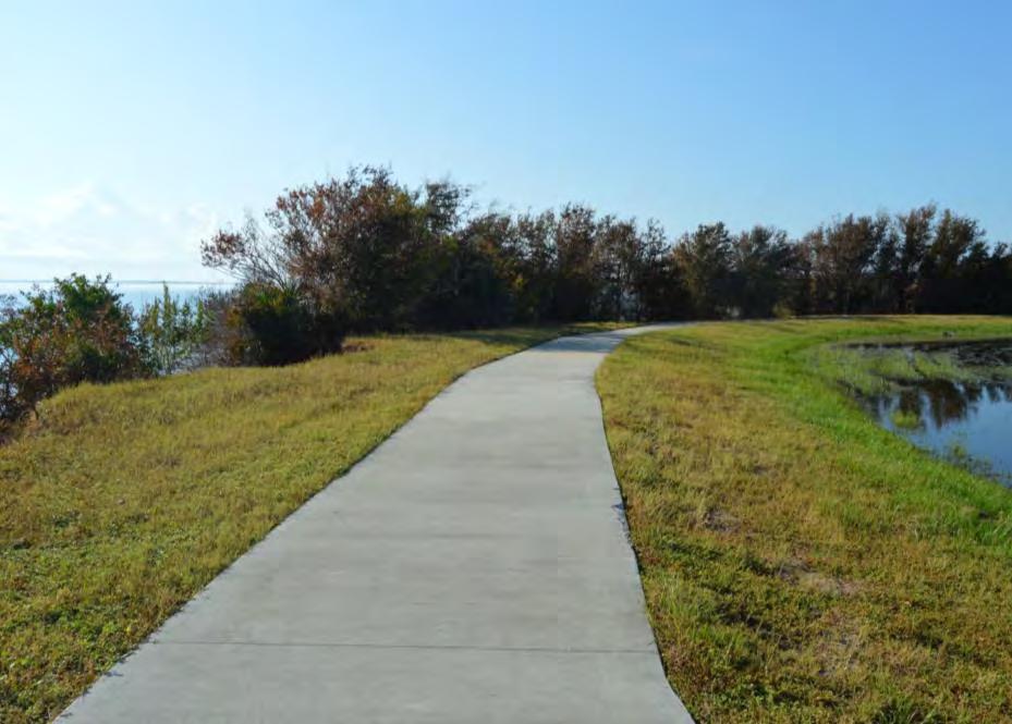
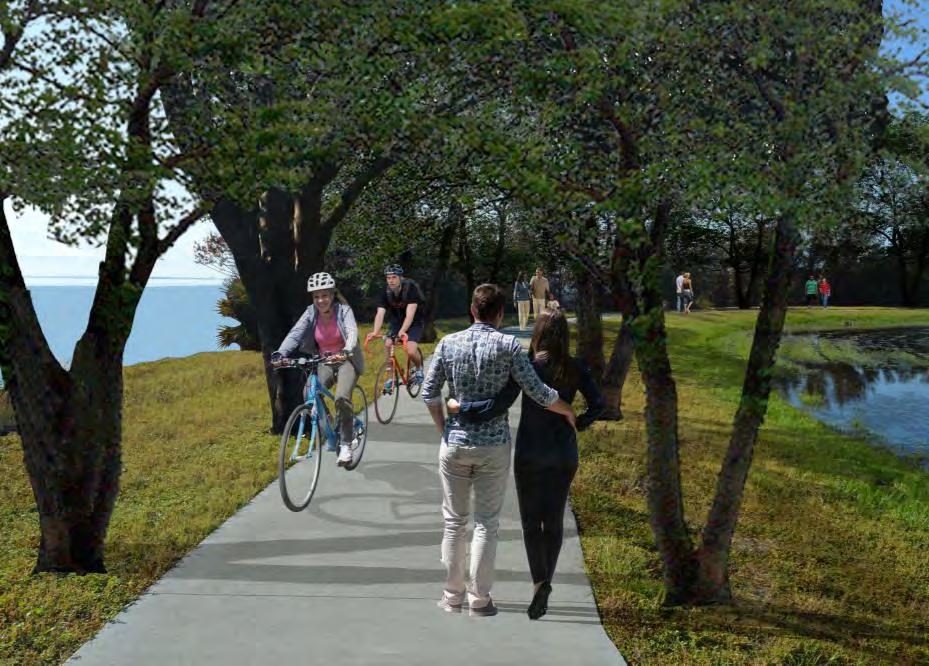
12 A Waterfront Trail Community BEFORE AFTER


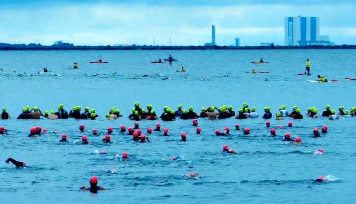
13 Activities on the Waterfront Trail Access to the water Waterfront Boardwalk Boating Dinner by Boat Fishing Marinas Hobbies on the Water Watching the Rockets 1.5 Mile Initial Phase 12 Mile Waterfront
14 Activities on the Waterfront Trail Boating
15 Activities on the Waterfront Trail Access to the water
16 Activities on the Waterfront Trail Waterfront Boardwalk

17 Activities on the Waterfront Trail Dinner by Boat

18 Activities on the Waterfront Trail Fishing
19 Activities on the Waterfront Trail Marinas
20 Activities on the Waterfront Trail Watching the Rockets

21 Activities on the Waterfront Trail Hobbies on the Water
22 Titusville Downtown Core


23 Our Conclusion: Traffic has to be fixed in the core Garden Street Broad Street Palm Street Hopkins Street Washington Street Indian River Avenue Trail EXISTING 51 Main Street 5-minute walk Julia Street Pine Street CORE South Street


24 Downtown can Become a Jewel & Revitalize the Surrounding Areas Garden Street Broad Street Palm Street Hopkins Street Washington Street Indian River Avenue Main Street 5-minute walk Julia Street Pine Street CORE South Street


25 Activities in the Core Garden Street Broad Street Palm Street Hopkins Street Washington Street Indian River Avenue Main Street Julia Street Pine Street CORE South Street

26 Activities in the Core Community Park 82
27 Activities in the Core Intimate Pedestrian Courtyard 81

28 Activities in the Core Street Festival 79

29 Activities in the Core Retail Along Side the Park 83

30 Activities in the Core Closing Street for a Celebration 75

31 Activities in the Core Pedestrian Walk Along the Park 89

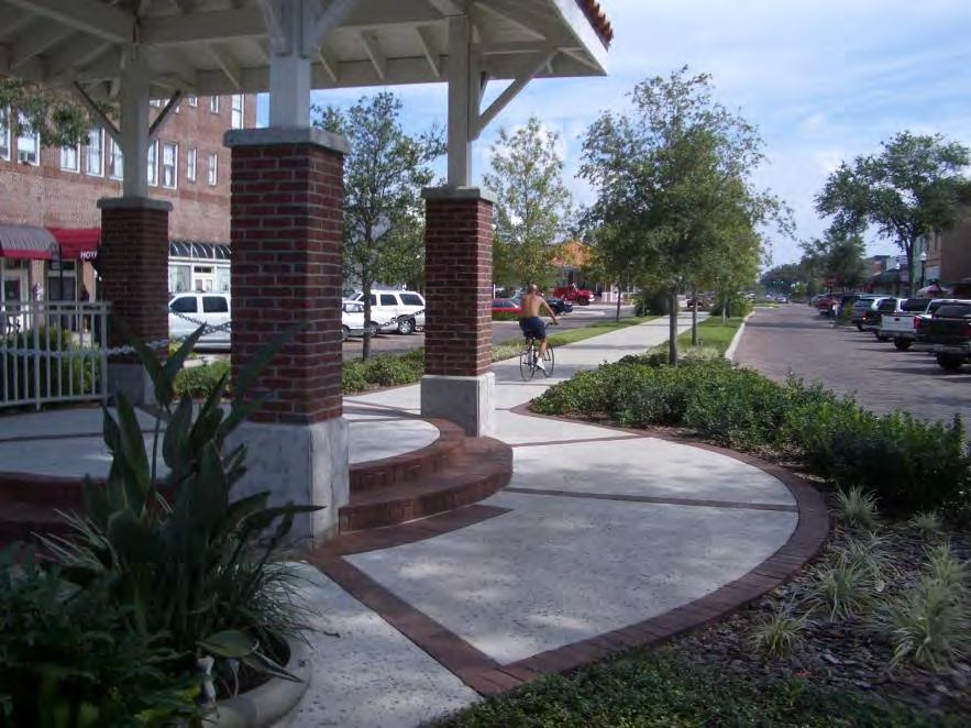
32 Activities in the Core Downtown Trail 56

33 Activities in the Core Quiet Place to Relax 72
34 Titusville Downtown Secondary Area

35 Potential Land Use Opportunities in Downtown Core & Secondary Area Garden Street Broad Street Palm Street Hopkins Street Washington Street Indian River Avenue Trail Main Street 5-minute walk Downtown Core Boundary Julia Street Historic Core Pine Street Public Land Residential/Mixed Use Residential South Street


36 Activities in the Secondary Area Garden Street Broad Street Palm Street Hopkins Street Washington Street Indian River Avenue Main Street Julia Street CORE Pine Street South Street SECONDARY AREA

37 Activities in the Downtown Secondary Area Small Café Building 88
38 Activities in the Downtown Secondary Area Downtown Office 50

39 Activities in the Downtown Secondary Area Residential 2

40 Activities in the Downtown Secondary Area Single-Family Residential 5

41 Activities in the Downtown Secondary Area Mixed Use 97

42 Activities in the Downtown Secondary Area Residential 6

43 Activities in the Downtown Secondary Area Pedestrian and Bicycle Friendly Street 49

44 Activities in the Downtown Secondary Area Small Buildings 84
45 Postcards From Home in 2027
46 Let s Vote Our Priorities

47 Key Findings & Strategies: Do You Agree?
ENVISIONING TOMORROW S FORT MYERS BEACH
 ENVISIONING TOMORROW S FORT MYERS BEACH NATURAL ENVIRONMENT... 2-1 MOBILITY... 2-1 TIMES SQUARE... 2-1 AVENUE OF PALMS... 2-2 RESIDENTIAL NEIGHBORHOODS... 2-2 A SECOND MAIN STREET... 2-4 FORT MYERS BEACH,
Hamilton Pier 7&8 Public Meeting and Workshop #1
 Hamilton Pier 7&8 Public Meeting and Workshop #1 May 12, 2015 May 01, 2015 Meeting Agenda 6:30 Doors Open 6:30-6:45 Review Boards 6:45-7:10 Introductions and Presentation Study Overview Policy Background
Workshop #3 June 13, 2016
 Downtown Ocoee Master Plan Workshop #3 June 13, 2016 Our Team Our Team and Tonight s Goal Quick Recap: Why a Downtown Plan? How are we developing the plan? How can you still be involved? What s left to
DRAFT City of Titusville 2040 Comprehensive Plan Future Land Use, Housing, and Transportation Elements April 16, 2018
 DRAFT City of Titusville 2040 Comprehensive Plan Future Land Use, Housing, and Transportation Elements April 16, 2018 Prepared by Canin Associates for the City of Titusville About the Comprehensive Plan:
hermitage town center
 hermitage town center A Community Vision prepared by Strada for The City of Hermitage and The Mercer County Regional Planning Commission January 2007 table of contents introduction 3 design principles
Corridors. Re-vitalize our Corridors and Gateways
 Corridors Re-vitalize our Corridors and Gateways Artist s rendering from the 287 Strategic Plan, 2015 Corridors are the major throughways of Loveland but they also provide important commercial, community
TAHOE CITY VISION PLAN June 2012
 TAHOE CITY VISION PLAN June 2012 Tahoe City Public Utility District North Lake Tahoe Resort Association Sustainable Community Advocates Agenda Process Overview Purpose TRPA Regional Plan Update Conversations
Town Center (part of the Comprehensive Plan)
") Town Center (part of the Comprehensive Plan) Mercer Island Town Center Looking North (2014) In 1994, a year-long process culminated in a set of design guidelines and code requirements for the Town Center
Town Center (part of the Comprehensive Plan) Mercer Island Town Center Looking North (2014) In 1994, a year-long process culminated in a set of design guidelines and code requirements for the Town Center
SQUAMISH 2010 AND BEYOND COMMUNITY VISION
 Our plan has been imagined and created to be both pragmatic and visionary. At the core of the strategy is a consideration of the highway s role and its impact on the community. First and foremost in creating
Dyersville Downtown Plan. Open House October 24, 2017
 Dyersville Downtown Plan Open House October 24, 2017 What is a Comprehensive Plan? - Vision - Guidance for decisions - Basis for regulations What is a Downtown Plan? - Understand priorities - Identify
Pine Island Road Corridor Master Plan
 RECOMMENDED DEVELOPMENT PLAN Figure 9: Del Prado Village District Conceptual Framework The Conceptual Framework (Figure 8) for development of the Pine Island Corridor is to encourage mixed-use development
2.1 Location and Size
 2.0 Context 7 2.1 Location and Size The Saanich Penninsula The study area is centrally located within the Town boundaries on the east side of Highway 17, which runs through Sidney in a north-south direction.
Cumberland Region Tomorrow is a private, non-profit, citizen based regional organization working with Greater Nashville Regional Council
 Cumberland Region Tomorrow is a private, non-profit, citizen based regional organization working with Greater Nashville Regional Council and others in the public and private sectors, dedicated to planning
CHAPTER 7: Transportation, Mobility and Circulation
 AGLE AREA COMMUNITY Plan CHAPTER 7 CHAPTER 7: Transportation, Mobility and Circulation Transportation, Mobility and Circulation The purpose of the Transportation, Mobility and Circulation Chapter is to
Status Update (2006 vs. Now) Citizen s Advisory Committee February Plan for Prosperity
 Citizen s Advisory Committee February Plan for Prosperity") Status Update (2006 vs. Now) Citizen s Advisory Committee February 2018 Plan for Prosperity 2000 2017 2000 2017 Gardnerville Population 6,000 5,760 5746 5,500 5,000 5,067 5,550 5,165 5,394 5,412 5,250
Status Update (2006 vs. Now) Citizen s Advisory Committee February 2018 Plan for Prosperity 2000 2017 2000 2017 Gardnerville Population 6,000 5,760 5746 5,500 5,000 5,067 5,550 5,165 5,394 5,412 5,250
Bourne Downtown Site Planning
 Prepared for: The Town of Bourne, MA In Cooperation with: Bourne Financial Development Corporation Prepared by:, Inc. June 24, 2009 Table of Contents Introduction and Summary... 1 Site Existing Conditions...
Lynn Housing Authority and Neighborhood Development. Washington Street Gateway District Plan A p r i l
 Lynn Housing Authority and Neighborhood Development Washington Street Gateway District Plan A p r i l 2 0 0 8 rendering of sagamore hill from lynnway pedestrian overpass table of contents project area
Robbinsdale LRT Station. CDI Development Guidelines. August Overview
 Robbinsdale LRT Station August 2018 Overview The City of Robbinsdale may have the coolest opportunity site along the 13 mile stretch of the Bottineau LRT corridor / Blue Line extension. Located a block
Por favor, levanten la mano si necesita traduccion en espanol Please raise your hand if you need Spanish translation
 FEDERAL BOULEVARD CORRIDOR WIDE STUDY PUBLIC MEETING #1 APRIL 27, 2016 Por favor, levanten la mano si necesita traduccion en espanol Please raise your hand if you need Spanish translation HDR DESIGN WORKSHOP
Corridor Vision. 1Pursue Minnehaha-Hiawatha Community Works Project. Mission of Hennepin County Community Works Program
 1Pursue Minnehaha-Hiawatha Community Works Project Minnehaha-Hiawatha Community Works is a project within the Hennepin Community Works (HCW) program. The mission of the HCW program is to enhance how the
12/9/2013. HOLLYWOOD/PINES CORRIDOR PROJECT AMPO 2013 Annual Conference October 24, Our Perspective. Broward.
 HOLLYWOOD/PINES CORRIDOR PROJECT AMPO 2013 Annual Conference October 24, 2013 Our Perspective Broward Fort Lauderdale 1 Broward Metropolitan Planning Organization Fort Lauderdale Fort Lauderdale Skyline
About Momentum Midland
 About Momentum Midland Achieving a community s full potential in terms of economic development and quality of life is critically important to its long term sustainability. Core to achieving this is a vibrant
Route 1 Corridor Study
 Route 1 Corridor Study Westbrook, Connecticut A Vision for the Connecticut Shoreline Public Informational Meeting July 28, 2015 Lower Connecticut River Valley Council of Governments Fitzgerald & Halliday,
Ship Creek Redevelopment
 Ship Creek Redevelopment Three Concepts May 2013 Cambridge ARCHITECTURE Philadelphia ENGINEERING Raleigh INTERIORS San Francisco PLANNING Washington, DC www.klingstubbins.com contact@klingstubbins.com
Table of Contents. Elm Avenue Improvement Plan City of Waco, Texas. Introduction 1. Existing Context 1 Figure 1 2.
 Table of Contents Introduction 1 Existing Context 1 Figure 1 2 Plan Guidelines 3 Future Urban Form 4 The West-End 4 Main Street 6 The East-End 7 Figure 2 9 Public Improvement Recommendations 7 General
Riverwalk Dreams compiled by Thomas P. Healy November 16, 2017
 Riverwalk Dreams compiled by Thomas P. Healy November 16, 2017 1986 Ripple Village Plan: A neighborhood plan developed by the City of Indianapolis Department of Metropolitan Development s Division of Planning
PLAN ELEMENTS WORKSHOP. April 5, 2016
 PLAN ELEMENTS WORKSHOP April 5, 2016 needs more housing. But there is no one-size fits-all solution. Every neighborhood has its own character. In some places, density is not only appropriate it is badly
ARISE: The Rock Renaissance Area Redevelopment & Implementation Strategy
 2014 Professional Awards 1 ARISE: The Rock Renaissance Area Redevelopment & Implementation Strategy Janesville, WI Completed December 2014 Analysis & Planning Purpose of Project 2 The purpose of the Rock
TOWN COUNCIL / PLANNING COMMISSION
 Workshop #3 TOWN COUNCIL / PLANNING COMMISSION January 20, 2011 Consultant Team In Attendance Tonight BMS Design Group Nevada City and San Francisco Michael Smiley, AICP, ASLA Partner-in-Charge Nancy L.
WELCOME and introduction
 1 WELCOME and introduction Mobility Hub Locations within Burlington STUDY OVERVIEW STUDY OBJECTIVES The City of Burlington is developing four Area Specific Plans, one for each of Burlington s Mobility
Gold Line Bus Rapid Transit Transit Oriented Development (BRTOD) Helmo Station Area Plan
 Helmo Station Area Plan") Appendix F Gold Line Bus Rapid Transit Transit Oriented Development (BRTOD) Helmo Station Area Plan Introduction and Purpose of the Plan The Gold Line Bus Rapid Transit facility is an eleven-mile dedicated
Appendix F Gold Line Bus Rapid Transit Transit Oriented Development (BRTOD) Helmo Station Area Plan Introduction and Purpose of the Plan The Gold Line Bus Rapid Transit facility is an eleven-mile dedicated
Status Report: MD 355 Project
 Status Report: MD 355 Project OCTOBER 2006 M-NCPPC MONTGOMERY COUNTY PLANNING DEPARTMENT Summary of Community Comments, and break to the Results of the MD 355 Participation Session Brookside Gardens -
4.1.3 LAND USE CATEGORIES
 4.1.3 LAND USE CATEGORIES a. City Center District The City Center District incorporates the existing character and mix of uses in downtown Belmont to encourage redevelopment and new development in keeping
CITY OF TARPON SPRINGS DCA#11-1AR
 Agenda Item #3.H.2 05/09/11 TAMPA BAY REGIONAL PLANNING COUNCIL LOCAL GOVERNMENT COMPREHENSIVE PLAN ADOPTED AMENDMENT REPORT CITY OF TARPON SPRINGS DCA#11-1AR 1 ADOPTED WITH THE FOLLOWING CHANGES: Ordinance
Village of Fair Haven Goals & Objectives
 Village of Fair Haven Goals & Objectives 1 Natural Environmental Quality & Aesthetics Embrace policies and programs that preserve and enhance the Village s natural resources, environment, water quality,
Chairman and Members of the Planning and Development Committee. Thomas S. Mokrzycki, Commissioner of Planning and Building
 LA.09.TOR (Toronto) DATE: TO: FROM: SUBJECT: Chairman and Members of the Planning and Development Committee Thomas S. Mokrzycki, Commissioner of Planning and Building Central Waterfront Secondary Plan
City of Cocoa Waterfront Code Public Workshop
 City of Cocoa Waterfront Code Public Workshop January 24, 2013 Agenda: Purpose of the Meeting Overview of the Waterfront Master Plan Introduction to the Waterfront Code (Open House) Browse the Regulating
West Ocala Vision & Community Plan City Council Work Session. Presented by West Ocala Community Plan Steering Committee
 West Ocala Vision & Community Plan City Council Work Session Presented by West Ocala Community Plan Steering Committee November 29,2011 Ocala 2035 Vision West Ocala Community Vision & Master Plan West
REVIEW AND EVALUATION OF REGIONAL LAND USE
 REVIEW AND EVALUATION OF REGIONAL LAND USE AND TRANSPORTATION SCENARIOS #220831 Environmental Justice Task Force October 7, 2014 VISION 2050 Process Development of Guiding Vision for Land Use and Transportation
Welcome. Comprehensive Plan & Transportation Plan Open House November 7, 2012
 Welcome Comprehensive Plan & Transportation Plan Open House November 7, 2012 Agenda Proposed future land use plan Comprehensive Plan strategies Traffic forecasts Future traffic operations Possible future
Attachment B Summary of Plan Alternatives Report
 Attachment B Summary of Plan Alternatives Report Based on community ideas and feedback to date, a series of draft alternative scenarios for the future of downtown s neighborhood districts have been created
preliminary master plan Cover Slide executive summary public presentation
 preliminary master plan public presentation executive summary Cover Slide {agenda} + Master Plan Process + Context and Overviews + Preliminary Concepts - Entry/Gateways - Core District - Streetscape +
EXECUTIVE SUMMARY DRAFT CHAPTER 1 INTRODUCTION EXECUTIVE SUMMARY
 CHAPTER 1 EXECUTIVE SUMMARY INTRODUCTION Through the joint efforts of the City of Tulsa planning staff and the Land Services division of Indian Nations Council of Governments (INCOG), the Berryhill Land
Shared Principles and Emerging Plan Directions
 Shared Principles and Emerging Plan Directions Introduction Since the Fairfield Neighbourhood planning process launched in June 2016, we have heard from many residents, businesses, groups and other people
Subarea 4 Indian Creek. Vision The combination of park networks and transportation amenities make Subarea 4 the greenest hub in the Corridor.
 indian creek 180 extends south from 101st Street to I-435. The I-435 and Metcalf intersection is one of the primary intersections in the Kansas City Metro Area. The area includes several residential neighborhoods
UNIVERSITY TOWN NEIGHBOURHOODS 5.2 ECO-CORRIDOR MELBOURNE CAMPUS MASTER PLAN 2014
 5.2 ECO-CORRIDOR 37 ECO-CORRIDOR EXISTING CONDITIONS & VISION NEIGHBOURHOOD VISION Investment in the Eco-corridor Neighbourhood will signify the University s commitment to supporting local ecology and
ITEM #8. Regional Smart Growth Program. Regional Smart Growth Program. Presentation Overview. Coast Highway Vision and Stategic Plan.
 Regional Smart Growth Program Economic Development Commission What is Smart Growth? Adopted as part of the Regional Comprehensive Plan (RCP) RCP provides vision for region based on Smart Growth and sustainability
Study Area. Capitol Way. Greening America s Capitals 11/13/2014. A Greening America s Capitals Project
 Olympia, WA: Greening Capitol Way Supporting Communities move towards sustainability is a priority for the federal government. A Greening America s Capitals Project Office of Sustainable Communities U.S.
What Pioneer Grove Will Look Like?
 The City of Deerfield Beach has embarked on a journey to create a new town center within the old heart of Deerfield Beach. The new town center is known as Pioneer Grove. Pioneer Grove will be Everybody
A. Selma Park, Davis Bay and Wilson Creek
 A. Selma Park, Davis Bay and Wilson Creek This waterfront neighbourhood consists of three separate community areas, linked by Highway 101, but with different character, land use patterns and future potential.
TEAM INPUT SUMMARY. Postcard Image?
 DOWNTOWN MAULDIN TEAM PUBLIC INPUT TEAM INPUT SUMMARY Postcard Image? A nice neighborhood The main city center with government buildings Mauldin entry sign, high school, Cultural Center, Sunset Park, Hall
Sub Area 2: Downtown Overland Park
 Downtown 132 2.12 encompasses over 600 acres and extends between 71st Street and 87 th Street including Downtown Overland Park. The area is home to several individual historic sites and structures, including
History: a Grand Urban Boulevard
 History: a Grand Urban Boulevard 1890 1910: At its peak, Euclid Avenue, "Millionaire's Row," was considered the second most beautiful urban street in the country next to Fifth Avenue in Manhattan. 1910-2030:
Sherri Ferguson. President/CEO Portland Chamber of Commerce. Tennessee Certified Economic Developer Capstone Project
 Sherri Ferguson President/CEO Portland Chamber of Commerce Tennessee Certified Economic Developer Capstone Project Strategic Plan Development for the North Gateway of Portland, Tennessee The New Gateway
Anatomy of A Vibrant Downtown. Anatomy of a Vibrant Downtown
 Anatomy of A Vibrant Downtown The goal of MAIN ST. REVITALIZATION PLANNING is to provide a framework that will help transform your downtown into a VIBRANT DOWNTOWN a place where people love to LIVE, WORK,
Sustainability, Health, Safety, Recreation & Open Space Working Group August 3, 2017
 Sustainability, Health, Safety, Recreation & Open Space Working Group August 3, 2017 DOWNTOWN OAKLAND SPECIFIC PLAN WELCOME Sustainability, Health, Safety, Recreation & Open Space Working Group Social
Burnside Gorge Neighbourhood Plan. Engagement Summary
 Burnside Gorge Neighbourhood Plan Engagement Summary Table of Contents Engagement Summary... 3 Phase One Engagement (April May 2015)... 4 Phase Two Engagement (January March 2016)... 4 Appendix One: Summary
Danvers High Street I-1 District Study
 Danvers High Street I-1 District Study Presentation of Final Recommendations Planning Board Presentation June 26 th, 2018 1 Introductions Metropolitan Area Planning Council Sam Cleaves AICP, Principal
LAND USE ELEMENT. Purpose. General Goals & Policies
 LAND USE ELEMENT Purpose This Land Use Element contains the goals and policies necessary to support the City s responsibility for managing land resources and guiding development through implementing regulations,
What We Heard. Downtown Georgetown Planning Study. April 4, 2018
 What We Heard Downtown Georgetown Planning Study April 4, 2018 Workshop 2 - July 5, 2017 01 DESIGN SUMMIT The Downtown Georgetown Planning Study will guide growth and development in the downtown over the
Potential Green Infrastructure Strategies May 6, 2015 Workshop
 Potential Green Infrastructure Strategies May 6, 2015 Workshop Background The City of Cortland is developing the Tioughnioga Urban Headwaters Green Infrastructure Action Plan with funding from the National
Zoning and Development Considerations in the Boothbay Harbor Maritime/Water Dependent District
 Zoning and Development Considerations in the Boothbay Harbor Maritime/Water Dependent District Bob Faunce Lincoln County Planner Lincoln County Regional Planning Commission Board of Selectmen and Planning
The 21st Century Waterfront Executive Summary
 The 21st Century Waterfront Executive Summary May, 2002 Hargreaves Associates Schwartz Silver /Moffatt Nichol / Arcadis G&M Manufacturers East Manufacturers West Moccasin Bend Gateway Ross s Landing Park
Johnson Street Bridge Public Realm Update
 Johnson Street Bridge Public Realm Update August 20, 2015 Background Johnson Street Bridge Replacement Project impacts a diverse range of stakeholders In addition to a new bridge, the project also includes
Urban Development Areas Albemarle County
 1 Urban Development Areas Albemarle County UDA Needs Profile: All UDAs Albemarle County has two UDAs: the Pantops UDA located east of the Rivanna River and the City of Charlottesville, and Places 29 South,
... the real city lives on... Character Area 5: LOWER WASHINGTON
 ... the real city lives on... Character Area 5: LOWER WASHINGTON 89 Boundaries This area is bordered by the extension of Fair Way to the north, the Napa River to the south, Gerard Street/Fire Station parking
Making Transit Oriented Development Work For Boonton, NJ
 Making Transit Oriented Development Work For Boonton, NJ Bloustein School of Planning and Public Policy Studio Dan Burton Loannie Dao Webster Slater Brandon Williams Ian Watson Maria Laham Nicola Mammes
City Center Neighborhood Plan
 [1] City Center Neighborhood Plan As adopted by Ordinance No. 2014-09-049 and amended by Ordinance Nos. Formerly CBD Neighborhood as adopted by Ordinance No. 8868 and amended by Ordinance Nos. 8946, 9693,
DOWNTOWN SIDNEY LOCAL AREA PLAN. urban design CHARRETTE REPORT 04 july 2008
 DOWNTOWN SIDNEY LOCAL AREA PLAN urban design CHARRETTE REPORT 04 july 2008 1.0 INTRODUCTION urban design is the art of making places. Successful downtown communities are places where people can live,
Presentation to Town Council in association with Kubilins Transportation Group Rose & Associates Equinox Environmental
 Presentation to Town Council 03.03.09 in association with Kubilins Transportation Group Rose & Associates Equinox Environmental Vision Statement: Boone 2030 is...a friendly, vibrant, attractive community...financially,
6 PORT SYDNEY SETTLEMENT AREA
 Section 6 Port Sydney Page 61 6 PORT SYDNEY SETTLEMENT AREA 6.1 Basis and Principles Village of Port Sydney Waterfront Community Existing Services 6.1.1 Port Sydney is an historic settlement that has developed
The Lower SaLuda Greenway
 The Lower SaLuda Greenway InITIaTIve a FLourIShInG Greenway. a hub For economic GrowTh. a ConneCTIon BeTween CoMMunITIeS. In April 2017 the Michael J. Mungo Foundation and Lexington County commissioned
NORTH CLAYMONT AREA MASTER PLAN COMMUNITY WORKSHOP #1 FEBRUARY 3, 2016
 NORTH CLAYMONT AREA MASTER PLAN COMMUNITY WORKSHOP #1 FEBRUARY 3, 2016 1. Introduction To the team and to the Plan Planning Partners The Claymont Community WILMAPCO New Castle County Claymont Renaissance
Lower Merion Commercial Districts Issues and Characteristics Handbook November 2013
 Lower Merion Commercial Districts Issues and Characteristics Handbook November 2013 DRAFT TOWNSHIP-WIDE VISION: To maintain and enhance commercial areas to complement the surrounding high-quality residential
Policies and Code Intent Sections Related to Town Center
 Policies and Code Intent Sections Related to Town Center The Town Center Vision is scattered throughout the Comprehensive Plan, development code and the 1994 Town Center Plan. What follows are sections
GREENING THE BOULEVARD Master Plan Concepts for Venice Boulevard between Lincoln and Sawtelle
 GREENING THE BOULEVARD Katherine Spitz Associates Inc. 4212½ Glencoe Avenue Marina Del Rey, CA 90292 310 574 4460 Fax 574 4462 January 2008 Table of Contents Overview Proposed Design Improvements Illustration
EXISTING COMPREHENSIVE PLAN
 EXISTING COMPREHENSIVE PLAN Town Center Land Use Element: V. LAND USE POLICIES Town Center Mercer Island's business district vision as described in "Your Mercer Island Citizen-Designed Downtown" was an
Grantsburg Community Design Team (CDT)
") Grantsburg Community Design Team (CDT) Summary Report Overview On April 10-13, 2014, a team of (19) volunteer planners, design professionals, and community development educators volunteered their time
Grantsburg Community Design Team (CDT) Summary Report Overview On April 10-13, 2014, a team of (19) volunteer planners, design professionals, and community development educators volunteered their time
Chapter 2: Vision, Goals and Strategies
 Chapter 2: Vision, Goals and Lake Elmo Today & Tomorrow Comprehensive Plan 2040 2 VISION, GOALS & STRATEGIES - DRAFT 4-6-2018 INTRODUCTION Comprehensive Plan Purpose Perhapse the most important objective
6. DOWNTOWN. The Downtown Element focuses on supporting and expanding the vitality and enhancement of Downtown Chico as the City s central core.
 VISION In 2030, Downtown Chico is the heart of the community and the center of cultural activity. Engaging and active at the street level, it is a multi-story, mixed-use hub, with specialty retail, restaurants,
FDOT D4 Complete Streets
 FDOT D4 Complete Streets Context Sensitive Solutions Directs that complete street solutions will complement the context of the community. Collaborative approach to decision making, project development,
Chapter 4 Urban Design Element
 Chapter 4 Urban Design Element "The general tenor of the responses indicates a strong preference to not allow low-intensity development into natural areas, resource lands or highly visible open space.
Naomi Weiss, Executive Director, DBPA Jason Jeffries, Project Manager, City of Daytona Beach
 Naomi Weiss, Executive Director, DBPA Jason Jeffries, Project Manager, City of Daytona Beach Nottingham Plan 2002 Adopted Redevelopment Plan 2002 Riverfront Action Plan 2004 Downtown Vision Plan 2007
RESEDA - WEST VAN NUYS COMMUNITY PLAN
 RESEDA - WEST VAN NUYS COMMUNITY PLAN Executive Summary As part of the initial outreach effort, the Department of City Planning hosted two workshops for the Reseda-West Van Nuys Community Plan Area during
In surveys, Dallas residents say what they want to change most
 NEIGHBORHOODS ELEMENT In surveys, Dallas residents say what they want to change most in the city is its appearance they want it to look beautiful, with trees and pedestrian-friendly neighborhoods. The
Rio/29 Future Land Use Alternatives. Rio/29 Small Area Plan Phase 1 December 12, 2016
 Rio/29 Future Land Use Alternatives Rio/29 Small Area Plan Phase 1 December 12, 2016 PRESENTATION OVERVIEW 1 BACKGROUND 2 COMMUNITY INPUT 3 DESIGN PRINCIPLES 4 5 ALTERNATIVES OPEN HOUSE 2 1 PROJECT BACKGROUND
Transit / Housing Oriented Redevelopment
 Broward County Urban Planning and Redevelopment Department Kick-Off Meeting October 24, 2007 Transit / Housing Oriented Redevelopment 1 Future Land Use 2 Broward County Charter Voters approved in 1974.
Urban Planning and Land Use
 Urban Planning and Land Use 701 North 7 th Street, Room 423 Phone: (913) 573-5750 Kansas City, Kansas 66101 Fax: (913) 573-5796 Email: planninginfo@wycokck.org www.wycokck.org/planning To: From: City Planning
Lakeview and Port Credit District Policies Review Public Engagement Process
 Lakeview and Port Credit District Policies Review Public Engagement Process Brook McIlroy Planning + Urban Design/PACE Architects MSAi Architects Poulos and Chung Transportation Engineers December 11,
Lower South Street/Louisa Street Charrette Final Presentation. September 22, 2009
 Lower South Street/Louisa Street Charrette Final Presentation September 22, 2009 Recap Mayor and Council called for a Charrette to engage the public on creating a vision for the Lower South Street area.
Mark-up of the effect of the proposed Bronte Village Growth Area OPA No.18 on the text of section 24, Bronte Village, of the Livable Oakville Plan
 Mark-up of the effect of the proposed Bronte Village Growth Area OPA No.18 on the text of section 24, Bronte Village, of the Livable Oakville Plan Notes: This document is provided for information purposes
Stockton Waterfront Master Plan. Waterfront Master Plan
 Stockton Waterfront Master Plan Presentation Objectives Process update Planning observations Planning Goals Planning Principles Review of planning activities Summary and next steps Planning Activities
CHAPTER 3 VISION, GOALS, & PLANNING PRINCIPLES. City of Greensburg Comprehensive Plan. Introduction. Vision Statement. Growth Management Goals.
 CHAPTER 3 VISION, GOALS, & PLANNING PRINCIPLES Introduction The Greensburg Comprehensive Plan is intended as a working community document. A combination of long and short-term goals, this document is intended
The Auburn Plan Designing the Future of Auburn February 28, 2005
 The Auburn Plan Designing the Future of Auburn February 28, 2005 Block-by-Block Bicycle Tour Aerial survey Focus Group Meetings September 7 and 8 Design Workshops October 11, 14, and 21 Revitalization
ROBBINSDALE LRT STATION CDI DEVELOPMENT GUIDELINES
 August 2018 OVERVIEW The City of Robbinsdale has a prime-opportunity site in the middle of the 13 mile stretch of the Bottineau LRT corridor / Blue Line extension. Robbinsdale offers a prominent, vital,
KEY FINDINGS. Community Engagement + Research
 PROJECT OVERVIEW PROJECT OVERVIEW PROJECT OVERVIEW KEY FINDINGS Community Engagement + Research Community Engagement Community Issues Workshop Steering Committee Workshop City Council/Planning Workshop
City of Long Beach. creating vibrant and exciting places
 City of Long Beach creating vibrant and exciting places Land Use Element Urban Design Element Overview of the two draft General Plan elements Discuss areas of change Economic goals of the plans Case study
Stakeholders Advisory Working Groups (SAWGs) Smart Growth and TOD Land Use (#11) SAWG Meeting
 Smart Growth and TOD Land Use (#11) SAWG Meeting") Presentation - Part II Tappan Zee Bridge/I-287 Corridor Project July 21, 2010 Slide 1. David Kooris (Regional Plan Association) welcomed members of the Land Use Stakeholders Advisory Working Groups (SAWGs)
Presentation - Part II Tappan Zee Bridge/I-287 Corridor Project July 21, 2010 Slide 1. David Kooris (Regional Plan Association) welcomed members of the Land Use Stakeholders Advisory Working Groups (SAWGs)
Introducing the Main Street Strategic Toolbox
 Ulster County Main Streets: A Regional Approach Ulster County Planning Department, 244 Fair Street, Kingston NY 12401 Why do we take a regional approach to Main Streets? There are many different approaches
Downtown Whitby Action Plan
 Downtown Whitby Action Plan Final Report October 2016 Table of Contents Introduction 1 Public Consultation 2 Walkability 3 Downtown Whitby Walkability Map 4 Vision 5 Goal & Objectives 6 Objective 1 7 Objective