Classroom Science Building
|
|
|
- Coral Mills
- 5 years ago
- Views:
Transcription
1 Classroom Science Building Public Realm Presented by: Gary Branville, Joe Moore, Justin Rechtzigel, Tom Roth & Hailey Wall
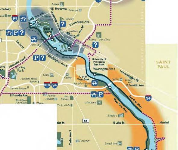
2 Proposal Objective: To create a node on the Grand Rounds Parkway Connect the public to the University Connect the students to the river Create a gateway for the campus
3 Precedence and Context Joe Moore
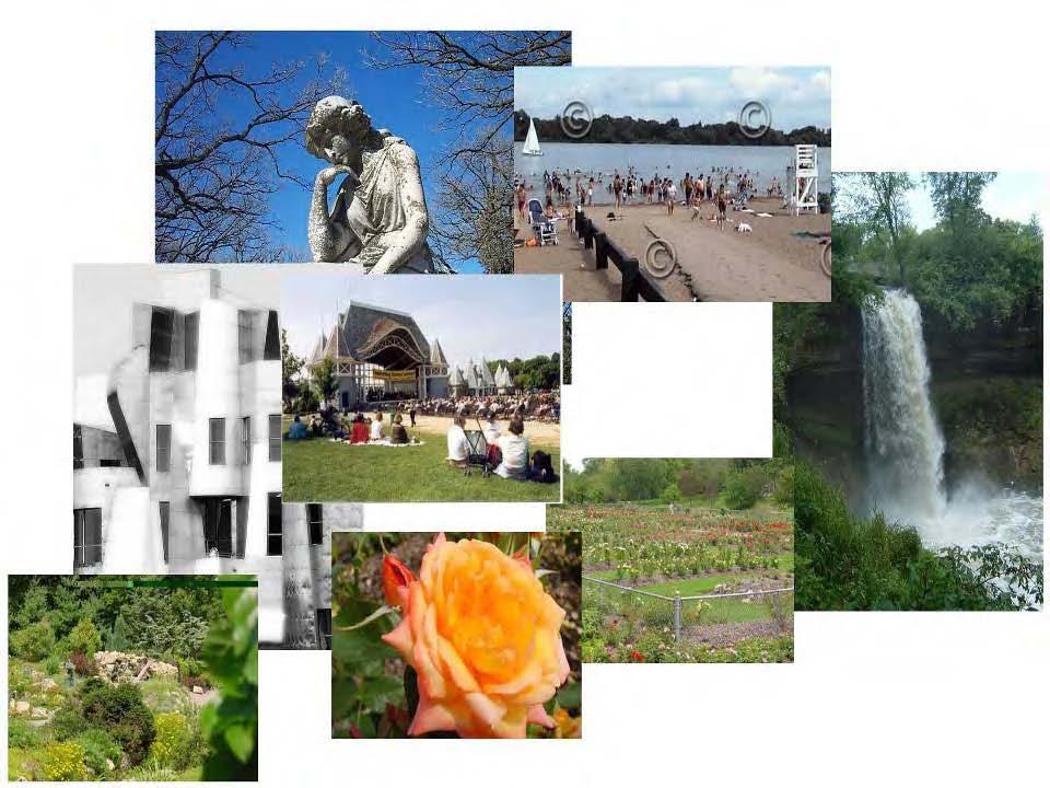
4 Twin Cities Contexts Mississippi River Education à la Mill City Museum and Science Museum Public Exhibits à la Wells Fargo Building

 Murals used to brighten")
5 Quad Cities and St. Louis Contexts Sculptures and Public Art used to interpret the River and draw users (Quad Cities) Murals used to brighten unaesthetic structures (St. Louis)
6 Historical Contexts Create node on the Historical Grand Rounds Interpretive Plaques depicting historical images
7 Participation & Involvement Gary Branville
8 Partners University of Minnesota City of Minneapolis Metropolitan Council U of M Department of Art: Student Groups MSA Minneapolis Park and Recreation Board Grand Rounds National Scenic Byway Friends of the Mississippi River DNR NPS
9 Public Participation IAP2 Level Of Participation: Involve Brochures Advertisements in newspapers Feature stories in local newspapers and magazines Expert Panels Internet surveys/polls Meeting with existing groups
10 Design Proposal Justin Rechtzigel & Hailey Wall
11
12
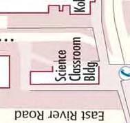
13 Areas of Focus East Plaza To display student art Cover Pleasant St. to create a safer, friendlier path for students West Plaza Highlight river views and overlooks Connect trails to campus & NPS Center Create green pace for everyone s enjoyment Create Rotating Public Exhibits Reroute bike lane away from prime river overlook
14 Why this Location? East Plaza Improve flow of pedestrian traffic Better connect to campus Separate pedestrians and automobiles Sidewalk ends


15 Why this Location? West Plaza Create better connection to river Underutilized Area Gateway area needs rehabilitation
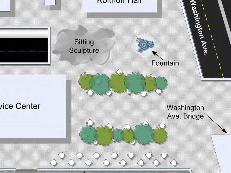
16 Area proposal East plaza Create sculptural seating Install water feature Display student art Create seating w/ movable café tables & chairs
17
18
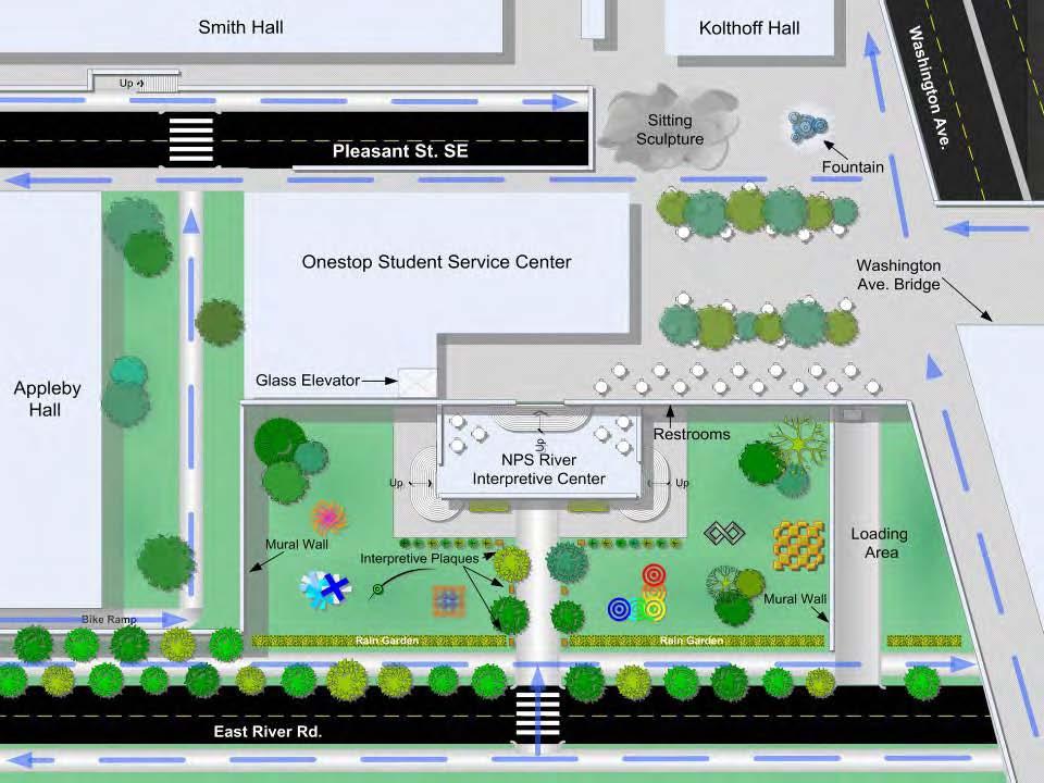
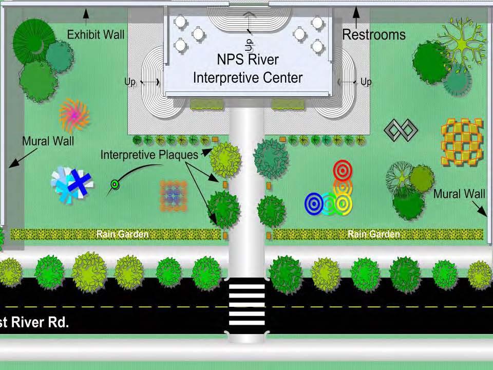
19 Area proposal West Plaza Install water feature Move loading dock to side Create rain garden to prevent runoff to river Sculptural seating so trail users & students can relax River mural on walls Rotating Exhibits
20
21 Other areas to be rehabilitated Washington Ave. Bridge Build new glass shelter Dry Erase Markers for student expression Install moving walkway to speed up travel time
22 Other areas to be rehabilitated Bike Trails Need repaving Better signage New lighting Rest areas
23 Measures of Success Tom Roth
24 Goals Will this site become a node on the Grand Rounds Parkway System and connect the University of Minnesota to the Minneapolis park system?
25
26
27 Goals Will this site become a node on the Grand Rounds Parkway System and connect the University of Minnesota to the Minneapolis park system? Will the site be included on the National Park Service s website? MNDNR? Park Service? Will this site get attention from local media outlets? Will the Mississippi River lose the stigma that surrounds it as a dirty and forbidding place? Will this site better connect the University of Minnesota students to the rest of the Minneapolis community?
28 Measures of Success Will vertical connectivity exist between the plaza and the bike/pedestrian traffic lanes? Will visitors stop to admire the public art displays? Will parents and students spend time on the site at information kiosks during visits to the student service center? Will guest speakers, community, and student groups utilize the presentation spaces and auditoriums?
29 How to Measure Success Passively survey the site How many people stop at the site from East River Road? How many people stop from the plaza level? How many bikes are parked at the site s bike racks? Actively survey visitors to the site Where are visitors to the site coming from? How did they hear about the existence of the site? What are those visitors coming to the site for?
30 Questions?
Section 4: Goals, Objectives, and Strategies
 99 Section 4: Goals, Objectives, and Strategies Goal 1 Resource Protection, Maintenance, Preservation, and Enhancement Protect, preserve, maintain, and enhance the natural, recreational, archaeological,
Midtown Greenway to lake street
 Making the connection: Midtown Greenway to lake street May 2016 Design experiment: site amenities, wayfinding, and activities at Cepro, near the Midtown Global Market Recent Greenway Development Highlights
Grand Rounds History
 Grand Rounds History 1883 Plan for Minneapolis Park System prepared by Landscape Architect Horace W. S. Cleveland. The system of connecting parks and parkways was first called the Grand Rounds by William
Build on community input
 Build on community input 1/8 8 WAYS TO CREATE GREAT PLACES Employ effective facilitation to encourage broad participation, deliver an aligned vision, and realize neighborhood plans. On front: Planning
7-PARKS, OPEN SPACE & PUBLIC ART
 7-s, Open Space & Public Art 7-PARKS, OPEN SPACE & PUBLIC ART This chapter provides recommendations for the expansion of new parks, plazas and open space that serve the many user groups targeted for downtown.
To qualify for federal Transportation Enhancement (TE) funds a project must meet two basic federal requirements:
 funds a project must meet two basic federal requirements:") Eligibility Requirements To qualify for federal Transportation Enhancement (TE) funds a project must meet two basic federal requirements: 1) Relate to surface transportation and 2) Be one of the 12 designated
Eligibility Requirements To qualify for federal Transportation Enhancement (TE) funds a project must meet two basic federal requirements: 1) Relate to surface transportation and 2) Be one of the 12 designated
Overview and Update of the Rutgers-New Brunswick Physical Master Plan. January 2015
 Overview and Update of the Rutgers-New Brunswick Physical Master Plan January 2015 Failure To Plan, is Planning For Failure Winston Churchill 2 Good Planning; The Key to Success 3 The university physical
Table of Contents. Elm Avenue Improvement Plan City of Waco, Texas. Introduction 1. Existing Context 1 Figure 1 2.
 Table of Contents Introduction 1 Existing Context 1 Figure 1 2 Plan Guidelines 3 Future Urban Form 4 The West-End 4 Main Street 6 The East-End 7 Figure 2 9 Public Improvement Recommendations 7 General
City of Plattsburgh DRI: Downtown Streetscapes & Riverfront Access. Downtown Streetscape and Riverfront Access Design
 City of Plattsburgh DRI: Downtown Streetscapes & Riverfront Access Welcome Thank you for coming this evening. Agenda PART I - Project Context The Downtown Revitalization Program Our DRI Projects Other
03 HIGH PRIORITY SITES
 03 HIGH PRIORITY SITES HOWARD PARK Howard Park is one of South Bend s largest riverfront parks, hosting nearly acres. Howard Park has a very passive landscape with a recreation building, ice skating rink,
Nepean Point CONSULTATION REPORT JUNE 2014
 Nepean Point CONSULTATION REPORT JUNE 2014 Workshop: Nepean Point I Project description Objective: With the renewal of Nepean Point, the National Capital Commission (NCC) presented a project to develop
Community Assistantship Program. Milaca Downtown Revitalization
 Community Assistantship Program Milaca Downtown Revitalization Prepared in partnership with City of Milaca Prepared by Zachary Jorgensen Research Assistant University of Minnesota December, 2009 CAP Report
Reconnecting to a Forgotten River St. Cloud MN. Aaron Hanson Design Design Thesis LA 572, Thesis, Spring 2012
 Reconnecting to a Forgotten River St. Cloud MN Aaron Hanson Design Design Thesis LA 572, Thesis, Spring 2012 site context 2.5 Miles Sartell St. Cloud to Fargo 170 Miles (2 hrs 45 mins) Hwy 10 infrastructure
Public responses to the question what do you want Muscatine to be, 20 years from now? (Responses were categorized as follows)
") Mississippi Drive Kickoff Event 9/1/2015 Blue Zones Kickoff Presentation Public responses to the question what do you want Muscatine to be, 20 years from now? (Responses were categorized as follows) Physical
Mississippi Drive Kickoff Event 9/1/2015 Blue Zones Kickoff Presentation Public responses to the question what do you want Muscatine to be, 20 years from now? (Responses were categorized as follows) Physical
BRADENTON RIVERWALK EXPANSION MASTER PLAN
 BRADENTON RIVERWALK EXPANSION MASTER PLAN INTRODUCTION & AGENDA Process Update Community Engagement Summary Center for Active Design (CfAD) Recommendations Context and Existing Conditions Master Plan Alternatives
CAMPUS MASTER PLAN DRAFT PLAN UPDATE JANUARY
 NEW MEXICO HIGHLANDS UNIVERSITY CAMPUS MASTER PLAN DRAFT PLAN UPDATE JANUARY 27 2010 MASTER PLANNING GOALS TO BALANCE THE STRATEGIC GOALS OF THE UNIVERSITY WITH THE PHYSICAL CAMPUS through the assessment
City of Poughkeepsie Waterfront Redevelopment Strategy. Poughkeepsie Waterfront Redevelopment Strategy
 City of Poughkeepsie Waterfront Redevelopment Strategy Poughkeepsie Waterfront Redevelopment Strategy City of Poughkeepsie Prime Assets: Major Waterfront Advantages: - Central City of the Hudson River
Water Works: Downtown Minneapolis Riverfront Destination
 Water Works: Downtown Minneapolis Riverfront Destination Previous conceptual design process for Water Works began in 2012 along with the Central Mississippi Riverfront Regional Park Master Plan Update
The Palisades Interstate Parkway and Henry Hudson Drive designated a New Jersey State Scenic Byway, 2005
 The Palisades Interstate Parkway and Henry Hudson Drive designated a New Jersey State Scenic Byway, 2005 What are scenic byways? How Did Scenic Byways Come About? National Scenic Byways Program Administered
Baraga Avenue PlacePlan Marquette, MI July 24 th, 2014
 Baraga Avenue PlacePlan Marquette, MI July 24 th, 2014 Presentation Outline Project Purpose Acknowledgements Placemaking Overview PlacePlan Process Design Overview PlacePlan Recommendations Physical Design
Stadium District Masterplan
 Stadium District Masterplan Masterplan (noun): an evolving long-term planning document that establishes the framework and key elements of a site. It reflects a clear vision synthesizing developer goals
Millbrae TOD #2 Project Analysis
 Millbrae TOD #2 Project Analysis Project Description A Site Development Permit and Conditional Use Permit are proposed to allow for a mixed-use transitoriented development on approximately 9 Acres located
Cleveland Park Streetscape and Drainage Improvement Project 1
 Cleveland Park Streetscape and Drainage Improvement Project 1 Urban Context Washington, D.C. Connecticut Avenue Cleveland Park Streetscape and Drainage Improvement Project 2 Neighborhood Context Contributing
5. Father Hennepin Blufs Park and Hennepin Island Father Hennepin Bluffs Park Supporting Initiatives (see Figure 36): 7-22
: 7-22") 5. Father Hennepin Blufs Park and Hennepin Island As described in existing conditions portion of Chapter 2, Father Hennepin Blufs Park lies on the upland portion of the park and Hennepin Island spans the
5. Father Hennepin Blufs Park and Hennepin Island As described in existing conditions portion of Chapter 2, Father Hennepin Blufs Park lies on the upland portion of the park and Hennepin Island spans the
FLORIN ROAD CORRIDOR Site Plan and Design Review Guidelines Checklist
 FLORIN ROAD CORRIDOR Site Plan and Design Review Guidelines Checklist Applicant s Name: Project Address: Phone: Email: Applicant shall fill out the design guidelines checklist for all guidelines applicable
A larger version of this map is located on the last page of this PDF.
 MAP Committee Input McLoughlin Area Draft Vision Map A larger version of this map is located on the last page of this PDF. 1. The map above is intended to portray a vision for the McLoughlin area. It highlights
Presentation of the Staff Draft. July 17, 2014 SSRVP Team, Area 3
 Presentation of the Staff Draft July 17, 2014 SSRVP Team, Area 3 Presentation Overview Introduction Plan Framework Plan Recommendations Implementation Next Steps and Request for Public Hearing on September
Ivywild On The Creek PRELIMINARY CREEK DISTRICT MASTER PLAN
 Ivywild On The Creek PRELIMINARY CREEK DISTRICT MASTER PLAN Introduction: Rejuvenating an extraordinary Creekside neighborhood THE CREEKSIDE DISTRICT The Ivywild On The Creek Neighborhood District Master
WESTERN ILLINOIS UNIVERSITY
 WESTERN ILLINOIS UNIVERSITY Quad Cities Riverfront Campus Master Plan March 1, 2006 Preliminary Master Plan Total Site Build Out Western Illinois University Quad Cities Municipal Park Mississippi River
SOUTH UNIVERSITY Street Design Setting a Direction for Schematic Design
 1 SOUTH UNIVERSITY Street Design Setting a Direction for Schematic Design Meeting Agenda 2 1. Project Scope 2. Design Direction 3. Design Details 4. Schedule and Construction Logistics 3 SOUTH UNIVERSITY
RLRC COMMUNITIES THIEF RIVER FALLS AREA CHARACTER COMMUNITY TRAIL OPTIONS OAKLAND PARK EXISTING CONDITIONS OAKLAND PARK DESIGN DESIGN DETAILS
 THIEF RIVER FALLS AREA CHARACTER COMMUNITY TRAIL OPTIONS OAKLAND PARK EXISTING CONDITIONS OAKLAND PARK DESIGN DESIGN DETAILS 61 THIEF RIVER FALLS AREA CHARACTER Thief River Falls has a number of existing
DESIGN STRATEGIES LESTER RIVER NEIGHBORHOOD: AREA CHARACTER DESCRIPTION OF PHOTOGRAPHS: LESTER RIVER NEIGHBORHOOD: OBLIQUE VIEWS
 DESIGN STRATEGIES LESTER RIVER NEIGHBORHOOD: AREA CHARACTER Visual analysis of the Lester River Neighborhood reveals the valuable resources throughout the area. In many ways it is here at the Lester River
23 July Sunshine Alley Design Project Open House Exhibits
 23 July Sunshine Alley Design Project Open House Exhibits Sunshine Alley Design Workshops were conducted over 2 evenings in late February and involved 57 people who had signed up on the Town s website
St. Charles County Parks News - Centennial Greenway Open House 5/2/13
 St. Charles County Parks News - Centennial Greenway Open House 5/2/13 Hello St. Charles County Parks Friends, We hope you will join us on May 2, from 4 7 p.m., at the St. Charles County Heritage Museum
TURN TO THE RIVER CITY PLAZA LANDSCAPE DESIGN CONCEPT May 25, 2016
 Turn to the River is a multi-year project of Art Spaces - Wabash Valley Outdoor Sculpture Collection, Inc. to connect downtown Terre Haute with the Wabash River through public art and design. The four-square
R STREET CORRIDOR NEIGHBORHOOD Site Plan and Design Review Supplemental Guidelines Checklist
 R STREET CORRIDOR NEIGHBORHOOD Site Plan and Design Review Supplemental Guidelines Checklist Applicant s Name: Project Address: Phone: Email: Applicant shall fill out the design guidelines checklist for
Carlsbad Village Redevelopment Concept Summary of Features
 Carlsbad Village Redevelopment Concept Summary of Features Calthorpe Associates November 5, 2003 The Redevelopment Concept illustrates a vision for the future of Carlsbad Village. The overall vision of
Blue Line LRT Extension
 v e Noble Pkwy Noble Pkwy Xerxes Ave N Shingle Creek Penn Ave N Penn Ave N Fremont Ave N Lyndale Ave N S Washington Ave University Ave NE Blue Line LRT Extension LIGHT RAIL PLATFORM AND STATION DESIGN
Subcampus Recommendations
 T he campus is is comprised of three major areas. These subcampus areas are known as WestCampus, South Campus, Campus Oakland and Drive East Campus. and Future East growth Campus. requires a Future careful
Jenifer Street Reconstruction Neighborhood Engagement Meeting November 4, 2015
 Jenifer Street Reconstruction Neighborhood Engagement Meeting November 4, 2015 Hosted by the Marquette Neighborhood Association Facilitated by Urban Assets Funded in part by the City of Madison Neighborhood
Welcome! Community Meeting FOR YOUR NEW WEBBER PARK LIBRARY
 Community Meeting FOR YOUR NEW WEBBER PARK LIBRARY Tuesday, April 21, 6 p.m. to 7:30 p.m. Webber Community Center Multipurpose Room 4400 Dupont Ave. N., Minneapolis, MN 55412 Welcome! Please join Hennepin
Introduction. Midtown Loop. This project s purpose is to envision and design an urban greenway known as Midtown Loop for the Detroit Midtown area.
 Introduction This project s purpose is to envision and design an urban greenway known as for the Detroit Midtown area. Midtown includes the region s cultural core, historic and new neighborhoods, Wayne
LANDSCAPE SCHEMATIC SITE PLAN CONCEPT DIAGRAM
 LANDSCAP SCHTIC SIT PLAN CONCPT DIAGAM W 64TH AV. W 64TH AV STTSCAP NOTH CON PLAZA FOCAL POT NOTH COUT WAT/STOMWAT FATU PUBLIC AT WALKWAY VHICL ACCSS LAN / MWS PHAS 2 NTY COUT PHAS 1 PHAS 1 SKYTA - CANADA
PHASE 3-4 PARKS SOUTH PARK AND CHANNEL PARK
 PHASE 3-4 PARKS SOUTH PARK AND CHANNEL PARK Sheet List L1.0 L2.0 L3.0 L4.0 L5.0 L6.0 L7.0 L8.0 L9.0 L10.0 L11.0 L12.0 L13.0 L14.0 L15.0 L16.0 L17.0 L18.0 L19.0 L20.0 L21.0 L22.0 Cover Open Space Context
Potential Green Infrastructure Strategies May 6, 2015 Workshop
 Potential Green Infrastructure Strategies May 6, 2015 Workshop Background The City of Cortland is developing the Tioughnioga Urban Headwaters Green Infrastructure Action Plan with funding from the National
4 C OMMUNITY D ISTRICTS
 4 C OMMUNITY D ISTRICTS N ew development in the Area will include many different types of land uses, including a destination retail area that attracts people from all over the region; recreation opportunities
Allegretti Architects & Andrews University
 1 Allegretti Architects & Andrews University Western Michigan University Arts Plaza Design Charrette Team Members: John W. Allegretti, FAIA Carey Carscallen, Director of Architecture, Andrews University
The George Washington University Streetscape Concept Plan. May 6 th 2009 Public Presentation for Discussion EHRENKRANTZ ECKSTUT & KUHN ARCHITECTS
 The George Washington University Streetscape Concept Plan May 6 th 2009 Public Presentation for Discussion EHRENKRANTZ ECKSTUT & KUHN ARCHITECTS Agenda 1. Introduction & Overview 2. Background & Context
Preci nct P l ans Figure 56 Campus Aerial Photo, 2008 CAL STATE EAST BAY, HAYWARD CAMPUS MASTER PLAN
 9 Precinct Plans This section contains a detailed discussion of the planning and design concepts for specific areas or precincts of the Cal State East Bay Hayward campus. The Precinct Plans pertain to
ANCHOR TO ANCHOR. Rescale the street to create an iconic boulevard.
 ANCHOR TO ANCHOR Rescale the street to create an iconic boulevard. UR NE ER UV GO NE LA OBJECTIVES 1. Maintain appropriate traffic flow and prioritize commercial curb access 2. Mark gateways at the street
Grantsburg Community Design Team (CDT)
") Grantsburg Community Design Team (CDT) Summary Report Overview On April 10-13, 2014, a team of (19) volunteer planners, design professionals, and community development educators volunteered their time
Grantsburg Community Design Team (CDT) Summary Report Overview On April 10-13, 2014, a team of (19) volunteer planners, design professionals, and community development educators volunteered their time
Missing Link Study Grand Rounds Parkway Planning and Design Introduction
 Missing Link Study Grand Rounds Parkway Planning and Design Introduction June 19, 2007 Minneapolis Park and Recreation Board HNTB Hoisington Koegler Group Inc. Hess Roise 1 The Missing Link Study The Minneapolis
Washington Plaza at the. Lake Anne Village Center
 Lake Anne Village Center Washington Plaza Design Charrette Washington Plaza at the Lake Anne Village Center Process and Recommendations Presentation to the Reston Association Board of Directors January
UNIVERSITY TOWN NEIGHBOURHOODS 5.2 ECO-CORRIDOR MELBOURNE CAMPUS MASTER PLAN 2014
 5.2 ECO-CORRIDOR 37 ECO-CORRIDOR EXISTING CONDITIONS & VISION NEIGHBOURHOOD VISION Investment in the Eco-corridor Neighbourhood will signify the University s commitment to supporting local ecology and
MISSISSIPPI GORGE REGIONAL PARK MASTER PLAN
 MISSISSIPPI GORGE REGIONAL PARK MASTER PLAN Minneapolis Park and Recreation Board CAC MEETING #1 APRIL 23, 2018 AGENDA Mississippi Gorge Regional Park Master Plan CAC #1 01 / Welcome and Calling Circle
QUESTION 8: What are your Public Realm priorities for implementation? What would you like to see happen first? TELL US WHAT YOU THINK
 Public Realm Plan How will the Public Realm Plan be implemented? The Public Realm Plan document will set out a vision for the next 30 years. Over time, Plan elements and aspects can be implemented as opportunities
4 Park Planning and Design
 4 Park Planning and Design Park Constellations Elliot Gateway/Mills Loring North Loop Commons Twins Minneapolis Park & Recreation Board Downtown Service Area Master Plan 4-1 PROJECT APPROACH REFERENCE
Neighborhood Districts
 NEIGHBORHOOD DISTRICTS SEVEN MAIN DISTRICTS Neighborhood Districts While the Development Plan provides a broad-scale overview of the neighborhood, this section focuses on uses and relationships at the
West Dennis Center: Bass River to Old Main Street. West Dennis Business District: Old Main Street to Dennis Commons
 West Dennis Center: Bass River to Old Main Street West Dennis Business District: Old Main Street to Dennis Commons Dennisport Center: Dennis Commons to Division Street Main Street Project Goals Project
Highland Falls Waterfront Redevelopment Feasibility Study Village Board Meeting March 20, 2017
 Village Board Meeting March 20, 2017 Agenda I. Public Meeting #1 Visioning Summary II. Public Meeting #2 Comment Summary III. IV. IV. Case Study: Milton Train Station Schematic Design Concepts Schedule/Next
Downtown North Las Vegas Demonstration Site Project. Project Update
 Downtown North Las Vegas Demonstration Site Project Project Update 7.16.14 Presentation Overview Project Purpose and Process Planning Context Opportunities and Barriers Summary Community Input Preliminary
LANGAN LANDSCAPE ARCHITECTURE + PLANNING FOR COLLEGES & UNIVERSITIES
 LANGAN LANDSCAPE ARCHITECTURE + PLANNING FOR COLLEGES & UNIVERSITIES CONTACT Philadelphia Pennsylvania 1818 Market Street Suite 3300 Philadelphia PA 19103 215.845.8900 215.845.8901 ST. JOSEPH'S UNIVERSITY
SARANAC LAKE VISION CONCEPTS
 DRAFT SARANAC LAKE VISION CONCEPTS A GENUINE PLACE TO LIVE, WORK, SHOP AND EXPERIENCE CULTURE IN THE HEART OF THE ADIRONDACKS PHOTO COURTESY OF SARANAC LAKE SARANAC LAKE, NEW YORK DECEMBER 2007 SARANAC
The Vision. Photo provided by The Minervini Group. 46 Vision, Objectives & Strategies
 Vision, Objectives & Strategies The is the public framework and guide for future development of the Grand Traverse Commons. The establishes public polices for infrastructure, the preservation of natural
APPENDIX C Township 9 Consistency with Applicable Plans
 Township 9 Consistency with Applicable Plans 1985 American River Parkway Plan Policies Project Consistency Policy 4.14: The following activities and facilities, which are incompatible with the Parkway,
Gateway to Greenpoint. With support from
 Gateway to Greenpoint With support from Site and Context Site History Open Space Projects Newtown Creek Nature Walk Phase 1, completed 2007 Newtown Creek Nature Walk Phases 2-3, ongoing Kingsland Wildflowers,
TOWN COUNCIL / PLANNING COMMISSION
 Workshop #3 TOWN COUNCIL / PLANNING COMMISSION January 20, 2011 Consultant Team In Attendance Tonight BMS Design Group Nevada City and San Francisco Michael Smiley, AICP, ASLA Partner-in-Charge Nancy L.
This is the East Carolina University Comprehensive Facilities Master Plan Final Draft Plan Review. This workbook reviews the campus draft master plan
 This is the East Carolina University Comprehensive Facilities Master Plan Final Draft Plan Review. This workbook reviews the campus draft master plan first presented on campus on June 29 and June 30, 2011.
12 Foot Davis and Adjacent Sites
 Peace River, Alberta Proposed Concept Design Presentation and Discussion January 26, 2010 Peace River Provincial Recreation Area 12 Foot Davis Grave Site Dr. Greene Cairn North Environments Landscape Architects
Dublin Mountains Visitor Centre
 Dublin Mountains Visitor Centre 27 th February 2017 Whitechurch Library Landowners Information Meeting PROPOSAL FOR THIS EVENING - Between 6-8pm - 20min Introduction & presentation - 10 mins brief Q&A
Implementation Status Jan 2013
 Implementation Status Jan 2013 Key Red Strikethrough: Green Text: Black Text: Completed Project has been initiated or is underway No action Circulation & Linkages Goal A: To establish safe and efficient
How can landscape architects aide in transportation planning process? John Dempsey, PLA Toole Design Group July 24, 2015
 How can landscape architects aide in transportation planning process? John Dempsey, PLA Toole Design Group July 24, 2015 What is Landscape Architecture? Landscape Architecture 1863 What is Landscape Architecture?
BEMIDJI CITY COUNCIL Work Session Agenda Monday July 9, 2012
 BEMIDJI CITY COUNCIL Work Session Agenda Monday July 9, 2012 City Hall Conference Room 5:30 p.m. 1. CALL TO ORDER / ROLL CALL 2. REVIEW PARK PLANS FOR PAUL BUNYAN PARK, LIBRARY PARK AND SOUTH SHORE BAUER
Wayfinding. North Gateway: Integrate a vertical gateway marker on the west side of Ward Street at the south corner of Vernon Street.
 3.3.6.2 Wayfinding Existing Conditions Wayfinding signage is important to direct visitors and tourists to different locations in the downtown. A significant part of the wayfinding signage in the downtown
ROCHESTER INSTITUTE OF TECHNOLOGY Active Transportation Improvements 2010
 ROCHESTER INSTITUTE OF TECHNOLOGY Active Transportation Improvements 2010 In 2008, the Rochester Institute of Technology (RIT) completed a Comprehensive Parking and Transportation Study. Recommendations
LAND USE PLAN 7. Housing
 21 LAND USE PLAN While the land uses that have historically dominated the Corridor itself have been industrial/commercial, the Master Plan proposes a shift to mixed-use redevelopment, complimented by a
Johnson Street Bridge Public Realm Update
 Johnson Street Bridge Public Realm Update August 20, 2015 Background Johnson Street Bridge Replacement Project impacts a diverse range of stakeholders In addition to a new bridge, the project also includes
Don Mills Crossing Study and Celestica Lands Development Application Community Meeting, Open House, and Breakout Discussions
 Consultation Summary Don Mills Crossing Study and Celestica Lands Development Application Community Meeting, Open House, and Breakout Discussions This report is not intended to provide a verbatim transcript
Master Plan Goals. 1. Outdoor Exhibition Project Background. 2. Master Plan Goals 3. Research + Site. Analysis. Location Investigation
 1. Outdoor Exhibition Project Background Master Plan Goals 2. Master Plan Goals 3. Research + Site Analysis 4. Outdoor Exhibition Location Investigation 5. Future History + Visitor Ctr. Location Investigation
PUBLIC RIGHT-OF-WAY IN THIS CHAPTER PUBLIC REALM
 PUBLIC RIGHT-OF-WAY This section provides design guidelines for improvements in the public right-of-way. The public right-of-way refers to streets, sidewalks, non-vehicular thoroughfares, parks and greenways
The Capital Design Advisory Committee St. Mary s College of Maryland & Historic St. Mary s City
 The Capital Design Advisory Committee St. Mary s College of Maryland & Historic St. Mary s City Welcome April 21, 2010 Capital Design Advisory Presentation: Relocating Margaret Brent Hall Traffic Calming
St. Anthony Parkway Bridge Over Northtown Yard Project S.P. No
 St. Anthony Parkway Bridge Over Northtown Yard Project S.P. No. 141-454-01 Questions & comments made by attendees during the Public Meeting held on April 9, 2013. How will the existing bridge be removed
REGIONAL ACTIVITY CENTER
 DRAFT REGIONAL ACTIVITY CENTER 70 EAST BENCH MASTER PLAN DRAFT 06 Introduction The East Bench Regional Activity center is comprised of large educational, research, medical, and employment centers. These
Route 347. New York State Department of Transportation Region 10, Long Island. THE GREENING of ROUTE 347
 The GREENING of Route 347 The Greening of Route 347 The Greening of Route 347: History 3 The Greening of Route 347 4 The Greening of Route 347 5 The Greening of Route 347 Smith Haven Mall 6 The Greening
Project Output Indicators for Federal Gas Tax Investments
 Municipalities are required to report results achieved through the investment of federal Gas Tax funds under the Municipal Funding Agreement. AMO uses the indicators listed below to capture the outputs
LITTLETON RIVER DISTRICT REDEVELOPMENT PROJECT A LEGACY OF LEADERSHIP & COMMUNITY INVOLVEMENT
 LITTLETON RIVER DISTRICT REDEVELOPMENT PROJECT A LEGACY OF LEADERSHIP & COMMUNITY INVOLVEMENT Background Information Littleton Saranac Street Design Charrette Sponsored by the Town of Littleton and Plan
W&OD PARK MASTER PLAN. The City s Greenest Street. DRAFT W&OD Trail Master Plan v4.docx Page 1
 W&OD PARK MASTER PLAN Adopted XXX-XX-XXXX The City s Greenest Street DRAFT W&OD Trail Master Plan v4.docx Page 1 Introduction and Purpose The Washington & Old Dominion Railroad Regional Park (W&OD) (which
PUBLIC REALM DESIGN PLAN APRIL, 2012
 PUBLIC REALM DESIGN PLAN APRIL, 2012 Introduction NoMa is growing quickly. Fueled by transit accessibility, proximity to both Downtown and Capitol Hill and streamlined entitlements, the neighborhood has
COBBOSSEE CORRIDOR MASTER PLAN. For larger image, see end of Section I.
 COBBOSSEE CORRIDOR MASTER PLAN For larger image, see end of Section I. 11 REDEVELOPMENT PARCELS For larger image, see end of Section I. 12 COBBOSSEE CORRIDOR S RICH HISTORY ACOBBOSSEE CORRIDOR HISTORICAL
a vibrant office and retail development enters the gateway to rutherford county
 a vibrant office and retail development enters the gateway to rutherford county PF UP Introducing Fountains at Gateway in Rutherford County Fountains at Gateway is a new 31-acre Class A multi-tenant office
U n i v e r s i t y o f S o u t h C a r o l i n a A i k e n. Land Plan Study
 U n i v e r s i t y o f S o u t h a r o l i n a A i k e n Land Plan Study 06.27.2008 Goals ampus Growth Develop a Land Plan that allows for the orderly expansion of the campus over the next ten years and
Waterfront Development Master Plan
 PORT of VANCOUVER USA Vancouver, WA Waterfront Development Master Plan DRAFT - FINAL CONCEPTUAL MASTER PLAN PROJECT TEAM NBBJ Heritage Research Associates JLA Kittelson Associates Leland Consulting Group
SFMTA PHELAN LOOP AND PUBLIC PLAZA PHELAN OCEAN AVENUE
 SFMTA Municipal Transportation Agency Image: a bus in front of the Palace of the Legion of honor SFMTA PHELAN LOOP AND PUBLIC PLAZA PHELAN AVENUE @ OCEAN AVENUE Community Meeting May 23, 2012 San Francisco,
Subarea 5 Southern Gateway. Vision. Mobility The proposed street network will create developable blocks that are scaled appropriately for the area.
 southern gateway 194 Southern Gateway extends south of I-435 to 123 rd Street and includes the area past the Blue Valley Parkway division. This area is adjacent to major office centers such as the College
SQUAMISH 2010 AND BEYOND COMMUNITY VISION
 Our plan has been imagined and created to be both pragmatic and visionary. At the core of the strategy is a consideration of the highway s role and its impact on the community. First and foremost in creating
Dowdy Park. Concept Plans TOWN OF NAGS HEAD NORTH CAROLINA. Developed by: Albemarle & Associates, Ltd VHB/ Vanasse Hangen Brustlin, Inc.
 TOWN OF NAGS HEAD NORTH CAROLINA Concept Plans Developed by: Albemarle & Associates, Ltd VHB/ Vanasse Hangen Brustlin, Inc. Site Looking Southeast Dowdy Park Existing Conditions Nags Head Woods Sound Future
Hayesville Downtown Improvement Projects Martha Eberle DCA Intern Summer 2010
 Downtown Improvement Projects Martha Eberle DCA Intern Summer 2010 Project 1: Trail etwork Downtown Trail Hia wa ssee Clay County Health Dept Spikebuck Mound and Village Site July 14, 2010 July 14, 14,
PIKE PINE RENAISSANCE: ACT ONE. October 19, 2017
 PIKE PINE RENAISSANCE: ACT ONE October 19, 2017 WATERFRONT SEATTLE PROGRAM PROJECT INTRODUCTION Pike and Pine streets, between First and Melrose avenues Pedestrian and streetscape improvements Budget:
Downtown Development District. Creative Class Market Research
 Downtown Development District. Creative Class Market Research Creative Class and Industries of the Mind What is the Creative Class? People who use creativity in their work Not limited to workers in traditional
Urban Design 9Identity
 Urban Design 9Identity URBAN DESIGN IDENTITY Urban design is about connecting people to their places through the built environment, nature, and overall urban form. Done well, it creates a memorable space