Tonight s Agenda. 7:45 p.m. Next Steps 8:00 p.m. Close
|
|
|
- Meghan Newton
- 5 years ago
- Views:
Transcription


1 Community Workshop #3 January 28, 2016 Team
2 Tonight s Agenda 6:00 p.m. Welcome and Introductions! 6:15 p.m. Draft Specific Plan Overview Project Process Update Vision and Objectives Overview Key Findings and Opportunities Development Areas Design Guidelines Implementation Next Steps 7:00 p.m. Community Discussion and Feedback 7:45 p.m. Next Steps 8:00 p.m. Close
3 Project Process
4 Project Process FALL 2014 Vision and SWOT Analysis WINTER Planning Framework and Concepts SPRING - SUMMER 2016 Commercial Core Plan and CEQA Review
5 Downtown Specific Plan Chapters 1. Introduction 2. Key Findings and Opportunities 3. Land Use 4. Development Standards 5. Design Guidelines and Street Tree Master Plan 6. Circulation and Street Design 7. Infrastructure and Sustainability 8. Implementation and Specific Plan Administration
6 Specific Plan Area


7 Community Workshop #1 Large turn-out 80+ participants Overview presentation - Project purpose - Planning gprocess - Transformative strategies Break-out group exercise Group report-backs Comment cards
8 Workshop #1 Key Findings Maintain and enhance Tustin s unique charm and celebrate Tustin's history Desire for more street life and vitality, including events Transform vacant parcels and underutilized parcels into a mix of uses, with building heights ht between two to four stories Provide a phased approach to replace Ficus trees Address parking structure options - Intensify use - Either add floors or tear down, depending upon feasibility Design gateway and street improvements, starting with Main g g y p, g Street


9 Community Workshop #2 Large turn-out ~ 90 participants Overview presentation - Vision and goals - Preliminary urban design strategies - Catalytic projects - Streets, t open spaces and infrastructure Stations with posters for direct comment Comment cards
10 Workshop #2 Key Findings Create more vibrancy downtown Shift location and time of Farmers Market, and include other activities Redesign Main Street between Newport Avenue and El Camino Real to be more pedestrian- and bike-friendly Focus on transforming vacant and underutilized lots Maintain Old Town s charm and historic character Introduce greater variety of uses
11 Vision and Objectives
12 Downtown Tustin Vision Vibrant: An active, dynamic economy and experience Cohesive: An engaged, interwoven en community with great design Connected: A walkable, bikable destination with strong transit and auto access Memorable: An attractive, welcoming downtown with a unique sense of place


13 Overarching Objectives Create an action-oriented strategic plan that is implementable and brings about tangible change. Bolster an economically vibrant and active Downtown environment. Enhance Downtown s brand, identity and visibility in the region. Support and build upon Downtown Tustin s unique character and history. Foster a walkable and bikeable environment that t is accessible for residents, workers and visitors.
14 Key Findings and Opportunities
15 Key Findings and Opportunities Economic and Market Conditions Land Use Urban Design Circulation and Parking Infrastructure and Sustainability
16 Economic and Market Conditions: Key Findings Employment-driven demand d can be expected for more than 216,000 square feet of commercial space in Tustin s Downtown core between 2015 and 2020 (demand will be realized through absorption of existing vacancies in the larger market area) Commercial demand is likely to come from the food and beverage sector Market demand can be anticipated for up to 260 multi-family dwelling units in Tustin ss Downtown core over the next five years (depending on the level of regional population growth captured within the Downtown area)
17 Economic and Market Conditions: Opportunities Capitalize on the surplus of existing office space and low lease rates by incentivizing businesses to open in the Downtown core Fulfill near term market demand for apartments and multi-family housing Promote niche residential products such as live-work and townhomes Bolster dining out and entertainment Tustin s weakest performing Bolster dining out and entertainment, Tustin s weakest performing sectors, to build upon one of Downtown Tustin s major strengths and respond to the community vision
18 Existing Land Uses
19 Land Use: Key Findings Physical capacity exists to increase residential density within the Downtown core There is a lack of regional draw type retail and restaurant uses within Old Town Tustin Underutilized parcels within the Downtown core offer opportunities for infill development and public open space
20 Land Use: Opportunities Provide space for a mix of residential, commercial, retail, services, civic and cultural uses throughout the Downtown core Encourage residential development in the Downtown core including apartments, multi-family housing, live-work space and townhouses Build adaptability into building design and code to allow for flexible uses and evolution of spaces as market demand shifts
21 Urban Design: Key Findings Historic i resources in the Downtown core offer the foundation for further developing Tustin s quaint character and brand Auto-oriented commercial development primarily along First Street and dnewport Avenue offers opportunity for infill development on surface parking lots and/or the redevelopment of one-story buildings Alleyways offer opportunities for increasing connectivity Sidewalks are relatively narrow and underutilized for street activation Transit stop improvements are needed Bicycle connections are incomplete Signage and wayfinding features are varied, inconsistent and at times redundant
22 Urban Design: Opportunities Further leverage historic i resources to promote Tustin s distinct t Downtown identity throughout the region Promote unique historic assets and subareas Test market-based incentives to promote historic rehabilitation and adaptive reuse Actively pursue local designation of key historic resources Support local historic-based activities, such as walking tours Improve sidewalks and adhere to ADA regulations Provide small, intimately-scaled open spaces, such as a central plaza space, parklets, and improved alleys I t t th h t th D t ith t t Improve streetscapes throughout the Downtown core with street elements, such as furnishings, wayfinding, lighting, public art, and street trees
23 Urban Design: Opportunities Improve safety for pedestrians and bicyclists with improved pedestrian-scale lighting, crosswalks, and strategically placed mid-block crossings Strengthen existing i historical i themes, such as the El Camino bell or wishing well to distinguish the Old Town Tustin core from the peripheral commercial corridors Unify identity and branding through consistent street furnishings, lighting, and design features in Old Town Tustin Expand programming g for Peppertree Park to attract people p from Old Town Tustin Create stronger connection between Peppertree Park and Downtown activities Identify underutilized and small pocket spaces to create vibrant spots for informal gathering
24 Infrastructure and Sustainability: Key Findings The existing i sanitary sewer system can accommodate additional uses consistent with the land use plan No recycled water network exists in the area Future increase in domestic water demand may require conservation strategies Fire suppression systems will require investigations to ensure current system will remain adequate with additional infill development Some areas have overhead wires
25 Infrastructure and Sustainability: Opportunities Leverage capacity of the sanitary sewer system for new development Require residential water conservation measures to reduce demand Undergrounding overhead wires along streets for future development Invest in a robust and concentrated Wi-Fi system for the Downtown core Integrate runoff capture, filter, and treatment into street designs
26 Circulation and Parking: Key Findings Pedestrian treatments primarily il exist in Old Town Tustin. Pedestrian treatments, accessibility, and intersection improvements could be expanded throughout the Downtown Core area. Bicycle and transit facilities do not penetrate into Old Town Tustin Transit options primarily exist on First Street and Newport Avenue There are opportunities to provide bicycle facilities within the Downtown core Traffic calming strategies and lane width reductions could be explored on low volume roadways Current parking surplus provides opportunities to develop more intense land uses
27 Circulation and Parking: Opportunities Support businesses and mixed-use projects by expanding pedestrian facilities and treatments throughout the Downtown area Increase pedestrian accessibility and improve conditions at intersections Provide expanded bicycle facilities Introduce lane width reductions on low volume roadways Expand the Parking Overlay District Improve the existing parking deck and create new parking decks/structures in Old Town Tustin Improve parking wayfinding and signage to enhance parking usage
28 Land Use Designations
29 Urban Design Framework
30 Development Areas
31 Development Areas (45 DU) (92 DU) (200 DU) (150 DU) (0 DU) (400 DU)
32 General Development Standards Development standards d applicable to all DAs Ground Floor Requirements Minimum floor to floor height Transparency requirements Minimum street frontage Façade articulation Screening Parkway Vehicular access Residential intensity

33 Typical Development Standards Standards d include: Build To Line (BTL) Side Setback Rear Setback Required Building Edge Circulation Required screening Building Heights


34 Key Highlights of DA-1 Focuses on development around First Street One to three story mixed use development with active ground floor uses Build to line of 15 foot sidewalk (from curb edge)
35 First Street: Existing Street Section (looking east) EXISTING FEATURES 2 Travel lanes in each direction 16-ft Turning lane/median Parallel on-street parking 4-ft Sidewalk 4-ft Planter No bike lanes
36 First Street: Proposed Street Section EXISTING FEATURES 2 Travel lanes in each direction 16-ft Turning lane/median Parallel on-street parking 4-ft Sidewalk 4-ft Planter No bike lanes PROPOSED FEATURES 1 Travel lane in each direction 16-ft Turning lane/median Angled on-street parking 8-10 ft Sidewalk 8-ft Stormwater Swale 5-ft Class 2 Bike Lane No bike lanes 5 ft Class 2 Bike Lane


37 Key Highlights of DA-2 Focuses on the gateway and arrival experience from First Street to Old Town Tustin Two to four stories mixed use buildings with active retail uses that step down as building gets closer to Old Town Tustin Build to line of 10 feet of sidewalk to enhance the pedestrian experience.


38 Key Highlights of DA story mixed-use buildings that face First Street and increase to 4-5 story buildings along Newport Avenue. Stand-alone alone multi-family residential buildings along Centennial Way Step-backs and buildings that decrease in scale closer to Centennial Way Build to line of 20 feet along Newport Ave.
39 Key Highlights of DA-4 Two-story mixed use buildings that face El Camino Real and Prospect Street The architectural styles and historic character is the highest priority Development should be consistent with the Cultural Resources District (CRD) Commercial Design Guidelines, Chapter VIII New Infill Development Build to line of 12 feet along El Camino Real Main B and Build to line of 12 feet along El Camino Real, Main, B, and Prospect Streets


40 Key Highlights of DA-5 Four to five story mixed use buildings with residential, i commercial, and office over retail/commercial Create higher intensity development along Newport Avenue that supports an expanded pedestrian environment. Buildings on the east side of Newport Avenue should gradually step down to transition to adjacent residential neighborhoods. Build to line of 20 feet on Newport Avenue
41 Main Street: Existing Street Section (looking east) EXISTING FEATURES One 13-ft Travel lane in each direction 13-ft Striped turning lane Parallel on-street parking 6-ft Sidewalk 6-ft Planter No bike lanes
42 Main Street: Proposed Street Section (looking east) EXISTING FEATURES PROPOSED FEATURES One 13-ft Travel lane in each direction 13-ft Striped turning lane One 10-ft Travel lane in each direction 8-ft Planted median with turn pocket Parallel on-street parking Parallel on-street parking 6-ft Sidewalk 6-ft Planter No bike lanes 6-ft Sidewalk 6-ft Planter 6-ft Class 2 Bike Lane
43 Main Street existing condition
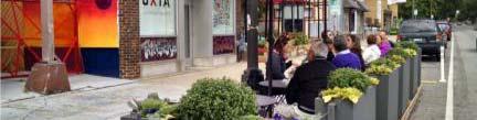
44 Main Street: Visual Simulation Opportunities for: Gateways Plazas Multi-modal connections


45 Key Highlights of DA-6 Mixed use with residential/commercial i i l over retail/commercial i l Development fronting El Camino Way should be a residential over retail configuration Development should have a graduated sense of massing with step-backs and lower scale buildings along Sixth Street Build to line of 15 feet along 6 th Street
46 Design Guidelines Elements Two primary palettes Downtown Gateway palette Old Town Tustin palette Street tree master plan Newport Ave First Street Main Street El Camino Real Secondary Streets Sidewalk and Crosswalk Paving Street Furniture and Lighting i Building Design Public Realm Signage Public Art Bust Program Parklet Program
47 Design Guidelines


48 Streetscape Palettes Old Town Tustin Palette Downtown Gateway Palette


49 Old Town Tustin Palette


50 Downtown Gateway Palette
51 Street Tree Master Plan Plan includes phased approach to replace Ficus trees Alternate species will be comparable maturity

52 Ficus Phased Replacement Plan


53 Selected Street Trees Koelreuteria paniculata Goldenrain Tree Lophostemon confertus Brisbane Box Quercus ilex Holly Oak Tabebuia impetiginosa Pink Trumpet Tree
54 Parklet Program


55 31 Parklets
56 Implementation
57 Implementation When a new project comes in, does it meet minimum criteria? Is it a mixed use project? Yes or No? Is the project requesting a transfer of intensity? Is the project consistent with development standards included in the Specific Plan? Is the project consistent with the design guidelines included in the Specific Plan Does the project meet the findings of fact are required by the Specific Plan
58 Approving Bodies for Projects within Plan Area Pending the following: Application Findings of fact Environmental review consistent with programmatic EIR Preliminary review by City staff Staff Level Review Review by Community Development Director Appealable to Planning Commission Review by Planning Commission Project Decision
59 Next Steps
60 Next Steps Environmental Scoping Meeting in Spring 2016 Environmental Review Spring 2016 Fi l S ifi R i d A l i h Pl i Final Specific Review and Approval with Planning Commission and City Council Summer 2016
61 Discussion and Feedback
62 Community Workshop #3 January 28, 2016 Team
 Community Workshop #2 December 4, 2014 Team Tonight s Agenda 6:00 pm Welcome! 6:05 pm The Future of Downtown Tustin Ideas, Strategies and Recommendations 6:35 pm Questions and Comments 6:50 pm Open
Lower Merion Commercial Districts Issues and Characteristics Handbook November 2013
 Lower Merion Commercial Districts Issues and Characteristics Handbook November 2013 DRAFT TOWNSHIP-WIDE VISION: To maintain and enhance commercial areas to complement the surrounding high-quality residential
Town Center (part of the Comprehensive Plan)
") Town Center (part of the Comprehensive Plan) Mercer Island Town Center Looking North (2014) In 1994, a year-long process culminated in a set of design guidelines and code requirements for the Town Center
Town Center (part of the Comprehensive Plan) Mercer Island Town Center Looking North (2014) In 1994, a year-long process culminated in a set of design guidelines and code requirements for the Town Center
Planning Board Briefing
 Planning Board Briefing Why Now? The Sector Plan Implementation Chapter States: Before Stage 1 begins, the following must occur: Approval of the Sectional Map Amendment. Approval of the Greater Lyttonsville
appendix and street interface guidelines
 appendix five: building and street interface guidelines appendix 5 building and street interface guidelines BOULEVARDS Boulevards are generally characterized by higher levels of traffic movement at higher
CHAPTER 3 VISION, GOALS, & PLANNING PRINCIPLES. City of Greensburg Comprehensive Plan. Introduction. Vision Statement. Growth Management Goals.
 CHAPTER 3 VISION, GOALS, & PLANNING PRINCIPLES Introduction The Greensburg Comprehensive Plan is intended as a working community document. A combination of long and short-term goals, this document is intended
Dyersville Downtown Plan. Open House October 24, 2017
 Dyersville Downtown Plan Open House October 24, 2017 What is a Comprehensive Plan? - Vision - Guidance for decisions - Basis for regulations What is a Downtown Plan? - Understand priorities - Identify
WEST LOOP DESIGN GUIDELINES CHECKLIST
 WEST LOOP DESIGN GUIDELINES CHECKLIST Section 1.0 General Strategies 1.1 DESIGN EXCELLENCE: ENCOURAGE HIGH QUALITY AND INNOVATIVE DESIGN OF NEW BUILDINGS WITHIN THE WEST LOOP WITHOUT BEING PRESCRIPTIVE
Old Town Neighborhoods Plan. Choices Event Wednesday, December 9, 2015
 Old Town Neighborhoods Plan Choices Event Wednesday, December 9, 2015 Agenda 6:00 6:10 p.m. Welcome + Sign In 6:10 6:30 p.m. Presentation 6:30 8:00 p.m. Workshop + Open House Seeking your input on: Neighborhood
City of Farmington. Downtown Plan. Amendment to the 1998 Master Plan Adopted October 11, 2004
 City of Farmington Amendment to the 1998 Master Plan Adopted October 11, 2004 Introduction Planning Background 1 Scope and Components of the Plan Amendment 2 Concept Introduction 3 Plan Concepts 3 Conceptual
Tonight s Agenda. Summary Presentation Open House. Group Discussion Next Steps: online community wide survey
 Community Open House February 22, 2018 Tonight s Agenda Summary Presentation Open House Station 1: Project Overview and Community Input Station 2: Draft Vision and Guiding Principles Station 3: Western,
VISION AND GUIDING DESIGN PRINCIPLES
 pleasure point commercial corridor VISION AND GUIDING DESIGN PRINCIPLES Public Draft November 26, 2018 County of Santa Cruz with assistance from MIG CONTENTS PART I: INTRODUCTION AND VISION... 3 Community
EXISTING COMPREHENSIVE PLAN
 EXISTING COMPREHENSIVE PLAN Town Center Land Use Element: V. LAND USE POLICIES Town Center Mercer Island's business district vision as described in "Your Mercer Island Citizen-Designed Downtown" was an
6. DOWNTOWN. The Downtown Element focuses on supporting and expanding the vitality and enhancement of Downtown Chico as the City s central core.
 VISION In 2030, Downtown Chico is the heart of the community and the center of cultural activity. Engaging and active at the street level, it is a multi-story, mixed-use hub, with specialty retail, restaurants,
Policies and Code Intent Sections Related to Town Center
 Policies and Code Intent Sections Related to Town Center The Town Center Vision is scattered throughout the Comprehensive Plan, development code and the 1994 Town Center Plan. What follows are sections
Table of Contents. Elm Avenue Improvement Plan City of Waco, Texas. Introduction 1. Existing Context 1 Figure 1 2.
 Table of Contents Introduction 1 Existing Context 1 Figure 1 2 Plan Guidelines 3 Future Urban Form 4 The West-End 4 Main Street 6 The East-End 7 Figure 2 9 Public Improvement Recommendations 7 General
Study Area. Capitol Way. Greening America s Capitals 11/13/2014. A Greening America s Capitals Project
 Olympia, WA: Greening Capitol Way Supporting Communities move towards sustainability is a priority for the federal government. A Greening America s Capitals Project Office of Sustainable Communities U.S.
7Page 91 CLEMMONS COMMUNITY COMPASS 7 COMMUNITY CHARACTER
 7 Community Character The beauty of Clemmons won t necessarily be a reflection of our past, but our future. This quote from Comprehensive Plan Steering Committee member Wayne Dodson captures the essence
Cobb County Design Guidelines Mableton Parkway & Veterans Memorial Highway Community Design Workshop January 12, 2017
 Community Design Workshop January 12, 2017 Agenda Opening Remarks / Introductions Scope of Work Existing Conditions Key Issues / Opportunities VPS Summary Draft Vision & Goal Statement Implementation Concepts
Pedestrian and Bike Bridge LOGO
 6.2.2 Pedestrian and Bike Bridge The proposed pedestrian and bike crossing re-envisions the existing bridge at Pismo Creek on Cypress Street. The bridge is currently underutilized by vehicular through
Potential Green Infrastructure Strategies May 6, 2015 Workshop
 Potential Green Infrastructure Strategies May 6, 2015 Workshop Background The City of Cortland is developing the Tioughnioga Urban Headwaters Green Infrastructure Action Plan with funding from the National
PUBLIC RIGHT-OF-WAY IN THIS CHAPTER PUBLIC REALM
 PUBLIC RIGHT-OF-WAY This section provides design guidelines for improvements in the public right-of-way. The public right-of-way refers to streets, sidewalks, non-vehicular thoroughfares, parks and greenways
Small Area Plan. South Gateway
 Small Area Plan Adopted May 12, 2008 South Gateway Purpose. The South Gateway Small Area Plan defines the City s expectations for the future of the southern entrance to the City at Interstate 85 and Highway
Urban Design Manual PLANNING AROUND RAPID TRANSIT STATIONS (PARTS) Introduction. Station Study Areas
 Introduction. Station Study Areas") 111111 PLANNING AROUND RAPID TRANSIT STATIONS (PARTS) Introduction The ION rapid transit system will link Waterloo, Kitchener and Cambridge through a central transit corridor (CTC). There are a number
111111 PLANNING AROUND RAPID TRANSIT STATIONS (PARTS) Introduction The ION rapid transit system will link Waterloo, Kitchener and Cambridge through a central transit corridor (CTC). There are a number
Equitable Growth Through TOD Planning
 Equitable Growth Through TOD Planning Community Meeting # 2 November 2017 Goals Objectives Extend investment from downtown Connect neighborhoods physically and economically Enhance places based on local
Hockessin Community Redevelopment Plan
 Hockessin Community Redevelopment Plan 3.1 Introduction The Community Redevelopment Plan for the Village of Hockessin is the result of the people s vision for a distinct village center that serves as the
The transportation system in a community is an
 7 TRANSPORTATION The transportation system in a community is an important factor contributing to the quality of life of the residents. Without a sound transportation system to bring both goods and patrons
BROOKLYN PARK / 85TH AVE LRT STATION CDI DEVELOPMENT GUIDELINES DRAFT
 August 2018 Page intentionally left blank The Brooklyn Park Library adjacent to the 85th Ave LRT Station Area. OVERVIEW The Blue Line LRT Extension / Bottineau corridor offers a unique opportunity to leverage
Draft Cary Community Plan Review Part 3: Shop, Engage, Serve, Special Area Plans, Other Updates. October 27, 2015 Police Department Training Room
 Draft Cary Community Plan Review Part 3: Shop, Engage, Serve, Special Area Plans, Other Updates Committee for the Future October 27, 2015 Police Department Training Room AGENDA 1. Welcome and Call to Order
Lehigh Acres Land Development Regulations Community Planning Project
 Lehigh Acres Land Development Regulations Planning Effort Summary In July, 2010 Commissioner Frank Mann invited the Lehigh Acres community to start discussing how to achieve their recently adopted community
Ivywild On The Creek PRELIMINARY CREEK DISTRICT MASTER PLAN
 Ivywild On The Creek PRELIMINARY CREEK DISTRICT MASTER PLAN Introduction: Rejuvenating an extraordinary Creekside neighborhood THE CREEKSIDE DISTRICT The Ivywild On The Creek Neighborhood District Master
A. Background Summary of Existing Challenges and Potential Possibilities. 1. Summary of Existing Assets and Potential Opportunities
 A. Background 1 A Main Street Master Plan Study was performed and completed in October of 2007. The study was initiated to review current land uses and development patterns along Main Street, from Parrish
LUNDY S LANE COMMUNITY IMPROVEMENT PLAN STUDY
 PUBLIC INFORMATION MEETING #2 October 12, 2016 LUNDY S LANE COMMUNITY IMPROVEMENT PLAN STUDY AGENDA 5:00 to 5:30pm: Open House 5:30 to 6:15pm: Presentation 6:15 to 7:00pm: Individual paced workshop with
Draft Memorandum #1: Goals and Vision for Revitalization
 Keizer Revitalization Plan Draft Memorandum #1: Goals and Vision for Revitalization Submitted to: City of Keizer April 12, 2018 (revised) Prepared By: Angelo Planning Group and Otak, Inc. Project No. 17482.A
Civic Center District
 Civic Center District The Civic Center district is the civic and social heart of Warrenville, containing such public buildings as the City Hall, Warrenville Public Library, Police Station, Park District
Preliminary Recommendations Tk Takoma/Langley Crossroads Sector Plan
 Preliminary Recommendations Tk Takoma/Langley Crossroads Sector Plan Vision is to achieve a Transit Oriented, pedestrian friendly Community that Celebrates and builds upon the cultural Diversity of the
DOWNTOWN GEORGETOWN PLANNING STUDY
 DOWNTOWN GEORGETOWN PLANNING STUDY Community Workshop #3 Thursday, May 4, 08 The Planning Partnership OVERVIEW OF STUDY, PROCESS & MILESTONES We are here PURPOSE OF THE STUDY To develop a clear vision
THEMES, VISION, + PRINCIPLES
 CHAPTER 2: THEMES, VISION, + PRINCIPLES This page intentionally left blank. 20 VISION DRAFT AUGUST 2018 2 2 THEMES, VISION, + GUIDING PRINCIPLES The Key Themes, Vision, and Guiding Principles presented
DRAFT City of Titusville 2040 Comprehensive Plan Future Land Use, Housing, and Transportation Elements April 16, 2018
 DRAFT City of Titusville 2040 Comprehensive Plan Future Land Use, Housing, and Transportation Elements April 16, 2018 Prepared by Canin Associates for the City of Titusville About the Comprehensive Plan:
City of Tacoma Planning and Development Services
 Agenda Item E-1 City of Tacoma Planning and Development Services To: Planning Commission From: Elliott Barnett, Planning Services Division Subject: Tacoma Mall Regional Center Subarea Plan and EIS Meeting
DRAFT. 10% Common Open Space
 % OF CHARLOTTE IS CATEGORIZED AS A. LAND USES : Placeholder map displaying location of Place Type GOALS: Accommodate XX% of future growth. Provide a concentration of primarily commercial and civic activity
This Review Is Divided Into Two Phases:
 Semiahmoo Town Centre Review The purpose of this review: To review the Semiahmoo Town Centre Concept Plan, originally approved in 1993, to ensure that this centre will continue to serve the needs of South
SLIDE TITLE TRANSIT-ORIENTED DEVELOPMENT PLAN RED-PURPLE BYPASS STUDY AREA PUBLIC MEETING #2 RED AND PURPLE MODERNIZATION. RPM TOD Plan Update
 SLIDE TITLE TRANSIT-ORIENTED DEVELOPMENT PLAN RED-PURPLE BYPASS STUDY AREA PUBLIC MEETING #2 RED AND PURPLE MODERNIZATION 1 SLIDE TITLE AGENDA Project Introduction TOD s and Development Trends Real Estate
IMAGINE CLEARWATER. Community Workshop 3. November 2016
 IMAGINE CLEARWATER Community Workshop 3 November 2016 Imagine Clearwater has been a 6-month community-focused process to re-envision the downtown waterfront. VISIONING FRAMEWORK MASTER PLAN HOW CAN WE
Good Design Guidelines for Downtown. Preliminary Findings and Recommendations
 Good Design Guidelines for Downtown Preliminary Findings and Recommendations City Council Meeting - February 5, 2017 Advisory Committee Team: Larry Paul: Planning Commission /Architect Bruce Bagnoli: Business
Lambeth Main Street Streetscape Improvements
 Lambeth Main Street Streetscape Improvements Open House October 5th, 2017 Agenda 1. Introduction 2. Project Background 3. Context 4. Project Objectives 5. Design Principles & Approach 6. Streetscape Design
East Central Area Plan
 East Central Area Plan Steering Committee Meeting March 8 th, 2018 CHUN Tears McFarlane House Vision Statement Development Opportunities Analysis Vision Elements 1. Equitable, Affordable and Inclusive
1 October Dear Citizens of Charlotte and Mecklenburg County,
 1 October 2011 Dear Citizens of Charlotte and Mecklenburg County, As co-chairs of the Center City 2020 Vision Plan Steering Committee, we are proud to present the Center City 2020 Vision Plan, which sets
NEIGHBORHOOD 3: UNIVERSITY EDGE
 NEIGHBORHOOD 3: UNIVERSITY EDGE Aerial View of North Indiana Avenue EXISTING CHARACTER The University Edge neighborhood represents the primary town/gown interface between the campus and the city of Bloomington,
About Momentum Midland
 About Momentum Midland Achieving a community s full potential in terms of economic development and quality of life is critically important to its long term sustainability. Core to achieving this is a vibrant
Community Design Plan
 Gardena General Plan 2006 Authority While the is not a required element of a General Plan, it is included because improving the community appearance and image is paramount to the overall quality of life
Complete Neighbourhood Guidelines Review Tool
 Complete Neighbourhood Guidelines Review Tool Prepared By: City of Regina Planning Department October 2014 Page 1 of 14 Community Development Review Checklist for Secondary Plans and Concept Plans The
Millbrae TOD #2 Project Analysis
 Millbrae TOD #2 Project Analysis Project Description A Site Development Permit and Conditional Use Permit are proposed to allow for a mixed-use transitoriented development on approximately 9 Acres located
Broadway District Specific Plan. Community Workshop #2 February 23,2016
 Broadway District Specific Plan Community Workshop #2 February 23,2016 1 Agenda Introductions Project Progress Status Upcoming Milestones Emerging Framework Land Use Urban Design Circulation Infrastructure
Sahuarita District & Phase 1 Master Plan. Town Council December 11, 2017
 Sahuarita District & Phase 1 Master Plan Town Council December 11, 2017 Visioning Study Visioning Process Advisory Group Meetings Community Questionnaire Town Center Case Studies Community Analysis The
North Downtown Specific Plan MEMORANDUM
 North Downtown Specific Plan MEMORANDUM MEETING DATE: November 13, 2017 TO: Members of the North Downtown Specific Plan Advisory Committee FROM: Jeanine Cavalli, Senior Planner SUBJECT: Materials for the
RE-Imagining the Downtown Colorado Springs Master Plan
 RE-Imagining the Downtown Colorado Springs Master Plan 2016 APA Colorado State Conference October 25, 2016 Overview 8:00 Welcome, Introductions, and Overview 8:15 Downtown s Planning History 8:30 A Market
A Vibrant Downtown. Chapter 5 Cary Public Art Opportunities 31
 A Vibrant Downtown Cary s vision for Downtown is a unique, vibrant, dynamic, pedestrian friendly location; a regional destination and a place to live, work, and recreate, according to the 2001 Town Center
Urban Design 9Identity
 Urban Design 9Identity URBAN DESIGN IDENTITY Urban design is about connecting people to their places through the built environment, nature, and overall urban form. Done well, it creates a memorable space
DALY CITY VISIONING PROCESS COMMUNITY WORKSHOP 3 MAY 8, 2008
 DALY CITY VISIONING PROCESS COMMUNITY WORKSHOP 3 MAY 8, 2008 PROCESS General Plan - a statement of the community s values, vision and aspirations for now and into the future... Timeframe LONG TERM - 2030
SECTION TWO: Urban Design Concepts
 SECTION TWO: Urban Design Concepts The Gardnerville Plan for Prosperity shapes economic opportunities presented by regional growth. The Urban Design Concepts provide policies and concepts for land use,
Bethesda Downtown Plan
 Bethesda Downtown Plan Planning Board Update Connecticut Avenue Location Economic Sustainability Social Environmental Scope Coming Soon! Team Listening, Twitter Outreach We Are Here Engagement Challenge
Chapter 2: Vision, Goals and Strategies
 Chapter 2: Vision, Goals and Lake Elmo Today & Tomorrow Comprehensive Plan 2040 2 VISION, GOALS & STRATEGIES - DRAFT 4-6-2018 INTRODUCTION Comprehensive Plan Purpose Perhapse the most important objective
FUTURE LAND USE ELEMENT
 FUTURE LAND USE ELEMENT GOAL I: To create and sustain a great place to live, play, and prosper Objective 1: The City of Ocala shall incorporate the principles and strategies of the Ocala 2035 Vision into
Silverdale Regional Center
 Silverdale Regional Center Vision for Silverdale Regional Center The Silverdale Regional Center Plan (Plan) will guide the evolution of the Silverdale Regional Center from a collection of strip malls and
R STREET CORRIDOR NEIGHBORHOOD Site Plan and Design Review Supplemental Guidelines Checklist
 R STREET CORRIDOR NEIGHBORHOOD Site Plan and Design Review Supplemental Guidelines Checklist Applicant s Name: Project Address: Phone: Email: Applicant shall fill out the design guidelines checklist for
WELCOME and introduction
 1 WELCOME and introduction Mobility Hub Locations within Burlington STUDY OVERVIEW STUDY OBJECTIVES The City of Burlington is developing four Area Specific Plans, one for each of Burlington s Mobility
open house 3 CITY OF SALEM Downtown Streetscape Plan
 open house 3 Streetscape concepts CITY OF SALEM Downtown Streetscape Plan analysis concepts we are here refined concepts & document Feb 13th 1 2 3 apr 18th KICKOFF OPEN HOUSE Streetscape Work Group Walking
The Vision. Photo provided by The Minervini Group. 46 Vision, Objectives & Strategies
 Vision, Objectives & Strategies The is the public framework and guide for future development of the Grand Traverse Commons. The establishes public polices for infrastructure, the preservation of natural
In surveys, Dallas residents say what they want to change most
 NEIGHBORHOODS ELEMENT In surveys, Dallas residents say what they want to change most in the city is its appearance they want it to look beautiful, with trees and pedestrian-friendly neighborhoods. The
5.1 Site Plan Guidelines
 5. Community Core Guidelines Development of the Community Core will take place by plan of subdivision and site plan approval. It will occur in a phased manner that will reflect the timing of residential
Chapter 4. Linking Land Use with Transportation. Chapter 4
 Chapter 4 Linking Land Use with Transportation Chapter 4 59 Chapter 4 Linking Land Use with Transportation Community Design and Transportation Program Introduction Since the 1950s, the predominant development
GREENING THE BOULEVARD Master Plan Concepts for Venice Boulevard between Lincoln and Sawtelle
 GREENING THE BOULEVARD Katherine Spitz Associates Inc. 4212½ Glencoe Avenue Marina Del Rey, CA 90292 310 574 4460 Fax 574 4462 January 2008 Table of Contents Overview Proposed Design Improvements Illustration
PINE CURVE REZONING. Property does not meet criteria for open space preservation and is not a candidate for a park
 PINE CURVE REZONING BACKGROUND Purchased as two parcels in 2001 and 2002 Annexed and Zoned Greater Downtown District Historic Center September 25, 2002 and October 7, 2002 WHAT THE PROJECT IS AND IS NOT
1 Adapted from the Statewide Transit-Oriented Development Study by CalTrans, 2006
 APPENDIX C: LAND USE PLANNING FOR ENHANCED RAIL SERVICE 72 BACKGROUND One of the consistent themes heard from localities in the Route 29 corridor Planning Forums was the need for expanding rail service
2.0 THE PLATINUM TRIANGLE VISION
 2.0 THE PLATINUM TRIANGLE VISION The envisions an exciting future for the area surrounding Angel Stadium of Anaheim, the Honda Center and The Grove of Anaheim. 2.1 Planning Principles In order to further
THE CIVIC DISTRICT DEVELOPMENT OPPORTUNITIES
 1 THE CIVIC DISTRICT DEVELOPMENT OPPORTUNITIES The Civic District is the physical and emotional heart of the downtown. It is also a major gateway into the central core, establishing the image and identity
Carlsbad Village Redevelopment Concept Summary of Features
 Carlsbad Village Redevelopment Concept Summary of Features Calthorpe Associates November 5, 2003 The Redevelopment Concept illustrates a vision for the future of Carlsbad Village. The overall vision of
8implementation. strategies
 PROGRAM STRATEGIES 8implementation strategies T he implementation actions of this chapter are designed to support and carry out the land use, economic development, transportation, urban design, and program
4- PA - LD - LIVELY DOWNTOWN. LD - Background
 4- PA - LD - LIVELY DOWNTOWN LD - Background The downtown has been the service centre for the community since the city s inception and the area continues to supply people with their personal services,
Horizon 2035 Land Use and Transportation Element
 CITY OF SUNNYVALE Horizon 2035 Land Use and Transportation Element City Council Study Session March 7, 2017 Overview General Plan Context Mixed Use Villages Transportation Mode & Parking General Plan Policy
The Five Components of the McLoughlin Area Plan
 The Five Components of the McLoughlin Area Plan This documents contains the complete language of the five components of the McLoughlin Area Plan: The Vision Statement The Values The Guiding Principles
Illustration of Eastlake Farmer s Cooperative Grain Elevator. Chapter 5: implementation 5-1
 Illustration of Eastlake Farmer s Cooperative Grain Elevator Chapter 5: implementation 5-1 chapter 5: implementation Introduction The Eastlake Subarea Plan includes a wide range of recommendations intended
City of Bristol Route 6 Corridor Implementation Program
 City of Bristol Route 6 Corridor Implementation Program FITZGERALD & HALLIDAY, INC. Innovative Planning, Better Communities June 2017 Route 6 Corridor Plan IMPLEMENTATION PROGRAM The following Implementation
W O R K S H O P S U M M A R Y. Community Workshop #1: Visioning September 11th, 2007
 W O R K S H O P S U M M A R Y Community Workshop #1: Visioning September 11th, 2007 Upper Market Community Workshop Series and Design Plan Page 1 of 9 INTRODUCTION The Upper Market Community Workshop Series
DRAFT PLAN PRESENTATION
 DRAFT PLAN PRESENTATION 1.23.2018 AGENDA Process Project Schedule Results from Visioning Workshop Draft Plan Highlights Concept Plans Feedback Next Steps PROJECT SCHEDULE KICK-OFF WORKSHOP August 29 th
Downtown Whitby Action Plan
 Downtown Whitby Action Plan Final Report October 2016 Table of Contents Introduction 1 Public Consultation 2 Walkability 3 Downtown Whitby Walkability Map 4 Vision 5 Goal & Objectives 6 Objective 1 7 Objective
VICTORIA DOWNTOWN DEVELOPMENT PLANNING
 VICTORIA DOWNTOWN DEVELOPMENT PLANNING A Vision & Guide for the Future Downtown Victoria thrives as a center for the community, offering a great mix of entertainment, culture, business, and recreational
Visioning Statement and Guiding Principles
 Visioning Statement and Guiding Principles Planning for the Future The General Plan The General Plan represents Woodland's shared vision of the future and defines a path to lead the community toward its
Pine Island Road Corridor Master Plan
 RECOMMENDED DEVELOPMENT PLAN Figure 9: Del Prado Village District Conceptual Framework The Conceptual Framework (Figure 8) for development of the Pine Island Corridor is to encourage mixed-use development
The University District envisions, in its neighborhood
 Envisioning the University District Link Light Rail in Seattle s neighborhoods CIY OF SEALE CONCEP-LEVEL SAION AREA PLANNING RECOMMENDAION RESOLUION # 30165 EXHIBI L Vision 08.2000 he University District
MISSION STREETSCAPE PLAN. Neighborhood Commercial Streets handle continuous activity. Neighborhood Commercial STREET ROW: Main Design Treatments
 Neighborhood Commercial STREET ROW: 64-80 Main Design Treatments CORNER reduce crossing distance for pedestrians, create entrances to a residential area and slow cars down. help widen sidewalk allocating
Santa Monica Chamber of Commerce DSP Subcommittee s DSP EIR Scoping Comments and Preliminary Comments on the DSP Framework
 Santa Monica Chamber of Commerce DSP Subcommittee s DSP EIR Scoping Comments and Preliminary Comments on the DSP Framework The Chamber of Commerce s DSP Subcommittee s comments on the scope of the DSP
1.0 Purpose of a Secondary Plan for the Masonville Transit Village
 Report to Planning and Environment Committee To: Chair and Members Planning & Environment Committee From: John M. Fleming Managing Director, Planning and City Planner Subject: Masonville Transit Village
Town of Cobourg Heritage Master Plan. Statutory Public Meeting
 Town of Cobourg Heritage Master Plan Statutory Public Meeting April 25 th 2016 Presentation Overview 1. Introduction 2. Project background and schedule overview 3. Review of strategic direction content
Allen Street Civic District Redevelopment Area Plan Redevelopment Plan & Proposal State College Planning Commission State College Redevelopment
 Allen Street Civic District Redevelopment Area Plan Redevelopment Plan & Proposal State College Planning Commission State College Redevelopment Authority September 17, 2015 Discussion Points Overview of
Introduction. Intent of the Plan. Urban Design and Land Use Approach
 Introduction Intent of the Plan This is the Second Public Open House for the. The intent of the is to update current City policy in order to encourage future development that will ensure a diverse, lively,
Building Great Neighbourhoods. Strathcona
 Building Great Neighbourhoods Strathcona March 21, 2018 Becky Redford Project Manager, Planning & Design Building Great Neighbourhoods Integrated Infrastructure Services Welcome and Purpose To provide
Southern Pines. Downtown Neighborhood Development Plan
 Southern Pines Downtown Neighborhood Development Plan Public Review Draft: March 28, 2013 Table of Contents Overview... 1 Purpose of the Downtown Neighborhood Development Plan... 1 How the Plan was Developed...
PLAN ELEMENTS WORKSHOP. April 5, 2016
 PLAN ELEMENTS WORKSHOP April 5, 2016 needs more housing. But there is no one-size fits-all solution. Every neighborhood has its own character. In some places, density is not only appropriate it is badly