Stowey Sutton Parish Council. Stowey Sutton Parish Council Placemaking Plan Assets of Community Value June 2014
|
|
|
- Douglas Ball
- 5 years ago
- Views:
Transcription
1 Stowey Sutton Parish Council Placemaking Plan Assets of Community Value June
2 2
3 Contents Identifying natural & built environment assets... 5 Natural & built environment asset: Lovell Mill... 7 Natural & built environment asset: The Red Lion... 8 Natural & built environment asset: The Methodist Hall... 9 Natural & built environment asset: Chapel Cottages Natural & built environment asset: Oak House Natural & built environment asset: The Colliers Natural & built environment asset: Mistletoe Cottage Natural & built environment asset: Vine House Natural & built environment asset: Rose Cottage Natural & built environment asset: 1 & 2 Church Lane Natural & built environment asset: Walnut Orchard Natural & built environment asset: Bishop Sutton Church Natural & built environment asset: Bishop Sutton Primary School Natural & built environment asset: Little Well House Natural & built environment asset: Copperstacks Natural & built environment asset: The Old Bakery Natural & built environment asset: Mountain Ash Farm Natural & built environment asset: Bishop Sutton Village Hall Natural & built environment asset: Bishop Sutton Recreation Ground Natural & built environment asset: Stowey Mill Natural & built environment asset: Stowey Church Natural & built environment asset: Petrifying Spring, Stowey Church Natural & built environment asset: Stowey School Natural & built environment asset: The Strachie Studio
4 Natural & built environment asset: Trees & Hedgerows around Proposed Cappards Estate Extensions Natural & built environment asset: Burledge Common Natural & built environment asset: Wick Green Natural & built environment development asset: Extend the footpath close to Chew Valley Lake
5 Identifying natural & built environment assets Stowey Sutton Parish Council The Parish has many natural and built assets which should be protected. These assets were identified by community volunteers, discussed with land & property owners & were refined following a public consultation event on the 15 th May Natural and built assets were grouped into themes based on these questions: Social and communal value Are there assets of importance to the local community? The asset(s) may be a source of civic pride for the community or a place that contributes to the collective memory of that area? Heritage value Are there assets that reflect the traditional functional character or former uses in the village? Architectural interest Are there assets that may be of a high-quality representation of a particular architectural style or type, an individually distinctive form of architecture or are there assets that demonstrate artistic interest? Associations Are there assets with a historical association with the village, with particular people, artists, writers, or other media, or events in history? Aesthetic value Are there assets which have intrinsic design value relating to local styles, materials or any other distinctive local characteristics? Landmark Quality Are there assets with a visual prominence? Assets with landmark quality are normally aesthetically attractive and dominate the street scene or an important view/vista. Assets with landmark quality are normally geographical or cultural orientation points. Archaeological Interest Are there any assets of archaeological interest? Geological Interest Are there any geological landforms of interest? Scenic quality Are there assets that appeal primarily to the visual senses? Conservation Are there any important flora or fauna assets which should be protected or noted? 5
6 6

7 Natural & built environment asset: Lovell Mill Stowey Sutton Parish Council Lovell Mill, Sutton Hill Road, Bishop Sutton, BS39 5UT A key building in a prime village location, this building has historical & architectural value, due to its scale, choice of local building materials & previous usage. Named after Jessie Lovell who built the original corn mill on this on site in

8 Natural & built environment asset: The Red Lion Stowey Sutton Parish Council The Red Lion, Sutton Hill Road, Bishop Sutton, BS39 5UT Built in 1883 the Red Lion public house has social and communal value, it provides an informal meeting space for village groups & associations, as well as providing a hub for social activity. 8

9 Natural & built environment asset: The Methodist Hall The Methodist Hall, The Street, Bishop Sutton, BS39 5UU Built in 1778 the original Methodist Hall has social and communal value and heritage value, as John Wesley preached here on September 17 th 1782, the original hall has architectural 9
10 interest, as it is typical of the stone built chapels of this period, the new Wesleyan chapel was added in The hall is used by several local associations, such as the WI & pre-school group & Parish Council, in addition to its religious function. 10

11 Natural & built environment asset: Chapel Cottages Chapel Cottages, The Street, Bishop Sutton, BS39 5UX These former mining cottages have Heritage & Architectural interest, due to their design & former use, they add to the streetscape helping to anchor the village to its past. 11

12 Natural & built environment asset: Oak House Stowey Sutton Parish Council Oak House, Sutton Hill Road, Bishop Sutton, BS39 5UT Oak House is one of four properties in Bishop Sutton built to a similar design & during the 1880 s & 1890 s so it has Heritage & Architectural interest, due to their design, construction material & original use, they add to the streetscape helping to anchor the village to its past. 12

13 Natural & built environment asset: The Colliers Stowey Sutton Parish Council The Colliers, Church Lane, Bishop Sutton The Colliers, built in 1785, was formerly used as the village school and miners pub and therefore has Heritage value together with Architectural interest, due to the style & local materials used in its construction, its location makes it a key landmark in Bishop Sutton 13

14 Natural & built environment asset: Mistletoe Cottage Mistletoe Cottage, Sutton Hill Road, Bishop Sutton, BS39 5UR Mistletoe Cottage is a traditional agricultural longhouse, built in the local style using local materials and therefore adds Heritage & Architectural interest, its location and traditional density add character and space to this part of the community. 14

15 Natural & built environment asset: Vine House Stowey Sutton Parish Council Vine House, Sutton Hill Road, Bishop Sutton Vine House is a traditional farmhouse, built in the local style using local materials and therefore adds Heritage & Architectural interest, its location and traditional density add character and space to this part of the community. 15

16 Natural & built environment asset: Rose Cottage Stowey Sutton Parish Council Rose Cottage, Sutton Hill Road, Bishop Sutton Rose Cottage is a traditional agricultural dwelling, built in the local style using local materials, with a cottage garden and therefore adds Heritage & Architectural interest, its location and traditional density add character and space to this part of the community. 16

17 Natural & built environment asset: 1 & 2 Church Lane 1 & 2 Church Lane, Bishop Sutton 1 & 2 Church Lane are mining cottages, built in the local style using local materials and therefore adds Heritage & Architectural interest, its location and traditional style add character & help to anchor this area to its past. 17

18 Natural & built environment asset: Walnut Orchard The Walnut Orchard, Church lane, Bishop Sutton The walnut orchard is an unusual feature and provides an area of green space at the heart of Bishop Sutton. 18

19 Natural & built environment asset: Bishop Sutton Church Bishop Sutton Church, Wick Road, Bishop Sutton Built in 1848 Bishop Sutton Church & its cemetery, along with the Methodist Church, were the centre of village life for many years, one of the earliest burials in the church yard is for a 13 year old boy killed in a roof fall at the colliery. The church is still in regular use & the building 19
20 is typical of its type, its location and layout provide a quiet green space at the heart of Bishop Sutton. 20


21 Natural & built environment asset: Stowey Sutton Parish Council Bishop Sutton Primary School Bishop Sutton Primary School, Wick Road, Bishop Sutton Built in the 1840 s Bishop Sutton Primary School & in particular its original building, was one of the earliest schools in Somerset. Built of local materials, it adds Heritage & Architectural interest, its location and traditional density add character and space to this part of Bishop Sutton, combined with its high academic standards make this school a vital village asset. 21

22 Natural & built environment asset: Little Well House Little Well House, Wick Road, Bishop Sutton Built in the 1880 s Little Well House is one of four properties in Bishop Sutton built to a similar design & possibly associated with the former mine so it has Heritage & Architectural interest, due to their design, construction material & original use, they add to the streetscape helping to anchor the village to its past. The original slate lined well is still in place within the house. 22

23 Natural & built environment asset: Copperstacks Stowey Sutton Parish Council Copperstacks, Wick Road, Bishop Sutton Copperstacks (originally known as Myrtle House) built in the mid-1890s with local stone by the original owner who was also a carpenter wheelwright and wagon maker, is one of four properties in Bishop Sutton built to a similar design The adjacent stone garage outbuilding predates the house and is what remains of the original workshops associated with his trade. 23
24 The site has Heritage & Architectural interest, due to their design, construction material & original use, adding to the streetscape helping to anchor the village to its past. 24

25 Natural & built environment asset: The Old Bakery Stowey Sutton Parish Council The Old Bakery, Wick Road, Bishop Sutton The Old Bakery, was formerly one of the two village bakeries and has Heritage value together with Architectural interest, due to the style & materials used in its construction, its style & previous use helps to anchor Bishop Sutton to its past. 25

26 Natural & built environment asset: Mountain Ash Farm Mountain Ash Farm, Wick Road, Bishop Sutton Mountain Ash Farm is a traditional farmhouse, built in the local style using local materials and therefore adds Heritage & Architectural interest representing the agricultural past of the 26
27 community, its location and traditional density add character and space to this part of the community. 27

28 Natural & built environment asset: Stowey Sutton Parish Council Bishop Sutton Village Hall Bishop Sutton Village Hall, Wick Road, Bishop Sutton Built on the site of the original village hall, on land donated by three local ladies using monies they had received for their work in France during World War one. Bishop Sutton Village Hall 28
29 has social and communal value, it provides an informal meeting space for village groups & associations, as well as providing a hub for social activity. 29

30 Natural & built environment asset: Stowey Sutton Parish Council Bishop Sutton Recreation Ground Bishop Sutton Recreation Ground, Wick Road, Bishop Sutton Bishop Sutton Recreation Ground was left to the village by XX has social and communal value, it provides an informal recreation space for villagers of all ages, it is well used groups & associations, such as the cricket club, village society & school for village fun days & events & provides a hub for social activity. 30

31 Natural & built environment asset: Stowey Mill Stowey Sutton Parish Council Stowey Mill, Stowey Bottom Stowey Mill has existed since very early times. In 1866 it was used to make red dye using Annatta berries imported from Brazil. The dye came from crushing the berries and was used for colouring cheese and marking sheep. Red ochre superseded Annatta beans. The mill closed in The site therefore adds Heritage & Architectural interest representing the 31
32 agricultural past of the community, its location and traditional density add character and space to this part of the community. 32

33 Natural & built environment asset: Stowey Church Stowey Sutton Parish Council Stowey Church, The Street, Stowey Stowey Church is the oldest building in Stowey and dates around 1235AD it has Heritage value together with Architectural interest, due to the style & materials used in its construction, its style & previous use helps to anchor Stowey to its past. 33

34 Natural & built environment asset: Stowey Sutton Parish Council Petrifying Spring, Stowey Church Stowey Church, The Street, Stowey Several publications from the 18th century mention the petrifying spring which issues from the ground near the Stowey Church comparing it to the Knaresborough Spring in Yorkshire. This natural feature has Heritage value and adds interest to its surroundings. 34


35 Natural & built environment asset: Stowey School Stowey Sutton Parish Council Stowey School, The Street, Bishop Sutton Stowey School was built in 1837 at the expense of Mrs James Clarke, Lord Mount Sandford and the Reverend Robert Harkness, the vicar of Stowey at that time, when the school closed 35
36 it was presented to the Boy Scouts Association by Edward, Baron Strachie, reopening in September 1951 as the Henry Strachey Memorial Hall. Although now sympathetically converted to residential use the property has Heritage value together with Architectural interest, due to the style & materials used in its construction, its style & previous use helps to anchor Stowey to its history. 36

37 Natural & built environment asset: The Strachie Studio The Strachie Studio, The Street, Stowey Standing in the grounds of Stowey Mead, the Strachie Studio was used by well-known local artist xx has Heritage value together with Architectural interest, due to the style & materials used in its construction. 37

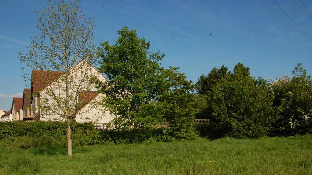
38 Natural & built environment asset: Trees & Hedgerows around Proposed Cappards Estate Extensions Cappards Road boundary, boundary with the rear of Rushmore Gardens, field boundary, boundary with Stitching Shord Lane, Bishop Sutton This field, which has outline planning permission for 35 additional dwellings, together with an outstanding appeal for an additional 35 new dwellings, is bounded by mature hedging and trees, which should be protected to maintain the green landscape and wildlife corridors around the new development, as well as providing screening from adjacent properties. 38


39 Existing boundary with Rushgrove Gardens Existing boundary with Cappards Road Existing boundary with Cappards Road 39
 is a major surviving common area in the Chew Valley, it is a very important open space which overlooks the entire valley, with a mix of short grazed turf, scrub and trees.")
40 Natural & built environment asset: Burledge Common Burledge Common, Bishop Sutton Burledge Common (7.57 acres) is a major surviving common area in the Chew Valley, it is a very important open space which overlooks the entire valley, with a mix of short grazed turf, scrub and trees. There was an Iron Age Fort of about 250 BC on Burledge. It is considered that the Romans camped here. 40


41 Natural & built environment asset: Wick Green Stowey Sutton Parish Council Wick Green, Bishop Sutton Wick Green is a smaller surviving common area broadly to the south of Bishop Sutton, it is a very important open space which looks towards Chew Valley Lake, with a mix of short grazed turf and trees. Wick Green was used during the 13th century as a communal centre where minstrels performed. 41


42 Natural & built environment development asset: Stowey Sutton Parish Council Extend the footpath close to Chew Valley Lake Chew Valley Lake Bishop Sutton D. Description & reason to develop Chew Valley Lake is a great rural resource, currently owned by Bristol Water and although there are well developed leisure walking facilities between points A, B & C on the map, walking outside this designated area is limited & often requires either a fishing or bird watching permit. Such a great open space should be open to more people & we support those organisations trying to gain greater public access, although a footpath between the current end at point C & the parish boundary at point D is directly supported, we would hope that similar paths through the lake sections in adjacent parishes could be linked to provide a circular, off road route around the lake 42
Land to West of Bessel s Way, Blewbury. Contextual Analysis. fluid
 Land to West of Bessel s Way, Blewbury Contextual Analysis fluid Contents fluid - Overview - Growth pattern - Footpath & Road connections - Landscape Character - Amenities - Agriculture - Characteristic
Environmental and Landscape Mapping
 Environmental and Landscape Mapping In support of the Calveley Neighbourhood Plan November 2016 Project Name and Number: Calveley Neighbourhood Plan 16-025 Document Name and Revision: Environmental and
East Harptree Landscape & Character Assessment
 East Harptree Landscape & Character Assessment Produced by East Harptree Parish Council in consultation with local residents September 2014 Contents The Parish of East Harptree: Objective Introduction
ENVIRONMENTAL AND LANDSCAPE MAPPING
 APPENDIX IV : Environmental and Landscape Mapping ENVIRONMENTAL AND LANDSCAPE MAPPING Calveley Neighbourhood Plan November 2016 ENVIRONMENTAL AND LANDSCAPE MAPPING Calveley Neighbourhood Plan Calveley
East Harptree Site EH3 Parker s Mead, Church Lane
 East Harptree Site EH3 Parker s Mead, Church Lane Photograph EH3.1 View looking north towards Chew Valley Lake Photograph EH3.2 Church Lane, adjacent to western site boundary Reference Baseline Information
Gazetteer of Non-Designated Heritage Assets in Cressing Parish
 Gazetteer of Non-Designated Heritage Assets in Cressing Parish 1 Rainbow House, Polecat Lane, Cressing. Appears on the OS map for 1875. Included in the Conservation Appraisal as a Building of Townscape
The Miller s House. Rode Hill, Rode, Somerset, BA11 6PS
 The Miller s House Rode Hill, Rode, Somerset, BA11 6PS The Miller s House Rode Hill, Rode, Somerset, BA11 6PS A beautiful Grade II* listed Queen Anne former dye house set in over 2 acres Entrance Hall,
Stanton Drew Parish Neighbourhood Plan Landscape and Environment
 Contents Introduction... 2 Scope of the Document... 2 Our Definition of a View... 2 Proposed Policies... 3 Criteria for a Protected View... 3 Views Assessed... 4 View 1: from cricket ground north towards
Lancaster Conservation Area Appraisal. Character Area 8. Cathedral
 Lancaster Conservation Area Appraisal Character Area 8. Cathedral March 2013 118 3.8 Character Area 8. Cathedral 3.8.1. Definition of Special Interest "This character area is distinctive for the fine group
Draft Submission of Chilcompton Parish Council to Mendip Local Plan
 Draft Submission of Chilcompton Parish Council to Mendip Local Plan Note: This is a draft for consultation. The Parish Council urges all villagers and other stakeholders to send comments to: parishclerk@chilcompton.org.
HIGH LITTLETON AND HALLATROW COMMUNITY PLACEMAKING PLAN
 HIGH LITTLETON AND HALLATROW COMMUNITY PLACEMAKING PLAN DOCUMENT 3 of 4 SNAPSHOT CHARACTER SUMMARY HALLATROW Context B&NES Landscape type: Area 6 Farrington Gurney Farmland/ Area 12 Cam and Wellow Brook
6: 2417 Fourth Line, Sixteen Hollow, Lion Valley Park
 1. Description of Property 6: 2417 Fourth Line, Sixteen Hollow, Lion Valley Park Municipal Address 2417 Fourth Line ame (if applicable) Sixteen Hollow, Lion Valley Park Legal Description CO 1 SDS PT LOTS
Conservation Area Designation, amendments and Review
 Conservation Area Designation, amendments and Review Location: No.s 37-49 (odd) Twickenham Road Date Assessed: January 2018 Adjacent Conservation Area Significance: Teddington Lock CA. The Teddington Lock
Community Planning Weekend
 Millfield Woods, Bury Green Community Planning Weekend Community Engagement Report Back March 2018 INTRODUCTION Around 100 members of the local community were engaged before and during the Bury Green Community
Introduction. Welcome to this consultation regarding the draft redevelopment proposals for the former CeramTec factory on Sidmouth Road, Colyton.
 Introduction Welcome to this consultation regarding the draft redevelopment proposals for the former CeramTec factory on Sidmouth Road, Colyton. We are currently considering options for the mixed-use redevelopment
Misterton Neighbourhood Plan
 Misterton Neighbourhood Plan Neighbourhood Profile Neighbourhood Character Profile TABLE OF CONTENTS 1. Introduction... 3 2. How to use this Report... 4 3. Neighbourhood Profiles: Zone 1... 6 4. Neighbourhood
Middle Barton Blindmoor, Buckland St Mary, Somerset
 Middle Barton Blindmoor, Buckland St Mary, Somerset Middle Barton Blindmoor, Buckland St Mary, Somerset, TA20 3RD A former Farmhouse and substantial barn set in a tranquil rural location Buckland St Mary
BORRISOKANE SETTLEMENT PLAN
 BORRISOKANE SETTLEMENT PLAN 1.0 General Introduction and Development Context Location Borrisokane is located 15km north of Nenagh on the N52. While the town is primarily residential, it acts as a market
7.2.9 Eudlo local plan code
 7.2.9 local plan code 7.2.9.1 Application (1) This code applies to assessable development:- (a) within the local plan area as shown on Map ZM29 contained within Schedule 2 (Mapping); and (b) identified
Conservation Area Designation, amendments and Review
 Conservation Area Designation, amendments and Review Location: Any area largely confined to Park Road and St. James Avenue which includes the following properties: St. James Church, St. James Road; No.
Appendix 4 - Character Assessment and Design Code. Character Assessment
 Appendix 4 - Character Assessment and Design Code Character Assessment To gain a deeper understanding of the Parish for the Neighbourhood Plan, a Character Assessment of the parish was carried out with
INTRODUCTION. Land West of Main Road, Stanton Harcourt THE SITE. Why is the Site Suitable for Development?
 0 INTRODUCTION THE SITE Application Boundary Gladman Developments Ltd has successfully invested in communities throughout the UK over the past 0 years, developing high quality and sustainable residential,
Public Consultation. Land at Monks Farm, North Grove. Welcome
 Welcome Welcome to our public exhibition for development on Land at Monks Farm, orth Grove. Gallagher Estates and Gleeson Strategic Land are preparing an outline planning application for new homes, open
Lincoln Townscape Assessment. Boultham Park Inherited Character Area Statement
 Lincoln Townscape Assessment Boultham Park Inherited Character Area Statement January 2008 Page 2 of 12 Table of Contents Page Overview 2 Historical Development 2 Urban form 3 Views 5 Condition of Buildings
Environment Agency Flood Risk Map for the Village of Bridge
 Environment Agency Flood Risk Map for the Village of Bridge December 2016 21 Objective F. Conserving and Enhancing the Natural Environment The National Planning Policy Framework states that the planning
Dulwich Dulwich Area Vision Map
 Area Vision Map Greendale Playing Fields East Lordship Lane Peckham Rye Park Herne Hill North St Barnabas Church Friern Road Edward Alleyn Club Herne Hill Velodrome Picture Gallery Village/College Road
LONGDEN VILLAGE DEVELOPMENT STATEMENT
 LONGDEN VILLAGE DEVELOPMENT STATEMENT 2017-2027 1 Longden Development Statement 2017-2027 15/01/18 1. Background 1.1 Longden Village Longden village is a very rural and traditional community first mentioned
Local Green Space. Site: Land surrounding All Saints Church and the recreation grounds, Earls Barton Site Appraisal: 02/12/13 Site Code: LGS1
 Local Green Space Site: Land surrounding All Saints Church and the recreation grounds, Earls Barton Site Appraisal: 02/12/13 Site Code: LGS1 Original Source es o Existing Local Plan Designation Suggested
Welcome. Land adjacent Sandy Lane WALTHAM CHASE THE PROPOSED SITE
 Land adjacent Sandy Lane WALTHAM CHASE Existing Linden Homes developments Welcome Welcome to Linden Homes Southern s ( Linden ) public exhibition about its proposals for a range of high-quality homes for
1. Objectives of this consultation
 1. Objectives of this consultation Provide an update on the results of the December 2014 consultation Provide a summary of the Pre-Submission Plan which is now out for formal consultation To ask for your
Warwickshire County Council. Upper and Lower Brailes. Landscape Study
 Warwickshire County Council Upper and Lower Brailes Landscape Study Produced by WCC Landscape Architects March 2016 Landscape Assessment of Potential Development Sites within the parish of Brailes 1.0
Wincanton: PlaceCheck report
 Wincanton: PlaceCheck report Contents What is a PlaceCheck?... 2 How the PlaceCheck was run... 2 Other key reference documents:... 2 General Findings... 3 Landscape character and setting... 3 Key views
CALA Homes is preparing a planning application for a development of up to 36 new homes, including a mix of properties to meet local demand.
 WELCOME Welcome to this public consultation event for our proposed development on land to the south of Twelve Leys in Wingrave. Thank you for taking the time to come along today. Homes is preparing a planning
Planning and Sustainability Statement
 Land adjacent to Manor Farm, Catterick Village Pallett Hill Sand and Gravel Co Ltd Proposed 10 new dwellings, (6 No market dwellings and 4 No affordable dwellings) with access, associated car parking and
Ottery Villa Stanton Wick Pensford BS39 4DA
 Ottery Villa Stanton Wick Pensford BS39 4DA Seller Insight This remarkable, spacious, family bungalow sits amidst its own extensive plot of land with a large vegetable garden and fruit trees set in a stunning
APPENDIX 9 HERITAGE CHARACTER
 APPENDIX 9 HERITAGE CHARACTER Defining attributes and features Perth Official Plan Appendix 9 HERITAGE CHARACTER defining attributes and features This appendix includes a table describing heritage attributes
WELCOME. Olney Road, Lavendon INTRODUCTION. The Site. The Application. The Need for Housing. A Sustainable Location LAVENDON TURVEY OLNEY ROAD
 0 WELCOME INTRODUCTION Gladman Developments Ltd have successfully invested in communities throughout the UK over the past 0 years, developing high quality and sustainable residential, commercial and industrial
Case Studies; Meitheal Clusters Applied to Villages and Rural Settlements
 Case Studies; Meitheal Clusters Applied to Villages and Rural Settlements 23.3.9 (ii) Case Studies, Meitheal Clusters applied to villages and rural settlments Fig 22.3.12 Cluster site plan; church opposite
Clifton Mill. Clifton Oxfordshire
 Clifton Mill Clifton Oxfordshire Clifton Mill Clifton Oxfordshire Approximate distances: Banbury 8 miles (London Marylebone by rail from 55 minutes) Bicester 11 miles (London Marylebone from 40 minutes)
Sunday's Well Proposed Architectural Conservation Area
 1 Sunday's Well Proposed Architectural Conservation Area D A E C B F Old City Gaol Saint Vincent s RC Church Saint Albert s Former Good Shepherd Convent Boundary of Area Sunday's Well is an area located
4.3 Dudley Area Plan. Introduction. History and Existing Character. Desired Future Character for Dudley
 4.3 Dudley Area Plan Introduction The suburb of Dudley has developed as a result of various circumstances including its topography, history and mineral resources. Dudley development has been identified
New House Farm, Risbury, Nr Leominster, Herefordshire
 New House Farm, Risbury, Nr Leominster, Herefordshire A beautiful farmhouse and numerous extremely versatile outbuildings, in extensive gardens and paddocks with superb views. 7 Acres LOCATION Leominster
A REGIONAL HERITAGE STRATEGIC PLAN for OKANAGAN - SIMILKAMEEN
 A REGIONAL HERITAGE STRATEGIC PLAN for OKANAGAN - SIMILKAMEEN The Regional District of Okanagan-Similkameen is preparing a Regional Heritage Strategic Plan. The Strategic Plan will identify important themes
SETTLEMENT ASSESSMENT PROFORMA
 SETTLEMENT ASSESSMENT PROFORMA Surveyors(s):Clare Sheridan Character Area: Park Estate = Midland Rd, Severn Rd, Festival Rd, Park Rd, Willow Rd, Rylands Rd. Date: Feb Weather: cloudy Look through all the
Site ref: AS06 Site Name or Address: Murreys Court, Agates Lane
 Site ref: AS06 Site Name or Address: Murreys Court, Agates Lane Proposed Land Use: Total Site Area (Ha): Housing 1.85 Ha Description: It is understood that the owner has no plans to dispose of the site
2 PLANNING AREA DESCRIPTION
 2 PLANNING AREA DESCRIPTION 2.1 LOCATION Hecker Pass is located within the City of Gilroy near the western city limit. Figure 2-1 illustrates the regional location of the Hecker Pass Area. Figure 2-1:
SUSTAINABLE MANAGEMENT
 . Sustainable Management.1 The Concept of Sustainable Management The concept of sustainable management recognises there are limits to the use of natural and physical resources and there is a need to balance
Character Area Summary 6: Canal Zone Stonehouse Town Character Assessment, Bridgend Works from Downton Road
 Character Area Summary 6: Canal Zone An open area, with residential and industrial areas, which has a rural character and a rich historic and natural environment strongly influenced by the Stroudwater
Nailsea and District Local History Society
 YOUNGWOOD LANE, NAILSEA AN HISTORIC LANDSCAPE BY MARGARET THOMAS Coombe Grange Previously published June1996 by Nailsea & District Local History Society This ebook version, Margaret Thomas and Nailsea
CLOUGHJORDAN SETTLEMENT PLAN
 CLOUGHJORDAN SETTLEMENT PLAN 1.0 General Introduction and Development Context Location The market town of Cloughjordan lies close to the border with Offaly at the junction of the R490 and R491 Regional
To secure a Green Belt around Cambridge whose boundaries are clearly defined and which will endure for the plan period and beyond.
 4. GREEN BELT OBJECTIVES GB/a GB/b GB/c GB/d To secure a Green Belt around Cambridge whose boundaries are clearly defined and which will endure for the plan period and beyond. To maintain the purposes
White Cottage Cardinal s Green Horseheath Cambridge CB21 4QY
 White Cottage Cardinal s Green Horseheath Cambridge CB21 4QY Step inside White Cottage An attractive detached cottage delightfully situated in secluded gardens of about 1/3 acre with views at the rear
Forstal Farm Brook. Distinctive country property
 Forstal Farm Brook Country Houses www.hobbsparker.co.uk Forstal Farm Brook Nr Wye, Kent TN25 5PD A wonderful period farmhouse and separate freehold cottage surrounded by its own land including gardens,
Neighbourhood Planning Guidance Local Green Spaces
 Neighbourhood Planning Guidance Local Green Spaces Introduction This guidance note has been produced for communities preparing neighbourhood plans in North Dorset to help them to identify, assess and designate
Development Brief Ursuline Convent, Blackrock, Cork
 Development Brief Ursuline Convent, Blackrock, Cork Comhairle Cathrach Chorcaí Cork City Council 2002 URSULINE CONVENT DEVELOPMENT BRIEF 1 INTRODUCTION AND MAIN OBJECTIVES... 3 1.1 The convent estate is
Pegasus Group PEGASUSGROUP.CO.UK PEGASUS GROUP OUR SERVICES
 Pegasus Group PEGASUSGROUP.CO.UK PEGASUS GROUP OUR SERVICES PLANNING DESIGN ENVIRONMENT ECONOMICS PEGASUS GROUP Pegasus Group was established in 2003 and has grown to become a leading independent, national
BROADHEMBURY DESIGN STATEMENT
 BROADHEMBURY DESIGN STATEMENT As drawn up by Broadhembury Parish Council during the development of a Parish Plan and adopted at its meeting on 17 th May 2010 BROADHEMBURY DESIGN STATEMENT Contents Introduction
General Terms Property, as used to describe eligibility for the National Register of Historic Places:
 Key Definitions Historic Landscapes Compiled by Camille Fife and Barbara Wyatt The field of historic landscape preservation has generated a specific vocabulary. Definitions have been published by two National
Revel Farm Pengenffordd Talgarth Brecon Powys LD3 0ES
 Revel Farm Pengenffordd Talgarth Brecon Powys LD3 0ES Step inside Spacious Farmhouse with much character Stunning views towards surrounding countryside Located within Brecon Beacons National Park Range
Baby Point Heritage Conservation District Study. Kick-off Community Meeting March 27, 2017 Humbercrest United Church
 Baby Point Heritage Conservation District Study Kick-off Community Meeting March 27, 2017 Humbercrest United Church Agenda 7:00 Welcome 7:10 HCD Study Overview and Process 8:00 Interactive Discussion /
Croftamie has a limited range of services and facilities and has close links with neighbouring Drymen.
 CROFTAMIE Croftamie has a limited range of services and facilities and has close links with neighbouring Drymen. Sense of Place Croftamie is a small rural village characterised by a linear low density
Howleigh House Blagdon Hill, Taunton, Somerset TA3 7SP
 Howleigh House Blagdon Hill, Taunton, Somerset TA3 7SP A beautifully presented, well - proportioned period country house situated in a peaceful rural location within 4 miles of the centre of Taunton, with
Barvills Solar Farm Environmental Statement Non-Technical Summary
 Barvills Solar Farm Environmental Statement Non-Technical Summary 13 March 2015 Produced for Prepared by St John s House Queen Street, Manchester M2 5JB Contents Contents... 2 1 Introduction... 3 1.1 Development
Welcome to our public exhibition
 About our development Welcome to our public exhibition This exhibition gives you the chance to view and comment on our proposals for a new residential development of 165 high-quality homes, along with
The Old Rectory Combpyne, Axminster, Devon EX13 8SY
 The Old Rectory The Old Rectory Combpyne, Axminster, Devon EX13 8SY Axminster 5.5 Miles Lyme Regis 4 Miles Exeter 24 Miles Victorian former Rectory with integrated ground floor annexe in stunning landscaped
Shenley Neighbourhood Development Plan Pre-Submission Plan, Regulation 14 Consultation
 Amanda Leboff, Clerk Shenley Parish Council Shenley Neighbourhood Plan c/o Shenley Parish Council The Hub London Road Shenley Herts WD7 9BS Sent by email to: clerk@shenleyvillage.org Hertfordshire County
"DoubleClick Insert Picture"
 "DoubleClick Insert Picture" Horsehill Farm, Prestleigh Road, Evercreech, Somerset BA4 6LN 775,000 A detached five bedroom farmhouse set in glorious, well-tended gardens, triple car port, summerhouse,
Tynemead Barn. Witham Friary, Somerset
 Tynemead Barn Witham Friary, Somerset Tynemead Barn Witham Friary, Somerset Wells 16 Miles Bruton 5 miles Frome 6 Miles Bath 18 Miles Bristol 24 Miles Castle Cary Station 10 Miles An attractive five bedroom
Lake District World Heritage Bid lakesworldheritage.co.uk #lakedistrictbid
 Lake District World Heritage Bid 2017 lakesworldheritage.co.uk #lakedistrictbid It s one of the best parts of the world. We shouldn t take it for granted. Nigel Wilkinson, Local businessman and resident
MEDLANDS FARM Combe Lane, Shere, Guildford, Surrey
 MEDLANDS FARM Combe Lane, Shere, Guildford, Surrey MEDLANDS FARM Combe Lane, Shere Guildford, Surrey GU5 9TD SHERE VILLAGE - 0.75 mile Guildford (Waterloo 38 mins) - 5 miles Set in 37 acres of pastureland
APP/G1630/W/15/
 Appeal Decision Site visit made on 20 October 2015 by William Fieldhouse BA (Hons) MA MRTPI an Inspector appointed by the Secretary of State for Communities and Local Government Decision date: 20 November
DRYHILL FARM STOODLEIGH TIVERTON DEVON EX16 9PT
 DRYHILL FARM STOODLEIGH TIVERTON DEVON EX16 9PT DRYHILL FARM STOODLEIGH TIVERTON DEVON EX16 9PT A beautifully restored period farmhouse, set in a spectacular elevated position enjoying far-reaching views
Hill Park. Self-guided Circular Trail
 Staffhurst 2007:Chobham - use this layout 22/9/09 15:49 Page 1 Hill Park to Tatsfield NDW Chestnut Avenue The Avenue 1 2 Key Footpath Clarks Lane 7 6 3 5 4 NDW North Downs Way Self-guided Trail Site size:
APPENDIX 4. 5 ST AGNES LOCAL LANDSCAPE CHARACTER ASSESSMENT TABLE ST AGNES BEACON
 APPENDIX 4. 5 ST AGNES LOCAL LANDSCAPE CHARACTER ASSESSMENT TABLE ST AGNES BEACON CHARACTER AREA: ST AGNES BEACON DATE OF ASSESSMENT May 2016 Character Attribute Landscape reference guide ST AGNES BEACON
Visual Impact Rating Form - Instructions
 Visual Impact Rating Form Instructions Project Name: Baron Winds Project EDR Project No: 13039 Date: 05.16.17 Reference: Visual Impact Rating Form - Instructions These instructions are intended to guide
The Coach House Church Road Dundry BS41 8LH
 The Coach House Church Road Dundry BS41 8LH Step inside The Coach House A charming family home in the middle of a sought after village, with delightful fully enclosed gardens, plenty of parking and scope
If you require support to complete this form please contact Jim Holford who will arrange suitable support to meet your needs
 If you require support to complete this form please contact Jim Holford who will arrange suitable support to meet your needs Jim Holford 1 Hillside Farm Chacewater TR4 8LU 07584135801 jimholford@gmail.com
Copyright Nigel Deeley and licensed for reuse under this Creative Commons Licence
 1 Copyright Nigel Deeley and licensed for reuse under this Creative Commons Licence Prepared by the Neighbourhood Plan Steering Group on behalf of Garway Parish Council with assistance from 2 Table of
Pimperne: PlaceCheck report
 Pimperne: PlaceCheck report Contents What is a PlaceCheck?... 2 How the PlaceCheck was run... 2 Key findings... 3 Landscape setting... 4 Settlement form... 4 Key views... 5 Important spaces... 5 Important
portugal house CHEW MAGNA BATH AND NORTH EAST SOMERSET
 portugal house CHEW MAGNA BATH AND NORTH EAST SOMERSET portugal house CHEW MAGNA BATH AND NORTH EAST SOMERSET A beautiful double fronted Grade II Listed village house dating from 1685 with separate cottage
London Bridge London Bridge Area Vision Map
 Area Vision Map Borough Market Southwark Cathedral NSP54 Hay s Galleria Key: NSP Site Allocations Greenspace Low Line Thames Path Cycle Network Primary Shopping Areas Borough High Street Tube Station NSP51
Rudy Parish Neighbourhood Plan Steering Group Meeting 6/8/2018. Proposed Green Spaces (Continued from SG meeting of 2/7/18)
") Rudy Parish Neighbourhood Plan Steering Group Meeting 6/8/2018 Proposed Green Spaces (Continued from SG meeting of 2/7/18) NPPF: Green Space Designation The Local Green Space designation will not be appropriate
Rudy Parish Neighbourhood Plan Steering Group Meeting 6/8/2018 Proposed Green Spaces (Continued from SG meeting of 2/7/18) NPPF: Green Space Designation The Local Green Space designation will not be appropriate
Lord Wandsworth College Masterplan
 ARCHITECTS AND TOWN PLANNERS westwaddy ADP Lord Wandsworth College Masterplan Set within landscaped grounds in a countryside setting, Lord Wandsworth College plan significant growth in the coming years.
Manor Farm, Clapton, Somerset BA3 4EB 535,000
 Manor Farm, Clapton, Somerset BA3 4EB 535,000 17 th Century farmhouse Idyllic location on the Mendip Hills Four bedrooms Bathroom, separate shower room Large sitting/dining room Open plan kitchen/family
Groby Pool and Bradgate Park. Circular walks around Leicestershire. Lin and John
 Groby Pool and Bradgate Park Bradgate House Lin and John A circular walk from Groby Pool via Anstey Village, Bradgate Park and Newtown Linford Village. Duration - 2 ½ to hours 3½ hours Distance - 9¼ kilometres
B4. Te tiaki taonga tuku iho - Natural heritage
 B4. Te tiaki taonga tuku iho - Natural heritage Tuia I runga, tuia i raro, tuia ki te waonui a Tiriwa Bind the life forces of heaven and earth to the great realm of Tiriwa B4.1. Issues Auckland s distinctive
Coley Hill Farm COLEY EAST HARPTREE
 Coley Hill Farm COLEY EAST HARPTREE coley hill farm COLEY EAST HARPTREE A beautiful former farmhouse in an elevated position set in the heart of the Chew Valley Entrance Hall Kitchen/breakfast room/family
Neighbourhood Plan Representation
 Date: 10 th November 2017 Neighbourhood Plan Representation Land to the east of Callow Hill Road, Alvechurch Introduction This representation has been prepared by RPS Planning and Development on behalf
Laurieston. Chedworth Gloucestershire
 Laurieston Chedworth Gloucestershire Laurieston Chedworth Gloucestershire A delightful family house with beautiful gardens in a desirable Cotswold village Entrance hall Cloakroom Sitting room Conservatory
ROCKS COURT PRIORTON (NR SANDFORD) CREDITON DEVON EX17 4BS FOR SALE
 CREDITON DEVON EX17 4BS FOR SALE") ROCKS COURT PRIORTON (NR SANDFORD) CREDITON DEVON EX17 4BS FOR SALE ACCOMMODATION DESCRIPTION Rocks Court is a modern & spacious 4 bedroomed detached property in a secluded, quiet location amidst swells
ROCKS COURT PRIORTON (NR SANDFORD) CREDITON DEVON EX17 4BS FOR SALE ACCOMMODATION DESCRIPTION Rocks Court is a modern & spacious 4 bedroomed detached property in a secluded, quiet location amidst swells
GREENFORD HALL & ADJOINING LAND
 GREENFORD HALL & ADJOINING LAND CONTENTS 1. Introduction 1. Introduction 2. Urban Context 2.1 The Site and Surroundings 2.2 Urban Context Map 2.3 Access and Movement 3. Planning Context 3.1 Planning History
Welcome to this exhibition which shows emerging ideas for land owned by University of Bristol at Long Ashton.
 1 Introduction Welcome to this exhibition which shows emerging ideas for land owned by University of Bristol at Long Ashton. The University of Bristol owns a 170 acre site south of Long Ashton village
Welford-on-Avon Neighbourhood Plan Consultation Event Sunday, 6 April Your name Your address
 Welford-on-Avon Neighbourhood Plan Consultation Event Sunday, 6 April 2014 Your name Your email address Please either: - complete this feedback form and put it in the box before leaving the Memorial Hall
7-9 Egerton Drive. 100 Heath Road. Chemistry Pits Field. Former Children s Home - Long Lane. Reasons for listing:
 7-9 Egerton Drive Rarity; Aesthetic value. Example of 1930s modernism which is unusual in this area. Still largely in original external condition though windows have been replaced. 100 Heath Road Age;
Webb Hill Farm.qxp_Stags 10/08/ :58 Page 1 Webb Hill Farm
 Webb Hill Farm Webb Hill Farm Heathfield, Taunton, Somerset TA4 1DP A stunning farmhouse, situated in the middle of its own land, with a range of traditional and modern outbuildings and approx 30 acres
Mendip Local Plan Part II: Sites and Policies - Issues and Options Consultation MDC LPP2 consultation response.pdf
 From: Nicola Duke Sent: 15 February 2018 11:17 To: PlanningPolicy Subject: Mendip Local Plan Part II: Sites and Policies - Issues and Options Consultation Attachments: 180215
Landscape Guidelines. Landscape type: Valley Pasture Character areas: Frome Valley Pasture Stour Valley Pasture. Landscape change
 Landscape type: Valley Pasture Character areas: Frome Valley Pasture Stour Valley Pasture The valley pasture landscape type is found along the lower reaches of the Stour and Frome, formed from alluvial
Welford-on-Avon. Neighbourhood Development Plan Welford-on-Avon Parish Council
 Welford-on-Avon Neighbourhood Development Plan 2011-2031 Welford-on-Avon Parish Council Parish Consultation: Summary Version December 2014 January 2015 Foreword This is the latest version of the Welford
 01227 752617 gatehouse@foundationproperty.co.uk Honeysuckle Cottage, Brooke Street, Ash CT3 2NP foundationproperty.co.uk Honeysuckle Cottage, Brooke Street, Ash CT3 2NP Charming Detached Victorian Cottage
Paynes Farm Uplowman, Tiverton, Devon
 Paynes Farm Uplowman, Tiverton, Devon Paynes Farm Uplowman, Tiverton, Devon, EX16 7LY Tiverton about 5 miles Wellington about 15 miles Taunton about 19 miles Exeter about 22 miles (Distances are approximate)