Development District Standards
|
|
|
- Camron Hancock
- 5 years ago
- Views:
Transcription
1 Development District Standards
2
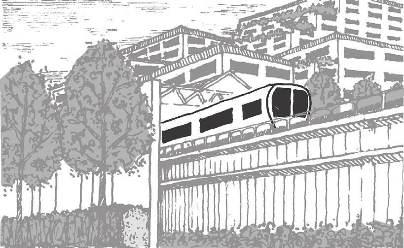
3 Greenbelt Metro Area Sector Plan - Development District Standards 165 INTRODUCTION The County Council of Prince George s County, which acts as the District Council in land use and zoning matters, has adopted the Development District Standards in this book for the Greenbelt Metro Area Development District, part of the area covered by the Greenbelt Metro Area Sector Plan. The District Council acted with the advice and technical assistance of the Prince George s County Planning Board. The Greenbelt Metro Area Development District is defined below. For Development District properties, owners and citizens will find zoning and land use regulations in the Greenbelt Metro Area Development District Standards in this chapter, the Sector Plan and Sectional Plan Amendment for the Greenbelt Metro Area, and the Prince George s County Zoning Ordinance and Subdivision Regulations. SECTOR PLAN AND DEVELOPMENT DISTRICT STANDARDS In sectional map amendment proceedings, the Planning Board reviewed and the District Council approved the zoning of each property in the Greenbelt Metro Area, including the Development District. The sector plan recommends placing a new zoning classification, the Development District Overlay Zone (DDOZ), on three of the six subareas in the sector. These subareas, the Core Area, Springhill Lake, and the Beltway Plaza/Greenbelt Road Commercial Corridor, make up the Development District, shown in maps in this book and the sector plan. The Greenbelt Metro Area Sector Plan offers a vision for the future of the Development District, with defined goals and objectives. The sector plan shows design concepts in illustrative plans for the three subareas in the Development District. Each subarea the Core Area, the Springhill Lake Transit Village, and the Beltway Plaza Greenbelt Road Commercial Corridor has its own specific recommendations for land use, transportation and civic improvements, natural features, and urban design elements. The subarea recommendations form a plan for future implementation, to develop, redevelop, and revitalize parts of the Development District. The Development District Standards implement the design concepts and recommendations for each subarea. All properties in the DDOZ have a zoning classification, R-18, C-A, C-O, C-S-C, or M-X-T, whose regulations are in the Zoning Ordinance. All DDOZ properties also have specific DDOZ regulations, the Greenbelt Metro Area Development District Standards in this book. Where Development District Standards are inconsistent with underlying zoning regulations, the standards govern development of a property. SECTOR PLAN SUMMARY This summary of the Greenbelt Metro Area Sector Plan outlines the planning principles implemented in the Development District Standards. The Preliminary Sector Plan itself should be consulted for further explanation of goals and objectives and specific recommendations for each subarea. A primary purpose of the sector plan is to maximize the public benefits from the Greenbelt Metro and MARC Station. The station represents many years of transportation planning and a major public financial investment. It connects the Greenbelt Metro Area to the many employment, shopping, recreation, and business opportunities available to users of the Metrorail and MARC rail systems. The sector plan sets out four primary goals: First, promote high-quality, compact, mixed-use development near the Greenbelt station. These uses will be oriented to pedestrians and will serve transit users, not the automobile. Second, preserve environmentally sensitive areas in balance with new development. While compact new development
4 166 Greenbelt Metro Area Sector Plan -Development District Standards Sunnyside Avenue Capital Edmonston Road Narragansett Pkwy. M Beltway Rhode Island Avenue Springhill Cherrywood Lane Drive Breezewood Ave. Drive GreenbeltRoad Kenilworth DDOZ Boundary GMAS - 1 (Superimpose DDO) 0 200' 600' 1000' DDOZ Boundary Map 36
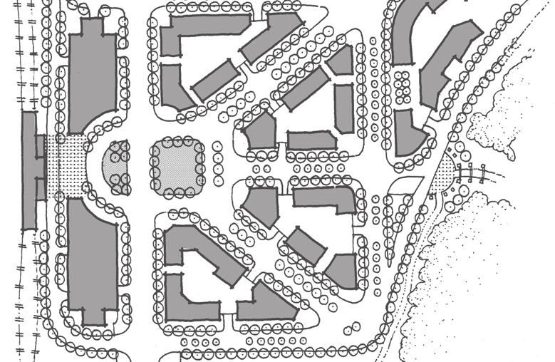
5 Greenbelt Metro Area Sector Plan - Development District Standards 167 Sunnyside 13 Avenue Edmonston Rhode Island Avenue Narragansett 17 6 CSX/Metrorail Line N O R T H C O L L E G E Pkwy. P A R K 2 16 C O R E 3 4 Capital A R E A M Cherrywood Lane Beltway Breezewood U S D A / B A R C + M E T R O S E R V I C E & I N S P E C T I O N Y A R D Drive B E L T W A Y P L A Z A 5 & 6 G R E E N B E L T R D. Greenbelt MS C O M M E R C I A L & C O R R I D O R School Board Maintenance Facility 7 8 S P R I N G H I L L L A K E T R A N S I T V I L L A G E Greenbelt Kenilworth Ave. Road 12 C A P I T A L 11 O F F I C E P A R K & F E D E R A L C O U R T H O U S E 9 10 Road Major Land Holdings 1. WMATA 2. A. H. Smith Property 3. Prince George's Scrap 4. Beltway Plaza West 5. Beltway Plaza 6. School Board Property 7. Springhill Lake 8. City of Greenbelt 9. Marriott Corporation 10. State Highway Administration 11. Capital Office Park 12. Federal Property ( Federal Courthouse) 13. Federal Property (USDA/BARC) 14. Al Huda School 15. M-NCPPC Property 16. Endelmann Property 17. City of College Park 18. Stone Industrial Company 19. Hollywood Shopping Center 0 200' 600' 1000' Sector Plan Boundary/Subareas Map 37
6 168 Greenbelt Metro Area Sector Plan -Development District Standards Sunnyside Avenue R-R R-O-S Capital O-S R-O-S Edmonston Road Rhode Island Avenue C-S-C Narragansett Pkwy. R-O-S R-O-S M M-X-T Beltway R-18 Springhill R-R Cherrywood O-S R-18 C-A Drive O-S Lane C-O C-S-C I-2 Breezewood R-18 Ave. I-1 C-S-C Greenbelt Road Drive R-R Kenilworth R-O-S O-S Zone (Reserved Open Space) Zone (Open Space) R-R Zone (Rural Residential) R-55 Zone (Single-Family Detached Residential) R-18 Zone (Multifamily Medium Density Residential) C-O C-S-C Zone (Commercial Office) C-A Zone (Ancillary Commercial) Zone (Commercial Service Center) M-X-T I-1 Zone I-2 Zone D-D-O Zone (Mixed Use - Transportation Oriented) (Light Industrial) (Heavy Industrial) Zone (Development District Overlay) Proposed Connector Road 0 200' 600' 1000' Approved Zoning Map 38
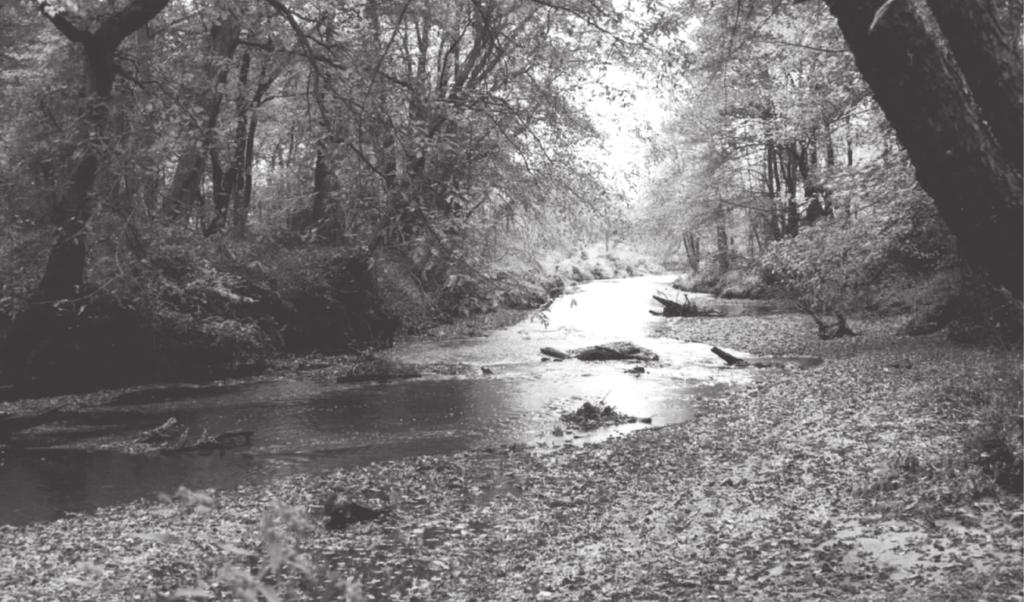
7 Greenbelt Metro Area Sector Plan - Development District Standards 169 around the Greenbelt station is desirable, it should not overwhelm the valuable woodlands and braided streams associated with Indian Creek. Third, create a network of pedestrian and bicycle connections as part of new development and redevelopment. Builders and developers should provide multiple connections among internal uses and between uses and the Greenbelt station. These connections will encourage transit ridership and lessen congestion on existing roads. Fourth, revitalize Beltway Plaza and the other commercial properties along Greenbelt Road. Revitalization in this subarea will attract new, high-quality businesses and take advantage of the prime Greenbelt Road location near the Greenbelt station. The Development District includes three subareas. The first, proposed for the most intense development, is the Core Area, which includes two development centers the North Core Area and the South Core Area. The vision for the Core Area is a compact, integrated, mixed-use development consistent with Smart Growth policy initiatives, to support transit ridership, including housing, shops, offices, public spaces, parks, and civic buildings. In the North Core Area, the sector plan proposes redevelopment of the Greenbelt station parking lot with air rights, high-intensity mixed uses, and structured parking. In the South Core Area, the sector plan proposes a medium-intensity mix of uses. A natural buffer with valuable woodlands, wetlands, and braided streams separates the North and South Core Areas. It is part of the Indian Creek Watershed and the larger Anacostia Watershed. The buffer is intended to be a natural area, a recreational and open space destination for the public. A fine-grained network for automobiles, pedestrians and bicycles is critical to the Core Area. The network will increase transit ridership, support new retail near the Greenbelt station, and enhance the quality of life. An internal road running through the natural buffer to Greenbelt Road will connect the North and South Core Areas. Strong pedestrian and bicycle links will connect the Core Area and station with Springhill Lake, Beltway Plaza, USDA/BARC, Capital Office Park, and North College Park. Springhill Lake will become a comprehensively designed transit village. Varied housing types and home ownership opportunities will replace garden apartment rental complexes, and a continuous, convenient street network will connect an integrated series of street blocks. A village center with limited retail and office uses, public uses such as day care centers and churches, and civic activity areas will define the space for social and community activities for all village residents. Rezoning with careful planning will allow these uses to redevelop Springhill Lake as a transit village, with strong links to the Greenbelt station, Core Area, and Beltway Plaza. The Beltway Plaza/Greenbelt Road Commercial Corridor needs revitalization. To maintain a strong commercial destination within the Greenbelt Metro Area, the corridor s overall appearance and spatial organization should be improved, and new high-quality office and retail development must be attracted. APPLICABILITY OF STANDARDS AND SITE PLAN REVIEW PROCESS New development in the Greenbelt Metro Area Development District is subject to detailed site plan review. Development in the Core Area and the Springhill Lake Transit Village is subject to conceptual site plan review as well. New development must show compliance with Development District Standards in the site plan review process. Under the Zoning Ordinance, development is any activity which materially affects the condition or use of land. Redevelopment, rehabilitation, and renovation of existing structure are all forms of development. A change from a lower intensity to a higher intensity use, as indicated in Table II in Section 4.7 of the Landscape Manual, is also a form of development. Development described in the exemptions below need not meet Development District Standards and is not subject to site plan review. 1. Legally existing development: Until a development proposal is submitted, all buildings, structures, and uses which were lawful and not nonconforming on the date of SMA approval are exempt from standards and site plan review, and are not nonconforming. 2. Legally existing parking and loading: Until a development proposal is submitted, all legally existing parking and loading spaces in the Development District which were lawful and not nonconforming on the date of SMA approval are exempt from the standards and site plan review, need not be reduced, and are not nonconforming. 3. Nonresidential development: An addition to a nonresidential structure which was lawful and not nonconforming on the date of SMA approval is exempt from the standards and site plan review, if the addition does not increase the gross floor area (GFA) of an existing structure smaller than 20,000 square feet by more than 10 percent or 5,000 square feet, whichever is less, or the GFA of an existing building equal to or larger than 20,000 square feet by more than 5 percent or 20,000
8 170 Greenbelt Metro Area Sector Plan -Development District Standards square feet, whichever is less. An existing shopping center larger than 750,000 square feet which was lawful and not nonconforming on the date of Sectional Map Amendment approval is exempt from the Development District Standards and site plan review, unless and until the cumulative gross floor area (GFA) of any addition(s) exceeds 20 percent of the GFA of the shopping center as of the date of approval of this SMA. 4. Multifamily development: An addition to a multifamily residential structure which was lawful and not nonconforming on the date of SMA approval is exempt from the standards and site plan review, if the addition does not increase the GFA by more than 20 percent or 10,000 square feet, whichever is less. 5. Parking facilities: Resurfacing, restriping, or adding landscaping to parking facilities not required by the standards are exempt from the standards and site plan review, if the facilities were lawful and not nonconforming on the date of SMA approval, will not add new spaces, and remain in conformance with all previously applicable regulations. 6. Nonconforming buildings, structures, and uses: a. Restoration or reconstruction of a nonconforming building or structure or a certified nonconforming use is exempt from the standards and site plan review, if it meets the requirements in Section (a)(1) of the Zoning Ordinance. b. Except for improvements listed in paragraph 8, a property owner may not expand a certified nonconforming use, or a use or structure which was lawful on the date of SMA approval but does not conform to the standards, unless a detailed site plan is approved with findings that the expansion is compatible with adjacent uses and meets the goals of the sector plan. 7. Signs: a. Permits for alteration or rehabilitation, with no increase of the existing gross floor area b. Canopies c. Fences d. Decks e. Ordinary maintenance f. Changes in occupancy 9. Plans pursuant to CB : A Conceptual Site Plan (CSP) approved by the District Council or preliminary plan of subdivision approved by the Planning Board for Metro Planned Community uses pursuant to CB prior to Council approval of the sector plan and SMA, and any Detailed Site Plan (DSP) filed thereafter which is consistent with a prior approved CSP, is not subject to the SMA s Development District Standards. SITE PLAN SUBMITTAL REQUIREMENTS For properties in the Greenbelt Metro Area Development District, site plans filed for Planning Board review should meet the general requirements in Part 3, Division 9, of the Zoning Ordinance. In addition, all site plan applications must include architectural elevations which demonstrate compliance with building design standards. USES Maps and 32 show the zoning for each subarea in the Development District. The uses allowed on property in the Greenbelt Metro Development District are the same as those allowed in a property s underlying zoning (R-18, C-A, C-O, C-S-C or M-X-T), except as modified in the permitted use tables. The permitted use tables modify the Zoning Ordinance use tables by restricting uses, normally by prohibiting a use the Zoning Ordinance permits. a. If a sign s size or height is not increased, sign refacing or replacement in kind is exempt. b. Signs in a development requiring a detailed site plan will be reviewed in the site plan process. Other signs will be reviewed in the permit review process for compliance with standards. 8. General: The following are exempt if the existing or proposed use is permitted and meets the Development District Standards for parking:
9 Greenbelt Metro Area Sector Plan - Development District Standards 171 This page intentionally blank.
10 172 Greenbelt Metro Area Sector Plan -Core Area Development District Standards U S D A/B ARC M ME T RO S E RV I C E & I N S P E C T I O N Y ARD N O RT H C O L L E G E P ARK North Core High Intensity Lane I CSX/METRO LINE South Core Medium Intensity (MI) Cherrywood S P RI N G H I L L L AK E T RAN S I T V I L L AG E South Core (MI) B E L T WAY P L AZ A Greenbelt Road T O WN O F B E RWY N H E I G H T S 0 200' 600' Proposed Mixed Use Development Existing On-Road Bike Lane Infill Opportunity Proposed Trail/Bike Lane Major Pedestrian/Bicycle Linkages Proposed Environmental Envelope Primary Gateways and Focal Points Proposed North-South Connector Major Transportation Improvement Core Area Concept Visual Linkage Proposed Buffer Map 39
11 Greenbelt Metro Area Sector Plan - Core Area Development District Standards 173 CORE AREA NORTH AND SOUTH CORE AREAS - TRANSIT-ORIENTED MIXED-USE CENTERS Urban Design Framework 1. The uses allowed in the Core Area are shown in Use Table The North and South Core Areas shall be developed as intensive, mixed-use and compact transit-supportive developments in areas where environmentally sensitive features, such as wetlands, woodlands and floodplain, will not be disturbed, except as authorized by appropriate local, state and federal environmental regulatory agencies. 3. To create a mixed-use and transit-supportive development, uses in the North and South Core Area mixed-use centers shall be combined in the manner described in the following chart: 4. Permits may be issued for no more than 50 percent of the total floor area for all commercial uses approved in the Conceptual Site Plan until at least 25 percent of the dwelling units for all residential uses have received building permits. Permits may be issued for no more than 75 percent of the total floor area for all commercial uses approved in the Conceptual Site Plan until at least 50 percent of the dwelling units for all residential uses have received building permits. 5. Uses may be mixed within the mixed-use centers (horizontal mix) and within buildings in the mixed-use centers (vertical mix). 6. Buildings and parking garages within 200 feet of the transit station platform shall be designed to provide all-weather accessibility and/or grade-separated pedestrian routes to the transit station platform. Land Use Category Core Area - Mixed-Use Centers* Residential 30-60%** Retail Commercial, Entertainment, Hotel 10-40%** Office Commercial 30-60%** Industrial*** Not Permitted *These percentages describe the totals for each mixed-use center. **The percentages listed in the chart represent the proportion of the floor area of the land use category to the total floor area of the development. The first number is the minimum percentage and the second number is the maximum percentage. ***Industrial uses are not considered a viable transit-dependent or transit-supporting land use and are not considered compatible with the pedestrian-oriented, high quality development envisioned adjacent to the Greenbelt Metro Sector Area. Application of the Development District Overlay Zone can eliminate/restrict certain industrial uses in the Core Area


12 174 Greenbelt Metro Area Sector Plan -Core Area Development District Standards Office Commercial Residential Horizontal mix of land uses. EXEC CON Office Retail PARK DO Off. Off. Off. Retail Off. Vertical mix of land uses. Several land uses are contained within the same building footprint. 7. Retail uses shall be located on the ground floor in a minimum of 50 percent of all commercial and residential buildings in the North Core Area. 8. Medium- and high-density housing shall be provided in the North and South Core Areas, with a mix of both rental and home-ownership-based housing options. 9. The maximum lot coverage for any buildings containing multifamily uses shall be 70 percent of the net lot area. Residential Residential Residential Residential Entry Office/Retail Entry Office/Retail Parking Parking Retail uses on the ground floor. Residential uses are a key component of a mixed-use development and help sustain a 24-hour environment. Examples of medium- and high-density housing.


13 Greenbelt Metro Area Sector Plan - Core Area Development District Standards 175 The remaining area shall be used for green area, parks or other public gathering/activity space. 10.Civic spaces, including plazas and village greens, shall be integrated and prominently located in the mixed-use centers in a manner that provides convenient pedestrian access and enhances the overall quality of the development. Each mixed-use center shall designate a minimum of 10 percent of the net tract area for civic uses, excluding road rights-of-way, including plazas and village greens. The civic space requirement shall not fulfill the requirement for recreation space elsewhere in the mixed-use centers. Lane to link the station site and the associated mixed-use center development with the Springhill Lake community. This gateway and pedestrian walkway shall visually and functionally link the two areas and shall be sensitively designed, constructed and integrated with the surrounding existing environmental features. Focal points shall be created at the terminal ends of this walkway. Landscape plantings, public art, site furniture, special paving, pedestrian lighting, signs and/or other design elements shall be utilized to emphasize these focal points, and transition into the North Core Area mixed-use development. The focal points shall serve as a public gathering/activity place. The promenade and focal points shall be part of the North Core Area development scheme. Ownership and maintenance agreements (contingent on state approval if the promenade crosses state-owned land) shall be specified at To Greenbelt Metro Station This building is prominently sited at the terminus of a vista and is accented with a public open space in the building foreground. Springhill Lake Transit Village Example of possible focal point/gateway at the intersection of Cherrywood Lane and Springhill Drive. Buildings can be sited to create plazas or other public gathering spaces to enhance the pedestrian environment. This plaza functions as an outside dining area for a nearby restaurant and is accented with a fountain. 11.Recreation facilities, such as play equipment, tot lots, gyms and/or courts shall be provided to meet the recreational needs of residents in the Core Area. Types, quantities and locations of recreation facilities shall be delineated on the Conceptual Site Plan. 12.A gateway and pedestrian promenade shall be established near the intersection of Springhill Drive and Cherrywood View of pedestrian promenade through Environmental Envelope to North Core Area.
 of any kind in the Core Area. Building Orientation and Setbacks 1.")


14 176 Greenbelt Metro Area Sector Plan -Core Area Development District Standards the time of Detailed Site Plan review for the terminus area/focal point within the North Core Area. This promenade shall be constructed prior to release of building permits for more than 750,000 square feet of gross floor area (GFA) of any kind in the Core Area. Building Orientation and Setbacks 1. A front build-to line between 14 and 20 feet from the back of the curb shall be established for all buildings in the mixed-use centers, including commercial, residential and vertical-mixed use buildings. This shall be in accordance with the illustrative street sections shown in Street Configuration and Design to create a compact development and continuous street edge. The commercial landscape strip requirements in the Landscape Manual shall be waived along the internal Core Area streets. Up to an additional 5 feet may be permitted if additional space is necessary to accommodate outside dining areas or other public activities. Sidewalk Building setbacks. Bike Lane Median R-O-W Parking 2. The primary facades of commercial and mixed-use buildings shall contain the primary building entrance and face the street, plaza or village green. Prominent entrances are encouraged for architectural interest and as an element of scale and orientation. Similarly, primary residential entries shall face the street to encourage pedestrian activity and create social and safe neighborhoods. 3. Building entrances shall connect to sidewalks and parking areas with pedestrian walkways. Building Height 1. In the North Core Area, building heights shall generally range from 4 to 10 stories, with a maximum height of 140 feet from finished grade, except landmark buildings, which may rise to 12 stories, with a maximum height of 165 feet from finished grade. The siting of these taller buildings shall be guided by the Maximum Height Zone to respect the scale of the adjacent residential neighborhoods. A consistent street edge is maintained when buildings front directly onto the sidewalk rather than behind an excessively wide setback from the curb. In the South Core Area, building heights shall generally range from 2 to 5 stories, with a maximum height of 70 feet from finished grade. Additional building height for either area may be granted if the developer submits an analysis of the following information for review and approval by the Planning Board, or Height Transition Zone Maximum Height Zone Height Transition Zone H o l l y w o o d C o m m u n I t y Metro Platform stories Cherrywood Lane 1400 Building heights transition up from the outer edges into a central Maximum Height Zone to reduce negative effects on existing surrounding neighborhoods and create a focal point in the development.
15 Greenbelt Metro Area Sector Plan - Core Area Development District Standards 177 other information the Planning Board deems necessary, including: a. A study to demonstrate that the additional height will have no significant impact on the surrounding communities in regard to views, vistas, light, air and shadow effects. (Computer simulation is strongly encouraged). b. A submission indicating how Core Area buildings will be architecturally articulated with high-quality materials, including the use of colors, patterns and textures. Height Justification Required 10 Stories d. A submission describing additional public amenities provided, such as additional civic space. 2. North Core Area building heights shall taper upward from the outer edges of a generally defined Height Transition Zone and into a Maximum Height Zone to achieve a concentrated center encompassed by high quality architectural form and character and to provide compatibility with the surrounding communities, particularly the well-established, low-density North College Park residential community and the Springhill Lake community. Architectural Design 1. Buildings shall be designed with compatible massing, scale and heights with adjacent structures and sensitivity to surrounding communities. 2. Roof forms shall be designed to create interest especially when viewed from the Beltway and the surrounding communities. 3. Roof lines shall be varied, where appropriate, through the use of pediments, parapets, lanterns, cupolas or other architectural features. By terracing building facades, building heights may increase without creating a solid massing and overwhelming the pedestrian. Also, terrace levels create opportunities for landscape plantings to visually soften buildings, reduce glare and provide shade to interior spaces. c. A submission indicating the use of varied architectural and building forms, such as terracing, to create visual variety and interest. Terrace levels may be landscaped to reduce the impact of the building edges and to minimize reflections and glare. Height Transition Zone Streets with activities and shop fronts help to encourage pedestrian traffic and support a park-once environment. Maximum Height Zone N o r t h C o l l e g e P a r k M Capital Beltway I-95/495 A A1 4. Building facades shall be varied and articulated to provide visual interest and enhance the street edge by utilizing elements such as arcades, porches, bay windows, display cases, balconies, architectural details, and/or other projections/recesses. Building height zones. S p r i n g h i l l L a k e T r a n s i t V i l l a g e 5. Building fenestration such as entrances and windows shall be compatible on each structure and shall reflect a pedestrian scale. Individual punched or framed windows are recommended. Buildings designed with ribbons or


16 178 Greenbelt Metro Area Sector Plan -Core Area Development District Standards SH P SHOP OB& S DR G U J LiQUOR Multiple ground-level entrances with colorful signs, storefront windows and wide sidewalks encourage pedestrians and enhance the street edge. Appropriate building articulation. Inappropriate building articulation. bands of glass divided by precast concrete panels are also acceptable. Buildings designed entirely with ribbons or bands of glass at the ground-level shall be avoided. 6. Large blank building walls are not permitted when facing public areas, such as streets, parking lots or zones of pedestrian activity. 7. Buildings located at corners and/or intersections shall utilize special architectural elements to frame the intersection, such as corner entrances and vertical architectural elements. 8. All mechanical equipment shall be screened from view, including equipment on roof areas. Screening shall be a natural extension of the building walls or roofing and constructed of the same building materials. 9. All antennas and dishes, either on buildings or freestanding, shall be located as inconspicuously as possible and shall either be screened from view from streets and pedestrian areas (in the case of dishes) or designed and painted to blend into their surroundings, to the degree possible. 10.Durable and attractive high-quality materials shall be used on all buildings within the Core Area. Exterior building materials such as tinted or textured precast concrete, brick, stone, iron and steel are recommended. Imitation or synthetic exterior building materials which simulate the appearance of stone or brick shall be avoided. Projections and Recesses 1. Awnings and canopies shall be utilized, in appropriate locations, at street level entrances and windows to indicate retail and office entrances and enrich the street edge. 2. Awnings and canopies may project up to five feet beyond the building edge, but shall be at least eight feet above the sidewalk to avoid obstacles in the pedestrian space.
 shall be used in the mixed-use centers.")


17 Greenbelt Metro Area Sector Plan - Core Area Development District Standards 179 information the Planning Board requires, for all signs in the mixed-use centers, including freestanding/monument and individual office/retail tenant signs. Freestanding or Monument Signs 2. Freestanding or monument signs (signs mounted directly on a solid base) shall be used in the mixed-use centers. Pole-mounted and pylon signs are not permitted. Awnings display the business logo, provide shelter from the weather and add color to the building facade. Monument signs simply announce development areas, offices, retailers or residential areas. A monument sign could effectively be used at the Core Area gateways to direct people into the development. This arcade directs pedestrians and provides an all-weather and convenient access to shops and parking. 3. The placement of awnings and their style, coloring and size shall complement the architectural style and character of the building. 4. A building s first floor may be recessed from the front setback to provide a pedestrian arcade/colonnade or port-cochère at the primary building entrance. The arcade/colonnade or port-cochère shall have a vertical clearance of 10 feet or more. Signs General 1. Prior to or concurrent with submission of the first Detailed Site Plan for the Core Area, a Common Sign Plan shall be submitted for approval by the Planning Board. It shall include plans, sketches and/or photographs indicating the location, quantity, design, materials, overall size, letter size, methods of sign attachment, illumination and other 3. Freestanding or monument signs shall be used to designate the gateway entrances into the Core Area and shall be strategically located for visibility from both sides of the right-of-way. Gateway signs shall be consistent with Section of the Zoning Ordinance. 4. The height of freestanding/monument exterior signs for existing retail establishments shall not exceed 25 feet. The height of freestanding/monument exterior signs for new development shall not exceed eight feet. A coordinated sign program for the entire development with a directional sign(s) on the nearby major highways shall be encouraged.
 located in an integrated shopping center,")


18 180 Greenbelt Metro Area Sector Plan -Core Area Development District Standards 5. The area of the freestanding signs shall not exceed 1 square foot for each 2 linear feet of street frontage, to a maximum of 100 square feet for buildings(s) located in an integrated shopping center, other commercial center with 3 or more businesses served by common and immediate off-street parking and loading facilities, or an office building complex, as modified from Section (c). The street frontage shall be measured on the property occupied by the center or complex associated with the sign. 6. The quantity of freestanding signs shall be equal to or less than the amount permitted by Section (d) of the Zoning Ordinance. Individual Commercial Tenant Signs Attached to a Building or Canopy 7. Signature or major user facade signs shall be placed near the roof line of the building. One sign per building is permitted except where building recognition is required from These tenant signs are visible, utilize the retailers styles and logos, and complement the storefront designs. height and width of the building face to which it is attached. 11.Commercial tenants (businesses) fronting streets, and with an exterior facade, shall be limited to one sign per tenant to avoid overcrowding and cluttering the building facade. 12.Retail tenants may display product signs inside ground-level windows. Signs shall be placed in an orderly manner and shall not obscure the interior view of a business/retail establishment. Corporate or logo signs should be visible from long distances; however, signs should remain compatible in character with the overall building and site designs. 13.Buildings with multiple tenants shall provide space at the ground level for upper-story tenant identification, such as the use of a consolidated wall-mounted plaque(s), located outside the main building entrances to direct visitors, employees and shoppers. different vantage points and the two signs are not visible at the same time from any of those points. 8. Roof-mounted signs and signs protruding above parapet walls or the roof line shall not be permitted. 9. Building signs shall be simply designed, contain a minimum amount of information and have a maximum of three colors. Building signs that are excessively elaborate, oversized in proportions, or use poor quality materials are not permitted. 10.Tenant signs shall be located in a designated sign field, or other suitable space, that has been provided as part of the overall architectural design. Wall signs shall be placed in the zone of the facade which is directly above the storefront. The size of the sign shall be in proportion to the Multimodal streets safely accommodate all types of users and are enhanced with site furnishings such as sheltered bus stops, bike racks, seating, street lights, paved crosswalks and street trees.
19 Greenbelt Metro Area Sector Plan - Core Area Development District Standards 181 Sidewalk Bike Lane Median Travel Lanes' Parking Sidewalk Boulevard R-O-W Sidewalk Median Parking Sidewalk Commercial Street R-O-W (Optional Bike Lanes) Note: The streetscape sections above are based on the illustrative concept of a modified grid street pattern recommended for the Core Area. The appropriateness of the sections including the number of lanes will depend on the ultimate density and intensity yields, and are subject to review and approval by Prince George's County DPW&T and referral and review by the City of Greenbelt for affected rights-of-way. Street Configuration and Design 1. The mixed-use centers shall be developed as a network of interconnected streets designed to a pedestrian scale. Unconnected streets with dead-end streets or cul-de-sacs shall be generally avoided, except where site layout, topography, barriers such as highways or railroad rights-of-way limit full street extensions. 2. The hierarchy of street rights-of-way shall depend on street function and classification. Rights-of-way ranging from 74 to 120 feet wide shall be provided to accommodate various street elements, such as 14- to 20-foot wide sidewalks for heavy pedestrian traffic, 8-foot wide on-street parallel parking bays, 5-foot wide bike lanes, 11-foot wide travel lanes, and minimum of 12-foot wide landscaped medians. The final street sections shall be developed in consultation with DPW&T. Roadway standards with suggested right-of-way dimensions and elements are recommended for all streets, public and private. 3. Sidewalks 14 to 20 feet wide shall be provided on both sides of streets and shall be designed with special paving, street trees, street furniture and pedestrian lighting, with approval from DPW&T. Street trees shall be provided along all streets (see Landscape Plantings). 4. On streets with on-street parking, intersections shall be narrowed, with approval from DPW&T, to create a shorter crosswalk area and provide increased visibility for pedestrian and bicyclists. 5. The north-south connector road between Greenbelt Road and the Core Area development centers shall be designed to accommodate vehicular, pedestrian, bicycle and transit access, with a right-of-way ranging between 80 and 100 feet wide with approval from DPW&T.

 Bike/Pedestrian Trail 12' Travel Lane Shoulder HOV/T' HOV/T' lanes Travel Lane")
 shall be utilized for access to nonresidential property, wherever feasible, instead of individual entry points to each property or parking area.")


20 182 Greenbelt Metro Area Sector Plan -Core Area Development District Standards Plan view of a typical crosswalk with a narrowed intersection By narrowing the curb width at crosswalks, pedestrian safety is improved because pedestrians are more visible and the crossing time is quicker. Bike/Pedestrian Trail Travel Lanes' HOV/T' Travel Lanes' 12' 5' 11' 11' 3' 16' 3' 11' 11' 5' North-South Connector ' R-O-W (4 vehicular lanes & 1 HOV/T reversible lane) Bike/Pedestrian Trail 12' 6' 11' 3' 16' 3' 11' 6' 12' North-South Connector -8 80' R-O-W (2 vehicular lanes & 1 reversible HOV/T lane) Bike/Pedestrian Trail 12' Travel Lane Shoulder HOV/T' HOV/T' lanes Travel Lane Shoulder Bike/Pedestrian Trail North-South Connector -8 80' R-O-W 80' R-O-W (2 HOV/T lanes) Bike/Pedestrian Trail 6' 8' 14' 14' 8' 6' 12' Bike/Pedestrian Trail 6. Common, shared entrances (curb cuts) shall be utilized for access to nonresidential property, wherever feasible, instead of individual entry points to each property or parking area. The amount of curb cuts used shall be minimized. 12' Parking and Loading 1. A parking schedule shall be submitted at the time of Detailed Site Plan review. The amount of parking spaces required in the North and South Core mixed-use centers shall be calculated using the parking schedules for each proposed use described in the Zoning Ordinance. This amount shall be considered the maximum quantity allowed except for office uses, for which the maximum quantity shall be 75 percent of this quantity. No less than 50 percent of the maximum quantity shall be provided for all uses. 2. Structured parking shall be provided within the North Core Area to maximize developable areas for high-intensity uses and minimize disturbance of environmentally sensitive areas. In the North Core Area, structured parking shall accommodate at least 75 percent of the total parking spaces provided. (WMATA requires parking replacement, one-to-one, of the current parking on site). 3. Shared parking facilities are permitted in the Core Area for adjacent uses with staggered periods of demand, such as retail, office and entertainment uses. Joint parking areas shall be conveniently located to all uses. 4. Off-street parking lots and garages shall not be the dominant visual feature of the street edge, interrupt the pedestrian route, or negatively impact vistas to and from surrounding areas. Parking areas shall be generally located to the rear or side of buildings, below grade, or in a parking structure, except for short-term convenience parking. Parking lots shall not be the primary use of corner lots in the mixed-use centers.
21 Greenbelt Metro Area Sector Plan - Core Area Development District Standards 183 Major PARKING Major Street Street PARKING 7. On-street parking shall be provided, subject to approval by DPW&T, to promote street level access to buildings and amenities and provide additional short-term parking facilities. The number of on-street parking spaces directly adjacent to the retail, office or public uses may be counted toward the required number of parking spaces. Major Street 8. Adequate space for the loading and unloading of persons, goods and trash recycling shall be provided in the mixed-use centers. The number of loading spaces shall be consistent with Section of the Zoning Ordinance. Parking lots located to the side or rear of a parcel help maintain a consistent street wall and reduce the visibility of parked vehicles. 5. Off-street surface parking lots shall be separated from walkways by landscaped screening, low-profile walls, or decorative fencing (see Landscape Plantings, Screening and Buffers). 6. Parking garages shall incorporate architectural design or landscape features to screen parked vehicles from passing pedestrians and motorists. Parking structures shall be architecturally compatible with surrounding or adjacent structures in material, style and detail. Parking garages shall either be located in peripheral locations or shall provide retail uses on the first floor of street-side edges in high-pedestrian traffic areas. Parking garages shall be designed as part of other buildings where architecturally feasible with limited street frontage and integrated to blend into the building s appearance. This well-screened parking garage with ground-level retail uses has interesting storefront windows and is articulated with horizontal openings parallel to the street. Office/Retail PREFERRED DISCOURAGED At the ground level, retail or office use should typically be provided to maintain an interesting walkway for pedestsrians with parking spaces provided at the rear.
 enhance buildings, roadways, open spaces, public activity areas, walkways; (2) create vistas; (3) define spaces; and (4)")

22 184 Greenbelt Metro Area Sector Plan -Core Area Development District Standards Landscape Plantings, Buffers and Screening 1. Landscape plantings shall be provided throughout the mixed-use centers to: (1) enhance buildings, roadways, open spaces, public activity areas, walkways; (2) create vistas; (3) define spaces; and (4) screen and/or buffer undesirable or incompatible views or activities. 2. A conceptual landscape plan showing the general location, type and quantity of plant material shall be submitted as a component of the Conceptual Site Plan. A final landscape plan showing final location, type, size and quantity of plant material shall be submitted as a component of the Detailed Site Plan. 3. The bufferyard requirements within the mixed-use centers shall be reduced to facilitate a compact form of development compatible with the proposed urban character of the areas surrounding the Greenbelt Metro Station. The minimum bufferyard requirements for incompatible uses in Section 4.7 of the Landscape Manual shall be reduced by 50 percent within the mixed-use centers. Alternative compliance shall not be required for this reduction. A six-foot-high opaque masonry wall or other opaque screening treatment shall be provided in conjunction with the reduced width of the bufferyard between residential and commercial uses. The plant units required per 100 linear feet of property line or right-of-way shall also be reduced by 50 percent. street trees in the mixed-use centers. A limited tree and plant palette shall be selected to provide consistency, uniformity and a distinct identity to the roads within the mixed-use centers. One tree species shall be selected for use as the street tree along each roadway within the centers. Street trees shall be installed at a minimum height of 12 feet and 2½-inch caliper. Street tree plantings shall be consistent with the Landscape Manual. 5. In the mixed-use centers, street trees shall be planted in tree pits a minimum of six feet by eight feet with the longer dimension parallel to the curb. Tree pits shall be a minimum of four feet deep. Structural soil, suspended sidewalks, or other methods to connect the soil volumes below the sidewalk paving so that space reserved for the tree roots can be shared, shall be utilized to provide adequate space for tree root expansion. Sidewalks and street tree plantings shall be designed in consultation with appropriate public agencies such as DPW&T and the State Highway Administration. In residential areas, a continuous green strip shall abut the curb. This strip shall be planted with street trees and either grass or other appropriate groundcovers, low shrubs or hedge material and shall be a minimum of six feet wide. These deviations shall be generally outlined during the Conceptual Site Plan review and will be reviewed and approved in detail during the time of Detailed Site Plan. 4. Street trees shall be used along the sides of all roadways within the Core Area to define the street edge, provide a shaded overhead canopy and establish a rhythmic, unifying element to the street environment. A variety of medium and large deciduous shade trees shall be utilized for Tree pit with groundcover. 6. Parking lots shall comply with the Perimeter Landscape and Interior Planting requirements of the Landscape Manual. Tree pit with raised curb and groundcover. 7. Parking lots/spaces which are located adjacent to the right-of-way line or curb edge due to site constraints shall be screened from adjacent roadways and public areas with a continuous, low masonry wall in compliance with the Parking Lot Landscape Strip, Option 4, requirements in the Landscape Manual.


23 Greenbelt Metro Area Sector Plan - Core Area Development District Standards 185 Street Furniture 1. Street furniture shall be consistent in style, quality and character. Street furniture shall be constructed of durable and high quality materials and require minimal maintenance. Parked cars are screened from public view with low masonry walls. The wall shall be between 36 and 42 inches in height and be faced on both sides with a masonry veneer. Unfinished concrete block or poured-in place concrete are not acceptable materials. The low masonry wall shall be compatible in materials and design with nearby buildings. Low shrubs and groundcover plantings, with a maximum growing height of 24 inches, may be planted in front of the wall between shade trees to form a continuous hedge. 8. Loading/unloading areas, dumpsters or other trash collection areas, utility and/or mechanical equipment, or any other similar areas, shall be screened from public view by utilizing sight-tight fencing or walls and/or evergreen screens compliant with the Screening Requirements in the Landscape Manual. Site furnishings, such as these pedestrian lights, bike racks, benches and trash receptacles, are important to keep the streetscape clean, safe and pleasant for pedestrian traffic. 2. Street furniture, including bicycle racks, shall be placed at strategic locations, such as bus stops, public plazas or high pedestrian traffic areas, along trails, and within retail/commercial activity zones. 3. Prior to or concurrent with the first Detailed Site Plan submission, the Planning Board shall approve consistent styles and designs for the street furniture for all future development in each of the mixed-use centers. This furniture shall include, but is not limited to, benches, trash receptacles, bicycle racks, light fixtures, banners, bus shelters, kiosks, planters and bollards. 4. Street lighting shall be consistent in style, quality and character and shall complement, in fixture selection and scale, the pedestrian emphasis of the sector plan. Noise Mitigation Trash receptacles are well screened behind this masonry wall and wood fence combination. 9. Chain-link fencing (of any type), corrugated metal, corrugated fiberglass, sheet metal or wire mesh shall not be used as a screening material. Barbed wire shall not be permitted. 1. Noise and vibration studies determined to be necessary by the Environmental Planning Section of the Prince George s County Planning Department shall be reviewed and approved at the time of Conceptual Site Plan. Appropriate noise mitigation shall be provided for any new development proposals in the Core Area and shall be described at the time of Detailed Site Plan review. Noise levels shall be within the allowable range for each land use proposed on-site.

24 186 Greenbelt Metro Area Sector Plan -Core Area Development District Standards 2. Structures located within the noise corridors designated by the noise studies shall provide acceptable attenuation measures and design features to bring the structure into compliance with state standards. 3. All buildings within the Core Area shall be designed with acoustical design techniques to absorb vibrations and noise from the railroad. and pedestrian/bicycle linkages or vehicular connections, such as the north-south connector road. 3. Vistas into the Environmental Envelope and PCMA from strategic locations in the mixed-use centers shall be provided. Utilities 1. Utility lines, such as electrical, fiber optic, cable and telephone lines shall be located underground in new or redevelopment areas to minimize visual clutter and improve the appearance of the Core Area. 2. All above-ground utility elements, such as transformer boxes, shall be located away from or screened from public view. Stormwater Management 1. Stormwater detention and water quality facilities shall be provided outside of the Preservation and Conservation Management Area (PCMA). These facilities shall be installed within the mixed-use centers and use biological retention and filtration techniques, whenever feasible. 2. The culvert systems carrying Indian Creek under the Capital Beltway and Greenbelt Road shall be restored, enhanced or engineered to allow wildlife and fish passage in and out of the Core Area. The responsibility, timing and maintenance for these improvements shall be determined at the time of Conceptual Site Plan review. The designs for restoration shall be reviewed at the time of Detailed Site Plan review for parcels including or adjacent to the culverts. The small tributary streams and other drainage entering the property from adjacent communities shall be evaluated for hydrologic functions and wildlife passage at the time of Detailed Site Plan review. ENVIRONMENTAL ENVELOPE Framework 1. A detailed Natural Resources Inventory (NRI) shall be submitted for any development proposals in the Core Area. The NRI shall include, but not be limited to, the 100-year floodplain, jurisdictional wetlands, streams, forest stands and Rare, Threatened and Endangered Species (RTEs). Soils and geotechnical studies will be required on a case-by-case basis. 2. Development proposals for the mixed-use centers in the Core Area shall not disrupt or disturb the PCMA except for passive recreation activities such as low-impact trails This building is positioned to limit environmental disturbance and to provide vistas of the surrounding open space. Mitigation 1. Impacts to the Environmental Envelope, especially the PCMA, shall be avoided. Any impacts proposed to environmentally sensitive features will require the applicable evaluation and permits by regulatory agencies. 2. If mitigation is permitted by regulatory agencies, every attempt shall be made to mitigate disturbances to the Environmental Envelope within the Core Area, the Sector Plan Area or Indian Creek Watershed, in that order of priority. Road Crossings 1. Road crossings and other encroachments from the built environment across or into the Environmental Envelope shall be avoided or minimized. 2. Roads or infrastructure crossings through the Environmental Envelope shall be constructed as narrowly as possible and cross streams at the narrowest point to limit the area of disturbance while still meeting transportation needs, and utilize environmentally sensitive design and construction techniques. 3. Roads that cross streams or wetland systems shall be designed with oversized culverts or other devices or techniques to maintain wildlife corridors, maintain hydrologic function and allow for hiker, biker and equestrian passage where appropriate.


25 Greenbelt Metro Area Sector Plan - Core Area Development District Standards Roadways shall be elevated where necessary to limit disturbance of environmentally sensitive features, such as wetlands. Buffers 1. Preservation areas or landscaped buffers shall be provided at the edge of mixed-used centers to transition development into the Environmental Envelope. Afforestation or reforestation plantings shall be consistent with the Woodland Conservation and Tree Preservation Ordinance. 1. Trails for hiker, biker and equestrian use shall be provided through the Environmental Envelope to serve recreational purposes and link to local and regional trails. A recreational/scenic stream valley trail shall be constructed in the Core Area to extend the Indian Creek Trail north to the station site and beyond. This trail shall connect to the pedestrian promenade proposed to link Springhill Lake and the station site. From Greenbelt Road, the Indian Creek Stream Valley Trail shall generally follow along Indian Creek, then meander north to the station site, avoiding environmentally sensitive areas. This trail shall be developed as a loop trail, bordering the edges of the Environmental Envelope, and provide access to both the eastern and western portions of the Core Area. An alignment parallel to and abutting the north-south connector road may be necessary to minimize disturbance of environmentally sensitive features and limit the construction of bridge crossings. The responsibility, timing and maintenance of this trail shall be determined at the time of Conceptual Site Plan review. The trail designs shall be reviewed at the time of Detailed Site Plan review for the north-south connector road and shall include details on connections with the pedestrian promenade. This trail shall be constructed prior to the release of building permits for more than 750,000 square feet of gross floor area (GFA) of any kind in the Core Area. 2. Similar to vehicular crossings, trails shall cross streams and wetlands at the narrowest point when possible when avoidance is not possible. 2. A 50-foot minimum wooded or vegetated buffer shall be maintained adjacent to streams, wetlands and floodplain. Trails Provide elevated walkways, where necessary, to avoid disturbing streams and wetlands. 3. Bike trails shall be constructed with stable and impervious materials, unless a trail is proposed in an environmentally sensitive area. Paving materials shall be carefully selected to avoid altering runoff and to minimize disturbance during construction. Where trails cross wetlands, streams or floodplain, boardwalks shall be used. Unpaved trails, such as stone dust on a compacted base, may be used in areas with lower volumes of traffic. 4. The main Indian Creek Stream Valley Trail shall be a minimum of 10 feet wide, with approval from the M-NCPPC Prince George s County Department of Parks and Recreation. Spur trail widths shall range from 6 to 10 feet wide to allow safe passage for all trail users. High traffic areas shall be constructed a minimum of 10 feet wide. Landscape Plantings 1. Efforts shall be made to retain the existing vegetation and maintain existing wildlife habitat, wherever possible. In the South Core area, the Indian Creek Trail may serve as a riverwalk, a pedestrian avenue that is fronted by commercial uses, and still provide adequate space for bicycle users. 2. Native plant material shall be used for planting projects within or adjacent to the Environmental Envelope.
26 188 Greenbelt Metro Area Sector Plan -Core Area Development District Standards 10 min. Clear Travel Lanes' 5 min. Shared pathway with stable material 10 minimum. Mowed strip for equestrian trail Edge of environmental envelope Multiuse trail. Restoration of Degraded Areas 1. The cement dump site in the South Core Area shall be removed. 2. Invasive Phragmites species shall be removed from areas near the old wash and settling ponds.
27 Greenbelt Metro Area Sector Plan - Core Area Development District Standards 189 This page is intentionally blank.
28 190 Greenbelt Metro Area Sector Plan -Springhill Lake Development District Standards M C O RE ARE A Capital Beltway I-95/495 C AP I T AL O F F I C E P ARK Cherrywood Lane Breezewood B E L T WAY P L AZ A Drive Kenilworth Avenue Proposed Residential Redevelopment Environmental Envelope/Open Space Existing Primary School Existing On-Road Bike Lane Proposed Trail/Bike Lane Visual Linkage Major Pedestrian/Bicycle Linkages Proposed Road Proposed Buffer/Sound Barrier Primary Gateways and Focal Points 0 200' 600' Springhill Lake Transit Village Concept Map40
 or within buildings in the village center (vertical mix). 3.")

29 Greenbelt Metro Area Sector Plan - Springhill Lake Development District Standards 191 SPRINGHILL LAKE Village Design Framework 1. Residential uses permitted in this area are included in Use Table Uses may be mixed within Springhill Lake (horizontal mix) or within buildings in the village center (vertical mix). 3. Accessory buildings may be provided and may accommodate auxiliary rental units. Accessory buildings shall be consistent with Table VIII of Part 5 of the Zoning Ordinance, except building height. See Building Heights. 4. The bedroom percentages for multifamily dwellings shall be consistent with Section of the Zoning Ordinance. Single-family detached on a small lot. Housing Intensity and Types 1. A range of residential unit types on a variety of lot sizes shall be provided, including a mix of rental and ownership-based housing options, and shall be mixed as much as possible throughout the entire community to create a random pattern of a traditional neighborhood. 2. A mixture of the following dwelling unit types shall be provided in the Springhill Lake community, in addition to the residential dwelling units over commercial uses in the village center: Narrow Lot Line (Small-Lot): One-family detached dwelling on lots ranging from 5,000 to 8,000 square feet with small front and side yards. Duplex: One-family semi-detached dwelling on lots of at least 4,500 square feet per unit. Townhouse: One-family attached dwelling units on lots of at least 1,800 square feet. Single-family attached/quadraplex. Stacked Townhouse: Multifamily attached dwelling units with units ranging from 1,200 to 1,500 square feet in total size. Multifamily: Buildings containing multiple dwelling units, consistent with the permitted density and building height requirements in the Zoning Ordinance.
 (2) (5) (1)")
 Mid-rise apartments/condominiums.")


30 192 Greenbelt Metro Area Sector Plan -Springhill Lake Development District Standards (1) (2) (5) (1) Townhouse. (2) Stacked townhouse/condominiums. (3) Mid-rise apartments/condominiums. (4) Mid-rise apartments/condominiums (5) High-rise apartments/condominiums. The specific residential mix shall be determined at the time of Conceptual Site Plan review. 3. Residential densities of each dwelling type shall be consistent with Part 5 of the Zoning Ordinance. (3) Residential Building Orientation and Setbacks 1. Residential dwellings shall front onto public streets, whenever possible, or public open spaces and parks. (4) An example of diverse street elements.
31 Greenbelt Metro Area Sector Plan - Springhill Lake Development District Standards min. STREET Grass strip with shade trees - 6 min. Sidewalk - 5 min min. ALLEY R-O-W Single-family Detached Dwelling 5 min Build-to lines for single-family detached dwellings. Sidewalk - 5 min. Grass strip with shade trees - 6 min. R-O-W
32 194 Greenbelt Metro Area Sector Plan -Springhill Lake Development District Standards ALLEY 20 min min. Grass strip with shade trees - 6 min. Sidewalk - 5 min. STREET Upper unit Second Floor Upper unit First Floor Lower unit Second Floor Townhouse Dwelling R-O-W Lower unit First Floor Stacked Townhouse Dwelling Grass strip with shade trees - 6 min. Sidewalk- 5 min Build-to lines for townhouses. 2. A build-to line between 15 and 25 feet from the right-of-way shall be established for single-family detached dwellings in Springhill Lake. 3. A build-to line between 5 and 15 feet from the right-of-way shall be established for townhouses, stacked townhouses, one-family semi-detached and triple-attached dwellings in Springhill Lake. 4. A build-to line between 10 and 20 feet from the right-of-way shall be established for multifamily dwellings in Springhill Lake.
33 Greenbelt Metro Area Sector Plan - Springhill Lake Development District Standards R-O-W Multifamily Dwellings Sidewalk - 5 min. Grass strip with shade trees - 6 min. Build-to line for multifamily dwellings. 5. A build-to line between 25 and 60 feet from the right-of-way shall be established for any residential buildings that face Cherrywood Lane to allow adequate space for a service lane, perimeter walls and/or landscape plantings. 6. The front facade of residential dwellings may protrude beyond the build-to line a maximum of five feet to accommodate steps, porches or stoops. On corner lots, steps, porches or stoops may protrude beyond the build-to line a maximum of five feet. Bay windows, oriels, entrances or vestibules may project up to three feet beyond the front, side or rear building lines if the projection is not more than 10 feet long (measured along the building). Balconies shall be an integral part of the overall architectural design and shall not protrude more than four feet beyond the adjacent wall. Cornices, eaves and other architectural projections/recesses shall be consistent with Section of the Zoning Ordinance. 7. No more than three continuous, attached dwellings may have the same setback. Variations in setbacks shall be 12 to 24 inches from the adjacent front facade. 8. To facilitate a compact form of development, single-family detached dwellings shall be a distance of 10 and 20 feet apart, measured from side wall to side wall. Townhouses, stacked townhouses and other one-family semi-detached or attached dwelling buildings shall be a distance of 12 to 20 feet apart, measured from side wall to side wall. Unattached multifamily buildings shall be a distance of 20 to 30 feet apart, measured from side wall to side wall. 9. Rear yard setbacks shall be a minimum of 15 feet from the rear property line, except for alley-accessed garages and accessory buildings, where the minimum setback shall be 5 feet. 10.Residential streets shall not be dominated by garages. Garages shall be setback from the front build-to line or located in the rear lot to reduce their visual impact. Garages for single-family detached or semi-detached dwellings may be: (1) attached and recessed from the front building line a minimum of eight feet; or (2) attached or detached and located in the rear yard, and accessed by either an alley or a side yard driveway. In either case, no more than 50 percent of the single-family detached or semi-detached dwellings combined shall have front-loaded garages.


34 196 Greenbelt Metro Area Sector Plan -Springhill Lake Development District Standards be 70 percent. The maximum lot coverage for multifamily dwelling units shall be 70 percent. 15.The bufferyard requirements throughout Springhill Lake shall be reduced to facilitate a compact form of development and concentrate public open spaces. The minimum bufferyard requirements for incompatible uses in the Landscape Manual shall be reduced by 50 percent. Alternative Compliance shall not be required for this reduction. A six-foot-high, opaque masonry wall or other opaque screening treatment shall be provided in conjunction with the reduced width of the bufferyard. The plant units required per 100 feet of property line or right-of-way shall also be reduced by 50 percent. These deviations shall be generally outlined during the Conceptual Site Plan review and will be reviewed and approved in detail at the time of Detailed Site Plan. 16.The lot width at the front building line shall be a minimum of 50 feet wide for single-family detached dwelling units. The lot width at the front building line shall be a minimum of 20 feet for townhouses. Lot widths for all other residential buildings types shall be consistent with the Zoning Ordinance, except there is no minimum lot width for an entire tract on which a group of attached dwellings is located. Two examples of rear garages. 11.All townhouses and stacked townhouses shall have either a front or rear garage. Garages may be located in enclosed attached locations or detached if in the rear. If garages are located in the rear lot, alleys shall be provided to gain access to parking areas. No more than 50 percent of the total number of townhouse/stacked townhouse dwellings shall have front-loaded garages. 12.Side yard driveways are permitted to access recessed attached or detached garages, and shall be setback a minimum of two feet from a side property line. 13.Single-family detached and townhouse dwellings shall have their primary facades with main entrances facing the street. One-family semi-detached and triple-attached buildings shall have at least one entrance facing the street, with other entrances facing side yards. Multifamily buildings shall have primary entries facing the street. Additional entries shall be provided from parking lots/garages. 14.The maximum lot coverage for single-family detached dwelling units shall be 60 percent. The maximum lot coverage for townhouses, stacked townhouse and other single-family semi-detached or attached dwelling units shall Building Heights 1. The cornice line of townhouses shall not exceed 35 feet in height, or three stories. An optional fourth floor within the roof structure with dormers is allowed. The cornice line for stacked townhouses shall not exceed 45 feet in height, or four stories. Stacked townhouses may have a depressed first floor, between 3 to 5 feet, with a main entrance reachable from an elevated stoop, to lower overall building heights and add diversity to the street edge. 2. A maximum building height of 30 feet above finished grade may be permitted for accessory buildings with demonstrated height and massing compatibility with adjacent buildings. Accessory buildings with dwelling units shall be permitted provided that parking is provided and the unit count is consistent with the total density allowable. 3. All other building heights for each type of residential dwellings shall be consistent with Table V in Part 5 of the Zoning Ordinance. Architectural Design 1. Buildings shall be designed with compatible massing, scale and heights with adjacent structures.


35 Greenbelt Metro Area Sector Plan - Springhill Lake Development District Standards 197 features on side walls of end units. Blank walls are not permitted. 8. Large blank building walls are not permitted when facing public areas, such as streets, parking lots or zones of pedestrian activity. Variation in details and materials create interest, provided compatibility is maintained. 9. Mechanical equipment shall be located to the side, rear or roof of all residential and nonresidential buildings, and screened from public view where possible. Screening shall be a natural extension of the building walls or roofing and constructed of the same building materials. Building Materials 1. Durable, attractive and high-quality materials shall be selected for use on all buildings within Springhill Lake. 2. Throughout Springhill Lake, imitation or synthetic exterior building materials which simulate the appearance of stone or brick shall be avoided. 2. Appropriate roof forms shall be selected for the height, size, type and function(s) of a proposed building. 3. Roof lines shall be varied, where appropriate, through the use of pediments, parapets, lanterns, cupolas or other architectural features. 4. Building facades shall be varied and articulated to provide visual interest and enhance the street edge by utilizing elements such as porches, balconies, bay windows, arcades, balconies and/or other projections/recesses. 5. Building fenestration such as entrances and windows shall be compatible on each structure and shall reflect a pedestrian scale. 6. In the village center, individual punched or framed windows are recommended. Buildings designed with ribbons or bands of glass divided by precast concrete panels are also acceptable. Buildings designed entirely with ribbons or bands of glass at the ground-level shall be avoided. 7. One-family semidetached and attached residential dwellings, including townhouses and stacked townhouses, shall incorporate two or more windows or other architectural 3. Single-family detached, townhouse and stacked townhouse dwellings shall be primarily clad with a single material, either brick, wood siding or smooth finish stucco, on the front facade. At least 60 percent of all single-family detached, townhouse and stacked townhouse dwellings in Springhill Lake shall use brick (or equal) materials on the front facade. Use of some masonry (such as brick) is encouraged on all sides of detached dwellings, and on the end walls of attached dwelling units with brick fronts. 4. At least 60 percent of all one-family semidetached and triple-attached and multifamily buildings shall be clad with a combination of masonry and siding. At least 30 percent of the front facades of those buildings shall be clad with masonry. 5. The color palette for buildings shall be kept simple and the selection of exterior colors shall allow the buildings to blend in harmoniously with the overall fabric of adjacent buildings. 6. Walls and fences shall be erected where required for privacy, screening, separation, security to define common versus private space, or to serve other necessary functions. Designs and materials shall be selected for quality and functionality, shall complement the character of surrounding buildings, and shall be suited for the nature of the development. Wrought-iron, masonry such as brick and stone, or a combination are encouraged. Chain-link fencing may be used on side or rear yards only and shall not be visible from streets or other public areas. Barbed-wire is not permitted.


36 198 Greenbelt Metro Area Sector Plan -Springhill Lake Development District Standards An example of a small-scale neighborhood center providing a variety of restaurants and shops. Village Center Design Framework 1. The village center shall consist of a blend of residential and nonresidential uses. Nonresidential uses shall provide employment opportunities and a variety of retail shops and services to support the everyday needs of Springhill Lake residents, and other local residents, in a manner consistent with a small market center. The village center shall be the identifiable civic center of the community. 2. The village center shall be located with convenient access for the entire community, accessible by car, foot and bicycle. 3. Buildings in the village center shall be sited close to the street edge with parking located in small and landscaped lots located to the side or rear of buildings. A build-to line between 14 and 20 feet from the right-of-way shall be established in the village center for all buildings. Up to an additional 5 feet may be permitted if additional space is necessary to accommodate outside dining areas or other public activities. 4. The focusing element of the village center shall be a public open space with civic scale and character, such as a plaza or village green. 5. The village center shall designate a minimum of 10 percent of the net tract area for civic open space, such as plazas and/or village greens, excluding road rights-of-way. The open spaces shall be spatially defined by surrounding buildings and/or streets. Open spaces shall enhance the overall form and appearance of the community with appropriate landscaping and site furnishings. Landscape plantings shall be in accordance with the Landscape Manual. A common mixed-use area should be provided as a component of the transit village to serve residents with commercial or service retailers that can be reached by foot, bicycle, bus or car. 6. The bufferyard requirements throughout Springhill Lake, including the village center, shall be reduced to facilitate a compact form of development and concentrate public open spaces. The minimum bufferyard requirements for incompatible uses in the Landscape Manual shall be reduced by 50 percent. Alternative Compliance shall not be required for this reduction. A six-foot-high, opaque masonry wall or other opaque screening treatment shall be provided in


37 Greenbelt Metro Area Sector Plan - Springhill Lake Development District Standards 199 These deviations shall be generally outlined during the Conceptual Site Plan review and will be reviewed and approved in detail during the time of Detailed Site Plan. 7. Buildings located at corners and/or intersections shall utilize special architectural elements to frame the intersection, such as corner entrances and vertical architectural elements. 8. Isolated freestanding commercial buildings are not permitted in the village center. 0-8 Sidewalk Bike Lane Median R-O-W Parking Sidewalk At least 25 percent of the gross floor area in the village center shall be designated for residential dwelling units above the ground level. Fine Dining 10.Standards outlined above in Architectural Design and Building Materials shall be followed, except as noted below. Building materials and architectural design shall be compatible with the overall community. Durable, attractive and high-quality exterior building materials such as tinted or textured precast concrete, brick, stone, iron and steel are recommended. 11.A gradual transition of building height from the surrounding streets is recommended with a maximum building height of 60 feet above the established grade. Wide sidewalks and buildings located close to the street edge encourage pedestrian interaction and storefront activities. 12.Building facades shall be varied and articulated to provide visual interest and enhance the street edge by using elements such as arcades, porches, bay windows, display cases and balconies. Blank walls, or monolithic building fronts, shall be avoided. 14.All antennas and dishes, either on buildings or freestanding, shall be located as inconspicuously as possible and shall either be screened from view from streets and pedestrian areas (in the case of dishes) or designed and painted to blend into their surroundings, to the degree possible. 15.Loading and trash areas shall be screened from public view. This linear open space provides an interesting scene with fountains and colorful displays of annuals along this commercial street. conjunction with the reduced width of the bufferyard. The plant units required per 100 feet of property line or right-of-way shall also be reduced by 50 percent. Signs 1. Prior to or concurrent with submission of the first Detailed Site Plan for Springhill Lake, a Common Sign Plan shall be submitted for approval by the Planning Board. It shall include plans, sketches and/or photographs indicating the location, quantity, design, materials, overall size, letter size, methods of sign attachment, illumination and other information the Planning Board requires. 2. The location, quantity and dimensions of gateway signs shall be approved at the time of Conceptual Site Plan

 on the nearby major highways shall be encouraged. 3. Pole-mounted and pylon signs are not permitted. 4.")


 Build-to Line Varies Build-to Line Varies Travel")
38 200 Greenbelt Metro Area Sector Plan -Springhill Lake Development District Standards review. The design shall be approved at the time of Detailed Site Plan review. Gateway signs shall be consistent with Section of the Zoning Ordinance. The height of freestanding/monument exterior signs for existing retail establishments shall not exceed 25 feet. The height of freestanding/monument exterior signs for new development shall not exceed 15 feet. A coordinated sign program for the entire development with a directional sign(s) on the nearby major highways shall be encouraged. 3. Pole-mounted and pylon signs are not permitted. 4. Signs shall not be placed above roof lines. Street Configuration and Design 1. Springhill Lake shall be developed as a network of interconnected streets. Streets shall be constructed with narrow travel lanes, bike lanes where appropriate, landscaped medians, on-street parking, and wide sidewalks, with approval of DPW&T. Cul-de-sacs as the terminus to streets shall be avoided; however, they may be used when developable land is surrounded by environmentally sensitive features. A perimeter fence and wall combination accents entrances and defines property boundaries. 2. Springhill Lake shall be designed to permit convenient, direct, safe and easy access to the Greenbelt station site *Shade trees located in 6-foot-wide grass strip, typ. Build-to Sidewalk Line Varies 6-10 Median Residential Main Street R-O-W Parking & Bike Lane Sidewalk (Optional Bike Lanes) Build-to Line Varies Build-to Line Varies Travel Lanes' Parking Residential Street 60 R-O-W Build-to Line Varies Residential Alley 26 R-O-W Note: The streetscape sections above are based on the illustrative concept of a modified grid street pattern recommended for the Springhill Lake Transit Village. The appropriateness of the sections including the number of lanes will depend on the ultimate density and intensity yields, and are subject to review and approval by Prince George's County DPW&T and referral and review by the City of Greenbelt for affected rights-of-way.


39 Greenbelt Metro Area Sector Plan - Springhill Lake Development District Standards 201 and station platform for buses, personal vehicles, pedestrians and bikers from all areas of the community. 3. The hierarchy of street rights-of-way shall depend on street function and classification. Rights-of-way ranging from 60 feet to 90 feet wide shall be provided to accommodate various streetscape elements such as: 5- to 10-foot-wide sidewalks, 8-foot-wide on-street parallel parking bays, 5-foot-wide bike lanes, 11- to 12-foot-wide travel lanes, and a minimum of 12-foot-wide landscaped medians. The final street sections shall be developed in consultation To Greenbelt Metro Station platted lot that are not designated for residential or nonresidential uses, parking, or parkland, and not included within a street right-of-way shall be included in the calculation of open space. 2. Springhill Lake shall comply with the mandatory dedication of parkland requirement in the Subdivision Ordinance. 3. Parks, plazas and other open spaces shall be easily accessible to all residents. Open space and parks shall be dispersed in the community in such as way that each residential lot/dwelling unit is within approximately ¼-mile walking distance from an open space or park. 4. Park facilities shall contain tot lots, playing fields, courts, informal picnic or lawn areas, or other facilities deemed appropriate by the Prince George s County Planning Board and the City of Greenbelt to meet the recreational needs of the community. Springhill Lake Transit Village Illustrative concept for the pedestrian promenade from Springhill Lake leading into the Core Area and the Greenbelt station. with DPW&T. Roadway standards with suggested right-of-way dimensions and elements are recommended for all streets, public and private. 4. Sidewalks, bike trails and paths shall be integrated and linked to the village center and the pedestrian promenade (described in the Core Area) to provide convenient access for all visitors. 5. On streets with on-street parking, intersections shall be narrowed to create a shorter crosswalk area and provide increased visibility for pedestrians and bicyclists, with approval from DPW&T. 6. Common, shared entrances (curb cuts) shall be utilized for access to nonresidential property, wherever feasible, instead of individual entry points to each property or parking area. The amount of curb cuts used shall be minimized. Parks, Plazas and Open Space 1. A minimum of 15 percent of the gross tract area shall be designated for open space. All areas not included in a Passive and active open spaces are important elements of a residential development to serve the recreational needs of the community.
40 202 Greenbelt Metro Area Sector Plan -Springhill Lake Development District Standards Parking 1. A parking schedule shall be submitted at the time of Detailed Site Plan review. The amount of parking spaces required shall be calculated using the Zoning Ordinance parking schedules for each proposed use. Parking quantities calculated for all residential uses shall be provided consistent with Part 11 of the Zoning Ordinance. Parking quantities calculated for mixed-uses within the village center shall be considered the maximum quantity allowed. No less than 50 percent of the maximum quantity shall be provided for all uses. 2. On-street parking shall be provided as extensively as possible, subject to approval by DPW&T. In conjunction with approval of the Detailed Site Plan, the Planning Board may reduce the requirements for off-street parking serving a particular lot, to the extent that the applicant can demonstrate that adequate parking is provided on-street or within a maximum distance of 500 feet from the lot, or that uses which do not generate the need for parking at the same time may share a parking lot. 3. Parking lots shall not be the dominant visual feature of the street edge. Off-street parking areas shall generally be located to the rear or side of buildings. The design and layout of parking areas shall not have a negative visual impact on surrounding development or contiguous and adjacent buildings or land. Parking lots shall not be the primary use of any corner lots in the entire community. 4. Neither parking structures nor single-car garages shall be located at the terminus of vistas. 5. Off-street surface parking lots shall be separated from public sidewalks by landscaped screening, low-profile walls, or decorative fencing (see Landscape Plantings, Screening and Buffers). 6. Parking garages shall incorporate architectural design or landscape features to screen parked vehicles from passing pedestrians and motorists. Parking structures shall be architecturally compatible with surrounding or adjacent structures in material, style and detail. 7. Adequate space for the loading and unloading of persons, goods and trash recycling shall be provided for multifamily buildings and buildings in the village center and shall be consistent with Section of the Zoning Ordinance. Pedestrian/Bicycle Connections 1. Pedestrian, bicycle and vehicular connections shall be designed to provide easy and safe access throughout the entire community and shall connect the park and open space network. 2. Bike trails shall be provided in Springhill Lake to link residents to internal activity areas as well as surrounding developments, such as the Greenbelt station site and Beltway Plaza. 3. Bike trails shall be a minimum of six feet wide or a minimum of ten feet wide in high traffic areas. Bike trails shall be constructed with stable and impervious materials, unless a trail is proposed in an environmentally sensitive area, in which case trails shall be stable but alternative construction materials may be considered. Paving materials shall be carefully selected to avoid altering runoff and where trails cross wetlands, streams or floodplain, boardwalks shall be used. Unpaved trails, such as stone dust on a compacted base, may be used in areas with lower volumes of traffic. 4. Bike lanes along roads/streets shall be a minimum of 5 feet wide. Landscape Plantings 1. Landscape plantings shall be provided throughout Springhill Lake to (1) enhance buildings, roadways, open spaces, public activity areas, walkways; (2) create vistas; (3) define spaces; and (4) screen and/or buffer undesirable or incompatible views or activities. 2. A conceptual landscape plan showing the general location, type and quantity of plant material shall be submitted as a component of the Conceptual Site Plan. A final landscape plan showing final location, type, size and quantity of plant material shall be submitted as a component of the Detailed Site Plan. 3. Street trees shall be used along the sides of all roadways within Springhill Lake to define the street edge, provide a shaded overhead canopy and establish a rhythmic, unifying element to the street environment. A variety of medium and large deciduous shade trees shall be utilized for street trees. A limited tree and plant palette shall be selected to provide consistency, uniformity and a distinct identity to the roads within Springhill Lake. One tree species shall be selected for use as the street tree along each roadway. Street trees shall be installed at a minimum height of 12 feet and 2½ inch caliper. A distinct set of street tree species is encouraged to define the village center. Street tree plantings shall be consistent with the Landscape Manual.


41 Greenbelt Metro Area Sector Plan - Springhill Lake Development District Standards In residential areas, a continuous green strip shall abut the curb. This strip shall be planted with street trees and either grass or other appropriate groundcovers, low shrubs or hedge material and shall be a minimum of six feet wide. (see Street Configuration and Design standards). 5. In the village center, street trees shall be planted in tree pits a minimum of six feet by eight feet with the longer dimension parallel to the curb. Tree pits shall be a minimum of four feet deep. Tree grates may be used or tree pits may be planted with ground covers to define the walking area. Structural soil, suspended sidewalks, or other methods to connect the soil volumes below the sidewalk paving so that space reserved for the tree roots can be shared, shall be utilized to provide adequate space for tree root expansion. Sidewalks and street tree plantings shall be designed in consultation with appropriate public agencies such as DPW&T and the State Highway Administration. 6. Residential uses within Springhill Lake shall comply with the Residential Planting requirements of the Landscape Manual. 7. Parking lots shall comply with the Perimeter Landscape and Interior Planting requirements of the Landscape Manual. A four-foot-wide landscape strip shall be provided between the right-of-way line and the parking lot. The wall shall be between 36 and 42 inches in height and be faced on both sides with a masonry veneer. Unfinished concrete block or poured-in place concrete are not acceptable materials. The low masonry wall shall be compatible in materials and design with nearby buildings. Low shrubs and groundcover plantings, with a maximum growing height of 24-inches, may be planted in front of the wall between shade trees to form a continuous hedge. 9. Loading/unloading areas, dumpsters or other trash collection areas, utility and/or mechanical equipment, or any other similar areas shall be screened from public view by utilizing sight-tight fencing or walls and/or evergreen screens compliant with the Screening Requirements in the Landscape Manual. 10.Chain-link fencing (of any type), corrugated metal, corrugated fiberglass, sheet metal or wire mesh shall not be used as a screening material. Barbed wire shall not be permitted. Street Furniture 1. Street furniture shall be consistent in style, quality and character. Street furniture shall be constructed of durable and high quality materials and require minimal maintenance. 8. Parking lots/spaces which are located adjacent to the right-of-way line or curb edge due to site constraints shall be screened from adjacent roadways and public areas with a continuous, low masonry wall in compliance with the Parking Lot Landscape Strip, Option 4, requirements in the Landscape Manual. This trash area is not sufficiently screened from public view. Better siting and orientation would relocate this dumpster to a less conspicuous location and reduce its visibility. Parked cars are screened from public view with a combination of low masonry walls and an evergreen hedge. Well-screened trash area.
42 204 Greenbelt Metro Area Sector Plan -Springhill Lake Development District Standards 2. Street furniture, including bicycle racks, shall be placed at strategic locations, such as bus stops, public plazas and high pedestrian traffic areas, along trails and within the village center. 3. Prior to or concurrent with the first Detailed Site Plan submission, the Planning Board shall approve consistent styles and designs for the street and site furniture for all future development in Springhill Lake, including the village center. This furniture shall include, but is not limited to, benches, trash receptacles, bicycle racks, light fixtures, banners, bus shelters, kiosks, planters and bollards. 4. Street and park lighting shall be consistent in style, quality and character and shall complement, in fixture selection and scale, the pedestrian emphasis of the plan.
43 Greenbelt Metro Area Sector Plan - Springhill Lake Development District Standards 205 This page is intentionally blank.
44 206 Greenbelt Metro Area Sector Plan -Beltway Plaza/Greenbelt Road Commercial Corridor Development District Standards M C O RE AREA Cherrywood Lane S P RIN G H I L L L AKE T RANS I T V I L L AGE Breezewood Drive Greenbelt Avenue Road T O WN O F B E RWYN H E I G H T S Kenilworth Proposed Park-School Facility Existing Buildings Historic District Existing On-Road Bike Lane Proposed Trail/Bike Lane Environmental Envelope/Open Space Major Pedestrian/Bicycle Linkages Proposed Road Primary Gateways and Focal Points 0 200' 600' Greenbelt Road Commercial Corridor & Beltway Plaza Concept Map 41
45 Greenbelt Metro Area Sector Plan - Beltway Plaza/Greenbelt Road Commercial Corridor Development District Standards 207 BELTWAY PLAZA/GREENBELT ROAD COMMERCIAL CORRIDOR Land Uses 1. The uses allowed in the Beltway Plaza/Greenbelt Road Commercial Corridor are shown in Use Table 3. Building Orientation and Setbacks 1. A front build-to line between 10 and 15 feet from the right-of-way shall be established for any commercial buildings which front onto Breezewood Drive. 2. A front build-to line between 20 and 35 feet from the right-of-way shall be established for any commercial buildings which front onto Cherrywood Lane, between Greenbelt Road and Breezewood Drive. 3. Within the Beltway Plaza property, a front build-to line consistent with the existing freestanding commercial buildings (pad sites) (with a setback distance no more than 15 percent in either direction from adjacent structures) shall be established for any commercial freestanding buildings which front onto Greenbelt Road. Breezewood Drive Build-to-line of new construction is permitted within this area Existing Structure 15% 15% Ex. Build-to-line Existing Structure Ex. Build-to-line 15% 15% Greenbelt Road Beltway Plaza Cherrywood Lane 4. A front build-to line between 15 and 30 feet from the right-of-way shall be established for any commercial buildings which front onto the south side of Greenbelt Road between Kenilworth Avenue and the CSX railroad right-of-way. Architectural Details and Materials 1. Buildings shall be designed with compatible massing, scale and heights with adjacent structures and sensitivity to surrounding communities. 2. Appropriate roof forms shall be selected for the height, size, type and function(s) of a proposed building.


46 208 Greenbelt Metro Area Sector Plan -Beltway Plaza/Greenbelt Road Commercial Corridor Development District Standards 7. All mechanical equipment shall be screened from view, including equipment on roof areas. Screening shall be a natural extension of the building walls or roofing and constructed of the same building materials. 8. All antennas and dishes, either on buildings or freestanding, shall be located as inconspicuously as possible and shall either be screened from view from streets and pedestrian areas (in the case of dishes) or designed and painted to blend into their surroundings, to the degree possible. These retail centers primarily attract automobile traffic but are scaled to the pedestrian with varied architectural features and materials. 9. Durable and attractive high-quality materials shall be used on all buildings within the Core Area. Exterior building materials such as tinted or textured precast concrete, brick, stone, iron and steel are recommended. Imitation or synthetic exterior building materials which simulate the appearance of stone or brick shall be avoided. 10.The color palette for buildings shall be kept simple and the selection of exterior colors shall allow the buildings to blend in harmoniously with the overall fabric of adjacent buildings. 11.Trademark (or chain) buildings are not permitted along the corridor, including Beltway Plaza, unless their exterior design is modified to relate to both the specific site and local building traditions, particularly regarding the building s siting, form, scale, detailing, color and construction materials. 3. Roof lines shall be varied, where appropriate, through the use of pediments, parapets, lanterns, cupolas or other architectural features. Awnings 1. Awnings and canopies shall be utilized, in appropriate locations, at street level entrances and windows to indicate retail and office entrances and enrich the street edge. 4. Building facades shall be varied and articulated to provide visual interest and enhance the street edge by utilizing elements such as arcades, porches, bay windows, display cases, balconies and/or other projections/recesses. The maximum front facade wall length shall be 100 feet before articulation such as projections or recesses and changes in material and/or color. 5. Building fenestration such as entrances and windows shall be compatible on each structure and shall reflect a pedestrian scale. Individual punched or framed windows are recommended. Buildings designed with ribbons or bands of glass divided by precast concrete panels are also acceptable. Buildings designed entirely with ribbons or bands of glass at the ground-level shall be avoided. 6. Large blank building walls are not permitted when facing public areas, such as streets, parking lots or zones of pedestrian activity. Examples of buildings with punched windows and buildings with bands of glass above the ground level.

47 Greenbelt Metro Area Sector Plan - Beltway Plaza/Greenbelt Road Commercial Corridor Development District Standards The following types of signs will be exempt from these standards: Contractor s signs or temporary signs announcing pertinent information about the contractor constructing a building on the property. Incidental building identification signs. Memorial tablets such as engraved sign s on buildings indicating historical data. Temporary signs concerning public interest events. The facade of this chain restaurant blends well with the style and character of other retail establishments along this commercial corridor and is sufficiently advertised with logo signs. 2. Awnings and canopies may project up to five feet beyond the building edge, but shall be at least eight feet above the sidewalk to avoid obstacles in the pedestrian space. 3. The placement of awnings and their style, coloring and size shall complement the architectural style and character of the building. 4. A building s first floor may be recessed from the front setback to provide a pedestrian arcade/colonnade or port-cochère at the primary building entrance. The arcade/colonnade or port-cochère shall have a vertical clearance of 10 feet or more. Signs General 1. Prior to or concurrent with submission of the first Detailed Site Plan for renovation, rehabilitation or expansion of Beltway Plaza, a Common Sign Plan shall be submitted for approval by the Planning Board. It shall include plans, sketches and/or photographs indicating the location, quantity, design, materials, overall size, letter size, methods of sign attachment, illumination and other information the Planning Board requires, for all signs in the Beltway Plaza shopping center including monument/freestanding and individual office/retail tenant signs. Similarly, all other new office, retail/commercial properties along the commercial corridor shall submit a Common Sign Plan at the time of Detailed Site Plan review for approval by the Planning Department when there is more than one principal building or multitenant (three or more businesses) building on a single parcel or a combination of parcels under common ownership. These common sign plans shall specify the same information described above. Real estate For Sale/Lease signs. Regulatory signs. Temporary signs allowed in the Zoning Ordinance. Theater bills. Freestanding or Monument Signs 3. Freestanding or monument signs (signs mounted directly on a solid base) shall be used along the Greenbelt Road commercial corridor. Pole-mounted and pylon signs are not permitted. 4. Freestanding or monument signs shall be used primarily to identify the name and type of business establishment. These signs may also be used as directional signs for buildings, especially those with multiple tenants, and parking lots and/or garages. 5. The location of freestanding/monument signs shall comply with Section (a) of the Zoning Ordinance. 6. The height of freestanding/monument exterior signs for existing shopping malls or other existing retail establishments shall not exceed 25 feet. The height of freestanding/monument signs for new development shall not exceed 15 feet along Greenbelt Road and 10 feet elsewhere along the commercial corridor. A coordinated sign program for the entire development with a directional sign(s) on the nearby major highways shall be encouraged. 7. The area of freestanding signs shall not exceed 1 square foot for each 2 linear feet of street frontage, to a maximum of 150 square feet for each sign for building(s) located in an integrated shopping center, other commercial center with 3 or more businesses served by common and immediate off-street parking and loading facilities, or an office building complex, as modified from Section (c), including Beltway Plaza and Beltway Plaza West. The


.")
48 210 Greenbelt Metro Area Sector Plan -Beltway Plaza/Greenbelt Road Commercial Corridor Development District Standards Pylon sign at Cherrywood Lane and Greenbelt Road overpowers the overall streetscape and creates visual clutter. different vantage points and the two signs are not visible at the same time from any of those points. 12.Roof-mounted signs and signs protruding above parapet walls or the roof line shall not be permitted. The CVS and Giant monument signs are visible for motorists. street frontage shall be measured on the property occupied by the center or complex associated with the sign. 8. The area of freestanding signs shall not exceed 1 square foot for each 4 linear feet of street frontage, to a maximum of 100 square feet for building(s) not located in an integrated shopping center, other commercial center with 3 or more businesses served by common and immediate off-street parking and loading facilities, or an office building complex, as modified from Section (c). The street frontage shall be measured on the property occupied by the use associated with the sign. 9. The quantity of freestanding signs shall be equal to or less than the amount permitted by Section (d), Freestanding Signs, in Part 12 of the Zoning Ordinance. 10.New billboard signs shall not be permitted along the Greenbelt Road commercial corridor. Individual Commercial Tenant Signs Attached to a Building or Canopy 11.Signature or major user facade signs shall be placed near the roof line of the building. One sign per building is permitted except where building recognition is required from 13.Building signs shall be simply designed, contain a minimum amount of information and have a maximum of three colors. Building signs that are excessively elaborate, oversized in proportions, or use poor quality materials are not permitted. At Beltway Plaza, sign colors shall be consistent with the established Beltway red letter color and neutral background which may include, in addition to logos, unique and distinct architectural features. National retailer signs are permitted but may require modifications to remain compatible with the established sign plan at Beltway Plaza or along Greenbelt Road. 14.Tenant signs shall be located in a designated sign field, or other suitable space, that has been provided as part of the overall architectural design. Wall signs shall be placed in the zone of the facade which is directly above the storefront. The size of the sign shall be in proportion to the height and width of the building face to which it is attached. At Beltway Plaza, sign heights shall relate to tenant space following these ratios: Leasable space greater than 10,000 square feet signs not to exceed 8 feet in height depending on the actual sign location/placement. Leasable space greater than 5,000 square feet signs approximately 4 feet in height, not to exceed 4 feet in height depending on the actual sign location/placement. Leasable space less than 5,000 square feet signs approximately 3 feet in height, not to exceed 3 feet in
 fronting public streets and with an exterior facade shall be limited to one sign per tenant to avoid overcrowding and cluttering the building facade. 16.")
, located outside the main")
49 Greenbelt Metro Area Sector Plan - Beltway Plaza/Greenbelt Road Commercial Corridor Development District Standards 211 height, depending on the actual sign location/placement. 15.Commercial tenants (businesses) fronting public streets and with an exterior facade shall be limited to one sign per tenant to avoid overcrowding and cluttering the building facade. 16.Retail tenants may display product signs inside ground-level windows. Signs shall be placed in an orderly manner and shall not obscure the interior view of a business/retail establishment. 17.Buildings with multiple tenants shall provide space at the ground level for upper-story tenant identification, such as the use of a consolidated wall-mounted plaque(s), located outside the main building entrances to direct visitors, employees and shoppers. Landscape Plantings, Buffers and Screening 1. Landscape plantings shall be provided along the Greenbelt Road commercial corridor to (1) screen parking lots from adjacent properties and roadways; (2) enhance buildings, roadways, open spaces, public activity areas, walkways; and (3) define parking areas. 2. A conceptual landscape plan showing the general location, type and quantity of plant material shall be submitted as a component of the Conceptual Site Plan. A final landscape plan showing final location, type, size and quantity of plant material shall be submitted as a component of the Detailed Site Plan. 3. Landscaping, screening and buffering of all parking lots, parking garages and loading areas shall comply with the requirements of the Landscape Manual unless otherwise noted. 4. The bufferyard requirements along the commercial corridor may be reduced to facilitate a compact form of development compatible with the proposed urban character of the areas surrounding the Greenbelt Metro Station. The minimum bufferyard requirements for incompatible uses in Section 4.7 of the Landscape Manual shall be reduced by 50 percent. Alternative compliance shall not be required for this reduction. A six-foot-high, opaque masonry wall or other opaque screening treatment shall be provided in conjunction with the reduced width of the bufferyard between residential and commercial uses. The plant units required per 100 linear feet of property line or right-of-way shall also be reduced by 50 percent. These deviations shall be reviewed and approved in detail during the time of Detailed Site Plan. 5. Parking lots/spaces which are located adjacent to the right-of-way line or curb edge due to site constraints shall be screened from adjacent roadways and public areas with a continuous, low masonry wall in compliance with the Parking Lot Landscape Strip, Option 4, requirements in the Landscape Manual. A four-foot-wide landscape strip shall be provided between the right-of-way line and the parking lot. The wall shall be between 36 and 42 inches in height and be faced on both sides with a masonry veneer. Unfinished concrete block or poured-in place concrete are not acceptable materials. The low masonry wall shall be compatible in materials and design with nearby buildings. Low shrubs and groundcover plantings, with a maximum growing height of 24 inches, may be planted in front of the wall and between the shade trees to form a continuous planting bed. 6. Parking lots utilizing berms shall be avoided in the commercial corridor as illustrated in Parking Lot Landscaping Strip, Option 2, of the Landscape Manual. Raised beds with shade trees define parking aisles. This trash area is screened from public view with masonry and wood materials and is located to the side or rear of the building.
, corrugated metal, corrugated fiberglass, sheet metal or wire mesh shall not be used as a screening material. Barbed wire shall not be permitted. 5.")
50 212 Greenbelt Metro Area Sector Plan -Beltway Plaza/Greenbelt Road Commercial Corridor Development District Standards 7. Chain-link fencing (of any type), corrugated metal, corrugated fiberglass, sheet metal or wire mesh shall not be used as a screening material. Barbed wire shall not be permitted. 5. Street lighting shall be consistent in style, quality and character and shall complement, in fixture selection and scale, the pedestrian emphasis of the sector plan. Parking and Circulation 1. Parking and loading spaces for commercial uses along the Greenbelt Road commercial corridor shall be consistent with the requirements set forth in Part 11 of the Zoning Ordinance and the Landscape Manual, unless otherwise noted. 2. Off-street parking lots and garages shall not be the dominant feature of the street edge, interrupt the pedestrian route or negatively impact vistas to and from surrounding areas. Parking areas located in a front yard shall be screened from public view and separated from walkways by landscaped screening, low-profile walls, or decorative fencing, or shall be located to the rear or side of buildings, below grade or in a parking structure. Parked cars are screened from public view with a combination of low masonry walls and an evergreen hedge 3. Common, shared entrances (curb cuts) shall be utilized for access to nonresidential property, wherever feasible, instead of individual entry points to each property or parking area. The amount of curb cuts used shall be minimized. Street Furniture 1. Street furniture shall be consistent in style, quality and character. Street furniture shall be constructed of durable and high quality materials and require minimal maintenance. 2. Street furniture, including bicycle racks, shall be placed at strategic locations, such as bus stops, public plazas, high pedestrian traffic areas, along trails, and within retail centers. 3. Prior to or concurrent with the first Detailed Site Plan submission for Beltway Plaza, the Planning Board shall approve consistent styles and designs for the street furniture for all future development. This furniture shall include, but is not limited to, benches, trash receptacles, bicycle racks, light fixtures, banners, bus shelters, kiosks, planters and bollards. 4. For any other commercial property along Greenbelt Road that proposes street furniture, the Planning Board shall approve consistent styles and designs for the street furniture that is compatible with the associated structure(s) on the property and immediately adjacent properties. This furniture shall include, but is not limited to, benches, trash receptacles, bicycle racks, light fixtures, banners, bus shelters, kiosks, planters and bollards.
NORTH COLLEGE PARK. Residential Neighborhood and Neighborhood Center OBJECTIVES EXISTING SITUATION AND ISSUES CONCEPT
 Greenbelt Metro Area Sector Plan - Subarea Design Policies and Guidelines - North College Park 119 NORTH COLLEGE PARK Residential Neighborhood and Neighborhood Center CONCEPT North College Park is envisioned
SPRINGHILL LAKE TRANSIT VILLAGE
 Greenbelt Metro Area Sector Plan - Subarea Design Policies and Guidelines - Springhill Lake Transit Village 113 SPRINGHILL LAKE TRANSIT VILLAGE Residential Neighborhood and Village Center CONCEPT Springhill
Sectional Map Amendment
 Sectional Map Amendment Greenbelt Metro Area Sector Plan - Sectional Map Amendment 143 INTRODUCTION The Comprehensive Rezoning process, also known as the sectional map amendment process in Prince George
CHAPTER 3. Design Standards for Business, Commercial, Industrial, Recreational and Institutional Uses
 CHAPTER 3 Design Standards for Business, Commercial, Section Number Title Ordinance Number Date of Ordinance 16-3-1 Applicability 2006-11 2008-04 07-01-08 16-3-2 Uniform Standards for Architectural Design
Chapter PEDESTRIAN COMMERCIAL (PC) ZONING DISTRICT
 ZONING DISTRICT") Chapter 11-17 PEDESTRIAN COMMERCIAL (PC) ZONING DISTRICT Sections: 11-17-01 GENERAL PURPOSE 11-17-02 PERMITTED BUILDING TYPES 11-17-03 USES PERMITTED WITH DESIGN REVIEW 11-17-04 USES PERMITTED BY CONDITIONAL
Chapter 11-17 PEDESTRIAN COMMERCIAL (PC) ZONING DISTRICT Sections: 11-17-01 GENERAL PURPOSE 11-17-02 PERMITTED BUILDING TYPES 11-17-03 USES PERMITTED WITH DESIGN REVIEW 11-17-04 USES PERMITTED BY CONDITIONAL
SECTION TWO: Overall Design Guidelines
 SECTION TWO: Overall Design Guidelines This section provides overall design principles and guidelines for the Gardnerville Mixed-use Overlay. They provide criteria for mixed-use places consisting of residential,
B L A C K D I A M O N D D E S I G N G U I D E L I N E S for Multi-family Development
 B L A C K D I A M O N D D E S I G N G U I D E L I N E S for Multi-family Development Adopted June 18, 2009 This section of the Design and focuses on site planning and design guidance for new multi-family
VEHICULAR AND PEDESTRIAN CIRCULATION
 This perspective sketch communicates the intended character and quality of a proposed streetscape design. Locate benches near a major intersection where people tend to gather. Seating and lighting provide
4.9 Mendocino Avenue Corridor Plan Design Guidelines
 4.9 Mendocino Avenue Corridor Plan Design Guidelines The Mendocino Avenue Corridor Plan addresses the area between College Avenue and Steele Lane. Mendocino Avenue is a busy arterial that runs parallel
VILLAGE OF SKOKIE Design Guidelines for Mixed-Use Districts NX Neighborhood Mixed-Use TX Transit Mixed-Use CX Core Mixed-Use
 VILLAGE OF SKOKIE Design Guidelines for Mixed-Use Districts NX Neighborhood Mixed-Use TX Transit Mixed-Use CX Core Mixed-Use TABLE OF CONTENTS CHAPTER 1 SITE DESIGN Purpose 1 CHAPTER 2 SITE DESIGN Streetscape
Policies and Code Intent Sections Related to Town Center
 Policies and Code Intent Sections Related to Town Center The Town Center Vision is scattered throughout the Comprehensive Plan, development code and the 1994 Town Center Plan. What follows are sections
FREEWAY/TOURIST DISTRICT
 FREEWAY/TOURIST DISTRICT DESIGN STANDARDS FOR THE CITY OF MOUNTLAKE TERRACE March, 2014 MOUNTLAKE TERRACE FREEWAY/TOURIST DESIGN STANDARDS March, 2014 1 TABLE OF CONTENTS Introduction...1 Design Site Design
ATTACHMENT A. SILVERDALE DESIGN STANDARDS Amendments to the Waaga Way Town Center Chapter
 ATTACHMENT A SILVERDALE DESIGN STANDARDS Amendments to the Waaga Way Town Center Chapter Chapter 10. Waaga Way Town Center 10.1 Physical Identity Elements & Opportunities The Waaga Way Town Center includes
The Highway Overlay District applies to an area within the City of Papillion's zoning jurisdiction described as:
 ARTICLE XXVIII. HOD Highway Overlay District 205-164. Intent. The Highway Overlay District recognizes the strategic importance of the Highway 370 corridor as an entrance to Papillion from Interstate 80
4. INDUSTRIAL 53 CASTLE ROCK DESIGN
 4. INDUSTRIAL 53 CASTLE ROCK DESIGN CASTLE ROCK DESIGN 54 4. INDUSTRIAL Overview Well-designed and attractive industrial centers are the product of blending economic realities with both functional and
COMMUNITY DESIGN. GOAL: Create livable and attractive communities. Intent
 COMMUNITY DESIGN Intent An attractive, well-designed County will attract quality development, instill civic pride, improve the visual character of the community, and create a strong, positive image for
The open space system should provide connective elements, relate to natural resources, and enhance the suburban character of the landscape..
 The open space system should provide connective elements, relate to natural resources, and enhance the suburban character of the landscape.. Mixed-use and infill development should maintain or enhance
Buildings may be set back to create small plazas provided that these setbacks do not substantially disrupt the street wall s continuity.
 6-22 Community Design Street Walls and Street-front Setbacks The siting of buildings will play a critical role in establishing the character and sense of place for the District. Siting buildings at the
PUBLIC RIGHT-OF-WAY IN THIS CHAPTER PUBLIC REALM
 PUBLIC RIGHT-OF-WAY This section provides design guidelines for improvements in the public right-of-way. The public right-of-way refers to streets, sidewalks, non-vehicular thoroughfares, parks and greenways
Community Design Plan
 Gardena General Plan 2006 Authority While the is not a required element of a General Plan, it is included because improving the community appearance and image is paramount to the overall quality of life
DRAFT. October Wheaton. Design Guidelines
 October 2011 DRAFT Wheaton Design Guidelines 2 Draft - Design Guidelines - Wheaton Sector Plan Contents 04 Section 1: Introduction 06 Section 2: Context 08 Section 3: Design Guidelines 09 Goal 1: Create
Figure Example of out door dining in the public right-of-way.
 Section 2 Core Area Goal 2.2.1 To maintain and enhance the character of existing streets in the Downtown Area. Character Figure 2.2.1 Example of out door dining in the public right-of-way. A. Provide street
5.1.1 The streetscape along US Highway 64 (Brevard Road); and, The built environment within new residential developments; and,
; and, The built environment within new residential developments; and,") Article 5. Landscaping 5.1 Purpose The Town of Laurel Park s landscape standards are designed to create a beautiful, aesthetically pleasing built environment that will complement and enhance community
Article 5. Landscaping 5.1 Purpose The Town of Laurel Park s landscape standards are designed to create a beautiful, aesthetically pleasing built environment that will complement and enhance community
BUSINESS DISTRICT DESIGN GUIDELINES
 Des Plaines, Illinois Prepared for the City of Des Plaines by: The Lakota Group Laurie Marston, AICP March 2005 Section 5: Streetscape Elements Business District Design Guidelines STREETSCAPE ELEMENTS
ZONING. 300 Attachment 1. City of Oneonta. Design Guidelines ( )
") 300 Attachment 1 City of Oneonta Design Guidelines ( 300-68) A. Site Organization. These guidelines address issues related to both building and parking location. Other issues include vehicle access (curb
300 Attachment 1 City of Oneonta Design Guidelines ( 300-68) A. Site Organization. These guidelines address issues related to both building and parking location. Other issues include vehicle access (curb
CENTERS AND CORRIDORS
 INITIAL DESIGN STANDARDS AND GUIDELINES for CENTERS AND CORRIDORS City of Spokane Planning Services Third Floor, City Hall 808 W. Spokane Falls Blvd. Spokane, WA 99201-3329 (509) 625-6300 www.spokaneplanning.org
The transportation system in a community is an
 7 TRANSPORTATION The transportation system in a community is an important factor contributing to the quality of life of the residents. Without a sound transportation system to bring both goods and patrons
4.0 Design Guidelines For The Village Centre. South fields Community Architectural Design Guidelines Town of Caledon
 4.0 Design Guidelines For The Village Centre 4.0 Design Guidelines for the Village Centre The Village Centre is the focal point of the entire South Fields Community and is designed as a traditional commercial
Draft Memorandum #1: Goals and Vision for Revitalization
 Keizer Revitalization Plan Draft Memorandum #1: Goals and Vision for Revitalization Submitted to: City of Keizer April 12, 2018 (revised) Prepared By: Angelo Planning Group and Otak, Inc. Project No. 17482.A
Corridor Identity. Section 9. Introduction. Corridor Guiding Principles
 Corridor Identity An attractive and healthy community is a critical element of a quality place, and the design of quality places is a balance between environmental, economic, and social considerations.
ARTICLE 6: Special and Planned Development Districts
 ARTICLE 6: Special and Planned Development Districts 6-10 Traditional Neighborhood Development (TND) District 6-10.10 Purpose and Intent The Traditional Neighborhood Development (TND) District provides
AIRPORT BUSINESS PARK
 PIER MAC PETROLEUM INSTALLATION LTD. AIRPORT BUSINESS PARK DEVELOPMENT APPLICATIONS March 2003 4.1 Airport Business Park Development Permit Area 4.1.1 Justification/Design Concept The design concept envisioned
CHAPTER ADDITIONAL REQUIREMENTS IN THE NC, NEIGHBORHOOD COMMERCIAL ZONE
 CITY OF MOSES LAKE MUNICIPAL CODE CHAPTER 18.31 ADDITIONAL REQUIREMENTS IN THE NC, NEIGHBORHOOD COMMERCIAL ZONE Sections: 18.31.010 Purpose 18.31.020 Minimum Lot Area 18.31.030 Setbacks 18.31.040 Maximum
MIDTOWN MIXED-USE VILLAGE. TECHNICAL DATA SHEET COMPONENT C-1 FOR PUBLIC HEARING - PETITION NUMBER Project No RZ1.1. Issued.
 N MIDTOWN MIXED-USE VILLAGE TECHNICAL DATA SHEET COMPONENT C- FOR PUBLIC HEARING - PETITION NUMBER 04-00 Project No. 496 Issued Revised SCALE: " = 0' N 0 0 0 40 RZ. c GENERAL PROVISIONS: a. SITE LOCATION.
Future Five. Design/ Development Guidelines. January 2008 Amended June 08 per City Council motion
 Future Five Design/ Development Guidelines January 2008 Amended June 08 per City Council motion 5-Points Design Guidelines Table of Contents I. Introduction 3 II. Area boundaries 4 III. Review Process
DEVELOPMENT CONTROLS MEDICAL DISTRICT
 6.01. GENERAL DESIGN GUIDELINES A. Site Planning B. Architectural Design C. Medical Facility Signage & Lighting D. Exhibit 48. ARCHITECTURAL DESIGN CONCEPTS 6.02. MEDICAL FACILITY STANDARDS & GUIDELINES
Clairtrell Area Context Plan
 Clairtrell Area Context Plan March 2005 Urban Development Services City Planning Contents 1. Introduction... 4 2. Development Structure... 6 2.1 Streets... 7 2.1.1 Sheppard Avenue and Bayview Avenue...
WEST LOOP DESIGN GUIDELINES CHECKLIST
 WEST LOOP DESIGN GUIDELINES CHECKLIST Section 1.0 General Strategies 1.1 DESIGN EXCELLENCE: ENCOURAGE HIGH QUALITY AND INNOVATIVE DESIGN OF NEW BUILDINGS WITHIN THE WEST LOOP WITHOUT BEING PRESCRIPTIVE
appendix and street interface guidelines
 appendix five: building and street interface guidelines appendix 5 building and street interface guidelines BOULEVARDS Boulevards are generally characterized by higher levels of traffic movement at higher
II. SINGLE FAMILY RESIDENTIAL
 II. SINGLE FAMILY RESIDENTIAL Castle Rock is made up of numerous individually built houses and subdivision tracts that have been developed during the past century. Some of the tracts are diverse in architectural
Landscaping Standards
 CHAPTER 29 ARTICLE 403 29.403 Landscaping Standards Purpose: The purpose of this section is to protect and promote the public health, safety and general welfare by requiring landscaping in relation to
FLORIN ROAD CORRIDOR Site Plan and Design Review Guidelines Checklist
 FLORIN ROAD CORRIDOR Site Plan and Design Review Guidelines Checklist Applicant s Name: Project Address: Phone: Email: Applicant shall fill out the design guidelines checklist for all guidelines applicable
lot flankage Y street 16m 6m landscape strip for large site 3m landscape strip for small medium site
 Commercial General Commercial Objectives Create developments compatible with adjacent land uses in scale, function and character Define a consistent and attractive street edge with quality landscaping,
Residential Design Guidelines
 Residential Design Guidelines Single-Family Residential Design Guidelines Introduction These guidelines seek to provide property owners, designers and developers with a clear understanding of the City
5.1 Site Plan Guidelines
 5. Community Core Guidelines Development of the Community Core will take place by plan of subdivision and site plan approval. It will occur in a phased manner that will reflect the timing of residential
Location and Field Inspection: History: Master Plan Recommendation:
 R E S O L U T I O N WHEREAS, the Prince George s County Planning Board has reviewed Special Permit Application No. SP-130008, Sudsville Laundry, requesting a special permit to construct an addition and
Chapter IV: Development Pattern
 Chapter IV: Development Pattern Introduction The 2002 Prince George s County Approved General Plan designates three growth policy tiers Developed, Developing, and Rural as well as three center designations
REZONING APPLICATION MPD SUPPLEMENT
 REZONING APPLICATION MPD SUPPLEMENT For Staff Use Only: DATE/TIMESTAMP: ZA# RECEIVED BY: The intent of the Master Planned District (MPD) designation is to allow flexibility in the design and construction
SUBCHAPTER 4-B GUIDELINES FOR THE B-3 COMMERCIAL CHARACTER AREA
 1 SUBCHAPTER 4-B GUIDELINES FOR THE B-3 COMMERCIAL CHARACTER AREA Downtown Bozeman should be the location of buildings of greatest height and intensity in the community. The following guidelines apply
Gold Line Bus Rapid Transit Transit Oriented Development (BRTOD) Helmo Station Area Plan
 Helmo Station Area Plan") Appendix F Gold Line Bus Rapid Transit Transit Oriented Development (BRTOD) Helmo Station Area Plan Introduction and Purpose of the Plan The Gold Line Bus Rapid Transit facility is an eleven-mile dedicated
Appendix F Gold Line Bus Rapid Transit Transit Oriented Development (BRTOD) Helmo Station Area Plan Introduction and Purpose of the Plan The Gold Line Bus Rapid Transit facility is an eleven-mile dedicated
EXISTING COMPREHENSIVE PLAN
 EXISTING COMPREHENSIVE PLAN Town Center Land Use Element: V. LAND USE POLICIES Town Center Mercer Island's business district vision as described in "Your Mercer Island Citizen-Designed Downtown" was an
DRAFT. 10% Common Open Space
 % OF CHARLOTTE IS CATEGORIZED AS A. LAND USES : Placeholder map displaying location of Place Type GOALS: Accommodate XX% of future growth. Provide a concentration of primarily commercial and civic activity
PROPOSED WATERFRONT DISTRICT DESIGN STANDARDS
 PROPOSED WATERFRONT DISTRICT DESIGN STANDARDS 20.25 DESIGN REVIEW. 20.25.080 WATERFRONT DISTRICT A. Purpose. This section is intended to implement The Waterfront District Subarea Plan by: 1. Creating a
13. New Construction. Context & Character
 13. New Construction Context & Character While historic districts convey a sense of time and place which is retained through the preservation of historic buildings and relationships, these areas continue
Chapter 11. Industrial Design Guidelines 11.1 INTRODUCTION AND PURPOSE 11.3 SITE PLANNING GUIDELINES 11.2 GENERAL DESIGN OBJECTIVES
 Chapter 11 Industrial Design Guidelines 11.1 INTRODUCTION AND PURPOSE The following industrial/design guidelines seek to assure high quality development in Santa Ana s industrial districts by: The design
Implementation. Approved Sector Plan and Sectional Map Amendment for the Tuxedo Road/Arbor Street/Cheverly Metro Area 65
 Implementation Approved Sector Plan and Sectional Map Amendment for the Tuxedo Road/Arbor Street/Cheverly Metro Area 65 66 Approved Sector Plan and Sectional Map Amendment for the Tuxedo Road/Arbor Street/Cheverly
Wide asphalt driveway abutting school property. garage built with incompatible materials, too close to park. incompatible fencing materials
 Wide asphalt driveway abutting school property incompatible fencing materials garage built with incompatible materials, too close to park Lack of plantings as a buffer between private property and open
Streetscape Patterns. Design Guidelines, Ridgewood Village Center Historic District, Ridgewood, N.J. page 20
 North Broad Street has a unique streetscape pattern with broad curving street, tight enclosure on the east side with attached commercial buildings aligned with the sidewalk, and landscaped open space on
CHAPTER FIVE COMMUNITY DESIGN
 CHAPTER FIVE COMMUNITY DESIGN CHAPTER FIVE - COMMUNITY DESIGN Assumptions Frazier Park and Lebec have historically developed according to different patterns of spatial form. While both communities are
(DC1) Direct Development Control Provision DC1 Area 4
 Direct Development Control Provision DC1 Area 4") . General Purpose (DC) Direct Development Control Provision DC Area 4 The purpose of this Provision is to provide for an area of commercial office employment and residential development in support of the
. General Purpose (DC) Direct Development Control Provision DC Area 4 The purpose of this Provision is to provide for an area of commercial office employment and residential development in support of the
Design Guidelines. Roosevelt. Mike Podowski DPD Design Guidelines Ordinance ATT 13 August 13, 2012 Version #1
 Roosevelt Design Guidelines The Roosevelt Neighborhood Design Guidelines apply within the Neighborhood Boundary. Map 1 2 Map 2 3 Map 3 4 CS1 Natural Systems and Site Features Citywide Guideline: Use natural
BE IT ORDAINED by the Board of Supervisors of Chesterfield County:
 Attachment A AN ORDINANCE TO AMEND THE CODE OF THE COUNTY OF CHESTERFIELD, 1997, AS AMENDED, BY AMENDING AND REENACTING SECTIONS 19.1-52, 19.1-53, 19.1-236, 19.1-247, 19.1-253, 19.1-263, 19.1-341, 19.1-346,
Chapter 4: Jordan Road Character District
 4: Jordan Road Character District 4.1 Introduction The Jordan Road character district encompasses much of the former Jordan orchard and farmstead, which was a significant part of Sedona s history. The
WATERFRONT DISTRICT DESIGN STANDARDS
 WATERFRONT DISTRICT DESIGN STANDARDS 20.25.080 WATERFRONT DISTRICT A. Purpose. This section is intended to implement The Waterfront District Subarea Plan by: 1. Creating a safe, vibrant mixed-use urban
The Maryland-National Capital Park and Planning Commission Prince George's County Planning Department Development Review Division
 The Maryland-National Capital Park and Planning Commission Prince George's County Planning Department Development Review Division 301-952-3530 Note: Staff reports can be accessed at www.mncppc.org/pgco/planning/plan.htm.
ARTICLE 9: LANDSCAPING AND FENCING REQUIREMENTS
 ARTICLE 9: LANDSCAPING AND FENCING REQUIREMENTS Section 9.01 Intent The intent of the landscaping requirements are to improve the appearance of lot areas and soften paved areas and buildings; to provide
Highland Village Green Design Guidelines
 Highland Village Green Design Guidelines Publishing Information Title Highland Village Green Design Guidelins Author The City of Calgary Status DRAFT - Proposed document subject to changes Additional Copies
Establish a network of streetscaped vehicle and pedestrian routes that connect within and outside the Plan area.
 This Plan s urban design goals are to create an urban scale, walkable community with connections to transit, parks, and services and with amenities and facilities for residents and employees. The 1992
MULTIFAMILY RESIDENTIAL DESIGN PRINCIPLES Site Plan and Design Review Principles Checklist
 MULTIFAMILY RESIDENTIAL DESIGN PRINCIPLES Site Plan and Design Review Principles Checklist Applicant s Name: Project Address: Phone: Email: Applicant shall fill out the design guidelines checklist for
Building and Site Design Standards
 Commercial Design Standards All Business and Industrial Uses as Described in Section 2234 Requiring Special Permit Review Except Large-Scale Ground Mounted Solar Photovoltaic Installations and Wireless
BUFFERS, TREE PROTECTION AND LANDSCAPING. Sec Purpose and Intent.
 ARTICLE 20 BUFFERS, TREE PROTECTION AND LANDSCAPING Sec. 20.1. Purpose and Intent. Trees improve air and water quality, reduce soil erosion, reduce noise and glare, provide habitat for desirable wildlife,
B. Blocks, Buildings and Street Networks
 B. Blocks, Buildings and Street Networks Figure IV.4 A rational block pattern with connected streets Introduction The single most important element in the physical and functional integration of mixed use
FRUITVALE TRANSIT VILLAGE (Phase 2) Residential Project
 Residential Project") FRUITVALE TRANSIT VILLAGE (Phase 2) Residential Project DEVELOPER: SIGNATURE PROPERTIES ARCHITECT: HKIT ARCHITECTS April 23, 2010 TABLE OF CONTENTS 3 Vision 4 Description of Site 5 Guiding Concepts 6
FRUITVALE TRANSIT VILLAGE (Phase 2) Residential Project DEVELOPER: SIGNATURE PROPERTIES ARCHITECT: HKIT ARCHITECTS April 23, 2010 TABLE OF CONTENTS 3 Vision 4 Description of Site 5 Guiding Concepts 6
Greater East Wenatchee Urban Growth Area. Design Standards & Guidelines
 Greater East Wenatchee Urban Growth Area Design Standards & Guidelines November 30, 2006 Table of Contents General Guidelines for All Development Site Design - - - - - - - - - - - - - - - - - - - - - -
Landscape and fencing requirements of this Chapter shall apply to all new landscaped areas.
 Chapter 19.06. Landscaping and Fencing. Sections: 19.06.01. Purpose. 19.06.02. Required Landscaping Improvements. 19.06.03. General Provisions. 19.06.04. Landscaping Plan. 19.06.05. Completion of Landscape
Chapter 5: Mixed Use Neighborhood Character District
 5: Mixed Use Neighborhood Character District 5.1 Introduction The Mixed Use Neighborhood character district acts as a transition or bridge between the State Route 89A District s commercial area to the
Table of Contents. Elm Avenue Improvement Plan City of Waco, Texas. Introduction 1. Existing Context 1 Figure 1 2.
 Table of Contents Introduction 1 Existing Context 1 Figure 1 2 Plan Guidelines 3 Future Urban Form 4 The West-End 4 Main Street 6 The East-End 7 Figure 2 9 Public Improvement Recommendations 7 General
R E S O L U T I O N. Single-Family Residence/ Church. 2,488 sq. ft. 2,488 sq. ft. Area Parking Required: Church
 R E S O L U T I O N WHEREAS, the Prince George s County Planning Board is charged with the approval of Detailed Site Plans pursuant to Part 3, Division 9 of the Zoning Ordinance of the Prince George s
A Plan Enhancement Process for the Future of Howard Design Studio 2 May 28-30, The Howard Plan
 A Plan Enhancement Process for the Future of Howard Design Studio 2 May 28-30, 2011 The Howard Plan West of Pinecrest Future Land Use Plan Velp Corridor Land Use Analysis & Recommendations Duck Creek /Quarry
D. Landscape Design. 1. Coverage Intent: To provide adequate landscaping materials that enhance the appearance of development projects.
 D. Landscape Design The standards and guidelines in this section give design guidance for the landscaping components of industrial and office projects. City regulations require that all landscaping be
GUIDELINES REPLACEMENT HOUSING GUIDELINES LOCATION INTRODUCTION URBAN DESIGN GUIDELINES
 Replacement housing in the former City of North York will be consistent with the following urban design guidelines. They provide a framework for residential re-development in the former City of North York
City of Aurora Planning Department DESIGN STANDARDS FOR MOTOR VEHICLE FUEL DISPENSING STATION. August 3, 1998
 City of Aurora Planning Department DESIGN STANDARDS FOR MOTOR VEHICLE FUEL DISPENSING STATION August 3, 1998 1. GENERAL PURPOSE AND APPLICABILITY The following design standards for motor vehicle fuel dispensing
MIXED-USE VILLAGE OVERLAY FLOATING DISTRICT
 MIXED-USE VILLAGE OVERLAY FLOATING DISTRICT Zoning regulations developed by committee to the Planning Board for the Town of DeWitt, NY Issue date: 13 July 2017 revised 3/12/2018, revised 4/26/2018, 5/9/2018
5.7 Design Criteria for the Private Realm Organization of Private Realm Design Standards and Guidelines Guidelines vs.
 5.7 Design Criteria for the Private Realm The Private Realm (shown in Exhibit 5.7a) includes the privately owned property not included in the Setback Realm described in the previous section. It encompasses
IV. Development in the Rural Overlay District
 Intracoastal Waterway Route 17 Route 168 Great Dismal Swamp VIRGINIA NORTH CAROLINA IV. Development in the Rural Overlay District IV-1 Route 17 in Chesapeake s Rural Overlay District affords distant views
ILLUSTRATIVE DESIGN GUIDELINES FOR OFFICE DEVELOPMENT
 The purpose of this guide is to provide a helpful illustration of the objectives and action strategies contained in the Comprehensive Plan concerning the promotion of high-quality office buildings within
general corridor design guidelines gen-0.0
 general corridor design guidelines gen-0.0 facades gen-1.0 GEN-1.1: TRANSPARENCY GEN-1.1.1: WALL OPENINGS In order to create buildings that are visually interesting for passers-by, blank ground floor
Landscape and Streetscape Design 2.5
 Landscape and Streetscape Design 2.5 2.5.1 Goals 2.5.2 Planting 2.5.3 Sidewalks and Pavement 2.5.4 Furnishings 2.5.5 Walls 2.5.6 Lighting 2.5.7 Stormwater 2.5.8 Street Cross Sections 2.5 LANDSCAPE AND
Corridor Planning Area
 Corridor Planning Area PLANNING AREA DESCRIPTION Planning Area Boundaries The Corridor planning area generally includes the areas of the Village south of Belleview Avenue, west of Yosemite Street, north
Design Guidelines for Multi-Family Residential Development
 Design Guidelines for Multi-Family Residential Development Development Services 972-466-3225 cityofcarrollton.com September 2012 Table of Contents Purpose... 1 Design Objectives... 2 Building Design Guidelines...
DEVELOPMENT DESIGN GUIDELINES
 DEVELOPMENT DESIGN GUIDELINES Approved by Surrey City Council January 26, 2004 Campbell Heights Business Park - Development Design Guidelines TABLE OF CONTENTS 1.0 DEVELOPMENT CONCEPT... 1 2.0 DESIGN OBJECTIVES...
Town Center. Block 5 Existing multifamily residential units are expected to remain.
 Area Guidelines Germantown s districts should be developed as distinct communities with unique features that are supported through the guidelines. The guidelines not only help distinguish these districts
City of Bellingham. Multifamily Residential Design Handbook
 City of Bellingham Multifamily Residential Design Handbook ADOPTED BY RESOLUTION 2001-23 ON JULY 16, 2001 TABLE OF CONTENTS INTRODUCTION Purpose... 2 Applicability... 2 How to Use the Handbook... 2 Review
COUNTY COUNCIL OF PRINCE GEORGE'S COUNTY, MARYLAND SITTING AS THE DISTRICT COUNCIL 2010 Legislative Session. Council Members Dernoga and Olson
 DR- COUNTY COUNCIL OF PRINCE GEORGE'S COUNTY, MARYLAND SITTING AS THE DISTRICT COUNCIL 00 Legislative Session Bill No. CB--00 Chapter No. Proposed and Presented by Introduced by Co-Sponsors The Chairman
TOWN CENTER DESIGN STANDARDS FOR THE CITY OF. August, MOUNTLAKE TERRACE TOWN CENTER DESIGN STANDARDS August,
 TOWN CENTER DESIGN STANDARDS FOR THE CITY OF MOUNTLAKE TERRACE August, 2008 MOUNTLAKE TERRACE TOWN CENTER DESIGN STANDARDS August, 2008 1 TABLE OF CONTENTS Introduction...3 Design Site Design...4 Pedestrian
Design Guidelines Checklist
 Design Guidelines Checklist A quick reference to the City of Vista Design Guidelines City of Vista Community Development Department Planning Division 600 Eucalyptus Avenue Vista, CA 92084 760.639.6100
R STREET CORRIDOR NEIGHBORHOOD Site Plan and Design Review Supplemental Guidelines Checklist
 R STREET CORRIDOR NEIGHBORHOOD Site Plan and Design Review Supplemental Guidelines Checklist Applicant s Name: Project Address: Phone: Email: Applicant shall fill out the design guidelines checklist for
The Village. Chapter 3. Mixed Use Development Plan SPECIFIC PLAN
 The Village SPECIFIC PLAN Chapter 3 3.1 INTRODUCTION 3.1.1 Purpose This Chapter describes the development regulations applicable to the Mixed-Use and Transit Center Planning Areas. These form-based regulations
DRAFT Northeast Quadrant of Kipling Avenue and Highway 7 DRAFT AUGUST 29, Goals Land Use. The goals of this Plan are to:
 AUGUST 29, 2017 12.15 Northeast Quadrant of Kipling Avenue and Highway 7 12.15.1 Goals 12.15.2 Land Use The goals of this Plan are to: 12.15.2.1 General Provisions: a) Ensure the development of a compact
The Maryland-National Capital Park and Planning Commission Prince George s County Planning Department Development Review Division
 The Maryland-National Capital Park and Planning Commission Prince George s County Planning Department Development Review Division 301-952-3530 Note: Staff reports can be accessed at www.mncppc.org/pgco/planning/plan.htm.