Town of New Scotland. Public Workshop. Visioning / Planning the Future of this Hamlet. New Scotland Hamlet Master Plan.
|
|
|
- Arnold Logan
- 5 years ago
- Views:
Transcription


1 Public Workshop Visioning / Planning the Future of this Hamlet December 1, 2011 Voorheesville High School Commons
2 Agenda I. Presentation Project Introduction The Study Area Existing Conditions Outcomes of Previous Studies Food for Thought II. Small Group Brainstorming III. Report Back IV. Wrap-Up
3 Agenda I. Presentation Project Introduction The Study Area Existing Conditions Outcomes of Previous Studies Food for Thought II. Small Group Brainstorming III. Report Back IV. Wrap-Up

4 Project Introduction Funded by the Town of New Scotland and the Capital District Transportation Committee (CDTC) Community and Transportation Linkage Planning Program (an implementation program for CDTC s adopted regional transportation plan New Visions 2035)
5 Project Introduction Town of New Scotland Town Board Capital District Transportation Committee (CDTC) Study Advisory Committee (SAC) Local residents and regional agencies Consultant Team Behan Planning and Design Creighton Manning Engineering
6 Project Introduction The Town of New Scotland seeks to develop a consensus vision about the look, feel and function of the New Scotland Hamlet. Bring together: Town officials Business owners and property owners Residents


 transportation improvement")
7 Project Introduction The Hamlet Master Plan is intended to provide: Clarity about the type and form of development desired in this area Corresponding zoning language and design guidelines to manage future growth and change in this area Corresponding multi-modal (walk, bike, drive, bus) transportation improvement concepts for this area
8 Project Introduction Study Timeline Ideas from tonight s meeting will be used to prepare a Draft Hamlet Master Plan over the winter Draft Hamlet Master Plan will be presented at a second public workshop in late winter / early spring 2012 Final Hamlet Master Plan will be completed and submitted to the Town Board in the spring of 2012 For updated information, see the project website:
9 Agenda I. Presentation Project Introduction The Study Area Existing Conditions Outcomes of Previous Studies Food for Thought II. Small Group Brainstorming III. Report Back IV. Wrap-Up
10 The Study Area Existing Conditions Study Area Boundary

11 The Study Area Existing Conditions Study Area Boundary
12 Village of Voorheesville The Study Area Existing Conditions NYS Route 85A Maple Road NYS Route 85 New Scotland Road CR 308 New Scotland Road South

 Town Boundary (w/ Bethlehem) Active")
13 Village of Voorheesville The Study Area Existing Conditions Former Rail Future Albany County Rail Trail Town Boundary (w/ Village) Town Boundary (w/ Bethlehem) Active Rail - CSX

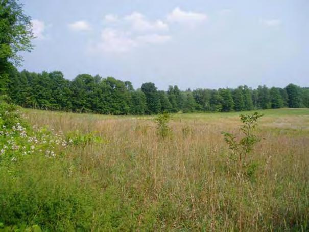
14 The Study Area Existing Conditions Hamlet of New Scotland
15 The Study Area Existing Conditions Hamlet of New Scotland

16 The Study Area Existing Conditions Hamlet of New Scotland

17 The Study Area Existing Conditions Hamlet of New Scotland
18 The Study Area Existing Conditions Demographics The Town s population has increased less than 1% from 2000 to 2010 and is expected to continue growing relatively slowly compared to surrounding suburbs o Population within the study area has decreased approximately 7% from 2000 to 2010 The senior population is steadily growing while the schoolaged population is falling The Town s median household income is higher and its unemployment rate is lower than Albany County as a whole

19 The Study Area Existing Conditions Demographics
20 The Study Area Existing Conditions Housing There are approximately 3,700 total housing units in the Town of New Scotland. o Within the study area there are approximately 280 residential units with an additional 90 approved units The median home value in the Town is $224,400, Albany County has lower median values. There is a 7% vacancy rate for residential buildings. The majority of the housing stock is single-family, detached homes built before There is also a mobile home park and a new housing development south of NY 85 which will include two family homes.


21 The Study Area Existing Conditions Housing
22 The Study Area Existing Conditions Mobility/Transportation The two main roadways serving the study area are owned and maintained by New York State. These roads serve as both commuting routes and as main roads and potentially as main streets within the New Scotland Hamlet area. Roadways within the study area serve a mix of land uses, with commercial uses concentrated around the intersection of NY 85/NY 85A and primarily residential uses adjacent to both roadways moving away from this intersection and outside the study area.
23 The Study Area Existing Conditions Mobility/Transportation These roadways serve the current, relatively low intensity, surrounding land uses and through traffic well in terms of motor vehicle level of service and safety. The amount of motor vehicle travel has remained relatively constant over the past decade. Both NY 85 and NY 85A have surplus capacity under traffic current conditions; the current capacity or Level of Service (LOS) for the roadway sections and intersections along NY 85 and NY 85A within the study area are well within acceptable ranges for typical arterial roadways.
24 The Study Area Existing Conditions Mobility/Transportation
25 The Study Area Existing Conditions Mobility/Transportation Residential LOC (level of compatibility) ratings are poor where residential use/traffic conflict occurs along NY 85 on the eastern edge of the study area and within Slingerlands, and along the short segment of NY 85 between CR308 and NY 85A. On NY 85A, LOC ratings are also poor where residential dwellings are clustered near the intersection of NY 155. Walking on the main routes within the study area using narrow shoulders alongside travel lanes where vehicles are moving at or over the speed limits of 45 and 40 mph most likely discourages pedestrian activity. However, land uses along the roadway in this area attract pedestrians.

26 The Study Area Existing Conditions Mobility/Transportation
 give the area poor marks.")
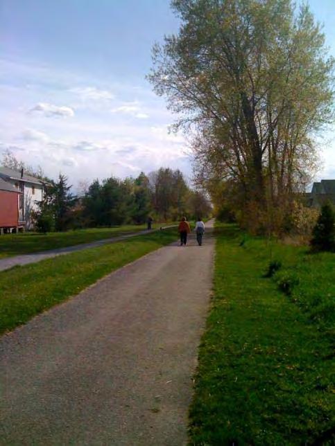
27 The Study Area Existing Conditions Mobility/Transportation Bicycle level of service analysis and walkability surveys (lack of sidewalks and pedestrian signals at NY 85/NY 85A) give the area poor marks. Despite the low Bicycle Level of Service scores, roadways within the study area are known as popular recreational rider and cycling club routes.
28 The Study Area Existing Conditions Mobility/Transportation The ability to add roadway capacity and/or to provide future standard bicycle and pedestrian accommodations in some areas along main routes (NY 85 and NY85A) is somewhat constrained due to limited right-of-way width, as well as the proximity of adjacent structures and the location of utilities. The Albany County Rail Trail presents a future opportunity for accommodating pedestrian and bicycle travel (both commuting and recreational) across a section of the study area.

29 The Study Area Existing Conditions Mobility/Transportation
30 The Study Area Existing Conditions Mobility/Transportation Transit service is seen as an asset to the study area providing an alternative to driving/enhanced mobility for those without access to a car. However due to the poor pedestrian and bicycling environment, limited frequency and timing of service as well as current lack of bus stop amenities, taking transit may not be an attractive option for some potential riders, with ridership decreases in recent years.

31 The Study Area Existing Conditions Mobility/Transportation Transit service is seen as an asset to the study area providing an alternative to driving/enhanced mobility for those without access to a car. However due to the poor pedestrian and bicycling environment, limited frequency and timing of service as well as current lack of bus stop amenities, taking transit may not be an attractive option for some potential riders, with ridership decreases in recent years.
32 The Study Area Existing Conditions Historic & Cultural Resources The area now known as the Town of New Scotland was settled in the early 17th century but wouldn t be established until April 25, The Town s earliest economy was based on agriculture. New Scotland was the largest provider of hops to breweries in the City of Albany. The Town s most popular farm product was the Bender Melon produced on the Charles Bender Farm. The single greatest impact on the town was the establishment of the railroad, which increased markets for farmers and other merchants.

33 The Study Area Existing Conditions Historic & Cultural Resources
34 The Study Area Existing Conditions Land Use & Recent Development Three (3) major residential subdivisions have been approved in the last few years within the Study Area. The Study Area is predominantly zoned [COM] Commercial. The Study Area is largely a mix of vacant, residential and commercial land speckled with community service-type uses.
35 The Study Area Existing Conditions Land Use & Recent Development
36 The Study Area Existing Conditions
37 The Study Area Existing Conditions
38 The Study Area Existing Conditions Sewer & Water Infrastructure & Community Facilities Sewer capacity is limited According to the Town engineer, current information on the hydrogeology in the area indicates that there does not seem to be much potential for large scale water supply. There are physical, fiscal and administrative constraints to providing additional public water and sewer infrastructure in and adjacent to the study area under current arrangements.
39 The Study Area Existing Conditions Sewer & Water Infrastructure & Community Facilities
40 The Study Area Existing Conditions Environmental Features The Study Area straddles two watershed areas: the Vly Creek- Normanskill and the Vloman Kill. Sections of the Vloman Kill and Phillipin Kill waterways are found in the vicinity of Youmans Road and south of NY 85; along these streams steep slopes can be found. Soils within the study area range from well drained to very poorly drained. Some of the larger, currently vacant parcels have soils classified as somewhat poorly drained.
41 The Study Area Existing Conditions Environmental Features

42 The Study Area Existing Conditions Environmental Features
43 Primary Area of New Development Potential
44 Primary Area of New Development Potential ~12.1 Million Square Foot Area 277 Acres
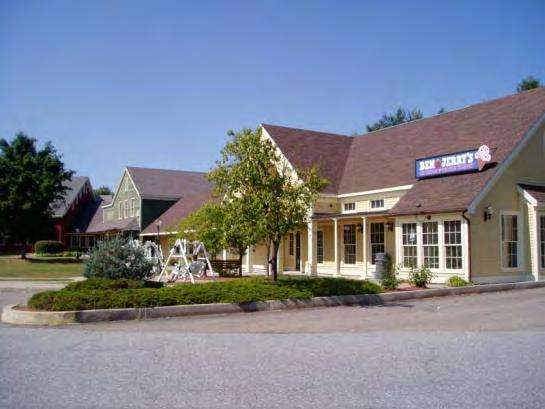
45 For Comparison: Slingerlands Price Chopper Plaza ~100,000 sq ft
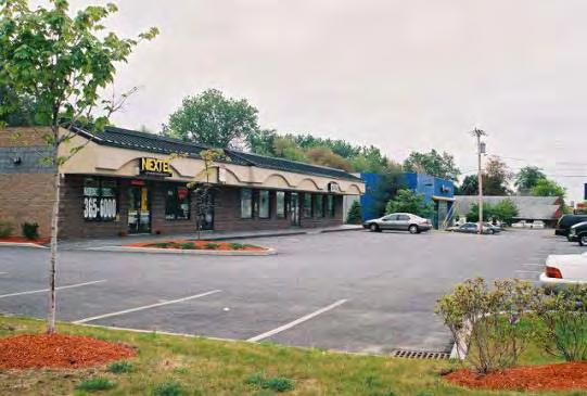
46 For Comparison: Delaware Ave. Plaza ~150,000 sq ft
47 For Comparison: Stuyvesant Plaza ~235,000 sq ft

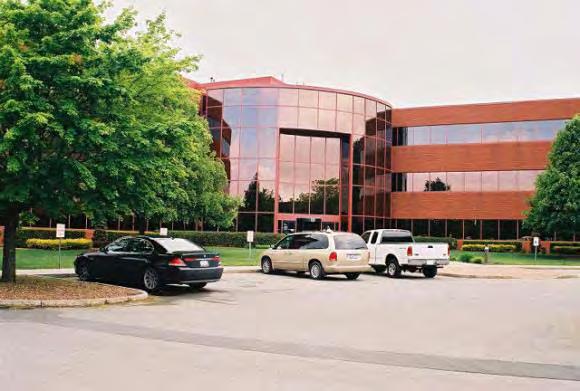
48 For Comparison: Bethlehem Town Center ~435,800 sq ft
49 For Comparison: Crossgates Mall ~1.9 Million sq ft
50 For Comparison: The Mansions at Delmar
51 For Comparison: Voorheesville High School
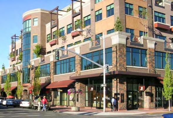
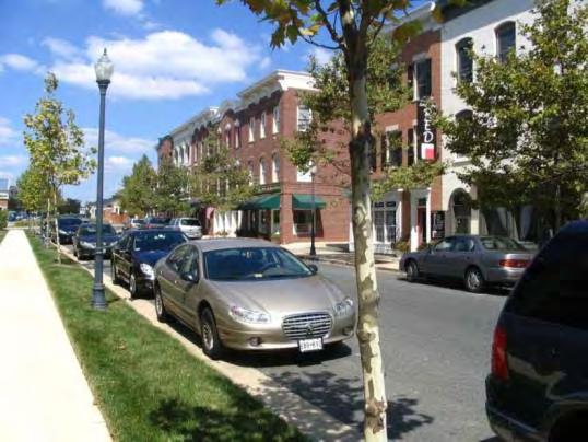
52 For Comparison: Broadway in Saratoga Springs
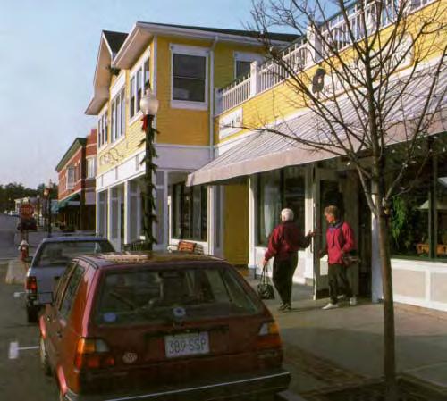
53 For Comparison: Empire State Plaza
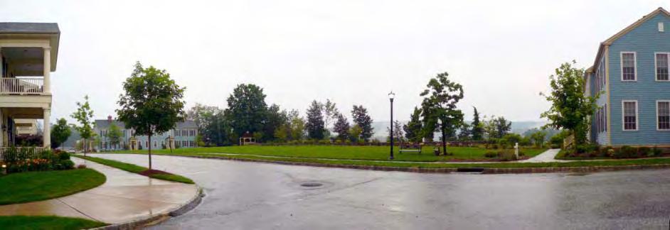
54 For Comparison: Downtown Albany
55 For Comparison: Downtown Albany This is a BIG area
56 Agenda I. Presentation Project Introduction The Study Area Existing Conditions Outcomes of Previous Studies Food for Thought II. Small Group Brainstorming III. Report Back IV. Wrap-Up
57 Outcomes of Previous Studies Town of New Scotland Comprehensive Land Use Plan Residents Planning Advisory Committee (RPAC) Route 85/85A Corridor Development Recommendations to the Town Board Traffic Impact Study, Kensington Woods Commercial Zone Advisory Committee (CZAC) 2008
58 Outcomes of Previous Studies Overlapping Themes A desire to maintain the hamlet character and encourage mixed-use development Commercial development, while desired, should fit in with the hamlet in terms of scale, and should serve the local population not be a regional draw Note: Language in the Comprehensive Plan is not crystal clear in terms of the type of commercial development appropriate here
59 Outcomes of Previous Studies Overlapping Themes Residential development some inconsistency: comprehensive plan tends to support the idea of new residential development in the hamlet RPAC report indicates that certain types of residential (condos/townhomes and/or rental units) less desired There are no pedestrian accommodations in the hamlet and conditions are dangerous for pedestrians Traffic volumes, while not ideal, are not viewed as problematic and there is no immediate need for roadway improvements
60 Outcomes of Previous Studies Visual Preference Survey (part of RPAC process) Conducted by Community Planning and Environmental Associates Targeted toward aesthetic preferences for the Commercially Zoned area images were limited to building types and landscapes that were or could be in that area (did not look at residential subdivisions and single-family homes) Participants rated each image on a scale of -5 to +5
61 Outcomes of Previous Studies Visual Preference Survey (part of RPAC process) In general residents: Preferred the typical architecture and landscaping that characterize a small town or hamlet Had strong negative feelings about non-descript and corporate-style architecture, areas with little green space and landscaping, multi-lane roads, and large parking lots in front of buildings

62 Outcomes of Previous Studies Visual Preference Survey (part of RPAC process)

63 Outcomes of Previous Studies Visual Preference Survey (part of RPAC process)

64 Outcomes of Previous Studies Visual Preference Survey (part of RPAC process)

65 Outcomes of Previous Studies Visual Preference Survey (part of RPAC process)

66 Outcomes of Previous Studies Visual Preference Survey (part of RPAC process)
67 Agenda I. Presentation Project Introduction The Study Area Existing Conditions Outcomes of Previous Studies Food for Thought II. Small Group Brainstorming III. Report Back IV. Wrap-Up
68 Food for Thought What is a hamlet? Not simply referring to the town s existing Residential Hamlet (RH) or Commercial Hamlet (CH) Zoning Districts In NYS, Hamlets are unincorporated settlements within towns. Hamlets are usually not legal entities and have no local government or official boundaries A hamlet could be described as the rural or suburban equivalent of a neighborhood in a city or village. (Wikipedia) A small village. (Dictionary.com)
69 Food for Thought What is a hamlet? Hamlets have distinct identities, are identifiable in the landscape, and often possess a defined public space. In addition to residential sections, a hamlet has a compact nucleus that draws residents. (Anton Nelessen)


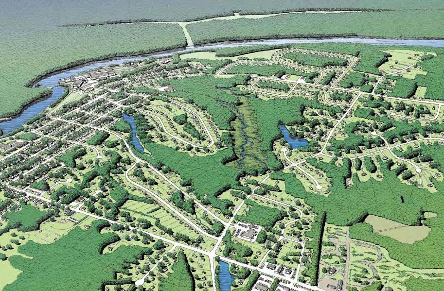
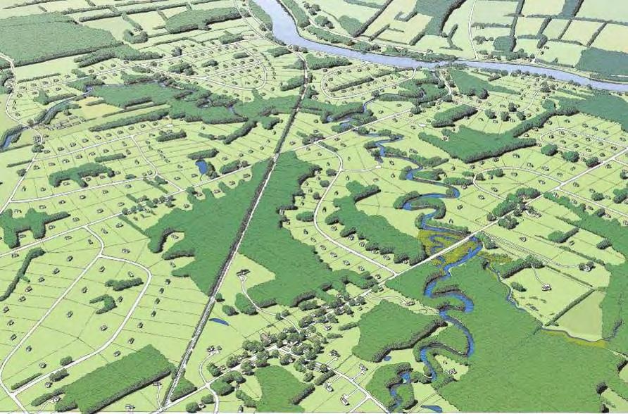
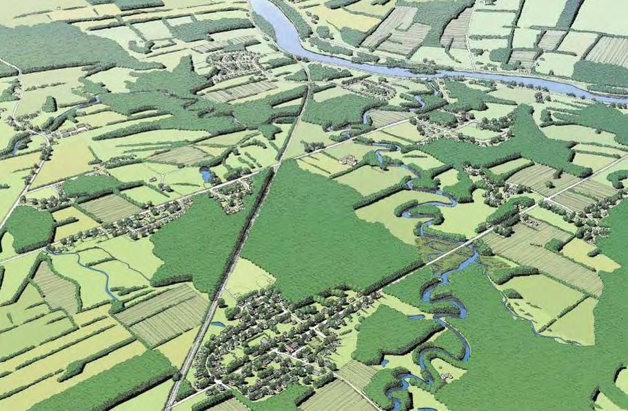
70 What is a hamlet? Traditional Pattern of Growth from crossroads hamlet to village Bristol, Vermont. From Above and Beyond: Visualizing change in small towns and rural areas (2002). Used with permission.

. Used with permission.")
71 What is a hamlet? Bristol, Vermont. From Above and Beyond: Visualizing change in small towns and rural areas (2002). Used with permission.

72 Shelburne Road, South Burlington, Vermont. From Above and Beyond: Visualizing change in small towns and rural areas (2002). Used with permission. 1930s

73 Shelburne Road, South Burlington, Vermont. From Above and Beyond: Visualizing change in small towns and rural areas (2002). Used with permission. 1995
74 Shelburne Road, South Burlington, Vermont. From Above and Beyond: Visualizing change in small towns and rural areas (2002). Used with permission.
75 Shelburne Road, South Burlington, Vermont. From Above and Beyond: Visualizing change in small towns and rural areas (2002). Used with permission.
76 Shelburne Road, South Burlington, Vermont. From Above and Beyond: Visualizing change in small towns and rural areas (2002). Used with permission.
77 Shelburne Road, South Burlington, Vermont. From Above and Beyond: Visualizing change in small towns and rural areas (2002). Used with permission.
78 Shelburne Road, South Burlington, Vermont. From Above and Beyond: Visualizing change in small towns and rural areas (2002). Used with permission.


79 Shelburne Road, South Burlington, Vermont. From Above and Beyond: Visualizing change in small towns and rural areas (2002). Used with permission.
80


81 Development B Development A
82 Development B Development A

83 Connected Open Space
84
85
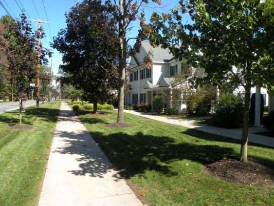
86 Food for Thought Abstract Terms: Residential Single-Family / Multi-Family Commercial Retail / Office Mixed-Use Open Space Sidewalks / Trails


87 Food for Thought Residential Single Family

88 Food for Thought Residential Single Family

89 Food for Thought Residential Single Family

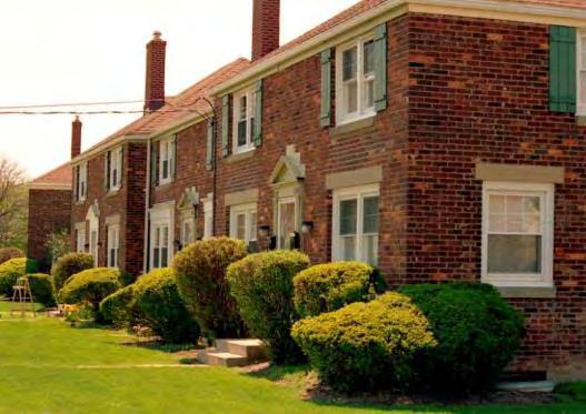
90 Food for Thought Residential Multi-Family

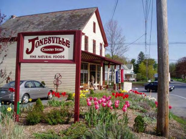

91 Food for Thought Commercial Retail

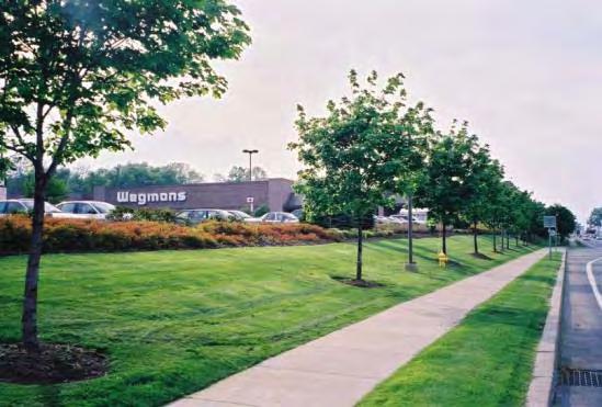
92 Food for Thought Commercial Retail


93 Food for Thought Commercial Office

94 Food for Thought Mixed-Use (Horizontal / Vertical)


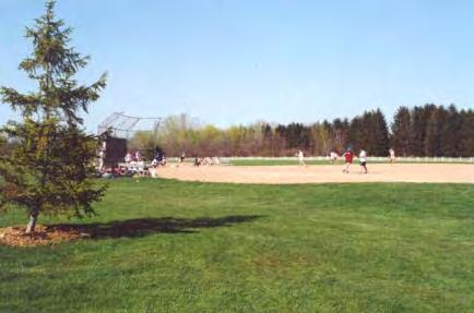

95 Food for Thought Open Space


96 Food for Thought Open Space


97 Food for Thought Sidewalks / Trails
98 Agenda I. Presentation Project Introduction The Study Area Existing Conditions Outcomes of Previous Studies Food for Thought II. Small Group Brainstorming III. Report Back IV. Wrap-Up
99 Small Group Brainstorming Eight (8) Groups / 45 minutes Tasks: Brief introductions Discuss ideas for land use and transportation in the study area (mark up the maps, avoid abstractions) No right or wrong ideas make note of different ideas Last five minutes sum it up. What were the group s 5 or 6 big ideas. Write these down and select a spokesmodel
100 Agenda I. Presentation Project Introduction The Study Area Existing Conditions Outcomes of Previous Studies Food for Thought II. Small Group Brainstorming III. Report Back IV. Wrap-Up
101 Agenda I. Presentation Project Introduction The Study Area Existing Conditions Outcomes of Previous Studies Food for Thought II. Small Group Brainstorming III. Report Back IV. Wrap-Up
102 Wrap-Up For updated information, see the project website: Questions / Comments: Jennifer Ceponis (CDTC) jceponis@cdtcmpo.org,
103 Thank you. For updated information, see the project website: Questions / Comments: Jennifer Ceponis (CDTC) jceponis@cdtcmpo.org,
Executive Summary. NY 7 / NY 2 Corridor
 Executive Summary NY 7 / NY 2 Corridor Transportation and Land Use Study December 2005 Prepared for: Town of Colonie Capital District Transportation Committee Prepared by: Introduction: Land use decisions
CHAPTER 7: VISION AND ACTION STATEMENTS. Noble 2025 Vision Statement
 CHAPTER 7: VISION AND ACTION STATEMENTS This chapter presents the vision, policy and action statements that transform the comprehensive planning study, an analysis of Noble s past, future trends and community
Secrest Short Cut and Monroe Expressway Small Area Plan AUGUST 29, 2018
 Secrest Short Cut and Monroe Expressway Small Area Plan AUGUST 29, 2018 Background and Process Monroe Expressway will be open by the end of 2018 Union County and Indian Trail identified a need to revisit
CHAPTER 3 VISION, GOALS, & PLANNING PRINCIPLES. City of Greensburg Comprehensive Plan. Introduction. Vision Statement. Growth Management Goals.
 CHAPTER 3 VISION, GOALS, & PLANNING PRINCIPLES Introduction The Greensburg Comprehensive Plan is intended as a working community document. A combination of long and short-term goals, this document is intended
NEW CASTLE COUNTY S ZONING DISTRICTS
 NEW CASTLE COUNTY S ZONING DISTRICTS This is general information about New Castle County s zoning districts. The information included is by no means exhaustive or complete. Before designing plans to develop
4-Town Comprehensive Plan DRAFT 7/30/07
 4-Town Comprehensive Plan DRAFT 7/30/07 Acknowledgements ning Committee Town of Harrisburg Norman Roof Randy Nicol Town of Martinsburg Terry Thisse Paul Kelly Town of Montague Jan Bagdanowicz Wendy Perry
Town of Peru Comprehensive Plan Executive Summary
 Town of Peru Comprehensive Plan Executive Communities that plan grow by choice, not by chance. A plan makes growth thoughtful, understandable, and predictable. A plan shows that a community is managing
International Blvd. TOD Plan Public Workshop #1
 International Blvd. TOD Plan Public Workshop #1 Add photos or project images September 21 and 22, 2010 Workshop Purpose Introduce the public to the Project Review and discuss the existing conditions analysis
Implementation Guide Comprehensive Plan City of Allen
 Implementation Guide 2030 Comprehensive Plan City of Allen DRAFT 2015 Implementation Guide Allen 2030 Comprehensive Plan INTRODUCTION The Comprehensive Plan serves as a guide for the growth and development
Ten Mile Creek Planning Area
 PLANNING AREA POLICIES TEN MILE CREEK Ten Mile Creek Planning Area Location and Context The Ten Mile Creek Planning Area ( Ten Mile Creek area ) is located south of the current Boise AOCI, generally south
MAYFIELD WEST SECONDARY PLAN PHASE 2
 MAYFIELD WEST SECONDARY PLAN PHASE 2 Public Open House #3 February 25, 2010 Draft Preferred Land Use Scenario TOWN OF CALEDON PLANNING & DEVELOPMENT DEPARTMENT Open House Agenda TOWN OF CALEDON 1. Welcome
4.1.3 LAND USE CATEGORIES
 4.1.3 LAND USE CATEGORIES a. City Center District The City Center District incorporates the existing character and mix of uses in downtown Belmont to encourage redevelopment and new development in keeping
HE VISION. Building a Better Connected Place
 HE VISION Building a Better Connected Place WALK INTO THE FUTURE. Life in Cranberry, 2030 Here s what our residents told us they wanted to see in their community by 2030: The Cranberry of 2030 is a place
Proposed Comprehensive Plan Strategies DRAFT for discussion June 28, 2017
 Proposed Comprehensive Plan Strategies DRAFT for discussion June 28, 2017 Land Use Rural Areas Refine the Farm and Forest area (FF) Update FF boundaries to account for existing lots less than five acres
CHAPTER 1. Ms. Guajardo s Class - Central Elementary CH 1 1
 INTRODUCTION CHAPTER 1 Ms. Guajardo s Class - Central Elementary CH 1 1 1.1 SETTING South Centre City is a linear corridor south of Downtown Escondido paralleling Centre City Parkway and South Escondido
Laberge Group. Town of Coeymans. Draft Comprehensive Plan. Overview of Planning Process
 Draft : Presentation of Goals & Strategies Laberge Group Benjamin H. Syden, A.I.C.P., E.D.P Director in Charge Nicole Allen, A.I.C.P. Senior Planner Anjali Malhotra Planner Presentation Outline Introductions
TREASURE COAST REGIONAL PLANNING COUNCIL M E M O R A N D U M. To: Council Members AGENDA ITEM 5H
 TREASURE COAST REGIONAL PLANNING COUNCIL M E M O R A N D U M To: Council Members AGENDA ITEM 5H From: Date: Subject: Staff October 17, 2008 Council Meeting Local Government Comprehensive Plan Review Draft
Access Management: An Overview
 Figures 1-5 Below Evolution of development along a highway. In the early stages, land along the road is used for farming with little traffic generated. As time passes, the highway corridor becomes a de
BROOKHILL NEIGHBORHOOD MODEL ZONING MAP AMENDMENT PREFACE TO APPLICATION
 BROOKHILL NEIGHBORHOOD MODEL ZONING MAP AMENDMENT PREFACE TO APPLICATION June 15, 2015 Revised: August 1, 2016 I. VISION Brookhill is a proposed community based upon the principles of Albemarle County
2018 Northampton Township Comprehensive Plan
 2018 BUCKS COUNTY, PENNSYLVANIA What is a? A comprehensive plan is a municipality s main policy document that details the collective vision for the future, the historic, environmental, and cultural facilities
Improve Neighborhood Design and Reduce Non Point Source Water Pollution
 HOW TO Planning Guide Improve Neighborhood Design and Reduce Non Point Source Water Pollution This document was funded by a grant from the New Hampshire Coastal Program with funding from the National Oceanic
REQUEST FOR QUALIFICATIONS
 REQUEST FOR QUALIFICATIONS VILLAGE OF HAMBURG COMPREHENSIVE ZONING/LAND USE REGULATIONS UPDATE Prepared By: Village of Hamburg 100 Main Street Hamburg, New York 14075 Village of Hamburg RFQ Page 1 of 10
Public Meeting Final Recommendations August 8, 2013
 Public Meeting Final Recommendations August 8, 2013 Meeting Agenda 1. Existing Conditions 2. Plan Building Blocks & Process 3. The Plan Policies 4. What we heard 5. Next Steps Existing Conditions Existing
New Partners for Smart Growth Conference February 5, 2010
 Dan Stroh, Planning Director City of Bellevue Planning and Community Development Bellevue, WA New Partners for Smart Growth Conference February 5, 2010 Summary of Project Long-range plan update for Bel-Red
Port Lavaca Future Land Use
 Port Lavaca Future Land Use Introduction The City of Port Lavaca is beginning to see sustained growth, after many years of relative stable population. New single family homes, apartments, and businesses
A BLUEPRINT FOR BROCKTON A CITY-WIDE COMPREHENSIVE PLAN
 A BLUEPRINT FOR BROCKTON A CITY-WIDE COMPREHENSIVE PLAN Public Meeting October 2016 1 Plan Summary and Discussion Public Meeting May 4 2017 City of Brockton Bill Carpenter, Mayor Department of Planning
COPLAY BOROUGH COMPREHENSIVE PLAN
 COPLAY BOROUGH COMPREHENSIVE PLAN Lehigh County, Pennsylvania Adopted by Coplay Borough Council on May 11, 2010 Urban Research and Development Corporation Bethlehem, PA with Keystone Consulting Engineers,
A. WHAT IS A GENERAL PLAN?
 I. Introduction A. WHAT IS A GENERAL PLAN? A general plan is the planning guideline for the future of a city. It contains goals and policies which regulate urban development, the protection of the natural
South Davis County COMMUNITY SPOTLIGHT
 South Davis County COMMUNITY SPOTLIGHT Davis/SLC Community Connector Bus Rapid Transit line connecting SLC & Davis County RTP Phase 1 Project Generate 3,100 average weekday riders Relieve congestion on
Land Use Amendment in Southwood (Ward 11) at and Elbow Drive SW, LOC
 at and Elbow Drive SW, LOC") 2018 November 15 Page 1 of 10 EXECUTIVE SUMMARY This land use amendment application was submitted by Rick Balbi Architect on 2017 August 31 on behalf of Sable Developments Ltd, and with authorization from
2018 November 15 Page 1 of 10 EXECUTIVE SUMMARY This land use amendment application was submitted by Rick Balbi Architect on 2017 August 31 on behalf of Sable Developments Ltd, and with authorization from
Town Center (part of the Comprehensive Plan)
") Town Center (part of the Comprehensive Plan) Mercer Island Town Center Looking North (2014) In 1994, a year-long process culminated in a set of design guidelines and code requirements for the Town Center
Town Center (part of the Comprehensive Plan) Mercer Island Town Center Looking North (2014) In 1994, a year-long process culminated in a set of design guidelines and code requirements for the Town Center
TOWN COUNCIL / PLANNING COMMISSION
 Workshop #3 TOWN COUNCIL / PLANNING COMMISSION January 20, 2011 Consultant Team In Attendance Tonight BMS Design Group Nevada City and San Francisco Michael Smiley, AICP, ASLA Partner-in-Charge Nancy L.
KEY FINDINGS. Community Engagement + Research
 PROJECT OVERVIEW PROJECT OVERVIEW PROJECT OVERVIEW KEY FINDINGS Community Engagement + Research Community Engagement Community Issues Workshop Steering Committee Workshop City Council/Planning Workshop
VILLAGE & TOWN OF BERGEN: COMPREHENSIVE PLAN
 VILLAGE & TOWN OF BERGEN: COMPREHENSIVE PLAN CPC Public Hearing April 21, 2016 History 1996 Comprehensive Plan Comprehensive Plan Update Committee Consultant (LaBella Associates): December 2014 Residents
MAIN STREET ECONOMIC DEVELOPMENT STRATEGY
 MAIN STREET ECONOMIC DEVELOPMENT STRATEGY A PATHWAY TO A BETTER POUGHKEEPSIE DRAFT Working Paper #2: Planning Strategies Submitted December 1 st, 2015 to the City of Poughkeepsie LAND USE LAW CENTER PACE
Chapter 1: Introduction
 Chapter 1: Introduction The Penn Avenue Community Works Corridor Vision and Implementation Framework presents an integrated communitybased vision and a coordinated, long-term implementation framework for
S C O P E O F W O R K A P R I L
 white flint 2 sector plan S C O P E O F W O R K A P R I L 2 0 1 2 MONTGOMERY COUNTY PLANNING DEPARTMENT M-NCPPC MontgomeryPlanning.org 1 white flint 2 sector plan Scope of Work abstract This scope of work
V. Vision and Guiding Principles
 V. Vision and Guiding Principles The Master Plan for the Powers Ferry Corridor seeks a foundation in the desires of the community. At times, various elements of the community offered opposing viewpoints,
Section 9 NEIGHBORHOOD DESIGN
 Section 9 NEIGHBORHOOD DESIGN City of Lancaster Comprehensive Plan D u n k i n, S e f k o & A s s o c i a t e s, I n c. NEIGHBORHOOD DESIGN INTRODUCTION There are many ways in which a neighborhood can
Windsor, Connecticut Plan of Conservation & Development DRAFT PLAN SUMMARY
 Windsor, Connecticut 2015 Plan of Conservation & Development DRAFT PLAN SUMMARY Plan Overview What is a Plan? Visionary Advisory Implementable Maintainable What it is not! Regulatory Binding Static Passive
Municipal Plan*Assessment
 Municipal Plan*Assessment This tool was developed to assist in reviewing municipal master plans and in determining if these plans are consistent with smart growth principles, neighboring municipal plans,
Northwest Rail Corridor and US 36 BRT Development Oriented Transit Analysis 4.4 STATION AREA FINDINGS
 4.4 STATION AREA FINDINGS Each station is different, and each one requires a separate set of recommendations based on the vision for the site. This section outlines an initial TOD strategy and recommendations
1.0 Introduction. Purpose and Basis for Updating the TMP. Introduction 1
 1.0 Introduction The Town of Castle Rock is situated between the metropolitan areas of Denver and Colorado Springs, amidst a unique terrain of rolling hills, mesas, ravines, and waterways. Like many Front
CHAPTER 7: Transportation, Mobility and Circulation
 AGLE AREA COMMUNITY Plan CHAPTER 7 CHAPTER 7: Transportation, Mobility and Circulation Transportation, Mobility and Circulation The purpose of the Transportation, Mobility and Circulation Chapter is to
Creating Complete Roadway Corridors:
 Creating Complete Roadway Corridors: The AASHTO Guide to Transportation Landscape Architecture and Environmental Design NCHRP Project 15-33 Status Report AASHTO Standing Committee on Design Technical Committee
Information Session July 25, 2018
 Concord Pike (US 202) Master Plan Information Session July 25, 2018 1 Concord Pike (US 202) Master Plan 2018 Project Partners Wilmington Area Planning Council Delaware Department of Transportation New
Micco Park Village Development
 FOR SALE Call For Pricing Micco Park Village Development Proposed Project Property Details Micco Park Village Development PRICE Call For Pricing A monumental development opportunity of a lifetime! The
Public Open House #1
 Public Open House #1 TONIGHT S AGENDA Welcome Project Overview The Big Picture The Station Area The Analysis Thoughts about Future Change Breakout Group Discussions Summation / Next Steps Project Overview
Hockessin Community Redevelopment Plan
 Hockessin Community Redevelopment Plan 3.1 Introduction The Community Redevelopment Plan for the Village of Hockessin is the result of the people s vision for a distinct village center that serves as the
MONTGOMERY COUNTY METRO STATION AREA DESIGN CHARRETTE
 MONTGOMERY COUNTY METRO STATION AREA DESIGN CHARRETTE Shady Grove Metro Station Area Charrette Closing Presentation October 25-28, 2000 MONTGOMERY COUNTY, MD M-NCPPC Design Collective, Inc. Architects
WELCOME and introduction
 1 WELCOME and introduction Mobility Hub Locations within Burlington STUDY OVERVIEW STUDY OBJECTIVES The City of Burlington is developing four Area Specific Plans, one for each of Burlington s Mobility
CONCORD PIKE (US 202) CORRIDOR MASTER PLAN
 CORRIDOR MASTER PLAN") PRESENTATION FOR THE CONCORD PIKE (US 202) CORRIDOR MASTER PLAN COMMUNITY VISIONING WORKSHOP November 14, 2018 Project Introduction Study Area Characteristics Diverse stakeholders: businesses, residents,
PRESENTATION FOR THE CONCORD PIKE (US 202) CORRIDOR MASTER PLAN COMMUNITY VISIONING WORKSHOP November 14, 2018 Project Introduction Study Area Characteristics Diverse stakeholders: businesses, residents,
Seattle Transit Master Plan
 Seattle Transit Master Plan Seattle City Council Transportation Committee Briefing May 10, 2011 Seattle Department of Transportation Presentation Outline Review of project schedule and goals Review of
NORTH CLAYMONT AREA MASTER PLAN COMMUNITY WORKSHOP #1 FEBRUARY 3, 2016
 NORTH CLAYMONT AREA MASTER PLAN COMMUNITY WORKSHOP #1 FEBRUARY 3, 2016 1. Introduction To the team and to the Plan Planning Partners The Claymont Community WILMAPCO New Castle County Claymont Renaissance
2. Form and Character. 2.1 Introduction. 2.2 The Downtown Addition Plan. 2.1 Introduction
 2.1 Introduction 2.1 Introduction This section of the Specific Plan describes and illustrates the desired form, character and uses of the Downtown Addition and explains the underlying design principles.
TABLE OF CONTENTS. Transportation Chapter 1 - Introduction and Purpose of Planning to 1-3. Utilities
 Chapter 1 - Introduction and Purpose of Planning... 1-1 to 1-3 Pennsylvania Municipalities Planning Code (Act 247)...1-1 Previous County Planning Activities...1-1 Objectives of the Plan...1-2 Elements
Preliminary Recommendations Tk Takoma/Langley Crossroads Sector Plan
 Preliminary Recommendations Tk Takoma/Langley Crossroads Sector Plan Vision is to achieve a Transit Oriented, pedestrian friendly Community that Celebrates and builds upon the cultural Diversity of the
Chapter 1 - General Design Guidelines CHAPTER 1 GENERAL DESIGN GUIDELINES
 CHAPTER 1 GENERAL DESIGN GUIDELINES 1.0 INTRODUCTION This Publication has been developed to provide current, uniform procedures and guidelines for the application and design of safe, convenient, efficient
AWH REPORT OF THE PLANNING AND DEVELOPMENT DEPARTMENT FOR APPLICATION FOR REZONING ORDINANCE TO PLANNED UNIT DEVELOPMENT
 AWH REPORT OF THE PLANNING AND DEVELOPMENT DEPARTMENT FOR APPLICATION FOR REZONING ORDINANCE TO PLANNED UNIT DEVELOPMENT MAY 8, 2014 The Planning and Development Department hereby forwards to the Planning
Tonight s Agenda. Summary Presentation Open House. Group Discussion Next Steps: online community wide survey
 Community Open House February 22, 2018 Tonight s Agenda Summary Presentation Open House Station 1: Project Overview and Community Input Station 2: Draft Vision and Guiding Principles Station 3: Western,
Chapter 10 IMPLEMENTATION RECOMMENDATIONS
 Chapter 10 IMPLEMENTATION RECOMMENDATIONS The recommended land use plan presented in the previous chapter provides a design for the attainment of the urban and rural development and open space preservation
GENERAL PLAN AND ENVIRONMENTAL IMPACT REPORT
 City of Menifee HEARING DRAFT GENERAL PLAN AND ENVIRONMENTAL IMPACT REPORT City Council November 2013 PURPOSE OF MEETING Overview of GP Process Overview of required and optional GP elements Receive direction
The Floyds Fork Area Study A Framework for Growth
 The Floyds Fork Area Study A Framework for Growth 2 21 st Century Parks Master Plan: The Fork 3 Neighborhood Development Area Policy Recommendations 1. Create incentives to promote infill of existing development
Planning Charlotte s Future. Transportation & Planning Committee March 14, 2016
 Planning Charlotte s Future Transportation & Planning Committee March 14, 2016 Charlotte s Vision Livable city Vibrant economy Thriving natural environment Diverse population Choices for housing, education,
E. RURAL COMMERCIAL/INDUSTRIAL PARK MODEL
 E. RURAL COMMERCIAL/INDUSTRIAL PARK MODEL 1. PURPOSE The purpose of the Rural Commerce/Industrial Park Model is to provide parameters within which a grouping of business buildings with parking, loading
1.0 INTRODUCTION 1.1 TH 14 WEST STUDY AREA Project Description Functional Classification Purpose of the Project
 1.0 INTRODUCTION 1.1 TH 14 WEST STUDY AREA 1.1.1 Project Description The Trunk Highway (TH) 14 West Corridor is a two-lane roadway approximately 22 miles in length. Located in Nicollet County, the corridor
SUSSEX COUNTY COMPREHENSIVE PLAN COUNTY PLANNING AND ZONING COMMISSION WORKSHOP
 SUSSEX COUNTY COMPREHENSIVE PLAN COUNTY PLANNING AND ZONING COMMISSION WORKSHOP August 21, 2017 TODAY S WORKSHOP Public Comment Utilities Update Economic Development Update Future Land Use Discussion Public
Issues, Challenges & Opportunities
 Below is a summary of issues, challenges, and opportunities relating to the revitalization of Downtown Romeoville and potential development of the Village s East Side TOD Area. Current Issues & Challenges
Mendota Heights 2040 Comprehensive Plan Draft Vers
 4 Parks and Trails The City of Mendota Heights boasts a variety of recreational and open space opportunities. Few cities can claim access to regional trails, riverside and lakeside parks, scenic bluffs
Official Plan Review
 Official Plan Review Summary Report - The Built Environment August 2014 Part 1: Introduction Planning for a healthy, prosperous and sustainable community is an important goal for our municipality. From
Speers Road Corridor Study. Livable Oakville (Official Plan) Council Sub Committee March 20, 2017
 Council Sub Committee March 20, 2017") Speers Road Corridor Study Livable Oakville (Official Plan) Council Sub Committee March 20, 2017 Overview 1) Study Purpose & Background 2) Study Area 3) Policy Context and Plan Review 4) Speers Road Corridor
Speers Road Corridor Study Livable Oakville (Official Plan) Council Sub Committee March 20, 2017 Overview 1) Study Purpose & Background 2) Study Area 3) Policy Context and Plan Review 4) Speers Road Corridor
What Does It Take To Create A Town Center?
 What Does It Take To Create A Town Center? Context, Design, and Process The Prince Frederick Master Plan Update 1 Background and Overview A Brief History of Town Centers in Calvert County 2 Background
FUNDING CORRIDOR REVITALIZATION
 FUNDING CORRIDOR REVITALIZATION Integrated corridor planning for the 21 st Century America Planning Association Annual Conference Atlanta, GA April 27, 2014 Mariia Zimmerman, MZ Strategies, LLC mariia@mzstrategies.com
Joint Meeting City Council and the Plan Commission. September 1st, 2015
 Joint Meeting City Council and the Plan Commission September 1st, 2015 1 The City Plan Commission shall recommend a City Plan for the physical development of the City Article IX Section 2 of the City of
The transportation system in a community is an
 7 TRANSPORTATION The transportation system in a community is an important factor contributing to the quality of life of the residents. Without a sound transportation system to bring both goods and patrons
MAYFIELD WEST SECONDARY PLAN PHASE 2
 MAYFIELD WEST SECONDARY PLAN PHASE 2 Council Information Workshop February 16, 2010 Draft Preferred Land Use Plan TOWN OF CALEDON PLANNING & DEVELOPMENT DEPARTMENT Workshop Agenda TOWN OF CALEDON 1. Welcome
Chapter 4. Linking Land Use with Transportation. Chapter 4
 Chapter 4 Linking Land Use with Transportation Chapter 4 59 Chapter 4 Linking Land Use with Transportation Community Design and Transportation Program Introduction Since the 1950s, the predominant development
Sustainable Growth. Sustainable Growth
 2 Sustainable Growth Sustainable Growth SUSTAINABLE GROWTH 2.1 COMMUNITY VISION... 2-5 2.2 THE CITY SYSTEM... 2-7 2.2.1 AREAS... 2-7 2.2.2 CITY-WIDE SYSTEMS... 2-8 2.2.3 PROVINCIAL PLAN BOUNDARIES AND
REVIEW AND EVALUATION OF REGIONAL LAND USE
 REVIEW AND EVALUATION OF REGIONAL LAND USE AND TRANSPORTATION SCENARIOS #220831 Environmental Justice Task Force October 7, 2014 VISION 2050 Process Development of Guiding Vision for Land Use and Transportation
Gold Line Bus Rapid Transit Transit Oriented Development (BRTOD) Helmo Station Area Plan
 Helmo Station Area Plan") Appendix F Gold Line Bus Rapid Transit Transit Oriented Development (BRTOD) Helmo Station Area Plan Introduction and Purpose of the Plan The Gold Line Bus Rapid Transit facility is an eleven-mile dedicated
Appendix F Gold Line Bus Rapid Transit Transit Oriented Development (BRTOD) Helmo Station Area Plan Introduction and Purpose of the Plan The Gold Line Bus Rapid Transit facility is an eleven-mile dedicated
Anatomy of A Vibrant Downtown. Anatomy of a Vibrant Downtown
 Anatomy of A Vibrant Downtown The goal of MAIN ST. REVITALIZATION PLANNING is to provide a framework that will help transform your downtown into a VIBRANT DOWNTOWN a place where people love to LIVE, WORK,
9 th Street Sub Area Plan
 9 th Street Sub Area Plan In the 1990 s, when the Township prepared the last Master Plan, the 9 th Street corridor was studied as part of a larger 9 th Street Focus Area that included the West Main Street
TOWN OF WILTON 22 TRAVER ROAD WILTON, NY
 TOWN OF WILTON 22 TRAVER ROAD WILTON, NY 12831-9127 (518) 587-1939 FAX (518) 587-2837 Website: www.townofwilton.com Ryan K. Riper, P.E. Director of Planning & Engineering Lucy B. Harlow Executive Secretary
General Location Annex, Rezone & Preliminary Plat Lansdowne Addition, Unit Three
 NEWFOUNDLAND I-5 Agricultural District Subject Site SUNDANCE ANDERSON Single Family Residential CHRISTY PUD Agricultural District Highway Business General Location Annex, Rezone & Preliminary Plat Lansdowne
Town of Washington Master Plan & Regulatory Audit: Interim Results
 Town of Washington Master Plan & Regulatory Audit: Interim Results May 20, 2008 Presented by: 30 Bank Street Lebanon, NH 03766 www.uvlsrpc.org Introduction & Purpose Compare the Master Plan to the regulations
City of Bristol Route 6 Corridor Implementation Program
 City of Bristol Route 6 Corridor Implementation Program FITZGERALD & HALLIDAY, INC. Innovative Planning, Better Communities June 2017 Route 6 Corridor Plan IMPLEMENTATION PROGRAM The following Implementation
Danvers High Street I-1 District Study
 Danvers High Street I-1 District Study Presentation of Final Recommendations Planning Board Presentation June 26 th, 2018 1 Introductions Metropolitan Area Planning Council Sam Cleaves AICP, Principal
A larger version of this map is located on the last page of this PDF.
 MAP Committee Input McLoughlin Area Draft Vision Map A larger version of this map is located on the last page of this PDF. 1. The map above is intended to portray a vision for the McLoughlin area. It highlights
THE GARDEN CITY PLAN. City of St. Catharines Official Plan. City of St. Catharines
 THE GARDEN CITY PLAN City of St. Catharines Official Plan City of St. Catharines August 2010 APPROVAL INFORMATION This Official Plan of the City of St. Catharines Planning Area, known as the Garden City
Date: April 10, 2017 City Council Work Session April 24, 2017: Status Report on the Comprehensive Plan Update and Transportation Master Plan
 AGENDA REPORT To: From: By: Honorable Mayor and City Council Members Warren Hutmacher, City Manager Sharon Ebert, Director Community Development Date: April 10, 2017 Agenda: City Council Work Session April
VILLAGE OF CLEMMONS PLANNING BOARD DRAFT STAFF REPORT
 VILLAGE OF CLEMMONS PLANNING BOARD DRAFT STAFF REPORT PETITION INFORMATION Docket # C-226 Staff Megan Ledbetter Petitioner(s) JBJH Properties, LLC Owner(s) JBJH Properties, LLC Subject Property 5892-49-1766
Further input invited as Colchester Growth Strategy nears final phase
 IUE 3 / NOVEMBER 2015 Further input invited as Colchester Growth trategy nears final phase trathcona County is seeking public feedback as it enters the final phase of work on a Growth Management trategy
13 THORNHILL YONGE STREET STUDY IMPLEMENTATION CITY OF VAUGHAN OPA 669 AND TOWN OF MARKHAM OPA 154
 13 THORNHILL YONGE STREET STUDY IMPLEMENTATION CITY OF VAUGHAN OPA 669 AND TOWN OF MARKHAM OPA 154 The Planning and Economic Development Committee recommends the adoption of the recommendations contained
COLVER ROAD INDUSTRIAL CONCEPT PLAN
 COLVER ROAD INDUSTRIAL CONCEPT PLAN A CONCEPTUAL LAND USE AND TRANSPORTATION PLAN FOR TA-4 AN URBAN RESERVE AREA OF THE CITY TALENT City of Talent Adopted by City Council Resolution No., June, 2015 PART
WORKSHOP PURPOSE PERRY COMPREHENSIVE PLAN COMMUNITY WORKSHOP APRIL 4 TH, 2013 WHAT IS A COMPREHENSIVE PLAN? AGENDA
 WORKSHOP PURPOSE PERRY COMPREHENSIVE PLAN COMMUNITY WORKSHOP APRIL 4 TH, 2013 Provide background information on the Perry Comprehensive Plan Tap the expertise of the local experts (YOU!) Understand what
Stakeholders Advisory Working Groups (SAWGs) Smart Growth and TOD Land Use (#11) SAWG Meeting
 Smart Growth and TOD Land Use (#11) SAWG Meeting") Presentation - Part II Tappan Zee Bridge/I-287 Corridor Project July 21, 2010 Slide 1. David Kooris (Regional Plan Association) welcomed members of the Land Use Stakeholders Advisory Working Groups (SAWGs)
Presentation - Part II Tappan Zee Bridge/I-287 Corridor Project July 21, 2010 Slide 1. David Kooris (Regional Plan Association) welcomed members of the Land Use Stakeholders Advisory Working Groups (SAWGs)
STAFF SUMMARY FOR S17-02 SPECIAL USE PERMIT APPLICATION
 APPLICATION SUMMARY Case Number: S17-02 Request: STAFF SUMMARY FOR S17-02 SPECIAL USE PERMIT APPLICATION SUP application in order to develop a convenience food store. Applicant: Property Owner(s): Cindee
University Parkway Corridor Plan. Public Workshop Sept. 18, 2017
 University Parkway Corridor Plan Public Workshop Sept. 18, 2017 AGENDA 1. Overview of Process 2. Study Area 3. Components of the Plan 4. What We Know 5. What We Have Heard 6. Tonight s Input 7. Next Steps
hermitage town center
 hermitage town center A Community Vision prepared by Strada for The City of Hermitage and The Mercer County Regional Planning Commission January 2007 table of contents introduction 3 design principles
Calvert County Comprehensive Plan
 Calvert County Comprehensive Plan Summary of Key Outcomes from the Issue Identification Workshops and Surveys February May, 2017 Providing an Efficient and Multi-modal Transportation System Overall, the