495/MetroWest Development Compact Plan Citizen Planner Training Collaborative Conference. March 17, 2012
|
|
|
- Allen May
- 5 years ago
- Views:
Transcription
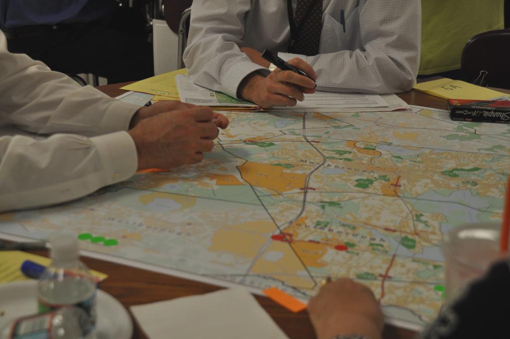

1 495/MetroWest Development Compact Plan Citizen Planner Training Collaborative Conference March 17, 2012

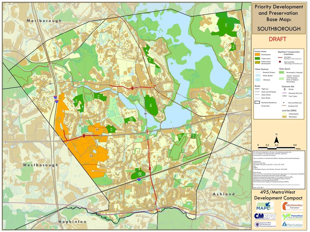
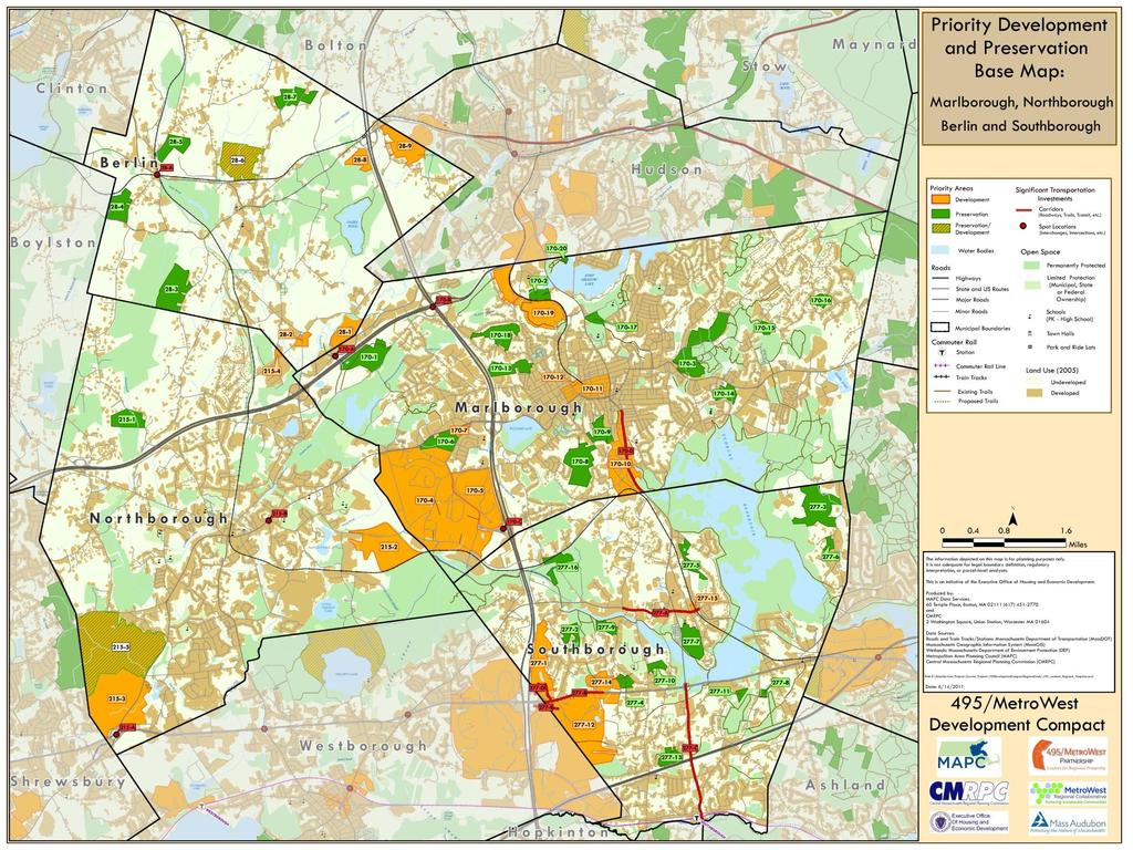
2 Project Process Local and Regional Priority Areas Growth Scenarios Transportation Investment Categories Implementation Toolkit

3 Where is the study area.

4 Includes 37 Cities and Towns and spans multiple RPAs
5 495/MetroWest Development Compact Plan Project Process Review of Previous Plans and Studies Local Meetings Community-Level Public Meetings First Round of Regional Forums Assessment and Identification of Regional Priorities Second Round of Regional Forums Project Conclusion and Finalize Plan

6 Project Process Create a shared framework for state, regional and local strategies for development, land preservation and infrastructure investments Encourage Regional Context for Planning Raise Awareness of Commonalities and Differences in Land Use Goals

7 Project Process Uses a Local Perspective to Identify:
8
9

10


11

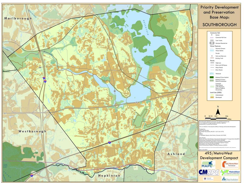
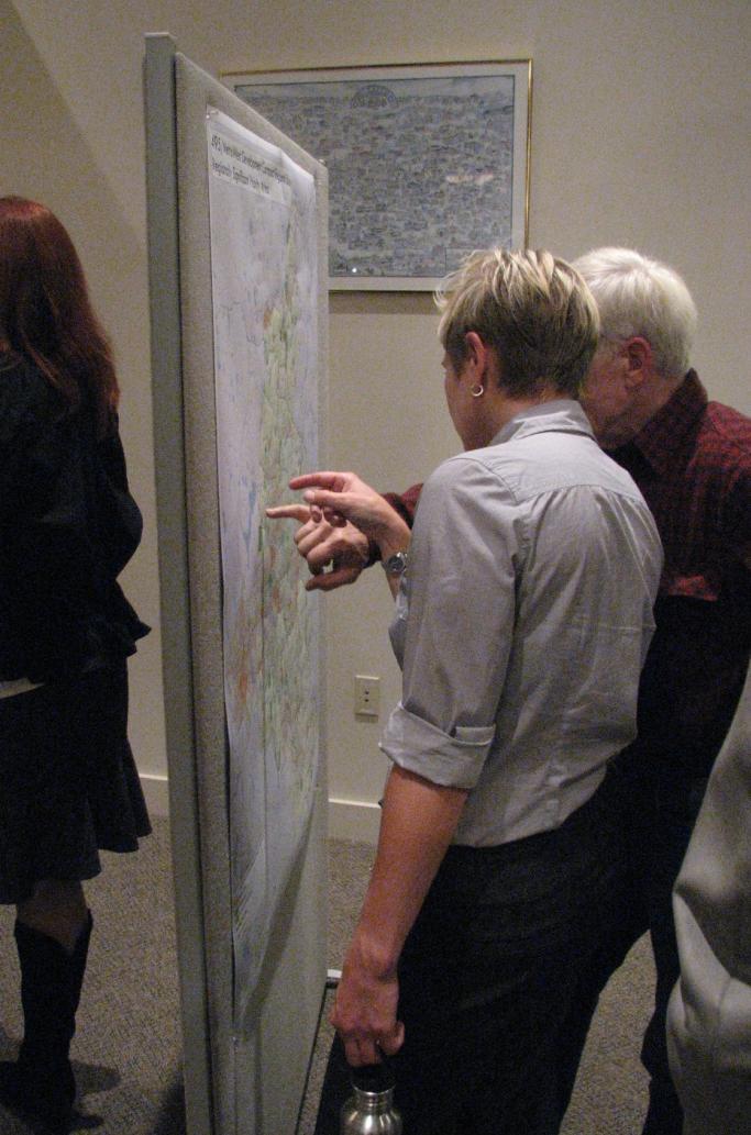
12 June Forums Westborough and Boxborough

13 June Forums


14 June Forums Presented city or town maps along with maps of neighboring municipalities Participants provided guidance on regional priorities and investments Land Use Environmental Resources Environmental Justice Water Resources Transportation Resources Agricultural and Historical Resources


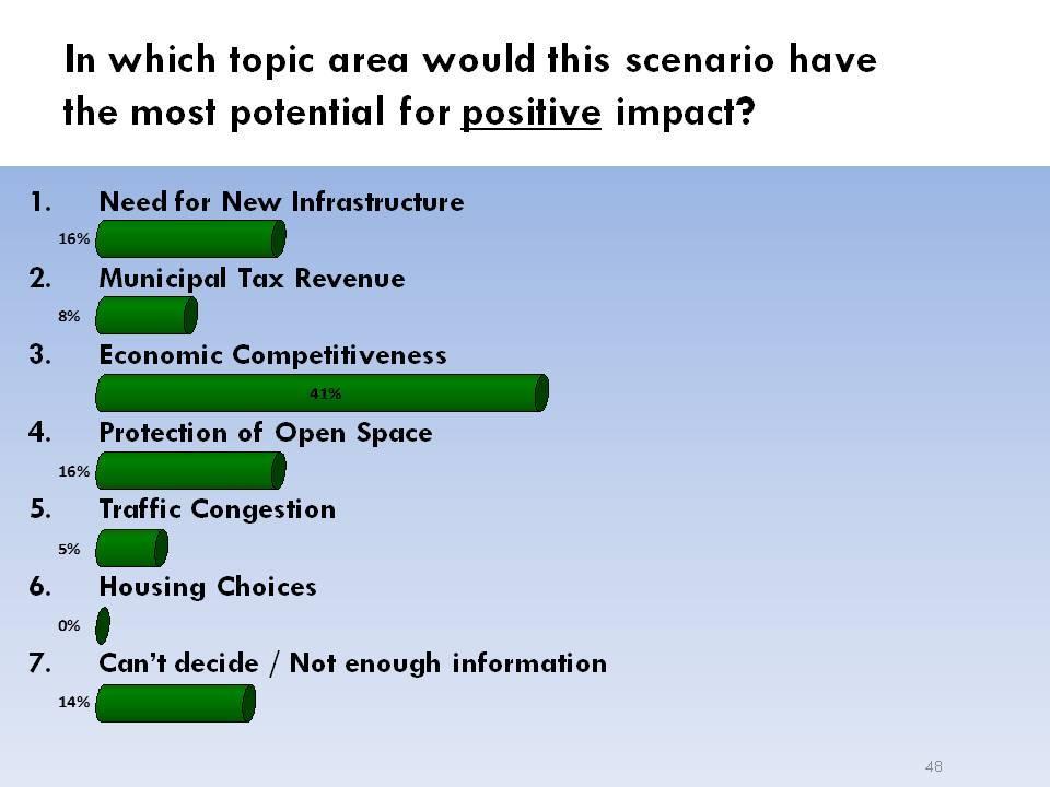
15 What We Heard Focus on existing commercial/industrial areas Prioritize redevelopment/reuse of underutilized/vacant facilities Improve key interchanges and intersections Build around regional train stations Rectify lack of transit Importance of farms and orchards Open space has both habitat and scenic/social value Address housing needs And much more
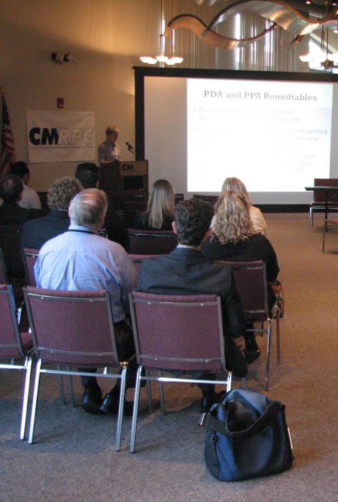
16 PDA and PPA Roundtables Meetings with professionals in the preservation and development fields Goal: Additional input and expertise regarding identified priorities and regional screening Participants: State officials, land trusts, real estate and development professionals (housing and commercial), transportation planners, civil engineers, conservation professionals, and others
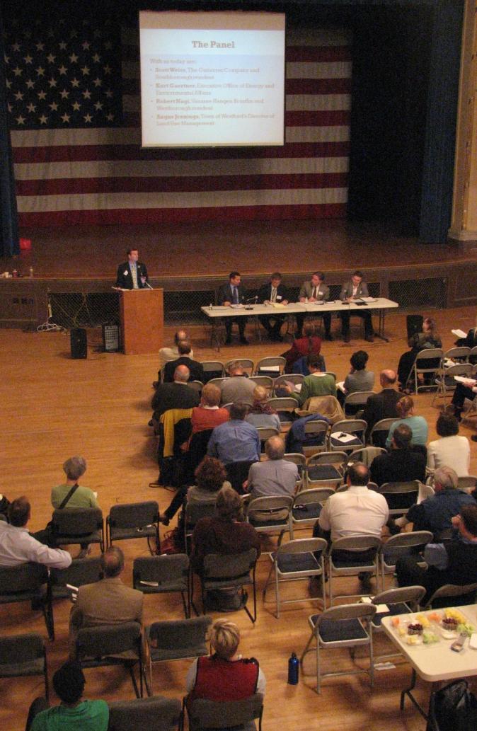
17 November Presentations Worcester and Framingham
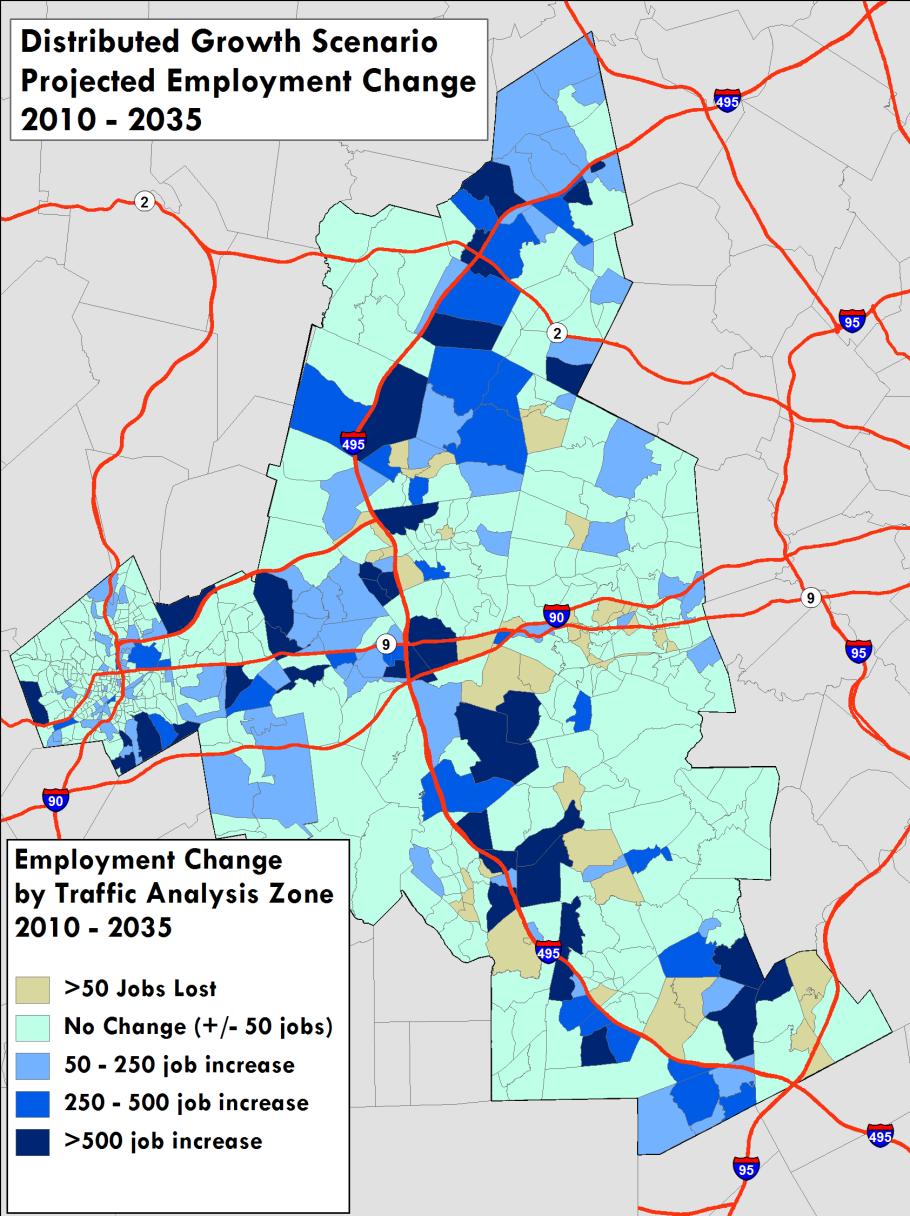
18 November Presentations Distributed Growth Scenario Regional Priorities Growth Scenario
19 November Presentations
20 Locally Identified Priority Areas

 Employment")

, 6,860 Commercial & Industrial,")
21 Local Priority Development Areas 293 Local PDAs 29,800 acres Average: 102 acres 140,500 existing jobs (35% of Corridor total) 10 employees per acre (average) Employment capacity: 204,000 jobs Existing Land Use, Local PDAs with acreage Vacant Developable Land, 11,700 Undevelopable (Wetlands, Open Space, Other), 6,860 Commercial & Industrial, 8,430 Residential, 2,780
22 Local Priority Development Areas 52,000 jobs projected region-wide from years to buildout Only 25% of capacity utilized by 2035 PDA Development Capacity and Projected Employment 250, , , ,000 50,000 New Jobs 0 Local PDA Development Capacity Projected Employment,
23 Local Priority Development Areas Potential for 30,800 new housing units in local PDAs 60,000 units needed region-wide from Not sufficient to house needed workers PDA Development Capacity and Projected Housing Demand 70,000 60,000 50,000 40,000 30,000 20,000 10,000 Housing Units - Local PDA Development Capacity Housing Demand,
24 Local Priority Preservation Areas 497 PPAs 37,200 acres Average size: 75 acres 166 contain groundwater recharge areas 172 contain Priority Habitat 4,600 acres of agricultural land use At current acquisition rates, would take 124 years to protect all this land

25 Distributed Growth Scenario
26 Distributed Growth Scenario Assume 85% of employment growth occurs in PDAs 45,000 jobs, distributed equally across all PDAs Each PDA achieves 20% of employment capacity
27 Impacts of Distributed Growth 19 cities & towns with more than 1,000 new jobs 1,900 acres of land developed for commercial growth in PDAs Only 6,200 jobs through redevelopment 22,900 new jobs projected in municipalities with no public sewer system Job losses in municipalities with MWRA sewer Average PDA employment density increases to 19 jobs per acre Only 36% of jobs near existing transit

 Transit share remains steady at 0.")
28 Impacts of Distributed Growth 16% increase in the number of trips 21% increase in vehicle miles travelled (up 4.7 million miles/day) Transit share remains steady at 0.6% Large increases in VMT in previously uncongested areas
29 Impacts of Distributed Growth Requests for infrastructure funding will quickly outpace available resources Less money available for maintenance and improvement in existing job centers Few PDAs built to their full capacity; municipalities and state will see less return on investment Few new housing opportunities near employment, shops, services, and transportation
30 Regional Screening
31 Regional Screening There are limited resources - financially, economically, environmentally To better guide investment of these resources, a Regional Screening was performed on the local PDAs and PPAs The screening was based on information and data that supported the six fundamental principles Local priorities will continue to be locations for growth and development and they are recorded on local maps created through this process


32 Regional Screening Regional Priority Areas Regional Screening Local Priority Areas
 data used to")


33 Regional Screening - GIS Geographic Information System (GIS) data used to guide the screening included Developed Land Housing Chapter 40R, 43D and Economic Growth Districts BioMAP 2 Wetlands Floodplains Impaired Streams Populations meeting Environmental Justice Criteria (e.g., income, minority population, etc.) Wellheads Aquifers Surface Water Supply Protection Areas Sidewalks, Shared Use and Bicycling Facilities, Trails, Transit Roadways and Interchanges Farms Prime Agricultural Soils Historic Areas


34 Regional Screening - Themes Downtowns, town centers, and villages, should be centers for development Housing as an element in PDAs was influential in advancing as regionally significant Regional Plan consistency as a guiding principle


35 Regional Screening Rail as a key asset: freight, commuter and abandoned corridors Interchanges as key transportation asset: Capacity to be protected Working farms and farms with prime agricultural soils are assets Connectivity between existing open spaces, clusters of identified PPAs
36 Regionally Significant Priority Areas


37 Regionally Significant PDAs 91 Regional PDAs 16,300 acres Average: 170 acres 110,400 existing jobs (27% of Corridor total) 14 employees per acre Capacity for 10,600 housing units Employment capacity: 109,000 jobs
38 Regionally Significant PPAs 192 Regional PPAs 21,400 acres Average: 111 acres 84 include Priority Habitat 66 include groundwater recharge areas 2,800 acres of agricultural land uses

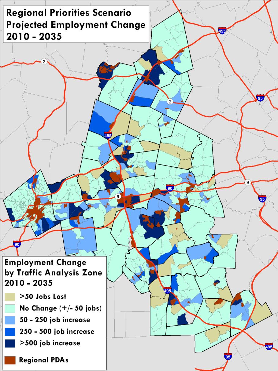
39 Regional Priorities Growth Scenario
40 Regional Priorities Scenario Assume 85% of corridor employment growth in Regional PDAs 45,000 new jobs in Regional PDAs Housing development focused near town centers and transit
41 Scenario Comparison
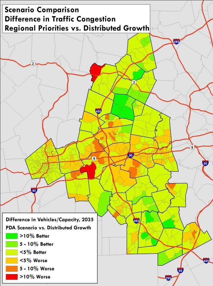
42
43 Impacts of Regional Priorities 15 municipalities with more than 1,000 new jobs 1,350 acres of land converted to commercial use (600 acres less than Distributed Growth) 18,100 jobs through redevelopment 7,520 new jobs projected in municipalities with no public sewer system 7,000 new jobs in MWRA sewer service area Regional PDA employment density increases to 28.6 jobs per acre (average) 56% of jobs in PDAs near existing transit
44 Impacts of Regional Priorities Supports existing employment centers by prioritizing growth where jobs already exist Leverages and protects previous infrastructure investments Reduces the need for new infrastructure extensions Increases transportation choice for workers and residents BUT Might result in less tax revenue for some cities and towns
45 Regionally Significant Transportation Investments
46 Regionally Significant Transportation Investments These investments aim to: Support the Regionally Significant PDAs Avoid adverse impacts to Regionally Significant PPAs Increase regional transportation choices and incorporate last-mile concepts into design plans Support reductions in greenhouse gas emissions as emphasized by the Global Warming Solutions Act and the GreenDOT initiative


47 Regionally Significant Transportation Investments Categories of Investment Category 1: Commuter and Freight Rail Category 2: Regional Transit Authorities Category 3: Highway Interchanges Category 4: Bridges Source: MetroWest Daily News Source: Wicked Local Source: Bing Maps


48 Regionally Significant Transportation Investments Categories of Investment Category 5: Connector Roadways to I-495 Category 6: Regional Bicycle and Pedestrian Connections Category 7: Rail and Roadway Interactions

49 Regionally Significant Transportation Investments Example Example of Category 2: Regional Transit Authorities investment could include: Enhanced service on the MWRTA route 7 between the Framingham commuter rail station and Simarano Drive should be considered to connect employees to the PDA via transit.
50 Regionally Significant Transportation Investments Example Example of Category 3: Highway Interchanges investment could include: At the I-290 and I-495 Interchange, safety and geometric improvements have the potential to reduce crashes and better accommodate merging and weaving movements. Paired with limited expansions in existing capacity, these improvements could reduce overall delay and traffic congestion.
51 Regionally Significant Transportation Investments Example Example of Category 6: Regional Bicycle and Pedestrian Connections investment could include: The Assabet River Rail Trail (ARRT) would provide a shared use path connection between multiple PDAs, including the Tower Street Mill in the Downtown Hudson, Downtown Maynard and South Acton Village.
52 Additional Elements of the Compact Plan

53 Additional Elements of the Housing Compact Plan With the housing gap comes reduced ability to meet affordable and workforce housing needs Actions are recommended to reduce the projected housing gap PDA Development Capacity and Projected Housing Demand 70,000 60,000 50,000 40,000 30,000 20,000 10,000 Housing Units - Local PDA Development Capacity Housing Demand,

54 Additional Elements of the Compact Plan Additional Infrastructure Investment Needs Non-transportation infrastructure needs were cited as critical Actions are proposed for Water and Wastewater resources and for related data needs
55 495/MetroWest Development Compact Plan Web-Based Implementation Toolkit

56 Toolkit Overview Chart
CHAPTER 7: Transportation, Mobility and Circulation
 AGLE AREA COMMUNITY Plan CHAPTER 7 CHAPTER 7: Transportation, Mobility and Circulation Transportation, Mobility and Circulation The purpose of the Transportation, Mobility and Circulation Chapter is to
REVIEW AND EVALUATION OF REGIONAL LAND USE
 REVIEW AND EVALUATION OF REGIONAL LAND USE AND TRANSPORTATION SCENARIOS #220831 Environmental Justice Task Force October 7, 2014 VISION 2050 Process Development of Guiding Vision for Land Use and Transportation
12/9/2013. HOLLYWOOD/PINES CORRIDOR PROJECT AMPO 2013 Annual Conference October 24, Our Perspective. Broward.
 HOLLYWOOD/PINES CORRIDOR PROJECT AMPO 2013 Annual Conference October 24, 2013 Our Perspective Broward Fort Lauderdale 1 Broward Metropolitan Planning Organization Fort Lauderdale Fort Lauderdale Skyline
TRANSPORTATION AND LAND USE
 CHAPTER 10 TRANSPORTATION AND LAND USE Transportation and land use are intimately linked. The expansion of a highway typically spurs housing, employment growth and land development in the communities that
Implementation Guide Comprehensive Plan City of Allen
 Implementation Guide 2030 Comprehensive Plan City of Allen DRAFT 2015 Implementation Guide Allen 2030 Comprehensive Plan INTRODUCTION The Comprehensive Plan serves as a guide for the growth and development
Prepared for the Citizens of Forsyth County by the City-County Planning Board
 Prepared for the Citizens of Forsyth County by the City-County Planning Board Bryce A. Stuart Municipal Building 100 East First Street, Winston-Salem, NC 27101 336.727.8000 www.cityofws.org/planning www.legacy2030.com
Making Transit Oriented Development Work For Boonton, NJ
 Making Transit Oriented Development Work For Boonton, NJ Bloustein School of Planning and Public Policy Studio Dan Burton Loannie Dao Webster Slater Brandon Williams Ian Watson Maria Laham Nicola Mammes
IMPLEMENTING SOMERSET COUNTY S INVESTMENT FRAMEWORK
 IMPLEMENTING SOMERSET COUNTY S INVESTMENT FRAMEWORK SMART CONSERVATION THROUGH SMART GROWTH NJ LAND CONSERVATION RALLY March 22, 2014 Laurette Kratina, PP, AICP, Supervising Planner Somerset County Planning
PSRC REVIEW REPORT & CERTIFICATION RECOMMENDATION
 PSRC REVIEW REPORT & CERTIFICATION RECOMMENDATION KITSAP COUNTY COUNTYWIDE PLANNING POLICIES July 2, 2012 BACKGROUND A major emphasis of the Washington State Growth Management Act (GMA) is the need to
A BLUEPRINT FOR BROCKTON A CITY-WIDE COMPREHENSIVE PLAN
 A BLUEPRINT FOR BROCKTON A CITY-WIDE COMPREHENSIVE PLAN Public Meeting October 2016 1 Plan Summary and Discussion Public Meeting May 4 2017 City of Brockton Bill Carpenter, Mayor Department of Planning
Northern Branch Corridor SDEIS March Table of Contents
 Table of Contents Executive Summary... ES-1 ES.1 Introduction... ES-1 ES.2 Project Background... ES-1 ES.3 Purpose and Need... ES-5 ES.4 Alternatives... ES-6 ES.5 Operating Plan... ES-11 ES.6 Cost Analysis...
Environmental: Urban land..51 acre wet (.30%); 1.01 acres/.59% within a 100 year floodplain; no other environmental indicators limit development.
; 1.01 acres/.59% within a 100 year floodplain; no other environmental indicators limit development.") A N DOV ER Downtown: Designated a State PDA Land Use: Downtown Andover (171.61 acres) is the Town s traditional central business district. It consists of offices, shops, restaurants, civic and institutional
A N DOV ER Downtown: Designated a State PDA Land Use: Downtown Andover (171.61 acres) is the Town s traditional central business district. It consists of offices, shops, restaurants, civic and institutional
Improve Neighborhood Design and Reduce Non Point Source Water Pollution
 HOW TO Planning Guide Improve Neighborhood Design and Reduce Non Point Source Water Pollution This document was funded by a grant from the New Hampshire Coastal Program with funding from the National Oceanic
STUDY AREA LOCATION & CONTEXT:
 UNLOCKING THE POTENTIAL OF THE KEATING CROSS ROAD BUSINESS CORRIDOR A PLAN TO CREATE + RETAIN JOB-GENERATING BUSINESSES AND TO GUIDE INFRASTRUCTURE INVESTMENT The Keating Cross Road Corridor (the Keating
3. ELEMENTS OF THE METRO VISION 2035 PLAN
 3. ELEMENTS OF THE METRO VISION 2035 PLAN What is Metro Vision and why does it matter? For more than 50 years, DRCOG has championed a regional perspective on key issues facing the metropolitan area and
BeltLine Corridor Environmental Study
 BeltLine Corridor Environmental Study Citywide Conversation on Transit and Trails April 2, 2009 Agenda & Introductions Introductions Environmental Study Process Overview of the BeltLine Project BeltLine
178 Carruthers Properties Inc.
 178 Carruthers Properties Inc. Planning Rationale for 178 Carruthers Avenue Site Plan Control Application June 2014 Table of Contents 1.0 Introduction 2.0 Overview of Subject Property 3.0 Current Zoning
Street Flooding Mitigation Plan KYOVA Interstate Planning Commission. Presented to AMPO National Conference October 18, 2017
 Street Flooding Mitigation Plan KYOVA Interstate Planning Commission Presented to AMPO National Conference October 18, 2017 Saleem Salameh, Ph.D., P.E., M.ASCE Chet Parsons, AICP CTP Agenda: Background
The transportation system in a community is an
 7 TRANSPORTATION The transportation system in a community is an important factor contributing to the quality of life of the residents. Without a sound transportation system to bring both goods and patrons
Westport Master Plan. Town of Westport. Master Plan Master Plan Update Committee. Westport, Massachusetts
 Town of Westport Master Plan 2004 Master Plan Update Committee Westport, Massachusetts Open Space and Recreation 5-1 Table of Contents Table of Contents... i List of Tables... ix List of Figures... ix
Mixed Use Zoning A Citizens Guide
 Mixed Use Zoning A Citizens Guide Prepared by the Metropolitan Area Planning Council with support from The Minuteman Advisory Group on Interlocal Coordination and the Commonwealth s Priority Development
Economic Development & Housing Council Committee Comprehensive Plan Update September 20, 2005
 1 Economic Development & Housing Council Committee Comprehensive Plan Update September 20, 2005 Purpose To update the Committee on the ForwardDallas! Plan, including: Status Anticipated Products Public
Municipal Plan*Assessment
 Municipal Plan*Assessment This tool was developed to assist in reviewing municipal master plans and in determining if these plans are consistent with smart growth principles, neighboring municipal plans,
LAND USE MODEL UPDATE. Planning and Land Use Advisory Committee Meeting #2 September 4, 2014
 1 LAND USE MODEL UPDATE Planning and Land Use Advisory Committee Meeting #2 September 4, 2014 2 Presentation Outline Introduction and Recap Model Process Study Design Place Types Suitability Factors 3
TOD 101 CREATING LIVABLE COMMUNITIES WITH TRANSIT
 1 CREATING LIVABLE COMMUNITIES WITH TRANSIT What are transit Centered Communities? Benefits of Partnerships to Support and Implement What You Will Learn Portland s Pearl District Your Trainers Today Catherine
Cumberland Region Tomorrow is a private, non-profit, citizen based regional organization working with Greater Nashville Regional Council
 Cumberland Region Tomorrow is a private, non-profit, citizen based regional organization working with Greater Nashville Regional Council and others in the public and private sectors, dedicated to planning
Onondaga County Sustainable Streets Project. Onondaga County Planning Federation June 7, Onondaga County Sustainable Streets Project 1
 Onondaga County Sustainable Streets Project Onondaga County Planning Federation June 7, 2012 Onondaga County Sustainable Streets Project 1 Sustainable Streets 1. Introduction to the SMTC 2. Sustainable
MONTGOMERY COUNTY METRO STATION AREA DESIGN CHARRETTE
 MONTGOMERY COUNTY METRO STATION AREA DESIGN CHARRETTE Shady Grove Metro Station Area Charrette Closing Presentation October 25-28, 2000 MONTGOMERY COUNTY, MD M-NCPPC Design Collective, Inc. Architects
FDOT D4 Complete Streets
 FDOT D4 Complete Streets Context Sensitive Solutions Directs that complete street solutions will complement the context of the community. Collaborative approach to decision making, project development,
12 AMENDMENT NO. 149, TOWN OF MARKHAM HIGHWAY 404 NORTH SECONDARY PLAN
 12 AMENDMENT NO. 149, TOWN OF MARKHAM HIGHWAY 404 NORTH SECONDARY PLAN The Planning and Economic Development Committee recommends the adoption of the recommendation contained in the following report August
3.9 Systems Interrelationships
 191 Sustainability Building Blocks: The Comprehensive Plan Systems Community Form Economy Social Transportation Natural Resources Housing and Neighborhoods Utilities and Infrastructure Institutions.9 Systems
Secrest Short Cut and Monroe Expressway Small Area Plan AUGUST 29, 2018
 Secrest Short Cut and Monroe Expressway Small Area Plan AUGUST 29, 2018 Background and Process Monroe Expressway will be open by the end of 2018 Union County and Indian Trail identified a need to revisit
TABLE OF CONTENTS. Transportation Chapter 1 - Introduction and Purpose of Planning to 1-3. Utilities
 Chapter 1 - Introduction and Purpose of Planning... 1-1 to 1-3 Pennsylvania Municipalities Planning Code (Act 247)...1-1 Previous County Planning Activities...1-1 Objectives of the Plan...1-2 Elements
FUTURE LAND USE PLAN 7
 FUTURE LAND USE PLAN 7 The recommendations of each of the preceding chapters can be combined to present an overall Future Land Use Plan for Wilton. The Future Land Use Plan, presented on the following
Joint Meeting City Council and the Plan Commission. September 1st, 2015
 Joint Meeting City Council and the Plan Commission September 1st, 2015 1 The City Plan Commission shall recommend a City Plan for the physical development of the City Article IX Section 2 of the City of
CITY OF UNION CITY MINUTES GENERAL PLAN ADVISORY COMMITTEE
 CITY OF UNION CITY MINUTES GENERAL PLAN ADVISORY COMMITTEE WEDNESDAY, MARCH 4, 2015, 6:30 P.M. IN THE CITY COUNCIL CONFERENCE ROOM OF CITY HALL 34009 ALVARADO-NILES BLVD., UNION CITY, CALIFORNIA Attachment
The GATEWAYS Sub Area Master Plan. City of Walker
 The GATEWAYS Sub Area Master Plan City of Walker Introduction: The Walker City Commission and Planning Commission decided in 2011 to create a sub-area master plan for the Remembrance Road and Wilson Avenue
Overview of Southwestern Pennsylvania Commission s (SPC) 2040 Long Range Transportation Plan (LRTP)
 2040 Long Range Transportation Plan (LRTP)") Overview of Southwestern Pennsylvania Commission s (SPC) 2040 Long Range Transportation Plan (LRTP) Presented to Pennsylvania Agency Coordination Meeting May 27, 2015 Doug Smith & Ryan Gordon 1 Southwestern
Overview of Southwestern Pennsylvania Commission s (SPC) 2040 Long Range Transportation Plan (LRTP) Presented to Pennsylvania Agency Coordination Meeting May 27, 2015 Doug Smith & Ryan Gordon 1 Southwestern
Gary & Regional Investment Project. October 27, Creating Tomorrow Today Comprehensive Regional Plan - NIRPC
 Creating Tomorrow Today 2040 Comprehensive Regional Plan Gary & Regional Investment Project October 27, 2010 Creating Tomorrow Today - 2040 Comprehensive Regional Plan - NIRPC What is NIRPC? - Northwestern
Smart Growth for Dallas
 Smart Growth for Dallas Data-driven decisions for the future of Dallas parks, open spaces, and green infrastructure Dallas Park and Recreation Board March 10, 2016 Agenda I. Welcome and Introductions II.
Green Infrastructure The Indianapolis Greenways Connection
 Green Infrastructure The Indianapolis Greenways Connection Fewer things in the transportation industry today make better since than combining the needs for pedestrian and bike trails with the need to locate,
Preliminary Plan Framework: Vision and Goals
 Preliminary Plan Framework: Vision and Goals Draft: May 2015 Introduction Since the Town of Milliken s comprehensive plan was last updated in 2010, the community was heavily impacted by the 2013 flood,
Transportation. Strategies for Action
 Transportation A major priority for the Overlake Neighborhood is to develop a multimodal transportation system. To achieve this system, a balance has to be found among travel, circulation and access needs;
Warren County/Bowling Green Focus 2030 Comprehensive Plan VOLUME 1 INDEX
 Appendix 5: Index VOLUME 1 INDEX A Aesthetics ES-6, FLU-15, FLU-17, FLU-24, NCR-7 Agricultural Base FLU-18, FLU-20 Agricultural Centers, Rural FLU-11 Agricultural District NCR-17-NCR-18 Agricultural Economy
MORRISVILLE TRANSPORTATION PLAN TOWN COUNCIL PRESENTATION AUGUST 22, 2017
 TOWN COUNCIL PRESENTATION AUGUST 22, 2017 SCENARIO PLANNING CORRIDORS Town Hall Drive Baseline + 2 McCrimmon Parkway Baseline + 2 NC 54 Baseline + 2 7 subregion model runs determining carrying capacity
CITY CLERK. Parkland Acquisition Strategic Directions Report (All Wards)
") CITY CLERK Clause embodied in Report No. 10 of the, as adopted by the Council of the City of Toronto at its meeting held on November 6, 7 and 8, 2001. 10 Parkland Acquisition Strategic Directions Report
CITY CLERK Clause embodied in Report No. 10 of the, as adopted by the Council of the City of Toronto at its meeting held on November 6, 7 and 8, 2001. 10 Parkland Acquisition Strategic Directions Report
PRELIMINARY REPORT. HIGHWAY 18 CORRIDOR NEIGHBORHOOD PLAN VILLAGE OF DOUSMAN November, 2014
 PRELIMINARY REPORT HIGHWAY 18 CORRIDOR NEIGHBORHOOD PLAN VILLAGE OF DOUSMAN November, 2014 This preliminary report presents the initial recommendations for land use within the Highway 18 corridor along
EXHIBIT A. Tax Increment Reinvestment Zone No. 1 (Town Center) First Amended Project Plan 1
 First Amended Project Plan 1") EXHIBIT A Tax Increment Reinvestment Zone No. 1 (Town Center) First Amended Project Plan 1 1 As amended by Resolution No. 2008-02-001(TR1R) of the Tax Increment Reinvestment Zone No.1, and approved to
EXHIBIT A Tax Increment Reinvestment Zone No. 1 (Town Center) First Amended Project Plan 1 1 As amended by Resolution No. 2008-02-001(TR1R) of the Tax Increment Reinvestment Zone No.1, and approved to
Access Management: An Overview
 Figures 1-5 Below Evolution of development along a highway. In the early stages, land along the road is used for farming with little traffic generated. As time passes, the highway corridor becomes a de
Urban Development Areas Albemarle County
 1 Urban Development Areas Albemarle County UDA Needs Profile: All UDAs Albemarle County has two UDAs: the Pantops UDA located east of the Rivanna River and the City of Charlottesville, and Places 29 South,
Proposed Comprehensive Plan Strategies DRAFT for discussion June 28, 2017
 Proposed Comprehensive Plan Strategies DRAFT for discussion June 28, 2017 Land Use Rural Areas Refine the Farm and Forest area (FF) Update FF boundaries to account for existing lots less than five acres
Dyersville Downtown Plan. Open House October 24, 2017
 Dyersville Downtown Plan Open House October 24, 2017 What is a Comprehensive Plan? - Vision - Guidance for decisions - Basis for regulations What is a Downtown Plan? - Understand priorities - Identify
SECTION II SECTION II STATEMENT OF GOALS, OBJECTIVES, PRINCIPLES, ASSUMPTIONS, POLICIES AND STANDARDS
 STATEMENT OF GOALS, OBJECTIVES, PRINCIPLES, ASSUMPTIONS, POLICIES AND STANDARDS 1 2 STATEMENT OF GOALS, OBJECTIVES, PRINCIPLES, ASSUMPTIONS, POLICIES AND STANDARDS INTRODUCTION The New Jersey Municipal
BROOKHILL NEIGHBORHOOD MODEL ZONING MAP AMENDMENT PREFACE TO APPLICATION
 BROOKHILL NEIGHBORHOOD MODEL ZONING MAP AMENDMENT PREFACE TO APPLICATION June 15, 2015 Revised: August 1, 2016 I. VISION Brookhill is a proposed community based upon the principles of Albemarle County
Wasatch CHOICE for 2040
 Wasatch CHOICE for 2040 Economic Opportunities We Can Choose a Better Future We enjoy an unparalleled quality of life along the Wasatch Front. People from all over the world are drawn to our stunning scenery,
Asset-Based Development Scenario
 Asset-Based Development Scenario The Asset-Based development scenario emphasizes existing regional assets, concentrating future development around these assets. Regional assets include sports arenas, higher
Robbinsdale LRT Station. CDI Development Guidelines. August Overview
 Robbinsdale LRT Station August 2018 Overview The City of Robbinsdale may have the coolest opportunity site along the 13 mile stretch of the Bottineau LRT corridor / Blue Line extension. Located a block
Windsor Locks Transit-Oriented Development Planning Grant Request. Project Background
 Windsor Locks Transit-Oriented Development Planning Grant Request Project Background Downtown Windsor Locks runs along Main Street in the vicinity of the intersection of Routes 159 and 140. The current
Northwest LRT Downtown to. Northwest Edmonton Study. Public Workshops
 Northwest LRT Downtown to Northwest Edmonton Study Public Workshops March 23 & 24, 2010 Welcome Thank you all for attending Welcome Introductions Welcome Our Team s Commitment to You for Tonight To provide
1.0 Circulation Element
 5/9/18 1.0 Circulation Element 1.1 Introduction As growth and development occur in Apache County, enhancements to its circulation system will be necessary. With time, more roads will be paved and air and
LAND USE ELEMENT. Purpose. General Goals & Policies
 LAND USE ELEMENT Purpose This Land Use Element contains the goals and policies necessary to support the City s responsibility for managing land resources and guiding development through implementing regulations,
City of Meriden Harbor Brook Flood Control Project Overview
 City of Meriden Harbor Brook Flood Control Project Overview Updated August 2013 OVERVIEW The center of Meriden, including the HUB site is the low point of the town which is ringed by basalt ridges. Running
SECTION 1 Introduction...1. SECTION 2 Regional Context Criteria for Planning Districts Description of Planning District...
 Table of Contents SECTION 1 Introduction...1 SECTION 2 Regional Context...2 2.1 - Criteria for Planning Districts...2 2.2 - Description of Planning District...2 SECTION 3 Goals & Objectives...5 SECTION
CHAPTER VI Plan Implementation
 Versailles-Midway CHAPTER VI Plan Implementation While prior sections focused on the tools the Commission needs to help it make the dayto-day decisions associated with subdivision, site plan and rezoning
New Official Plan Quest November 2013
 City of Markham New Official Plan Quest November 2013 Building Markham s Future Together - 6 Key Strategic Priorities 1. Growth - Managing our Growth 2. Transportation/Transit - Improving transportation
Public Forum. Kelley s Corner: The Corner that Connects Us. The Cecil Group. March 7, Acton 2020 Town of Acton.
 Public Forum Acton 2020 Town of Acton March 7, 2013 AGENDA Purpose of Forum Kelley s Corner Project Examples of the Planning Processes Next Steps Dialogue: Questions and Answers PURPOSE Acton 2020 April
Chapter 1 - General Design Guidelines CHAPTER 1 GENERAL DESIGN GUIDELINES
 CHAPTER 1 GENERAL DESIGN GUIDELINES 1.0 INTRODUCTION This Publication has been developed to provide current, uniform procedures and guidelines for the application and design of safe, convenient, efficient
Concord Community Reuse Project Goals and Guiding Principles. Overarching Goals (OG)
") Concord Community Reuse Project Goals and Guiding Principles Overarching Goals (OG) No priority is implied by the order of presentation of the goals and guiding principles. Overarching goals for the Concord
Concord Community Reuse Project Goals and Guiding Principles Overarching Goals (OG) No priority is implied by the order of presentation of the goals and guiding principles. Overarching goals for the Concord
Chapter 10 IMPLEMENTATION RECOMMENDATIONS
 Chapter 10 IMPLEMENTATION RECOMMENDATIONS The recommended land use plan presented in the previous chapter provides a design for the attainment of the urban and rural development and open space preservation
Lesson 6. Corridor Planning
 Lesson 6 Corridor Planning 1 Learning Outcomes Identify land use strategies and solutions that can be incorporated into multimodal transportation corridor plans Identify land use stakeholders and describe
Living in Albemarle County s Urban Places
 Living in Albemarle County s Urban Places ALBEMARLE COUNTY, VIRGINIA A Closer Look at Albemarle s Approach to Managing Growth and Creating Quality Urban Environments www.albemarle.org Page 2 Living in
National Association of Conservation Districts. Kris Hoellen Vice President, Sustainable Programs The Conservation Fund September 19, 2013
 National Association of Conservation Districts Kris Hoellen Vice President, Sustainable Programs The Conservation Fund September 19, 2013 Our Mission The Conservation Fund forges partnerships to conserve
Regional Context Statement
 Regional Context Statement REGIONAL CONTEXT STATEMENT 3. REGIONAL CONTEXT STATEMENT In 1995, the Provincial Government passed into law the Growth Strategies Act. The purpose of this provincial initiative
Northwest commuter rail station US 36 BRT. Westminster Station
 Northwest commuter rail station Westminster Station US 36 BRT Westminster Center US 36 & Church Ranch Broomfield Flatiron/96 th St. US 36 & McCaslin Table Mesa Boulder Junction 13-month effort that will
Gold Line Bus Rapid Transit Transit Oriented Development (BRTOD) Helmo Station Area Plan
 Helmo Station Area Plan") Appendix F Gold Line Bus Rapid Transit Transit Oriented Development (BRTOD) Helmo Station Area Plan Introduction and Purpose of the Plan The Gold Line Bus Rapid Transit facility is an eleven-mile dedicated
Appendix F Gold Line Bus Rapid Transit Transit Oriented Development (BRTOD) Helmo Station Area Plan Introduction and Purpose of the Plan The Gold Line Bus Rapid Transit facility is an eleven-mile dedicated
Sacramento Area Council of Governments (SACOG)
") Sacramento Area Council of Governments (SACOG) The Blueprint Vision The SACOG Board of Directors adopted the Preferred Blueprint Scenario in December 2004, a bold vision for growth that promotes compact,
Sacramento Area Council of Governments (SACOG) The Blueprint Vision The SACOG Board of Directors adopted the Preferred Blueprint Scenario in December 2004, a bold vision for growth that promotes compact,
Sustainably Repositioning Greyfield Sites. Greyfield Sites Anywhere
 Sustainably Repositioning Greyfield Sites Jim Constantine Looney Ricks Kiss Architects Todd Poole 4ward Planning Greyfield Sites Anywhere Pennsylvania Chapter American Planning Association Conference 2009
Plano Tomorrow Vision and Policies
 Plano Tomorrow Vision and Policies PLANO TOMORROW PILLARS The Built Environment The Social Environment The Natural Environment The Economic Environment Land Use and Urban Design Transportation Housing
Transportation Research Center
 Increasing Design Flexibility in the AASHTO Green Book Your Department Name Presentation to AASHTO Subcommittee on Design Doug Harwood, MRIGlobal July 2017 Transportation Research Center Resolution of
Embrace Green Urban Space:
 1 Embrace Green Urban Space: Parks/Green Space as Vital to Urban Livability Jenna Fletcher The Trust for Public Land LUAC November 15, 2012 2 The Trust for Public Land conserves land for people to enjoy
CHAPTER 4 FUTURE LAND USE AND URBAN SERVICES DISTRICTS
 CHAPTER 4 FUTURE LAND USE AND URBAN SERVICES DISTRICTS Introduction This chapter discusses how Benzie County should grow and change in the future. A community can grow and change in many different ways.
ROBBINSDALE LRT STATION CDI DEVELOPMENT GUIDELINES
 August 2018 OVERVIEW The City of Robbinsdale has a prime-opportunity site in the middle of the 13 mile stretch of the Bottineau LRT corridor / Blue Line extension. Robbinsdale offers a prominent, vital,
Route 1 Corridor Study
 Route 1 Corridor Study Westbrook, Connecticut A Vision for the Connecticut Shoreline Public Informational Meeting July 28, 2015 Lower Connecticut River Valley Council of Governments Fitzgerald & Halliday,
This page intentionally blank.
 This page intentionally blank. Parks, Recreation, and Open Space Chapter Relationship to Vision Vision Parks, Recreation and Open Space Chapter Concepts County Government. County government that is accountable
1.0 Introduction. Purpose and Basis for Updating the TMP. Introduction 1
 1.0 Introduction The Town of Castle Rock is situated between the metropolitan areas of Denver and Colorado Springs, amidst a unique terrain of rolling hills, mesas, ravines, and waterways. Like many Front
1 Adapted from the Statewide Transit-Oriented Development Study by CalTrans, 2006
 APPENDIX C: LAND USE PLANNING FOR ENHANCED RAIL SERVICE 72 BACKGROUND One of the consistent themes heard from localities in the Route 29 corridor Planning Forums was the need for expanding rail service
WELCOME TO OPEN HOUSE TWO November 28, 2018
 Langstaff Road Weston Road to Highway 7 Class Environmental Assessment Study WELCOME TO OPEN HOUSE TWO November 28, 2018 Please sign in and join our mailing list Study Overview York Region is conducting
Transportation Land Use Integration & Regional Planning. Don Kostelec, AICP Senior Planner, Louis Berger Group February 1, 2010
 Transportation Land Use Integration & Regional Planning Don Kostelec, AICP Senior Planner, Louis Berger Group February 1, 2010 Transportation Land Use Integration DOT-HUD-EPA Sustainable Communities Initiative
Stakeholder Recommendations Voting Results
 Stakeholder Recommendations Voting Results Public Input Yes No Abstain Total Count 1. On the matters that are of the highest importance to the community, strengthen the related policy statements through
NORTH-SOUTH CORRIDOR STUDY EXECUTIVE SUMMARY. Executive Summary
 Executive Summary Background As congestion continues to affect mobility in the region, the Ozarks Transportation Organization (OTO) is particularly concerned with traffic movement. The North-South Corridor
South Davis County COMMUNITY SPOTLIGHT
 South Davis County COMMUNITY SPOTLIGHT Davis/SLC Community Connector Bus Rapid Transit line connecting SLC & Davis County RTP Phase 1 Project Generate 3,100 average weekday riders Relieve congestion on
Section 4 BUILDING THE MASTER PLAN
 The Master Plan 33 Section 4 BUILDING THE MASTER PLAN Figure 4:1. A collaborative effort characterized the two design workshops sponsored by DISC to create hypothetical Master Plans for the Towers Property
Harlem Avenue Corridor Plan: Corridor Planning Across Municipal Boundaries
 Harlem Avenue Corridor Plan: Corridor Planning Across Municipal Boundaries Heather Tabbert, Manager, Local Planning and Programs Division Regional Transportation Authority (RTA) Jen McNeil Dhadwal, Principal
FUNDING CORRIDOR REVITALIZATION
 FUNDING CORRIDOR REVITALIZATION Integrated corridor planning for the 21 st Century America Planning Association Annual Conference Atlanta, GA April 27, 2014 Mariia Zimmerman, MZ Strategies, LLC mariia@mzstrategies.com
Community Open House March 26 th, 2018
 Community Open House March 26 th, 2018 Open House Agenda 1. Overview of Planning Process What we heard 2. Future Land Use Policy 3. Priority Growth Areas 4. Plan Elements Making it happen What is a Comprehensive
Town of Leicester Route 56 PDA
 Town of Leicester Route 56 PDA Purpose of Analysis The Route 56 (Huntoon Memorial Highway) Highway Business and Industrial corridor was identified as a Priority Development Area in the recently completed
CONTENTS 8.0 LAND USE 8.1 GENERAL LAND USE 8.2 RESIDENTIAL 8.3 MIXED USE 8.4 COMMERCIAL 8.5 EMPLOYMENT LANDS
 8-2 Land Use 8.0 LAND USE CONTENTS 8.1 GENERAL LAND USE 8.1.1 Uses provided for in all Land Use Designations 8.1.2 Uses prohibited in Hazardous Lands, Hazardous Sites and Special Policy Areas 8.1.3 Uses
Shift Rapid Transit Public Participation Meeting May 3, 2017
 Shift Rapid Transit Public Participation Meeting May 3, 2017 Shift Rapid Transit Initiative Largest infrastructure project in the city s history. Rapid Transit initiative will transform London s public
OVERVIEW OF PLANS FOR THE JEFFERSON COUNTY COUNTRYSIDE FARM In the Context of Quality Place Characteristics
 OVERVIEW OF PLANS FOR THE JEFFERSON COUNTY COUNTRYSIDE FARM In the Context of Quality Place Characteristics By Steve Grabow, Professor and Community Development Educator University of Wisconsin-Extension,
Chapter 1 Vision Statement & Goals
 Chapter 1 Section 1.1 Section 1.2 Section 1.3 Section 1.4 Section 1.5 Introduction Vision Statement Visioning Exercise Prioritization of Land Use Issues Goals of the Comprehensive Plan CHAPTER 1 SECTION