VIEW SHAFTS. Figure 32: Existing view shafts which are to be protected and enhanced and desirable new view shafts ANNEX 2
|
|
|
- Sandra Wilkerson
- 5 years ago
- Views:
Transcription
1 VIEW SHAFTS Sight lines, both from within the Viaduct Harbour area, and into the area from without, are a vital component of the character of the area. They are also an invaluable means by which linkages and connections may be made between the Viaduct Harbour area and the Waitemata, as well as between the Central Area core and the harbour generally In order to preserve and enhance view shafts, intrusions into view shafts, such as large trees or structures within streets, and building projections (balconies, signs, etc.) must be evaluated in each case. Enhancement may occur by way of framing, punctuating, or focusing on a view Obstruction of views, especially of the Viaduct and Waitemata Harbour from within and beyond the area, must be avoided The Viaduct Harbour area is also one of the few places where it is possible to view the Central Area core on its waterfront setting, especially from the water s edge along Halsey Street, and from the Eastern and Western Viaducts themselves The views from these places are therefore also particularly important and the designers of development need to pay special attention to the silhouette formed by the facades and roofs of buildings in the Viaduct Harbour area which will be viewed against the backdrop the Central Area core lying to the east and south Urban Design Guidelines: (i) protect, enhance, and open up the view shafts indicated in Proposed Plan Change No. 61 (appendix 17) (ii) protect and enhance view shafts over public space along streets and lanes. Figure 32: Existing view shafts which are to be protected and enhanced and desirable new view shafts CENTRAL AREA SECTION - OPERATIVE 2004 Page 35
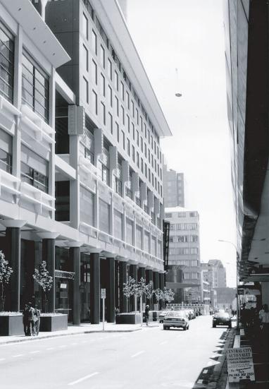
2 CITY BLOCKS In traditional cities, city blocks form the solid material of the city, out of which the public spaces appear to have been carved. Private development is thus shaped by the layout of the public space network, and public space is defined by private development within the city block The Viaduct Harbour area is currently characterised by city blocks which are larger than those in most other parts of the Central Area core, and which make the area relatively impermeable to pedestrian and vehicular movement. These blocks create obstacles to people trying to access the waterfront. Figure 33: Private development as defined by the public space network Figure 34: Public space network as defined by private development Page 36 CENTRAL AREA SECTION - OPERATIVE 2004
3 3.0.3 Urban Design Guidelines: (i) make city blocks more physically, visually, and psychologically permeable by further transecting them with streets, lanes, arcades, and through-site links which, while they may remain in private ownership, should be designed to be publicly accessible, welcoming, and able to be utilised at all times. (ii) provide streets, lanes, alleyways, and arcades, which: - reduce the scale of the built footprints on any city block /site. - create a pattern of public circulation which focuses upon the two main public squares. - respect the historic city grid structuring influence of the Felton Mathew Plan. - recognise all other design guideline directives. (iii) ensure that buildings are constructed to align their front facades precisely with the boundary between their city block/site and the adjacent public space. Buildings should not be set back from the front or side boundaries of their site. Where there are two front boundaries, such as would be the case on a corner site, or where a site spans between two public spaces, then the same requirements will apply. (iv) ensure that there is continuity between building facades so that collectively they produce a continuous built edge definition to any given length of public space. Figure 35: Illustrations of the appropriate scale of city blocks/sites, and of buildings continuously aligned with the boundary between their site and adjoining public space CENTRAL AREA SECTION - OPERATIVE 2004 Page 37
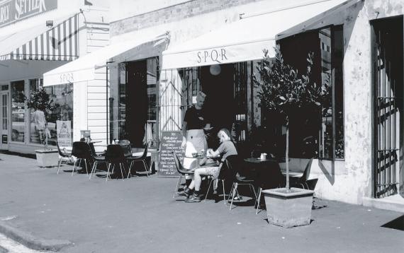
4 BUILDINGS BUILDING CHARACTER: All buildings fronting on to public squares, waterfront promenades, streets, and lanes should contribute to the felt volume 1 of those spaces The scale and character of building elevations will be profoundly influenced by the desired character of the adjoining public space Urban Design Guidelines: (i) produce buildings of varied architectural character within individual city blocks and between development sites. (ii) produce building component proportions, dimensions, details etc., in scale with the human figure. The general scale of city resulting from this would be not unlike that of the existing area of Auckland city comprising High Street, Vulcan Lane, O Connell Street, Lorne Street, or historically intact parts of the Viaduct Harbour itself in 1996, ie: Market Place and Customs Street West. (iii) within the scale outlined above, exhibit simple, traditional street-oriented architectural forms and geometry, and provide relatively low key background architectures, quiet backdrops/stage sets, in order to contrast with and thereby highlight and throw into focus the ever-changing and potentially theatrical quality, intensity, colour, and intricate details of activities associated with the streets, the public places, and the waters of the Viaduct and Waitemata Harbour. (iv) produce buildings with a predominance of vertical rather than horizontal emphases on their elevations. The design of elements on these elevations, the degree to which they can be individually varied by the building occupants (eg. opening windows, doors, shutters, etc.), together with balconies, awnings, window boxes etc., and variations in materials will all contribute to the visual reduction in the scale of buildings and thereby contribute towards achieving an appropriate scale for the adjoining public places. (v) include activities which have a strong interaction with the use of the adjoining public space. (vi) take advantage of operational installations, such as ice towers, which offer unique design opportunities for landmark elements on the Viaduct foreshore. (vii) ensure that all temporary structures should show design sensitivity and recognition of the primary principles set out in these guidelines of public space quality. (viii)take every opportunity to architecturally express their city/ harbour edge setting, and their Pacific regional and cultural qualities. 1. felt volume: a spatial characteristic which is generated by and responds to the characteristics of the vertical wall planes that bound the volume on either side. Felt volume depends upon the elements of a street (carriageway, footpath, and flanking buildings) existing interdependently with one another. Page 38 CENTRAL AREA SECTION - OPERATIVE 2004
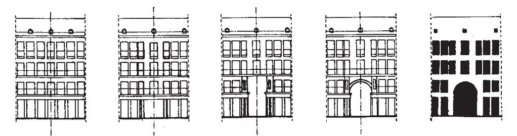
5 WALLS The walls of buildings aligning a public space collectively form the most important single factor in determining the character of that space. The architectural design of these vertical building surfaces and the activities which they reveal to the adjoining public space are equally important Public spaces derive their feeling of volume from the vertical building surfaces that front on to them, while the character of these surfaces contributes to the atmosphere of the spaces There are two particularly important design considerations in the composition of public space walls formed by building facades: - one is the division of the vertical dimension of the wall into the three main elevational zones of base (connection with the ground), middle, and top (connection with the sky). Typically, the ground floor has a higher floor to ceiling height than the floors above (with the exception of the piano nobile 1 tradition). The top floor is sometimes of a lesser floor to ceiling height than those below. - the other is the division of the horizontal dimension of the wall into a series of segments of limited widths (traditionally related to lot sizes and boundaries) which collectively form a continuous edge along the length, or around the edge, of the public space Other important design considerations include: - the degree of physical, spatial, and functional relationship between the ground floor and the adjoining public space. - the ratio of window opening to wall surface. - a gradual reduction in the ratio of window openings to wall surface in the progression from the ground floor level to the top of the building. - the proportions of window and/or door openings. - variation in the window size, reducing from the largest in the base zone, through the middle, to the smallest windows in the top zone. - the dominance of vertical over horizontal elevational and elemental emphases. - the thickness of walls, as revealed by the depths of window and door openings. - the transparency of openings to provide contrast between solid and void. - details such as window sills, lintels, reveals, pediments, and facings. 1. piano nobile: the architecturally most grand and ornate first floor level of residential building types. It typically had tallest of all windows on the street elevation, a floor to ceiling height greater than any other in the building, and was used for the most public rooms ( reception and drawing ) in the house. CENTRAL AREA SECTION - OPERATIVE 2004 Page 39
6 4.2.5 Urban Design Guidelines: (i) ensure that walls create felt volumes of public space. Building elevations should rise to their full height on their street boundary line, and not step back as they increase in height. (ii) provide walls which continuously define the edge of the street space, but with individual variation in architectural character along any given length of street. Variety in street architecture will contribute to incident, intensity, and richness within the street scene. Long lengths of undifferentiated wall are dull. monotonous, and unacceptable. Avoid the use of curtain wall cladding. (iii) produce walls with vertical rather than horizontal proportions and elemental emphases. When seen in perspective, these vertical emphases produce a rhythmic series of vertical elements which attract and hold the interest of the human eye. Vertical emphases are preferable to horizontal emphases which reinforce the vanishing point of the street scene and stimulate the eye to speed rapidly to the end of the vista. (iv) comprise walls which are architecturally demarcated into three distinct vertical zones: - a base (connecting it to the public realm at ground level), a middle, and a top (both signifying the upper limit of the street space and connecting it to the sky). - the base zone should deploy the architectural elements of columns, windows, doors, and recessed entrance ways, all with the purpose of achieving a strong visual and physical integration of exterior and interior worlds, public and private space. - the middle zone should be further subdivided within its vertical dimension. - the top zone should employ the well established architectural elements of cornice, eave, parapet, and pediment to terminate the upper limits of the building, although these archetypal components may be given new interpretations and constructed of materials expressive of contemporary times.they should not become a dominant element in the facade. (v) reinforce these zones by reducing the size of windows in a progression from the largest at the base, through the middle, to the smallest at the top. (vi) ensure that walls at ground floor level are visually and functionally continuous with the adjoining public space. Windows and doors should be able to open up the full width of any individual use at ground floor level. However, large areas of glass should be subdivided into well proportioned components. (vii) ensure that walls above ground floor level read primarily as solid planes into which clear glazed openings have been placed. (viii) achieve a gradual reduction in the ratio of window and/or door openings to wall surface in the progression from the ground floor level to the top of the building (ix) design the height to width proportions of window and/or door openings to produce a square, or a vertical directional emphasis. (x) take particular care that the compositional proportions and qualities of the walls above ground floor level are consistent with and are carried down through the ground floor level, and vice versa. (xi) provide opening windows, irrespective of whether or not a building development is air-conditioned. Page 40 CENTRAL AREA SECTION - OPERATIVE 2004


7 (xii) ensure that any gabled or other shaped parapets forming the upper limits of the walls and a silhouette against the sky and/or city are an accurate expression of the cross-section of the roof immediately behind the parapet. Freestanding triangular or other shaped pediments at the tops of building facades would appear thin and pretentious, especially when viewed from the upper levels of existing buildings in the Central Area core to the east and south. They are also architecturally dishonest in that they do not accurately express the form of the roof behind. In the extreme they can reduce the building to pastiche of a by-gone era. Figure 36: Illustrations of the appropriate character of public space-defining building walls CENTRAL AREA SECTION - OPERATIVE 2004 Page 41

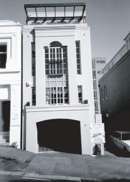
8 ANNEX 2 Figure 37: Illustrations of the appropriate character of public space-defining building walls Page 42 CENTRAL AREA SECTION - OPERATIVE 2004

 use parapets extensively, to conceal roofs in accordance with the established and")
 use parapets to maximise the height of walls delineating and enclosing public space.")
 take advantage of the opportunities offered by parapets to create varied and interesting silhouettes against the")
9 PARAPETS Parapets mark the transition between buildings and the sky. They cap the building and conceal the roof. They provide an alternative to an eave as a means of completing the top of a building, and give maximum vertical height to a facade. They can be deployed to screen architecturally bland but practical and efficient roof forms Urban Design Guidelines: (i) use parapets extensively, to conceal roofs in accordance with the established and characteristic urban architectural design tradition. (ii) use parapets to maximise the height of walls delineating and enclosing public space. (iii) deploy parapets to make architecturally attractive transitions between tops of buildings and the sky. (iv) take advantage of the opportunities offered by parapets to create varied and interesting silhouettes against the sky. Figure 38: Illustrations of the appropriate character of parapets CENTRAL AREA SECTION - OPERATIVE 2004 Page 43


 ensure that the ground surfaces of colonnades are fully compatible and integrated with adjacent")
10 COLONNADES Colonnades are an attractive traditional form of shelter for pedestrian circulation. They provide a covered space, recessed into the ground floor level of a building, with a regular rhythm of columns interlocking public space with adjoining buildings Viewed from within an adjoining public space, a colonnade provides depth and a vertical emphasis to the ground floor level of a building facade, and the columns can provide a basis for establishing the horizontal subdivision of the facade above Urban Design Guidelines: (i) ensure that the ground surfaces of colonnades are fully compatible and integrated with adjacent public space surfaces. Figure 39: Illustrations of the appropriate character of colonnades Page 44 CENTRAL AREA SECTION - OPERATIVE 2004
CITY OF AUCKLAND 44: - DISTRICT PLAN 50 CENTRAL AREA SECTION - OPERATIVE
 ROOFS 4.9.1 In traditional urban settings, roofs are not usually very visible from most areas of public space at ground level. Because roofs were often hidden behind parapets or only revealed themselves
3. PUBLIC SPACE. 3.1 Public Space Network
 3. PUBLIC SPACE 3.1 Public Space Network There are three main types of space in a city: - public, semi-public and private. This document is concerned primarily with public and semi-public urban space.
2.11 PARAPETS AND CORNICES
 2.11 PARAPETS AND CORNICES Parapets and cornices mark the transition between buildings and the sky; they cap the building and conceal the roof. Parapets often extend well above the roof to create an illusion
PART AOTEA PRECINCT
 CONTENTS... PAGE AOTEA PRECINCT...4 14.5.1 INTRODUCTION...4 14.5.2 RESOURCE MANAGEMENT ISSUES...4 14.5.3 RESOURCE MANAGEMENT OBJECTIVES AND POLICIES... 4 14.5.4 RESOURCE MANAGEMENT STRATEGY...5 14.5.5
1. Avoid extensive blank walls that would detract from the experience and appearance of an active streetscape.
 08 ARCHITECTURAL DETAIL Once a building s massing and street wall have been defined, architectural details, including façade variation, materials and window treatment, shape a building s visual identity.
13. New Construction. Context & Character
 13. New Construction Context & Character While historic districts convey a sense of time and place which is retained through the preservation of historic buildings and relationships, these areas continue
Wide asphalt driveway abutting school property. garage built with incompatible materials, too close to park. incompatible fencing materials
 Wide asphalt driveway abutting school property incompatible fencing materials garage built with incompatible materials, too close to park Lack of plantings as a buffer between private property and open
ANNEXURE 2 VIADUCT HARBOUR URBAN DESIGN GUIDELINES
 ANNEXURE 2 VIADUCT HARBOUR URBAN DESIGN GUIDELINES Page 2 CENTRAL AREA SECTION - OPERATIVE 2004 CONTENTS INTRODUCTION...5 BACKGROUND...6 HISTORY OF THE AREA...7 CONTEXT...9 OBJECTIVES OF THE URBAN DESIGN
4 Residential and Urban Living Zones
 4 Residential and Urban Living Zones Refer to Chapters 11 to 20 for additional rules that may apply to these zones. 4.1 OBJECTIVES AND POLICIES Objective Res1 Policy 1 Policy 2 Policy 3 Policy 4 Policy
Resolution : Exhibit A. Downtown District Design Guidelines March 2003
 Resolution 03-011: Exhibit A Downtown District Design Guidelines March 2003 DOWNTOWN DISTRICT DESIGN GUIDELINES CITY OF SOUTHLAKE, TEXAS Adopted March 2003 1 DOWNTOWN DISTRICT DESIGN GUIDELINES Adopted
GUIDELINES TORONTO GENERAL HOSPITAL LOCATION. INTRODUCTION Existing College Wing Buildings and Site Plan - Figure 1A and Figure 1B.
 GENERAL HOSPITAL Development in the south-east quandrant of University Avenue and College Street will be consistent with the following urban design guidelines. LOCATION Lands owned by the Toronto General
I615. Westgate Precinct
 I615. Westgate Precinct I615.1. Precinct Description The Westgate Precinct is located approximately 18km west of the Auckland city centre. There are seven Sub-precincts in the Westgate Precinct: Sub-precinct
I207. Learning Precinct
 I207. Learning Precinct I207.1. Precinct description The Learning Precinct is centred on the Symonds Street ridge where the University of Auckland and Auckland University of Technology have the majority
Building and Site Design Standards
 Commercial Design Standards All Business and Industrial Uses as Described in Section 2234 Requiring Special Permit Review Except Large-Scale Ground Mounted Solar Photovoltaic Installations and Wireless
Future Five. Design/ Development Guidelines. January 2008 Amended June 08 per City Council motion
 Future Five Design/ Development Guidelines January 2008 Amended June 08 per City Council motion 5-Points Design Guidelines Table of Contents I. Introduction 3 II. Area boundaries 4 III. Review Process
Site Planning. 1.0 Site Context. 2.0 Pedestrian Circulation Systems. Pag e 2-23
 The following photographs from throughout the country illustrate key urban design principles. Photographs are provided to illustrate the overall urban design concepts described in Chapter 1 of the Downtown
Building and Public Space Design Guidelines
 AMERICA'S CUP WYNYARD HOBSON Building and Public Space Design Guidelines INTRODUCTION 10 April 2018 The 36 th America s Cup in Auckland requires the construction of new wharf and breakwater structures.
New-Cast Mixed-use Development Proposal King Street West, Newcastle, Ontario
 URBAN DESIGN BRIEF New-Cast Mixed-use Development Proposal King Street West, Newcastle, Ontario TABLE OF CONTENTS: 1.0 Executive Summary 2.0 Creating Vibrant and Sustainable Urban Places: Excerpts from
TALL BUILDING GUIDELINES
 TALL BUILDING GUIDELINES Urban Design Guidance for the Site Planning and Design of Tall Buildings in Milton May, 2018 A Place of Possibility Contents 1.0 INTRODUCTION 1 1.1 What is a Tall Building? 2
2.0 Urban Design Concepts
 0 Urban Design Concepts Urban Design Concept diagrams The Waterfront Axis The Park Axis The Wharf Axis Waterfront Precincts 0.1 The Four Key Concepts: This Concept for the Wynyard Quarter establishes four
Cha p t e r 2: Ge n e r a l De s i g n Gu i d e l i n e s
 Downtown Ann Arbor Design Guidelines Cha p t e r 2: Ge n e r a l De s i g n Gu i d e l i n e s This chapter presents general design guidelines for new site plan or PUD projects in downtown Ann Arbor. The
4.0 Design Guidelines For The Village Centre. South fields Community Architectural Design Guidelines Town of Caledon
 4.0 Design Guidelines For The Village Centre 4.0 Design Guidelines for the Village Centre The Village Centre is the focal point of the entire South Fields Community and is designed as a traditional commercial
APPENDIX MATAKANA COMMERCIAL URBAN DESIGN GUIDELINES
 APPENDIX MATAKANA COMMERCIAL URBAN DESIGN GUIDELINES 1.0 INTRODUCTION The following urban design guidelines are to be utilised by landowners, planners and other persons involved in development at early
PART 14.6 BRITOMART PRECINCT
 CONTENTS...PAGE 14.6.1 INTRODUCTION...4 14.6.2 RESOURCE MANAGEMENT ISSUES...4 14.6.3 RESOURCE MANAGEMENT OBJECTIVES AND POLICIES... 5 14.6.4 RESOURCE MANAGEMENT STRATEGY...7 14.6.5 ANTICIPATED ENVIRONMENTAL
B. Blocks, Buildings and Street Networks
 B. Blocks, Buildings and Street Networks Figure IV.4 A rational block pattern with connected streets Introduction The single most important element in the physical and functional integration of mixed use
WATERFRONT DISTRICT DESIGN STANDARDS
 WATERFRONT DISTRICT DESIGN STANDARDS 20.25.080 WATERFRONT DISTRICT A. Purpose. This section is intended to implement The Waterfront District Subarea Plan by: 1. Creating a safe, vibrant mixed-use urban
BACKGROUND PROJECT DESCRIPTION. Memo
 DATE: March 9, 2016 TO: Architectural Review Committee (ARC) of the Historic Preservation Commission FROM: Pilar LaValley, Preservation Planner, (415) 575 9084 REVIEWED BY: RE: Tim Frye, Preservation Coordinator
MASTER PLAN NO. 62 (SITE DEVELOPMENT PLAN BIRTINYA VILLAGE CENTRE) 2009
 2009") Development Agreement, Development Control Plan 1 - Kawana Waters and Section 6.1.45A (Development Control Plans under Repealed Act) of the Integrated Planning Act 1997 MASTER PLAN NO. 62 (SITE DEVELOPMENT
Development Agreement, Development Control Plan 1 - Kawana Waters and Section 6.1.45A (Development Control Plans under Repealed Act) of the Integrated Planning Act 1997 MASTER PLAN NO. 62 (SITE DEVELOPMENT
Principle 7. Architectural Style and Historic Preservation PRINCIPLE 7
 Principle 7 Architectural Style and Historic Preservation U n i v e r s i t y of Oregon Campus Plan - Third + Edition, 2017 49 Principle 7: Architectural Style and Historic Preservation Principle The
97 Lea Bridge Road, Leyton, E10 7QL London Borough of Waltham Forest December 2015
 97 Lea Bridge Road, Leyton, E10 7QL London Borough of Waltham Forest December 2015 Public Realm and Landscape Proposals LEA BRIDGE ROAD, WALTHAMSTOW Public Realm & Landscape Proposals BDP(90)RPT001 December
Storefront. Cornice. Frieze. Awning. Transom. Recessed entrance. Pier. Display window. Base panel or bulkhead
 Cornice Frieze Awning Transom Recessed entrance Pier Display window Base panel or bulkhead The storefronts in the Ridgewood Village Center Historic District are important features contributing to the downtown
WINDSOR GLEN DESIGN GUIDELINES
 WINDSOR GLEN DESIGN GUIDELINES Adopted by Council, 2006 WINDSOR GLEN REDEVELOPMENT DESIGN GUIDELINES August 2006 1.0 Master Plan Organization For this area of the Coquitlam Town Centre, a mix of high,
LITTLETON CENTER DESIGN GUIDELINES
 LITTLETON CENTER DESIGN GUIDELINES Littleton Center Design Guidelines 1 I. DESIGN REVIEW PROCESS These Design Guidelines have been initially created by Hallin Family LLC (the "Developer"), and govern all
WELLINGTON HOSPITAL DESIGN GUIDE TABLE OF CONTENTS
 WELLINGTON HOSPITAL DESIGN GUIDE TABLE OF CONTENTS 1.0 Introduction Page 2 The Place of Wellington Hospital 2 The Future of the Hospital 2 2.0 The Intention of the Design Guide 3 3.0 Analysis 4 General
Urban Design Brief December 23, 2015 Southside Construction Group Official Plan & Zoning By-Law Amendment
 Urban Design Brief Proposed Official Plan & Zoning By-Law Amendment 3244, 3263 and 3274 Wonderland Road South Southside Group December 23, 2015 TABLE OF CONTENTS Page No. INTRODUCTION... 1 SECTION 1 LAND
Appendix. The following pages provide definitions of some of the more specialized terms used in the Design Guidelines.
 195 Appendix The following pages provide definitions of some of the more specialized terms used in the Design Guidelines. 196 Definitions ACTIVE USE: Retail/services/restaurants, residential entrances,
6. BUILDINGS AND SPACES OF HUMAN SCALE
 The Neighborhood Model: Building Block for the Development Areas Design Approaches 79 6. BUILDINGS AND SPACES OF HUMAN SCALE There are many elements of buildings and spaces that contribute to the creation
Project introduction and relevance:
 Project introduction and relevance: Every city has a central area or district where, most of the social and commercial activity within the city is concentrated. Norzin Lam is in the process of becoming
DESIGN GUIDELINES FOR: INTENSIVE RESIDENTIAL DEVELOPMENT TOWNHOUSE AND ROWHOUSE
 DESIGN GUIDELINES FOR: INTENSIVE RESIDENTIAL DEVELOPMENT TOWNHOUSE AND ROWHOUSE 1. Introduction Townhouse and Rowhouse Building Typologies Within these guidelines, the term rowhouse means a single row
(DC1) Direct Development Control Provision DC1 Area 4
 Direct Development Control Provision DC1 Area 4") . General Purpose (DC) Direct Development Control Provision DC Area 4 The purpose of this Provision is to provide for an area of commercial office employment and residential development in support of the
. General Purpose (DC) Direct Development Control Provision DC Area 4 The purpose of this Provision is to provide for an area of commercial office employment and residential development in support of the
DRAFT DRAFT DRAFT DRAFT
 # 19 EXPAND GREEN AND OPEN SPACES AND COMMUNITY FACILITIES IN TANDEM WITH NEW DEVELOPMENT The role of Eglinton will change in the coming years, along with the intensity of activity and land uses. As more
Character Area 1: Town Core
 Character Area 1: Town Core Map S 354 Copyright Cotswold District Council 109 Character Area 1: Town Core Key Characteristics 355 356 357 358 359 360 361 362 363 364 365 366 367 368 369 370 Copyright Cotswold
RESOURCE MANAGEMENT ACT 1991 CENTRAL OTAGO DISTRICT PLAN PLAN CHANGE 12 : WOOING TREE, CROMWELL
 Annex 1 RESOURCE MANAGEMENT ACT 1991 CENTRAL OTAGO DISTRICT PLAN PLAN CHANGE 12 : WOOING TREE, CROMWELL 1. Amend Section 4 : Rural Resource Area of the Operative Central Otago District Plan by inserting
URBAN DESIGN BRIEF REPORT
 URBAN DESIGN BRIEF REPORT PREPARED FOR 2568401 ONTARIO INC NEW GASBAR, CONVENIENCE STORE & CARWASH DEVELOPMENT @ 1509 FANSHAWE PARK ROAD WEST LONDON, ONTARIO GAMA ENGINEERING INC. PROJECT NUMBER 1669 PREPARED
KEY MAP DEVELOPMENT PERMIT AREA MAP. Sunnymede North Sub-Area Plan
 Richmond Official Community Plan BROADMOOR AREA SUNNYMEDE NORTH SUB-AREA PLAN Bylaw 7100 Schedule 2.6C SUNNYMEDE NORTH SUB-AREA PLAN SUNNYMEDE NORTH SUB-AREA PLAN SUNNYMEDE NORTH SUB-AREA PLAN KEY MAP
VILLAGE OF SKOKIE Design Guidelines for Mixed-Use Districts NX Neighborhood Mixed-Use TX Transit Mixed-Use CX Core Mixed-Use
 VILLAGE OF SKOKIE Design Guidelines for Mixed-Use Districts NX Neighborhood Mixed-Use TX Transit Mixed-Use CX Core Mixed-Use TABLE OF CONTENTS CHAPTER 1 SITE DESIGN Purpose 1 CHAPTER 2 SITE DESIGN Streetscape
PROPOSED WATERFRONT DISTRICT DESIGN STANDARDS
 PROPOSED WATERFRONT DISTRICT DESIGN STANDARDS 20.25 DESIGN REVIEW. 20.25.080 WATERFRONT DISTRICT A. Purpose. This section is intended to implement The Waterfront District Subarea Plan by: 1. Creating a
This chapter contains the design standards and guidelines for development and improvement of office and industrial buildings and
 CHAPTER 4: INDUSTRIAL AND OFFICE This chapter contains the design standards and guidelines for development and improvement of office and industrial buildings and projects. Applicants should discuss specific
I209 Quay Park Precinct
 I209. Quay Park I209.1. Precinct description The Quay Park Precinct is located on reclaimed land at the eastern end of the city centre and along the City Centre waterfront. It is dissected to the east
SCHEDULE 12 TO THE DESIGN AND DEVELOPMENT OVERLAY GLEN WAVERLEY ACTIVITY CENTRE STRUCTURE PLAN
 DD/MM/YY Proposed C120 SCHEDULE 12 TO THE DESIGN AND DEVELOPMENT OVERLAY Shown on the planning scheme map as DDO12. GLEN WAVERLEY ACTIVITY CENTRE STRUCTURE PLAN 1.0 Design objectives DD/MM/YY Proposed
To receive Tax Abatement, structures must comply with the Green Building Standard.
 The Housing Design Review Subcommittee evaluates new residential construction proposals for compliance with the City s goals for Compatibility, Sustainability, and Walkability. These goals are outlined
FLORIN ROAD CORRIDOR Site Plan and Design Review Guidelines Checklist
 FLORIN ROAD CORRIDOR Site Plan and Design Review Guidelines Checklist Applicant s Name: Project Address: Phone: Email: Applicant shall fill out the design guidelines checklist for all guidelines applicable
INSTITUTIONAL USE DESIGN COMPATIBILITY TECHNIQUES
 INSTITUTIONAL USE DESIGN COMPATIBILITY TECHNIQUES INTRODUCTION Community institutions are an important part of the character and vitality of neighborhoods in Forsyth County. Institutional uses include
Part 10 Town Centre Area Plans Toronto
 CONTENTS: 1 INTRODUCTION... 3 1.1 BACKGROUND... 3 1.2 EXISTING CHARACTER... 4 1.3 ENVIRONMENTAL CONSTRAINTS... 6 1.4 DESIRED FUTURE CHARACTER... 6 2 DEVELOPMENT CONTROLS... 8 2.1 BLOCK CONTROLS... 9 3
Residential Design Guidelines
 Residential Design Guidelines Single-Family Residential Design Guidelines Introduction These guidelines seek to provide property owners, designers and developers with a clear understanding of the City
Highland Village Green Design Guidelines
 Highland Village Green Design Guidelines Publishing Information Title Highland Village Green Design Guidelins Author The City of Calgary Status DRAFT - Proposed document subject to changes Additional Copies
6 BRIDGES. 6.1 Design philosophy. Proposed bridges
 SECTION 6 BRIDGES 6 BRIDGES Throughout the Project, bridges are a key visual element and marker for road users, pedestrians and cyclists. The design of bridges, as with other visible structures, has been
PUBLIC REALM STRATEGY
 CONSULTATION DRAFT PUBLIC REALM STRATEGY Trenchard Street & Frogmore Street City Design Group Place Directorate Public Realm Strategy Trenchard Street & Frogmore Street Contents 1. Introduction 2. Understanding
GUIDING PRINCIPLES IN THIS CHAPTER
 GUIDING PRINCIPLES The guiding principles and design concepts in this chapter work together with the Chapel Hill 2020 Comprehensive Plan to support new public places that can be enjoyed by all while also
ILLUSTRATIVE DESIGN GUIDELINES FOR OFFICE DEVELOPMENT
 The purpose of this guide is to provide a helpful illustration of the objectives and action strategies contained in the Comprehensive Plan concerning the promotion of high-quality office buildings within
SUBCHAPTER 4-B GUIDELINES FOR THE B-3 COMMERCIAL CHARACTER AREA
 1 SUBCHAPTER 4-B GUIDELINES FOR THE B-3 COMMERCIAL CHARACTER AREA Downtown Bozeman should be the location of buildings of greatest height and intensity in the community. The following guidelines apply
PART QUEEN STREET VALLEY PRECINCT
 CONTENTS... PAGE 14.4.1 INTRODUCTION...4 14.4.2 RESOURCE MANAGEMENT ISSUES...5 14.4.3 RESOURCE MANAGEMENT OBJECTIVES AND POLICIES...5 14.4.4 RESOURCE MANAGEMENT STRATEGY...7 14.4.5 ANTICIPATED ENVIRONMENTAL
D18. Special Character Areas Overlay Residential and Business
 D18 Overlay Residential and Business D18. Overlay Residential and Business D18.1. Background The Overlay Residential and Business seeks to retain and manage the special character values of specific residential
Memorial Business Park Site. Proposed Future Development. Design guidelines. August
 Memorial Business Park Site Proposed Future Development Design guidelines August 2014 www.designenvironment.co.nz 0064 3 358 3040 Contents 1.0 Background 1.1 Introduction 3 1.2 Objectives 4 2.0 Context
CHAPTER 3. Design Standards for Business, Commercial, Industrial, Recreational and Institutional Uses
 CHAPTER 3 Design Standards for Business, Commercial, Section Number Title Ordinance Number Date of Ordinance 16-3-1 Applicability 2006-11 2008-04 07-01-08 16-3-2 Uniform Standards for Architectural Design
appendix and street interface guidelines
 appendix five: building and street interface guidelines appendix 5 building and street interface guidelines BOULEVARDS Boulevards are generally characterized by higher levels of traffic movement at higher
SIMPLOT OFFICE BUILDING
 SIMPLOT OFFICE BUILDING 1) Urban Context and conformance with the River Myrtle Masterplan The proposed project is part of a larger development on the block between 9th and 11th, and Myrtle and Front Street.By
Urban Design Guidelines Townhouse and Apartment Built Form
 Urban Design Guidelines Townhouse and Apartment Built Form Town of Wasaga Beach Table of Contents 1. Introduction 1.1. Purpose 1.2. Urban Design Principles 1.3. Application of Guidelines 2. Site Design,
Policies and Code Intent Sections Related to Town Center
 Policies and Code Intent Sections Related to Town Center The Town Center Vision is scattered throughout the Comprehensive Plan, development code and the 1994 Town Center Plan. What follows are sections
Proposed for Vic West Neighbourhood Plan. Design Guidelines for Intensive Residential Development - Townhouse and Attached Dwelling
 Proposed for Vic West Neighbourhood Plan Design Guidelines for Intensive Residential Development - Townhouse and Attached Dwelling Design Guidelines for Intensive Residential Development - Townhouse and
Duplex Design Guidelines
 Duplex Design Guidelines Adopted by Council May 29, 2006 Prepared By: Table of Contents 1.0 Application and Intent 1 2.0 Areas of Application 2 3.0 Design Principles 3 4.0 Design Guidelines 4 4.1 Site
/05 Architectural Response
 /05 Architectural Response 5.1 Inspiration Stacked Boxes (Artist : Rachael Whiteread) Cubism ( Architect : Le Corbusier) 52 1133 Melville Rezoning Submission Patterns ( Textile Artist : Annie Albers) Overlapping
CHAPTER 6 DESIGN GUIDELINES FOR INDIVIDUAL BUILDING ELEMENTS. Commercial Facades
 Design Guidelines for Historic Resources CHAPTER 6 DESIGN GUIDELINES FOR INDIVIDUAL BUILDING ELEMENTS This chapter presents design guidelines for the preservation of individual historic building elements
Nelson Residential Street Frontage Guideline
 DRAFT 22-06-2012 Nelson Residential Street Frontage Guideline June 2012 1317273 Contents and purpose Residential s are important Residential s are much more than corridors which move traffic. Streets allow
built form design guidelines
 built form design guidelines Derry Green Corporate Business Park 17 built form design guidelines.1 Built Form Design Guidelines Section : Built Form Design Guidelines is intended to be used by both developers
Chapter 3: Office & Office Mixed-Use Project Types
 Chapter Contents Purpose... 3-2 Applicability and Use Types...3-3 (1) Site Design...3-4 Building Placement and Orientation...3-5 Circulation and Vehicle Parking...3-6 Bicycle/Pedestrian Amenities...3-8
FREEWAY/TOURIST DISTRICT
 FREEWAY/TOURIST DISTRICT DESIGN STANDARDS FOR THE CITY OF MOUNTLAKE TERRACE March, 2014 MOUNTLAKE TERRACE FREEWAY/TOURIST DESIGN STANDARDS March, 2014 1 TABLE OF CONTENTS Introduction...1 Design Site Design
Revitalization Guidelines for Corridors, Villages and Town Centres
 Revitalization Guidelines for Corridors, Villages and Town Centres July 2017 Updated May, 2018 Publishing Information Title: Prepared by: Revitalization Guidelines for Corridors, Villages and Town Centres
ILLUSTRATIVE DESIGN GUIDELINES FOR OFFICE DEVELOPMENT. Introduction
 Community Design Office Development PRINCE WILLIAM COUNTY 2008 COMPREHENSIVE PLAN ILLUSTRATIVE DESIGN GUIDELINES FOR OFFICE DEVELOPMENT The purpose of this guide is to provide a helpful illustration of
1. General Purpose. 3. Uses
 1. General Purpose The purpose of this DC1 Provision is to facilitate the development of a pedestrian friendly Community Commercial Centre that may accommodate a range of commercial, residential, office,
TABLE OF CONTENTS 1.0 INTRODUCTION... 3
 TABLE OF CONTENTS 1.0 INTRODUCTION... 3 1.1. BACKGROUND... 3 1.2. THE PROPOSAL... 5 2.0 EXISTING POLICY FRAMEWORK... 5 2.1. PROVINCIAL POLICY STATEMENT (PPS)... 5 2.2. CITY OF LONDON OFFICIAL PLAN (OP)...
Boundaries and Fencing
 Boundaries and Fencing Introduction 7.1 The purpose of this chapter of the design code is to establish design principles and parameters to guide the development and erection of site boundaries within the
Winston Road Neighbourhood Town of Grimsby. Urban Design Manual. February 2016
 Winston Road Neighbourhood Town of Grimsby Urban Design Manual February 2016 FEBRUARY 2016 Winston Road Neighbourhood Urban Design Manual Town of Grimsby 1 2 3 Contents Introduction Document Overview...
Central Area Urban Design Guide
 Last Amended 12 September 2012 Central Area Design Guide Operative 27/07/00 Central Area Urban Design Guide Contents Introduction - Intention - Using this Guide Wellington Context 1 Design Coherence -
I539. Smales 2 Precinct
 I539. Smales 2 Precinct I539.1. Precinct Description The Smales 2 Precinct applies to a 4.8 hectare block of land located on the southern side of Northcote Road and fronting Lake Pupuke, Takapuna. The
Buildings may be set back to create small plazas provided that these setbacks do not substantially disrupt the street wall s continuity.
 6-22 Community Design Street Walls and Street-front Setbacks The siting of buildings will play a critical role in establishing the character and sense of place for the District. Siting buildings at the
Infill Residential Design Guidelines
 Infill Residential Design Guidelines Adopted March 23, 2004 Amended September 10, 2013 City of Orange Community Development Department Planning Division Phone: (714) 744-7220 Fax: (714) 744-7222 www.cityoforange.org
CITY COTTAGE 2017 AIA INDIANAPOLIS DESIGN AWARDS
 2017 AIA INDIANAPOLIS DESIGN AWARDS 513 E. 11th Street, Indianapolis, IN 46202 Category 2: New Building, Less Than $5 Million Construction Cost Project Type: Private Residence Substantial Completion: December
The Proposed Auckland Unitary Plan (notified 30 September 2013)
") 3 Business zones Introduction There are 10 business zones in the Unitary Plan: City Centre Metropolitan Centre Town Centre Local Centre Neighbourhood Centre Mixed Use General Business Business Park Light
3 Business zones Introduction There are 10 business zones in the Unitary Plan: City Centre Metropolitan Centre Town Centre Local Centre Neighbourhood Centre Mixed Use General Business Business Park Light
Planning scheme policy for Landsborough (urban design guidelines)
") SC6.2 SC6.2.1 Planning scheme policy for Landsborough (urban design guidelines) Purpose The purpose of this planning scheme policy is to provide advice about achieving outcomes in the Landsborough local
SC6.2 SC6.2.1 Planning scheme policy for Landsborough (urban design guidelines) Purpose The purpose of this planning scheme policy is to provide advice about achieving outcomes in the Landsborough local
Morgan s Subdivision Historic District Character-defining Features
 Morgan s Subdivision Historic District Character-defining Features DISTRICT DESCRIPTION This small addition, designed as a neighborhood for those wishing to move east from Capitol Hill, was predominantly
Urban Design Brief to 1557 Gordon Street & 34 Lowes Road West
 Urban Design Brief 1533 to 1557 Gordon Street & 34 Lowes Road West Reid s Heritage Homes Ltd. & 883928 Ontario Ltd. and RHH Property Management Ltd. City of Guelph Zoning By-law Amendment November 2017
Appendix A COMMUNITY IMPROVEMENT PLAN DESIGN GUIDELINES
 Appendix A COMMUNITY IMPROVEMENT PLAN DESIGN GUIDELINES INTRODUCTION The continuous and desirable improvement of Arnprior requires a clear understanding of what is envisioned for the Town. These Design
CENTERS AND CORRIDORS
 INITIAL DESIGN STANDARDS AND GUIDELINES for CENTERS AND CORRIDORS City of Spokane Planning Services Third Floor, City Hall 808 W. Spokane Falls Blvd. Spokane, WA 99201-3329 (509) 625-6300 www.spokaneplanning.org
4. INDUSTRIAL 53 CASTLE ROCK DESIGN
 4. INDUSTRIAL 53 CASTLE ROCK DESIGN CASTLE ROCK DESIGN 54 4. INDUSTRIAL Overview Well-designed and attractive industrial centers are the product of blending economic realities with both functional and
Baker Historic District
 DISTRICT DESCRIPTION This is a historically middle-class neighborhood in the South Side, an area annexed by Denver in 1883, consisting of more than 20 tightly interwoven residential subdivisions. The earliest
Downtown Streetscape Manual & Built Form Standards
 City of Guelph Downtown Streetscape Manual & Built Form Standards July 2014 Prepared by Brook McIlroy Inc. in association with Unterman McPhail Associates and McCormick Rankin Inc. City of Guelph Downtown
Walnut Creek Transit Village Design Guidelines. Part Three III - 25
 C. General Design Criteria Part Three DRAFT 0/6/ III - 5 Frontage Types Frontage is a semi-public transition zone at the ground level where public and private realms meet. An understanding of various frontage
APPENDIX C. Architectural and Environmental Design Standards. Environmentally sensitive areas should be protected.
 APPENDIX C Architectural and Environmental Design Standards Environmentally Sensitive Areas Goal A. Environmentally sensitive areas should be protected. Development, such as roads, houses, and other structures,
Chapter 5 Urban Design and Public Realm
 5.1 Introduction Public realm is all areas of the urban fabric to which the public have access. It is where physical interaction takes place between people. It therefore, includes buildings and their design,