PUBLIC PARKS AND FACILITIES, SERVING NEIGHBORHOOD RECREATIONAL AND COMMUNITY EVENTS BUILDINGS BUILT TO THE LINE AND ORIENTED TOWARD THE STREET
|
|
|
- Loreen Doris Woods
- 5 years ago
- Views:
Transcription
1
2 BUILDINGS BUILT TO THE LINE AND ORIENTED TOWARD THE STREET PUBLIC PARKS AND FACILITIES, SERVING NEIGHBORHOOD RECREATIONAL AND COMMUNITY EVENTS CONNECTED & COMPLETE STREETS AND STREET GRID VIEW SHEDS GROUND FLOOR RETAIL & UPPER STORY RESIDENTIAL (LIVE/WORK UNITS) PEDESTRIAN CONNECTIONS WITH NARROW STREETS, WIDE SIDEWALKS, AND ON-STREET PARKING HIDDEN BUILDING SERVICE EQUIPMENT REAR, SIDE, OR UNDER-BUILDING PARKING, PARK & RIDE, AND TRANSIT SERVICE INTERESTING BUILDING FACADES, STREET FURNITURE, BANNERS AND PLANTINGS FOR ENHANCED APPEARANCE ACTIVE AUKE BAY CENTER
 Buildings close to sidewalks An attractive sense-of-place for pedestrians Pedestrians")

3 BUILDINGS BUILT TO THE LINE AND ORIENTED TOWARD THE STREET Creating a walkable, save, efficient sense of place Small front yard setbacks (<10 ft) Buildings close to sidewalks An attractive sense-of-place for pedestrians Pedestrians will enjoy buildings architectural elements Human scale Vibrant pedestrian setting Town center atmosphere Buildings built to the line and oriented towards the street Bainbridge Island, WA Mixed -Use Waterfront with strong Building Orientation


4 CONNECTED & COMPLETE STREETS AND STREET GRID Provide connection for shopping, businesses, residences, and parks Facilitate small lots and alleys for better use of space and density Pedestrian-friendly and safe design Alleys and small streets as a means for traffic calming Pedestrian-only routes, lighting, grades, canopies can all add to street comfort, attraction, and usage


5 GROUND FLOOR RETAIL & UPPER STORY RESIDENTIAL (LIVE/WORK UNITS) Environment for living, working, shopping, and entertaining Mixture of uses Attract shops, restaurants, housing choices, etc. Town center atmosphere Upper floors more attractive for residential noise requirements, as well as attractive for being close to city center More affordable housing opportunities as density increases. Bar Harbor, MA Hill-Side development Utilizing Slope


6 HIDDEN BUILDING SERVICE EQUIPMENT Outdoor mechanical on rooftops or in back of buildings Lessen noise problems and visual blight Diminish unsightly appearances to create an attractive neighborhood Nearby users should be taken into consideration when locating trash receptacles and loading bays


7 INTERESTING BUILDING FACADES, STREET FURNITURE, BANNERS AND PLANTINGS FOR ENHANCED APPEARANCE Designs that form and complement the unique setting of Auke Bay Center Emphasizing features such as windows, entrances, and rooflines to attract pedestrians and act as security element Building facades enhance the civic nature, sense of place, and pedestrian-oriented character Avoid long expanses of blank walls Planters, banners, furniture and lighting attract people, add energy, vibrancy, and a unique sense of place A Avenue, Lake Oswego, WA Rockport, MA Portland, OR


8 PUBLIC PARKS AND FACILITIES, SERVING NEIGHBORHOOD RECREATIONAL AND COMMUNITY EVENTS Be consistent with goals and objectives of CBJ s existing Park & Recreation Comprehensive Plan Serve a significan proportion of the area s desnsity with a quarter mile Designed to be programmed for community events year-round Bowen Village rendering Active Public Space/Center


9 View Points Map VIEW SHEDS Protect scenic vistas and view points Allow Auke Bay area and community to preserve its unique charm and civic pride Attract positive grown to the area Higher property values Strengthening tourism Contributing to the overall enjoyment of the area Key viewpoints to maintain: Looking toward Auke Bay from the intersection of Bayview and Glacier Hwy; Sidewalk in front of Chan s Restaurant and SE Waffle Company; Auke Bay from the crest of the hill at Back Loop Rd to the round-a-bout; Approaching the opening of UAS student housing and Auke Lake at 4300 University Dr; UAS dock looking east across Auke Lake; Glacier Hwy near Auke Lake parking area turnoff; Glacier Hwy heading north as you approach the round-about; Looking toward the land and harbors in Auke Bay; and From the bottom of Horton parking looking toward Auke Bay National Harbor, MD Auke Bay, AK


10 PEDESTRIAN CONNECTIONS WITH NARROW STREETS, WIDE SIDEWALKS, AND ON-STREET PARKING Narrow streets decrease vehicular speed and noise, while increasing pedestrian and bicycle safety Wide sidewalks provide pedestrians with pleasant, safe, and convenient walking places Canopies provide rain shelter and comfort Narrow streets save construction costs On-street parking buffers pedestrians from vehicle traffic Convenient short-term parking for nearby businesses Linkages between properties that: contribute to connecting residents to UAS, waterfront, or businesses; consider view opportunities; foster opportunities for art, culture, and educational kiosks; and address all-season weather and lighting conditions. Anchorage Downtown Comprehensive plan Anchorage Downtown Comprehensive plan


11 REAR, SIDE, OR UNDER-BUILDING PARKING, PARK & RIDE, AND TRANSIT SERVICE Can create an attractive downtown setting Transit facilities located near high intense uses, designed with pedestrian linkages, and compliment the sense of place of the town center Should be designed for other uses to maximize use of land Designed to be utilized for community events year-round Whitehorse, Canada Nose out parking for better visibiilty


12 ACTIVE AUKE BAY CENTER Strong sense of community pride and neighborhood harmony Designed for higher residential density to create a town center setting Attract a mix of shopping, dining, art, music, and marine- and education-related services and events Create a desirable town center lifestyle and quality Well planned, managed, and maintained to ensure safety and enjoyment as Auke Bay grows Multii-coordinated and well-communicated efforts among government and public organizations and groups Grassroots effort Architectural rendering Rome, NY planning
DRAFT. 10% Common Open Space
 % OF CHARLOTTE IS CATEGORIZED AS A. LAND USES : Placeholder map displaying location of Place Type GOALS: Accommodate XX% of future growth. Provide a concentration of primarily commercial and civic activity
Policies and Code Intent Sections Related to Town Center
 Policies and Code Intent Sections Related to Town Center The Town Center Vision is scattered throughout the Comprehensive Plan, development code and the 1994 Town Center Plan. What follows are sections
Community Design Plan
 Gardena General Plan 2006 Authority While the is not a required element of a General Plan, it is included because improving the community appearance and image is paramount to the overall quality of life
appendix and street interface guidelines
 appendix five: building and street interface guidelines appendix 5 building and street interface guidelines BOULEVARDS Boulevards are generally characterized by higher levels of traffic movement at higher
V. Gateways GATEWAYS / V-1
 V. GATEWAYS / V-1 Many of Chesapeake s gateways are located on highways and call for bold and attractive designs that motorists can understand, appreciate, and enjoy. can also take the form of natural
WEST LOOP DESIGN GUIDELINES CHECKLIST
 WEST LOOP DESIGN GUIDELINES CHECKLIST Section 1.0 General Strategies 1.1 DESIGN EXCELLENCE: ENCOURAGE HIGH QUALITY AND INNOVATIVE DESIGN OF NEW BUILDINGS WITHIN THE WEST LOOP WITHOUT BEING PRESCRIPTIVE
Recommended changes to the Comprehensive Plan Land Use designation
 Recommended changes to the Comprehensive Plan Land Use designation Purpose of Comprehensive Plan land use designations The designation provides a long term vision of the use/ density/ intensity of neighborhoods
FRUITVALE TRANSIT VILLAGE (Phase 2) Residential Project
 Residential Project") FRUITVALE TRANSIT VILLAGE (Phase 2) Residential Project DEVELOPER: SIGNATURE PROPERTIES ARCHITECT: HKIT ARCHITECTS April 23, 2010 TABLE OF CONTENTS 3 Vision 4 Description of Site 5 Guiding Concepts 6
FRUITVALE TRANSIT VILLAGE (Phase 2) Residential Project DEVELOPER: SIGNATURE PROPERTIES ARCHITECT: HKIT ARCHITECTS April 23, 2010 TABLE OF CONTENTS 3 Vision 4 Description of Site 5 Guiding Concepts 6
FLORIN ROAD CORRIDOR Site Plan and Design Review Guidelines Checklist
 FLORIN ROAD CORRIDOR Site Plan and Design Review Guidelines Checklist Applicant s Name: Project Address: Phone: Email: Applicant shall fill out the design guidelines checklist for all guidelines applicable
BROOKHILL NEIGHBORHOOD MODEL ZONING MAP AMENDMENT PREFACE TO APPLICATION
 BROOKHILL NEIGHBORHOOD MODEL ZONING MAP AMENDMENT PREFACE TO APPLICATION June 15, 2015 Revised: August 1, 2016 I. VISION Brookhill is a proposed community based upon the principles of Albemarle County
4.0 Design Guidelines For The Village Centre. South fields Community Architectural Design Guidelines Town of Caledon
 4.0 Design Guidelines For The Village Centre 4.0 Design Guidelines for the Village Centre The Village Centre is the focal point of the entire South Fields Community and is designed as a traditional commercial
Draft Memorandum #1: Goals and Vision for Revitalization
 Keizer Revitalization Plan Draft Memorandum #1: Goals and Vision for Revitalization Submitted to: City of Keizer April 12, 2018 (revised) Prepared By: Angelo Planning Group and Otak, Inc. Project No. 17482.A
MIXED-USE VILLAGE OVERLAY FLOATING DISTRICT
 MIXED-USE VILLAGE OVERLAY FLOATING DISTRICT Zoning regulations developed by committee to the Planning Board for the Town of DeWitt, NY Issue date: 13 July 2017 revised 3/12/2018, revised 4/26/2018, 5/9/2018
3.1 community vision. 3.3 required plan elements
 Chapter 3 Community Form 3.1 community vision 3.2 Parks & landscaping concepts 3.3 required plan elements D R A F T 20 Community Form Chapter 3 3.0 Community form 3.1 community vision The Specific Plan
Town Center (part of the Comprehensive Plan)
") Town Center (part of the Comprehensive Plan) Mercer Island Town Center Looking North (2014) In 1994, a year-long process culminated in a set of design guidelines and code requirements for the Town Center
Town Center (part of the Comprehensive Plan) Mercer Island Town Center Looking North (2014) In 1994, a year-long process culminated in a set of design guidelines and code requirements for the Town Center
5.1 Site Plan Guidelines
 5. Community Core Guidelines Development of the Community Core will take place by plan of subdivision and site plan approval. It will occur in a phased manner that will reflect the timing of residential
1 Adapted from the Statewide Transit-Oriented Development Study by CalTrans, 2006
 APPENDIX C: LAND USE PLANNING FOR ENHANCED RAIL SERVICE 72 BACKGROUND One of the consistent themes heard from localities in the Route 29 corridor Planning Forums was the need for expanding rail service
Metro. Activity Center Design Guidelines. Recommendations For Developing Focused, Mixed-Use Commercial/Residential Centers
 Metro Activity Center Design Guidelines Recommendations For Developing Focused, Mixed-Use Commercial/Residential Centers Metro Activity Centers What is a MAC? Legacy, the adopted guide for the future growth
EXISTING COMPREHENSIVE PLAN
 EXISTING COMPREHENSIVE PLAN Town Center Land Use Element: V. LAND USE POLICIES Town Center Mercer Island's business district vision as described in "Your Mercer Island Citizen-Designed Downtown" was an
CITY OF WAUKEGAN MASTER PLAN AND DESIGN GUIDELINES
 CITY OF WAUKEGAN MASTER PLAN AND DESIGN GUIDELINES Presented to College of Lake County 10/24/13 Master Plan Background 2002 Urban Land Institute 2003 January creation of the plan begins 2003 July city
PINE CURVE REZONING. BACKGROUND Purchased as two parcels in 2001 and 2002
 BACKGROUND Purchased as two parcels in 2001 and 2002 WHAT THE PROJECT IS AND IS NOT A Rezoning establishes the land use standards for Annexed and Zoned Greater Downtown District Historic Center September
PLANNING ADVISORY BOARD AGENDA OCTOBER
 ! City of Langley PLANNING ADVISORY BOARD AGENDA OCTOBER 1, 2014 3-5pm LANGLEY CITY HALL - 112 2 nd Street, Langley WA 1) Call to Order and Roll Call 2) Approval of the Minutes September 10, 2014 3) Public
, C-MS I June 3, 2016 $1500 pd chk #216918
 , C-MS-8 LOTS 21 THROUGH 40, INCLUSIVE, BLOCK 299 CLEMENTS ADDITION TO THE CITY OF DENVER SOUTHEAST QUARTER OF SECTION 34, TOWNSHIP 3 SOUTH, RANGE 68 WEST, SIXTH PRINCIPAL MERIDIAN, CITY
VISION, GOALS & CONCEPT DIAGRAM 2.0
 CHAPTER 2.0 2.1 Vision Creation Process 2.2 City Center Vision Statement, Goals and Objectives 2.3 Individual Zone Visions 2.4 Steps in City Building 2.5 Urban Form Concept Diagram for City Center VISION,
Sheridan Boulevard S TAT I O N A R E A P L A N S H E R I D A N B O U L E VA R D S TAT I O N A R E A P L A N
 Sheridan Boulevard S TAT I O N A R E A P L A N 1 City of Lakewood Adopted November, 2006 S H E R I D A N B O U L E VA R D S TAT I O N A R E A P L A N The Vision The City of Lakewood s overall vision is
2.0 AREA PLANS. Lakeside Business District. Lakeside Business District Land Use Categories:
 Lakeside Business District Lakeside Business District Land Use Categories: Campus Commercial Campus Commercial means a mixture of uses which includes corporate offices, office parks, hotels, commercial,
PINE CURVE REZONING. Property does not meet criteria for open space preservation and is not a candidate for a park
 PINE CURVE REZONING BACKGROUND Purchased as two parcels in 2001 and 2002 Annexed and Zoned Greater Downtown District Historic Center September 25, 2002 and October 7, 2002 WHAT THE PROJECT IS AND IS NOT
Wadsworth Boulevard S TAT I O N A R E A P L A N
 Wadsworth Boulevard S TAT I O N A R E A P L A N City of Lakewood Adopted November, 2006 The Vision The City of Lakewood s overall vision is to transform the area around the light rail station into a mixed-use
VILLAGE OF SKOKIE Design Guidelines for Mixed-Use Districts NX Neighborhood Mixed-Use TX Transit Mixed-Use CX Core Mixed-Use
 VILLAGE OF SKOKIE Design Guidelines for Mixed-Use Districts NX Neighborhood Mixed-Use TX Transit Mixed-Use CX Core Mixed-Use TABLE OF CONTENTS CHAPTER 1 SITE DESIGN Purpose 1 CHAPTER 2 SITE DESIGN Streetscape
Appendix A COMMUNITY IMPROVEMENT PLAN DESIGN GUIDELINES
 Appendix A COMMUNITY IMPROVEMENT PLAN DESIGN GUIDELINES INTRODUCTION The continuous and desirable improvement of Arnprior requires a clear understanding of what is envisioned for the Town. These Design
II. SINGLE FAMILY RESIDENTIAL
 II. SINGLE FAMILY RESIDENTIAL Castle Rock is made up of numerous individually built houses and subdivision tracts that have been developed during the past century. Some of the tracts are diverse in architectural
PROTECT AND PROMOTE QUALITY OF LIFE AND LIVABILITY FOR THE CITIZENS OF GAINESVILLE THROUGH QUALITY URBAN DESIGN.
 Goals, & Urban Design Element PROTECT AND PROMOTE QUALITY OF LIFE AND LIVABILITY FOR THE CITIZENS OF GAINESVILLE THROUGH QUALITY URBAN DESIGN. GOAL 1 By 2003, the City shall adopt urban design standards
CHAPTER 3 VISION, GOALS, & PLANNING PRINCIPLES. City of Greensburg Comprehensive Plan. Introduction. Vision Statement. Growth Management Goals.
 CHAPTER 3 VISION, GOALS, & PLANNING PRINCIPLES Introduction The Greensburg Comprehensive Plan is intended as a working community document. A combination of long and short-term goals, this document is intended
SPRINGHILL LAKE TRANSIT VILLAGE
 Greenbelt Metro Area Sector Plan - Subarea Design Policies and Guidelines - Springhill Lake Transit Village 113 SPRINGHILL LAKE TRANSIT VILLAGE Residential Neighborhood and Village Center CONCEPT Springhill
Lehigh Acres Land Development Regulations Community Planning Project
 Lehigh Acres Land Development Regulations Planning Effort Summary In July, 2010 Commissioner Frank Mann invited the Lehigh Acres community to start discussing how to achieve their recently adopted community
East Bayshore Road Neighbourhood
 East Bayshore Road Neighbourhood Northridge Property Management Urban Design Brief 3195 East Bayshore Road City of Owen Sound January 2016 East Bayshore Road Neighbourhood Northridge Property Management
PORT WHITBY COMMUNITY
 PORT WHITBY COMMUNITY SECONDARY PLAN UPDATE COMMUNITY IMPROVEMENT PLAN URBAN DESIGN GUIDELINES September 2015 DRAFT PROPOSED AMENDMENT NUMBER # to the Whitby Official Plan PURPOSE: The intent of this Amendment
Village of Fair Haven Goals & Objectives
 Village of Fair Haven Goals & Objectives 1 Natural Environmental Quality & Aesthetics Embrace policies and programs that preserve and enhance the Village s natural resources, environment, water quality,
New-Cast Mixed-use Development Proposal King Street West, Newcastle, Ontario
 URBAN DESIGN BRIEF New-Cast Mixed-use Development Proposal King Street West, Newcastle, Ontario TABLE OF CONTENTS: 1.0 Executive Summary 2.0 Creating Vibrant and Sustainable Urban Places: Excerpts from
B L A C K D I A M O N D D E S I G N G U I D E L I N E S for Multi-family Development
 B L A C K D I A M O N D D E S I G N G U I D E L I N E S for Multi-family Development Adopted June 18, 2009 This section of the Design and focuses on site planning and design guidance for new multi-family
Lower Merion Commercial Districts Issues and Characteristics Handbook November 2013
 Lower Merion Commercial Districts Issues and Characteristics Handbook November 2013 DRAFT TOWNSHIP-WIDE VISION: To maintain and enhance commercial areas to complement the surrounding high-quality residential
Highland Village Green Design Guidelines
 Highland Village Green Design Guidelines Publishing Information Title Highland Village Green Design Guidelins Author The City of Calgary Status DRAFT - Proposed document subject to changes Additional Copies
TRANSIT ORIENTED DEVELOPMENT PINELLAS COUNTY MPO LIVABLE COMMUNITIES INITIATIVE PINELLAS COUNTY COMPREHENSIVE PLAN AMENDMENTS
 PINELLAS COUNTY MPO LIVABLE COMMUNITIES INITIATIVE MODEL LAND DEVELOPMENT CODE TRANSIT ORIENTED DEVELOPMENT PINELLAS COUNTY COMPREHENSIVE PLAN AMENDMENTS MPO Livable Communities Initiative Goal: Improve
Summary of Public Input & Discussion of Alternatives
 Meeting #4 Summary of Public Input & Discussion of Alternatives May 6 th, 2009 City of Bellingham, Washington April 1 April 15 April 22 May 6 Introduction, Character and Boundary Study Areas Public Realm:
CHAPTER 7: Transportation, Mobility and Circulation
 AGLE AREA COMMUNITY Plan CHAPTER 7 CHAPTER 7: Transportation, Mobility and Circulation Transportation, Mobility and Circulation The purpose of the Transportation, Mobility and Circulation Chapter is to
This Review Is Divided Into Two Phases:
 Semiahmoo Town Centre Review The purpose of this review: To review the Semiahmoo Town Centre Concept Plan, originally approved in 1993, to ensure that this centre will continue to serve the needs of South
What Pioneer Grove Will Look Like?
 The City of Deerfield Beach has embarked on a journey to create a new town center within the old heart of Deerfield Beach. The new town center is known as Pioneer Grove. Pioneer Grove will be Everybody
July 6 th, Re: The Sugarmont Apartments Planned Development. Dear John,
 July 6 th, 2016 Planning Division Community And Economic Development Salt Lake City Corporation c/o John Anderson 451 South State Street, Room 215 Salt Lake City, Utah 84114 Re: The Sugarmont Apartments
T O W N O F A J A X URBAN DESIGN GUIDELINES FOR MOTOR VEHICLE GAS BARS / SERVICE CENTRES
 T O W N O F A J A X URBAN DESIGN GUIDELINES FOR MOTOR VEHICLE GAS BARS / SERVICE CENTRES June 2006 Table of Contents TABLE OF CONTENTS... 1 1.0 INTRODUCTION... 2 1.1 Purpose... 2 1.2 Organization of the...
Be it enacted by the Town Board of the Town of Guilderland that the following new A (Transit Oriented Development (TOD) District) is adopted:
 District) is adopted:") Local Law No. 4 of 2018 (Adoption of 280-18A (Transit Oriented Development District) Be it enacted by the Town Board of the Town of Guilderland that the following new 280-18A (Transit Oriented Development
Local Law No. 4 of 2018 (Adoption of 280-18A (Transit Oriented Development District) Be it enacted by the Town Board of the Town of Guilderland that the following new 280-18A (Transit Oriented Development
Figure BE-4: Urban Form - Corridors. Urban Form and Land Use. Page BE-24 Redwood City General Plan S A N F R A N C I S C O B A Y.
 and Land Use Bird Island S A N F R A N C I S C O B A Y Foster City Bair Island Belmont Greco Island San Carlos Veterans Blvd. El Camino Real Broadway Middleeld Rd. Menlo Park Woodside Rd. Features El Camino
8. Urban Villages. Other Relevant Policies & Bylaws Official Community Plan Development Permit Area Designations and Guidelines
 8. Urban Villages Urban villages provide walkable shops and services, encourage a neighbourhood social life, create a sense of place and provide different housing options. More housing near Urban Villages
Creating Quality Places: Successful Communities by Design
 Creating Quality Places: Successful Communities by Design Communities across the metropolitan Kansas City area are growing. Our challenge is to shape future development in ways that will maintain and enhance
Mark-up of the effect of the proposed Bronte Village Growth Area OPA No.18 on the text of section 24, Bronte Village, of the Livable Oakville Plan
 Mark-up of the effect of the proposed Bronte Village Growth Area OPA No.18 on the text of section 24, Bronte Village, of the Livable Oakville Plan Notes: This document is provided for information purposes
ZONING. 300 Attachment 1. City of Oneonta. Design Guidelines ( )
") 300 Attachment 1 City of Oneonta Design Guidelines ( 300-68) A. Site Organization. These guidelines address issues related to both building and parking location. Other issues include vehicle access (curb
300 Attachment 1 City of Oneonta Design Guidelines ( 300-68) A. Site Organization. These guidelines address issues related to both building and parking location. Other issues include vehicle access (curb
Unique. Livable. Connected. Sustainable. Anticipate and Manage Change. Variety of Housing Choices. Enhanced Arterial Corridors
 Neighborhood Vision The Old Town Neighborhoods are Unique, Livable, Connected, and Sustainable. As mature, established neighborhoods, many of the ideas and opportunities expressed by stakeholders in support
Bourne Downtown Site Planning
 Prepared for: The Town of Bourne, MA In Cooperation with: Bourne Financial Development Corporation Prepared by:, Inc. June 24, 2009 Table of Contents Introduction and Summary... 1 Site Existing Conditions...
Complete Neighbourhood Guidelines Review Tool
 Complete Neighbourhood Guidelines Review Tool Prepared By: City of Regina Planning Department October 2014 Page 1 of 14 Community Development Review Checklist for Secondary Plans and Concept Plans The
PROPOSED REDEVELOPMENT OF THE GLEN ABBEY GOLF CLUB. STREETSCAPE DESIGN STUDY (excerpt from the Urban Design Brief) TOWN OF OAKVILLE.
 TOWN OF OAKVILLE.") PROPOSED REDEVELOPMENT OF THE GLEN ABBEY GOLF CLUB STREETSCAPE DESIGN STUDY (excerpt from the Urban Design Brief) TOWN OF OAKVILLE OCTOBER, 2016 for 2.4.2 STREETS Streets are the single largest component
PROPOSED REDEVELOPMENT OF THE GLEN ABBEY GOLF CLUB STREETSCAPE DESIGN STUDY (excerpt from the Urban Design Brief) TOWN OF OAKVILLE OCTOBER, 2016 for 2.4.2 STREETS Streets are the single largest component
City of Farmington. Downtown Plan. Amendment to the 1998 Master Plan Adopted October 11, 2004
 City of Farmington Amendment to the 1998 Master Plan Adopted October 11, 2004 Introduction Planning Background 1 Scope and Components of the Plan Amendment 2 Concept Introduction 3 Plan Concepts 3 Conceptual
Bellingham Comprehensive Plan Community Design Chapter
 Bellingham Comprehensive Plan Community Design Chapter 2016 I. Introduction Urban design is concerned with the arrangement, appearance, and functionality of the community. It focuses on the shaping and
OPPORTUNITY SITES. A. Introduction. Chapter 5
 OPPORTUNITY SITES A. Introduction As described in Chapter 2, the land use framework establishes an organizing structure for where and how growth within the plan area will occur. The land use framework
4.9 Mendocino Avenue Corridor Plan Design Guidelines
 4.9 Mendocino Avenue Corridor Plan Design Guidelines The Mendocino Avenue Corridor Plan addresses the area between College Avenue and Steele Lane. Mendocino Avenue is a busy arterial that runs parallel
CITY OF MERCER ISLAND DESIGN COMMISSION STAFF REPORT
 CITY OF MERCER ISLAND DESIGN COMMISSION STAFF REPORT Agenda Item: 2 March 9, 2011 Project: Description: Applicant: DSR11-004 The applicant is requesting approval to replace the existing exterior wood framed
Sierra Springs Regional Commercial Master Site Plan Airdrie, Alberta Hopewell Development Corporation Project No May 26, 2010
 Sierra Springs Regional Commercial Master Site Plan Airdrie, Alberta Hopewell Development Corporation Project No. 205-077 May 26, 2010 TABLE OF CONTENTS Purpose... 2 Master Site Plan Guidelines... 3 Overall
Chapter 6--Urban Design
 6.1 Introduction... 6-1 6.1.1 Background & Scope... 6-1 6.1.2 Relationship to State Law... 6-2 6.1.3 Relationship to Other General Plan Chapters... 6-2 6.2 Guiding Principles... 6-2 6.3 Urban Design Guidelines...
Buildings may be set back to create small plazas provided that these setbacks do not substantially disrupt the street wall s continuity.
 6-22 Community Design Street Walls and Street-front Setbacks The siting of buildings will play a critical role in establishing the character and sense of place for the District. Siting buildings at the
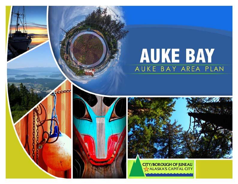
Auke Bay Area Plan. Complete List of Goals and Policies for the Auke Bay Area Plan
 Auke Bay Area Plan Complete List of Goals and for the Auke Bay Area Plan Recreation Goals & Pedestrian Access Goal 1: Link the Auke Bay area with an accessible system for recreation and transportation.
Trinity Uptown - Peripheral Zones University Drive/ Jacksboro Highway Zone March 31, 2008
 Trinity Uptown - Peripheral Zones University Drive/ Jacksboro Highway Zone March 31, 2008 TRINITY UPTOWN CHARACTERISTICS Desirable density Residential and mixed uses Active waterfront Public spaces Pedestrian
Anatomy of A Vibrant Downtown. Anatomy of a Vibrant Downtown
 Anatomy of A Vibrant Downtown The goal of MAIN ST. REVITALIZATION PLANNING is to provide a framework that will help transform your downtown into a VIBRANT DOWNTOWN a place where people love to LIVE, WORK,
Route 347. New York State Department of Transportation Region 10, Long Island. THE GREENING of ROUTE 347
 The GREENING of Route 347 The Greening of Route 347 The Greening of Route 347: History 3 The Greening of Route 347 4 The Greening of Route 347 5 The Greening of Route 347 Smith Haven Mall 6 The Greening
Coast Highway Oceanside, California
 Coast Highway Oceanside, California Coast Highway Plan Zones What We ve Heard - Walkable/Bikeable Community (Senior and Child Friendly) -Wider Sidewalks -Street Trees -Traffic Calming -Bike Lanes -Paseos
Standards (R-3) Figure B-11: R-3 Residential Standards Exhibit
 Figure B-11: R-3 Residential Standards Exhibit") Avila Ranch Avila Ranch Specific Plan Development Standards High Medium Density - High Residential Density Residential Lot and Building Lot and Standards Building (R-3) Standards (R-3) EXAMPLES These sketches
Avila Ranch Avila Ranch Specific Plan Development Standards High Medium Density - High Residential Density Residential Lot and Building Lot and Standards Building (R-3) Standards (R-3) EXAMPLES These sketches
AMITY STATION Revised Concept Plan Review West Rosemary Street Chapel Hill, NC September 27, 2016
 AMITY STATION Revised Concept Plan Review West Rosemary Street Chapel Hill, NC September 27, 2016 DEVELOPER'S PROGRAM Introduction This is a request for review of a Revised Concept Plan by Chapel Hill
Chapter 4 Urban Design Element
 Chapter 4 Urban Design Element "The general tenor of the responses indicates a strong preference to not allow low-intensity development into natural areas, resource lands or highly visible open space.
Courthouse Square Planning & Urban Design Study. Courthouse Square Working Group #13 October 15, 2014
 Courthouse Square Planning & Urban Design Study Courthouse Square Working Group #13 October 15, 2014 1 Courthouse Square Process Working Group Community Courthouse Square Advisory Groups & Civic Associations
DALY CITY VISIONING PROCESS COMMUNITY WORKSHOP 3 MAY 8, 2008
 DALY CITY VISIONING PROCESS COMMUNITY WORKSHOP 3 MAY 8, 2008 PROCESS General Plan - a statement of the community s values, vision and aspirations for now and into the future... Timeframe LONG TERM - 2030
Supplemental Design Guidelines
 Supplemental Design Guidelines 65 SUPPLEMENTAL DESIGN GUIDELINES As a supplemental reference to the project, the following diagrams are included to illustrate the site planning approaches that were followed
Chapter PEDESTRIAN COMMERCIAL (PC) ZONING DISTRICT
 ZONING DISTRICT") Chapter 11-17 PEDESTRIAN COMMERCIAL (PC) ZONING DISTRICT Sections: 11-17-01 GENERAL PURPOSE 11-17-02 PERMITTED BUILDING TYPES 11-17-03 USES PERMITTED WITH DESIGN REVIEW 11-17-04 USES PERMITTED BY CONDITIONAL
Chapter 11-17 PEDESTRIAN COMMERCIAL (PC) ZONING DISTRICT Sections: 11-17-01 GENERAL PURPOSE 11-17-02 PERMITTED BUILDING TYPES 11-17-03 USES PERMITTED WITH DESIGN REVIEW 11-17-04 USES PERMITTED BY CONDITIONAL
ARTICLE 13 STREETS General
 ARTICLE 13 STREETS 13.1 General Streets shall be designed to suit their functions. Many streets have purposes other than vehicular traffic. As an alternative to current N.C. Department of Transportation
NWI Wetland Public Waters Inventory Low Density Residential Medium Density Residential. High Density Residential. Public or Institutional
 Map 1.1 Future Land Use Jennings Bay West Arm Dutch Lake Harrisons Bay Lake Langdon Seton Lake Emerald Lake Black Lake Cooks Bay Halstead Bay Priest Bay Phelps Bay NWI Wetland Public Waters Inventory Low
BUSINESS DISTRICT DESIGN GUIDELINES
 Des Plaines, Illinois Prepared for the City of Des Plaines by: The Lakota Group Laurie Marston, AICP March 2005 Section 5: Streetscape Elements Business District Design Guidelines STREETSCAPE ELEMENTS
Sidewalks Street Lights
 Boston Complete Streets Guidelines 013 Boston Transportation Department Sidewalks Introduction 17 Sidewalk Design Principles 18 Sidewalk Zones 0 Sidewalk Zones Widths Preferred and Minimum Widths for Sidewalk
City of Hermosa Beach Administrative Policy #
 City of Hermosa Beach Administrative Policy # SUBJECT: Living Streets Policy Date: Approved by: City Council Authority: Public Works Department & Community Development Department Mayor, PURPOSE The City
Table of Contents. Elm Avenue Improvement Plan City of Waco, Texas. Introduction 1. Existing Context 1 Figure 1 2.
 Table of Contents Introduction 1 Existing Context 1 Figure 1 2 Plan Guidelines 3 Future Urban Form 4 The West-End 4 Main Street 6 The East-End 7 Figure 2 9 Public Improvement Recommendations 7 General
ARTICLE 13 STREETS General
 ARTICLE 13 STREETS 13.1 General Streets shall be designed to suit their functions. Many streets have purposes other than vehicular traffic. As an alternative to current N.C. Department of Transportation
DRAFT DESIGN GUIDELINES
 IHZ Booklet #7 May 6, 2010 DRAFT DESIGN GUIDELINES CANTERBURY 7 Overview During the recent planning process for the Plan of Conservation and Development community character was identified as an important
4. INDUSTRIAL 53 CASTLE ROCK DESIGN
 4. INDUSTRIAL 53 CASTLE ROCK DESIGN CASTLE ROCK DESIGN 54 4. INDUSTRIAL Overview Well-designed and attractive industrial centers are the product of blending economic realities with both functional and
RESEDA - WEST VAN NUYS COMMUNITY PLAN
 RESEDA - WEST VAN NUYS COMMUNITY PLAN Executive Summary As part of the initial outreach effort, the Department of City Planning hosted two workshops for the Reseda-West Van Nuys Community Plan Area during
COMMUNITY DESIGN. GOAL: Create livable and attractive communities. Intent
 COMMUNITY DESIGN Intent An attractive, well-designed County will attract quality development, instill civic pride, improve the visual character of the community, and create a strong, positive image for
City of Woodinville Planning Commission Study Session. Development Regulations 101: An Overview of Specific Regulatory Items To Help You in 2012
 City of Woodinville Planning Commission Study Session Development Regulations 101: An Overview of Specific Regulatory Items To Help You in 2012 Development Regulations 101 Overview of the Different Zones
RESIDENTIAL DISTRICTS
 RESIDENTIAL DISTRICTS The residential district standards have been revised to reflect on-the-ground conditions, while continuing to respect the use patterns established within the neighborhoods. This will
4.1.3 LAND USE CATEGORIES
 4.1.3 LAND USE CATEGORIES a. City Center District The City Center District incorporates the existing character and mix of uses in downtown Belmont to encourage redevelopment and new development in keeping
Citizen Advisory Group Meeting 5: Land Use April 14, 2011
 Citizen Advisory Group Meeting 5: Land Use April 14, 2011 Meeting Agenda 1. Background Review 2. Transportation Follow-up 3. PED Overlay Approach 4. Land Use Mapping 5. Group Exercise 6. Wrap-up and Next
SECTION TWO: Overall Design Guidelines
 SECTION TWO: Overall Design Guidelines This section provides overall design principles and guidelines for the Gardnerville Mixed-use Overlay. They provide criteria for mixed-use places consisting of residential,
13. New Construction. Context & Character
 13. New Construction Context & Character While historic districts convey a sense of time and place which is retained through the preservation of historic buildings and relationships, these areas continue
The Baileys Planning District portion of the Comprehensive Plan contains site design recommendations for both the Baileys Crossroads Community
 The Baileys Planning District portion of the Comprehensive Plan contains site design recommendations for both the Baileys Crossroads Community Business Center and the Seven Corners Community Business Center.
III. Design Principles
 III. Design Principles The design of Bay Meadows Phase II has been guided by a series of Urban Design Principles. These principles, informed by consultant site analysis, City staff recommendations, and
ORDINANCE AN ORDINANCE TO ADD A NEW SECTION 4.N. IN THE ZONING CODE FOR THE TOWN OF MIDDLETOWN, RELATING TO MIXED-USE DEVELOPMENT
 Introduced: November 5, 2018 Approved: ORDINANCE 18-11-01 AN ORDINANCE TO ADD A NEW SECTION 4.N. IN THE ZONING CODE FOR THE TOWN OF MIDDLETOWN, RELATING TO MIXED-USE DEVELOPMENT BE IT ENACTED BY THE MAYOR
The Need to Develop a Transit Ready Community
 Evaluation & Appraisal Report (EAR) Major Issue # 6 The Need to Develop a Transit Ready Community July 3, 2007 EAR Major Issue # 6 Transit Ready Existing Comp Plan policies apply only to Indiantown Road: