Newton Town Centre. Land Use, Urban Design & Transportation Plan
|
|
|
- Kathryn Garrison
- 5 years ago
- Views:
Transcription


1 Newton Town Centre Land Use, Urban Design & Transportation Plan Public Workshop - June 2-4, 2009
2 6:15 6:30 Sign-in & conversations Tonight s Agenda 6:30 6:55 Project introduction and summary of previous meetings 6:55 7:30 pm Review project findings and principles 7:30 7:45 pm Community Design Session 8:45 9:00 pm Questions, comments, and wrap-up
3 Tuesday June 2 nd 6:30 to 9:00 Tonight s Workshop This Week s Agenda Wednesday June 3 rd 10:00 to 5:00 - Open House 6:00 to 8:00 Open House Thursday June 4 th 10:00 to 12:00 - Open House 12:00 to 6:00 - Team Work Session 6:00 to 8:00 Presentation & Discussion
4 Project Initiation On July 28, 2008, City Council endorsed a planning process for the area in partnership with TransLink. The Plan is a key component of the TransLink and the City plans to significantly enhance transit services and facilities in the City, and to support these enhancement with higher density, transit-oriented development along major corridors.

5 Study Area


6 Background and Planning Context City Centre Town Centres: Newton Guildford Fleetwood Cloverdale Semiahmoo
7 Recent Surrey Council Initiatives Sustainability Charter Crime Reduction Strategy Transportation Strategic Plan Parks, Recreation & Culture Master Plan Employment Lands Strategy Plan for Social Well-Being Emphasis on Place-Making
8 Memorandum of Understanding Memorandum of Understanding (MOU) between the City of Surrey and TransLink approved and signed on September, The goal of the Project is to produce a land use and transportation plan that will guide the development of a mixed use, high-density, transit-oriented Town Centre, fully integrating new and enhanced transit facilities into a high quality and sustainable urban centre.
9 Objectives for the Week The objective of tonight s workshop and the entire week is to present our findings and initiate the community s design that will define the character aspirations for the.
10 Project Overview

11 Regional Context

12 Study Area

13 South of Fraser Transit Plan
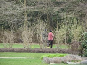
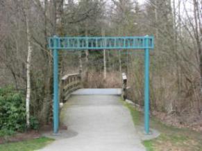
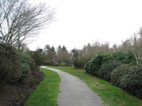
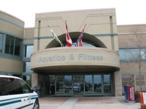
14 Community Assets Newton Wave Pool Library Senior Center Newton Arena Community Hall Newton Loop
15 Community Holdings Newton Wave Pool Library Senior Center Newton Arena Community Hall Newton Loop

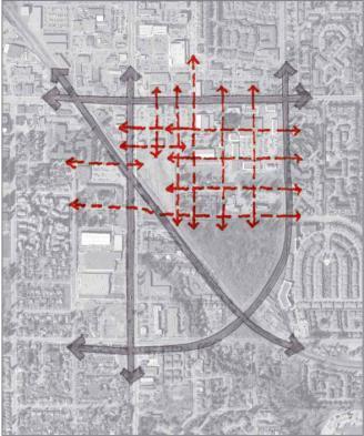
16 Integrating Land Use and Transportation Requires Urban Design Project Overview
17 Project Process
18 PROJECT INITIATION & WALKING TOUR March 4 th & 5 th Process & Schedule STAKEHOLDER & COMMUNITY INTERVIEWS April 8 th & 9 th DESIGN WORKSHOP This Week FEEDBACK, REACTION, AND TESTING OF CONCEPTS June - August REVIEW WORKSHOP FOR STAGE 1 Early September PROCESSING & PACKAGING STAGE 1 REPORT October STAGE 2 FINAL PLAN Early 2010
 - Drainage and Environment, - Department of Fisheries and Oceans, - Realty Services, - Economic Development TransLink")

19 City of Surrey - Current Planning - Long-Range Planning - Parks, Recreation and Culture - Engineering (Drainage Planning Section) - Engineering Department (Transportation) - Drainage and Environment, - Department of Fisheries and Oceans, - Realty Services, - Economic Development TransLink Coast Mountain Bus Company, Royal Canadian Mounted Police (RCMP); B.C. Hydro Southern Railway Anthem Properties Property Owners: - Rob Blackwell, - Bill Kennedy, - Mehran Kiai, - Myong Kwang, Gurdev - S. Heer, - Harp Hoonjan, - Kate Lambert, - Tim Delesalle Stakeholder Interviews April 8th & 9th


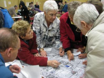
20 Community Values Workshop April 9 th


21 What we value about the Convenience and Walkability 34 Shopping 24 Senior Center 21 Library 20 Wave Pool 11 Parks and Green 11 Transit 8 Safe and Secure 6 Community Values Workshop April 9 th

22 Top Issues Make sure redevelopment includes 16 walking, biking, public transit, sidewalks. Preserve Tree bounded by railroad tracks, th St & BC Hydro Outdoor cafes-patios- flowers and 12 trees/color- streetscapes Retain old growth trees and plant new 11 ones Traffic on 138th St. needs some form of 10 speed control Traffic calming on 138th needed. 10 Safety, policing, security 10 Keep discount theater and entertainment 10 (now affordable) Community Values Workshop April 9 th
23 Key Finding s & Challenges Additional connections to K.G.H. and 72 nd Avenue are needed to accommodate Growth. B.C. Hydro and Southern Railway and additional grade crossings Pedestrian oriented design requires a taming of K.G.H. and 72 nd Avenue and a more complete internal street network. Shopping Centers, Wave Pool and Arena create, Wooded area create super-block limiting network opportunities. Civic/Recreational are good uses; however, the designs are liabilities, creating blank faces of buildings and blocks with no activity. New investments will require a more urban and integrated design solutions. Size and function of transit exchange will define joint development opportunities. A new balance in transit efficiency and urban development opportunities. Environmental features are both assets and liabilities. Balancing environmental preservation and urban integration. Security issues, social problems and perceptions are liabilities and must be overcome. Providing the market confidence that will change public perceptions.
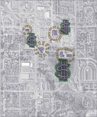
24 Market Opportunities
25 Demographic Data 180, , ,000 Newton s population is projected to grow from 117,000 in 2006 to 166,000 by 2031 a 42% increase. Newton Wave Pool Library Senior Center Newton Arena Community Hall Newton Loop 120, ,000 80,
26 Demographic Data Composition of new housing will shift away from single-family dwellings to multi-family dwellings 100% 80% 60% 40% 20% 0% Single-Family/Duplex Townhouse Multi-Family
27 New Units per Year Residential Absorption Annual Townhouse Absorption Annual Multi-Family Absorption
28 Residential Absorption Based on a medium-case scenario, we have determined the following approximate preliminary residential absorption schedule: 140 units by units by units by units by units by 2031
29 Commercial Square Feet Retail / Commercial Absorption 250, , , ,000 50, LOW SCENARIO MEDIUM SCENARIO HIGH SCENARIO
30 Retail / Commercial Absorption Based on this on-site and surrounding population, we have estimated, using moderate-case market shares, new commercial space (over and above what is already inside the study area) as follows: 18,000 square feet by ,000 square feet by ,000 square feet by ,000 square feet by 2031
31 Market Summary Short-Term Opportunity ( ) Med-Term Opportunity ( ) Long-Term Opportunity ( ) Office Very Limited Very Limited Limited/Moderate Retail Very Limited Strong Strong Attached/Multi- Family Residential Limited/Moderate Strong Very Strong Key Factors No new civic or transit infrastructure. Lack of scale. New rapid transit connectivity. Expanded civic facilities. Scale develops. Strong connectivity. Expanded civic facilities. Critical mass achieved.
32 Transportation Systems
33 Analysis Overview Micro-simulation (VISSIM) modelling undertaken to date for the Land Use and Transportation Study: Existing Situation (2008); and Future Year Base (2031) This model will provide the basis to test a number of traffic and transit options
; 72nd Avenue (north); 68th Avenue (south); 138th Street")
34 Modeled Network The model area is bounded by: King George Hwy (west); 72nd Avenue (north); 68th Avenue (south); 138th Street (east).
35 Traffic data has been provided from three sources: Traffic turning counts at intersections; Strategic regional model (EMME); and Transit routes and frequencies. Model Data Traffic information was gathered for the existing conditions (2008) and estimated for future conditions (2031) Future conditions were based on future growth in traffic assuming existing land use/development i.e. no changes in the Newton area As the Design Workshop progresses, emerging visions of the future land use/development scenario will be tested in the model
36 Model Results AM Peak PM Peak Ι The 2008 situation shows the network to be busy, but not congested Ι Network performance better in the AM peak (less traffic) Average Delay per vehicle (sec) Average Speed (km/h) Total travel time (hrs) Ι Ι In 2031 (AM), the operation of the network is generally satisfactory Ι With the exception of the eastbound approach to the KGH/68th Ave which is operating above capacity and causes vehicles to backup a significant distance In 2031 (PM), a number of approaches are operating above the practical capacity, mostly due to increased left turning which does not have priority Ι Overall, there is significant deterioration in network performance between 2008 and
 Eastbound Stacking 72 nd Ave Westbound KGH")
37 2031 PM Peak: King George 72nd Avenue (looking northwest) Eastbound Stacking 72 nd Ave Westbound KGH Northbound

38 2031 PM Peak: King George 68th Avenue (looking west) KGH Northbound Westbound Left-turn Stacking 68 th Ave Westbound
39 Transit Exchange
 throughout area Bus lanes on Hwy 1, 91 and 99 New cross-town routes 17 new or upgraded facilities 2 new Transit Centres 45% of total plan in place by")
40 South of Fraser Area Transit Plan Highlights: Long-range plan: to more buses Rapid transit on KGH/104, Fraser Highway, 200th Street (B-Line, BRT, LRT) Frequent Transit Network (FTN) throughout area Bus lanes on Hwy 1, 91 and 99 New cross-town routes 17 new or upgraded facilities 2 new Transit Centres 45% of total plan in place by 2013

")
41 Newton Exchange Today Highlights: Major South of Fraser transit exchange 11 routes connecting Key transfer point Frequent Bus 72 nd Ave Key Findings: At capacity Poor connection to future BRT on King George Hwy Exchange faces back of surrounding buildings Inconvenient access to exchange from surrounding buildings Poor visibility of exchange (missed opportunity for natural surveillance) Community Shuttle Local Bus
42 King George Hwy Newton Exchange Tomorrow 72 nd Ave Existing Exchange Wave Pool TransLink property

43 Bus Rapid Transit on King George Highway King George Hwy Bus Rapid Transit on King George: 2010: B-Line 2013: Bus Rapid Transit Future: LRT? 104 th Ave Curb lane Some TPM Limited Stops Separated Median Lanes TPM Stations, not stops Real-time Information Rail-based Advanced TPM Stations, not stops Real-time Information High Capacity

44 Transit Function Options LRT / BRT Median Running 1 Access Points BRT Median Running 2 Access Points BRT Median Running 1 Access Points BRT Median Running
45 Land Use & Development


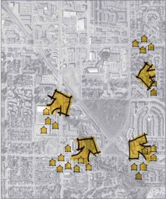
46 Environmental Constraints Newton Wave Pool Library Senior Center Newton Arena Community Hall Newton Loop High Medium Low


47 Current Land Uses Commercial / Office Civic / Recreational Highway Related Commercial Urban Residential Vacant

48 Official Community Plan Land Use Town Centre Commercial Multiple Residential Urban Residential


49 Existing Zoning Label Zoning Newton District Wave Pool Library RF Single Family Senior Res. Center LI Light Impact Newton Ind. Arena CD Comprehensive Community Dev. Hall C-8 Community Newton Comm. Loop CHI Highway Comm. Ind.


50 Areas of Change & Stability Redevelopment Probable Newton Wave Pool Redevelopment Library PossibleSenior Center Newton Arena Redevelopment Community Hall Unlikely Newton Loop Stable
51 Project Principles
52 Embrace Transit as a Mobility Option Transit can be the biggest catalyst for redevelopment providing a mobility option for all users. The transit station should be integrated into the overall framework of development and highlighted as a key civic place. Project Principles
53 Integrate Civic Amenities into the Fabric of Town Centre Civic amenities should be woven throughout the Town Centre and used as focal points as redevelopment occurs. Project Principles
54 Leverage Public Investments The investments made by public Entities should be leveraged to encourage not only new civic investments such as parks but private investments as well. Project Principles
55 Improve Connectivity and Create Livable Transportation Solutions Opportunity exists to increase the overall network throughout the study area with new streets, trails and sidewalks. Project Principles
56 Redesign the Environment for the Pedestrian The pedestrian should be the first priority as redevelopment of the site occurs. This includes wide sidewalks and ample pedestrian amenities such as benches and lighting. Project Principles
57 Preserve, Enhance, and Utilize Open Spaces The two key open spaces within the study area are currently underutilized. Building should front these open spaces and the possibilities for programming these spaces with restored habitat, trails and connectivity should be explored. Project Principles
58 Expand Neighborhoods Toward the Town Center Preserve and enhance the existing neighborhoods by expanding the framework to include new transit oriented development which is contextual and appropriately scaled and transitions to the surrounding neighborhoods. Project Principles


59 Increase Market Confidence Public infrastructure investments, new development strategies and an open public dialogue can begin to lay a foundation for the future investments in the Newton Town Centre. Project Principles
60 Work Shop Table Sessions


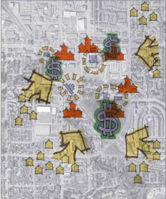
61 Community Character Table Sessions Discuss and select the appropriate character scenario. Then arrange the character scenarios to fit in the Newtown Town Centre
62 Community Character Table Sessions


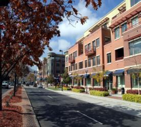
63 Scenario 1 Mid-Rise 35% Stacked Flats 45% Walk-Ups 5% Townhomes 5% Parks & Recreation 10% Community Character Development Scenarios Scenario 2 Mid-Rise 45% Stacked Flats 25% Walk-Ups 10% Townhomes 5% Parks & Recreation 15% Scenario 3 Mid-Rise 55% Stacked Flats 10% Walk-Ups 5% Townhomes 5% Parks & Recreation 25%


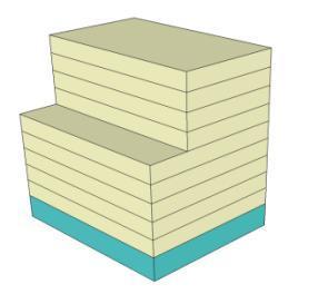
64 Community Character Mid-Rise Buildings Office or Residential Retail/ Office or Residential


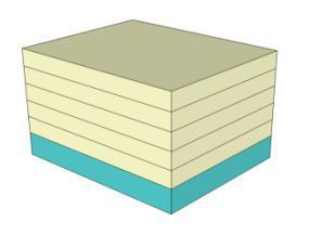

65 Community Character Stacked Flats Office or Residential Retail/ Office or Residential


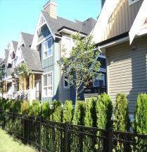
66 Community Character Walk-ups Office or Residential Retail/ Office or Residential

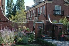
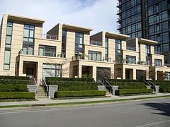
67 Community Character Townhouse Residential Retail/ Office or Residential


68 Park Type Community Character Parks and Recreation

69 Community Character Table Sessions
70 Next Steps
71 This Week s Agenda Tuesday June 2 nd 6:00 to 8:00 Tonight s Workshop Wednesday June 3 rd 10:00 to 5:00 - Open House 6:00 to 8:00 Open House Thursday June 4 th 10:00 to 12:00 - Open House 6:00 to 8:00 Presentation & Discussion
72 PROJECT INITIATION & WALKING TOUR March 4 th & 5 th Process & Schedule STAKEHOLDER & COMMUNITY INTERVIEWS April 8 th and 9th DESIGN WORKSHOP This Week FEEDBACK, REACTION, AND TESTING OF CONCEPTS June - August REVIEW WORKSHOP FOR STAGE 1 Early September PROCESSING & PACKAGING STAGE 1 REPORT October STAGE 2 FINAL PLAN Early 2010
73 Land Use, Urban Design & Transportation Plan Public Workshop - June 2-4, 2009
Newton Town Centre. Land Use, Urban Design & Transportation Planning Study
 Newton Town Centre Land Use, Urban Design & Transportation Planning Study December 2009 Acknowledgements: Table of Contents Project Introduction 1 Background 2 Purpose 3 Organization 3 The Public Process
WELCOME and introduction
 1 WELCOME and introduction Mobility Hub Locations within Burlington STUDY OVERVIEW STUDY OBJECTIVES The City of Burlington is developing four Area Specific Plans, one for each of Burlington s Mobility
Building out the Regional Growth Strategy in Surrey: a Strong Centre & a Connected Transit City
 Building out the Regional Growth Strategy in Surrey: a Strong Centre & a Connected Transit City Surrey in the Metro Vancouver Region Regional Growth Strategy identifies Surrey as a major provider of housing
3. Endorse the LRT vision in transforming Surrey into Connected-Complete-Livable communities, and more specifically, the official vision statement:
 CORPORATE REPORT NO: R038 COUNCIL DATE: February 20, 2017 REGULAR COUNCIL TO: Mayor & Council DATE: February 16, 2017 FROM: General Manager, Engineering FILE: 8740-01 SUBJECT: Surrey Light Rail Transit
South Davis County COMMUNITY SPOTLIGHT
 South Davis County COMMUNITY SPOTLIGHT Davis/SLC Community Connector Bus Rapid Transit line connecting SLC & Davis County RTP Phase 1 Project Generate 3,100 average weekday riders Relieve congestion on
Chapter 1: Introduction
 Chapter 1: Introduction The Penn Avenue Community Works Corridor Vision and Implementation Framework presents an integrated communitybased vision and a coordinated, long-term implementation framework for
PLAN ELEMENTS WORKSHOP. April 5, 2016
 PLAN ELEMENTS WORKSHOP April 5, 2016 needs more housing. But there is no one-size fits-all solution. Every neighborhood has its own character. In some places, density is not only appropriate it is badly
NO: R035 COUNCIL DATE: FEBRUARY 24, 2014
 CORPORATE REPORT NO: R035 COUNCIL DATE: FEBRUARY 24, 2014 REGULAR COUNCIL TO: Mayor & Council DATE: February 24, 2014 FROM: General Manager, Planning and Development FILE: 6520-01 SUBJECT: Town Centre
This Review Is Divided Into Two Phases:
 Semiahmoo Town Centre Review The purpose of this review: To review the Semiahmoo Town Centre Concept Plan, originally approved in 1993, to ensure that this centre will continue to serve the needs of South
PUBLIC OPEN HOUSE HURONTARIO-MAIN CORRIDOR SECONDARY PLAN
 PUBLIC OPEN HOUSE HURONTARIO-MAIN CORRIDOR SECONDARY PLAN Tuesday, February 28, 2012 6pm 9pm 1 st Floor Atrium, City Hall 2 Wellington Street West, Brampton 1 POLICY FRAMEWORK The 2006 Provincial Growth
Plano Tomorrow Vision and Policies
 Plano Tomorrow Vision and Policies PLANO TOMORROW PILLARS The Built Environment The Social Environment The Natural Environment The Economic Environment Land Use and Urban Design Transportation Housing
The Cambie Corridor 2015 Fall workshop series. What we heard WORKSHOP OUTLINE
 The Cambie Corridor 2015 Fall workshop series W 16 AVE Area 5 CAMBIE CORRIDOR Phase 3 What we heard ovember 21, 2015, 9am-noon, 1:30-4:30pm Peretz Centre 89 Participants* WORKSHOP OUTLIE Introductions
Port Credit Local Advisory Panel October 20 th Meeting
 Port Credit Local Advisory Panel October 20 th Meeting Focus Of This Evening s Meeting: 1. Hurontario Main Street Higher Order Transit Study 2. Port Credit Mobility Hub & GO Station Parking Structure Study
LOW DENSITY RESIDENTIAL
 LOW DENSITY RESIDENTIAL Corner lots with coach houses to increase diversity, provide unity to the streetscape and increase eyes on the street. Garages and ancillary units accessed via rear lanes. Parking
2035 General Plan Update and Belmont Village Specific Plan. Joint Study Session with the City Council and Planning Commission April 12, 2016
 2035 General Plan Update and Belmont Village Specific Plan Joint Study with the City Council and Planning Commission April 12, 2016 Agenda 1. Welcome and Introductions 2. General Plan Update Status of
Building Great Neighbourhoods. Strathcona
 Building Great Neighbourhoods Strathcona March 21, 2018 Becky Redford Project Manager, Planning & Design Building Great Neighbourhoods Integrated Infrastructure Services Welcome and Purpose To provide
Blueprint Denver Task Force Meeting #
 Blueprint Denver Task Force Meeting #1 6.23.16 1. Welcome and Introductions Your name and affiliation Name 1 thing you love about Denver Name 1 thing you d change about Denver All in 30 seconds! Ready,
REVIEW AND EVALUATION OF REGIONAL LAND USE
 REVIEW AND EVALUATION OF REGIONAL LAND USE AND TRANSPORTATION SCENARIOS #220831 Environmental Justice Task Force October 7, 2014 VISION 2050 Process Development of Guiding Vision for Land Use and Transportation
Community Visioning Workshop Prep
 Community Visioning Workshop Prep Visioning Workshop 73 Visioning Workshop: Public Events 1 2 3 4 74 Visioning Workshop: draft Schedule 75 Visioning Workshop: draft Schedule working to schedule stakeholder
A BLUEPRINT FOR BROCKTON A CITY-WIDE COMPREHENSIVE PLAN
 A BLUEPRINT FOR BROCKTON A CITY-WIDE COMPREHENSIVE PLAN Public Meeting October 2016 1 Plan Summary and Discussion Public Meeting May 4 2017 City of Brockton Bill Carpenter, Mayor Department of Planning
Don Mills Crossing Study and Celestica Lands Development Application Community Meeting, Open House, and Breakout Discussions
 Consultation Summary Don Mills Crossing Study and Celestica Lands Development Application Community Meeting, Open House, and Breakout Discussions This report is not intended to provide a verbatim transcript
DOMINION BOULEVARD CORRIDOR STUDY AND ECONOMIC DEVELOPMENT STRATEGIC PLAN A MODEL FOR CHESAPEAKE S FUTURE
 DOMINION BOULEVARD CORRIDOR STUDY AND ECONOMIC DEVELOPMENT STRATEGIC PLAN A MODEL FOR CHESAPEAKE S FUTURE Overview I. Draft Plan Process II. Draft Plan Overview a. Market Analysis b. Master Land Use Plan
INDEPENDENCE BOULEVARD AREA PLAN
 INDEPENDENCE BOULEVARD AREA PLAN Public Meeting October 28, 2008 Tonight s Agenda Introduction 4:00 4:05 Tom Warshauer Presentation 4:05 5:00 Blake Drury Group Exercises 5:00 5:50 All Wrap Up & Next Steps
Aldershot GO Draft Mobility Hub Concepts. East Plains United Church September 13, :30 8:30 pm
 Aldershot GO Draft Mobility Hub Concepts East Plains United Church September 13, 2017 6:30 8:30 pm Today s Agenda 6:30pm: 6:35pm: 7:10pm: 8:10pm: 8:25pm: Opening Remarks Rosa Bustamante, Manager Mobility
Laird in Focus Community Information Session
 Laird in Focus Community Information Session Tuesday, December 5, 2017 St. Anslem Catholic School, 182 Bessborough Drive Session 1: 5:30 pm - Presentation and Question and Answer Period 6:15 pm - Breakout
International Blvd. TOD Plan Public Workshop #1
 International Blvd. TOD Plan Public Workshop #1 Add photos or project images September 21 and 22, 2010 Workshop Purpose Introduce the public to the Project Review and discuss the existing conditions analysis
Tyvola & Archdale Transit Station Area Plan. June 5, 2008
 Tyvola & Archdale Transit Station Area Plan Second Public Meeting June 5, 2008 Presentation Outline 1. Purpose and Process 2. Station Area Overview 3. Plan Recommendations 4. Comments Received and Proposed
St. Clair Avenue West Area Transportation Master Plan
 1 (Between Keele Street and Old Weston Road) Public Information Centre 1 December 2, 2015 2 Welcome Welcome to the first Public Information Centre for the St. Clair Avenue West Area. The panels will present
City of Farmington. Downtown Plan. Amendment to the 1998 Master Plan Adopted October 11, 2004
 City of Farmington Amendment to the 1998 Master Plan Adopted October 11, 2004 Introduction Planning Background 1 Scope and Components of the Plan Amendment 2 Concept Introduction 3 Plan Concepts 3 Conceptual
Scope of Services. River Oaks Boulevard (SH 183) Corridor Master Plan
 Corridor Master Plan") Scope of Services River Oaks Boulevard (SH 183) Corridor Master Plan PROJECT AREA The project area consists of the River Oaks Boulevard (SH 183) corridor bounded by SH 199 at the northern end and the Trinity
Scope of Services River Oaks Boulevard (SH 183) Corridor Master Plan PROJECT AREA The project area consists of the River Oaks Boulevard (SH 183) corridor bounded by SH 199 at the northern end and the Trinity
MAYFIELD WEST SECONDARY PLAN PHASE 2
 MAYFIELD WEST SECONDARY PLAN PHASE 2 Public Open House #3 February 25, 2010 Draft Preferred Land Use Scenario TOWN OF CALEDON PLANNING & DEVELOPMENT DEPARTMENT Open House Agenda TOWN OF CALEDON 1. Welcome
Draft Cary Community Plan Review Part 3: Shop, Engage, Serve, Special Area Plans, Other Updates. October 27, 2015 Police Department Training Room
 Draft Cary Community Plan Review Part 3: Shop, Engage, Serve, Special Area Plans, Other Updates Committee for the Future October 27, 2015 Police Department Training Room AGENDA 1. Welcome and Call to Order
SCTPO Project Summary September 2014
 A1A MULTIMODAL CORRIDOR PLANNING AND ENGINEERING ANALYSIS Florida Department of Transportation SCTPO Project Summary September 2014 PRESENTATION FOOTER Meeting Agenda What We Plan To Do Project Background
Courtice Main Street Study Community Vision Workshop PLANNING SERVICES DEPARTMENT
 Courtice Main Street Study Community Vision Workshop PLANNING SERVICES DEPARTMENT July 22, 2009 Tonight s Meeting 7:00 pm Introduction David Crome, Director of Planning 7:05 Presentation Stasia Bogdan,
ROBBINSDALE LRT STATION CDI DEVELOPMENT GUIDELINES
 August 2018 OVERVIEW The City of Robbinsdale has a prime-opportunity site in the middle of the 13 mile stretch of the Bottineau LRT corridor / Blue Line extension. Robbinsdale offers a prominent, vital,
Subregion 4 Central Avenue-Metro Blue Line Corridor Transit-Oriented Development (TOD) Implementation Project. Community Meeting April 27, 2011
 Implementation Project. Community Meeting April 27, 2011") Subregion 4 Central Avenue-Metro Blue Line Corridor Transit-Oriented Development (TOD) Implementation Project Community Meeting April 27, 2011 Overview Introduction to Subregion 4 TOD Implementation Program
Subregion 4 Central Avenue-Metro Blue Line Corridor Transit-Oriented Development (TOD) Implementation Project Community Meeting April 27, 2011 Overview Introduction to Subregion 4 TOD Implementation Program
Land Use Amendment in Southwood (Ward 11) at and Elbow Drive SW, LOC
 at and Elbow Drive SW, LOC") 2018 November 15 Page 1 of 10 EXECUTIVE SUMMARY This land use amendment application was submitted by Rick Balbi Architect on 2017 August 31 on behalf of Sable Developments Ltd, and with authorization from
2018 November 15 Page 1 of 10 EXECUTIVE SUMMARY This land use amendment application was submitted by Rick Balbi Architect on 2017 August 31 on behalf of Sable Developments Ltd, and with authorization from
Urban Planning and Land Use
 Urban Planning and Land Use 701 North 7 th Street, Room 423 Phone: (913) 573-5750 Kansas City, Kansas 66101 Fax: (913) 573-5796 Email: planninginfo@wycokck.org www.wycokck.org/planning To: From: City Planning
Public input has been an important part of the plan development process.
 Lakewood s Comprehensive Plan recognizes that transportation helps shape the community, and that the way the community provides for the safe and efficient movement of people affects the character of the
Transportation. Strategies for Action
 Transportation A major priority for the Overlake Neighborhood is to develop a multimodal transportation system. To achieve this system, a balance has to be found among travel, circulation and access needs;
Public Open House. Yonge Street and Bernard Avenue (Bernard KDA) Planning Study Update Town of Richmond Hill. March 30, 2017
 Planning Study Update Town of Richmond Hill. March 30, 2017") Public Open House Yonge Street and Bernard Avenue (Bernard KDA) Planning Study Update Town of Richmond Hill March 30, 2017 Open House Review of Project Purpose and Process Policy Refresher Highlights of
Public Open House Yonge Street and Bernard Avenue (Bernard KDA) Planning Study Update Town of Richmond Hill March 30, 2017 Open House Review of Project Purpose and Process Policy Refresher Highlights of
GRANDVIEW HEIGHTS NCP AREA #3 CITIZEN ADVISORY COMMITTEE (CAC) MEETING #6
 MEETING #6") WELCOME TO THE NCP AREA #3 CITIZEN ADVISORY COMMITTEE (CAC) MEETING #6 For more information visit the city of surrey webpage at: www.surrey.ca/gh3ncp 1 Feb 1, 2018 CAC Meeting NEIGHBOURHOOD CONCEPT PLAN
WELCOME TO THE NCP AREA #3 CITIZEN ADVISORY COMMITTEE (CAC) MEETING #6 For more information visit the city of surrey webpage at: www.surrey.ca/gh3ncp 1 Feb 1, 2018 CAC Meeting NEIGHBOURHOOD CONCEPT PLAN
NO: R230 COUNCIL DATE: October 24, LRT Corridor Planning Studies Terms of Reference
 CORPORATE REPORT NO: R230 COUNCIL DATE: October 24, 2016 REGULAR COUNCIL TO: Mayor & Council DATE: October 20, 2016 FROM: General Manager, Planning & Development General Manager, Engineering FILE: 6520-20
Allen Street Civic District Redevelopment Area Plan Redevelopment Plan & Proposal State College Planning Commission State College Redevelopment
 Allen Street Civic District Redevelopment Area Plan Redevelopment Plan & Proposal State College Planning Commission State College Redevelopment Authority September 17, 2015 Discussion Points Overview of
Potential Green Infrastructure Strategies May 6, 2015 Workshop
 Potential Green Infrastructure Strategies May 6, 2015 Workshop Background The City of Cortland is developing the Tioughnioga Urban Headwaters Green Infrastructure Action Plan with funding from the National
Tyvola & Archdale Transit Station Area Plan. May 15, 2008
 Tyvola & Archdale Transit Station Area Plan First Public Meeting May 15, 2008 Presentation Outline 1. Purpose and Process 2. Station Area Overview 3. Plan Recommendations Vision Land Use Transportation
LAND USE MODEL UPDATE. Planning and Land Use Advisory Committee Meeting #2 September 4, 2014
 1 LAND USE MODEL UPDATE Planning and Land Use Advisory Committee Meeting #2 September 4, 2014 2 Presentation Outline Introduction and Recap Model Process Study Design Place Types Suitability Factors 3
JASPER PLACE. Area Redevelopment Plan
 JASPER PLACE Area Redevelopment Plan Executive Summary Jasper Place is an established community where people live, work and play. The Jasper Place Area Redevelopment Plan (ARP) provides a tool to help
St. Louis Park Wooddale LRT Station Site development guidelines
 St. Louis Park Wooddale LRT Station Site development guidelines November 2013 OVERVIEW St. Louis Park s convenient location as a neighbor to Minneapolis means you re only minutes away from some of the
Lower Merion Commercial Districts Issues and Characteristics Handbook November 2013
 Lower Merion Commercial Districts Issues and Characteristics Handbook November 2013 DRAFT TOWNSHIP-WIDE VISION: To maintain and enhance commercial areas to complement the surrounding high-quality residential
U T D N o r t h C a m p u s T O D and D o w n t o w n D e n t o n T O D
 U n i v e r s i t y o f T e x a s a t D a l l a s C i t y o f R i c h a r d s o n U T D N o r t h C a m p u s T O D and D o w n t o w n D e n t o n T O D Rick Leisner, AICP Assistant Director of Development
CHAPTER 3 VISION, GOALS, & PLANNING PRINCIPLES. City of Greensburg Comprehensive Plan. Introduction. Vision Statement. Growth Management Goals.
 CHAPTER 3 VISION, GOALS, & PLANNING PRINCIPLES Introduction The Greensburg Comprehensive Plan is intended as a working community document. A combination of long and short-term goals, this document is intended
4- PA - LD - LIVELY DOWNTOWN. LD - Background
 4- PA - LD - LIVELY DOWNTOWN LD - Background The downtown has been the service centre for the community since the city s inception and the area continues to supply people with their personal services,
INDEPENDENCE BOULEVARD AREA PLAN. June 24, 2008
 INDEPENDENCE BOULEVARD AREA PLAN Public Meeting #1 June 24, 2008 Tonight s Agenda Introduction Welcome and Ground Rules Overview Presentation Purpose of the Plan What Brings Us Here? A Tour of the Corridor
Robbinsdale LRT Station. CDI Development Guidelines. August Overview
 Robbinsdale LRT Station August 2018 Overview The City of Robbinsdale may have the coolest opportunity site along the 13 mile stretch of the Bottineau LRT corridor / Blue Line extension. Located a block
Beaverton City Council: Work Session. SIDEDistrict. May 6, 2014
 BEAVERTON Beaverton City Council: CREEK Work Session SIDEDistrict May 6, 2014 Tonight s Agenda BEAVERTON CREEK SIDE Brief updates Creekside Vision Scenarios & discussion: Redevelopment & Parking Project
SLIDE TITLE TRANSIT-ORIENTED DEVELOPMENT PLAN RED-PURPLE BYPASS STUDY AREA PUBLIC MEETING #2 RED AND PURPLE MODERNIZATION. RPM TOD Plan Update
 SLIDE TITLE TRANSIT-ORIENTED DEVELOPMENT PLAN RED-PURPLE BYPASS STUDY AREA PUBLIC MEETING #2 RED AND PURPLE MODERNIZATION 1 SLIDE TITLE AGENDA Project Introduction TOD s and Development Trends Real Estate
Carlsbad Village Redevelopment Concept Summary of Features
 Carlsbad Village Redevelopment Concept Summary of Features Calthorpe Associates November 5, 2003 The Redevelopment Concept illustrates a vision for the future of Carlsbad Village. The overall vision of
CHAPTER 7: Transportation, Mobility and Circulation
 AGLE AREA COMMUNITY Plan CHAPTER 7 CHAPTER 7: Transportation, Mobility and Circulation Transportation, Mobility and Circulation The purpose of the Transportation, Mobility and Circulation Chapter is to
Public Forum. Kelley s Corner: The Corner that Connects Us. The Cecil Group. March 7, Acton 2020 Town of Acton.
 Public Forum Acton 2020 Town of Acton March 7, 2013 AGENDA Purpose of Forum Kelley s Corner Project Examples of the Planning Processes Next Steps Dialogue: Questions and Answers PURPOSE Acton 2020 April
Coliseum Station Area Area Redevelopment Plan. Public Engagement #1 June 12, 2017
 Coliseum Station Area Area Redevelopment Plan Public Engagement #1 June 12, 2017 Welcome Engagement Purpose Introduce the project Share information Gather input Project Updates & Newsletter edmonton.ca/coliseumplan
Welcome. Comprehensive Plan & Transportation Plan Open House November 7, 2012
 Welcome Comprehensive Plan & Transportation Plan Open House November 7, 2012 Agenda Proposed future land use plan Comprehensive Plan strategies Traffic forecasts Future traffic operations Possible future
Introduction. Chapter 1. Purpose of the Comprehensive Plan Plan Organization Planning Process & Community Input 1-1
 Chapter 1 Introduction Lakewood 2025: Moving Forward Together Purpose of the Comprehensive Plan Plan Organization Planning Process & Community Input 1-1 Purpose of the Comprehensive Plan The Comprehensive
Rio/29 Small Area Plan. Design Plan & Implementation Framework Open House - January 25, 2018
 Rio/29 Small Area Plan Design Plan & Implementation Framework Open House - January 25, 2018 MEETING PURPOSE PRESENTATION 1. Orient to the updated design plans 2. Introduce implementing options 3. Explain
Secrest Short Cut and Monroe Expressway Small Area Plan AUGUST 29, 2018
 Secrest Short Cut and Monroe Expressway Small Area Plan AUGUST 29, 2018 Background and Process Monroe Expressway will be open by the end of 2018 Union County and Indian Trail identified a need to revisit
 Community Workshop #2 December 4, 2014 Team Tonight s Agenda 6:00 pm Welcome! 6:05 pm The Future of Downtown Tustin Ideas, Strategies and Recommendations 6:35 pm Questions and Comments 6:50 pm Open
FUNDING CORRIDOR REVITALIZATION
 FUNDING CORRIDOR REVITALIZATION Integrated corridor planning for the 21 st Century America Planning Association Annual Conference Atlanta, GA April 27, 2014 Mariia Zimmerman, MZ Strategies, LLC mariia@mzstrategies.com
burlington mobility hubs study Downtown Burlington Mobility Hub
 burlington mobility hubs study Downtown Burlington Mobility Hub Draft Precinct Plan Workbook PIC #3, September 7, 2017 downtown mobility hub objectives City staff and their consultants are proposing an
1 October Dear Citizens of Charlotte and Mecklenburg County,
 1 October 2011 Dear Citizens of Charlotte and Mecklenburg County, As co-chairs of the Center City 2020 Vision Plan Steering Committee, we are proud to present the Center City 2020 Vision Plan, which sets
Public Open House #1
 Public Open House #1 TONIGHT S AGENDA Welcome Project Overview The Big Picture The Station Area The Analysis Thoughts about Future Change Breakout Group Discussions Summation / Next Steps Project Overview
CITY OF CAMBRIDGE Growth & Intensification Study Secondary Plan Stakeholder Session September 12th, 2016
 CITY OF CAMBRIDGE Growth & Intensification Study Secondary Plan Stakeholder Session September 12th, 2016 Dillon Consulting Limited Watson & Associates Economists Curtis Planning Inc. Tim Welch Consulting
Midtown Corridor Alternatives Analysis. Appendix A - Initially Considered Alternatives Screening
 Midtown Corridor Alternatives Analysis Appendix A - Initially Considered Alternatives Screening Arterial BRT on Lake Street - Overall Rating: RATING Metropolitan Council recommendations stated in the Transportation
Atlanta BeltLine Subarea 3 Master Plan Update
 Atlanta BeltLine Subarea 3 Master Plan Update April 14, 2018 Workshop Meeting 1 22 miles, connecting 45 neighborhoods 22 MILES of transit 46 MILES of streetscapes and complete streets 33 MILES of urban
Executive Summary. NY 7 / NY 2 Corridor
 Executive Summary NY 7 / NY 2 Corridor Transportation and Land Use Study December 2005 Prepared for: Town of Colonie Capital District Transportation Committee Prepared by: Introduction: Land use decisions
Town Center (part of the Comprehensive Plan)
") Town Center (part of the Comprehensive Plan) Mercer Island Town Center Looking North (2014) In 1994, a year-long process culminated in a set of design guidelines and code requirements for the Town Center
Town Center (part of the Comprehensive Plan) Mercer Island Town Center Looking North (2014) In 1994, a year-long process culminated in a set of design guidelines and code requirements for the Town Center
Gold Line Bus Rapid Transit Transit Oriented Development (BRTOD) Helmo Station Area Plan
 Helmo Station Area Plan") Appendix F Gold Line Bus Rapid Transit Transit Oriented Development (BRTOD) Helmo Station Area Plan Introduction and Purpose of the Plan The Gold Line Bus Rapid Transit facility is an eleven-mile dedicated
Appendix F Gold Line Bus Rapid Transit Transit Oriented Development (BRTOD) Helmo Station Area Plan Introduction and Purpose of the Plan The Gold Line Bus Rapid Transit facility is an eleven-mile dedicated
DOWNTOWN GEORGETOWN PLANNING STUDY
 DOWNTOWN GEORGETOWN PLANNING STUDY Community Workshop #3 Thursday, May 4, 08 The Planning Partnership OVERVIEW OF STUDY, PROCESS & MILESTONES We are here PURPOSE OF THE STUDY To develop a clear vision
Imagining Ward 3 Session #2. April 18, :00 pm 8:30 pm
 Imagining Ward 3 Session #2 April 18, 2016 7:00 pm 8:30 pm Project Team City of Mississauga Karen Crouse, Project Leader, Policy Planning Division Frank Marzo, Planner, Policy Planning Division Brook McIlroy
Preliminary Recommendations Tk Takoma/Langley Crossroads Sector Plan
 Preliminary Recommendations Tk Takoma/Langley Crossroads Sector Plan Vision is to achieve a Transit Oriented, pedestrian friendly Community that Celebrates and builds upon the cultural Diversity of the
Future Proposed Development
 Future Proposed Development on and around Link light rail s Capitol Hill Station Meeting September 24, 2012 Tonight s Agenda 6:00 pm Open House 6:30 pm Introductions Richard Conlin, City of Seattle Councilmember/Sound
1.0 Purpose of a Secondary Plan for the Masonville Transit Village
 Report to Planning and Environment Committee To: Chair and Members Planning & Environment Committee From: John M. Fleming Managing Director, Planning and City Planner Subject: Masonville Transit Village
Route 1 Corridor Study
 Route 1 Corridor Study Westbrook, Connecticut A Vision for the Connecticut Shoreline Public Informational Meeting July 28, 2015 Lower Connecticut River Valley Council of Governments Fitzgerald & Halliday,
3. Urban Design in the Central Area
 3. Urban Design in the Central Area The Central Area Planning and Design Group assumes the responsibility to promote high quality urban and architectural design in the Central Area, plan and ensure the
URBAN DESIGN BRIEF URBAN DESIGN BRIEF 721 FRANKLIN BLVD, CAMBRIDGE August 2018
 URBAN DESIGN BRIEF URBAN DESIGN BRIEF 721 FRANKLIN BLVD, CAMBRIDGE August 2018 DESIGN BRIEF CONTENTS PART A 1.0 INTRODUCTION 2.0 DESCRIPTION & ANALYSIS OF SITE CONTEXT 3.0 DESIGN CONSTRAINTS AND OPPORTUNITIES
12/9/2013. HOLLYWOOD/PINES CORRIDOR PROJECT AMPO 2013 Annual Conference October 24, Our Perspective. Broward.
 HOLLYWOOD/PINES CORRIDOR PROJECT AMPO 2013 Annual Conference October 24, 2013 Our Perspective Broward Fort Lauderdale 1 Broward Metropolitan Planning Organization Fort Lauderdale Fort Lauderdale Skyline
Comprehensive Plan Advisory Panel Meeting #3
 Comprehensive Plan Advisory Panel Meeting #3 November 7, 2016 Agenda 1. September 19 th Meeting Notes 2. Summary of Focus Areas Charrette 3. Heart of the City Focus Area a. HOC2/Station Areas Concept &
GPA FALL 2017 CONFERENCE
 Change in Doraville Doraville at the beginning of a new era Design Doraville (Comp. Plan) adopted in 2016 Doraville Town Center Masterplan LCI (2005) Downtown Doraville Masterplan LCI (2010) 2014 Adoption
3 MARKHAM NORTH-SOUTH LINK CORRIDOR PUBLIC TRANSIT IMPROVEMENTS ENVIRONMENTAL ASSESSMENT UPDATE
 3 MARKHAM NORTH-SOUTH LINK CORRIDOR PUBLIC TRANSIT IMPROVEMENTS ENVIRONMENTAL ASSESSMENT UPDATE The Rapid Transit Public/Private Partnership Steering Committee recommends the adoption of the recommendations
Roosevelt Corridor. R e i n v e s t m e n t P l a n. Public Meeting Gilbert Elementary School May 12, :00 pm
 Roosevelt Corridor R e i n v e s t m e n t P l a n Public Meeting Gilbert Elementary School May 12, 2009 6:00 pm Agenda 6:00 6:10 6:25 6:40 6:55 7:00 Opening Comments Councilwoman Jennifer V. Ramos District
Corridor Vision. 1Pursue Minnehaha-Hiawatha Community Works Project. Mission of Hennepin County Community Works Program
 1Pursue Minnehaha-Hiawatha Community Works Project Minnehaha-Hiawatha Community Works is a project within the Hennepin Community Works (HCW) program. The mission of the HCW program is to enhance how the
University Parkway Corridor Plan. Public Workshop Sept. 18, 2017
 University Parkway Corridor Plan Public Workshop Sept. 18, 2017 AGENDA 1. Overview of Process 2. Study Area 3. Components of the Plan 4. What We Know 5. What We Have Heard 6. Tonight s Input 7. Next Steps
TOWN COUNCIL / PLANNING COMMISSION
 Workshop #3 TOWN COUNCIL / PLANNING COMMISSION January 20, 2011 Consultant Team In Attendance Tonight BMS Design Group Nevada City and San Francisco Michael Smiley, AICP, ASLA Partner-in-Charge Nancy L.
Chapter 4. Linking Land Use with Transportation. Chapter 4
 Chapter 4 Linking Land Use with Transportation Chapter 4 59 Chapter 4 Linking Land Use with Transportation Community Design and Transportation Program Introduction Since the 1950s, the predominant development
Status Report: MD 355 Project
 Status Report: MD 355 Project OCTOBER 2006 M-NCPPC MONTGOMERY COUNTY PLANNING DEPARTMENT Summary of Community Comments, and break to the Results of the MD 355 Participation Session Brookside Gardens -
Michigan City Alternative Analysis Realignment Study. Progress Status Update Report Presentation to City Council February 1, 2012
 Michigan City Alternative Analysis Realignment Study Progress Status Update Report Presentation to City Council Project Web Site Project Web Site is Active www. emichigancity.com Click on NICTD logo at
BROOKLYN PARK / 85TH AVE LRT STATION CDI DEVELOPMENT GUIDELINES DRAFT
 August 2018 Page intentionally left blank The Brooklyn Park Library adjacent to the 85th Ave LRT Station Area. OVERVIEW The Blue Line LRT Extension / Bottineau corridor offers a unique opportunity to leverage
Civic Center District
 Civic Center District The Civic Center district is the civic and social heart of Warrenville, containing such public buildings as the City Hall, Warrenville Public Library, Police Station, Park District
THE 355/270 CORRIDOR:
 THE 355/270 CORRIDOR: Strategic Ideas for Sustaining a Livable Work Place Project Summary ACCESS LIFE DESIGN HEALTH WORK Montgomery County Planning Department The Maryland-National Capital Park and Planning
Shift Rapid Transit Public Participation Meeting May 3, 2017
 Shift Rapid Transit Public Participation Meeting May 3, 2017 Shift Rapid Transit Initiative Largest infrastructure project in the city s history. Rapid Transit initiative will transform London s public
Joint Public Hearing. Preliminary Subregion 5 Master Plan and Proposed Sectional Map Amendment
 Preliminary Subregion 5 Master Plan and Proposed Sectional Map Amendment Joint Public Hearing April 11, 2013 Council Hearing Room Upper Marlboro 7:00 pm His Lordship s Kindness (Clinton) Presentation Overview